Total solar eclipse of 03/06/-0012
| Day of week: | Saturday |
| Maximum duration of eclipse: | 03m03s |
| Maximum width of eclipse path: | 191 km |
| Saros cycle: | 78 |
| Coverage: | 100% |
| Magnitude: | 1.0407 |
| Gamma: | -0.7036 |
Wo kann man die Sonnenfinsternis vom 03/06/-0012 sehen?
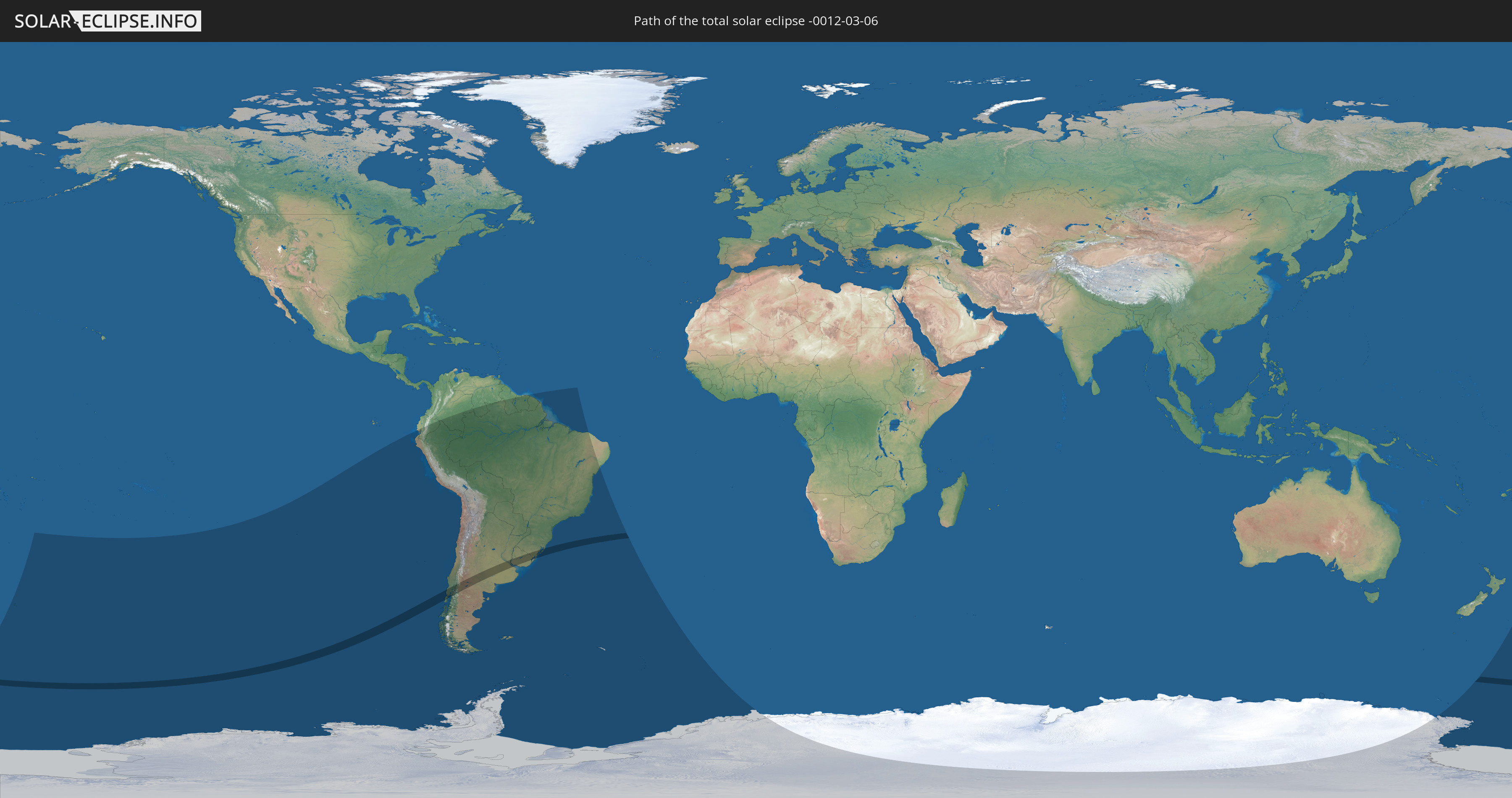
Die Sonnenfinsternis am 03/06/-0012 kann man in 17 Ländern als partielle Sonnenfinsternis beobachten.
Der Finsternispfad verläuft durch 4 Länder. Nur in diesen Ländern ist sie als total Sonnenfinsternis zu sehen.
In den folgenden Ländern ist die Sonnenfinsternis total zu sehen
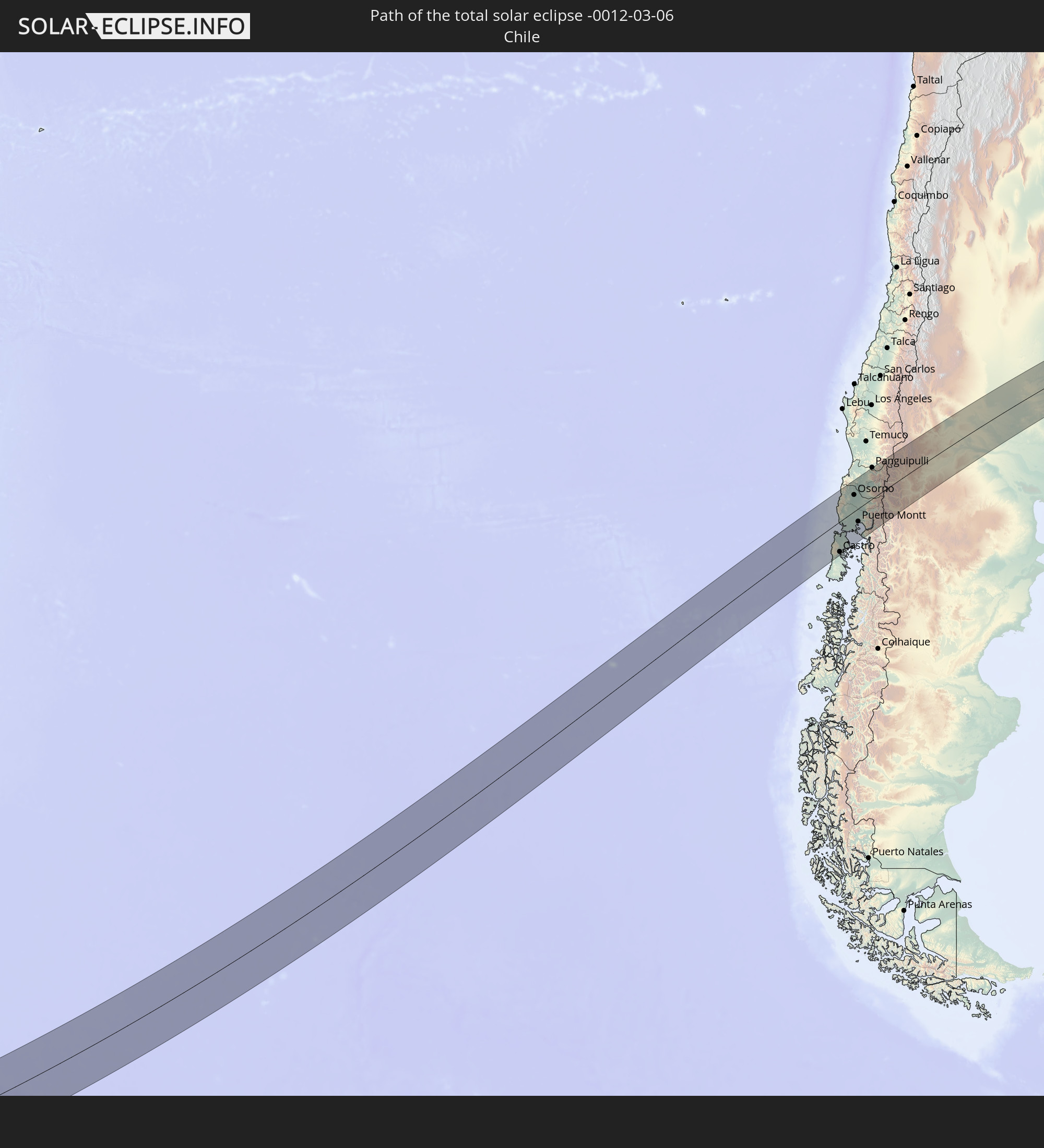 Chile
Chile
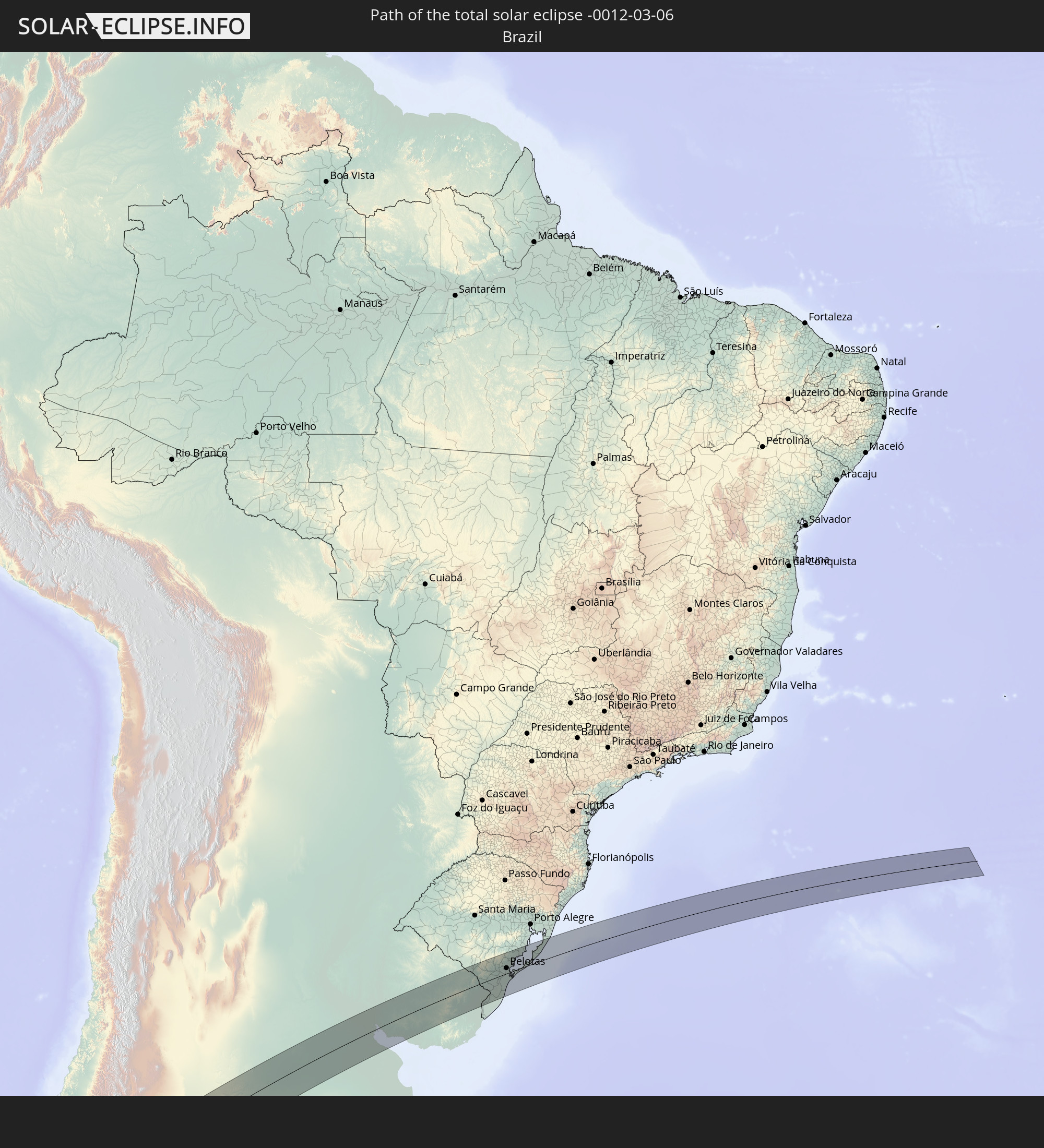 Brazil
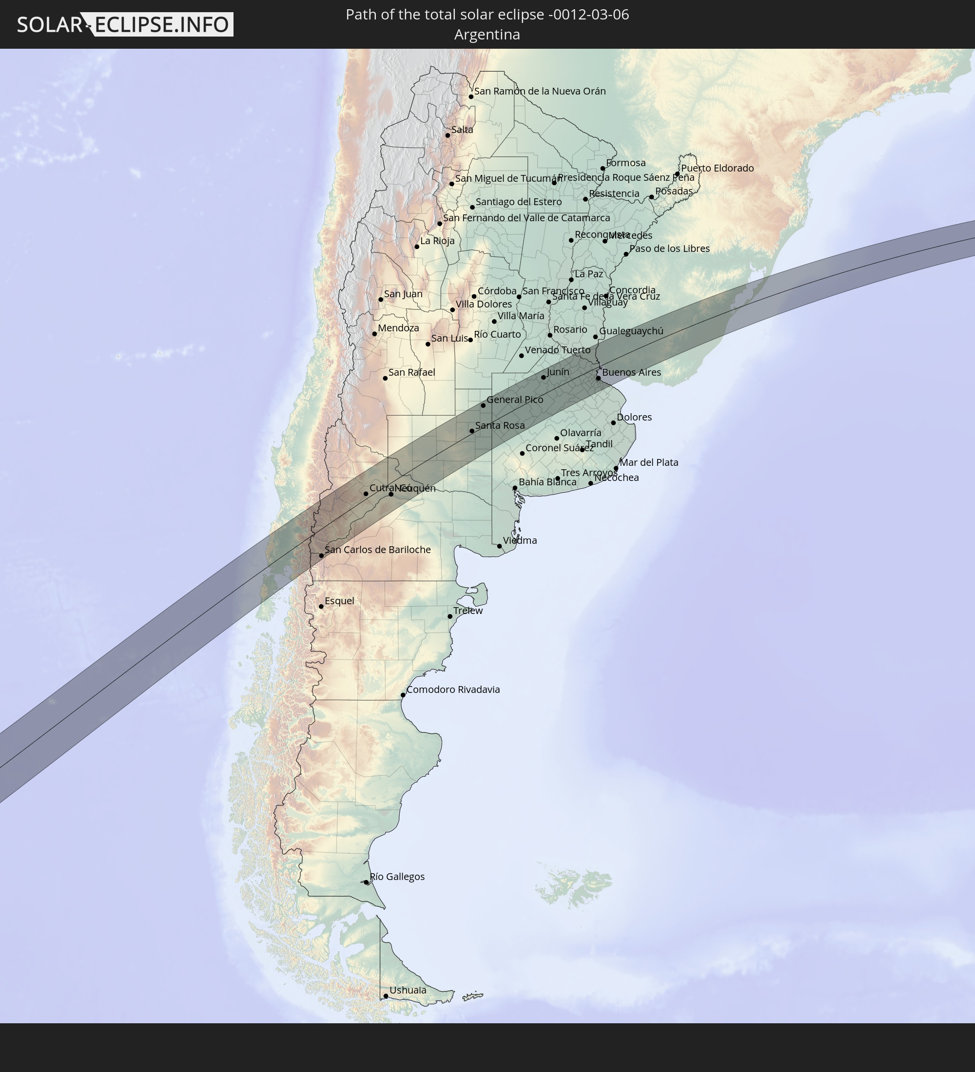 Argentina
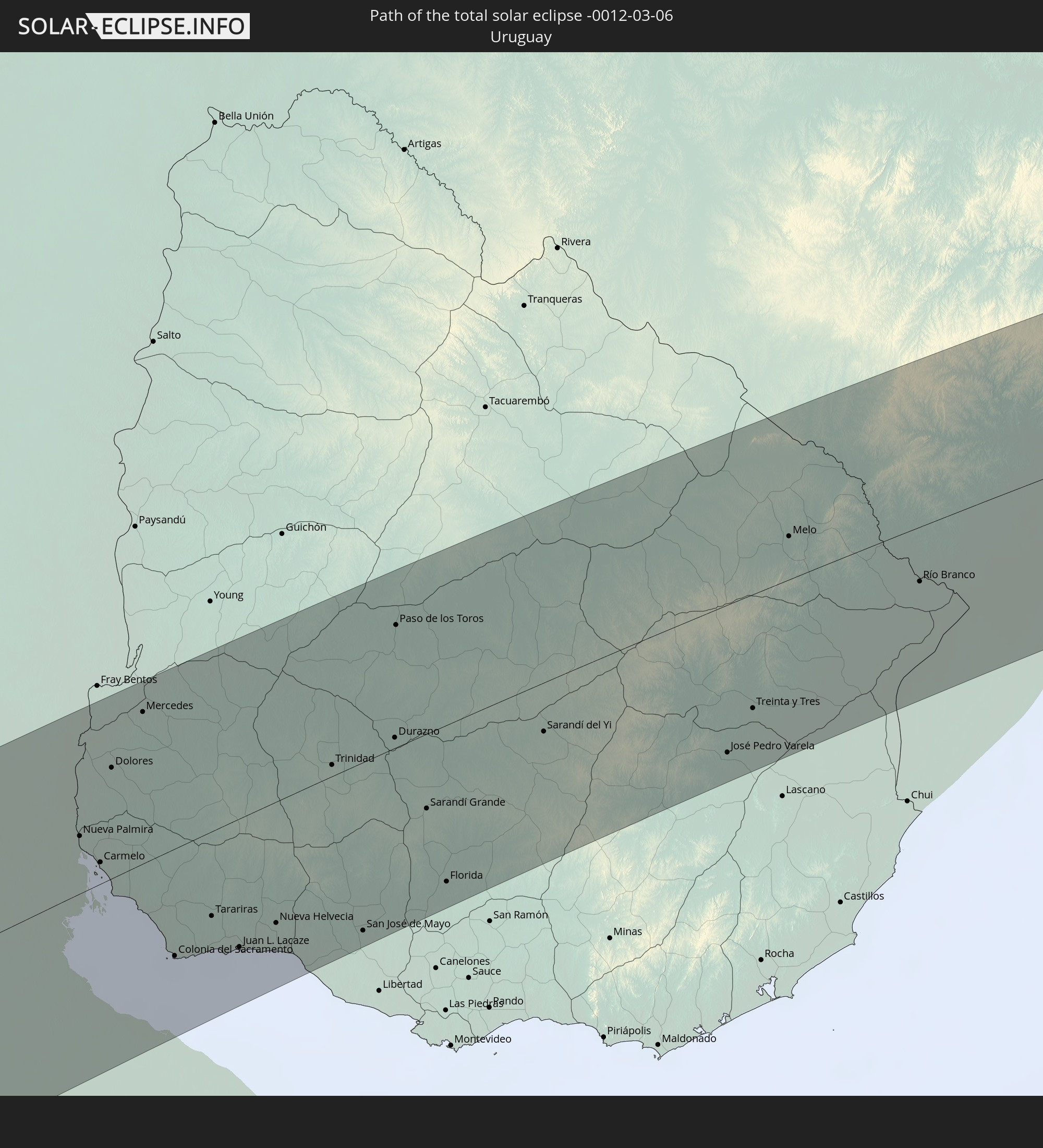 Uruguay
In den folgenden Ländern ist die Sonnenfinsternis partiell zu sehen


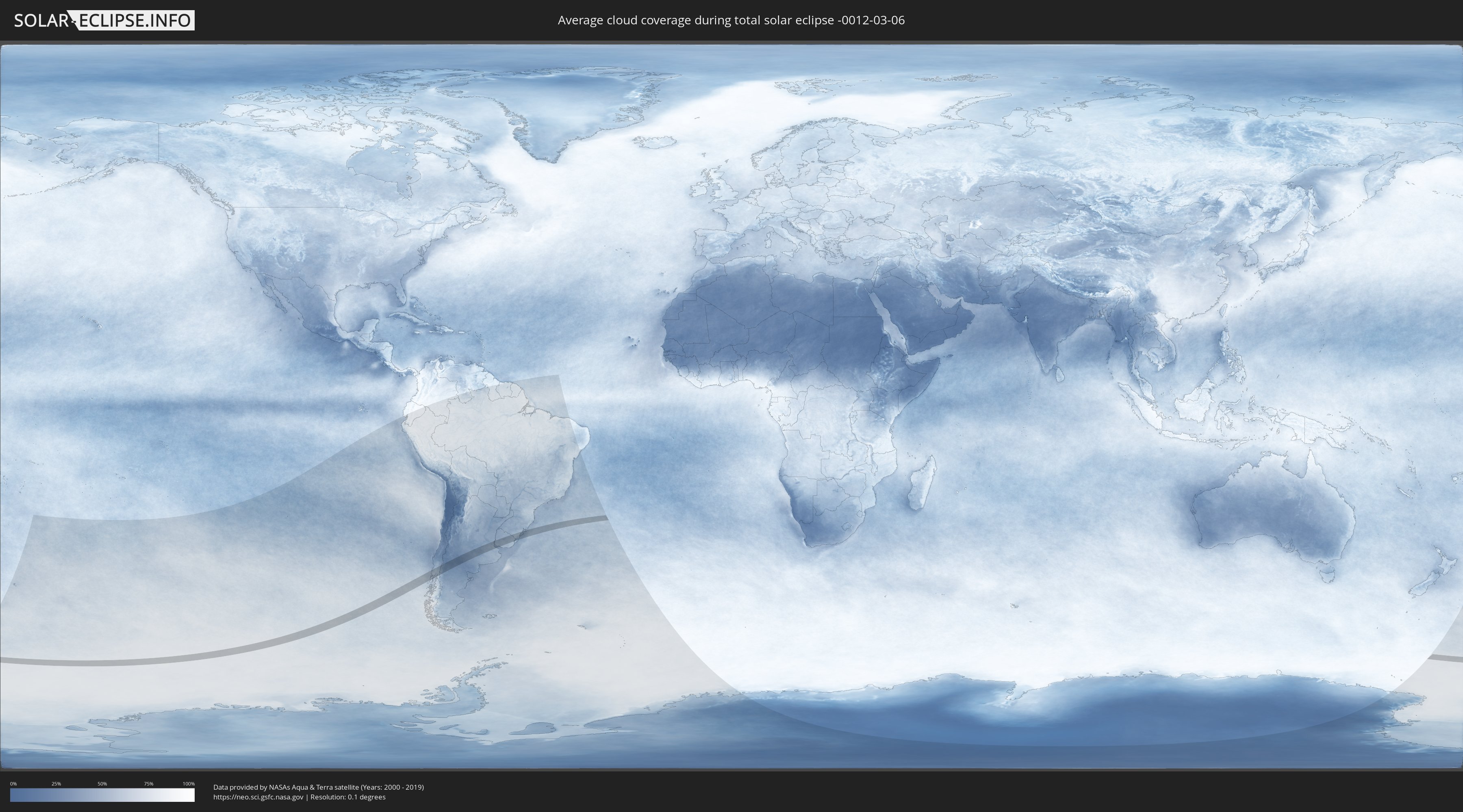
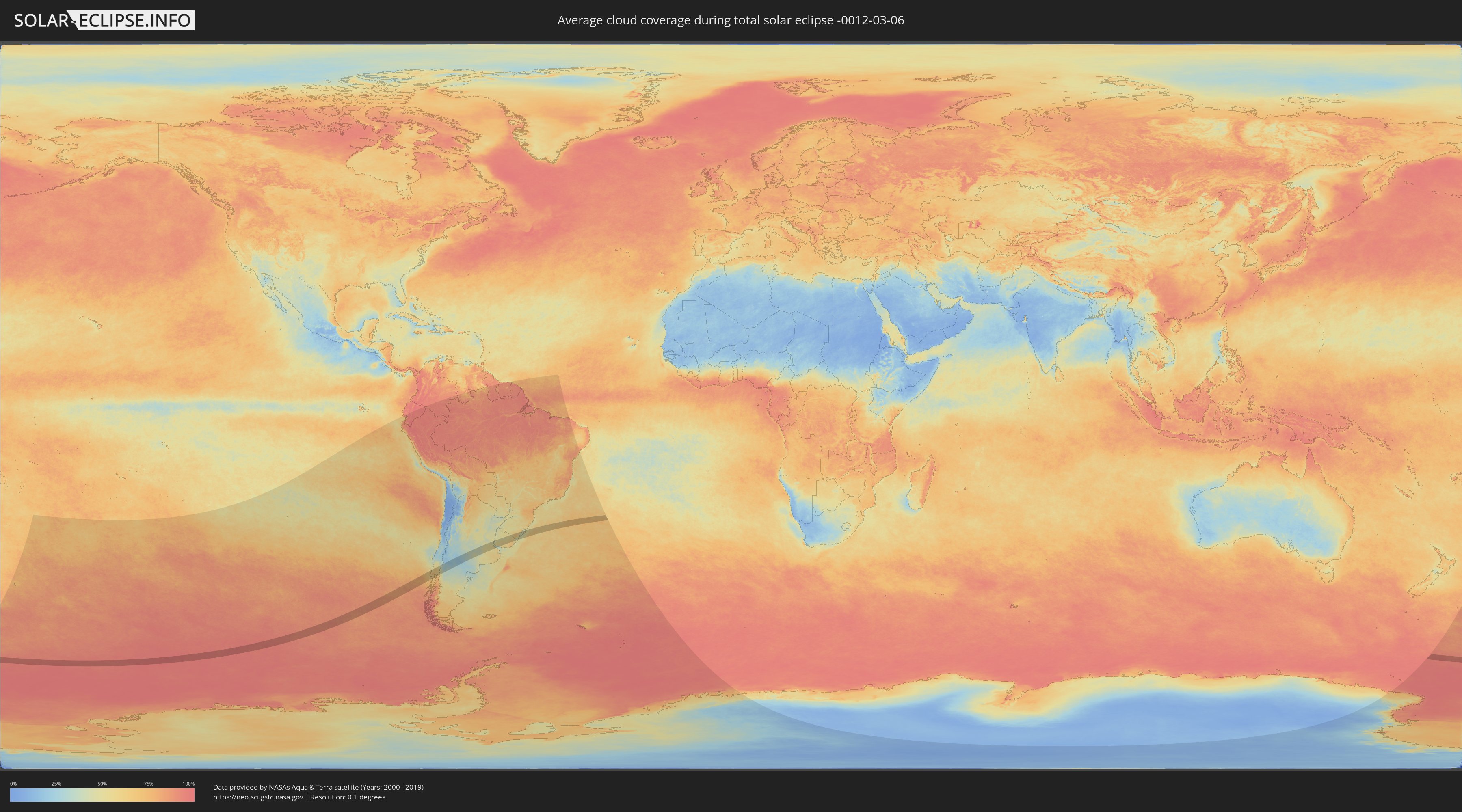
How will be the weather during the total solar eclipse on 03/06/-0012?
Where is the best place to see the total solar eclipse of 03/06/-0012?
The following maps show the average cloud coverage for the day of the total solar eclipse.
With the help of these maps, it is possible to find the place along the eclipse path, which has the best
chance of a cloudless sky.
Nevertheless, you should consider local circumstances and inform about the weather of your chosen
observation site.
The data is provided by NASAs satellites
AQUA and TERRA.
The cloud maps are averaged over a period of 19 years (2000 - 2019).
Detailed country maps
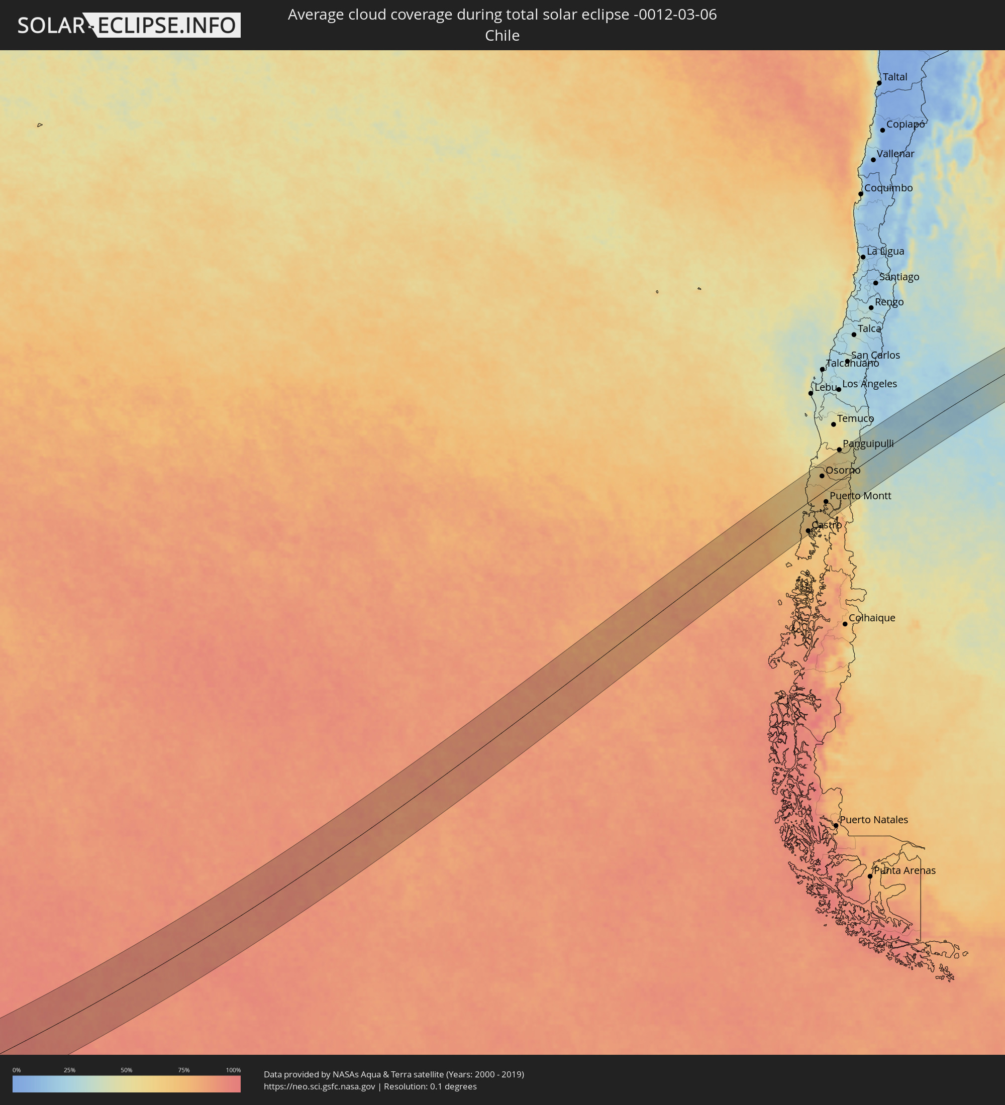 Chile
Chile
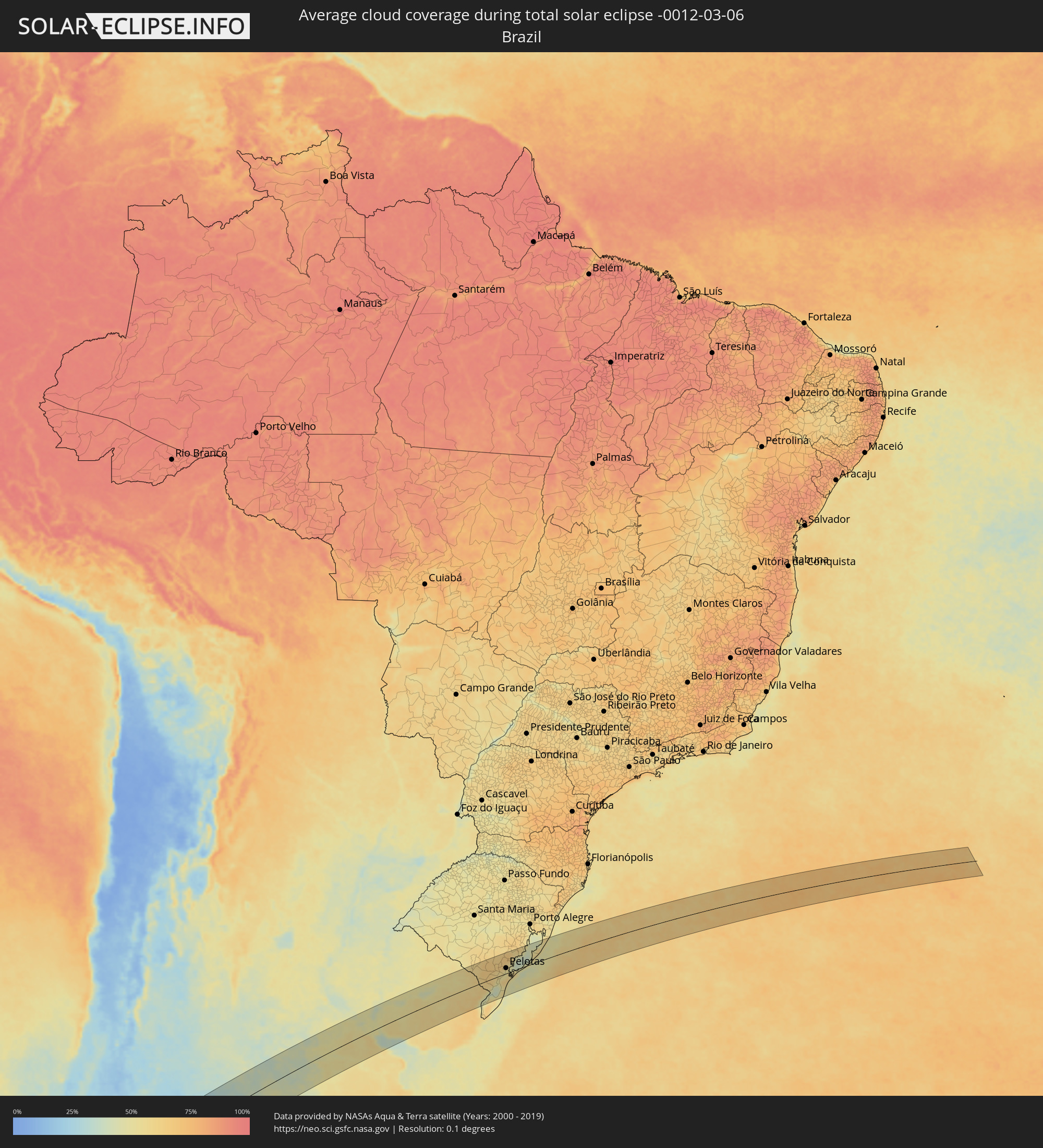 Brazil
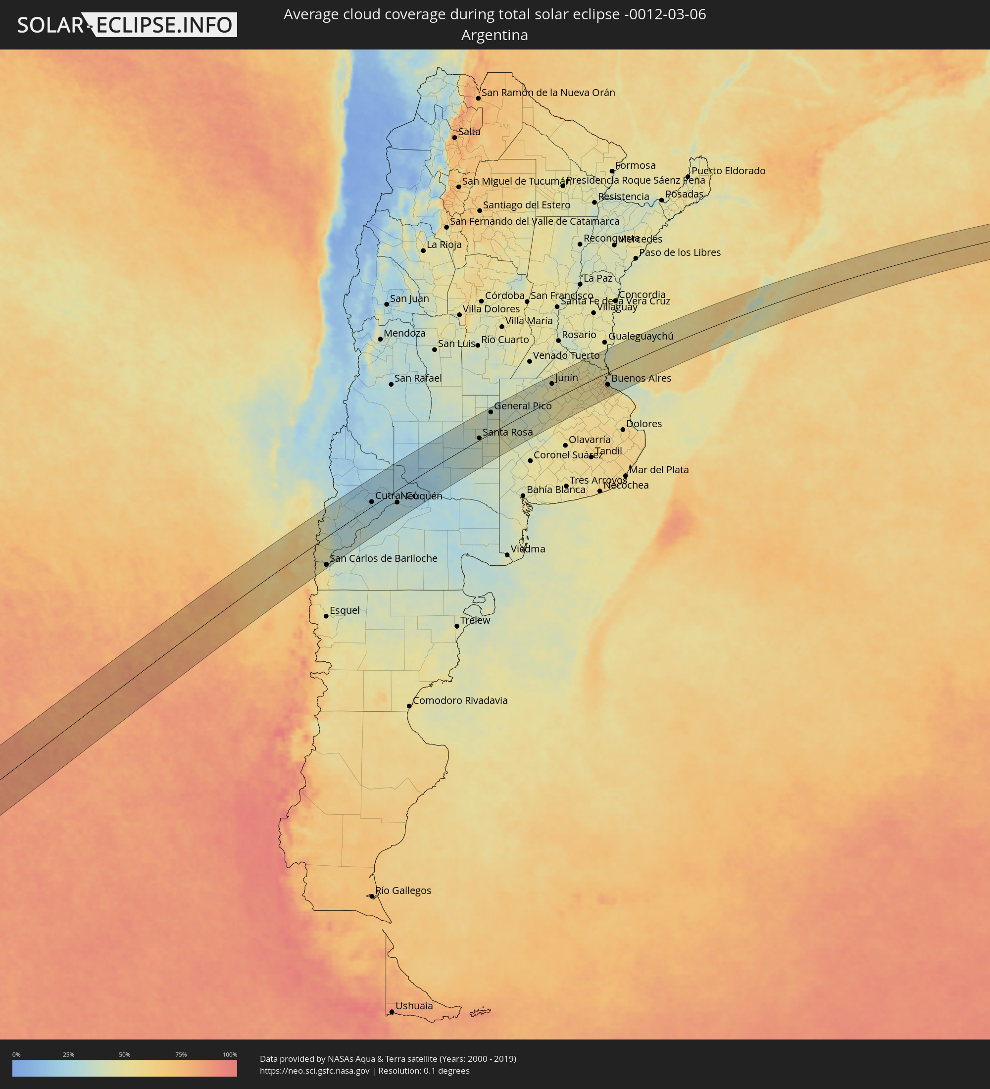 Argentina
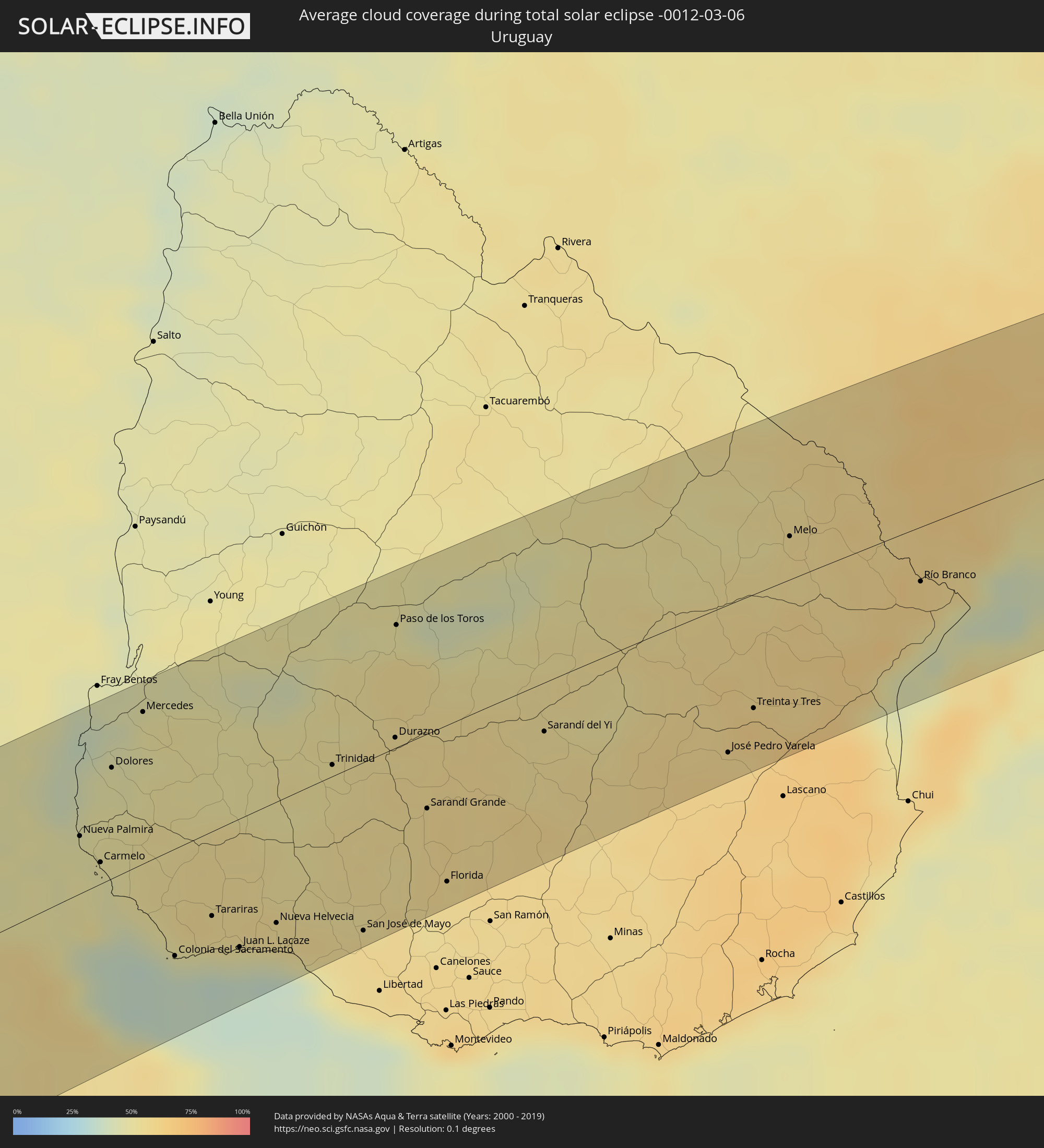 Uruguay
Cities inside the path of the eclipse
The following table shows all locations with a population of more than 5,000 inside the eclipse path. Cities which have more than 100,000 inhabitants are marked bold. A click at the locations opens a detailed map.
| City | Type | Eclipse duration | Local time of max. eclipse | Distance to central line | Ø Cloud coverage |
 Ancud, Los Lagos
|
total | - | 14:59:02 UTC-04:42 | 34 km | 65% |
|
Castro, Los Lagos
|
total | - | 14:58:03 UTC-04:42 | 91 km | 66% |
|
Purranque, Los Lagos
|
total | - | 15:01:29 UTC-04:42 | 21 km | 68% |
|
Osorno, Los Lagos
|
total | - | 15:02:06 UTC-04:42 | 50 km | 64% |
|
Calbuco, Los Lagos
|
total | - | 15:00:02 UTC-04:42 | 59 km | 68% |
|
La Unión, Los Ríos
|
total | - | 15:02:39 UTC-04:42 | 74 km | 62% |
|
Frutillar, Los Lagos
|
total | - | 15:01:15 UTC-04:42 | 4 km | 63% |
|
Puerto Varas, Los Lagos
|
total | - | 15:01:00 UTC-04:42 | 25 km | 69% |
|
Río Bueno, Los Ríos
|
total | - | 15:02:44 UTC-04:42 | 64 km | 65% |
|
Puerto Montt, Los Lagos
|
total | - | 15:00:47 UTC-04:42 | 40 km | 68% |
|
Panguipulli, Araucanía
|
total | - | 15:04:42 UTC-04:42 | 97 km | 55% |
 Villa La Angostura, Neuquén Province
|
total | - | 15:29:32 UTC-04:16 | 39 km | 45% |
|
San Martín de los Andes, Neuquén Province
|
total | - | 15:30:56 UTC-04:16 | 3 km | 44% |
|
San Carlos de Bariloche, Río Negro Province
|
total | - | 15:29:15 UTC-04:16 | 90 km | 39% |
|
Junín de los Andes, Neuquén Province
|
total | - | 15:31:37 UTC-04:16 | 8 km | 36% |
|
Zapala, Neuquén Province
|
total | - | 15:34:38 UTC-04:16 | 57 km | 28% |
|
Cutral-Có, Neuquén Province
|
total | - | 15:35:30 UTC-04:16 | 15 km | 24% |
|
Plaza Huincul, Neuquén Province
|
total | - | 15:35:32 UTC-04:16 | 14 km | 24% |
|
Senillosa, Neuquén Province
|
total | - | 15:36:14 UTC-04:16 | 31 km | 26% |
|
Plottier, Neuquén Province
|
total | - | 15:36:32 UTC-04:16 | 36 km | 27% |
|
Centenario, Neuquén Province
|
total | - | 15:36:53 UTC-04:16 | 27 km | 27% |
|
Cinco Saltos, Río Negro Province
|
total | - | 15:36:58 UTC-04:16 | 30 km | 27% |
|
Neuquén, Neuquén Province
|
total | - | 15:36:45 UTC-04:16 | 42 km | 27% |
|
Cipolletti, Río Negro Province
|
total | - | 15:36:51 UTC-04:16 | 44 km | 31% |
|
General Fernández Oro, Río Negro Province
|
total | - | 15:36:53 UTC-04:16 | 49 km | 28% |
|
Allen, Río Negro Province
|
total | - | 15:36:57 UTC-04:16 | 56 km | 28% |
|
Catriel, Río Negro Province
|
total | - | 15:38:56 UTC-04:16 | 46 km | 23% |
|
Veinticinco de Mayo, La Pampa Province
|
total | - | 15:39:12 UTC-04:16 | 52 km | 23% |
|
General Roca, Río Negro Province
|
total | - | 15:37:06 UTC-04:16 | 72 km | 31% |
|
Cervantes, Río Negro Province
|
total | - | 15:37:17 UTC-04:16 | 83 km | 28% |
|
Ingeniero Luis A. Huergo, Río Negro Province
|
total | - | 15:37:23 UTC-04:16 | 93 km | 28% |
|
General Acha, La Pampa Province
|
total | - | 15:43:03 UTC-04:16 | 53 km | 35% |
|
Eduardo Castex, La Pampa Province
|
total | - | 15:45:55 UTC-04:16 | 74 km | 39% |
|
Santa Rosa, La Pampa Province
|
total | - | 15:44:42 UTC-04:16 | 6 km | 40% |
|
General Pico, La Pampa Province
|
total | - | 15:46:53 UTC-04:16 | 76 km | 38% |
|
Lincoln, Buenos Aires
|
total | - | 15:50:14 UTC-04:16 | 57 km | 46% |
|
Junín, Buenos Aires
|
total | - | 15:51:13 UTC-04:16 | 61 km | 48% |
|
Nueve de Julio, Buenos Aires
|
total | - | 15:49:46 UTC-04:16 | 27 km | 51% |
|
Chacabuco, Buenos Aires
|
total | - | 15:51:30 UTC-04:16 | 35 km | 50% |
|
Veinticinco de Mayo, Buenos Aires
|
total | - | 15:50:22 UTC-04:16 | 56 km | 52% |
|
Chivilcoy, Buenos Aires
|
total | - | 15:51:26 UTC-04:16 | 9 km | 54% |
|
Mercedes, Buenos Aires
|
total | - | 15:52:19 UTC-04:16 | 9 km | 55% |
|
Luján, Buenos Aires
|
total | - | 15:52:42 UTC-04:16 | 14 km | 51% |
|
Zárate, Buenos Aires
|
total | - | 15:53:34 UTC-04:16 | 31 km | 51% |
|
Campana, Buenos Aires
|
total | - | 15:53:30 UTC-04:16 | 21 km | 51% |
|
Pontevedra, Buenos Aires
|
total | - | 15:52:42 UTC-04:16 | 48 km | 56% |
|
Morón, Buenos Aires
|
total | - | 15:52:56 UTC-04:16 | 41 km | 57% |
|
Tigre, Buenos Aires
|
total | - | 15:53:21 UTC-04:16 | 20 km | 55% |
|
San Isidro, Buenos Aires
|
total | - | 15:53:18 UTC-04:16 | 27 km | 56% |
|
Villa Santa Rita, Buenos Aires F.D.
|
total | - | 15:53:06 UTC-04:16 | 43 km | 58% |
|
Villa Lugano, Buenos Aires F.D.
|
total | - | 15:52:59 UTC-04:16 | 50 km | 58% |
|
Colegiales, Buenos Aires F.D.
|
total | - | 15:53:11 UTC-04:16 | 40 km | 55% |
 Nueva Palmira, Colonia
|
total | - | 16:26:22 UTC-03:44 | 29 km | 48% |
|
Adrogué, Buenos Aires
|
total | - | 15:52:51 UTC-04:16 | 66 km | 56% |
|
Retiro, Buenos Aires F.D.
|
total | - | 15:53:13 UTC-04:16 | 44 km | 55% |
|
Buenos Aires, Buenos Aires F.D.
|
total | - | 15:53:10 UTC-04:16 | 47 km | 55% |
|
Carmelo, Colonia
|
total | - | 16:26:15 UTC-03:44 | 11 km | 48% |
|
Quilmes, Buenos Aires
|
total | - | 15:53:03 UTC-04:16 | 63 km | 57% |
|
Dolores, Soriano
|
total | - | 16:27:06 UTC-03:44 | 55 km | 48% |
|
Mercedes, Soriano
|
total | - | 16:27:42 UTC-03:44 | 76 km | 48% |
|
Colonia del Sacramento, Colonia
|
total | - | 16:25:46 UTC-03:44 | 53 km | 37% |
|
Tarariras, Colonia
|
total | - | 16:26:16 UTC-03:44 | 42 km | 51% |
|
Juan L. Lacaze, Colonia
|
total | - | 16:26:07 UTC-03:44 | 64 km | 44% |
|
Rosario, Colonia
|
total | - | 16:26:22 UTC-03:44 | 58 km | 51% |
|
Nueva Helvecia, Colonia
|
total | - | 16:26:29 UTC-03:44 | 61 km | 53% |
|
Trinidad, Flores
|
total | - | 16:28:03 UTC-03:44 | 6 km | 52% |
|
Trinidad, Flores
|
total | - | 16:28:01 UTC-03:44 | 3 km | 52% |
|
San José de Mayo, San José
|
total | - | 16:26:47 UTC-03:44 | 85 km | 57% |
|
Durazno, Durazno
|
total | - | 16:28:32 UTC-03:44 | 5 km | 54% |
|
Paso de los Toros, Tacuarembó
|
total | - | 16:29:29 UTC-03:44 | 62 km | 50% |
|
Sarandí Grande, Florida
|
total | - | 16:28:04 UTC-03:44 | 38 km | 57% |
|
Florida, Florida
|
total | - | 16:27:31 UTC-03:44 | 79 km | 56% |
|
Sarandí del Yi, Durazno
|
total | - | 16:29:10 UTC-03:44 | 25 km | 55% |
|
José Pedro Varela, Lavalleja
|
total | - | 16:29:40 UTC-03:44 | 76 km | 60% |
|
Treinta y Tres, Treinta y Tres
|
total | - | 16:30:08 UTC-03:44 | 59 km | 62% |
|
Melo, Cerro Largo
|
total | - | 16:31:41 UTC-03:44 | 22 km | 56% |
 Herval, Rio Grande do Sul
|
total | - | 17:11:05 UTC-03:06 | 31 km | 63% |
|
Río Branco, Cerro Largo
|
total | - | 16:31:46 UTC-03:44 | 29 km | 61% |
|
Pinheiro Machado, Rio Grande do Sul
|
total | - | 17:11:49 UTC-03:06 | 77 km | 66% |
|
Jaguarão, Rio Grande do Sul
|
total | - | 17:10:12 UTC-03:06 | 26 km | 61% |
|
Arroio Grande, Rio Grande do Sul
|
total | - | 17:10:54 UTC-03:06 | 2 km | 63% |
|
Canguçu, Rio Grande do Sul
|
total | - | 17:12:30 UTC-03:06 | 72 km | 62% |
|
Pelotas, Rio Grande do Sul
|
total | - | 17:12:03 UTC-03:06 | 22 km | 52% |
|
Rio Grande, Rio Grande do Sul
|
total | - | 17:11:45 UTC-03:06 | 14 km | 56% |
|
São Lourenço do Sul, Rio Grande do Sul
|
total | - | 17:12:54 UTC-03:06 | 52 km | 47% |