Annular solar eclipse of 02/24/-0049
| Day of week: | Friday |
| Maximum duration of eclipse: | 01m52s |
| Maximum width of eclipse path: | 60 km |
| Saros cycle: | 68 |
| Coverage: | 98.3% |
| Magnitude: | 0.9831 |
| Gamma: | -0.0666 |
Wo kann man die Sonnenfinsternis vom 02/24/-0049 sehen?
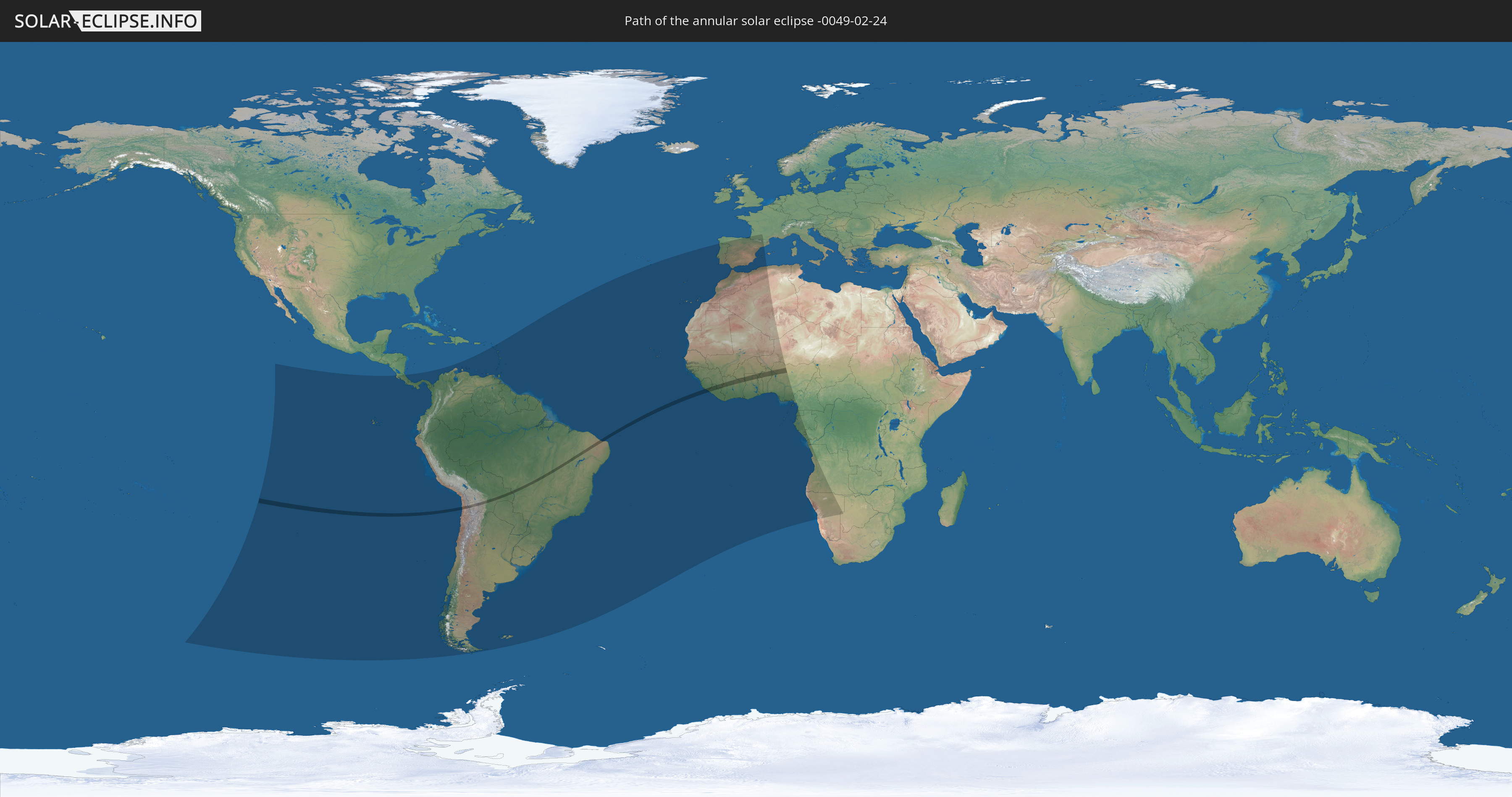
Die Sonnenfinsternis am 02/24/-0049 kann man in 61 Ländern als partielle Sonnenfinsternis beobachten.
Der Finsternispfad verläuft durch 12 Länder. Nur in diesen Ländern ist sie als annular Sonnenfinsternis zu sehen.
In den folgenden Ländern ist die Sonnenfinsternis annular zu sehen
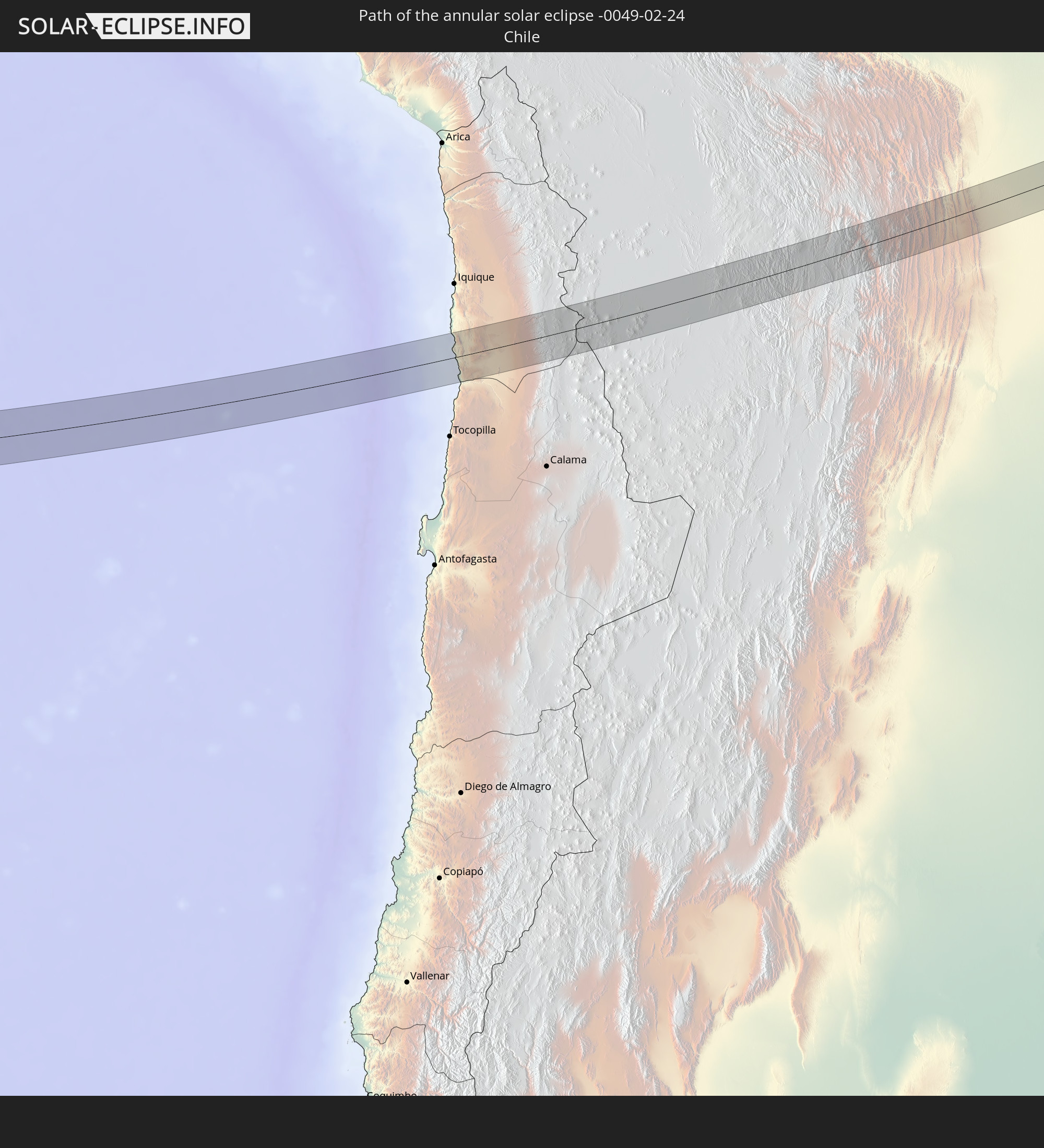 Chile
Chile
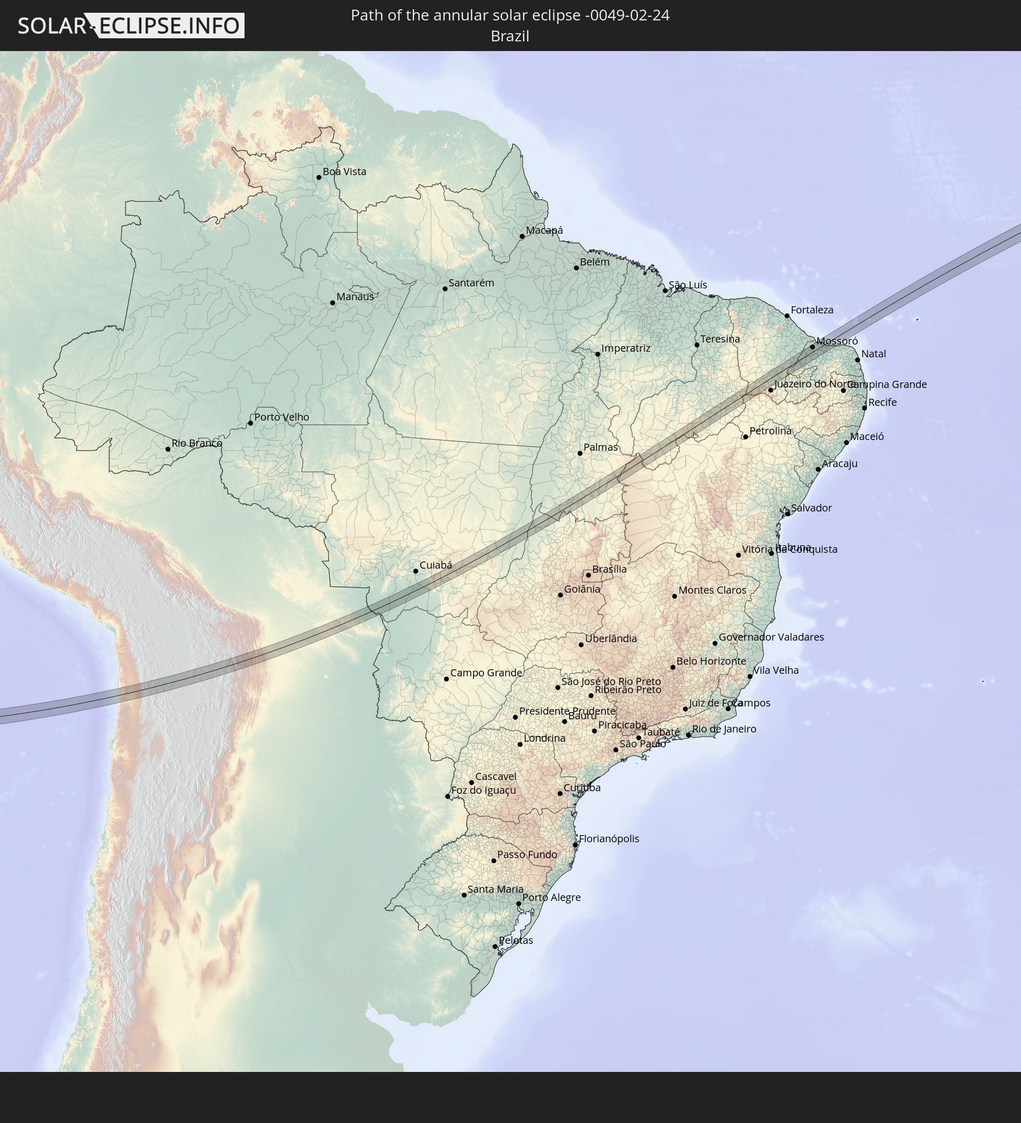 Brazil
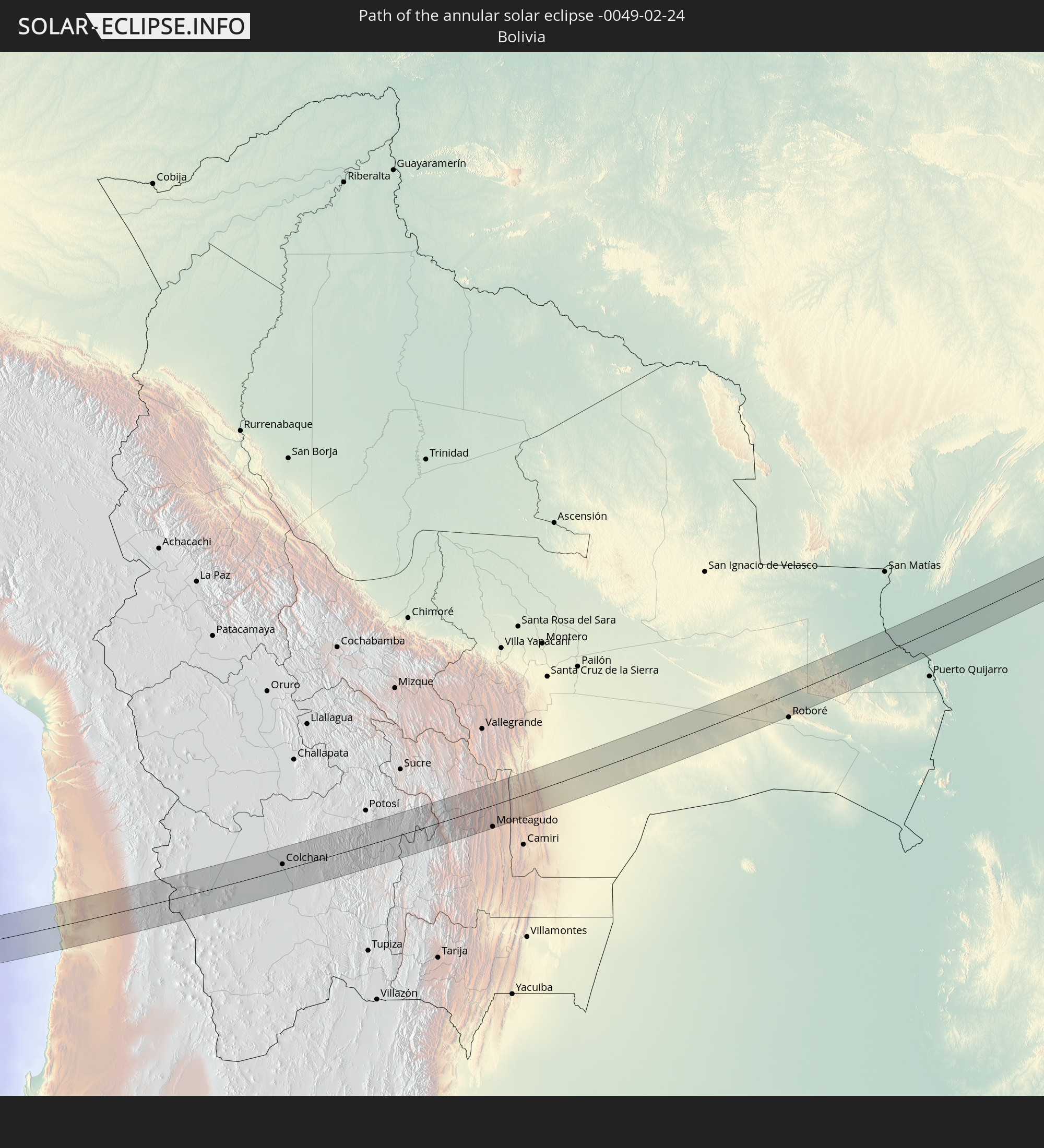 Bolivia
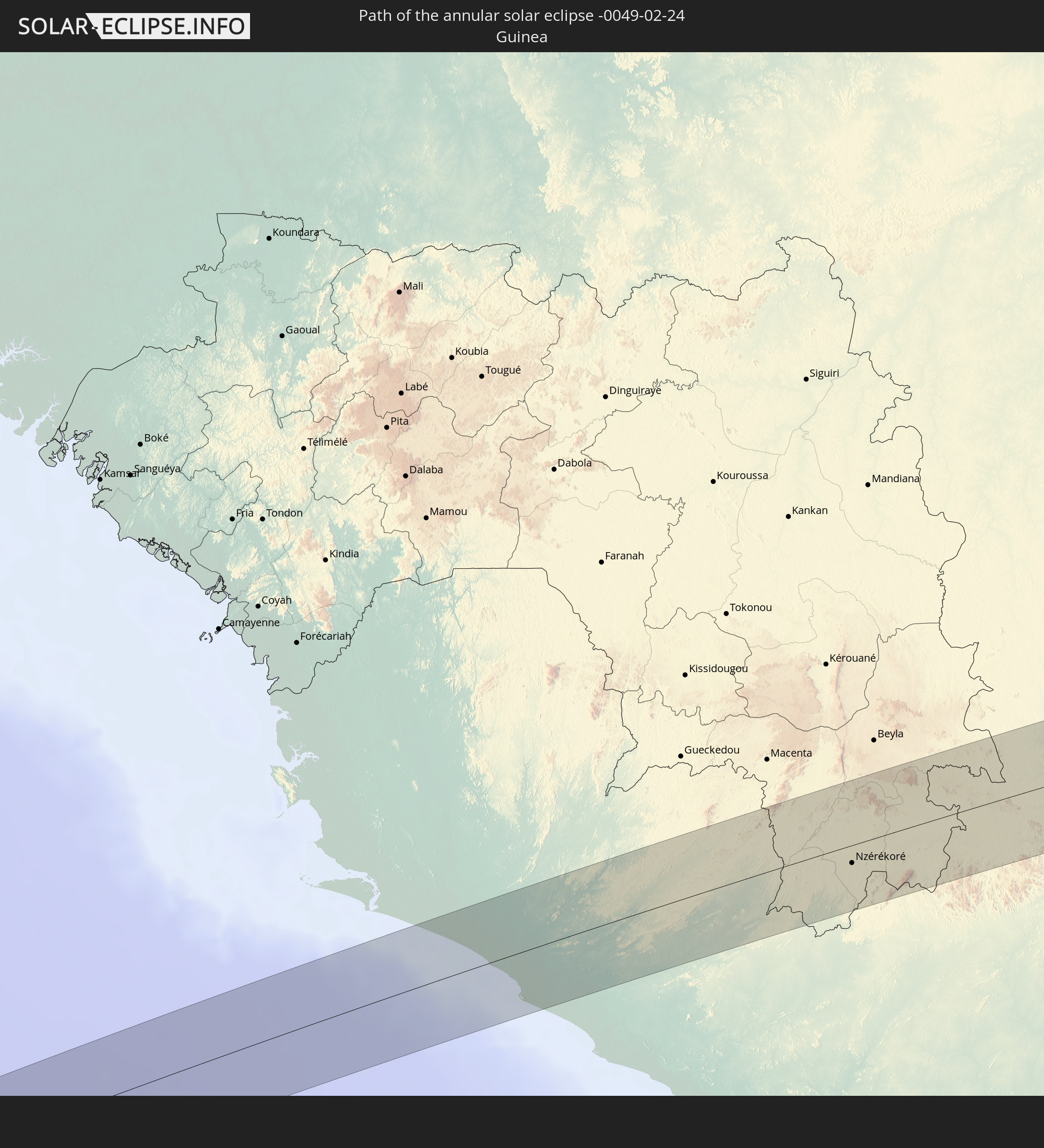 Guinea
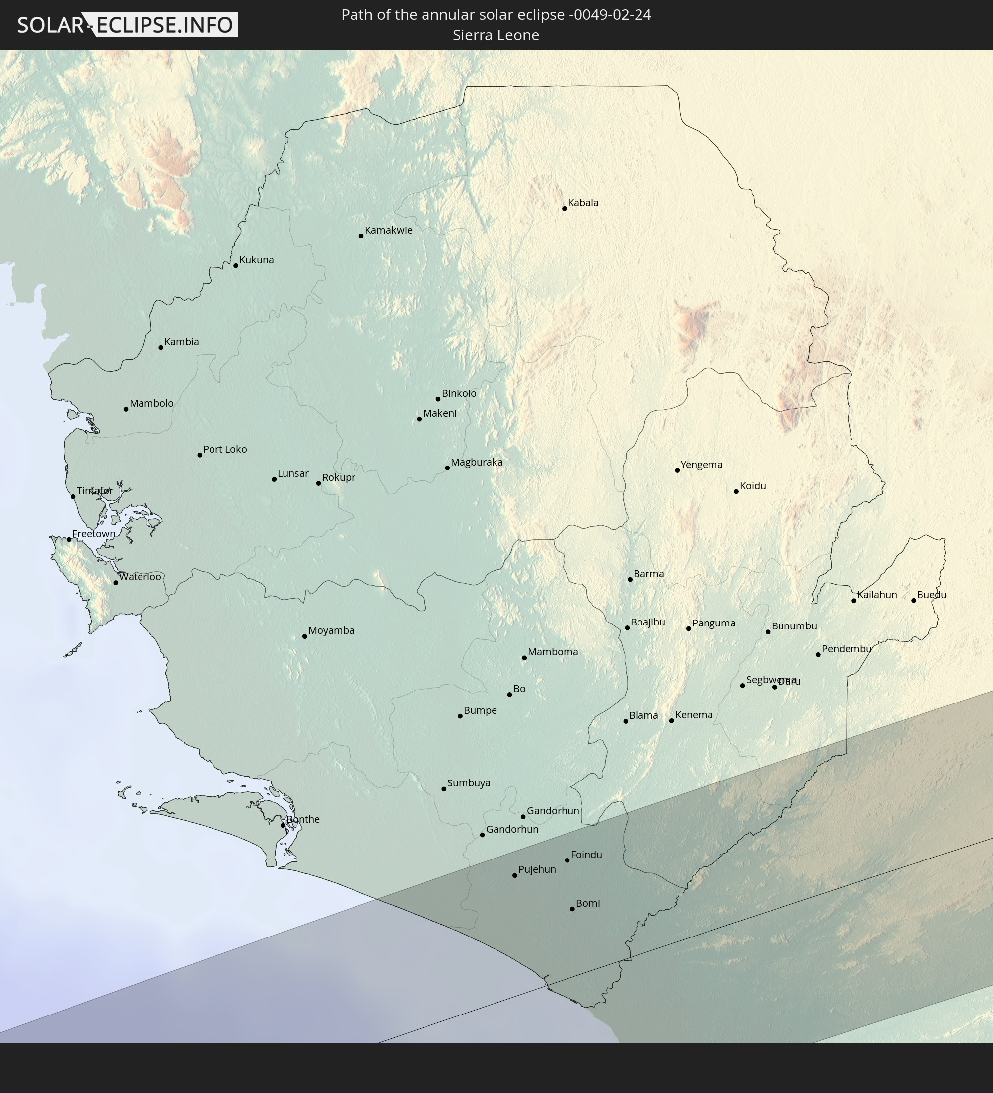 Sierra Leone
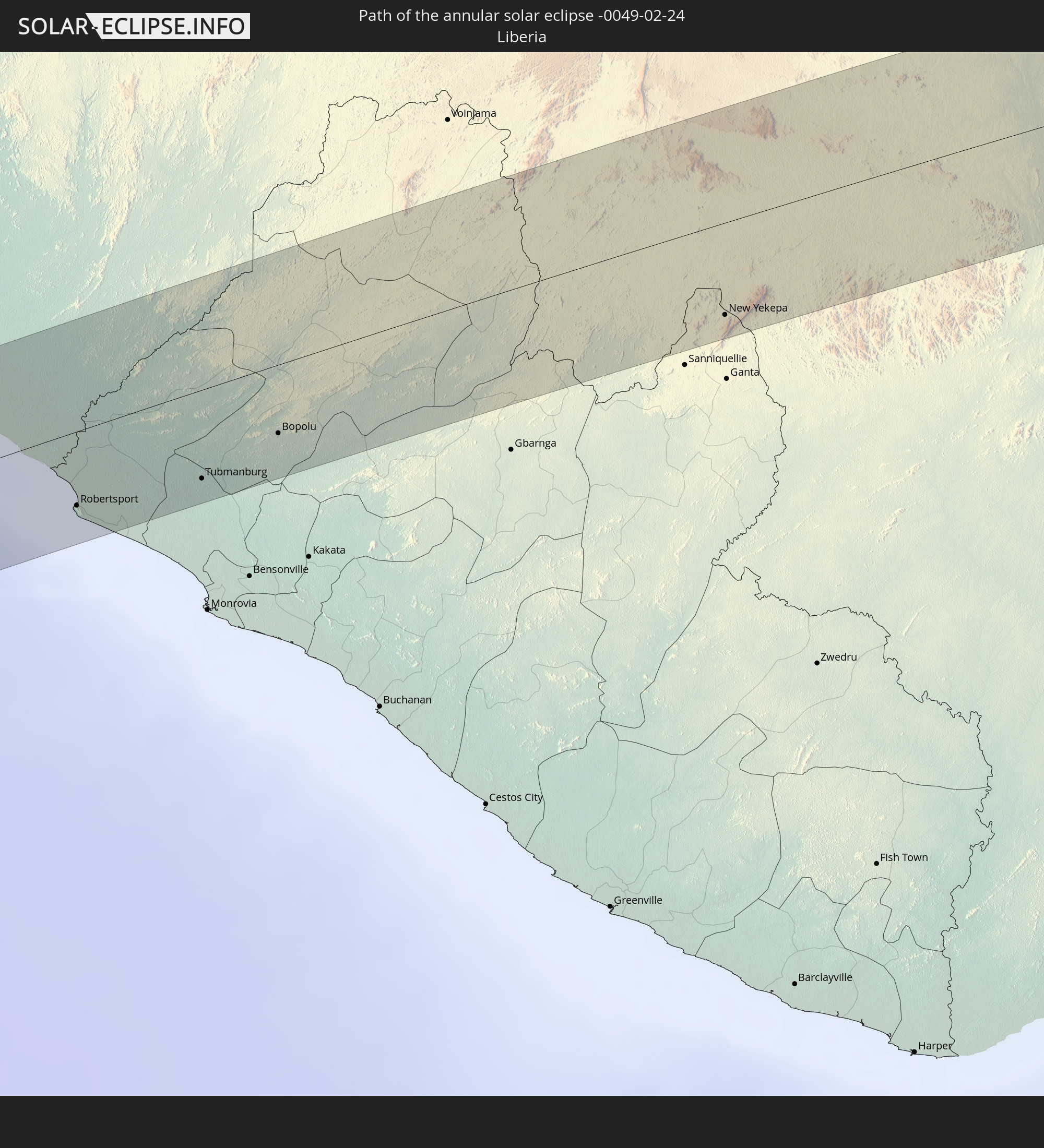 Liberia
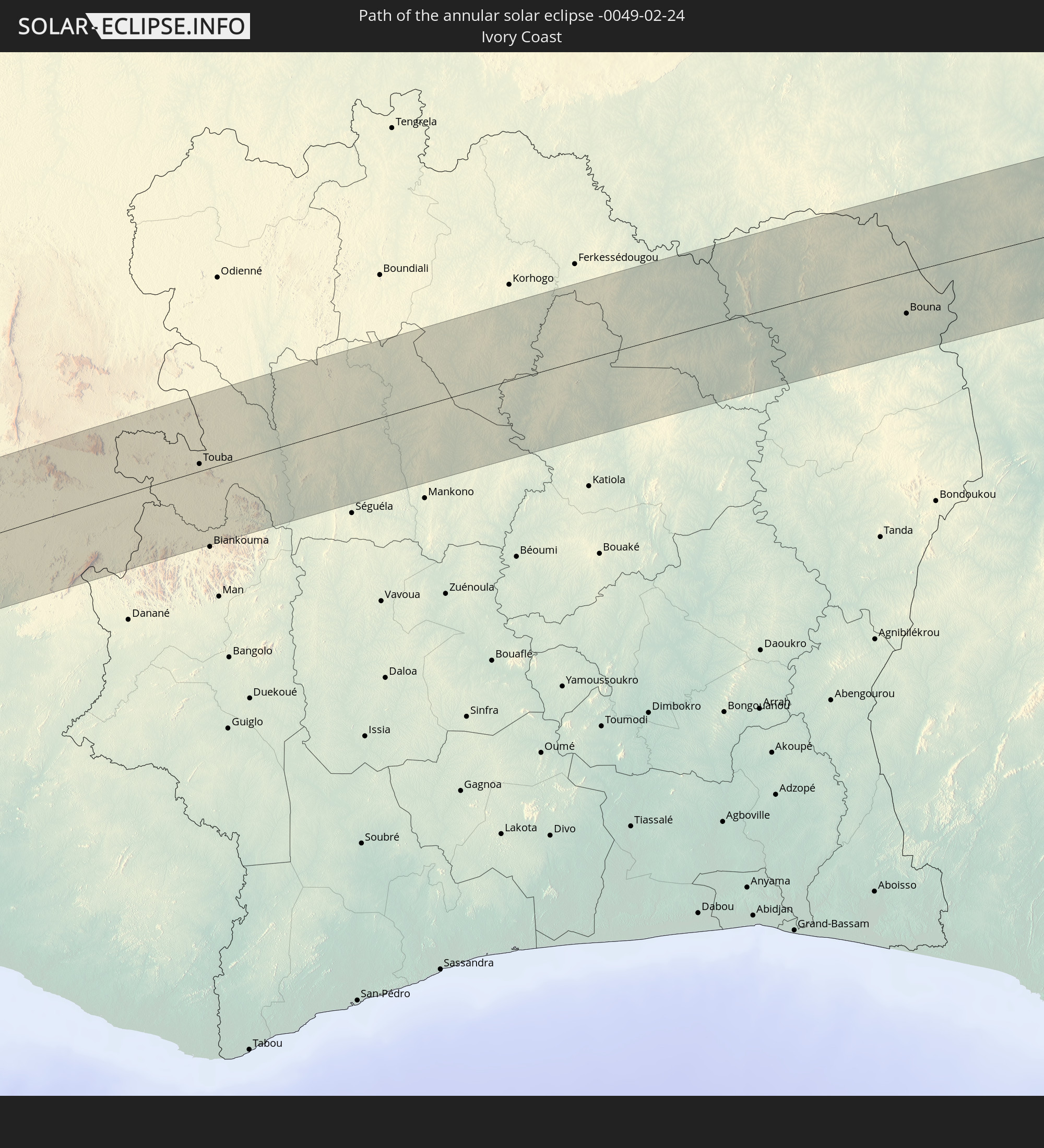 Ivory Coast
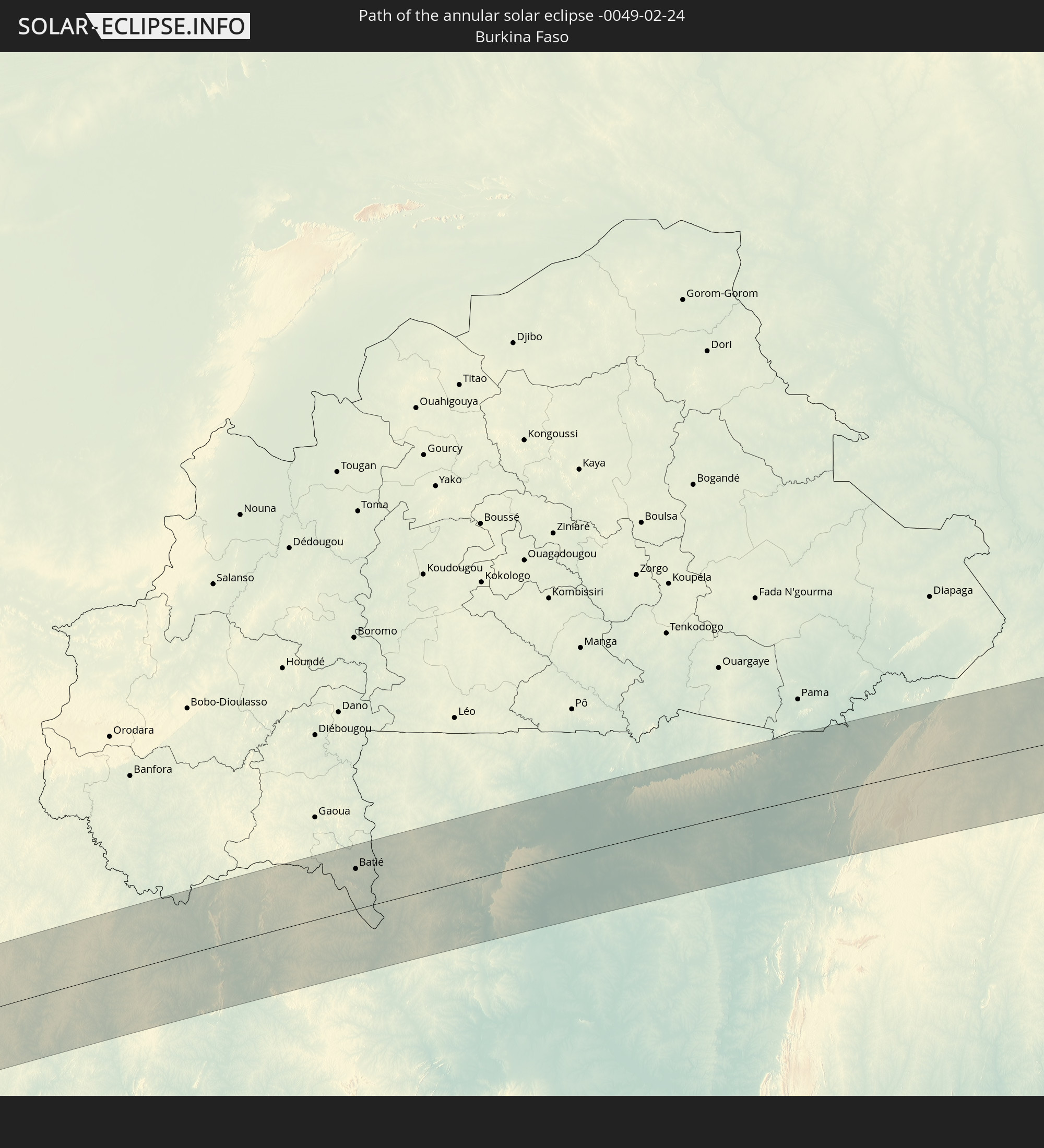 Burkina Faso
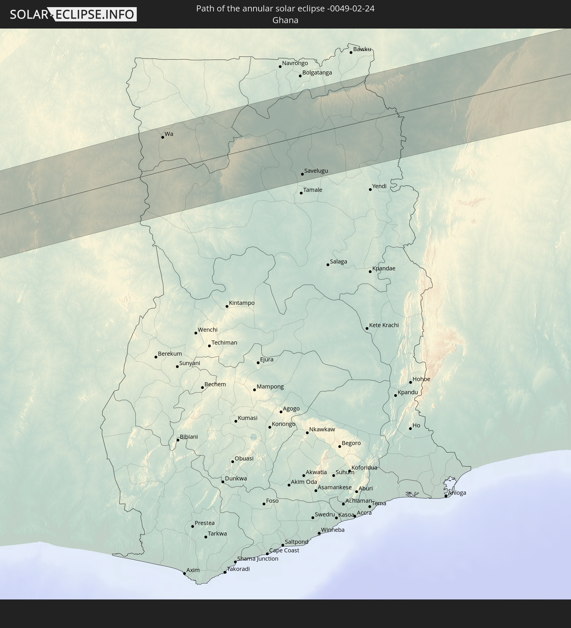 Ghana
Ghana
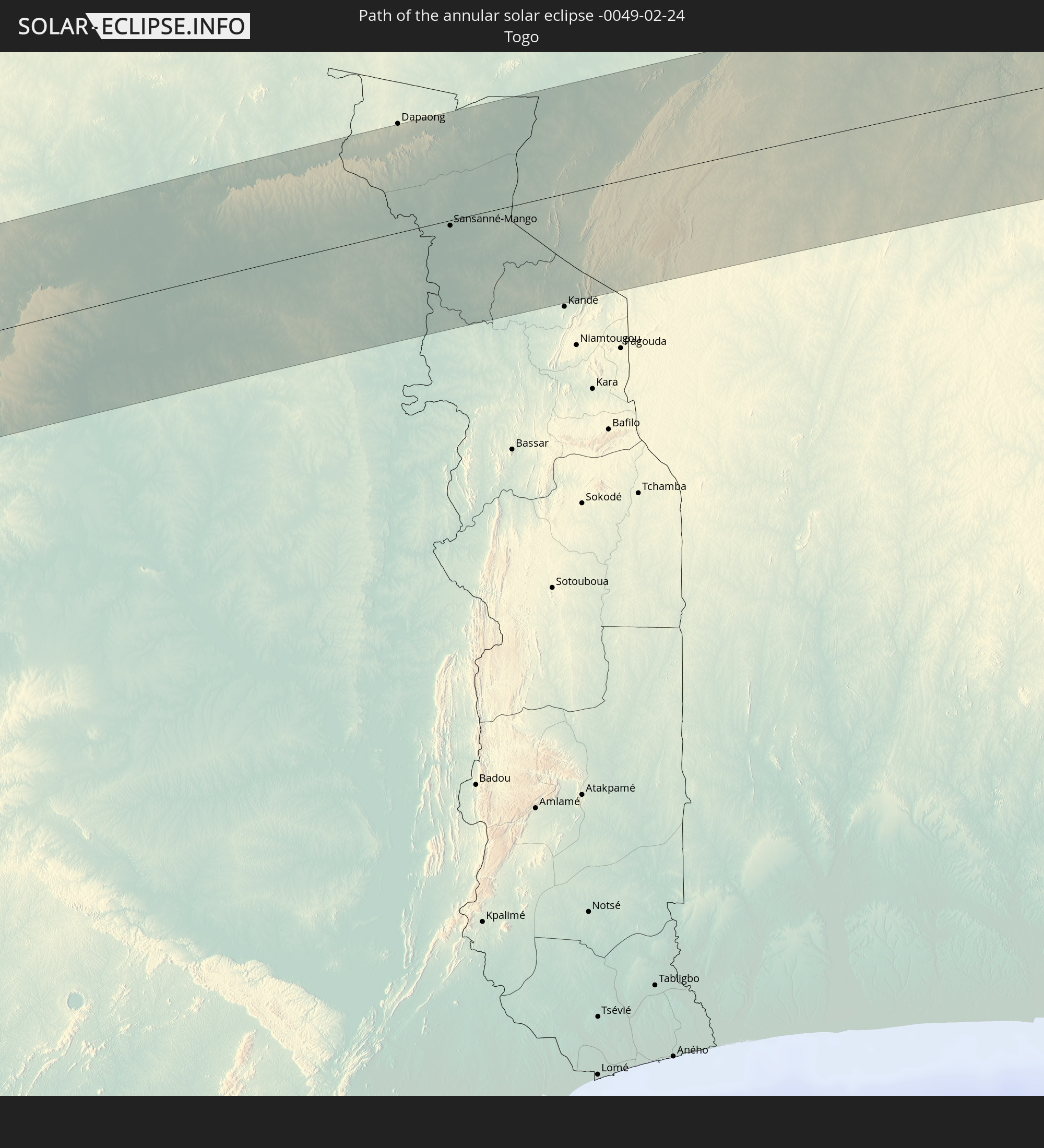 Togo
Togo
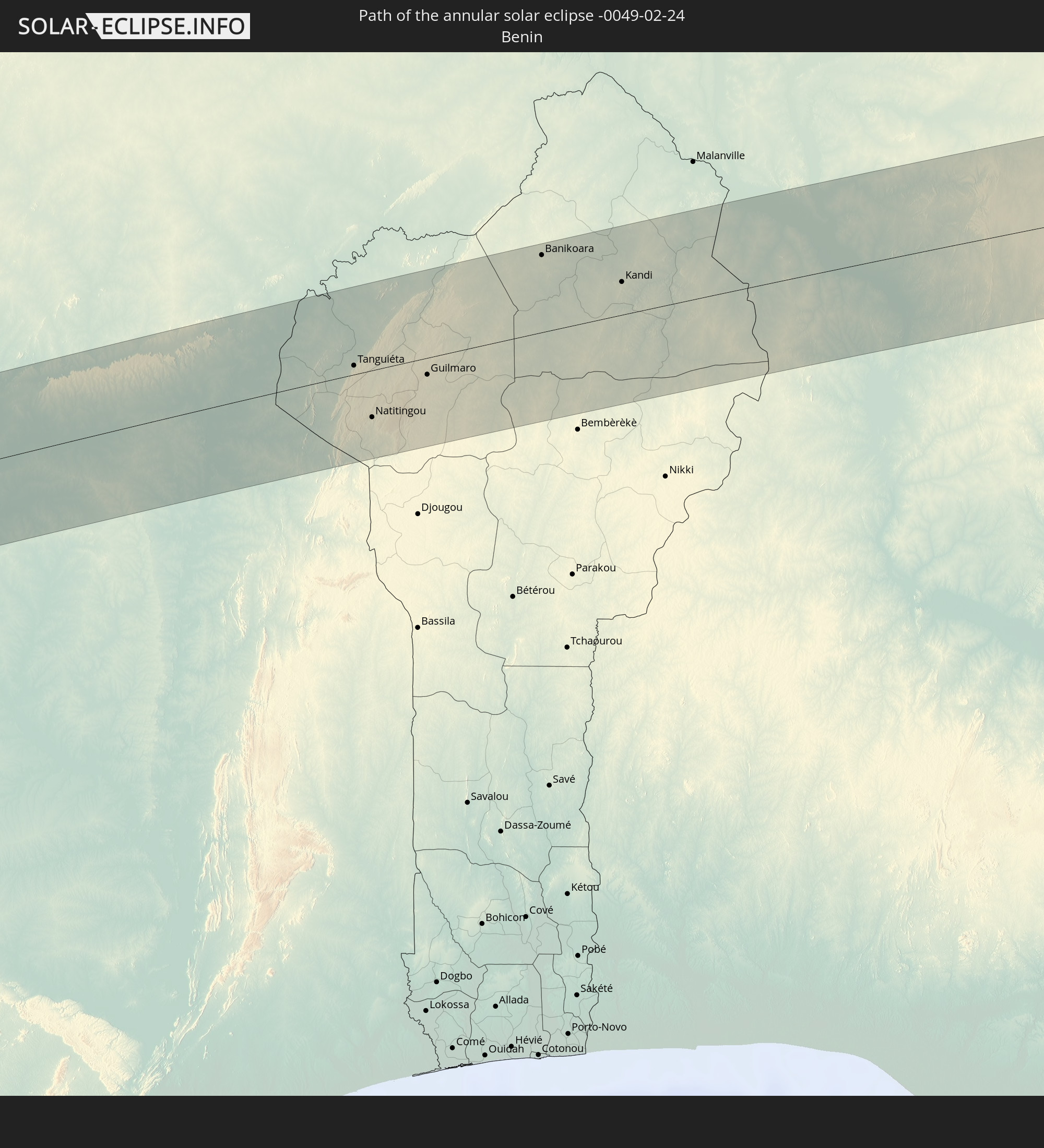 Benin
Benin
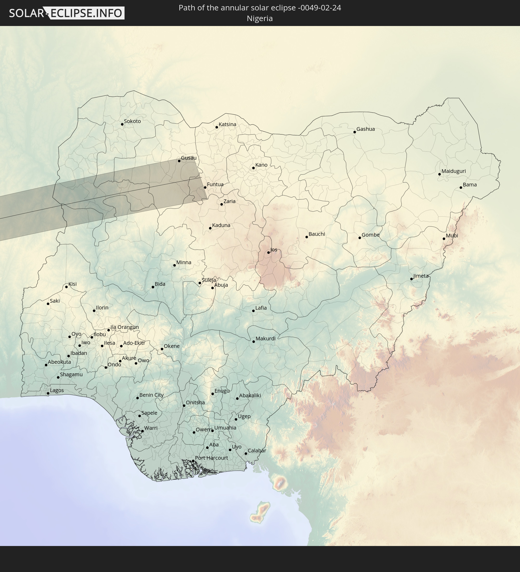 Nigeria
In den folgenden Ländern ist die Sonnenfinsternis partiell zu sehen
 Chile
Chile
 Ecuador
 Costa Rica
 Panama
 Colombia
 Peru
Peru
 Brazil
 Argentina
 Venezuela
 Aruba
Aruba
 Bolivia
 Saint Kitts and Nevis
 Paraguay
 Antigua and Barbuda
 Montserrat
 Trinidad and Tobago
 Guadeloupe
 Grenada
 Dominica
 Saint Vincent and the Grenadines
 Falkland Islands
 Guyana
 Martinique
 Saint Lucia
 Barbados
 Uruguay
 Suriname
 French Guiana
 Portugal
 Cabo Verde
 Spain
Spain
 Senegal
 Mauritania
 The Gambia
 Guinea-Bissau
 Guinea
 Saint Helena, Ascension and Tristan da Cunha
 Sierra Leone
 Morocco
 Mali
Mali
 Liberia
 Algeria
 Ivory Coast
 Burkina Faso
 Gibraltar
 France
 Ghana
Ghana
 Togo
Togo
 Niger
Niger
 Benin
Benin
 Andorra
 Nigeria
 Equatorial Guinea
 São Tomé and Príncipe
 Cameroon
 Gabon
Gabon
 Republic of the Congo
 Angola
 Namibia
 Democratic Republic of the Congo
 Botswana
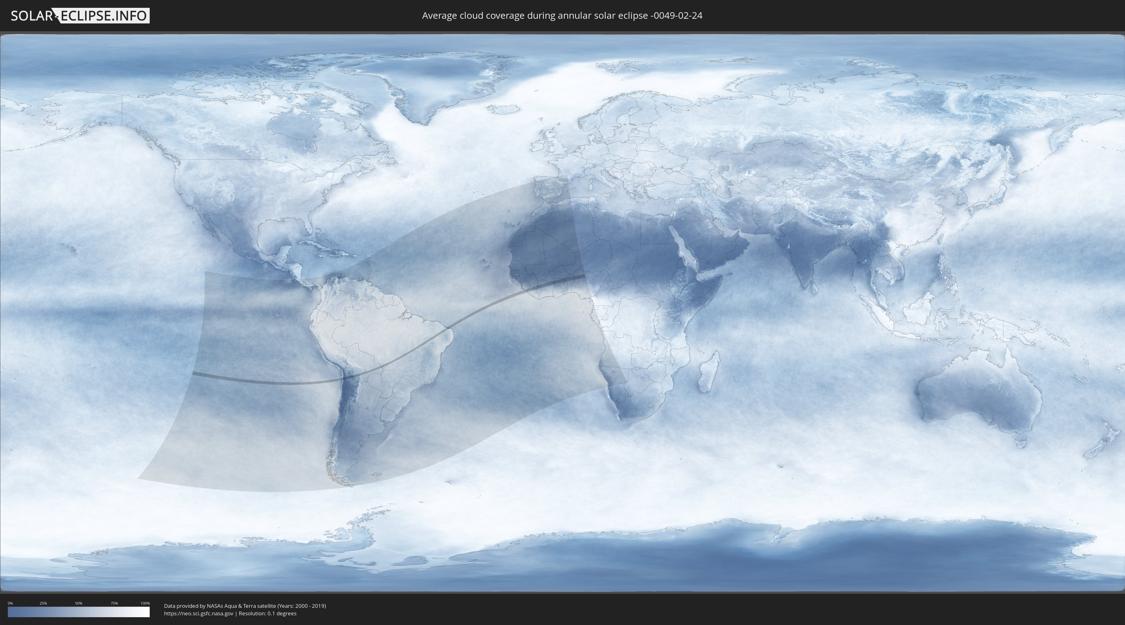
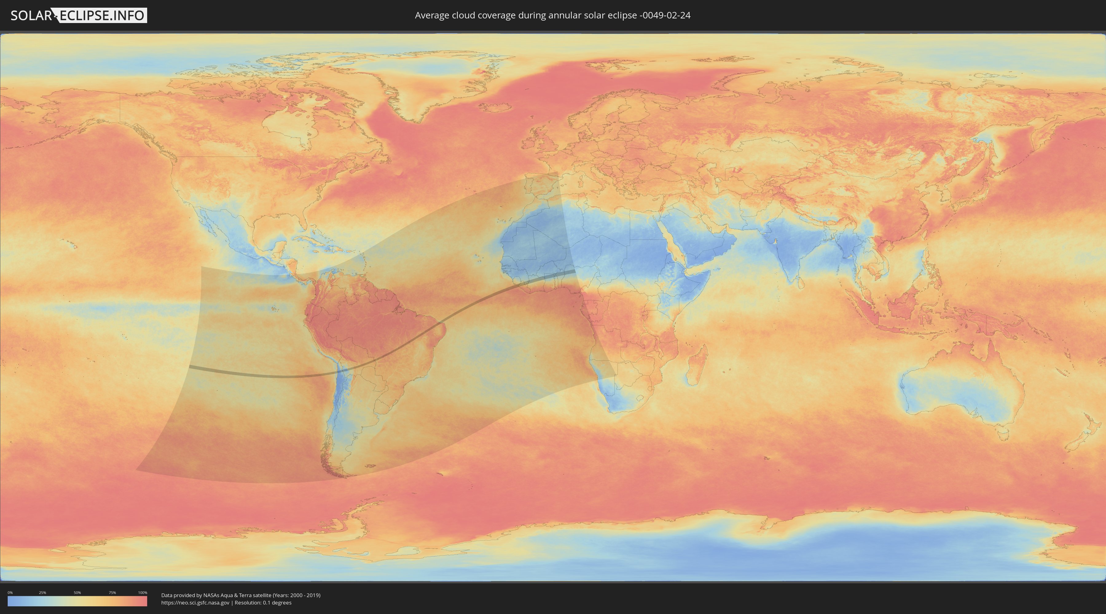
How will be the weather during the annular solar eclipse on 02/24/-0049?
Where is the best place to see the annular solar eclipse of 02/24/-0049?
The following maps show the average cloud coverage for the day of the annular solar eclipse.
With the help of these maps, it is possible to find the place along the eclipse path, which has the best
chance of a cloudless sky.
Nevertheless, you should consider local circumstances and inform about the weather of your chosen
observation site.
The data is provided by NASAs satellites
AQUA and TERRA.
The cloud maps are averaged over a period of 19 years (2000 - 2019).
Detailed country maps
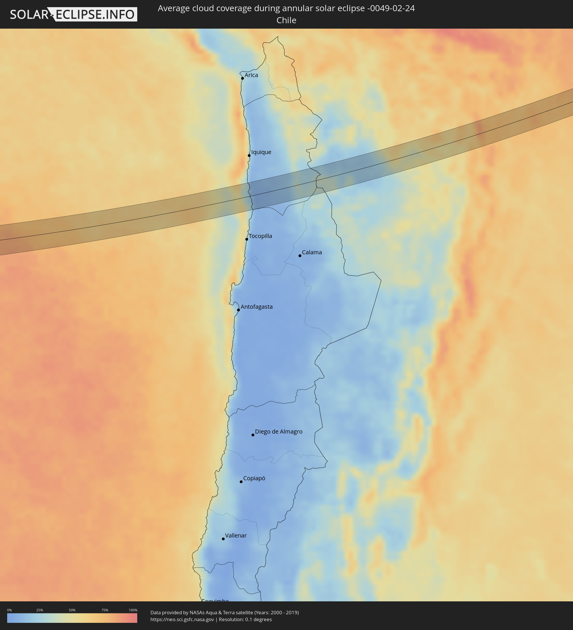 Chile
Chile
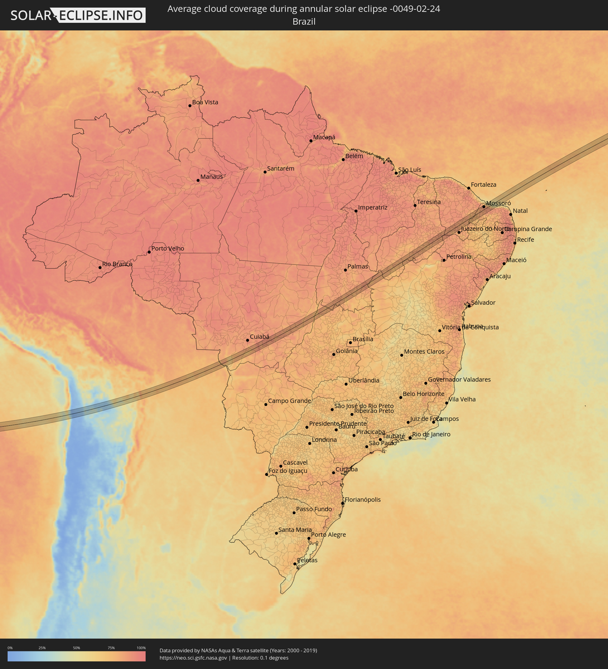 Brazil
 Bolivia
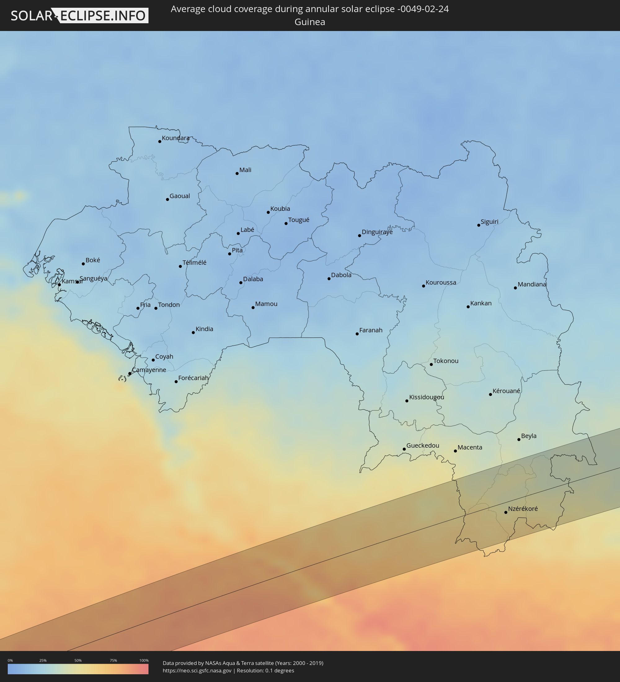 Guinea
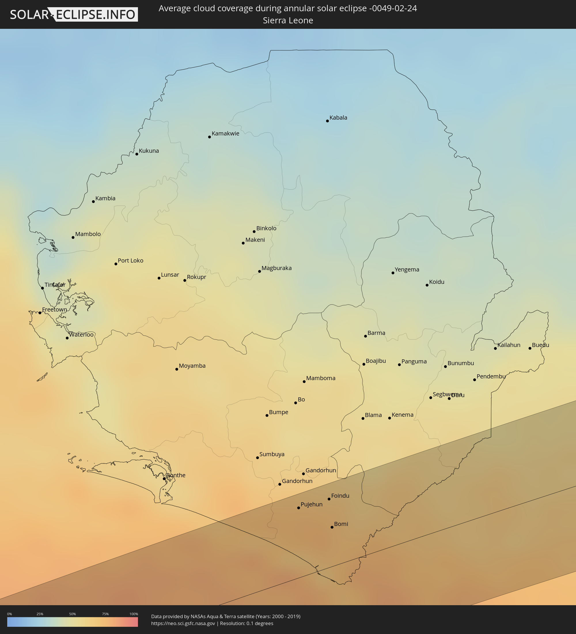 Sierra Leone
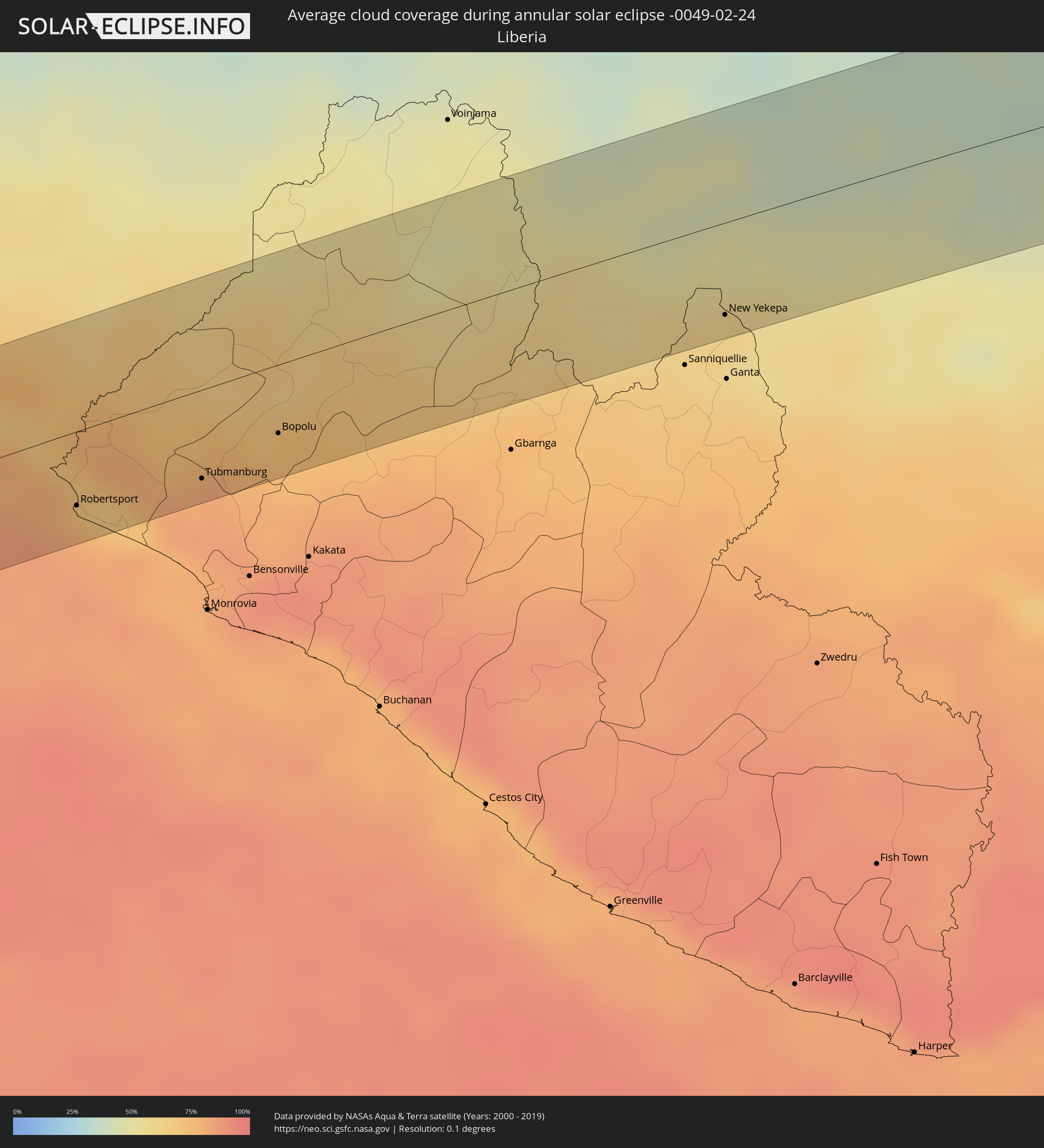 Liberia
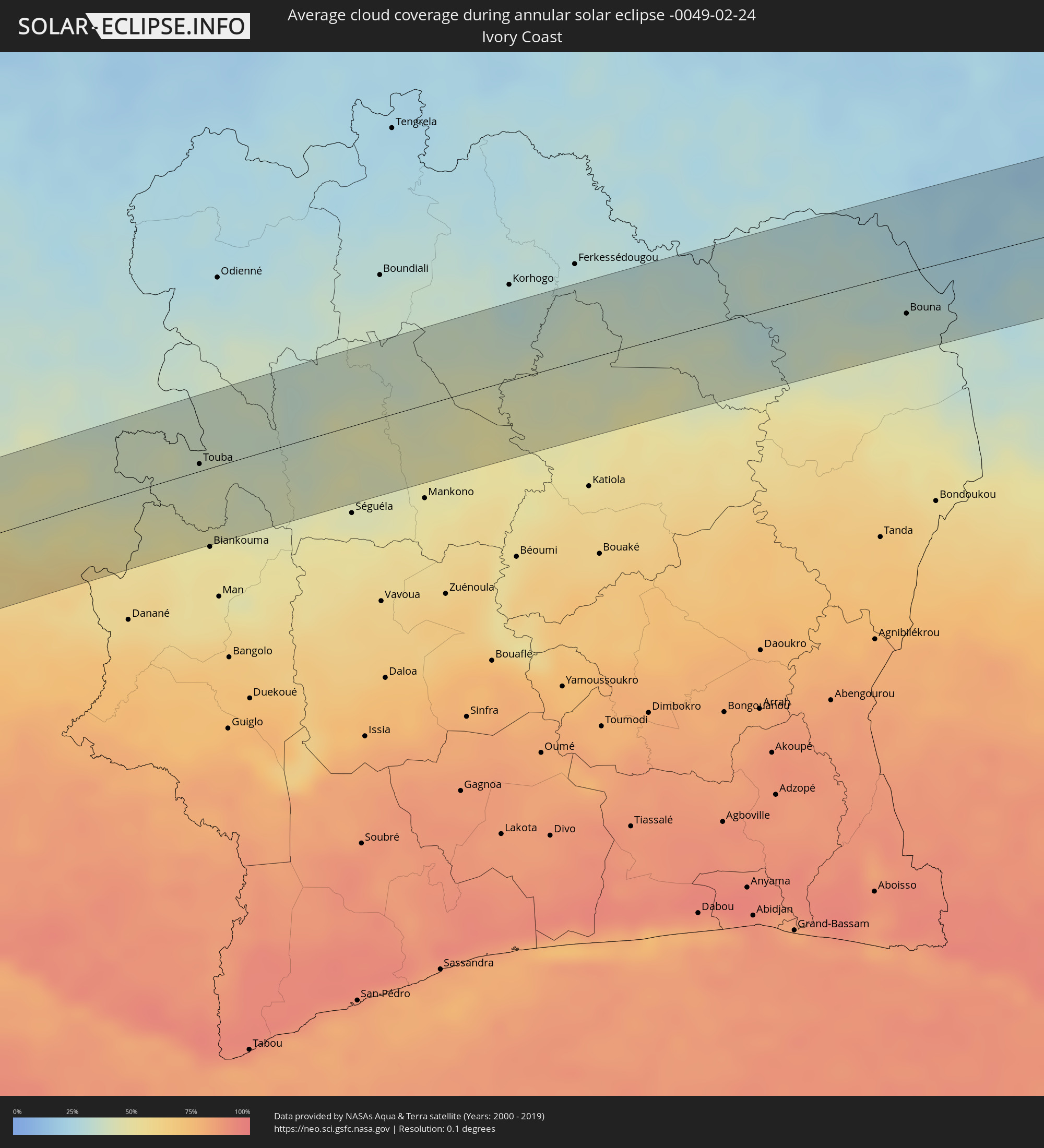 Ivory Coast
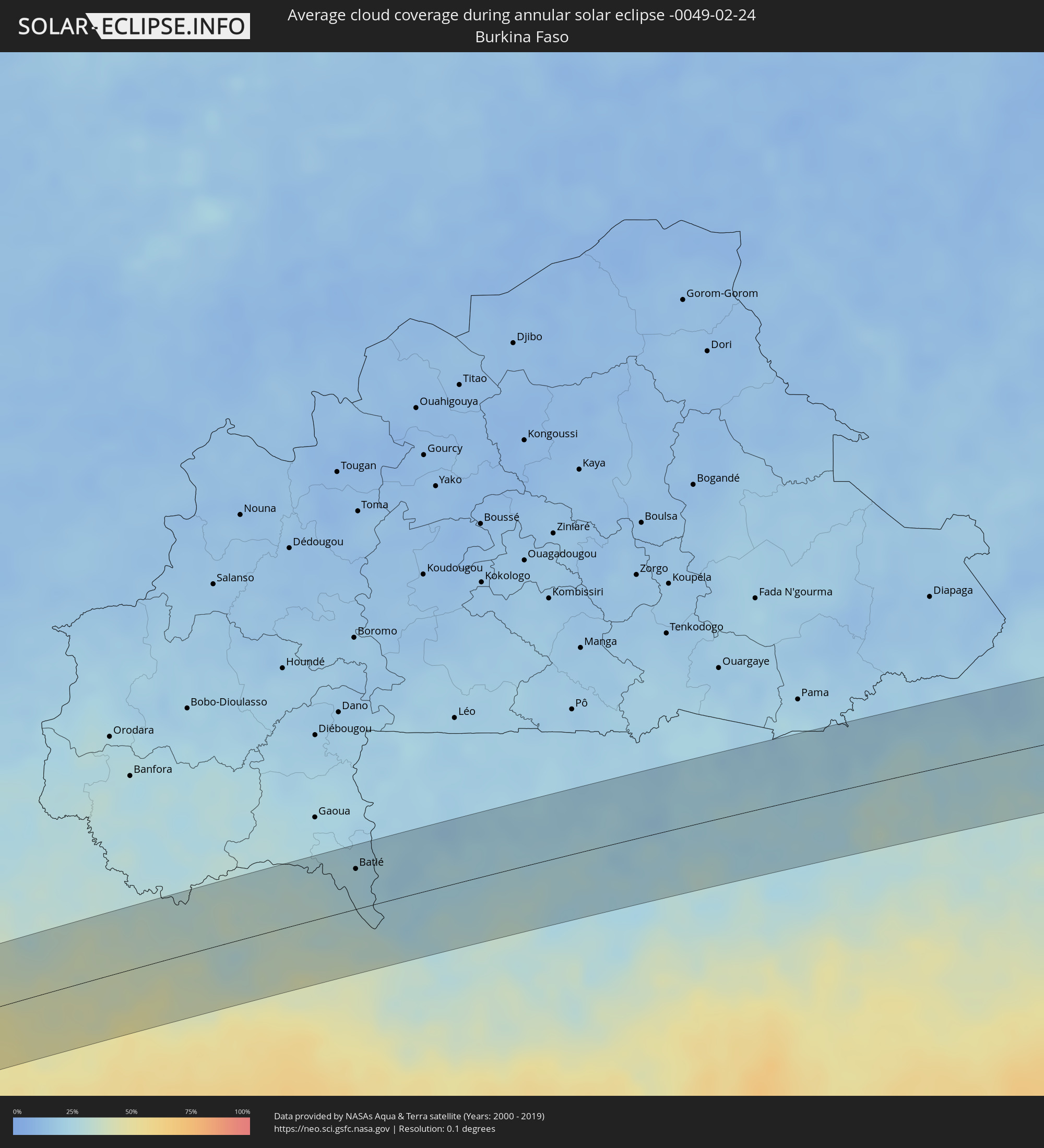 Burkina Faso
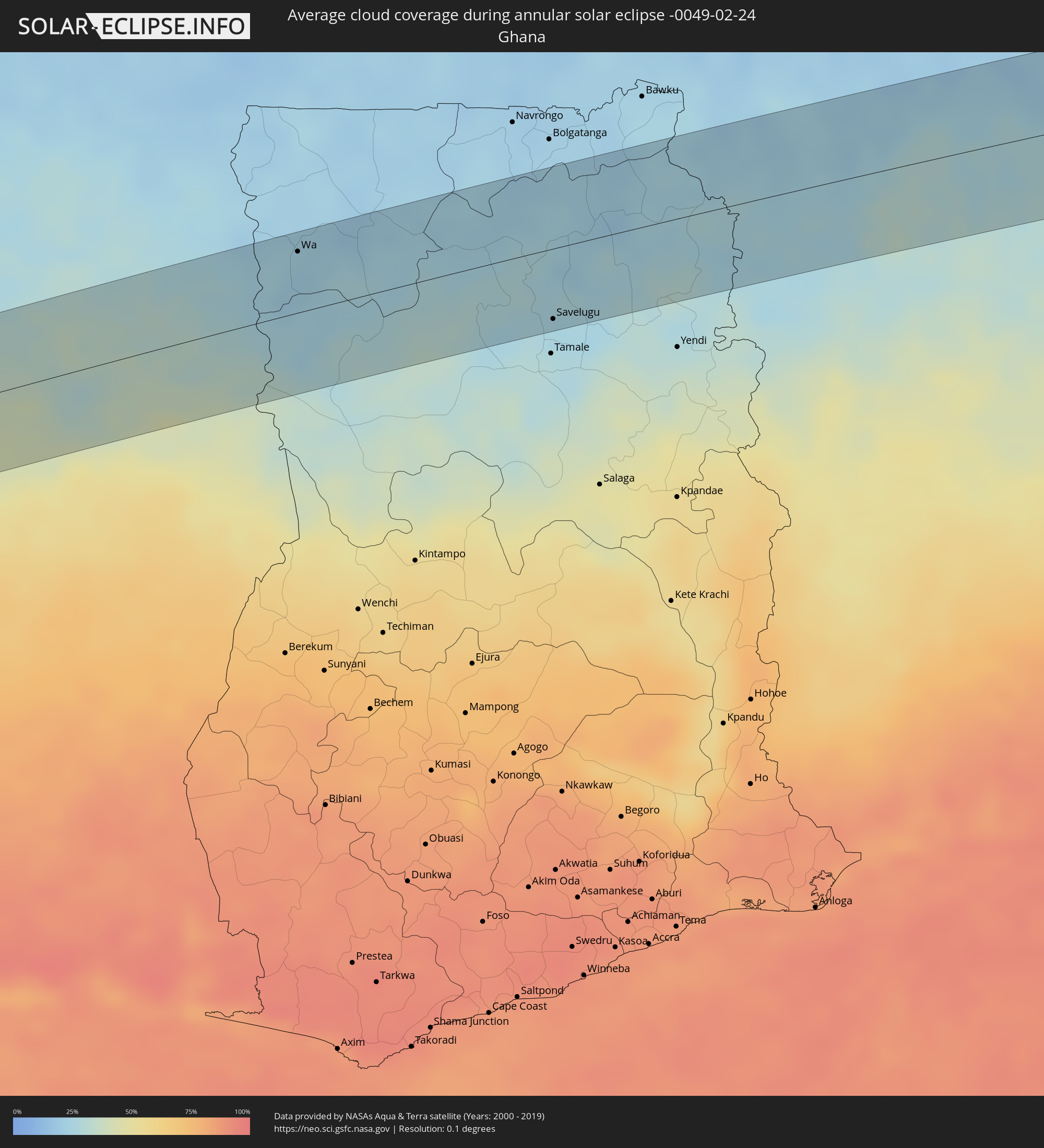 Ghana
Ghana
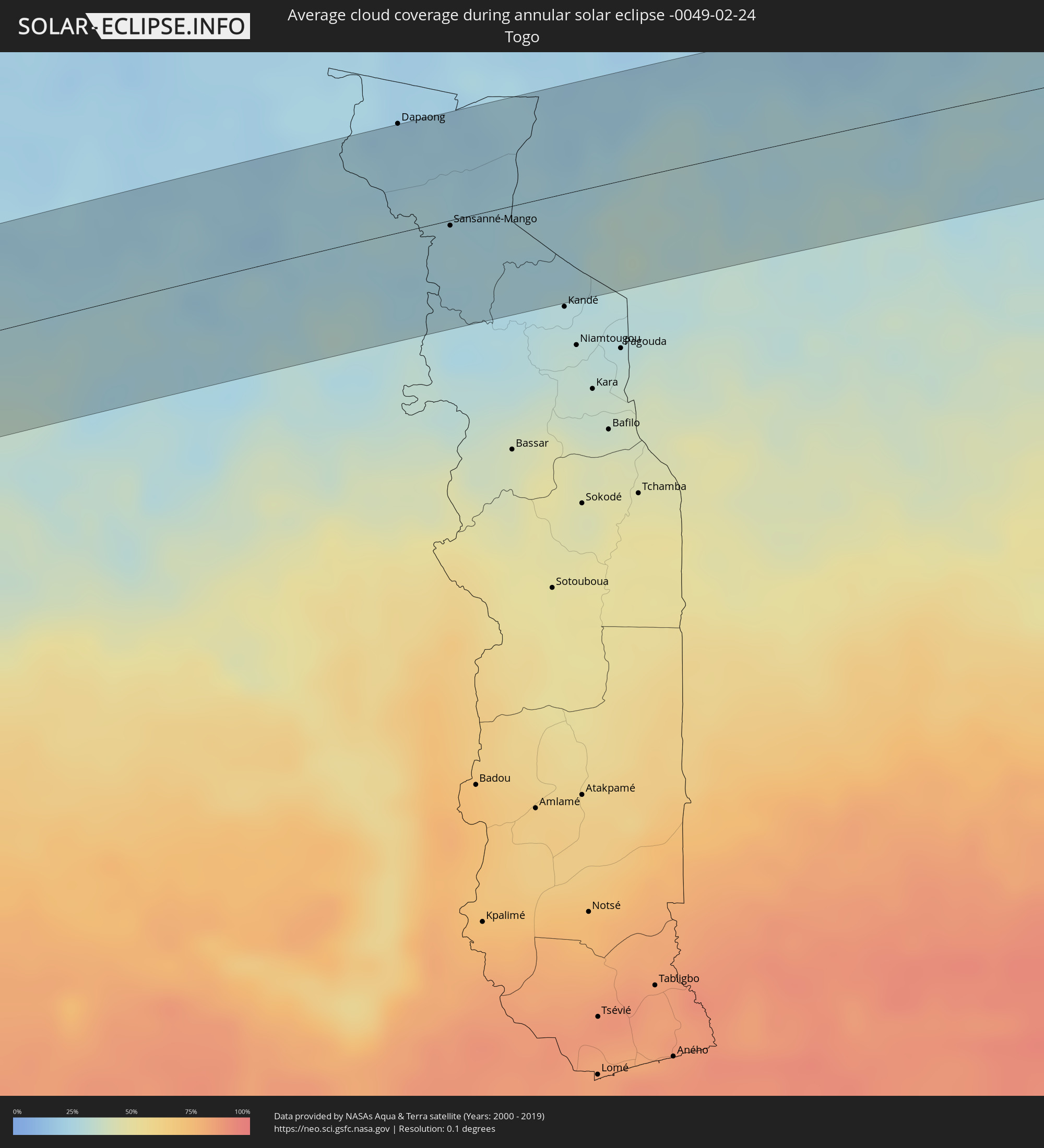 Togo
Togo
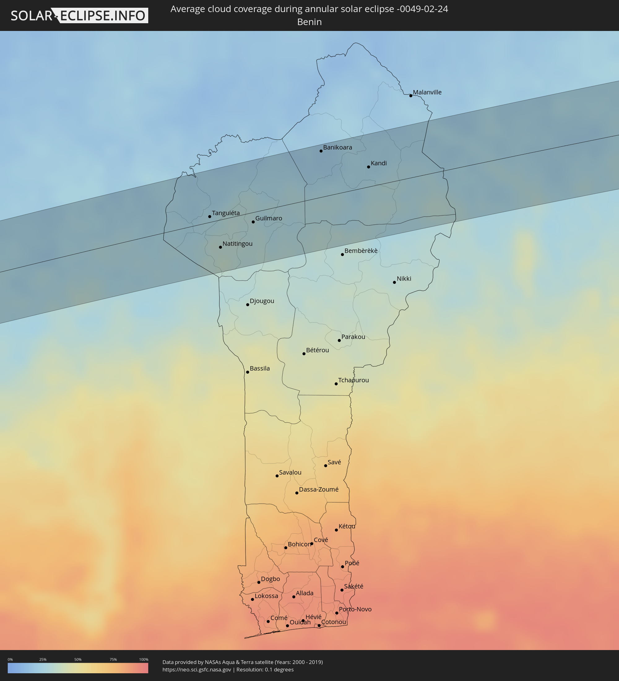 Benin
Benin
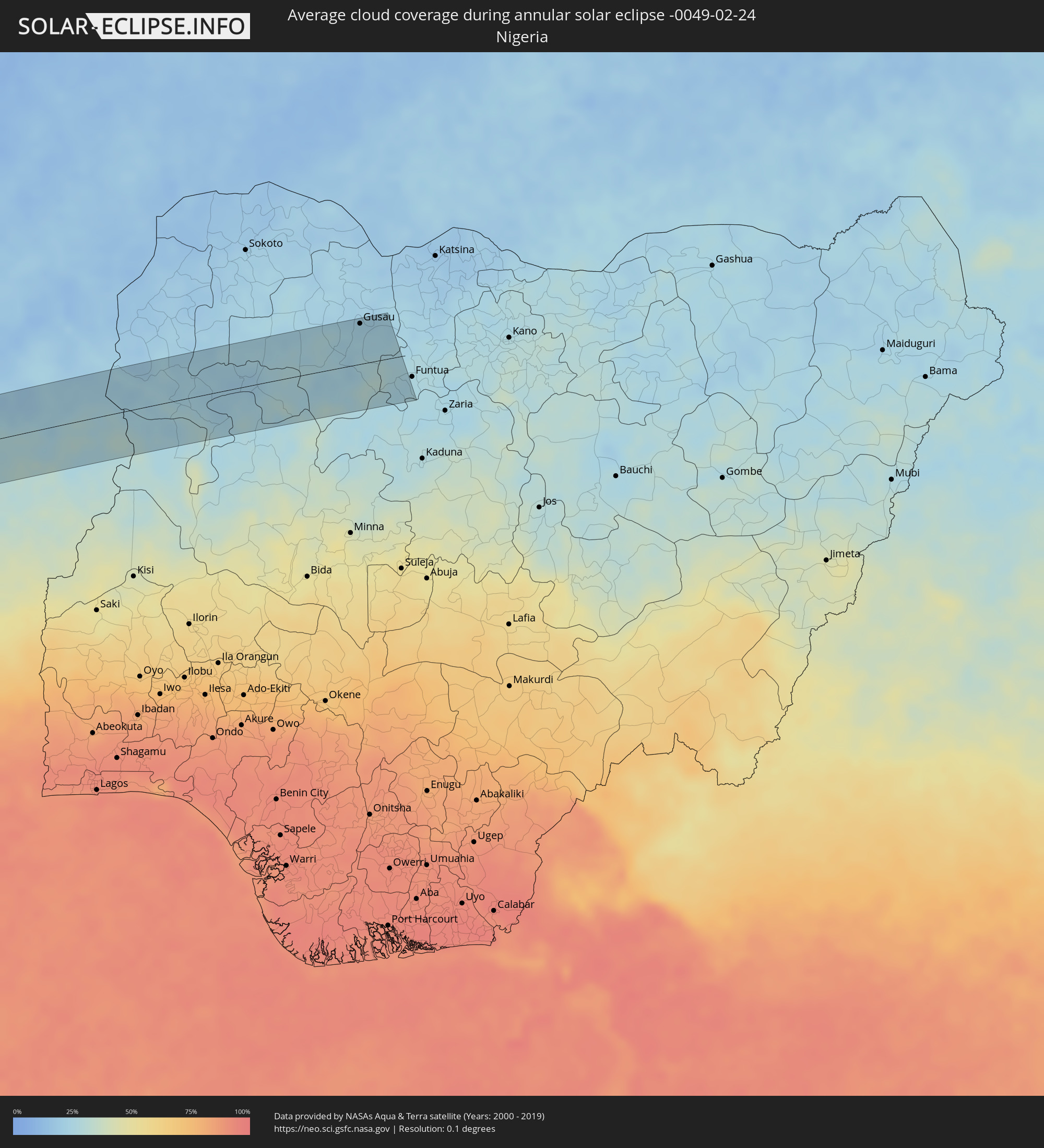 Nigeria
Cities inside the path of the eclipse
The following table shows all locations with a population of more than 5,000 inside the eclipse path. Cities which have more than 100,000 inhabitants are marked bold. A click at the locations opens a detailed map.
| City | Type | Eclipse duration | Local time of max. eclipse | Distance to central line | Ø Cloud coverage |
|
Colchani, Potosí
|
annular | - | 10:22:25 UTC-04:32 | 8 km | 32% |
|
Uyuni, Potosí
|
annular | - | 10:22:35 UTC-04:32 | 12 km | 29% |
|
Monteagudo, Chuquisaca
|
annular | - | 10:30:46 UTC-04:32 | 30 km | 66% |
|
Lucas, Mato Grosso
|
annular | - | 11:52:12 UTC-03:38 | 2 km | 75% |
|
Jaciara, Mato Grosso
|
annular | - | 11:55:37 UTC-03:38 | 8 km | 80% |
|
São Miguel do Araguaia, Goiás
|
annular | - | 12:46:16 UTC-03:06 | 5 km | 83% |
|
São Raimundo Nonato, Piauí
|
annular | - | 13:47:08 UTC-02:34 | 24 km | 83% |
|
São João do Piauí, Piauí
|
annular | - | 13:49:30 UTC-02:34 | 11 km | 79% |
|
Araripina, Pernambuco
|
annular | - | 14:09:41 UTC-02:19 | 20 km | 85% |
|
Ipueiras, Ceará
|
annular | - | 13:56:22 UTC-02:34 | 28 km | 83% |
|
Campos Sales, Ceará
|
annular | - | 13:56:28 UTC-02:34 | 20 km | 84% |
|
Jucás, Ceará
|
annular | - | 13:59:29 UTC-02:34 | 21 km | 82% |
|
Iguatu, Ceará
|
annular | - | 14:00:19 UTC-02:34 | 23 km | 81% |
|
Cedro, Ceará
|
annular | - | 14:00:26 UTC-02:34 | 14 km | 81% |
|
Lavras da Mangabeira, Ceará
|
annular | - | 14:00:25 UTC-02:34 | 34 km | 81% |
|
Orós, Ceará
|
annular | - | 14:01:25 UTC-02:34 | 11 km | 81% |
|
Icó, Ceará
|
annular | - | 14:01:16 UTC-02:34 | 7 km | 81% |
|
Jaguaribe, Ceará
|
annular | - | 14:02:42 UTC-02:34 | 27 km | 79% |
|
Apodi, Rio Grande do Norte
|
annular | - | 14:04:59 UTC-02:34 | 0 km | 79% |
|
Mossoró, Rio Grande do Norte
|
annular | - | 14:06:48 UTC-02:34 | 18 km | 86% |
|
Areia Branca, Rio Grande do Norte
|
annular | - | 14:07:39 UTC-02:34 | 28 km | 83% |
|
Macau, Rio Grande do Norte
|
annular | - | 14:08:30 UTC-02:34 | 16 km | 82% |
|
Pujehun, Southern Province
|
annular | - | 17:15:13 UTC-00:16 | 42 km | 75% |
|
Foindu, Southern Province
|
annular | - | 17:15:22 UTC-00:16 | 42 km | 71% |
|
Bomi, Southern Province
|
annular | - | 17:15:16 UTC-00:16 | 24 km | 72% |
|
Robertsport, Grand Cape Mount
|
annular | - | 16:48:02 UTC-00:43 | 34 km | 72% |
|
Tubmanburg, Bomi
|
annular | - | 16:48:28 UTC-00:43 | 41 km | 82% |
|
Bopolu, Gbarpolu
|
annular | - | 16:48:48 UTC-00:43 | 31 km | 73% |
|
Nzérékoré, Nzerekore
|
annular | - | 17:17:11 UTC-00:16 | 14 km | 51% |
|
New Yekepa, Nimba
|
annular | - | 16:50:13 UTC-00:43 | 42 km | 61% |
|
Touba, Woroba
|
annular | - | 17:18:03 UTC-00:16 | 5 km | 41% |
|
Bouna, Zanzan
|
annular | - | 17:20:22 UTC-00:16 | 29 km | 35% |
|
Batié, Sud-Ouest
|
annular | - | 17:20:40 UTC-00:16 | 35 km | 26% |
|
Wa, Upper West
|
annular | - | 17:36:08 UTC-00:00 | 43 km | 22% |
|
Savelugu, Northern
|
annular | - | 17:36:20 UTC-00:00 | 49 km | 25% |
|
Sansanné-Mango, Savanes
|
annular | - | 17:21:37 UTC-00:16 | 3 km | 26% |
|
Tanguiéta, Atakora
|
annular | - | 17:51:33 UTC+00:13 | 6 km | 29% |
|
Natitingou, Atakora
|
annular | - | 17:51:27 UTC+00:13 | 31 km | 34% |
|
Guilmaro, Atakora
|
annular | - | 17:51:36 UTC+00:13 | 11 km | 29% |
|
Banikoara, Alibori
|
annular | - | 17:51:56 UTC+00:13 | 51 km | 19% |
|
Kandi, Alibori
|
annular | - | 17:51:55 UTC+00:13 | 22 km | 26% |
|
Dakingari, Kebbi
|
annular | - | 17:52:09 UTC+00:13 | 52 km | 24% |
|
Konkwesso, Niger
|
annular | - | 17:51:54 UTC+00:13 | 36 km | 25% |
|
Bagudo, Kebbi
|
annular | - | 17:52:05 UTC+00:13 | 22 km | 26% |
|
Kende, Kebbi
|
annular | - | 17:52:07 UTC+00:13 | 34 km | 22% |
|
Shanga, Kebbi
|
annular | - | 17:52:02 UTC+00:13 | 6 km | 25% |
|
Bin Yauri, Kebbi
|
annular | - | 17:51:54 UTC+00:13 | 59 km | 27% |
|
Duku, Niger
|
annular | - | 17:52:03 UTC+00:13 | 11 km | 21% |
|
Mahuta, Kebbi
|
annular | - | 17:52:09 UTC+00:13 | 22 km | 20% |
|
Dabai, Kebbi
|
annular | - | 17:52:08 UTC+00:13 | 9 km | 22% |
|
Zuru, Kebbi
|
annular | - | 17:52:07 UTC+00:13 | 3 km | 24% |
|
Rijau, Niger
|
annular | - | 17:52:01 UTC+00:13 | 33 km | 26% |
|
Wasagu, Kebbi
|
annular | - | 17:52:06 UTC+00:13 | 15 km | 26% |
|
Bena, Kebbi
|
annular | - | 17:52:04 UTC+00:13 | 28 km | 25% |
|
Dan Sadau, Zamfara
|
annular | - | 17:52:04 UTC+00:13 | 38 km | 26% |
|
Gusau, Zamfara
|
annular | - | 17:52:19 UTC+00:13 | 54 km | 24% |
|
Sauri, Zamfara
|
annular | - | 17:52:11 UTC+00:13 | 3 km | 29% |
|
Kwatarkwashi, Zamfara
|
annular | - | 17:52:18 UTC+00:13 | 49 km | 24% |
|
Tsafe, Zamfara
|
annular | - | 17:52:14 UTC+00:13 | 26 km | 25% |