Hybrid solar eclipse of 09/01/-0487
| Day of week: | Sunday |
| Maximum duration of eclipse: | 00m13s |
| Maximum width of eclipse path: | 8 km |
| Saros cycle: | 56 |
| Coverage: | 100% |
| Magnitude: | 1.0023 |
| Gamma: | 0.2091 |
Wo kann man die Sonnenfinsternis vom 09/01/-0487 sehen?
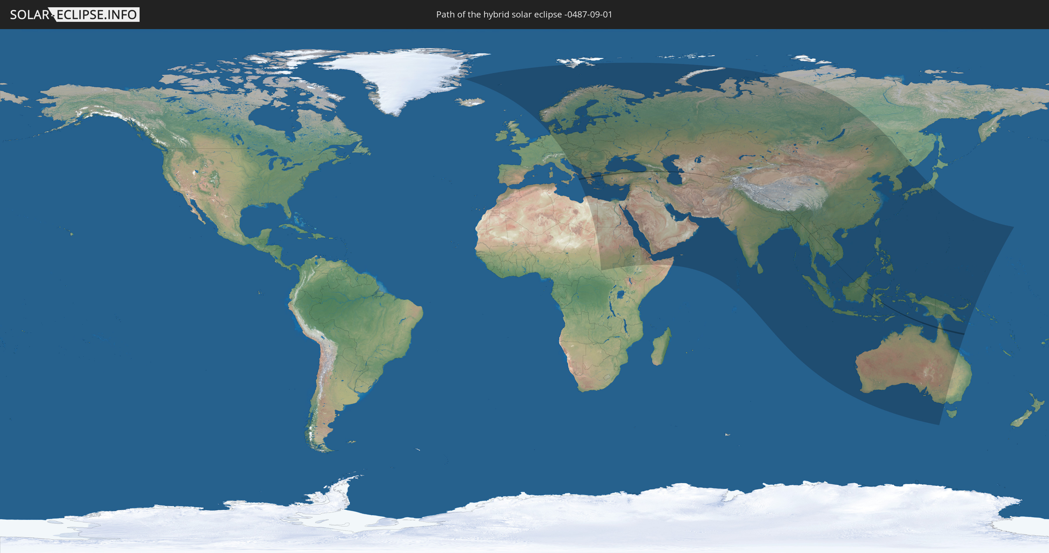
Die Sonnenfinsternis am 09/01/-0487 kann man in 97 Ländern als partielle Sonnenfinsternis beobachten.
Der Finsternispfad verläuft durch 21 Länder. Nur in diesen Ländern ist sie als hybrid Sonnenfinsternis zu sehen.
In den folgenden Ländern ist die Sonnenfinsternis hybrid zu sehen
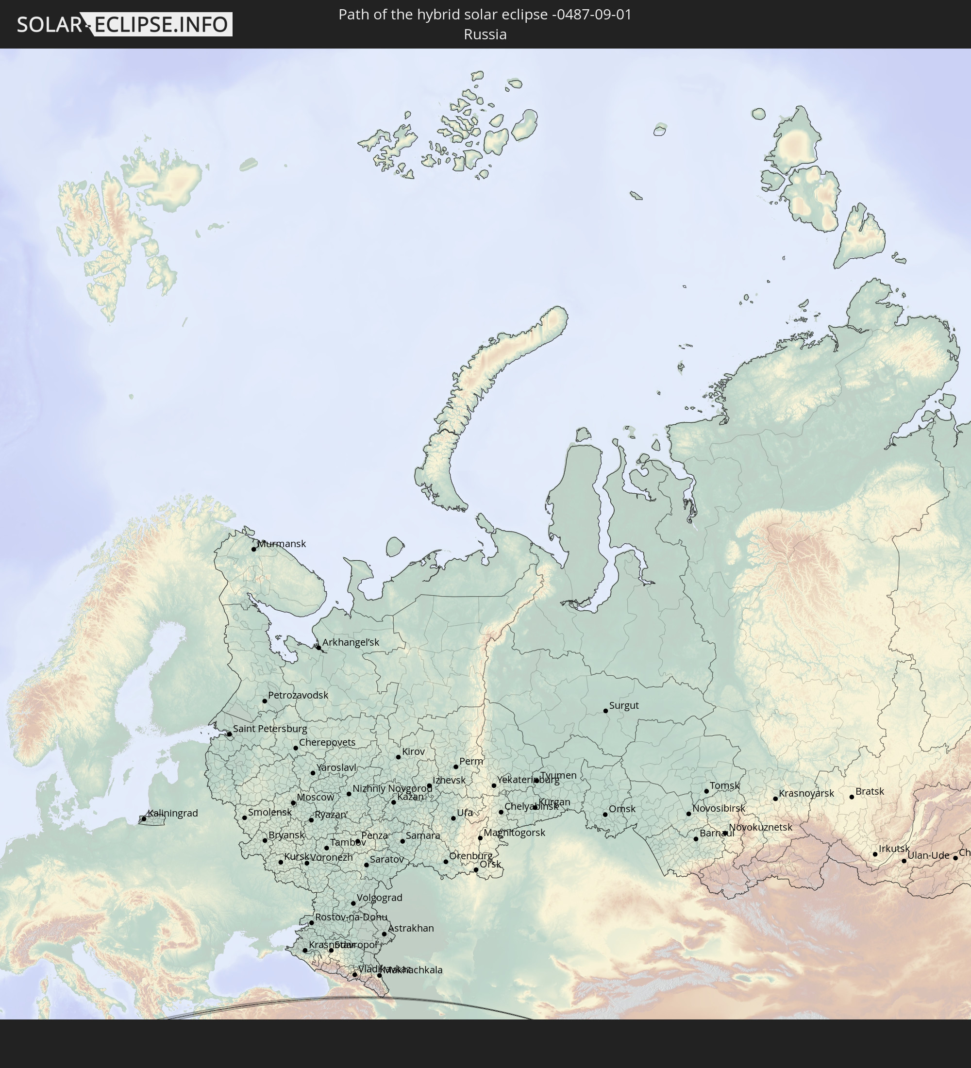 Russia
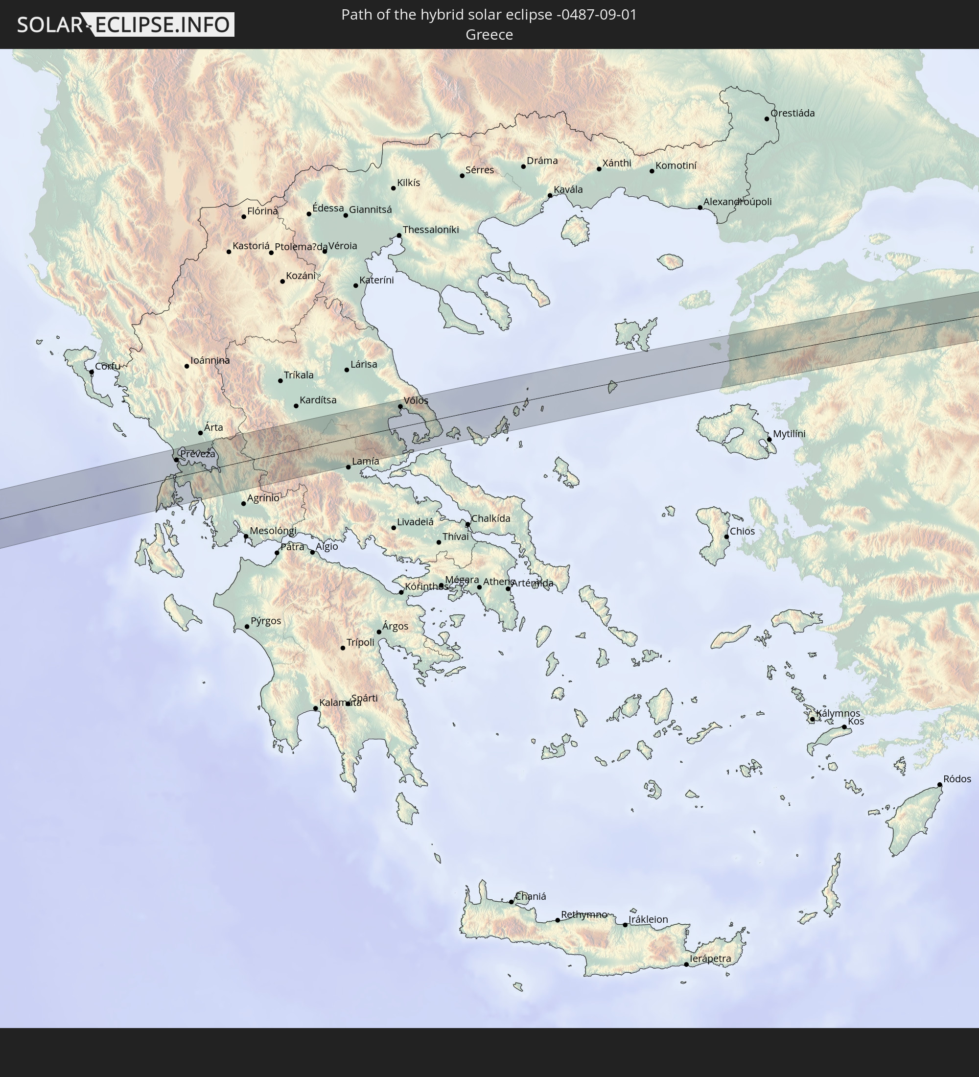 Greece
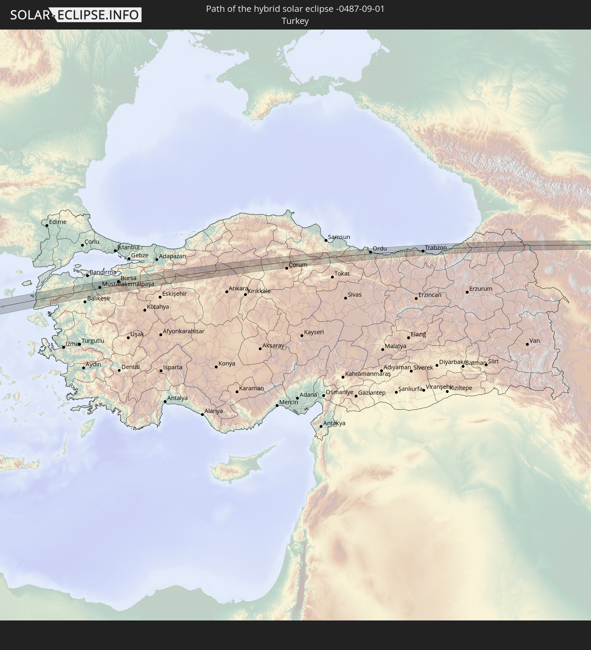 Turkey
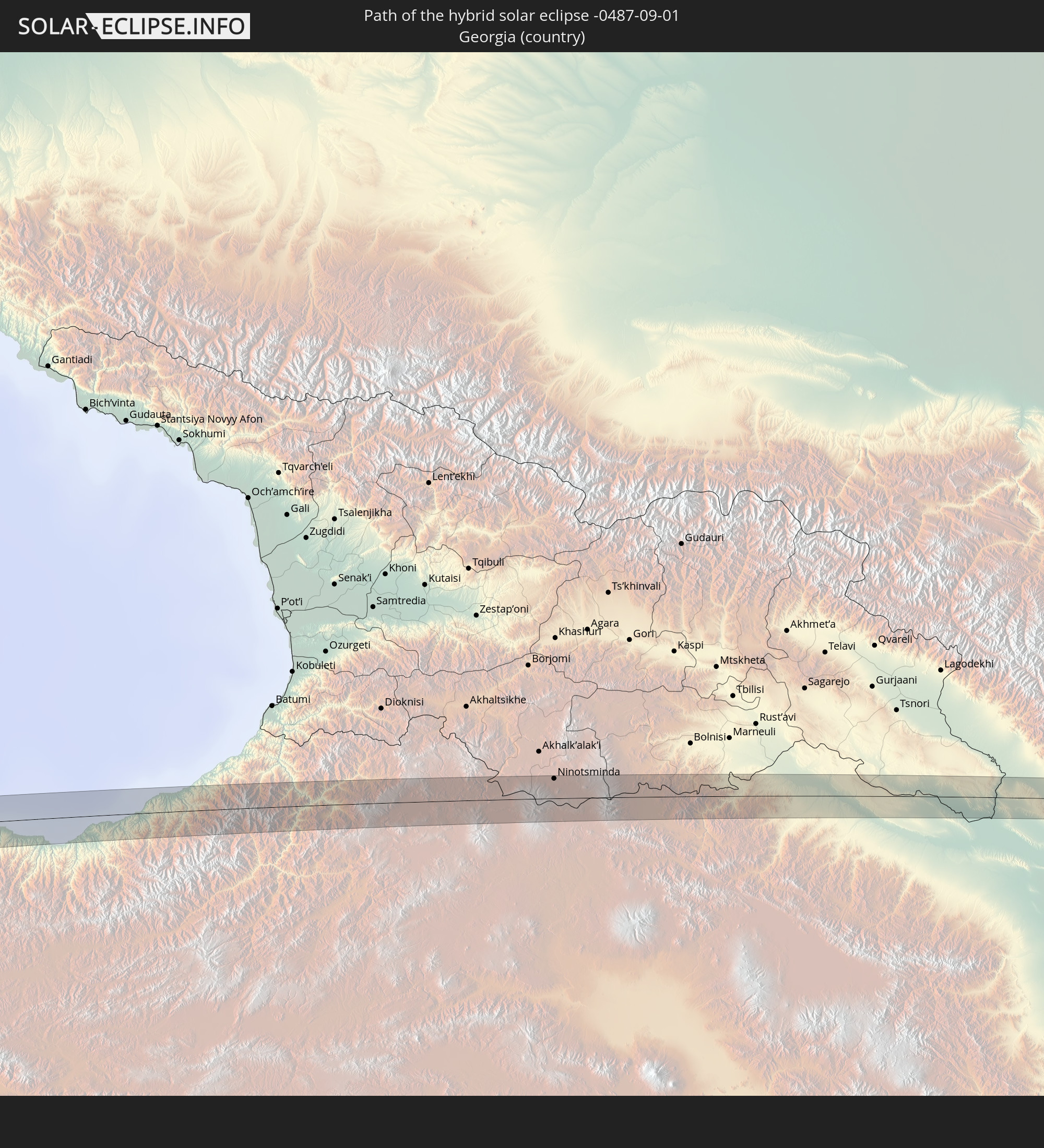 Georgia
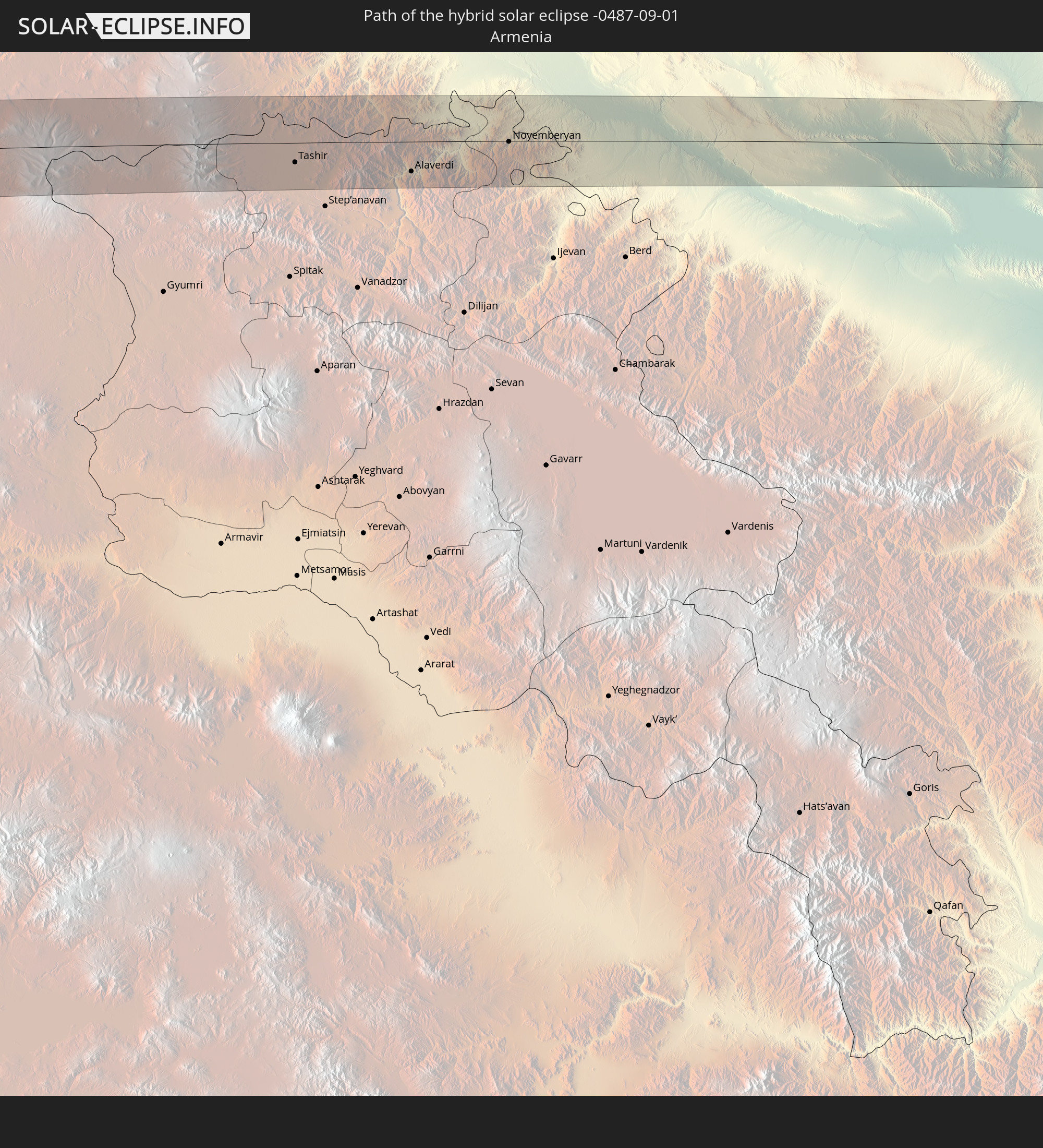 Armenia
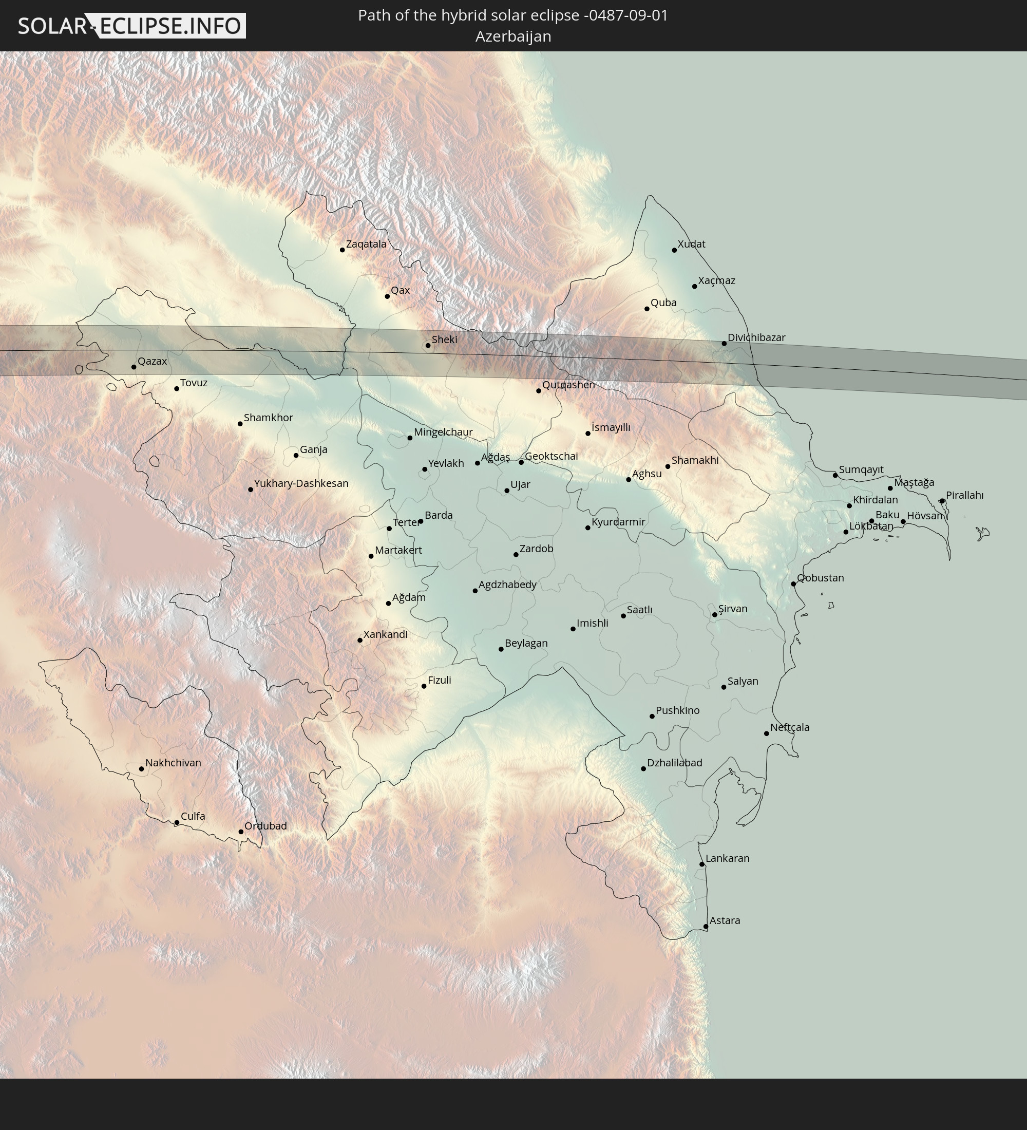 Azerbaijan
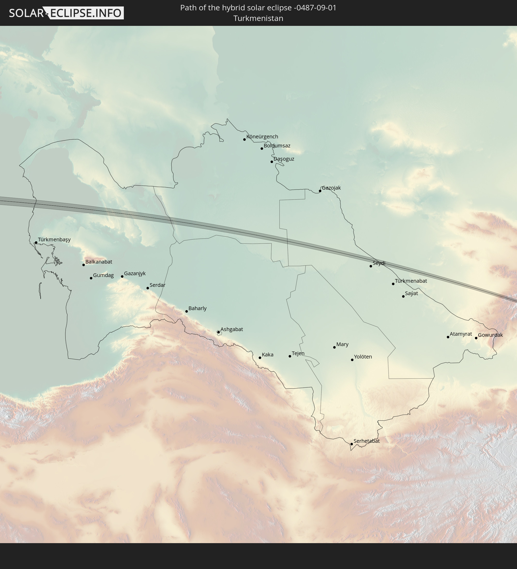 Turkmenistan
 Uzbekistan
 Afghanistan
 Pakistan
 Tajikistan
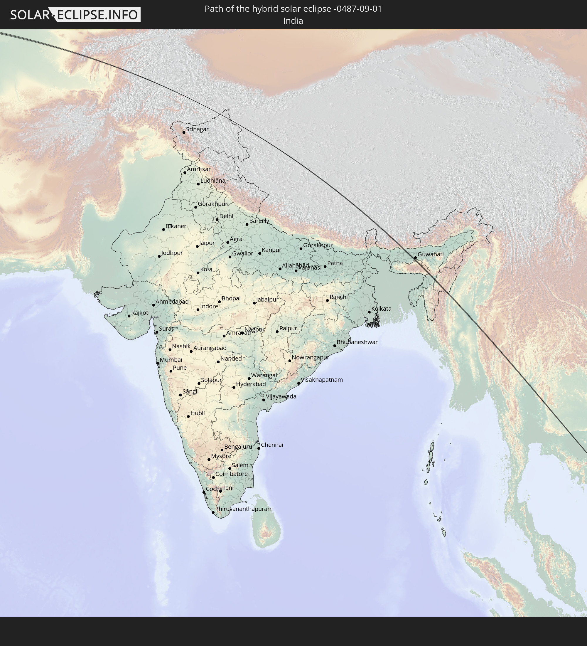 India
India
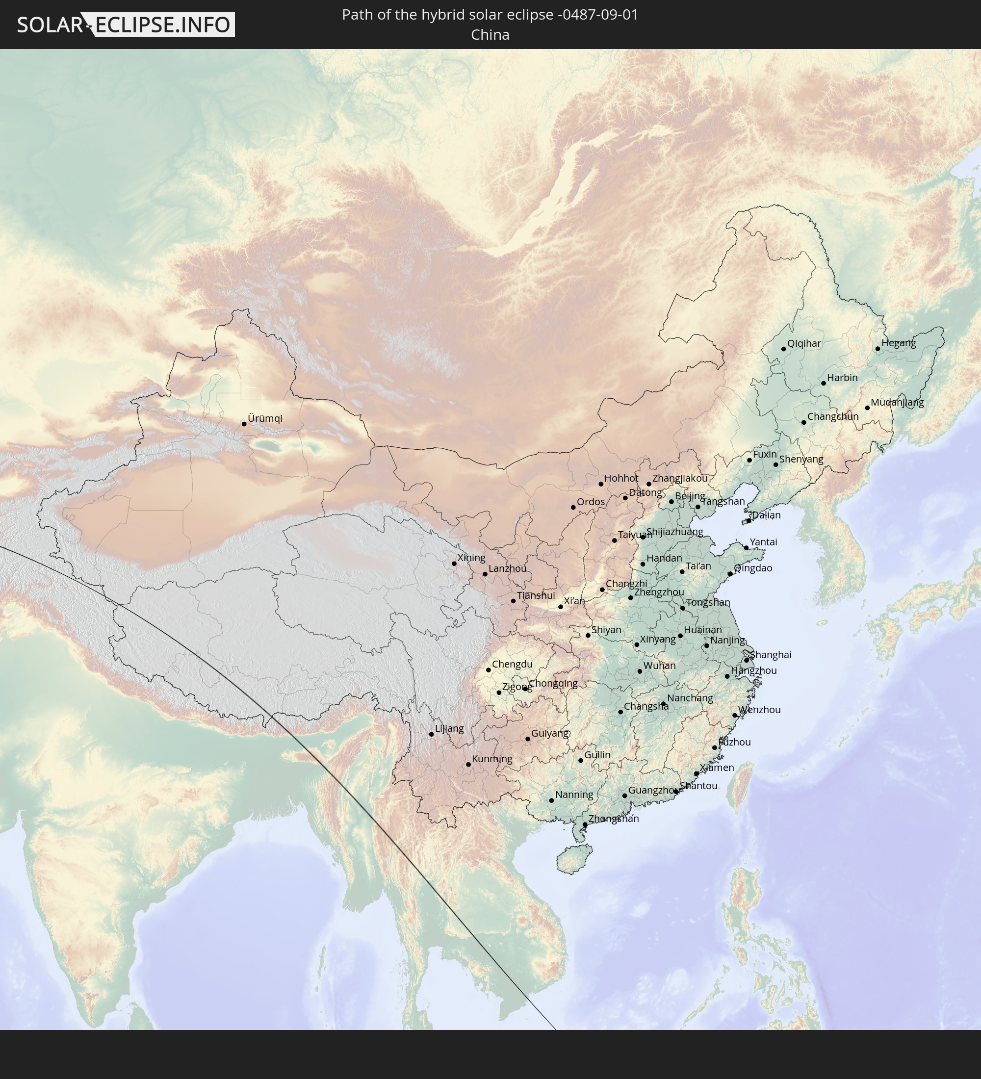 China
China
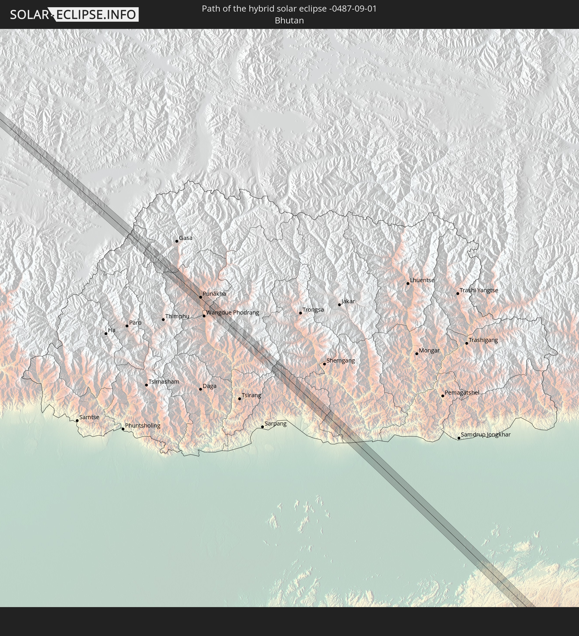 Bhutan
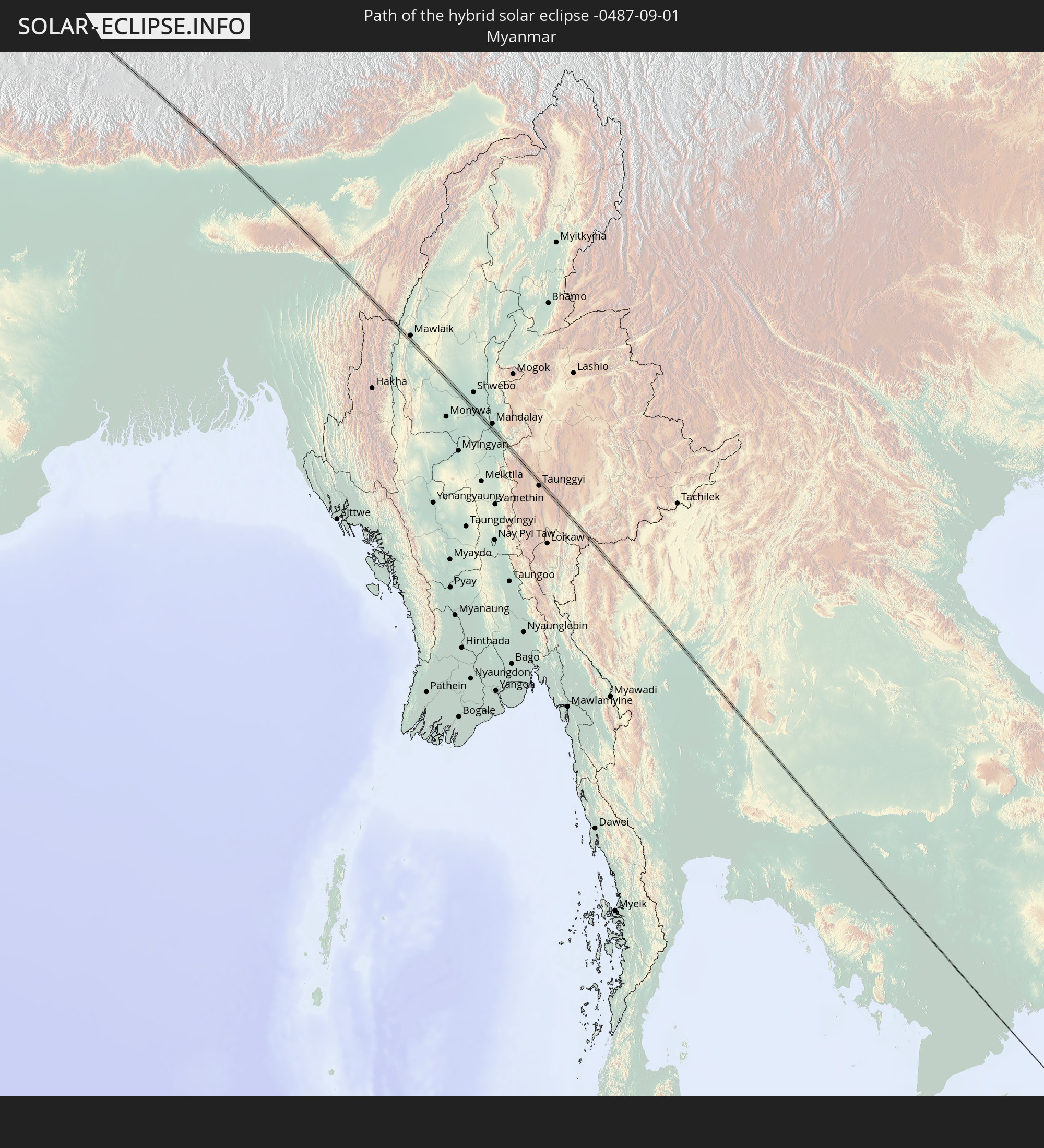 Myanmar
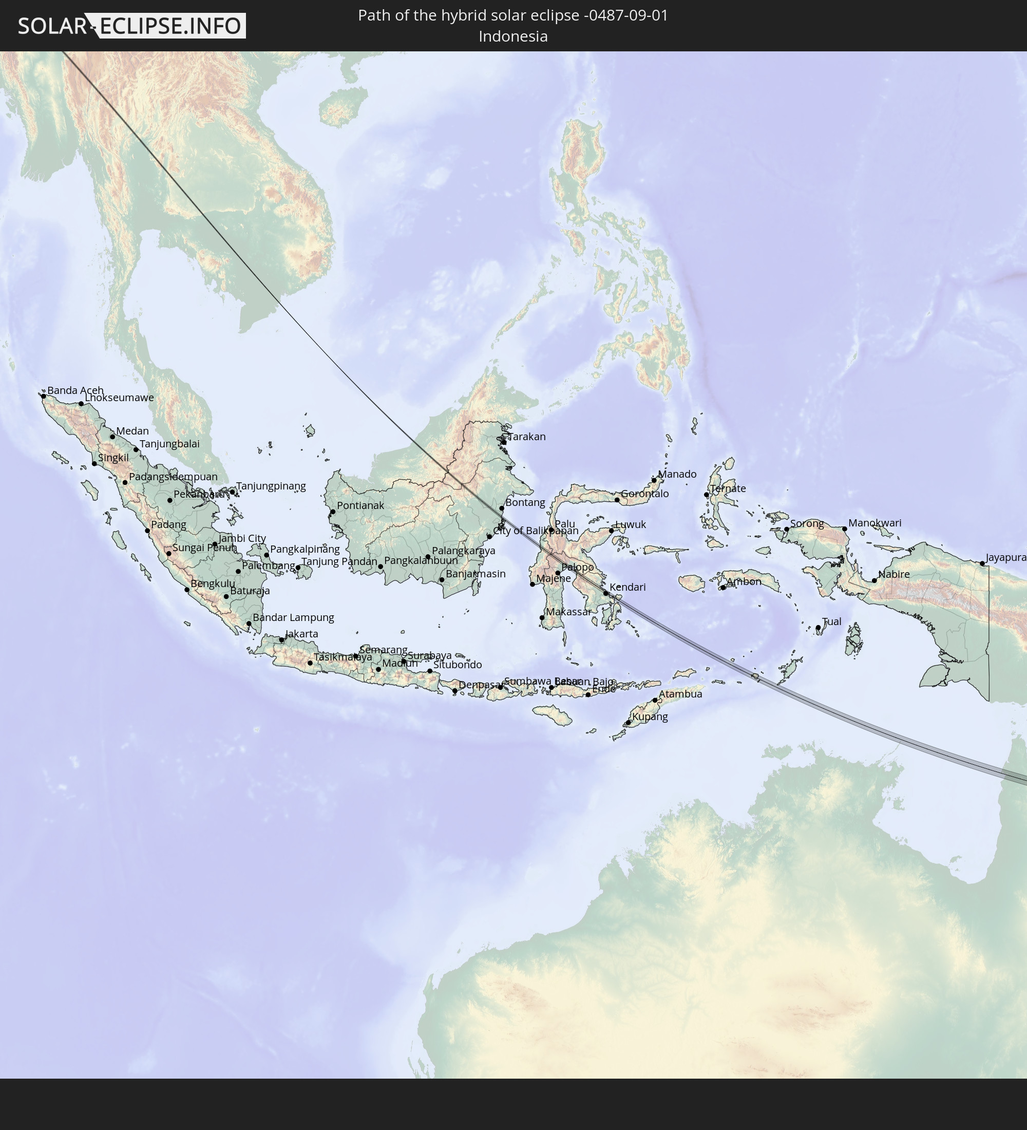 Indonesia
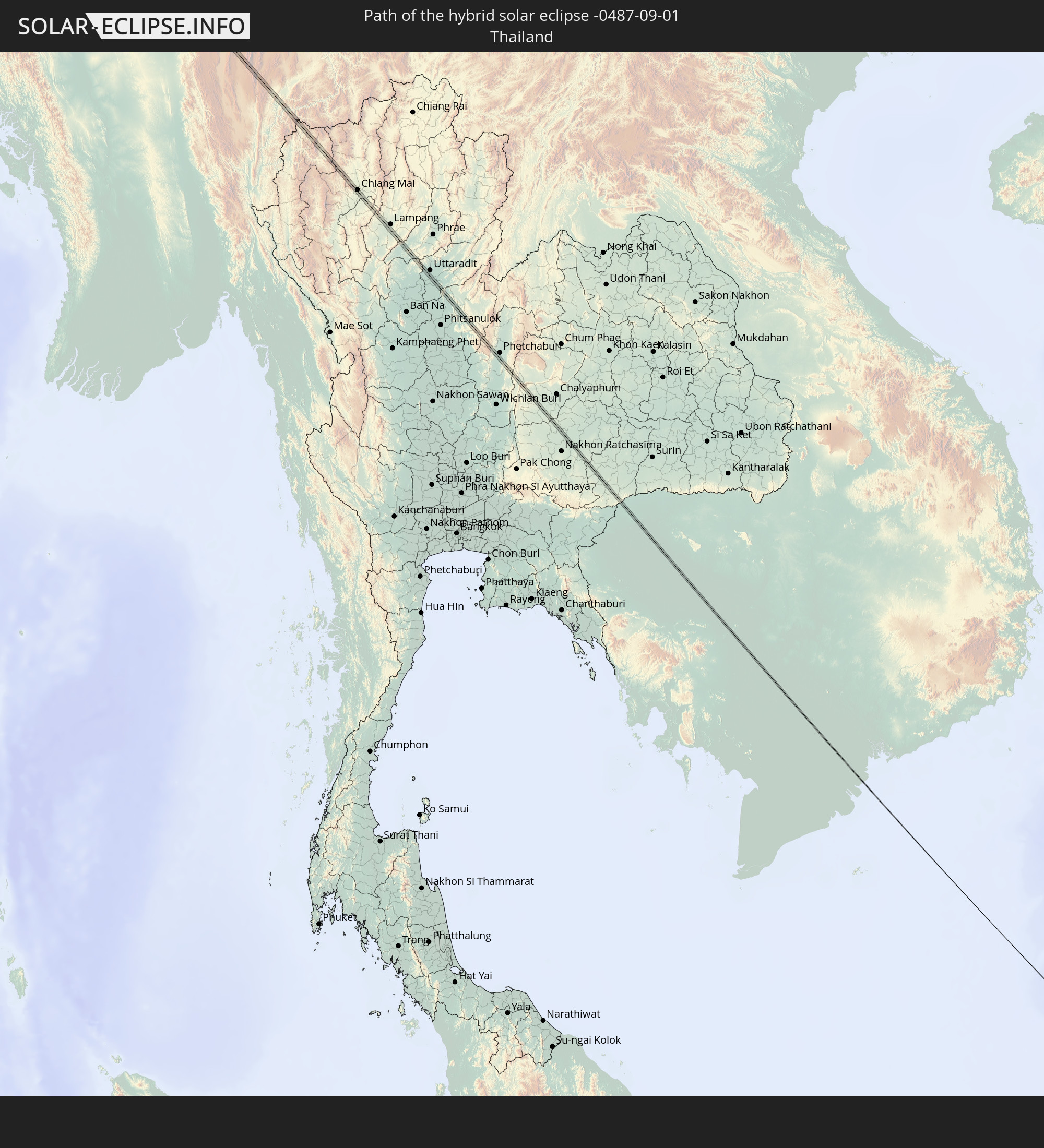 Thailand
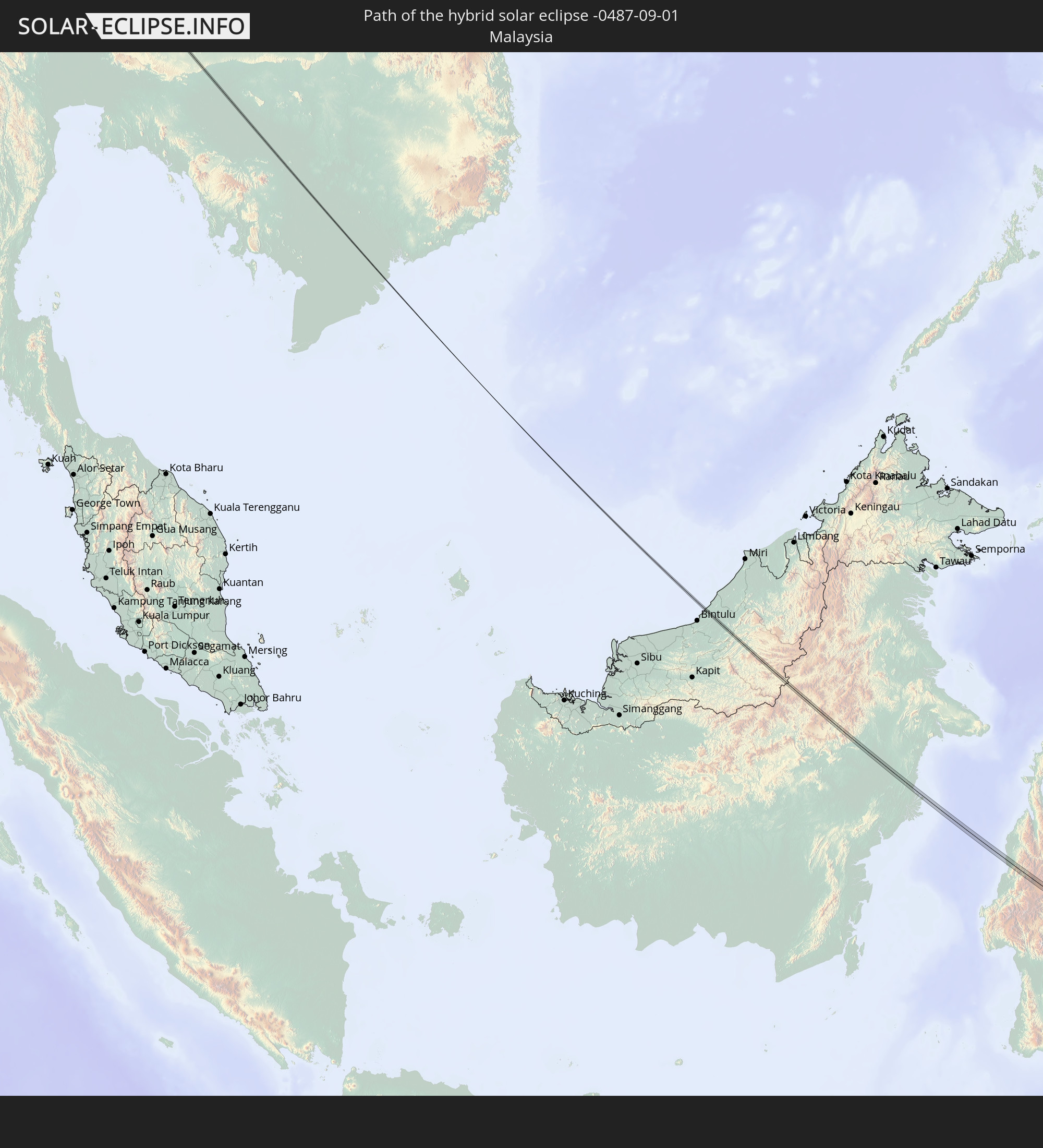 Malaysia
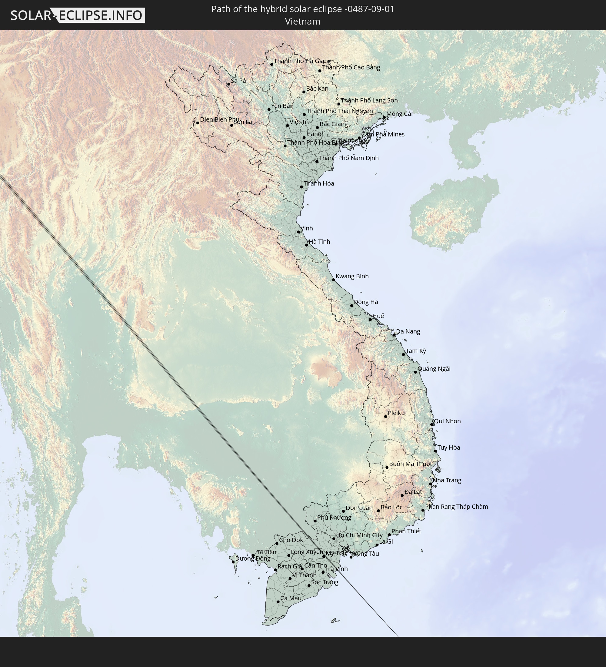 Vietnam
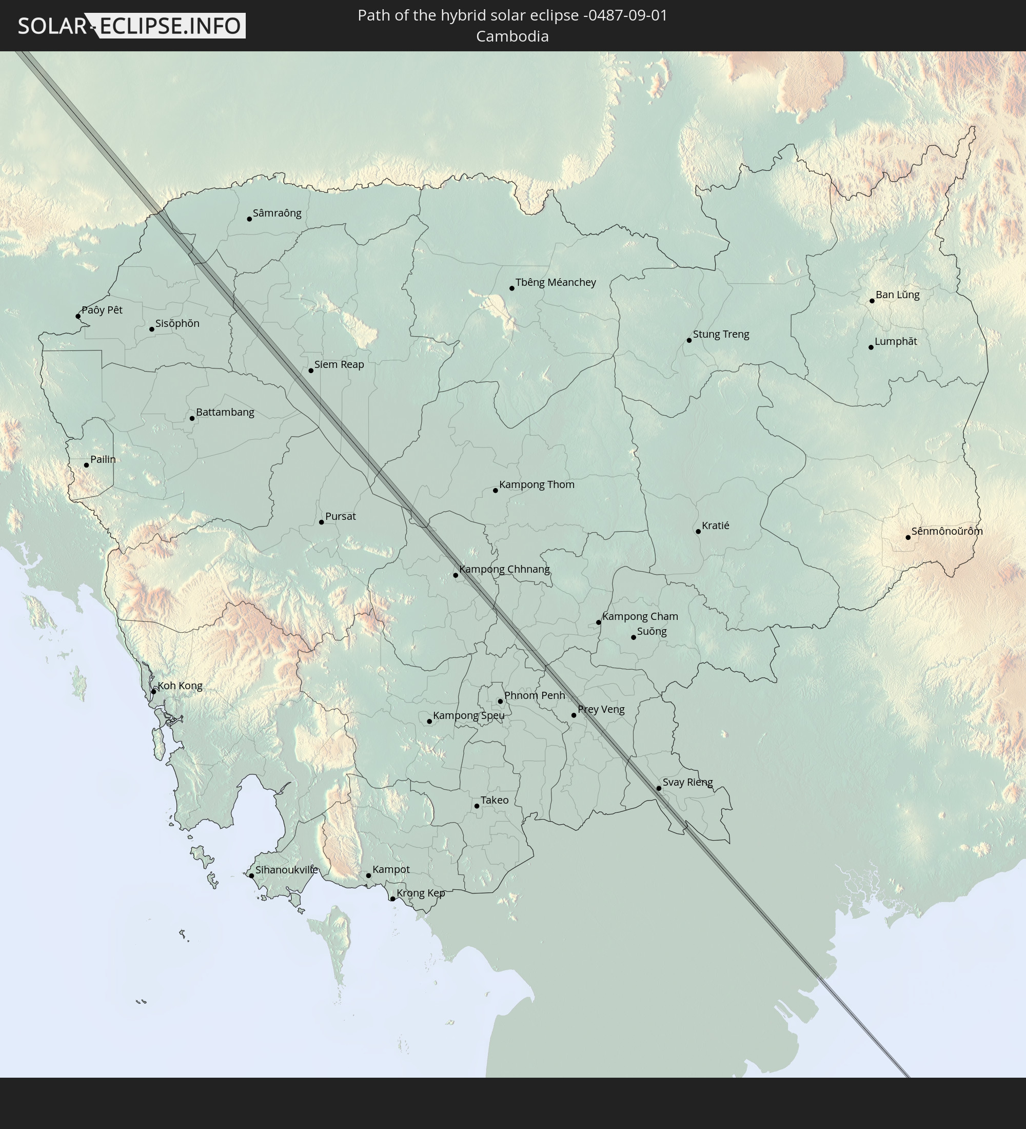 Cambodia
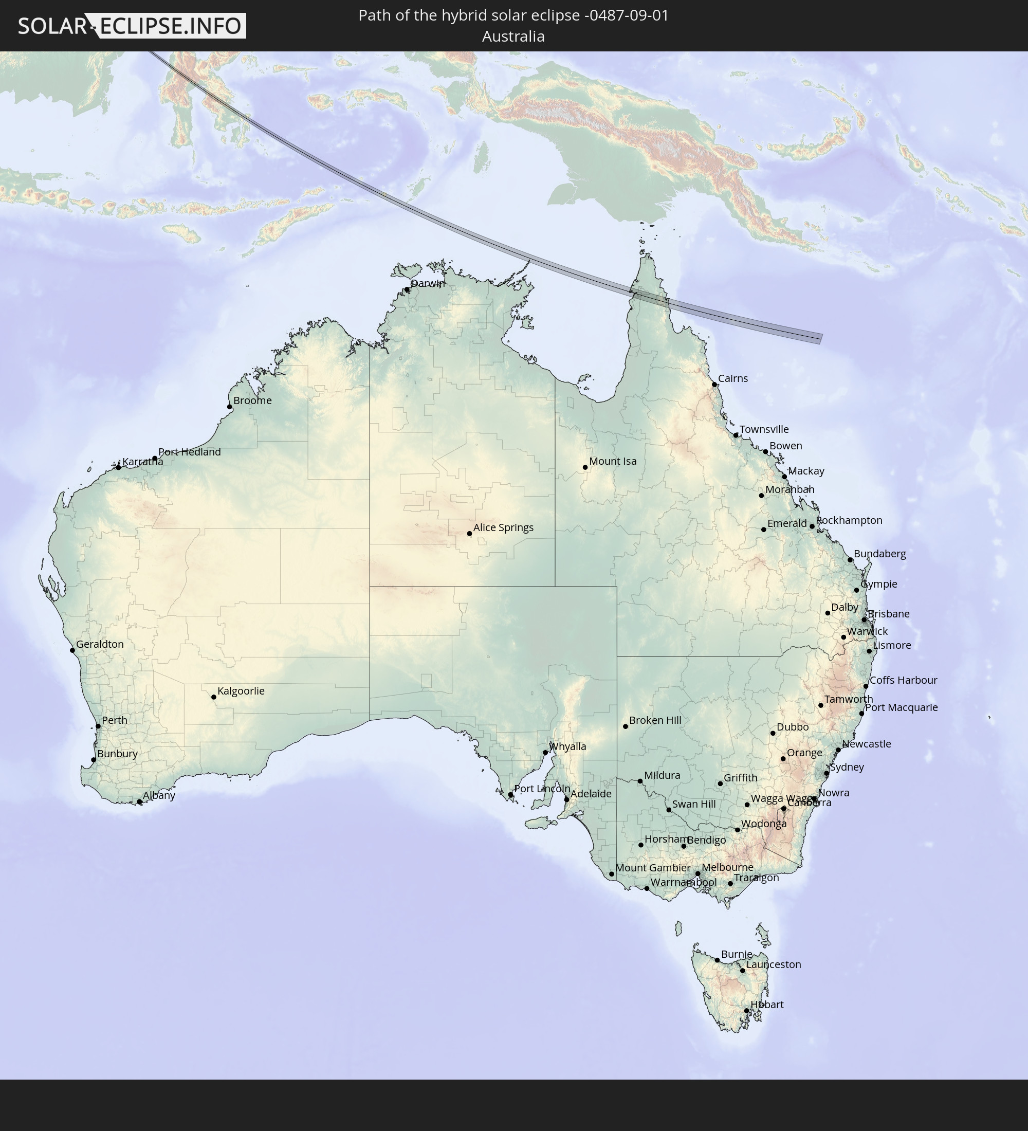 Australia
In den folgenden Ländern ist die Sonnenfinsternis partiell zu sehen
 Russia
 Svalbard and Jan Mayen
 Norway
 Germany
 Italy
Italy
 Denmark
 Libya
Libya
 Austria
 Sweden
 Czechia
 Slovenia
 Croatia
 Poland
 Bosnia and Herzegovina
 Hungary
 Slovakia
 Montenegro
 Serbia
 Albania
 Åland Islands
 Greece
 Romania
 Republic of Macedonia
 Finland
 Lithuania
 Latvia
 Estonia
 Sudan
Sudan
 Ukraine
 Bulgaria
 Belarus
 Egypt
Egypt
 Turkey
 Moldova
 Cyprus
 Ethiopia
 State of Palestine
 Israel
 Saudi Arabia
 Jordan
 Lebanon
 Syria
Syria
 Eritrea
 Iraq
Iraq
 Georgia
 Somalia
 Djibouti
 Yemen
Yemen
 Armenia
 Iran
Iran
 Azerbaijan
 Kazakhstan
 Kuwait
 Bahrain
 Qatar
Qatar
 United Arab Emirates
 Oman
Oman
 Turkmenistan
 Uzbekistan
 Afghanistan
 Pakistan
 Tajikistan
 India
India
 Kyrgyzstan
 Maldives
 China
China
 Sri Lanka
 Nepal
Nepal
 Mongolia
 Bangladesh
 Bhutan
 Myanmar
 Indonesia
 Cocos Islands
 Thailand
 Malaysia
 Laos
Laos
 Vietnam
 Cambodia
 Singapore
 Christmas Island
 Australia
 Macau
Macau
 Hong Kong
 Brunei
 Taiwan
 Philippines
 Japan
Japan
 East Timor
 North Korea
 South Korea
 Palau
Palau
 Federated States of Micronesia
 Papua New Guinea
 Guam
Guam
 Northern Mariana Islands
 Marshall Islands
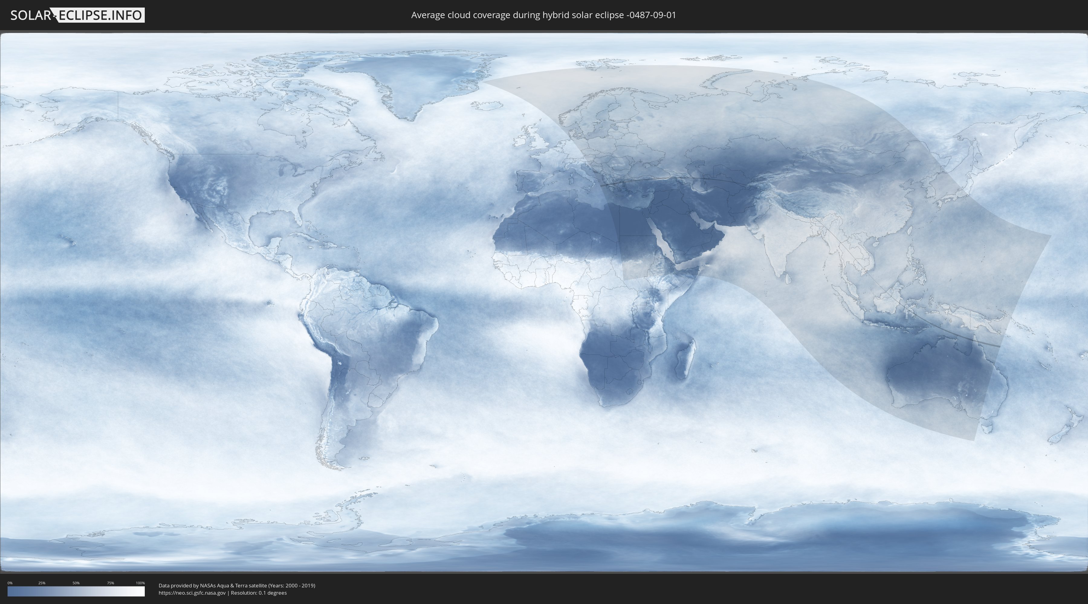
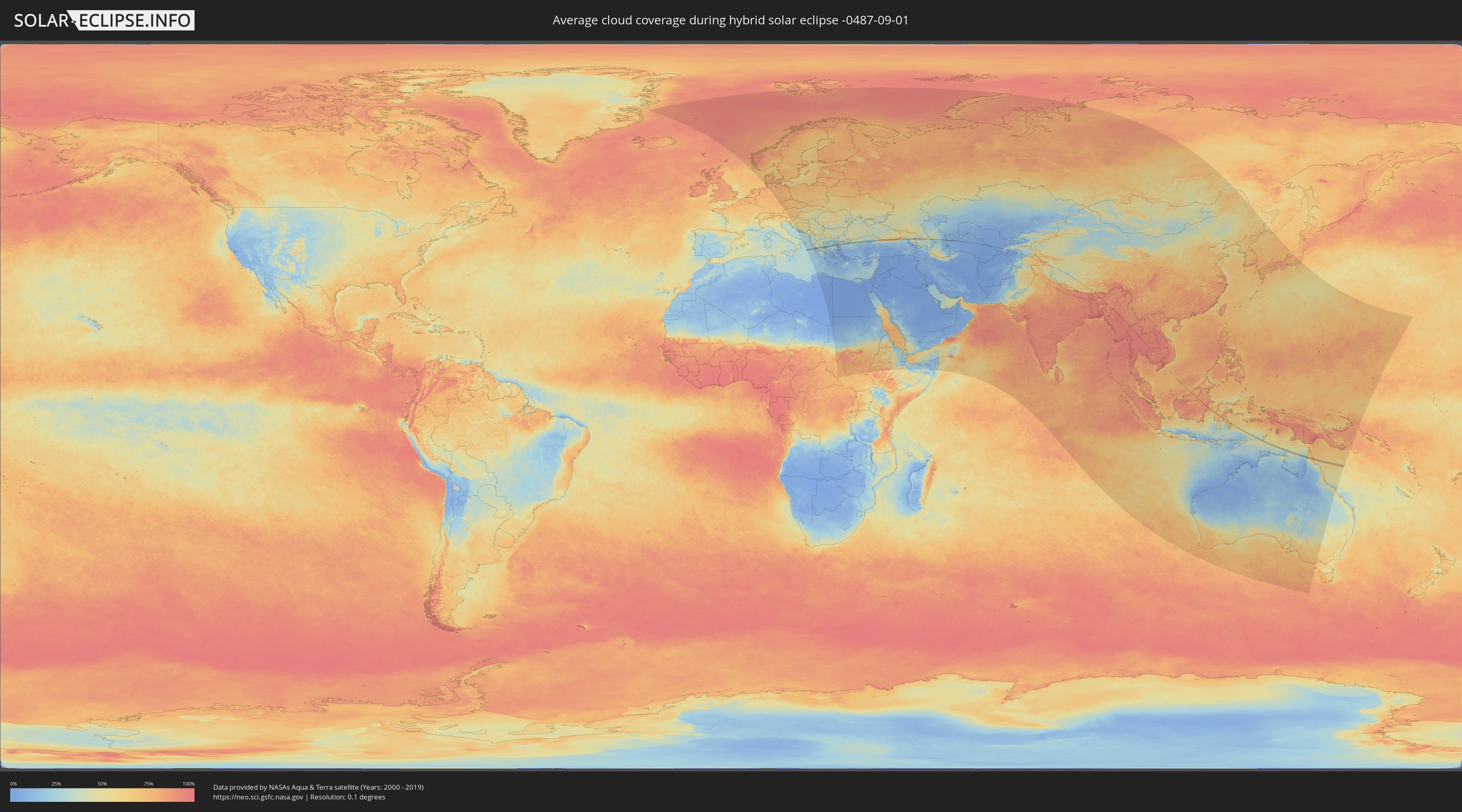
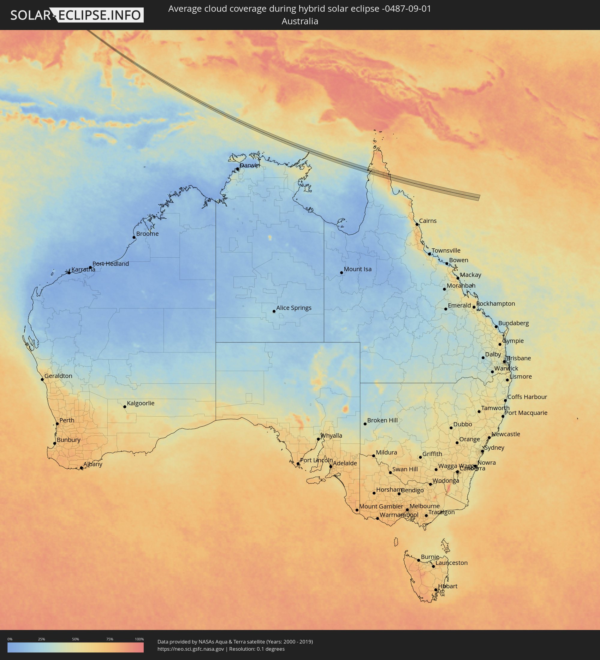
How will be the weather during the hybrid solar eclipse on 09/01/-0487?
Where is the best place to see the hybrid solar eclipse of 09/01/-0487?
The following maps show the average cloud coverage for the day of the hybrid solar eclipse.
With the help of these maps, it is possible to find the place along the eclipse path, which has the best
chance of a cloudless sky.
Nevertheless, you should consider local circumstances and inform about the weather of your chosen
observation site.
The data is provided by NASAs satellites
AQUA and TERRA.
The cloud maps are averaged over a period of 19 years (2000 - 2019).
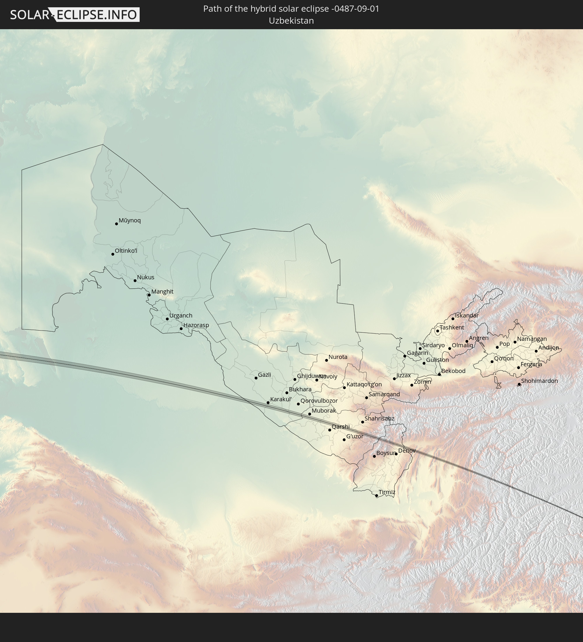
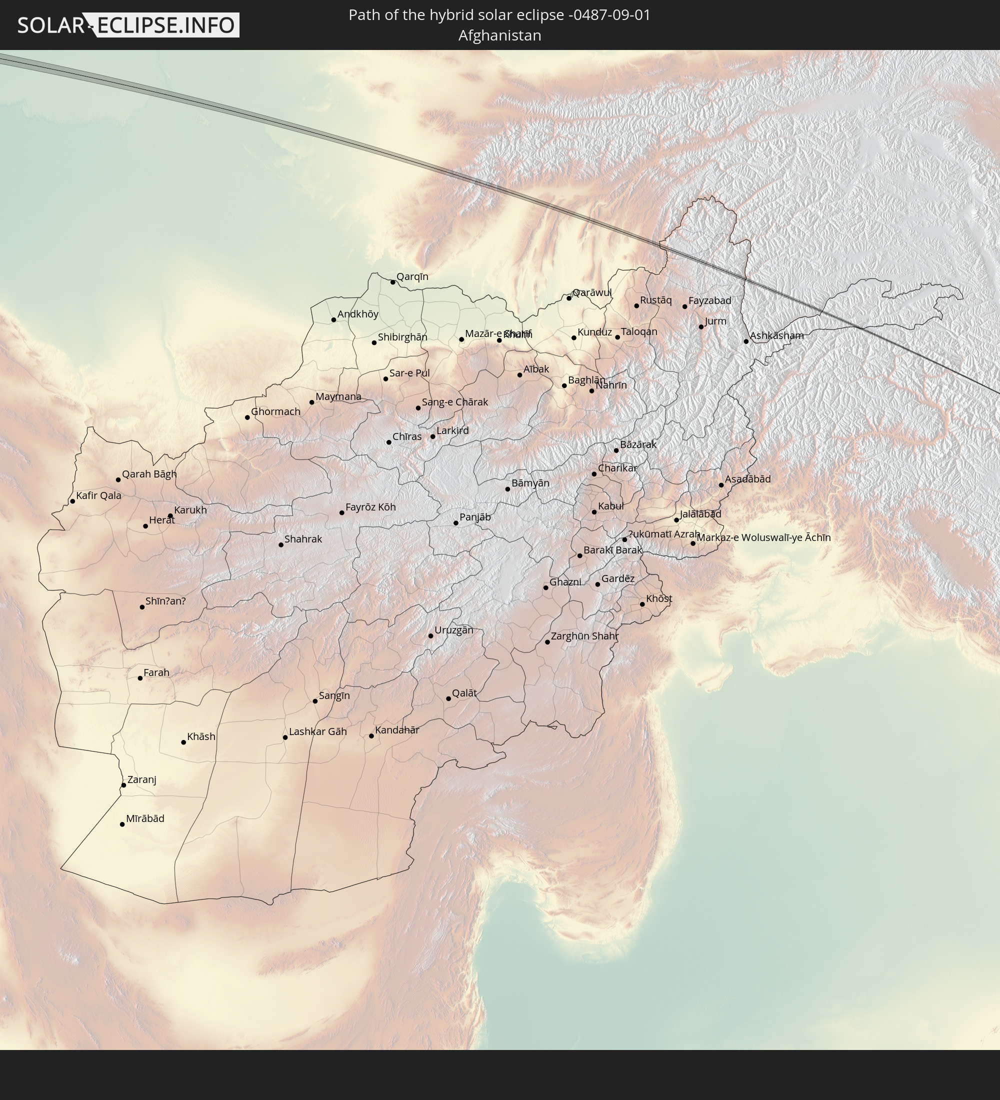
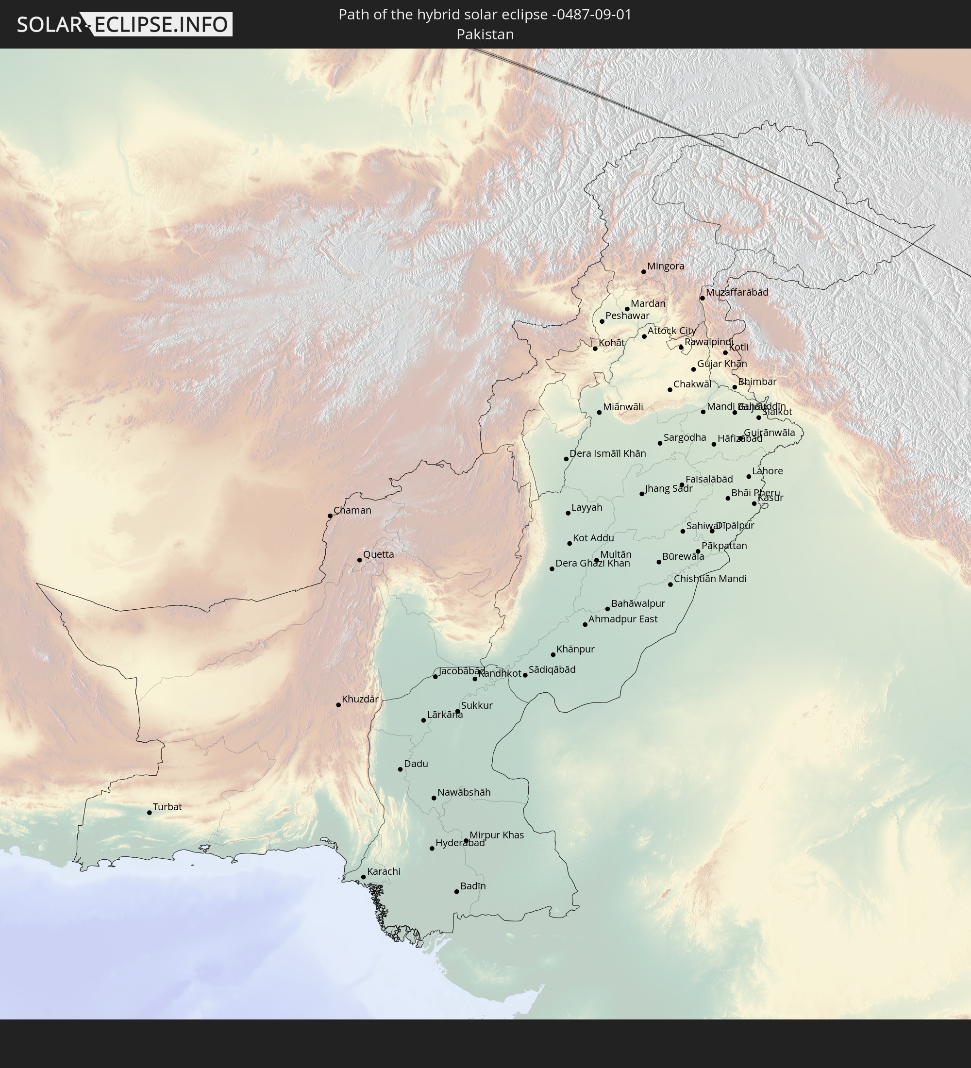
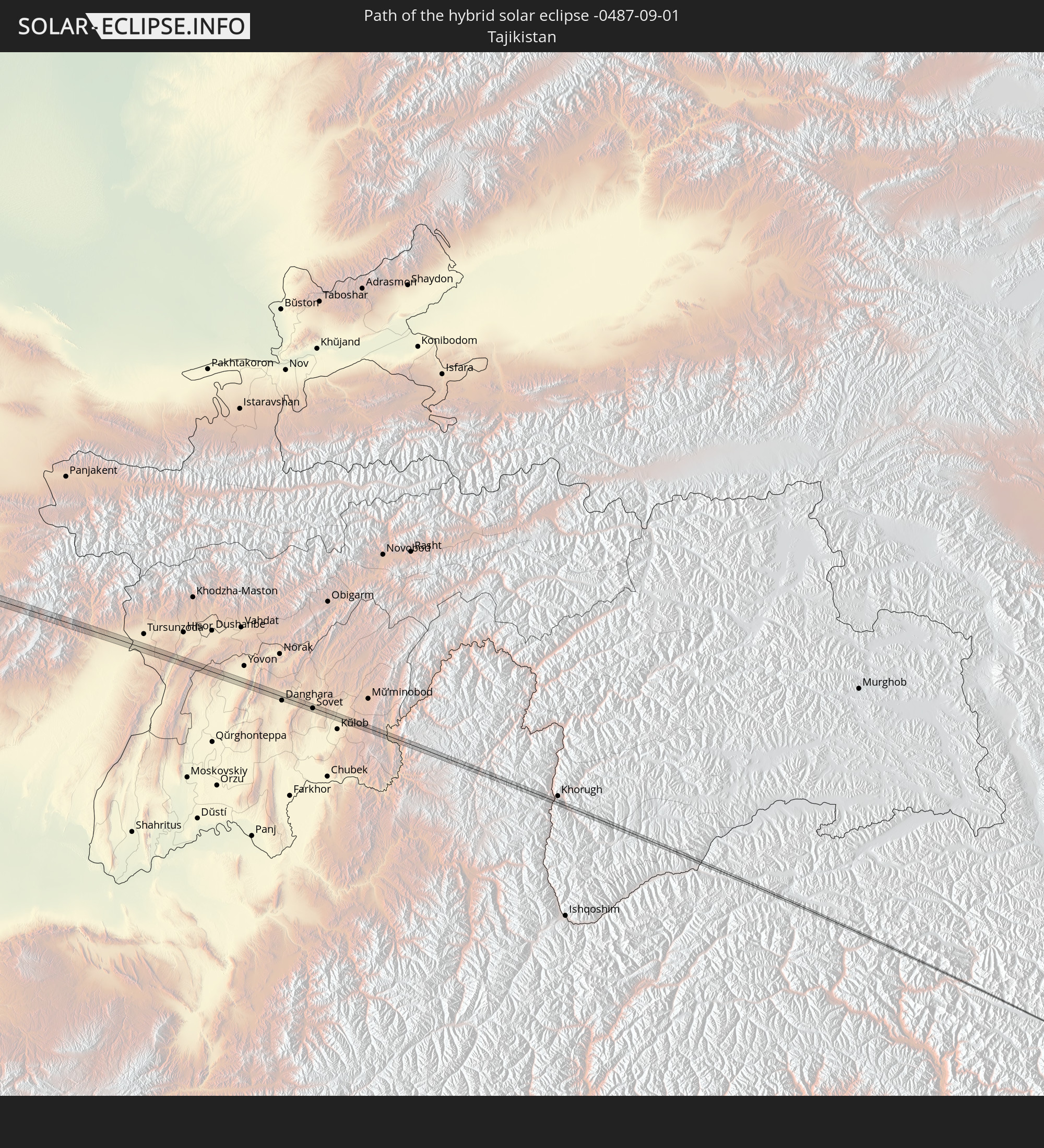
Detailed country maps
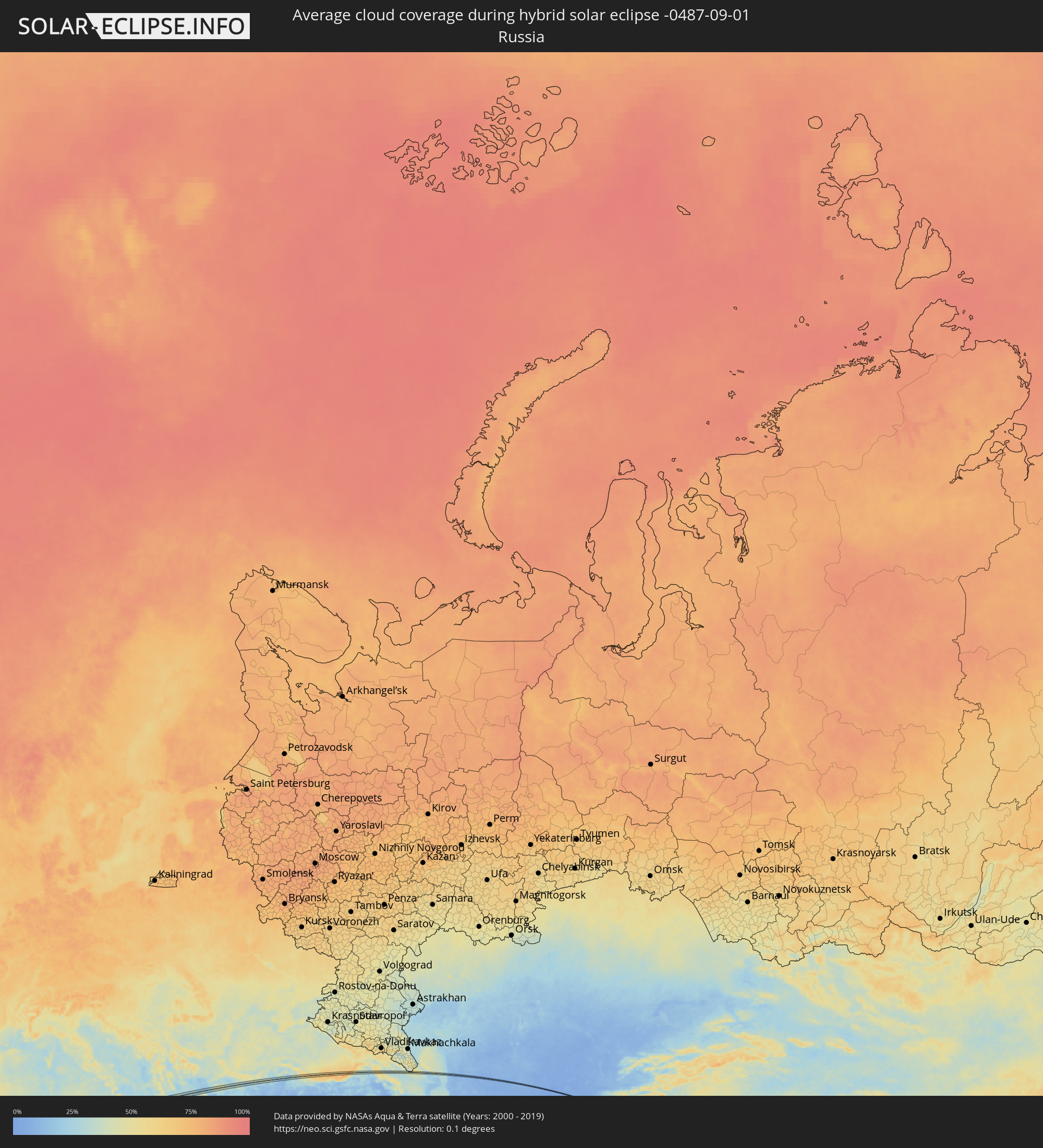 Russia
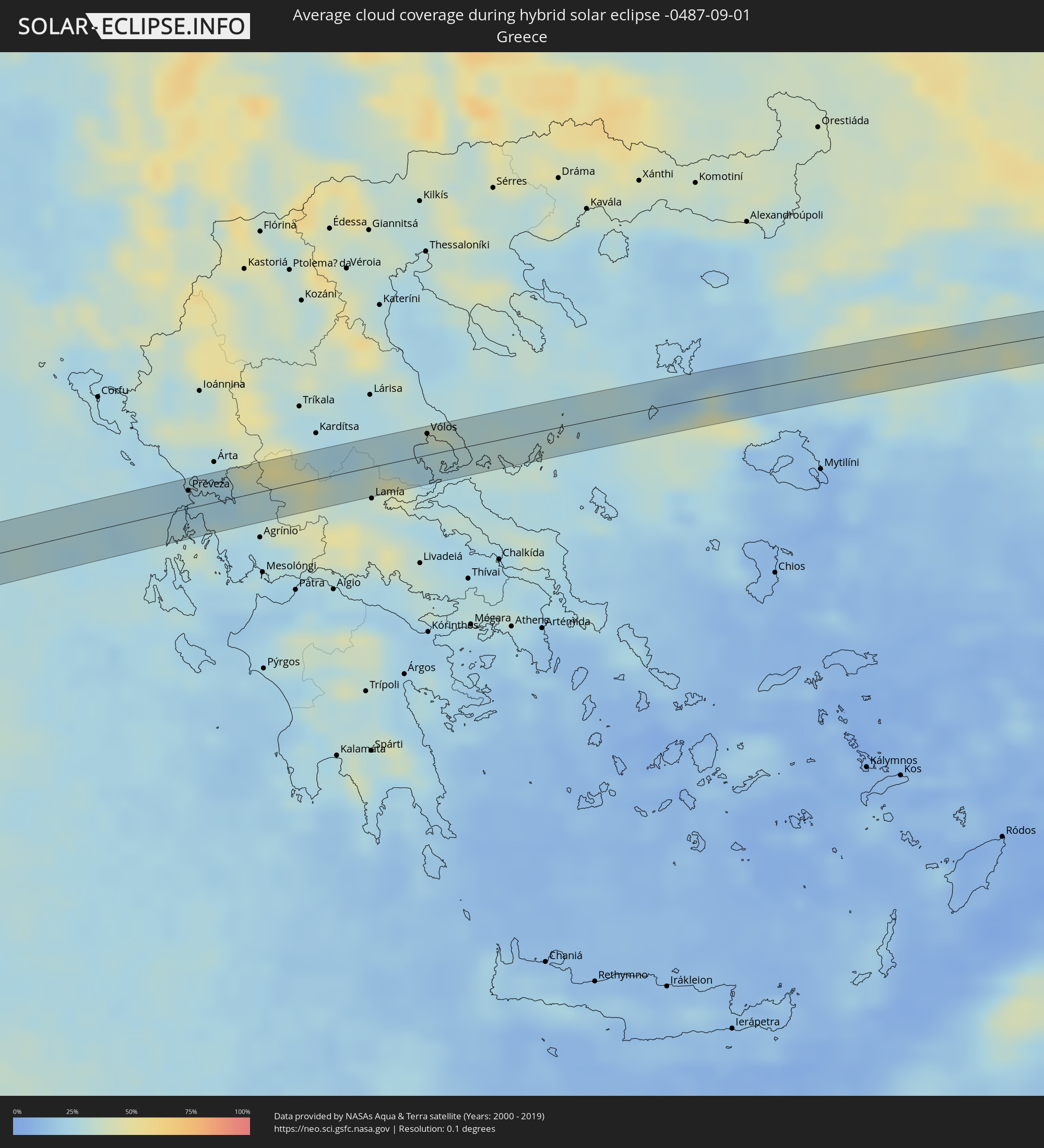 Greece
 Turkey
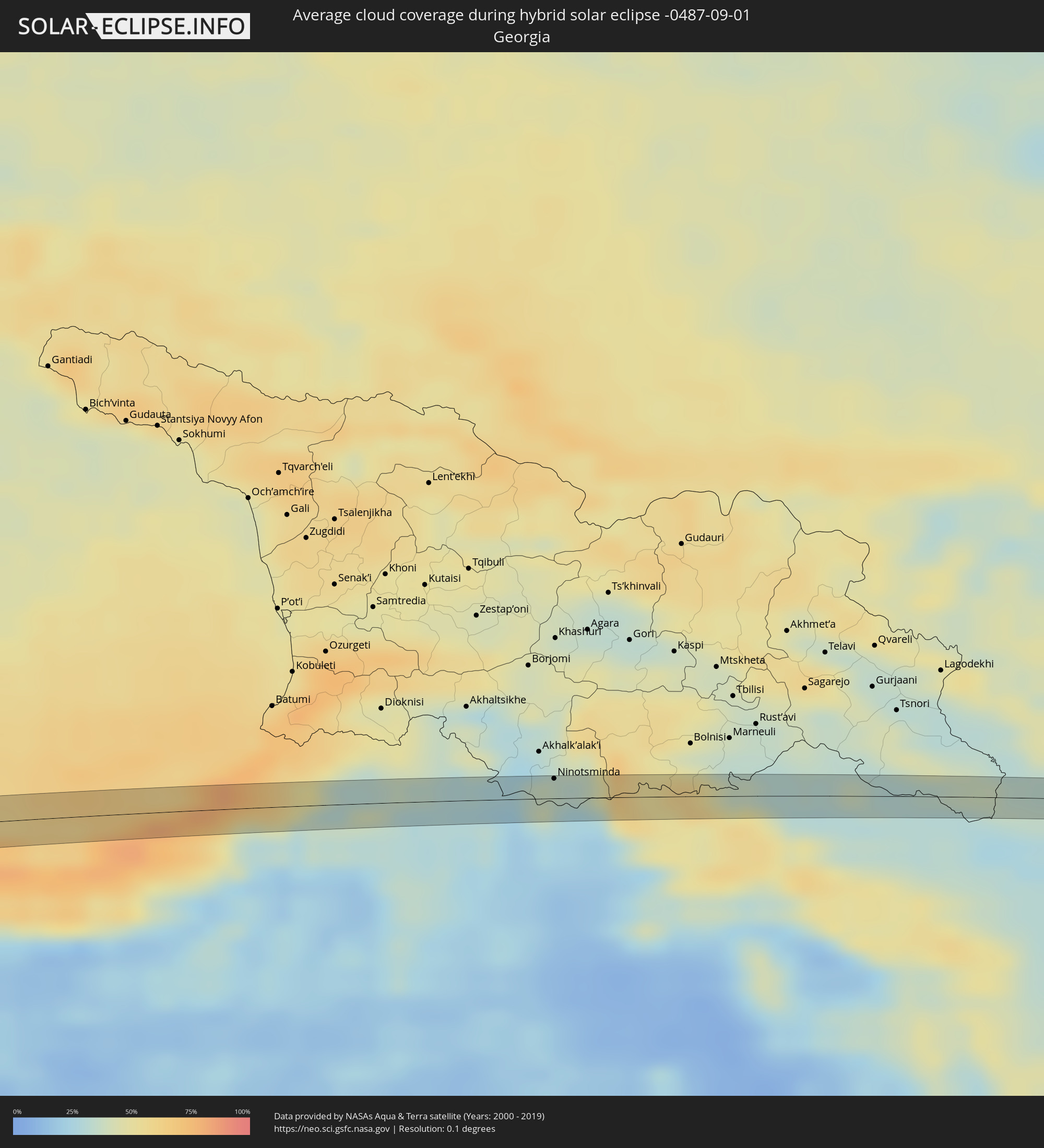 Georgia
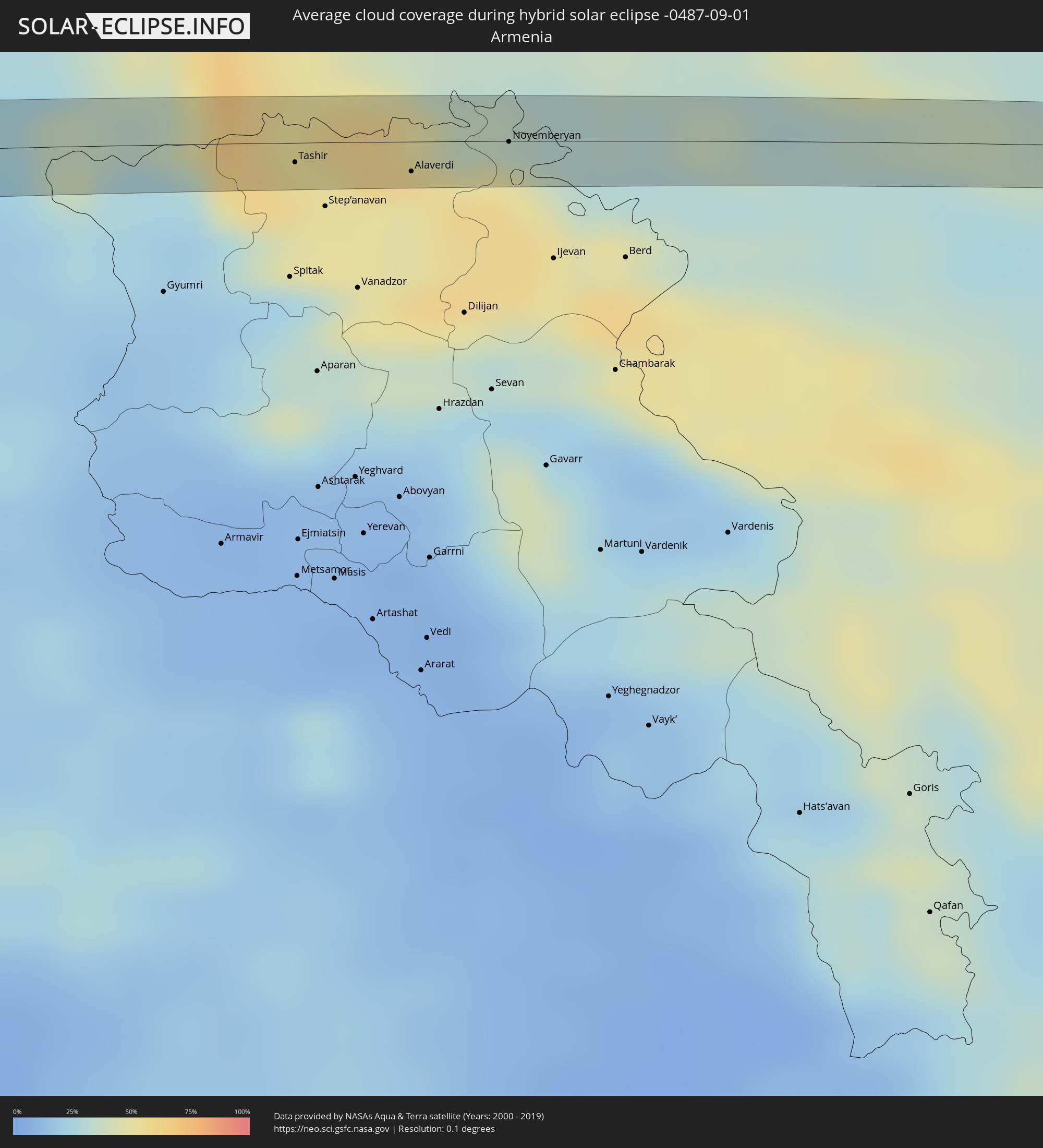 Armenia
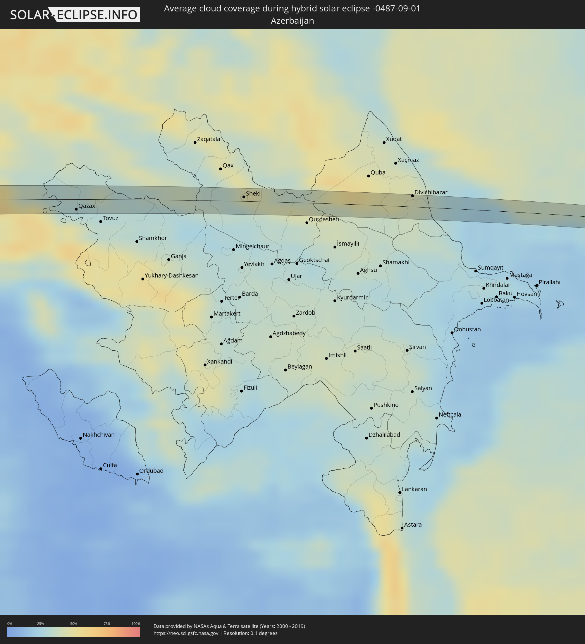 Azerbaijan
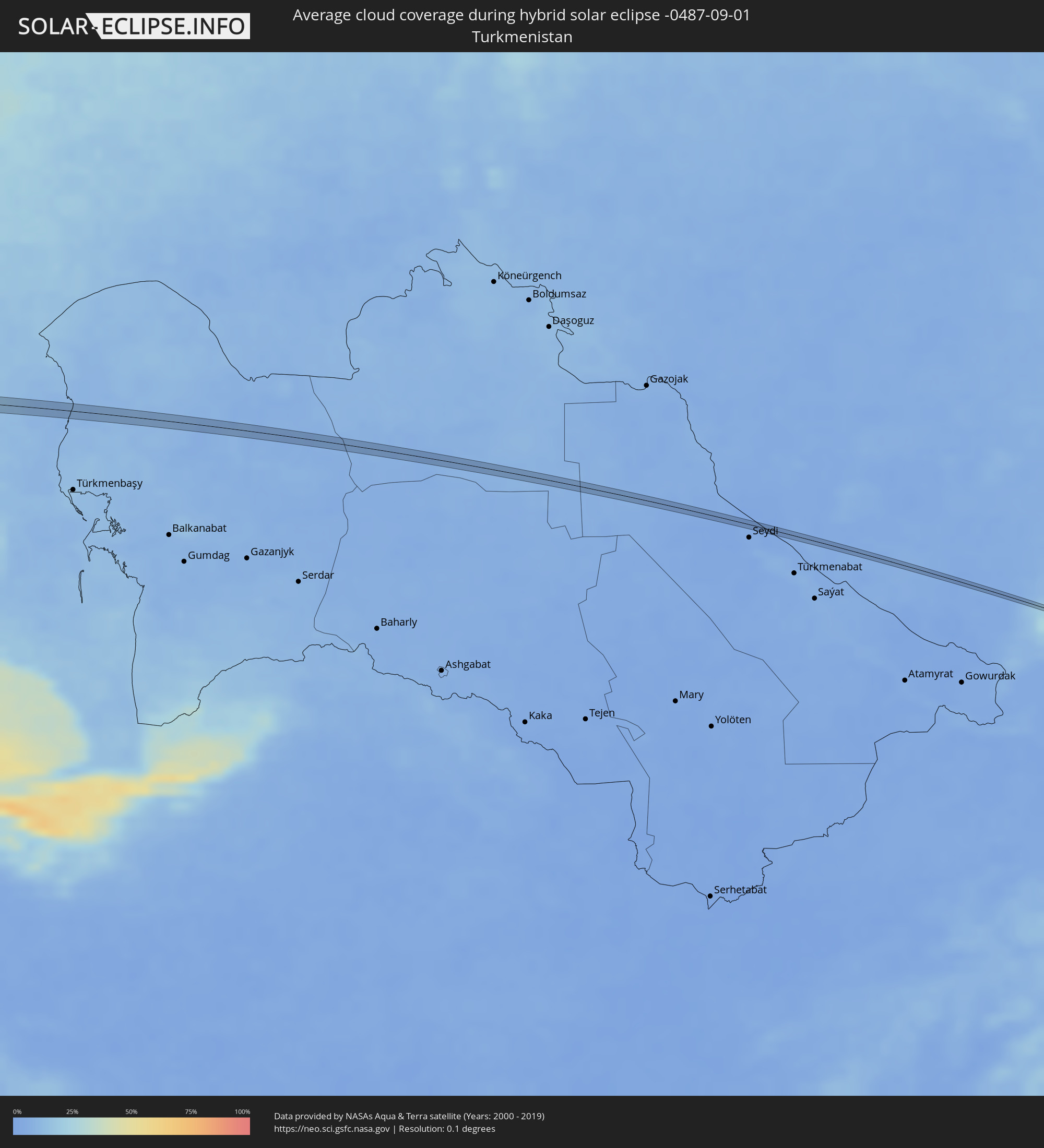 Turkmenistan
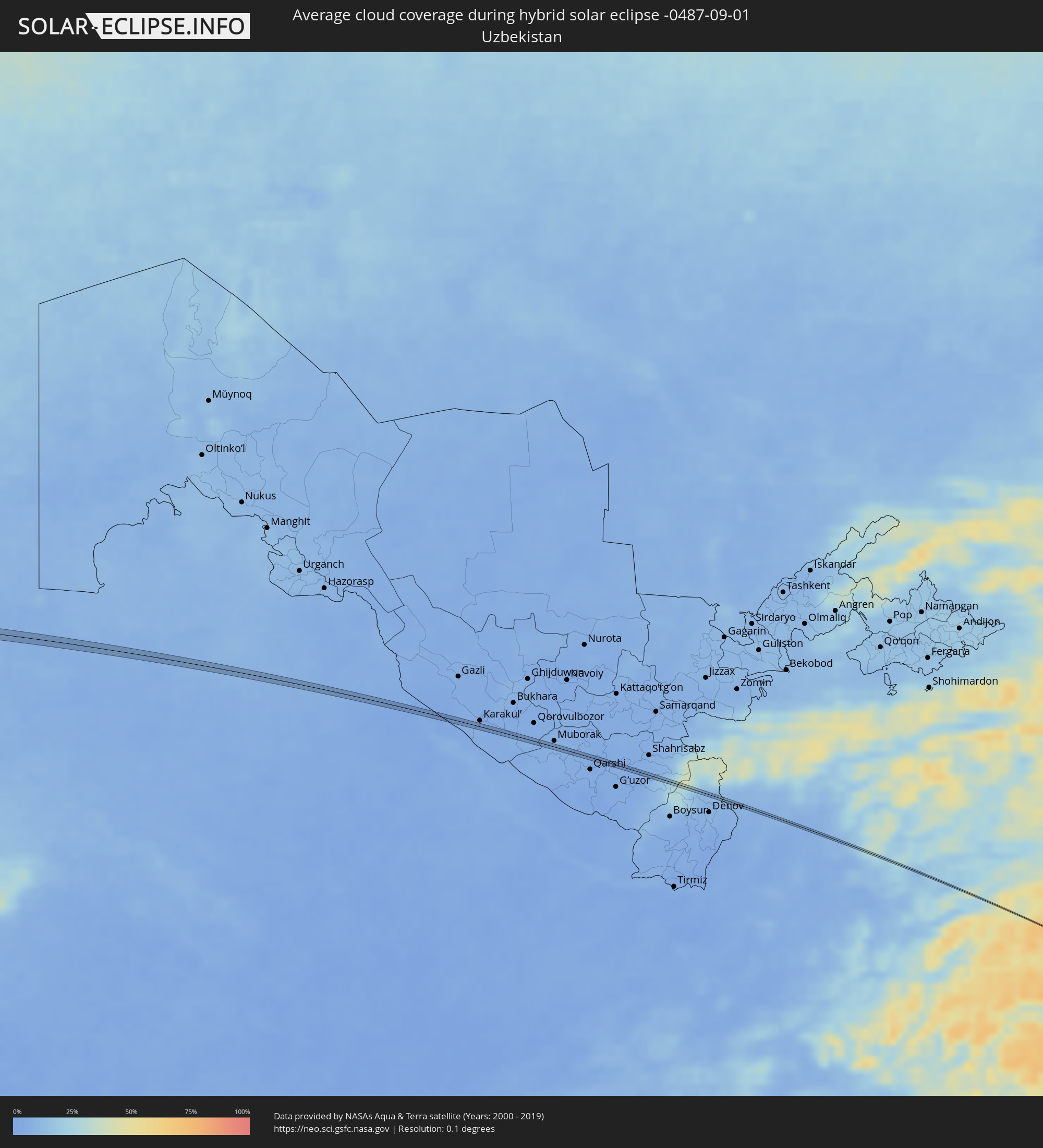 Uzbekistan
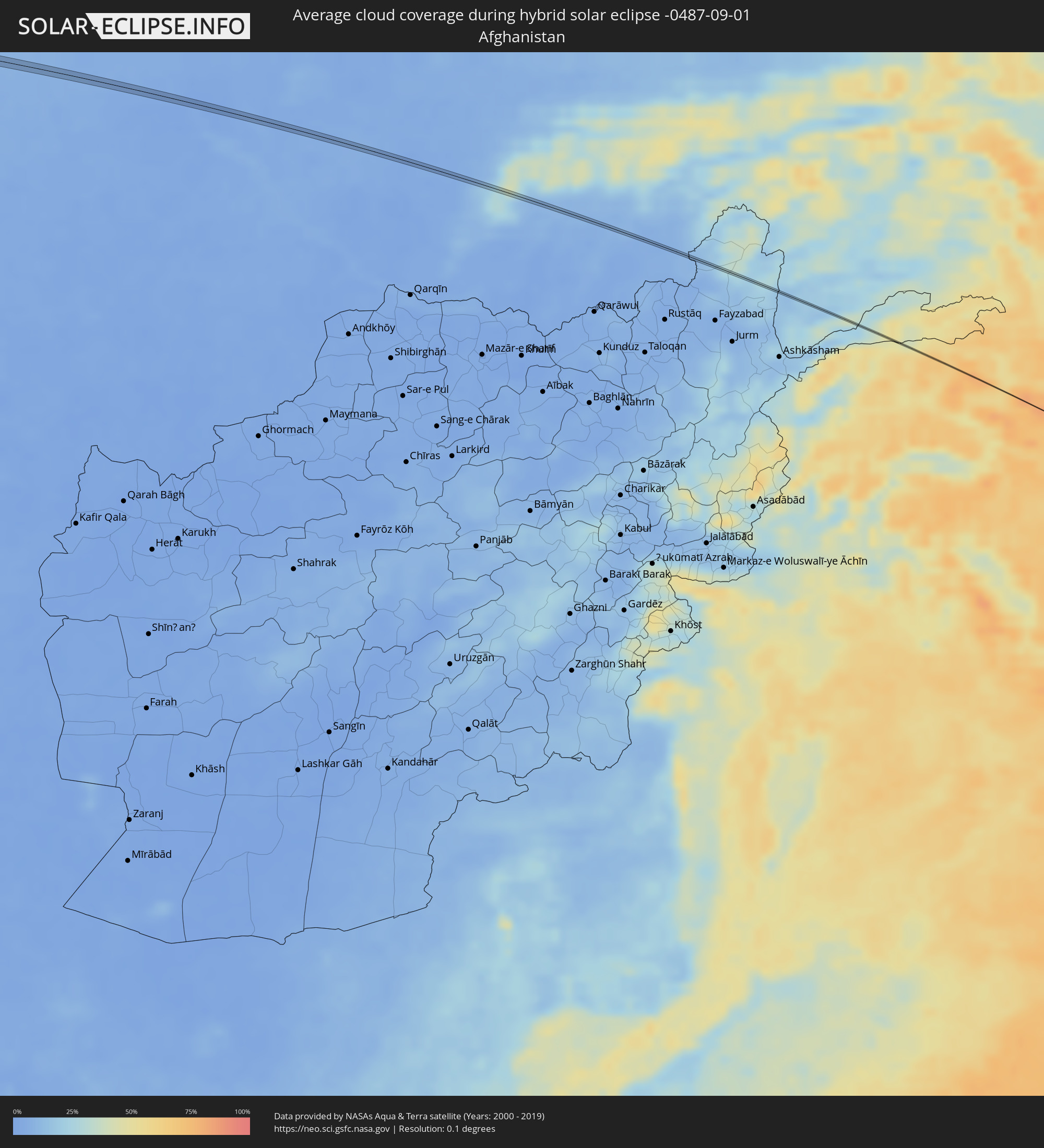 Afghanistan
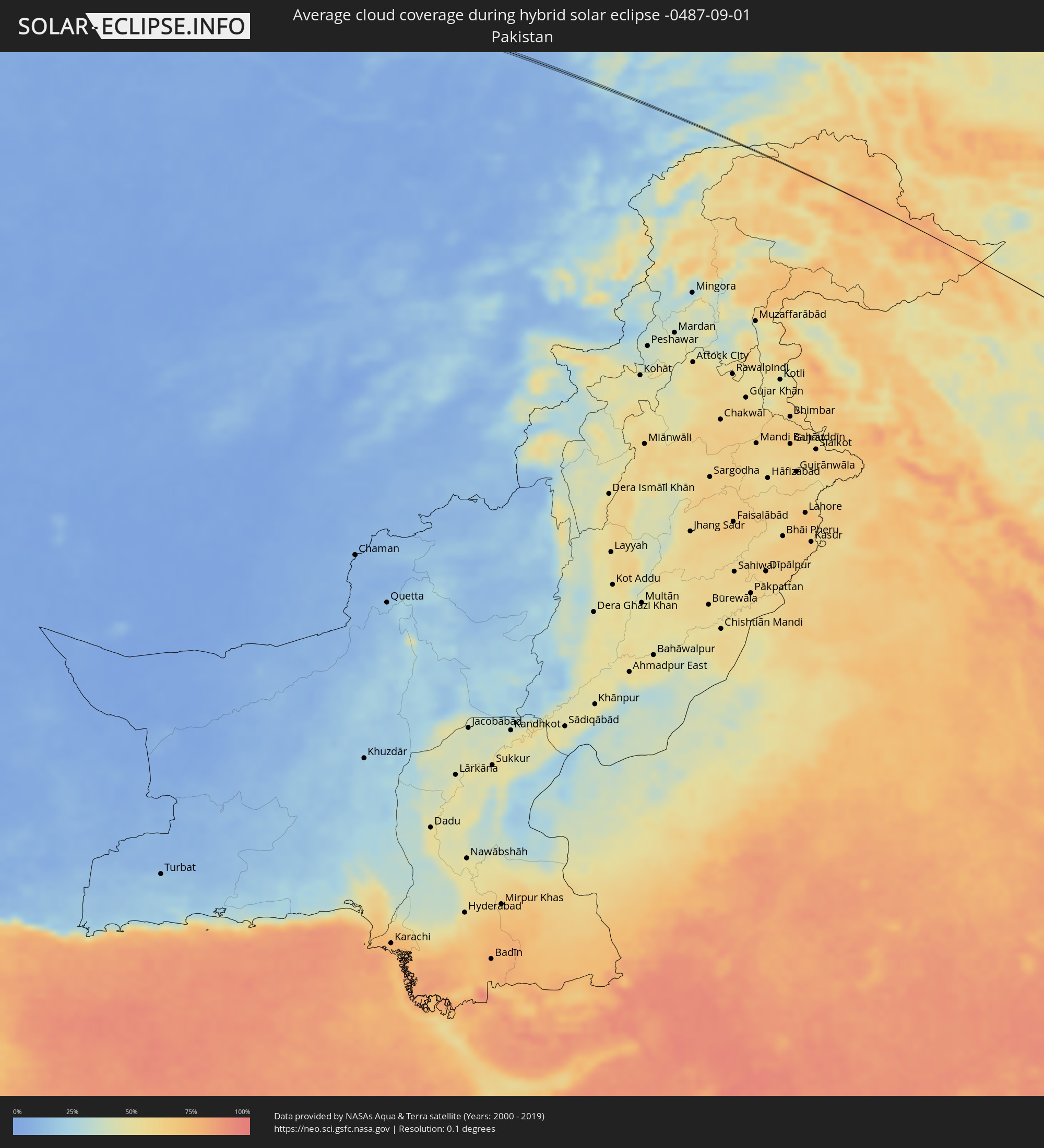 Pakistan
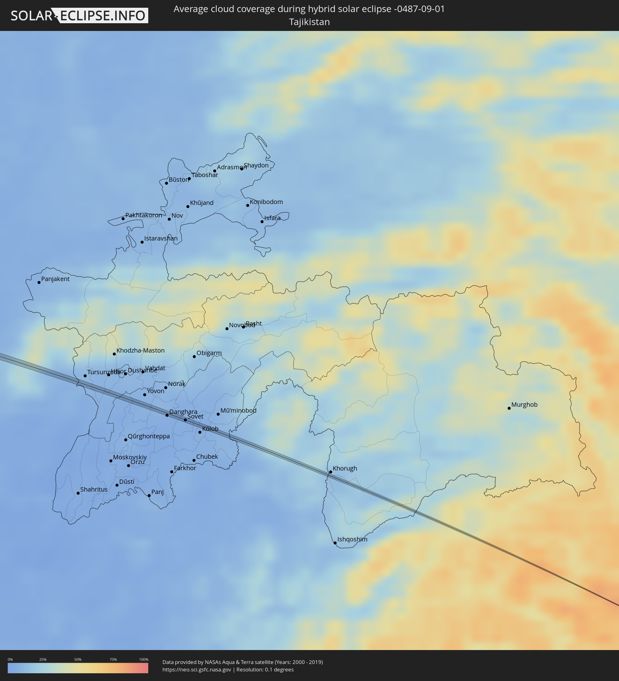 Tajikistan
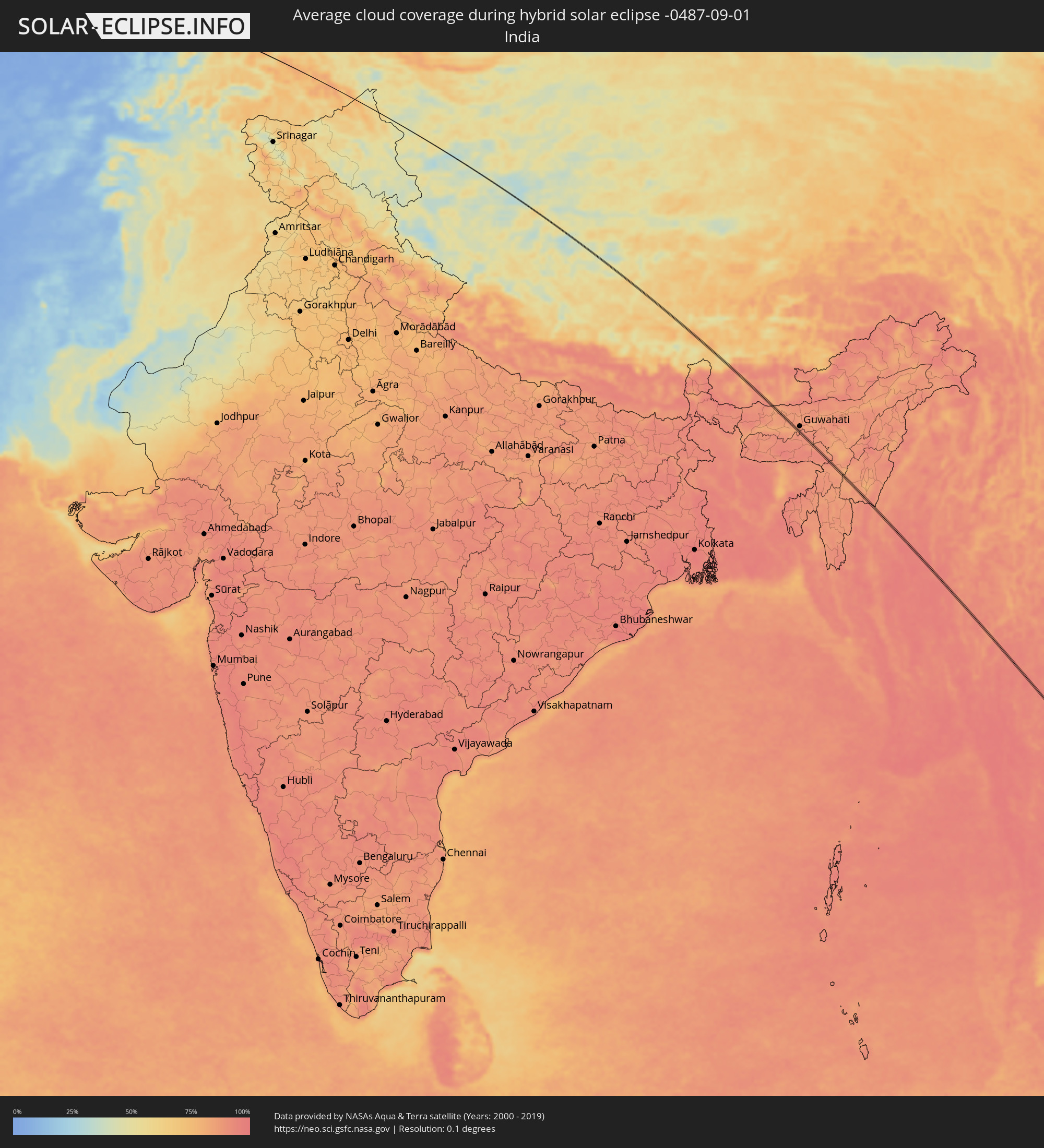 India
India
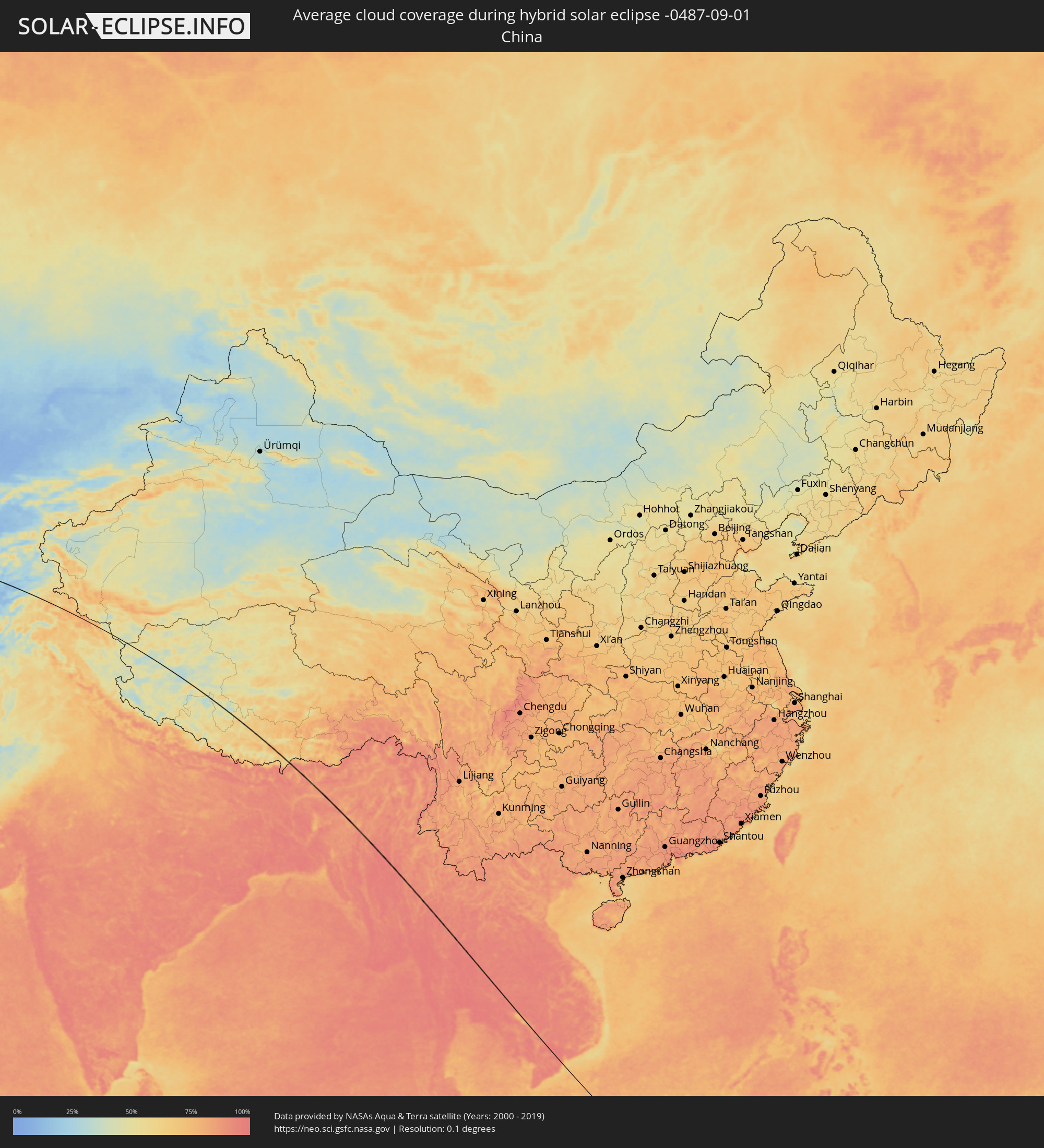 China
China
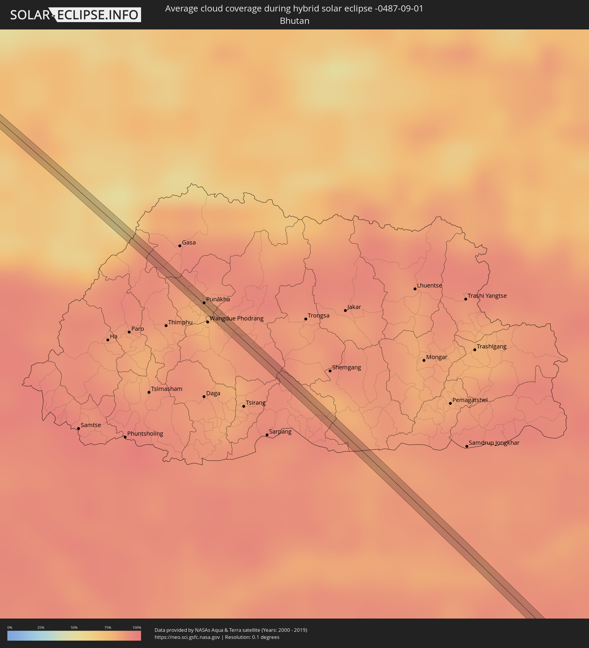 Bhutan
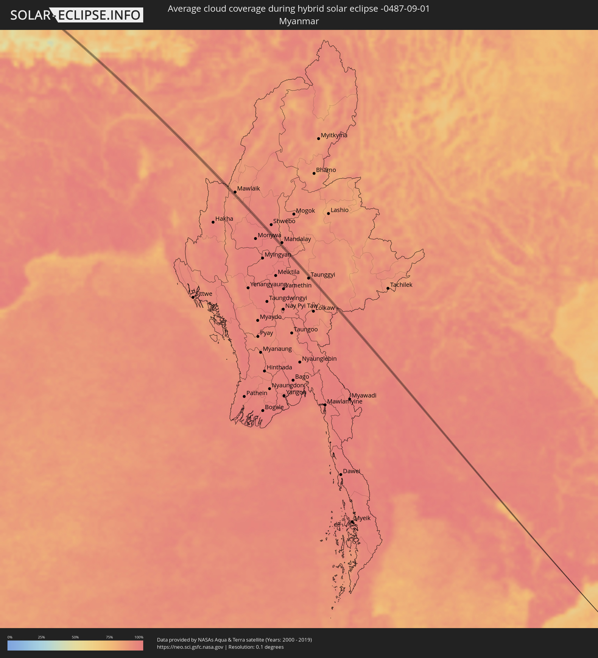 Myanmar
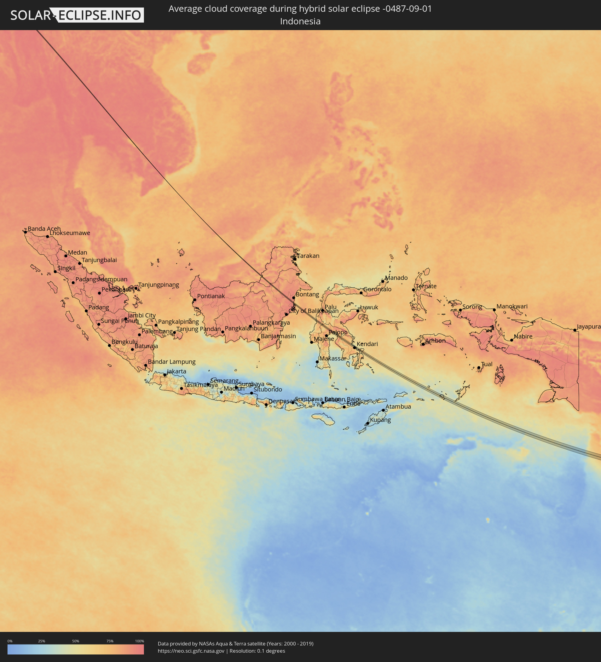 Indonesia
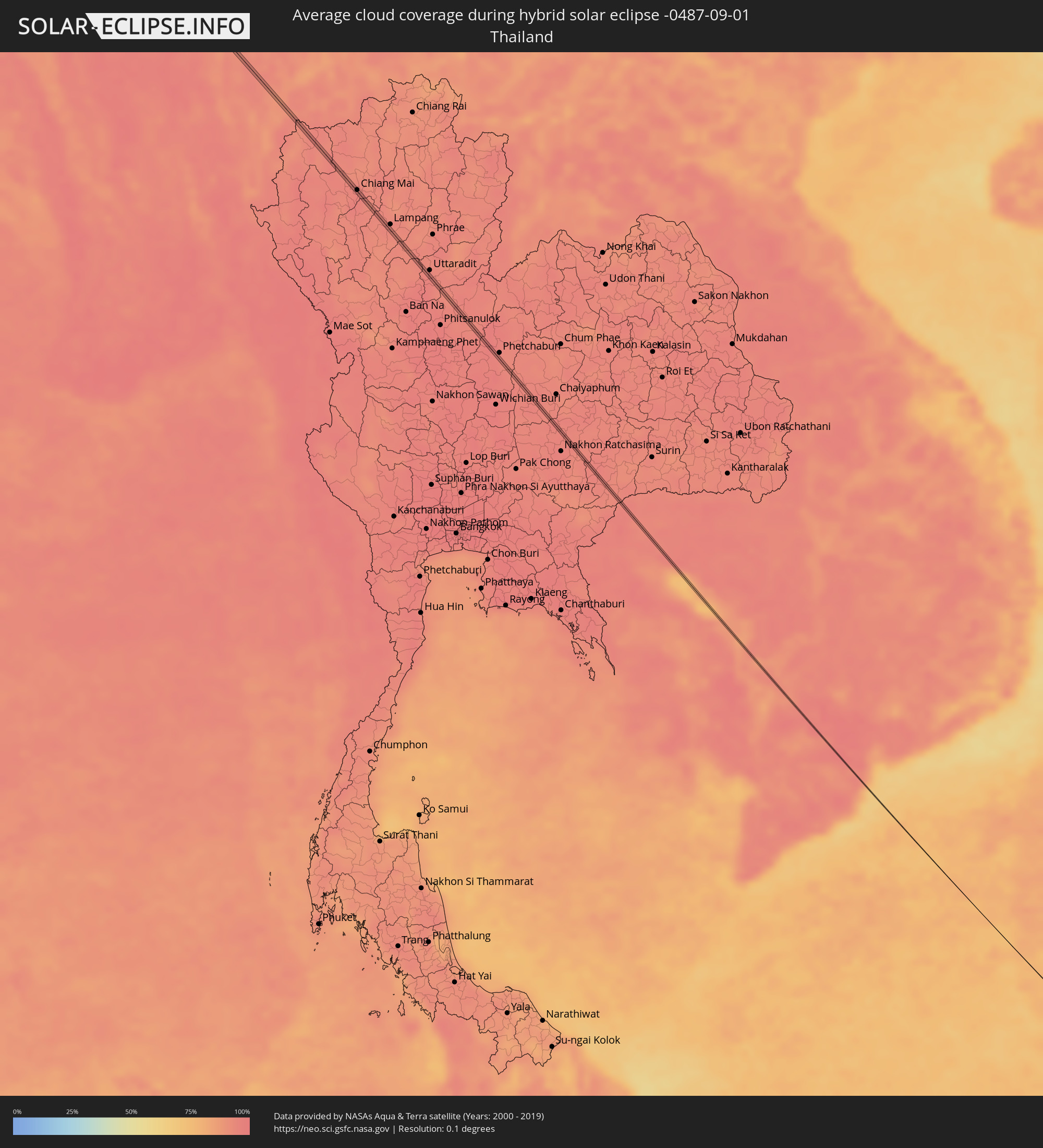 Thailand
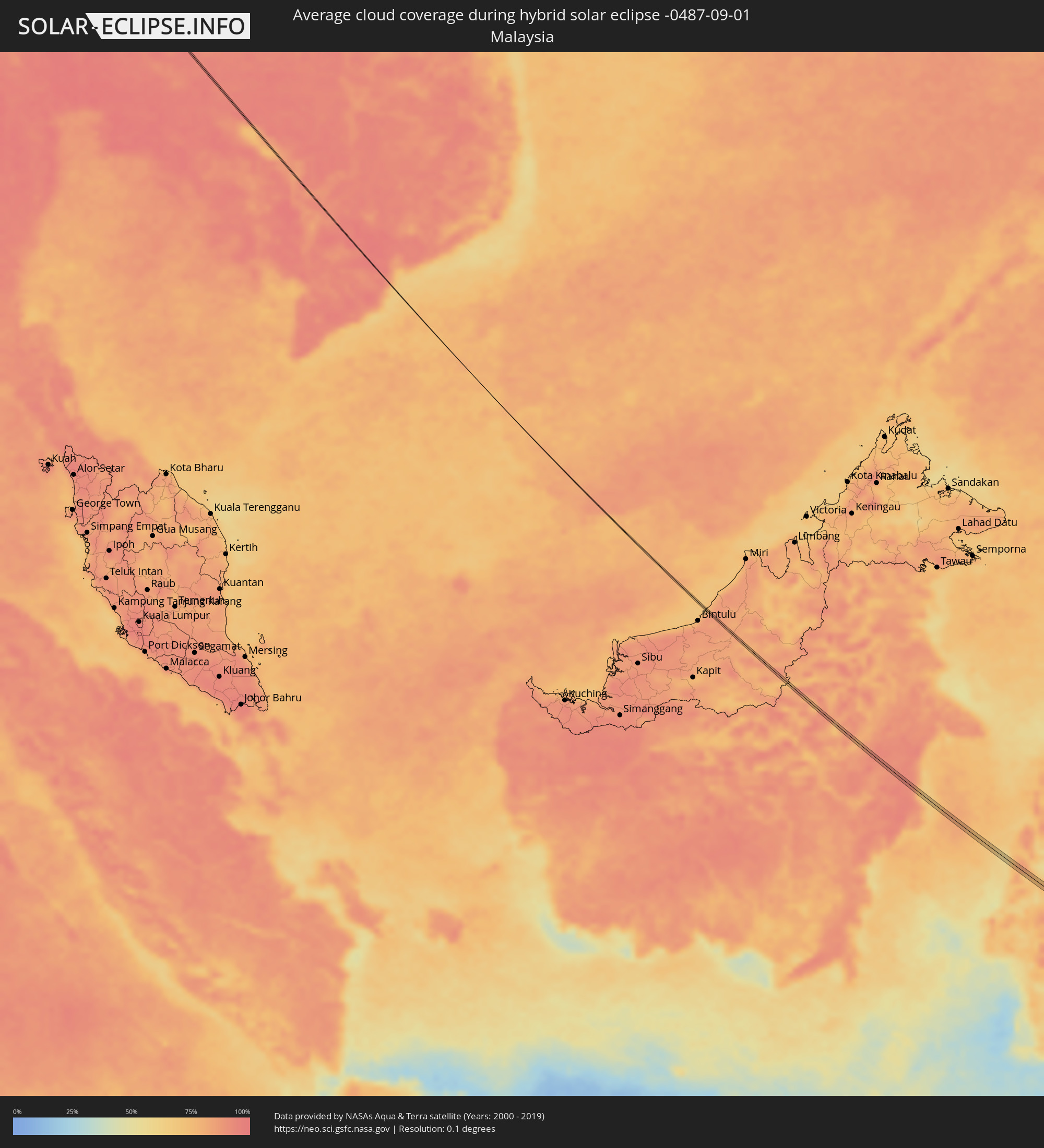 Malaysia
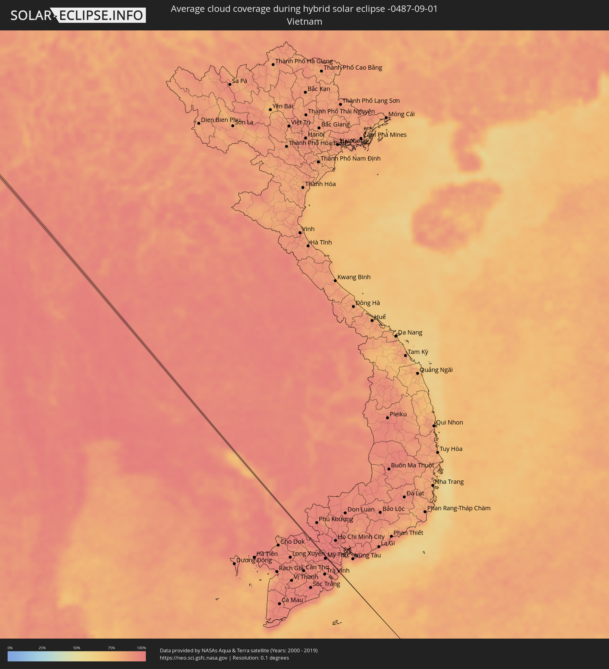 Vietnam
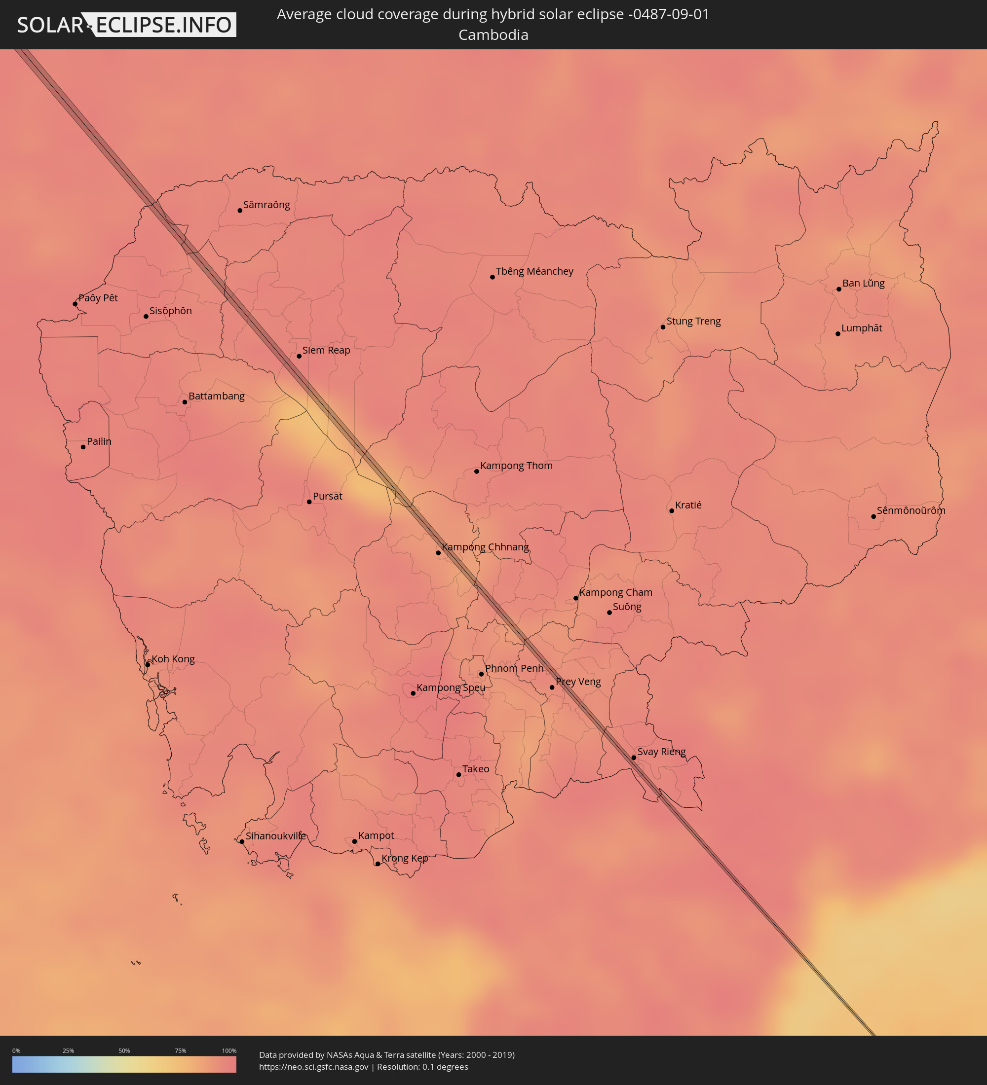 Cambodia
 Australia
Cities inside the path of the eclipse
The following table shows all locations with a population of more than 5,000 inside the eclipse path. Cities which have more than 100,000 inhabitants are marked bold. A click at the locations opens a detailed map.
| City | Type | Eclipse duration | Local time of max. eclipse | Distance to central line | Ø Cloud coverage |
|
Lefkáda, Ionian Islands
|
annular | - | 05:46:21 UTC+01:34 | 1 km | 27% |
|
Préveza, Epirus
|
annular | - | 05:46:25 UTC+01:34 | 14 km | 22% |
|
Karpenísi, Central Greece
|
annular | - | 05:46:21 UTC+01:34 | 11 km | 40% |
|
Fársala, Thessaly
|
annular | - | 05:46:33 UTC+01:34 | 19 km | 28% |
|
Almyrós, Thessaly
|
annular | - | 05:46:29 UTC+01:34 | 0 km | 26% |
|
Néa Anchiálos, Thessaly
|
annular | - | 05:46:33 UTC+01:34 | 10 km | 26% |
|
Néa Ionía, Thessaly
|
annular | - | 05:46:36 UTC+01:34 | 19 km | 29% |
|
Vólos, Thessaly
|
annular | - | 05:46:35 UTC+01:34 | 16 km | 29% |
|
Agriá, Thessaly
|
annular | - | 05:46:35 UTC+01:34 | 13 km | 28% |
|
Skiáthos, Thessaly
|
annular | - | 05:46:29 UTC+01:34 | 15 km | 33% |
|
Gönen, Balıkesir
|
annular | - | 06:09:23 UTC+01:56 | 20 km | 42% |
|
Mustafakemalpaşa, Bursa
|
annular | - | 06:09:27 UTC+01:56 | 2 km | 39% |
|
Bursa, Bursa
|
annular | - | 06:09:38 UTC+01:56 | 10 km | 35% |
|
İnegol, Bursa
|
annular | - | 06:09:39 UTC+01:56 | 9 km | 34% |
|
Bilecik, Bilecik
|
annular | - | 06:09:46 UTC+01:56 | 9 km | 27% |
|
Khanjarah, Çankırı
|
annular | - | 06:10:54 UTC+01:56 | 1 km | 19% |
|
Merzifon, Amasya
|
annular | - | 06:11:39 UTC+01:56 | 12 km | 27% |
|
Suluova, Amasya
|
annular | - | 06:11:41 UTC+01:56 | 5 km | 26% |
|
Amasya, Amasya
|
annular | - | 06:11:39 UTC+01:56 | 16 km | 29% |
|
Kumru, Ordu
|
annular | - | 06:12:19 UTC+01:56 | 3 km | 66% |
|
Fatsa, Ordu
|
annular | - | 06:12:29 UTC+01:56 | 12 km | 58% |
|
Ordu, Ordu
|
annular | - | 06:12:37 UTC+01:56 | 4 km | 57% |
|
Giresun, Giresun
|
annular | - | 06:12:48 UTC+01:56 | 6 km | 68% |
|
Görele, Giresun
|
annular | - | 06:13:08 UTC+01:56 | 3 km | 74% |
|
Vakfıkebir, Trabzon
|
annular | - | 06:13:16 UTC+01:56 | 3 km | 76% |
|
Trabzon, Trabzon
|
annular | - | 06:13:27 UTC+01:56 | 4 km | 70% |
|
Of, Trabzon
|
annular | - | 06:13:40 UTC+01:56 | 14 km | 76% |
|
Rize, Rize
|
annular | - | 06:13:51 UTC+01:56 | 6 km | 78% |
|
Ardeşen, Rize
|
annular | - | 06:14:10 UTC+01:56 | 11 km | 75% |
|
Ninotsminda, Samtskhe-Javakheti
|
annular | - | 07:17:53 UTC+02:59 | 11 km | 35% |
|
Tashir, Lori Province
|
annular | - | 07:17:03 UTC+02:58 | 5 km | 52% |
|
Alaverdi, Lori Province
|
annular | - | 07:17:17 UTC+02:58 | 8 km | 52% |
|
Noyemberyan, Tavush Province
|
annular | - | 07:17:31 UTC+02:58 | 0 km | 45% |
|
Qazax, Qazax
|
annular | - | 07:39:07 UTC+03:19 | 9 km | 31% |
|
Aghstafa, Ağstafa
|
annular | - | 07:39:11 UTC+03:19 | 6 km | 31% |
|
Sheki, Shaki City
|
annular | - | 07:40:23 UTC+03:19 | 4 km | 34% |
|
Oğuz, Oğuz
|
annular | - | 07:40:32 UTC+03:19 | 9 km | 37% |
|
Divichibazar, Shabran
|
annular | - | 07:41:43 UTC+03:19 | 10 km | 40% |
|
Kyzyl-Burun, Siyǝzǝn
|
annular | - | 07:41:46 UTC+03:19 | 4 km | 35% |
|
Olot, Bukhara
|
annular | - | 09:05:03 UTC+04:27 | 5 km | 4% |
|
Danghara, Khatlon
|
annular | - | 09:20:19 UTC+04:35 | 3 km | 5% |
|
Sovet, Khatlon
|
annular | - | 09:20:42 UTC+04:35 | 0 km | 5% |
|
Punākha, Punakha
|
total | - | 11:32:22 UTC+05:58 | 1 km | 77% |
|
Hājo, Assam
|
total | - | 11:00:38 UTC+05:21 | 3 km | 82% |
|
Soalkuchi, Assam
|
total | - | 11:00:52 UTC+05:21 | 1 km | 83% |
|
Nongpoh, Meghalaya
|
total | - | 11:01:58 UTC+05:21 | 1 km | 91% |
|
Chiang Mai, Chiang Mai
|
total | - | 12:51:17 UTC+06:42 | 2 km | 96% |
|
Kendari, Southeast Sulawesi
|
annular | - | 15:23:27 UTC+07:57 | 7 km | 72% |