Annular solar eclipse of 02/26/-0486
| Day of week: | Wednesday |
| Maximum duration of eclipse: | 03m48s |
| Maximum width of eclipse path: | 182 km |
| Saros cycle: | 61 |
| Coverage: | 96.2% |
| Magnitude: | 0.9624 |
| Gamma: | 0.688 |
Wo kann man die Sonnenfinsternis vom 02/26/-0486 sehen?
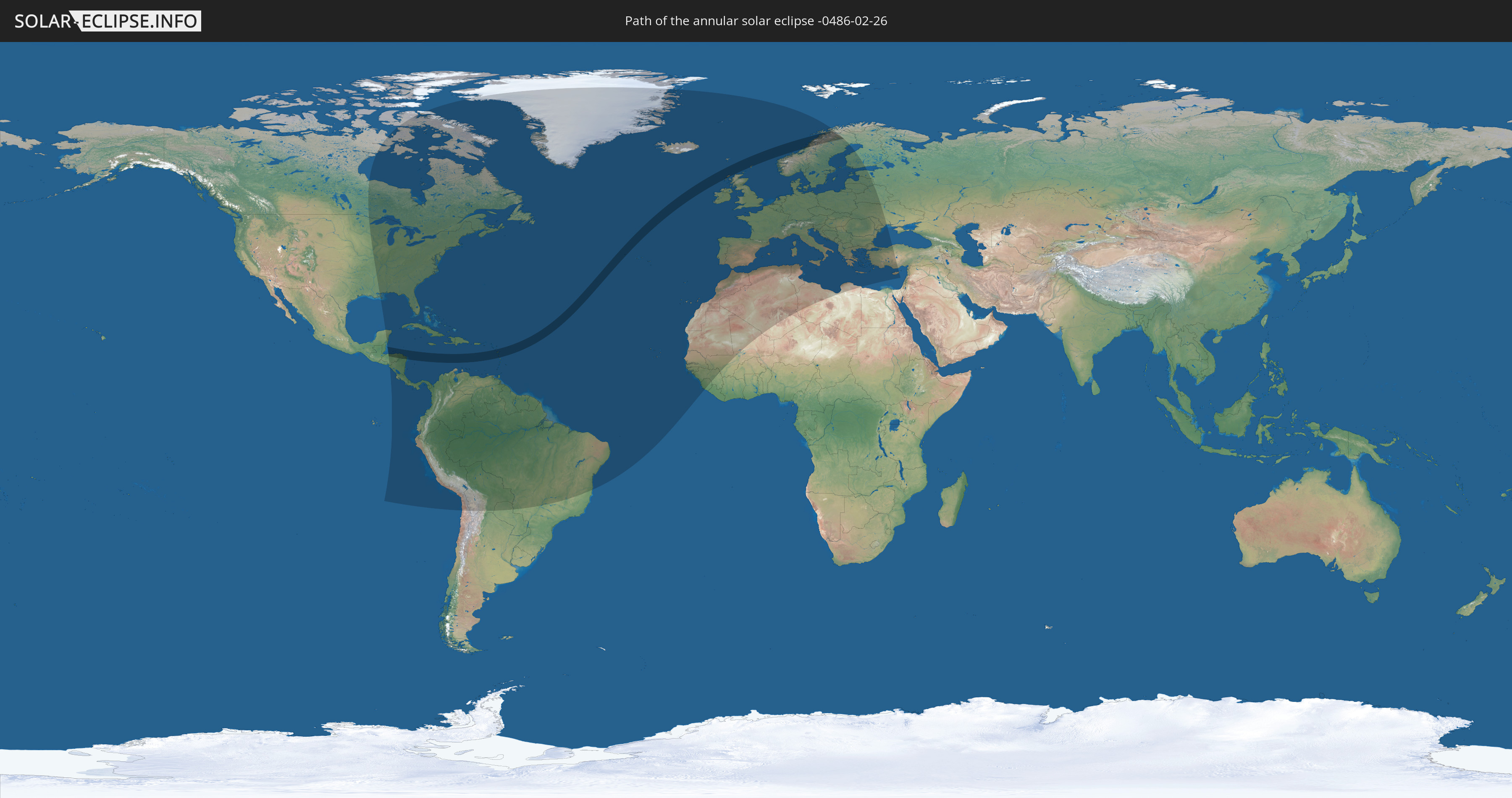
Die Sonnenfinsternis am 02/26/-0486 kann man in 113 Ländern als partielle Sonnenfinsternis beobachten.
Der Finsternispfad verläuft durch 10 Länder. Nur in diesen Ländern ist sie als annular Sonnenfinsternis zu sehen.
In den folgenden Ländern ist die Sonnenfinsternis annular zu sehen
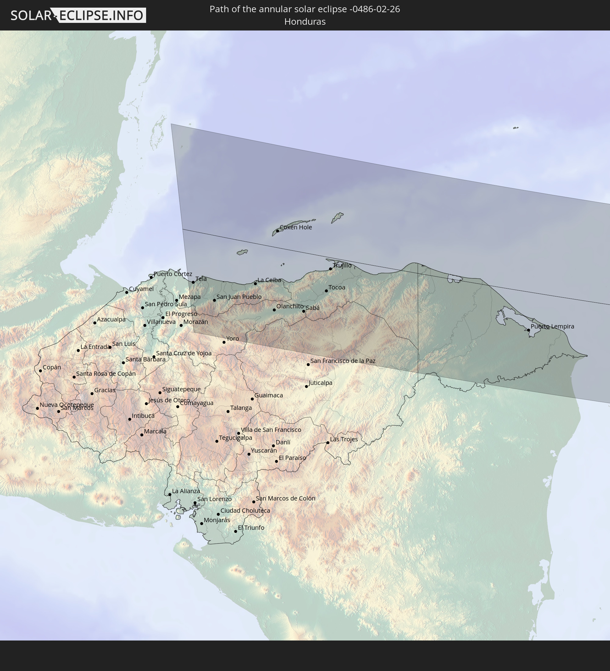 Honduras
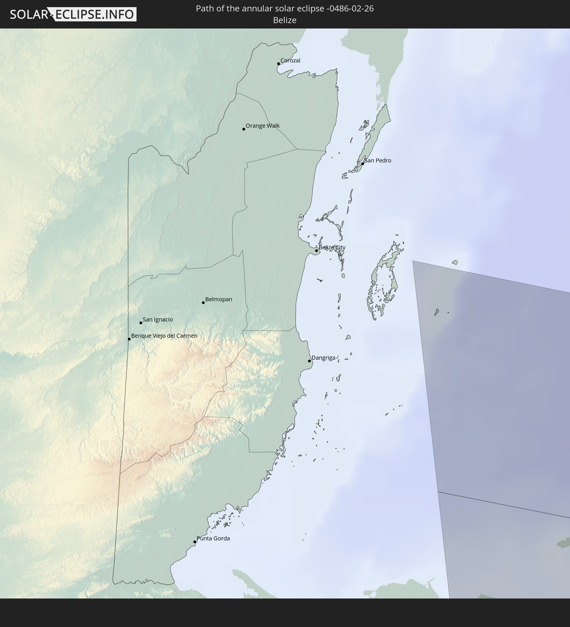 Belize
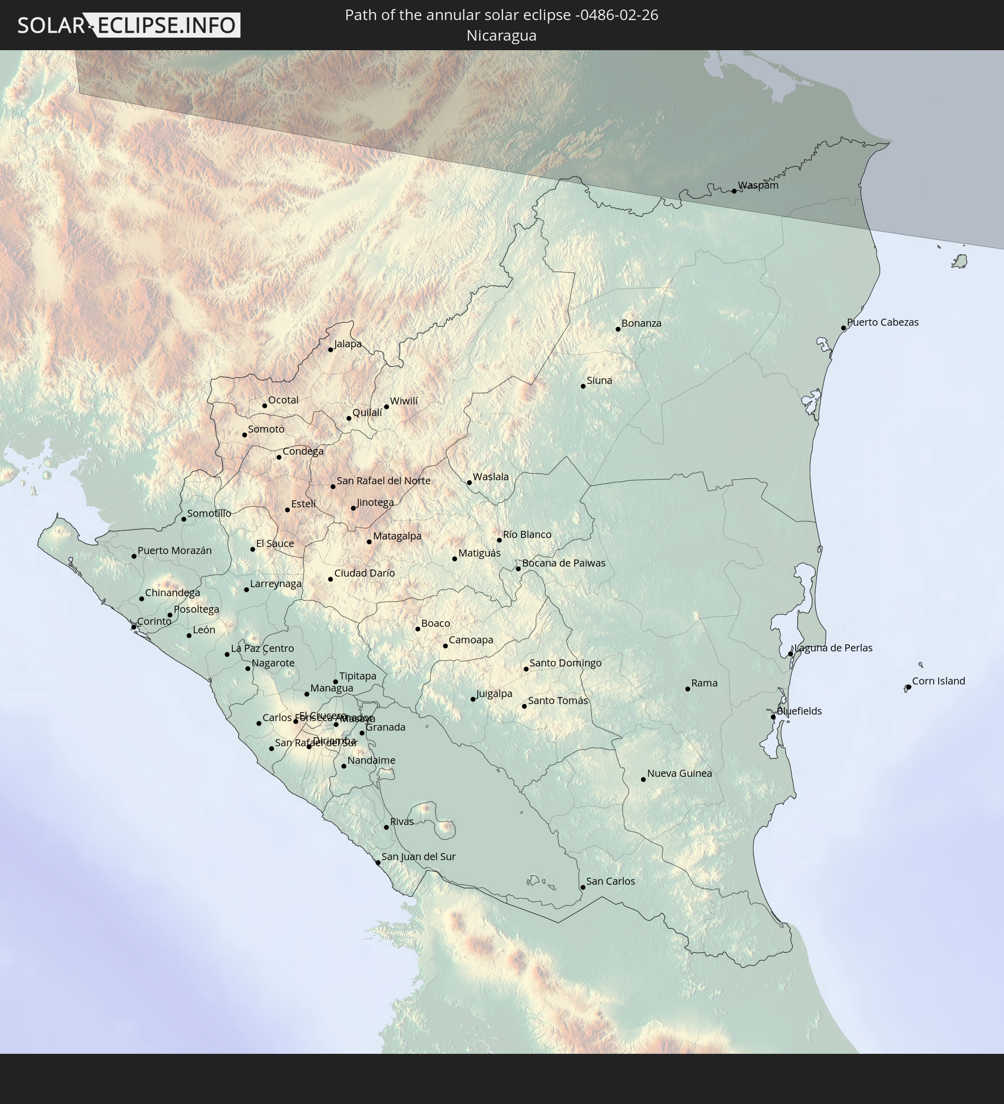 Nicaragua
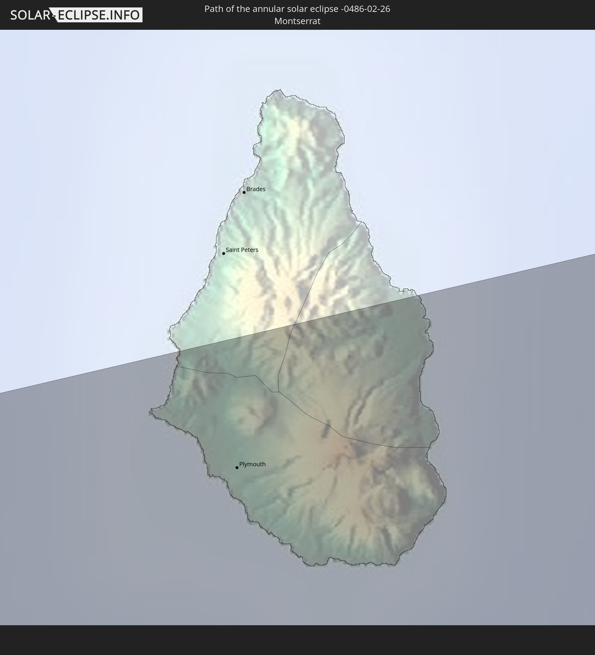 Montserrat
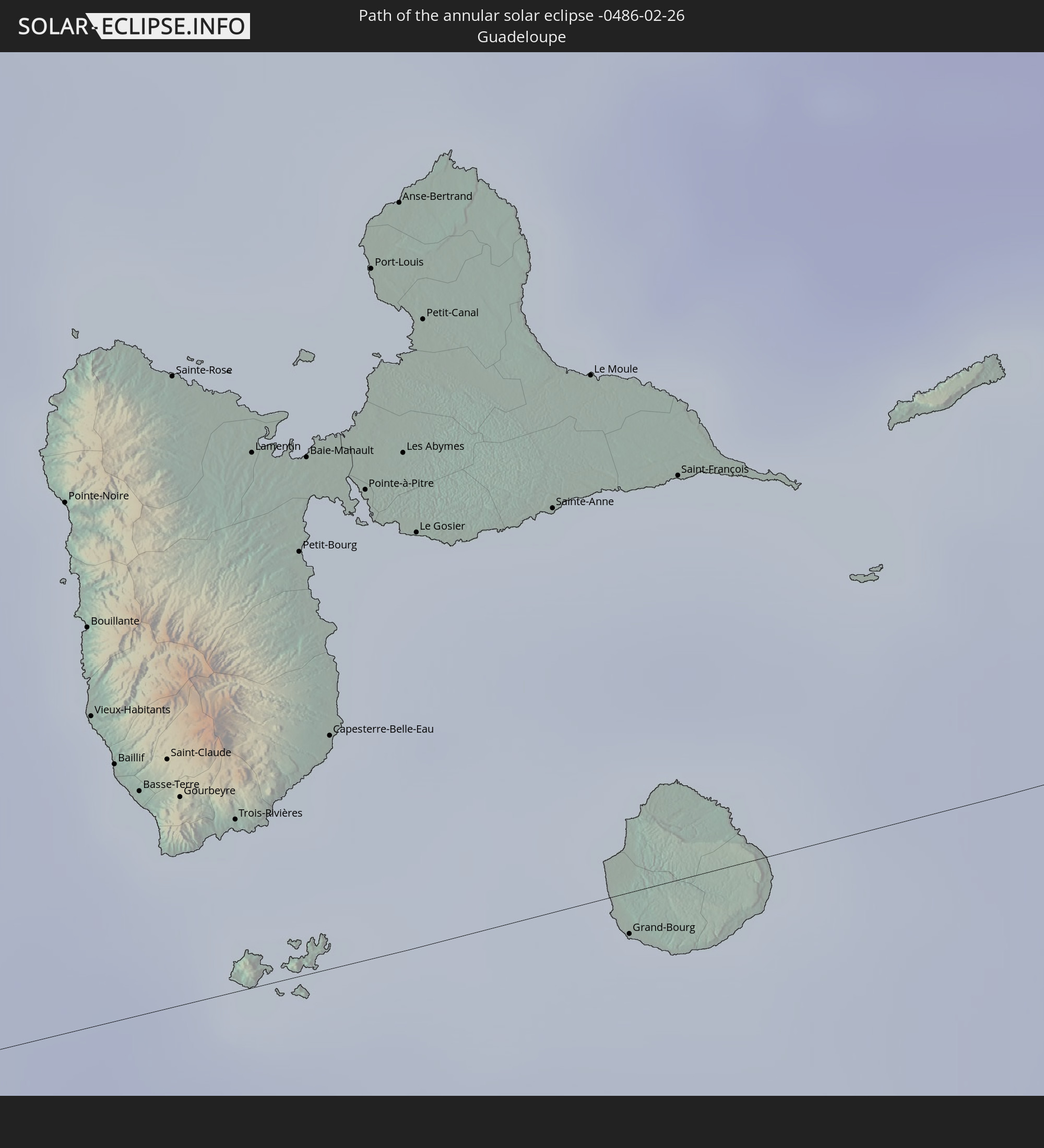 Guadeloupe
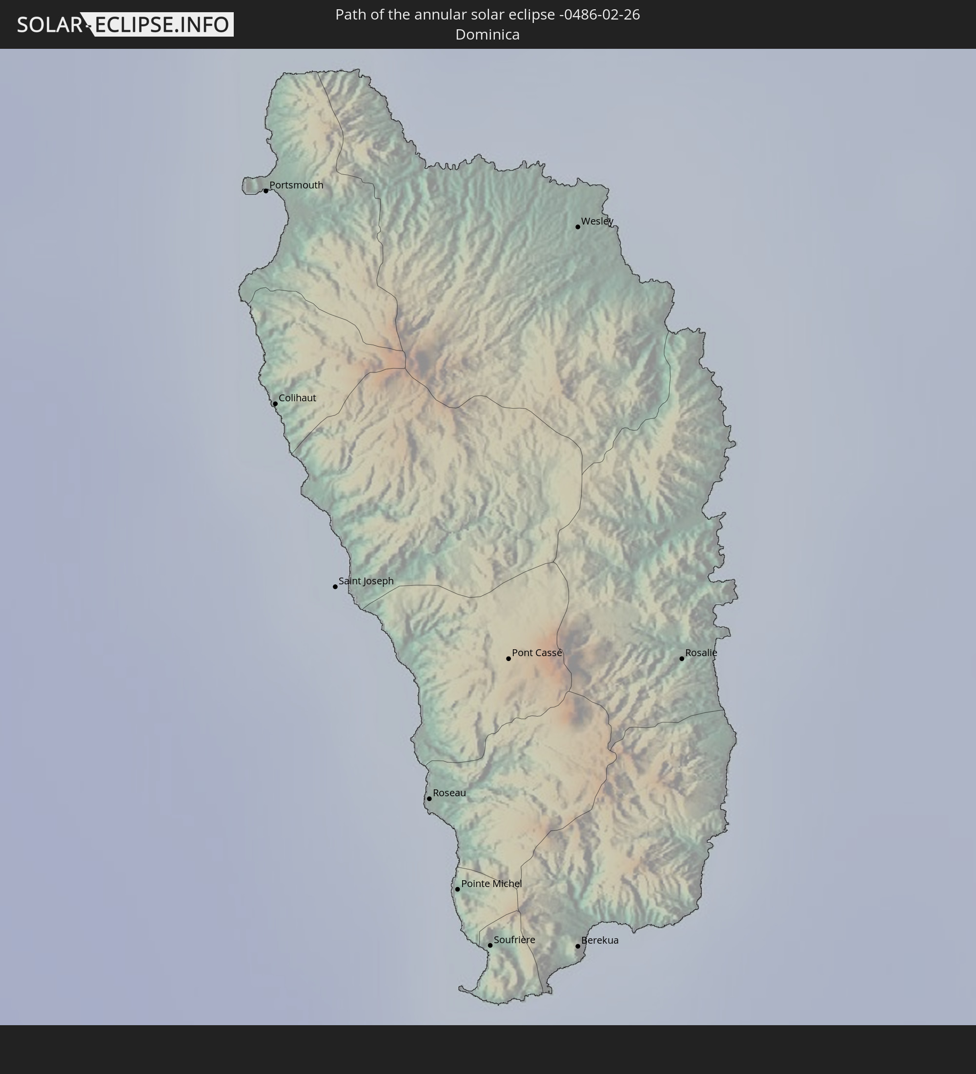 Dominica
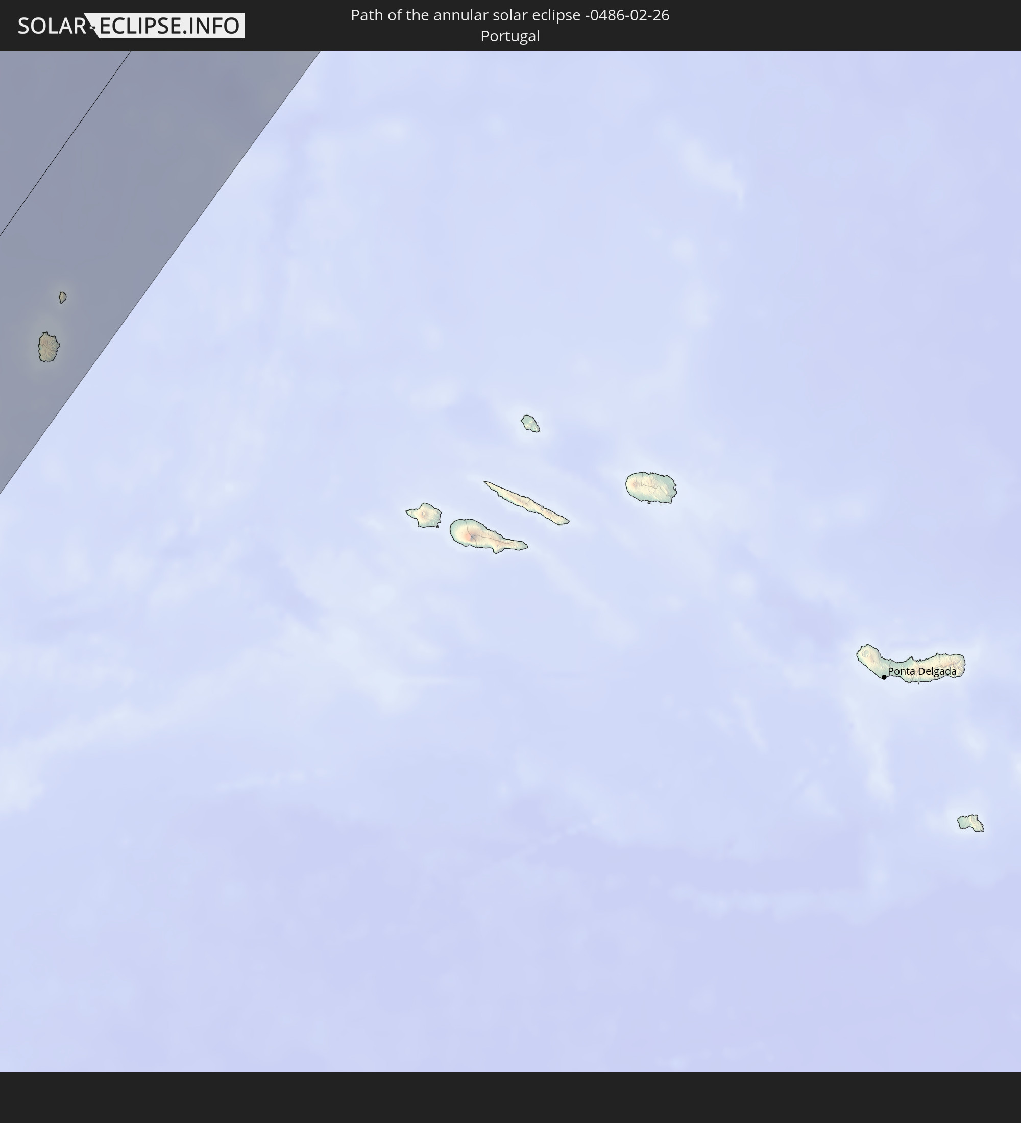 Portugal
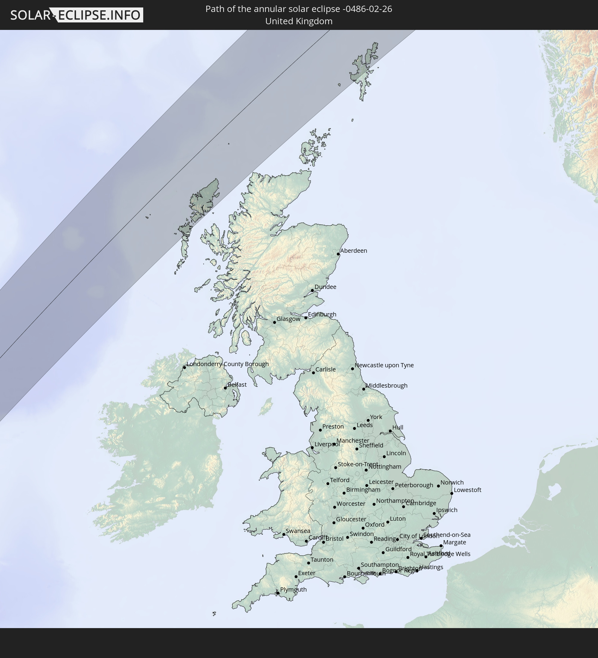 United Kingdom
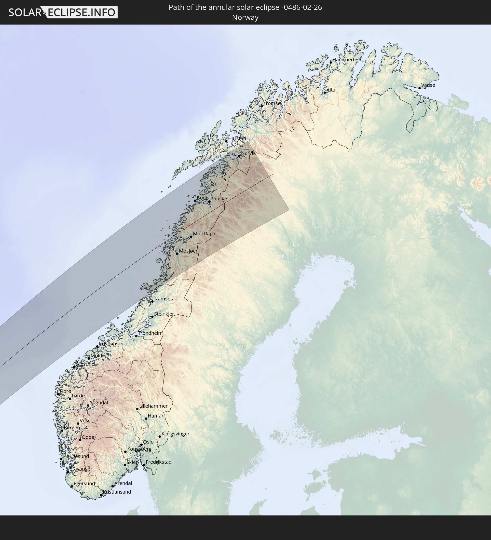 Norway
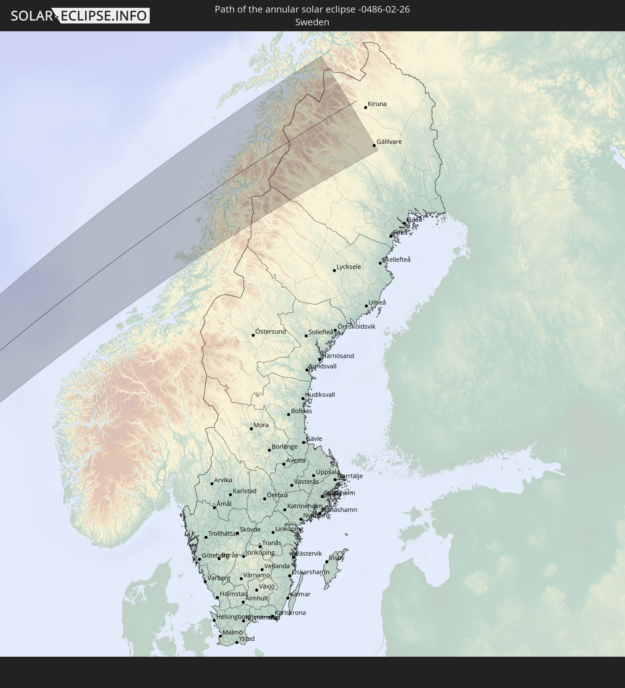 Sweden
In den folgenden Ländern ist die Sonnenfinsternis partiell zu sehen
 Russia
 United States
 United States Minor Outlying Islands
 Canada
 Mexico
 Chile
Chile
 Greenland
 Ecuador
 Honduras
 Belize
 Nicaragua
 Costa Rica
 Cuba
Cuba
 Panama
 Colombia
 Cayman Islands
 Peru
Peru
 The Bahamas
 Jamaica
 Haiti
Haiti
 Brazil
 Venezuela
 Turks and Caicos Islands
 Dominican Republic
 Aruba
Aruba
 Bolivia
 Puerto Rico
 United States Virgin Islands
 Bermuda
 British Virgin Islands
 Anguilla
 Collectivity of Saint Martin
 Saint Barthélemy
 Saint Kitts and Nevis
 Paraguay
 Antigua and Barbuda
 Montserrat
 Trinidad and Tobago
 Guadeloupe
 Grenada
 Dominica
 Saint Vincent and the Grenadines
 Guyana
 Martinique
 Saint Lucia
 Barbados
 Suriname
 Saint Pierre and Miquelon
 French Guiana
 Portugal
 Cabo Verde
 Iceland
 Spain
Spain
 Senegal
 Mauritania
 The Gambia
 Guinea-Bissau
 Guinea
 Sierra Leone
 Morocco
 Mali
Mali
 Republic of Ireland
 Svalbard and Jan Mayen
 Algeria
 United Kingdom
 Faroe Islands
 Gibraltar
 France
 Isle of Man
 Guernsey
 Jersey
 Andorra
 Belgium
 Netherlands
 Norway
 Luxembourg
 Germany
 Switzerland
 Italy
Italy
 Monaco
 Tunisia
 Denmark
 Libya
Libya
 Liechtenstein
 Austria
 Sweden
 Czechia
 San Marino
 Vatican City
 Slovenia
 Croatia
 Poland
 Malta
Malta
 Bosnia and Herzegovina
 Hungary
 Slovakia
 Montenegro
 Serbia
 Albania
 Åland Islands
 Greece
 Romania
 Republic of Macedonia
 Finland
 Lithuania
 Latvia
 Estonia
 Ukraine
 Bulgaria
 Belarus
 Turkey
 Moldova
 Cyprus
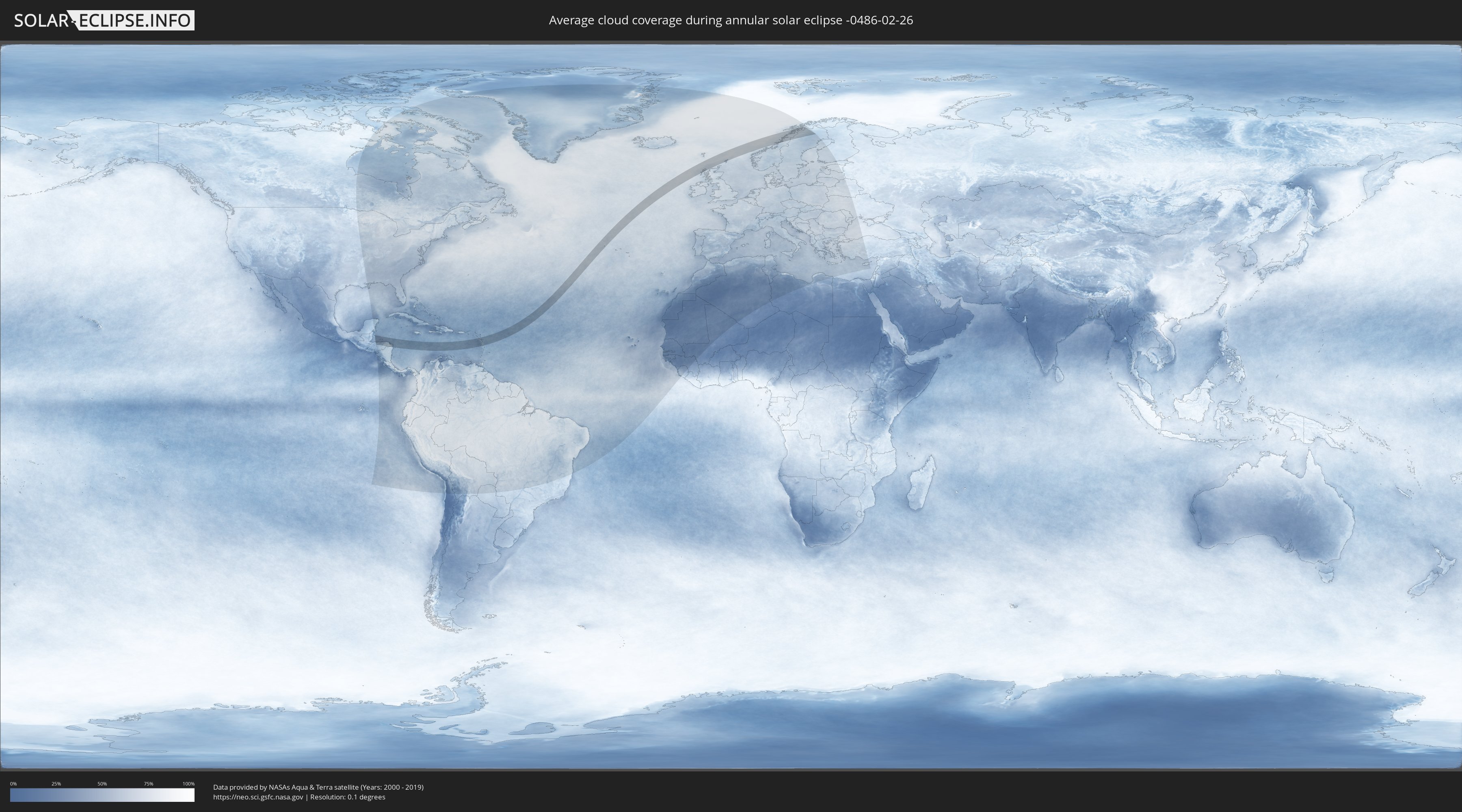
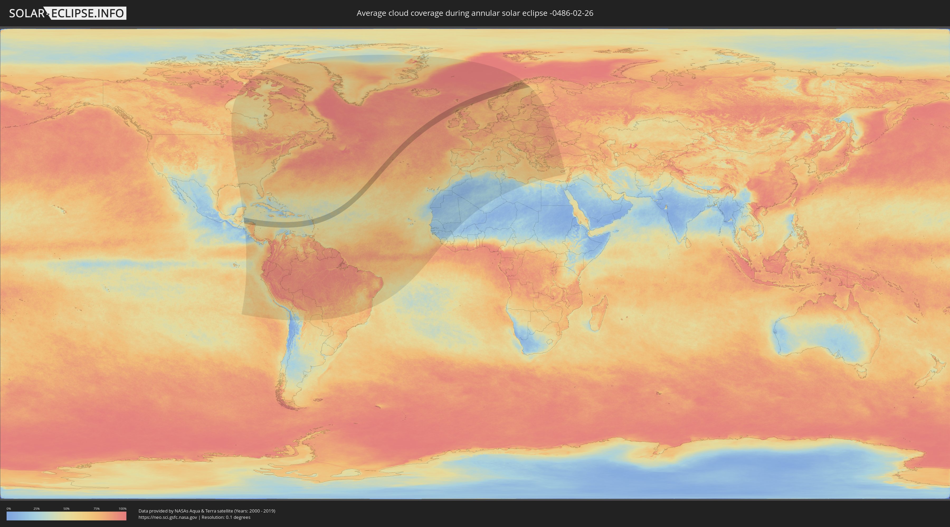
How will be the weather during the annular solar eclipse on 02/26/-0486?
Where is the best place to see the annular solar eclipse of 02/26/-0486?
The following maps show the average cloud coverage for the day of the annular solar eclipse.
With the help of these maps, it is possible to find the place along the eclipse path, which has the best
chance of a cloudless sky.
Nevertheless, you should consider local circumstances and inform about the weather of your chosen
observation site.
The data is provided by NASAs satellites
AQUA and TERRA.
The cloud maps are averaged over a period of 19 years (2000 - 2019).
Detailed country maps
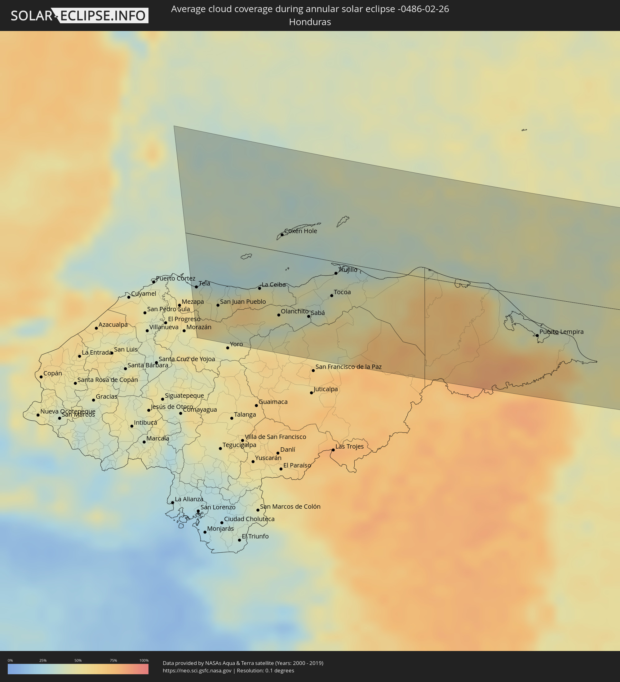 Honduras
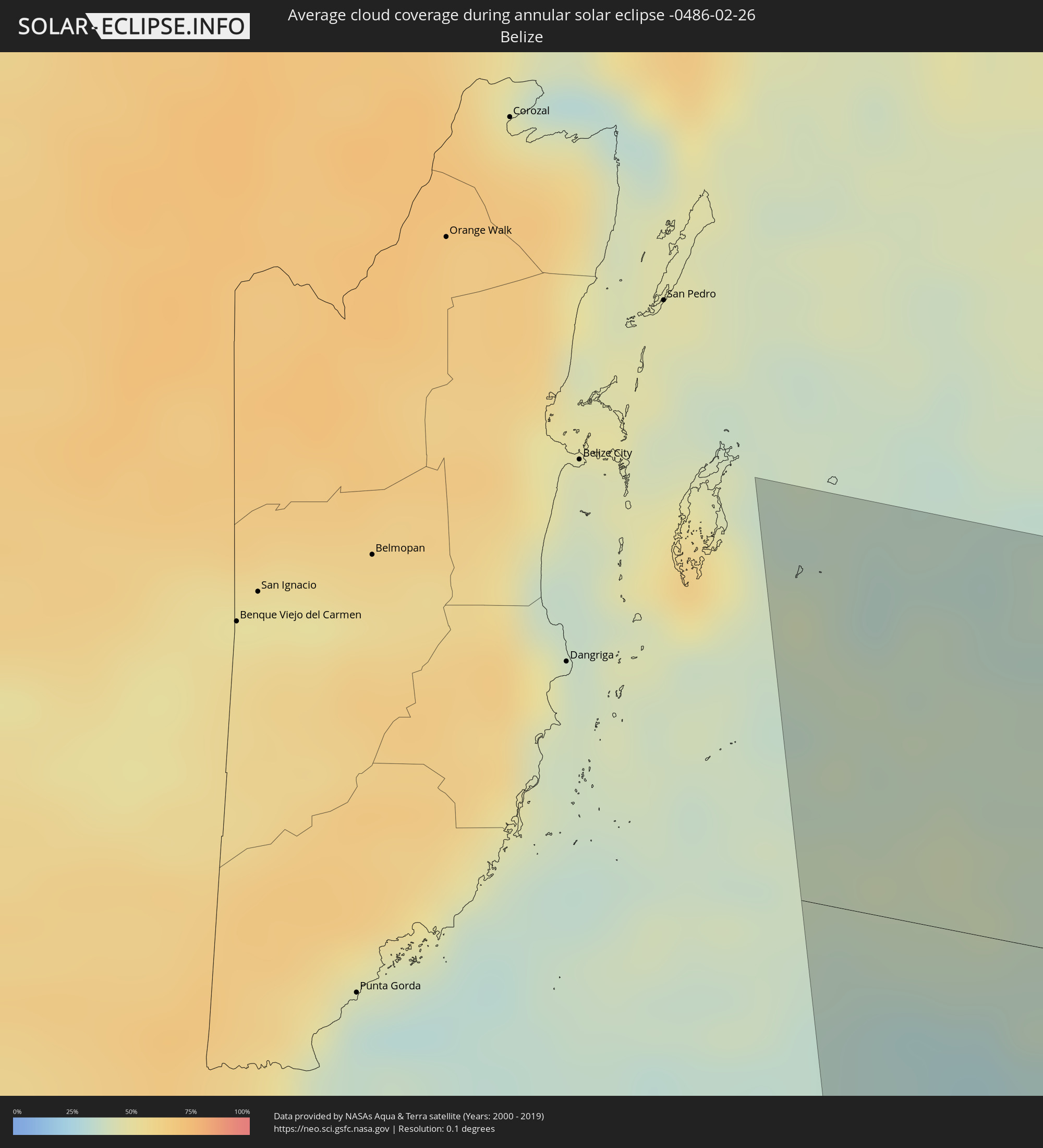 Belize
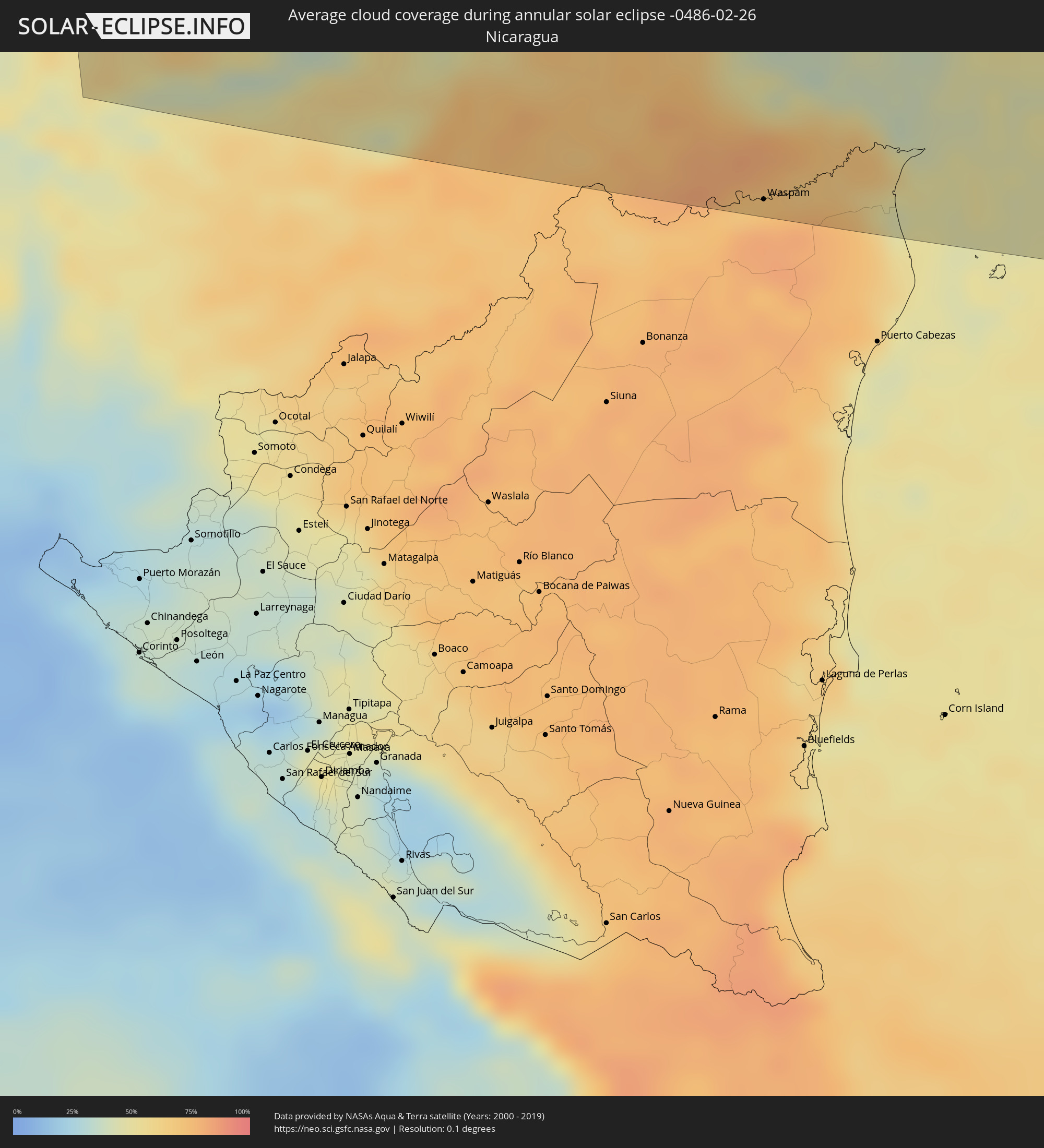 Nicaragua
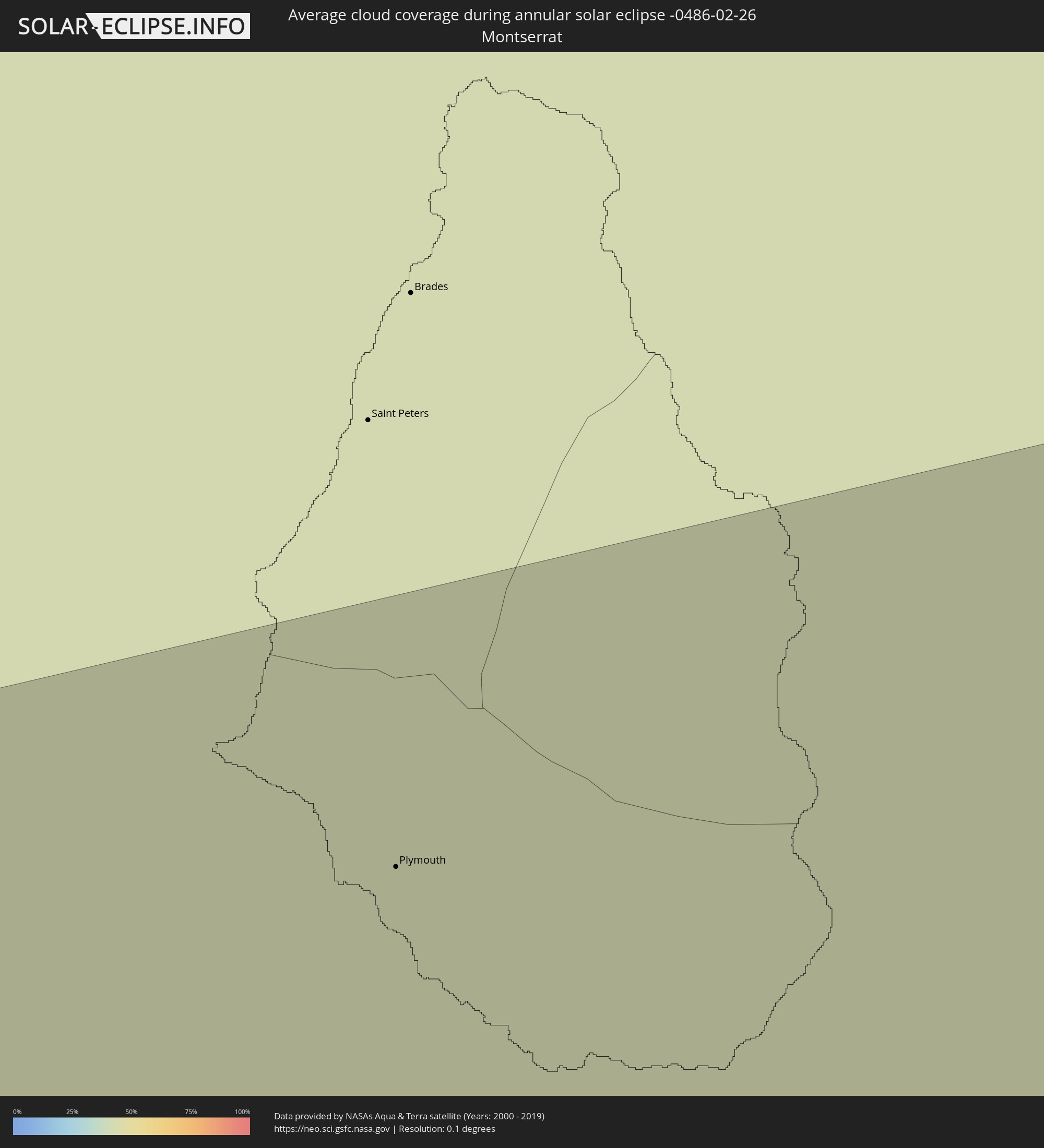 Montserrat
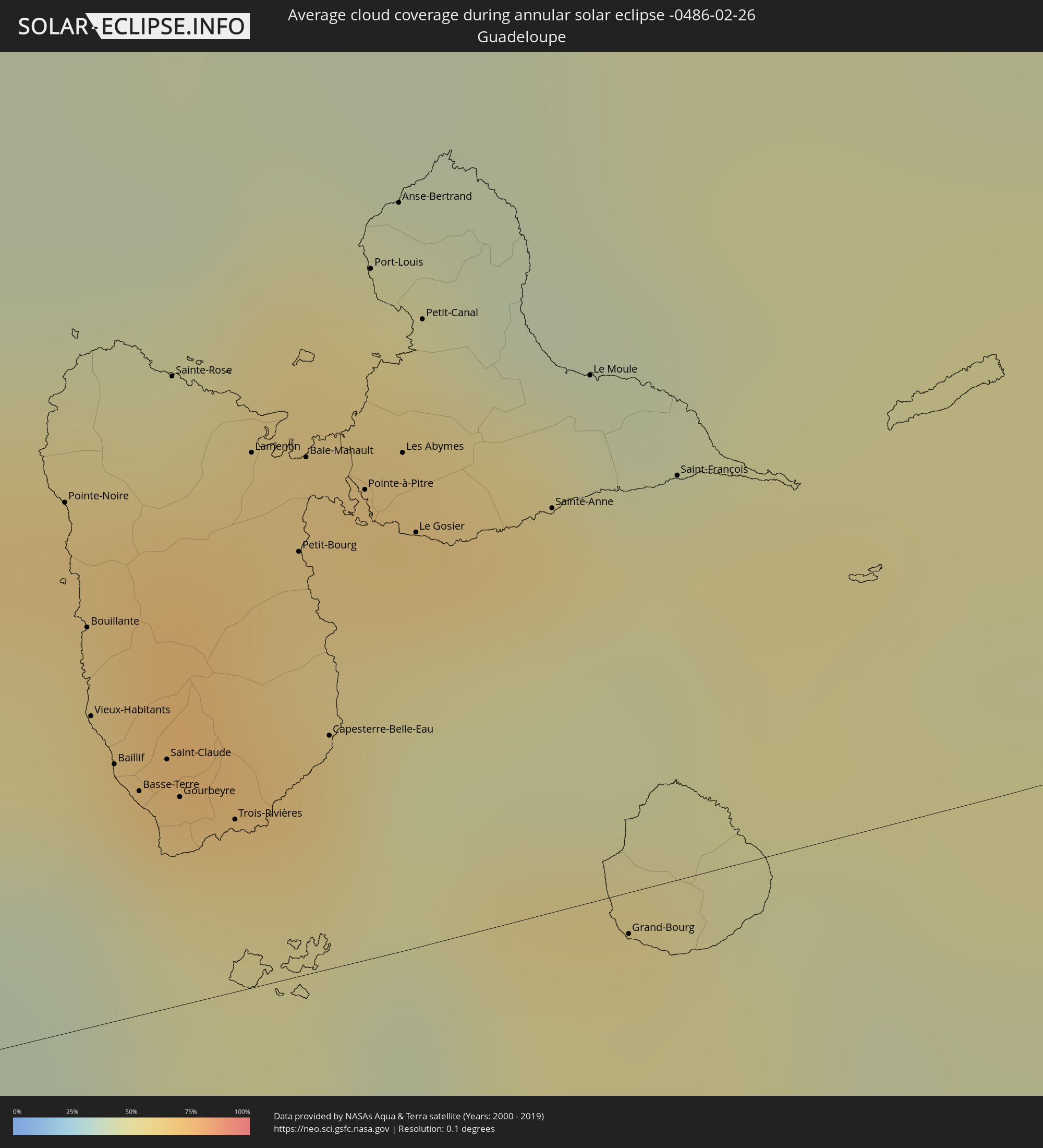 Guadeloupe
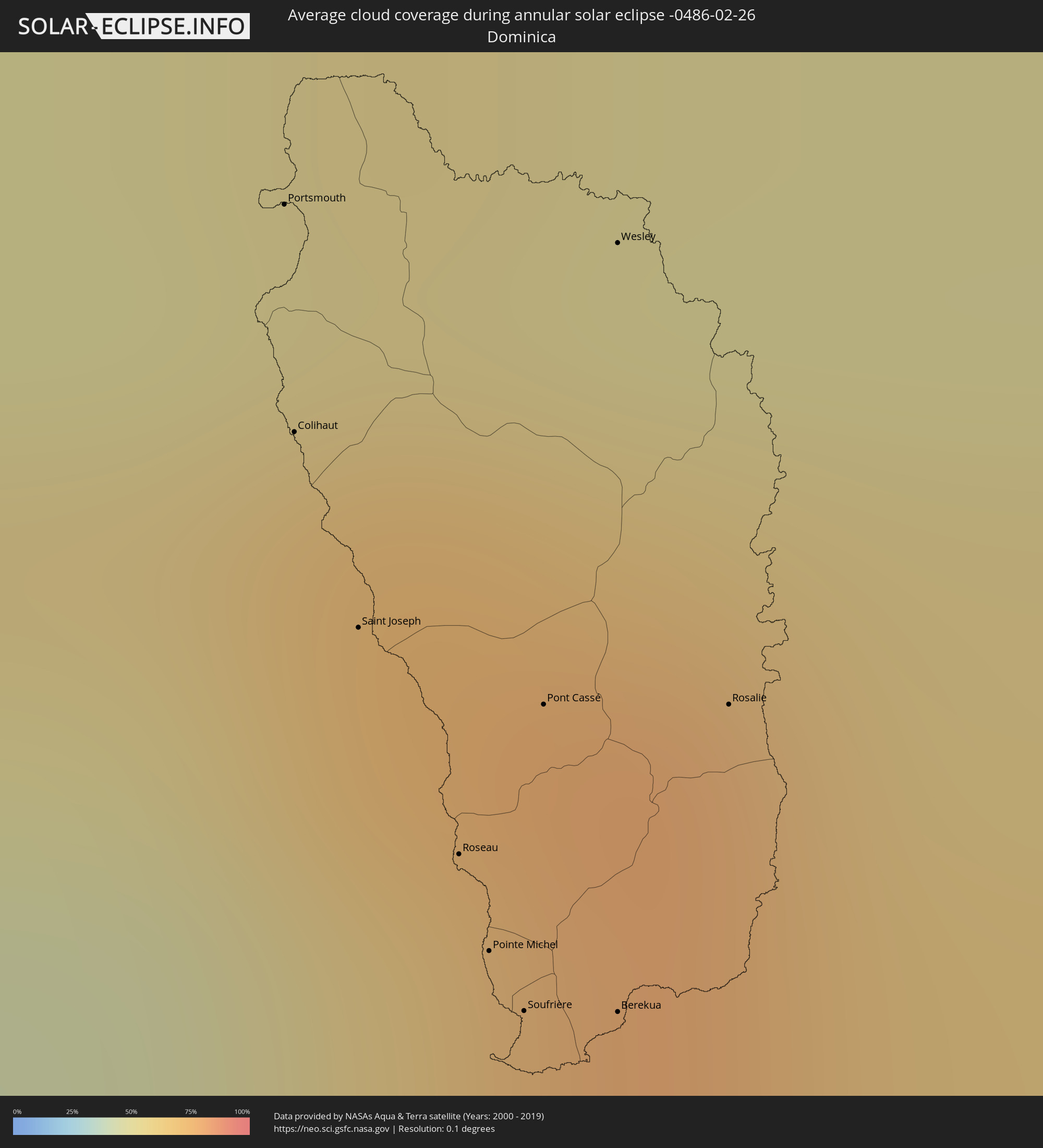 Dominica
 Portugal
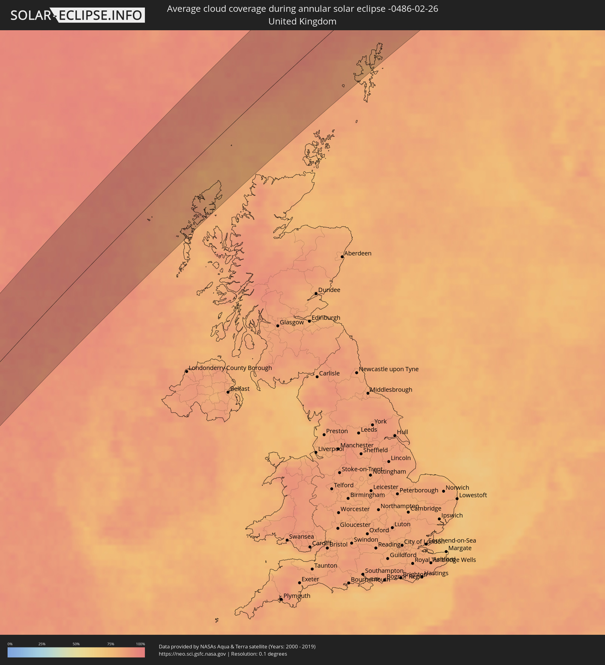 United Kingdom
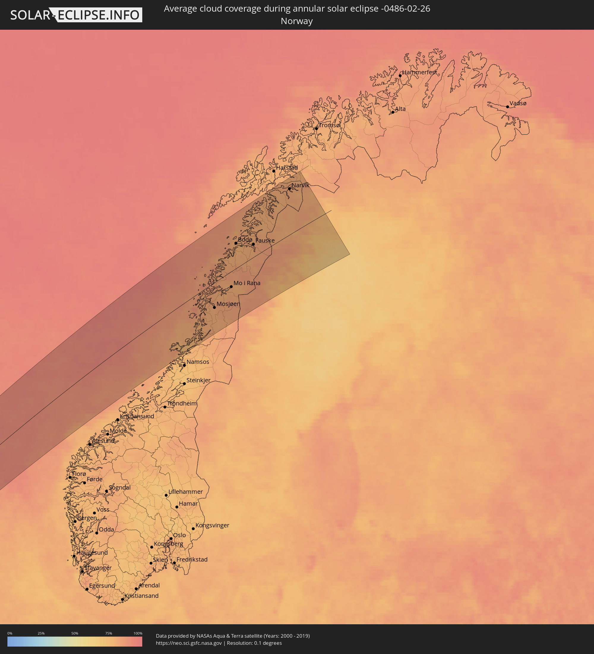 Norway
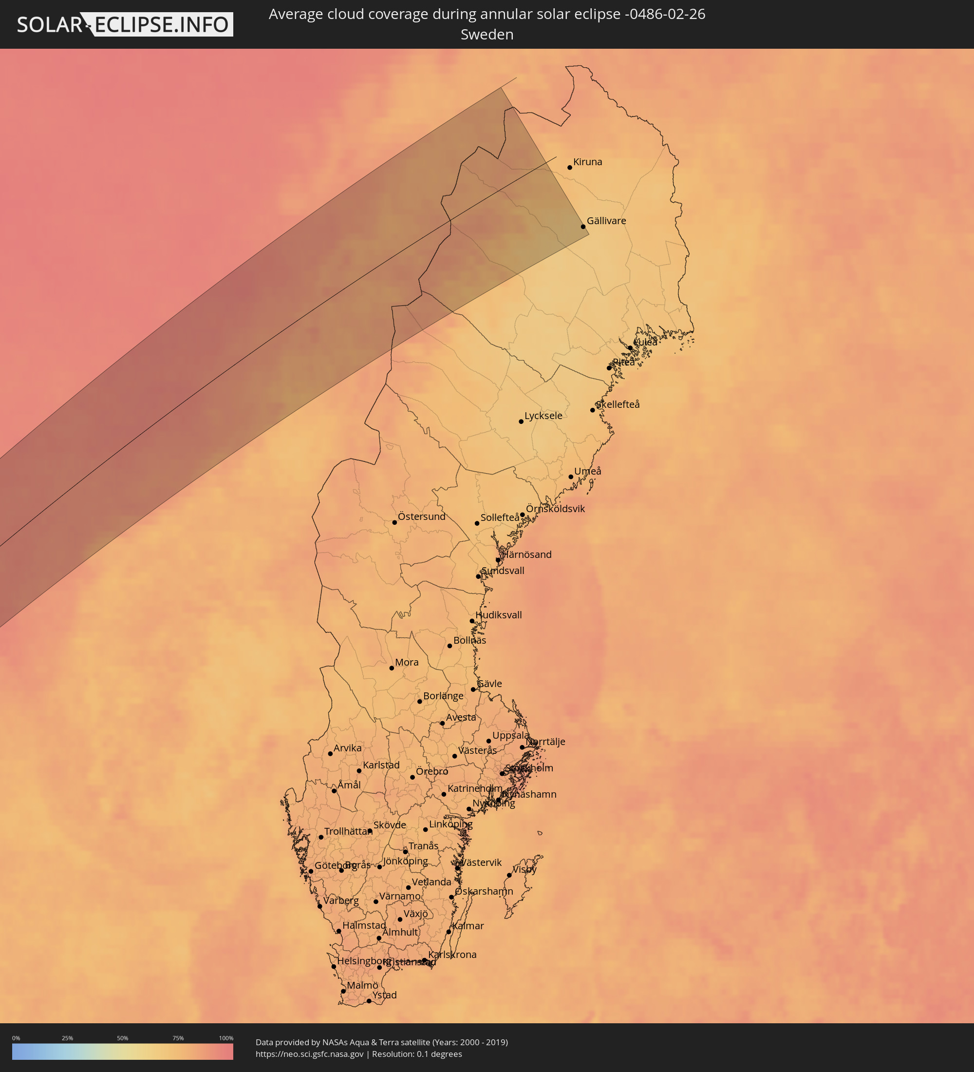 Sweden
Cities inside the path of the eclipse
The following table shows all locations with a population of more than 5,000 inside the eclipse path. Cities which have more than 100,000 inhabitants are marked bold. A click at the locations opens a detailed map.
| City | Type | Eclipse duration | Local time of max. eclipse | Distance to central line | Ø Cloud coverage |
|
Tela, Atlántida
|
annular | - | 06:30:27 UTC-05:48 | 61 km | 43% |
|
San Juan Pueblo, Atlántida
|
annular | - | 06:30:16 UTC-05:48 | 75 km | 55% |
|
La Ceiba, Atlántida
|
annular | - | 06:30:37 UTC-05:48 | 47 km | 47% |
|
Olanchito, Yoro
|
annular | - | 06:30:19 UTC-05:48 | 73 km | 38% |
|
Coxen Hole, Bay Islands
|
annular | - | 06:31:25 UTC-05:48 | 19 km | 35% |
|
Sabá, Colón
|
annular | - | 06:30:23 UTC-05:48 | 69 km | 47% |
|
Tocoa, Colón
|
annular | - | 06:30:44 UTC-05:48 | 40 km | 43% |
|
Trujillo, Colón
|
annular | - | 06:31:04 UTC-05:48 | 13 km | 42% |
|
Waspam, Atlántico Norte (RAAN)
|
annular | - | 06:33:51 UTC-05:45 | 106 km | 81% |
|
Puerto Lempira, Gracias a Dios
|
annular | - | 06:30:58 UTC-05:48 | 45 km | 58% |
|
Plymouth, Saint Anthony
|
annular | - | 08:35:49 UTC-04:06 | 108 km | 50% |
|
Pointe-Noire, Guadeloupe
|
annular | - | 08:35:35 UTC-04:06 | 46 km | 57% |
|
Bouillante, Guadeloupe
|
annular | - | 08:35:25 UTC-04:06 | 35 km | 53% |
|
Vieux-Habitants, Guadeloupe
|
annular | - | 08:35:18 UTC-04:06 | 27 km | 53% |
|
Baillif, Guadeloupe
|
annular | - | 08:35:15 UTC-04:06 | 22 km | 53% |
|
Basse-Terre, Guadeloupe
|
annular | - | 08:35:15 UTC-04:06 | 20 km | 53% |
|
Saint-Claude, Guadeloupe
|
annular | - | 08:35:20 UTC-04:06 | 22 km | 53% |
|
Sainte-Rose, Guadeloupe
|
annular | - | 08:35:54 UTC-04:06 | 55 km | 67% |
|
Gourbeyre, Guadeloupe
|
annular | - | 08:35:17 UTC-04:06 | 18 km | 53% |
|
Trois-Rivières, Guadeloupe
|
annular | - | 08:35:19 UTC-04:06 | 15 km | 55% |
|
Lamentin, Guadeloupe
|
annular | - | 08:35:53 UTC-04:06 | 47 km | 62% |
|
Petit-Bourg, Guadeloupe
|
annular | - | 08:35:48 UTC-04:06 | 37 km | 60% |
|
Baie-Mahault, Guadeloupe
|
annular | - | 08:35:57 UTC-04:06 | 45 km | 62% |
|
Capesterre-Belle-Eau, Guadeloupe
|
annular | - | 08:35:34 UTC-04:06 | 20 km | 55% |
|
Pointe-à-Pitre, Guadeloupe
|
annular | - | 08:35:59 UTC-04:06 | 41 km | 53% |
|
Port-Louis, Guadeloupe
|
annular | - | 08:36:19 UTC-04:06 | 60 km | 60% |
|
Anse-Bertrand, Guadeloupe
|
annular | - | 08:36:27 UTC-04:06 | 65 km | 51% |
|
Les Abymes, Guadeloupe
|
annular | - | 08:36:05 UTC-04:06 | 43 km | 63% |
|
Le Gosier, Guadeloupe
|
annular | - | 08:35:59 UTC-04:06 | 36 km | 53% |
|
Petit-Canal, Guadeloupe
|
annular | - | 08:36:18 UTC-04:06 | 54 km | 60% |
|
Portsmouth, Saint John
|
annular | - | 08:34:52 UTC-04:06 | 32 km | 58% |
|
Colihaut, Saint Peter
|
annular | - | 08:34:42 UTC-04:06 | 43 km | 53% |
|
Saint Joseph, Saint Joseph
|
annular | - | 08:34:35 UTC-04:06 | 53 km | 62% |
|
Roseau, Saint George
|
annular | - | 08:34:29 UTC-04:06 | 64 km | 54% |
|
Sainte-Anne, Guadeloupe
|
annular | - | 08:36:11 UTC-04:06 | 35 km | 49% |
|
Pointe Michel, Saint Luke
|
annular | - | 08:34:25 UTC-04:06 | 69 km | 54% |
|
Soufrière, Saint Mark
|
annular | - | 08:34:24 UTC-04:06 | 72 km | 44% |
|
Pont Cassé, Saint Paul
|
annular | - | 08:34:39 UTC-04:06 | 58 km | 62% |
|
Le Moule, Guadeloupe
|
annular | - | 08:36:26 UTC-04:06 | 46 km | 51% |
|
Wesley, Saint Andrew
|
annular | - | 08:35:04 UTC-04:06 | 38 km | 65% |
|
Berekua, Saint Patrick
|
annular | - | 08:34:28 UTC-04:06 | 74 km | 53% |
|
Grand-Bourg, Guadeloupe
|
annular | - | 08:35:39 UTC-04:06 | 4 km | 51% |
|
Saint-François, Guadeloupe
|
annular | - | 08:36:24 UTC-04:06 | 35 km | 51% |
|
Rosalie, Saint David
|
annular | - | 08:34:47 UTC-04:06 | 61 km | 78% |
|
Isle of Lewis, Scotland
|
annular | - | 15:00:29 UTC+00:00 | 79 km | 79% |
|
Stornoway, Scotland
|
annular | - | 15:00:29 UTC+00:00 | 79 km | 79% |
|
Sandnessjøen, Nordland
|
annular | - | 16:05:21 UTC+01:00 | 22 km | 82% |
|
Mosjøen, Nordland
|
annular | - | 16:05:45 UTC+01:00 | 53 km | 80% |
|
Mo i Rana, Nordland
|
annular | - | 16:05:35 UTC+01:00 | 33 km | 80% |
|
Bodø, Nordland
|
annular | - | 16:04:38 UTC+01:00 | 51 km | 79% |
|
Fauske, Nordland
|
annular | - | 16:04:58 UTC+01:00 | 26 km | 83% |
|
Narvik, Nordland
|
annular | - | 16:04:13 UTC+01:00 | 92 km | 82% |
|
Gällivare, Norrbotten
|
annular | - | 16:06:36 UTC+01:00 | 102 km | 66% |