Total solar eclipse of 04/17/-0629
| Day of week: | Monday |
| Maximum duration of eclipse: | 04m42s |
| Maximum width of eclipse path: | 341 km |
| Saros cycle: | 38 |
| Coverage: | 100% |
| Magnitude: | 1.0689 |
| Gamma: | 0.7547 |
Wo kann man die Sonnenfinsternis vom 04/17/-0629 sehen?
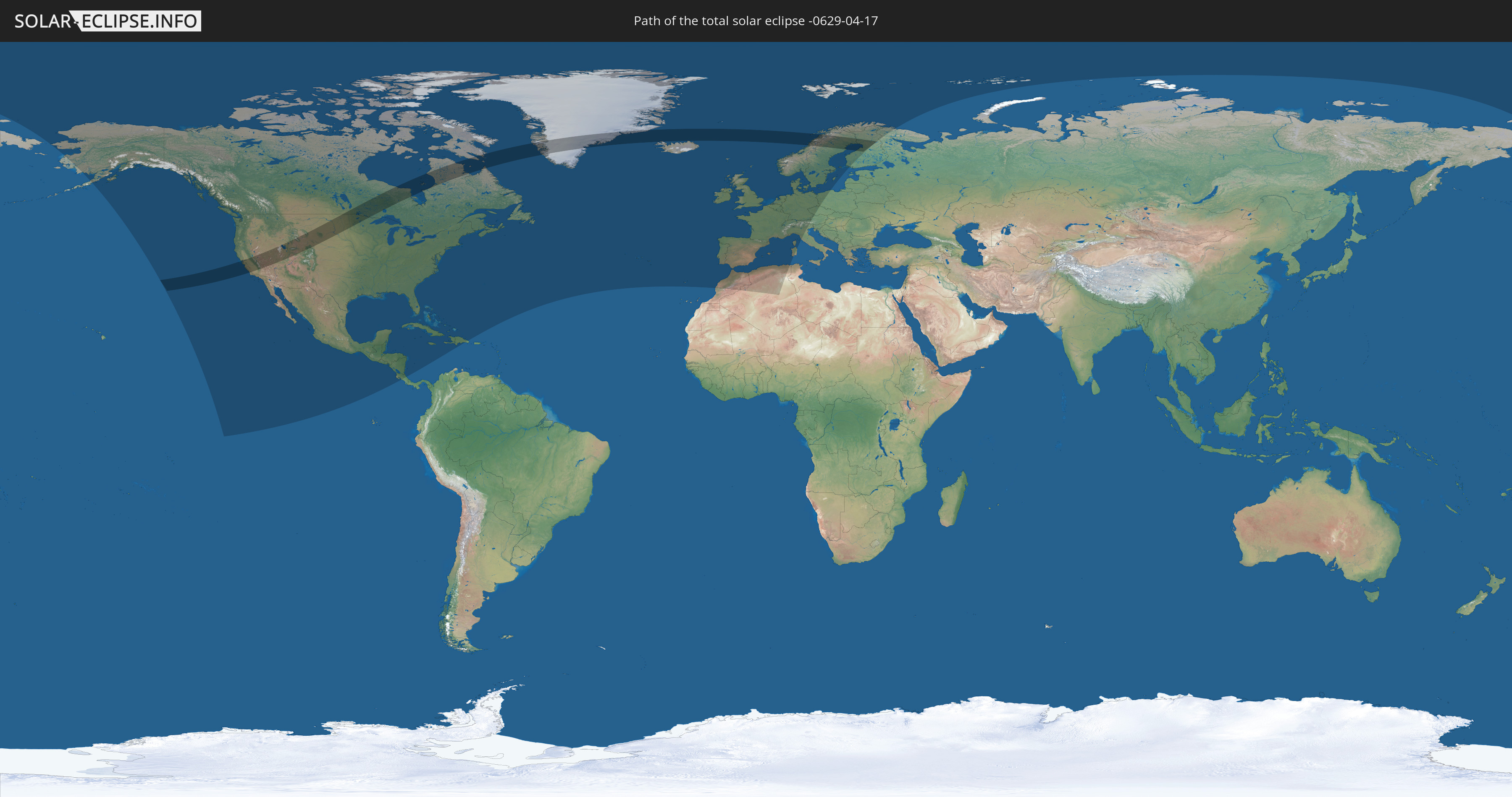
Die Sonnenfinsternis am 04/17/-0629 kann man in 53 Ländern als partielle Sonnenfinsternis beobachten.
Der Finsternispfad verläuft durch 7 Länder. Nur in diesen Ländern ist sie als total Sonnenfinsternis zu sehen.
In den folgenden Ländern ist die Sonnenfinsternis total zu sehen
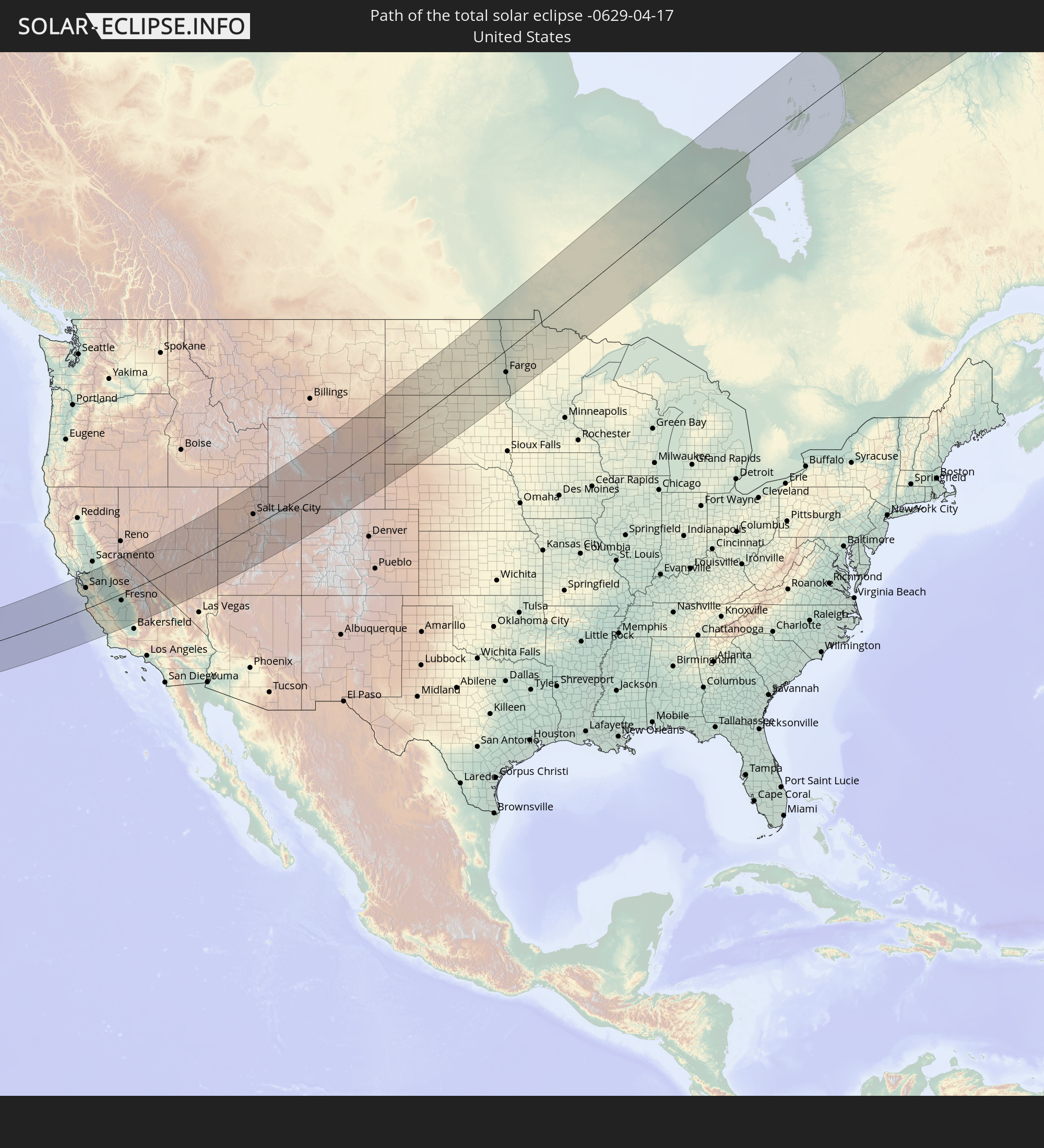 United States
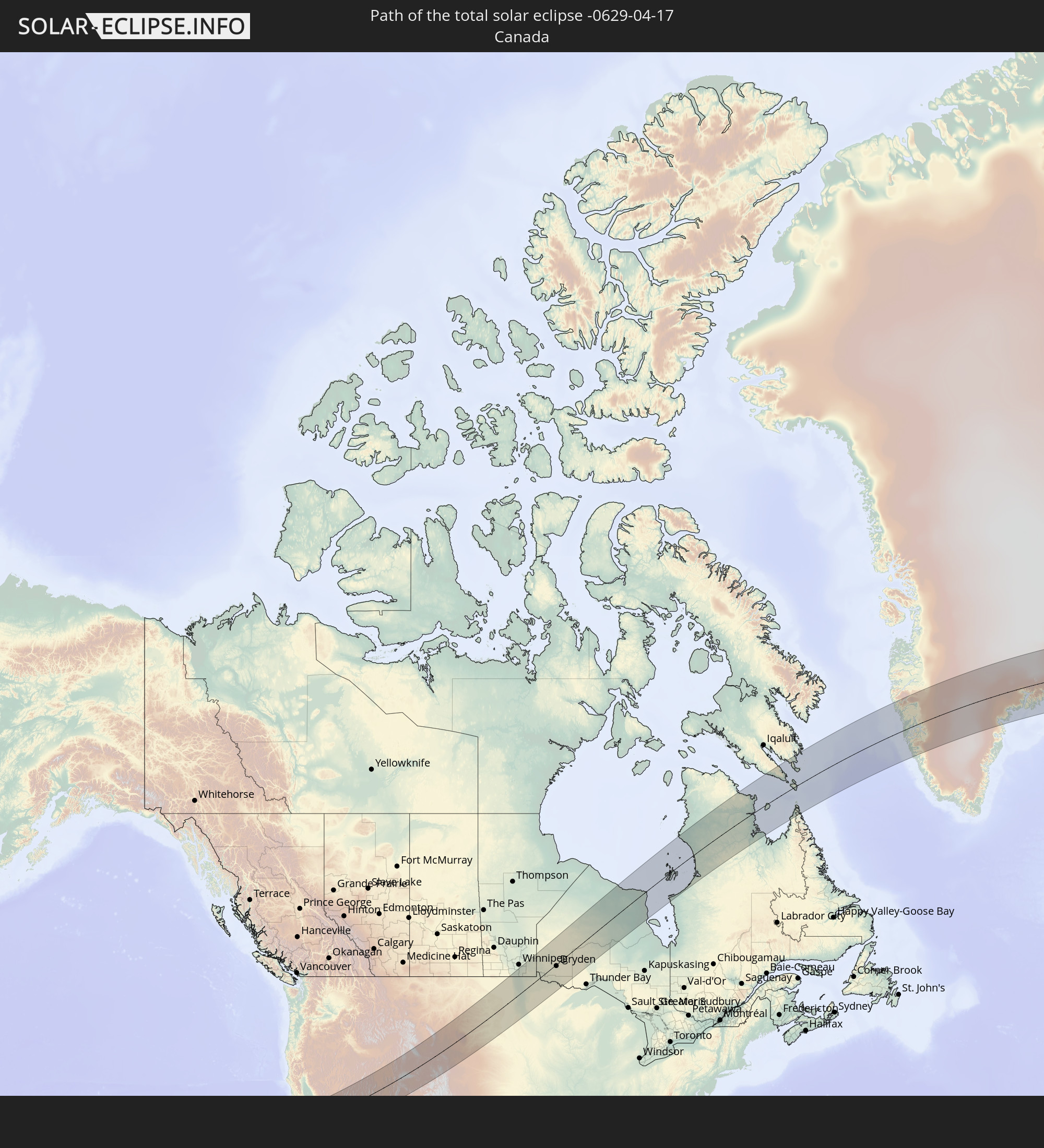 Canada
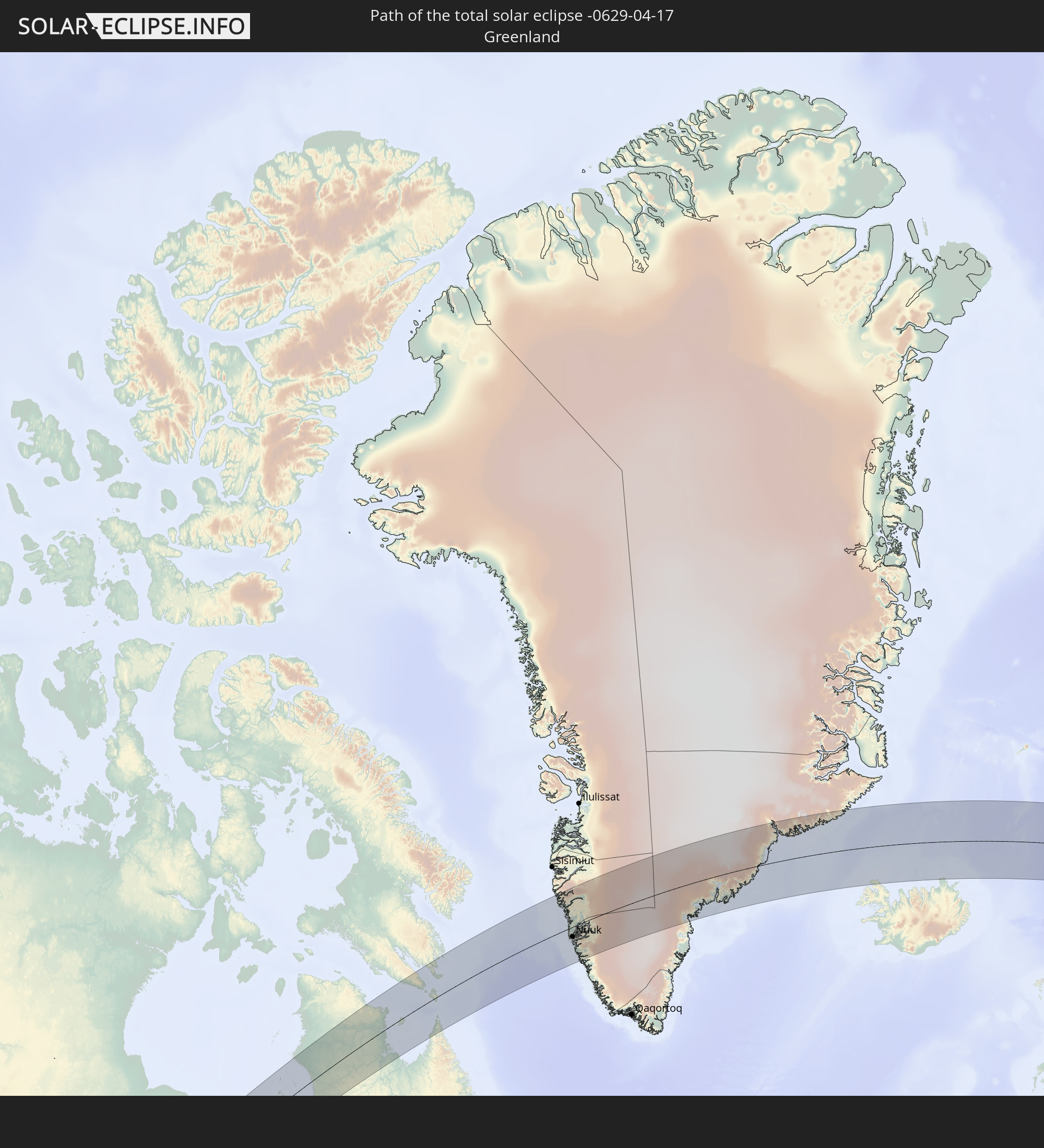 Greenland
 Iceland
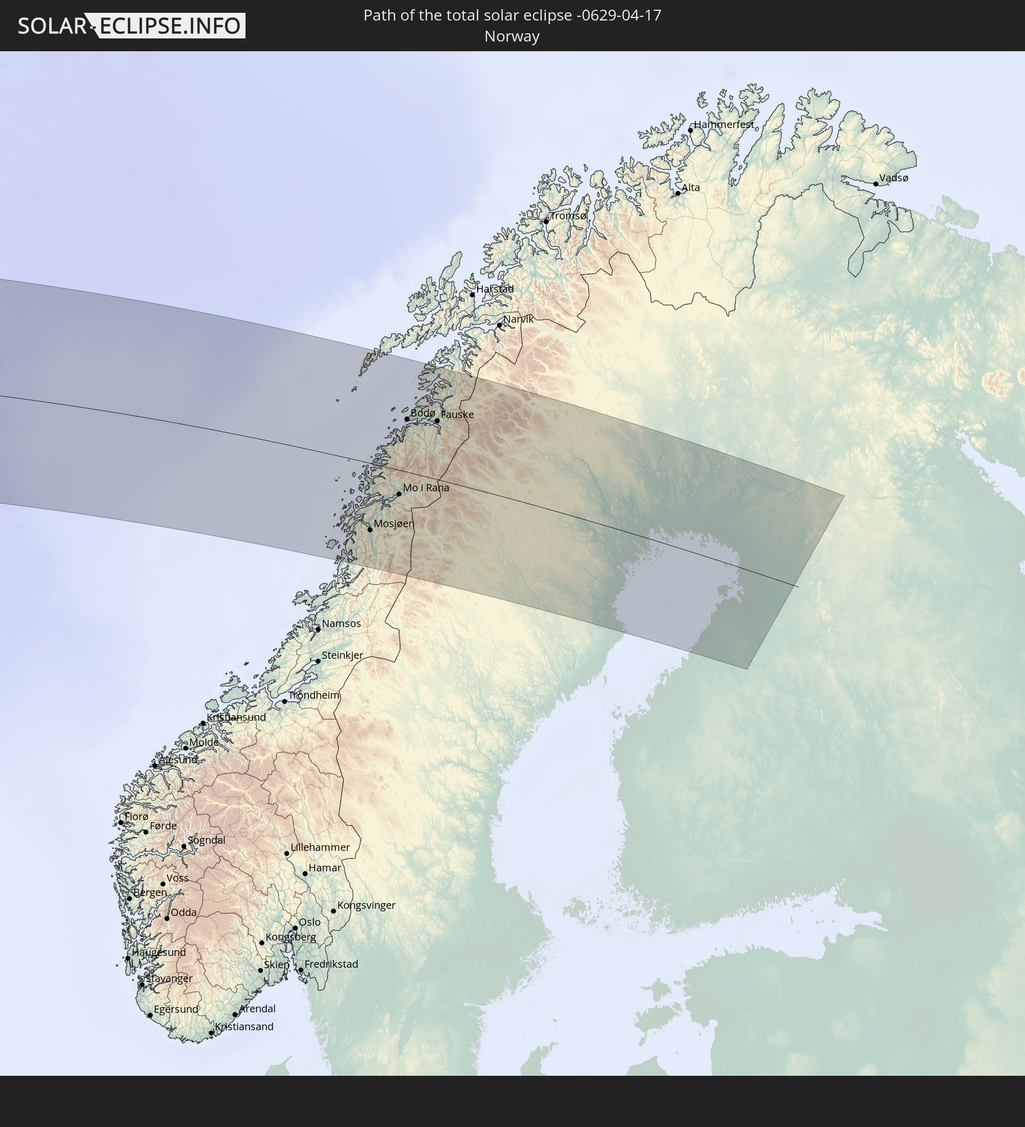 Norway
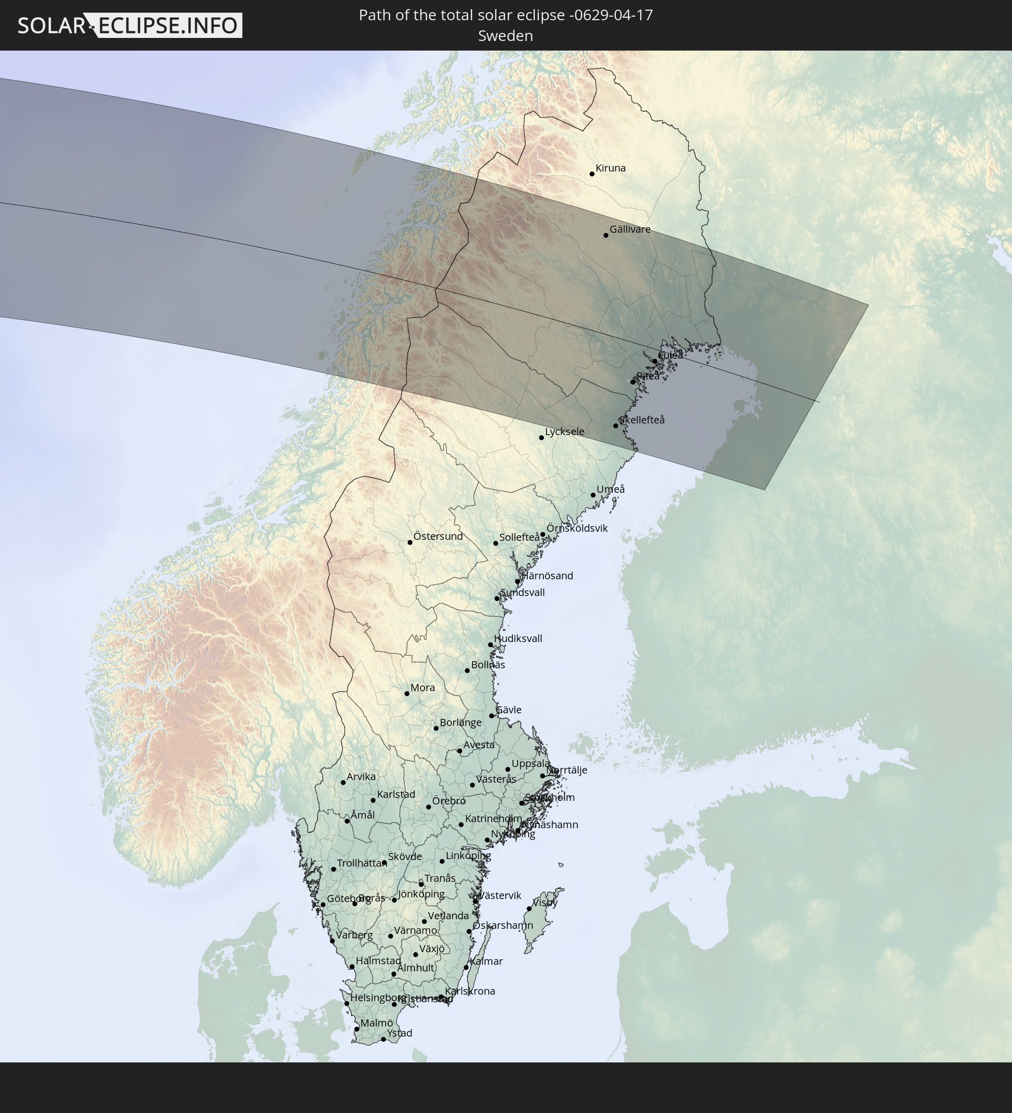 Sweden
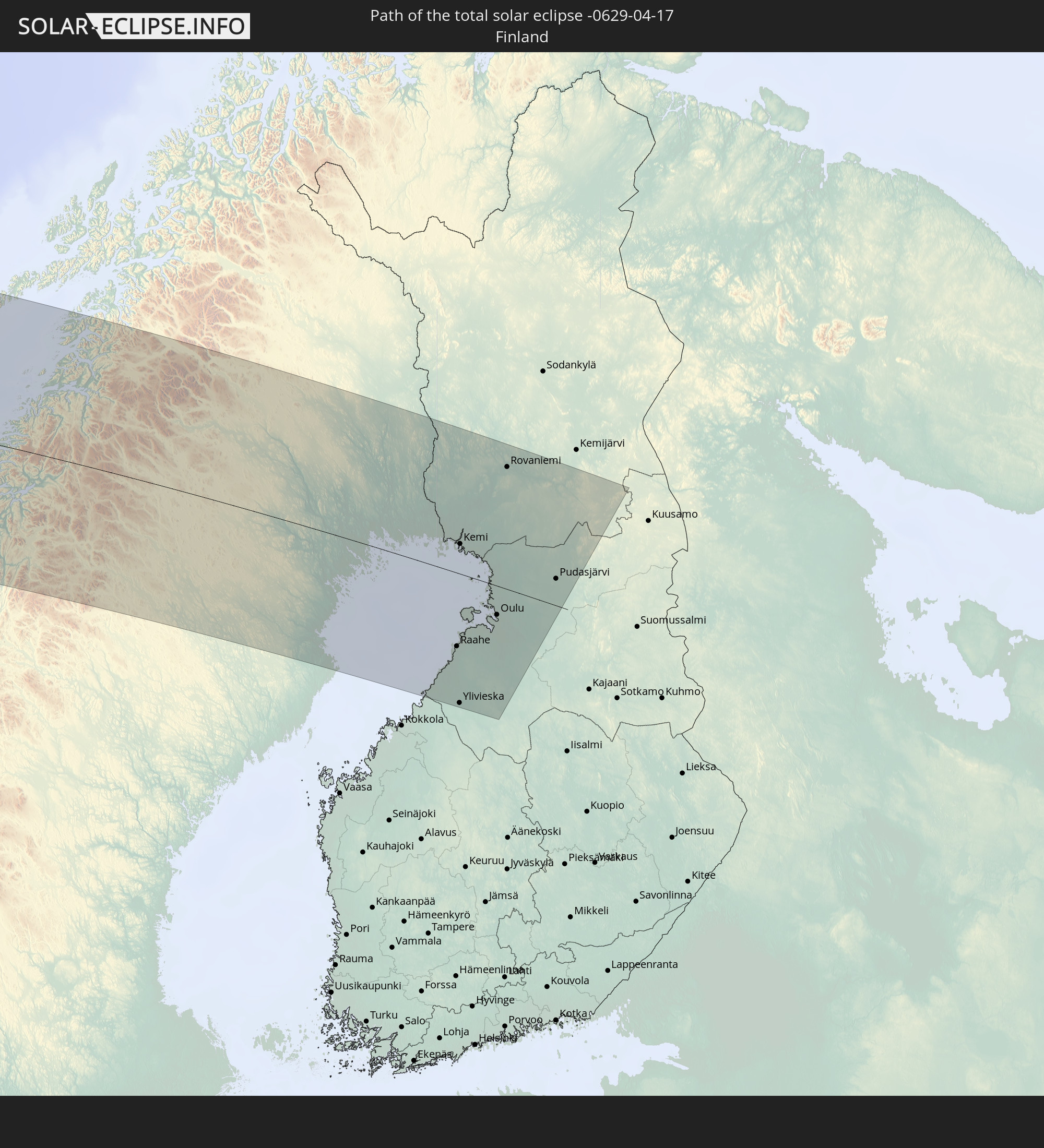 Finland
In den folgenden Ländern ist die Sonnenfinsternis partiell zu sehen
 Russia
 United States
 United States Minor Outlying Islands
 Canada
 Mexico
 Greenland
 Guatemala
 El Salvador
 Honduras
 Belize
 Nicaragua
 Costa Rica
 Cuba
Cuba
 Colombia
 Cayman Islands
 The Bahamas
 Jamaica
 Haiti
Haiti
 Turks and Caicos Islands
 Dominican Republic
 Bermuda
 Saint Pierre and Miquelon
 Portugal
 Iceland
 Spain
Spain
 Morocco
 Republic of Ireland
 Svalbard and Jan Mayen
 Algeria
 United Kingdom
 Faroe Islands
 Gibraltar
 France
 Isle of Man
 Guernsey
 Jersey
 Andorra
 Belgium
 Netherlands
 Norway
 Luxembourg
 Germany
 Switzerland
 Italy
Italy
 Monaco
 Denmark
 Liechtenstein
 Austria
 Sweden
 Czechia
 Poland
 Åland Islands
 Finland
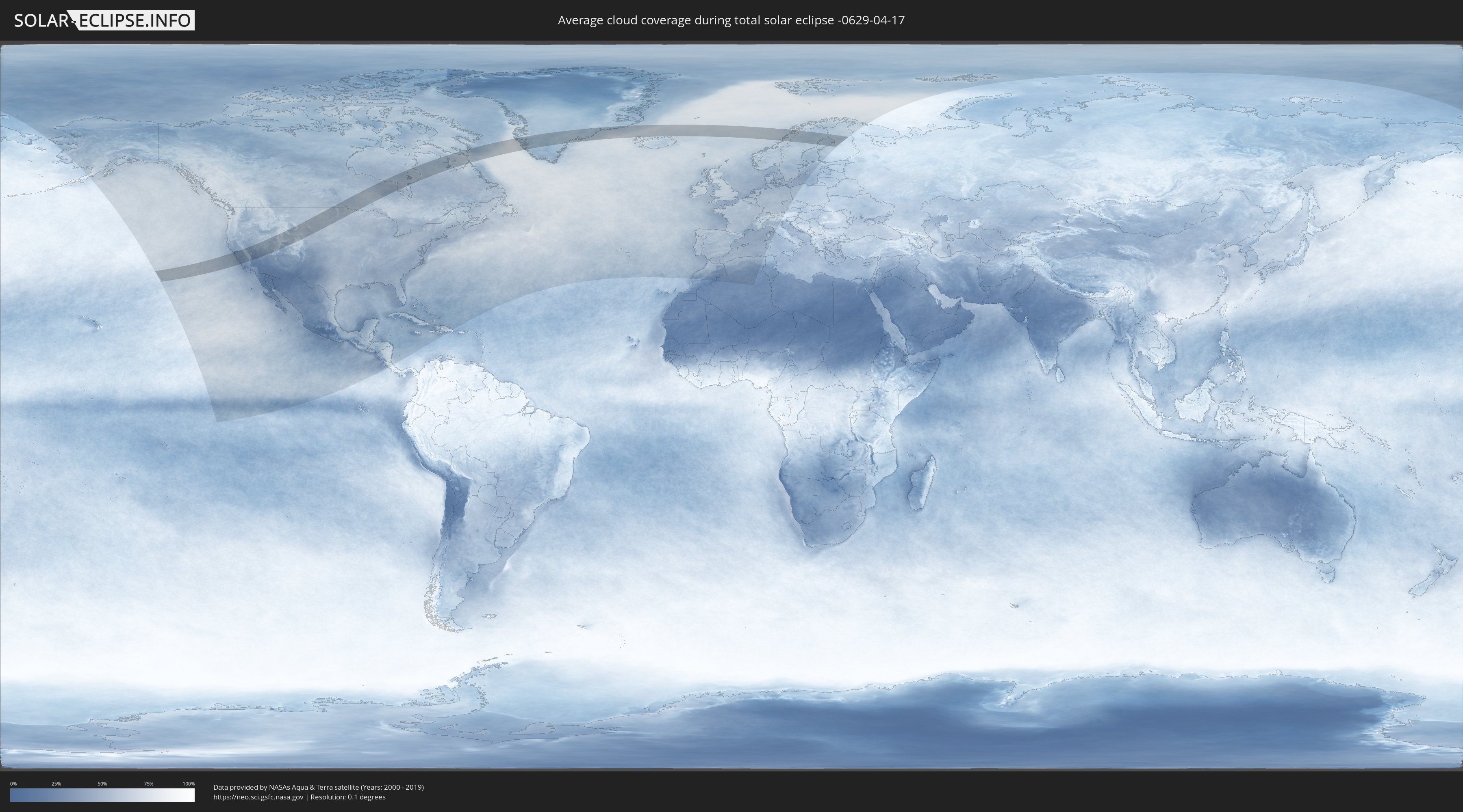
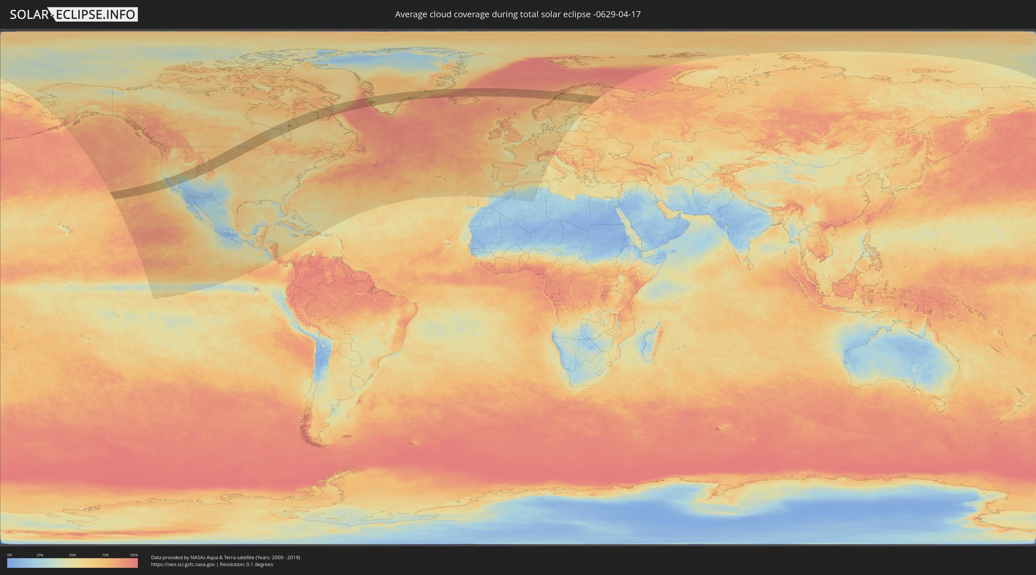
How will be the weather during the total solar eclipse on 04/17/-0629?
Where is the best place to see the total solar eclipse of 04/17/-0629?
The following maps show the average cloud coverage for the day of the total solar eclipse.
With the help of these maps, it is possible to find the place along the eclipse path, which has the best
chance of a cloudless sky.
Nevertheless, you should consider local circumstances and inform about the weather of your chosen
observation site.
The data is provided by NASAs satellites
AQUA and TERRA.
The cloud maps are averaged over a period of 19 years (2000 - 2019).
Detailed country maps
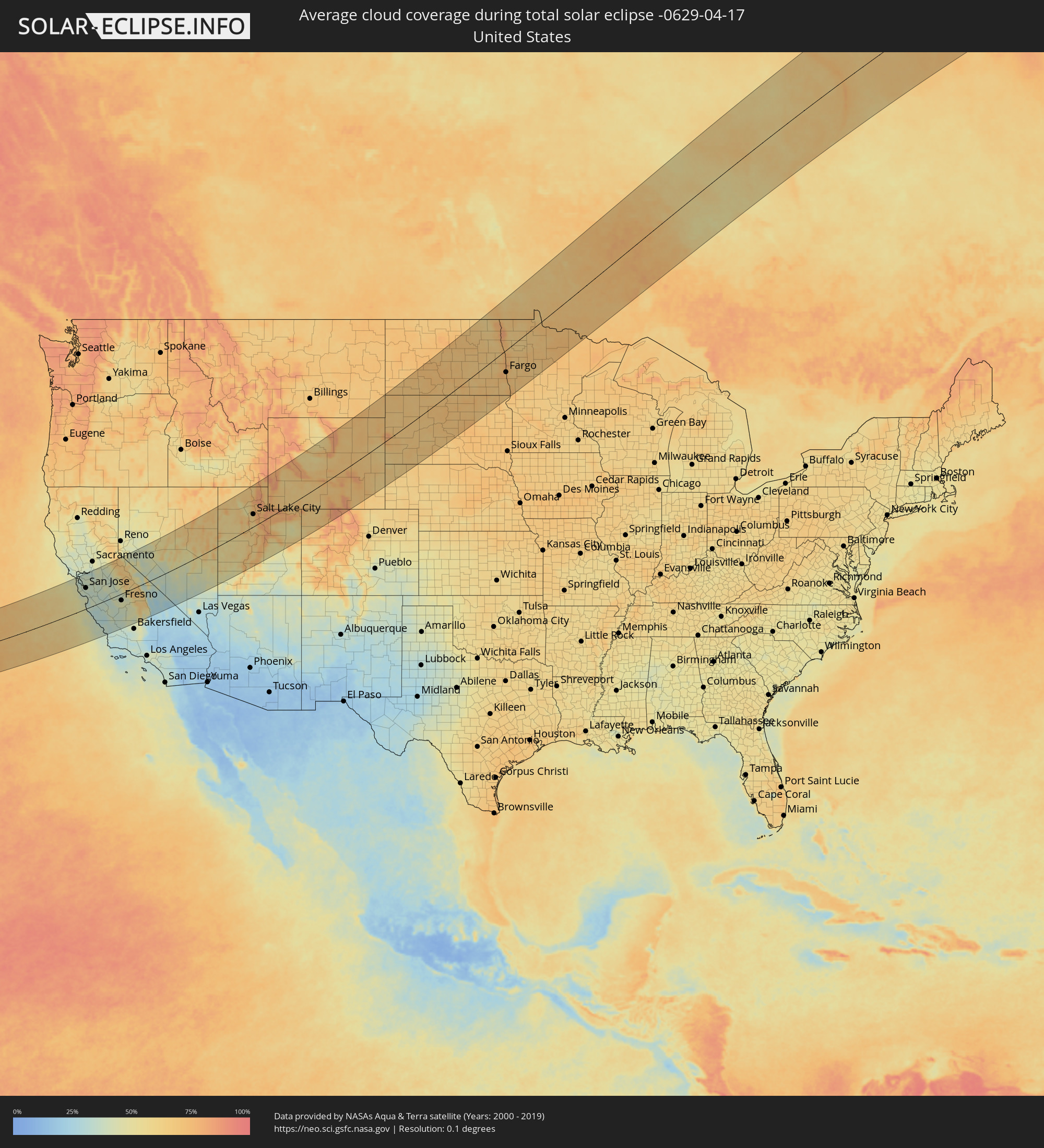 United States
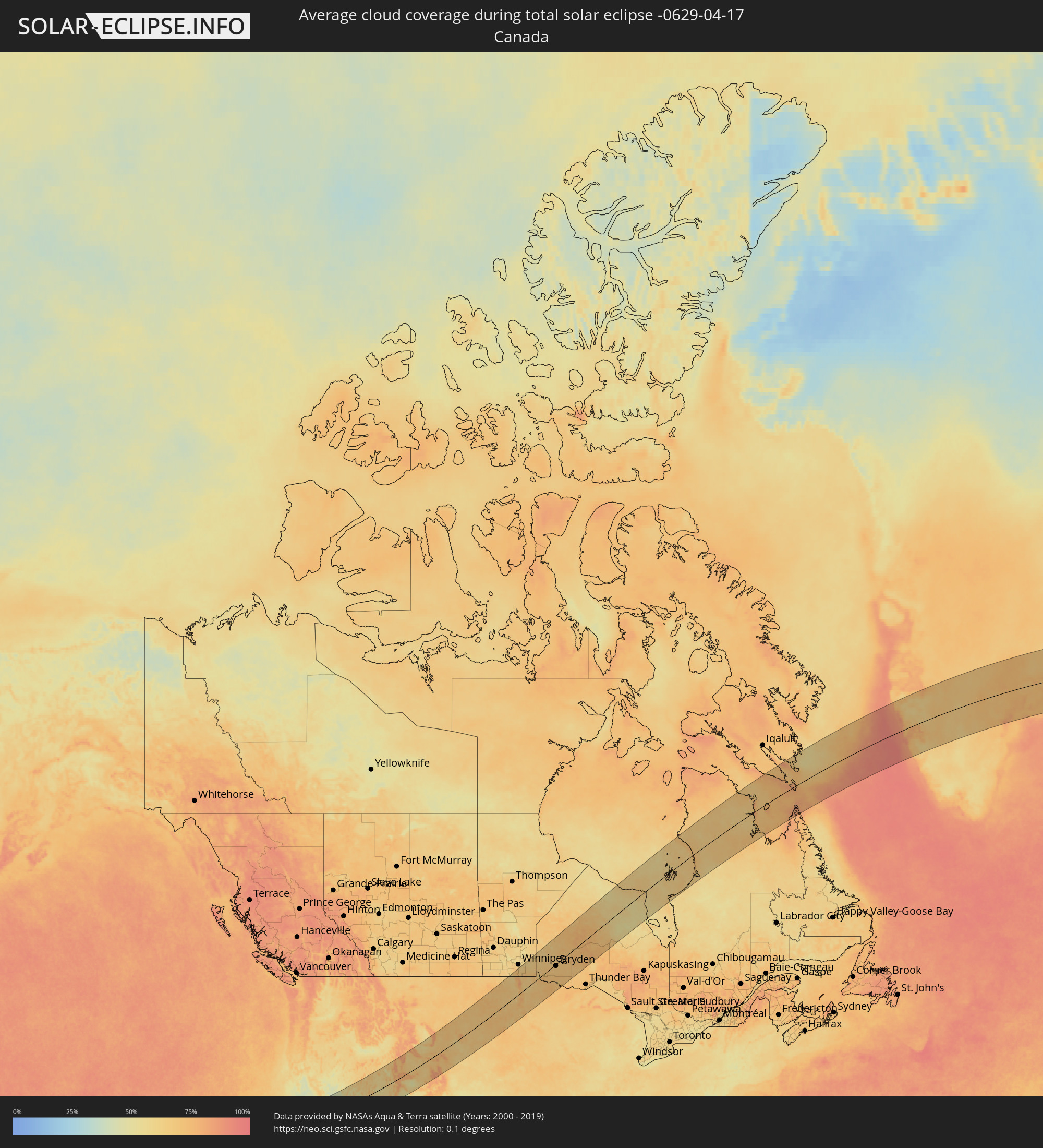 Canada
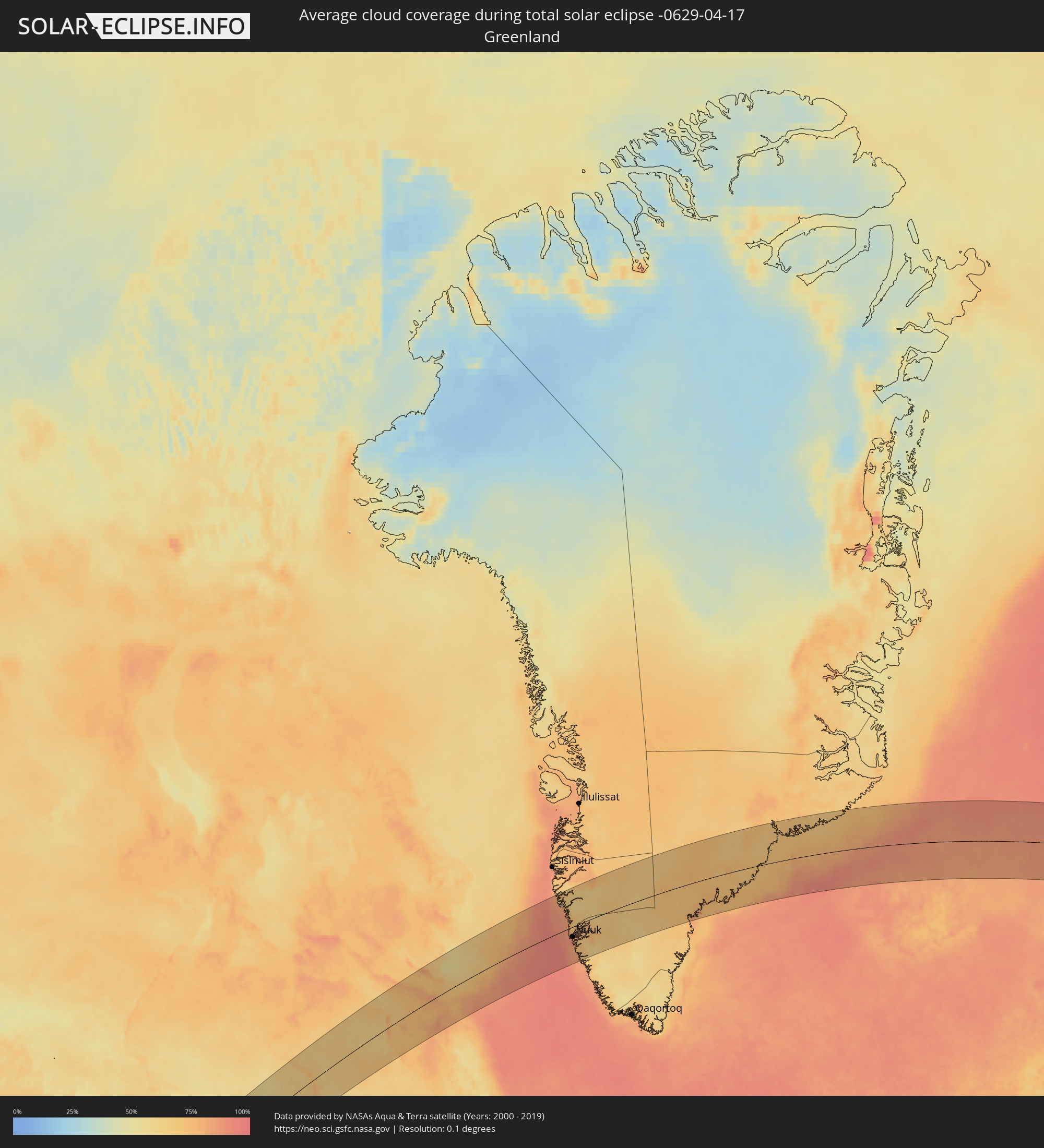 Greenland
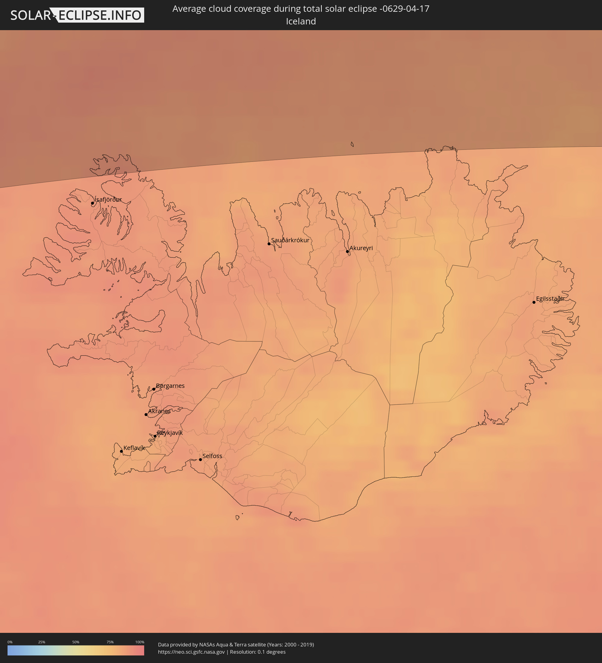 Iceland
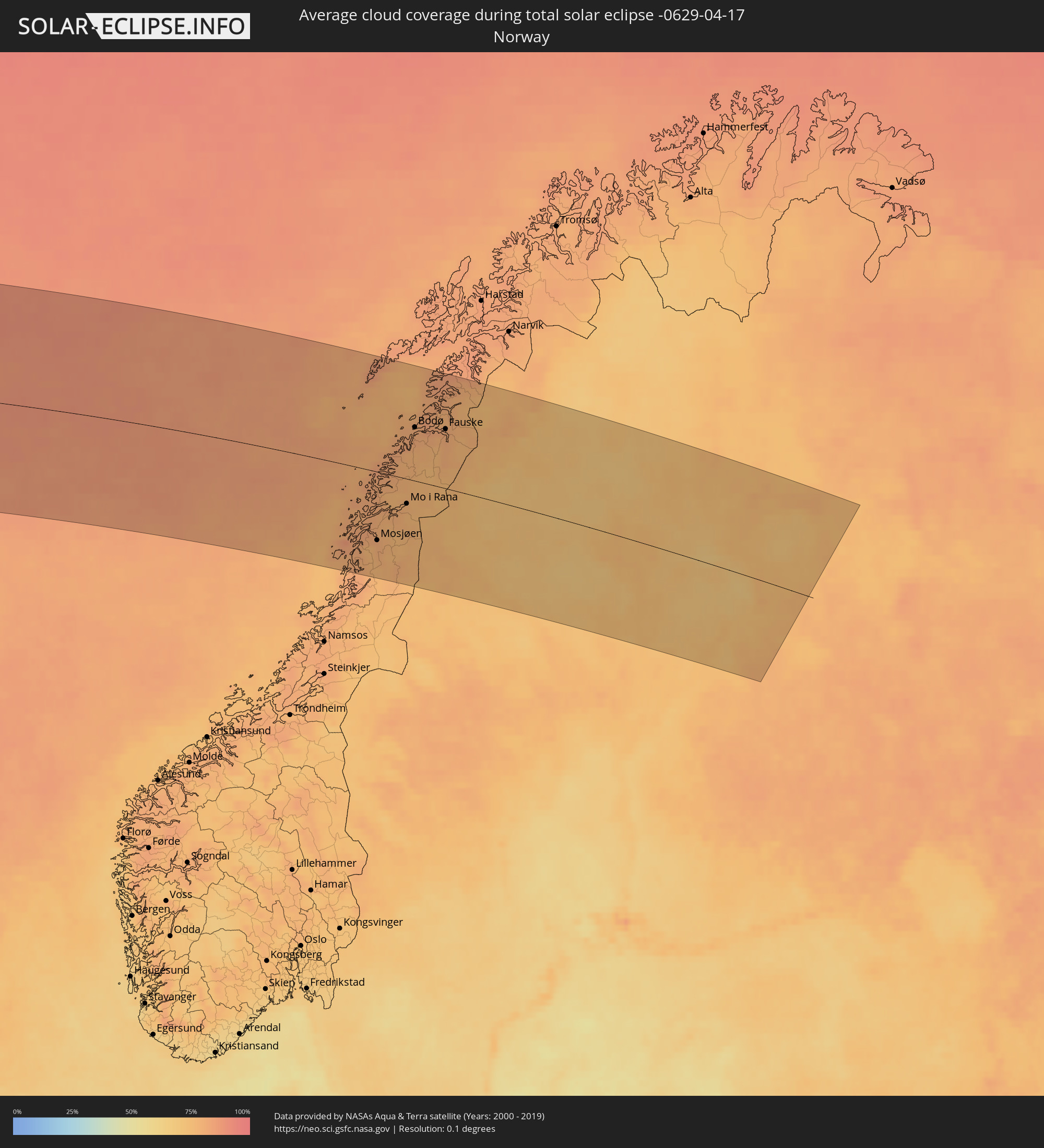 Norway
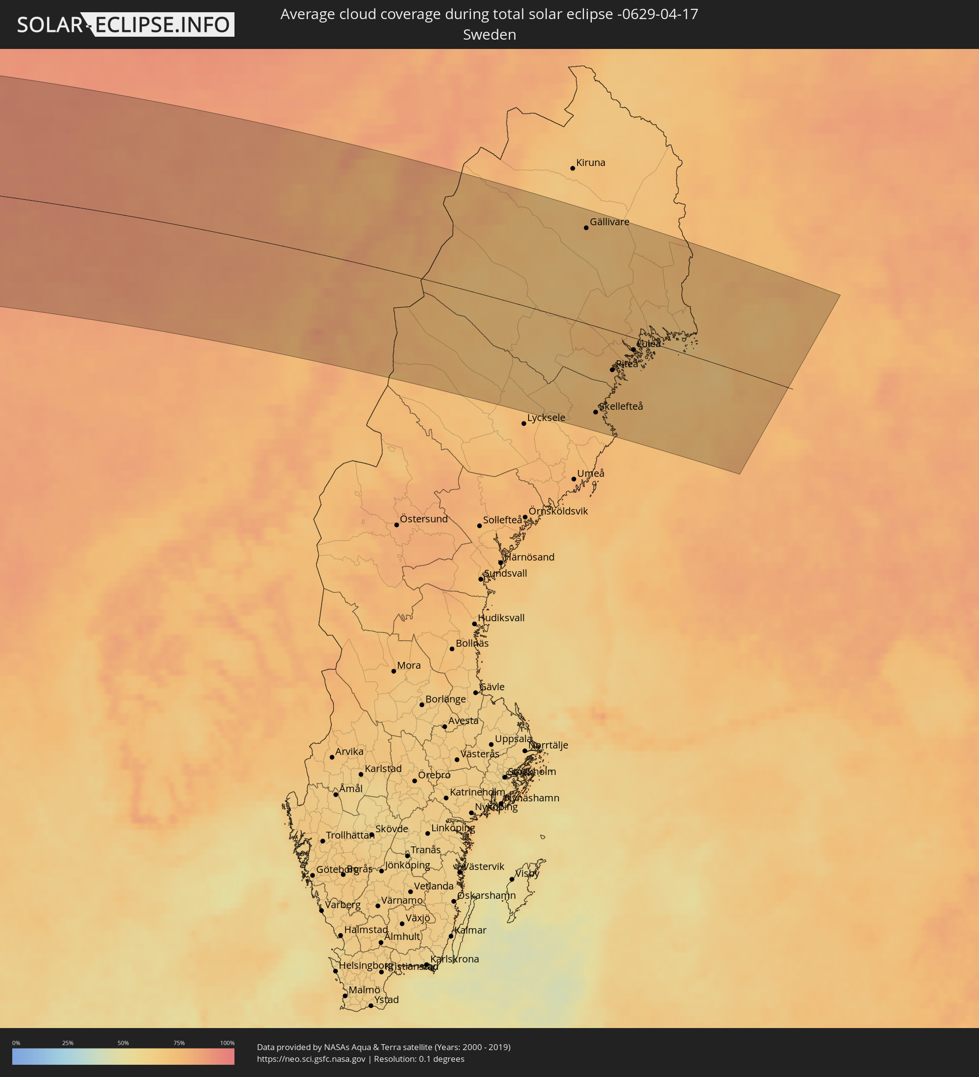 Sweden
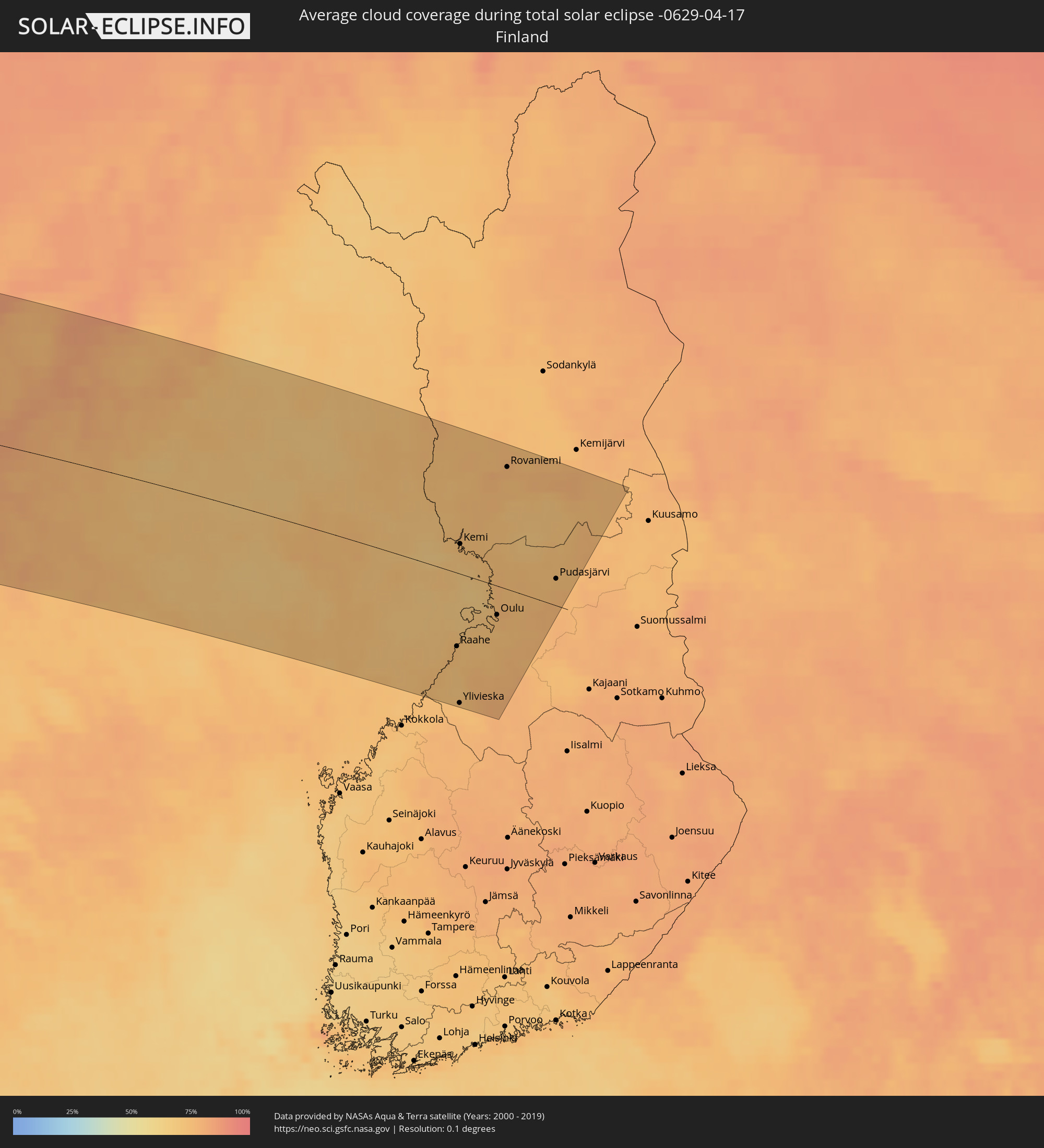 Finland
Cities inside the path of the eclipse
The following table shows all locations with a population of more than 5,000 inside the eclipse path. Cities which have more than 100,000 inhabitants are marked bold. A click at the locations opens a detailed map.
| City | Type | Eclipse duration | Local time of max. eclipse | Distance to central line | Ø Cloud coverage |
|
San Francisco, California
|
total | - | 07:14:41 UTC-08:00 | 166 km | 37% |
|
San Mateo, California
|
total | - | 07:14:22 UTC-08:00 | 142 km | 33% |
|
Berkeley, California
|
total | - | 07:14:54 UTC-08:00 | 170 km | 36% |
|
Mountain View, California
|
total | - | 07:14:10 UTC-08:00 | 114 km | 37% |
|
Hayward, California
|
total | - | 07:14:38 UTC-08:00 | 142 km | 35% |
|
Concord, California
|
total | - | 07:15:09 UTC-08:00 | 174 km | 38% |
|
Santa Cruz, California
|
total | - | 07:13:31 UTC-08:00 | 73 km | 42% |
|
Fremont, California
|
total | - | 07:14:28 UTC-08:00 | 127 km | 42% |
|
San Ramon, California
|
total | - | 07:14:51 UTC-08:00 | 151 km | 38% |
|
San Jose, California
|
total | - | 07:14:09 UTC-08:00 | 102 km | 36% |
|
Antioch, California
|
total | - | 07:15:17 UTC-08:00 | 167 km | 37% |
|
Livermore, California
|
total | - | 07:14:46 UTC-08:00 | 134 km | 38% |
|
Salinas, California
|
total | - | 07:13:09 UTC-08:00 | 26 km | 33% |
|
Tracy, California
|
total | - | 07:14:59 UTC-08:00 | 128 km | 39% |
|
Stockton, California
|
total | - | 07:15:23 UTC-08:00 | 145 km | 40% |
|
Lodi, California
|
total | - | 07:15:41 UTC-08:00 | 162 km | 41% |
|
Manteca, California
|
total | - | 07:15:09 UTC-08:00 | 127 km | 41% |
|
Modesto, California
|
total | - | 07:14:58 UTC-08:00 | 102 km | 41% |
|
Turlock, California
|
total | - | 07:14:47 UTC-08:00 | 82 km | 43% |
|
Merced, California
|
total | - | 07:14:36 UTC-08:00 | 54 km | 41% |
|
Madera, California
|
total | - | 07:14:13 UTC-08:00 | 6 km | 38% |
|
Fresno, California
|
total | - | 07:13:58 UTC-08:00 | 34 km | 45% |
|
Hanford, California
|
total | - | 07:13:20 UTC-08:00 | 80 km | 39% |
|
Visalia, California
|
total | - | 07:13:29 UTC-08:00 | 95 km | 43% |
|
Porterville, California
|
total | - | 07:13:10 UTC-08:00 | 130 km | 43% |
|
Ogden, Utah
|
total | - | 08:25:42 UTC-07:00 | 103 km | 66% |
|
Layton, Utah
|
total | - | 08:25:25 UTC-07:00 | 86 km | 65% |
|
West Jordan, Utah
|
total | - | 08:24:39 UTC-07:00 | 46 km | 65% |
|
Salt Lake City, Utah
|
total | - | 08:24:57 UTC-07:00 | 54 km | 62% |
|
Provo, Utah
|
total | - | 08:24:11 UTC-07:00 | 20 km | 60% |
|
Casper, Wyoming
|
total | - | 08:32:44 UTC-07:00 | 22 km | 70% |
|
Rapid City, South Dakota
|
total | - | 08:37:30 UTC-07:00 | 28 km | 71% |
|
Bismarck, North Dakota
|
total | - | 09:44:28 UTC-06:00 | 102 km | 72% |
|
Winkler, Manitoba
|
total | - | 09:51:13 UTC-06:00 | 175 km | 62% |
|
Fargo, North Dakota
|
total | - | 09:48:34 UTC-06:00 | 79 km | 71% |
|
Steinbach, Manitoba
|
total | - | 09:53:03 UTC-06:00 | 146 km | 64% |
|
Fort Frances, Ontario
|
total | - | 09:55:02 UTC-06:00 | 85 km | 70% |
|
Dryden, Ontario
|
total | - | 09:57:37 UTC-06:00 | 18 km | 67% |
|
Nuuk, Sermersooq
|
total | - | 13:26:04 UTC-03:26 | 42 km | 82% |
|
Sandnessjøen, Nordland
|
total | - | 18:19:24 UTC+01:00 | 82 km | 82% |
|
Mosjøen, Nordland
|
total | - | 18:19:40 UTC+01:00 | 96 km | 80% |
|
Mo i Rana, Nordland
|
total | - | 18:18:59 UTC+01:00 | 35 km | 78% |
|
Bodø, Nordland
|
total | - | 18:17:37 UTC+01:00 | 73 km | 80% |
|
Fauske, Nordland
|
total | - | 18:17:37 UTC+01:00 | 81 km | 81% |
|
Gällivare, Norrbotten
|
total | - | 18:17:28 UTC+01:00 | 129 km | 71% |
|
Malmberget, Norrbotten
|
total | - | 18:17:24 UTC+01:00 | 133 km | 73% |
|
Skellefteå, Västerbotten
|
total | - | 18:20:38 UTC+01:00 | 122 km | 74% |
|
Älvsbyn, Norrbotten
|
total | - | 18:19:24 UTC+01:00 | 23 km | 76% |
|
Piteå, Norrbotten
|
total | - | 18:19:50 UTC+01:00 | 55 km | 73% |
|
Boden, Norrbotten
|
total | - | 18:19:08 UTC+01:00 | 9 km | 74% |
|
Luleå, Norrbotten
|
total | - | 18:19:24 UTC+01:00 | 21 km | 73% |
|
Kalix, Norrbotten
|
total | - | 18:18:55 UTC+01:00 | 25 km | 71% |
|
Ylitornio, Lapland
|
total | - | 18:58:03 UTC+01:39 | 81 km | 73% |
|
Kalajoki, Northern Ostrobothnia
|
total | - | 19:00:42 UTC+01:39 | 135 km | 72% |
|
Tornio, Lapland
|
total | - | 18:58:36 UTC+01:39 | 38 km | 70% |
|
Raahe, Northern Ostrobothnia
|
total | - | 19:00:04 UTC+01:39 | 81 km | 73% |
|
Keminmaa, Lapland
|
total | - | 18:58:36 UTC+01:39 | 40 km | 74% |
|
Ylivieska, Northern Ostrobothnia
|
total | - | 19:00:50 UTC+01:39 | 143 km | 73% |
|
Kemi, Lapland
|
total | - | 18:58:41 UTC+01:39 | 33 km | 72% |
|
Oulainen, Northern Ostrobothnia
|
total | - | 19:00:33 UTC+01:39 | 120 km | 75% |
|
Haukipudas, Northern Ostrobothnia
|
total | - | 18:59:17 UTC+01:39 | 16 km | 74% |
|
Haapavesi, Northern Ostrobothnia
|
total | - | 19:00:38 UTC+01:39 | 126 km | 78% |
|
Ii, Northern Ostrobothnia
|
total | - | 18:59:06 UTC+01:39 | 6 km | 75% |
|
Oulunsalo, Northern Ostrobothnia
|
total | - | 18:59:36 UTC+01:39 | 42 km | 72% |
|
Liminka, Northern Ostrobothnia
|
total | - | 18:59:45 UTC+01:39 | 55 km | 73% |
|
Oulu, Northern Ostrobothnia
|
total | - | 18:59:29 UTC+01:39 | 33 km | 75% |
|
Kempele, Northern Ostrobothnia
|
total | - | 18:59:36 UTC+01:39 | 43 km | 72% |
|
Tyrnävä, Northern Ostrobothnia
|
total | - | 18:59:46 UTC+01:39 | 55 km | 73% |
|
Rovaniemi, Lapland
|
total | - | 18:57:30 UTC+01:39 | 130 km | 76% |
|
Kiiminki, Northern Ostrobothnia
|
total | - | 18:59:17 UTC+01:39 | 15 km | 75% |
|
Muhos, Northern Ostrobothnia
|
total | - | 18:59:40 UTC+01:39 | 46 km | 75% |
|
Pudasjärvi, Northern Ostrobothnia
|
total | - | 18:58:46 UTC+01:39 | 31 km | 74% |