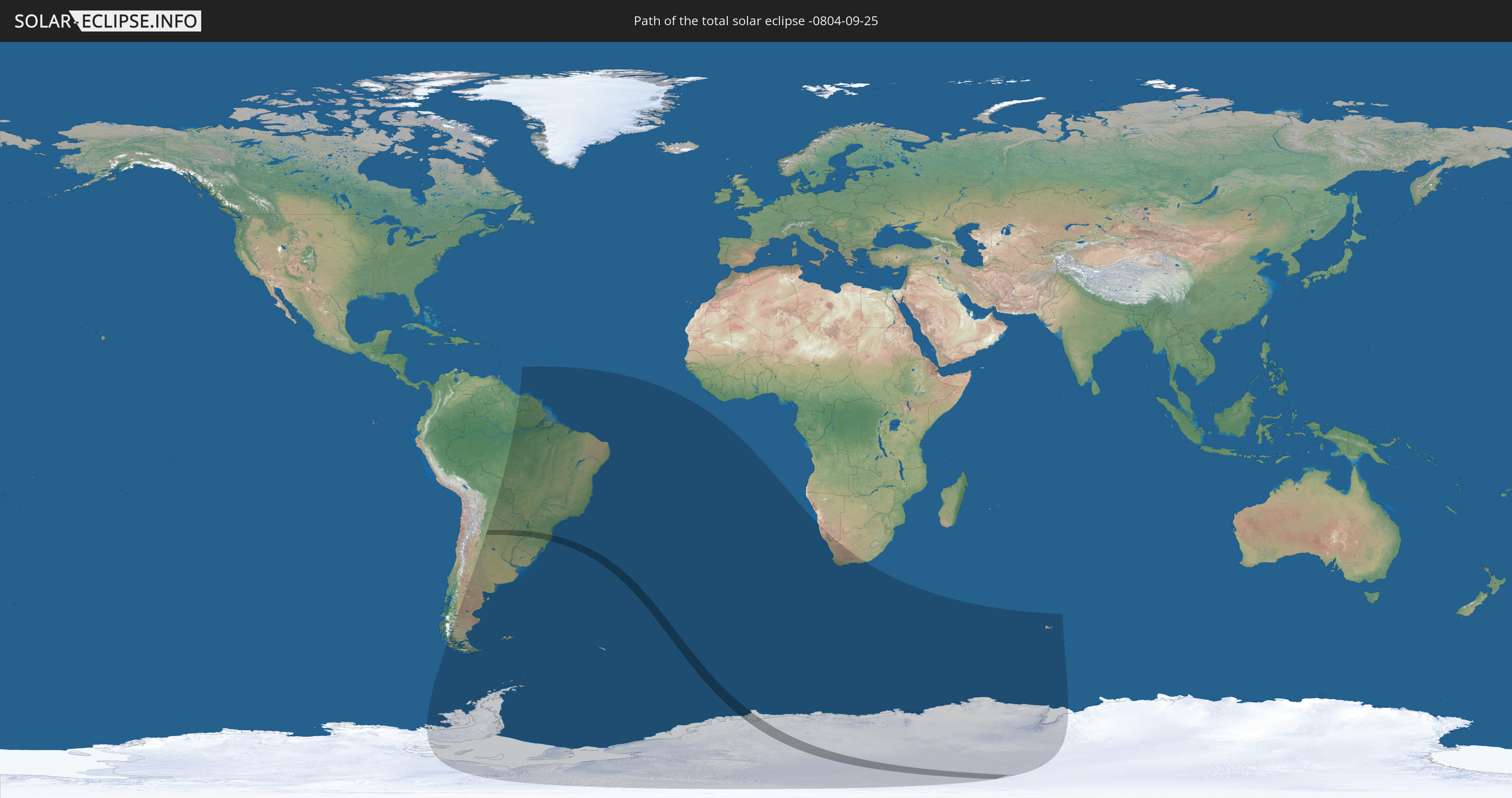
Total solar eclipse of 09/25/-0804
| Day of week: | Tuesday |
| Maximum duration of eclipse: | 02m03s |
| Maximum width of eclipse path: | 167 km |
| Saros cycle: | 60 |
| Coverage: | 100% |
| Magnitude: | 1.0284 |
| Gamma: | -0.8278 |
Wo kann man die Sonnenfinsternis vom 09/25/-0804 sehen?
Die Sonnenfinsternis am 09/25/-0804 kann man in 18 Ländern als partielle Sonnenfinsternis beobachten.
Der Finsternispfad verläuft durch 4 Länder. Nur in diesen Ländern ist sie als total Sonnenfinsternis zu sehen.
In den folgenden Ländern ist die Sonnenfinsternis total zu sehen
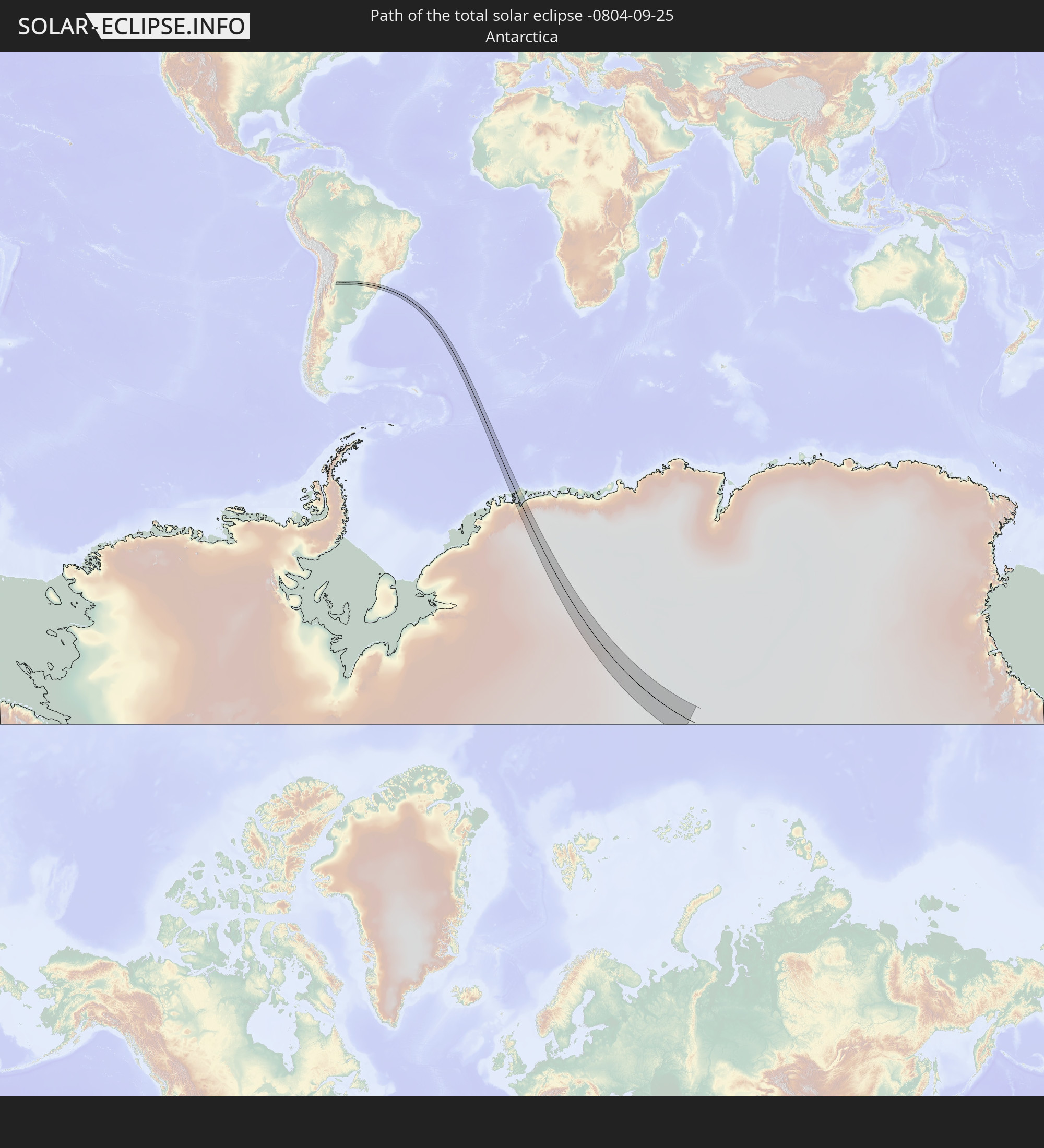 Antarctica
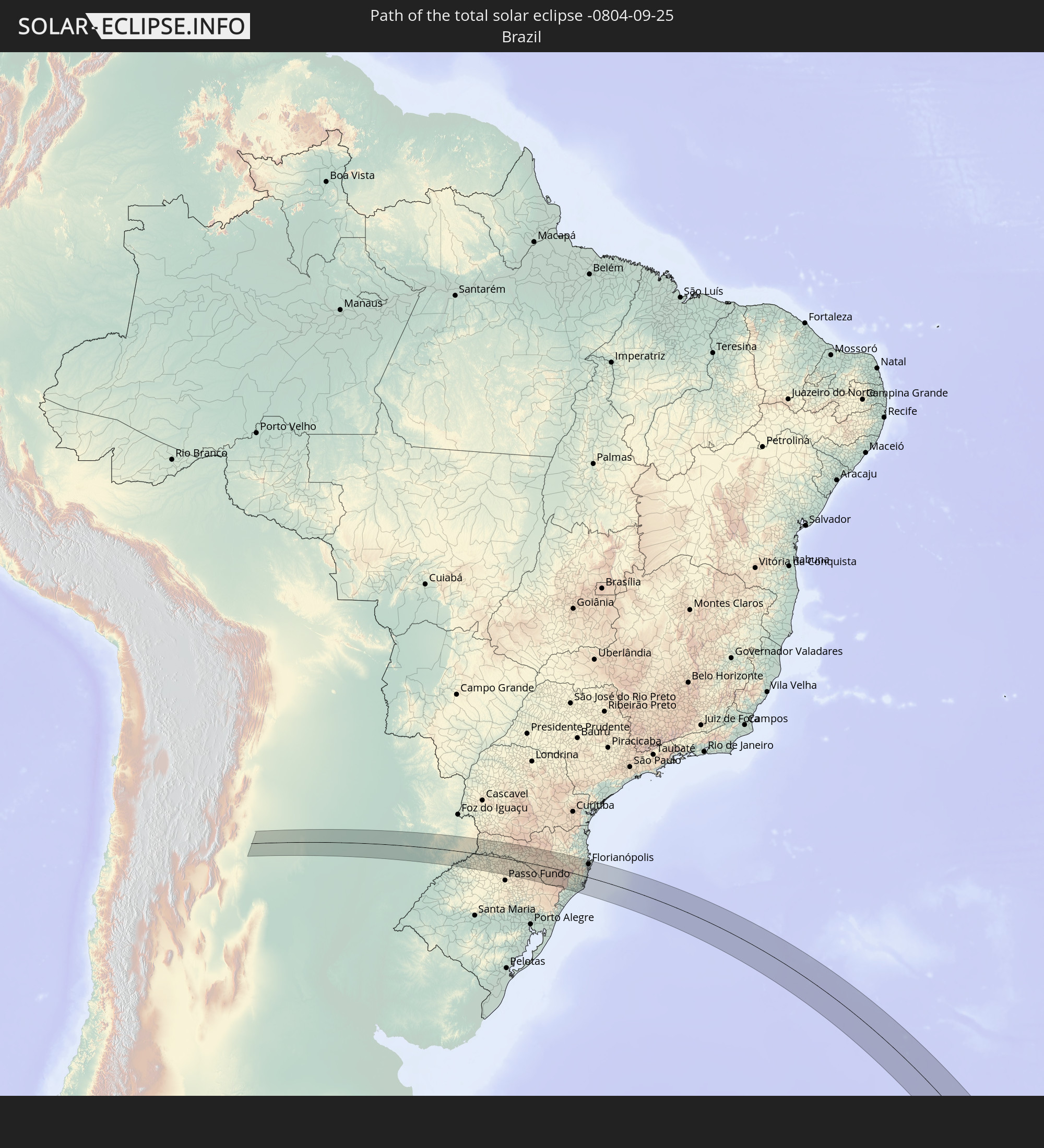 Brazil
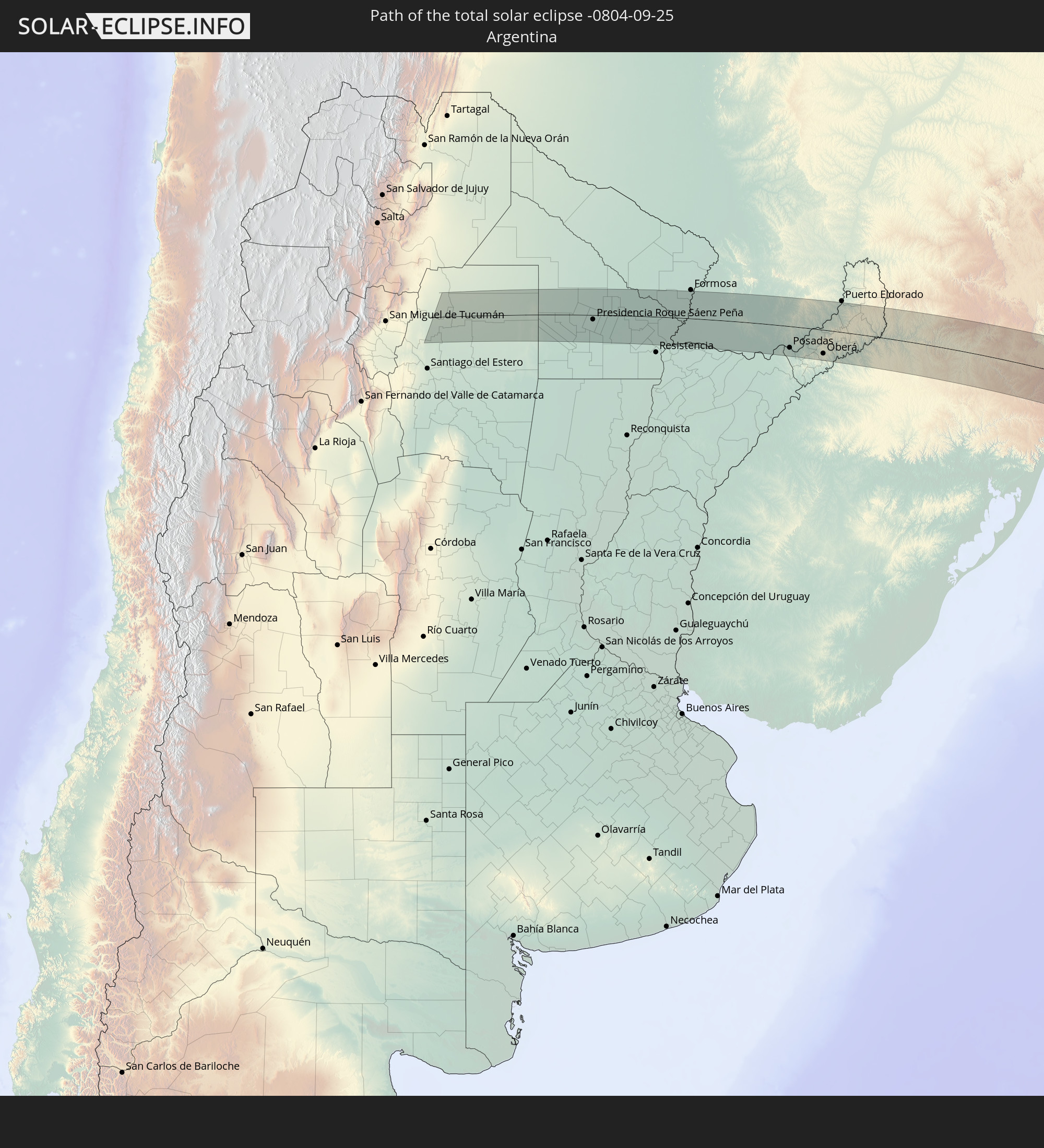 Argentina
 Paraguay
In den folgenden Ländern ist die Sonnenfinsternis partiell zu sehen
 Antarctica
 Chile
Chile
 Brazil
 Argentina
 Bolivia
 Paraguay
 Falkland Islands
 Guyana
 Uruguay
 Suriname
 French Guiana
 South Georgia and the South Sandwich Islands
 Saint Helena, Ascension and Tristan da Cunha
 Bouvet Island
 Namibia
 South Africa
 French Southern and Antarctic Lands
 Heard Island and McDonald Islands
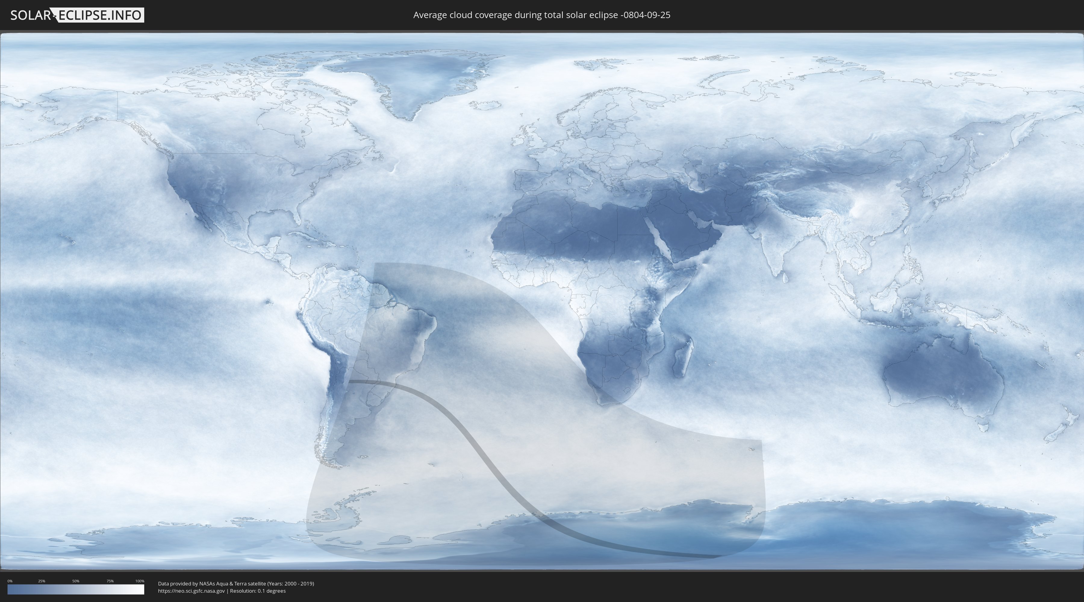
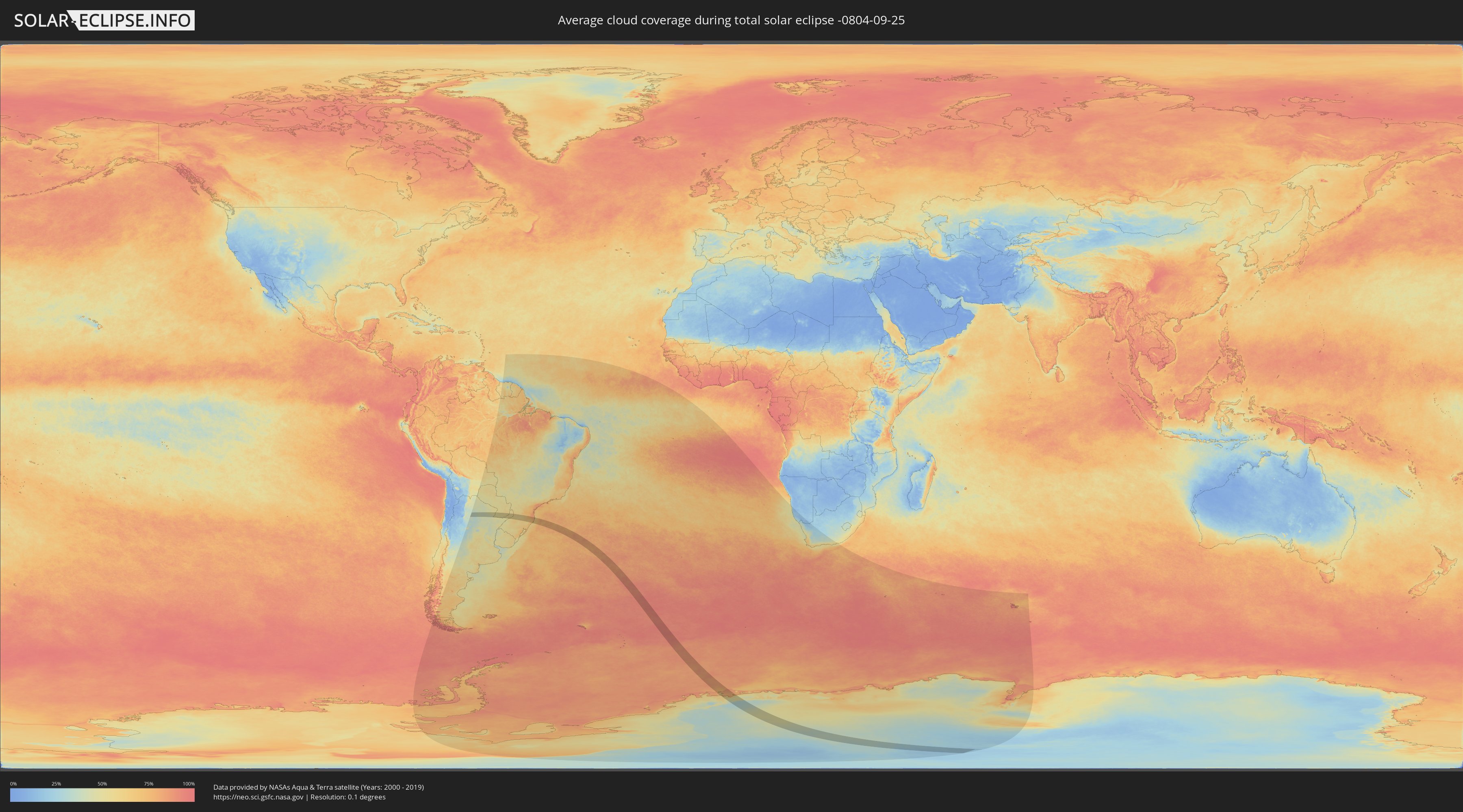
How will be the weather during the total solar eclipse on 09/25/-0804?
Where is the best place to see the total solar eclipse of 09/25/-0804?
The following maps show the average cloud coverage for the day of the total solar eclipse.
With the help of these maps, it is possible to find the place along the eclipse path, which has the best
chance of a cloudless sky.
Nevertheless, you should consider local circumstances and inform about the weather of your chosen
observation site.
The data is provided by NASAs satellites
AQUA and TERRA.
The cloud maps are averaged over a period of 19 years (2000 - 2019).
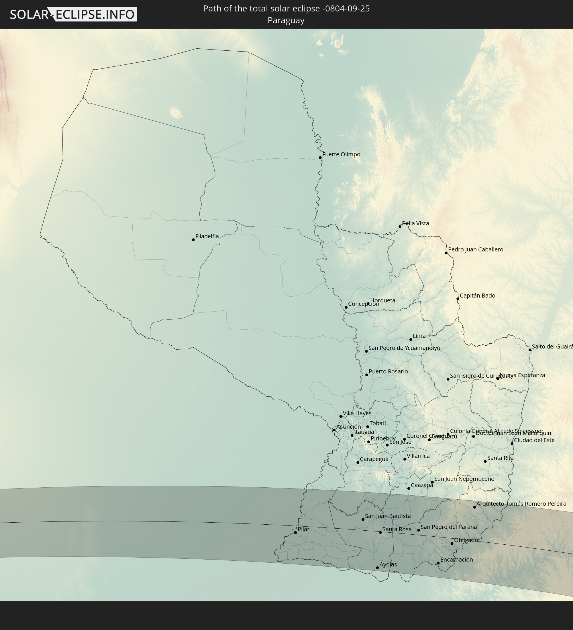
Detailed country maps
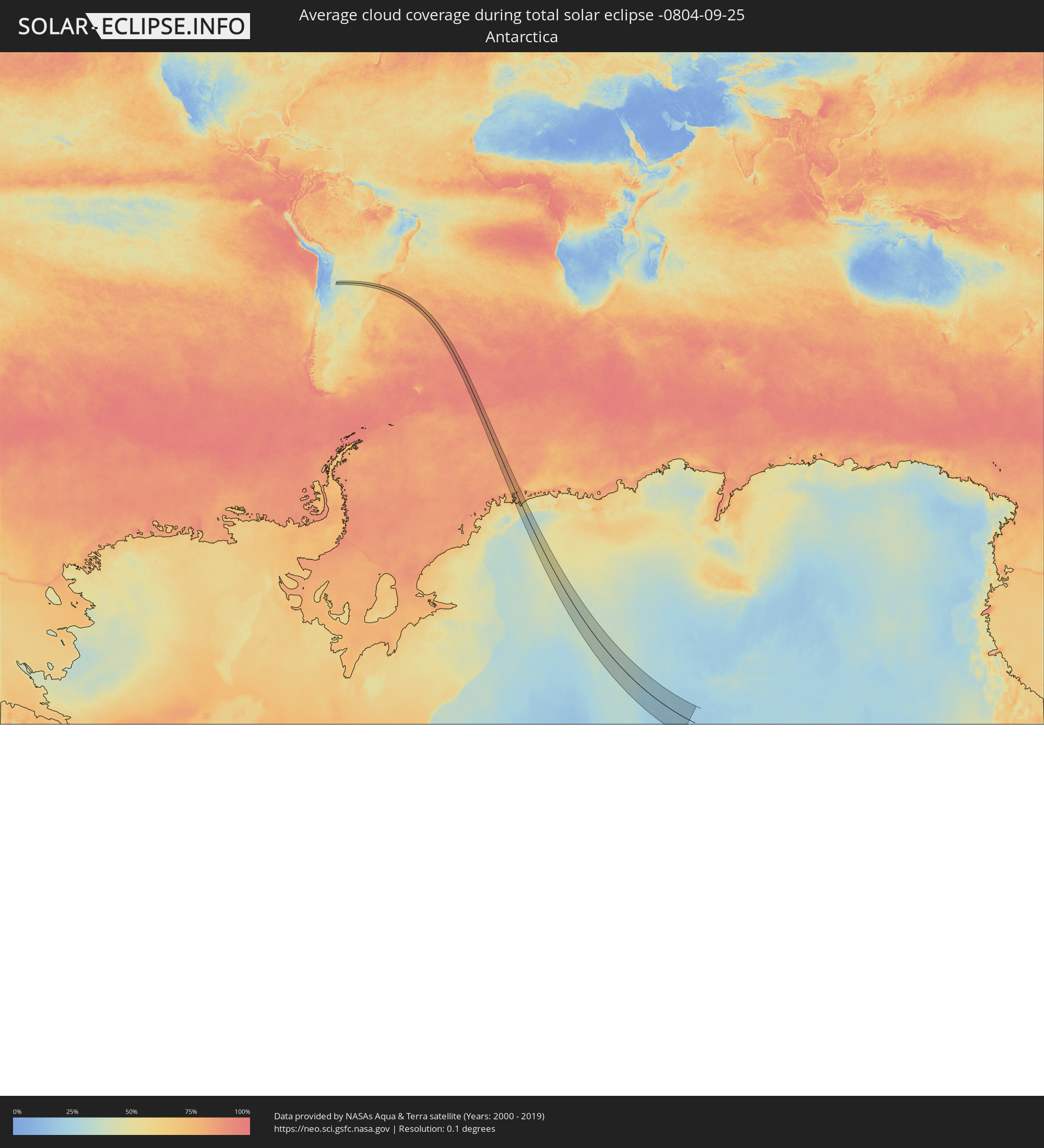 Antarctica
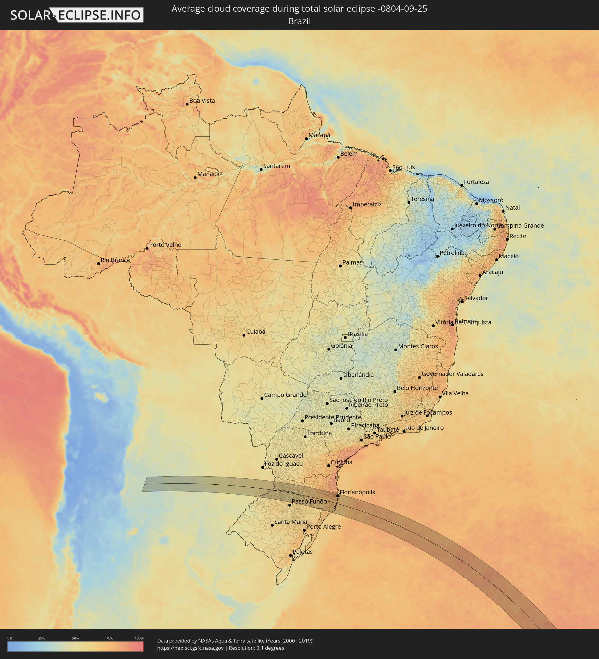 Brazil
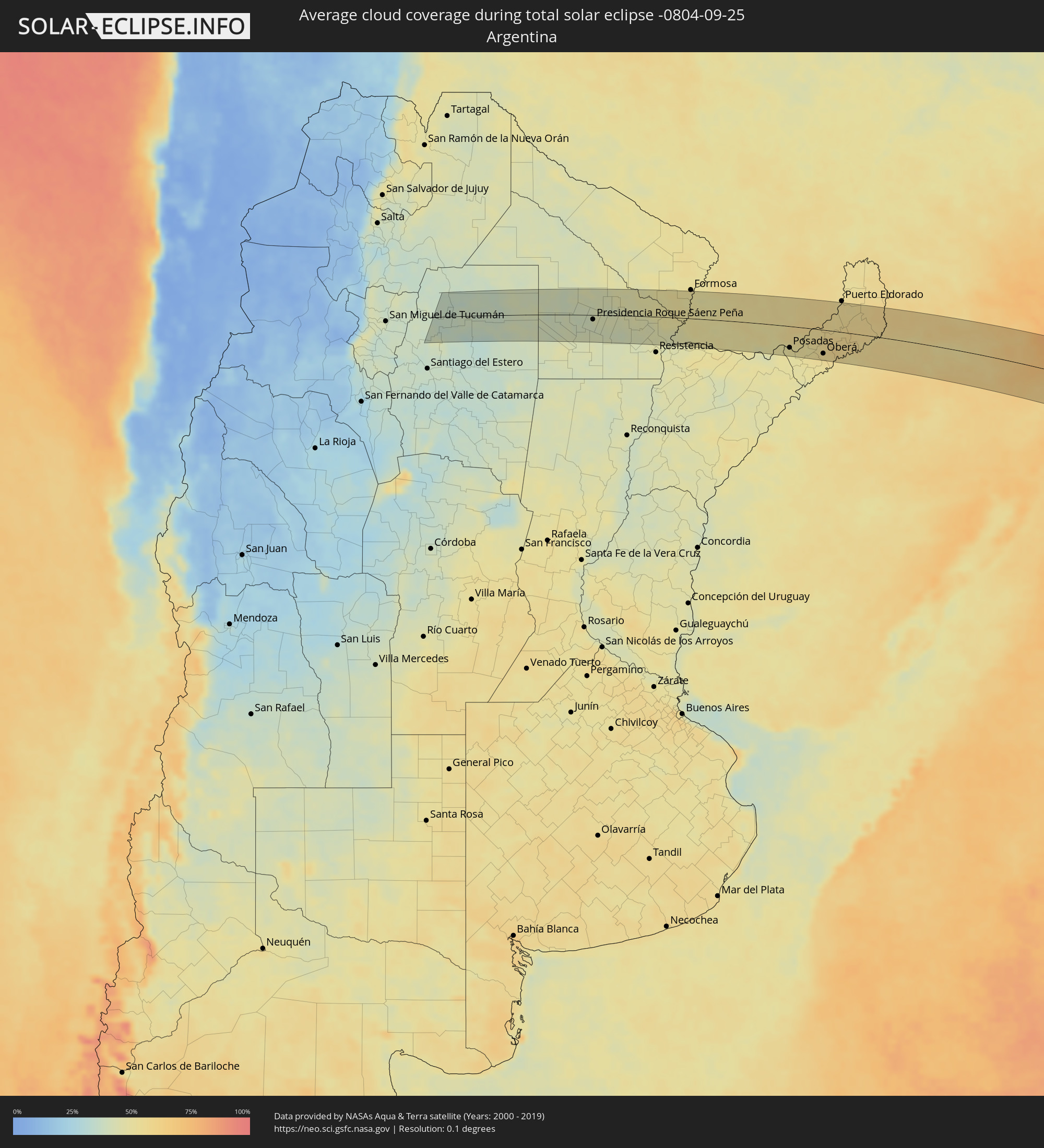 Argentina
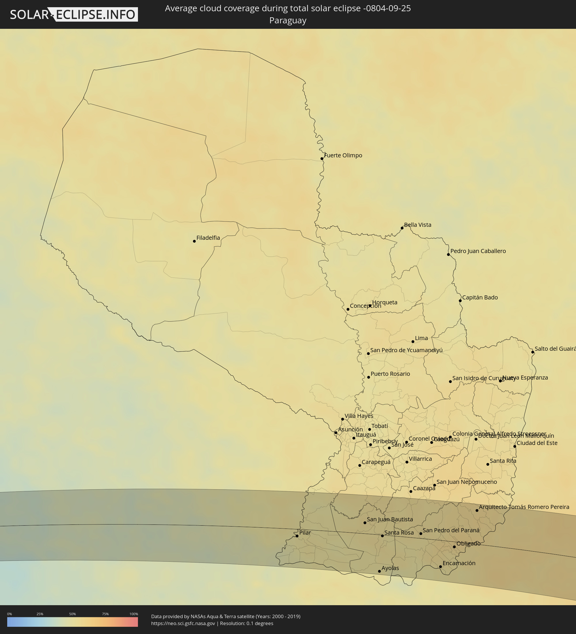 Paraguay
Cities inside the path of the eclipse
The following table shows all locations with a population of more than 5,000 inside the eclipse path. Cities which have more than 100,000 inhabitants are marked bold. A click at the locations opens a detailed map.
| City | Type | Eclipse duration | Local time of max. eclipse | Distance to central line | Ø Cloud coverage |
|
Campo Gallo, Santiago del Estero Province
|
total | - | 05:59:47 UTC-04:16 | 13 km | 37% |
|
Los Frentones, Chaco Province
|
total | - | 05:59:41 UTC-04:16 | 31 km | 40% |
|
Charata, Chaco Province
|
total | - | 06:00:58 UTC-04:16 | 59 km | 44% |
|
Pampa del Infierno, Chaco Province
|
total | - | 05:59:52 UTC-04:16 | 20 km | 39% |
|
Las Breñas, Chaco Province
|
total | - | 06:00:47 UTC-04:16 | 45 km | 42% |
|
Corzuela, Chaco Province
|
total | - | 06:00:36 UTC-04:16 | 30 km | 42% |
|
Concepción del Bermejo, Chaco Province
|
total | - | 06:00:02 UTC-04:16 | 10 km | 39% |
|
Campo Largo, Chaco Province
|
total | - | 06:00:22 UTC-04:16 | 12 km | 40% |
|
Aviá Terai, Chaco Province
|
total | - | 06:00:12 UTC-04:16 | 1 km | 39% |
|
Presidencia Roque Sáenz Peña, Chaco Province
|
total | - | 06:00:25 UTC-04:16 | 10 km | 41% |
|
Tres Isletas, Chaco Province
|
total | - | 05:59:43 UTC-04:16 | 39 km | 43% |
|
Quitilipi, Chaco Province
|
total | - | 06:00:35 UTC-04:16 | 19 km | 41% |
|
Machagai, Chaco Province
|
total | - | 06:00:42 UTC-04:16 | 25 km | 42% |
|
Presidencia de la Plaza, Chaco Province
|
total | - | 06:00:51 UTC-04:16 | 33 km | 39% |
|
El Colorado, Formosa Province
|
total | - | 05:59:51 UTC-04:16 | 46 km | 47% |
|
General José de San Martín, Chaco Province
|
total | - | 06:00:13 UTC-04:16 | 20 km | 47% |
|
Margarita Belén, Chaco Province
|
total | - | 06:01:26 UTC-04:16 | 59 km | 46% |
|
La Leonesa, Chaco Province
|
total | - | 06:01:08 UTC-04:16 | 33 km | 44% |
|
Paso de la Patria, Corrientes Province
|
total | - | 06:01:37 UTC-04:16 | 63 km | 44% |
|
Pilar, Ñeembucú
|
total | - | 06:27:05 UTC-03:50 | 12 km | 49% |
|
Itatí, Corrientes Province
|
total | - | 06:01:37 UTC-04:16 | 56 km | 47% |
|
San Juan Bautista, Misiones
|
total | - | 06:27:02 UTC-03:50 | 18 km | 53% |
|
Ayolas, Misiones
|
total | - | 06:28:17 UTC-03:50 | 62 km | 48% |
|
Santa Rosa, Misiones
|
total | - | 06:27:26 UTC-03:50 | 2 km | 54% |
|
San Pedro del Paraná, Itapúa
|
total | - | 06:27:33 UTC-03:50 | 7 km | 52% |
|
Posadas, Misiones Province
|
total | - | 06:02:23 UTC-04:16 | 49 km | 49% |
|
Encarnación, Itapúa
|
total | - | 06:28:28 UTC-03:50 | 44 km | 51% |
|
Garupá, Misiones Province
|
total | - | 06:02:36 UTC-04:16 | 61 km | 48% |
|
Hohenau, Itapúa
|
total | - | 06:28:06 UTC-03:50 | 16 km | 54% |
|
Candelaria, Misiones Province
|
total | - | 06:02:35 UTC-04:16 | 57 km | 48% |
|
Obligado, Itapúa
|
total | - | 06:28:03 UTC-03:50 | 9 km | 54% |
|
Gobernador Roca, Misiones Province
|
total | - | 06:02:13 UTC-04:16 | 24 km | 52% |
|
Santo Pipó, Misiones Province
|
total | - | 06:02:10 UTC-04:16 | 19 km | 54% |
|
Arquitecto Tomás Romero Pereira, Itapúa
|
total | - | 06:27:16 UTC-03:50 | 56 km | 57% |
|
Jardín América, Misiones Province
|
total | - | 06:02:03 UTC-04:16 | 6 km | 55% |
|
Oberá, Misiones Province
|
total | - | 06:02:49 UTC-04:16 | 54 km | 55% |
|
Capioví, Misiones Province
|
total | - | 06:01:55 UTC-04:16 | 9 km | 56% |
|
Campo Viera, Misiones Province
|
total | - | 06:02:41 UTC-04:16 | 41 km | 55% |
|
Puerto Rico, Misiones Province
|
total | - | 06:01:43 UTC-04:16 | 24 km | 55% |
|
Campo Ramón, Misiones Province
|
total | - | 06:02:49 UTC-04:16 | 50 km | 55% |
|
Campo Grande, Misiones Province
|
total | - | 06:02:24 UTC-04:16 | 21 km | 56% |
|
Garuhapé, Misiones Province
|
total | - | 06:01:46 UTC-04:16 | 22 km | 55% |
|
Aristóbulo del Valle, Misiones Province
|
total | - | 06:02:15 UTC-04:16 | 8 km | 57% |
|
El Alcázar, Misiones Province
|
total | - | 06:01:39 UTC-04:16 | 35 km | 55% |
|
Montecarlo, Misiones Province
|
total | - | 06:01:25 UTC-04:16 | 52 km | 54% |
|
Veinticinco de Mayo, Misiones Province
|
total | - | 06:02:46 UTC-04:16 | 37 km | 56% |
|
Puerto Piray, Misiones Province
|
total | - | 06:01:16 UTC-04:16 | 64 km | 55% |
|
Dos de Mayo, Misiones Province
|
total | - | 06:02:12 UTC-04:16 | 3 km | 56% |
|
Alba Posse, Misiones Province
|
total | - | 06:03:06 UTC-04:16 | 57 km | 53% |
|
Colonia Aurora, Misiones Province
|
total | - | 06:03:00 UTC-04:16 | 45 km | 53% |
|
Horizontina, Rio Grande do Sul
|
total | - | 07:13:40 UTC-03:06 | 59 km | 56% |
|
El Soberbio, Misiones Province
|
total | - | 06:02:49 UTC-04:16 | 21 km | 54% |
|
San Vicente, Misiones Province
|
total | - | 06:01:43 UTC-04:16 | 55 km | 57% |
|
San Pedro, Misiones Province
|
total | - | 06:01:44 UTC-04:16 | 55 km | 57% |
|
Três Passos, Rio Grande do Sul
|
total | - | 07:13:30 UTC-03:06 | 35 km | 57% |
|
Frederico Westphalen, Rio Grande do Sul
|
total | - | 07:13:32 UTC-03:06 | 16 km | 56% |
|
Chapecó, Santa Catarina
|
total | - | 07:13:24 UTC-03:06 | 25 km | 59% |
|
Xanxerê, Santa Catarina
|
total | - | 07:13:07 UTC-03:06 | 53 km | 62% |
|
Erechim, Rio Grande do Sul
|
total | - | 07:14:26 UTC-03:06 | 28 km | 57% |
|
Concórdia, Santa Catarina
|
total | - | 07:13:52 UTC-03:06 | 20 km | 56% |
|
Tapejara, Rio Grande do Sul
|
total | - | 07:15:17 UTC-03:06 | 71 km | 61% |
|
Sananduva, Rio Grande do Sul
|
total | - | 07:15:10 UTC-03:06 | 54 km | 61% |
|
Capinzal, Santa Catarina
|
total | - | 07:14:13 UTC-03:06 | 16 km | 56% |
|
Joaçaba, Santa Catarina
|
total | - | 07:13:59 UTC-03:06 | 36 km | 58% |
|
Celso Ramos, Santa Catarina
|
total | - | 07:14:50 UTC-03:06 | 10 km | 58% |
|
Campos Novos, Santa Catarina
|
total | - | 07:14:29 UTC-03:06 | 17 km | 62% |
|
Videira, Santa Catarina
|
total | - | 07:13:51 UTC-03:06 | 62 km | 63% |
|
Estrela, Rio Grande do Sul
|
total | - | 07:15:44 UTC-03:06 | 49 km | 63% |
|
Curitibanos, Santa Catarina
|
total | - | 07:14:34 UTC-03:06 | 44 km | 64% |
|
Correia Pinto, Santa Catarina
|
total | - | 07:15:11 UTC-03:06 | 16 km | 70% |
|
Lages, Santa Catarina
|
total | - | 07:15:36 UTC-03:06 | 9 km | 70% |
|
Otacílio Costa, Santa Catarina
|
total | - | 07:15:07 UTC-03:06 | 32 km | 73% |
|
São Joaquim, Santa Catarina
|
total | - | 07:16:37 UTC-03:06 | 51 km | 61% |
|
Rio do Sul, Santa Catarina
|
total | - | 07:14:53 UTC-03:06 | 72 km | 77% |
|
Siderópolis, Santa Catarina
|
total | - | 07:17:24 UTC-03:06 | 72 km | 73% |
|
Lauro Muller, Santa Catarina
|
total | - | 07:17:03 UTC-03:06 | 49 km | 70% |
|
Cocal, Santa Catarina
|
total | - | 07:17:27 UTC-03:06 | 70 km | 73% |
|
Urussanga, Santa Catarina
|
total | - | 07:17:18 UTC-03:06 | 61 km | 73% |
|
Orleans, Santa Catarina
|
total | - | 07:17:03 UTC-03:06 | 43 km | 72% |
|
Morro da Fumaça, Santa Catarina
|
total | - | 07:17:36 UTC-03:06 | 72 km | 68% |
|
Braço do Norte, Santa Catarina
|
total | - | 07:16:58 UTC-03:06 | 31 km | 71% |
|
São José, Santa Catarina
|
total | - | 07:16:51 UTC-03:06 | 24 km | 71% |
|
Jaguaruna, Santa Catarina
|
total | - | 07:17:38 UTC-03:06 | 64 km | 69% |
|
Tubarão, Santa Catarina
|
total | - | 07:17:23 UTC-03:06 | 47 km | 68% |
|
Laguna, Santa Catarina
|
total | - | 07:17:31 UTC-03:06 | 43 km | 64% |
|
Santo Amaro da Imperatriz, Santa Catarina
|
total | - | 07:16:08 UTC-03:06 | 42 km | 78% |
|
Imbituba, Santa Catarina
|
total | - | 07:17:09 UTC-03:06 | 14 km | 71% |
|
Palhoça, Santa Catarina
|
total | - | 07:16:07 UTC-03:06 | 50 km | 78% |
|
Biguaçu, Santa Catarina
|
total | - | 07:15:52 UTC-03:06 | 66 km | 78% |
|
Campinas, Santa Catarina
|
total | - | 07:16:04 UTC-03:06 | 57 km | 72% |
|
Freguesia do Ribeirao da Ilha, Santa Catarina
|
total | - | 07:16:18 UTC-03:06 | 45 km | 71% |
|
Florianópolis, Santa Catarina
|
total | - | 07:16:06 UTC-03:06 | 58 km | 70% |
|
Saco dos Limoes, Santa Catarina
|
total | - | 07:16:07 UTC-03:06 | 57 km | 70% |
|
Ribeirão da Ilha, Santa Catarina
|
total | - | 07:16:17 UTC-03:06 | 48 km | 68% |
|
Trindade, Santa Catarina
|
total | - | 07:16:05 UTC-03:06 | 60 km | 70% |
|
Costeira do Pirajubae, Santa Catarina
|
total | - | 07:16:11 UTC-03:06 | 55 km | 70% |
|
Santa Monica, Santa Catarina
|
total | - | 07:16:06 UTC-03:06 | 60 km | 70% |
|
Itacorubi, Santa Catarina
|
total | - | 07:16:06 UTC-03:06 | 61 km | 70% |
|
Lagoa, Santa Catarina
|
total | - | 07:16:09 UTC-03:06 | 59 km | 70% |