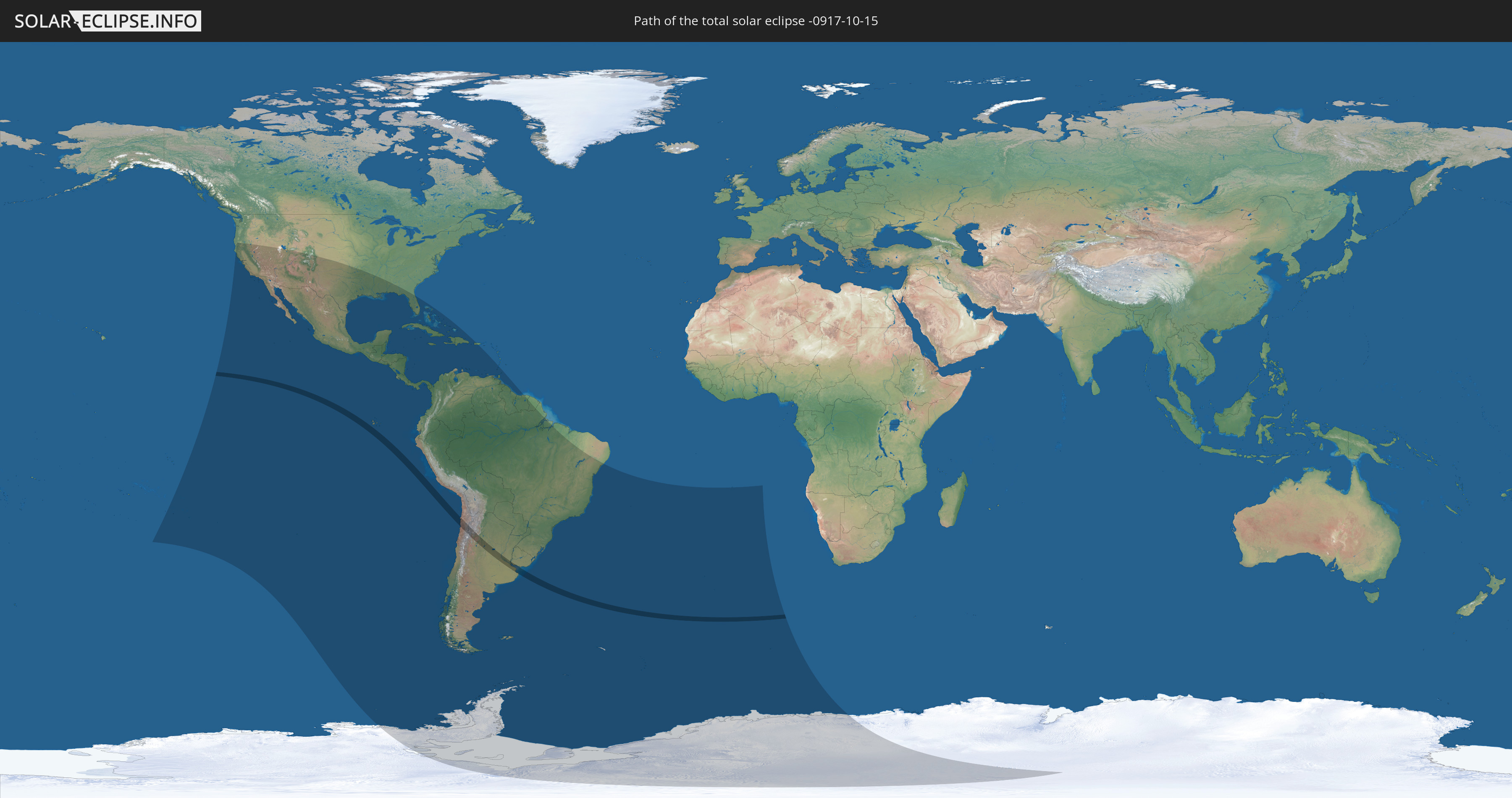
Total solar eclipse of 10/15/-0917
| Day of week: | Saturday |
| Maximum duration of eclipse: | 03m36s |
| Maximum width of eclipse path: | 156 km |
| Saros cycle: | 48 |
| Coverage: | 100% |
| Magnitude: | 1.0447 |
| Gamma: | -0.3072 |
Wo kann man die Sonnenfinsternis vom 10/15/-0917 sehen?
Die Sonnenfinsternis am 10/15/-0917 kann man in 42 Ländern als partielle Sonnenfinsternis beobachten.
Der Finsternispfad verläuft durch 3 Länder. Nur in diesen Ländern ist sie als total Sonnenfinsternis zu sehen.
In den folgenden Ländern ist die Sonnenfinsternis total zu sehen
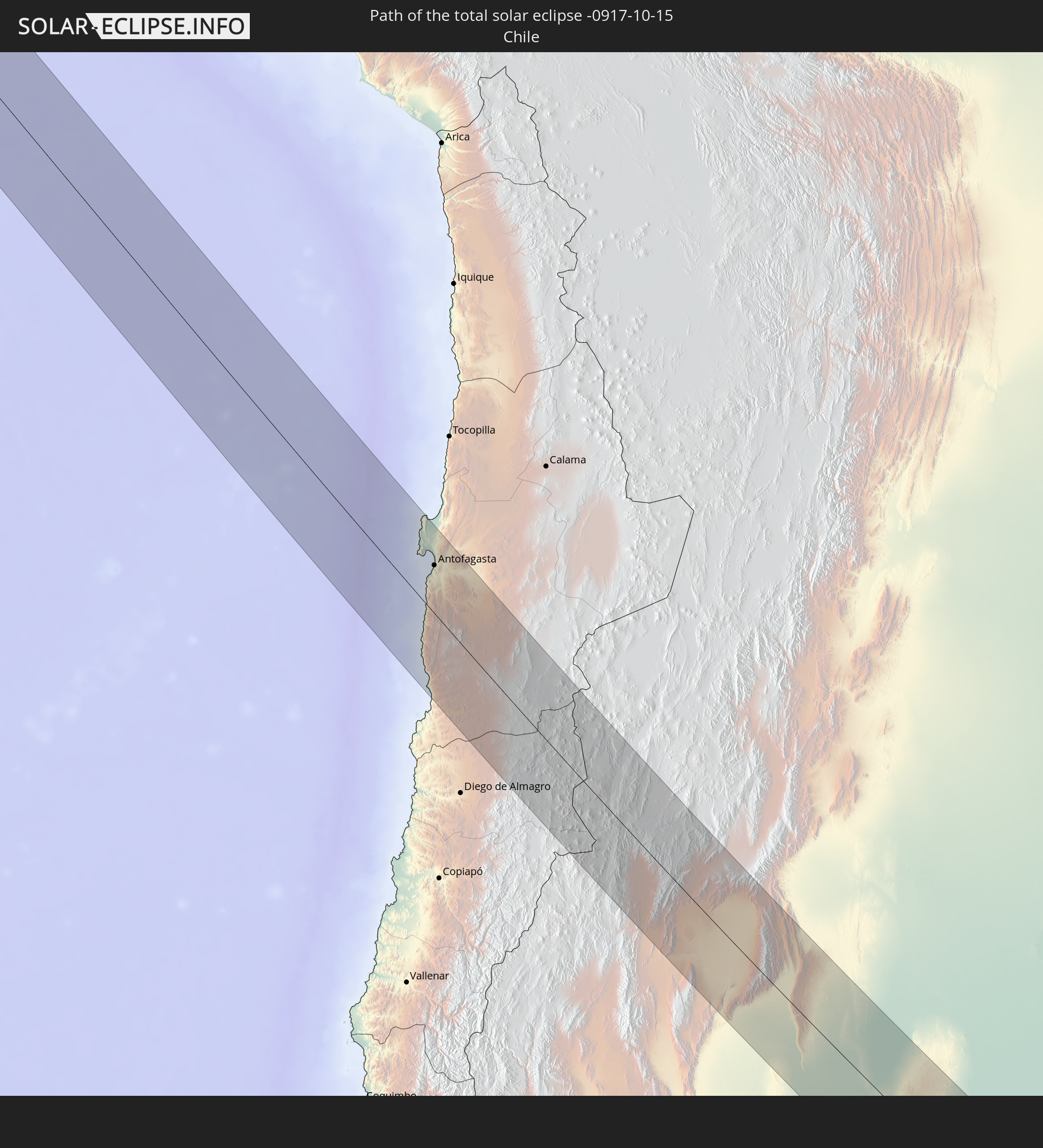 Chile
Chile
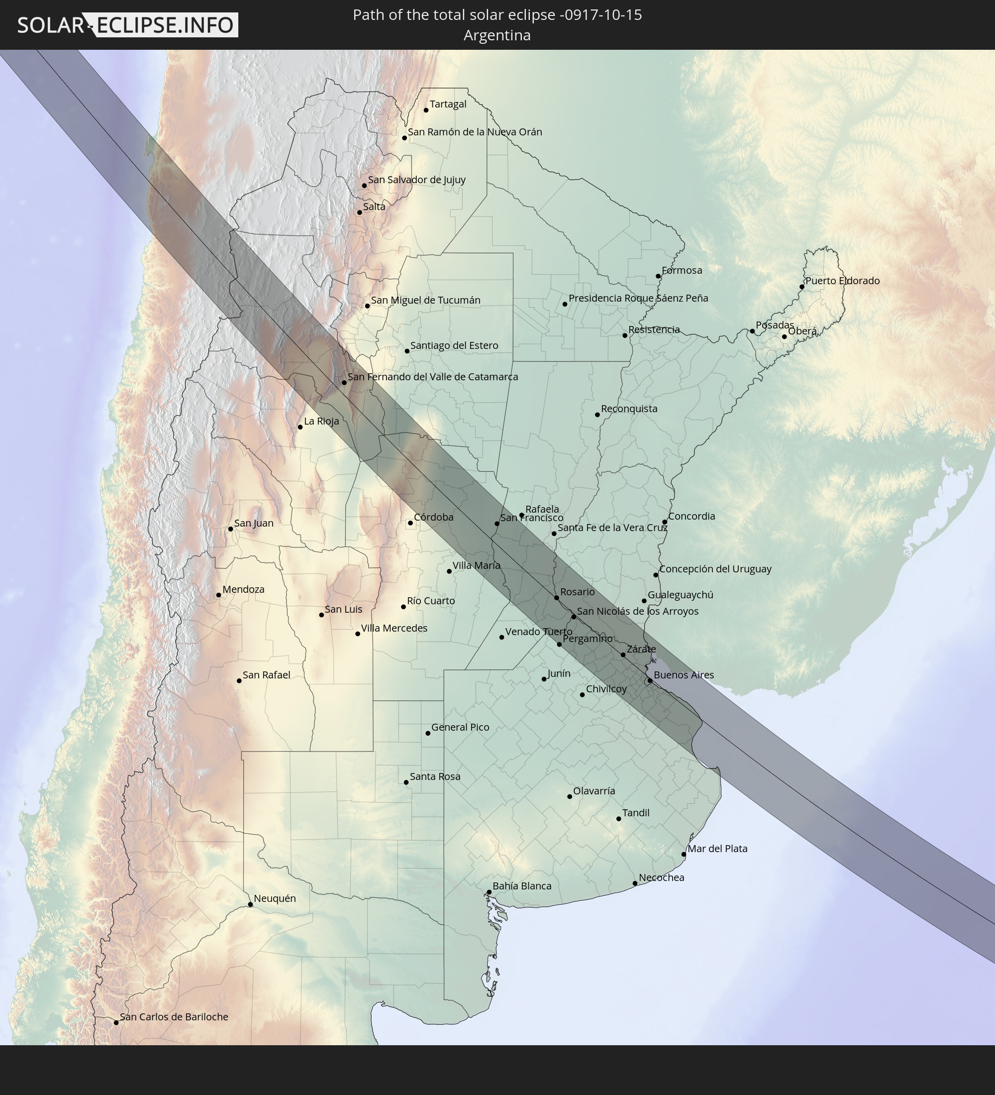 Argentina
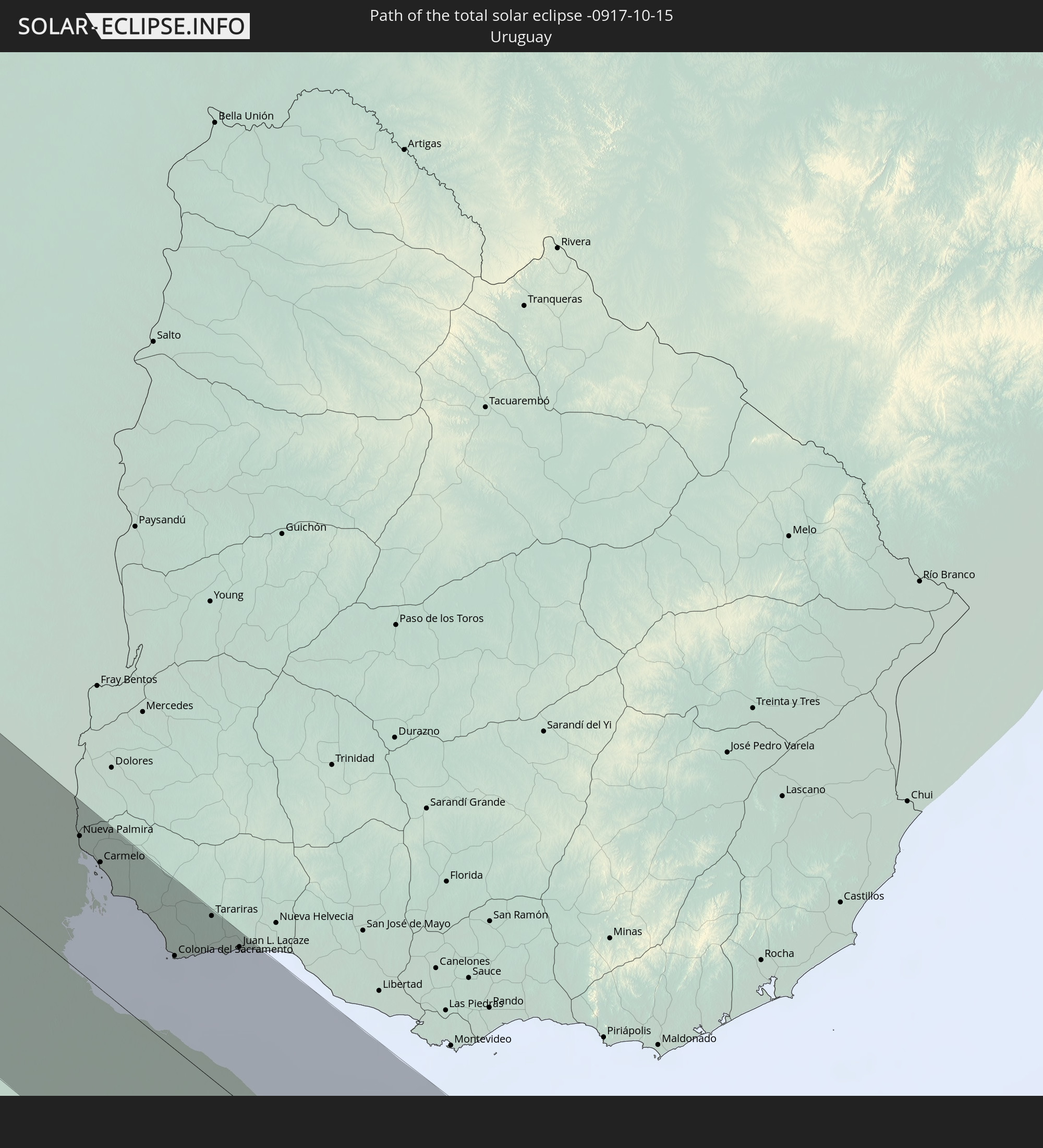 Uruguay
In den folgenden Ländern ist die Sonnenfinsternis partiell zu sehen
 Antarctica
 United States
 United States Minor Outlying Islands
 French Polynesia
 Pitcairn Islands
 Mexico
 Chile
Chile
 Guatemala
 Ecuador
 El Salvador
 Honduras
 Belize
 Nicaragua
 Costa Rica
 Cuba
Cuba
 Panama
 Colombia
 Cayman Islands
 Peru
Peru
 The Bahamas
 Jamaica
 Haiti
Haiti
 Brazil
 Argentina
 Venezuela
 Turks and Caicos Islands
 Dominican Republic
 Aruba
Aruba
 Bolivia
 Puerto Rico
 Paraguay
 Trinidad and Tobago
 Grenada
 Saint Vincent and the Grenadines
 Falkland Islands
 Guyana
 Uruguay
 Suriname
 French Guiana
 South Georgia and the South Sandwich Islands
 Saint Helena, Ascension and Tristan da Cunha
 Bouvet Island
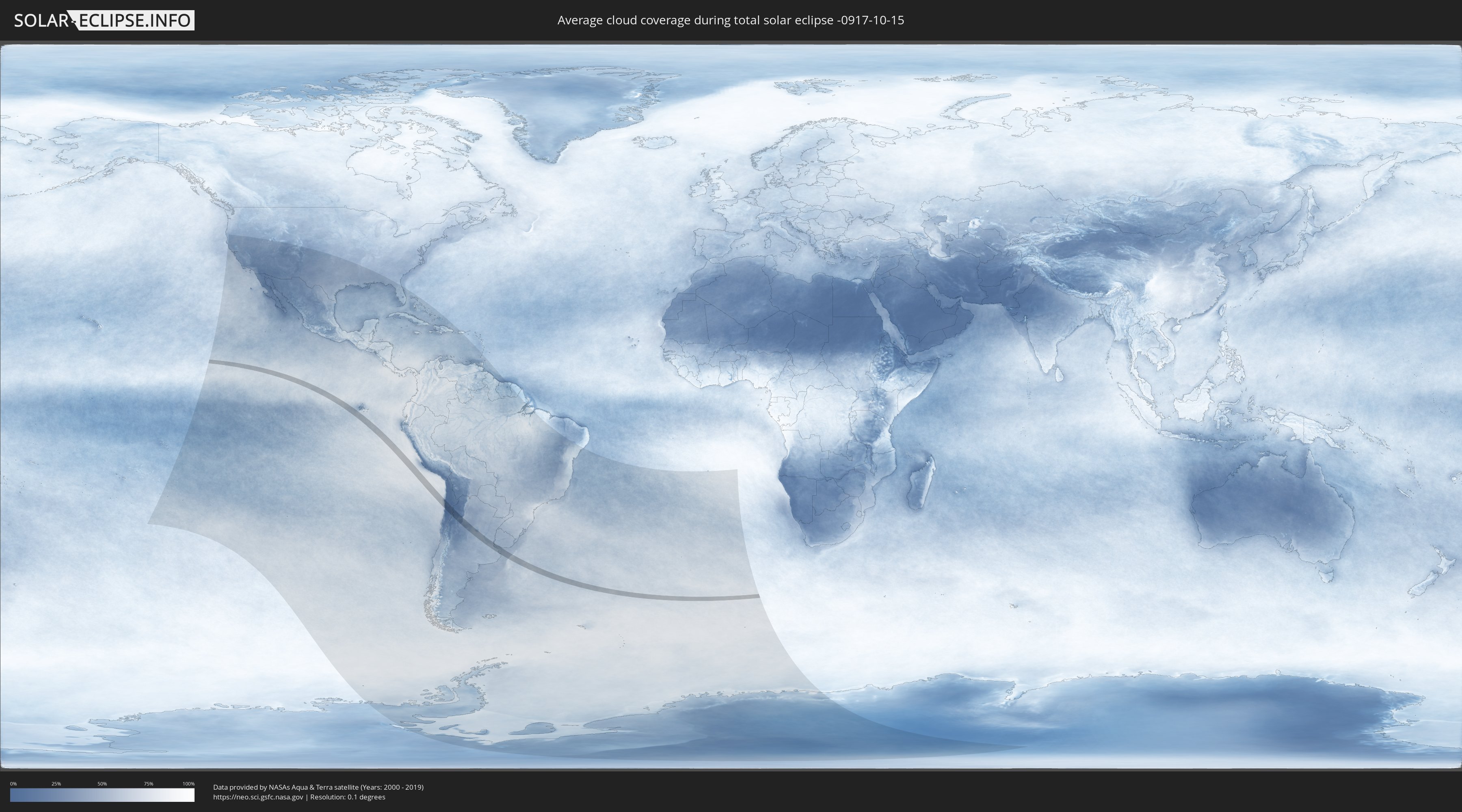
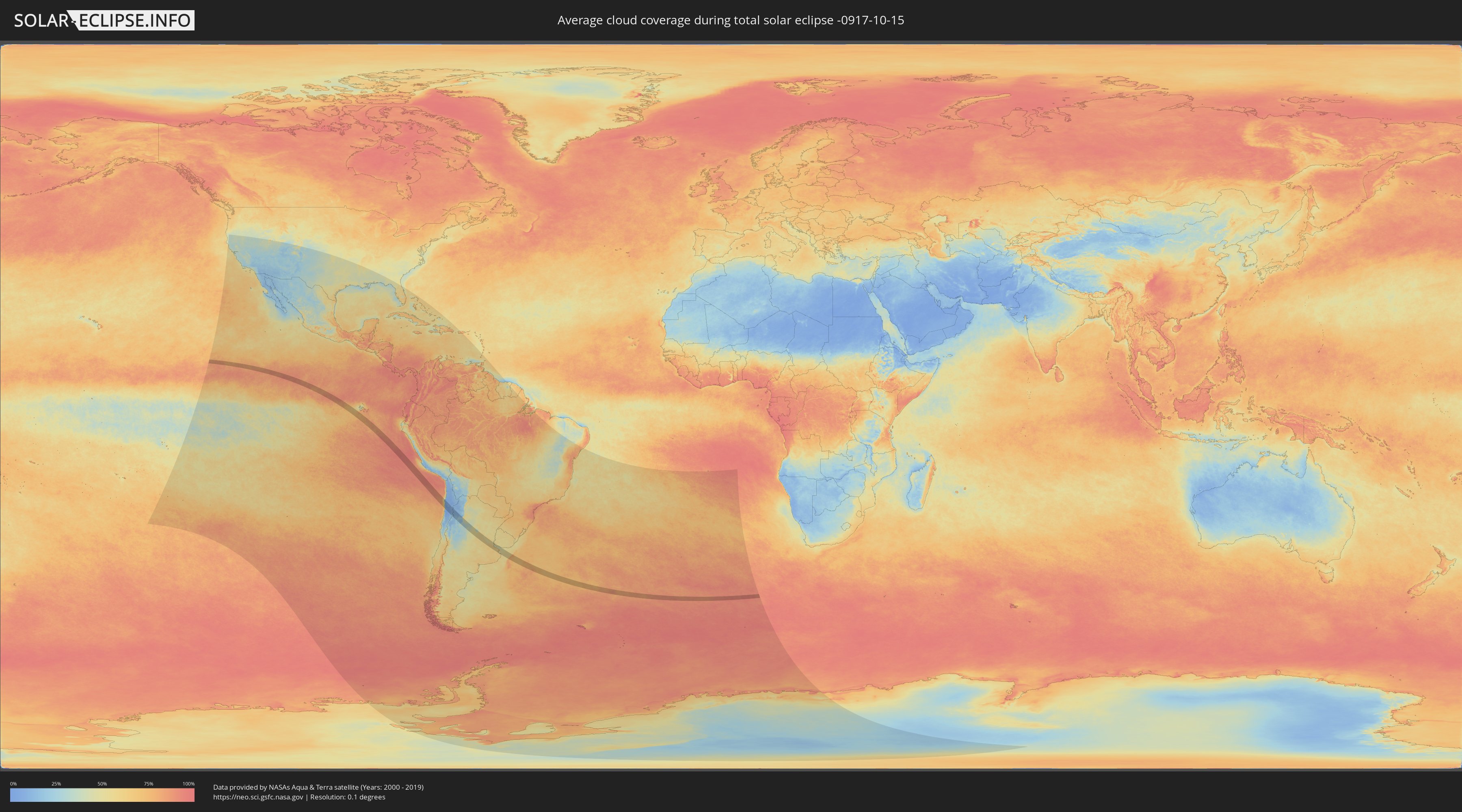
How will be the weather during the total solar eclipse on 10/15/-0917?
Where is the best place to see the total solar eclipse of 10/15/-0917?
The following maps show the average cloud coverage for the day of the total solar eclipse.
With the help of these maps, it is possible to find the place along the eclipse path, which has the best
chance of a cloudless sky.
Nevertheless, you should consider local circumstances and inform about the weather of your chosen
observation site.
The data is provided by NASAs satellites
AQUA and TERRA.
The cloud maps are averaged over a period of 19 years (2000 - 2019).
Detailed country maps
 Chile
Chile
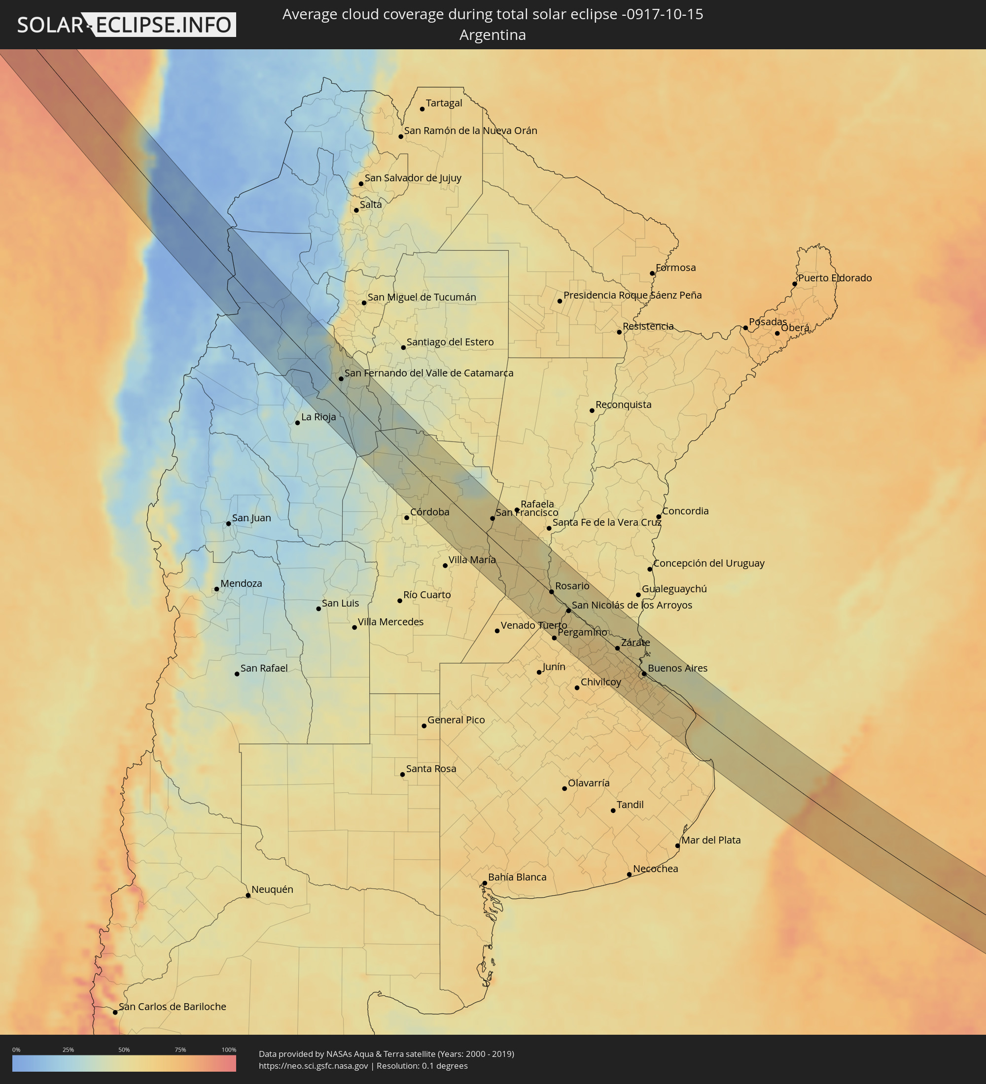 Argentina
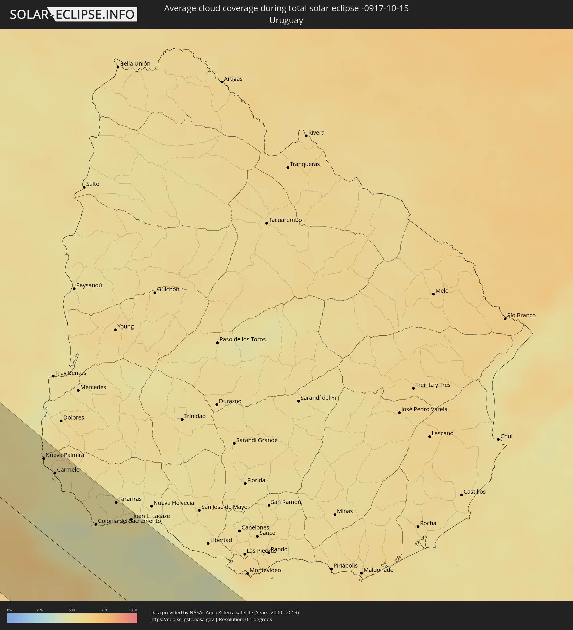 Uruguay
Cities inside the path of the eclipse
The following table shows all locations with a population of more than 5,000 inside the eclipse path. Cities which have more than 100,000 inhabitants are marked bold. A click at the locations opens a detailed map.
| City | Type | Eclipse duration | Local time of max. eclipse | Distance to central line | Ø Cloud coverage |
|
Antofagasta, Antofagasta
|
total | - | 11:35:27 UTC-04:42 | 42 km | 13% |
|
Fiambalá, Catamarca Province
|
total | - | 12:13:21 UTC-04:16 | 50 km | 17% |
|
Tinogasta, Catamarca Province
|
total | - | 12:14:05 UTC-04:16 | 75 km | 25% |
|
Arauco, La Rioja Province
|
total | - | 12:16:13 UTC-04:16 | 59 km | 18% |
|
Andalgalá, Catamarca Province
|
total | - | 12:15:22 UTC-04:16 | 50 km | 25% |
|
Capayán, Catamarca Province
|
total | - | 12:17:45 UTC-04:16 | 21 km | 32% |
|
Huillapima, Catamarca Province
|
total | - | 12:17:49 UTC-04:16 | 13 km | 33% |
|
San Fernando del Valle de Catamarca, Catamarca Province
|
total | - | 12:17:43 UTC-04:16 | 21 km | 34% |
|
Los Altos, Catamarca Province
|
total | - | 12:17:29 UTC-04:16 | 73 km | 44% |
|
Icaño, Catamarca Province
|
total | - | 12:19:12 UTC-04:16 | 18 km | 36% |
|
Recreo, Catamarca Province
|
total | - | 12:20:13 UTC-04:16 | 8 km | 33% |
|
Deán Funes, Cordoba Province
|
total | - | 12:23:10 UTC-04:16 | 33 km | 41% |
|
Jesús María, Cordoba Province
|
total | - | 12:24:26 UTC-04:16 | 61 km | 48% |
|
Villa del Totoral, Cordoba Province
|
total | - | 12:24:48 UTC-04:16 | 22 km | 50% |
|
Santa Rosa de Río Primero, Cordoba Province
|
total | - | 12:25:48 UTC-04:16 | 29 km | 53% |
|
Arroyito, Cordoba Province
|
total | - | 12:26:46 UTC-04:16 | 27 km | 52% |
|
Pozo del Molle, Cordoba Province
|
total | - | 12:27:50 UTC-04:16 | 67 km | 53% |
|
Las Varillas, Cordoba Province
|
total | - | 12:27:57 UTC-04:16 | 42 km | 55% |
|
Balnearia, Cordoba Province
|
total | - | 12:26:47 UTC-04:16 | 31 km | 49% |
|
Devoto, Cordoba Province
|
total | - | 12:27:57 UTC-04:16 | 23 km | 55% |
|
Marcos Juárez, Cordoba Province
|
total | - | 12:30:04 UTC-04:16 | 70 km | 54% |
|
San Francisco, Cordoba Province
|
total | - | 12:28:20 UTC-04:16 | 35 km | 56% |
|
San Jorge, Santa Fe Province
|
total | - | 12:29:22 UTC-04:16 | 11 km | 56% |
|
Sastre, Santa Fe Province
|
total | - | 12:29:14 UTC-04:16 | 24 km | 56% |
|
El Trébol, Santa Fe Province
|
total | - | 12:30:02 UTC-04:16 | 4 km | 58% |
|
Armstrong, Santa Fe Province
|
total | - | 12:30:59 UTC-04:16 | 45 km | 54% |
|
Las Rosas, Santa Fe Province
|
total | - | 12:30:36 UTC-04:16 | 19 km | 57% |
|
Las Parejas, Santa Fe Province
|
total | - | 12:31:00 UTC-04:16 | 32 km | 56% |
|
Cañada de Gómez, Santa Fe Province
|
total | - | 12:31:22 UTC-04:16 | 35 km | 56% |
|
Gálvez, Santa Fe Province
|
total | - | 12:30:34 UTC-04:16 | 41 km | 57% |
|
Totoras, Santa Fe Province
|
total | - | 12:31:25 UTC-04:16 | 2 km | 55% |
|
Casilda, Santa Fe Province
|
total | - | 12:32:01 UTC-04:16 | 40 km | 53% |
|
Carcarañá, Santa Fe Province
|
total | - | 12:31:48 UTC-04:16 | 23 km | 53% |
|
Coronda, Santa Fe Province
|
total | - | 12:30:58 UTC-04:16 | 65 km | 49% |
|
Roldán, Santa Fe Province
|
total | - | 12:32:15 UTC-04:16 | 11 km | 56% |
|
Funes, Santa Fe Province
|
total | - | 12:32:25 UTC-04:16 | 7 km | 58% |
|
Pérez, Santa Fe Province
|
total | - | 12:32:36 UTC-04:16 | 11 km | 57% |
|
Fray Luis A. Beltrán, Santa Fe Province
|
total | - | 12:32:23 UTC-04:16 | 9 km | 56% |
|
Capitán Bermúdez, Santa Fe Province
|
total | - | 12:32:26 UTC-04:16 | 7 km | 56% |
|
Granadero Baigorria, Santa Fe Province
|
total | - | 12:32:29 UTC-04:16 | 4 km | 61% |
|
Gobernador Gálvez, Santa Fe Province
|
total | - | 12:32:50 UTC-04:16 | 6 km | 55% |
|
Rosario, Santa Fe Province
|
total | - | 12:32:44 UTC-04:16 | 1 km | 53% |
|
Arroyo Seco, Santa Fe Province
|
total | - | 12:33:12 UTC-04:16 | 8 km | 58% |
|
Villa Constitución, Santa Fe Province
|
total | - | 12:33:35 UTC-04:16 | 3 km | 54% |
|
San Nicolás de los Arroyos, Buenos Aires
|
total | - | 12:33:53 UTC-04:16 | 6 km | 55% |
|
Victoria, Entre Ríos Province
|
total | - | 12:33:04 UTC-04:16 | 59 km | 51% |
|
Mercedes, Buenos Aires
|
total | - | 12:36:45 UTC-04:16 | 69 km | 64% |
|
Gualeguay, Entre Ríos Province
|
total | - | 12:35:05 UTC-04:16 | 66 km | 53% |
|
Luján, Buenos Aires
|
total | - | 12:37:09 UTC-04:16 | 43 km | 63% |
|
Zárate, Buenos Aires
|
total | - | 12:36:42 UTC-04:16 | 2 km | 60% |
|
Campana, Buenos Aires
|
total | - | 12:36:54 UTC-04:16 | 0 km | 61% |
|
Pontevedra, Buenos Aires
|
total | - | 12:37:59 UTC-04:16 | 35 km | 64% |
|
Morón, Buenos Aires
|
total | - | 12:38:00 UTC-04:16 | 22 km | 65% |
|
Tigre, Buenos Aires
|
total | - | 12:37:47 UTC-04:16 | 0 km | 59% |
|
San Isidro, Buenos Aires
|
total | - | 12:37:56 UTC-04:16 | 1 km | 60% |
|
Villa Santa Rita, Buenos Aires F.D.
|
total | - | 12:38:10 UTC-04:16 | 10 km | 65% |
|
Villa Lugano, Buenos Aires F.D.
|
total | - | 12:38:15 UTC-04:16 | 16 km | 66% |
|
Colegiales, Buenos Aires F.D.
|
total | - | 12:38:10 UTC-04:16 | 5 km | 62% |
|
Nueva Palmira, Colonia
|
total | - | 13:09:20 UTC-03:44 | 58 km | 51% |
|
Adrogué, Buenos Aires
|
total | - | 12:38:32 UTC-04:16 | 21 km | 63% |
|
Retiro, Buenos Aires F.D.
|
total | - | 12:38:17 UTC-04:16 | 2 km | 62% |
|
Buenos Aires, Buenos Aires F.D.
|
total | - | 12:38:19 UTC-04:16 | 4 km | 62% |
|
Carmelo, Colonia
|
total | - | 13:09:41 UTC-03:44 | 54 km | 50% |
|
Quilmes, Buenos Aires
|
total | - | 12:38:38 UTC-04:16 | 8 km | 64% |
|
La Plata, Buenos Aires
|
total | - | 12:39:19 UTC-04:16 | 7 km | 64% |
|
Colonia del Sacramento, Colonia
|
total | - | 13:10:55 UTC-03:44 | 40 km | 45% |
|
Tarariras, Colonia
|
total | - | 13:11:02 UTC-03:44 | 70 km | 52% |
|
Juan L. Lacaze, Colonia
|
total | - | 13:11:28 UTC-03:44 | 66 km | 49% |
|
San Clemente del Tuyú, Buenos Aires
|
total | - | 12:42:43 UTC-04:16 | 63 km | 57% |