Annular solar eclipse of 11/05/-0965
| Day of week: | Tuesday |
| Maximum duration of eclipse: | 08m48s |
| Maximum width of eclipse path: | 303 km |
| Saros cycle: | 37 |
| Coverage: | 92.5% |
| Magnitude: | 0.9246 |
| Gamma: | -0.3539 |
Wo kann man die Sonnenfinsternis vom 11/05/-0965 sehen?
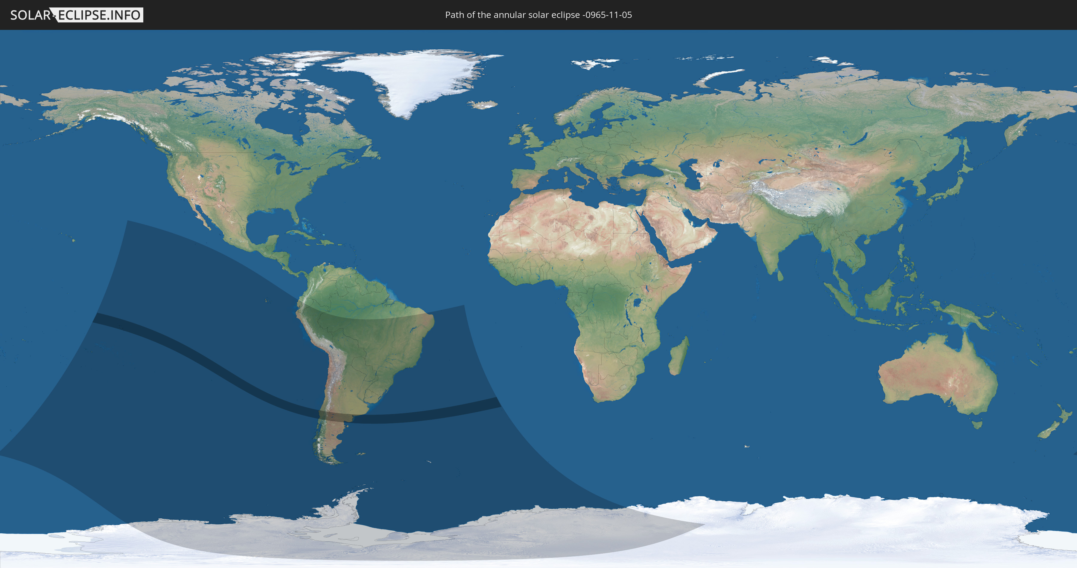
Die Sonnenfinsternis am 11/05/-0965 kann man in 16 Ländern als partielle Sonnenfinsternis beobachten.
Der Finsternispfad verläuft durch 3 Länder. Nur in diesen Ländern ist sie als annular Sonnenfinsternis zu sehen.
In den folgenden Ländern ist die Sonnenfinsternis annular zu sehen
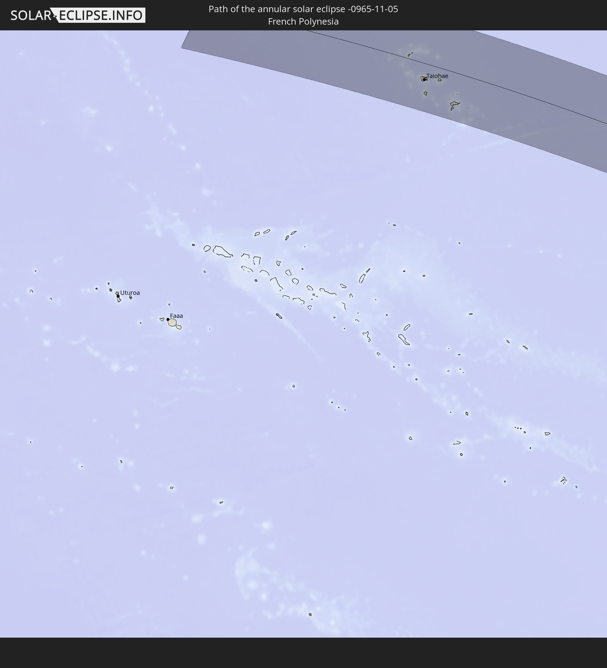 French Polynesia
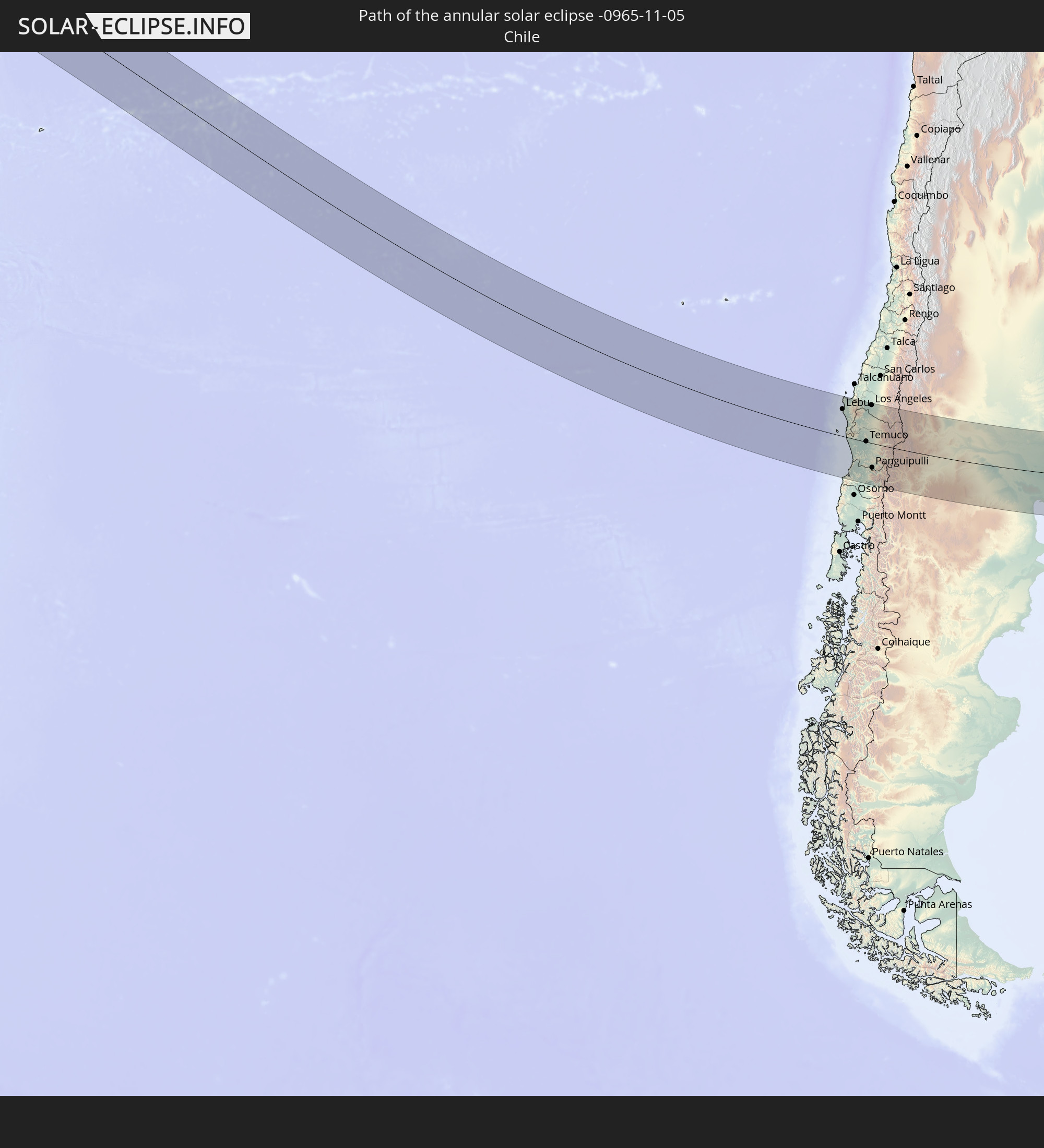 Chile
Chile
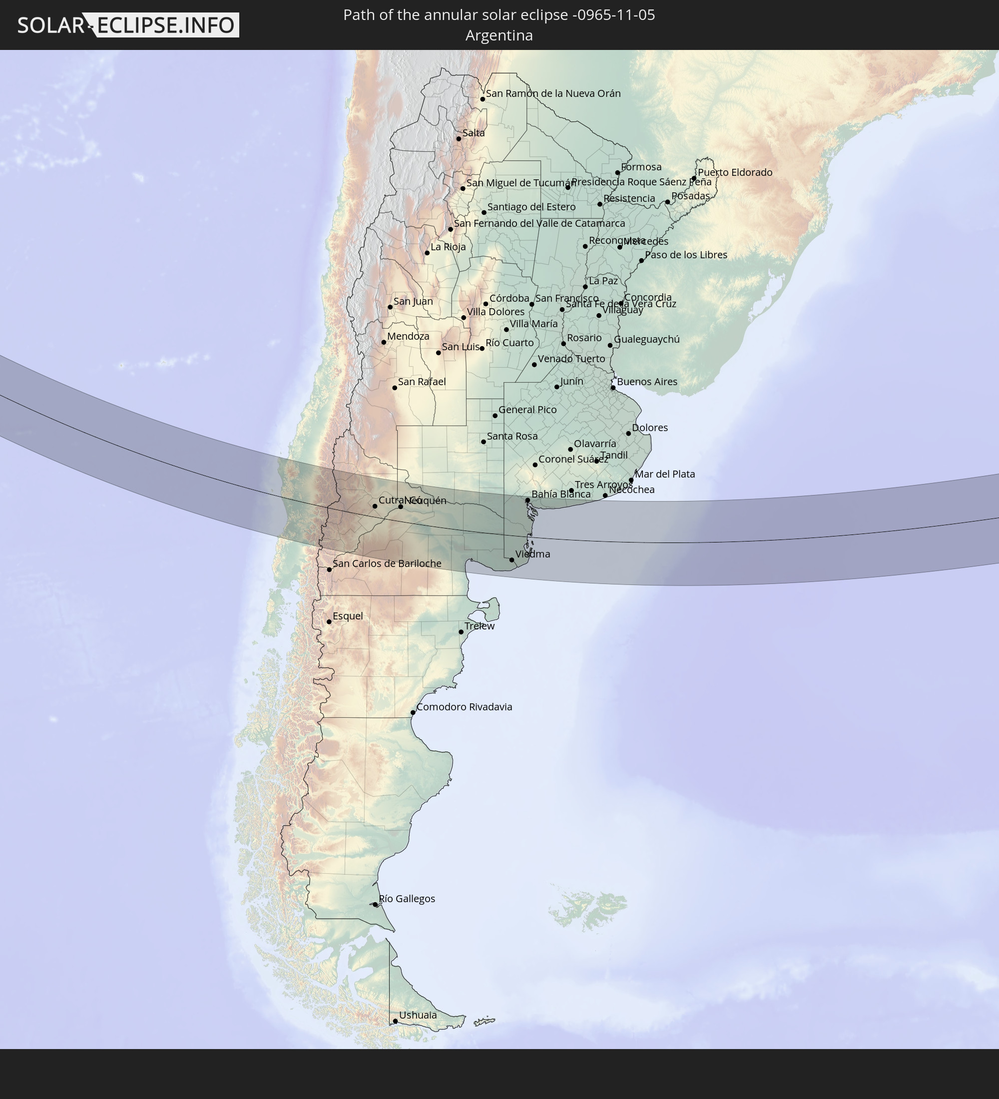 Argentina
In den folgenden Ländern ist die Sonnenfinsternis partiell zu sehen


How will be the weather during the annular solar eclipse on 11/05/-0965?
Where is the best place to see the annular solar eclipse of 11/05/-0965?
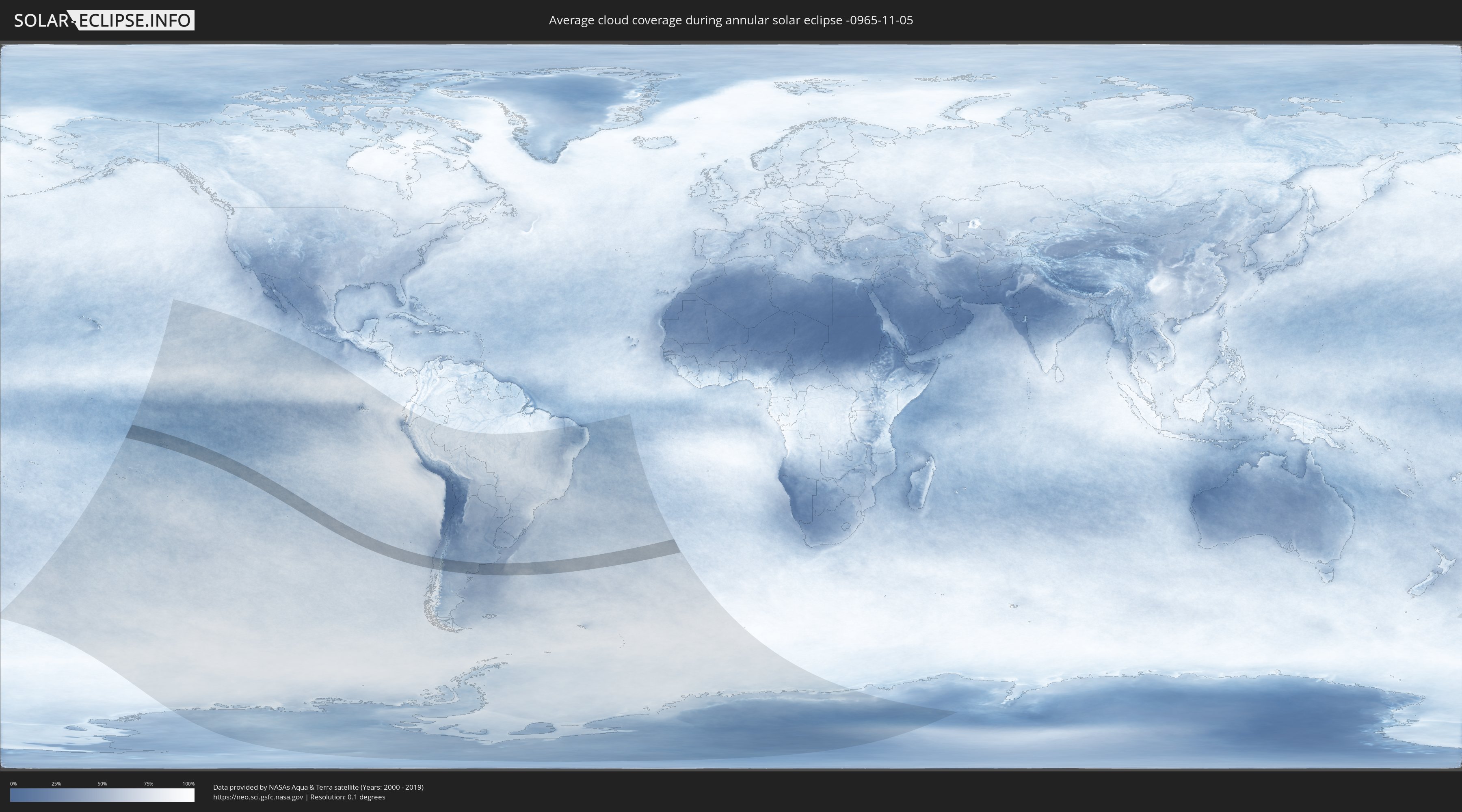
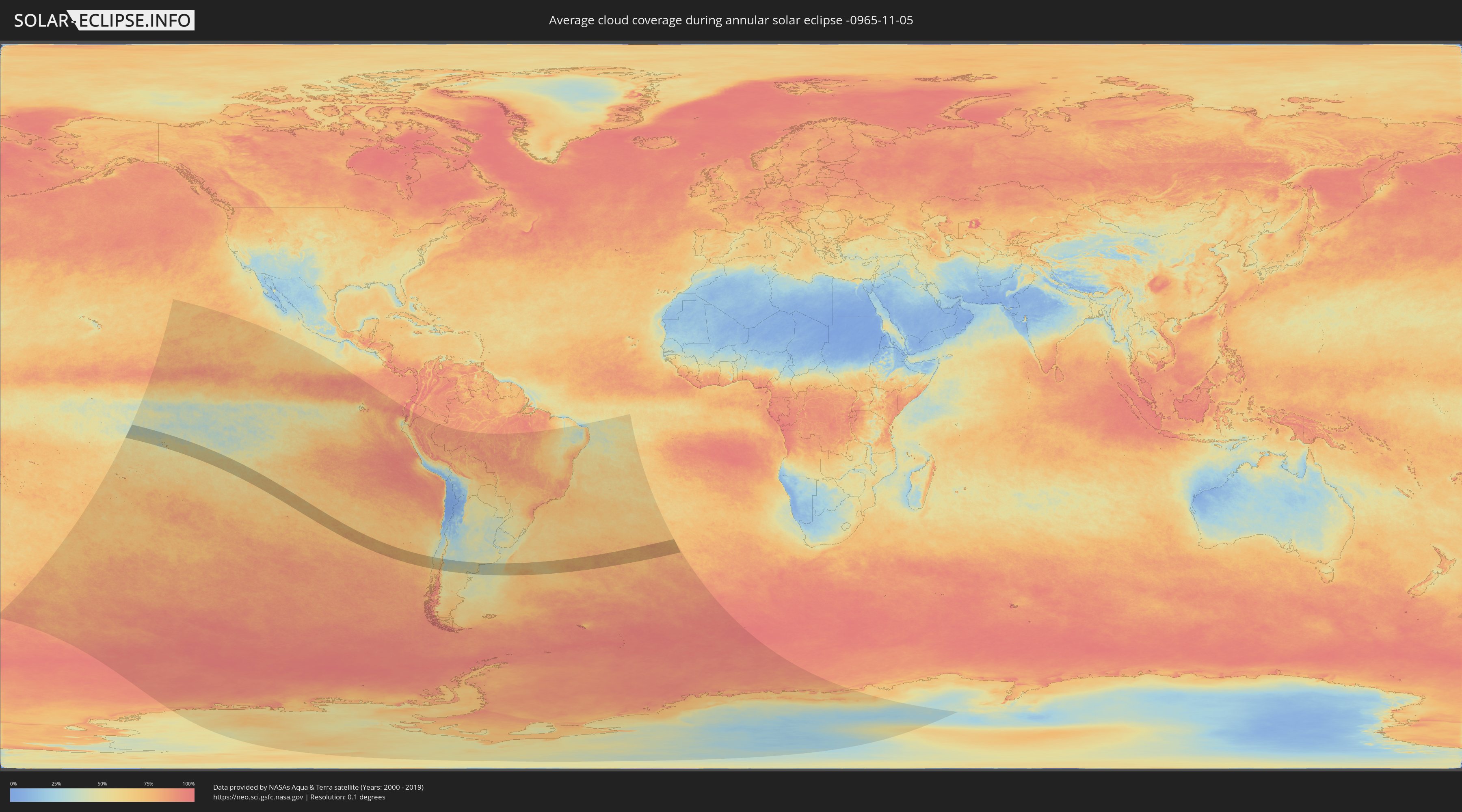
The following maps show the average cloud coverage for the day of the annular solar eclipse.
With the help of these maps, it is possible to find the place along the eclipse path, which has the best
chance of a cloudless sky.
Nevertheless, you should consider local circumstances and inform about the weather of your chosen
observation site.
The data is provided by NASAs satellites
AQUA and TERRA.
The cloud maps are averaged over a period of 19 years (2000 - 2019).
Detailed country maps
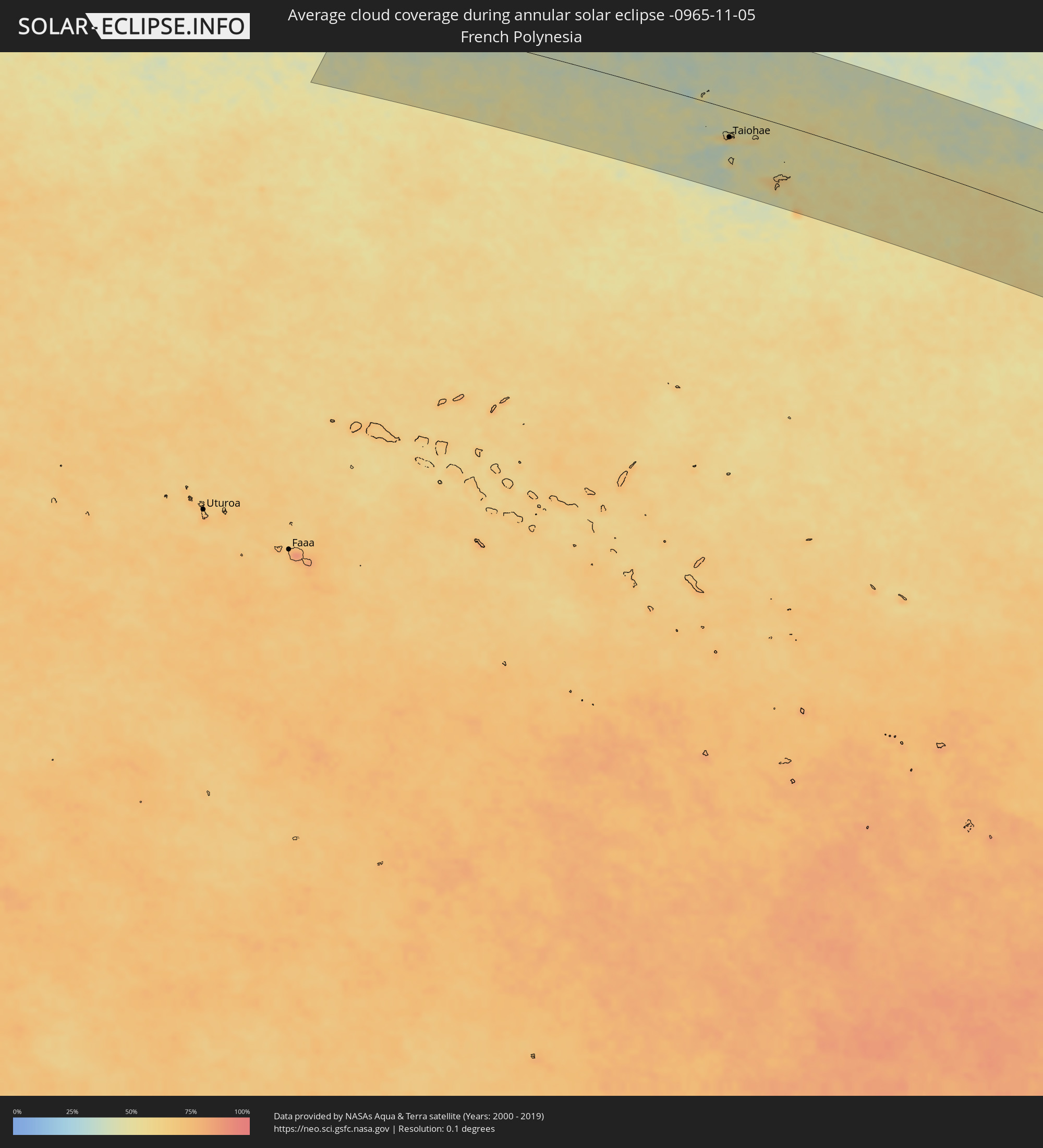 French Polynesia
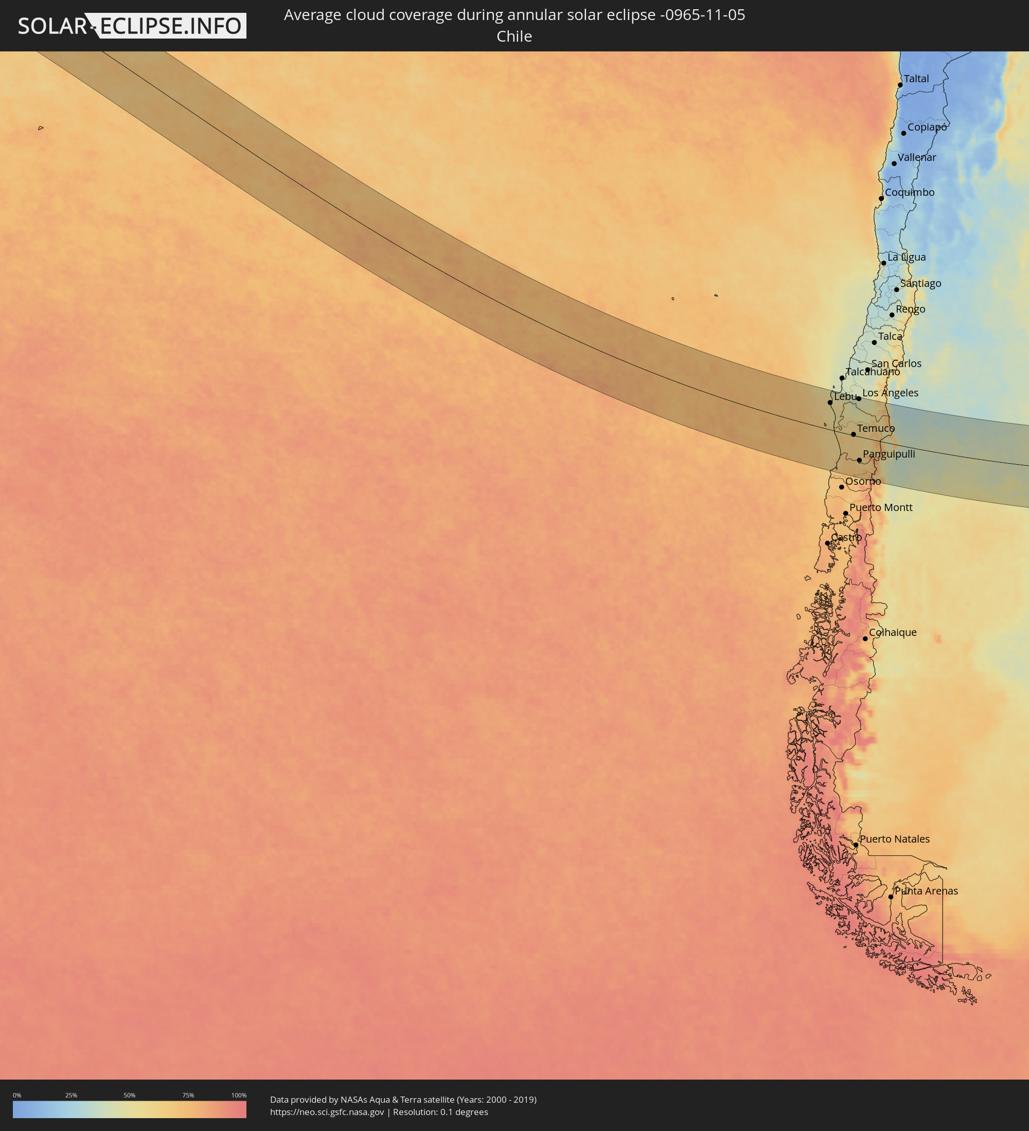 Chile
Chile
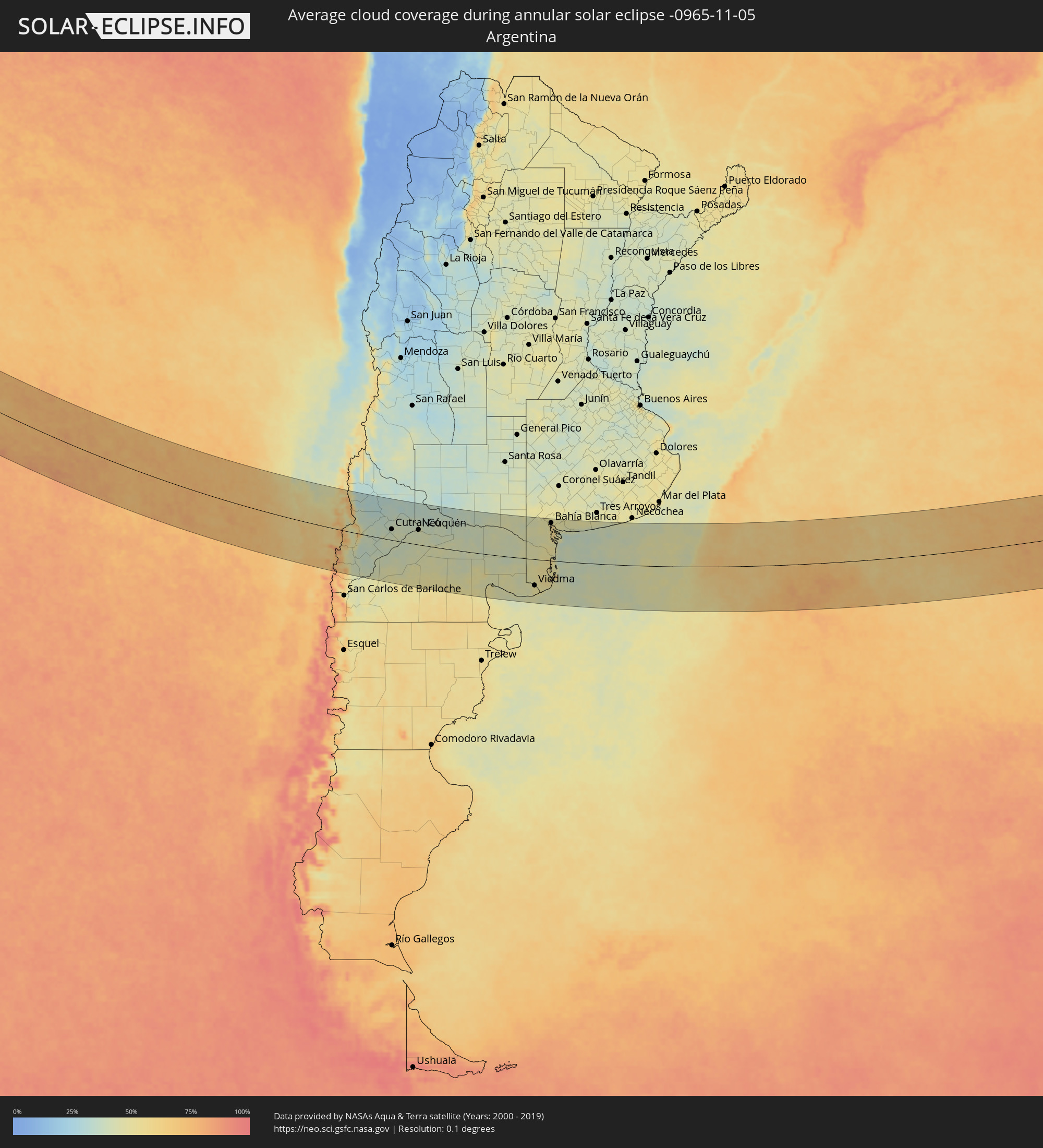 Argentina
Cities inside the path of the eclipse
The following table shows all locations with a population of more than 5,000 inside the eclipse path. Cities which have more than 100,000 inhabitants are marked bold. A click at the locations opens a detailed map.
| City | Type | Eclipse duration | Local time of max. eclipse | Distance to central line | Ø Cloud coverage |
 Taiohae, Îles Marquises
|
annular | - | 06:21:06 UTC-09:18 | 65 km | 57% |
 Lebu, Biobío
|
annular | - | 13:32:17 UTC-04:42 | 102 km | 54% |
|
Cañete, Biobío
|
annular | - | 13:32:56 UTC-04:42 | 87 km | 57% |
|
Curanilahue, Biobío
|
annular | - | 13:32:59 UTC-04:42 | 123 km | 50% |
|
Arauco, Biobío
|
annular | - | 13:32:59 UTC-04:42 | 149 km | 47% |
|
Valdivia, Los Ríos
|
annular | - | 13:33:41 UTC-04:42 | 127 km | 61% |
|
Las Animas, Los Lagos
|
annular | - | 13:33:45 UTC-04:42 | 126 km | 61% |
|
Carahue, Araucanía
|
annular | - | 13:33:41 UTC-04:42 | 6 km | 66% |
|
Nueva Imperial, Araucanía
|
annular | - | 13:34:10 UTC-04:42 | 6 km | 63% |
|
Angol, Araucanía
|
annular | - | 13:34:31 UTC-04:42 | 102 km | 48% |
|
Nacimiento, Biobío
|
annular | - | 13:34:33 UTC-04:42 | 134 km | 46% |
|
Traiguén, Araucanía
|
annular | - | 13:34:42 UTC-04:42 | 54 km | 55% |
|
Pitrufquén, Araucanía
|
annular | - | 13:34:54 UTC-04:42 | 26 km | 65% |
|
Loncoche, Araucanía
|
annular | - | 13:34:58 UTC-04:42 | 67 km | 63% |
|
Freire, Araucanía
|
annular | - | 13:34:55 UTC-04:42 | 22 km | 65% |
|
Temuco, Araucanía
|
annular | - | 13:34:57 UTC-04:42 | 2 km | 64% |
|
Lautaro, Araucanía
|
annular | - | 13:35:17 UTC-04:42 | 28 km | 60% |
|
Collipulli, Araucanía
|
annular | - | 13:35:11 UTC-04:42 | 90 km | 49% |
|
Los Ángeles, Biobío
|
annular | - | 13:35:17 UTC-04:42 | 144 km | 45% |
|
Victoria, Araucanía
|
annular | - | 13:35:28 UTC-04:42 | 62 km | 54% |
|
Panguipulli, Araucanía
|
annular | - | 13:35:39 UTC-04:42 | 91 km | 61% |
|
Mulchén, Biobío
|
annular | - | 13:35:35 UTC-04:42 | 120 km | 47% |
|
Villarrica, Araucanía
|
annular | - | 13:35:51 UTC-04:42 | 50 km | 62% |
|
Vilcún, Araucanía
|
annular | - | 13:35:46 UTC-04:42 | 17 km | 61% |
|
Pucón, Araucanía
|
annular | - | 13:36:27 UTC-04:42 | 45 km | 66% |
 San Martín de los Andes, Neuquén Province
|
annular | - | 14:03:45 UTC-04:16 | 129 km | 68% |
|
Junín de los Andes, Neuquén Province
|
annular | - | 14:04:21 UTC-04:16 | 101 km | 46% |
|
Zapala, Neuquén Province
|
annular | - | 14:06:30 UTC-04:16 | 31 km | 38% |
|
Cutral-Có, Neuquén Province
|
annular | - | 14:08:16 UTC-04:16 | 40 km | 39% |
|
Plaza Huincul, Neuquén Province
|
annular | - | 14:08:19 UTC-04:16 | 41 km | 39% |
|
Senillosa, Neuquén Province
|
annular | - | 14:09:56 UTC-04:16 | 43 km | 41% |
|
Plottier, Neuquén Province
|
annular | - | 14:10:21 UTC-04:16 | 51 km | 41% |
|
Centenario, Neuquén Province
|
annular | - | 14:10:35 UTC-04:16 | 68 km | 42% |
|
Cinco Saltos, Río Negro Province
|
annular | - | 14:10:43 UTC-04:16 | 69 km | 42% |
|
Neuquén, Neuquén Province
|
annular | - | 14:10:43 UTC-04:16 | 55 km | 41% |
|
Cipolletti, Río Negro Province
|
annular | - | 14:10:51 UTC-04:16 | 58 km | 44% |
|
General Fernández Oro, Río Negro Province
|
annular | - | 14:10:59 UTC-04:16 | 57 km | 43% |
|
Allen, Río Negro Province
|
annular | - | 14:11:11 UTC-04:16 | 56 km | 42% |
|
General Roca, Río Negro Province
|
annular | - | 14:11:41 UTC-04:16 | 53 km | 41% |
|
Cervantes, Río Negro Province
|
annular | - | 14:12:05 UTC-04:16 | 54 km | 39% |
|
Ingeniero Luis A. Huergo, Río Negro Province
|
annular | - | 14:12:23 UTC-04:16 | 52 km | 40% |
|
Villa Regina, Río Negro Province
|
annular | - | 14:12:43 UTC-04:16 | 52 km | 41% |
|
Fray Luis Beltrán, Río Negro Province
|
annular | - | 14:15:15 UTC-04:16 | 44 km | 43% |
|
Lamarque, Río Negro Province
|
annular | - | 14:15:21 UTC-04:16 | 33 km | 43% |
|
Choele Choel, Río Negro Province
|
annular | - | 14:15:26 UTC-04:16 | 50 km | 44% |
|
San Antonio Oeste, Río Negro Province
|
annular | - | 14:16:22 UTC-04:16 | 104 km | 49% |
|
General Conesa, Río Negro Province
|
annular | - | 14:17:33 UTC-04:16 | 29 km | 44% |
|
Viedma, Río Negro Province
|
annular | - | 14:19:51 UTC-04:16 | 96 km | 49% |
|
Bahía Blanca, Buenos Aires
|
annular | - | 14:22:05 UTC-04:16 | 141 km | 53% |
|
Punta Alta, Buenos Aires
|
annular | - | 14:22:22 UTC-04:16 | 125 km | 48% |
|
Coronel Dorrego, Buenos Aires
|
annular | - | 14:23:51 UTC-04:16 | 148 km | 46% |