Total solar eclipse of 11/30/-1236
| Day of week: | Sunday |
| Maximum duration of eclipse: | 02m46s |
| Maximum width of eclipse path: | 104 km |
| Saros cycle: | 32 |
| Coverage: | 100% |
| Magnitude: | 1.0308 |
| Gamma: | -0.0448 |
Wo kann man die Sonnenfinsternis vom 11/30/-1236 sehen?
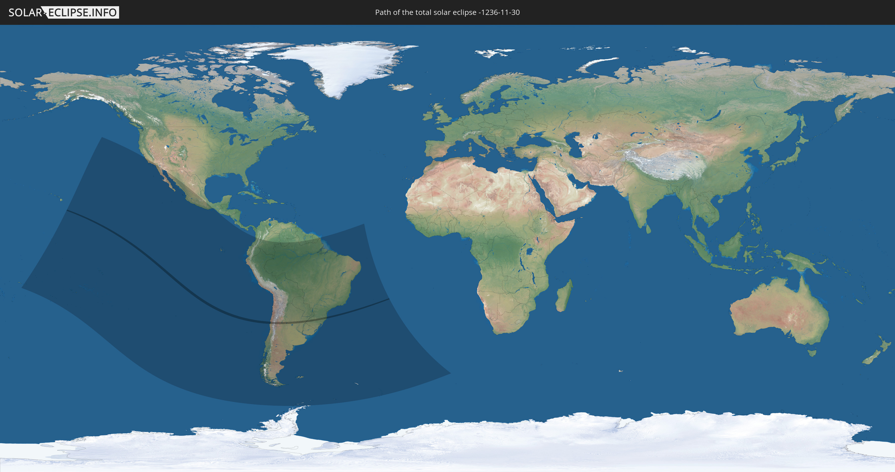
Die Sonnenfinsternis am 11/30/-1236 kann man in 26 Ländern als partielle Sonnenfinsternis beobachten.
Der Finsternispfad verläuft durch 3 Länder. Nur in diesen Ländern ist sie als total Sonnenfinsternis zu sehen.
In den folgenden Ländern ist die Sonnenfinsternis total zu sehen
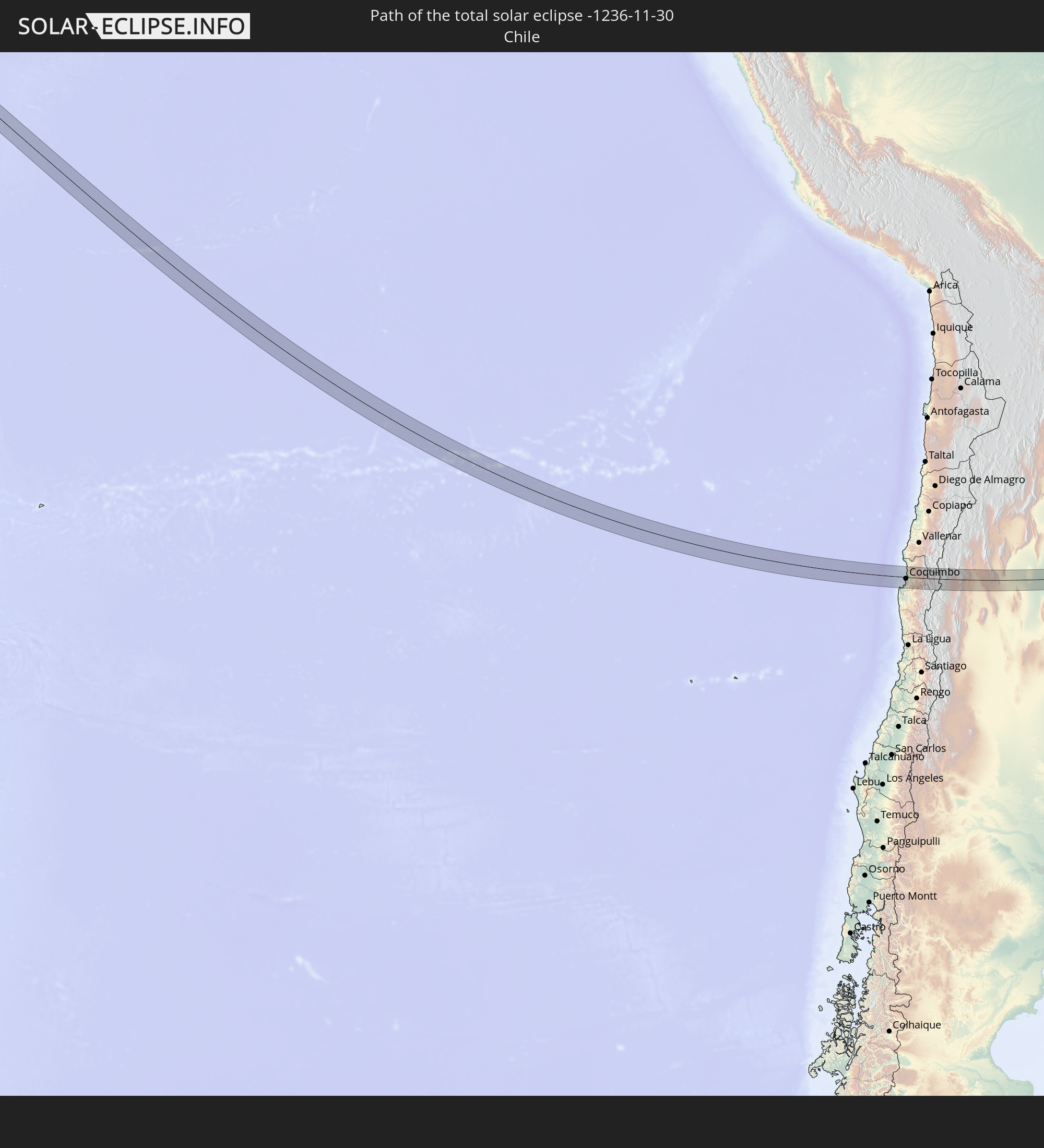 Chile
Chile
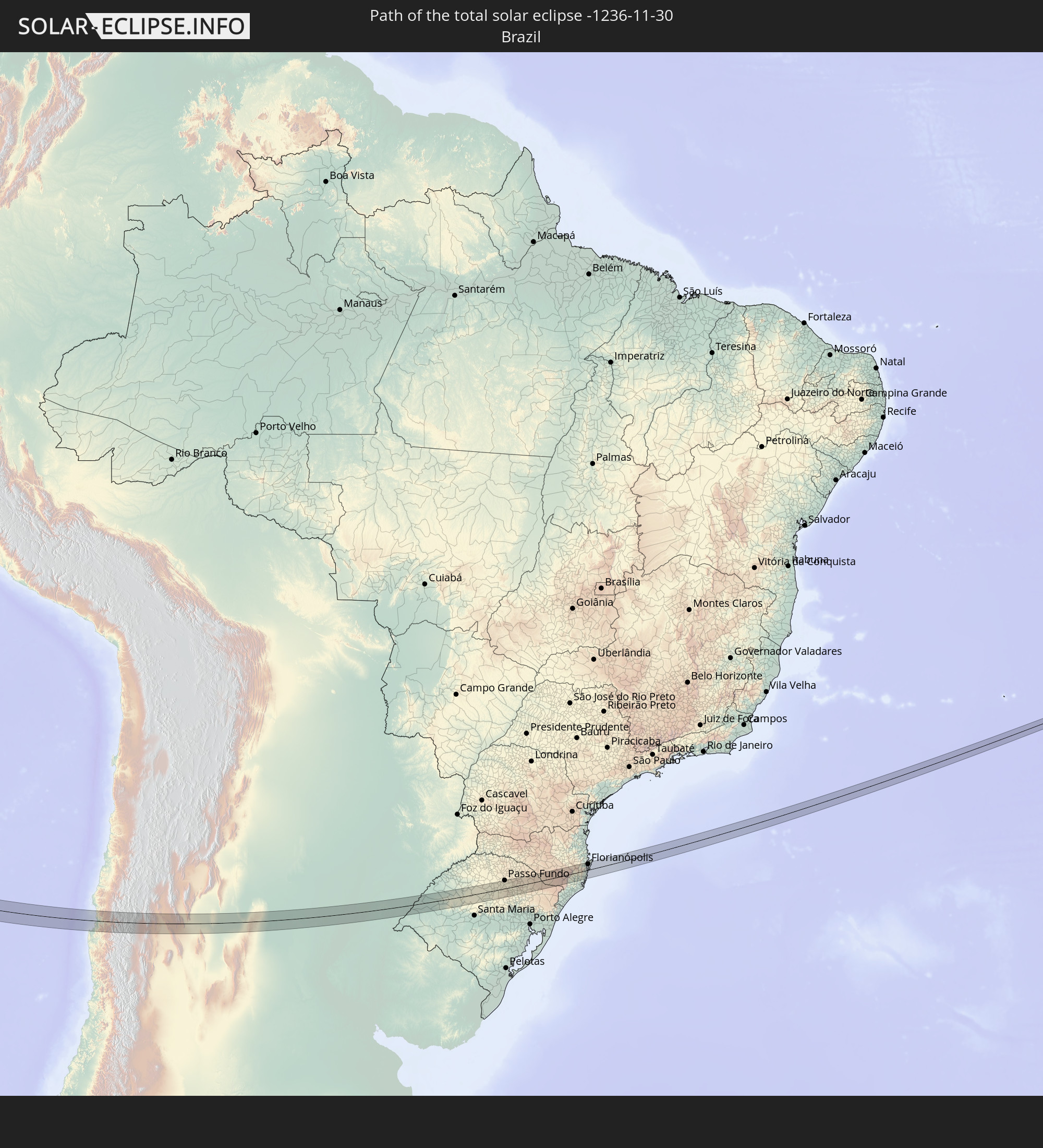 Brazil
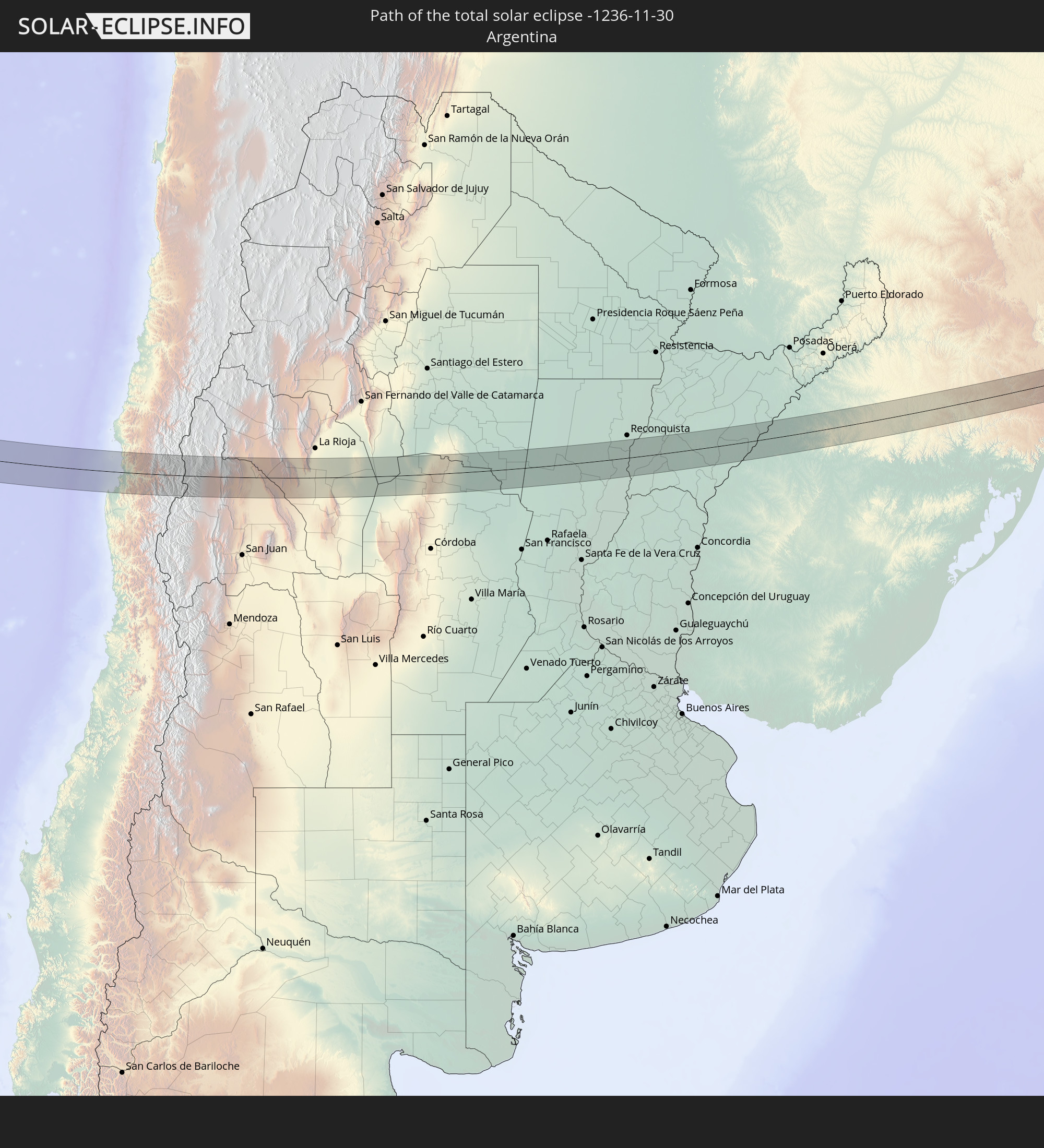 Argentina
In den folgenden Ländern ist die Sonnenfinsternis partiell zu sehen
 Antarctica
 United States
 United States Minor Outlying Islands
 Kiribati
 American Samoa
 Cook Islands
 French Polynesia
 Pitcairn Islands
 Mexico
 Chile
Chile
 Ecuador
 Costa Rica
 Colombia
 Peru
Peru
 Brazil
 Argentina
 Venezuela
 Bolivia
 Paraguay
 Falkland Islands
 Guyana
 Uruguay
 Suriname
 French Guiana
 South Georgia and the South Sandwich Islands
 Saint Helena, Ascension and Tristan da Cunha
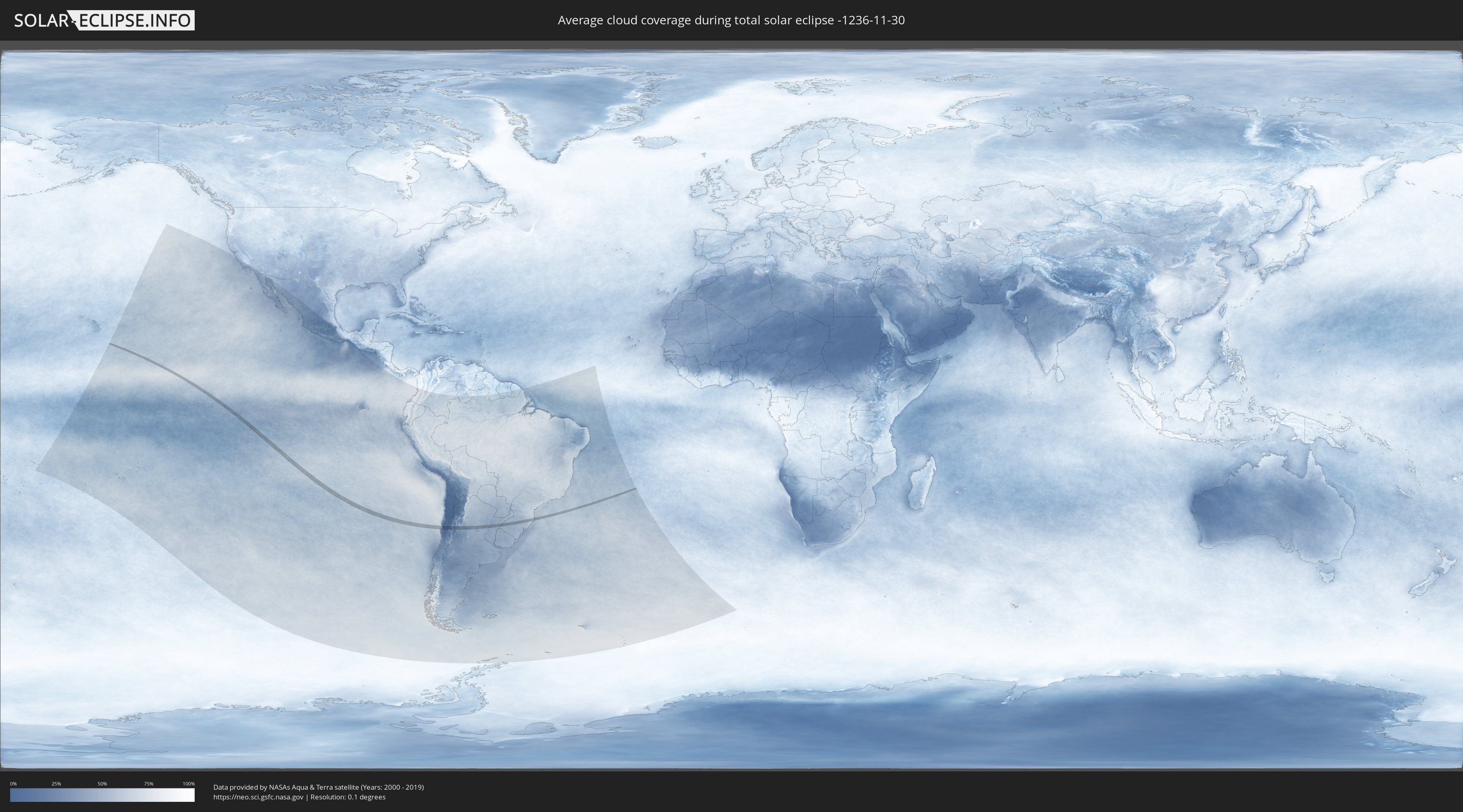
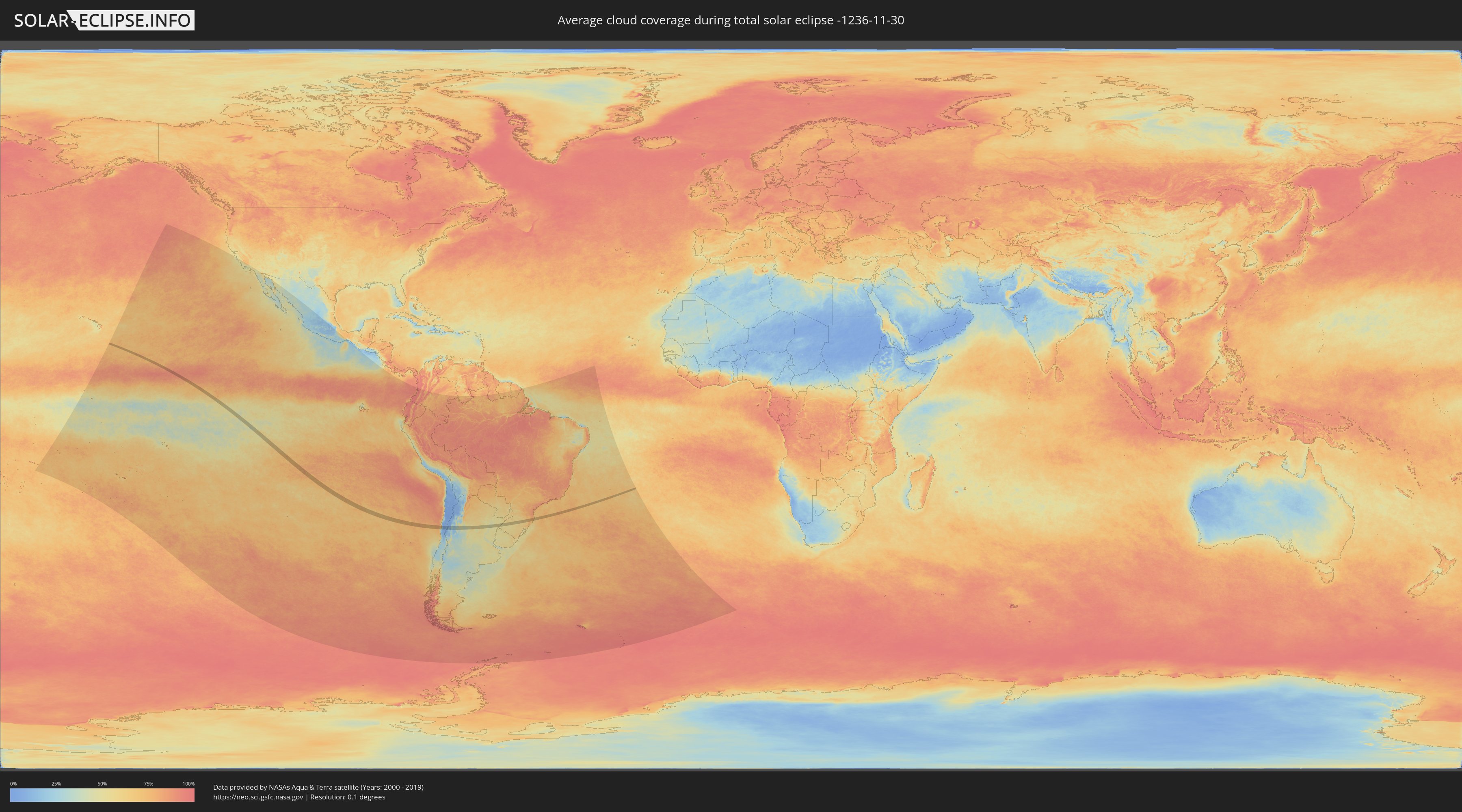
How will be the weather during the total solar eclipse on 11/30/-1236?
Where is the best place to see the total solar eclipse of 11/30/-1236?
The following maps show the average cloud coverage for the day of the total solar eclipse.
With the help of these maps, it is possible to find the place along the eclipse path, which has the best
chance of a cloudless sky.
Nevertheless, you should consider local circumstances and inform about the weather of your chosen
observation site.
The data is provided by NASAs satellites
AQUA and TERRA.
The cloud maps are averaged over a period of 19 years (2000 - 2019).
Detailed country maps
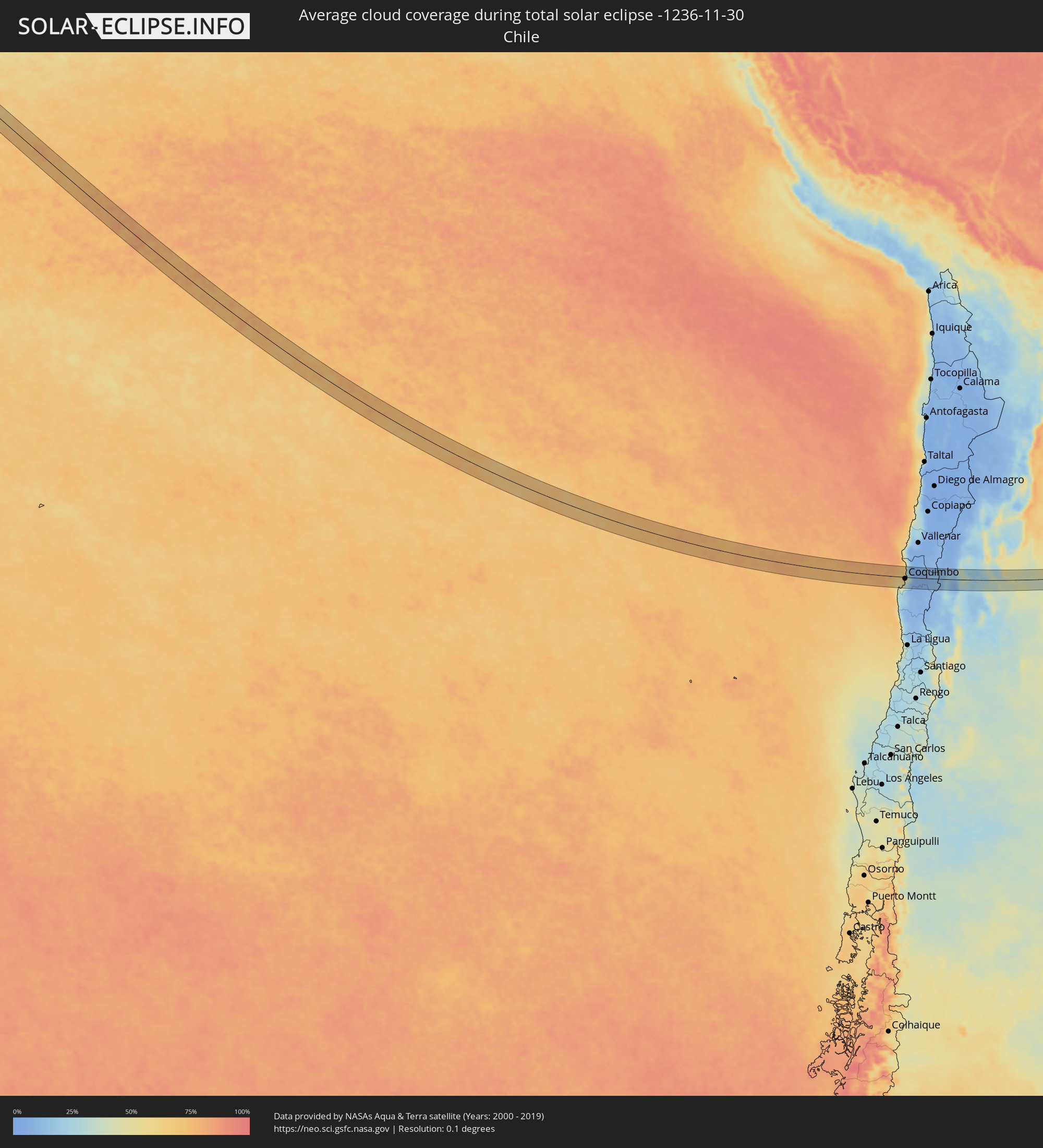 Chile
Chile
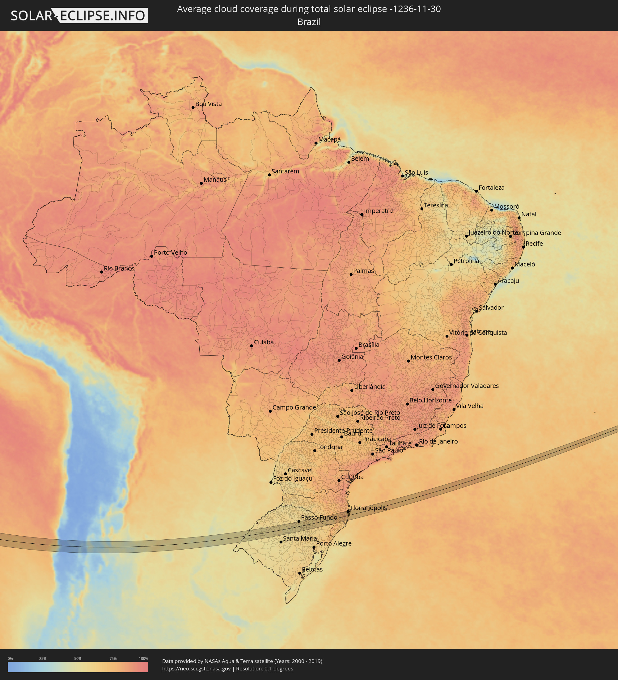 Brazil
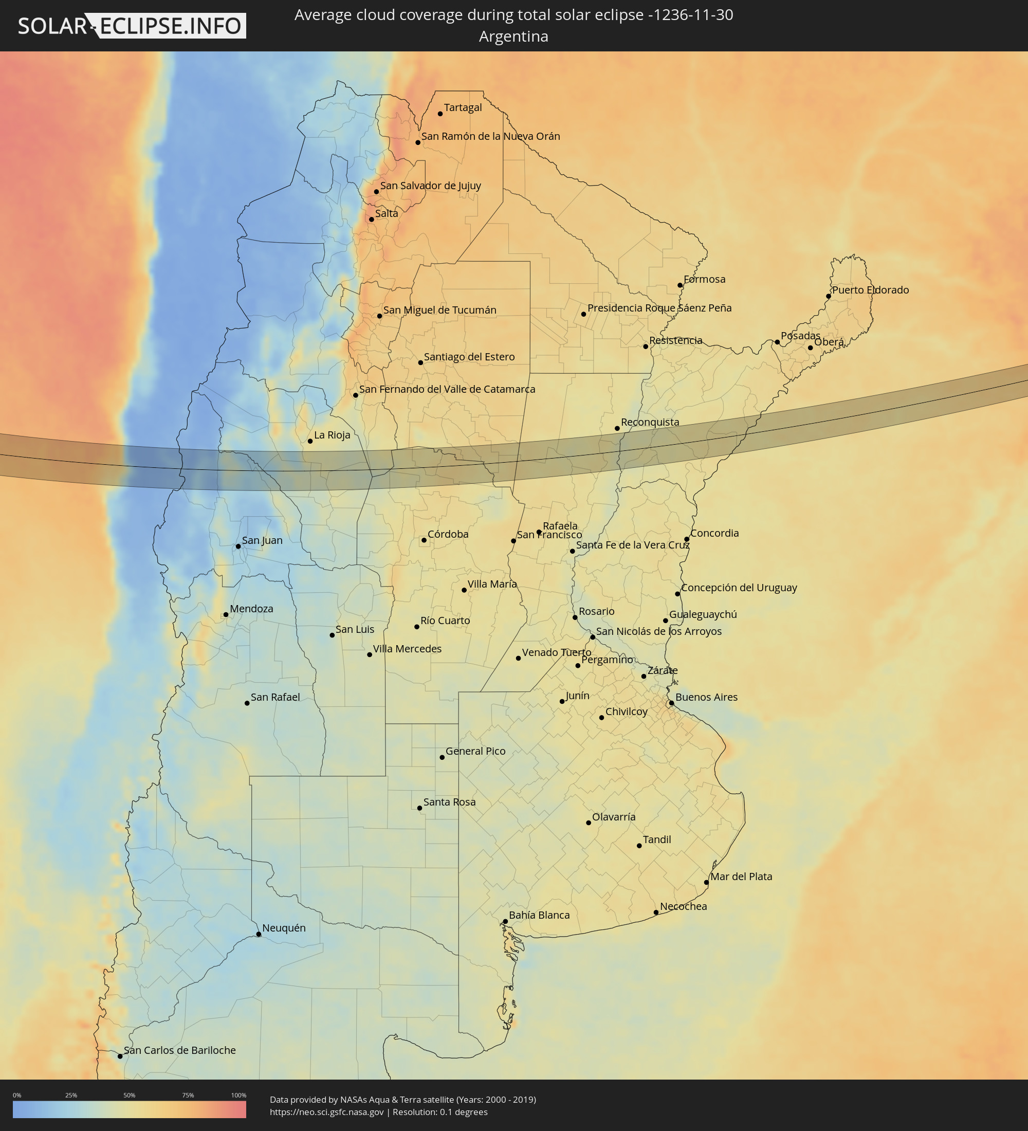 Argentina
Cities inside the path of the eclipse
The following table shows all locations with a population of more than 5,000 inside the eclipse path. Cities which have more than 100,000 inhabitants are marked bold. A click at the locations opens a detailed map.
| City | Type | Eclipse duration | Local time of max. eclipse | Distance to central line | Ø Cloud coverage |
|
Coquimbo, Coquimbo
|
total | - | 14:32:58 UTC-04:42 | 7 km | 43% |
|
La Serena, Coquimbo
|
total | - | 14:33:08 UTC-04:42 | 1 km | 43% |
|
Vicuña, Coquimbo
|
total | - | 14:34:08 UTC-04:42 | 12 km | 6% |
|
San José de Jáchal, San Juan Province
|
total | - | 15:03:35 UTC-04:16 | 28 km | 27% |
|
Chamical, La Rioja Province
|
total | - | 15:07:39 UTC-04:16 | 41 km | 47% |
|
Ceres, Santa Fe Province
|
total | - | 15:14:22 UTC-04:16 | 9 km | 55% |
|
Calchaquí, Santa Fe Province
|
total | - | 15:16:39 UTC-04:16 | 25 km | 52% |
|
Vera, Santa Fe Province
|
total | - | 15:16:53 UTC-04:16 | 22 km | 51% |
|
Malabrigo, Santa Fe Province
|
total | - | 15:17:15 UTC-04:16 | 32 km | 53% |
|
Perugorría, Corrientes Province
|
total | - | 15:19:01 UTC-04:16 | 17 km | 47% |
|
Mercedes, Corrientes Province
|
total | - | 15:19:44 UTC-04:16 | 27 km | 51% |
|
Curuzú Cuatiá, Corrientes Province
|
total | - | 15:19:33 UTC-04:16 | 40 km | 51% |
|
La Cruz, Corrientes Province
|
total | - | 15:21:28 UTC-04:16 | 9 km | 51% |
|
Itaqui, Rio Grande do Sul
|
total | - | 16:31:55 UTC-03:06 | 13 km | 51% |
|
Alvear, Corrientes Province
|
total | - | 15:21:36 UTC-04:16 | 16 km | 51% |
|
Santiago, Rio Grande do Sul
|
total | - | 16:33:47 UTC-03:06 | 21 km | 54% |
|
Tupanciretã, Rio Grande do Sul
|
total | - | 16:34:56 UTC-03:06 | 27 km | 56% |
|
Cruz Alta, Rio Grande do Sul
|
total | - | 16:35:21 UTC-03:06 | 17 km | 55% |
|
Ibirubá, Rio Grande do Sul
|
total | - | 16:35:53 UTC-03:06 | 9 km | 53% |
|
Espumoso, Rio Grande do Sul
|
total | - | 16:36:05 UTC-03:06 | 6 km | 55% |
|
Não Me Toque, Rio Grande do Sul
|
total | - | 16:36:14 UTC-03:06 | 22 km | 54% |
|
Soledade, Rio Grande do Sul
|
total | - | 16:36:22 UTC-03:06 | 23 km | 57% |
|
Passo Fundo, Rio Grande do Sul
|
total | - | 16:36:43 UTC-03:06 | 36 km | 58% |
|
Marau, Rio Grande do Sul
|
total | - | 16:36:50 UTC-03:06 | 11 km | 57% |
|
Lagoa Vermelha, Rio Grande do Sul
|
total | - | 16:37:35 UTC-03:06 | 24 km | 62% |
|
Estrela, Rio Grande do Sul
|
total | - | 16:38:11 UTC-03:06 | 28 km | 63% |
|
Vacaria, Rio Grande do Sul
|
total | - | 16:37:59 UTC-03:06 | 21 km | 64% |
|
São Joaquim, Santa Catarina
|
total | - | 16:38:58 UTC-03:06 | 19 km | 67% |
|
Braço do Norte, Santa Catarina
|
total | - | 16:39:37 UTC-03:06 | 34 km | 70% |
|
São José, Santa Catarina
|
total | - | 16:39:39 UTC-03:06 | 27 km | 71% |
|
Santo Amaro da Imperatriz, Santa Catarina
|
total | - | 16:40:13 UTC-03:06 | 21 km | 79% |
|
Palhoça, Santa Catarina
|
total | - | 16:40:20 UTC-03:06 | 23 km | 74% |
|
Campinas, Santa Catarina
|
total | - | 16:40:24 UTC-03:06 | 27 km | 73% |
|
Freguesia do Ribeirao da Ilha, Santa Catarina
|
total | - | 16:40:23 UTC-03:06 | 13 km | 73% |
|
Florianópolis, Santa Catarina
|
total | - | 16:40:27 UTC-03:06 | 25 km | 71% |
|
Saco dos Limoes, Santa Catarina
|
total | - | 16:40:27 UTC-03:06 | 24 km | 71% |
|
Ribeirão da Ilha, Santa Catarina
|
total | - | 16:40:25 UTC-03:06 | 14 km | 70% |
|
Trindade, Santa Catarina
|
total | - | 16:40:28 UTC-03:06 | 26 km | 71% |
|
Costeira do Pirajubae, Santa Catarina
|
total | - | 16:40:27 UTC-03:06 | 21 km | 71% |
|
Santa Monica, Santa Catarina
|
total | - | 16:40:29 UTC-03:06 | 25 km | 71% |
|
Itacorubi, Santa Catarina
|
total | - | 16:40:30 UTC-03:06 | 26 km | 71% |
|
Lagoa, Santa Catarina
|
total | - | 16:40:30 UTC-03:06 | 23 km | 71% |