Total solar eclipse of 04/23/-1373
| Day of week: | Saturday |
| Maximum duration of eclipse: | 06m47s |
| Maximum width of eclipse path: | 247 km |
| Saros cycle: | 26 |
| Coverage: | 100% |
| Magnitude: | 1.0762 |
| Gamma: | 0.0018 |
Wo kann man die Sonnenfinsternis vom 04/23/-1373 sehen?
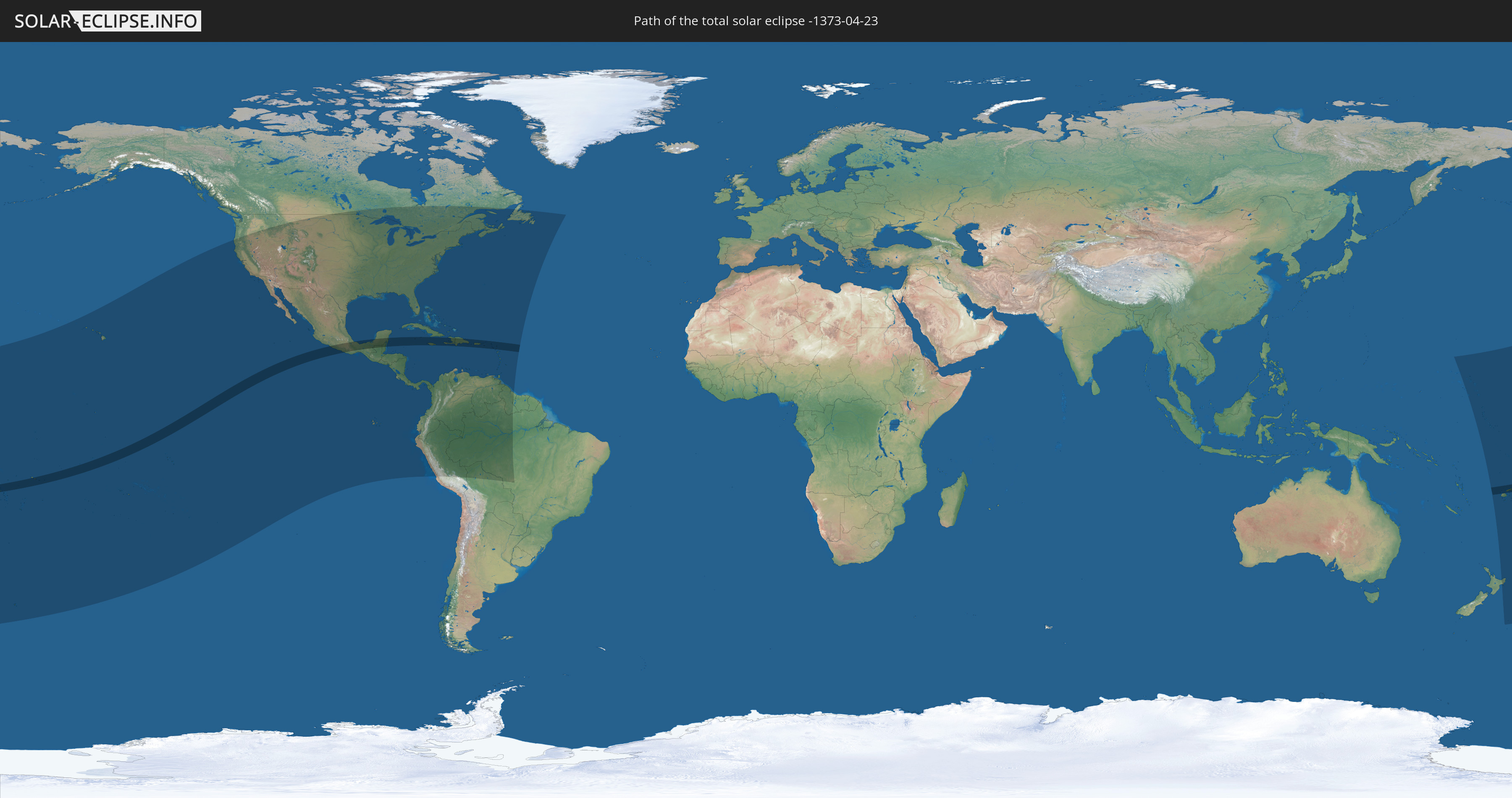
Die Sonnenfinsternis am 04/23/-1373 kann man in 60 Ländern als partielle Sonnenfinsternis beobachten.
Der Finsternispfad verläuft durch 23 Länder. Nur in diesen Ländern ist sie als total Sonnenfinsternis zu sehen.
In den folgenden Ländern ist die Sonnenfinsternis total zu sehen
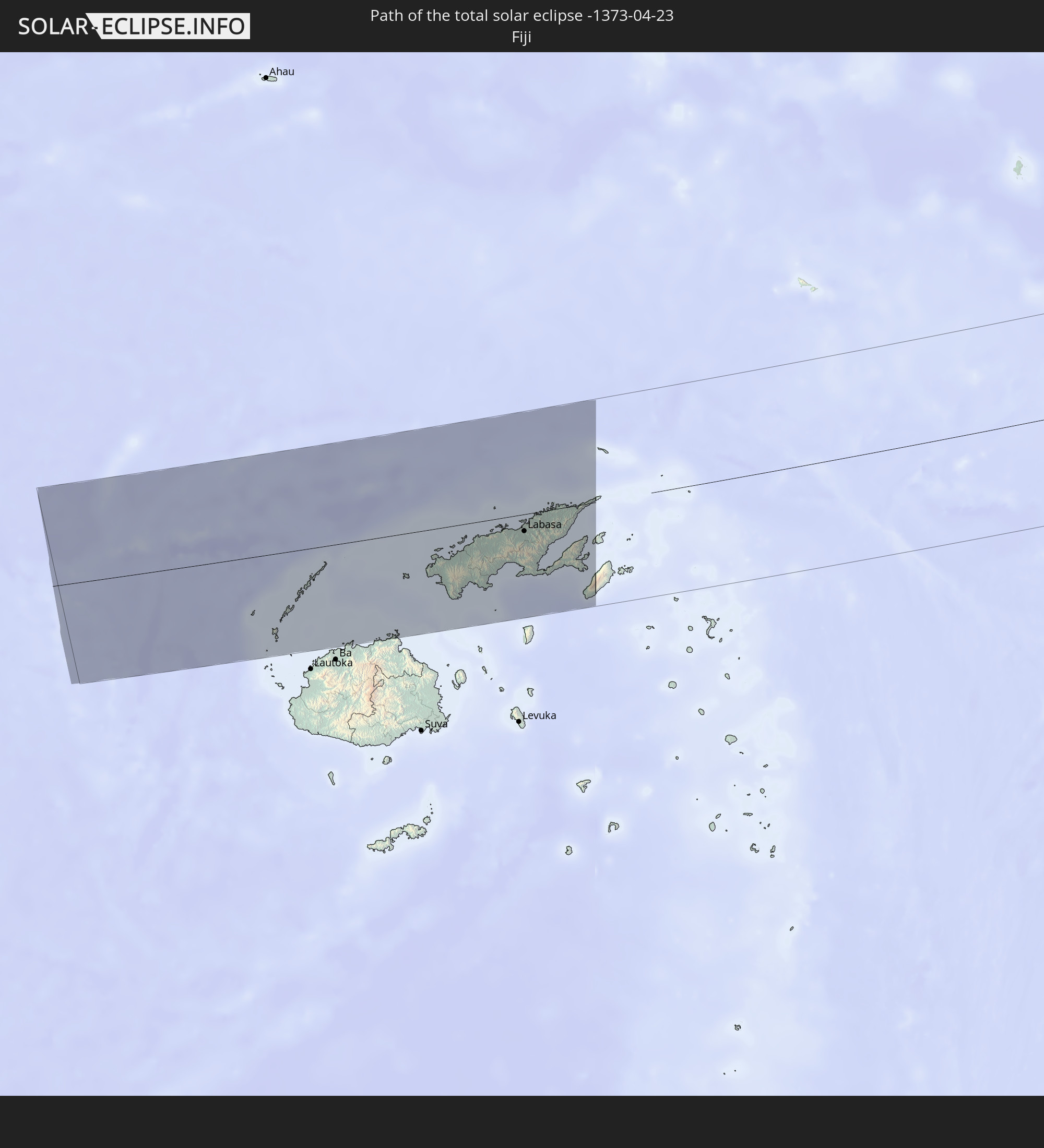 Fiji
Fiji
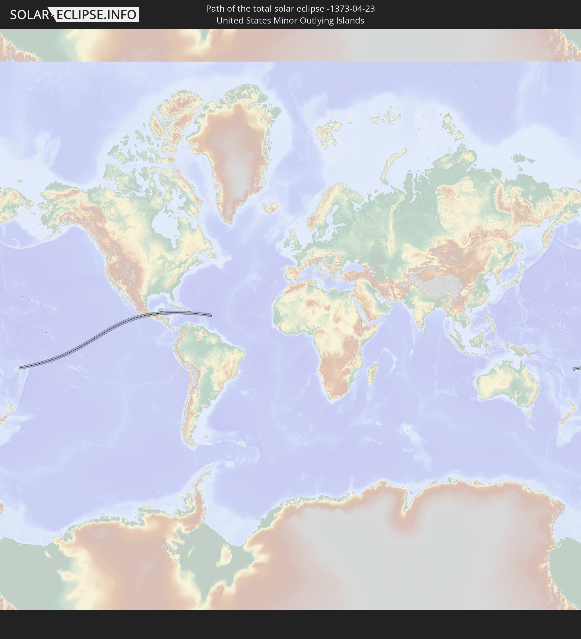 United States Minor Outlying Islands
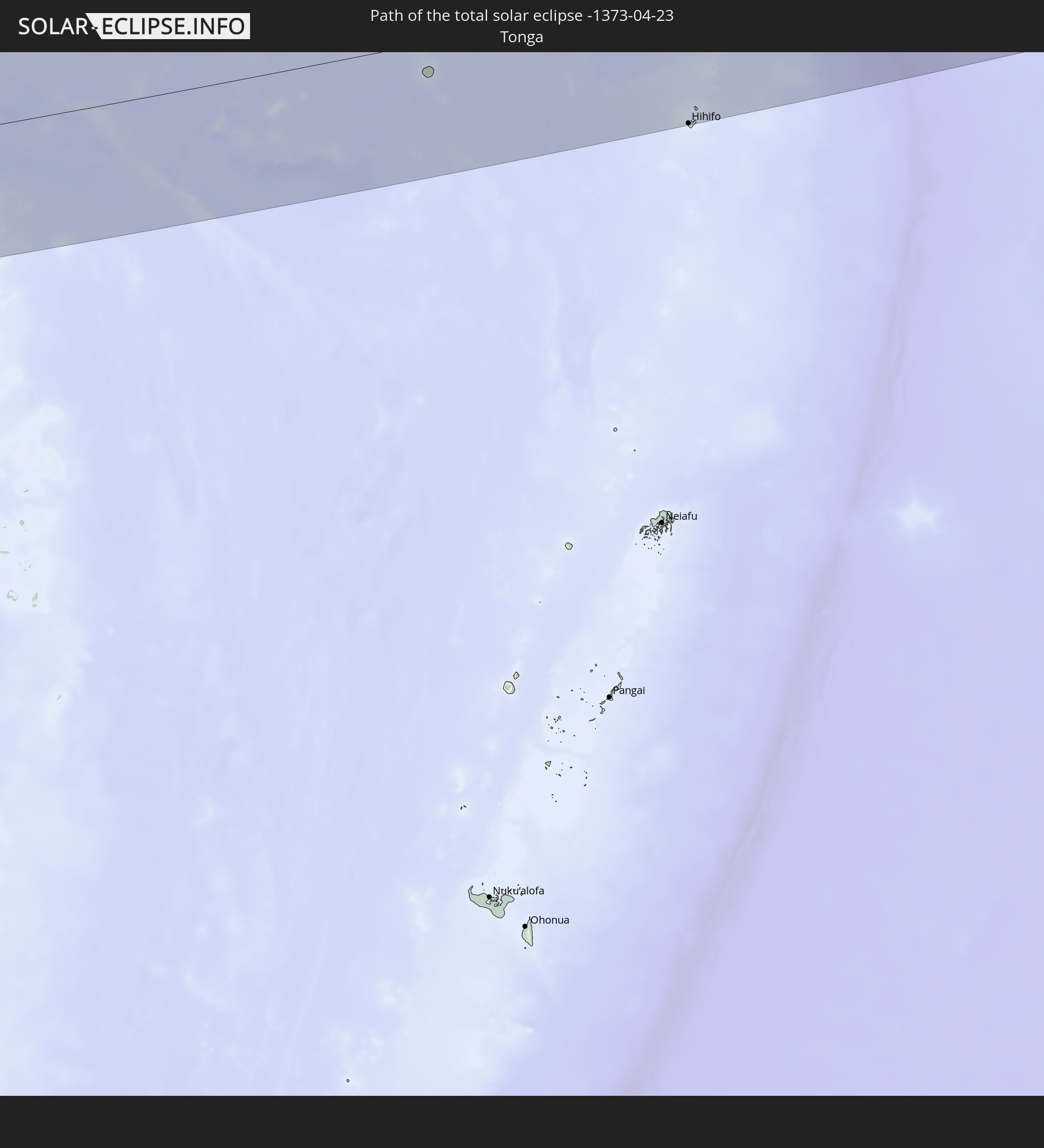 Tonga
Tonga
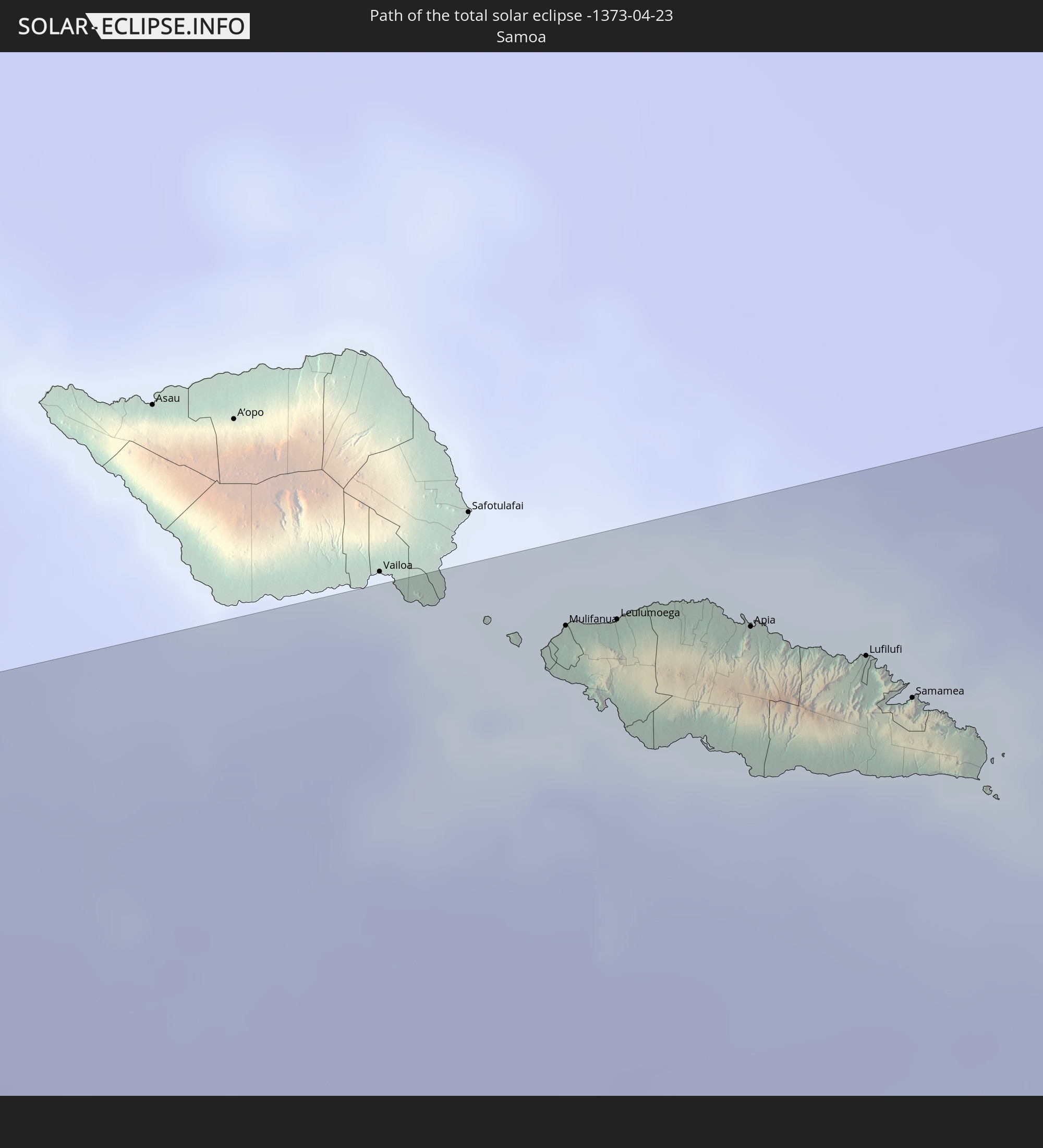 Samoa
Samoa
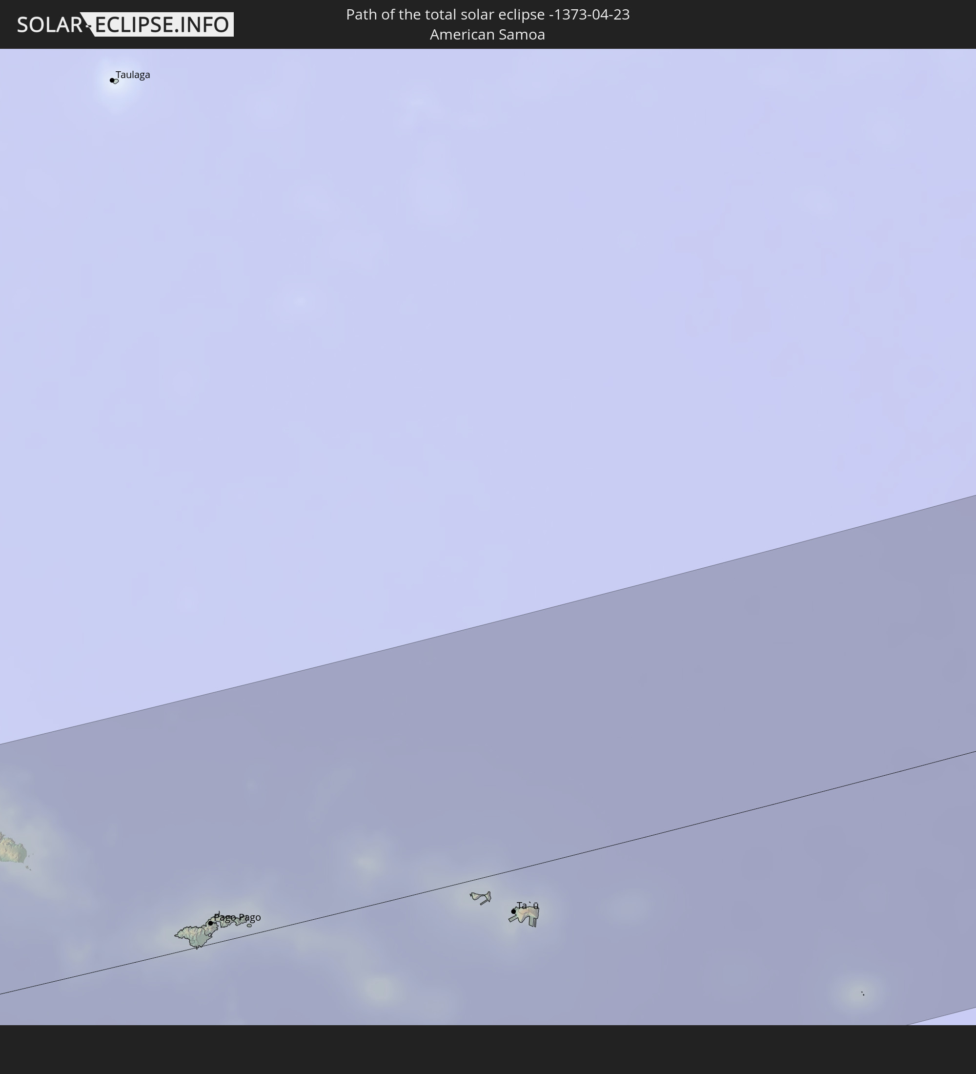 American Samoa
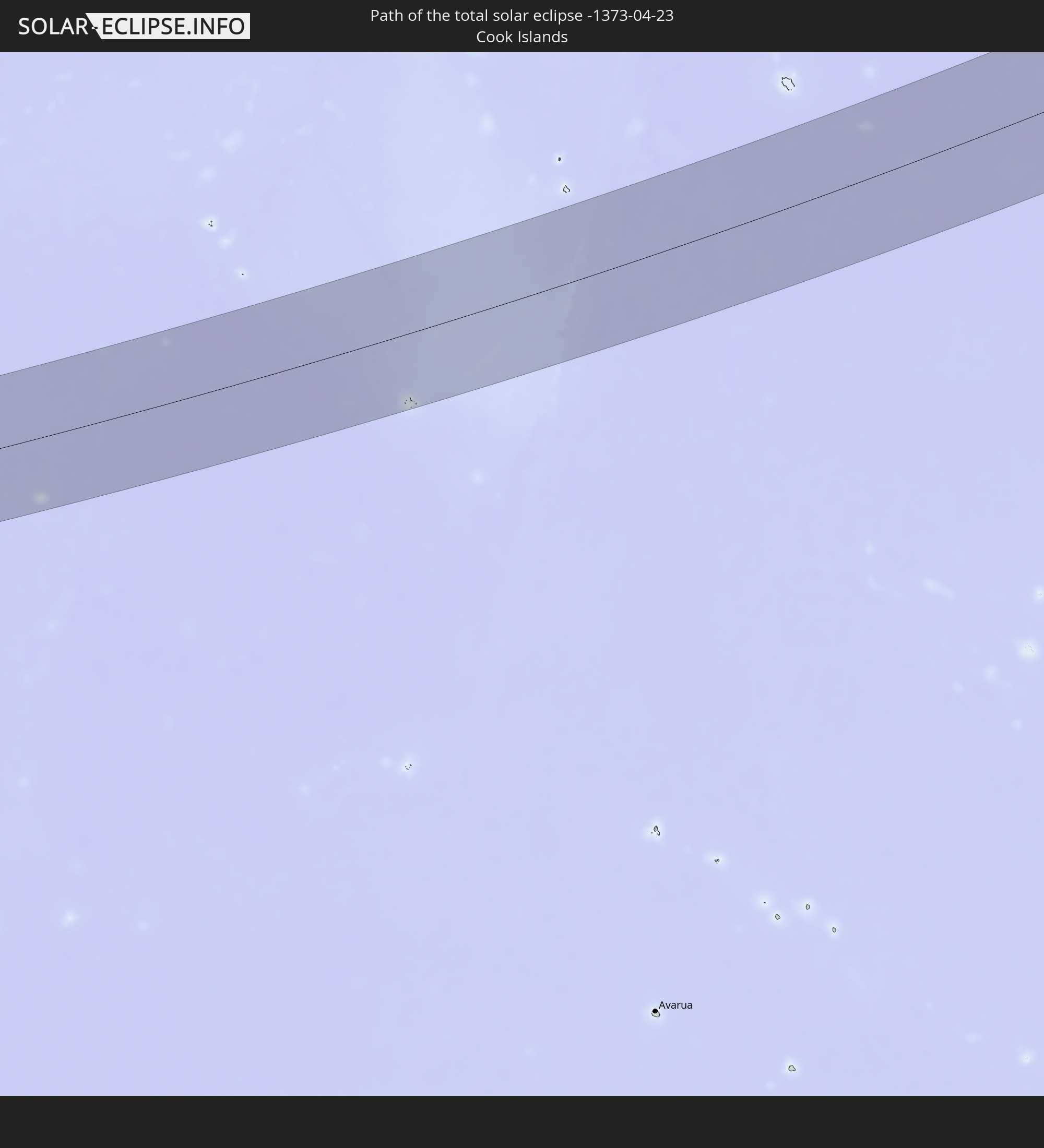 Cook Islands
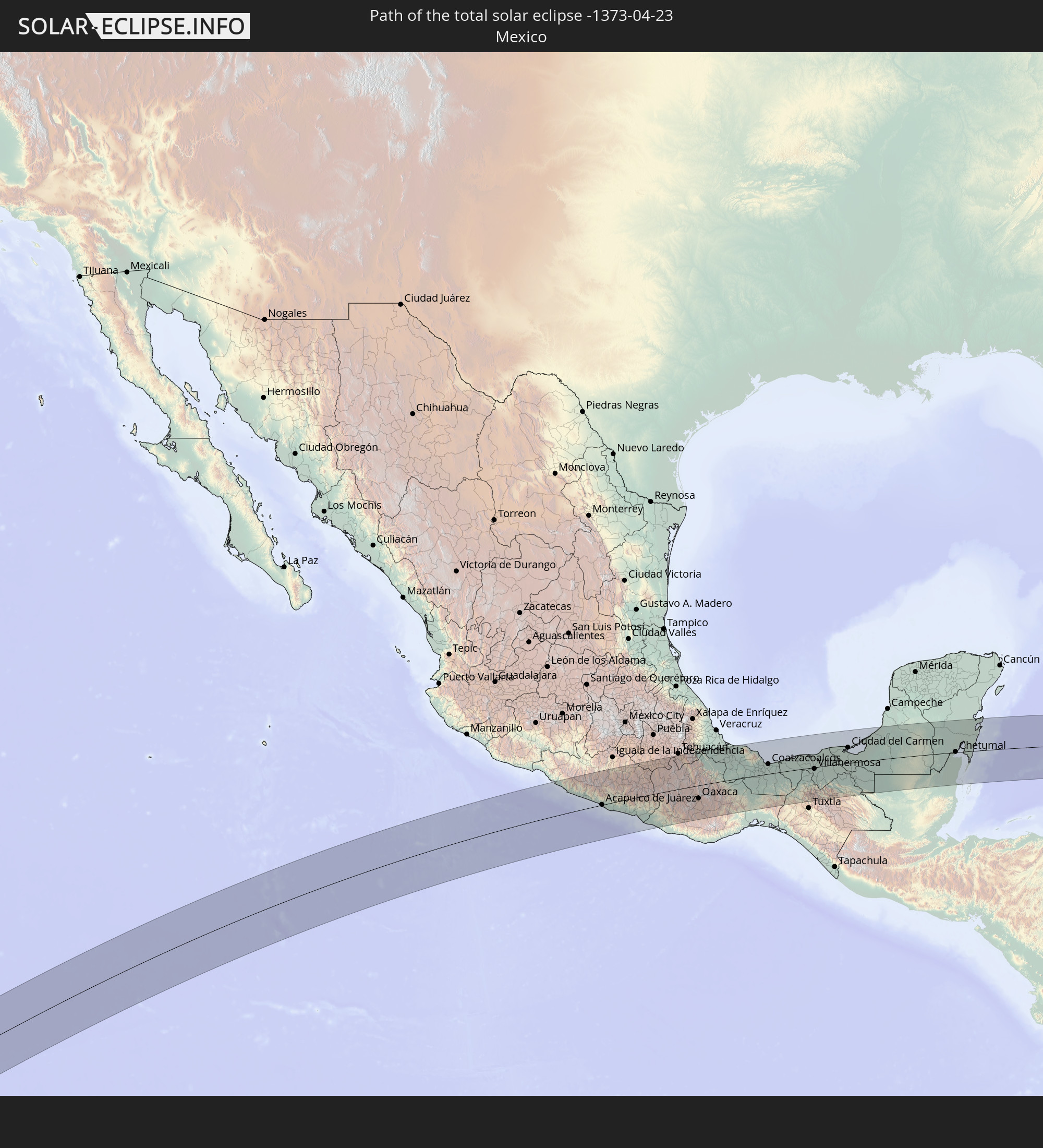 Mexico
 Guatemala
 Belize
 Cayman Islands
 Jamaica
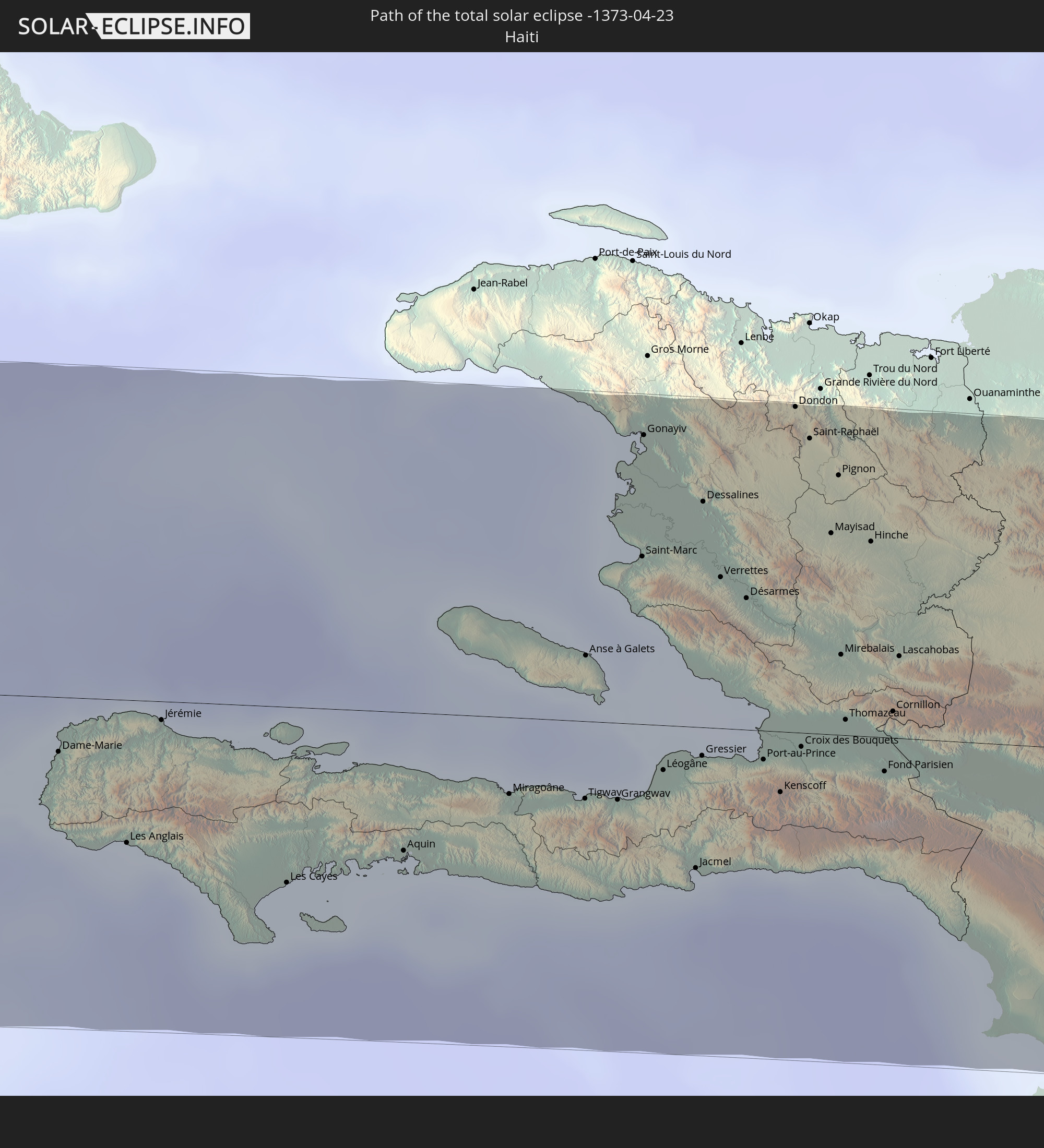 Haiti
Haiti
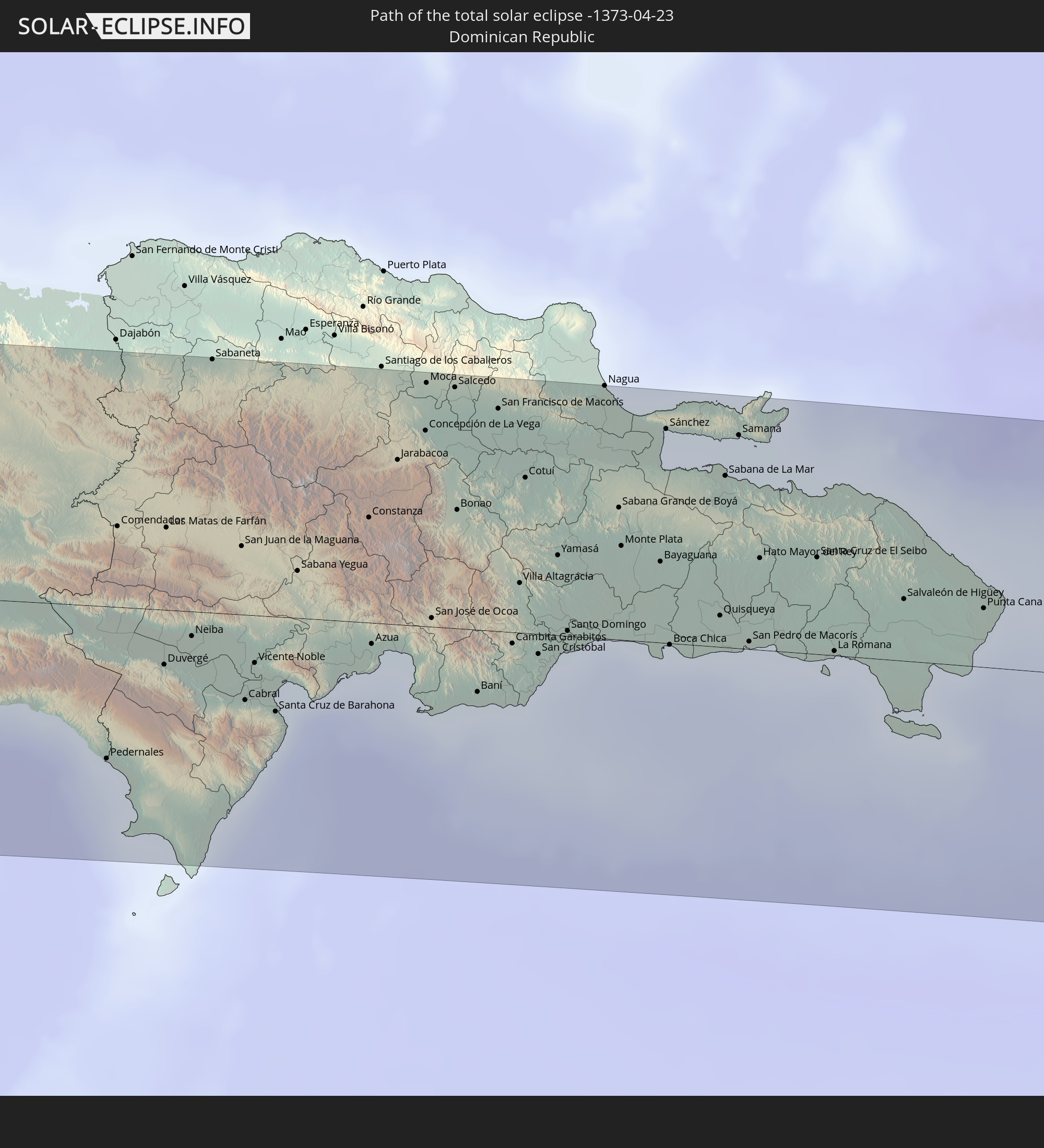 Dominican Republic
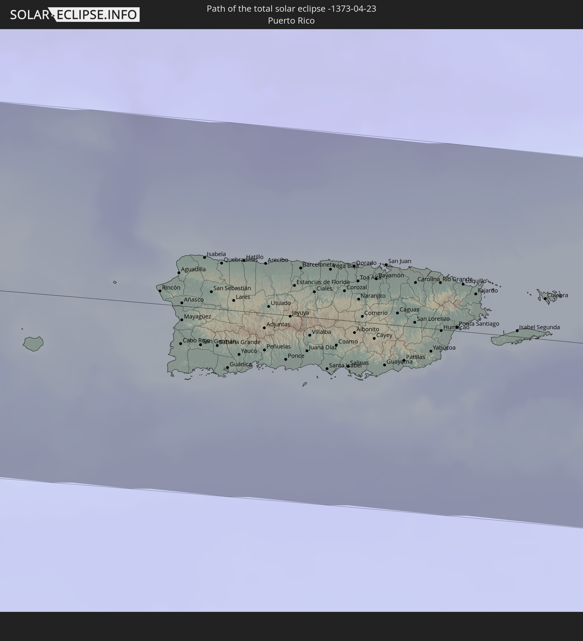 Puerto Rico
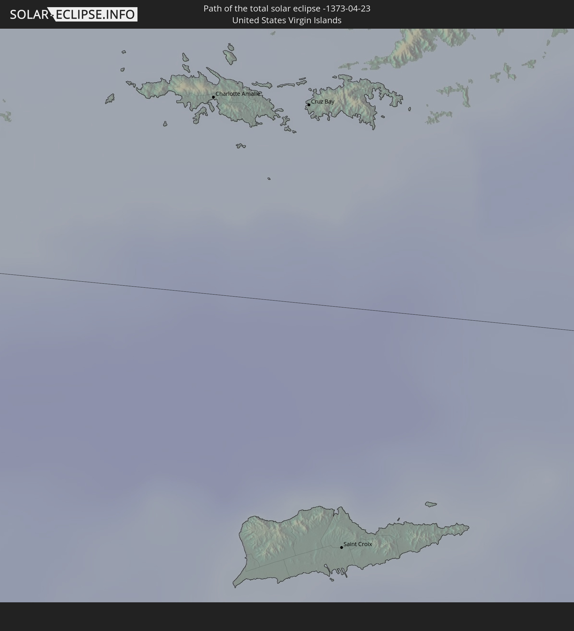 United States Virgin Islands
 British Virgin Islands
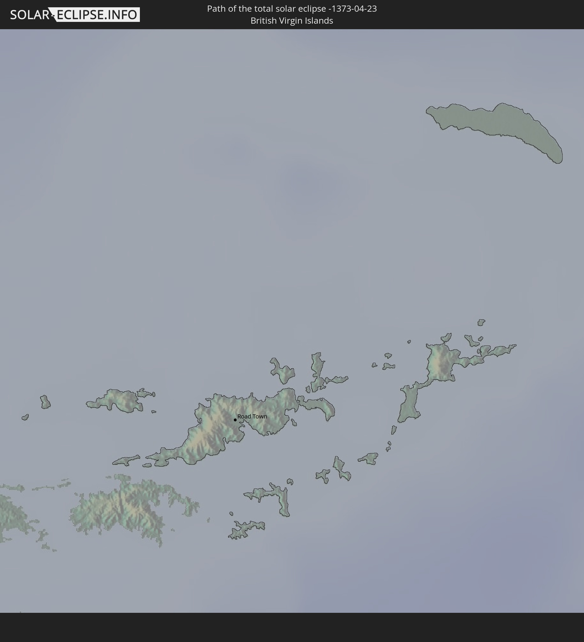
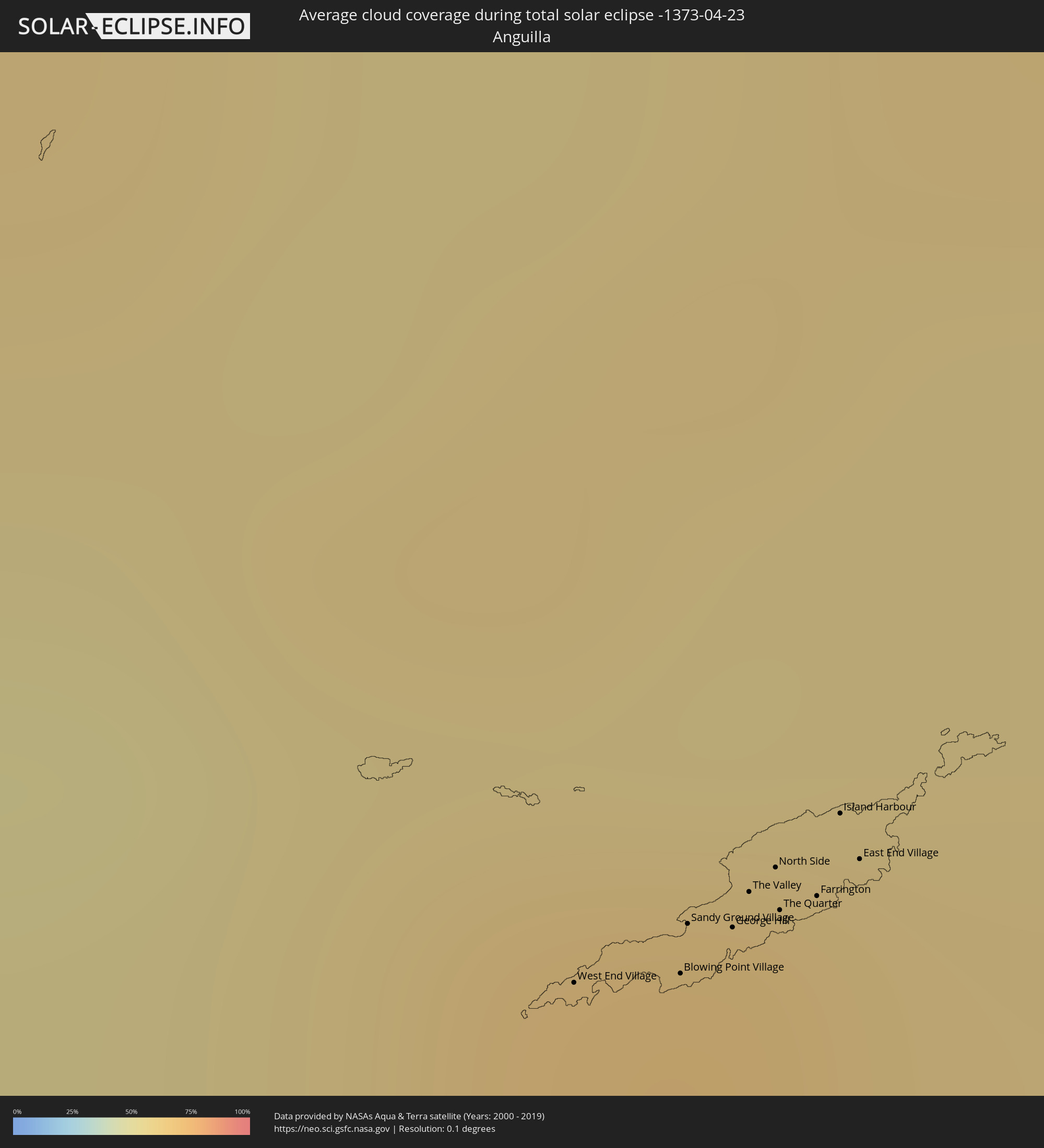
 Anguilla
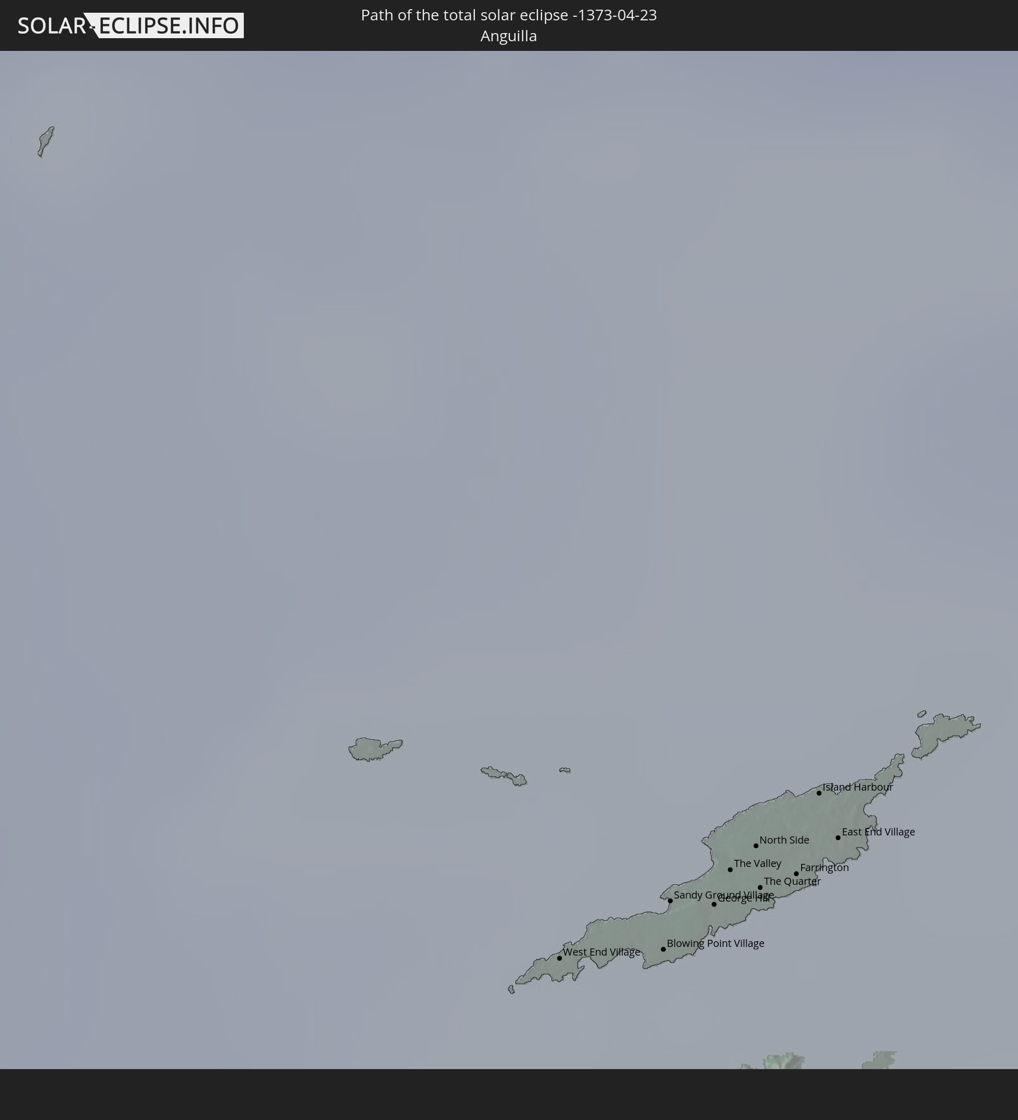
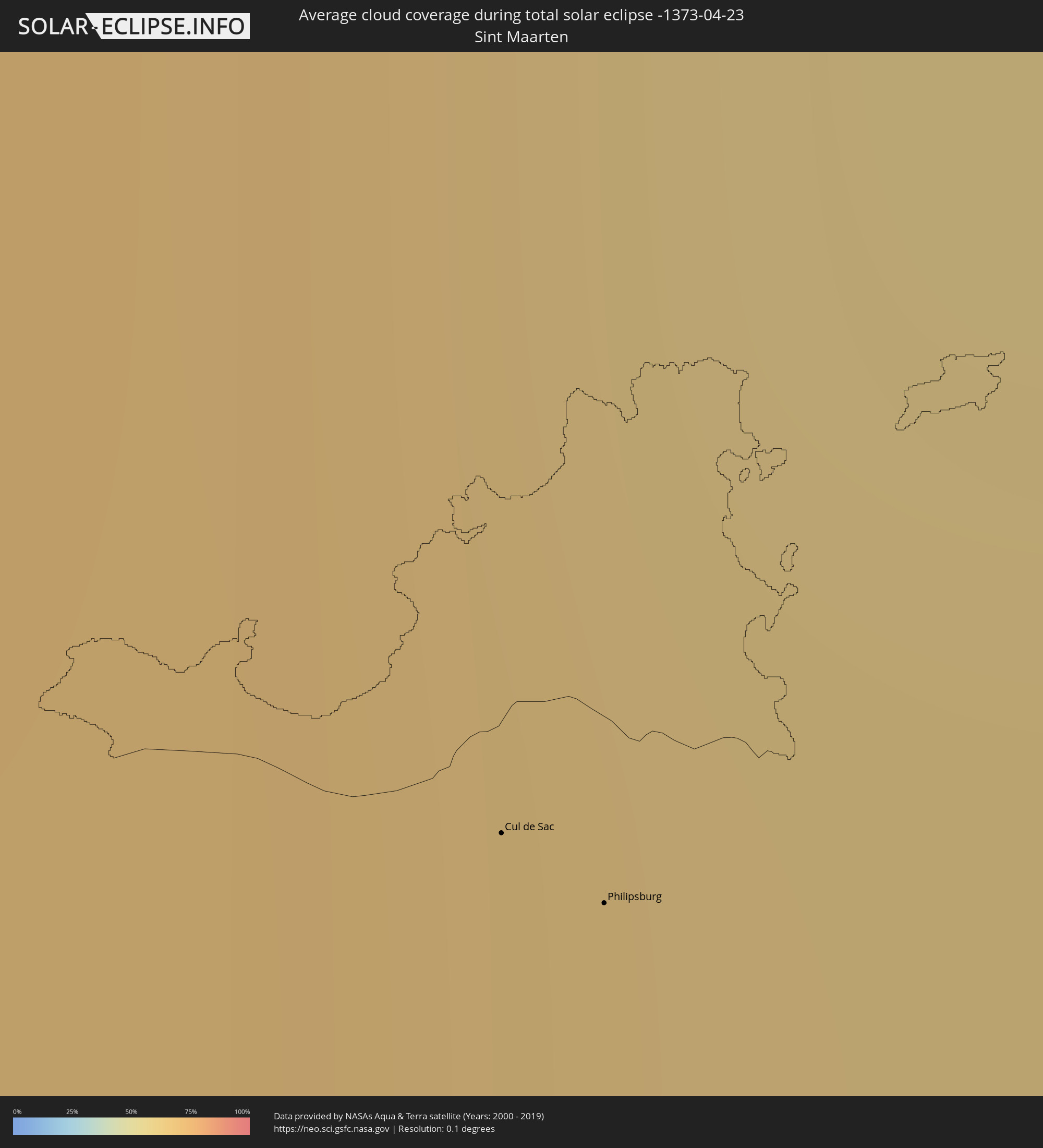
 Sint Maarten
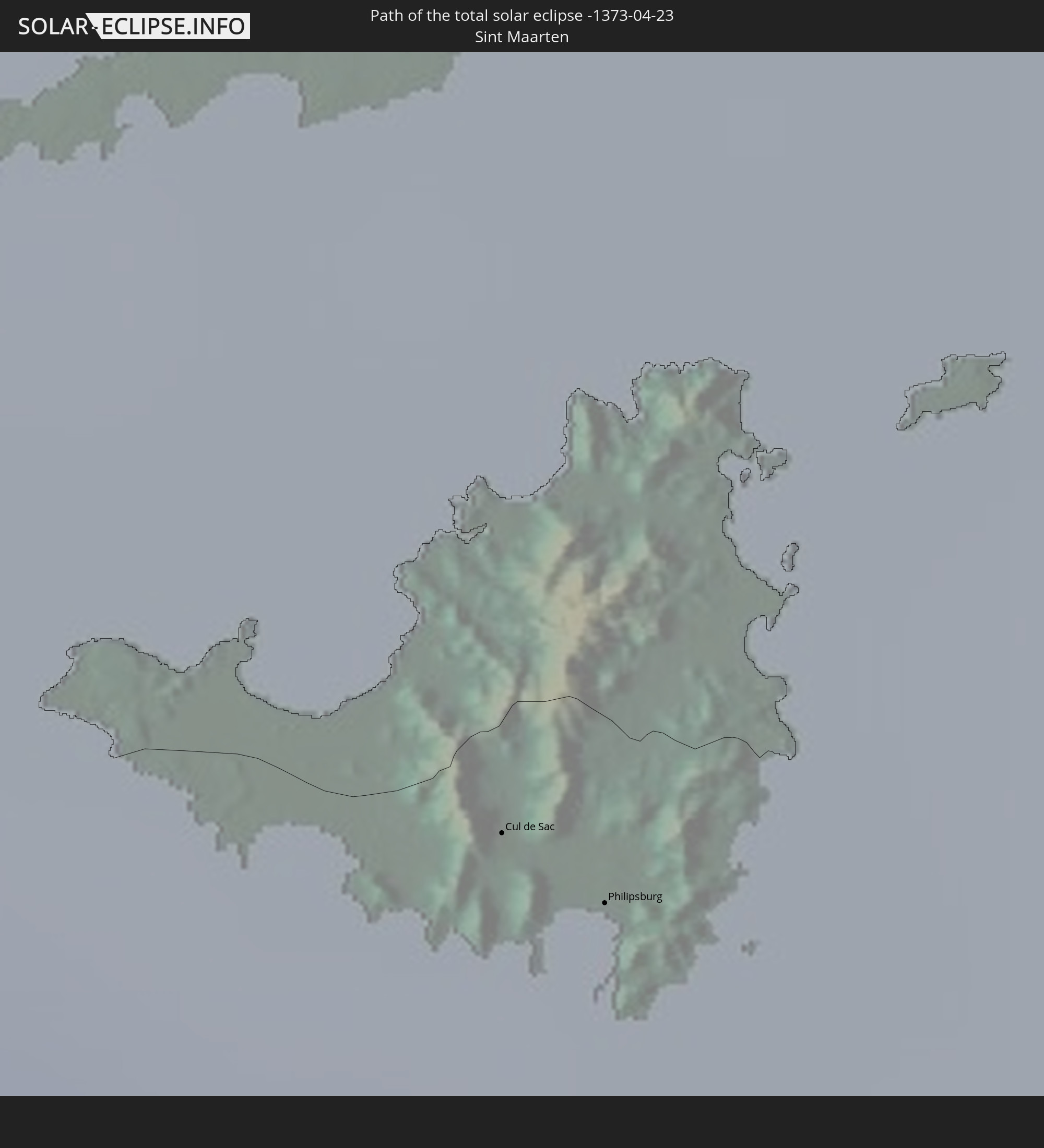
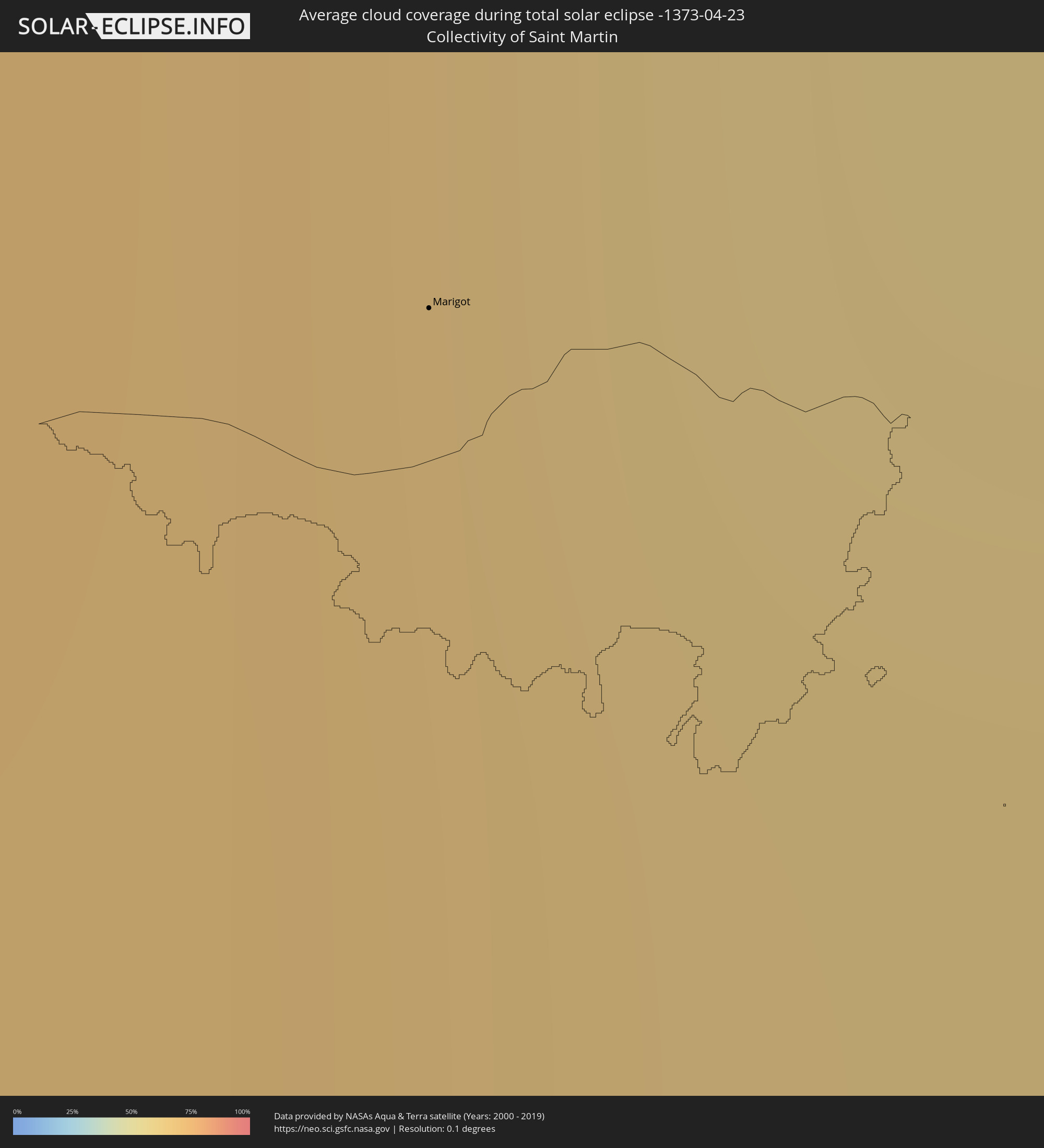
 Collectivity of Saint Martin
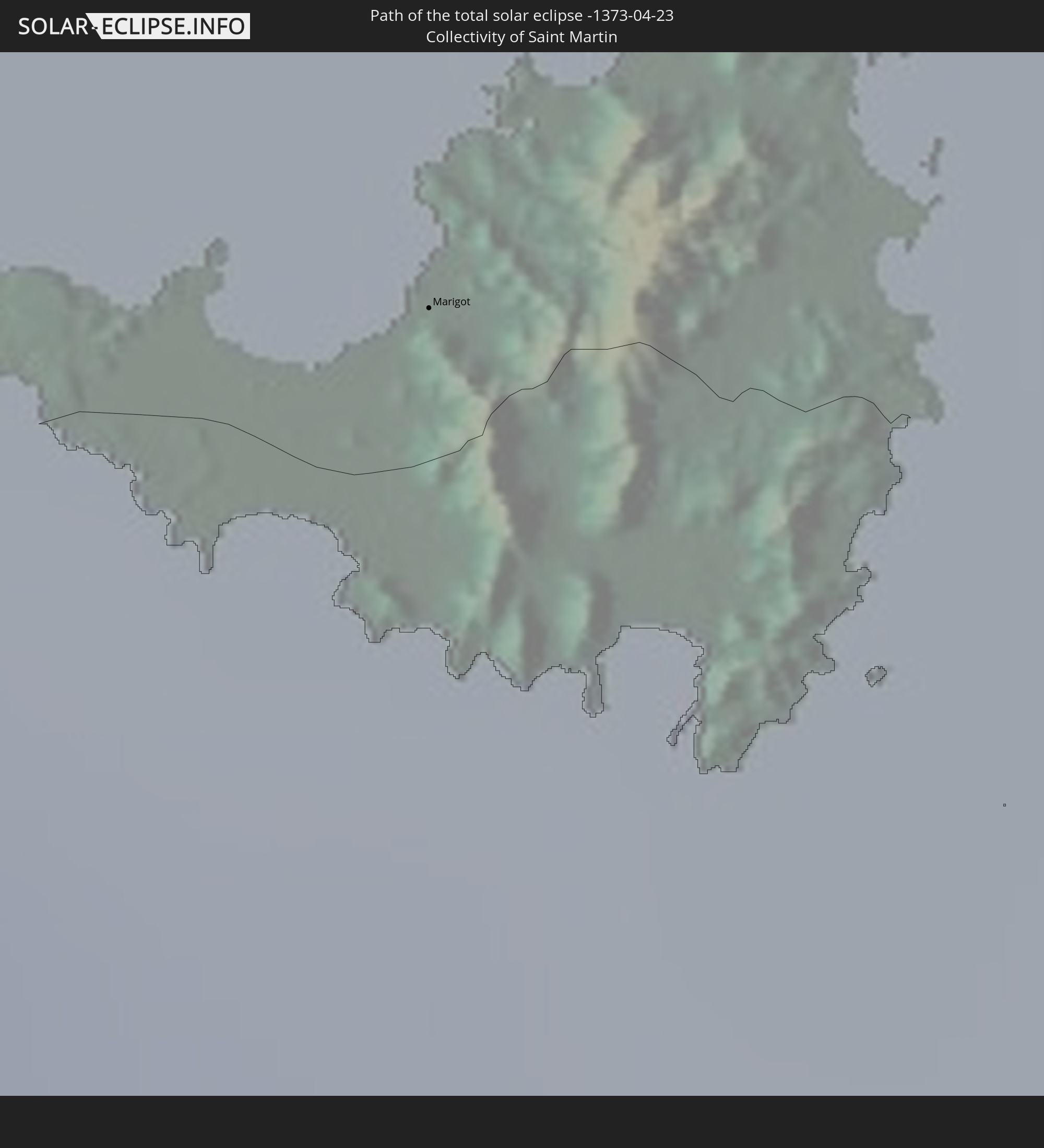
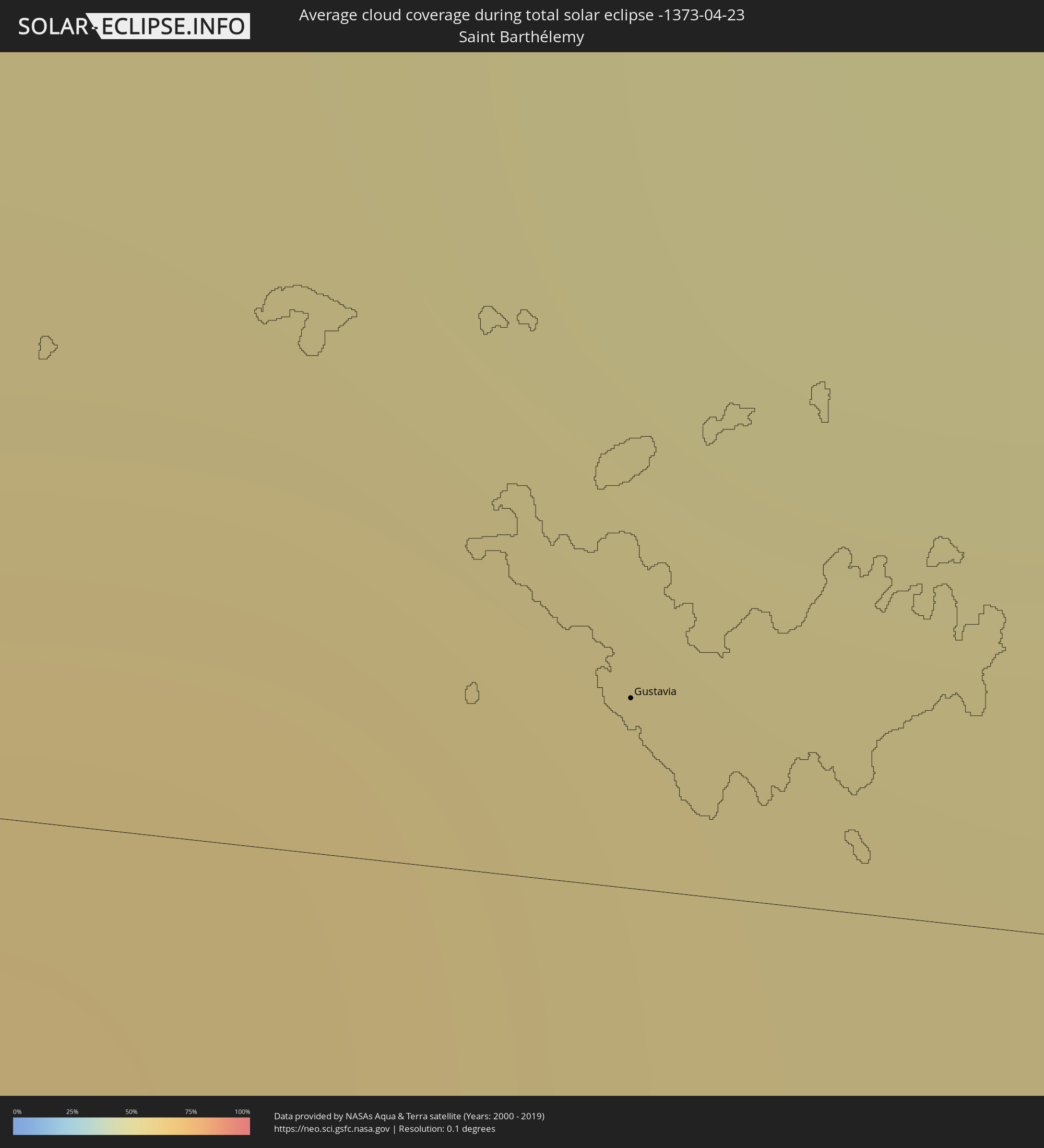
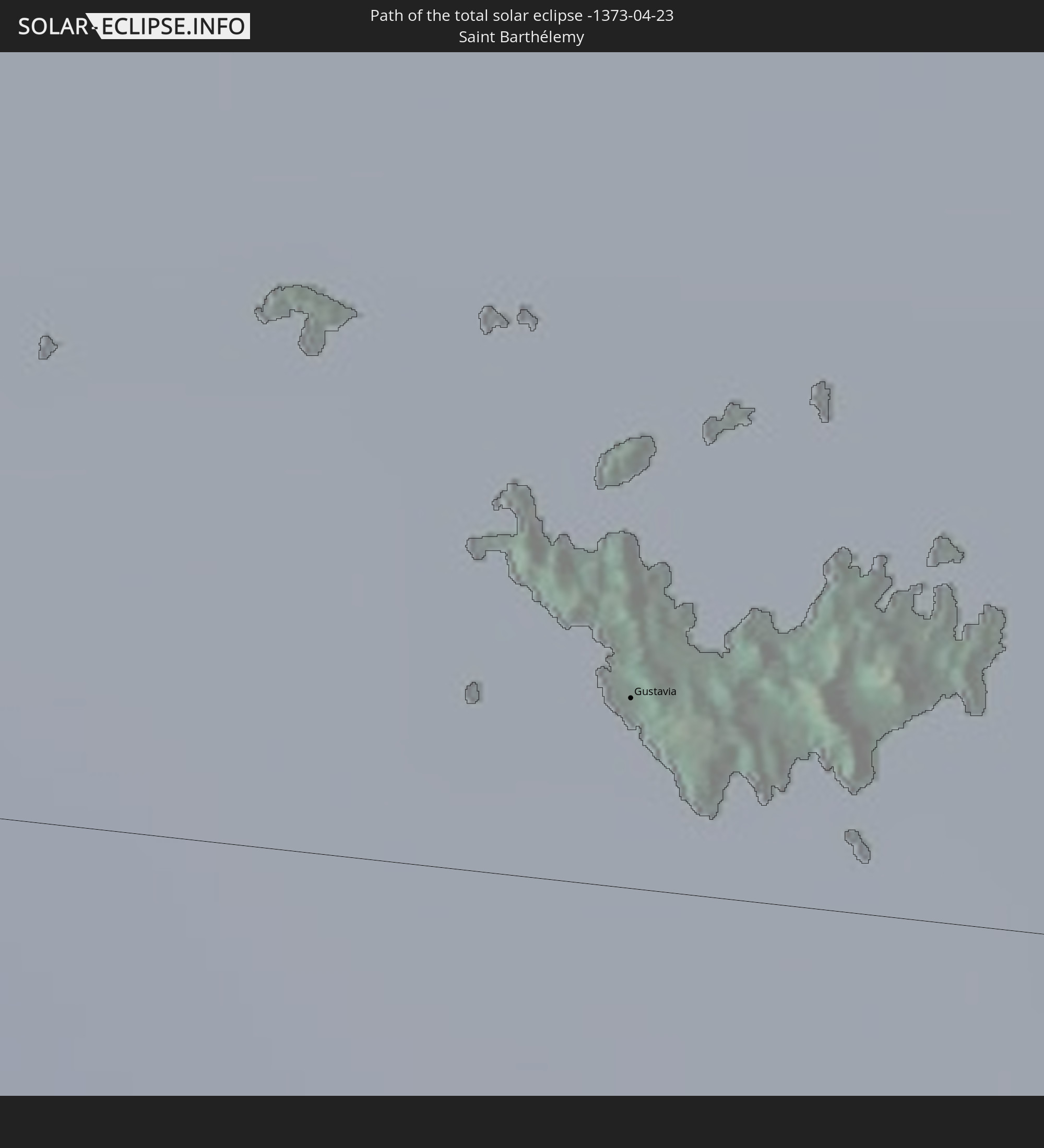 Saint Barthélemy
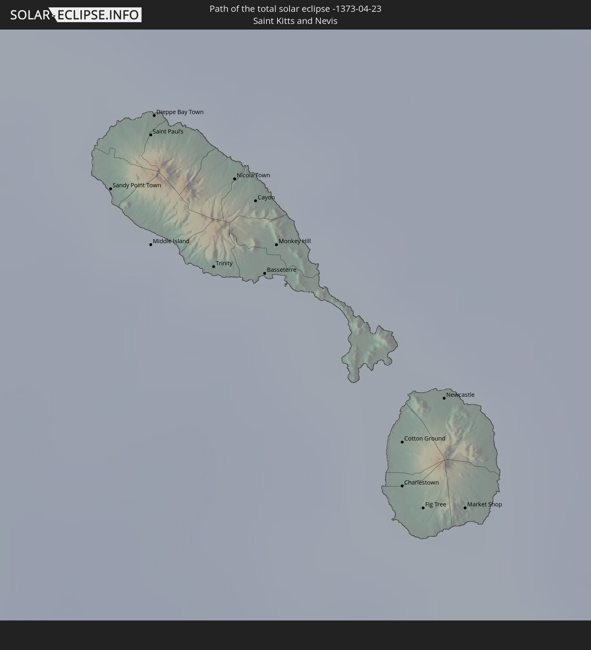 Saint Kitts and Nevis
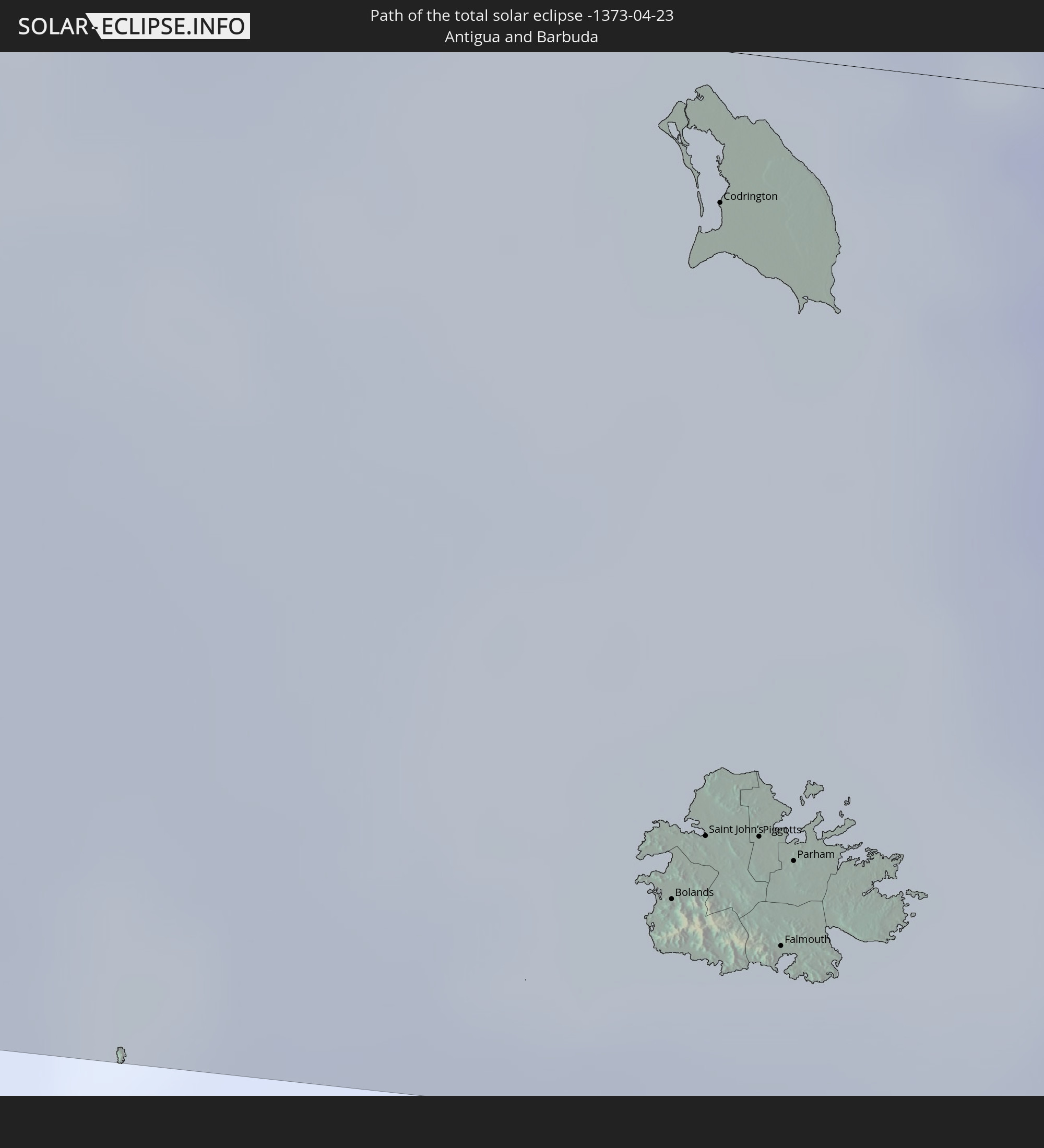 Antigua and Barbuda
 Caribbean Netherlands
In den folgenden Ländern ist die Sonnenfinsternis partiell zu sehen
 Fiji
Fiji
 United States
 New Zealand
 United States Minor Outlying Islands
 Wallis and Futuna
 Tonga
Tonga
 Kiribati
 Samoa
Samoa
 Tokelau
 American Samoa
 Niue
Niue
 Cook Islands
 French Polynesia
 Canada
 Pitcairn Islands
 Mexico
 Guatemala
 Ecuador
 El Salvador
 Honduras
 Belize
 Nicaragua
 Costa Rica
 Cuba
Cuba
 Panama
 Colombia
 Cayman Islands
 Peru
Peru
 The Bahamas
 Jamaica
 Haiti
Haiti
 Brazil
 Venezuela
 Turks and Caicos Islands
 Dominican Republic
 Aruba
Aruba
 Bolivia
 Puerto Rico
 United States Virgin Islands
 Bermuda
 British Virgin Islands
 Anguilla
 Collectivity of Saint Martin
 Saint Barthélemy
 Saint Kitts and Nevis
 Antigua and Barbuda
 Montserrat
 Trinidad and Tobago
 Guadeloupe
 Grenada
 Dominica
 Saint Vincent and the Grenadines
 Guyana
 Martinique
 Saint Lucia
 Barbados
 Suriname
 Saint Pierre and Miquelon
 Marshall Islands
 Tuvalu
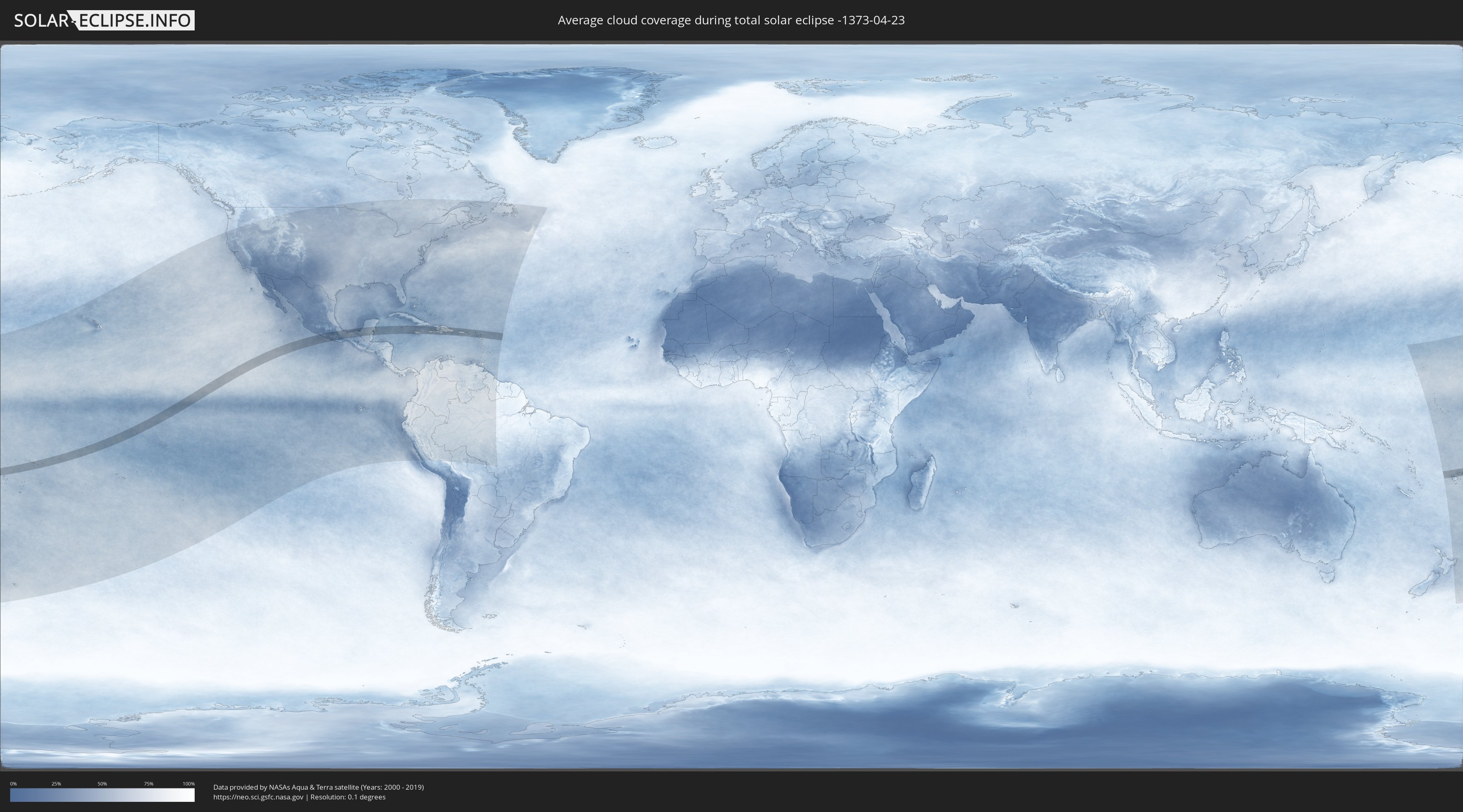
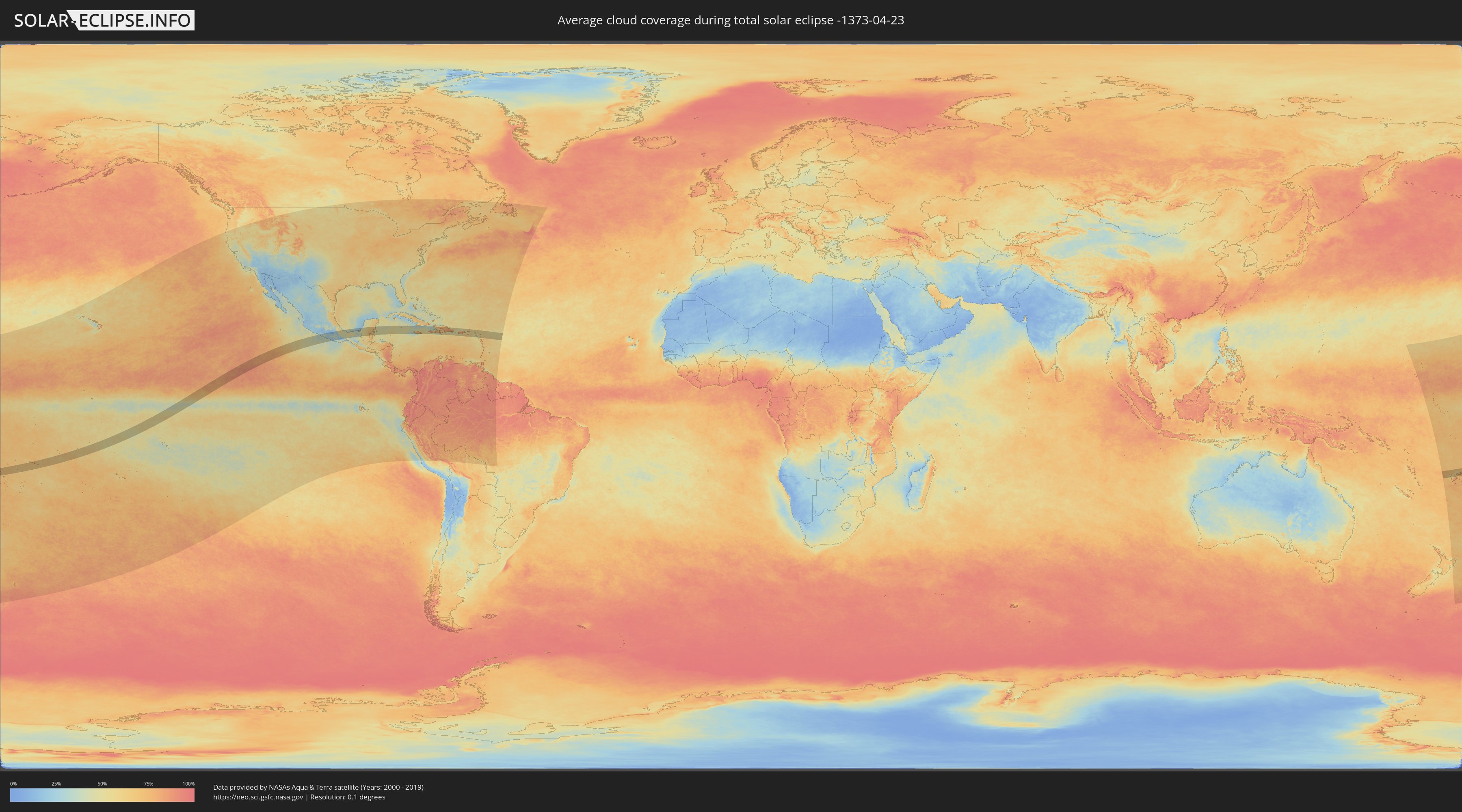
How will be the weather during the total solar eclipse on 04/23/-1373?
Where is the best place to see the total solar eclipse of 04/23/-1373?
The following maps show the average cloud coverage for the day of the total solar eclipse.
With the help of these maps, it is possible to find the place along the eclipse path, which has the best
chance of a cloudless sky.
Nevertheless, you should consider local circumstances and inform about the weather of your chosen
observation site.
The data is provided by NASAs satellites
AQUA and TERRA.
The cloud maps are averaged over a period of 19 years (2000 - 2019).
Detailed country maps
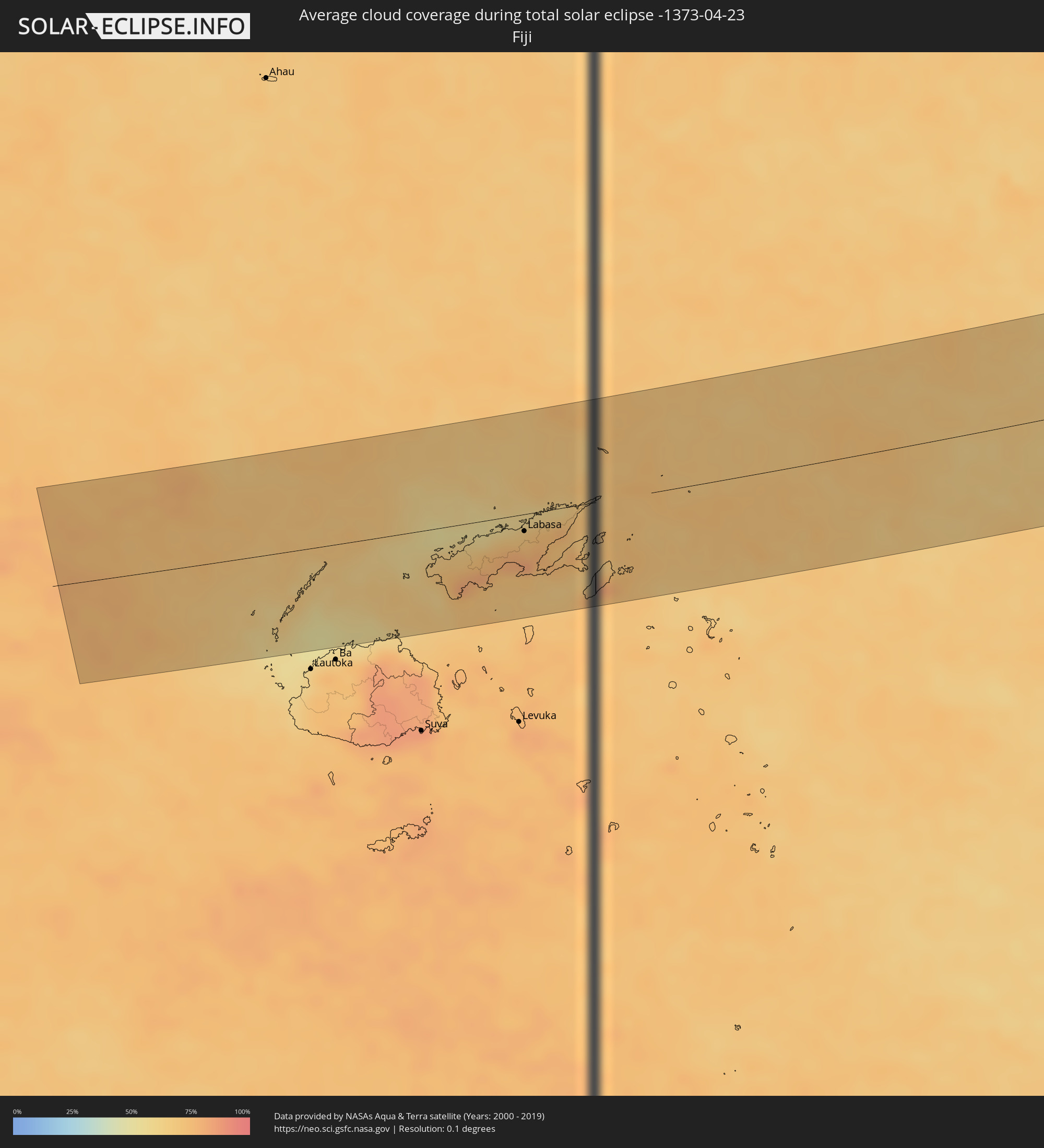 Fiji
Fiji
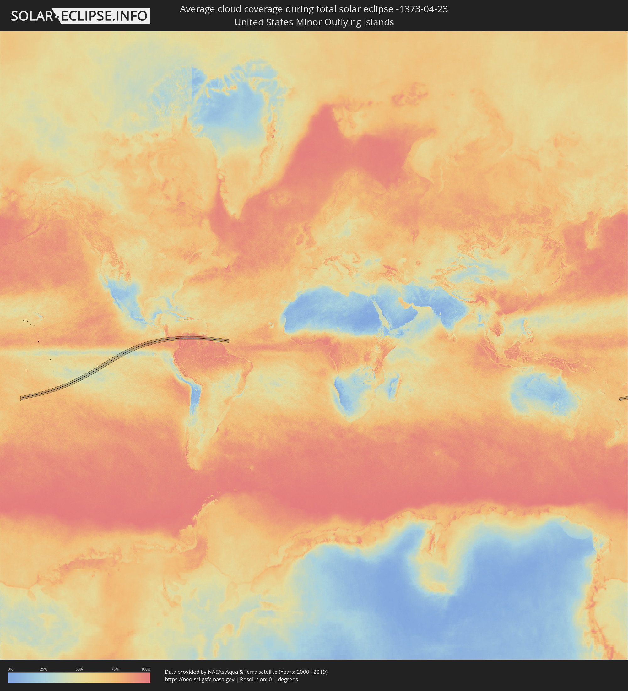 United States Minor Outlying Islands
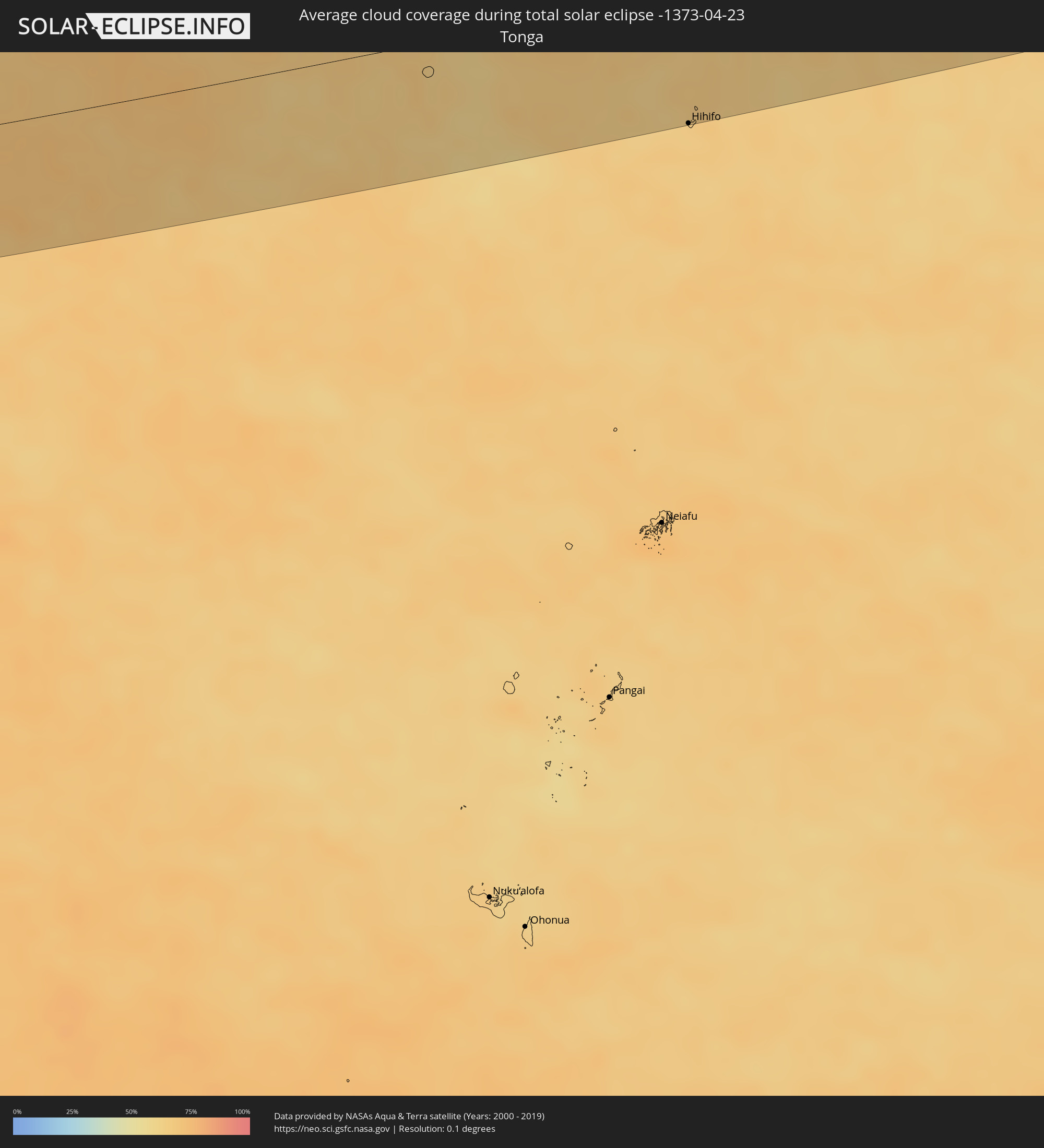 Tonga
Tonga
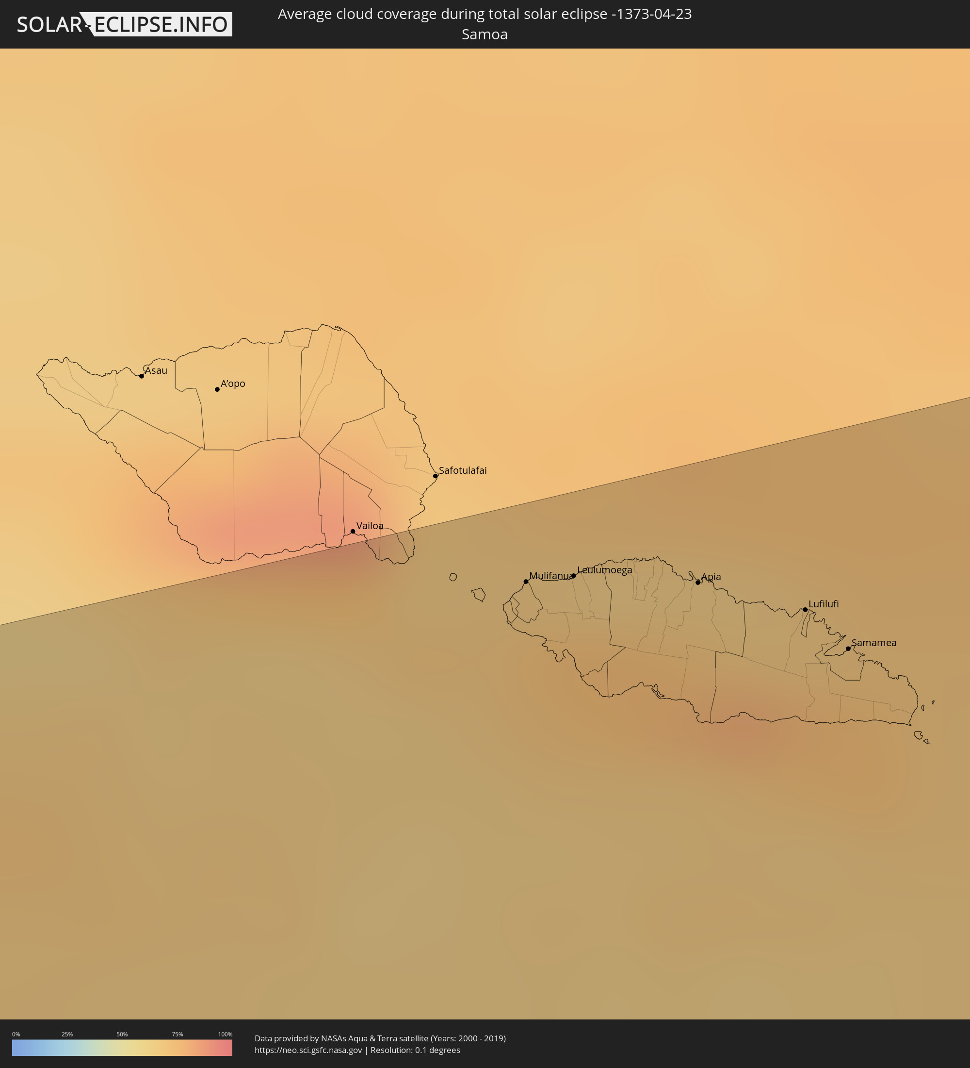 Samoa
Samoa
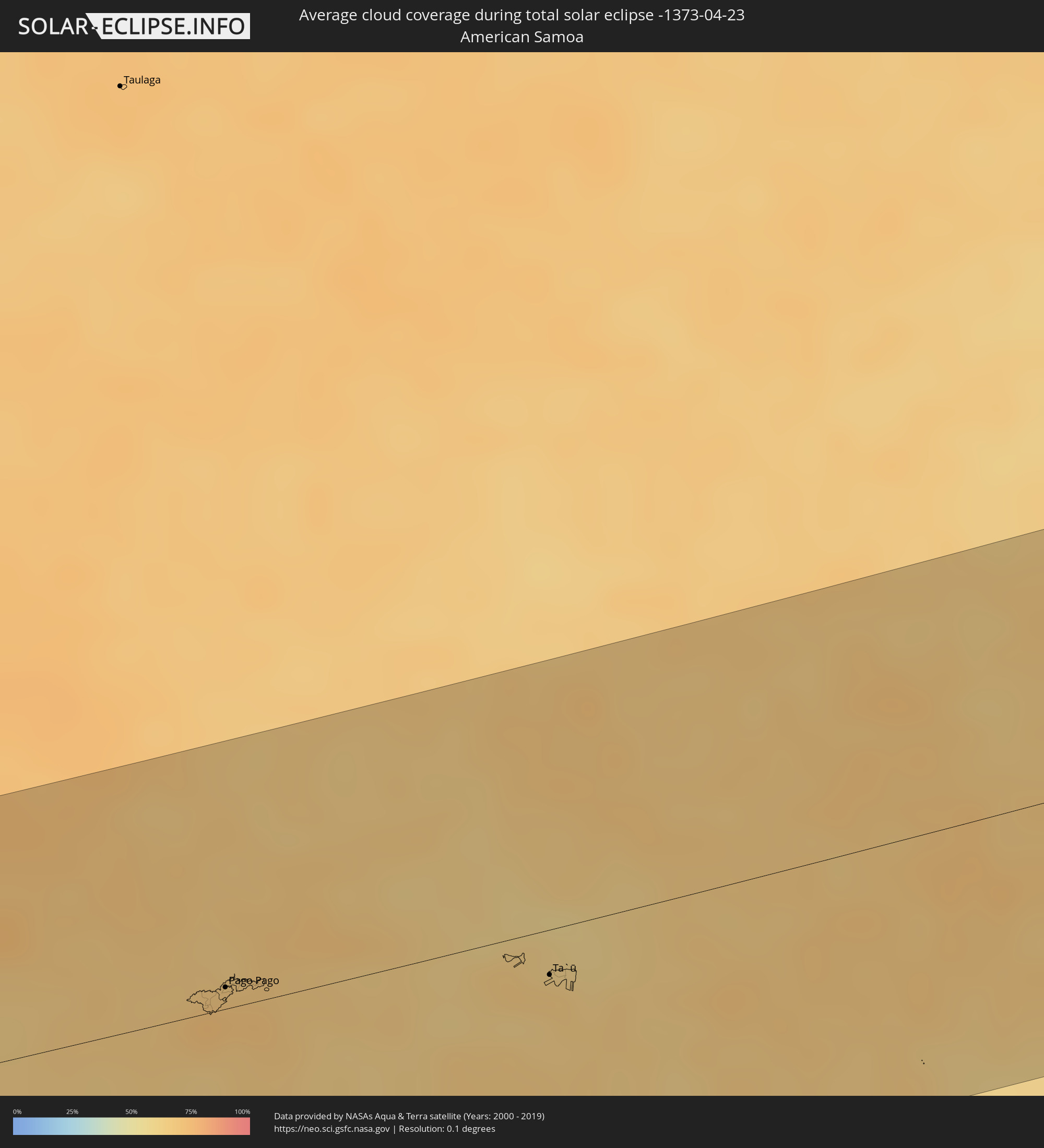 American Samoa
 Cook Islands
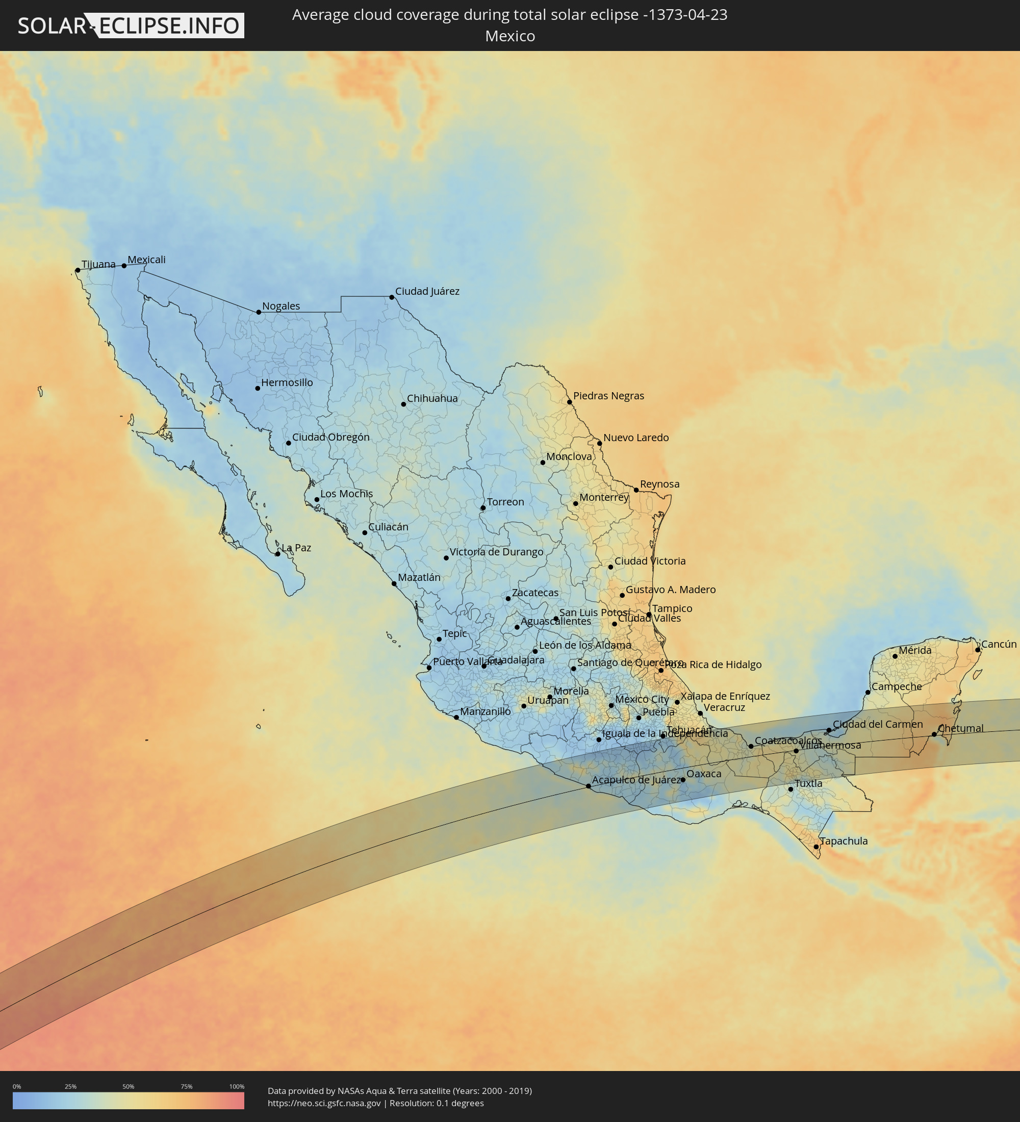 Mexico
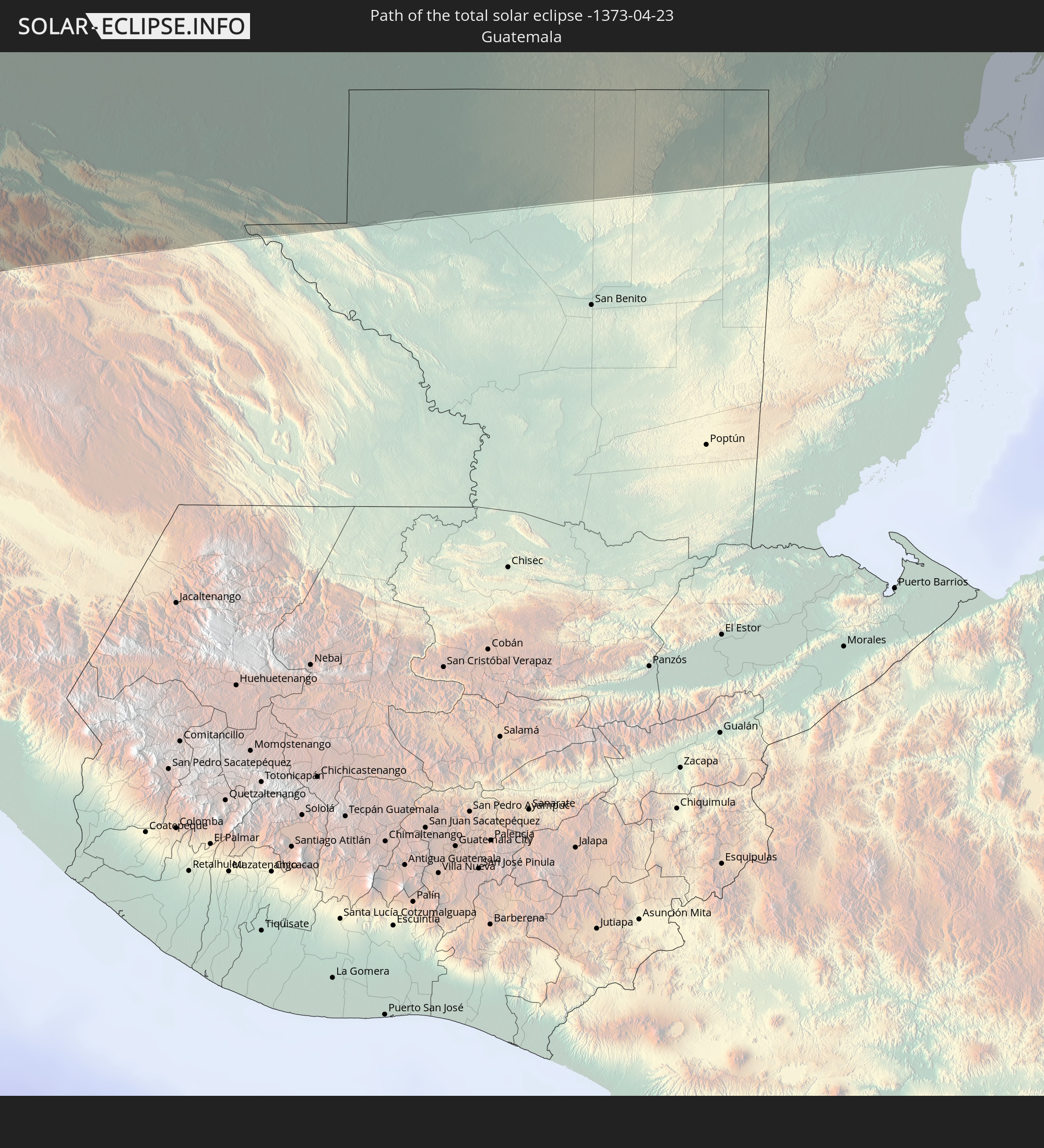
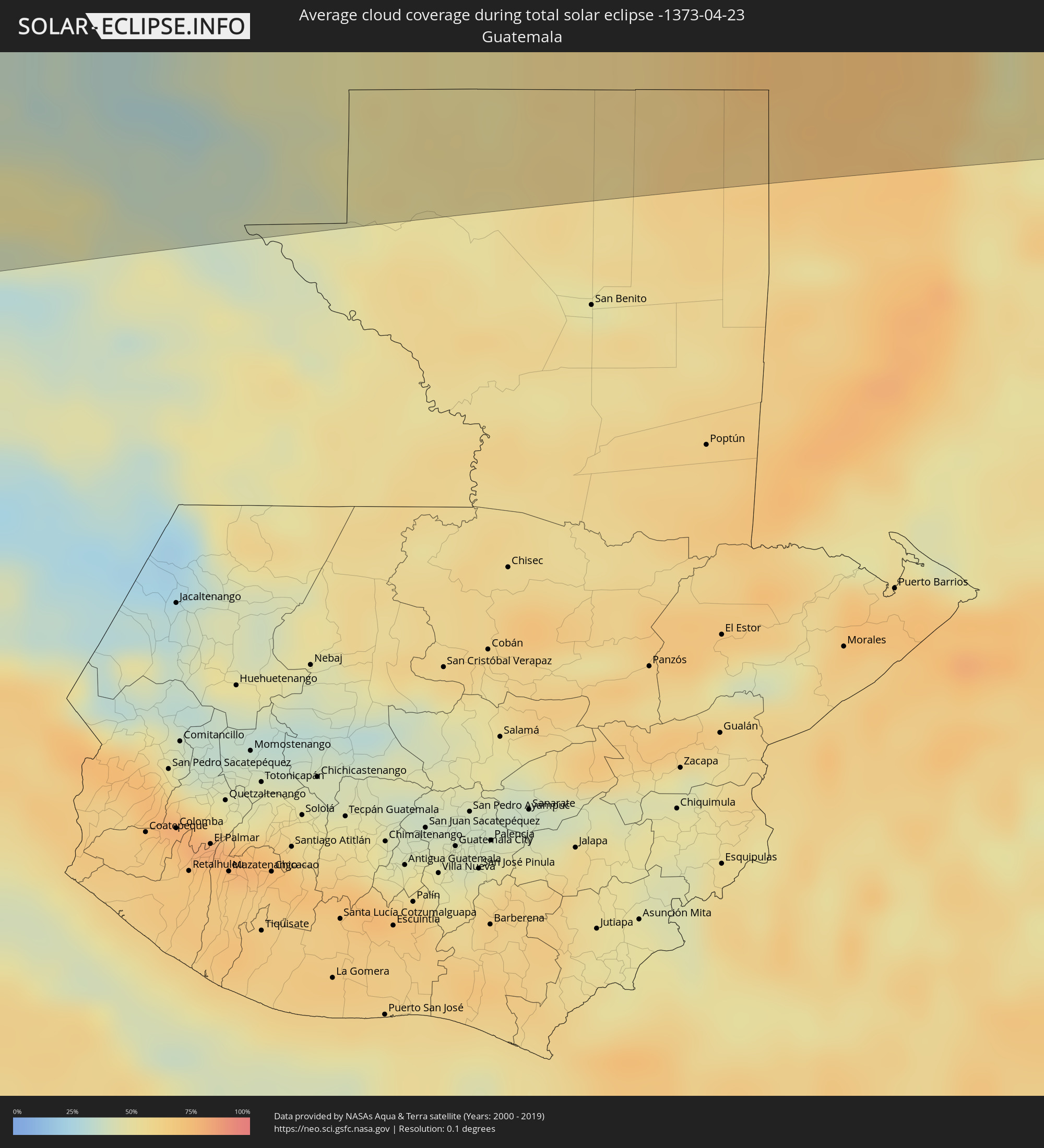 Guatemala
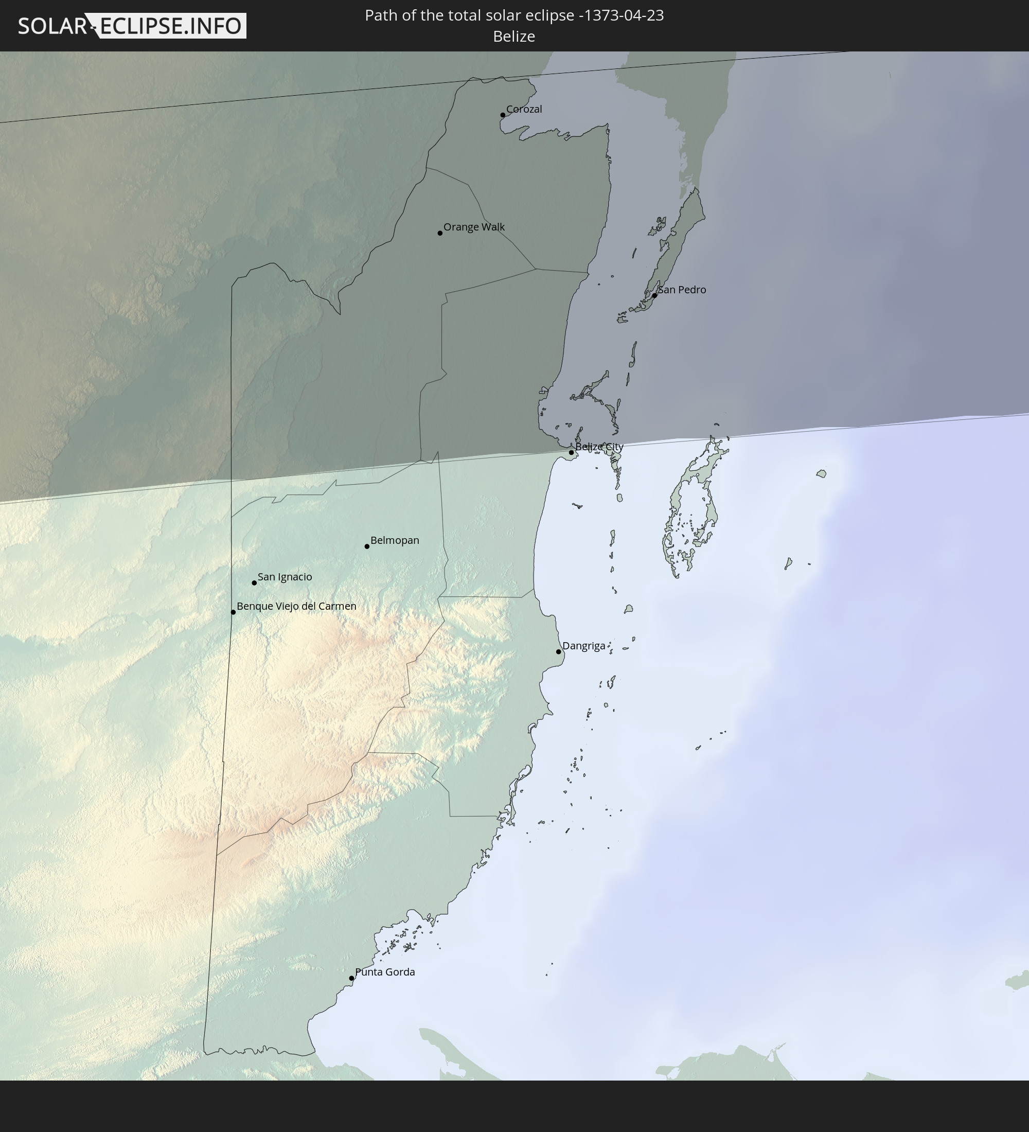
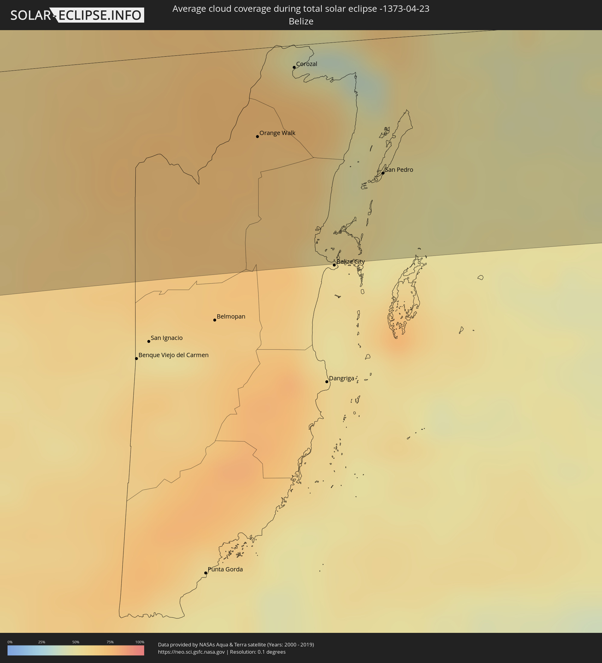 Belize
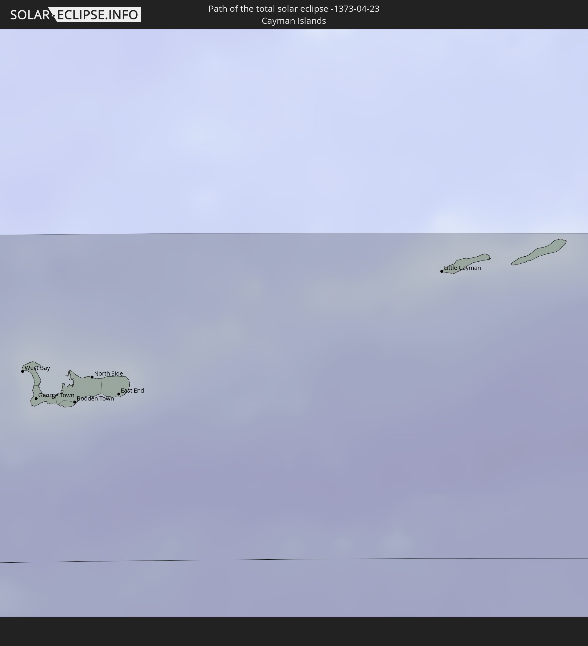
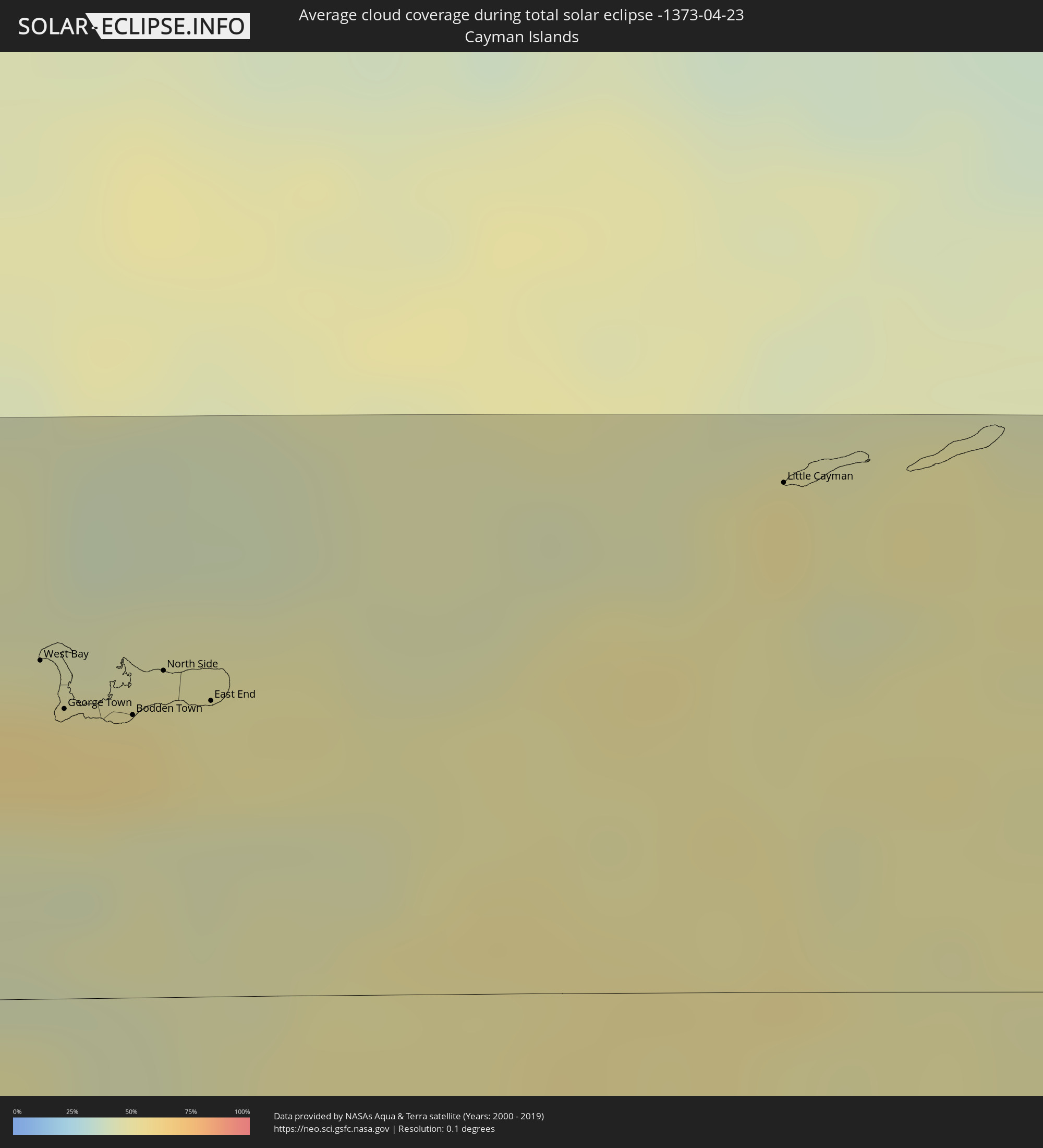 Cayman Islands
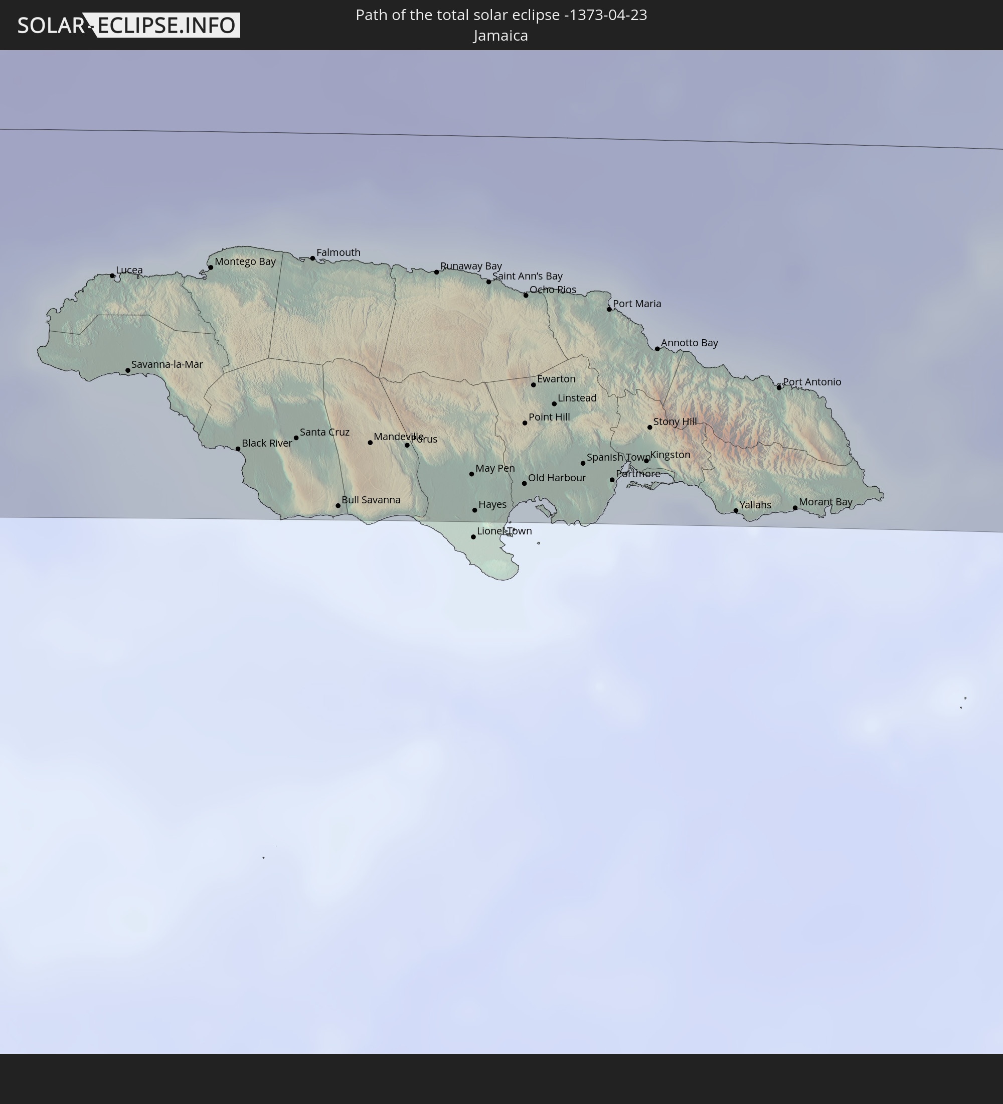
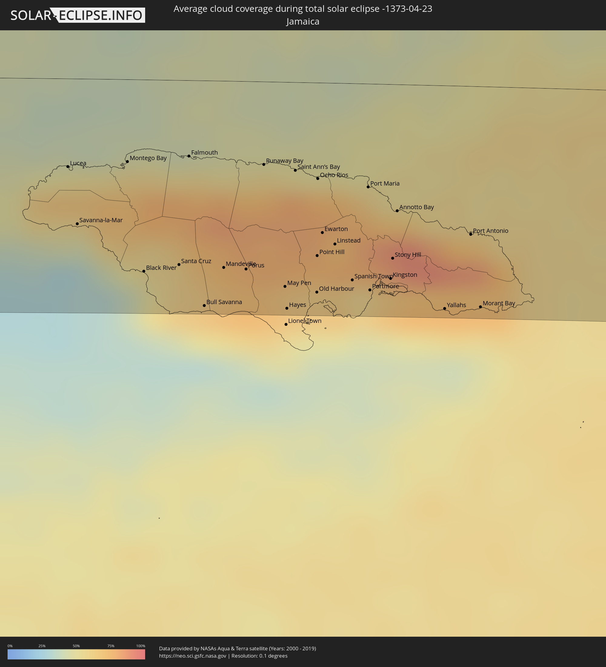 Jamaica
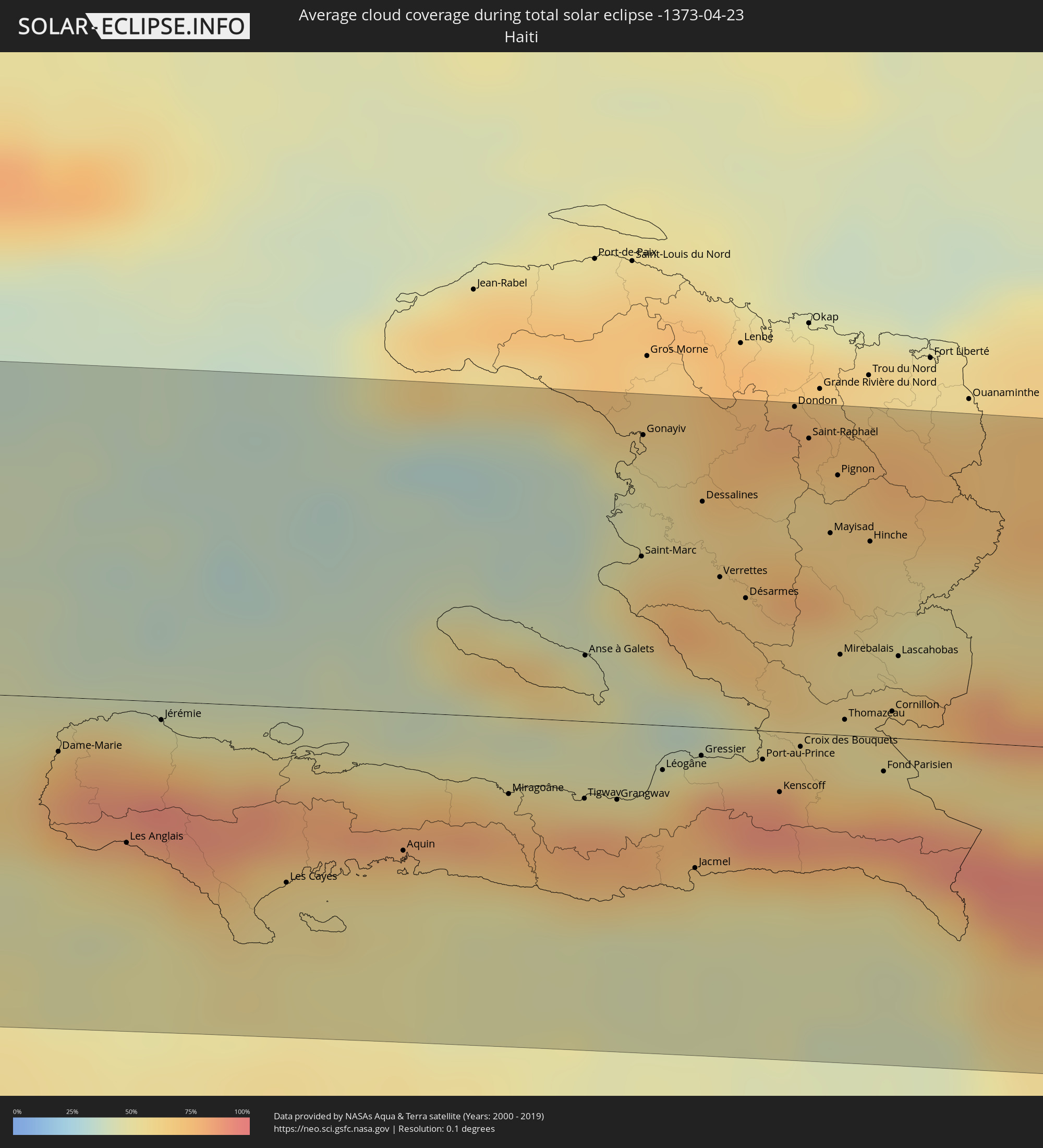 Haiti
Haiti
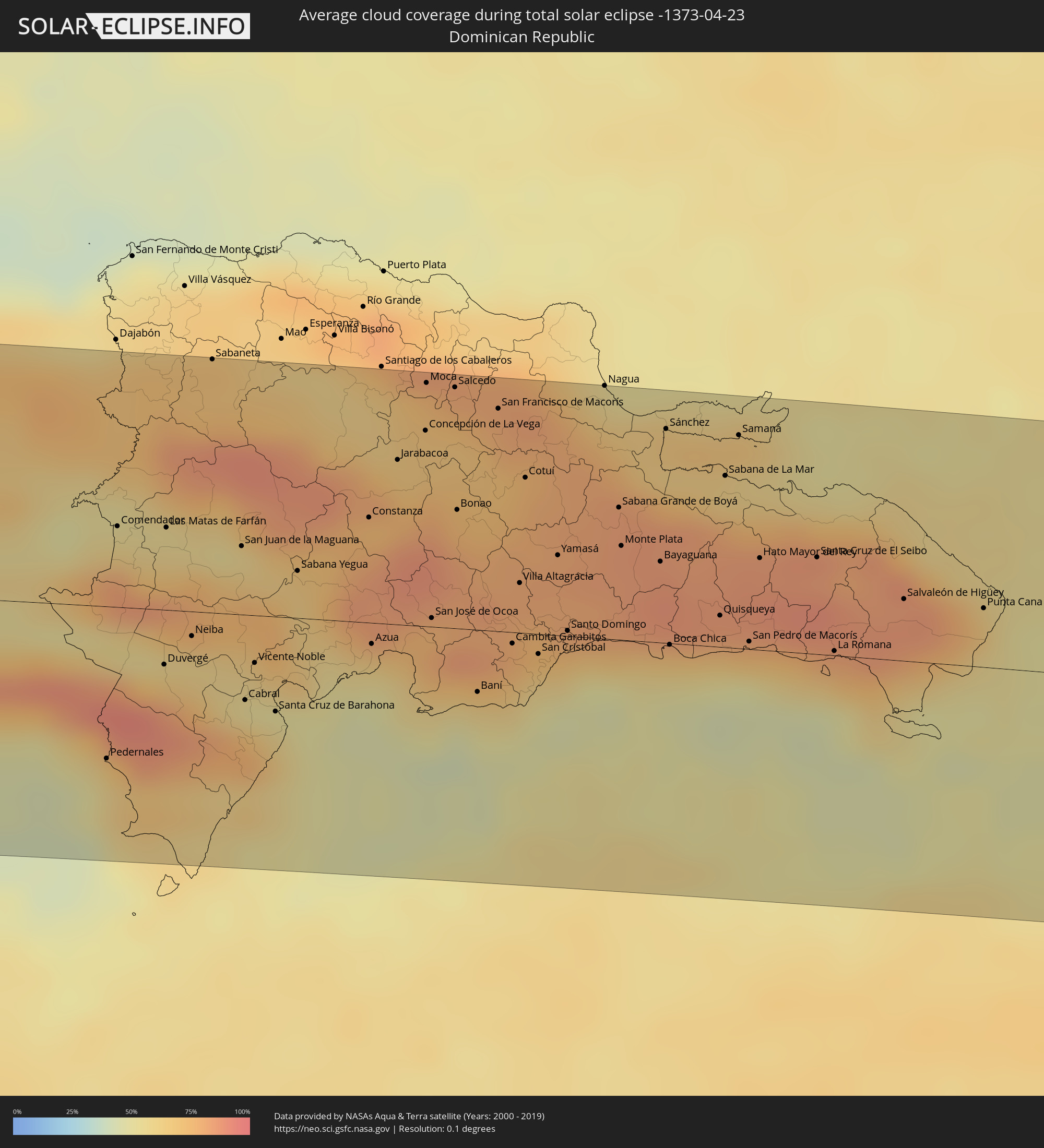 Dominican Republic
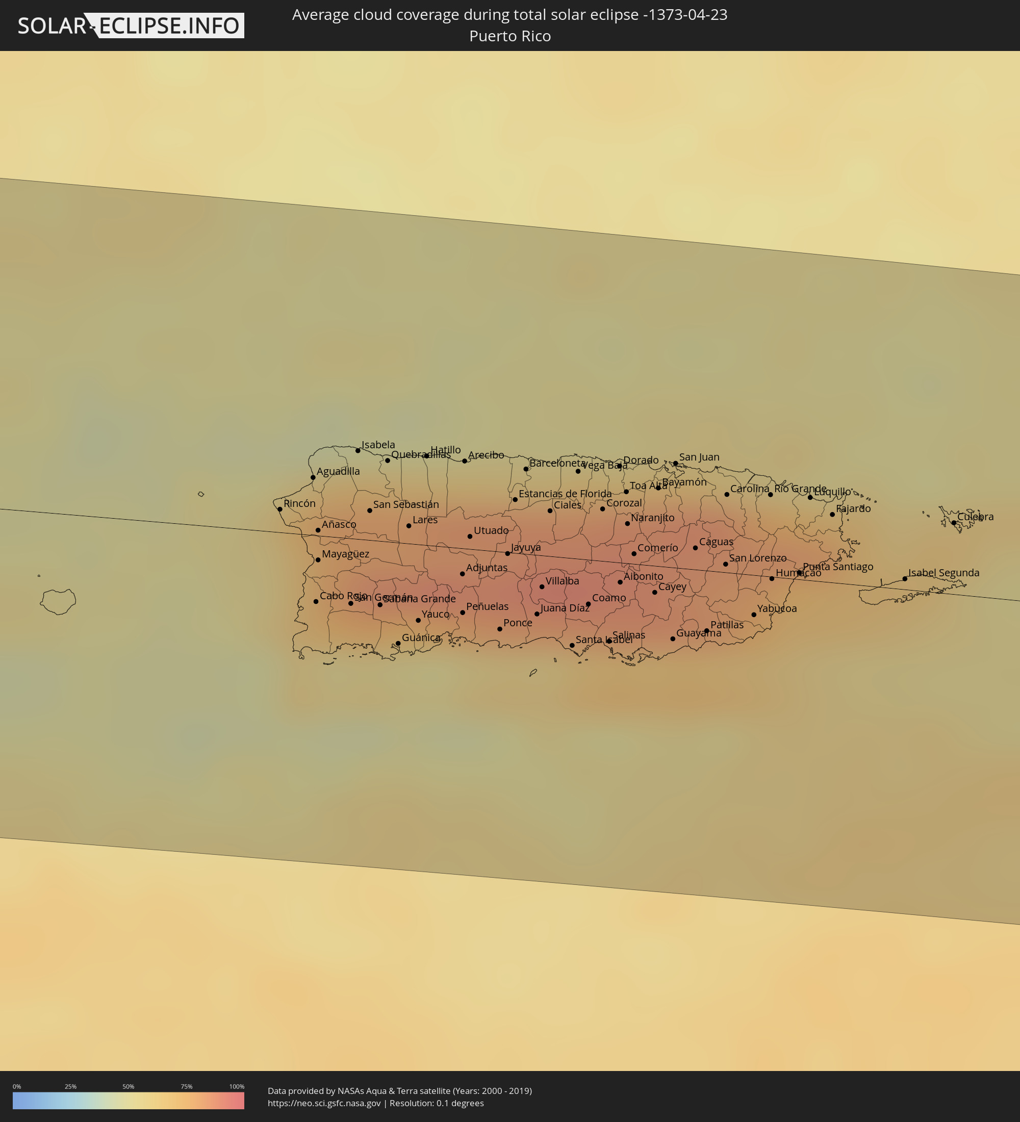 Puerto Rico
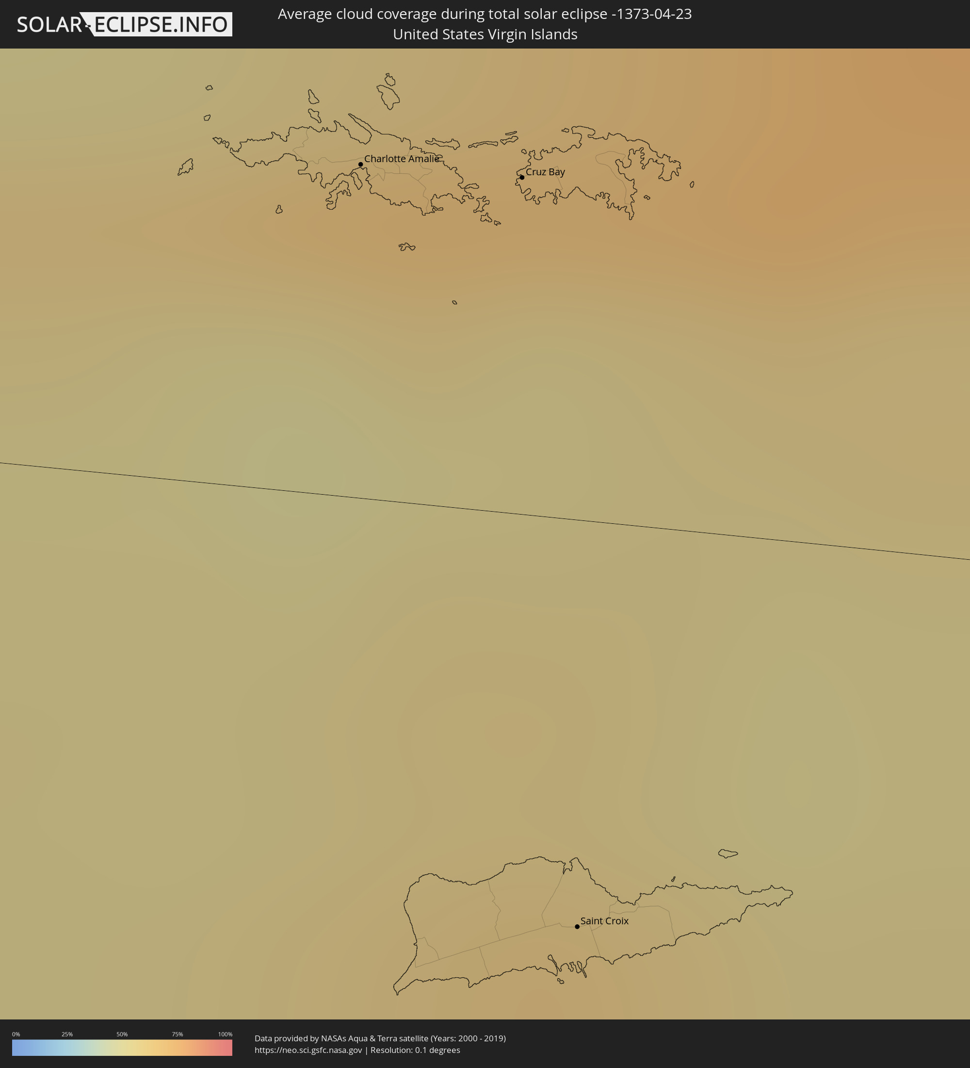 United States Virgin Islands
 British Virgin Islands
 Anguilla
 Sint Maarten
 Collectivity of Saint Martin
 Saint Barthélemy
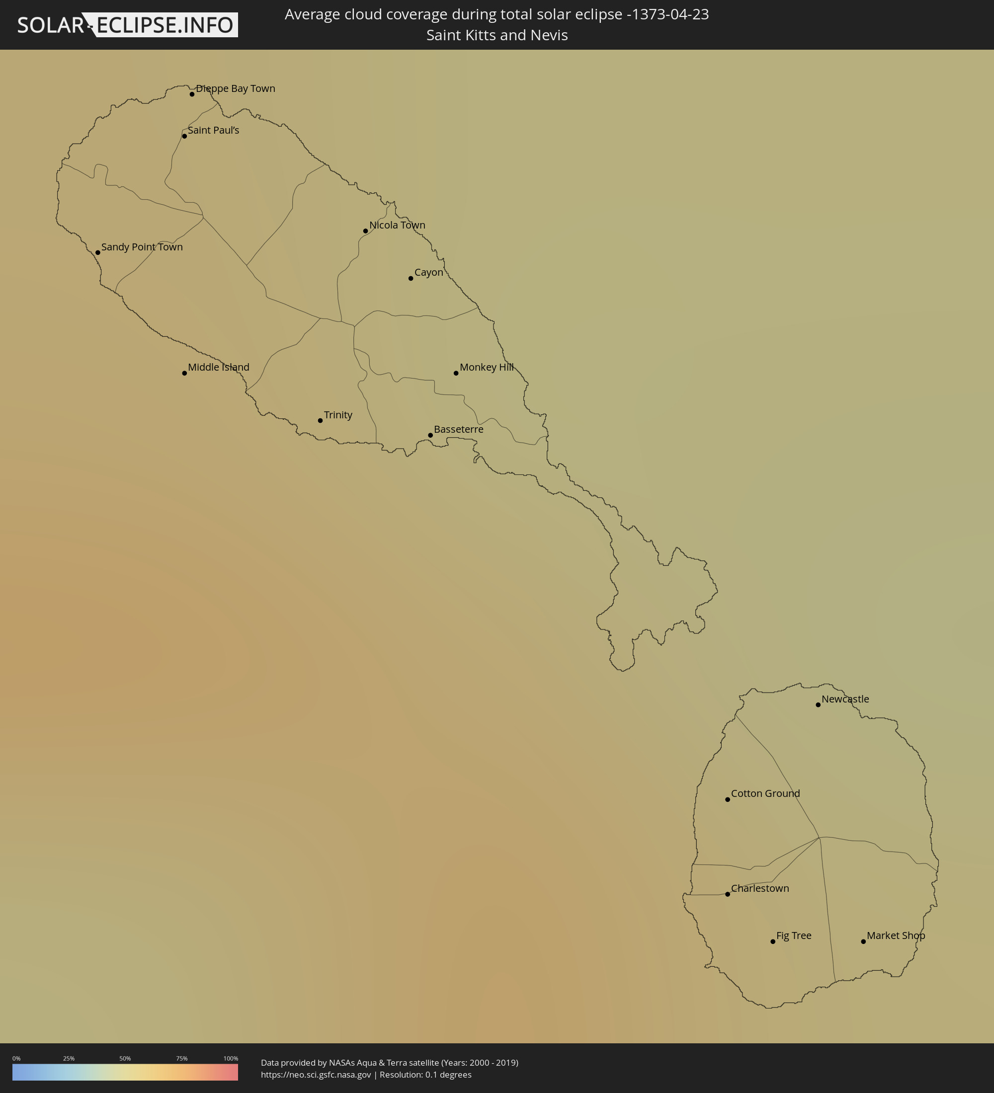 Saint Kitts and Nevis
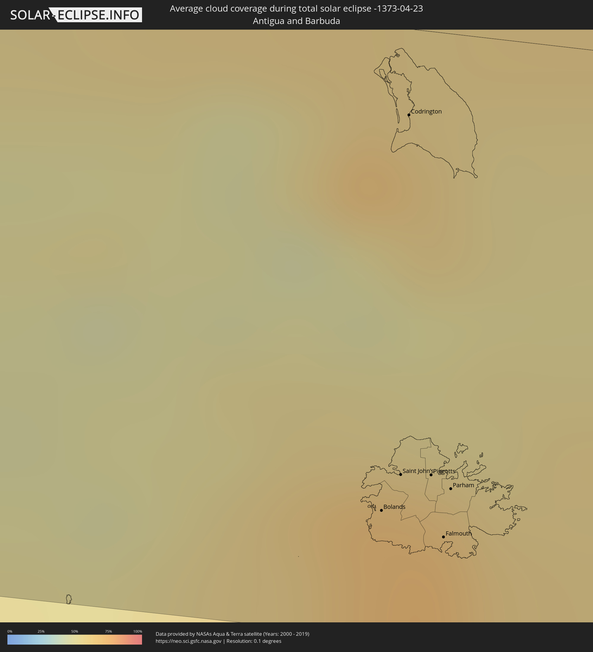 Antigua and Barbuda
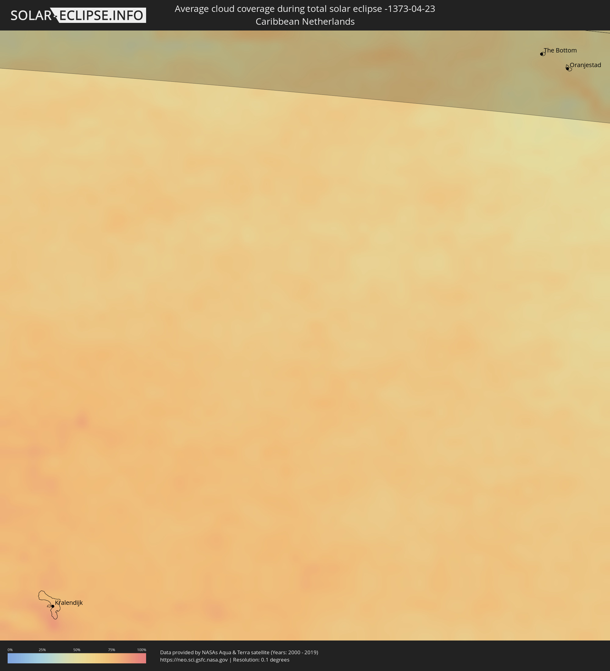 Caribbean Netherlands
Cities inside the path of the eclipse
The following table shows all locations with a population of more than 5,000 inside the eclipse path. Cities which have more than 100,000 inhabitants are marked bold. A click at the locations opens a detailed map.
| City | Type | Eclipse duration | Local time of max. eclipse | Distance to central line | Ø Cloud coverage |
|
Hihifo, Niuas
|
total | - | 06:49:13 UTC+12:20 | 100 km | 66% |
|
Mulifanua, Aiga-i-le-Tai
|
total | - | 07:03:28 UTC-11:26 | 90 km | 73% |
|
Leulumoega, A'ana
|
total | - | 07:03:30 UTC-11:26 | 89 km | 73% |
|
Apia, Tuamasaga
|
total | - | 07:03:34 UTC-11:26 | 83 km | 72% |
|
Lufilufi, Atua
|
total | - | 07:03:38 UTC-11:26 | 74 km | 75% |
|
Samamea, Va‘a-o-Fonoti
|
total | - | 07:03:38 UTC-11:26 | 66 km | 73% |
|
Tāfuna, Western District
|
total | - | 07:08:00 UTC-11:22 | 3 km | 70% |
|
Pago Pago, Eastern District
|
total | - | 07:08:01 UTC-11:22 | 8 km | 70% |
|
Ta`ū, Manu'a
|
total | - | 07:08:35 UTC-11:22 | 17 km | 66% |
|
Acapulco de Juárez, Guerrero
|
total | - | 14:39:40 UTC-06:36 | 0 km | 40% |
|
Chilpancingo, Guerrero
|
total | - | 14:40:45 UTC-06:36 | 66 km | 26% |
|
Oaxaca, Oaxaca
|
total | - | 14:45:33 UTC-06:36 | 44 km | 22% |
|
Tuxtepec, Oaxaca
|
total | - | 14:46:59 UTC-06:36 | 57 km | 50% |
|
Minatitlan, Veracruz
|
total | - | 14:49:32 UTC-06:36 | 20 km | 42% |
|
Coatzacoalcos, Veracruz
|
total | - | 14:49:45 UTC-06:36 | 33 km | 47% |
|
Cárdenas, Tabasco
|
total | - | 14:51:23 UTC-06:36 | 3 km | 50% |
|
Villahermosa, Tabasco
|
total | - | 14:52:04 UTC-06:36 | 5 km | 47% |
|
Ciudad del Carmen, Campeche
|
total | - | 14:53:53 UTC-06:36 | 53 km | 28% |
|
Orange Walk, Orange Walk
|
total | - | 15:42:03 UTC-05:52 | 44 km | 72% |
|
Corozal, Corozal
|
total | - | 15:42:20 UTC-05:52 | 11 km | 59% |
|
Chetumal, Quintana Roo
|
total | - | 15:48:12 UTC-05:47 | 2 km | 39% |
|
San Pedro, Belize
|
total | - | 15:42:48 UTC-05:52 | 68 km | 54% |
|
West Bay, West Bay
|
total | - | 16:23:17 UTC-05:19 | 63 km | 56% |
|
George Town, George Town
|
total | - | 16:23:20 UTC-05:19 | 54 km | 56% |
|
Bodden Town, Bodden Town
|
total | - | 16:23:26 UTC-05:19 | 52 km | 56% |
|
North Side, North Side
|
total | - | 16:23:29 UTC-05:19 | 60 km | 53% |
|
East End, East End
|
total | - | 16:23:34 UTC-05:19 | 55 km | 51% |
|
Little Cayman, Sister Island
|
total | - | 16:24:27 UTC-05:19 | 94 km | 52% |
|
Savanna-la-Mar, Westmoreland
|
total | - | 16:38:33 UTC-05:07 | 66 km | 43% |
|
Montego Bay, St. James
|
total | - | 16:38:43 UTC-05:07 | 37 km | 58% |
|
Mandeville, Manchester
|
total | - | 16:39:02 UTC-05:07 | 84 km | 68% |
|
May Pen, Clarendon
|
total | - | 16:39:14 UTC-05:07 | 92 km | 66% |
|
Saint Ann’s Bay, St Ann
|
total | - | 16:39:16 UTC-05:07 | 40 km | 78% |
|
Linstead, Saint Catherine
|
total | - | 16:39:24 UTC-05:07 | 73 km | 76% |
|
Spanish Town, Saint Catherine
|
total | - | 16:39:27 UTC-05:07 | 89 km | 64% |
|
Kingston, Kingston
|
total | - | 16:39:34 UTC-05:07 | 88 km | 66% |
|
Port Antonio, Portland
|
total | - | 16:39:49 UTC-05:07 | 67 km | 74% |
|
Morant Bay, St. Thomas
|
total | - | 16:39:51 UTC-05:07 | 100 km | 54% |
|
Jérémie, GrandʼAnse
|
total | - | 16:59:31 UTC-04:49 | 6 km | 52% |
|
Les Cayes, Sud
|
total | - | 16:59:46 UTC-04:49 | 55 km | 57% |
|
Miragoâne, Nippes
|
total | - | 17:00:08 UTC-04:49 | 24 km | 79% |
|
Tigwav, Ouest
|
total | - | 17:00:15 UTC-04:49 | 24 km | 81% |
|
Saint-Marc, Artibonite
|
total | - | 17:00:18 UTC-04:49 | 52 km | 66% |
|
Gonayiv, Artibonite
|
total | - | 17:00:16 UTC-04:49 | 90 km | 51% |
|
Léogâne, Ouest
|
total | - | 17:00:23 UTC-04:49 | 14 km | 69% |
|
Jacmel, Sud-Est
|
total | - | 17:00:27 UTC-04:49 | 44 km | 52% |
|
Port-au-Prince, Ouest
|
total | - | 17:00:32 UTC-04:49 | 9 km | 84% |
|
Thomazeau, Ouest
|
total | - | 17:00:40 UTC-04:49 | 5 km | 54% |
|
San Juan de la Maguana, San Juan
|
total | - | 17:10:05 UTC-04:40 | 27 km | 65% |
|
Santa Cruz de Barahona, Barahona
|
total | - | 17:10:12 UTC-04:40 | 38 km | 60% |
|
Concepción de La Vega, La Vega
|
total | - | 17:10:22 UTC-04:40 | 78 km | 69% |
|
Bonao, Monseñor Nouel
|
total | - | 17:10:28 UTC-04:40 | 48 km | 81% |
|
San Francisco de Macorís, Duarte
|
total | - | 17:10:29 UTC-04:40 | 89 km | 72% |
|
Santo Domingo, Nacional
|
total | - | 17:10:42 UTC-04:40 | 2 km | 71% |
|
San Pedro de Macorís, San Pedro de Macorís
|
total | - | 17:11:00 UTC-04:40 | 3 km | 70% |
|
La Romana, La Romana
|
total | - | 17:11:08 UTC-04:40 | 2 km | 63% |
|
Salvaleón de Higüey, La Altagracia
|
total | - | 17:11:13 UTC-04:40 | 25 km | 86% |
|
Punta Cana, La Altagracia
|
total | - | 17:11:21 UTC-04:40 | 24 km | 68% |
|
Mayagüez, Mayaguez
|
total | - | 17:51:50 UTC-04:00 | 8 km | 78% |
|
Arecibo, Arecibo
|
total | - | 17:51:57 UTC-04:00 | 26 km | 63% |
|
Ponce, Ponce
|
total | - | 17:52:02 UTC-04:00 | 24 km | 59% |
|
Barceloneta, Barceloneta
|
total | - | 17:52:01 UTC-04:00 | 26 km | 62% |
|
Vega Baja, Vega Baja
|
total | - | 17:52:03 UTC-04:00 | 26 km | 82% |
|
Guayama, Guayama
|
total | - | 17:52:12 UTC-04:00 | 22 km | 67% |
|
San Juan, San Juan
|
total | - | 17:52:08 UTC-04:00 | 32 km | 66% |
|
Caguas, Caguas
|
total | - | 17:52:11 UTC-04:00 | 6 km | 81% |
|
Carolina, Carolina
|
total | - | 17:52:12 UTC-04:00 | 24 km | 84% |
|
Fajardo, Fajardo
|
total | - | 17:52:17 UTC-04:00 | 21 km | 78% |
|
Charlotte Amalie, Saint Thomas Island
|
total | - | 17:46:25 UTC-04:06 | 30 km | 57% |
|
Cruz Bay, Saint John Island
|
total | - | 17:46:27 UTC-04:06 | 30 km | 55% |
|
Saint Croix, Saint Croix Island
|
total | - | 17:46:32 UTC-04:06 | 36 km | 63% |
|
Road Town
|
total | - | 17:46:29 UTC-04:06 | 42 km | 72% |
 The Bottom, Saba
|
total | - | 17:17:10 UTC-04:35 | 31 km | 56% |
|
Marigot
|
total | - | 17:46:52 UTC-04:06 | 20 km | 66% |
|
North Hill Village, North Hill
|
total | - | 17:46:51 UTC-04:06 | 35 km | 66% |
|
George Hill, George Hill
|
total | - | 17:46:51 UTC-04:06 | 34 km | 66% |
 Cul de Sac
|
total | - | 17:17:10 UTC-04:35 | 17 km | 53% |
|
The Valley, The Valley
|
total | - | 17:46:51 UTC-04:06 | 36 km | 66% |
|
Stoney Ground, Stoney Ground
|
total | - | 17:46:51 UTC-04:06 | 37 km | 59% |
|
Philipsburg
|
total | - | 17:17:10 UTC-04:35 | 15 km | 56% |
|
North Side, North Side
|
total | - | 17:46:51 UTC-04:06 | 38 km | 59% |
|
The Quarter, The Quarter
|
total | - | 17:46:52 UTC-04:06 | 36 km | 59% |
|
Farrington, The Farrington
|
total | - | 17:46:52 UTC-04:06 | 37 km | 59% |
|
Sandy Hill, Sandy Hill
|
total | - | 17:46:52 UTC-04:06 | 37 km | 59% |
|
Island Harbour, Island Harbour
|
total | - | 17:46:52 UTC-04:06 | 41 km | 60% |
|
East End Village, East End
|
total | - | 17:46:52 UTC-04:06 | 39 km | 59% |
|
Oranjestad, Sint Eustatius
|
total | - | 17:17:14 UTC-04:35 | 44 km | 62% |
|
Gustavia
|
total | - | 17:46:56 UTC-04:06 | 3 km | 54% |
|
Sandy Point Town, Saint Anne Sandy Point
|
total | - | 17:47:00 UTC-04:06 | 56 km | 65% |
|
Saint Paul’s, Saint Paul Capesterre
|
total | - | 17:47:00 UTC-04:06 | 51 km | 65% |
|
Dieppe Bay Town, Saint John Capesterre
|
total | - | 17:47:00 UTC-04:06 | 50 km | 65% |
|
Trinity, Trinity Palmetto Point
|
total | - | 17:47:01 UTC-04:06 | 62 km | 53% |
|
Nicola Town, Christ Church Nichola Town
|
total | - | 17:47:01 UTC-04:06 | 54 km | 65% |
|
Cayon, Saint Mary Cayon
|
total | - | 17:47:01 UTC-04:06 | 56 km | 57% |
|
Basseterre, Saint George Basseterre
|
total | - | 17:47:01 UTC-04:06 | 62 km | 64% |
|
Monkey Hill, Saint Peter Basseterre
|
total | - | 17:47:01 UTC-04:06 | 59 km | 64% |
|
Charlestown, Saint Paul Charlestown
|
total | - | 17:47:03 UTC-04:06 | 78 km | 56% |
|
Fig Tree, Saint John Figtree
|
total | - | 17:47:04 UTC-04:06 | 80 km | 56% |
|
Bolands, Saint Mary
|
total | - | 17:47:11 UTC-04:06 | 77 km | 69% |
|
Saint John’s, Saint John
|
total | - | 17:47:11 UTC-04:06 | 71 km | 71% |
|
Codrington, Barbuda
|
total | - | 17:47:08 UTC-04:06 | 14 km | 58% |
|
Piggotts, Saint George
|
total | - | 17:47:12 UTC-04:06 | 70 km | 71% |
|
Falmouth, Saint Paul
|
total | - | 17:47:13 UTC-04:06 | 80 km | 61% |
|
Parham, Saint Peter
|
total | - | 17:47:12 UTC-04:06 | 72 km | 71% |
|
Labasa, Northern
|
total | - | 06:23:25 UTC+11:55 | 16 km | 72% |