Annular solar eclipse of 06/02/-1412
| Day of week: | Saturday |
| Maximum duration of eclipse: | 06m30s |
| Maximum width of eclipse path: | 222 km |
| Saros cycle: | 34 |
| Coverage: | 95.1% |
| Magnitude: | 0.9509 |
| Gamma: | -0.5902 |
Wo kann man die Sonnenfinsternis vom 06/02/-1412 sehen?
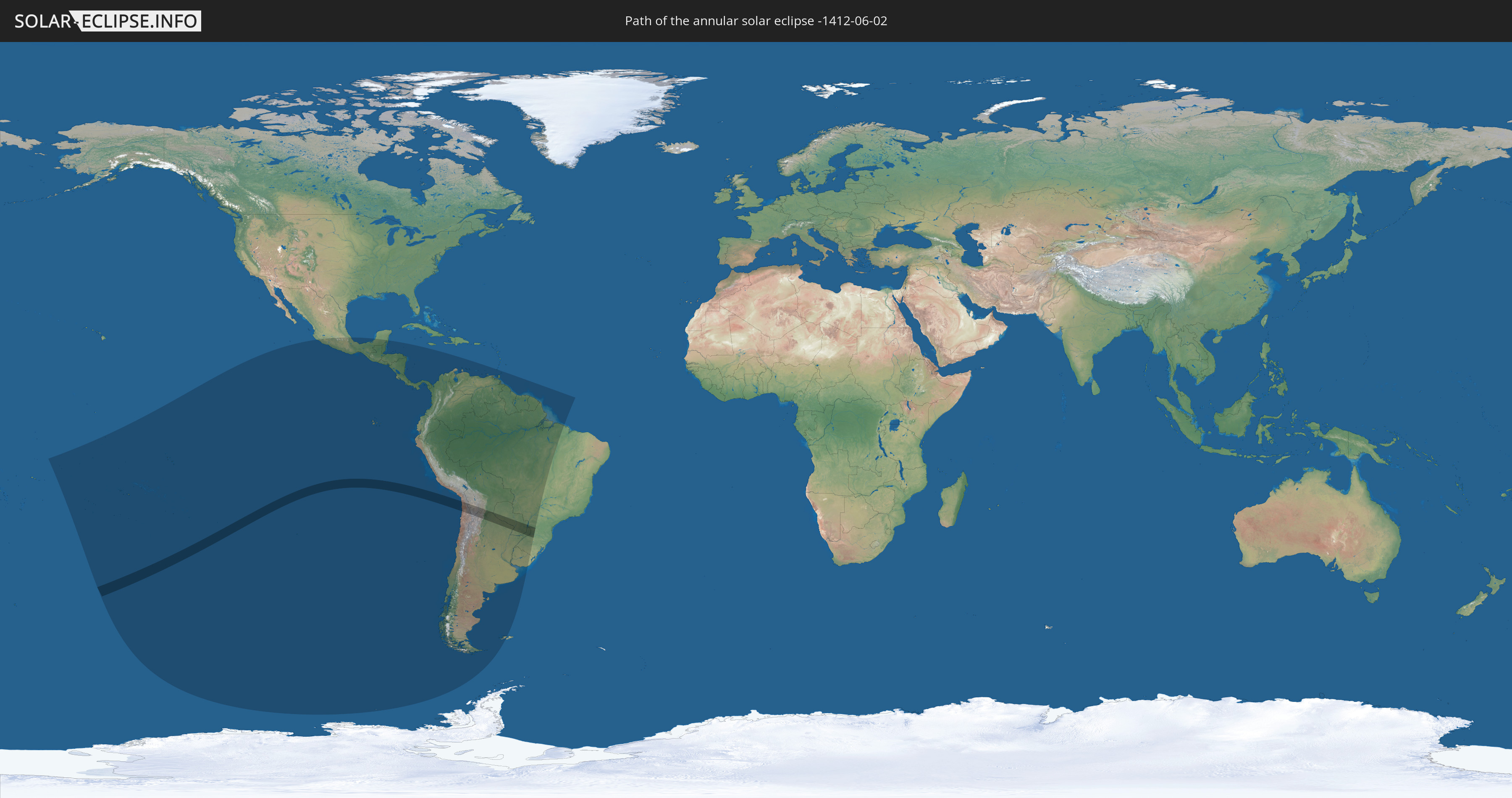
Die Sonnenfinsternis am 06/02/-1412 kann man in 29 Ländern als partielle Sonnenfinsternis beobachten.
Der Finsternispfad verläuft durch 6 Länder. Nur in diesen Ländern ist sie als annular Sonnenfinsternis zu sehen.
In den folgenden Ländern ist die Sonnenfinsternis annular zu sehen
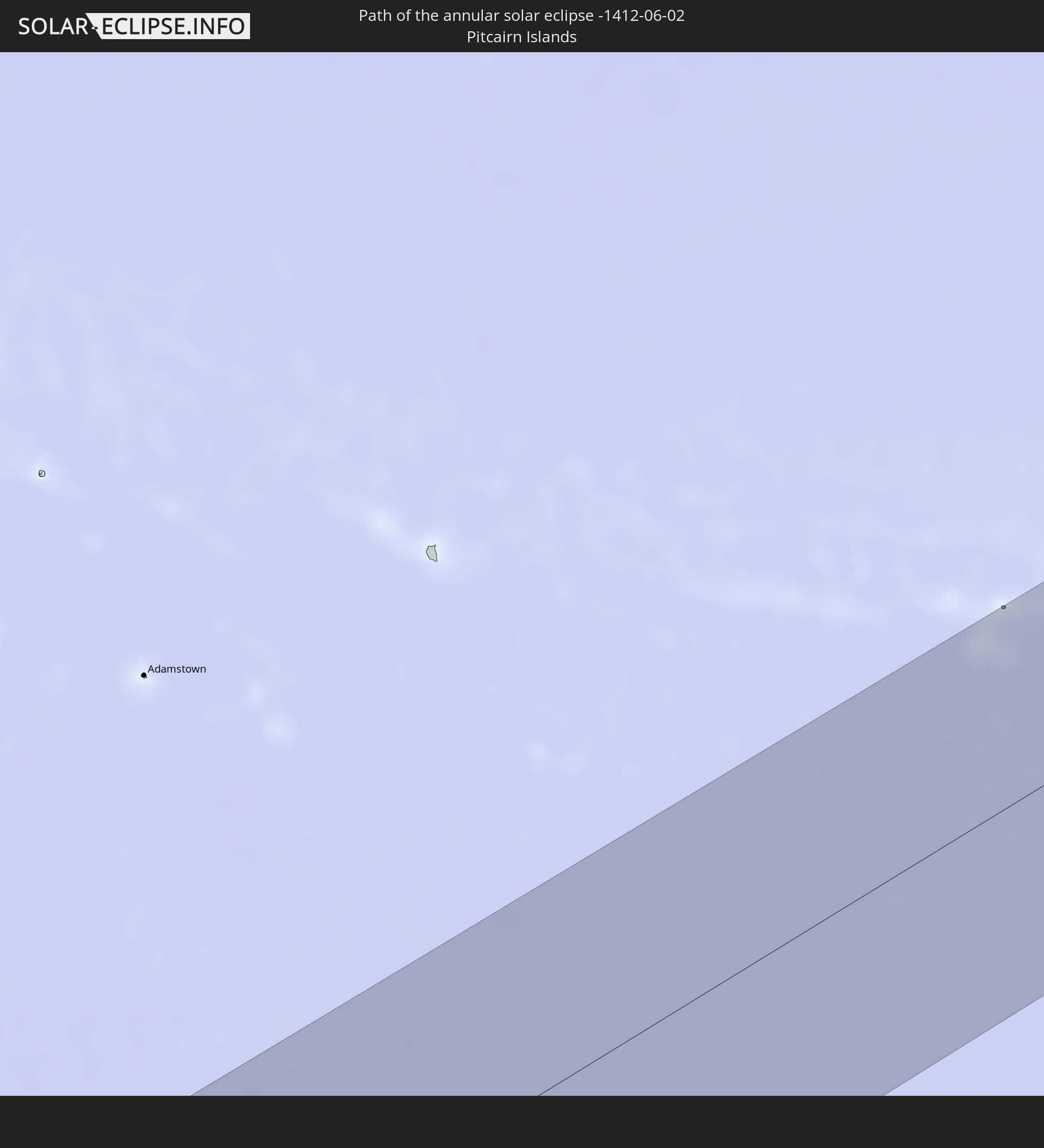 Pitcairn Islands
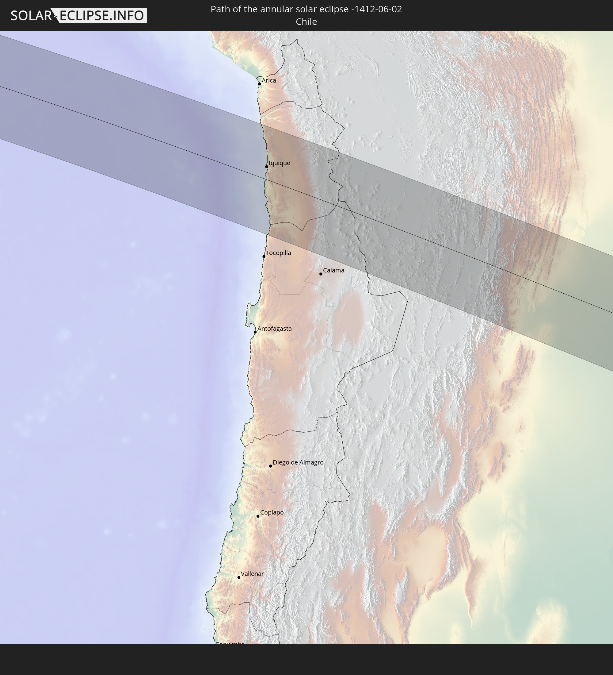 Chile
Chile
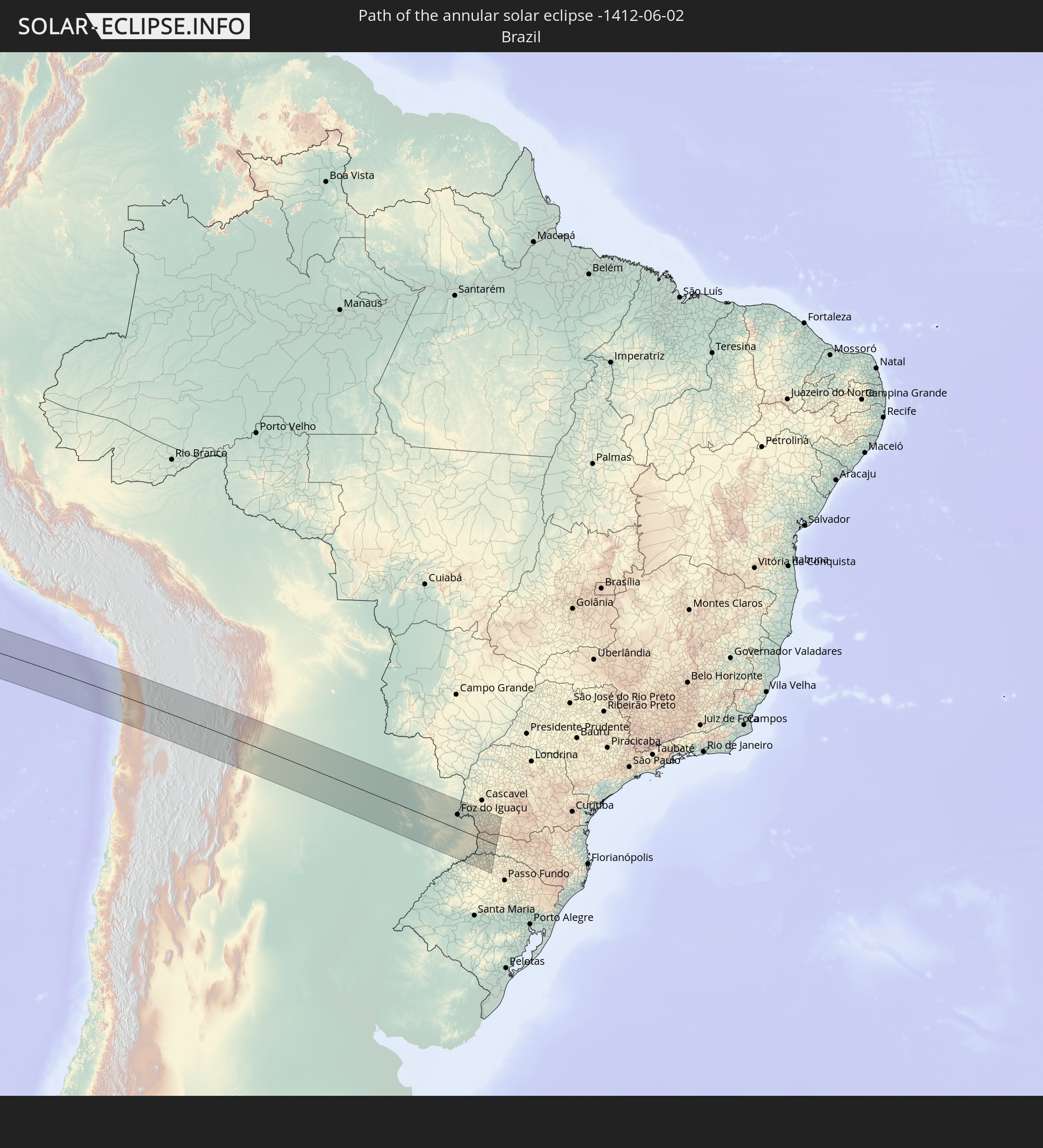 Brazil
 Argentina
 Bolivia
 Paraguay
In den folgenden Ländern ist die Sonnenfinsternis partiell zu sehen
 Kiribati
 Cook Islands
 French Polynesia
 Pitcairn Islands
 Mexico
 Chile
Chile
 Guatemala
 Ecuador
 El Salvador
 Honduras
 Belize
 Nicaragua
 Costa Rica
 Panama
 Colombia
 Peru
Peru
 Brazil
 Argentina
 Venezuela
 Aruba
Aruba
 Bolivia
 Paraguay
 Trinidad and Tobago
 Grenada
 Falkland Islands
 Guyana
 Uruguay
 Suriname
 French Guiana
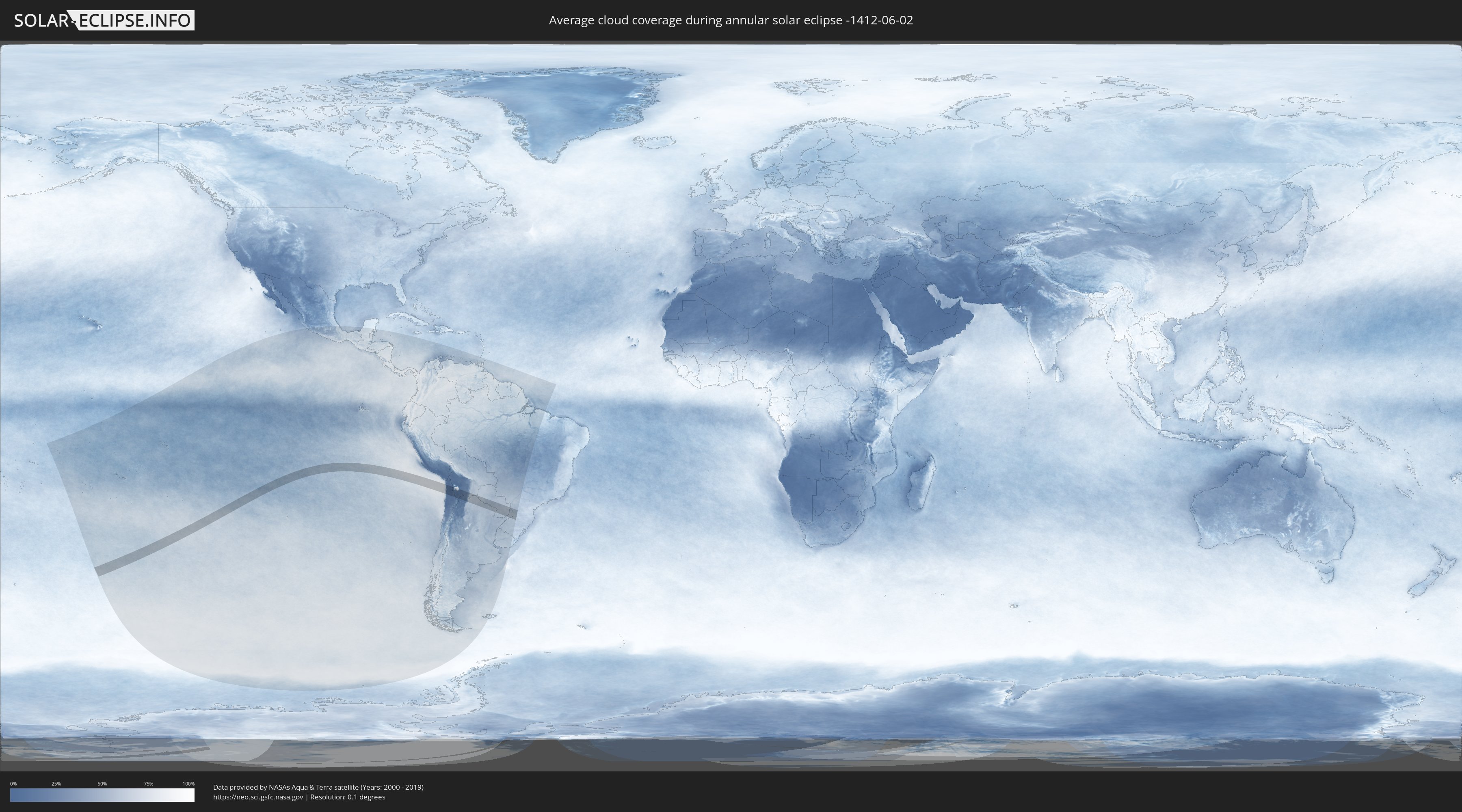
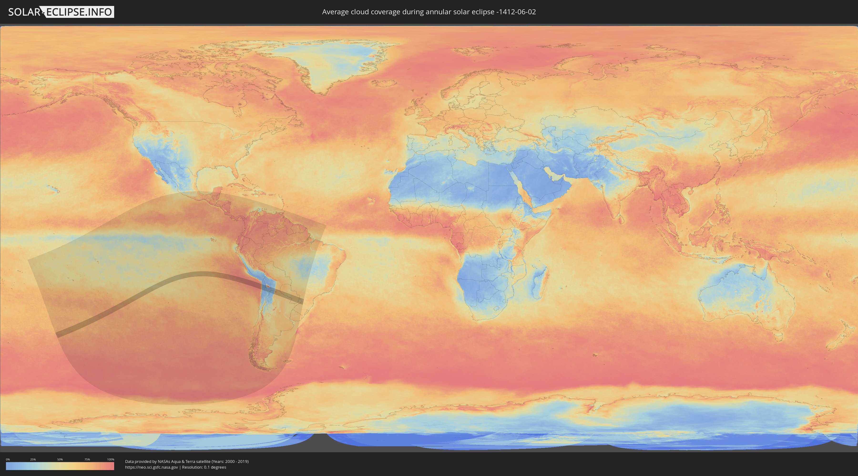
How will be the weather during the annular solar eclipse on 06/02/-1412?
Where is the best place to see the annular solar eclipse of 06/02/-1412?
The following maps show the average cloud coverage for the day of the annular solar eclipse.
With the help of these maps, it is possible to find the place along the eclipse path, which has the best
chance of a cloudless sky.
Nevertheless, you should consider local circumstances and inform about the weather of your chosen
observation site.
The data is provided by NASAs satellites
AQUA and TERRA.
The cloud maps are averaged over a period of 19 years (2000 - 2019).
Detailed country maps
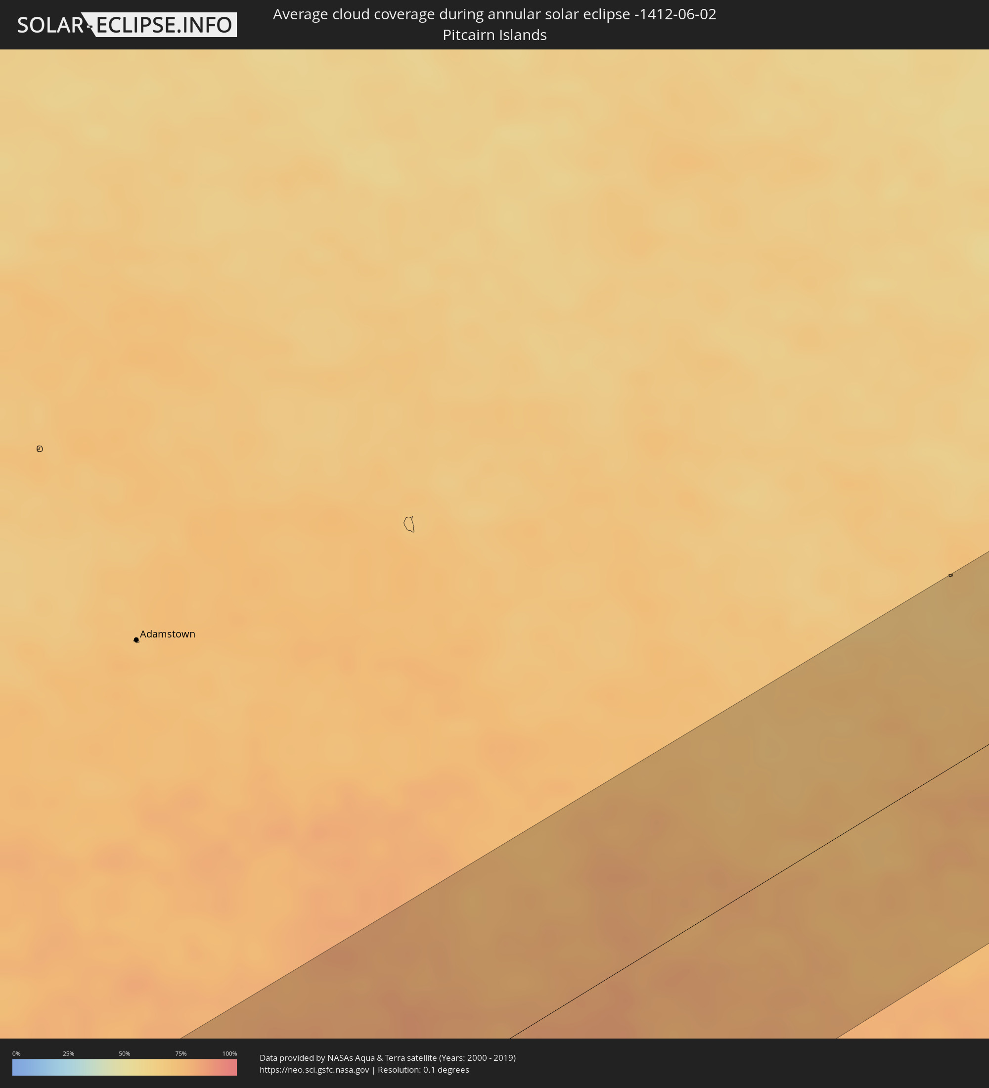 Pitcairn Islands
 Chile
Chile
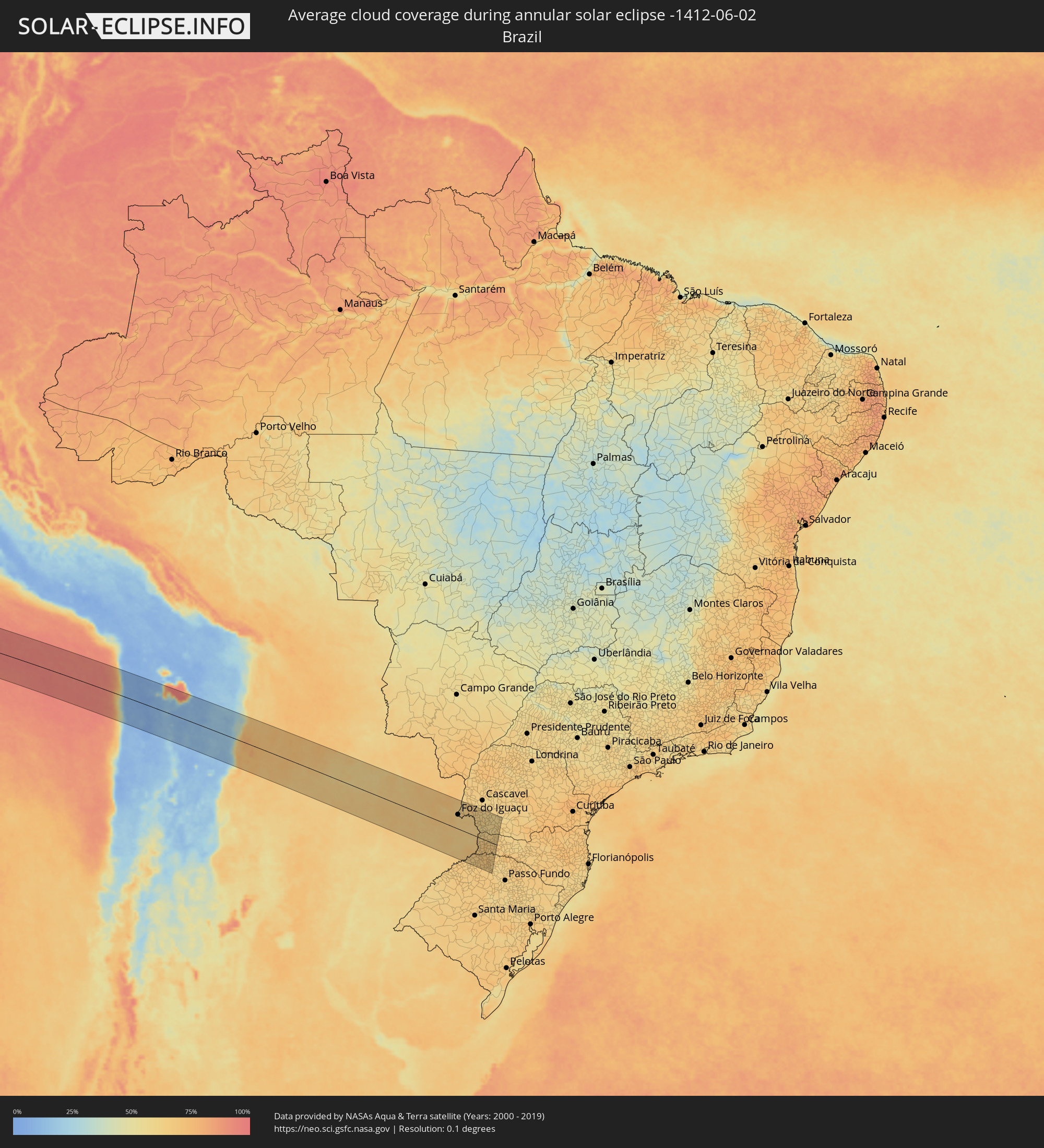 Brazil
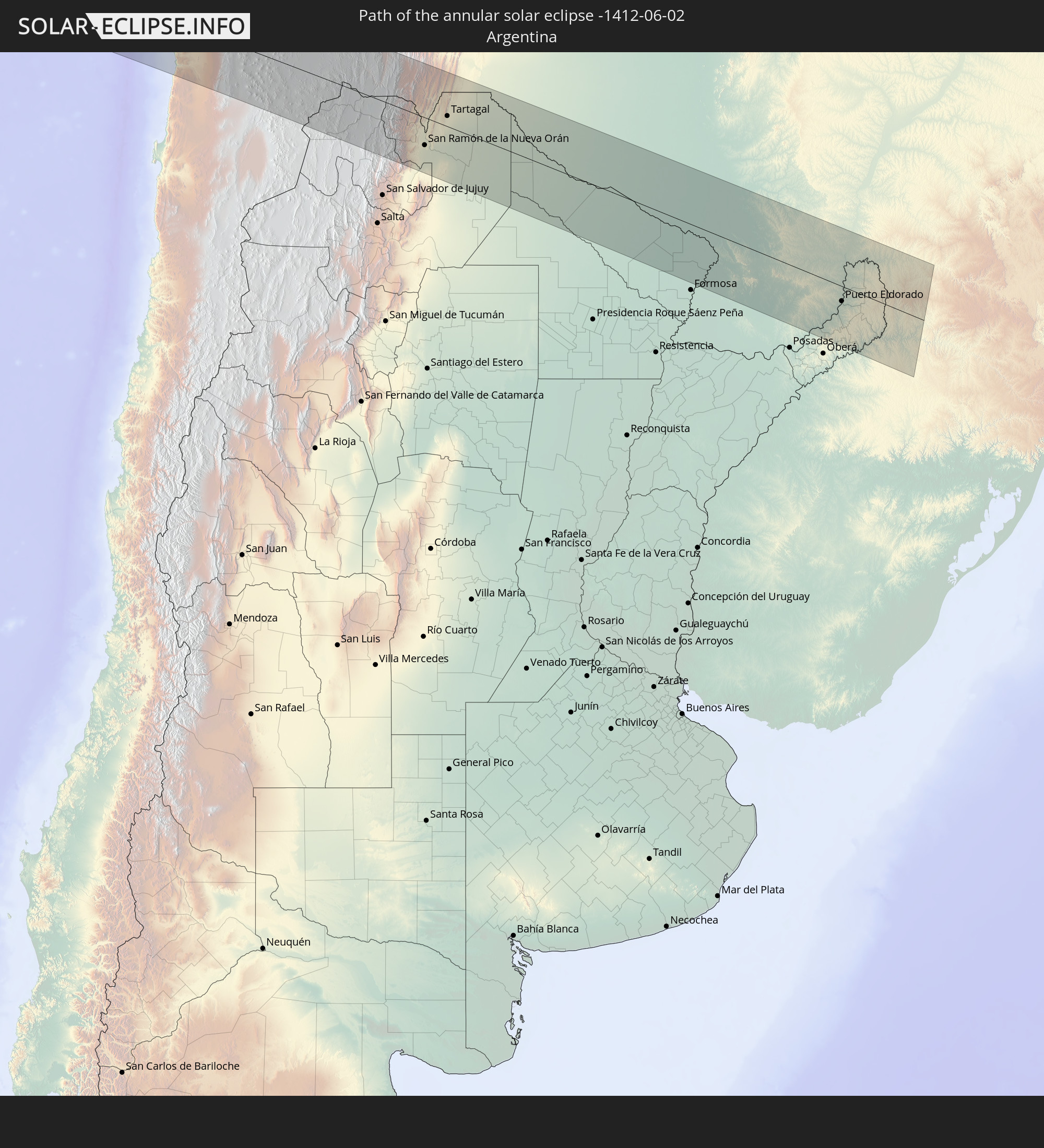
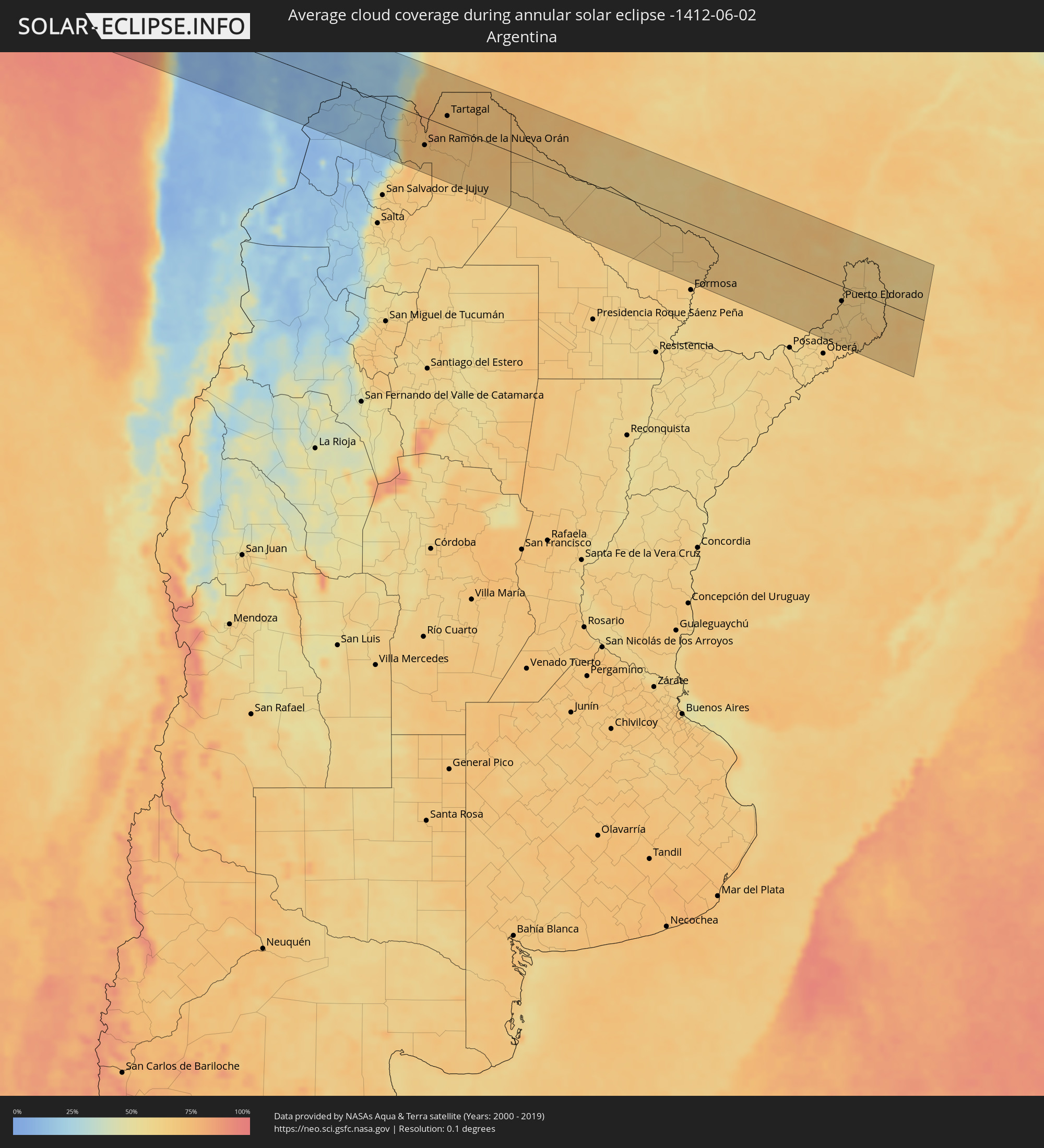 Argentina
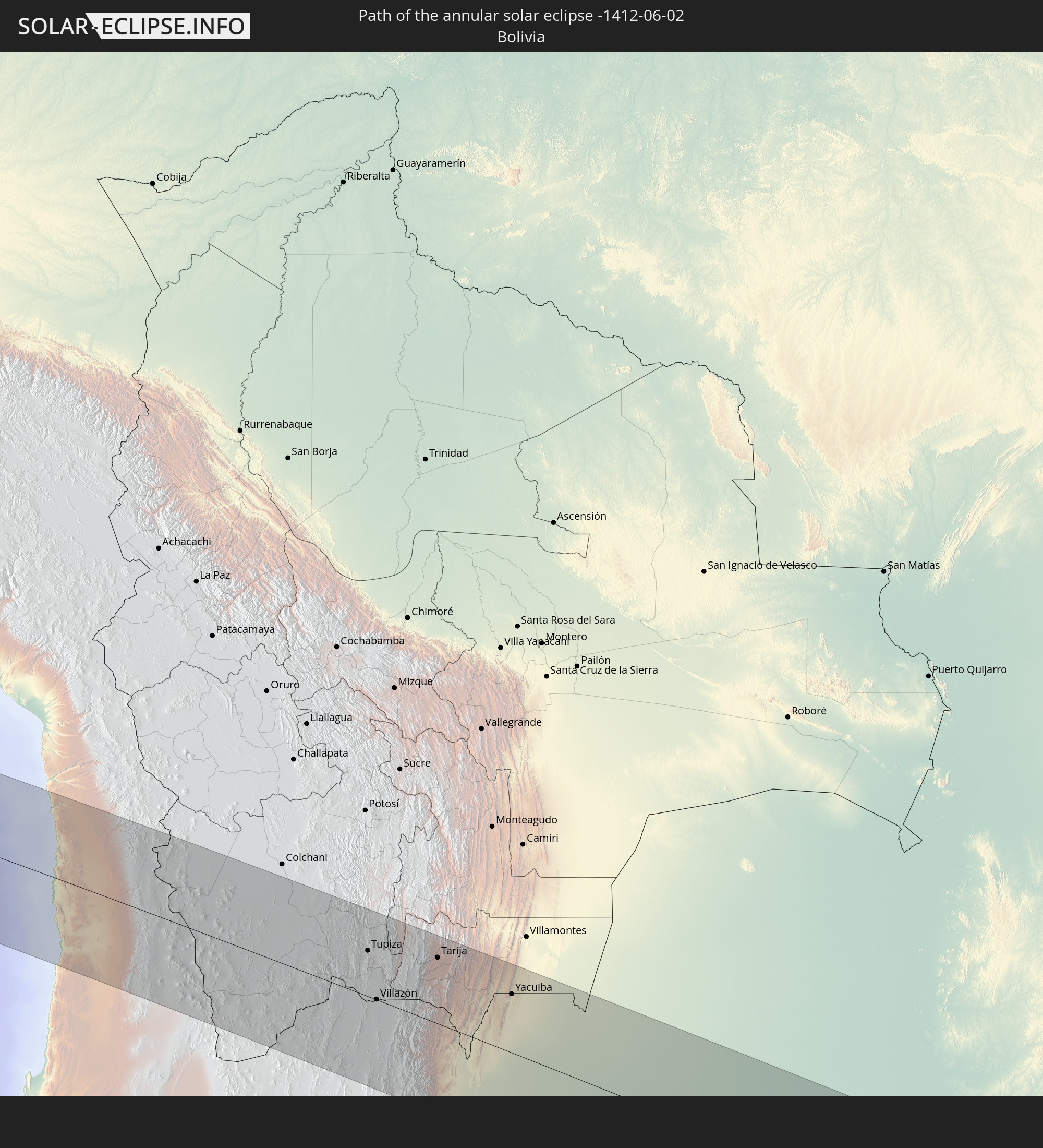
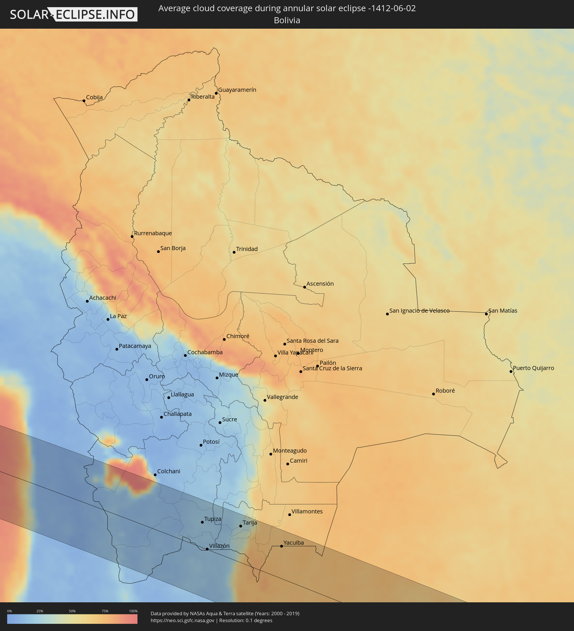 Bolivia
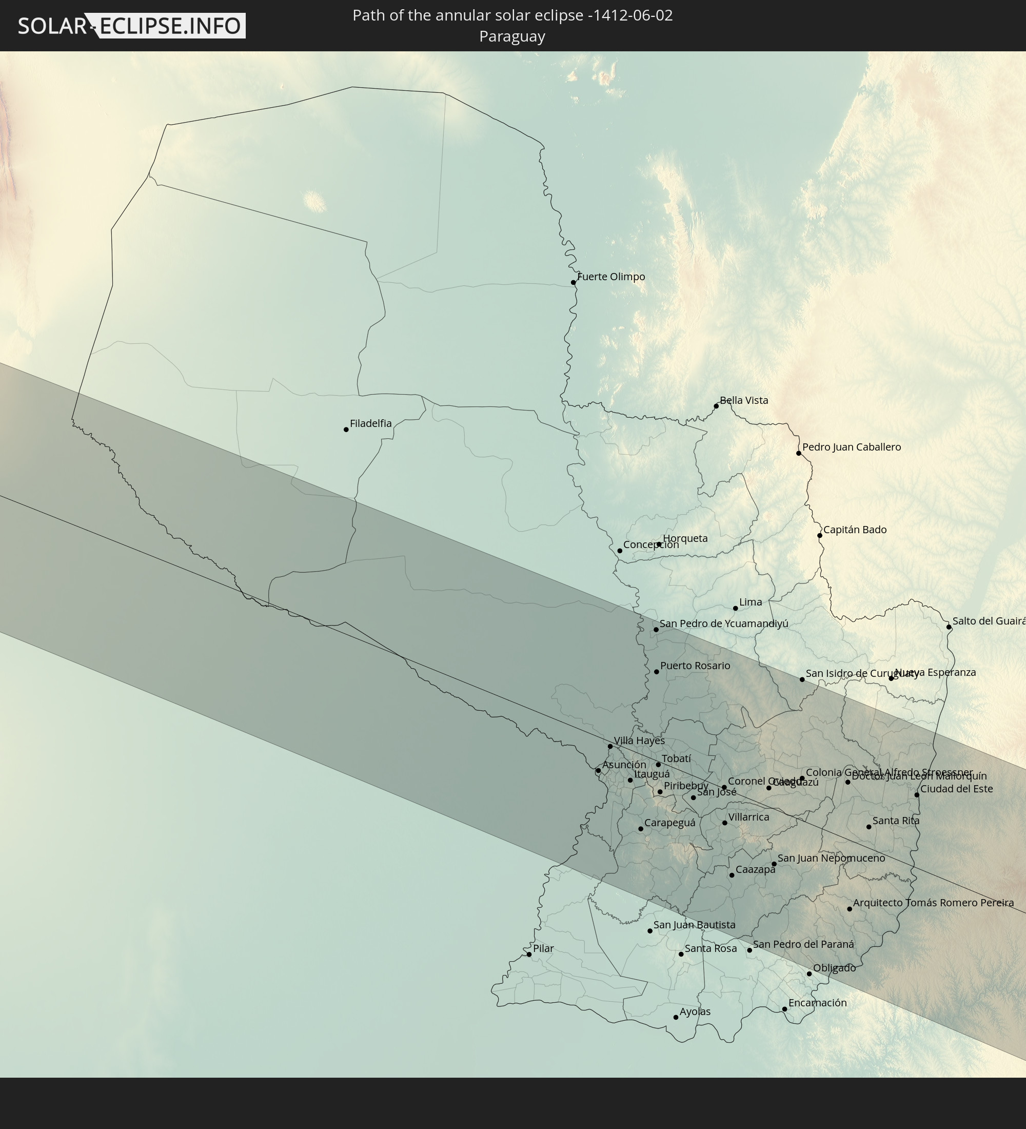
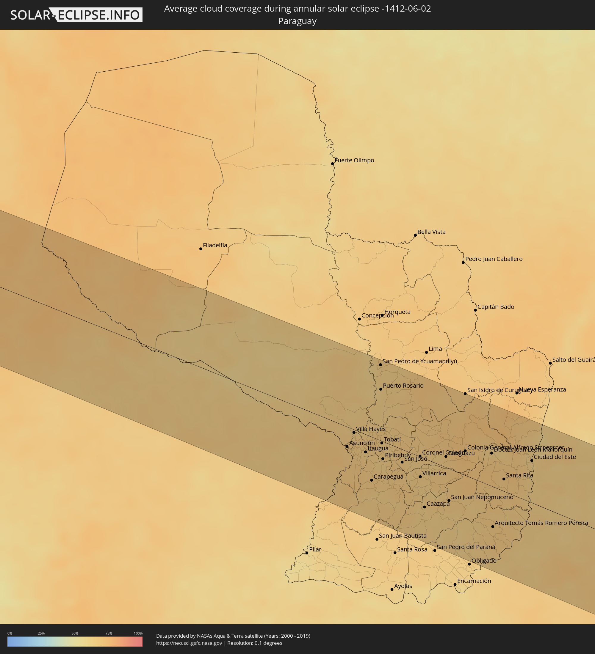 Paraguay
Cities inside the path of the eclipse
The following table shows all locations with a population of more than 5,000 inside the eclipse path. Cities which have more than 100,000 inhabitants are marked bold. A click at the locations opens a detailed map.
| City | Type | Eclipse duration | Local time of max. eclipse | Distance to central line | Ø Cloud coverage |
|
Iquique, Tarapacá
|
annular | - | 15:48:30 UTC-04:42 | 28 km | 28% |
|
Tupiza, Potosí
|
annular | - | 16:02:38 UTC-04:32 | 62 km | 20% |
|
Abra Pampa, Jujuy Province
|
annular | - | 16:17:23 UTC-04:16 | 69 km | 18% |
|
Villazón, Potosí
|
annular | - | 16:02:14 UTC-04:32 | 1 km | 17% |
|
La Quiaca, Jujuy Province
|
annular | - | 16:18:01 UTC-04:16 | 1 km | 17% |
|
Humahuaca, Jujuy Province
|
annular | - | 16:17:18 UTC-04:16 | 107 km | 13% |
|
Tarija, Tarija
|
annular | - | 16:03:30 UTC-04:32 | 90 km | 32% |
|
Yuto, Jujuy Province
|
annular | - | 16:17:44 UTC-04:16 | 119 km | 66% |
|
San Ramón de la Nueva Orán, Salta Province
|
annular | - | 16:18:19 UTC-04:16 | 61 km | 73% |
|
Embarcación, Salta Province
|
annular | - | 16:18:27 UTC-04:16 | 60 km | 71% |
|
General Enrique Mosconi, Salta Province
|
annular | - | 16:19:14 UTC-04:16 | 14 km | 73% |
|
Tartagal, Salta Province
|
annular | - | 16:19:19 UTC-04:16 | 23 km | 73% |
|
Yacuiba, Tarija
|
annular | - | 16:04:03 UTC-04:32 | 79 km | 70% |
|
Ingeniero Guillermo N. Juárez, Formosa Province
|
annular | - | 16:19:42 UTC-04:16 | 46 km | 66% |
|
Las Lomitas, Formosa Province
|
annular | - | 16:19:54 UTC-04:16 | 82 km | 65% |
|
Ibarreta, Formosa Province
|
annular | - | 16:19:56 UTC-04:16 | 106 km | 66% |
|
Comandante Fontana, Formosa Province
|
annular | - | 16:19:56 UTC-04:16 | 112 km | 64% |
|
Palo Santo, Formosa Province
|
annular | - | 16:19:57 UTC-04:16 | 122 km | 63% |
|
Clorinda, Formosa Province
|
annular | - | 16:21:11 UTC-04:16 | 32 km | 67% |
|
Nanawa, Presidente Hayes
|
annular | - | 16:47:22 UTC-03:50 | 28 km | 67% |
|
Asunción, Asunción
|
annular | - | 16:47:21 UTC-03:50 | 30 km | 66% |
|
Lambaré, Central
|
annular | - | 16:47:20 UTC-03:50 | 34 km | 66% |
|
Villa Elisa, Central
|
annular | - | 16:47:19 UTC-03:50 | 35 km | 65% |
|
Benjamín Aceval, Presidente Hayes
|
annular | - | 16:47:42 UTC-03:50 | 7 km | 66% |
|
Colonia Mariano Roque Alonso, Central
|
annular | - | 16:47:32 UTC-03:50 | 13 km | 66% |
|
San Antonio, Central
|
annular | - | 16:47:17 UTC-03:50 | 39 km | 66% |
|
Nemby, Central
|
annular | - | 16:47:19 UTC-03:50 | 36 km | 66% |
|
Villa Hayes, Presidente Hayes
|
annular | - | 16:47:37 UTC-03:50 | 5 km | 67% |
|
Fernando de la Mora, Central
|
annular | - | 16:47:23 UTC-03:50 | 30 km | 67% |
|
Limpio, Central
|
annular | - | 16:47:34 UTC-03:50 | 11 km | 67% |
|
Guarambaré, Central
|
annular | - | 16:47:17 UTC-03:50 | 43 km | 68% |
|
Capiatá, Central
|
annular | - | 16:47:25 UTC-03:50 | 29 km | 66% |
|
Areguá, Central
|
annular | - | 16:47:29 UTC-03:50 | 22 km | 65% |
|
Itá, Central
|
annular | - | 16:47:19 UTC-03:50 | 41 km | 67% |
|
Emboscada, Cordillera
|
annular | - | 16:47:39 UTC-03:50 | 4 km | 65% |
|
Itauguá, Central
|
annular | - | 16:47:27 UTC-03:50 | 27 km | 66% |
|
Yaguarón, Paraguarí
|
annular | - | 16:47:16 UTC-03:50 | 48 km | 66% |
|
Ypacarai, Central
|
annular | - | 16:47:27 UTC-03:50 | 28 km | 66% |
|
Quiindy, Paraguarí
|
annular | - | 16:46:56 UTC-03:50 | 85 km | 65% |
|
Carapeguá, Paraguarí
|
annular | - | 16:47:06 UTC-03:50 | 66 km | 65% |
|
Paraguarí, Paraguarí
|
annular | - | 16:47:19 UTC-03:50 | 45 km | 67% |
|
Caacupé, Cordillera
|
annular | - | 16:47:33 UTC-03:50 | 20 km | 64% |
|
San Pedro de Ycuamandiyú, San Pedro
|
annular | - | 16:48:45 UTC-03:50 | 116 km | 65% |
|
Tobatí, Cordillera
|
annular | - | 16:47:43 UTC-03:50 | 3 km | 66% |
|
Piribebuy, Cordillera
|
annular | - | 16:47:30 UTC-03:50 | 27 km | 64% |
|
Eusebio Ayala, Cordillera
|
annular | - | 16:47:38 UTC-03:50 | 15 km | 64% |
|
Coronel Oviedo, Caaguazú
|
annular | - | 16:47:52 UTC-03:50 | 1 km | 65% |
|
Villarrica, Guairá
|
annular | - | 16:47:35 UTC-03:50 | 31 km | 64% |
|
Caazapá, Caazapá
|
annular | - | 16:47:11 UTC-03:50 | 74 km | 64% |
|
Caaguazú, Caaguazú
|
annular | - | 16:48:04 UTC-03:50 | 16 km | 65% |
|
San Juan Nepomuceno, Caazapá
|
annular | - | 16:47:29 UTC-03:50 | 49 km | 66% |
|
Repatriación, Caaguazú
|
annular | - | 16:48:01 UTC-03:50 | 10 km | 65% |
|
Colonia General Alfredo Stroessner, Caaguazú
|
annular | - | 16:48:18 UTC-03:50 | 37 km | 71% |
|
San Isidro de Curuguaty, Canindeyú
|
annular | - | 16:49:04 UTC-03:50 | 125 km | 67% |
|
Doctor Juan León Mallorquín, Alto Paraná
|
annular | - | 16:48:28 UTC-03:50 | 50 km | 67% |
|
Arquitecto Tomás Romero Pereira, Itapúa
|
annular | - | 16:47:27 UTC-03:50 | 61 km | 67% |
|
Jardín América, Misiones Province
|
annular | - | 16:20:47 UTC-04:16 | 117 km | 64% |
|
Santa Rita, Alto Paraná
|
annular | - | 16:48:12 UTC-03:50 | 18 km | 67% |
|
Capioví, Misiones Province
|
annular | - | 16:20:58 UTC-04:16 | 99 km | 63% |
|
Puerto Rico, Misiones Province
|
annular | - | 16:21:07 UTC-04:16 | 84 km | 65% |
|
Campo Grande, Misiones Province
|
annular | - | 16:20:44 UTC-04:16 | 125 km | 65% |
|
Garuhapé, Misiones Province
|
annular | - | 16:21:08 UTC-04:16 | 84 km | 65% |
|
Aristóbulo del Valle, Misiones Province
|
annular | - | 16:20:53 UTC-04:16 | 110 km | 65% |
|
El Alcázar, Misiones Province
|
annular | - | 16:21:17 UTC-04:16 | 68 km | 62% |
|
Montecarlo, Misiones Province
|
annular | - | 16:21:27 UTC-04:16 | 50 km | 63% |
|
Puerto Piray, Misiones Province
|
annular | - | 16:21:34 UTC-04:16 | 39 km | 64% |
|
Puerto Eldorado, Misiones Province
|
annular | - | 16:47:46 UTC-03:50 | 32 km | 64% |
|
Dos de Mayo, Misiones Province
|
annular | - | 16:21:03 UTC-04:16 | 95 km | 65% |
|
Puerto Esperanza, Misiones Province
|
annular | - | 16:22:01 UTC-04:16 | 9 km | 65% |
|
Puerto Libertad, Misiones Province
|
annular | - | 16:48:16 UTC-03:50 | 22 km | 63% |
|
Presidente Franco, Alto Paraná
|
annular | - | 16:48:38 UTC-03:50 | 61 km | 63% |
|
Ciudad del Este, Alto Paraná
|
annular | - | 16:48:39 UTC-03:50 | 64 km | 63% |
|
Foz do Iguaçu, Paraná
|
annular | - | 17:32:49 UTC-03:06 | 61 km | 63% |
|
Puerto Iguazú, Misiones Province
|
annular | - | 16:22:27 UTC-04:16 | 56 km | 63% |
|
Colonia Wanda, Misiones Province
|
annular | - | 16:22:10 UTC-04:16 | 23 km | 64% |
|
São Miguel do Iguaçu, Paraná
|
annular | - | 17:33:09 UTC-03:06 | 95 km | 66% |
|
El Soberbio, Misiones Province
|
annular | - | 16:20:59 UTC-04:16 | 104 km | 64% |
|
San Vicente, Misiones Province
|
annular | - | 16:21:40 UTC-04:16 | 32 km | 63% |
|
San Pedro, Misiones Province
|
annular | - | 16:21:41 UTC-04:16 | 31 km | 63% |
|
Medianeira, Paraná
|
annular | - | 17:33:15 UTC-03:06 | 106 km | 67% |
|
Matelândia, Paraná
|
annular | - | 17:33:21 UTC-03:06 | 115 km | 66% |
|
Três Passos, Rio Grande do Sul
|
annular | - | 17:31:16 UTC-03:06 | 110 km | 66% |
|
Santo Antônio do Sudoeste, Paraná
|
annular | - | 17:32:41 UTC-03:06 | 40 km | 63% |
|
Bernardo de Irigoyen, Misiones Province
|
annular | - | 16:22:13 UTC-04:16 | 24 km | 62% |
|
Realeza, Paraná
|
annular | - | 17:33:03 UTC-03:06 | 78 km | 63% |
|
Ampére, Paraná
|
annular | - | 17:32:56 UTC-03:06 | 66 km | 61% |
|
Frederico Westphalen, Rio Grande do Sul
|
annular | - | 17:31:35 UTC-03:06 | 80 km | 69% |
|
Dois Vizinhos, Paraná
|
annular | - | 17:33:15 UTC-03:06 | 100 km | 62% |
|
Francisco Beltrão, Paraná
|
annular | - | 17:32:56 UTC-03:06 | 64 km | 58% |
|
São Lourenço dOeste, Santa Catarina
|
annular | - | 17:32:45 UTC-03:06 | 44 km | 64% |