Hybrid solar eclipse of 04/21/-1419
| Day of week: | Thursday |
| Maximum duration of eclipse: | 00m26s |
| Maximum width of eclipse path: | 28 km |
| Saros cycle: | 35 |
| Coverage: | 100% |
| Magnitude: | 1.0055 |
| Gamma: | 0.7371 |
Wo kann man die Sonnenfinsternis vom 04/21/-1419 sehen?
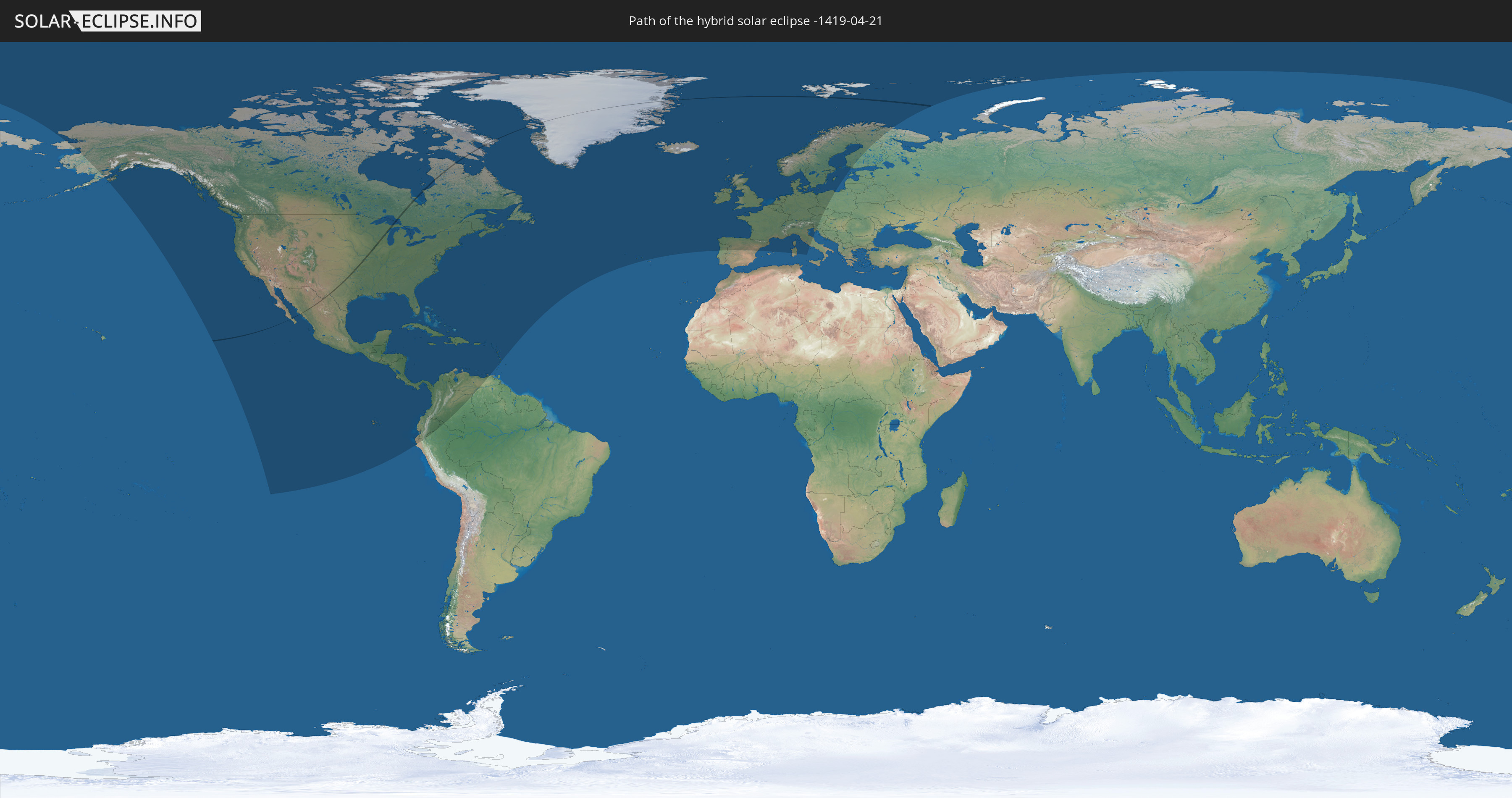
Die Sonnenfinsternis am 04/21/-1419 kann man in 72 Ländern als partielle Sonnenfinsternis beobachten.
Der Finsternispfad verläuft durch 5 Länder. Nur in diesen Ländern ist sie als hybrid Sonnenfinsternis zu sehen.
In den folgenden Ländern ist die Sonnenfinsternis hybrid zu sehen
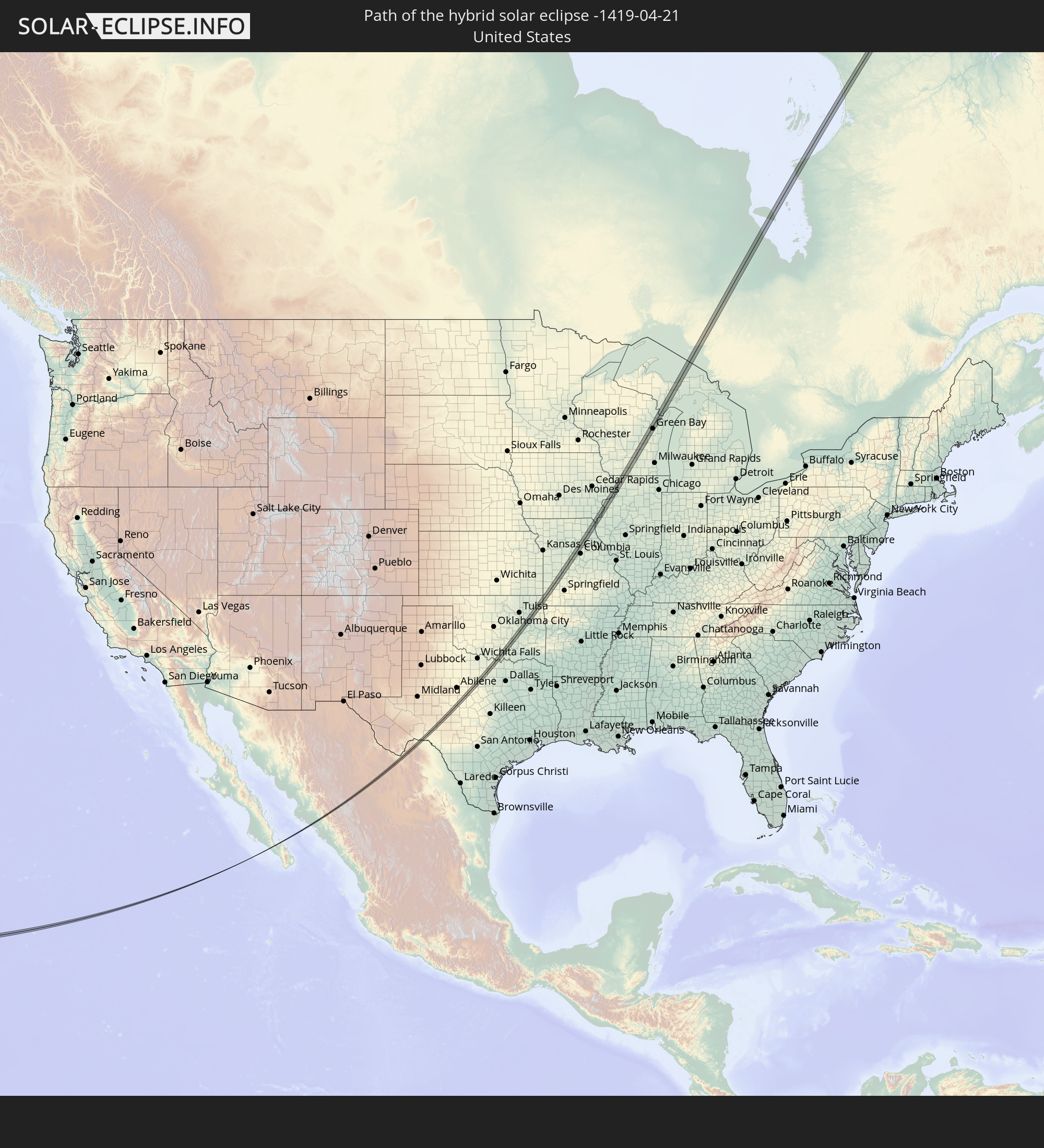 United States
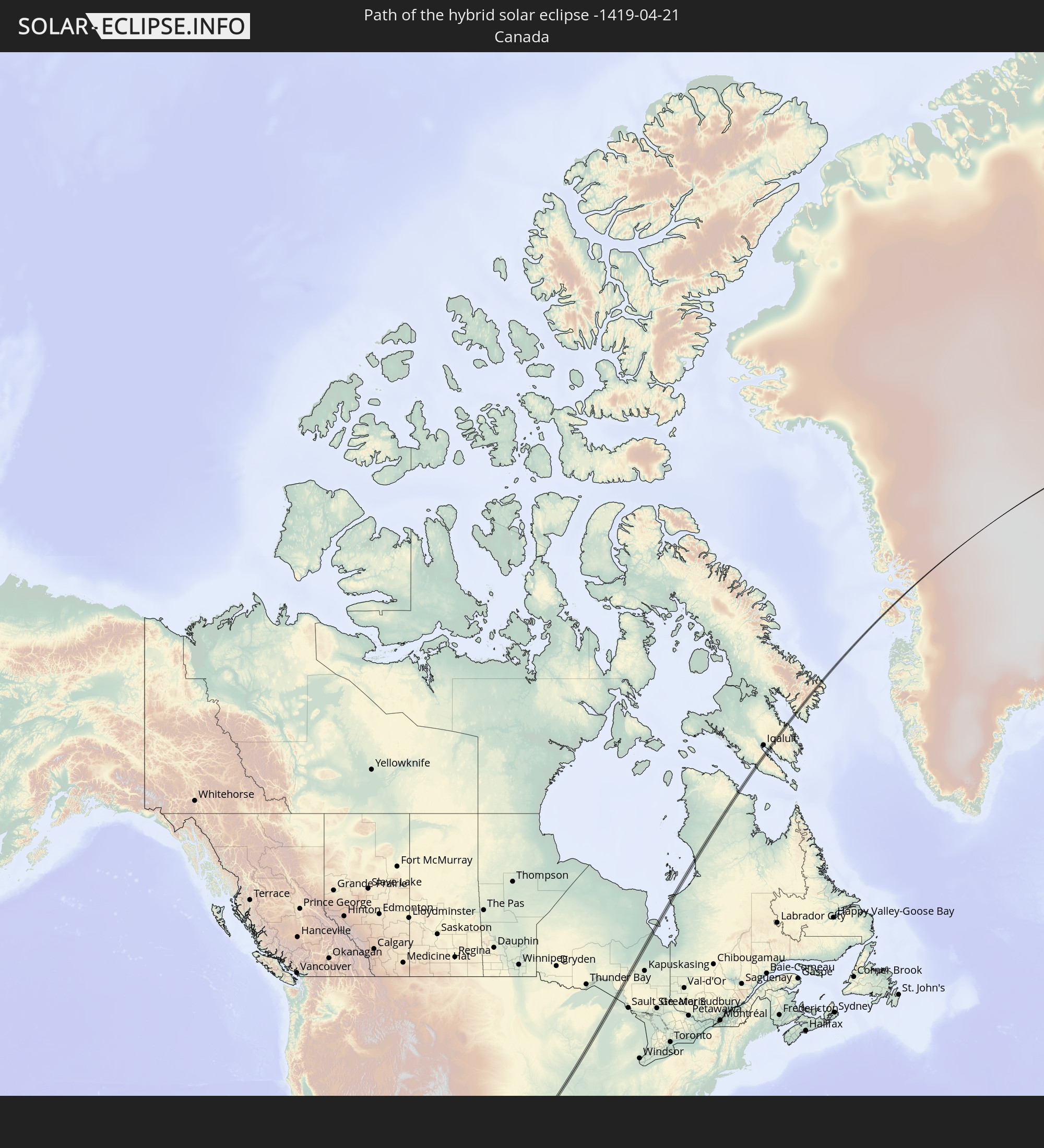 Canada
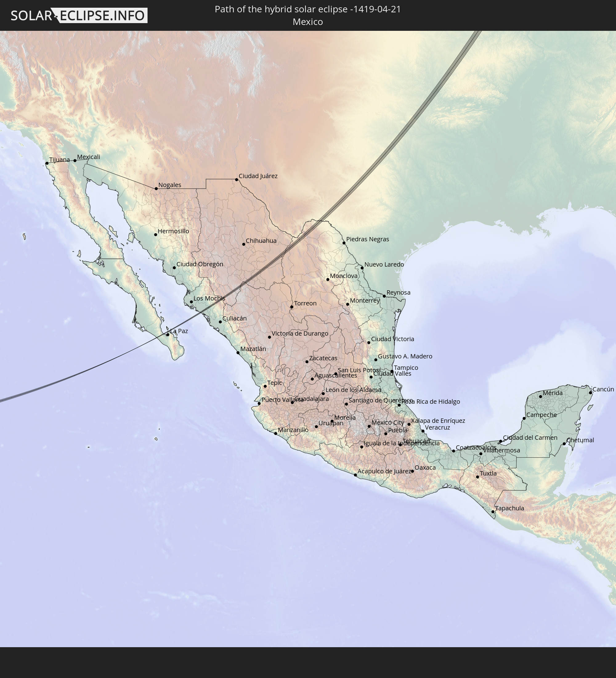 Mexico
 Greenland
 Svalbard and Jan Mayen
In den folgenden Ländern ist die Sonnenfinsternis partiell zu sehen
 Russia
 United States
 United States Minor Outlying Islands
 Canada
 Mexico
 Greenland
 Guatemala
 Ecuador
 El Salvador
 Honduras
 Belize
 Nicaragua
 Costa Rica
 Cuba
Cuba
 Panama
 Colombia
 Cayman Islands
 Peru
Peru
 The Bahamas
 Jamaica
 Haiti
Haiti
 Venezuela
 Turks and Caicos Islands
 Dominican Republic
 Aruba
Aruba
 Puerto Rico
 United States Virgin Islands
 Bermuda
 British Virgin Islands
 Anguilla
 Collectivity of Saint Martin
 Saint Barthélemy
 Saint Kitts and Nevis
 Antigua and Barbuda
 Montserrat
 Guadeloupe
 Dominica
 Martinique
 Saint Lucia
 Saint Pierre and Miquelon
 Portugal
 Iceland
 Spain
Spain
 Republic of Ireland
 Svalbard and Jan Mayen
 United Kingdom
 Faroe Islands
 France
 Isle of Man
 Guernsey
 Jersey
 Andorra
 Belgium
 Netherlands
 Norway
 Luxembourg
 Germany
 Switzerland
 Italy
Italy
 Monaco
 Denmark
 Liechtenstein
 Austria
 Sweden
 Czechia
 San Marino
 Vatican City
 Slovenia
 Croatia
 Poland
 Åland Islands
 Finland
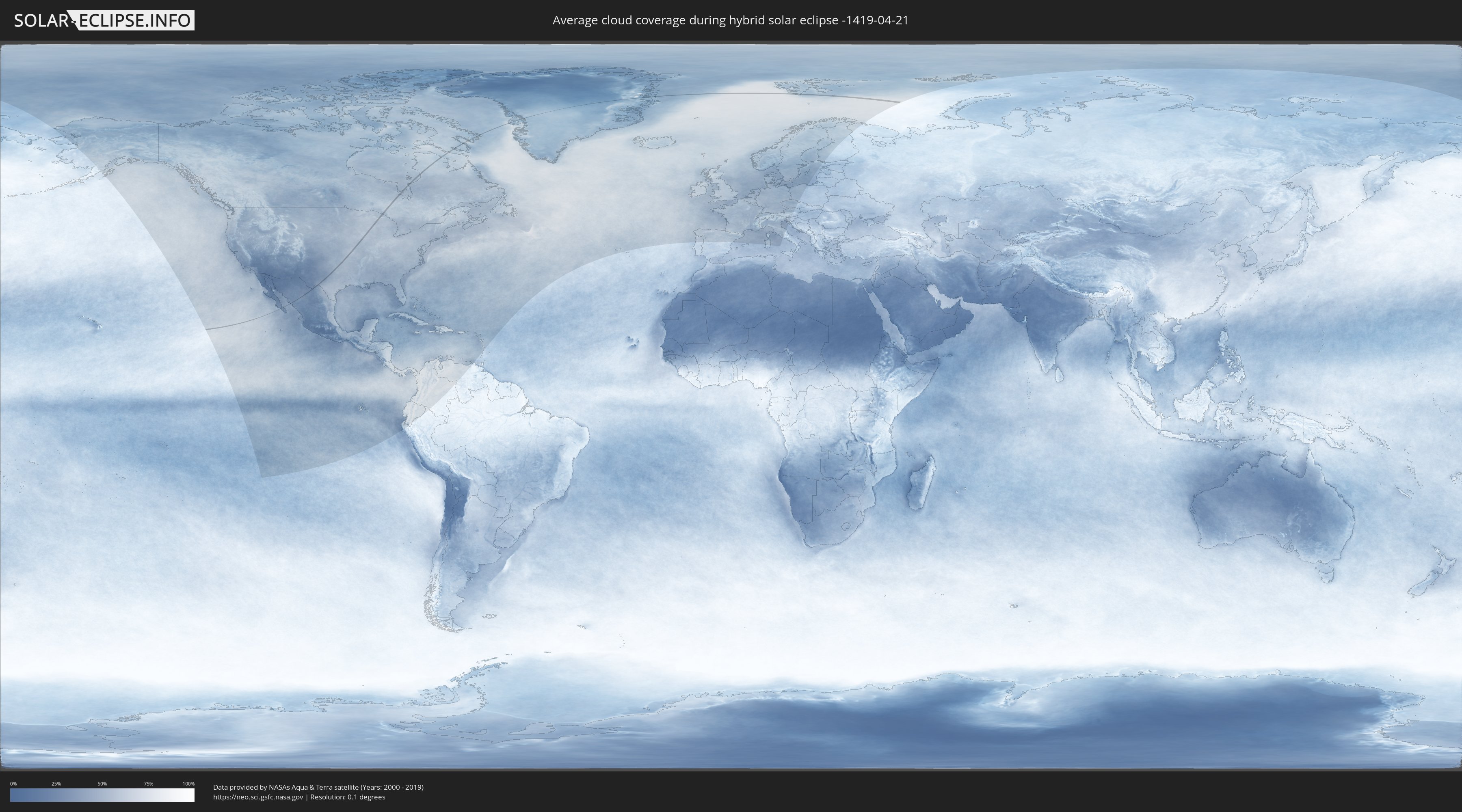
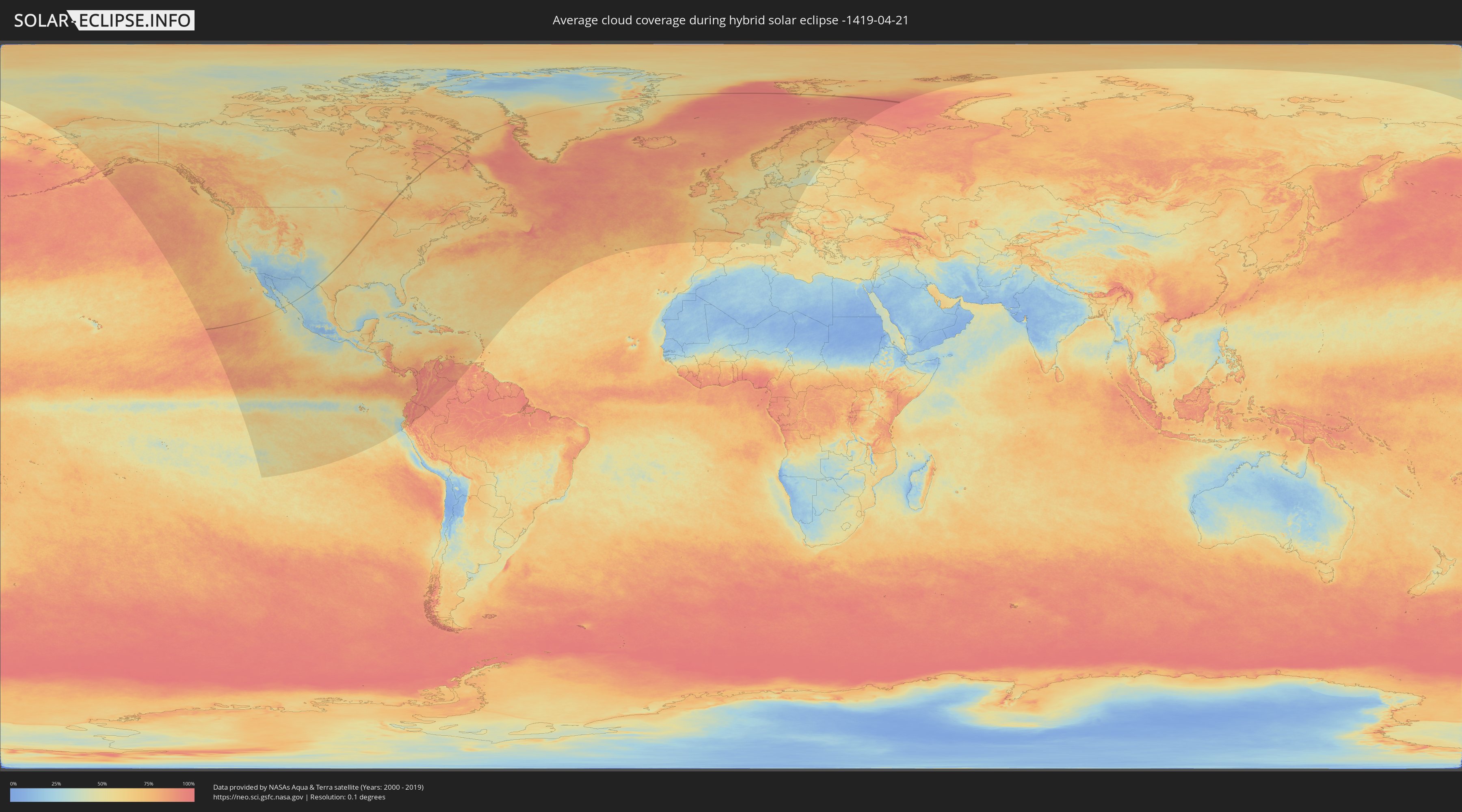
How will be the weather during the hybrid solar eclipse on 04/21/-1419?
Where is the best place to see the hybrid solar eclipse of 04/21/-1419?
The following maps show the average cloud coverage for the day of the hybrid solar eclipse.
With the help of these maps, it is possible to find the place along the eclipse path, which has the best
chance of a cloudless sky.
Nevertheless, you should consider local circumstances and inform about the weather of your chosen
observation site.
The data is provided by NASAs satellites
AQUA and TERRA.
The cloud maps are averaged over a period of 19 years (2000 - 2019).
Detailed country maps
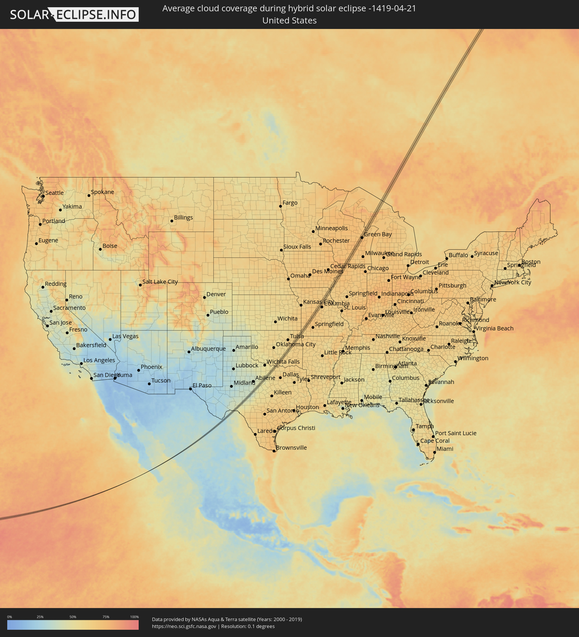 United States
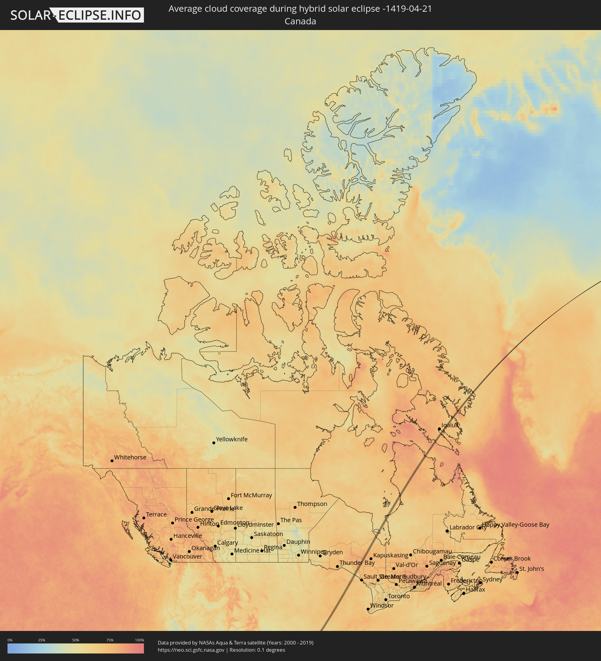 Canada
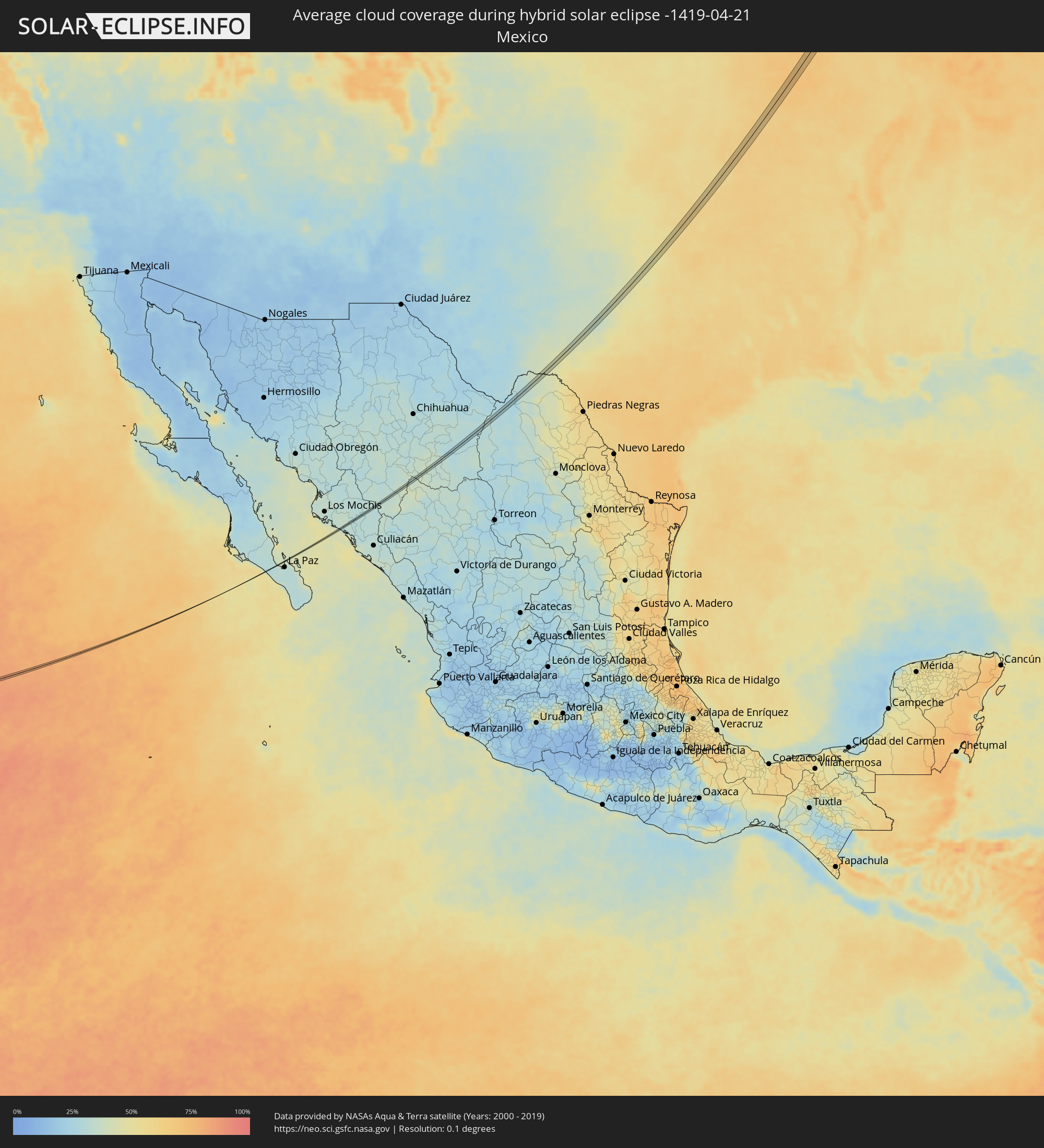 Mexico
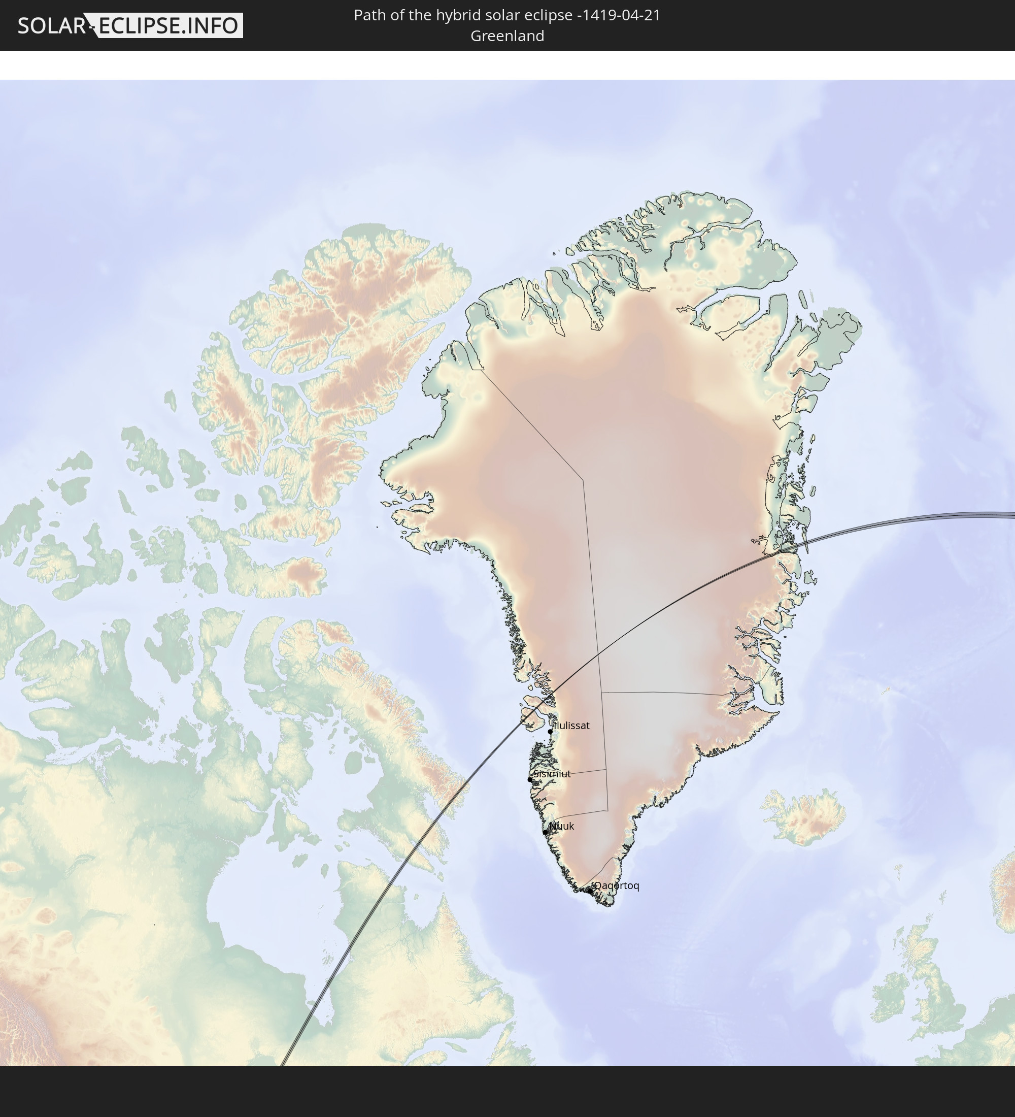
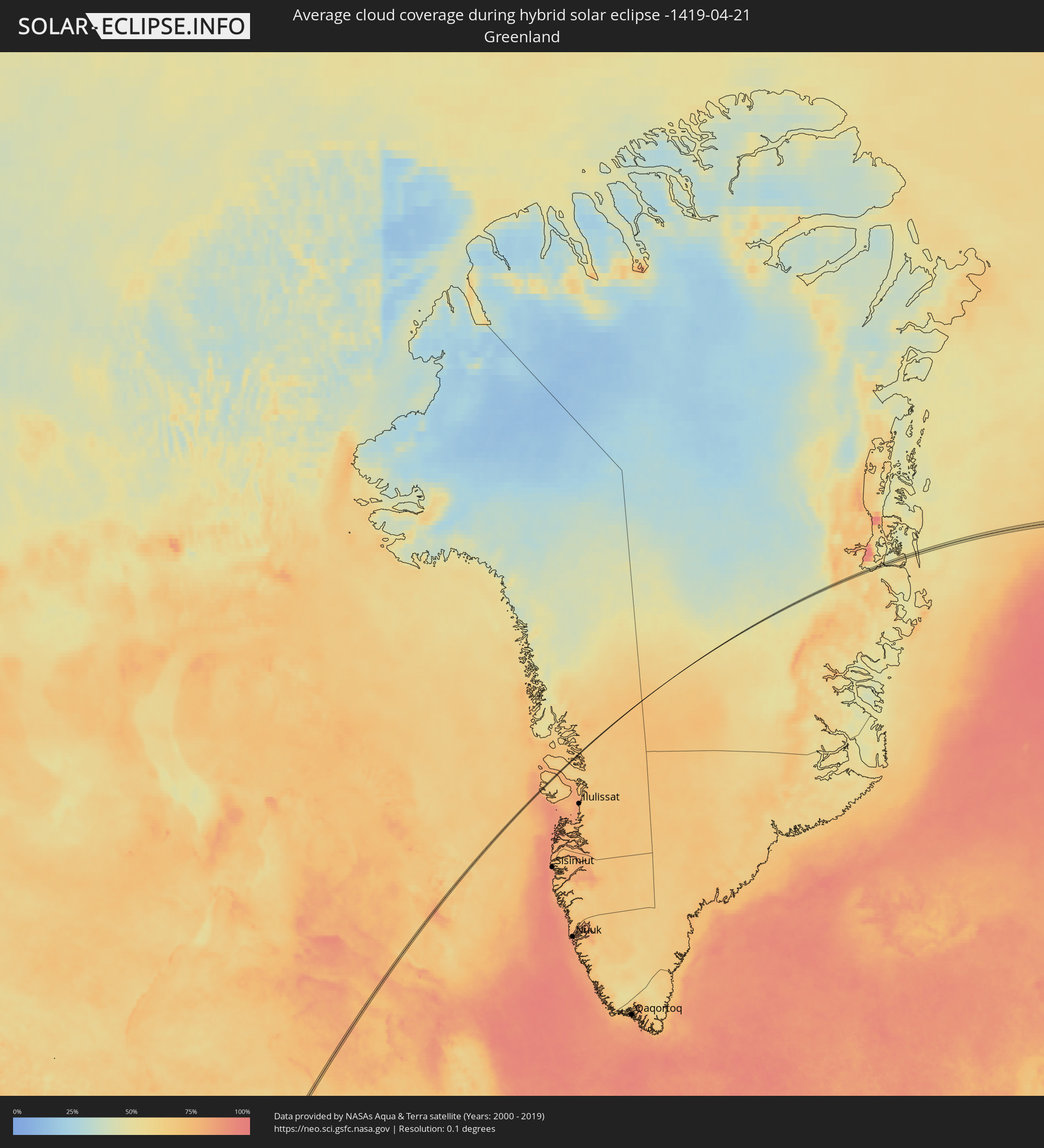 Greenland
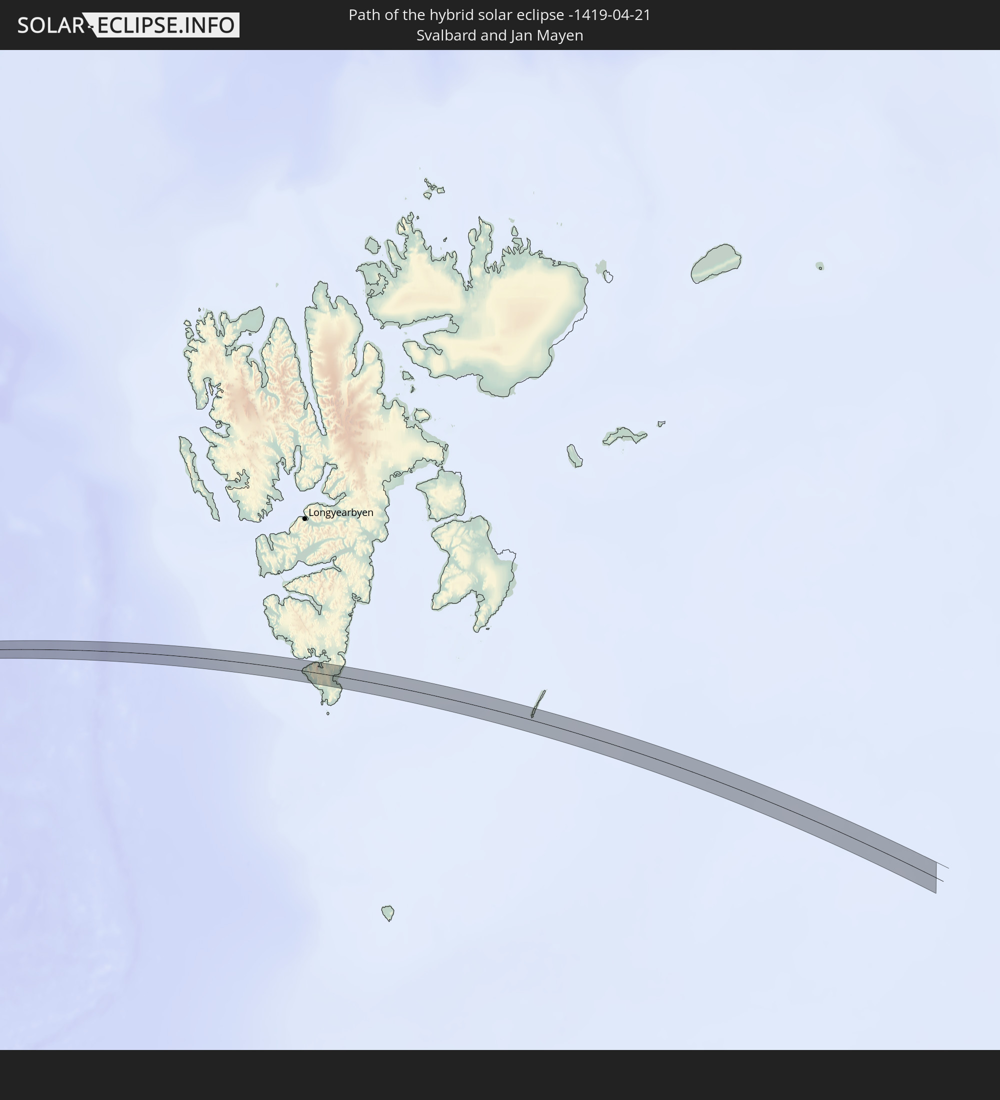
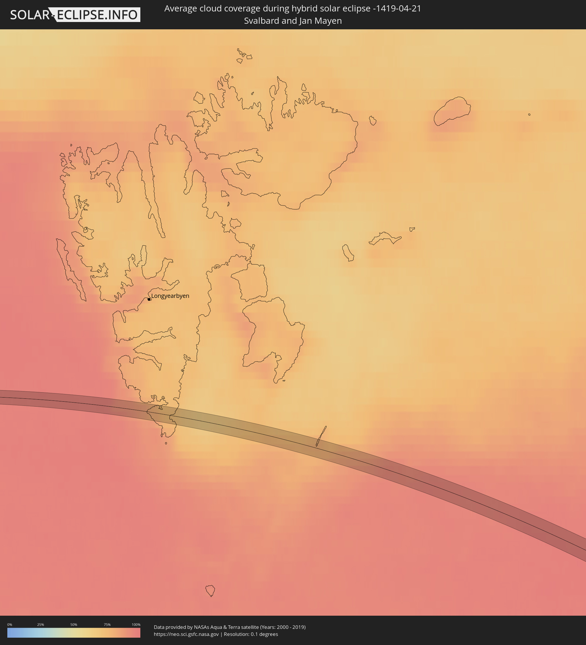 Svalbard and Jan Mayen
Cities inside the path of the eclipse
The following table shows all locations with a population of more than 5,000 inside the eclipse path. Cities which have more than 100,000 inhabitants are marked bold. A click at the locations opens a detailed map.
| City | Type | Eclipse duration | Local time of max. eclipse | Distance to central line | Ø Cloud coverage |
|
Ardmore, Oklahoma
|
total | - | 09:06:29 UTC-06:00 | 7 km | 60% |
|
Henryetta, Oklahoma
|
total | - | 09:10:09 UTC-06:00 | 11 km | 58% |
|
Muskogee, Oklahoma
|
total | - | 09:11:21 UTC-06:00 | 13 km | 64% |
|
Wagoner, Oklahoma
|
total | - | 09:11:48 UTC-06:00 | 1 km | 61% |
|
Grove, Oklahoma
|
total | - | 09:13:41 UTC-06:00 | 0 km | 61% |
|
Joplin, Missouri
|
total | - | 09:14:57 UTC-06:00 | 13 km | 65% |
|
Webb City, Missouri
|
total | - | 09:15:08 UTC-06:00 | 13 km | 65% |
|
Neosho, Missouri
|
total | - | 09:14:38 UTC-06:00 | 11 km | 63% |
|
Carthage, Missouri
|
total | - | 09:15:20 UTC-06:00 | 4 km | 66% |
|
Boonville, Missouri
|
total | - | 09:20:36 UTC-06:00 | 4 km | 65% |
|
Moberly, Missouri
|
total | - | 09:21:50 UTC-06:00 | 9 km | 65% |
|
Keokuk, Iowa
|
total | - | 09:24:55 UTC-06:00 | 8 km | 62% |
|
Fort Madison, Iowa
|
total | - | 09:25:28 UTC-06:00 | 1 km | 64% |
|
Burlington, Iowa
|
total | - | 09:26:02 UTC-06:00 | 3 km | 65% |
|
Eldridge, Iowa
|
total | - | 09:28:19 UTC-06:00 | 9 km | 71% |
|
Rock Island, Illinois
|
total | - | 09:28:01 UTC-06:00 | 1 km | 70% |
|
Davenport, Iowa
|
total | - | 09:28:03 UTC-06:00 | 1 km | 70% |
|
Milan, Illinois
|
total | - | 09:27:55 UTC-06:00 | 4 km | 70% |
|
Bettendorf, Iowa
|
total | - | 09:28:07 UTC-06:00 | 3 km | 71% |
|
Moline, Illinois
|
total | - | 09:28:05 UTC-06:00 | 5 km | 71% |
|
East Moline, Illinois
|
total | - | 09:28:08 UTC-06:00 | 10 km | 71% |
|
Silvis, Illinois
|
total | - | 09:28:12 UTC-06:00 | 11 km | 71% |
|
Clinton, Iowa
|
total | - | 09:29:06 UTC-06:00 | 8 km | 72% |
|
Monroe, Wisconsin
|
total | - | 09:31:13 UTC-06:00 | 3 km | 77% |
|
Verona, Wisconsin
|
total | - | 09:32:07 UTC-06:00 | 12 km | 72% |
|
Fitchburg, Wisconsin
|
total | - | 09:32:07 UTC-06:00 | 5 km | 72% |
|
Madison, Wisconsin
|
total | - | 09:32:25 UTC-06:00 | 7 km | 69% |
|
Oregon, Wisconsin
|
total | - | 09:32:08 UTC-06:00 | 3 km | 72% |
|
De Forest, Wisconsin
|
total | - | 09:32:49 UTC-06:00 | 13 km | 72% |
|
Monona, Wisconsin
|
total | - | 09:32:28 UTC-06:00 | 2 km | 69% |
|
McFarland, Wisconsin
|
total | - | 09:32:24 UTC-06:00 | 4 km | 69% |
|
Sun Prairie, Wisconsin
|
total | - | 09:32:50 UTC-06:00 | 0 km | 70% |
|
Cottage Grove, Wisconsin
|
total | - | 09:32:38 UTC-06:00 | 7 km | 71% |
|
Beaver Dam, Wisconsin
|
total | - | 09:33:46 UTC-06:00 | 11 km | 72% |
|
Ripon, Wisconsin
|
total | - | 09:34:33 UTC-06:00 | 11 km | 74% |
|
Waupun, Wisconsin
|
total | - | 09:34:14 UTC-06:00 | 8 km | 73% |
|
Oshkosh, Wisconsin
|
total | - | 09:35:13 UTC-06:00 | 1 km | 72% |
|
Neenah, Wisconsin
|
total | - | 09:35:37 UTC-06:00 | 4 km | 73% |
|
Menasha, Wisconsin
|
total | - | 09:35:40 UTC-06:00 | 4 km | 73% |
|
Appleton, Wisconsin
|
total | - | 09:35:49 UTC-06:00 | 5 km | 75% |
|
Kimberly, Wisconsin
|
total | - | 09:35:55 UTC-06:00 | 1 km | 75% |
|
Little Chute, Wisconsin
|
total | - | 09:35:57 UTC-06:00 | 0 km | 75% |
|
Kaukauna, Wisconsin
|
total | - | 09:36:00 UTC-06:00 | 4 km | 75% |
|
Howard, Wisconsin
|
total | - | 09:36:43 UTC-06:00 | 2 km | 77% |
|
Ashwaubenon, Wisconsin
|
total | - | 09:36:37 UTC-06:00 | 6 km | 77% |
|
De Pere, Wisconsin
|
total | - | 09:36:34 UTC-06:00 | 9 km | 74% |
|
Suamico, Wisconsin
|
total | - | 09:36:57 UTC-06:00 | 0 km | 73% |
|
Green Bay, Wisconsin
|
total | - | 09:36:45 UTC-06:00 | 8 km | 77% |
|
Allouez, Wisconsin
|
total | - | 09:36:40 UTC-06:00 | 10 km | 77% |
|
Marinette, Wisconsin
|
total | - | 09:38:18 UTC-06:00 | 2 km | 71% |
|
Menominee, Michigan
|
total | - | 09:38:20 UTC-06:00 | 3 km | 71% |
|
Escanaba, Michigan
|
total | - | 10:40:09 UTC-05:00 | 5 km | 72% |