Annular solar eclipse of 10/23/-1550
| Day of week: | Friday |
| Maximum duration of eclipse: | 09m09s |
| Maximum width of eclipse path: | 342 km |
| Saros cycle: | 28 |
| Coverage: | 91.6% |
| Magnitude: | 0.9164 |
| Gamma: | -0.3911 |
Wo kann man die Sonnenfinsternis vom 10/23/-1550 sehen?
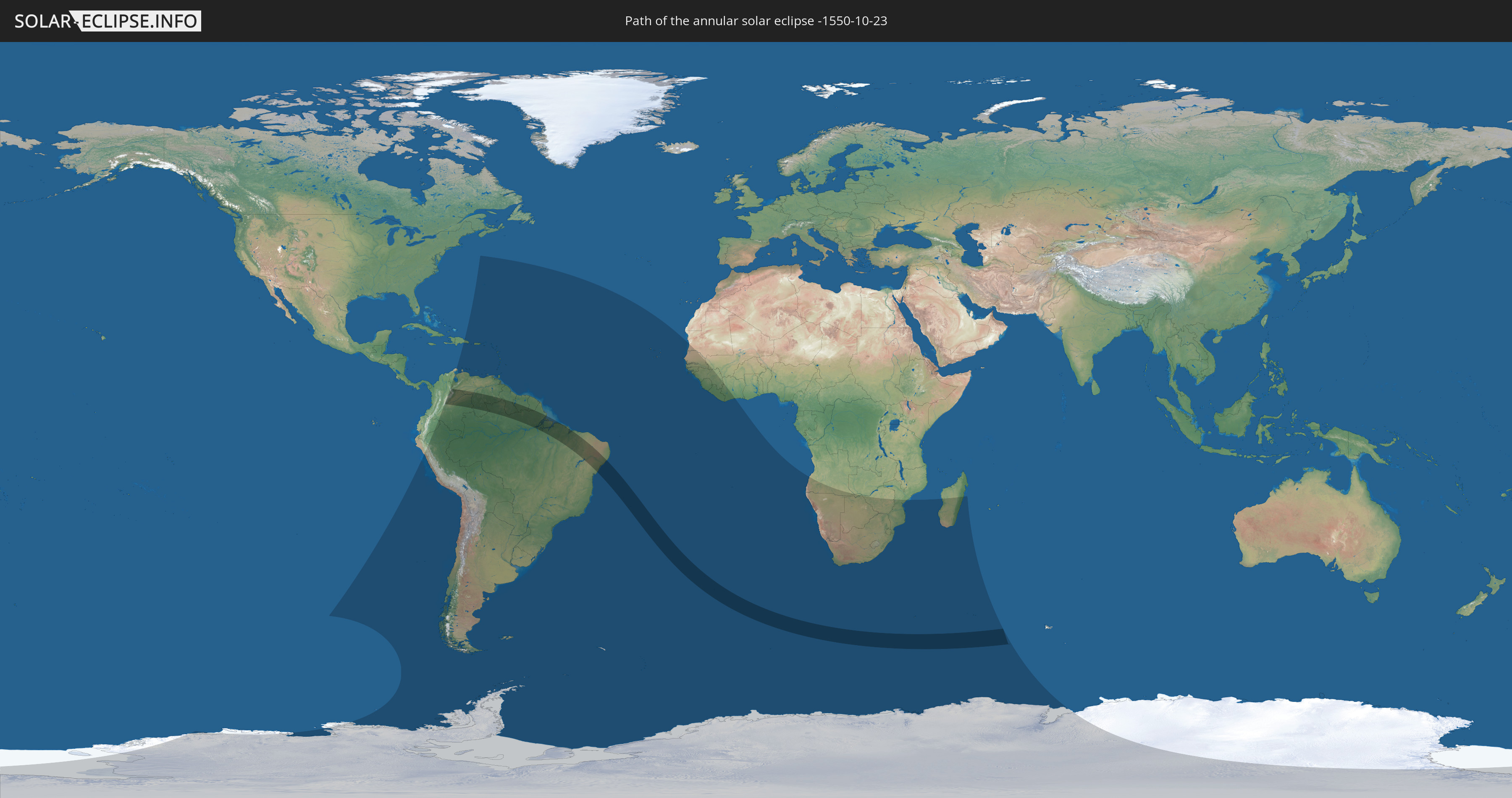
Die Sonnenfinsternis am 10/23/-1550 kann man in 59 Ländern als partielle Sonnenfinsternis beobachten.
Der Finsternispfad verläuft durch 7 Länder. Nur in diesen Ländern ist sie als annular Sonnenfinsternis zu sehen.
In den folgenden Ländern ist die Sonnenfinsternis annular zu sehen
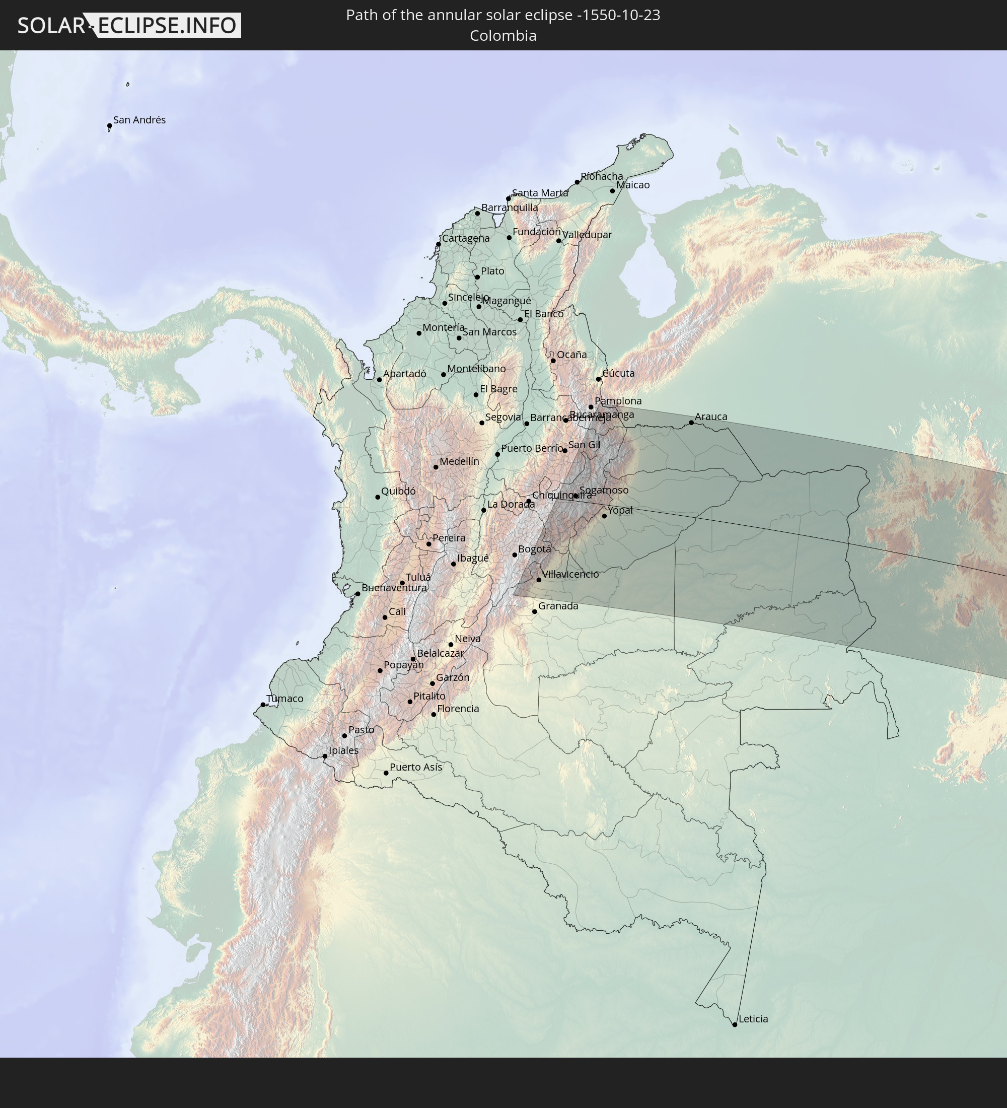 Colombia
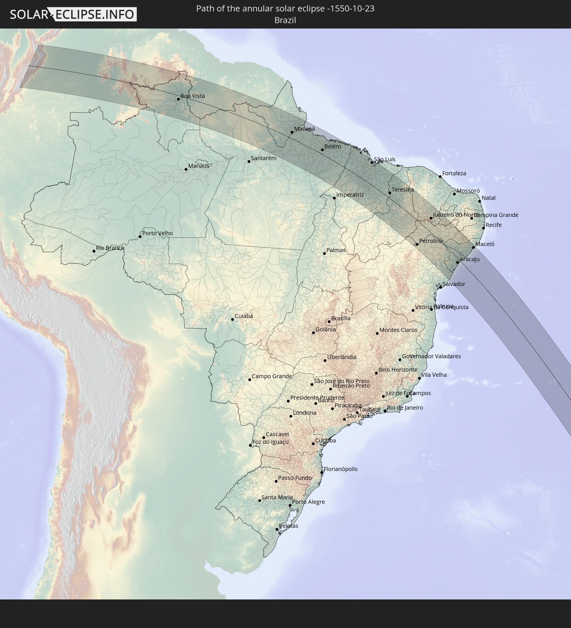 Brazil
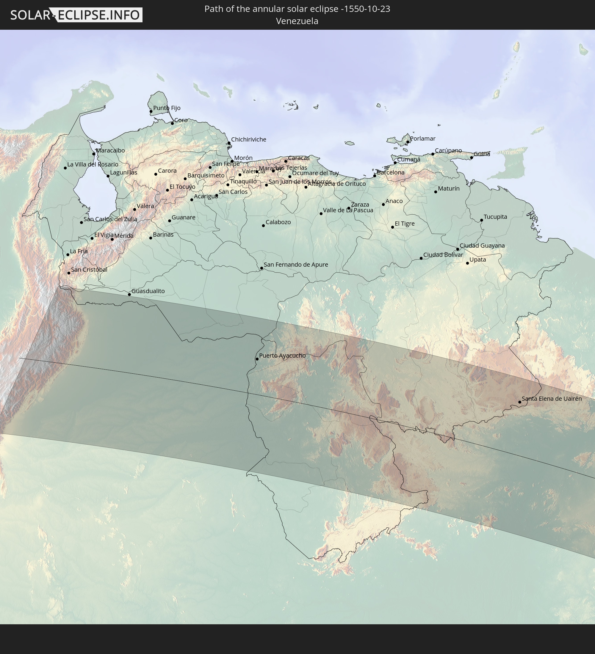 Venezuela
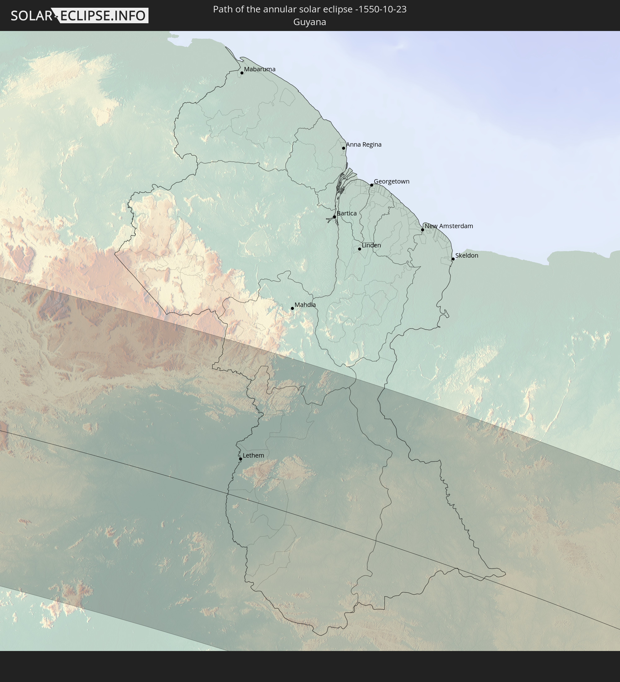 Guyana
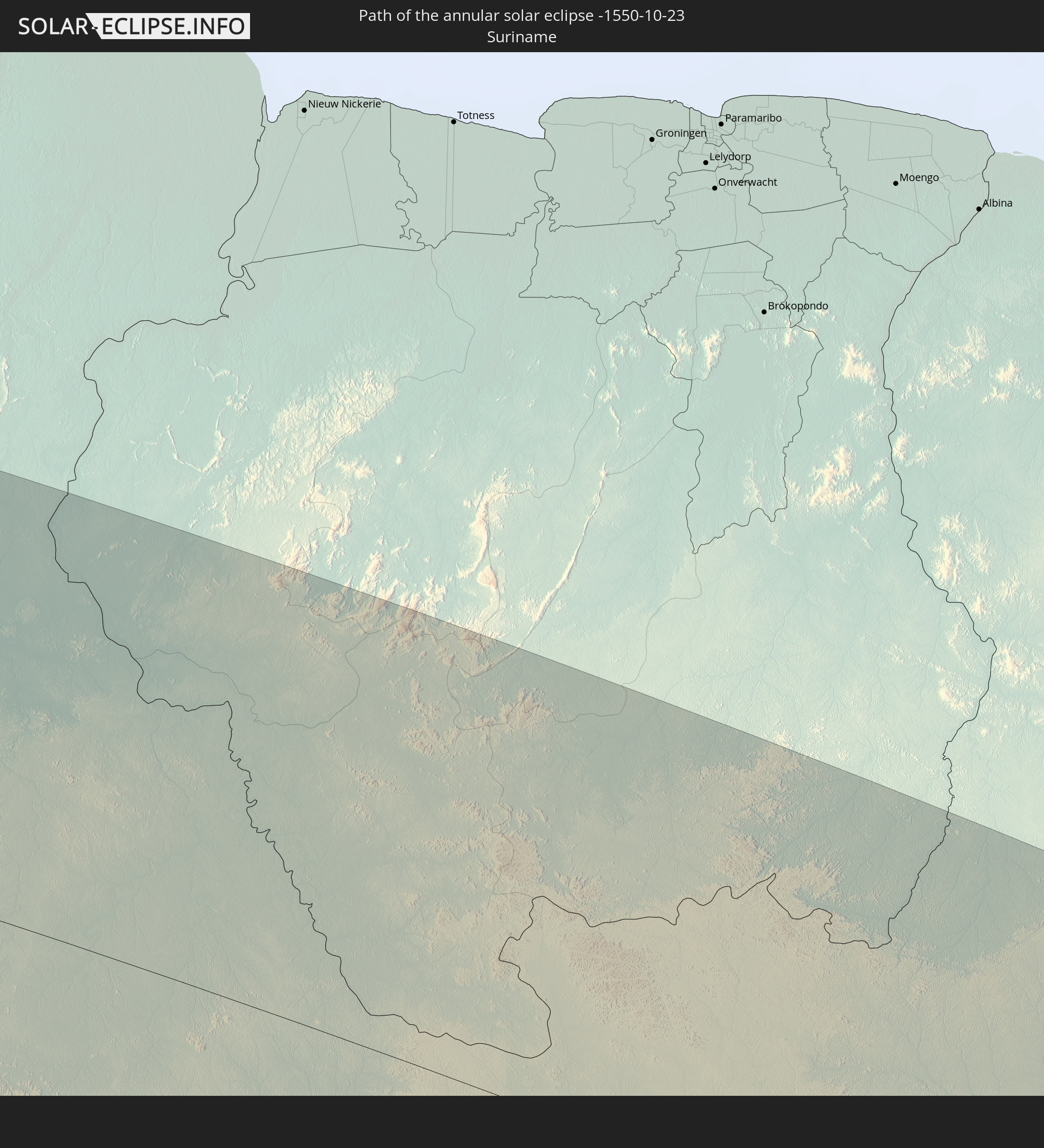 Suriname
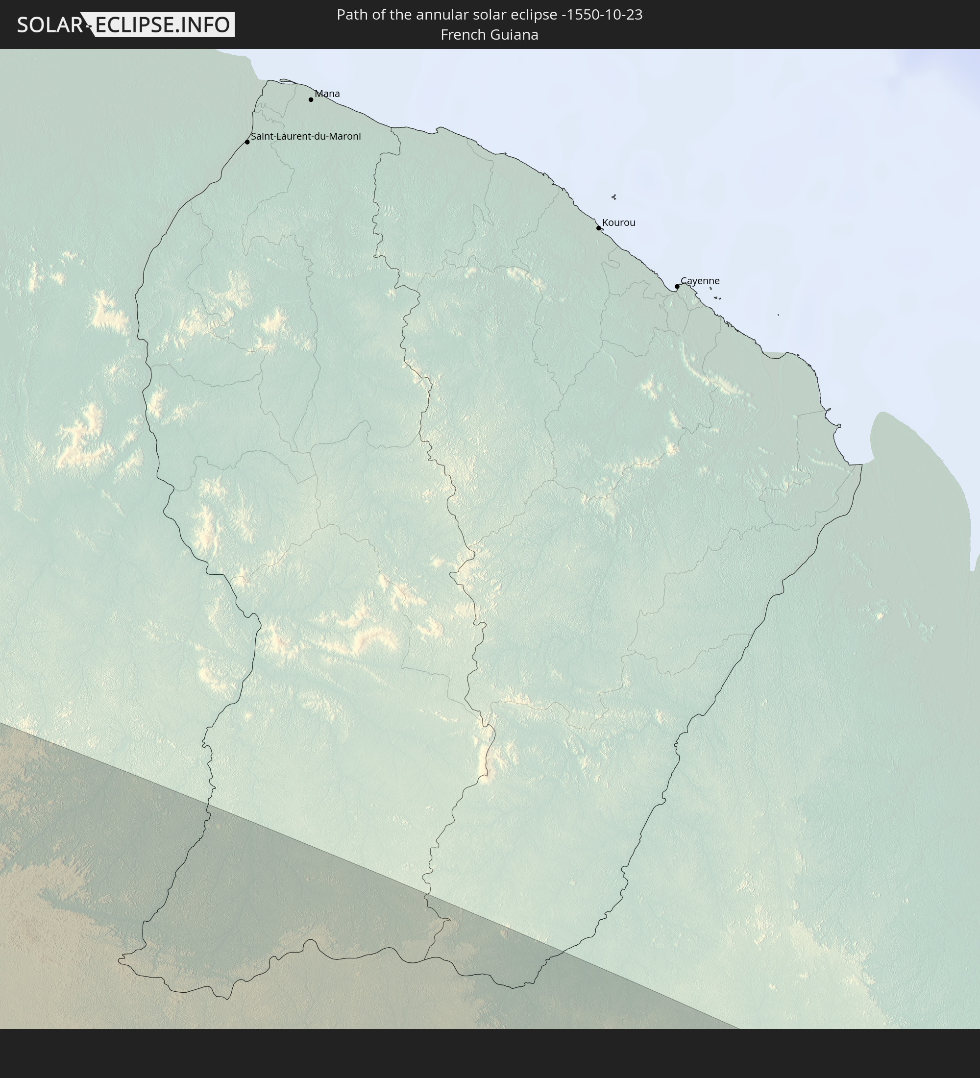 French Guiana
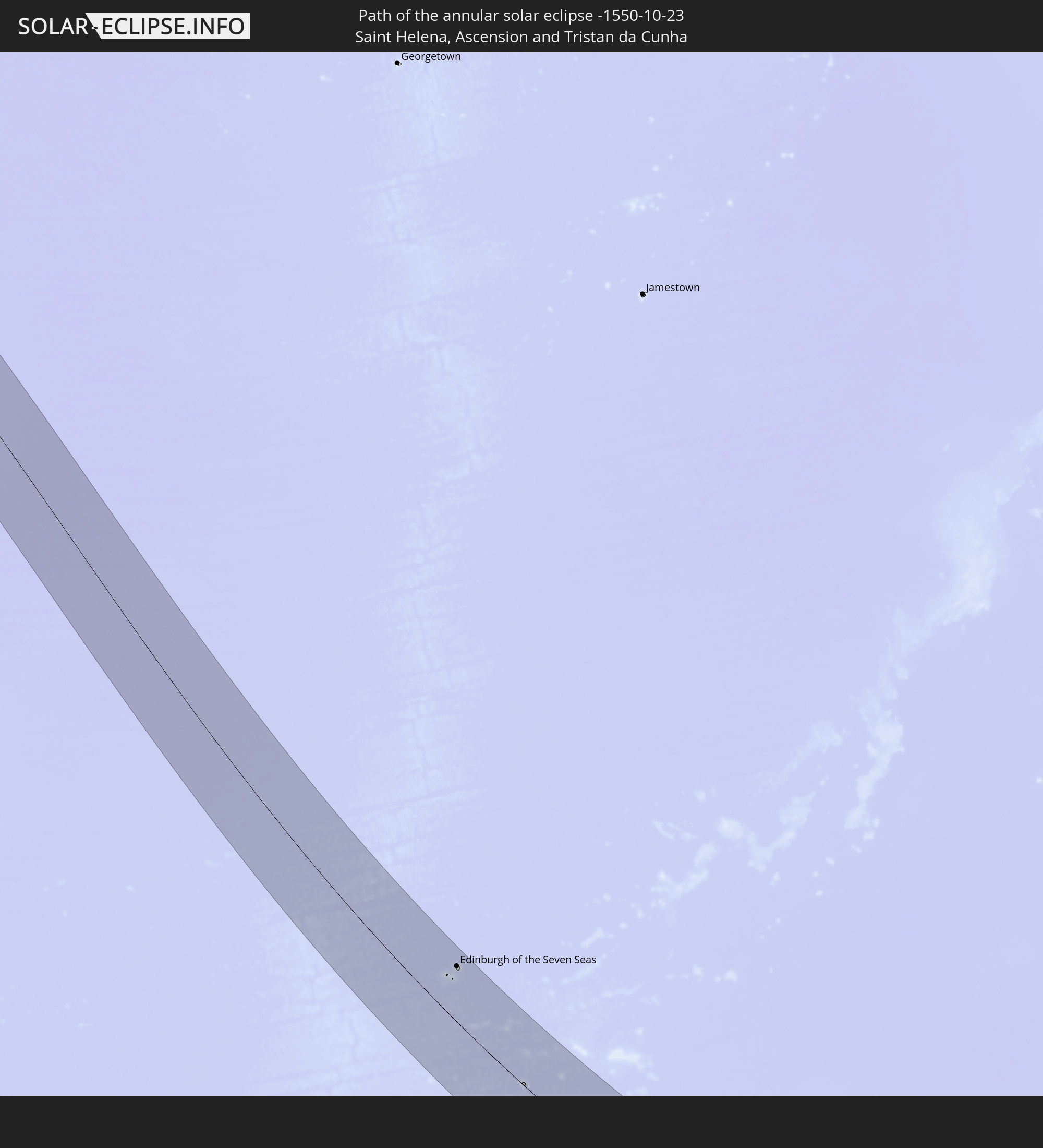 Saint Helena, Ascension and Tristan da Cunha
In den folgenden Ländern ist die Sonnenfinsternis partiell zu sehen
 Antarctica
 Chile
Chile
 Ecuador
 Colombia
 Peru
Peru
 Brazil
 Argentina
 Venezuela
 Dominican Republic
 Aruba
Aruba
 Bolivia
 Puerto Rico
 United States Virgin Islands
 Bermuda
 British Virgin Islands
 Anguilla
 Collectivity of Saint Martin
 Saint Barthélemy
 Saint Kitts and Nevis
 Paraguay
 Antigua and Barbuda
 Montserrat
 Trinidad and Tobago
 Guadeloupe
 Grenada
 Dominica
 Saint Vincent and the Grenadines
 Falkland Islands
 Guyana
 Martinique
 Saint Lucia
 Barbados
 Uruguay
 Suriname
 French Guiana
 South Georgia and the South Sandwich Islands
 Cabo Verde
 Senegal
 Mauritania
 The Gambia
 Guinea-Bissau
 Guinea
 Saint Helena, Ascension and Tristan da Cunha
 Sierra Leone
 Mali
Mali
 Liberia
 Ivory Coast
 Bouvet Island
 Angola
 Namibia
 South Africa
 Botswana
 Zambia
 Zimbabwe
 Lesotho
 Mozambique
 Swaziland
 French Southern and Antarctic Lands
 Madagascar
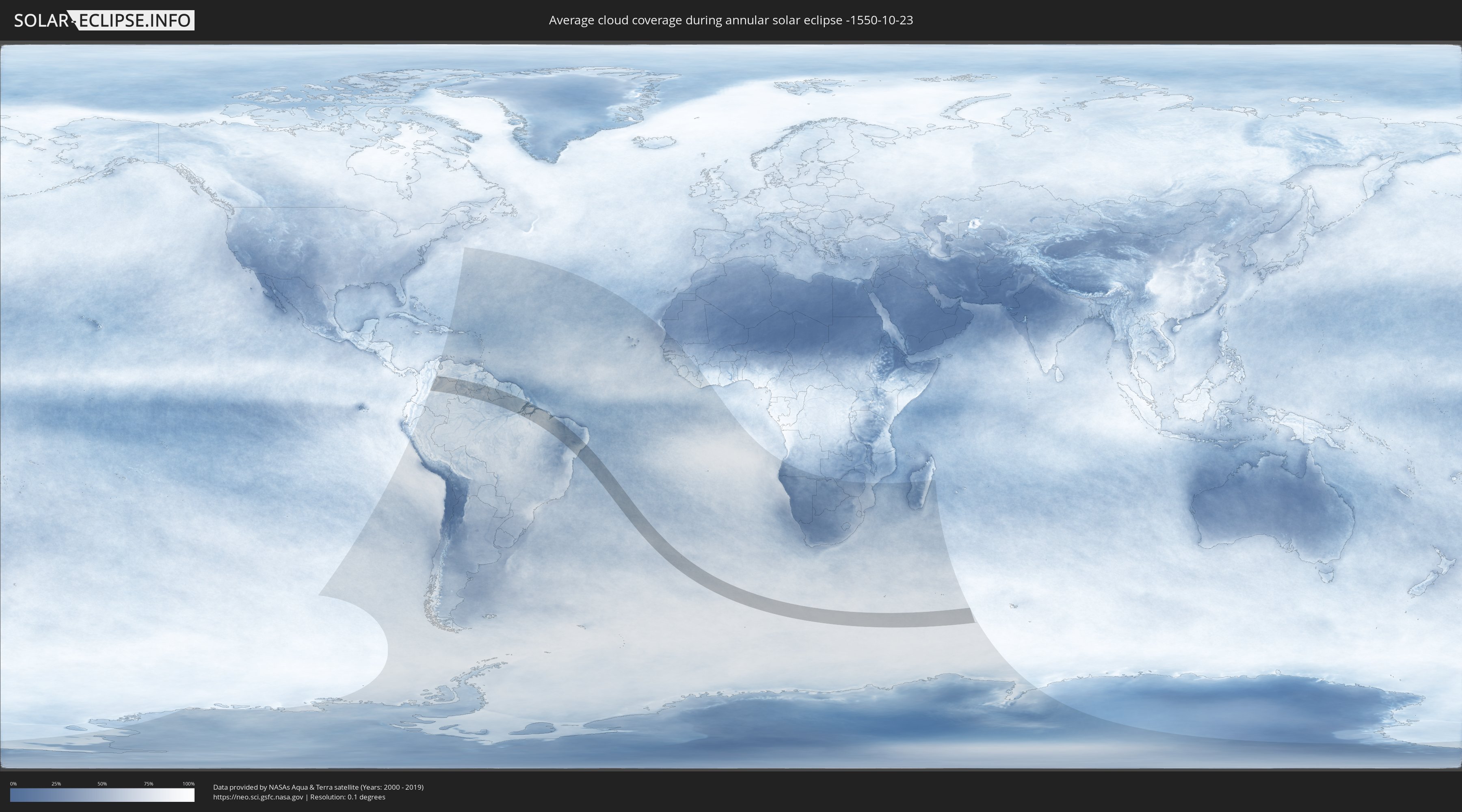
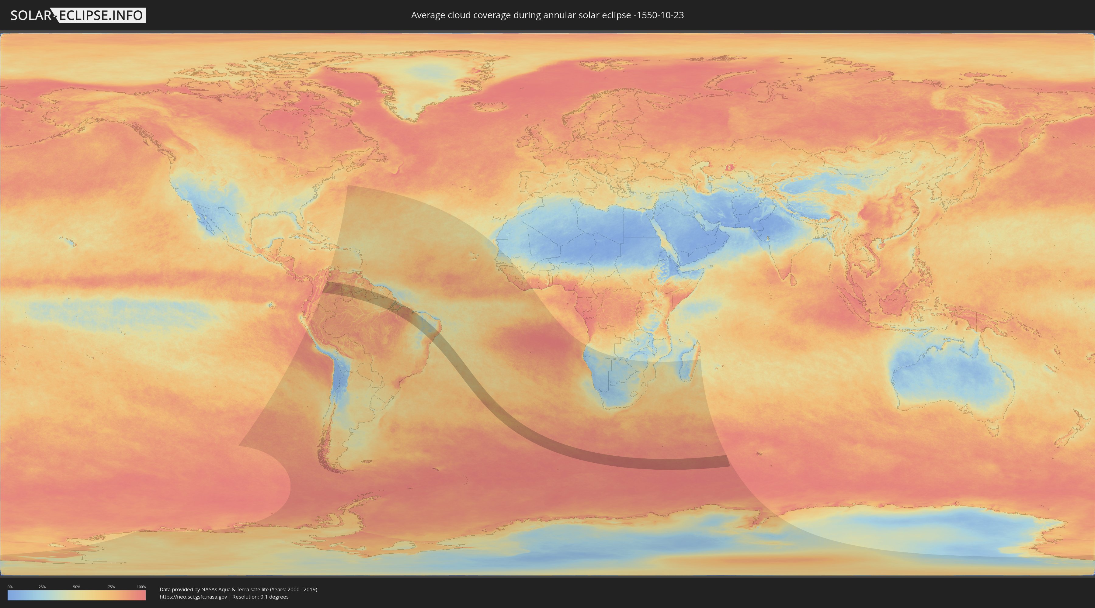
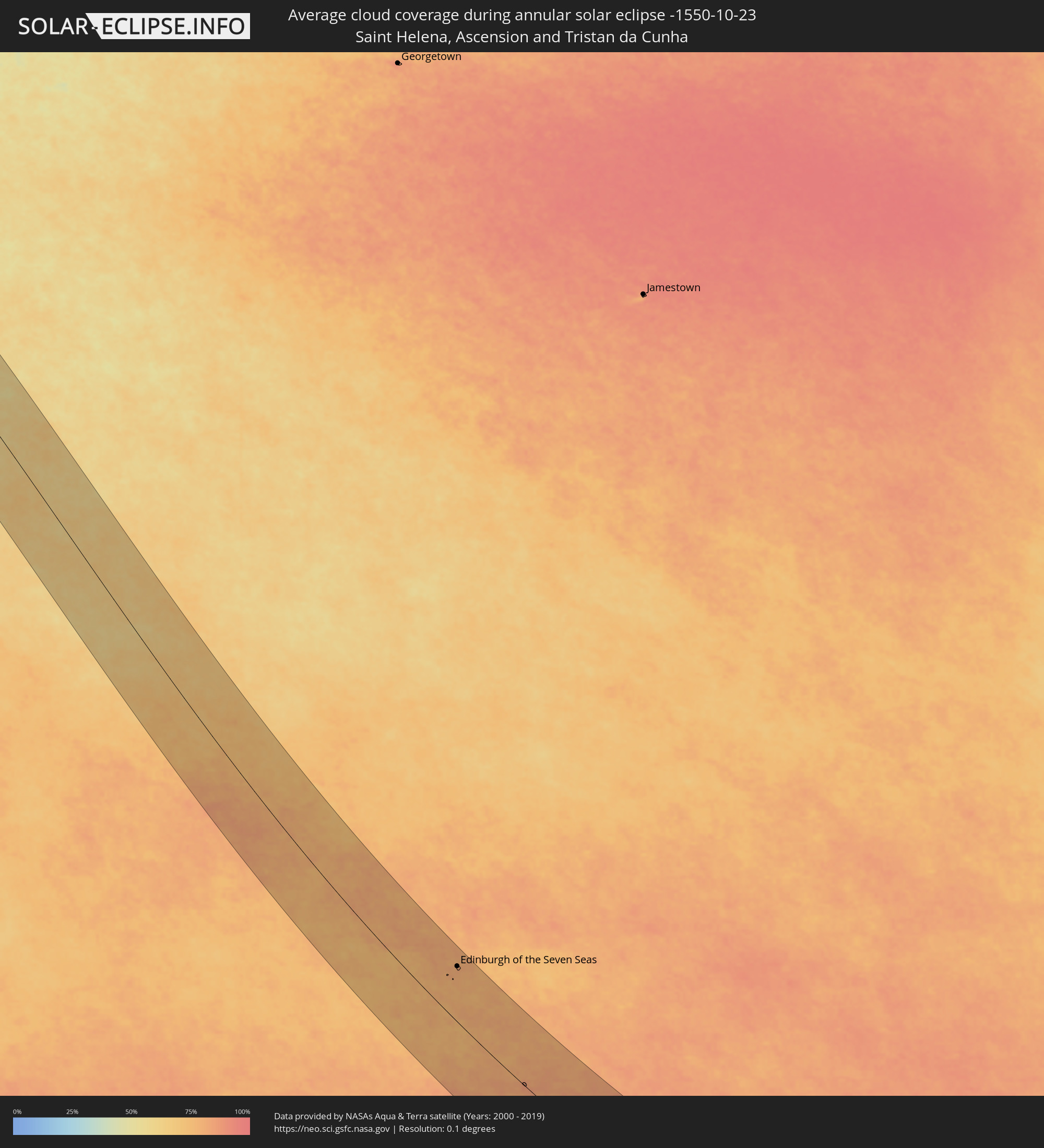
How will be the weather during the annular solar eclipse on 10/23/-1550?
Where is the best place to see the annular solar eclipse of 10/23/-1550?
The following maps show the average cloud coverage for the day of the annular solar eclipse.
With the help of these maps, it is possible to find the place along the eclipse path, which has the best
chance of a cloudless sky.
Nevertheless, you should consider local circumstances and inform about the weather of your chosen
observation site.
The data is provided by NASAs satellites
AQUA and TERRA.
The cloud maps are averaged over a period of 19 years (2000 - 2019).
Detailed country maps
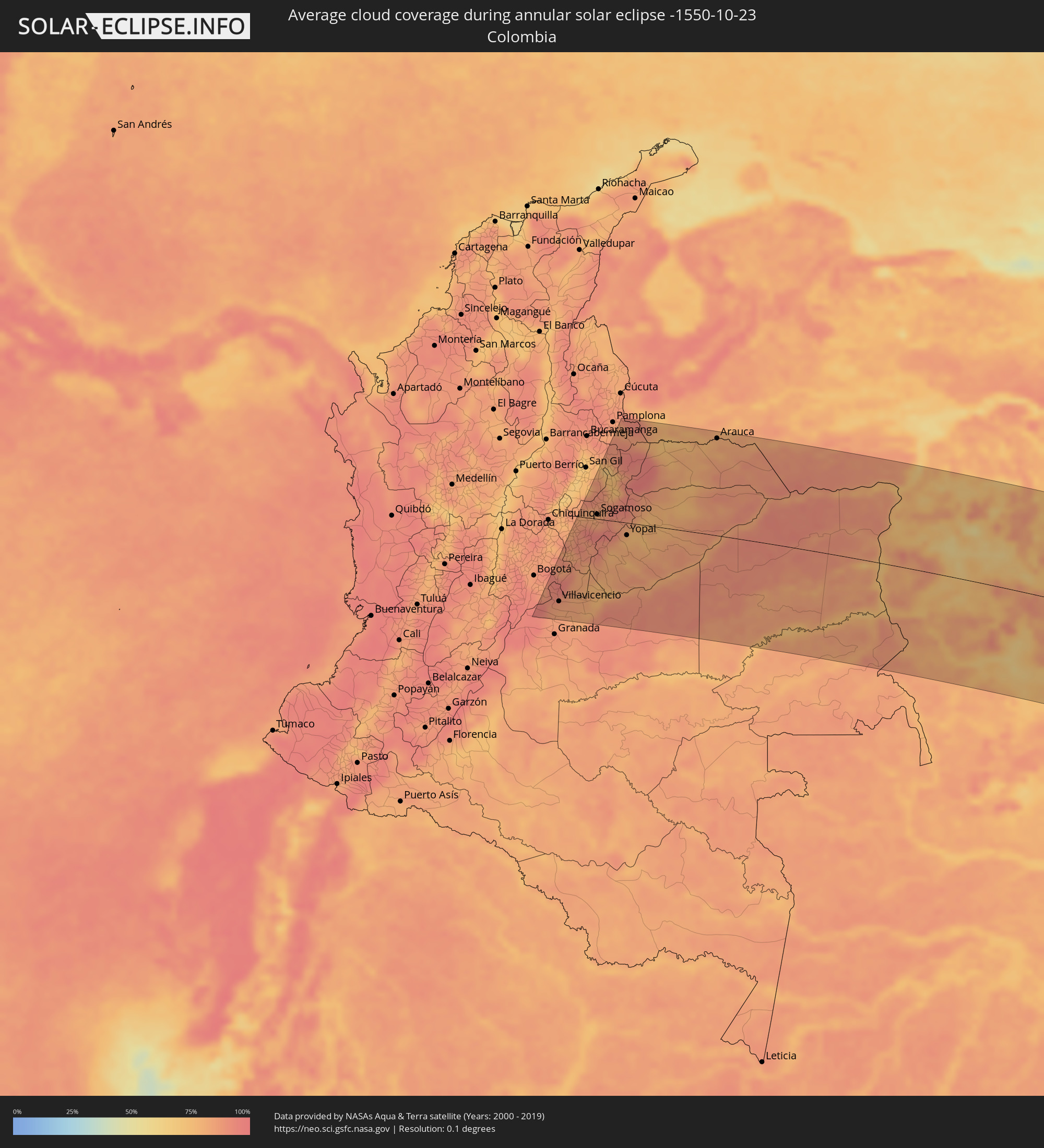 Colombia
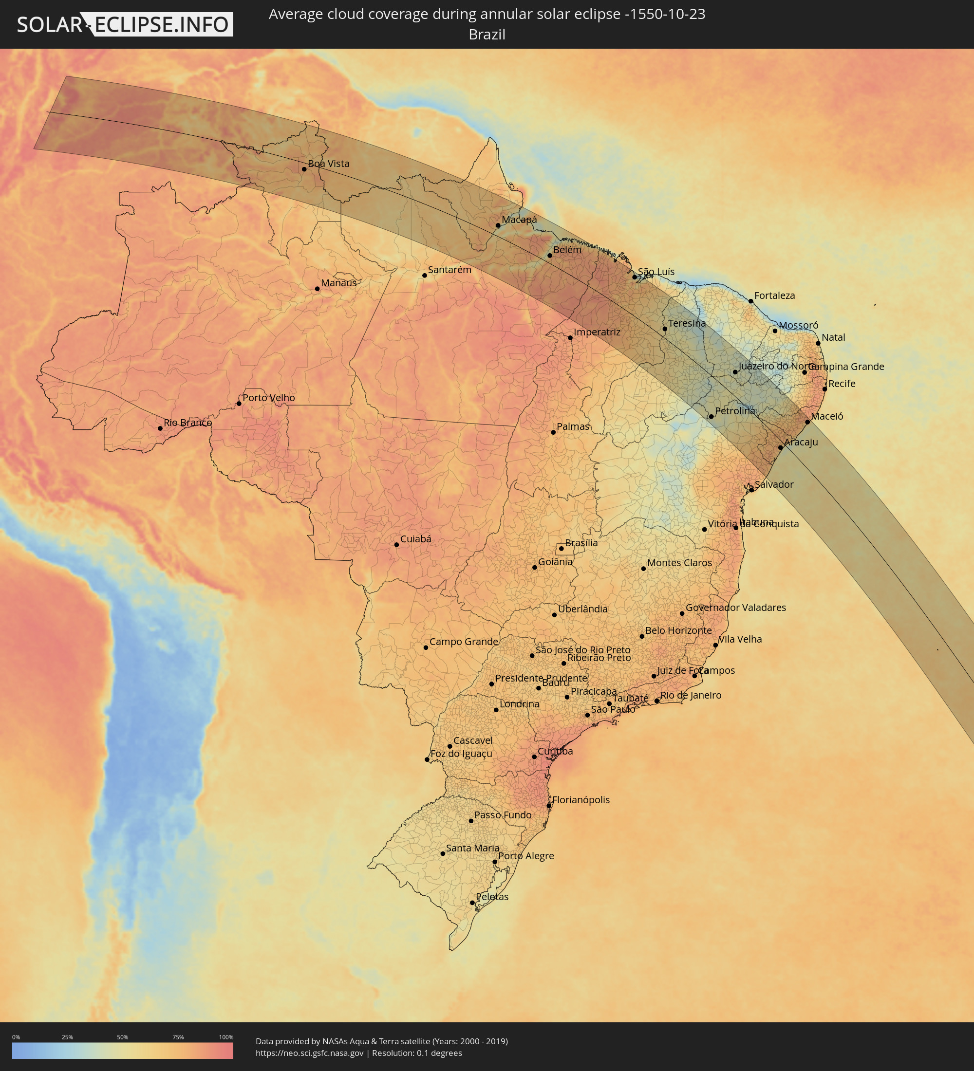 Brazil
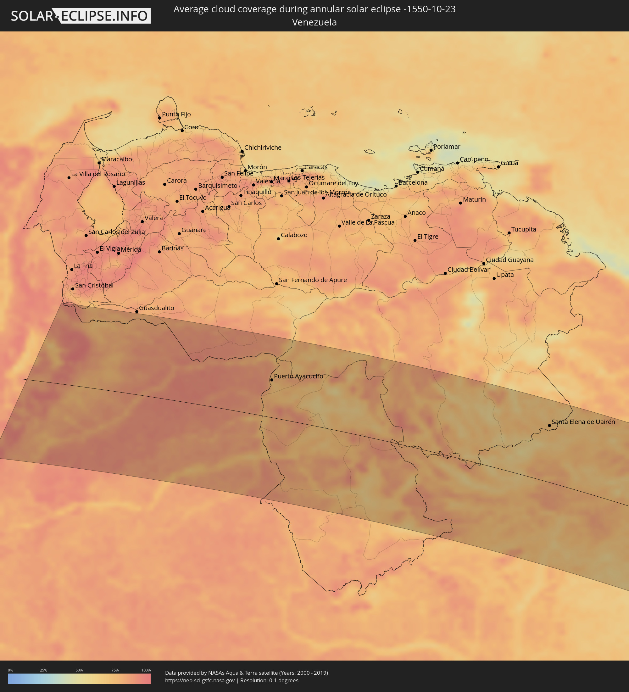 Venezuela
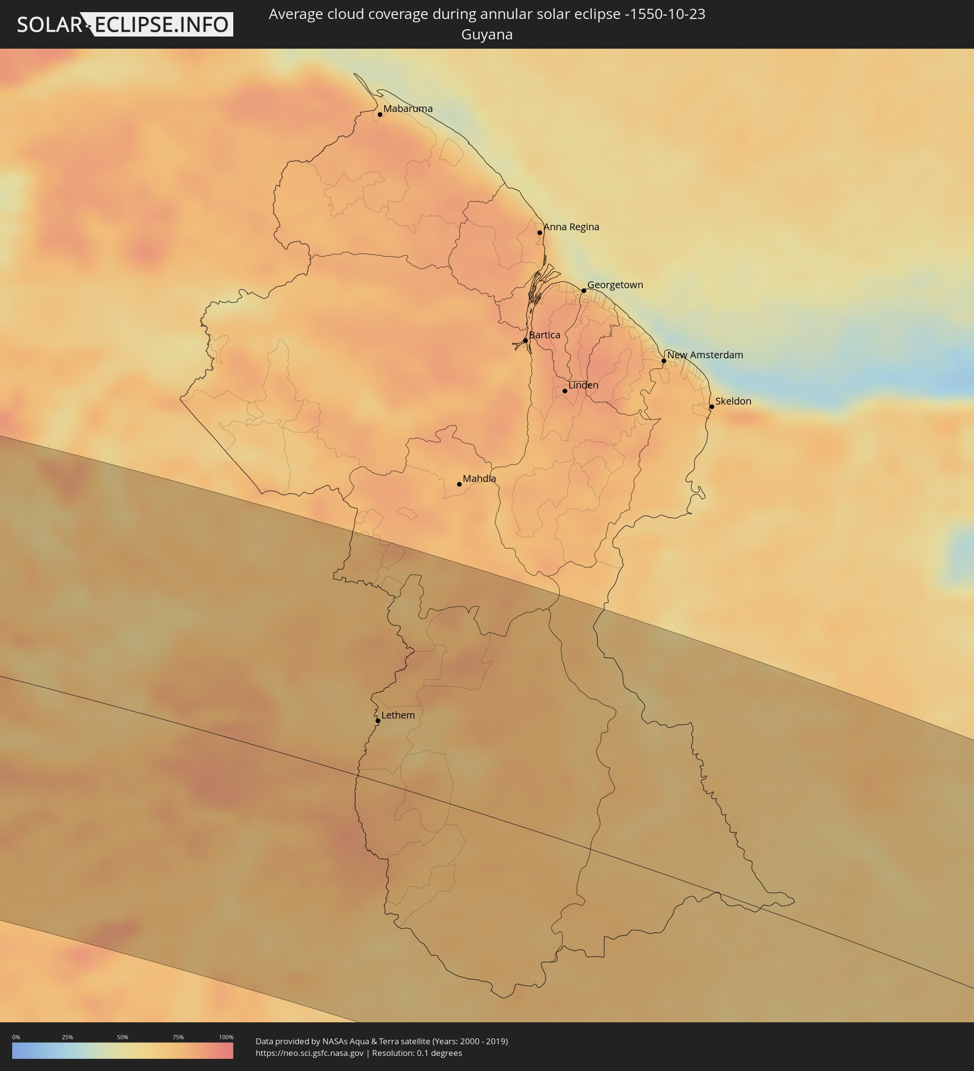 Guyana
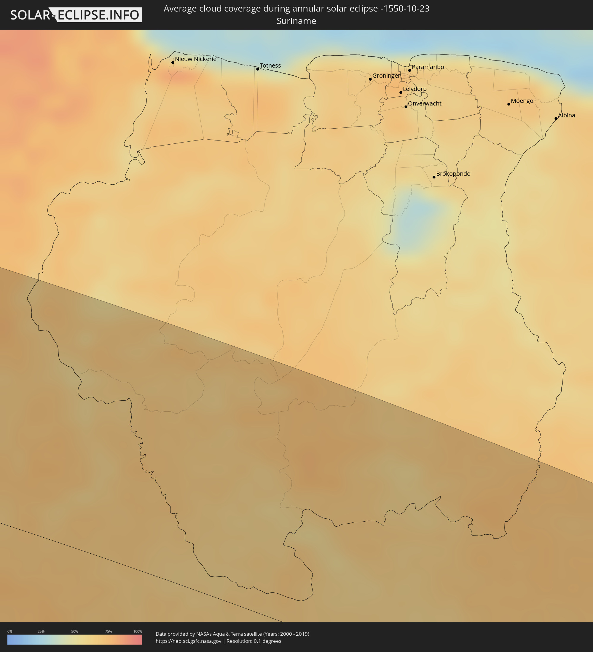 Suriname
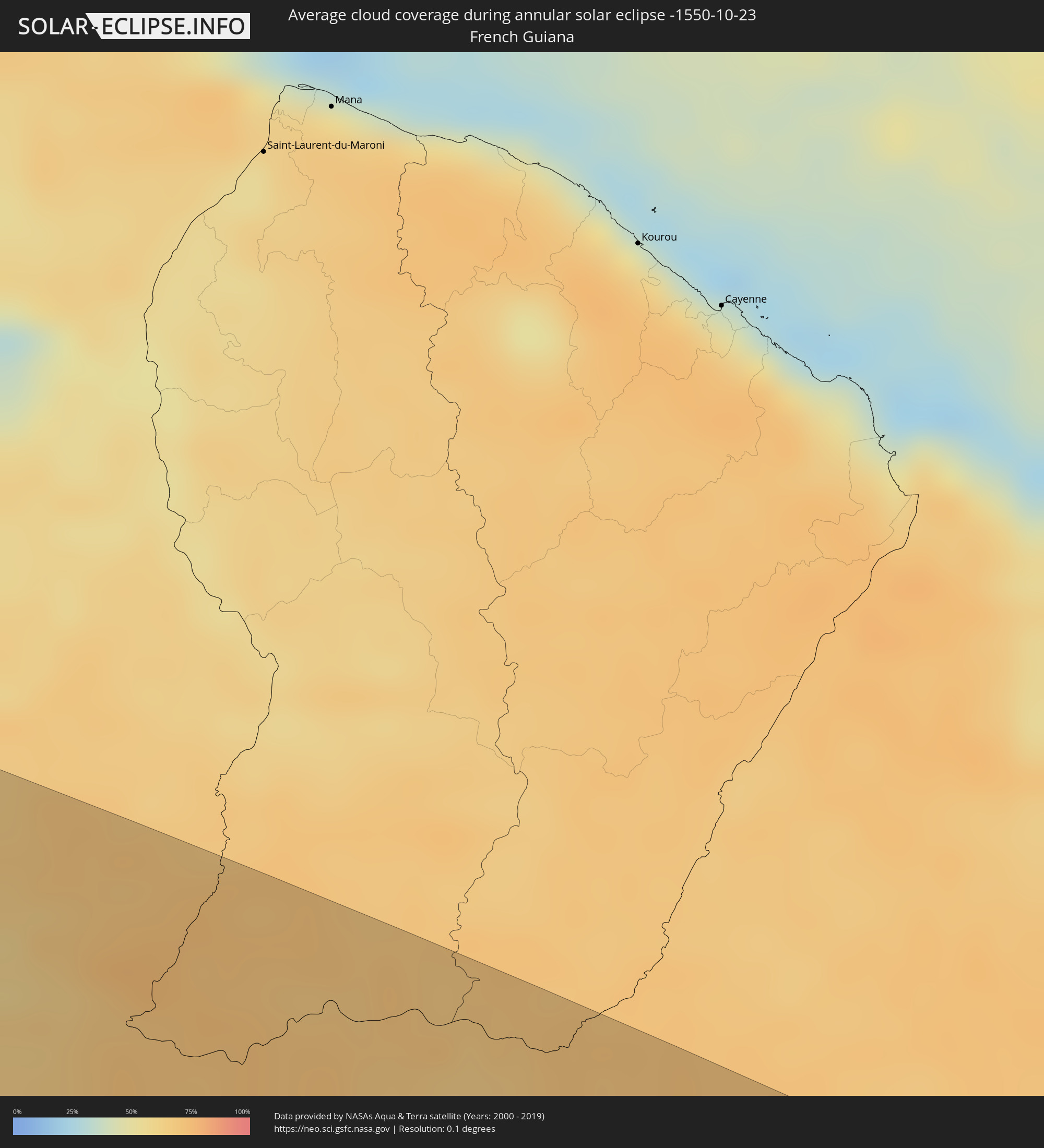 French Guiana
 Saint Helena, Ascension and Tristan da Cunha
Cities inside the path of the eclipse
The following table shows all locations with a population of more than 5,000 inside the eclipse path. Cities which have more than 100,000 inhabitants are marked bold. A click at the locations opens a detailed map.
| City | Type | Eclipse duration | Local time of max. eclipse | Distance to central line | Ø Cloud coverage |
|
Guamal, Meta
|
annular | - | 05:54:11 UTC-04:56 | 205 km | 86% |
|
Acacías, Meta
|
annular | - | 05:54:05 UTC-04:56 | 193 km | 86% |
|
Villavicencio, Meta
|
annular | - | 05:53:55 UTC-04:56 | 174 km | 84% |
|
Restrepo, Meta
|
annular | - | 05:53:49 UTC-04:56 | 160 km | 89% |
|
Cumaral, Meta
|
annular | - | 05:53:47 UTC-04:56 | 158 km | 86% |
|
Guateque, Boyacá
|
annular | - | 05:53:07 UTC-04:56 | 76 km | 85% |
|
Tunja, Boyacá
|
annular | - | 05:52:38 UTC-04:56 | 17 km | 82% |
|
Garagoa, Boyacá
|
annular | - | 05:53:02 UTC-04:56 | 67 km | 81% |
|
Ramiriquí, Boyacá
|
annular | - | 05:52:45 UTC-04:56 | 31 km | 89% |
|
Paipa, Boyacá
|
annular | - | 05:52:23 UTC-04:56 | 14 km | 81% |
|
Pesca, Boyacá
|
annular | - | 05:52:35 UTC-04:56 | 11 km | 88% |
|
Duitama, Boyacá
|
annular | - | 05:52:20 UTC-04:56 | 20 km | 80% |
|
Santa Rosa de Viterbo, Boyacá
|
annular | - | 05:52:17 UTC-04:56 | 26 km | 83% |
|
Puerto López, Meta
|
annular | - | 05:53:55 UTC-04:56 | 170 km | 79% |
|
Sogamoso, Boyacá
|
annular | - | 05:52:25 UTC-04:56 | 9 km | 85% |
|
Belén, Boyacá
|
annular | - | 05:52:11 UTC-04:56 | 40 km | 87% |
|
Monterrey, Casanare
|
annular | - | 05:53:11 UTC-04:56 | 83 km | 86% |
|
Aquitania, Boyacá
|
annular | - | 05:52:36 UTC-04:56 | 12 km | 92% |
|
Málaga, Santander
|
annular | - | 05:51:33 UTC-04:56 | 121 km | 77% |
|
Soatá, Boyacá
|
annular | - | 05:51:51 UTC-04:56 | 81 km | 74% |
|
Aguazul, Casanare
|
annular | - | 05:52:53 UTC-04:56 | 45 km | 81% |
|
Toledo, Norte de Santander
|
annular | - | 05:51:00 UTC-04:56 | 192 km | 81% |
|
Yopal, Casanare
|
annular | - | 05:52:43 UTC-04:56 | 25 km | 76% |
|
Maní, Casanare
|
annular | - | 05:53:12 UTC-04:56 | 81 km | 79% |
|
Puerto Gaitán, Meta
|
annular | - | 05:53:39 UTC-04:56 | 133 km | 87% |
|
Villanueva, Casanare
|
annular | - | 05:52:44 UTC-04:56 | 24 km | 77% |
|
Tame, Arauca
|
annular | - | 05:51:40 UTC-04:56 | 109 km | 83% |
|
Arauquita, Arauca
|
annular | - | 05:51:09 UTC-04:56 | 176 km | 77% |
|
Arauca, Arauca
|
annular | - | 05:51:03 UTC-04:56 | 193 km | 79% |
|
Inírida, Guainía
|
annular | - | 05:54:09 UTC-04:56 | 109 km | 78% |
|
Puerto Ayacucho, Amazonas
|
annular | - | 06:20:58 UTC-04:27 | 95 km | 73% |
|
Puerto Carreño, Vichada
|
annular | - | 05:51:52 UTC-04:56 | 155 km | 72% |
|
Santa Elena de Uairén, Bolívar
|
annular | - | 06:23:06 UTC-04:27 | 141 km | 72% |
|
Boa Vista, Roraima
|
annular | - | 06:50:19 UTC-04:02 | 37 km | 76% |
|
Lethem, Upper Takutu-Upper Essequibo
|
annular | - | 06:59:55 UTC-03:52 | 51 km | 65% |
|
Santana, Amapá
|
annular | - | 11:01:37 UTC+00:00 | 38 km | 46% |
|
Macapá, Amapá
|
annular | - | 08:27:32 UTC-02:34 | 54 km | 48% |
|
Breves, Pará
|
annular | - | 07:50:46 UTC-03:13 | 89 km | 69% |
|
Cametá, Pará
|
annular | - | 07:52:27 UTC-03:13 | 93 km | 67% |
|
Abaetetuba, Pará
|
annular | - | 07:52:02 UTC-03:13 | 9 km | 75% |
|
Belém, Pará
|
annular | - | 07:51:53 UTC-03:13 | 37 km | 74% |
|
Ananindeua, Pará
|
annular | - | 07:51:51 UTC-03:13 | 52 km | 80% |
|
Castanhal, Pará
|
annular | - | 07:52:04 UTC-03:13 | 84 km | 83% |
|
Paragominas, Pará
|
annular | - | 07:55:21 UTC-03:13 | 53 km | 88% |
|
Capanema, Pará
|
annular | - | 07:52:31 UTC-03:13 | 134 km | 86% |
|
Bragança, Pará
|
annular | - | 07:52:36 UTC-03:13 | 171 km | 83% |
|
Santa Inês, Maranhão
|
annular | - | 08:38:26 UTC-02:34 | 5 km | 80% |
|
Barra do Corda, Maranhão
|
annular | - | 08:42:05 UTC-02:34 | 155 km | 79% |
|
Bacabal, Maranhão
|
annular | - | 08:40:11 UTC-02:34 | 16 km | 78% |
|
São Luís, Maranhão
|
annular | - | 08:37:20 UTC-02:34 | 177 km | 71% |
|
Codó, Maranhão
|
annular | - | 08:41:23 UTC-02:34 | 26 km | 63% |
|
Caxias, Maranhão
|
annular | - | 08:42:42 UTC-02:34 | 24 km | 62% |
|
Floriano, Piauí
|
annular | - | 08:46:53 UTC-02:34 | 123 km | 60% |
|
Teresina, Piauí
|
annular | - | 08:43:44 UTC-02:34 | 40 km | 52% |
|
Piripiri, Piauí
|
annular | - | 08:43:11 UTC-02:34 | 181 km | 44% |
|
Picos, Piauí
|
annular | - | 08:49:15 UTC-02:34 | 43 km | 48% |
|
Crateús, Ceará
|
annular | - | 08:46:11 UTC-02:34 | 176 km | 42% |
|
Petrolina, Pernambuco
|
annular | - | 09:09:47 UTC-02:19 | 169 km | 41% |
|
Juazeiro do Norte, Ceará
|
annular | - | 08:52:02 UTC-02:34 | 100 km | 44% |
|
Iguatu, Ceará
|
annular | - | 08:50:13 UTC-02:34 | 173 km | 44% |
|
Cajazeiras, Paraíba
|
annular | - | 08:52:14 UTC-02:34 | 182 km | 36% |
|
Serra Talhada, Pernambuco
|
annular | - | 09:09:22 UTC-02:19 | 110 km | 40% |
|
Paulo Afonso, Bahia
|
annular | - | 08:58:14 UTC-02:34 | 2 km | 51% |
|
Lagarto, Sergipe
|
annular | - | 09:02:26 UTC-02:34 | 74 km | 78% |
|
Estância, Sergipe
|
annular | - | 09:03:32 UTC-02:34 | 84 km | 63% |
|
Itabaiana, Sergipe
|
annular | - | 09:02:11 UTC-02:34 | 38 km | 77% |
|
São Cristóvão, Sergipe
|
annular | - | 09:03:15 UTC-02:34 | 46 km | 61% |
|
Aracaju, Sergipe
|
annular | - | 09:03:11 UTC-02:34 | 28 km | 60% |
|
Arcoverde, Pernambuco
|
annular | - | 09:11:52 UTC-02:19 | 170 km | 43% |
|
Arapiraca, Alagoas
|
annular | - | 09:01:02 UTC-02:34 | 95 km | 75% |
|
Garanhuns, Pernambuco
|
annular | - | 09:13:38 UTC-02:19 | 176 km | 68% |
|
Marechal Deodoro, Alagoas
|
annular | - | 09:01:56 UTC-02:34 | 158 km | 56% |
|
Rio Largo, Alagoas
|
annular | - | 09:01:27 UTC-02:34 | 179 km | 76% |
|
Maceió, Alagoas
|
annular | - | 09:02:03 UTC-02:34 | 174 km | 49% |
|
Edinburgh of the Seven Seas, Tristan da Cunha
|
annular | - | 13:04:56 UTC-00:16 | 122 km | 81% |