Total solar eclipse of 07/31/-1583
| Day of week: | Saturday |
| Maximum duration of eclipse: | 05m26s |
| Maximum width of eclipse path: | 230 km |
| Saros cycle: | 20 |
| Coverage: | 100% |
| Magnitude: | 1.0683 |
| Gamma: | 0.2452 |
Wo kann man die Sonnenfinsternis vom 07/31/-1583 sehen?
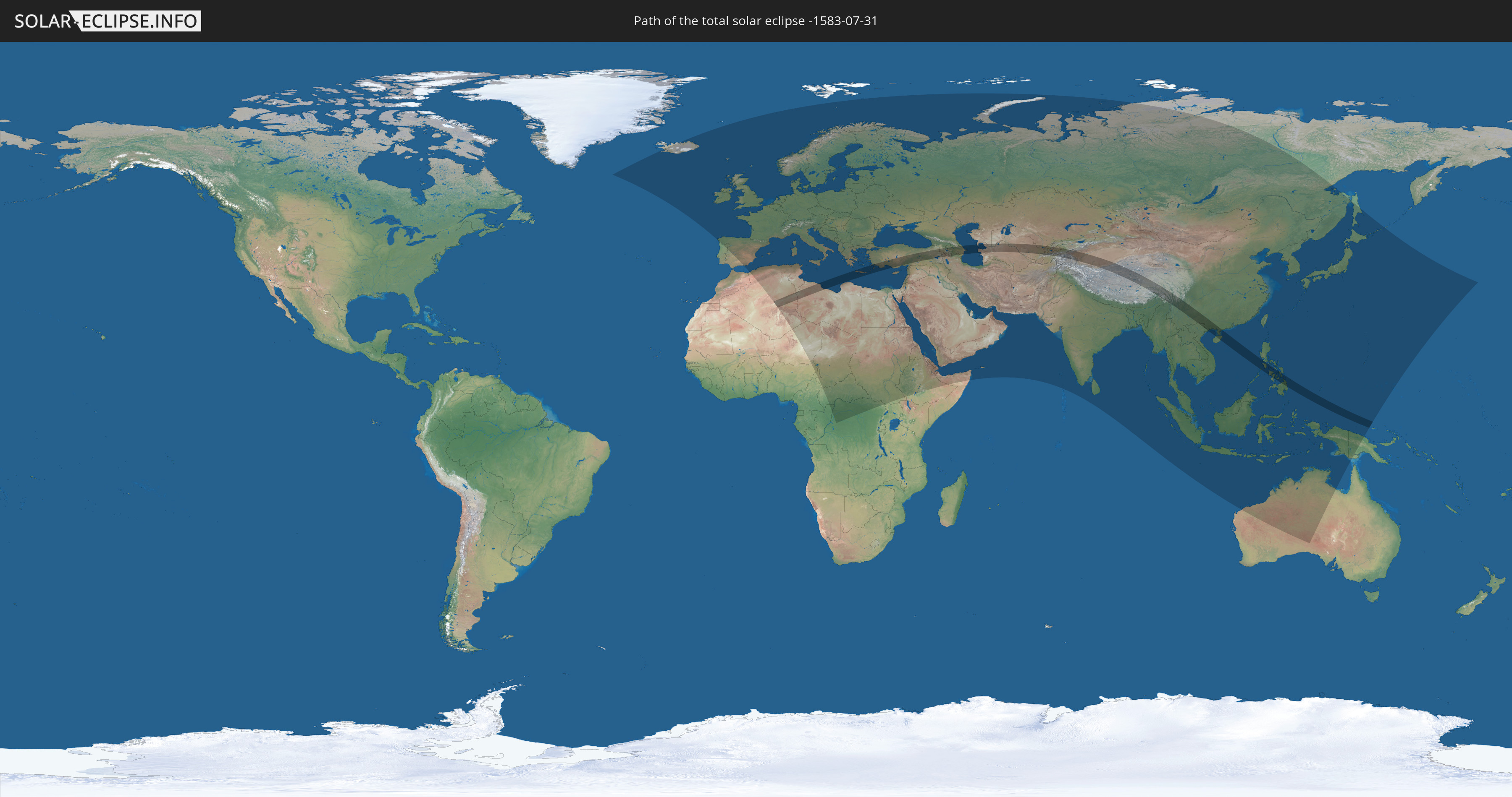
Die Sonnenfinsternis am 07/31/-1583 kann man in 123 Ländern als partielle Sonnenfinsternis beobachten.
Der Finsternispfad verläuft durch 22 Länder. Nur in diesen Ländern ist sie als total Sonnenfinsternis zu sehen.
In den folgenden Ländern ist die Sonnenfinsternis total zu sehen
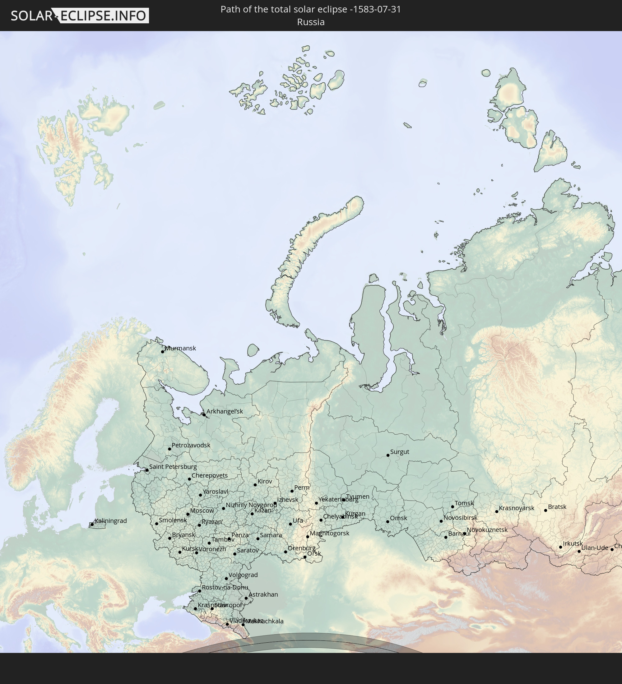 Russia
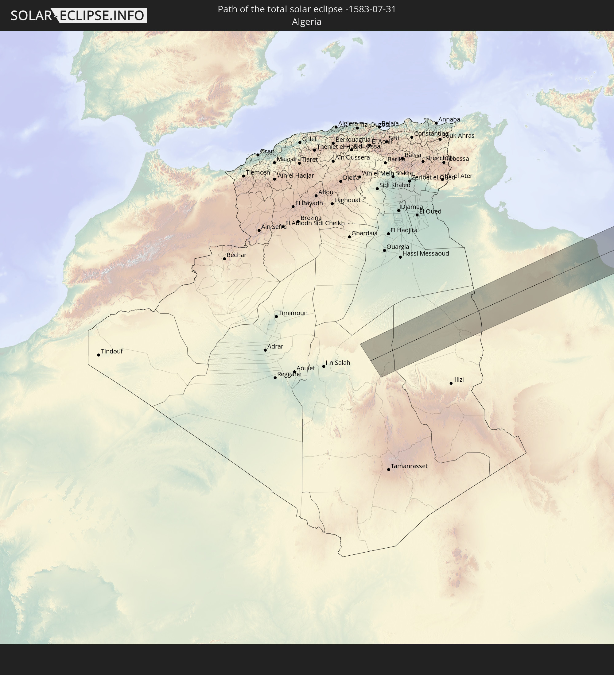 Algeria
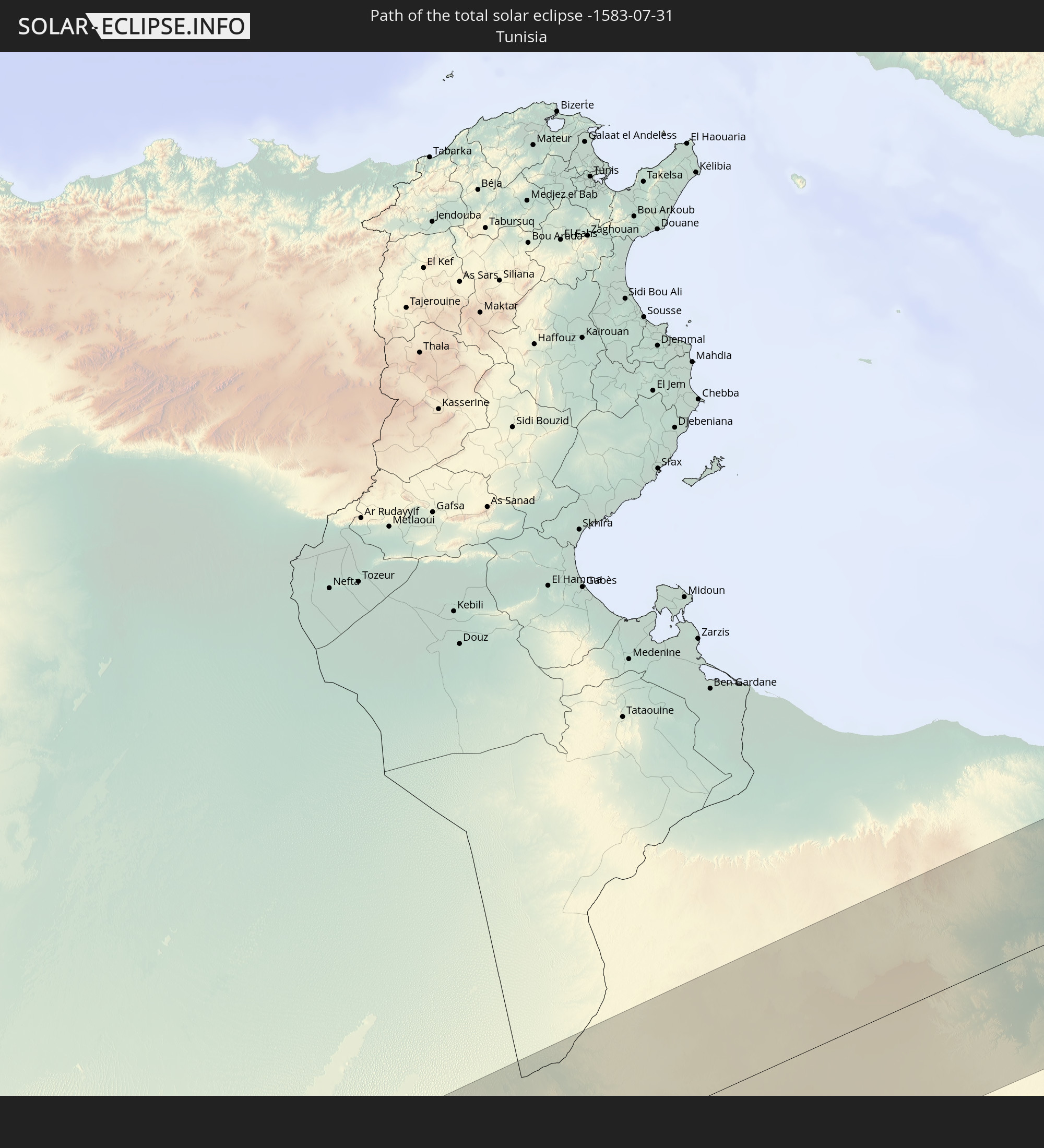 Tunisia
 Libya
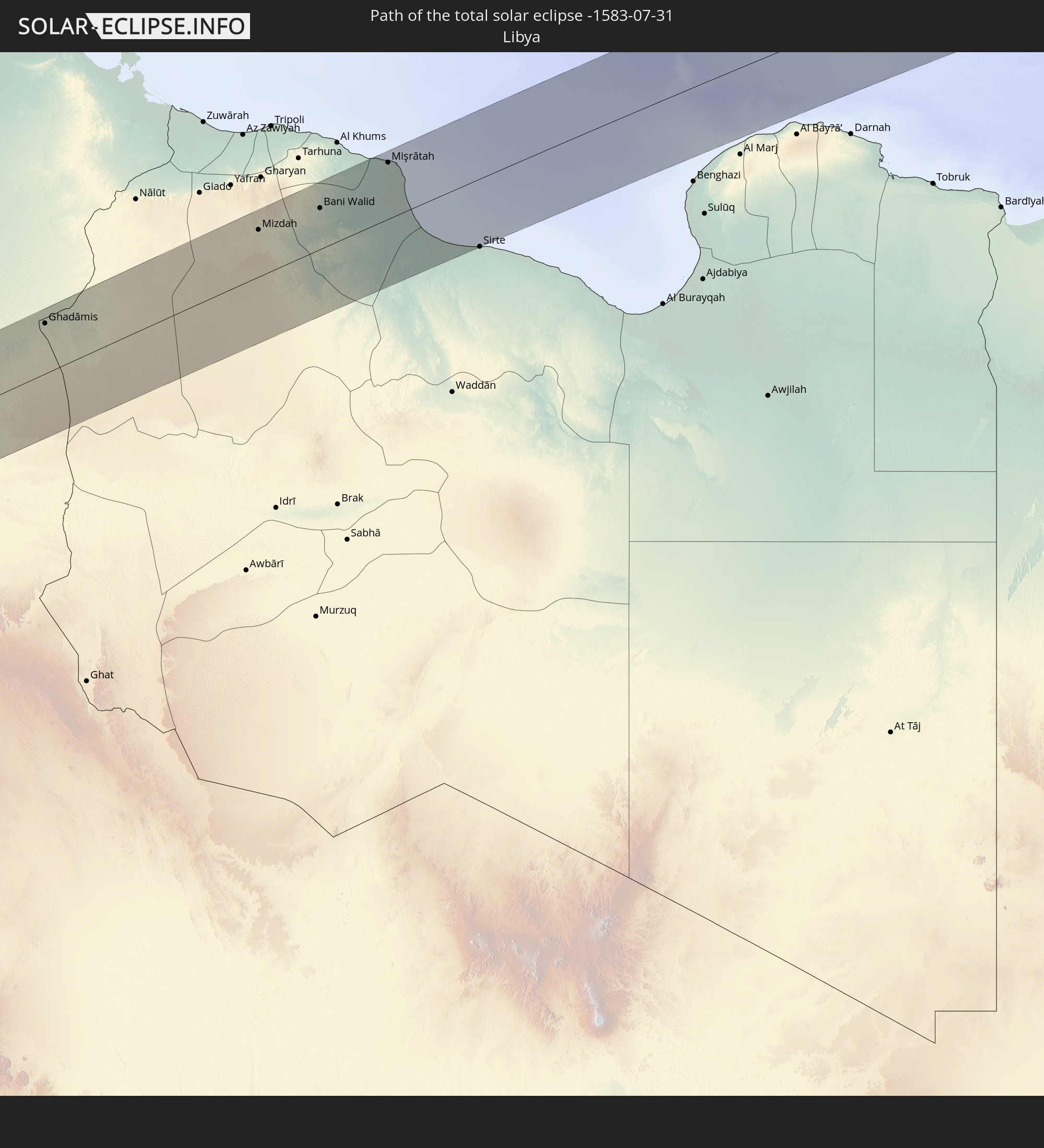
Libya
 Greece
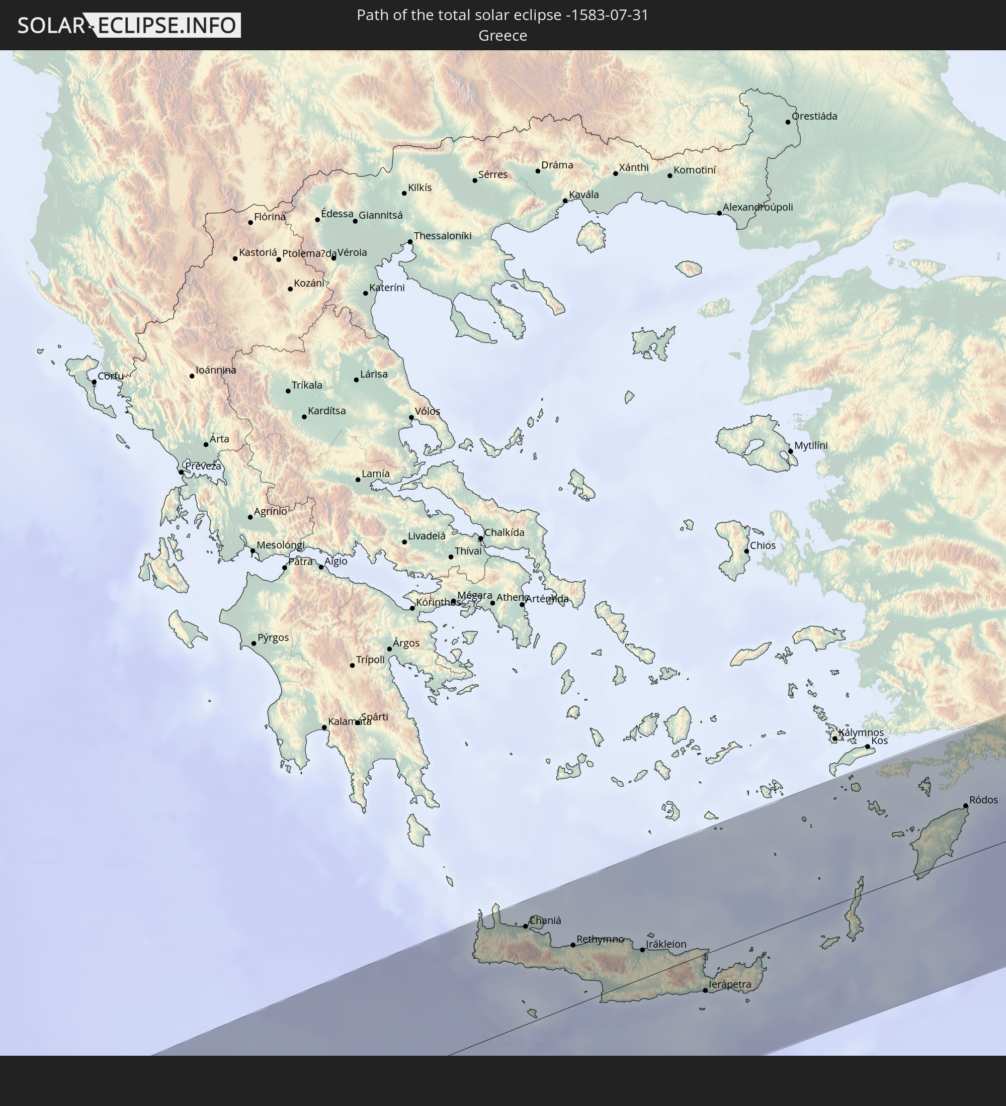
 Turkey
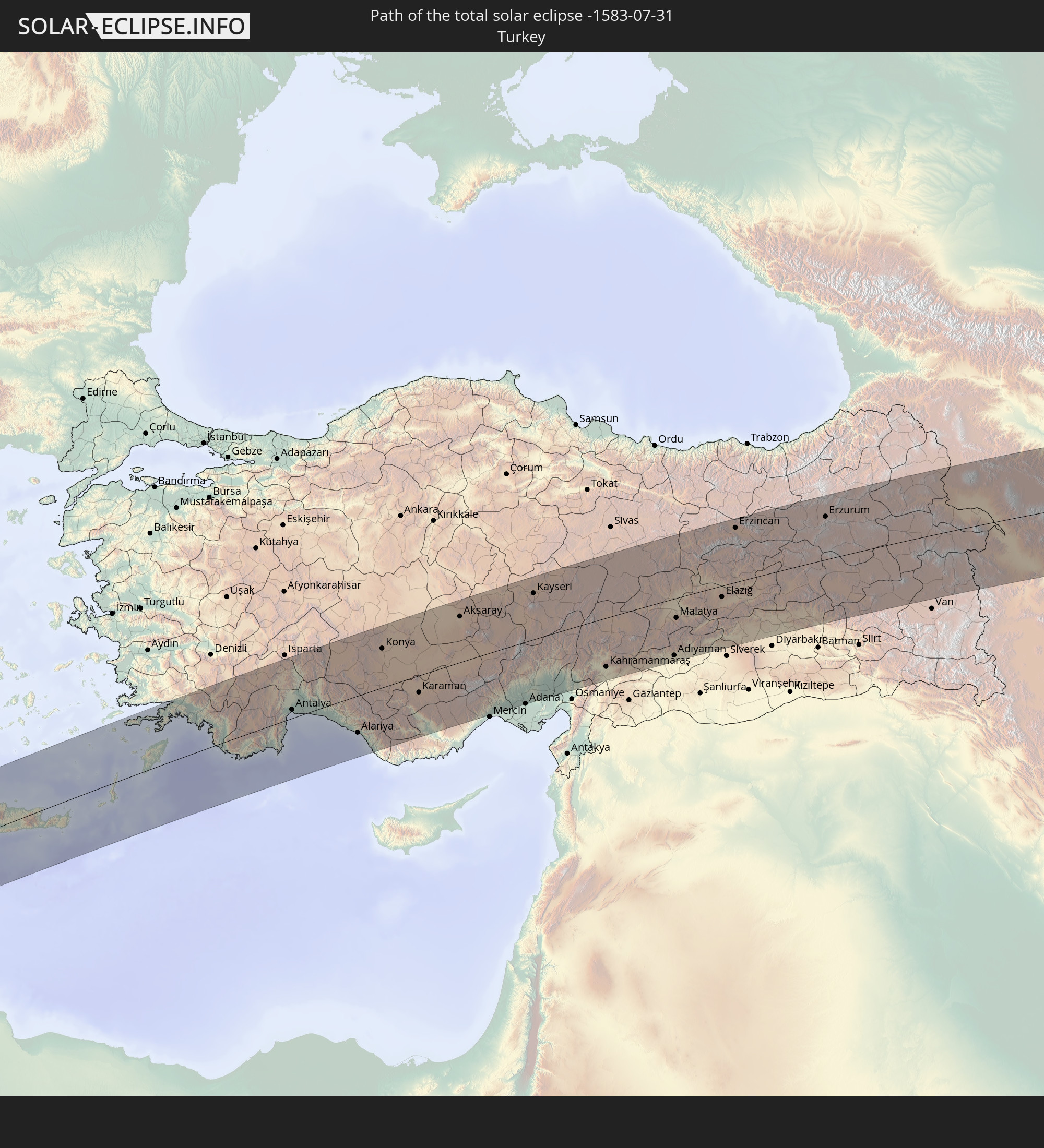
 Georgia
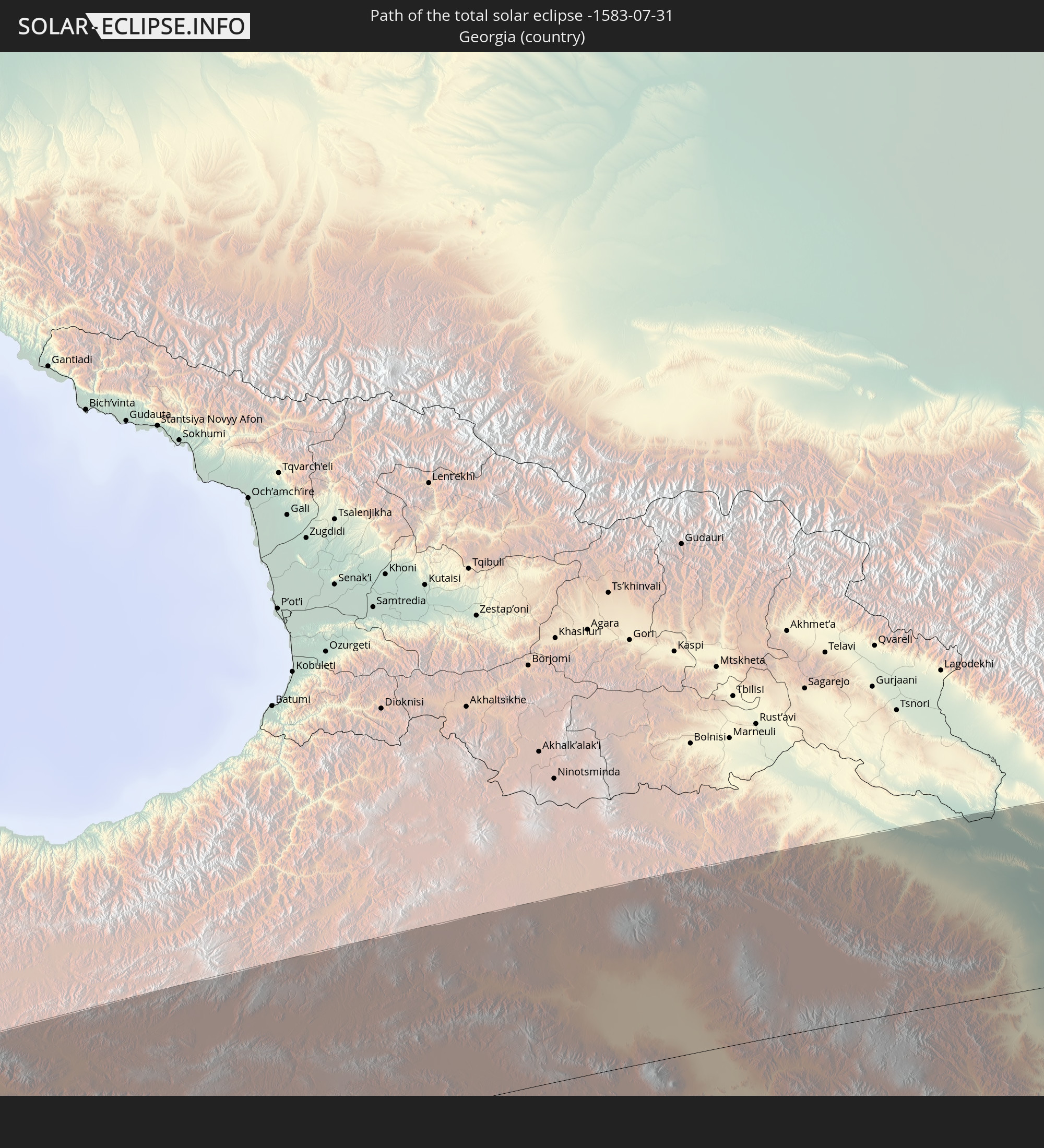
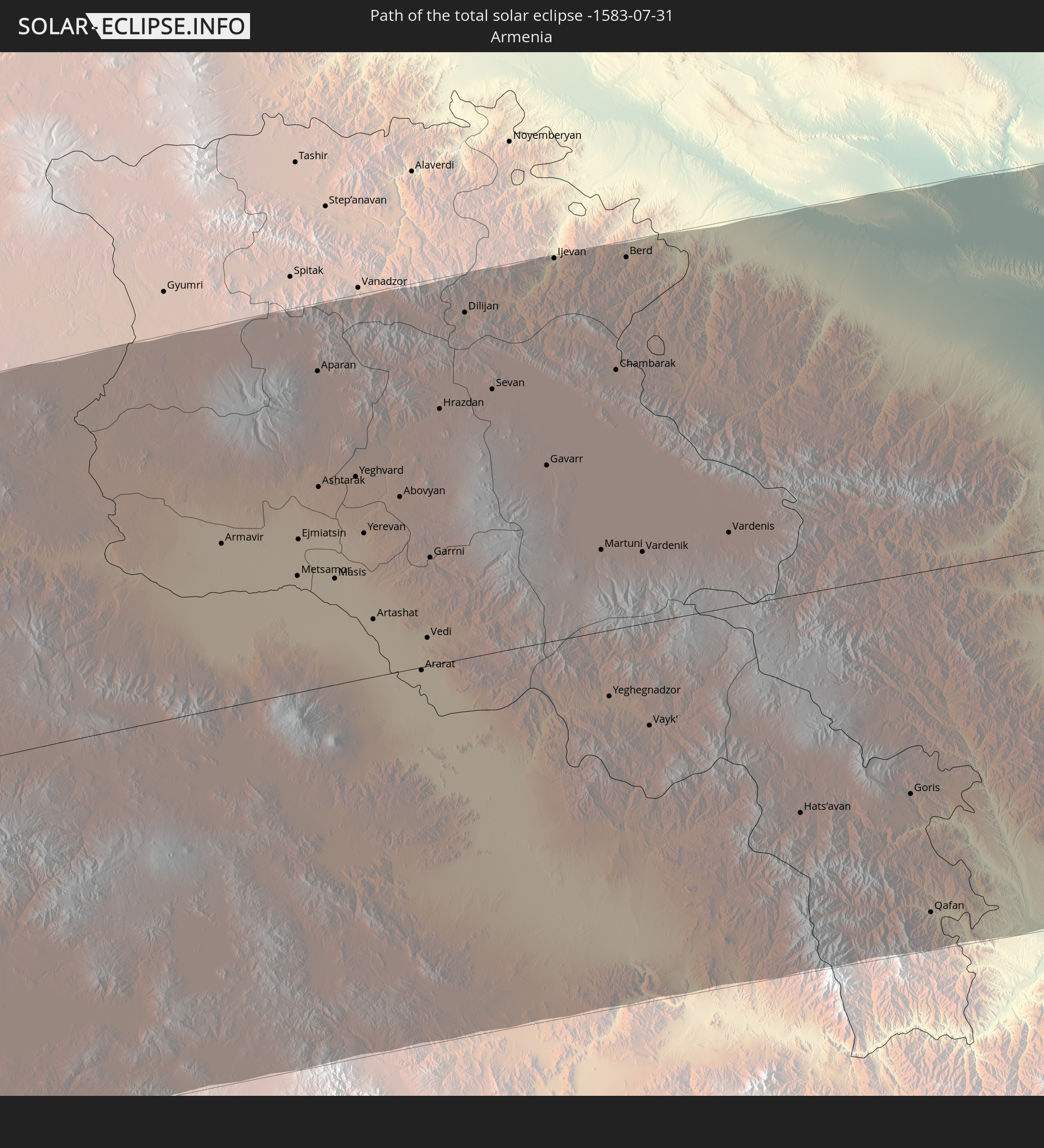 Armenia
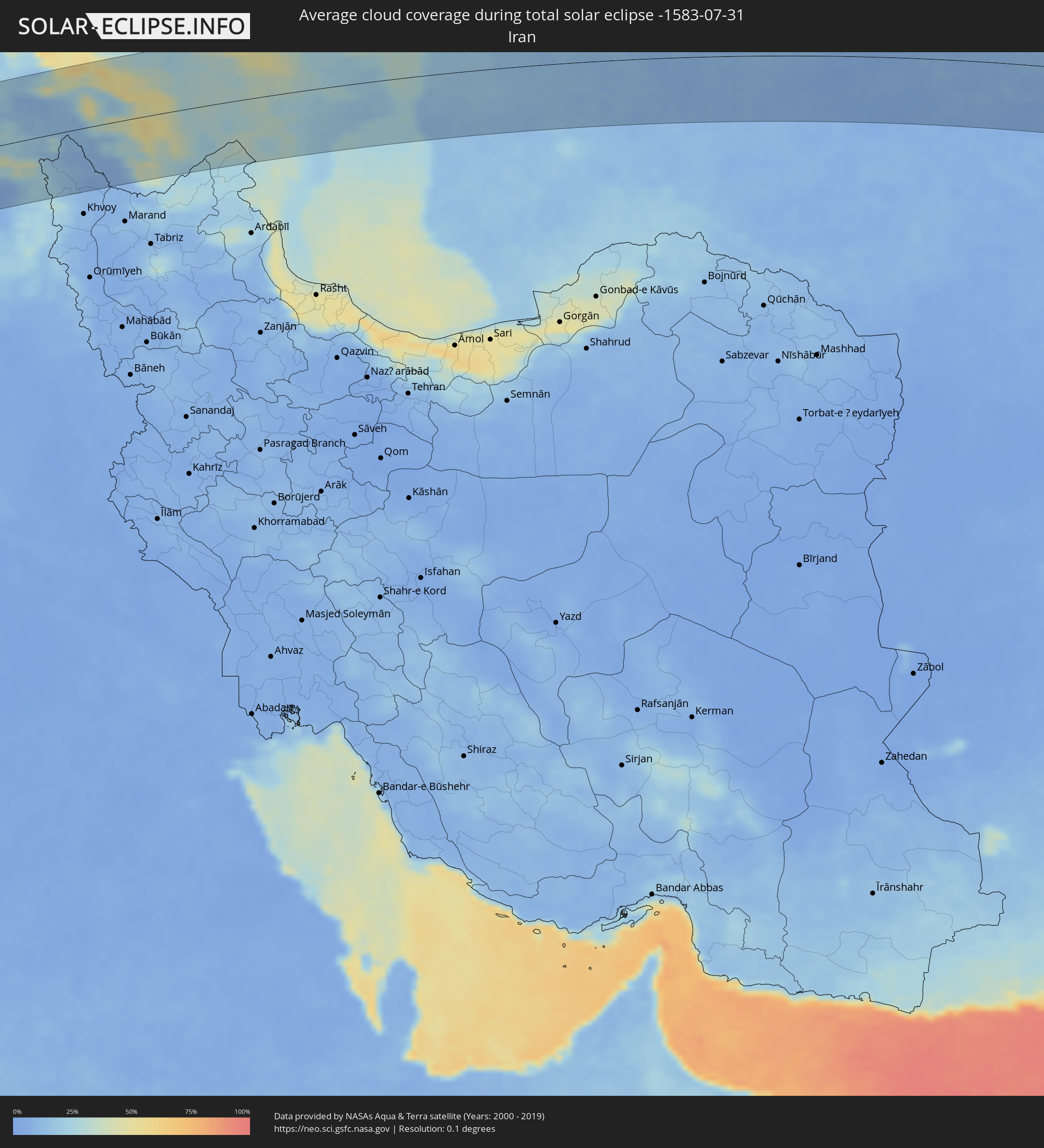
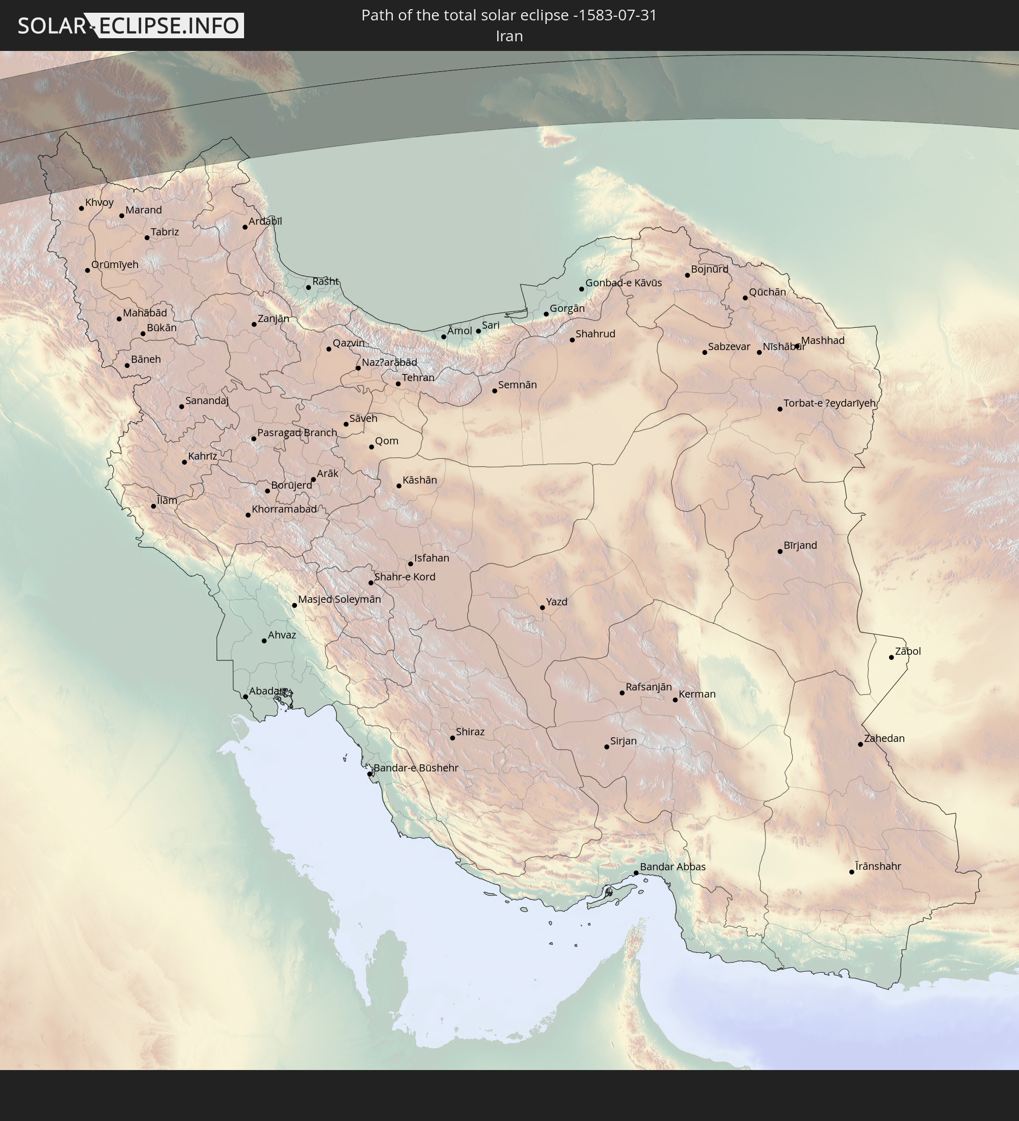 Iran
Iran
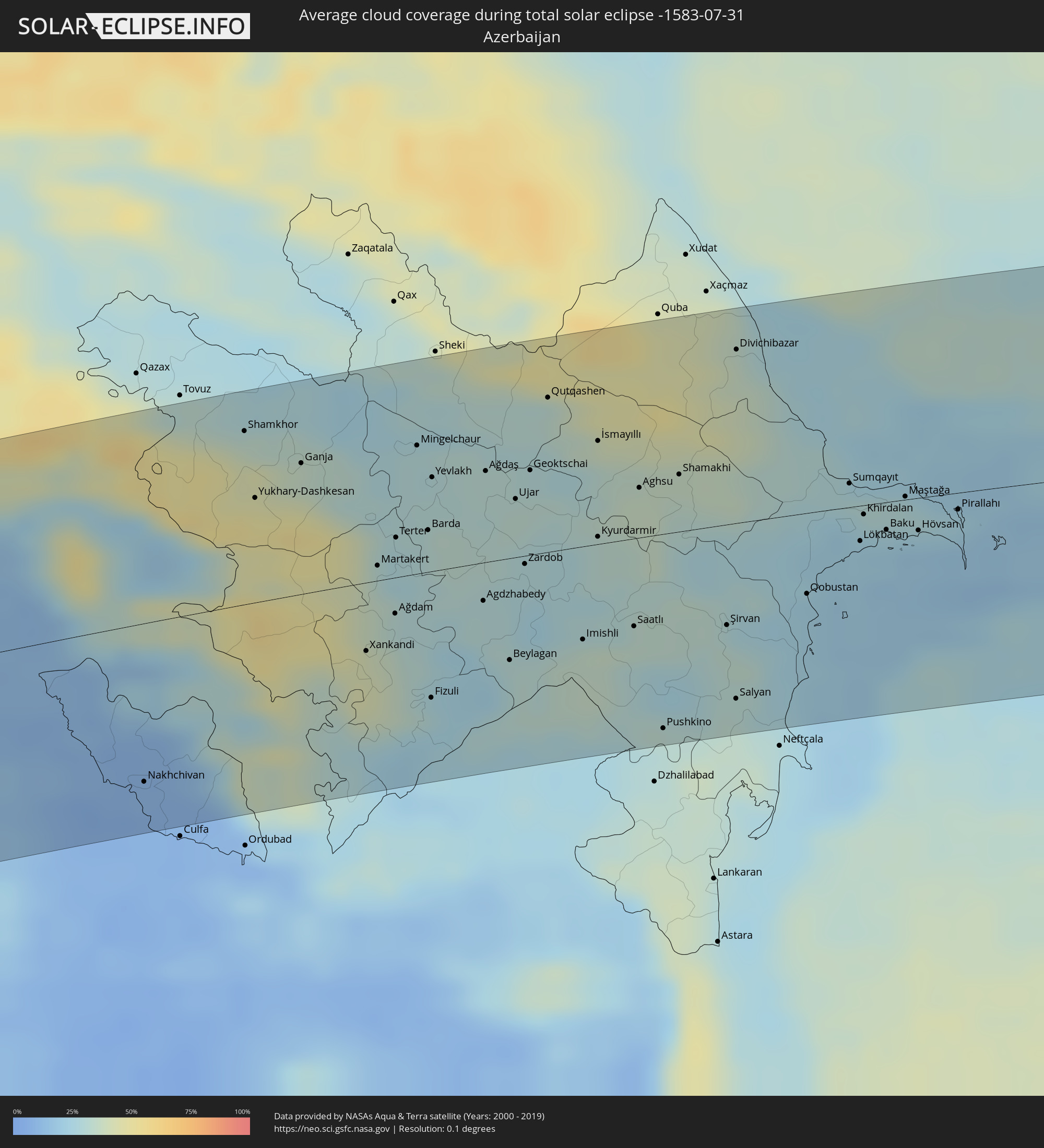
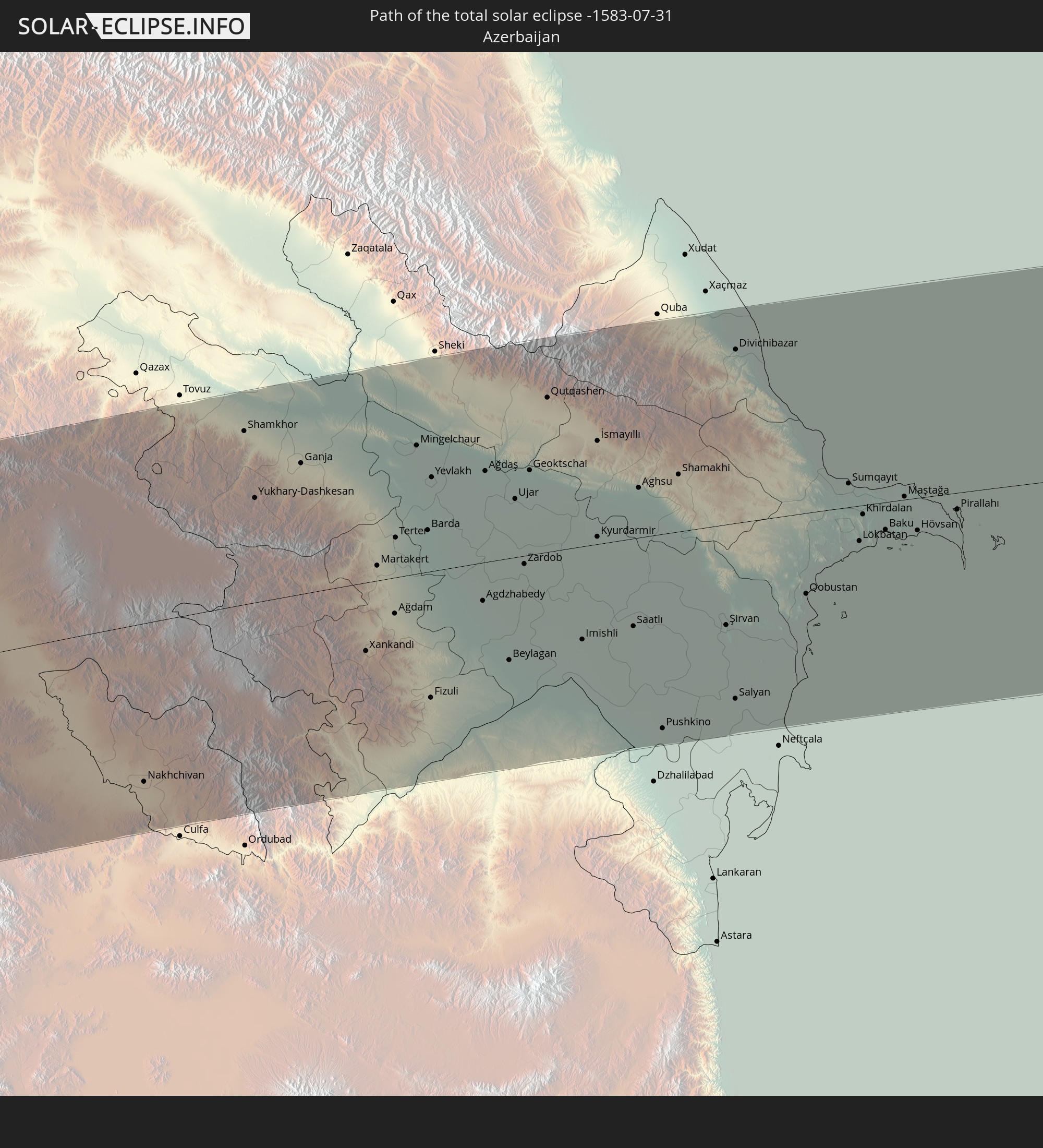 Azerbaijan
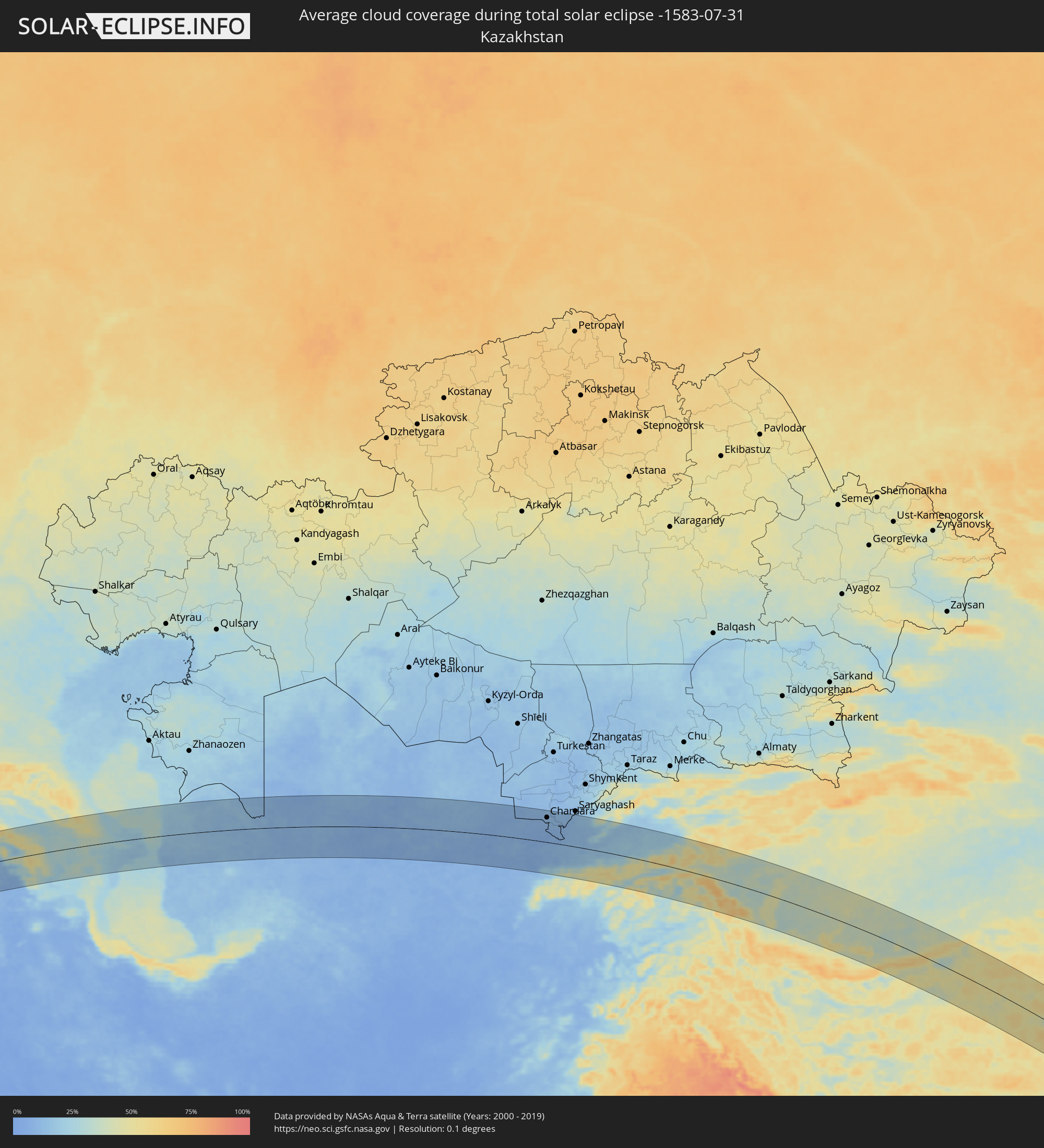
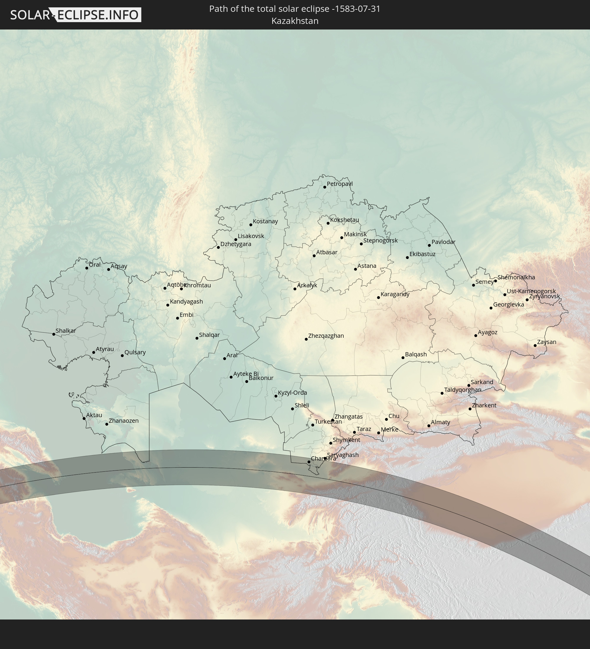 Kazakhstan
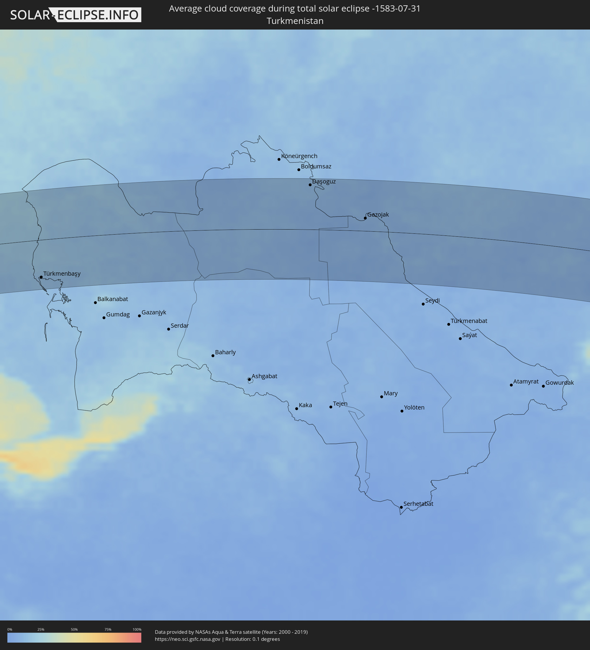
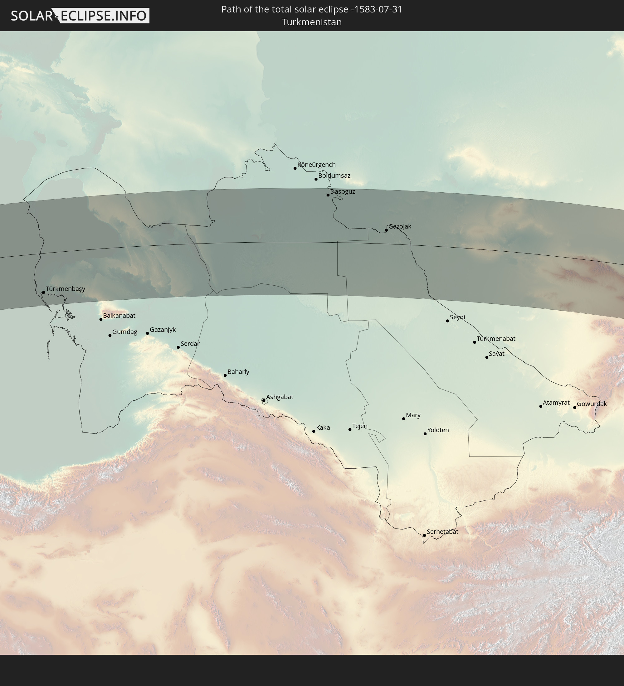 Turkmenistan
 Uzbekistan
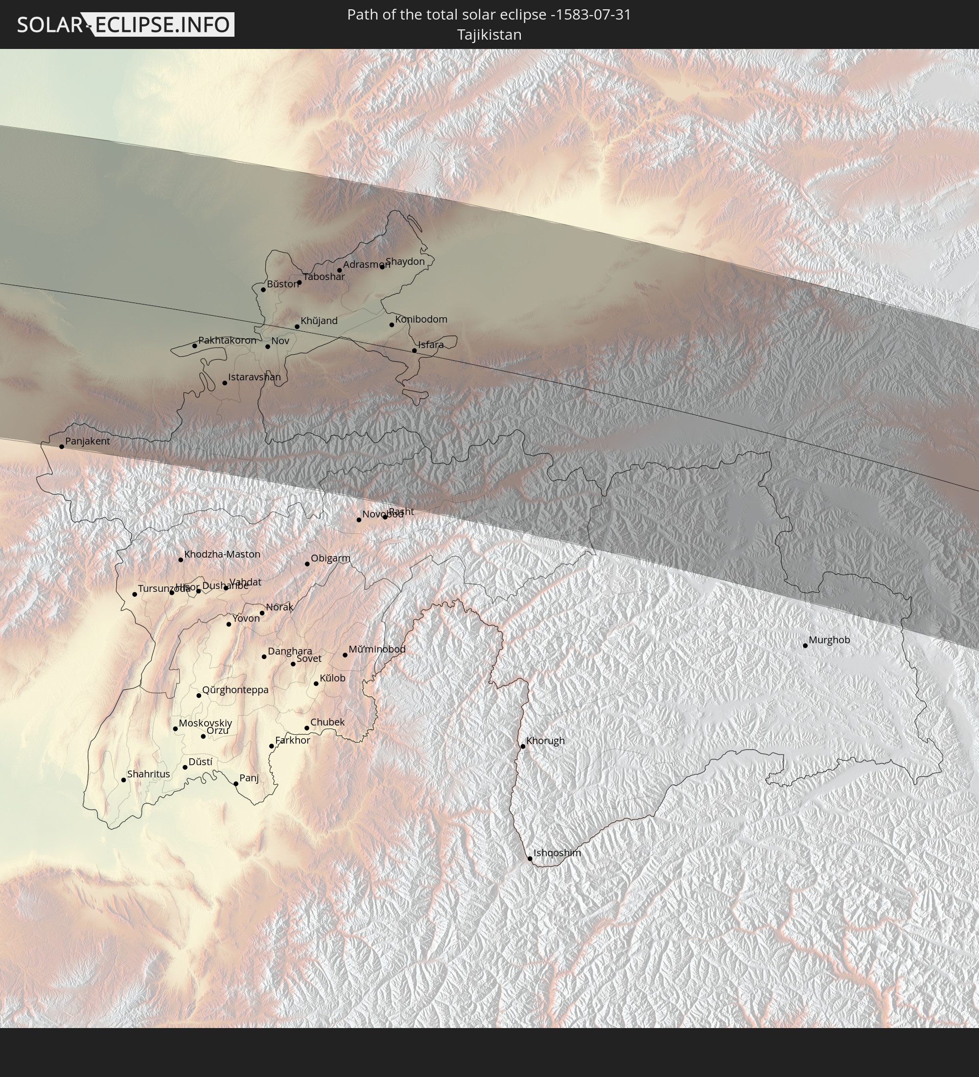 Tajikistan
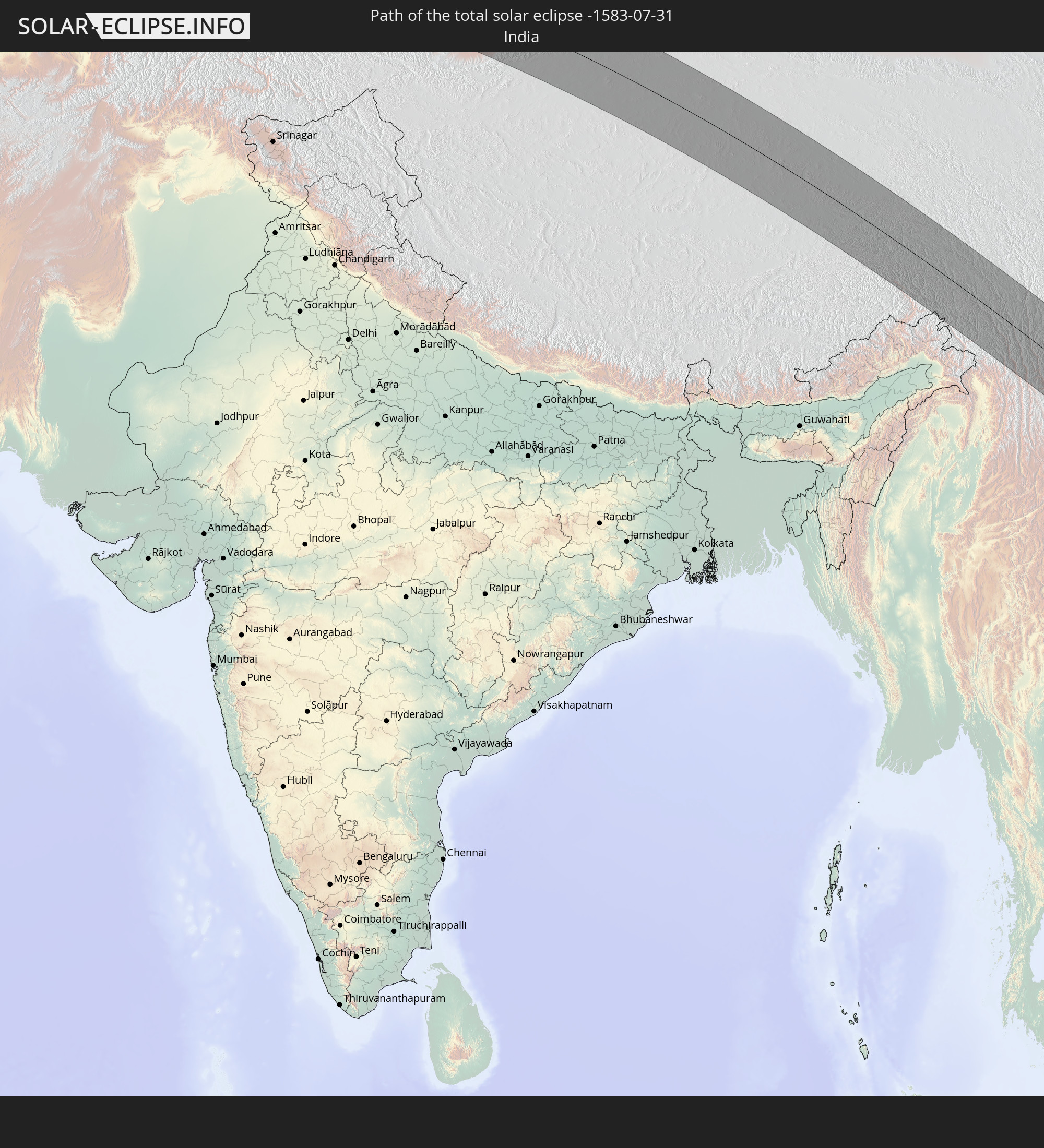 India
India
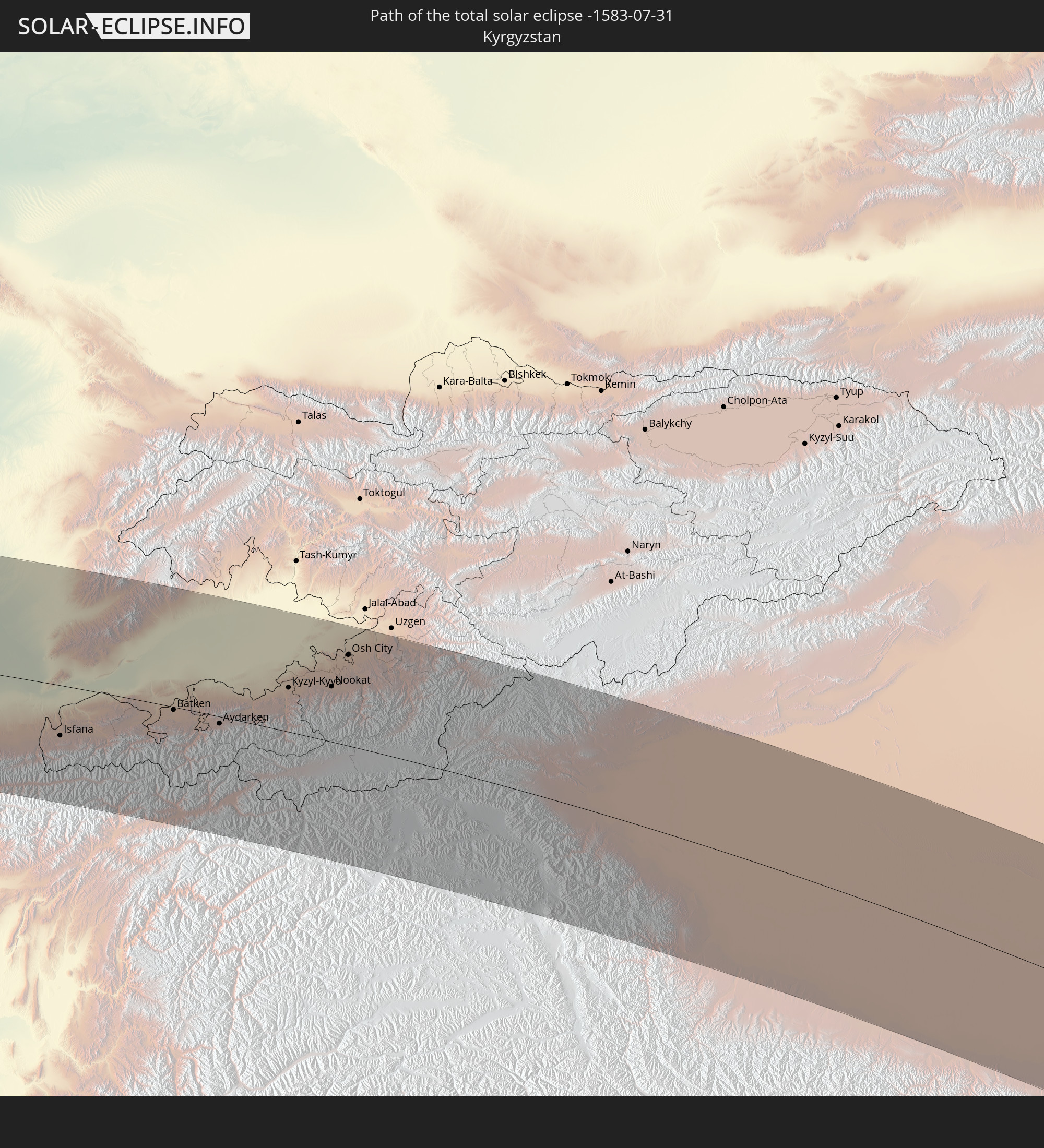 Kyrgyzstan
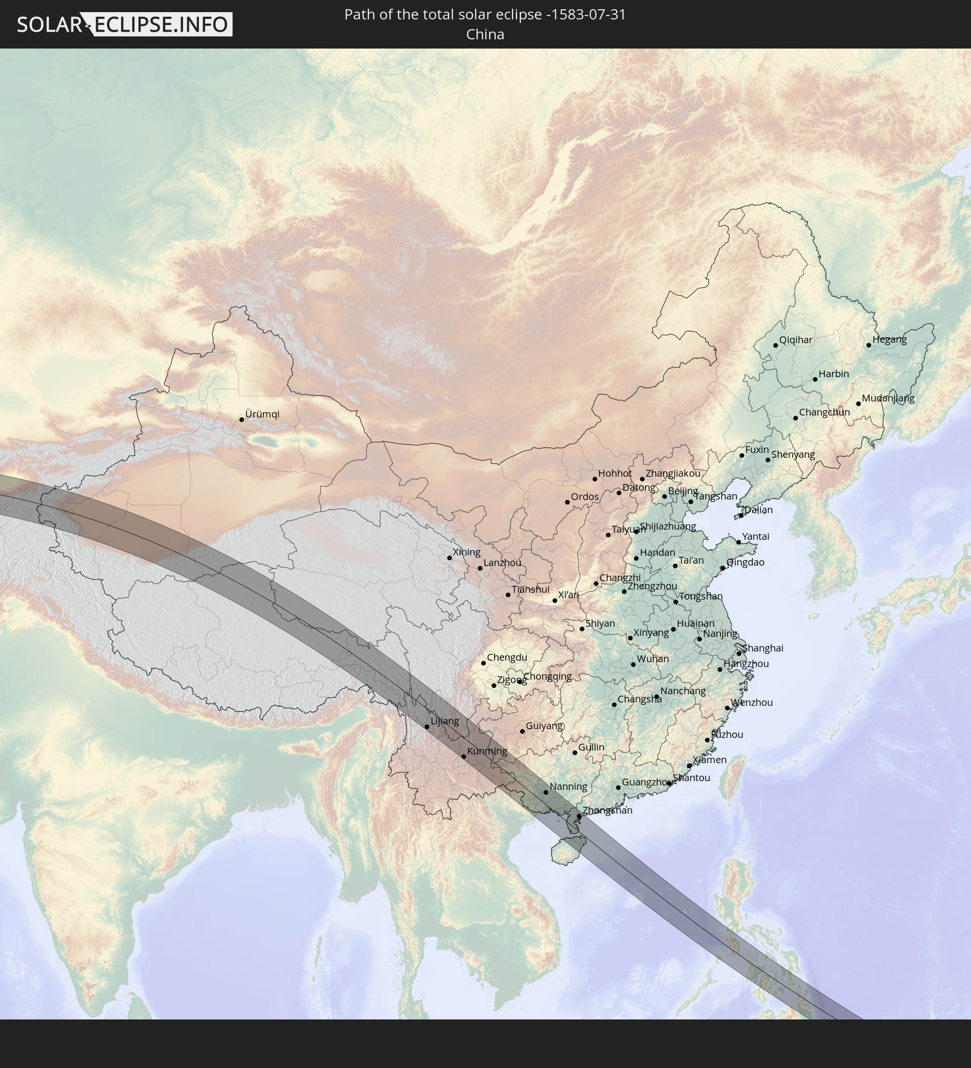 China
China
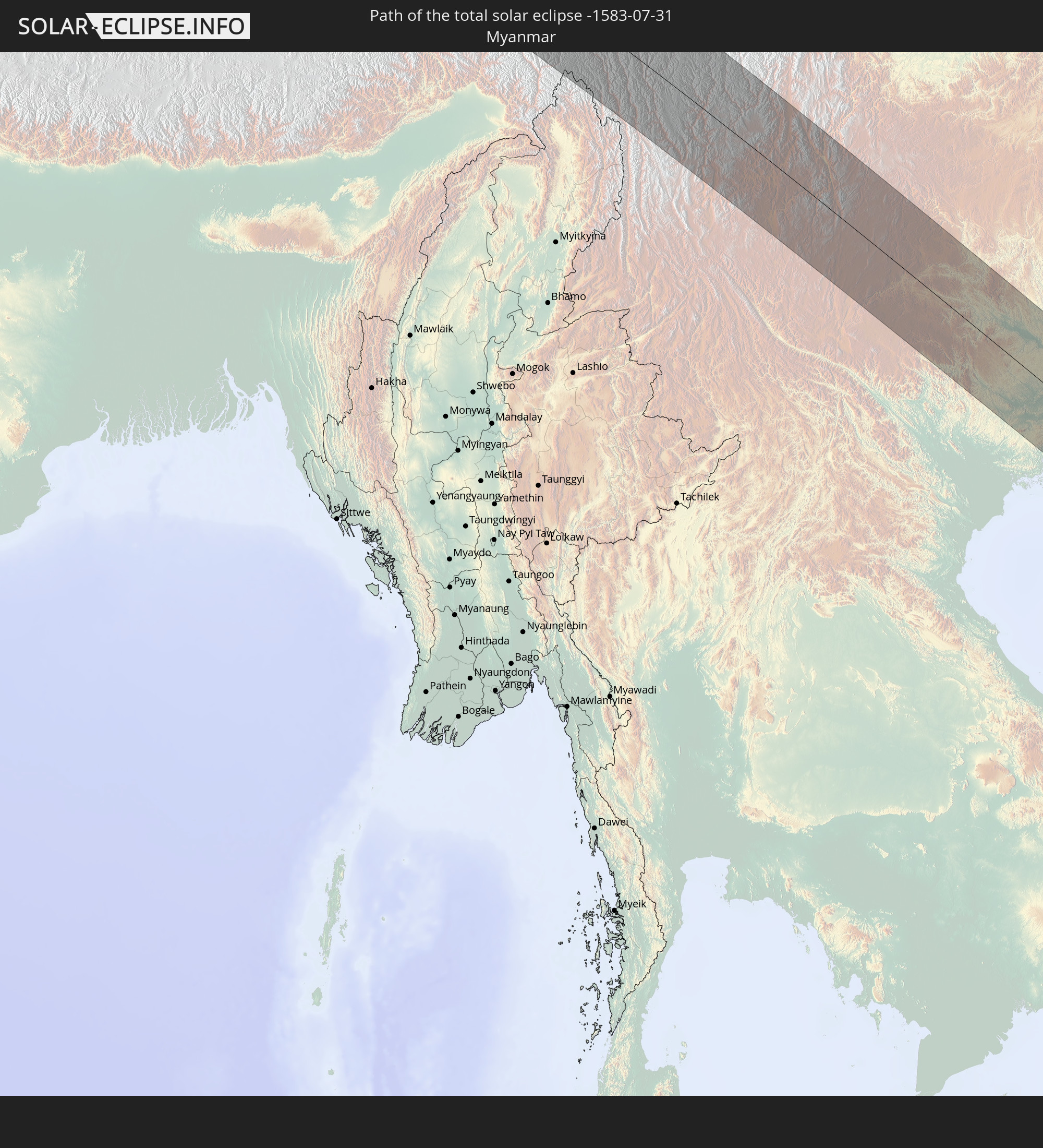 Myanmar
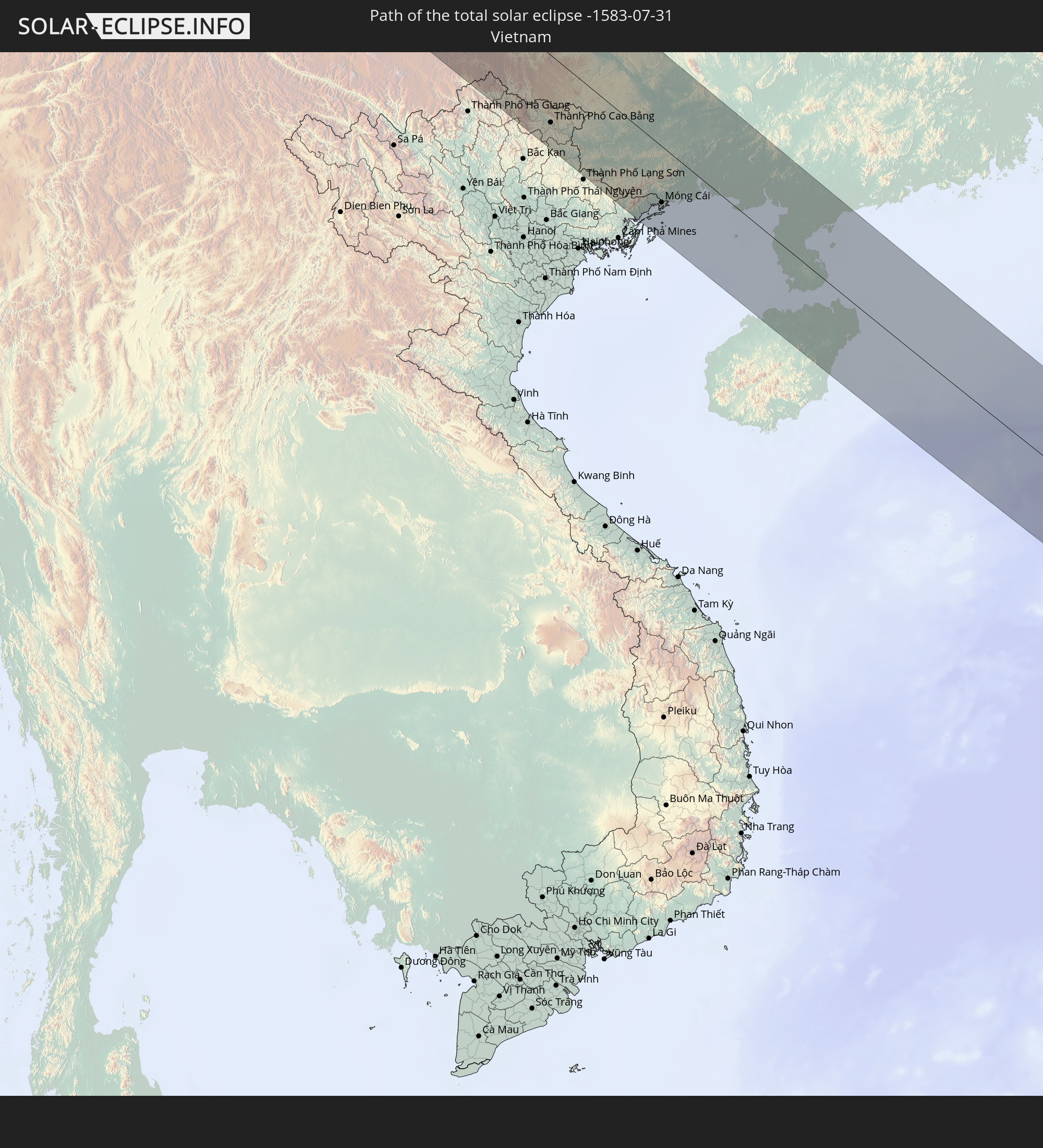 Vietnam
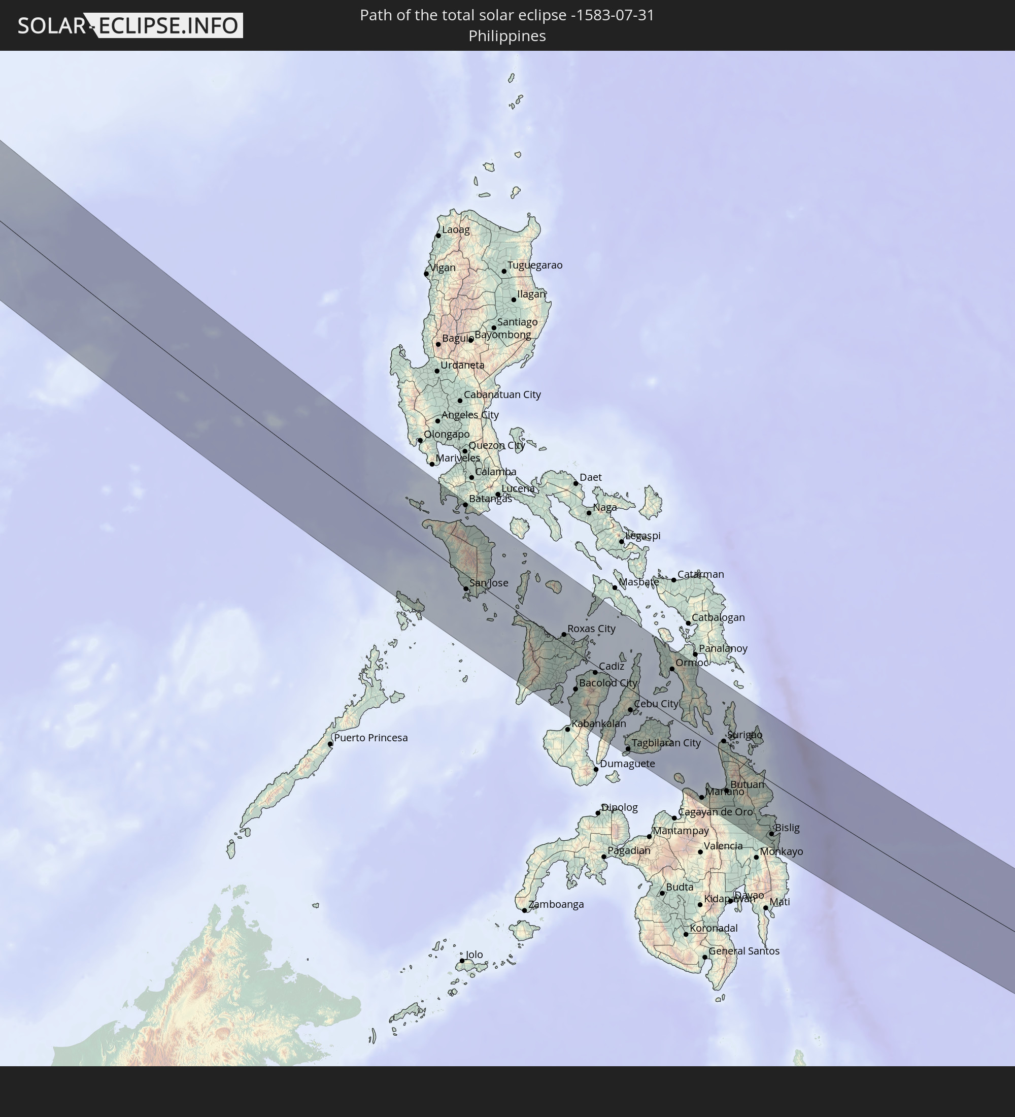 Philippines
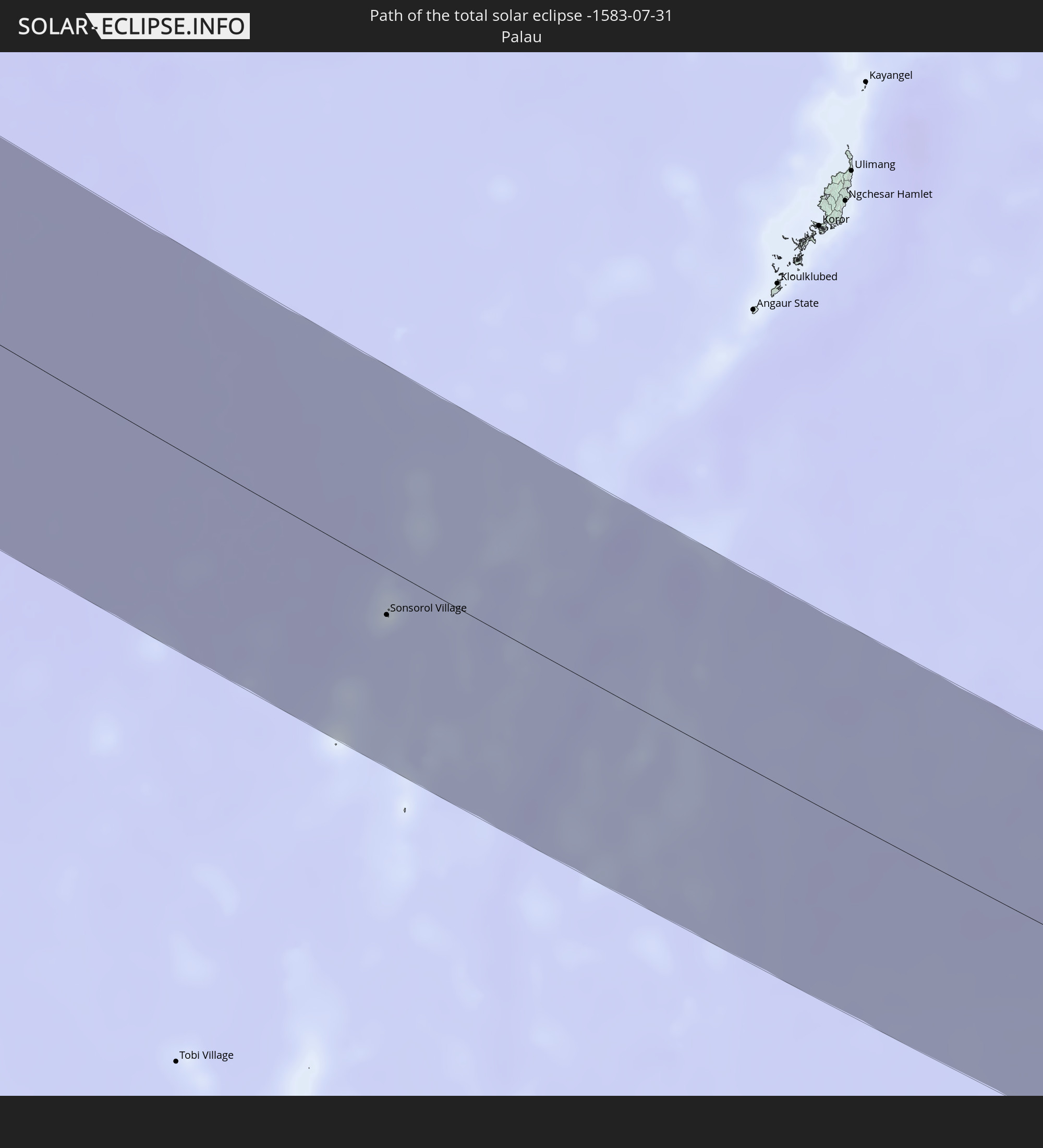 Palau
Palau
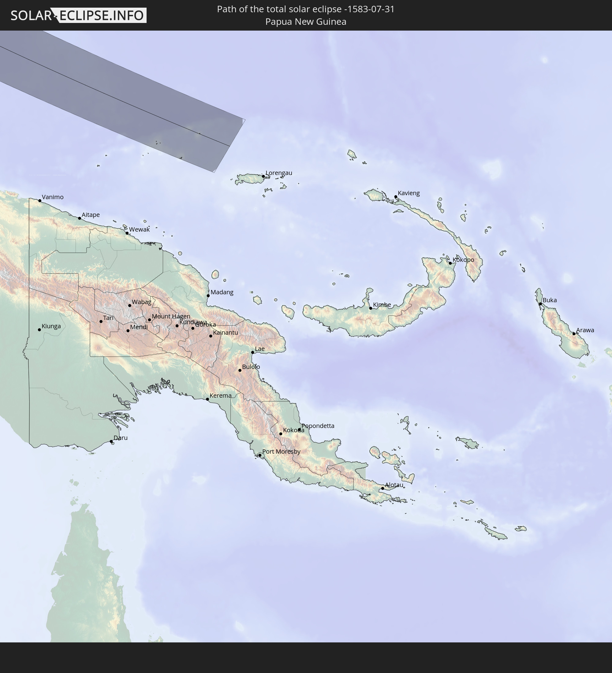 Papua New Guinea
In den folgenden Ländern ist die Sonnenfinsternis partiell zu sehen
 Russia
 Portugal
 Iceland
 Spain
Spain
 Republic of Ireland
 Svalbard and Jan Mayen
 Algeria
 United Kingdom
 Faroe Islands
 France
 Isle of Man
 Guernsey
 Jersey
 Niger
Niger
 Andorra
 Belgium
 Nigeria
 Netherlands
 Norway
 Luxembourg
 Germany
 Switzerland
 Italy
Italy
 Monaco
 Tunisia
 Denmark
 Cameroon
 Libya
Libya
 Liechtenstein
 Austria
 Sweden
 Republic of the Congo
 Czechia
 Democratic Republic of the Congo
 San Marino
 Vatican City
 Slovenia
 Chad
Chad
 Croatia
 Poland
 Malta
Malta
 Central African Republic
 Bosnia and Herzegovina
 Hungary
 Slovakia
 Montenegro
 Serbia
 Albania
 Åland Islands
 Greece
 Romania
 Republic of Macedonia
 Finland
 Lithuania
 Latvia
 Estonia
 Sudan
Sudan
 Ukraine
 Bulgaria
 Belarus
 Egypt
Egypt
 Turkey
 Moldova
 Cyprus
 Ethiopia
 State of Palestine
 Israel
 Saudi Arabia
 Jordan
 Lebanon
 Syria
Syria
 Eritrea
 Iraq
Iraq
 Georgia
 Somalia
 Djibouti
 Yemen
Yemen
 Armenia
 Iran
Iran
 Azerbaijan
 Kazakhstan
 Kuwait
 Bahrain
 Qatar
Qatar
 United Arab Emirates
 Oman
Oman
 Turkmenistan
 Uzbekistan
 Afghanistan
 Pakistan
 Tajikistan
 India
India
 Kyrgyzstan
 China
China
 Sri Lanka
 Nepal
Nepal
 Mongolia
 Bangladesh
 Bhutan
 Myanmar
 Indonesia
 Thailand
 Malaysia
 Laos
Laos
 Vietnam
 Cambodia
 Singapore
 Christmas Island
 Australia
 Macau
Macau
 Hong Kong
 Brunei
 Taiwan
 Philippines
 Japan
Japan
 East Timor
 North Korea
 South Korea
 Palau
Palau
 Federated States of Micronesia
 Papua New Guinea
 Guam
Guam
 Northern Mariana Islands
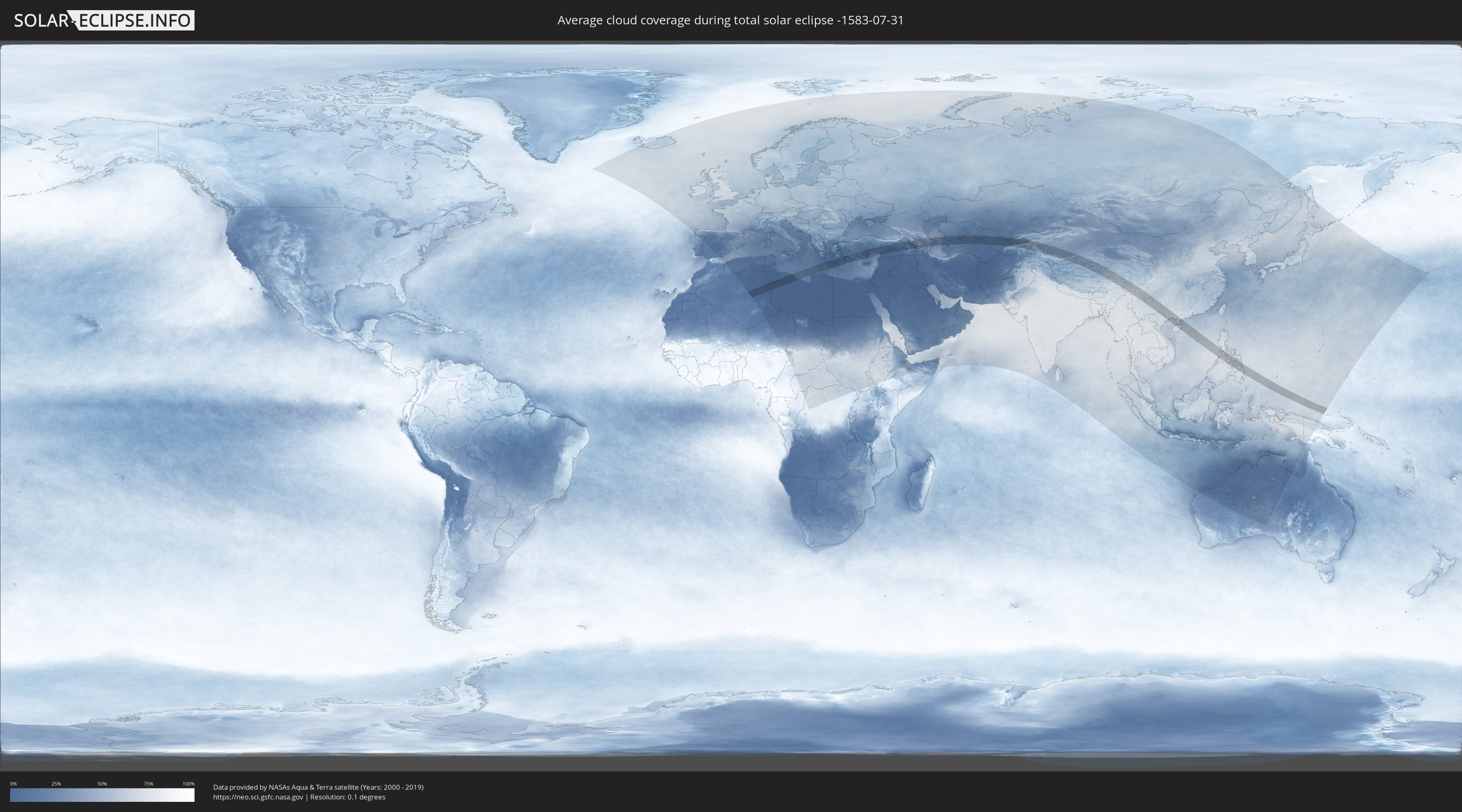
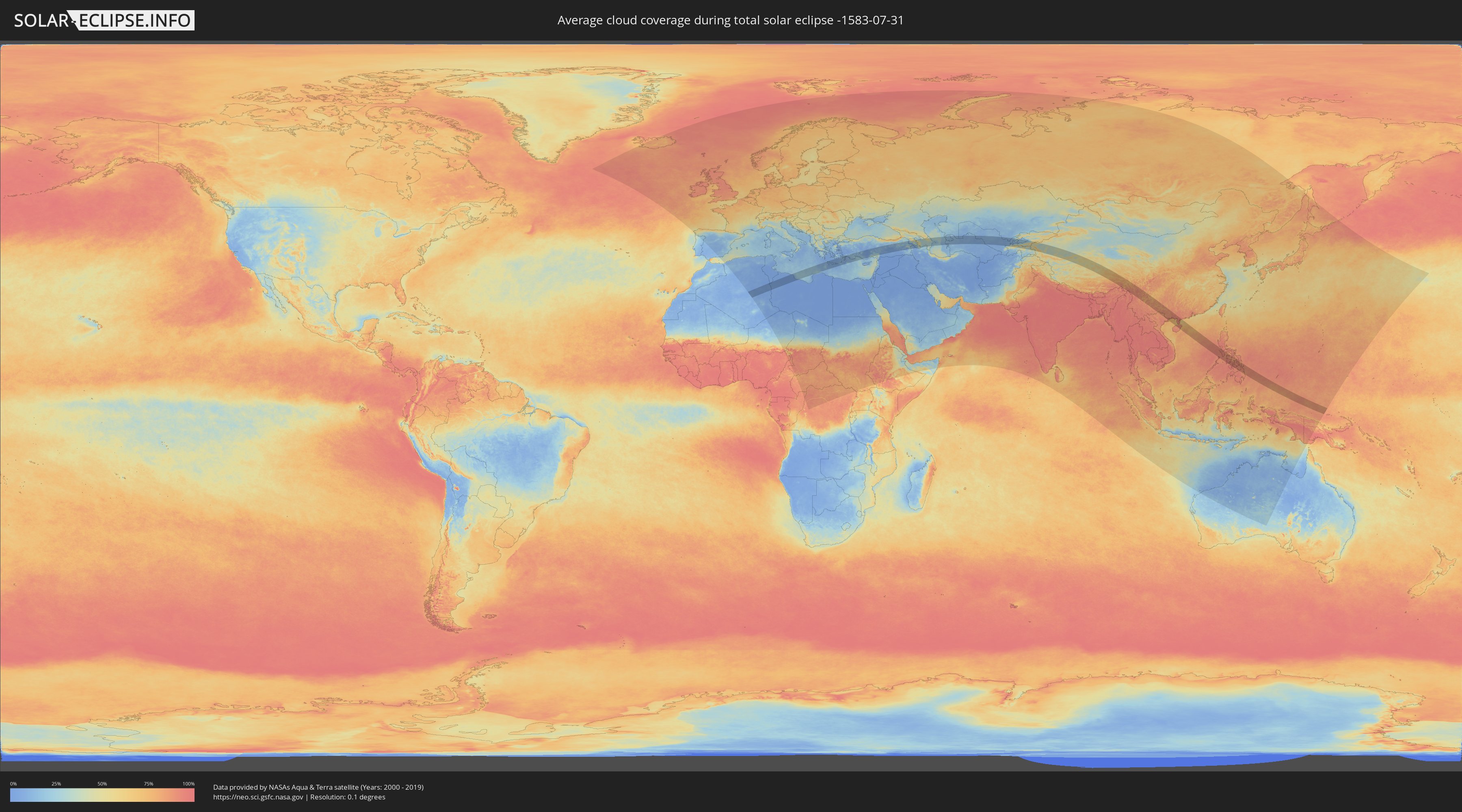
How will be the weather during the total solar eclipse on 07/31/-1583?
Where is the best place to see the total solar eclipse of 07/31/-1583?
The following maps show the average cloud coverage for the day of the total solar eclipse.
With the help of these maps, it is possible to find the place along the eclipse path, which has the best
chance of a cloudless sky.
Nevertheless, you should consider local circumstances and inform about the weather of your chosen
observation site.
The data is provided by NASAs satellites
AQUA and TERRA.
The cloud maps are averaged over a period of 19 years (2000 - 2019).
Detailed country maps
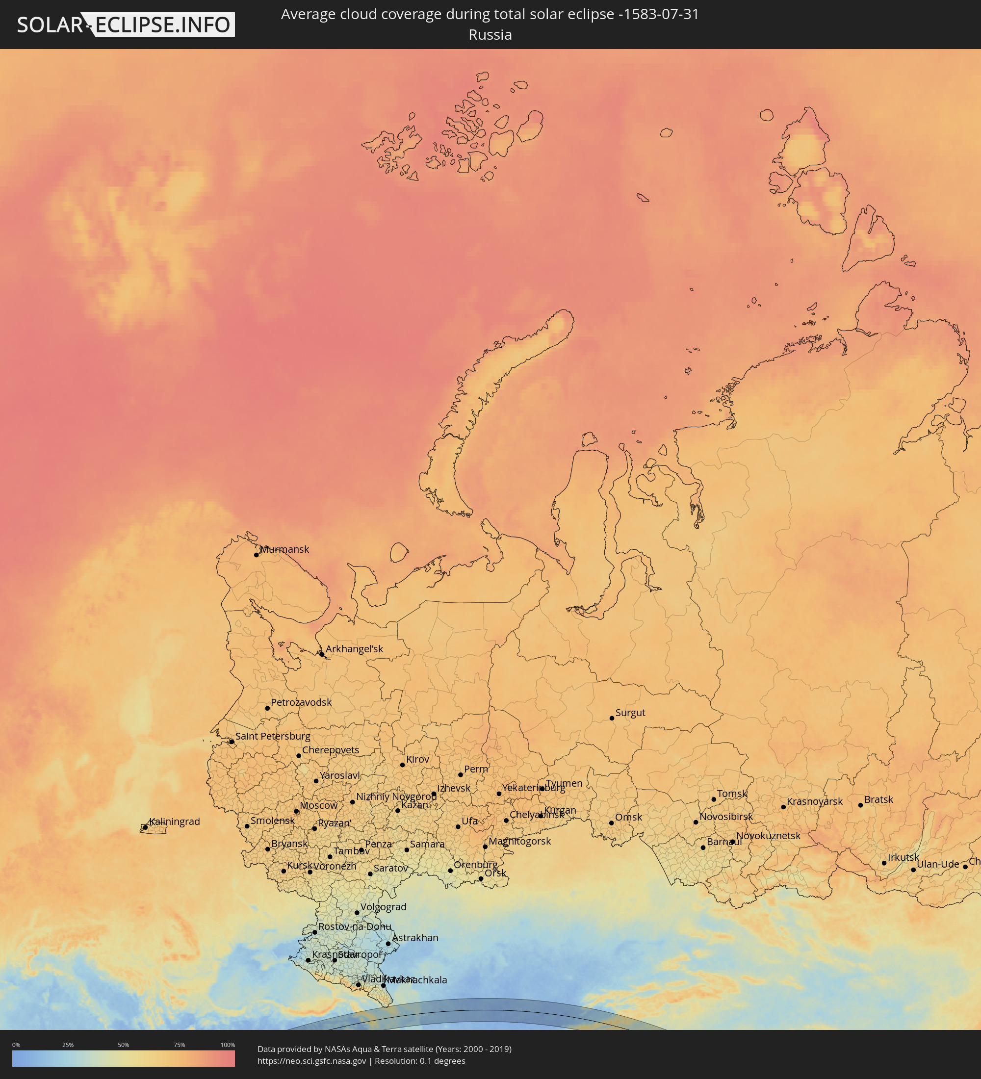 Russia
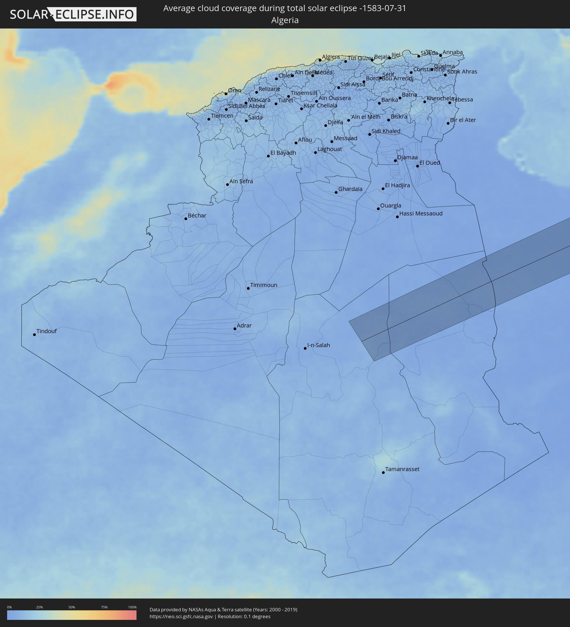 Algeria
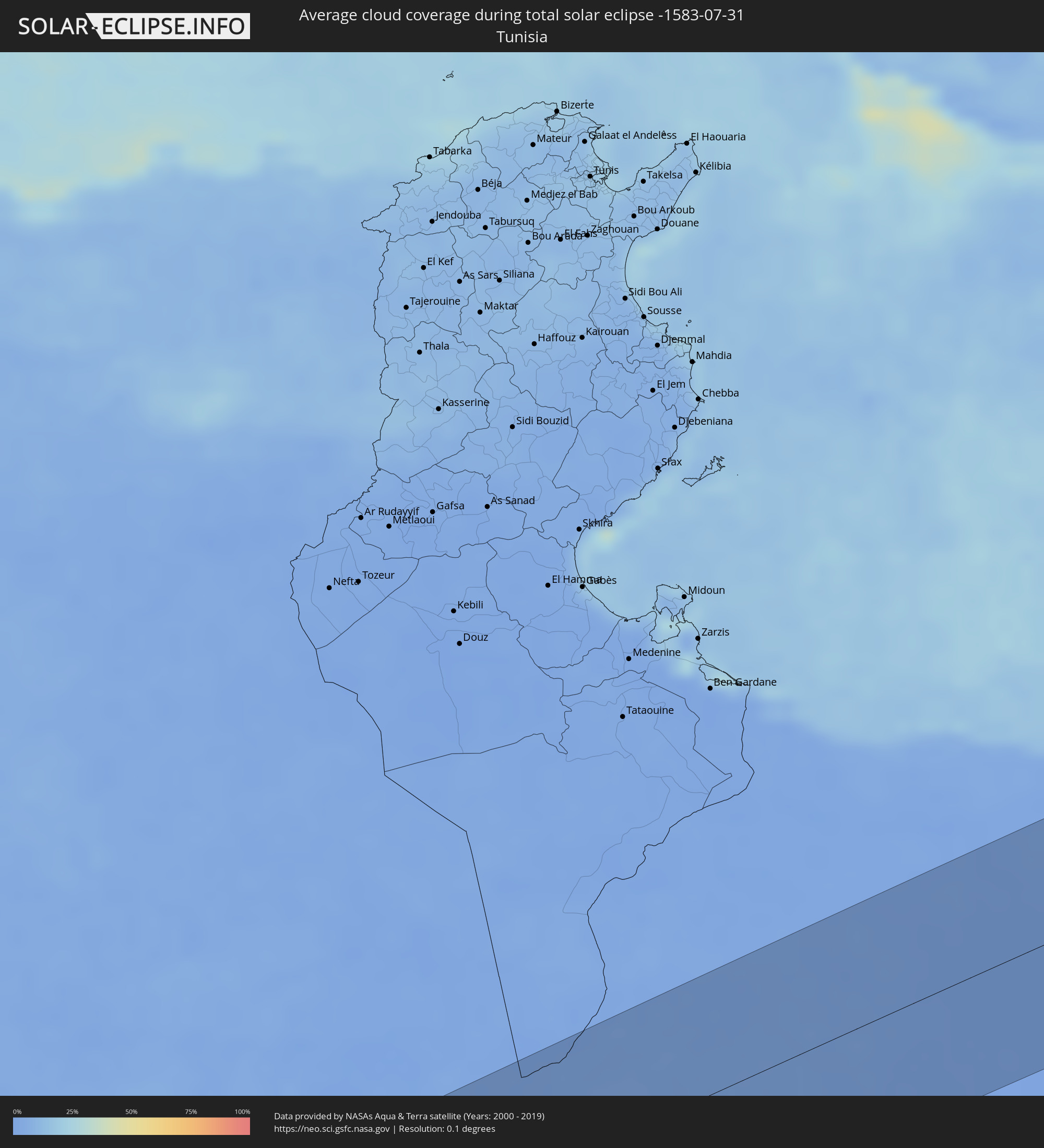 Tunisia
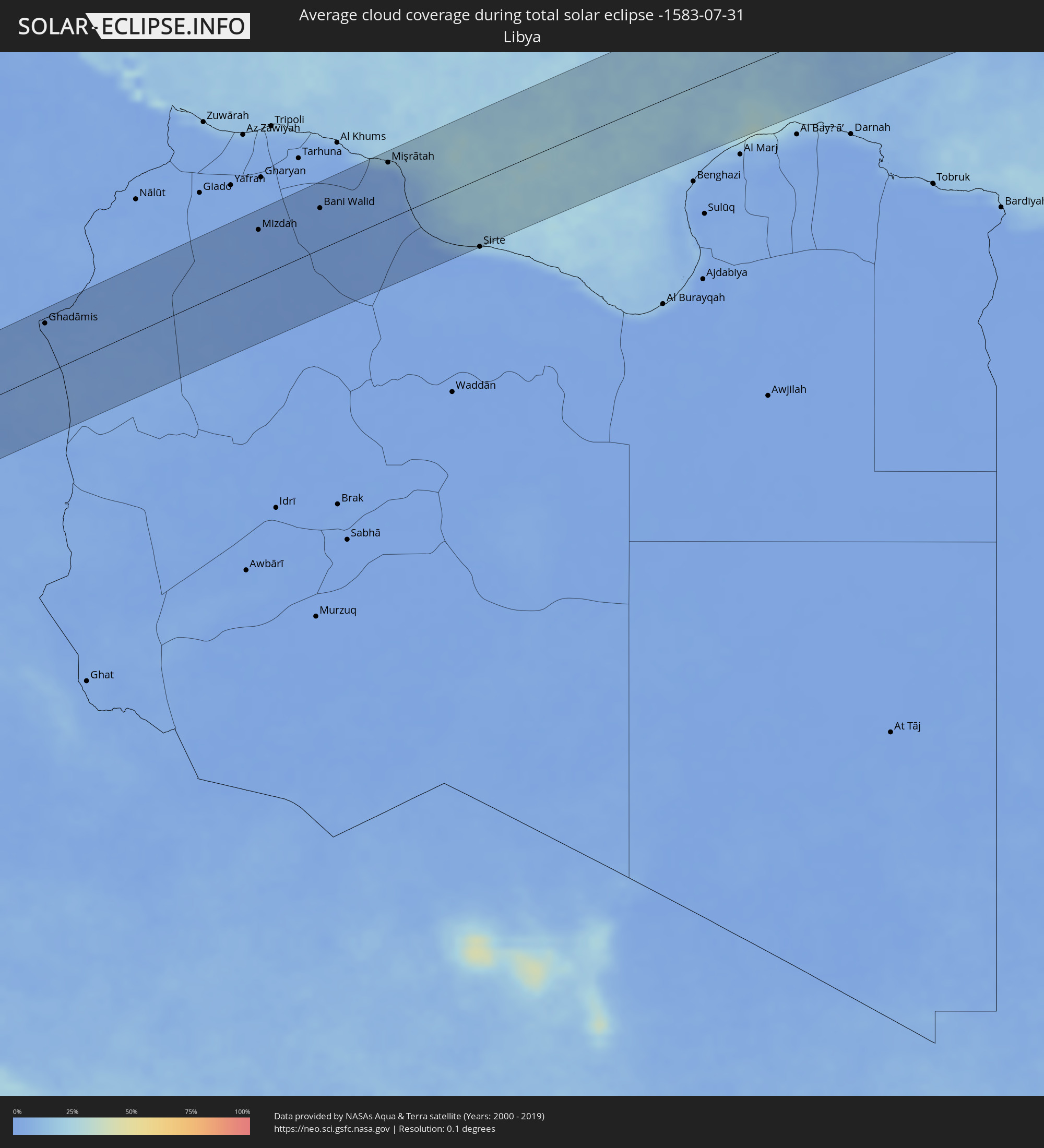 Libya
Libya
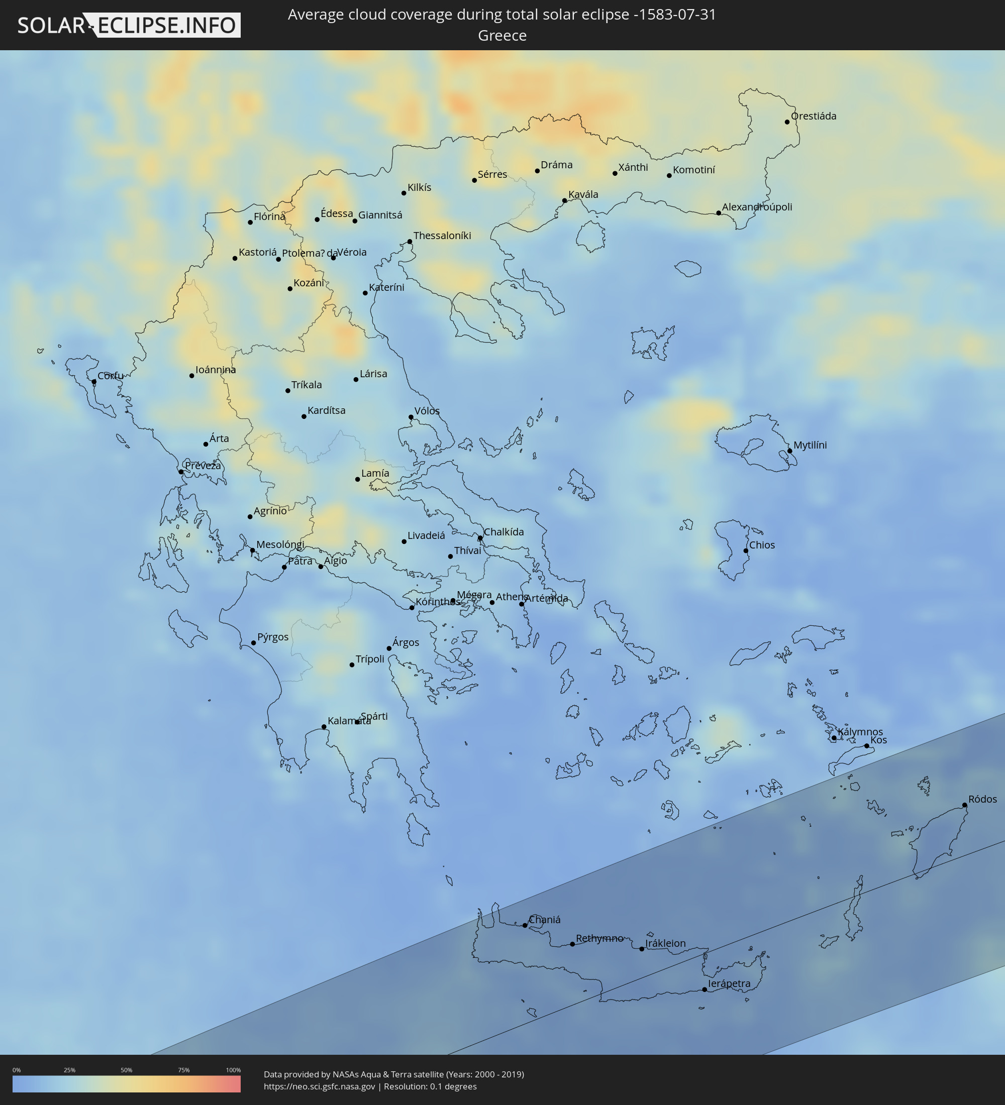 Greece
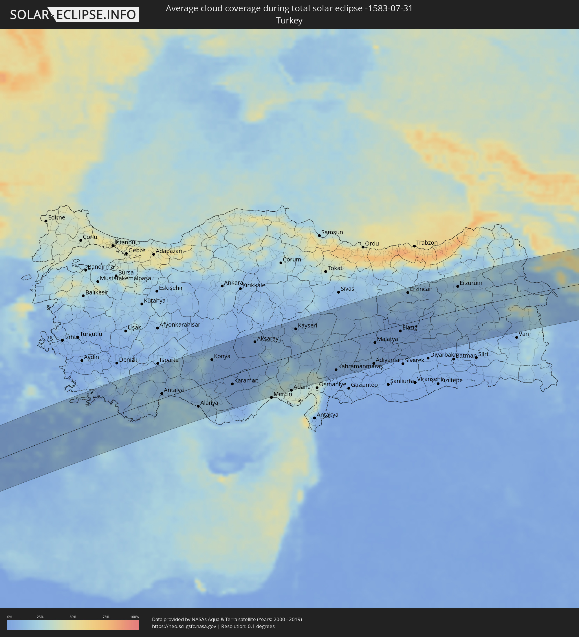 Turkey
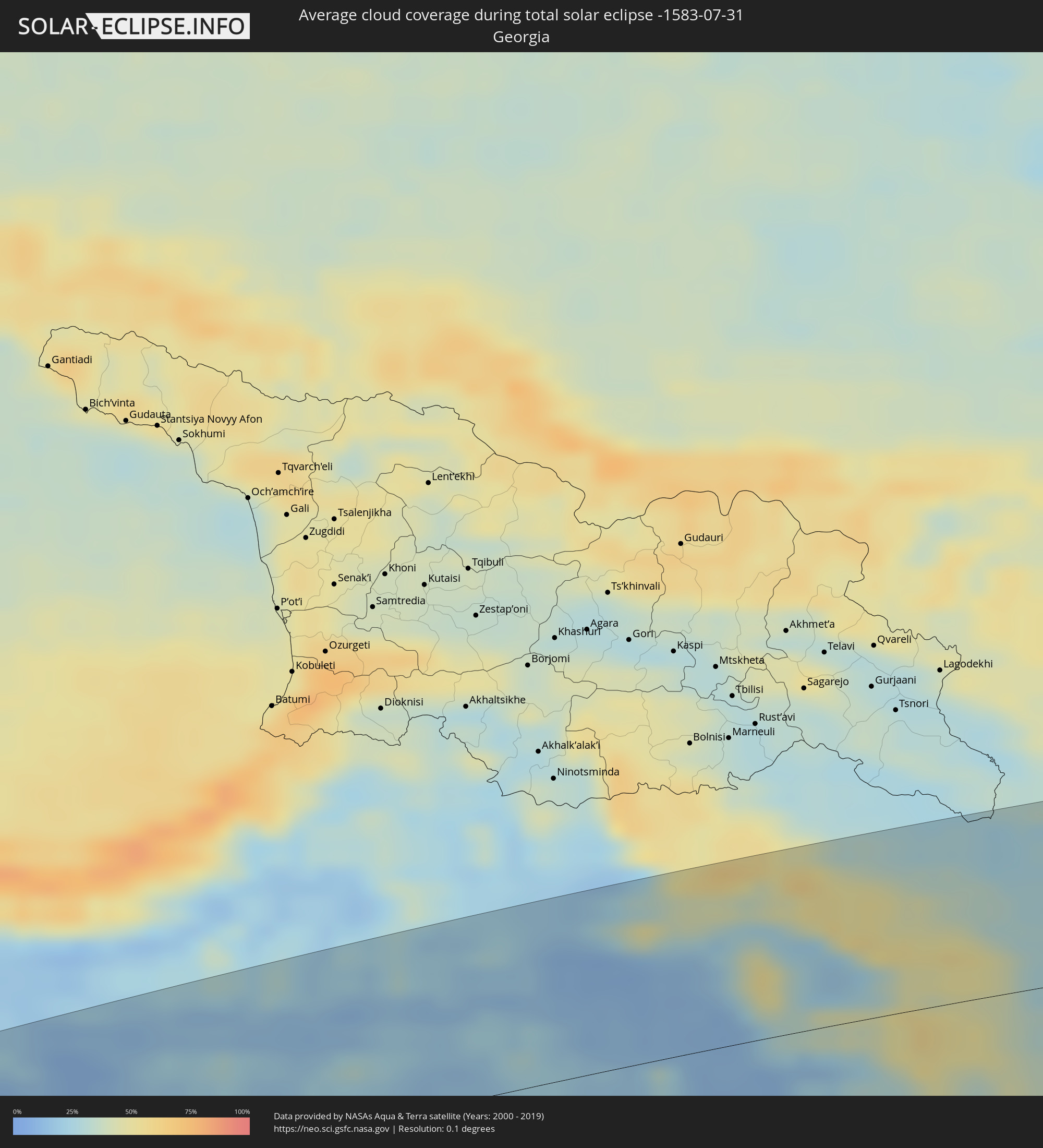 Georgia
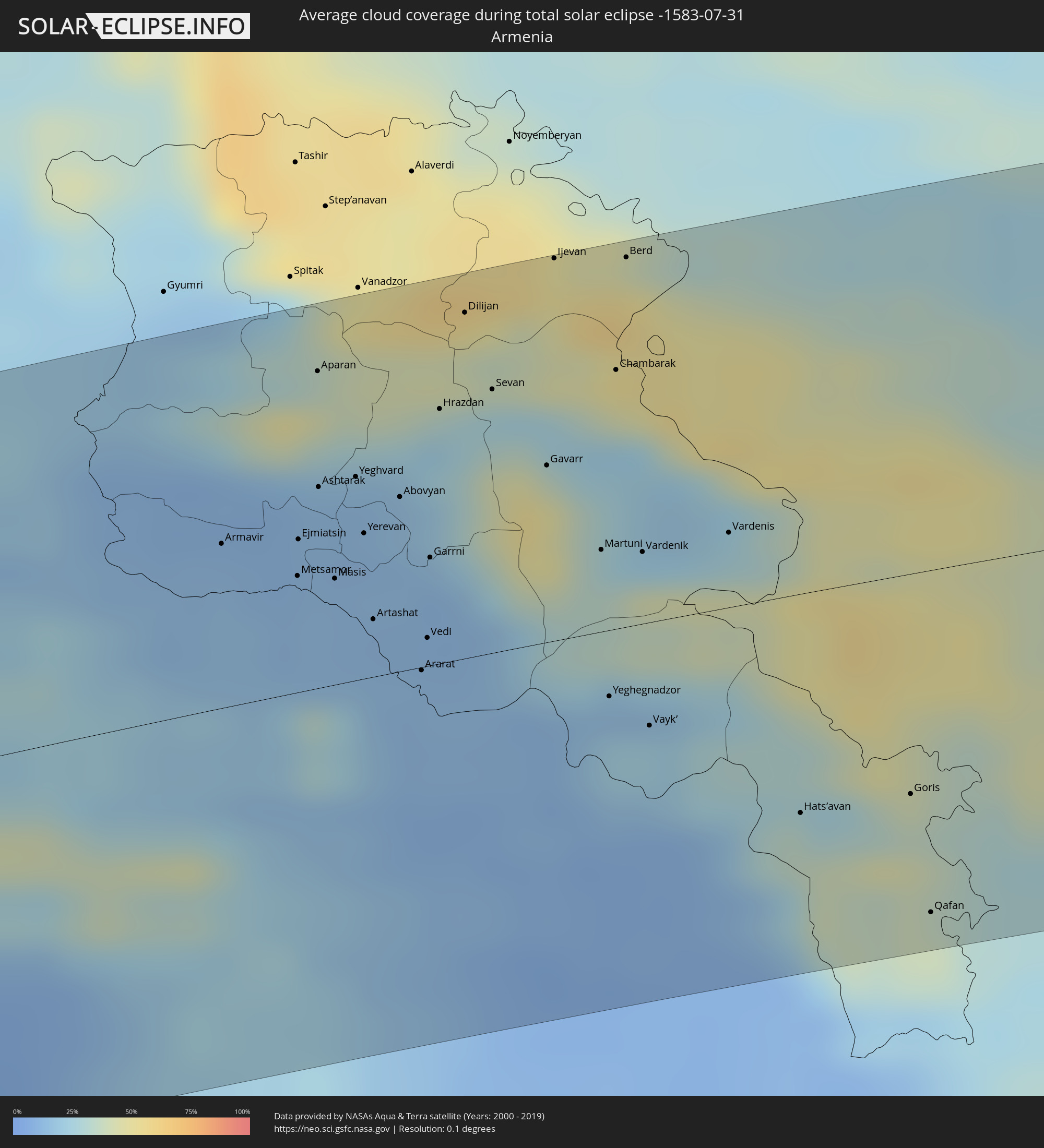 Armenia
 Iran
Iran
 Azerbaijan
 Kazakhstan
 Turkmenistan
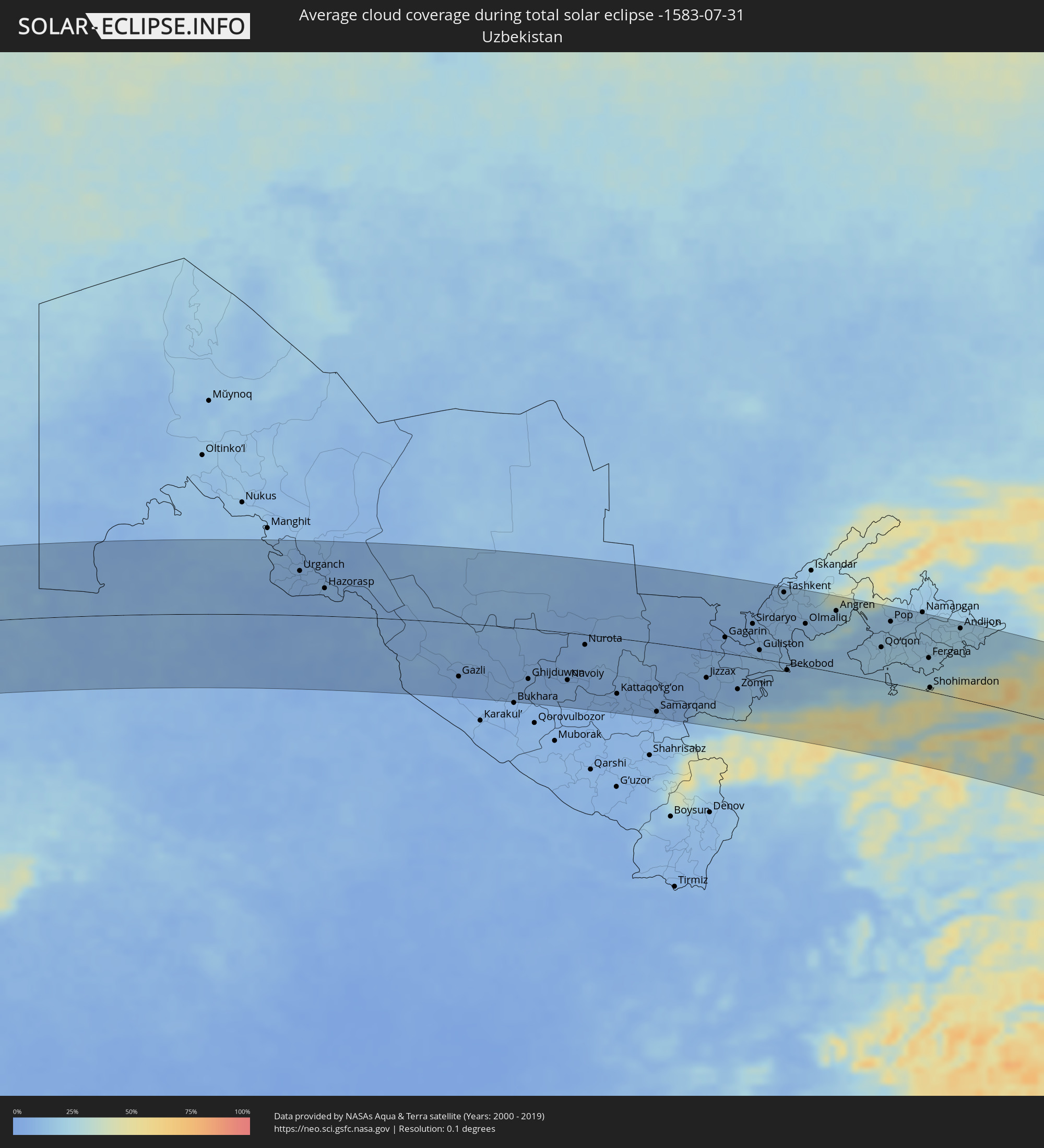 Uzbekistan
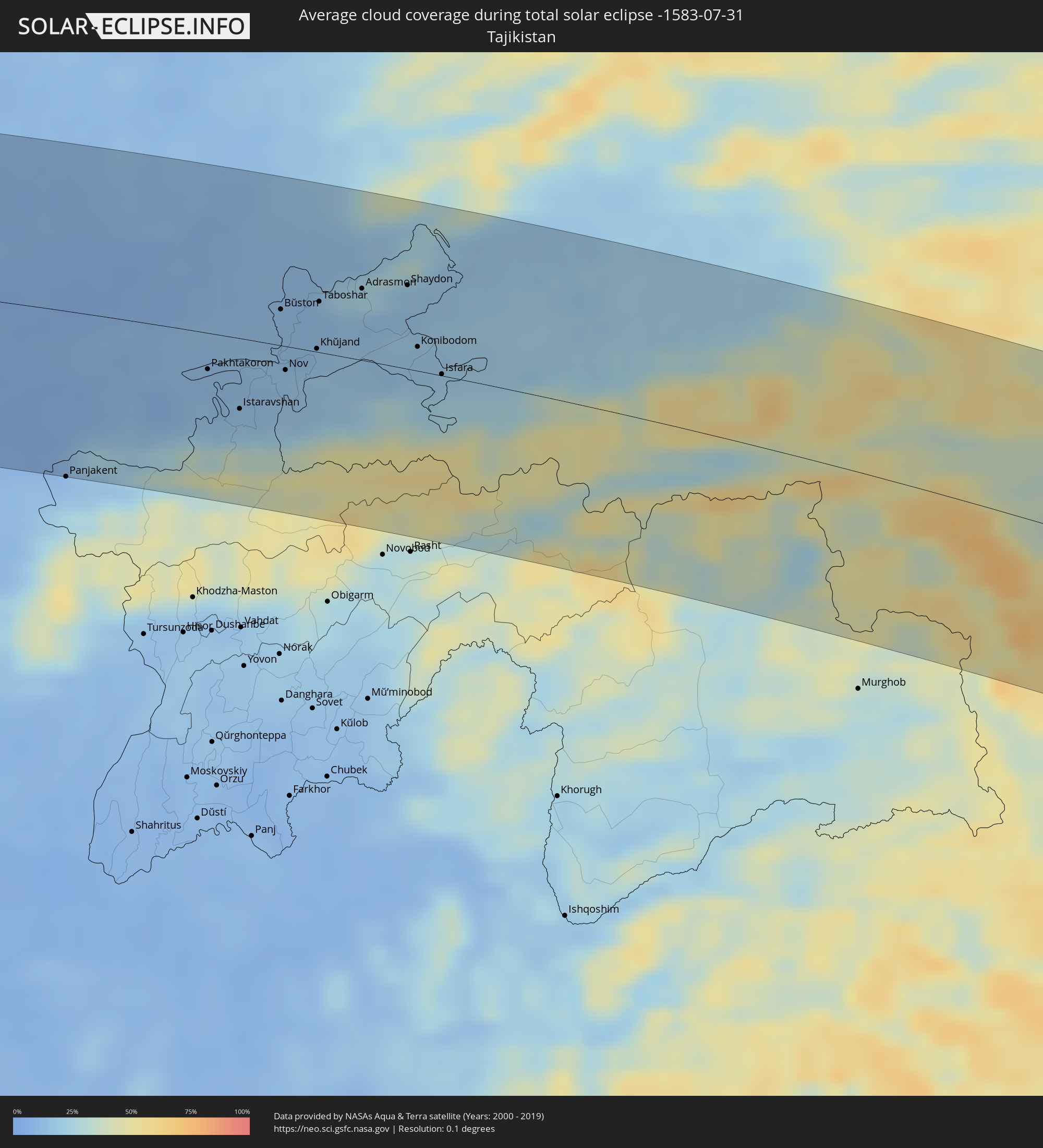 Tajikistan
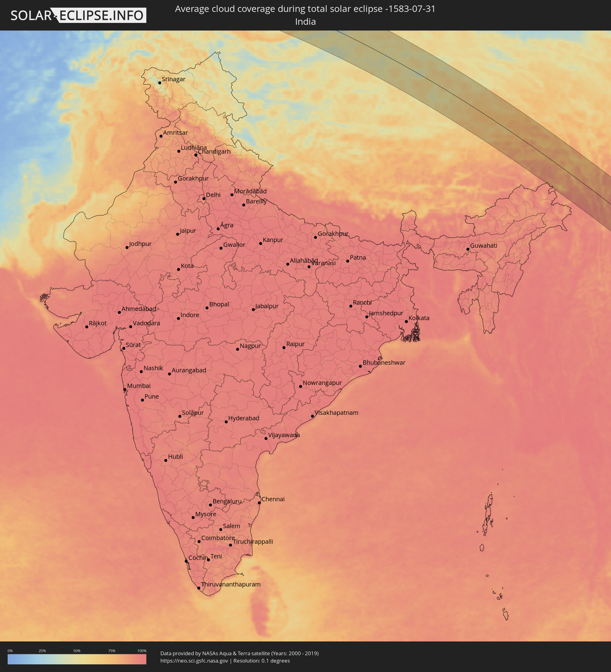 India
India
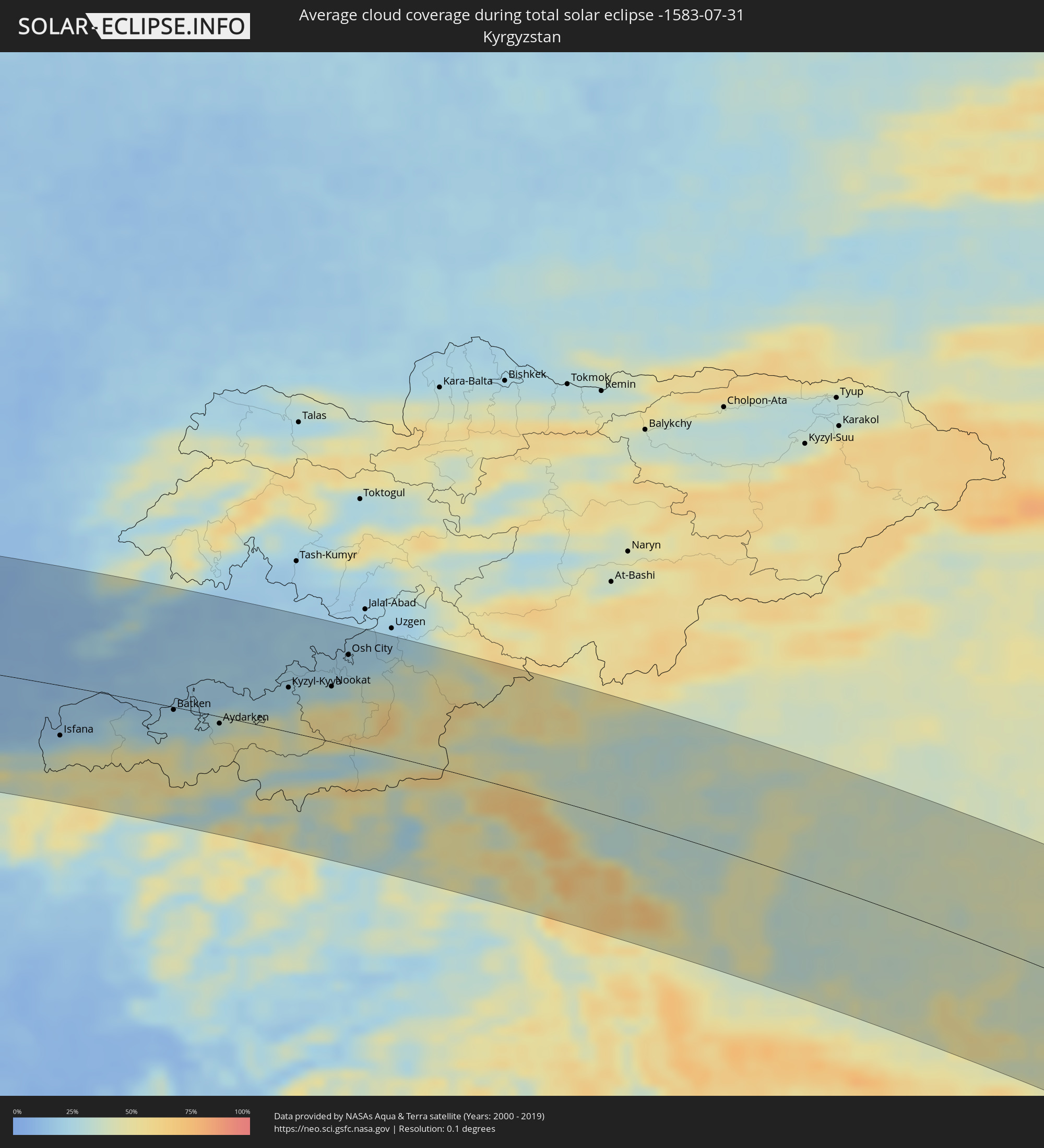 Kyrgyzstan
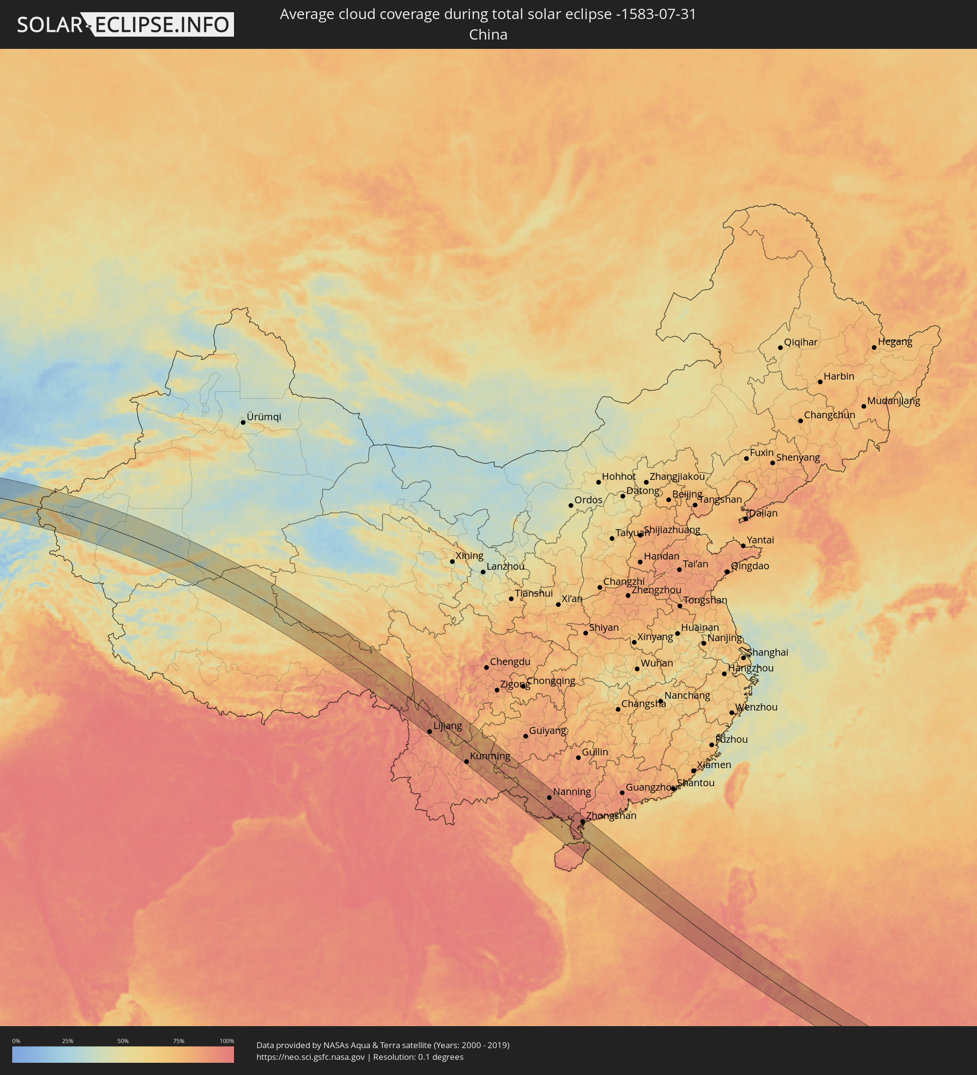 China
China
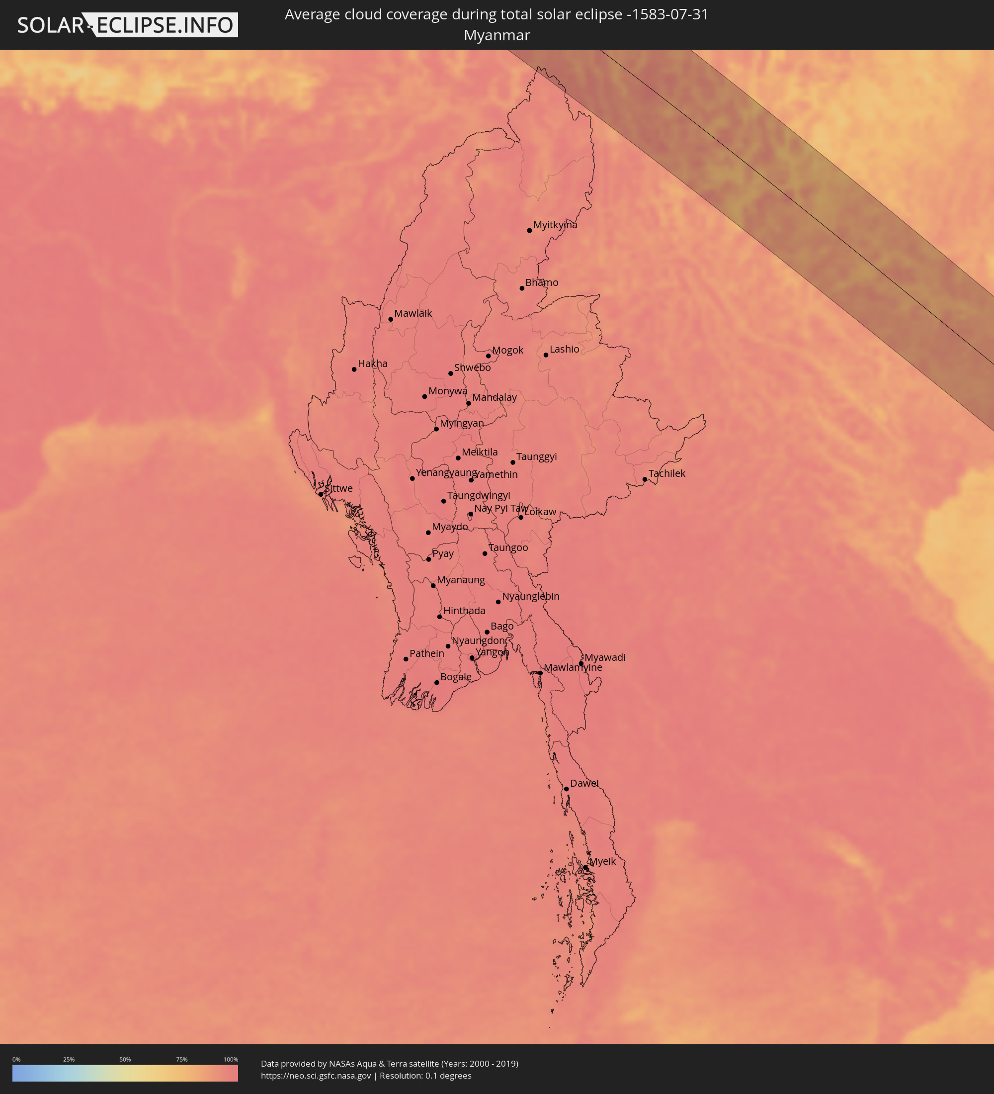 Myanmar
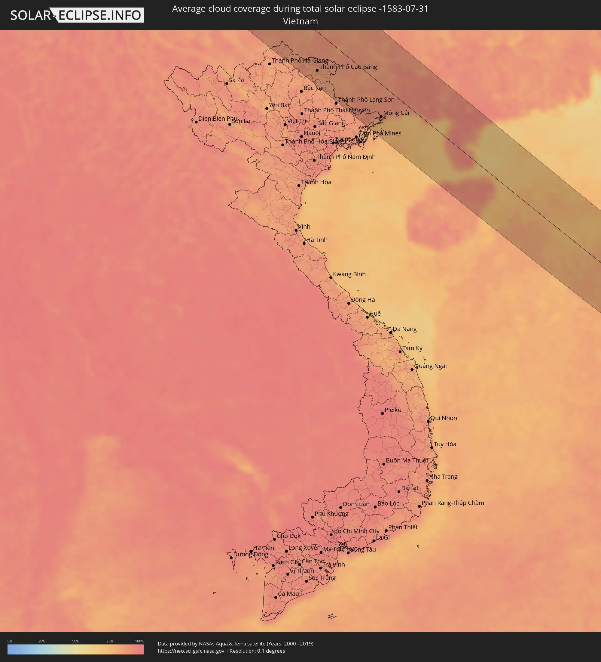 Vietnam
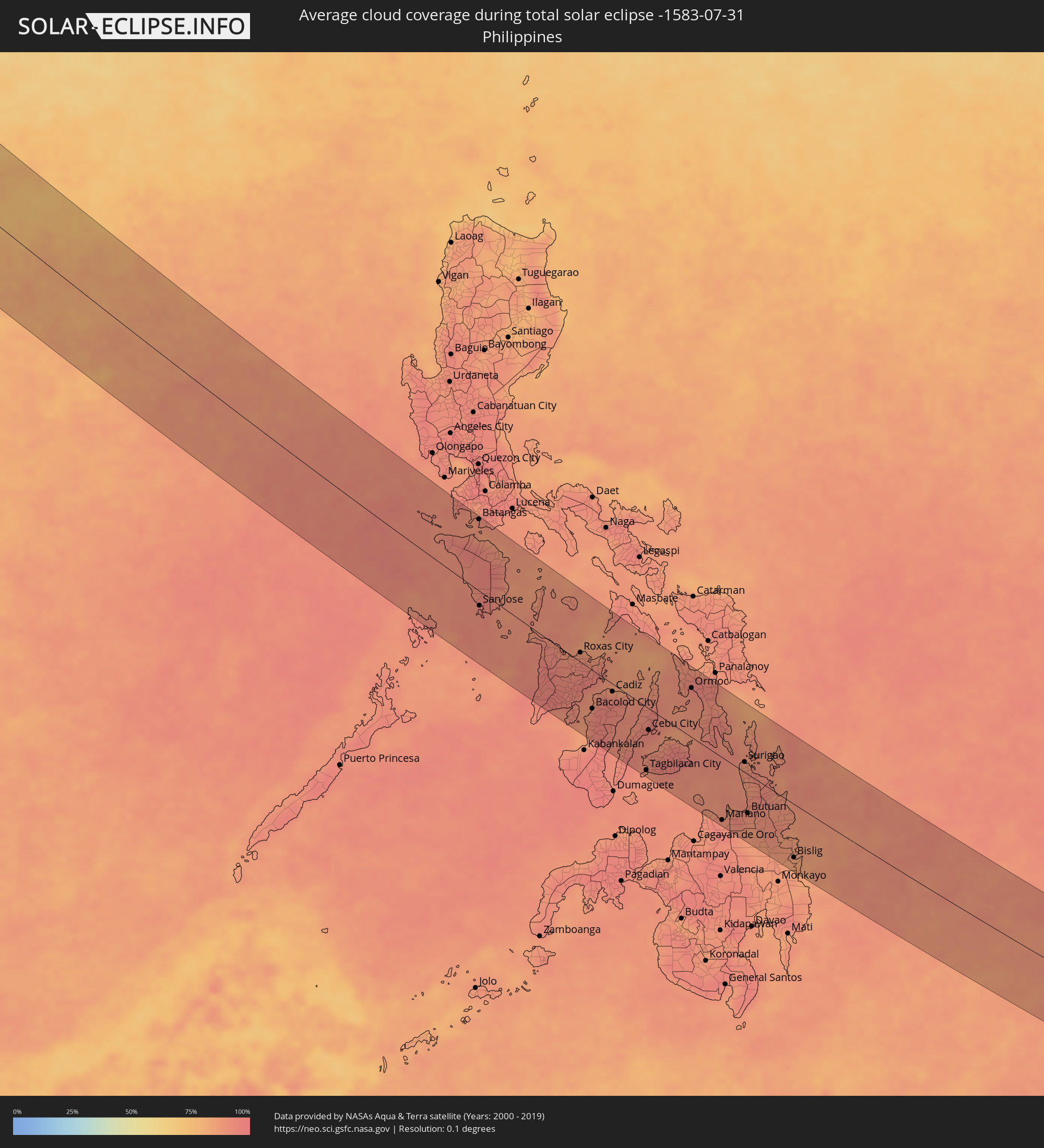 Philippines
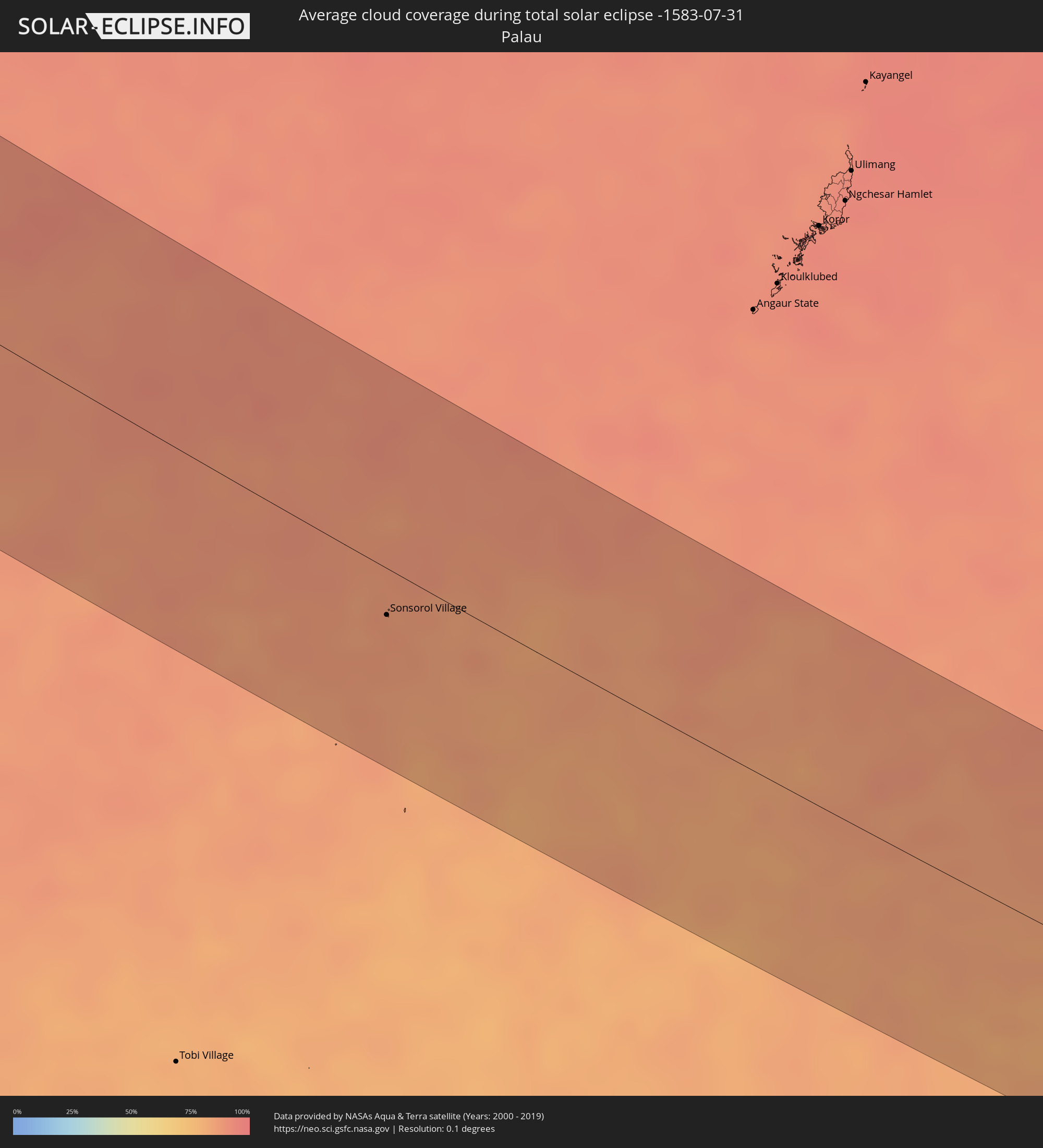 Palau
Palau
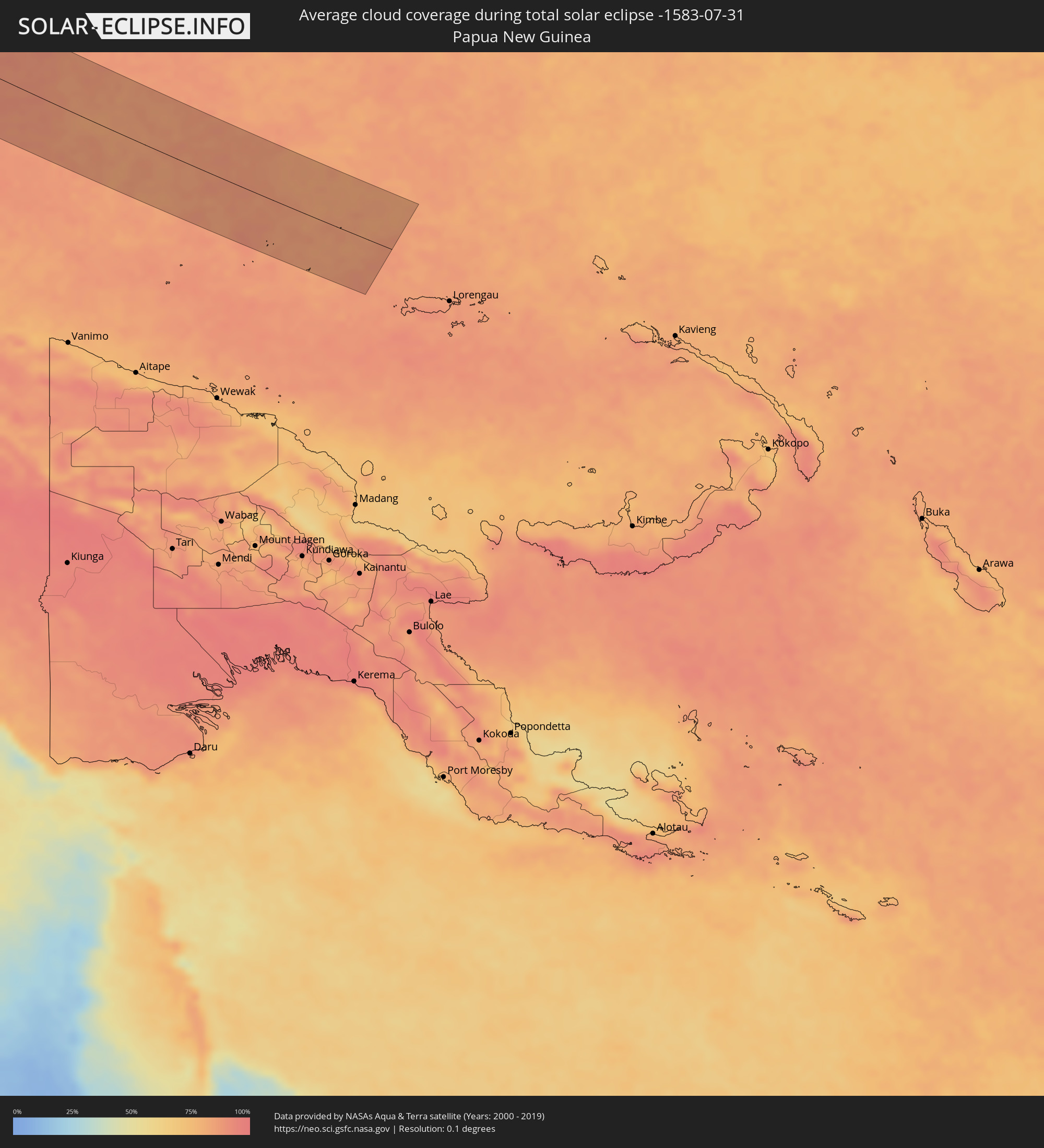 Papua New Guinea
Cities inside the path of the eclipse
The following table shows all locations with a population of more than 5,000 inside the eclipse path. Cities which have more than 100,000 inhabitants are marked bold. A click at the locations opens a detailed map.
| City | Type | Eclipse duration | Local time of max. eclipse | Distance to central line | Ø Cloud coverage |
|
Ghadāmis, Sha‘bīyat Nālūt
|
total | - | 05:47:46 UTC+00:52 | 72 km | 2% |
|
Mizdah, Jabal al Gharbi District
|
total | - | 05:48:29 UTC+00:52 | 67 km | 1% |
|
Bani Walid, Mişrātah
|
total | - | 05:48:43 UTC+00:52 | 58 km | 1% |
|
Mişrātah, Mişrātah
|
total | - | 05:49:14 UTC+00:52 | 79 km | 4% |
|
Chaniá, Crete
|
total | - | 06:35:39 UTC+01:34 | 79 km | 12% |
|
Soúda, Crete
|
total | - | 06:35:38 UTC+01:34 | 75 km | 13% |
|
Rethymno, Crete
|
total | - | 06:35:40 UTC+01:34 | 48 km | 8% |
|
Moíres, Crete
|
total | - | 06:35:32 UTC+01:34 | 3 km | 5% |
|
Gázi, Crete
|
total | - | 06:35:51 UTC+01:34 | 25 km | 5% |
|
Irákleion, Crete
|
total | - | 06:35:52 UTC+01:34 | 23 km | 5% |
|
Néa Alikarnassós, Crete
|
total | - | 06:35:53 UTC+01:34 | 23 km | 5% |
|
Ágios Nikólaos, Crete
|
total | - | 06:35:58 UTC+01:34 | 10 km | 6% |
|
Ierápetra, Crete
|
total | - | 06:35:49 UTC+01:34 | 30 km | 10% |
|
Sitia, Crete
|
total | - | 06:36:08 UTC+01:34 | 21 km | 6% |
|
Afántou, South Aegean
|
total | - | 06:38:00 UTC+01:34 | 26 km | 10% |
|
Triánta, South Aegean
|
total | - | 06:38:06 UTC+01:34 | 38 km | 10% |
|
Faliraki, South Aegean
|
total | - | 06:38:03 UTC+01:34 | 30 km | 10% |
|
Ródos, South Aegean
|
total | - | 06:38:09 UTC+01:34 | 40 km | 10% |
|
Antalya, Antalya
|
total | - | 07:01:55 UTC+01:56 | 14 km | 25% |
|
Manavgat, Antalya
|
total | - | 07:02:15 UTC+01:56 | 20 km | 23% |
|
Alanya, Antalya
|
total | - | 07:02:22 UTC+01:56 | 62 km | 26% |
|
Konya, Konya
|
total | - | 07:03:51 UTC+01:56 | 65 km | 8% |
|
Karaman, Karaman
|
total | - | 07:03:42 UTC+01:56 | 28 km | 5% |
|
Aksaray, Aksaray
|
total | - | 07:05:19 UTC+01:56 | 76 km | 6% |
|
Tarsus, Mersin
|
total | - | 07:04:37 UTC+01:56 | 101 km | 28% |
|
Kayseri, Kayseri
|
total | - | 07:06:40 UTC+01:56 | 76 km | 14% |
|
Kahramanmaraş, Kahramanmaraş
|
total | - | 07:06:45 UTC+01:56 | 82 km | 5% |
|
Adıyaman, Adıyaman
|
total | - | 07:08:01 UTC+01:56 | 95 km | 4% |
|
Malatya, Malatya
|
total | - | 07:08:33 UTC+01:56 | 33 km | 4% |
|
Elazığ, Elazığ
|
total | - | 07:09:37 UTC+01:56 | 19 km | 4% |
|
Erzincan, Erzincan
|
total | - | 07:10:46 UTC+01:56 | 90 km | 15% |
|
Erzurum, Erzurum
|
total | - | 07:12:32 UTC+01:56 | 71 km | 28% |
|
Armavir, Armavir Province
|
total | - | 08:16:33 UTC+02:58 | 46 km | 12% |
|
Ejmiatsin, Armavir Province
|
total | - | 08:16:49 UTC+02:58 | 43 km | 12% |
|
Ashtarak, Aragatsotn Province
|
total | - | 08:17:00 UTC+02:58 | 56 km | 12% |
|
Masis, Ararat Province
|
total | - | 08:16:52 UTC+02:58 | 30 km | 12% |
|
Yerevan, Yerevan
|
total | - | 08:17:04 UTC+02:58 | 41 km | 12% |
|
Artashat, Ararat Province
|
total | - | 08:16:55 UTC+02:58 | 16 km | 12% |
|
Ararat, Ararat Province
|
total | - | 08:17:00 UTC+02:58 | 1 km | 13% |
|
Hrazdan, Kotayk Province
|
total | - | 08:17:35 UTC+02:58 | 71 km | 26% |
|
Sevan, Gegharkunik Province
|
total | - | 08:17:49 UTC+02:58 | 73 km | 32% |
|
Gavarr, Gegharkunik Province
|
total | - | 08:17:51 UTC+02:58 | 49 km | 35% |
|
Ijevan, Tavush Province
|
total | - | 08:18:18 UTC+02:58 | 106 km | 51% |
|
Nakhchivan, Nakhichevan
|
total | - | 08:38:41 UTC+03:19 | 81 km | 9% |
|
Hats’avan, Syunik Province
|
total | - | 08:18:06 UTC+02:58 | 62 km | 29% |
|
Goris, Syunik Province
|
total | - | 08:18:34 UTC+02:58 | 62 km | 36% |
|
Ganja, Gǝncǝ
|
total | - | 08:40:53 UTC+03:19 | 66 km | 35% |
|
Qafan, Syunik Province
|
total | - | 08:18:25 UTC+02:58 | 96 km | 38% |
|
Xankandi, Xankǝndi
|
total | - | 08:40:40 UTC+03:19 | 35 km | 40% |
|
Ağdam, Ağdam
|
total | - | 08:41:00 UTC+03:19 | 18 km | 32% |
|
Mingelchaur, Mingǝcevir
|
total | - | 08:41:44 UTC+03:19 | 65 km | 29% |
|
Barda, Bǝrdǝ
|
total | - | 08:41:31 UTC+03:19 | 21 km | 30% |
|
Yevlakh, Yevlax City
|
total | - | 08:41:44 UTC+03:19 | 47 km | 30% |
|
Pārsābād, Ardabīl
|
total | - | 08:48:16 UTC+03:25 | 70 km | 33% |
|
Saatlı, Saatlı
|
total | - | 08:42:41 UTC+03:19 | 45 km | 33% |
|
Şirvan, Shirvan
|
total | - | 08:43:22 UTC+03:19 | 51 km | 33% |
|
Salyan, Salyan
|
total | - | 08:43:13 UTC+03:19 | 89 km | 31% |
|
Sumqayıt, Sumqayit
|
total | - | 08:44:45 UTC+03:19 | 12 km | 29% |
|
Baku, Baki
|
total | - | 08:44:53 UTC+03:19 | 14 km | 25% |
|
Maştağa, Baki
|
total | - | 08:45:08 UTC+03:19 | 2 km | 28% |
|
Hövsan, Baki
|
total | - | 08:45:08 UTC+03:19 | 16 km | 24% |
|
Türkmenbaşy, Balkan
|
total | - | 09:22:53 UTC+03:53 | 82 km | 13% |
|
Yylanly, Daşoguz
|
total | - | 09:33:40 UTC+03:53 | 96 km | 11% |
|
Tagta, Daşoguz
|
total | - | 09:34:01 UTC+03:53 | 76 km | 12% |
|
Daşoguz, Daşoguz
|
total | - | 09:34:09 UTC+03:53 | 96 km | 11% |
|
Urganch, Xorazm
|
total | - | 10:09:29 UTC+04:27 | 66 km | 9% |
|
Gazojak, Lebap
|
total | - | 09:36:17 UTC+03:53 | 27 km | 8% |
|
Navoiy, Navoiy
|
total | - | 10:17:20 UTC+04:27 | 71 km | 8% |
|
Kattaqo’rg’on, Samarqand
|
total | - | 10:18:55 UTC+04:27 | 83 km | 7% |
|
Samarqand, Samarqand
|
total | - | 10:20:13 UTC+04:27 | 102 km | 9% |
|
Panjakent, Viloyati Sughd
|
partial | - | 10:28:46 UTC+04:35 | 112 km | 13% |
|
Jizzax, Jizzax
|
total | - | 10:21:49 UTC+04:27 | 41 km | 8% |
|
Chardara, Ongtüstik Qazaqstan
|
total | - | 10:15:55 UTC+04:21 | 87 km | 11% |
|
Asyqata, Ongtüstik Qazaqstan
|
total | - | 10:16:39 UTC+04:21 | 52 km | 10% |
|
Atakent, Ongtüstik Qazaqstan
|
total | - | 10:16:55 UTC+04:21 | 48 km | 9% |
|
Slavyanka, Ongtüstik Qazaqstan
|
total | - | 10:17:01 UTC+04:21 | 28 km | 8% |
|
Pakhtakoron, Viloyati Sughd
|
total | - | 10:30:48 UTC+04:35 | 24 km | 12% |
|
Istaravshan, Viloyati Sughd
|
total | - | 10:31:19 UTC+04:35 | 47 km | 17% |
|
Yangiyŭl, Toshkent
|
total | - | 10:23:53 UTC+04:27 | 85 km | 11% |
|
Tashkent, Toshkent Shahri
|
total | - | 10:24:10 UTC+04:27 | 104 km | 13% |
|
Bekobod, Toshkent
|
total | - | 10:24:27 UTC+04:27 | 10 km | 15% |
|
Bŭston, Viloyati Sughd
|
total | - | 10:31:49 UTC+04:35 | 24 km | 13% |
|
Nov, Viloyati Sughd
|
total | - | 10:31:58 UTC+04:35 | 16 km | 15% |
|
Proletar, Viloyati Sughd
|
total | - | 10:32:12 UTC+04:35 | 12 km | 16% |
|
Isfana, Batken
|
total | - | 10:55:31 UTC+04:58 | 48 km | 29% |
|
Suluktu, Batken
|
total | - | 10:55:34 UTC+04:58 | 37 km | 21% |
|
Olmaliq, Toshkent
|
total | - | 10:24:56 UTC+04:27 | 63 km | 11% |
|
Khŭjand, Viloyati Sughd
|
total | - | 10:32:24 UTC+04:35 | 2 km | 14% |
|
Taboshar, Viloyati Sughd
|
total | - | 10:32:23 UTC+04:35 | 34 km | 12% |
|
Chkalov, Viloyati Sughd
|
total | - | 10:32:33 UTC+04:35 | 2 km | 17% |
|
Konsoy, Viloyati Sughd
|
total | - | 10:32:31 UTC+04:35 | 26 km | 12% |
|
Adrasmon, Viloyati Sughd
|
total | - | 10:33:00 UTC+04:35 | 48 km | 16% |
|
Angren, Toshkent
|
total | - | 10:25:54 UTC+04:27 | 90 km | 16% |
|
Shaydon, Viloyati Sughd
|
total | - | 10:33:40 UTC+04:35 | 56 km | 16% |
|
Konibodom, Viloyati Sughd
|
total | - | 10:33:55 UTC+04:35 | 16 km | 17% |
|
Isfara, Viloyati Sughd
|
total | - | 10:34:19 UTC+04:35 | 1 km | 20% |
|
Batken, Batken
|
total | - | 10:57:54 UTC+04:58 | 3 km | 21% |
|
Qo‘qon, Fergana
|
total | - | 10:27:29 UTC+04:27 | 50 km | 20% |
|
Chust Shahri, Namangan
|
total | - | 10:27:53 UTC+04:27 | 107 km | 17% |
|
Aydarken, Batken
|
total | - | 10:58:56 UTC+04:58 | 7 km | 41% |
|
Fergana, Fergana
|
total | - | 10:29:07 UTC+04:27 | 49 km | 20% |
|
Iradan, Batken
|
total | - | 11:00:16 UTC+04:58 | 42 km | 23% |
|
Kyzyl-Kyya, Batken
|
total | - | 11:00:19 UTC+04:58 | 42 km | 23% |
|
Andijon, Andijon
|
total | - | 10:30:02 UTC+04:27 | 103 km | 20% |
|
Nookat
|
total | - | 11:01:15 UTC+04:58 | 52 km | 27% |
|
Osh, Osh
|
total | - | 11:01:29 UTC+04:58 | 84 km | 22% |
|
Osh City, Osh City
|
total | - | 11:01:30 UTC+04:58 | 86 km | 22% |
|
Kara Suu, Osh
|
total | - | 11:01:33 UTC+04:58 | 105 km | 21% |
|
Kashgar, Xinjiang Uyghur Autonomous Region
|
total | - | 14:09:42 UTC+08:00 | 42 km | 34% |
|
Hotan, Xinjiang Uyghur Autonomous Region
|
total | - | 14:19:19 UTC+08:00 | 95 km | 53% |
|
Shangri-La, Yunnan
|
total | - | 15:10:02 UTC+08:00 | 44 km | 89% |
|
Lijiang, Yunnan
|
total | - | 15:12:28 UTC+08:00 | 97 km | 85% |
|
Dadukou, Sichuan
|
total | - | 15:15:18 UTC+08:00 | 34 km | 82% |
|
Kunming, Yunnan
|
total | - | 15:19:23 UTC+08:00 | 103 km | 81% |
|
Qujing, Yunnan
|
total | - | 15:20:09 UTC+08:00 | 3 km | 82% |
|
Thành Phố Cao Bằng, Cao Bằng
|
total | - | 14:34:56 UTC+07:06 | 82 km | 84% |
|
Móng Cái, Quảng Ninh
|
total | - | 14:38:57 UTC+07:06 | 69 km | 80% |
|
Nanning, Guangxi Zhuang Autonomous Region
|
total | - | 15:30:34 UTC+08:00 | 65 km | 91% |
|
Qinzhou, Guangxi Zhuang Autonomous Region
|
total | - | 15:32:20 UTC+08:00 | 13 km | 93% |
|
Beihai, Guangxi Zhuang Autonomous Region
|
total | - | 15:33:42 UTC+08:00 | 2 km | 82% |
|
Haikou, Hainan
|
total | - | 15:37:25 UTC+08:00 | 41 km | 89% |
|
Zhanjiang, Guangdong
|
total | - | 15:35:25 UTC+08:00 | 66 km | 94% |
|
Zhongshan, Guangdong
|
total | - | 15:35:37 UTC+08:00 | 84 km | 84% |
|
Wuchuan, Guangdong
|
total | - | 15:35:36 UTC+08:00 | 109 km | 87% |
|
Batangas, Calabarzon
|
total | - | 15:55:39 UTC+08:00 | 105 km | 92% |
|
San Jose, Mimaropa
|
total | - | 15:57:31 UTC+08:00 | 21 km | 93% |
|
Iloilo, Western Visayas
|
total | - | 16:00:25 UTC+08:00 | 79 km | 92% |
|
Roxas City, Western Visayas
|
total | - | 15:59:24 UTC+08:00 | 14 km | 91% |
|
Bago City, Western Visayas
|
total | - | 16:00:45 UTC+08:00 | 77 km | 86% |
|
Bacolod City, Western Visayas
|
total | - | 16:00:38 UTC+08:00 | 58 km | 94% |
|
Victorias, Western Visayas
|
total | - | 16:00:25 UTC+08:00 | 29 km | 94% |
|
Cadiz, Western Visayas
|
total | - | 16:00:28 UTC+08:00 | 11 km | 95% |
|
Toledo, Central Visayas
|
total | - | 16:01:19 UTC+08:00 | 42 km | 90% |
|
Tagbilaran City, Central Visayas
|
total | - | 16:02:17 UTC+08:00 | 96 km | 90% |
|
Cebu City, Central Visayas
|
total | - | 16:01:31 UTC+08:00 | 33 km | 93% |
|
Ormoc, Eastern Visayas
|
total | - | 16:01:00 UTC+08:00 | 75 km | 91% |
|
Surigao, Caraga
|
total | - | 16:02:49 UTC+08:00 | 16 km | 89% |
|
Butuan, Caraga
|
total | - | 16:03:48 UTC+08:00 | 60 km | 89% |
|
Sonsorol Village, Sonsorol
|
total | - | 17:09:21 UTC+09:00 | 23 km | 85% |