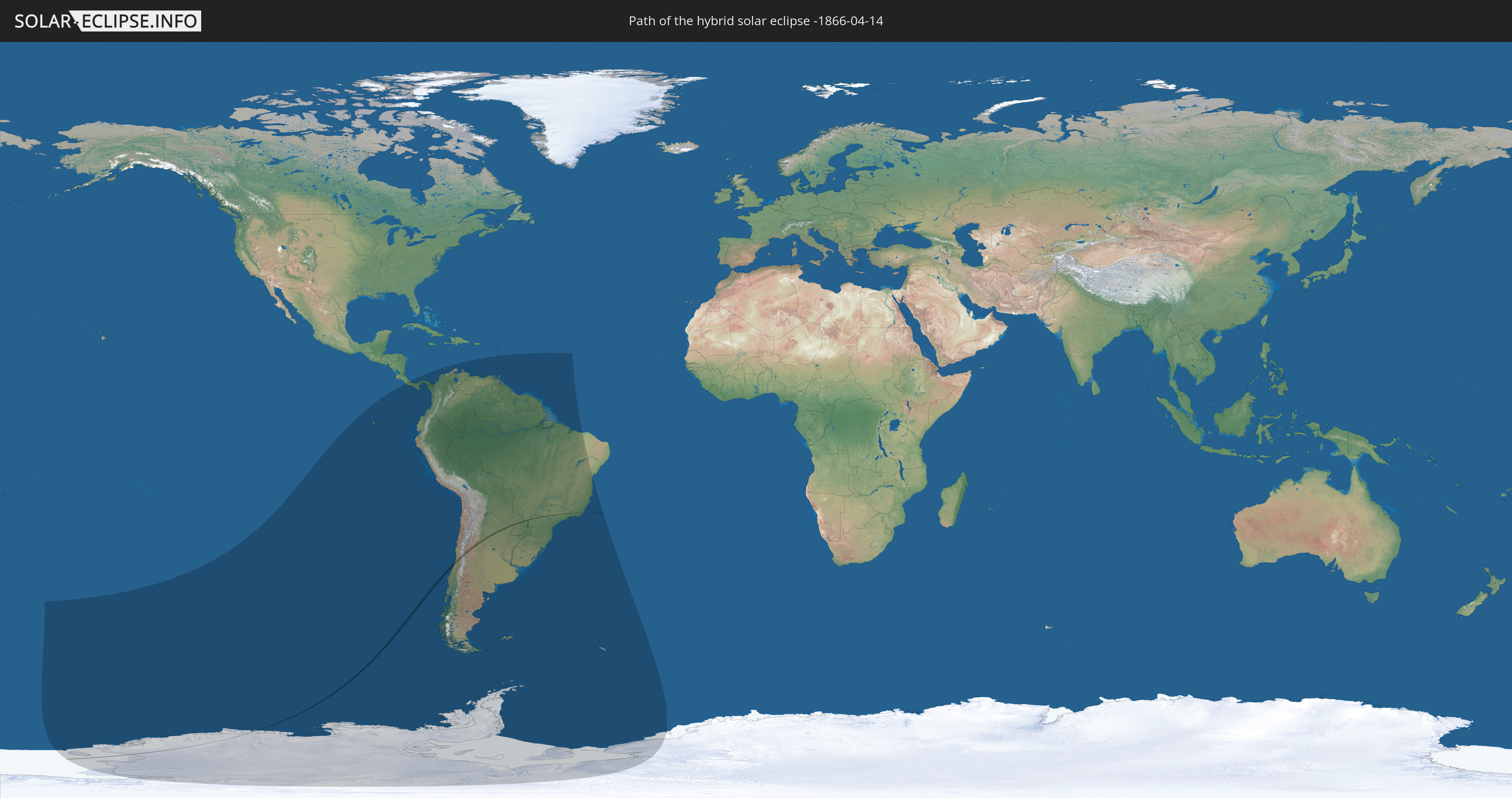
Hybrid solar eclipse of 04/14/-1866
| Day of week: | Monday |
| Maximum duration of eclipse: | 00m41s |
| Maximum width of eclipse path: | 45 km |
| Saros cycle: | -1 |
| Coverage: | 100% |
| Magnitude: | 1.0084 |
| Gamma: | -0.7818 |
Wo kann man die Sonnenfinsternis vom 04/14/-1866 sehen?
Die Sonnenfinsternis am 04/14/-1866 kann man in 26 Ländern als partielle Sonnenfinsternis beobachten.
Der Finsternispfad verläuft durch 5 Länder. Nur in diesen Ländern ist sie als hybrid Sonnenfinsternis zu sehen.
In den folgenden Ländern ist die Sonnenfinsternis hybrid zu sehen
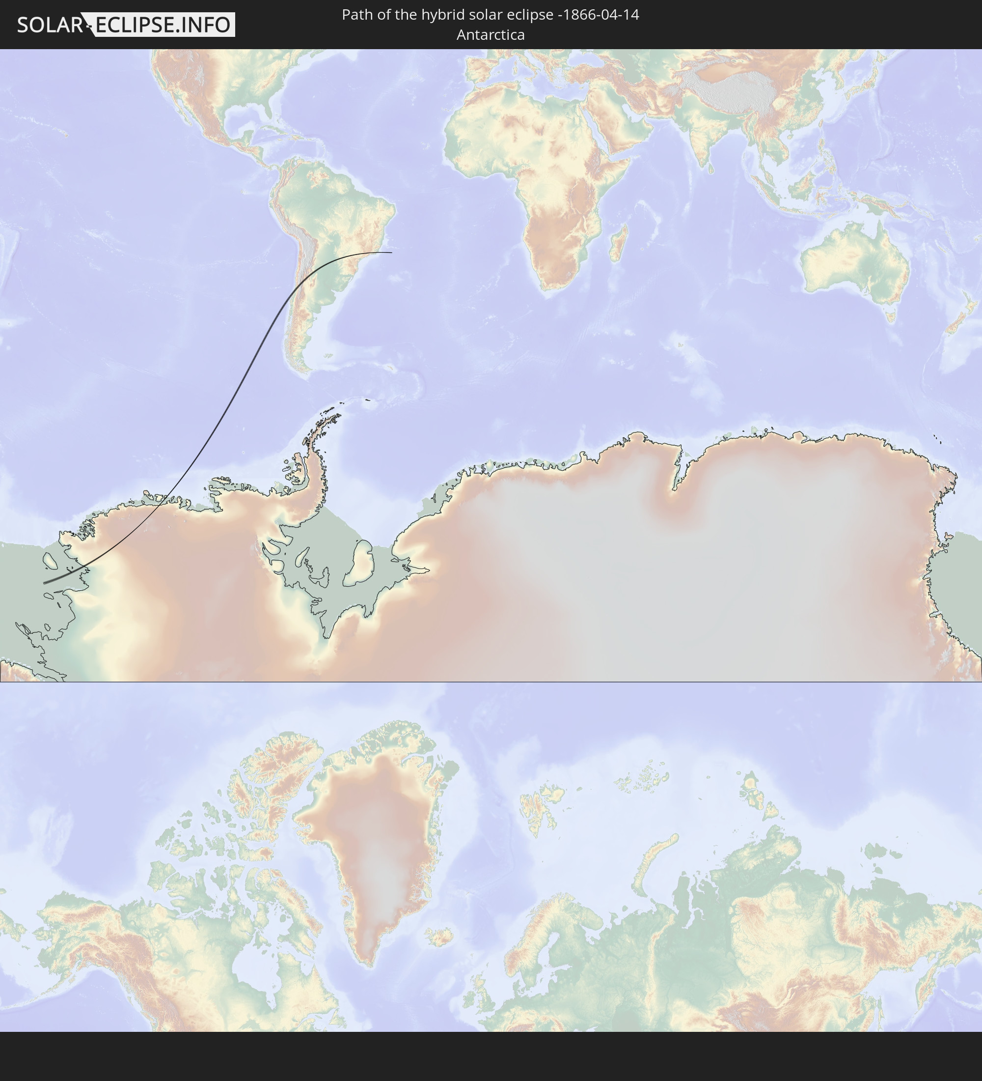 Antarctica
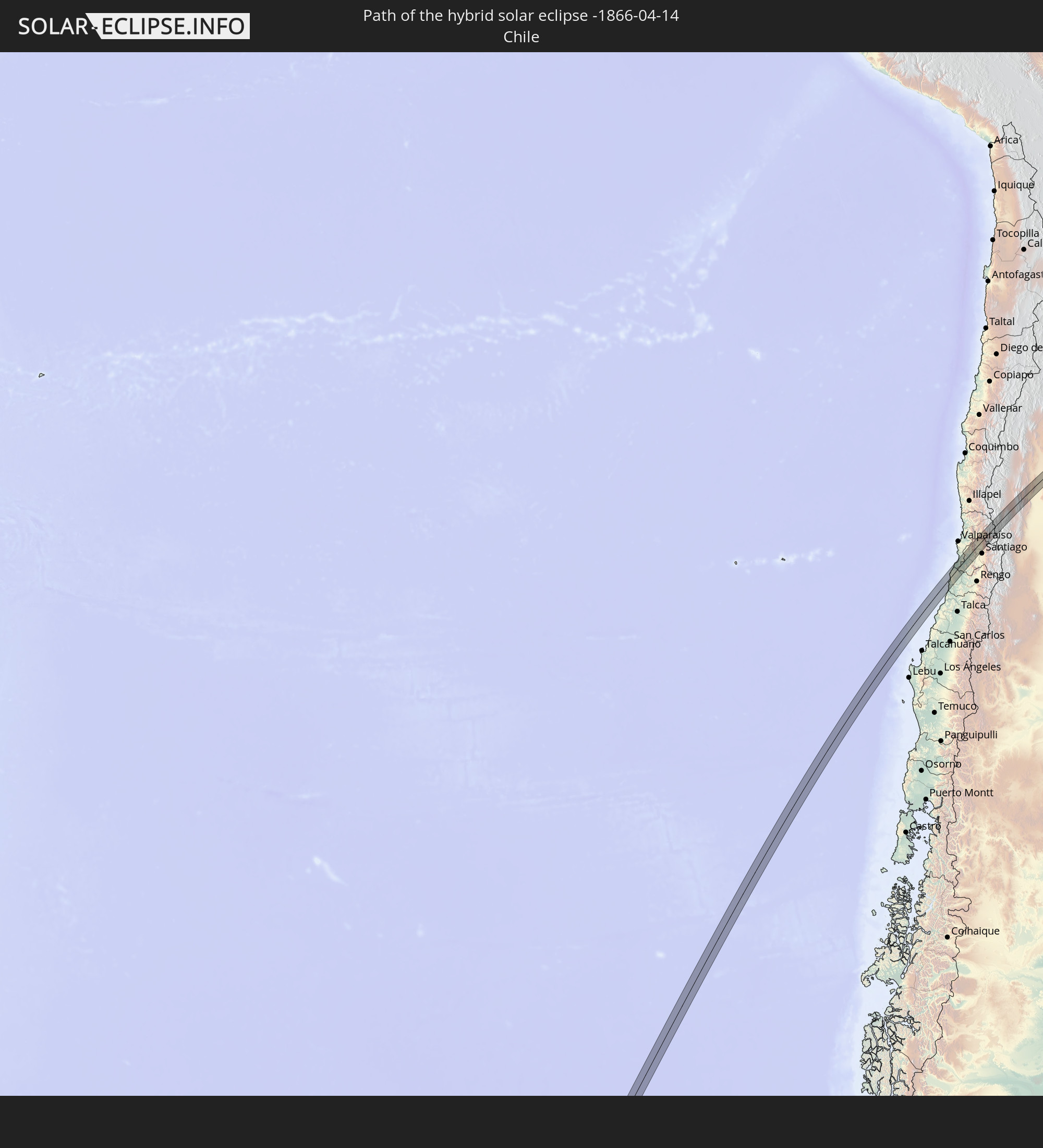 Chile
Chile
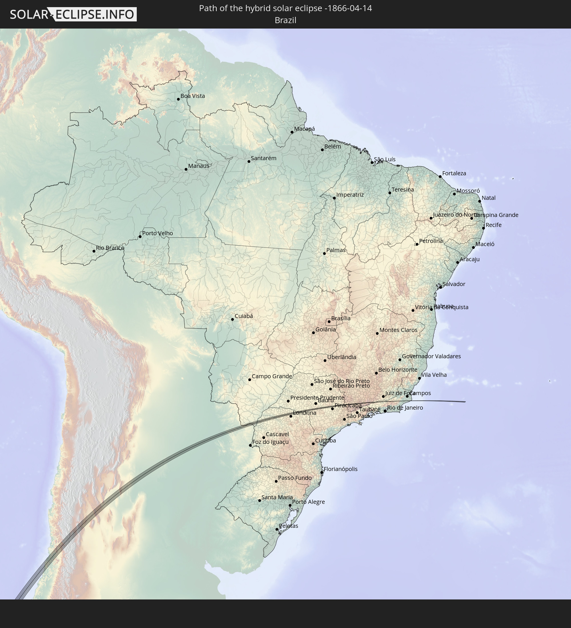 Brazil
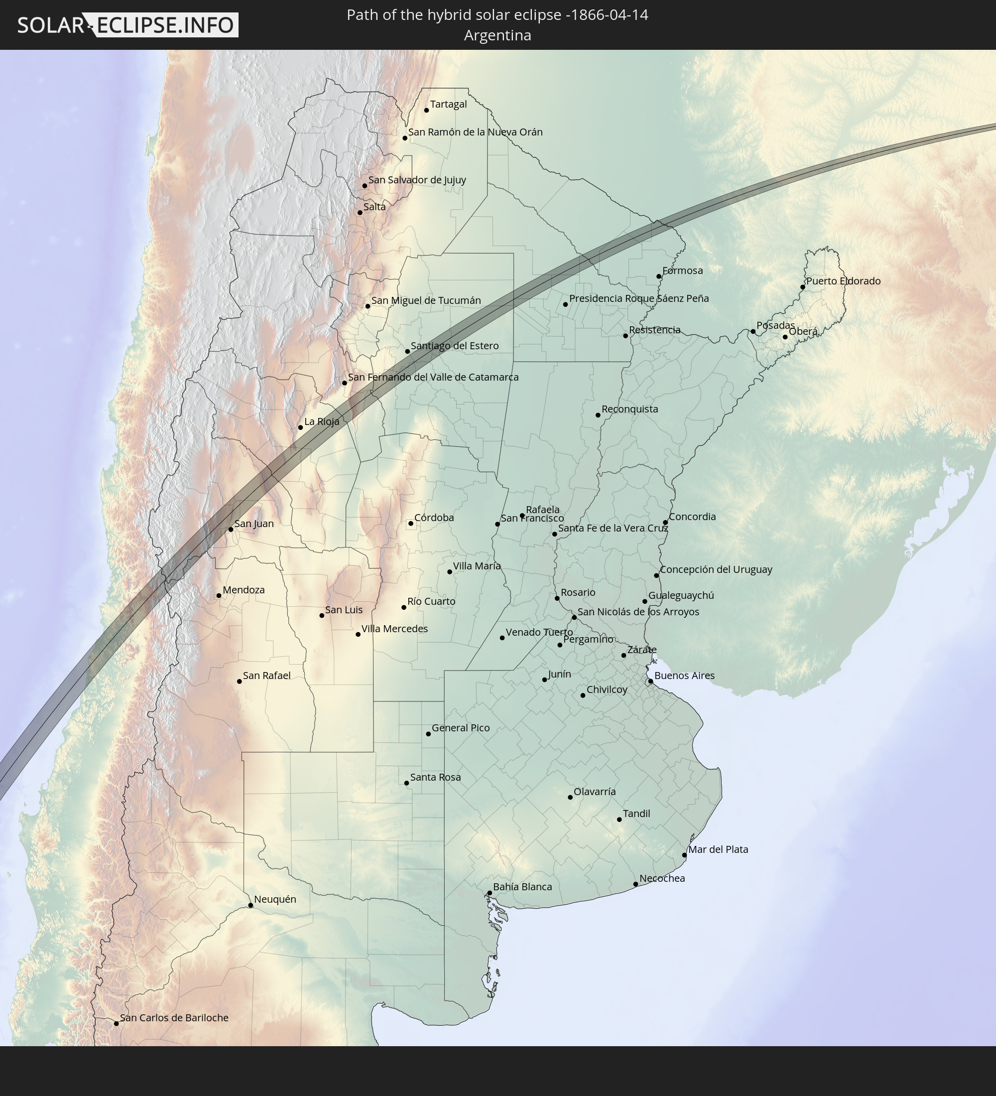 Argentina
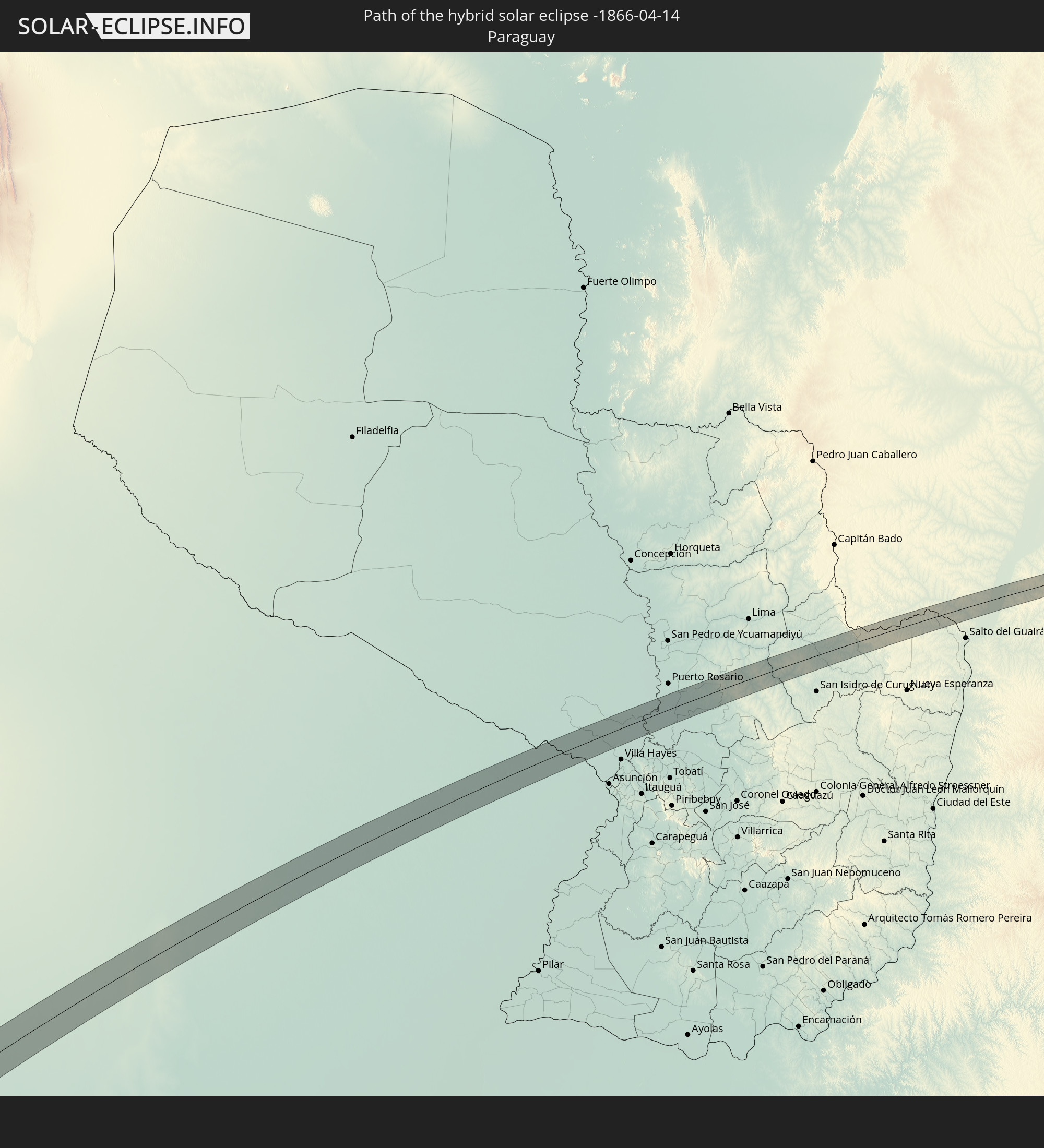 Paraguay
In den folgenden Ländern ist die Sonnenfinsternis partiell zu sehen
 Antarctica
 Chile
Chile
 Ecuador
 Costa Rica
 Panama
 Colombia
 Peru
Peru
 Brazil
 Argentina
 Venezuela
 Aruba
Aruba
 Bolivia
 Paraguay
 Trinidad and Tobago
 Grenada
 Dominica
 Saint Vincent and the Grenadines
 Falkland Islands
 Guyana
 Martinique
 Saint Lucia
 Barbados
 Uruguay
 Suriname
 French Guiana
 South Georgia and the South Sandwich Islands
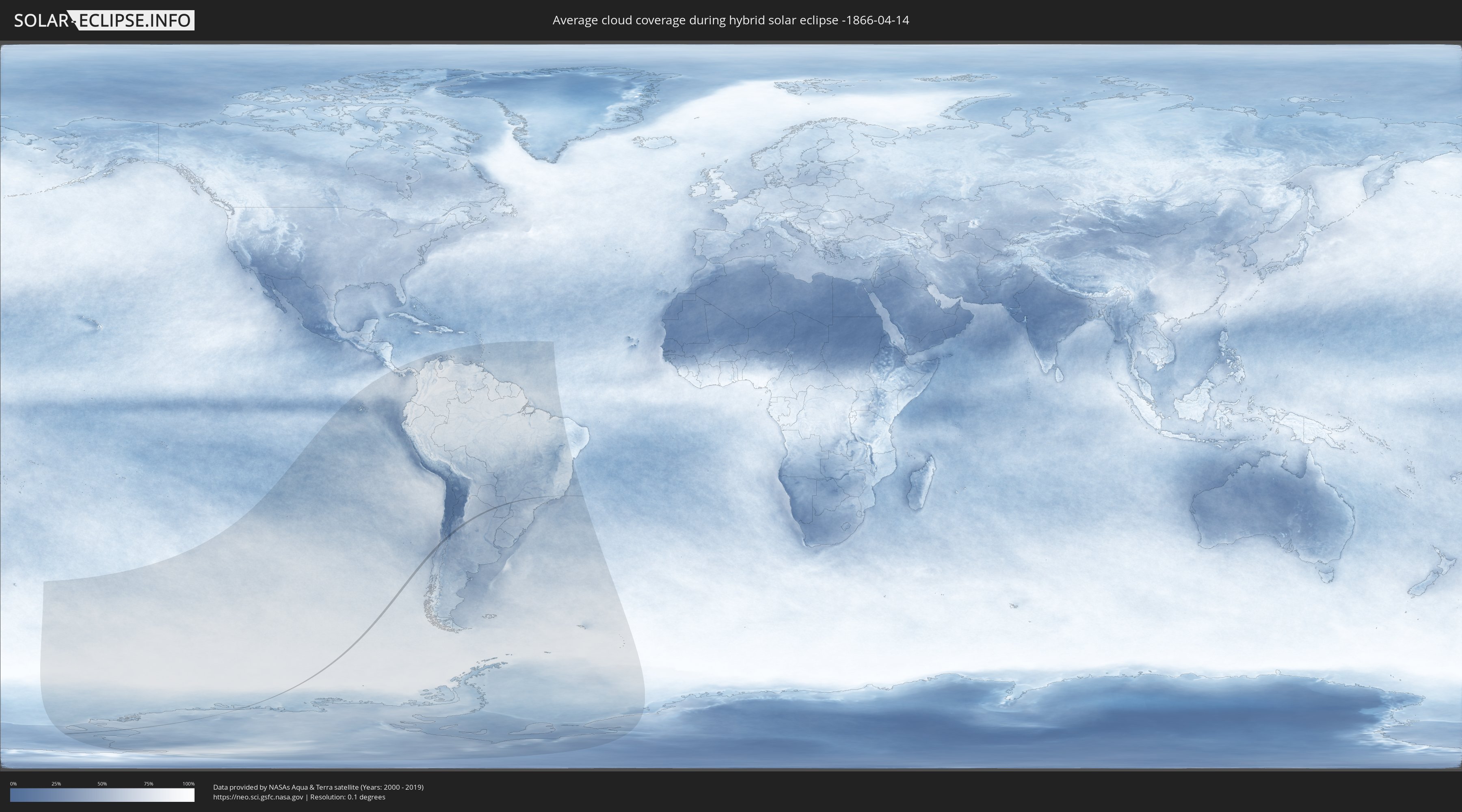
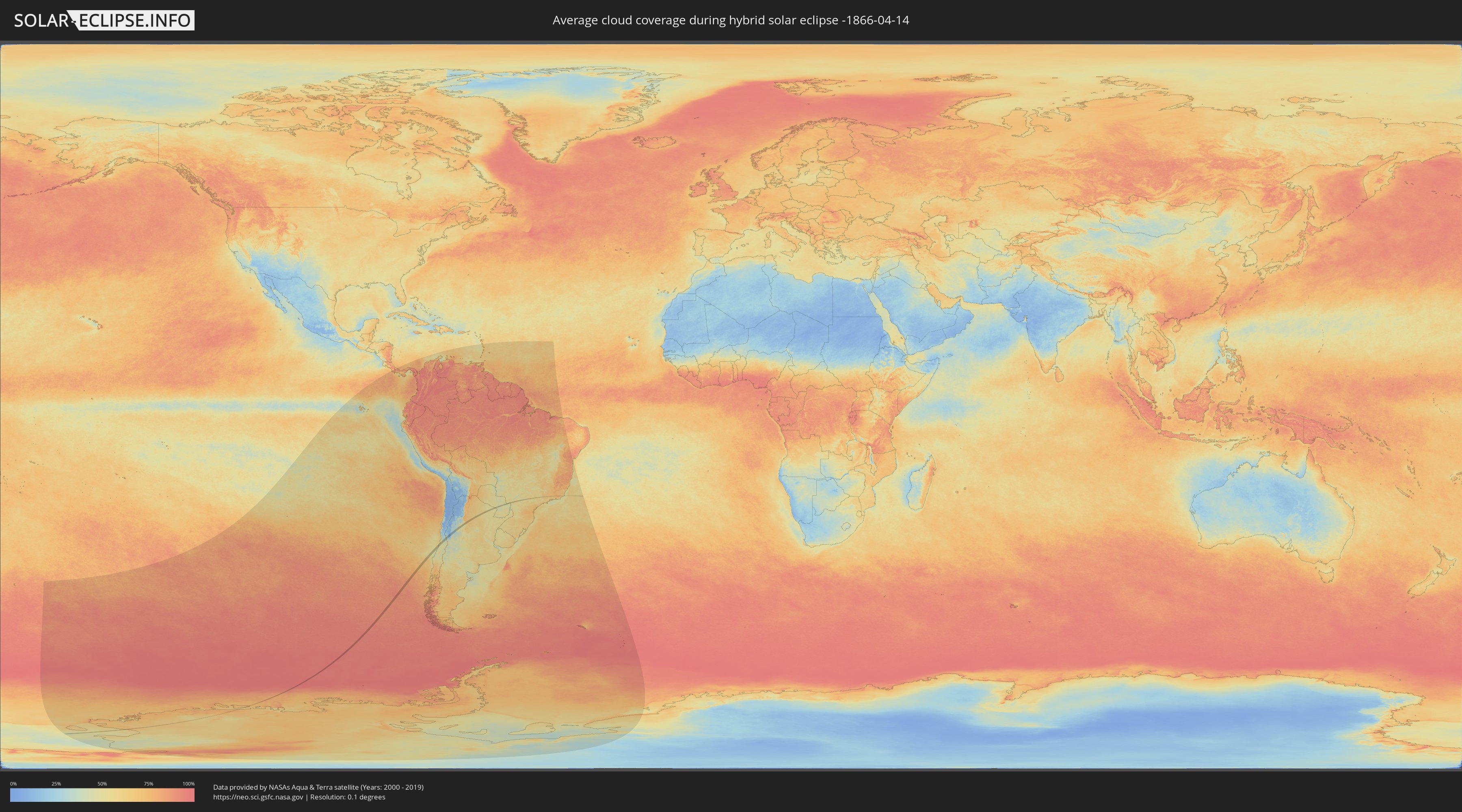
How will be the weather during the hybrid solar eclipse on 04/14/-1866?
Where is the best place to see the hybrid solar eclipse of 04/14/-1866?
The following maps show the average cloud coverage for the day of the hybrid solar eclipse.
With the help of these maps, it is possible to find the place along the eclipse path, which has the best
chance of a cloudless sky.
Nevertheless, you should consider local circumstances and inform about the weather of your chosen
observation site.
The data is provided by NASAs satellites
AQUA and TERRA.
The cloud maps are averaged over a period of 19 years (2000 - 2019).
Detailed country maps
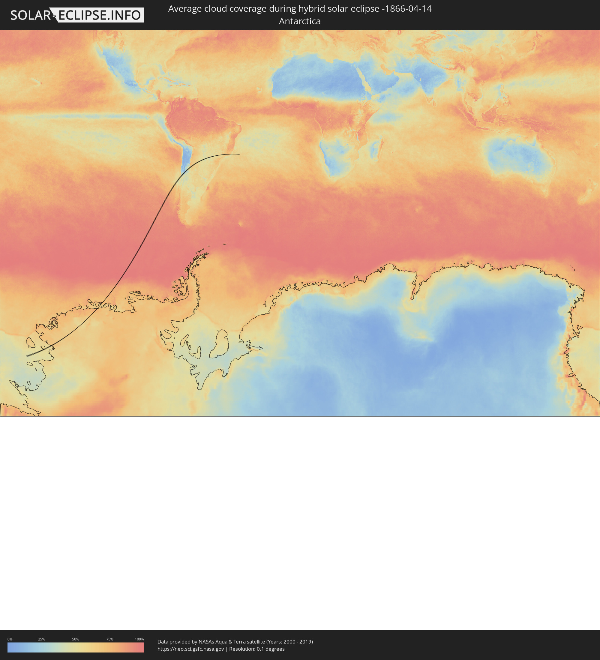 Antarctica
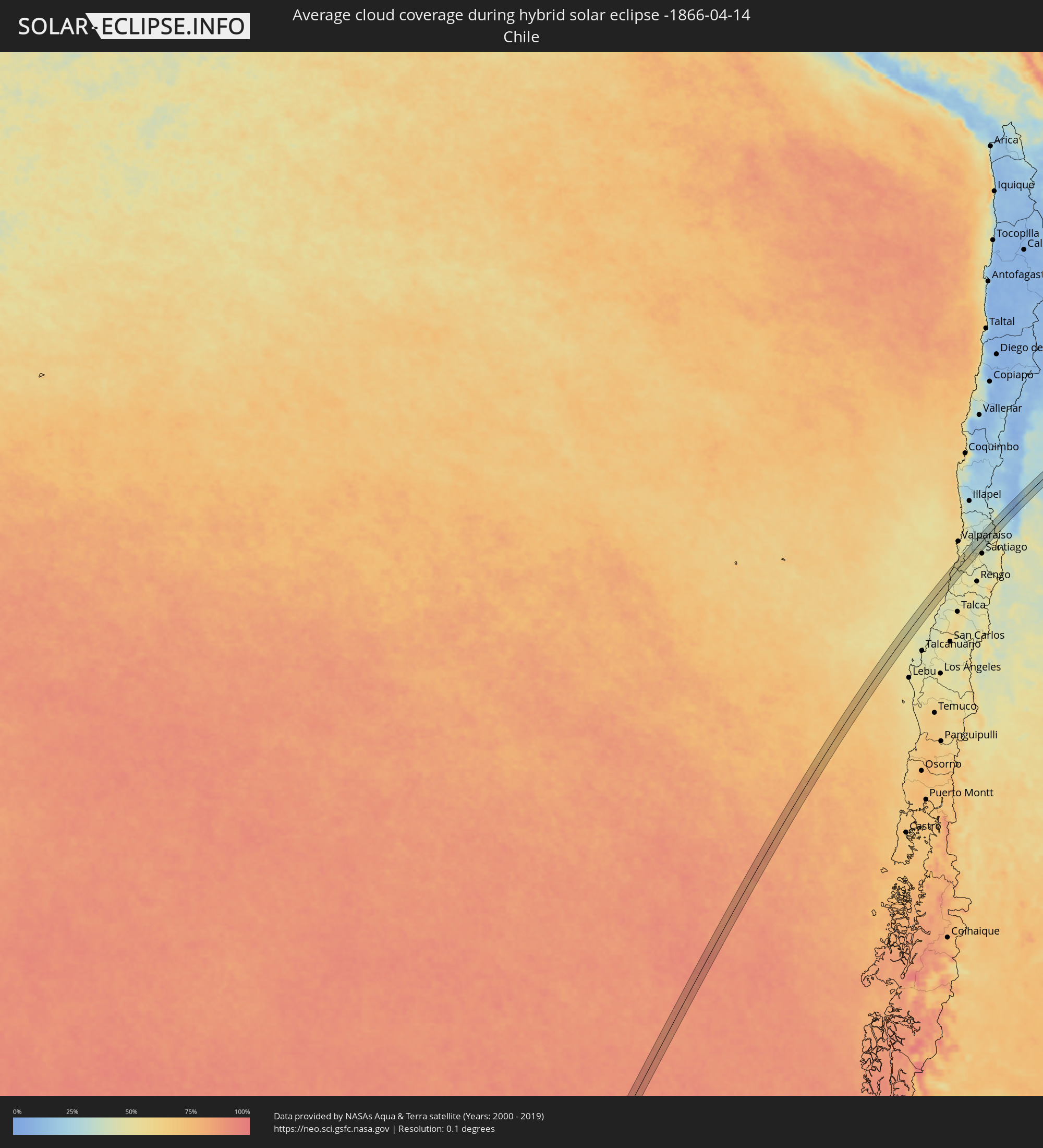 Chile
Chile
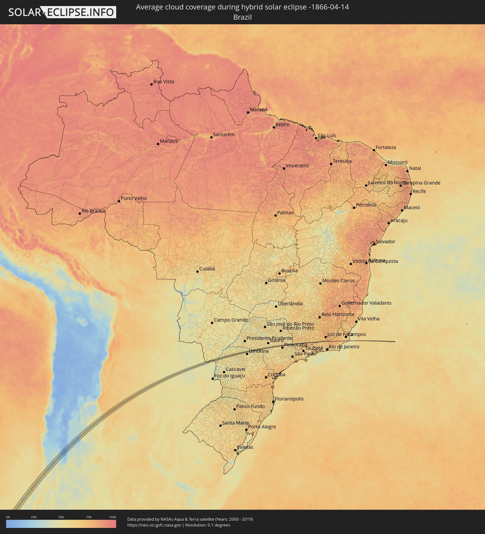 Brazil
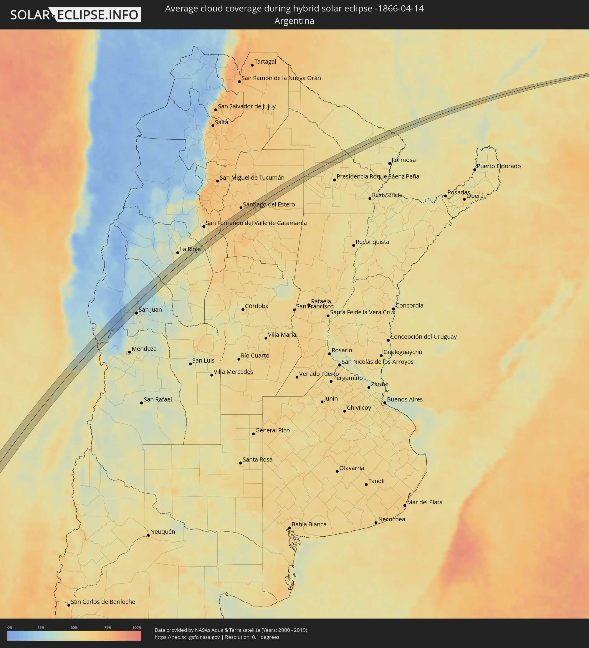 Argentina
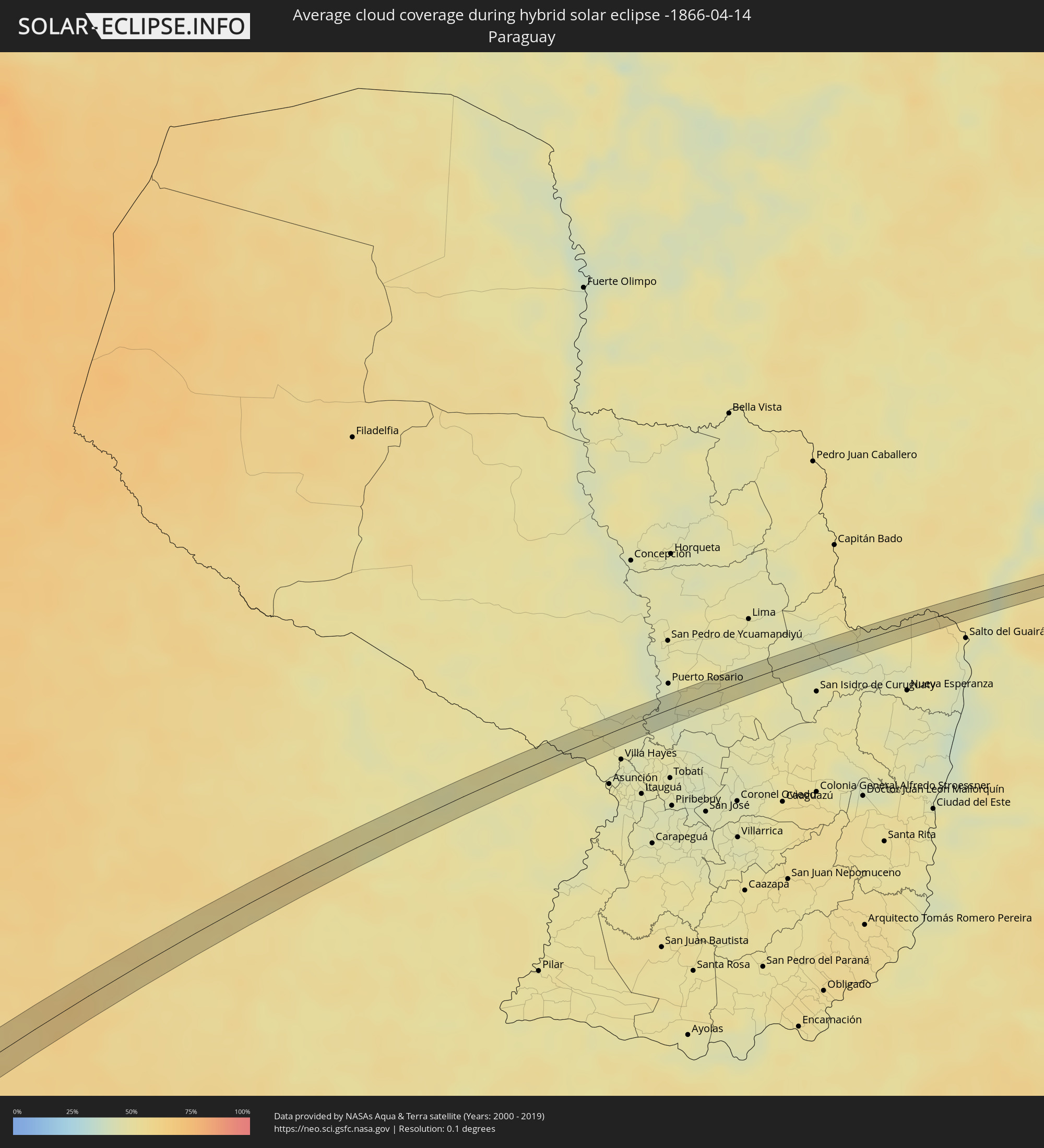 Paraguay
Cities inside the path of the eclipse
The following table shows all locations with a population of more than 5,000 inside the eclipse path. Cities which have more than 100,000 inhabitants are marked bold. A click at the locations opens a detailed map.
| City | Type | Eclipse duration | Local time of max. eclipse | Distance to central line | Ø Cloud coverage |
|
Melipilla, Santiago Metropolitan
|
total | - | 14:55:58 UTC-04:42 | 10 km | 49% |
|
Lampa, Santiago Metropolitan
|
total | - | 14:57:13 UTC-04:42 | 4 km | 42% |
|
Chicureo Abajo, Santiago Metropolitan
|
total | - | 14:57:30 UTC-04:42 | 20 km | 45% |
|
Los Andes, Valparaíso
|
total | - | 14:58:30 UTC-04:42 | 10 km | 37% |
|
Icaño, Catamarca Province
|
total | - | 15:38:40 UTC-04:16 | 12 km | 59% |
|
Beltrán, Santiago del Estero Province
|
total | - | 15:42:13 UTC-04:16 | 13 km | 64% |
|
Los Frentones, Chaco Province
|
total | - | 15:47:40 UTC-04:16 | 10 km | 56% |
|
Pampa del Infierno, Chaco Province
|
total | - | 15:47:42 UTC-04:16 | 11 km | 55% |
|
Palo Santo, Formosa Province
|
total | - | 15:51:12 UTC-04:16 | 2 km | 49% |
|
Benjamín Aceval, Presidente Hayes
|
total | - | 16:19:57 UTC-03:50 | 13 km | 46% |
|
Eldorado, Mato Grosso do Sul
|
total | - | 16:36:46 UTC-03:38 | 1 km | 54% |
|
Astorga, Paraná
|
total | - | 17:11:24 UTC-03:06 | 7 km | 51% |
|
Bela Vista do Paraíso, Paraná
|
total | - | 17:12:05 UTC-03:06 | 8 km | 51% |
|
Sertanópolis, Paraná
|
total | - | 17:12:03 UTC-03:06 | 2 km | 52% |
|
São Pedro, São Paulo
|
total | - | 17:14:29 UTC-03:06 | 1 km | 57% |
|
Charqueada, São Paulo
|
total | - | 17:14:36 UTC-03:06 | 1 km | 59% |
|
Santa Gertrudes, São Paulo
|
total | - | 17:14:48 UTC-03:06 | 4 km | 60% |
|
Cordeirópolis, São Paulo
|
total | - | 17:14:47 UTC-03:06 | 0 km | 60% |
|
Mogi Mirim, São Paulo
|
total | - | 17:15:05 UTC-03:06 | 1 km | 53% |
|
Itapira, São Paulo
|
total | - | 17:15:08 UTC-03:06 | 3 km | 55% |