Total solar eclipse of 08/25/-1900
| Day of week: | Wednesday |
| Maximum duration of eclipse: | 03m56s |
| Maximum width of eclipse path: | 222 km |
| Saros cycle: | 24 |
| Coverage: | 100% |
| Magnitude: | 1.0467 |
| Gamma: | -0.725 |
Wo kann man die Sonnenfinsternis vom 08/25/-1900 sehen?
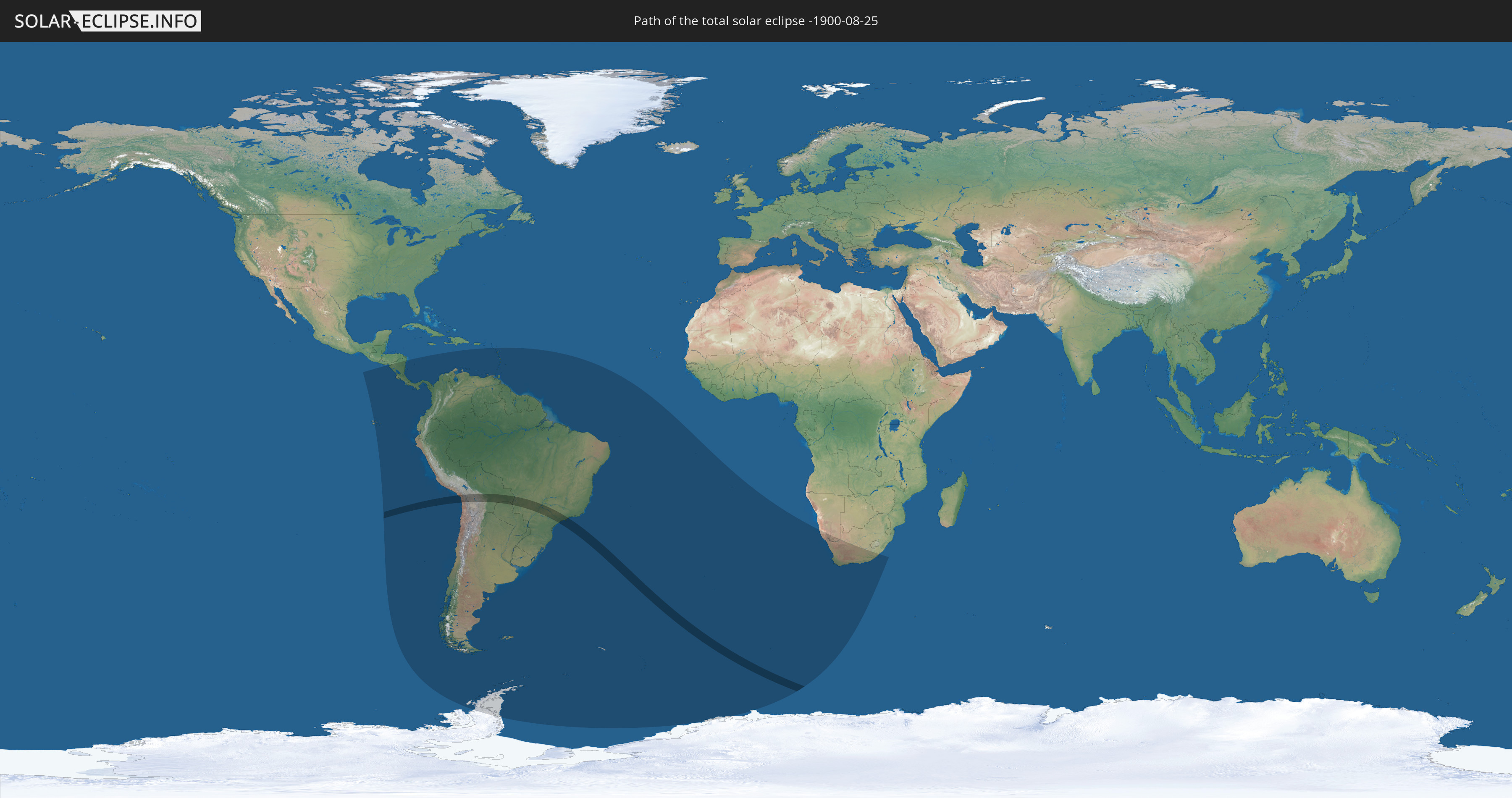
Die Sonnenfinsternis am 08/25/-1900 kann man in 36 Ländern als partielle Sonnenfinsternis beobachten.
Der Finsternispfad verläuft durch 5 Länder. Nur in diesen Ländern ist sie als total Sonnenfinsternis zu sehen.
In den folgenden Ländern ist die Sonnenfinsternis total zu sehen
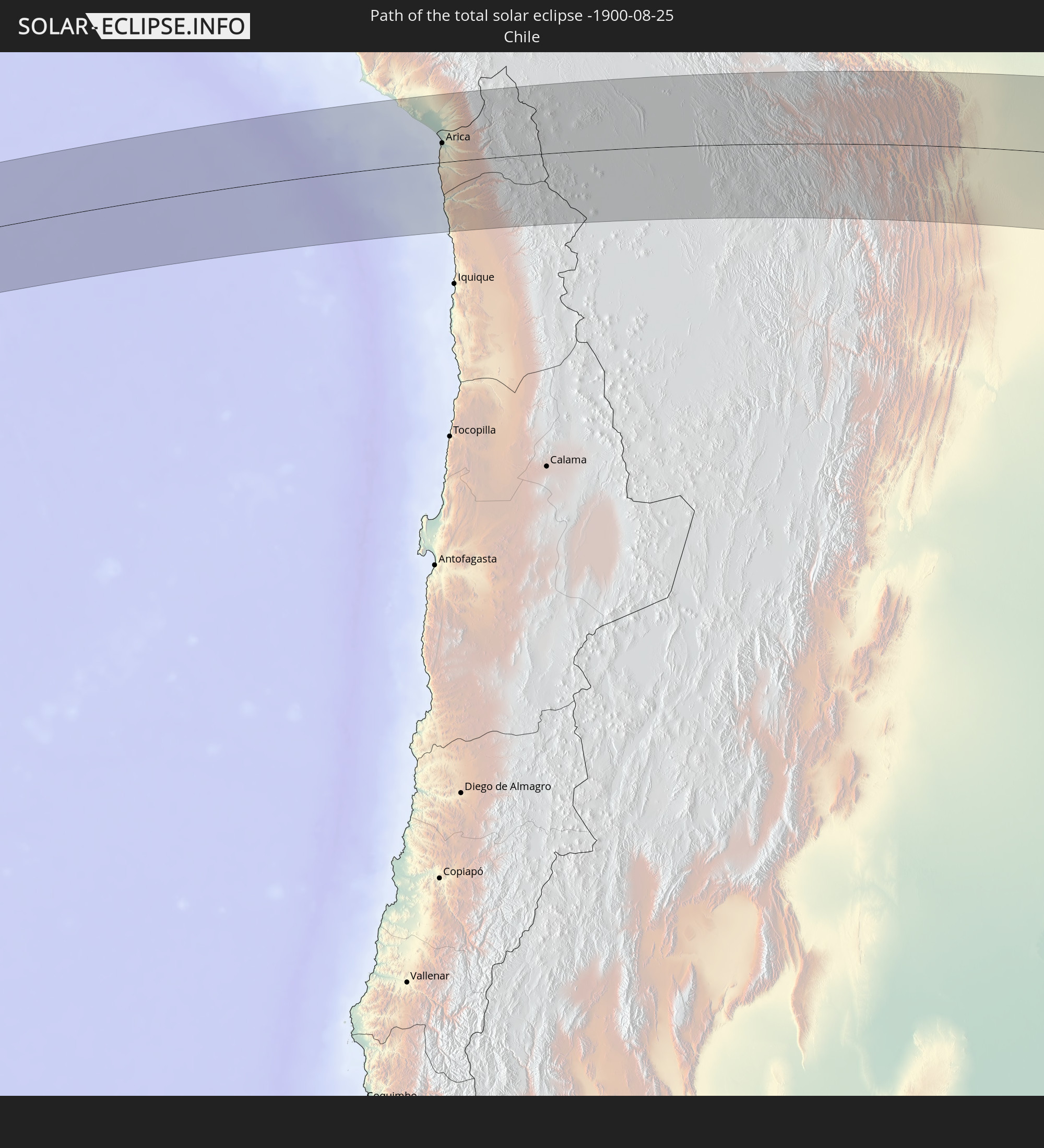 Chile
Chile
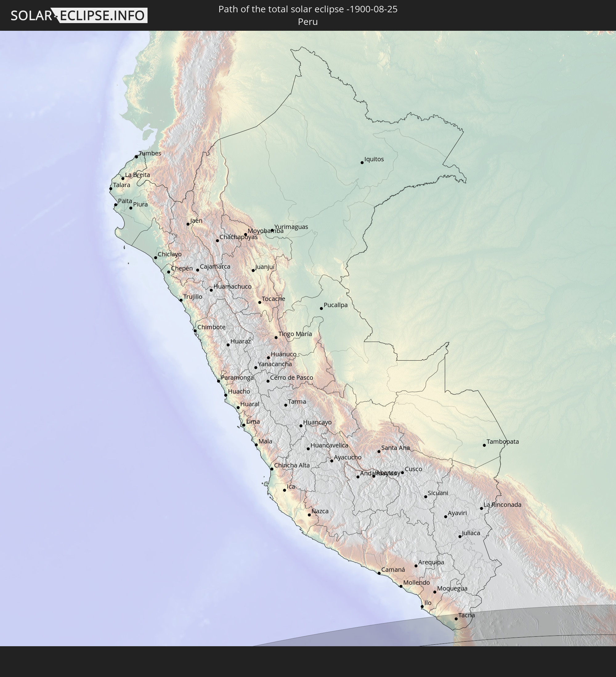 Peru
Peru
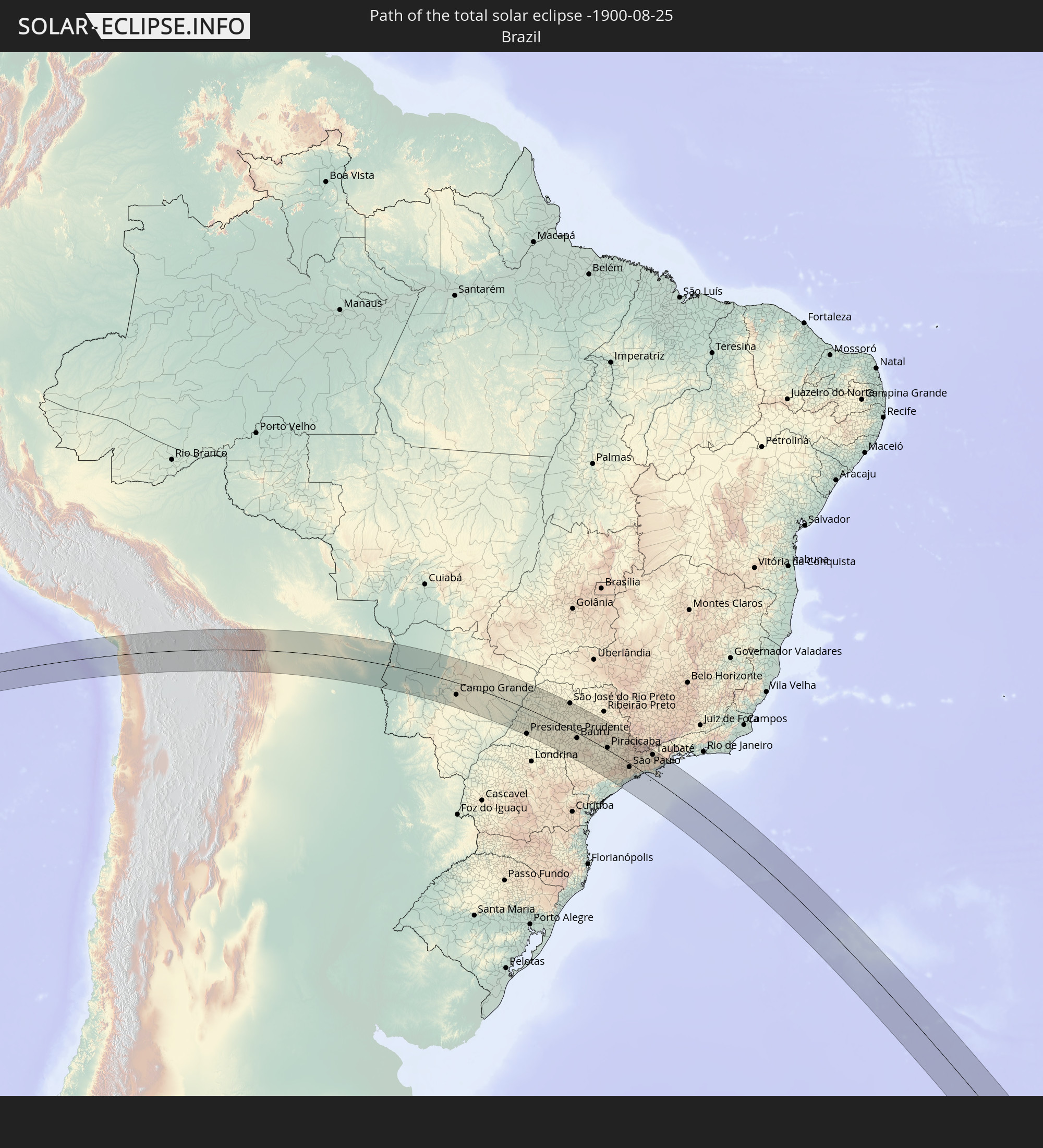 Brazil
 Bolivia
 Paraguay
In den folgenden Ländern ist die Sonnenfinsternis partiell zu sehen
 Antarctica
 Chile
Chile
 Ecuador
 Honduras
 Nicaragua
 Costa Rica
 Panama
 Colombia
 Peru
Peru
 Brazil
 Argentina
 Venezuela
 Aruba
Aruba
 Bolivia
 Saint Kitts and Nevis
 Paraguay
 Antigua and Barbuda
 Montserrat
 Trinidad and Tobago
 Guadeloupe
 Grenada
 Dominica
 Saint Vincent and the Grenadines
 Falkland Islands
 Guyana
 Martinique
 Saint Lucia
 Barbados
 Uruguay
 Suriname
 French Guiana
 South Georgia and the South Sandwich Islands
 Saint Helena, Ascension and Tristan da Cunha
 Bouvet Island
 Namibia
 South Africa
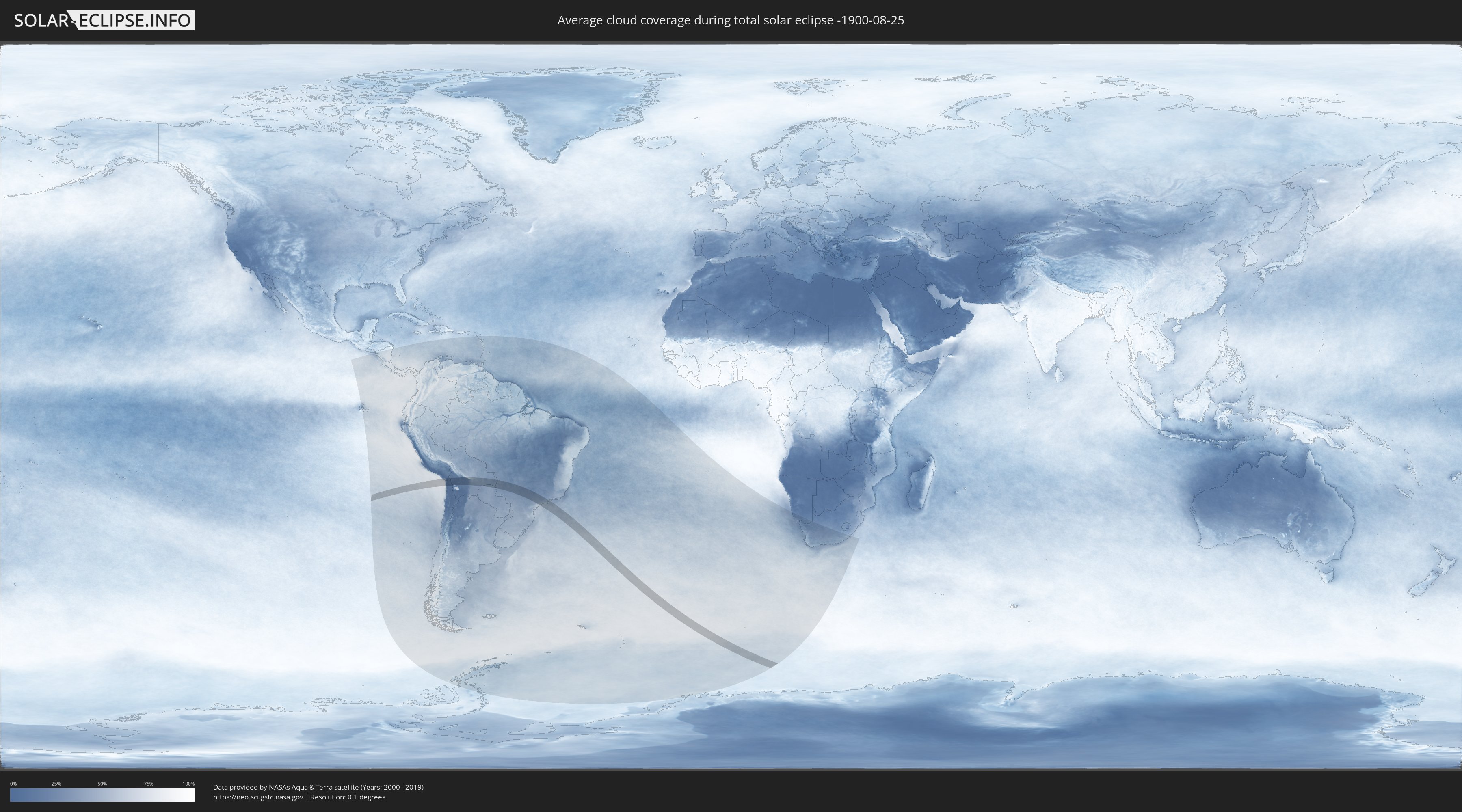
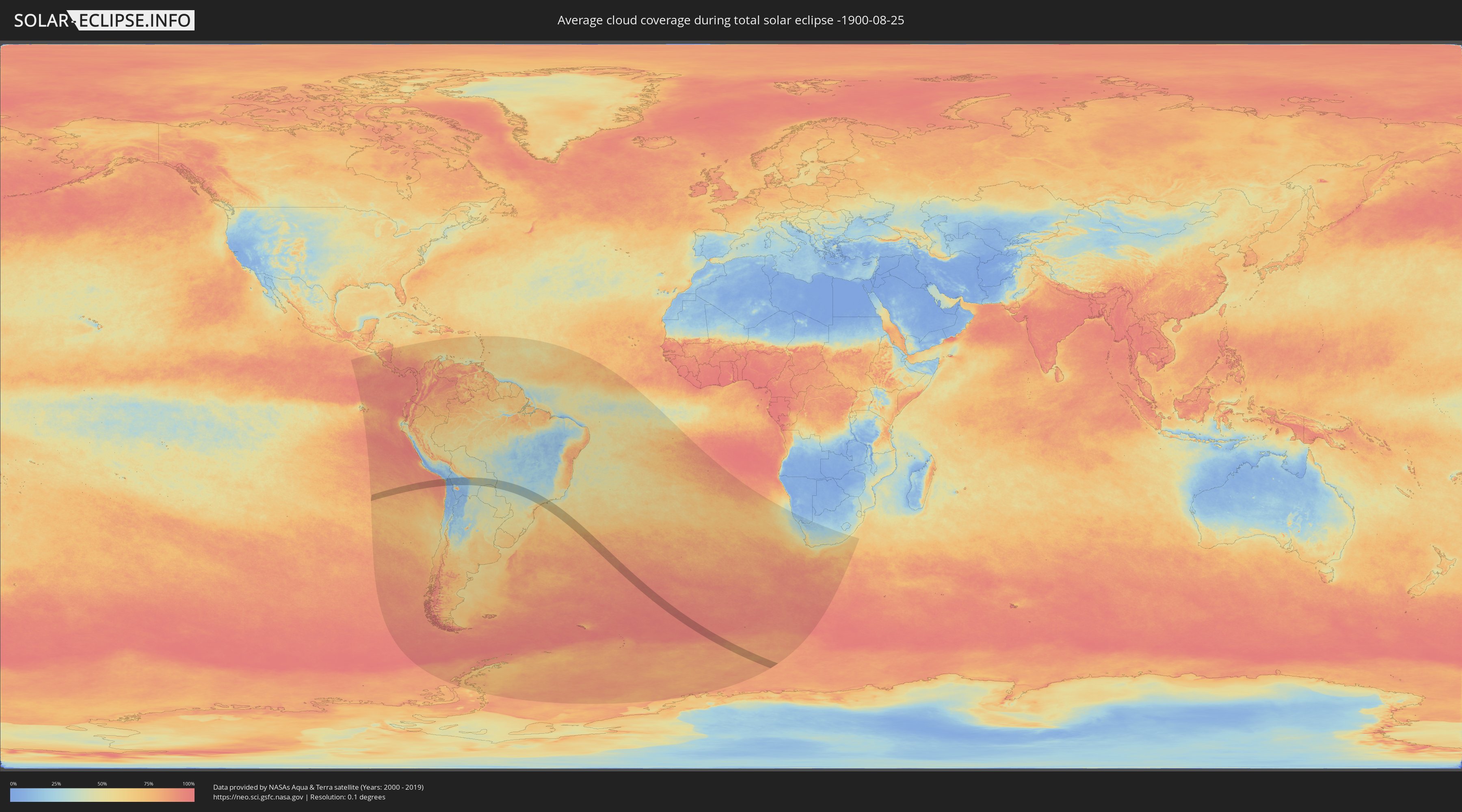
How will be the weather during the total solar eclipse on 08/25/-1900?
Where is the best place to see the total solar eclipse of 08/25/-1900?
The following maps show the average cloud coverage for the day of the total solar eclipse.
With the help of these maps, it is possible to find the place along the eclipse path, which has the best
chance of a cloudless sky.
Nevertheless, you should consider local circumstances and inform about the weather of your chosen
observation site.
The data is provided by NASAs satellites
AQUA and TERRA.
The cloud maps are averaged over a period of 19 years (2000 - 2019).
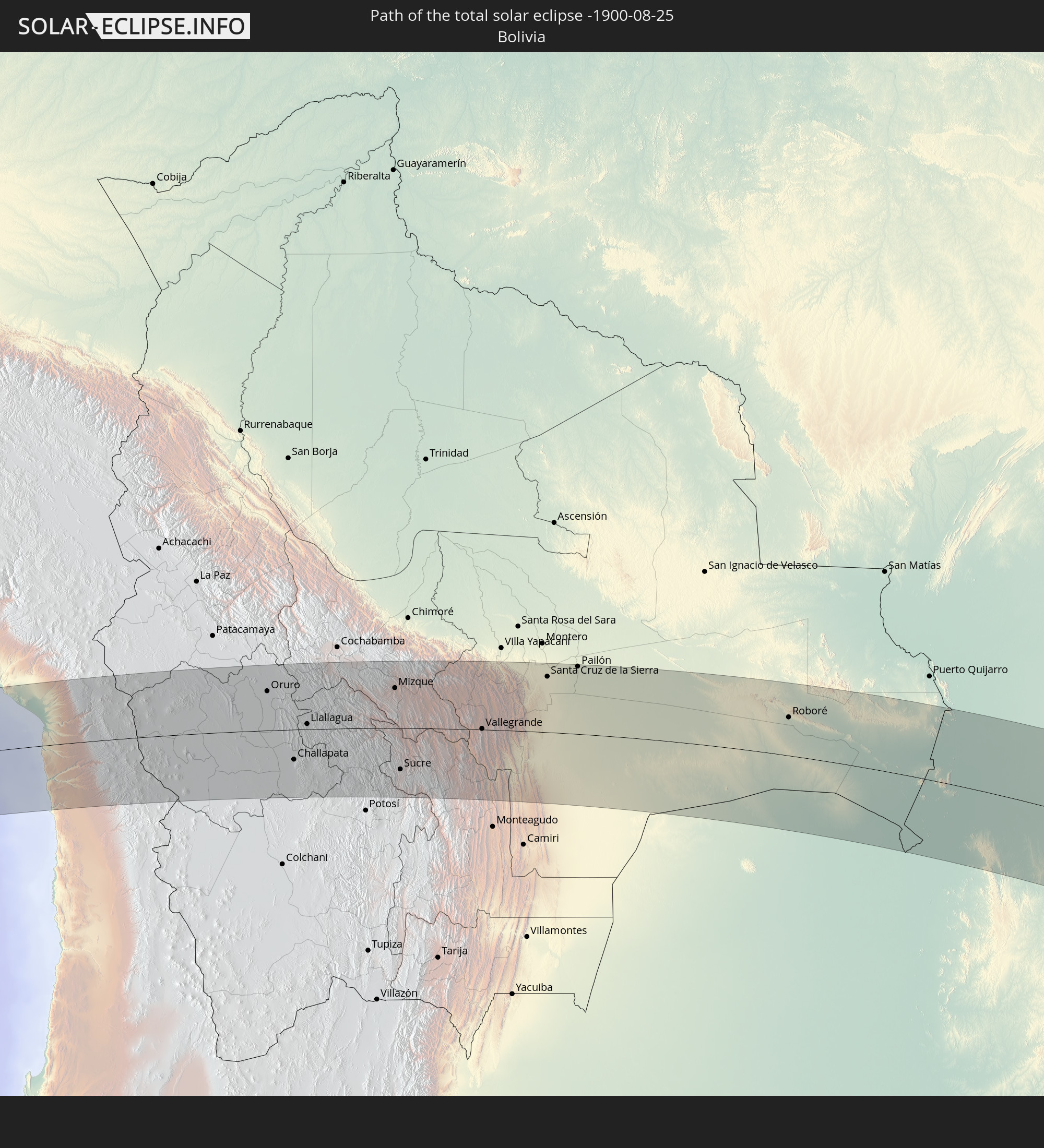
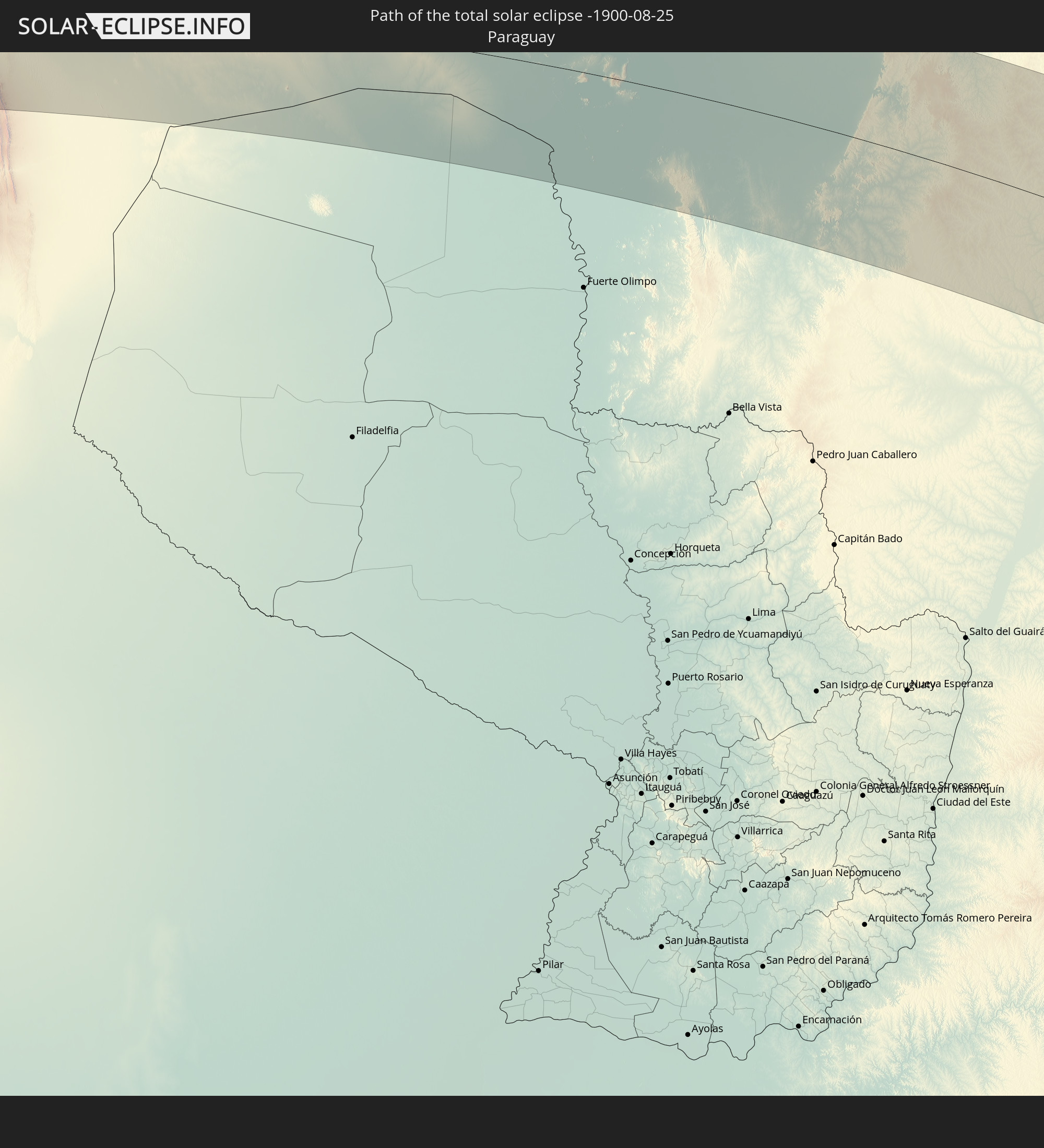
Detailed country maps
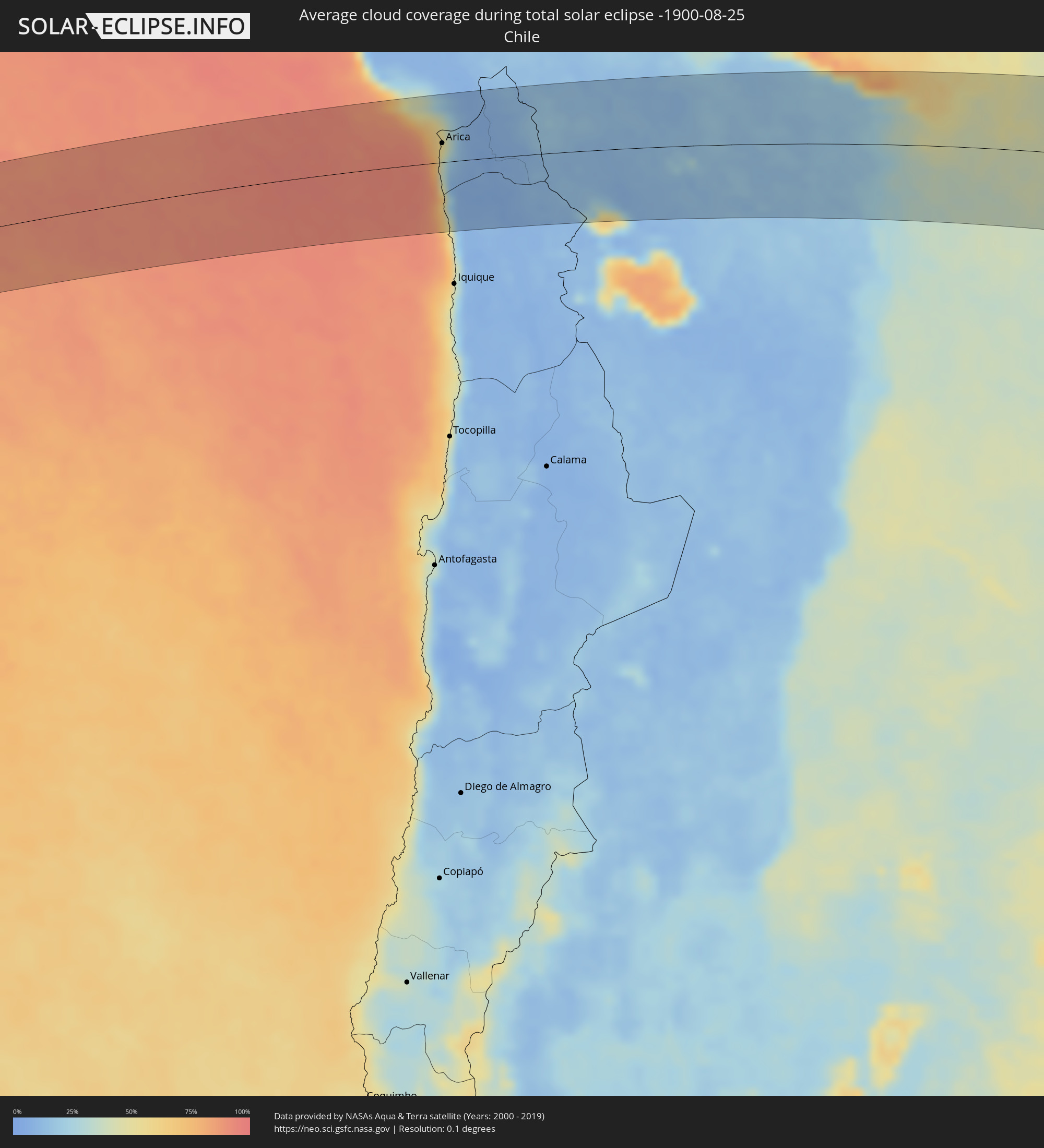 Chile
Chile
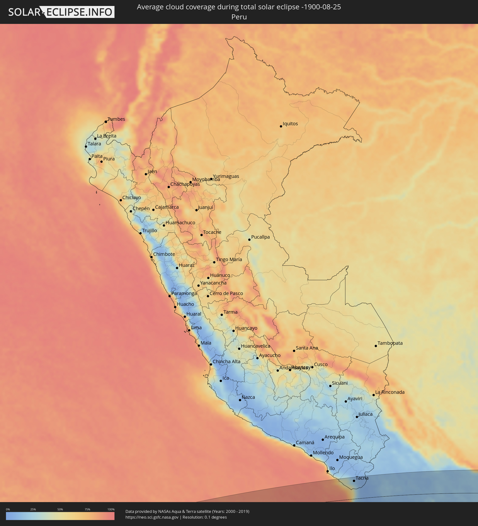 Peru
Peru
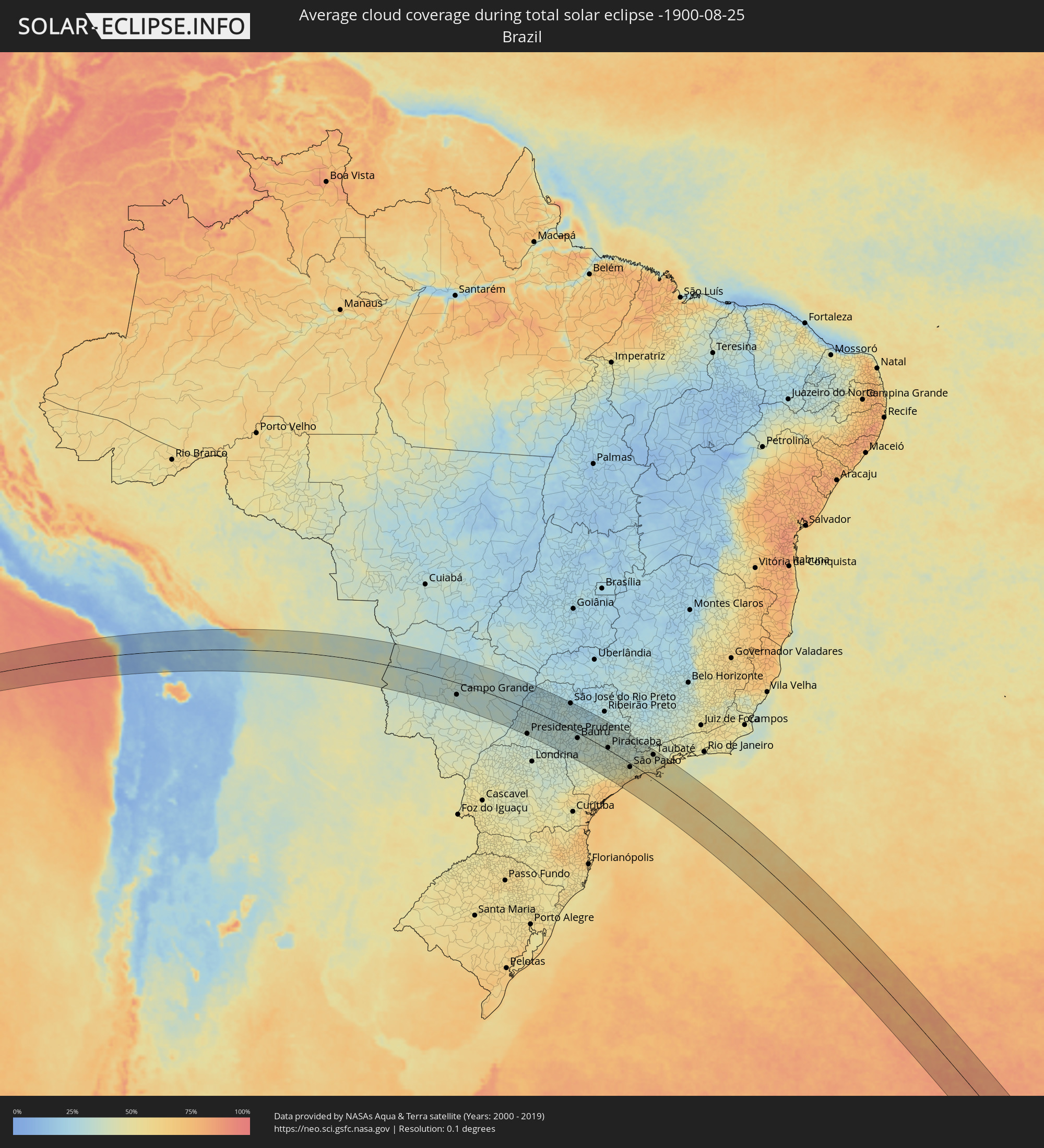 Brazil
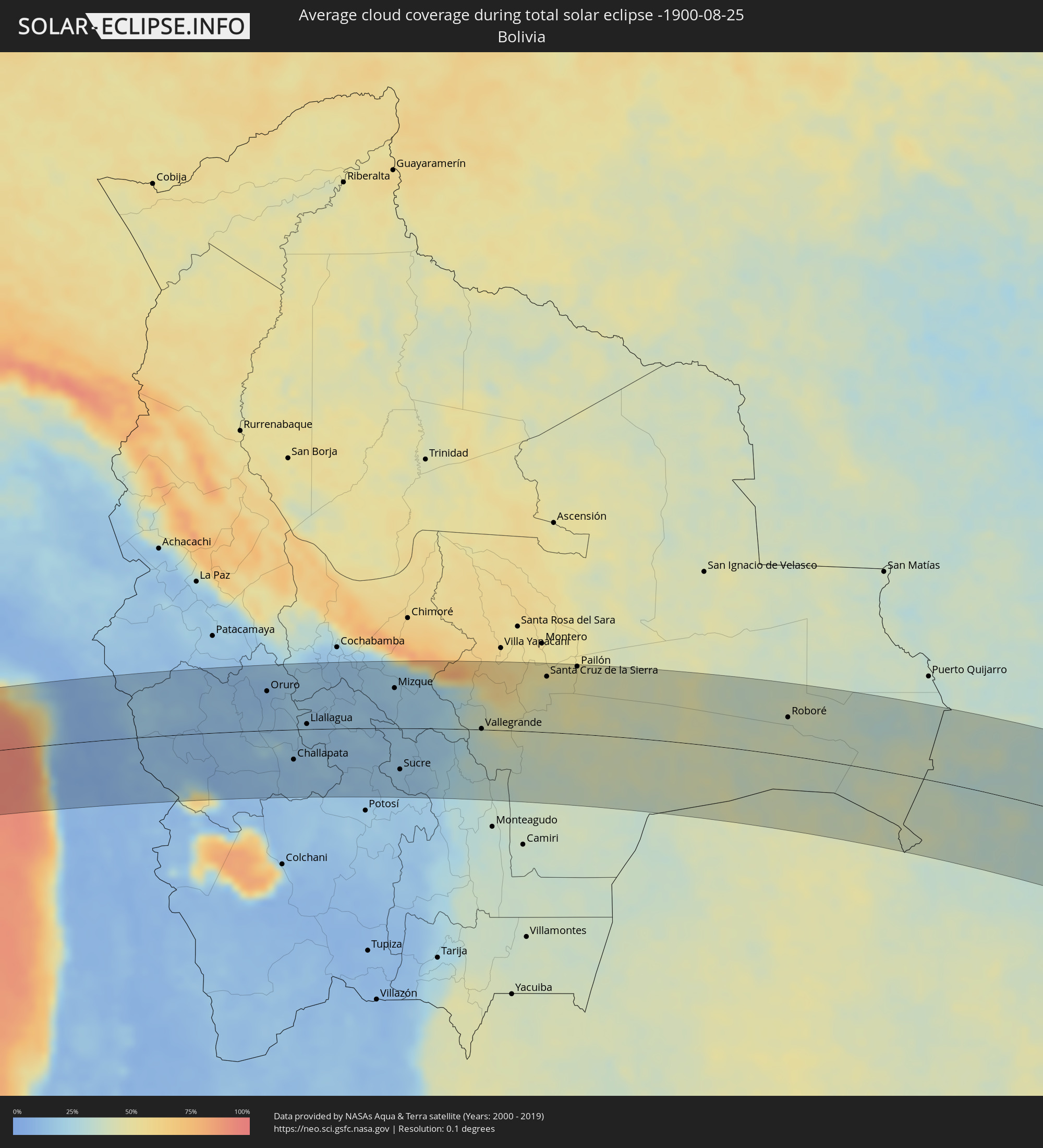 Bolivia
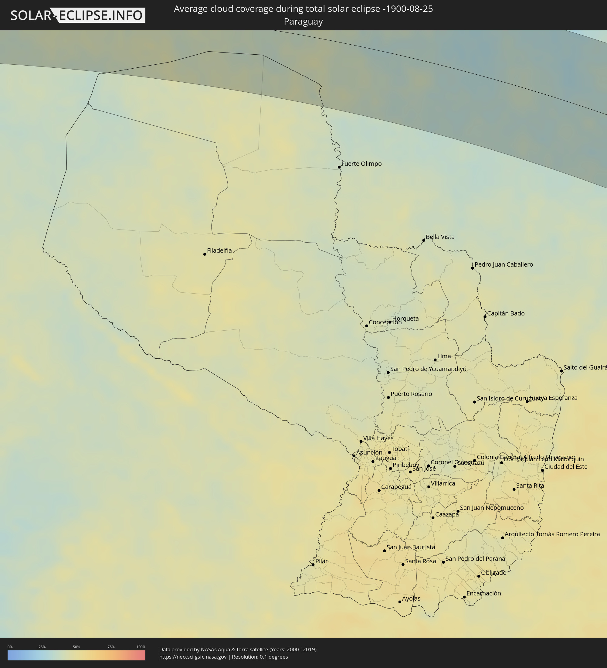 Paraguay
Cities inside the path of the eclipse
The following table shows all locations with a population of more than 5,000 inside the eclipse path. Cities which have more than 100,000 inhabitants are marked bold. A click at the locations opens a detailed map.
| City | Type | Eclipse duration | Local time of max. eclipse | Distance to central line | Ø Cloud coverage |
|
Arica, Arica y Parinacota
|
total | - | 07:52:58 UTC-04:42 | 26 km | 47% |
|
Tacna, Tacna
|
total | - | 07:26:34 UTC-05:08 | 77 km | 33% |
|
Oruro, Oruro
|
total | - | 08:06:23 UTC-04:32 | 59 km | 11% |
|
Huanuni, Oruro
|
total | - | 08:07:13 UTC-04:32 | 24 km | 18% |
|
Challapata, Oruro
|
total | - | 08:08:10 UTC-04:32 | 45 km | 15% |
|
Llallagua, Potosí
|
total | - | 08:07:45 UTC-04:32 | 8 km | 20% |
|
Capinota, Cochabamba
|
total | - | 08:07:13 UTC-04:32 | 86 km | 14% |
|
Tarata, Cochabamba
|
total | - | 08:07:24 UTC-04:32 | 97 km | 15% |
|
Cliza, Cochabamba
|
total | - | 08:07:29 UTC-04:32 | 100 km | 16% |
|
Mizque, Cochabamba
|
total | - | 08:08:49 UTC-04:32 | 60 km | 19% |
|
Sucre, Chuquisaca
|
total | - | 08:10:27 UTC-04:32 | 61 km | 17% |
|
Aiquile, Cochabamba
|
total | - | 08:09:24 UTC-04:32 | 31 km | 18% |
|
Vallegrande, Santa Cruz
|
total | - | 08:11:23 UTC-04:32 | 1 km | 37% |
|
Santiago del Torno, Santa Cruz
|
total | - | 08:11:45 UTC-04:32 | 60 km | 46% |
|
Santa Cruz de la Sierra, Santa Cruz
|
total | - | 08:11:47 UTC-04:32 | 83 km | 47% |
|
Cotoca, Santa Cruz
|
total | - | 08:12:01 UTC-04:32 | 81 km | 47% |
|
San Julian, Santa Cruz
|
total | - | 08:12:15 UTC-04:32 | 85 km | 46% |
|
Pailón, Santa Cruz
|
total | - | 08:12:15 UTC-04:32 | 101 km | 49% |
|
Roboré, Santa Cruz
|
total | - | 08:18:06 UTC-04:32 | 57 km | 38% |
|
Corumbá, Mato Grosso do Sul
|
total | - | 09:16:57 UTC-03:38 | 20 km | 37% |
|
Campo Grande, Mato Grosso do Sul
|
total | - | 09:24:48 UTC-03:38 | 55 km | 31% |
|
Três Lagoas, Mato Grosso do Sul
|
total | - | 09:31:13 UTC-03:38 | 14 km | 27% |
|
Presidente Prudente, São Paulo
|
total | - | 10:05:59 UTC-03:06 | 110 km | 34% |
|
Araçatuba, São Paulo
|
total | - | 10:06:31 UTC-03:06 | 24 km | 28% |
|
Marília, São Paulo
|
total | - | 10:09:07 UTC-03:06 | 55 km | 32% |
|
São José do Rio Preto, São Paulo
|
total | - | 10:08:06 UTC-03:06 | 110 km | 27% |
|
Bauru, São Paulo
|
total | - | 10:11:08 UTC-03:06 | 23 km | 34% |
|
Catanduva, São Paulo
|
total | - | 10:09:28 UTC-03:06 | 98 km | 28% |
|
Avaré, São Paulo
|
total | - | 10:12:39 UTC-03:06 | 93 km | 40% |
|
Jaú, São Paulo
|
total | - | 10:12:10 UTC-03:06 | 4 km | 37% |
|
Botucatu, São Paulo
|
total | - | 10:13:20 UTC-03:06 | 48 km | 36% |
|
Matão, São Paulo
|
total | - | 10:11:29 UTC-03:06 | 81 km | 31% |
|
Araraquara, São Paulo
|
total | - | 10:12:11 UTC-03:06 | 72 km | 32% |
|
Itapetininga, São Paulo
|
total | - | 10:15:16 UTC-03:06 | 95 km | 43% |
|
São Carlos, São Paulo
|
total | - | 10:13:09 UTC-03:06 | 64 km | 32% |
|
Tatuí, São Paulo
|
total | - | 10:15:19 UTC-03:06 | 63 km | 40% |
|
Piracicaba, São Paulo
|
total | - | 10:14:46 UTC-03:06 | 9 km | 37% |
|
Rio Claro, São Paulo
|
total | - | 10:14:28 UTC-03:06 | 43 km | 35% |
|
Sorocaba, São Paulo
|
total | - | 10:16:24 UTC-03:06 | 55 km | 42% |
|
Santa Bárbara d'Oeste, São Paulo
|
total | - | 10:15:19 UTC-03:06 | 18 km | 38% |
|
Limeira, São Paulo
|
total | - | 10:15:03 UTC-03:06 | 37 km | 37% |
|
Leme, São Paulo
|
total | - | 10:14:29 UTC-03:06 | 74 km | 33% |
|
Araras, São Paulo
|
total | - | 10:14:46 UTC-03:06 | 58 km | 35% |
|
Itu, São Paulo
|
total | - | 10:16:22 UTC-03:06 | 24 km | 39% |
|
Sumaré, São Paulo
|
total | - | 10:15:44 UTC-03:06 | 19 km | 38% |
|
Indaiatuba, São Paulo
|
total | - | 10:16:17 UTC-03:06 | 3 km | 39% |
|
Campinas, São Paulo
|
total | - | 10:16:19 UTC-03:06 | 22 km | 36% |
|
Mogi-Gaucu, São Paulo
|
total | - | 10:15:43 UTC-03:06 | 80 km | 33% |
|
Cotia, São Paulo
|
total | - | 10:17:42 UTC-03:06 | 36 km | 46% |
|
Santana de Parnaíba, São Paulo
|
total | - | 10:17:28 UTC-03:06 | 21 km | 44% |
|
Jundiaí, São Paulo
|
total | - | 10:17:08 UTC-03:06 | 5 km | 40% |
|
Embu Guaçu, São Paulo
|
total | - | 10:18:18 UTC-03:06 | 52 km | 51% |
|
Osasco, São Paulo
|
total | - | 10:17:52 UTC-03:06 | 22 km | 44% |
|
Itanhaém, São Paulo
|
total | - | 10:18:53 UTC-03:06 | 83 km | 63% |
|
Francisco Morato, São Paulo
|
total | - | 10:17:35 UTC-03:06 | 4 km | 41% |
|
São Paulo, São Paulo
|
total | - | 10:18:14 UTC-03:06 | 15 km | 45% |
|
São Bernardo do Campo, São Paulo
|
total | - | 10:18:36 UTC-03:06 | 25 km | 47% |
|
Atibaia, São Paulo
|
total | - | 10:17:44 UTC-03:06 | 30 km | 38% |
|
Bragança Paulista, São Paulo
|
total | - | 10:17:30 UTC-03:06 | 46 km | 35% |
|
Ribeirão Pires, São Paulo
|
total | - | 10:18:58 UTC-03:06 | 18 km | 55% |
|
Itaquaquecetuba, São Paulo
|
total | - | 10:18:45 UTC-03:06 | 6 km | 47% |
|
Santos, São Paulo
|
total | - | 10:19:31 UTC-03:06 | 37 km | 58% |
|
Mogi das Cruzes, São Paulo
|
total | - | 10:19:09 UTC-03:06 | 12 km | 48% |
|
Jacareí, São Paulo
|
total | - | 10:19:17 UTC-03:06 | 45 km | 47% |
|
São José dos Campos, São Paulo
|
total | - | 10:19:16 UTC-03:06 | 61 km | 45% |
|
Taubaté, São Paulo
|
total | - | 10:19:44 UTC-03:06 | 94 km | 43% |
|
Caraguatatuba, São Paulo
|
total | - | 10:20:58 UTC-03:06 | 47 km | 57% |
|
São Sebastião, São Paulo
|
total | - | 10:21:12 UTC-03:06 | 34 km | 54% |
|
Ubatuba, São Paulo
|
total | - | 10:21:25 UTC-03:06 | 83 km | 58% |