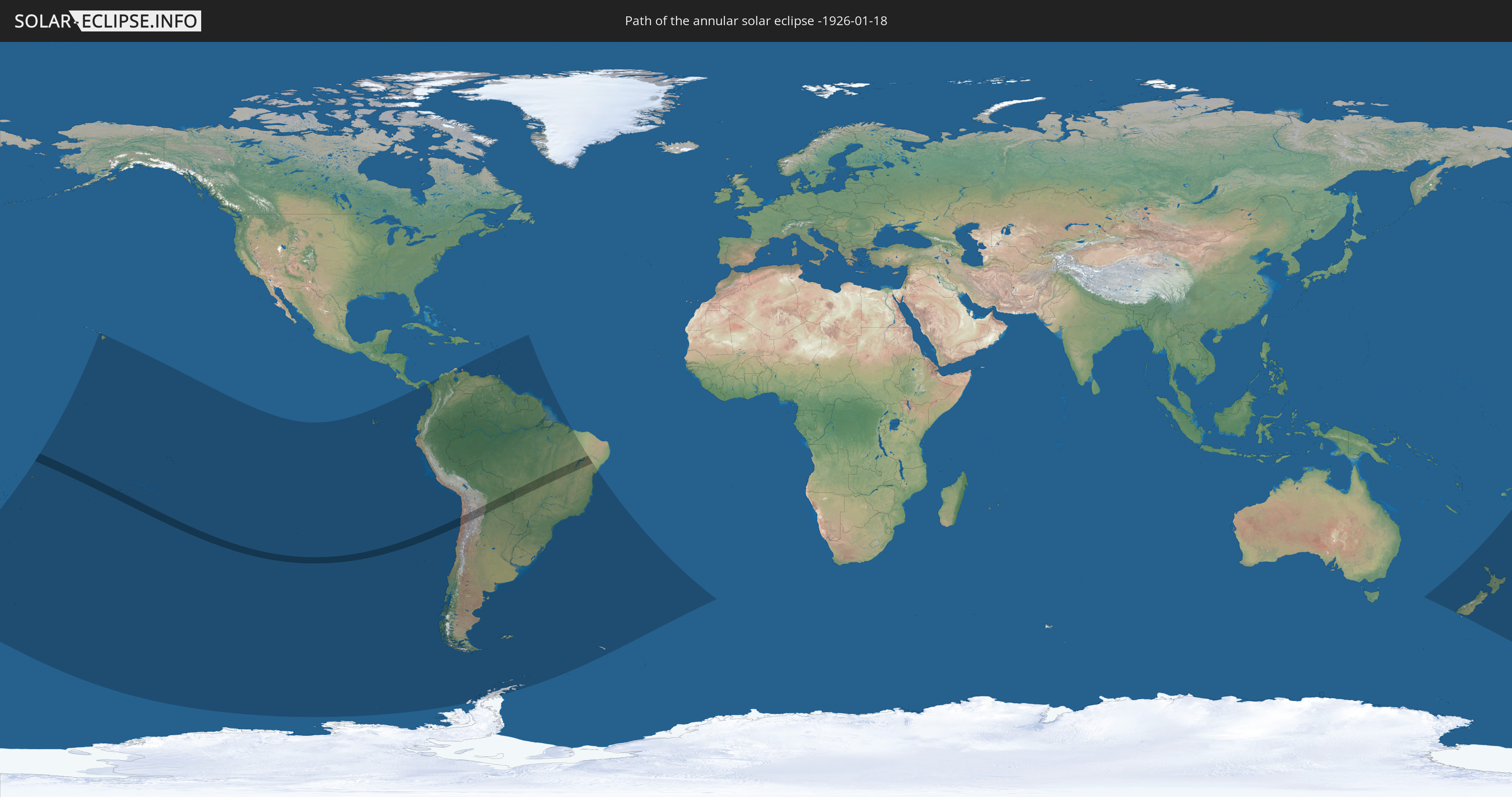
Annular solar eclipse of 01/18/-1926
| Day of week: | Tuesday |
| Maximum duration of eclipse: | 04m50s |
| Maximum width of eclipse path: | 159 km |
| Saros cycle: | 10 |
| Coverage: | 95.7% |
| Magnitude: | 0.957 |
| Gamma: | -0.1741 |
Wo kann man die Sonnenfinsternis vom 01/18/-1926 sehen?
Die Sonnenfinsternis am 01/18/-1926 kann man in 39 Ländern als partielle Sonnenfinsternis beobachten.
Der Finsternispfad verläuft durch 8 Länder. Nur in diesen Ländern ist sie als annular Sonnenfinsternis zu sehen.
In den folgenden Ländern ist die Sonnenfinsternis annular zu sehen
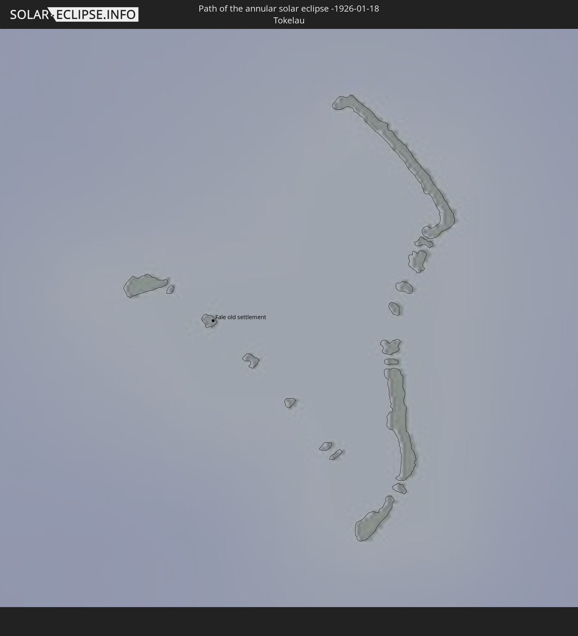 Tokelau
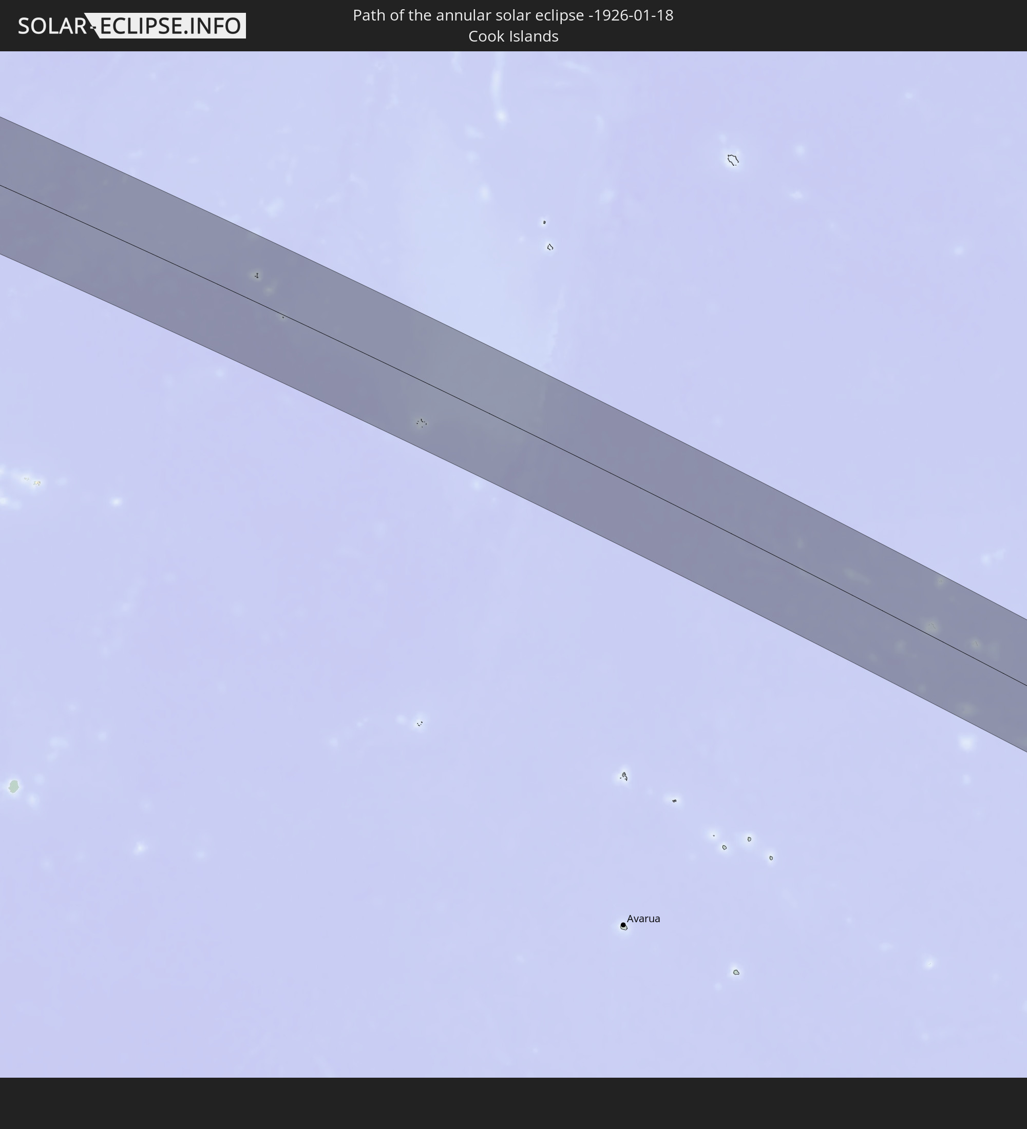 Cook Islands
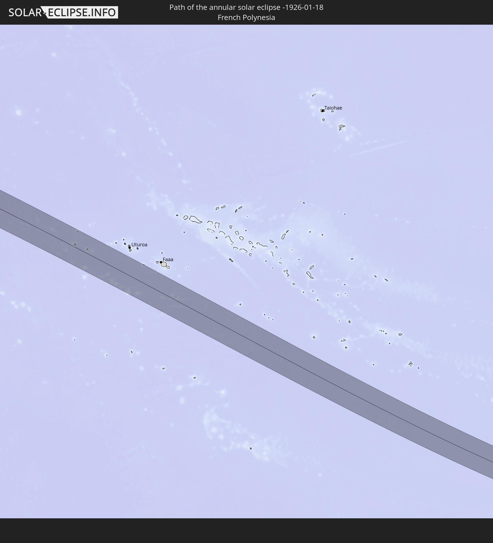 French Polynesia
 Chile
Chile
 Brazil
 Argentina
 Bolivia
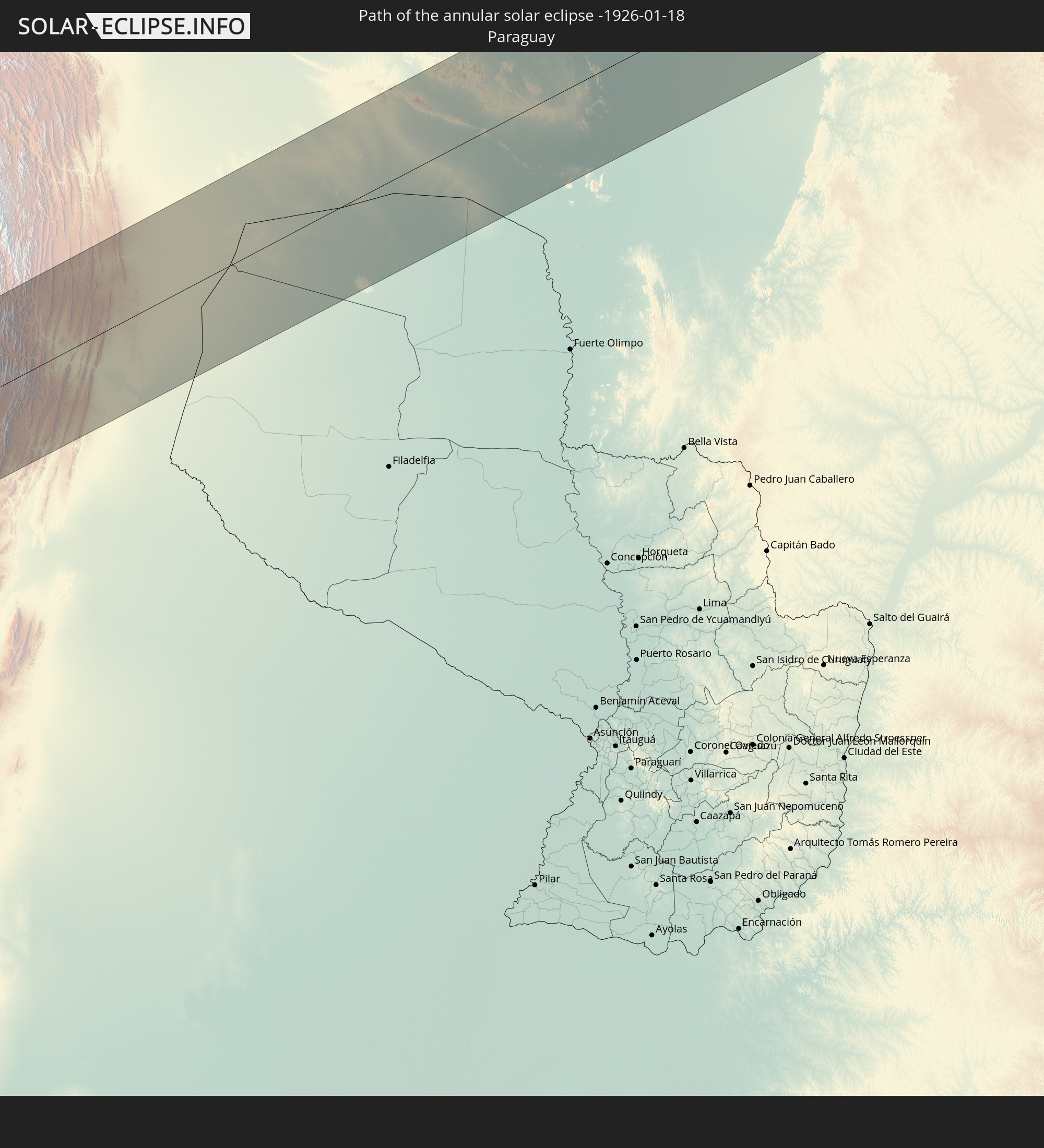 Paraguay
In den folgenden Ländern ist die Sonnenfinsternis partiell zu sehen
 Antarctica
 Fiji
Fiji
 United States
 New Zealand
 United States Minor Outlying Islands
 Tonga
Tonga
 Kiribati
 Samoa
Samoa
 Tokelau
 American Samoa
 Niue
Niue
 Cook Islands
 French Polynesia
 Pitcairn Islands
 Chile
Chile
 Ecuador
 Panama
 Colombia
 Peru
Peru
 Brazil
 Argentina
 Venezuela
 Aruba
Aruba
 Bolivia
 Paraguay
 Trinidad and Tobago
 Guadeloupe
 Grenada
 Dominica
 Saint Vincent and the Grenadines
 Falkland Islands
 Guyana
 Martinique
 Saint Lucia
 Barbados
 Uruguay
 Suriname
 French Guiana
 South Georgia and the South Sandwich Islands
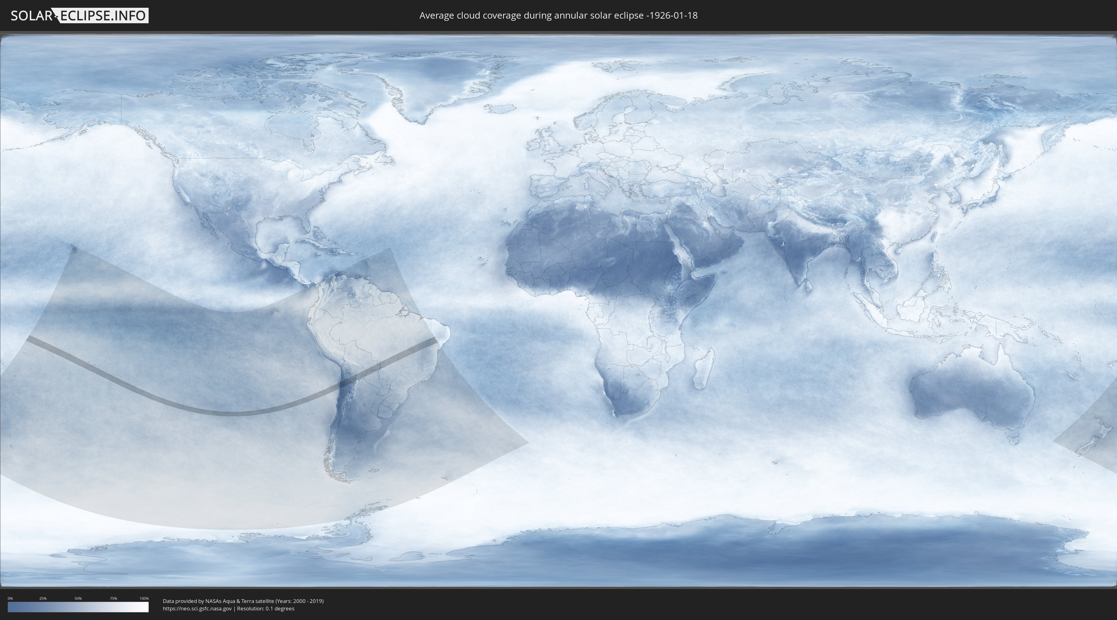
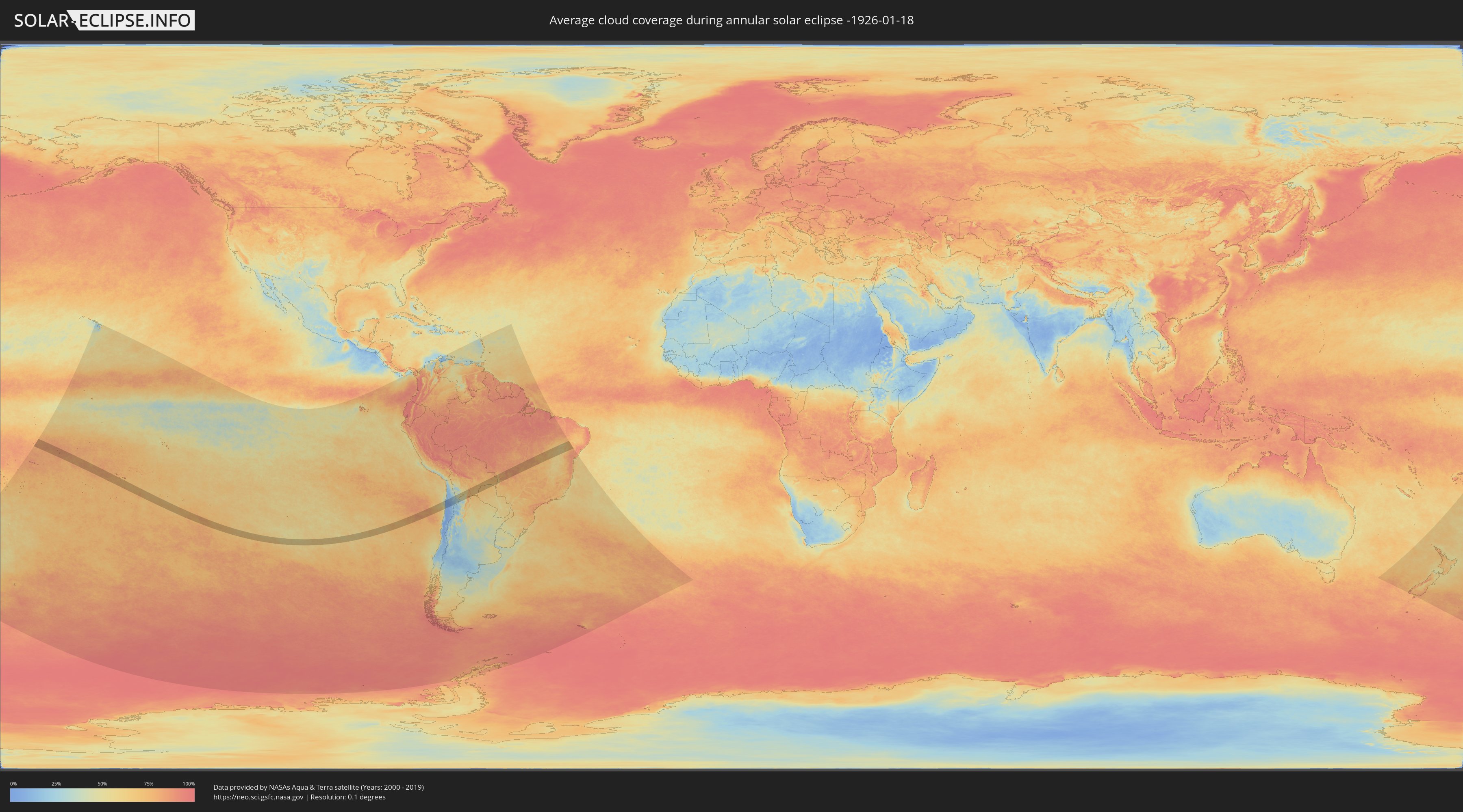
How will be the weather during the annular solar eclipse on 01/18/-1926?
Where is the best place to see the annular solar eclipse of 01/18/-1926?
The following maps show the average cloud coverage for the day of the annular solar eclipse.
With the help of these maps, it is possible to find the place along the eclipse path, which has the best
chance of a cloudless sky.
Nevertheless, you should consider local circumstances and inform about the weather of your chosen
observation site.
The data is provided by NASAs satellites
AQUA and TERRA.
The cloud maps are averaged over a period of 19 years (2000 - 2019).
Detailed country maps
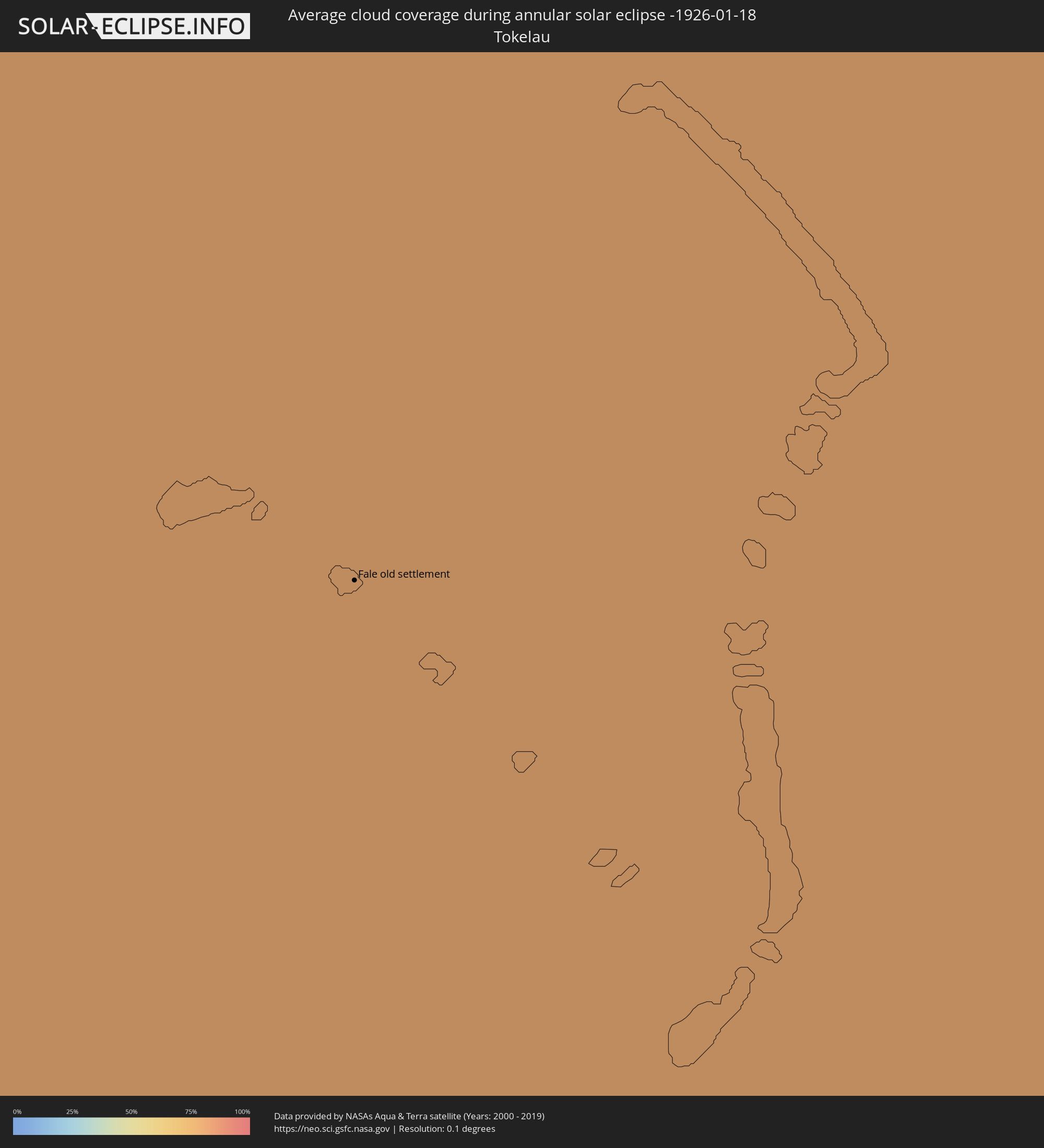 Tokelau
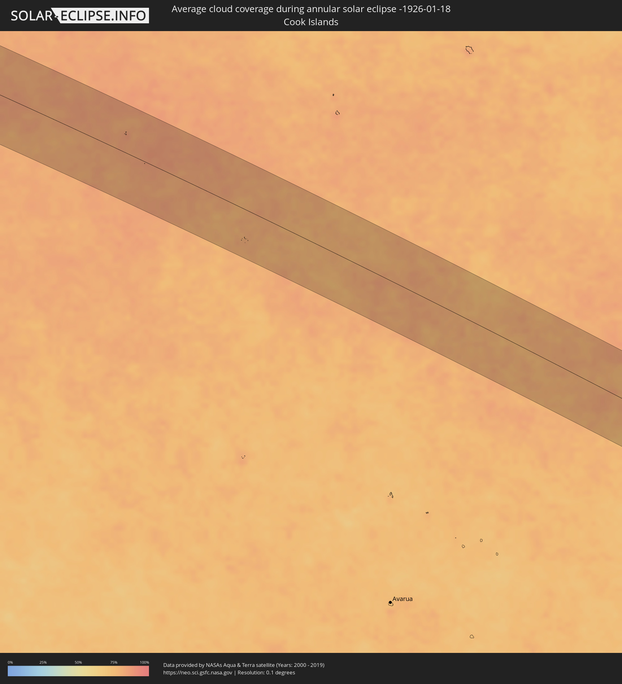 Cook Islands
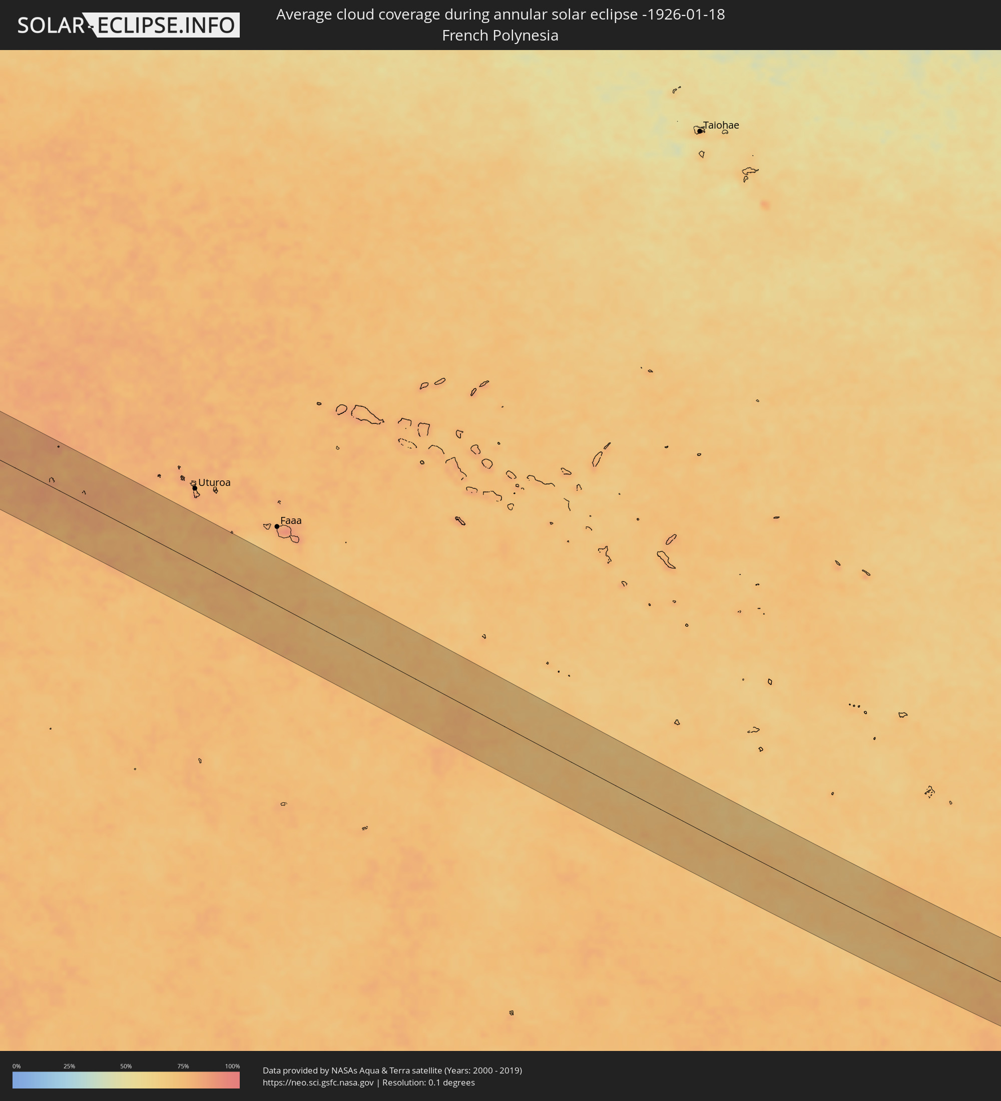 French Polynesia
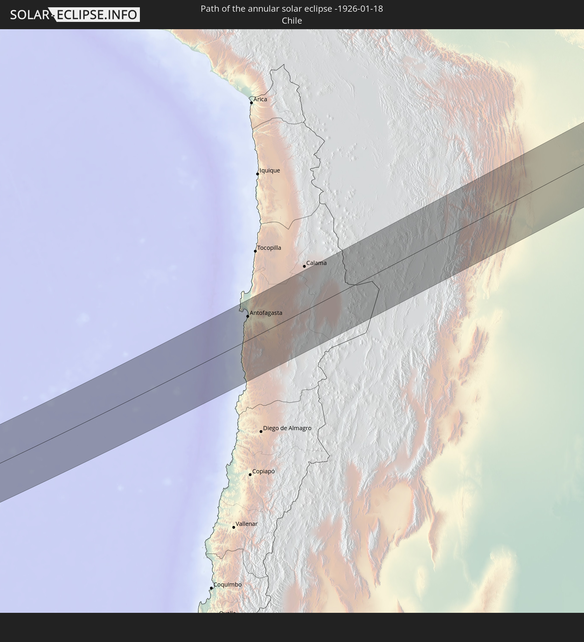
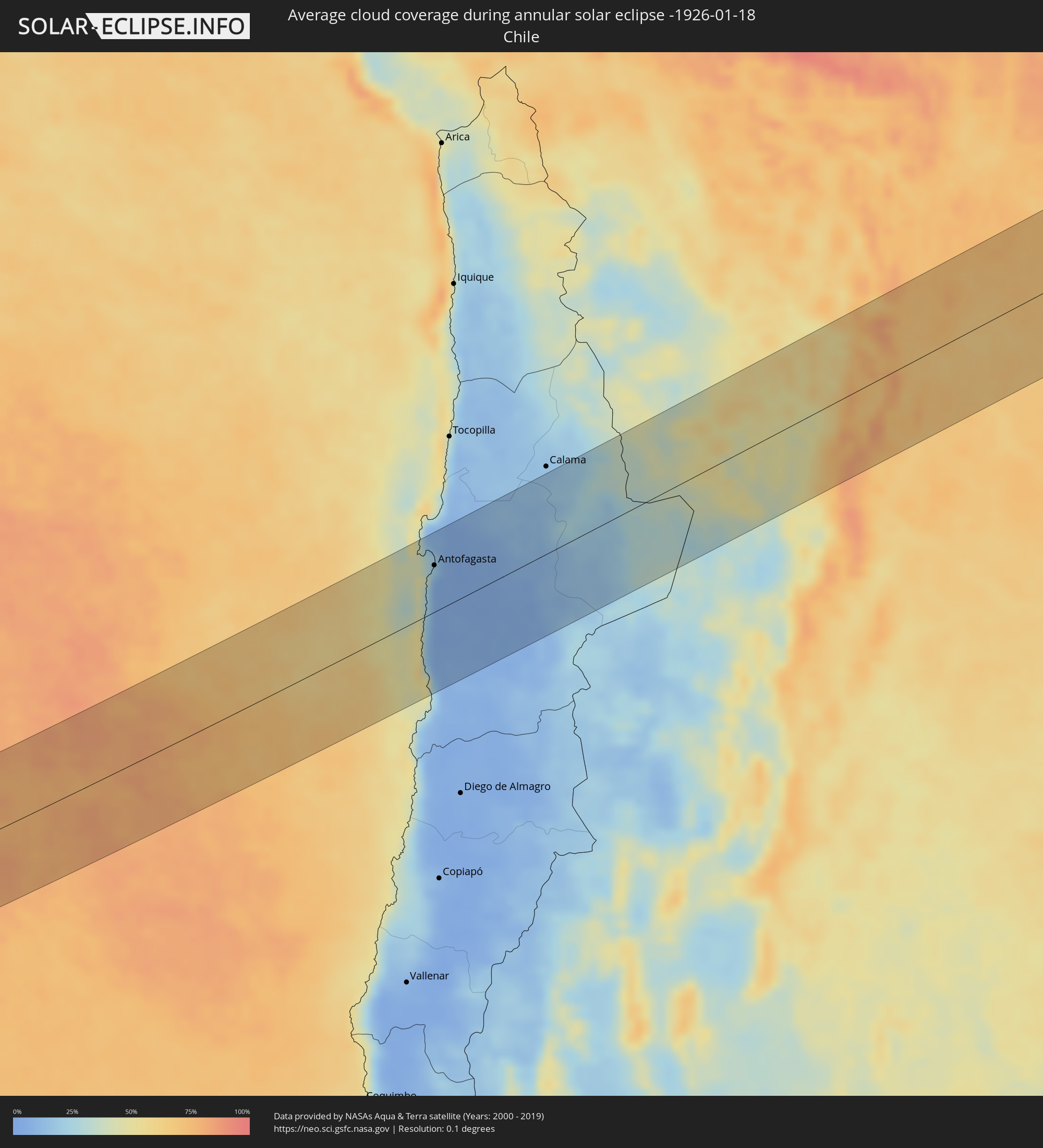 Chile
Chile
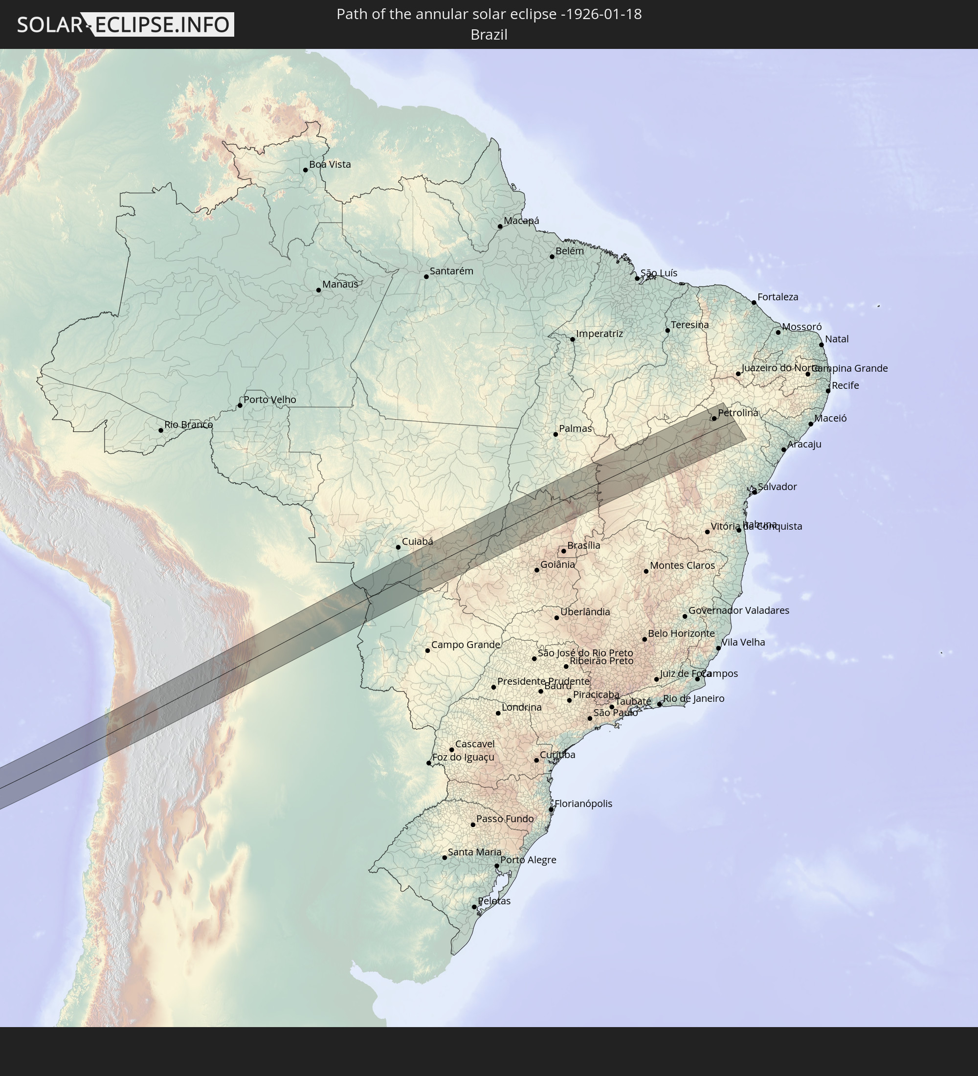
 Brazil
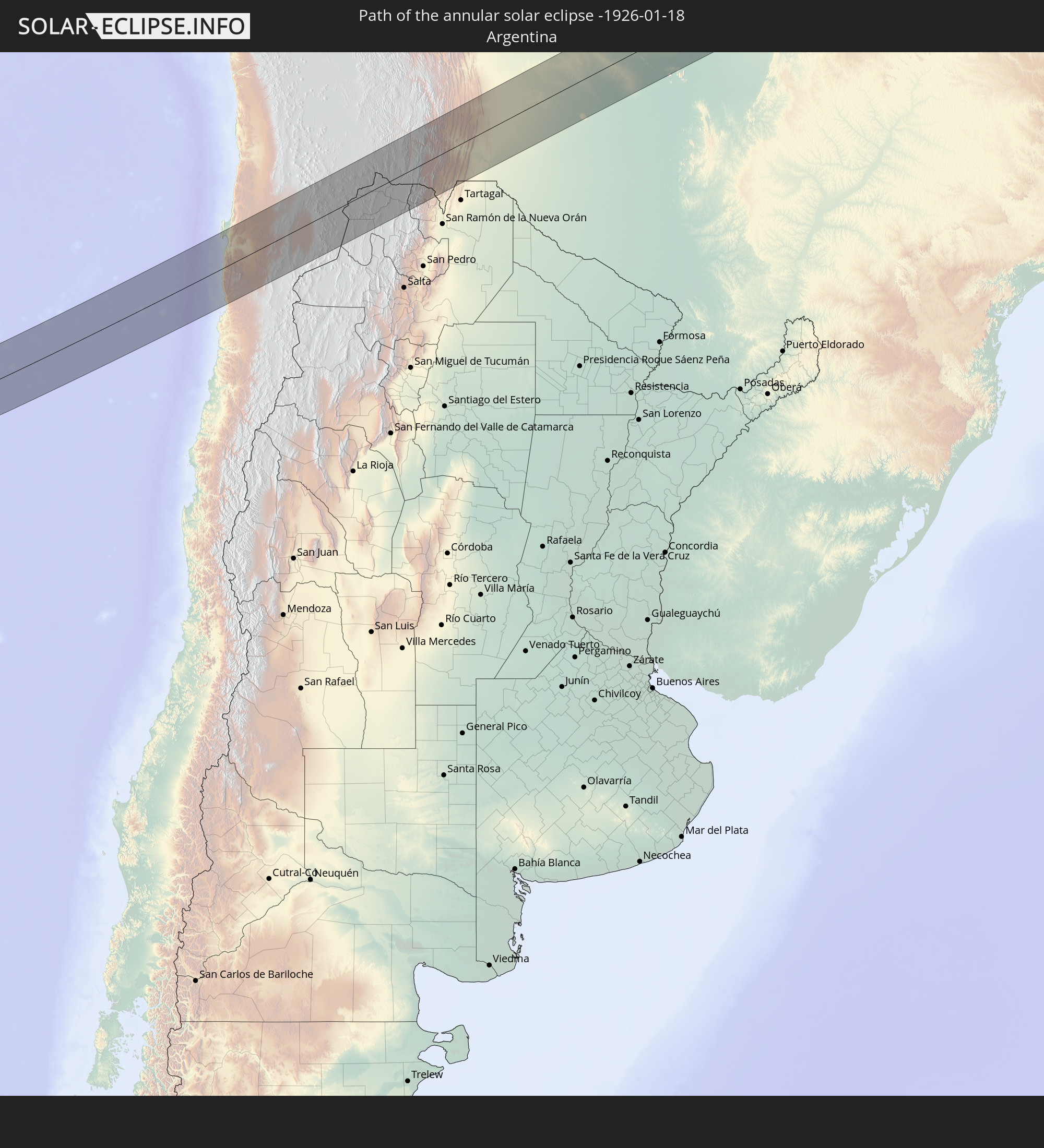
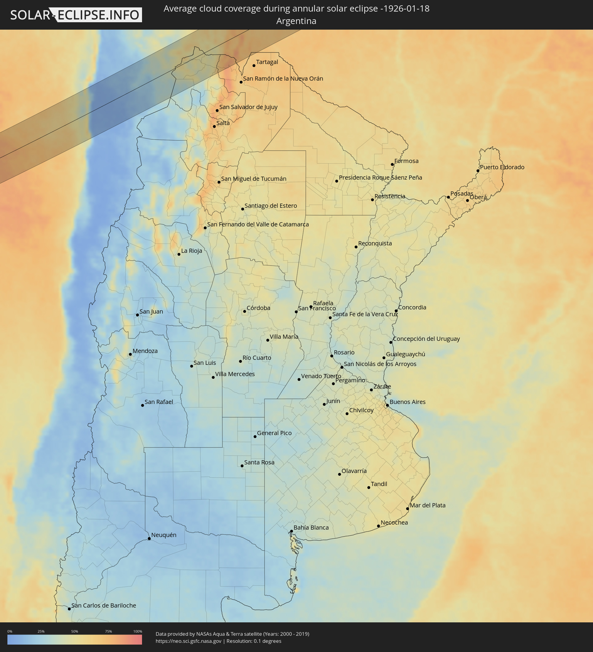 Argentina
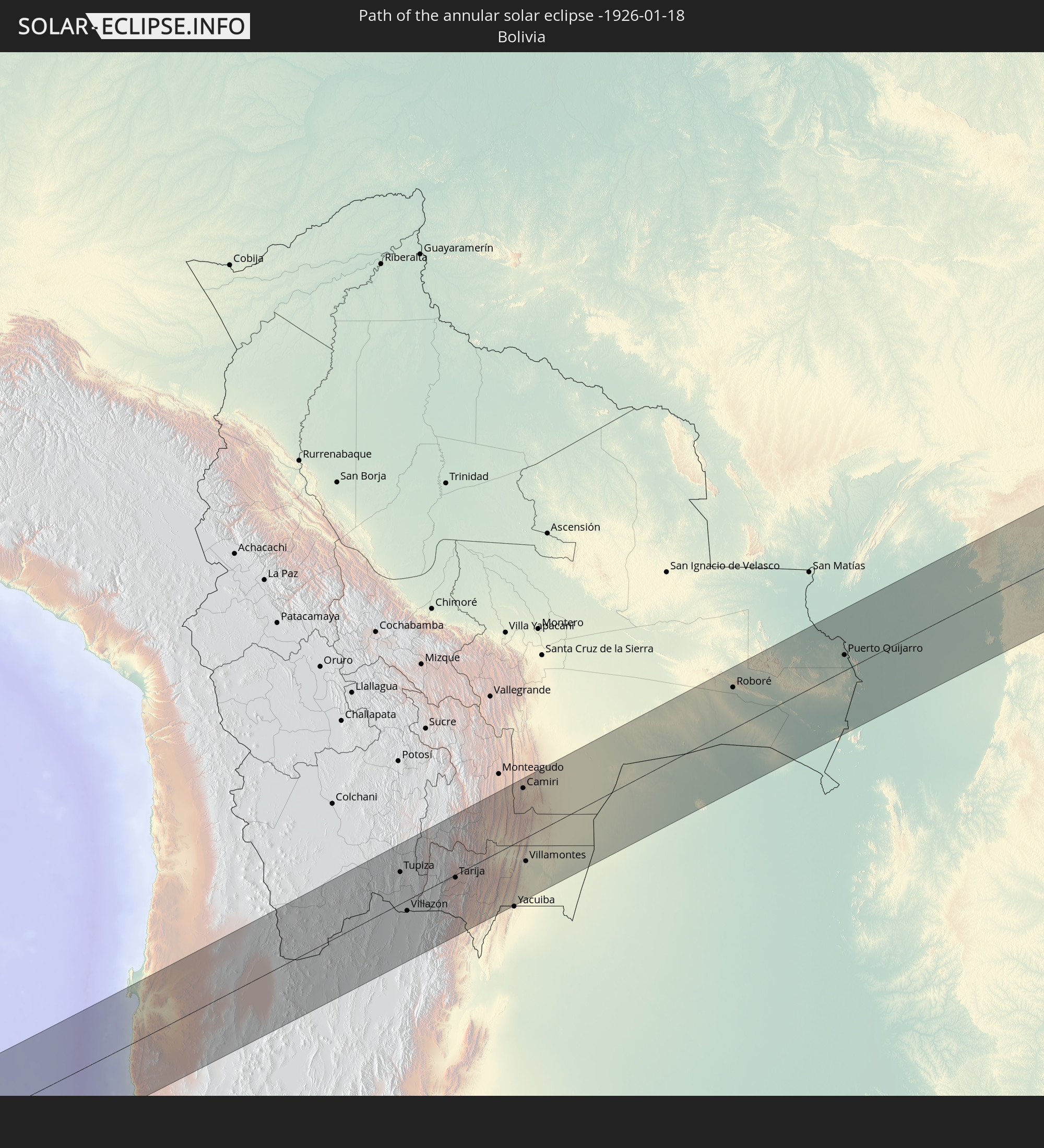
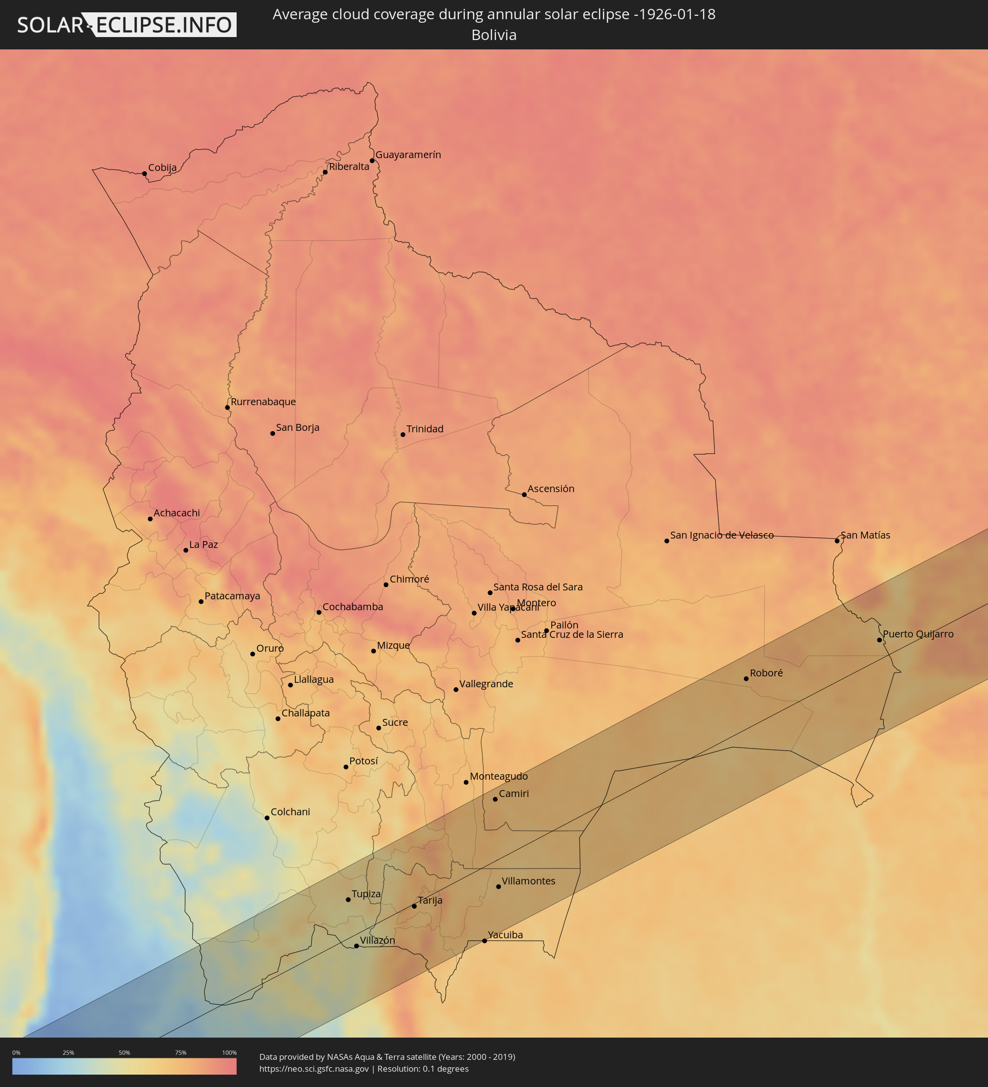 Bolivia
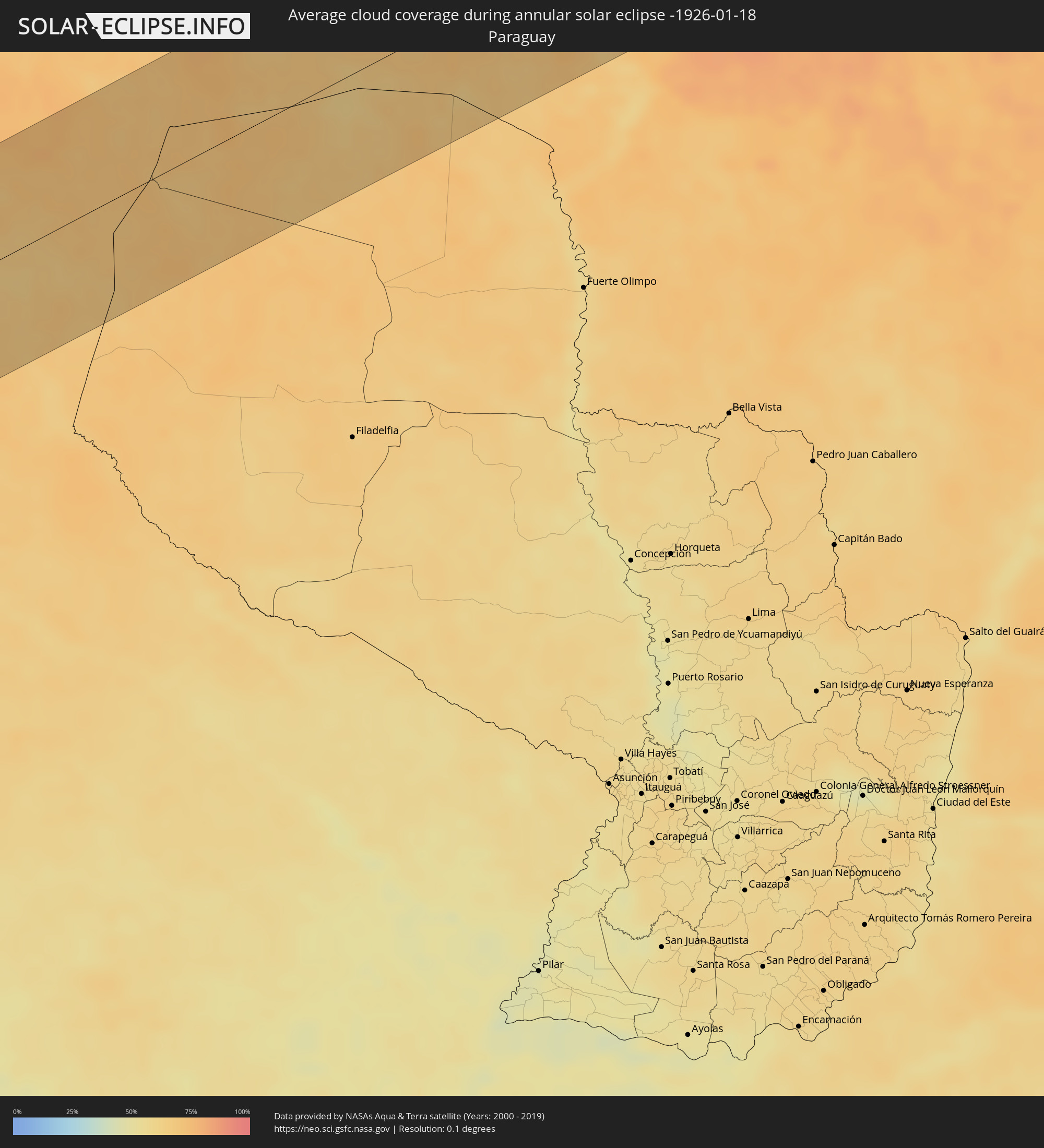 Paraguay
Cities inside the path of the eclipse
The following table shows all locations with a population of more than 5,000 inside the eclipse path. Cities which have more than 100,000 inhabitants are marked bold. A click at the locations opens a detailed map.
| City | Type | Eclipse duration | Local time of max. eclipse | Distance to central line | Ø Cloud coverage |
|
Fale old settlement, Fakaofo
|
annular | - | 06:22:40 UTC-11:00 | 49 km | 84% |
|
Antofagasta, Antofagasta
|
annular | - | 16:01:03 UTC-04:42 | 55 km | 10% |
|
Tupiza, Potosí
|
annular | - | 16:18:37 UTC-04:32 | 52 km | 53% |
|
Abra Pampa, Jujuy Province
|
annular | - | 16:32:50 UTC-04:16 | 75 km | 44% |
|
Villazón, Potosí
|
annular | - | 16:17:56 UTC-04:32 | 18 km | 44% |
|
La Quiaca, Jujuy Province
|
annular | - | 16:33:42 UTC-04:16 | 19 km | 44% |
|
Tarija, Tarija
|
annular | - | 16:19:19 UTC-04:32 | 5 km | 70% |
|
Camiri, Santa Cruz
|
annular | - | 16:22:02 UTC-04:32 | 84 km | 71% |
|
Villamontes, Tarija
|
annular | - | 16:20:36 UTC-04:32 | 39 km | 68% |
|
Roboré, Santa Cruz
|
annular | - | 16:26:15 UTC-04:32 | 69 km | 71% |
|
Puerto Quijarro, Santa Cruz
|
annular | - | 16:27:46 UTC-04:32 | 26 km | 68% |
|
Corumbá, Mato Grosso do Sul
|
annular | - | 17:20:38 UTC-03:38 | 101 km | 67% |
|
Ladário, Mato Grosso do Sul
|
annular | - | 17:20:40 UTC-03:38 | 103 km | 65% |
|
Lucas, Mato Grosso
|
annular | - | 17:24:04 UTC-03:38 | 80 km | 77% |
|
Jaciara, Mato Grosso
|
annular | - | 17:24:44 UTC-03:38 | 70 km | 83% |
|
Rondonópolis, Mato Grosso
|
annular | - | 17:24:20 UTC-03:38 | 4 km | 80% |
|
Poxoréo, Mato Grosso
|
annular | - | 17:25:01 UTC-03:38 | 55 km | 83% |
|
Guiratinga, Mato Grosso
|
annular | - | 17:24:41 UTC-03:38 | 26 km | 86% |
|
Barra do Garças, Mato Grosso
|
annular | - | 17:25:26 UTC-03:38 | 54 km | 77% |
|
Aragarças, Goiás
|
annular | - | 17:25:26 UTC-03:38 | 55 km | 77% |
|
Mozarlândia, Goiás
|
annular | - | 17:58:43 UTC-03:06 | 20 km | 82% |
|
São Miguel do Araguaia, Goiás
|
annular | - | 18:00:01 UTC-03:06 | 107 km | 85% |
|
Crixás, Goiás
|
annular | - | 17:58:57 UTC-03:06 | 30 km | 79% |
|
Rubiataba, Goiás
|
annular | - | 17:58:25 UTC-03:06 | 99 km | 81% |
|
Itapaci, Goiás
|
annular | - | 17:58:38 UTC-03:06 | 90 km | 77% |
|
Porangatu, Goiás
|
annular | - | 17:59:57 UTC-03:06 | 42 km | 81% |
|
Uruaçu, Goiás
|
annular | - | 17:59:02 UTC-03:06 | 67 km | 77% |
|
Niquelândia, Goiás
|
annular | - | 17:59:07 UTC-03:06 | 94 km | 76% |
|
Campos Belos, Goiás
|
annular | - | 18:00:18 UTC-03:06 | 29 km | 75% |
|
Taguatinga, Tocantins
|
annular | - | 18:33:14 UTC-02:34 | 19 km | 75% |
|
Formosa do Rio Preto, Bahia
|
annular | - | 18:34:09 UTC-02:34 | 98 km | 71% |
|
Barreiras, Bahia
|
annular | - | 18:33:20 UTC-02:34 | 23 km | 67% |
|
São Desidério, Bahia
|
annular | - | 18:33:10 UTC-02:34 | 45 km | 66% |
|
Riachão das Neves, Bahia
|
annular | - | 18:33:37 UTC-02:34 | 14 km | 65% |
|
Ibotirama, Bahia
|
annular | - | 18:33:06 UTC-02:34 | 108 km | 60% |
|
Barra, Bahia
|
annular | - | 18:33:52 UTC-02:34 | 1 km | 64% |
|
Xique Xique, Bahia
|
annular | - | 18:33:59 UTC-02:34 | 8 km | 57% |
|
Ibipeba, Bahia
|
annular | - | 18:33:17 UTC-02:34 | 108 km | 63% |
|
Irecê, Bahia
|
annular | - | 18:33:30 UTC-02:34 | 81 km | 60% |
|
Lapão, Bahia
|
annular | - | 18:33:26 UTC-02:34 | 90 km | 60% |
|
América Dourada, Bahia
|
annular | - | 18:33:18 UTC-02:34 | 115 km | 63% |
|
Petrolina, Pernambuco
|
annular | - | 18:48:51 UTC-02:19 | 52 km | 70% |
|
Pindobaçu, Bahia
|
annular | - | 18:33:33 UTC-02:34 | 91 km | 69% |
|
Campo Formoso, Bahia
|
annular | - | 18:33:42 UTC-02:34 | 69 km | 70% |
|
Jaguarari, Bahia
|
annular | - | 18:33:50 UTC-02:34 | 50 km | 70% |
|
Senhor do Bonfim, Bahia
|
annular | - | 18:33:42 UTC-02:34 | 70 km | 74% |
|
Ponto Novo, Bahia
|
annular | - | 18:33:25 UTC-02:34 | 113 km | 77% |
|
Curaçá, Bahia
|
annular | - | 18:34:33 UTC-02:34 | 67 km | 78% |
|
Uauá, Bahia
|
annular | - | 18:33:55 UTC-02:34 | 38 km | 76% |
|
Monte Santo, Bahia
|
annular | - | 18:33:30 UTC-02:34 | 106 km | 76% |