Total solar eclipse of 03/19/0052
| Day of week: | Tuesday |
| Maximum duration of eclipse: | 05m02s |
| Maximum width of eclipse path: | 200 km |
| Saros cycle: | 69 |
| Coverage: | 100% |
| Magnitude: | 1.0609 |
| Gamma: | -0.0509 |
Wo kann man die Sonnenfinsternis vom 03/19/0052 sehen?
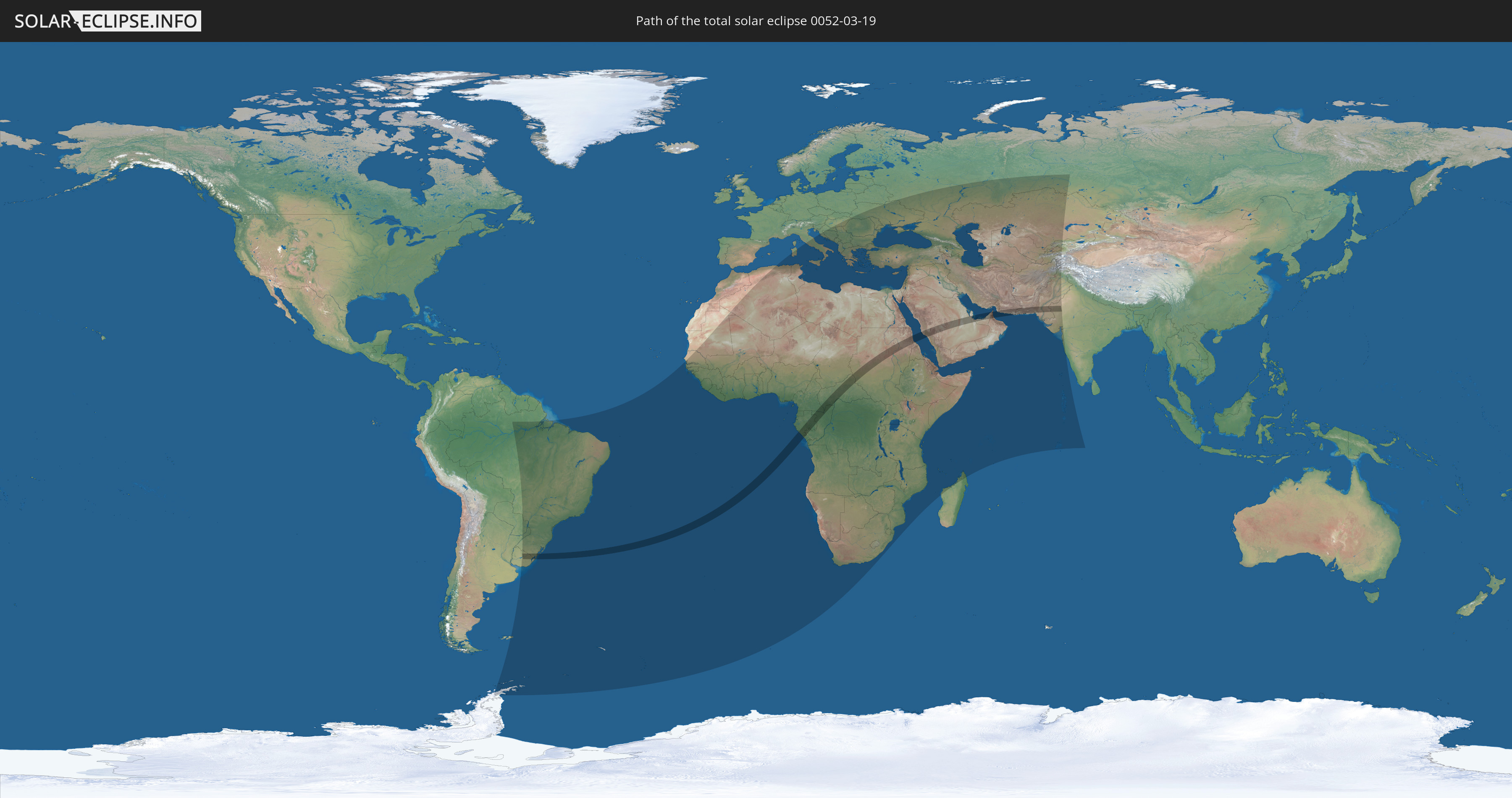
Die Sonnenfinsternis am 03/19/0052 kann man in 107 Ländern als partielle Sonnenfinsternis beobachten.
Der Finsternispfad verläuft durch 15 Länder. Nur in diesen Ländern ist sie als total Sonnenfinsternis zu sehen.
In den folgenden Ländern ist die Sonnenfinsternis total zu sehen
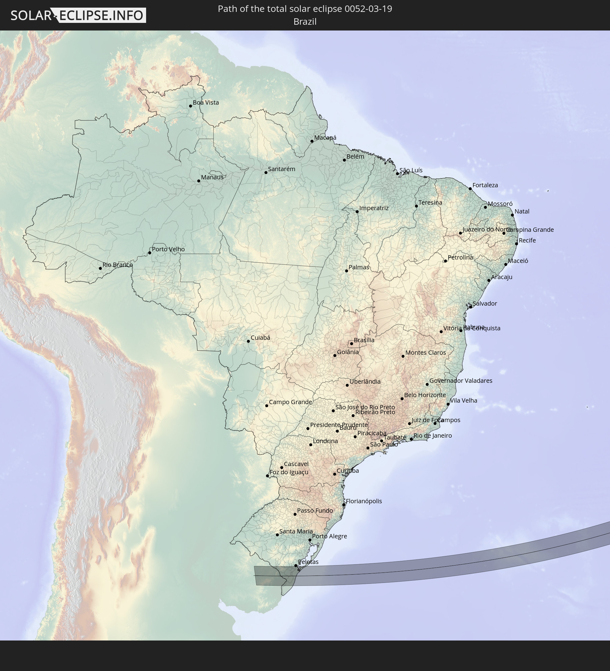 Brazil
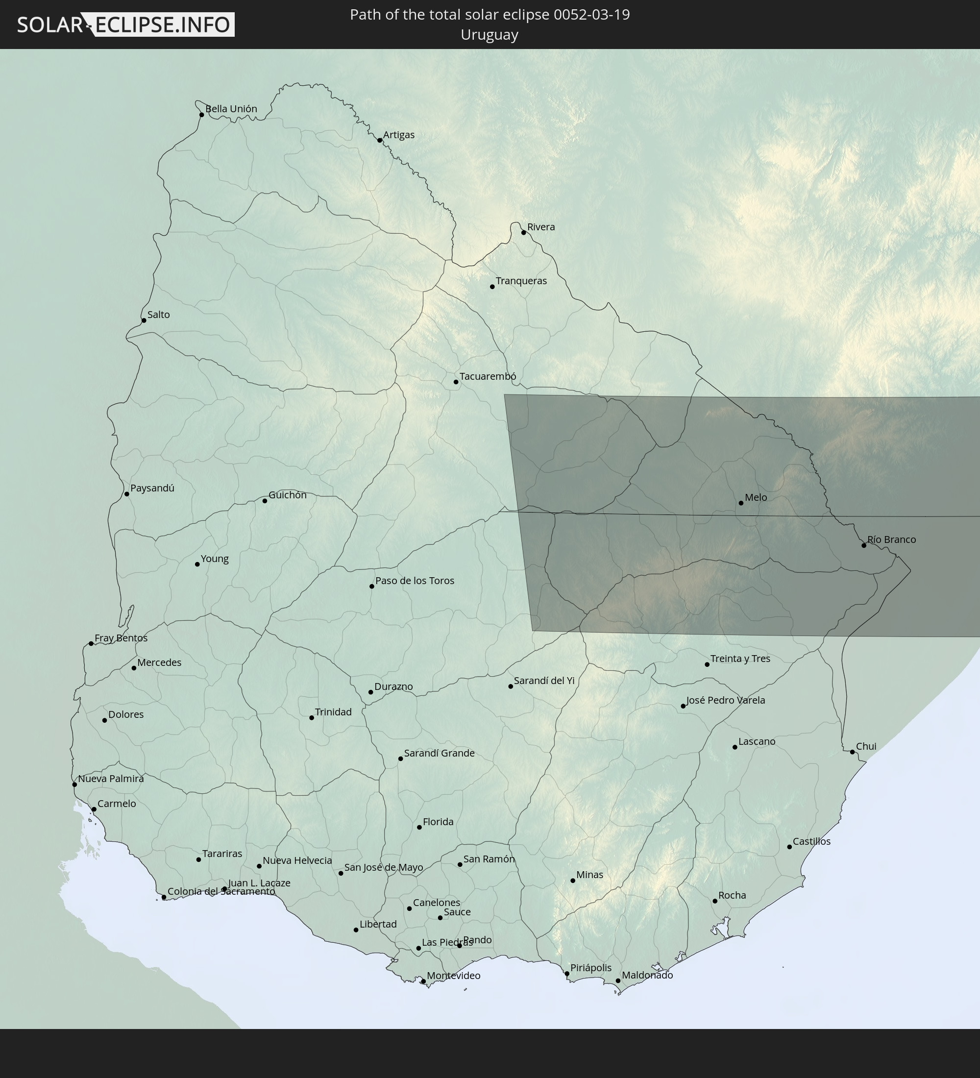 Uruguay
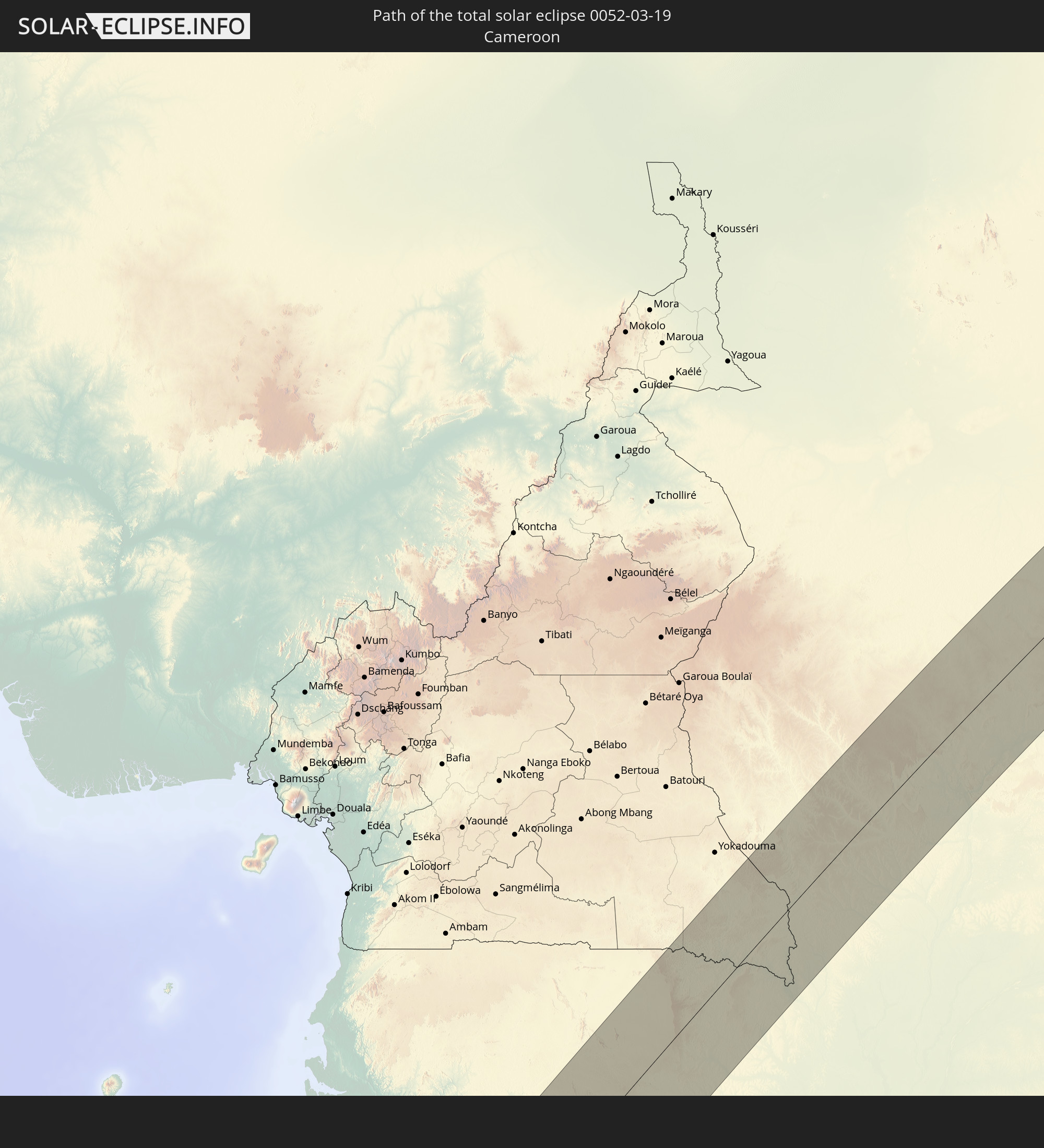 Cameroon
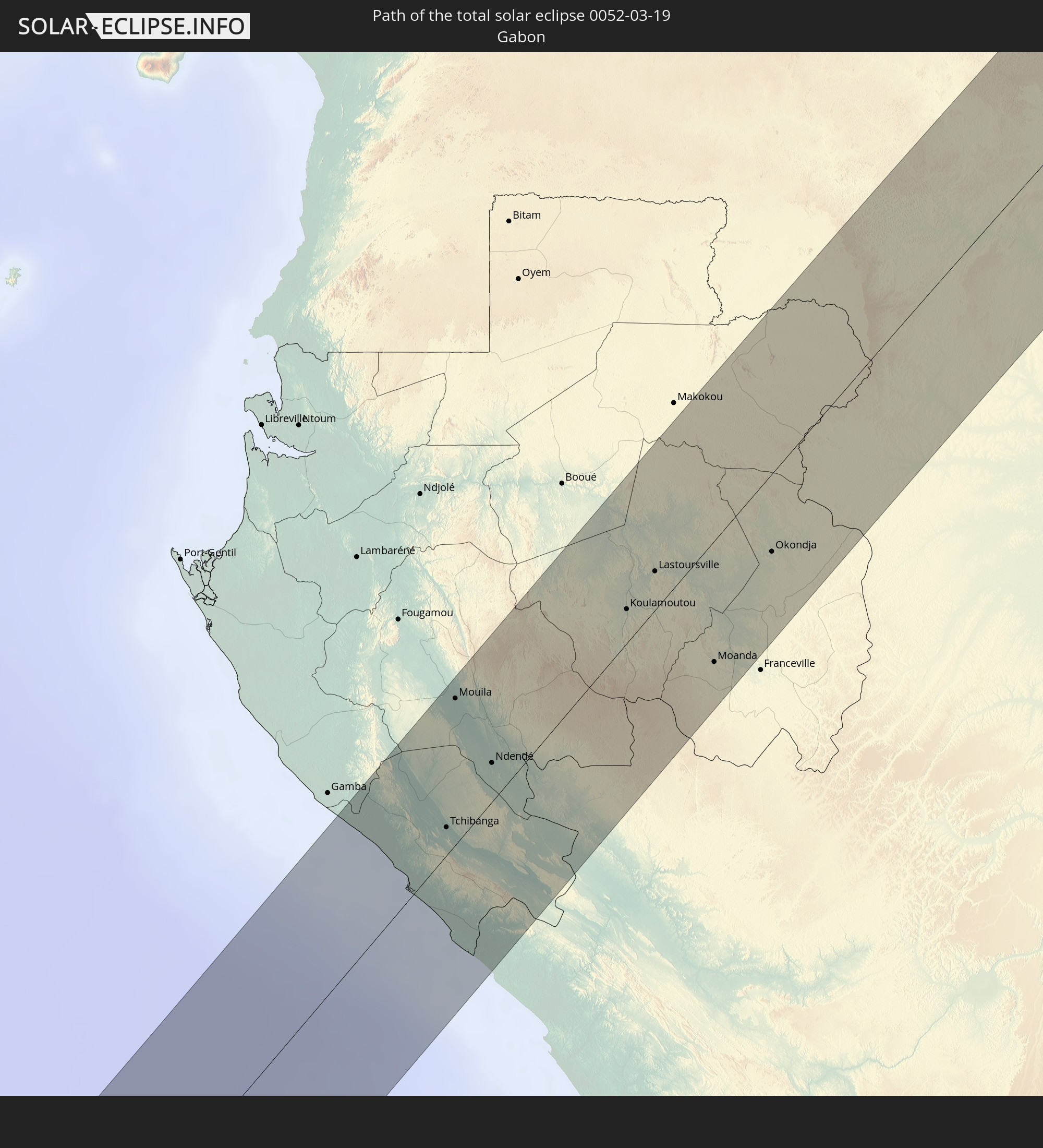 Gabon
Gabon
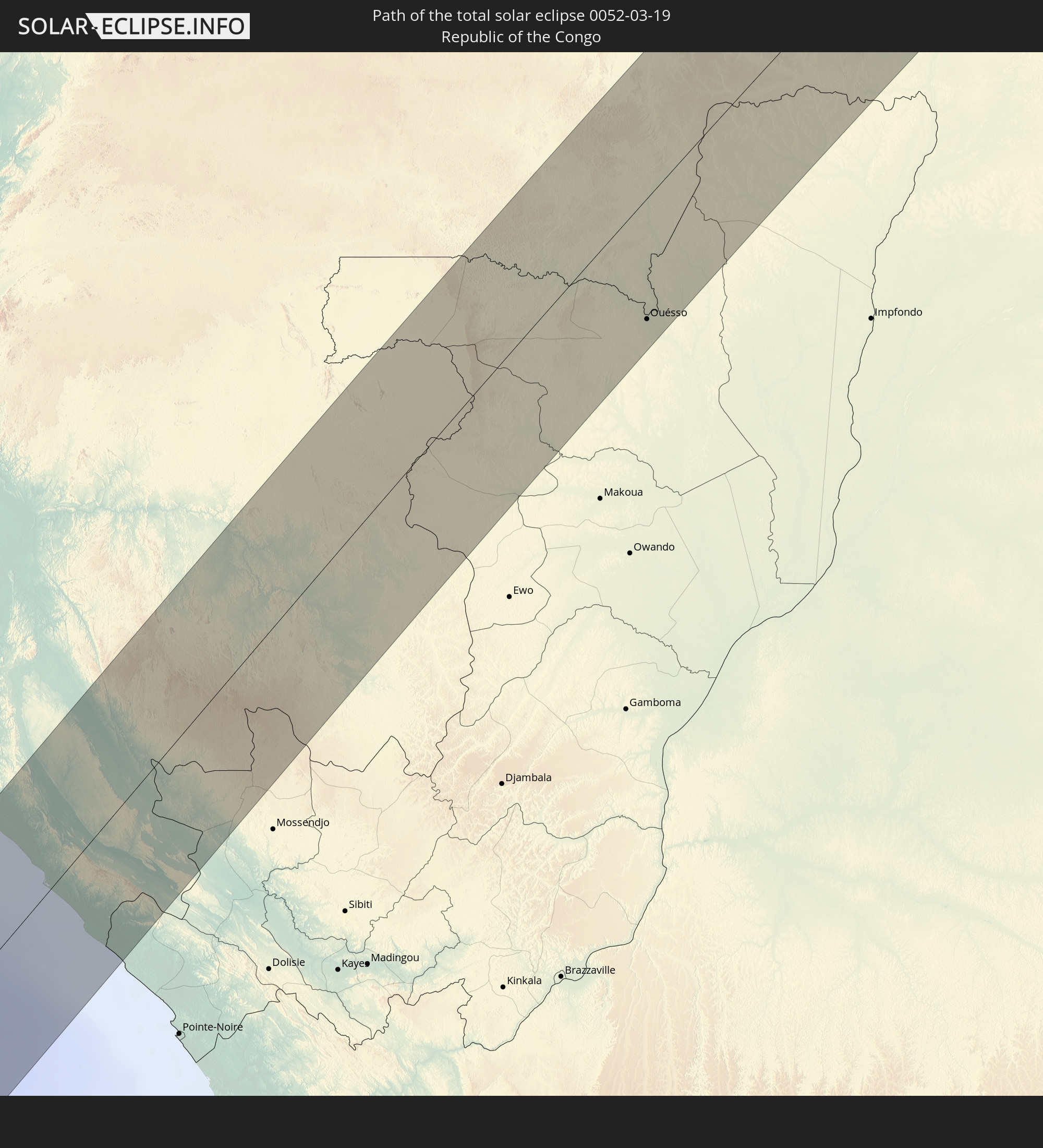 Republic of the Congo
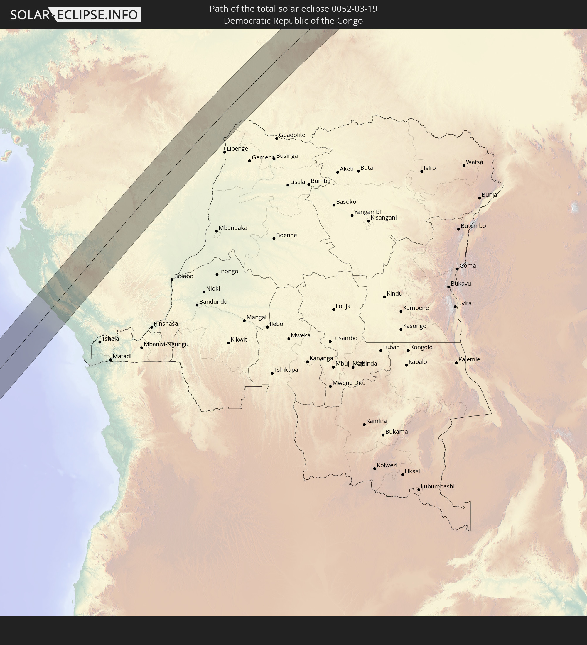 Democratic Republic of the Congo
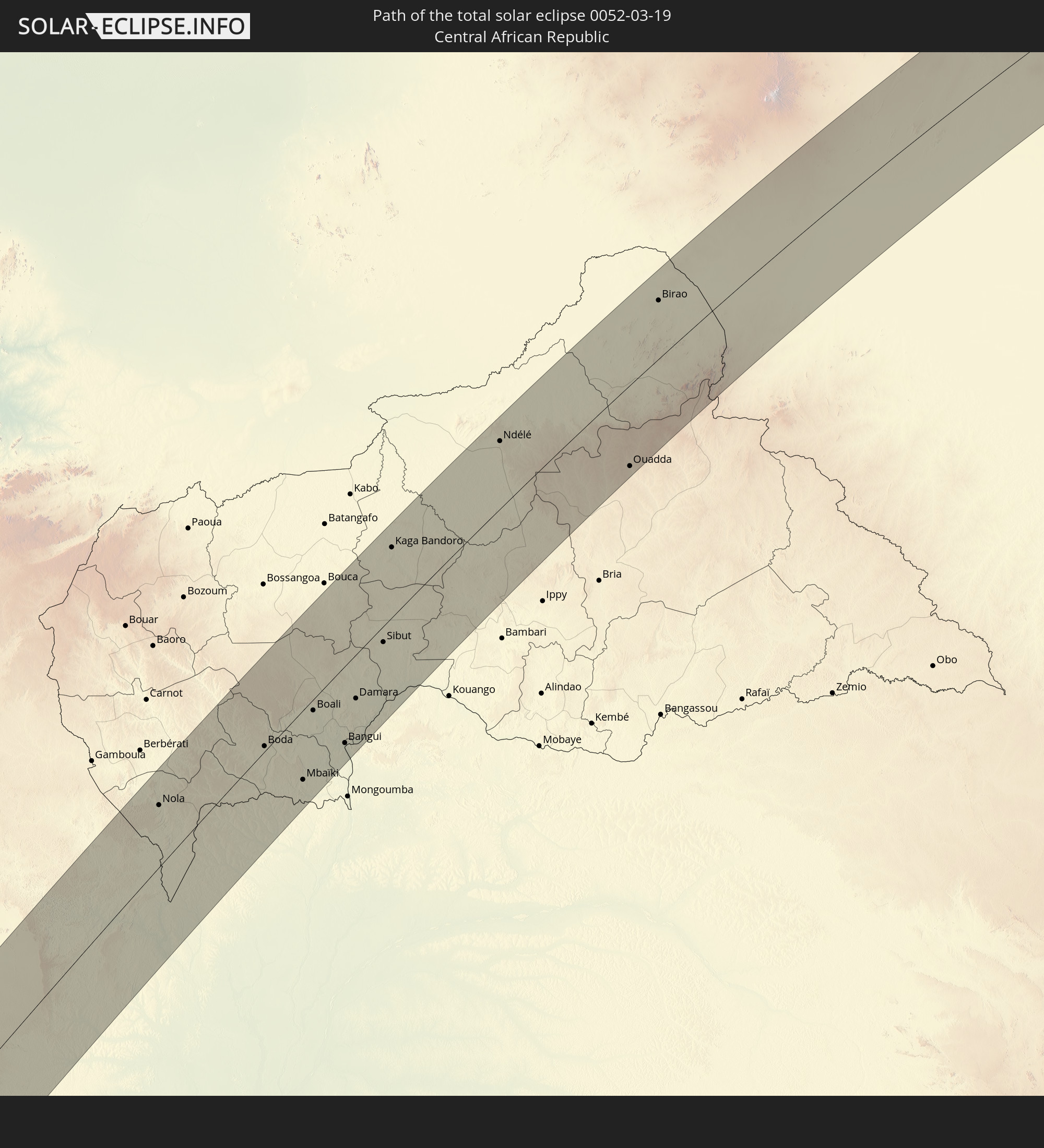 Central African Republic
 Sudan
Sudan
 Saudi Arabia
 Iran
Iran
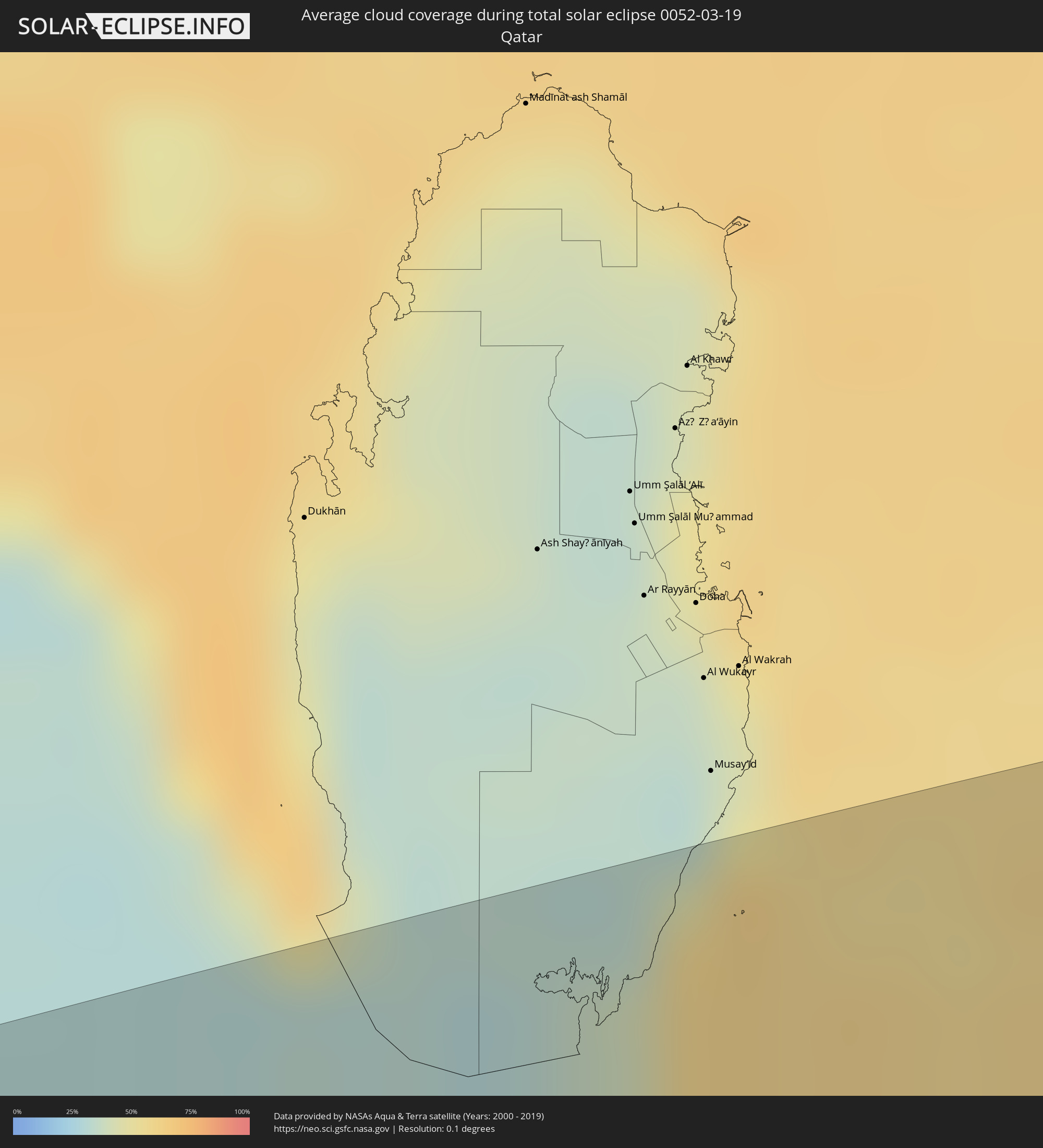
 Qatar
Qatar
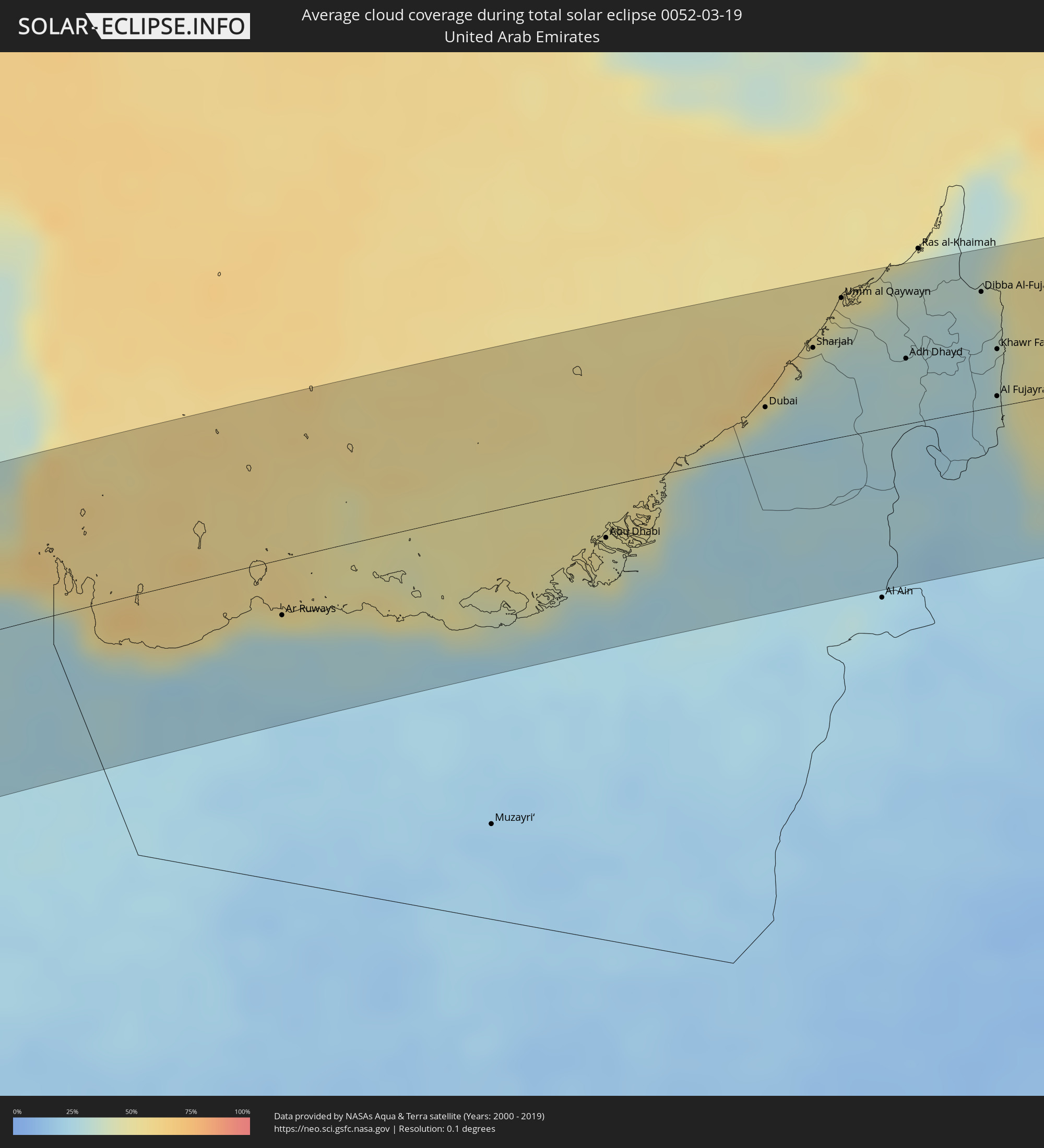
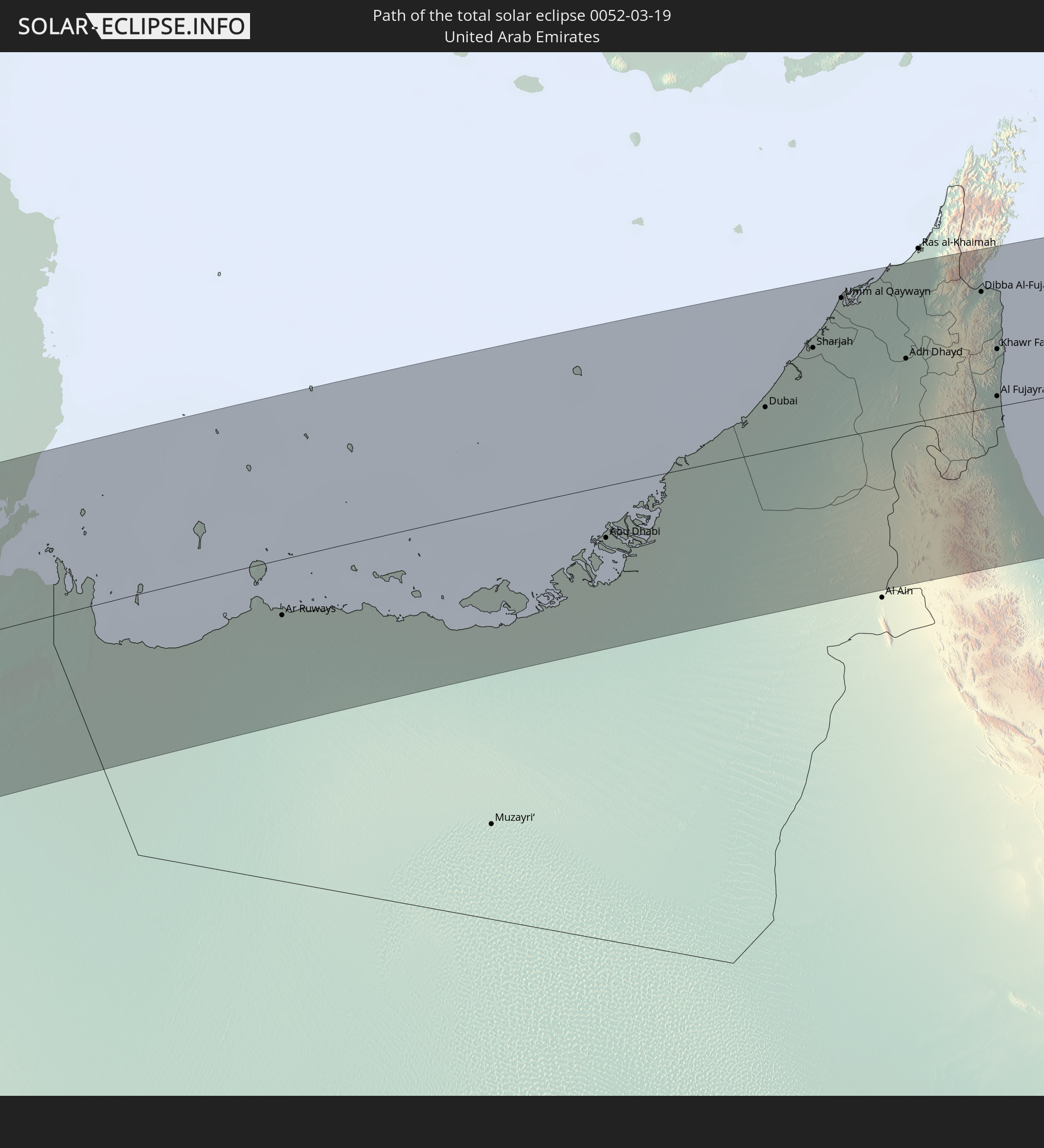 United Arab Emirates
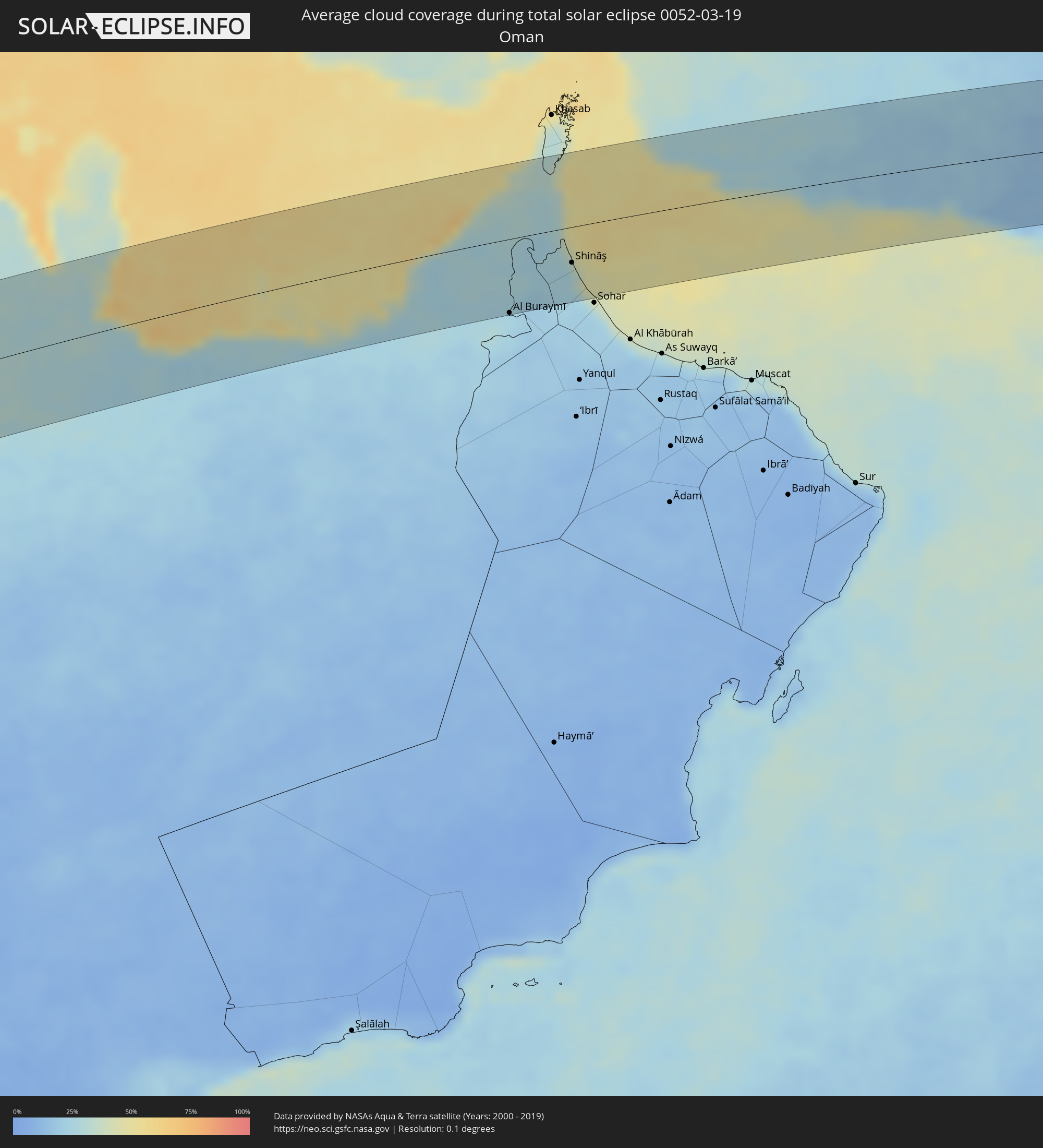
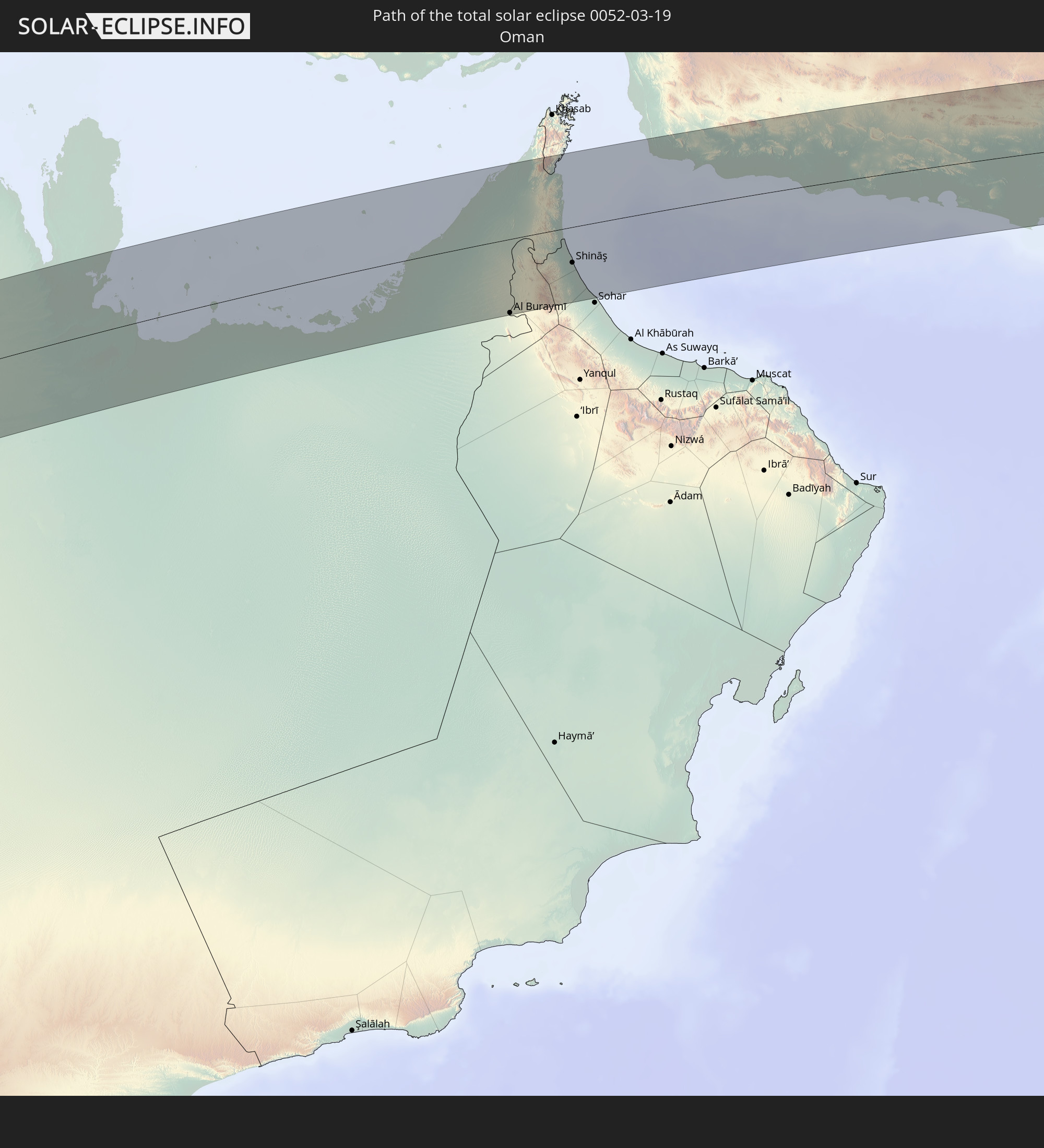 Oman
Oman
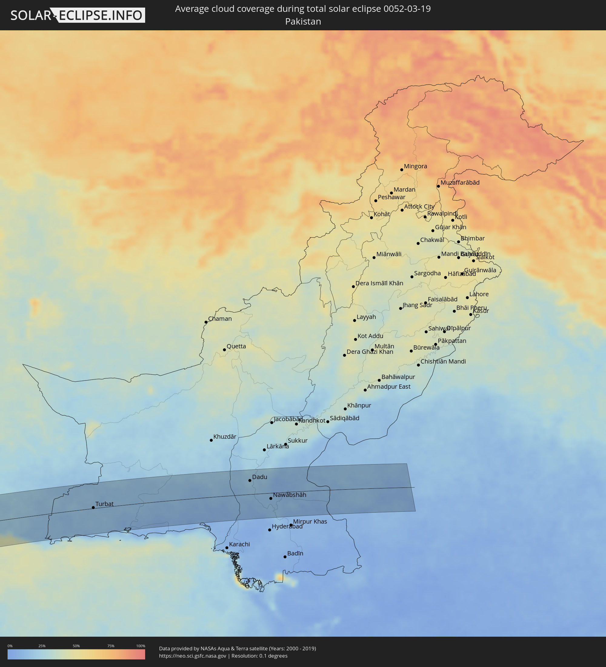
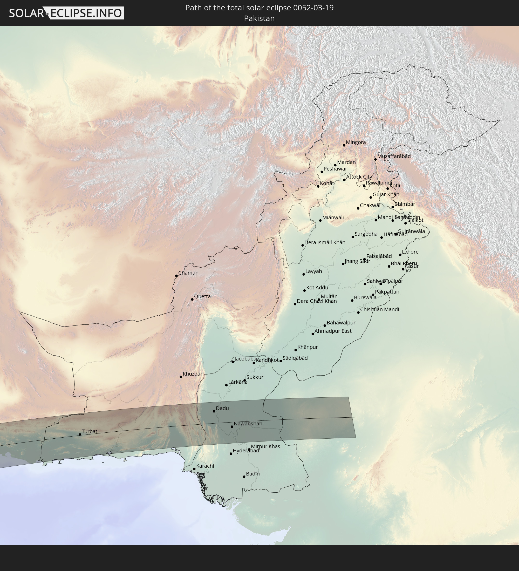 Pakistan
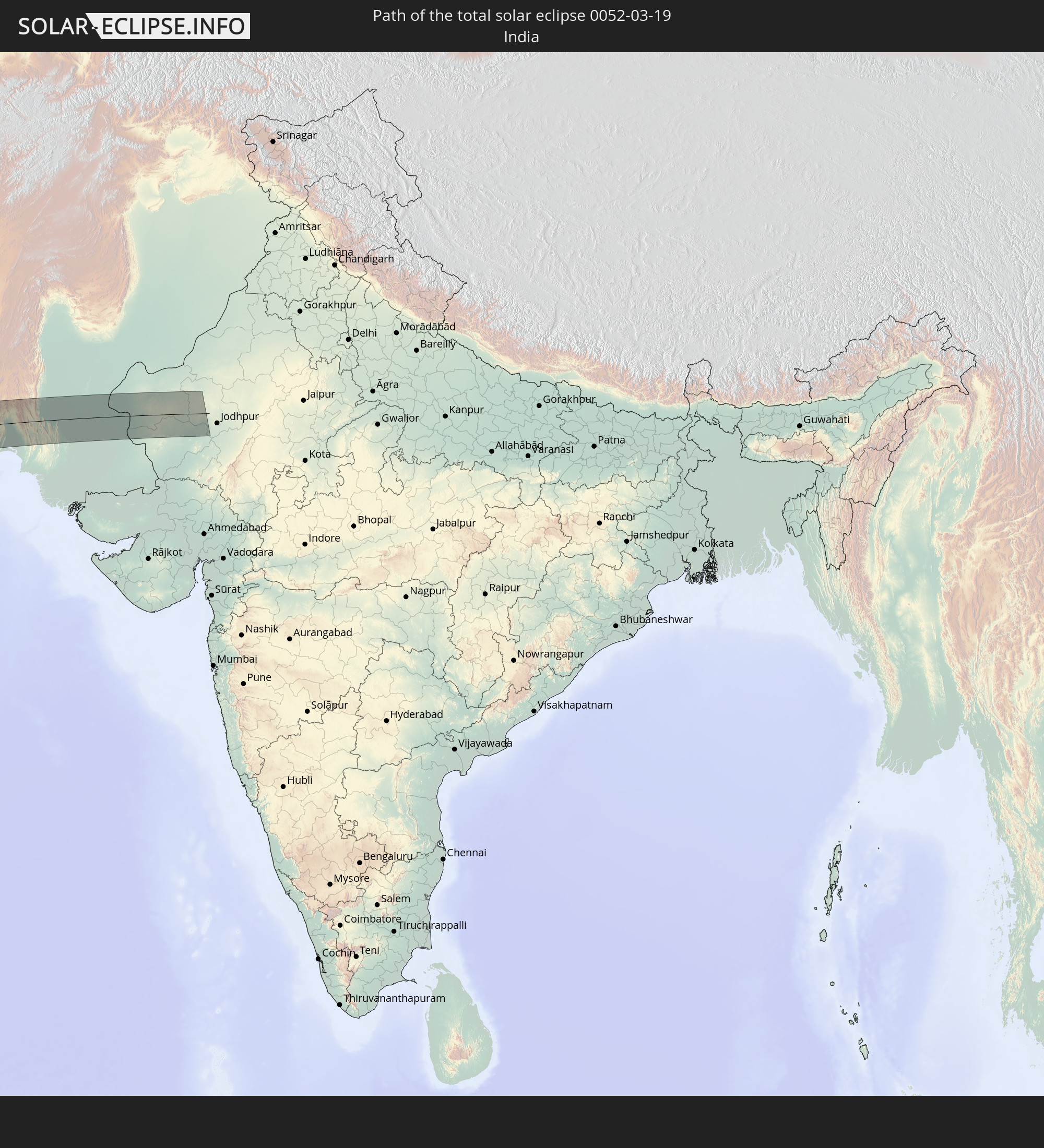 India
India
In den folgenden Ländern ist die Sonnenfinsternis partiell zu sehen
 Russia
 Antarctica
 Brazil
 Argentina
 Paraguay
 Falkland Islands
 Uruguay
 South Georgia and the South Sandwich Islands
 Senegal
 Mauritania
 The Gambia
 Guinea-Bissau
 Guinea
 Saint Helena, Ascension and Tristan da Cunha
 Sierra Leone
 Mali
Mali
 Liberia
 Algeria
 Ivory Coast
 Burkina Faso
 Ghana
Ghana
 Togo
Togo
 Niger
Niger
 Benin
Benin
 Nigeria
 Equatorial Guinea
 São Tomé and Príncipe
 Italy
Italy
 Tunisia
 Cameroon
 Gabon
Gabon
 Libya
Libya
 Republic of the Congo
 Angola
 Namibia
 Democratic Republic of the Congo
 Vatican City
 Chad
Chad
 Croatia
 Malta
Malta
 Central African Republic
 Bosnia and Herzegovina
 Hungary
 South Africa
 Montenegro
 Serbia
 Albania
 Greece
 Botswana
 Romania
 Republic of Macedonia
 Sudan
Sudan
 Zambia
 Ukraine
 Bulgaria
 Belarus
 Egypt
Egypt
 Zimbabwe
 Turkey
 Moldova
 Lesotho
 Rwanda
 Burundi
 Tanzania
 Uganda
 Mozambique
 Swaziland
 Cyprus
 Malawi
 Ethiopia
 Kenya
Kenya
 State of Palestine
 Israel
 Saudi Arabia
 Jordan
 Lebanon
 Syria
Syria
 Eritrea
 Iraq
Iraq
 Georgia
 French Southern and Antarctic Lands
 Somalia
 Djibouti
 Yemen
Yemen
 Madagascar
 Comoros
 Armenia
 Iran
Iran
 Azerbaijan
 Mayotte
 Seychelles
 Kazakhstan
 Kuwait
 Bahrain
 Qatar
Qatar
 United Arab Emirates
 Oman
Oman
 Turkmenistan
 Uzbekistan
 Mauritius
 Afghanistan
 Pakistan
 Tajikistan
 India
India
 Kyrgyzstan
 British Indian Ocean Territory
 Maldives
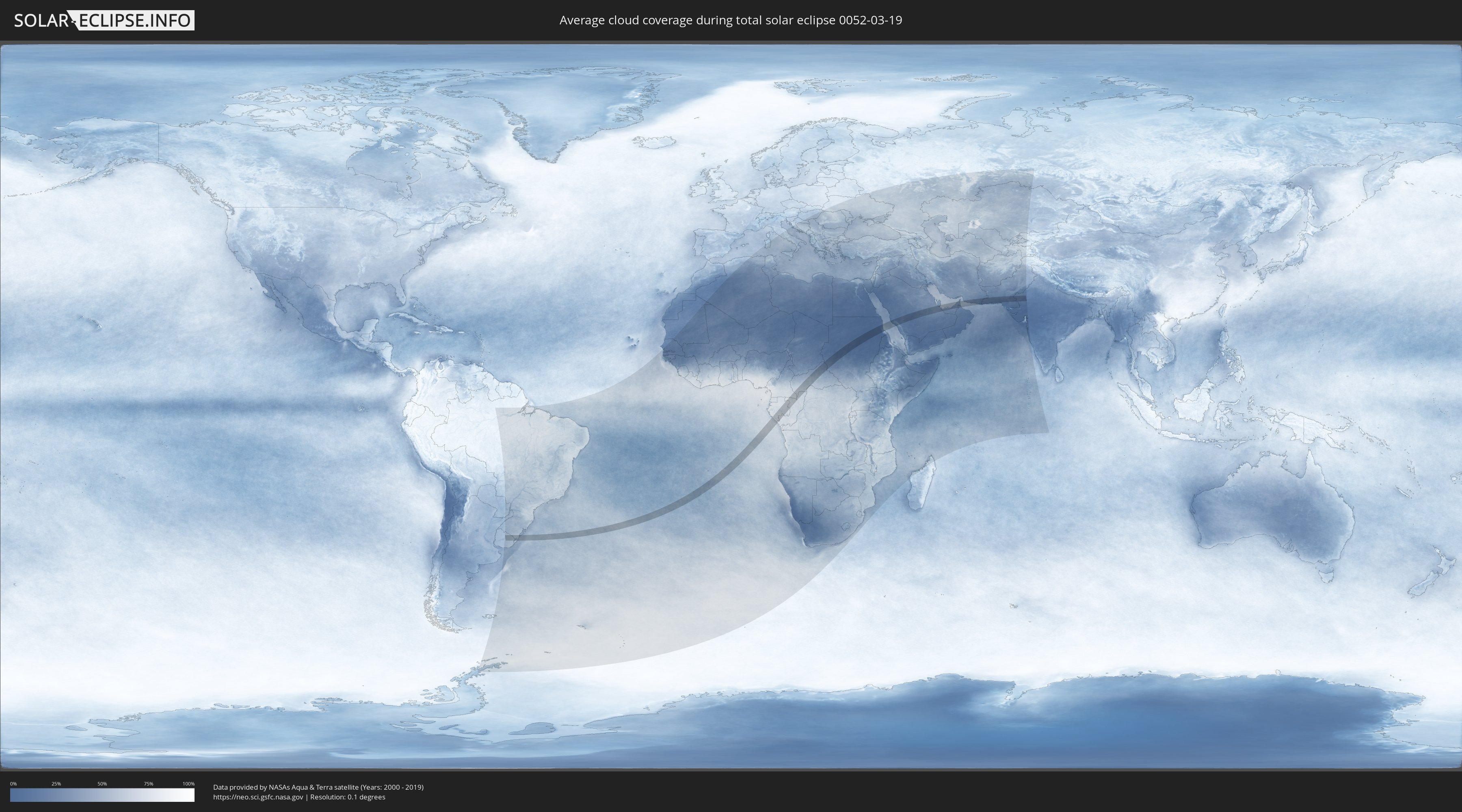
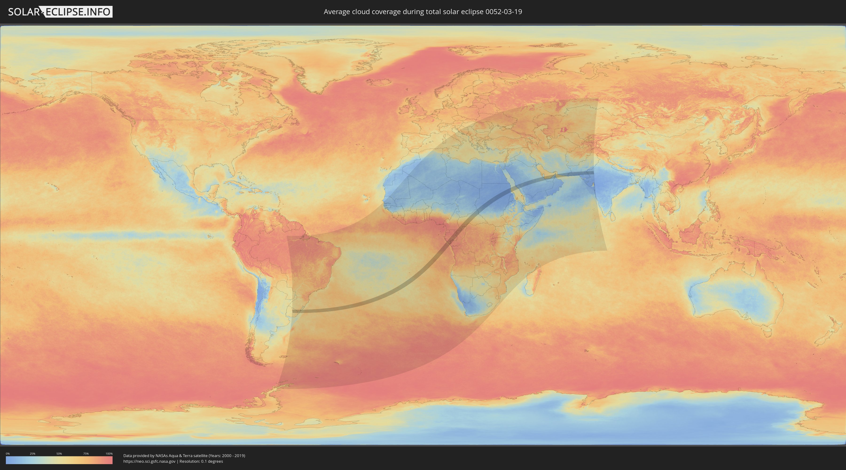
How will be the weather during the total solar eclipse on 03/19/0052?
Where is the best place to see the total solar eclipse of 03/19/0052?
The following maps show the average cloud coverage for the day of the total solar eclipse.
With the help of these maps, it is possible to find the place along the eclipse path, which has the best
chance of a cloudless sky.
Nevertheless, you should consider local circumstances and inform about the weather of your chosen
observation site.
The data is provided by NASAs satellites
AQUA and TERRA.
The cloud maps are averaged over a period of 19 years (2000 - 2019).
Detailed country maps
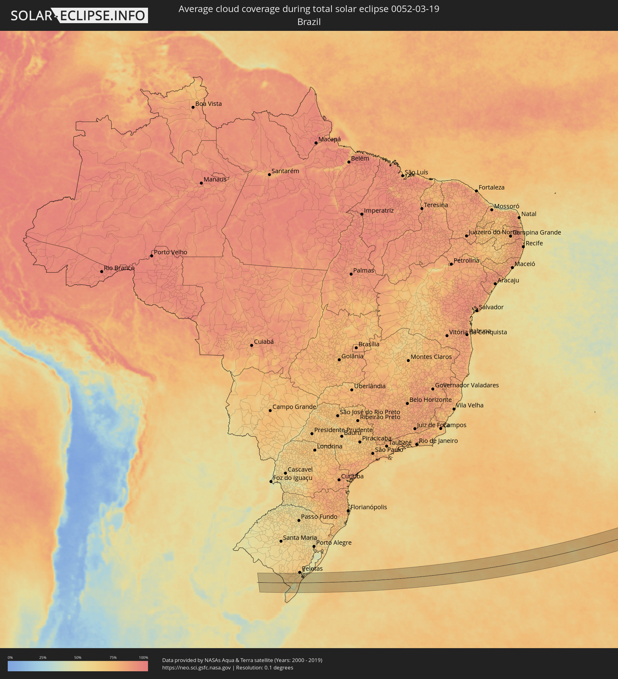 Brazil
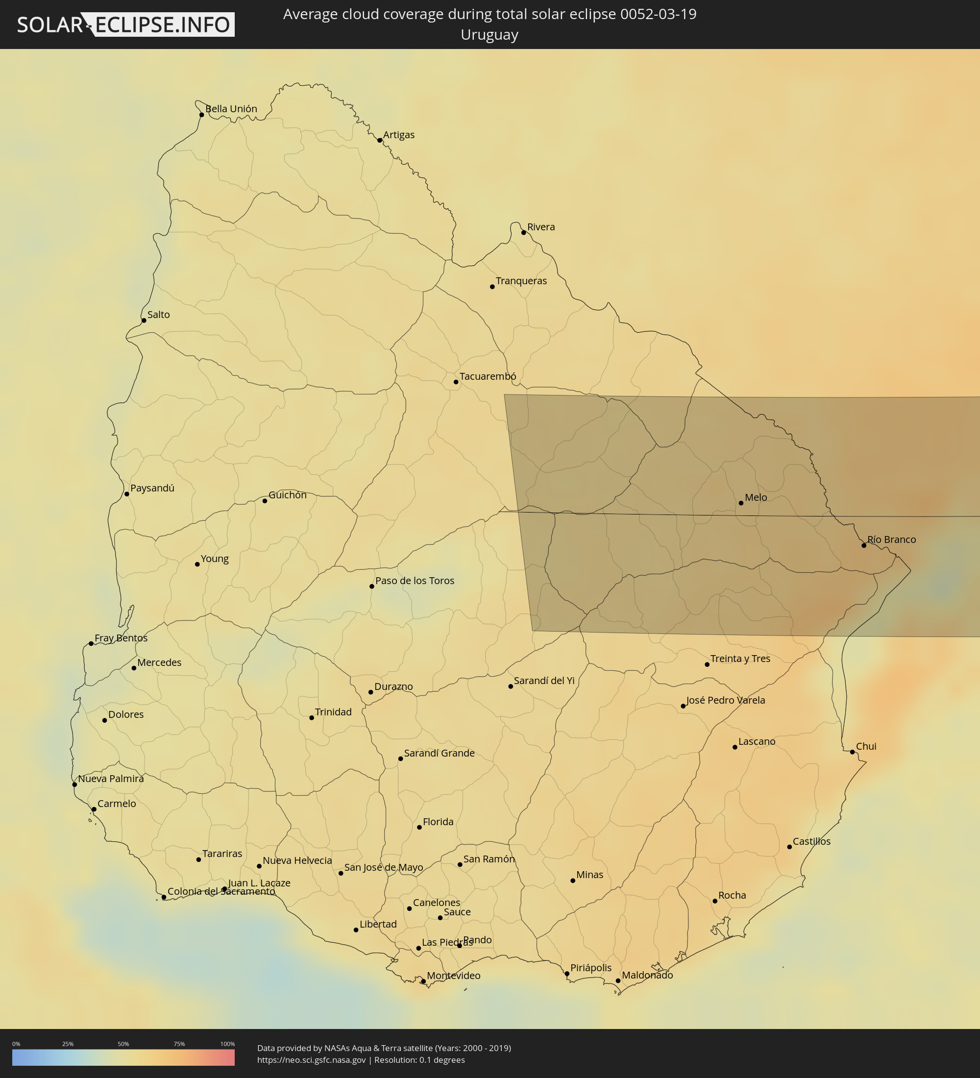 Uruguay
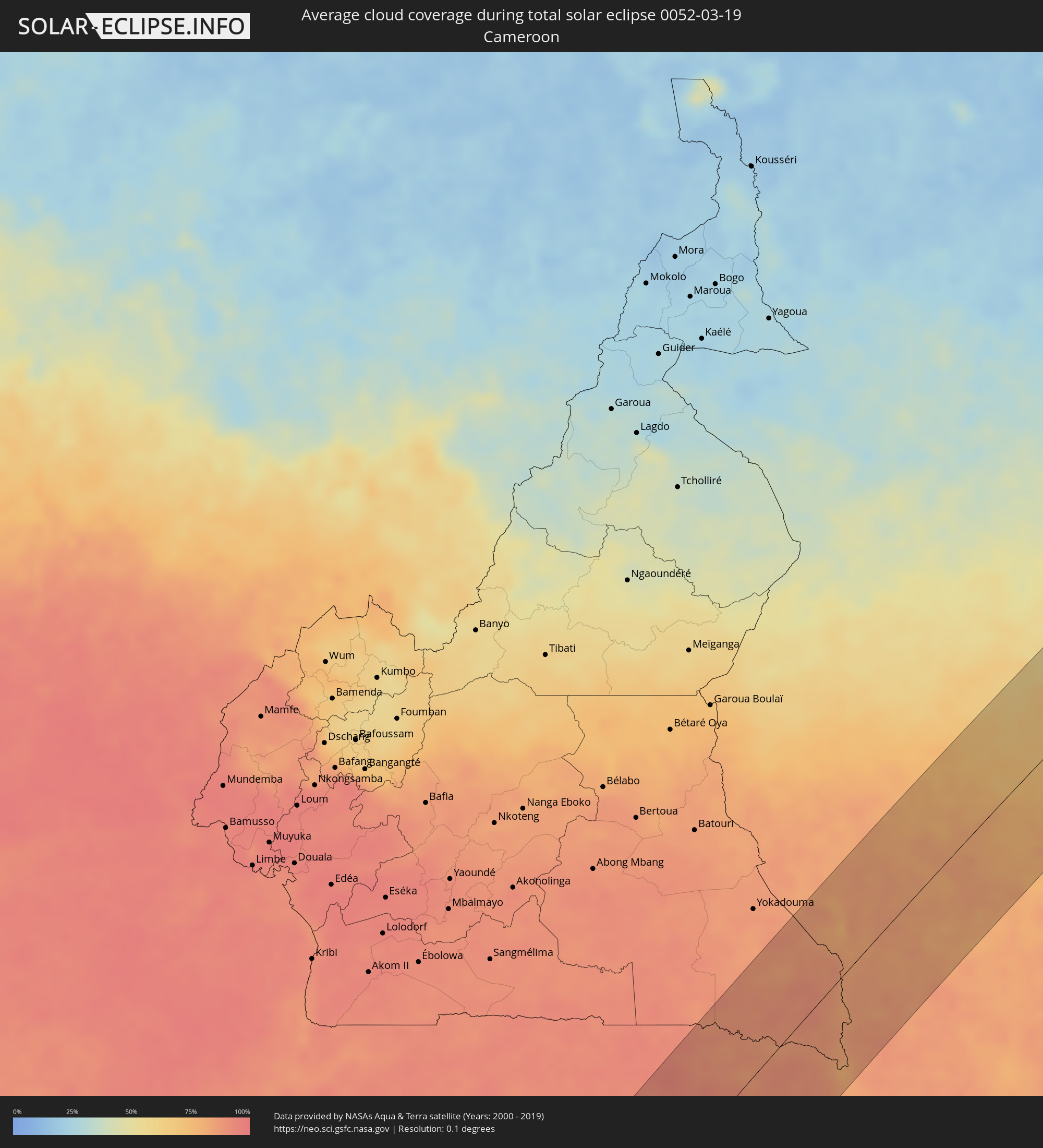 Cameroon
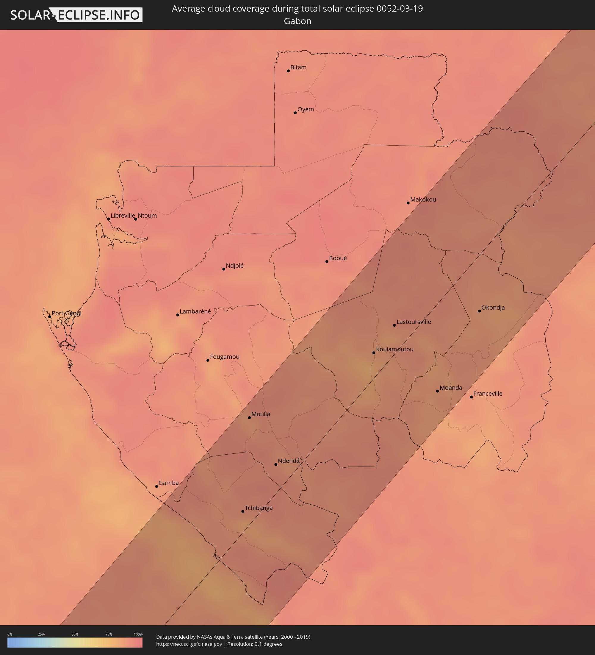 Gabon
Gabon
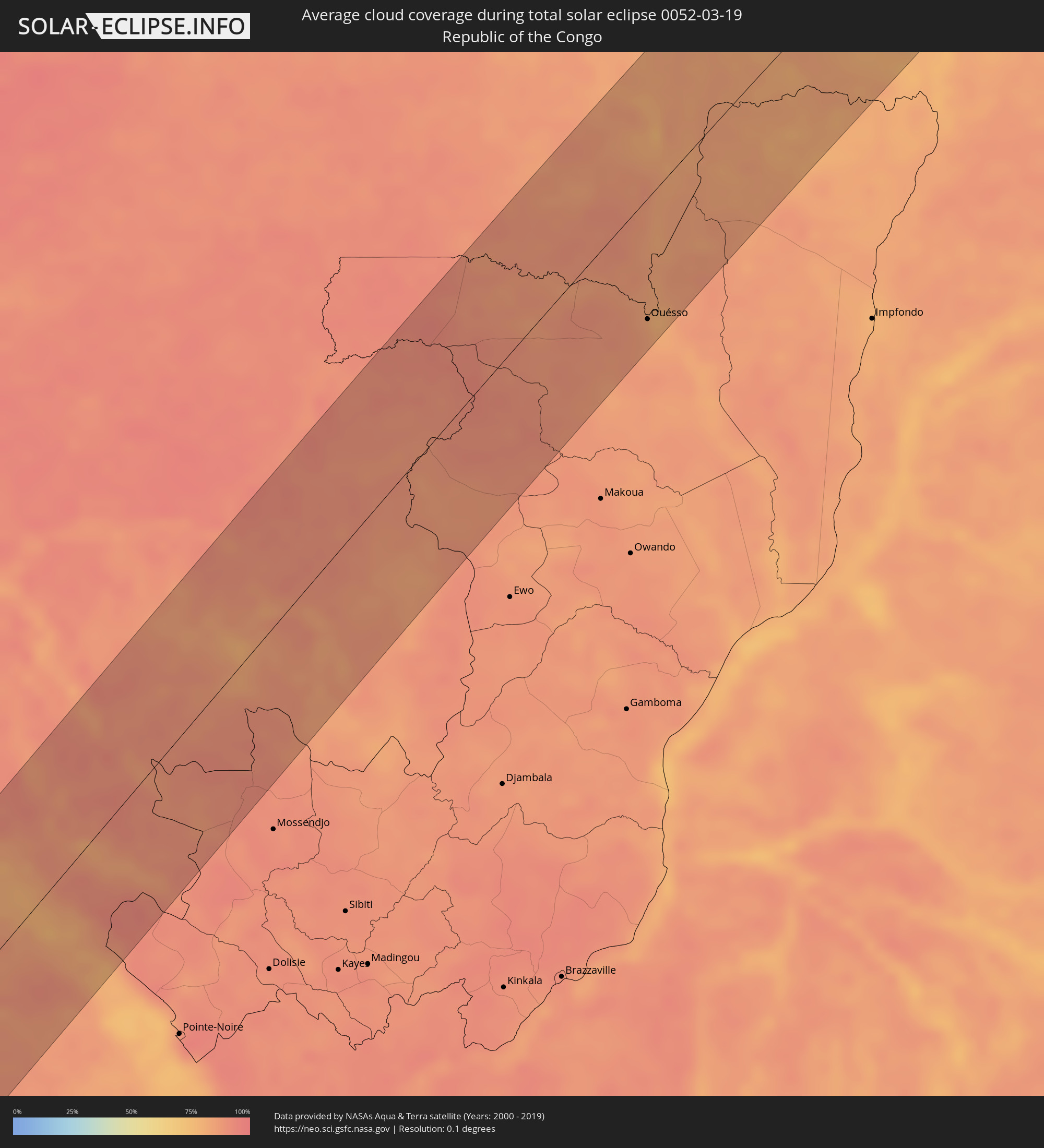 Republic of the Congo
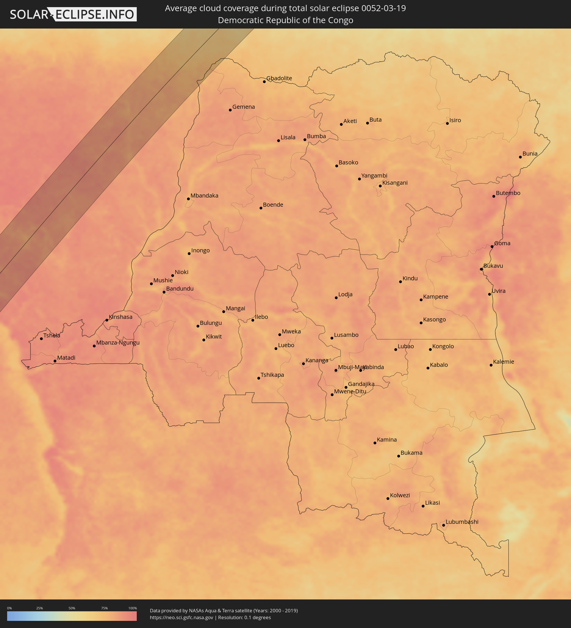 Democratic Republic of the Congo
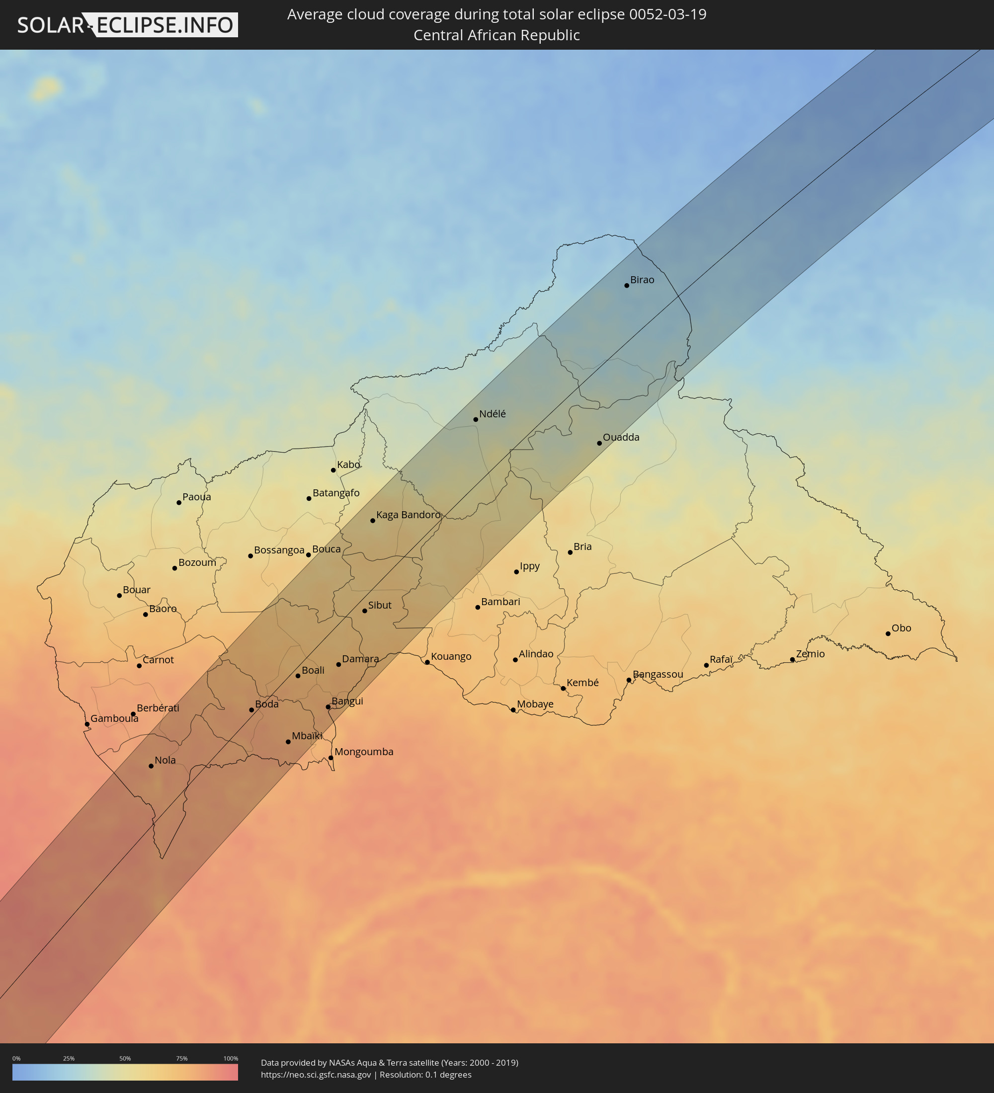 Central African Republic
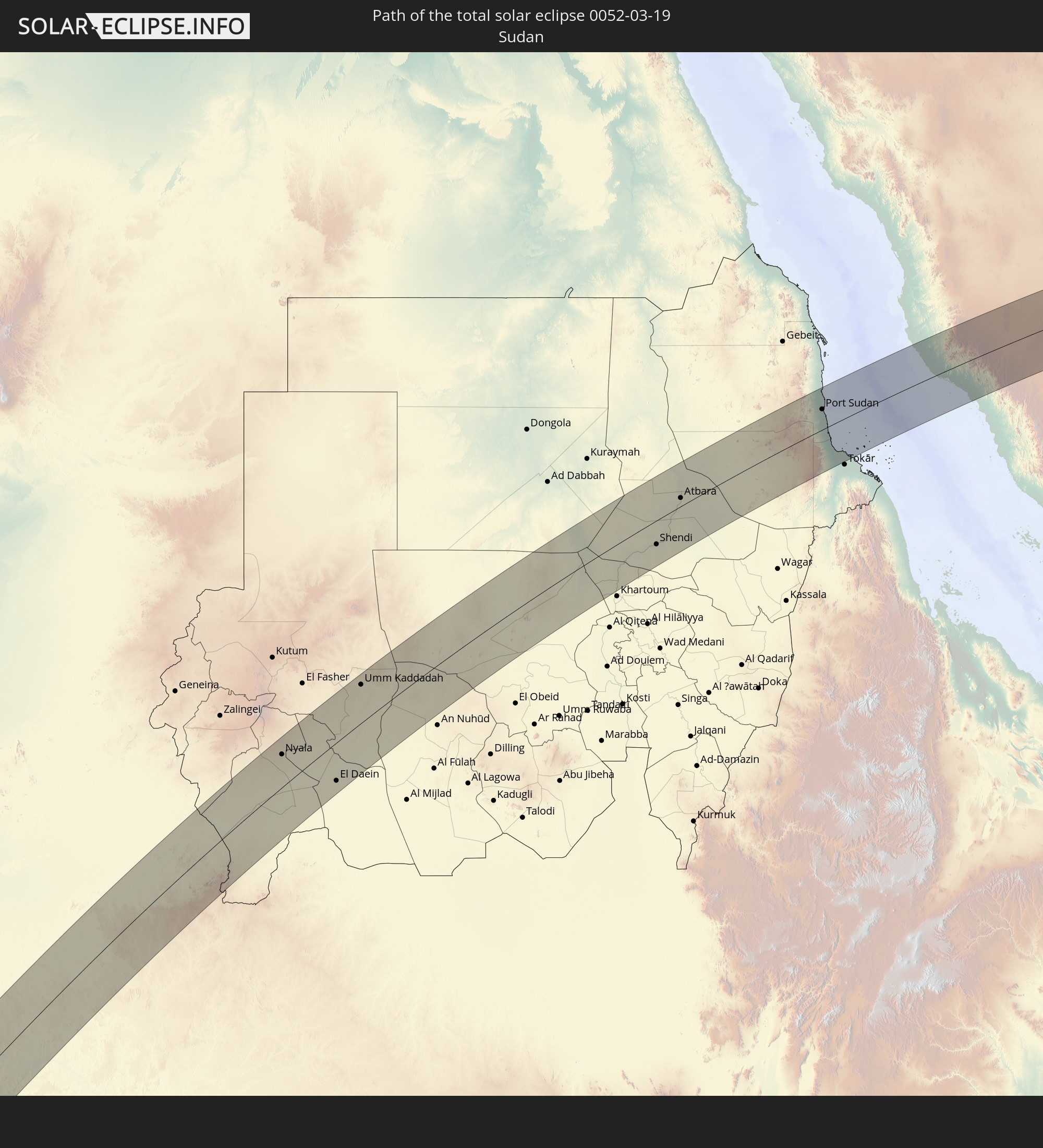
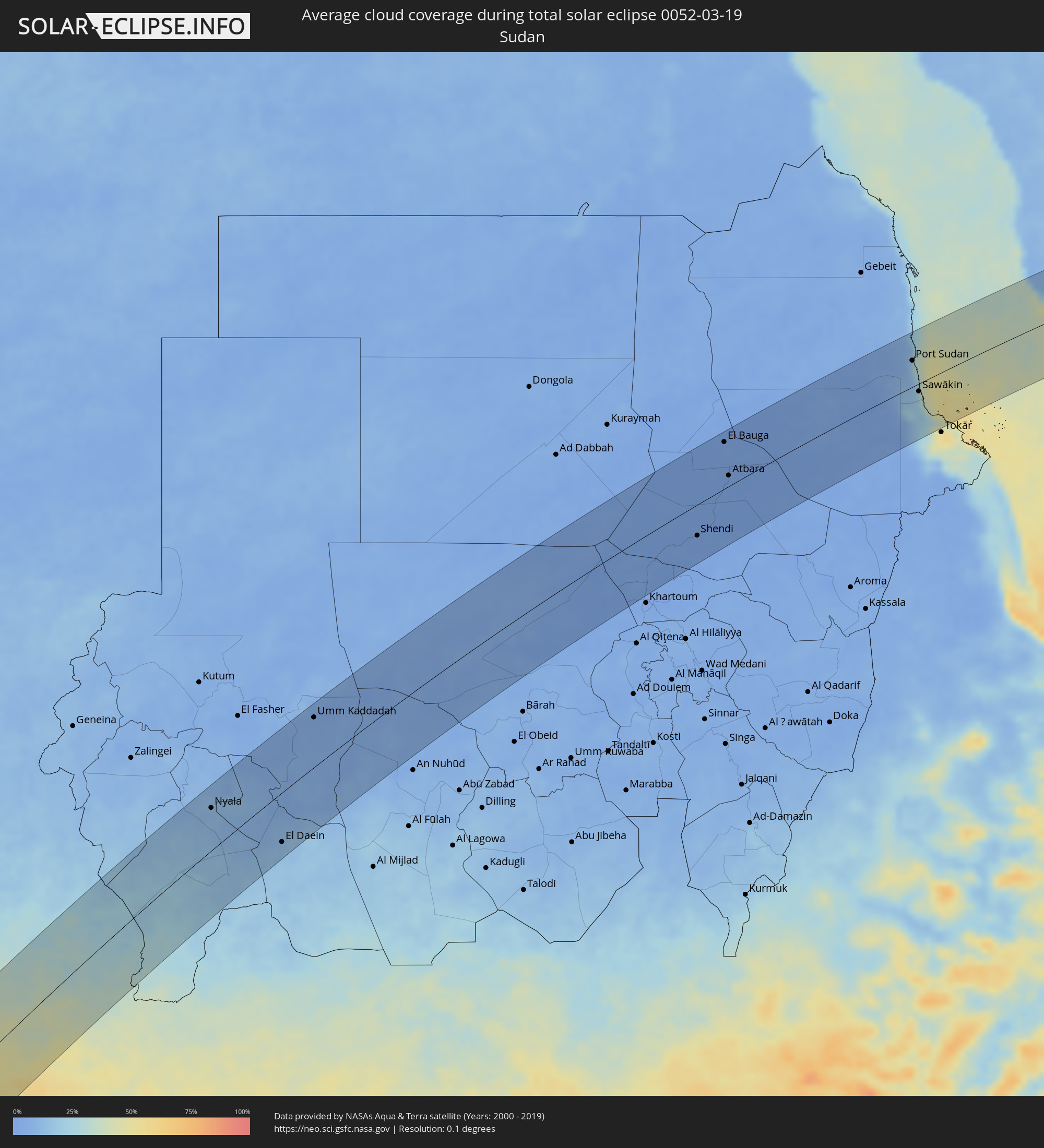 Sudan
Sudan
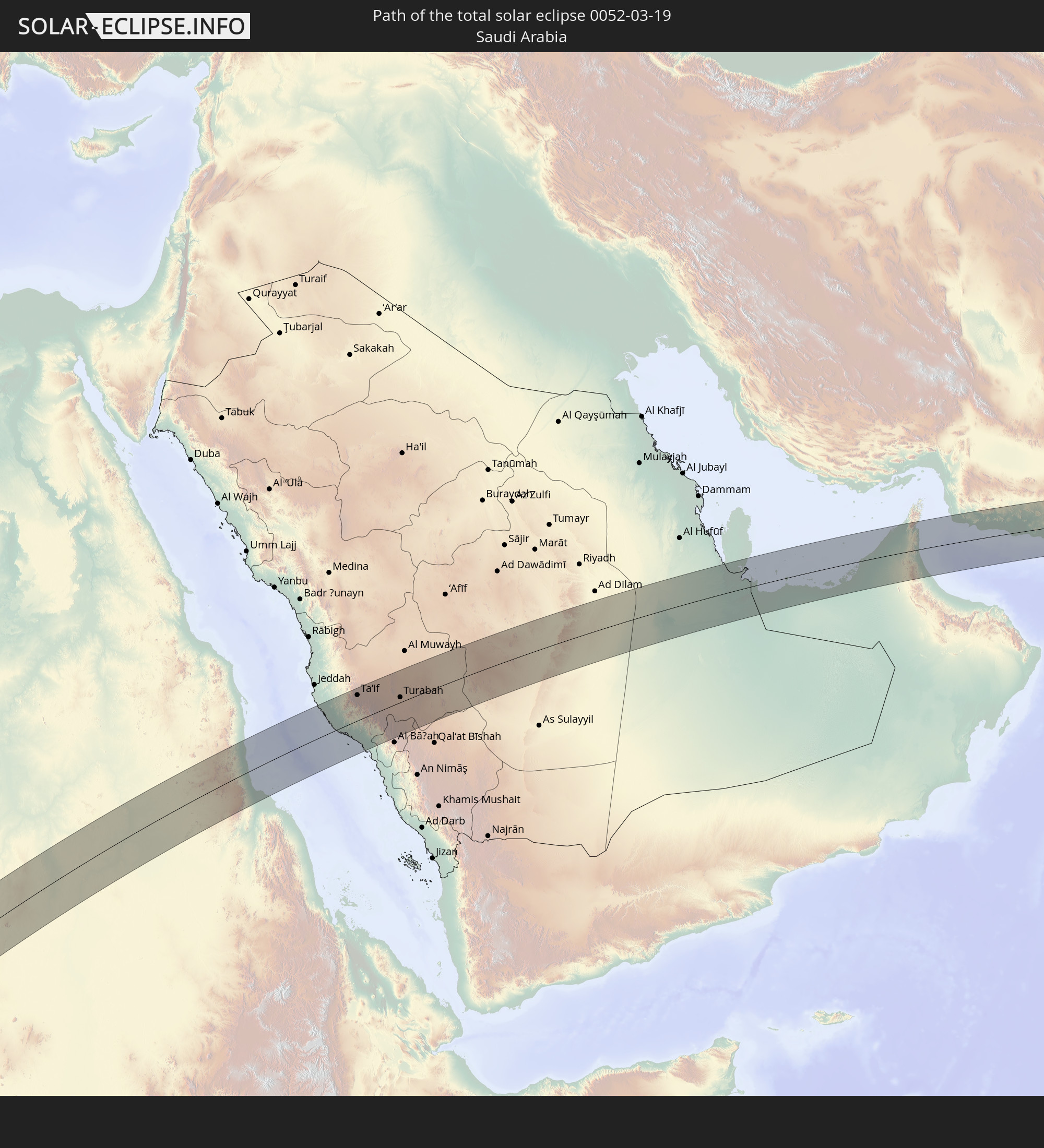
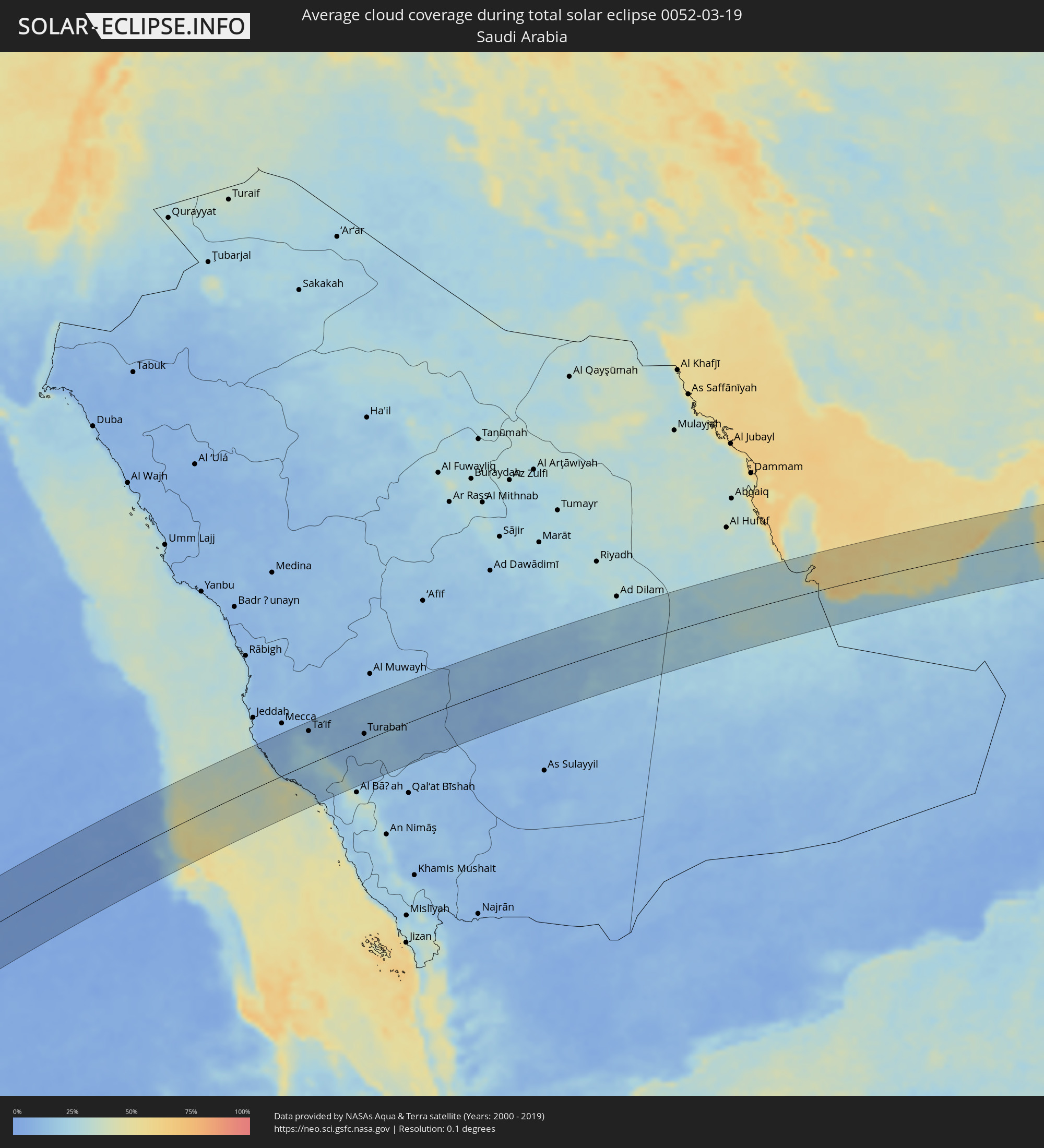 Saudi Arabia
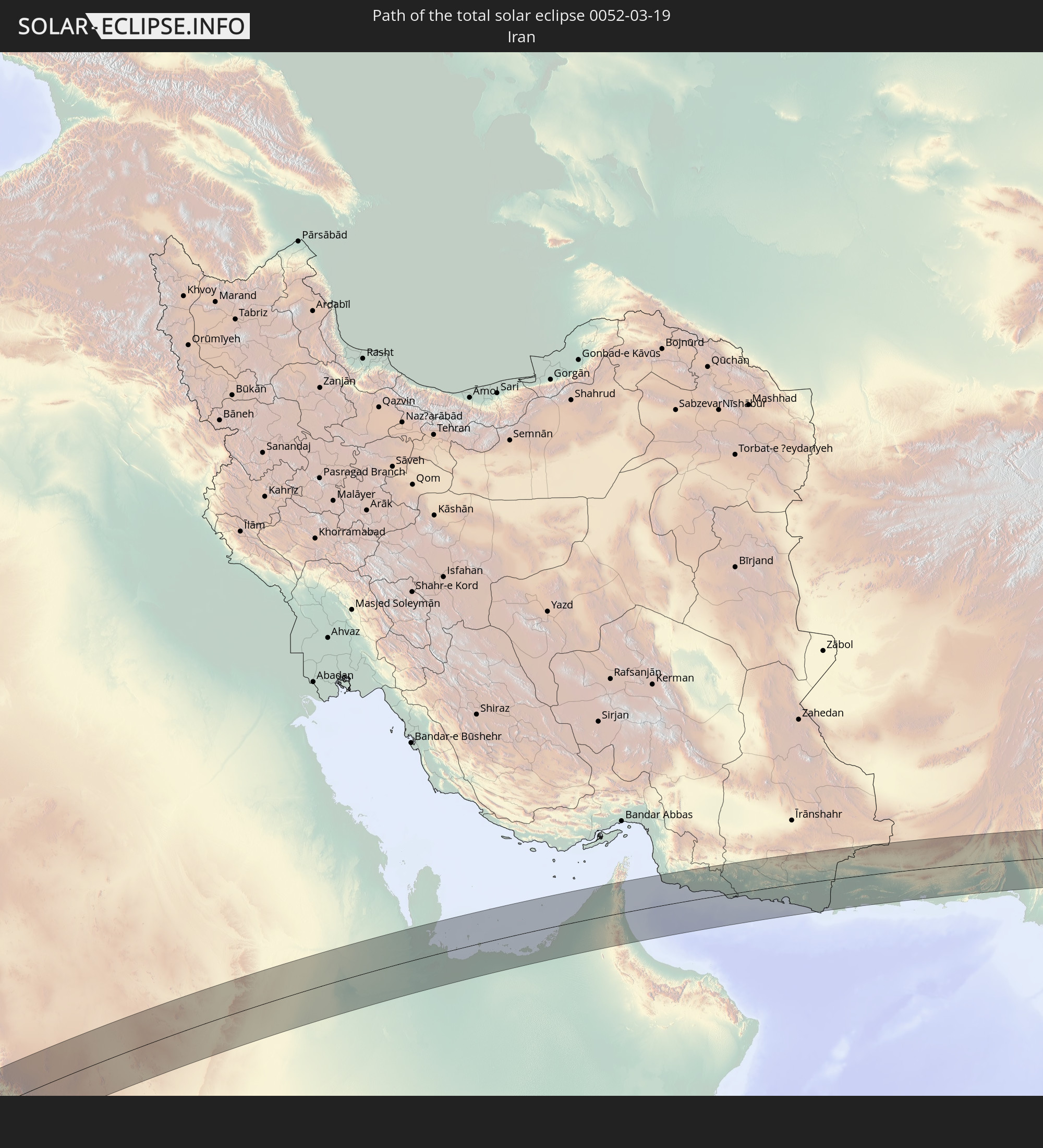
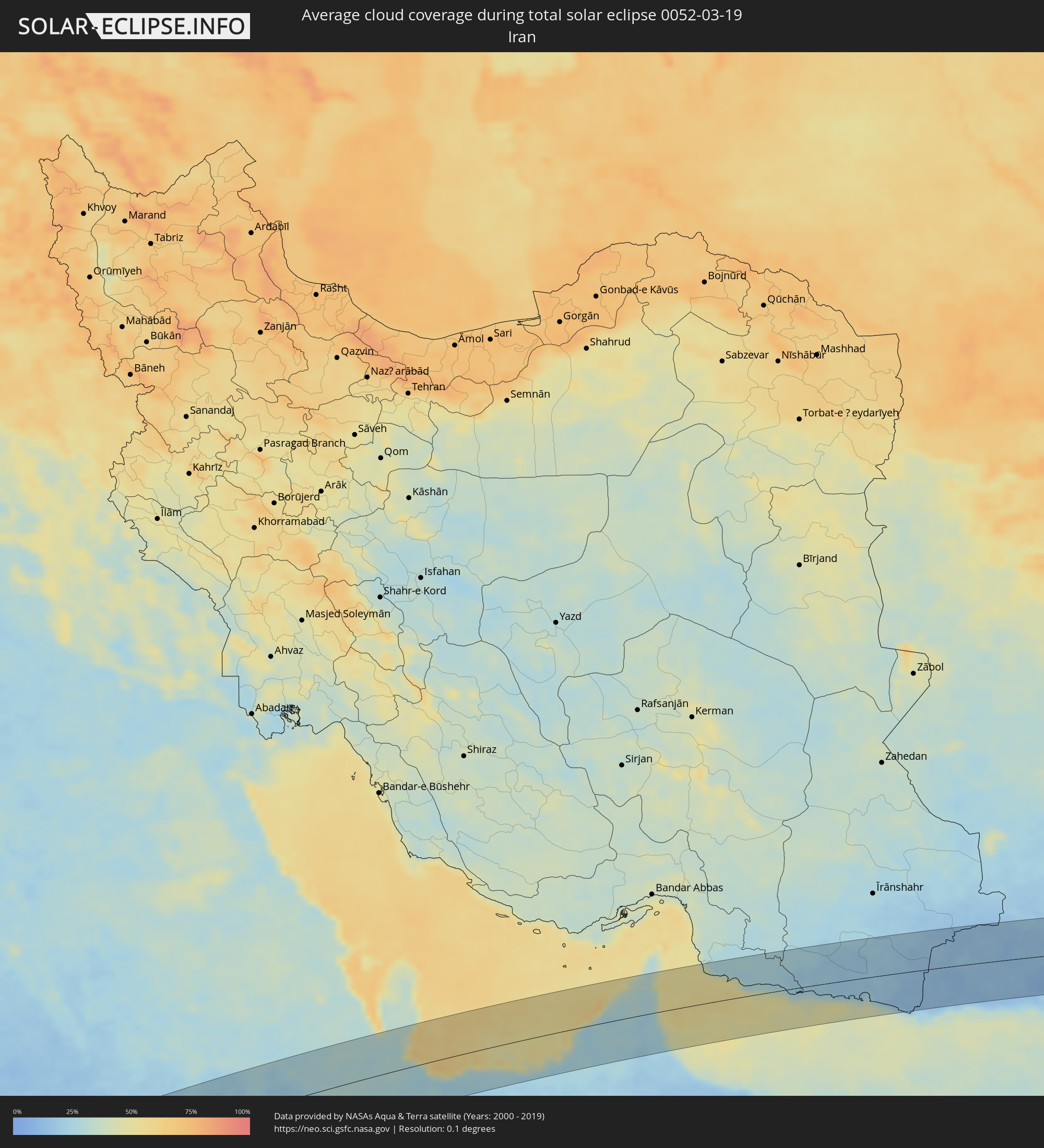 Iran
Iran
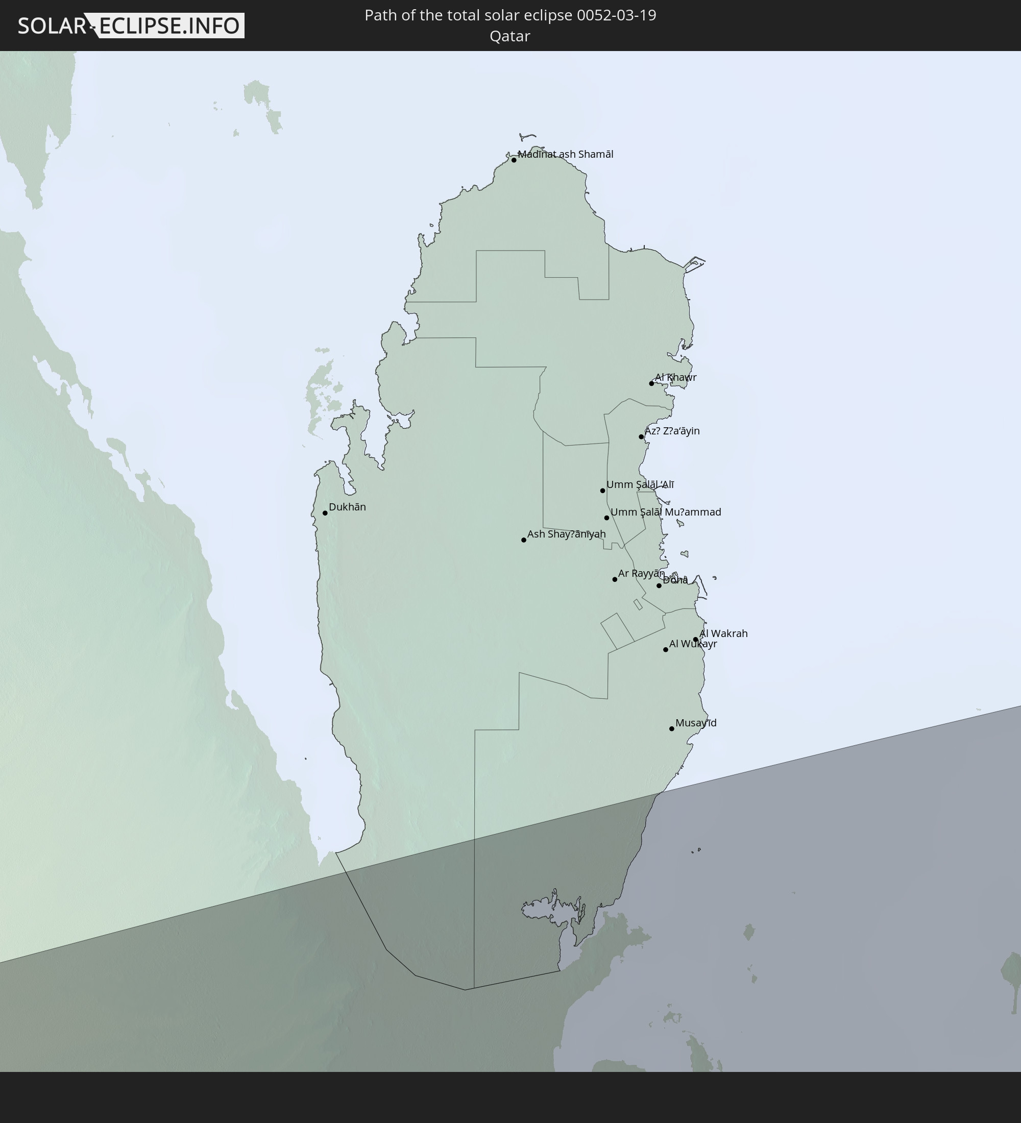
 Qatar
Qatar
 United Arab Emirates
 Oman
Oman
 Pakistan
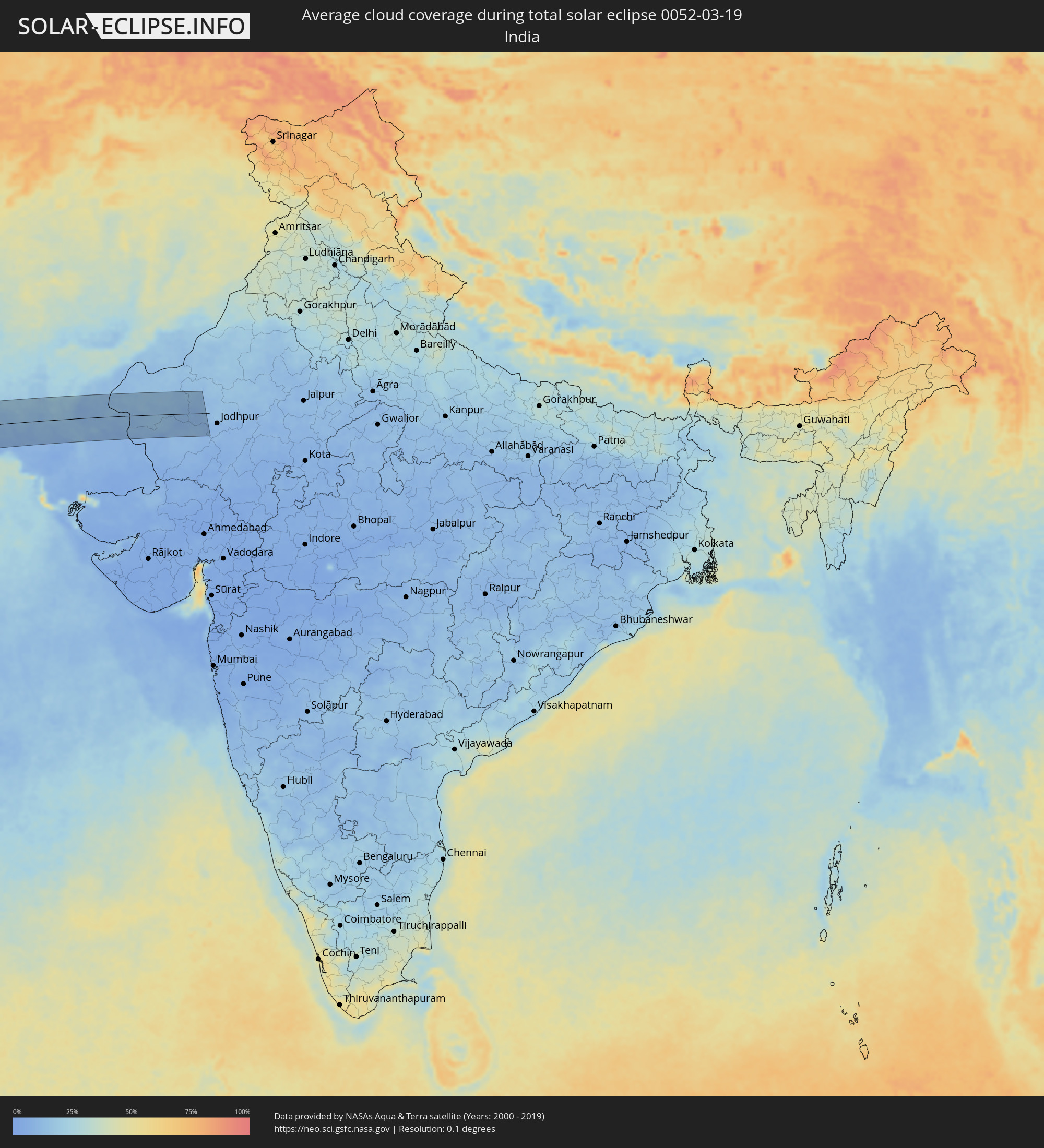 India
India
Cities inside the path of the eclipse
The following table shows all locations with a population of more than 5,000 inside the eclipse path. Cities which have more than 100,000 inhabitants are marked bold. A click at the locations opens a detailed map.
| City | Type | Eclipse duration | Local time of max. eclipse | Distance to central line | Ø Cloud coverage |
|
Melo, Cerro Largo
|
total | - | 06:04:09 UTC-03:44 | 7 km | 61% |
|
Herval, Rio Grande do Sul
|
total | - | 06:42:32 UTC-03:06 | 46 km | 67% |
|
Río Branco, Cerro Largo
|
total | - | 06:04:12 UTC-03:44 | 18 km | 66% |
|
Jaguarão, Rio Grande do Sul
|
total | - | 06:42:35 UTC-03:06 | 14 km | 66% |
|
Arroio Grande, Rio Grande do Sul
|
total | - | 06:42:34 UTC-03:06 | 22 km | 68% |
|
Rio Grande, Rio Grande do Sul
|
total | - | 06:42:38 UTC-03:06 | 44 km | 61% |
|
Tchibanga, Nyanga
|
total | - | 11:48:16 UTC+00:13 | 17 km | 80% |
|
Mouila, Ngouni
|
total | - | 11:50:39 UTC+00:13 | 87 km | 87% |
|
Ndendé, Ngouni
|
total | - | 11:50:04 UTC+00:13 | 23 km | 91% |
|
Koulamoutou, Ogooué-Lolo
|
total | - | 11:54:46 UTC+00:13 | 20 km | 82% |
|
Lastoursville, Ogooué-Lolo
|
total | - | 11:55:51 UTC+00:13 | 23 km | 83% |
|
Mounana, Haut-Ogooué
|
total | - | 11:55:25 UTC+00:13 | 58 km | 86% |
|
Moanda, Haut-Ogooué
|
total | - | 11:55:10 UTC+00:13 | 73 km | 84% |
|
Okondja, Haut-Ogooué
|
total | - | 11:57:57 UTC+00:13 | 47 km | 85% |
|
Nola, Sangha-Mbaéré
|
total | - | 12:10:49 UTC+00:13 | 62 km | 82% |
|
Ouésso, Sangha
|
total | - | 12:06:55 UTC+00:13 | 80 km | 80% |
|
Boda, Lobaye
|
total | - | 12:14:54 UTC+00:13 | 5 km | 81% |
|
Mbaïki, Lobaye
|
total | - | 12:14:55 UTC+00:13 | 71 km | 81% |
|
Boali, Ombella-M'Poko
|
total | - | 12:17:00 UTC+00:13 | 11 km | 77% |
|
Bimbo, Ombella-M'Poko
|
total | - | 12:16:26 UTC+00:13 | 76 km | 81% |
|
Bangui, Bangui
|
total | - | 12:16:53 UTC+00:13 | 79 km | 78% |
|
Damara, Ombella-M'Poko
|
total | - | 12:18:19 UTC+00:13 | 45 km | 76% |
|
Sibut, Kémo
|
total | - | 12:20:26 UTC+00:13 | 17 km | 66% |
|
Kaga Bandoro, Nana-Grébizi
|
total | - | 12:23:04 UTC+00:13 | 73 km | 54% |
|
Ndélé, Bamingui-Bangoran
|
total | - | 12:28:09 UTC+00:13 | 72 km | 39% |
|
Ouadda, Haute-Kotto
|
total | - | 12:30:26 UTC+00:13 | 88 km | 45% |
|
Birao, Vakaga
|
total | - | 12:34:58 UTC+00:13 | 64 km | 25% |
|
Nyala, Southern Darfur
|
total | - | 14:37:44 UTC+02:10 | 63 km | 12% |
|
El Daein, Eastern Darfur
|
total | - | 14:38:41 UTC+02:10 | 74 km | 11% |
|
Umm Kaddadah, Northern Darfur
|
total | - | 14:42:51 UTC+02:10 | 75 km | 4% |
|
El Matama, River Nile
|
total | - | 14:56:11 UTC+02:10 | 44 km | 1% |
|
Shendi, River Nile
|
total | - | 14:56:16 UTC+02:10 | 50 km | 1% |
|
El Bauga, River Nile
|
total | - | 14:58:39 UTC+02:10 | 76 km | 2% |
|
Ed Damer, River Nile
|
total | - | 14:57:59 UTC+02:10 | 8 km | 1% |
|
Berber, River Nile
|
total | - | 14:58:29 UTC+02:10 | 48 km | 1% |
|
Atbara, River Nile
|
total | - | 14:58:07 UTC+02:10 | 17 km | 1% |
|
Port Sudan, Red Sea
|
total | - | 15:03:53 UTC+02:10 | 44 km | 14% |
|
Sawākin, Red Sea
|
total | - | 15:03:30 UTC+02:10 | 13 km | 19% |
|
Al Hadā, Makkah
|
total | - | 16:05:20 UTC+03:06 | 84 km | 14% |
|
Ash Shafā, Makkah
|
total | - | 16:05:07 UTC+03:06 | 53 km | 25% |
|
Ta’if, Makkah
|
total | - | 16:05:23 UTC+03:06 | 69 km | 13% |
|
Al Mindak, Al Bahah
|
total | - | 16:05:19 UTC+03:06 | 81 km | 32% |
|
Turabah, Makkah
|
total | - | 16:06:31 UTC+03:06 | 14 km | 12% |
|
Ar Ruways, Abu Dhabi
|
total | - | 16:50:58 UTC+03:41 | 28 km | 29% |
|
Abu Dhabi, Abu Dhabi
|
total | - | 16:52:00 UTC+03:41 | 26 km | 44% |
|
Dubai, Dubai
|
total | - | 16:52:37 UTC+03:41 | 23 km | 33% |
|
Sharjah, Ash Shāriqah
|
total | - | 16:52:49 UTC+03:41 | 47 km | 34% |
|
Ajman, Ajman
|
total | - | 16:52:52 UTC+03:41 | 55 km | 41% |
|
Umm al Qaywayn, Umm al Qaywayn
|
total | - | 16:52:58 UTC+03:41 | 69 km | 42% |
|
Al Buraymī, Al Buraimi
|
total | - | 16:52:37 UTC+03:41 | 79 km | 24% |
|
Adh Dhayd, Ash Shāriqah
|
total | - | 16:53:02 UTC+03:41 | 33 km | 30% |
|
Dibba Al-Fujairah, Al Fujayrah
|
total | - | 16:53:18 UTC+03:41 | 59 km | 34% |
|
Dibba Al-Hisn, Al Fujayrah
|
total | - | 16:53:19 UTC+03:41 | 61 km | 34% |
|
Al Fujayrah, Al Fujayrah
|
total | - | 16:53:11 UTC+03:41 | 5 km | 31% |
|
Khawr Fakkān, Ash Shāriqah
|
total | - | 16:53:15 UTC+03:41 | 29 km | 31% |
|
Shināş, Al Batinah North Governorate
|
total | - | 16:53:06 UTC+03:41 | 38 km | 34% |
|
Al Liwā’, Al Batinah North Governorate
|
total | - | 16:53:05 UTC+03:41 | 63 km | 27% |
|
Chabahar, Sistan and Baluchestan
|
total | - | 16:39:26 UTC+03:25 | 46 km | 43% |
|
Qaşr-e Qand, Sistan and Baluchestan
|
total | - | 16:39:42 UTC+03:25 | 58 km | 21% |
|
Turbat, Balochistān
|
total | - | 17:42:45 UTC+04:28 | 2 km | 15% |
|
Bela, Balochistān
|
total | - | 17:43:28 UTC+04:28 | 5 km | 11% |
|
Bhān, Sindh
|
total | - | 17:43:44 UTC+04:28 | 22 km | 15% |
|
Dadu, Sindh
|
total | - | 17:43:45 UTC+04:28 | 41 km | 19% |
|
Sīta Road, Sindh
|
total | - | 17:43:48 UTC+04:28 | 73 km | 19% |
|
Sehwān, Sindh
|
total | - | 17:43:43 UTC+04:28 | 6 km | 12% |
|
Moro, Sindh
|
total | - | 17:43:47 UTC+04:28 | 32 km | 17% |
|
Thāru Shāh, Sindh
|
total | - | 17:43:49 UTC+04:28 | 62 km | 17% |
|
Sakrand, Sindh
|
total | - | 17:43:44 UTC+04:28 | 29 km | 12% |
|
Pad Īdan, Sindh
|
total | - | 17:43:49 UTC+04:28 | 42 km | 16% |
|
Daur, Sindh
|
total | - | 17:43:47 UTC+04:28 | 7 km | 13% |
|
Nawābshāh, Sindh
|
total | - | 17:43:46 UTC+04:28 | 17 km | 14% |
|
Hāla, Sindh
|
total | - | 17:43:42 UTC+04:28 | 66 km | 9% |
|
Shāhdādpur, Sindh
|
total | - | 17:43:44 UTC+04:28 | 55 km | 14% |
|
Shāhpur Chākar, Sindh
|
total | - | 17:43:46 UTC+04:28 | 29 km | 13% |
|
Tando Ādam, Sindh
|
total | - | 17:43:43 UTC+04:28 | 73 km | 13% |
|
Sānghar, Sindh
|
total | - | 17:43:47 UTC+04:28 | 43 km | 10% |
|
Jaisalmer, Rajasthan
|
total | - | 18:37:00 UTC+05:21 | 45 km | 12% |
|
Pokaran, Rajasthan
|
total | - | 18:37:02 UTC+05:21 | 42 km | 11% |
|
Phalodi, Rajasthan
|
total | - | 18:37:03 UTC+05:21 | 65 km | 11% |