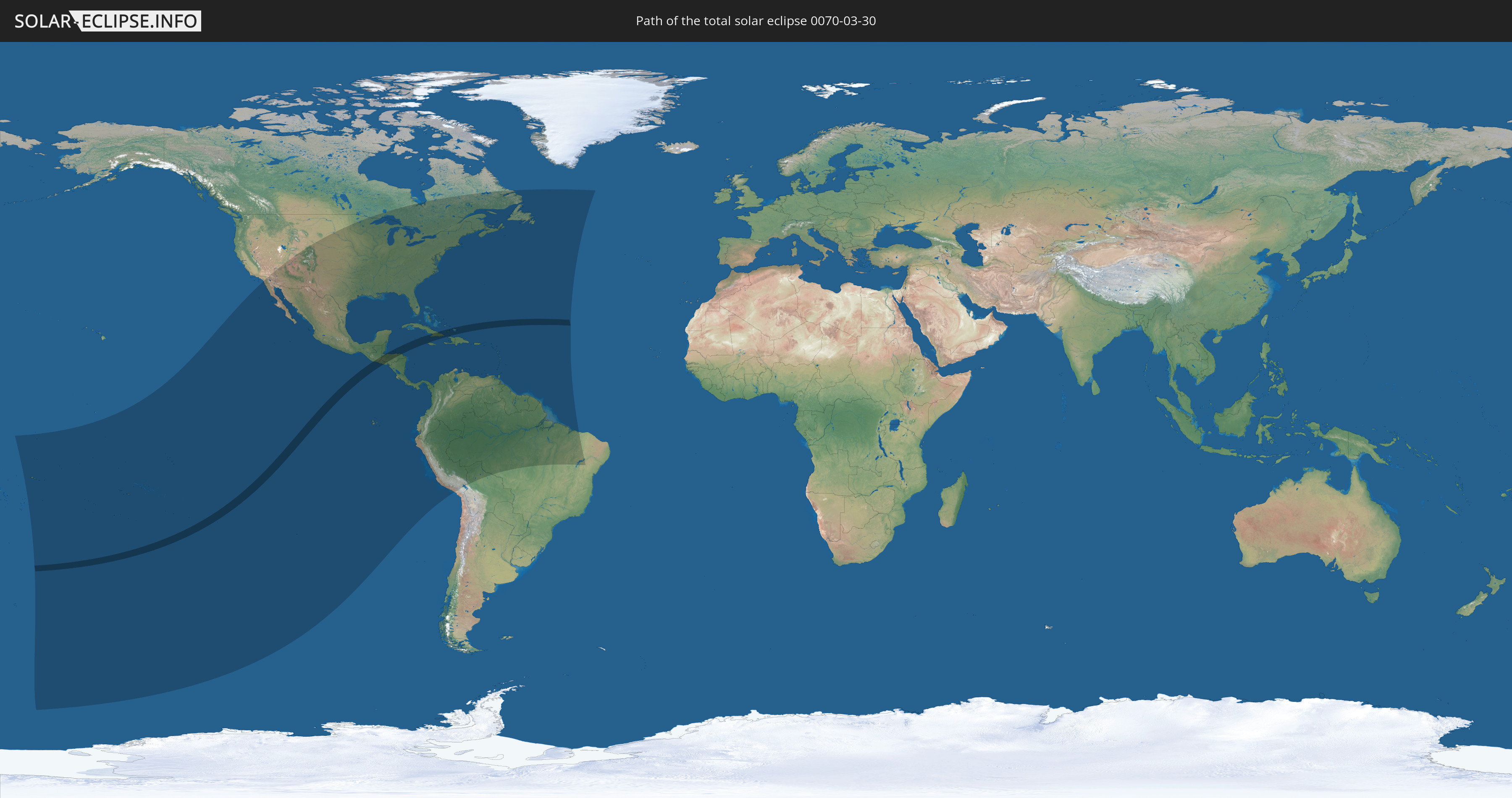
Total solar eclipse of 03/30/0070
| Day of week: | Sunday |
| Maximum duration of eclipse: | 05m08s |
| Maximum width of eclipse path: | 204 km |
| Saros cycle: | 69 |
| Coverage: | 100% |
| Magnitude: | 1.0619 |
| Gamma: | -0.1051 |
Wo kann man die Sonnenfinsternis vom 03/30/0070 sehen?
Die Sonnenfinsternis am 03/30/0070 kann man in 57 Ländern als partielle Sonnenfinsternis beobachten.
Der Finsternispfad verläuft durch 9 Länder. Nur in diesen Ländern ist sie als total Sonnenfinsternis zu sehen.
In den folgenden Ländern ist die Sonnenfinsternis total zu sehen
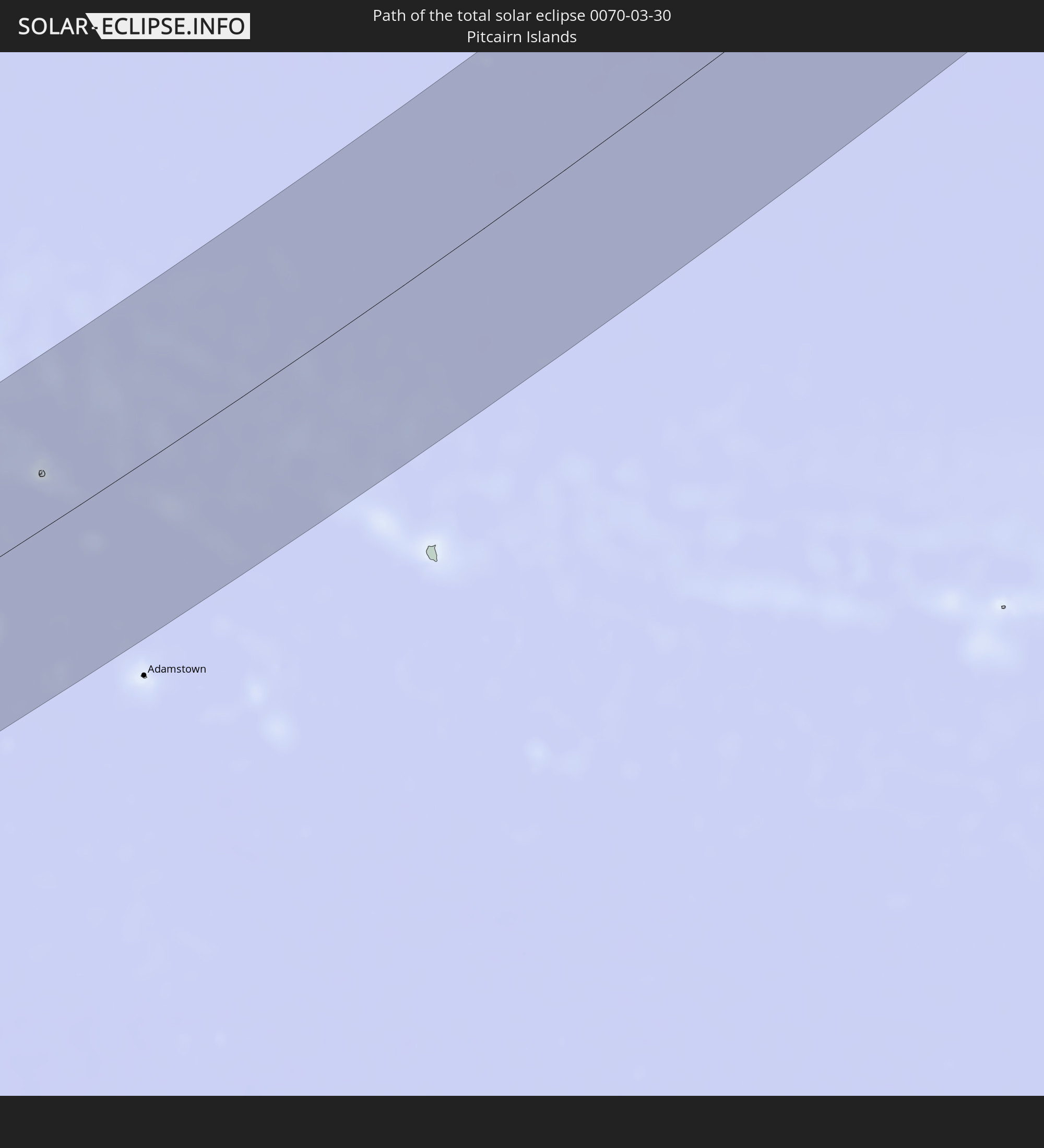 Pitcairn Islands
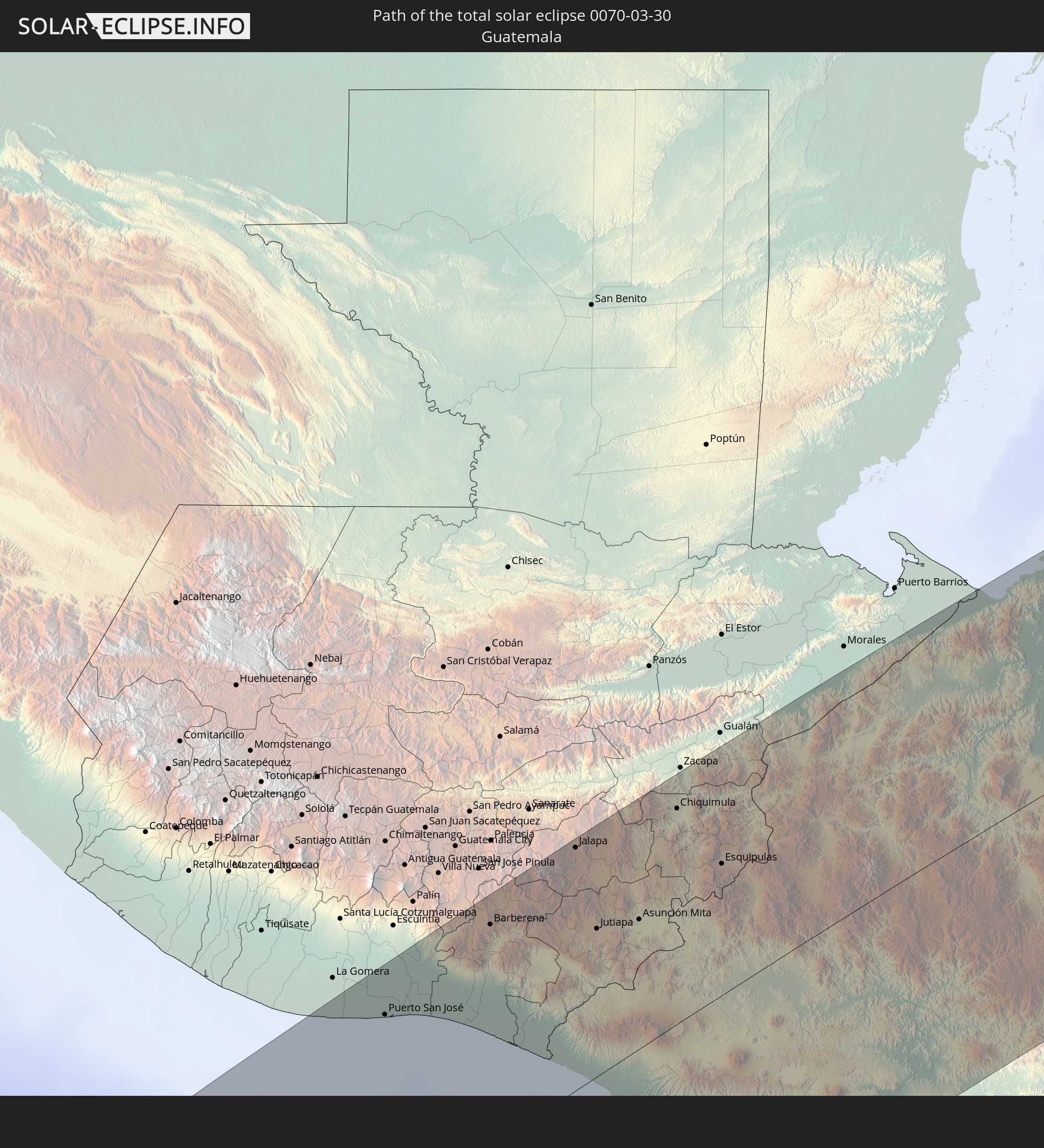 Guatemala
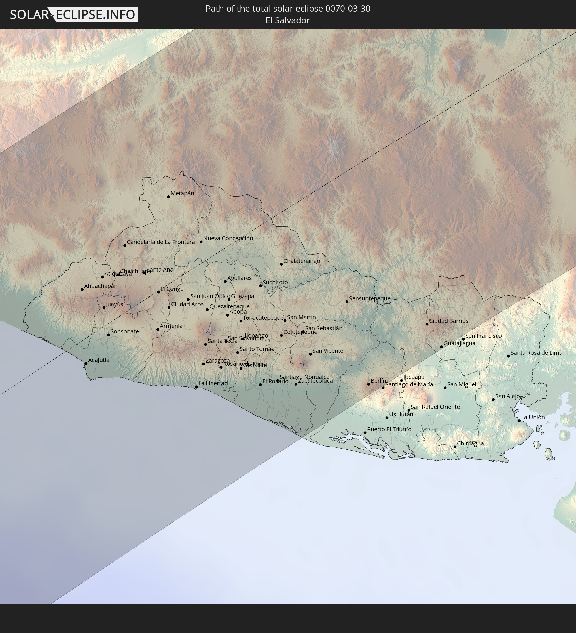 El Salvador
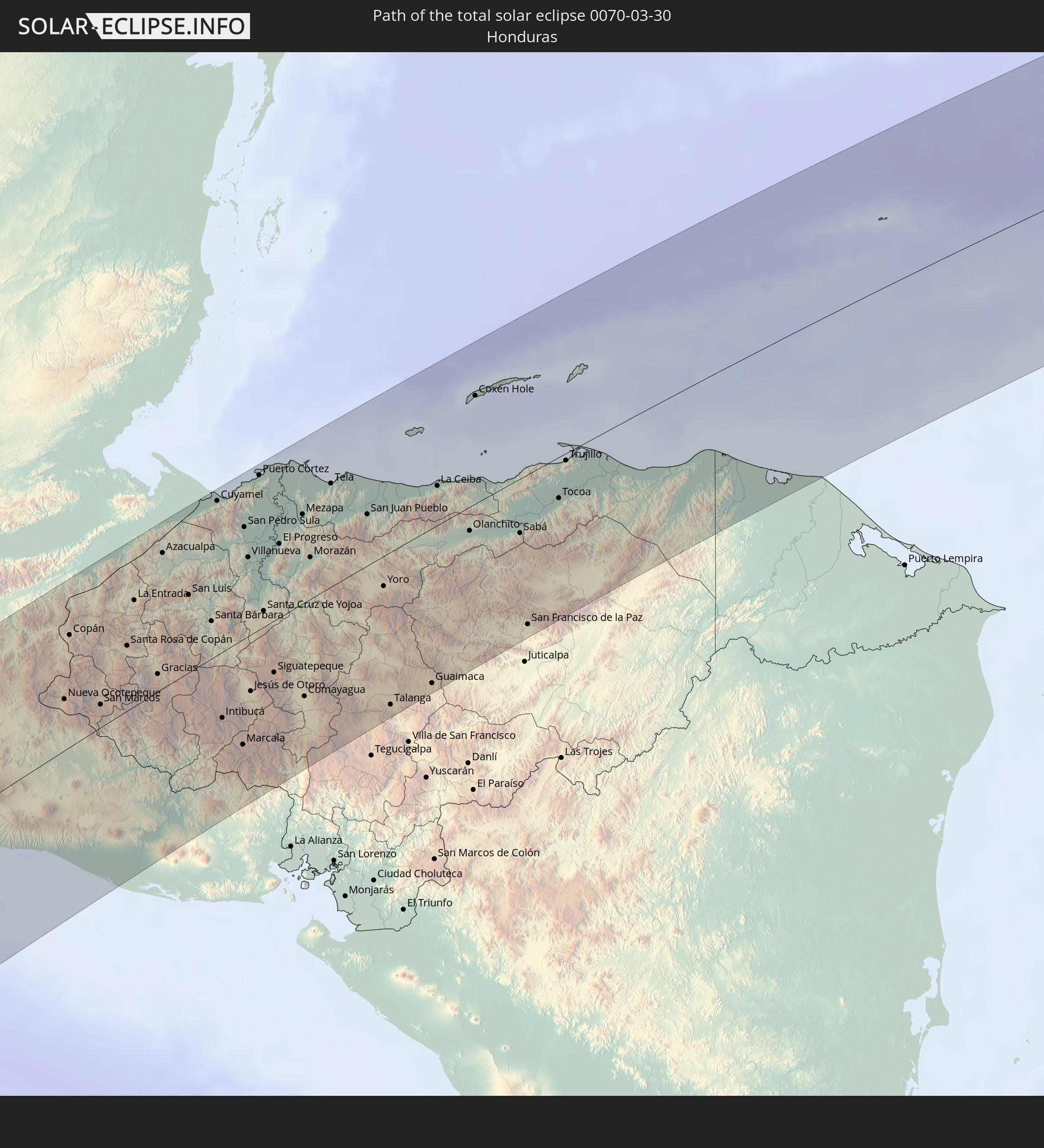 Honduras
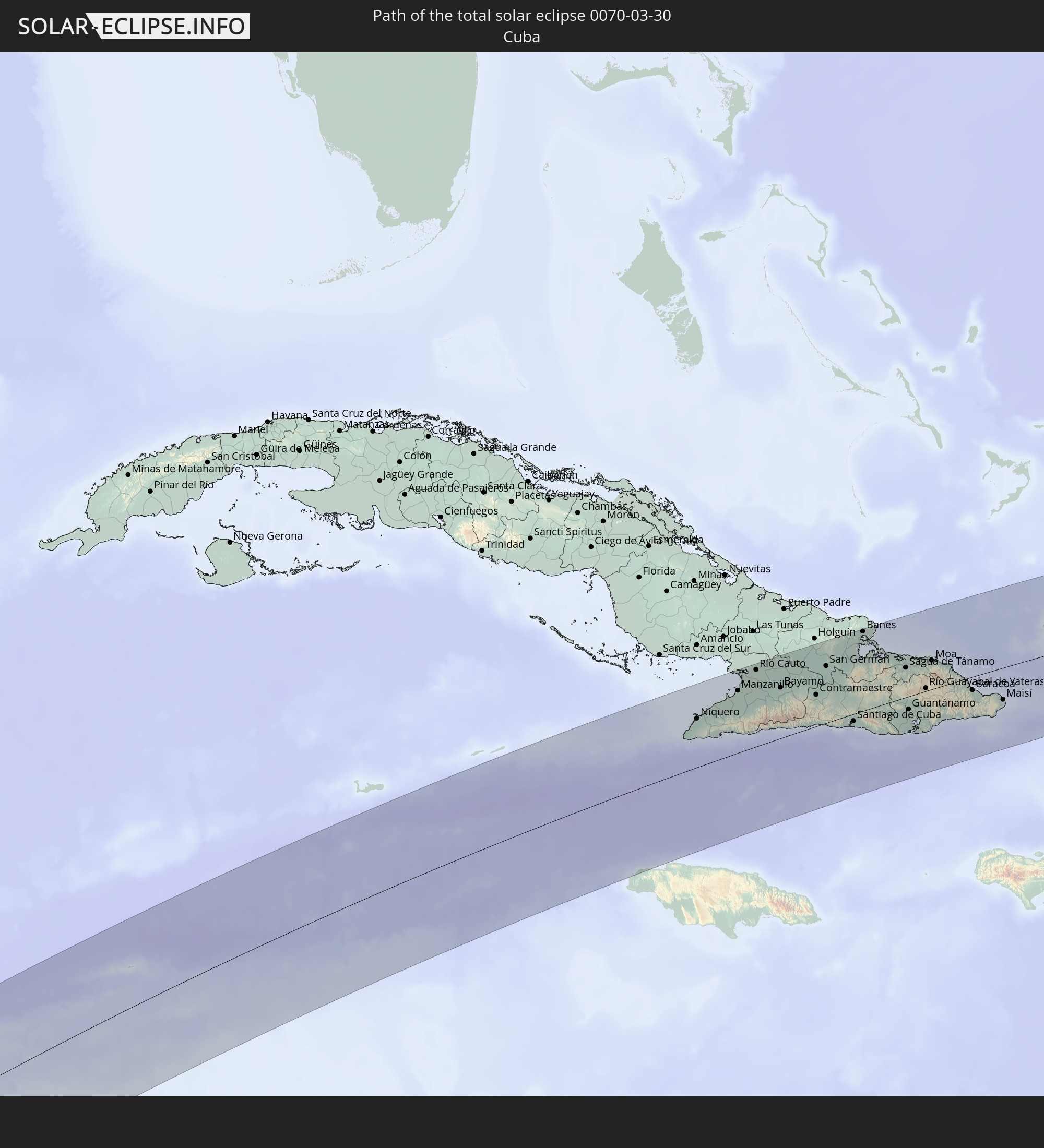 Cuba
Cuba
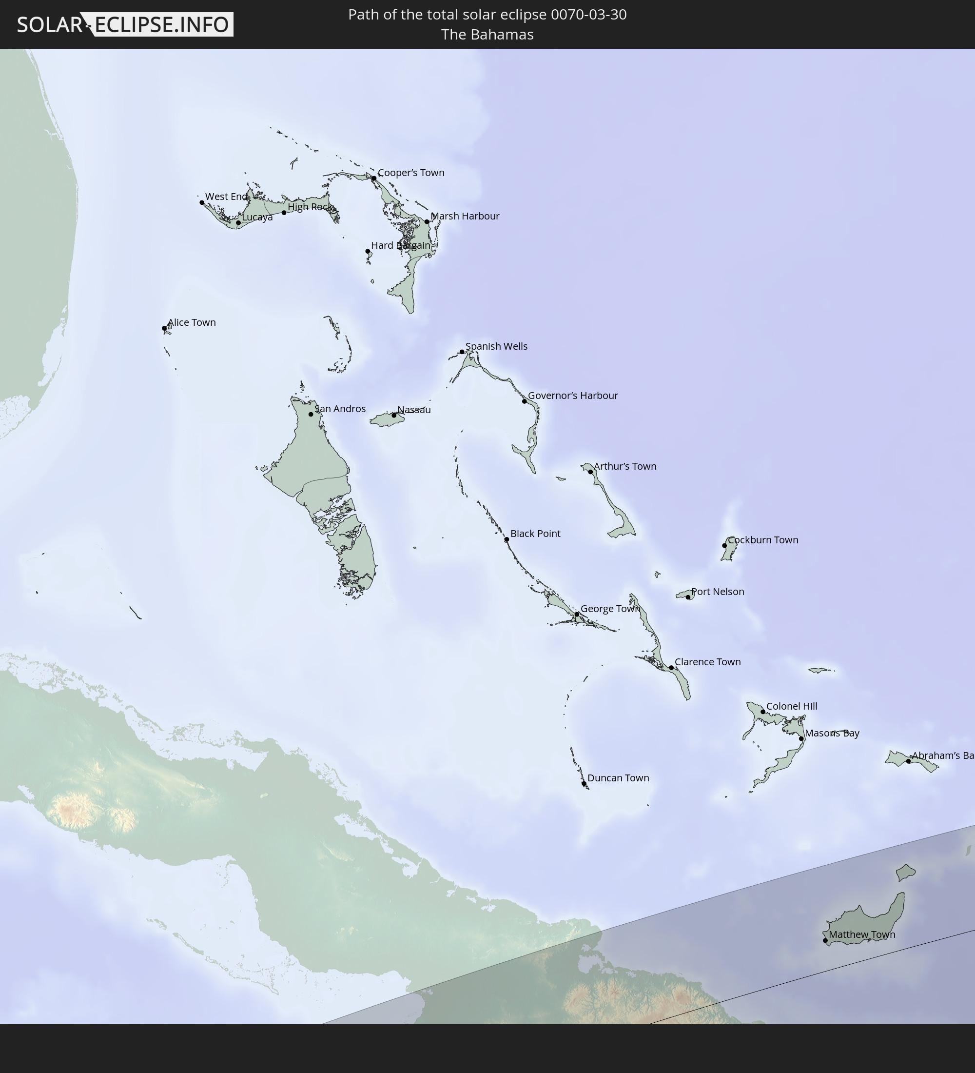 The Bahamas
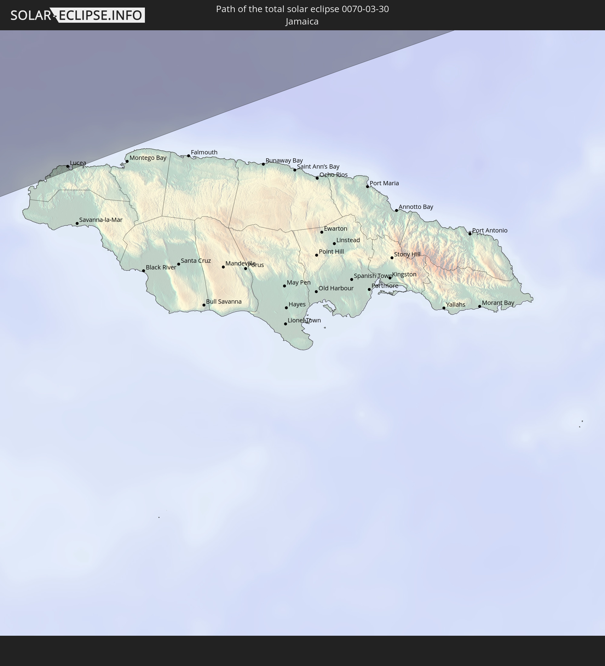 Jamaica
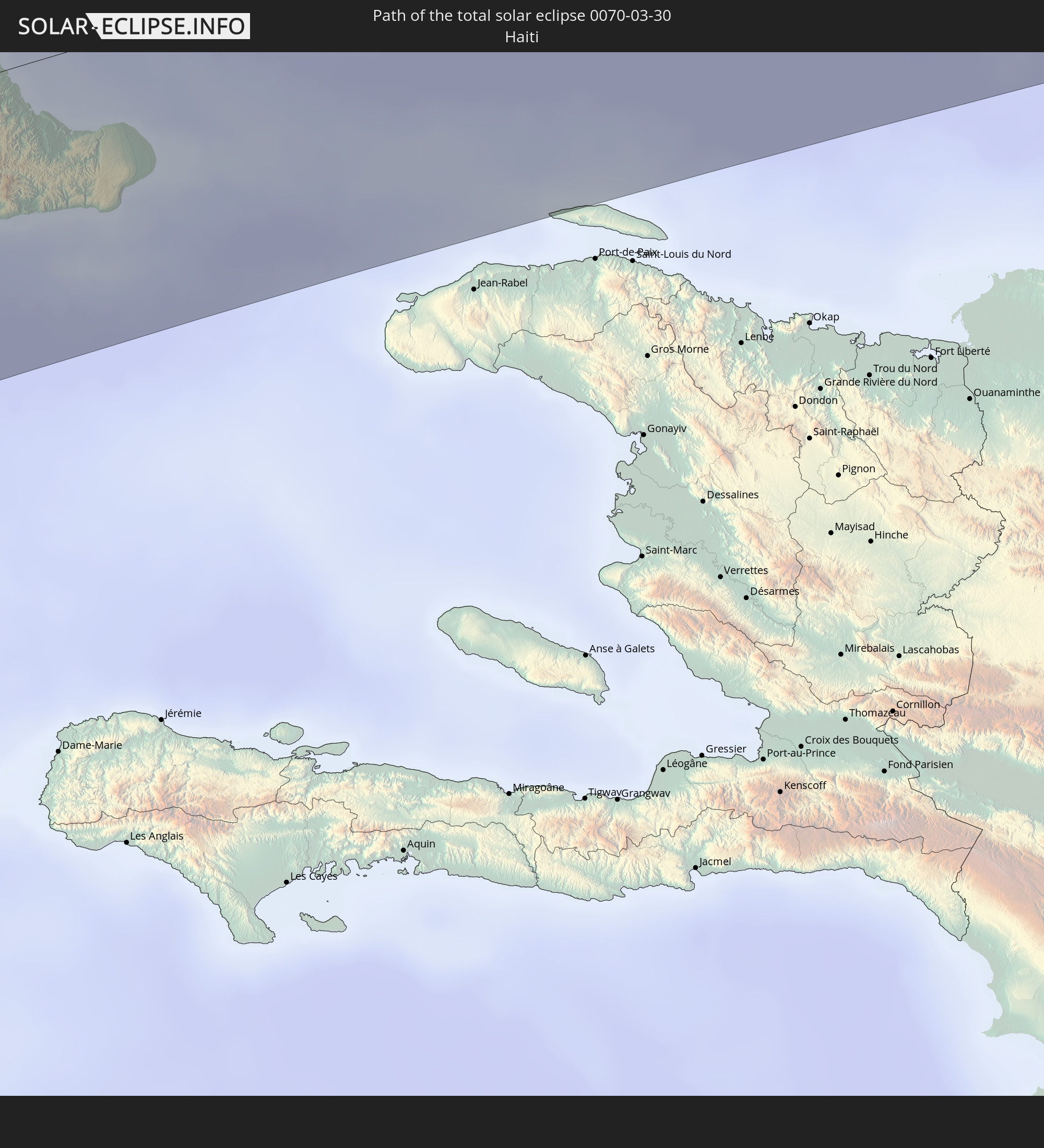 Haiti
Haiti
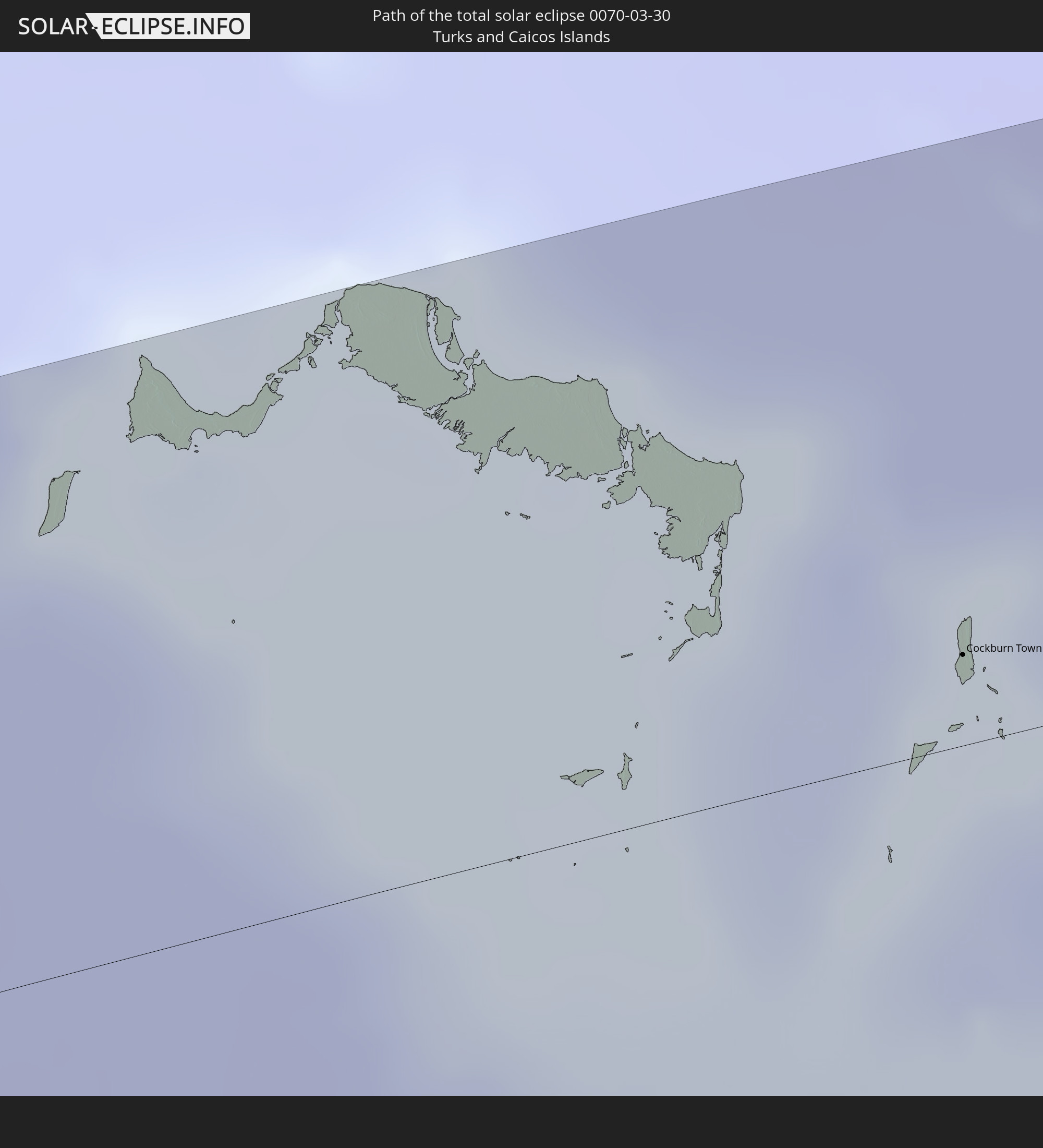 Turks and Caicos Islands
In den folgenden Ländern ist die Sonnenfinsternis partiell zu sehen
 United States
 United States Minor Outlying Islands
 Tonga
Tonga
 Kiribati
 Samoa
Samoa
 Tokelau
 American Samoa
 Niue
Niue
 Cook Islands
 French Polynesia
 Canada
 Pitcairn Islands
 Mexico
 Chile
Chile
 Guatemala
 Ecuador
 El Salvador
 Honduras
 Belize
 Nicaragua
 Costa Rica
 Cuba
Cuba
 Panama
 Colombia
 Cayman Islands
 Peru
Peru
 The Bahamas
 Jamaica
 Haiti
Haiti
 Brazil
 Venezuela
 Turks and Caicos Islands
 Dominican Republic
 Aruba
Aruba
 Bolivia
 Puerto Rico
 United States Virgin Islands
 Bermuda
 British Virgin Islands
 Anguilla
 Collectivity of Saint Martin
 Saint Barthélemy
 Saint Kitts and Nevis
 Antigua and Barbuda
 Montserrat
 Trinidad and Tobago
 Guadeloupe
 Grenada
 Dominica
 Saint Vincent and the Grenadines
 Guyana
 Martinique
 Saint Lucia
 Barbados
 Suriname
 Saint Pierre and Miquelon
 French Guiana
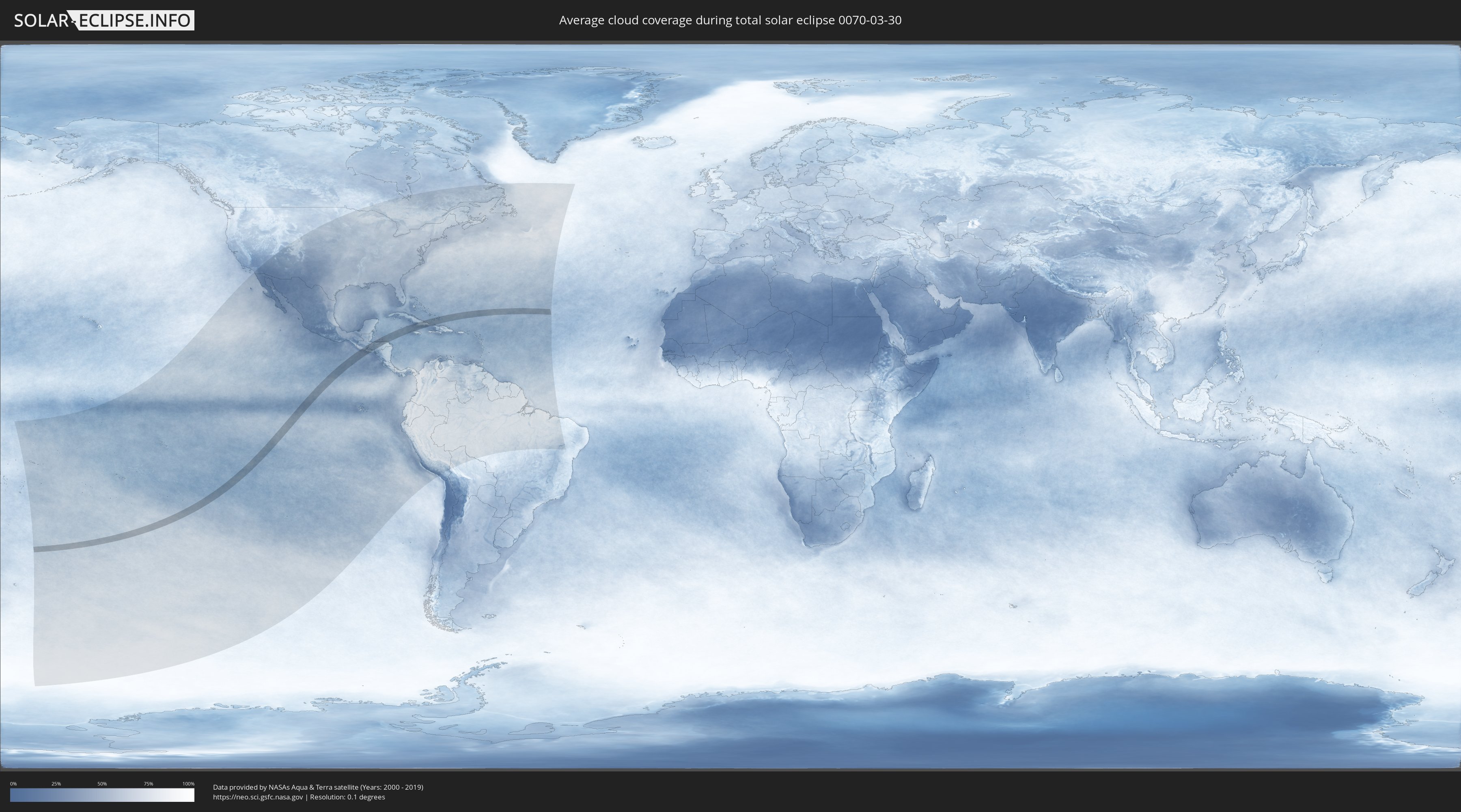
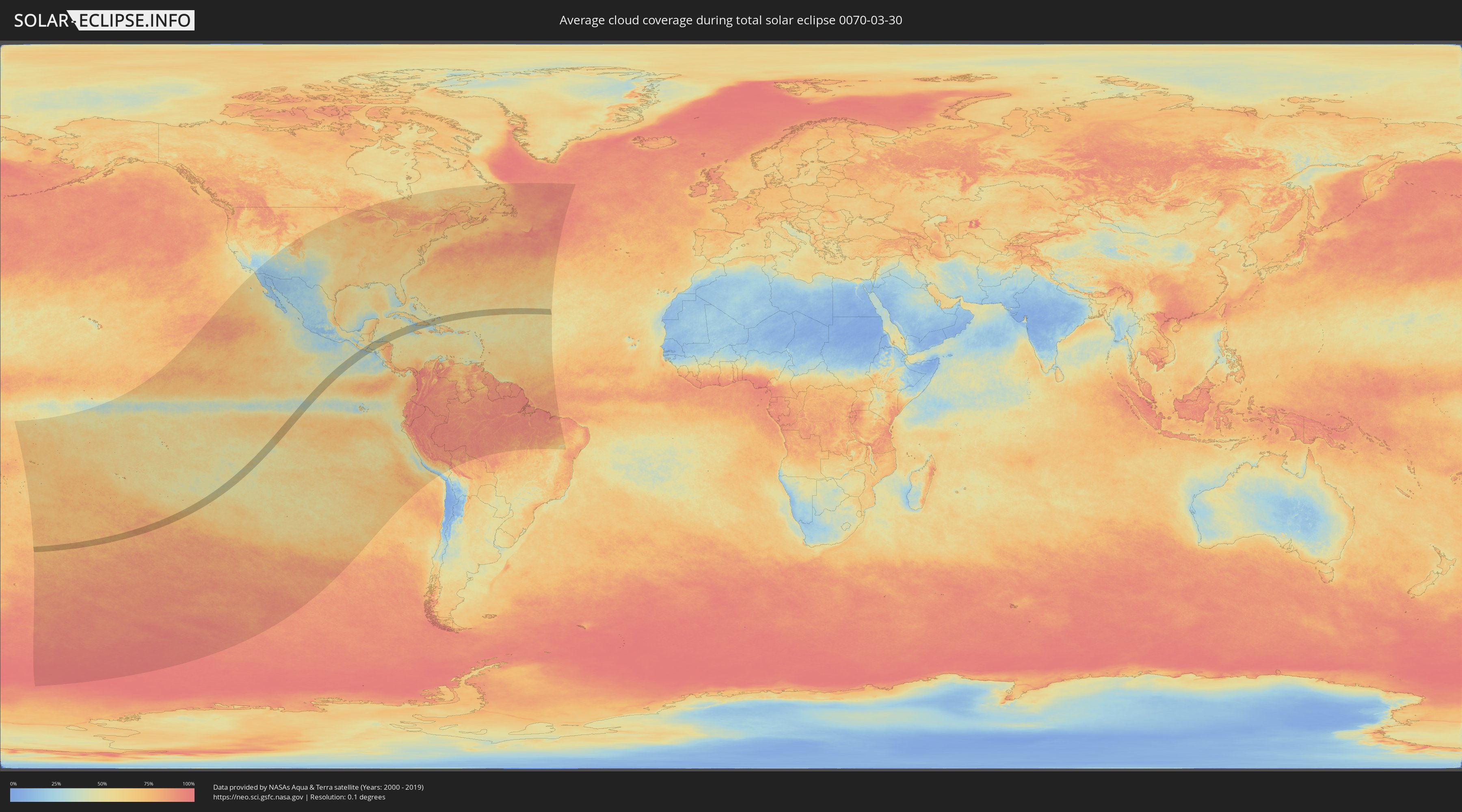
How will be the weather during the total solar eclipse on 03/30/0070?
Where is the best place to see the total solar eclipse of 03/30/0070?
The following maps show the average cloud coverage for the day of the total solar eclipse.
With the help of these maps, it is possible to find the place along the eclipse path, which has the best
chance of a cloudless sky.
Nevertheless, you should consider local circumstances and inform about the weather of your chosen
observation site.
The data is provided by NASAs satellites
AQUA and TERRA.
The cloud maps are averaged over a period of 19 years (2000 - 2019).
Detailed country maps
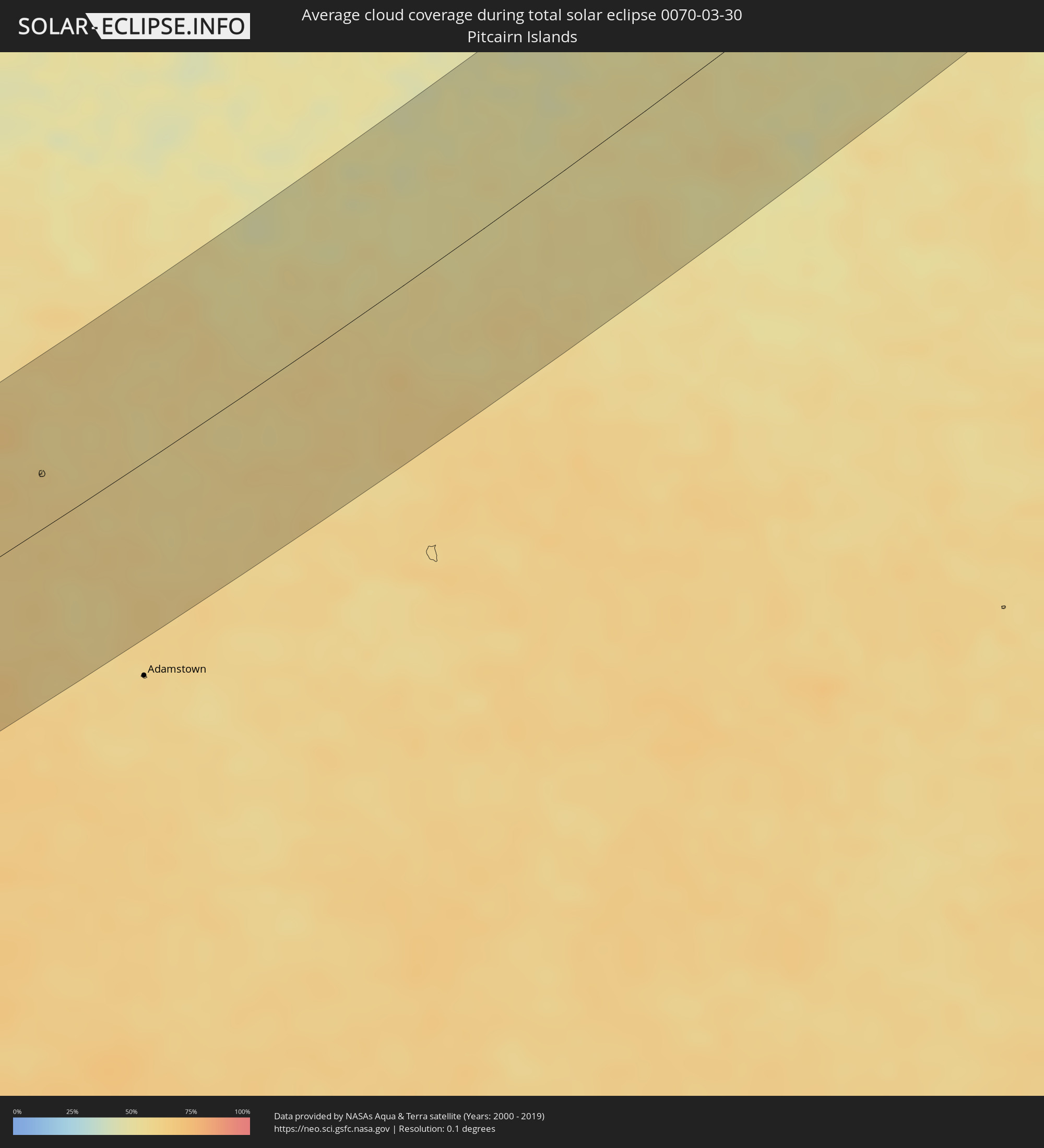 Pitcairn Islands
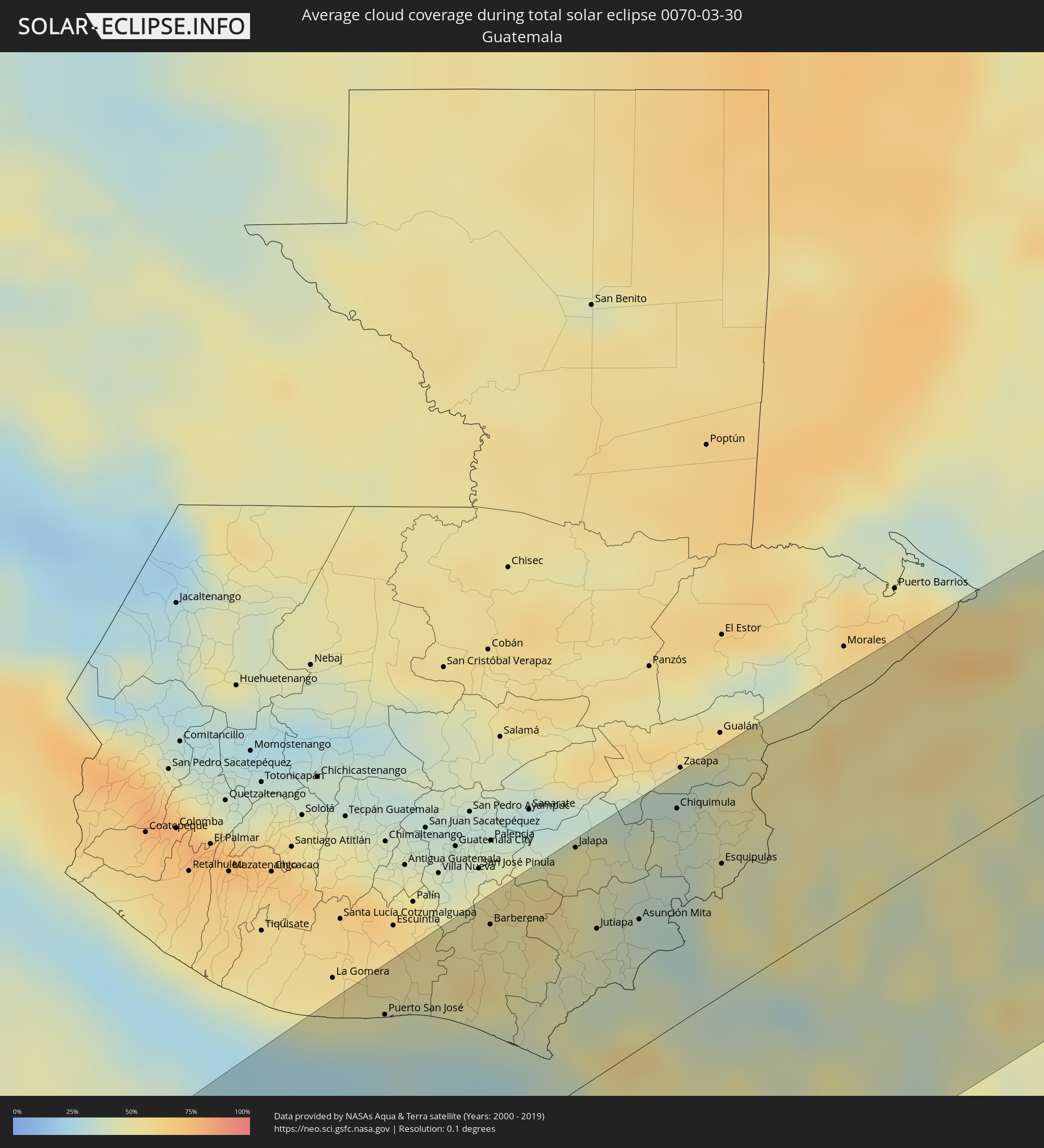 Guatemala
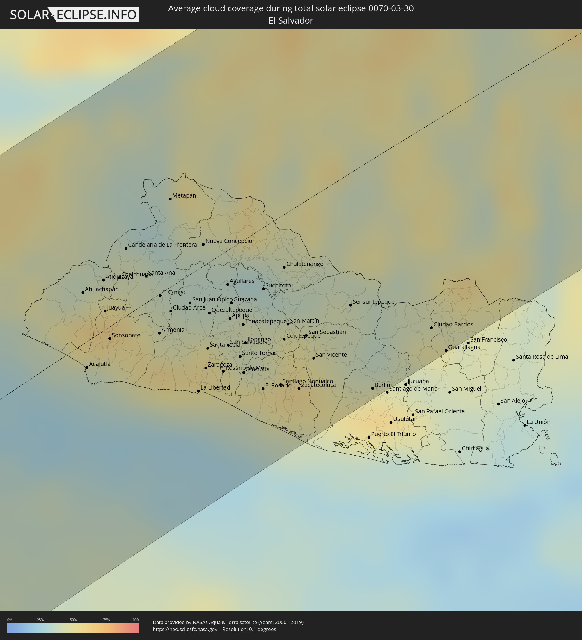 El Salvador
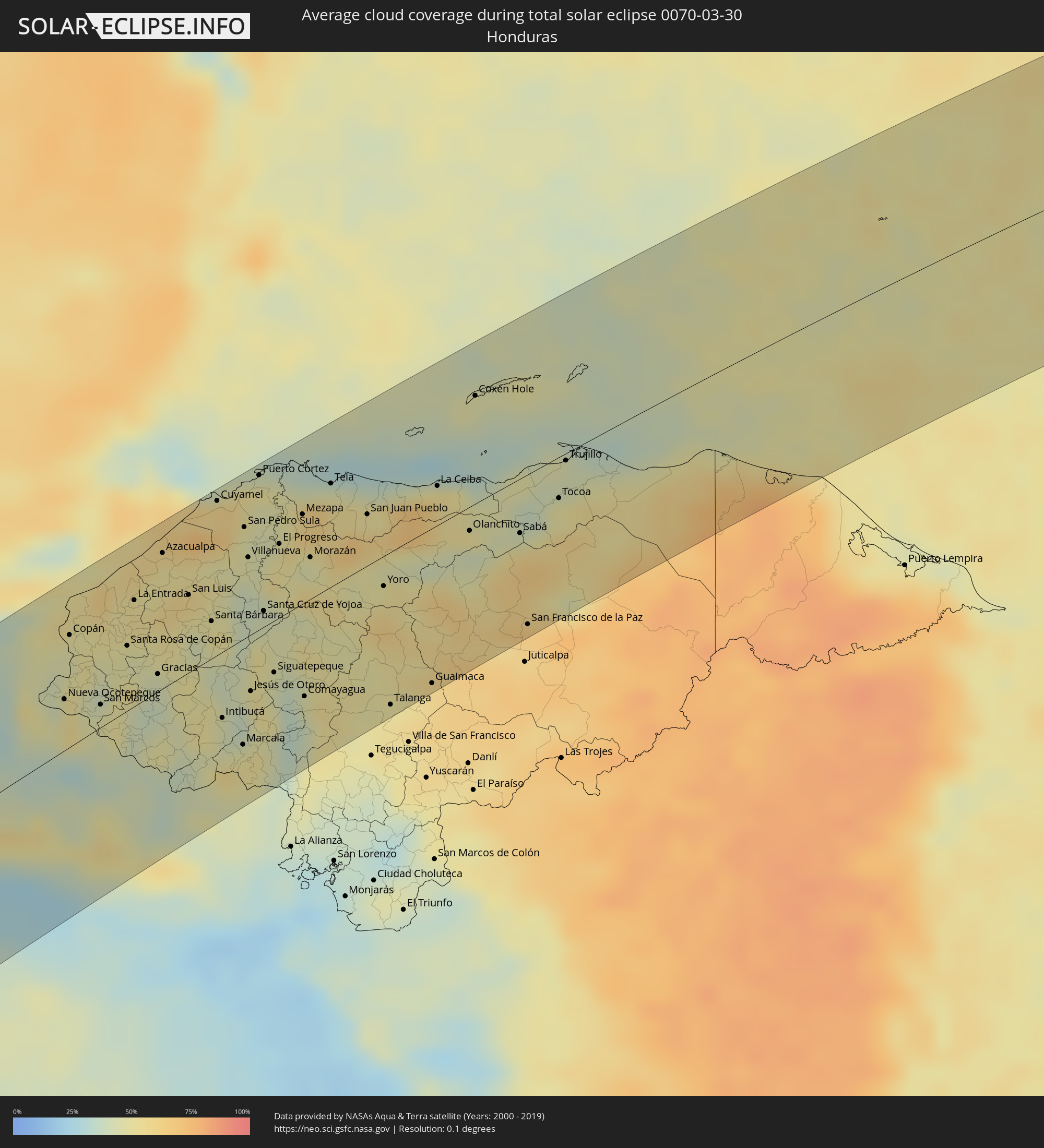 Honduras
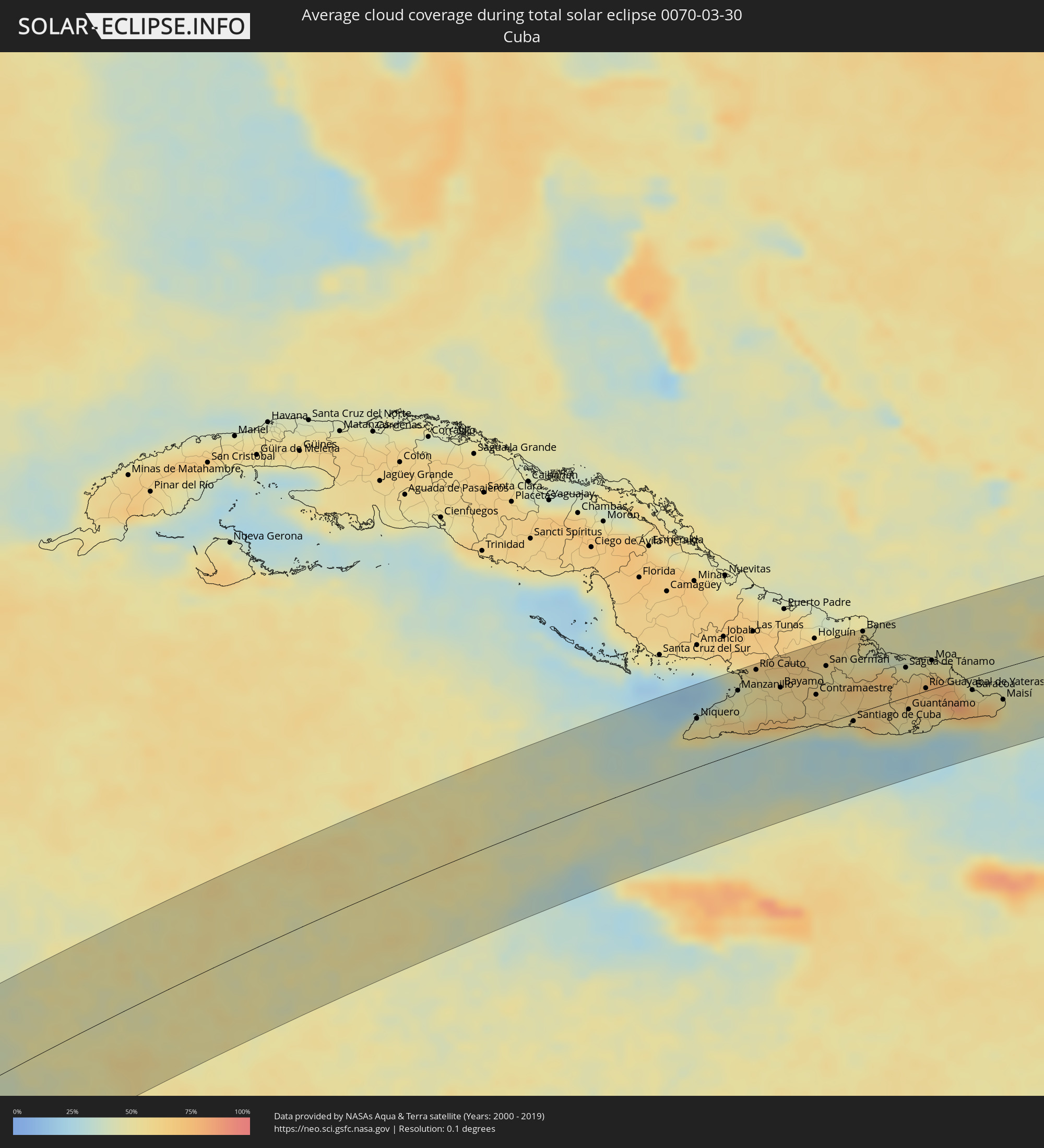 Cuba
Cuba
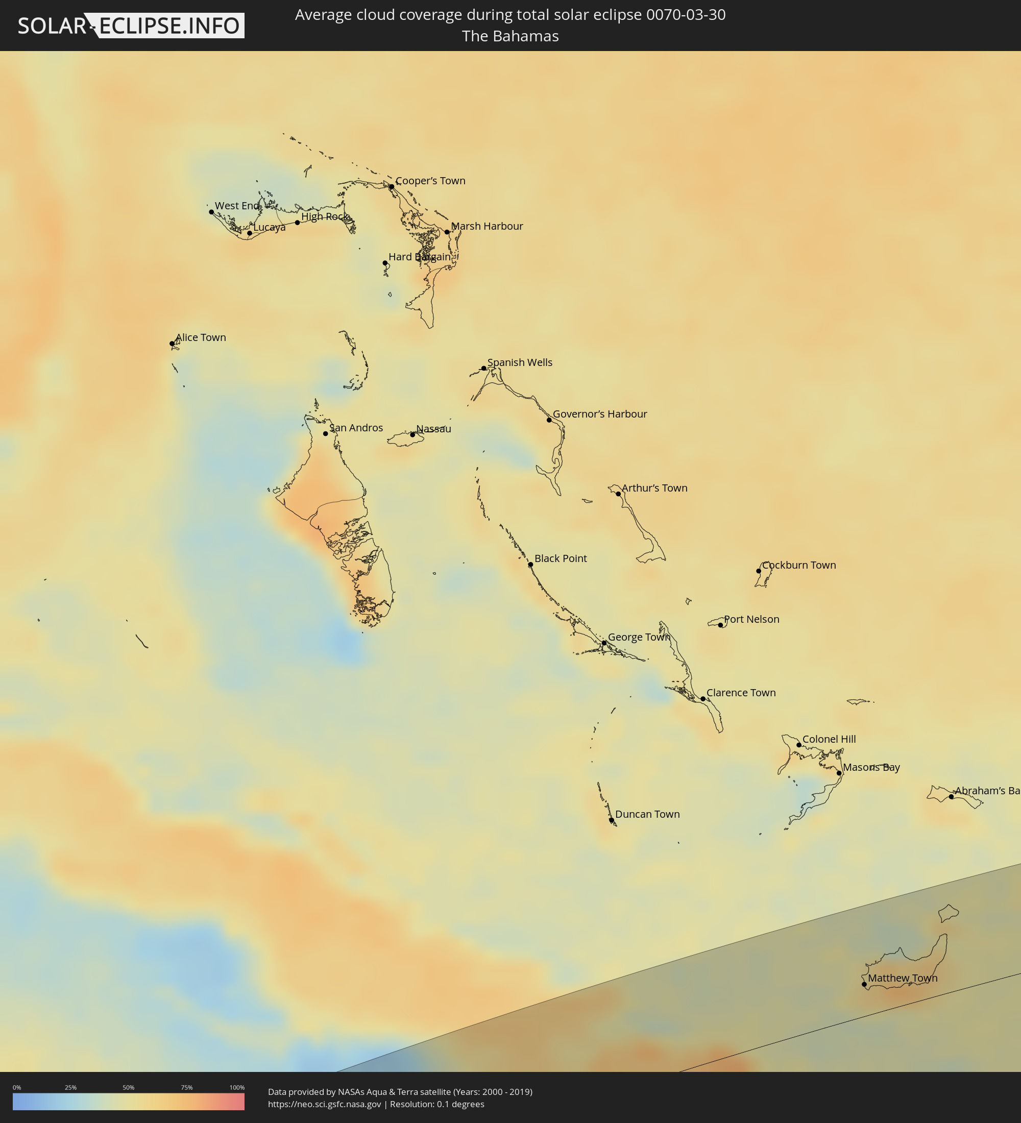 The Bahamas
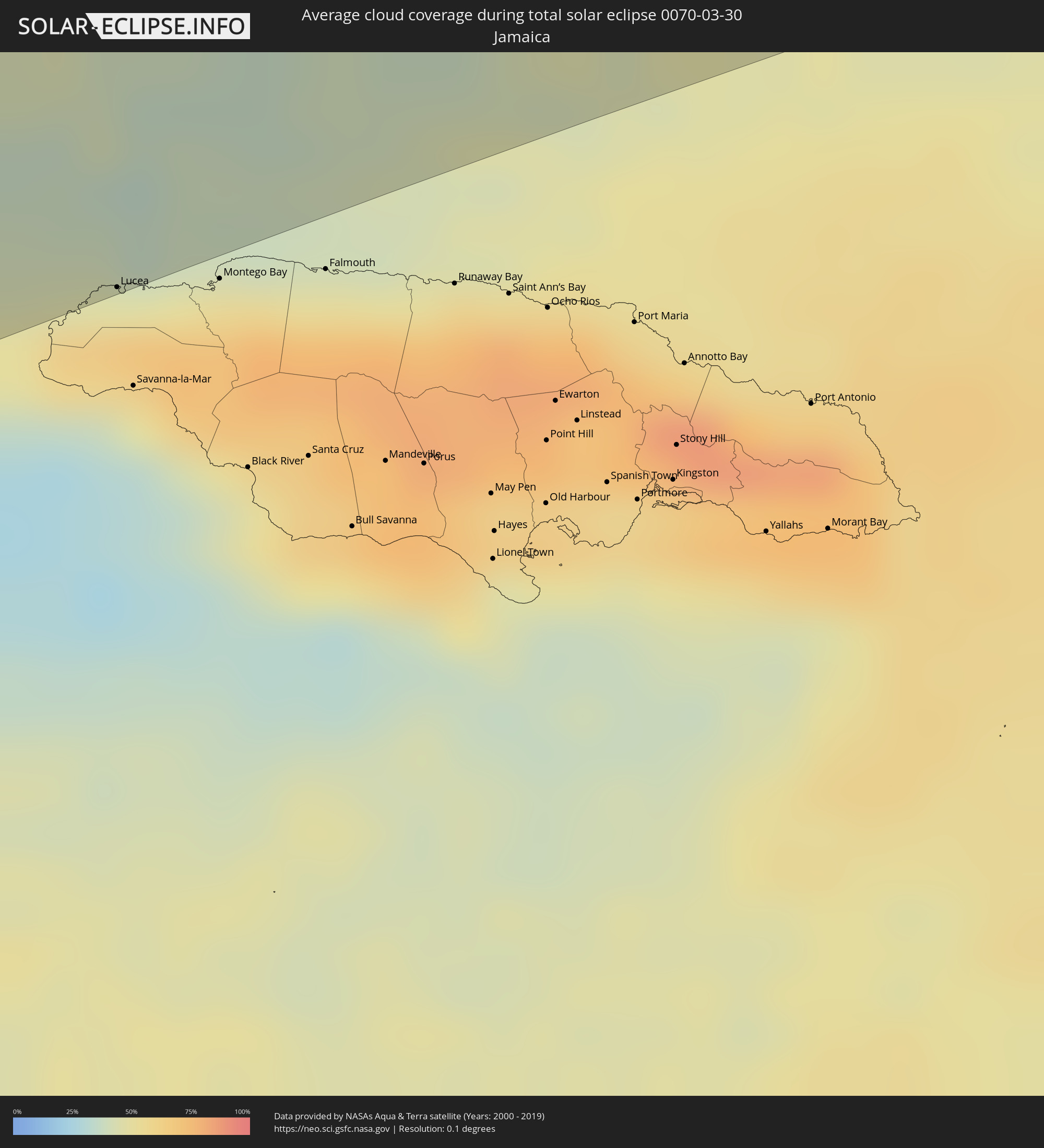 Jamaica
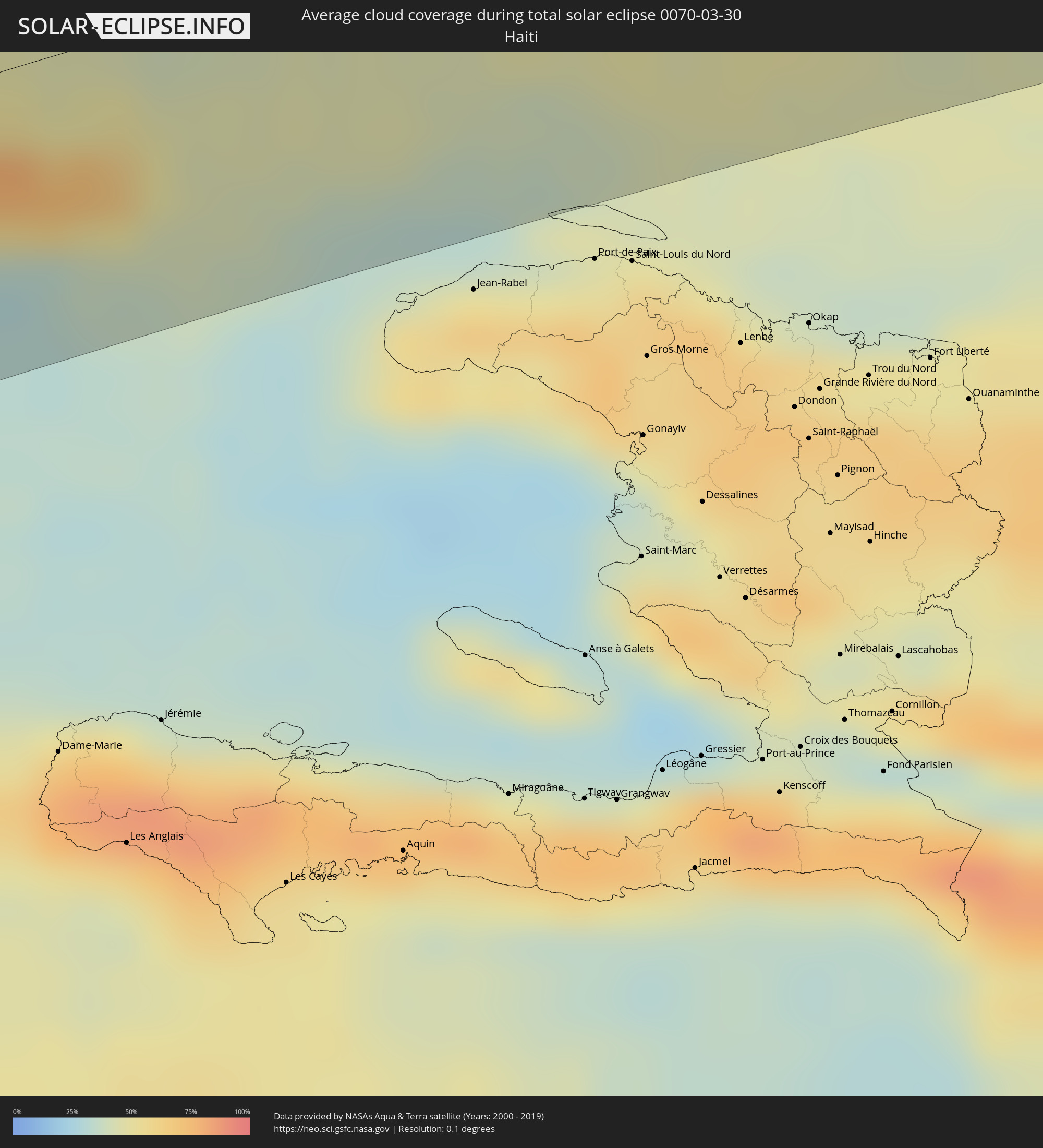 Haiti
Haiti
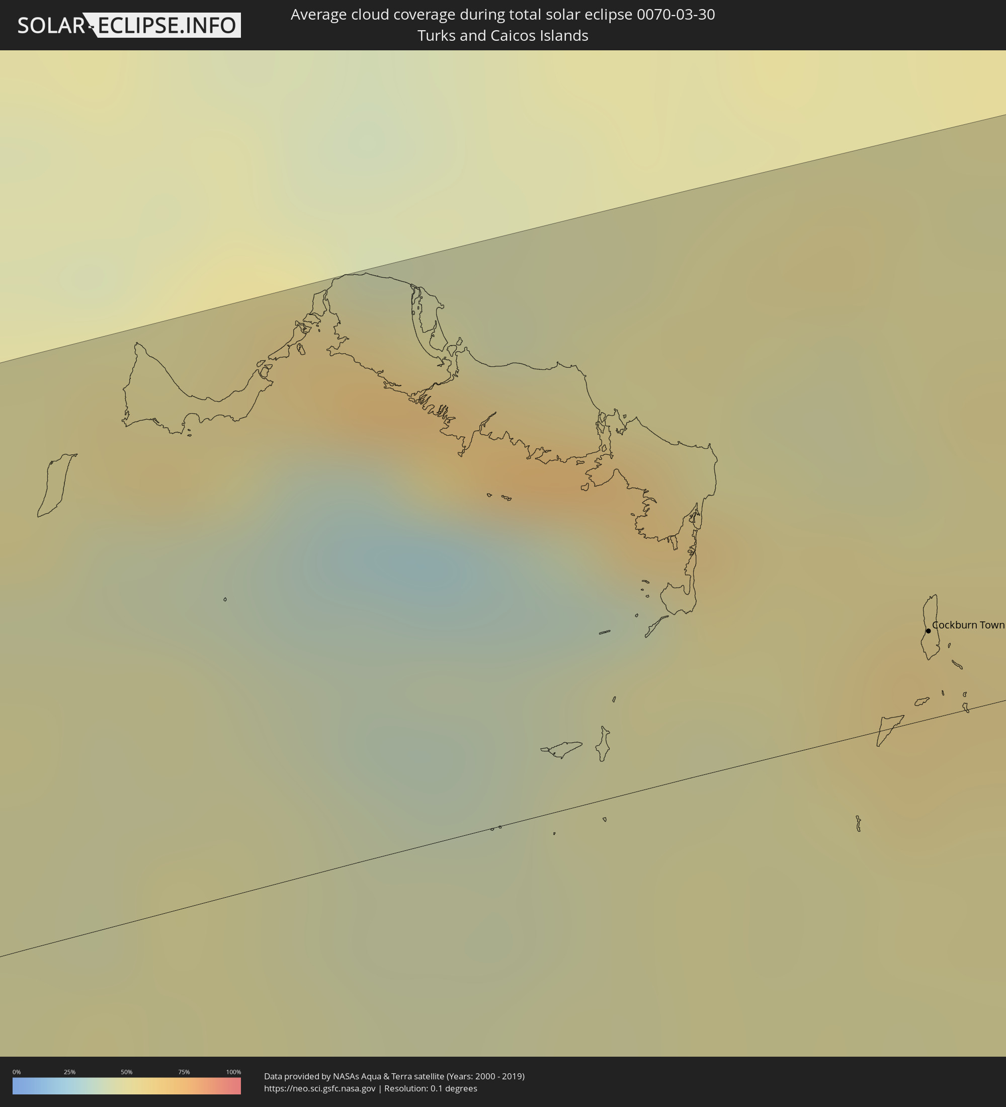 Turks and Caicos Islands
Cities inside the path of the eclipse
The following table shows all locations with a population of more than 5,000 inside the eclipse path. Cities which have more than 100,000 inhabitants are marked bold. A click at the locations opens a detailed map.
| City | Type | Eclipse duration | Local time of max. eclipse | Distance to central line | Ø Cloud coverage |
|
Puerto San José, Escuintla
|
total | - | 14:20:53 UTC-06:02 | 80 km | 32% |
|
Taxisco, Santa Rosa
|
total | - | 14:21:38 UTC-06:02 | 72 km | 48% |
|
Guazacapán, Santa Rosa
|
total | - | 14:21:44 UTC-06:02 | 69 km | 49% |
|
Chiquimulilla, Santa Rosa
|
total | - | 14:21:48 UTC-06:02 | 68 km | 49% |
|
Santa Cruz Naranjo, Santa Rosa
|
total | - | 14:22:16 UTC-06:02 | 95 km | 52% |
|
Barberena, Santa Rosa
|
total | - | 14:22:10 UTC-06:02 | 88 km | 53% |
|
Cuilapa, Santa Rosa
|
total | - | 14:22:12 UTC-06:02 | 81 km | 48% |
|
Santa Rosa de Lima, Santa Rosa
|
total | - | 14:22:22 UTC-06:02 | 91 km | 48% |
|
Nueva Santa Rosa, Santa Rosa
|
total | - | 14:22:24 UTC-06:02 | 89 km | 48% |
|
Casillas, Santa Rosa
|
total | - | 14:22:30 UTC-06:02 | 91 km | 55% |
|
Mataquescuintla, Jalapa
|
total | - | 14:22:45 UTC-06:02 | 98 km | 55% |
|
Oratorio, Santa Rosa
|
total | - | 14:22:20 UTC-06:02 | 69 km | 47% |
|
San José Acatempa, Jutiapa
|
total | - | 14:22:28 UTC-06:02 | 70 km | 47% |
|
Moyuta, Jutiapa
|
total | - | 14:22:12 UTC-06:02 | 46 km | 47% |
|
Jalpatagua, Jutiapa
|
total | - | 14:22:28 UTC-06:02 | 51 km | 42% |
|
Jalapa, Jalapa
|
total | - | 14:23:12 UTC-06:02 | 96 km | 49% |
|
Jutiapa, Jutiapa
|
total | - | 14:22:52 UTC-06:02 | 58 km | 42% |
|
Monjas, Jalapa
|
total | - | 14:23:12 UTC-06:02 | 76 km | 43% |
|
El Progreso, Jutiapa
|
total | - | 14:23:01 UTC-06:02 | 61 km | 43% |
|
Concepción de Ataco, Ahuachapán
|
total | - | 14:27:36 UTC-05:56 | 16 km | 59% |
|
Ahuachapán, Ahuachapán
|
total | - | 14:27:40 UTC-05:56 | 21 km | 59% |
|
Acajutla, Sonsonate
|
total | - | 14:27:13 UTC-05:56 | 11 km | 35% |
|
Atiquizaya, Ahuachapán
|
total | - | 14:27:54 UTC-05:56 | 21 km | 48% |
|
Santa Catarina Mita, Jutiapa
|
total | - | 14:23:19 UTC-06:02 | 65 km | 38% |
|
Juayúa, Sonsonate
|
total | - | 14:27:43 UTC-05:56 | 8 km | 52% |
|
Atescatempa, Jutiapa
|
total | - | 14:22:56 UTC-06:02 | 38 km | 41% |
|
San Antonio del Monte, Sonsonate
|
total | - | 14:27:32 UTC-05:56 | 4 km | 46% |
|
Nahuizalco, Sonsonate
|
total | - | 14:27:38 UTC-05:56 | 1 km | 52% |
|
San Luis Jilotepeque, Jalapa
|
total | - | 14:23:37 UTC-06:02 | 82 km | 39% |
|
Sonsonate, Sonsonate
|
total | - | 14:27:34 UTC-05:56 | 5 km | 46% |
|
Asunción Mita, Jutiapa
|
total | - | 14:23:12 UTC-06:02 | 51 km | 37% |
|
Ipala, Chiquimula
|
total | - | 14:23:45 UTC-06:02 | 72 km | 35% |
|
Santa Ana, Santa Ana
|
total | - | 14:28:13 UTC-05:56 | 11 km | 42% |
|
Chiquimula, Chiquimula
|
total | - | 14:24:07 UTC-06:02 | 85 km | 38% |
|
Armenia, Sonsonate
|
total | - | 14:27:57 UTC-05:56 | 16 km | 56% |
|
El Congo, Santa Ana
|
total | - | 14:28:12 UTC-05:56 | 1 km | 42% |
|
Metapán, Santa Ana
|
total | - | 14:28:53 UTC-05:56 | 36 km | 32% |
|
Ciudad Arce, La Libertad
|
total | - | 14:28:11 UTC-05:56 | 10 km | 45% |
|
Esquipulas, Chiquimula
|
total | - | 14:24:06 UTC-06:02 | 52 km | 48% |
|
La Libertad, La Libertad
|
total | - | 14:27:52 UTC-05:56 | 50 km | 39% |
|
Nueva Concepción, Chalatenango
|
total | - | 14:28:50 UTC-05:56 | 9 km | 35% |
|
Zaragoza, La Libertad
|
total | - | 14:28:04 UTC-05:56 | 43 km | 49% |
|
Quezaltepeque, La Libertad
|
total | - | 14:28:26 UTC-05:56 | 21 km | 50% |
|
Aguilares, San Salvador
|
total | - | 14:28:45 UTC-05:56 | 14 km | 37% |
|
San Salvador, San Salvador
|
total | - | 14:28:22 UTC-05:56 | 40 km | 49% |
|
Nueva Ocotepeque, Ocotepeque
|
total | - | 14:37:22 UTC-05:48 | 30 km | 47% |
|
Guazapa, San Salvador
|
total | - | 14:28:39 UTC-05:56 | 23 km | 41% |
|
Santo Tomás, San Salvador
|
total | - | 14:28:23 UTC-05:56 | 47 km | 51% |
|
Santiago Nonualco, La Paz
|
total | - | 14:28:29 UTC-05:56 | 70 km | 47% |
|
Cojutepeque, Cuscatlán
|
total | - | 14:28:48 UTC-05:56 | 52 km | 53% |
|
Chalatenango, Chalatenango
|
total | - | 14:29:15 UTC-05:56 | 22 km | 36% |
|
Zacatecoluca, La Paz
|
total | - | 14:28:36 UTC-05:56 | 76 km | 50% |
|
San Vicente, San Vicente
|
total | - | 14:28:53 UTC-05:56 | 67 km | 54% |
|
Santa Rosa de Copán, Copán
|
total | - | 14:38:27 UTC-05:48 | 38 km | 48% |
|
La Entrada, Copán
|
total | - | 14:38:55 UTC-05:48 | 62 km | 53% |
|
Sensuntepeque, Cabañas
|
total | - | 14:29:29 UTC-05:56 | 55 km | 41% |
|
Berlín, Usulután
|
total | - | 14:29:07 UTC-05:56 | 95 km | 58% |
|
Ciudad Barrios, San Miguel
|
total | - | 14:29:54 UTC-05:56 | 85 km | 47% |
|
Santa Bárbara, Santa Bárbara
|
total | - | 14:39:29 UTC-05:48 | 22 km | 47% |
|
Intibucá, Intibucá
|
total | - | 14:38:46 UTC-05:48 | 39 km | 49% |
|
Cofradía, Cortés
|
total | - | 14:40:16 UTC-05:48 | 63 km | 48% |
|
Marcala, La Paz
|
total | - | 14:38:44 UTC-05:48 | 62 km | 49% |
|
San Pedro Sula, Cortés
|
total | - | 14:40:35 UTC-05:48 | 66 km | 47% |
|
Villanueva, Cortés
|
total | - | 14:40:22 UTC-05:48 | 47 km | 42% |
|
Pimienta Vieja, Cortés
|
total | - | 14:40:19 UTC-05:48 | 37 km | 39% |
|
Puerto Cortez, Cortés
|
total | - | 14:41:09 UTC-05:48 | 92 km | 51% |
|
Santa Cruz de Yojoa, Cortés
|
total | - | 14:40:05 UTC-05:48 | 10 km | 43% |
|
Baracoa, Cortés
|
total | - | 14:41:12 UTC-05:48 | 82 km | 51% |
|
Siguatepeque, Comayagua
|
total | - | 14:39:40 UTC-05:48 | 31 km | 45% |
|
El Progreso, Yoro
|
total | - | 14:40:47 UTC-05:48 | 44 km | 50% |
|
El Negrito, Yoro
|
total | - | 14:40:49 UTC-05:48 | 30 km | 48% |
|
La Paz, La Paz
|
total | - | 14:39:31 UTC-05:48 | 66 km | 35% |
|
Comayagua, Comayagua
|
total | - | 14:39:45 UTC-05:48 | 56 km | 44% |
|
Morazán, Yoro
|
total | - | 14:40:58 UTC-05:48 | 25 km | 53% |
|
Tela, Atlántida
|
total | - | 14:41:46 UTC-05:48 | 62 km | 44% |
|
Santa Rita, Yoro
|
total | - | 14:41:15 UTC-05:48 | 7 km | 48% |
|
Yoro, Yoro
|
total | - | 14:41:26 UTC-05:48 | 18 km | 59% |
|
Talanga, Francisco Morazán
|
total | - | 14:40:31 UTC-05:48 | 91 km | 52% |
|
Guaimaca, Francisco Morazán
|
total | - | 14:41:06 UTC-05:48 | 93 km | 58% |
|
La Ceiba, Atlántida
|
total | - | 14:42:45 UTC-05:48 | 24 km | 51% |
|
Olanchito, Yoro
|
total | - | 14:42:42 UTC-05:48 | 14 km | 42% |
|
Sabá, Colón
|
total | - | 14:43:09 UTC-05:48 | 33 km | 51% |
|
Tocoa, Colón
|
total | - | 14:43:48 UTC-05:48 | 25 km | 47% |
|
Trujillo, Colón
|
total | - | 14:44:09 UTC-05:48 | 4 km | 44% |
|
Lucea, Hanover
|
total | - | 15:38:44 UTC-05:07 | 92 km | 47% |
|
Niquero, Granma
|
total | - | 15:18:21 UTC-05:29 | 54 km | 55% |
|
Media Luna, Granma
|
total | - | 15:18:35 UTC-05:29 | 59 km | 54% |
|
Campechuela, Granma
|
total | - | 15:18:49 UTC-05:29 | 63 km | 51% |
|
Manzanillo, Granma
|
total | - | 15:19:05 UTC-05:29 | 69 km | 48% |
|
Yara, Granma
|
total | - | 15:19:13 UTC-05:29 | 56 km | 49% |
|
Bartolomé Masó, Granma
|
total | - | 15:19:08 UTC-05:29 | 44 km | 55% |
|
Río Cauto, Granma
|
total | - | 15:19:28 UTC-05:29 | 85 km | 57% |
|
Bayamo, Granma
|
total | - | 15:19:37 UTC-05:29 | 56 km | 57% |
|
Guisa, Granma
|
total | - | 15:19:38 UTC-05:29 | 40 km | 57% |
|
Cauto Cristo, Granma
|
total | - | 15:19:57 UTC-05:29 | 70 km | 62% |
|
Jiguaní, Granma
|
total | - | 15:19:51 UTC-05:29 | 48 km | 61% |
|
Cacocum, Holguín
|
total | - | 15:20:14 UTC-05:29 | 84 km | 63% |
|
Contramaestre, Santiago de Cuba
|
total | - | 15:19:59 UTC-05:29 | 35 km | 60% |
|
San Germán, Holguín
|
total | - | 15:20:20 UTC-05:29 | 63 km | 52% |
|
Báguanos, Holguín
|
total | - | 15:20:33 UTC-05:29 | 76 km | 60% |
|
Palma Soriano, Santiago de Cuba
|
total | - | 15:20:11 UTC-05:29 | 18 km | 57% |
|
Cueto, Holguín
|
total | - | 15:20:35 UTC-05:29 | 62 km | 54% |
|
San Luis, Santiago de Cuba
|
total | - | 15:20:19 UTC-05:29 | 10 km | 57% |
|
Santiago de Cuba, Santiago de Cuba
|
total | - | 15:20:13 UTC-05:29 | 8 km | 43% |
|
Banes, Holguín
|
total | - | 15:21:01 UTC-05:29 | 88 km | 57% |
|
Sagua de Tánamo, Holguín
|
total | - | 15:21:14 UTC-05:29 | 33 km | 59% |
|
Guantánamo, Guantánamo
|
total | - | 15:20:57 UTC-05:29 | 15 km | 52% |
|
Río Guayabal de Yateras, Guantánamo
|
total | - | 15:21:18 UTC-05:29 | 3 km | 67% |
|
Moa, Holguín
|
total | - | 15:21:35 UTC-05:29 | 32 km | 52% |
|
Baracoa, Guantánamo
|
total | - | 15:21:49 UTC-05:29 | 15 km | 77% |
|
Maisí, Guantánamo
|
total | - | 15:22:05 UTC-05:29 | 36 km | 63% |
|
Matthew Town, Inagua
|
total | - | 15:43:09 UTC-05:09 | 25 km | 47% |
|
Cockburn Town
|
total | - | 15:48:07 UTC-05:07 | 13 km | 56% |