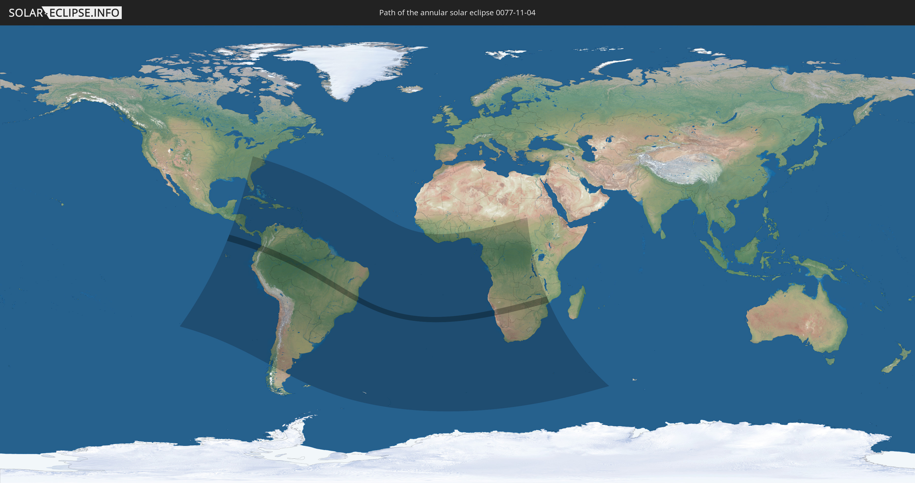
Annular solar eclipse of 11/04/0077
| Day of week: | Thursday |
| Maximum duration of eclipse: | 06m55s |
| Maximum width of eclipse path: | 211 km |
| Saros cycle: | 73 |
| Coverage: | 94.3% |
| Magnitude: | 0.9431 |
| Gamma: | -0.1015 |
Wo kann man die Sonnenfinsternis vom 11/04/0077 sehen?
Die Sonnenfinsternis am 11/04/0077 kann man in 82 Ländern als partielle Sonnenfinsternis beobachten.
Der Finsternispfad verläuft durch 8 Länder. Nur in diesen Ländern ist sie als annular Sonnenfinsternis zu sehen.
In den folgenden Ländern ist die Sonnenfinsternis annular zu sehen
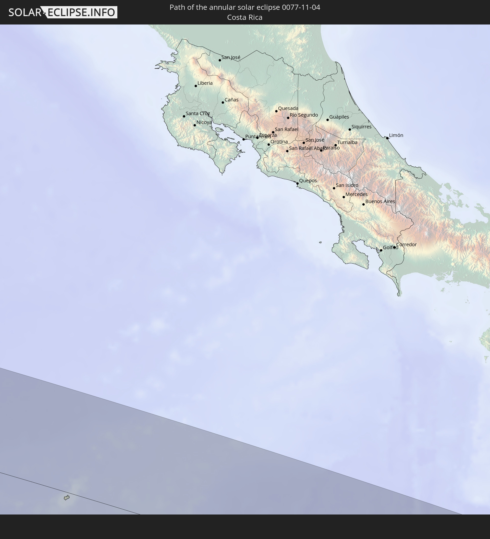 Costa Rica
 Colombia
 Brazil
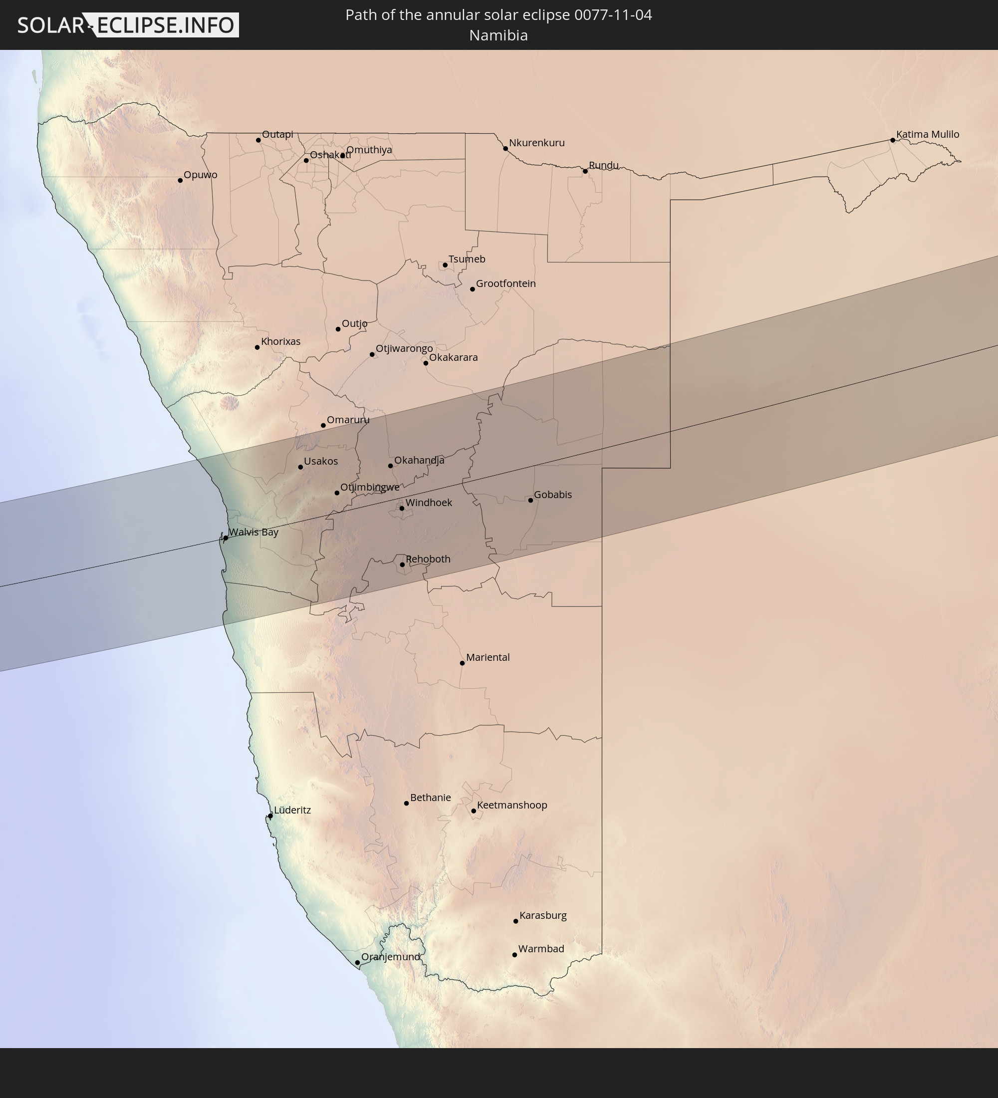 Namibia
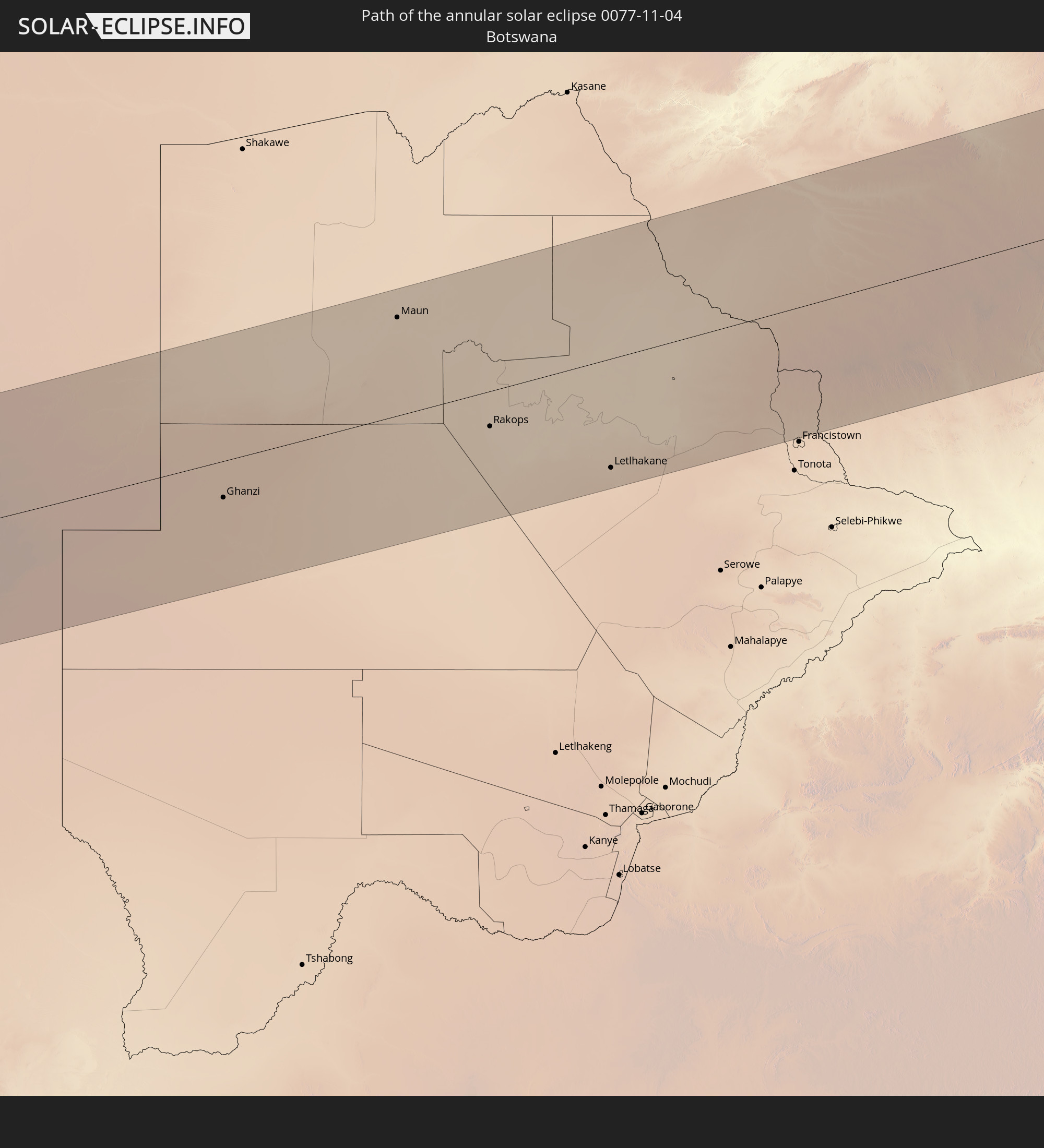 Botswana
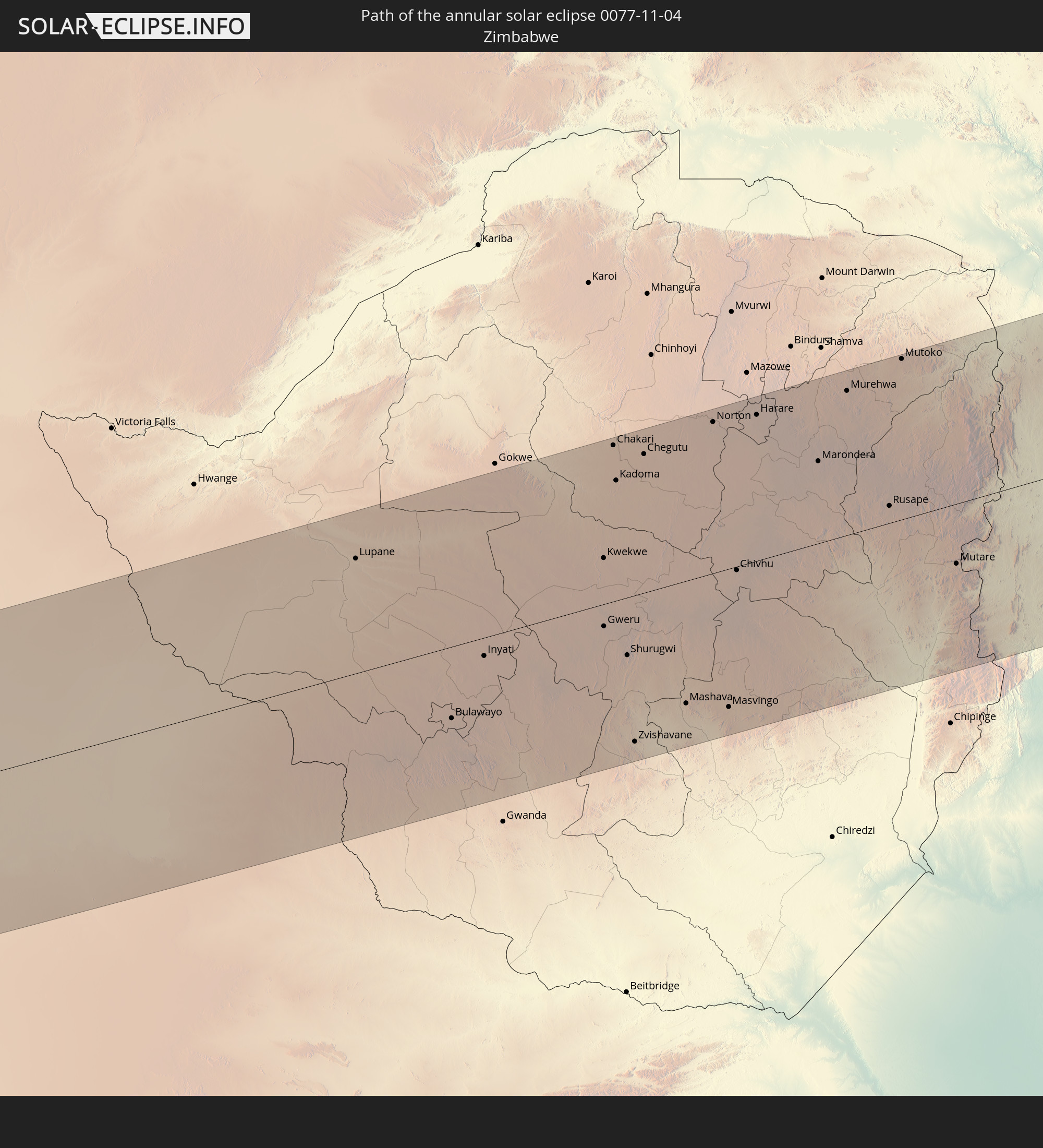 Zimbabwe
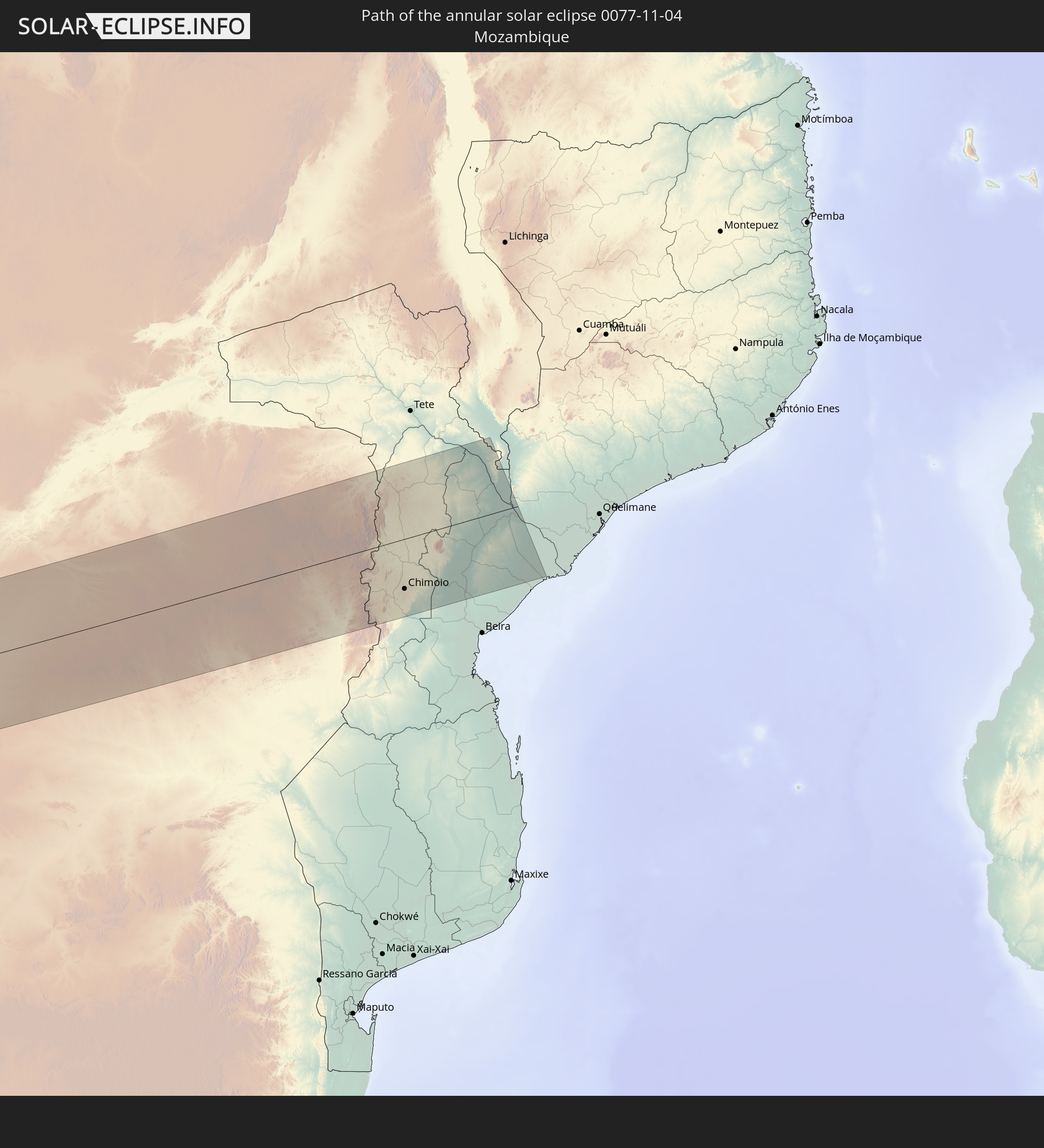 Mozambique
 Malawi
In den folgenden Ländern ist die Sonnenfinsternis partiell zu sehen
 United States
 United States Minor Outlying Islands
 Chile
Chile
 Ecuador
 El Salvador
 Honduras
 Nicaragua
 Costa Rica
 Cuba
Cuba
 Panama
 Colombia
 Cayman Islands
 Peru
Peru
 The Bahamas
 Jamaica
 Haiti
Haiti
 Brazil
 Argentina
 Venezuela
 Turks and Caicos Islands
 Dominican Republic
 Aruba
Aruba
 Bolivia
 Puerto Rico
 United States Virgin Islands
 Bermuda
 British Virgin Islands
 Anguilla
 Collectivity of Saint Martin
 Saint Barthélemy
 Saint Kitts and Nevis
 Paraguay
 Antigua and Barbuda
 Montserrat
 Trinidad and Tobago
 Guadeloupe
 Grenada
 Dominica
 Saint Vincent and the Grenadines
 Falkland Islands
 Guyana
 Martinique
 Saint Lucia
 Barbados
 Uruguay
 Suriname
 French Guiana
 South Georgia and the South Sandwich Islands
 Guinea
 Saint Helena, Ascension and Tristan da Cunha
 Sierra Leone
 Liberia
 Ivory Coast
 Ghana
Ghana
 Togo
Togo
 Benin
Benin
 Nigeria
 Bouvet Island
 Equatorial Guinea
 São Tomé and Príncipe
 Cameroon
 Gabon
Gabon
 Republic of the Congo
 Angola
 Namibia
 Democratic Republic of the Congo
 Chad
Chad
 Central African Republic
 South Africa
 Botswana
 Sudan
Sudan
 Zambia
 Zimbabwe
 Lesotho
 Rwanda
 Burundi
 Tanzania
 Uganda
 Mozambique
 Swaziland
 Malawi
 French Southern and Antarctic Lands
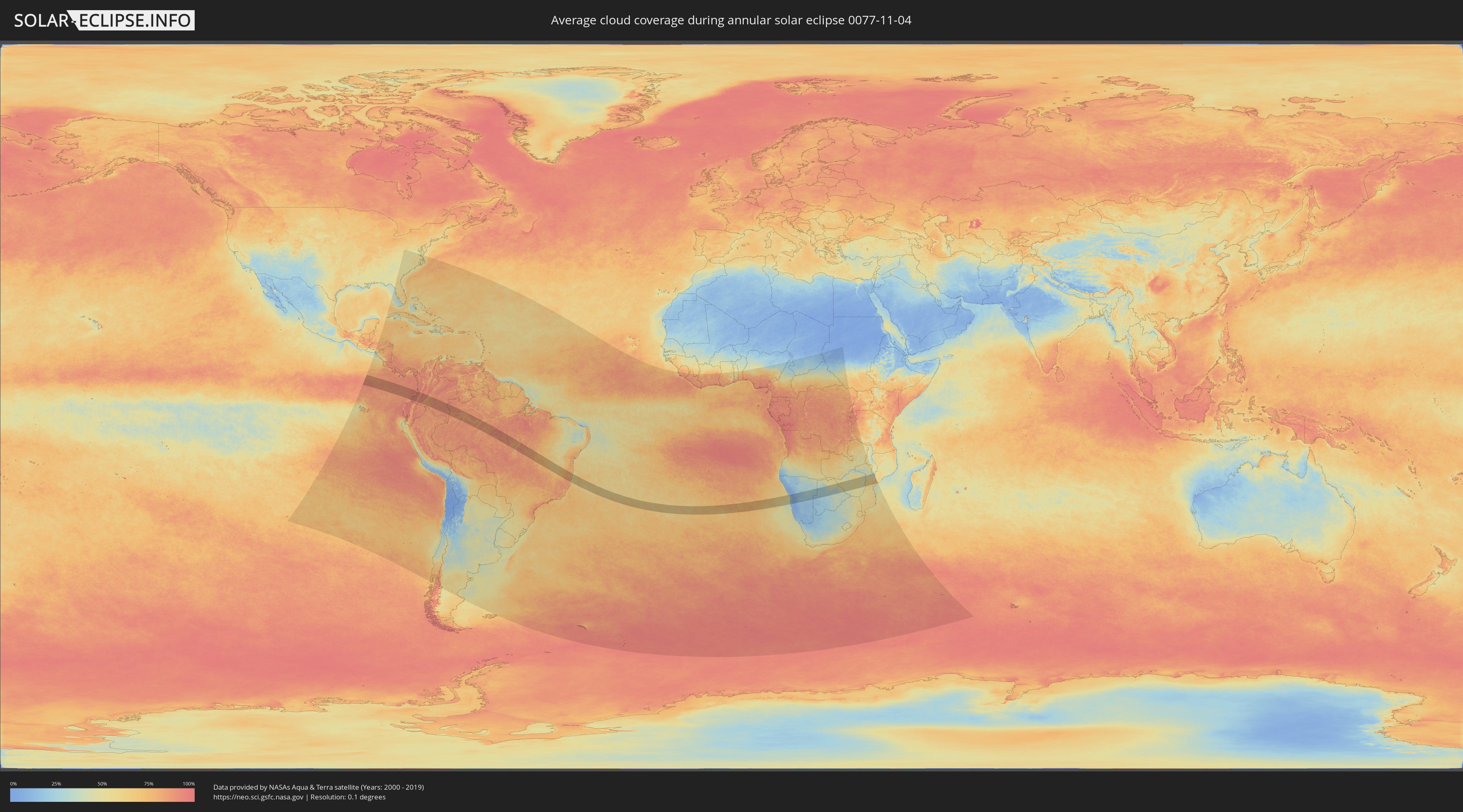
How will be the weather during the annular solar eclipse on 11/04/0077?
Where is the best place to see the annular solar eclipse of 11/04/0077?
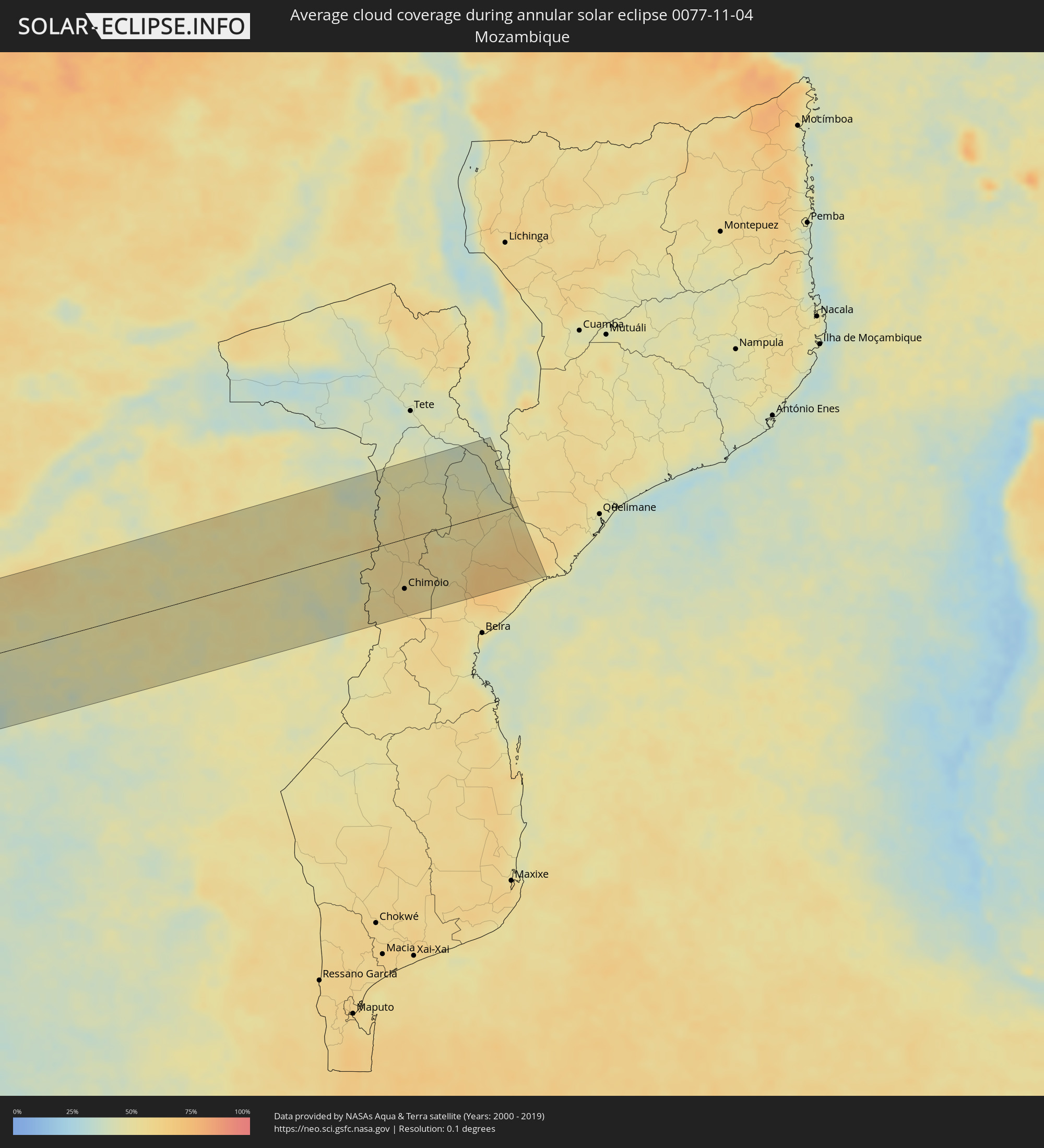
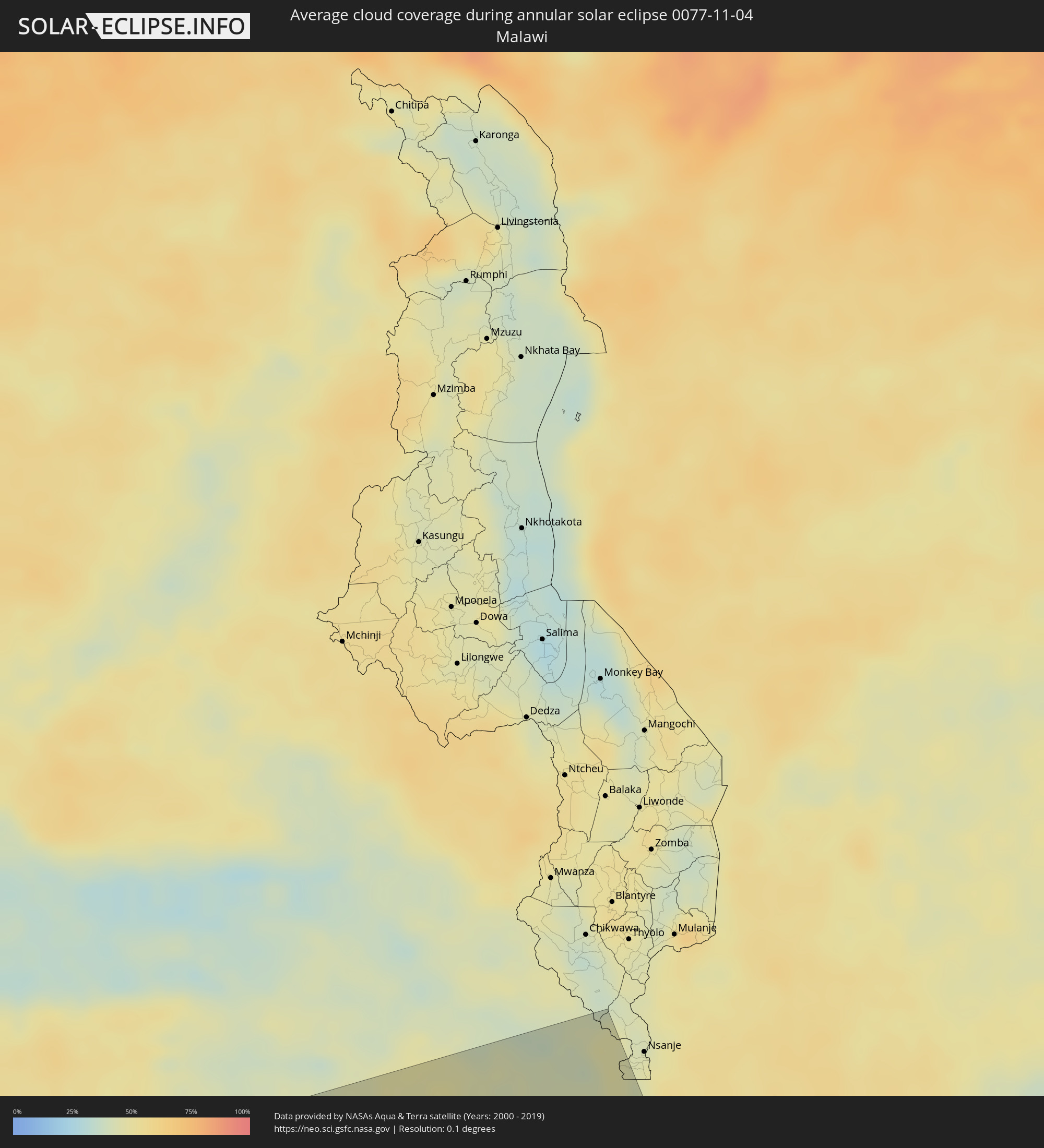
The following maps show the average cloud coverage for the day of the annular solar eclipse.
With the help of these maps, it is possible to find the place along the eclipse path, which has the best
chance of a cloudless sky.
Nevertheless, you should consider local circumstances and inform about the weather of your chosen
observation site.
The data is provided by NASAs satellites
AQUA and TERRA.
The cloud maps are averaged over a period of 19 years (2000 - 2019).

Detailed country maps
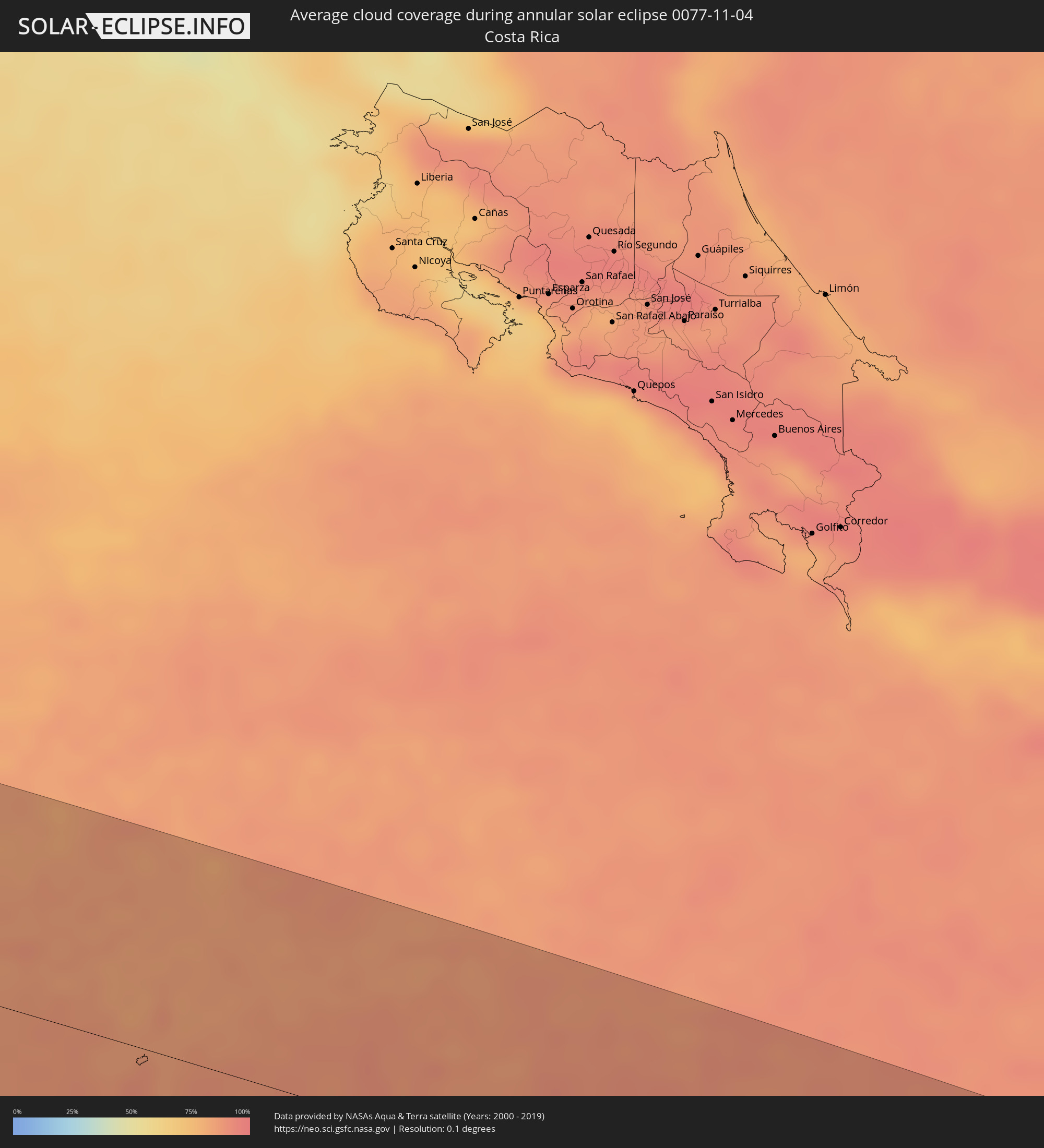 Costa Rica
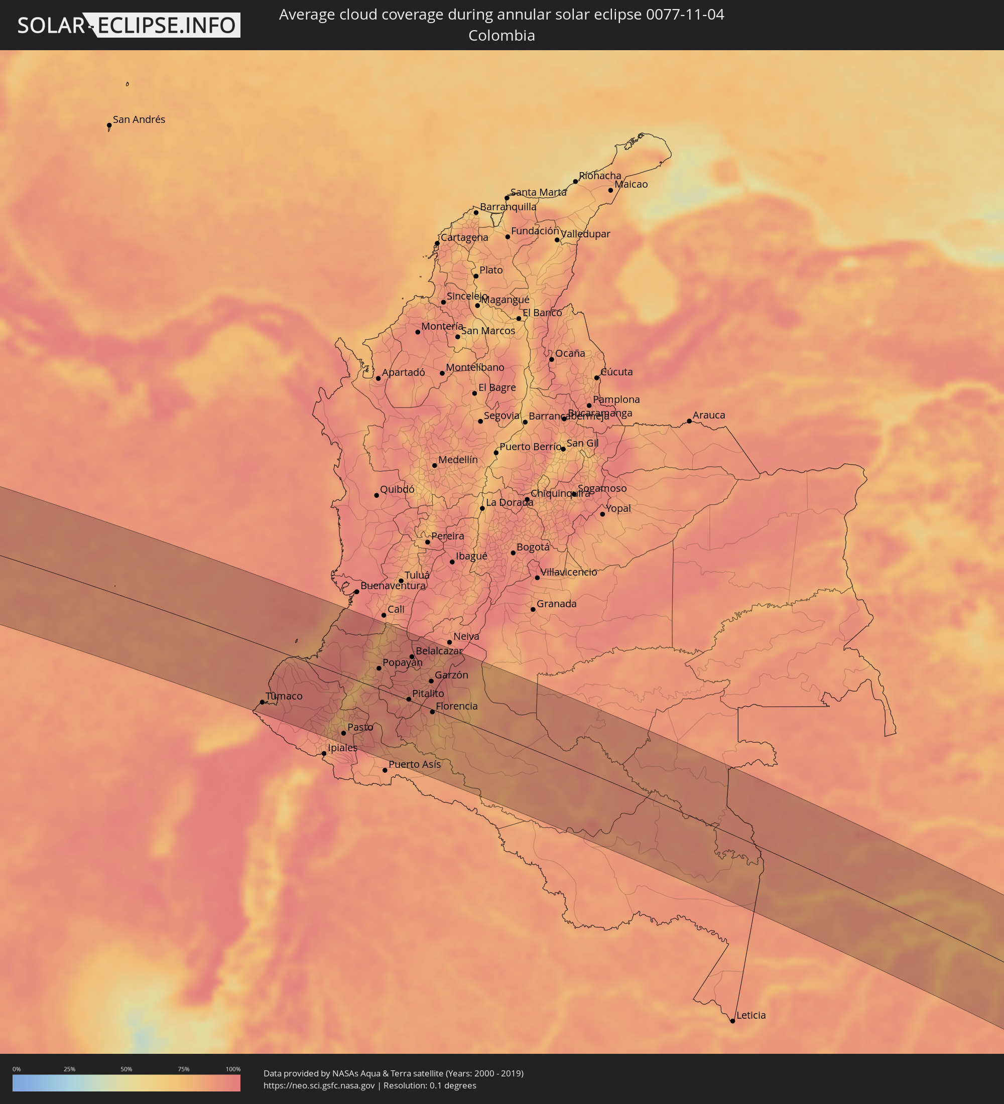 Colombia
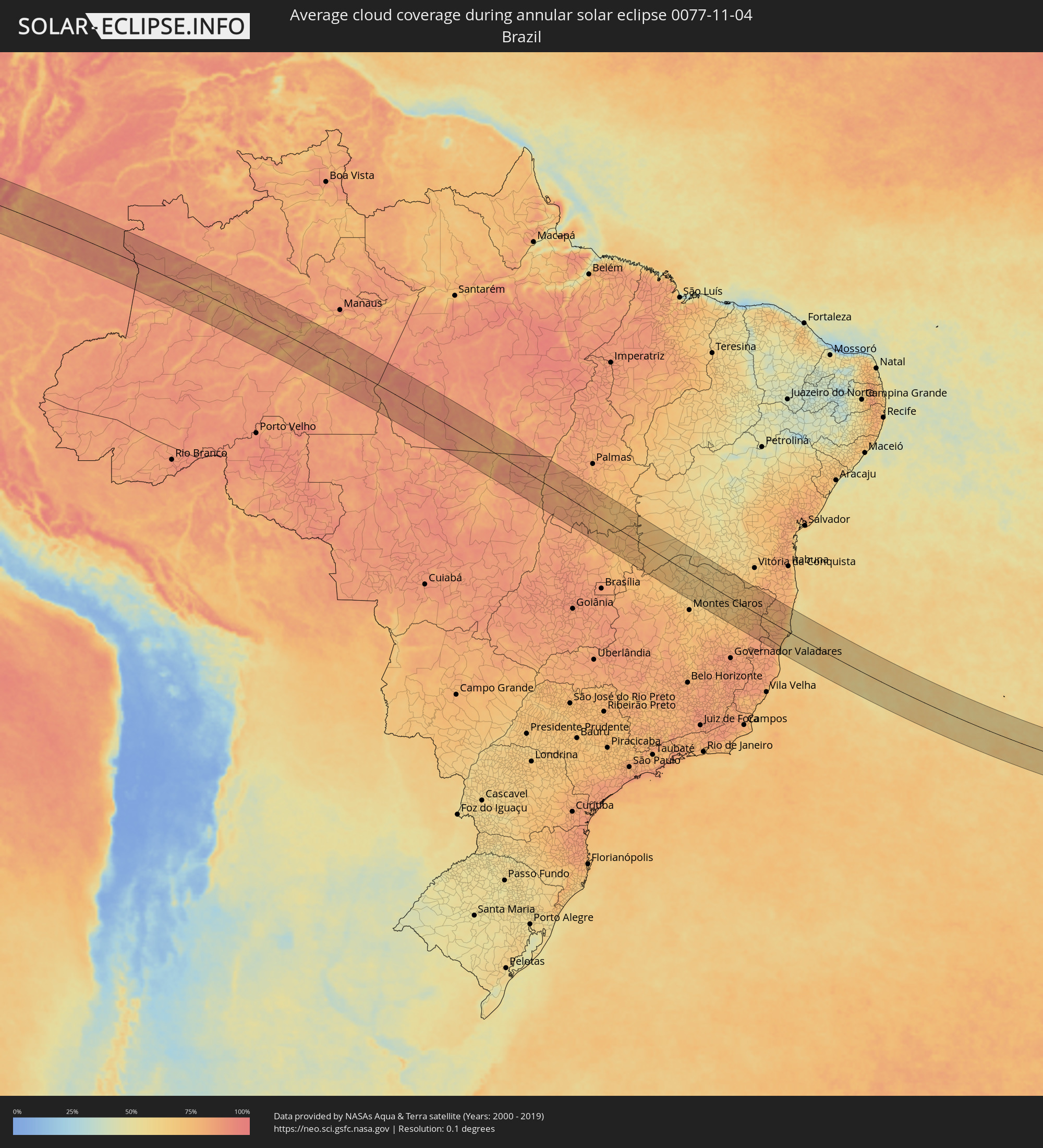 Brazil
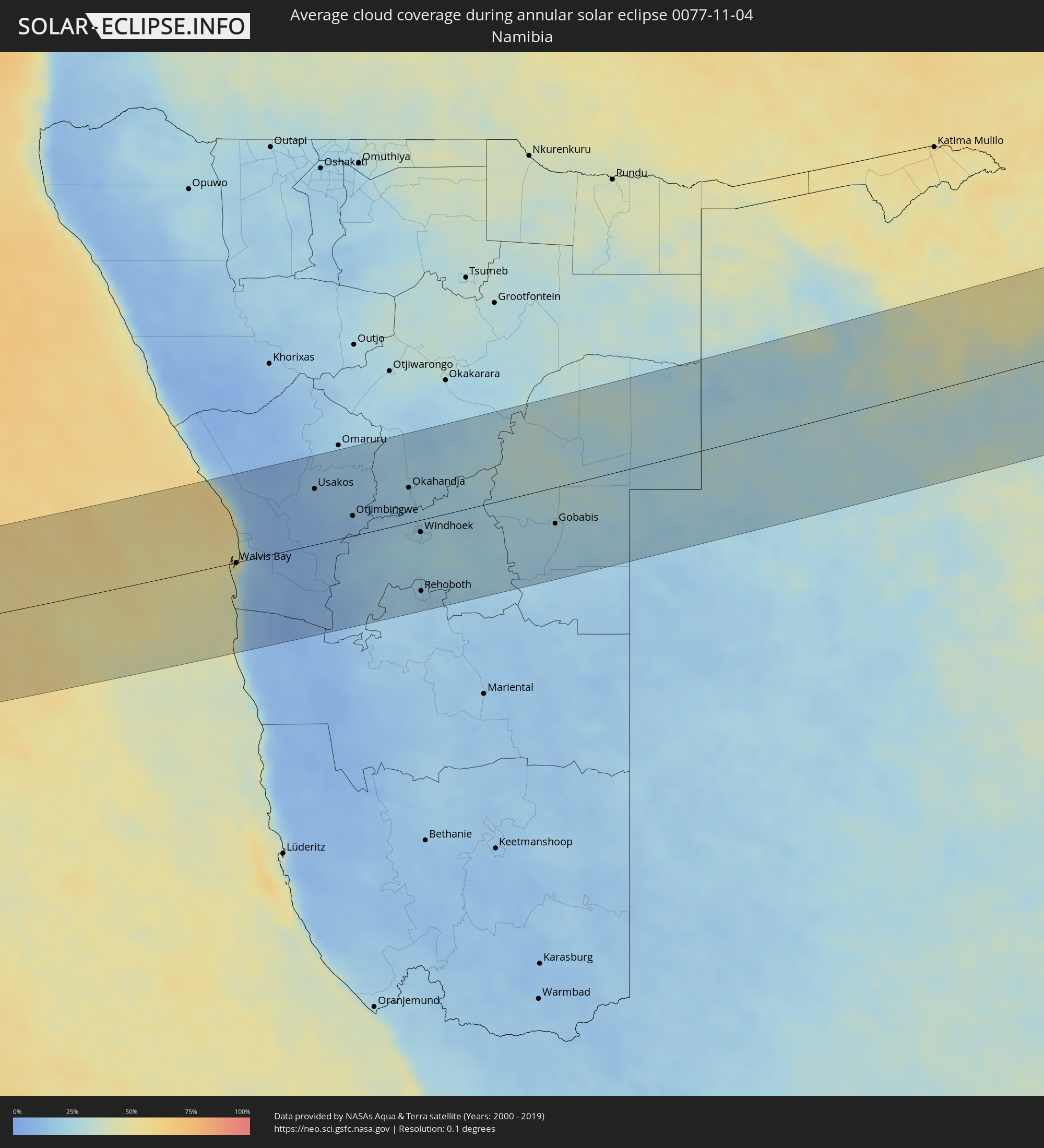 Namibia
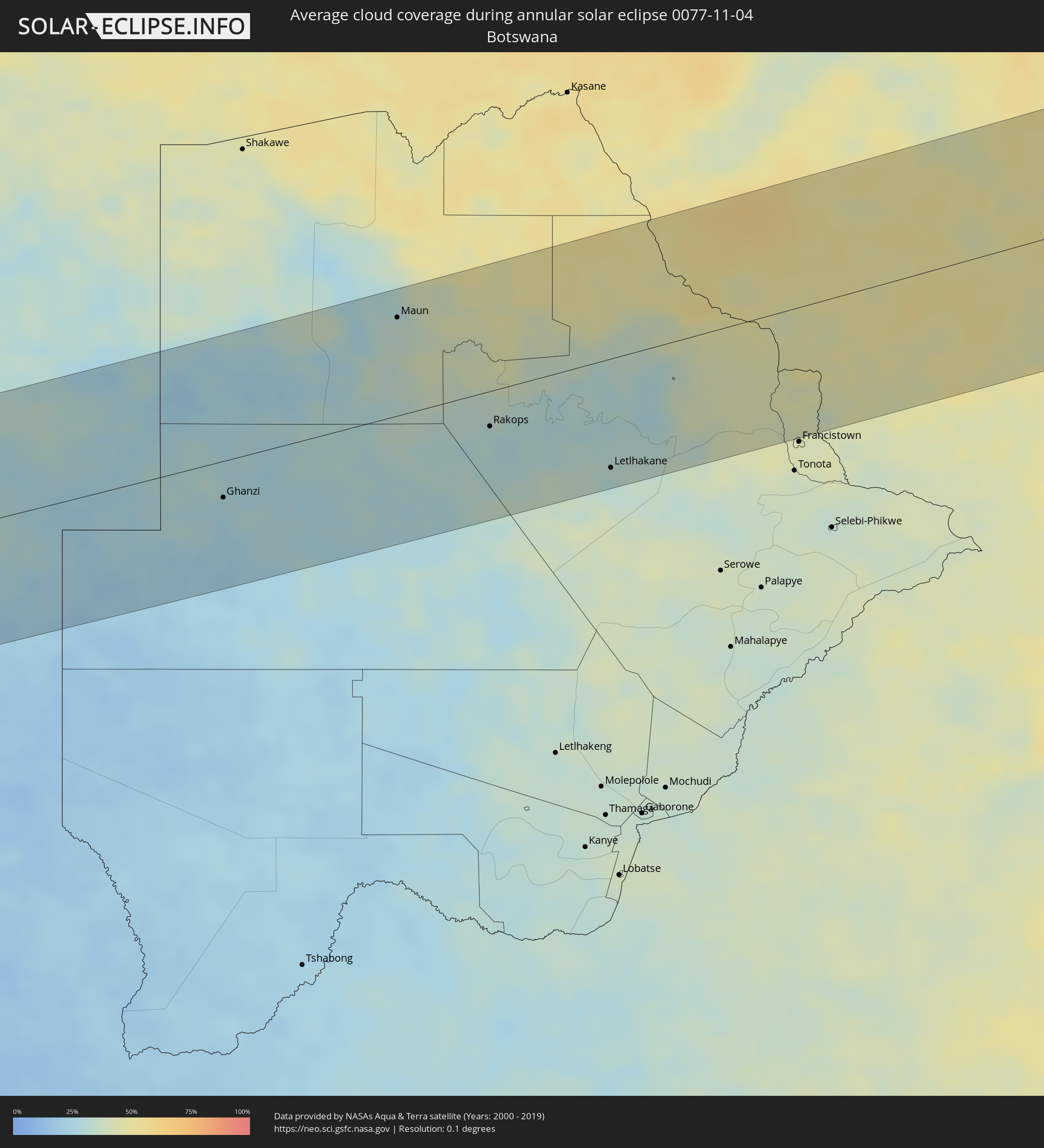 Botswana
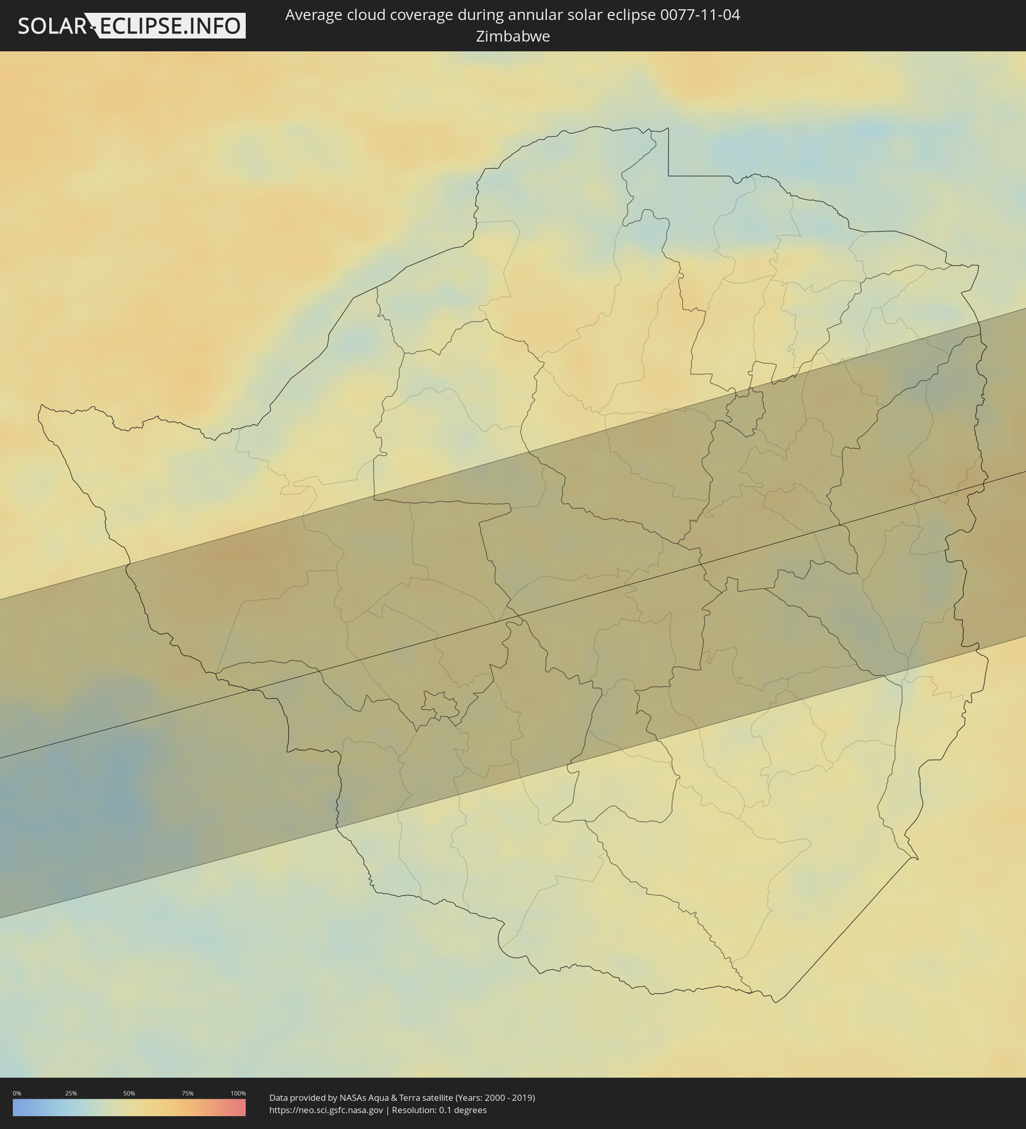 Zimbabwe
 Mozambique
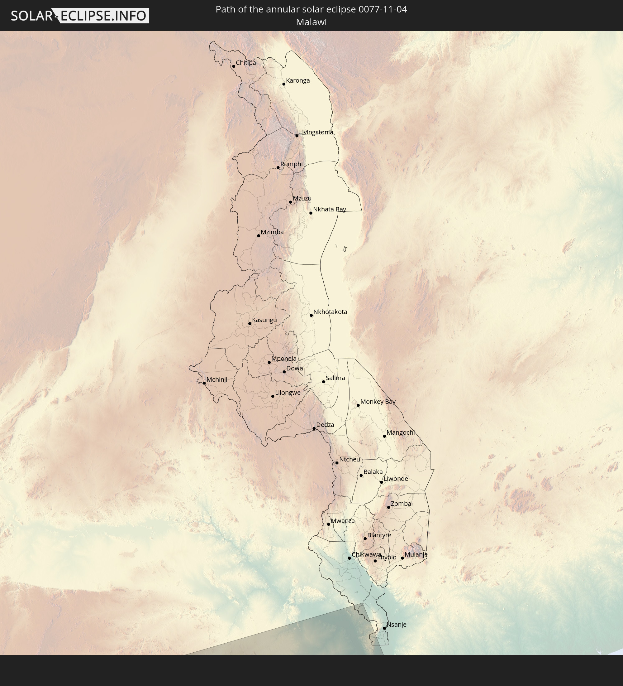
 Malawi
Cities inside the path of the eclipse
The following table shows all locations with a population of more than 5,000 inside the eclipse path. Cities which have more than 100,000 inhabitants are marked bold. A click at the locations opens a detailed map.
| City | Type | Eclipse duration | Local time of max. eclipse | Distance to central line | Ø Cloud coverage |
|
Tumaco, Nariño
|
annular | - | 07:02:06 UTC-04:56 | 113 km | 93% |
|
Barbacoas, Nariño
|
annular | - | 07:02:24 UTC-04:56 | 100 km | 96% |
|
El Charco, Nariño
|
annular | - | 07:01:49 UTC-04:56 | 15 km | 95% |
|
Guapi, Cauca
|
annular | - | 07:01:49 UTC-04:56 | 4 km | 89% |
|
Samaniego, Nariño
|
annular | - | 07:02:49 UTC-04:56 | 114 km | 83% |
|
Olaya Herrera, Nariño
|
annular | - | 07:02:56 UTC-04:56 | 119 km | 82% |
|
Sandoná, Nariño
|
annular | - | 07:02:54 UTC-04:56 | 114 km | 82% |
|
El Tambo, Nariño
|
annular | - | 07:02:50 UTC-04:56 | 98 km | 85% |
|
Pasto, Nariño
|
annular | - | 07:03:02 UTC-04:56 | 114 km | 89% |
|
La Unión, Nariño
|
annular | - | 07:02:47 UTC-04:56 | 68 km | 91% |
|
Patía, Cauca
|
annular | - | 07:02:28 UTC-04:56 | 16 km | 75% |
|
El Bordo, Cauca
|
annular | - | 07:02:27 UTC-04:56 | 8 km | 79% |
|
La Cruz, Cauca
|
annular | - | 07:02:51 UTC-04:56 | 61 km | 91% |
|
Sibundoy, Putumayo
|
annular | - | 07:03:10 UTC-04:56 | 101 km | 90% |
|
Villa Rica, Cauca
|
annular | - | 07:02:12 UTC-04:56 | 38 km | 80% |
|
Suárez, Cauca
|
annular | - | 07:01:57 UTC-04:56 | 90 km | 79% |
|
Mocoa, Putumayo
|
annular | - | 07:03:18 UTC-04:56 | 96 km | 94% |
|
Villagarzón, Putumayo
|
annular | - | 07:03:24 UTC-04:56 | 107 km | 87% |
|
Morales, Cauca
|
annular | - | 07:02:07 UTC-04:56 | 73 km | 82% |
|
Popayán, Cauca
|
annular | - | 07:02:21 UTC-04:56 | 40 km | 92% |
|
Santander de Quilichao, Cauca
|
annular | - | 07:01:59 UTC-04:56 | 104 km | 80% |
|
Puerto Tejada, Cauca
|
annular | - | 07:01:51 UTC-04:56 | 130 km | 80% |
|
Silvia, Cauca
|
annular | - | 07:02:18 UTC-04:56 | 67 km | 92% |
|
San Agustín, Huila
|
annular | - | 07:02:54 UTC-04:56 | 5 km | 83% |
|
Corinto, Cauca
|
annular | - | 07:01:57 UTC-04:56 | 130 km | 85% |
|
Pitalito, Huila
|
annular | - | 07:03:00 UTC-04:56 | 1 km | 87% |
|
Belalcazar, Cauca
|
annular | - | 07:02:25 UTC-04:56 | 87 km | 92% |
|
Timaná, Huila
|
annular | - | 07:02:57 UTC-04:56 | 18 km | 90% |
|
Curillo, Caquetá
|
annular | - | 07:03:41 UTC-04:56 | 79 km | 78% |
|
La Plata, Huila
|
annular | - | 07:02:39 UTC-04:56 | 64 km | 89% |
|
Garzón, Huila
|
annular | - | 07:02:54 UTC-04:56 | 54 km | 95% |
|
Florencia, Caquetá
|
annular | - | 07:03:22 UTC-04:56 | 6 km | 82% |
|
Gigante, Huila
|
annular | - | 07:02:48 UTC-04:56 | 77 km | 93% |
|
El Paujil, Caquetá
|
annular | - | 07:03:31 UTC-04:56 | 1 km | 84% |
|
Campoalegre, Huila
|
annular | - | 07:02:40 UTC-04:56 | 117 km | 92% |
|
Algeciras, Huila
|
annular | - | 07:02:47 UTC-04:56 | 100 km | 95% |
|
El Doncello, Caquetá
|
annular | - | 07:03:27 UTC-04:56 | 14 km | 87% |
|
Rivera, Huila
|
annular | - | 07:02:37 UTC-04:56 | 129 km | 89% |
|
Puerto Rico, Caquetá
|
annular | - | 07:03:19 UTC-04:56 | 44 km | 77% |
|
Cartagena del Chairá, Caquetá
|
annular | - | 07:03:55 UTC-04:56 | 3 km | 80% |
|
Fonte Boa, Amazonas
|
annular | - | 08:06:58 UTC-04:02 | 4 km | 80% |
|
Tefé, Amazonas
|
annular | - | 08:09:13 UTC-04:02 | 22 km | 84% |
|
Coari, Amazonas
|
annular | - | 08:11:41 UTC-04:02 | 14 km | 80% |
|
Codajás, Amazonas
|
annular | - | 08:12:35 UTC-04:02 | 66 km | 81% |
|
Manicoré, Amazonas
|
annular | - | 08:15:59 UTC-04:02 | 89 km | 80% |
|
Novo Aripuanã, Amazonas
|
annular | - | 08:16:12 UTC-04:02 | 27 km | 77% |
|
Alvorada, Tocantins
|
annular | - | 10:15:01 UTC-02:34 | 53 km | 83% |
|
Gurupi, Tocantins
|
annular | - | 10:13:49 UTC-02:34 | 21 km | 81% |
|
Campos Belos, Goiás
|
annular | - | 09:48:41 UTC-03:06 | 30 km | 76% |
|
Taguatinga, Tocantins
|
annular | - | 10:20:47 UTC-02:34 | 109 km | 74% |
|
Posse, Goiás
|
annular | - | 09:51:31 UTC-03:06 | 47 km | 75% |
|
Januária, Minas Gerais
|
annular | - | 09:58:53 UTC-03:06 | 66 km | 64% |
|
Itacarambi, Minas Gerais
|
annular | - | 09:58:50 UTC-03:06 | 14 km | 62% |
|
Manga, Minas Gerais
|
annular | - | 09:58:36 UTC-03:06 | 28 km | 63% |
|
Carinhanha, Bahia
|
annular | - | 10:30:39 UTC-02:34 | 80 km | 61% |
|
Barreiro do Jaíba, Minas Gerais
|
annular | - | 10:01:02 UTC-03:06 | 35 km | 65% |
|
Janaúba, Minas Gerais
|
annular | - | 10:02:05 UTC-03:06 | 37 km | 65% |
|
Porteirinha, Minas Gerais
|
annular | - | 10:02:42 UTC-03:06 | 15 km | 64% |
|
Monte Azul, Minas Gerais
|
annular | - | 10:02:01 UTC-03:06 | 49 km | 64% |
|
Espinosa, Minas Gerais
|
annular | - | 10:01:44 UTC-03:06 | 74 km | 63% |
|
Rio Pardo de Minas, Minas Gerais
|
annular | - | 10:03:43 UTC-03:06 | 24 km | 66% |
|
Salinas, Minas Gerais
|
annular | - | 10:05:24 UTC-03:06 | 15 km | 67% |
|
Taiobeiras, Minas Gerais
|
annular | - | 10:04:53 UTC-03:06 | 22 km | 67% |
|
Araçuaí, Minas Gerais
|
annular | - | 10:07:13 UTC-03:06 | 68 km | 67% |
|
Padre Paraíso, Minas Gerais
|
annular | - | 10:09:11 UTC-03:06 | 58 km | 75% |
|
Medina, Minas Gerais
|
annular | - | 10:07:39 UTC-03:06 | 24 km | 71% |
|
Águas Vermelhas, Minas Gerais
|
annular | - | 10:06:49 UTC-03:06 | 71 km | 71% |
|
Pedra Azul, Minas Gerais
|
annular | - | 10:07:44 UTC-03:06 | 55 km | 70% |
|
Jequitinhonha, Minas Gerais
|
annular | - | 10:09:19 UTC-03:06 | 30 km | 74% |
|
Águas Formosas, Minas Gerais
|
annular | - | 10:10:41 UTC-03:06 | 29 km | 78% |
|
Carlos Chagas, Minas Gerais
|
annular | - | 10:12:16 UTC-03:06 | 79 km | 82% |
|
Almenara, Minas Gerais
|
annular | - | 10:09:42 UTC-03:06 | 71 km | 77% |
|
Montanha, Espírito Santo
|
annular | - | 10:14:08 UTC-03:06 | 98 km | 83% |
|
Nanuque, Minas Gerais
|
annular | - | 10:13:39 UTC-03:06 | 70 km | 81% |
|
Itanhém, Bahia
|
annular | - | 10:44:57 UTC-02:34 | 4 km | 77% |
|
Medeiros Neto, Bahia
|
annular | - | 10:45:38 UTC-02:34 | 18 km | 78% |
|
Mucuri, Bahia
|
annular | - | 10:48:47 UTC-02:34 | 52 km | 67% |
|
Itamaraju, Bahia
|
annular | - | 10:46:57 UTC-02:34 | 51 km | 80% |
|
Nova Viçosa, Bahia
|
annular | - | 10:48:56 UTC-02:34 | 23 km | 63% |
|
Prado, Bahia
|
annular | - | 10:48:22 UTC-02:34 | 38 km | 58% |
|
Walvis Bay, Erongo
|
annular | - | 17:06:15 UTC+01:30 | 1 km | 28% |
|
Swakopmund, Erongo
|
annular | - | 17:06:26 UTC+01:30 | 28 km | 45% |
|
Usakos, Erongo
|
annular | - | 17:07:37 UTC+01:30 | 78 km | 13% |
|
Karibib, Erongo
|
annular | - | 17:07:49 UTC+01:30 | 80 km | 15% |
|
Otjimbingwe, Erongo
|
annular | - | 17:07:46 UTC+01:30 | 28 km | 11% |
|
Okahandja, Otjozondjupa
|
annular | - | 17:08:30 UTC+01:30 | 49 km | 19% |
|
Windhoek, Khomas
|
annular | - | 17:08:15 UTC+01:30 | 17 km | 24% |
|
Rehoboth, Hardap
|
annular | - | 17:07:47 UTC+01:30 | 99 km | 18% |
|
Gobabis, Omaheke
|
annular | - | 17:09:24 UTC+01:30 | 51 km | 22% |
|
Ghanzi, Ghanzi
|
annular | - | 17:51:26 UTC+02:10 | 37 km | 26% |
|
Maun, North-West
|
annular | - | 17:53:03 UTC+02:10 | 101 km | 34% |
|
Rakops, Central
|
annular | - | 17:52:46 UTC+02:10 | 36 km | 29% |
|
Orapa, Central
|
annular | - | 17:52:52 UTC+02:10 | 94 km | 31% |
|
Letlhakane, Central
|
annular | - | 17:52:52 UTC+02:10 | 111 km | 30% |
|
Chimoio, Manica
|
annular | - | 17:54:47 UTC+02:10 | 88 km | 56% |