Total solar eclipse of 06/29/0409
| Day of week: | Monday |
| Maximum duration of eclipse: | 01m35s |
| Maximum width of eclipse path: | 239 km |
| Saros cycle: | 72 |
| Coverage: | 100% |
| Magnitude: | 1.0279 |
| Gamma: | 0.9153 |
Wo kann man die Sonnenfinsternis vom 06/29/0409 sehen?
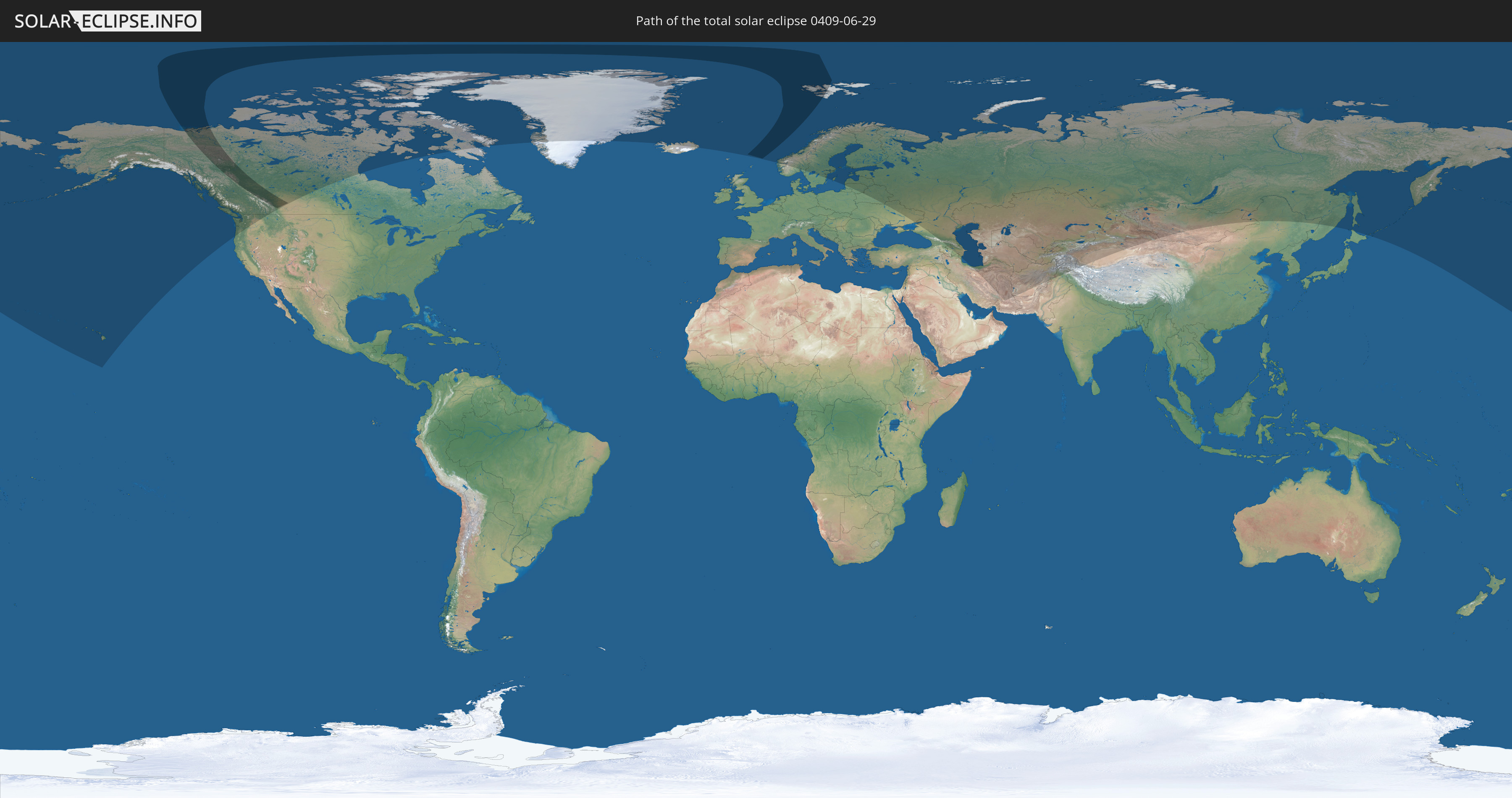
Die Sonnenfinsternis am 06/29/0409 kann man in 29 Ländern als partielle Sonnenfinsternis beobachten.
Der Finsternispfad verläuft durch 2 Länder. Nur in diesen Ländern ist sie als total Sonnenfinsternis zu sehen.
In den folgenden Ländern ist die Sonnenfinsternis total zu sehen
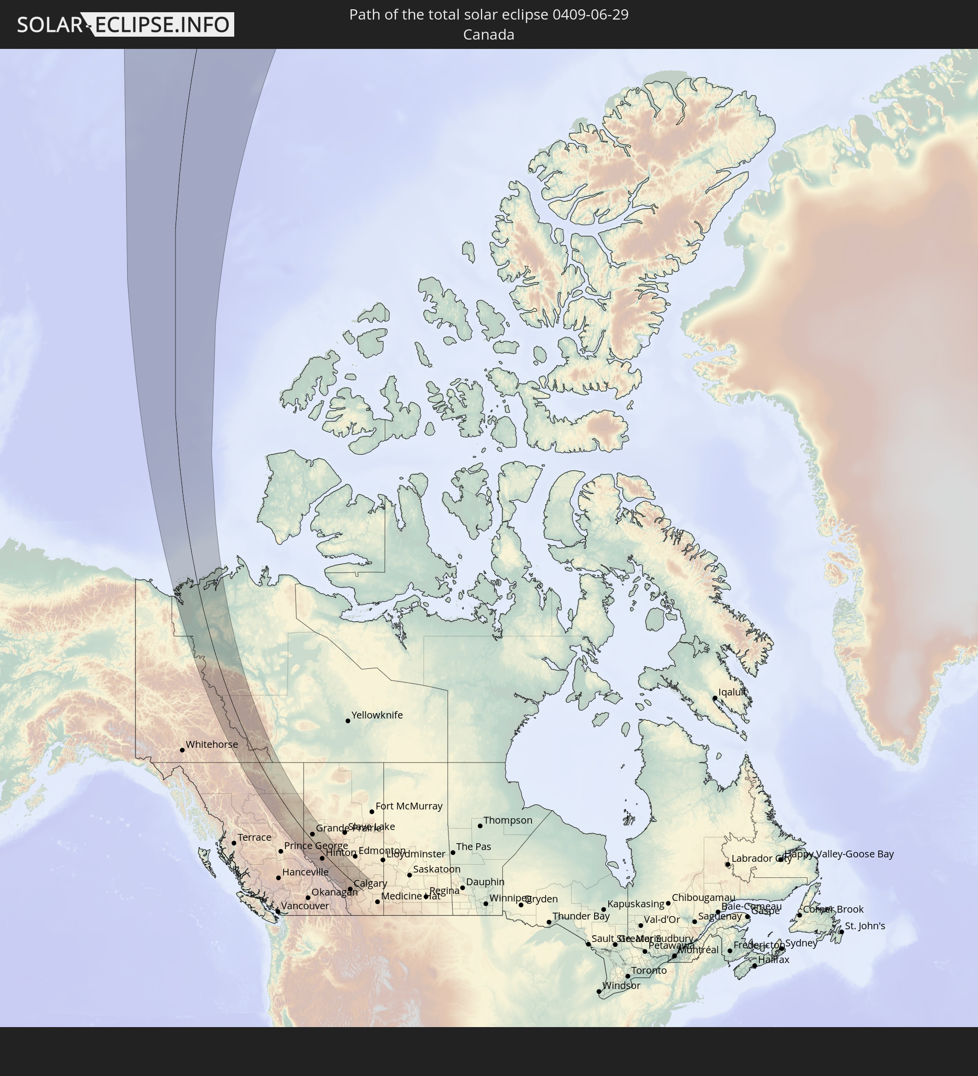 Canada
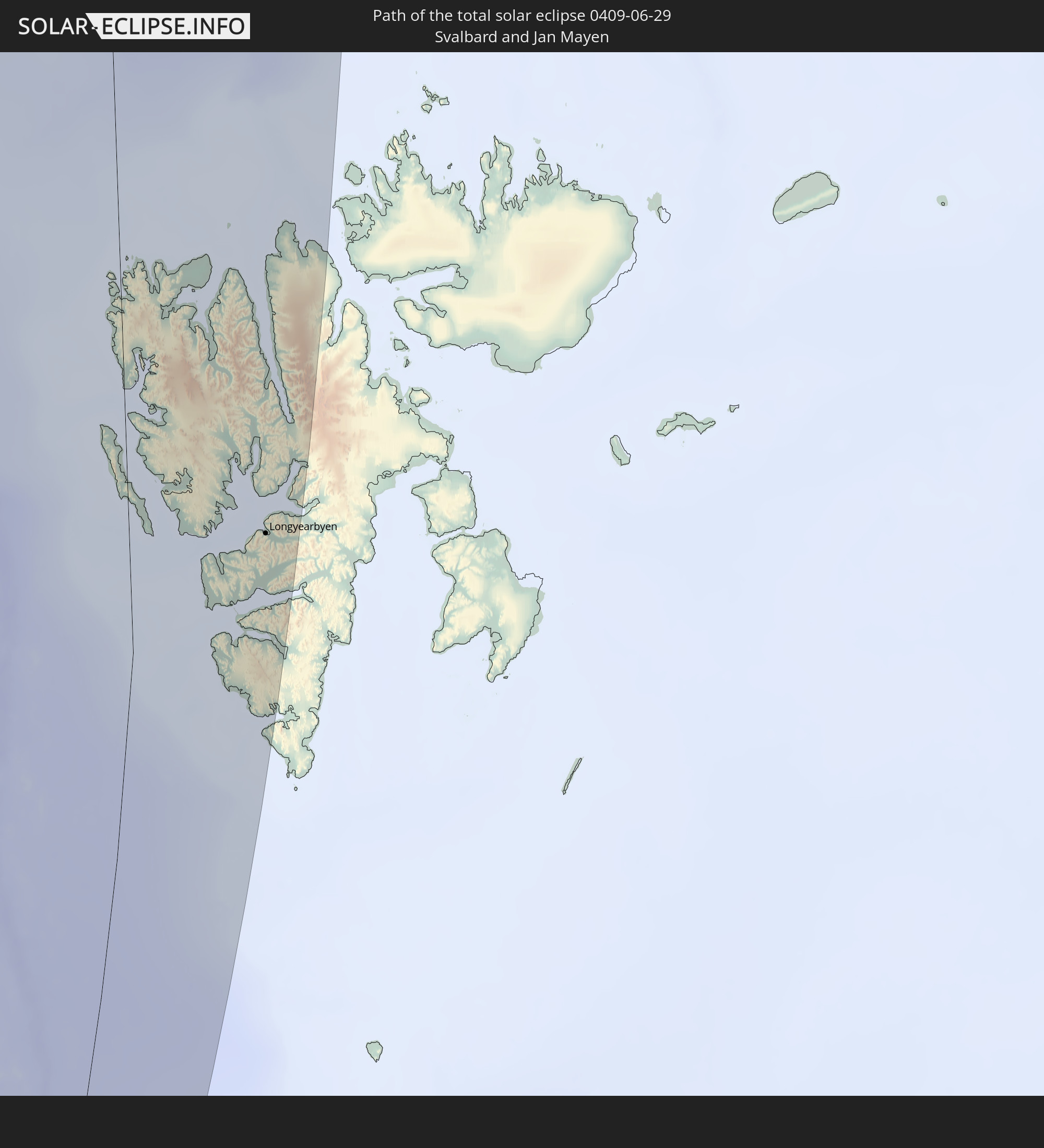 Svalbard and Jan Mayen
In den folgenden Ländern ist die Sonnenfinsternis partiell zu sehen
 Russia
 United States
 United States Minor Outlying Islands
 Canada
 Greenland
 Iceland
 Svalbard and Jan Mayen
 Norway
 Sweden
 Åland Islands
 Finland
 Lithuania
 Latvia
 Estonia
 Ukraine
 Belarus
 Georgia
 Iran
Iran
 Azerbaijan
 Kazakhstan
 Turkmenistan
 Uzbekistan
 Afghanistan
 Pakistan
 Tajikistan
 Kyrgyzstan
 China
China
 Mongolia
 Japan
Japan
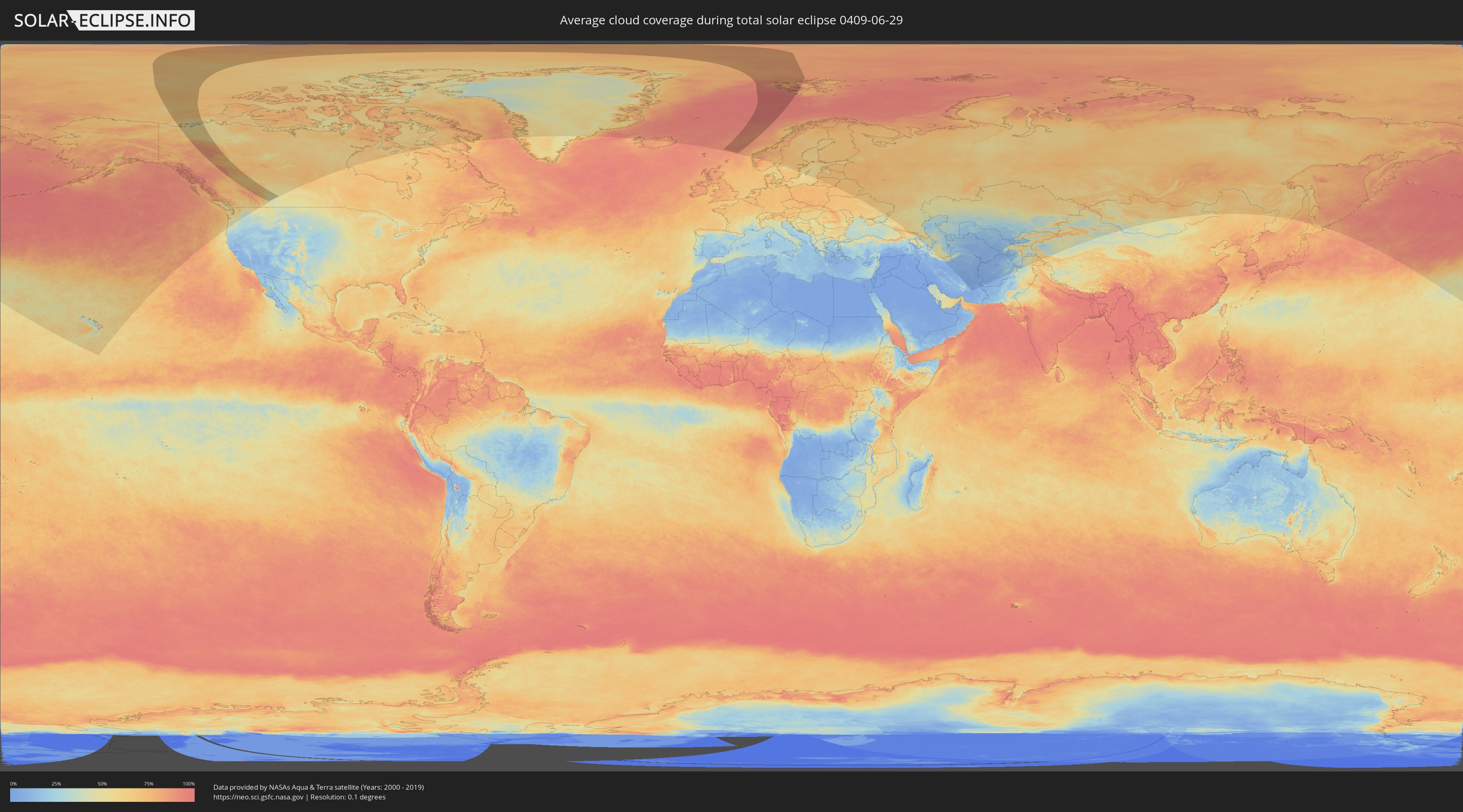
How will be the weather during the total solar eclipse on 06/29/0409?
Where is the best place to see the total solar eclipse of 06/29/0409?
The following maps show the average cloud coverage for the day of the total solar eclipse.
With the help of these maps, it is possible to find the place along the eclipse path, which has the best
chance of a cloudless sky.
Nevertheless, you should consider local circumstances and inform about the weather of your chosen
observation site.
The data is provided by NASAs satellites
AQUA and TERRA.
The cloud maps are averaged over a period of 19 years (2000 - 2019).

Detailed country maps
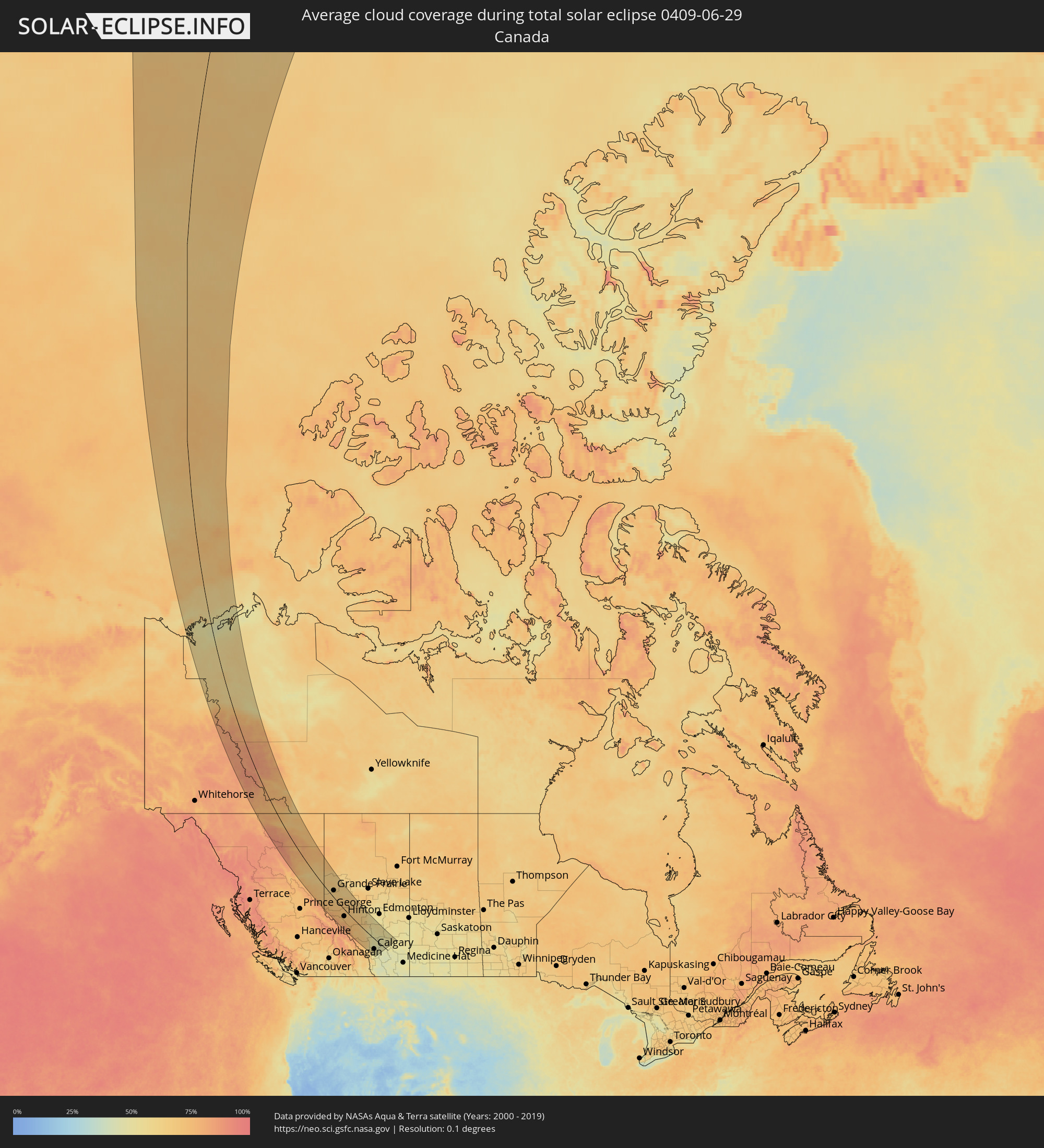 Canada
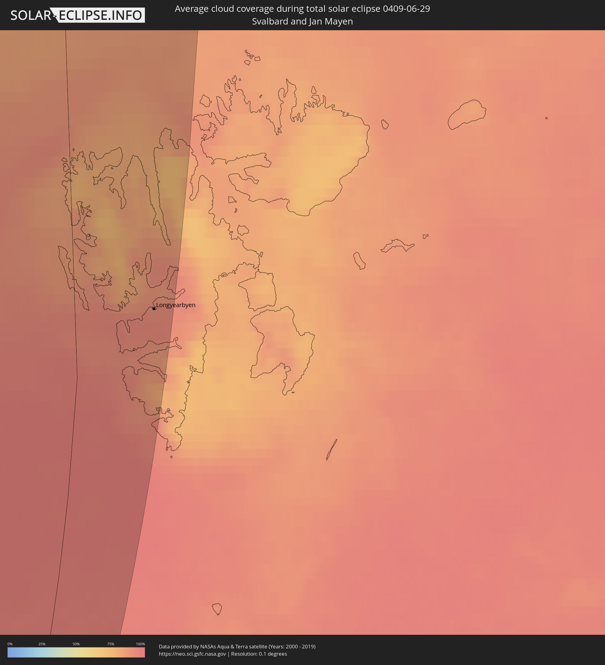 Svalbard and Jan Mayen
Cities inside the path of the eclipse
The following table shows all locations with a population of more than 5,000 inside the eclipse path. Cities which have more than 100,000 inhabitants are marked bold. A click at the locations opens a detailed map.
| City | Type | Eclipse duration | Local time of max. eclipse | Distance to central line | Ø Cloud coverage |
|
Fort St. John, British Columbia
|
total | - | 19:37:02 UTC-08:00 | 8 km | 65% |
|
Dawson Creek, British Columbia
|
total | - | 19:37:26 UTC-08:00 | 5 km | 64% |
|
Grande Prairie, Alberta
|
total | - | 20:03:42 UTC-07:33 | 35 km | 63% |
|
Hinton, Alberta
|
total | - | 20:05:25 UTC-07:33 | 37 km | 67% |
|
Edson, Alberta
|
total | - | 20:04:35 UTC-07:33 | 32 km | 66% |
|
Whitecourt, Alberta
|
total | - | 20:03:29 UTC-07:33 | 112 km | 62% |
|
Drayton Valley, Alberta
|
total | - | 20:04:17 UTC-07:33 | 73 km | 60% |
|
Rocky Mountain House, Alberta
|
total | - | 20:05:17 UTC-07:33 | 8 km | 55% |
|
Cochrane, Alberta
|
total | - | 20:06:28 UTC-07:33 | 70 km | 50% |
|
Olds, Alberta
|
total | - | 20:05:32 UTC-07:33 | 3 km | 48% |
|
Sylvan Lake, Alberta
|
total | - | 20:04:53 UTC-07:33 | 42 km | 50% |
|
Calgary, Alberta
|
total | - | 20:06:24 UTC-07:33 | 64 km | 54% |
|
Airdrie, Alberta
|
total | - | 20:06:04 UTC-07:33 | 40 km | 48% |
|
Okotoks, Alberta
|
total | - | 20:06:43 UTC-07:33 | 86 km | 49% |
|
High River, Alberta
|
total | - | 20:06:49 UTC-07:33 | 94 km | 48% |
|
Red Deer, Alberta
|
total | - | 20:04:47 UTC-07:33 | 51 km | 55% |
|
Lacombe, Alberta
|
total | - | 20:04:30 UTC-07:33 | 71 km | 53% |
|
Ponoka, Alberta
|
total | - | 20:04:10 UTC-07:33 | 95 km | 56% |
|
Strathmore, Alberta
|
total | - | 20:05:59 UTC-07:33 | 32 km | 46% |
|
Stettler, Alberta
|
total | - | 20:04:06 UTC-07:33 | 105 km | 51% |
|
Longyearbyen, Svalbard
|
total | - | 03:24:19 UTC+01:00 | 131 km | 92% |