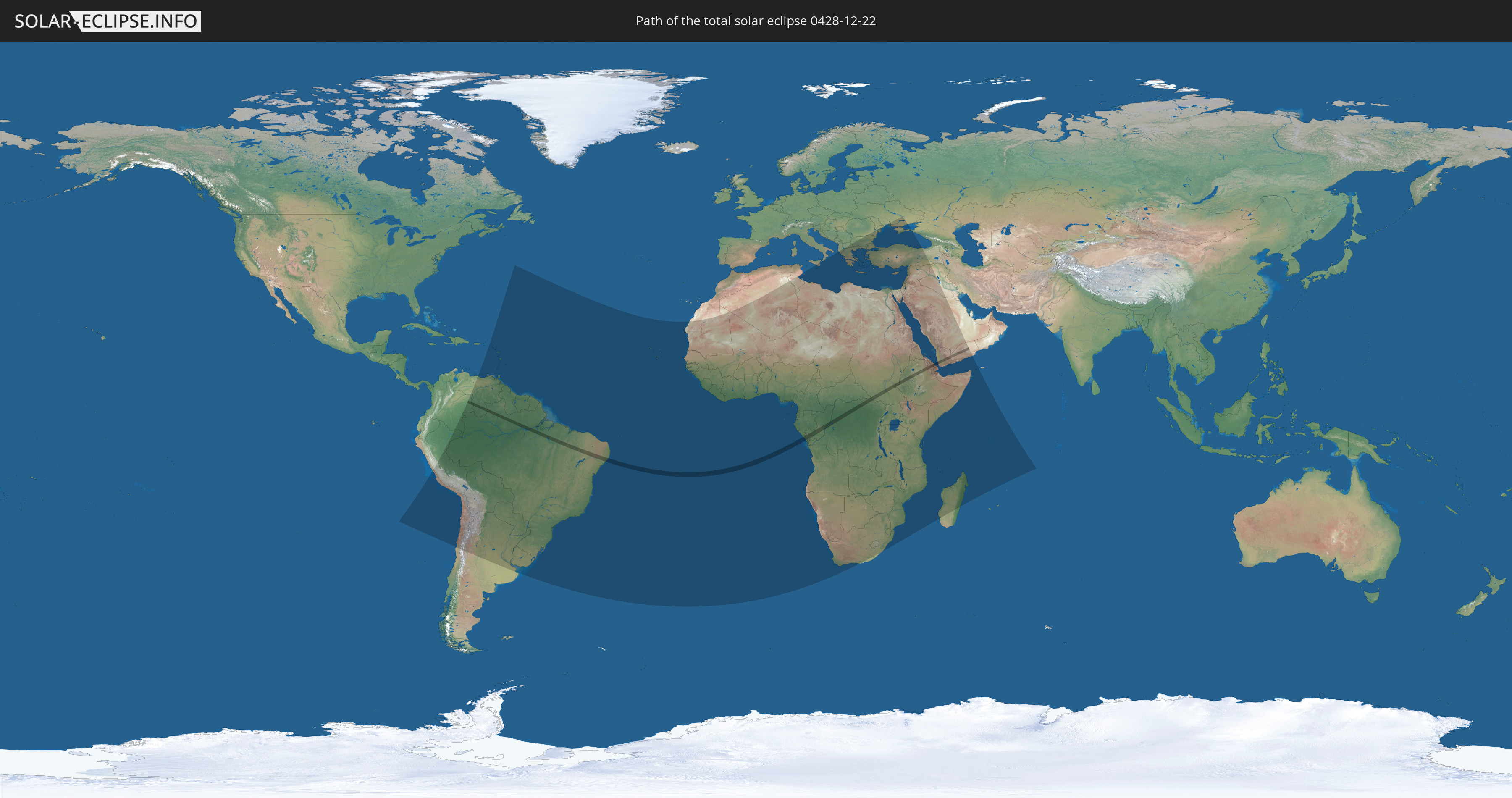
Total solar eclipse of 12/22/0428
| Day of week: | Friday |
| Maximum duration of eclipse: | 03m22s |
| Maximum width of eclipse path: | 118 km |
| Saros cycle: | 87 |
| Coverage: | 100% |
| Magnitude: | 1.0343 |
| Gamma: | 0.2019 |
Wo kann man die Sonnenfinsternis vom 12/22/0428 sehen?
Die Sonnenfinsternis am 12/22/0428 kann man in 100 Ländern als partielle Sonnenfinsternis beobachten.
Der Finsternispfad verläuft durch 11 Länder. Nur in diesen Ländern ist sie als total Sonnenfinsternis zu sehen.
In den folgenden Ländern ist die Sonnenfinsternis total zu sehen
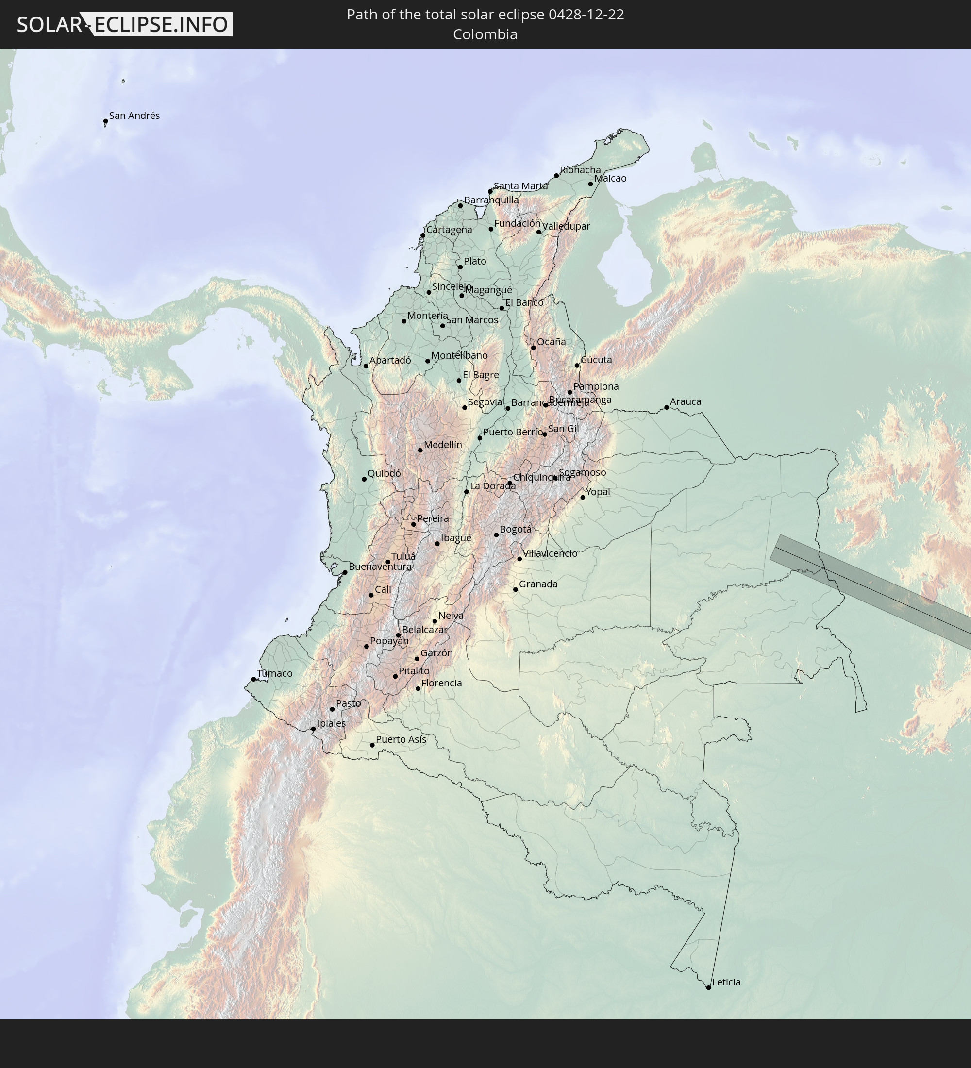 Colombia
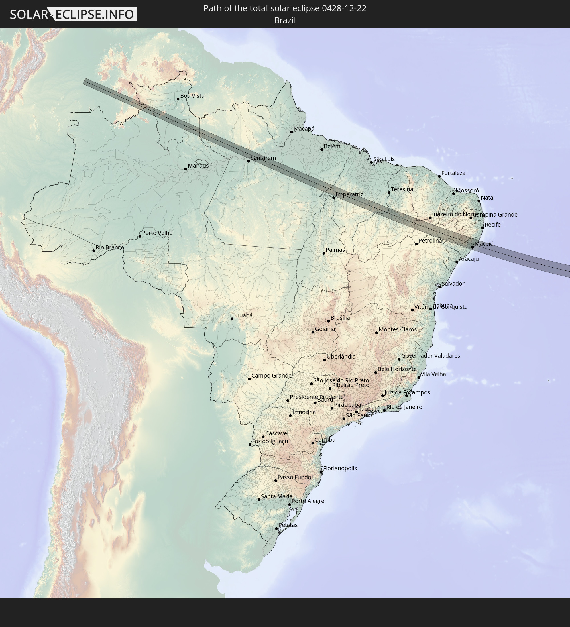 Brazil
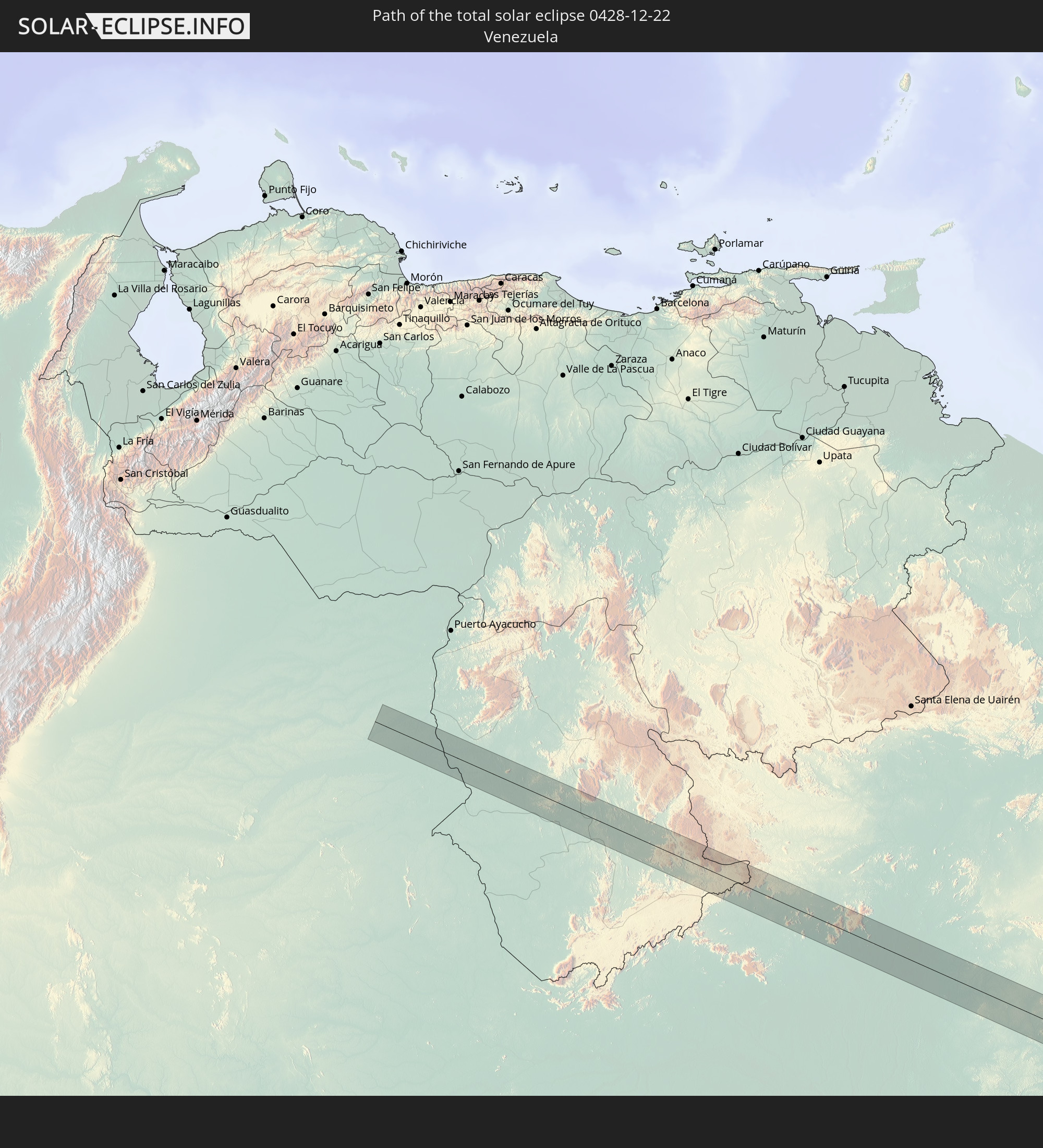 Venezuela
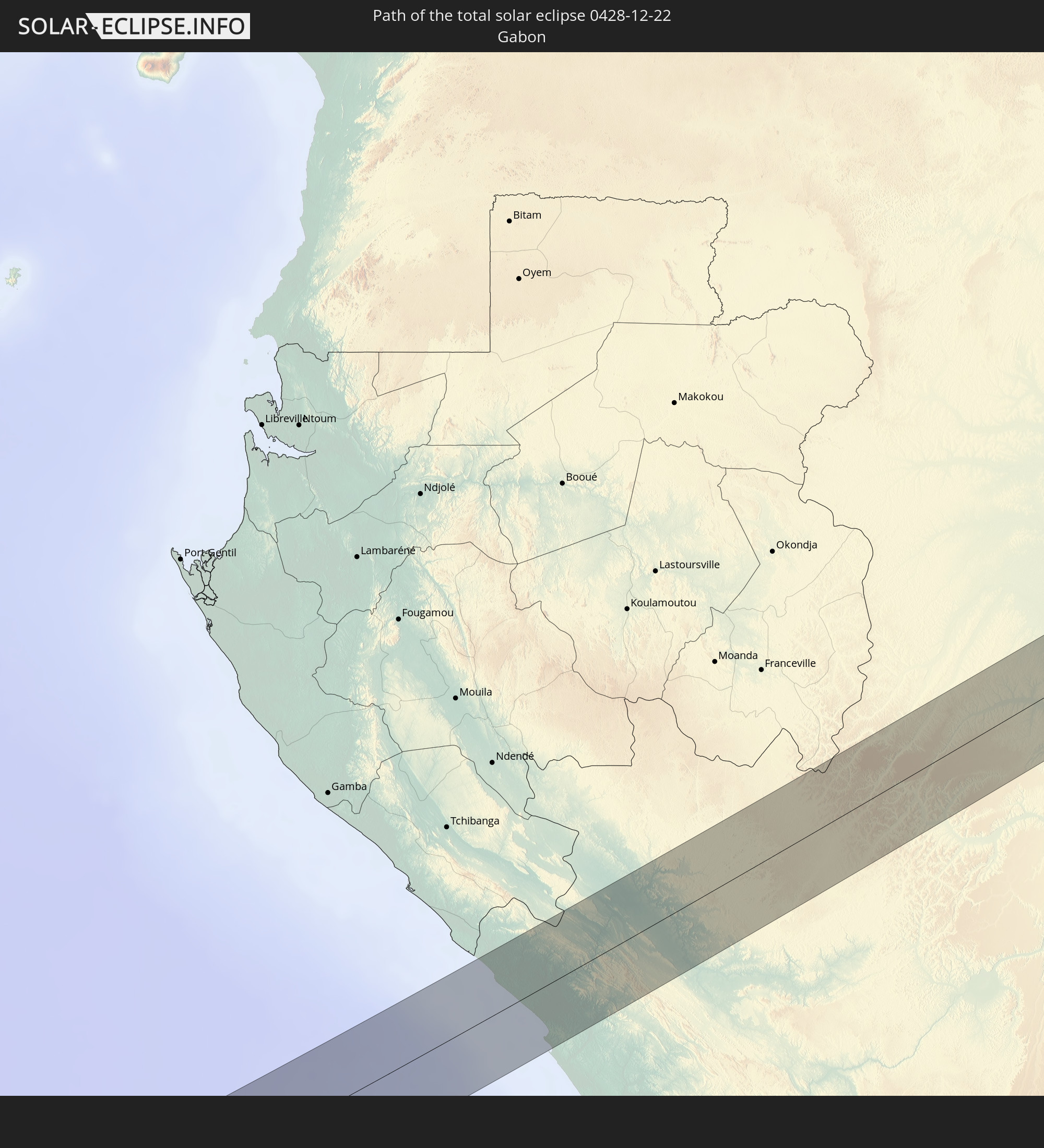 Gabon
Gabon
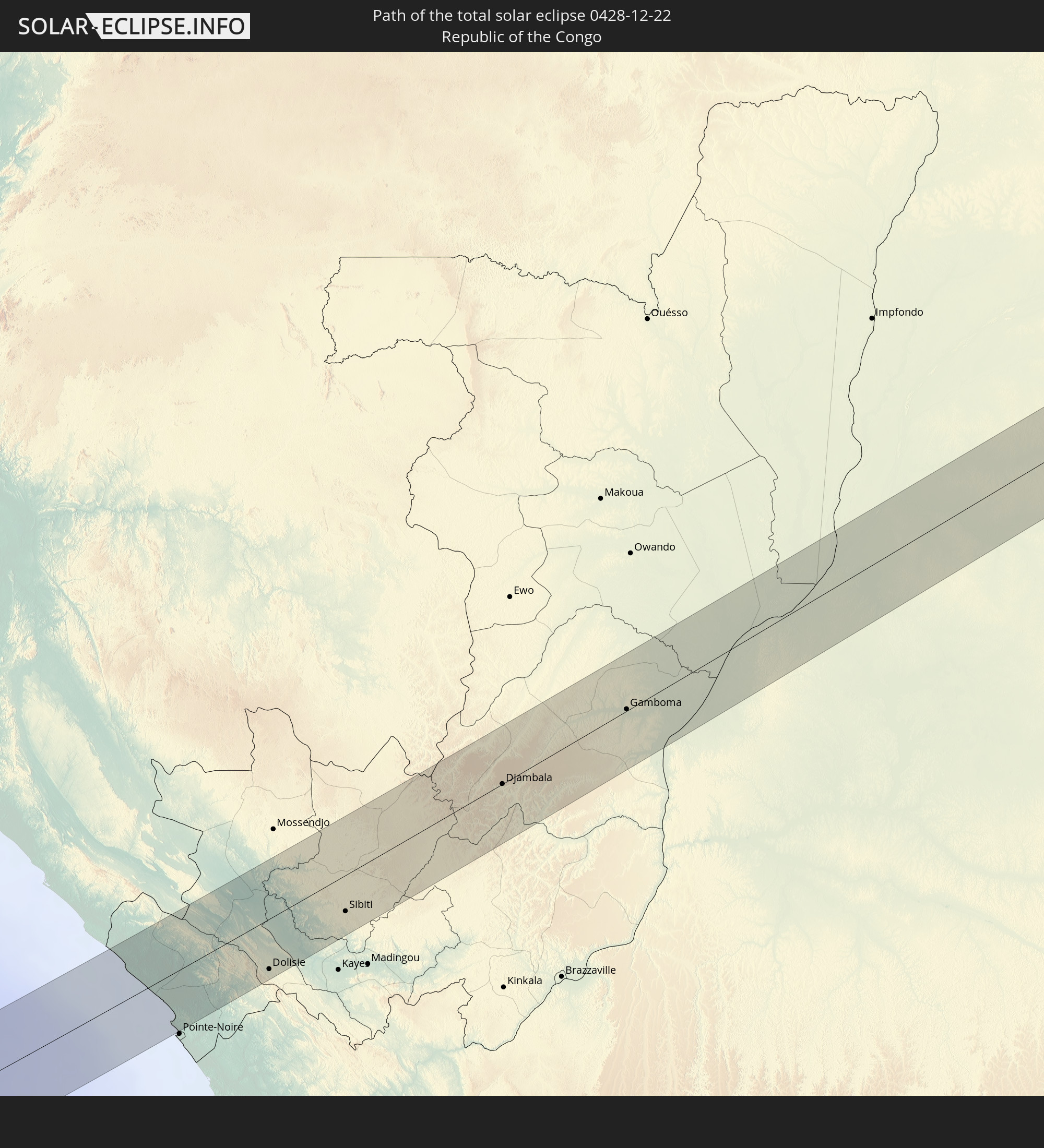 Republic of the Congo
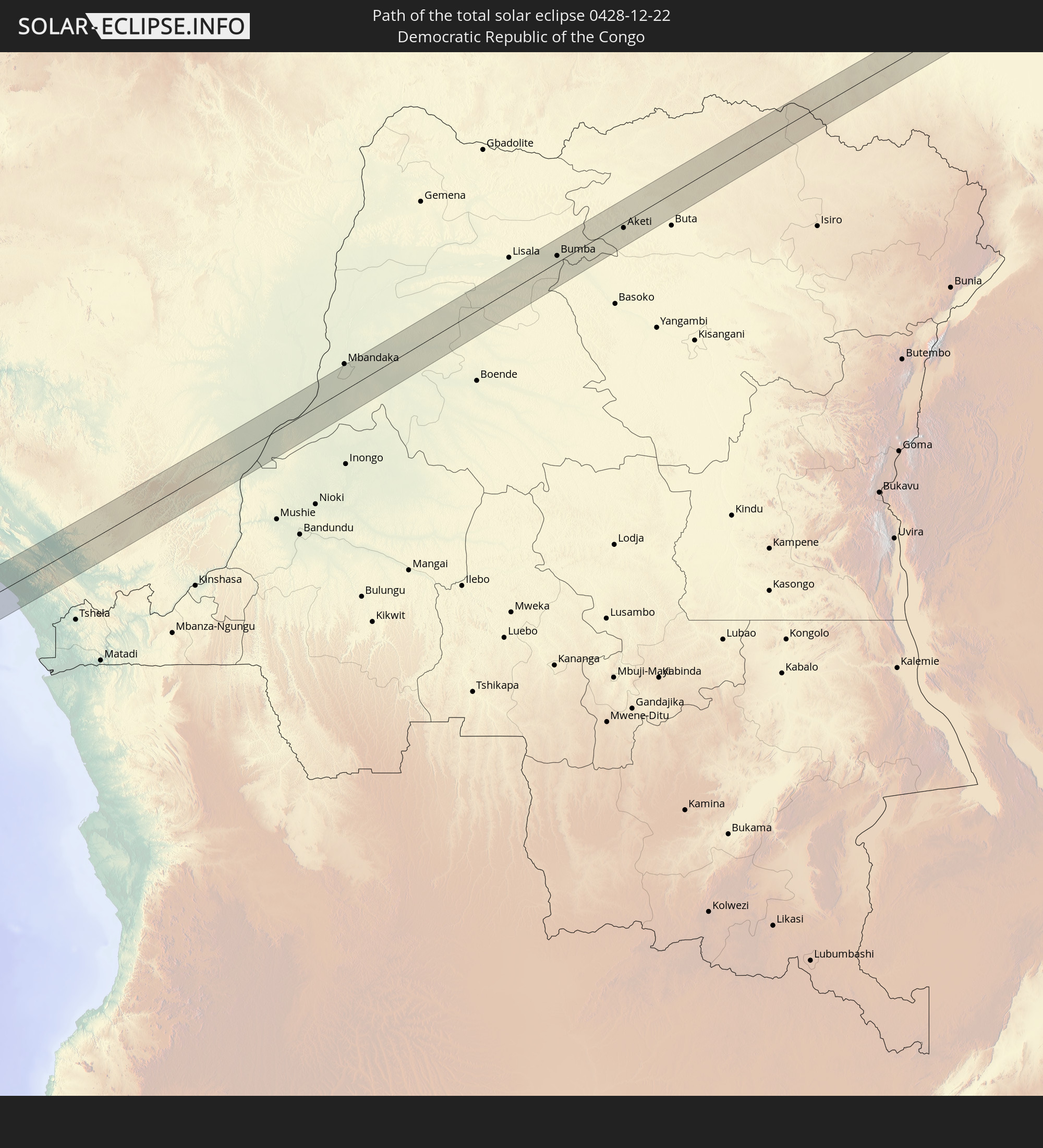 Democratic Republic of the Congo
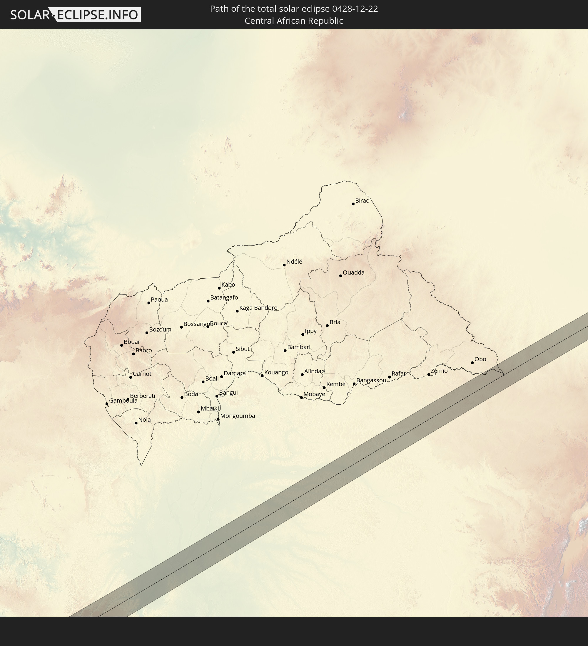 Central African Republic
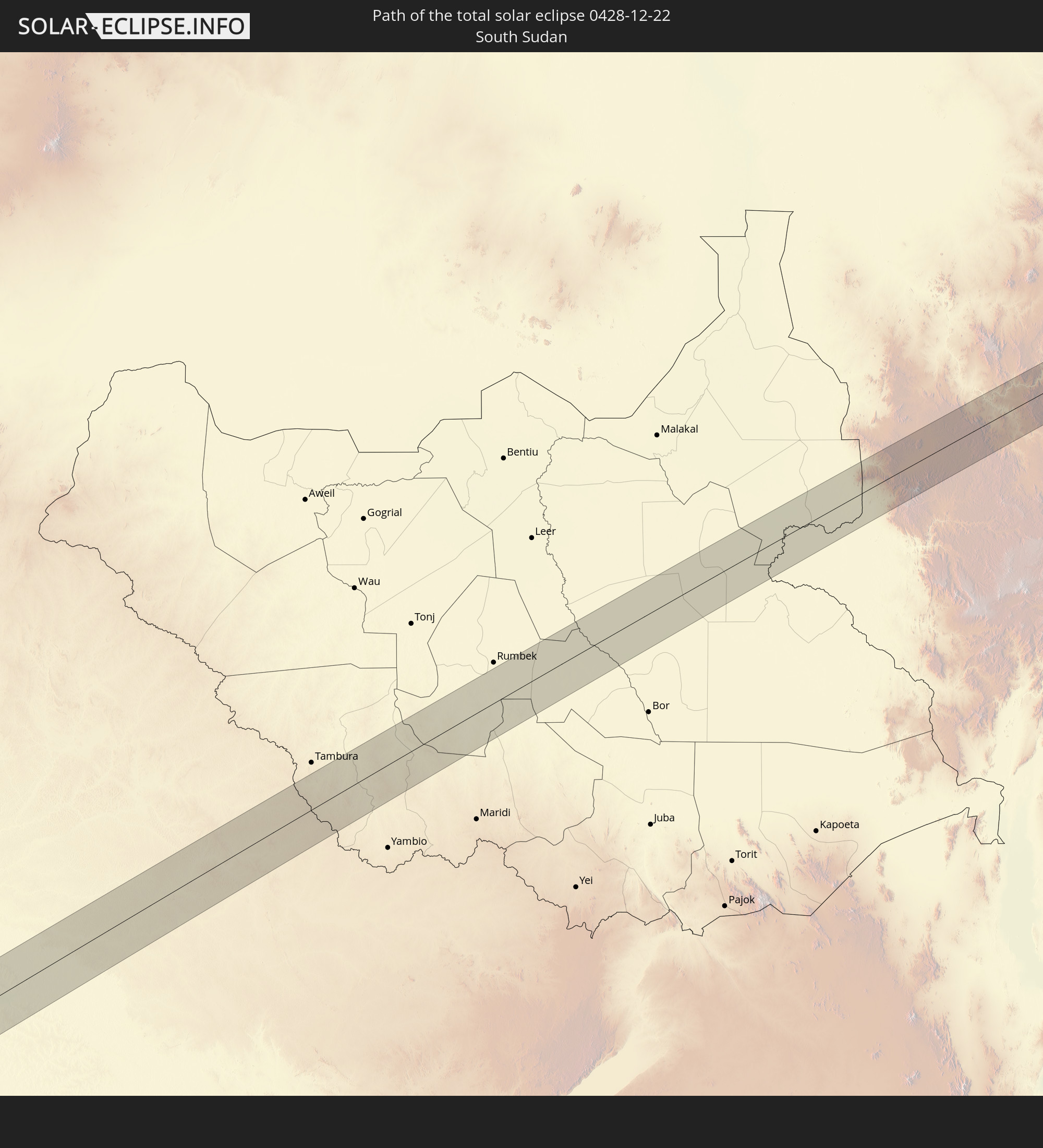 South Sudan
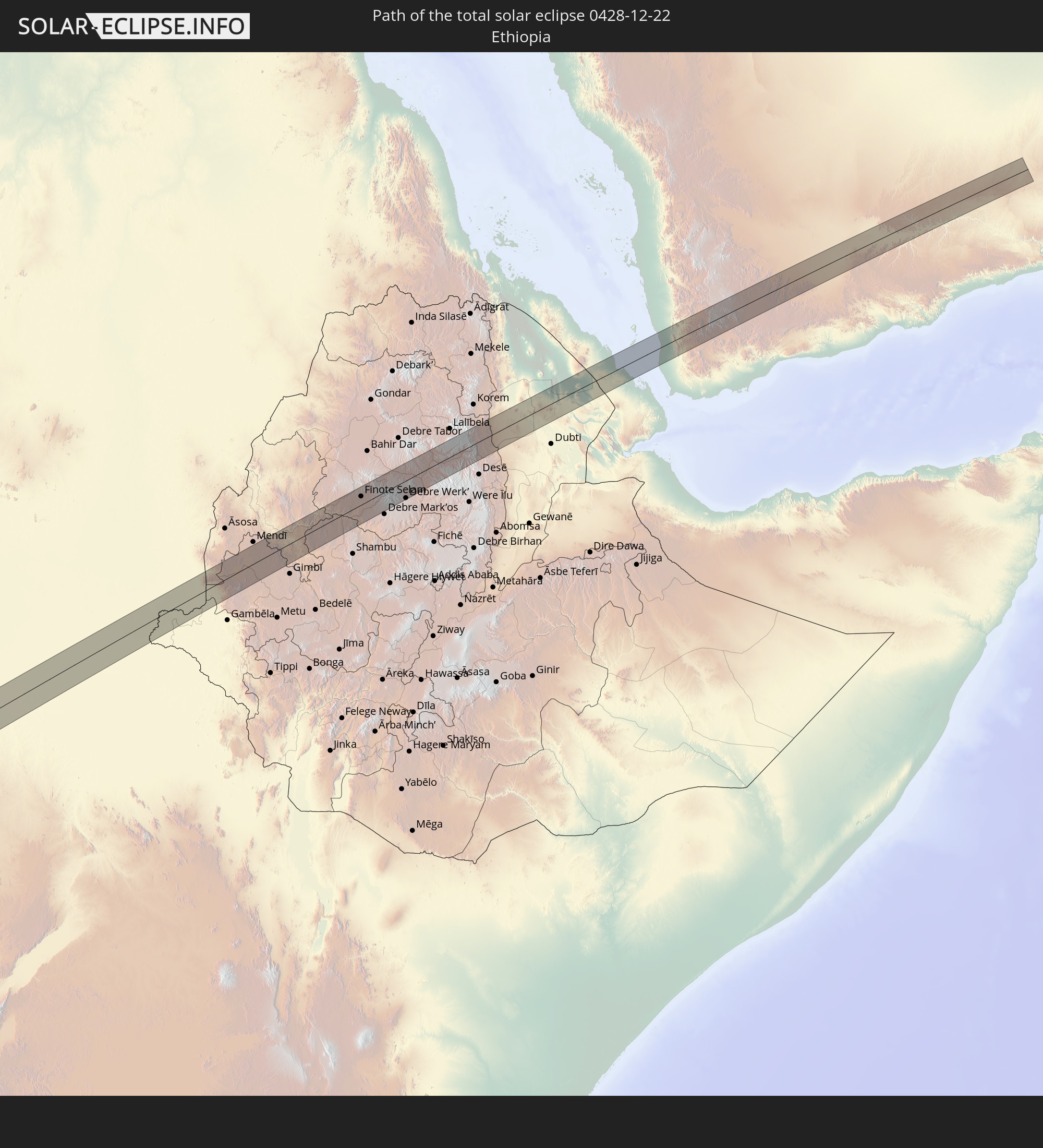 Ethiopia
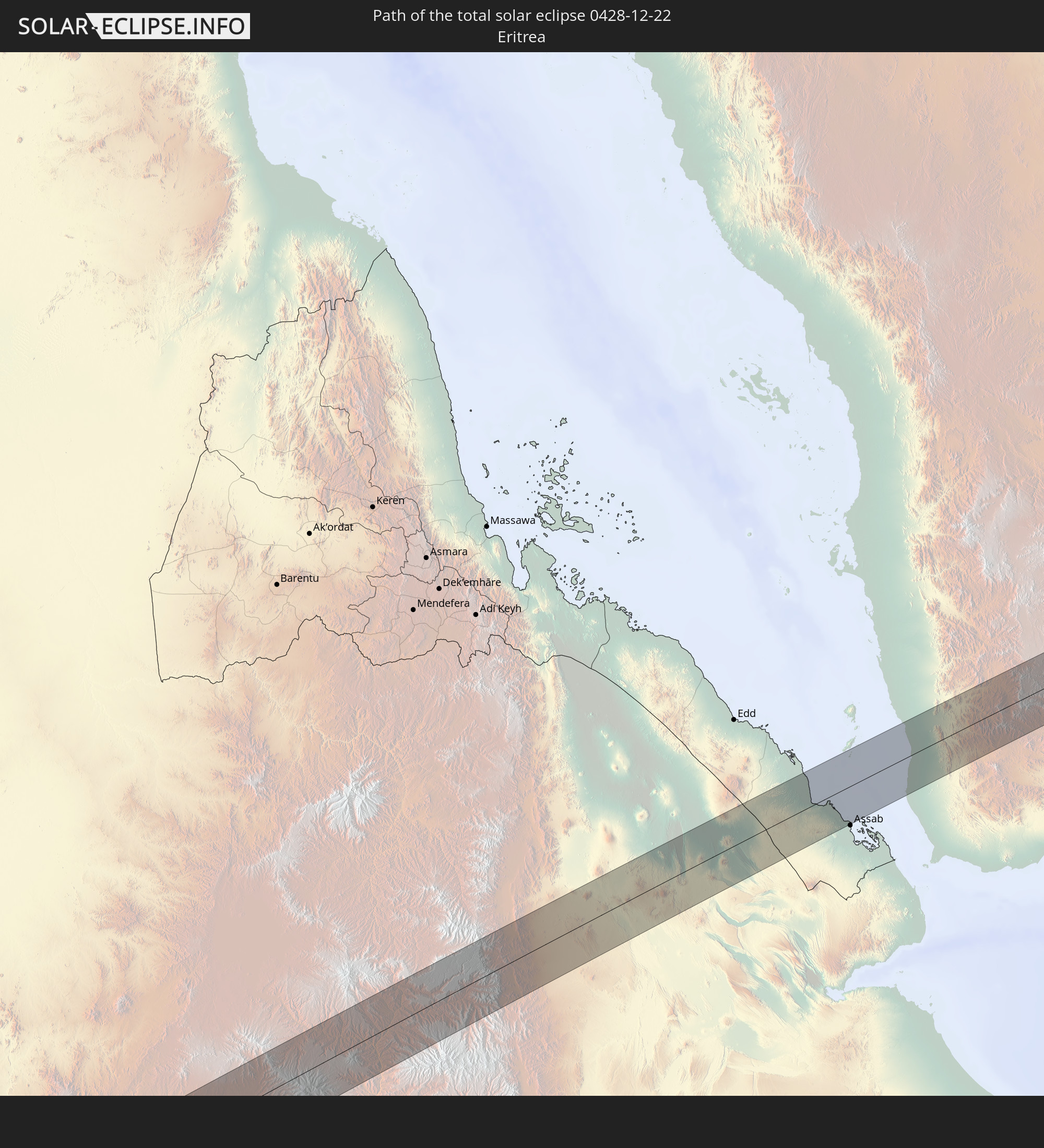 Eritrea
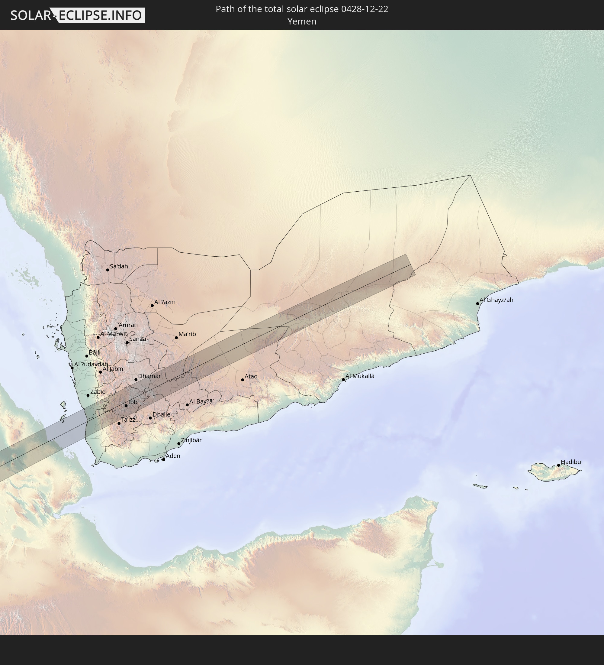 Yemen
Yemen
In den folgenden Ländern ist die Sonnenfinsternis partiell zu sehen
 Russia
 Chile
Chile
 Colombia
 Peru
Peru
 Brazil
 Argentina
 Venezuela
 Bolivia
 Anguilla
 Collectivity of Saint Martin
 Saint Barthélemy
 Saint Kitts and Nevis
 Paraguay
 Antigua and Barbuda
 Montserrat
 Trinidad and Tobago
 Guadeloupe
 Grenada
 Dominica
 Saint Vincent and the Grenadines
 Guyana
 Martinique
 Saint Lucia
 Barbados
 Uruguay
 Suriname
 French Guiana
 Cabo Verde
 Senegal
 Mauritania
 The Gambia
 Guinea-Bissau
 Guinea
 Saint Helena, Ascension and Tristan da Cunha
 Sierra Leone
 Mali
Mali
 Liberia
 Algeria
 Ivory Coast
 Burkina Faso
 Ghana
Ghana
 Togo
Togo
 Niger
Niger
 Benin
Benin
 Nigeria
 Equatorial Guinea
 São Tomé and Príncipe
 Italy
Italy
 Tunisia
 Cameroon
 Gabon
Gabon
 Libya
Libya
 Republic of the Congo
 Angola
 Namibia
 Democratic Republic of the Congo
 Chad
Chad
 Malta
Malta
 Central African Republic
 South Africa
 Albania
 Greece
 Botswana
 Romania
 Republic of Macedonia
 Sudan
Sudan
 Zambia
 Ukraine
 Bulgaria
 Egypt
Egypt
 Zimbabwe
 Turkey
 Lesotho
 Rwanda
 Burundi
 Tanzania
 Uganda
 Mozambique
 Swaziland
 Cyprus
 Malawi
 Ethiopia
 Kenya
Kenya
 State of Palestine
 Israel
 Saudi Arabia
 Jordan
 Lebanon
 Syria
Syria
 Eritrea
 Iraq
Iraq
 French Southern and Antarctic Lands
 Somalia
 Djibouti
 Yemen
Yemen
 Madagascar
 Comoros
 Mayotte
 Seychelles
 Mauritius
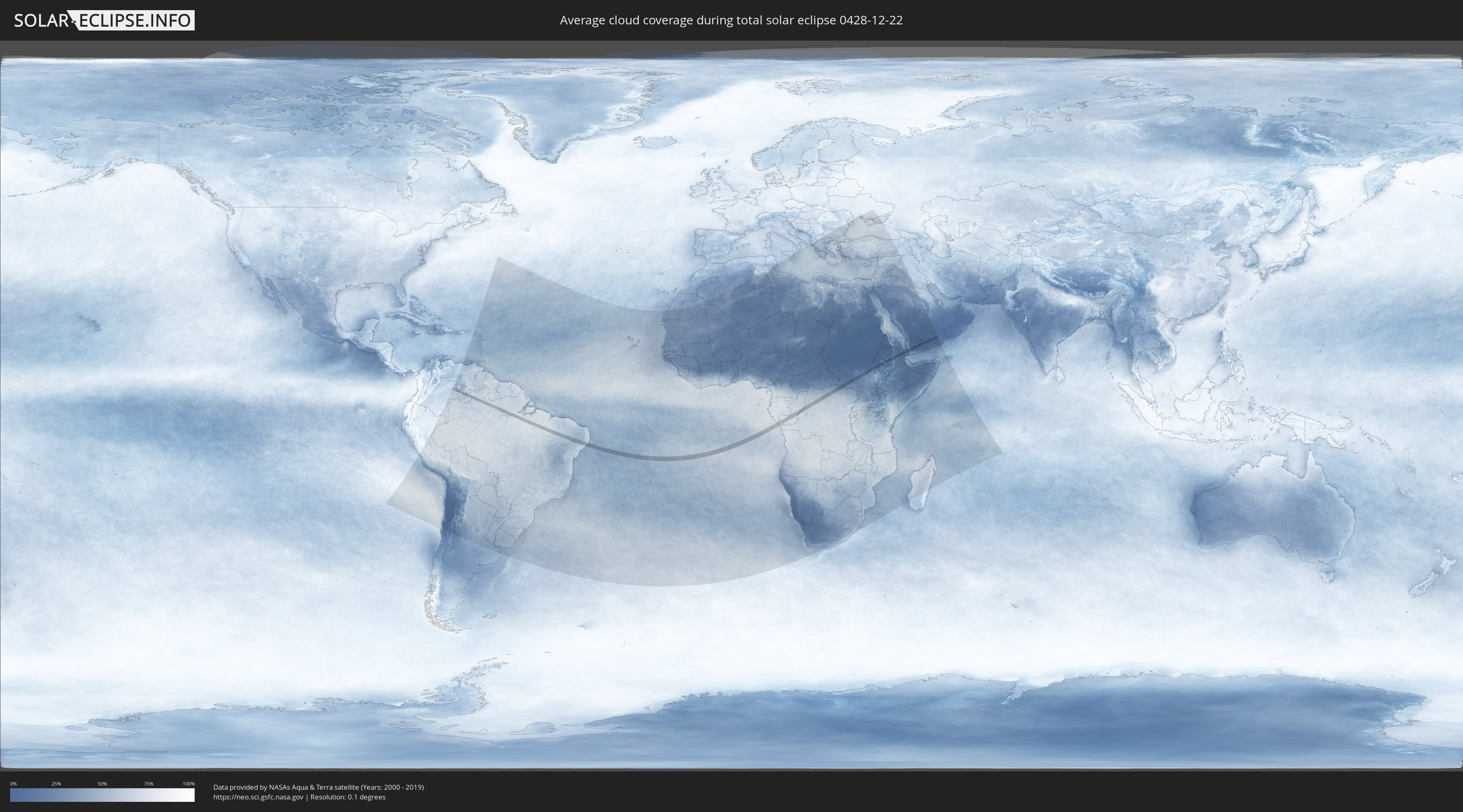
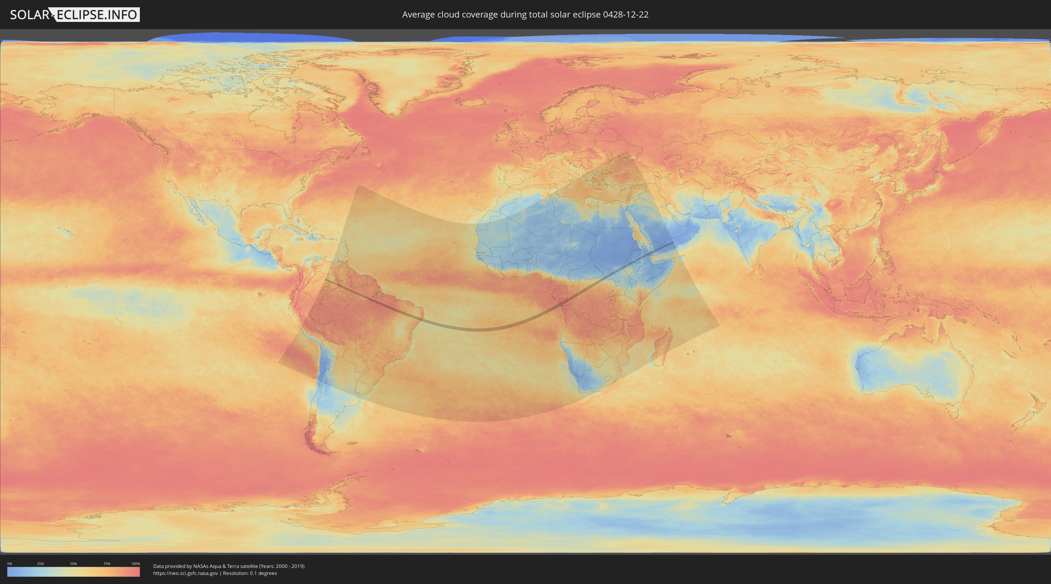
How will be the weather during the total solar eclipse on 12/22/0428?
Where is the best place to see the total solar eclipse of 12/22/0428?
The following maps show the average cloud coverage for the day of the total solar eclipse.
With the help of these maps, it is possible to find the place along the eclipse path, which has the best
chance of a cloudless sky.
Nevertheless, you should consider local circumstances and inform about the weather of your chosen
observation site.
The data is provided by NASAs satellites
AQUA and TERRA.
The cloud maps are averaged over a period of 19 years (2000 - 2019).
Detailed country maps
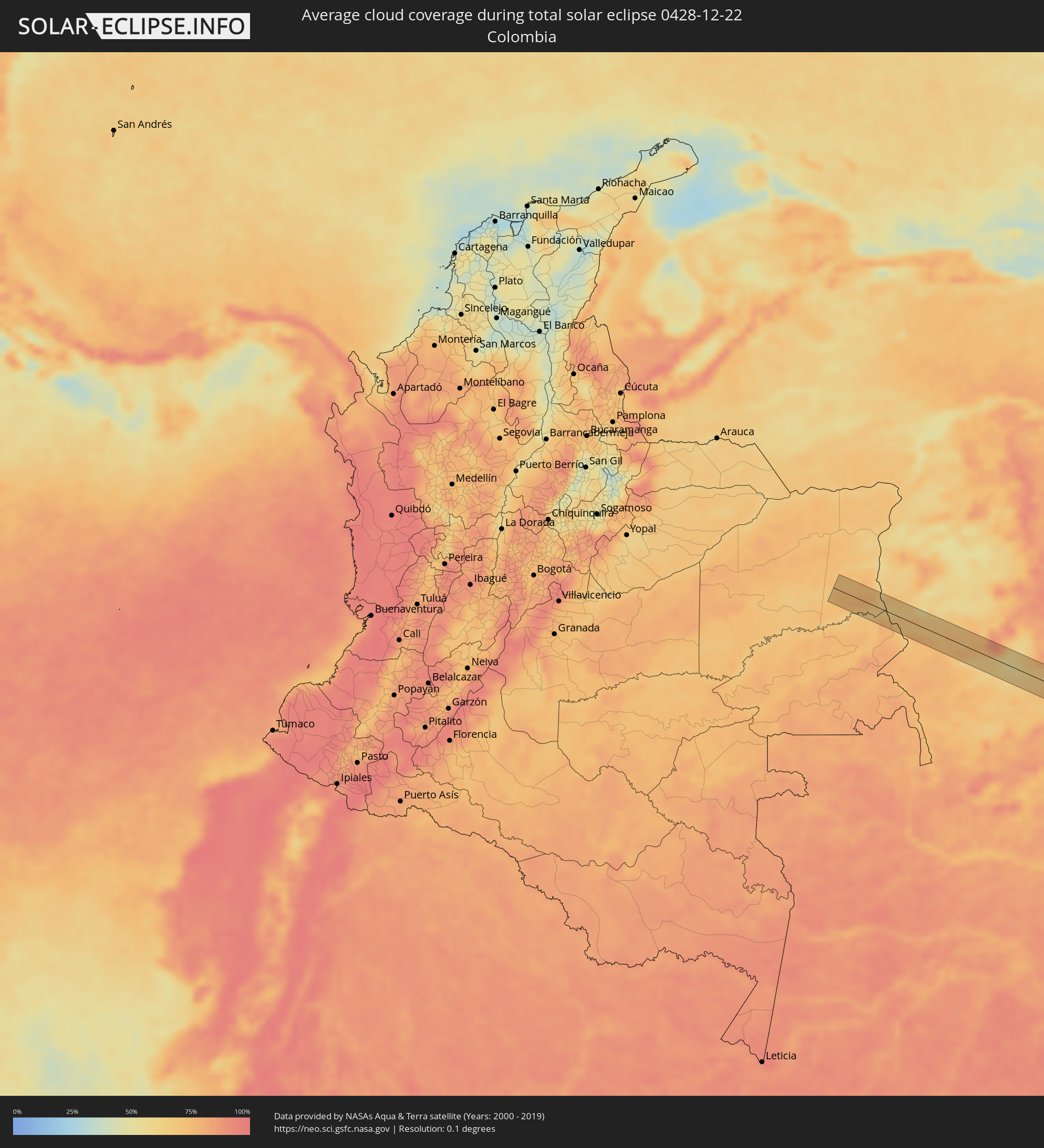 Colombia
 Brazil
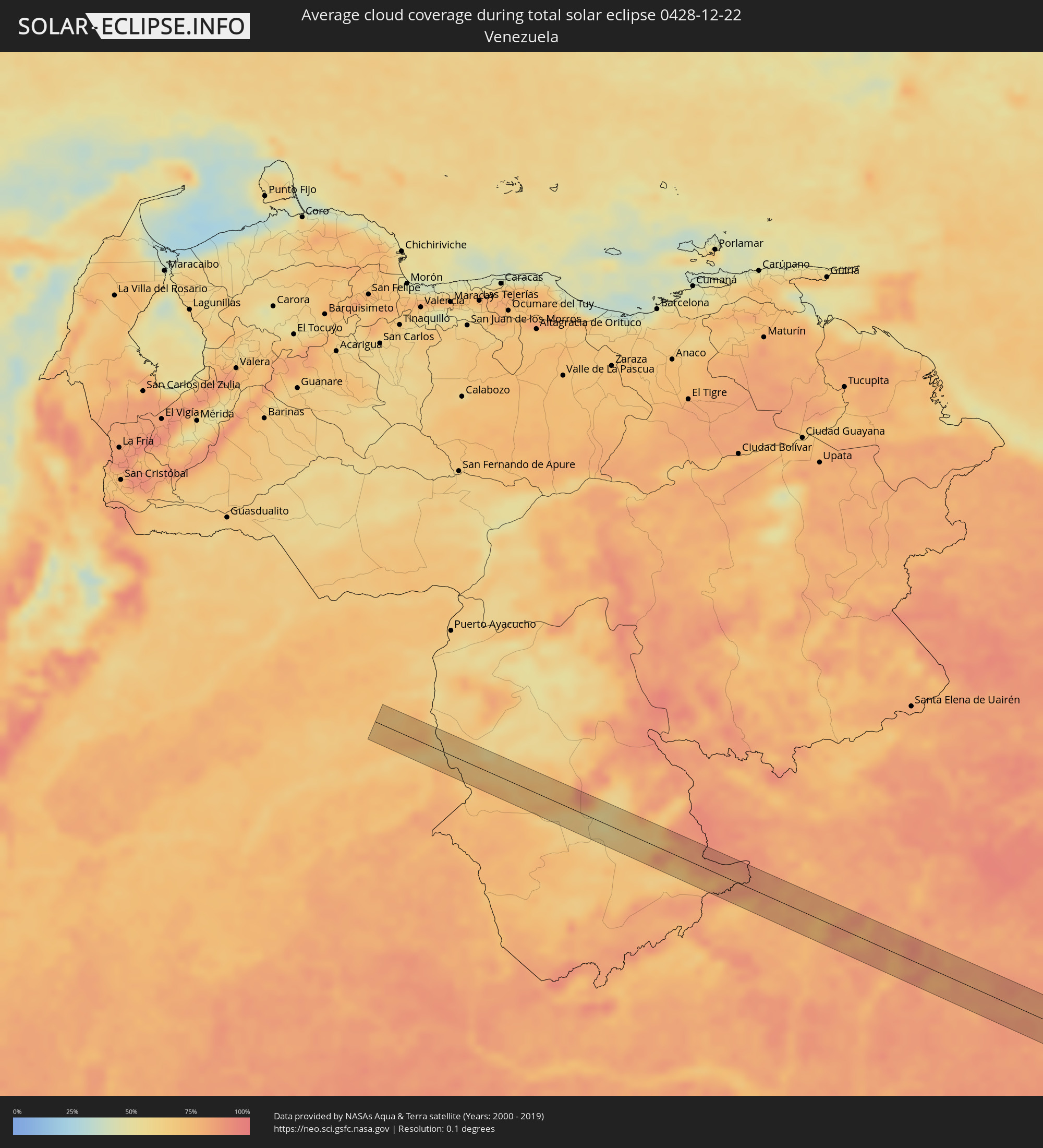 Venezuela
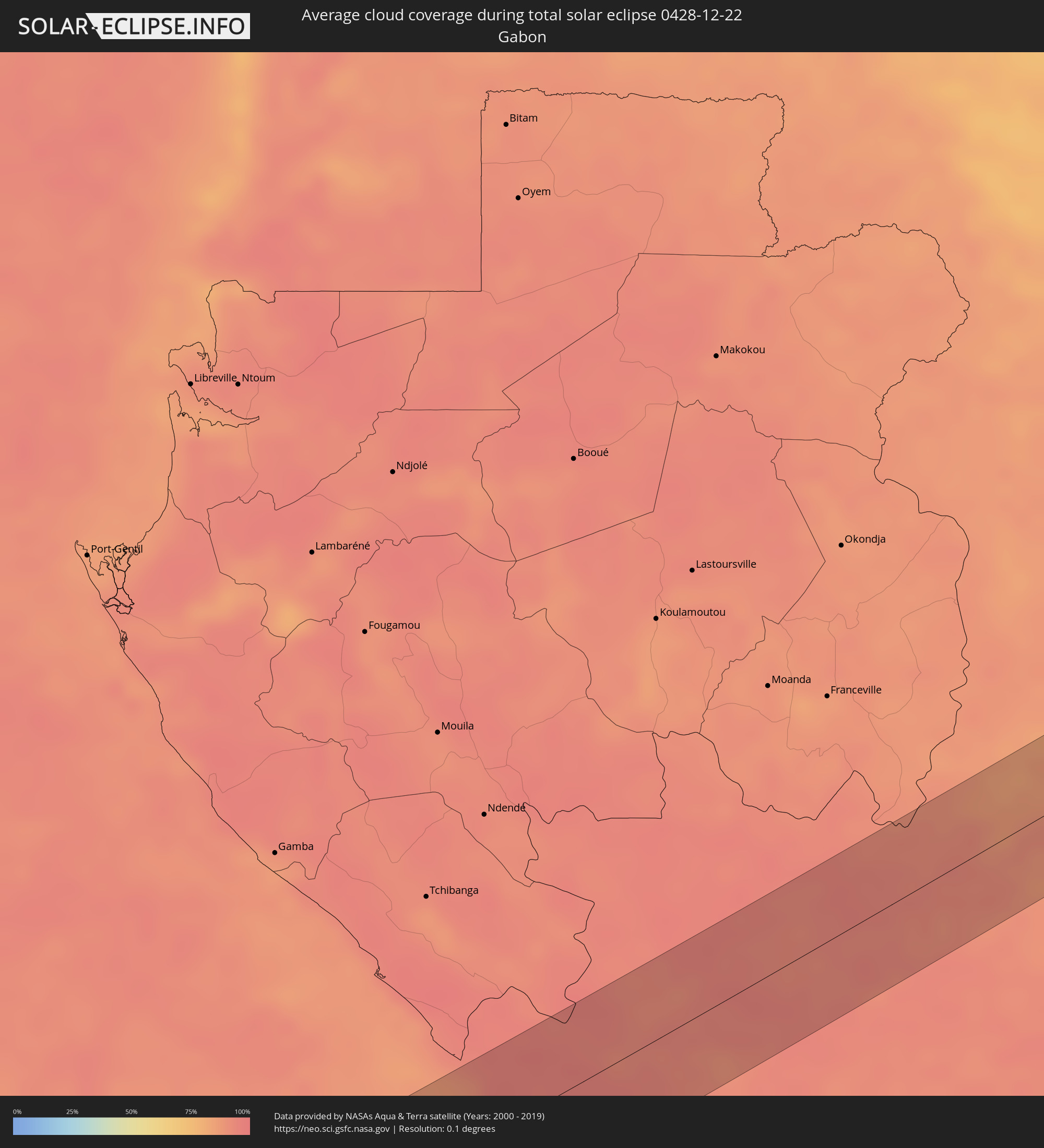 Gabon
Gabon
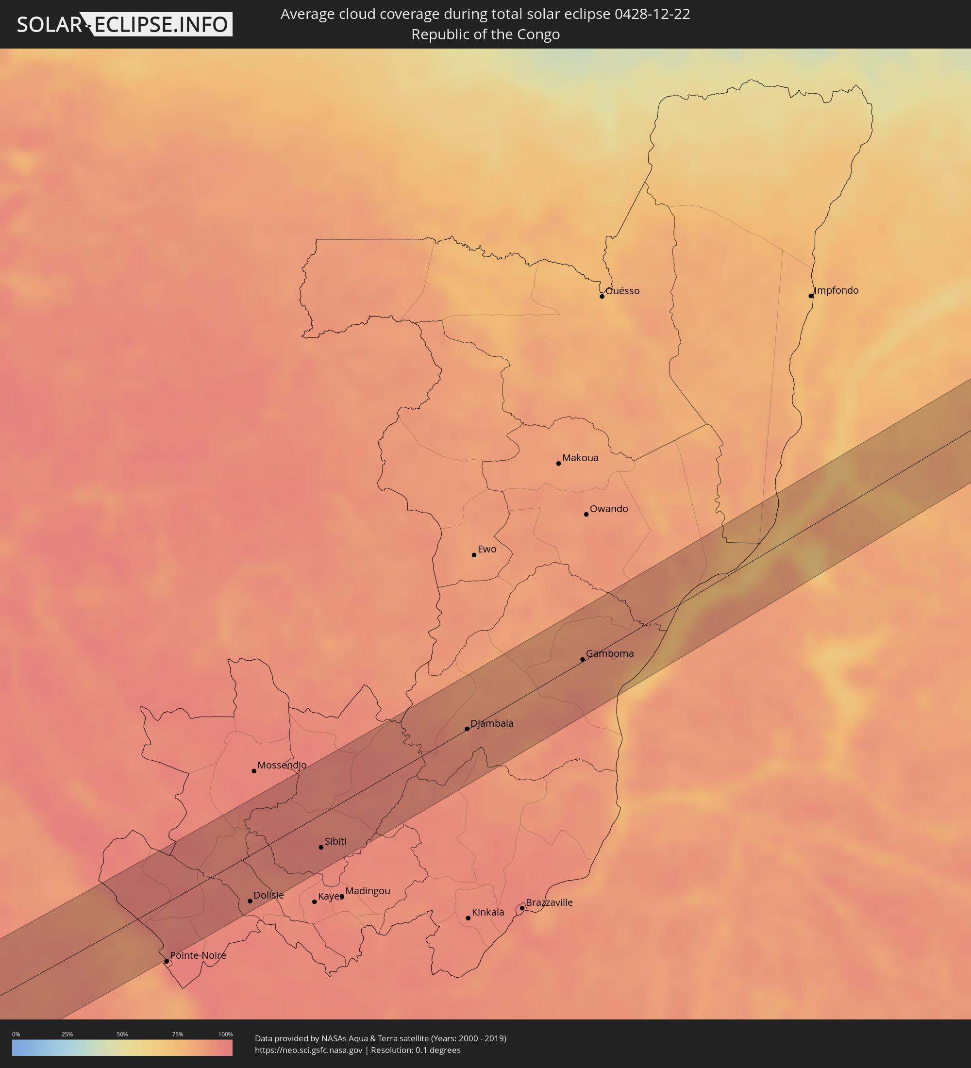 Republic of the Congo
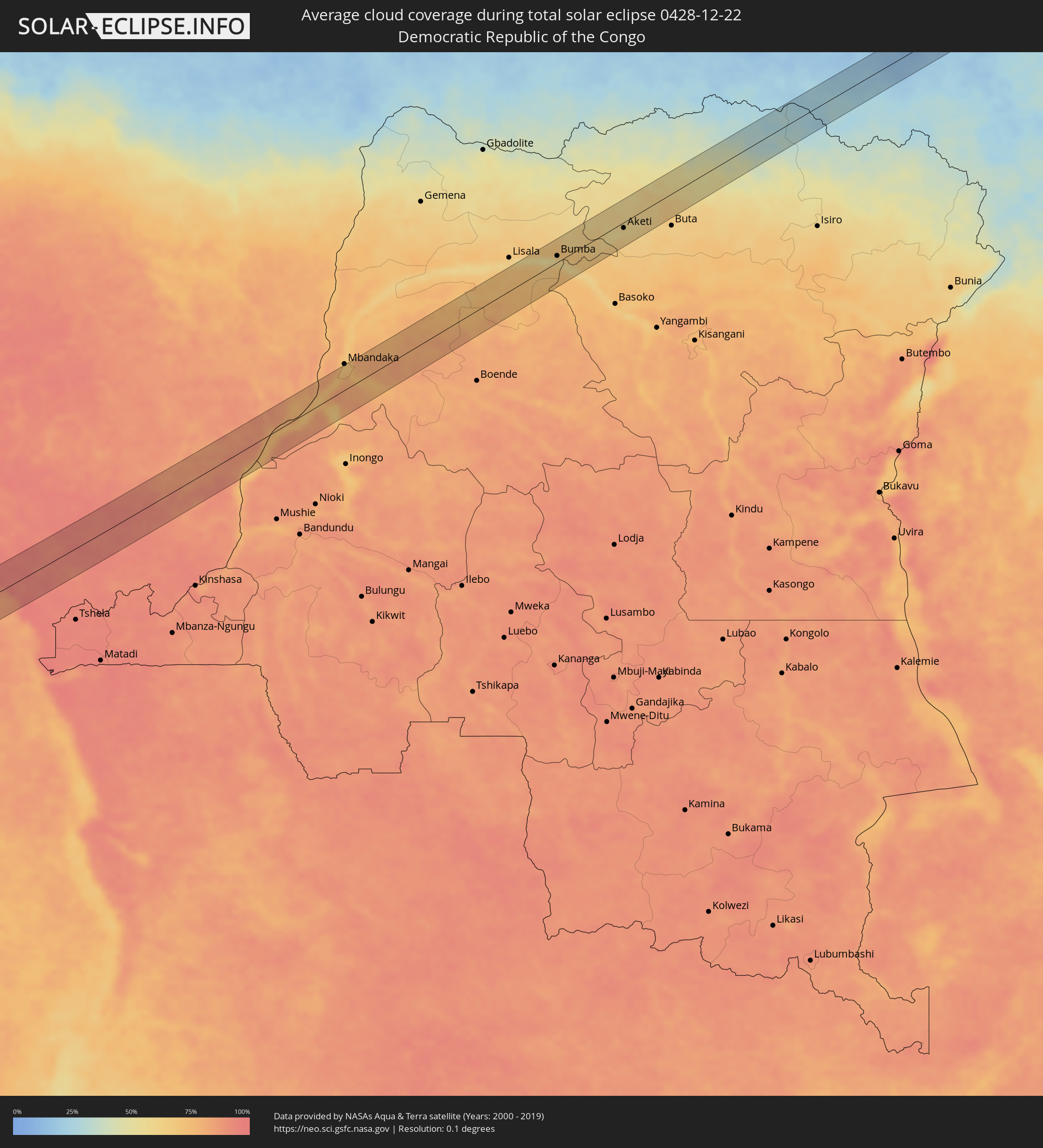 Democratic Republic of the Congo
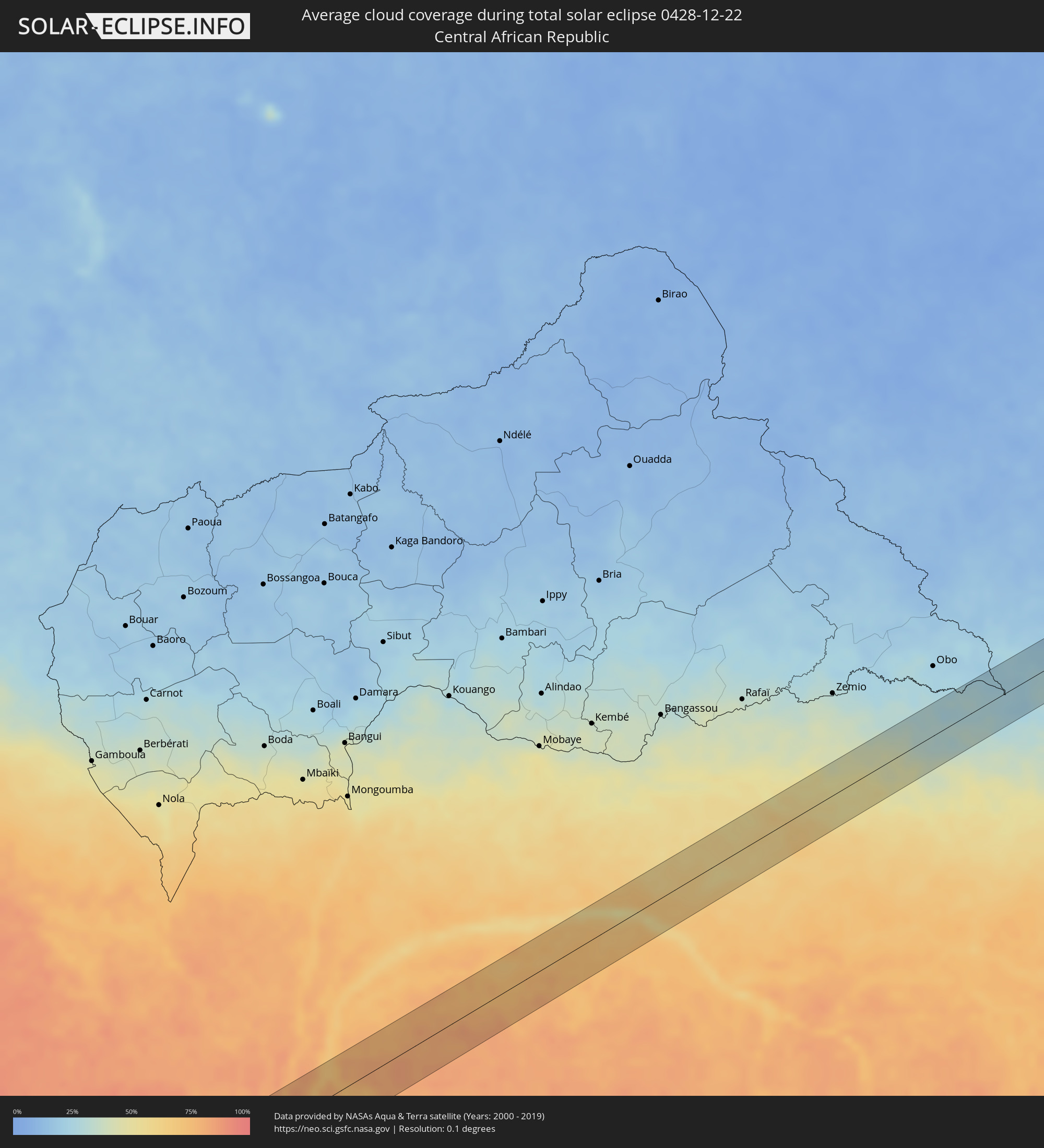 Central African Republic
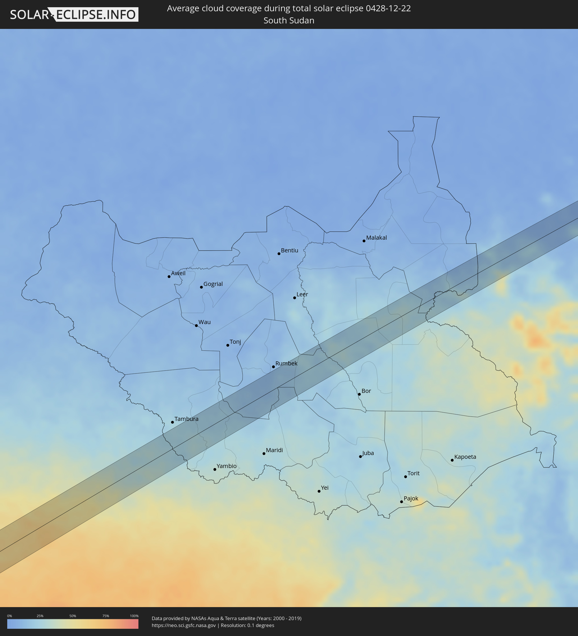 South Sudan
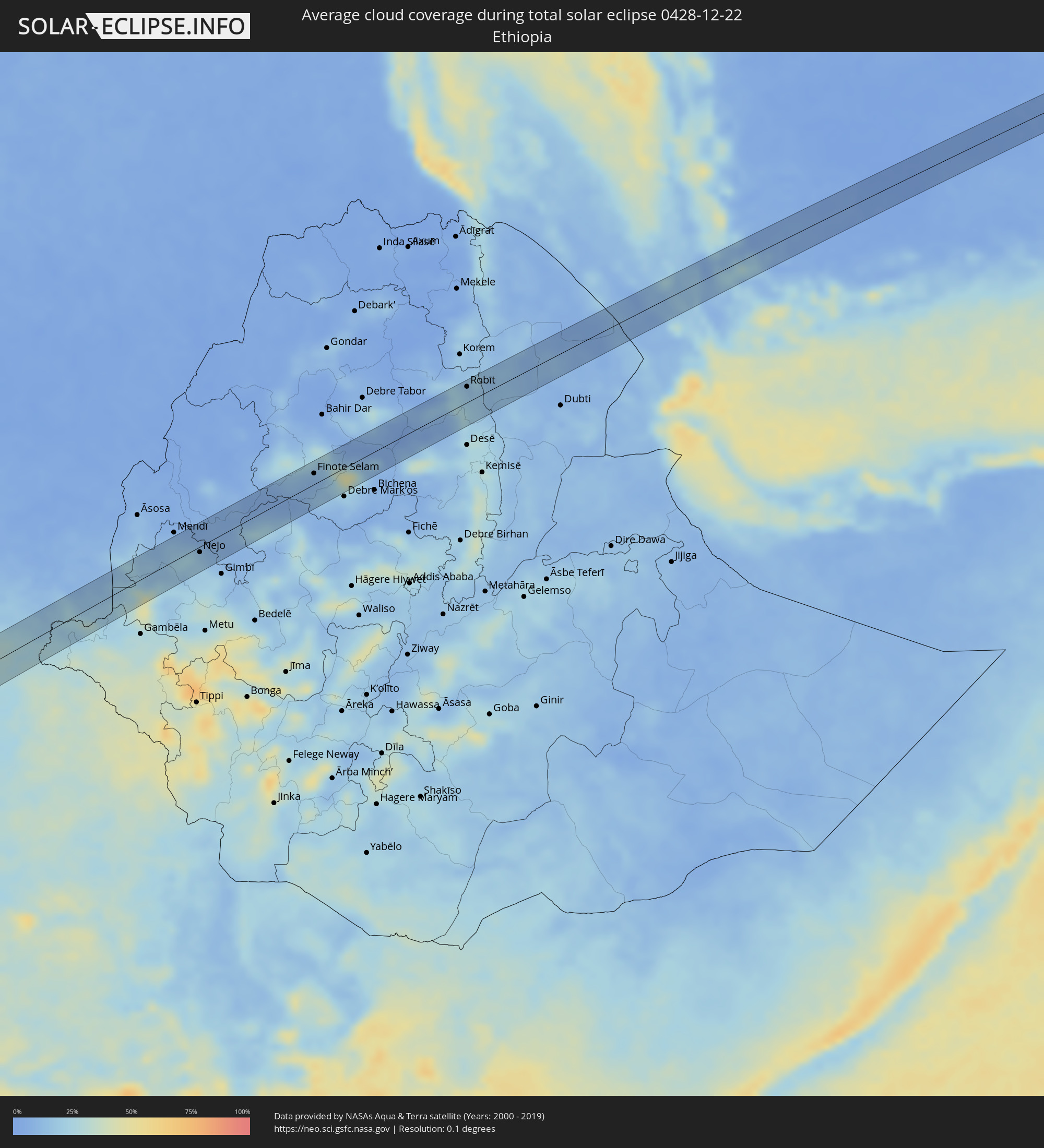 Ethiopia
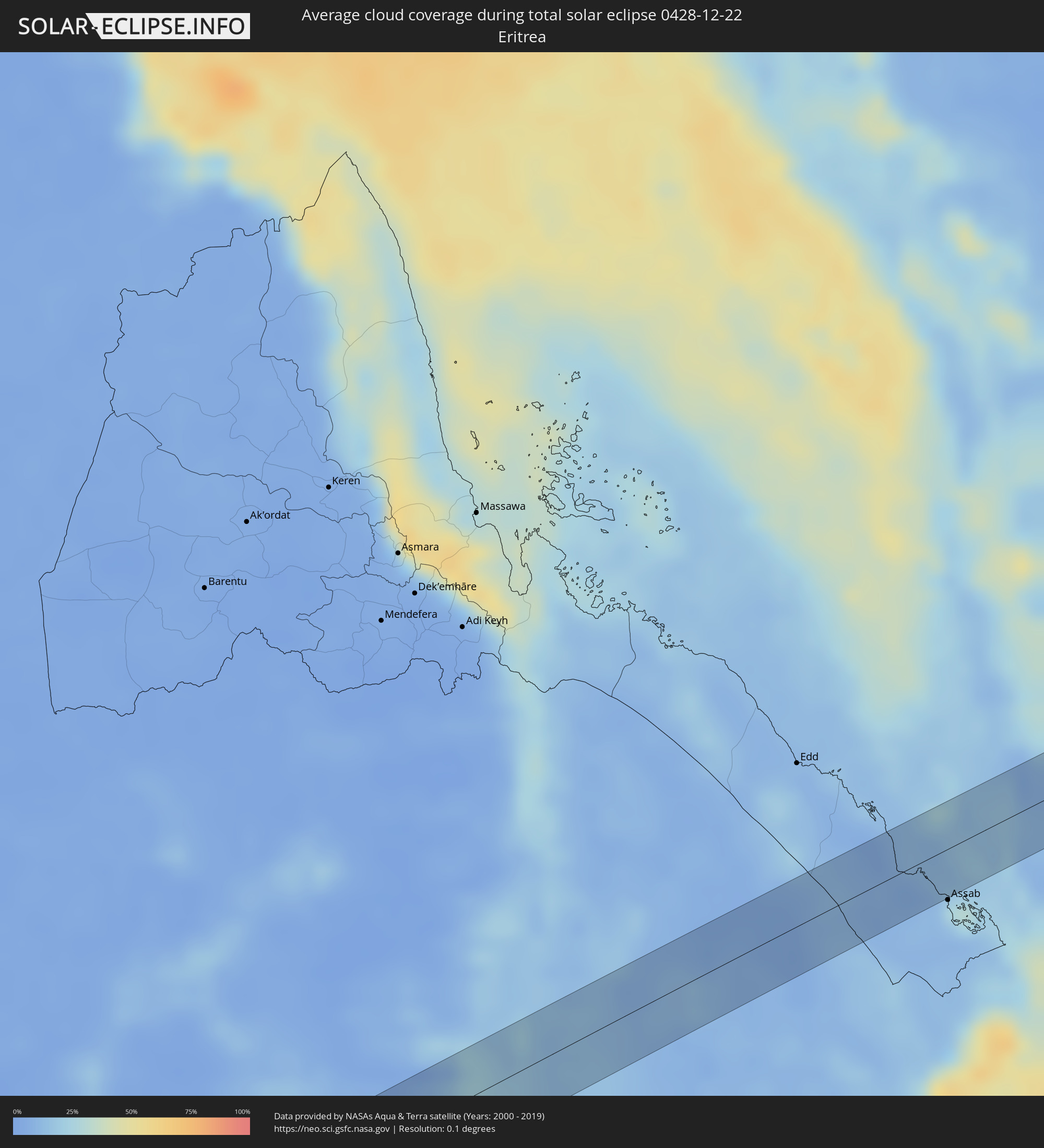 Eritrea
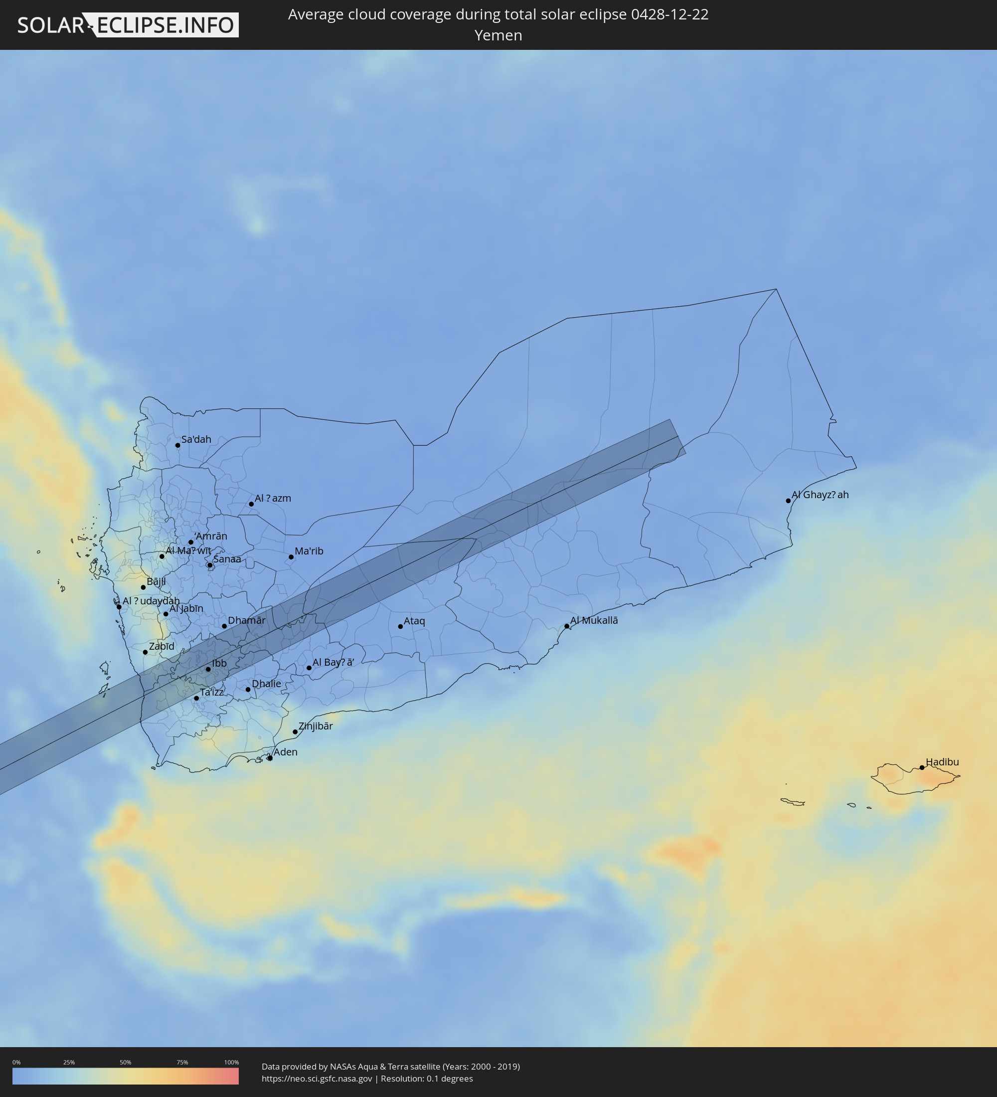 Yemen
Yemen
Cities inside the path of the eclipse
The following table shows all locations with a population of more than 5,000 inside the eclipse path. Cities which have more than 100,000 inhabitants are marked bold. A click at the locations opens a detailed map.
| City | Type | Eclipse duration | Local time of max. eclipse | Distance to central line | Ø Cloud coverage |
|
Inírida, Guainía
|
total | - | 05:49:33 UTC-04:56 | 21 km | 70% |
|
Alenquer, Pará
|
total | - | 07:36:07 UTC-03:13 | 15 km | 83% |
|
Monte Alegre, Pará
|
total | - | 07:36:31 UTC-03:13 | 8 km | 79% |
|
Altamira, Pará
|
total | - | 07:37:58 UTC-03:13 | 31 km | 92% |
|
Tucuruí, Pará
|
total | - | 07:40:00 UTC-03:13 | 23 km | 88% |
|
Grajaú, Maranhão
|
total | - | 08:23:46 UTC-02:34 | 35 km | 92% |
|
Barra do Corda, Maranhão
|
total | - | 08:24:36 UTC-02:34 | 35 km | 91% |
|
Colinas, Maranhão
|
total | - | 08:25:51 UTC-02:34 | 23 km | 89% |
|
São João dos Patos, Maranhão
|
total | - | 08:26:38 UTC-02:34 | 3 km | 85% |
|
Floriano, Piauí
|
total | - | 08:27:32 UTC-02:34 | 4 km | 77% |
|
Oeiras, Piauí
|
total | - | 08:28:44 UTC-02:34 | 6 km | 74% |
|
Picos, Piauí
|
total | - | 08:29:36 UTC-02:34 | 27 km | 80% |
|
Araripina, Pernambuco
|
total | - | 08:45:28 UTC-02:19 | 13 km | 71% |
|
Trindade, Pernambuco
|
total | - | 08:45:52 UTC-02:19 | 3 km | 68% |
|
Ipubi, Pernambuco
|
total | - | 08:45:59 UTC-02:19 | 19 km | 69% |
|
Ouricuri, Pernambuco
|
total | - | 08:46:10 UTC-02:19 | 3 km | 67% |
|
Cabrobó, Pernambuco
|
total | - | 08:47:30 UTC-02:19 | 39 km | 56% |
|
Salgueiro, Pernambuco
|
total | - | 08:47:37 UTC-02:19 | 14 km | 66% |
|
Floresta, Pernambuco
|
total | - | 08:48:37 UTC-02:19 | 20 km | 57% |
|
Itaíba, Pernambuco
|
total | - | 08:50:31 UTC-02:19 | 14 km | 61% |
|
Buíque, Pernambuco
|
total | - | 08:50:49 UTC-02:19 | 30 km | 59% |
|
Águas Belas, Pernambuco
|
total | - | 08:51:03 UTC-02:19 | 21 km | 67% |
|
Bom Conselho, Pernambuco
|
total | - | 08:51:48 UTC-02:19 | 11 km | 66% |
|
Garanhuns, Pernambuco
|
total | - | 08:51:59 UTC-02:19 | 26 km | 66% |
|
Viçosa, Alagoas
|
total | - | 08:38:12 UTC-02:34 | 17 km | 79% |
|
União dos Palmares, Alagoas
|
total | - | 08:38:28 UTC-02:34 | 13 km | 77% |
|
Atalaia, Alagoas
|
total | - | 08:38:36 UTC-02:34 | 23 km | 77% |
|
Murici, Alagoas
|
total | - | 08:38:40 UTC-02:34 | 1 km | 80% |
|
Marechal Deodoro, Alagoas
|
total | - | 08:38:54 UTC-02:34 | 40 km | 60% |
|
Rio Largo, Alagoas
|
total | - | 08:38:53 UTC-02:34 | 14 km | 76% |
|
Satuba, Alagoas
|
total | - | 08:38:58 UTC-02:34 | 22 km | 62% |
|
Maceió, Alagoas
|
total | - | 08:39:09 UTC-02:34 | 30 km | 47% |
|
São Luís do Quitunde, Alagoas
|
total | - | 08:39:19 UTC-02:34 | 13 km | 73% |
|
Matriz de Camaragibe, Alagoas
|
total | - | 08:39:19 UTC-02:34 | 31 km | 73% |
|
Porto Calvo, Alagoas
|
total | - | 08:39:30 UTC-02:34 | 47 km | 76% |
|
Loango, Kouilou
|
total | - | 13:40:19 UTC+00:13 | 41 km | 90% |
|
Dolisie, Niari
|
total | - | 13:42:27 UTC+00:13 | 43 km | 93% |
|
Sibiti, Lékoumou
|
total | - | 13:44:16 UTC+00:13 | 31 km | 94% |
|
Djambala, Plateaux
|
total | - | 13:47:56 UTC+00:13 | 0 km | 91% |
|
Gamboma, Plateaux
|
total | - | 13:50:29 UTC+00:13 | 1 km | 87% |
|
Bolobo, Bandundu
|
total | - | 13:50:51 UTC+00:13 | 46 km | 73% |
|
Lukolela, Équateur
|
total | - | 13:53:23 UTC+00:13 | 5 km | 83% |
|
Bumba, Équateur
|
total | - | 14:03:28 UTC+00:13 | 12 km | 59% |
|
Aketi, Orientale
|
total | - | 16:02:11 UTC+02:10 | 11 km | 58% |
|
Nejo, Oromiya
|
total | - | 16:32:19 UTC+02:27 | 8 km | 18% |
|
Burē, Amhara
|
total | - | 16:33:29 UTC+02:27 | 27 km | 11% |
|
Finote Selam, Amhara
|
total | - | 16:33:34 UTC+02:27 | 16 km | 9% |
|
Debre Werk’, Amhara
|
total | - | 16:33:59 UTC+02:27 | 34 km | 9% |
|
Robīt, Amhara
|
total | - | 16:34:53 UTC+02:27 | 23 km | 20% |
|
Dhī as Sufāl, Ibb
|
total | - | 17:16:05 UTC+03:06 | 20 km | 16% |
|
Ibb, Ibb
|
total | - | 17:16:07 UTC+03:06 | 10 km | 13% |
|
Yarīm, Ibb
|
total | - | 17:16:11 UTC+03:06 | 14 km | 6% |