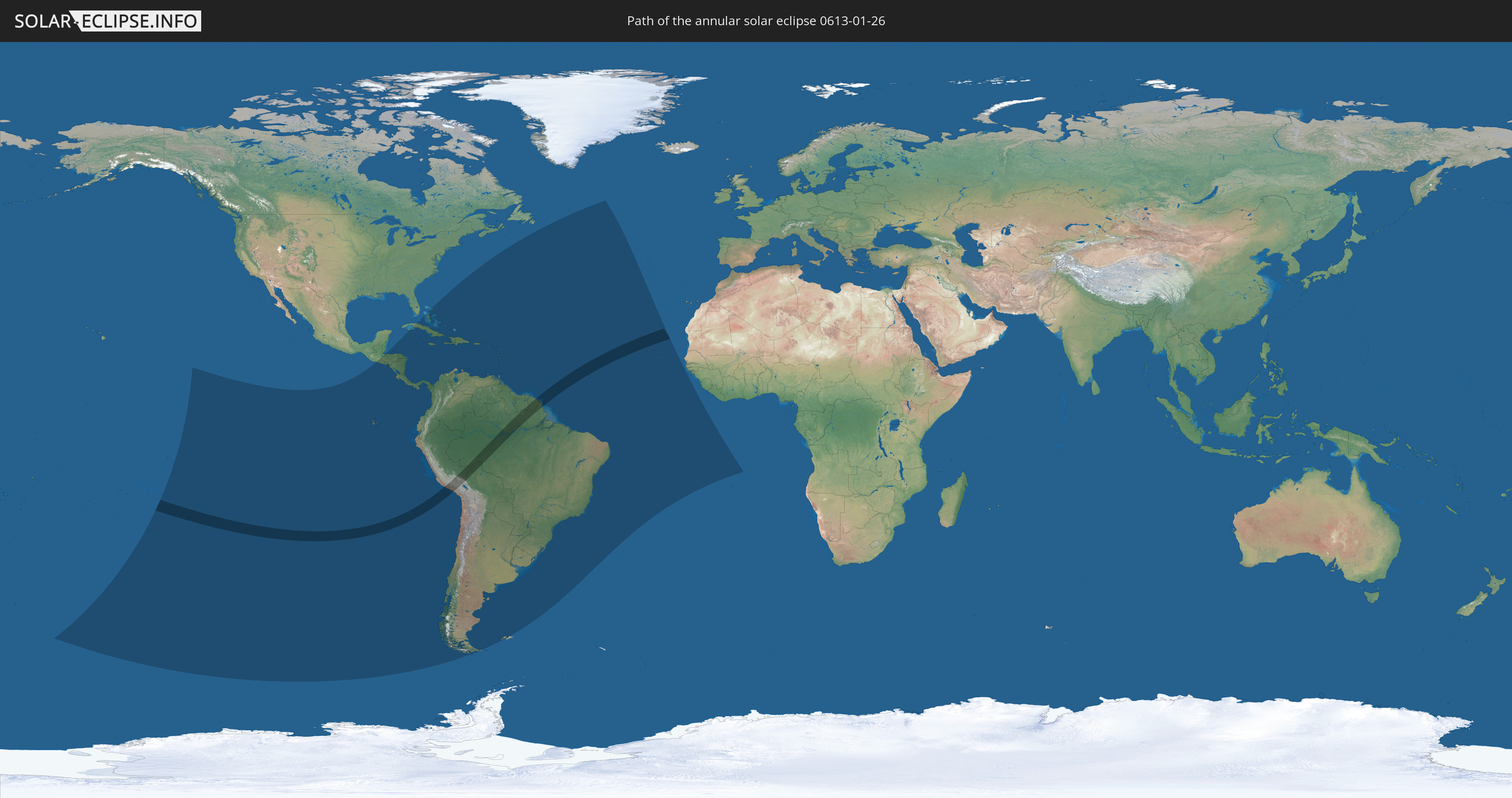
Annular solar eclipse of 01/26/0613
| Day of week: | Tuesday |
| Maximum duration of eclipse: | 07m35s |
| Maximum width of eclipse path: | 237 km |
| Saros cycle: | 89 |
| Coverage: | 93.6% |
| Magnitude: | 0.9363 |
| Gamma: | 0.003 |
Wo kann man die Sonnenfinsternis vom 01/26/0613 sehen?
Die Sonnenfinsternis am 01/26/0613 kann man in 52 Ländern als partielle Sonnenfinsternis beobachten.
Der Finsternispfad verläuft durch 8 Länder. Nur in diesen Ländern ist sie als annular Sonnenfinsternis zu sehen.
In den folgenden Ländern ist die Sonnenfinsternis annular zu sehen
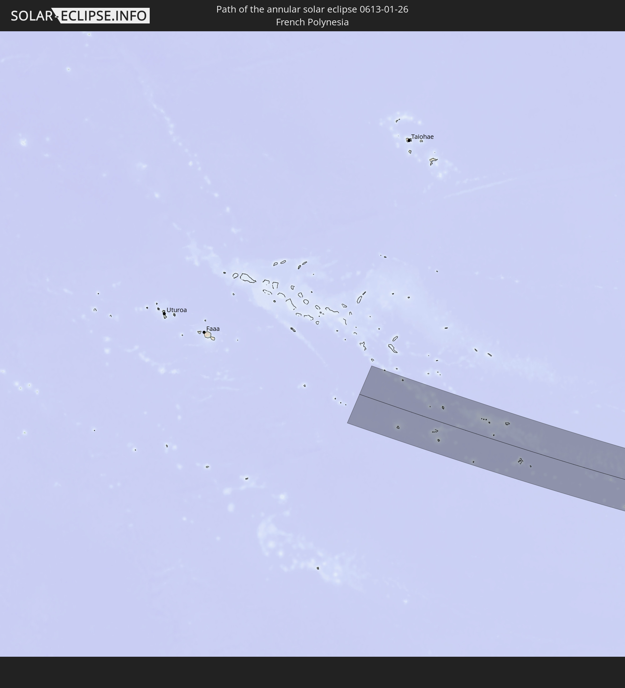 French Polynesia
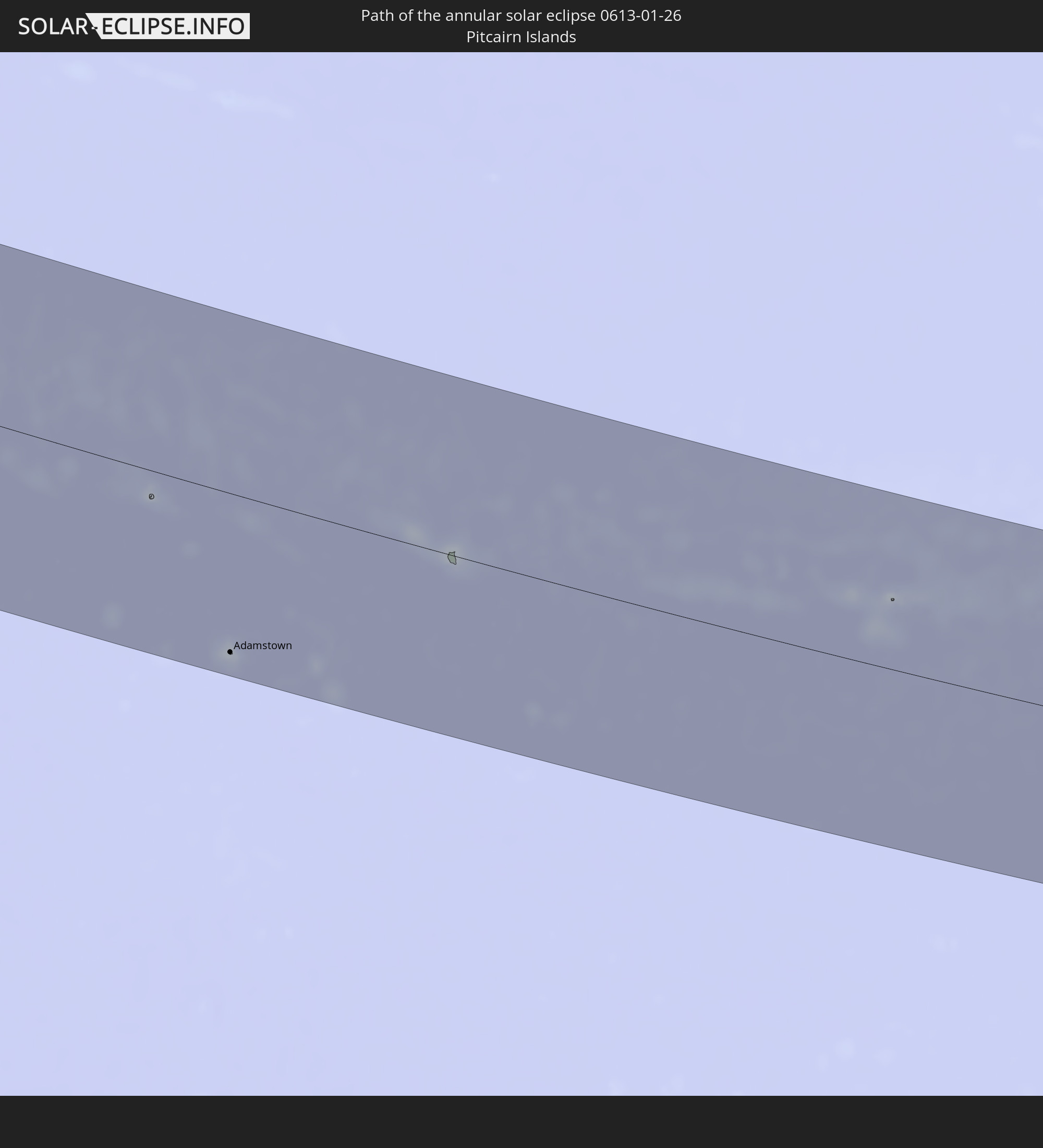 Pitcairn Islands
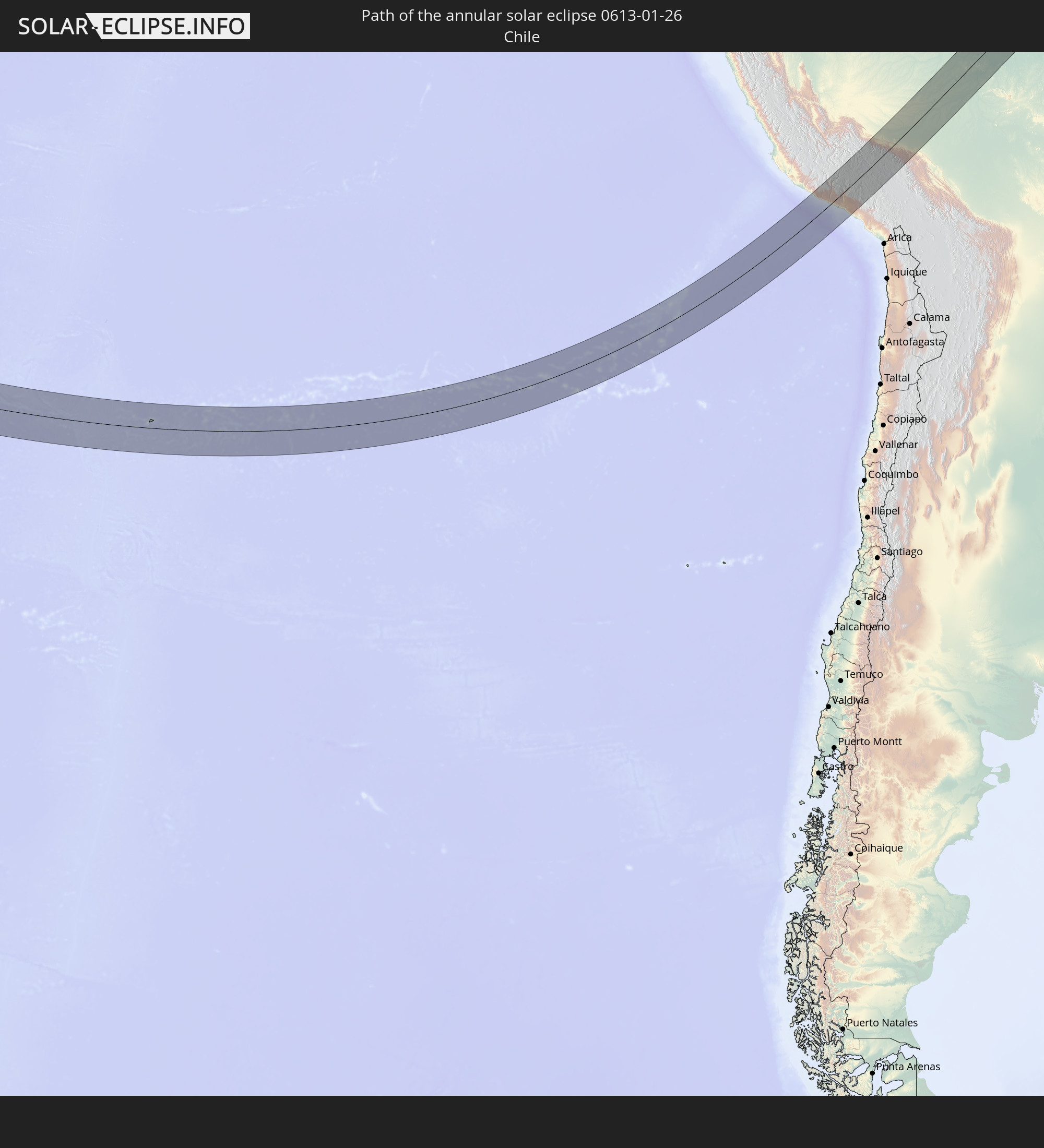 Chile
Chile
 Peru
Peru
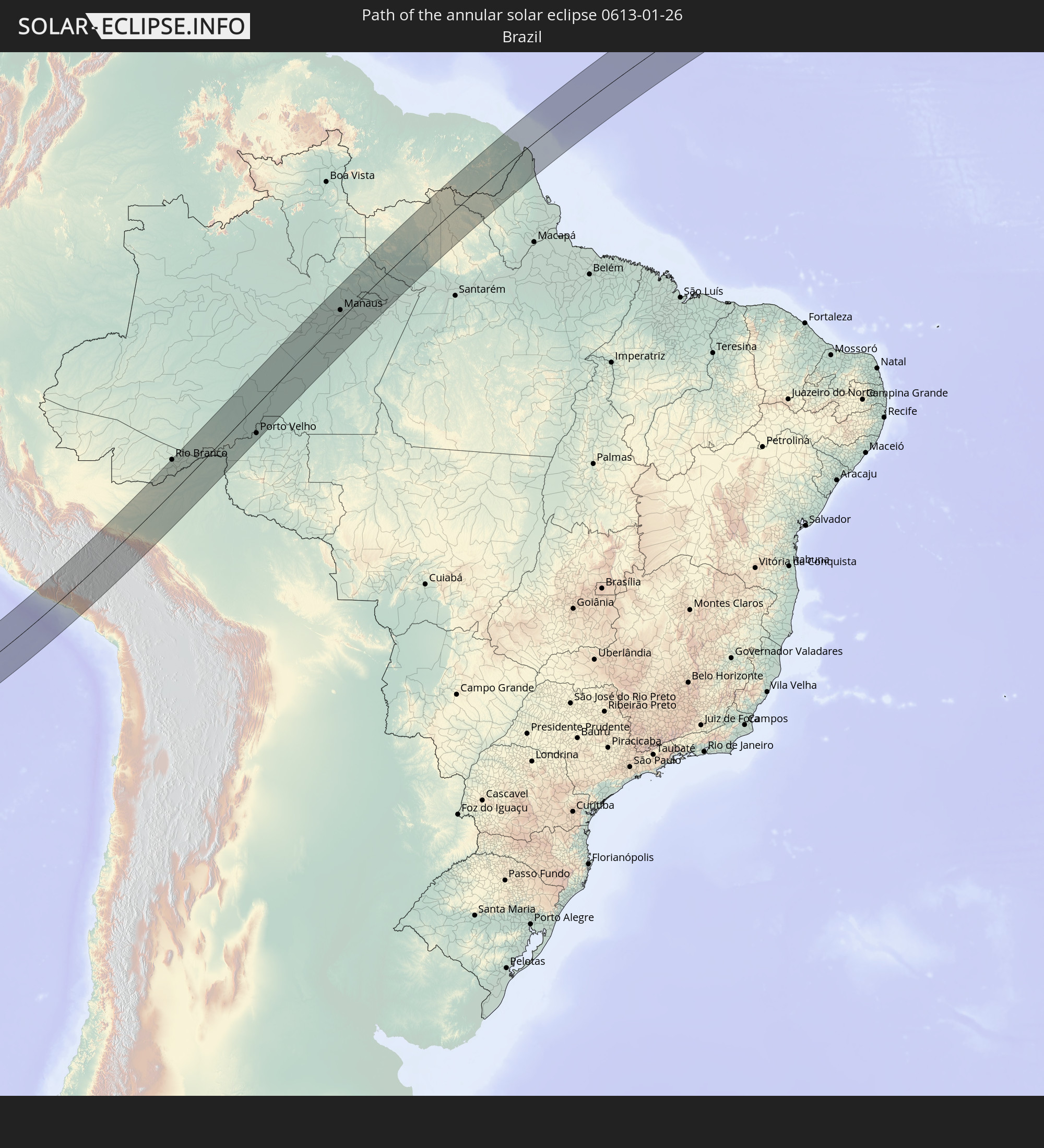 Brazil
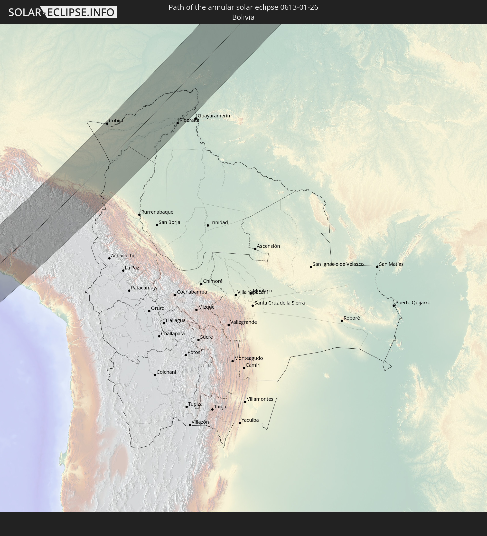 Bolivia
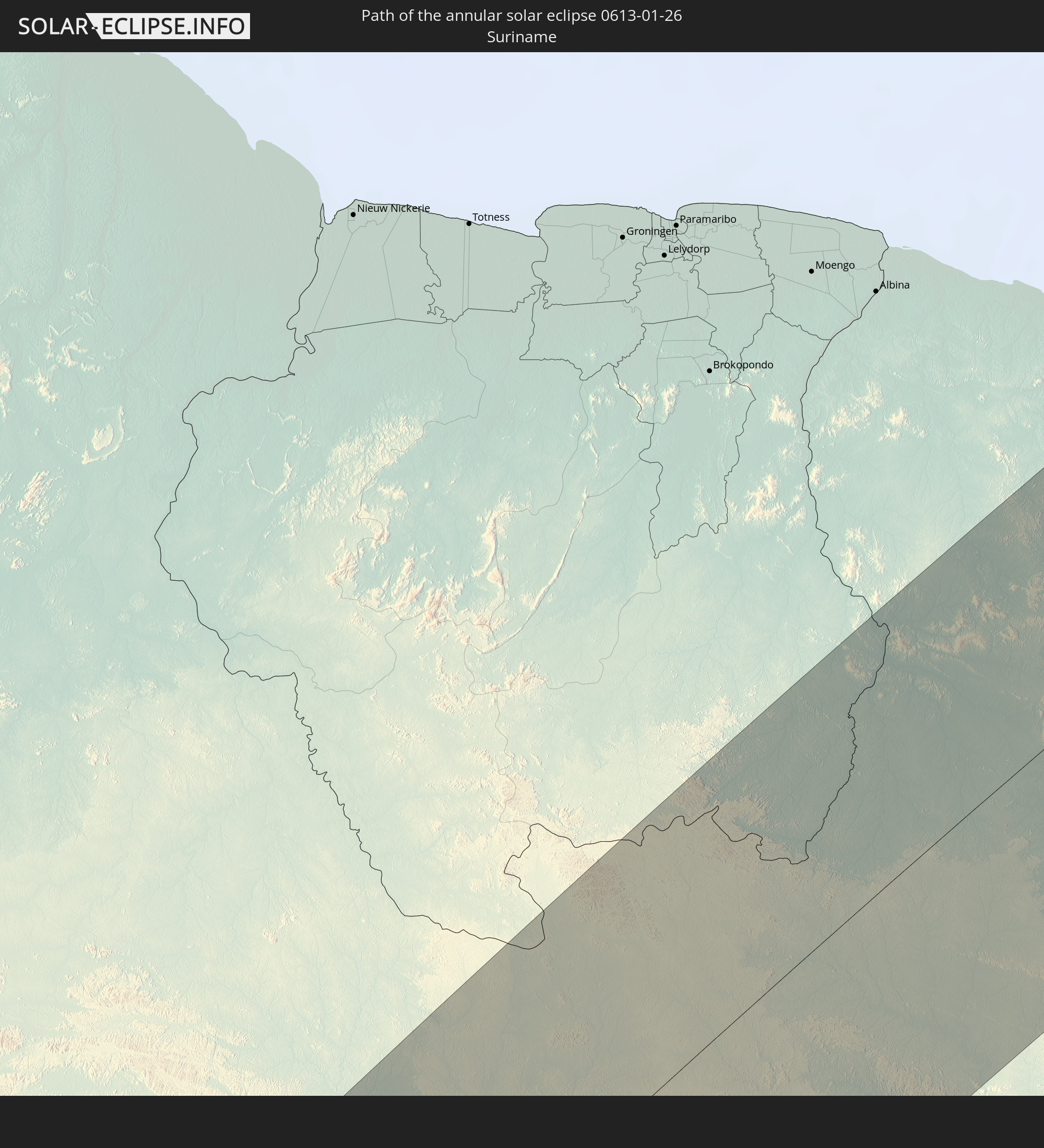 Suriname
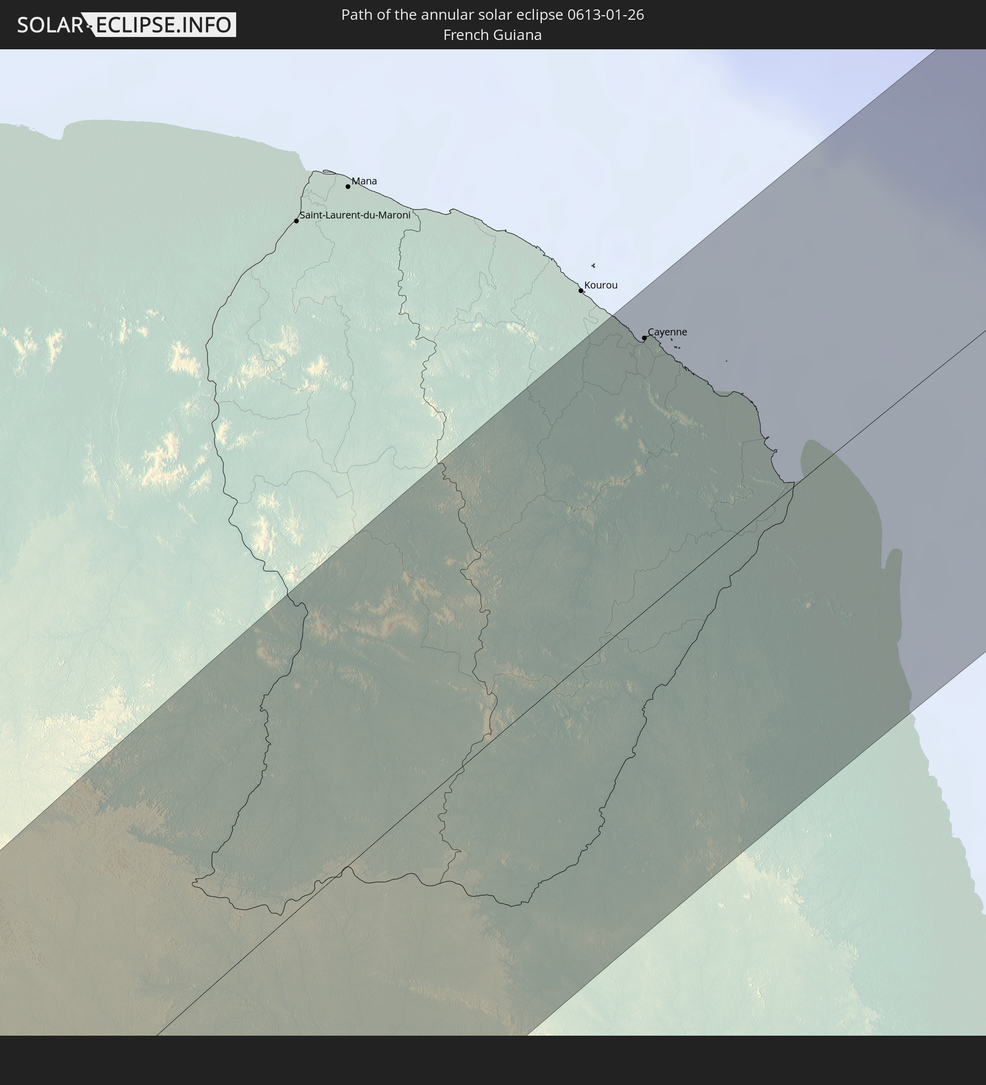 French Guiana
In den folgenden Ländern ist die Sonnenfinsternis partiell zu sehen
 United States Minor Outlying Islands
 French Polynesia
 Pitcairn Islands
 Chile
Chile
 Guatemala
 Ecuador
 El Salvador
 Honduras
 Nicaragua
 Costa Rica
 Cuba
Cuba
 Panama
 Colombia
 Cayman Islands
 Peru
Peru
 The Bahamas
 Jamaica
 Haiti
Haiti
 Brazil
 Argentina
 Venezuela
 Turks and Caicos Islands
 Dominican Republic
 Aruba
Aruba
 Bolivia
 Puerto Rico
 United States Virgin Islands
 Bermuda
 British Virgin Islands
 Anguilla
 Collectivity of Saint Martin
 Saint Barthélemy
 Saint Kitts and Nevis
 Paraguay
 Antigua and Barbuda
 Montserrat
 Trinidad and Tobago
 Guadeloupe
 Grenada
 Dominica
 Saint Vincent and the Grenadines
 Falkland Islands
 Guyana
 Martinique
 Saint Lucia
 Barbados
 Uruguay
 Suriname
 French Guiana
 Portugal
 Cabo Verde
 Saint Helena, Ascension and Tristan da Cunha
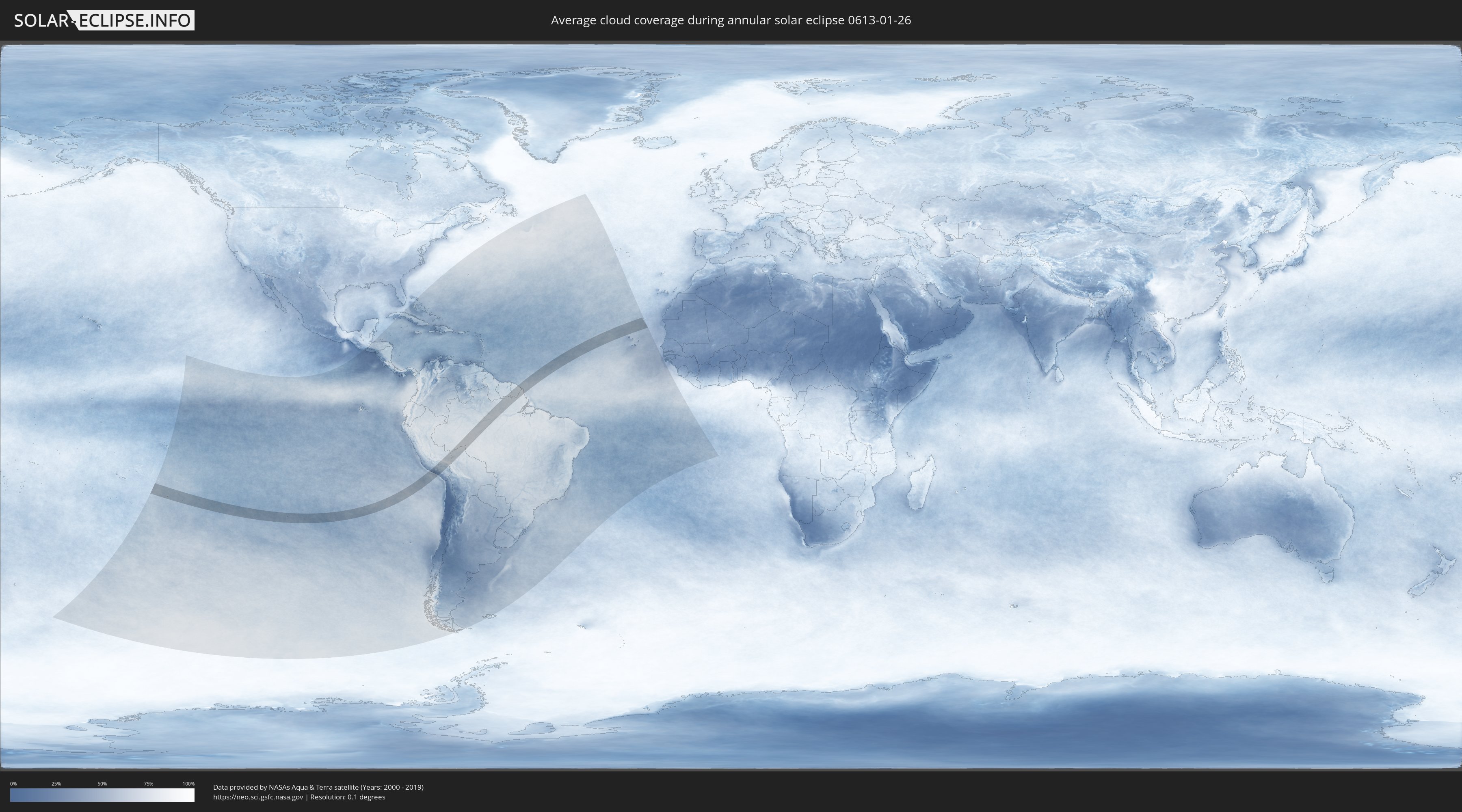
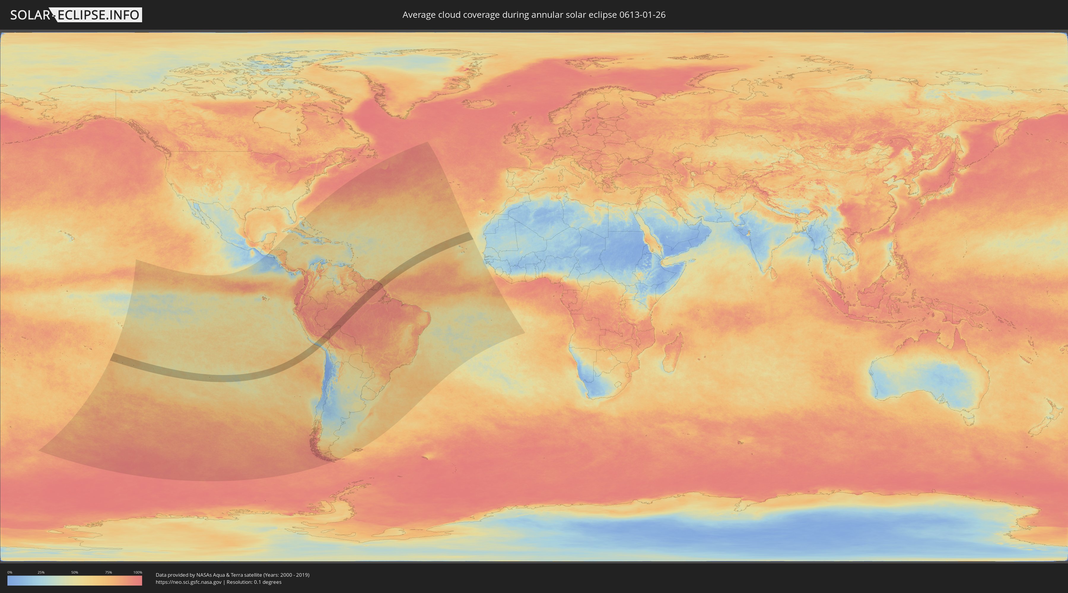
How will be the weather during the annular solar eclipse on 01/26/0613?
Where is the best place to see the annular solar eclipse of 01/26/0613?
The following maps show the average cloud coverage for the day of the annular solar eclipse.
With the help of these maps, it is possible to find the place along the eclipse path, which has the best
chance of a cloudless sky.
Nevertheless, you should consider local circumstances and inform about the weather of your chosen
observation site.
The data is provided by NASAs satellites
AQUA and TERRA.
The cloud maps are averaged over a period of 19 years (2000 - 2019).
Detailed country maps
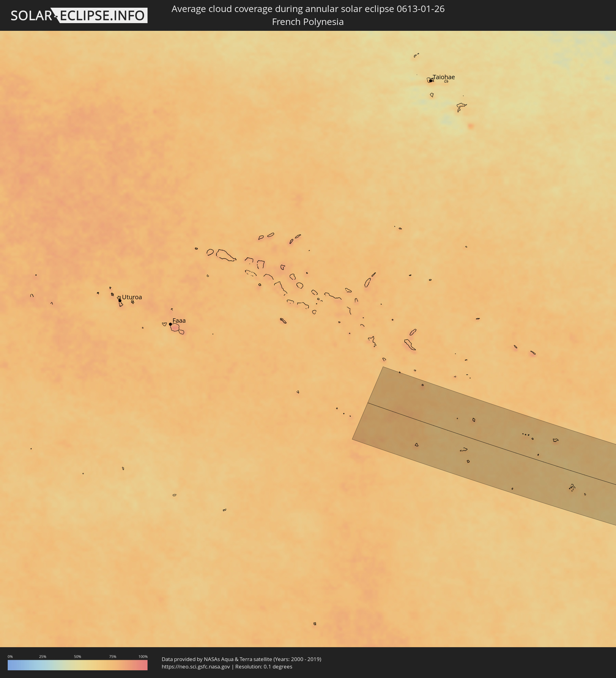 French Polynesia
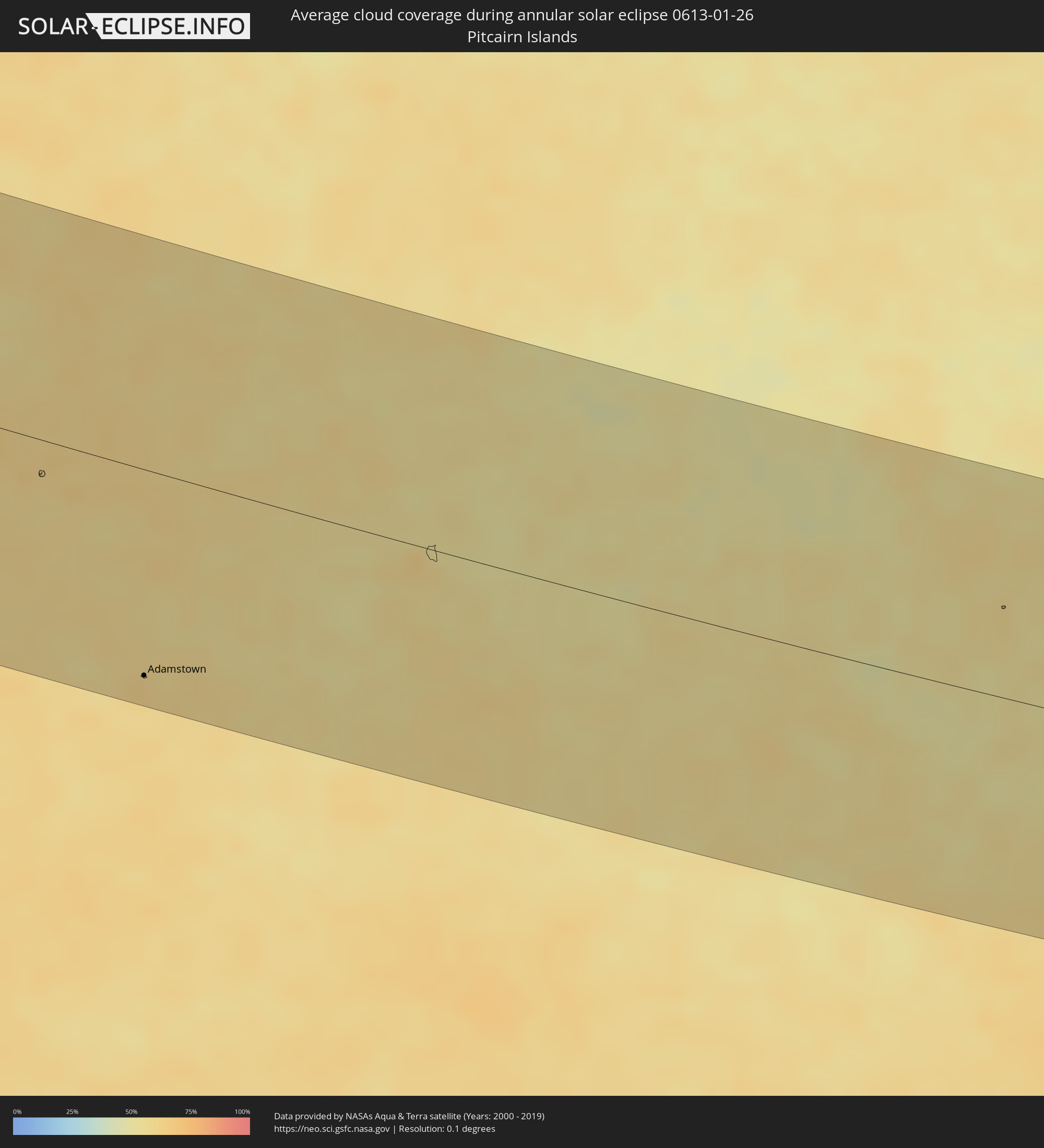 Pitcairn Islands
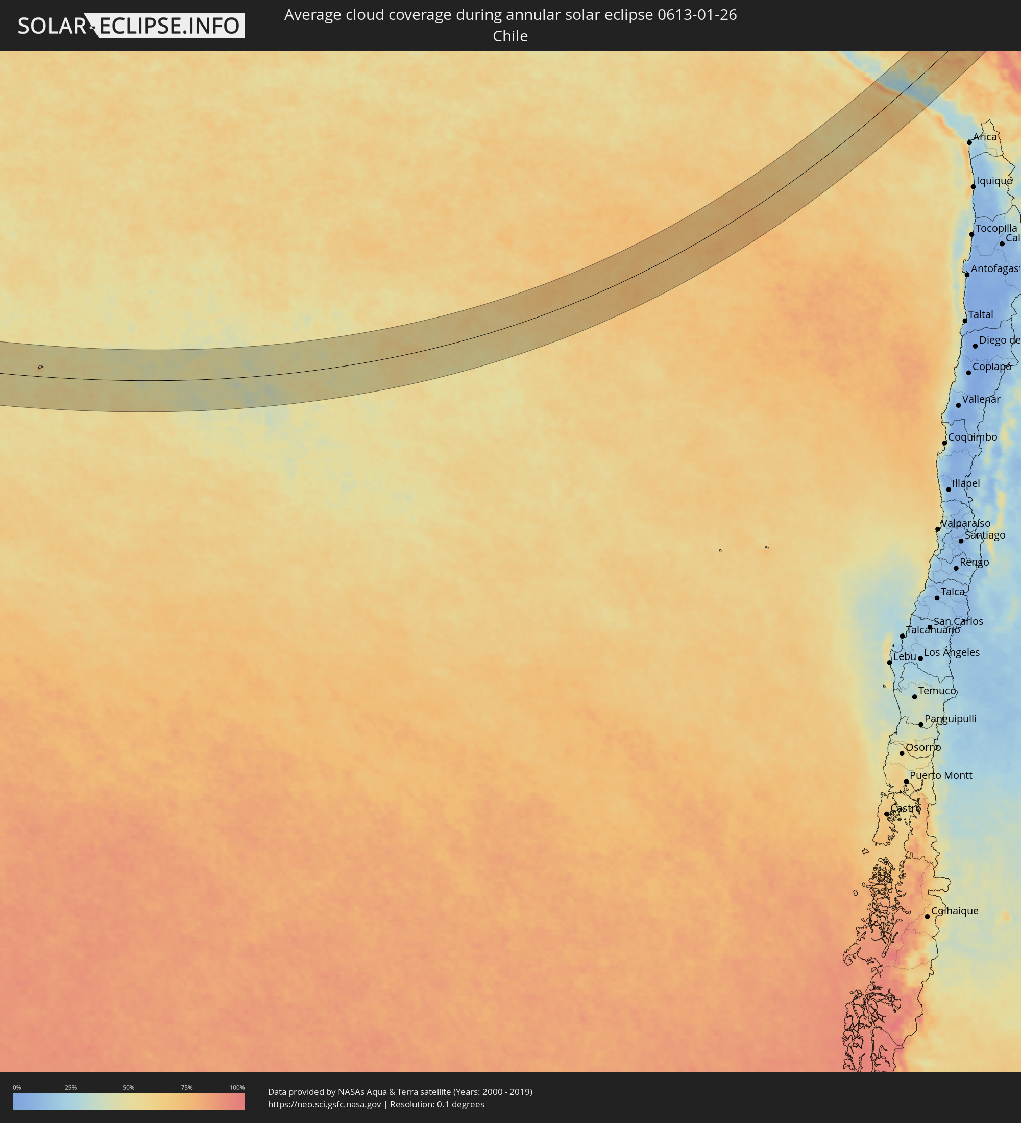 Chile
Chile
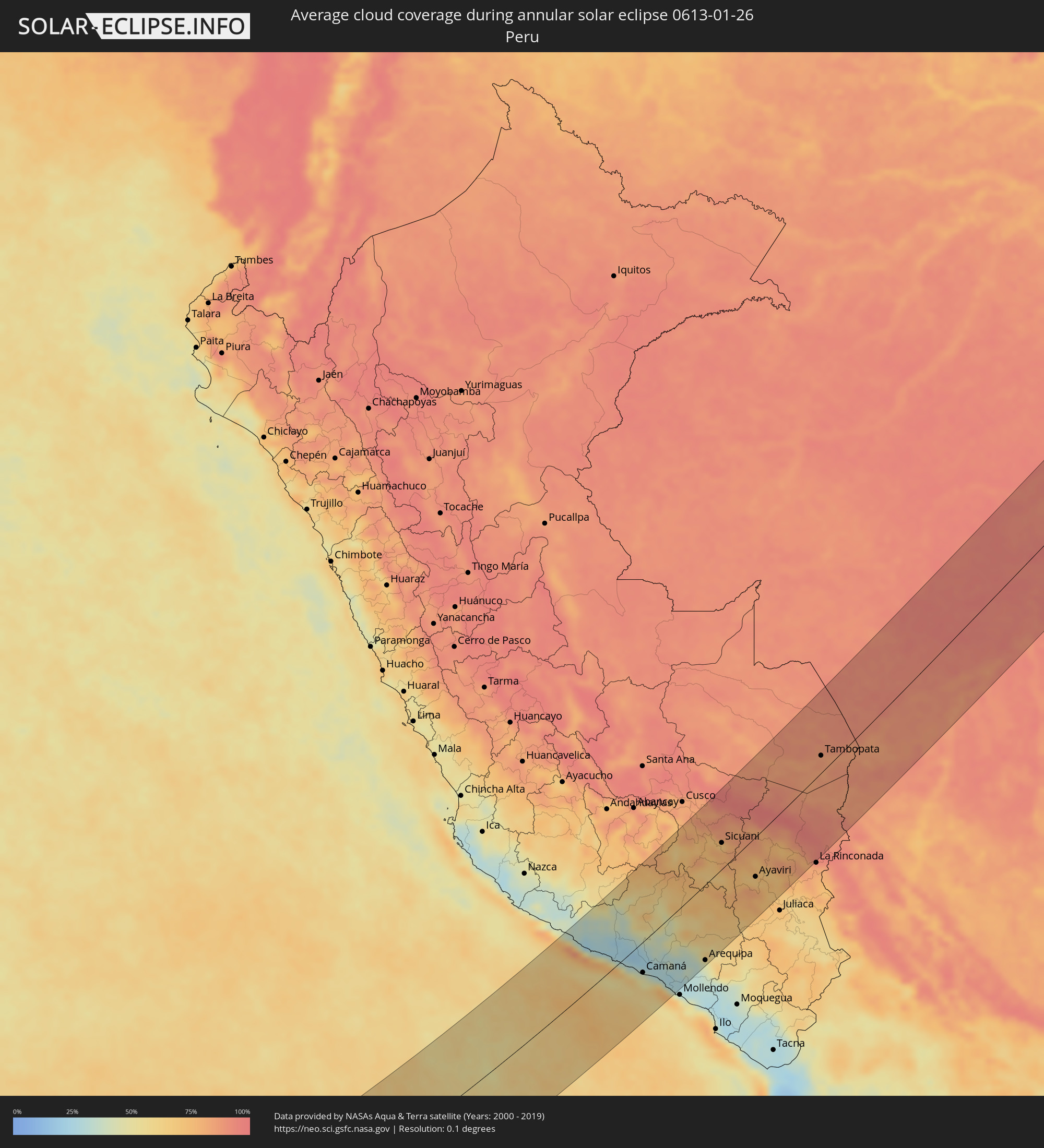 Peru
Peru
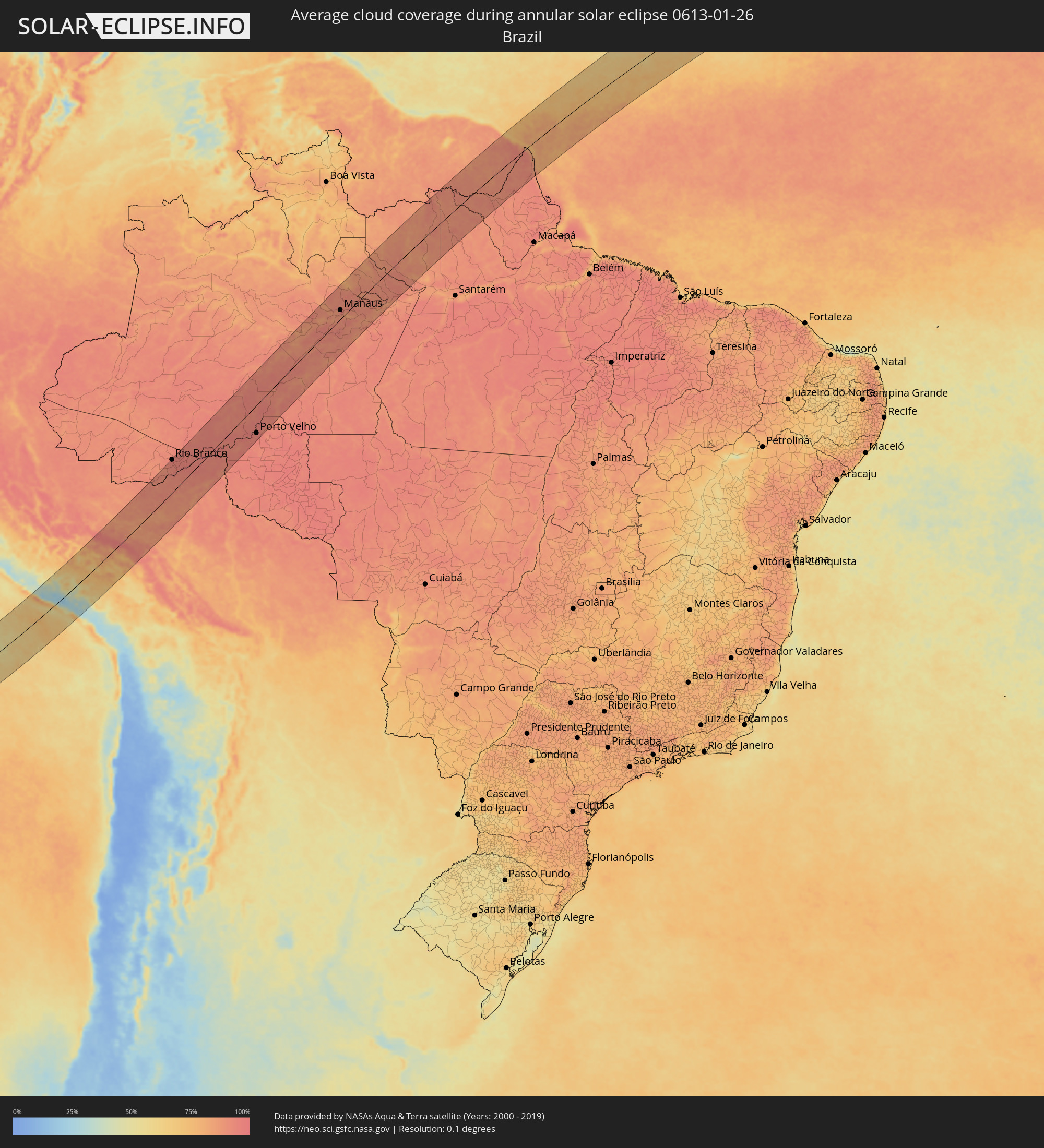 Brazil
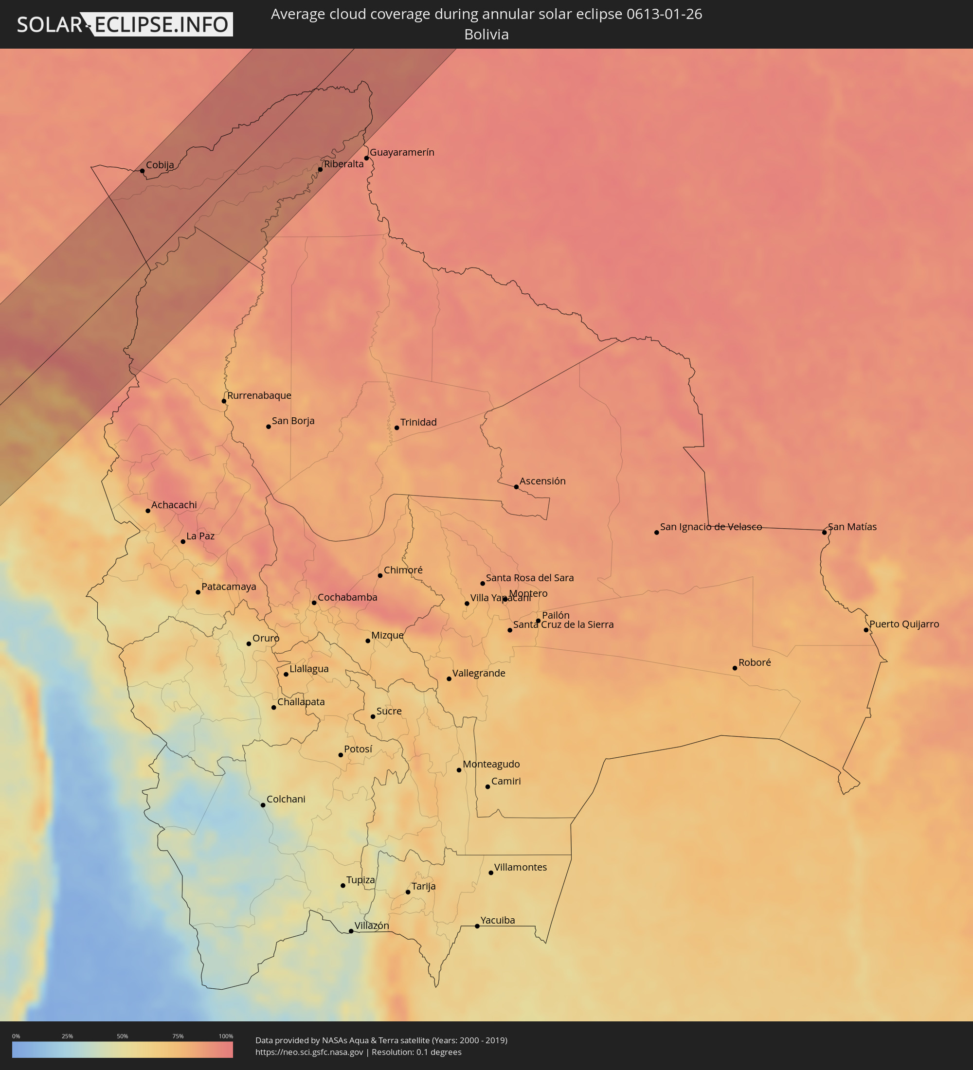 Bolivia
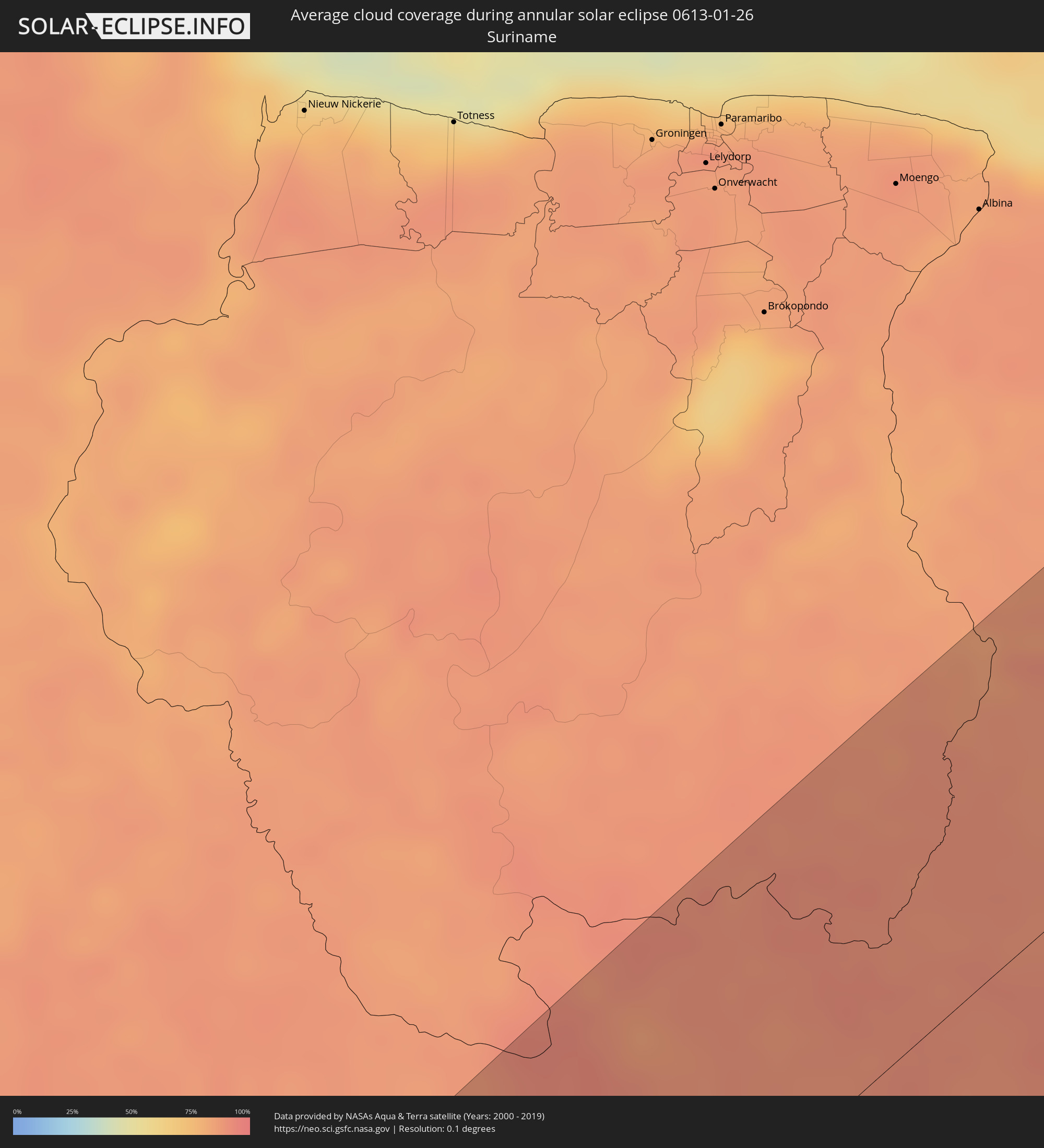 Suriname
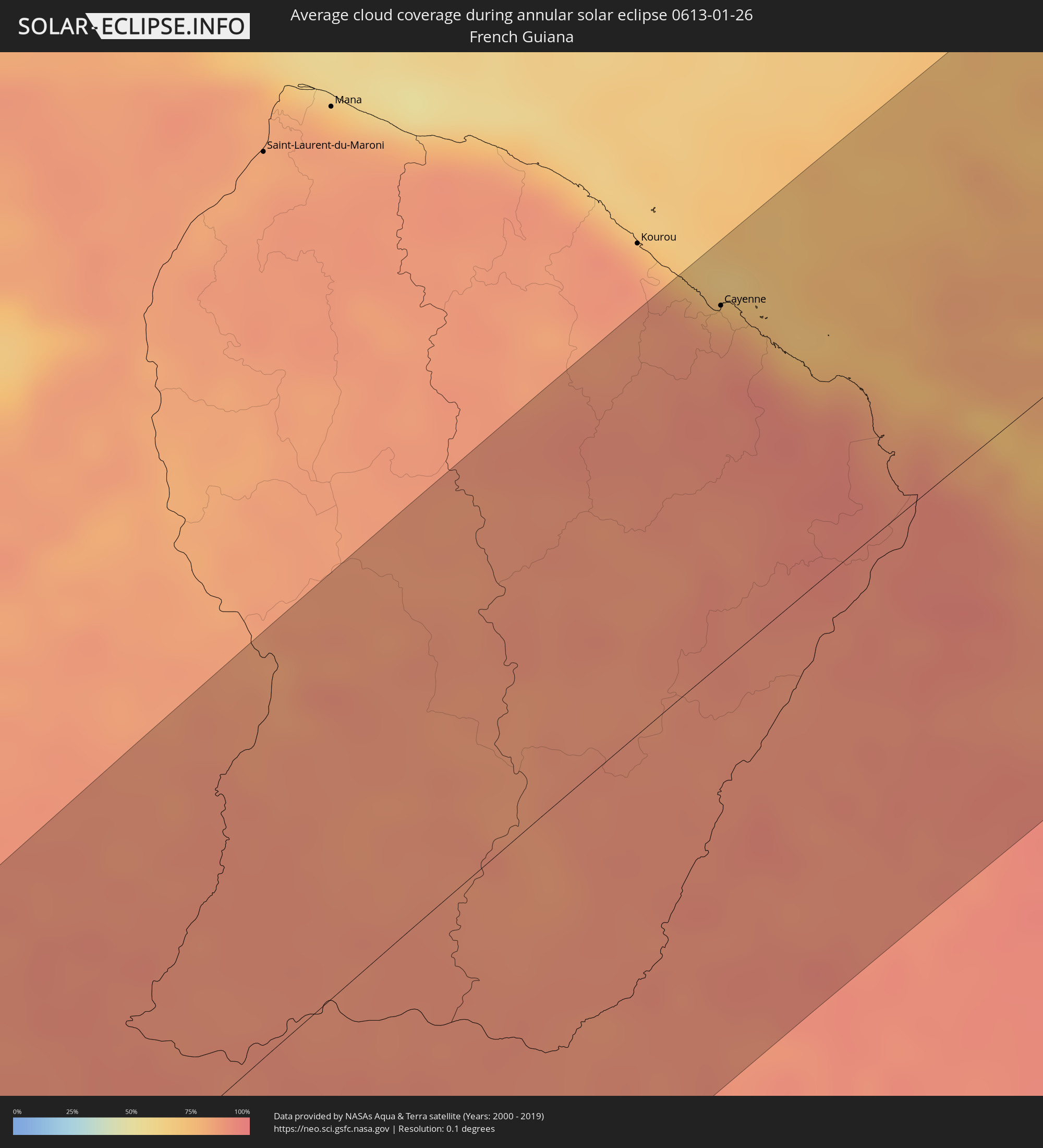 French Guiana
Cities inside the path of the eclipse
The following table shows all locations with a population of more than 5,000 inside the eclipse path. Cities which have more than 100,000 inhabitants are marked bold. A click at the locations opens a detailed map.
| City | Type | Eclipse duration | Local time of max. eclipse | Distance to central line | Ø Cloud coverage |
|
Adamstown
|
annular | - | 06:51:37 UTC-08:30 | 124 km | 61% |
|
Camaná, Arequipa
|
annular | - | 12:15:17 UTC-05:08 | 46 km | 47% |
|
Orcopampa, Arequipa
|
annular | - | 12:19:23 UTC-05:08 | 40 km | 56% |
|
Lluta, Arequipa
|
annular | - | 12:18:26 UTC-05:08 | 46 km | 41% |
|
Yura, Arequipa
|
annular | - | 12:18:42 UTC-05:08 | 89 km | 34% |
|
Urcos, Cusco
|
annular | - | 12:24:54 UTC-05:08 | 115 km | 84% |
|
Arequipa, Arequipa
|
annular | - | 12:18:43 UTC-05:08 | 112 km | 45% |
|
Sicuani, Cusco
|
annular | - | 12:24:29 UTC-05:08 | 39 km | 77% |
|
Hacienda Huancane, Puno
|
annular | - | 12:21:38 UTC-05:08 | 112 km | 67% |
|
Ayaviri, Puno
|
annular | - | 12:24:33 UTC-05:08 | 58 km | 69% |
|
Macusani, Puno
|
annular | - | 12:26:49 UTC-05:08 | 6 km | 79% |
|
Azángaro, Puno
|
annular | - | 12:25:26 UTC-05:08 | 89 km | 70% |
|
Tambopata, Madre de Dios
|
annular | - | 12:32:43 UTC-05:08 | 25 km | 87% |
|
Puerto Maldonado, Madre de Dios
|
annular | - | 12:33:17 UTC-05:08 | 18 km | 83% |
|
Cobija, Pando
|
annular | - | 13:13:58 UTC-04:32 | 109 km | 91% |
|
Brasiléia, Acre
|
annular | - | 13:14:02 UTC-04:32 | 108 km | 90% |
|
Xapuri, Acre
|
annular | - | 13:16:51 UTC-04:31 | 118 km | 91% |
|
Rio Branco, Acre
|
annular | - | 13:19:59 UTC-04:31 | 116 km | 95% |
|
Senador Guiomard, Acre
|
annular | - | 13:19:44 UTC-04:31 | 97 km | 93% |
|
Plácido de Castro, Acre
|
annular | - | 13:19:05 UTC-04:32 | 39 km | 95% |
|
Riberalta, El Beni
|
annular | - | 13:19:53 UTC-04:32 | 101 km | 88% |
|
Canutama, Amazonas
|
annular | - | 14:03:28 UTC-04:02 | 111 km | 90% |
|
Porto Velho, Rondônia
|
annular | - | 13:59:21 UTC-04:02 | 99 km | 95% |
|
Humaitá, Amazonas
|
annular | - | 14:03:49 UTC-04:02 | 72 km | 92% |
|
Anori, Amazonas
|
annular | - | 14:14:26 UTC-04:02 | 108 km | 86% |
|
Manicoré, Amazonas
|
annular | - | 14:10:41 UTC-04:02 | 78 km | 89% |
|
Manacapuru, Amazonas
|
annular | - | 14:17:08 UTC-04:02 | 64 km | 89% |
|
Novo Aripuanã, Amazonas
|
annular | - | 14:13:44 UTC-04:02 | 98 km | 89% |
|
Manaquiri, Amazonas
|
annular | - | 14:17:32 UTC-04:02 | 41 km | 87% |
|
Iranduba, Amazonas
|
annular | - | 14:17:52 UTC-04:02 | 31 km | 89% |
|
Manaus, Amazonas
|
annular | - | 14:18:30 UTC-04:02 | 32 km | 92% |
|
Careiro da Várzea, Amazonas
|
annular | - | 14:18:38 UTC-04:02 | 9 km | 84% |
|
Rio Preto da Eva, Amazonas
|
annular | - | 14:19:50 UTC-04:02 | 39 km | 92% |
|
Borba, Amazonas
|
annular | - | 14:16:34 UTC-04:02 | 103 km | 91% |
|
Autazes, Amazonas
|
annular | - | 14:18:57 UTC-04:02 | 75 km | 88% |
|
Nova Olinda do Norte, Amazonas
|
annular | - | 14:18:23 UTC-04:02 | 103 km | 89% |
|
Itacoatiara, Amazonas
|
annular | - | 14:20:54 UTC-04:02 | 95 km | 86% |
|
Urucurituba, Amazonas
|
annular | - | 14:21:23 UTC-04:02 | 116 km | 90% |
|
Urucará, Amazonas
|
annular | - | 14:23:09 UTC-04:02 | 100 km | 86% |
|
Macouria, Guyane
|
annular | - | 15:16:20 UTC-03:29 | 114 km | 86% |
|
Cayenne, Guyane
|
annular | - | 15:16:25 UTC-03:29 | 113 km | 84% |
|
Matoury, Guyane
|
annular | - | 15:16:18 UTC-03:29 | 105 km | 90% |
|
Rémire-Montjoly, Guyane
|
annular | - | 15:16:28 UTC-03:29 | 107 km | 84% |