Total solar eclipse of 09/04/0666
| Day of week: | Tuesday |
| Maximum duration of eclipse: | 03m31s |
| Maximum width of eclipse path: | 269 km |
| Saros cycle: | 84 |
| Coverage: | 100% |
| Magnitude: | 1.0524 |
| Gamma: | 0.774 |
Wo kann man die Sonnenfinsternis vom 09/04/0666 sehen?
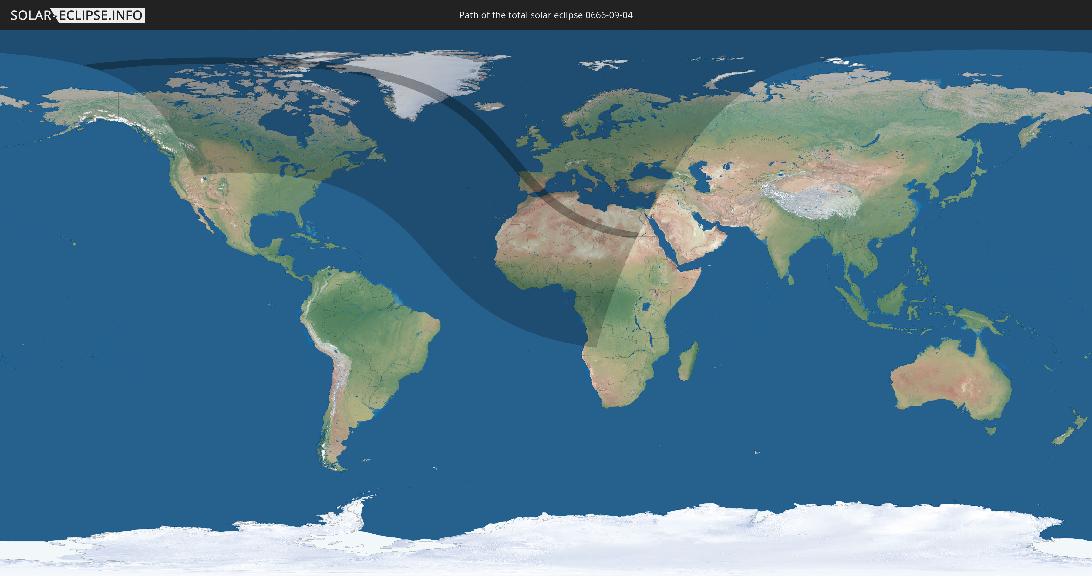
Die Sonnenfinsternis am 09/04/0666 kann man in 93 Ländern als partielle Sonnenfinsternis beobachten.
Der Finsternispfad verläuft durch 8 Länder. Nur in diesen Ländern ist sie als total Sonnenfinsternis zu sehen.
In den folgenden Ländern ist die Sonnenfinsternis total zu sehen
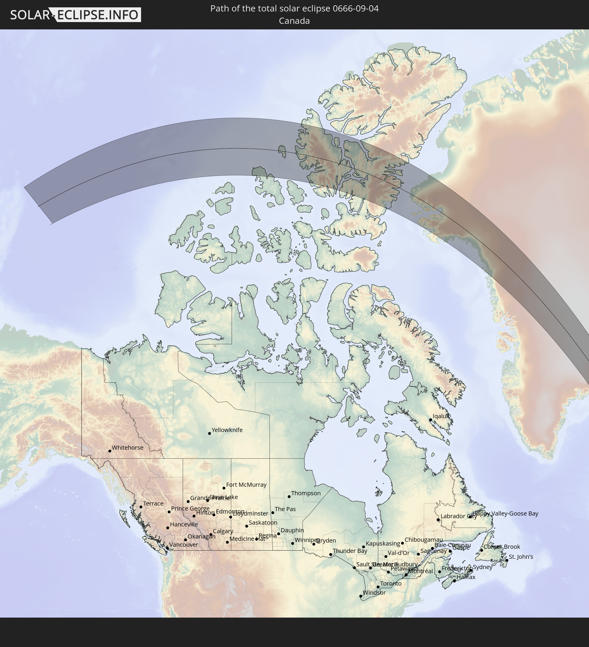 Canada
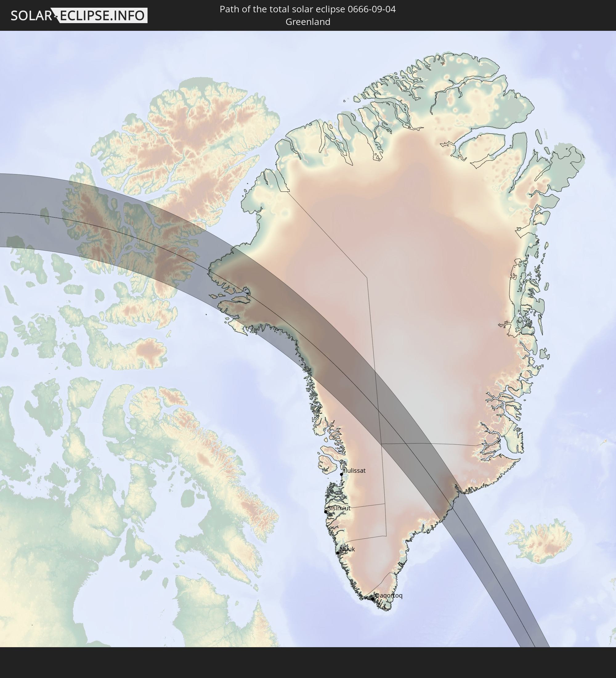 Greenland
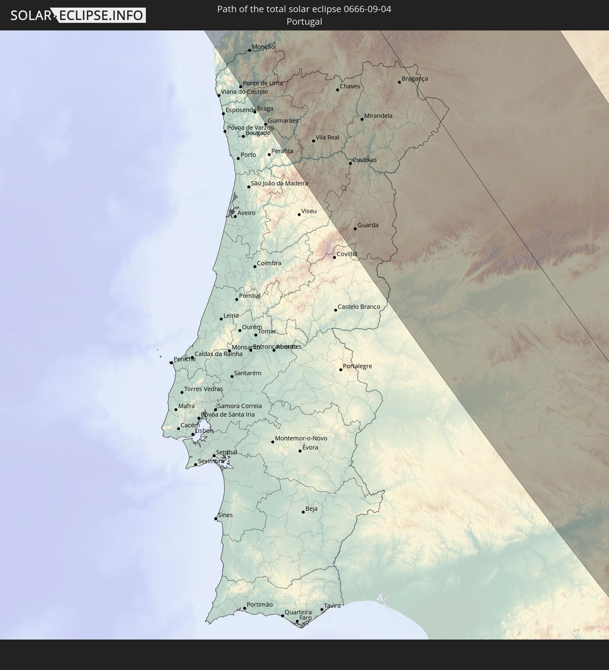 Portugal
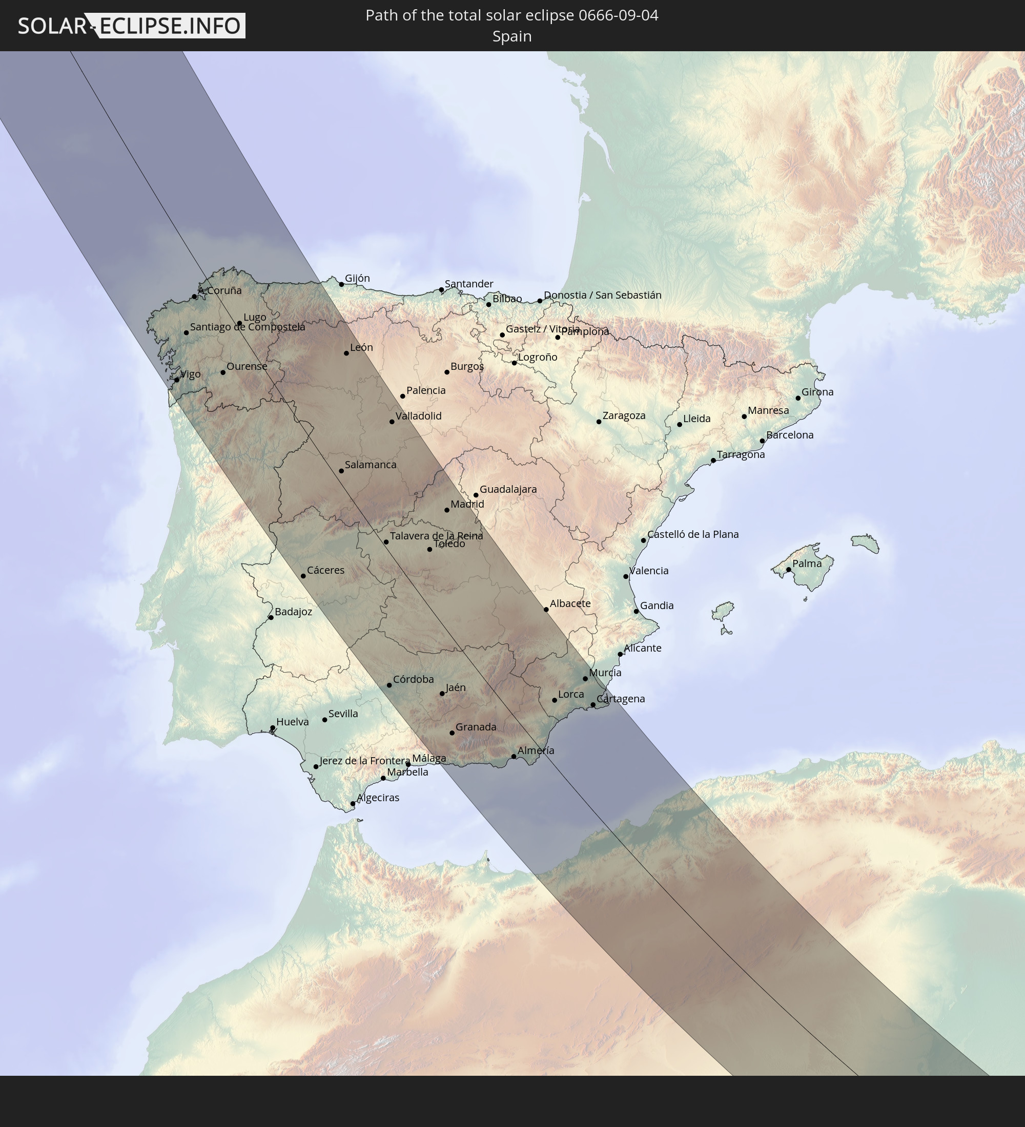 Spain
Spain
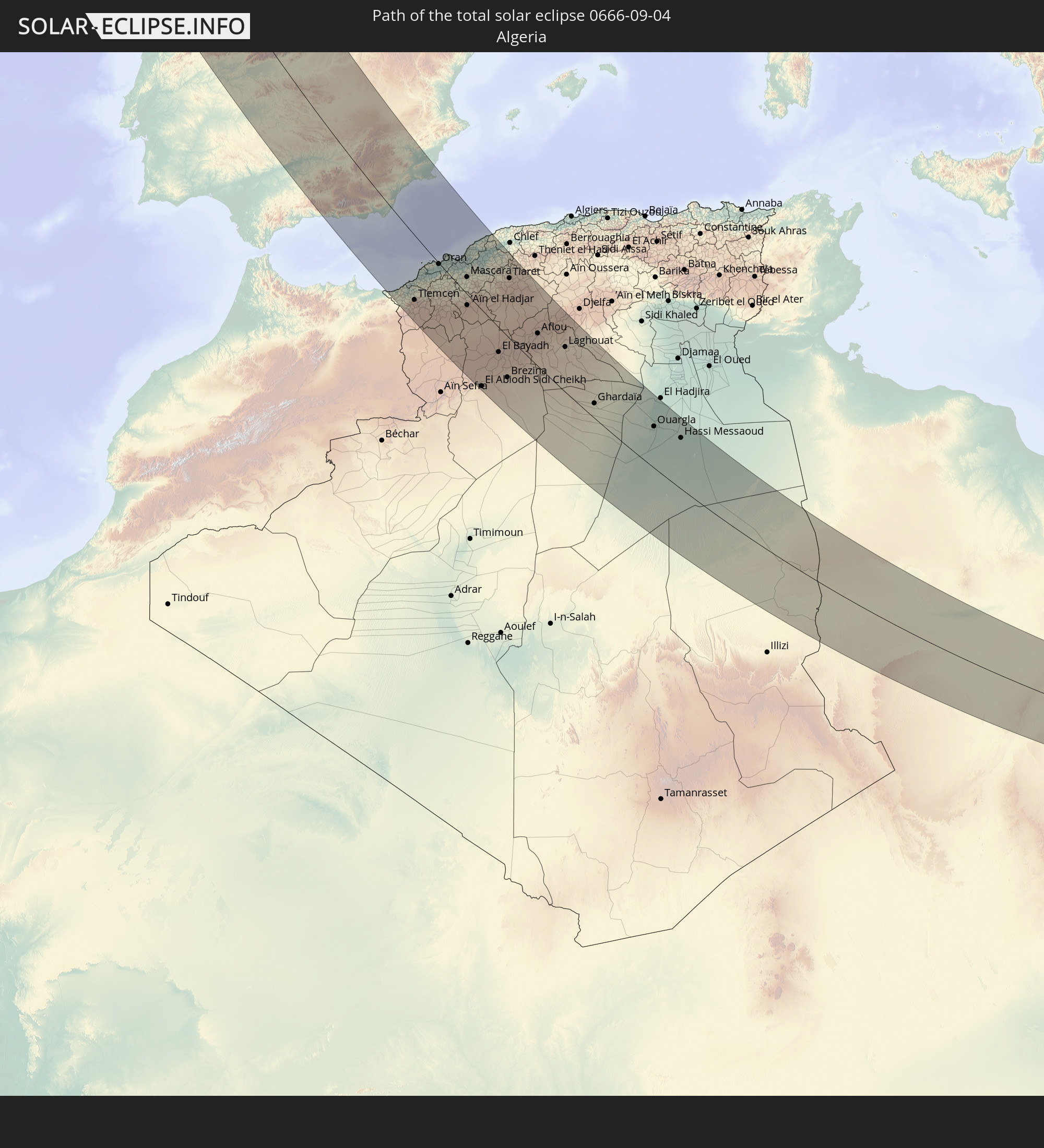 Algeria
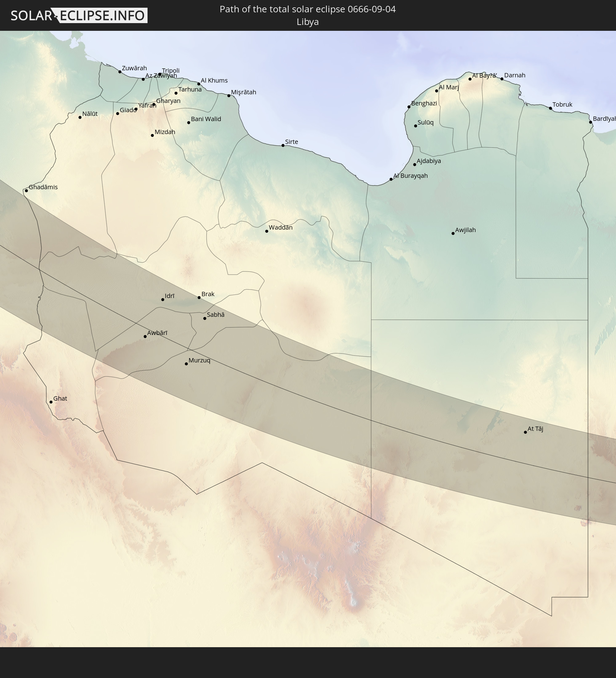 Libya
Libya
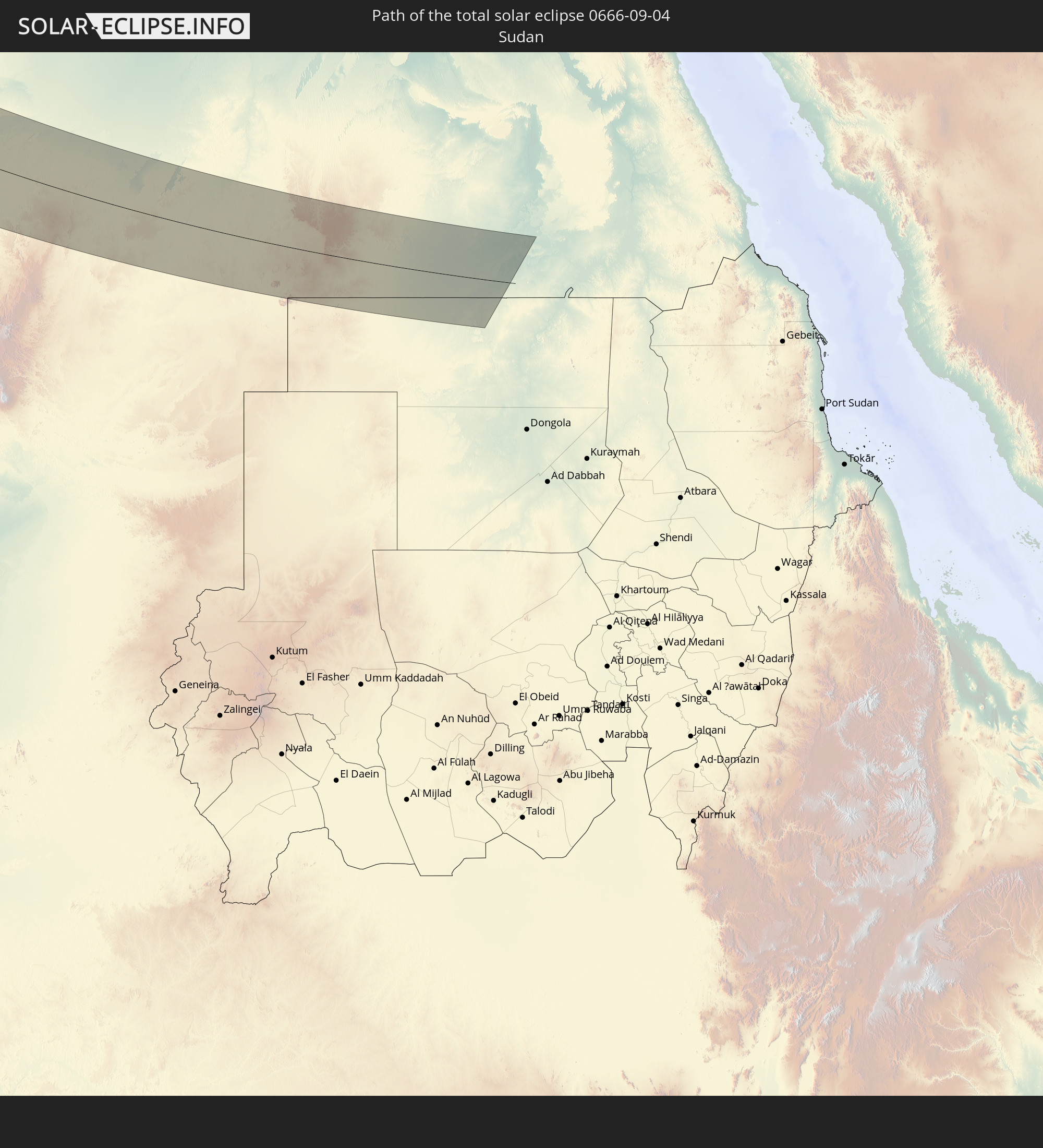 Sudan
Sudan
 Egypt
Egypt
In den folgenden Ländern ist die Sonnenfinsternis partiell zu sehen
 Russia
 United States
 Canada
 Greenland
 Saint Pierre and Miquelon
 Portugal
 Cabo Verde
 Iceland
 Spain
Spain
 Senegal
 Mauritania
 The Gambia
 Guinea-Bissau
 Guinea
 Sierra Leone
 Morocco
 Mali
Mali
 Liberia
 Republic of Ireland
 Svalbard and Jan Mayen
 Algeria
 United Kingdom
 Ivory Coast
 Faroe Islands
 Burkina Faso
 Gibraltar
 France
 Isle of Man
 Ghana
Ghana
 Guernsey
 Jersey
 Togo
Togo
 Niger
Niger
 Benin
Benin
 Andorra
 Belgium
 Nigeria
 Netherlands
 Norway
 Equatorial Guinea
 Luxembourg
 Germany
 Switzerland
 São Tomé and Príncipe
 Italy
Italy
 Monaco
 Tunisia
 Denmark
 Cameroon
 Gabon
Gabon
 Libya
Libya
 Liechtenstein
 Austria
 Sweden
 Republic of the Congo
 Angola
 Czechia
 Democratic Republic of the Congo
 San Marino
 Vatican City
 Slovenia
 Chad
Chad
 Croatia
 Poland
 Malta
Malta
 Central African Republic
 Bosnia and Herzegovina
 Hungary
 Slovakia
 Montenegro
 Serbia
 Albania
 Åland Islands
 Greece
 Romania
 Republic of Macedonia
 Finland
 Lithuania
 Latvia
 Estonia
 Sudan
Sudan
 Ukraine
 Bulgaria
 Belarus
 Egypt
Egypt
 Turkey
 Moldova
 Cyprus
 State of Palestine
 Israel
 Lebanon
 Syria
Syria
 Georgia
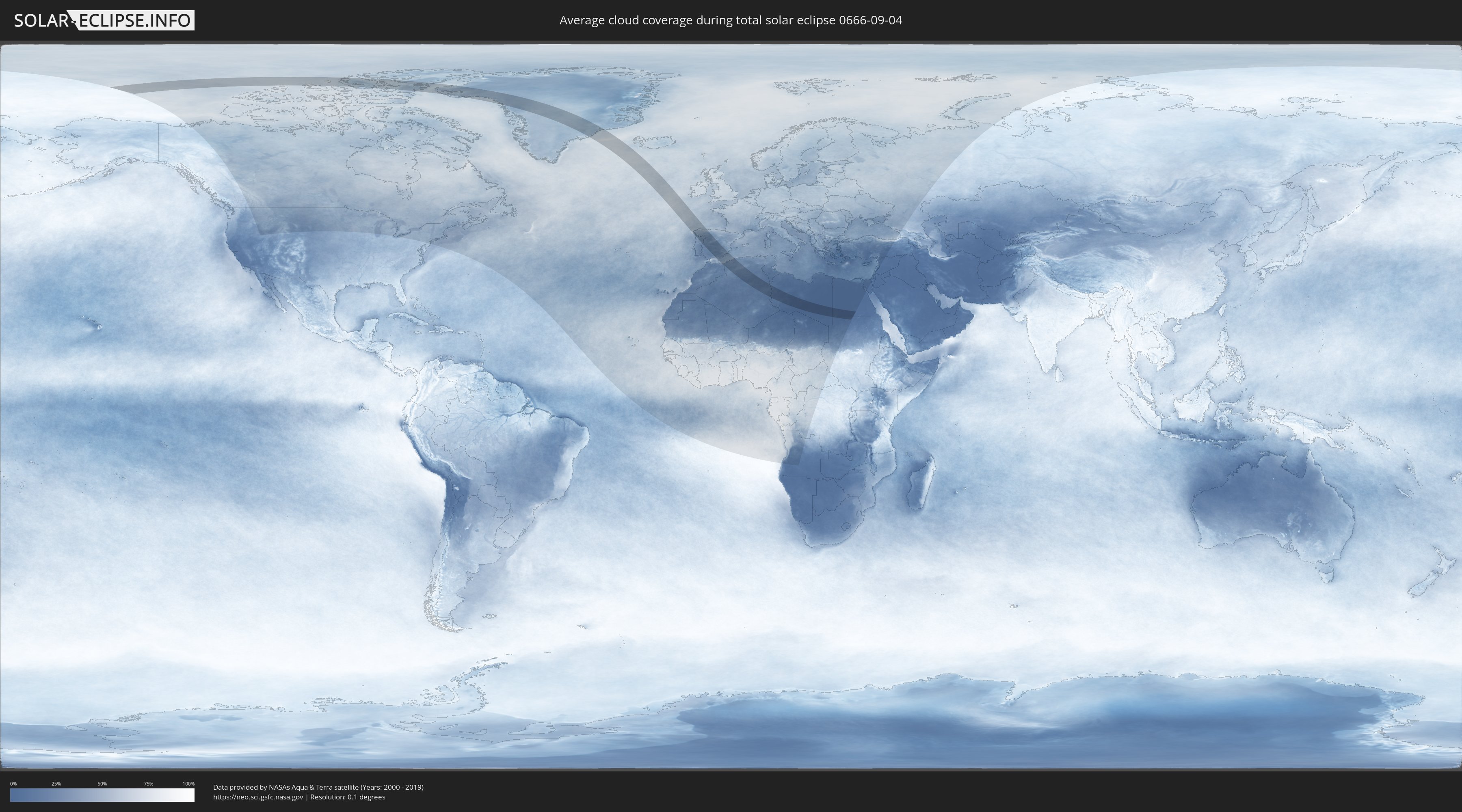
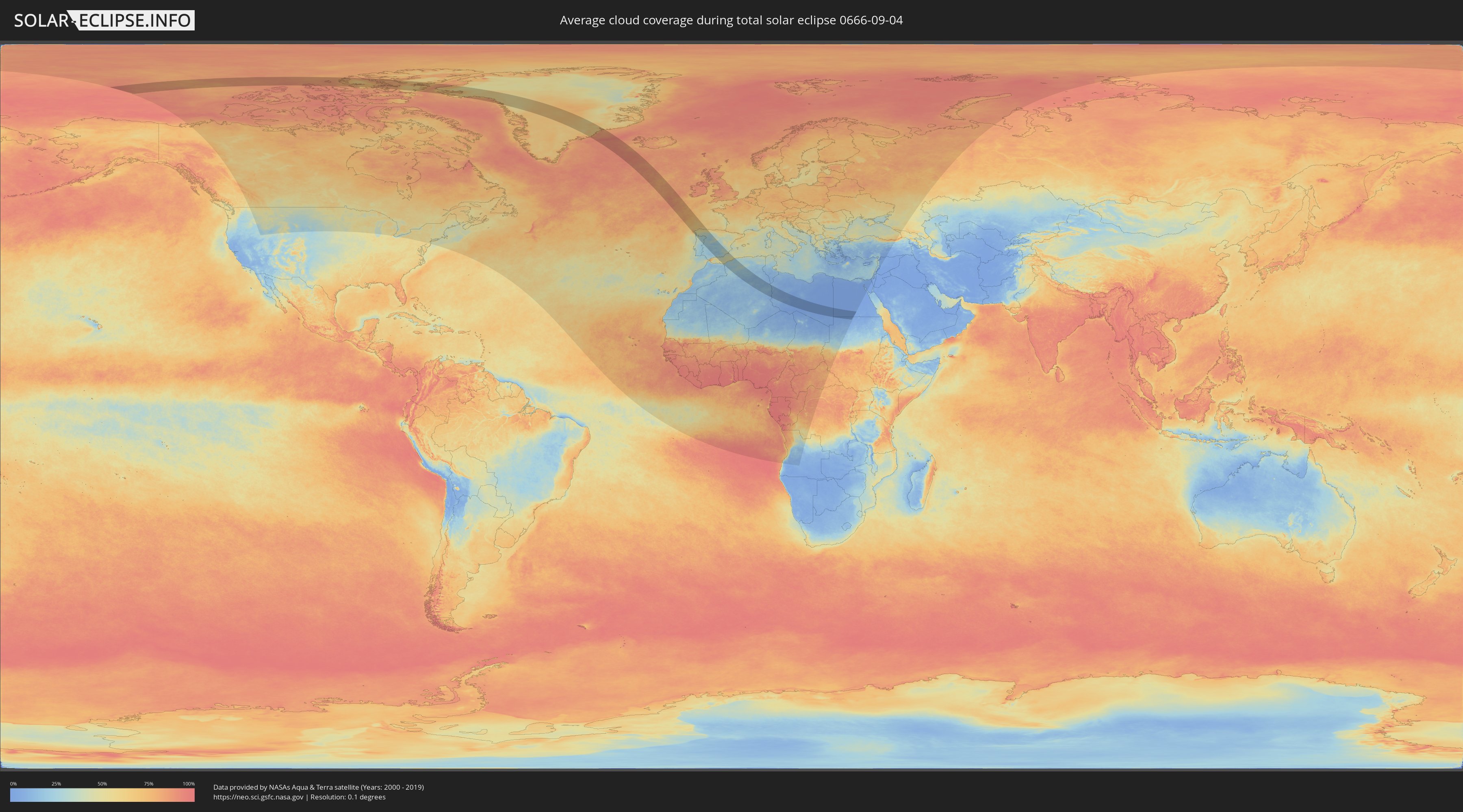
How will be the weather during the total solar eclipse on 09/04/0666?
Where is the best place to see the total solar eclipse of 09/04/0666?
The following maps show the average cloud coverage for the day of the total solar eclipse.
With the help of these maps, it is possible to find the place along the eclipse path, which has the best
chance of a cloudless sky.
Nevertheless, you should consider local circumstances and inform about the weather of your chosen
observation site.
The data is provided by NASAs satellites
AQUA and TERRA.
The cloud maps are averaged over a period of 19 years (2000 - 2019).
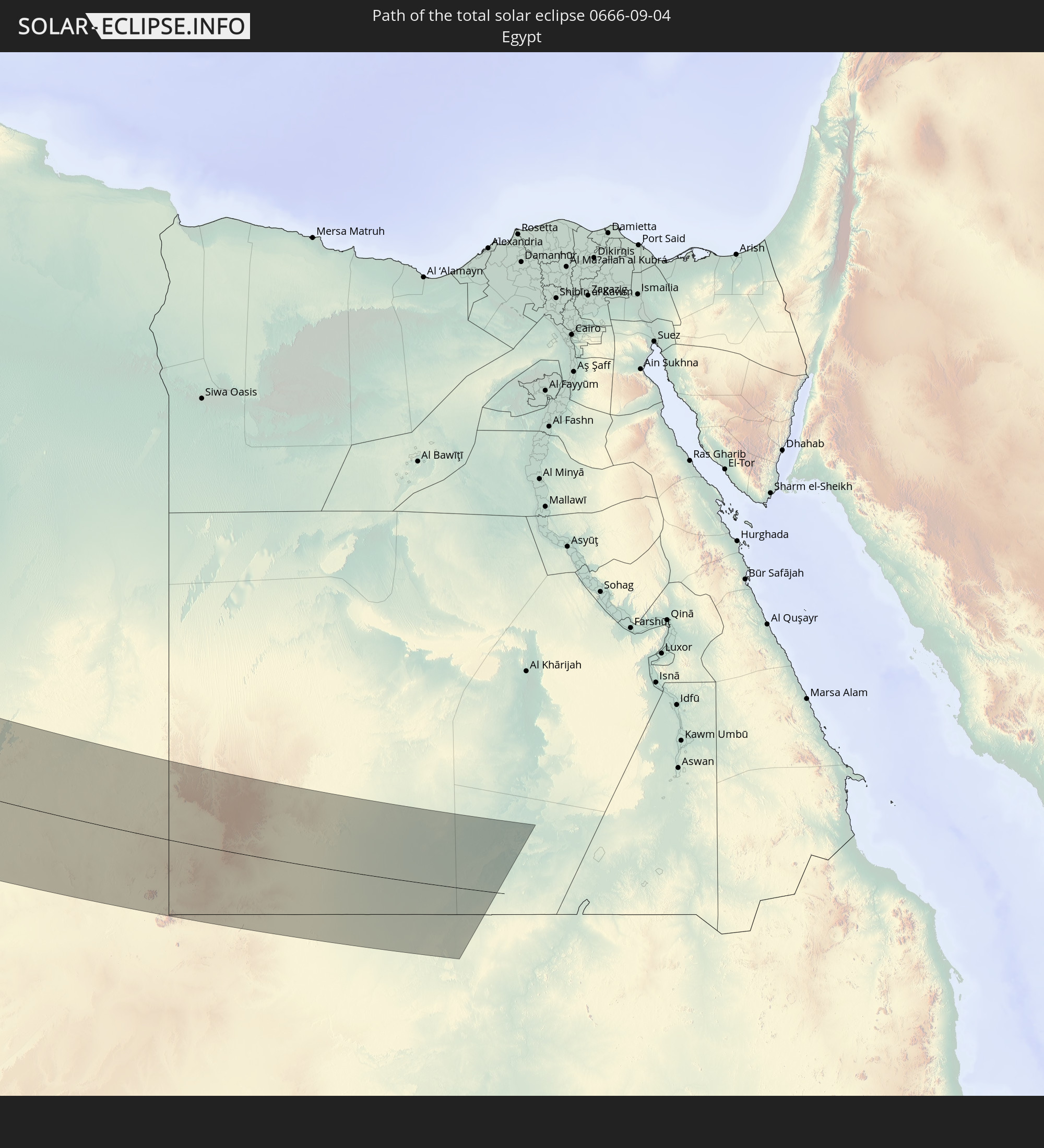
Detailed country maps
 Canada
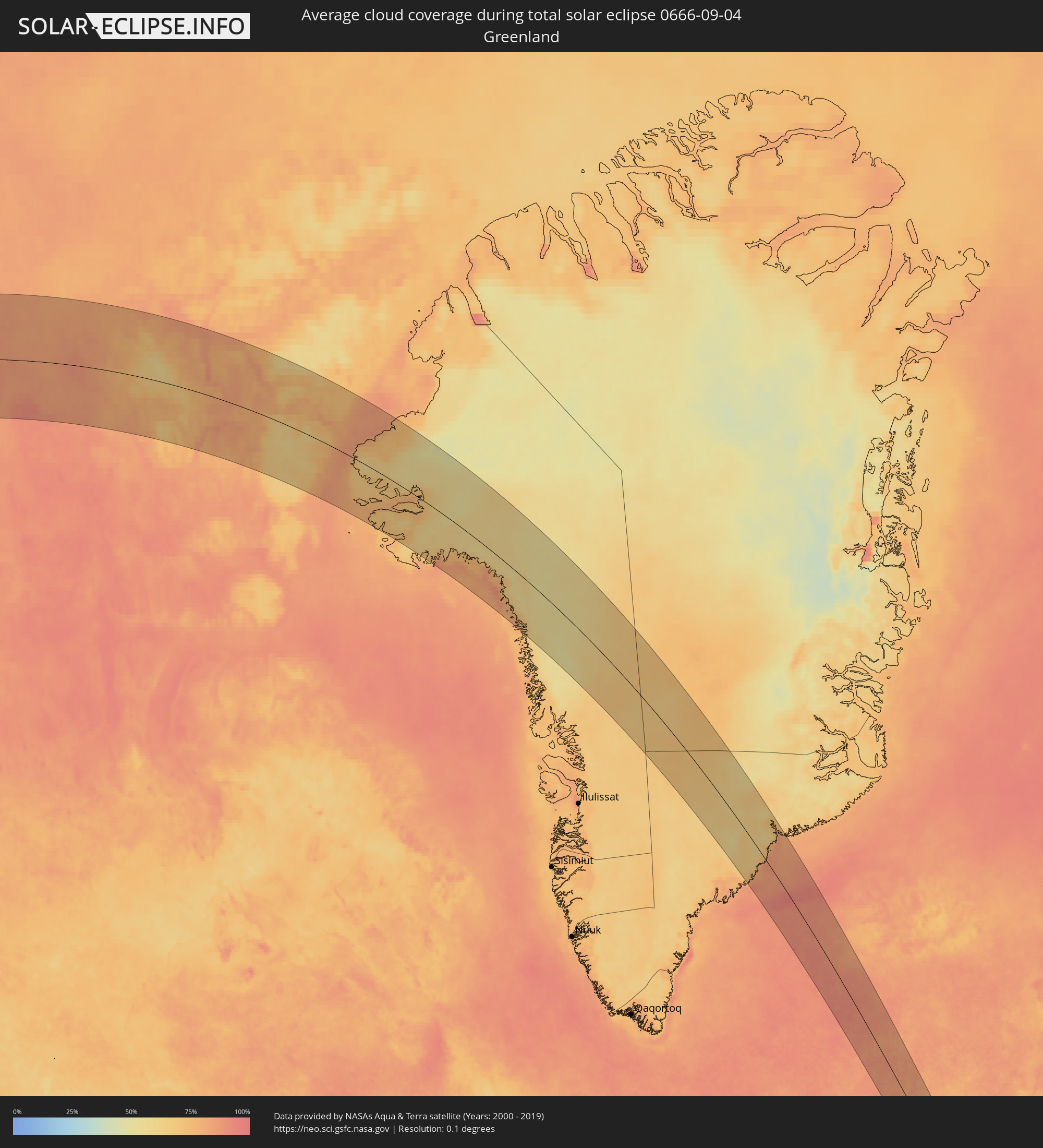 Greenland
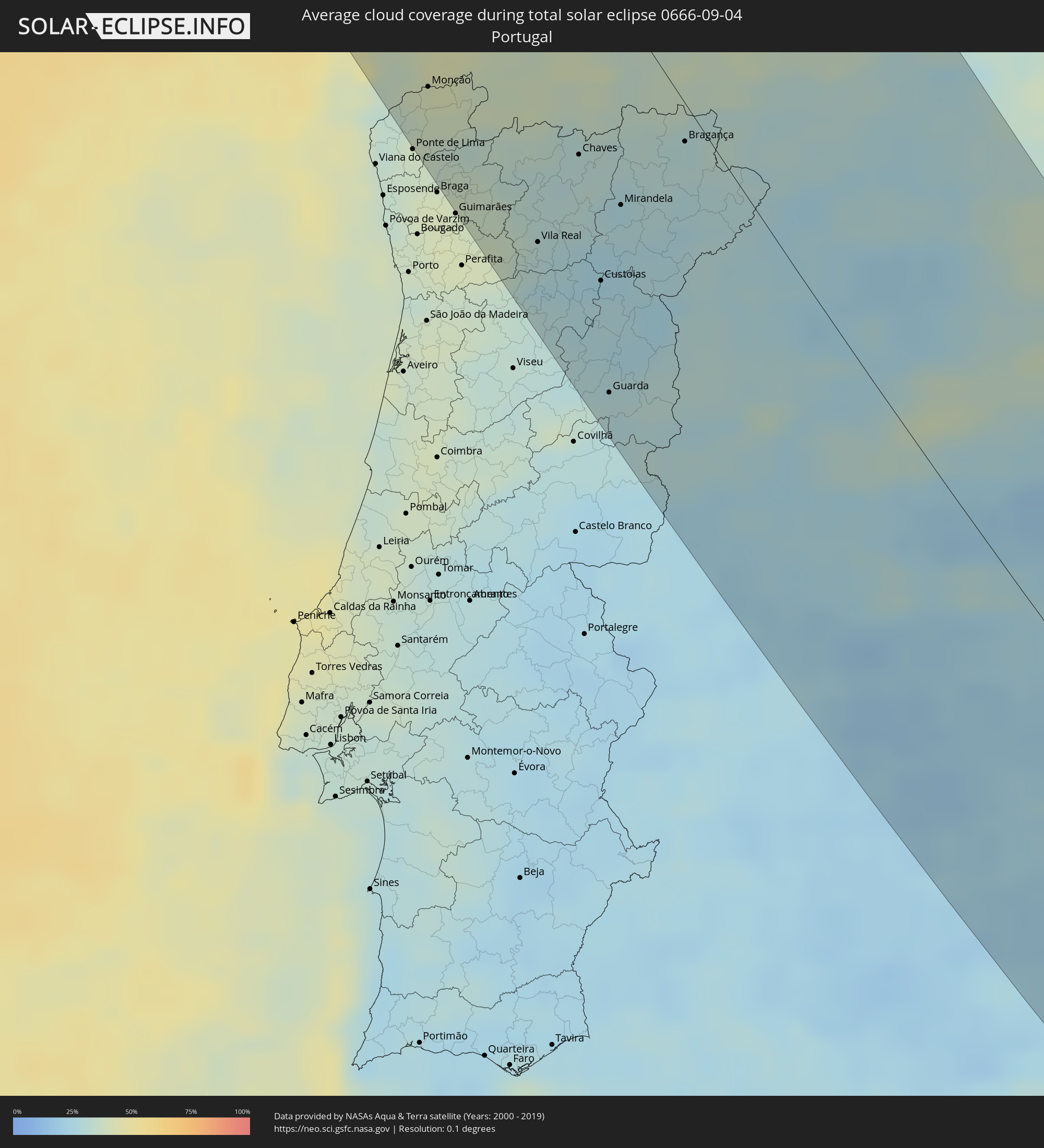 Portugal
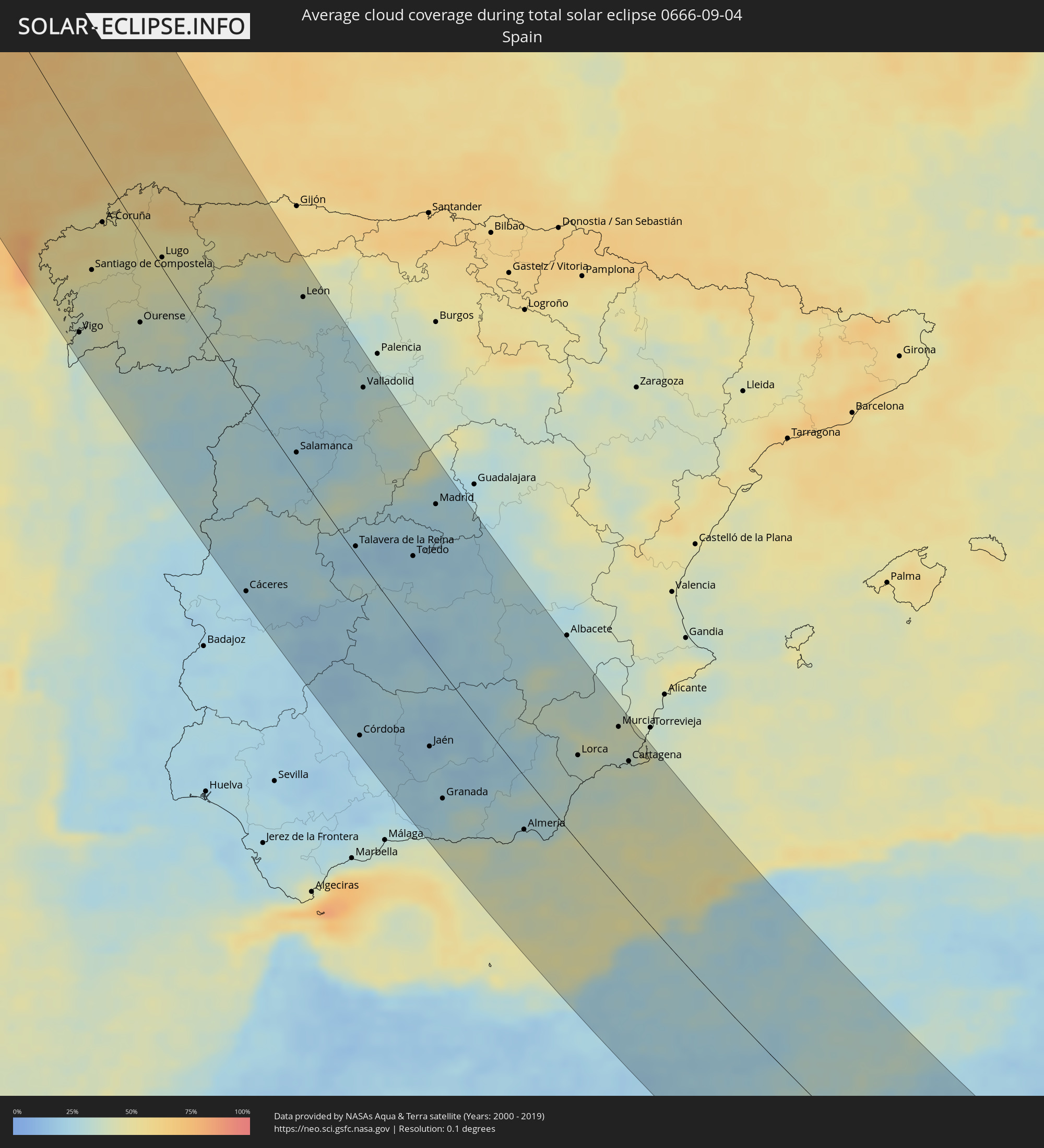 Spain
Spain
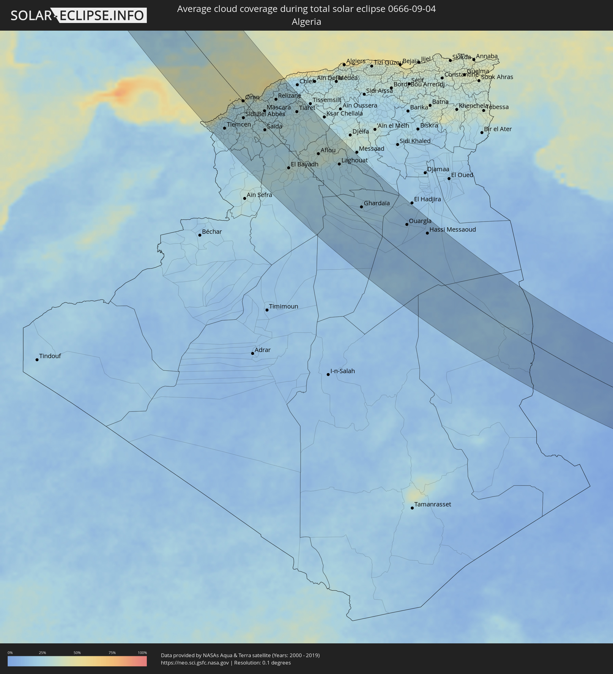 Algeria
 Libya
Libya
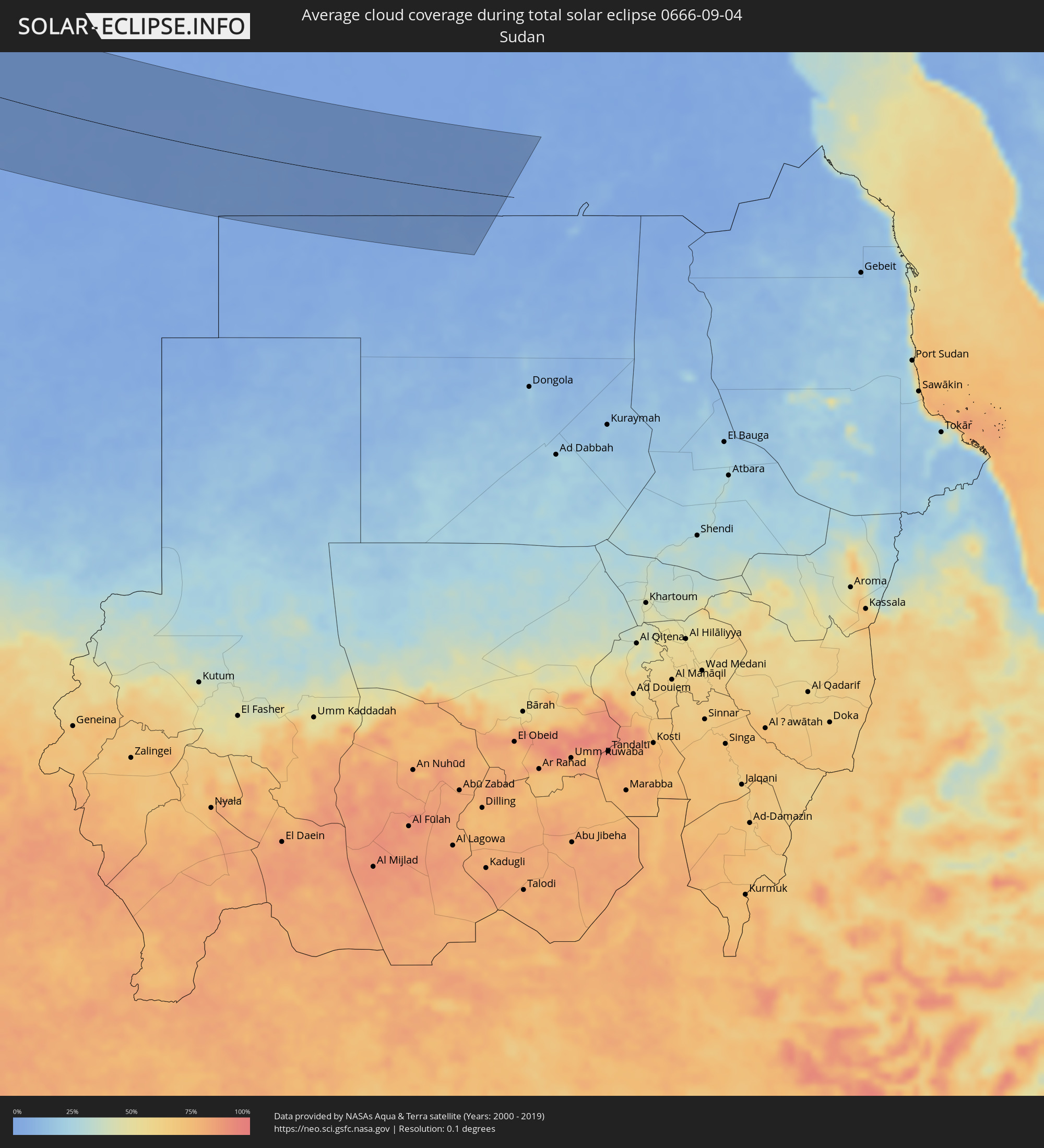 Sudan
Sudan
 Egypt
Egypt
Cities inside the path of the eclipse
The following table shows all locations with a population of more than 5,000 inside the eclipse path. Cities which have more than 100,000 inhabitants are marked bold. A click at the locations opens a detailed map.
| City | Type | Eclipse duration | Local time of max. eclipse | Distance to central line | Ø Cloud coverage |
|
Vilagarcía de Arousa, Galicia
|
total | - | 15:15:19 UTC+00:00 | 102 km | 46% |
|
Vigo, Galicia
|
total | - | 15:16:02 UTC+00:00 | 121 km | 37% |
|
Pontevedra, Galicia
|
total | - | 15:15:44 UTC+00:00 | 103 km | 39% |
|
Valenza, Viana do Castelo
|
total | - | 14:39:46 UTC-00:36 | 128 km | 36% |
|
Santiago de Compostela, Galicia
|
total | - | 15:14:59 UTC+00:00 | 69 km | 48% |
|
Monção, Viana do Castelo
|
total | - | 14:39:48 UTC-00:36 | 114 km | 39% |
|
Mozelos, Viana do Castelo
|
total | - | 14:40:16 UTC-00:36 | 121 km | 35% |
|
A Coruña, Galicia
|
total | - | 15:14:11 UTC+00:00 | 30 km | 51% |
|
Sande, Braga
|
total | - | 14:40:35 UTC-00:36 | 131 km | 37% |
|
Caldelas, Braga
|
total | - | 14:40:39 UTC-00:36 | 132 km | 37% |
|
Antas, Braga
|
total | - | 14:40:36 UTC-00:36 | 123 km | 36% |
|
Póvoa de Lanhoso, Braga
|
total | - | 14:40:55 UTC-00:36 | 131 km | 38% |
|
Ferrol, Galicia
|
total | - | 15:14:07 UTC+00:00 | 12 km | 49% |
|
Serzedo, Braga
|
total | - | 14:41:18 UTC-00:36 | 138 km | 40% |
|
Margaride, Porto
|
total | - | 14:41:24 UTC-00:36 | 139 km | 40% |
|
Real, Braga
|
total | - | 14:40:54 UTC-00:36 | 120 km | 37% |
|
Fafe, Braga
|
total | - | 14:41:16 UTC-00:36 | 131 km | 38% |
|
Amarante, Porto
|
total | - | 14:41:41 UTC-00:36 | 136 km | 40% |
|
Refojos de Basto, Braga
|
total | - | 14:41:18 UTC-00:36 | 115 km | 37% |
|
Valadares, Porto
|
total | - | 14:42:01 UTC-00:36 | 137 km | 33% |
|
Ourense, Galicia
|
total | - | 15:16:37 UTC+00:00 | 55 km | 37% |
|
Lamego, Viseu
|
total | - | 14:42:15 UTC-00:36 | 129 km | 30% |
|
Peso da Régua, Vila Real
|
total | - | 14:42:09 UTC-00:36 | 123 km | 28% |
|
Vila Real, Vila Real
|
total | - | 14:41:56 UTC-00:36 | 111 km | 29% |
|
Vilela, Vila Real
|
total | - | 14:42:12 UTC-00:36 | 106 km | 26% |
|
Lugo, Galicia
|
total | - | 15:15:37 UTC+00:00 | 6 km | 48% |
|
Chaves, Vila Real
|
total | - | 14:41:20 UTC-00:36 | 65 km | 31% |
|
Custoias, Guarda
|
total | - | 14:42:41 UTC-00:36 | 94 km | 27% |
|
Guarda, Guarda
|
total | - | 14:43:48 UTC-00:36 | 126 km | 30% |
|
Sequeira, Guarda
|
total | - | 14:43:49 UTC-00:36 | 123 km | 29% |
|
Mirandela, Bragança
|
total | - | 14:42:04 UTC-00:36 | 61 km | 28% |
|
Macedo de Cavaleiros, Bragança
|
total | - | 14:42:10 UTC-00:36 | 42 km | 28% |
|
Bragança, Bragança
|
total | - | 14:41:50 UTC-00:36 | 12 km | 31% |
|
Ponferrada, Castille and León
|
total | - | 15:17:20 UTC+00:00 | 45 km | 38% |
|
Cáceres, Extremadura
|
total | - | 15:23:22 UTC+00:00 | 133 km | 22% |
|
Plasencia, Extremadura
|
total | - | 15:22:33 UTC+00:00 | 77 km | 25% |
|
Don Benito, Extremadura
|
total | - | 15:24:48 UTC+00:00 | 132 km | 24% |
|
Zamora, Castille and León
|
total | - | 15:20:02 UTC+00:00 | 40 km | 28% |
|
Salamanca, Castille and León
|
total | - | 15:21:07 UTC+00:00 | 12 km | 25% |
|
León, Castille and León
|
total | - | 15:18:06 UTC+00:00 | 119 km | 35% |
|
Talavera de la Reina, Castille-La Mancha
|
total | - | 15:23:45 UTC+00:00 | 6 km | 21% |
|
Córdoba, Andalusia
|
total | - | 15:27:46 UTC+00:00 | 128 km | 23% |
|
Valladolid, Castille and León
|
total | - | 15:20:36 UTC+00:00 | 120 km | 31% |
|
Ávila, Castille and León
|
total | - | 15:22:31 UTC+00:00 | 59 km | 35% |
|
Lucena, Andalusia
|
total | - | 15:28:56 UTC+00:00 | 142 km | 23% |
|
Segovia, Castille and León
|
total | - | 15:22:27 UTC+00:00 | 118 km | 41% |
|
Puertollano, Castille-La Mancha
|
total | - | 15:26:47 UTC+00:00 | 28 km | 26% |
|
Andújar, Andalusia
|
total | - | 15:28:05 UTC+00:00 | 68 km | 19% |
|
Toledo, Castille-La Mancha
|
total | - | 15:24:37 UTC+00:00 | 55 km | 21% |
|
Collado-Villalba, Madrid
|
total | - | 15:23:08 UTC+00:00 | 106 km | 28% |
|
Ciudad Real, Castille-La Mancha
|
total | - | 15:26:21 UTC+00:00 | 4 km | 19% |
|
Las Rozas de Madrid, Madrid
|
total | - | 15:23:31 UTC+00:00 | 106 km | 24% |
|
Móstoles, Madrid
|
total | - | 15:23:51 UTC+00:00 | 96 km | 25% |
|
Jaén, Andalusia
|
total | - | 15:28:49 UTC+00:00 | 69 km | 21% |
|
Colmenar Viejo, Madrid
|
total | - | 15:23:17 UTC+00:00 | 124 km | 29% |
|
Madrid, Madrid
|
total | - | 15:23:48 UTC+00:00 | 113 km | 28% |
|
Valdemoro, Madrid
|
total | - | 15:24:15 UTC+00:00 | 100 km | 23% |
|
Alcobendas, Madrid
|
total | - | 15:23:36 UTC+00:00 | 126 km | 27% |
|
Linares, Andalusia
|
total | - | 15:28:18 UTC+00:00 | 36 km | 20% |
|
Granada, Andalusia
|
total | - | 15:30:05 UTC+00:00 | 96 km | 25% |
|
Aranjuez, Madrid
|
total | - | 15:24:37 UTC+00:00 | 95 km | 21% |
|
Motril, Andalusia
|
total | - | 15:30:59 UTC+00:00 | 121 km | 37% |
|
Rivas-Vaciamadrid, Madrid
|
total | - | 15:24:08 UTC+00:00 | 121 km | 26% |
|
Úbeda, Andalusia
|
total | - | 15:28:41 UTC+00:00 | 23 km | 20% |
|
Alcalá de Henares, Madrid
|
total | - | 15:23:57 UTC+00:00 | 141 km | 26% |
|
Tomelloso, Castille-La Mancha
|
total | - | 15:26:45 UTC+00:00 | 78 km | 26% |
|
Campiña, Andalusia
|
total | - | 15:28:36 UTC+00:00 | 18 km | 22% |
|
El Ejido, Andalusia
|
total | - | 15:31:30 UTC+00:00 | 71 km | 38% |
|
Roquetas de Mar, Andalusia
|
total | - | 15:31:41 UTC+00:00 | 58 km | 37% |
|
Almería, Andalusia
|
total | - | 15:31:39 UTC+00:00 | 42 km | 39% |
|
Nedroma, Tlemcen
|
total | - | 15:45:03 UTC+00:09 | 127 km | 26% |
|
Lorca, Murcia
|
total | - | 15:30:38 UTC+00:00 | 69 km | 34% |
|
Remchi, Tlemcen
|
total | - | 15:45:11 UTC+00:09 | 102 km | 23% |
|
Cieza, Murcia
|
total | - | 15:29:45 UTC+00:00 | 127 km | 36% |
|
Beni Saf, Aïn Témouchent
|
total | - | 15:44:46 UTC+00:09 | 80 km | 30% |
|
Hennaya, Tlemcen
|
total | - | 15:45:27 UTC+00:09 | 106 km | 24% |
|
Mansoûra, Tlemcen
|
total | - | 15:45:39 UTC+00:09 | 110 km | 23% |
|
Sebdou, Tlemcen
|
total | - | 15:46:05 UTC+00:09 | 127 km | 24% |
|
Tlemcen, Tlemcen
|
total | - | 15:45:38 UTC+00:09 | 107 km | 23% |
|
Mazarrón, Murcia
|
total | - | 15:31:04 UTC+00:00 | 90 km | 39% |
|
Chetouane, Tlemcen
|
total | - | 15:45:34 UTC+00:09 | 103 km | 23% |
|
Aïn Temouchent, Aïn Témouchent
|
total | - | 15:44:57 UTC+00:09 | 64 km | 25% |
|
Sidi Abdelli, Tlemcen
|
total | - | 15:45:24 UTC+00:09 | 81 km | 25% |
|
Murcia, Murcia
|
total | - | 15:30:28 UTC+00:00 | 130 km | 41% |
|
Ouled Mimoun, Tlemcen
|
total | - | 15:45:47 UTC+00:09 | 87 km | 25% |
|
El Amria, Aïn Témouchent
|
total | - | 15:44:37 UTC+00:09 | 39 km | 27% |
|
Cartagena, Murcia
|
total | - | 15:31:18 UTC+00:00 | 113 km | 40% |
|
Hammam Bou Hadjar, Aïn Témouchent
|
total | - | 15:44:56 UTC+00:09 | 47 km | 25% |
|
Bou Tlelis, Oran
|
total | - | 15:44:36 UTC+00:09 | 28 km | 26% |
|
’Aïn el Turk, Oran
|
total | - | 15:44:23 UTC+00:09 | 6 km | 31% |
|
Oran, Oran
|
total | - | 15:44:34 UTC+00:09 | 1 km | 31% |
|
Sidi Bel Abbès, Sidi Bel Abbès
|
total | - | 15:45:32 UTC+00:09 | 38 km | 27% |
|
Es Senia, Oran
|
total | - | 15:44:40 UTC+00:09 | 4 km | 29% |
|
Bir el Djir, Oran
|
total | - | 15:44:35 UTC+00:09 | 7 km | 31% |
|
Sidi ech Chahmi, Oran
|
total | - | 15:44:43 UTC+00:09 | 4 km | 31% |
|
Aïn el Bya, Oran
|
total | - | 15:44:36 UTC+00:09 | 30 km | 30% |
|
Sfizef, Sidi Bel Abbès
|
total | - | 15:45:44 UTC+00:09 | 9 km | 28% |
|
Sig, Mascara
|
total | - | 15:45:12 UTC+00:09 | 17 km | 30% |
|
Bou Hanifia el Hamamat, Mascara
|
total | - | 15:45:43 UTC+00:09 | 10 km | 29% |
|
Mostaganem, Mostaganem
|
total | - | 15:44:38 UTC+00:09 | 66 km | 31% |
|
Mascara, Mascara
|
total | - | 15:45:42 UTC+00:09 | 29 km | 27% |
|
Saïda, Saida
|
total | - | 15:46:47 UTC+00:09 | 13 km | 29% |
|
El Abiodh Sidi Cheikh, El Bayadh
|
total | - | 15:50:44 UTC+00:09 | 138 km | 23% |
|
Relizane, Relizane
|
total | - | 15:45:20 UTC+00:09 | 83 km | 26% |
|
Djidiouia, Relizane
|
total | - | 15:45:10 UTC+00:09 | 115 km | 24% |
|
Oued Rhiou, Relizane
|
total | - | 15:45:10 UTC+00:09 | 124 km | 28% |
|
’Aïn Merane, Relizane
|
total | - | 15:44:49 UTC+00:09 | 142 km | 25% |
|
El Bayadh, El Bayadh
|
total | - | 15:49:34 UTC+00:09 | 44 km | 31% |
|
Frenda, Tiaret
|
total | - | 15:46:58 UTC+00:09 | 65 km | 29% |
|
Ammi Moussa, Relizane
|
total | - | 15:45:29 UTC+00:09 | 130 km | 25% |
|
Boukadir, Chlef
|
total | - | 15:45:06 UTC+00:09 | 145 km | 26% |
|
Tiaret, Tiaret
|
total | - | 15:46:34 UTC+00:09 | 106 km | 29% |
|
Sougueur, Tiaret
|
total | - | 15:47:02 UTC+00:09 | 104 km | 30% |
|
’Aïn Deheb, Tiaret
|
total | - | 15:47:43 UTC+00:09 | 81 km | 29% |
|
Mehdia, Tiaret
|
total | - | 15:46:45 UTC+00:09 | 140 km | 28% |
|
Aflou, Laghouat
|
total | - | 15:49:28 UTC+00:09 | 60 km | 31% |
|
El Idrissia, Djelfa
|
total | - | 15:49:07 UTC+00:09 | 114 km | 31% |
|
Charef, Djelfa
|
total | - | 15:48:58 UTC+00:09 | 145 km | 32% |
|
Laghouat, Laghouat
|
total | - | 15:50:33 UTC+00:09 | 85 km | 24% |
|
Metlili Chaamba, Ghardaia
|
total | - | 15:53:54 UTC+00:09 | 8 km | 21% |
|
Ghardaïa, Ghardaia
|
total | - | 15:53:30 UTC+00:09 | 29 km | 21% |
|
Berriane, Ghardaia
|
total | - | 15:52:56 UTC+00:09 | 63 km | 20% |
|
Ouargla, Ouargla
|
total | - | 15:55:28 UTC+00:09 | 85 km | 14% |
|
Rouissat, Ouargla
|
total | - | 15:55:32 UTC+00:09 | 84 km | 15% |
|
Hassi Messaoud, Ouargla
|
total | - | 15:56:23 UTC+00:09 | 106 km | 12% |
|
Awbārī, Sha‘bīyat Wādī al Ḩayāt
|
total | - | 16:51:37 UTC+00:52 | 22 km | 8% |
|
Idrī, Ash Shāţiʼ
|
total | - | 16:50:14 UTC+00:52 | 90 km | 6% |
|
Murzuq, Murzuq
|
total | - | 16:53:04 UTC+00:52 | 41 km | 5% |
|
Brak, Ash Shāţiʼ
|
total | - | 16:50:27 UTC+00:52 | 138 km | 4% |
|
Al Jadīd, Sabhā
|
total | - | 16:51:19 UTC+00:52 | 94 km | 2% |
|
Sabhā, Sabhā
|
total | - | 16:51:21 UTC+00:52 | 93 km | 2% |
|
At Tāj, Al Kufrah
|
total | - | 16:57:12 UTC+00:52 | 85 km | 0% |
|
Al Jawf, Al Kufrah
|
total | - | 16:57:13 UTC+00:52 | 85 km | 0% |