Total solar eclipse of 06/03/0699
| Day of week: | Saturday |
| Maximum duration of eclipse: | 07m17s |
| Maximum width of eclipse path: | 282 km |
| Saros cycle: | 87 |
| Coverage: | 100% |
| Magnitude: | 1.0792 |
| Gamma: | -0.4291 |
Wo kann man die Sonnenfinsternis vom 06/03/0699 sehen?
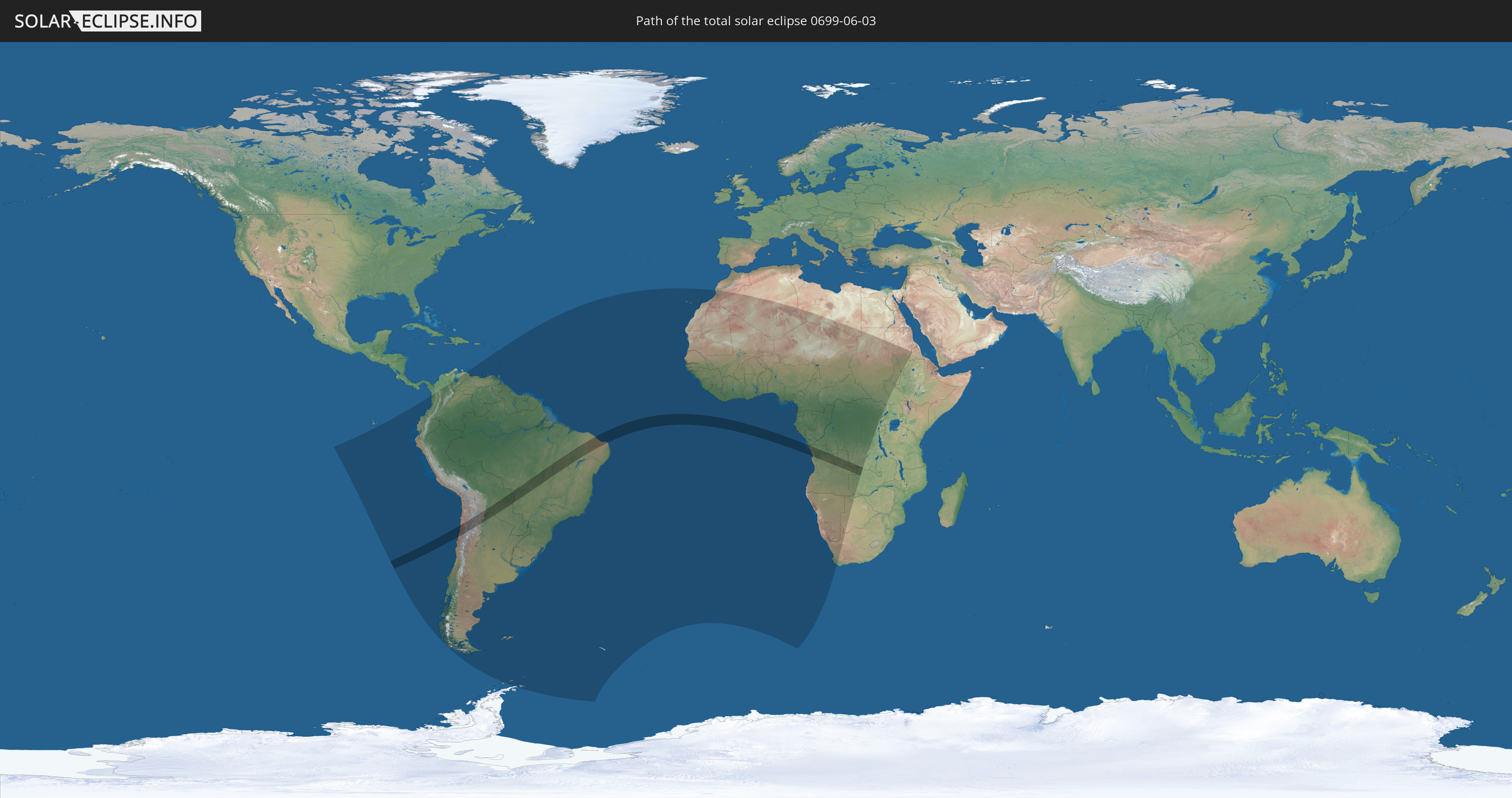
Die Sonnenfinsternis am 06/03/0699 kann man in 61 Ländern als partielle Sonnenfinsternis beobachten.
Der Finsternispfad verläuft durch 8 Länder. Nur in diesen Ländern ist sie als total Sonnenfinsternis zu sehen.
In den folgenden Ländern ist die Sonnenfinsternis total zu sehen
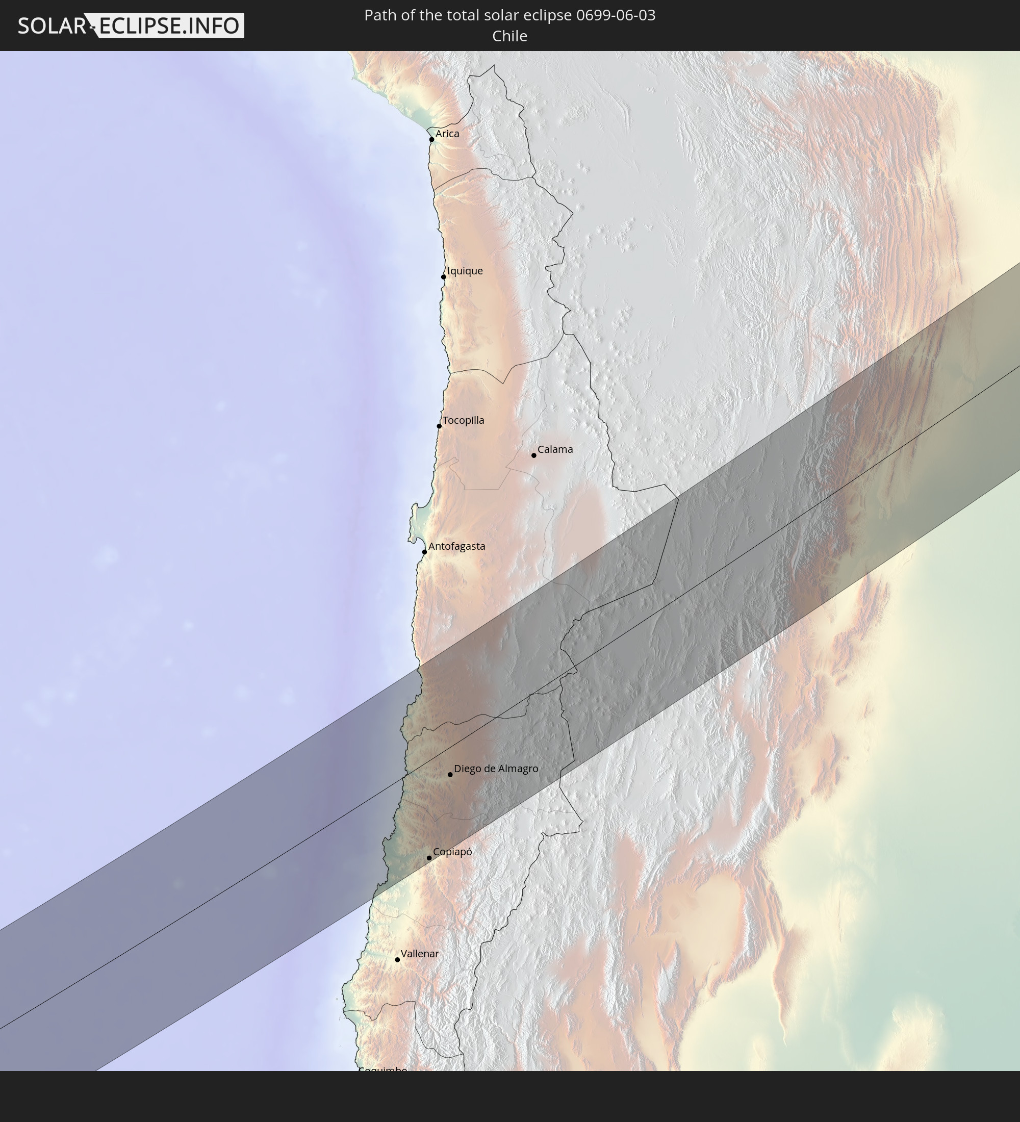 Chile
Chile
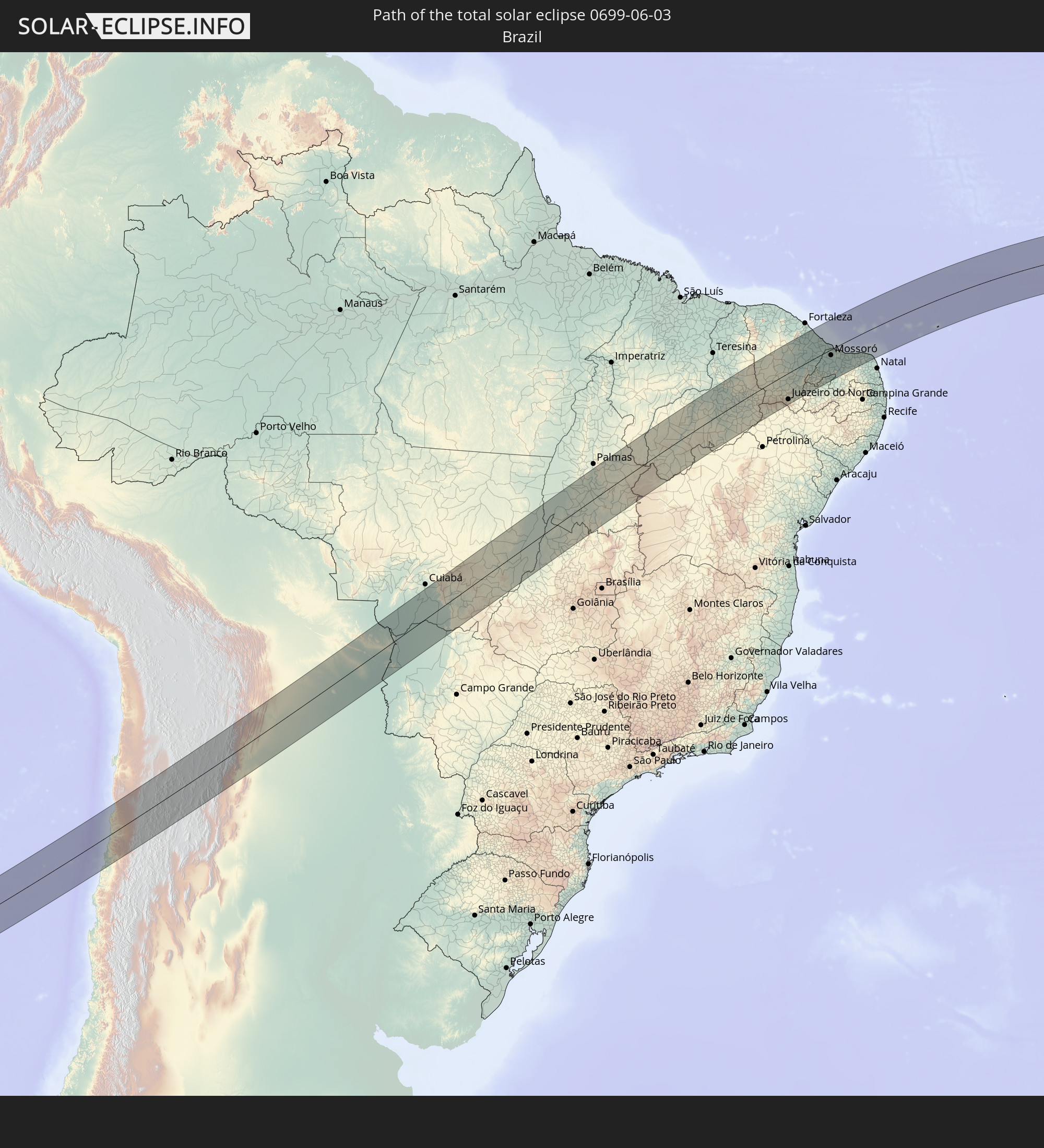 Brazil
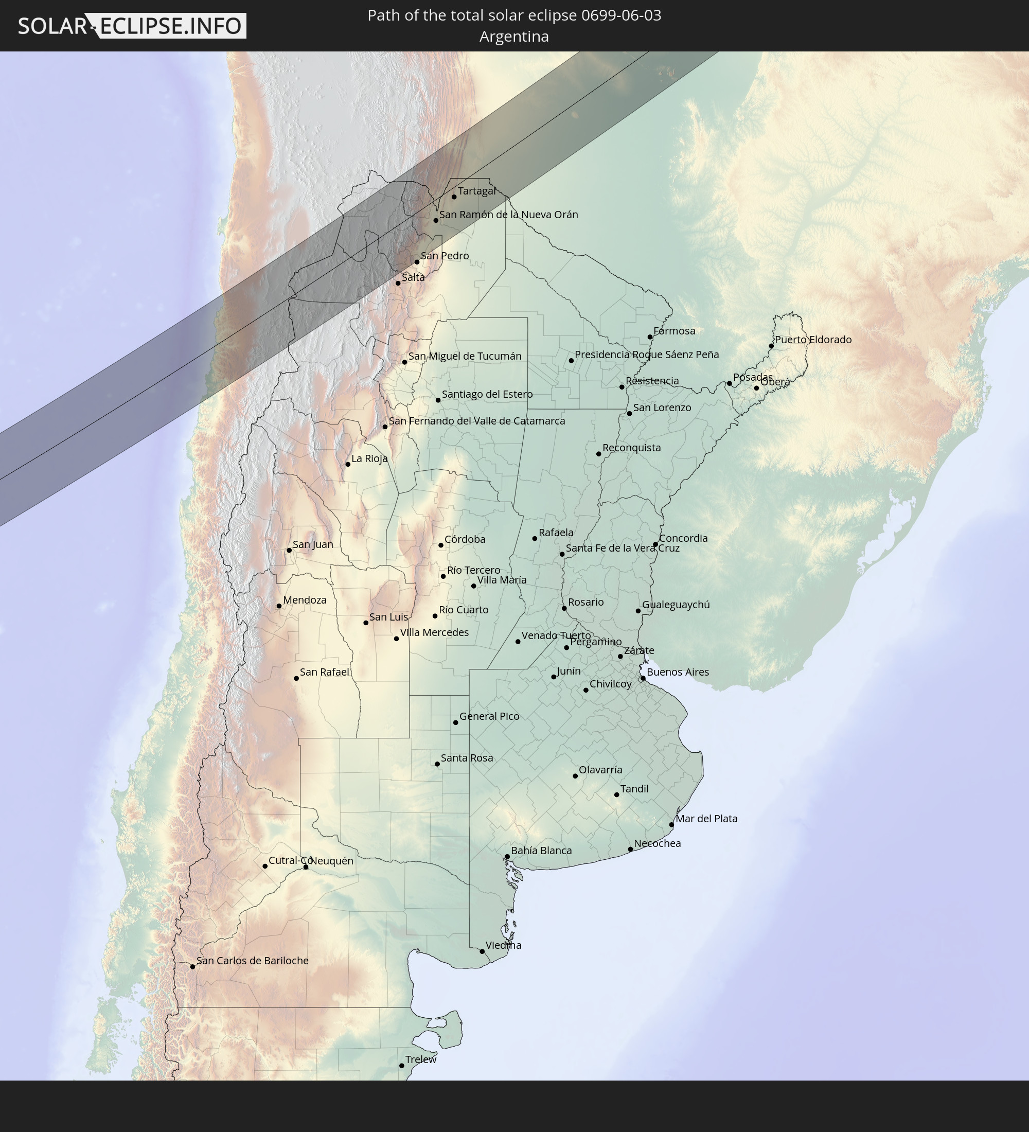 Argentina
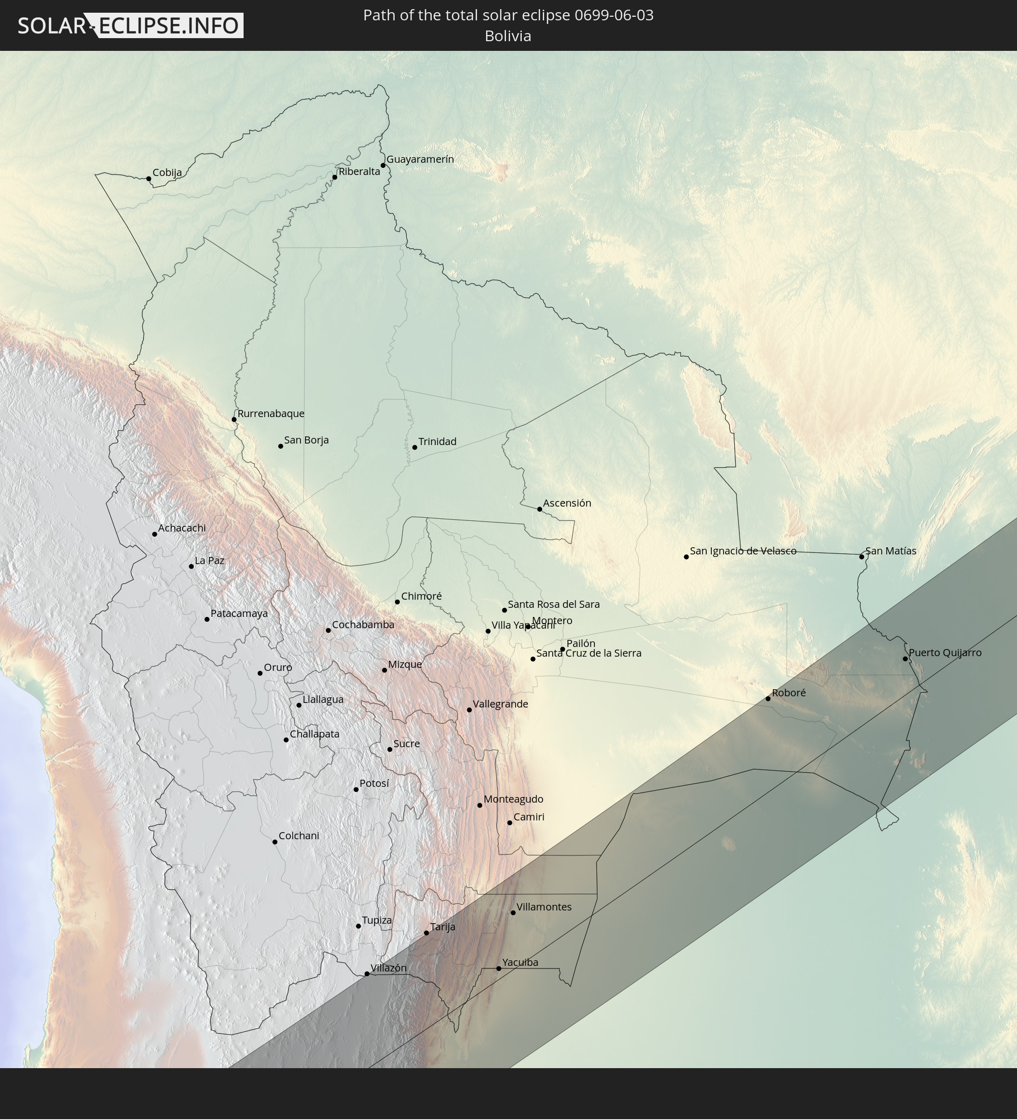 Bolivia
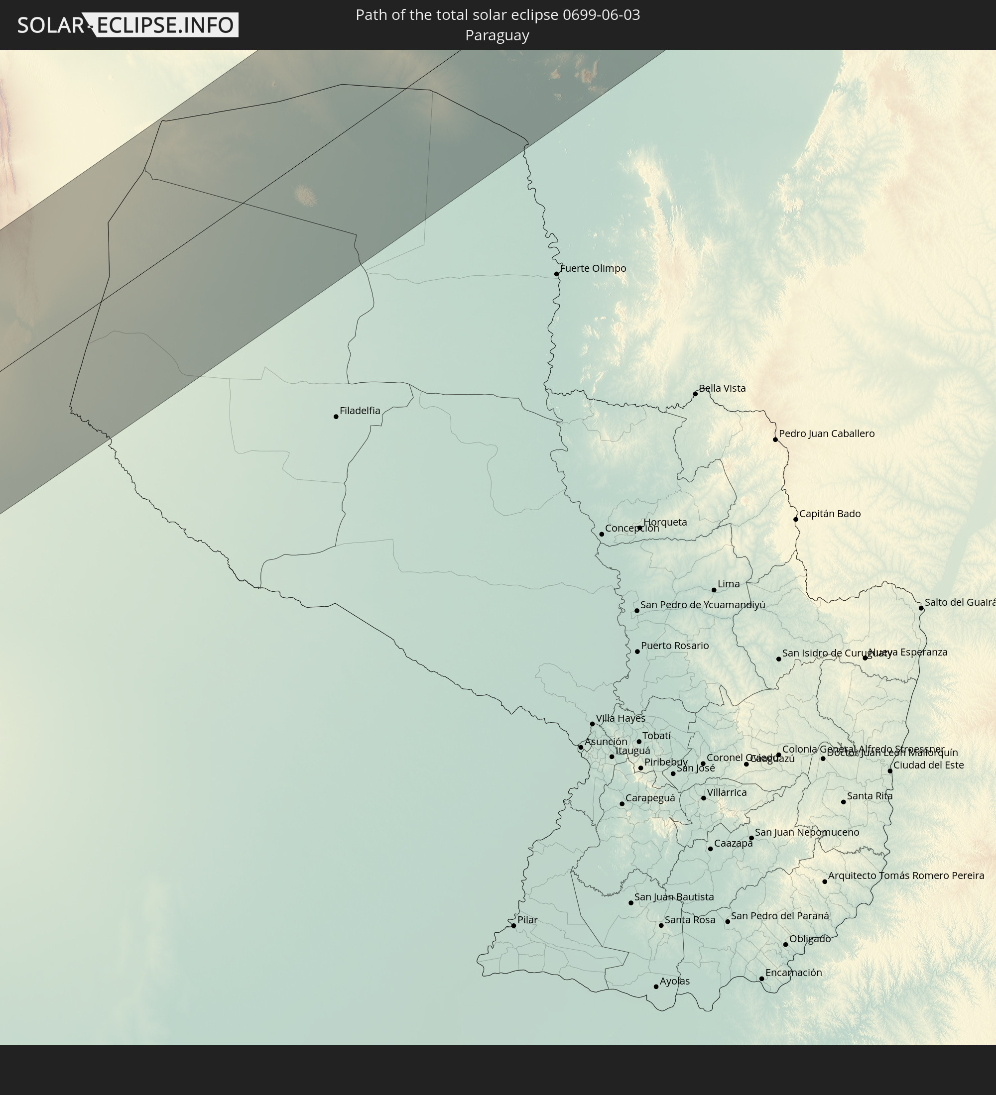 Paraguay
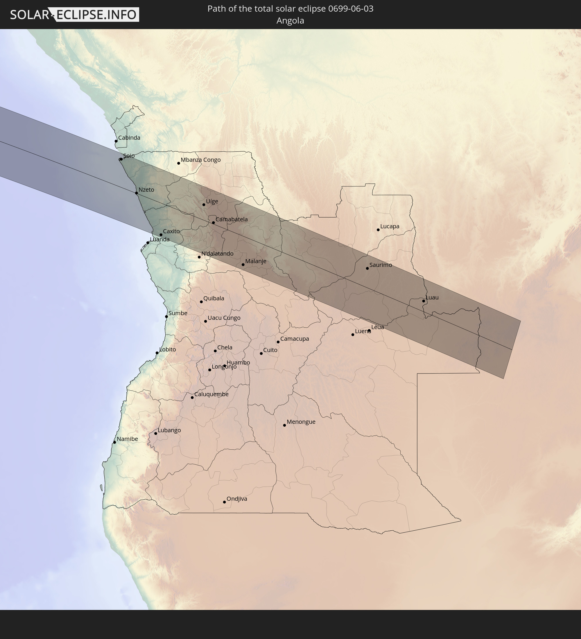 Angola
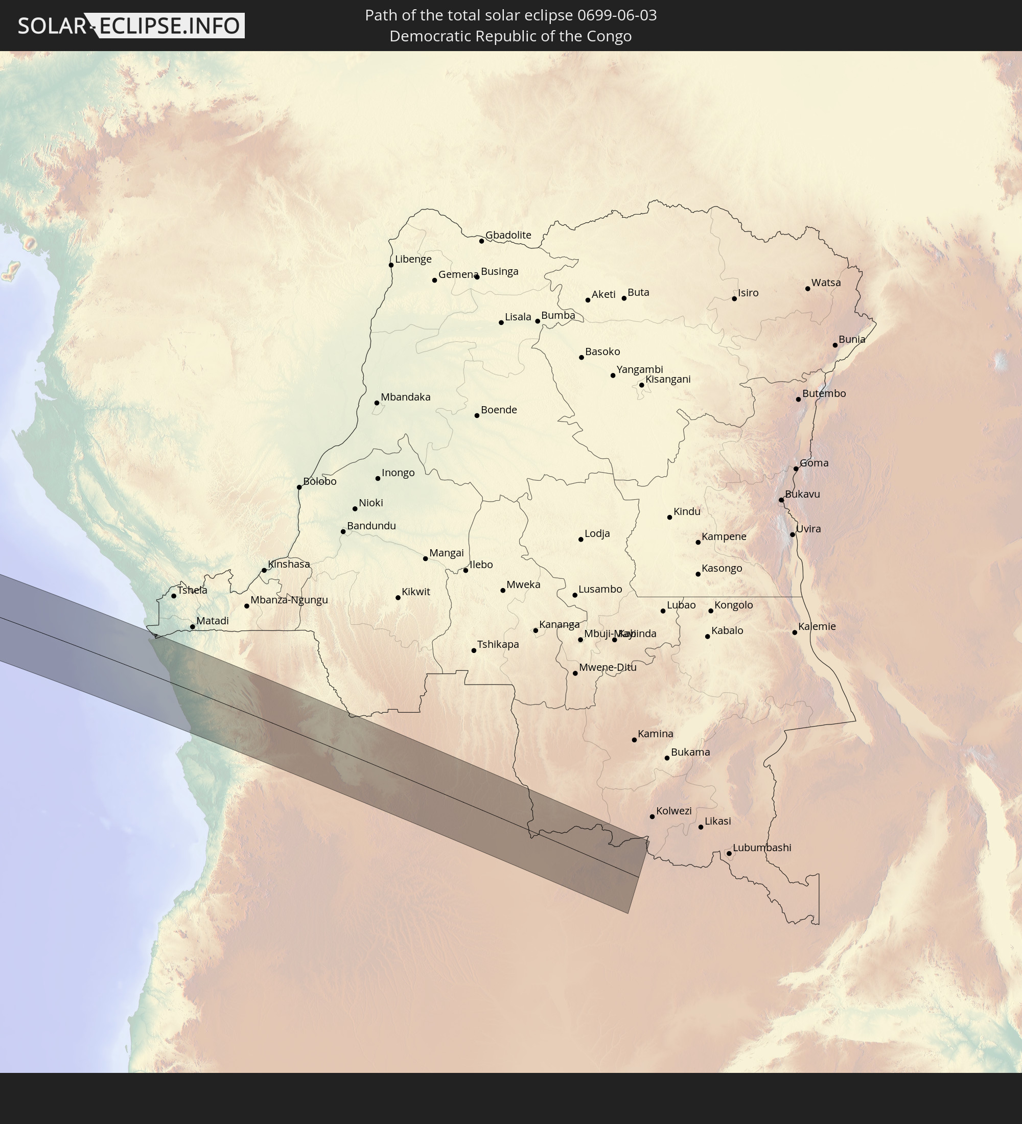 Democratic Republic of the Congo
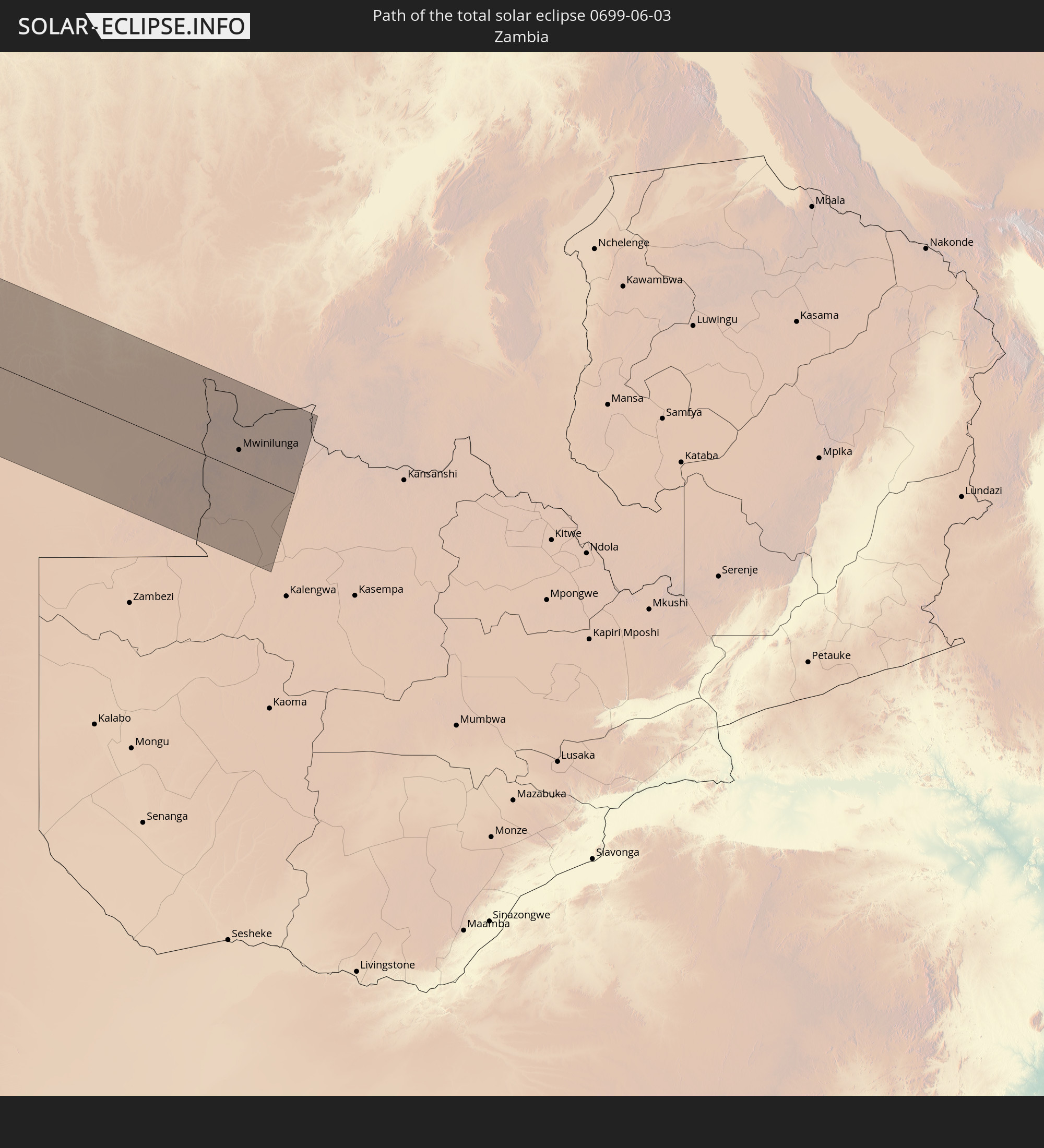 Zambia
In den folgenden Ländern ist die Sonnenfinsternis partiell zu sehen
 Antarctica
 Chile
Chile
 Ecuador
 Colombia
 Peru
Peru
 Brazil
 Argentina
 Venezuela
 Bolivia
 Paraguay
 Trinidad and Tobago
 Guadeloupe
 Grenada
 Dominica
 Saint Vincent and the Grenadines
 Falkland Islands
 Guyana
 Martinique
 Saint Lucia
 Barbados
 Uruguay
 Suriname
 French Guiana
 South Georgia and the South Sandwich Islands
 Portugal
 Cabo Verde
 Spain
Spain
 Senegal
 Mauritania
 The Gambia
 Guinea-Bissau
 Guinea
 Saint Helena, Ascension and Tristan da Cunha
 Sierra Leone
 Morocco
 Mali
Mali
 Liberia
 Algeria
 Ivory Coast
 Burkina Faso
 Ghana
Ghana
 Togo
Togo
 Niger
Niger
 Benin
Benin
 Nigeria
 Equatorial Guinea
 São Tomé and Príncipe
 Cameroon
 Gabon
Gabon
 Libya
Libya
 Republic of the Congo
 Angola
 Namibia
 Democratic Republic of the Congo
 Chad
Chad
 Central African Republic
 South Africa
 Botswana
 Sudan
Sudan
 Zambia
 Eritrea
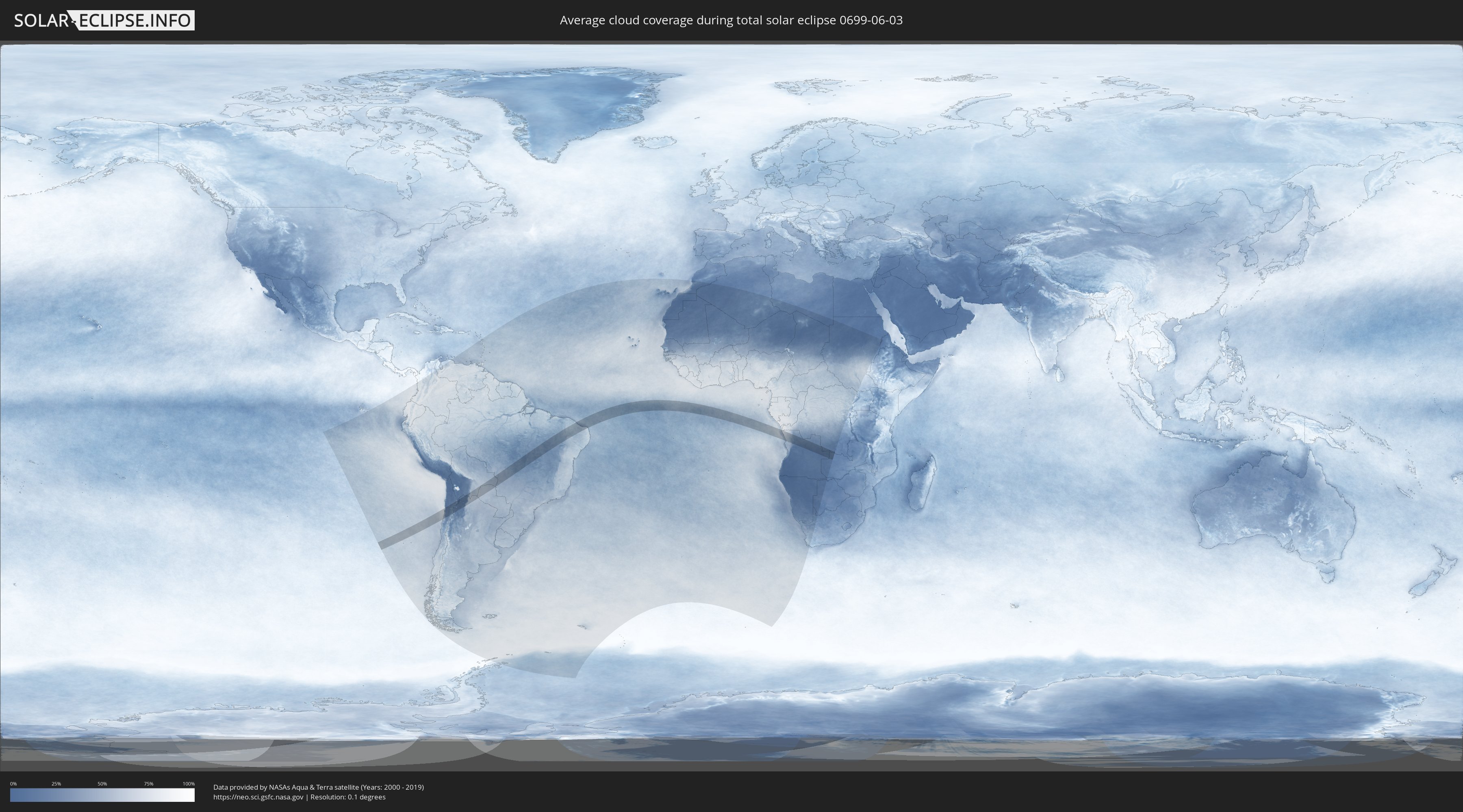
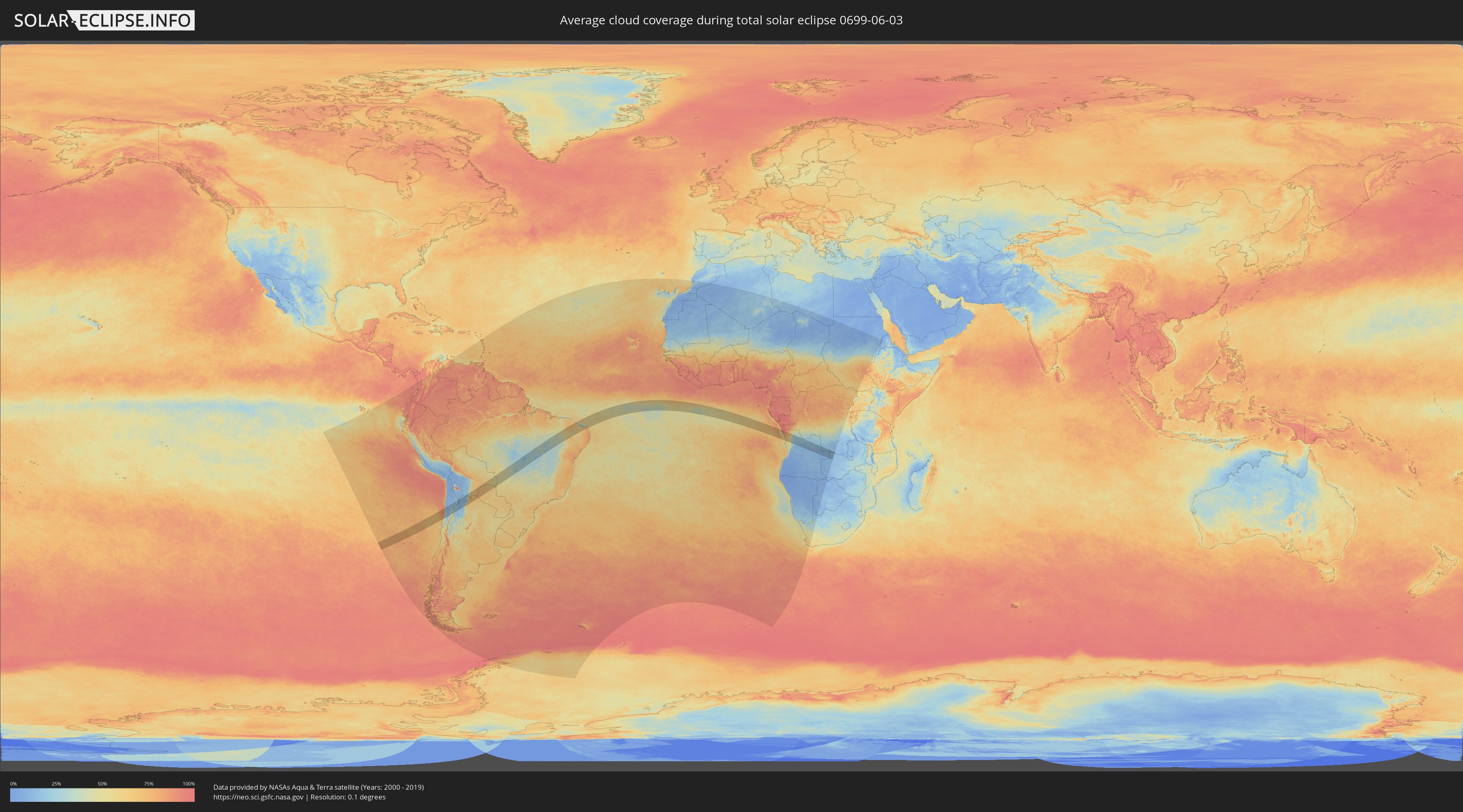
How will be the weather during the total solar eclipse on 06/03/0699?
Where is the best place to see the total solar eclipse of 06/03/0699?
The following maps show the average cloud coverage for the day of the total solar eclipse.
With the help of these maps, it is possible to find the place along the eclipse path, which has the best
chance of a cloudless sky.
Nevertheless, you should consider local circumstances and inform about the weather of your chosen
observation site.
The data is provided by NASAs satellites
AQUA and TERRA.
The cloud maps are averaged over a period of 19 years (2000 - 2019).
Detailed country maps
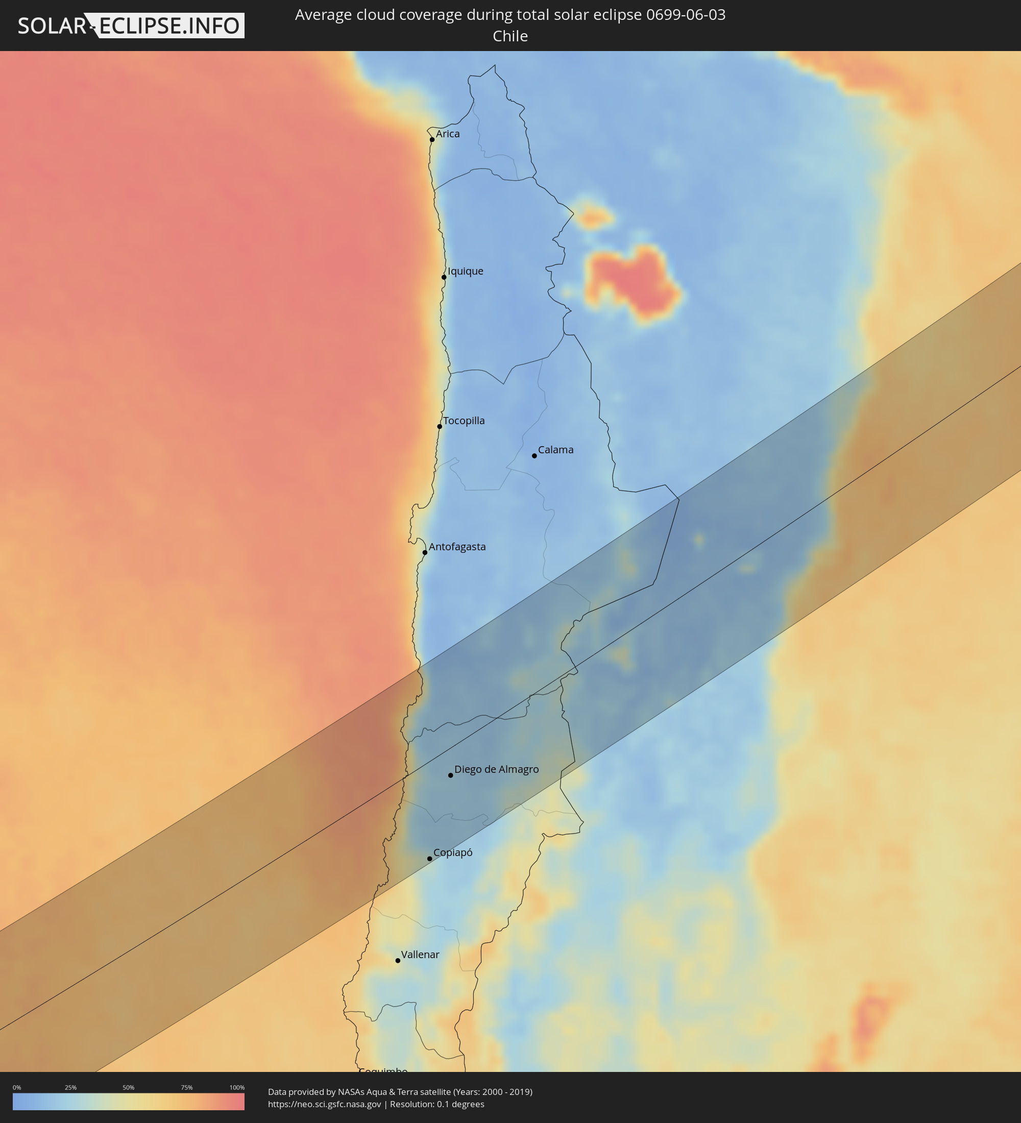 Chile
Chile
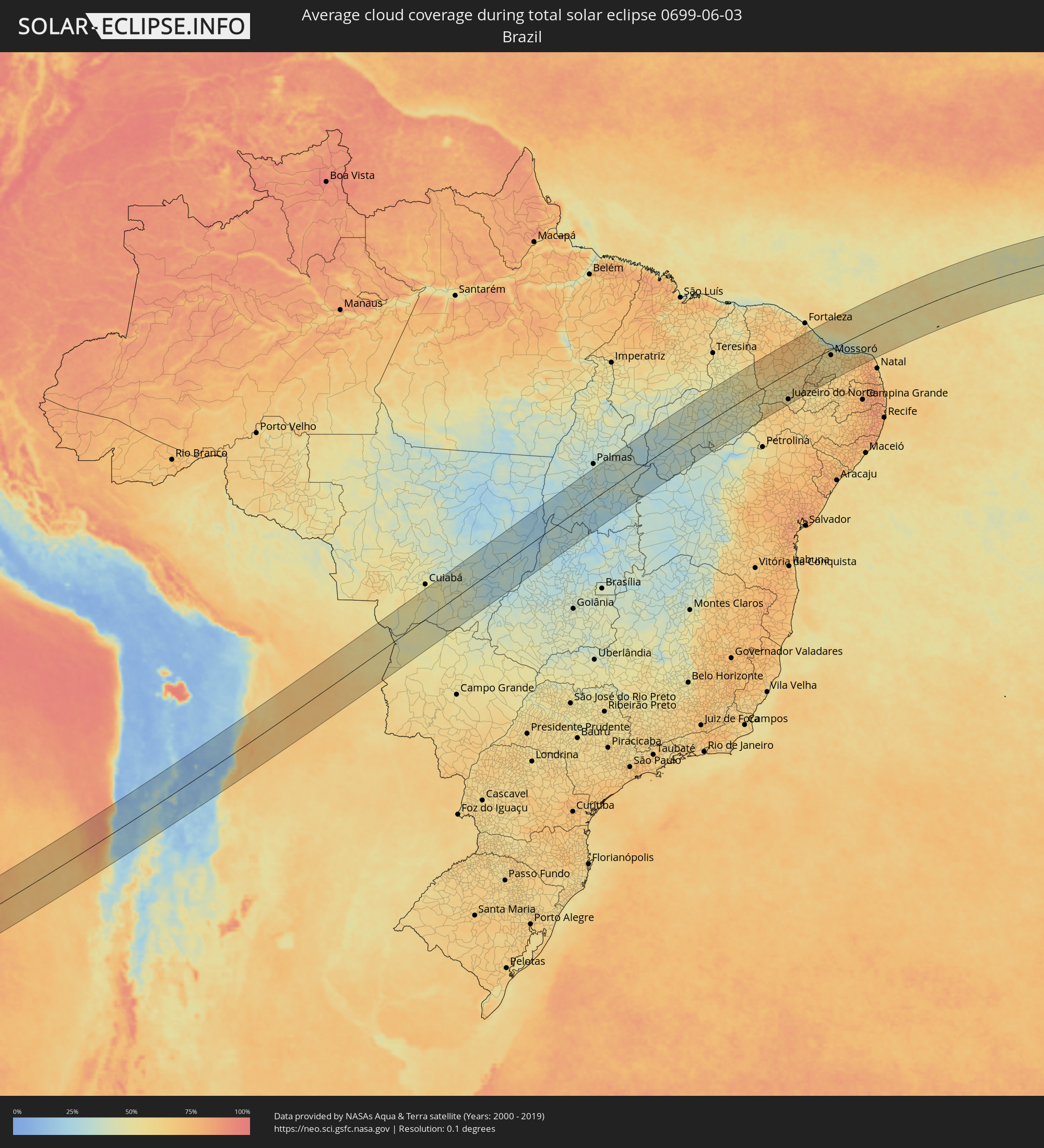 Brazil
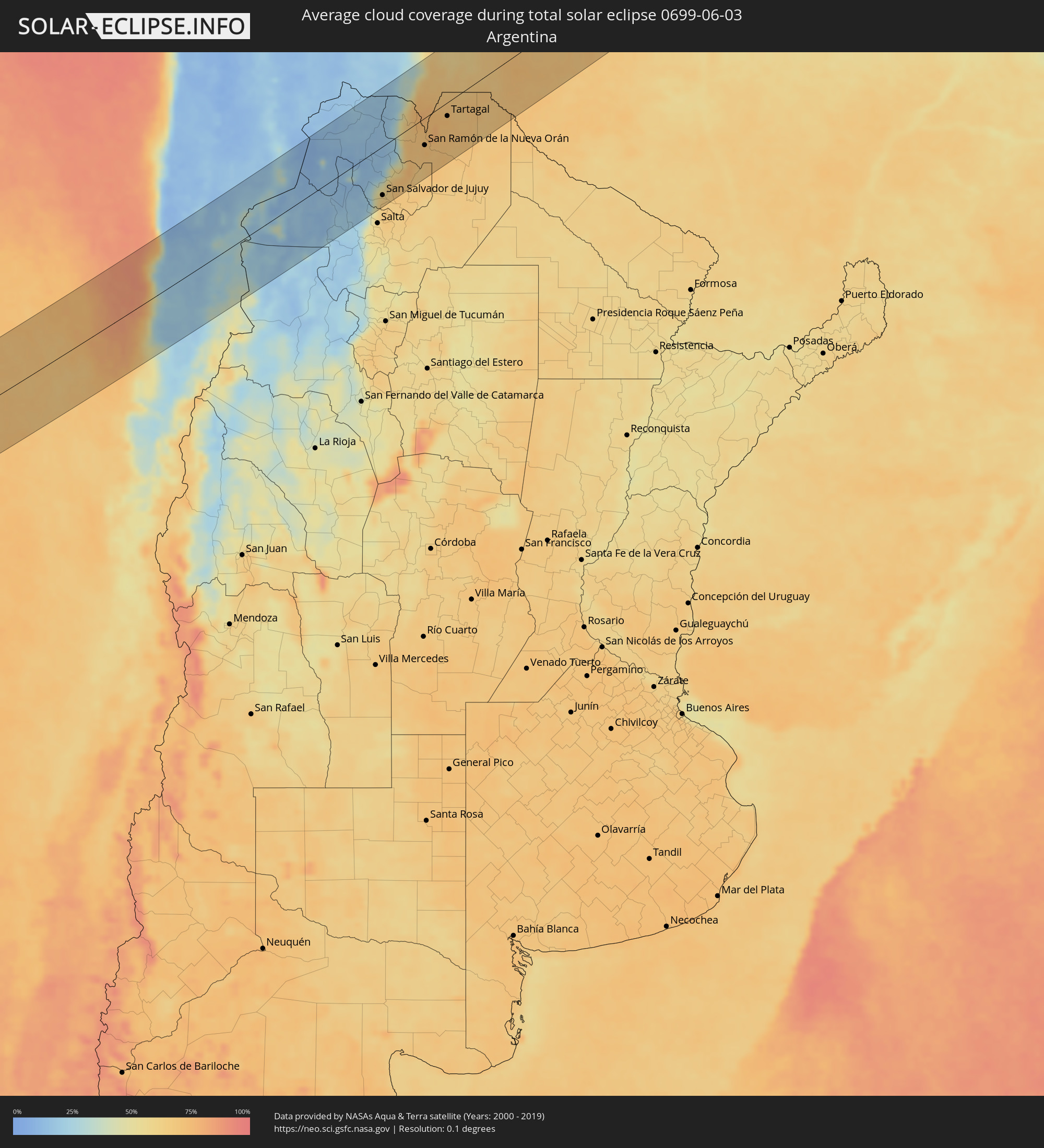 Argentina
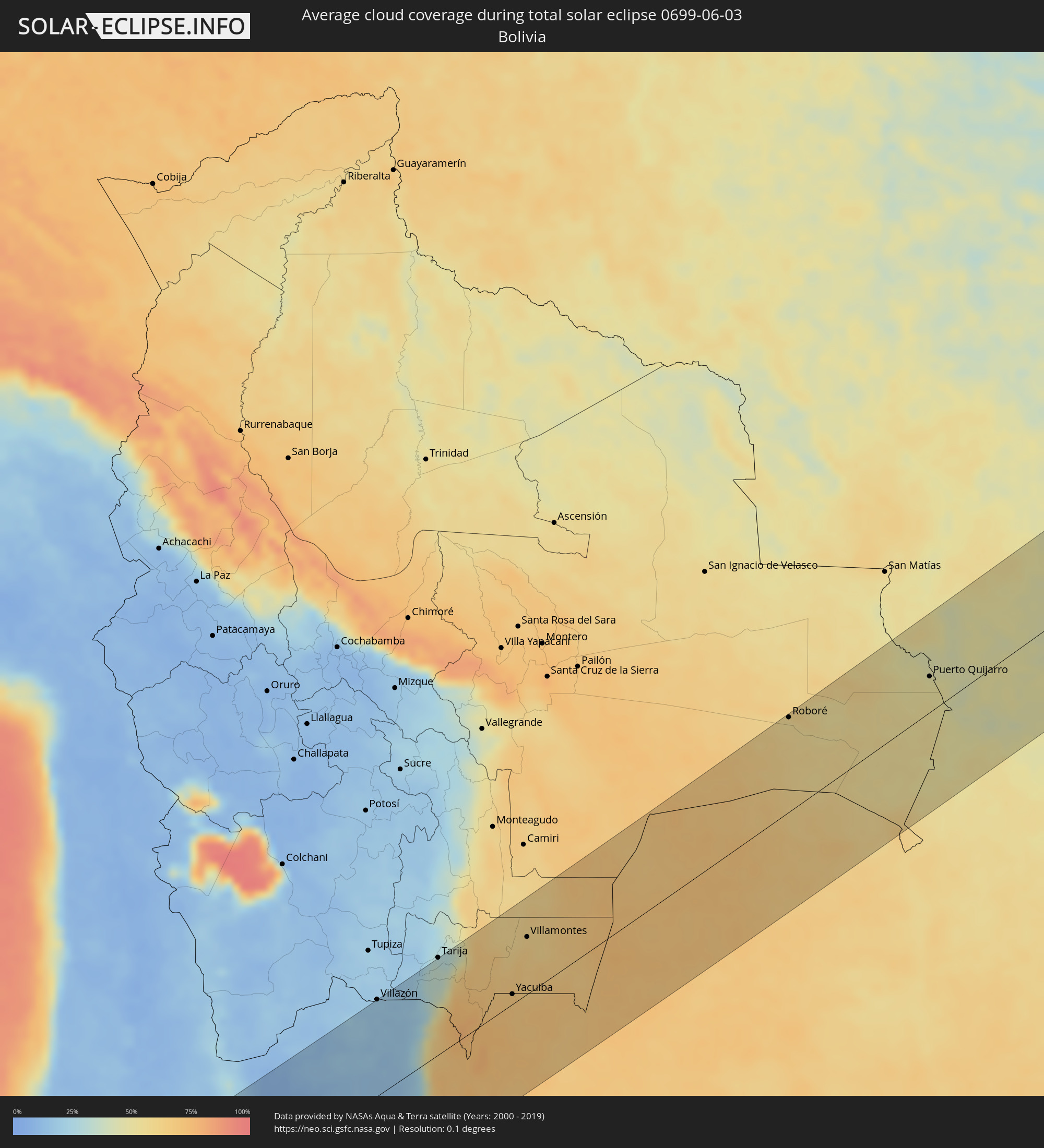 Bolivia
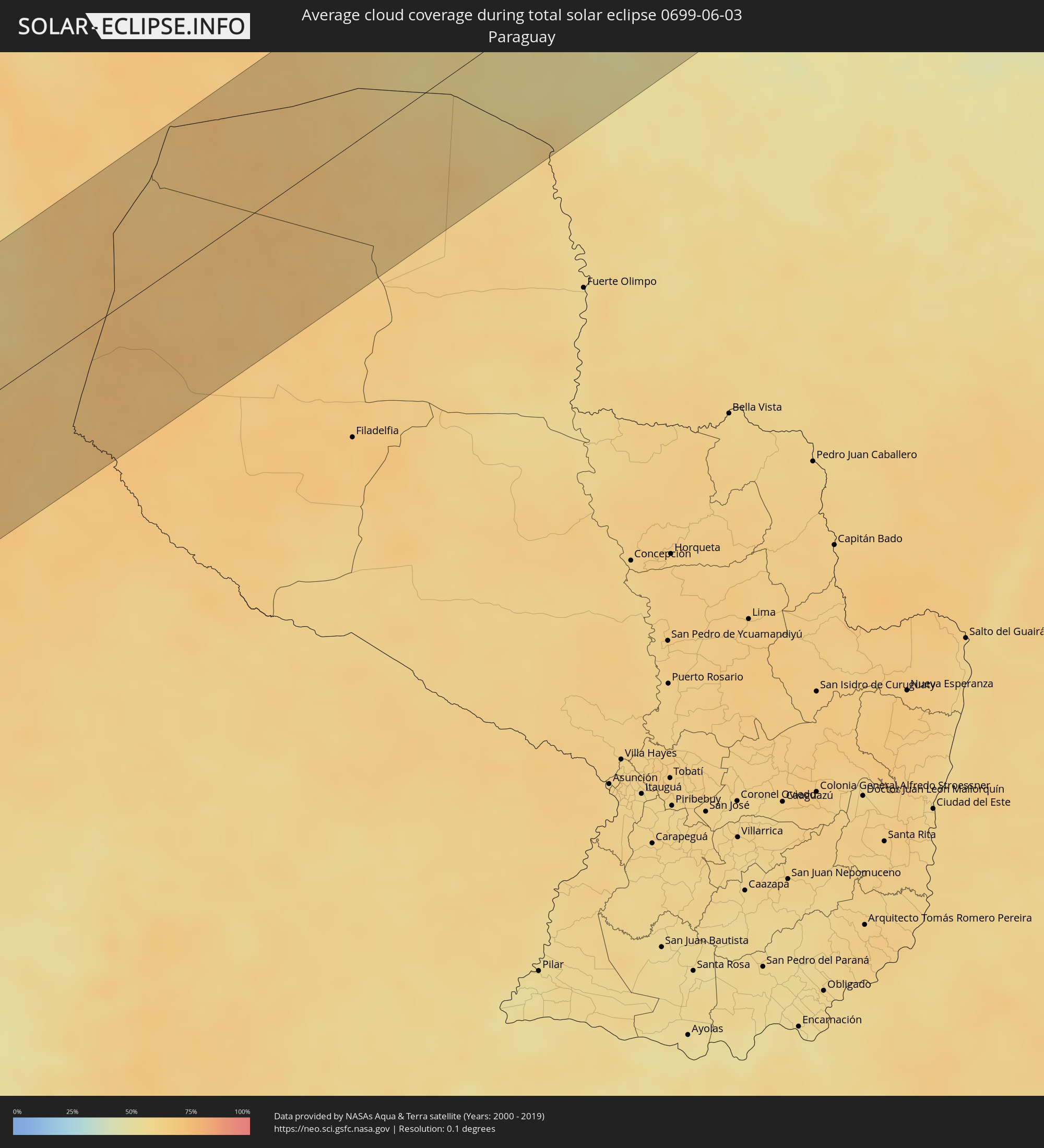 Paraguay
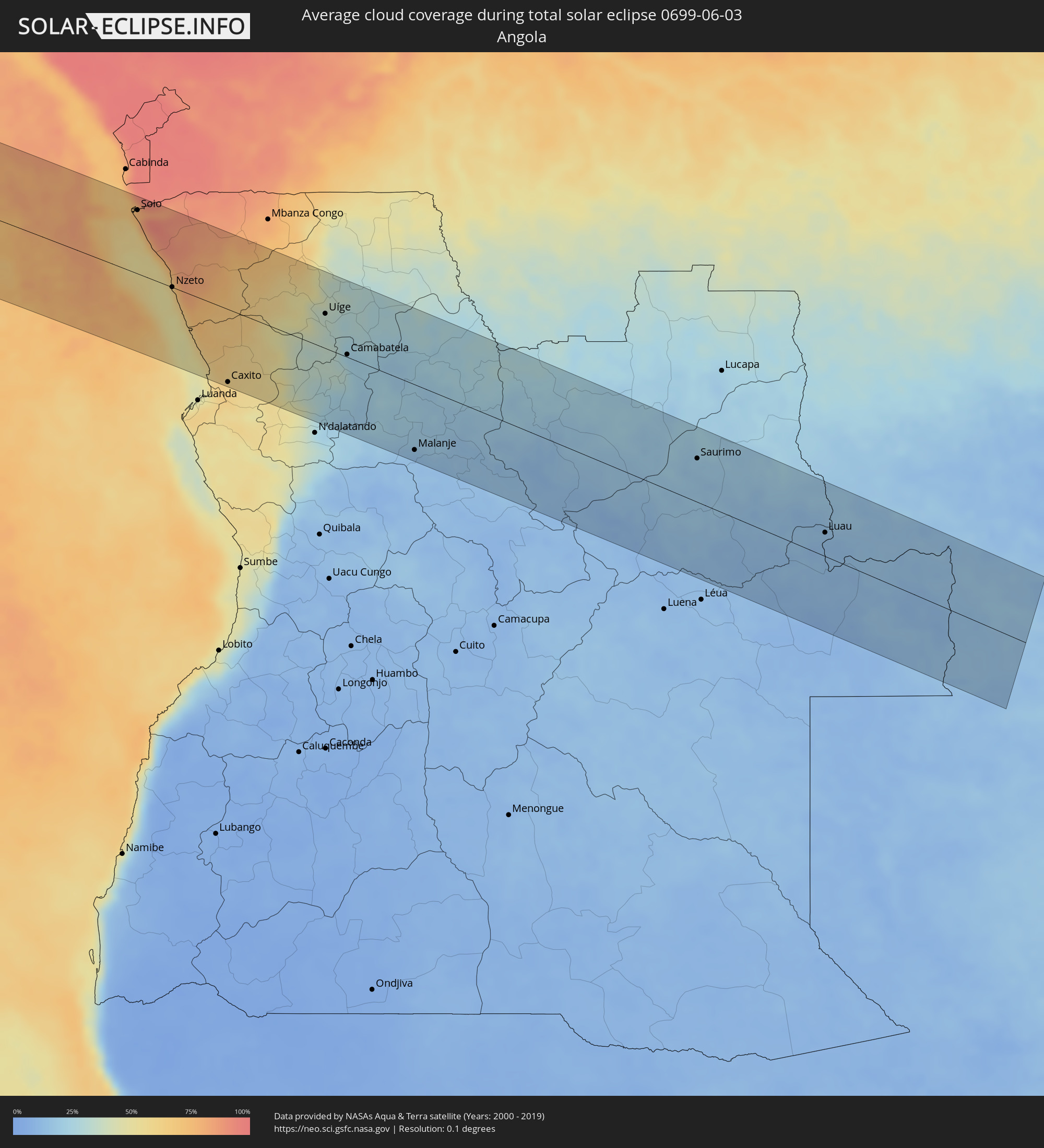 Angola
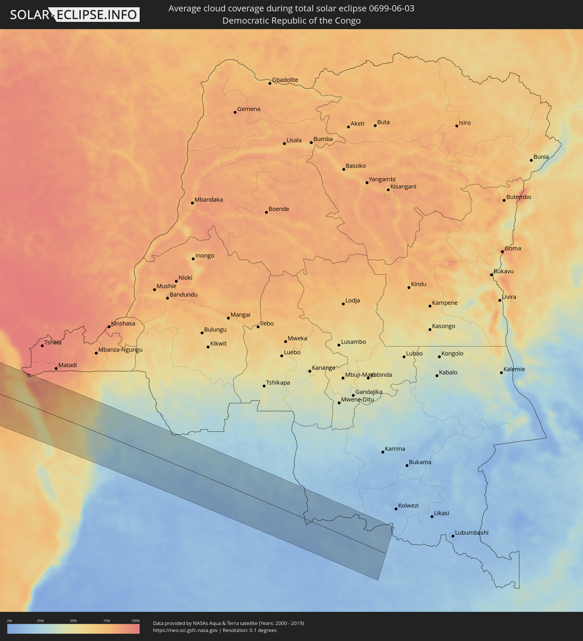 Democratic Republic of the Congo
 Zambia
Cities inside the path of the eclipse
The following table shows all locations with a population of more than 5,000 inside the eclipse path. Cities which have more than 100,000 inhabitants are marked bold. A click at the locations opens a detailed map.
| City | Type | Eclipse duration | Local time of max. eclipse | Distance to central line | Ø Cloud coverage |
|
Taltal, Antofagasta
|
total | - | 08:11:08 UTC-04:42 | 81 km | 53% |
|
Copiapó, Atacama
|
total | - | 08:11:23 UTC-04:42 | 111 km | 30% |
|
Diego de Almagro, Atacama
|
total | - | 08:11:30 UTC-04:42 | 32 km | 22% |
|
Abra Pampa, Jujuy Province
|
total | - | 08:41:17 UTC-04:16 | 64 km | 18% |
|
Villazón, Potosí
|
total | - | 08:25:40 UTC-04:32 | 117 km | 19% |
|
La Quiaca, Jujuy Province
|
total | - | 08:41:28 UTC-04:16 | 115 km | 19% |
|
Tilcara, Jujuy Province
|
total | - | 08:41:31 UTC-04:16 | 35 km | 16% |
|
Humahuaca, Jujuy Province
|
total | - | 08:41:34 UTC-04:16 | 1 km | 14% |
|
San Salvador de Jujuy, Jujuy Province
|
total | - | 08:41:32 UTC-04:16 | 95 km | 63% |
|
Palpalá, Jujuy Province
|
total | - | 08:41:36 UTC-04:16 | 106 km | 65% |
|
Fraile Pintado, Jujuy Province
|
total | - | 08:42:02 UTC-04:16 | 100 km | 68% |
|
Libertador General San Martín, Jujuy Province
|
total | - | 08:42:03 UTC-04:16 | 88 km | 70% |
|
Calilegua, Jujuy Province
|
total | - | 08:42:04 UTC-04:16 | 86 km | 70% |
|
Caimancito, Jujuy Province
|
total | - | 08:42:15 UTC-04:16 | 93 km | 66% |
|
Yuto, Jujuy Province
|
total | - | 08:42:23 UTC-04:16 | 91 km | 65% |
|
San Ramón de la Nueva Orán, Salta Province
|
total | - | 08:42:35 UTC-04:16 | 53 km | 71% |
|
Embarcación, Salta Province
|
total | - | 08:42:48 UTC-04:16 | 73 km | 69% |
|
General Enrique Mosconi, Salta Province
|
total | - | 08:43:11 UTC-04:16 | 33 km | 72% |
|
Tartagal, Salta Province
|
total | - | 08:43:12 UTC-04:16 | 27 km | 72% |
|
Yacuiba, Tarija
|
total | - | 08:27:37 UTC-04:32 | 12 km | 69% |
|
Villamontes, Tarija
|
total | - | 08:27:59 UTC-04:32 | 69 km | 63% |
|
Roboré, Santa Cruz
|
total | - | 08:33:11 UTC-04:32 | 115 km | 55% |
|
Puerto Quijarro, Santa Cruz
|
total | - | 08:36:04 UTC-04:32 | 44 km | 49% |
|
Corumbá, Mato Grosso do Sul
|
total | - | 09:29:52 UTC-03:38 | 74 km | 52% |
|
Poconé, Mato Grosso
|
total | - | 09:32:32 UTC-03:38 | 112 km | 52% |
|
Lucas, Mato Grosso
|
total | - | 09:33:31 UTC-03:38 | 62 km | 41% |
|
Jaciara, Mato Grosso
|
total | - | 09:35:12 UTC-03:38 | 35 km | 42% |
|
Rondonópolis, Mato Grosso
|
total | - | 09:35:27 UTC-03:38 | 31 km | 44% |
|
Porangatu, Goiás
|
total | - | 10:18:57 UTC-03:06 | 101 km | 29% |
|
Gurupi, Tocantins
|
total | - | 10:52:52 UTC-02:34 | 50 km | 31% |
|
Oeiras, Piauí
|
total | - | 11:12:30 UTC-02:34 | 62 km | 41% |
|
Picos, Piauí
|
total | - | 11:14:06 UTC-02:34 | 19 km | 52% |
|
Araripina, Pernambuco
|
total | - | 11:30:28 UTC-02:19 | 84 km | 60% |
|
Várzea Alegre, Ceará
|
total | - | 11:18:38 UTC-02:34 | 122 km | 70% |
|
São João dos Inhamuns, Ceará
|
total | - | 11:18:13 UTC-02:34 | 54 km | 64% |
|
Boa Viagem, Ceará
|
total | - | 11:20:34 UTC-02:34 | 108 km | 73% |
|
Pedra Branca, Ceará
|
total | - | 11:20:16 UTC-02:34 | 75 km | 73% |
|
Acopiara, Ceará
|
total | - | 11:20:17 UTC-02:34 | 1 km | 63% |
|
Juazeiro do Norte, Ceará
|
total | - | 11:19:31 UTC-02:34 | 116 km | 59% |
|
Iguatu, Ceará
|
total | - | 11:20:26 UTC-02:34 | 35 km | 59% |
|
Quixeramobim, Ceará
|
total | - | 11:21:39 UTC-02:34 | 77 km | 67% |
|
Quixadá, Ceará
|
total | - | 11:22:37 UTC-02:34 | 84 km | 69% |
|
Icó, Ceará
|
total | - | 11:21:33 UTC-02:34 | 63 km | 60% |
|
Jaguaribe, Ceará
|
total | - | 11:22:43 UTC-02:34 | 27 km | 64% |
|
Cajazeiras, Paraíba
|
total | - | 11:21:52 UTC-02:34 | 127 km | 57% |
|
Pacajus, Ceará
|
total | - | 11:24:58 UTC-02:34 | 132 km | 69% |
|
Morada Nova, Ceará
|
total | - | 11:24:12 UTC-02:34 | 36 km | 62% |
|
Cascavel, Ceará
|
total | - | 11:25:36 UTC-02:34 | 124 km | 57% |
|
Sousa, Paraíba
|
total | - | 11:22:53 UTC-02:34 | 132 km | 58% |
|
Limoeiro do Norte, Ceará
|
total | - | 11:24:55 UTC-02:34 | 18 km | 63% |
|
Russas, Ceará
|
total | - | 11:25:28 UTC-02:34 | 31 km | 64% |
|
Jaguaruana, Ceará
|
total | - | 11:26:06 UTC-02:34 | 31 km | 65% |
|
Aracati, Ceará
|
total | - | 11:26:25 UTC-02:34 | 57 km | 58% |
|
São Bento, Paraíba
|
total | - | 11:24:41 UTC-02:34 | 112 km | 63% |
|
Mossoró, Rio Grande do Norte
|
total | - | 11:26:56 UTC-02:34 | 26 km | 59% |
|
Açu, Rio Grande do Norte
|
total | - | 11:27:44 UTC-02:34 | 87 km | 56% |
|
João Câmara, Rio Grande do Norte
|
total | - | 11:30:51 UTC-02:34 | 139 km | 79% |
|
Soio, Zaire
|
total | - | 16:04:43 UTC+00:13 | 94 km | 84% |
|
Nzeto, Zaire
|
total | - | 16:04:42 UTC+00:13 | 0 km | 68% |
|
Caxito, Bengo
|
total | - | 16:04:44 UTC+00:13 | 107 km | 59% |
|
Uíge, Uíge
|
total | - | 16:06:00 UTC+00:13 | 51 km | 33% |
|
Camabatela, Cuanza Norte
|
total | - | 16:05:58 UTC+00:13 | 4 km | 23% |
|
Malanje, Malanje
|
total | - | 16:05:58 UTC+00:13 | 95 km | 12% |
|
Saurimo, Lunda Sul
|
total | - | 16:07:47 UTC+00:13 | 63 km | 18% |
|
Luau, Moxico
|
total | - | 16:07:58 UTC+00:13 | 34 km | 13% |
|
Mwinilunga, North-Western
|
total | - | 18:04:50 UTC+02:10 | 24 km | 15% |