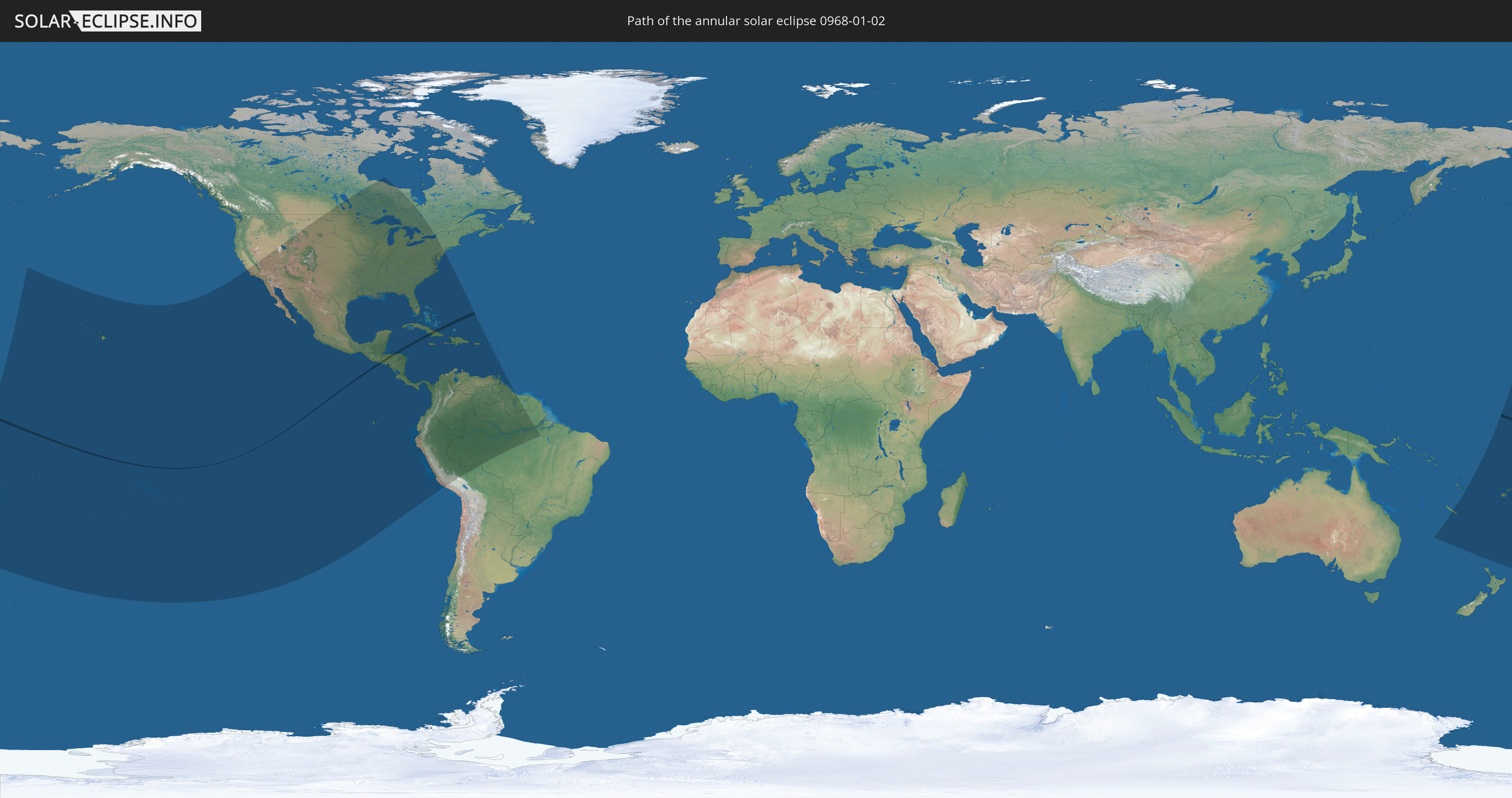
Annular solar eclipse of 01/02/0968
| Day of week: | Saturday |
| Maximum duration of eclipse: | 00m21s |
| Maximum width of eclipse path: | 12 km |
| Saros cycle: | 105 |
| Coverage: | 99.7% |
| Magnitude: | 0.9967 |
| Gamma: | 0.249 |
Wo kann man die Sonnenfinsternis vom 01/02/0968 sehen?
Die Sonnenfinsternis am 01/02/0968 kann man in 50 Ländern als partielle Sonnenfinsternis beobachten.
Der Finsternispfad verläuft durch 5 Länder. Nur in diesen Ländern ist sie als annular Sonnenfinsternis zu sehen.
In den folgenden Ländern ist die Sonnenfinsternis annular zu sehen
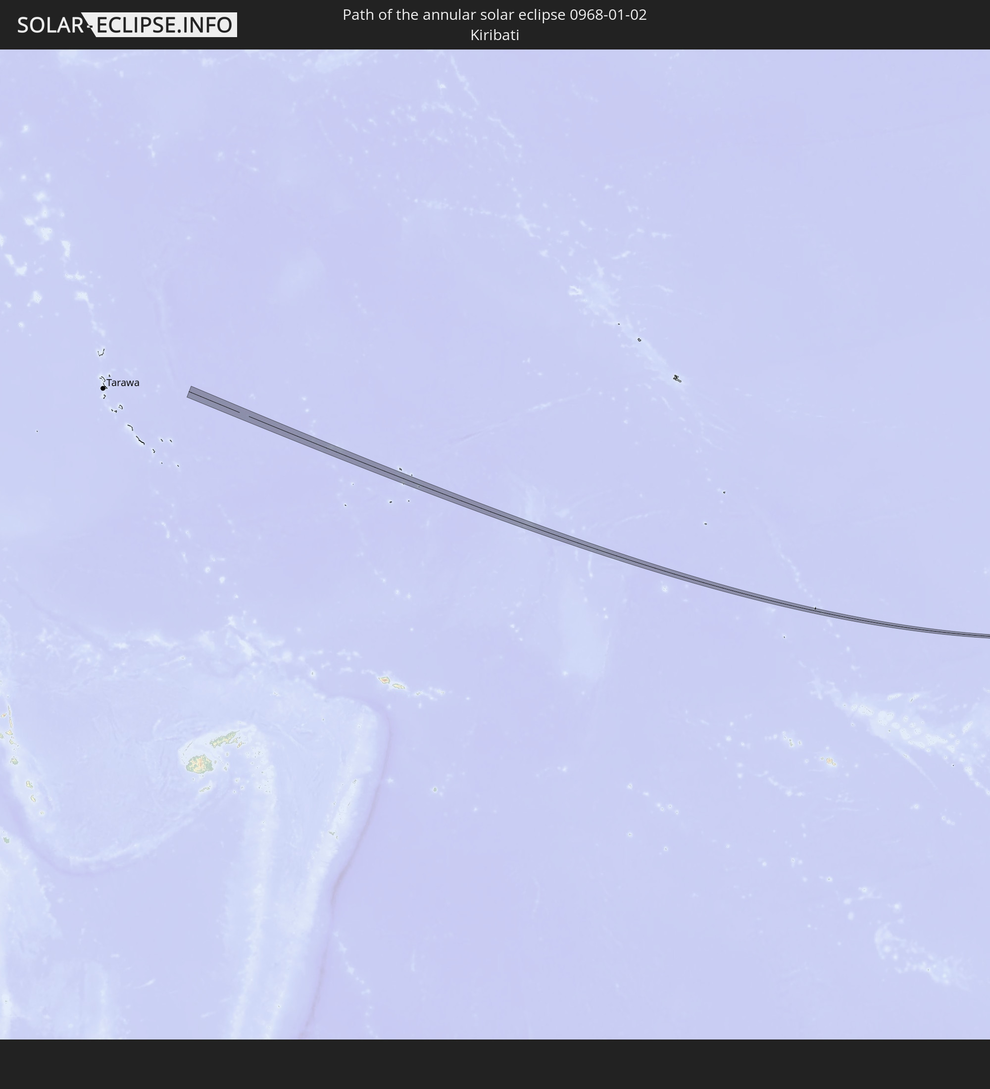 Kiribati
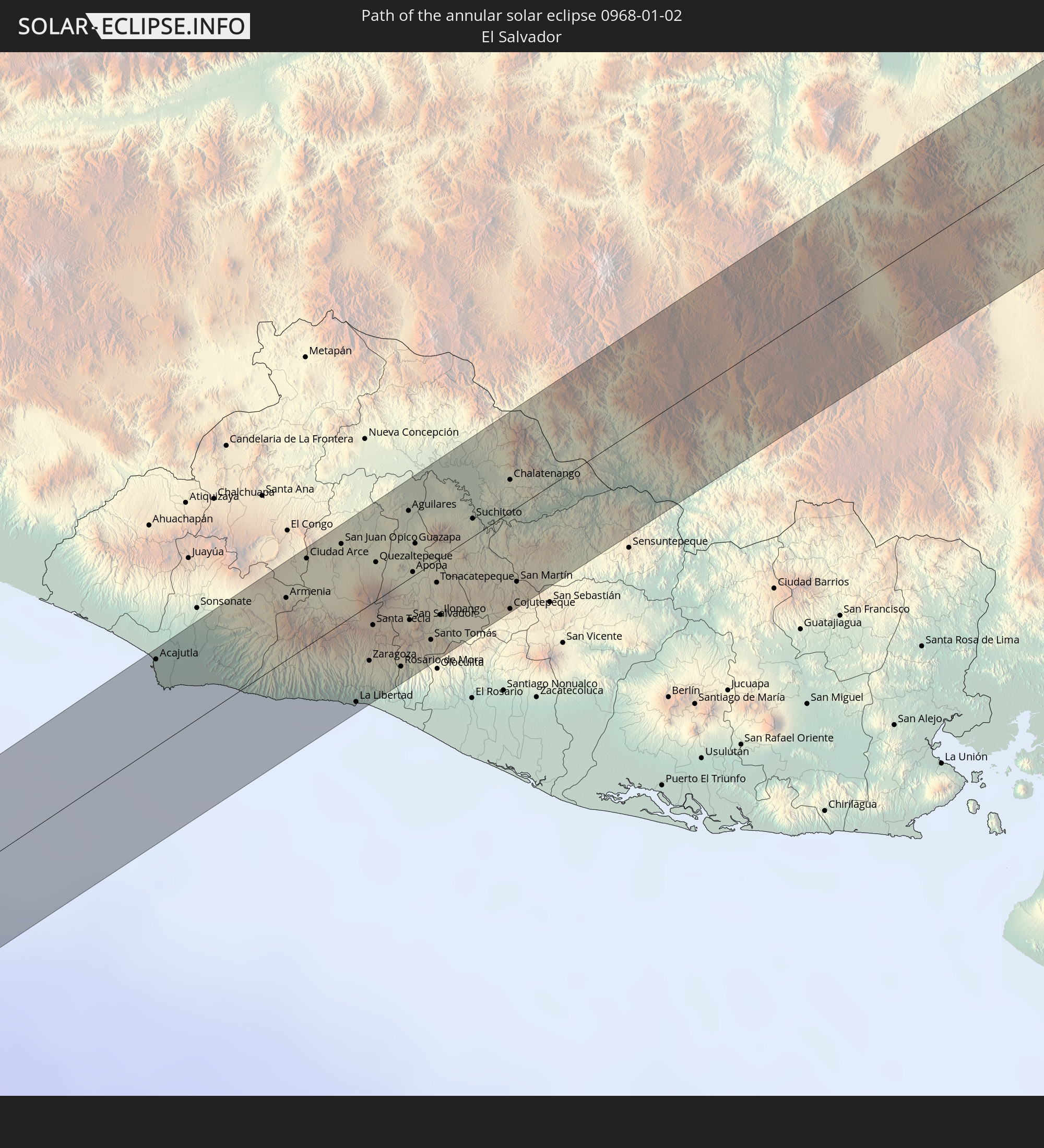 El Salvador
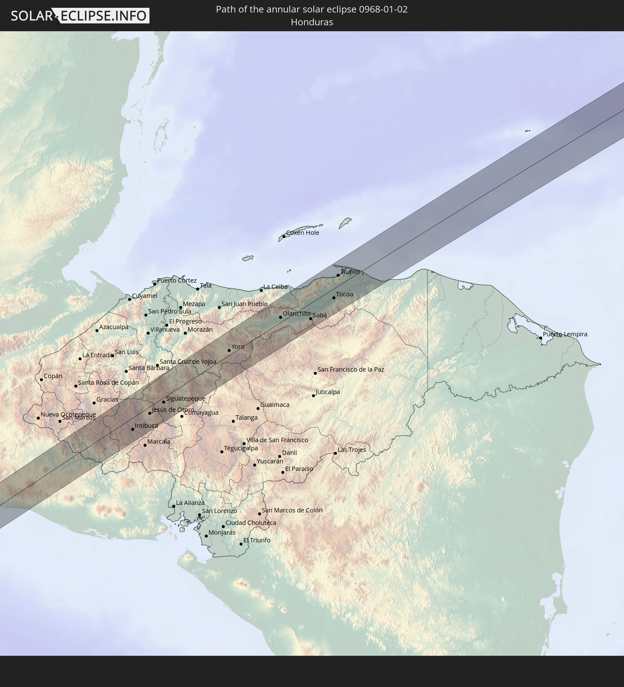 Honduras
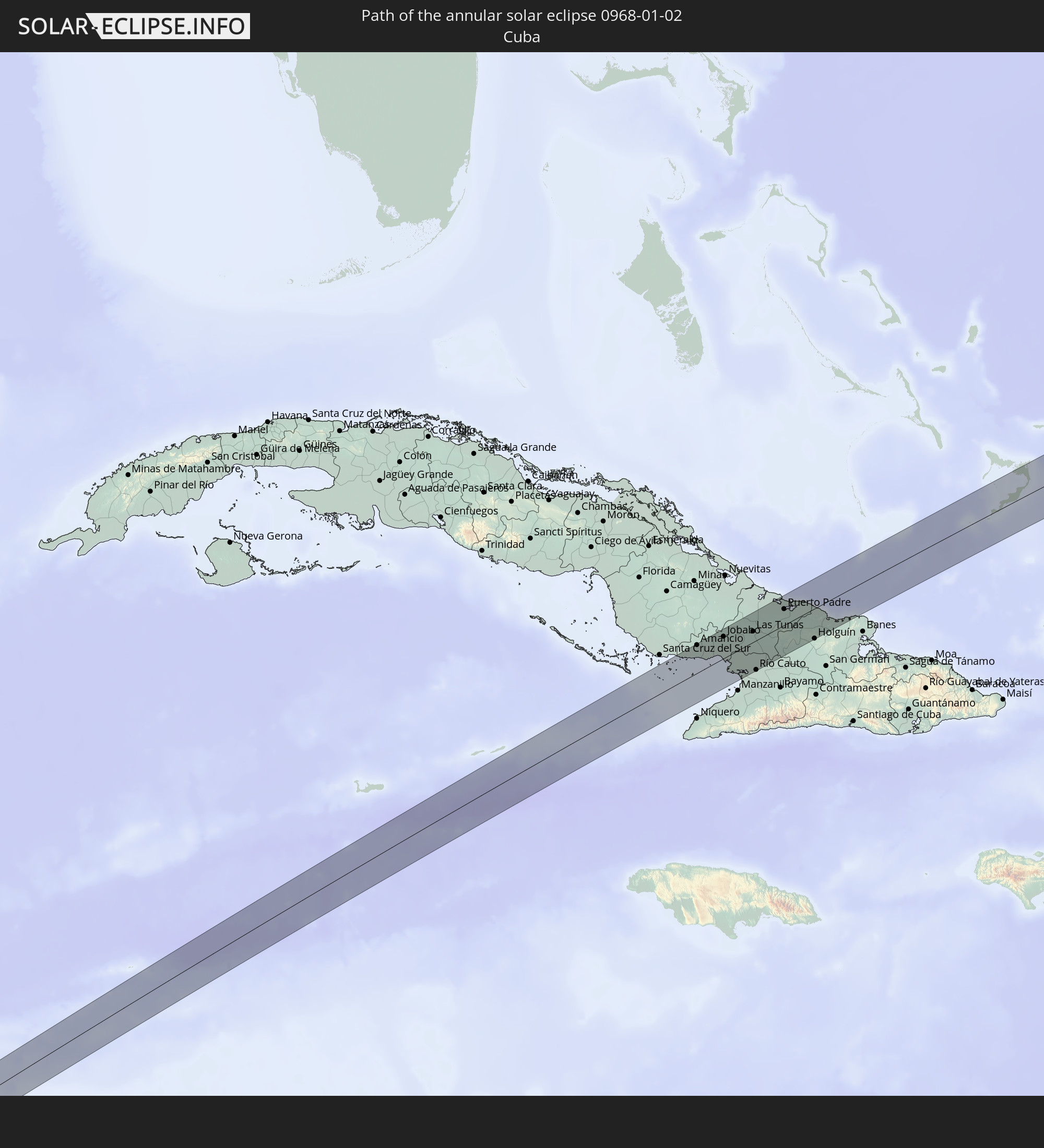 Cuba
Cuba
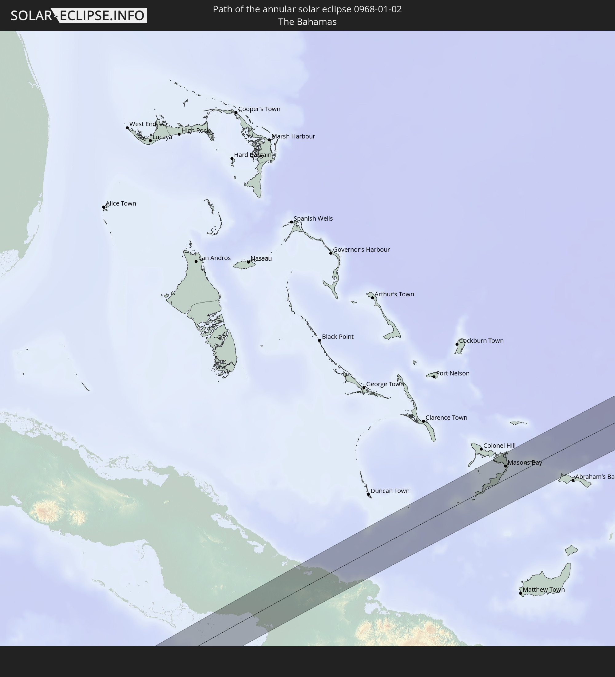 The Bahamas
In den folgenden Ländern ist die Sonnenfinsternis partiell zu sehen
 Fiji
Fiji
 United States
 New Zealand
 United States Minor Outlying Islands
 Wallis and Futuna
 Tonga
Tonga
 Kiribati
 Samoa
Samoa
 Tokelau
 American Samoa
 Niue
Niue
 Cook Islands
 French Polynesia
 Canada
 Pitcairn Islands
 Mexico
 Chile
Chile
 Guatemala
 Ecuador
 El Salvador
 Honduras
 Belize
 Nicaragua
 Costa Rica
 Cuba
Cuba
 Panama
 Colombia
 Cayman Islands
 Peru
Peru
 The Bahamas
 Jamaica
 Haiti
Haiti
 Brazil
 Venezuela
 Turks and Caicos Islands
 Dominican Republic
 Aruba
Aruba
 Bolivia
 Puerto Rico
 United States Virgin Islands
 British Virgin Islands
 Trinidad and Tobago
 Grenada
 Saint Vincent and the Grenadines
 Guyana
 Suriname
 New Caledonia
 Vanuatu
 Norfolk Island
 Tuvalu
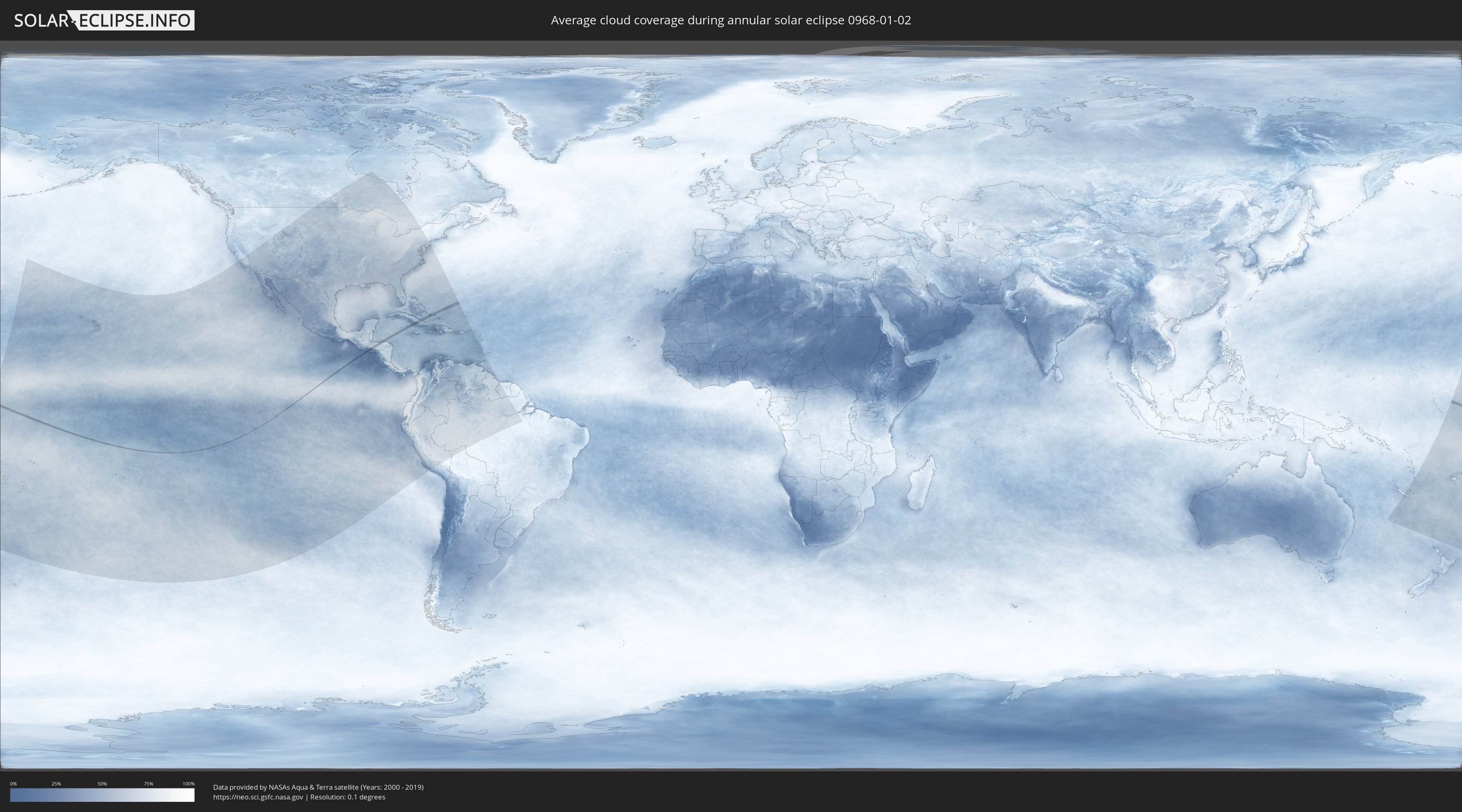
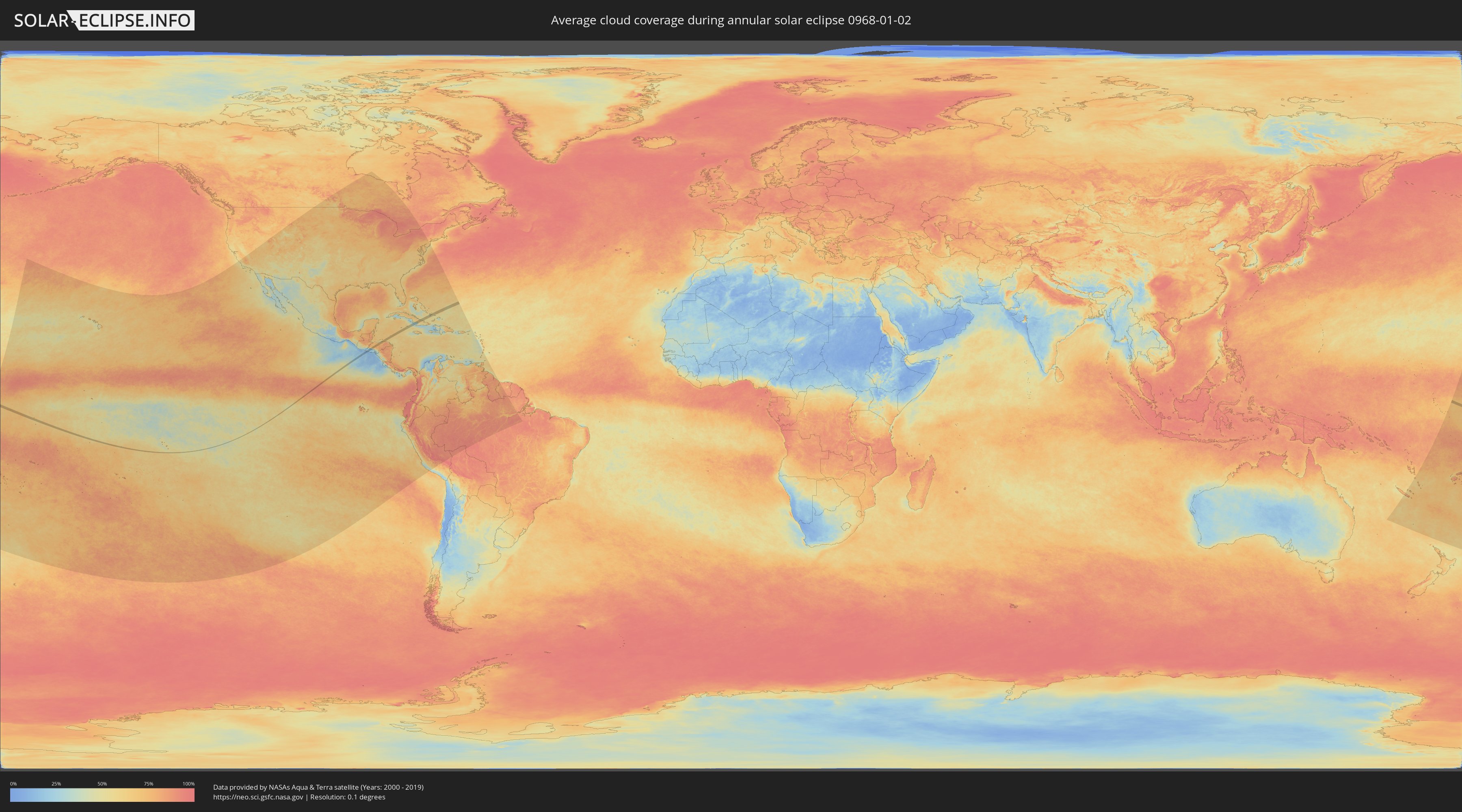
How will be the weather during the annular solar eclipse on 01/02/0968?
Where is the best place to see the annular solar eclipse of 01/02/0968?
The following maps show the average cloud coverage for the day of the annular solar eclipse.
With the help of these maps, it is possible to find the place along the eclipse path, which has the best
chance of a cloudless sky.
Nevertheless, you should consider local circumstances and inform about the weather of your chosen
observation site.
The data is provided by NASAs satellites
AQUA and TERRA.
The cloud maps are averaged over a period of 19 years (2000 - 2019).
Detailed country maps
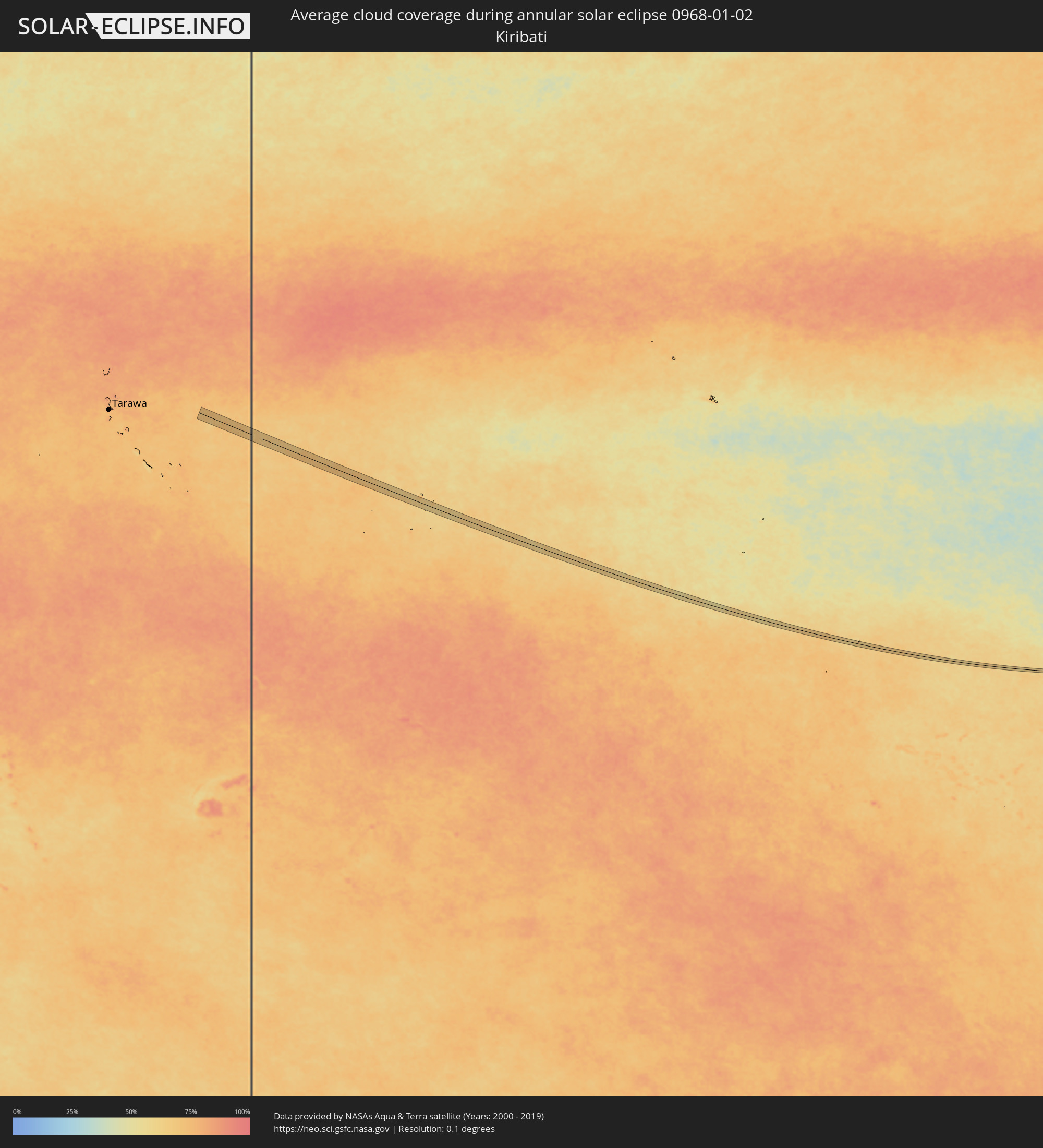 Kiribati
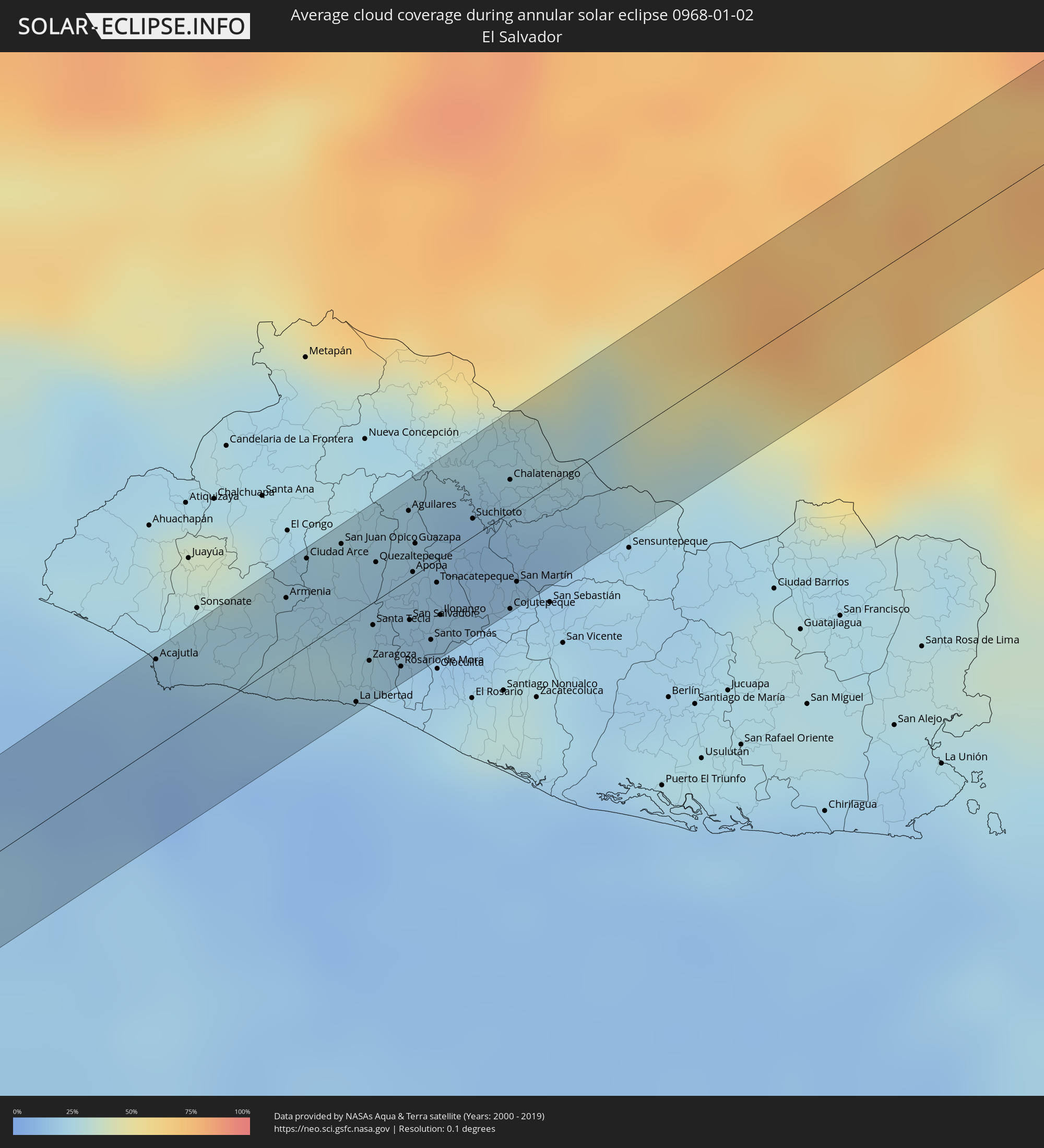 El Salvador
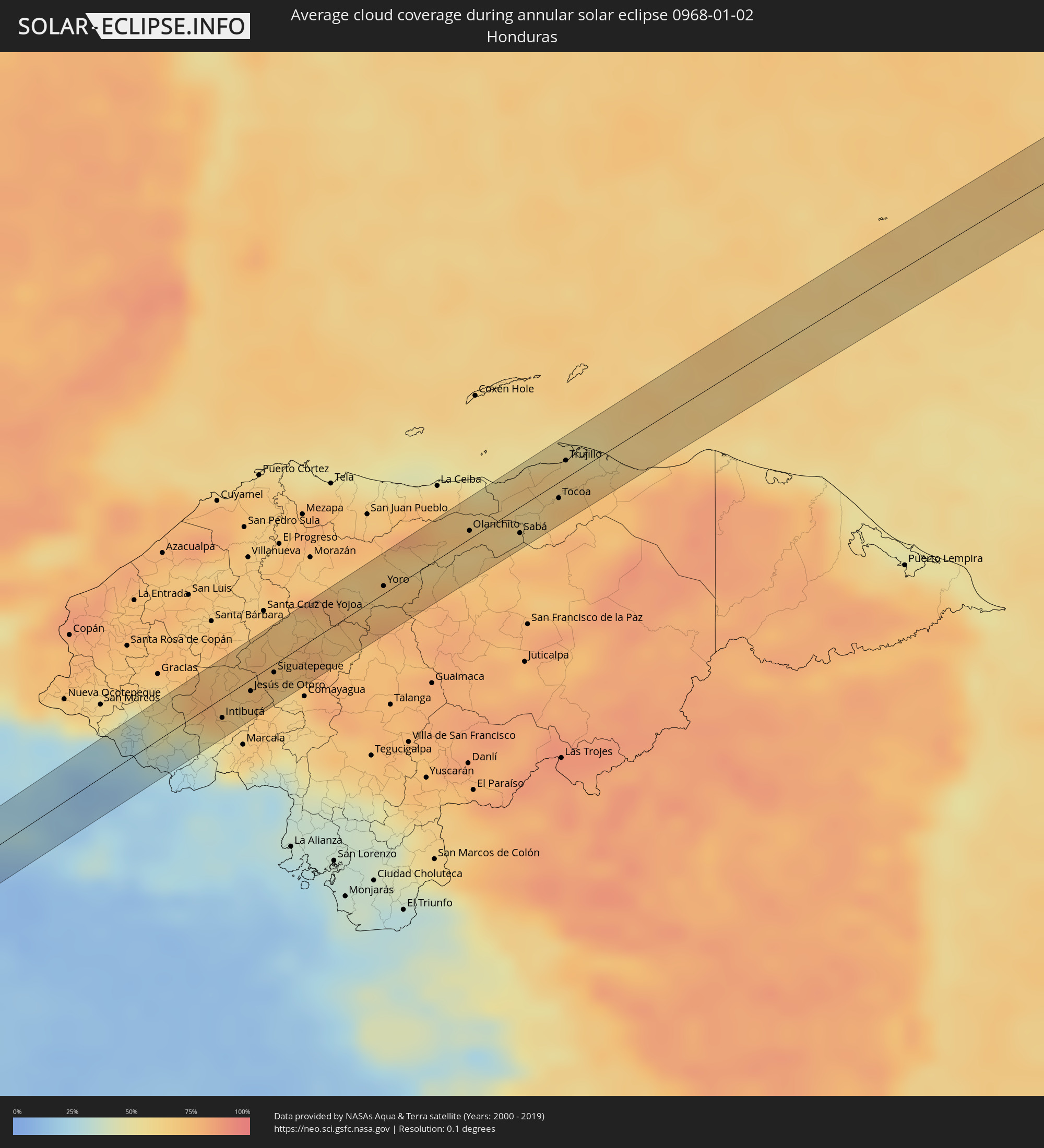 Honduras
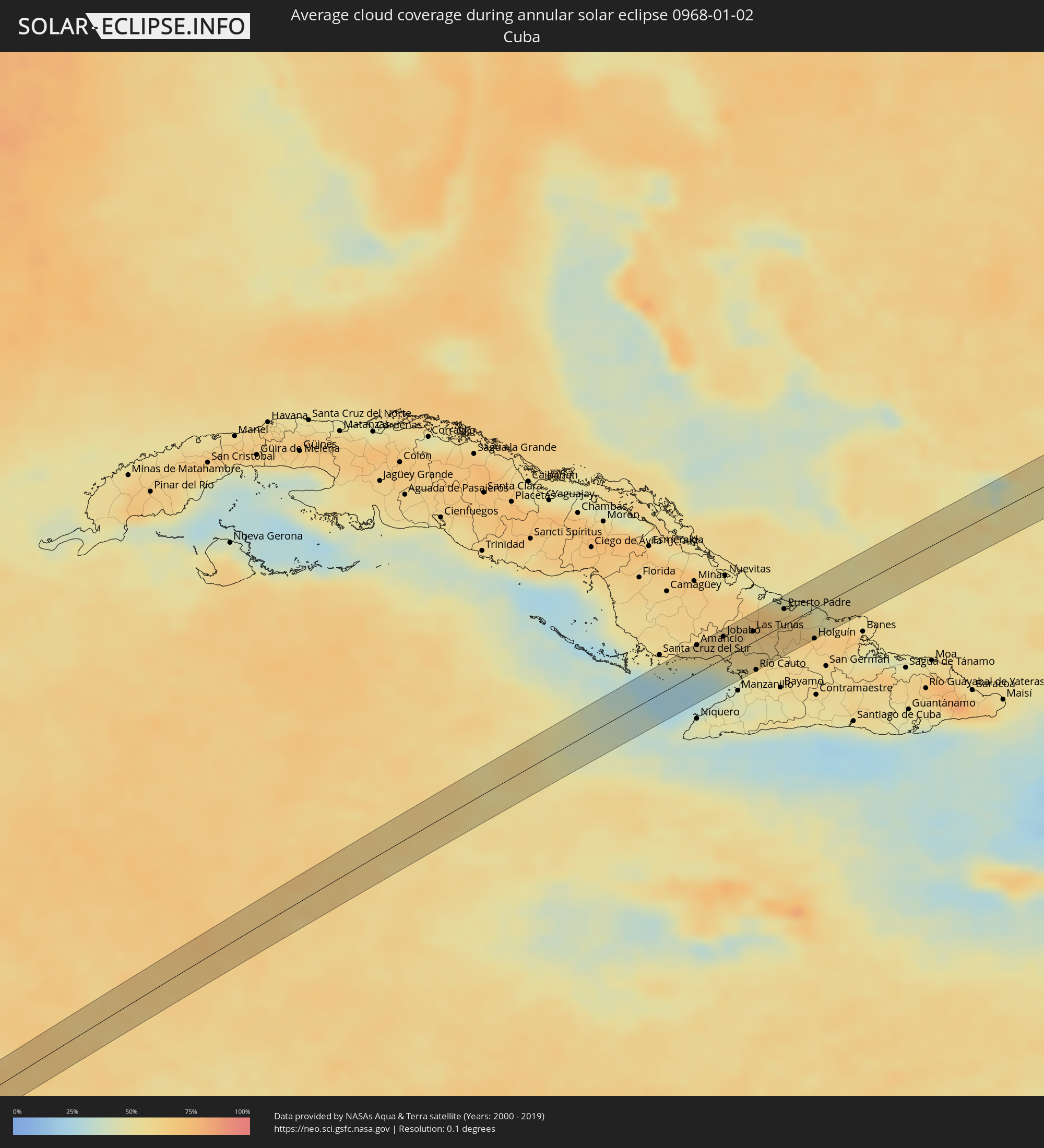 Cuba
Cuba
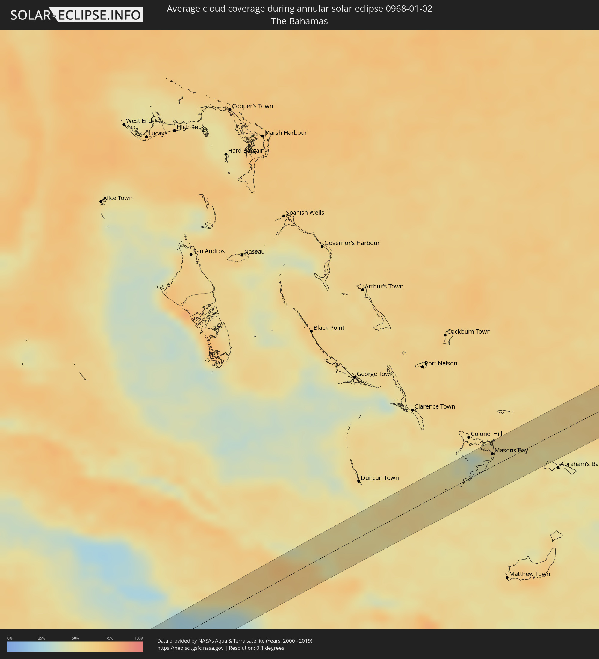 The Bahamas
Cities inside the path of the eclipse
The following table shows all locations with a population of more than 5,000 inside the eclipse path. Cities which have more than 100,000 inhabitants are marked bold. A click at the locations opens a detailed map.
| City | Type | Eclipse duration | Local time of max. eclipse | Distance to central line | Ø Cloud coverage |
|
Acajutla, Sonsonate
|
annular | - | 15:42:34 UTC-05:56 | 20 km | 13% |
|
Armenia, Sonsonate
|
annular | - | 15:42:57 UTC-05:56 | 14 km | 26% |
|
Ciudad Arce, La Libertad
|
annular | - | 15:43:03 UTC-05:56 | 20 km | 22% |
|
San Juan Opico, La Libertad
|
annular | - | 15:43:09 UTC-05:56 | 18 km | 22% |
|
La Libertad, La Libertad
|
annular | - | 15:42:58 UTC-05:56 | 20 km | 15% |
|
Zaragoza, La Libertad
|
annular | - | 15:43:03 UTC-05:56 | 13 km | 20% |
|
Santa Tecla, La Libertad
|
annular | - | 15:43:07 UTC-05:56 | 5 km | 24% |
|
Quezaltepeque, La Libertad
|
annular | - | 15:43:12 UTC-05:56 | 9 km | 21% |
|
Nuevo Cuscatlán, La Libertad
|
annular | - | 15:43:06 UTC-05:56 | 9 km | 20% |
|
Antiguo Cuscatlán, La Libertad
|
annular | - | 15:43:08 UTC-05:56 | 8 km | 24% |
|
Mejicanos, San Salvador
|
annular | - | 15:43:12 UTC-05:56 | 3 km | 19% |
|
Rosario de Mora, San Salvador
|
annular | - | 15:43:07 UTC-05:56 | 19 km | 20% |
|
Ayutuxtepeque, San Salvador
|
annular | - | 15:43:13 UTC-05:56 | 3 km | 19% |
|
Aguilares, San Salvador
|
annular | - | 15:43:20 UTC-05:56 | 15 km | 21% |
|
San Salvador, San Salvador
|
annular | - | 15:43:12 UTC-05:56 | 10 km | 19% |
|
San Marcos, San Salvador
|
annular | - | 15:43:11 UTC-05:56 | 13 km | 19% |
|
Cuscatancingo, San Salvador
|
annular | - | 15:43:14 UTC-05:56 | 6 km | 19% |
|
Panchimalco, San Salvador
|
annular | - | 15:43:10 UTC-05:56 | 17 km | 20% |
|
Apopa, San Salvador
|
annular | - | 15:43:16 UTC-05:56 | 1 km | 18% |
|
Guazapa, San Salvador
|
annular | - | 15:43:19 UTC-05:56 | 7 km | 19% |
|
Delgado, San Salvador
|
annular | - | 15:43:14 UTC-05:56 | 7 km | 19% |
|
Soyapango, San Salvador
|
annular | - | 15:43:15 UTC-05:56 | 10 km | 16% |
|
Santo Tomás, San Salvador
|
annular | - | 15:43:13 UTC-05:56 | 17 km | 22% |
|
Tonacatepeque, San Salvador
|
annular | - | 15:43:19 UTC-05:56 | 5 km | 19% |
|
Ilopango, San Salvador
|
annular | - | 15:43:17 UTC-05:56 | 13 km | 16% |
|
Suchitoto, Cuscatlán
|
annular | - | 15:43:28 UTC-05:56 | 4 km | 15% |
|
Cojutepeque, Cuscatlán
|
annular | - | 15:43:26 UTC-05:56 | 22 km | 26% |
|
Chalatenango, Chalatenango
|
annular | - | 15:43:36 UTC-05:56 | 7 km | 15% |
|
San Martín, Cuscatlán
|
annular | - | 15:43:29 UTC-05:56 | 17 km | 21% |
|
La Esperanza, Intibucá
|
annular | - | 15:52:19 UTC-05:48 | 11 km | 50% |
|
Intibucá, Intibucá
|
annular | - | 15:52:20 UTC-05:48 | 12 km | 50% |
|
Jesús de Otoro, Intibucá
|
annular | - | 15:52:34 UTC-05:48 | 7 km | 64% |
|
Siguatepeque, Comayagua
|
annular | - | 15:52:45 UTC-05:48 | 5 km | 68% |
|
Santa Rita, Yoro
|
annular | - | 15:53:28 UTC-05:48 | 16 km | 69% |
|
Yoro, Yoro
|
annular | - | 15:53:34 UTC-05:48 | 4 km | 76% |
|
Olanchito, Yoro
|
annular | - | 15:54:09 UTC-05:48 | 5 km | 62% |
|
Sabá, Colón
|
annular | - | 15:54:23 UTC-05:48 | 15 km | 70% |
|
Tocoa, Colón
|
annular | - | 15:54:39 UTC-05:48 | 9 km | 68% |
|
Trujillo, Colón
|
annular | - | 15:54:47 UTC-05:48 | 10 km | 65% |
|
Amancio, Las Tunas
|
annular | - | 16:19:52 UTC-05:29 | 29 km | 53% |
|
Jobabo, Las Tunas
|
annular | - | 16:20:00 UTC-05:29 | 22 km | 60% |
|
Las Tunas, Las Tunas
|
annular | - | 16:20:07 UTC-05:29 | 11 km | 63% |
|
Río Cauto, Granma
|
annular | - | 16:20:05 UTC-05:29 | 30 km | 53% |
|
Puerto Padre, Las Tunas
|
annular | - | 16:20:16 UTC-05:29 | 16 km | 64% |
|
Jesús Menéndez, Las Tunas
|
annular | - | 16:20:18 UTC-05:29 | 7 km | 64% |
|
Jobabo, Holguín
|
annular | - | 16:20:21 UTC-05:29 | 21 km | 66% |
|
Holguín, Holguín
|
annular | - | 16:20:21 UTC-05:29 | 31 km | 59% |
|
Gibara, Holguín
|
annular | - | 16:20:25 UTC-05:29 | 16 km | 61% |
|
Masons Bay, Acklins
|
annular | - | 16:41:16 UTC-05:09 | 16 km | 50% |