Total solar eclipse of 08/11/1124
| Day of week: | Monday |
| Maximum duration of eclipse: | 03m19s |
| Maximum width of eclipse path: | 259 km |
| Saros cycle: | 121 |
| Coverage: | 100% |
| Magnitude: | 1.0497 |
| Gamma: | 0.7716 |
Wo kann man die Sonnenfinsternis vom 08/11/1124 sehen?
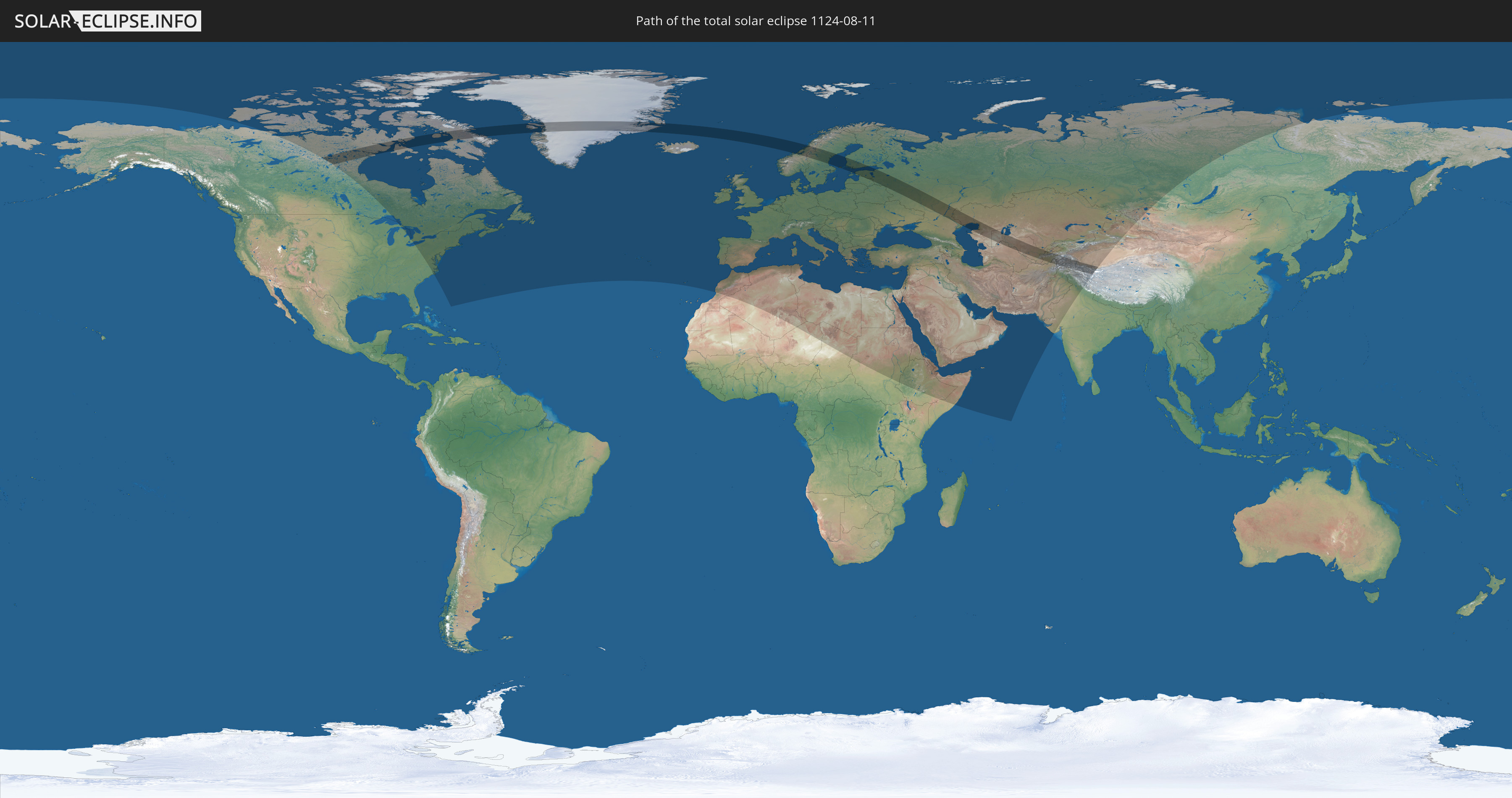
Die Sonnenfinsternis am 08/11/1124 kann man in 97 Ländern als partielle Sonnenfinsternis beobachten.
Der Finsternispfad verläuft durch 19 Länder. Nur in diesen Ländern ist sie als total Sonnenfinsternis zu sehen.
In den folgenden Ländern ist die Sonnenfinsternis total zu sehen
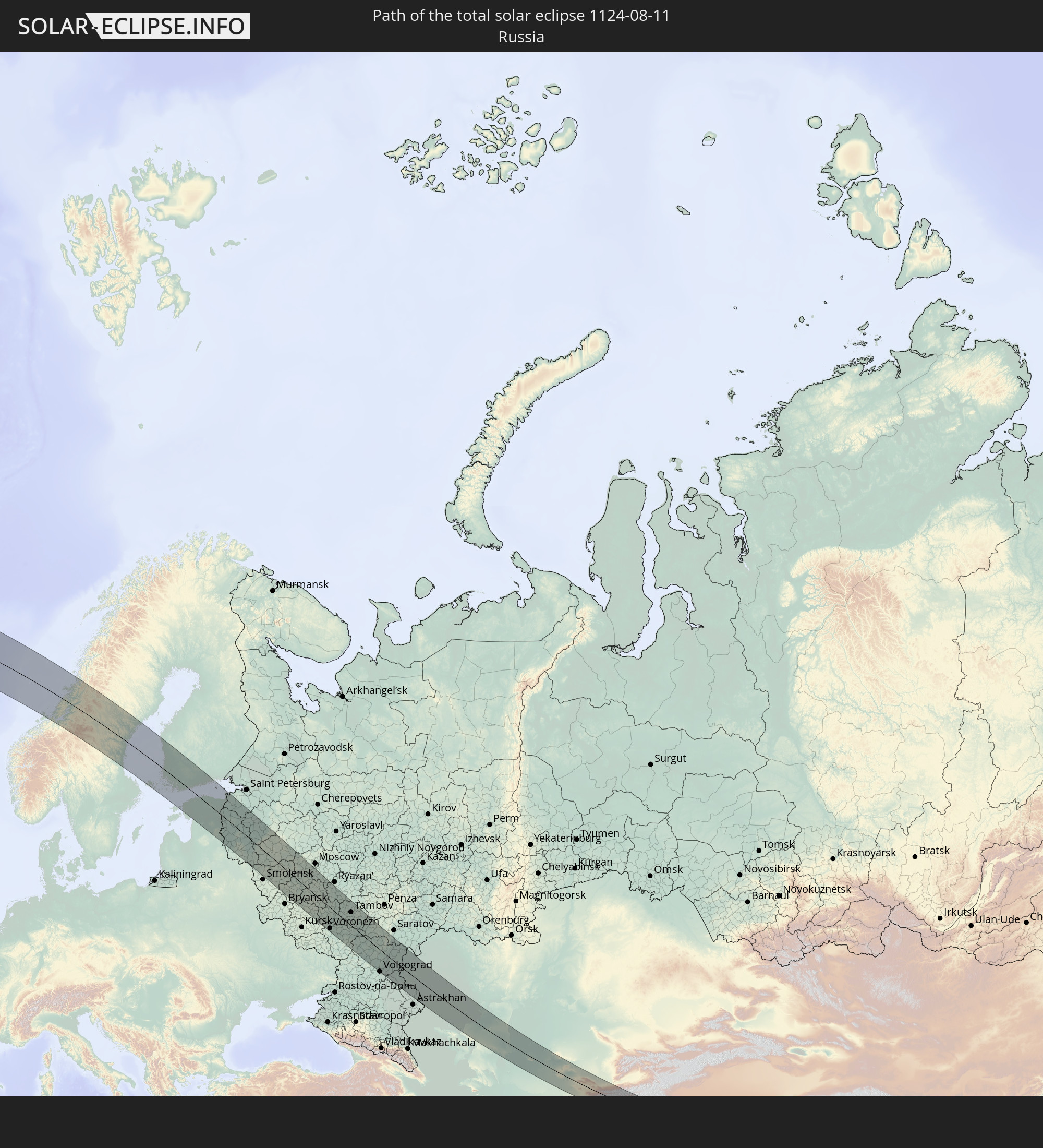 Russia
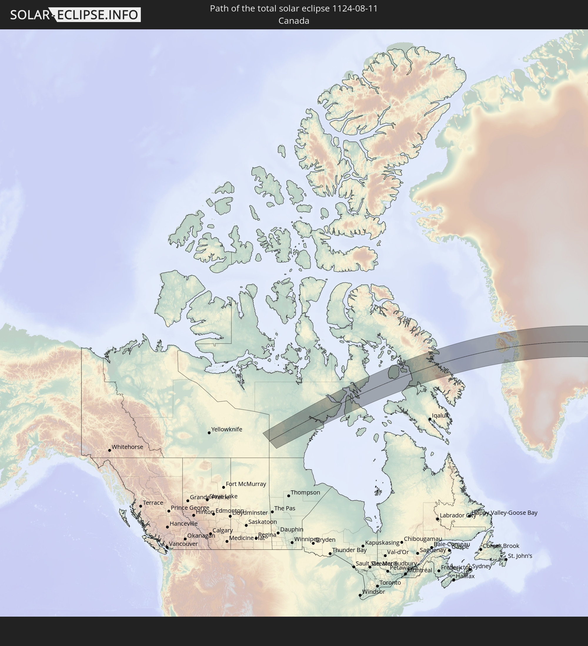 Canada
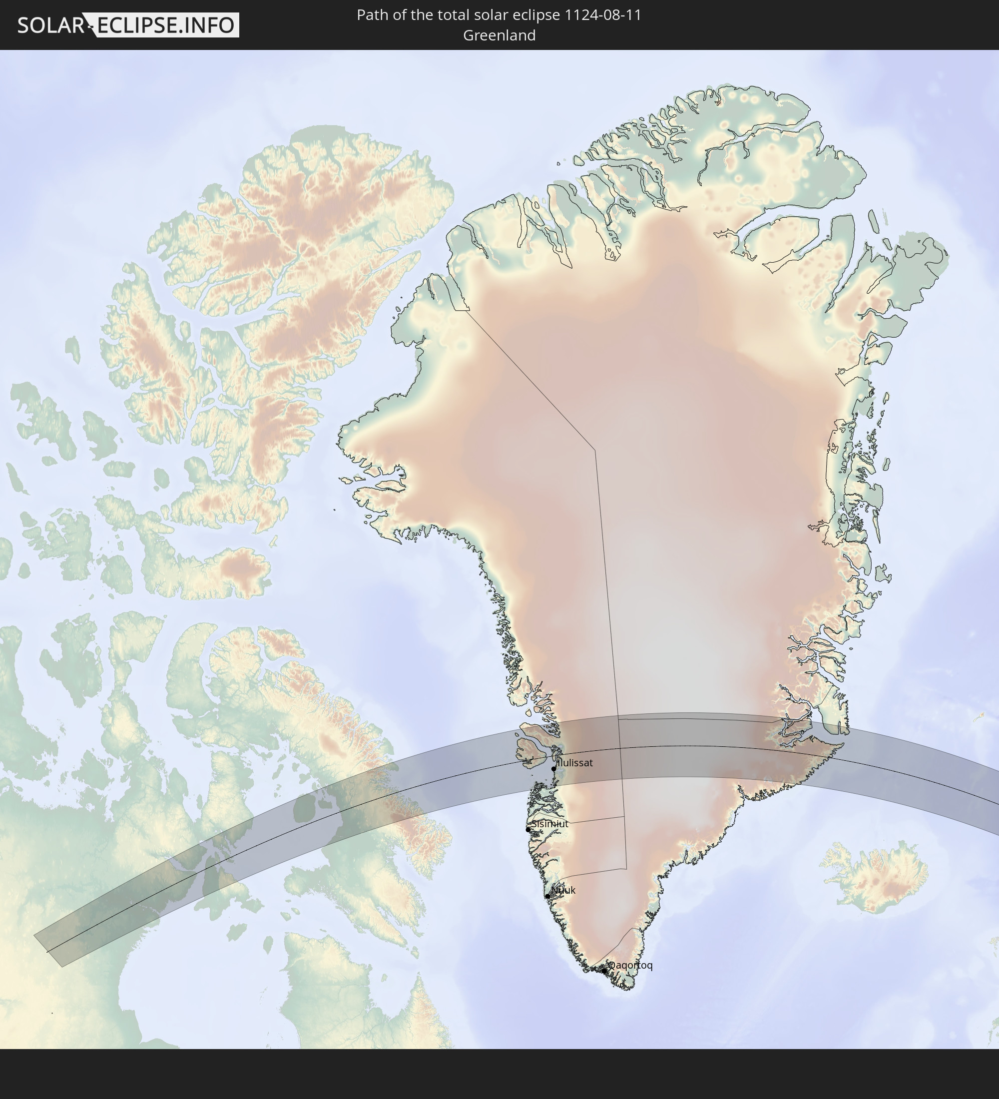 Greenland
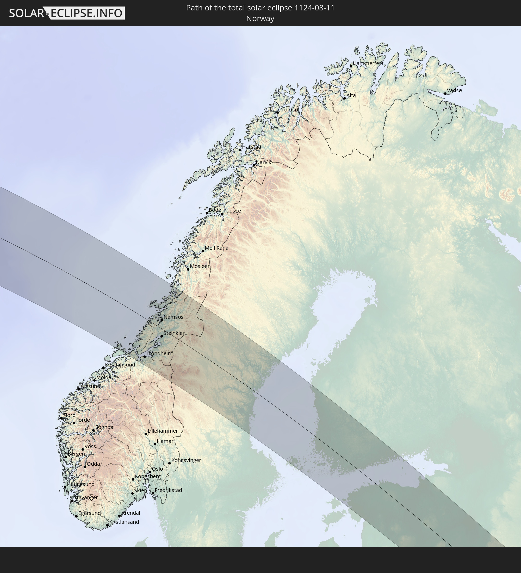 Norway
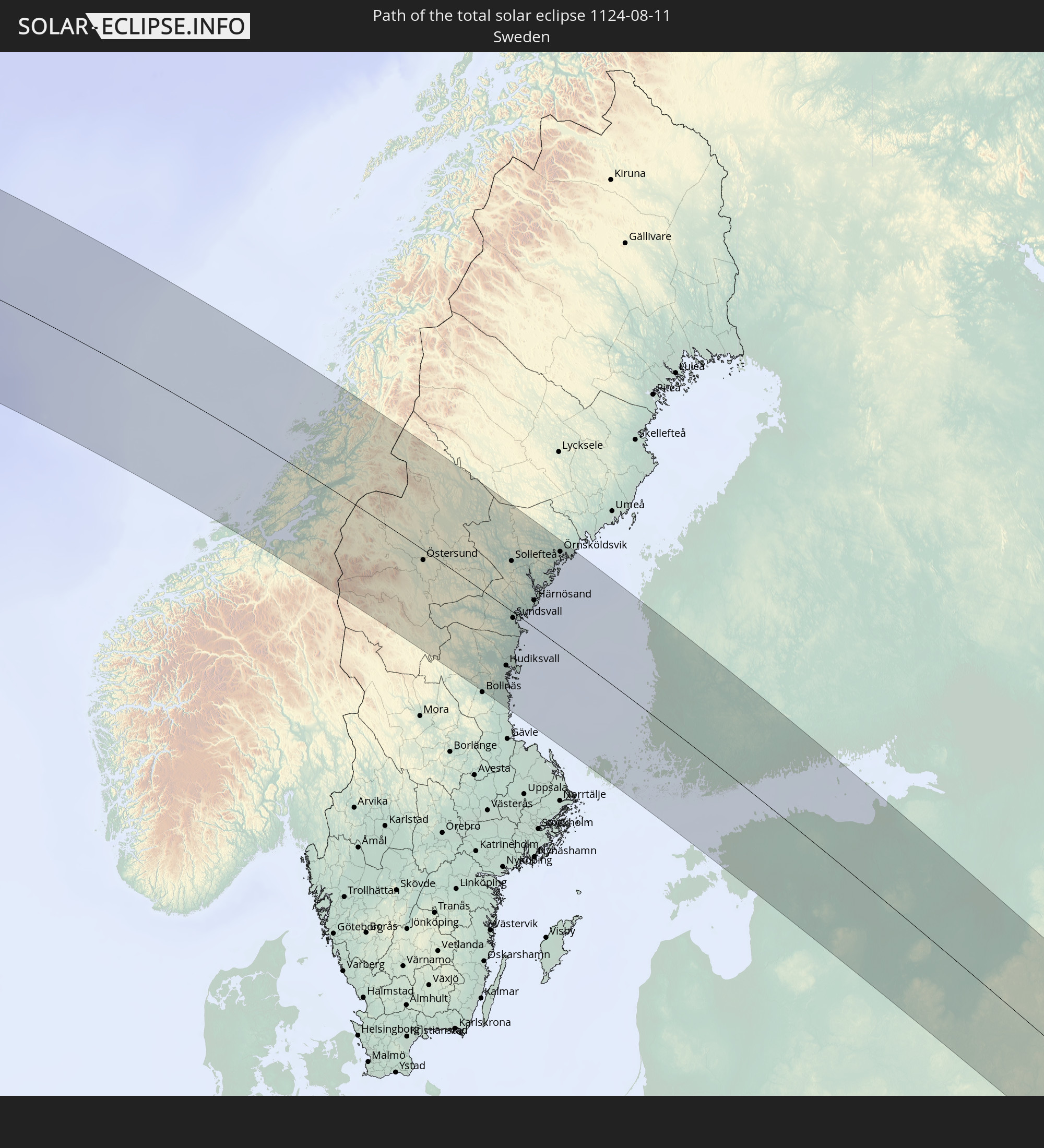 Sweden
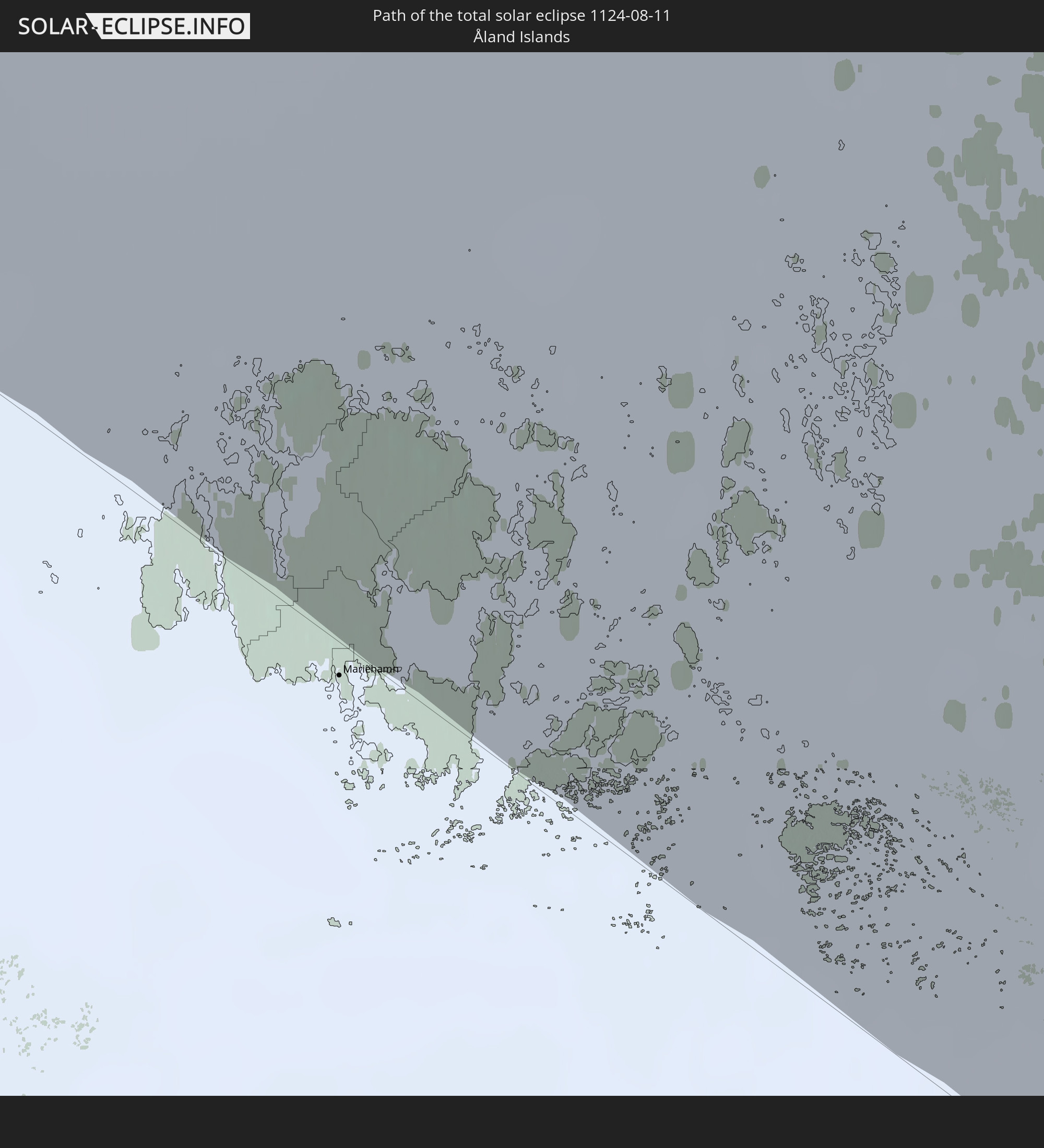 Åland Islands
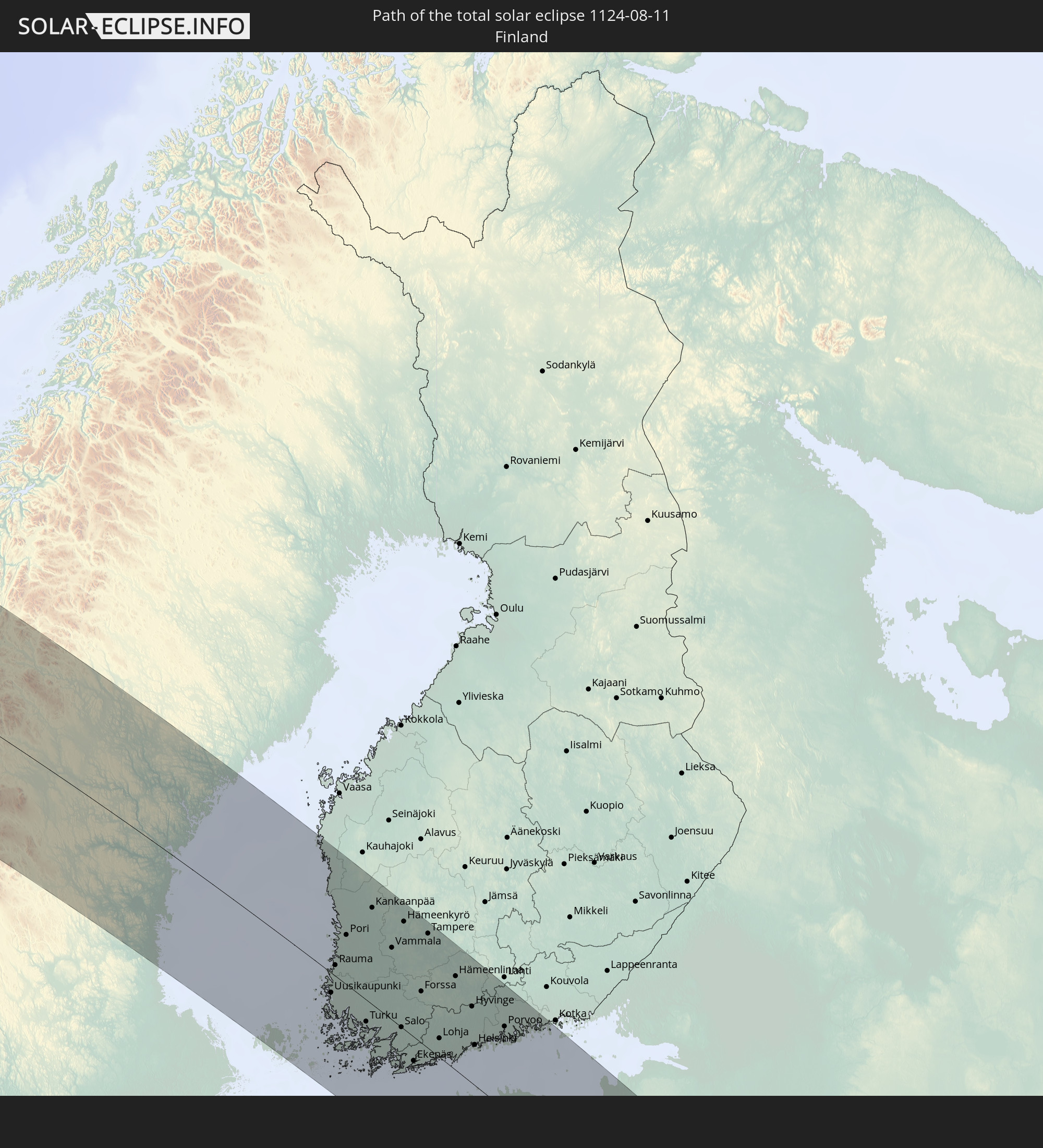 Finland
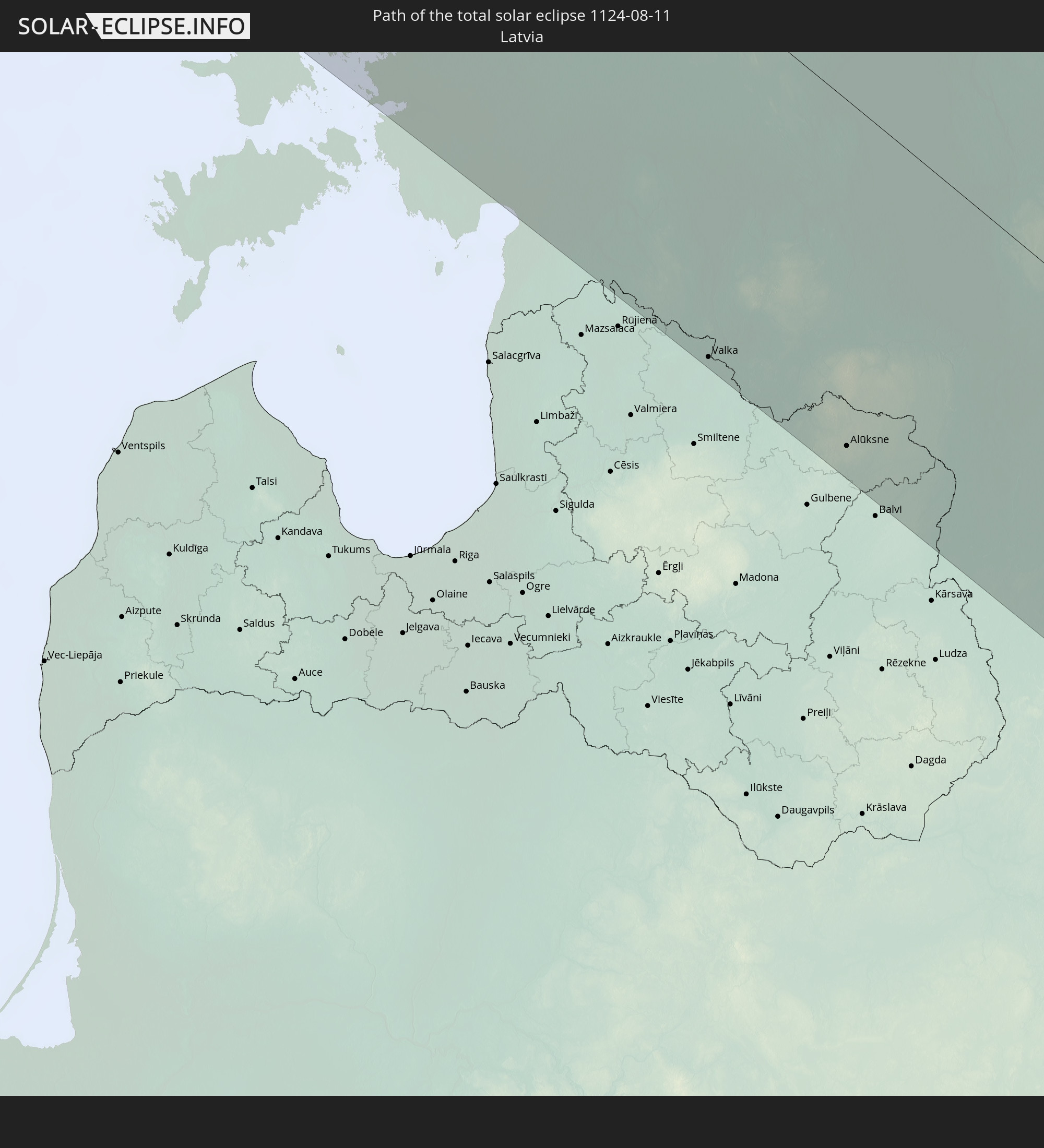 Latvia
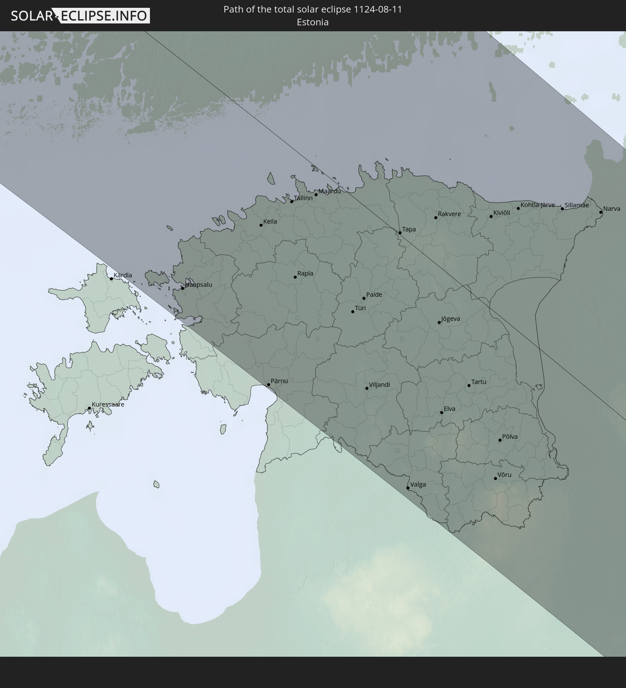 Estonia
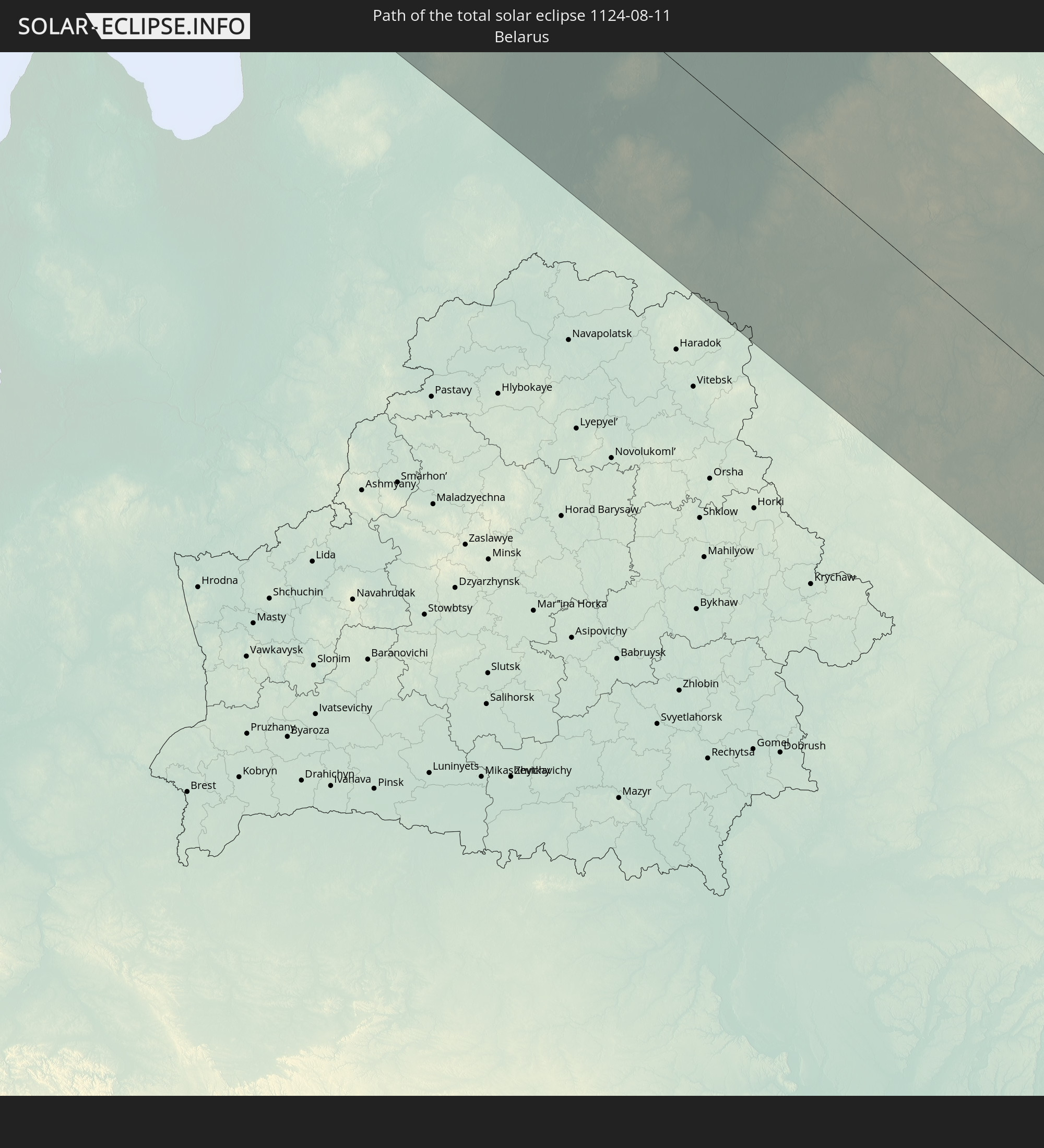 Belarus
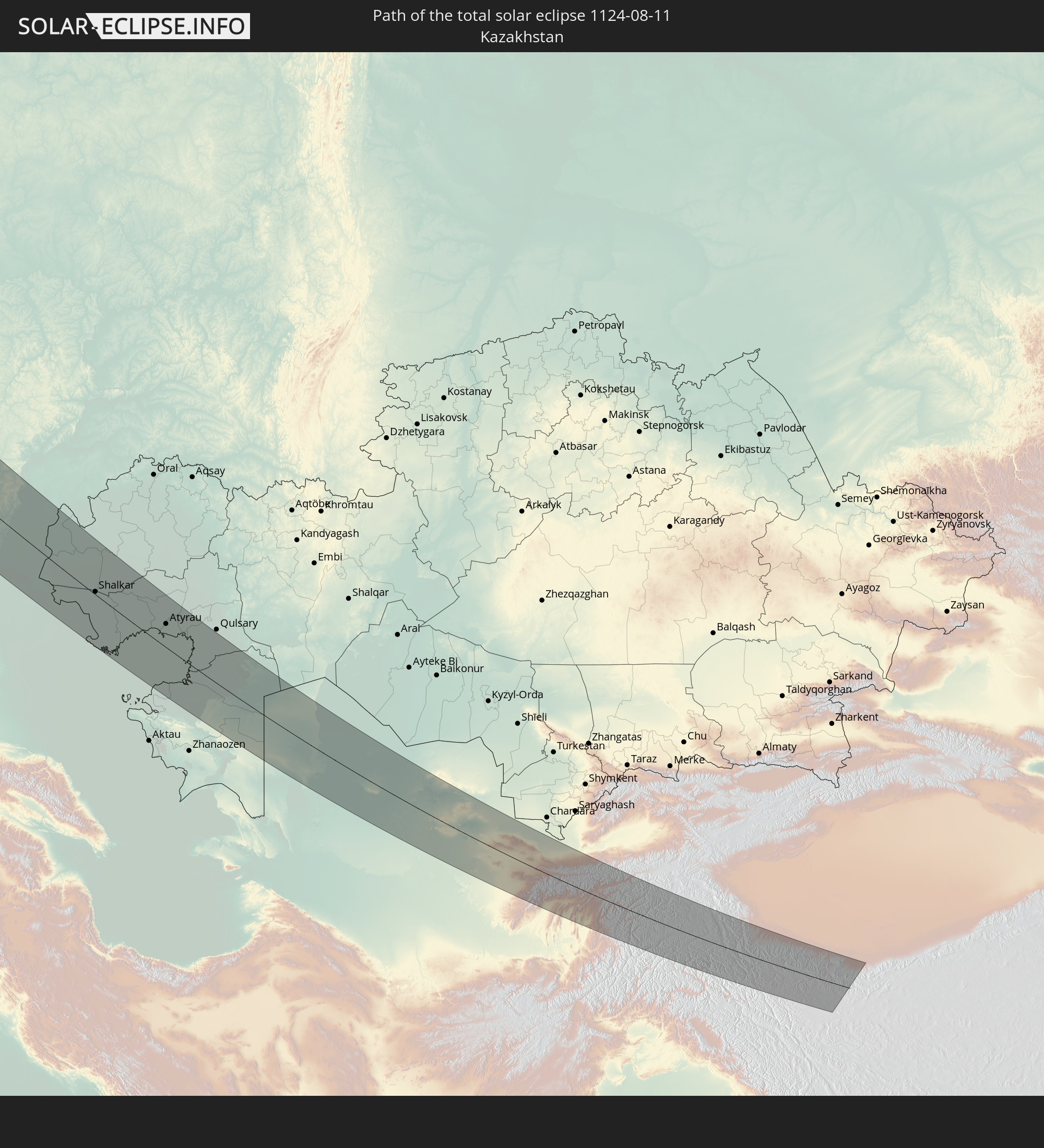 Kazakhstan
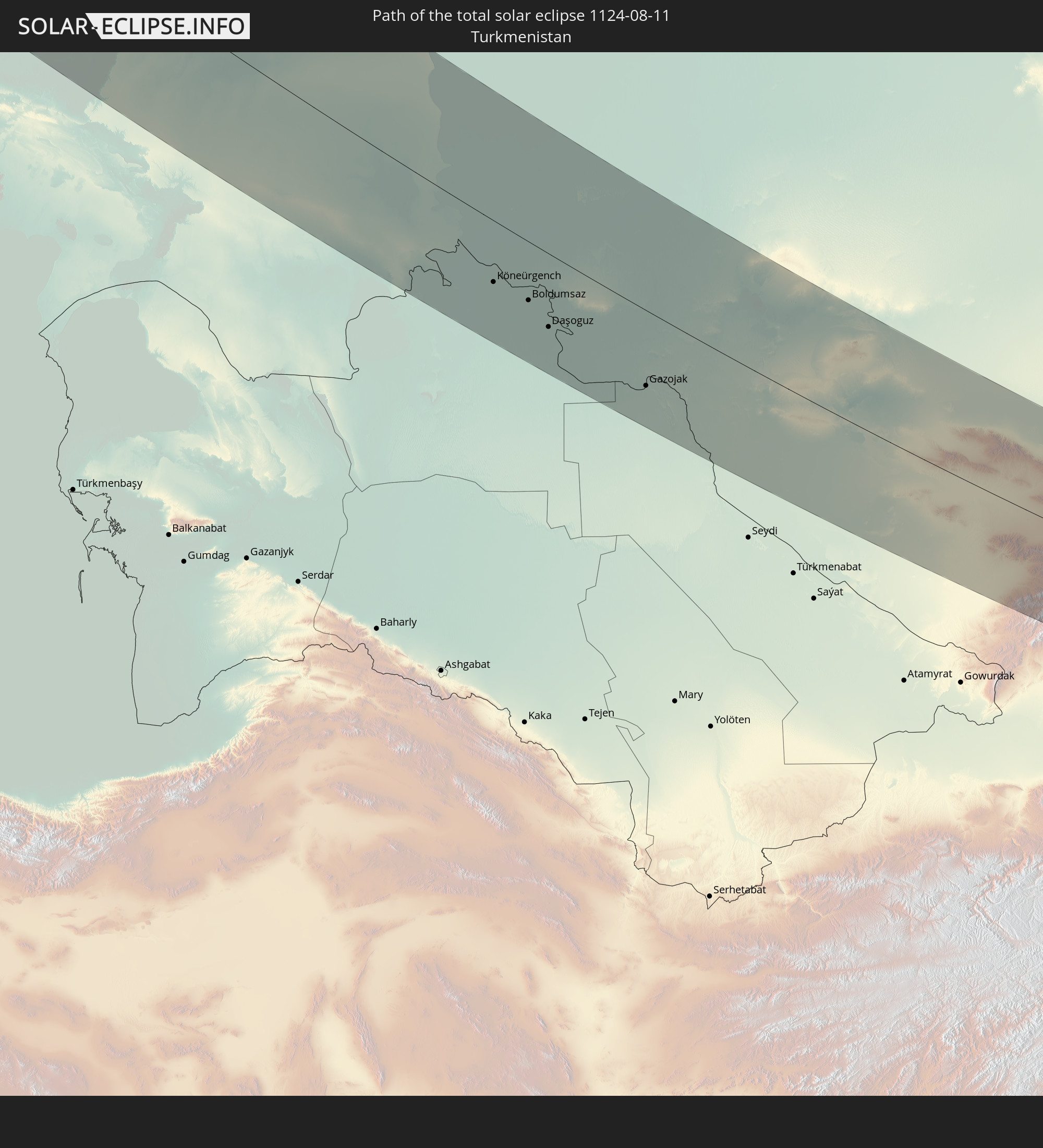 Turkmenistan
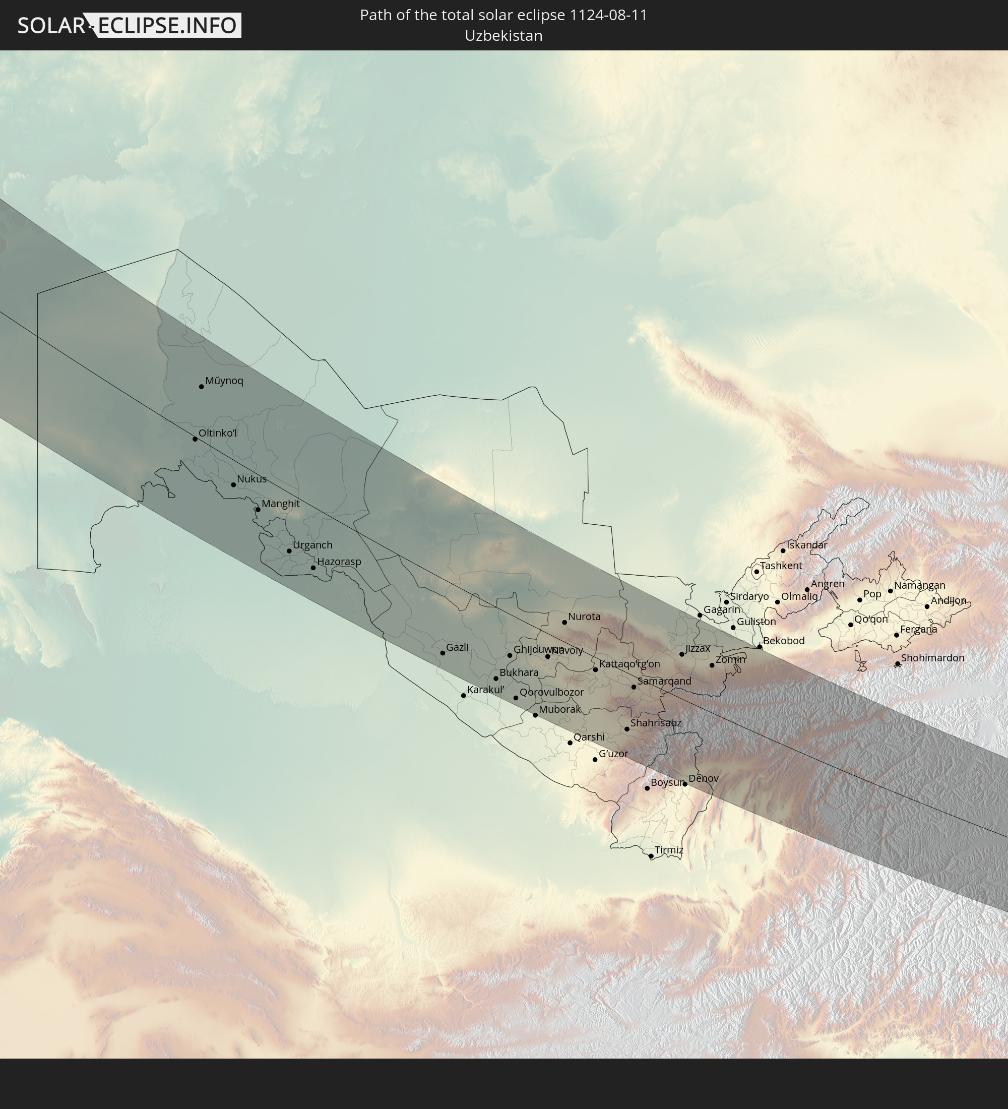 Uzbekistan
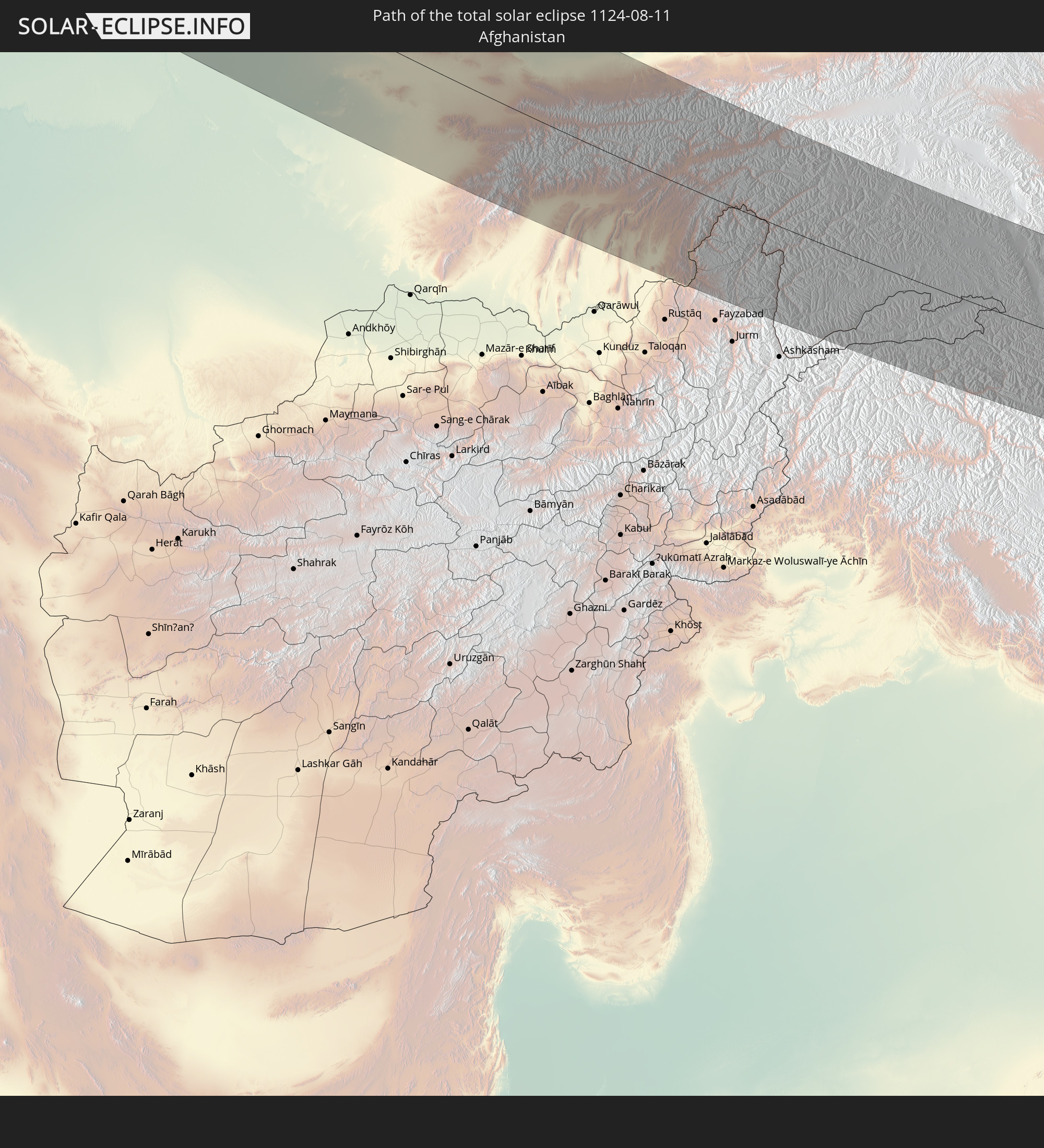 Afghanistan
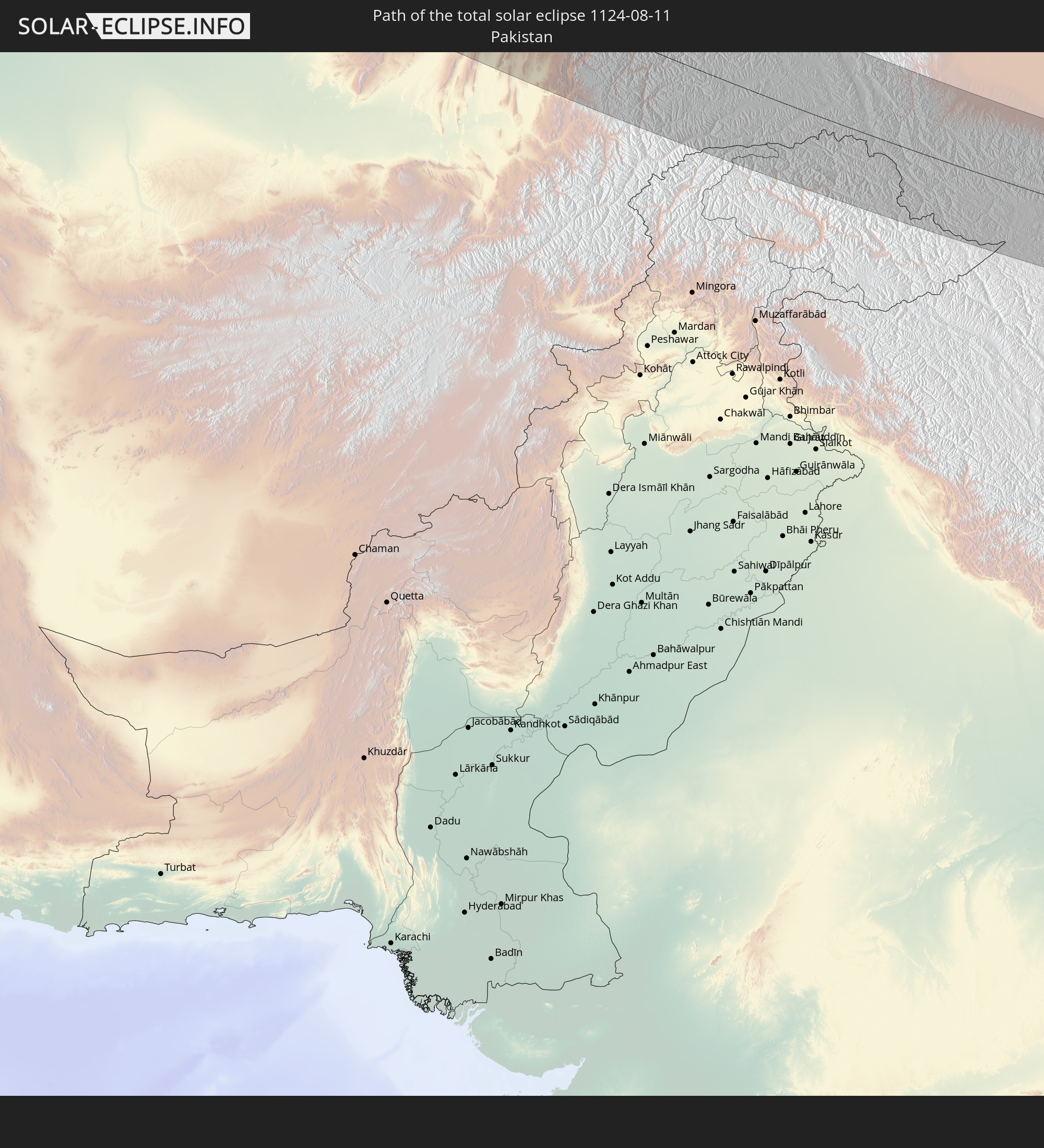 Pakistan
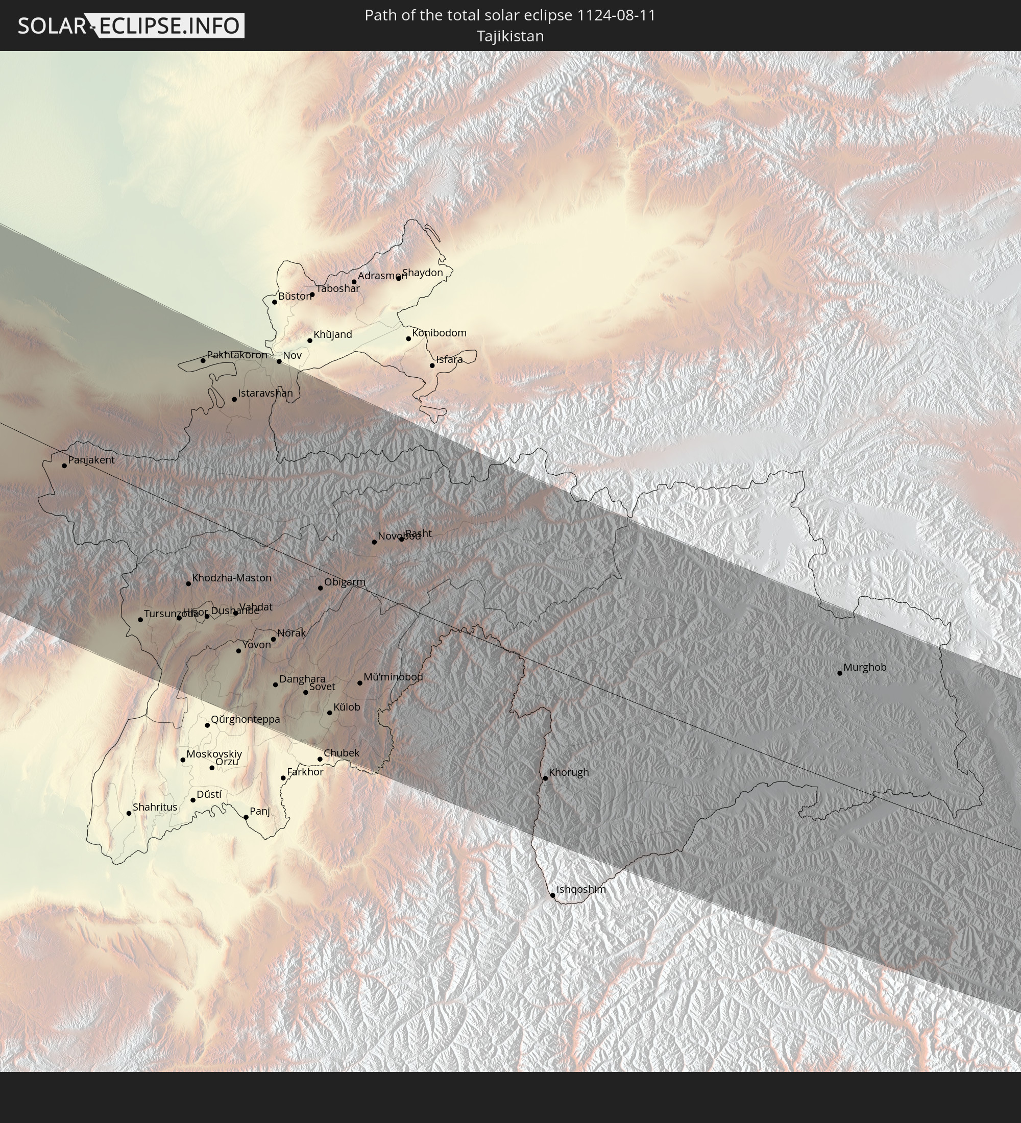 Tajikistan
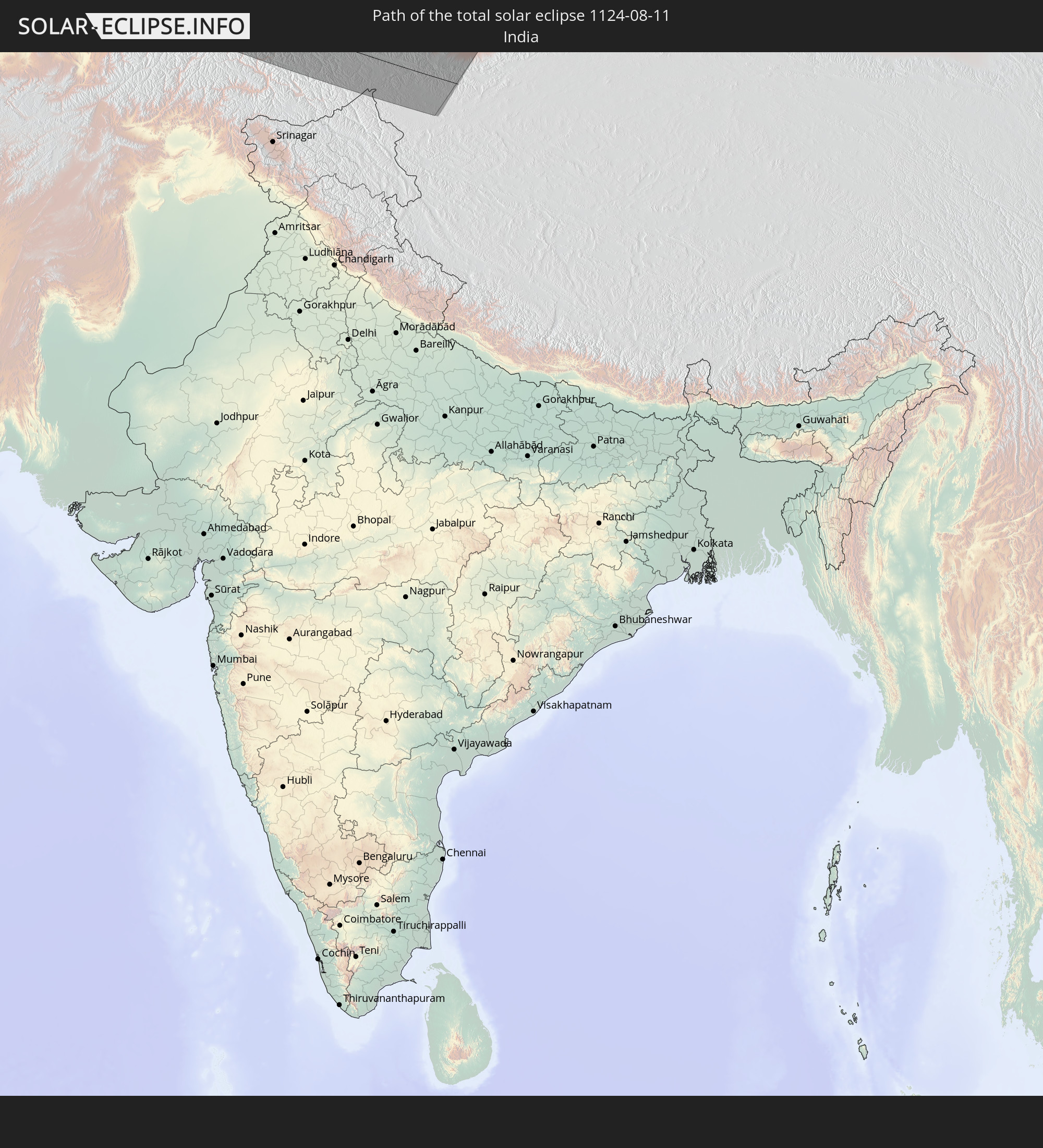 India
India
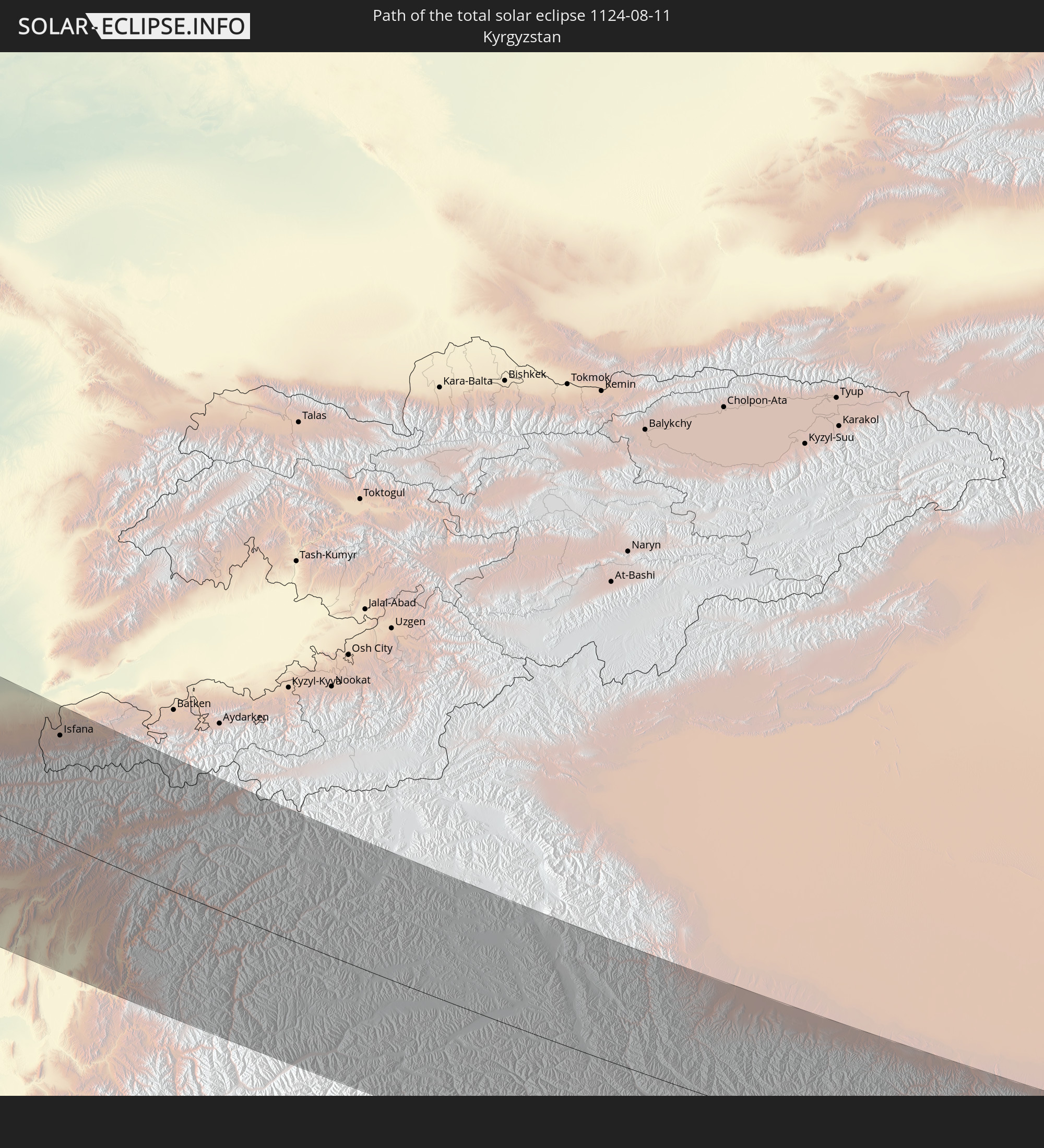 Kyrgyzstan
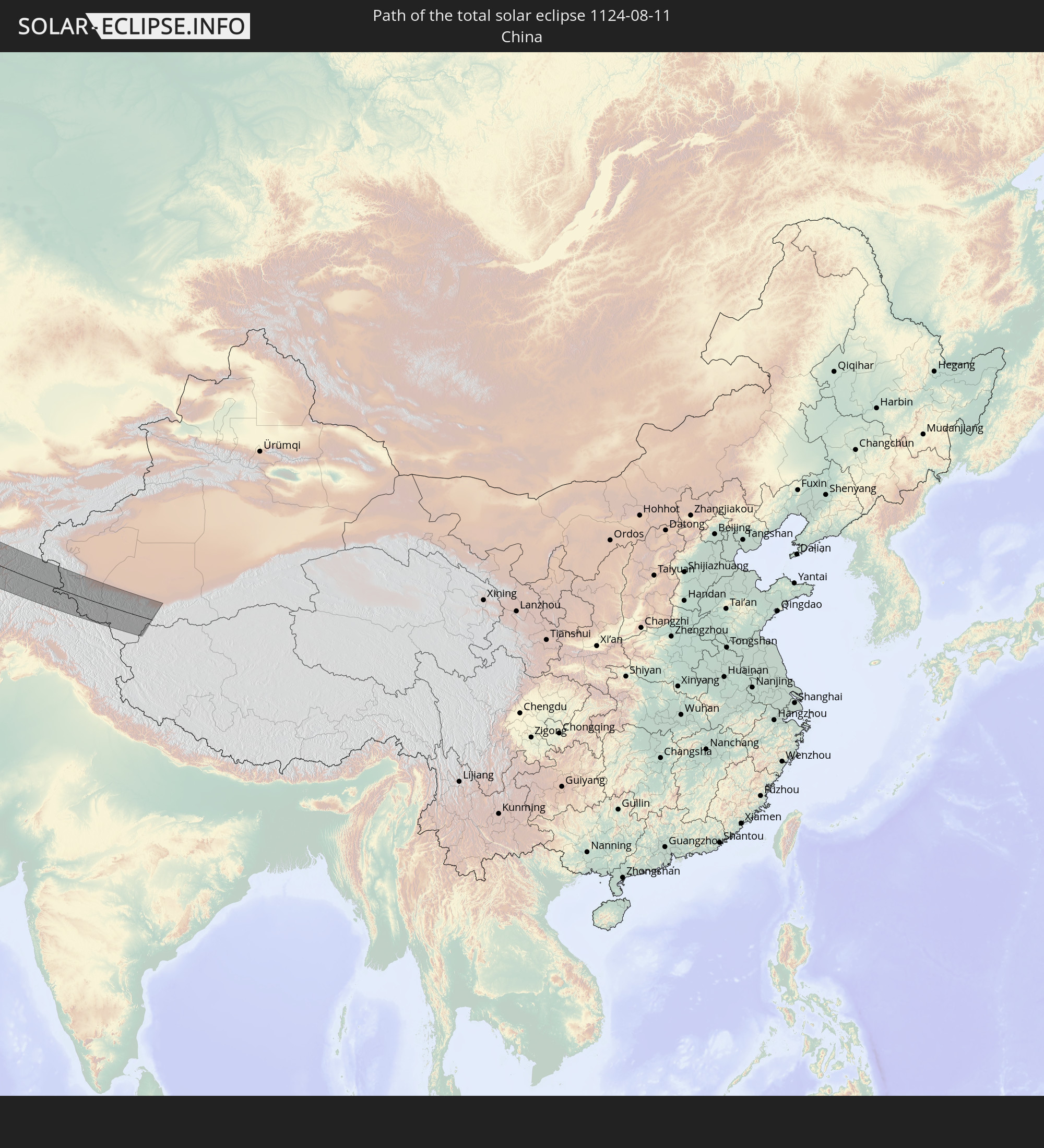 China
China
In den folgenden Ländern ist die Sonnenfinsternis partiell zu sehen
 Russia
 United States
 Canada
 Greenland
 Bermuda
 Saint Pierre and Miquelon
 Portugal
 Iceland
 Spain
Spain
 Morocco
 Republic of Ireland
 Svalbard and Jan Mayen
 Algeria
 United Kingdom
 Faroe Islands
 Gibraltar
 France
 Isle of Man
 Guernsey
 Jersey
 Niger
Niger
 Andorra
 Belgium
 Netherlands
 Norway
 Luxembourg
 Germany
 Switzerland
 Italy
Italy
 Monaco
 Tunisia
 Denmark
 Libya
Libya
 Liechtenstein
 Austria
 Sweden
 Czechia
 San Marino
 Vatican City
 Slovenia
 Chad
Chad
 Croatia
 Poland
 Malta
Malta
 Bosnia and Herzegovina
 Hungary
 Slovakia
 Montenegro
 Serbia
 Albania
 Åland Islands
 Greece
 Romania
 Republic of Macedonia
 Finland
 Lithuania
 Latvia
 Estonia
 Sudan
Sudan
 Ukraine
 Bulgaria
 Belarus
 Egypt
Egypt
 Turkey
 Moldova
 Cyprus
 Ethiopia
 State of Palestine
 Israel
 Saudi Arabia
 Jordan
 Lebanon
 Syria
Syria
 Eritrea
 Iraq
Iraq
 Georgia
 Somalia
 Djibouti
 Yemen
Yemen
 Armenia
 Iran
Iran
 Azerbaijan
 Kazakhstan
 Kuwait
 Bahrain
 Qatar
Qatar
 United Arab Emirates
 Oman
Oman
 Turkmenistan
 Uzbekistan
 Afghanistan
 Pakistan
 Tajikistan
 India
India
 Kyrgyzstan
 China
China
 Mongolia
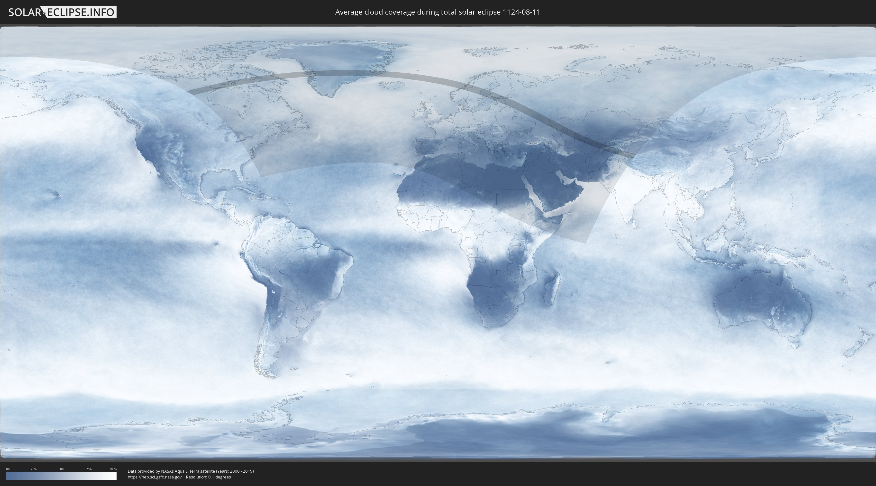
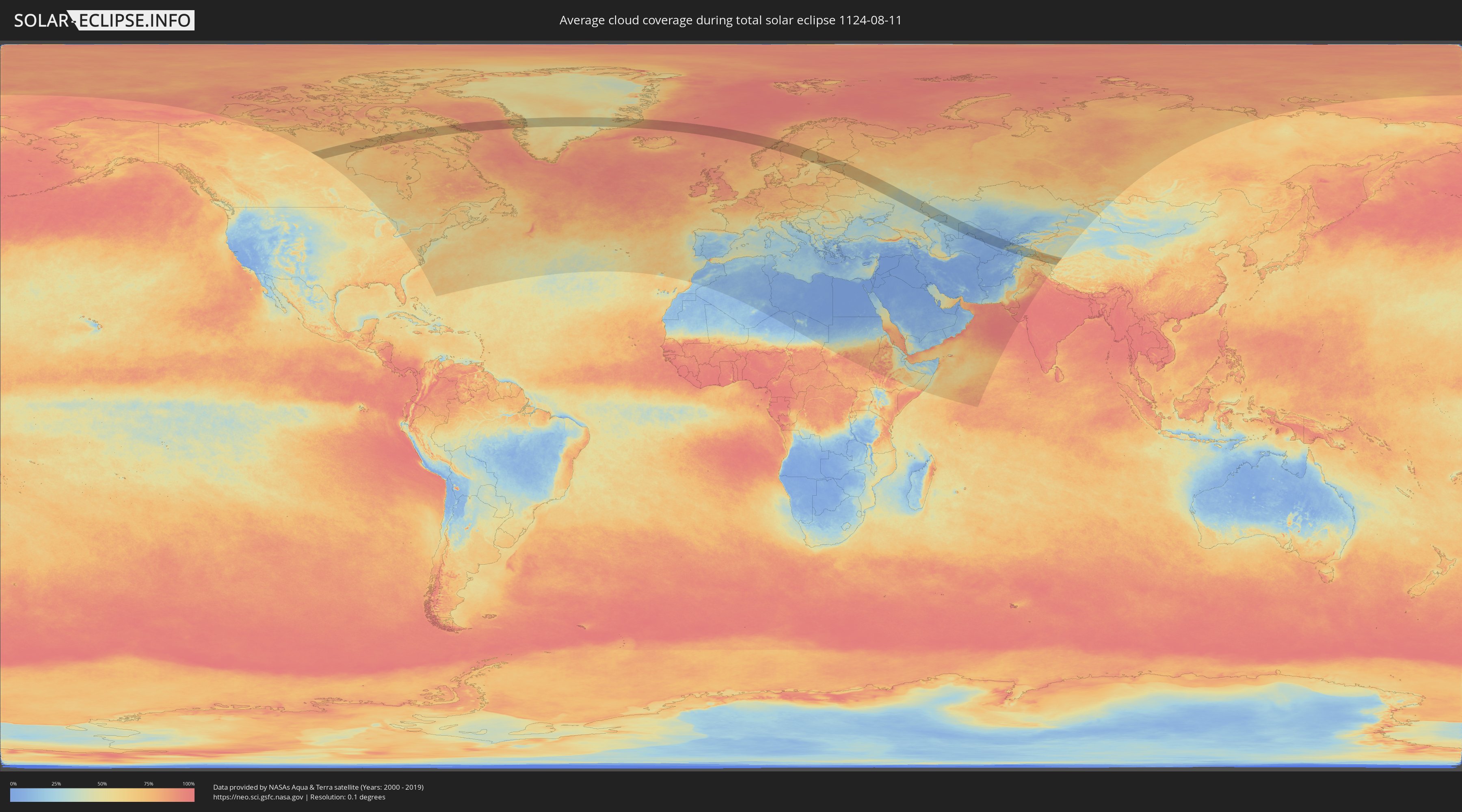
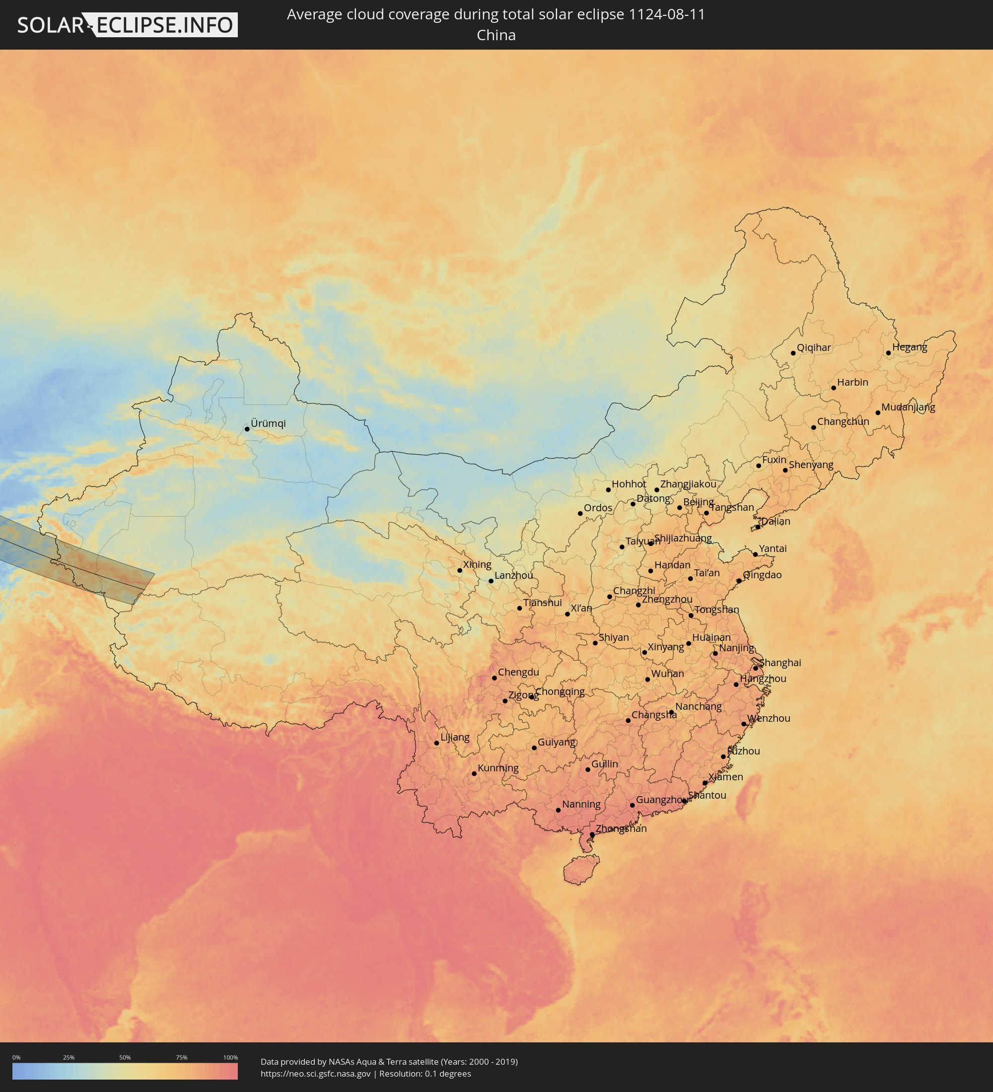
How will be the weather during the total solar eclipse on 08/11/1124?
Where is the best place to see the total solar eclipse of 08/11/1124?
The following maps show the average cloud coverage for the day of the total solar eclipse.
With the help of these maps, it is possible to find the place along the eclipse path, which has the best
chance of a cloudless sky.
Nevertheless, you should consider local circumstances and inform about the weather of your chosen
observation site.
The data is provided by NASAs satellites
AQUA and TERRA.
The cloud maps are averaged over a period of 19 years (2000 - 2019).
Detailed country maps
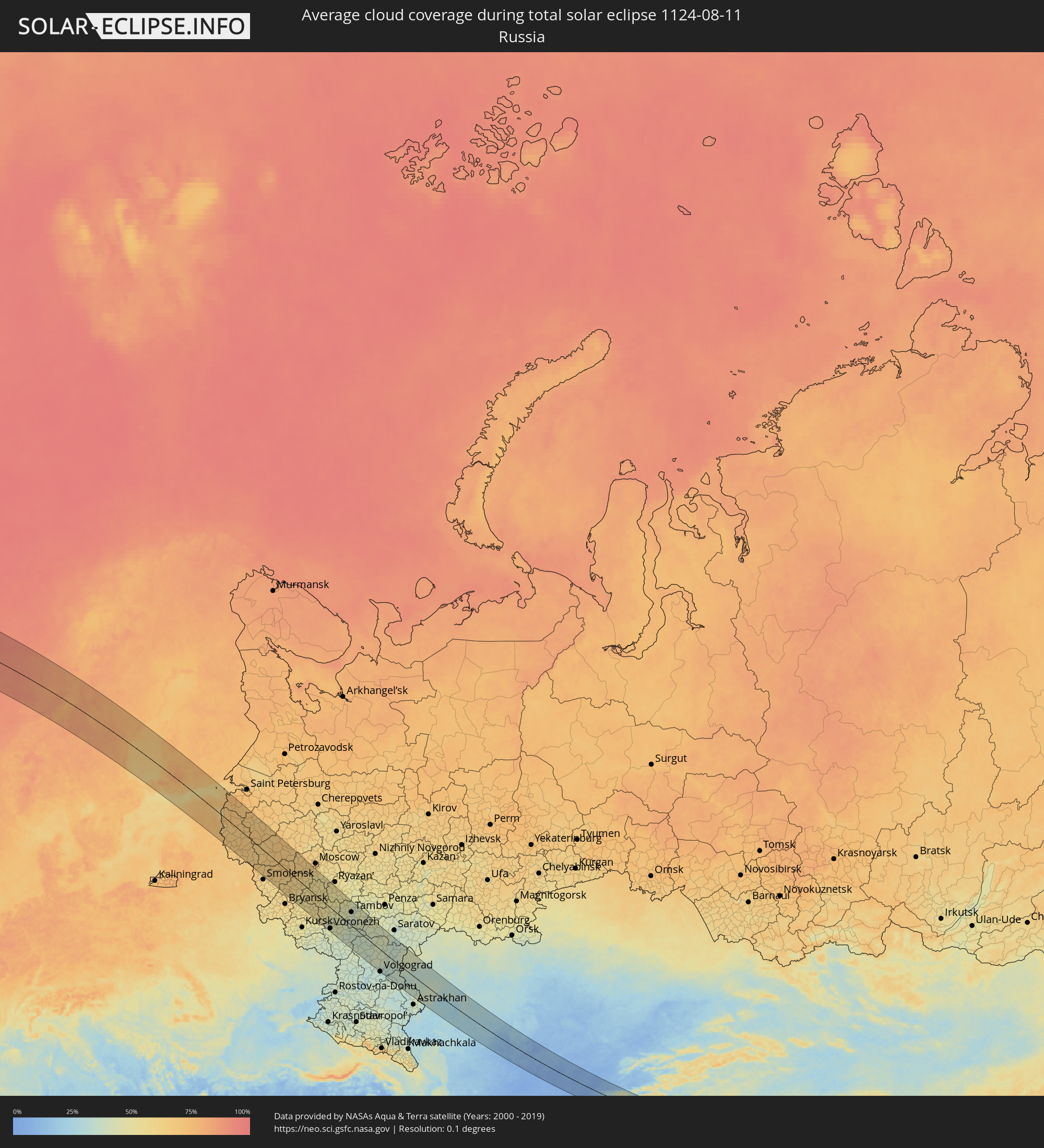 Russia
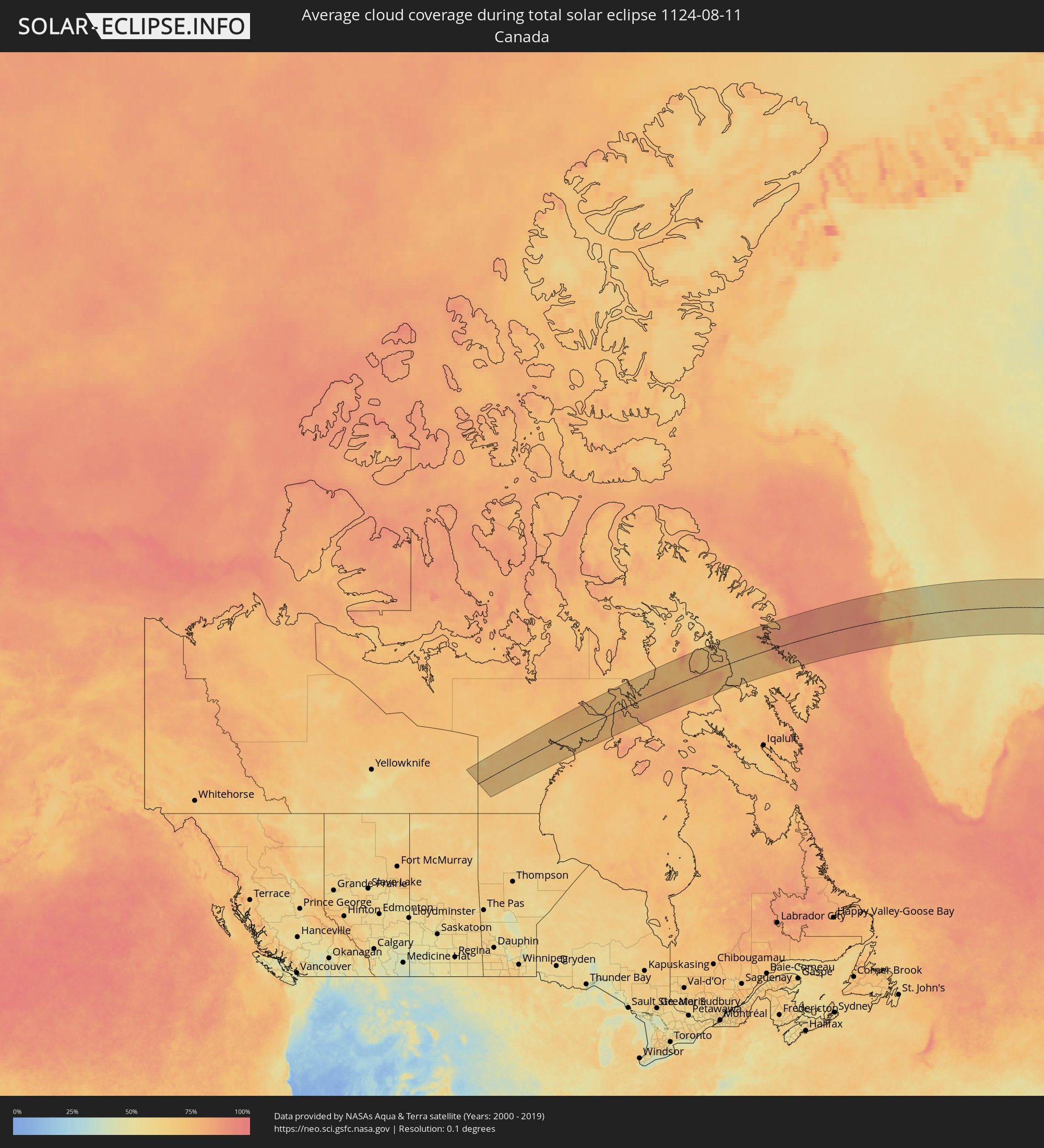 Canada
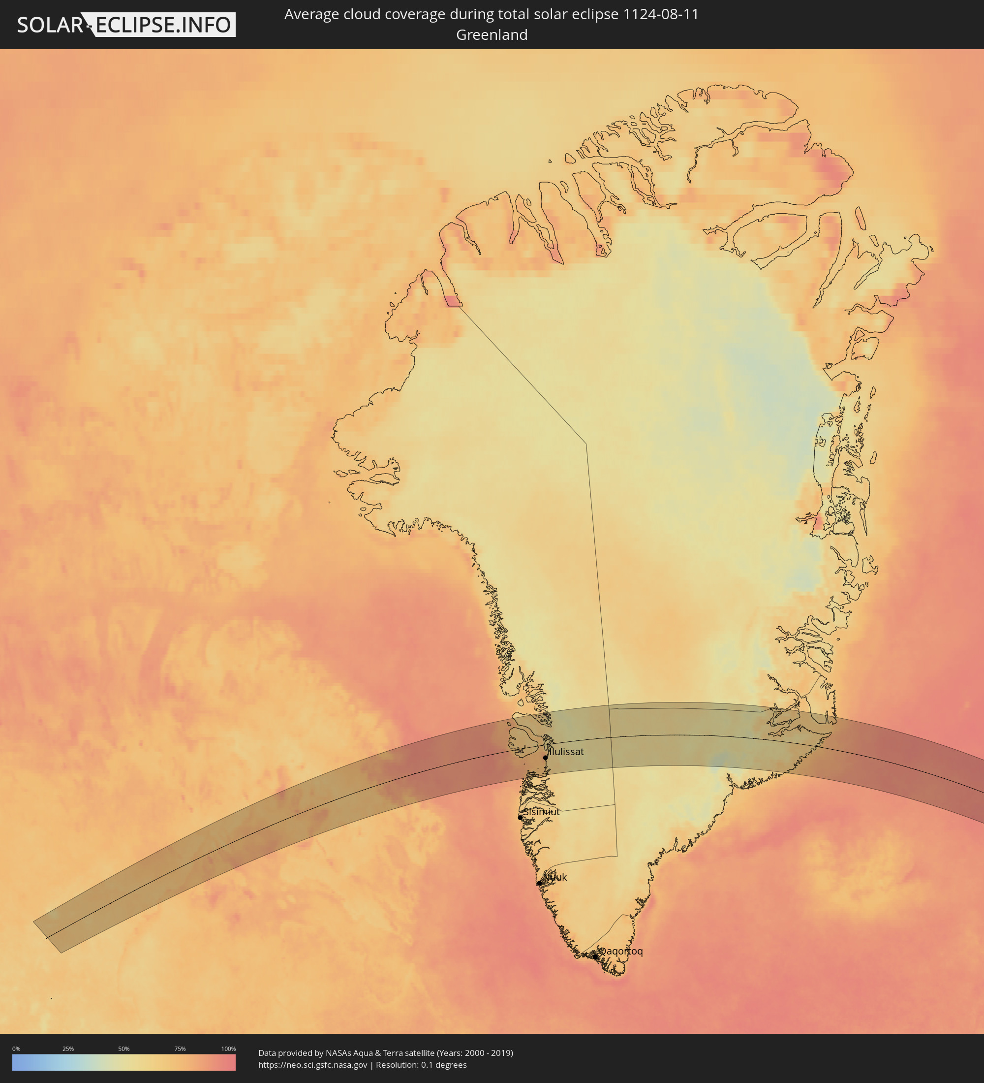 Greenland
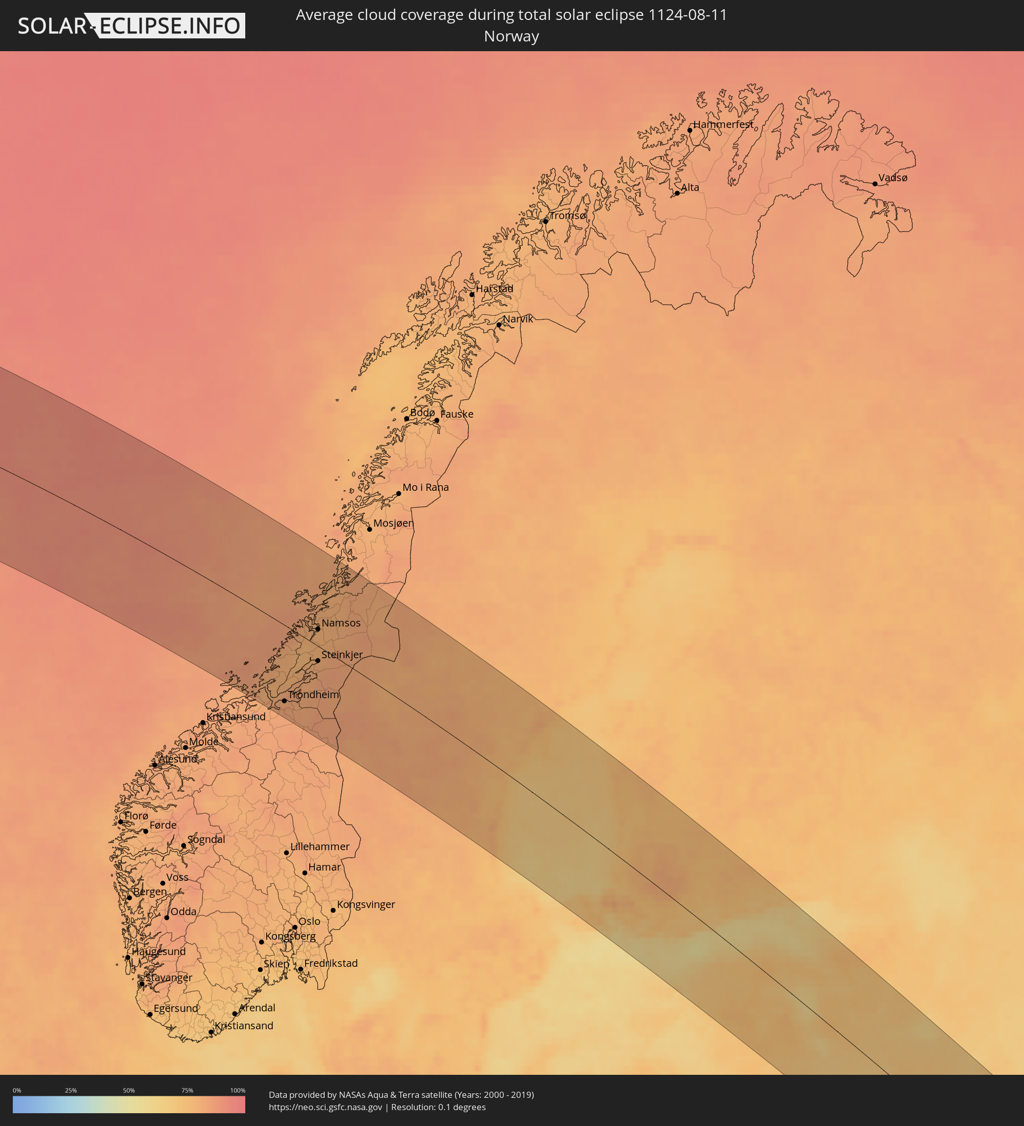 Norway
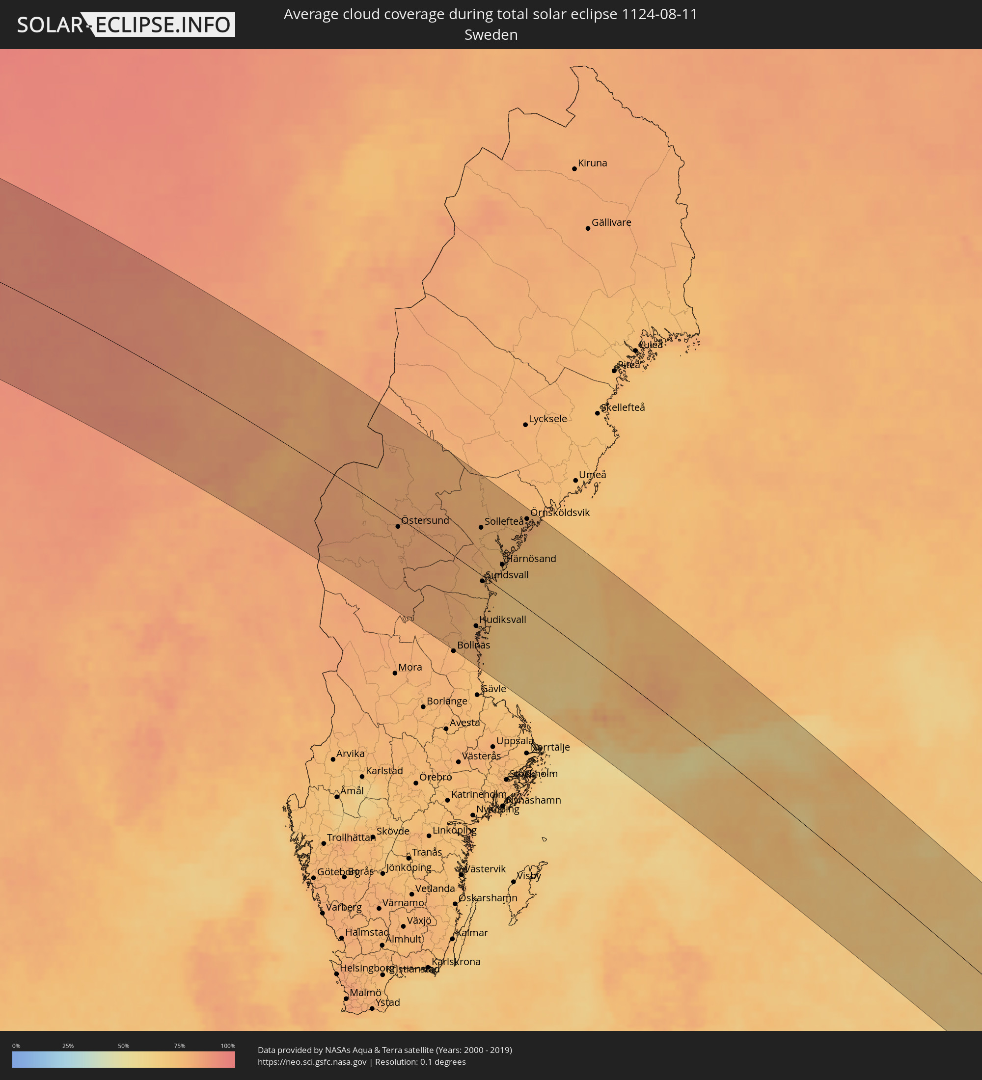 Sweden
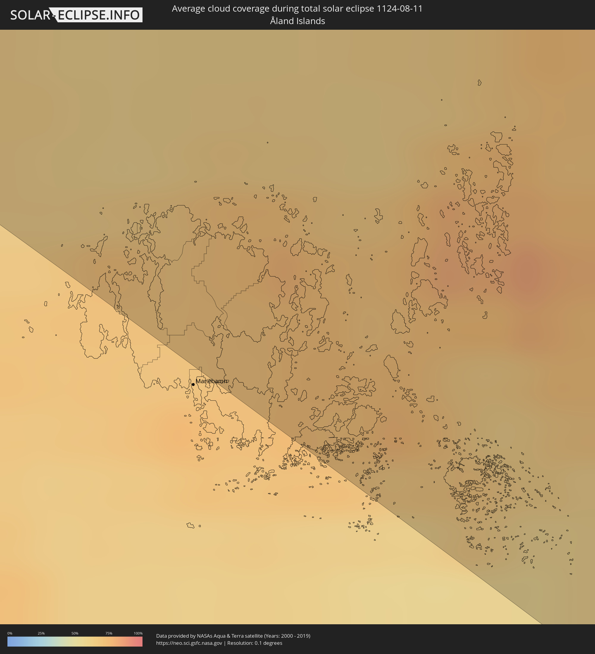 Åland Islands
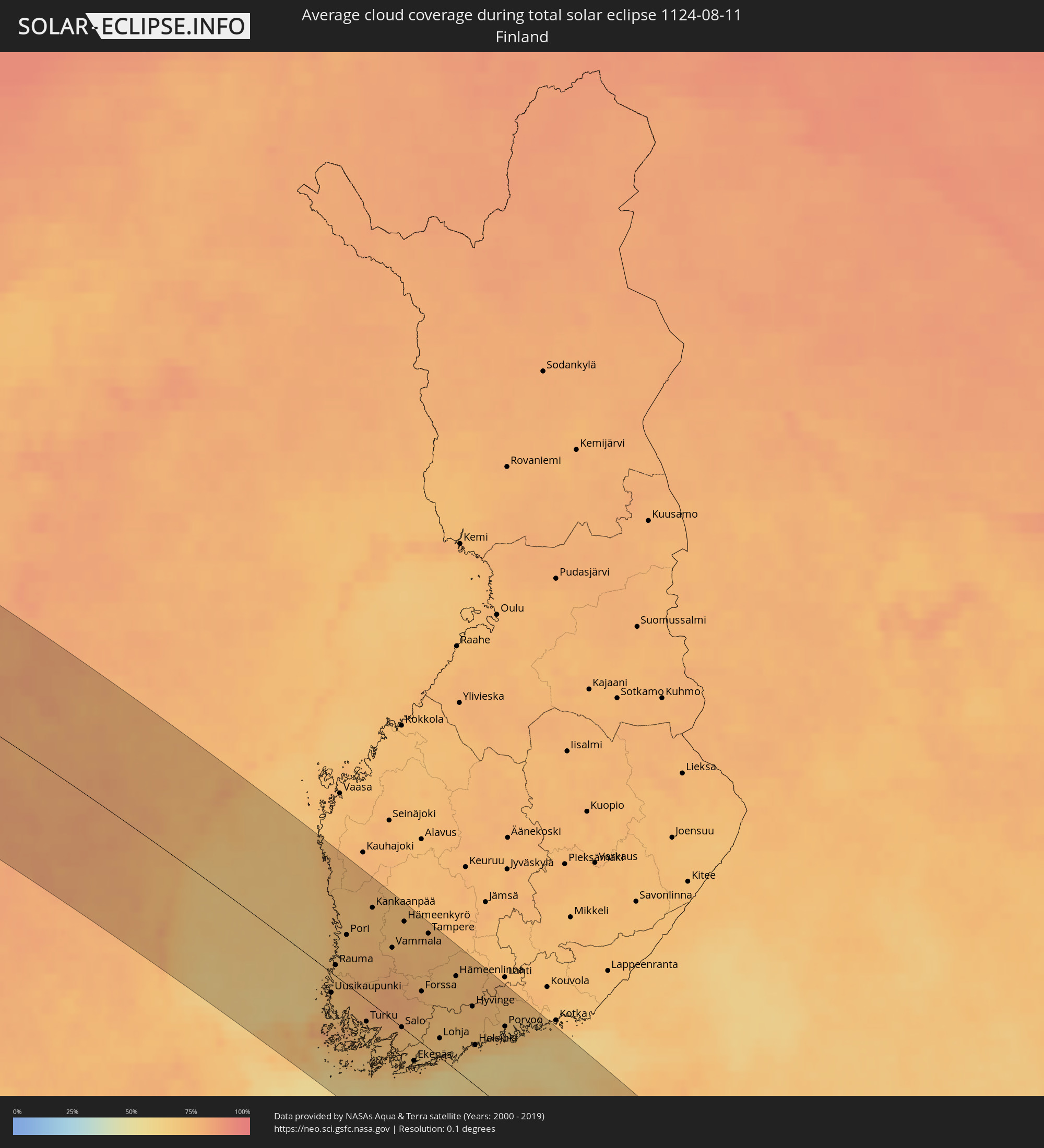 Finland
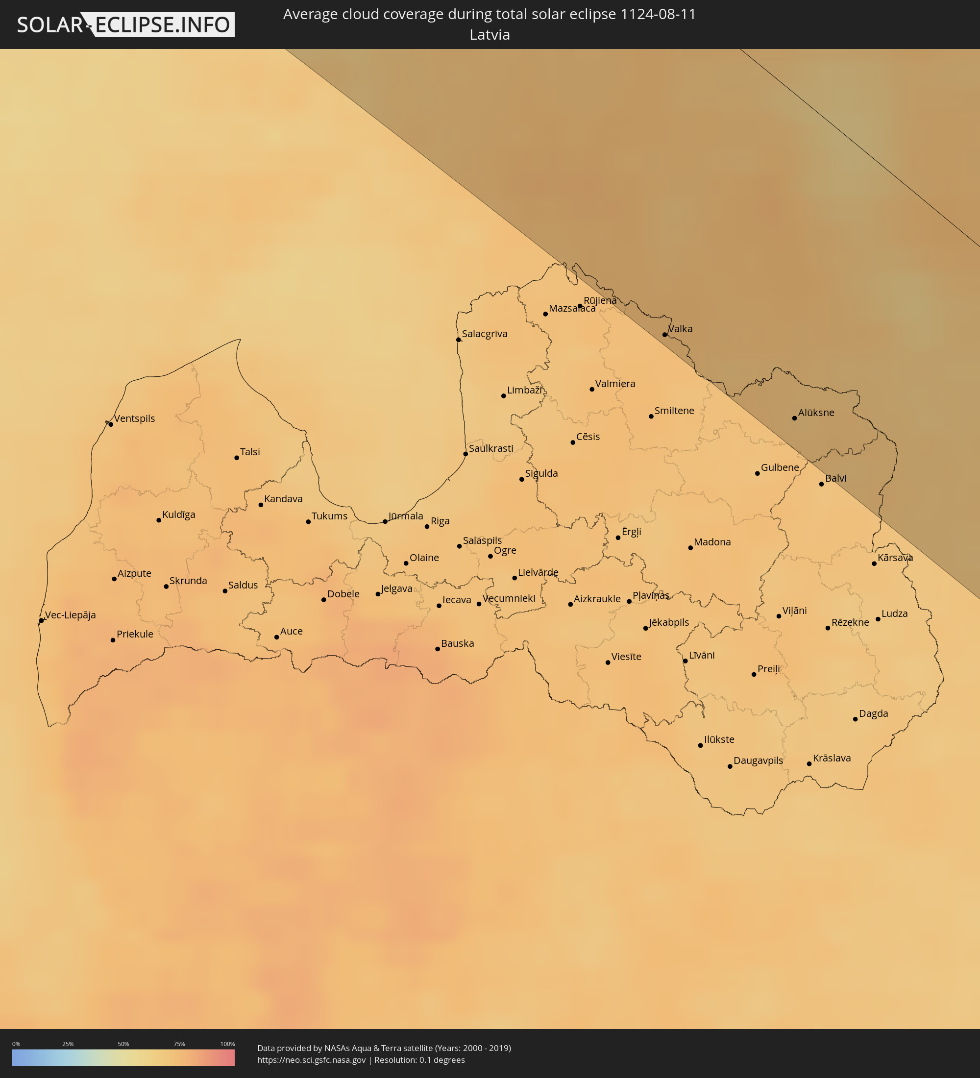 Latvia
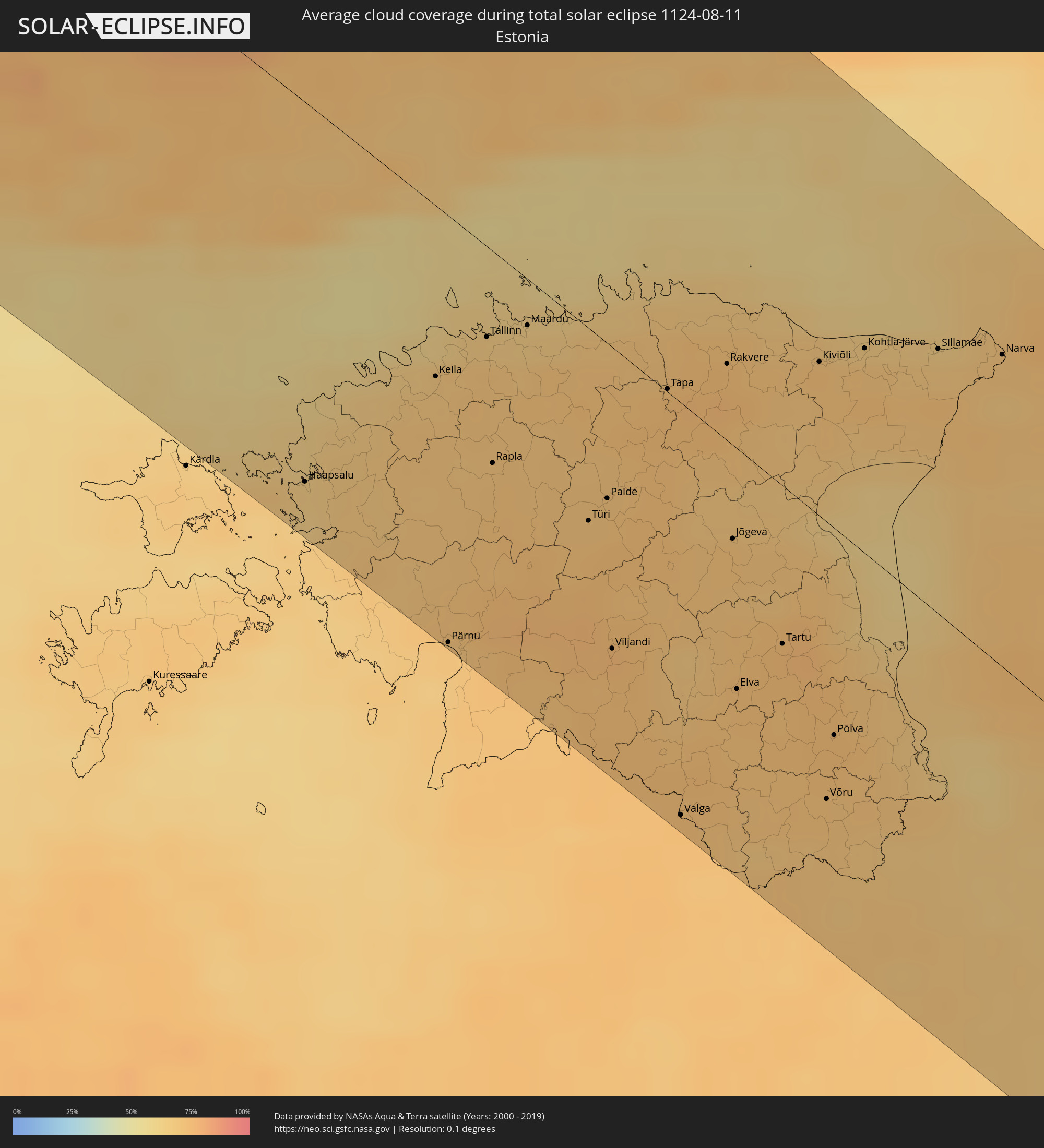 Estonia
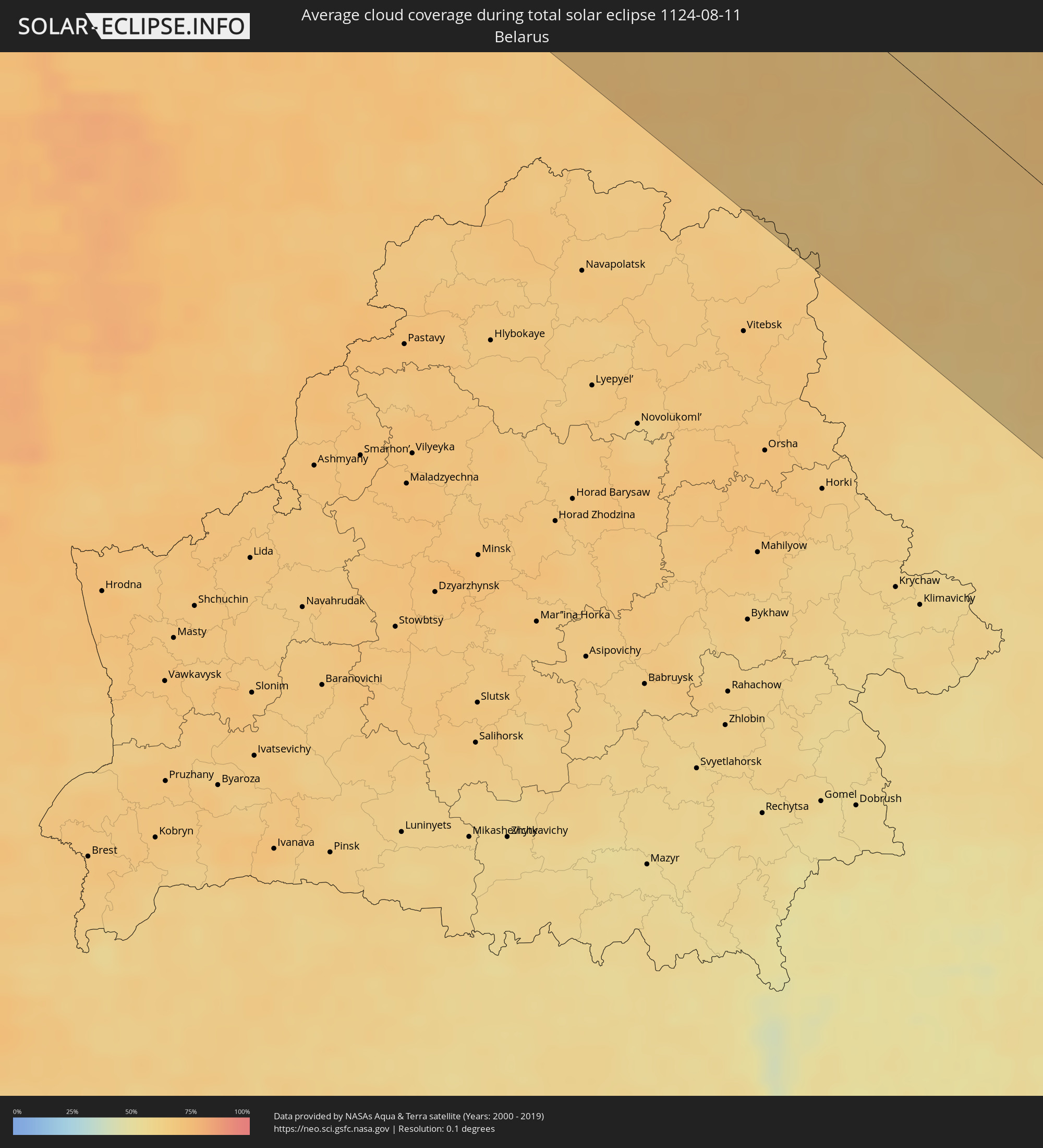 Belarus
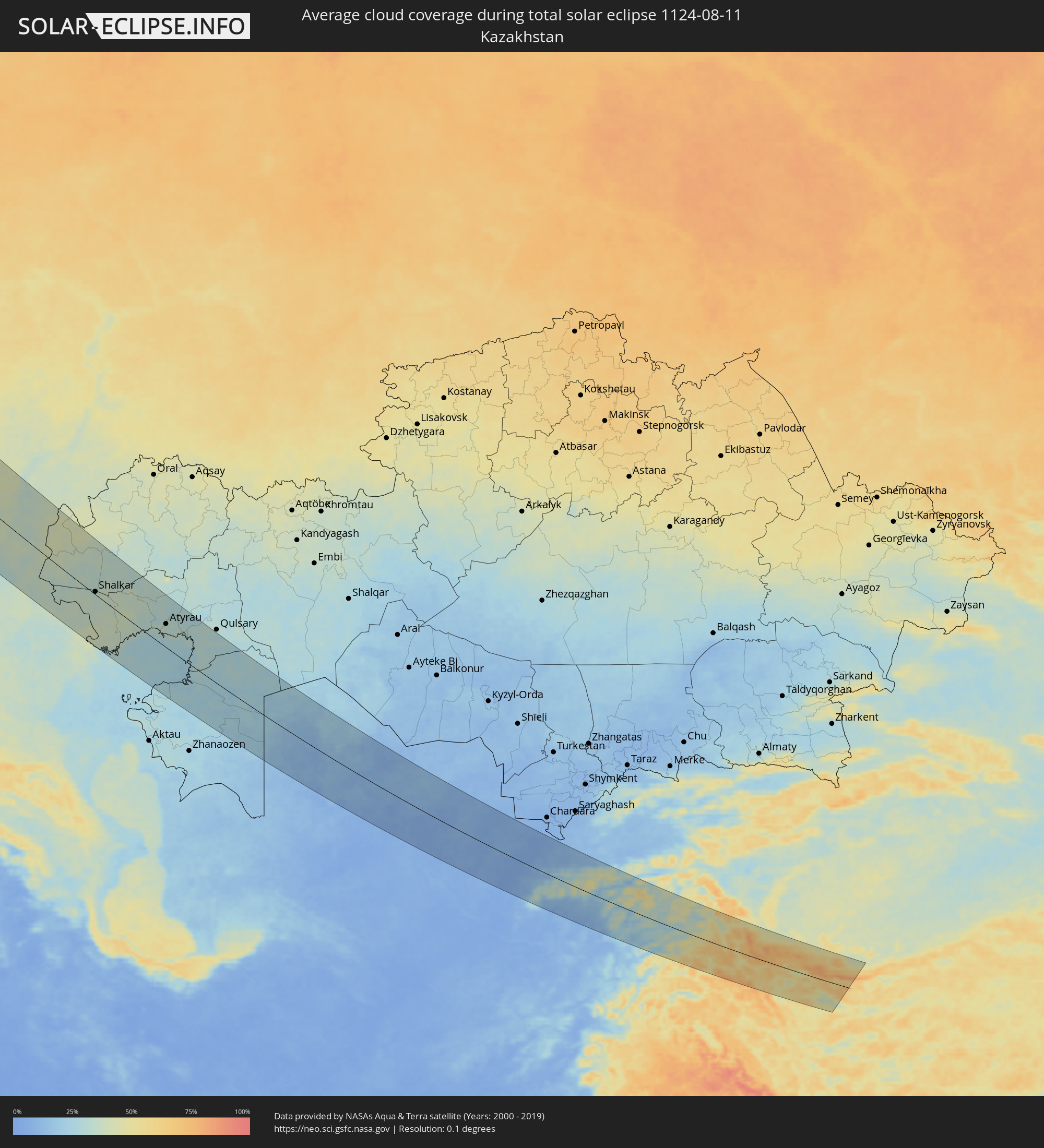 Kazakhstan
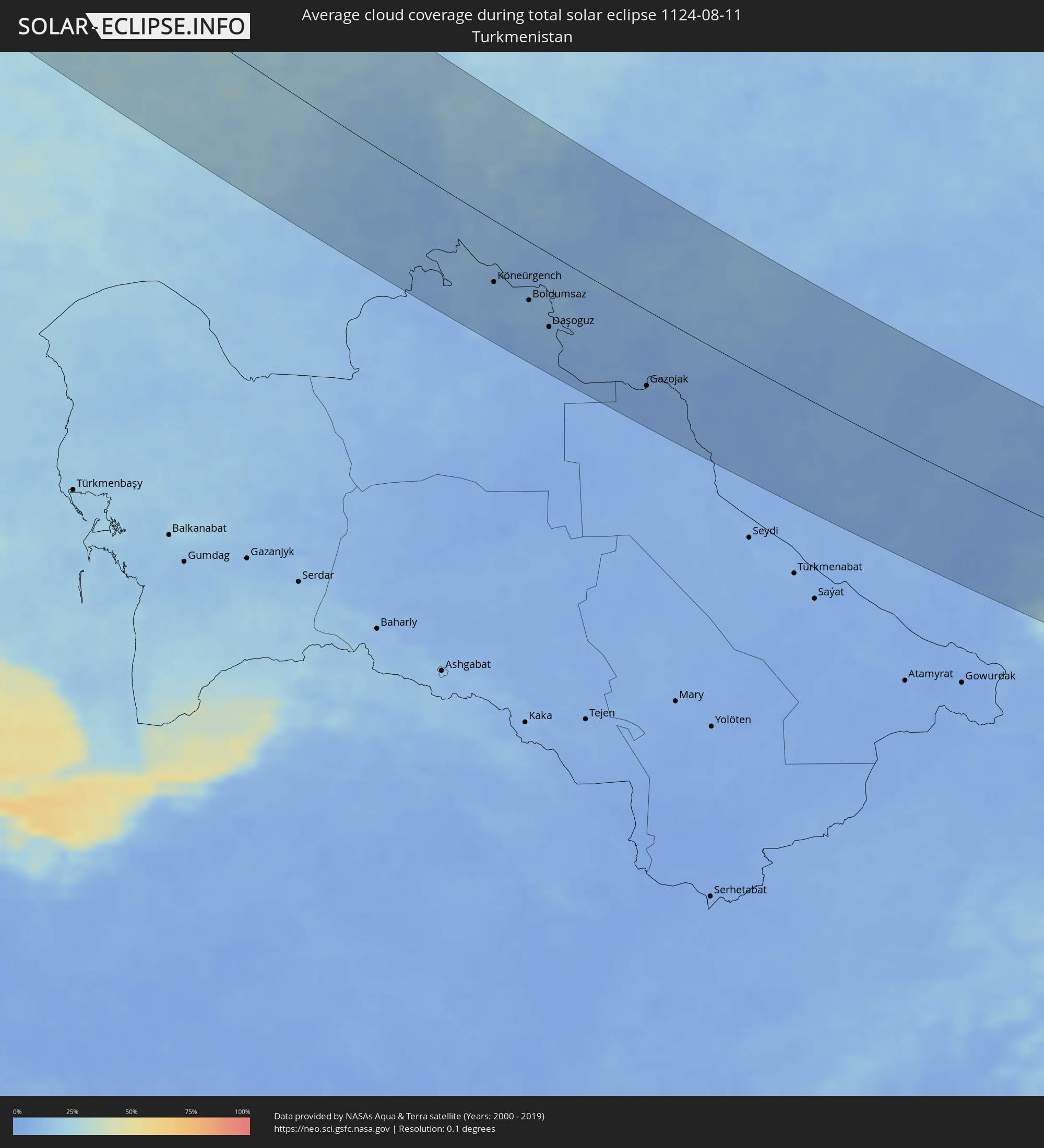 Turkmenistan
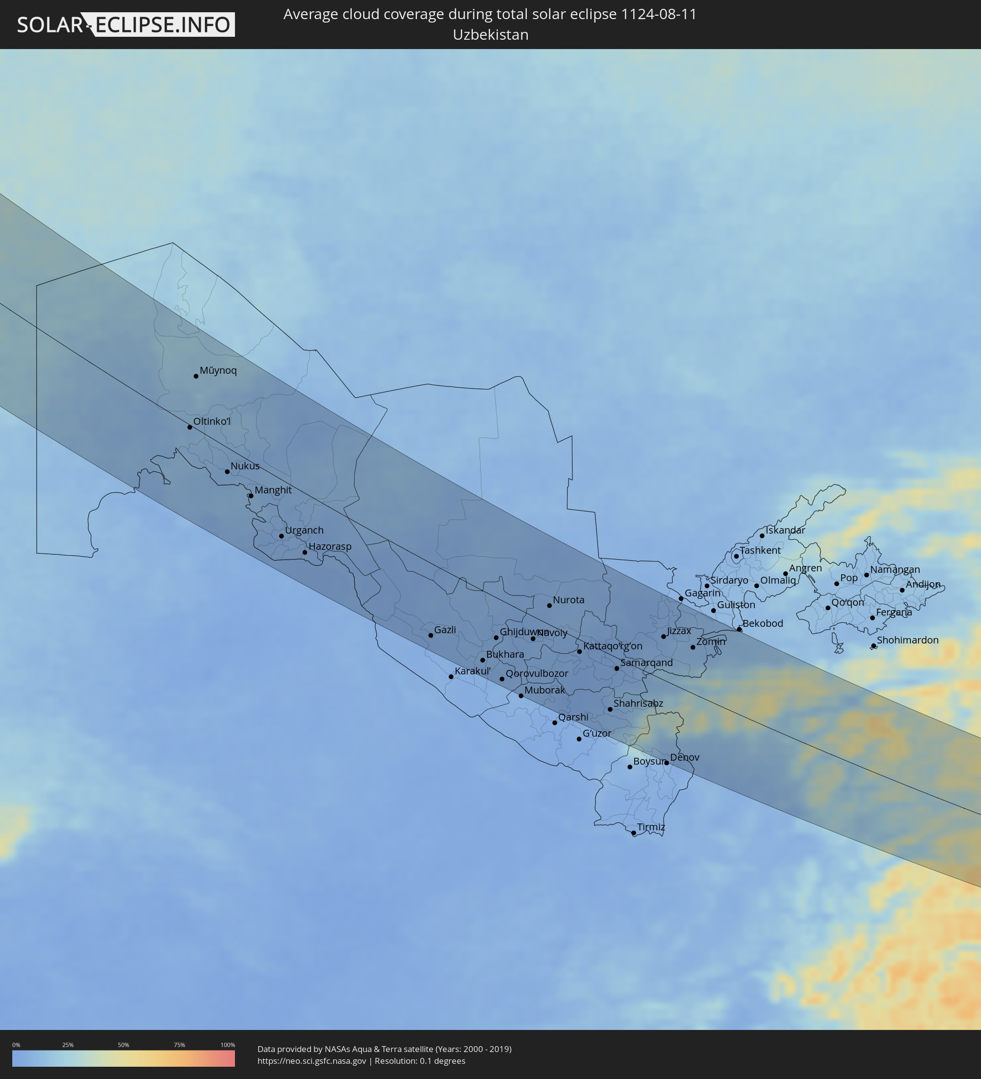 Uzbekistan
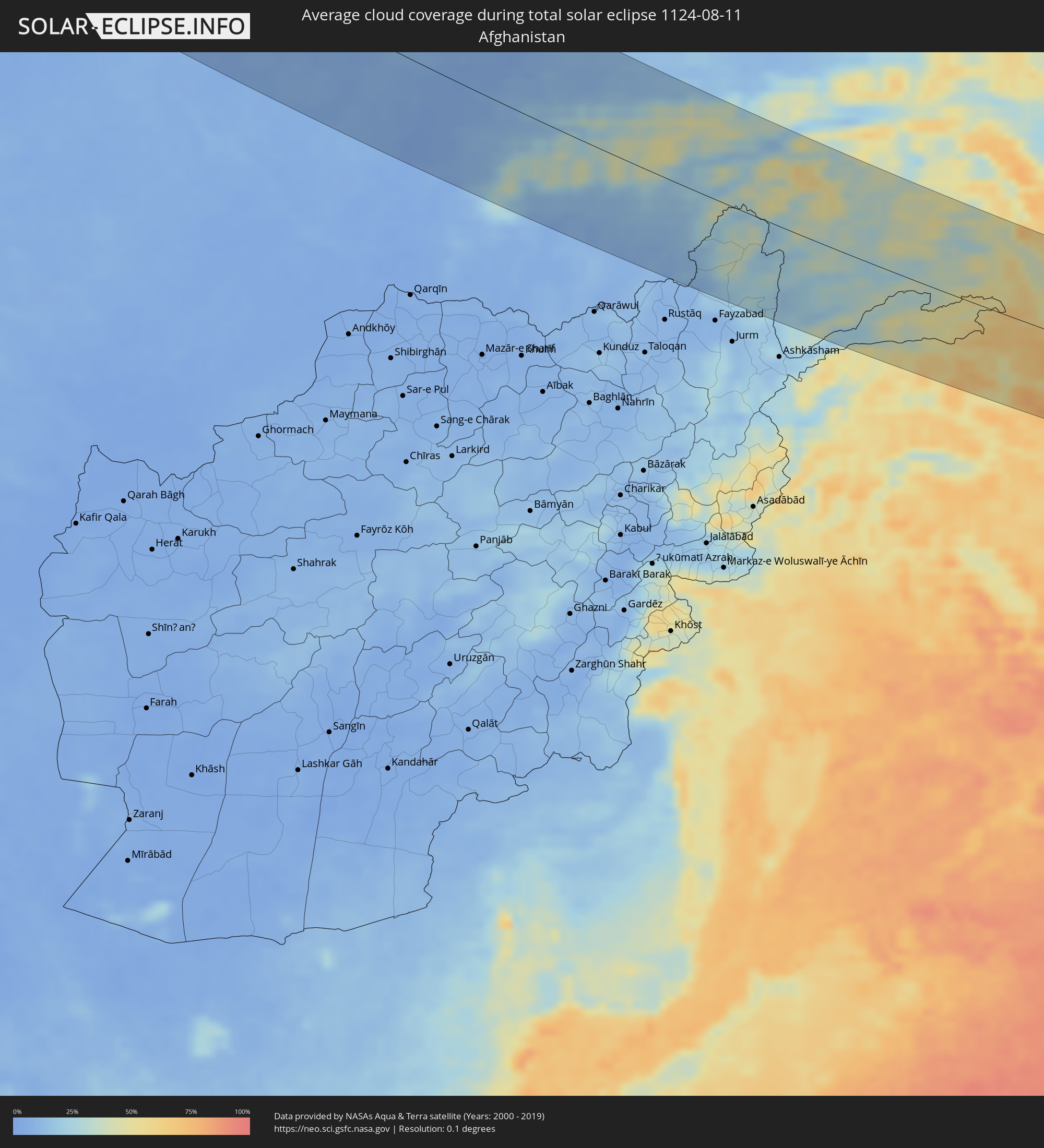 Afghanistan
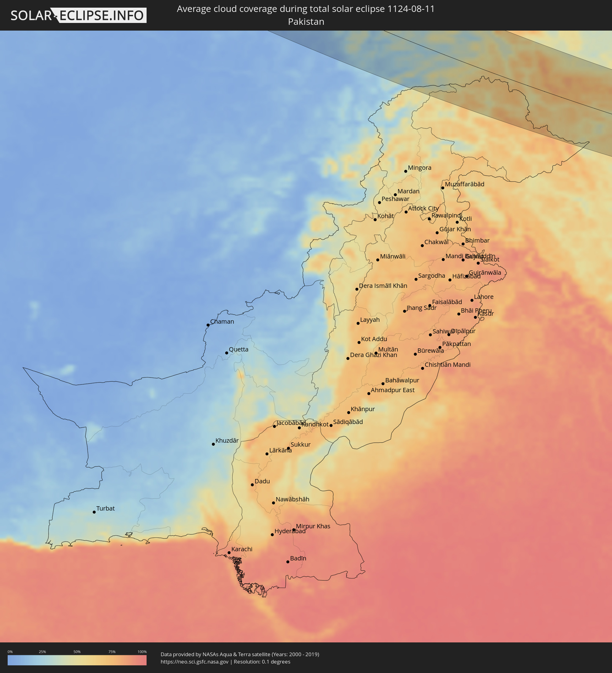 Pakistan
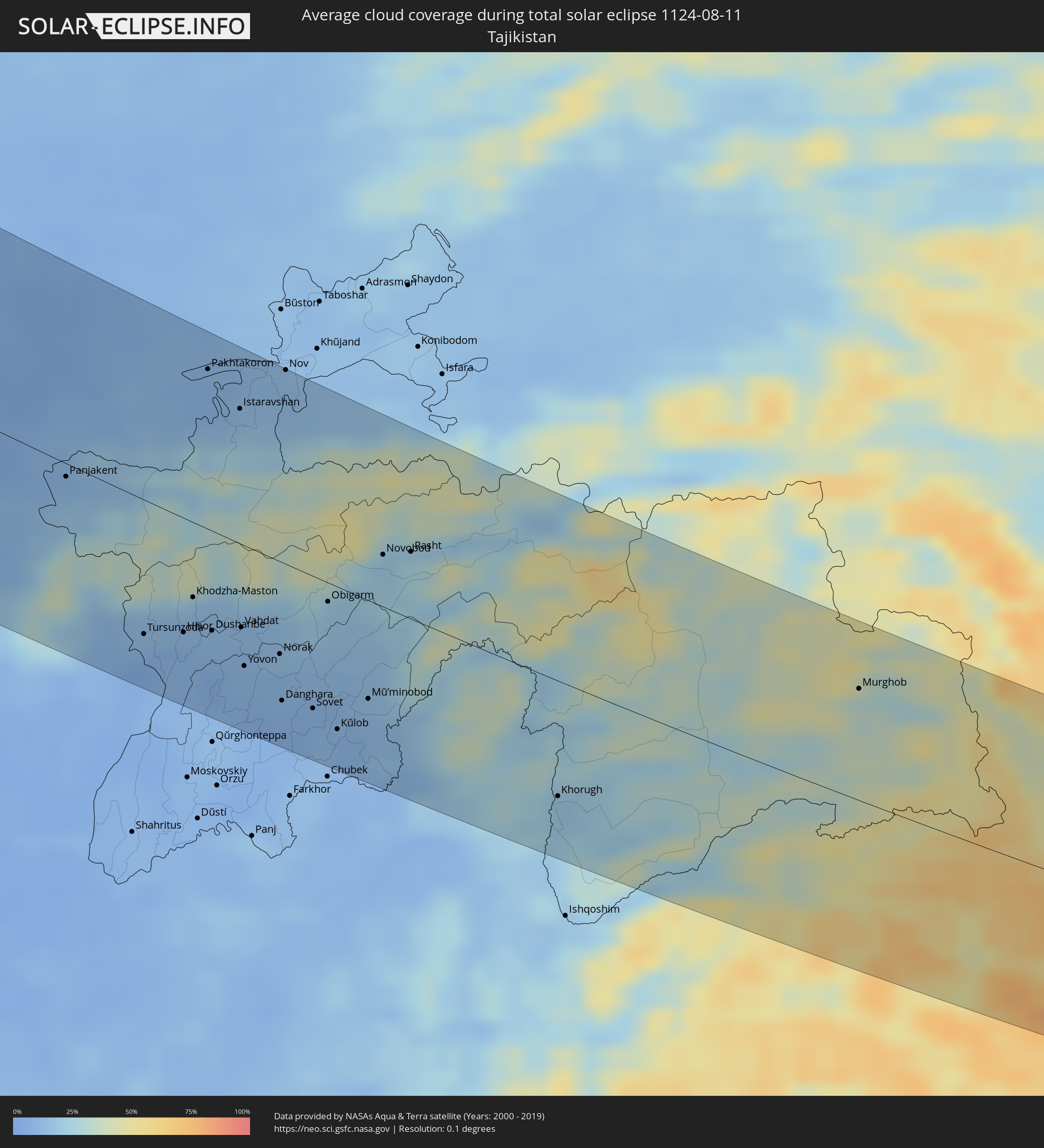 Tajikistan
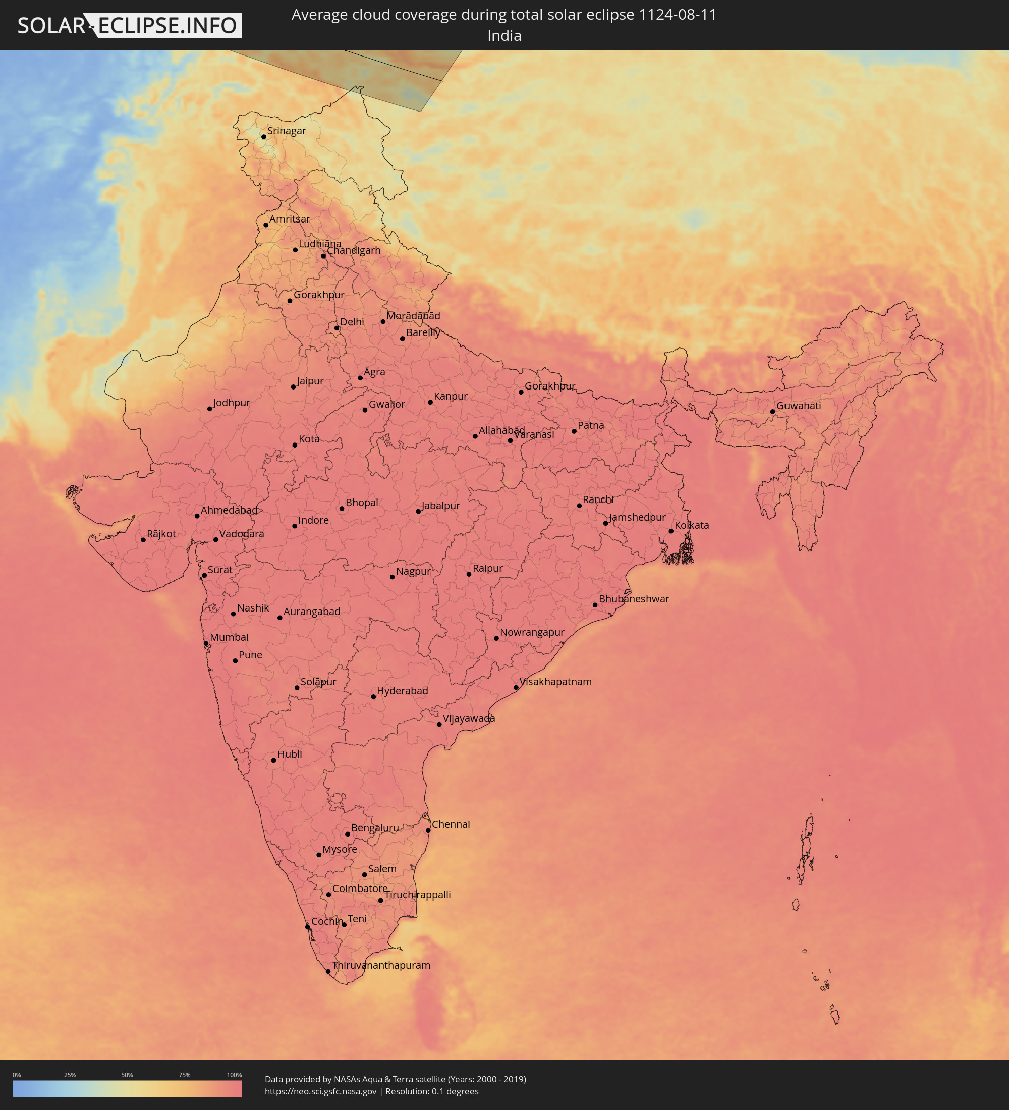 India
India
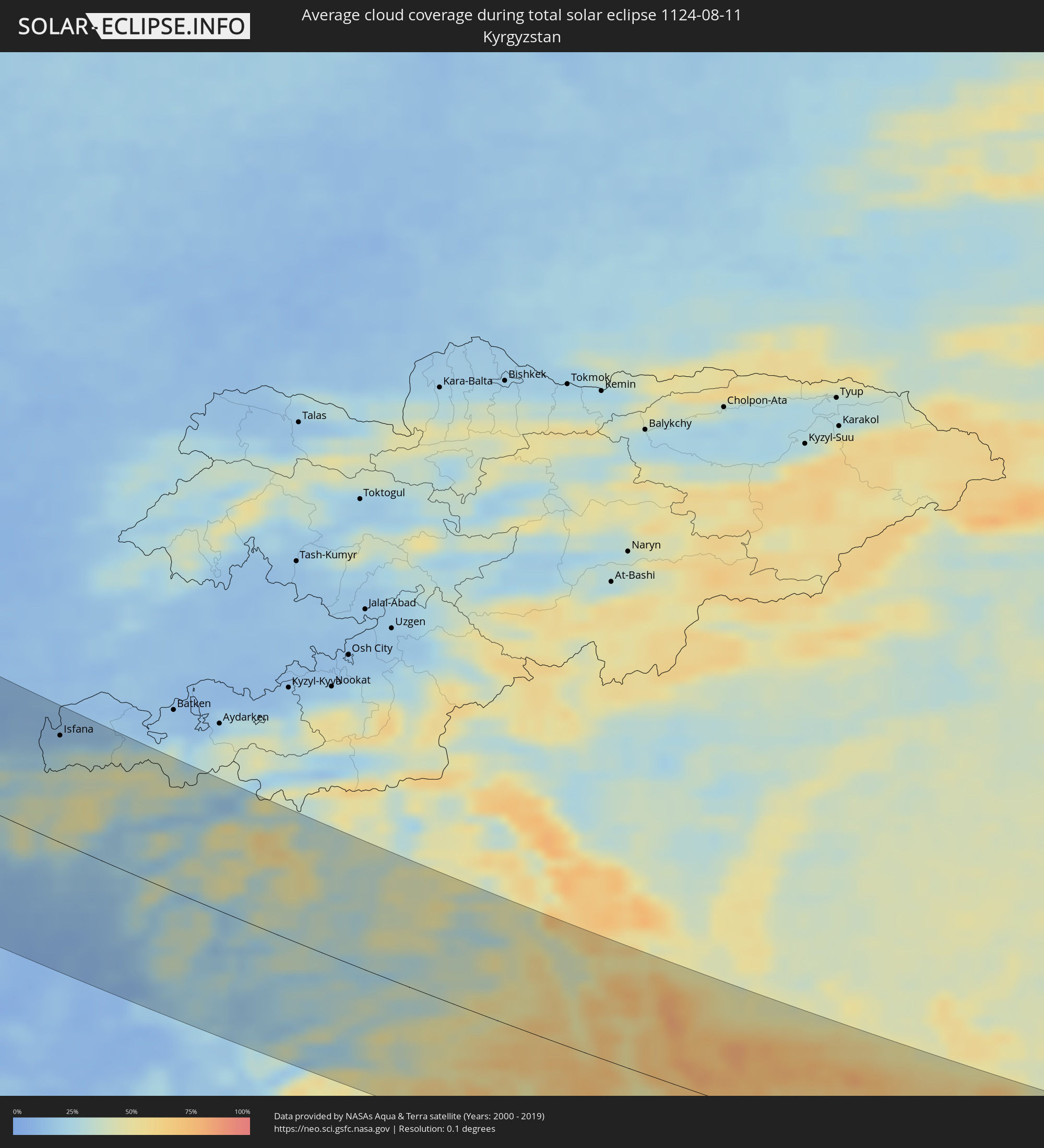 Kyrgyzstan
 China
China
Cities inside the path of the eclipse
The following table shows all locations with a population of more than 5,000 inside the eclipse path. Cities which have more than 100,000 inhabitants are marked bold. A click at the locations opens a detailed map.
| City | Type | Eclipse duration | Local time of max. eclipse | Distance to central line | Ø Cloud coverage |
|
Ilulissat, Qaasuitsup
|
total | - | 07:51:43 UTC-03:26 | 54 km | 68% |
|
Trondheim, Sør-Trøndelag
|
total | - | 13:01:08 UTC+01:00 | 104 km | 82% |
|
Malvik, Sør-Trøndelag
|
total | - | 13:01:24 UTC+01:00 | 97 km | 81% |
|
Stjørdalshalsen, Nord-Trøndelag
|
total | - | 13:01:36 UTC+01:00 | 87 km | 81% |
|
Levanger, Nord-Trøndelag
|
total | - | 13:01:43 UTC+01:00 | 51 km | 81% |
|
Verdal, Nord-Trøndelag
|
total | - | 13:01:51 UTC+01:00 | 41 km | 82% |
|
Steinkjer, Nord-Trøndelag
|
total | - | 13:01:41 UTC+01:00 | 23 km | 80% |
|
Namsos, Nord-Trøndelag
|
total | - | 13:01:19 UTC+01:00 | 26 km | 78% |
|
Östersund, Jämtland
|
total | - | 13:05:16 UTC+01:00 | 19 km | 80% |
|
Ljusdal, Gävleborg
|
total | - | 13:07:58 UTC+01:00 | 95 km | 78% |
|
Söderhamn, Gävleborg
|
total | - | 13:09:27 UTC+01:00 | 114 km | 77% |
|
Hudiksvall, Gävleborg
|
total | - | 13:09:02 UTC+01:00 | 74 km | 77% |
|
Sollefteå, Västernorrland
|
total | - | 13:07:39 UTC+01:00 | 62 km | 77% |
|
Sundsvall, Västernorrland
|
total | - | 13:08:30 UTC+01:00 | 10 km | 76% |
|
Timrå, Västernorrland
|
total | - | 13:08:25 UTC+01:00 | 13 km | 76% |
|
Kramfors, Västernorrland
|
total | - | 13:08:21 UTC+01:00 | 56 km | 75% |
|
Härnösand, Västernorrland
|
total | - | 13:08:49 UTC+01:00 | 34 km | 76% |
|
Örnsköldsvik, Västernorrland
|
total | - | 13:08:47 UTC+01:00 | 116 km | 78% |
|
Rauma, Satakunta
|
total | - | 13:53:36 UTC+01:39 | 14 km | 72% |
|
Pori, Satakunta
|
total | - | 13:53:24 UTC+01:39 | 53 km | 74% |
|
Turku, Southwest Finland
|
total | - | 13:55:09 UTC+01:39 | 23 km | 75% |
|
Salo, Southwest Finland
|
total | - | 13:56:01 UTC+01:39 | 9 km | 75% |
|
Nokia, Pirkanmaa
|
total | - | 13:54:56 UTC+01:39 | 108 km | 75% |
|
Haapsalu, Lääne
|
total | - | 13:57:30 UTC+01:39 | 114 km | 65% |
|
Tampere, Pirkanmaa
|
total | - | 13:55:08 UTC+01:39 | 119 km | 76% |
|
Lohja, Uusimaa
|
total | - | 13:57:02 UTC+01:39 | 23 km | 69% |
|
Vihti, Uusimaa
|
total | - | 13:57:02 UTC+01:39 | 45 km | 71% |
|
Keila, Harjumaa
|
total | - | 13:57:49 UTC+01:39 | 50 km | 69% |
|
Hämeenlinna, Häme
|
total | - | 13:56:23 UTC+01:39 | 99 km | 74% |
|
Pärnu, Pärnumaa
|
total | - | 13:59:10 UTC+01:39 | 128 km | 69% |
|
Espoo, Uusimaa
|
total | - | 13:57:37 UTC+01:39 | 40 km | 71% |
|
Tallinn, Harjumaa
|
total | - | 13:57:56 UTC+01:39 | 27 km | 70% |
|
Nurmijärvi, Uusimaa
|
total | - | 13:57:24 UTC+01:39 | 65 km | 74% |
|
Hyvinge, Uusimaa
|
total | - | 13:57:13 UTC+01:39 | 81 km | 76% |
|
Helsinki, Uusimaa
|
total | - | 13:57:55 UTC+01:39 | 43 km | 72% |
|
Maardu, Harjumaa
|
total | - | 13:58:08 UTC+01:39 | 19 km | 65% |
|
Vantaa, Uusimaa
|
total | - | 13:57:50 UTC+01:39 | 58 km | 72% |
|
Järvenpää, Uusimaa
|
total | - | 13:57:38 UTC+01:39 | 77 km | 73% |
|
Paide, Järvamaa
|
total | - | 13:59:26 UTC+01:39 | 46 km | 72% |
|
Viljandi, Viljandimaa
|
total | - | 14:00:12 UTC+01:39 | 90 km | 75% |
|
Porvoo, Uusimaa
|
total | - | 13:58:15 UTC+01:39 | 89 km | 69% |
|
Valka, Valkas Rajons
|
total | - | 13:59:00 UTC+01:36 | 127 km | 73% |
|
Valga, Valgamaa
|
total | - | 14:01:28 UTC+01:39 | 125 km | 73% |
|
Rakvere, Lääne-Virumaa
|
total | - | 13:59:30 UTC+01:39 | 24 km | 74% |
|
Ape, Apes Novads
|
total | - | 13:59:59 UTC+01:36 | 122 km | 71% |
|
Tartu, Tartu
|
total | - | 14:01:13 UTC+01:39 | 51 km | 74% |
|
Kiviõli, Ida-Virumaa
|
total | - | 14:00:02 UTC+01:39 | 45 km | 72% |
|
Võru, Võrumaa
|
total | - | 14:02:17 UTC+01:39 | 84 km | 71% |
|
Alūksne, Alūksnes Rajons
|
total | - | 14:00:29 UTC+01:36 | 120 km | 70% |
|
Kohtla-Järve, Ida-Virumaa
|
total | - | 14:00:13 UTC+01:39 | 61 km | 71% |
|
Jõhvi, Ida-Virumaa
|
total | - | 14:00:24 UTC+01:39 | 64 km | 70% |
|
Viļaka, Viļaka
|
total | - | 14:01:24 UTC+01:36 | 116 km | 70% |
|
Sillamäe, Ida-Virumaa
|
total | - | 14:00:39 UTC+01:39 | 78 km | 68% |
|
Narva, Ida-Virumaa
|
total | - | 14:01:02 UTC+01:39 | 93 km | 70% |
|
Pskov, Pskov
|
total | - | 14:54:47 UTC+02:30 | 40 km | 67% |
|
Velikiye Luki, Pskov
|
total | - | 14:58:59 UTC+02:30 | 78 km | 65% |
|
Kaluga, Kaluga
|
total | - | 15:06:43 UTC+02:30 | 21 km | 58% |
|
Obninsk, Kaluga
|
total | - | 15:06:01 UTC+02:30 | 65 km | 62% |
|
Serpukhov, Moscow Oblast
|
total | - | 15:06:56 UTC+02:30 | 84 km | 53% |
|
Podolsk, Moscow Oblast
|
total | - | 15:06:10 UTC+02:30 | 133 km | 60% |
|
Tula, Tula
|
total | - | 15:08:19 UTC+02:30 | 36 km | 56% |
|
Novomoskovsk, Tula
|
total | - | 15:09:08 UTC+02:30 | 45 km | 57% |
|
Yelets, Lipetsk
|
total | - | 15:11:43 UTC+02:30 | 63 km | 50% |
|
Voronezh, Voronezj
|
total | - | 15:13:54 UTC+02:30 | 116 km | 41% |
|
Lipetsk, Lipetsk
|
total | - | 15:12:32 UTC+02:30 | 28 km | 46% |
|
Tambov, Tambov
|
total | - | 15:13:38 UTC+02:30 | 78 km | 40% |
|
Balashov, Saratov
|
total | - | 16:06:55 UTC+03:20 | 55 km | 39% |
|
Volgograd, Volgograd
|
total | - | 15:22:48 UTC+02:30 | 133 km | 31% |
|
Volzhskiy, Volgograd
|
total | - | 15:22:51 UTC+02:30 | 116 km | 32% |
|
Kamyshin, Volgograd
|
total | - | 15:20:52 UTC+02:30 | 32 km | 36% |
|
Zhänibek, Batys Qazaqstan
|
total | - | 16:18:02 UTC+03:25 | 36 km | 41% |
|
Shalkar, Atyraū
|
total | - | 16:21:37 UTC+03:25 | 17 km | 34% |
|
Maloye Ganyushkino, Atyraū
|
total | - | 16:24:22 UTC+03:25 | 104 km | 34% |
|
Makhambet, Atyraū
|
total | - | 16:23:33 UTC+03:25 | 98 km | 33% |
|
Balyqshy, Atyraū
|
total | - | 16:24:45 UTC+03:25 | 56 km | 32% |
|
Atyrau, Atyraū
|
total | - | 16:24:40 UTC+03:25 | 62 km | 32% |
|
Qaraton, Atyraū
|
total | - | 16:26:31 UTC+03:25 | 72 km | 30% |
|
Beyneu, Mangghystaū
|
total | - | 16:29:07 UTC+03:25 | 48 km | 25% |
|
Oltinko’l, Karakalpakstan
|
total | - | 17:36:31 UTC+04:27 | 8 km | 11% |
|
Köneürgench, Daşoguz
|
total | - | 17:03:28 UTC+03:53 | 64 km | 10% |
|
Akdepe
|
total | - | 17:03:59 UTC+03:53 | 81 km | 11% |
|
Nukus, Karakalpakstan
|
total | - | 17:37:43 UTC+04:27 | 37 km | 9% |
|
Yylanly, Daşoguz
|
total | - | 17:04:24 UTC+03:53 | 92 km | 8% |
|
Boldumsaz, Daşoguz
|
total | - | 17:03:55 UTC+03:53 | 61 km | 12% |
|
Tagta, Daşoguz
|
total | - | 17:04:46 UTC+03:53 | 97 km | 9% |
|
Daşoguz, Daşoguz
|
total | - | 17:04:28 UTC+03:53 | 77 km | 11% |
|
Khiwa, Xorazm
|
total | - | 17:39:39 UTC+04:27 | 105 km | 7% |
|
Urganch, Xorazm
|
total | - | 17:39:25 UTC+04:27 | 77 km | 7% |
|
Beruniy, Karakalpakstan
|
total | - | 17:39:12 UTC+04:27 | 59 km | 8% |
|
Novyy Turtkul’, Karakalpakstan
|
total | - | 17:39:28 UTC+04:27 | 62 km | 8% |
|
Gazojak, Lebap
|
total | - | 17:05:47 UTC+03:53 | 82 km | 5% |
|
Bukhara, Bukhara
|
total | - | 17:42:45 UTC+04:27 | 100 km | 6% |
|
Ghijduwon, Bukhara
|
total | - | 17:42:15 UTC+04:27 | 58 km | 8% |
|
Navoiy, Navoiy
|
total | - | 17:42:18 UTC+04:27 | 33 km | 7% |
|
Oqtosh, Samarqand
|
total | - | 17:42:35 UTC+04:27 | 29 km | 7% |
|
Kattaqo’rg’on, Samarqand
|
total | - | 17:42:38 UTC+04:27 | 23 km | 6% |
|
Shahrisabz, Qashqadaryo
|
total | - | 17:43:57 UTC+04:27 | 81 km | 8% |
|
Samarqand, Samarqand
|
total | - | 17:43:02 UTC+04:27 | 16 km | 6% |
|
Urgut, Samarqand
|
total | - | 17:43:25 UTC+04:27 | 32 km | 11% |
|
Panjakent, Viloyati Sughd
|
total | - | 17:50:35 UTC+04:35 | 16 km | 10% |
|
Jizzax, Jizzax
|
total | - | 17:42:19 UTC+04:27 | 63 km | 6% |
|
Tursunzoda, Republican Subordination
|
total | - | 17:52:05 UTC+04:35 | 86 km | 9% |
|
Hisor, Republican Subordination
|
total | - | 17:52:03 UTC+04:35 | 73 km | 9% |
|
Dushanbe, Dushanbe
|
total | - | 17:52:02 UTC+04:35 | 64 km | 11% |
|
Yangiyer, Sirdaryo
|
total | - | 17:42:03 UTC+04:27 | 117 km | 10% |
|
Istaravshan, Viloyati Sughd
|
total | - | 17:49:55 UTC+04:35 | 85 km | 15% |
|
Vahdat, Republican Subordination
|
total | - | 17:51:59 UTC+04:35 | 53 km | 11% |
|
Yovon, Khatlon
|
total | - | 17:52:21 UTC+04:35 | 77 km | 10% |
|
Norak, Khatlon
|
total | - | 17:52:13 UTC+04:35 | 59 km | 13% |
|
Danghara, Khatlon
|
total | - | 17:52:39 UTC+04:35 | 88 km | 9% |
|
Nov, Viloyati Sughd
|
total | - | 17:49:32 UTC+04:35 | 123 km | 14% |
|
Isfana, Batken
|
total | - | 18:13:13 UTC+04:58 | 96 km | 20% |
|
Suluktu, Batken
|
total | - | 18:13:04 UTC+04:58 | 107 km | 14% |
|
Vose’, Khatlon
|
total | - | 17:53:04 UTC+04:35 | 108 km | 10% |
|
Kŭlob, Khatlon
|
total | - | 17:52:54 UTC+04:35 | 93 km | 9% |
|
Mŭ’minobod, Khatlon
|
total | - | 17:52:36 UTC+04:35 | 66 km | 12% |
|
Rasht
|
total | - | 17:51:11 UTC+04:35 | 46 km | 26% |
|
Khorugh, Gorno-Badakhshan
|
total | - | 17:53:22 UTC+04:35 | 76 km | 17% |
|
Khandūd, Badakhshan
|
total | - | 17:18:50 UTC+04:00 | 108 km | 19% |
|
Murghob, Gorno-Badakhshan
|
total | - | 17:52:03 UTC+04:35 | 75 km | 31% |