Total solar eclipse of 08/13/1151
| Day of week: | Monday |
| Maximum duration of eclipse: | 04m26s |
| Maximum width of eclipse path: | 258 km |
| Saros cycle: | 102 |
| Coverage: | 100% |
| Magnitude: | 1.0635 |
| Gamma: | 0.6024 |
Wo kann man die Sonnenfinsternis vom 08/13/1151 sehen?
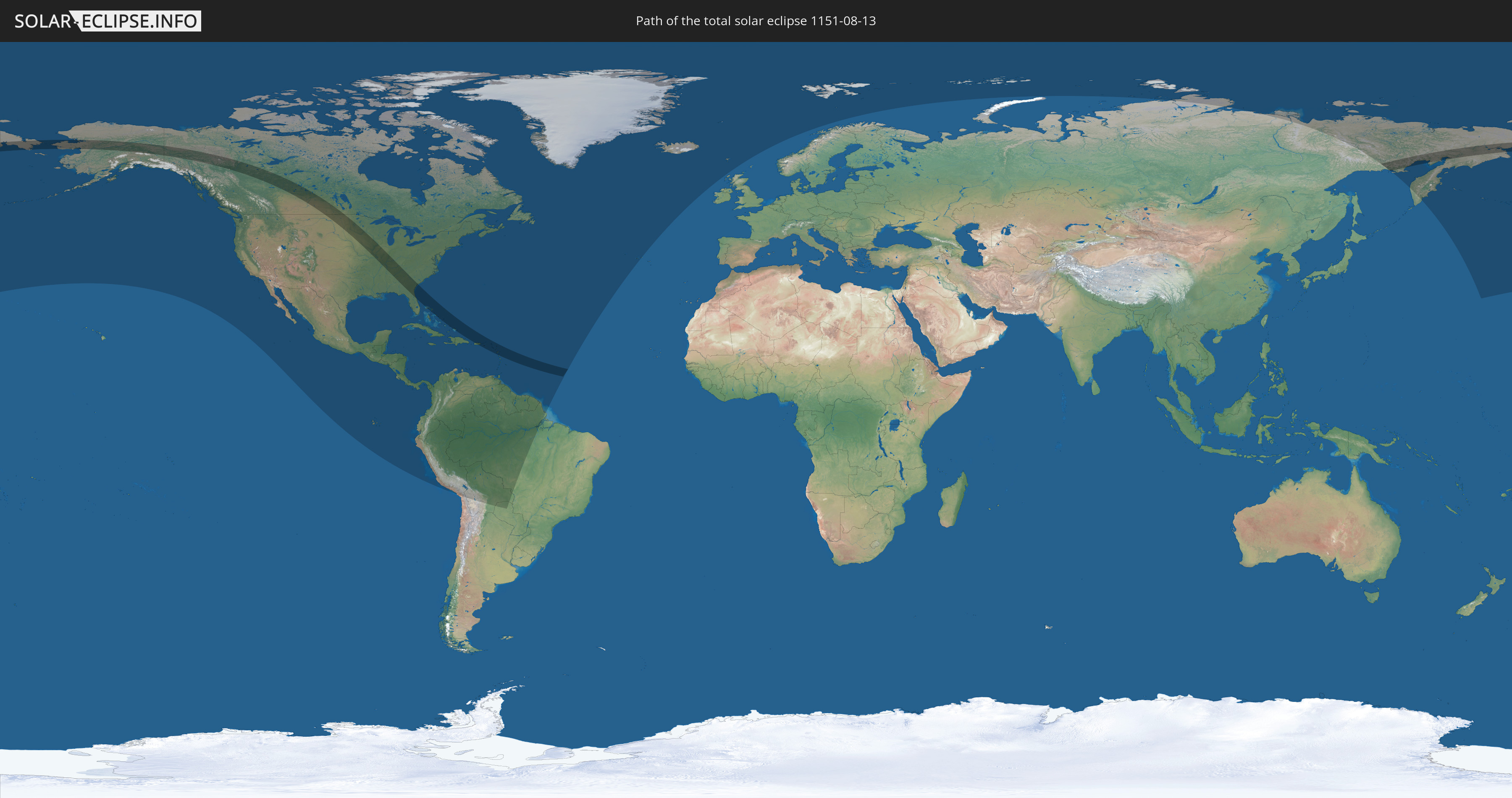
Die Sonnenfinsternis am 08/13/1151 kann man in 56 Ländern als partielle Sonnenfinsternis beobachten.
Der Finsternispfad verläuft durch 18 Länder. Nur in diesen Ländern ist sie als total Sonnenfinsternis zu sehen.
In den folgenden Ländern ist die Sonnenfinsternis total zu sehen
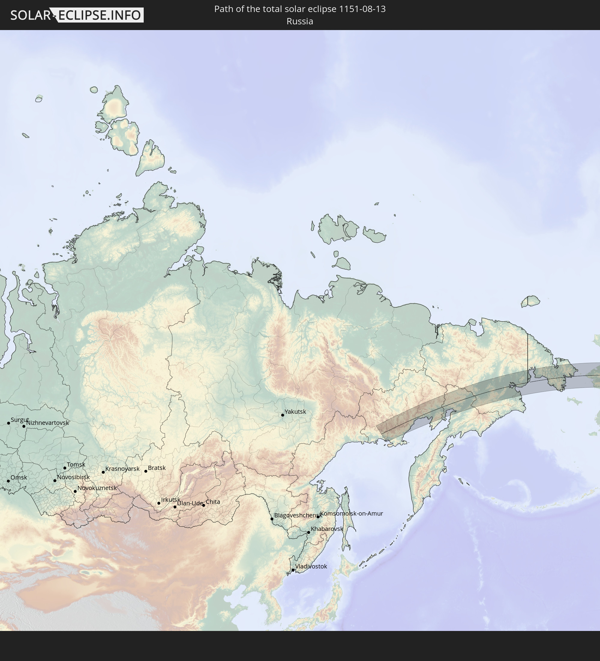 Russia
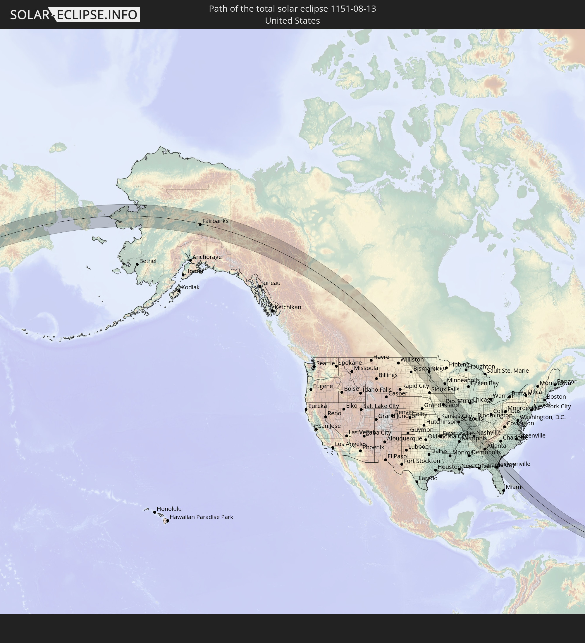 United States
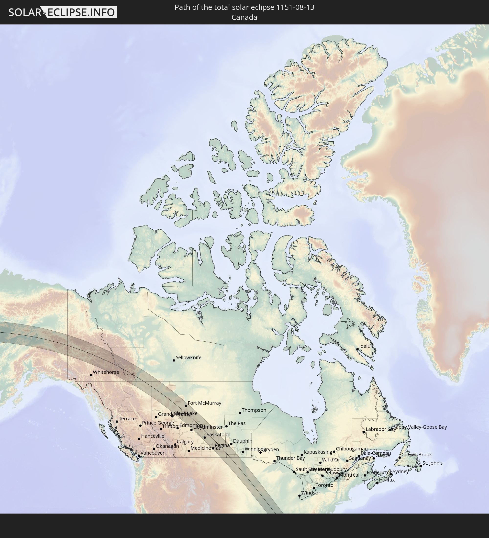 Canada
 The Bahamas
 Turks and Caicos Islands
 Puerto Rico
 United States Virgin Islands
 British Virgin Islands
 Anguilla
 Sint Maarten
 Collectivity of Saint Martin
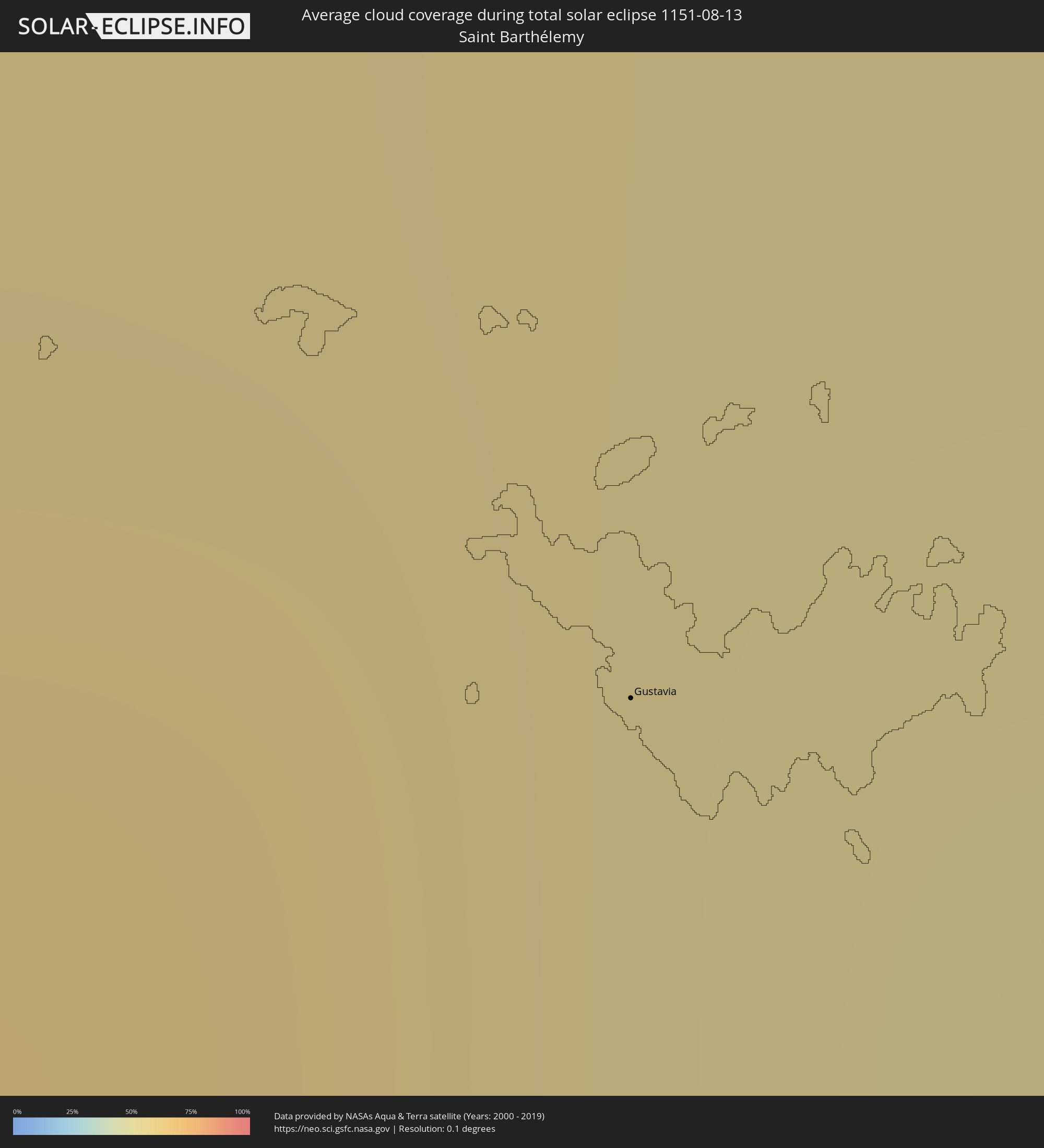
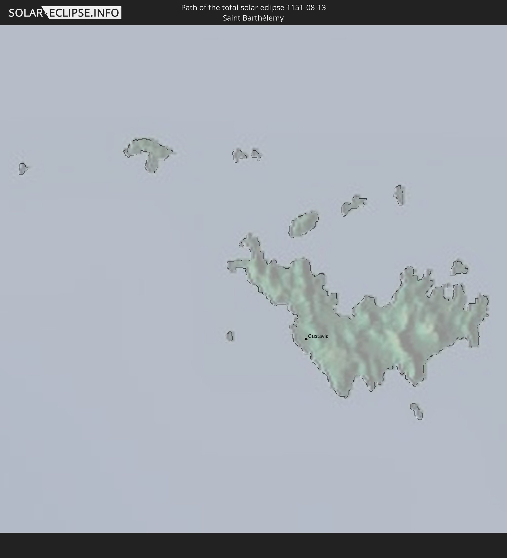 Saint Barthélemy
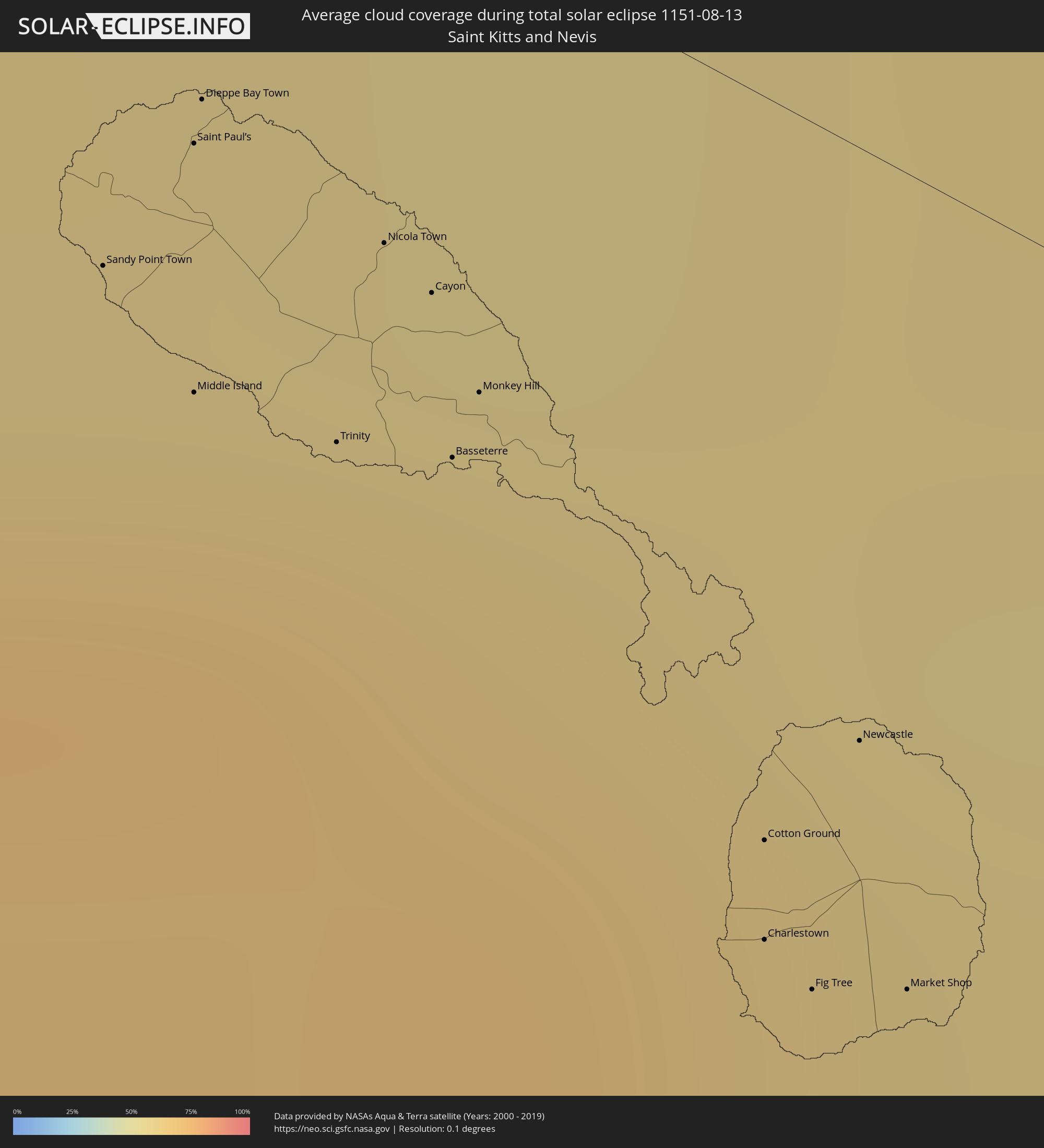
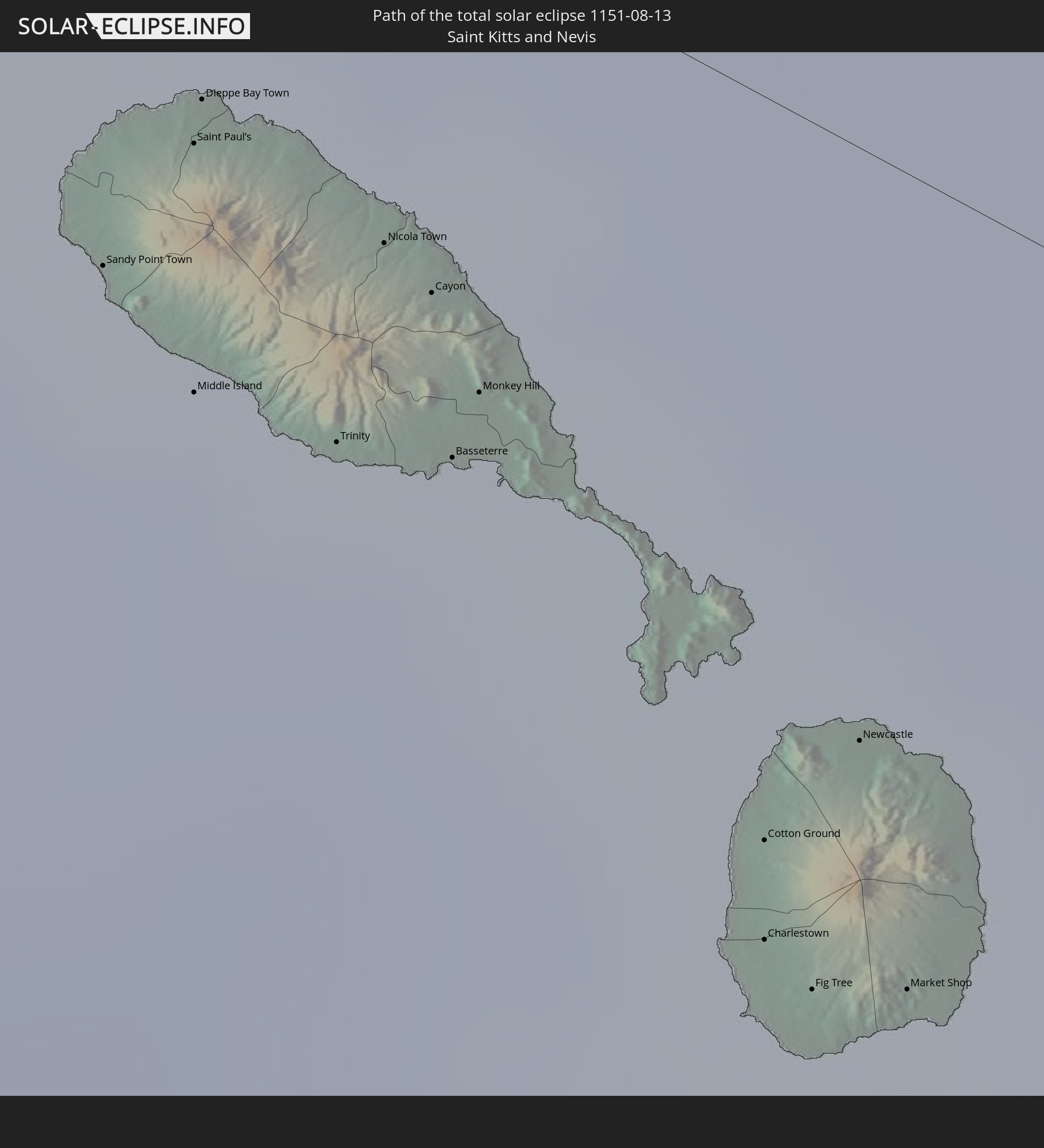 Saint Kitts and Nevis
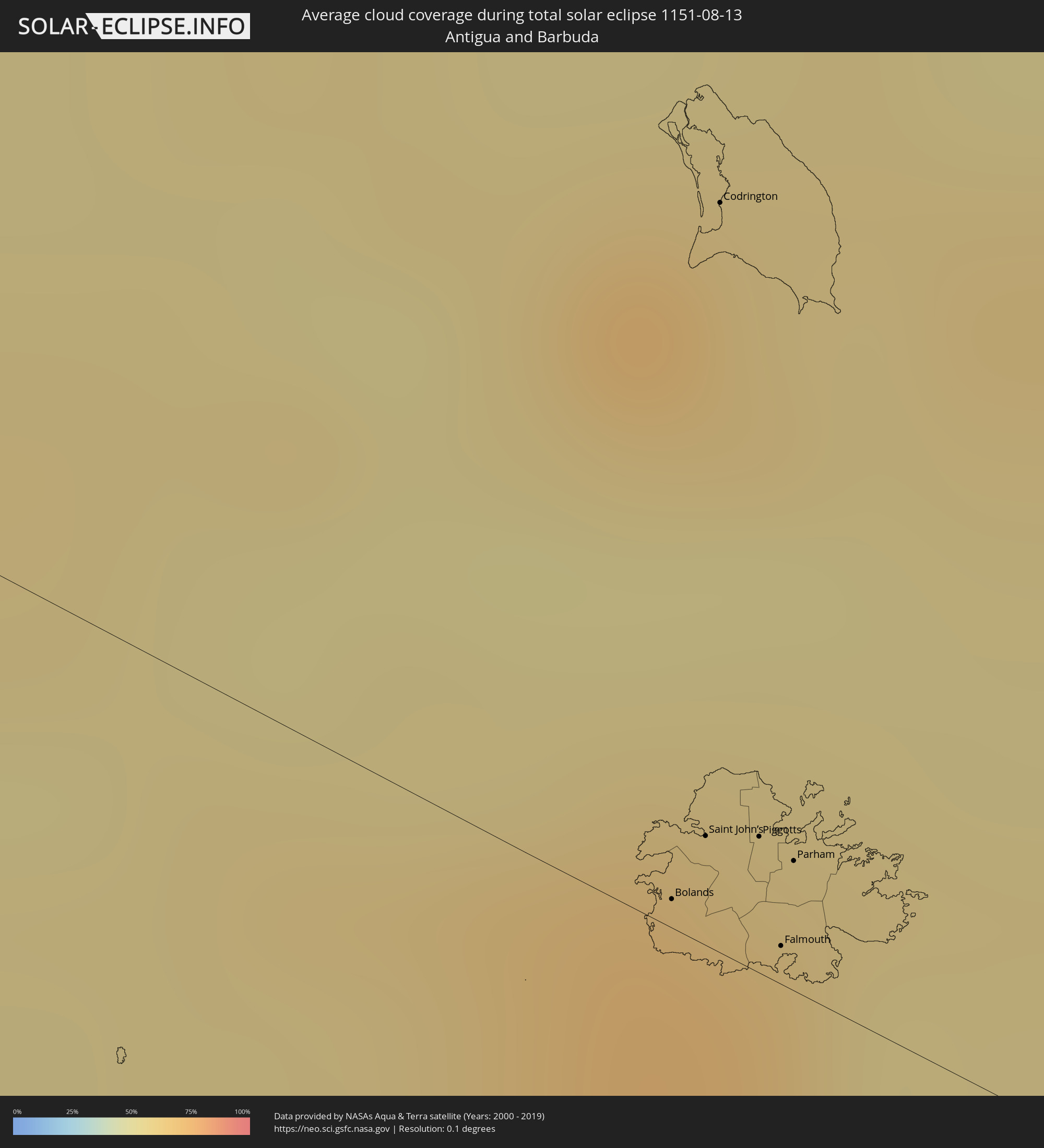
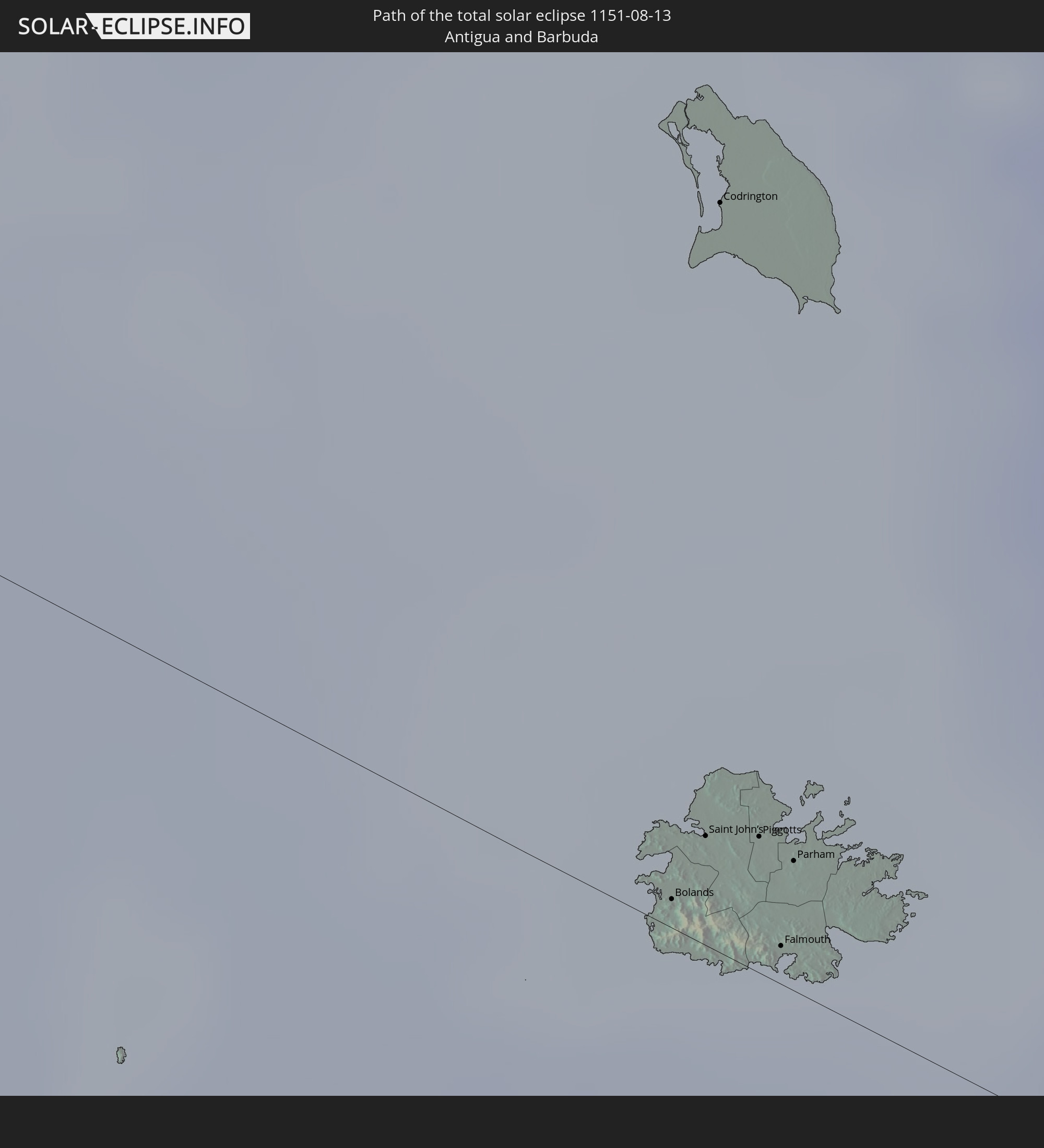 Antigua and Barbuda
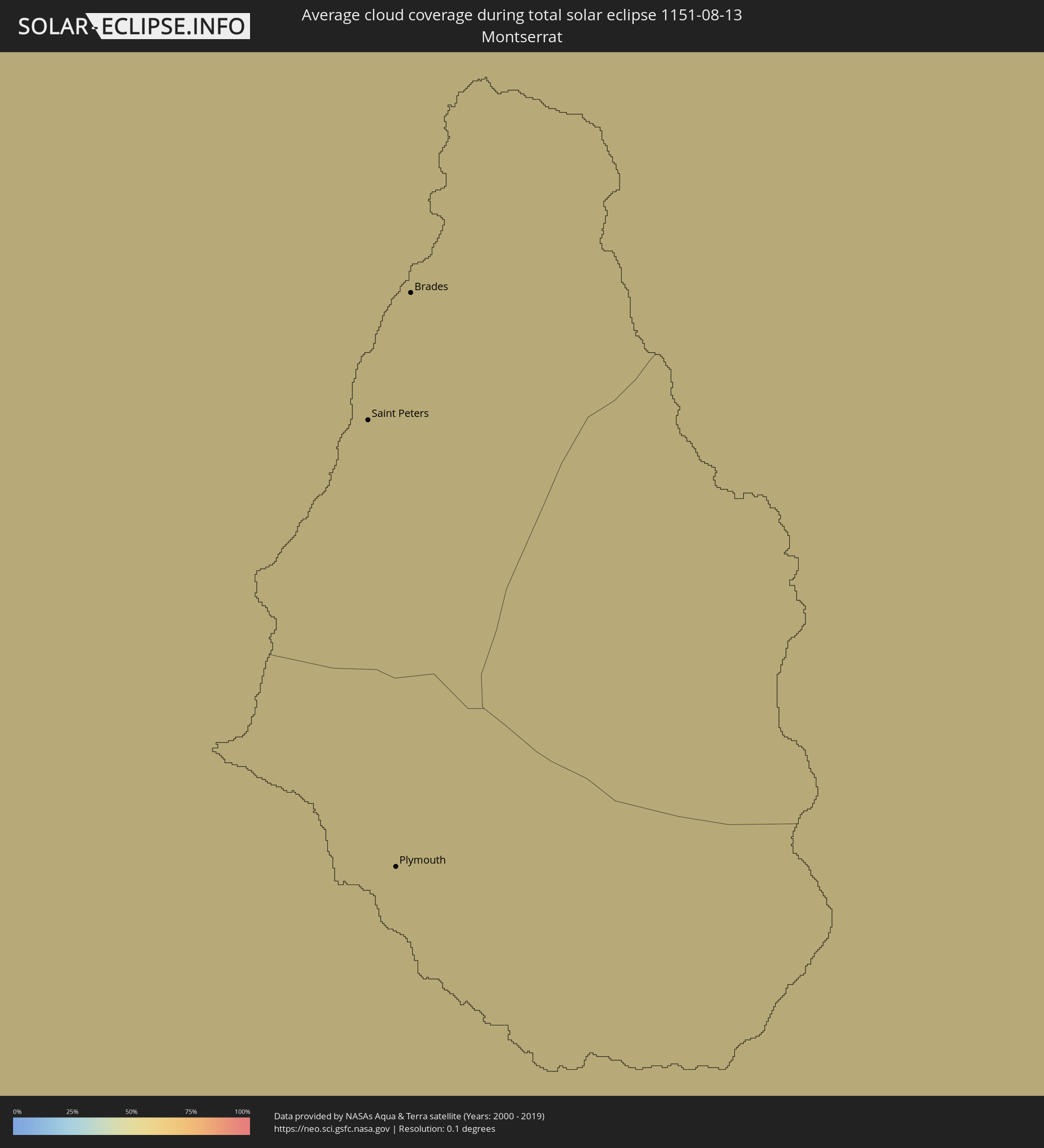
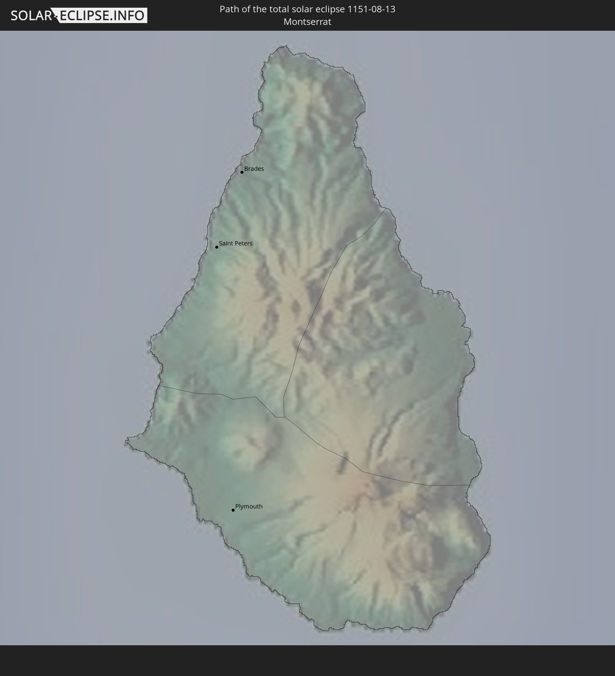 Montserrat
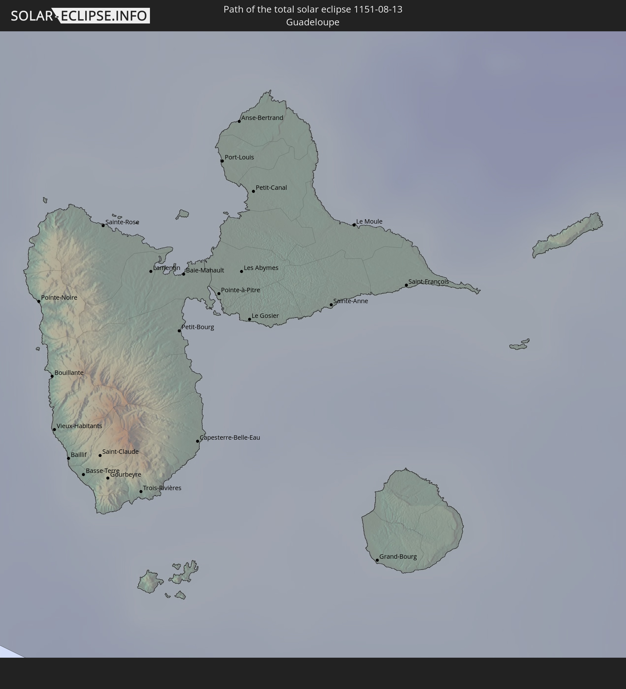 Guadeloupe
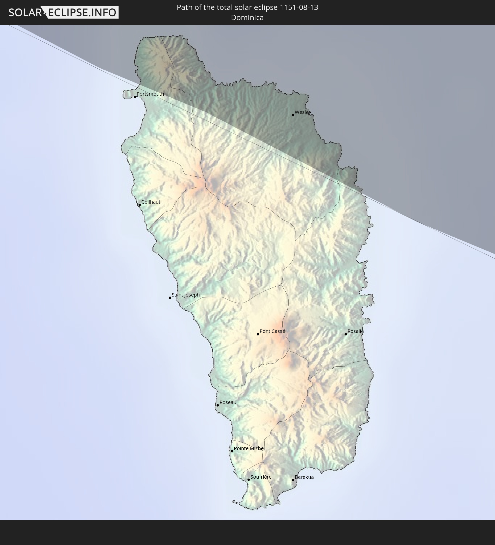 Dominica
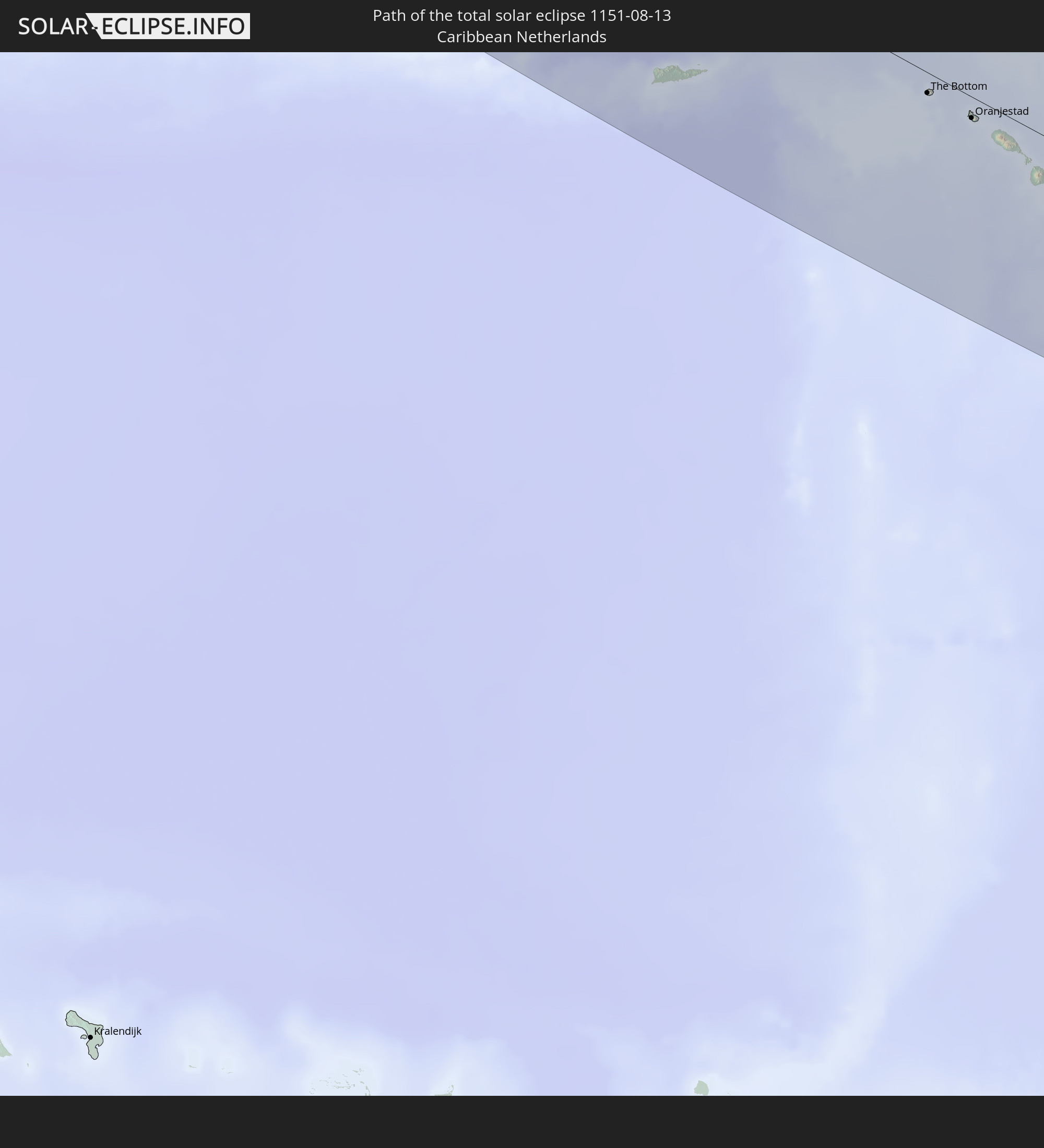 Caribbean Netherlands
In den folgenden Ländern ist die Sonnenfinsternis partiell zu sehen
 Russia
 United States
 United States Minor Outlying Islands
 Canada
 Mexico
 Chile
Chile
 Greenland
 Guatemala
 Ecuador
 El Salvador
 Honduras
 Belize
 Nicaragua
 Costa Rica
 Cuba
Cuba
 Panama
 Colombia
 Cayman Islands
 Peru
Peru
 The Bahamas
 Jamaica
 Haiti
Haiti
 Brazil
 Venezuela
 Turks and Caicos Islands
 Dominican Republic
 Aruba
Aruba
 Bolivia
 Puerto Rico
 United States Virgin Islands
 Bermuda
 British Virgin Islands
 Anguilla
 Collectivity of Saint Martin
 Saint Barthélemy
 Saint Kitts and Nevis
 Paraguay
 Antigua and Barbuda
 Montserrat
 Trinidad and Tobago
 Guadeloupe
 Grenada
 Dominica
 Saint Vincent and the Grenadines
 Guyana
 Martinique
 Saint Lucia
 Barbados
 Suriname
 Saint Pierre and Miquelon
 French Guiana
 Portugal
 Iceland
 Svalbard and Jan Mayen
 United Kingdom
 Faroe Islands
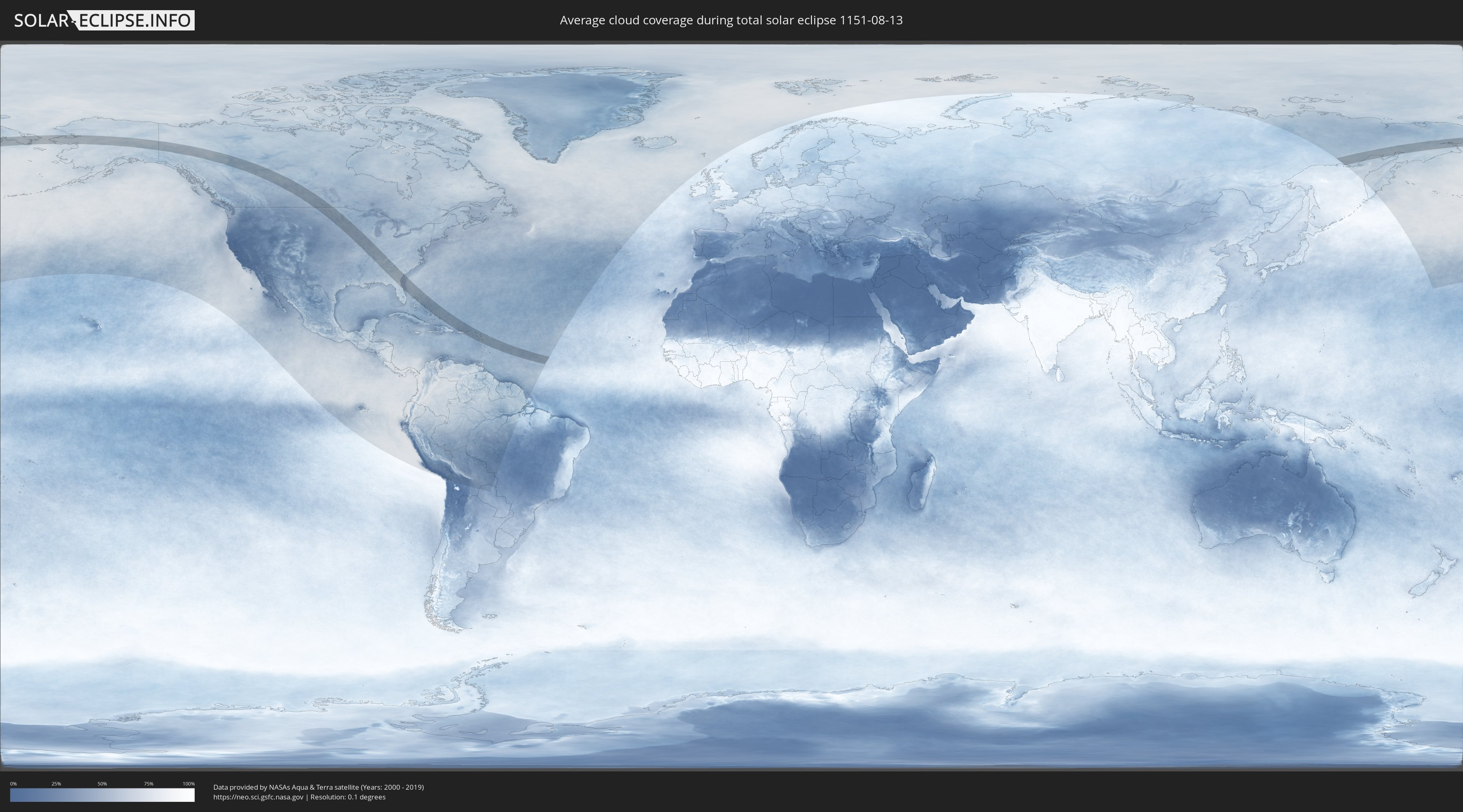
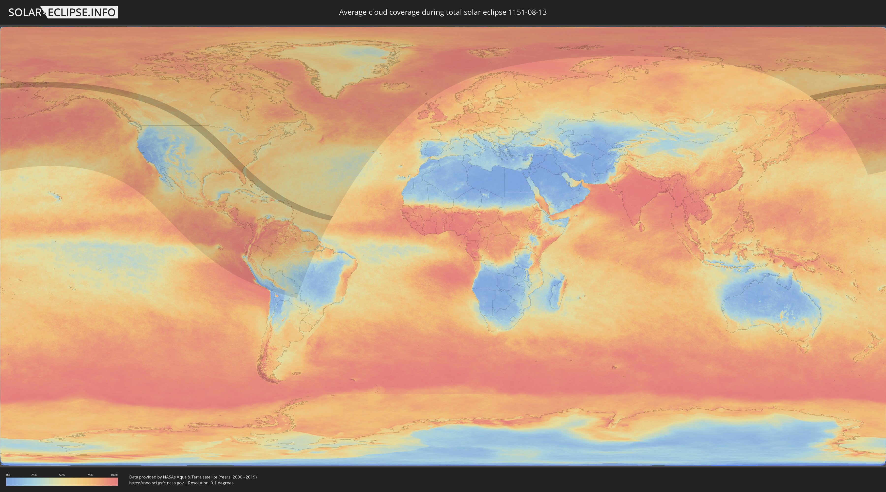
How will be the weather during the total solar eclipse on 08/13/1151?
Where is the best place to see the total solar eclipse of 08/13/1151?
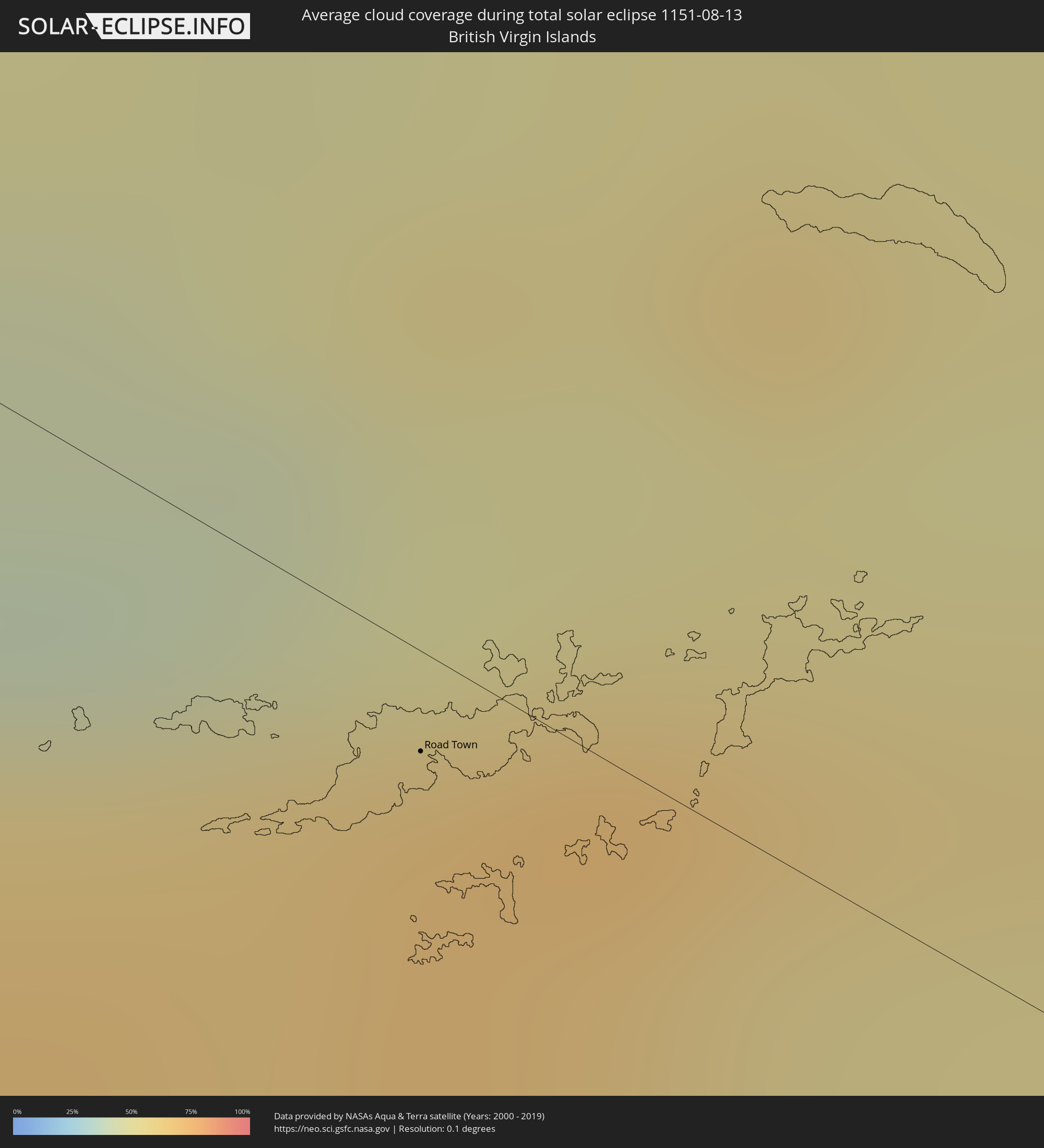
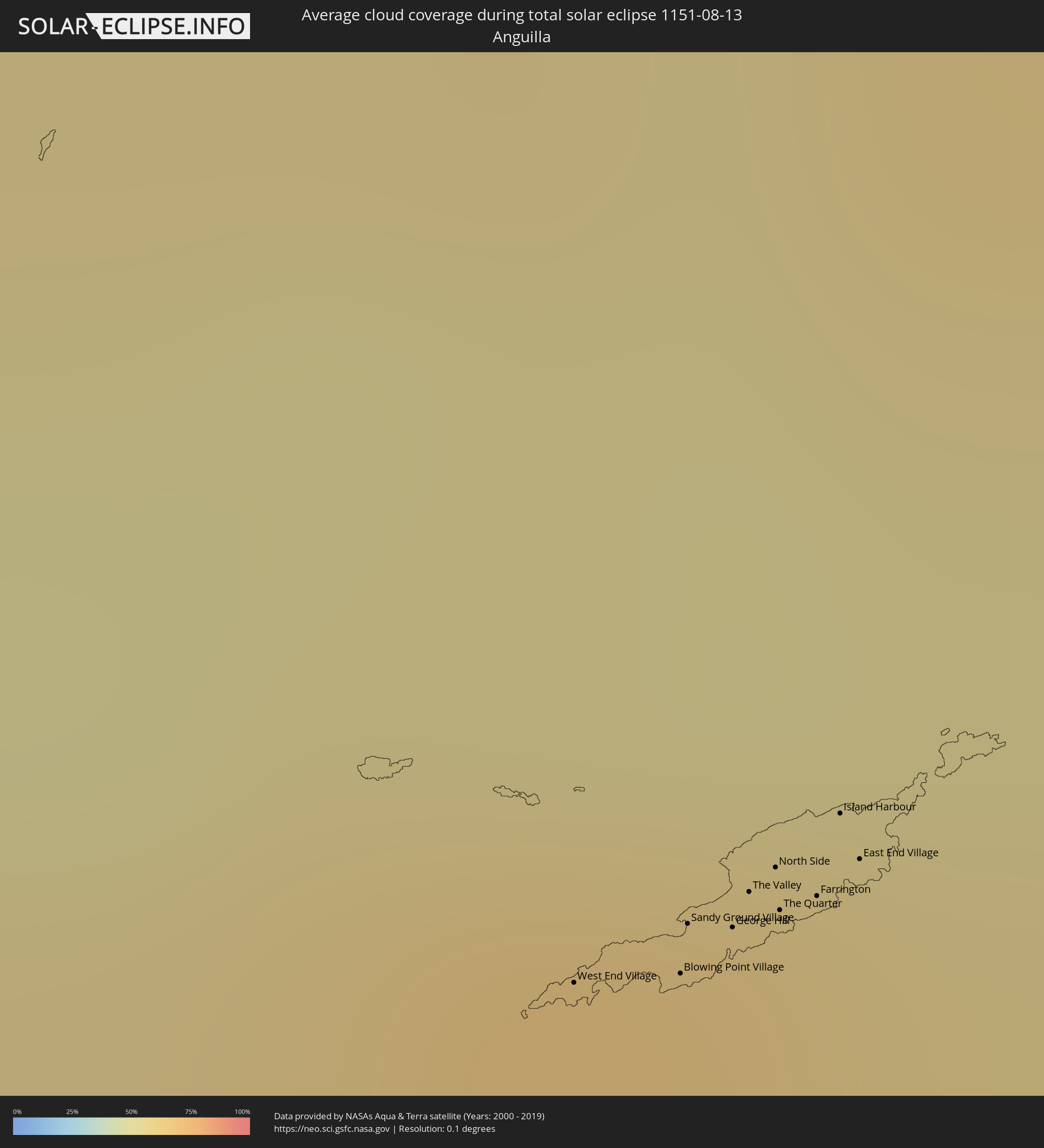
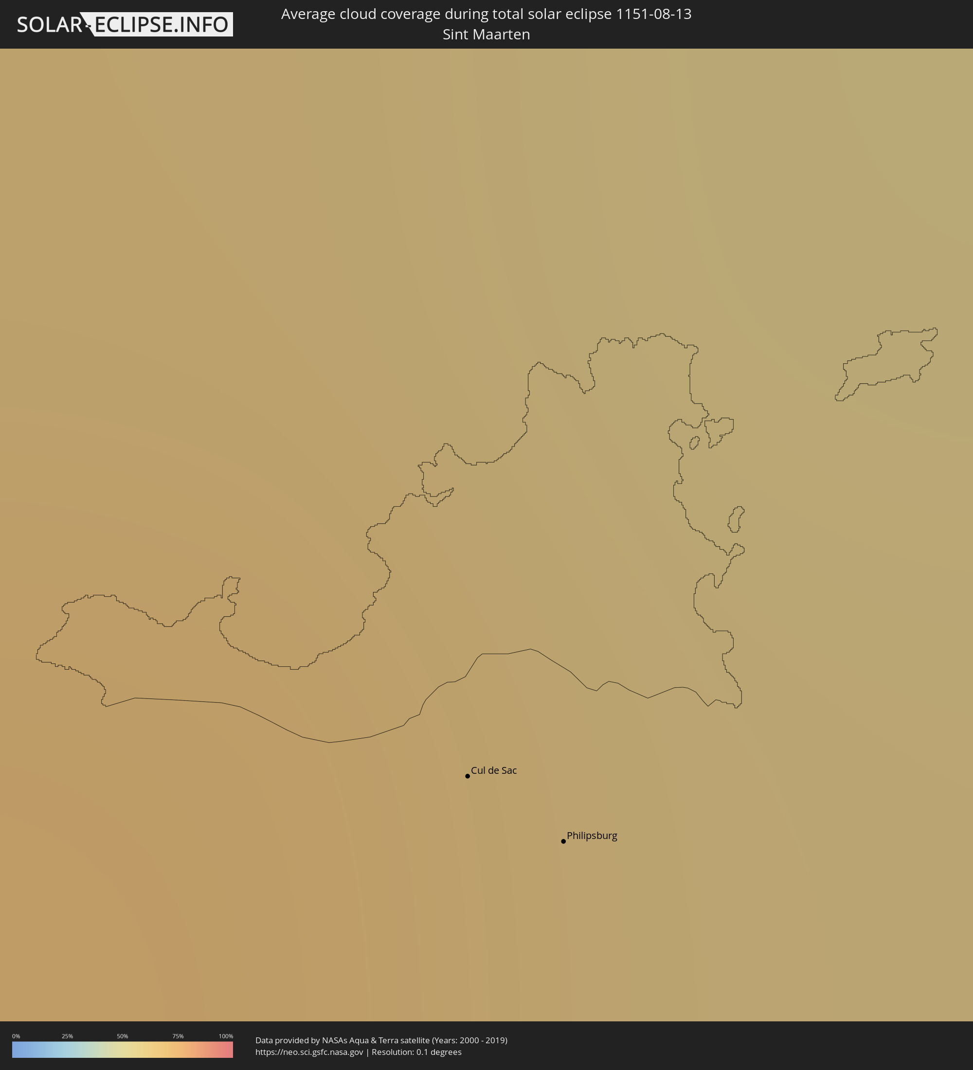
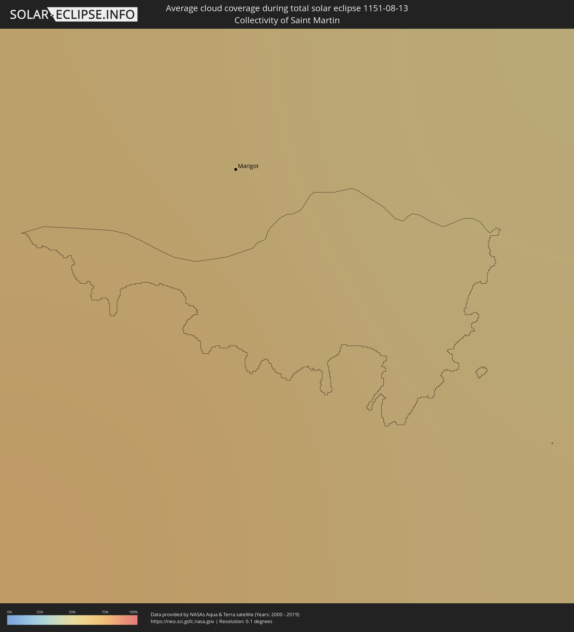
The following maps show the average cloud coverage for the day of the total solar eclipse.
With the help of these maps, it is possible to find the place along the eclipse path, which has the best
chance of a cloudless sky.
Nevertheless, you should consider local circumstances and inform about the weather of your chosen
observation site.
The data is provided by NASAs satellites
AQUA and TERRA.
The cloud maps are averaged over a period of 19 years (2000 - 2019).
Detailed country maps
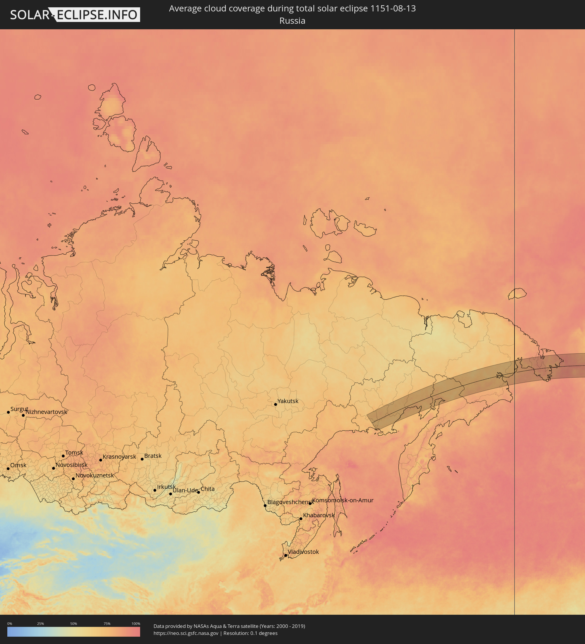 Russia
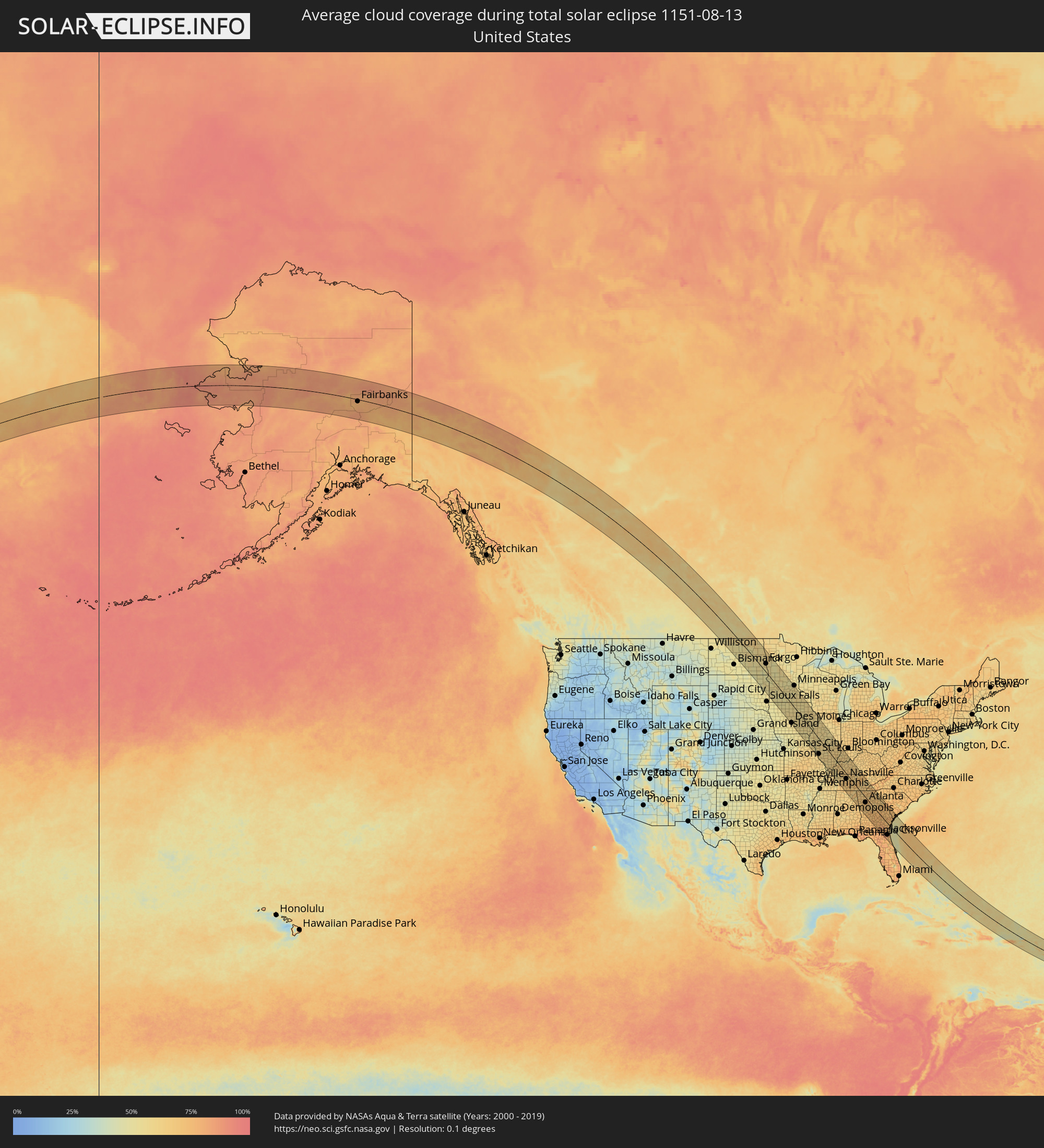 United States
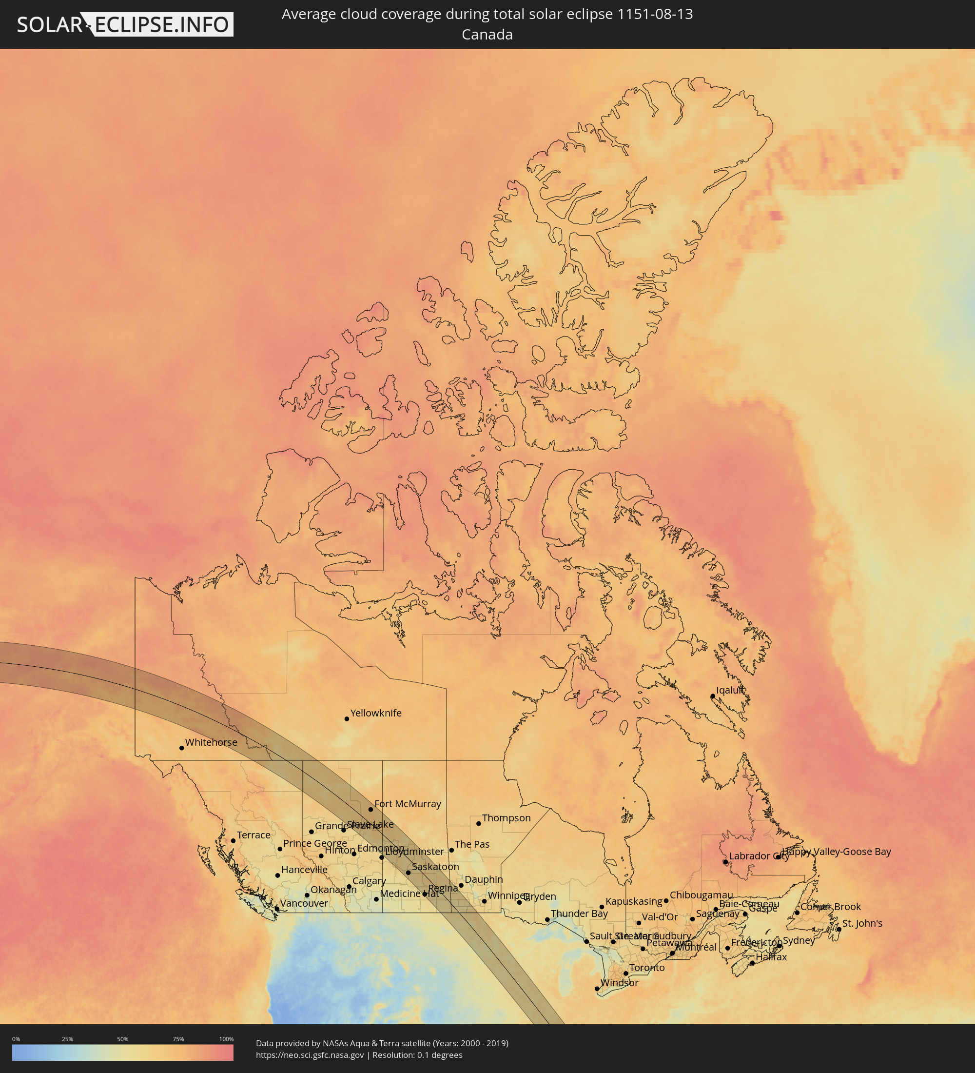 Canada
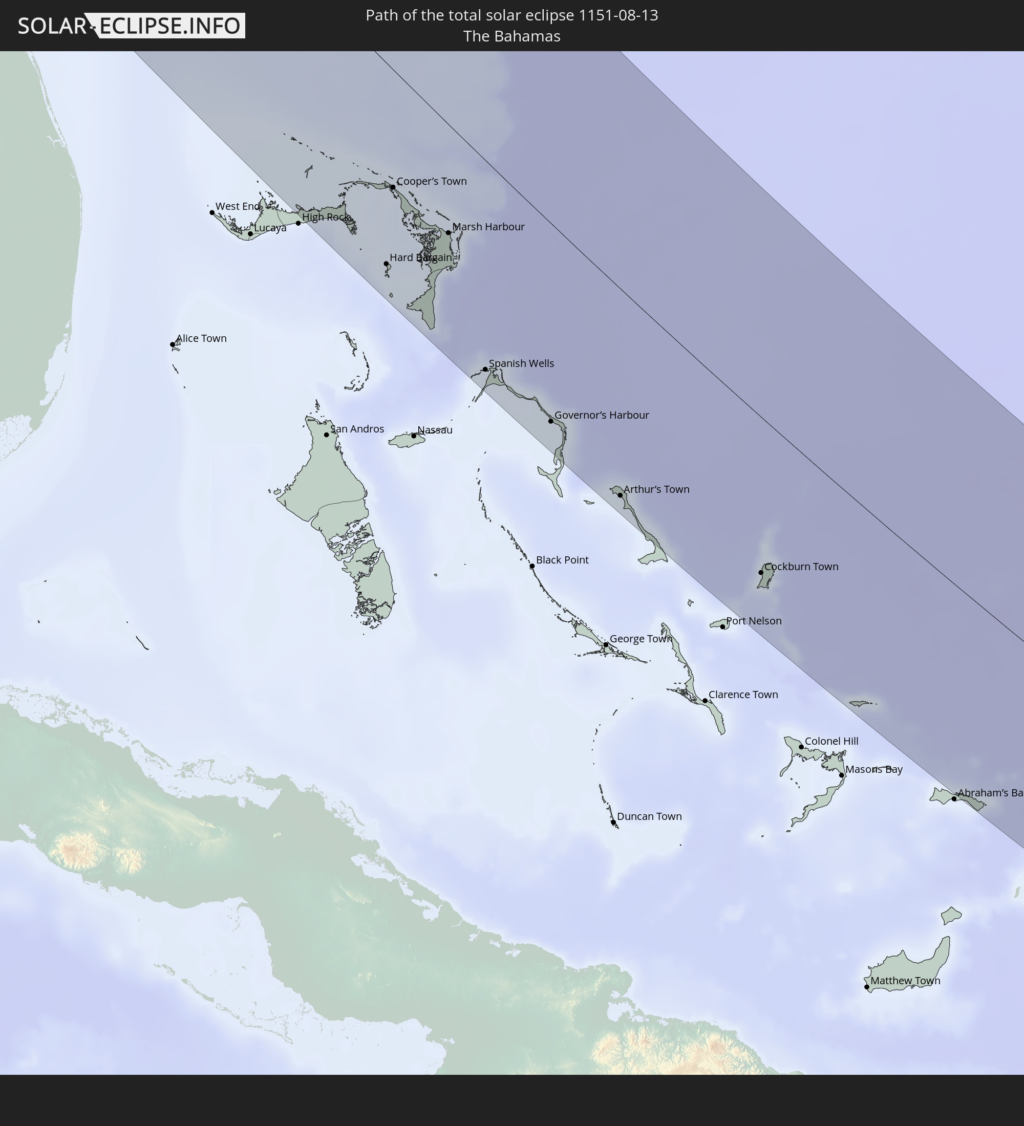
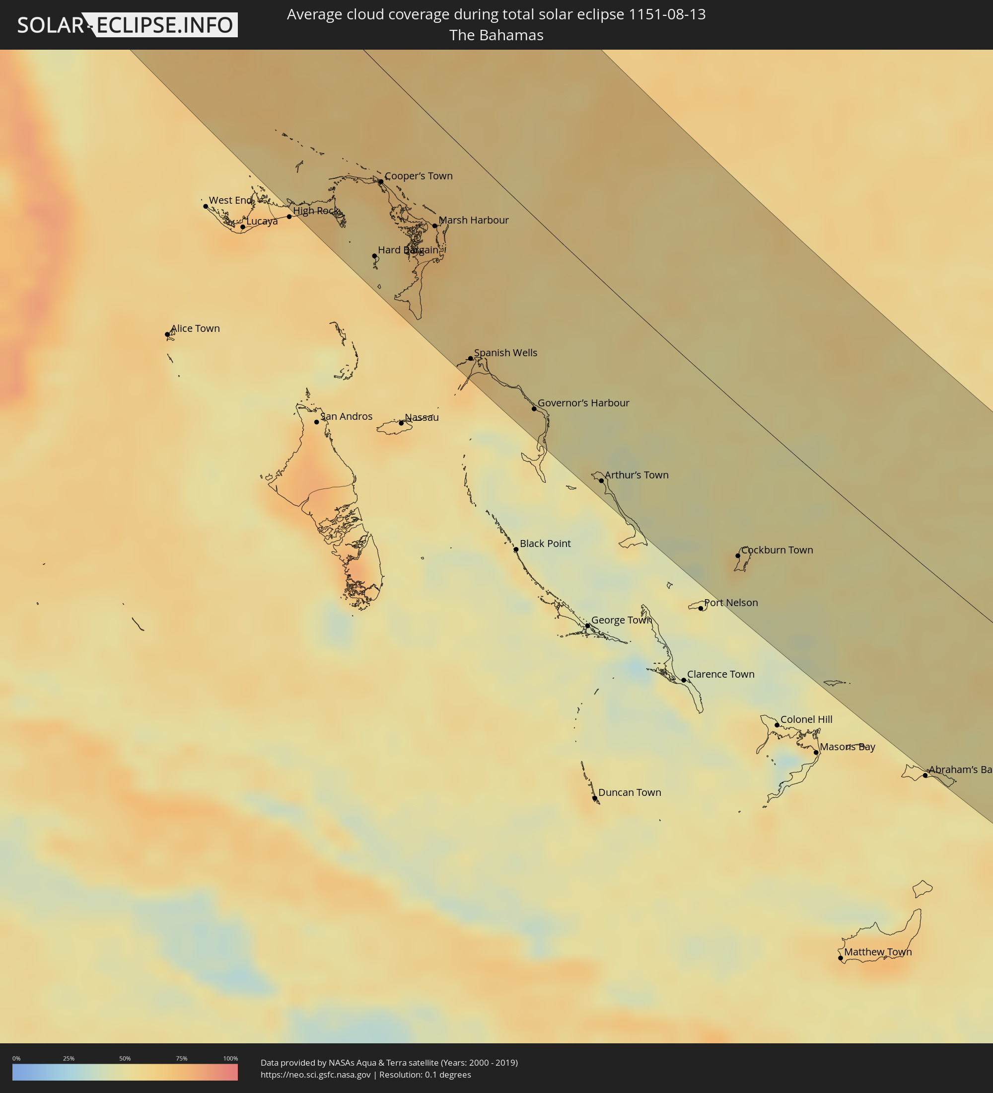 The Bahamas
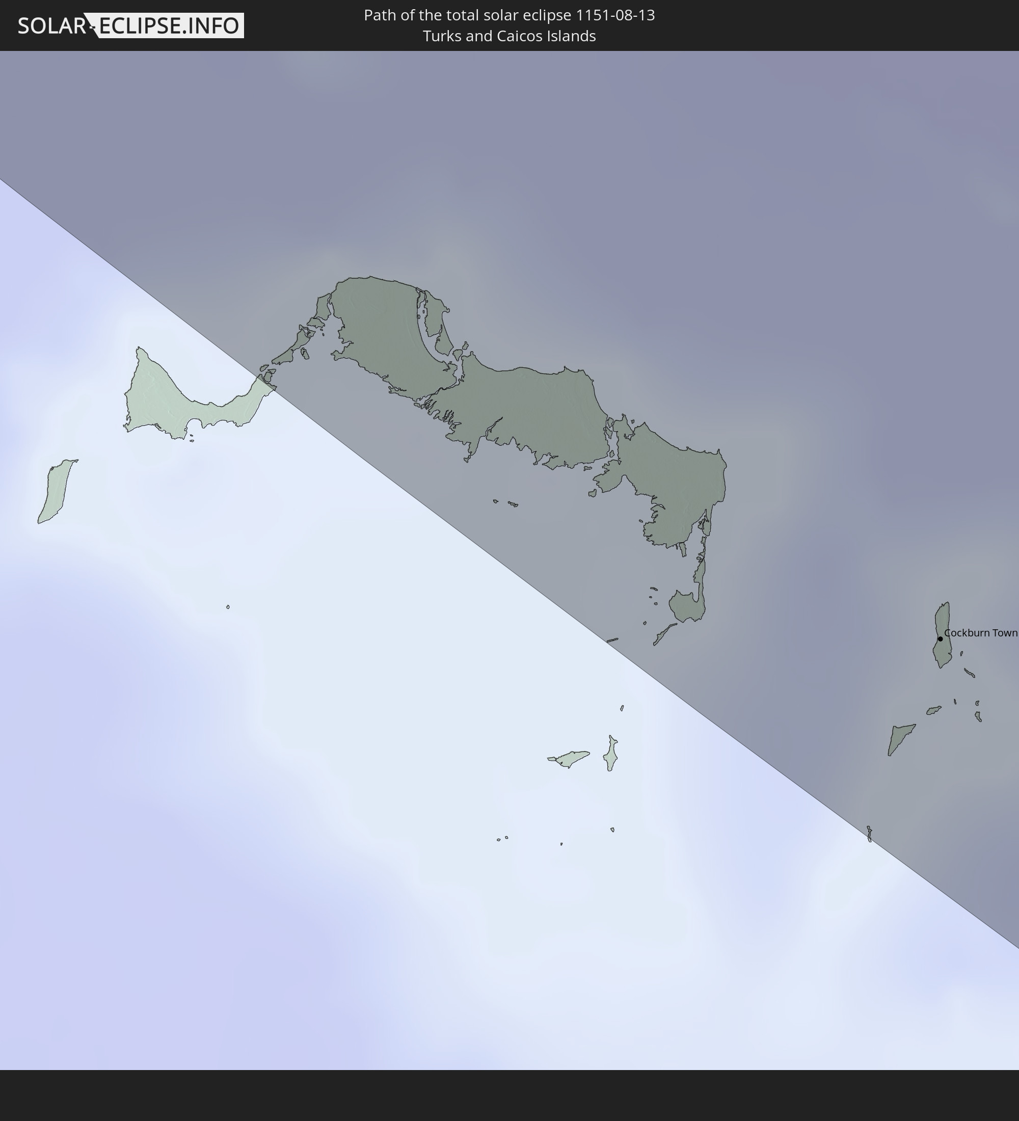
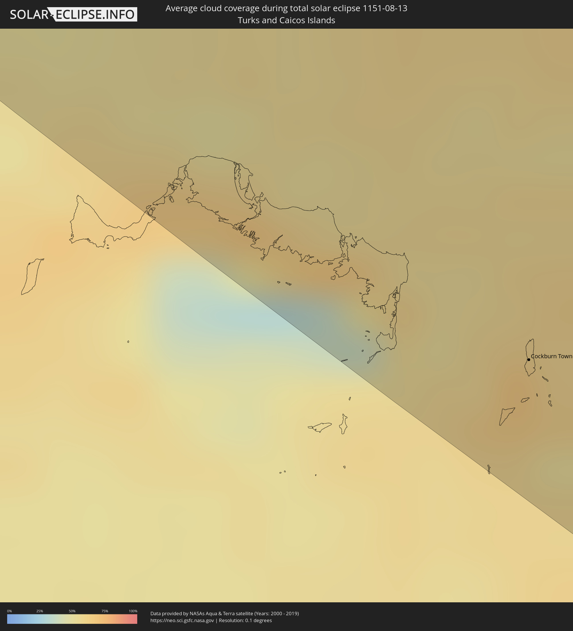 Turks and Caicos Islands
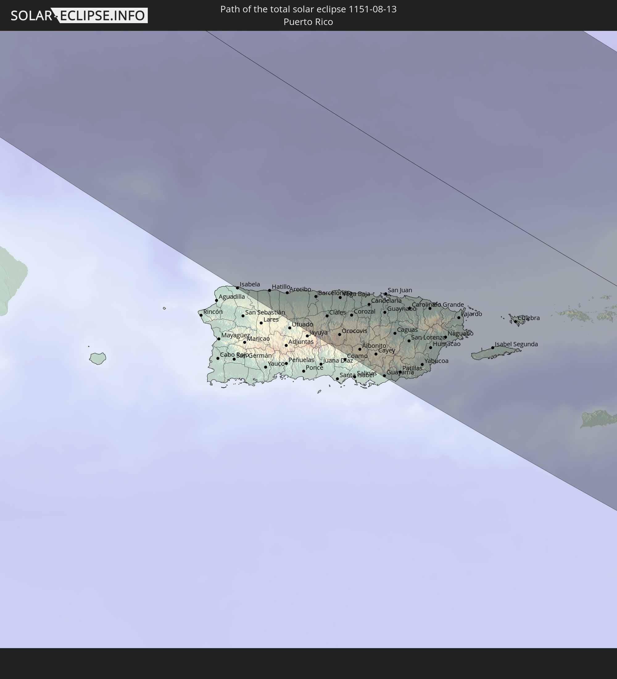
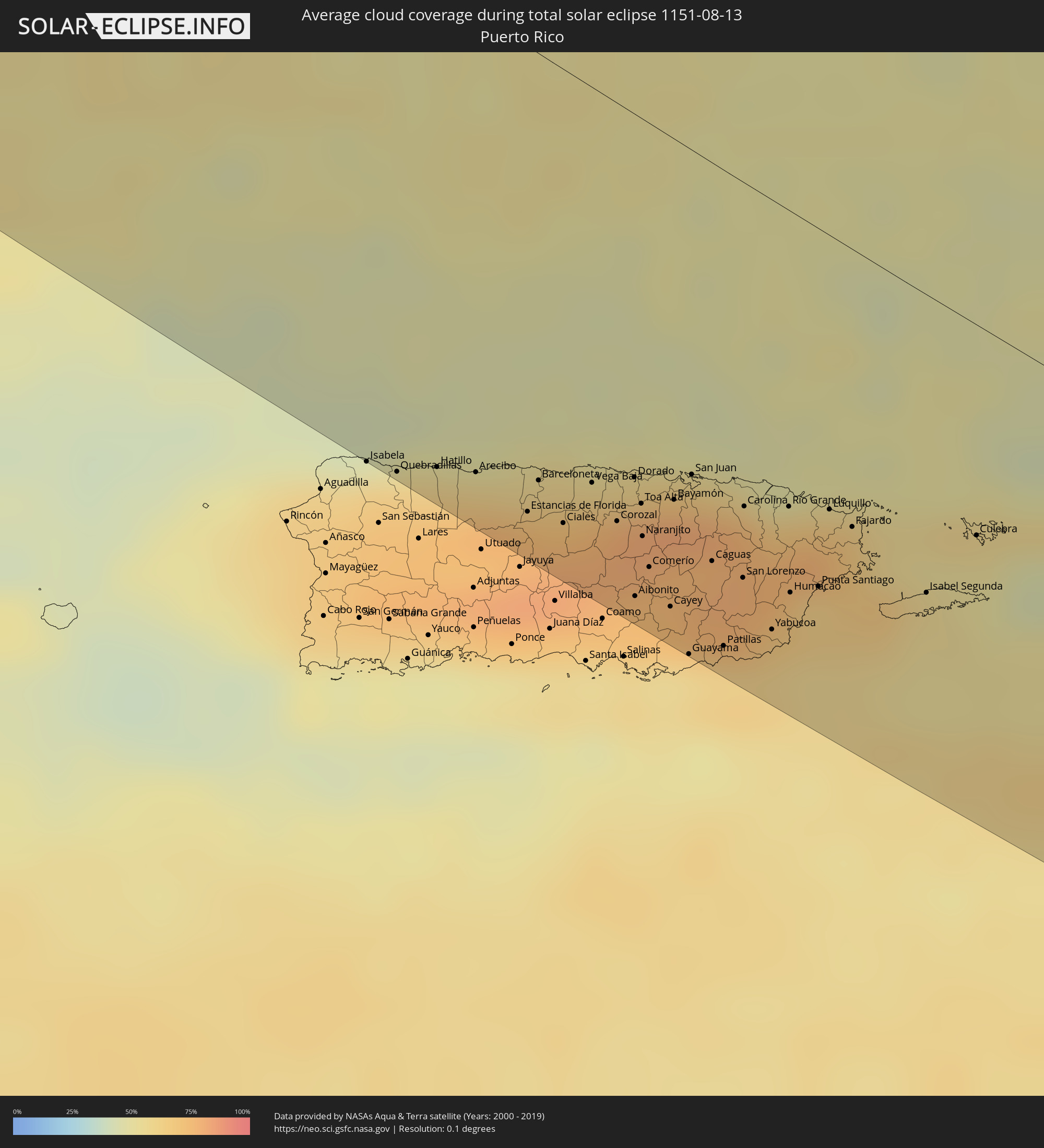 Puerto Rico
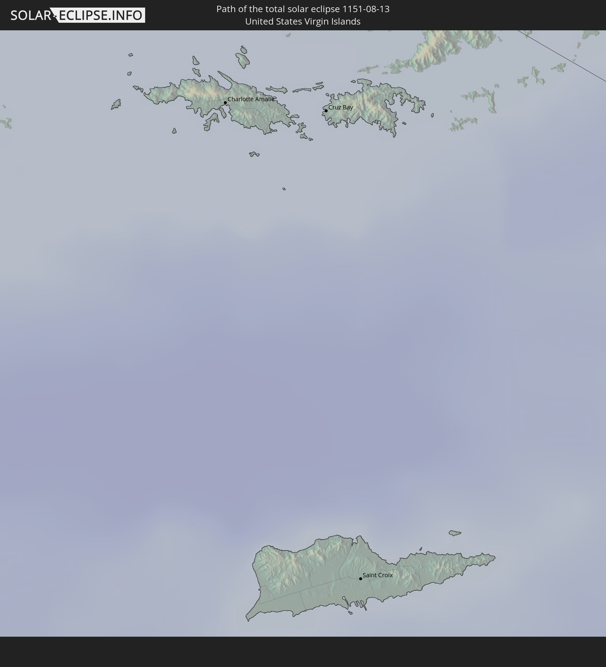
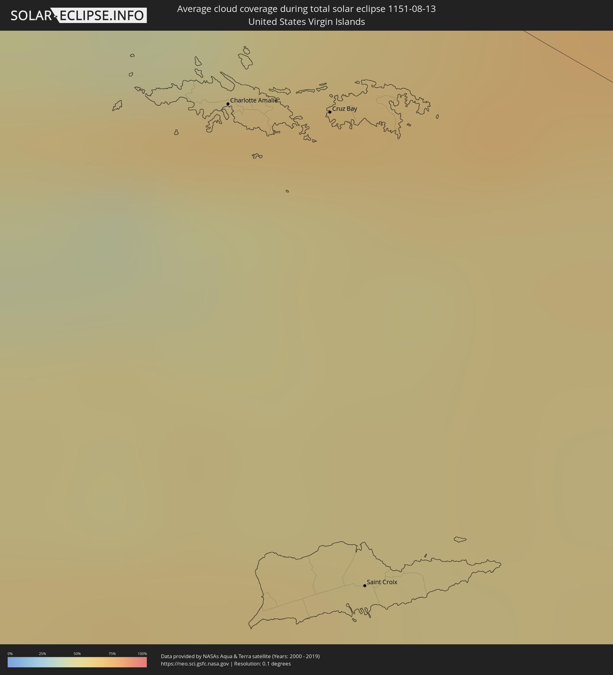 United States Virgin Islands
 British Virgin Islands
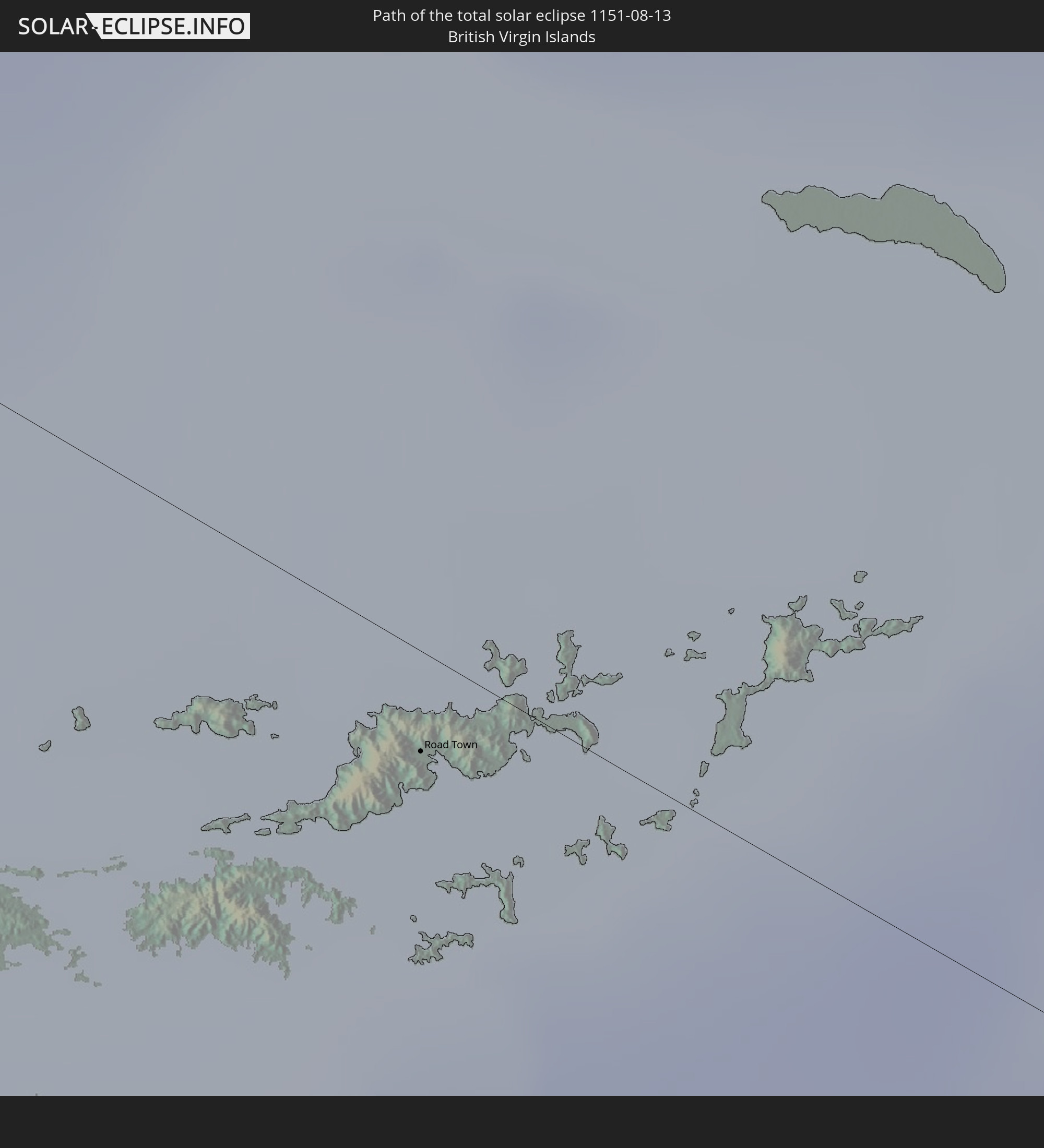
 Anguilla
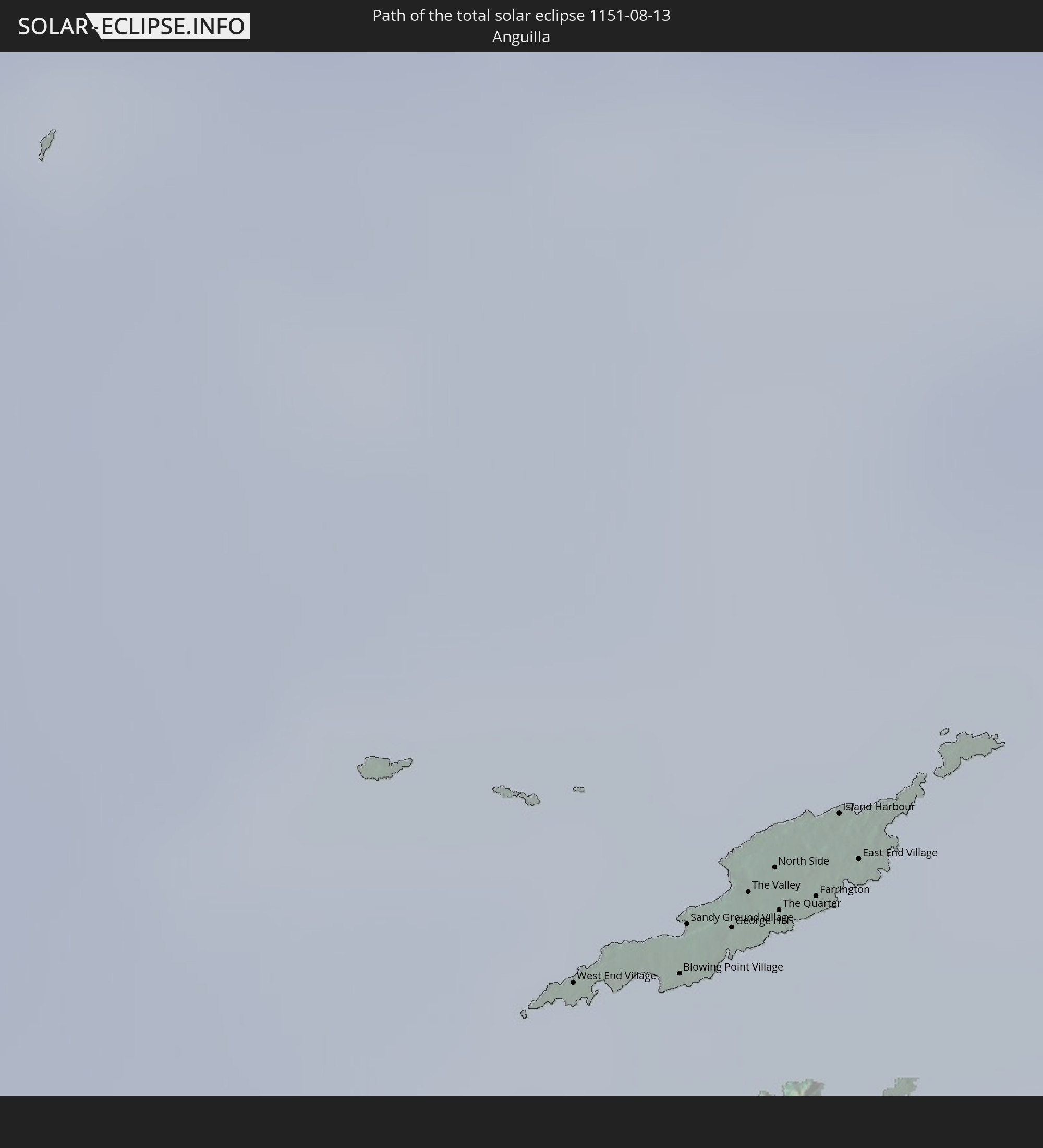
 Sint Maarten
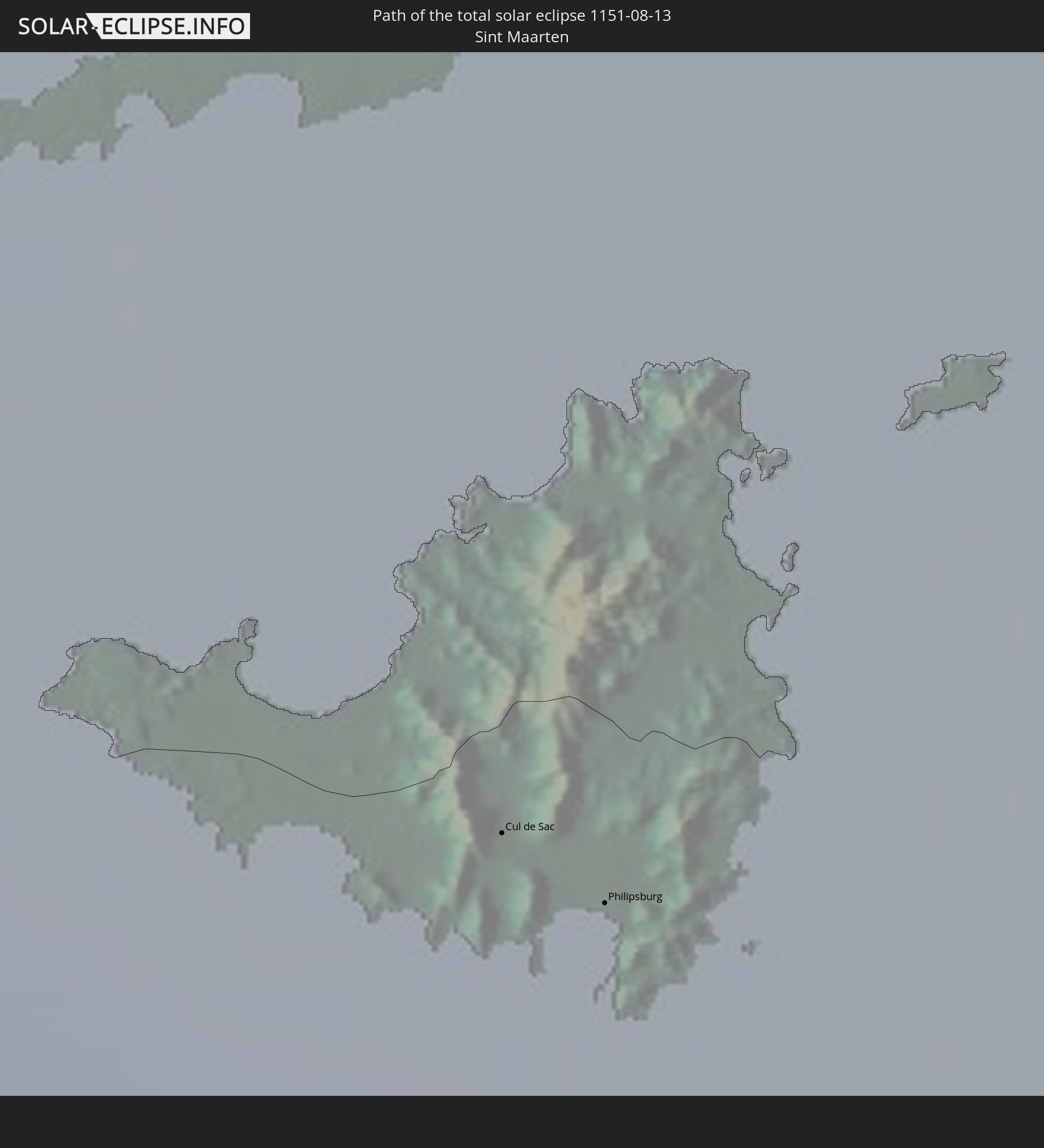
 Collectivity of Saint Martin
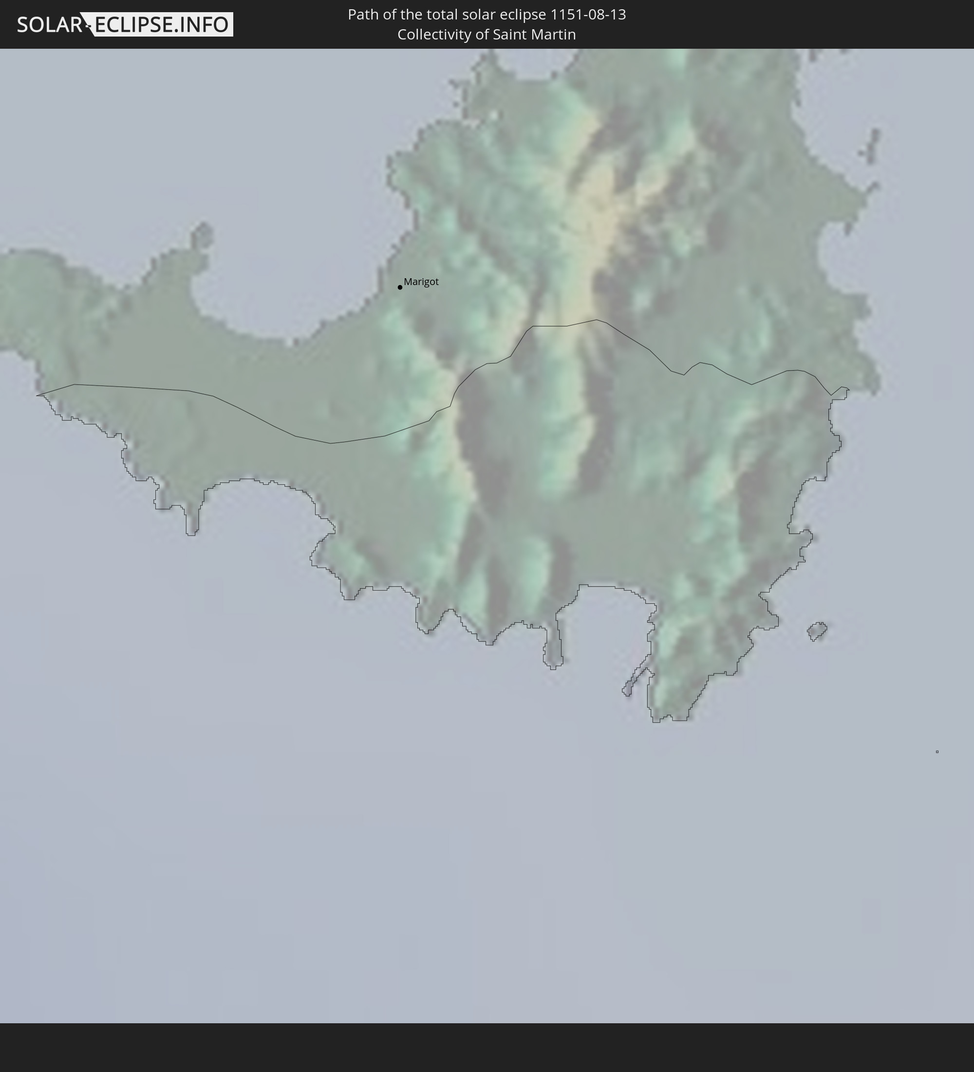
 Saint Barthélemy
 Saint Kitts and Nevis
 Antigua and Barbuda
 Montserrat
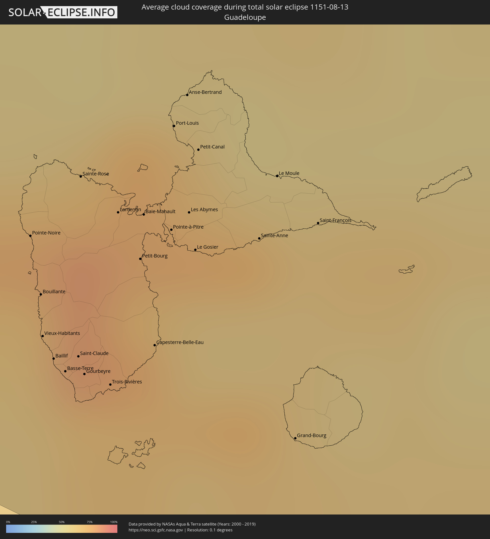 Guadeloupe
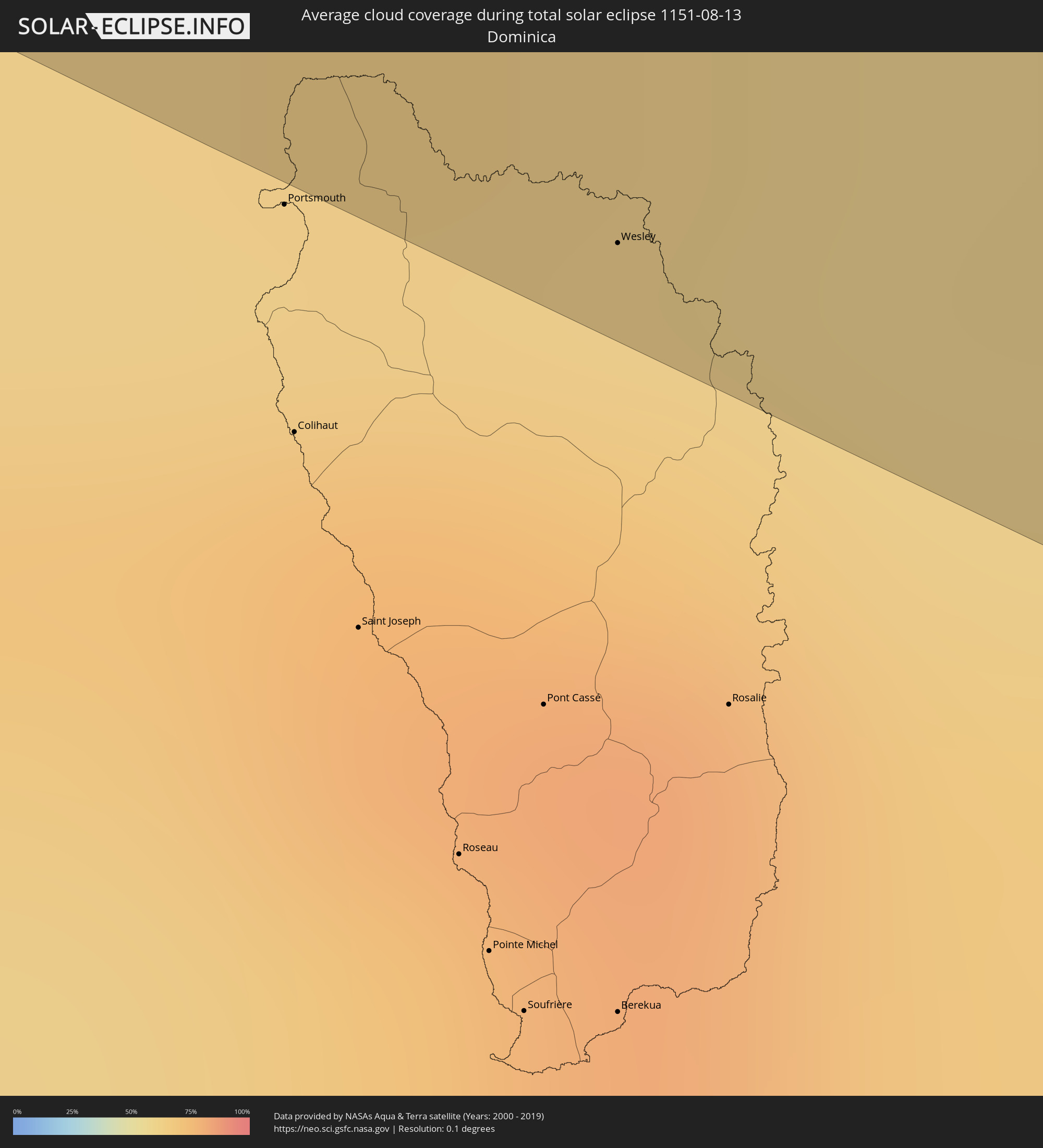 Dominica
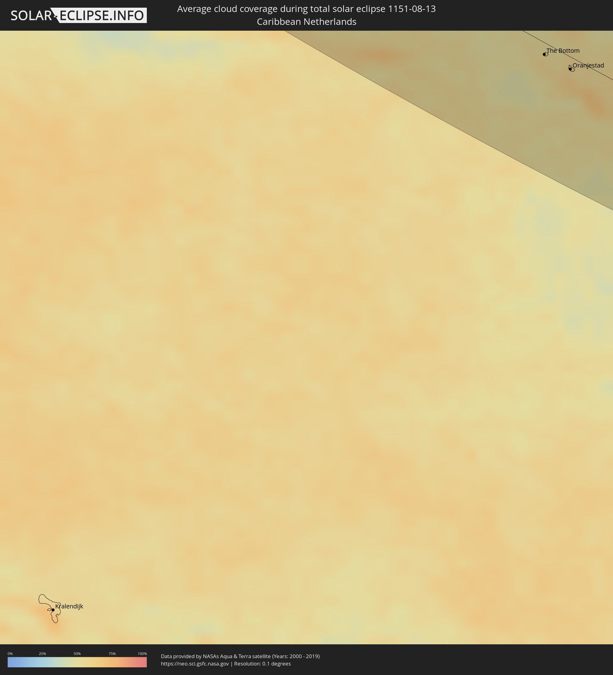 Caribbean Netherlands
Cities inside the path of the eclipse
The following table shows all locations with a population of more than 5,000 inside the eclipse path. Cities which have more than 100,000 inhabitants are marked bold. A click at the locations opens a detailed map.
| City | Type | Eclipse duration | Local time of max. eclipse | Distance to central line | Ø Cloud coverage |
|
Fort McMurray, Alberta
|
total | - | 11:44:31 UTC-07:33 | 83 km | 66% |
|
Bonnyville, Alberta
|
total | - | 11:47:26 UTC-07:33 | 96 km | 56% |
|
Cold Lake, Alberta
|
total | - | 11:47:52 UTC-07:33 | 55 km | 57% |
|
North Battleford, Saskatchewan
|
total | - | 12:27:04 UTC-06:58 | 109 km | 60% |
|
Saskatoon, Saskatchewan
|
total | - | 12:29:42 UTC-06:58 | 84 km | 58% |
|
Prince Albert, Saskatchewan
|
total | - | 12:29:30 UTC-06:58 | 43 km | 59% |
|
Regina, Saskatchewan
|
total | - | 12:34:14 UTC-06:58 | 115 km | 55% |
|
Melfort, Saskatchewan
|
total | - | 12:31:12 UTC-06:58 | 72 km | 61% |
|
Yorkton, Saskatchewan
|
total | - | 12:35:45 UTC-06:58 | 54 km | 54% |
|
Brandon, Manitoba
|
total | - | 13:39:09 UTC-06:00 | 85 km | 54% |
|
Des Moines, Iowa
|
total | - | 14:00:06 UTC-06:00 | 120 km | 56% |
|
Cedar Rapids, Iowa
|
total | - | 14:01:35 UTC-06:00 | 36 km | 55% |
|
St. Louis, Missouri
|
total | - | 14:09:27 UTC-06:00 | 100 km | 59% |
|
Evansville, Indiana
|
total | - | 14:13:31 UTC-06:00 | 36 km | 59% |
|
Clarksville, Tennessee
|
total | - | 14:16:29 UTC-06:00 | 50 km | 60% |
|
Nashville, Tennessee
|
total | - | 14:17:46 UTC-06:00 | 35 km | 70% |
|
Huntsville, Alabama
|
total | - | 14:20:45 UTC-06:00 | 122 km | 64% |
|
Chattanooga, Tennessee
|
total | - | 15:21:24 UTC-05:00 | 10 km | 66% |
|
Atlanta, Georgia
|
total | - | 15:24:48 UTC-05:00 | 37 km | 76% |
|
Athens, Georgia
|
total | - | 15:25:21 UTC-05:00 | 50 km | 72% |
|
Jacksonville, Florida
|
total | - | 15:33:52 UTC-05:00 | 92 km | 81% |
|
Savannah, Georgia
|
total | - | 15:30:59 UTC-05:00 | 77 km | 79% |
|
Hard Bargain, Moore’s Island
|
total | - | 15:35:08 UTC-05:09 | 115 km | 61% |
|
Cooper’s Town, North Abaco
|
total | - | 15:34:09 UTC-05:09 | 67 km | 71% |
|
Marsh Harbour, Central Abaco
|
total | - | 15:35:05 UTC-05:09 | 63 km | 72% |
|
Spanish Wells, Spanish Wells
|
total | - | 15:37:06 UTC-05:09 | 123 km | 68% |
|
Governor’s Harbour, Central Eleuthera
|
total | - | 20:47:39 UTC+00:00 | 118 km | 58% |
|
Arthur’s Town, Cat Island
|
total | - | 15:39:30 UTC-05:09 | 125 km | 50% |
|
Cockburn Town, San Salvador
|
total | - | 15:41:14 UTC-05:09 | 96 km | 59% |
|
Cockburn Town
|
total | - | 15:49:54 UTC-05:07 | 102 km | 60% |
|
Isabela, Isabela
|
total | - | 17:03:34 UTC-04:00 | 130 km | 64% |
|
Arecibo, Arecibo
|
total | - | 17:03:43 UTC-04:00 | 115 km | 61% |
|
Barceloneta, Barceloneta
|
total | - | 17:03:49 UTC-04:00 | 108 km | 61% |
|
Vega Baja, Vega Baja
|
total | - | 17:03:52 UTC-04:00 | 100 km | 75% |
|
Pájaros, Toa Alta
|
total | - | 17:04:03 UTC-04:00 | 98 km | 81% |
|
Cayey, Cayey
|
total | - | 17:04:27 UTC-04:00 | 119 km | 73% |
|
Guayama, Guayama
|
total | - | 17:04:40 UTC-04:00 | 128 km | 60% |
|
San Juan, San Juan
|
total | - | 17:03:56 UTC-04:00 | 82 km | 64% |
|
Caguas, Caguas
|
total | - | 17:04:18 UTC-04:00 | 101 km | 78% |
|
Carolina, Carolina
|
total | - | 17:04:06 UTC-04:00 | 82 km | 77% |
|
Humacao, Humacao
|
total | - | 17:04:30 UTC-04:00 | 97 km | 63% |
|
Fajardo, Fajardo
|
total | - | 17:04:17 UTC-04:00 | 71 km | 69% |
|
Charlotte Amalie, Saint Thomas Island
|
total | - | 16:58:25 UTC-04:06 | 30 km | 51% |
|
Cruz Bay, Saint John Island
|
total | - | 16:58:28 UTC-04:06 | 24 km | 54% |
|
Saint Croix, Saint Croix Island
|
total | - | 16:59:23 UTC-04:06 | 80 km | 58% |
|
Road Town
|
total | - | 16:58:22 UTC-04:06 | 6 km | 67% |
 The Bottom, Saba
|
total | - | 16:30:13 UTC-04:35 | 11 km | 57% |
|
West End Village, West End
|
total | - | 16:59:08 UTC-04:06 | 47 km | 63% |
|
South Hill Village, South Hill
|
total | - | 16:59:07 UTC-04:06 | 52 km | 63% |
|
Marigot
|
total | - | 16:59:19 UTC-04:06 | 40 km | 68% |
|
North Hill Village, North Hill
|
total | - | 16:59:06 UTC-04:06 | 54 km | 63% |
|
George Hill, George Hill
|
total | - | 16:59:07 UTC-04:06 | 54 km | 63% |
 Cul de Sac
|
total | - | 16:29:38 UTC-04:35 | 38 km | 57% |
|
The Valley, The Valley
|
total | - | 16:59:06 UTC-04:06 | 56 km | 63% |
|
Stoney Ground, Stoney Ground
|
total | - | 16:59:06 UTC-04:06 | 57 km | 57% |
|
Philipsburg
|
total | - | 16:29:40 UTC-04:35 | 38 km | 59% |
|
North Side, North Side
|
total | - | 16:59:05 UTC-04:06 | 58 km | 57% |
|
The Quarter, The Quarter
|
total | - | 16:59:07 UTC-04:06 | 56 km | 57% |
|
Farrington, The Farrington
|
total | - | 16:59:06 UTC-04:06 | 58 km | 57% |
|
Sandy Hill, Sandy Hill
|
total | - | 16:59:06 UTC-04:06 | 59 km | 57% |
|
Island Harbour, Island Harbour
|
total | - | 16:59:03 UTC-04:06 | 62 km | 57% |
|
East End Village, East End
|
total | - | 16:59:05 UTC-04:06 | 60 km | 57% |
|
Oranjestad, Sint Eustatius
|
total | - | 16:30:29 UTC-04:35 | 12 km | 62% |
|
Gustavia
|
total | - | 16:59:37 UTC-04:06 | 35 km | 52% |
|
Sandy Point Town, Saint Anne Sandy Point
|
total | - | 17:00:25 UTC-04:06 | 17 km | 67% |
|
Saint Paul’s, Saint Paul Capesterre
|
total | - | 17:00:22 UTC-04:06 | 12 km | 67% |
|
Middle Island, Saint Thomas Middle Island
|
total | - | 17:00:29 UTC-04:06 | 20 km | 66% |
|
Dieppe Bay Town, Saint John Capesterre
|
total | - | 17:00:20 UTC-04:06 | 10 km | 67% |
|
Trinity, Trinity Palmetto Point
|
total | - | 17:00:31 UTC-04:06 | 19 km | 66% |
|
Nicola Town, Christ Church Nichola Town
|
total | - | 17:00:25 UTC-04:06 | 12 km | 67% |
|
Cayon, Saint Mary Cayon
|
total | - | 17:00:27 UTC-04:06 | 12 km | 61% |
|
Basseterre, Saint George Basseterre
|
total | - | 17:00:32 UTC-04:06 | 17 km | 67% |
|
Monkey Hill, Saint Peter Basseterre
|
total | - | 17:00:30 UTC-04:06 | 15 km | 67% |
|
Charlestown, Saint Paul Charlestown
|
total | - | 17:00:48 UTC-04:06 | 28 km | 55% |
|
Fig Tree, Saint John Figtree
|
total | - | 17:00:49 UTC-04:06 | 29 km | 55% |
|
Newcastle, Saint James Windwa
|
total | - | 17:00:42 UTC-04:06 | 19 km | 61% |
|
Saint Peters, Saint Peter
|
total | - | 17:01:24 UTC-04:06 | 43 km | 67% |
|
Plymouth, Saint Anthony
|
total | - | 17:01:30 UTC-04:06 | 50 km | 59% |
|
Brades, Saint Peter
|
total | - | 17:01:22 UTC-04:06 | 41 km | 67% |
|
Bolands, Saint Mary
|
total | - | 17:01:03 UTC-04:06 | 2 km | 71% |
|
Saint John’s, Saint John
|
total | - | 17:00:59 UTC-04:06 | 9 km | 67% |
|
Codrington, Barbuda
|
total | - | 17:00:14 UTC-04:06 | 60 km | 60% |
|
Piggotts, Saint George
|
total | - | 17:00:59 UTC-04:06 | 11 km | 67% |
|
Pointe-Noire, Guadeloupe
|
total | - | 17:02:16 UTC-04:06 | 76 km | 70% |
|
Falmouth, Saint Paul
|
total | - | 17:01:07 UTC-04:06 | 3 km | 60% |
|
Parham, Saint Peter
|
total | - | 17:01:01 UTC-04:06 | 10 km | 67% |
|
Bouillante, Guadeloupe
|
total | - | 17:02:24 UTC-04:06 | 85 km | 66% |
|
Vieux-Habitants, Guadeloupe
|
total | - | 17:02:31 UTC-04:06 | 92 km | 66% |
|
Basse-Terre, Guadeloupe
|
total | - | 17:02:36 UTC-04:06 | 96 km | 69% |
|
Saint-Claude, Guadeloupe
|
total | - | 17:02:34 UTC-04:06 | 93 km | 69% |
|
Sainte-Rose, Guadeloupe
|
total | - | 17:02:08 UTC-04:06 | 62 km | 82% |
|
Gourbeyre, Guadeloupe
|
total | - | 17:02:37 UTC-04:06 | 95 km | 69% |
|
Trois-Rivières, Guadeloupe
|
total | - | 17:02:39 UTC-04:06 | 95 km | 70% |
|
Capesterre-Belle-Eau, Guadeloupe
|
total | - | 17:02:34 UTC-04:06 | 84 km | 70% |
|
Les Abymes, Guadeloupe
|
total | - | 17:02:15 UTC-04:06 | 59 km | 75% |
|
Petit-Canal, Guadeloupe
|
total | - | 17:02:06 UTC-04:06 | 47 km | 70% |
|
Le Moule, Guadeloupe
|
total | - | 17:02:12 UTC-04:06 | 45 km | 65% |
|
Wesley, Saint Andrew
|
total | - | 17:03:17 UTC-04:06 | 120 km | 70% |
|
Magadan, Magadan
|
total | - | 04:43:17 UTC+10:14 | 85 km | 73% |
|
Ola, Magadan
|
total | - | 04:43:11 UTC+10:14 | 96 km | 79% |
|
Anadyr, Chukotskiy Avtonomnyy Okrug
|
total | - | 06:22:51 UTC+11:49 | 11 km | 73% |