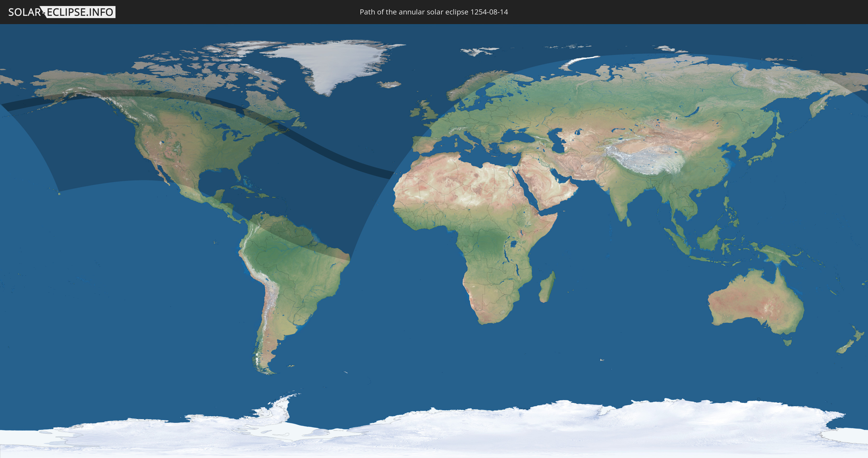
Annular solar eclipse of 08/14/1254
| Day of week: | Friday |
| Maximum duration of eclipse: | 05m23s |
| Maximum width of eclipse path: | 282 km |
| Saros cycle: | 123 |
| Coverage: | 94.3% |
| Magnitude: | 0.9433 |
| Gamma: | 0.6726 |
Wo kann man die Sonnenfinsternis vom 08/14/1254 sehen?
Die Sonnenfinsternis am 08/14/1254 kann man in 59 Ländern als partielle Sonnenfinsternis beobachten.
Der Finsternispfad verläuft durch 4 Länder. Nur in diesen Ländern ist sie als annular Sonnenfinsternis zu sehen.
In den folgenden Ländern ist die Sonnenfinsternis annular zu sehen
 United States
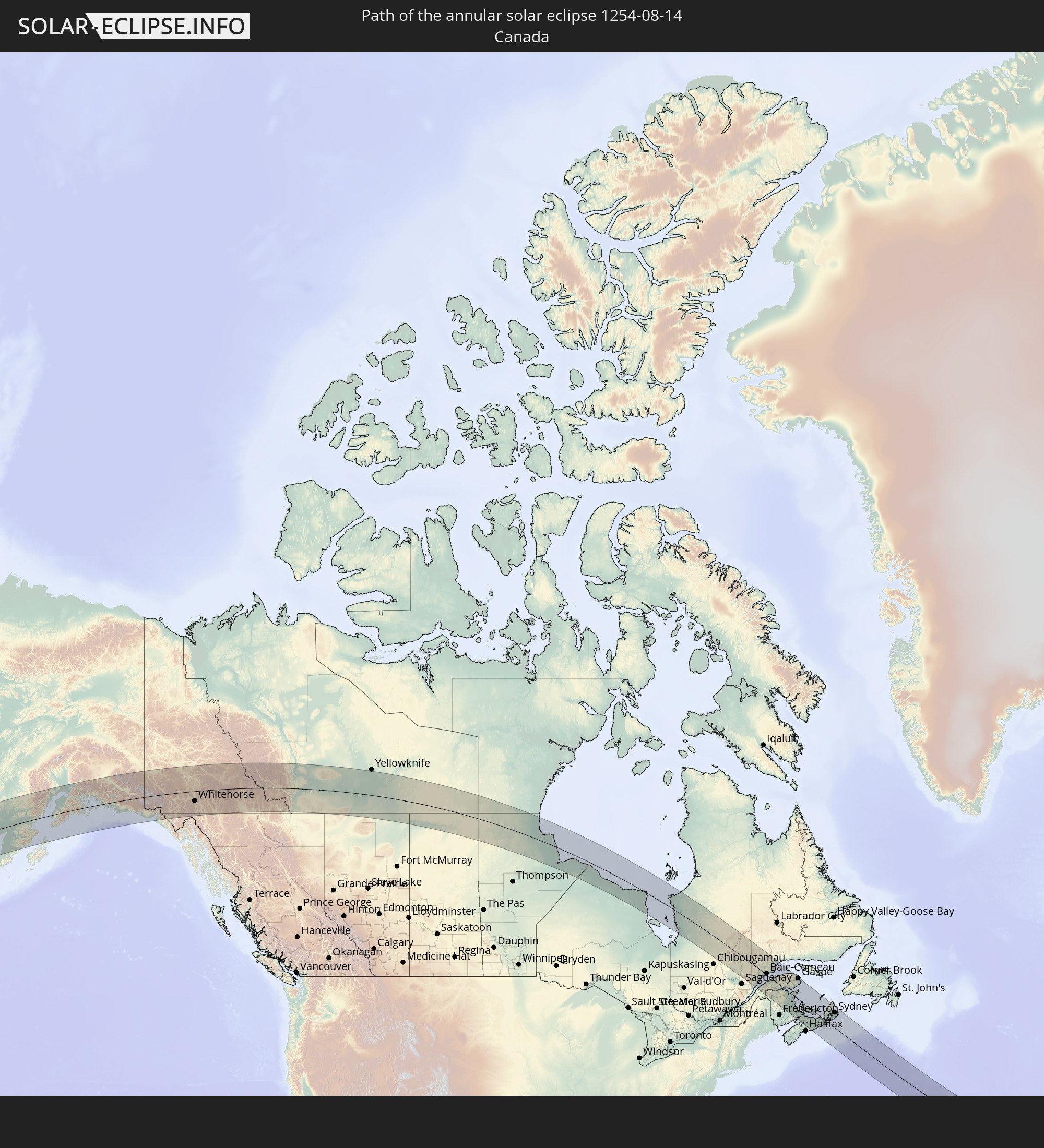 Canada
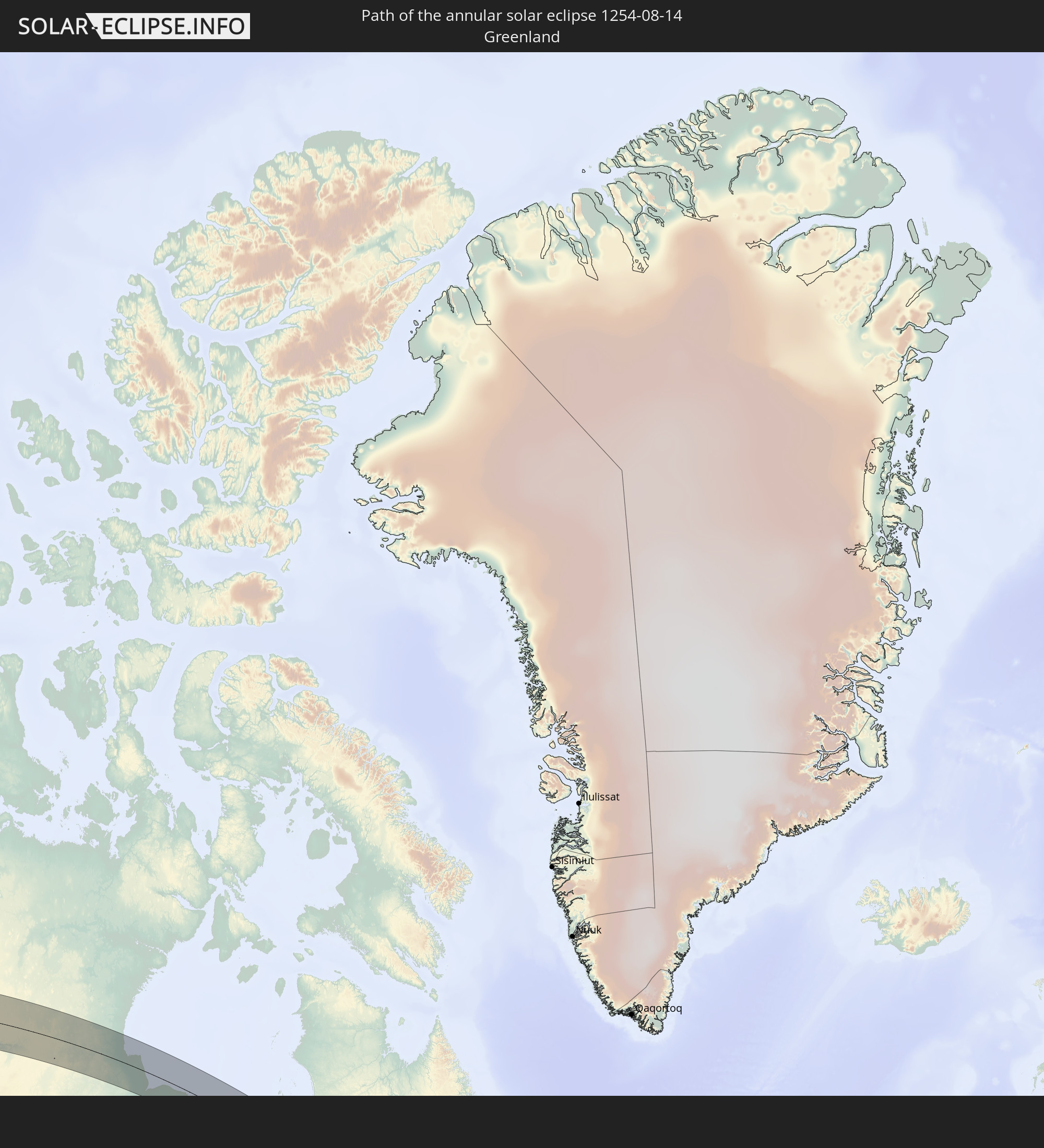 Greenland
 Spain
Spain
In den folgenden Ländern ist die Sonnenfinsternis partiell zu sehen
 Russia
 United States
 United States Minor Outlying Islands
 Canada
 Mexico
 Greenland
 Guatemala
 Honduras
 Belize
 Nicaragua
 Cuba
Cuba
 Colombia
 Cayman Islands
 The Bahamas
 Jamaica
 Haiti
Haiti
 Brazil
 Venezuela
 Turks and Caicos Islands
 Dominican Republic
 Aruba
Aruba
 Puerto Rico
 United States Virgin Islands
 Bermuda
 British Virgin Islands
 Anguilla
 Collectivity of Saint Martin
 Saint Barthélemy
 Saint Kitts and Nevis
 Antigua and Barbuda
 Montserrat
 Trinidad and Tobago
 Guadeloupe
 Grenada
 Dominica
 Saint Vincent and the Grenadines
 Guyana
 Martinique
 Saint Lucia
 Barbados
 Suriname
 Saint Pierre and Miquelon
 French Guiana
 Portugal
 Cabo Verde
 Iceland
 Spain
Spain
 Republic of Ireland
 Svalbard and Jan Mayen
 United Kingdom
 Faroe Islands
 France
 Isle of Man
 Guernsey
 Jersey
 Norway
 Denmark
 Sweden
 Finland
How will be the weather during the annular solar eclipse on 08/14/1254?
Where is the best place to see the annular solar eclipse of 08/14/1254?
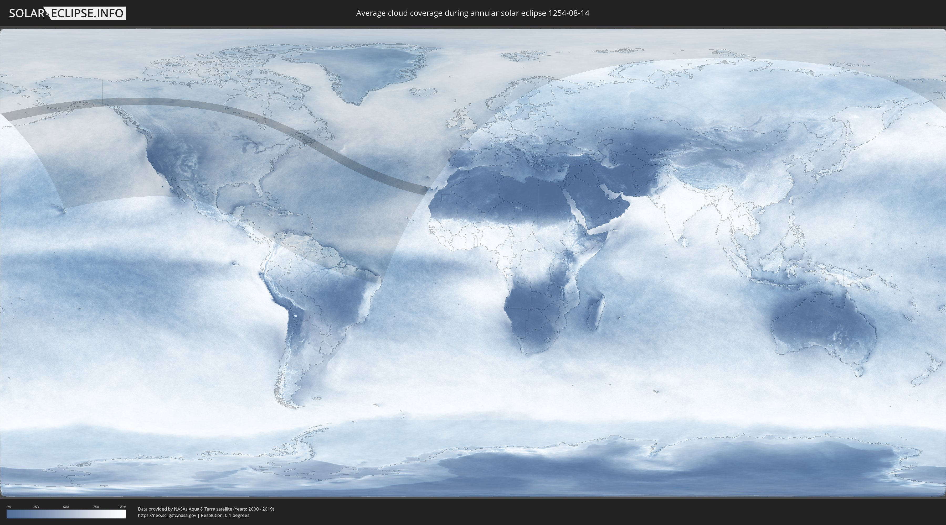
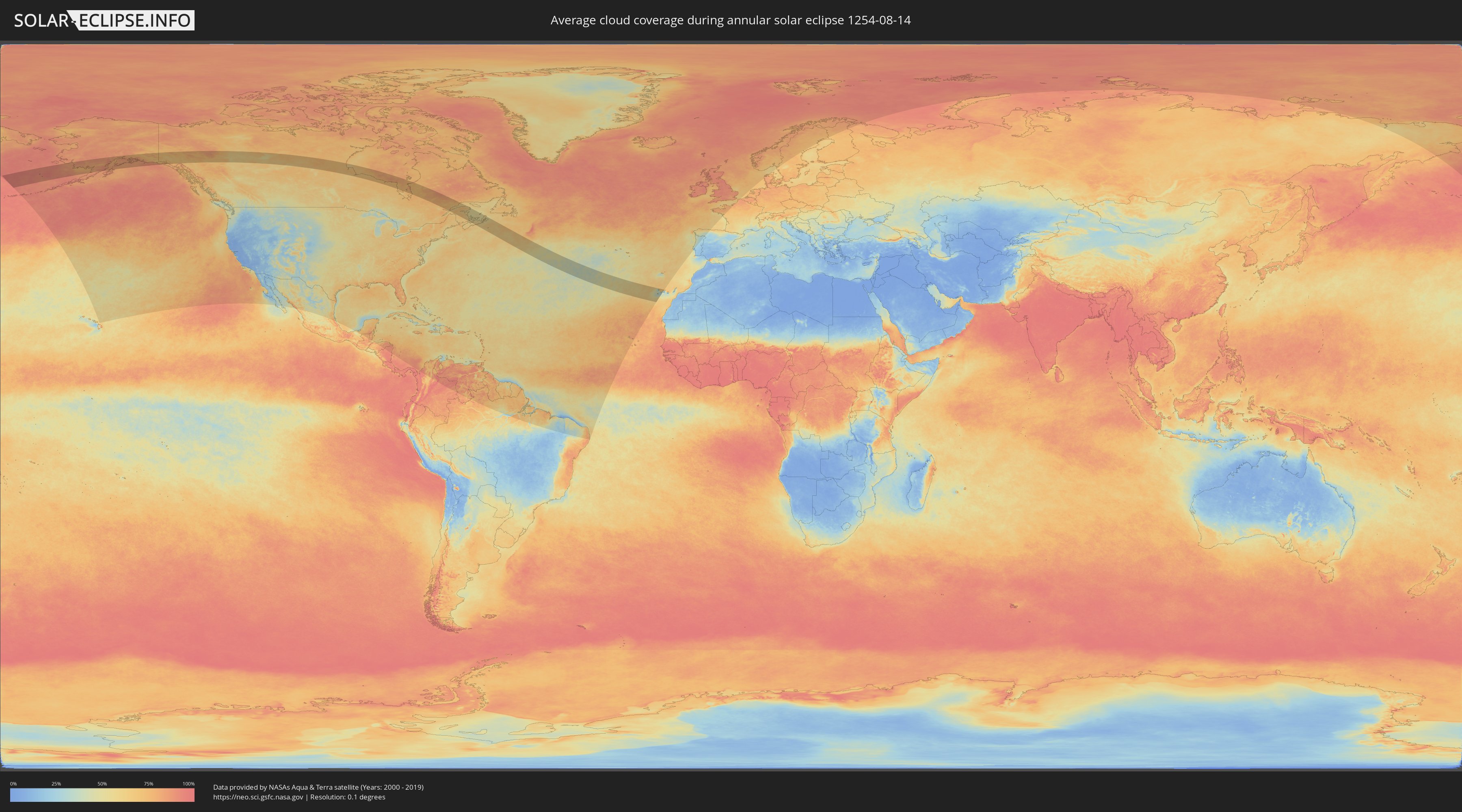
The following maps show the average cloud coverage for the day of the annular solar eclipse.
With the help of these maps, it is possible to find the place along the eclipse path, which has the best
chance of a cloudless sky.
Nevertheless, you should consider local circumstances and inform about the weather of your chosen
observation site.
The data is provided by NASAs satellites
AQUA and TERRA.
The cloud maps are averaged over a period of 19 years (2000 - 2019).
Detailed country maps
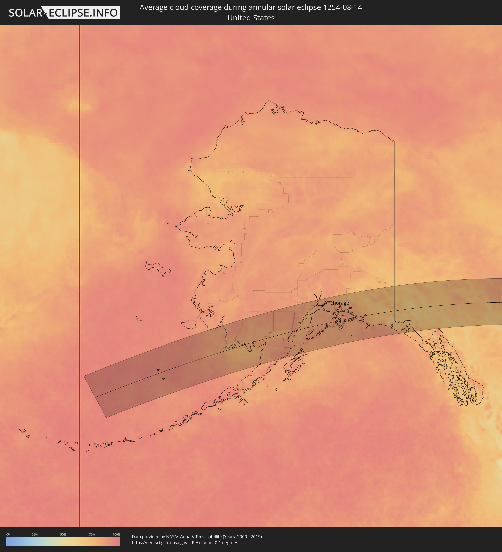 United States
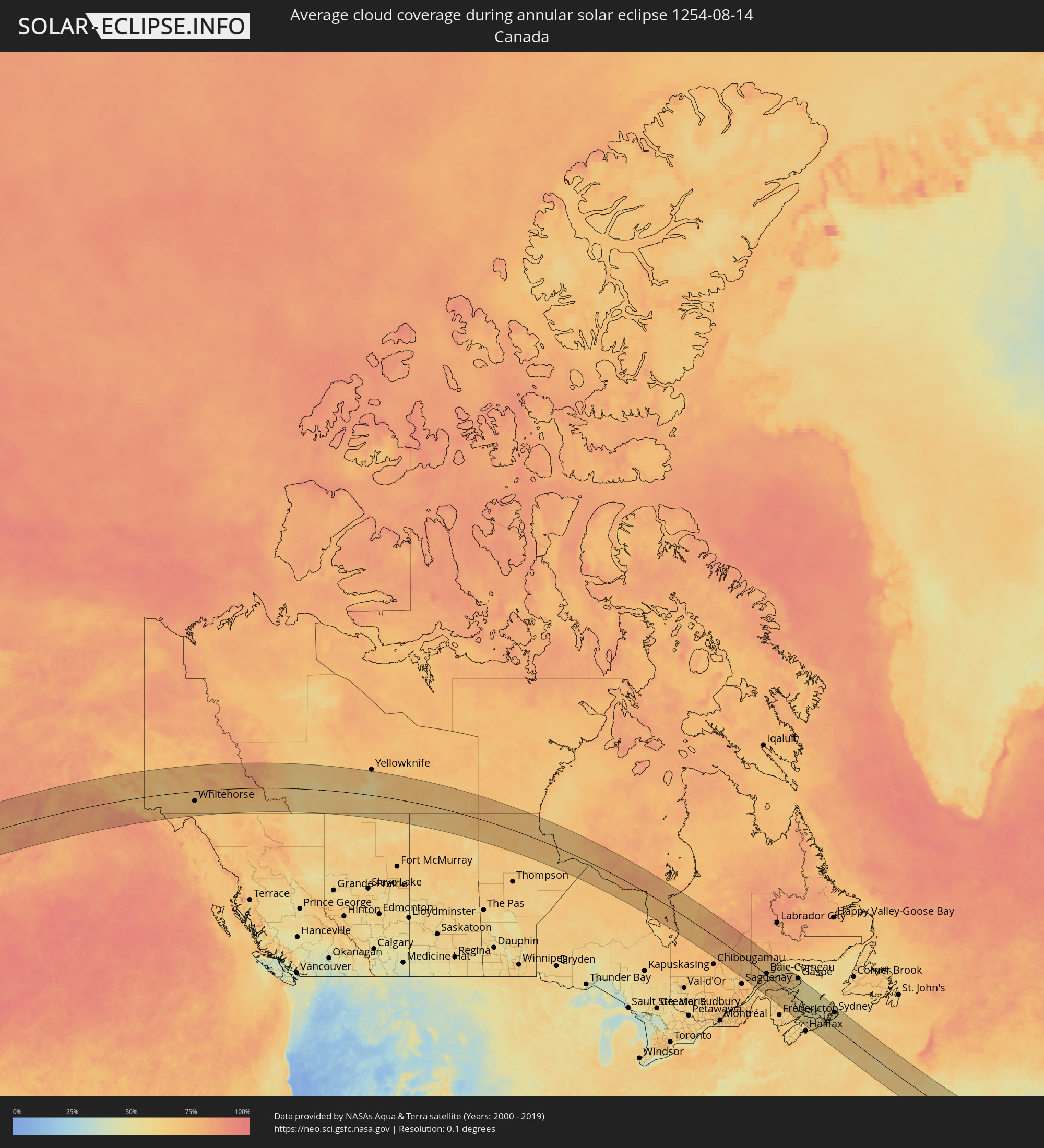 Canada
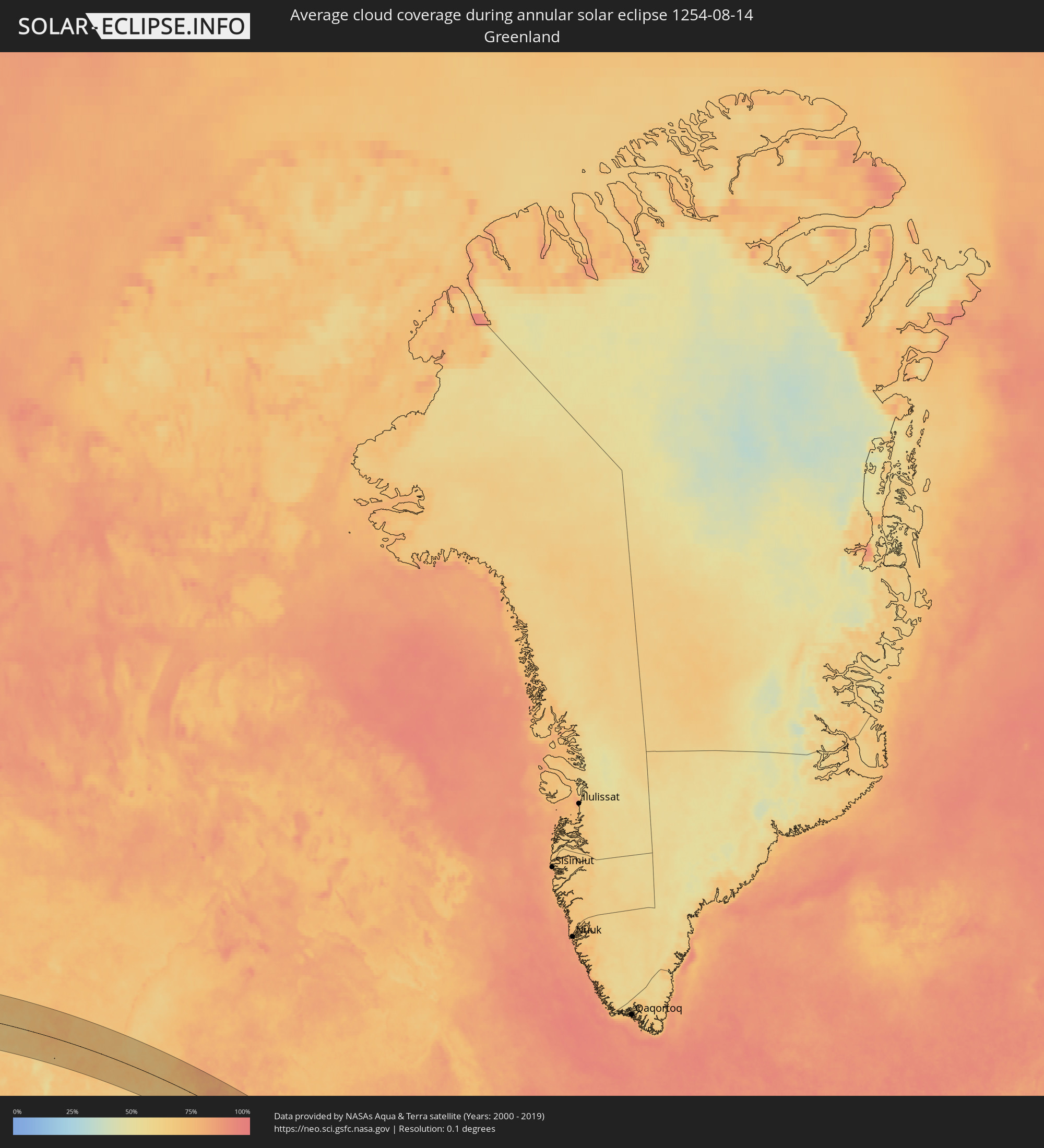 Greenland
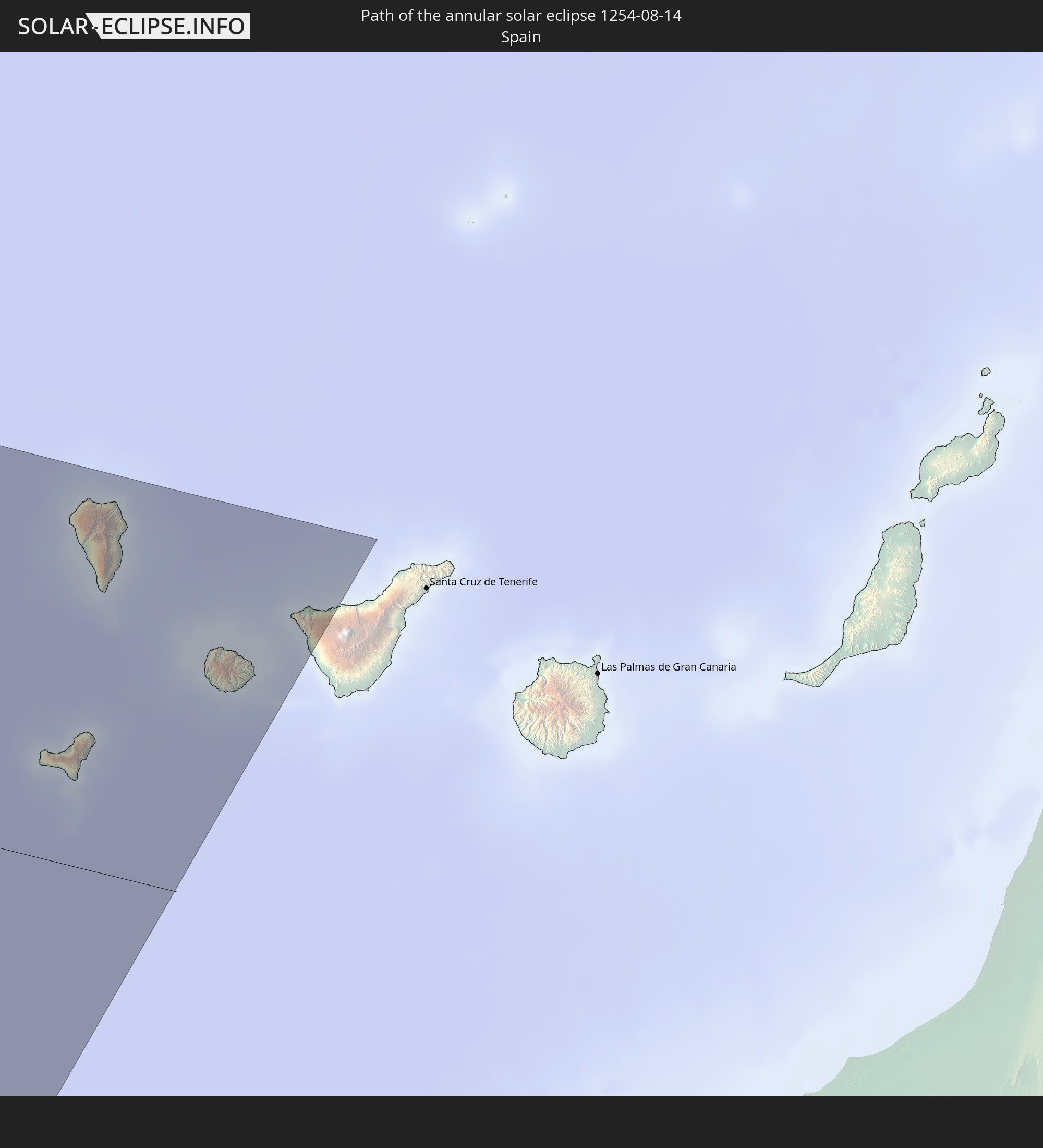
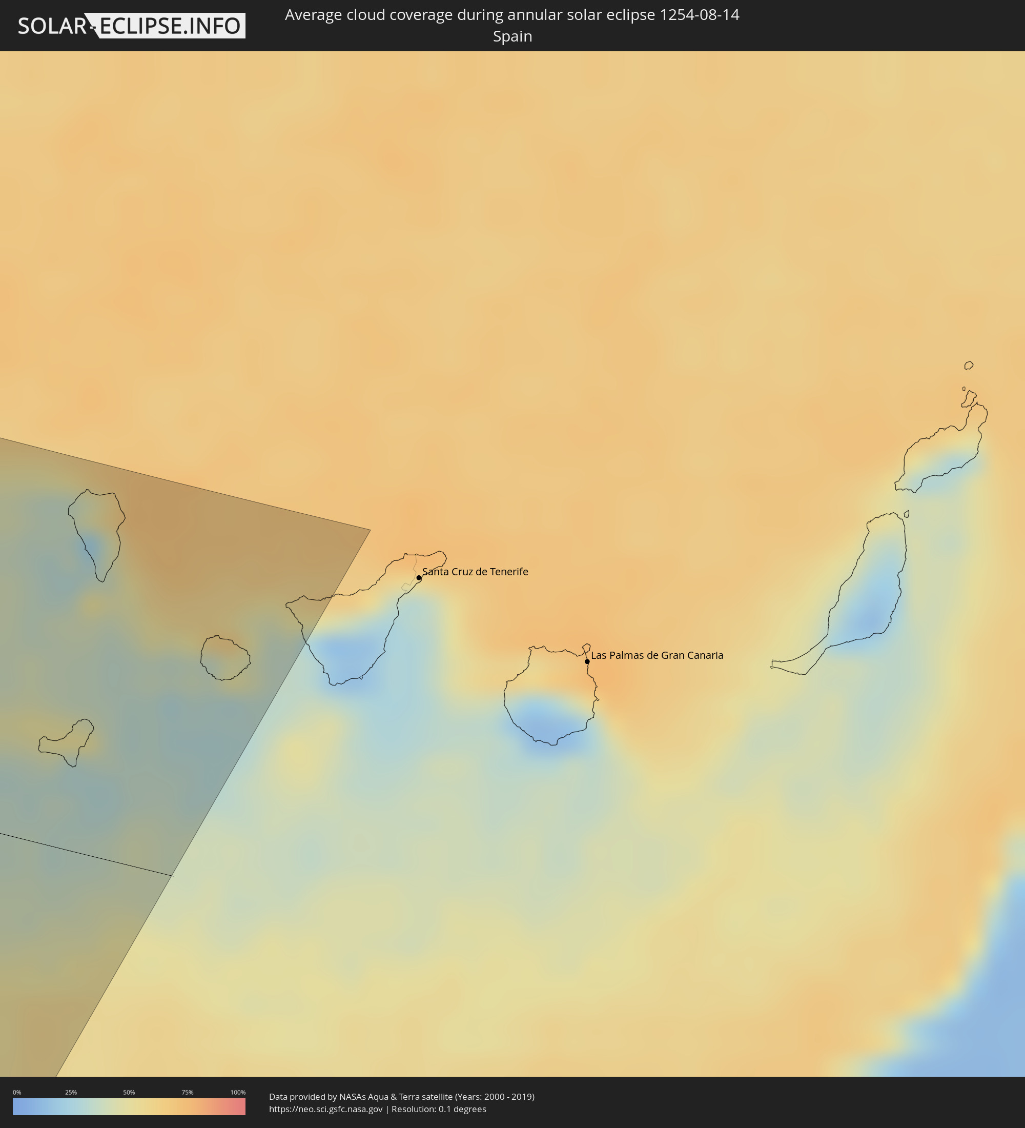 Spain
Spain
Cities inside the path of the eclipse
The following table shows all locations with a population of more than 5,000 inside the eclipse path. Cities which have more than 100,000 inhabitants are marked bold. A click at the locations opens a detailed map.
| City | Type | Eclipse duration | Local time of max. eclipse | Distance to central line | Ø Cloud coverage |
|
Homer, Alaska
|
annular | - | 06:48:34 UTC-10:00 | 32 km | 84% |
|
Kalifornsky, Alaska
|
annular | - | 06:49:51 UTC-10:00 | 51 km | 78% |
|
Kenai, Alaska
|
annular | - | 06:50:04 UTC-10:00 | 65 km | 79% |
|
Sterling, Alaska
|
annular | - | 06:50:10 UTC-10:00 | 57 km | 84% |
|
Anchorage, Alaska
|
annular | - | 06:51:28 UTC-10:00 | 120 km | 84% |
|
Elmendorf Air Force Base, Alaska
|
annular | - | 06:51:36 UTC-10:00 | 121 km | 84% |
|
Meadow Lakes, Alaska
|
annular | - | 06:52:12 UTC-10:00 | 161 km | 81% |
|
Knik-Fairview, Alaska
|
annular | - | 06:52:01 UTC-10:00 | 148 km | 85% |
|
Eagle River, Alaska
|
annular | - | 06:51:44 UTC-10:00 | 127 km | 84% |
|
Wasilla, Alaska
|
annular | - | 06:52:11 UTC-10:00 | 154 km | 81% |
|
Tanaina, Alaska
|
annular | - | 06:52:15 UTC-10:00 | 159 km | 81% |
|
Lakes, Alaska
|
annular | - | 06:52:15 UTC-10:00 | 156 km | 81% |
|
Gateway, Alaska
|
annular | - | 06:52:13 UTC-10:00 | 151 km | 81% |
|
Palmer, Alaska
|
annular | - | 06:52:18 UTC-10:00 | 152 km | 80% |
|
Whitehorse, Yukon
|
annular | - | 08:57:02 UTC-08:00 | 62 km | 67% |
|
Rimouski, Quebec
|
annular | - | 13:27:29 UTC-05:00 | 76 km | 64% |
|
Mont-Joli, Quebec
|
annular | - | 13:27:43 UTC-05:00 | 52 km | 60% |
|
Baie-Comeau, Quebec
|
annular | - | 13:26:39 UTC-05:00 | 23 km | 63% |
|
Matane, Quebec
|
annular | - | 13:28:14 UTC-05:00 | 5 km | 60% |
|
Amqui, Quebec
|
annular | - | 13:29:02 UTC-05:00 | 33 km | 67% |
|
Port-Cartier, Quebec
|
annular | - | 13:26:59 UTC-05:00 | 138 km | 71% |
|
Campbellton, New Brunswick
|
annular | - | 14:16:33 UTC-04:14 | 32 km | 64% |
|
Sainte-Anne-des-Monts, Quebec
|
annular | - | 13:29:09 UTC-05:00 | 76 km | 61% |
|
Bathurst, New Brunswick
|
annular | - | 14:18:43 UTC-04:14 | 19 km | 65% |
|
Miramichi, New Brunswick
|
annular | - | 14:20:02 UTC-04:14 | 64 km | 62% |
|
Lutes Mountain, New Brunswick
|
annular | - | 14:22:36 UTC-04:14 | 116 km | 63% |
|
Moncton, New Brunswick
|
annular | - | 14:22:49 UTC-04:14 | 115 km | 62% |
|
Dieppe, New Brunswick
|
annular | - | 14:23:00 UTC-04:14 | 112 km | 61% |
|
Chandler, Quebec
|
annular | - | 13:33:03 UTC-05:00 | 90 km | 59% |
|
Gaspé, Quebec
|
annular | - | 13:32:25 UTC-05:00 | 141 km | 60% |
|
Sackville, New Brunswick
|
annular | - | 14:23:44 UTC-04:14 | 110 km | 56% |
|
Amherst, Nova Scotia
|
annular | - | 14:24:09 UTC-04:14 | 111 km | 57% |
|
Summerside, Prince Edward Island
|
annular | - | 14:23:37 UTC-04:14 | 40 km | 55% |
|
Truro, Nova Scotia
|
annular | - | 14:26:21 UTC-04:14 | 106 km | 60% |
|
Charlottetown, Prince Edward Island
|
annular | - | 14:24:48 UTC-04:14 | 24 km | 60% |
|
New Glasgow, Nova Scotia
|
annular | - | 14:26:44 UTC-04:14 | 61 km | 58% |
|
Antigonish, Nova Scotia
|
annular | - | 14:27:31 UTC-04:14 | 30 km | 58% |
|
Princeville, Nova Scotia
|
annular | - | 14:28:07 UTC-04:14 | 23 km | 55% |
|
Sydney Mines, Nova Scotia
|
annular | - | 14:28:31 UTC-04:14 | 117 km | 53% |
|
Sydney, Nova Scotia
|
annular | - | 14:28:46 UTC-04:14 | 109 km | 57% |
|
Glace Bay, Nova Scotia
|
annular | - | 14:28:55 UTC-04:14 | 125 km | 54% |
|
Tazacorte, Canary Islands
|
annular | - | 18:33:36 UTC-01:01 | 150 km | 37% |
|
Los Llanos de Aridane, Canary Islands
|
annular | - | 18:33:34 UTC-01:01 | 152 km | 29% |
|
El Paso, Canary Islands
|
annular | - | 18:33:35 UTC-01:01 | 152 km | 29% |
|
Breña Alta, Canary Islands
|
annular | - | 18:33:33 UTC-01:01 | 156 km | 43% |
|
Garachico, Canary Islands
|
annular | - | 18:33:22 UTC-01:01 | 170 km | 44% |
|
Santa Cruz de la Palma, Canary Islands
|
annular | - | 18:33:30 UTC-01:01 | 160 km | 43% |
|
San Sebastián de la Gomera, Canary Islands
|
annular | - | 18:34:08 UTC-01:01 | 111 km | 33% |
|
Buenavista del Norte, Canary Islands
|
annular | - | 18:33:41 UTC-01:01 | 149 km | 48% |
|
Santiago del Teide, Canary Islands
|
annular | - | 18:33:46 UTC-01:01 | 143 km | 27% |
|
Los Silos, Canary Islands
|
annular | - | 18:33:41 UTC-01:01 | 150 km | 48% |
|
Garachico, Canary Islands
|
annular | - | 18:33:39 UTC-01:01 | 153 km | 48% |
|
Icod de los Vinos, Canary Islands
|
annular | - | 18:33:38 UTC-01:01 | 156 km | 44% |