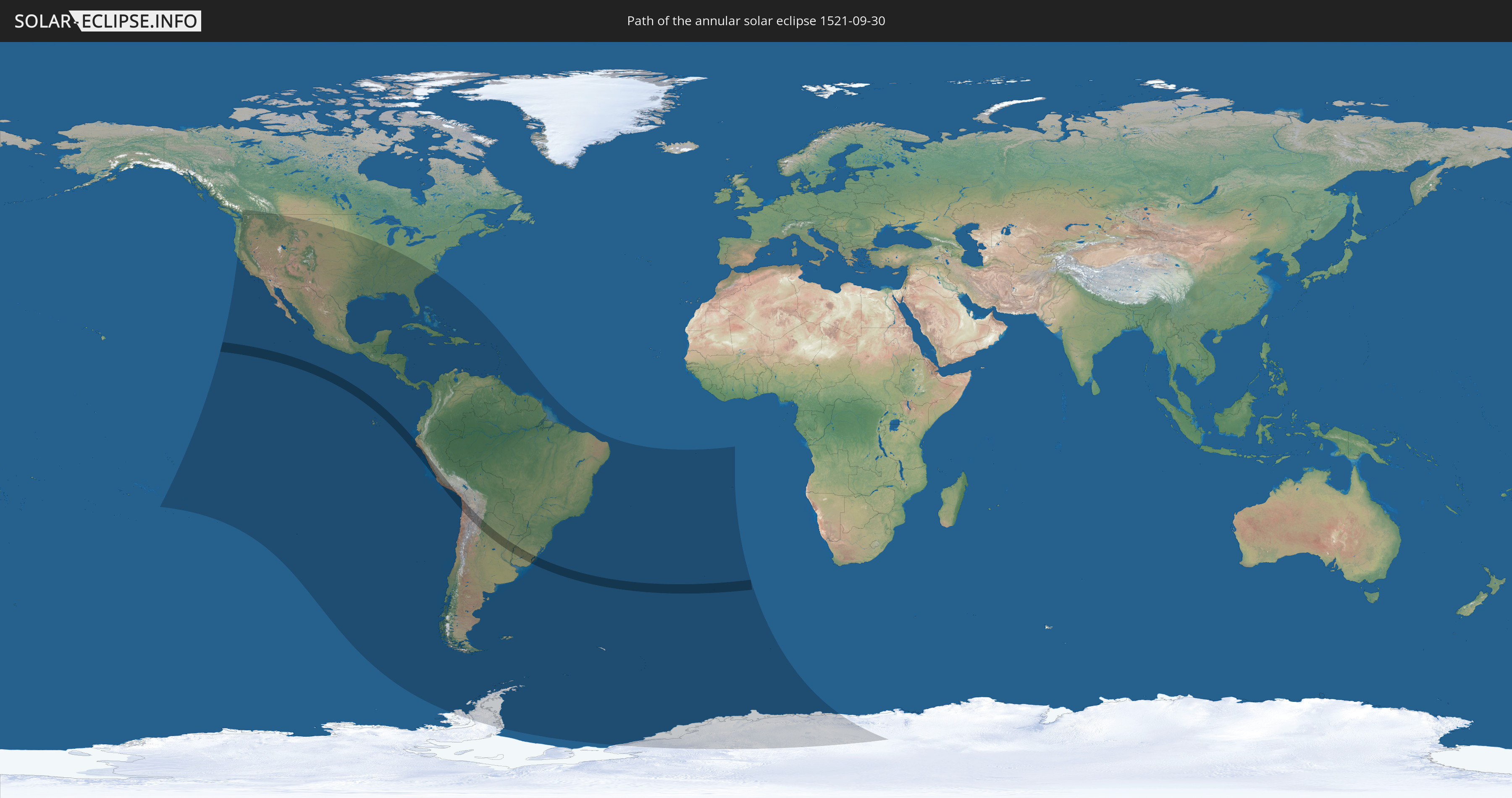
Annular solar eclipse of 09/30/1521
| Day of week: | Friday |
| Maximum duration of eclipse: | 05m30s |
| Maximum width of eclipse path: | 191 km |
| Saros cycle: | 126 |
| Coverage: | 94.9% |
| Magnitude: | 0.9489 |
| Gamma: | -0.1892 |
Wo kann man die Sonnenfinsternis vom 09/30/1521 sehen?
Die Sonnenfinsternis am 09/30/1521 kann man in 56 Ländern als partielle Sonnenfinsternis beobachten.
Der Finsternispfad verläuft durch 7 Länder. Nur in diesen Ländern ist sie als annular Sonnenfinsternis zu sehen.
In den folgenden Ländern ist die Sonnenfinsternis annular zu sehen
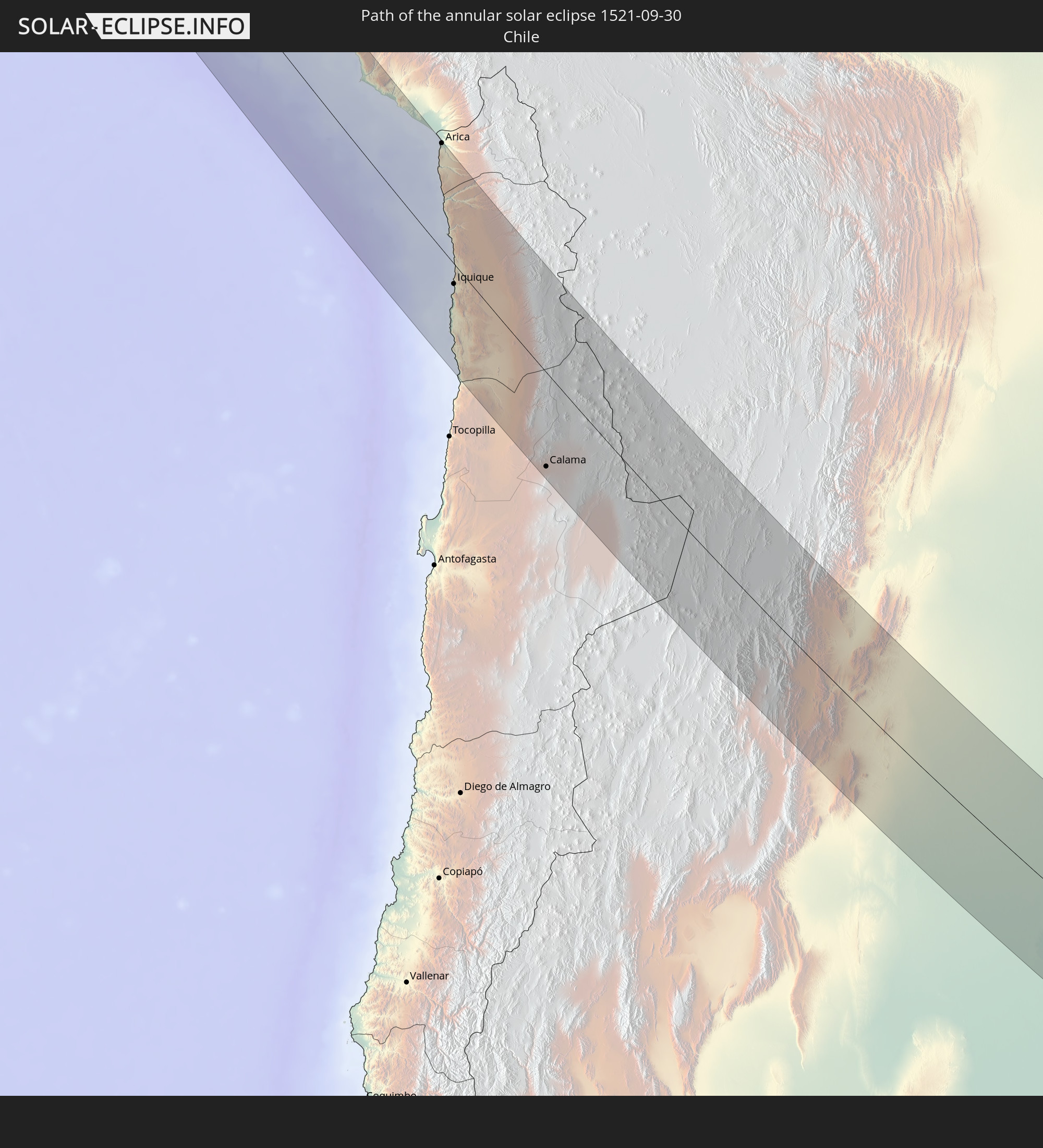 Chile
Chile
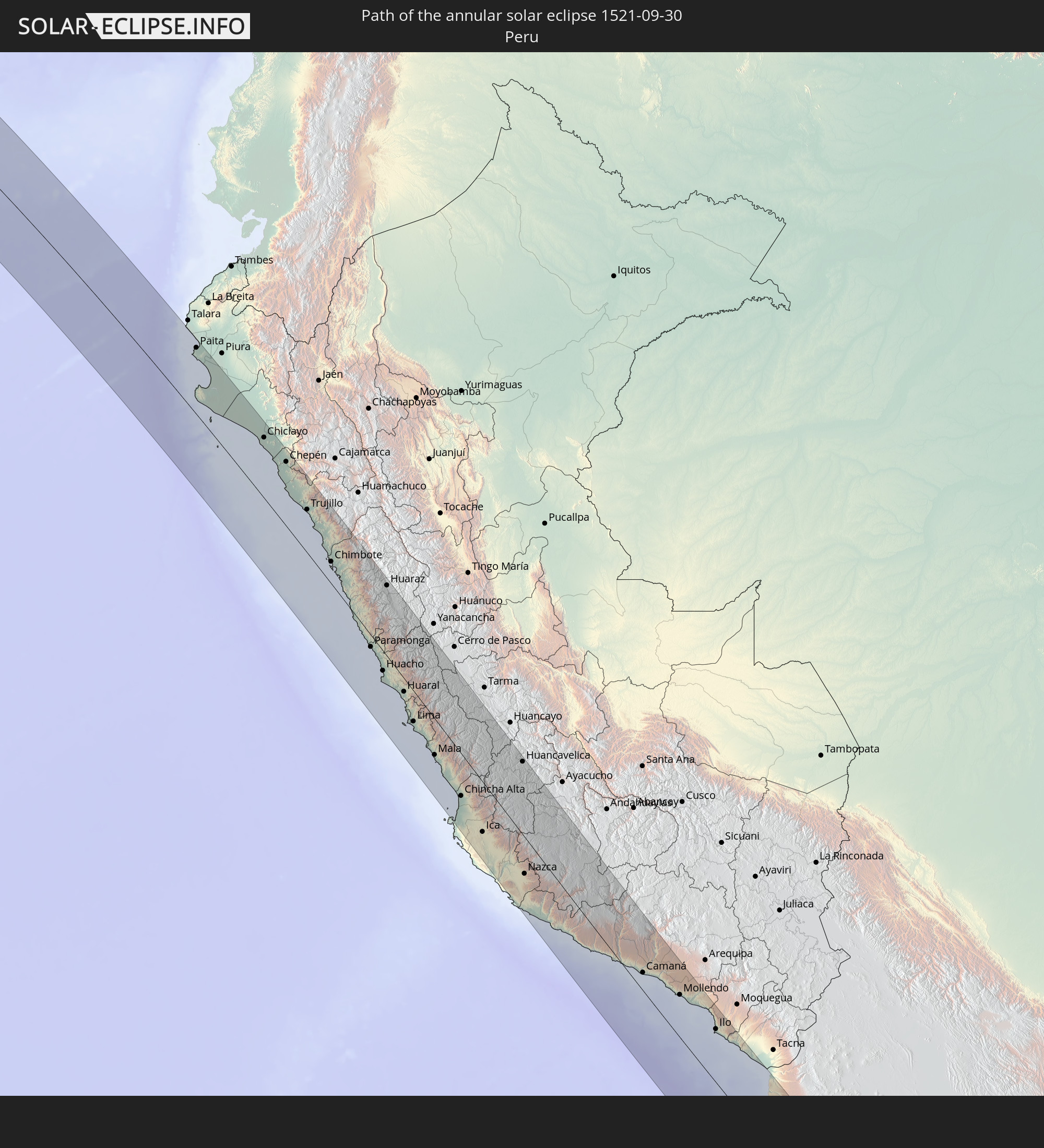 Peru
Peru
 Brazil
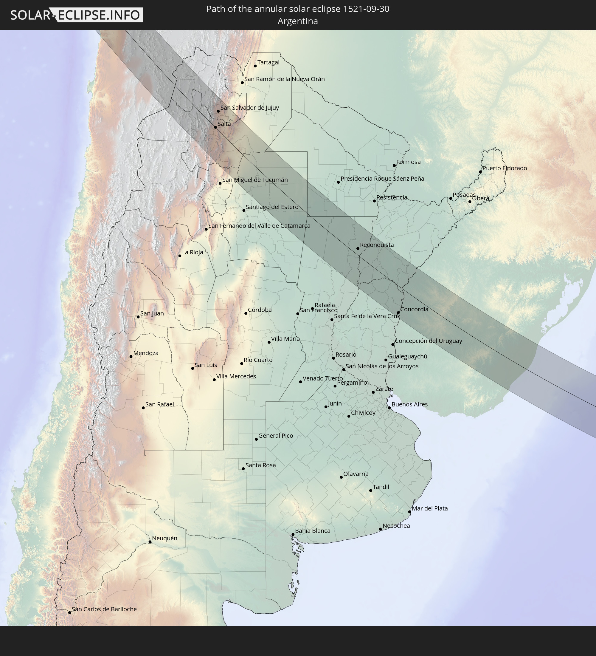 Argentina
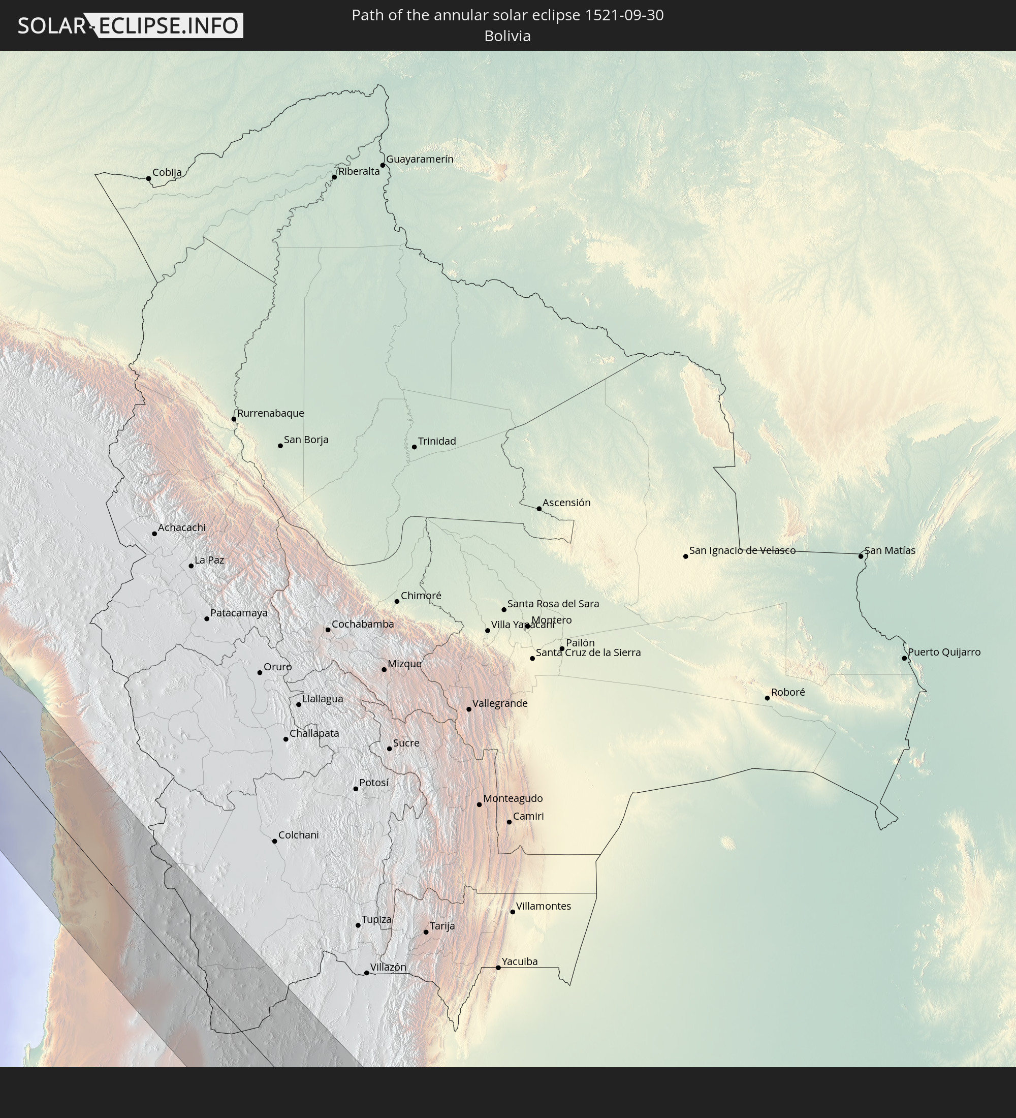 Bolivia
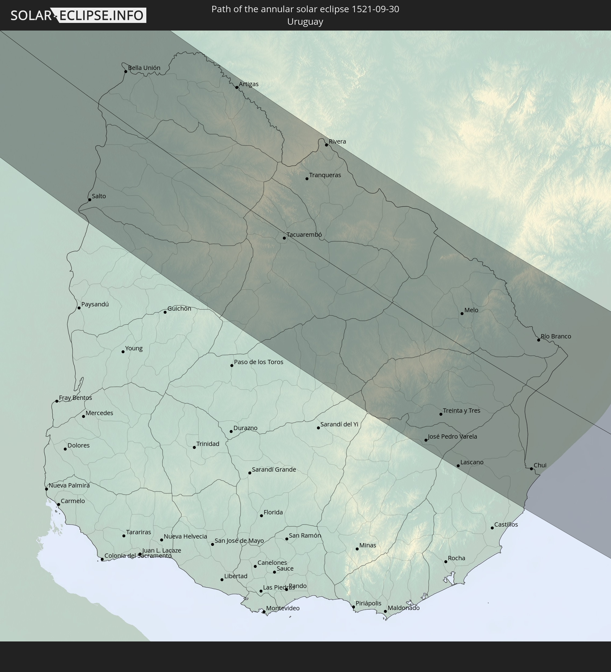 Uruguay
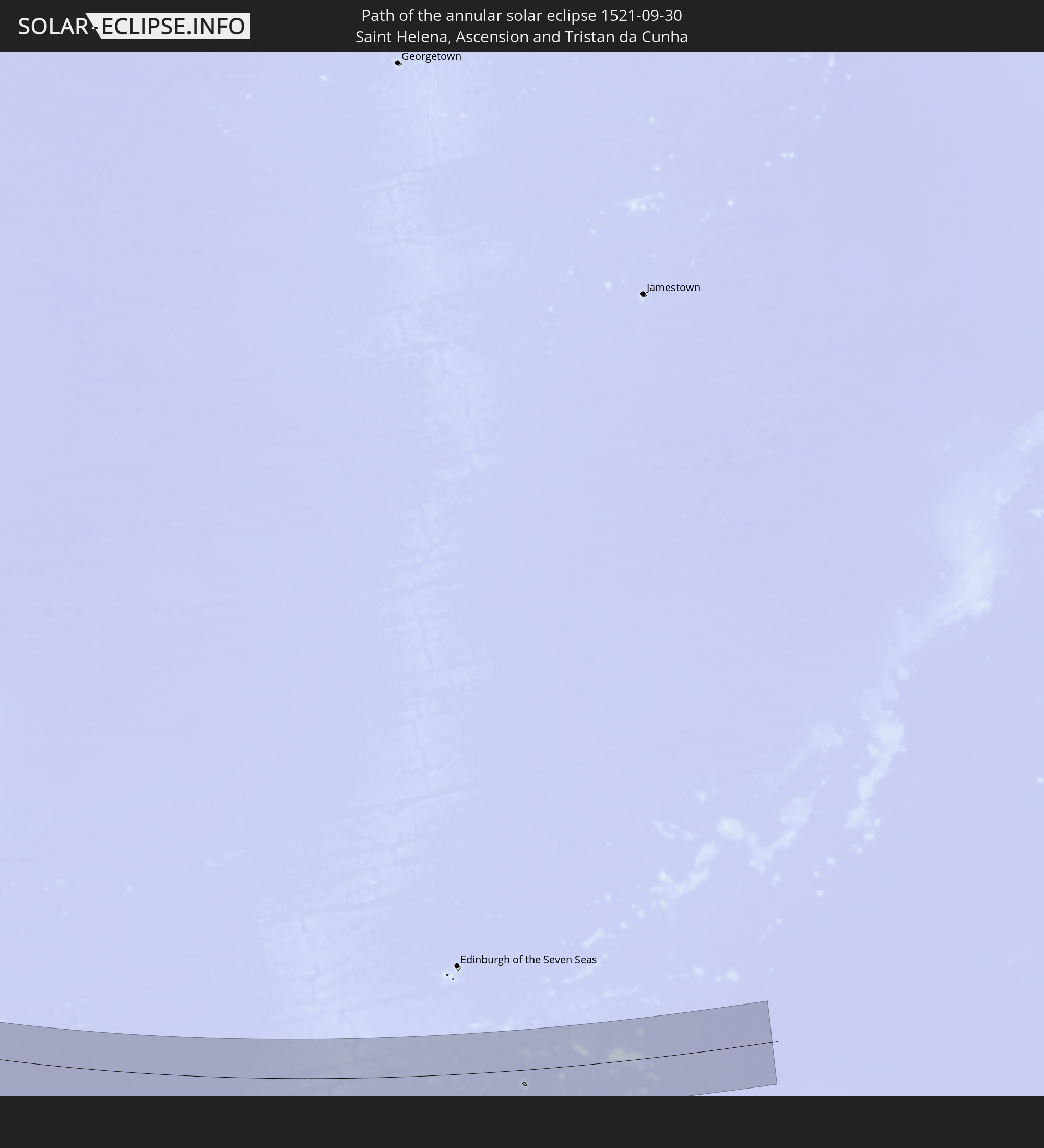 Saint Helena, Ascension and Tristan da Cunha
In den folgenden Ländern ist die Sonnenfinsternis partiell zu sehen
 Antarctica
 United States
 United States Minor Outlying Islands
 French Polynesia
 Canada
 Pitcairn Islands
 Mexico
 Chile
Chile
 Guatemala
 Ecuador
 El Salvador
 Honduras
 Belize
 Nicaragua
 Costa Rica
 Cuba
Cuba
 Panama
 Colombia
 Cayman Islands
 Peru
Peru
 The Bahamas
 Jamaica
 Haiti
Haiti
 Brazil
 Argentina
 Venezuela
 Turks and Caicos Islands
 Dominican Republic
 Aruba
Aruba
 Bolivia
 Puerto Rico
 United States Virgin Islands
 British Virgin Islands
 Anguilla
 Collectivity of Saint Martin
 Saint Barthélemy
 Saint Kitts and Nevis
 Paraguay
 Antigua and Barbuda
 Montserrat
 Trinidad and Tobago
 Guadeloupe
 Grenada
 Dominica
 Saint Vincent and the Grenadines
 Falkland Islands
 Guyana
 Martinique
 Saint Lucia
 Barbados
 Uruguay
 Suriname
 French Guiana
 South Georgia and the South Sandwich Islands
 Saint Helena, Ascension and Tristan da Cunha
 Bouvet Island
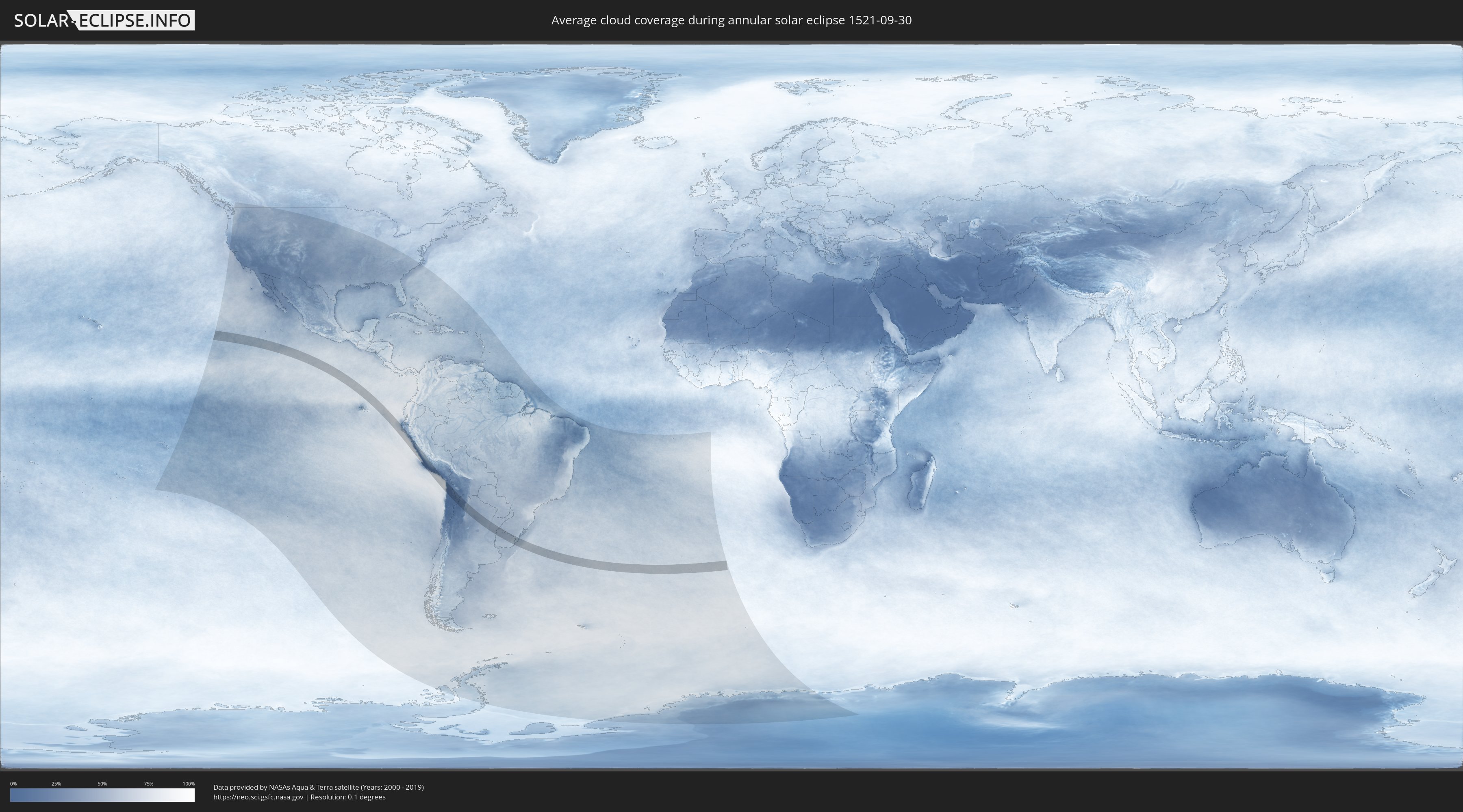
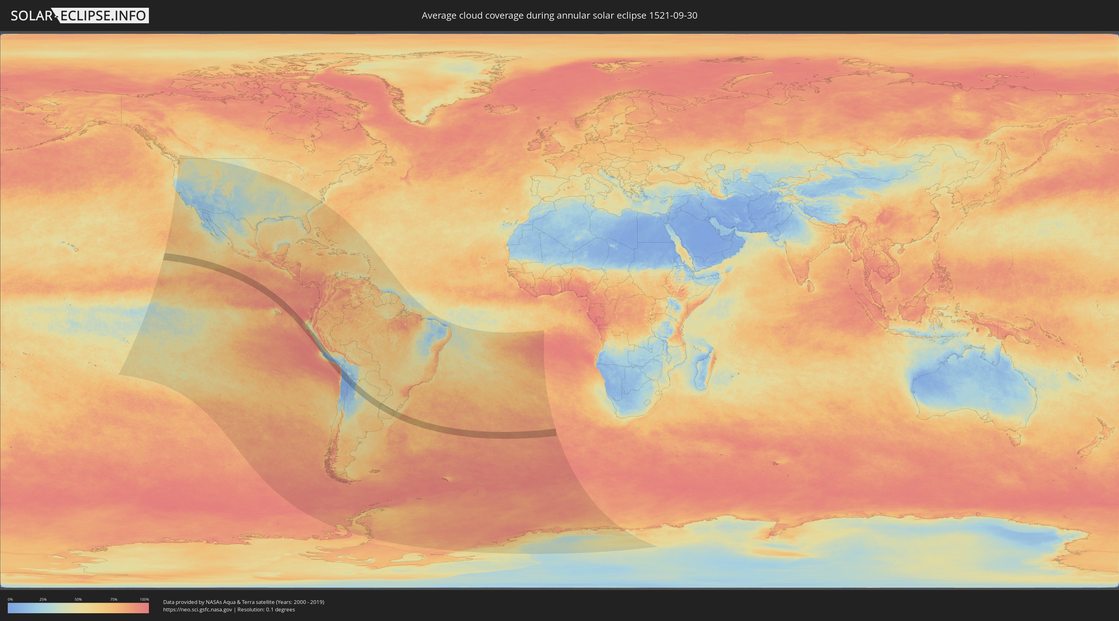
How will be the weather during the annular solar eclipse on 09/30/1521?
Where is the best place to see the annular solar eclipse of 09/30/1521?
The following maps show the average cloud coverage for the day of the annular solar eclipse.
With the help of these maps, it is possible to find the place along the eclipse path, which has the best
chance of a cloudless sky.
Nevertheless, you should consider local circumstances and inform about the weather of your chosen
observation site.
The data is provided by NASAs satellites
AQUA and TERRA.
The cloud maps are averaged over a period of 19 years (2000 - 2019).
Detailed country maps
 Chile
Chile
 Peru
Peru
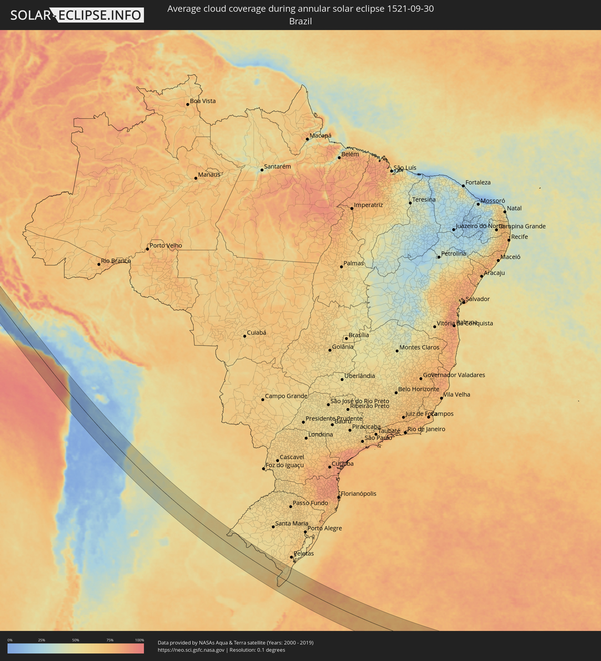 Brazil
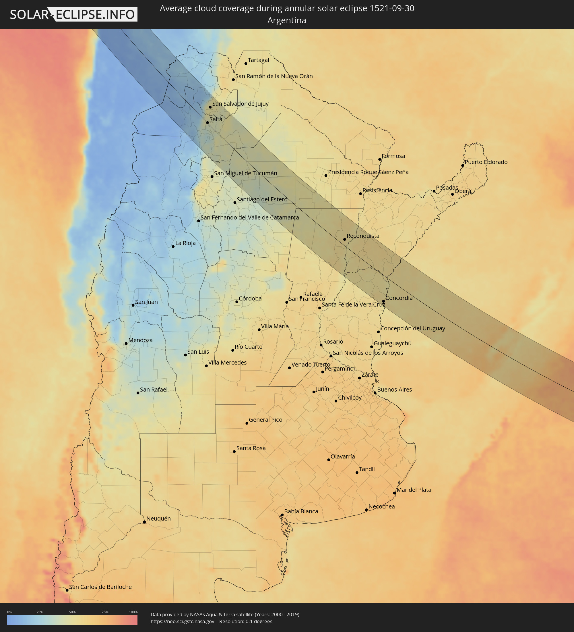 Argentina
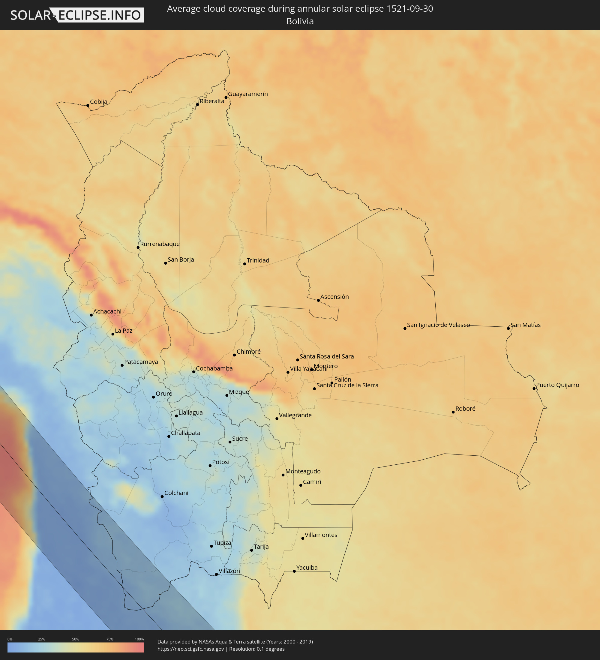 Bolivia
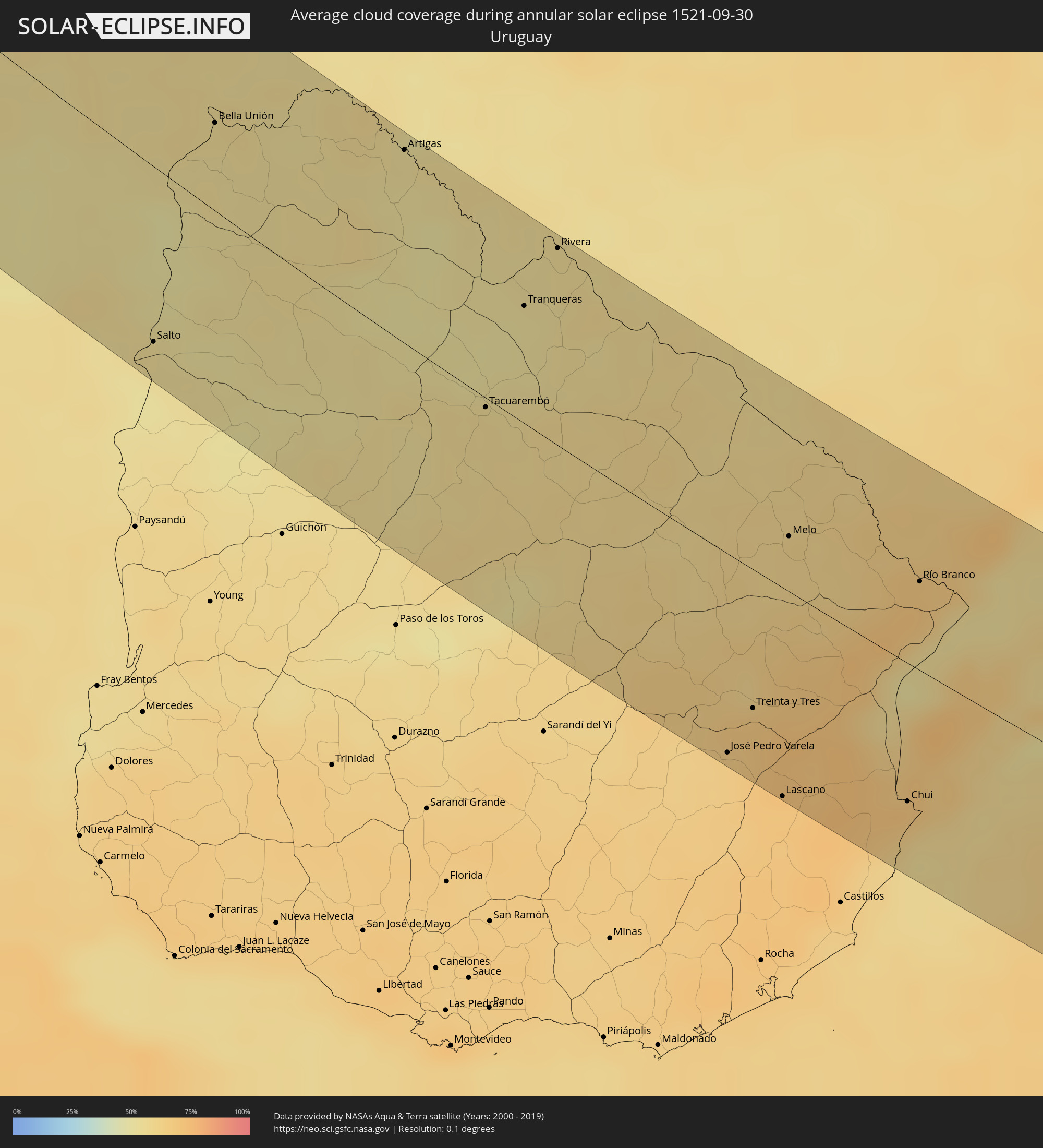 Uruguay
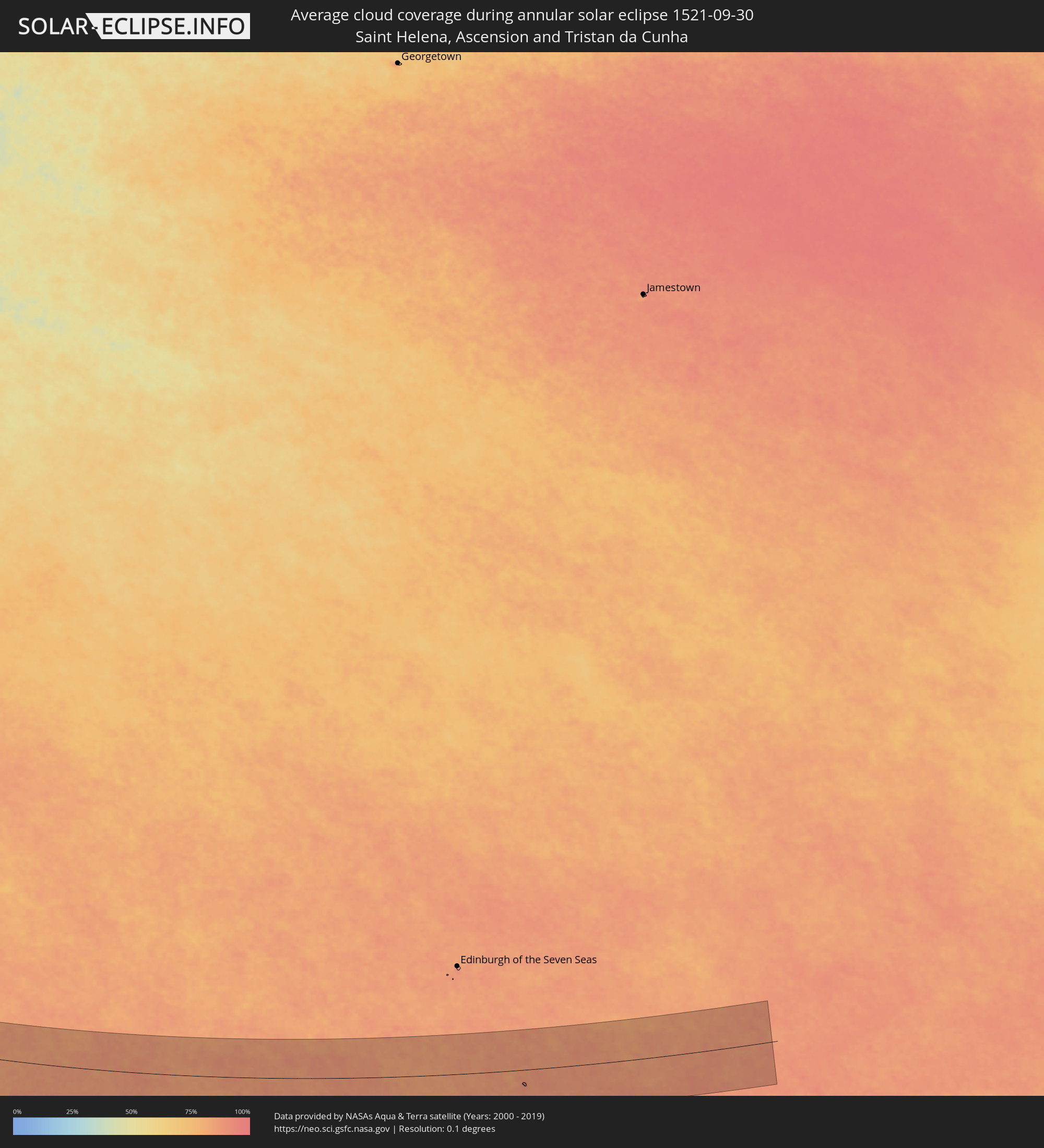 Saint Helena, Ascension and Tristan da Cunha
Cities inside the path of the eclipse
The following table shows all locations with a population of more than 5,000 inside the eclipse path. Cities which have more than 100,000 inhabitants are marked bold. A click at the locations opens a detailed map.
| City | Type | Eclipse duration | Local time of max. eclipse | Distance to central line | Ø Cloud coverage |
|
Paita, Piura
|
annular | - | 10:27:27 UTC-05:08 | 89 km | 40% |
|
Sechura, Piura
|
annular | - | 10:29:06 UTC-05:08 | 80 km | 42% |
|
Vice, Piura
|
annular | - | 10:28:49 UTC-05:08 | 94 km | 57% |
|
La Unión, Piura
|
annular | - | 10:28:51 UTC-05:08 | 98 km | 62% |
|
Eten, Lambayeque
|
annular | - | 10:34:06 UTC-05:08 | 67 km | 58% |
|
Chiclayo, Lambayeque
|
annular | - | 10:33:48 UTC-05:08 | 79 km | 57% |
|
Ferreñafe, Lambayeque
|
annular | - | 10:33:34 UTC-05:08 | 93 km | 64% |
|
Saña, Lambayeque
|
annular | - | 10:34:38 UTC-05:08 | 91 km | 49% |
|
Pacasmayo, La Libertad
|
annular | - | 10:35:51 UTC-05:08 | 58 km | 52% |
|
Chepén, La Libertad
|
annular | - | 10:35:40 UTC-05:08 | 83 km | 48% |
|
Santiago de Cao, La Libertad
|
annular | - | 10:37:51 UTC-05:08 | 48 km | 67% |
|
Chocope, La Libertad
|
annular | - | 10:37:27 UTC-05:08 | 61 km | 57% |
|
Ascope, La Libertad
|
annular | - | 10:37:28 UTC-05:08 | 76 km | 33% |
|
Trujillo, La Libertad
|
annular | - | 10:38:37 UTC-05:08 | 55 km | 65% |
|
Virú, La Libertad
|
annular | - | 10:39:52 UTC-05:08 | 59 km | 60% |
|
Chimbote, Ancash
|
annular | - | 10:41:53 UTC-05:08 | 28 km | 69% |
|
Huarmey, Ancash
|
annular | - | 10:45:10 UTC-05:08 | 2 km | 67% |
|
Pativilca, Lima region
|
annular | - | 10:47:27 UTC-05:08 | 13 km | 84% |
|
Barranca, Lima region
|
annular | - | 10:47:37 UTC-05:08 | 15 km | 82% |
|
Puerto Supe, Lima region
|
annular | - | 10:47:47 UTC-05:08 | 16 km | 76% |
|
Huacho, Lima region
|
annular | - | 10:48:49 UTC-05:08 | 25 km | 69% |
|
Huaraz, Ancash
|
annular | - | 10:44:55 UTC-05:08 | 89 km | 56% |
|
Huaral, Lima region
|
annular | - | 10:50:33 UTC-05:08 | 16 km | 66% |
|
Lima, Lima Province
|
annular | - | 10:52:18 UTC-05:08 | 38 km | 66% |
|
Santa María, Lima region
|
annular | - | 10:52:27 UTC-05:08 | 24 km | 39% |
|
Chilca, Lima region
|
annular | - | 10:54:04 UTC-05:08 | 45 km | 70% |
|
Chosica, Lima region
|
annular | - | 10:52:38 UTC-05:08 | 4 km | 14% |
|
Mala, Lima region
|
annular | - | 10:54:37 UTC-05:08 | 45 km | 80% |
|
Imperial, Lima region
|
annular | - | 10:56:10 UTC-05:08 | 48 km | 82% |
|
Pisco, Ica
|
annular | - | 10:58:07 UTC-05:08 | 79 km | 41% |
|
Villa Tupac Amaru, Ica
|
annular | - | 10:58:13 UTC-05:08 | 74 km | 36% |
|
Chincha Alta, Ica
|
annular | - | 10:57:29 UTC-05:08 | 52 km | 56% |
|
La Oroya, Junín Region
|
annular | - | 10:53:04 UTC-05:08 | 95 km | 63% |
|
Ica, Ica
|
annular | - | 10:59:56 UTC-05:08 | 62 km | 11% |
|
Minas de Marcona, Ica
|
annular | - | 11:04:02 UTC-05:08 | 85 km | 18% |
|
Huancavelica, Huancavelica
|
annular | - | 10:58:05 UTC-05:08 | 90 km | 63% |
|
Nazca, Ica
|
annular | - | 11:03:23 UTC-05:08 | 45 km | 6% |
|
Camaná, Arequipa
|
annular | - | 11:12:15 UTC-05:08 | 22 km | 63% |
|
Mollendo, Arequipa
|
annular | - | 11:14:38 UTC-05:08 | 53 km | 73% |
|
Ilo, Moquegua
|
annular | - | 11:17:30 UTC-05:08 | 67 km | 65% |
|
Arica, Arica y Parinacota
|
annular | - | 11:47:28 UTC-04:42 | 94 km | 40% |
|
Iquique, Tarapacá
|
annular | - | 11:51:59 UTC-04:42 | 18 km | 31% |
|
Calama, Antofagasta
|
annular | - | 11:59:34 UTC-04:42 | 84 km | 4% |
|
Chicoana, Salta Province
|
annular | - | 12:37:55 UTC-04:16 | 32 km | 32% |
|
El Carril, Salta Province
|
annular | - | 12:37:57 UTC-04:16 | 27 km | 32% |
|
Salta, Salta Province
|
annular | - | 12:37:31 UTC-04:16 | 1 km | 39% |
|
San Salvador de Jujuy, Jujuy Province
|
annular | - | 12:36:32 UTC-04:16 | 56 km | 48% |
|
Palpalá, Jujuy Province
|
annular | - | 12:36:50 UTC-04:16 | 57 km | 47% |
|
San Pedro, Jujuy Province
|
annular | - | 12:37:28 UTC-04:16 | 84 km | 44% |
|
Ingenio La Esperanza, Jujuy Province
|
annular | - | 12:37:30 UTC-04:16 | 86 km | 43% |
|
El Galpón, Salta Province
|
annular | - | 12:40:14 UTC-04:16 | 8 km | 45% |
|
Las Lajitas, Salta Province
|
annular | - | 12:39:37 UTC-04:16 | 92 km | 42% |
|
Joaquín V. González, Salta Province
|
annular | - | 12:40:34 UTC-04:16 | 65 km | 45% |
|
El Quebrachal, Salta Province
|
annular | - | 12:41:12 UTC-04:16 | 57 km | 45% |
|
Taco Pozo, Chaco Province
|
annular | - | 12:43:24 UTC-04:16 | 84 km | 45% |
|
Campo Gallo, Santiago del Estero Province
|
annular | - | 12:46:06 UTC-04:16 | 34 km | 45% |
|
Quimilí, Santiago del Estero Province
|
annular | - | 12:48:51 UTC-04:16 | 24 km | 42% |
|
Hermoso Campo, Chaco Province
|
annular | - | 12:50:53 UTC-04:16 | 48 km | 48% |
|
General Pinedo, Chaco Province
|
annular | - | 12:50:29 UTC-04:16 | 76 km | 50% |
|
Charata, Chaco Province
|
annular | - | 12:50:30 UTC-04:16 | 91 km | 50% |
|
Santa Sylvina, Chaco Province
|
annular | - | 12:51:40 UTC-04:16 | 42 km | 50% |
|
Coronel Du Graty, Chaco Province
|
annular | - | 12:51:50 UTC-04:16 | 69 km | 50% |
|
Villa Ángela, Chaco Province
|
annular | - | 12:52:03 UTC-04:16 | 91 km | 50% |
|
Calchaquí, Santa Fe Province
|
annular | - | 12:56:39 UTC-04:16 | 83 km | 56% |
|
Vera, Santa Fe Province
|
annular | - | 12:56:07 UTC-04:16 | 41 km | 52% |
|
Malabrigo, Santa Fe Province
|
annular | - | 12:56:24 UTC-04:16 | 16 km | 54% |
|
Avellaneda, Santa Fe Province
|
annular | - | 12:56:37 UTC-04:16 | 23 km | 56% |
|
Reconquista, Santa Fe Province
|
annular | - | 12:56:41 UTC-04:16 | 20 km | 55% |
|
Esquina, Corrientes Province
|
annular | - | 12:58:15 UTC-04:16 | 48 km | 53% |
|
Villa Ocampo, Santa Fe Province
|
annular | - | 12:56:11 UTC-04:16 | 96 km | 57% |
|
Goya, Corrientes Province
|
annular | - | 12:57:24 UTC-04:16 | 44 km | 52% |
|
Santa Lucía, Corrientes Province
|
annular | - | 12:57:28 UTC-04:16 | 67 km | 56% |
|
Federal, Entre Ríos Province
|
annular | - | 13:01:00 UTC-04:16 | 89 km | 51% |
|
San José de Feliciano, Entre Ríos Province
|
annular | - | 13:00:14 UTC-04:16 | 36 km | 52% |
|
Perugorría, Corrientes Province
|
annular | - | 12:58:57 UTC-04:16 | 65 km | 57% |
|
Curuzú Cuatiá, Corrientes Province
|
annular | - | 13:00:39 UTC-04:16 | 57 km | 55% |
|
Concordia, Entre Ríos Province
|
annular | - | 13:02:59 UTC-04:16 | 85 km | 53% |
|
Chajarí, Entre Ríos Province
|
annular | - | 13:02:10 UTC-04:16 | 25 km | 50% |
|
Salto, Salto
|
annular | - | 13:35:01 UTC-03:44 | 81 km | 53% |
|
Mocoretá, Corrientes Province
|
annular | - | 13:02:01 UTC-04:16 | 12 km | 50% |
|
Federación, Entre Ríos Province
|
annular | - | 13:02:41 UTC-04:16 | 43 km | 51% |
|
Monte Caseros, Corrientes Province
|
annular | - | 13:02:06 UTC-04:16 | 39 km | 54% |
|
Bella Unión, Artigas
|
annular | - | 13:34:08 UTC-03:44 | 41 km | 54% |
|
Artigas, Artigas
|
annular | - | 13:36:24 UTC-03:44 | 91 km | 54% |
|
Quaraí, Rio Grande do Sul
|
annular | - | 14:14:47 UTC-03:06 | 93 km | 54% |
|
Tacuarembó, Tacuarembó
|
annular | - | 13:39:00 UTC-03:44 | 4 km | 56% |
|
Tranqueras, Rivera
|
annular | - | 13:38:45 UTC-03:44 | 56 km | 51% |
|
Rivera, Rivera
|
annular | - | 13:38:44 UTC-03:44 | 93 km | 55% |
|
Santana do Livramento, Rio Grande do Sul
|
annular | - | 14:17:08 UTC-03:06 | 96 km | 55% |
|
José Pedro Varela, Lavalleja
|
annular | - | 13:43:31 UTC-03:44 | 94 km | 65% |
|
Treinta y Tres, Treinta y Tres
|
annular | - | 13:43:32 UTC-03:44 | 66 km | 68% |
|
Lascano, Rocha
|
annular | - | 13:44:18 UTC-03:44 | 99 km | 69% |
|
Melo, Cerro Largo
|
annular | - | 13:42:57 UTC-03:44 | 26 km | 60% |
|
Chui, Rocha
|
annular | - | 13:45:34 UTC-03:44 | 66 km | 66% |
|
Chuí, Rio Grande do Sul
|
annular | - | 13:45:34 UTC-03:44 | 65 km | 66% |
|
Herval, Rio Grande do Sul
|
annular | - | 14:22:16 UTC-03:06 | 97 km | 62% |
|
Río Branco, Cerro Largo
|
annular | - | 13:44:32 UTC-03:44 | 43 km | 69% |
|
Jaguarão, Rio Grande do Sul
|
annular | - | 14:22:54 UTC-03:06 | 46 km | 69% |
|
Santa Vitória do Palmar, Rio Grande do Sul
|
annular | - | 14:23:55 UTC-03:06 | 45 km | 69% |
|
Arroio Grande, Rio Grande do Sul
|
annular | - | 14:23:02 UTC-03:06 | 92 km | 67% |