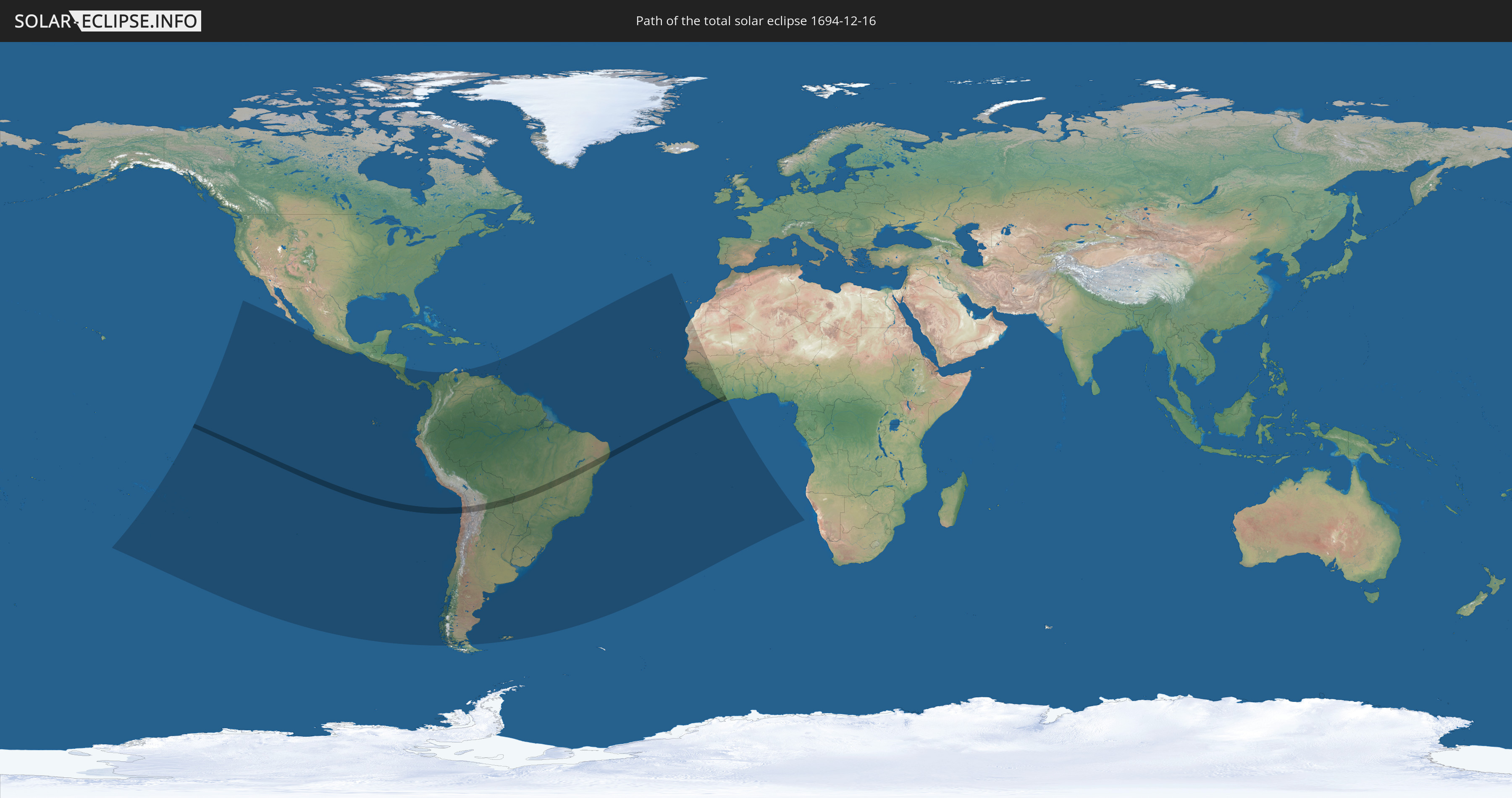
Total solar eclipse of 12/16/1694
| Day of week: | Thursday |
| Maximum duration of eclipse: | 04m22s |
| Maximum width of eclipse path: | 158 km |
| Saros cycle: | 127 |
| Coverage: | 100% |
| Magnitude: | 1.0475 |
| Gamma: | 0.0388 |
Wo kann man die Sonnenfinsternis vom 12/16/1694 sehen?
Die Sonnenfinsternis am 12/16/1694 kann man in 42 Ländern als partielle Sonnenfinsternis beobachten.
Der Finsternispfad verläuft durch 6 Länder. Nur in diesen Ländern ist sie als total Sonnenfinsternis zu sehen.
In den folgenden Ländern ist die Sonnenfinsternis total zu sehen
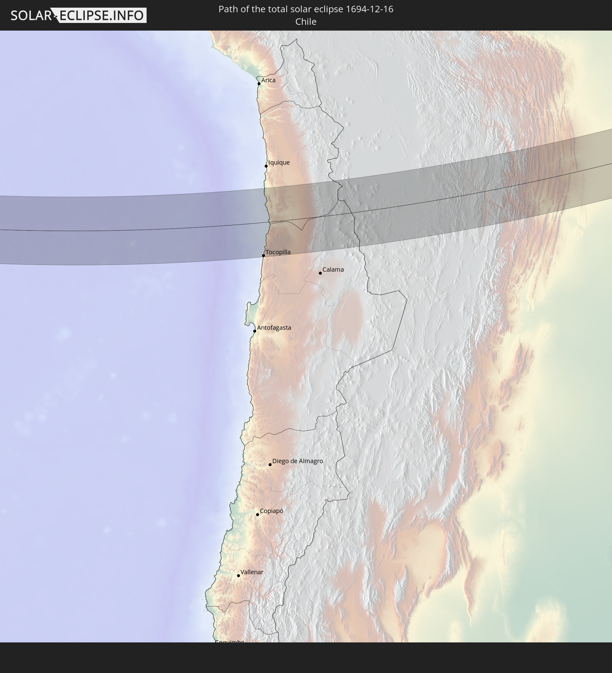 Chile
Chile
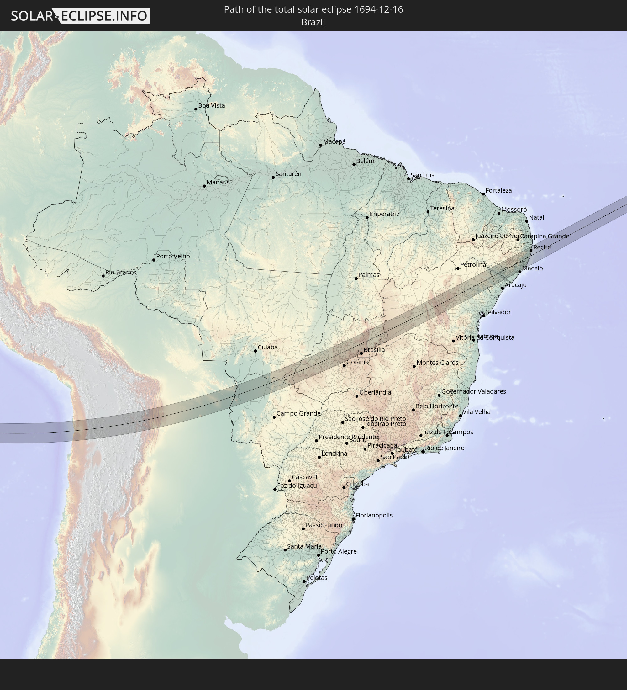 Brazil
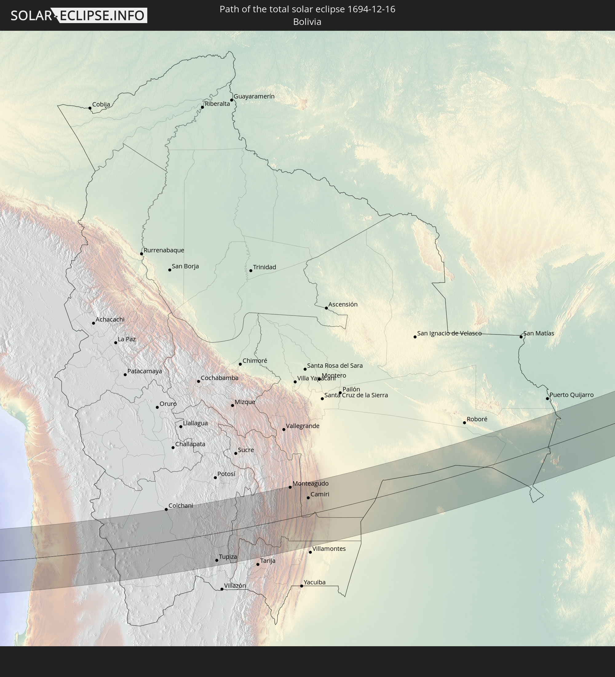 Bolivia
 Paraguay
 Liberia
 Ivory Coast
In den folgenden Ländern ist die Sonnenfinsternis partiell zu sehen
 Kiribati
 French Polynesia
 Pitcairn Islands
 Mexico
 Chile
Chile
 Guatemala
 Ecuador
 El Salvador
 Honduras
 Nicaragua
 Costa Rica
 Panama
 Colombia
 Peru
Peru
 Brazil
 Argentina
 Venezuela
 Bolivia
 Paraguay
 Trinidad and Tobago
 Grenada
 Saint Vincent and the Grenadines
 Falkland Islands
 Guyana
 Martinique
 Saint Lucia
 Barbados
 Uruguay
 Suriname
 French Guiana
 Cabo Verde
 Spain
Spain
 Senegal
 Mauritania
 The Gambia
 Guinea-Bissau
 Guinea
 Saint Helena, Ascension and Tristan da Cunha
 Sierra Leone
 Mali
Mali
 Liberia
 Ivory Coast
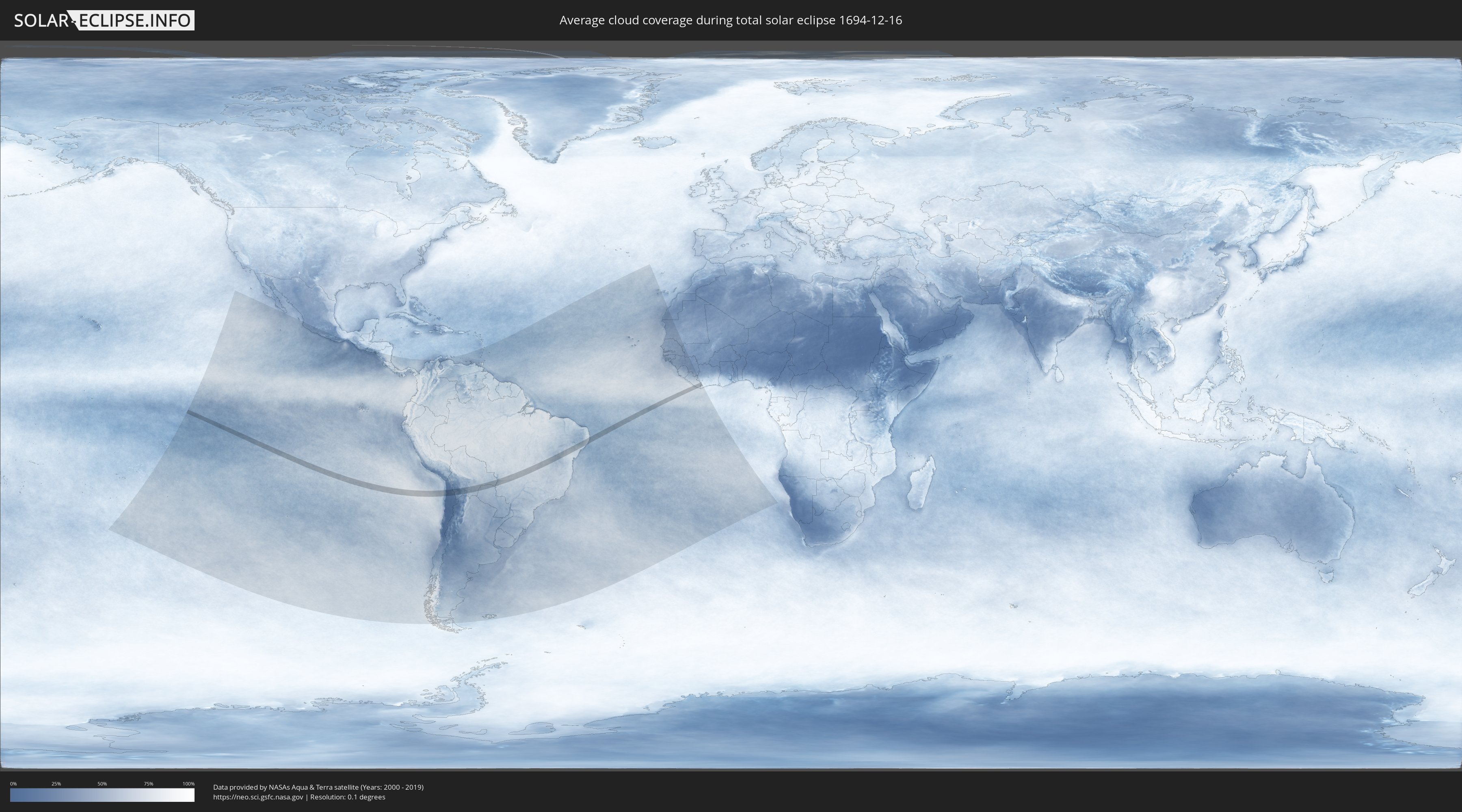
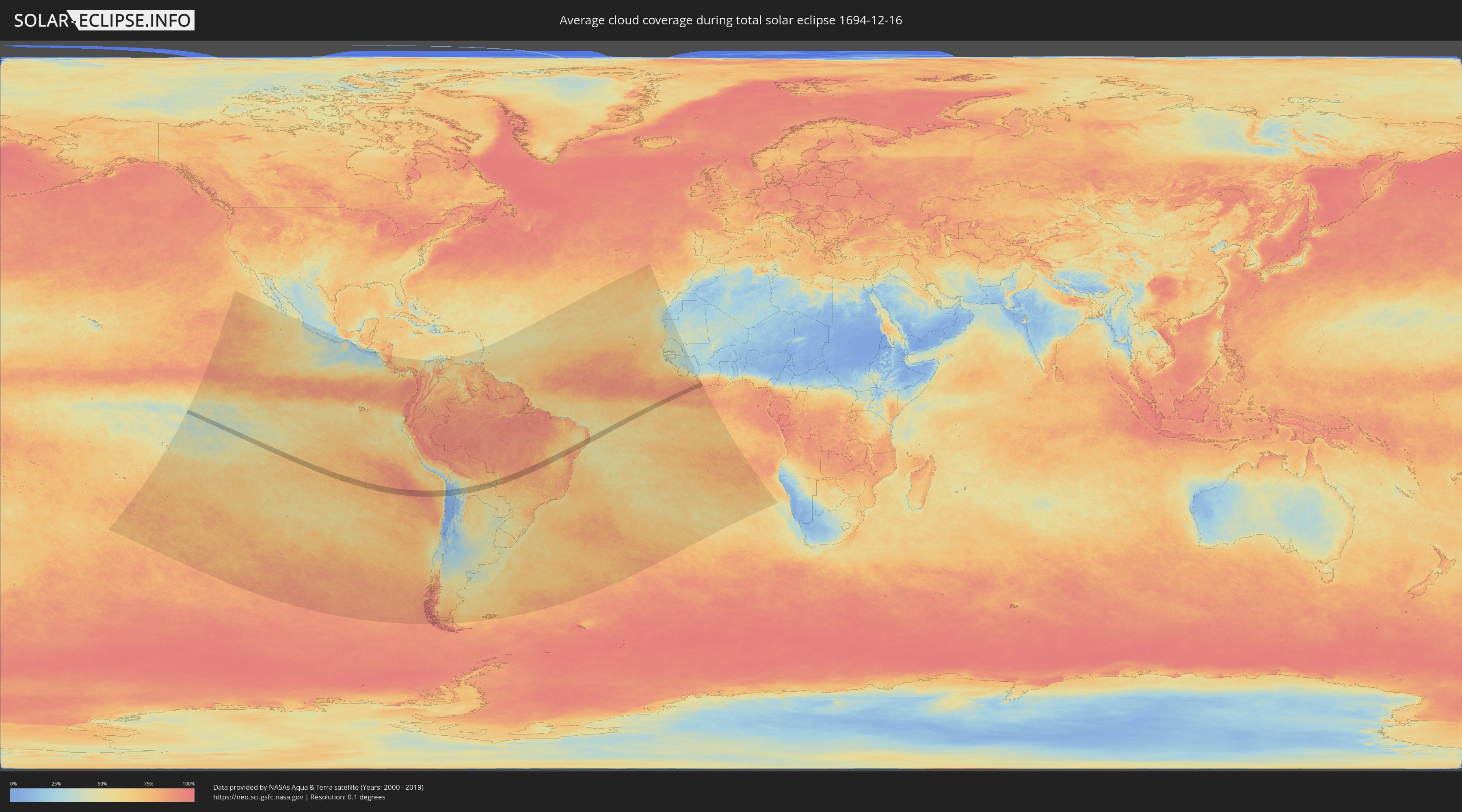
How will be the weather during the total solar eclipse on 12/16/1694?
Where is the best place to see the total solar eclipse of 12/16/1694?
The following maps show the average cloud coverage for the day of the total solar eclipse.
With the help of these maps, it is possible to find the place along the eclipse path, which has the best
chance of a cloudless sky.
Nevertheless, you should consider local circumstances and inform about the weather of your chosen
observation site.
The data is provided by NASAs satellites
AQUA and TERRA.
The cloud maps are averaged over a period of 19 years (2000 - 2019).
Detailed country maps
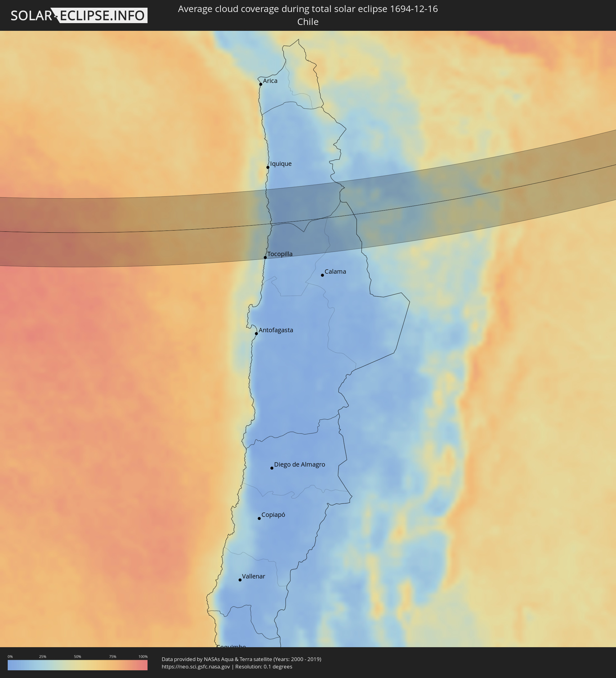 Chile
Chile
 Brazil
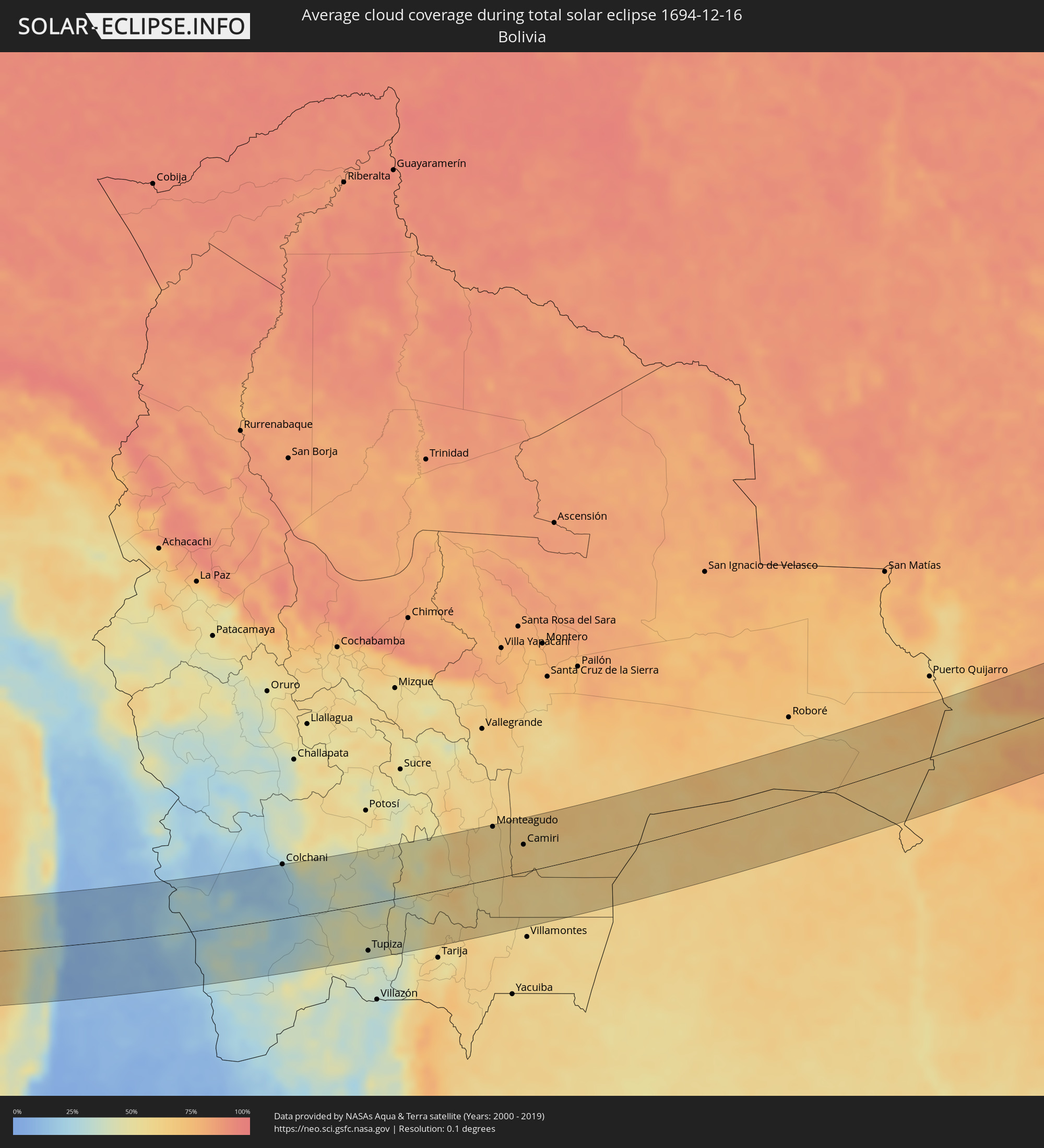 Bolivia
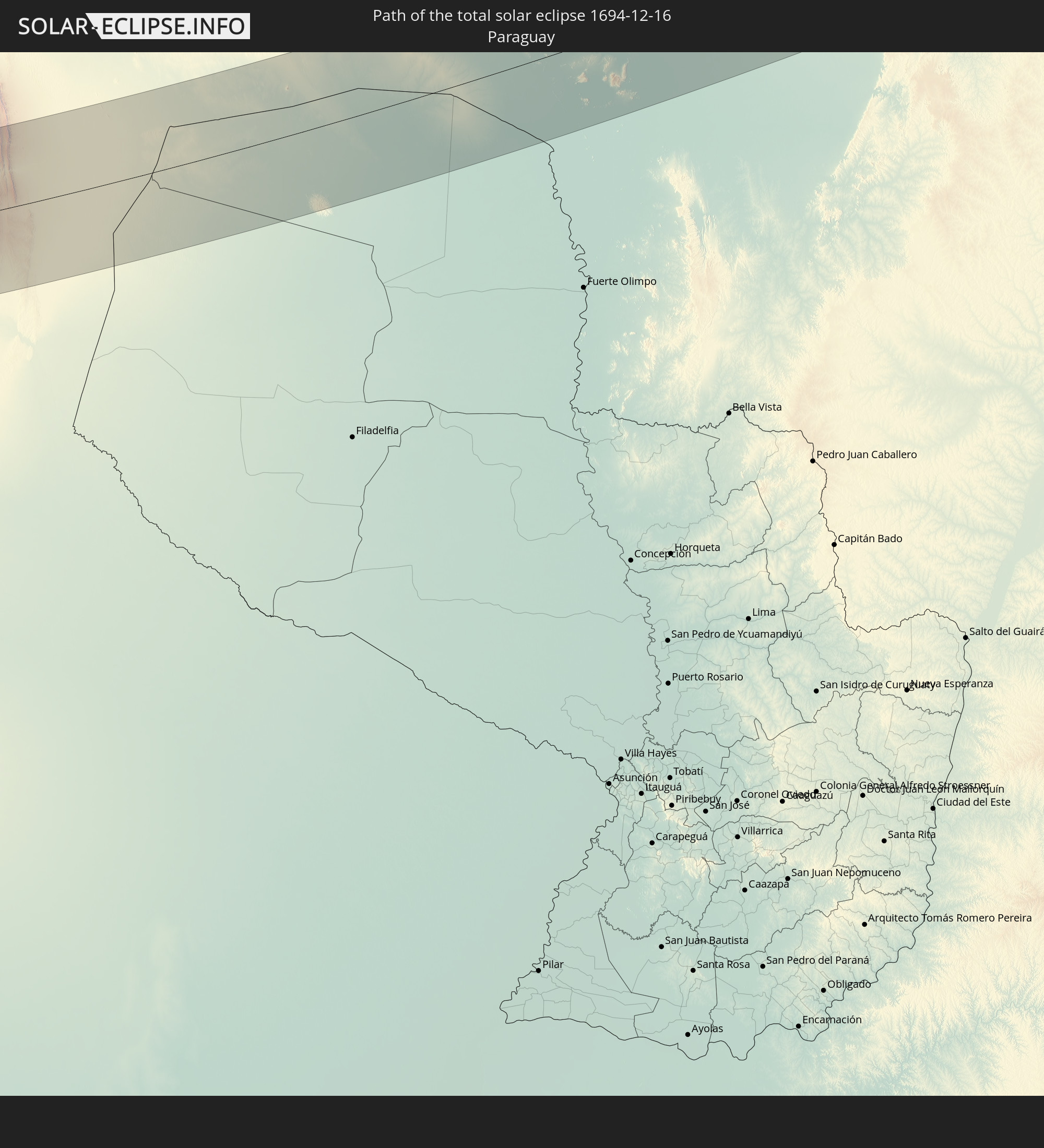
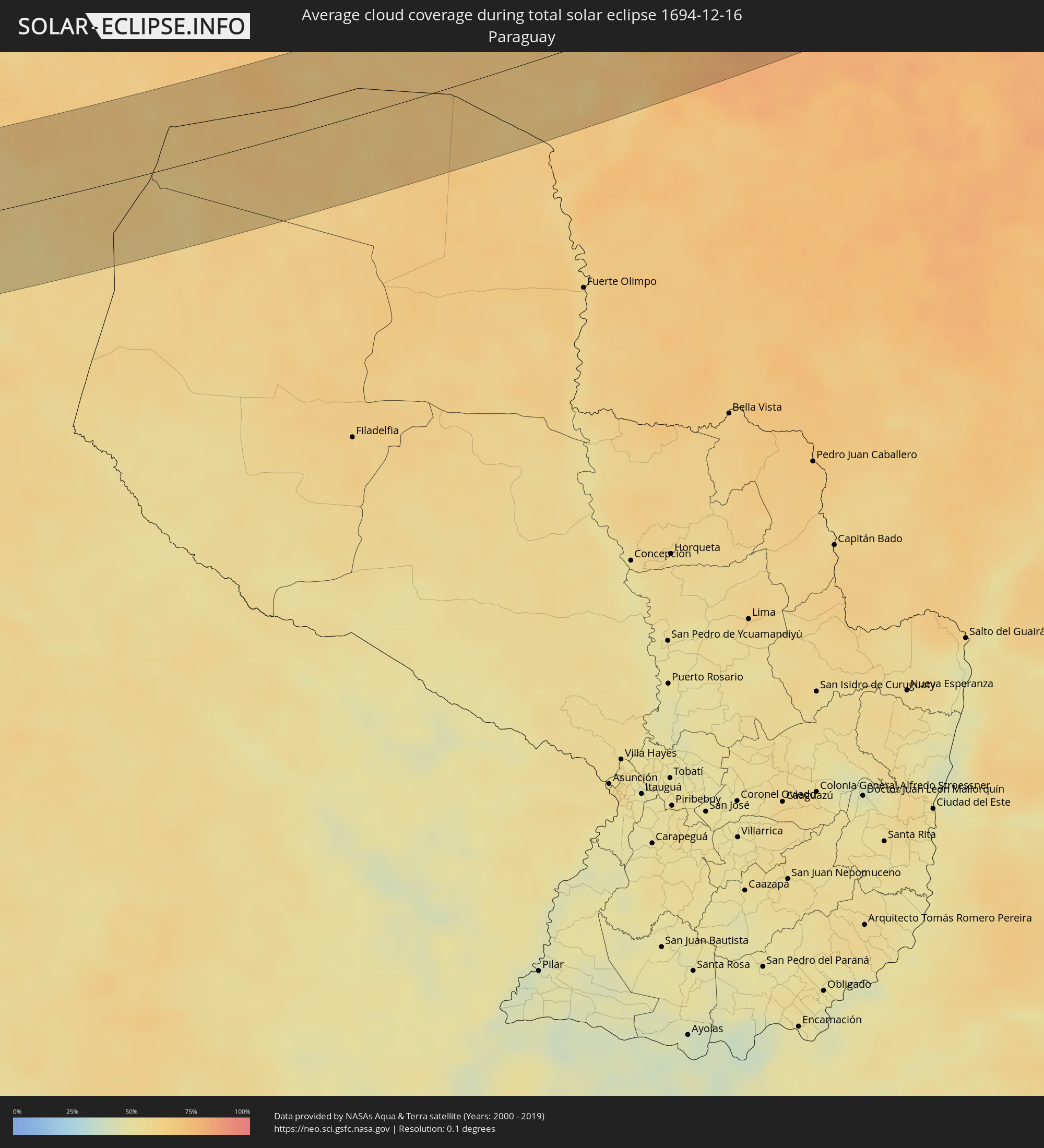 Paraguay
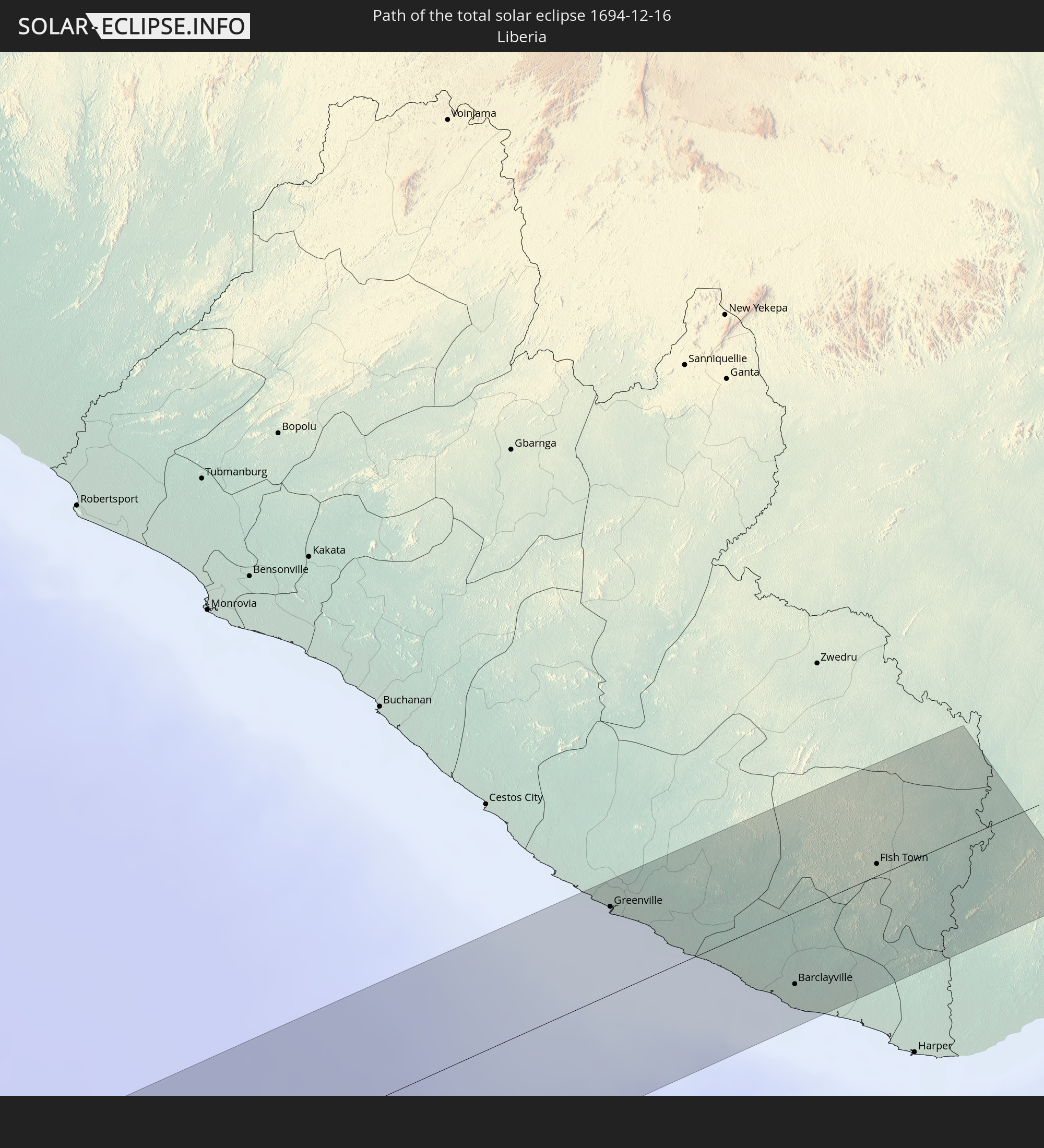
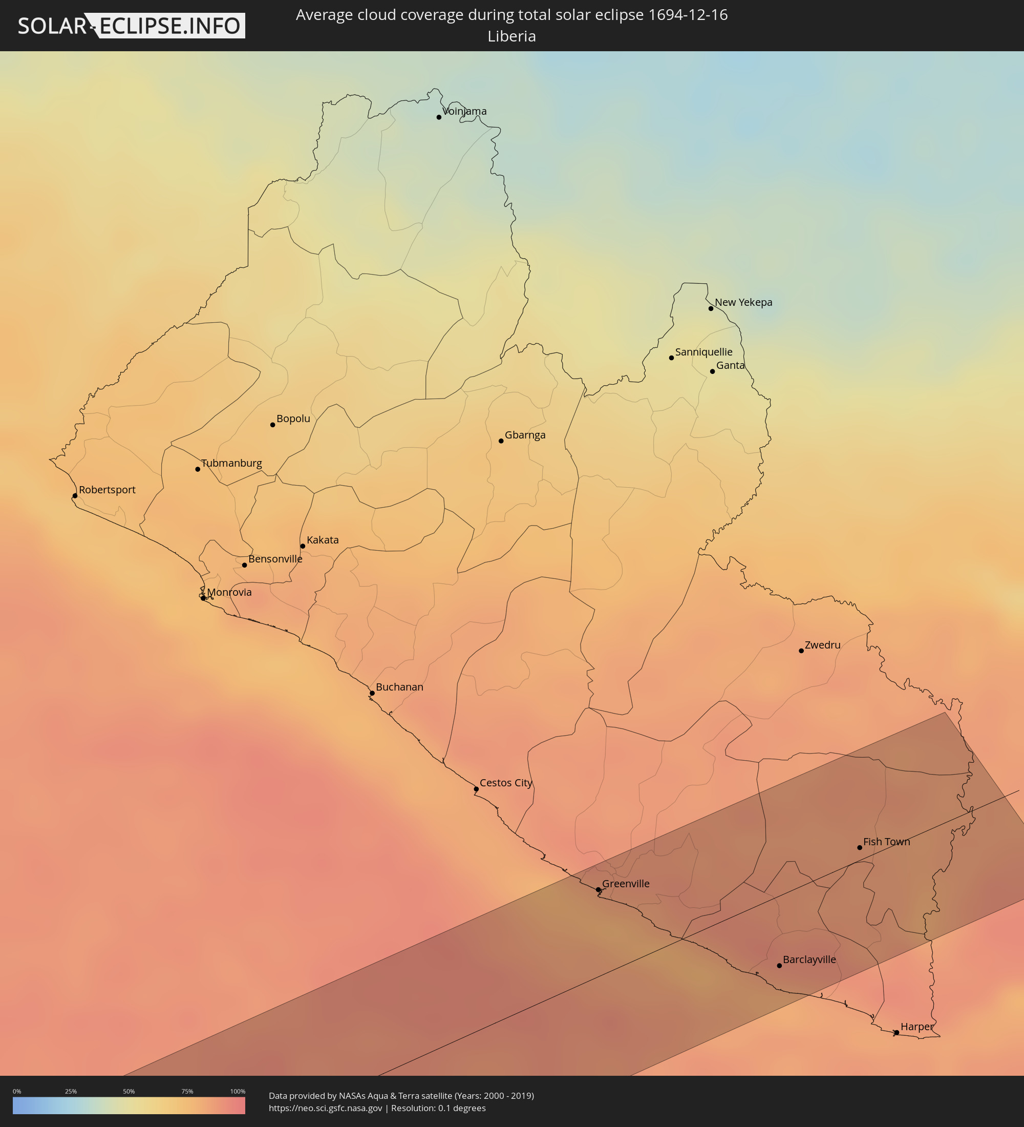 Liberia
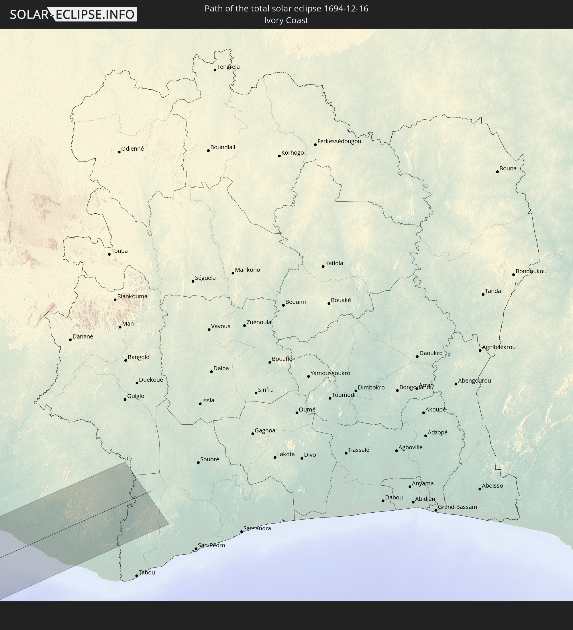
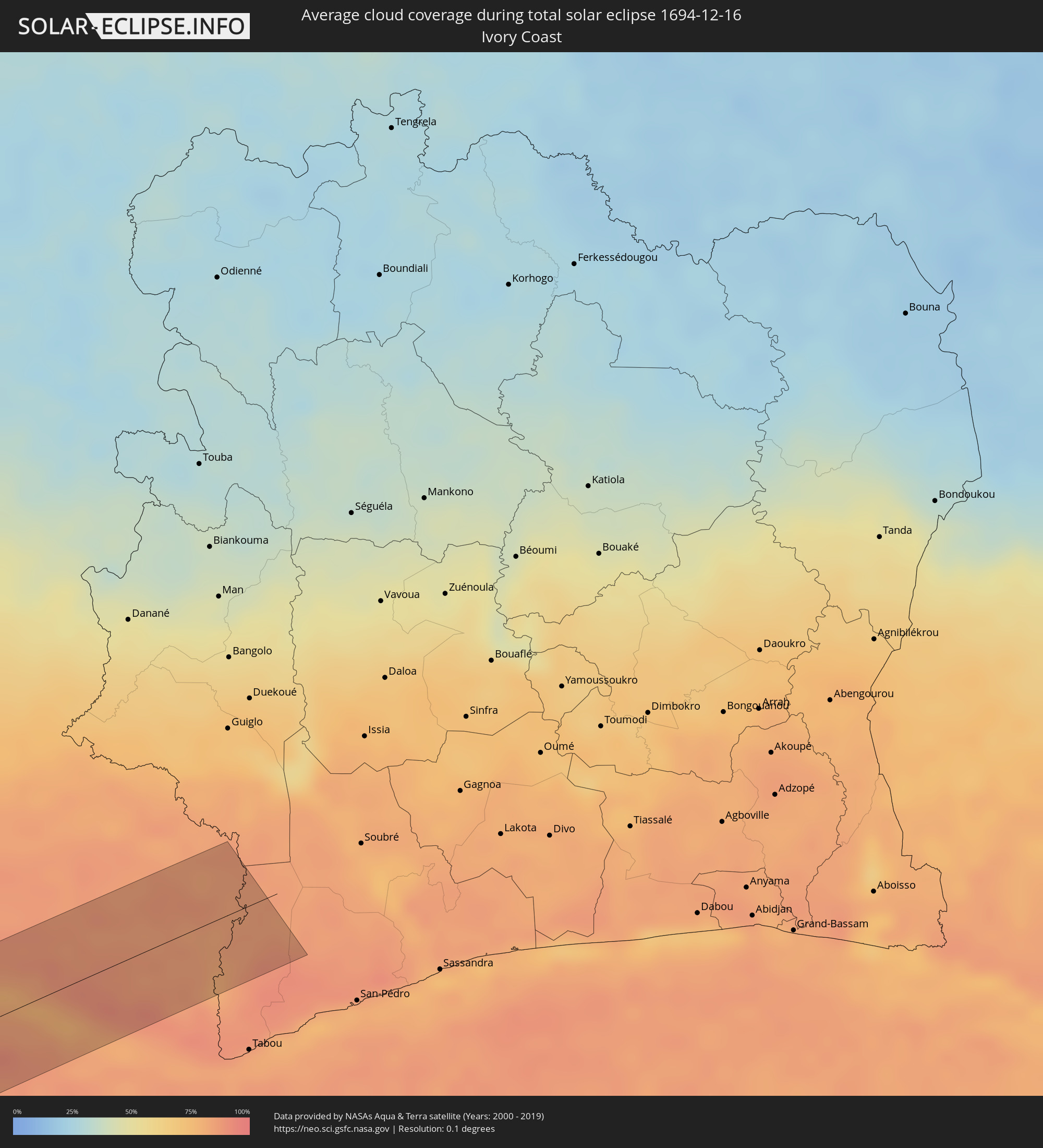 Ivory Coast
Cities inside the path of the eclipse
The following table shows all locations with a population of more than 5,000 inside the eclipse path. Cities which have more than 100,000 inhabitants are marked bold. A click at the locations opens a detailed map.
| City | Type | Eclipse duration | Local time of max. eclipse | Distance to central line | Ø Cloud coverage |
|
Tocopilla, Antofagasta
|
total | - | 11:47:20 UTC-04:42 | 78 km | 22% |
|
Colchani, Potosí
|
total | - | 12:07:28 UTC-04:32 | 79 km | 22% |
|
Uyuni, Potosí
|
total | - | 12:07:42 UTC-04:32 | 60 km | 26% |
|
Tupiza, Potosí
|
total | - | 12:10:20 UTC-04:32 | 68 km | 39% |
|
Monteagudo, Chuquisaca
|
total | - | 12:16:12 UTC-04:32 | 76 km | 59% |
|
Camiri, Santa Cruz
|
total | - | 12:17:16 UTC-04:32 | 40 km | 65% |
|
Corumbá, Mato Grosso do Sul
|
total | - | 13:27:41 UTC-03:38 | 18 km | 68% |
|
Coxim, Mato Grosso do Sul
|
total | - | 13:35:07 UTC-03:38 | 69 km | 79% |
|
Mineiros, Goiás
|
total | - | 14:13:02 UTC-03:06 | 59 km | 83% |
|
Iporá, Goiás
|
total | - | 14:17:16 UTC-03:06 | 4 km | 85% |
|
São Luís de Montes Belos, Goiás
|
total | - | 14:18:44 UTC-03:06 | 44 km | 85% |
|
Goiás, Goiás
|
total | - | 14:19:49 UTC-03:06 | 5 km | 86% |
|
Itapuranga, Goiás
|
total | - | 14:20:35 UTC-03:06 | 35 km | 84% |
|
Itaberaí, Goiás
|
total | - | 14:20:24 UTC-03:06 | 18 km | 84% |
|
Ceres, Goiás
|
total | - | 14:21:33 UTC-03:06 | 45 km | 87% |
|
Inhumas, Goiás
|
total | - | 14:20:41 UTC-03:06 | 66 km | 82% |
|
Jaraguá, Goiás
|
total | - | 14:21:37 UTC-03:06 | 12 km | 83% |
|
Goianésia, Goiás
|
total | - | 14:22:30 UTC-03:06 | 22 km | 86% |
|
Planaltina, Goiás
|
total | - | 14:25:16 UTC-03:06 | 60 km | 82% |
|
Posse, Goiás
|
total | - | 14:28:57 UTC-03:06 | 18 km | 82% |
|
Santa Maria da Vitória, Bahia
|
total | - | 15:05:53 UTC-02:34 | 18 km | 67% |
|
Bom Jesus da Lapa, Bahia
|
total | - | 15:07:16 UTC-02:34 | 42 km | 61% |
|
Morro do Chapéu, Bahia
|
total | - | 15:12:25 UTC-02:34 | 14 km | 72% |
|
Jacobina, Bahia
|
total | - | 15:13:41 UTC-02:34 | 17 km | 77% |
|
Santaluz, Bahia
|
total | - | 15:15:10 UTC-02:34 | 49 km | 84% |
|
Euclides da Cunha, Bahia
|
total | - | 15:16:21 UTC-02:34 | 6 km | 75% |
|
Tucano, Bahia
|
total | - | 15:16:13 UTC-02:34 | 49 km | 82% |
|
Ribeira do Pombal, Bahia
|
total | - | 15:16:40 UTC-02:34 | 50 km | 79% |
|
Delmiro Gouveia, Alagoas
|
total | - | 15:18:41 UTC-02:34 | 64 km | 63% |
|
Santana do Ipanema, Alagoas
|
total | - | 15:19:37 UTC-02:34 | 26 km | 64% |
|
Águas Belas, Pernambuco
|
total | - | 15:34:24 UTC-02:19 | 45 km | 63% |
|
Bom Conselho, Pernambuco
|
total | - | 15:34:52 UTC-02:19 | 17 km | 63% |
|
Arapiraca, Alagoas
|
total | - | 15:19:58 UTC-02:34 | 41 km | 76% |
|
Garanhuns, Pernambuco
|
total | - | 15:35:20 UTC-02:19 | 36 km | 64% |
|
Lajedo, Pernambuco
|
total | - | 15:35:44 UTC-02:19 | 47 km | 71% |
|
Viçosa, Alagoas
|
total | - | 15:20:48 UTC-02:34 | 26 km | 79% |
|
União dos Palmares, Alagoas
|
total | - | 15:21:13 UTC-02:34 | 16 km | 76% |
|
Caruaru, Pernambuco
|
total | - | 15:36:27 UTC-02:19 | 67 km | 77% |
|
Pilar, Alagoas
|
total | - | 15:20:55 UTC-02:34 | 63 km | 70% |
|
Cupira, Pernambuco
|
total | - | 15:36:11 UTC-02:19 | 33 km | 71% |
|
Murici, Alagoas
|
total | - | 15:21:11 UTC-02:34 | 35 km | 78% |
|
Rio Largo, Alagoas
|
total | - | 15:21:08 UTC-02:34 | 57 km | 74% |
|
Bezerros, Pernambuco
|
total | - | 15:36:41 UTC-02:19 | 62 km | 78% |
|
Palmares, Pernambuco
|
total | - | 15:36:32 UTC-02:19 | 8 km | 80% |
|
Gravatá, Pernambuco
|
total | - | 15:36:58 UTC-02:19 | 53 km | 80% |
|
São Luís do Quitunde, Alagoas
|
total | - | 15:21:36 UTC-02:34 | 56 km | 69% |
|
Ribeirão, Pernambuco
|
total | - | 15:36:54 UTC-02:19 | 13 km | 85% |
|
Vitória de Santo Antão, Pernambuco
|
total | - | 15:37:20 UTC-02:19 | 47 km | 83% |
|
Escada, Pernambuco
|
total | - | 15:37:12 UTC-02:19 | 20 km | 82% |
|
Barreiros, Pernambuco
|
total | - | 15:36:51 UTC-02:19 | 27 km | 68% |
|
Sirinhaém, Pernambuco
|
total | - | 15:37:07 UTC-02:19 | 8 km | 65% |
|
Ipojuca, Pernambuco
|
total | - | 15:37:21 UTC-02:19 | 8 km | 80% |
|
São Lourenço da Mata, Pernambuco
|
total | - | 15:37:44 UTC-02:19 | 44 km | 82% |
|
Jaboatão, Pernambuco
|
total | - | 15:37:36 UTC-02:19 | 26 km | 74% |
|
Igarassu, Pernambuco
|
total | - | 15:37:59 UTC-02:19 | 55 km | 69% |
|
Recife, Pernambuco
|
total | - | 15:37:50 UTC-02:19 | 32 km | 63% |
|
Greenville, Sinoe
|
total | - | 17:32:49 UTC-00:43 | 39 km | 83% |
|
Barclayville, Grand Kru
|
total | - | 17:32:42 UTC-00:43 | 32 km | 89% |
|
Fish Town, River Gee
|
total | - | 17:32:48 UTC-00:43 | 5 km | 85% |