Hybrid solar eclipse of 05/14/1771
| Day of week: | Tuesday |
| Maximum duration of eclipse: | 00m49s |
| Maximum width of eclipse path: | 33 km |
| Saros cycle: | 134 |
| Coverage: | 100% |
| Magnitude: | 1.0076 |
| Gamma: | -0.598 |
Wo kann man die Sonnenfinsternis vom 05/14/1771 sehen?
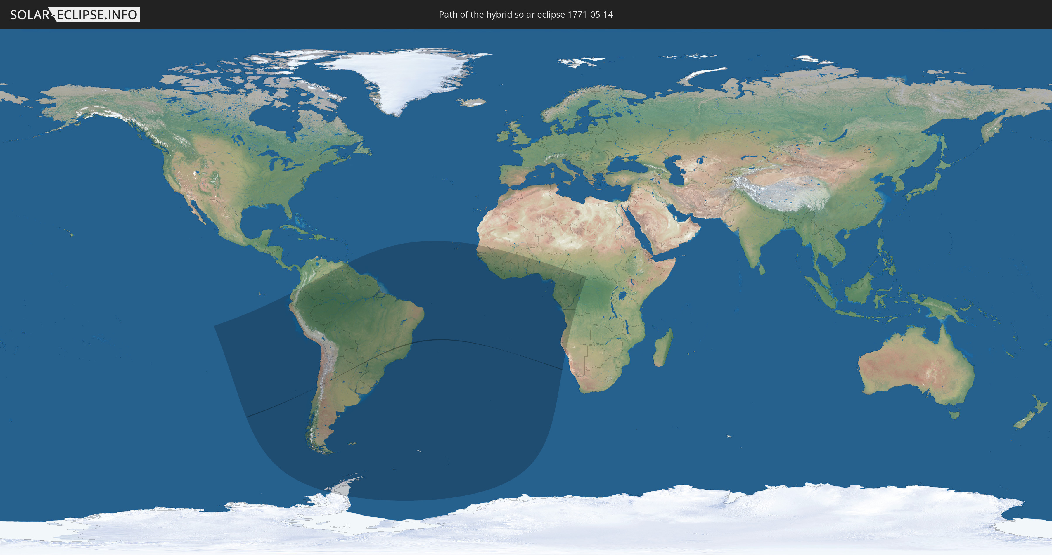
Die Sonnenfinsternis am 05/14/1771 kann man in 42 Ländern als partielle Sonnenfinsternis beobachten.
Der Finsternispfad verläuft durch 4 Länder. Nur in diesen Ländern ist sie als hybrid Sonnenfinsternis zu sehen.
In den folgenden Ländern ist die Sonnenfinsternis hybrid zu sehen
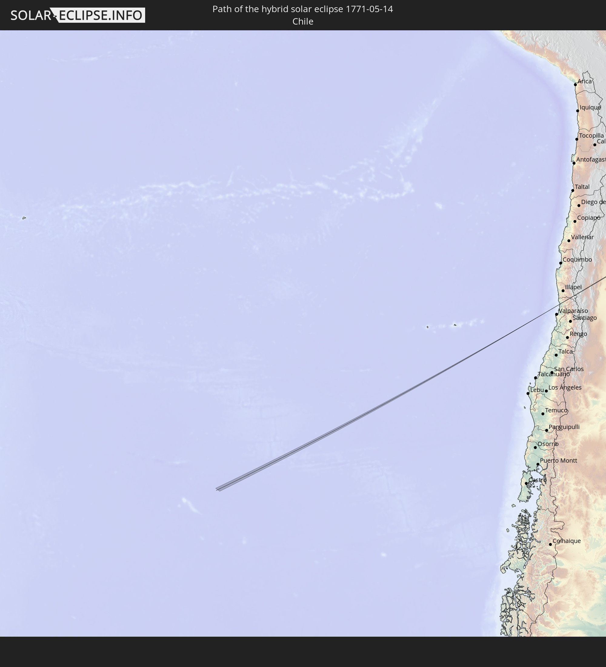 Chile
Chile
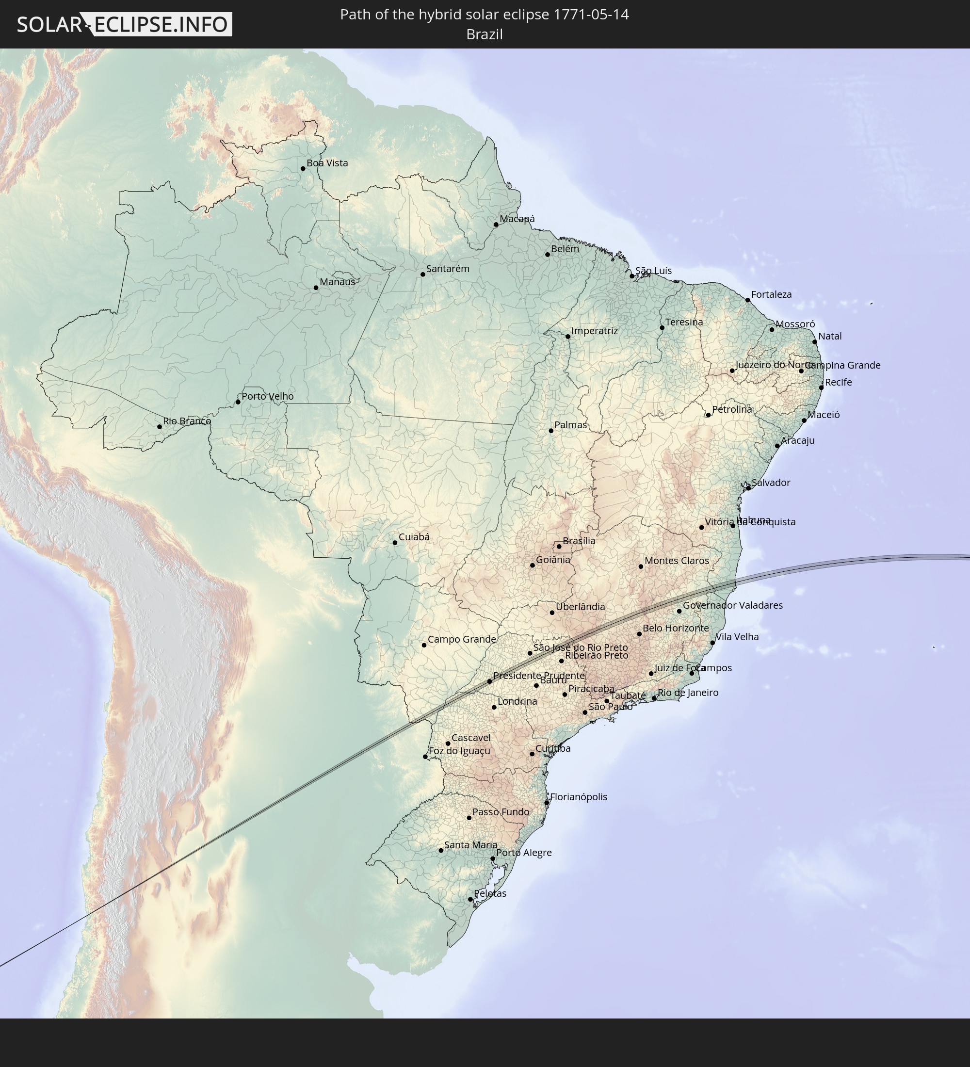 Brazil
 Argentina
 Paraguay
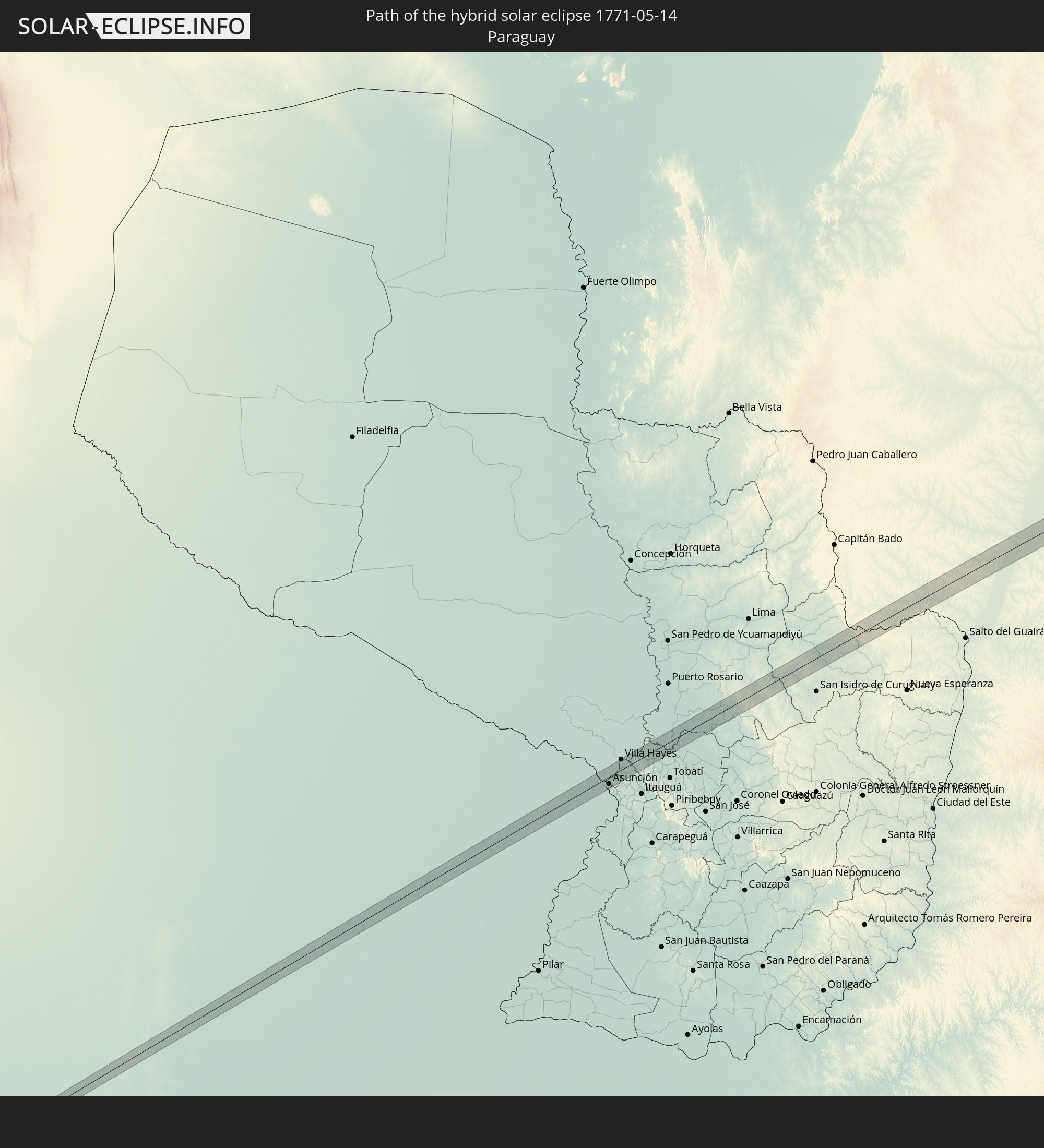
In den folgenden Ländern ist die Sonnenfinsternis partiell zu sehen
 Antarctica
 Chile
Chile
 Ecuador
 Colombia
 Peru
Peru
 Brazil
 Argentina
 Venezuela
 Bolivia
 Paraguay
 Falkland Islands
 Guyana
 Uruguay
 Suriname
 French Guiana
 South Georgia and the South Sandwich Islands
 Cabo Verde
 Senegal
 Mauritania
 The Gambia
 Guinea-Bissau
 Guinea
 Saint Helena, Ascension and Tristan da Cunha
 Sierra Leone
 Mali
Mali
 Liberia
 Ivory Coast
 Burkina Faso
 Ghana
Ghana
 Togo
Togo
 Benin
Benin
 Nigeria
 Bouvet Island
 Equatorial Guinea
 São Tomé and Príncipe
 Cameroon
 Gabon
Gabon
 Republic of the Congo
 Angola
 Namibia
 Democratic Republic of the Congo
 Central African Republic
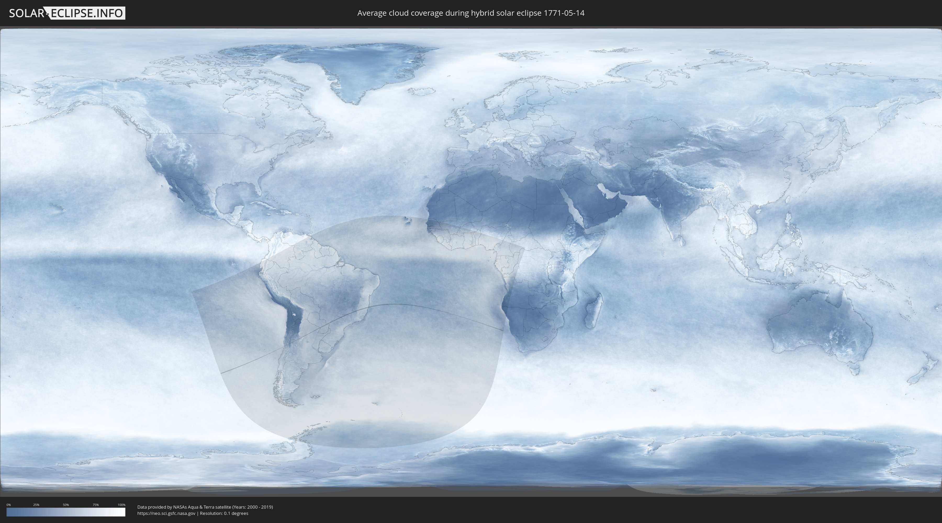
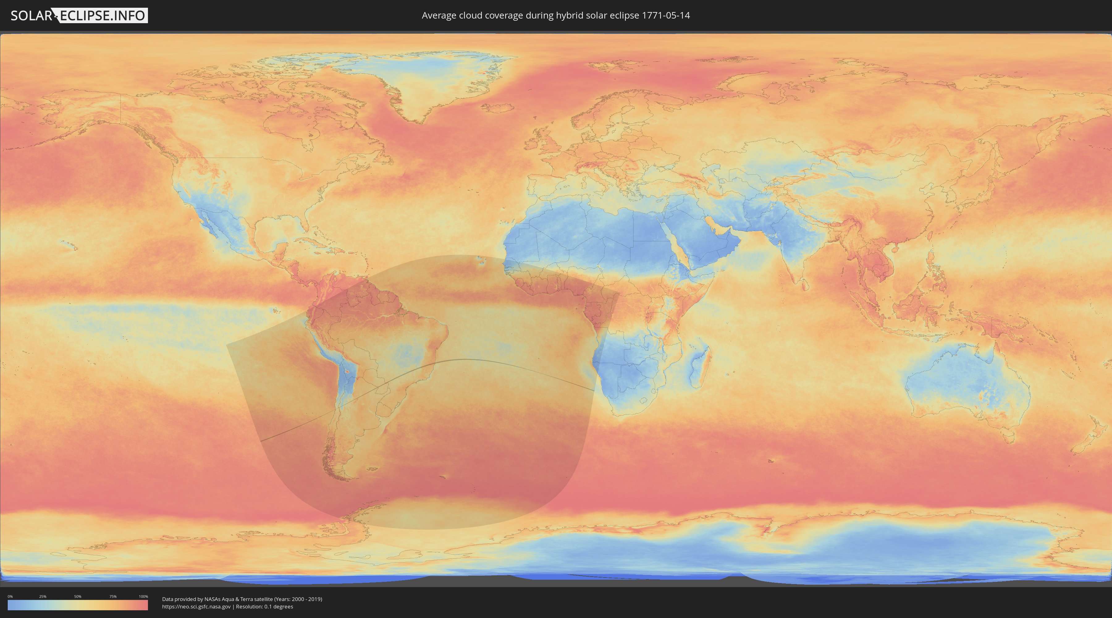
How will be the weather during the hybrid solar eclipse on 05/14/1771?
Where is the best place to see the hybrid solar eclipse of 05/14/1771?
The following maps show the average cloud coverage for the day of the hybrid solar eclipse.
With the help of these maps, it is possible to find the place along the eclipse path, which has the best
chance of a cloudless sky.
Nevertheless, you should consider local circumstances and inform about the weather of your chosen
observation site.
The data is provided by NASAs satellites
AQUA and TERRA.
The cloud maps are averaged over a period of 19 years (2000 - 2019).
Detailed country maps
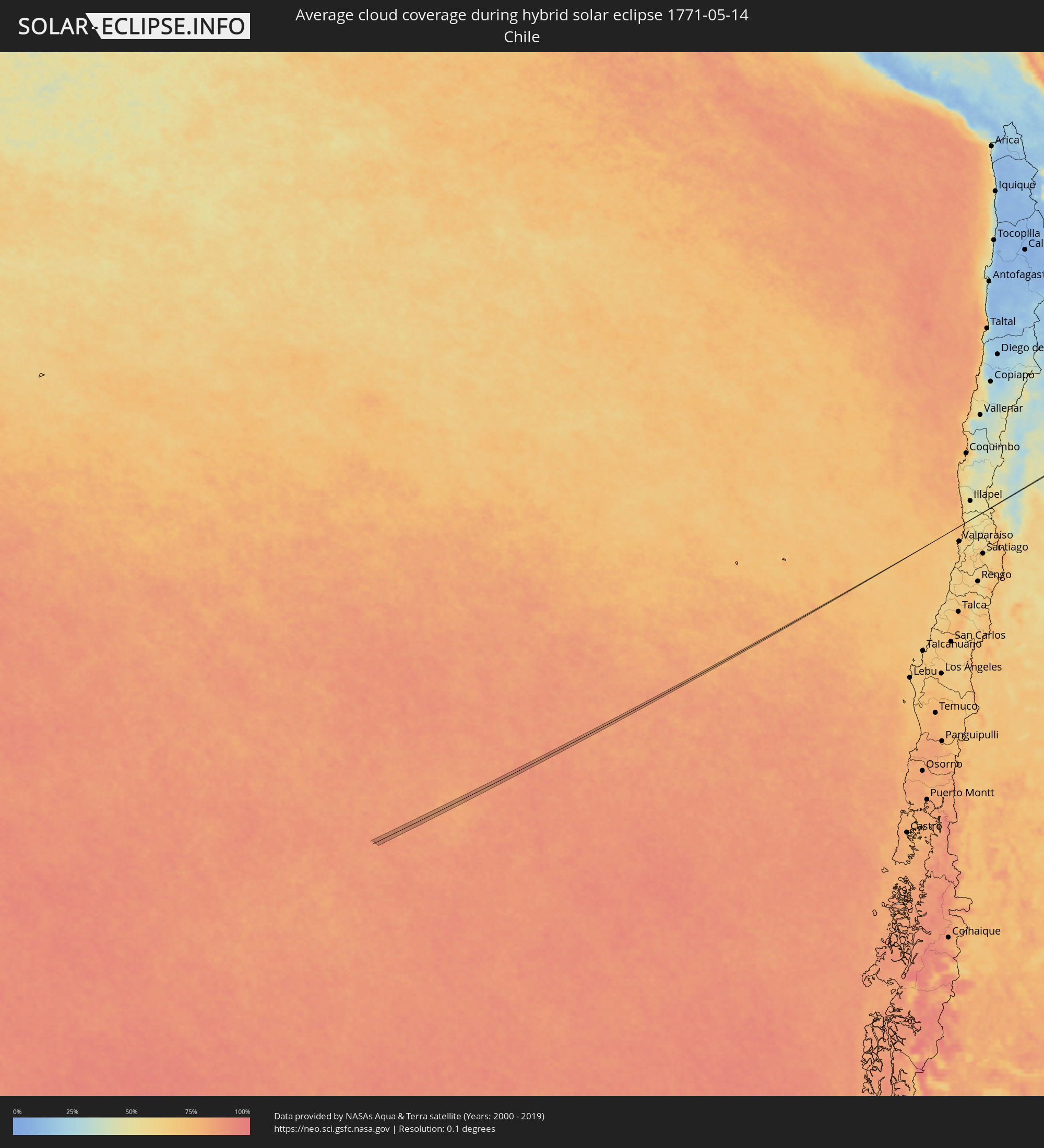 Chile
Chile
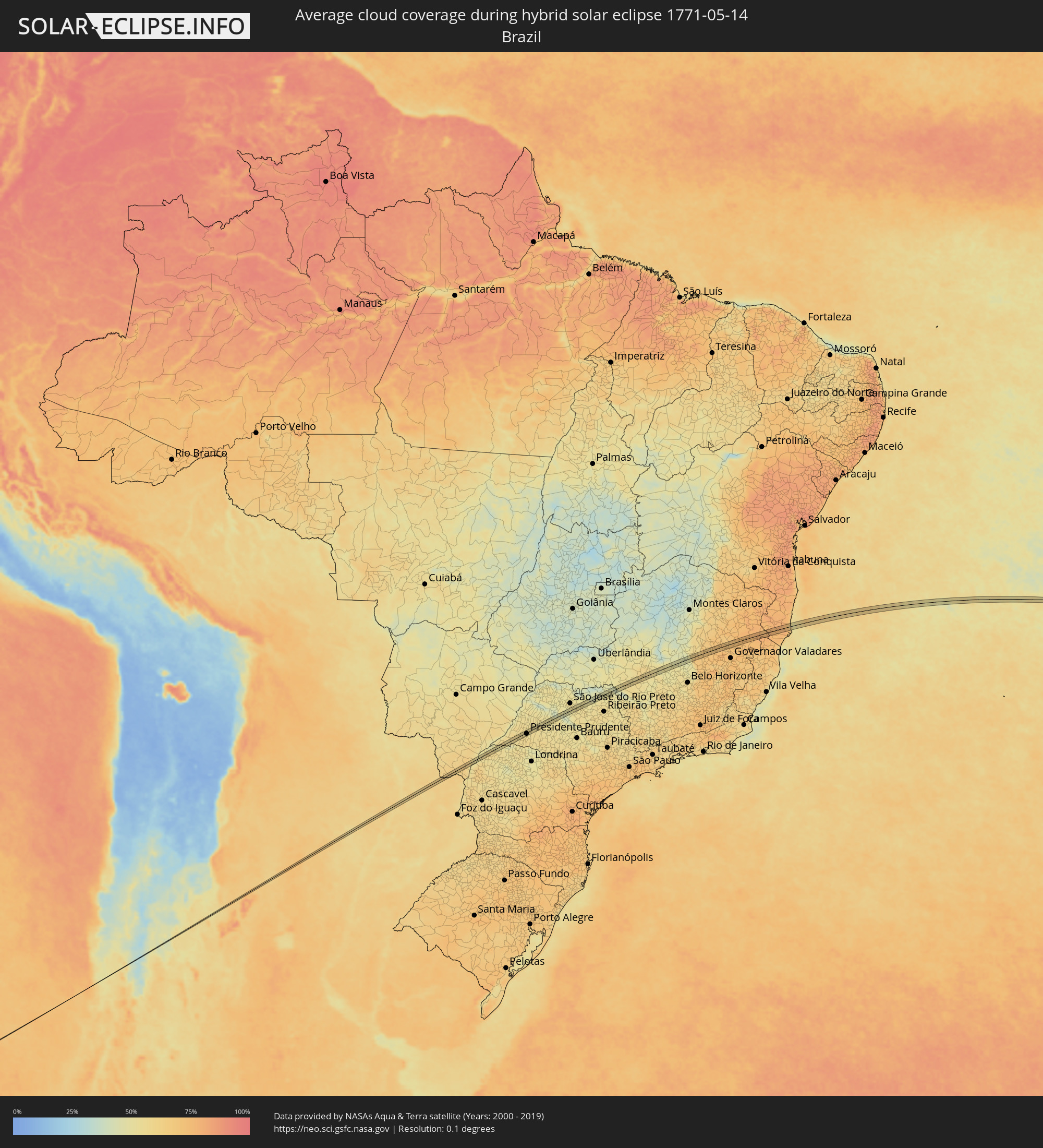 Brazil
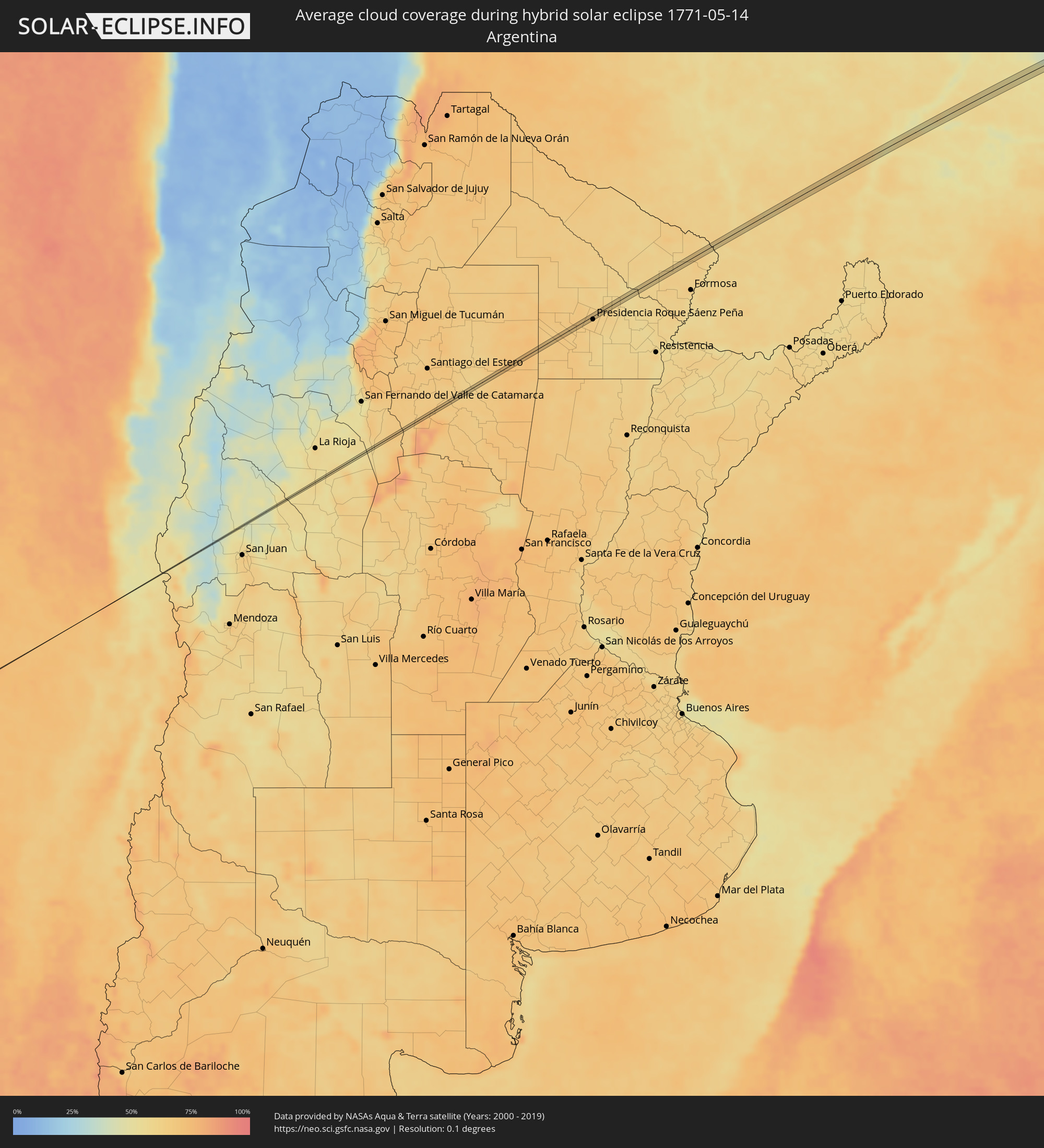 Argentina
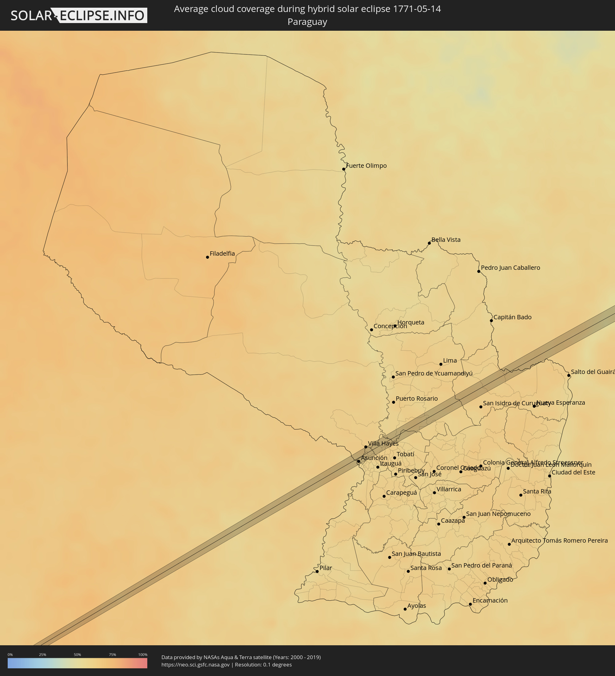 Paraguay
Cities inside the path of the eclipse
The following table shows all locations with a population of more than 5,000 inside the eclipse path. Cities which have more than 100,000 inhabitants are marked bold. A click at the locations opens a detailed map.
| City | Type | Eclipse duration | Local time of max. eclipse | Distance to central line | Ø Cloud coverage |
|
Las Breñas, Chaco Province
|
total | - | 09:42:57 UTC-04:16 | 3 km | 67% |
|
Corzuela, Chaco Province
|
total | - | 09:43:11 UTC-04:16 | 4 km | 66% |
|
Presidencia Roque Sáenz Peña, Chaco Province
|
total | - | 09:44:15 UTC-04:16 | 7 km | 64% |
|
Clorinda, Formosa Province
|
total | - | 09:50:17 UTC-04:16 | 0 km | 57% |
|
Nanawa, Presidente Hayes
|
total | - | 10:16:32 UTC-03:50 | 1 km | 57% |
|
Asunción, Asunción
|
total | - | 10:16:35 UTC-03:50 | 6 km | 56% |
|
Colonia Mariano Roque Alonso, Central
|
total | - | 10:16:49 UTC-03:50 | 3 km | 57% |
|
Villa Hayes, Presidente Hayes
|
total | - | 10:16:53 UTC-03:50 | 8 km | 59% |
|
Limpio, Central
|
total | - | 10:16:57 UTC-03:50 | 1 km | 59% |
|
Emboscada, Cordillera
|
total | - | 10:17:16 UTC-03:50 | 6 km | 56% |
|
Iguatemi, Mato Grosso do Sul
|
total | - | 10:36:29 UTC-03:38 | 3 km | 62% |
|
Loanda, Paraná
|
total | - | 11:12:22 UTC-03:06 | 1 km | 59% |
|
Nova Londrina, Paraná
|
total | - | 11:12:50 UTC-03:06 | 9 km | 57% |
|
Terra Rica, Paraná
|
total | - | 11:13:48 UTC-03:06 | 4 km | 53% |
|
Teodoro Sampaio, São Paulo
|
total | - | 11:15:04 UTC-03:06 | 8 km | 47% |
|
Mirante do Paranapanema, São Paulo
|
total | - | 11:15:52 UTC-03:06 | 3 km | 57% |
|
Álvares Machado, São Paulo
|
total | - | 11:17:08 UTC-03:06 | 3 km | 53% |
|
Presidente Prudente, São Paulo
|
total | - | 11:17:20 UTC-03:06 | 5 km | 53% |
|
Osvaldo Cruz, São Paulo
|
total | - | 11:18:53 UTC-03:06 | 3 km | 55% |
|
Penápolis, São Paulo
|
total | - | 11:21:18 UTC-03:06 | 3 km | 52% |
|
Urupês, São Paulo
|
total | - | 11:23:38 UTC-03:06 | 11 km | 52% |
|
Severínia, São Paulo
|
total | - | 11:25:16 UTC-03:06 | 6 km | 52% |
|
Monte Azul Paulista, São Paulo
|
total | - | 11:25:40 UTC-03:06 | 11 km | 51% |
|
Ipuã, São Paulo
|
total | - | 11:27:47 UTC-03:06 | 8 km | 46% |
|
São Joaquim da Barra, São Paulo
|
total | - | 11:28:09 UTC-03:06 | 13 km | 52% |
|
Guará, São Paulo
|
total | - | 11:28:20 UTC-03:06 | 1 km | 49% |
|
Ituverava, São Paulo
|
total | - | 11:28:31 UTC-03:06 | 8 km | 49% |
|
Pedregulho, São Paulo
|
total | - | 11:29:28 UTC-03:06 | 4 km | 49% |
|
Campos Altos, Minas Gerais
|
total | - | 11:33:44 UTC-03:06 | 6 km | 56% |
|
Dores do Indaiá, Minas Gerais
|
total | - | 11:35:38 UTC-03:06 | 6 km | 55% |
|
Martinho Campos, Minas Gerais
|
total | - | 11:36:51 UTC-03:06 | 5 km | 50% |
|
Pompéu, Minas Gerais
|
total | - | 11:37:51 UTC-03:06 | 4 km | 51% |
|
Serro, Minas Gerais
|
total | - | 11:43:09 UTC-03:06 | 10 km | 66% |
|
Sabinópolis, Minas Gerais
|
total | - | 11:44:02 UTC-03:06 | 7 km | 69% |
|
São João Evangelista, Minas Gerais
|
total | - | 11:45:08 UTC-03:06 | 6 km | 69% |
|
Peçanha, Minas Gerais
|
total | - | 11:45:48 UTC-03:06 | 13 km | 72% |
|
Itambacuri, Minas Gerais
|
total | - | 11:48:58 UTC-03:06 | 12 km | 70% |
|
Nanuque, Minas Gerais
|
total | - | 11:53:23 UTC-03:06 | 9 km | 74% |
|
Prado, Bahia
|
total | - | 12:29:55 UTC-02:34 | 13 km | 57% |