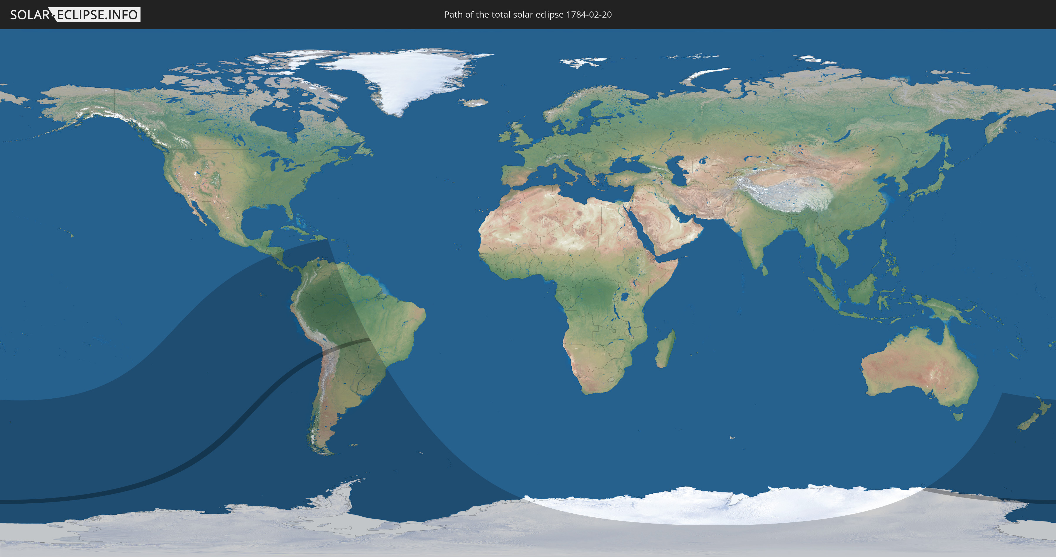
Total solar eclipse of 02/20/1784
| Day of week: | Friday |
| Maximum duration of eclipse: | 02m44s |
| Maximum width of eclipse path: | 174 km |
| Saros cycle: | 117 |
| Coverage: | 100% |
| Magnitude: | 1.0389 |
| Gamma: | -0.6739 |
Wo kann man die Sonnenfinsternis vom 02/20/1784 sehen?
Die Sonnenfinsternis am 02/20/1784 kann man in 22 Ländern als partielle Sonnenfinsternis beobachten.
Der Finsternispfad verläuft durch 4 Länder. Nur in diesen Ländern ist sie als total Sonnenfinsternis zu sehen.
In den folgenden Ländern ist die Sonnenfinsternis total zu sehen
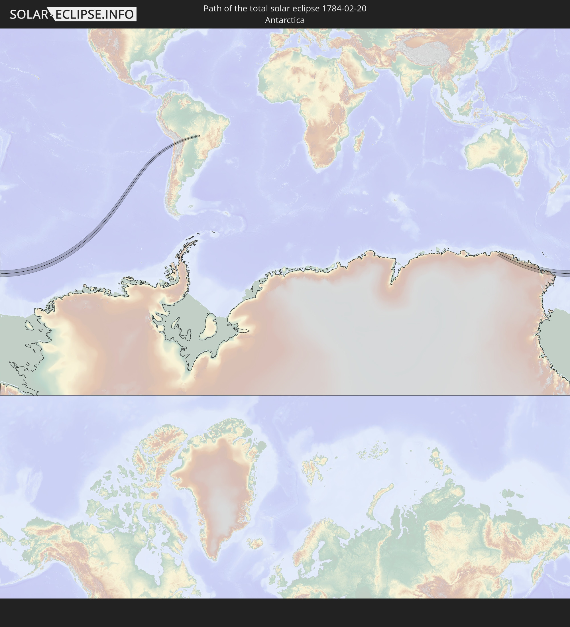 Antarctica
 Chile
Chile
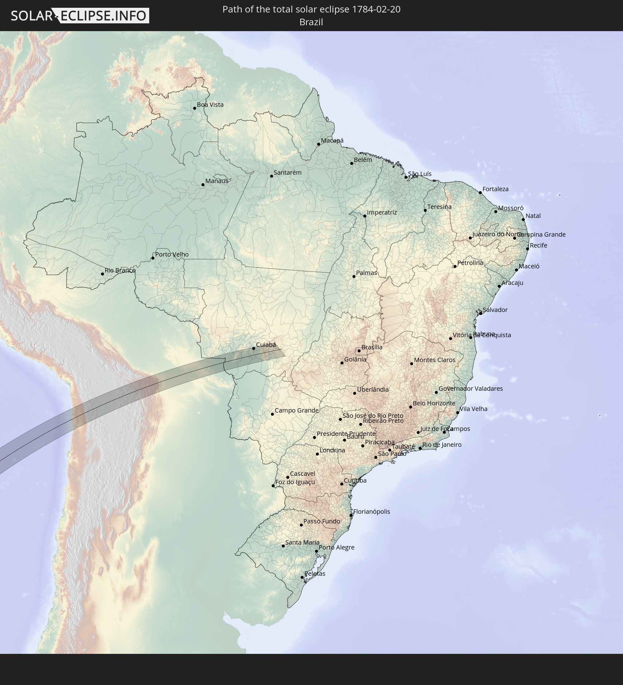 Brazil
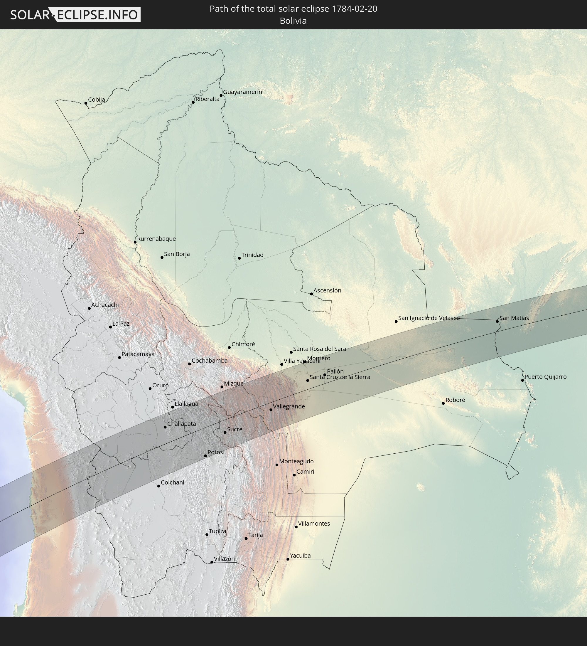 Bolivia
In den folgenden Ländern ist die Sonnenfinsternis partiell zu sehen


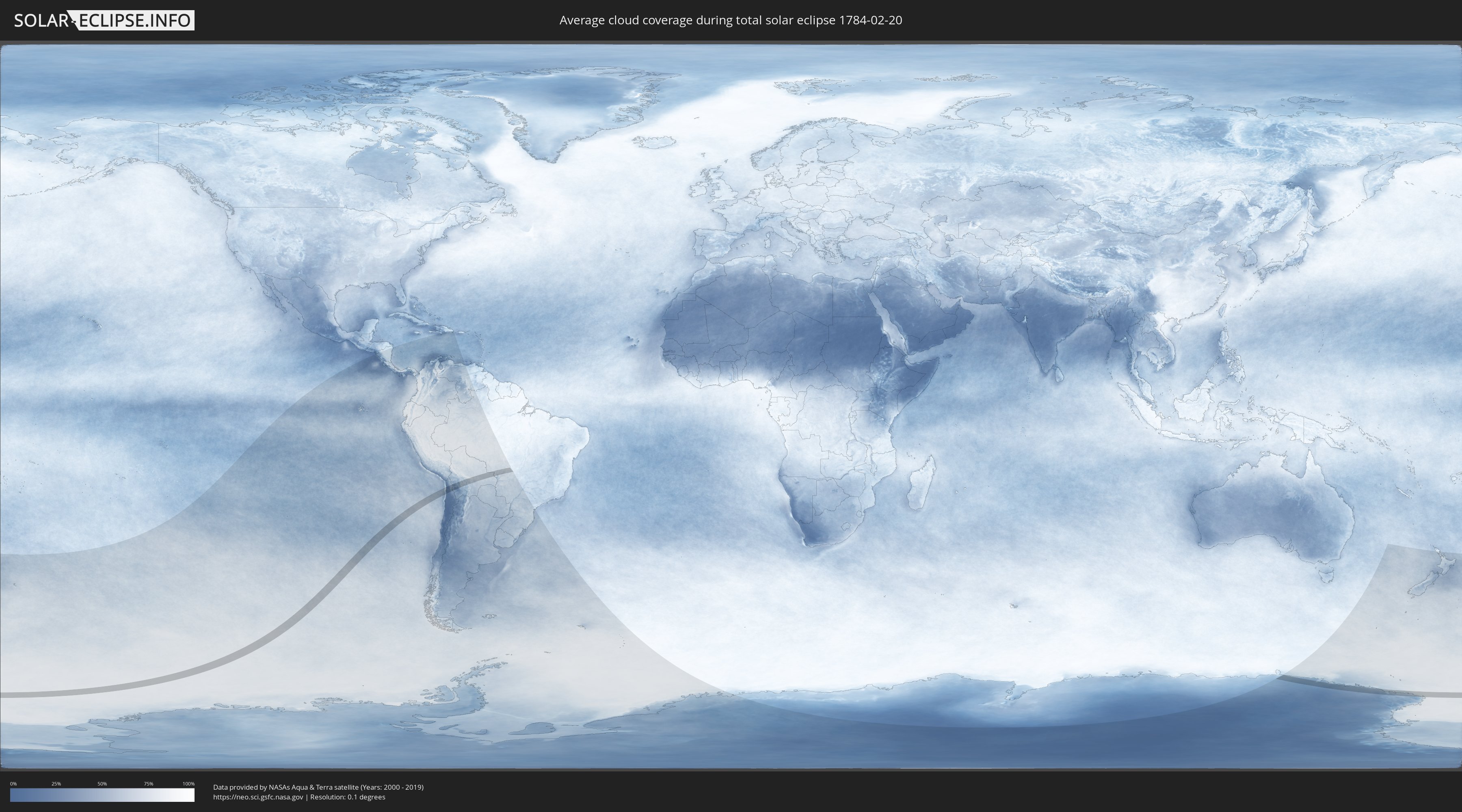
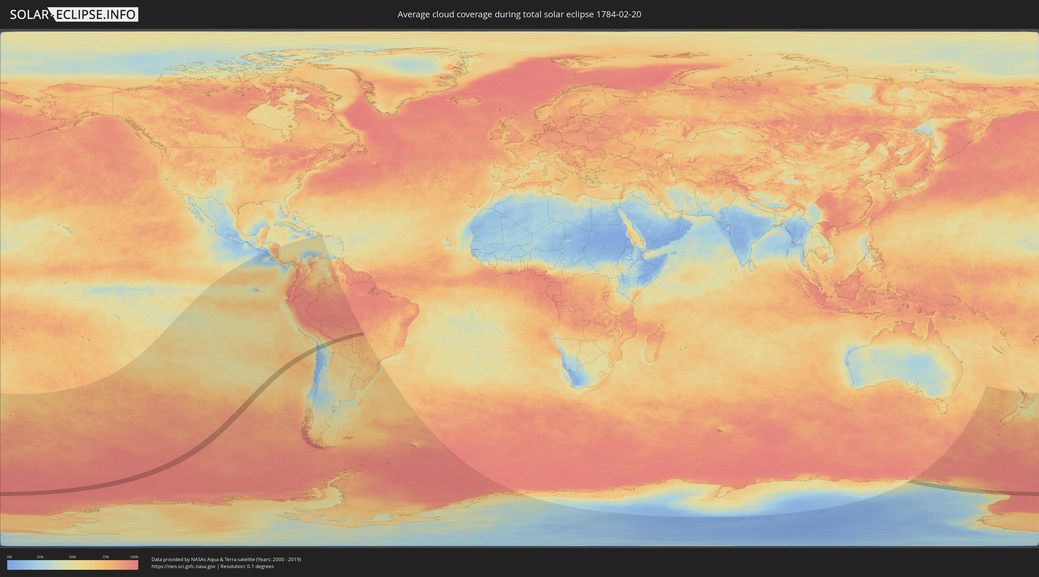
How will be the weather during the total solar eclipse on 02/20/1784?
Where is the best place to see the total solar eclipse of 02/20/1784?
The following maps show the average cloud coverage for the day of the total solar eclipse.
With the help of these maps, it is possible to find the place along the eclipse path, which has the best
chance of a cloudless sky.
Nevertheless, you should consider local circumstances and inform about the weather of your chosen
observation site.
The data is provided by NASAs satellites
AQUA and TERRA.
The cloud maps are averaged over a period of 19 years (2000 - 2019).
Detailed country maps
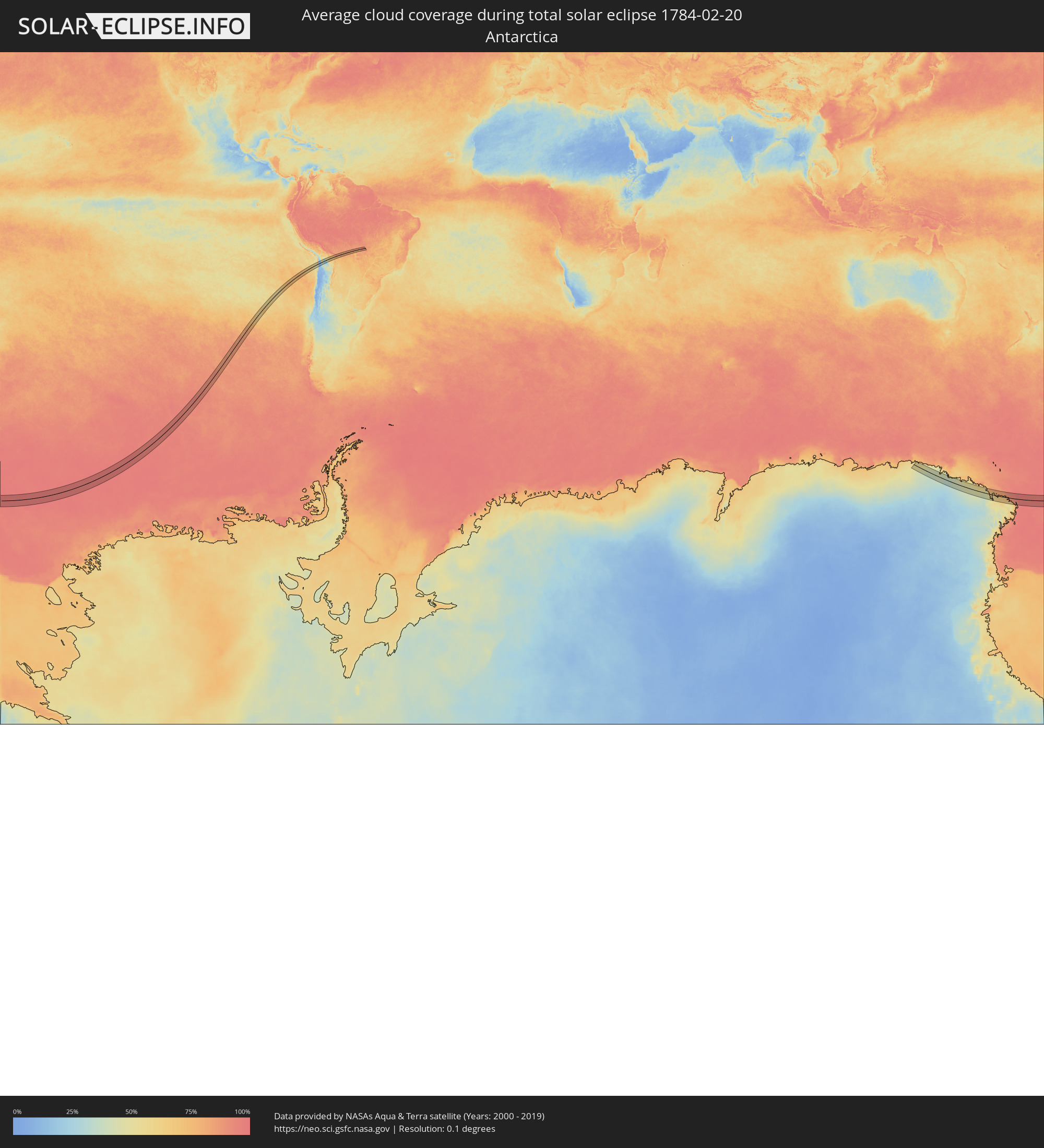 Antarctica
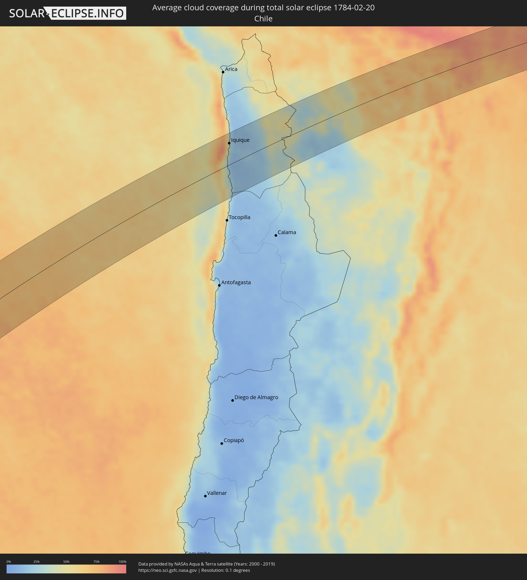 Chile
Chile
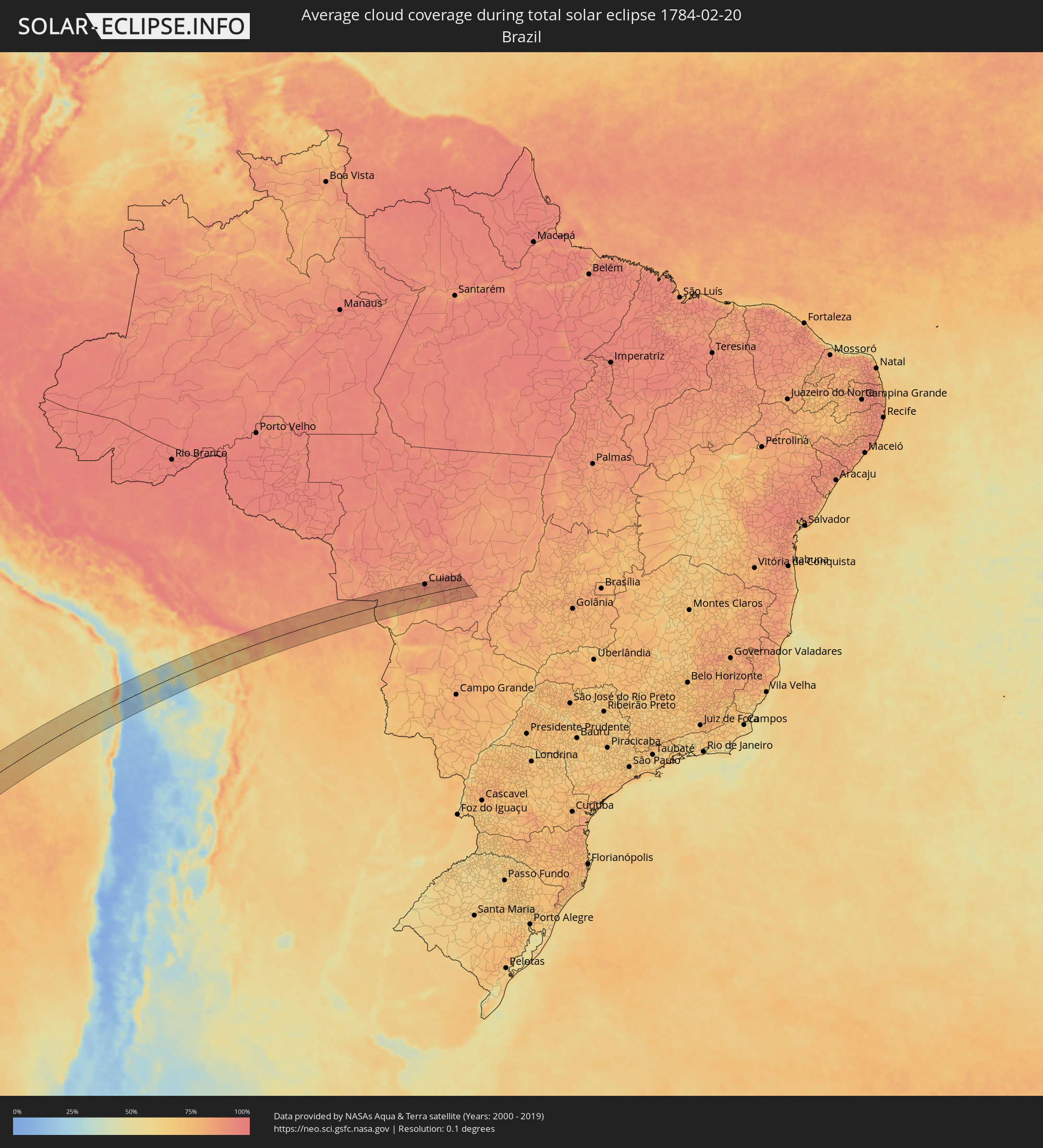 Brazil
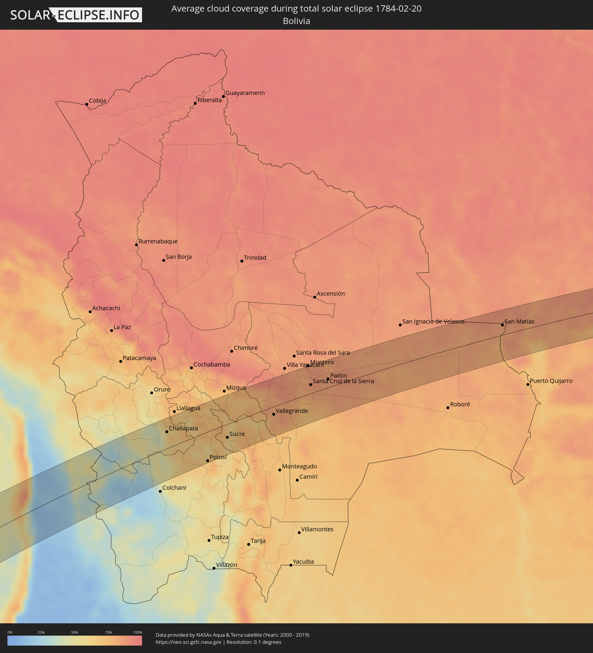 Bolivia
Cities inside the path of the eclipse
The following table shows all locations with a population of more than 5,000 inside the eclipse path. Cities which have more than 100,000 inhabitants are marked bold. A click at the locations opens a detailed map.
| City | Type | Eclipse duration | Local time of max. eclipse | Distance to central line | Ø Cloud coverage |
 Iquique, Tarapacá
|
total | - | 17:13:28 UTC-04:42 | 52 km | 26% |
 Challapata, Oruro
|
total | - | 17:26:05 UTC-04:32 | 40 km | 58% |
|
Potosí, Potosí
|
total | - | 17:25:11 UTC-04:32 | 71 km | 66% |
|
Sucre, Chuquisaca
|
total | - | 17:26:01 UTC-04:32 | 33 km | 67% |
|
Aiquile, Cochabamba
|
total | - | 17:27:12 UTC-04:32 | 50 km | 74% |
|
Vallegrande, Santa Cruz
|
total | - | 17:26:50 UTC-04:32 | 20 km | 81% |
|
Santiago del Torno, Santa Cruz
|
total | - | 17:27:33 UTC-04:32 | 7 km | 77% |
|
Montero, Santa Cruz
|
total | - | 17:28:26 UTC-04:32 | 71 km | 85% |
|
La Bélgica, Santa Cruz
|
total | - | 17:28:09 UTC-04:32 | 47 km | 85% |
|
Santa Cruz de la Sierra, Santa Cruz
|
total | - | 17:27:49 UTC-04:32 | 21 km | 85% |
|
Warnes, Santa Cruz
|
total | - | 17:28:11 UTC-04:32 | 49 km | 86% |
|
Cotoca, Santa Cruz
|
total | - | 17:27:47 UTC-04:32 | 13 km | 87% |
|
San Julian, Santa Cruz
|
total | - | 17:27:49 UTC-04:32 | 11 km | 84% |
|
Pailón, Santa Cruz
|
total | - | 17:28:00 UTC-04:32 | 21 km | 83% |
|
San Matías, Santa Cruz
|
total | - | 17:29:23 UTC-04:32 | 25 km | 81% |
 Poconé, Mato Grosso
|
total | - | 18:23:24 UTC-03:38 | 9 km | 82% |
|
Várzea Grande, Mato Grosso
|
total | - | 18:24:04 UTC-03:38 | 45 km | 91% |
|
Cuiabá, Mato Grosso
|
total | - | 18:24:07 UTC-03:38 | 50 km | 91% |
|
Santo Antônio do Leverger, Mato Grosso
|
total | - | 18:23:47 UTC-03:38 | 20 km | 78% |
|
Lucas, Mato Grosso
|
total | - | 18:23:11 UTC-03:38 | 34 km | 77% |
|
Chapada dos Guimarães, Mato Grosso
|
total | - | 18:24:13 UTC-03:38 | 56 km | 87% |
|
Jaciara, Mato Grosso
|
total | - | 18:23:27 UTC-03:38 | 17 km | 84% |
|
Poxoréo, Mato Grosso
|
total | - | 18:23:29 UTC-03:38 | 15 km | 84% |