Total solar eclipse of 07/17/1814
| Day of week: | Sunday |
| Maximum duration of eclipse: | 06m33s |
| Maximum width of eclipse path: | 254 km |
| Saros cycle: | 133 |
| Coverage: | 100% |
| Magnitude: | 1.0774 |
| Gamma: | 0.1641 |
Wo kann man die Sonnenfinsternis vom 07/17/1814 sehen?
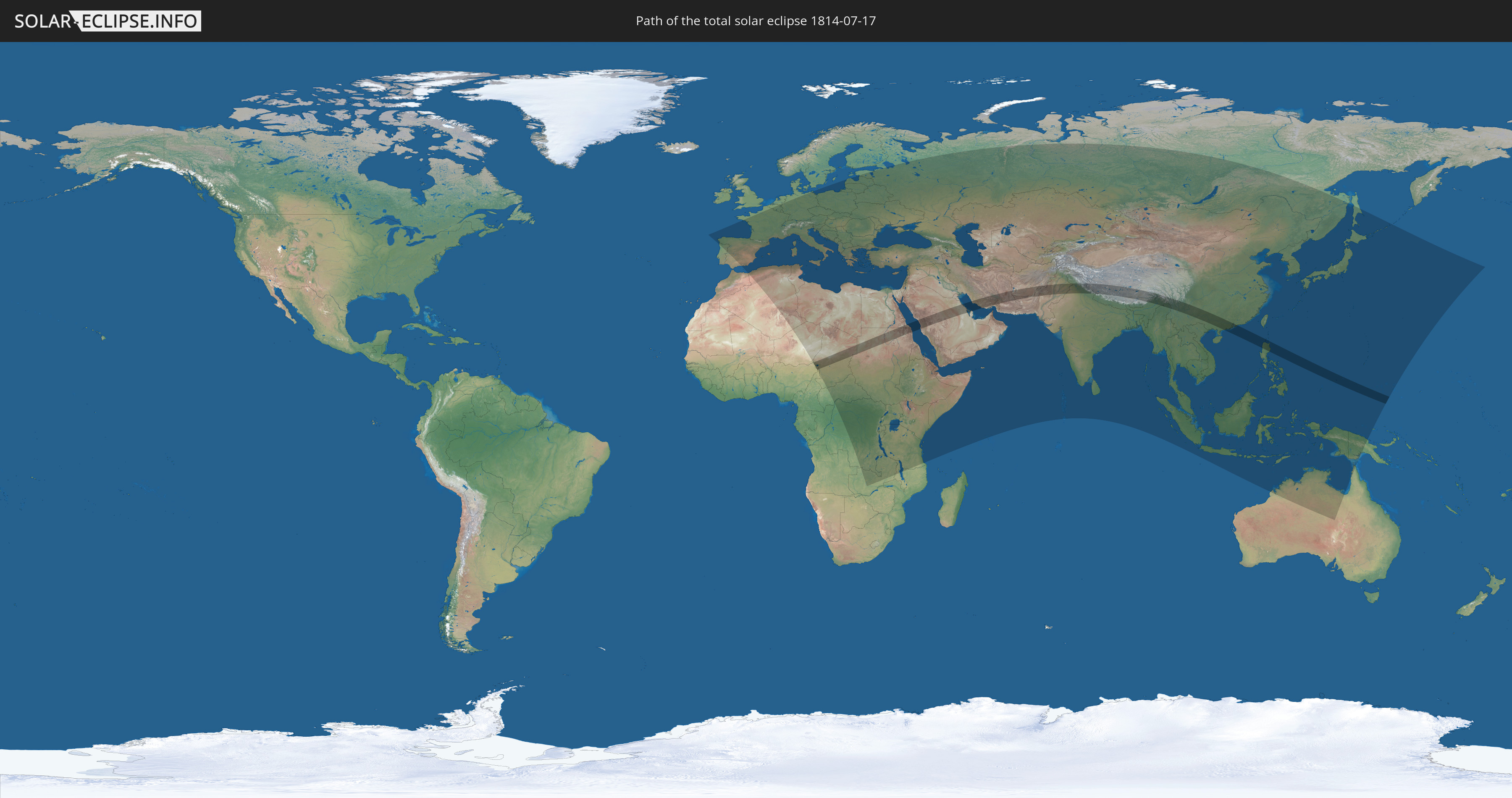
Die Sonnenfinsternis am 07/17/1814 kann man in 119 Ländern als partielle Sonnenfinsternis beobachten.
Der Finsternispfad verläuft durch 20 Länder. Nur in diesen Ländern ist sie als total Sonnenfinsternis zu sehen.
In den folgenden Ländern ist die Sonnenfinsternis total zu sehen
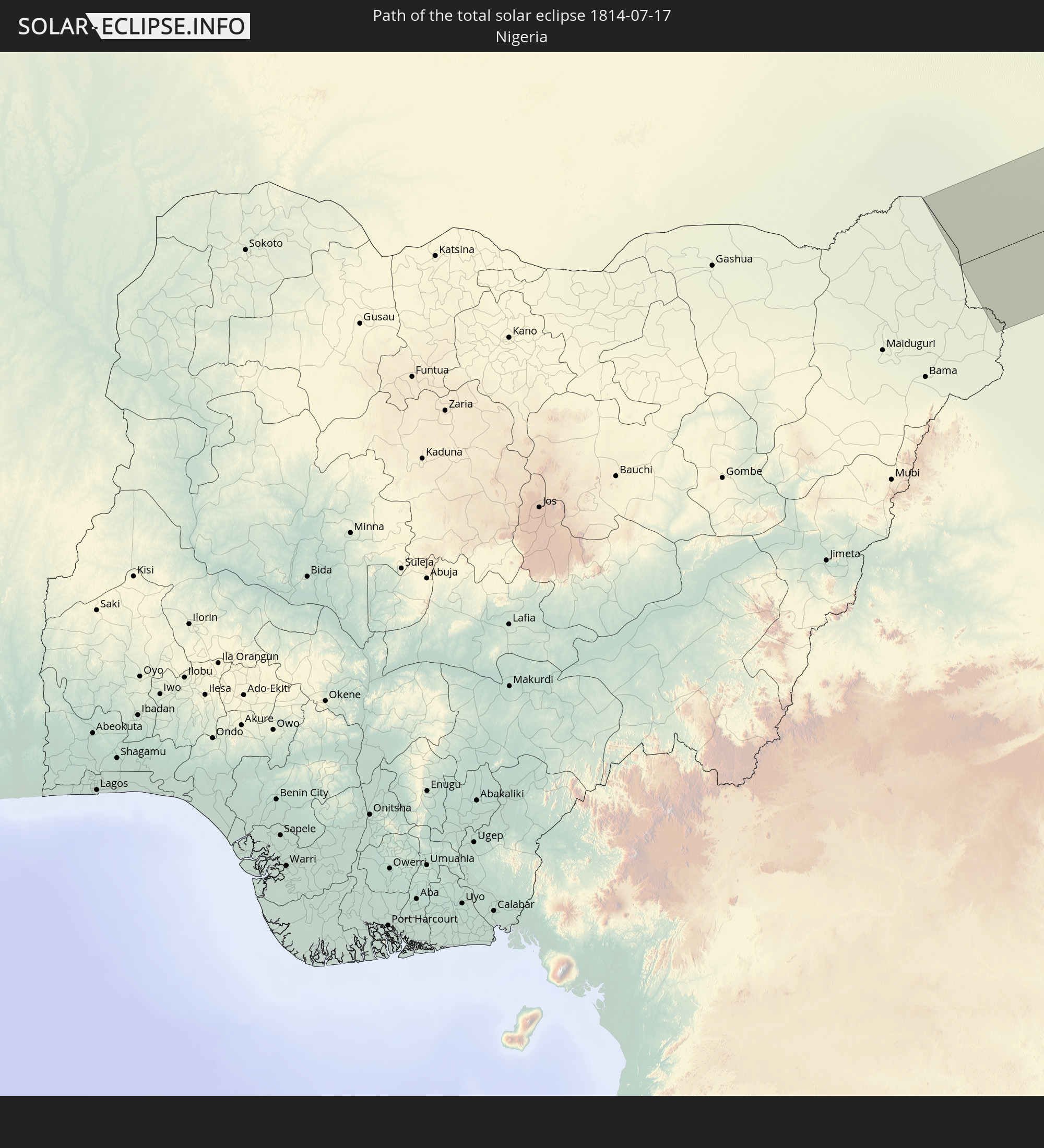 Nigeria
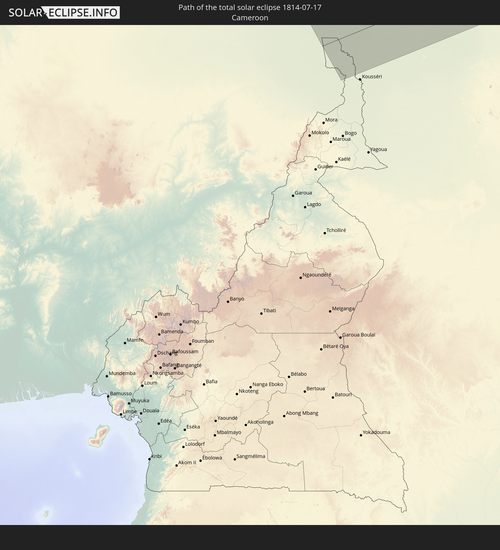 Cameroon
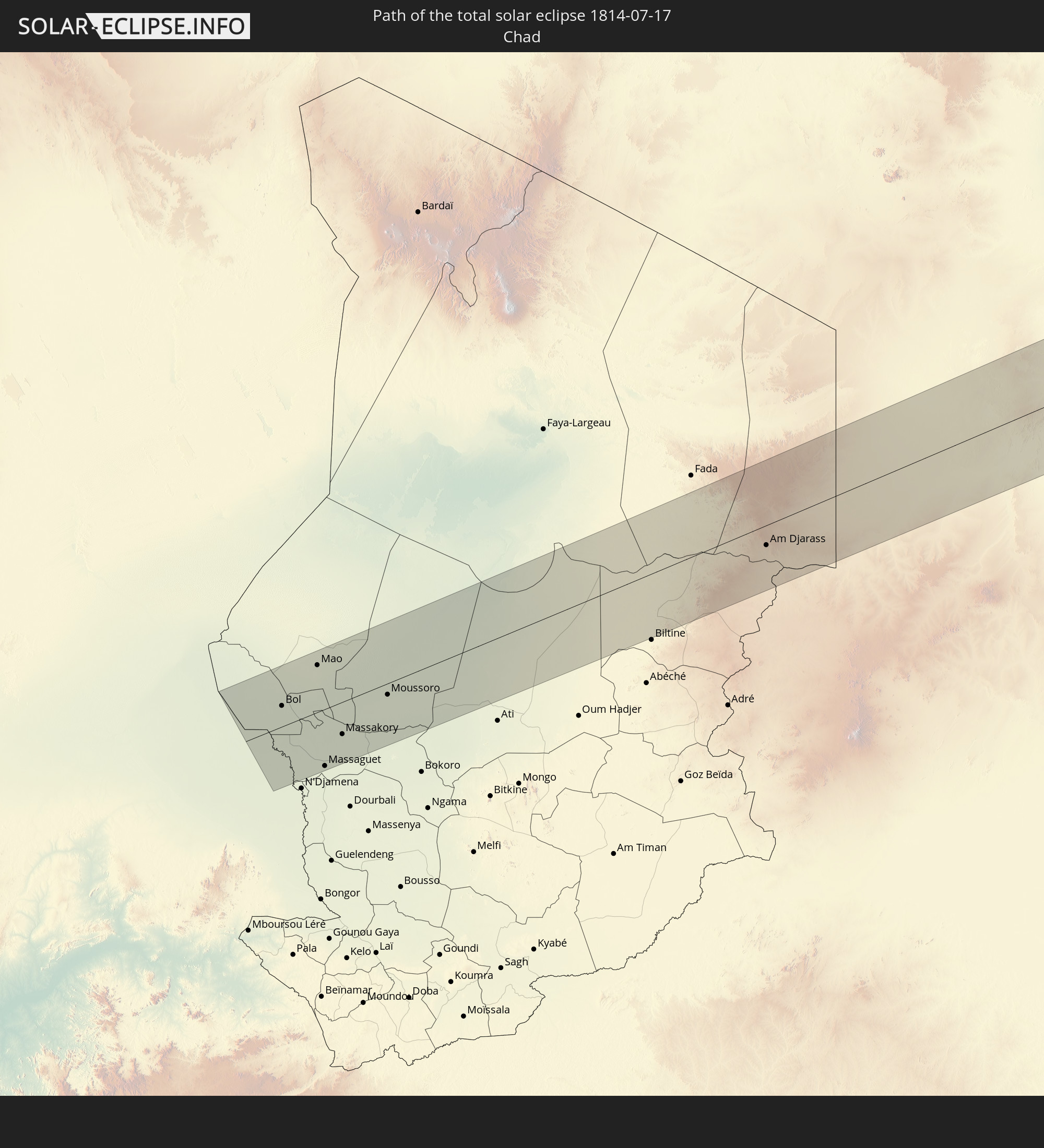 Chad
Chad
 Sudan
Sudan
 Egypt
Egypt
 Saudi Arabia
 Iran
Iran
 Bahrain
 Qatar
Qatar
 Afghanistan
 Pakistan
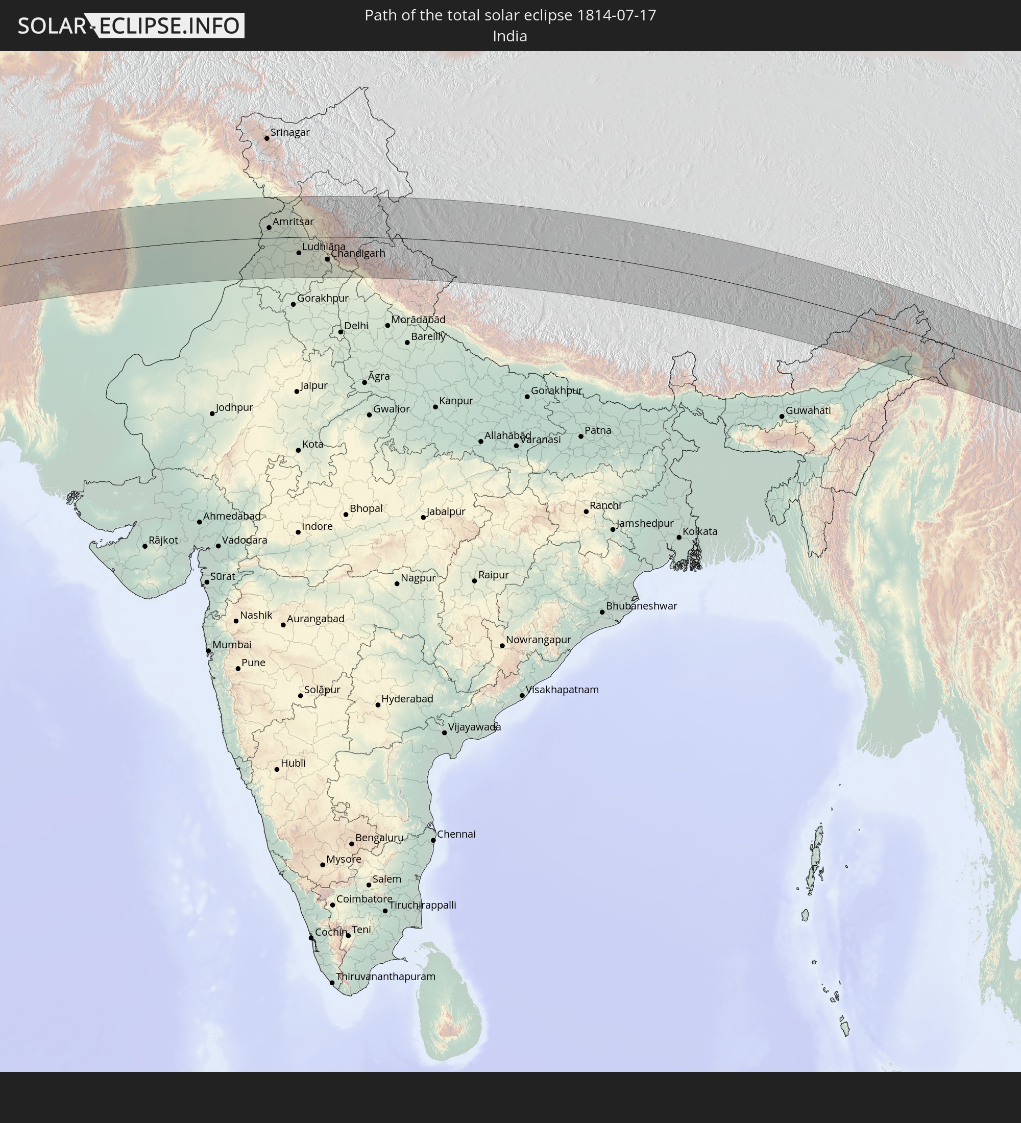 India
India
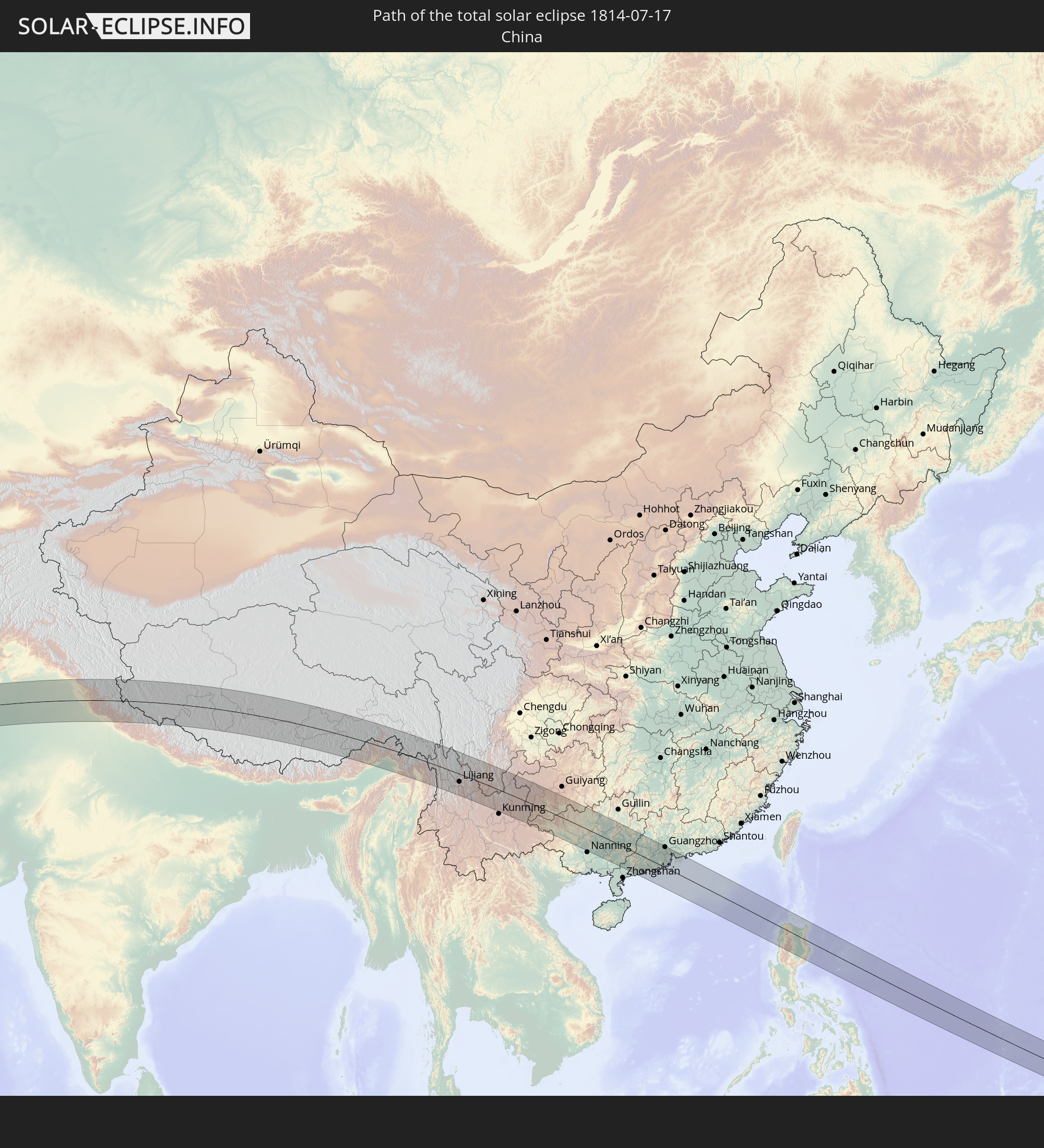 China
China
 Nepal
Nepal
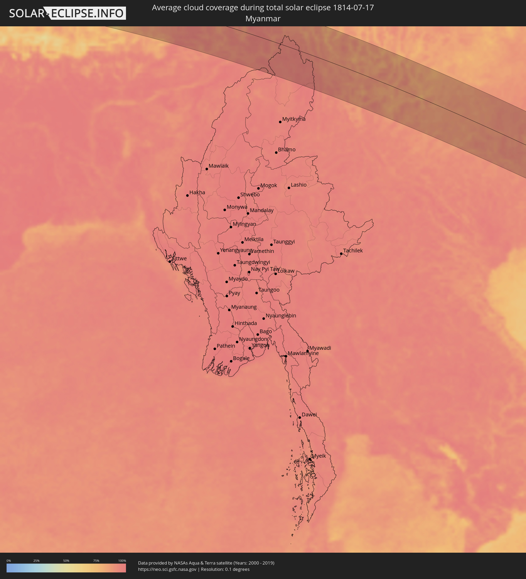
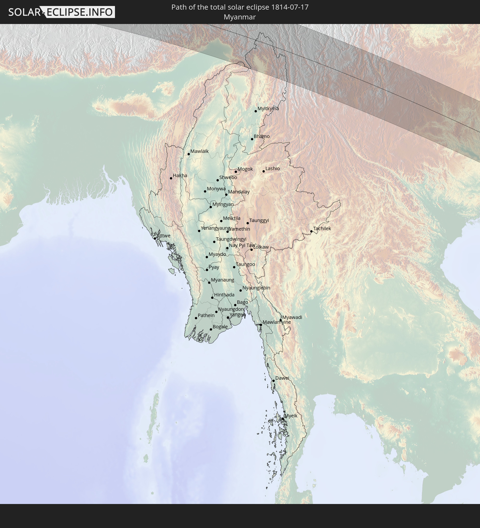 Myanmar
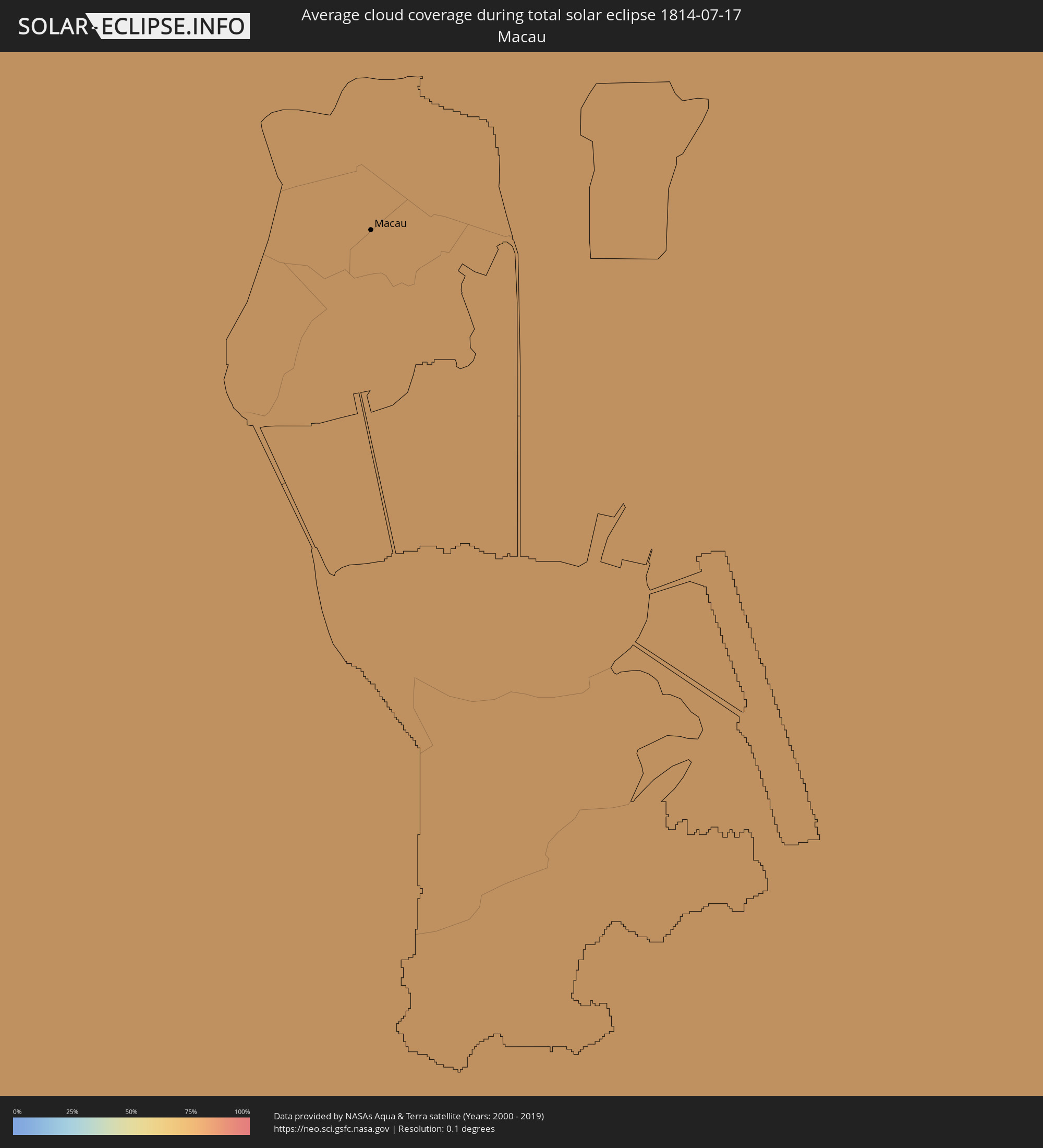
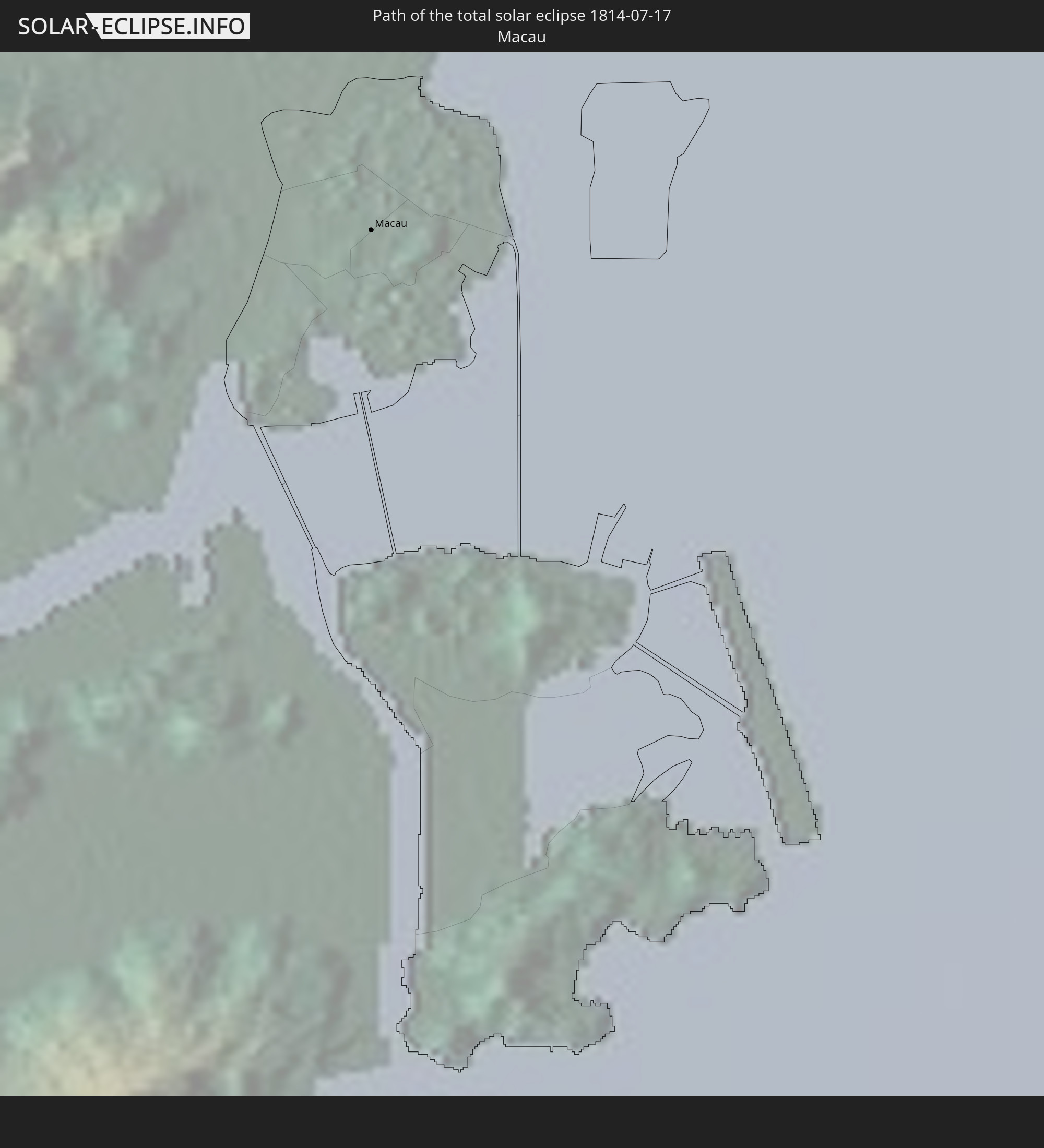 Macau
Macau
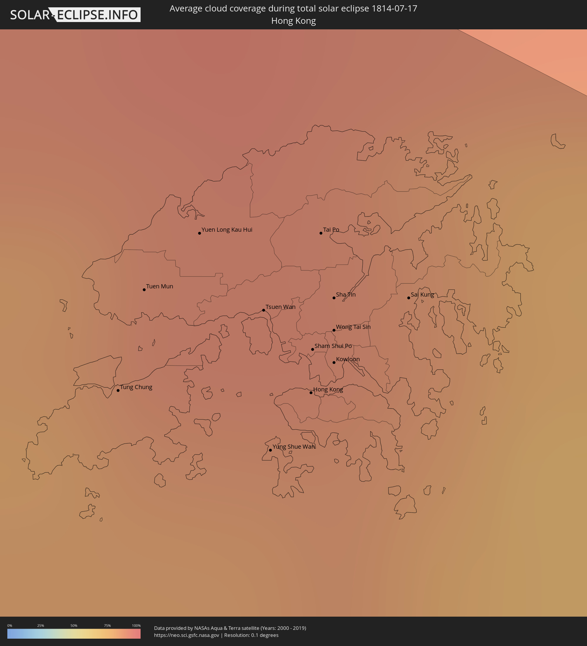
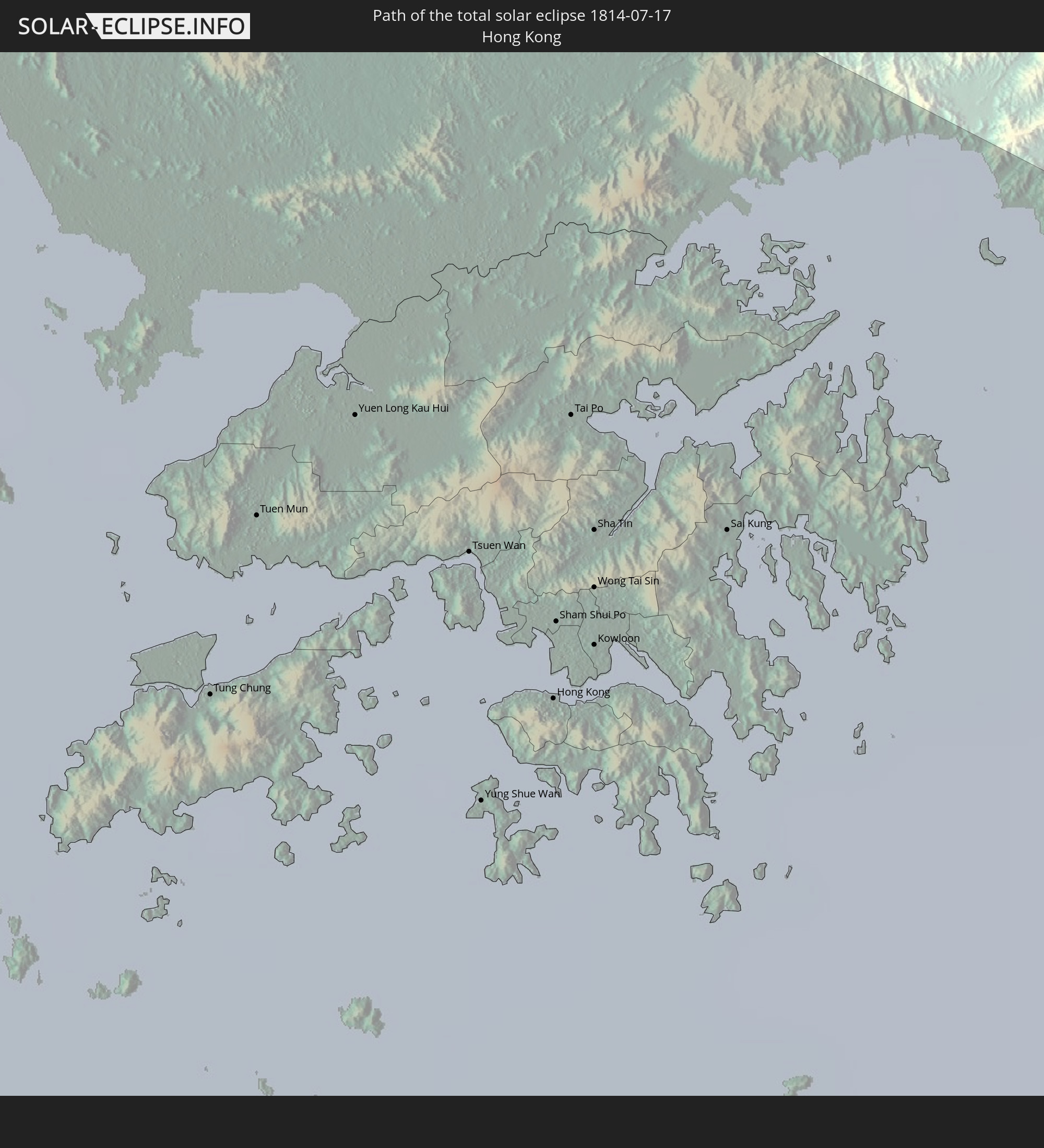 Hong Kong
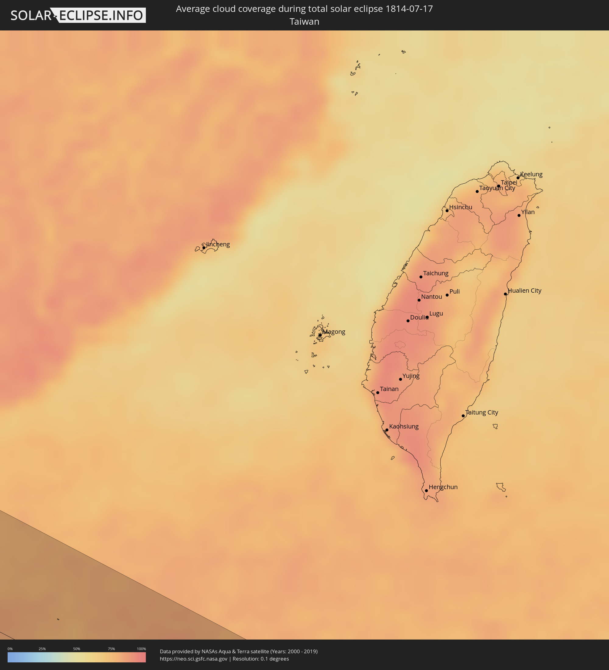
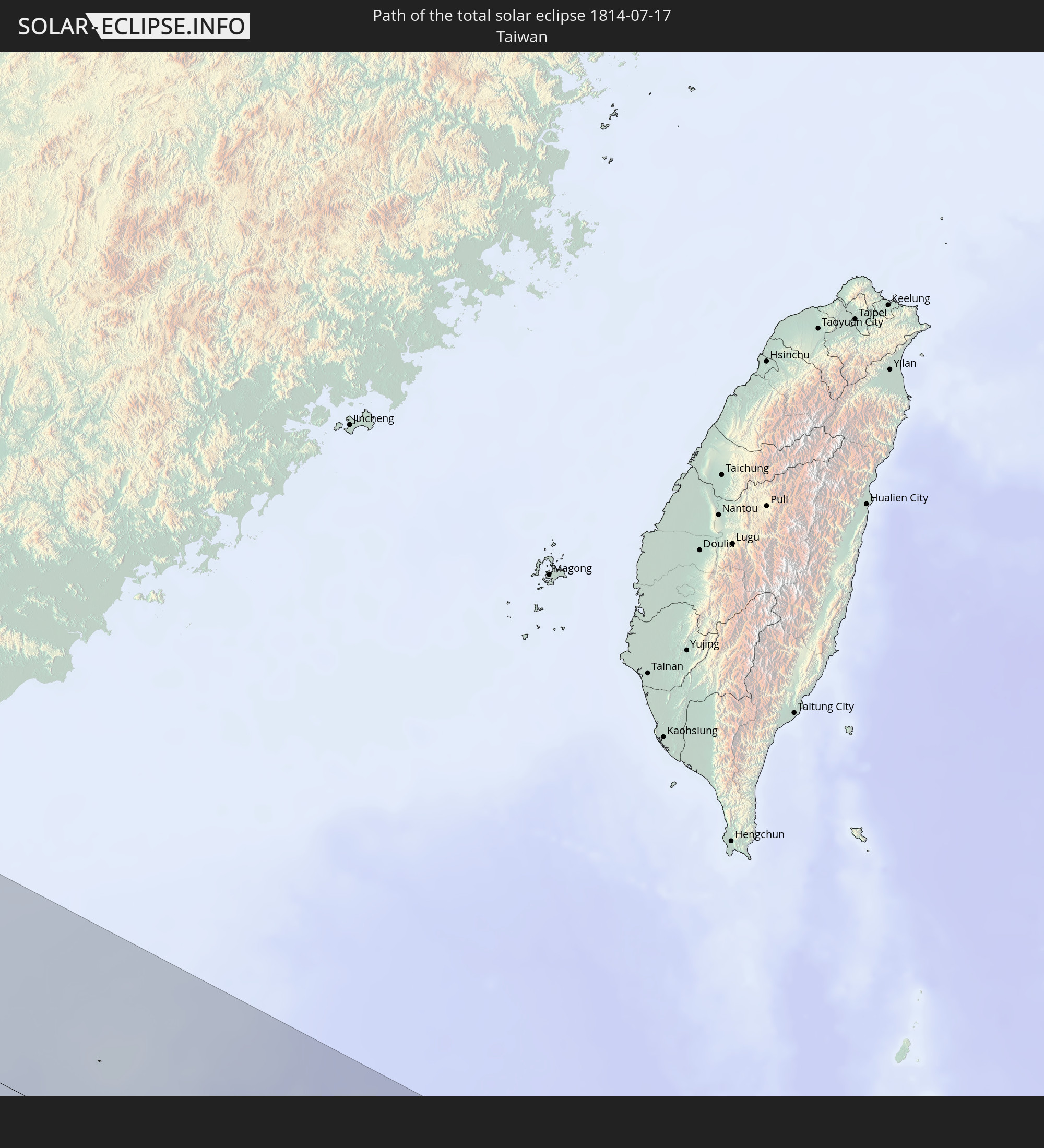 Taiwan
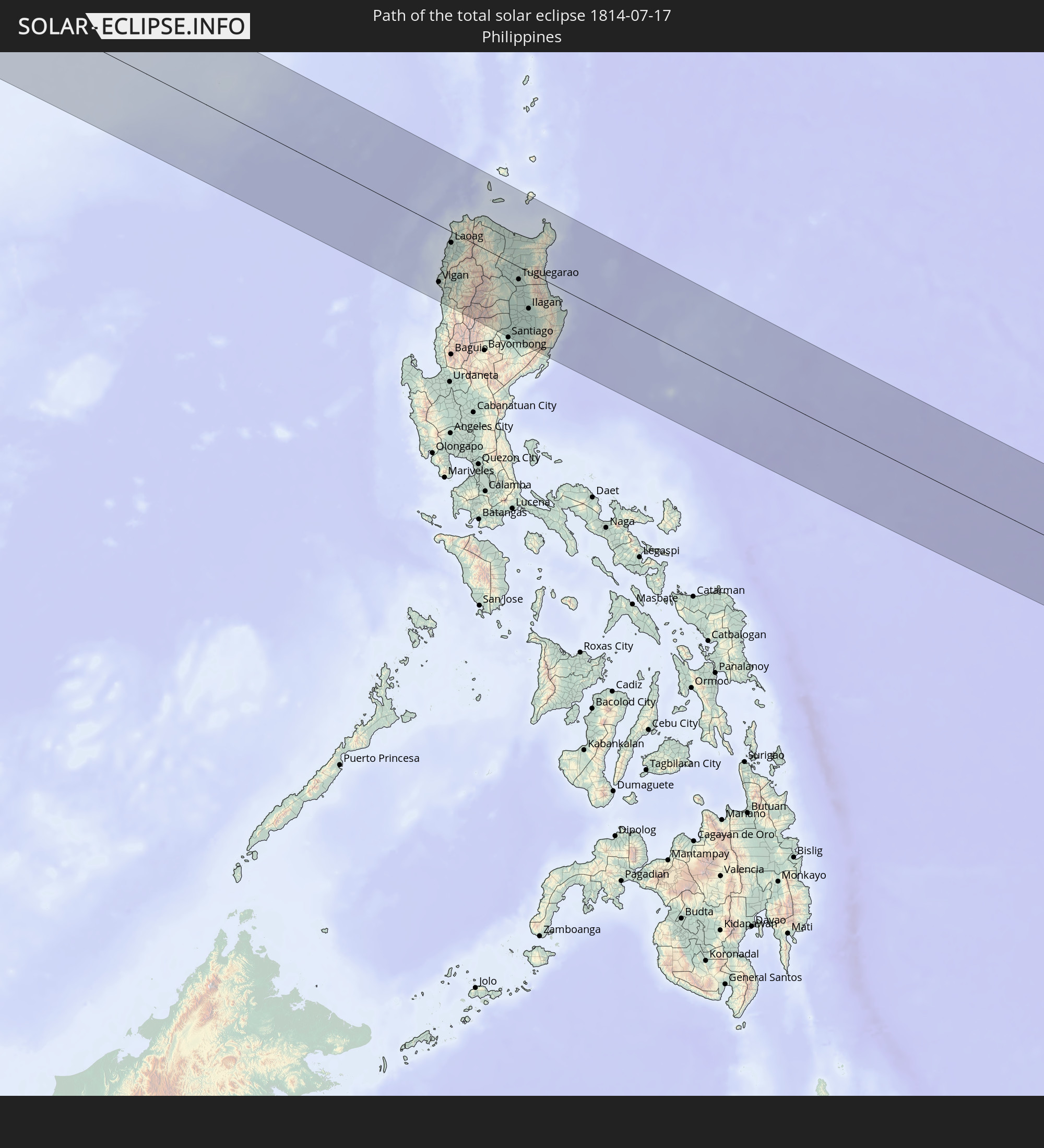 Philippines
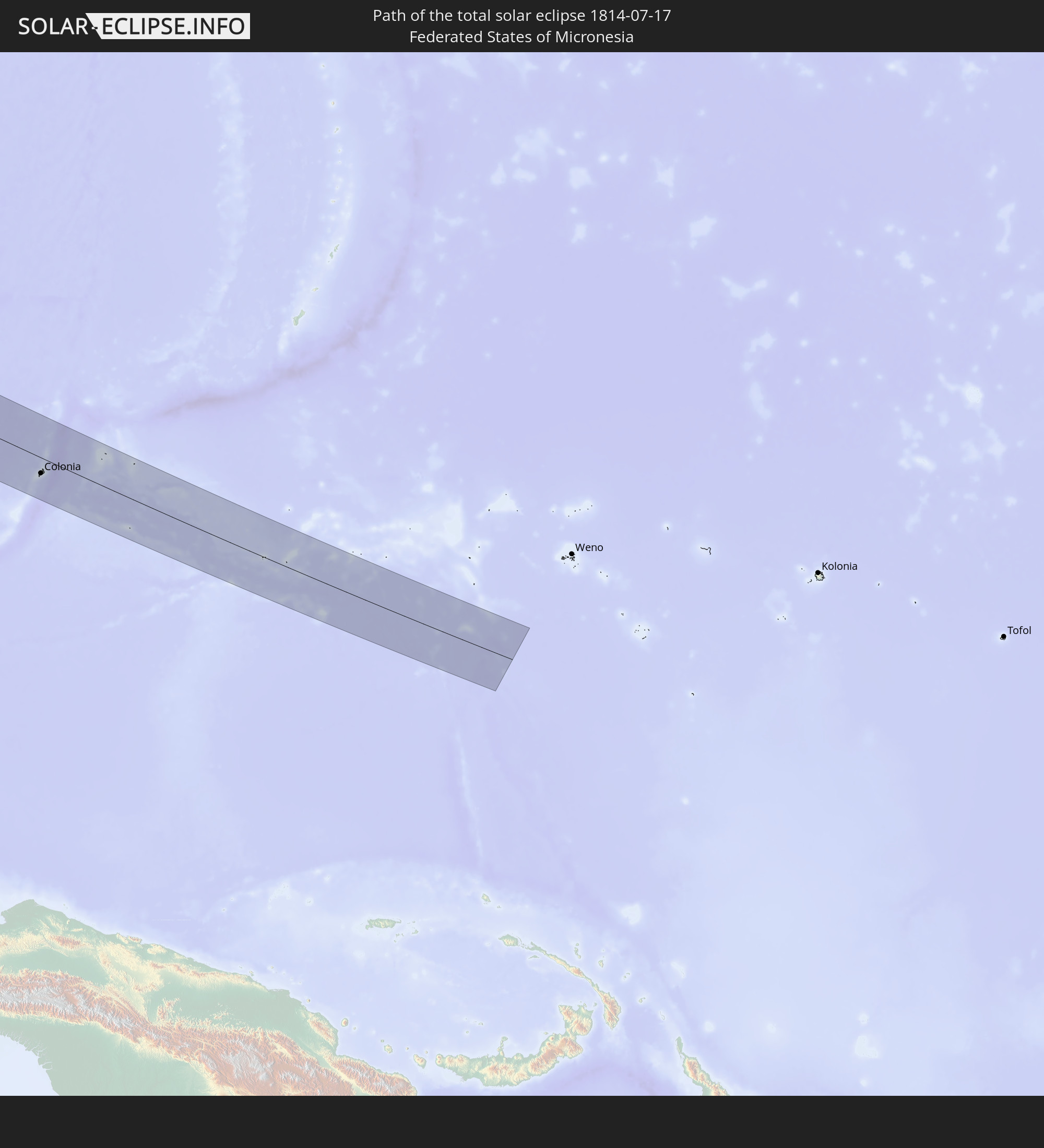 Federated States of Micronesia
In den folgenden Ländern ist die Sonnenfinsternis partiell zu sehen
 Russia
 Portugal
 Spain
Spain
 Algeria
 France
 Niger
Niger
 Andorra
 Belgium
 Nigeria
 Netherlands
 Luxembourg
 Germany
 Switzerland
 Italy
Italy
 Monaco
 Tunisia
 Denmark
 Cameroon
 Libya
Libya
 Liechtenstein
 Austria
 Czechia
 Democratic Republic of the Congo
 San Marino
 Vatican City
 Slovenia
 Chad
Chad
 Croatia
 Poland
 Malta
Malta
 Central African Republic
 Bosnia and Herzegovina
 Hungary
 Slovakia
 Montenegro
 Serbia
 Albania
 Greece
 Romania
 Republic of Macedonia
 Lithuania
 Latvia
 Estonia
 Sudan
Sudan
 Zambia
 Ukraine
 Bulgaria
 Belarus
 Egypt
Egypt
 Turkey
 Moldova
 Rwanda
 Burundi
 Tanzania
 Uganda
 Mozambique
 Cyprus
 Malawi
 Ethiopia
 Kenya
Kenya
 State of Palestine
 Israel
 Saudi Arabia
 Jordan
 Lebanon
 Syria
Syria
 Eritrea
 Iraq
Iraq
 Georgia
 Somalia
 Djibouti
 Yemen
Yemen
 Armenia
 Iran
Iran
 Azerbaijan
 Seychelles
 Kazakhstan
 Kuwait
 Bahrain
 Qatar
Qatar
 United Arab Emirates
 Oman
Oman
 Turkmenistan
 Uzbekistan
 Afghanistan
 Pakistan
 Tajikistan
 India
India
 Kyrgyzstan
 Maldives
 China
China
 Sri Lanka
 Nepal
Nepal
 Mongolia
 Bangladesh
 Bhutan
 Myanmar
 Indonesia
 Thailand
 Malaysia
 Laos
Laos
 Vietnam
 Cambodia
 Singapore
 Australia
 Macau
Macau
 Hong Kong
 Brunei
 Taiwan
 Philippines
 Japan
Japan
 East Timor
 North Korea
 South Korea
 Palau
Palau
 Federated States of Micronesia
 Papua New Guinea
 Guam
Guam
 Northern Mariana Islands
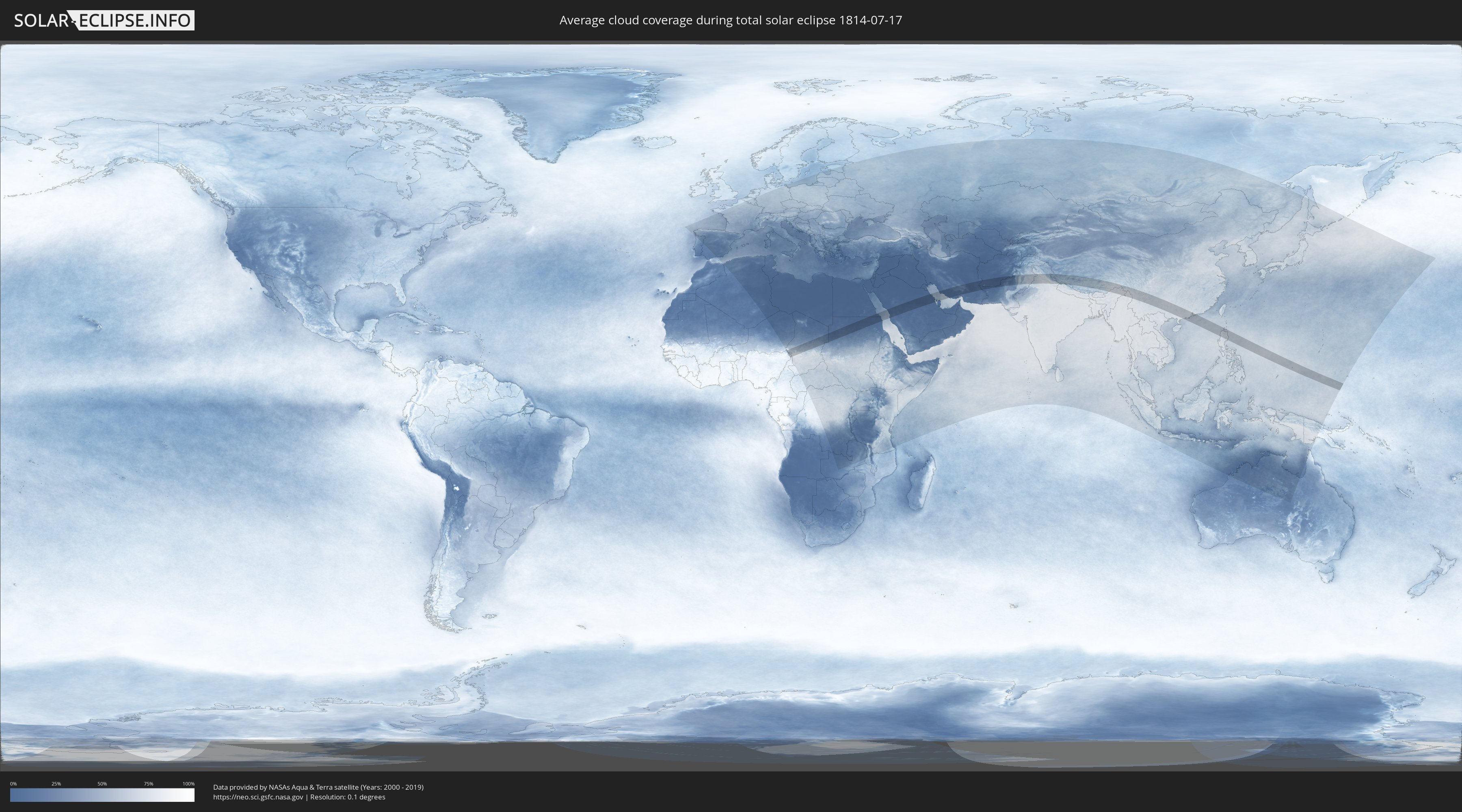
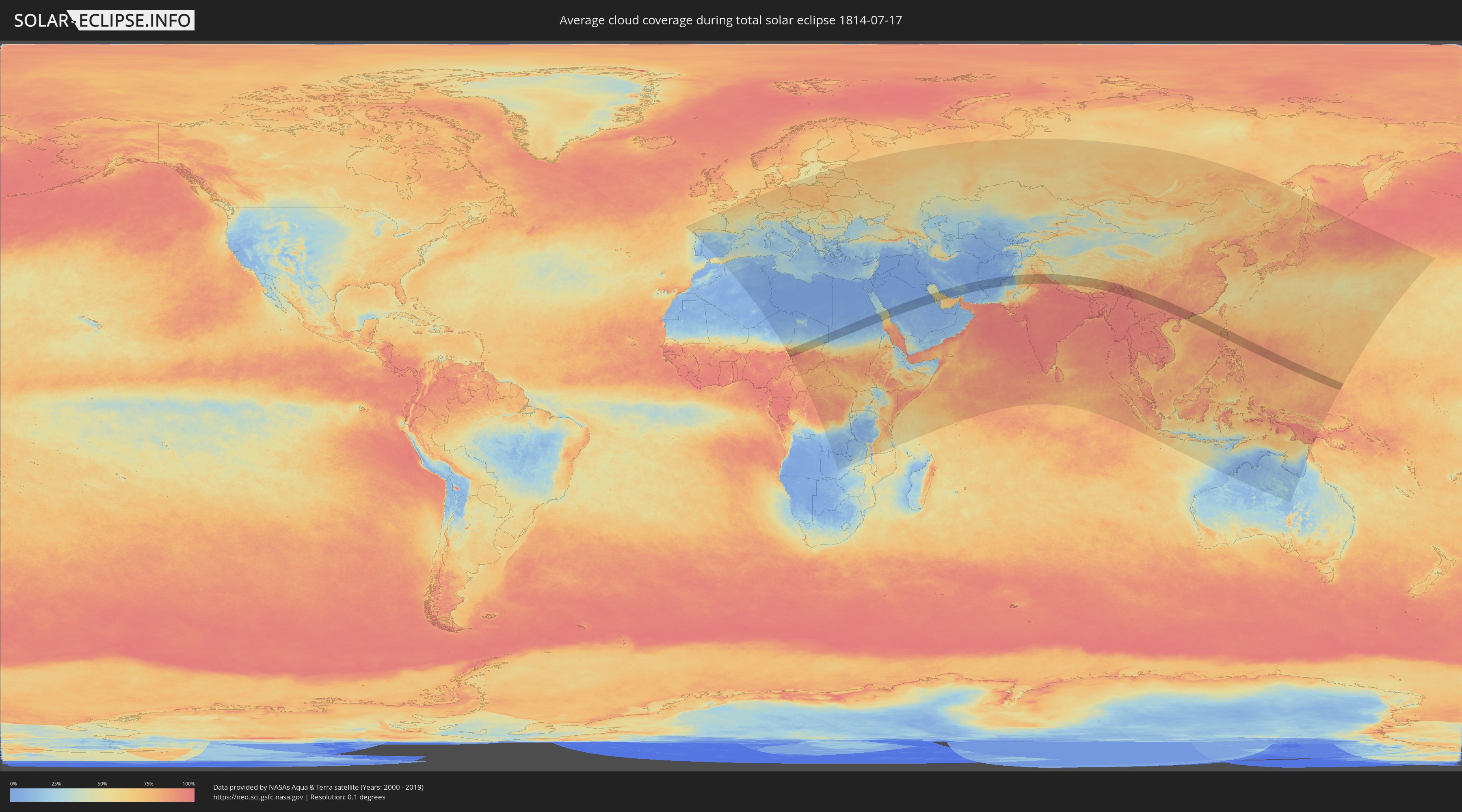
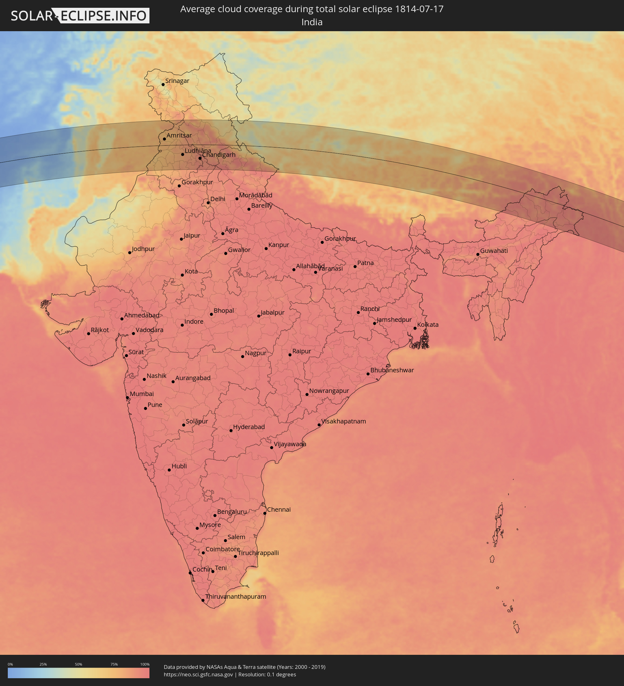
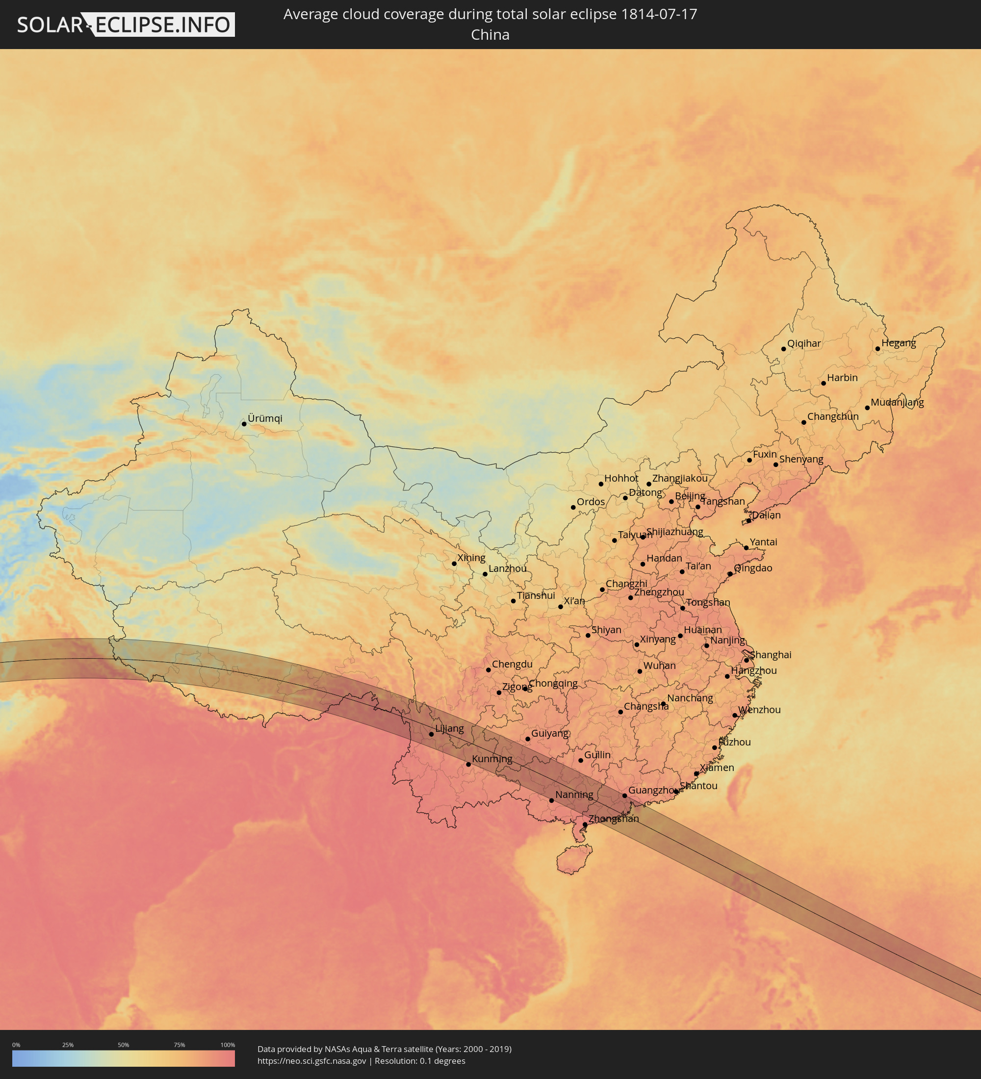
How will be the weather during the total solar eclipse on 07/17/1814?
Where is the best place to see the total solar eclipse of 07/17/1814?
The following maps show the average cloud coverage for the day of the total solar eclipse.
With the help of these maps, it is possible to find the place along the eclipse path, which has the best
chance of a cloudless sky.
Nevertheless, you should consider local circumstances and inform about the weather of your chosen
observation site.
The data is provided by NASAs satellites
AQUA and TERRA.
The cloud maps are averaged over a period of 19 years (2000 - 2019).
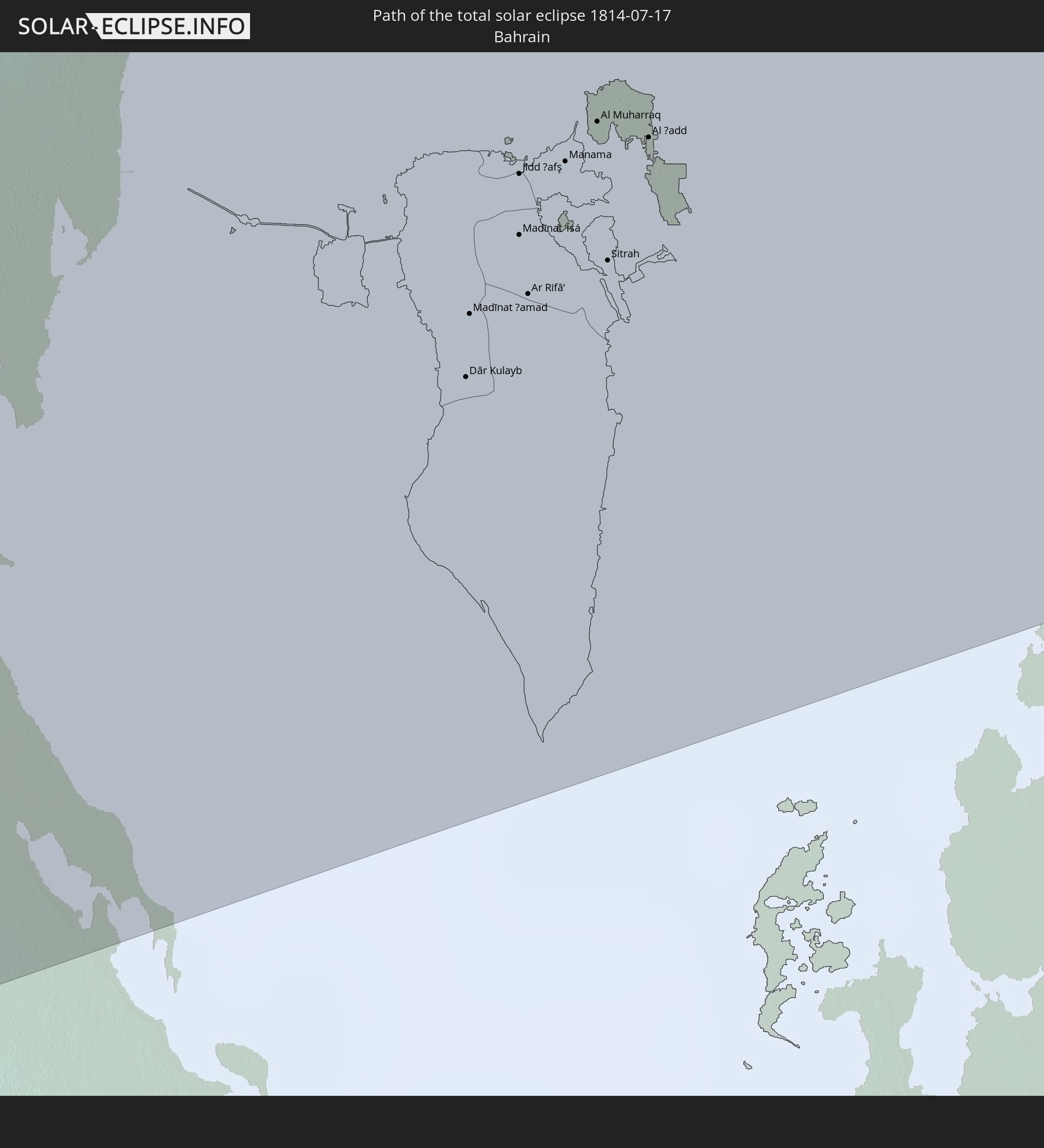
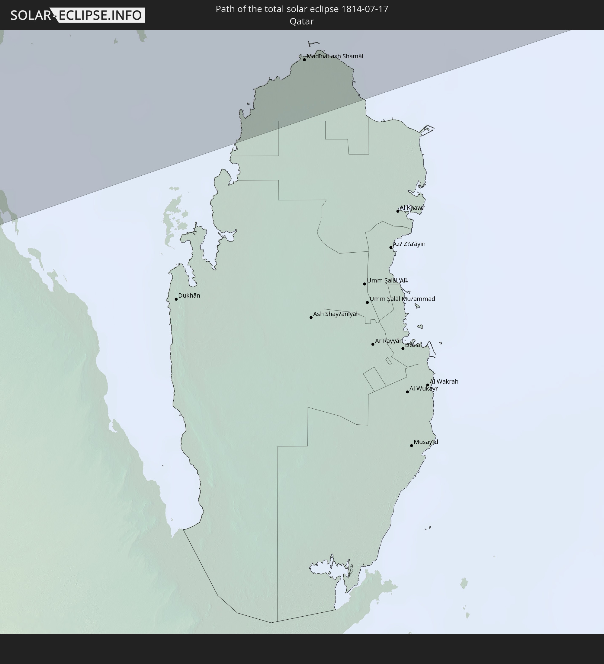
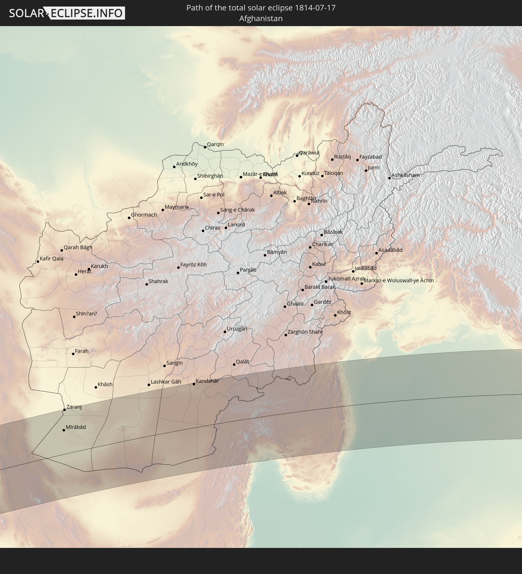
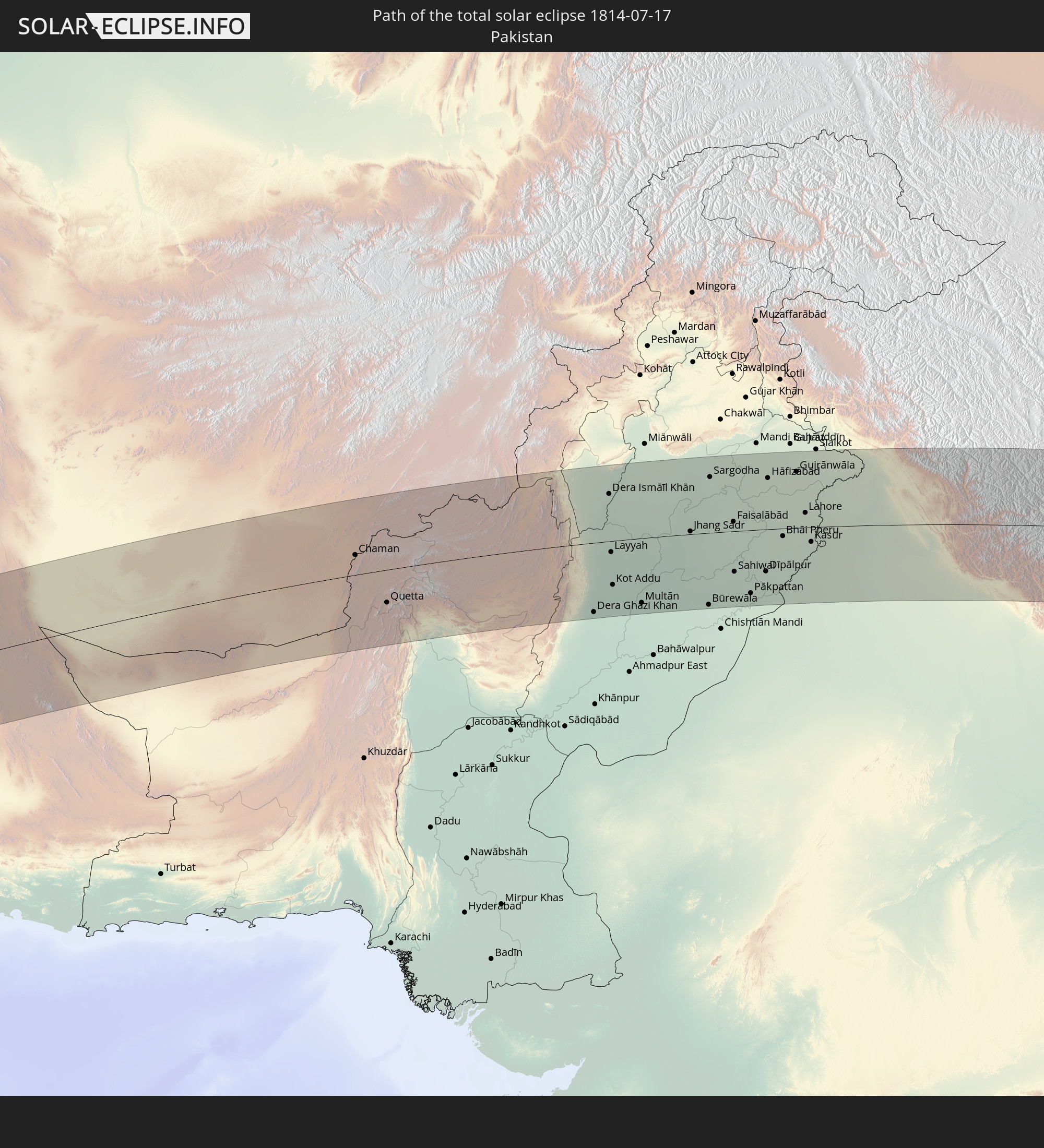
Detailed country maps
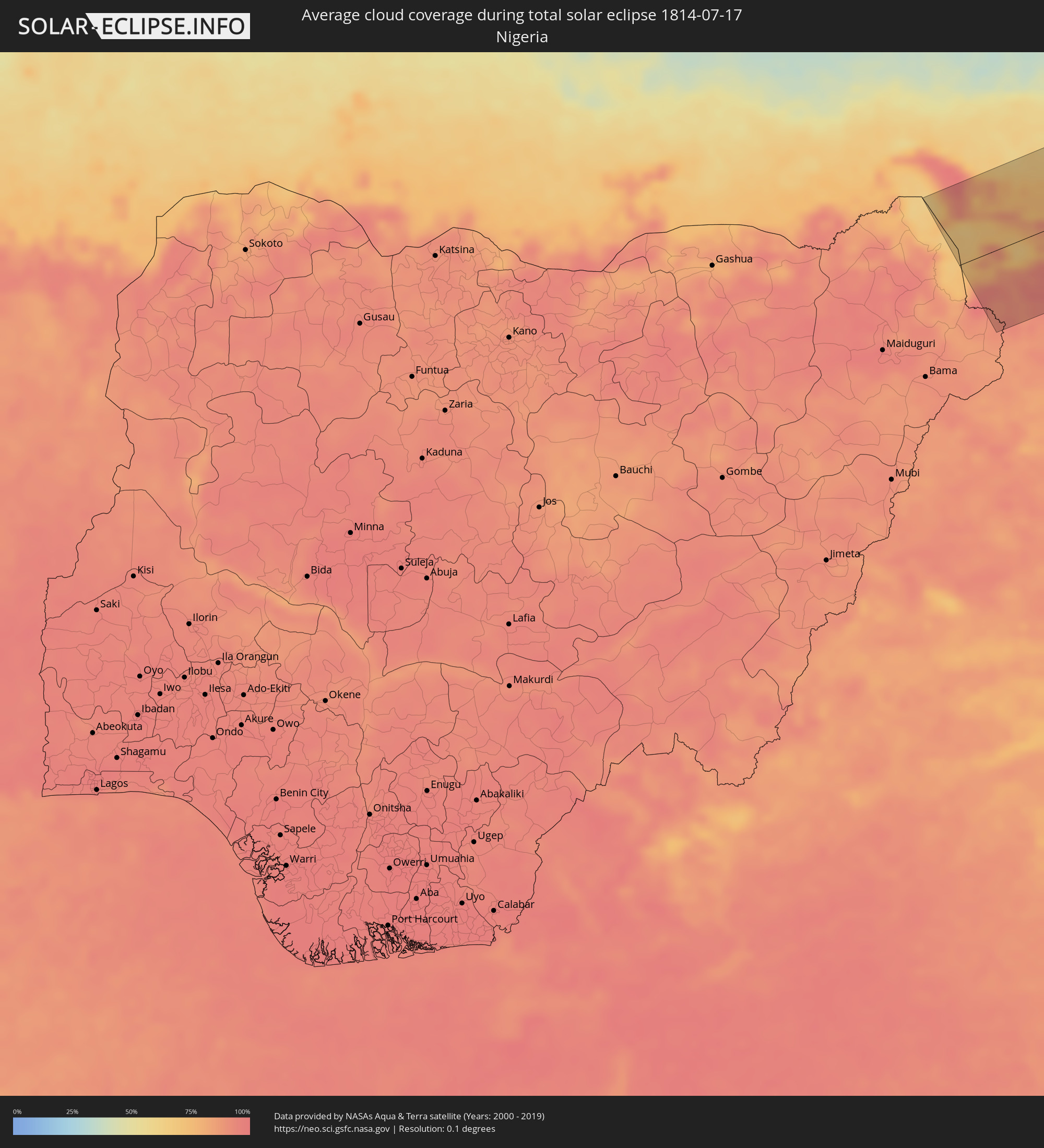 Nigeria
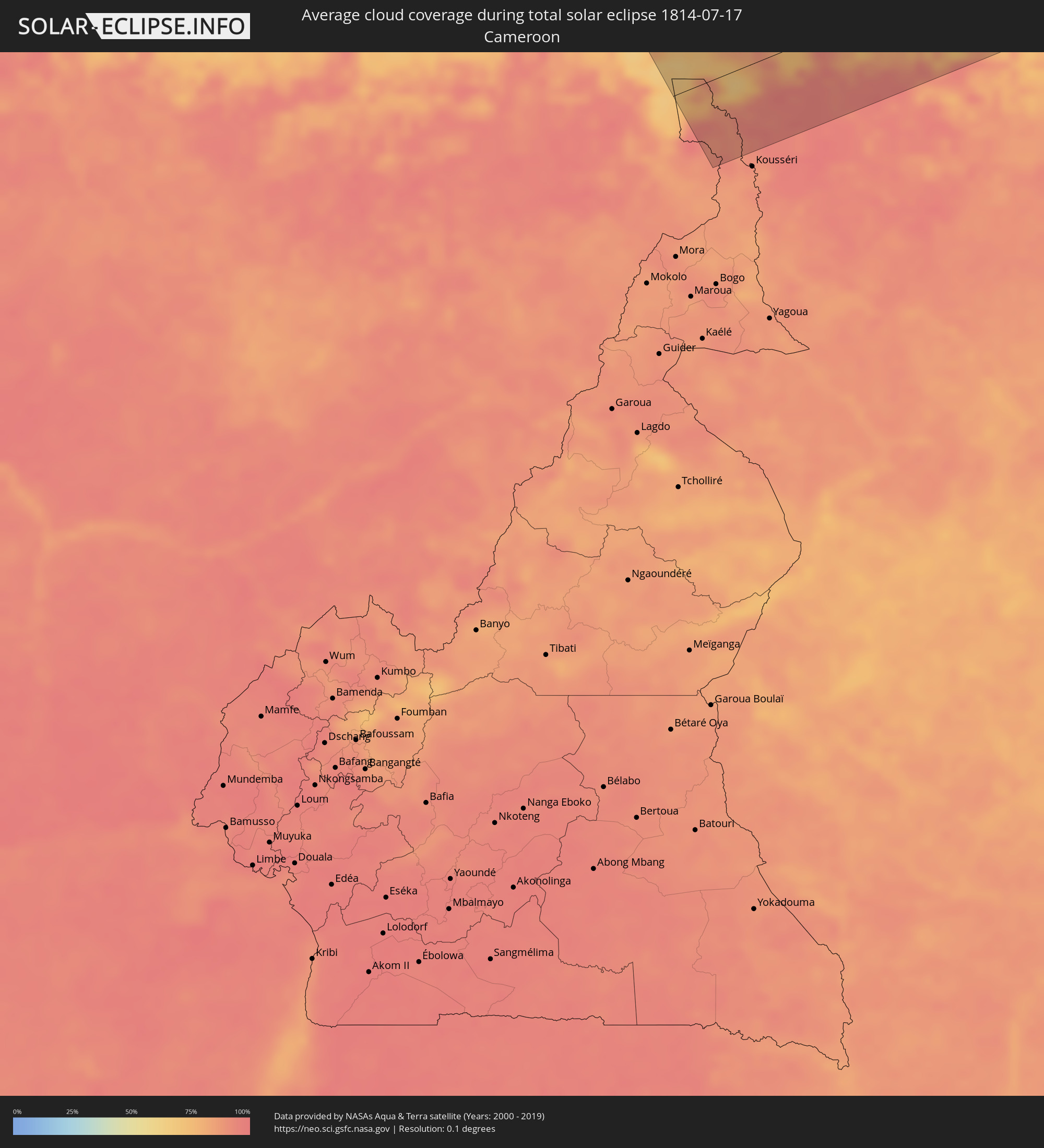 Cameroon
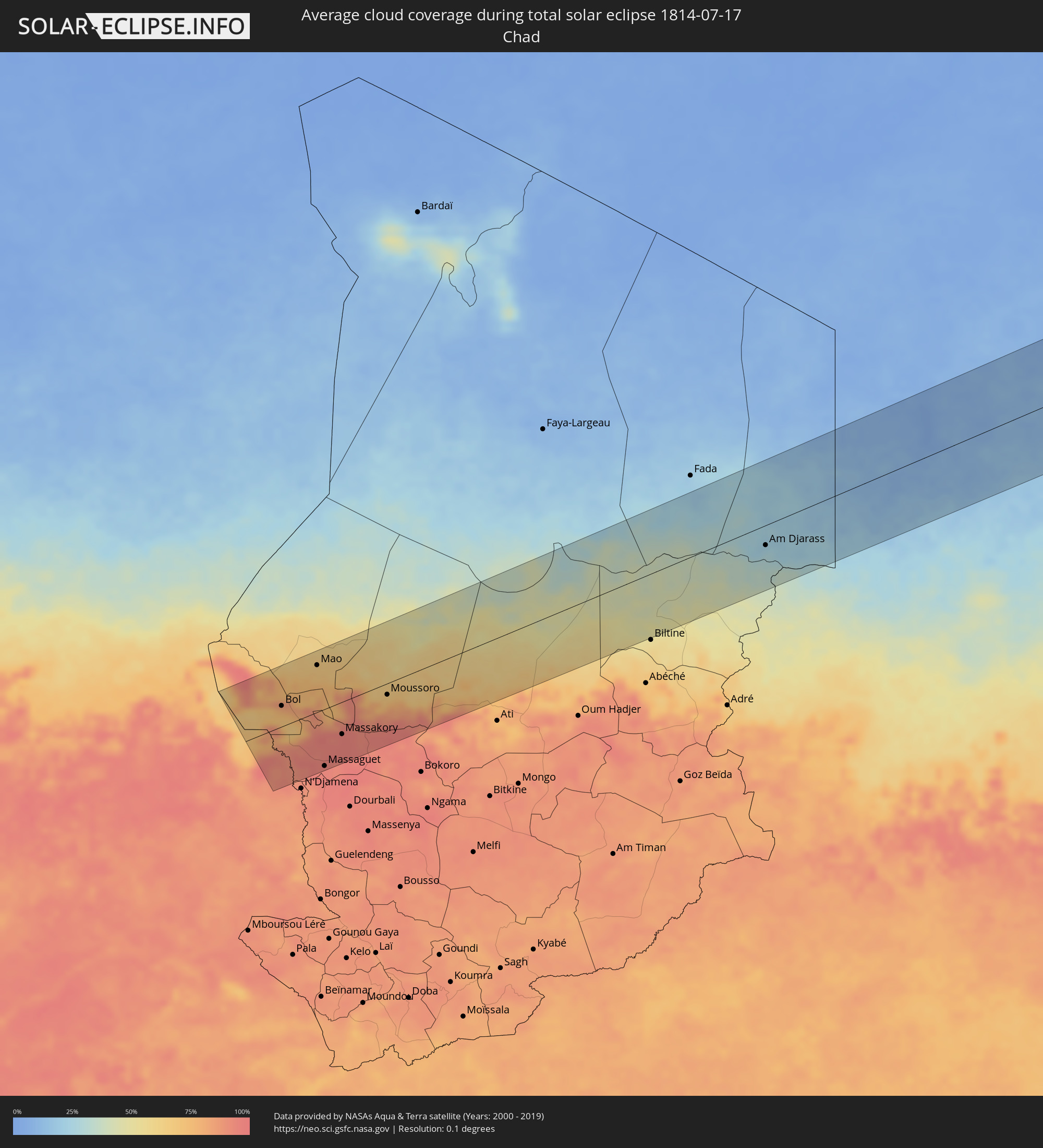 Chad
Chad
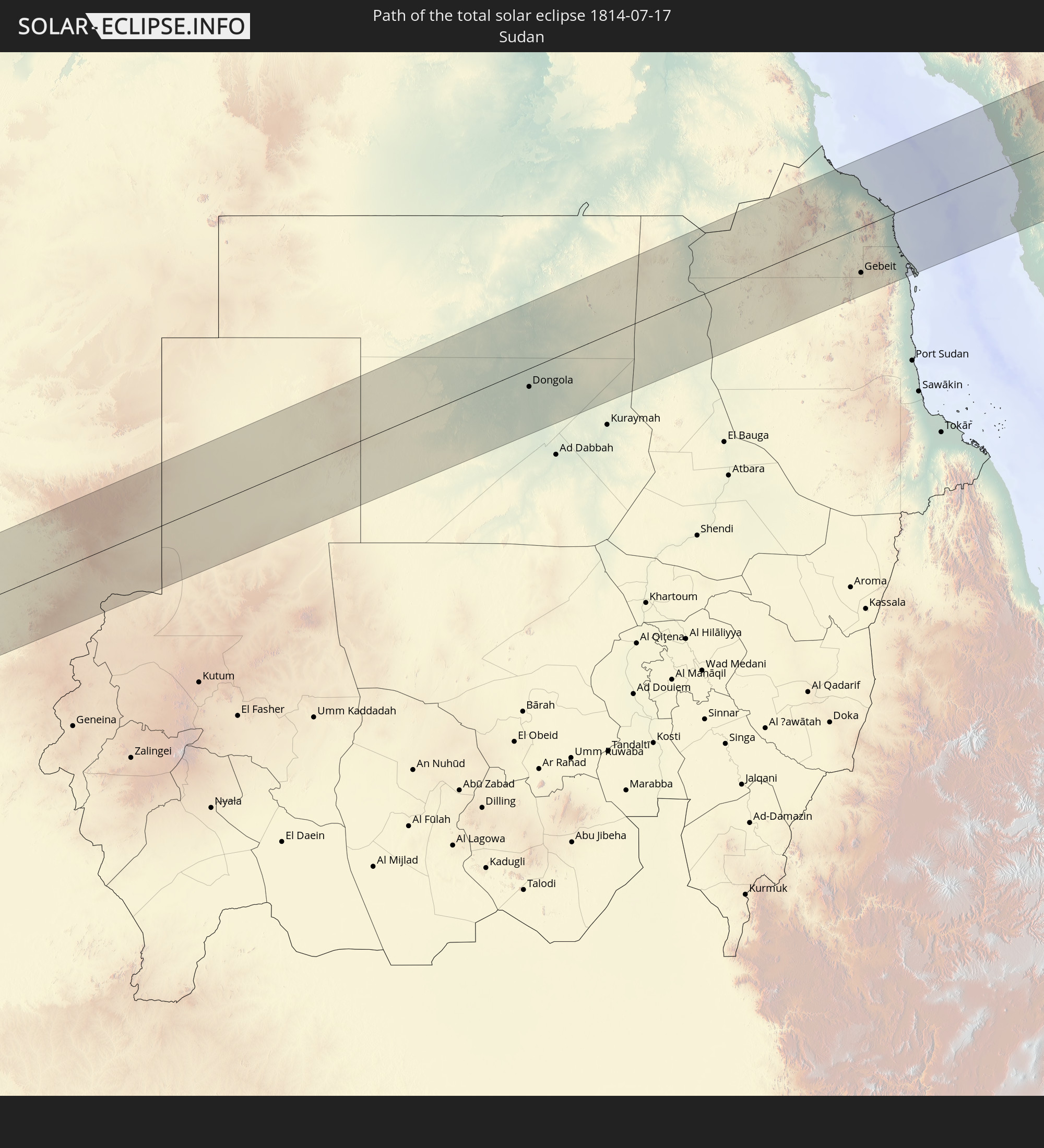
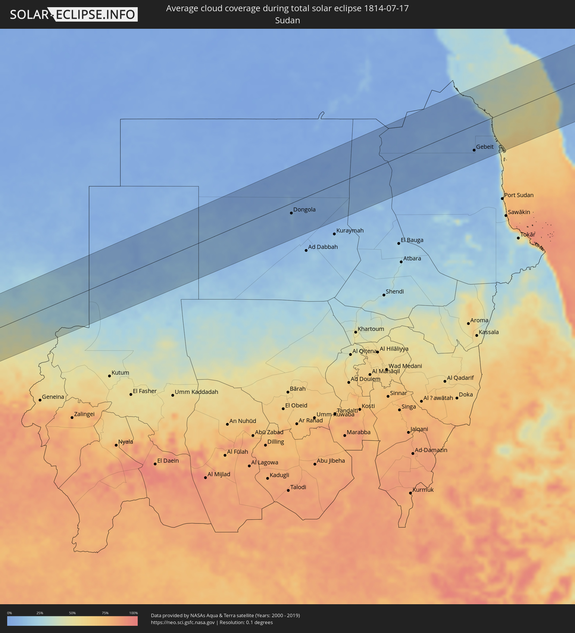 Sudan
Sudan
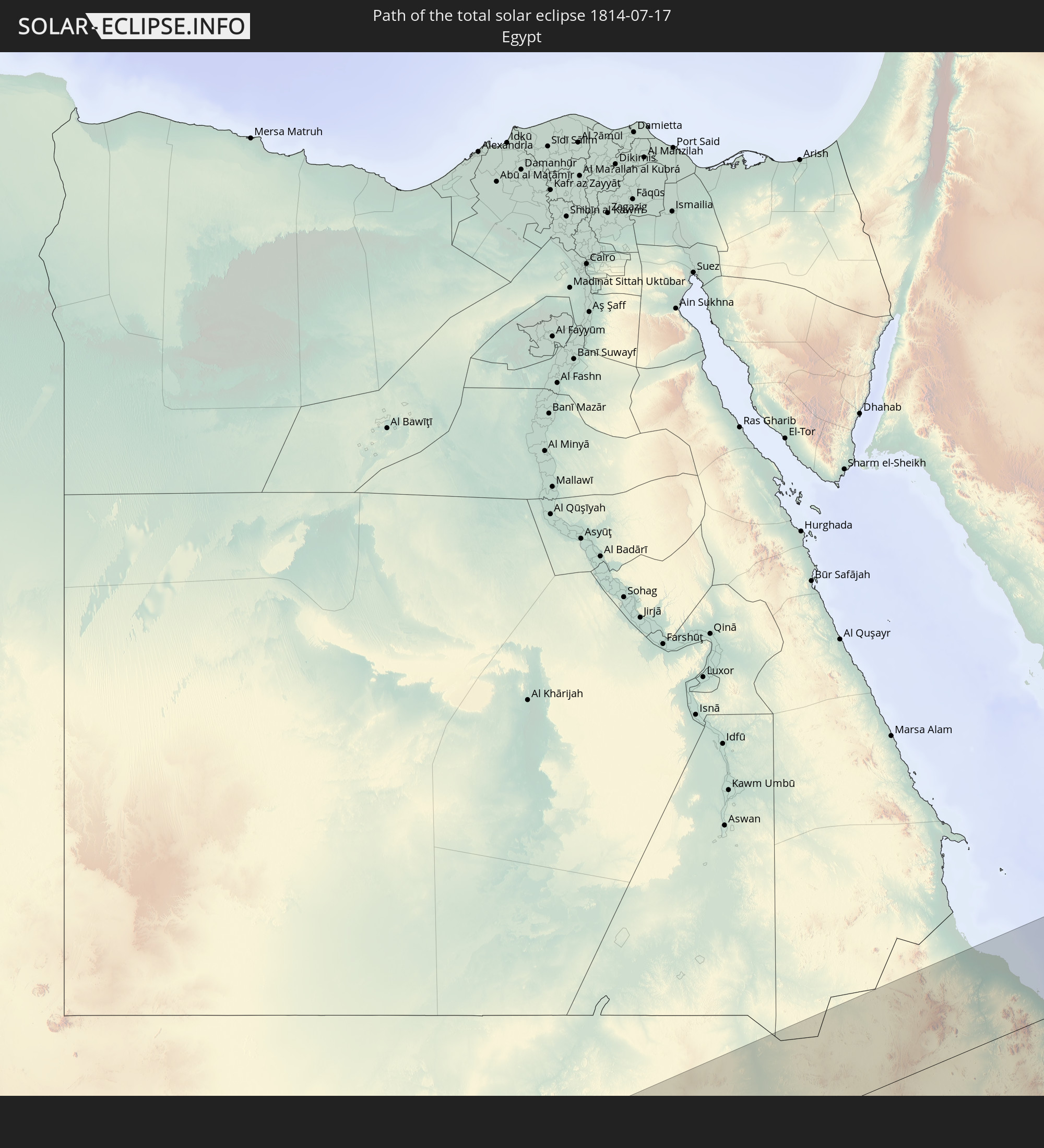
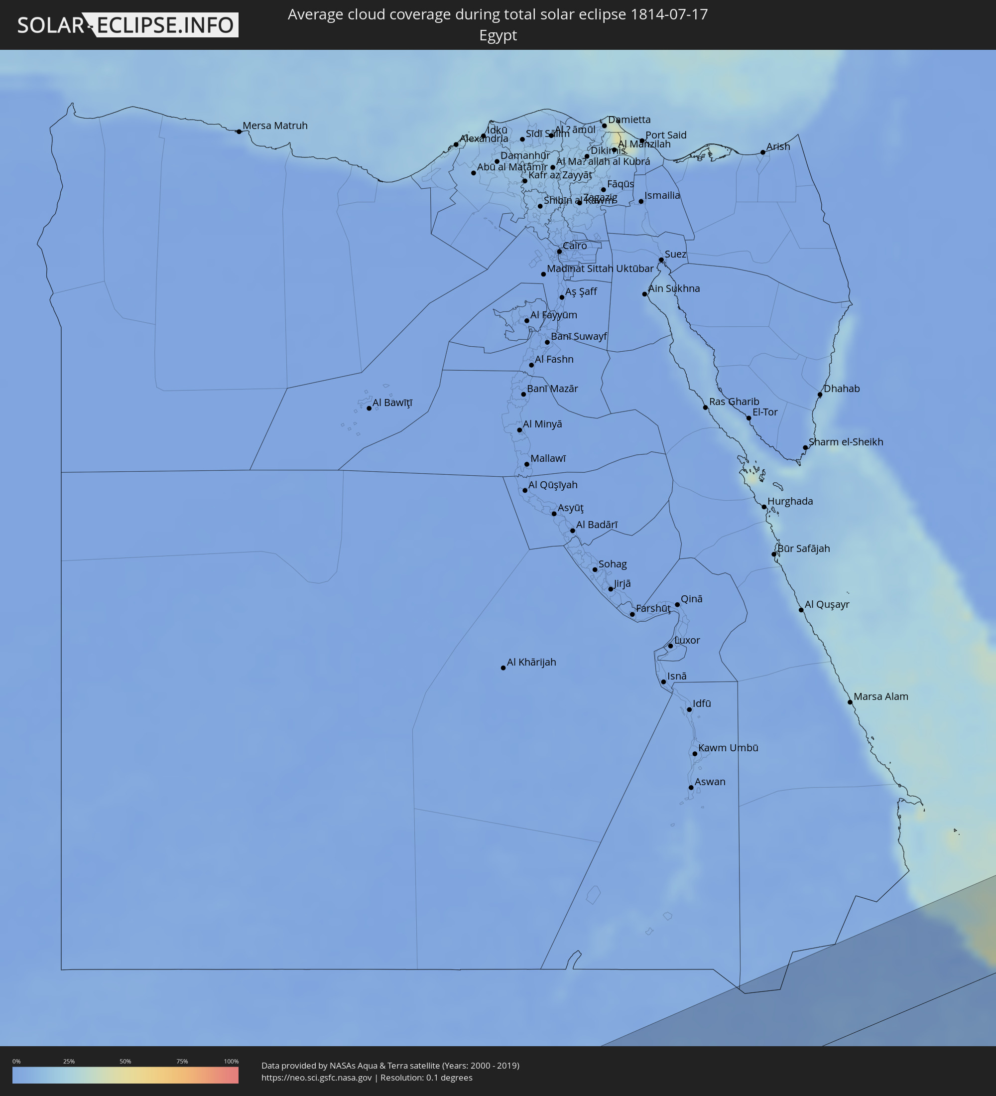 Egypt
Egypt
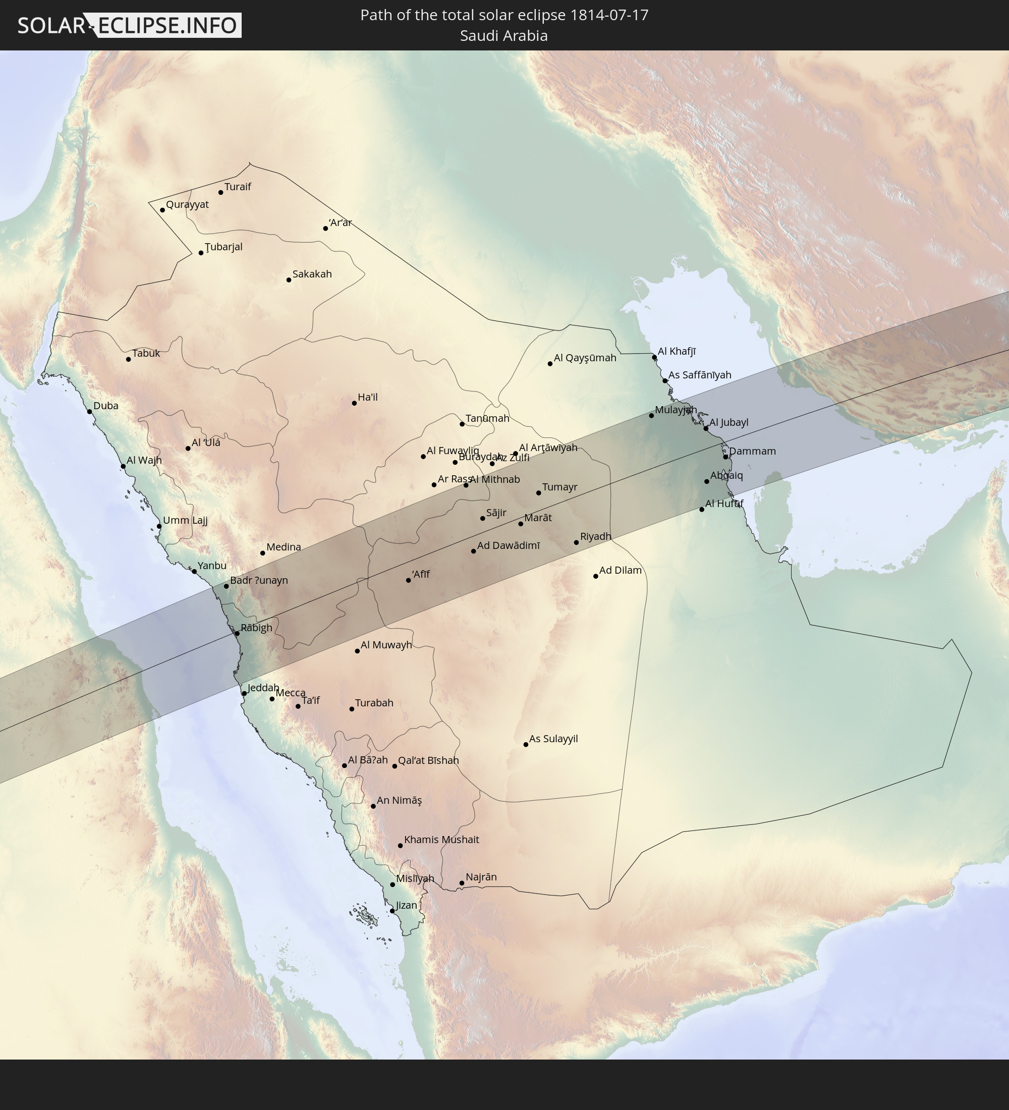
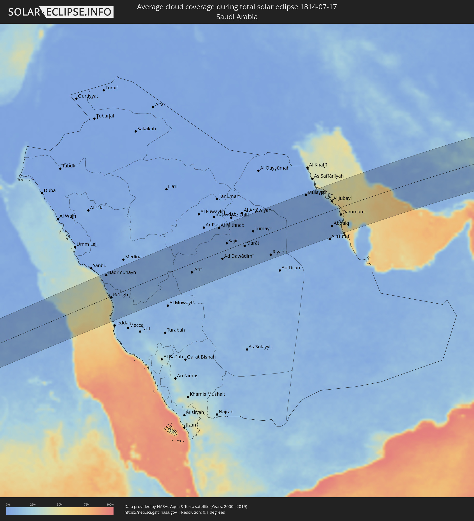 Saudi Arabia
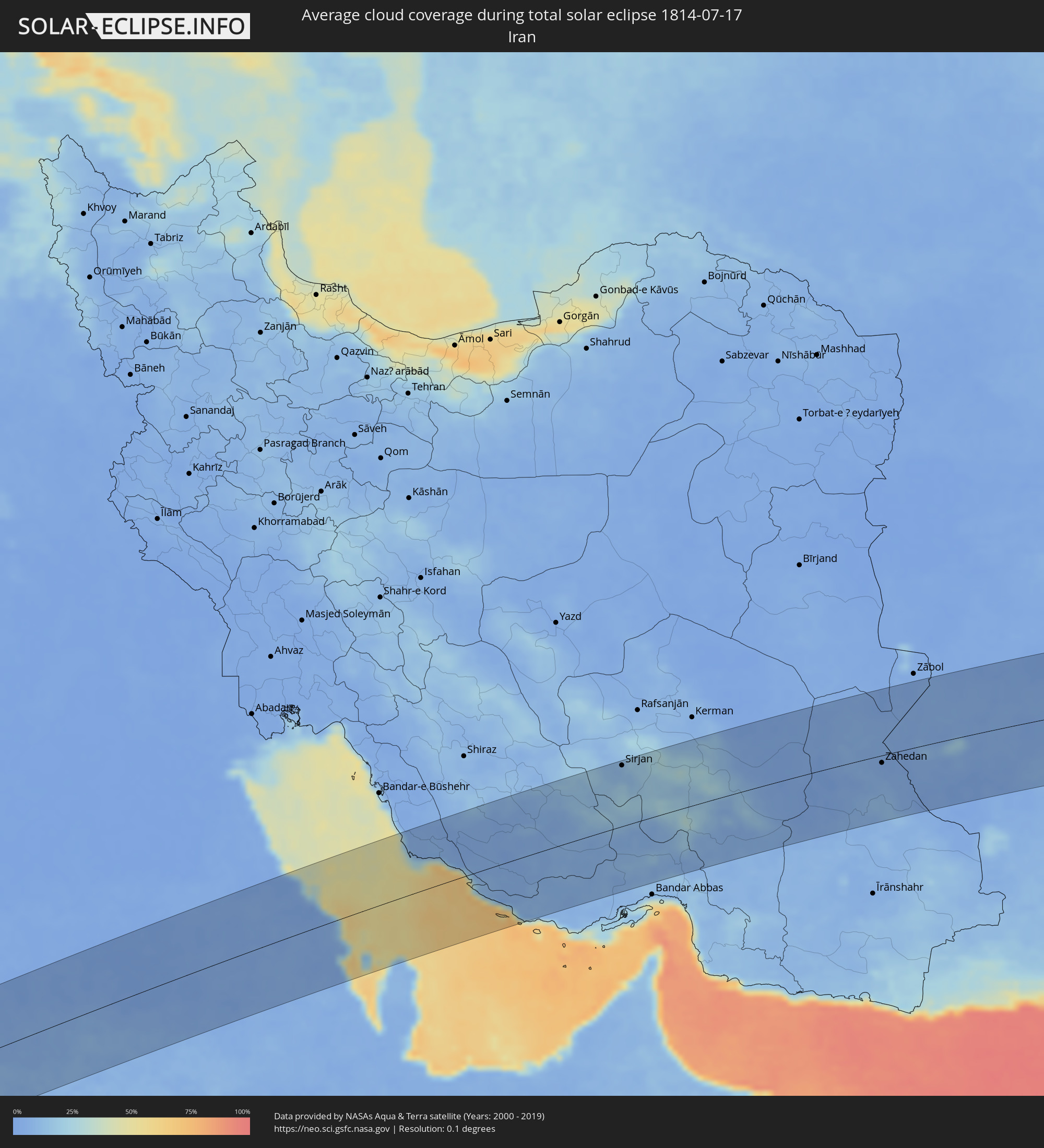 Iran
Iran
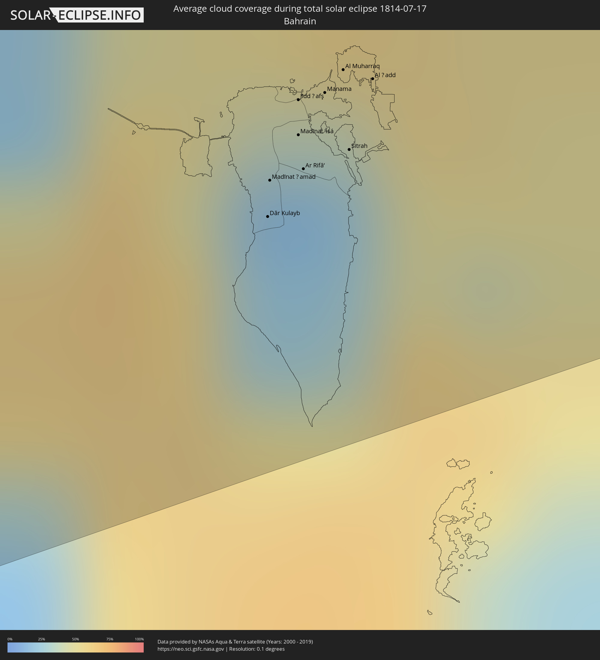 Bahrain
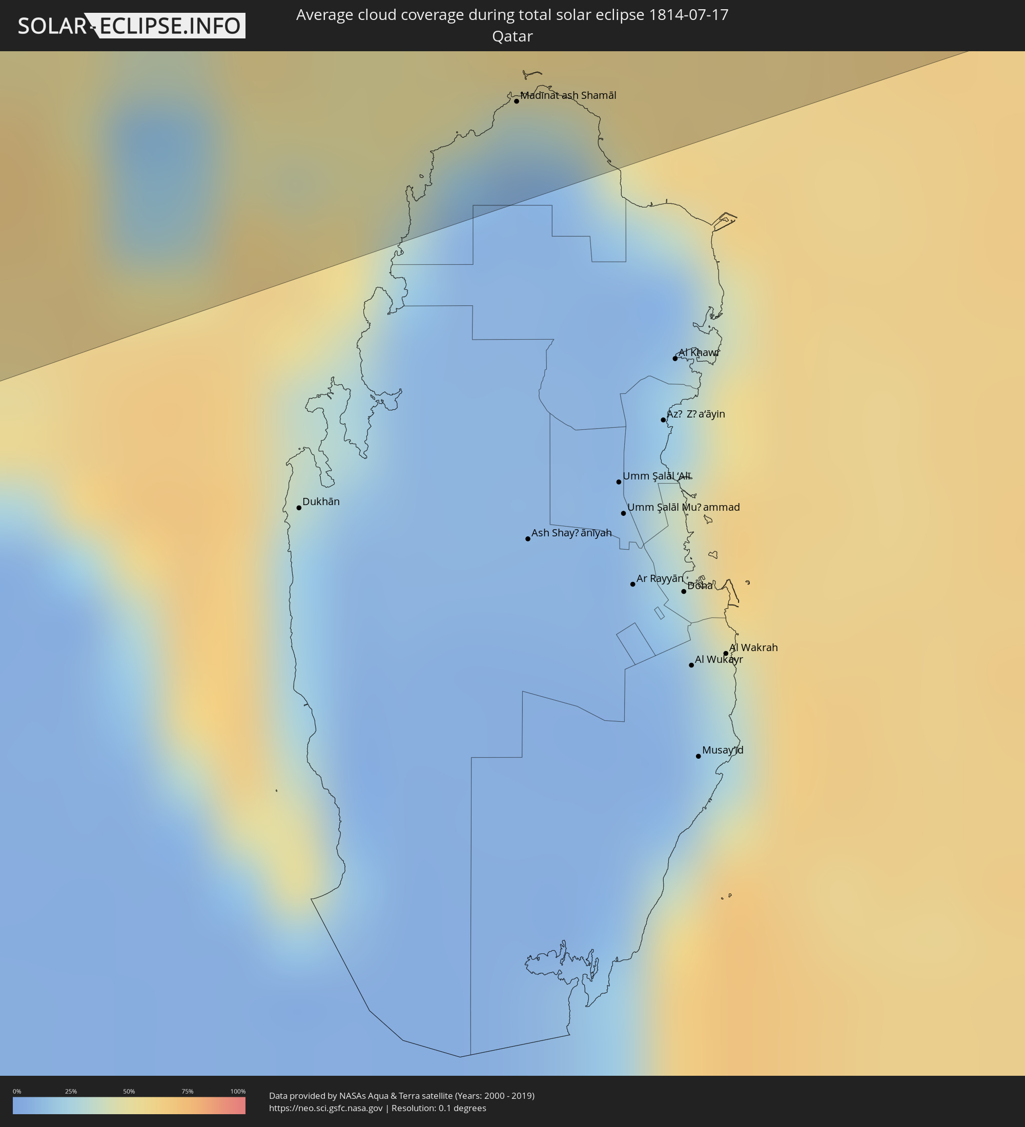 Qatar
Qatar
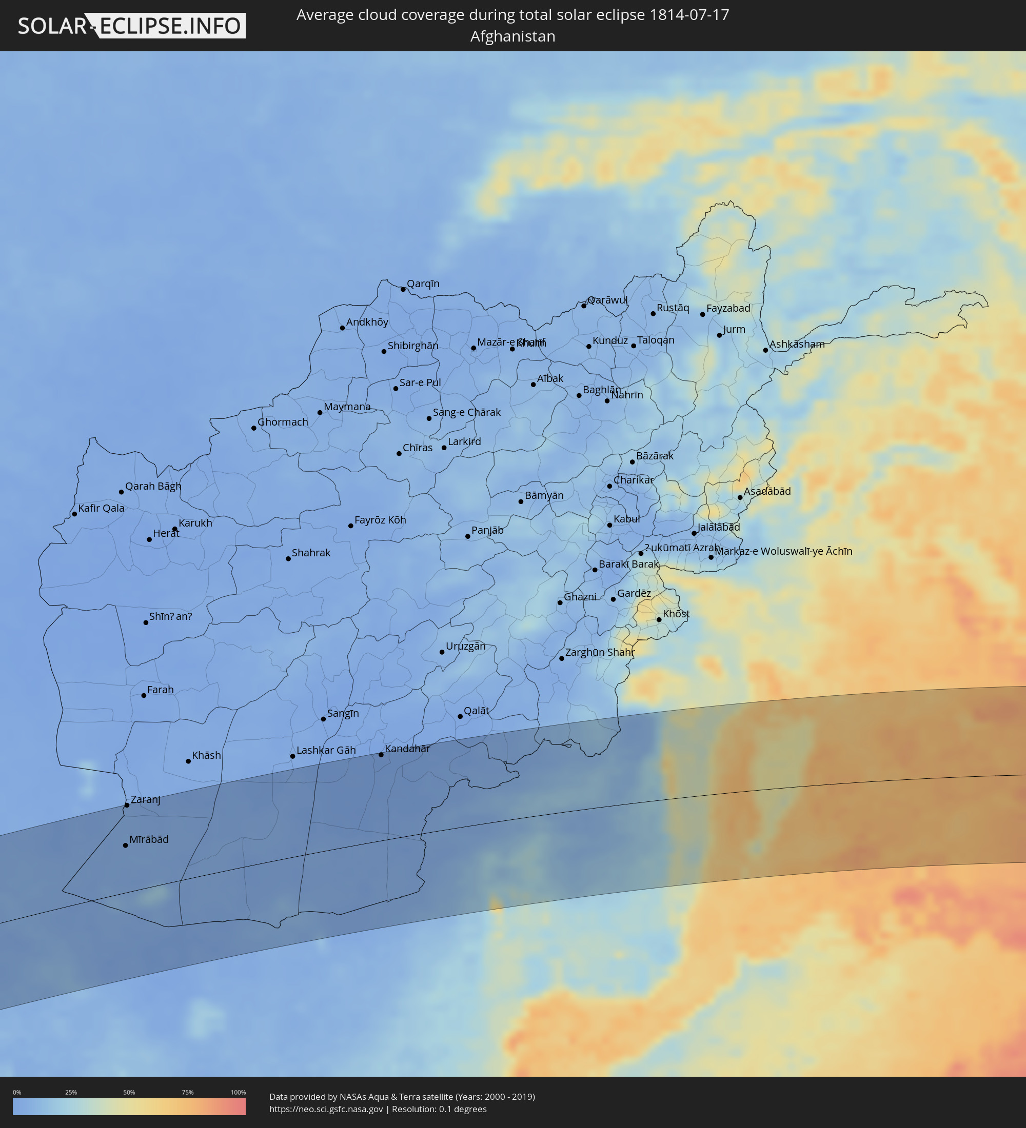 Afghanistan
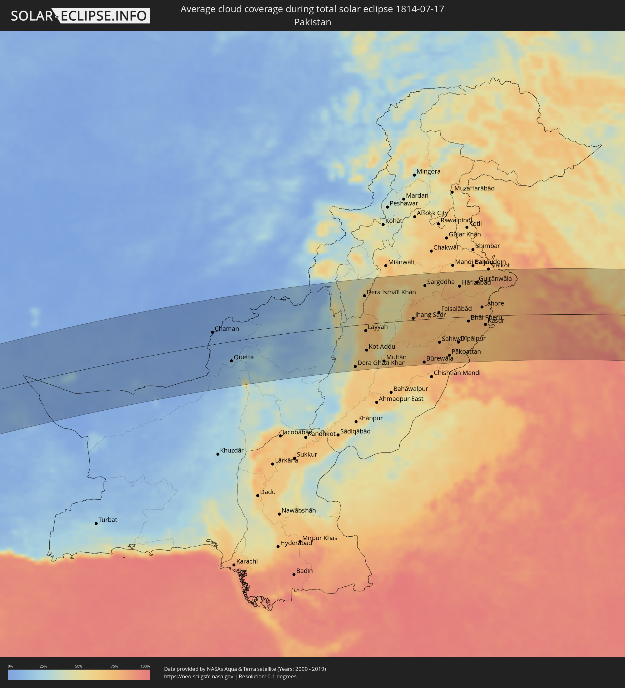 Pakistan
 India
India
 China
China
 Nepal
Nepal
 Myanmar
 Macau
Macau
 Hong Kong
 Taiwan
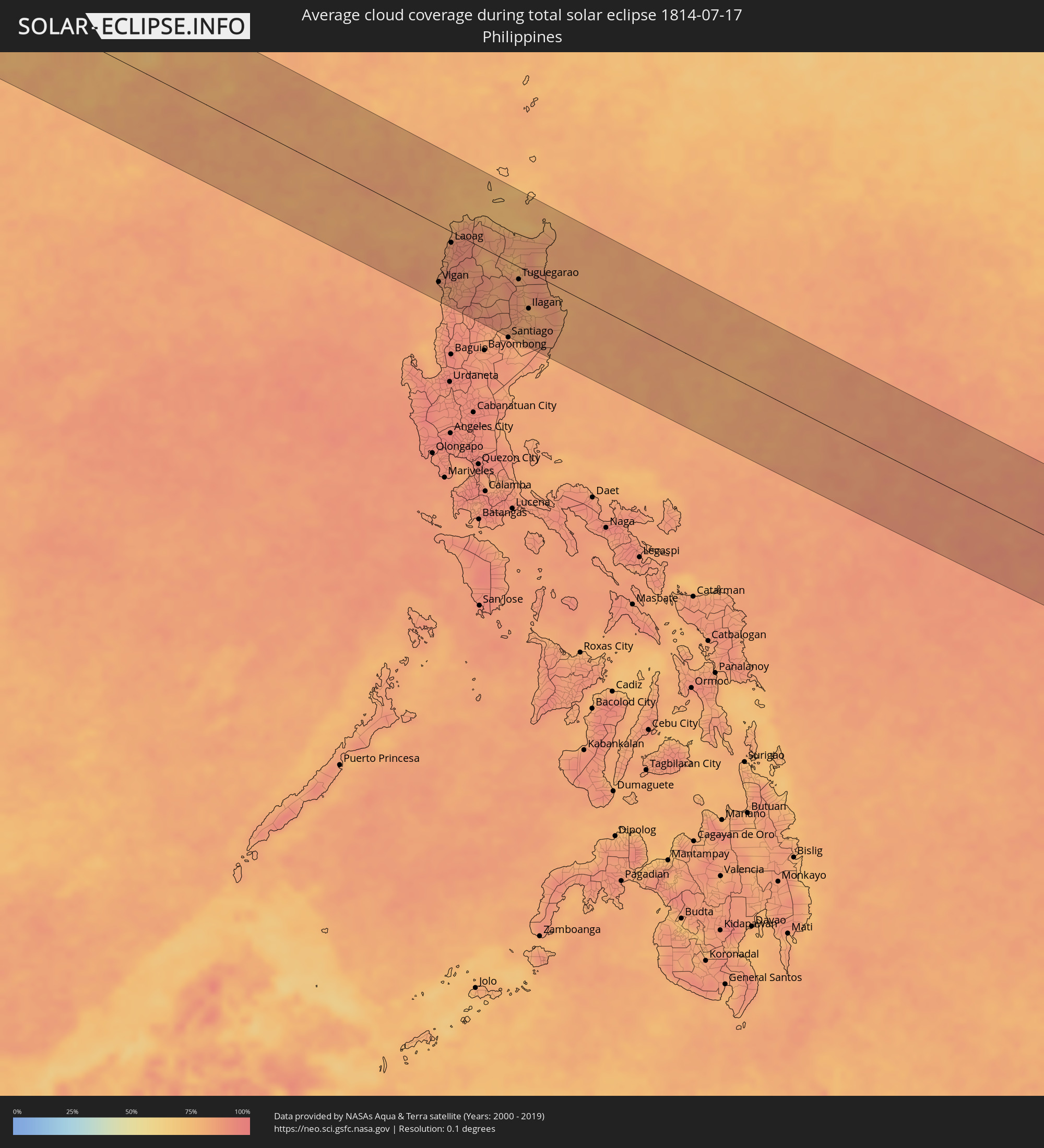 Philippines
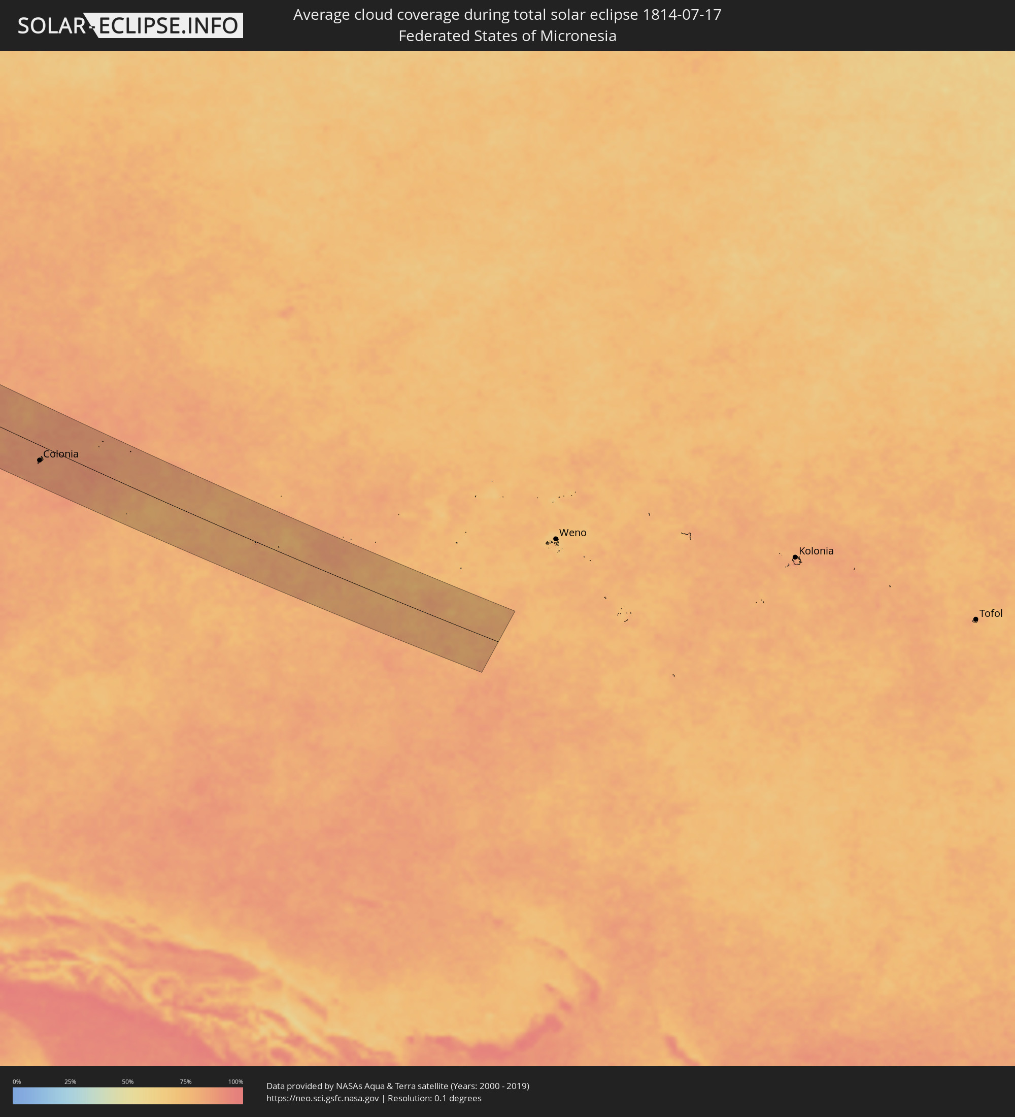 Federated States of Micronesia
Cities inside the path of the eclipse
The following table shows all locations with a population of more than 5,000 inside the eclipse path. Cities which have more than 100,000 inhabitants are marked bold. A click at the locations opens a detailed map.
| City | Type | Eclipse duration | Local time of max. eclipse | Distance to central line | Ø Cloud coverage |
|
Makary, Far North
|
total | - | 05:02:03 UTC+00:13 | 46 km | 94% |
|
Bol, Lac
|
total | - | 05:49:04 UTC+01:00 | 35 km | 80% |
|
Mao, Kanem
|
total | - | 05:49:20 UTC+01:00 | 79 km | 67% |
|
Massaguet, Hadjer-Lamis
|
total | - | 05:48:27 UTC+01:00 | 96 km | 95% |
|
Massakory, Hadjer-Lamis
|
total | - | 05:48:40 UTC+01:00 | 54 km | 96% |
|
Moussoro, Barh el Gazel
|
total | - | 05:48:54 UTC+01:00 | 19 km | 76% |
|
Am Djarass, Ennedi-Est
|
total | - | 05:50:06 UTC+01:00 | 33 km | 24% |
|
Argo, Northern State
|
total | - | 07:04:03 UTC+02:10 | 6 km | 9% |
|
Dongola, Northern State
|
total | - | 07:03:48 UTC+02:10 | 31 km | 11% |
|
Gebeit, Red Sea
|
total | - | 07:08:05 UTC+02:10 | 77 km | 5% |
|
Badr Ḩunayn, Al Madīnah al Munawwarah
|
total | - | 08:08:51 UTC+03:06 | 104 km | 3% |
|
Rābigh, Makkah
|
total | - | 08:08:07 UTC+03:06 | 7 km | 30% |
|
‘Afīf, Ar Riyāḑ
|
total | - | 08:12:18 UTC+03:06 | 42 km | 7% |
|
Al Mithnab, Al-Qassim
|
total | - | 08:15:23 UTC+03:06 | 112 km | 2% |
|
Ad Dawādimī, Ar Riyāḑ
|
total | - | 08:14:15 UTC+03:06 | 35 km | 6% |
|
Riyadh, Ar Riyāḑ
|
total | - | 08:16:50 UTC+03:06 | 100 km | 6% |
|
Al Qurayn, Eastern Province
|
total | - | 08:20:58 UTC+03:06 | 117 km | 7% |
|
Al Jubayl, Eastern Province
|
total | - | 08:22:31 UTC+03:06 | 41 km | 20% |
|
Abqaiq, Eastern Province
|
total | - | 08:21:30 UTC+03:06 | 72 km | 3% |
|
Umm as Sāhik, Eastern Province
|
total | - | 08:22:29 UTC+03:06 | 5 km | 8% |
|
Tārūt, Eastern Province
|
total | - | 08:22:34 UTC+03:06 | 18 km | 18% |
|
Raḩīmah, Eastern Province
|
total | - | 08:22:43 UTC+03:06 | 4 km | 47% |
|
Dammam, Eastern Province
|
total | - | 08:22:31 UTC+03:06 | 34 km | 8% |
|
Khobar, Eastern Province
|
total | - | 08:22:30 UTC+03:06 | 54 km | 26% |
|
Dār Kulayb, Southern Governorate
|
total | - | 08:41:57 UTC+03:26 | 86 km | 24% |
|
Madīnat Ḩamad, Central Governorate
|
total | - | 08:42:00 UTC+03:26 | 81 km | 24% |
|
Madīnat ‘Īsá, Southern Governorate
|
total | - | 08:42:06 UTC+03:26 | 77 km | 19% |
|
Jidd Ḩafş, Manama
|
total | - | 08:42:09 UTC+03:26 | 72 km | 19% |
|
Ar Rifā‘, Southern Governorate
|
total | - | 08:42:04 UTC+03:26 | 81 km | 25% |
|
Manama, Manama
|
total | - | 08:42:12 UTC+03:26 | 72 km | 22% |
|
Al Muharraq, Muharraq
|
total | - | 08:42:16 UTC+03:26 | 70 km | 39% |
|
Sitrah, Manama
|
total | - | 08:42:11 UTC+03:26 | 81 km | 22% |
|
Al Ḩadd, Muharraq
|
total | - | 08:42:19 UTC+03:26 | 72 km | 46% |
|
Madīnat ash Shamāl, Madīnat ash Shamāl
|
total | - | 08:42:55 UTC+03:26 | 103 km | 11% |
|
Fasā, Fars
|
total | - | 08:48:36 UTC+03:25 | 118 km | 6% |
|
Gerāsh, Fars
|
total | - | 08:48:06 UTC+03:25 | 32 km | 6% |
|
Dārāb, Fars
|
total | - | 08:49:44 UTC+03:25 | 71 km | 7% |
|
Sirjan, Kerman
|
total | - | 08:52:06 UTC+03:25 | 113 km | 13% |
|
Bam, Kerman
|
total | - | 08:56:08 UTC+03:25 | 5 km | 5% |
|
Zahedan, Sistan and Baluchestan
|
total | - | 09:00:53 UTC+03:25 | 14 km | 4% |
|
Mīrābād, Nimroz
|
total | - | 09:37:42 UTC+04:00 | 66 km | 5% |
|
Zaranj, Nimroz
|
total | - | 09:38:09 UTC+04:00 | 123 km | 4% |
|
Rūdbār, Nimroz
|
total | - | 09:38:54 UTC+04:00 | 19 km | 4% |
|
‘Alāqahdārī Dīshū, Helmand
|
total | - | 09:40:27 UTC+04:00 | 36 km | 5% |
|
Markaz-e Ḩukūmat-e Darwēshān, Helmand
|
total | - | 09:42:42 UTC+04:00 | 95 km | 3% |
|
Kandahār, Kandahar
|
total | - | 09:46:02 UTC+04:00 | 121 km | 0% |
|
Quetta, Balochistān
|
total | - | 10:16:02 UTC+04:28 | 54 km | 14% |
|
Dera Ghazi Khan, Punjab
|
total | - | 10:24:00 UTC+04:28 | 116 km | 58% |
|
Multān, Punjab
|
total | - | 10:26:00 UTC+04:28 | 108 km | 63% |
|
Jhang Sadr, Punjab
|
total | - | 10:28:22 UTC+04:28 | 5 km | 69% |
|
Sargodha, Punjab
|
total | - | 10:29:26 UTC+04:28 | 93 km | 67% |
|
Chiniot, Punjab
|
total | - | 10:30:01 UTC+04:28 | 50 km | 71% |
|
Faisalābād, Punjab
|
total | - | 10:30:10 UTC+04:28 | 16 km | 69% |
|
Sahiwal, Punjab
|
total | - | 10:29:58 UTC+04:28 | 68 km | 73% |
|
Okāra, Punjab
|
total | - | 10:30:50 UTC+04:28 | 54 km | 75% |
|
Shahkot, Punjab
|
total | - | 10:31:08 UTC+04:28 | 31 km | 74% |
|
Sheikhupura, Punjab
|
total | - | 10:32:19 UTC+04:28 | 44 km | 73% |
|
Gujrānwāla, Punjab
|
total | - | 10:32:56 UTC+04:28 | 93 km | 72% |
|
Lahore, Punjab
|
total | - | 10:33:08 UTC+04:28 | 24 km | 73% |
|
Kasūr, Punjab
|
total | - | 10:33:17 UTC+04:28 | 24 km | 76% |
|
Amritsar, Punjab
|
total | - | 11:27:22 UTC+05:21 | 31 km | 75% |
|
Moga, Punjab
|
total | - | 11:27:55 UTC+05:21 | 60 km | 77% |
|
Batāla, Punjab
|
total | - | 11:28:11 UTC+05:21 | 50 km | 74% |
|
Barnāla, Punjab
|
total | - | 11:28:46 UTC+05:21 | 110 km | 80% |
|
Jalandhar, Punjab
|
total | - | 11:28:59 UTC+05:21 | 4 km | 81% |
|
Pathānkot, Punjab
|
total | - | 11:29:19 UTC+05:21 | 101 km | 79% |
|
Ludhiāna, Punjab
|
total | - | 11:29:35 UTC+05:21 | 51 km | 82% |
|
Māler Kotla, Punjab
|
total | - | 11:29:36 UTC+05:21 | 93 km | 84% |
|
Khanna, Punjab
|
total | - | 11:30:27 UTC+05:21 | 74 km | 86% |
|
Patiāla, Punjab
|
total | - | 11:30:50 UTC+05:21 | 116 km | 87% |
|
Chandigarh, Chandigarh
|
total | - | 11:31:51 UTC+05:21 | 71 km | 88% |
|
Ambāla, Haryana
|
total | - | 11:31:50 UTC+05:21 | 113 km | 92% |
|
Shimla, Himachal Pradesh
|
total | - | 11:32:48 UTC+05:21 | 30 km | 88% |
|
Dehra Dūn, Uttarakhand
|
total | - | 11:34:55 UTC+05:21 | 116 km | 95% |
|
Lijiang, Yunnan
|
total | - | 15:10:02 UTC+08:00 | 46 km | 85% |
|
Dadukou, Sichuan
|
total | - | 15:13:24 UTC+08:00 | 25 km | 86% |
|
Liupanshui, Guizhou
|
total | - | 15:19:18 UTC+08:00 | 102 km | 85% |
|
Anshun, Guizhou
|
total | - | 15:21:41 UTC+08:00 | 111 km | 89% |
|
Wuzhou, Guangxi Zhuang Autonomous Region
|
total | - | 15:33:49 UTC+08:00 | 66 km | 88% |
|
Yangjiang, Guangdong
|
total | - | 15:36:46 UTC+08:00 | 66 km | 90% |
|
Yunfu, Guangdong
|
total | - | 15:35:33 UTC+08:00 | 44 km | 90% |
|
Zhaoqing, Guangdong
|
total | - | 15:36:00 UTC+08:00 | 76 km | 90% |
|
Jiangmen, Guangdong
|
total | - | 15:37:27 UTC+08:00 | 58 km | 91% |
|
Foshan, Guangdong
|
total | - | 15:36:57 UTC+08:00 | 104 km | 91% |
|
Guangzhou, Guangdong
|
total | - | 15:37:00 UTC+08:00 | 119 km | 92% |
|
Shiqi, Guangdong
|
total | - | 15:37:56 UTC+08:00 | 65 km | 93% |
|
Macau, Macau
|
total | - | 15:12:43 UTC+07:34 | 41 km | 85% |
|
Zhuhai, Guangdong
|
total | - | 15:38:29 UTC+08:00 | 50 km | 76% |
|
Tung Chung, Islands
|
total | - | 15:15:40 UTC+07:36 | 68 km | 79% |
|
Tuen Mun, Tuen Mun
|
total | - | 15:15:35 UTC+07:36 | 80 km | 83% |
|
Yuen Long Kau Hui, Yuen Long
|
total | - | 15:15:35 UTC+07:36 | 89 km | 88% |
|
Shenzhen, Guangdong
|
total | - | 15:38:49 UTC+08:00 | 100 km | 90% |
|
Tsuen Wan, Tsuen Wan
|
total | - | 15:15:47 UTC+07:36 | 84 km | 85% |
|
Yung Shue Wan
|
total | - | 15:15:58 UTC+07:36 | 70 km | 76% |
|
Hong Kong, Central and Western
|
total | - | 15:15:57 UTC+07:36 | 78 km | 83% |
|
Central, Central and Western
|
total | - | 15:15:57 UTC+07:36 | 78 km | 83% |
|
Sham Shui Po, Sham Shui Po
|
total | - | 15:15:54 UTC+07:36 | 83 km | 83% |
|
Tai Po, Tai Po
|
total | - | 15:15:46 UTC+07:36 | 95 km | 88% |
|
Wan Chai, Wanchai
|
total | - | 15:15:59 UTC+07:36 | 79 km | 83% |
|
Kowloon, Kowloon City
|
total | - | 15:15:57 UTC+07:36 | 83 km | 83% |
|
Wong Tai Sin, Wong Tai Sin
|
total | - | 15:15:54 UTC+07:36 | 86 km | 85% |
|
Sha Tin, Sha Tin
|
total | - | 15:15:52 UTC+07:36 | 89 km | 85% |
|
Sai Kung, Sai Kung
|
total | - | 15:15:59 UTC+07:36 | 93 km | 80% |
|
Vigan, Ilocos
|
total | - | 15:51:55 UTC+08:00 | 89 km | 83% |
|
Batac City, Ilocos
|
total | - | 15:51:33 UTC+08:00 | 33 km | 88% |
|
Laoag, Ilocos
|
total | - | 15:51:25 UTC+08:00 | 17 km | 88% |
|
Claveria, Cagayan Valley
|
total | - | 15:51:25 UTC+08:00 | 47 km | 78% |
|
Tabuk, Cordillera
|
total | - | 15:53:03 UTC+08:00 | 46 km | 88% |
|
Ramon, Cagayan Valley
|
total | - | 15:53:52 UTC+08:00 | 111 km | 84% |
|
Roxas, Cagayan Valley
|
total | - | 15:53:34 UTC+08:00 | 74 km | 87% |
|
Aparri, Cagayan Valley
|
total | - | 15:52:13 UTC+08:00 | 49 km | 78% |
|
Magapit, Aguiguican, Cagayan Valley
|
total | - | 15:52:32 UTC+08:00 | 27 km | 83% |
|
Alicia, Cagayan Valley
|
total | - | 15:54:01 UTC+08:00 | 104 km | 81% |
|
Tuguegarao, Cagayan Valley
|
total | - | 15:53:07 UTC+08:00 | 20 km | 84% |
|
Cabagan, Cagayan Valley
|
total | - | 15:53:22 UTC+08:00 | 36 km | 80% |
|
Ilagan, Cagayan Valley
|
total | - | 15:53:47 UTC+08:00 | 58 km | 80% |
|
San Mariano, Cagayan Valley
|
total | - | 15:54:05 UTC+08:00 | 68 km | 84% |
|
Colonia, Yap
|
total | - | 18:09:09 UTC+10:00 | 40 km | 86% |