Total solar eclipse of 10/15/2498
| Day of week: | Wednesday |
| Maximum duration of eclipse: | 05m21s |
| Maximum width of eclipse path: | 215 km |
| Saros cycle: | 161 |
| Coverage: | 100% |
| Magnitude: | 1.0597 |
| Gamma: | 0.4131 |
Wo kann man die Sonnenfinsternis vom 10/15/2498 sehen?
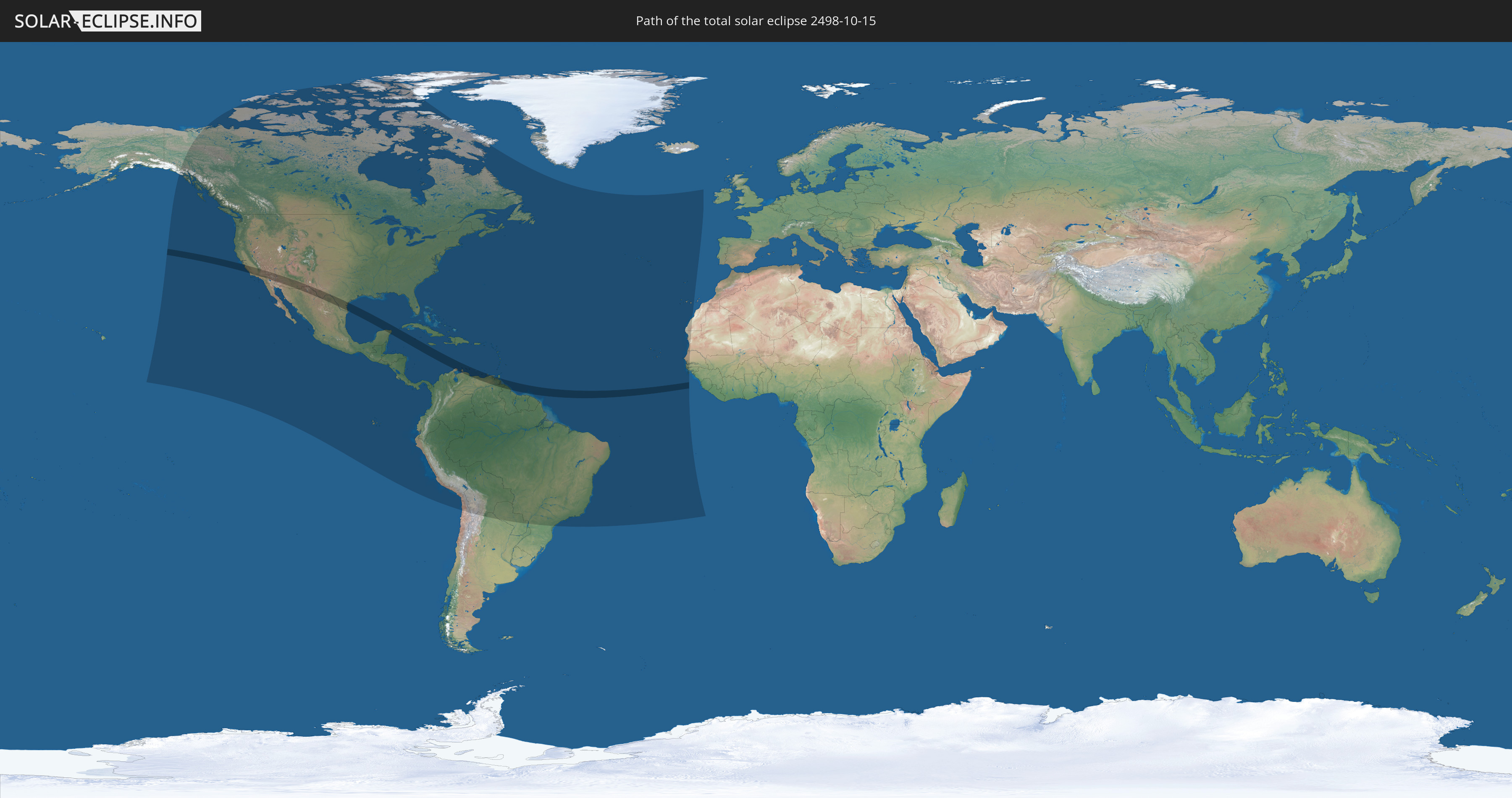
Die Sonnenfinsternis am 10/15/2498 kann man in 58 Ländern als partielle Sonnenfinsternis beobachten.
Der Finsternispfad verläuft durch 11 Länder. Nur in diesen Ländern ist sie als total Sonnenfinsternis zu sehen.
In den folgenden Ländern ist die Sonnenfinsternis total zu sehen
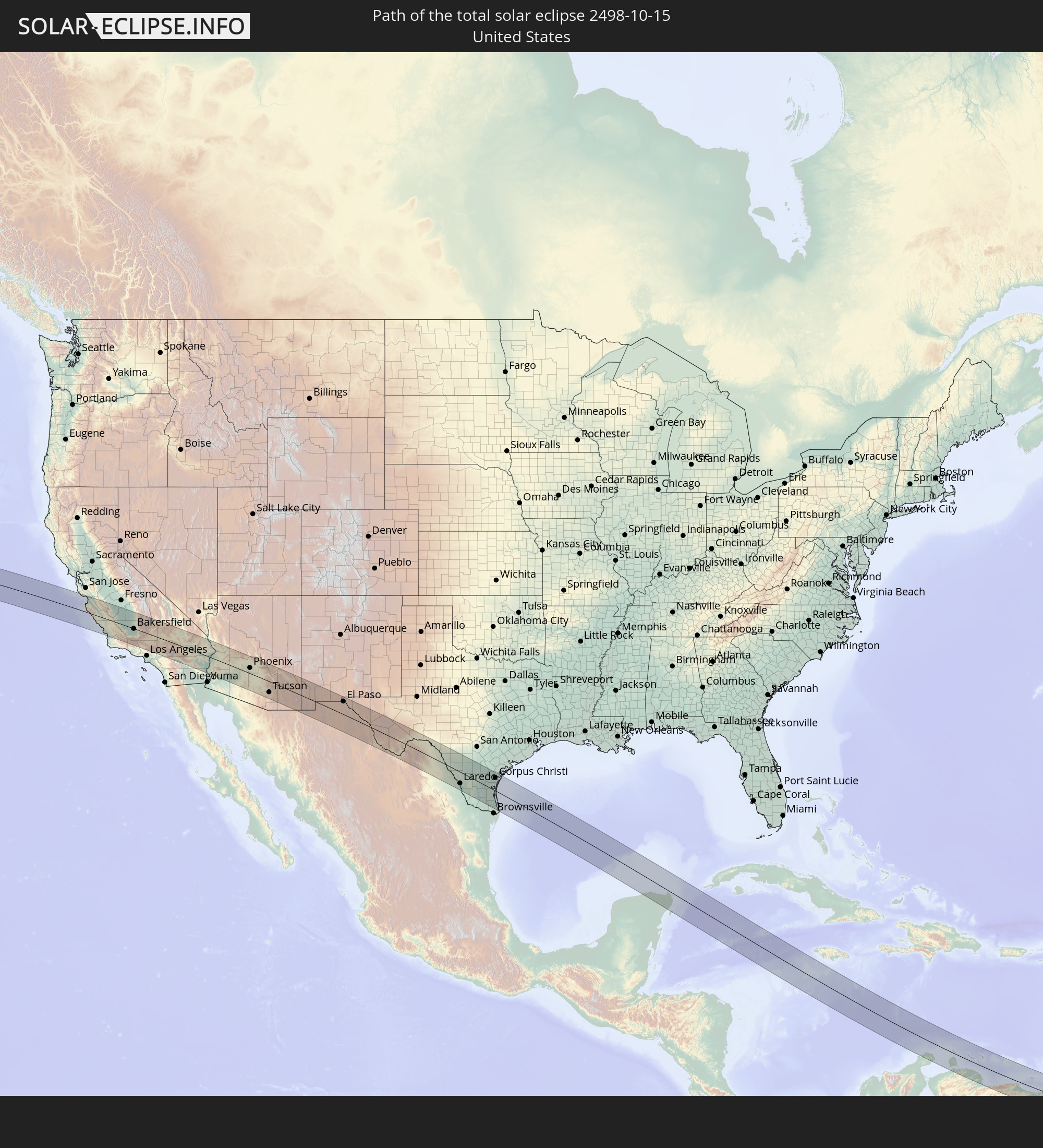 United States
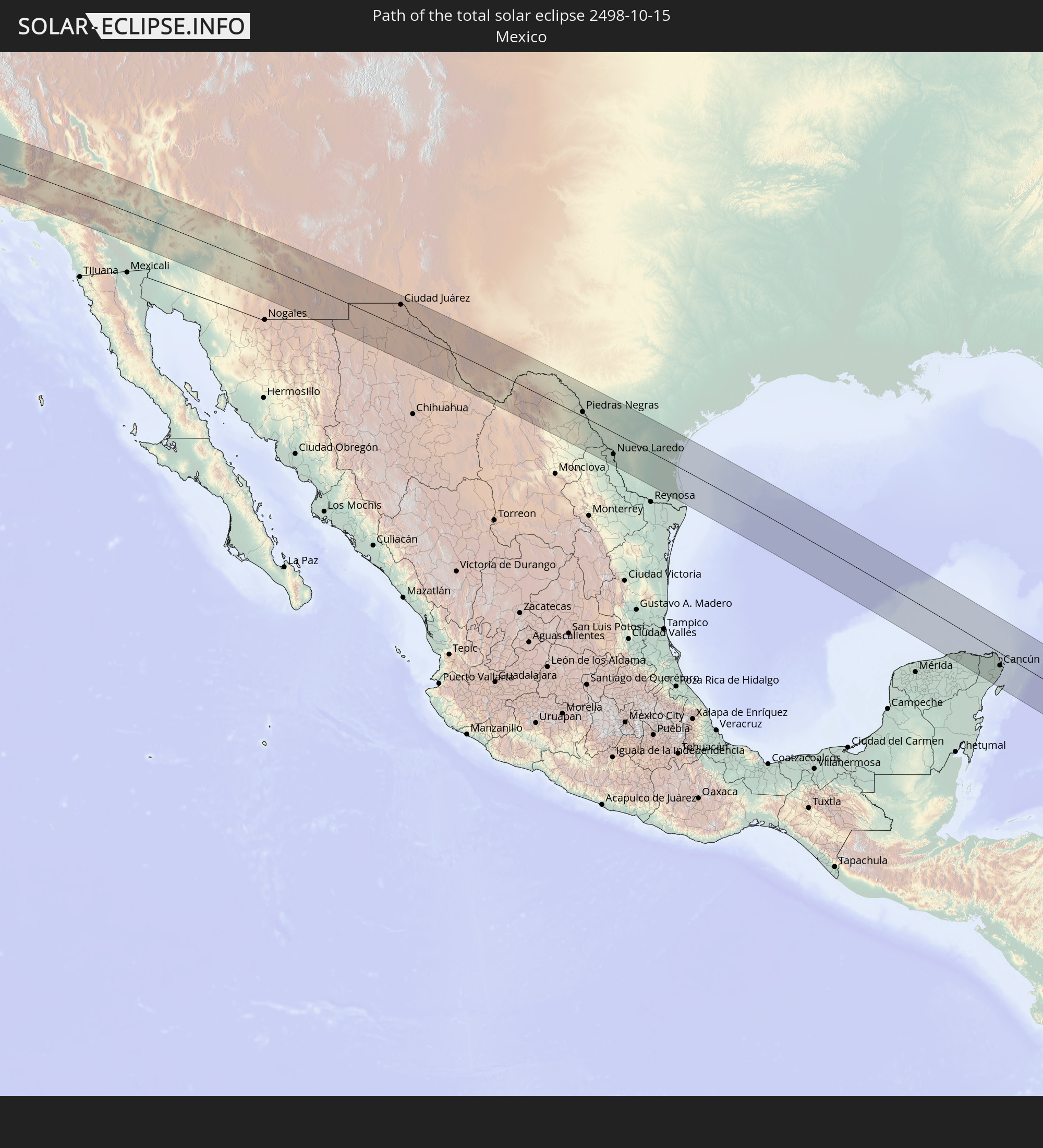 Mexico
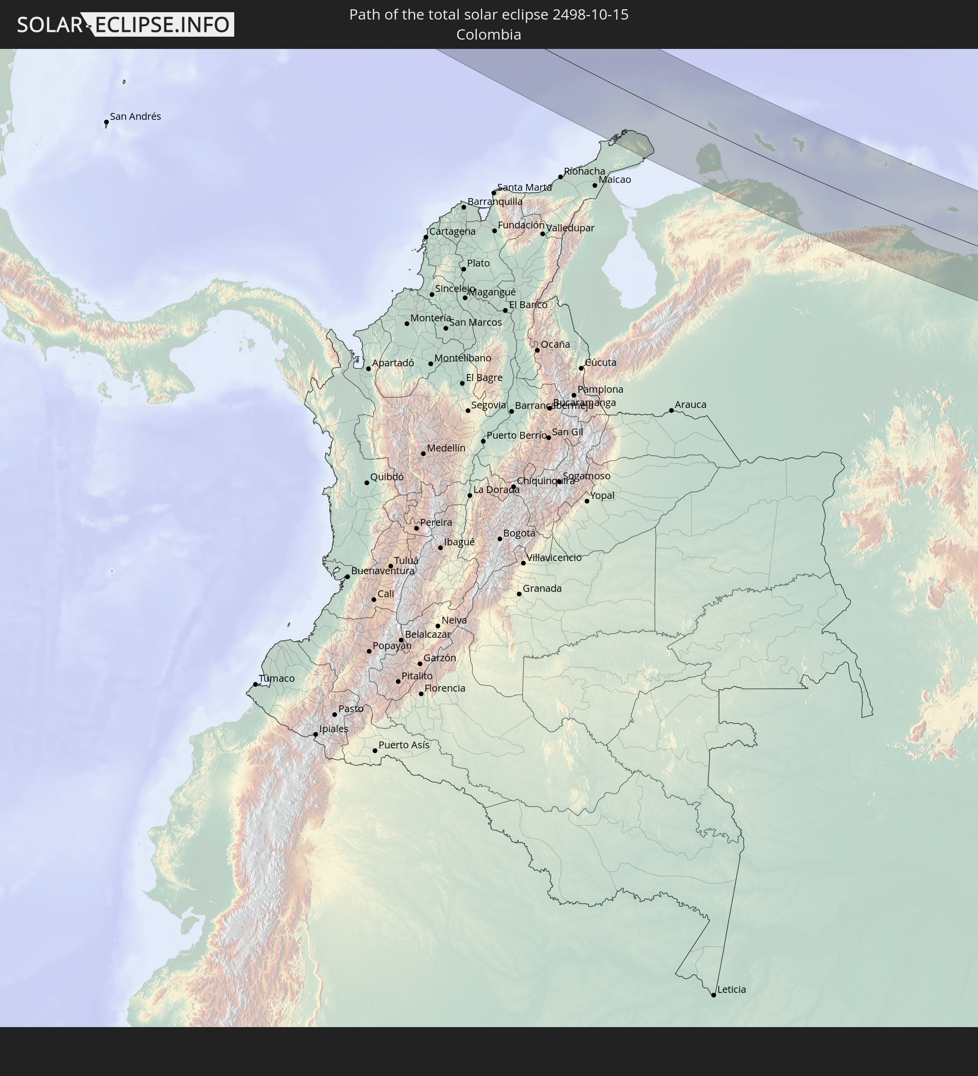 Colombia
 Cayman Islands
 Jamaica
 Venezuela
 Aruba
Aruba
 Curaçao
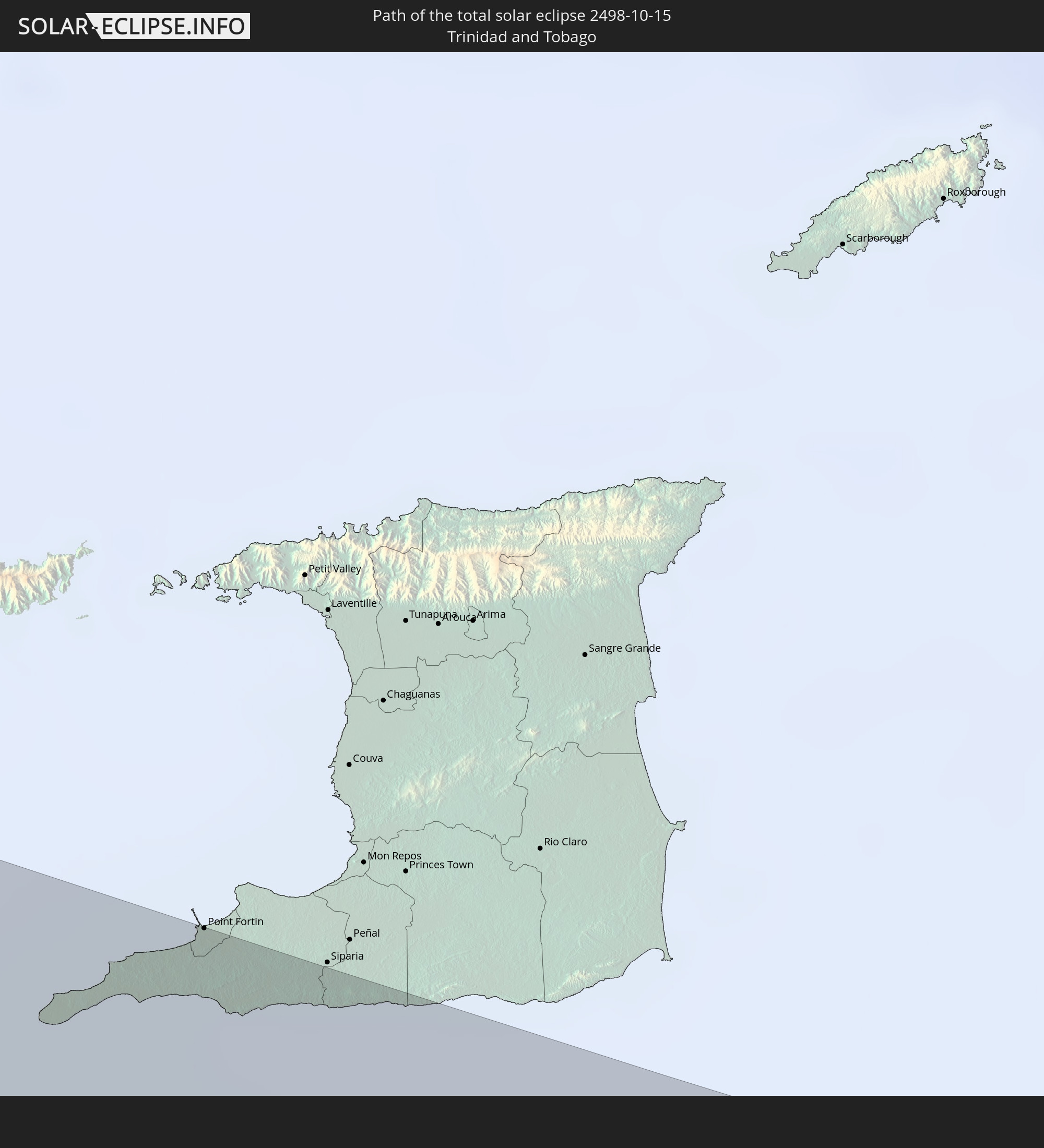 Trinidad and Tobago
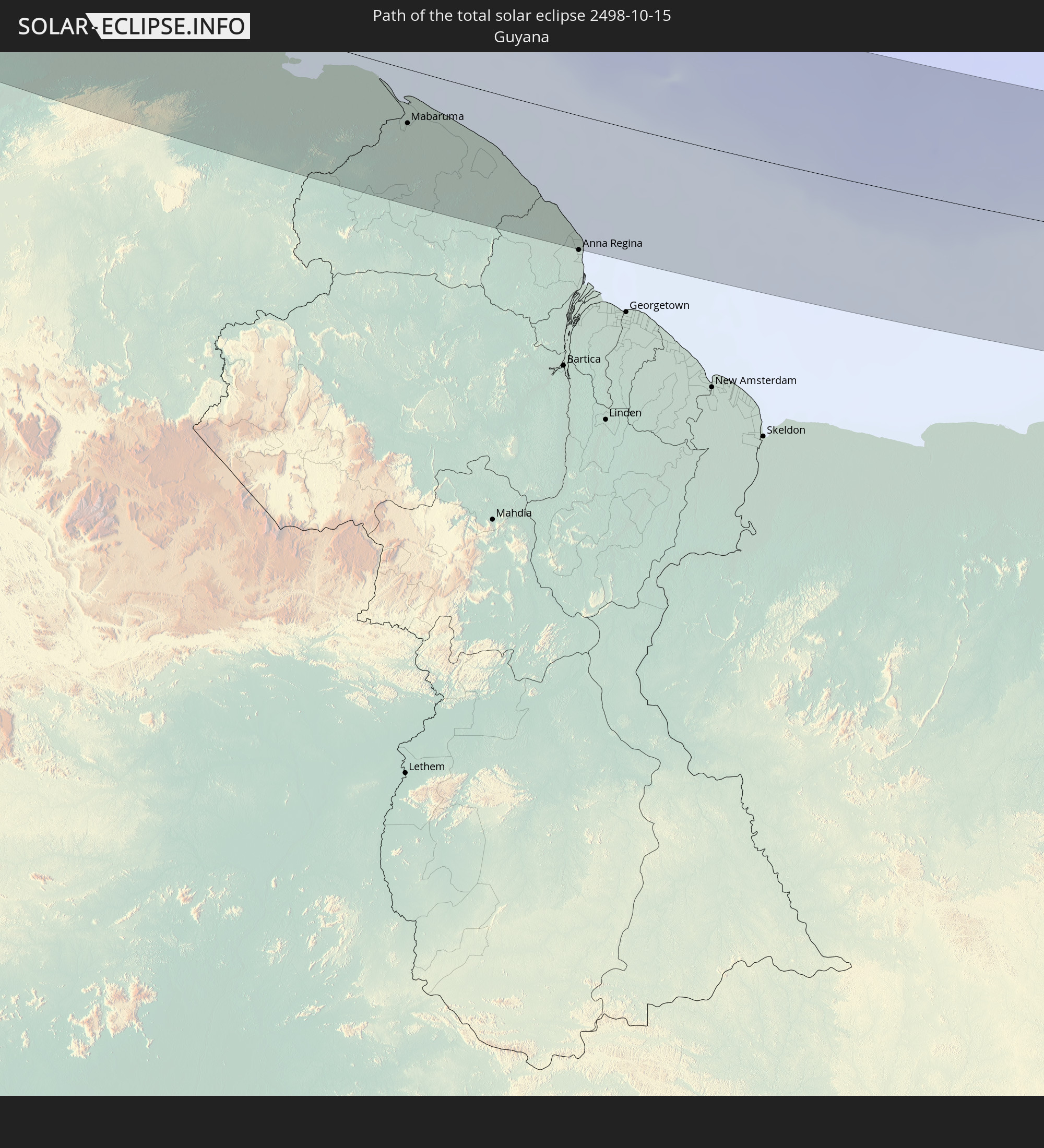 Guyana
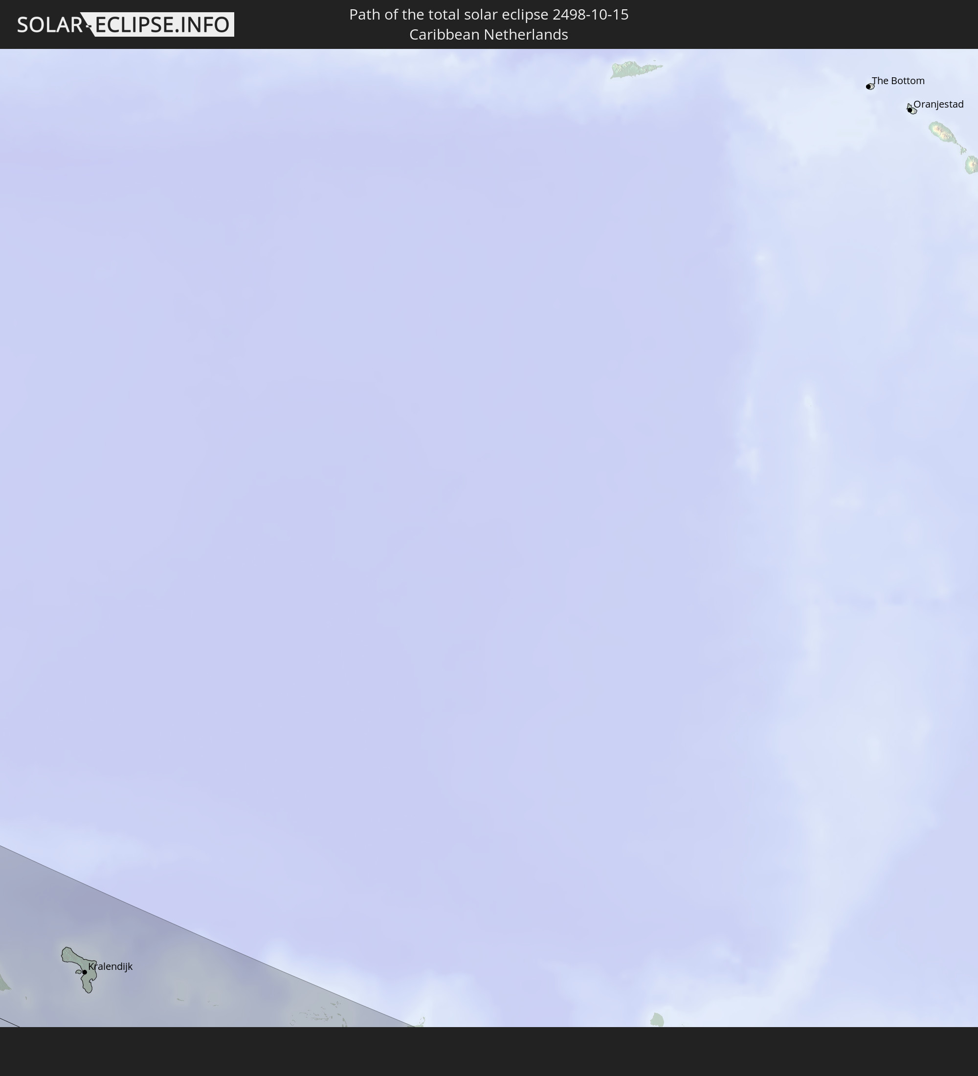 Caribbean Netherlands
In den folgenden Ländern ist die Sonnenfinsternis partiell zu sehen
 United States
 United States Minor Outlying Islands
 Canada
 Mexico
 Chile
Chile
 Greenland
 Guatemala
 Ecuador
 El Salvador
 Honduras
 Belize
 Nicaragua
 Costa Rica
 Cuba
Cuba
 Panama
 Colombia
 Cayman Islands
 Peru
Peru
 The Bahamas
 Jamaica
 Haiti
Haiti
 Brazil
 Argentina
 Venezuela
 Turks and Caicos Islands
 Dominican Republic
 Aruba
Aruba
 Bolivia
 Puerto Rico
 United States Virgin Islands
 Bermuda
 British Virgin Islands
 Anguilla
 Collectivity of Saint Martin
 Saint Barthélemy
 Saint Kitts and Nevis
 Paraguay
 Antigua and Barbuda
 Montserrat
 Trinidad and Tobago
 Guadeloupe
 Grenada
 Dominica
 Saint Vincent and the Grenadines
 Guyana
 Martinique
 Saint Lucia
 Barbados
 Suriname
 Saint Pierre and Miquelon
 French Guiana
 Portugal
 Cabo Verde
 Spain
Spain
 Senegal
 Mauritania
 The Gambia
 Guinea-Bissau
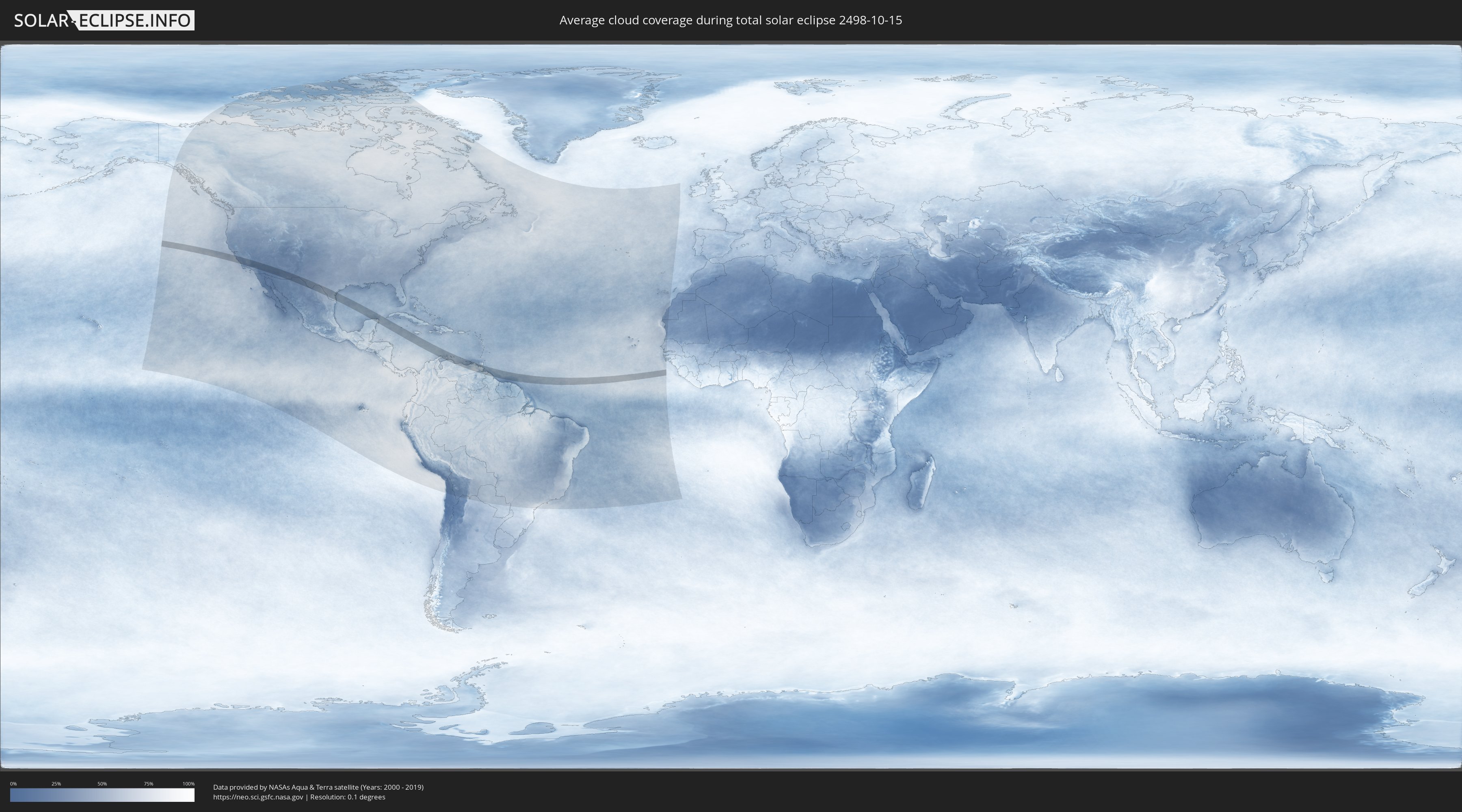
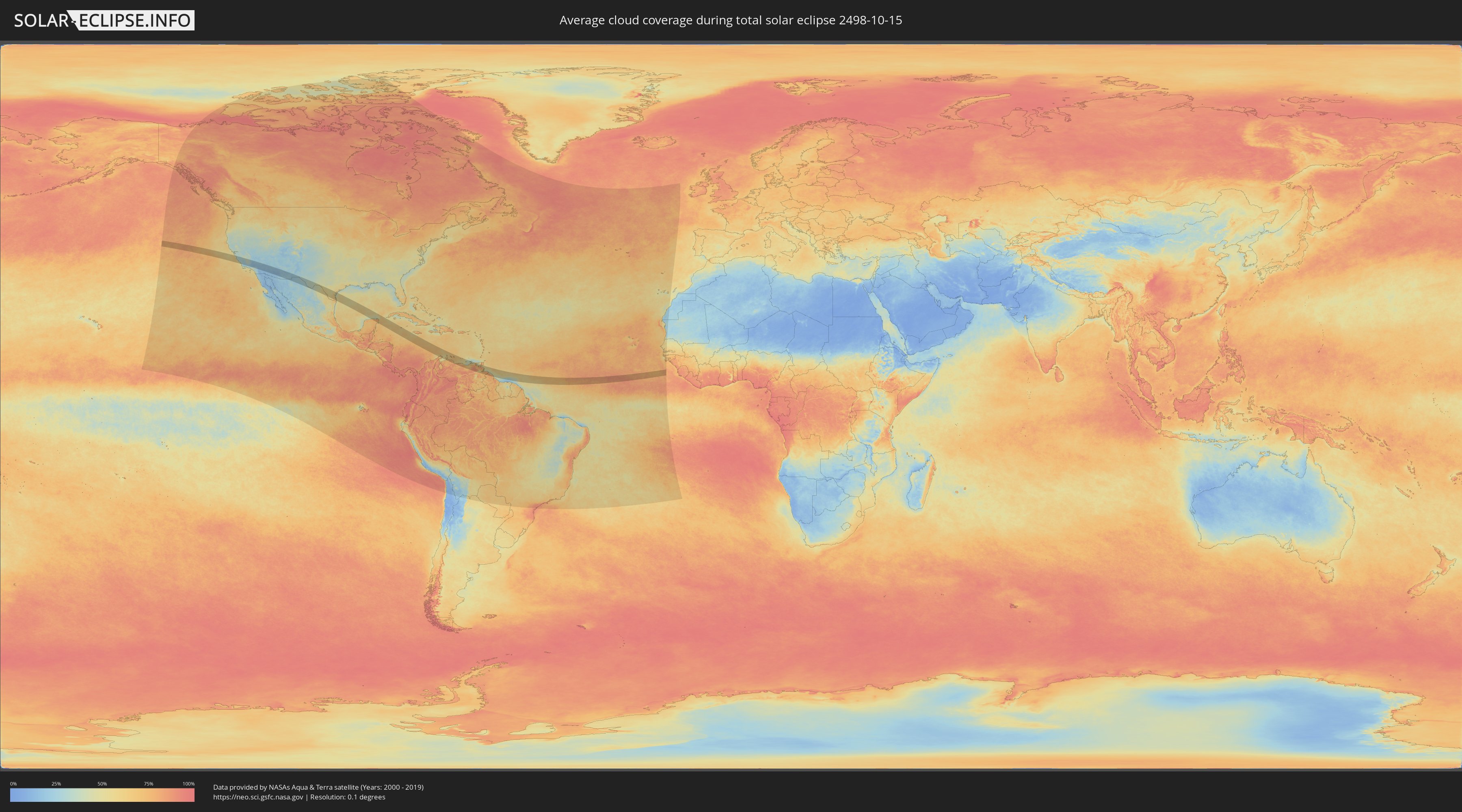
How will be the weather during the total solar eclipse on 10/15/2498?
Where is the best place to see the total solar eclipse of 10/15/2498?
The following maps show the average cloud coverage for the day of the total solar eclipse.
With the help of these maps, it is possible to find the place along the eclipse path, which has the best
chance of a cloudless sky.
Nevertheless, you should consider local circumstances and inform about the weather of your chosen
observation site.
The data is provided by NASAs satellites
AQUA and TERRA.
The cloud maps are averaged over a period of 19 years (2000 - 2019).
Detailed country maps
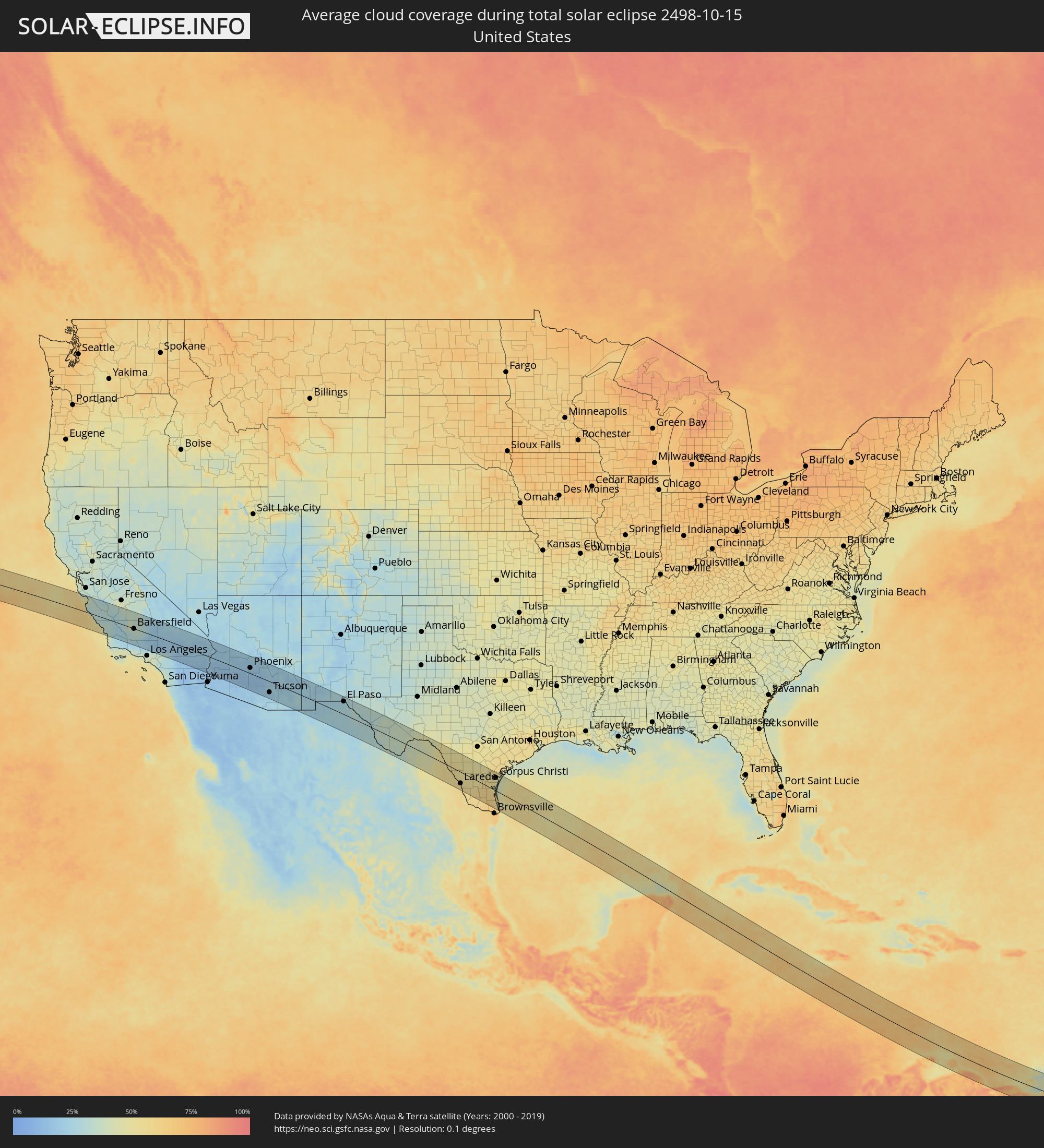 United States
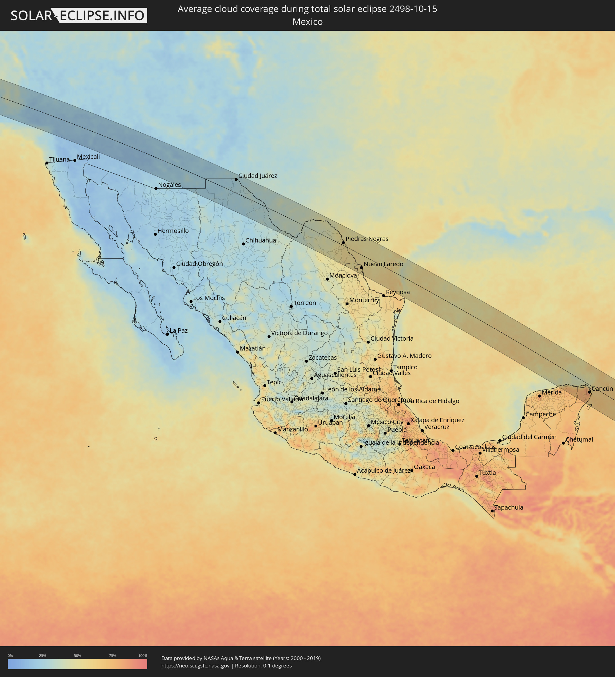 Mexico
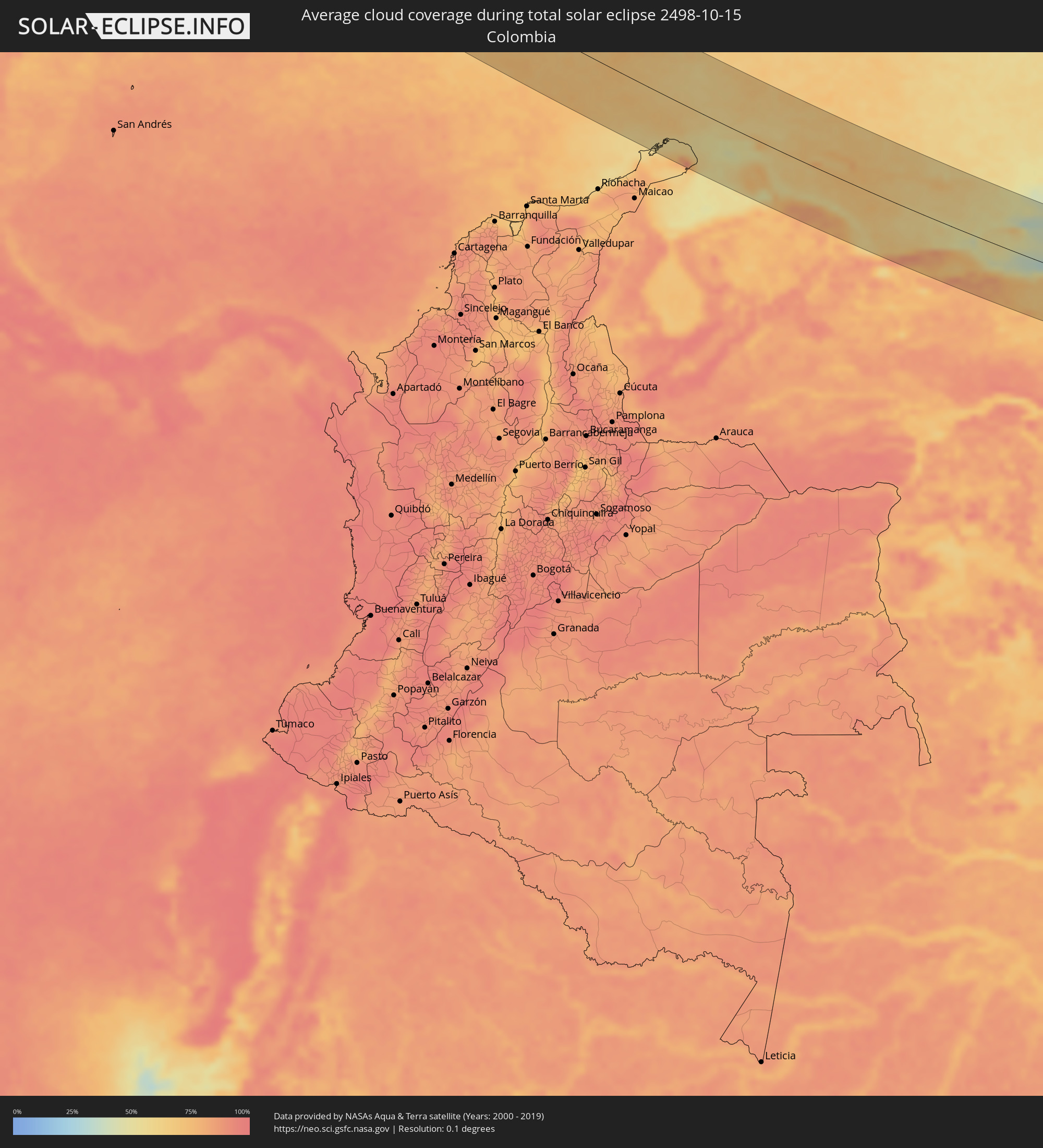 Colombia
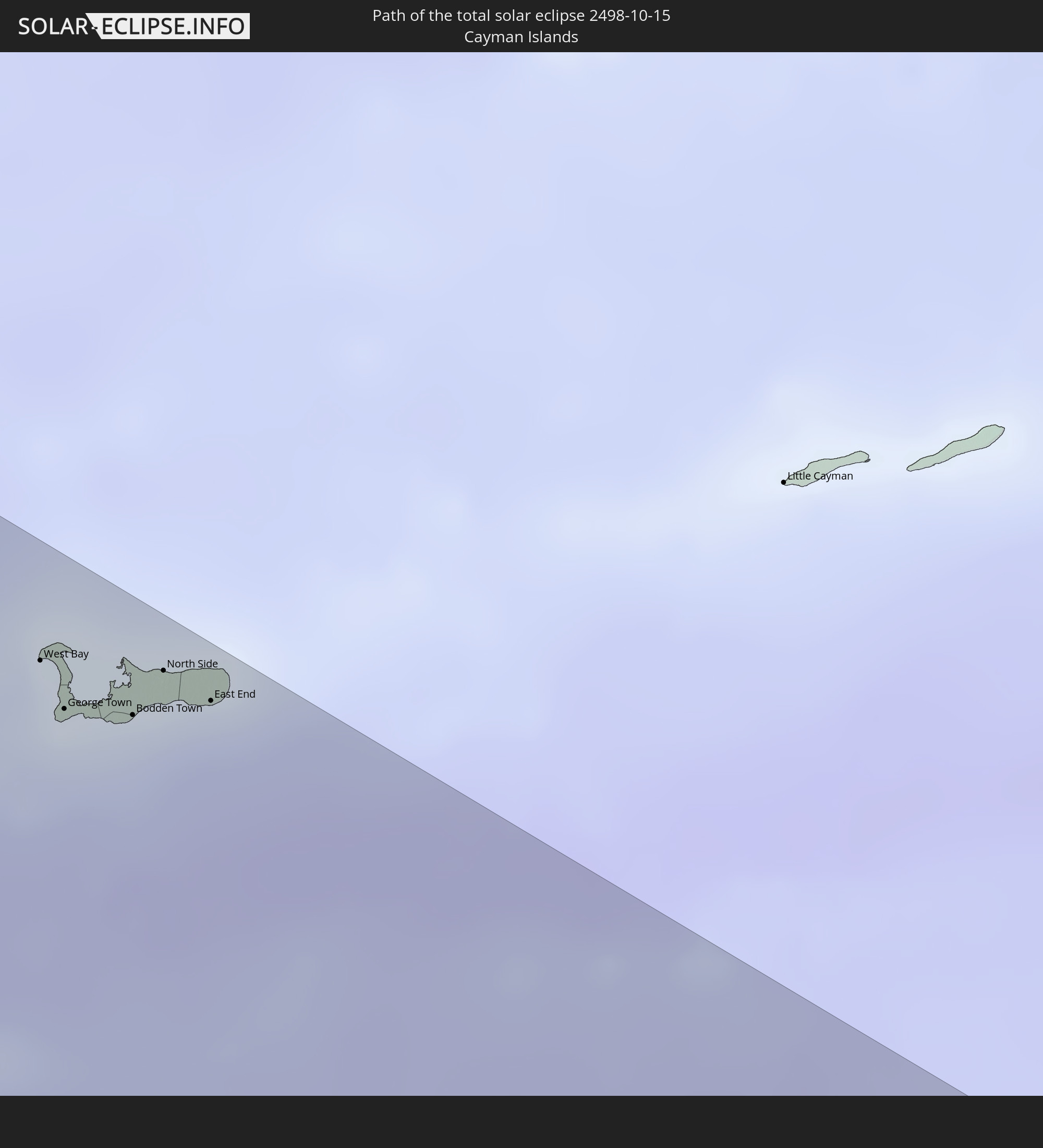
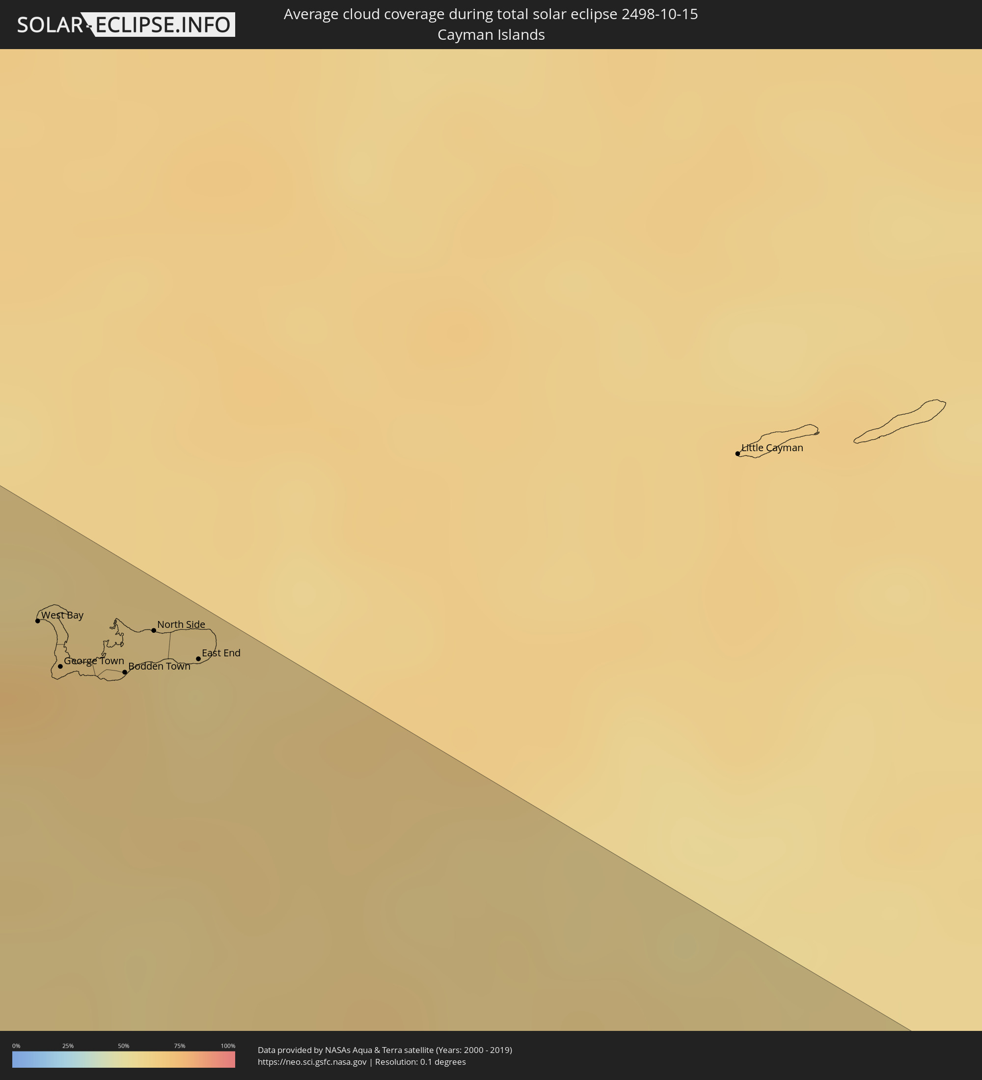 Cayman Islands
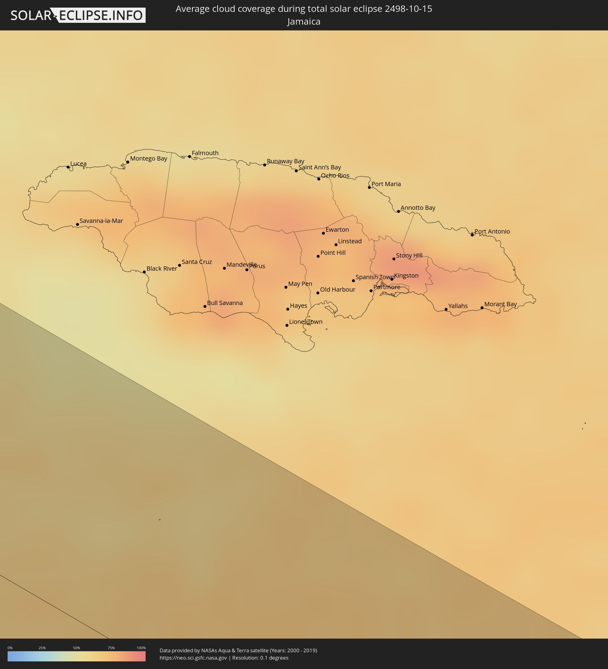 Jamaica
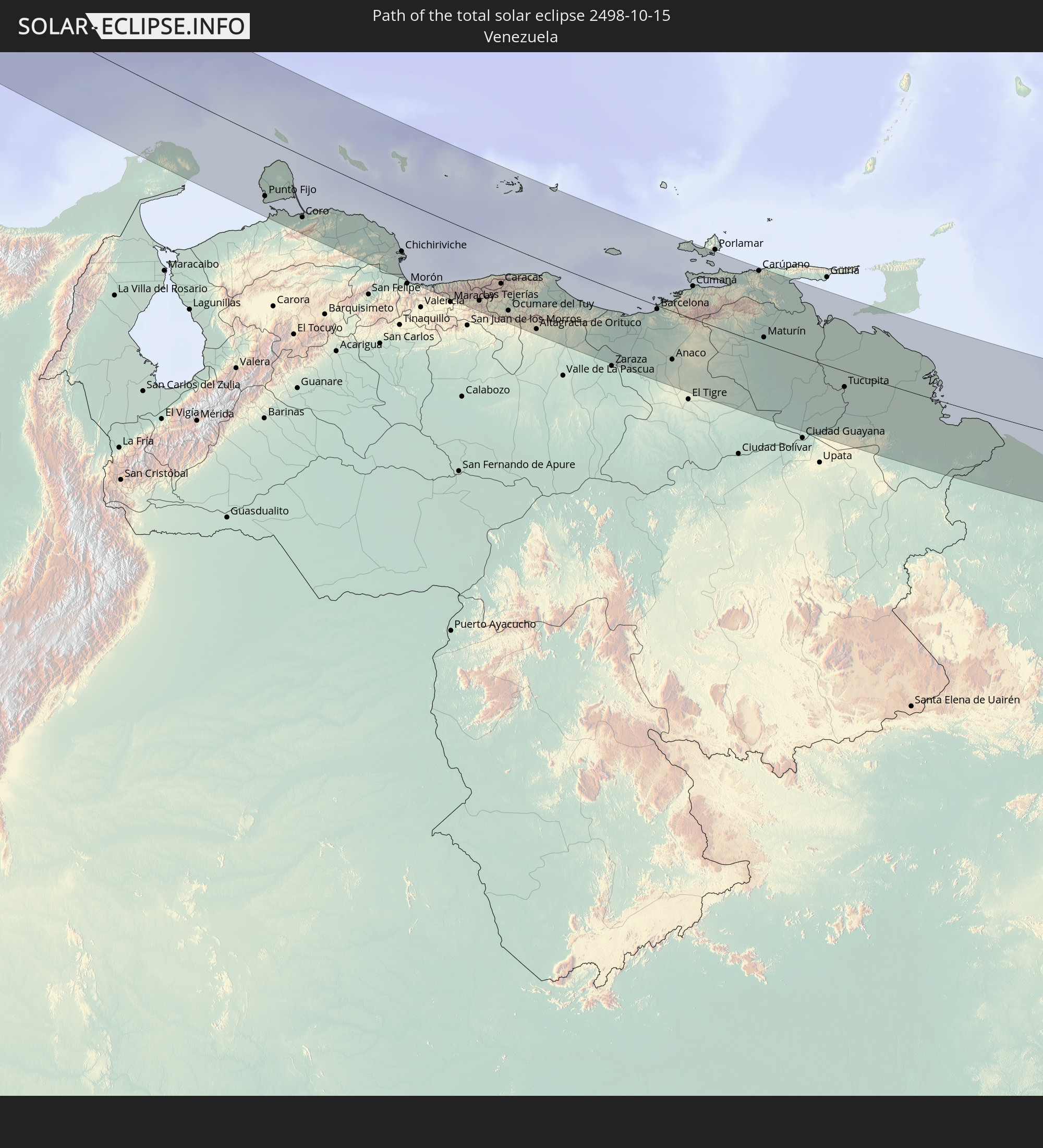
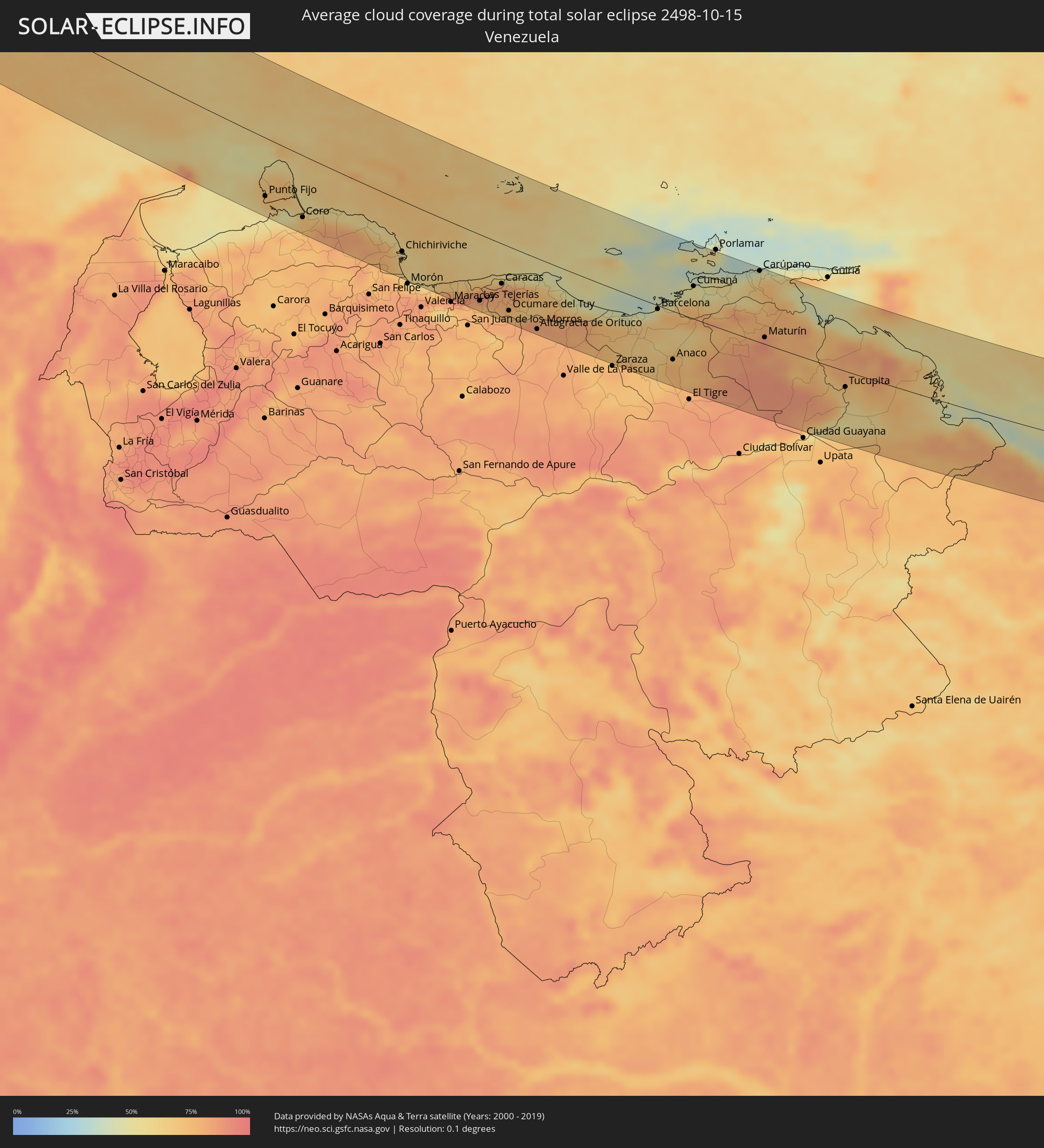 Venezuela
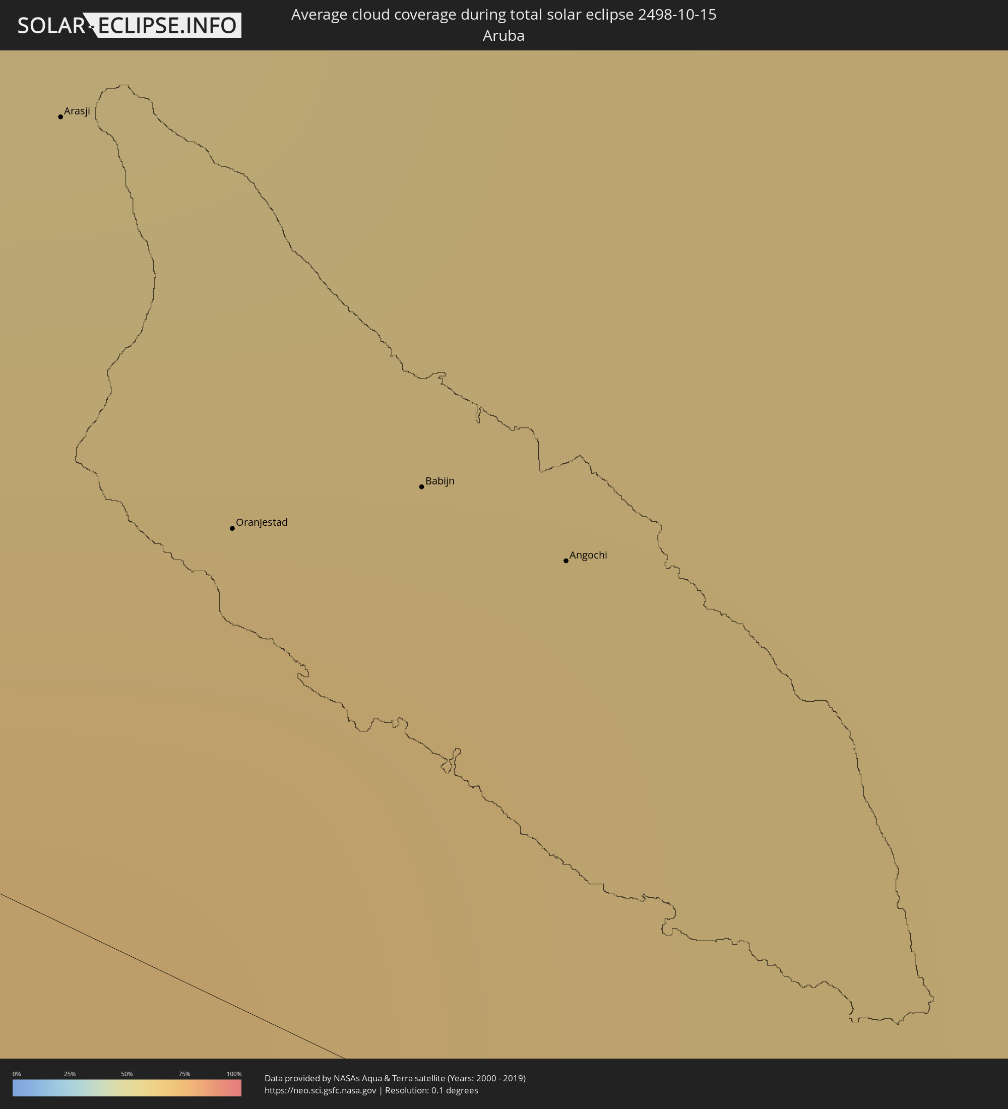 Aruba
Aruba
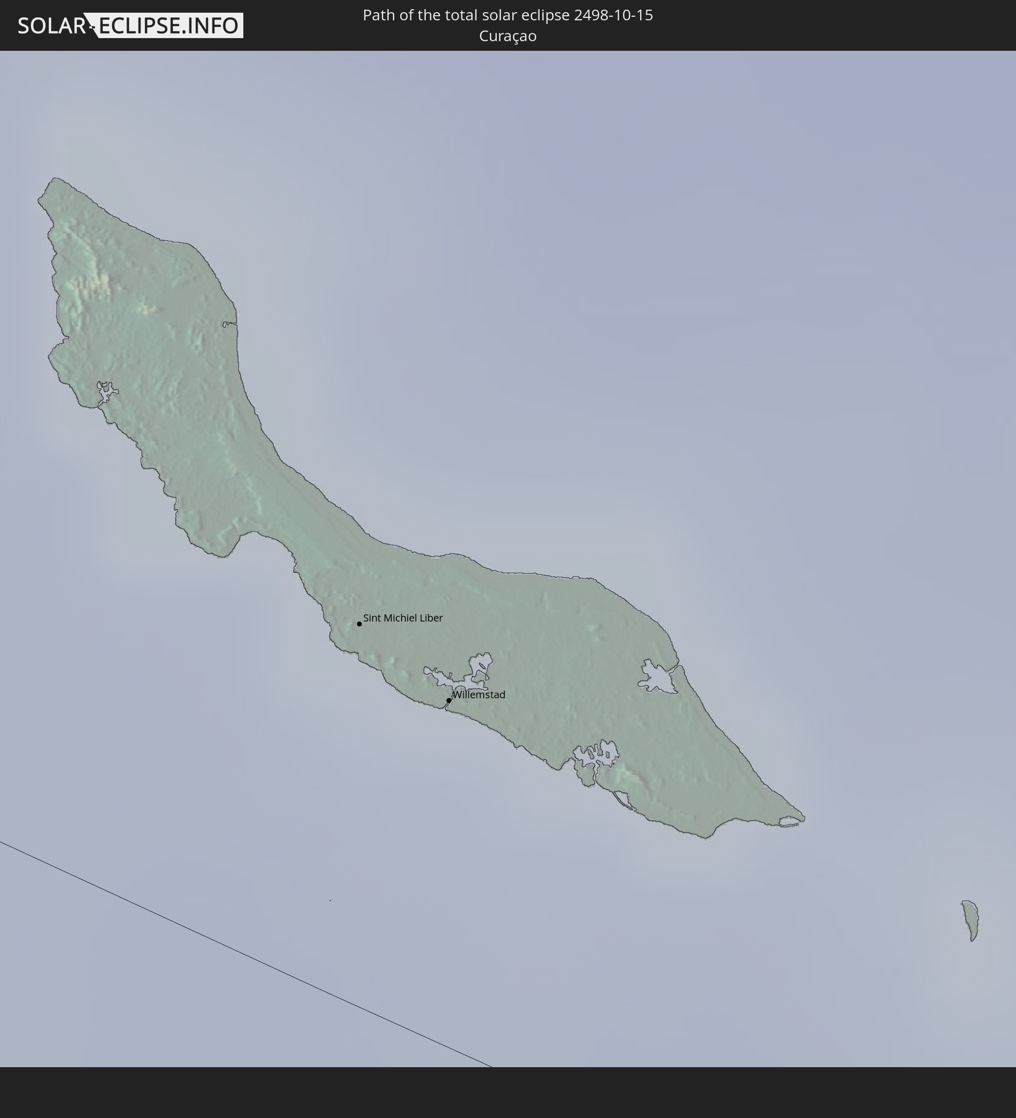
 Curaçao
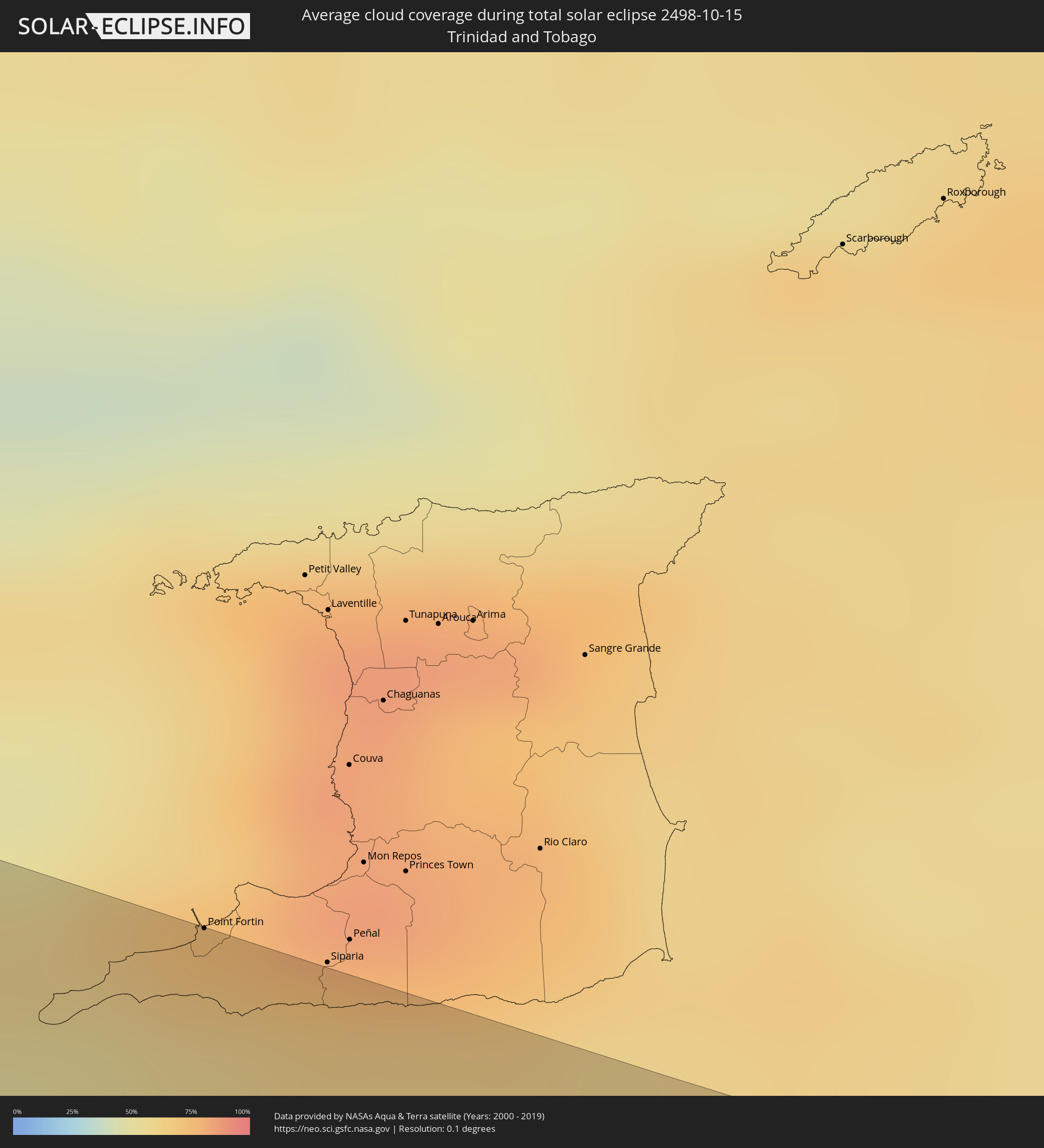 Trinidad and Tobago
 Guyana
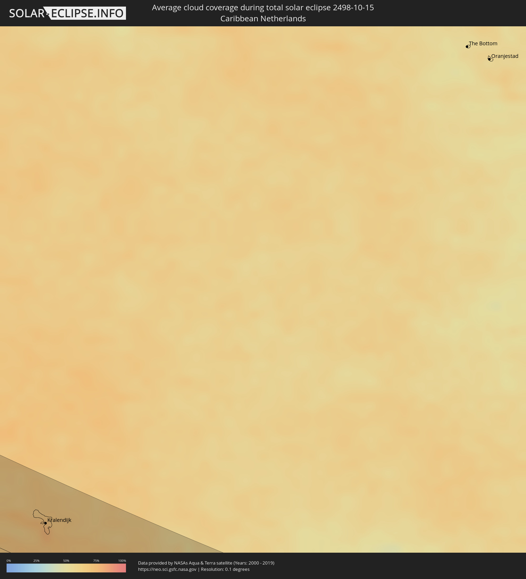 Caribbean Netherlands
Cities inside the path of the eclipse
The following table shows all locations with a population of more than 5,000 inside the eclipse path. Cities which have more than 100,000 inhabitants are marked bold. A click at the locations opens a detailed map.
| City | Type | Eclipse duration | Local time of max. eclipse | Distance to central line | Ø Cloud coverage |
|
Santa Cruz, California
|
total | - | 07:41:21 UTC-08:00 | 78 km | 41% |
|
Watsonville, California
|
total | - | 07:41:29 UTC-08:00 | 79 km | 42% |
|
Salinas, California
|
total | - | 07:41:27 UTC-08:00 | 58 km | 36% |
|
Hanford, California
|
total | - | 07:42:37 UTC-08:00 | 80 km | 36% |
|
Tulare, California
|
total | - | 07:42:47 UTC-08:00 | 76 km | 38% |
|
Delano, California
|
total | - | 07:42:41 UTC-08:00 | 33 km | 40% |
|
Bakersfield, California
|
total | - | 07:42:42 UTC-08:00 | 1 km | 35% |
|
Porterville, California
|
total | - | 07:42:58 UTC-08:00 | 71 km | 36% |
|
Lancaster, California
|
total | - | 07:43:08 UTC-08:00 | 45 km | 18% |
|
Victorville, California
|
total | - | 07:43:44 UTC-08:00 | 35 km | 19% |
|
San Bernardino, California
|
total | - | 07:43:36 UTC-08:00 | 80 km | 33% |
|
Yucaipa, California
|
total | - | 07:43:47 UTC-08:00 | 79 km | 27% |
|
Indio, California
|
total | - | 07:44:22 UTC-08:00 | 85 km | 15% |
|
Lake Havasu City, Arizona
|
total | - | 08:46:12 UTC-07:00 | 57 km | 22% |
|
Avondale, Arizona
|
total | - | 08:47:48 UTC-07:00 | 17 km | 19% |
|
Peoria, Arizona
|
total | - | 08:47:56 UTC-07:00 | 36 km | 18% |
|
Phoenix, Arizona
|
total | - | 08:48:04 UTC-07:00 | 28 km | 19% |
|
Mesa, Arizona
|
total | - | 08:48:18 UTC-07:00 | 33 km | 18% |
|
San Tan Valley, Arizona
|
total | - | 08:48:34 UTC-07:00 | 21 km | 17% |
|
Tucson, Arizona
|
total | - | 08:49:03 UTC-07:00 | 56 km | 20% |
|
Ascención, Chihuahua
|
total | - | 08:52:14 UTC-07:00 | 59 km | 25% |
|
Puerto Palomas, Chihuahua
|
total | - | 08:52:39 UTC-07:00 | 23 km | 24% |
|
Miguel Ahumada, Chihuahua
|
total | - | 08:54:00 UTC-07:00 | 50 km | 26% |
|
El Paso, Texas
|
total | - | 08:54:01 UTC-07:00 | 67 km | 27% |
|
Ciudad Juárez, Chihuahua
|
total | - | 08:54:02 UTC-07:00 | 64 km | 27% |
|
Ojinaga, Chihuahua
|
total | - | 08:56:36 UTC-07:00 | 75 km | 31% |
|
Manuel Ojinaga, Chihuahua
|
total | - | 08:56:47 UTC-07:00 | 70 km | 31% |
|
Nueva Rosita, Coahuila
|
total | - | 10:01:37 UTC-06:00 | 93 km | 50% |
|
Ciudad Acuña, Coahuila
|
total | - | 10:01:42 UTC-06:00 | 56 km | 49% |
|
Zaragoza, Coahuila
|
total | - | 10:01:56 UTC-06:00 | 25 km | 51% |
|
Allende, Coahuila
|
total | - | 10:02:04 UTC-06:00 | 37 km | 53% |
|
Nava, Coahuila
|
total | - | 10:02:11 UTC-06:00 | 26 km | 52% |
|
Villa Union, Coahuila
|
total | - | 10:02:18 UTC-06:00 | 44 km | 53% |
|
Piedras Negras, Coahuila
|
total | - | 10:02:29 UTC-06:00 | 13 km | 54% |
|
El Campanario y Oradel, Tamaulipas
|
total | - | 10:04:13 UTC-06:00 | 68 km | 55% |
|
Nuevo Laredo, Tamaulipas
|
total | - | 10:04:23 UTC-06:00 | 62 km | 56% |
|
Laredo, Texas
|
total | - | 10:04:23 UTC-06:00 | 59 km | 56% |
|
Corpus Christi, Texas
|
total | - | 10:07:42 UTC-06:00 | 68 km | 50% |
|
Kantunilkin, Quintana Roo
|
total | - | 11:31:06 UTC-05:00 | 78 km | 75% |
|
Leona Vicario, Quintana Roo
|
total | - | 11:31:50 UTC-05:00 | 73 km | 78% |
|
Playa del Carmen, Quintana Roo
|
total | - | 11:32:26 UTC-05:00 | 101 km | 64% |
|
Alfredo V. Bonfil, Quintana Roo
|
total | - | 11:32:32 UTC-05:00 | 45 km | 67% |
|
Cancún, Quintana Roo
|
total | - | 11:32:27 UTC-05:00 | 37 km | 73% |
|
Isla Mujeres, Quintana Roo
|
total | - | 11:32:40 UTC-05:00 | 25 km | 64% |
|
West Bay, West Bay
|
total | - | 11:46:58 UTC-05:00 | 86 km | 68% |
|
George Town, George Town
|
total | - | 11:47:10 UTC-05:00 | 80 km | 64% |
|
Bodden Town, Bodden Town
|
total | - | 11:47:28 UTC-05:00 | 86 km | 63% |
|
North Side, North Side
|
total | - | 11:47:31 UTC-05:00 | 96 km | 62% |
|
East End, East End
|
total | - | 11:47:46 UTC-05:00 | 96 km | 59% |
|
Punta Cardón, Falcón
|
total | - | 13:25:43 UTC-04:00 | 85 km | 62% |
|
Punto Fijo, Falcón
|
total | - | 13:25:42 UTC-04:00 | 81 km | 62% |
|
Arasji
|
total | - | 13:24:48 UTC-04:00 | 18 km | 67% |
|
Oranjestad
|
total | - | 13:25:02 UTC-04:00 | 11 km | 69% |
|
Babijn
|
total | - | 13:25:08 UTC-04:00 | 14 km | 69% |
|
Angochi
|
total | - | 13:25:14 UTC-04:00 | 14 km | 69% |
|
Coro, Falcón
|
total | - | 13:27:29 UTC-04:00 | 86 km | 71% |
 Sint Michiel Liber
|
total | - | 13:28:16 UTC-04:00 | 21 km | 76% |
|
Willemstad
|
total | - | 13:28:27 UTC-04:00 | 19 km | 69% |
 Kralendijk, Bonaire
|
total | - | 13:30:07 UTC-04:00 | 53 km | 77% |
|
Puerto Cabello, Carabobo
|
total | - | 13:33:01 UTC-04:00 | 108 km | 79% |
|
El Limón, Aragua
|
total | - | 13:34:16 UTC-04:00 | 107 km | 74% |
|
Turmero, Aragua
|
total | - | 13:34:46 UTC-04:00 | 109 km | 73% |
|
La Victoria, Aragua
|
total | - | 13:35:09 UTC-04:00 | 104 km | 77% |
|
Los Teques, Miranda
|
total | - | 13:35:43 UTC-04:00 | 79 km | 75% |
|
Catia La Mar, Vargas
|
total | - | 13:35:24 UTC-04:00 | 51 km | 79% |
|
San Antonio de Los Altos, Miranda
|
total | - | 13:35:54 UTC-04:00 | 70 km | 81% |
|
Cúa, Miranda
|
total | - | 13:36:22 UTC-04:00 | 91 km | 74% |
|
Caracas, Capital
|
total | - | 13:35:57 UTC-04:00 | 57 km | 80% |
|
Chacao, Miranda
|
total | - | 13:36:00 UTC-04:00 | 55 km | 80% |
|
El Cafetal, Miranda
|
total | - | 13:36:06 UTC-04:00 | 57 km | 81% |
|
Los Dos Caminos, Miranda
|
total | - | 13:36:04 UTC-04:00 | 54 km | 81% |
|
Caucaguita, Miranda
|
total | - | 13:36:19 UTC-04:00 | 67 km | 78% |
|
Santa Teresa, Miranda
|
total | - | 13:36:50 UTC-04:00 | 74 km | 70% |
|
Guatire, Miranda
|
total | - | 13:36:49 UTC-04:00 | 44 km | 75% |
|
Barcelona, Anzoátegui
|
total | - | 13:41:57 UTC-04:00 | 5 km | 67% |
|
Anaco, Anzoátegui
|
total | - | 13:43:23 UTC-04:00 | 70 km | 76% |
|
Cumaná, Sucre
|
total | - | 13:42:46 UTC-04:00 | 47 km | 52% |
|
Carúpano, Sucre
|
total | - | 13:44:47 UTC-04:00 | 104 km | 59% |
|
Maturín, Monagas
|
total | - | 13:46:09 UTC-04:00 | 10 km | 86% |
|
Point Fortin, Point Fortin
|
total | - | 13:49:12 UTC-04:00 | 108 km | 67% |
|
Mabaruma, Barima-Waini
|
total | - | 13:56:06 UTC-04:00 | 43 km | 81% |