Annular solar eclipse of 01/09/2559
| Day of week: | Tuesday |
| Maximum duration of eclipse: | 09m43s |
| Maximum width of eclipse path: | 280 km |
| Saros cycle: | 150 |
| Coverage: | 93.1% |
| Magnitude: | 0.9308 |
| Gamma: | 0.3841 |
Wo kann man die Sonnenfinsternis vom 01/09/2559 sehen?
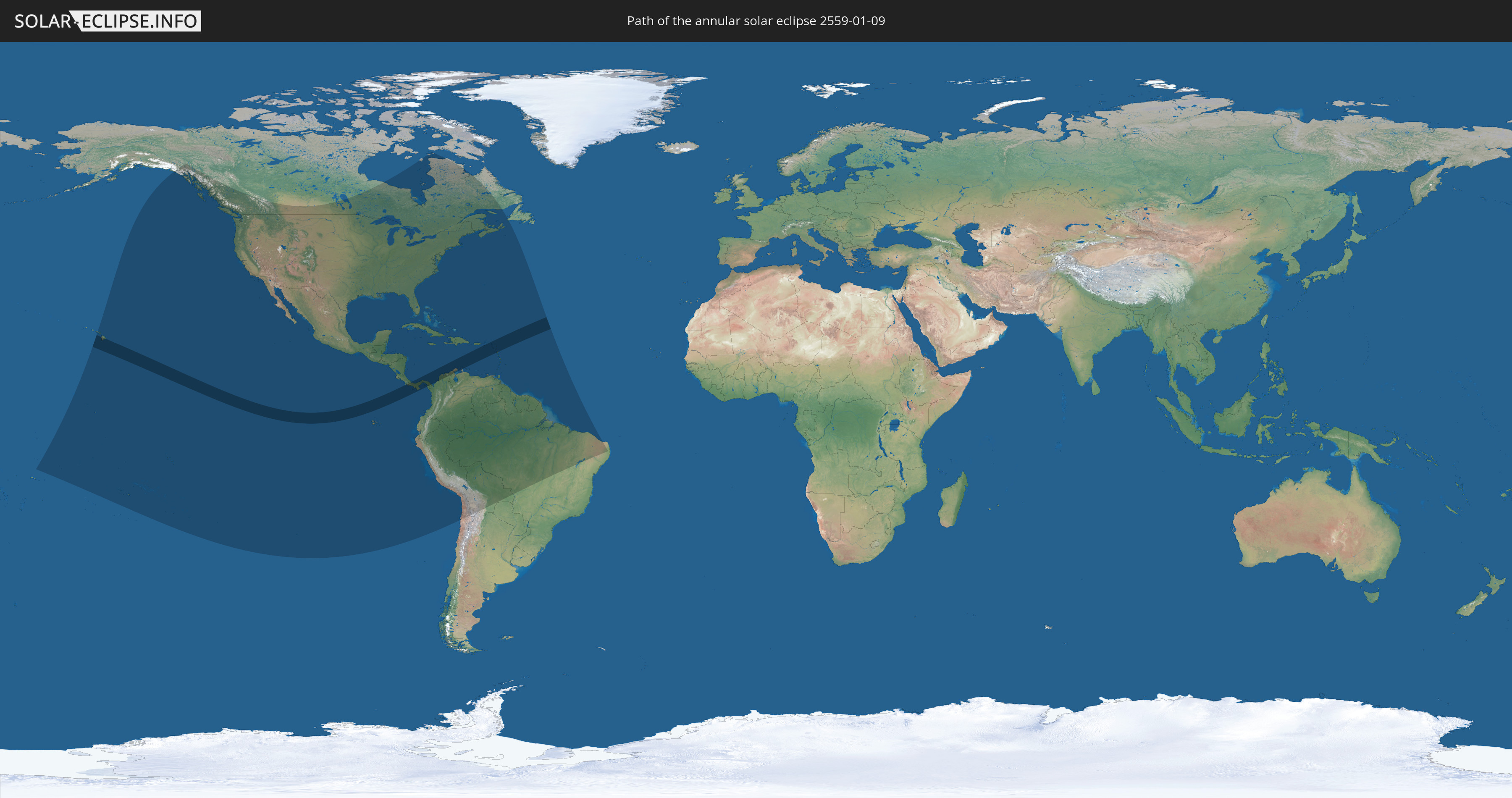
Die Sonnenfinsternis am 01/09/2559 kann man in 52 Ländern als partielle Sonnenfinsternis beobachten.
Der Finsternispfad verläuft durch 16 Länder. Nur in diesen Ländern ist sie als annular Sonnenfinsternis zu sehen.
In den folgenden Ländern ist die Sonnenfinsternis annular zu sehen
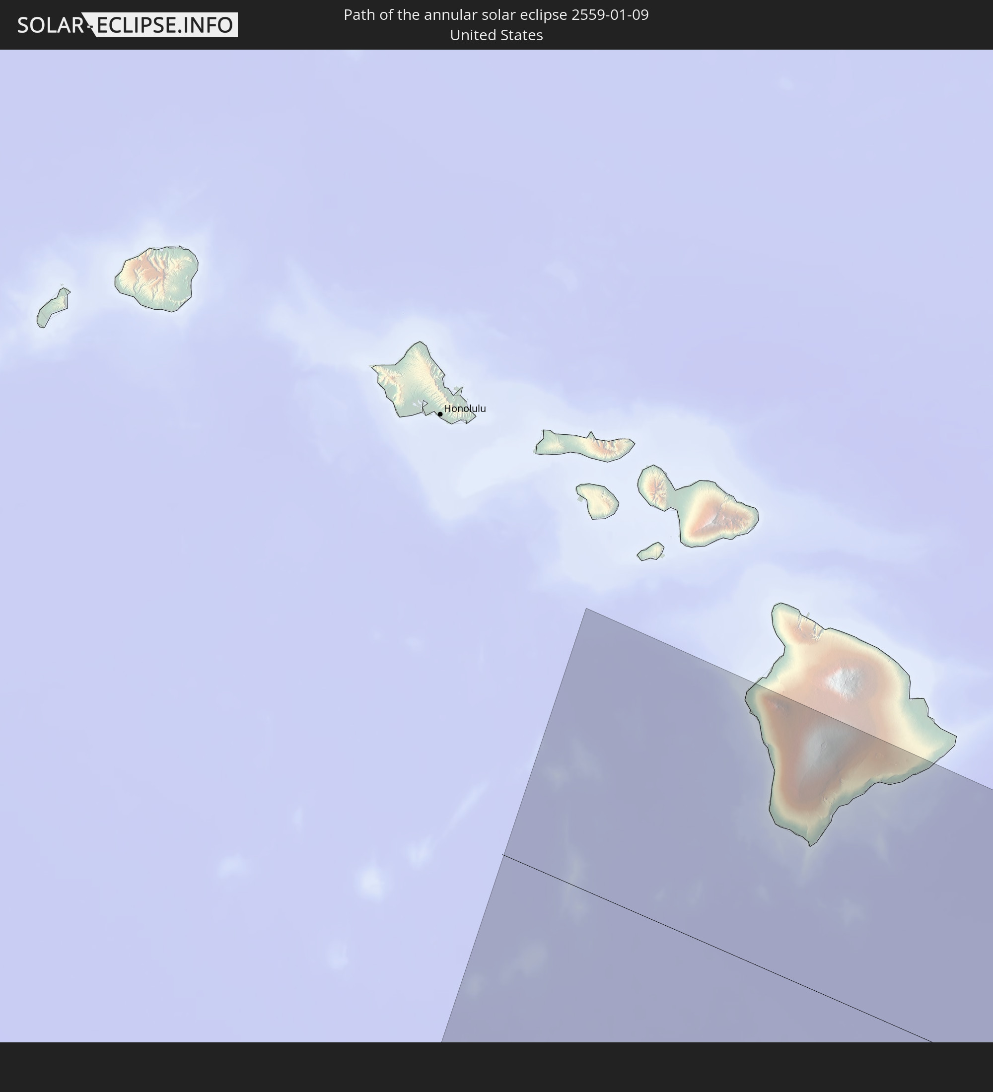 United States
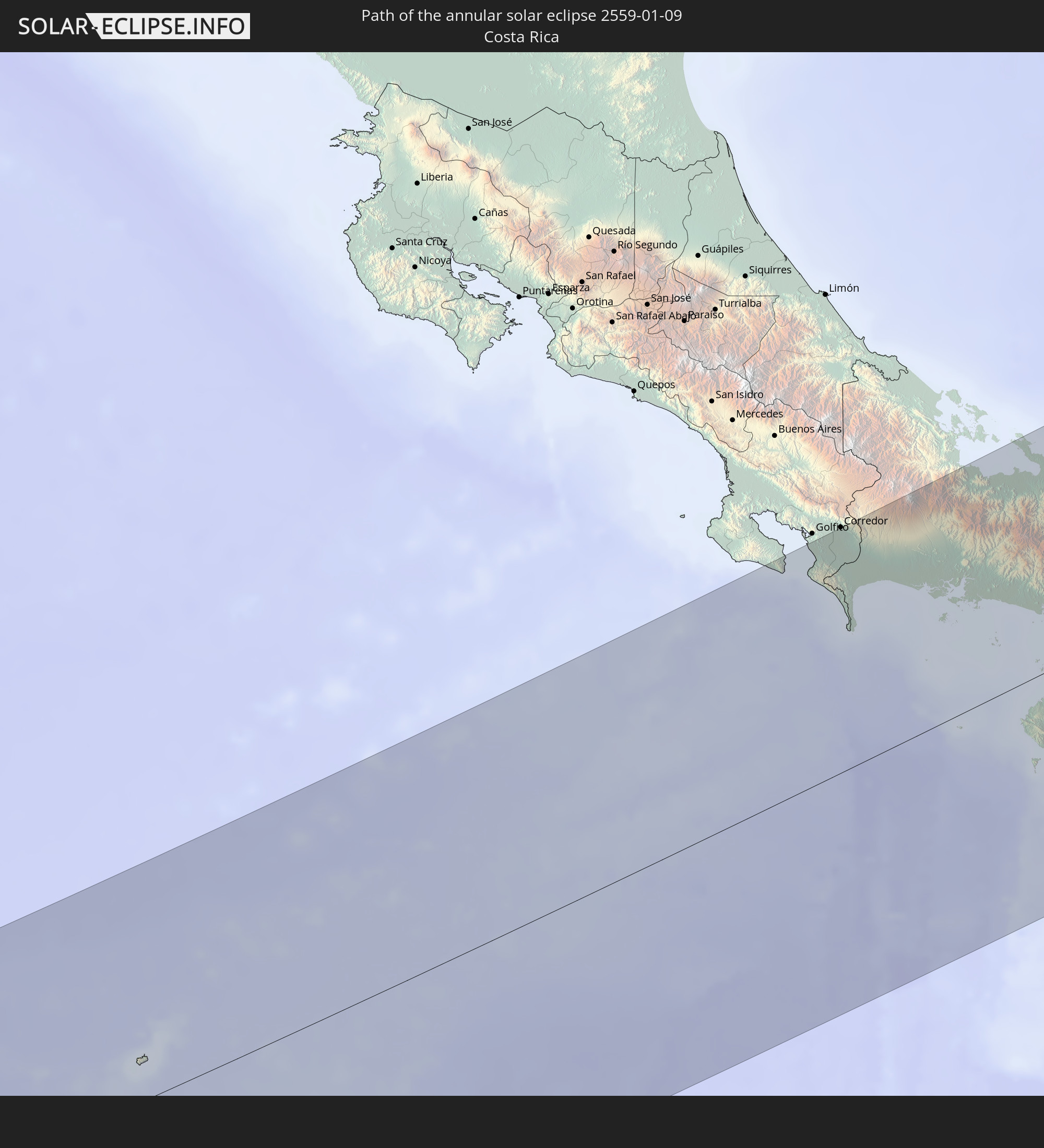 Costa Rica
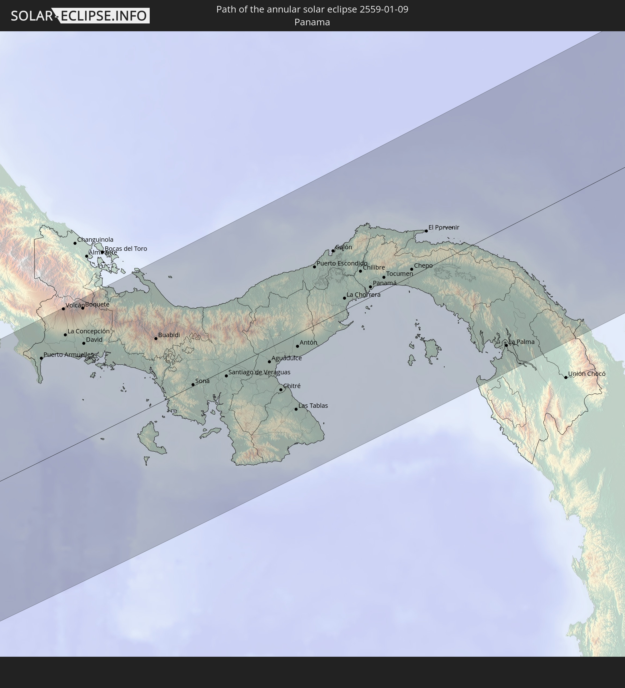 Panama
 Colombia
 Venezuela
 Aruba
Aruba
 United States Virgin Islands
 Anguilla
 Sint Maarten
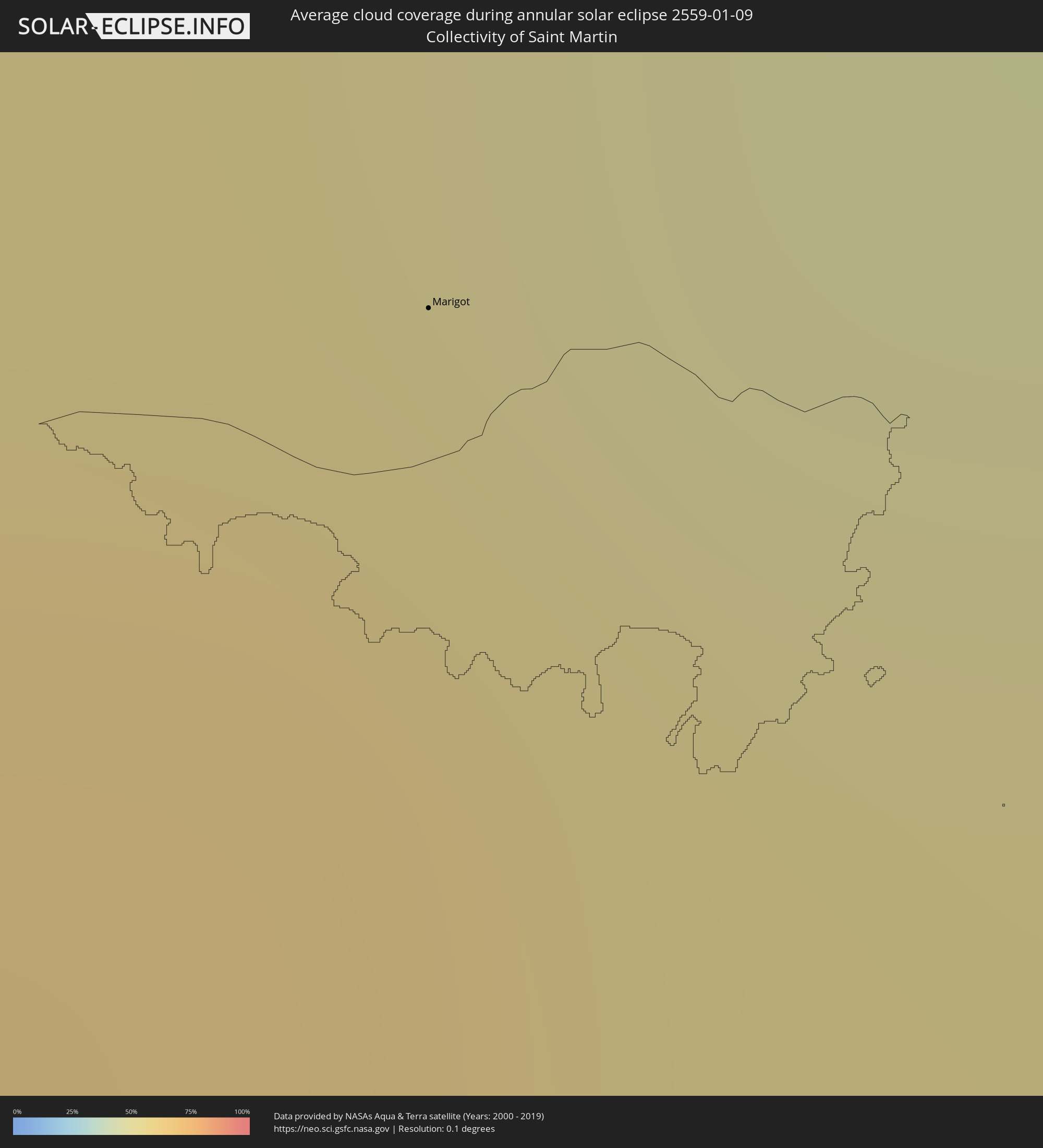
 Collectivity of Saint Martin
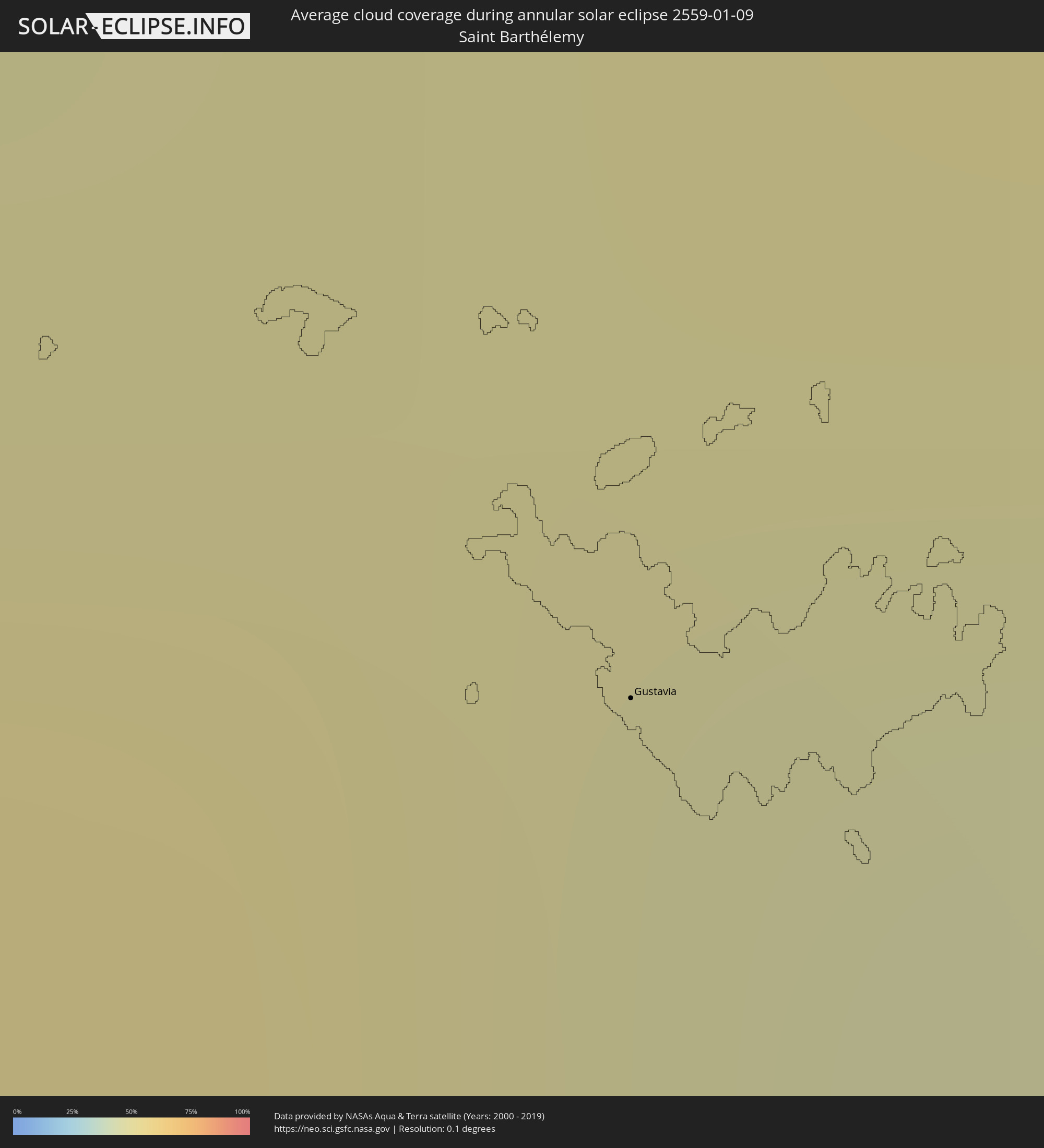
 Saint Barthélemy
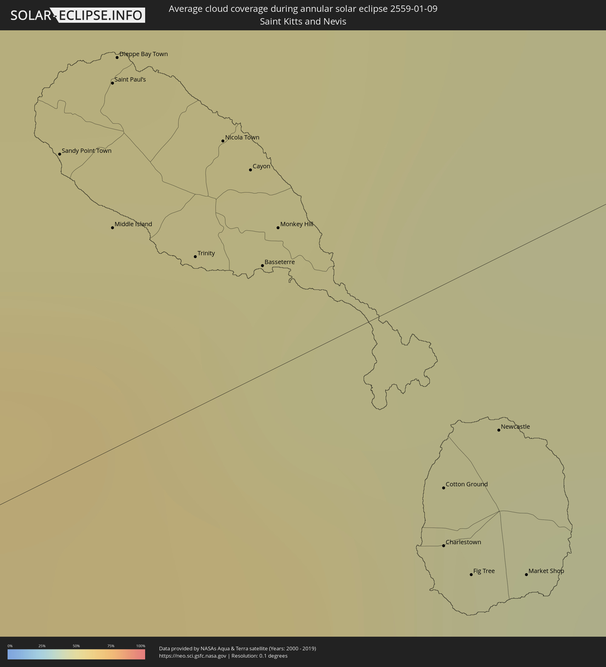
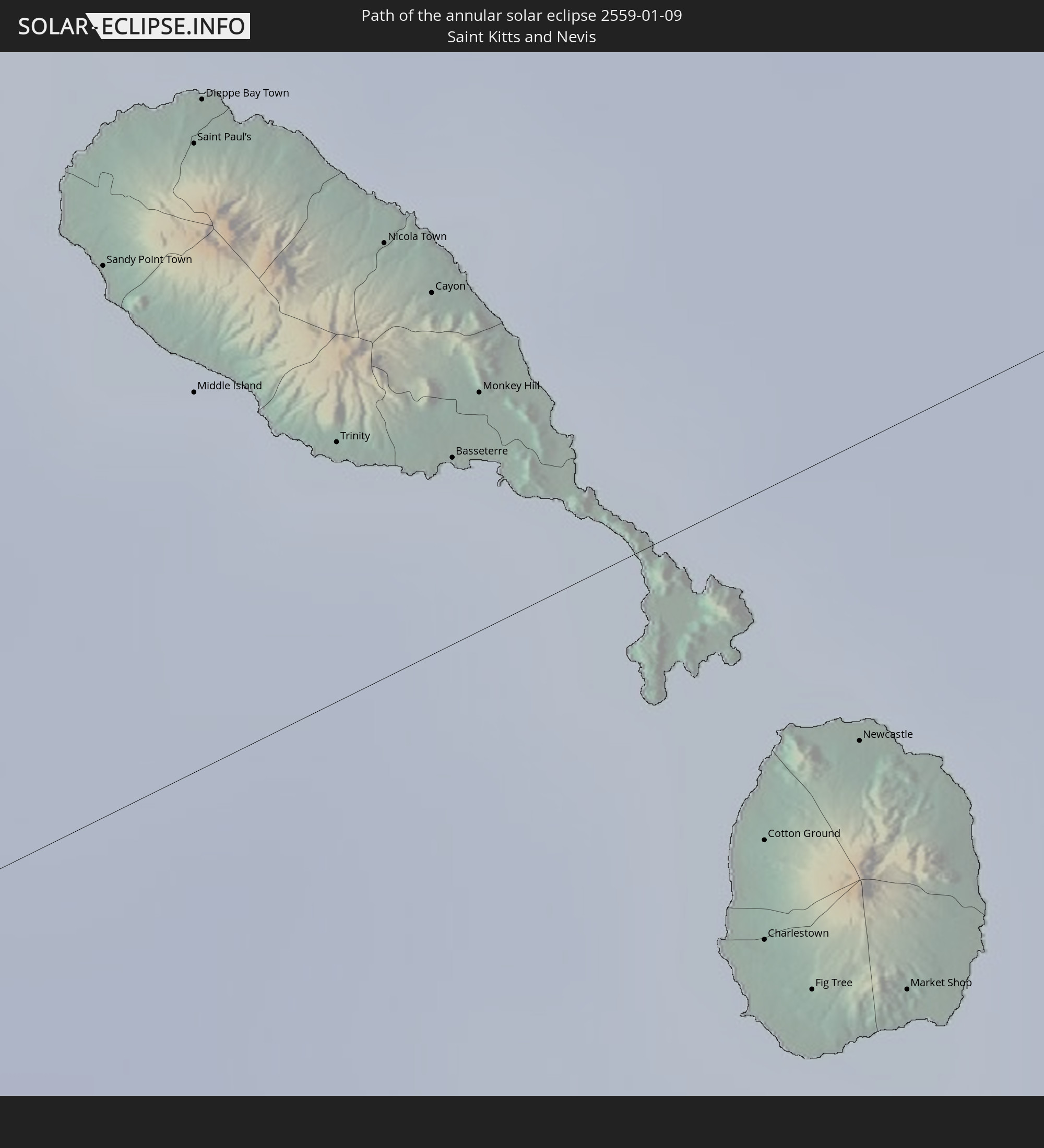 Saint Kitts and Nevis
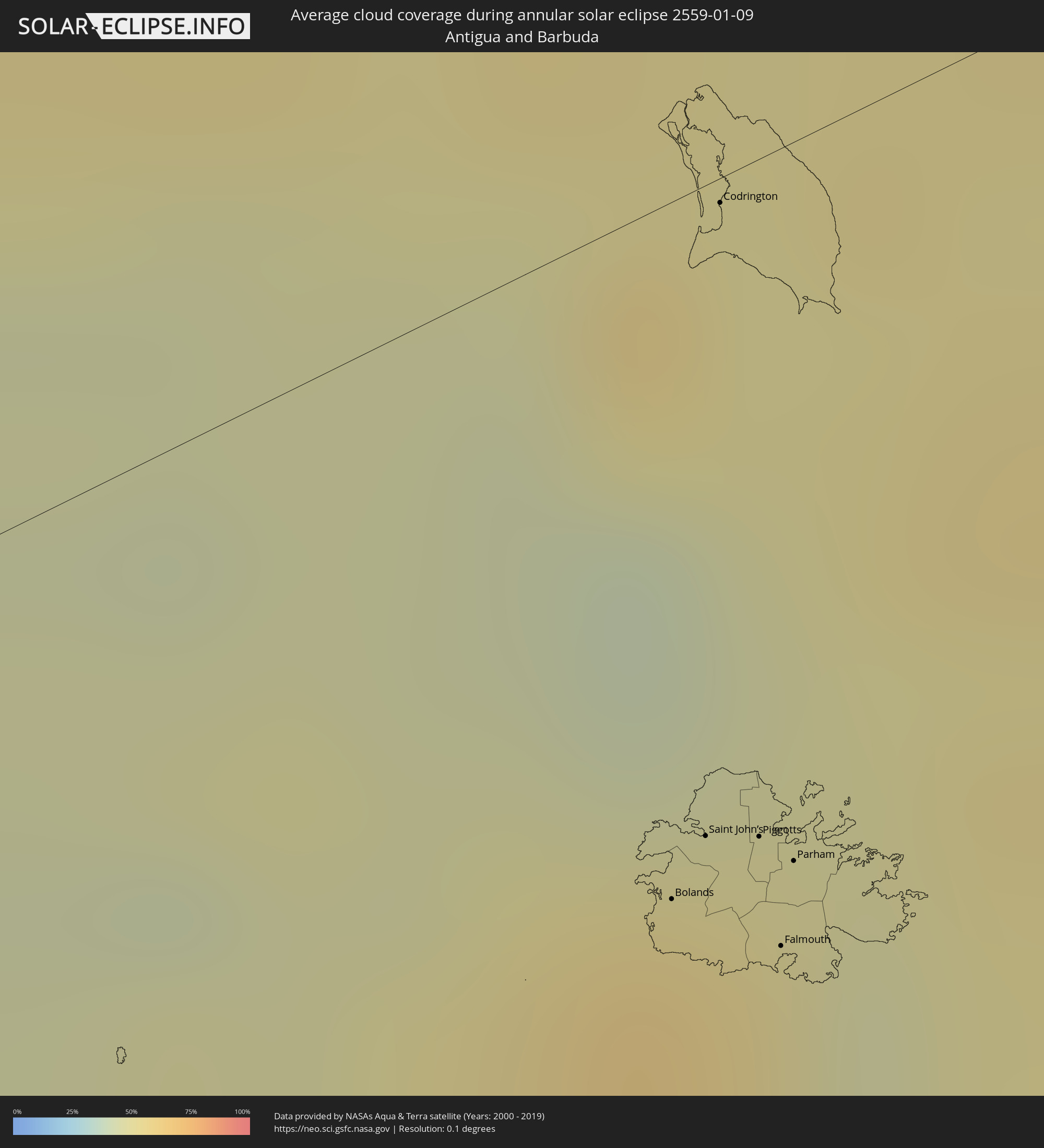
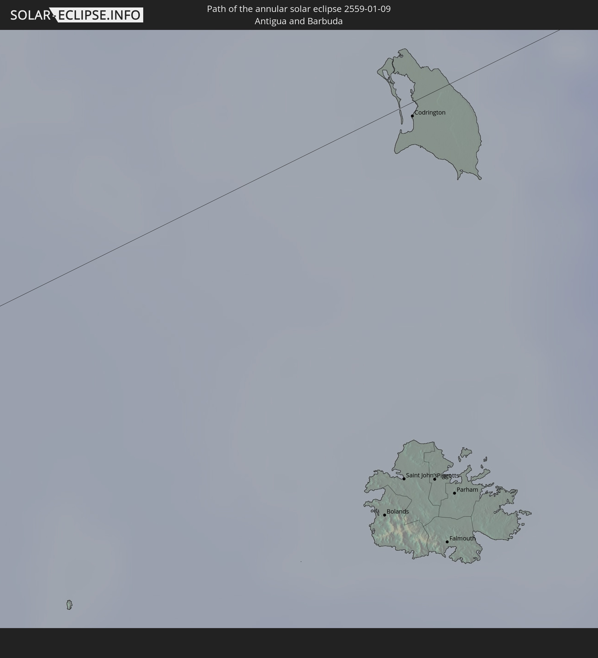 Antigua and Barbuda
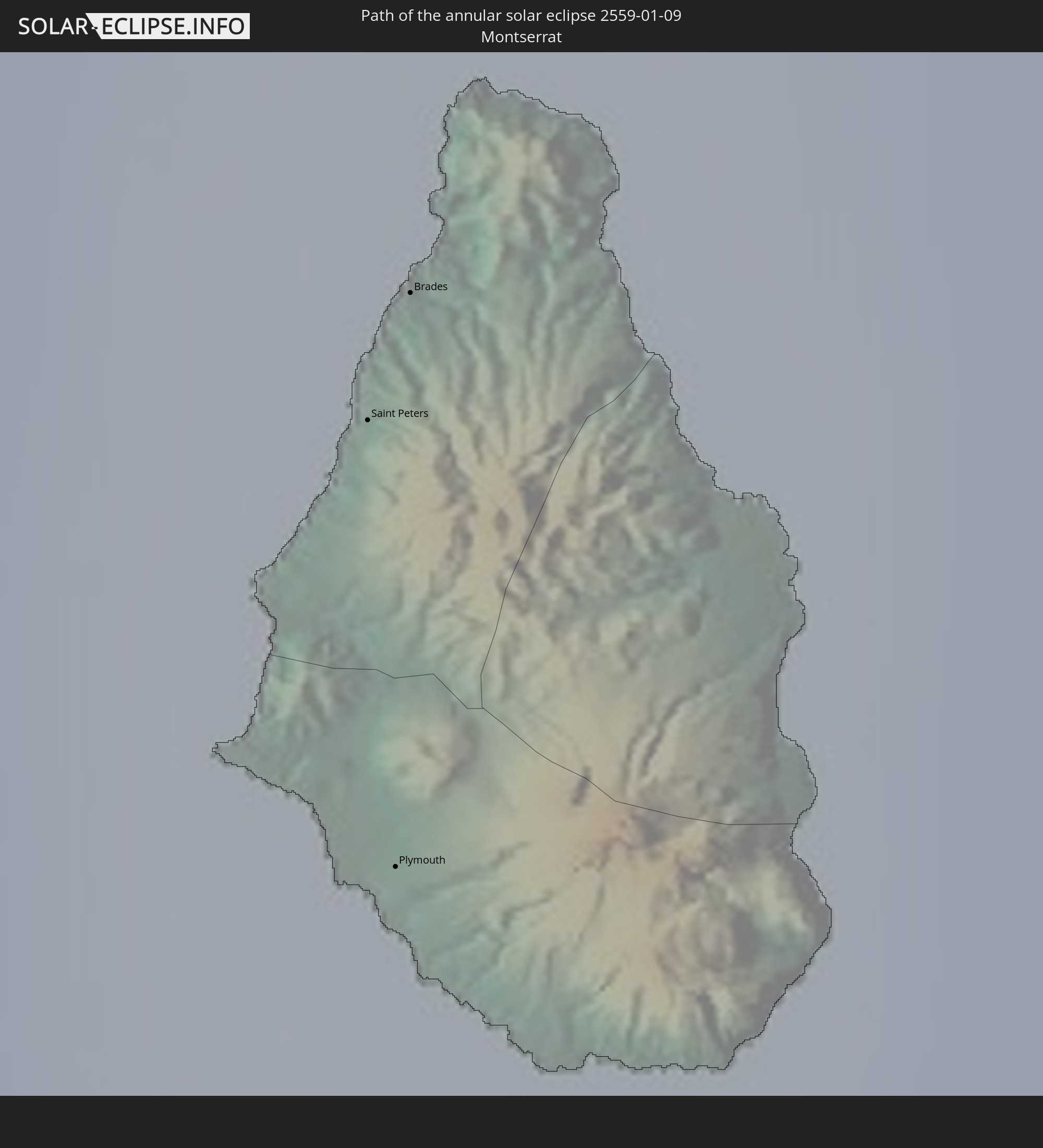 Montserrat
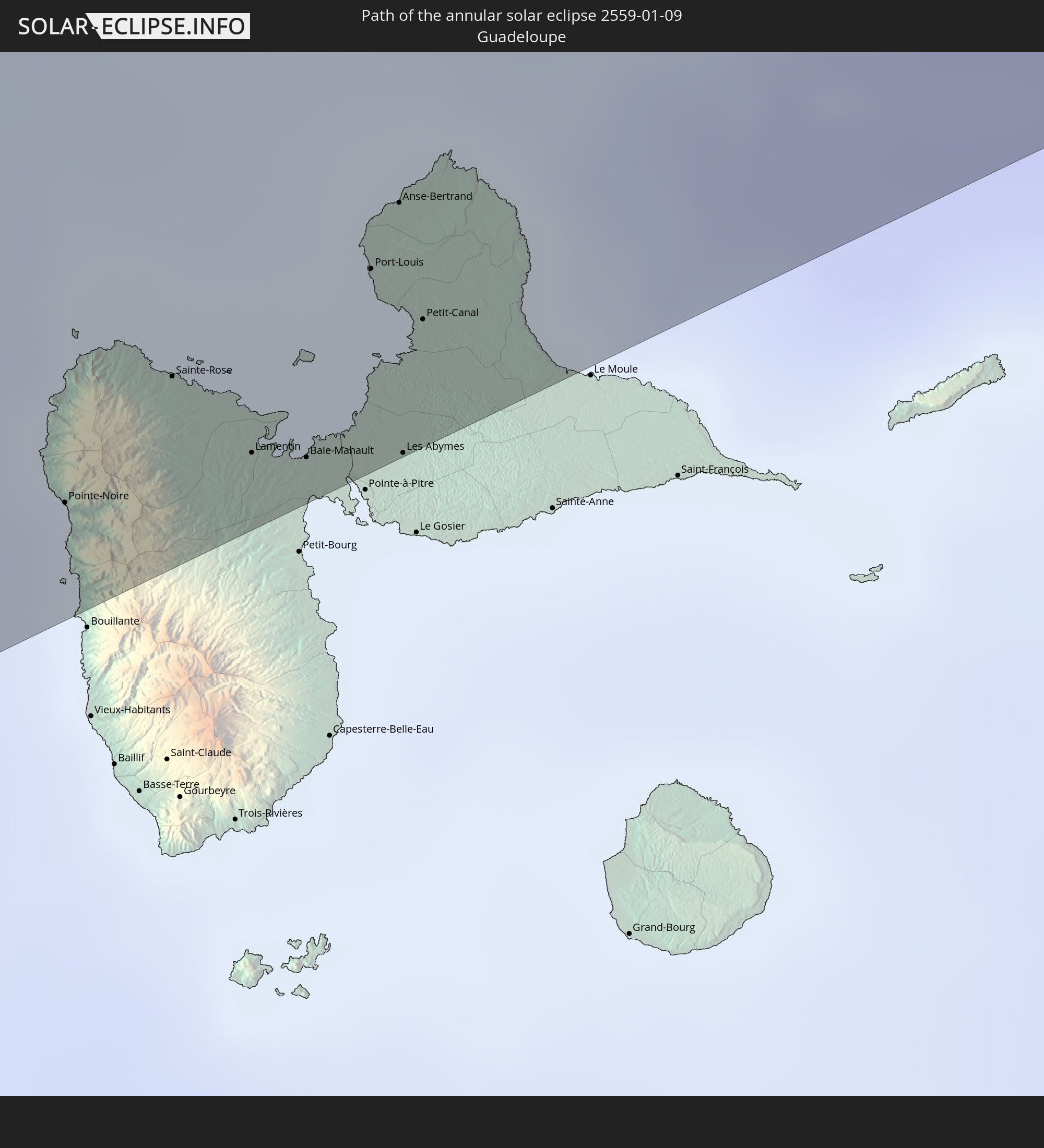 Guadeloupe
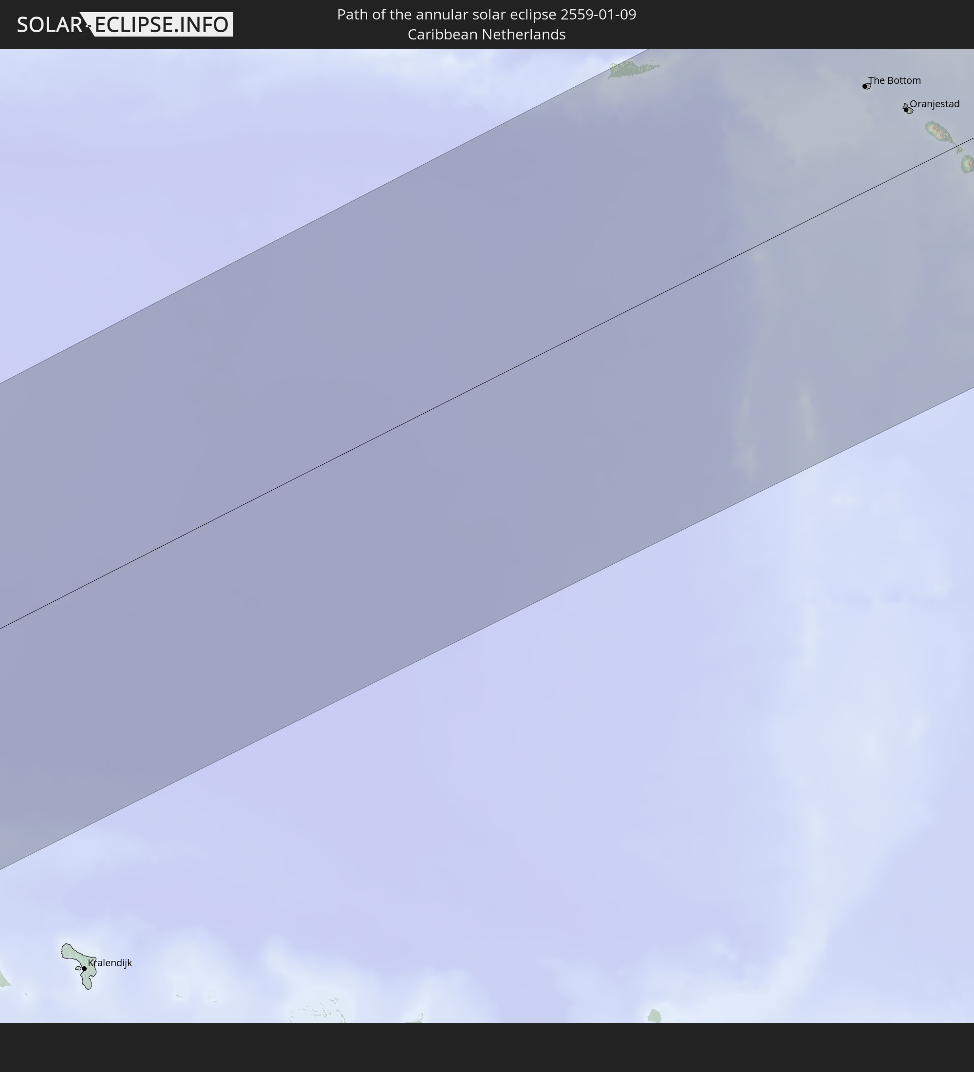 Caribbean Netherlands
In den folgenden Ländern ist die Sonnenfinsternis partiell zu sehen
 United States
 United States Minor Outlying Islands
 Kiribati
 American Samoa
 Cook Islands
 French Polynesia
 Canada
 Pitcairn Islands
 Mexico
 Chile
Chile
 Guatemala
 Ecuador
 El Salvador
 Honduras
 Belize
 Nicaragua
 Costa Rica
 Cuba
Cuba
 Panama
 Colombia
 Cayman Islands
 Peru
Peru
 The Bahamas
 Jamaica
 Haiti
Haiti
 Brazil
 Venezuela
 Turks and Caicos Islands
 Dominican Republic
 Aruba
Aruba
 Bolivia
 Puerto Rico
 United States Virgin Islands
 Bermuda
 British Virgin Islands
 Anguilla
 Collectivity of Saint Martin
 Saint Barthélemy
 Saint Kitts and Nevis
 Antigua and Barbuda
 Montserrat
 Trinidad and Tobago
 Guadeloupe
 Grenada
 Dominica
 Saint Vincent and the Grenadines
 Guyana
 Martinique
 Saint Lucia
 Barbados
 Suriname
 French Guiana
How will be the weather during the annular solar eclipse on 01/09/2559?
Where is the best place to see the annular solar eclipse of 01/09/2559?
The following maps show the average cloud coverage for the day of the annular solar eclipse.
With the help of these maps, it is possible to find the place along the eclipse path, which has the best
chance of a cloudless sky.
Nevertheless, you should consider local circumstances and inform about the weather of your chosen
observation site.
The data is provided by NASAs satellites
AQUA and TERRA.
The cloud maps are averaged over a period of 19 years (2000 - 2019).
Detailed country maps
 United States
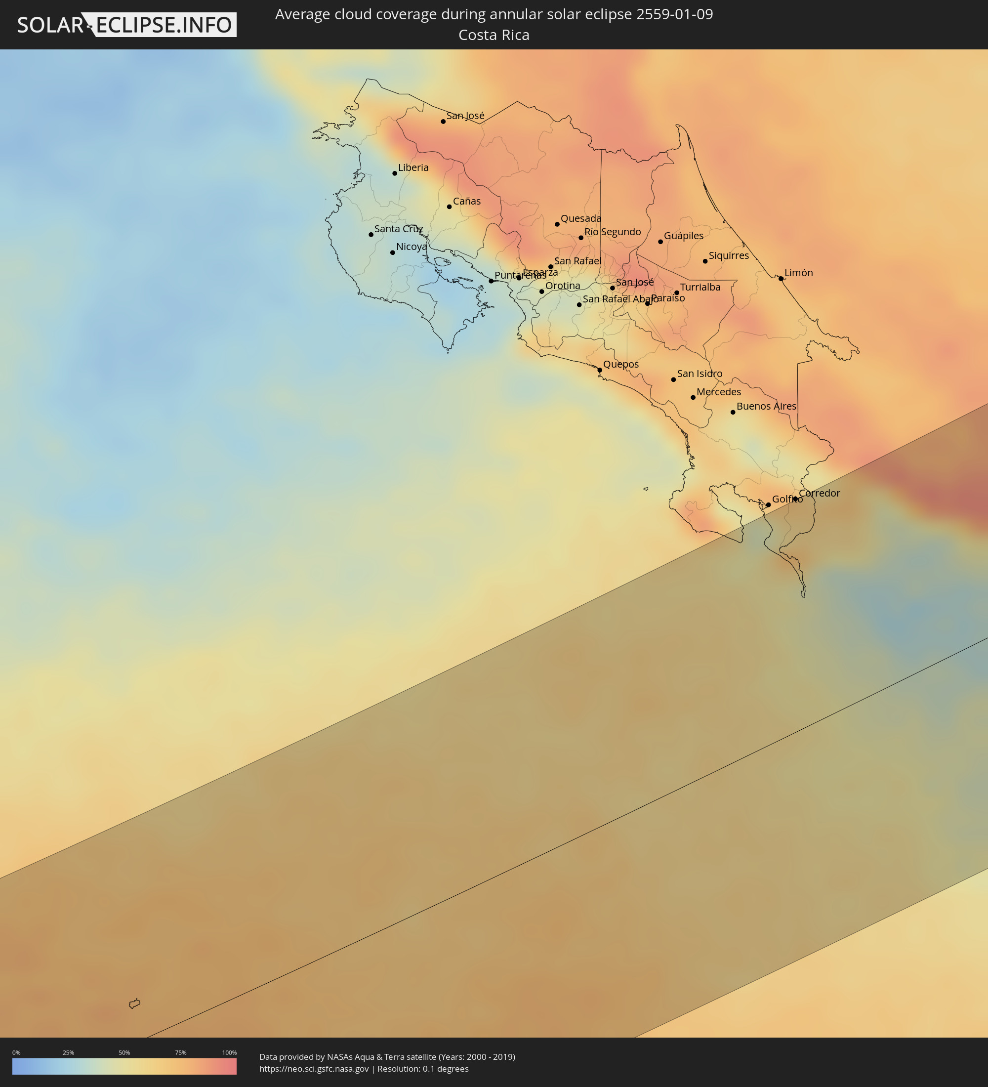 Costa Rica
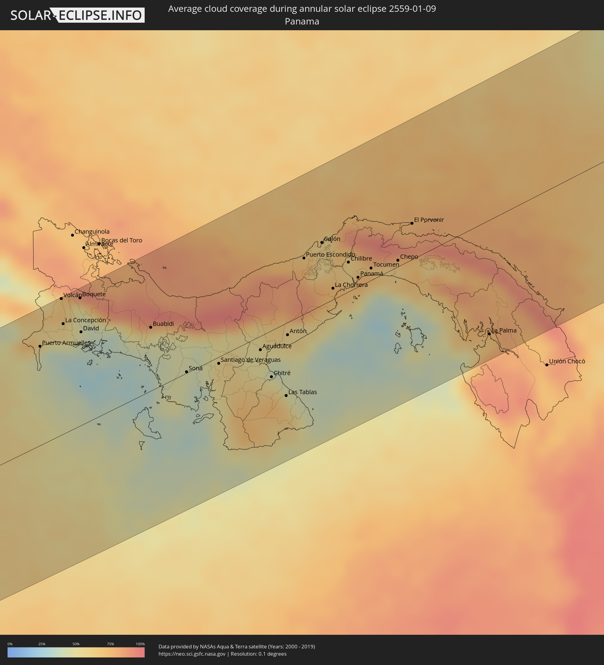 Panama
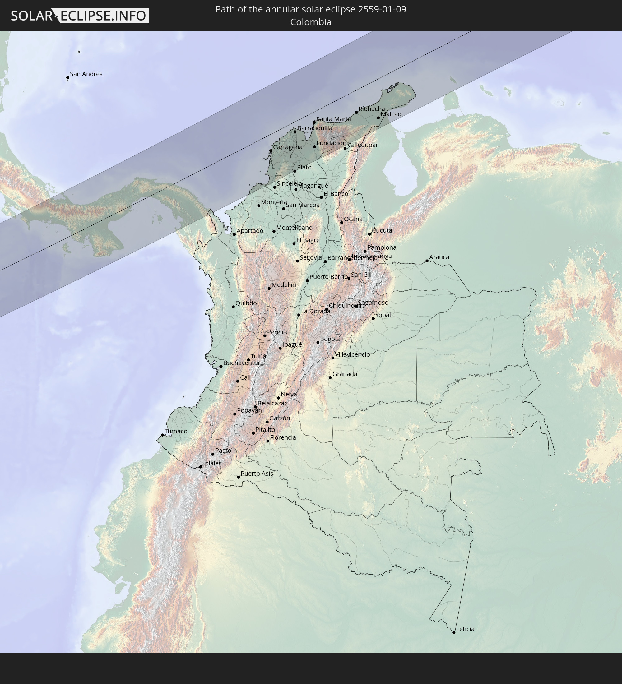
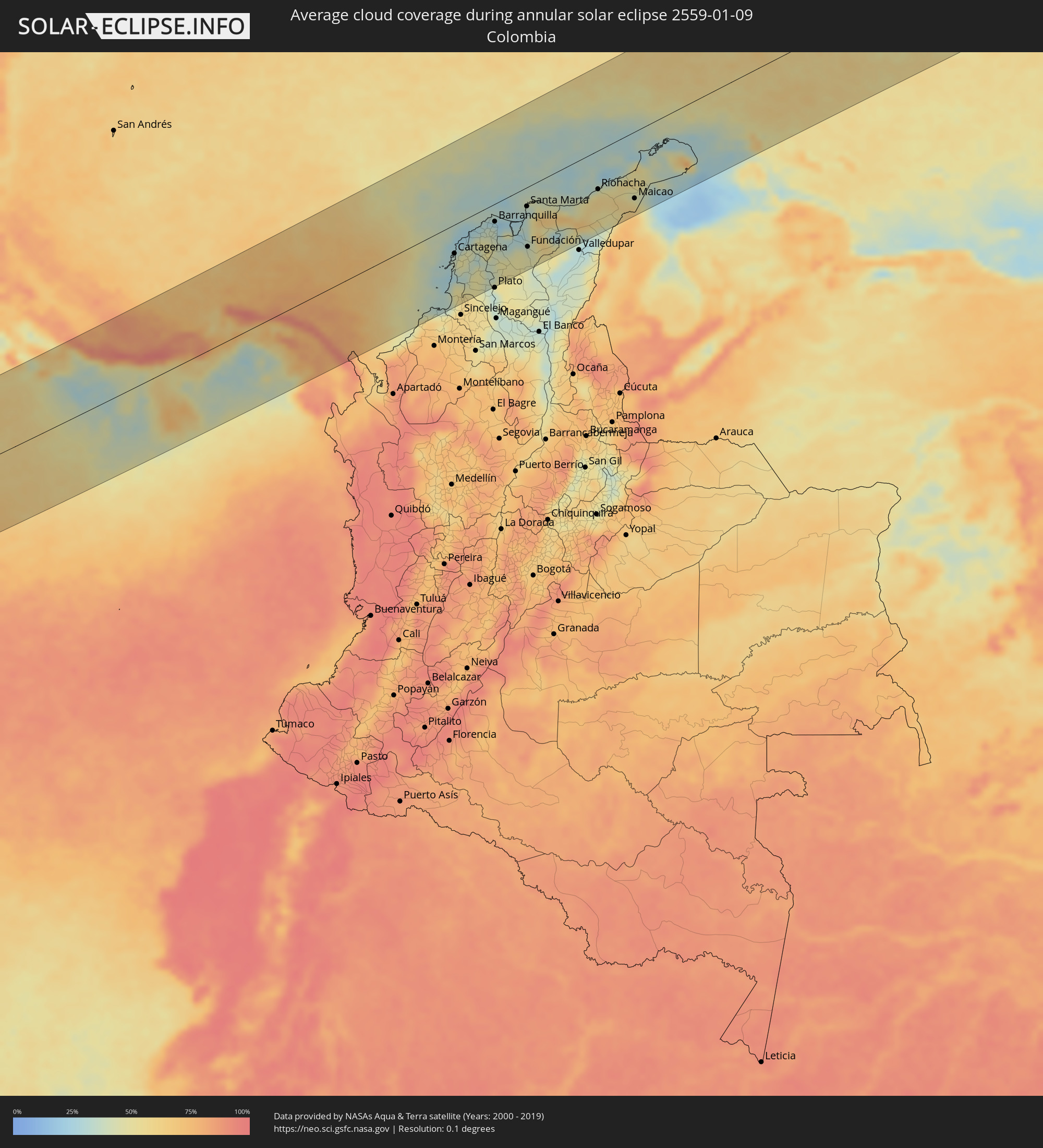 Colombia
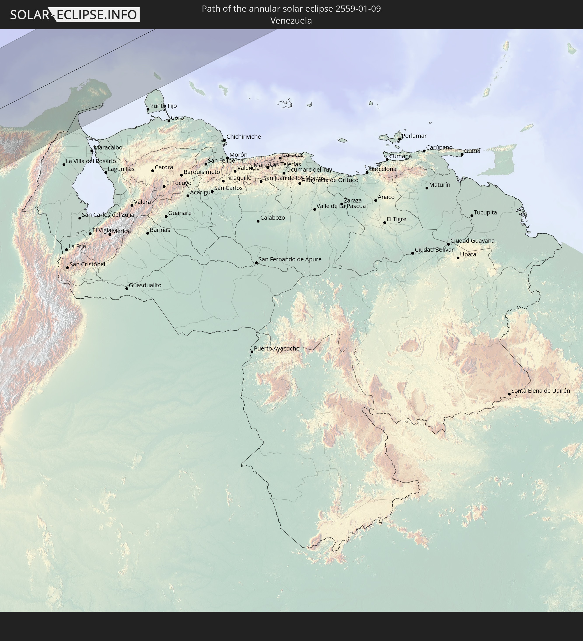
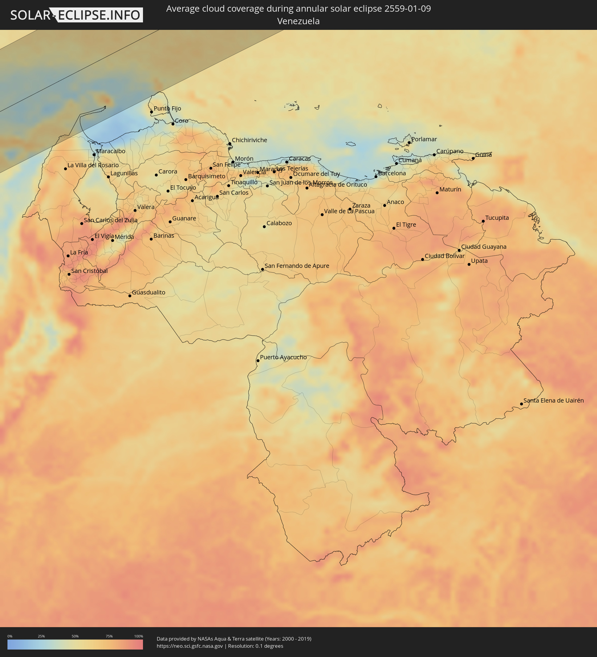 Venezuela
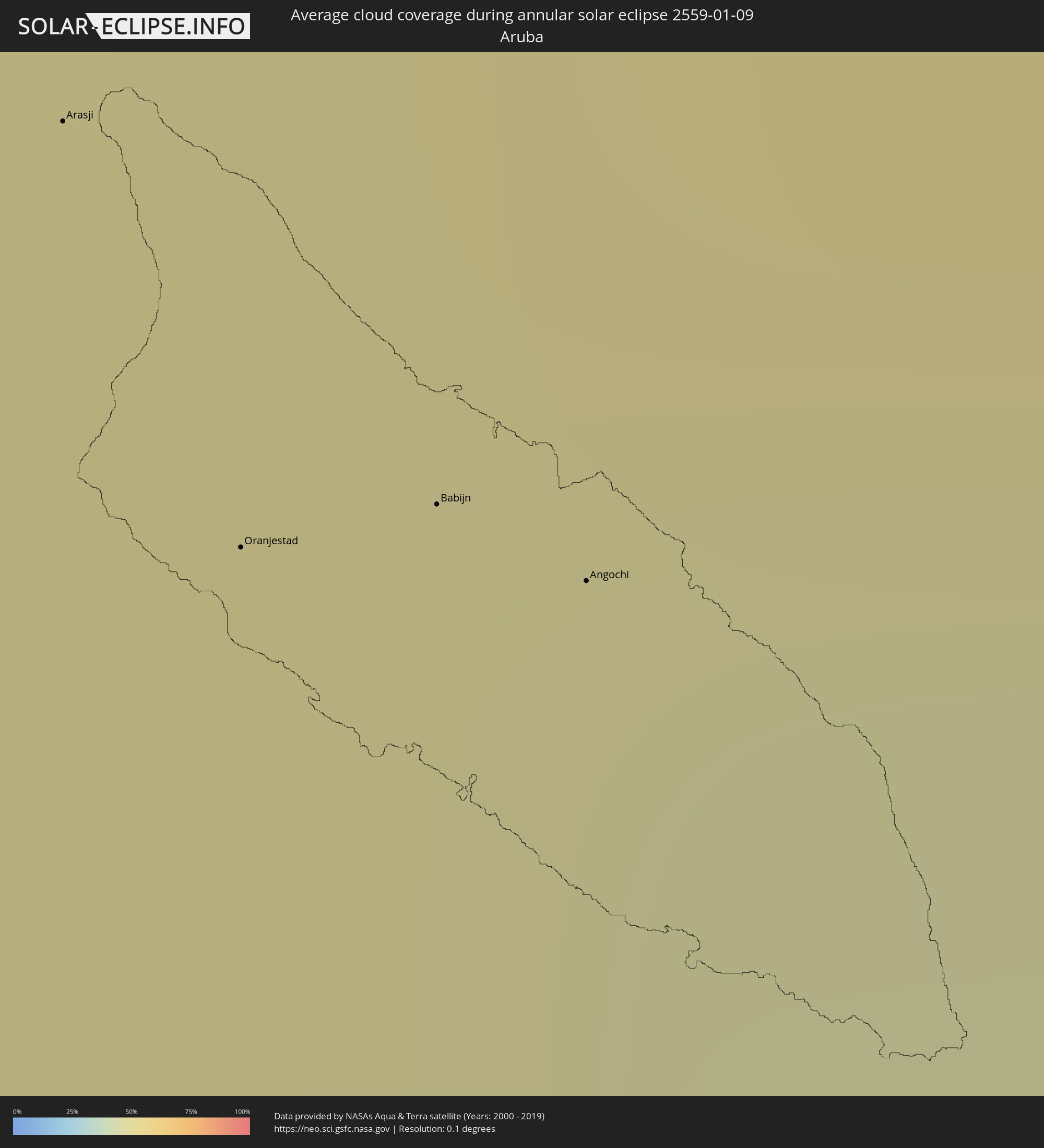 Aruba
Aruba
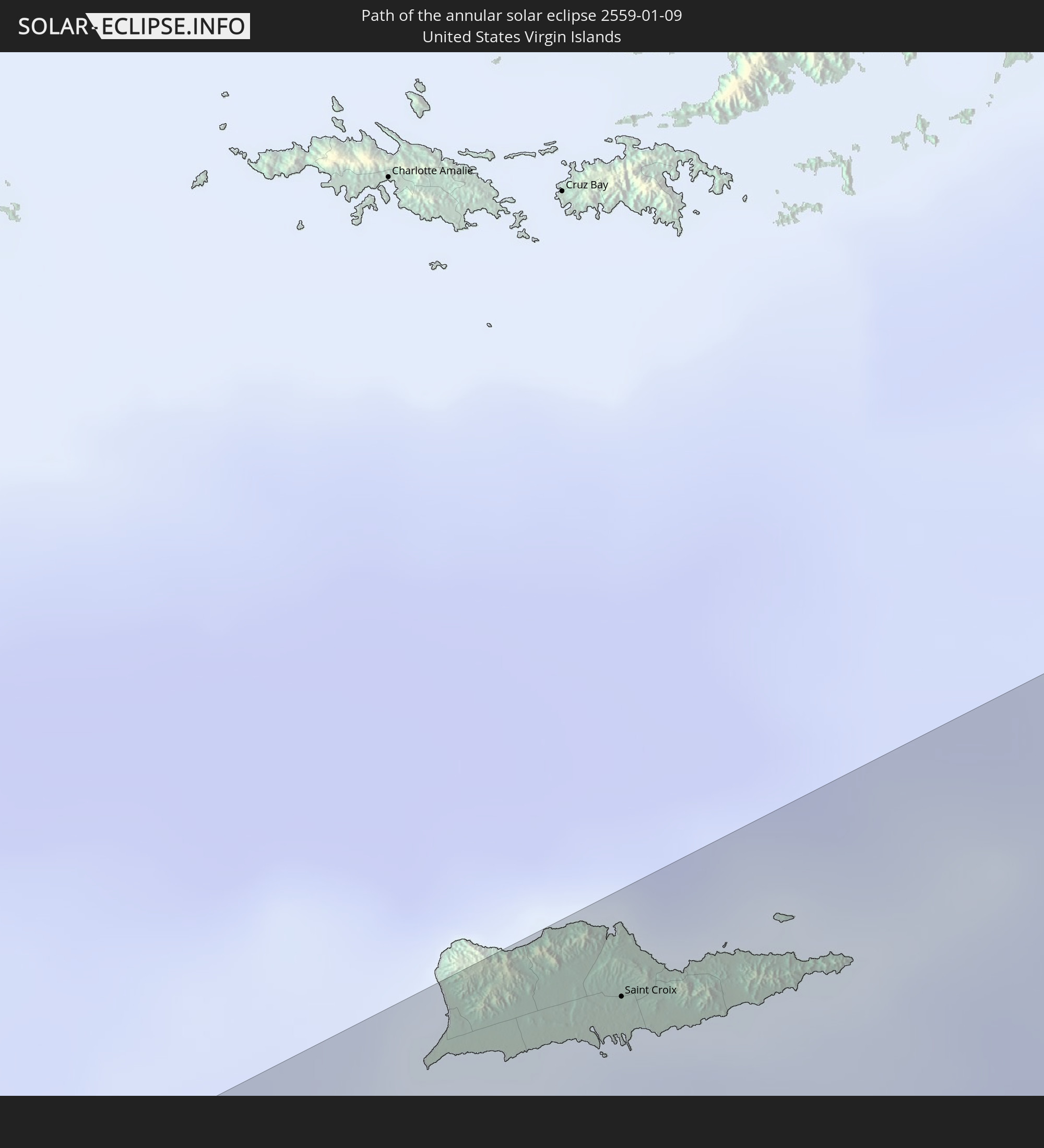
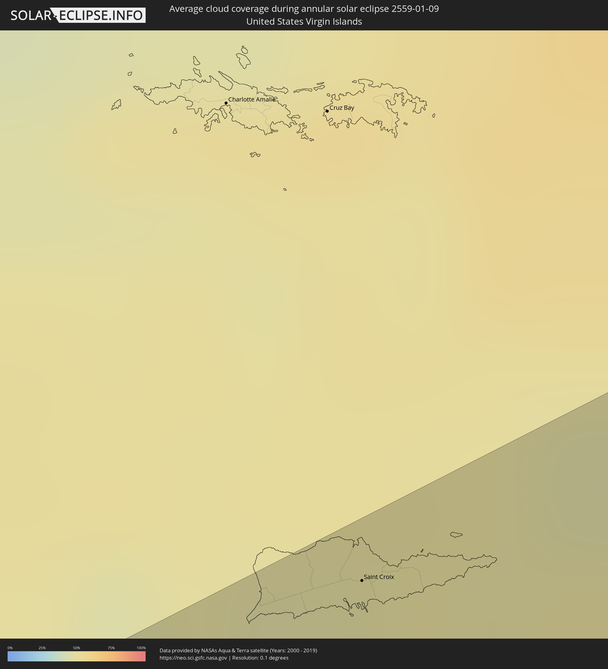 United States Virgin Islands
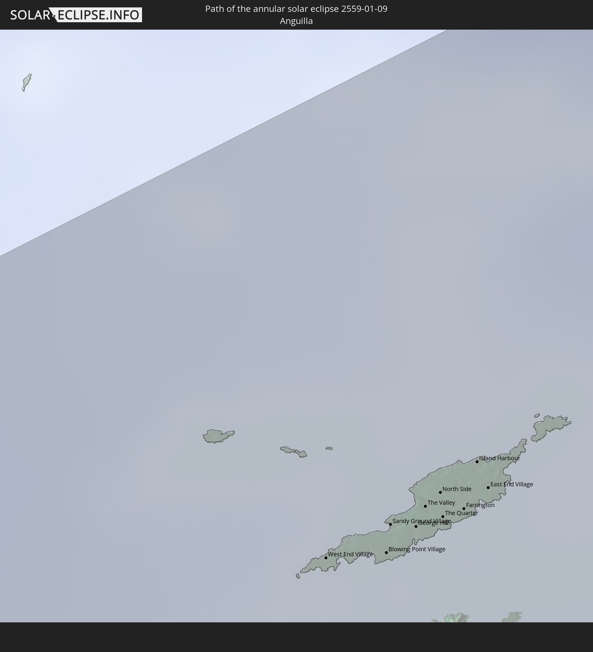
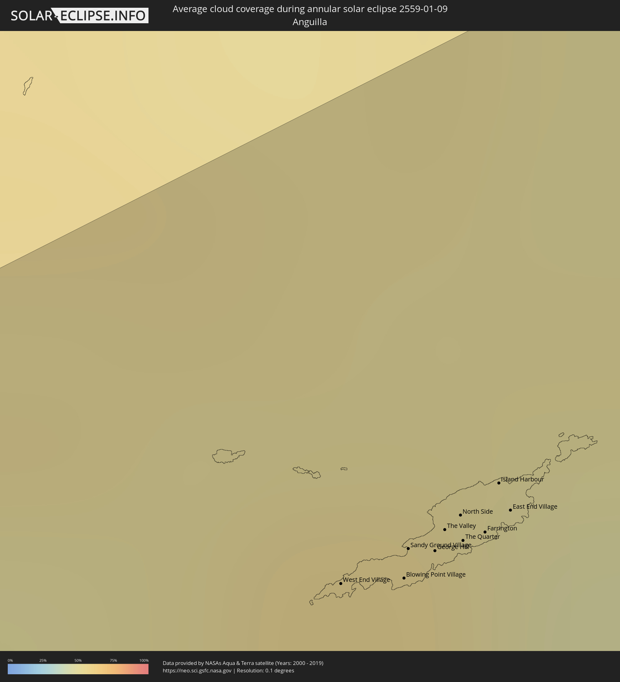 Anguilla
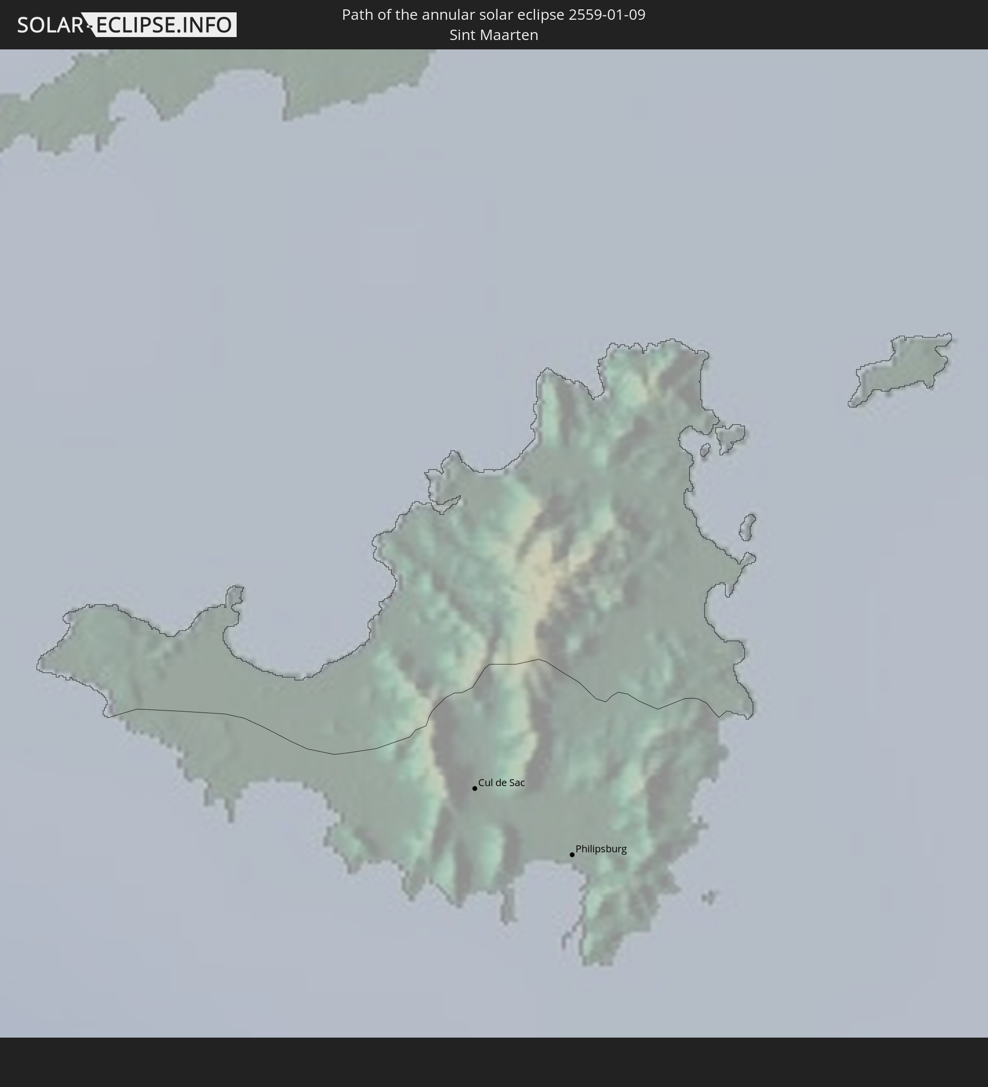
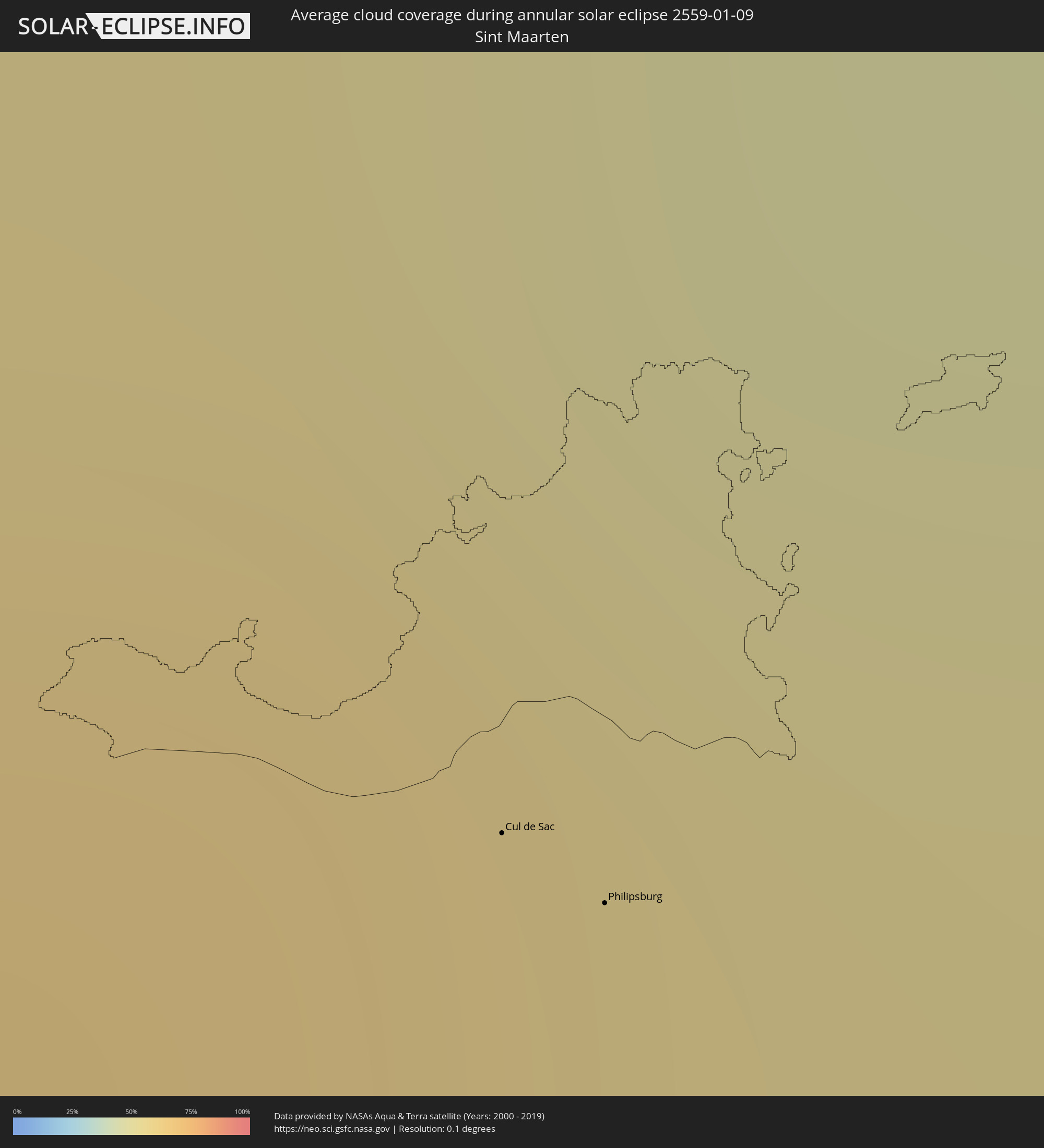 Sint Maarten
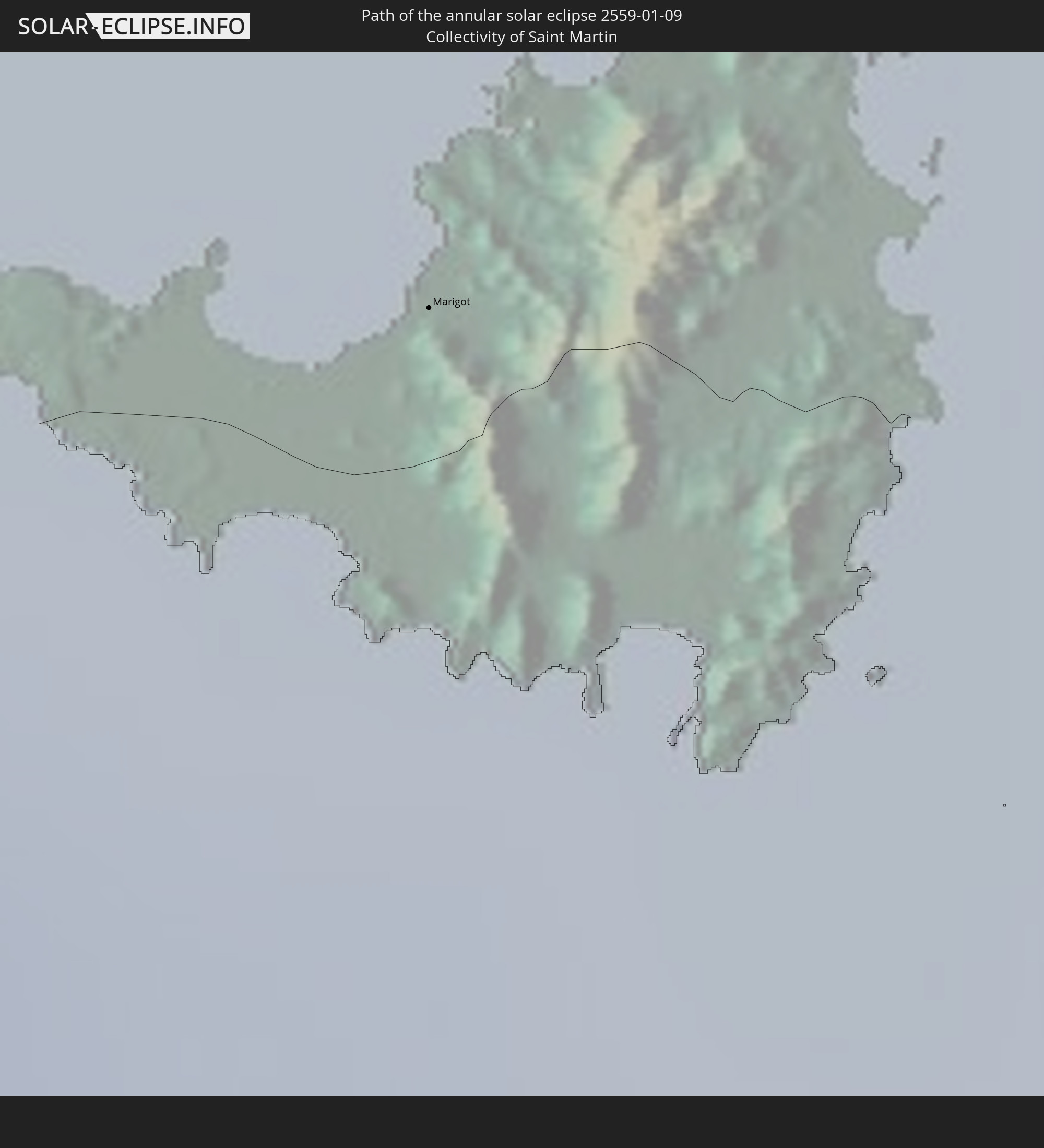
 Collectivity of Saint Martin
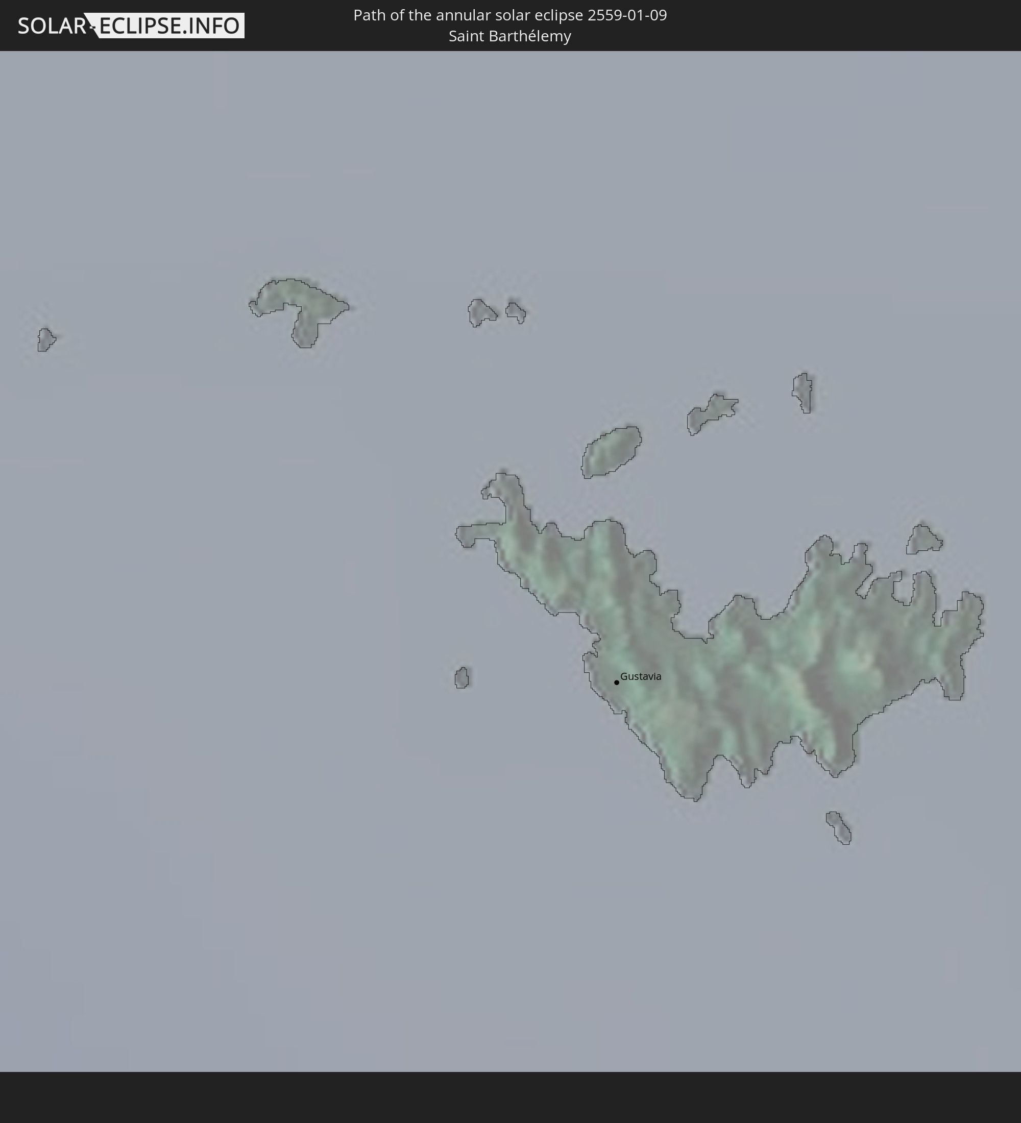
 Saint Barthélemy
 Saint Kitts and Nevis
 Antigua and Barbuda
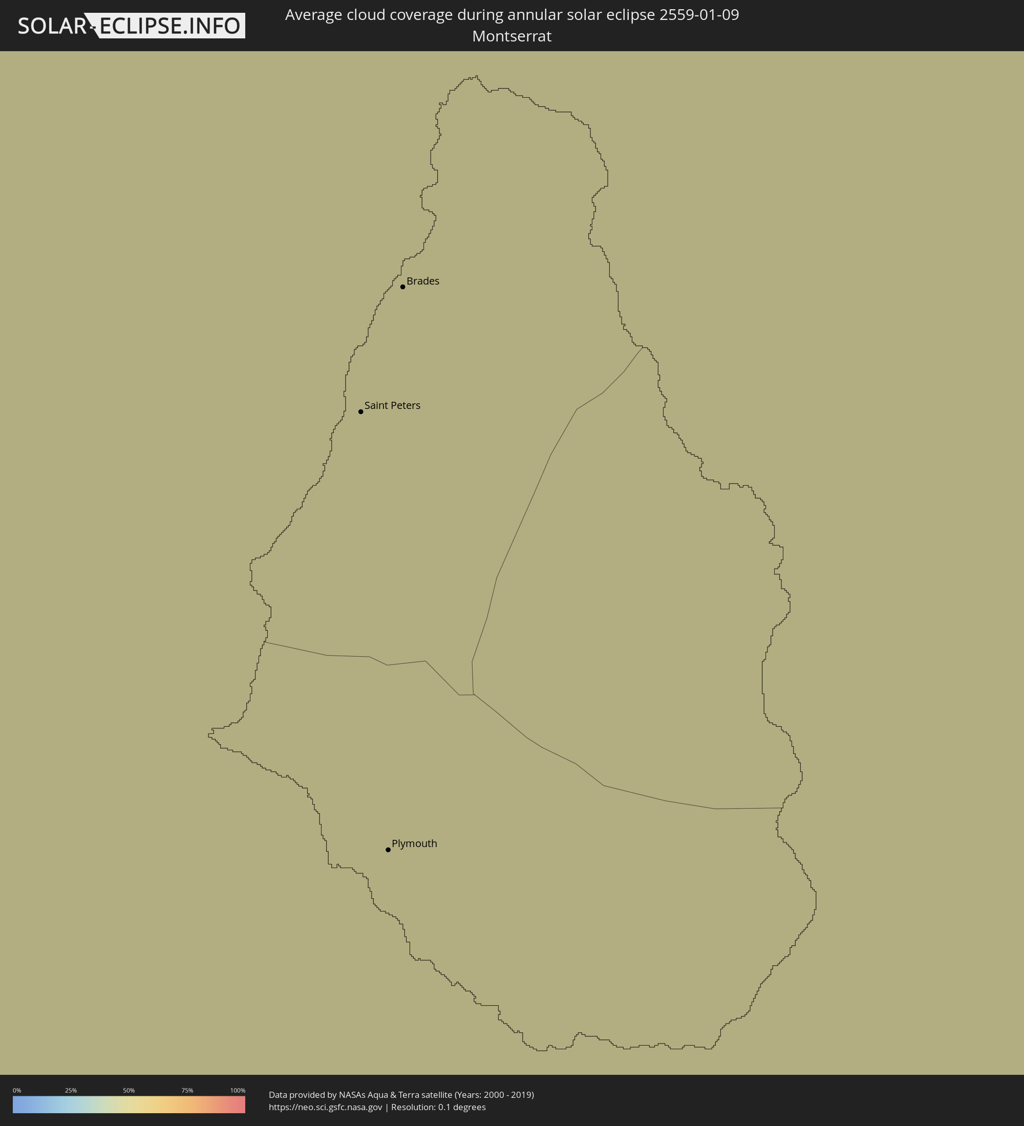 Montserrat
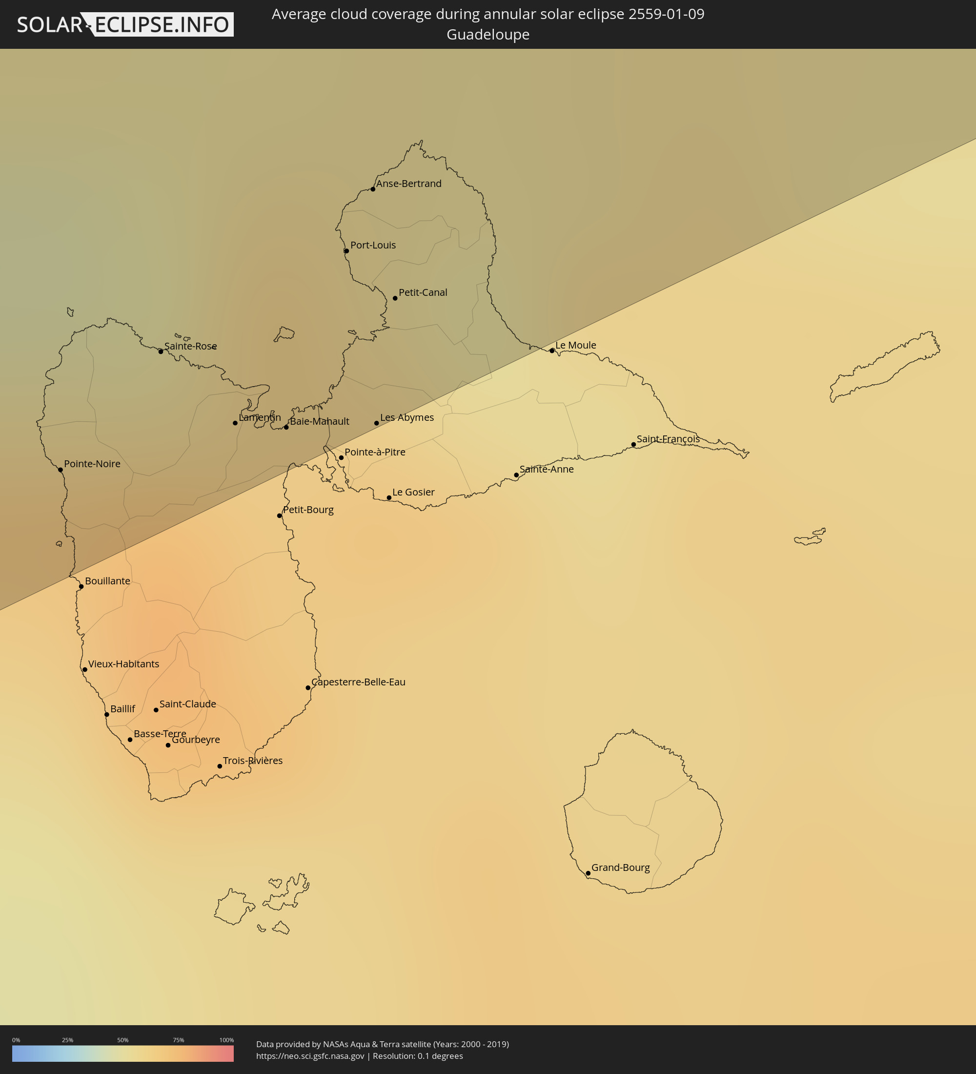 Guadeloupe
 Caribbean Netherlands
Cities inside the path of the eclipse
The following table shows all locations with a population of more than 5,000 inside the eclipse path. Cities which have more than 100,000 inhabitants are marked bold. A click at the locations opens a detailed map.
| City | Type | Eclipse duration | Local time of max. eclipse | Distance to central line | Ø Cloud coverage |
|
Kailua-Kona, Hawaii
|
annular | - | 07:08:14 UTC-10:00 | 142 km | 37% |
|
Kalaoa, Hawaii
|
annular | - | 07:08:17 UTC-10:00 | 152 km | 46% |
|
Hōlualoa, Hawaii
|
annular | - | 07:08:14 UTC-10:00 | 142 km | 51% |
|
Puerto Armuelles, Chiriquí
|
annular | - | 15:09:36 UTC-05:00 | 103 km | 57% |
|
La Concepción, Chiriquí
|
annular | - | 15:10:16 UTC-05:00 | 114 km | 58% |
|
David, Chiriquí
|
annular | - | 15:10:39 UTC-05:00 | 97 km | 41% |
|
Santiago de Veraguas, Veraguas
|
annular | - | 15:13:40 UTC-05:00 | 7 km | 56% |
|
Aguadulce, Coclé
|
annular | - | 15:14:38 UTC-05:00 | 14 km | 53% |
|
Chitré, Herrera
|
annular | - | 15:14:45 UTC-05:00 | 48 km | 50% |
|
Penonomé, Coclé
|
annular | - | 15:15:09 UTC-05:00 | 4 km | 63% |
|
Antón, Coclé
|
annular | - | 15:15:17 UTC-05:00 | 13 km | 57% |
|
Colón, Colón
|
annular | - | 15:16:24 UTC-05:00 | 64 km | 61% |
|
La Chorrera, Panamá
|
annular | - | 15:16:27 UTC-05:00 | 11 km | 73% |
|
Arraiján, Panamá
|
annular | - | 15:16:44 UTC-05:00 | 12 km | 73% |
|
Chilibre, Panamá
|
annular | - | 15:16:53 UTC-05:00 | 30 km | 62% |
|
Panamá, Panamá
|
annular | - | 15:17:01 UTC-05:00 | 10 km | 73% |
|
Tocumen, Panamá
|
annular | - | 15:17:19 UTC-05:00 | 12 km | 74% |
|
Chepo, Panamá
|
annular | - | 15:17:54 UTC-05:00 | 6 km | 63% |
|
San Onofre, Sucre
|
annular | - | 15:24:25 UTC-05:00 | 116 km | 49% |
|
Cartagena, Bolívar
|
annular | - | 15:24:38 UTC-05:00 | 51 km | 40% |
|
Arjona, Bolívar
|
annular | - | 15:24:52 UTC-05:00 | 74 km | 43% |
|
El Carmen de Bolívar, Bolívar
|
annular | - | 15:25:03 UTC-05:00 | 138 km | 53% |
|
San Juan Nepomuceno, Bolívar
|
annular | - | 15:25:11 UTC-05:00 | 117 km | 49% |
|
Sabanalarga, Atlántico
|
annular | - | 15:25:38 UTC-05:00 | 58 km | 50% |
|
Baranoa, Atlántico
|
annular | - | 15:25:41 UTC-05:00 | 42 km | 44% |
|
Barranquilla, Atlántico
|
annular | - | 15:25:56 UTC-05:00 | 31 km | 36% |
|
Palmar de Varela, Atlántico
|
annular | - | 15:25:55 UTC-05:00 | 55 km | 44% |
|
Pivijay, Magdalena
|
annular | - | 15:26:04 UTC-05:00 | 90 km | 42% |
|
Ciénaga, Magdalena
|
annular | - | 15:26:46 UTC-05:00 | 54 km | 36% |
|
Santa Marta, Magdalena
|
annular | - | 15:26:53 UTC-05:00 | 34 km | 35% |
|
Fundación, Magdalena
|
annular | - | 15:26:44 UTC-05:00 | 106 km | 45% |
|
Ríohacha, La Guajira
|
annular | - | 15:28:50 UTC-05:00 | 68 km | 59% |
|
Maicao, La Guajira
|
annular | - | 15:29:43 UTC-05:00 | 117 km | 56% |
|
Arasji
|
annular | - | 16:32:42 UTC-04:00 | 103 km | 63% |
|
Oranjestad
|
annular | - | 16:32:44 UTC-04:00 | 114 km | 63% |
|
Babijn
|
annular | - | 16:32:47 UTC-04:00 | 115 km | 63% |
|
Angochi
|
annular | - | 16:32:49 UTC-04:00 | 119 km | 63% |
|
Saint Croix, Saint Croix Island
|
annular | - | 16:38:04 UTC-04:00 | 145 km | 53% |
 The Bottom, Saba
|
annular | - | 16:39:17 UTC-04:00 | 64 km | 48% |
|
West End Village, West End
|
annular | - | 16:39:17 UTC-04:00 | 114 km | 54% |
|
Blowing Point Village, Blowing Point
|
annular | - | 16:39:19 UTC-04:00 | 111 km | 54% |
|
Sandy Ground Village, Sandy Ground
|
annular | - | 16:39:19 UTC-04:00 | 114 km | 54% |
|
South Hill Village, South Hill
|
annular | - | 16:39:20 UTC-04:00 | 113 km | 54% |
|
Marigot
|
annular | - | 16:39:21 UTC-04:00 | 100 km | 59% |
|
North Hill Village, North Hill
|
annular | - | 16:39:20 UTC-04:00 | 114 km | 54% |
|
George Hill, George Hill
|
annular | - | 16:39:20 UTC-04:00 | 112 km | 54% |
 Cul de Sac
|
annular | - | 16:39:22 UTC-04:00 | 96 km | 56% |
|
The Valley, The Valley
|
annular | - | 16:39:21 UTC-04:00 | 114 km | 54% |
|
Stoney Ground, Stoney Ground
|
annular | - | 16:39:21 UTC-04:00 | 114 km | 47% |
|
Philipsburg
|
annular | - | 16:39:23 UTC-04:00 | 94 km | 55% |
|
North Side, North Side
|
annular | - | 16:39:21 UTC-04:00 | 114 km | 47% |
|
The Quarter, The Quarter
|
annular | - | 16:39:21 UTC-04:00 | 112 km | 47% |
|
Farrington, The Farrington
|
annular | - | 16:39:22 UTC-04:00 | 112 km | 47% |
|
Sandy Hill, Sandy Hill
|
annular | - | 16:39:23 UTC-04:00 | 112 km | 47% |
|
Island Harbour, Island Harbour
|
annular | - | 16:39:22 UTC-04:00 | 115 km | 47% |
|
East End Village, East End
|
annular | - | 16:39:23 UTC-04:00 | 113 km | 47% |
|
Oranjestad, Sint Eustatius
|
annular | - | 16:39:31 UTC-04:00 | 37 km | 52% |
|
Gustavia
|
annular | - | 16:39:33 UTC-04:00 | 72 km | 42% |
|
Sandy Point Town, Saint Anne Sandy Point
|
annular | - | 16:39:38 UTC-04:00 | 18 km | 55% |
|
Saint Paul’s, Saint Paul Capesterre
|
annular | - | 16:39:39 UTC-04:00 | 21 km | 55% |
|
Middle Island, Saint Thomas Middle Island
|
annular | - | 16:39:39 UTC-04:00 | 13 km | 55% |
|
Dieppe Bay Town, Saint John Capesterre
|
annular | - | 16:39:39 UTC-04:00 | 22 km | 55% |
|
Trinity, Trinity Palmetto Point
|
annular | - | 16:39:42 UTC-04:00 | 9 km | 55% |
|
Nicola Town, Christ Church Nichola Town
|
annular | - | 16:39:42 UTC-04:00 | 15 km | 55% |
|
Cayon, Saint Mary Cayon
|
annular | - | 16:39:43 UTC-04:00 | 12 km | 48% |
|
Basseterre, Saint George Basseterre
|
annular | - | 16:39:44 UTC-04:00 | 6 km | 53% |
|
Monkey Hill, Saint Peter Basseterre
|
annular | - | 16:39:44 UTC-04:00 | 8 km | 53% |
|
Charlestown, Saint Paul Charlestown
|
annular | - | 16:39:50 UTC-04:00 | 15 km | 46% |
|
Cotton Ground, Saint Thomas Lowland
|
annular | - | 16:39:49 UTC-04:00 | 12 km | 48% |
|
Fig Tree, Saint John Figtree
|
annular | - | 16:39:50 UTC-04:00 | 17 km | 46% |
|
Newcastle, Saint James Windwa
|
annular | - | 16:39:51 UTC-04:00 | 10 km | 48% |
|
Market Shop, Saint George Gingerland
|
annular | - | 16:39:52 UTC-04:00 | 19 km | 46% |
|
Saint Peters, Saint Peter
|
annular | - | 16:40:09 UTC-04:00 | 70 km | 57% |
|
Plymouth, Saint Anthony
|
annular | - | 16:40:10 UTC-04:00 | 77 km | 55% |
|
Brades, Saint Peter
|
annular | - | 16:40:09 UTC-04:00 | 68 km | 57% |
|
Bolands, Saint Mary
|
annular | - | 16:40:22 UTC-04:00 | 57 km | 60% |
|
Saint John’s, Saint John
|
annular | - | 16:40:23 UTC-04:00 | 53 km | 54% |
|
Codrington, Barbuda
|
annular | - | 16:40:19 UTC-04:00 | 2 km | 50% |
|
Piggotts, Saint George
|
annular | - | 16:40:25 UTC-04:00 | 55 km | 54% |
|
Pointe-Noire, Guadeloupe
|
annular | - | 16:40:30 UTC-04:00 | 144 km | 63% |
|
Falmouth, Saint Paul
|
annular | - | 16:40:26 UTC-04:00 | 65 km | 51% |
|
Parham, Saint Peter
|
annular | - | 16:40:26 UTC-04:00 | 59 km | 54% |
|
Sainte-Rose, Guadeloupe
|
annular | - | 16:40:34 UTC-04:00 | 138 km | 71% |
|
Lamentin, Guadeloupe
|
annular | - | 16:40:37 UTC-04:00 | 148 km | 64% |
|
Baie-Mahault, Guadeloupe
|
annular | - | 16:40:39 UTC-04:00 | 150 km | 64% |
|
Port-Louis, Guadeloupe
|
annular | - | 16:40:40 UTC-04:00 | 138 km | 60% |
|
Anse-Bertrand, Guadeloupe
|
annular | - | 16:40:41 UTC-04:00 | 133 km | 55% |
|
Les Abymes, Guadeloupe
|
annular | - | 16:40:42 UTC-04:00 | 154 km | 66% |
|
Petit-Canal, Guadeloupe
|
annular | - | 16:40:42 UTC-04:00 | 144 km | 60% |