Annular solar eclipse of 12/12/2634
| Day of week: | Friday |
| Maximum duration of eclipse: | 03m19s |
| Maximum width of eclipse path: | 110 km |
| Saros cycle: | 152 |
| Coverage: | 97.2% |
| Magnitude: | 0.9723 |
| Gamma: | 0.4303 |
Wo kann man die Sonnenfinsternis vom 12/12/2634 sehen?
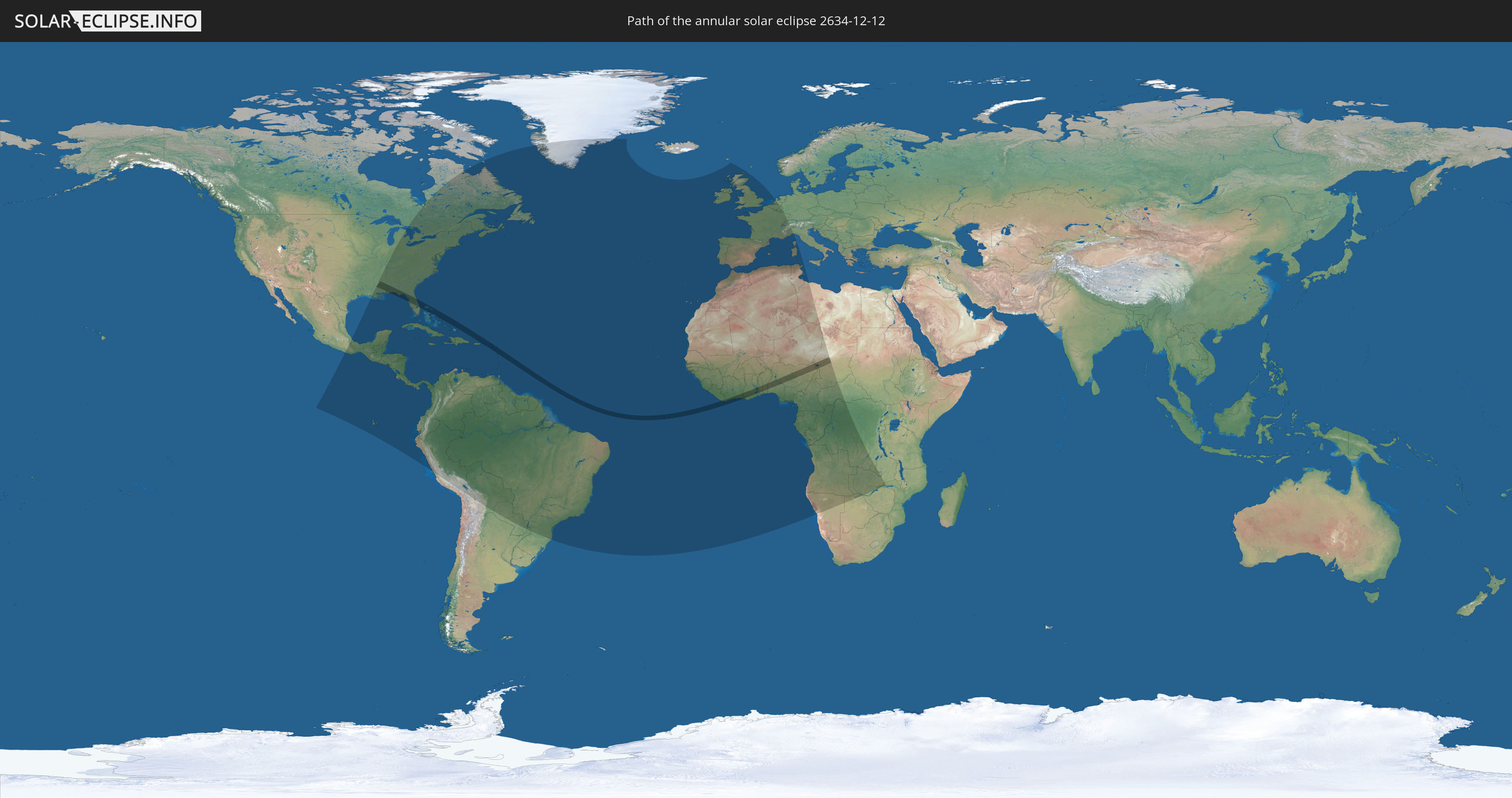
Die Sonnenfinsternis am 12/12/2634 kann man in 102 Ländern als partielle Sonnenfinsternis beobachten.
Der Finsternispfad verläuft durch 22 Länder. Nur in diesen Ländern ist sie als annular Sonnenfinsternis zu sehen.
In den folgenden Ländern ist die Sonnenfinsternis annular zu sehen
 United States
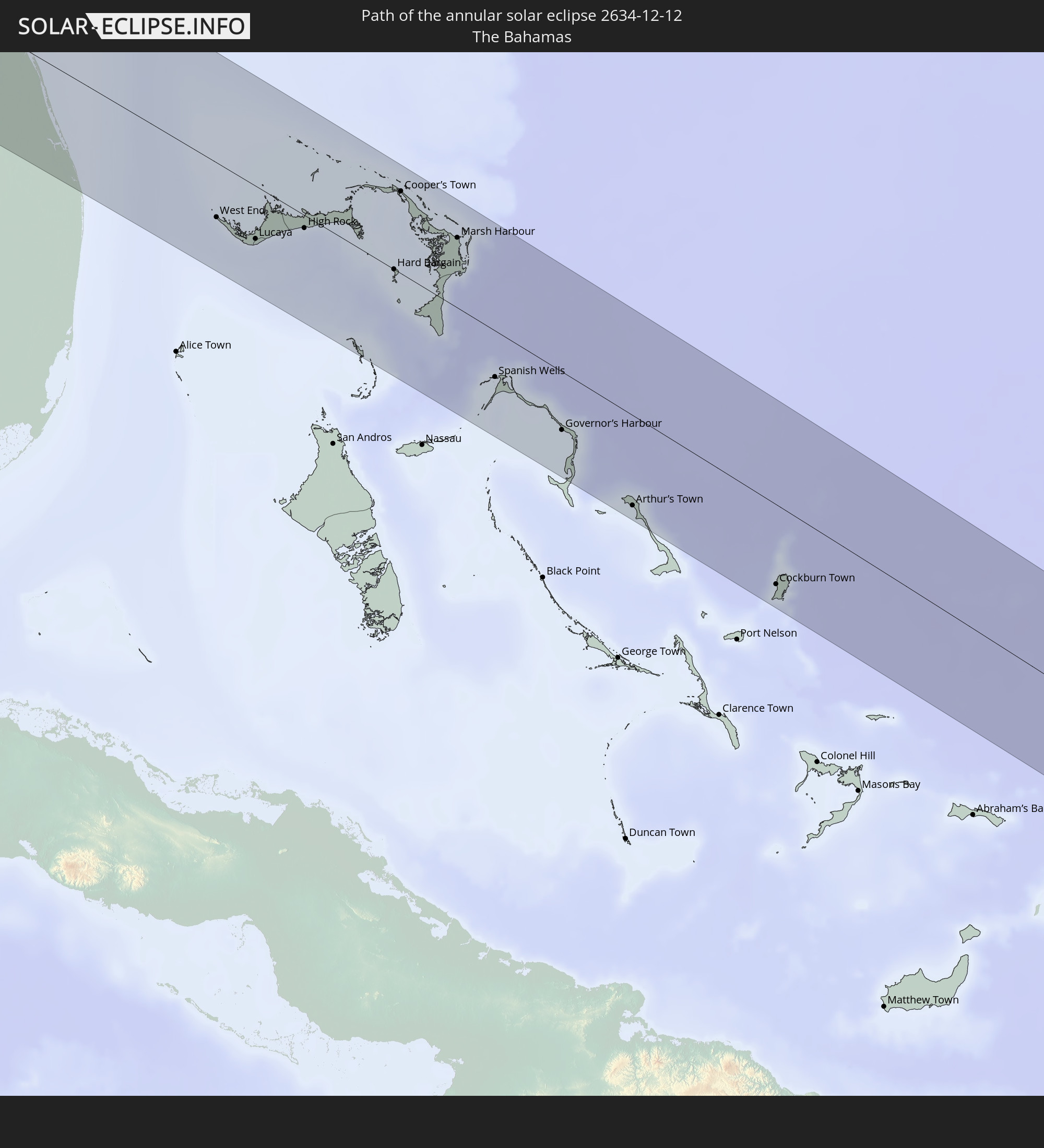 The Bahamas
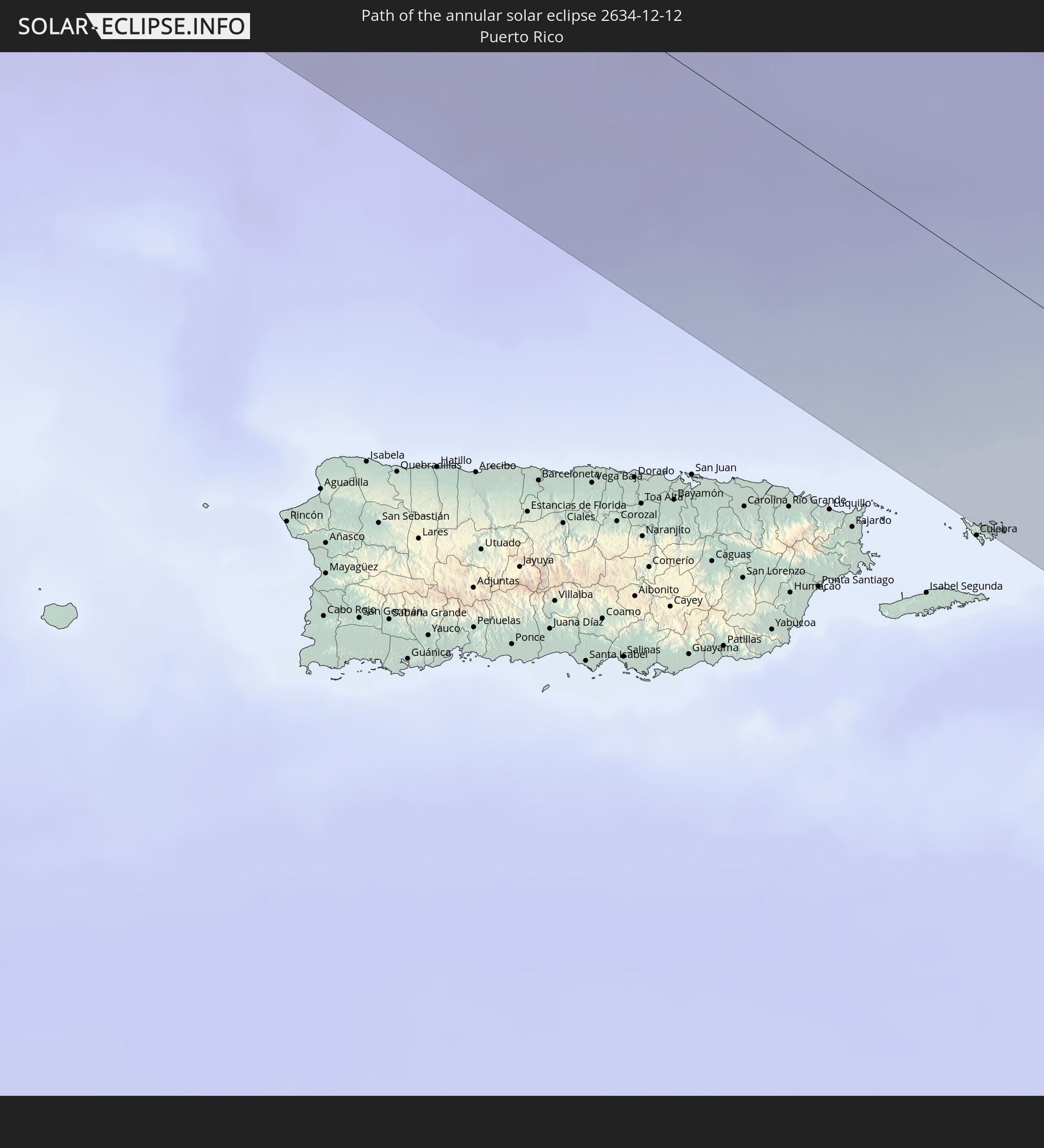 Puerto Rico
 United States Virgin Islands
 British Virgin Islands
 Anguilla
 Sint Maarten
 Collectivity of Saint Martin
 Saint Barthélemy
 Saint Kitts and Nevis
 Antigua and Barbuda
 Montserrat
 Guadeloupe
 Liberia
 Ivory Coast
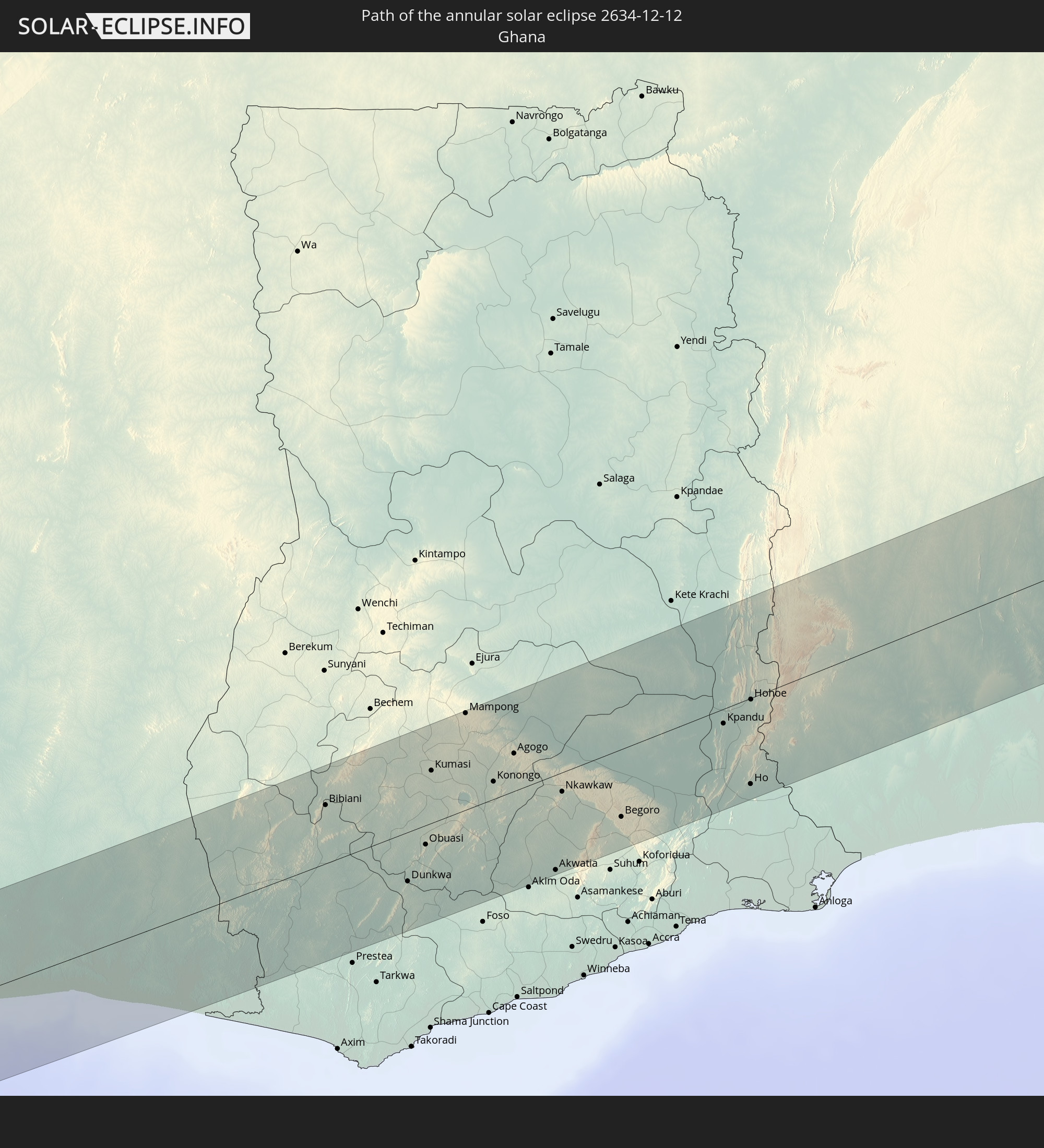 Ghana
Ghana
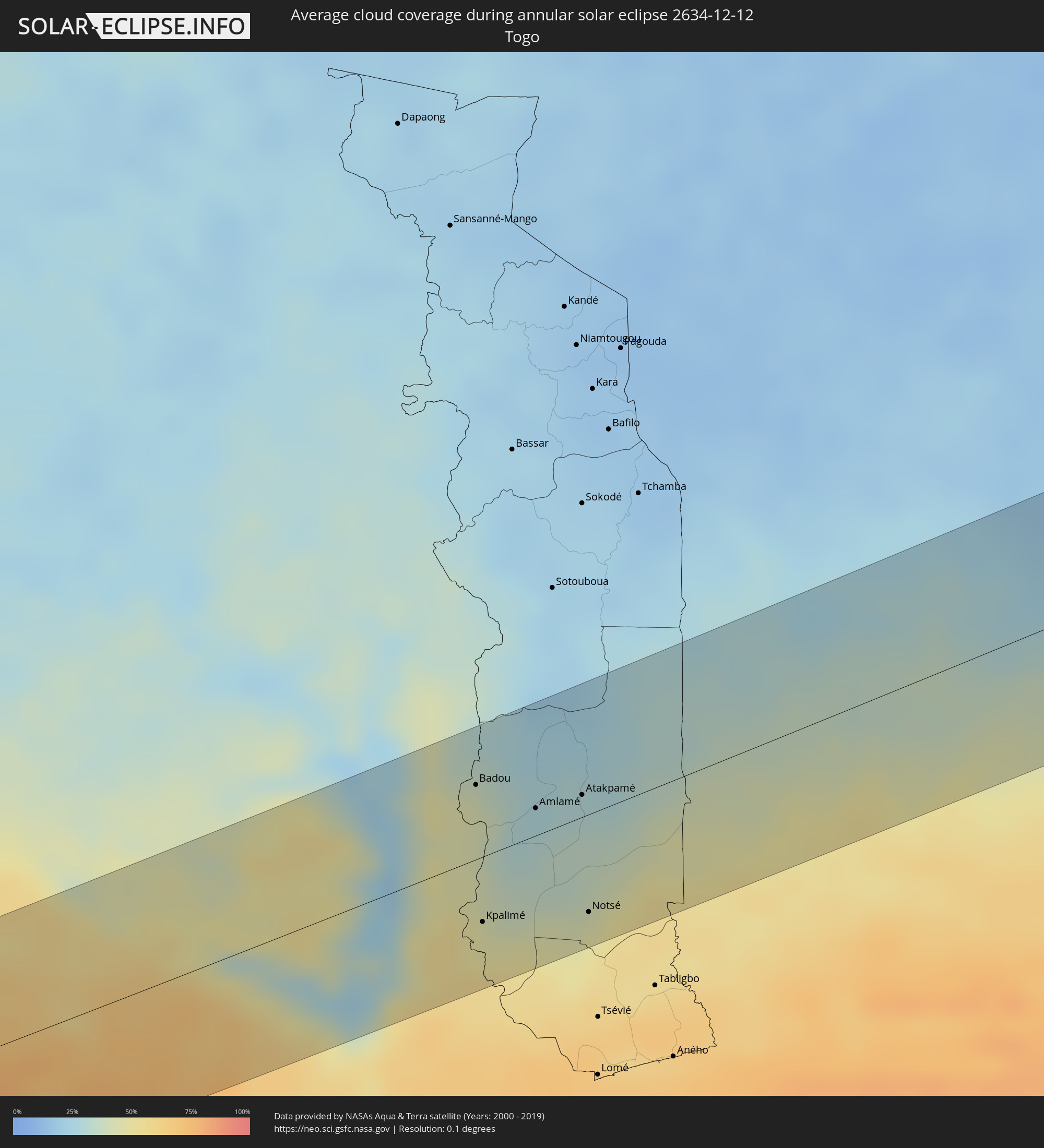
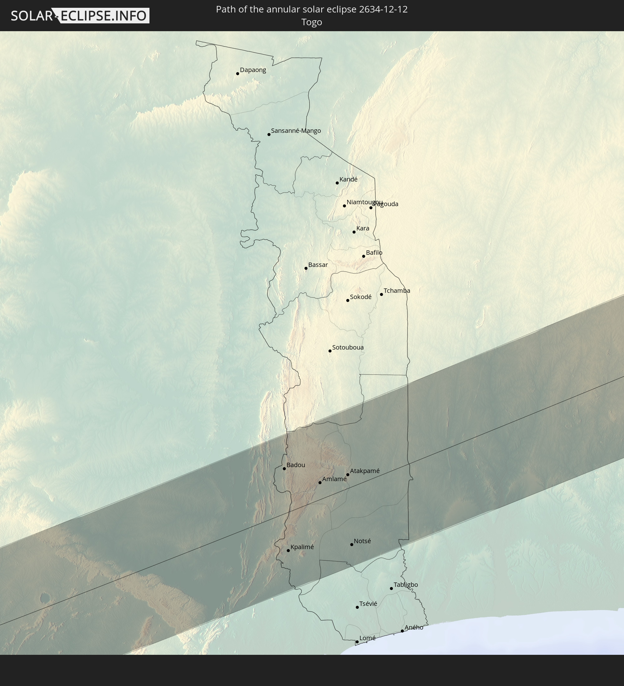 Togo
Togo
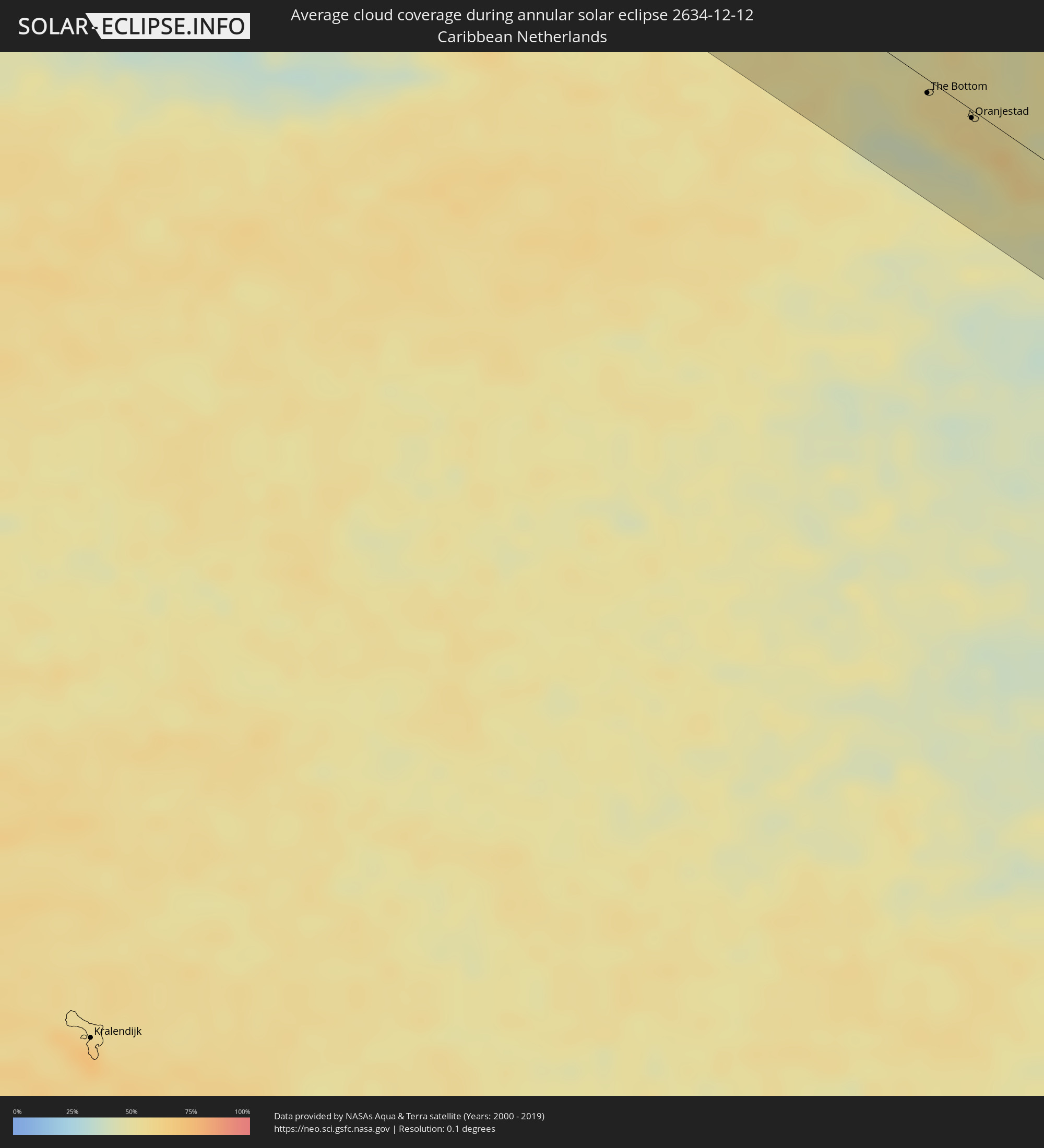
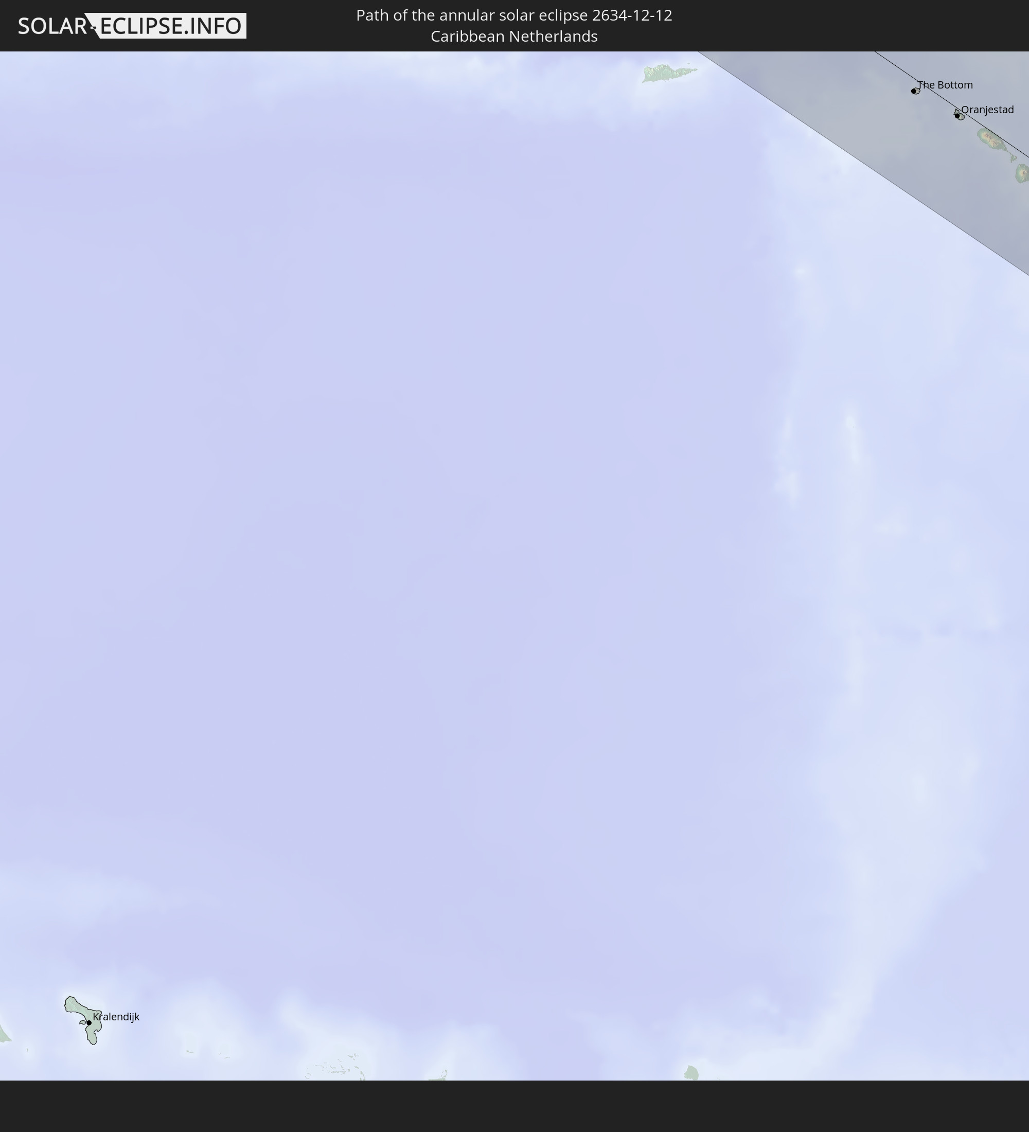 Caribbean Netherlands
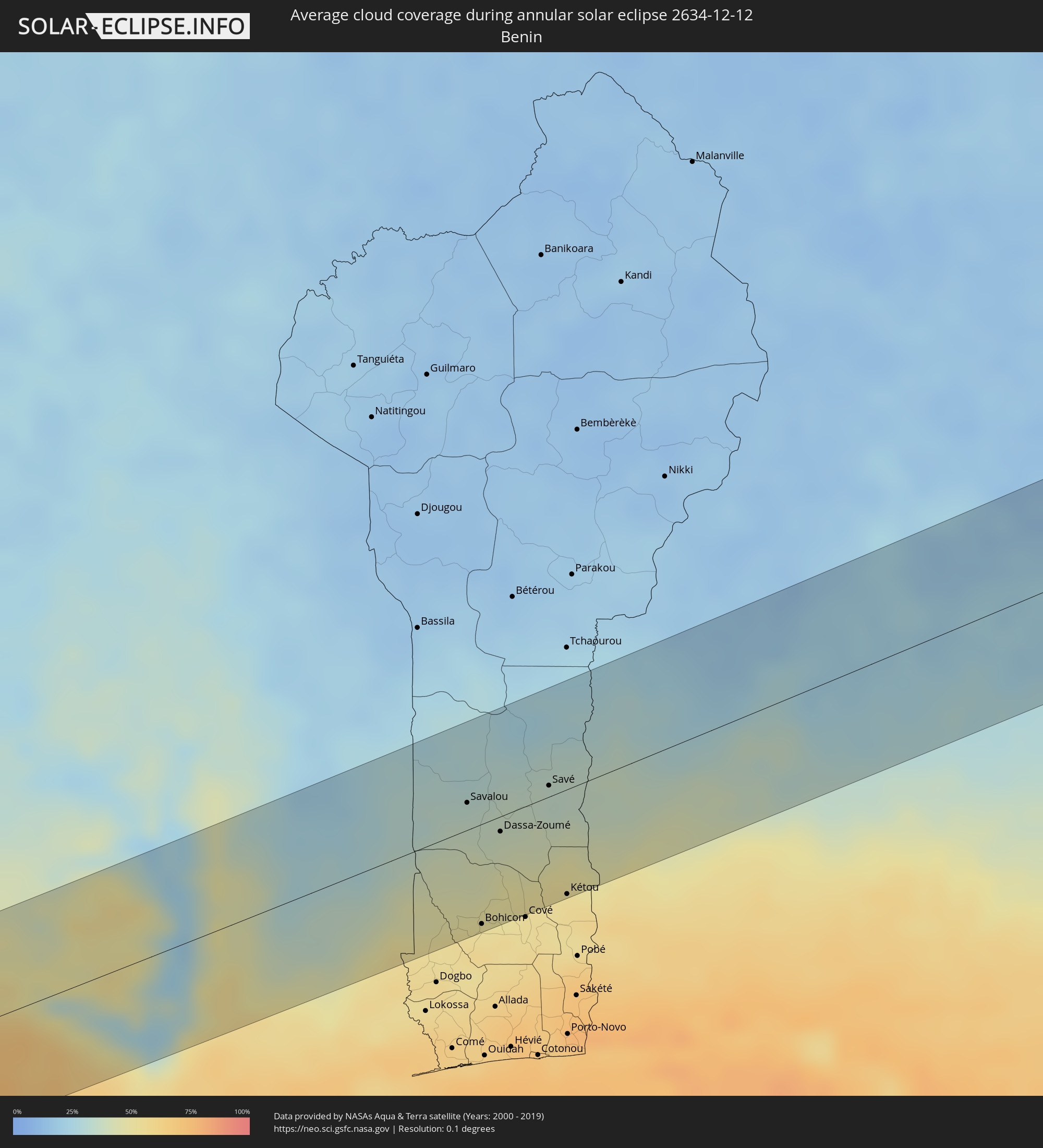
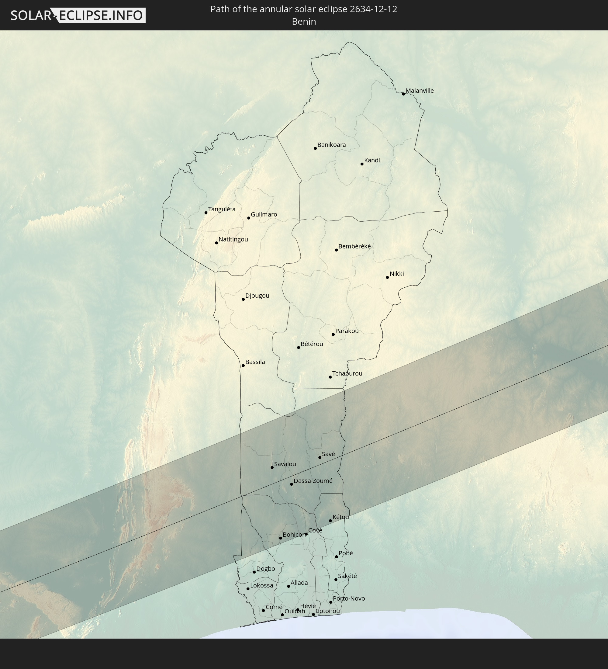 Benin
Benin
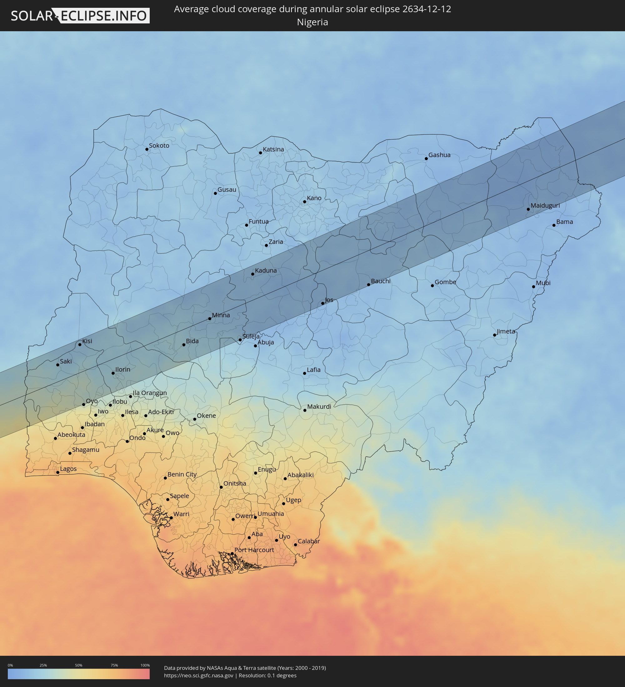
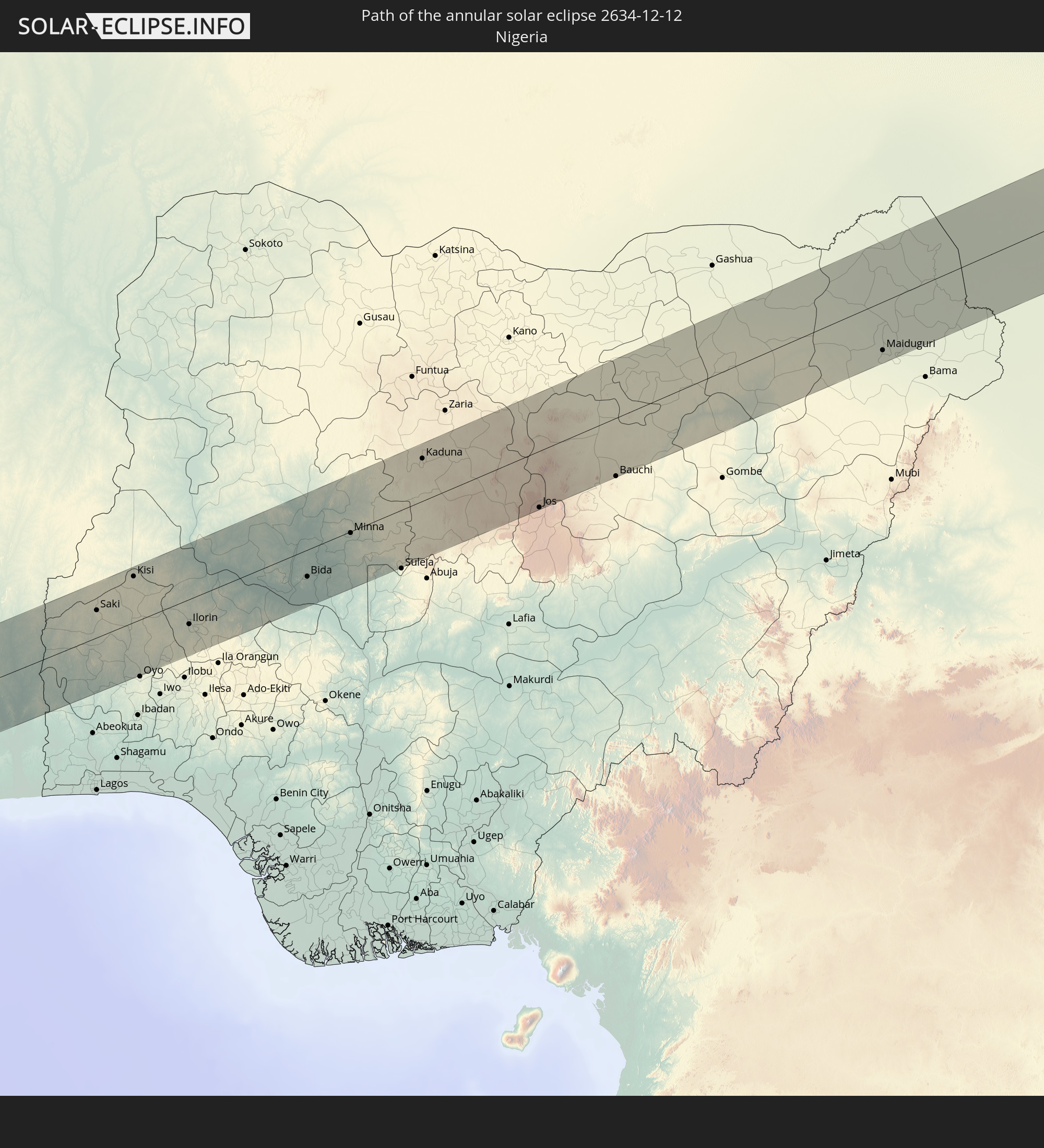 Nigeria
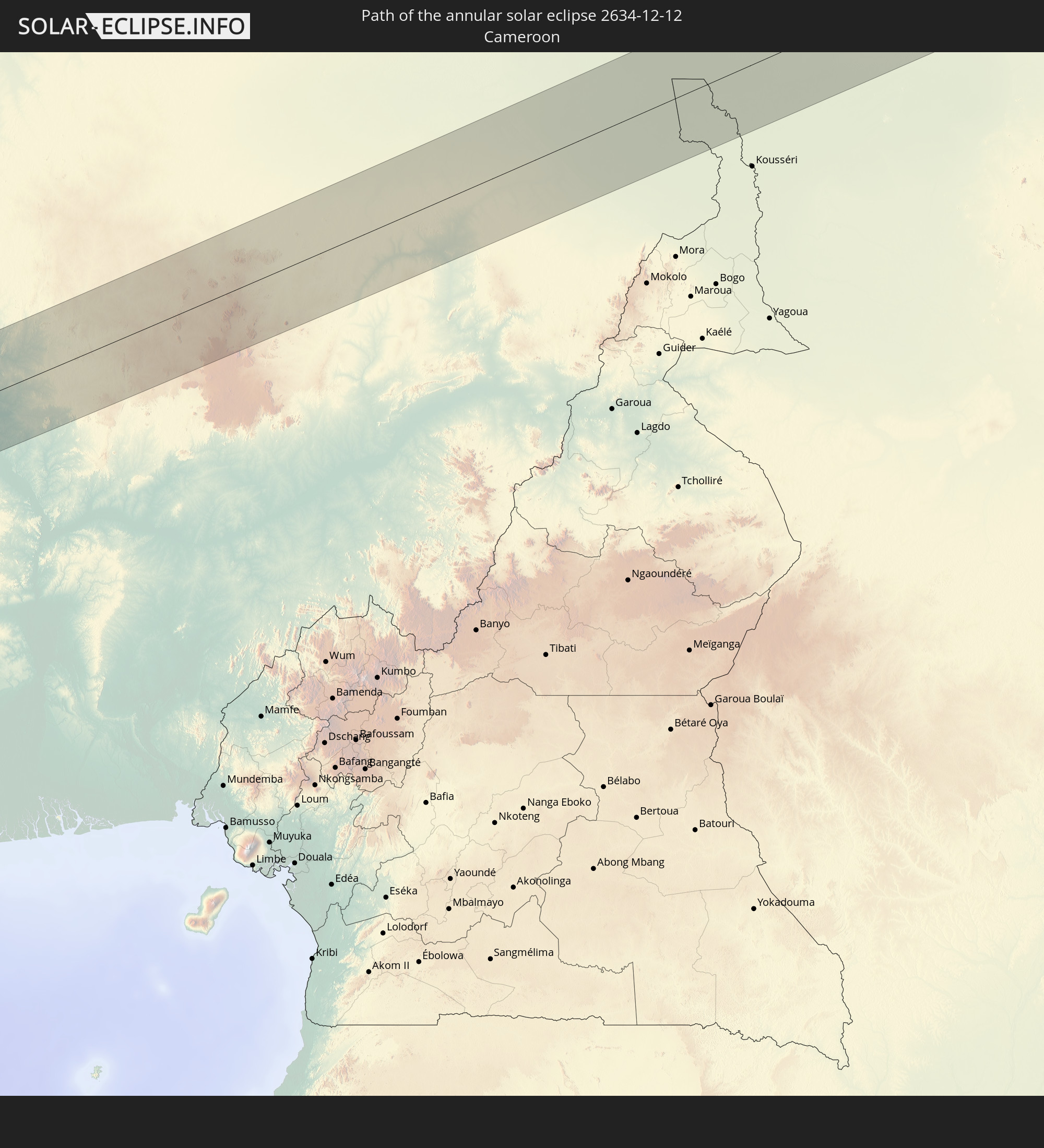 Cameroon
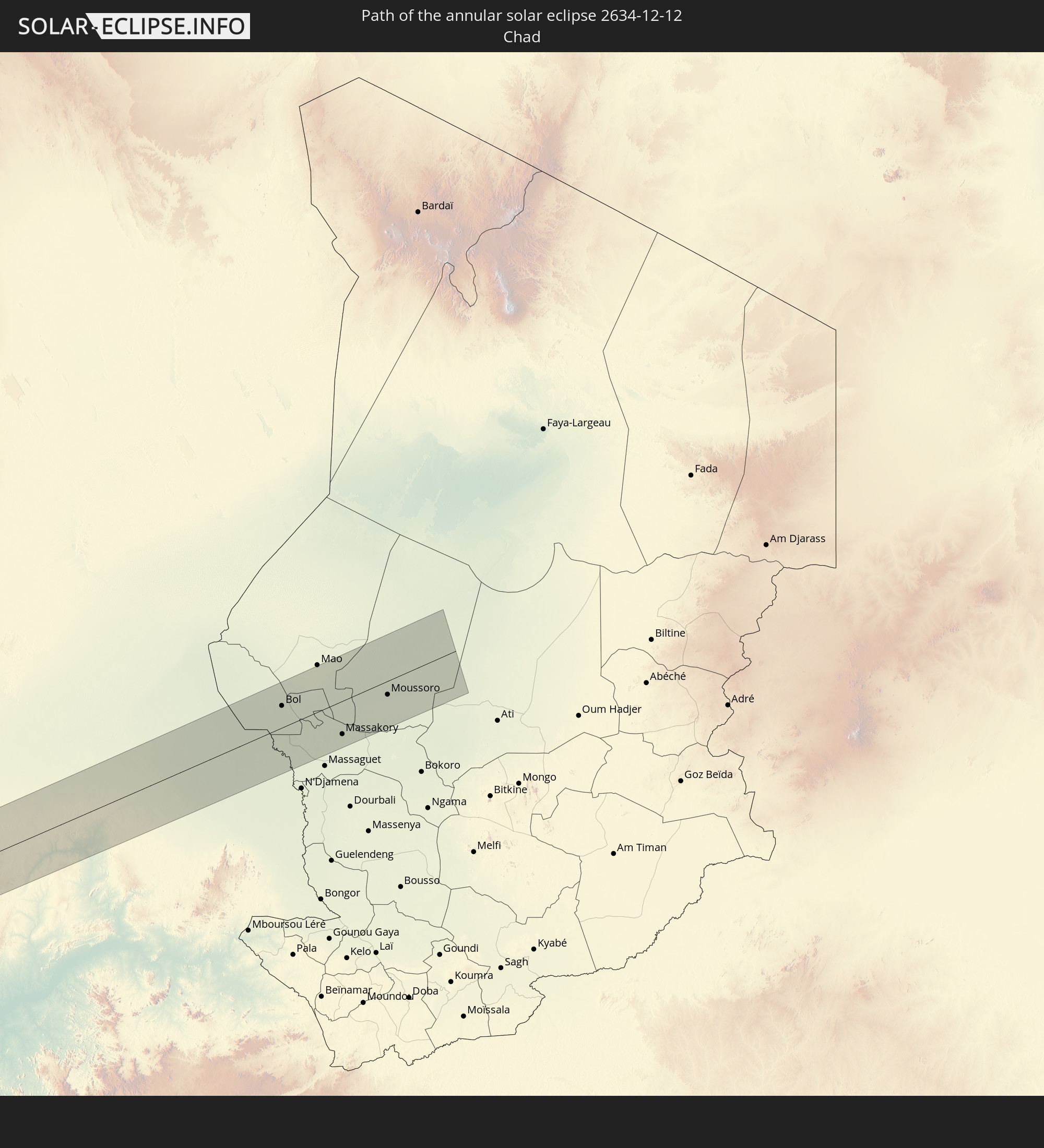 Chad
Chad
In den folgenden Ländern ist die Sonnenfinsternis partiell zu sehen
 United States
 United States Minor Outlying Islands
 Canada
 Mexico
 Greenland
 Guatemala
 Ecuador
 El Salvador
 Honduras
 Belize
 Nicaragua
 Costa Rica
 Cuba
Cuba
 Panama
 Colombia
 Cayman Islands
 Peru
Peru
 The Bahamas
 Jamaica
 Haiti
Haiti
 Brazil
 Argentina
 Venezuela
 Turks and Caicos Islands
 Dominican Republic
 Aruba
Aruba
 Bolivia
 Puerto Rico
 United States Virgin Islands
 Bermuda
 British Virgin Islands
 Anguilla
 Collectivity of Saint Martin
 Saint Barthélemy
 Saint Kitts and Nevis
 Paraguay
 Antigua and Barbuda
 Montserrat
 Trinidad and Tobago
 Guadeloupe
 Grenada
 Dominica
 Saint Vincent and the Grenadines
 Guyana
 Martinique
 Saint Lucia
 Barbados
 Suriname
 Saint Pierre and Miquelon
 French Guiana
 Portugal
 Cabo Verde
 Spain
Spain
 Senegal
 Mauritania
 The Gambia
 Guinea-Bissau
 Guinea
 Saint Helena, Ascension and Tristan da Cunha
 Sierra Leone
 Morocco
 Mali
Mali
 Liberia
 Republic of Ireland
 Algeria
 United Kingdom
 Ivory Coast
 Burkina Faso
 Gibraltar
 France
 Isle of Man
 Ghana
Ghana
 Guernsey
 Jersey
 Togo
Togo
 Niger
Niger
 Benin
Benin
 Andorra
 Belgium
 Nigeria
 Netherlands
 Equatorial Guinea
 Luxembourg
 Germany
 Switzerland
 São Tomé and Príncipe
 Italy
Italy
 Monaco
 Tunisia
 Cameroon
 Gabon
Gabon
 Libya
Libya
 Republic of the Congo
 Angola
 Namibia
 Democratic Republic of the Congo
 Chad
Chad
 Central African Republic
 Botswana
 Zambia
 Zimbabwe
 Mozambique
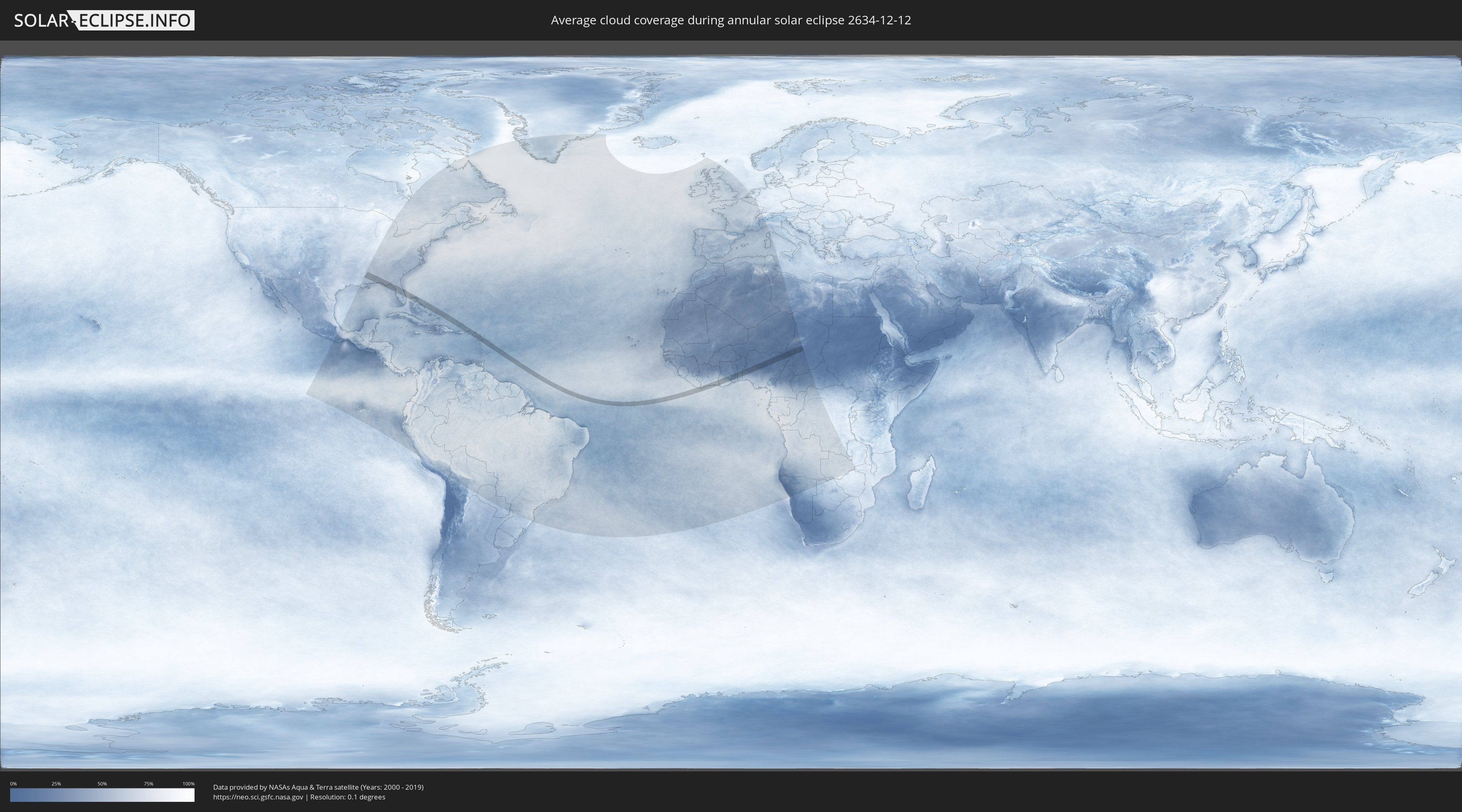
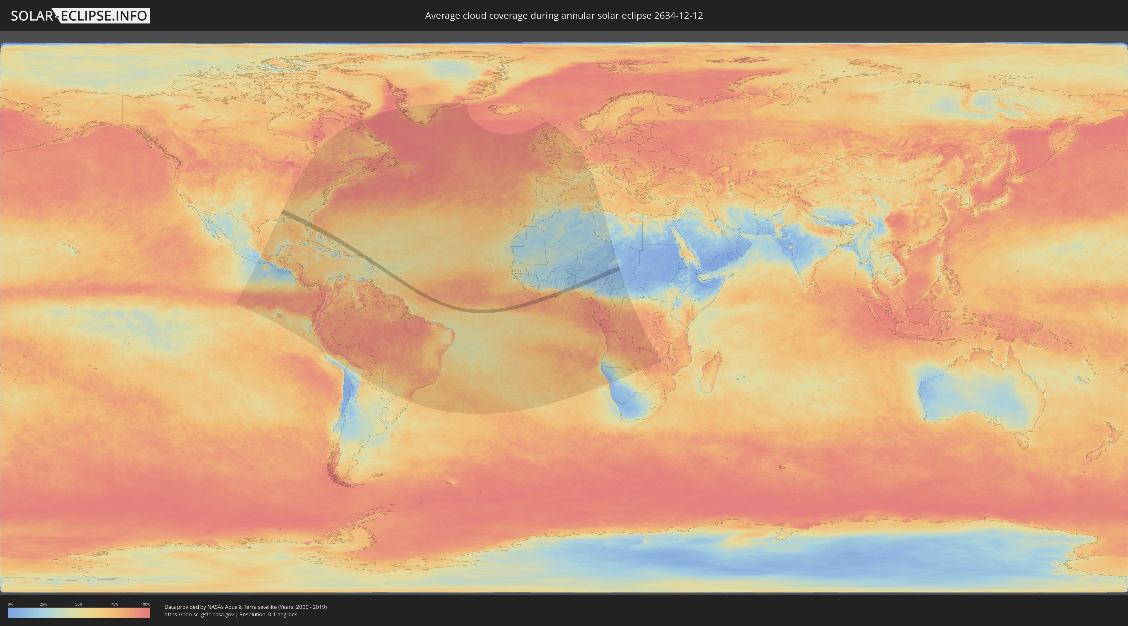
How will be the weather during the annular solar eclipse on 12/12/2634?
Where is the best place to see the annular solar eclipse of 12/12/2634?
The following maps show the average cloud coverage for the day of the annular solar eclipse.
With the help of these maps, it is possible to find the place along the eclipse path, which has the best
chance of a cloudless sky.
Nevertheless, you should consider local circumstances and inform about the weather of your chosen
observation site.
The data is provided by NASAs satellites
AQUA and TERRA.
The cloud maps are averaged over a period of 19 years (2000 - 2019).
Detailed country maps
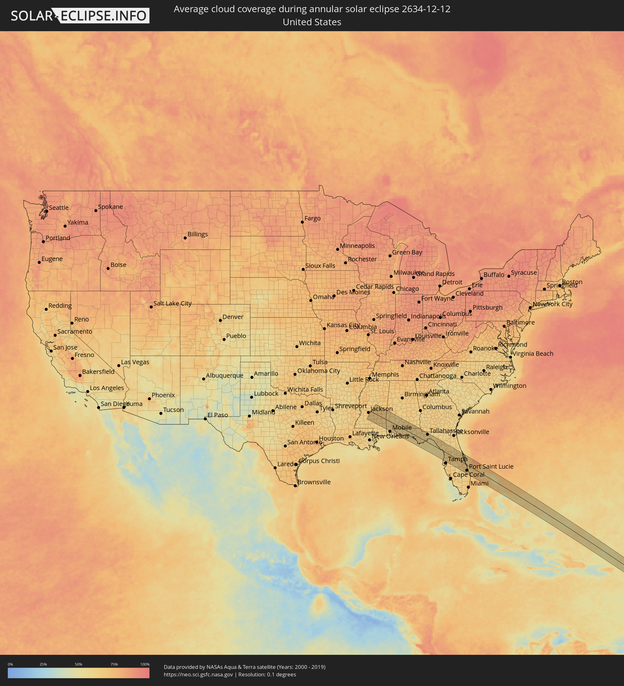 United States
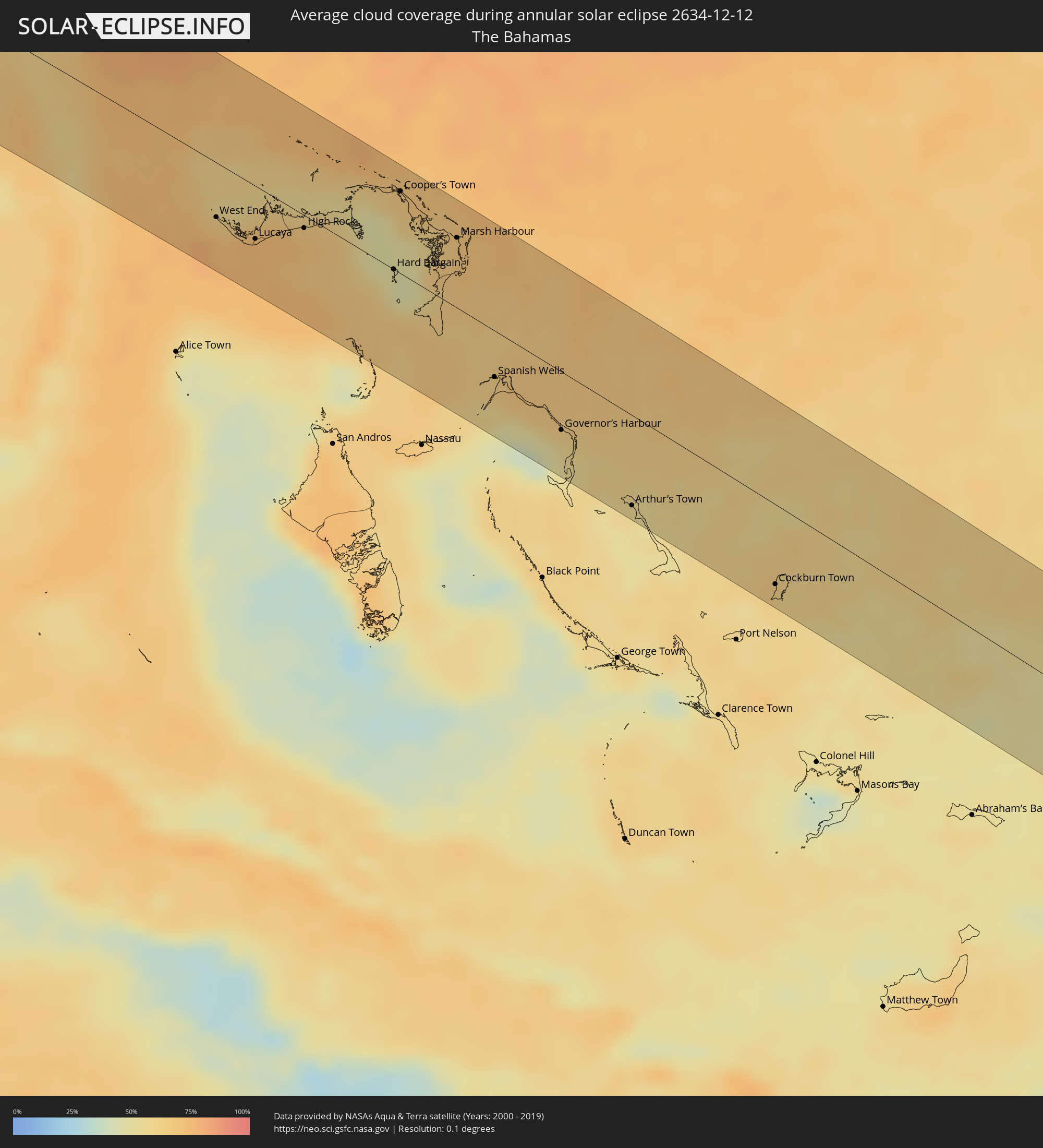 The Bahamas
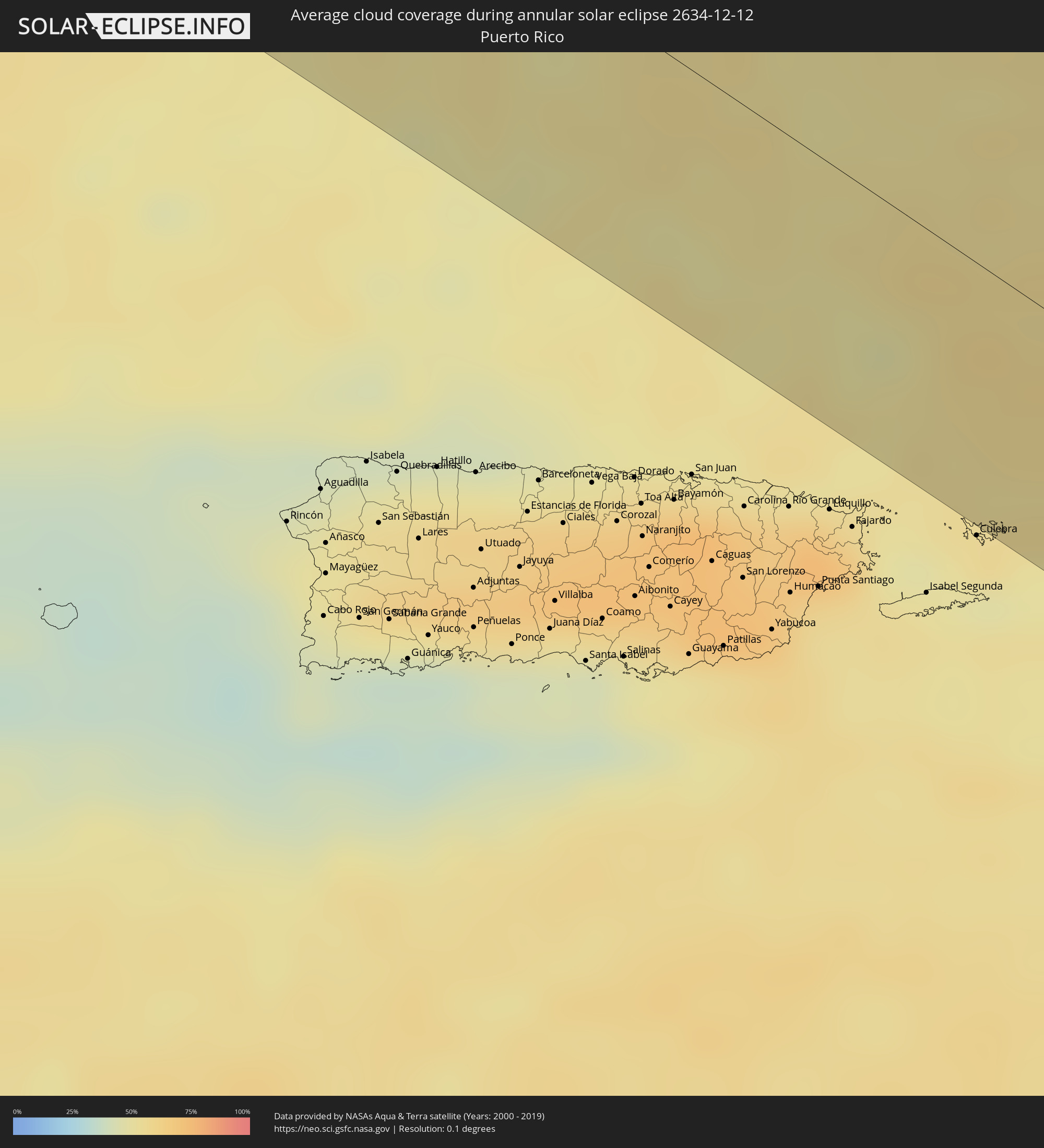 Puerto Rico
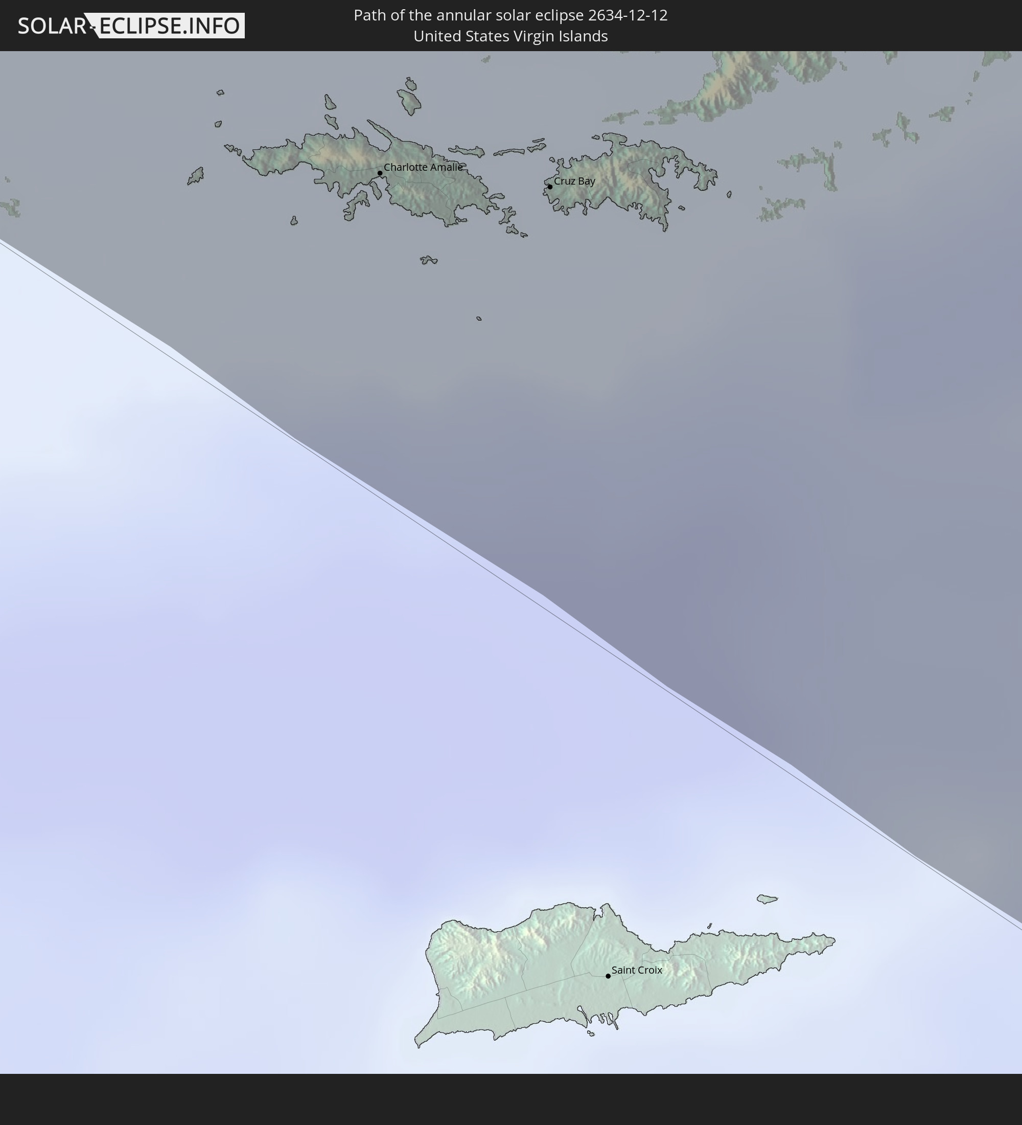
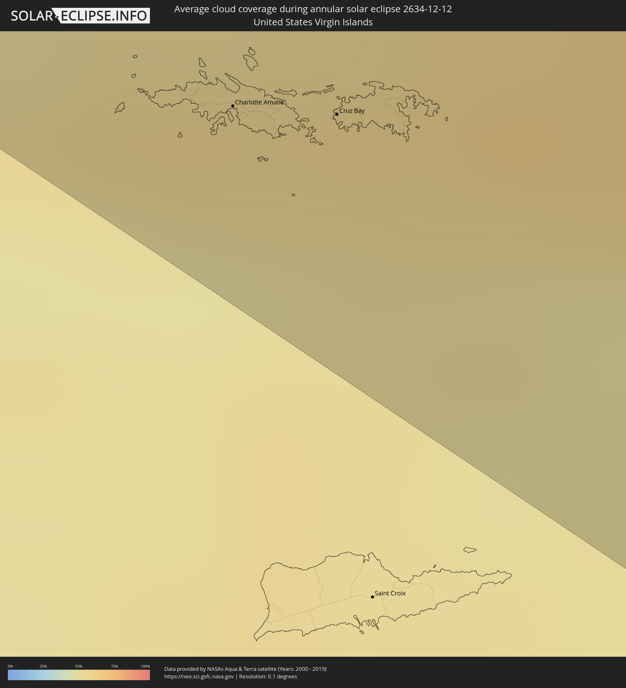 United States Virgin Islands
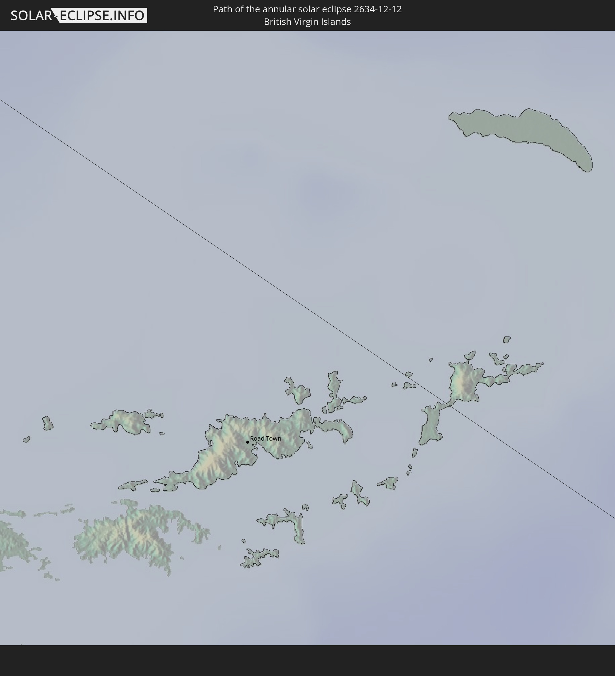
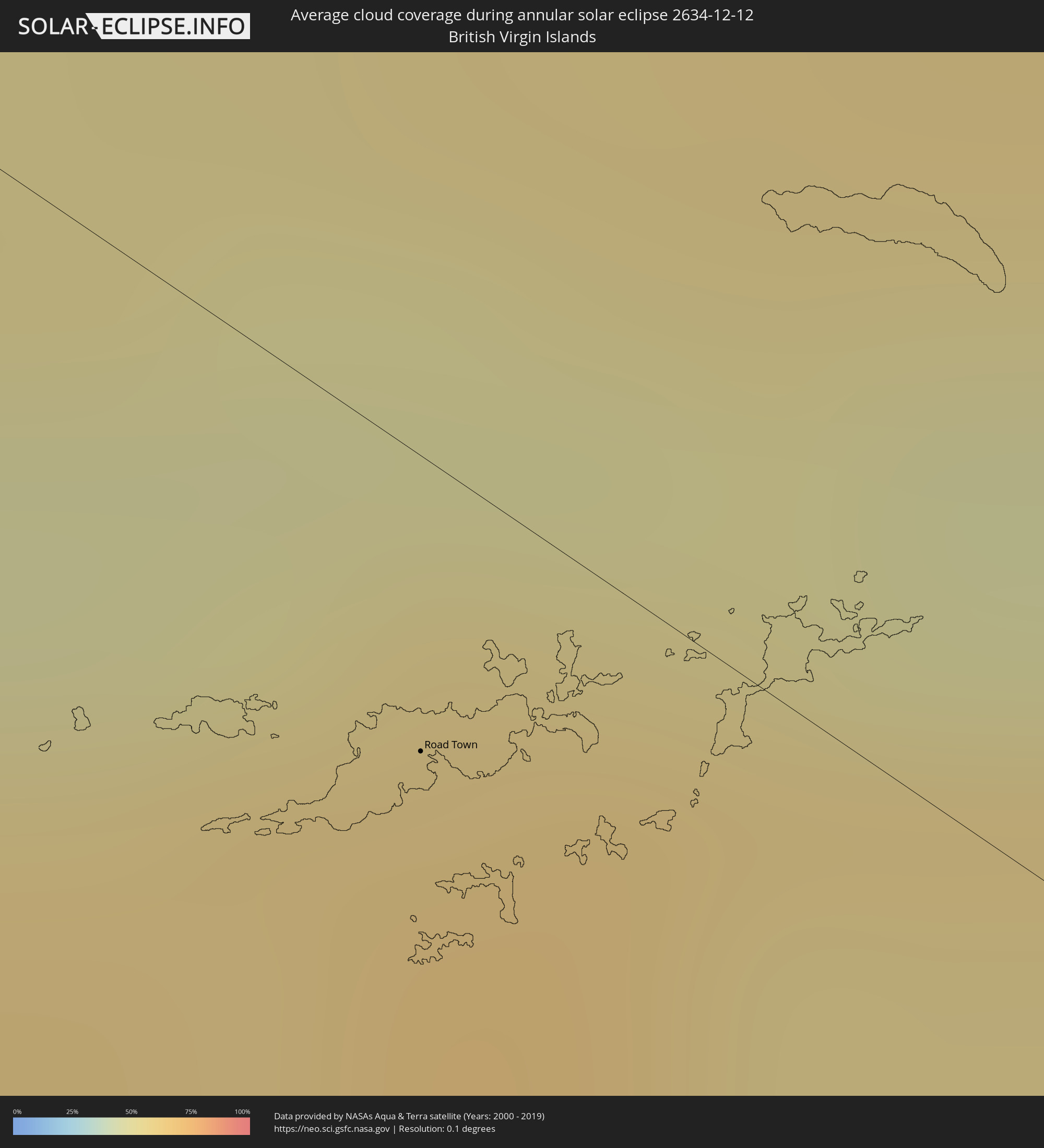 British Virgin Islands
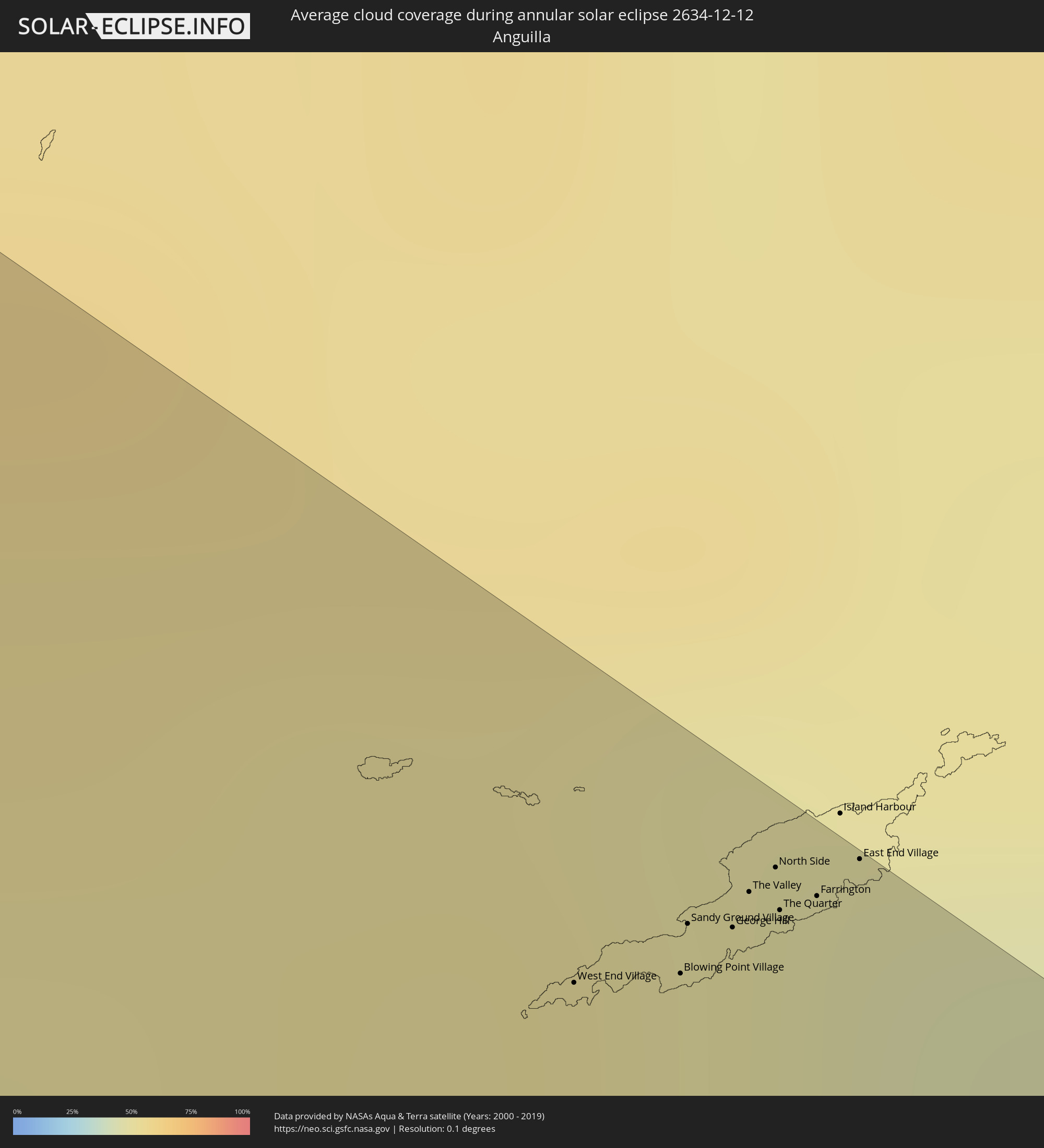 Anguilla
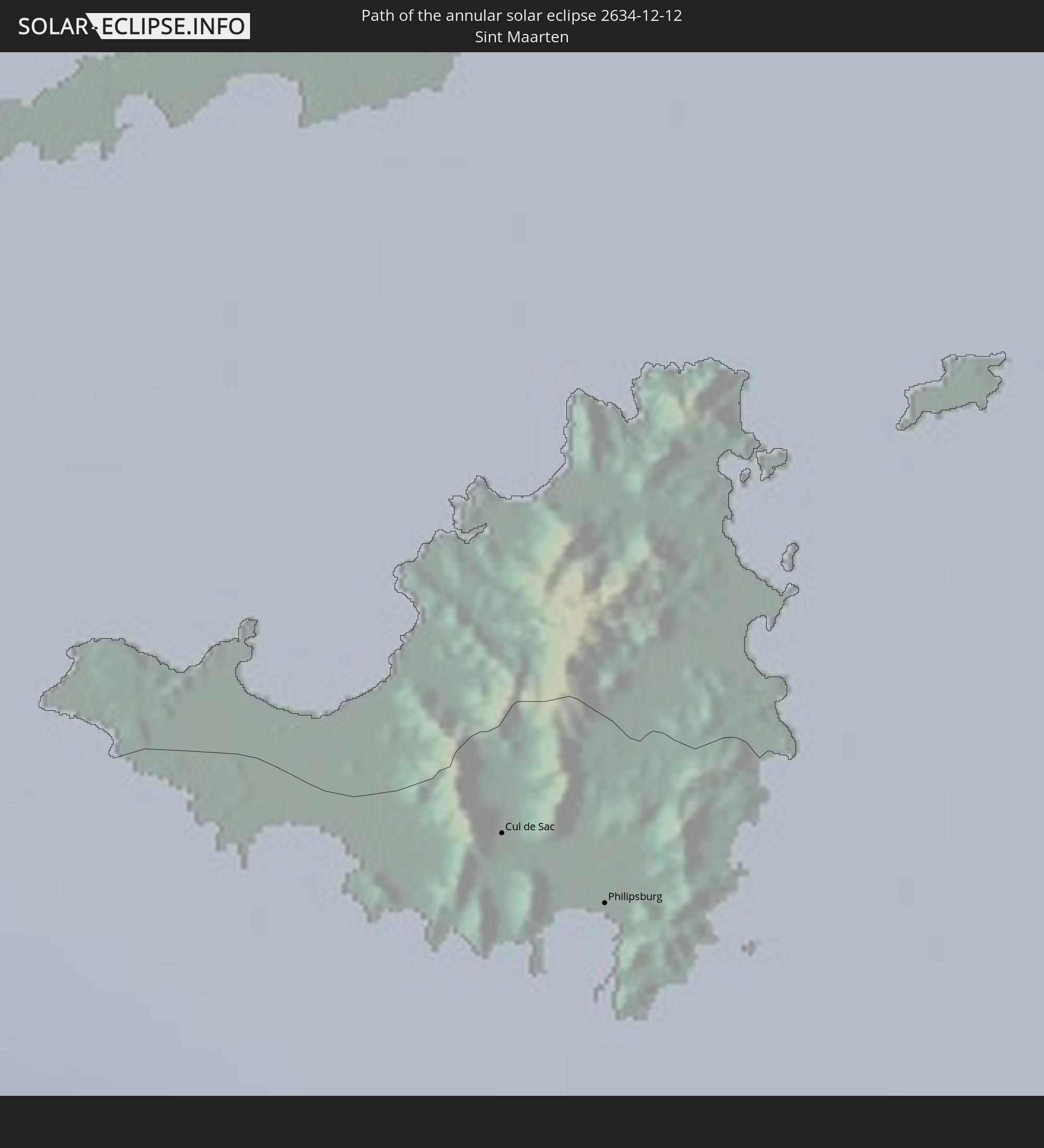
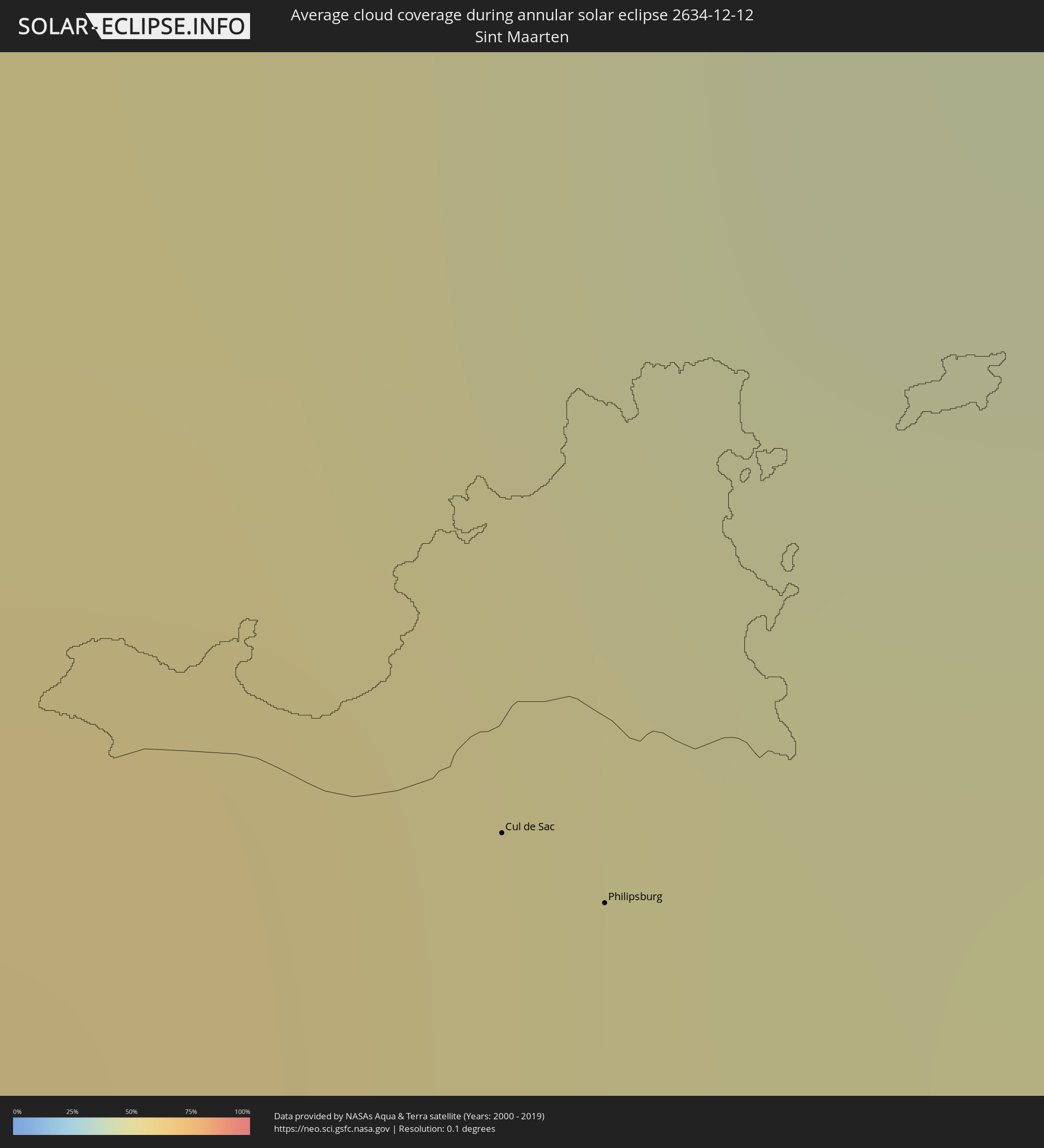 Sint Maarten
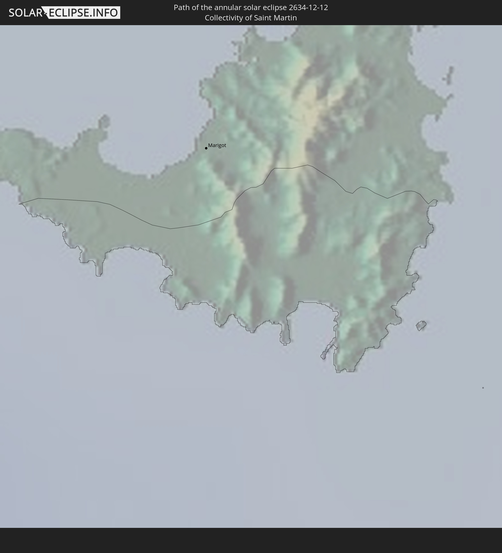
 Collectivity of Saint Martin
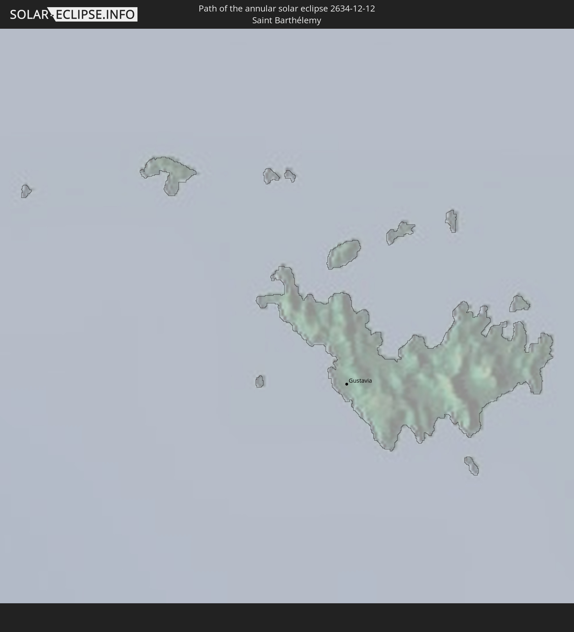
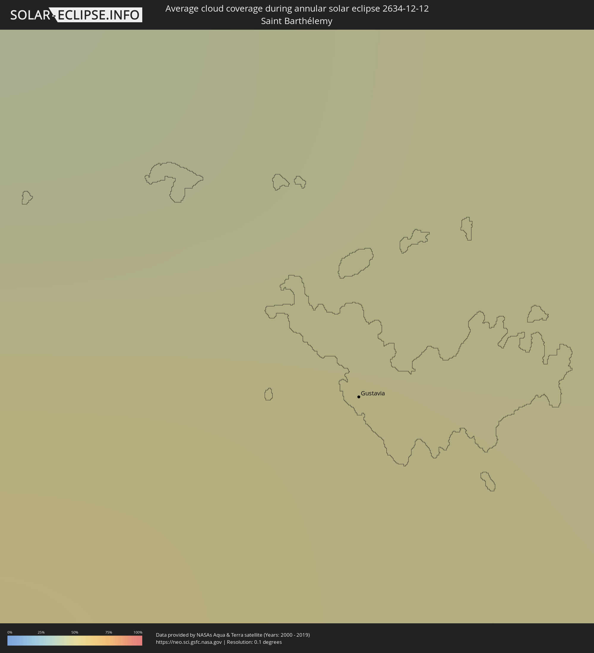 Saint Barthélemy
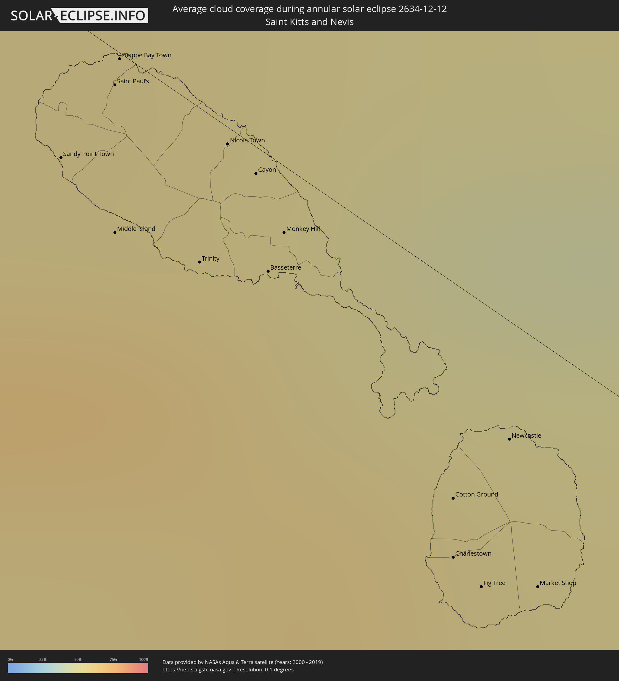 Saint Kitts and Nevis
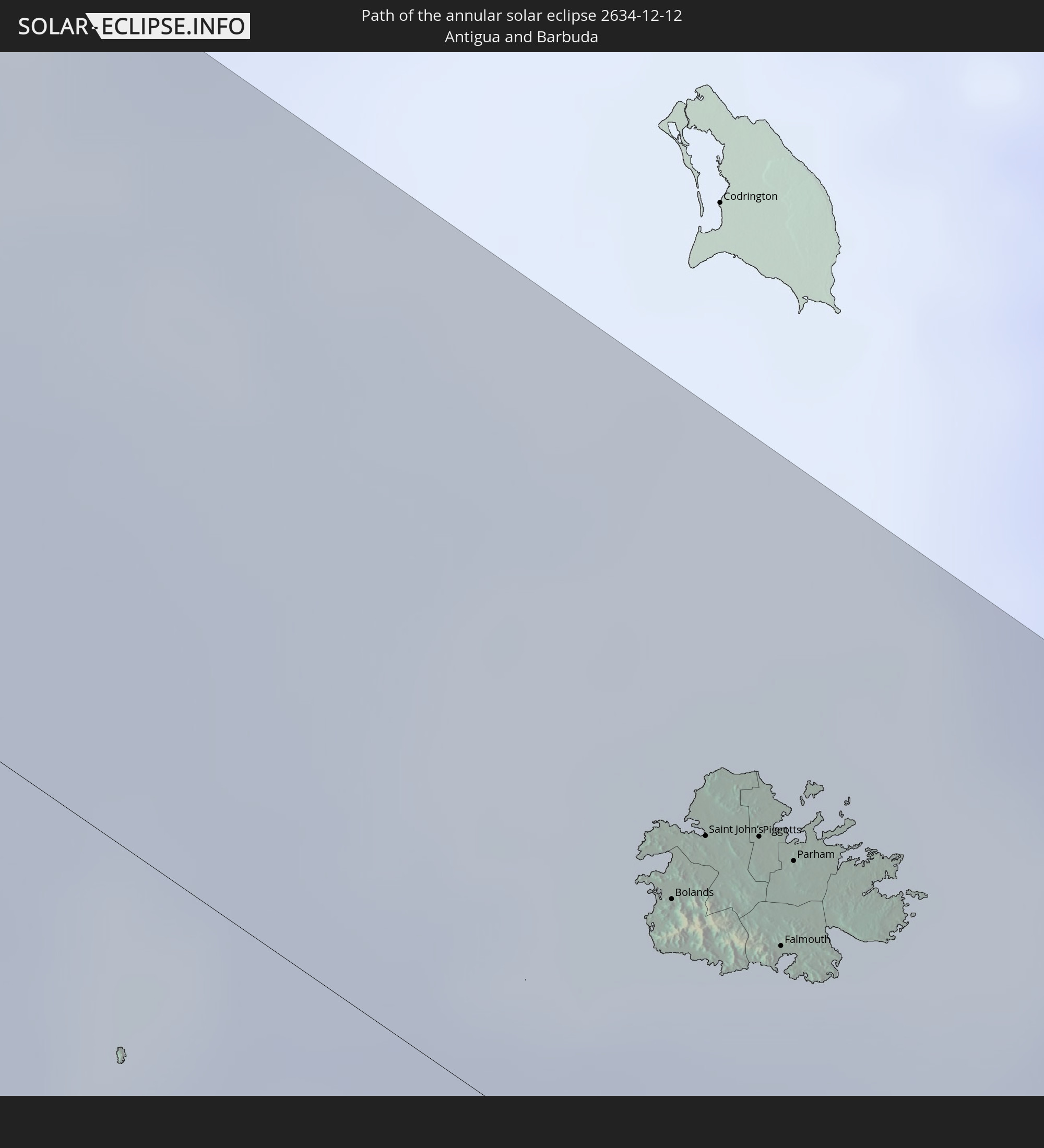
 Antigua and Barbuda
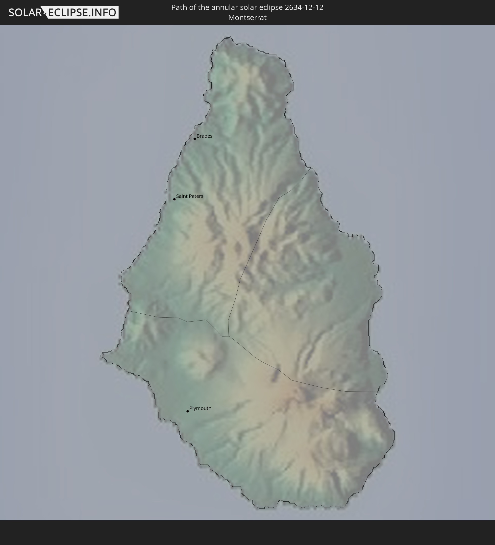
 Montserrat
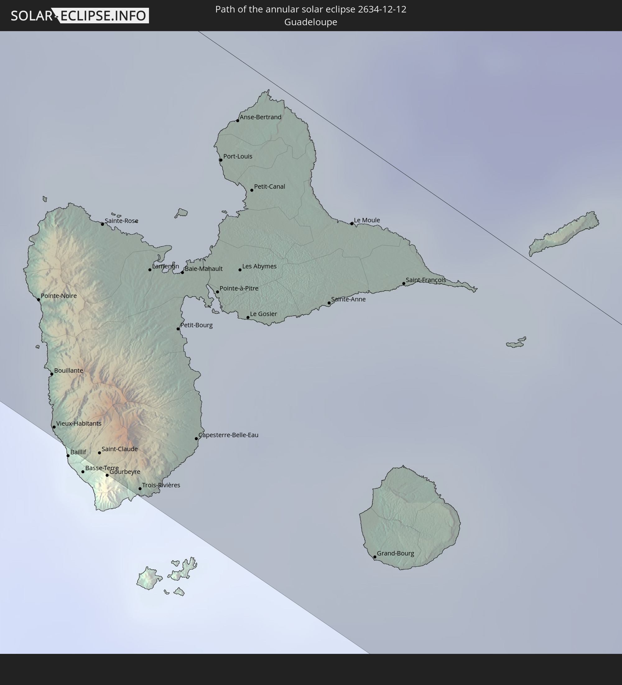
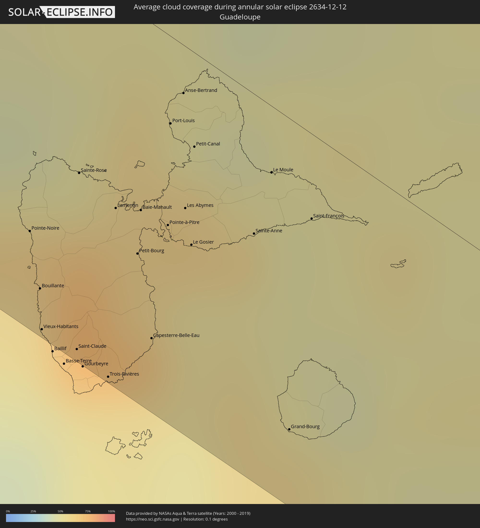 Guadeloupe
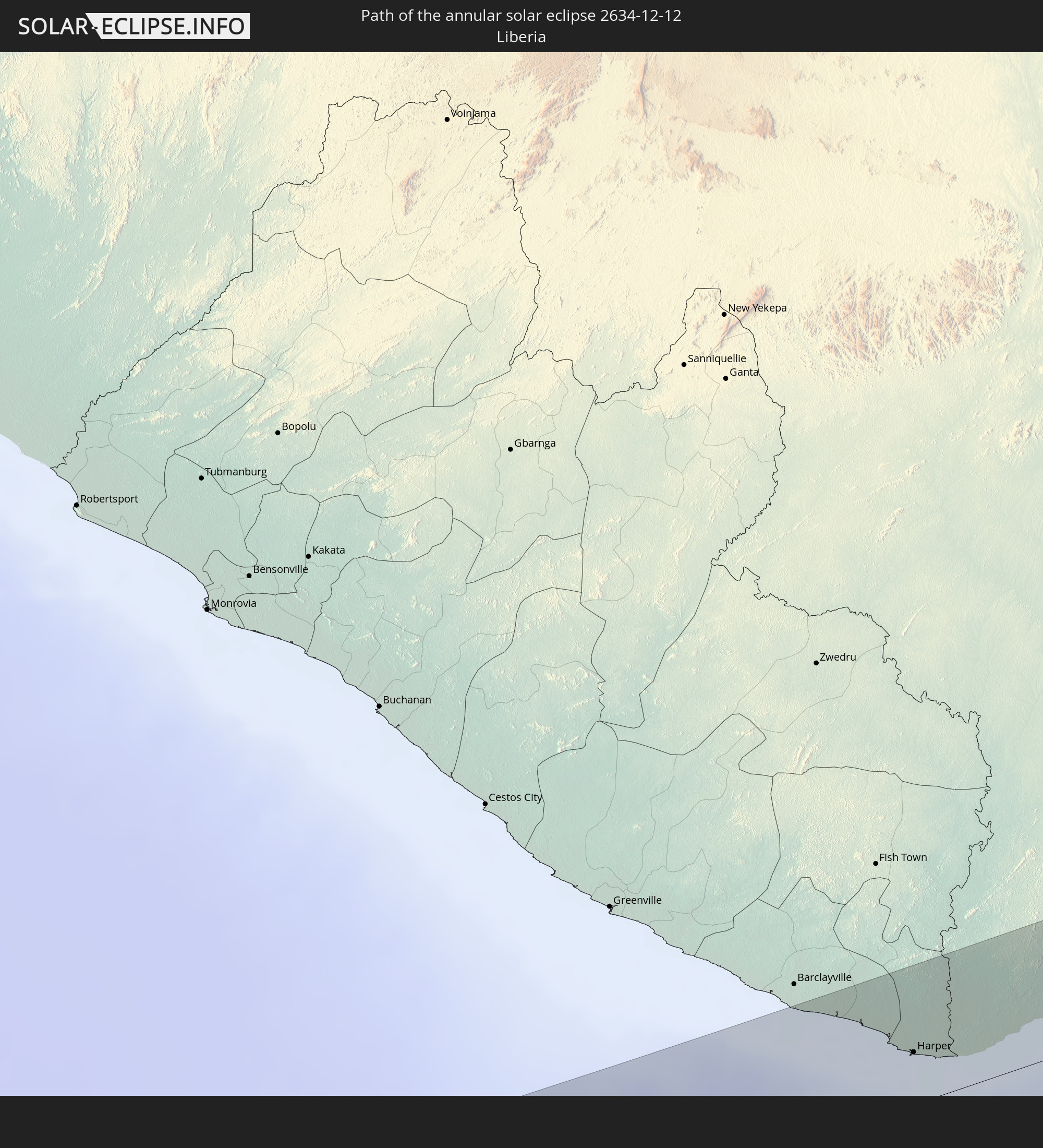
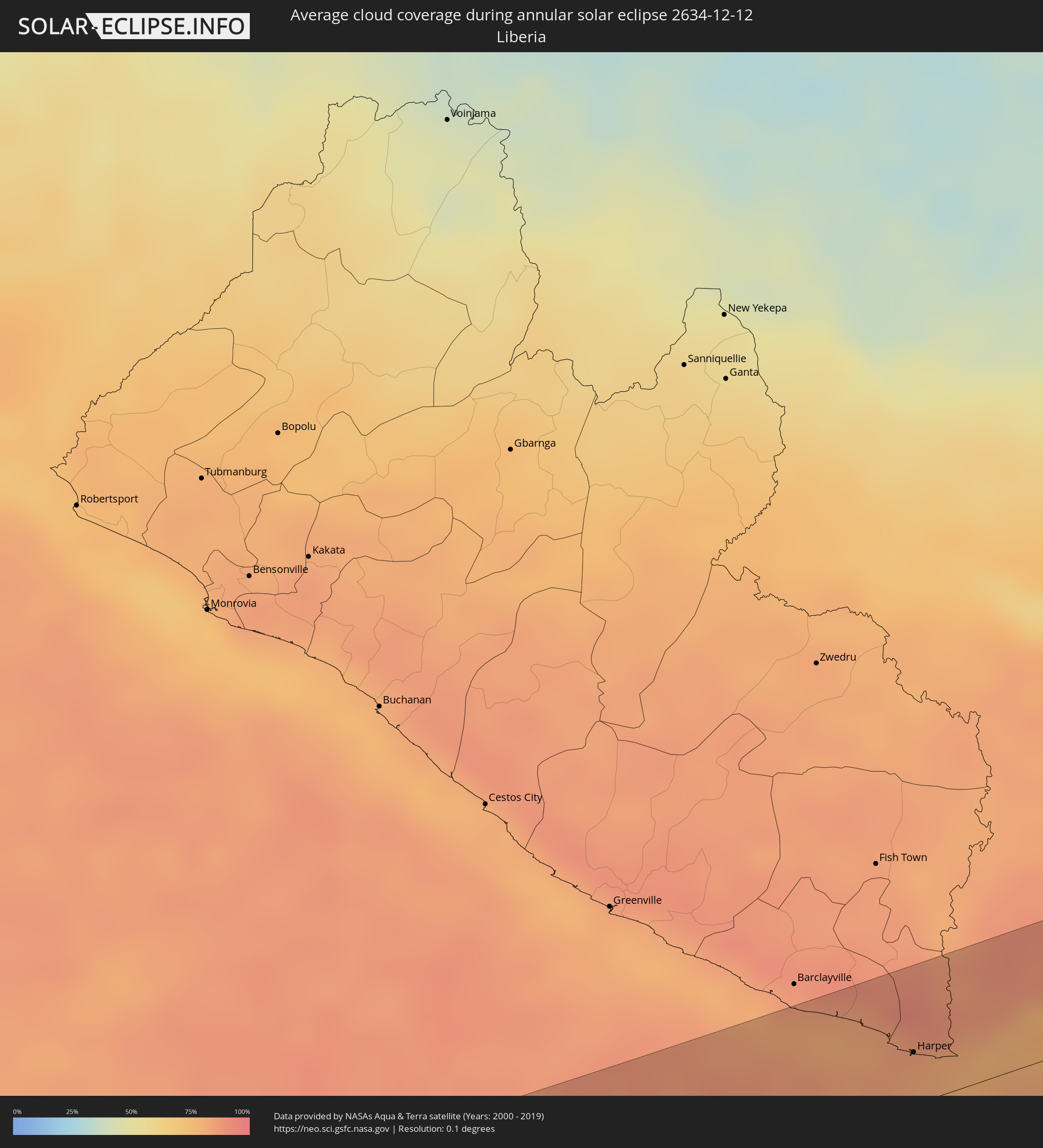 Liberia
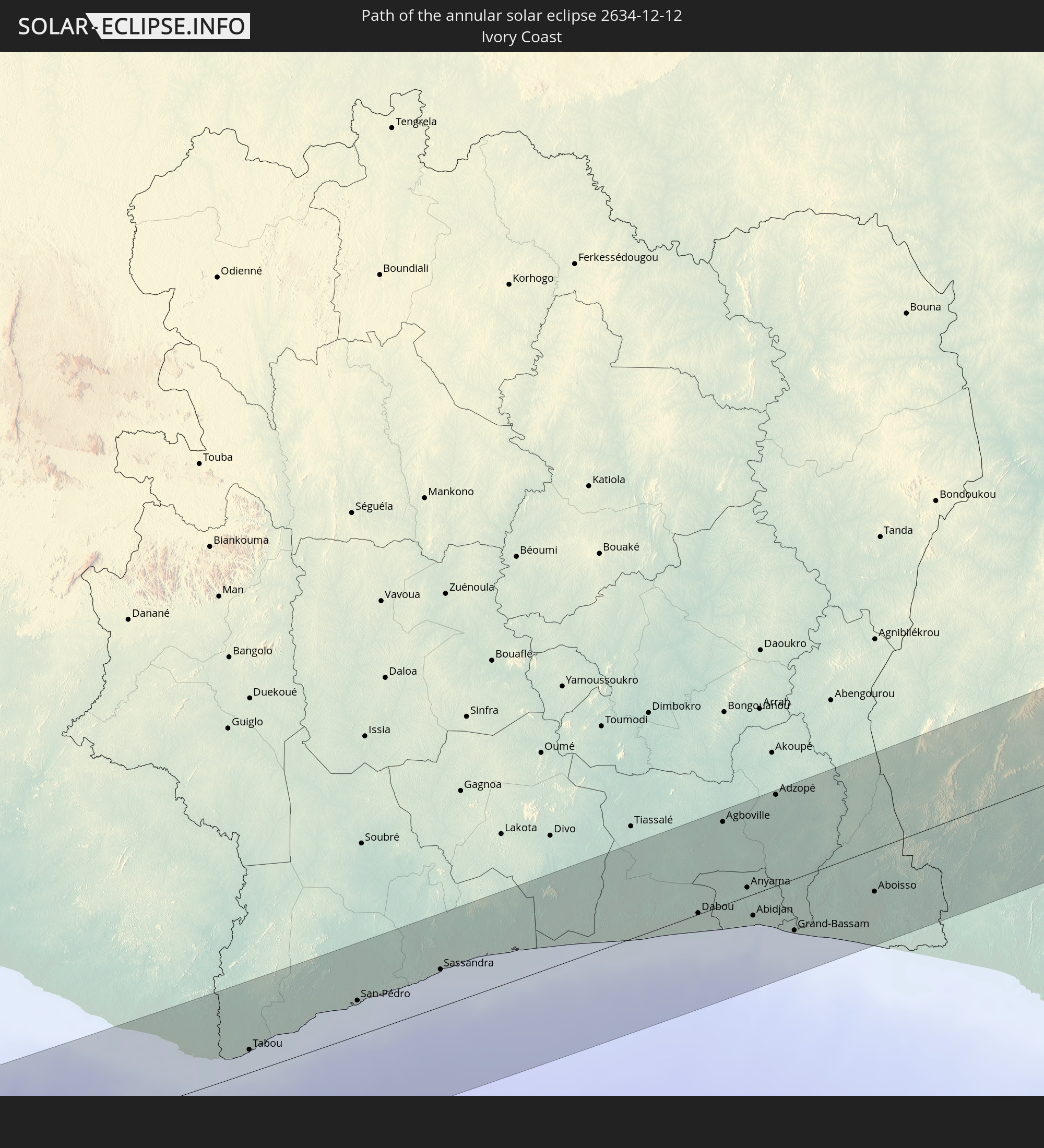
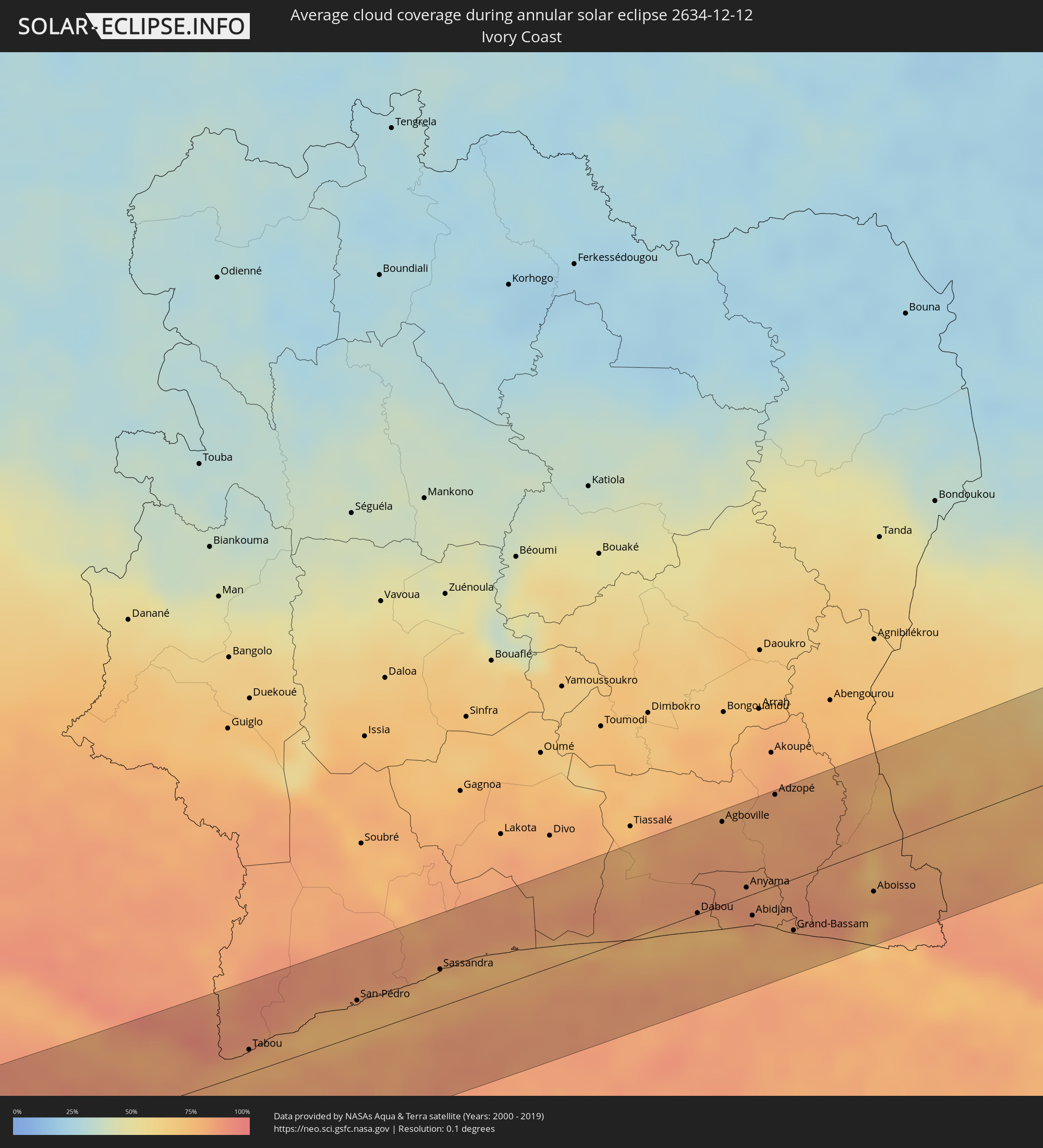 Ivory Coast
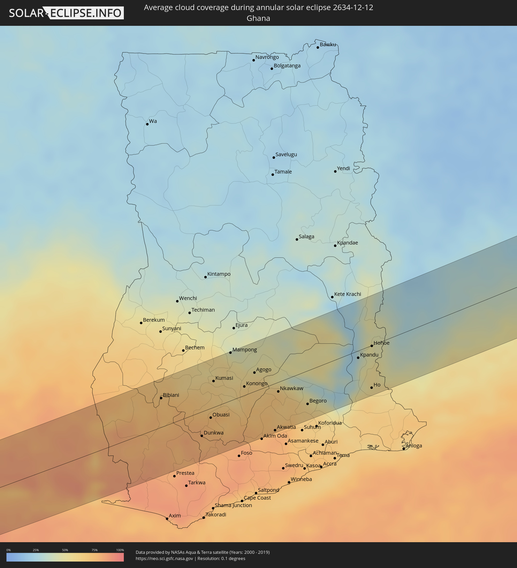 Ghana
Ghana
 Togo
Togo
 Caribbean Netherlands
 Benin
Benin
 Nigeria
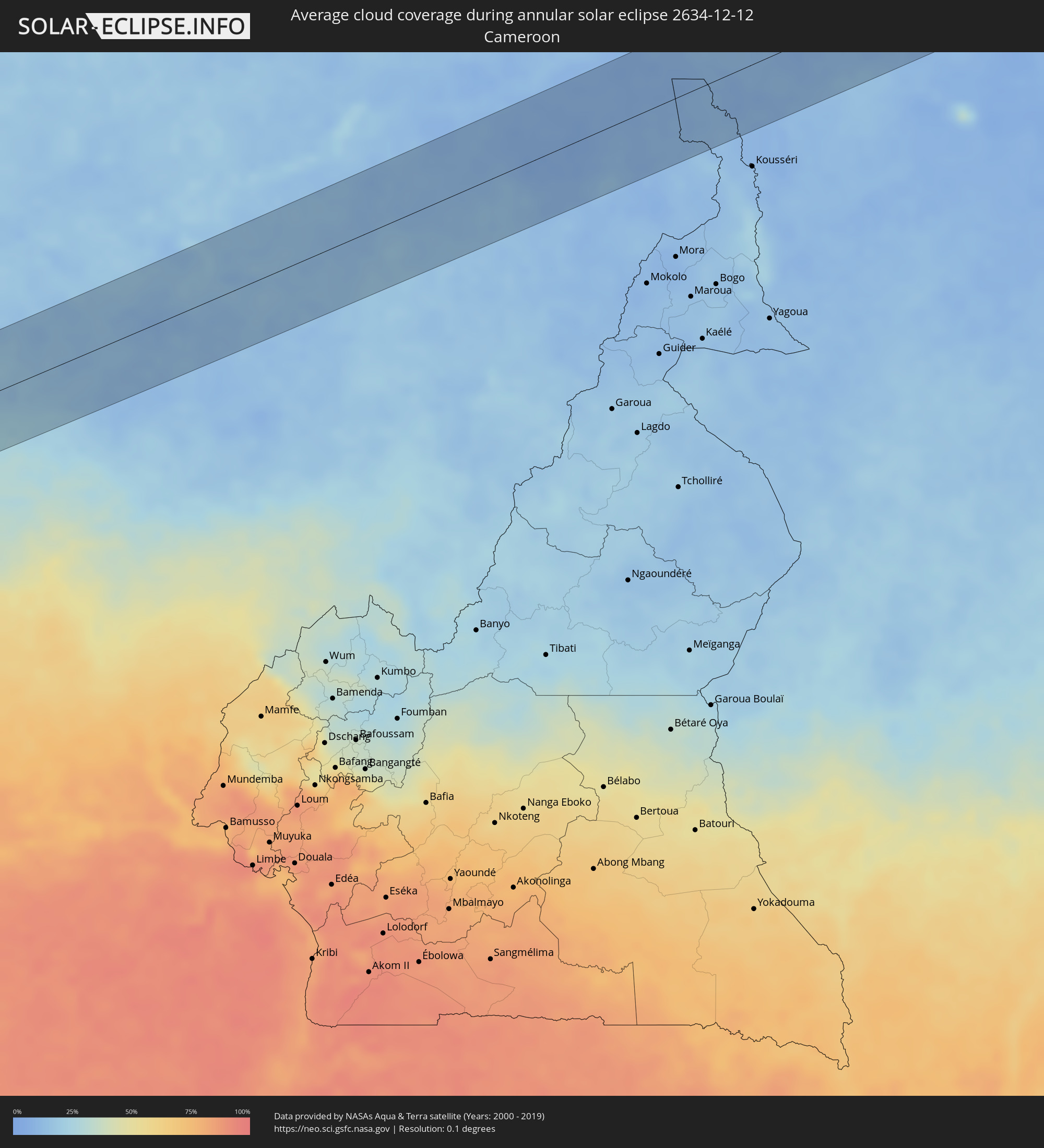 Cameroon
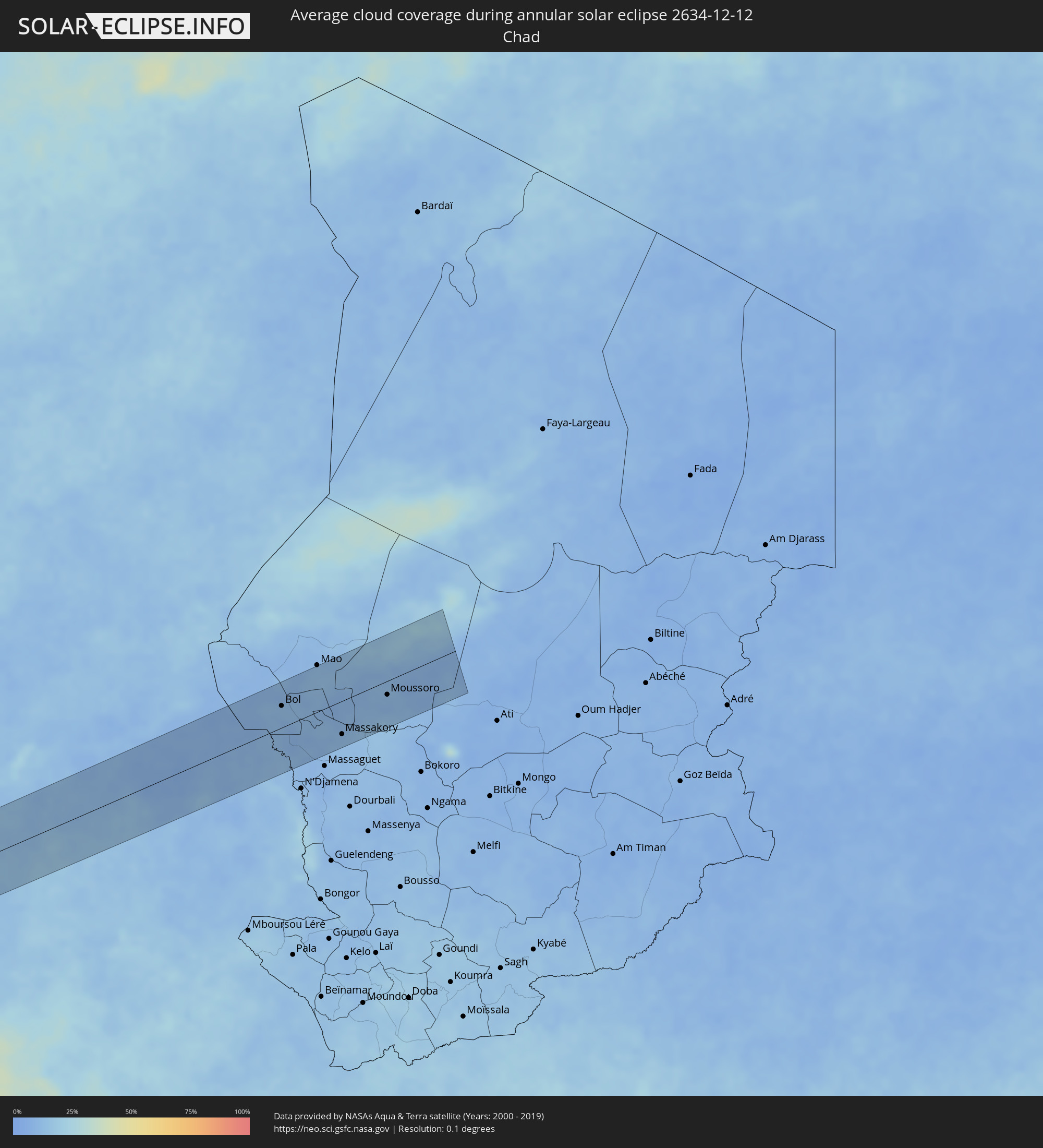 Chad
Chad
Cities inside the path of the eclipse
The following table shows all locations with a population of more than 5,000 inside the eclipse path. Cities which have more than 100,000 inhabitants are marked bold. A click at the locations opens a detailed map.
| City | Type | Eclipse duration | Local time of max. eclipse | Distance to central line | Ø Cloud coverage |
|
Tallahassee, Florida
|
annular | - | 07:56:20 UTC-05:00 | 64 km | 62% |
|
Spring Hill, Florida
|
annular | - | 07:56:26 UTC-05:00 | 42 km | 65% |
|
Ocala, Florida
|
annular | - | 07:56:50 UTC-05:00 | 46 km | 63% |
|
Lakeland, Florida
|
annular | - | 07:56:35 UTC-05:00 | 56 km | 64% |
|
Kissimmee, Florida
|
annular | - | 07:56:55 UTC-05:00 | 4 km | 62% |
|
Orlando, Florida
|
annular | - | 07:57:00 UTC-05:00 | 20 km | 68% |
|
Deltona, Florida
|
annular | - | 07:57:10 UTC-05:00 | 61 km | 61% |
|
Alafaya, Florida
|
annular | - | 07:57:06 UTC-05:00 | 31 km | 66% |
|
Palm Bay, Florida
|
annular | - | 07:57:16 UTC-05:00 | 11 km | 64% |
|
Port Saint Lucie, Florida
|
annular | - | 07:57:13 UTC-05:00 | 48 km | 70% |
|
West End, West Grand Bahama
|
annular | - | 07:57:53 UTC-05:00 | 37 km | 70% |
|
Lucaya, Freeport
|
annular | - | 07:58:03 UTC-05:00 | 36 km | 75% |
|
High Rock, East Grand Bahama
|
annular | - | 12:58:18 UTC+00:00 | 9 km | 71% |
|
Hard Bargain, Moore’s Island
|
annular | - | 07:58:42 UTC-05:00 | 0 km | 54% |
|
Cooper’s Town, North Abaco
|
annular | - | 07:58:50 UTC-05:00 | 56 km | 65% |
|
Marsh Harbour, Central Abaco
|
annular | - | 07:59:05 UTC-05:00 | 47 km | 67% |
|
Spanish Wells, Spanish Wells
|
annular | - | 07:59:08 UTC-05:00 | 31 km | 57% |
|
Governor’s Harbour, Central Eleuthera
|
annular | - | 12:59:28 UTC+00:00 | 40 km | 58% |
|
Arthur’s Town, Cat Island
|
annular | - | 07:59:50 UTC-05:00 | 62 km | 54% |
|
Cockburn Town, San Salvador
|
annular | - | 08:00:41 UTC-05:00 | 55 km | 59% |
|
Charlotte Amalie, Saint Thomas Island
|
annular | - | 09:11:41 UTC-04:00 | 42 km | 55% |
|
Cruz Bay, Saint John Island
|
annular | - | 09:11:52 UTC-04:00 | 35 km | 56% |
|
Road Town
|
annular | - | 09:12:04 UTC-04:00 | 15 km | 63% |
 The Bottom, Saba
|
annular | - | 09:14:18 UTC-04:00 | 7 km | 53% |
|
South Hill Village, South Hill
|
annular | - | 09:14:19 UTC-04:00 | 54 km | 50% |
|
Marigot
|
annular | - | 09:14:22 UTC-04:00 | 43 km | 54% |
|
North Hill Village, North Hill
|
annular | - | 09:14:20 UTC-04:00 | 56 km | 50% |
|
George Hill, George Hill
|
annular | - | 09:14:21 UTC-04:00 | 56 km | 50% |
 Cul de Sac
|
annular | - | 09:14:25 UTC-04:00 | 42 km | 55% |
|
The Valley, The Valley
|
annular | - | 09:14:21 UTC-04:00 | 59 km | 50% |
|
Stoney Ground, Stoney Ground
|
annular | - | 09:14:22 UTC-04:00 | 60 km | 44% |
|
Philipsburg
|
annular | - | 09:14:27 UTC-04:00 | 42 km | 52% |
|
North Side, North Side
|
annular | - | 09:14:22 UTC-04:00 | 61 km | 44% |
|
The Quarter, The Quarter
|
annular | - | 09:14:23 UTC-04:00 | 59 km | 44% |
|
Farrington, The Farrington
|
annular | - | 09:14:24 UTC-04:00 | 61 km | 44% |
|
Sandy Hill, Sandy Hill
|
annular | - | 09:14:25 UTC-04:00 | 62 km | 44% |
|
East End Village, East End
|
annular | - | 09:14:26 UTC-04:00 | 64 km | 44% |
|
Oranjestad, Sint Eustatius
|
annular | - | 09:14:45 UTC-04:00 | 4 km | 57% |
|
Gustavia
|
annular | - | 09:14:47 UTC-04:00 | 42 km | 48% |
|
Sandy Point Town, Saint Anne Sandy Point
|
annular | - | 09:15:00 UTC-04:00 | 8 km | 62% |
|
Saint Paul’s, Saint Paul Capesterre
|
annular | - | 09:15:02 UTC-04:00 | 2 km | 62% |
|
Dieppe Bay Town, Saint John Capesterre
|
annular | - | 09:15:02 UTC-04:00 | 0 km | 62% |
|
Trinity, Trinity Palmetto Point
|
annular | - | 09:15:09 UTC-04:00 | 8 km | 56% |
|
Nicola Town, Christ Church Nichola Town
|
annular | - | 09:15:09 UTC-04:00 | 1 km | 62% |
|
Cayon, Saint Mary Cayon
|
annular | - | 09:15:10 UTC-04:00 | 1 km | 54% |
|
Basseterre, Saint George Basseterre
|
annular | - | 09:15:13 UTC-04:00 | 6 km | 58% |
|
Monkey Hill, Saint Peter Basseterre
|
annular | - | 09:15:13 UTC-04:00 | 3 km | 58% |
|
Charlestown, Saint Paul Charlestown
|
annular | - | 09:15:26 UTC-04:00 | 14 km | 50% |
|
Fig Tree, Saint John Figtree
|
annular | - | 09:15:28 UTC-04:00 | 15 km | 50% |
|
Saint Peters, Saint Peter
|
annular | - | 09:16:12 UTC-04:00 | 23 km | 61% |
|
Plymouth, Saint Anthony
|
annular | - | 09:16:15 UTC-04:00 | 29 km | 56% |
|
Brades, Saint Peter
|
annular | - | 09:16:12 UTC-04:00 | 21 km | 61% |
|
Bolands, Saint Mary
|
annular | - | 09:16:36 UTC-04:00 | 24 km | 57% |
|
Saint John’s, Saint John
|
annular | - | 09:16:38 UTC-04:00 | 31 km | 52% |
|
Piggotts, Saint George
|
annular | - | 09:16:42 UTC-04:00 | 34 km | 52% |
|
Pointe-Noire, Guadeloupe
|
annular | - | 09:17:08 UTC-04:00 | 47 km | 58% |
|
Falmouth, Saint Paul
|
annular | - | 09:16:46 UTC-04:00 | 27 km | 50% |
|
Parham, Saint Peter
|
annular | - | 09:16:45 UTC-04:00 | 34 km | 52% |
|
Bouillante, Guadeloupe
|
annular | - | 09:17:12 UTC-04:00 | 55 km | 54% |
|
Vieux-Habitants, Guadeloupe
|
annular | - | 09:17:15 UTC-04:00 | 61 km | 54% |
|
Saint-Claude, Guadeloupe
|
annular | - | 09:17:22 UTC-04:00 | 61 km | 54% |
|
Sainte-Rose, Guadeloupe
|
annular | - | 09:17:13 UTC-04:00 | 32 km | 67% |
|
Trois-Rivières, Guadeloupe
|
annular | - | 09:17:29 UTC-04:00 | 62 km | 56% |
|
Capesterre-Belle-Eau, Guadeloupe
|
annular | - | 09:17:34 UTC-04:00 | 51 km | 56% |
|
Les Abymes, Guadeloupe
|
annular | - | 09:17:33 UTC-04:00 | 26 km | 60% |
|
Petit-Canal, Guadeloupe
|
annular | - | 09:17:32 UTC-04:00 | 15 km | 59% |
|
Le Moule, Guadeloupe
|
annular | - | 09:17:46 UTC-04:00 | 11 km | 48% |
|
Harper, Maryland
|
annular | - | 15:59:16 UTC+00:00 | 24 km | 84% |
|
San-Pédro, Bas-Sassandra
|
annular | - | 16:00:55 UTC+00:00 | 24 km | 73% |
|
Dabou, Lagunes
|
annular | - | 16:04:08 UTC+00:00 | 1 km | 73% |
|
Agboville, Lagunes
|
annular | - | 16:04:12 UTC+00:00 | 58 km | 82% |
|
Anyama, Abidjan
|
annular | - | 16:04:32 UTC+00:00 | 6 km | 86% |
|
Abidjan, Abidjan
|
annular | - | 16:04:38 UTC+00:00 | 15 km | 81% |
|
Bingerville, Abidjan
|
annular | - | 16:04:48 UTC+00:00 | 15 km | 81% |
|
Adzopé, Lagunes
|
annular | - | 16:04:38 UTC+00:00 | 63 km | 81% |
|
Grand-Bassam, Comoé
|
annular | - | 16:05:02 UTC+00:00 | 36 km | 79% |
|
Bonoua
|
annular | - | 16:05:13 UTC+00:00 | 35 km | 84% |
|
Aboisso, Comoé
|
annular | - | 16:05:41 UTC+00:00 | 29 km | 81% |
|
Dunkwa, Central
|
annular | - | 16:07:21 UTC+00:00 | 33 km | 77% |
|
Obuasi, Ashanti
|
annular | - | 16:07:26 UTC+00:00 | 13 km | 75% |
|
Kumasi, Ashanti
|
annular | - | 16:07:21 UTC+00:00 | 36 km | 62% |
|
Mampong, Ashanti
|
annular | - | 16:07:31 UTC+00:00 | 65 km | 46% |
|
Konongo, Ashanti
|
annular | - | 16:07:51 UTC+00:00 | 12 km | 67% |
|
Agogo, Ashanti
|
annular | - | 16:07:58 UTC+00:00 | 25 km | 59% |
|
Nkawkaw, Eastern
|
annular | - | 16:08:24 UTC+00:00 | 13 km | 68% |
|
Begoro, Eastern
|
annular | - | 16:08:53 UTC+00:00 | 46 km | 61% |
|
Ho, Volta
|
annular | - | 16:09:45 UTC+00:00 | 58 km | 58% |
|
Hohoe, Volta
|
annular | - | 16:09:36 UTC+00:00 | 1 km | 46% |
|
Badou, Plateaux
|
annular | - | 16:09:36 UTC+00:00 | 38 km | 42% |
|
Kpalimé, Plateaux
|
annular | - | 16:09:50 UTC+00:00 | 34 km | 48% |
|
Amlamé, Plateaux
|
annular | - | 16:09:57 UTC+00:00 | 14 km | 27% |
|
Atakpamé, Plateaux
|
annular | - | 16:10:10 UTC+00:00 | 11 km | 30% |
|
Notsé, Plateaux
|
annular | - | 16:10:22 UTC+00:00 | 50 km | 44% |
|
Savalou, Collines
|
annular | - | 17:10:53 UTC+01:00 | 17 km | 36% |
|
Abomey, Zou
|
annular | - | 17:11:07 UTC+01:00 | 60 km | 53% |
|
Bohicon, Zou
|
annular | - | 17:11:12 UTC+01:00 | 64 km | 53% |
|
Dassa-Zoumé, Collines
|
annular | - | 17:11:09 UTC+01:00 | 10 km | 39% |
|
Savé, Collines
|
annular | - | 17:11:21 UTC+01:00 | 7 km | 34% |
|
Kétou, Plateau
|
annular | - | 17:11:39 UTC+01:00 | 67 km | 55% |
|
Saki, Oyo
|
annular | - | 17:11:58 UTC+01:00 | 34 km | 23% |
|
Igboho, Oyo
|
annular | - | 17:12:14 UTC+01:00 | 37 km | 26% |
|
Kisi, Oyo
|
annular | - | 17:12:14 UTC+01:00 | 58 km | 18% |
|
Ilorin, Kwara
|
annular | - | 17:13:00 UTC+01:00 | 32 km | 26% |
|
Bida, Niger
|
annular | - | 17:13:57 UTC+01:00 | 34 km | 26% |
|
Minna, Niger
|
annular | - | 17:14:09 UTC+01:00 | 2 km | 18% |
|
Kaduna, Kaduna
|
annular | - | 17:14:25 UTC+01:00 | 53 km | 16% |
|
Jos, Plateau
|
annular | - | 17:15:33 UTC+01:00 | 71 km | 12% |
|
Bauchi, Bauchi
|
annular | - | 17:15:56 UTC+01:00 | 73 km | 12% |
|
Maiduguri, Borno
|
annular | - | 17:16:52 UTC+01:00 | 60 km | 10% |
|
Makary, Far North
|
annular | - | 17:17:02 UTC+01:00 | 42 km | 11% |
|
Bol, Lac
|
annular | - | 17:16:43 UTC+01:00 | 36 km | 11% |
|
Massakory, Hadjer-Lamis
|
annular | - | 17:17:14 UTC+01:00 | 55 km | 11% |
|
Moussoro, Barh el Gazel
|
annular | - | 17:17:08 UTC+01:00 | 23 km | 10% |