Annular solar eclipse of 09/28/-0172
| Day of week: | Friday |
| Maximum duration of eclipse: | 03m17s |
| Maximum width of eclipse path: | 117 km |
| Saros cycle: | 70 |
| Coverage: | 96.8% |
| Magnitude: | 0.9679 |
| Gamma: | -0.1846 |
Wo kann man die Sonnenfinsternis vom 09/28/-0172 sehen?
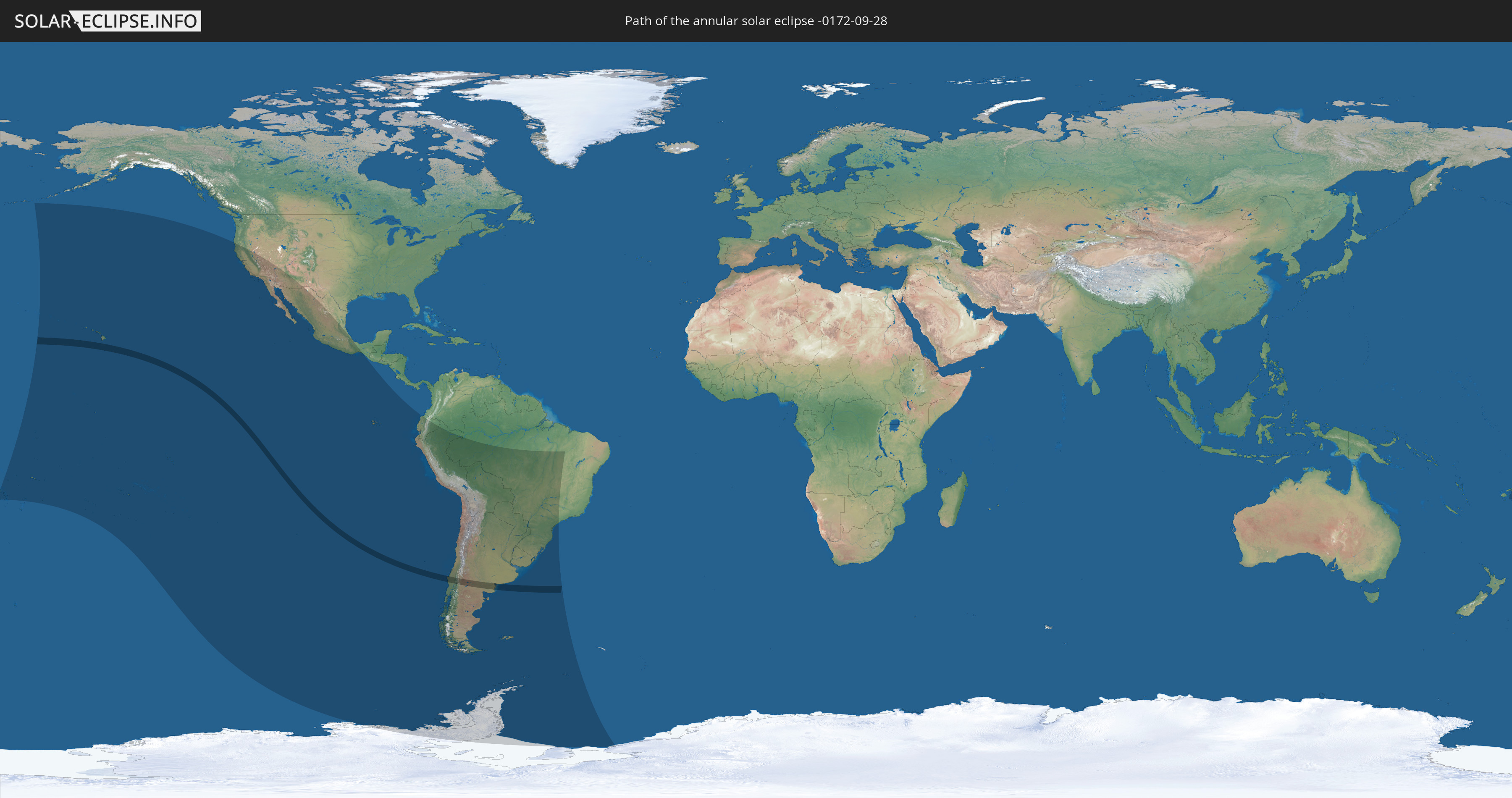
Die Sonnenfinsternis am 09/28/-0172 kann man in 26 Ländern als partielle Sonnenfinsternis beobachten.
Der Finsternispfad verläuft durch 2 Länder. Nur in diesen Ländern ist sie als annular Sonnenfinsternis zu sehen.
In den folgenden Ländern ist die Sonnenfinsternis annular zu sehen
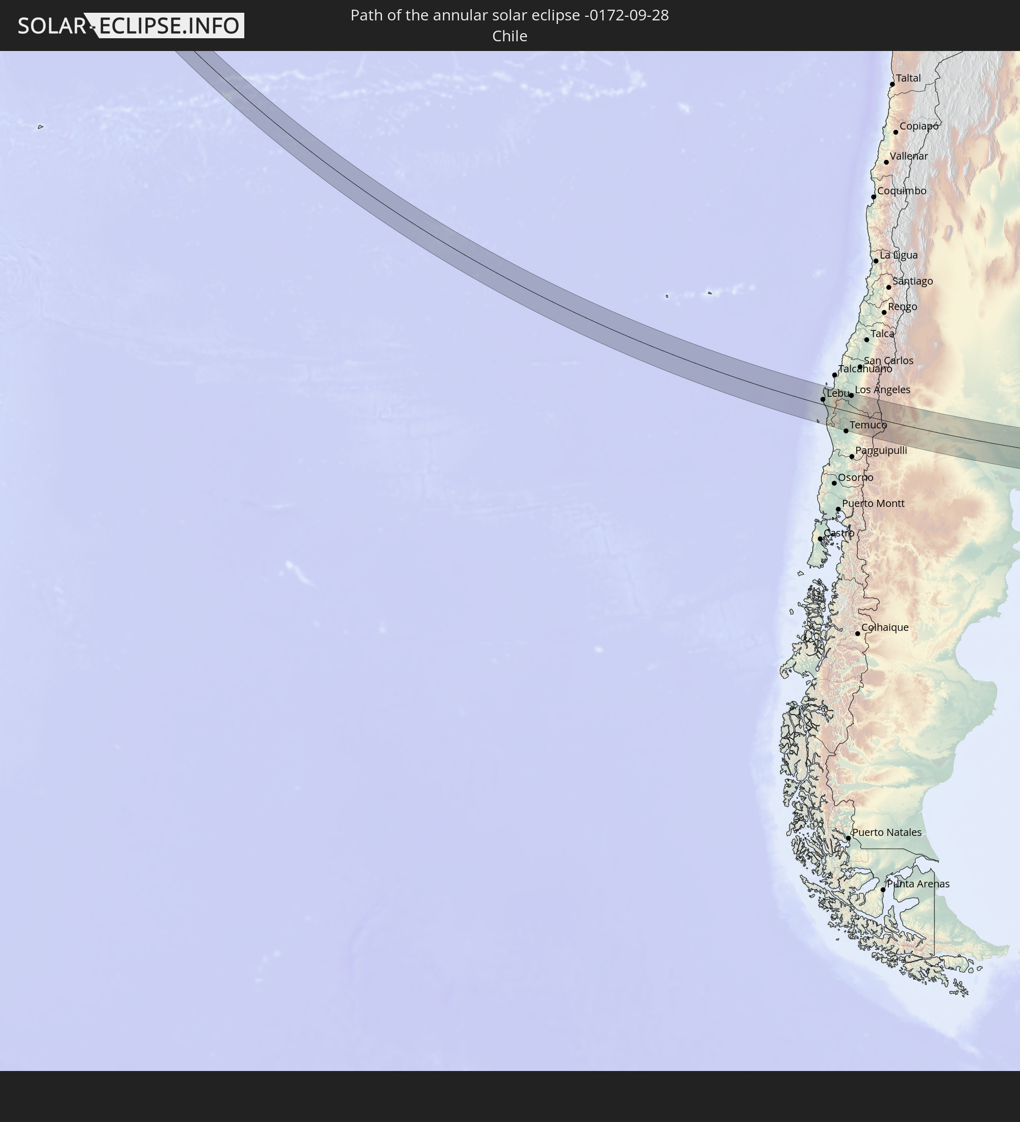 Chile
Chile
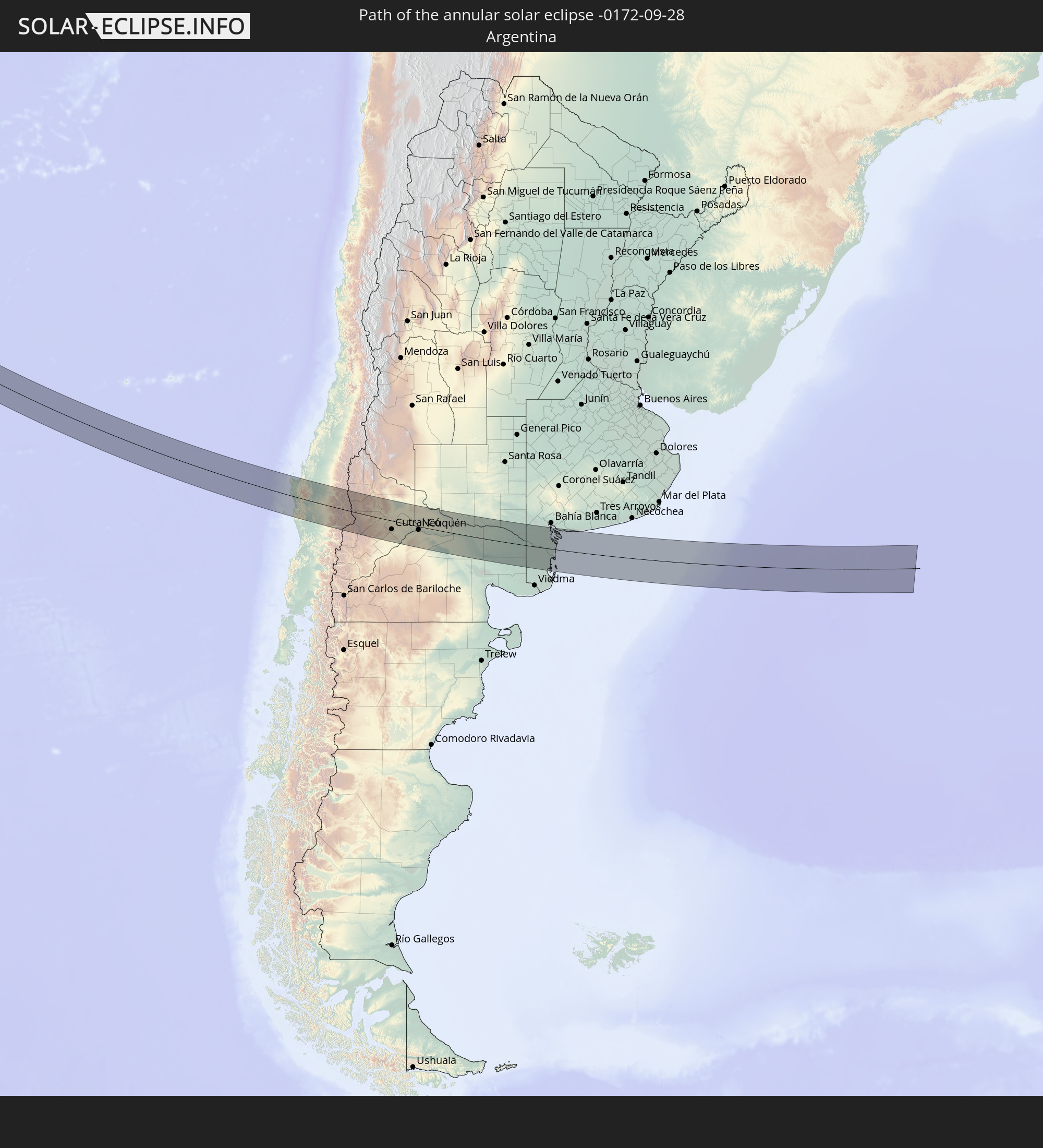 Argentina
In den folgenden Ländern ist die Sonnenfinsternis partiell zu sehen


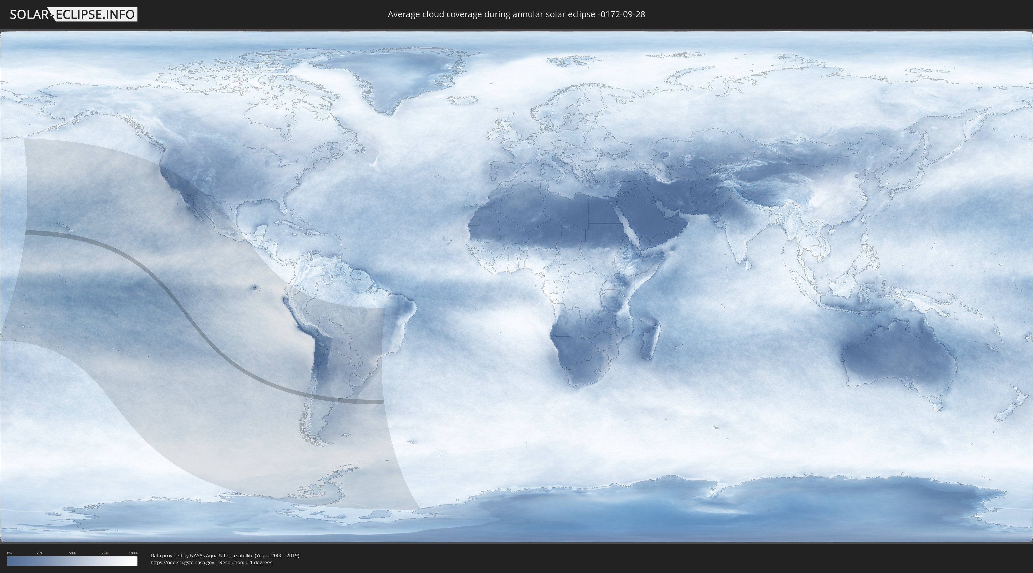
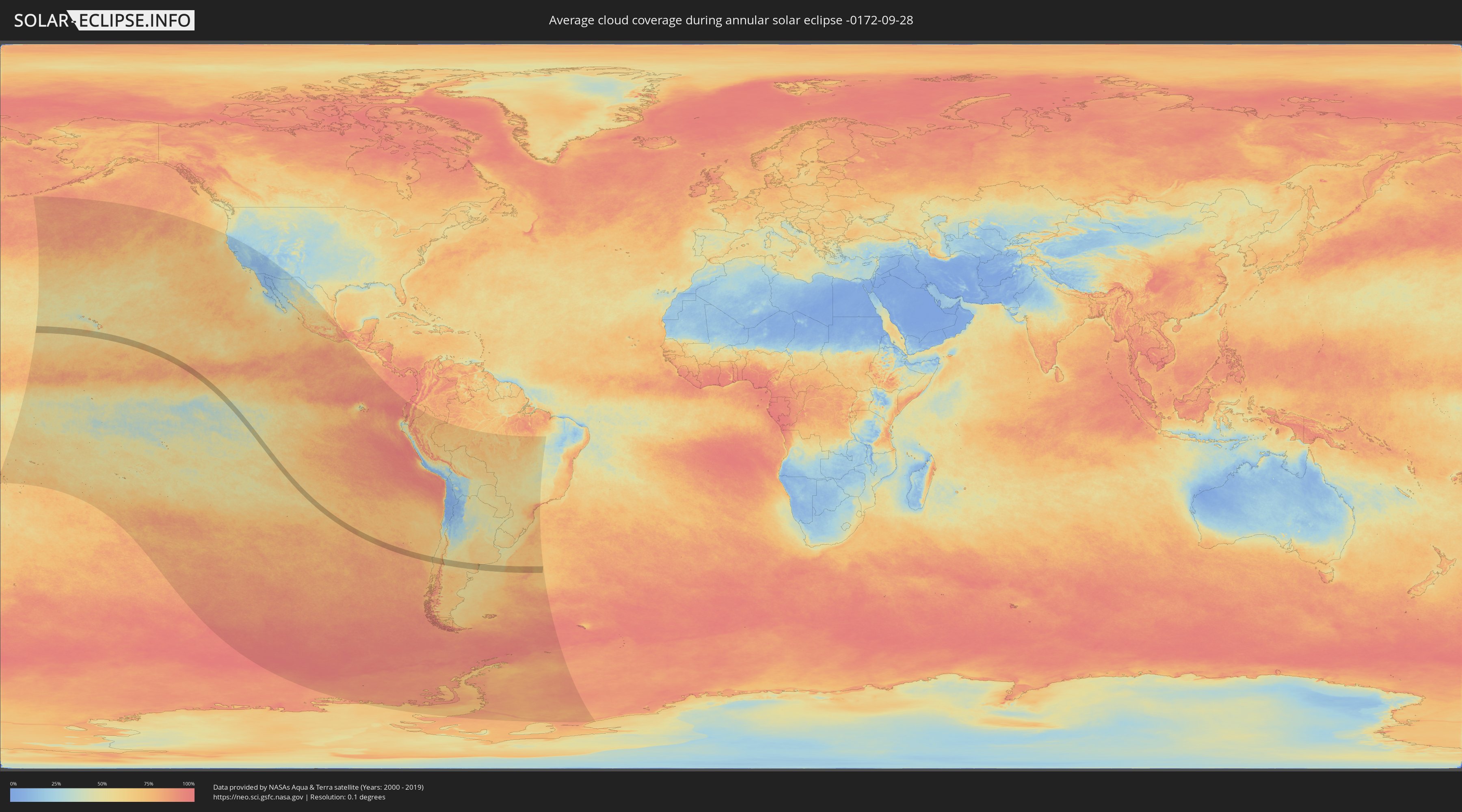
How will be the weather during the annular solar eclipse on 09/28/-0172?
Where is the best place to see the annular solar eclipse of 09/28/-0172?
The following maps show the average cloud coverage for the day of the annular solar eclipse.
With the help of these maps, it is possible to find the place along the eclipse path, which has the best
chance of a cloudless sky.
Nevertheless, you should consider local circumstances and inform about the weather of your chosen
observation site.
The data is provided by NASAs satellites
AQUA and TERRA.
The cloud maps are averaged over a period of 19 years (2000 - 2019).
Detailed country maps
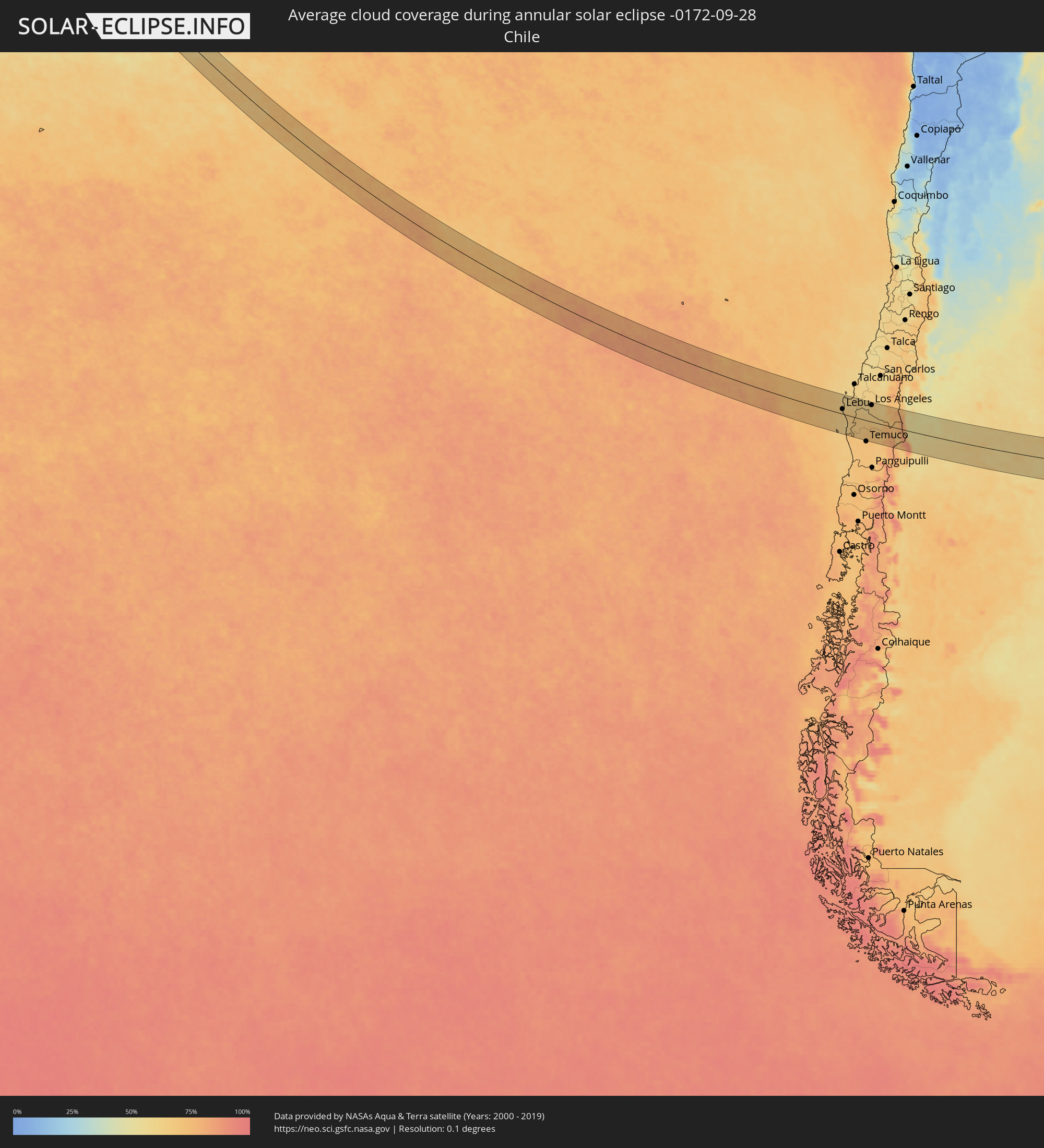 Chile
Chile
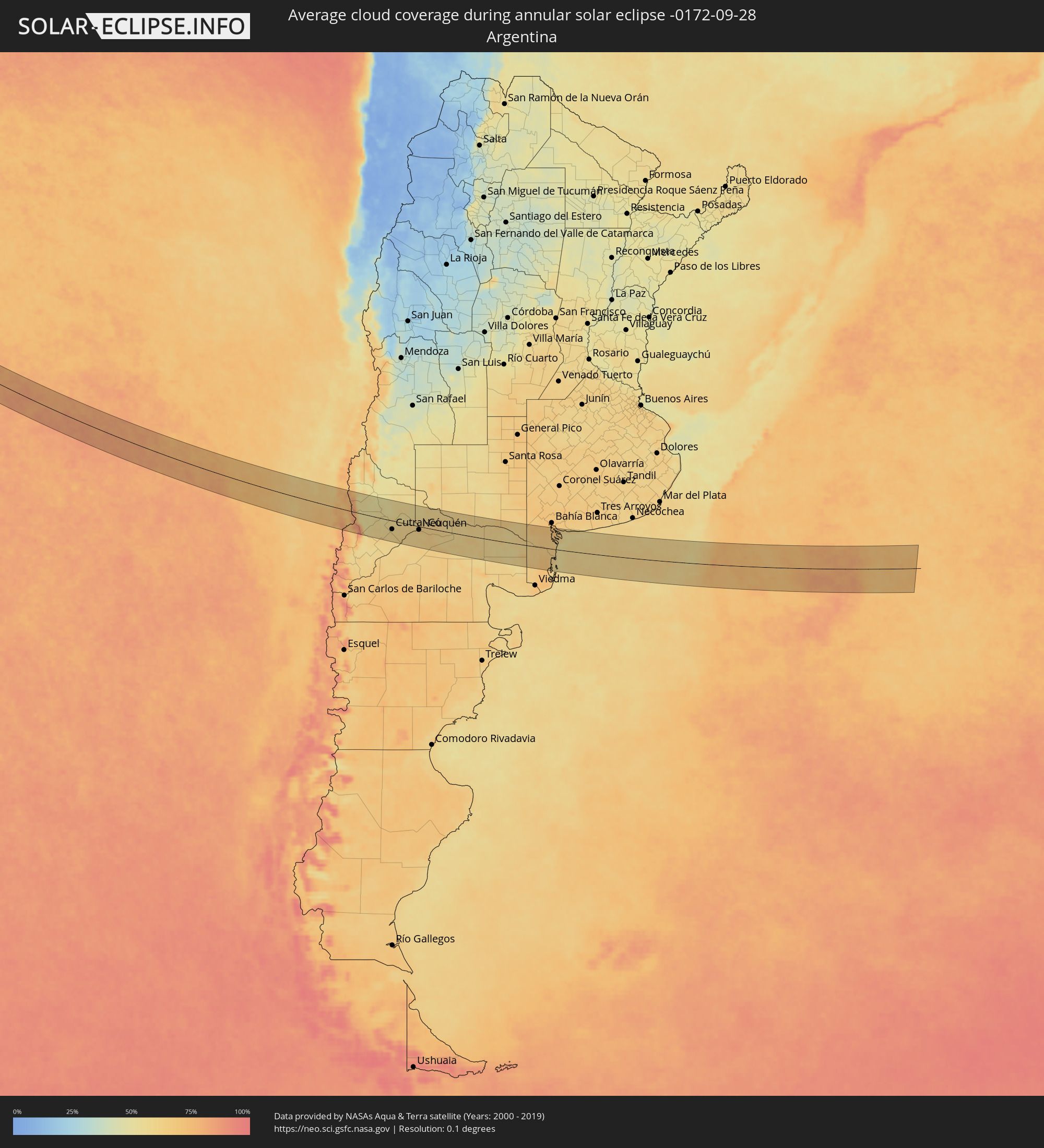 Argentina
Cities inside the path of the eclipse
The following table shows all locations with a population of more than 5,000 inside the eclipse path. Cities which have more than 100,000 inhabitants are marked bold. A click at the locations opens a detailed map.
| City | Type | Eclipse duration | Local time of max. eclipse | Distance to central line | Ø Cloud coverage |
 Lebu, Biobío
|
annular | - | 16:08:38 UTC-04:42 | 18 km | 66% |
|
Cañete, Biobío
|
annular | - | 16:08:50 UTC-04:42 | 4 km | 66% |
|
Curanilahue, Biobío
|
annular | - | 16:08:51 UTC-04:42 | 39 km | 64% |
|
Arauco, Biobío
|
annular | - | 16:08:51 UTC-04:42 | 65 km | 61% |
|
Angol, Araucanía
|
annular | - | 16:09:20 UTC-04:42 | 20 km | 65% |
|
Nacimiento, Biobío
|
annular | - | 16:09:21 UTC-04:42 | 52 km | 62% |
|
Traiguén, Araucanía
|
annular | - | 16:09:22 UTC-04:42 | 28 km | 67% |
|
Lautaro, Araucanía
|
annular | - | 16:09:32 UTC-04:42 | 53 km | 72% |
|
Collipulli, Araucanía
|
annular | - | 16:09:32 UTC-04:42 | 9 km | 66% |
|
Los Ángeles, Biobío
|
annular | - | 16:09:35 UTC-04:42 | 63 km | 62% |
|
Victoria, Araucanía
|
annular | - | 16:09:37 UTC-04:42 | 19 km | 70% |
|
Mulchén, Biobío
|
annular | - | 16:09:40 UTC-04:42 | 39 km | 64% |
|
Vilcún, Araucanía
|
annular | - | 16:09:41 UTC-04:42 | 63 km | 72% |
 Zapala, Neuquén Province
|
annular | - | 16:37:05 UTC-04:16 | 43 km | 58% |
|
Cutral-Có, Neuquén Province
|
annular | - | 16:37:35 UTC-04:16 | 32 km | 59% |
|
Plaza Huincul, Neuquén Province
|
annular | - | 16:37:36 UTC-04:16 | 30 km | 59% |
|
Senillosa, Neuquén Province
|
annular | - | 16:38:03 UTC-04:16 | 26 km | 59% |
|
Plottier, Neuquén Province
|
annular | - | 16:38:10 UTC-04:16 | 17 km | 59% |
|
Centenario, Neuquén Province
|
annular | - | 16:38:15 UTC-04:16 | 0 km | 62% |
|
Cinco Saltos, Río Negro Province
|
annular | - | 16:38:17 UTC-04:16 | 2 km | 62% |
|
Neuquén, Neuquén Province
|
annular | - | 16:38:16 UTC-04:16 | 12 km | 60% |
|
Cipolletti, Río Negro Province
|
annular | - | 16:38:19 UTC-04:16 | 9 km | 63% |
|
General Fernández Oro, Río Negro Province
|
annular | - | 16:38:21 UTC-04:16 | 10 km | 61% |
|
Allen, Río Negro Province
|
annular | - | 16:38:24 UTC-04:16 | 11 km | 61% |
|
General Roca, Río Negro Province
|
annular | - | 16:38:32 UTC-04:16 | 13 km | 64% |
|
Cervantes, Río Negro Province
|
annular | - | 16:38:38 UTC-04:16 | 12 km | 60% |
|
Ingeniero Luis A. Huergo, Río Negro Province
|
annular | - | 16:38:43 UTC-04:16 | 13 km | 59% |
|
Villa Regina, Río Negro Province
|
annular | - | 16:38:49 UTC-04:16 | 12 km | 61% |
|
Fray Luis Beltrán, Río Negro Province
|
annular | - | 16:39:27 UTC-04:16 | 15 km | 63% |
|
Lamarque, Río Negro Province
|
annular | - | 16:39:28 UTC-04:16 | 26 km | 59% |
|
Choele Choel, Río Negro Province
|
annular | - | 16:39:30 UTC-04:16 | 9 km | 62% |