Total solar eclipse of 01/18/-0401
| Day of week: | Sunday |
| Maximum duration of eclipse: | 03m49s |
| Maximum width of eclipse path: | 253 km |
| Saros cycle: | 44 |
| Coverage: | 100% |
| Magnitude: | 1.0442 |
| Gamma: | 0.8128 |
Wo kann man die Sonnenfinsternis vom 01/18/-0401 sehen?
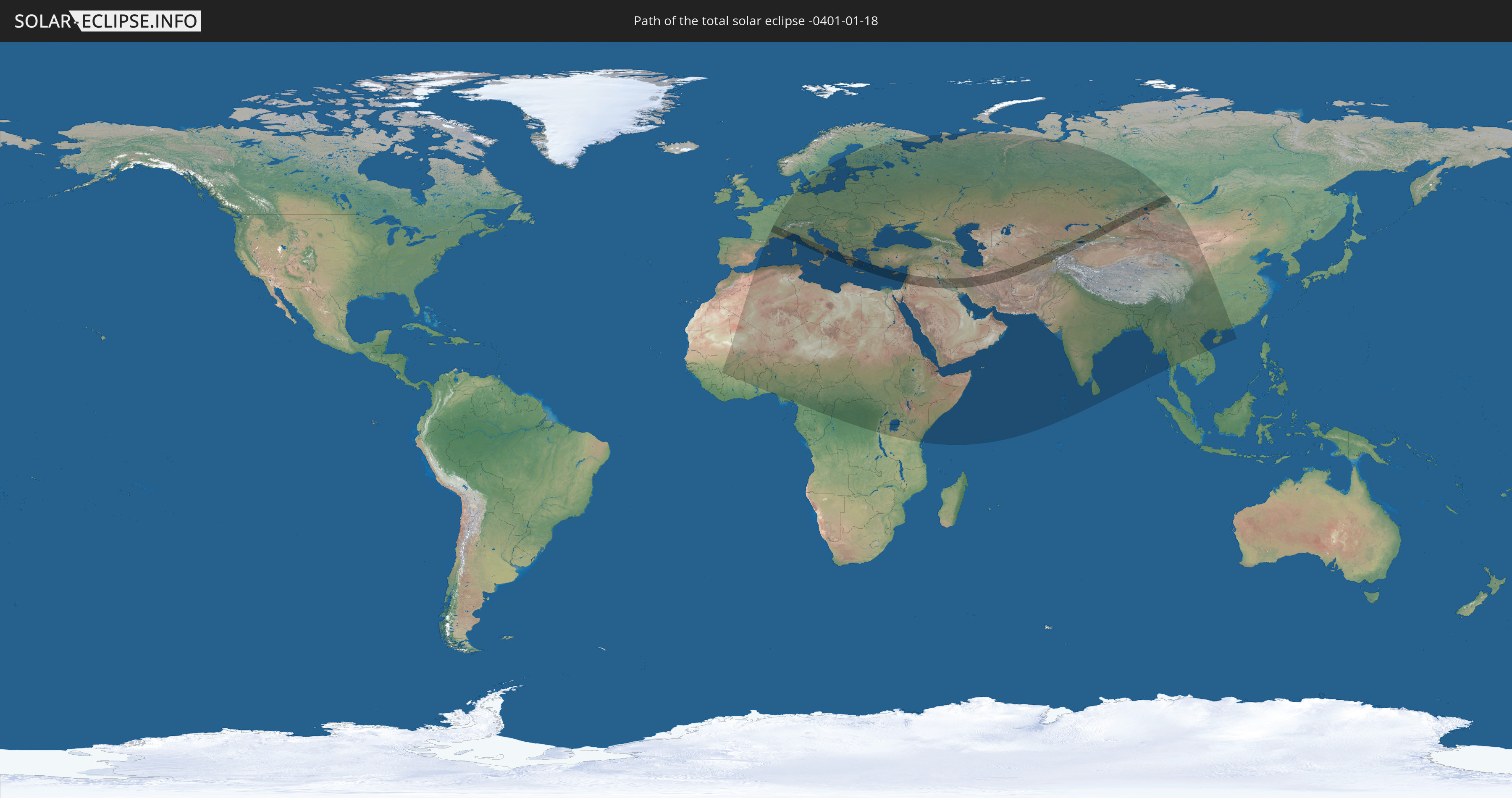
Die Sonnenfinsternis am 01/18/-0401 kann man in 105 Ländern als partielle Sonnenfinsternis beobachten.
Der Finsternispfad verläuft durch 24 Länder. Nur in diesen Ländern ist sie als total Sonnenfinsternis zu sehen.
In den folgenden Ländern ist die Sonnenfinsternis total zu sehen
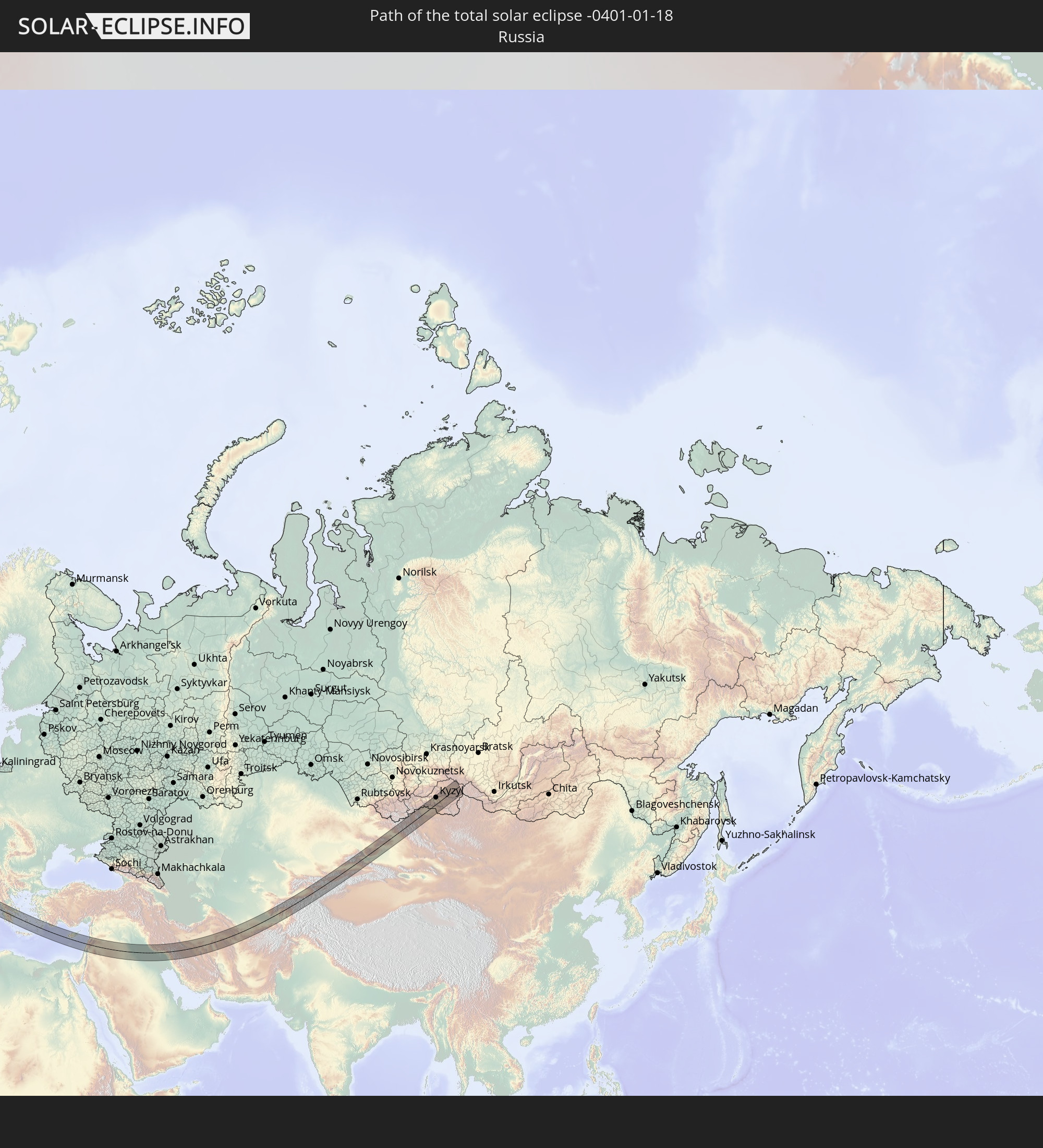 Russia
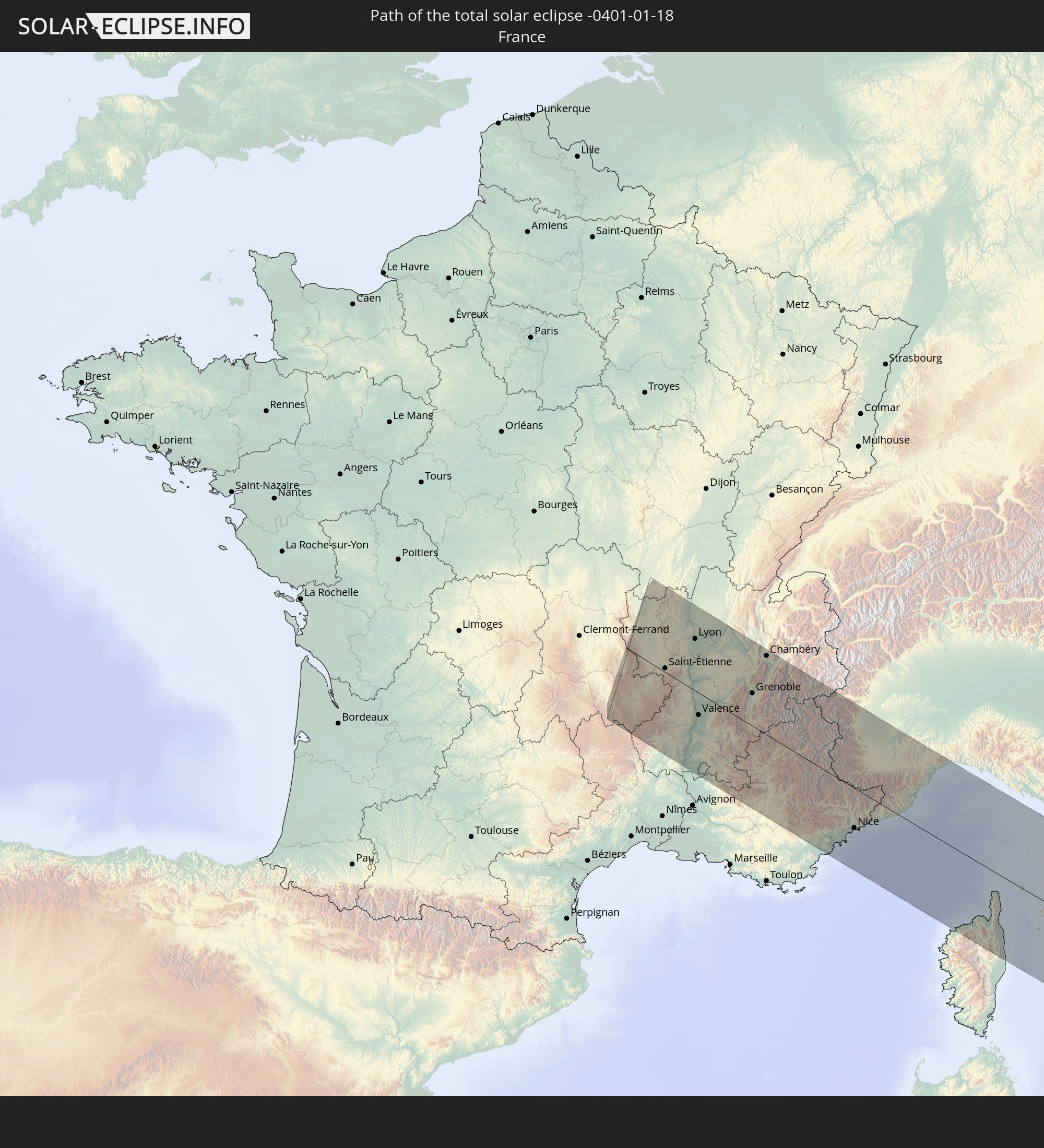 France
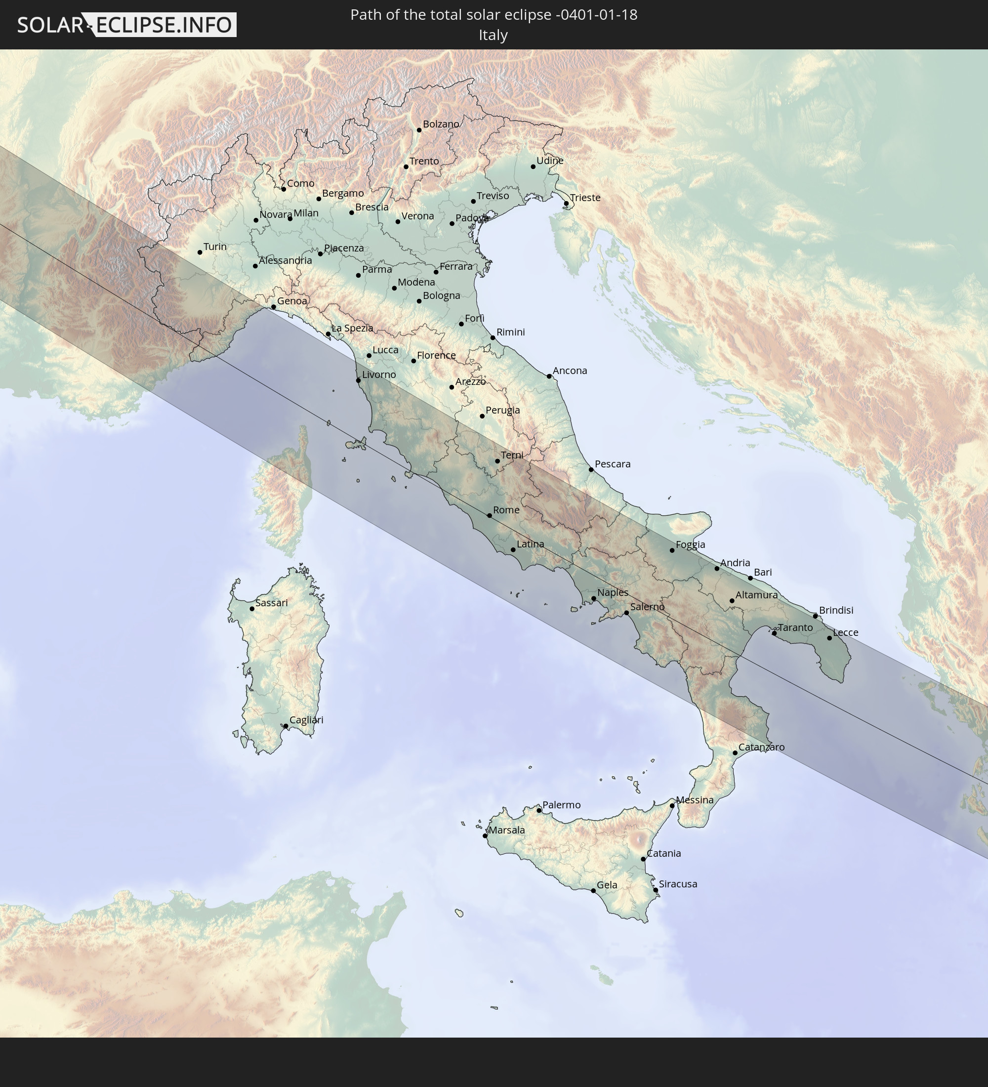 Italy
Italy
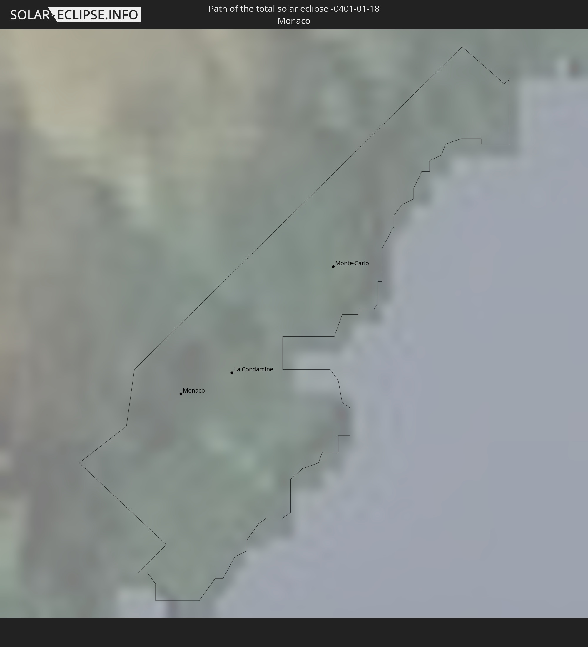 Monaco
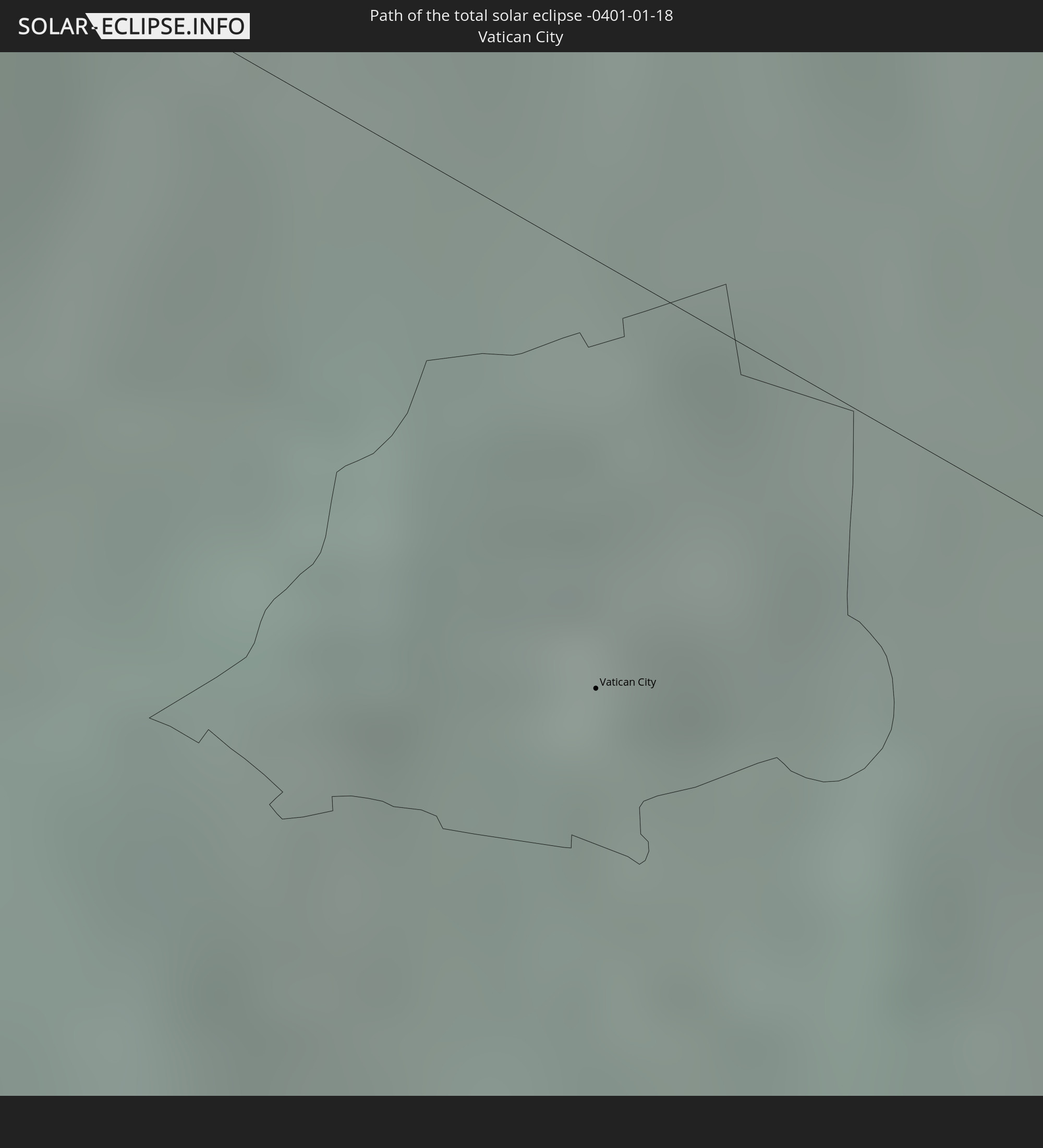 Vatican City
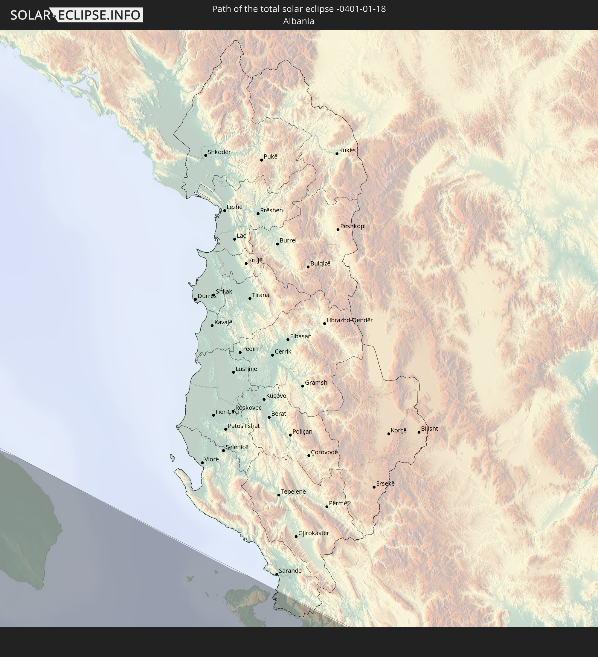 Albania
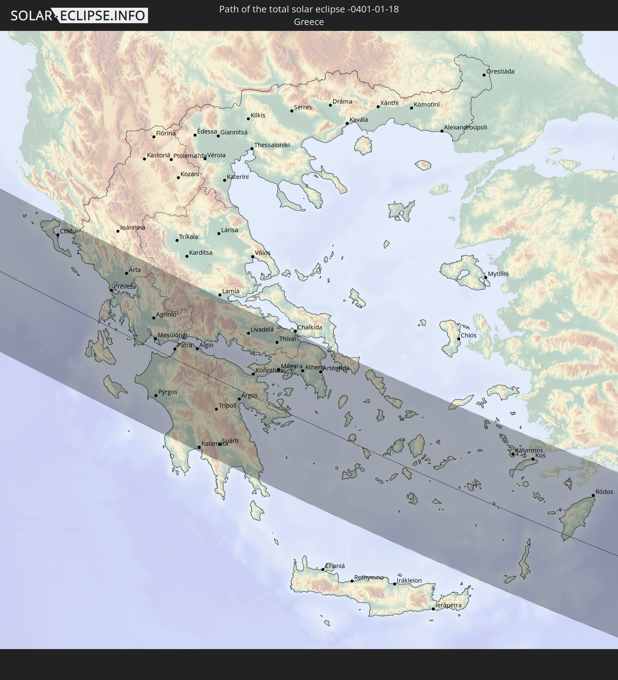 Greece
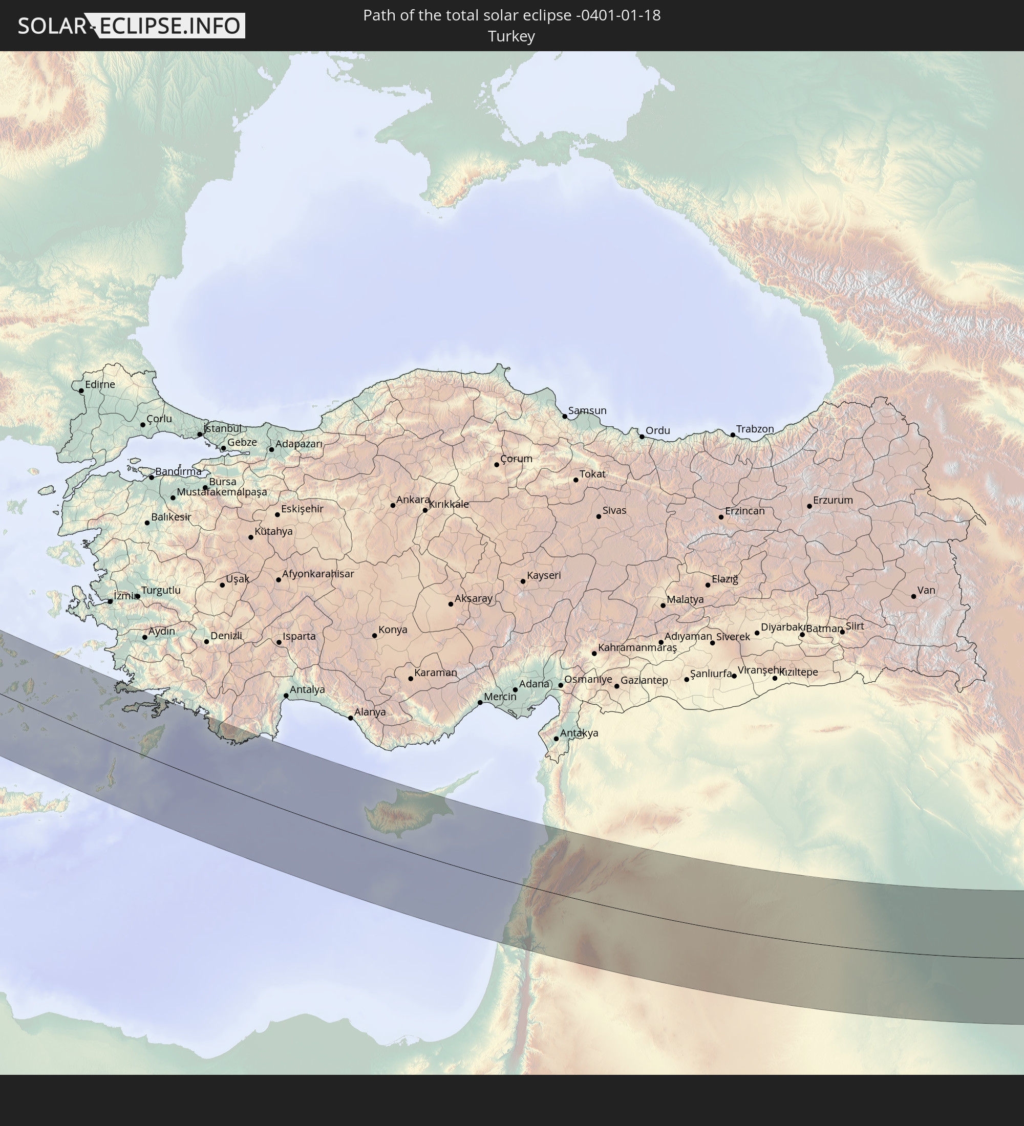 Turkey
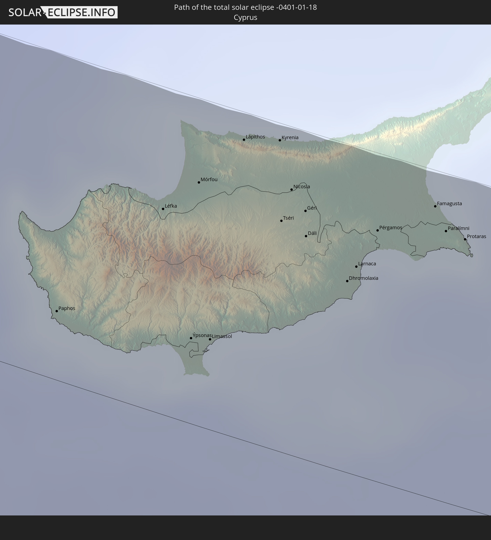 Cyprus
 Israel
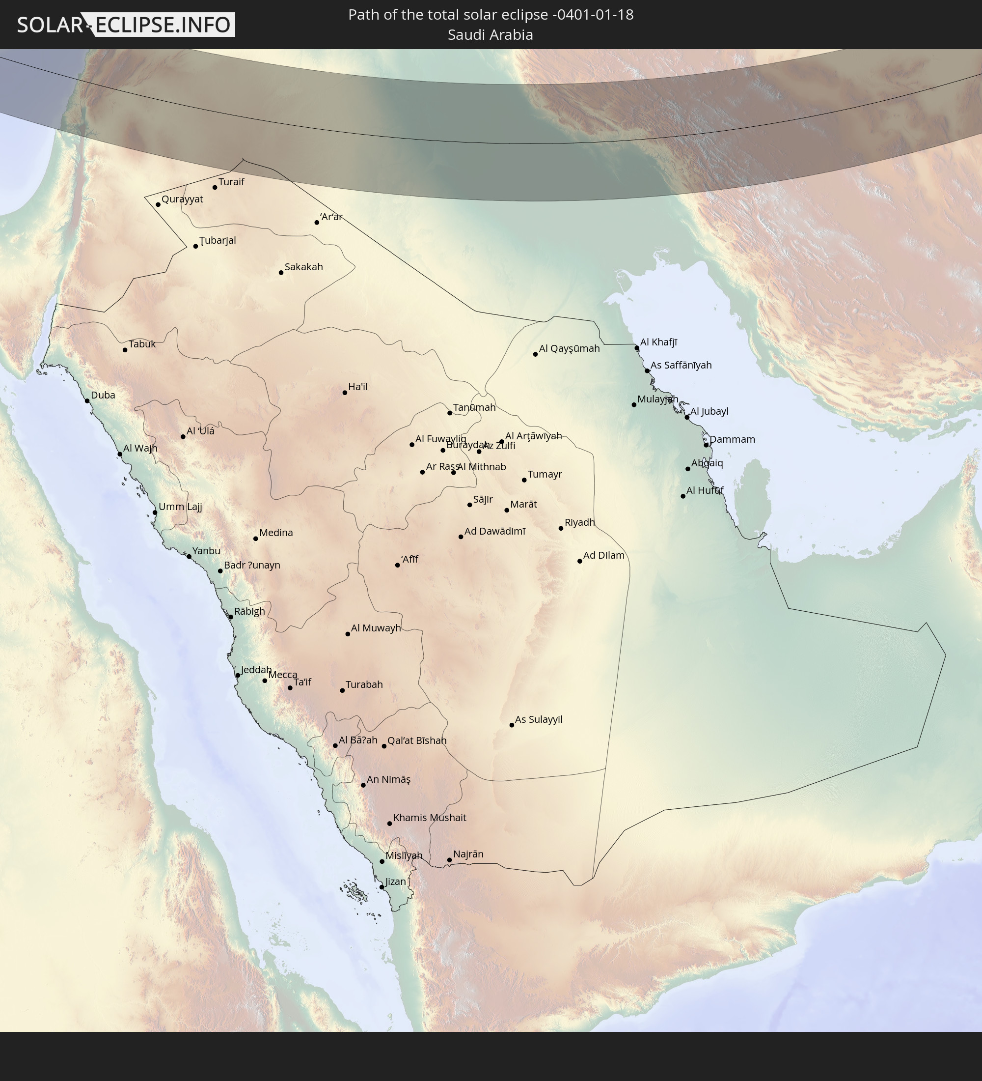 Saudi Arabia
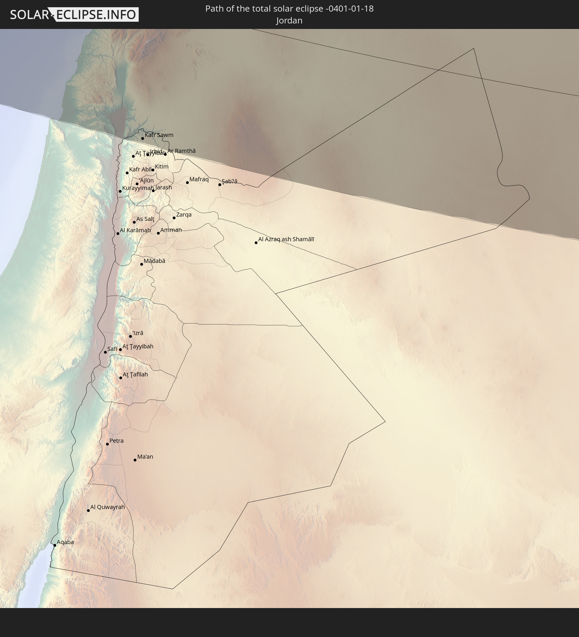 Jordan
 Lebanon
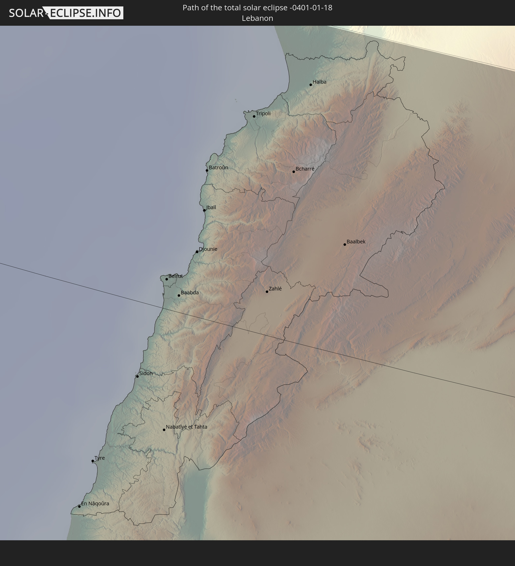
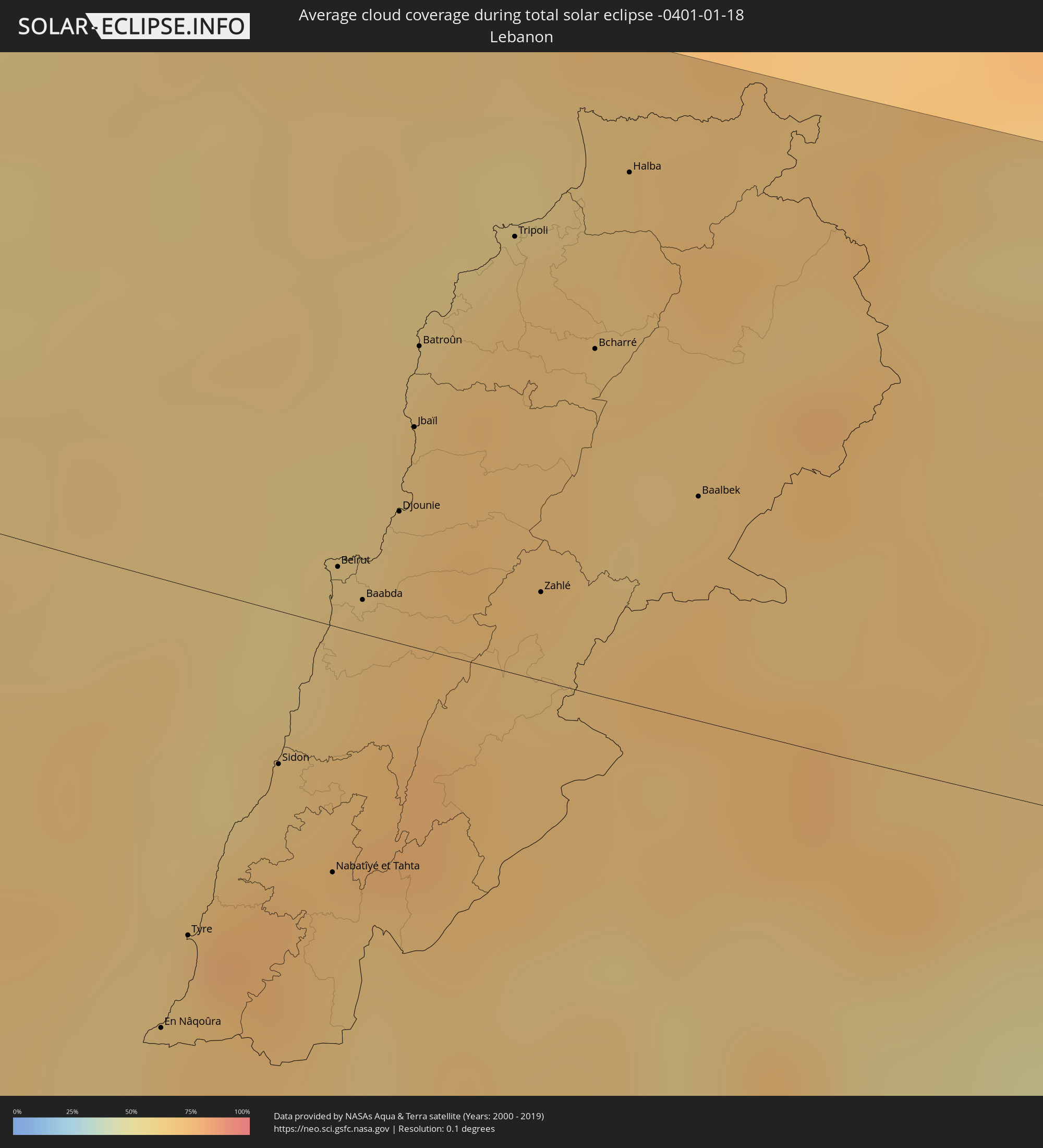
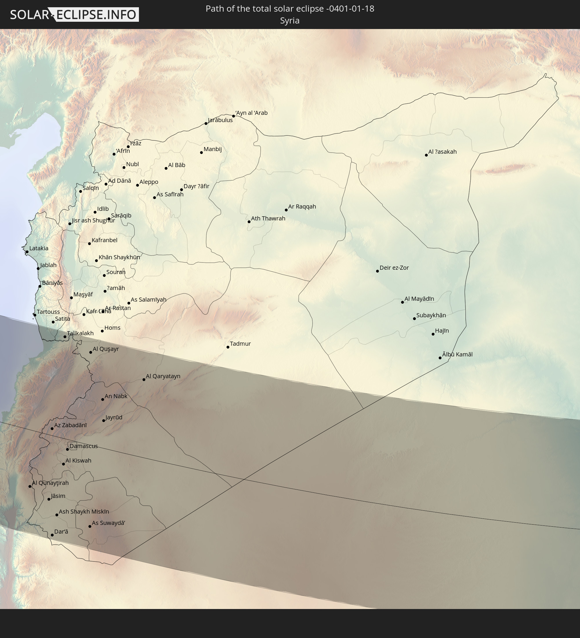 Syria
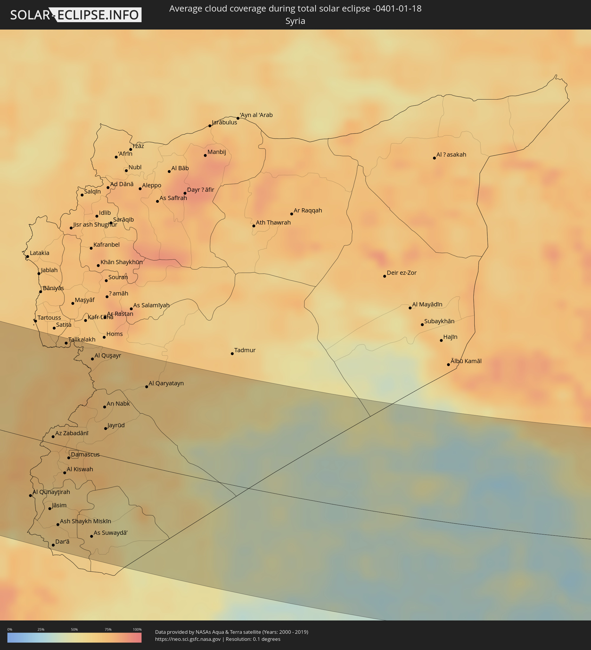
Syria
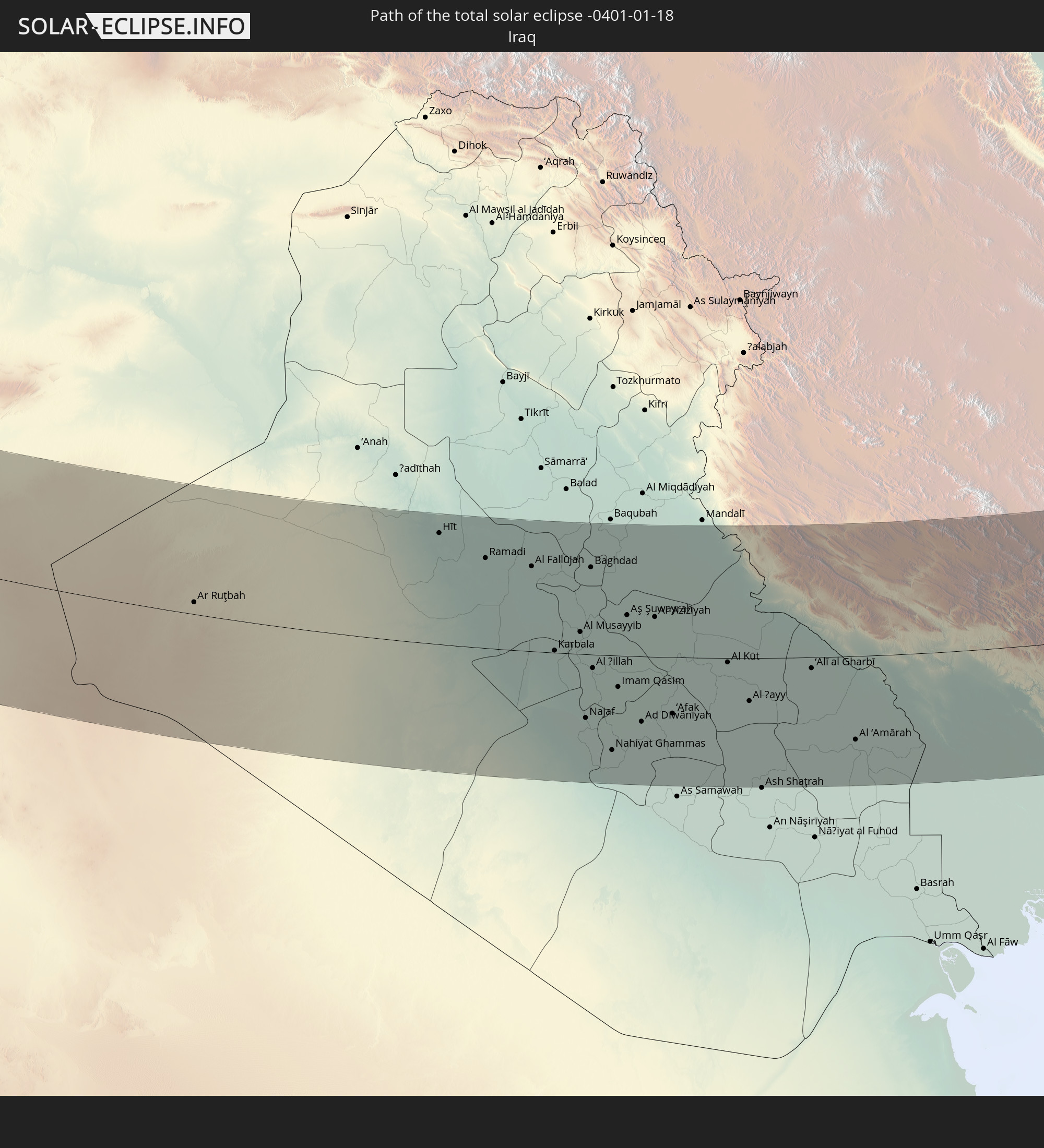 Iraq
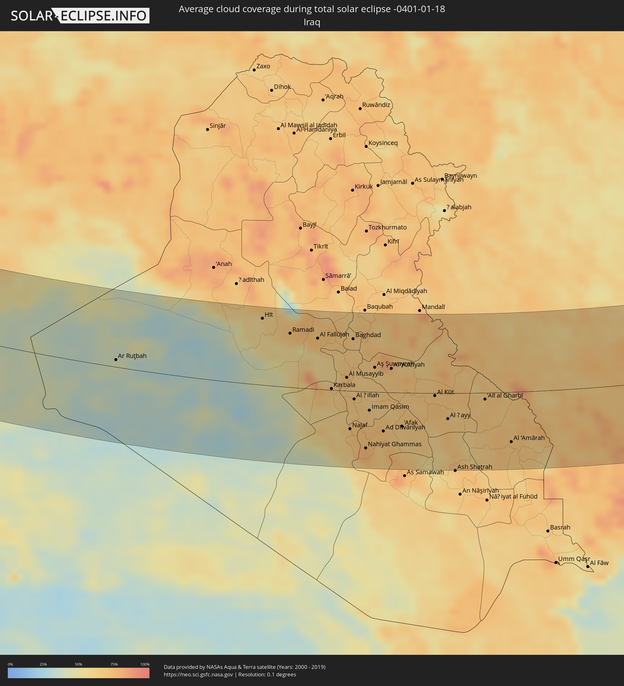
Iraq
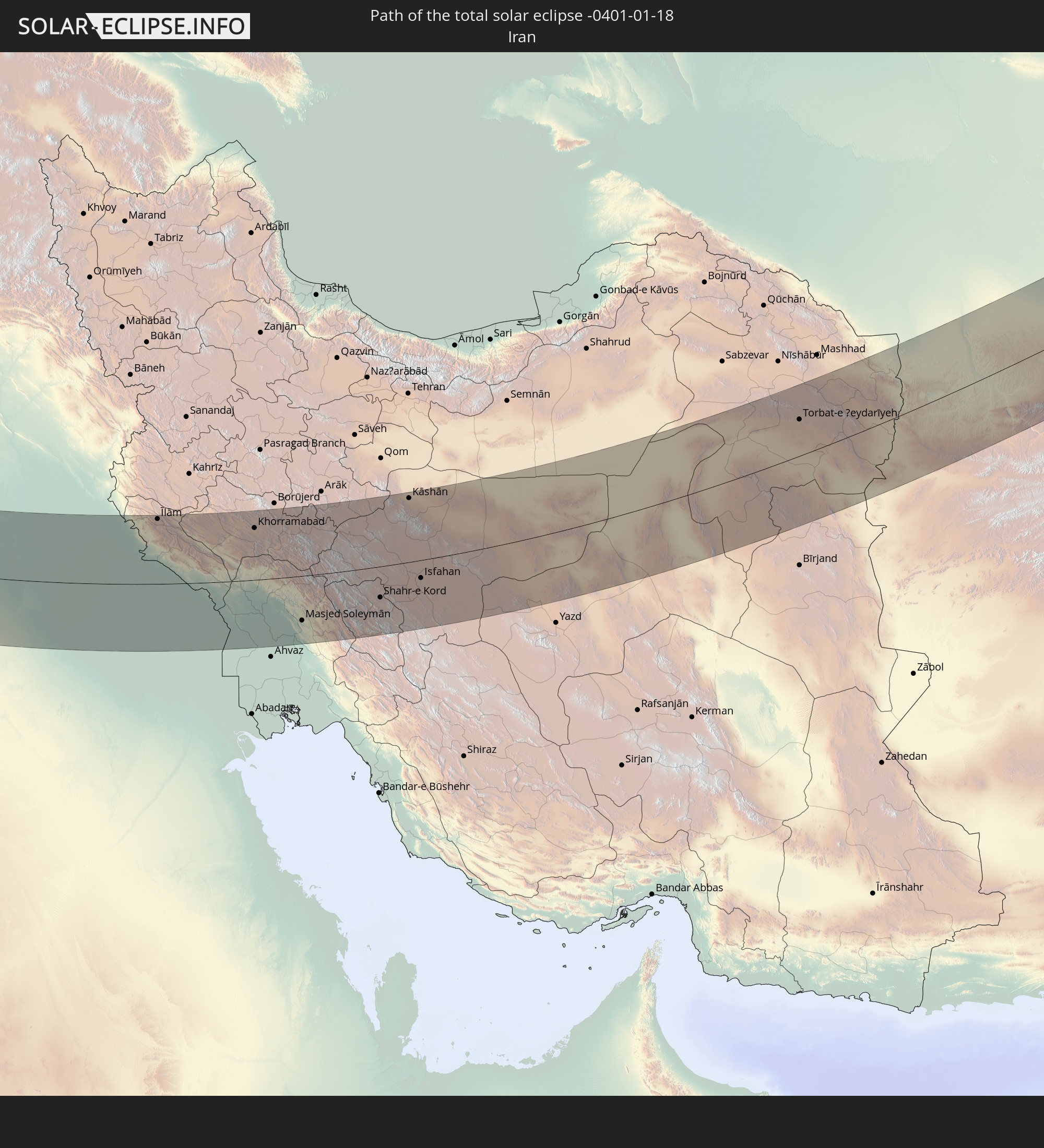 Iran
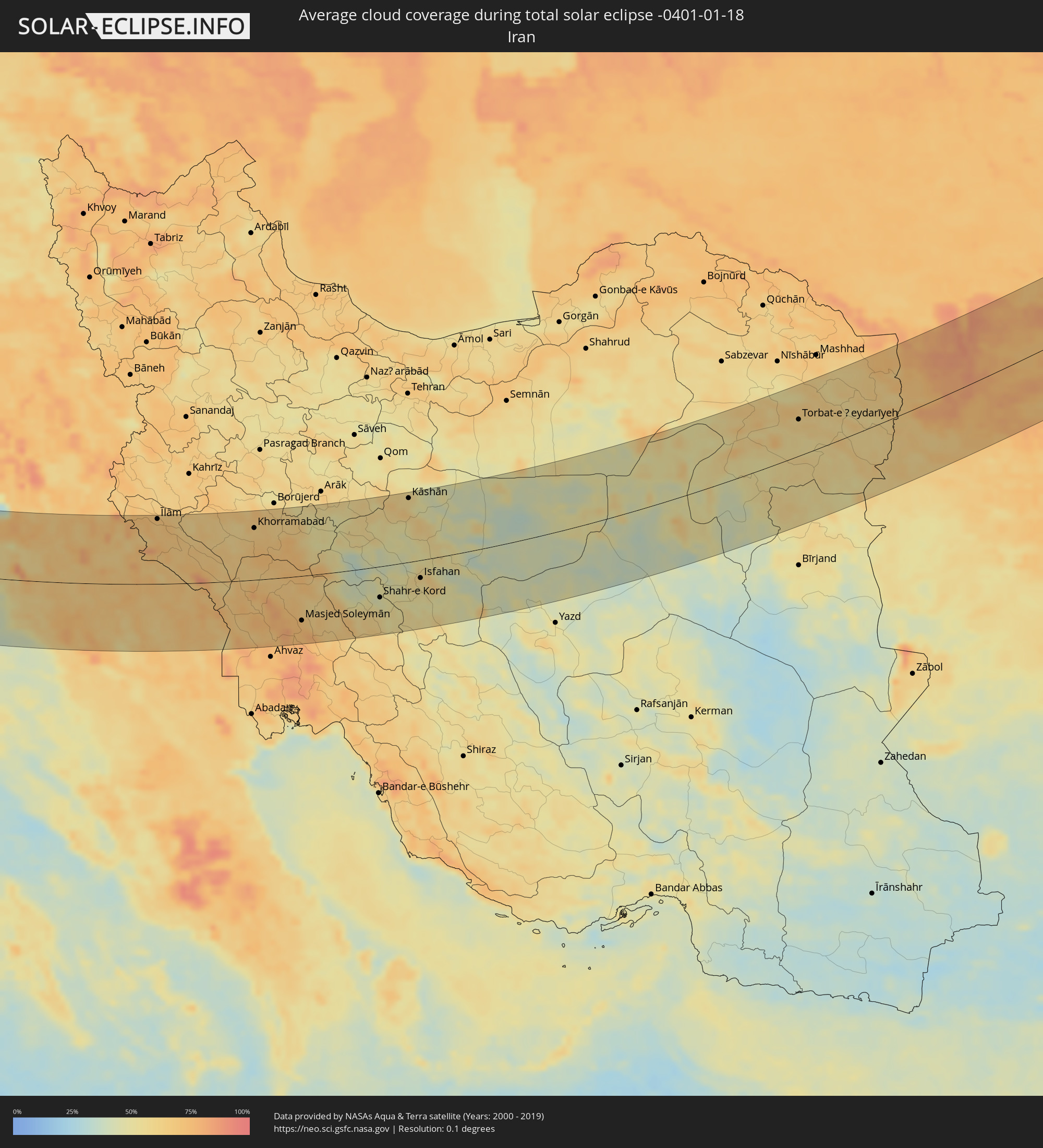
Iran
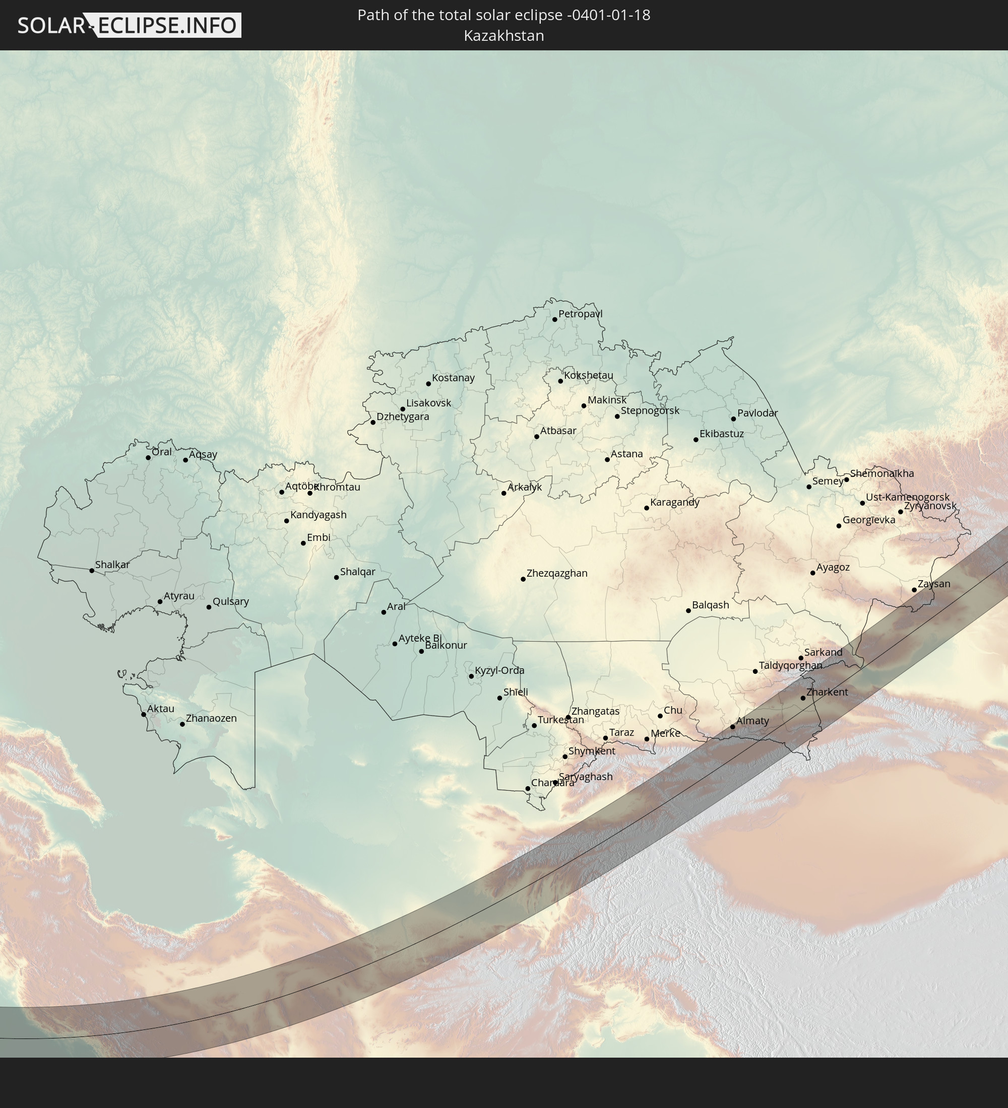 Kazakhstan
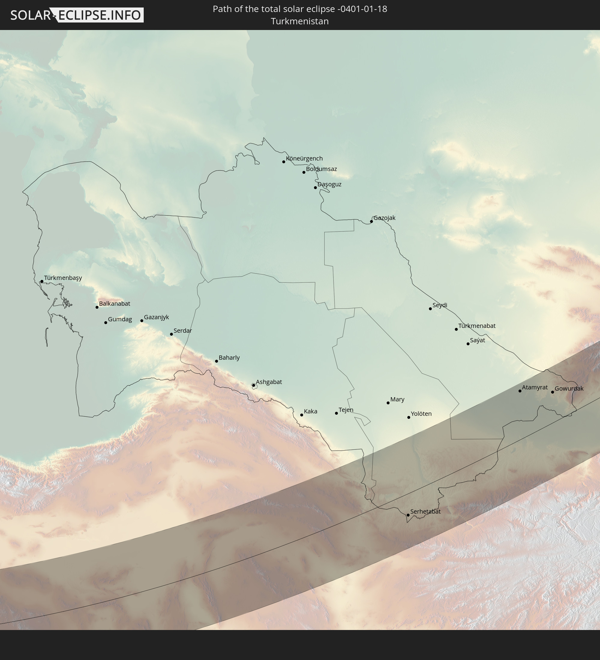 Turkmenistan
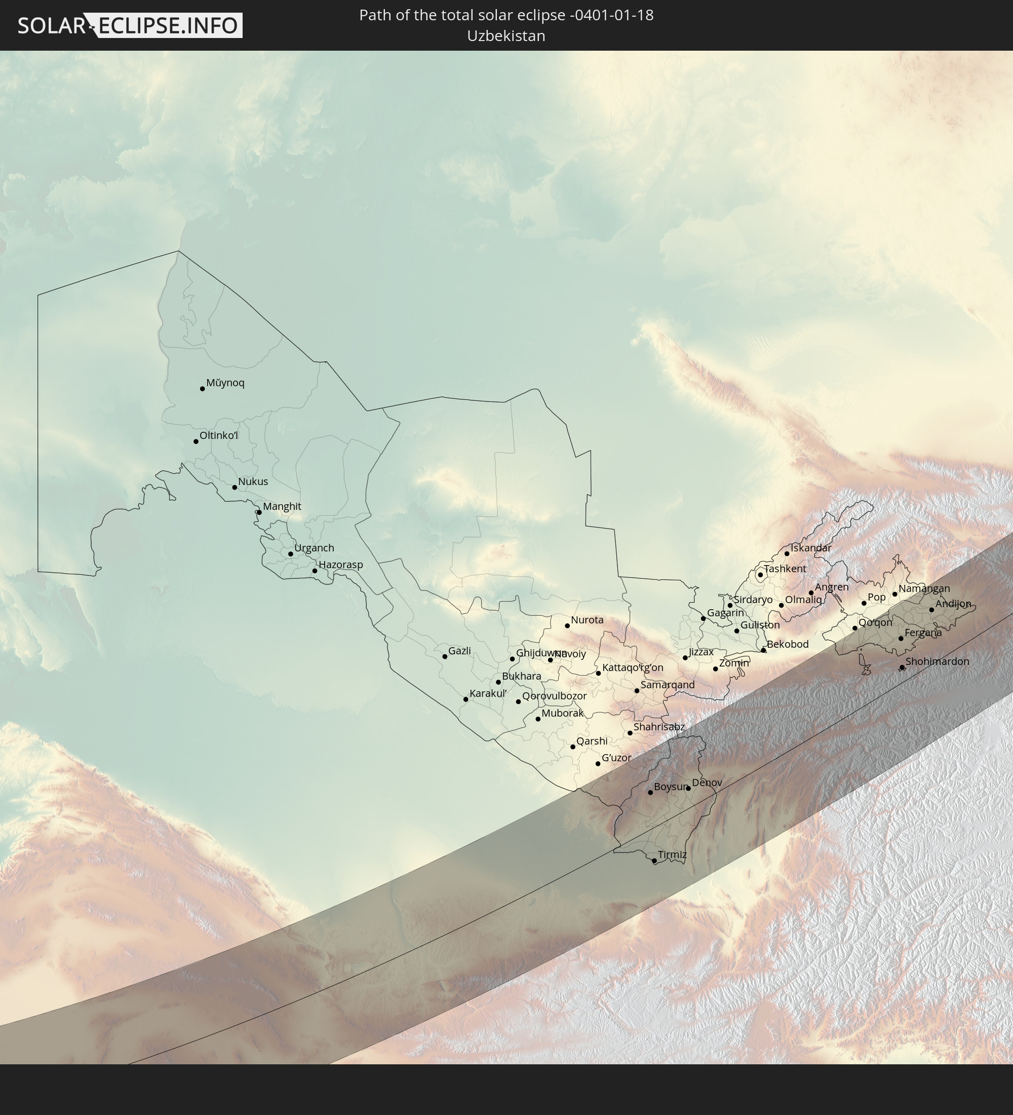 Uzbekistan
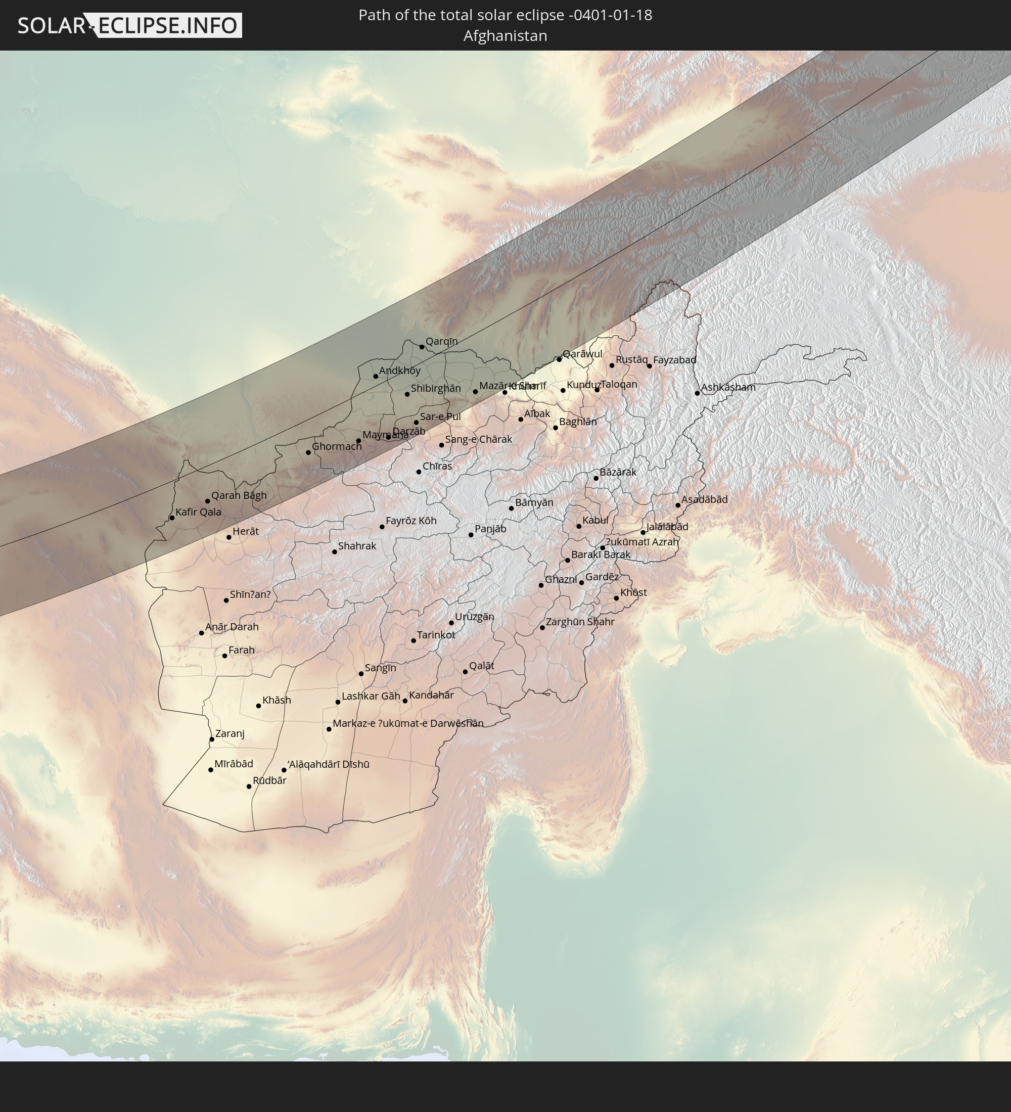 Afghanistan
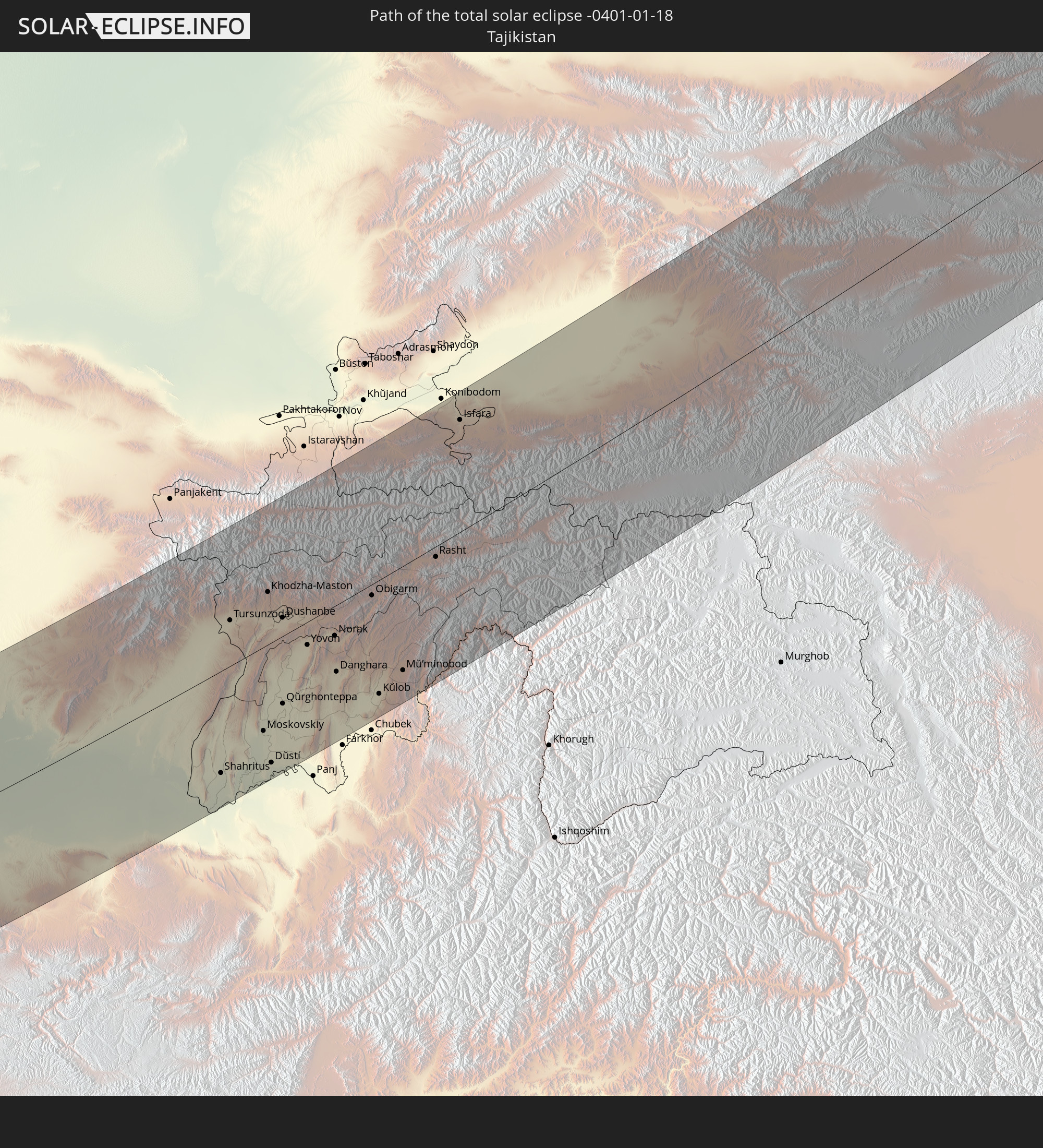 Tajikistan
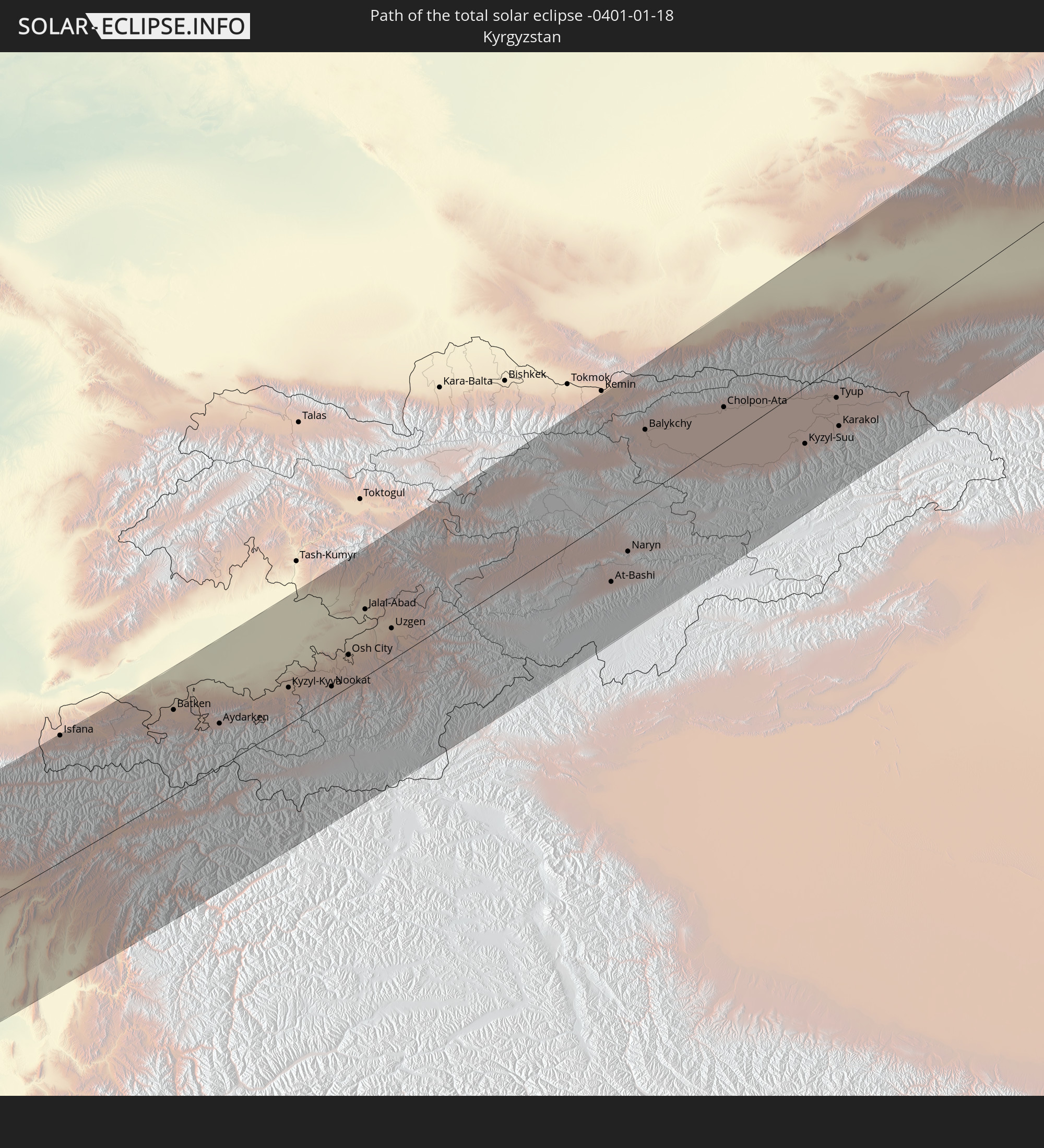 Kyrgyzstan
 China
China
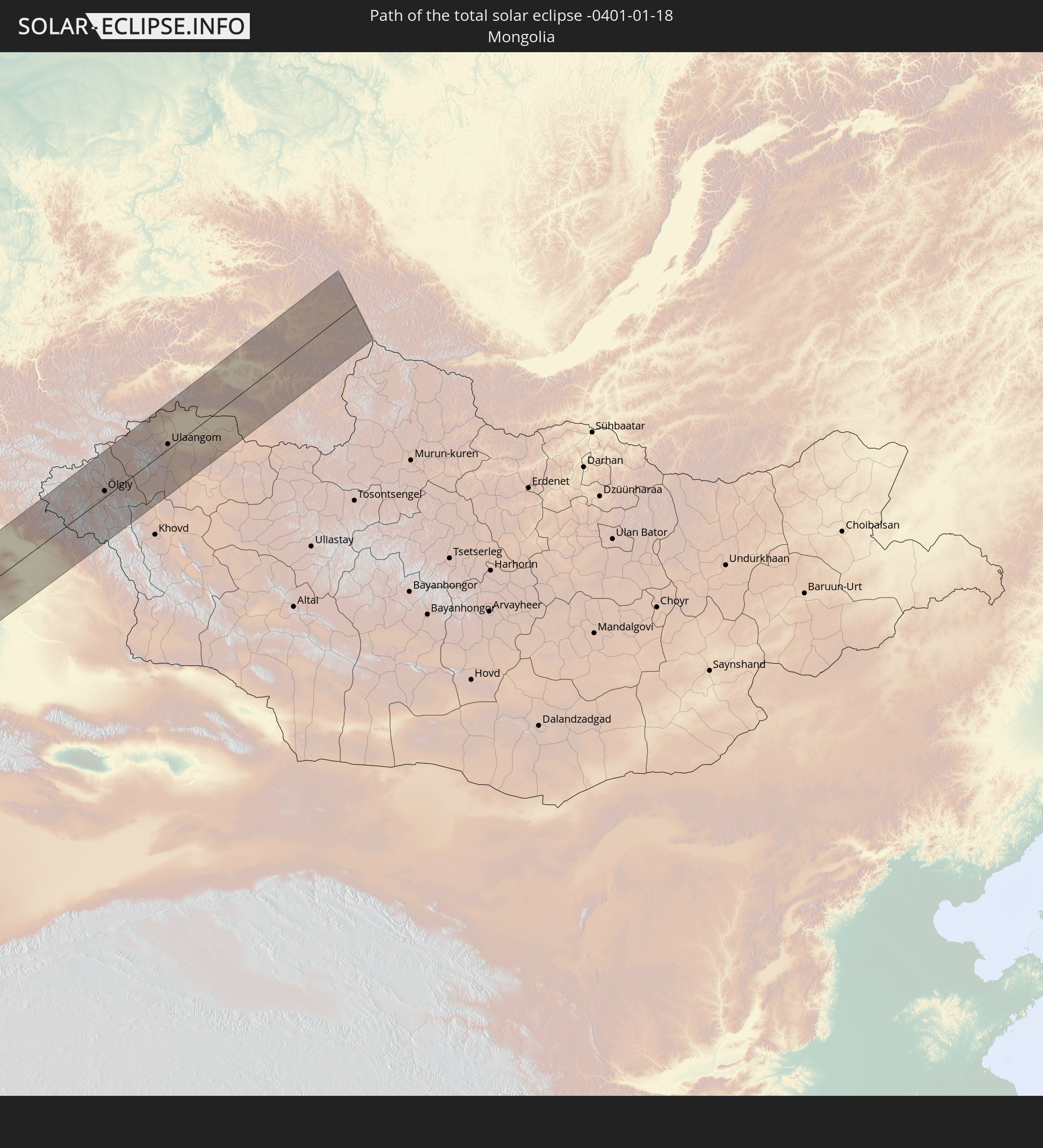 Mongolia
In den folgenden Ländern ist die Sonnenfinsternis partiell zu sehen
 Russia
 Spain
Spain
 Mauritania
 Morocco
 Mali
Mali
 Algeria
 Ivory Coast
 Burkina Faso
 France
 Ghana
Ghana
 Togo
Togo
 Niger
Niger
 Benin
Benin
 Nigeria
 Luxembourg
 Germany
 Switzerland
 Italy
Italy
 Monaco
 Tunisia
 Denmark
 Cameroon
 Libya
Libya
 Liechtenstein
 Austria
 Sweden
 Republic of the Congo
 Czechia
 Democratic Republic of the Congo
 San Marino
 Vatican City
 Slovenia
 Chad
Chad
 Croatia
 Poland
 Malta
Malta
 Central African Republic
 Bosnia and Herzegovina
 Hungary
 Slovakia
 Montenegro
 Serbia
 Albania
 Åland Islands
 Greece
 Romania
 Republic of Macedonia
 Finland
 Lithuania
 Latvia
 Estonia
 Sudan
Sudan
 Ukraine
 Bulgaria
 Belarus
 Egypt
Egypt
 Turkey
 Moldova
 Rwanda
 Burundi
 Tanzania
 Uganda
 Cyprus
 Ethiopia
 Kenya
Kenya
 State of Palestine
 Israel
 Saudi Arabia
 Jordan
 Lebanon
 Syria
Syria
 Eritrea
 Iraq
Iraq
 Georgia
 Somalia
 Djibouti
 Yemen
Yemen
 Armenia
 Iran
Iran
 Azerbaijan
 Seychelles
 Kazakhstan
 Kuwait
 Bahrain
 Qatar
Qatar
 United Arab Emirates
 Oman
Oman
 Turkmenistan
 Uzbekistan
 Afghanistan
 Pakistan
 Tajikistan
 India
India
 Kyrgyzstan
 Maldives
 China
China
 Sri Lanka
 Nepal
Nepal
 Mongolia
 Bangladesh
 Bhutan
 Myanmar
 Thailand
 Laos
Laos
 Vietnam
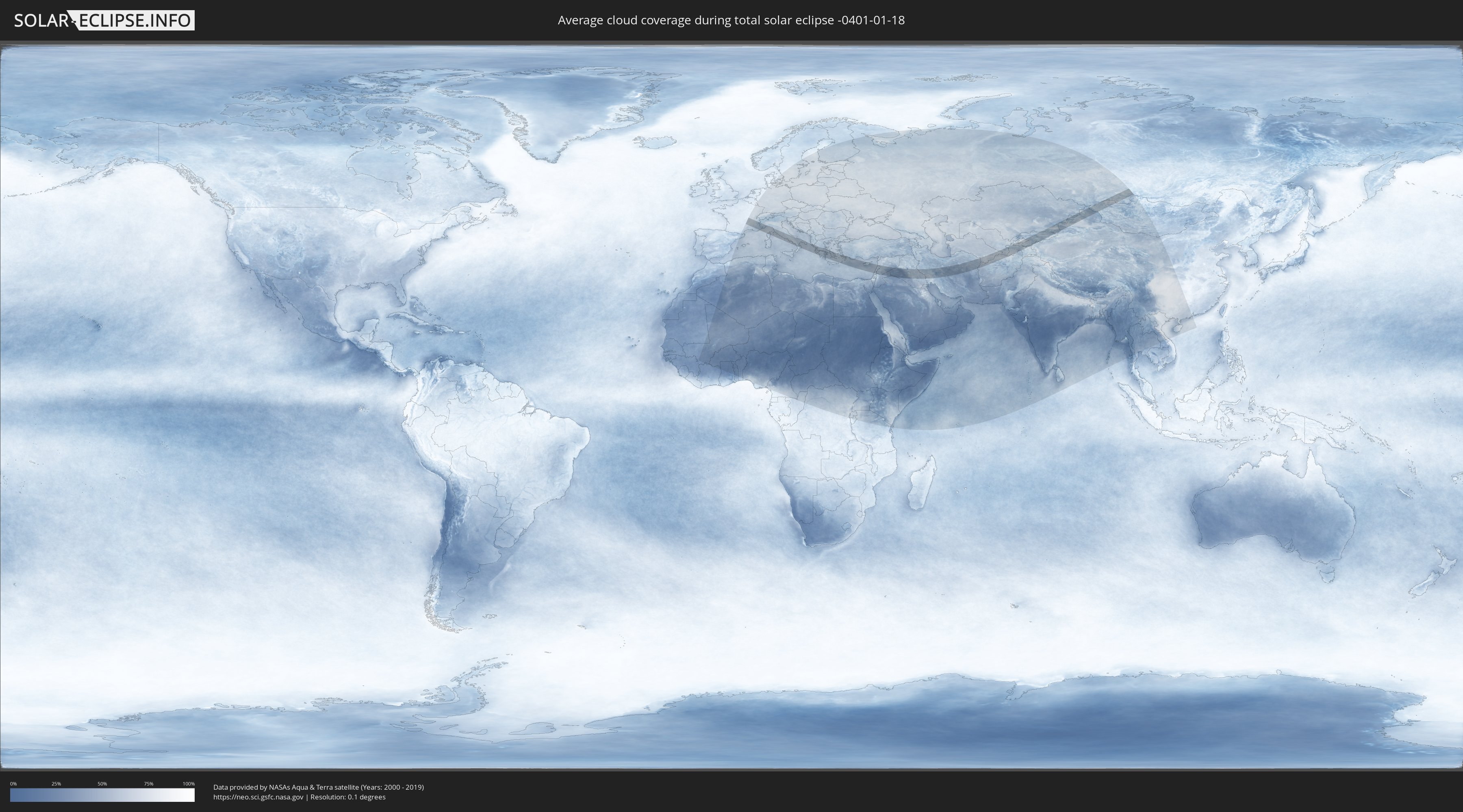
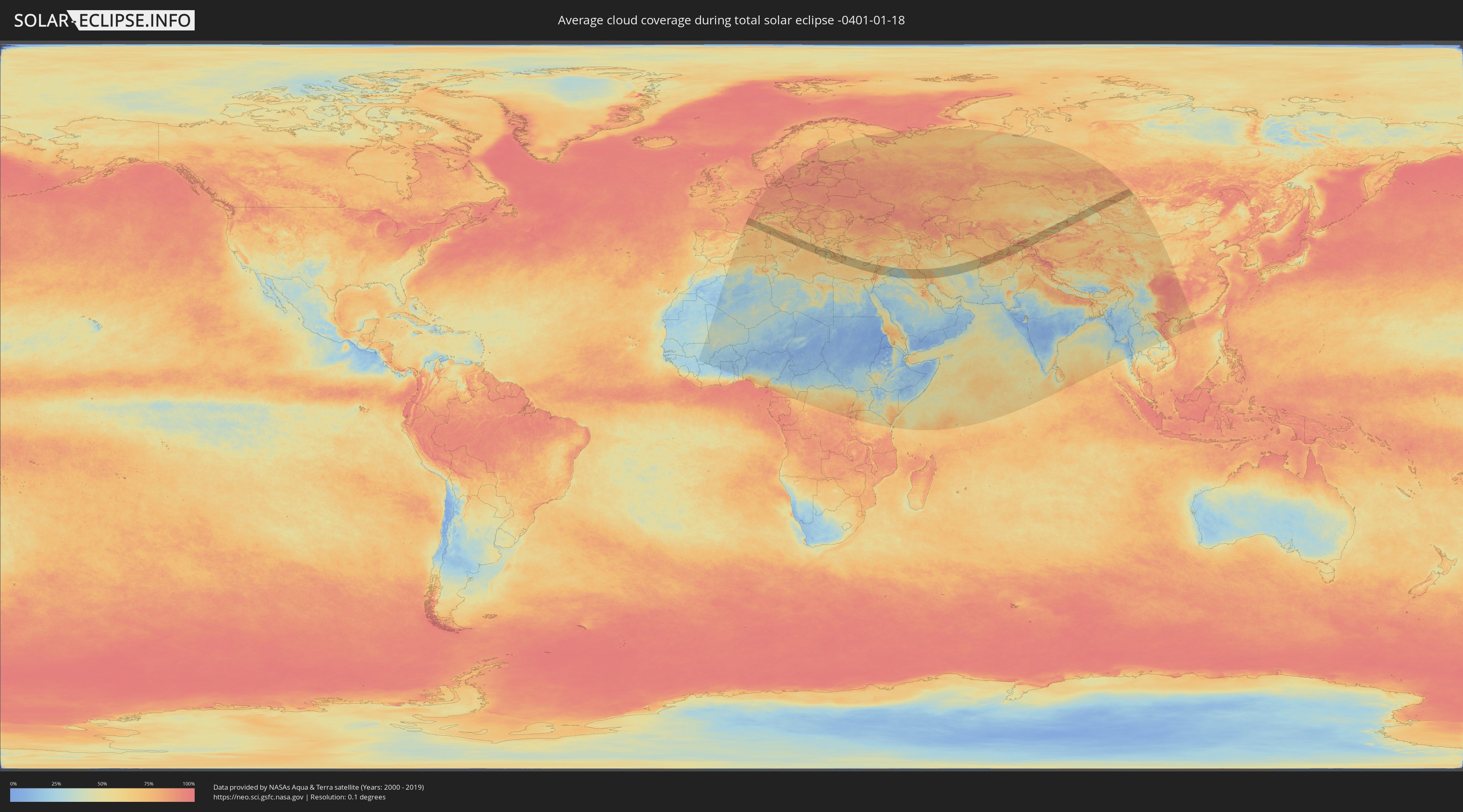
How will be the weather during the total solar eclipse on 01/18/-0401?
Where is the best place to see the total solar eclipse of 01/18/-0401?
The following maps show the average cloud coverage for the day of the total solar eclipse.
With the help of these maps, it is possible to find the place along the eclipse path, which has the best
chance of a cloudless sky.
Nevertheless, you should consider local circumstances and inform about the weather of your chosen
observation site.
The data is provided by NASAs satellites
AQUA and TERRA.
The cloud maps are averaged over a period of 19 years (2000 - 2019).
Detailed country maps
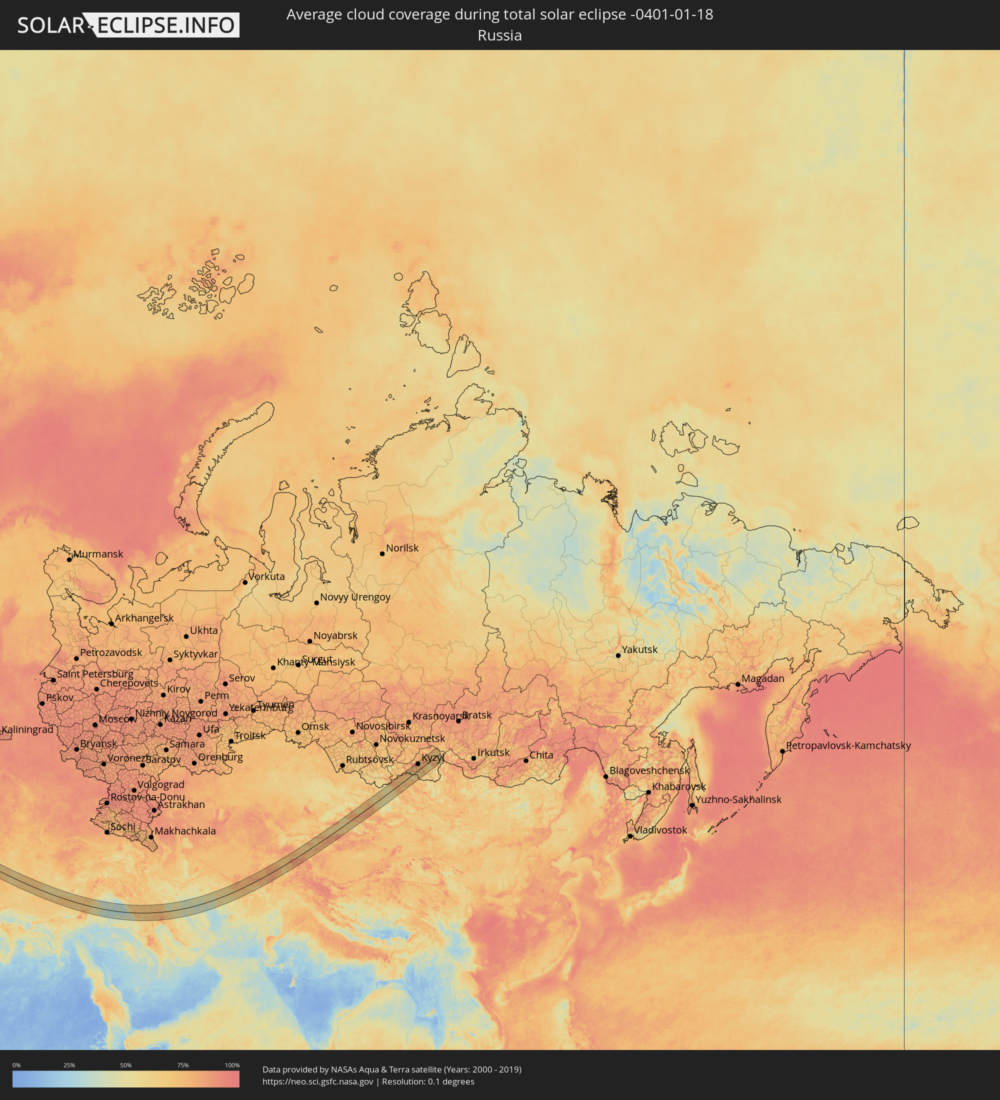 Russia
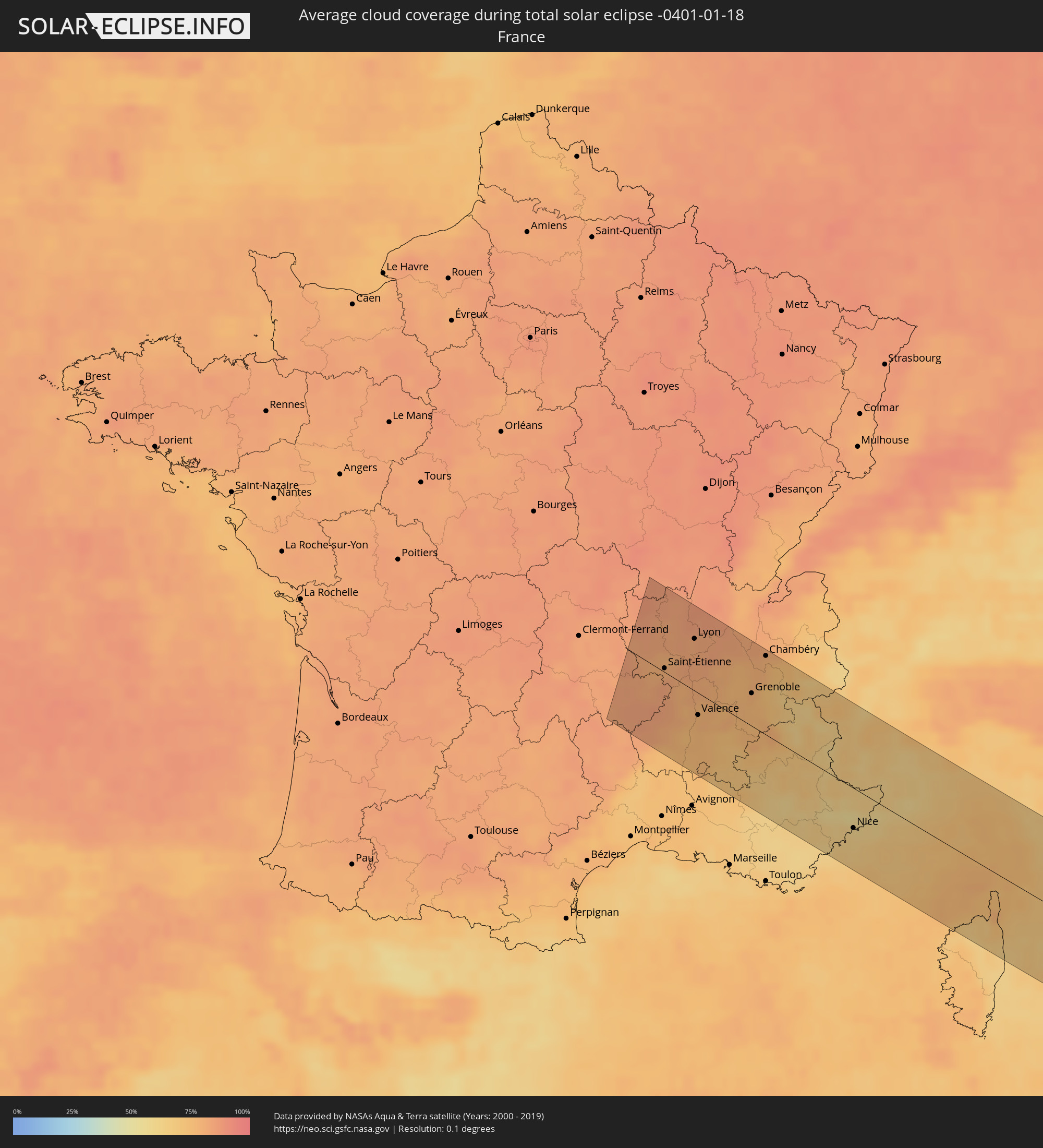 France
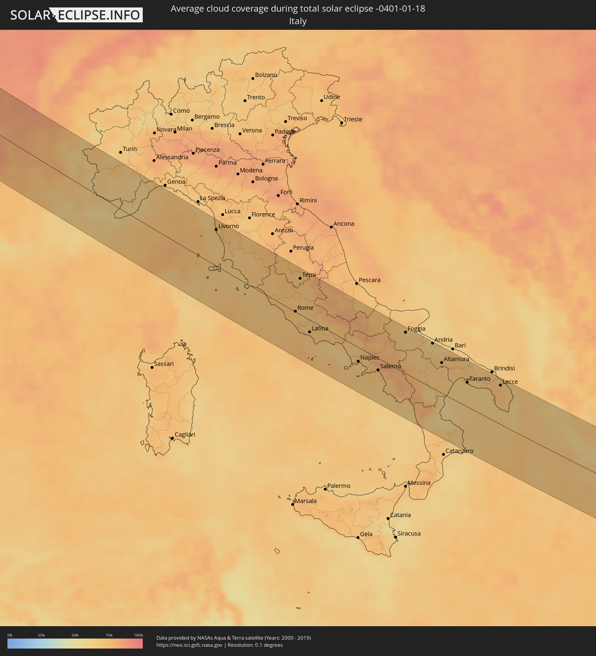 Italy
Italy
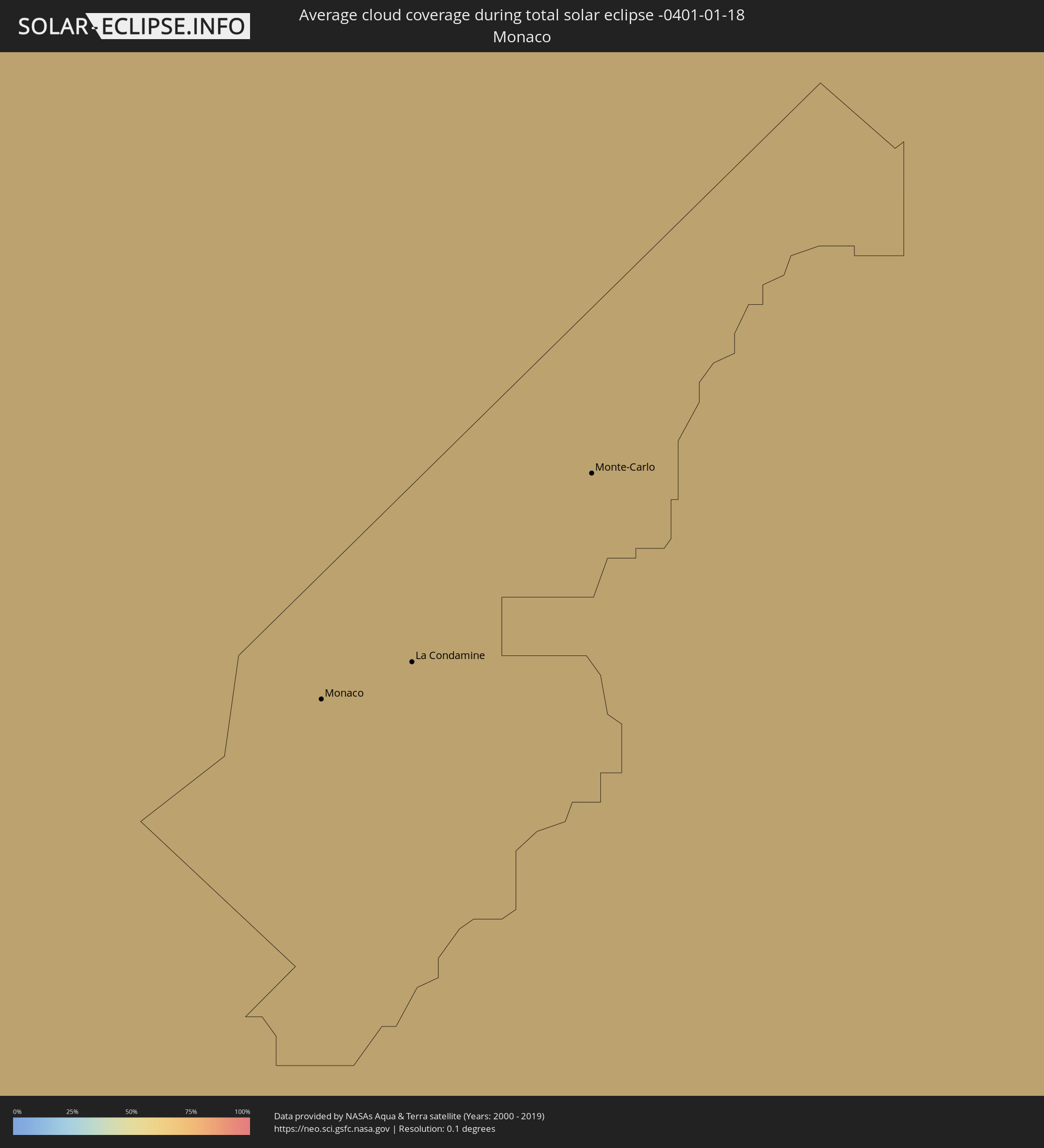 Monaco
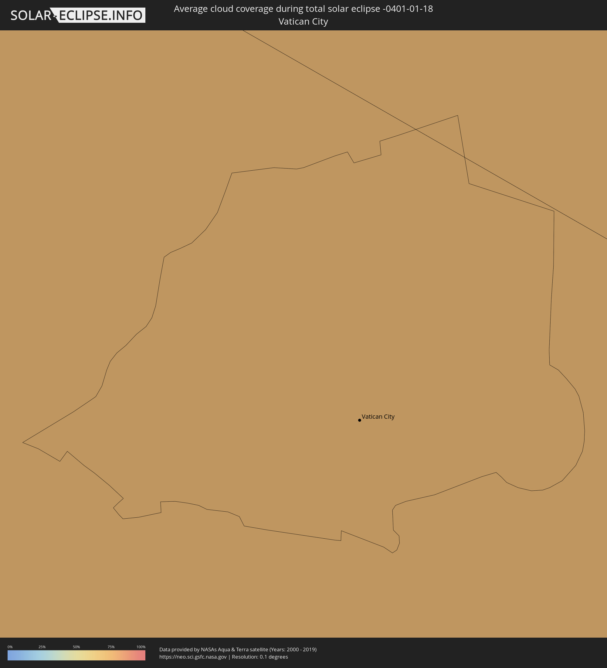 Vatican City
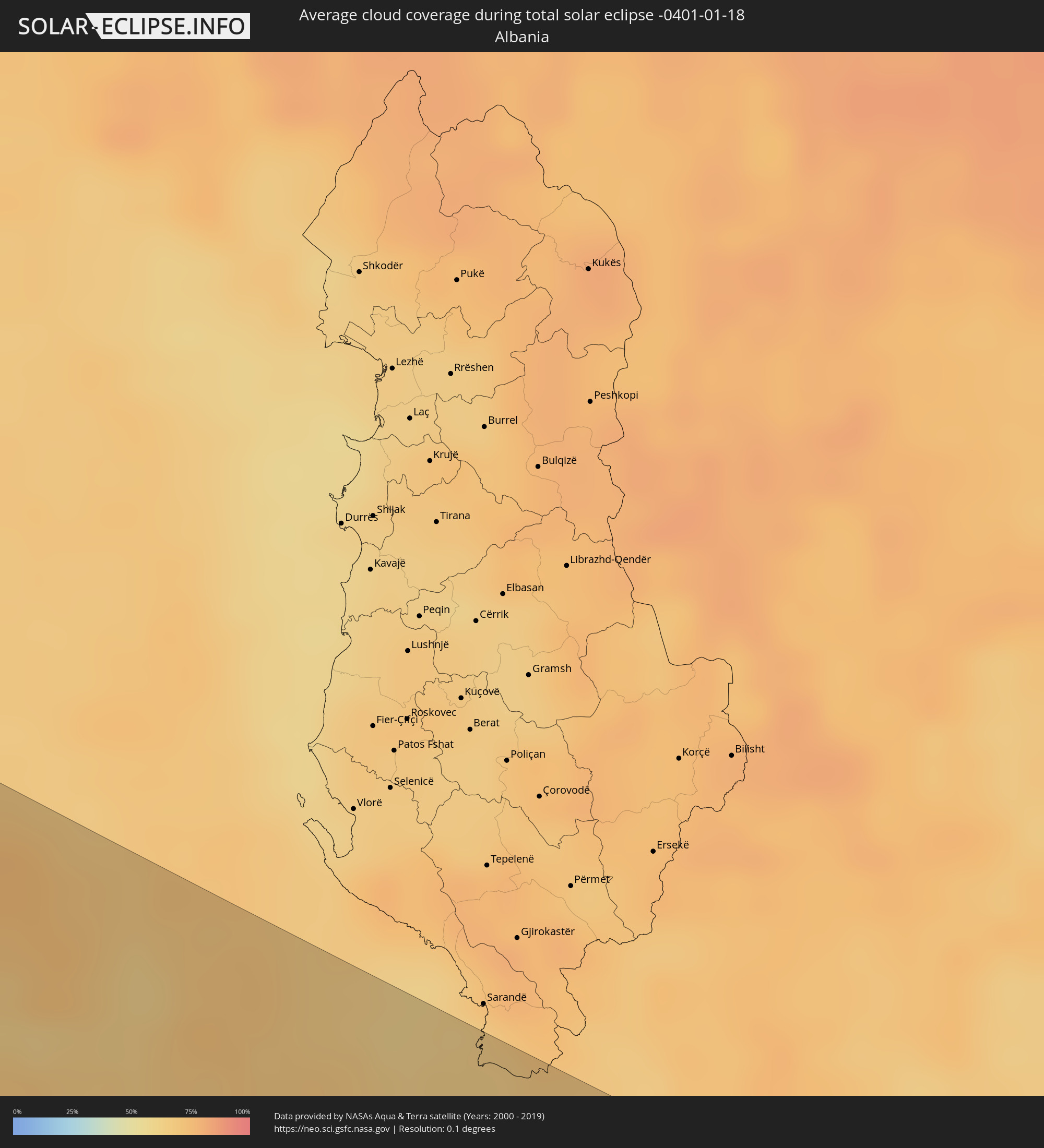 Albania
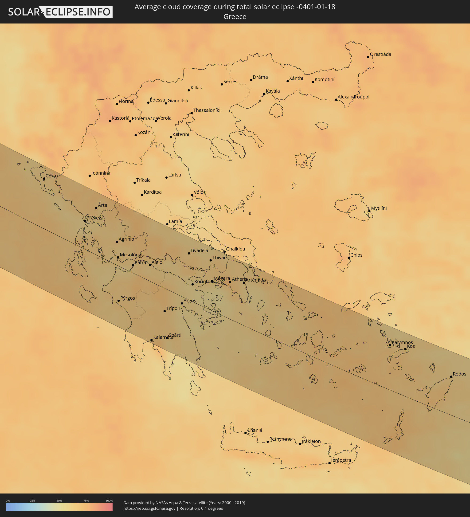 Greece
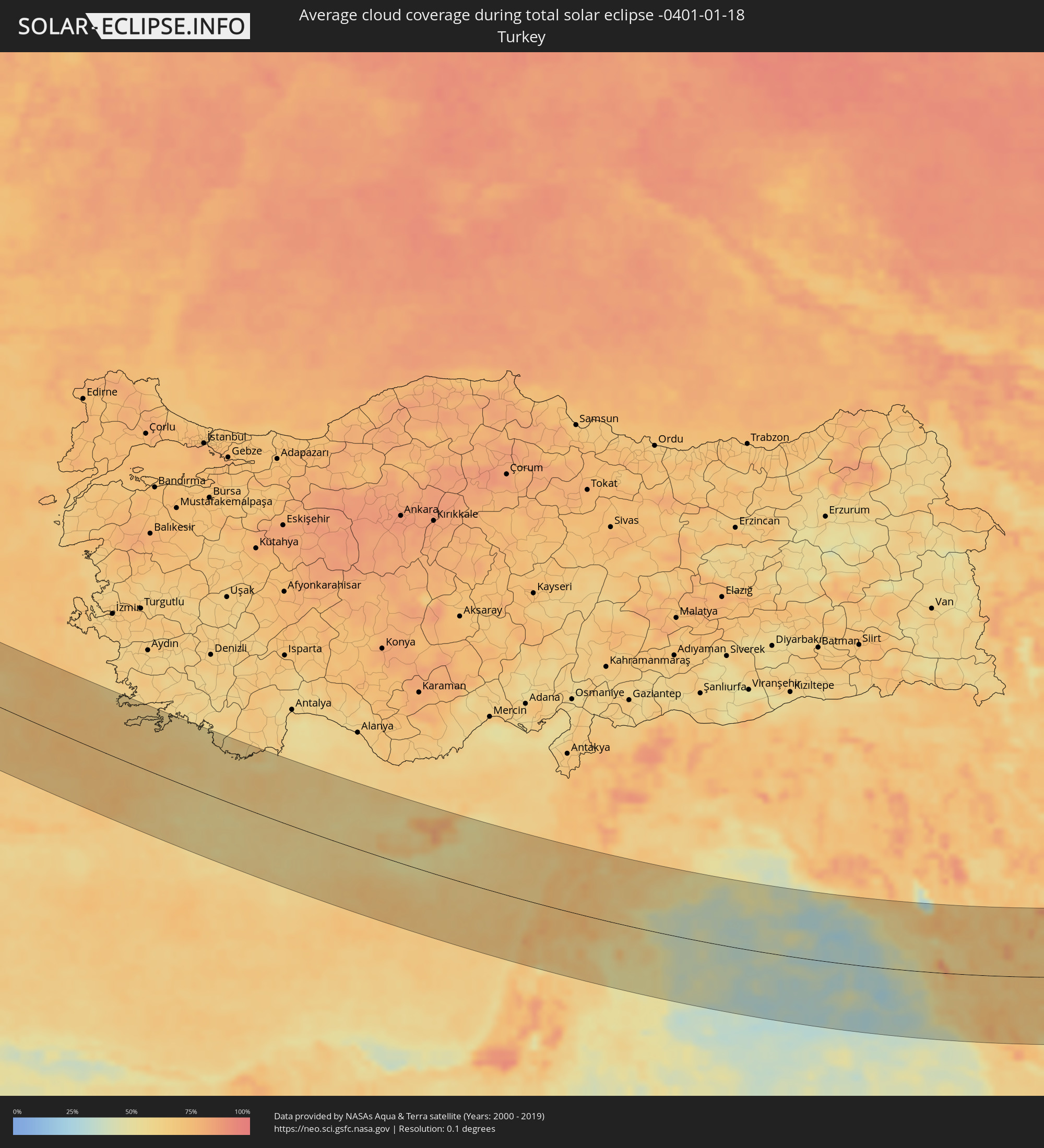 Turkey
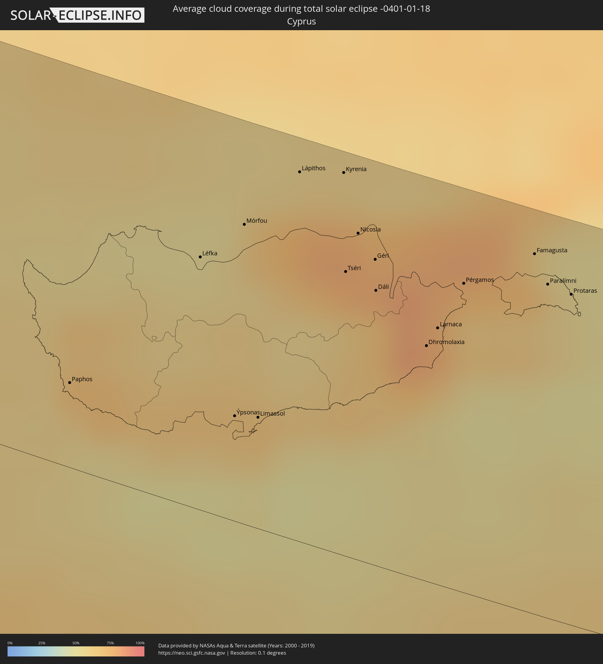 Cyprus
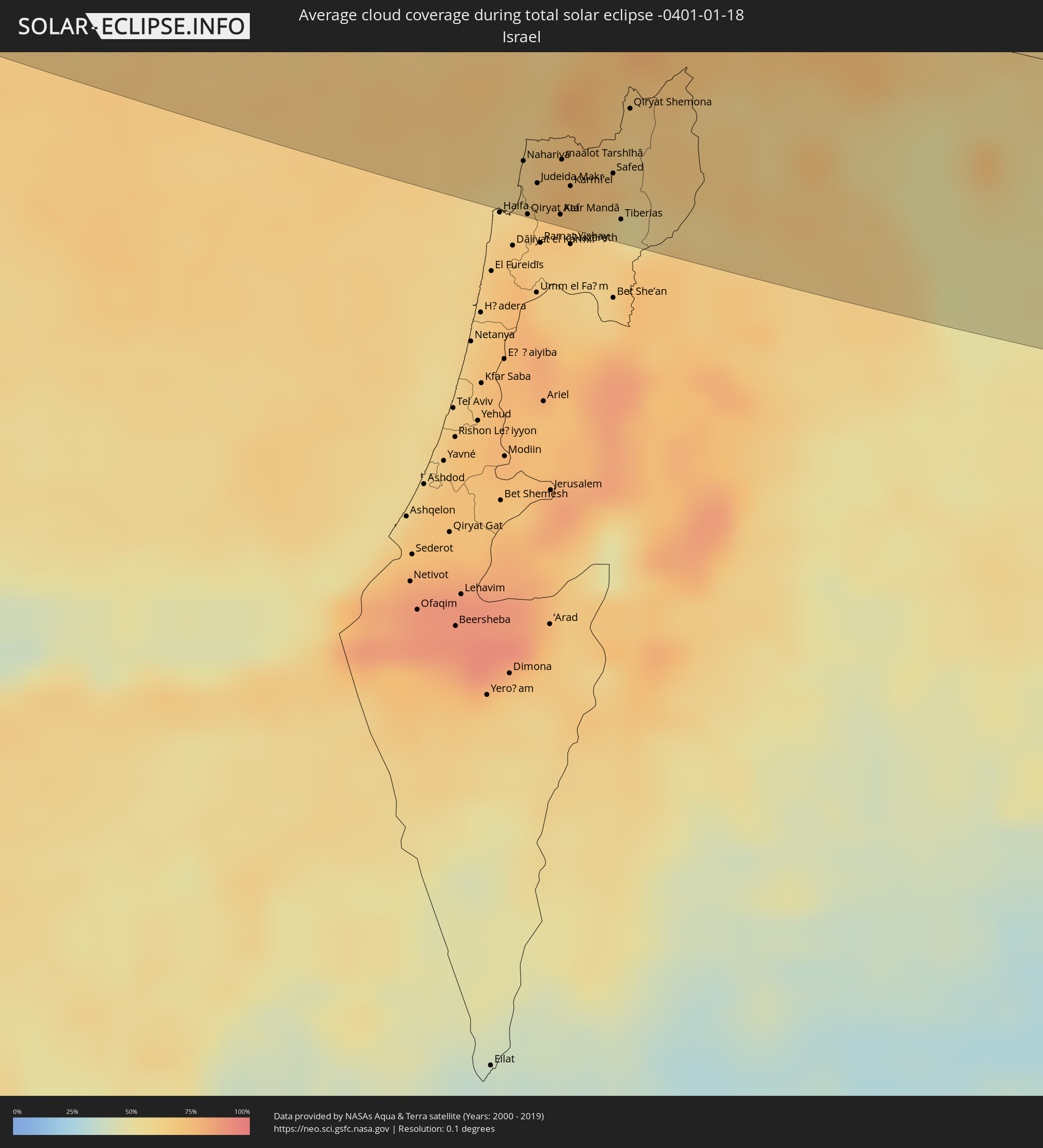 Israel
 Saudi Arabia
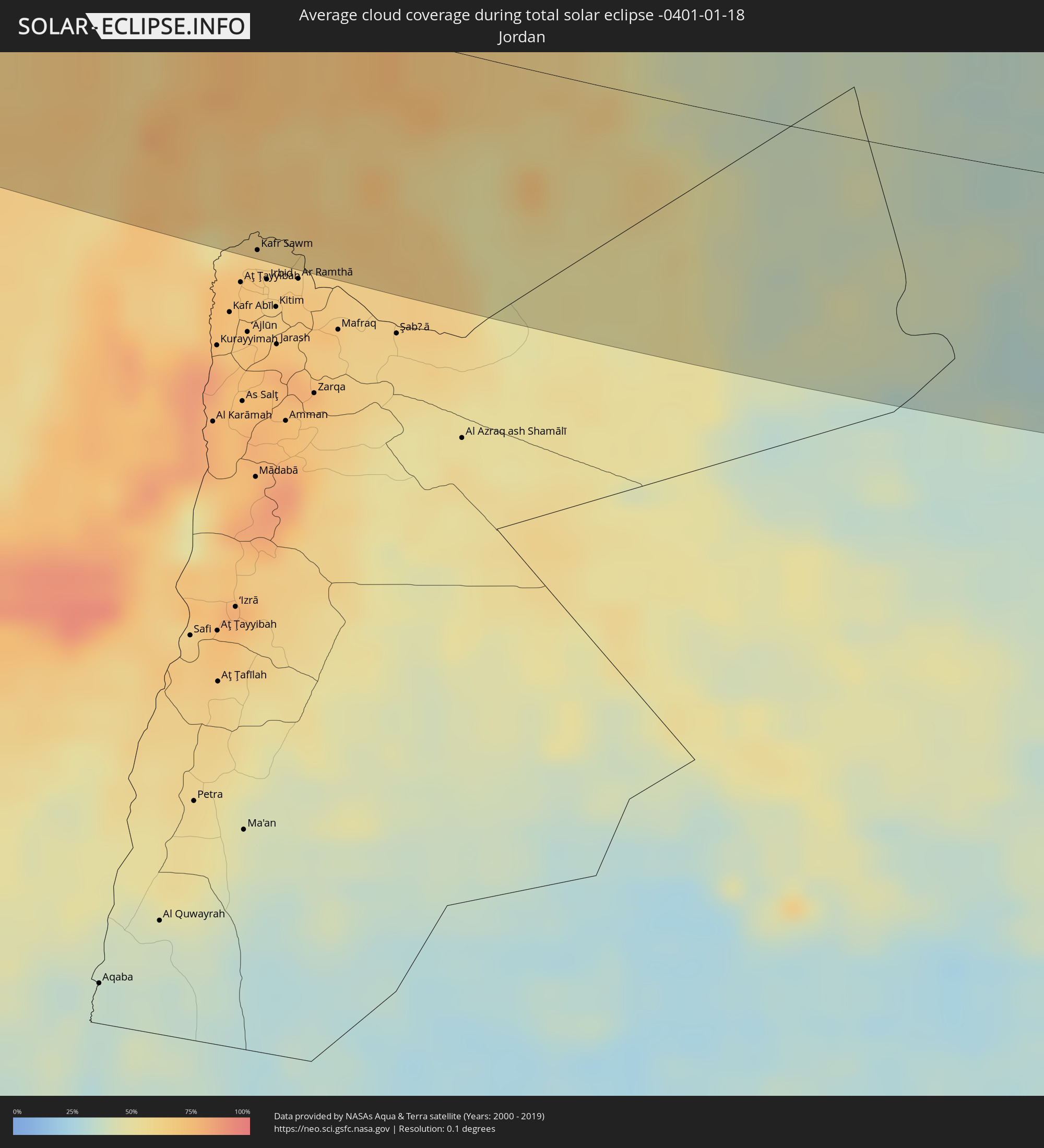 Jordan
 Lebanon
 Syria
Syria
 Iraq
Iraq
 Iran
Iran
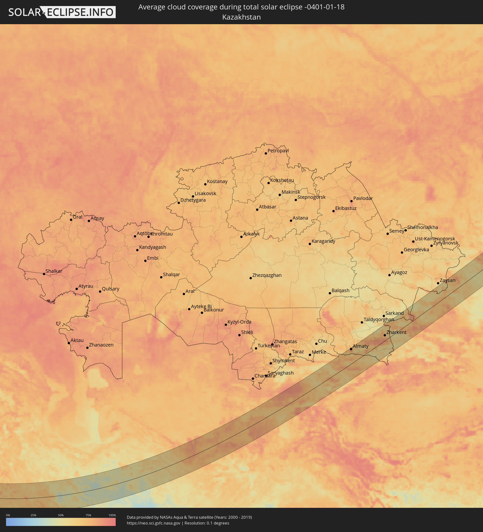 Kazakhstan
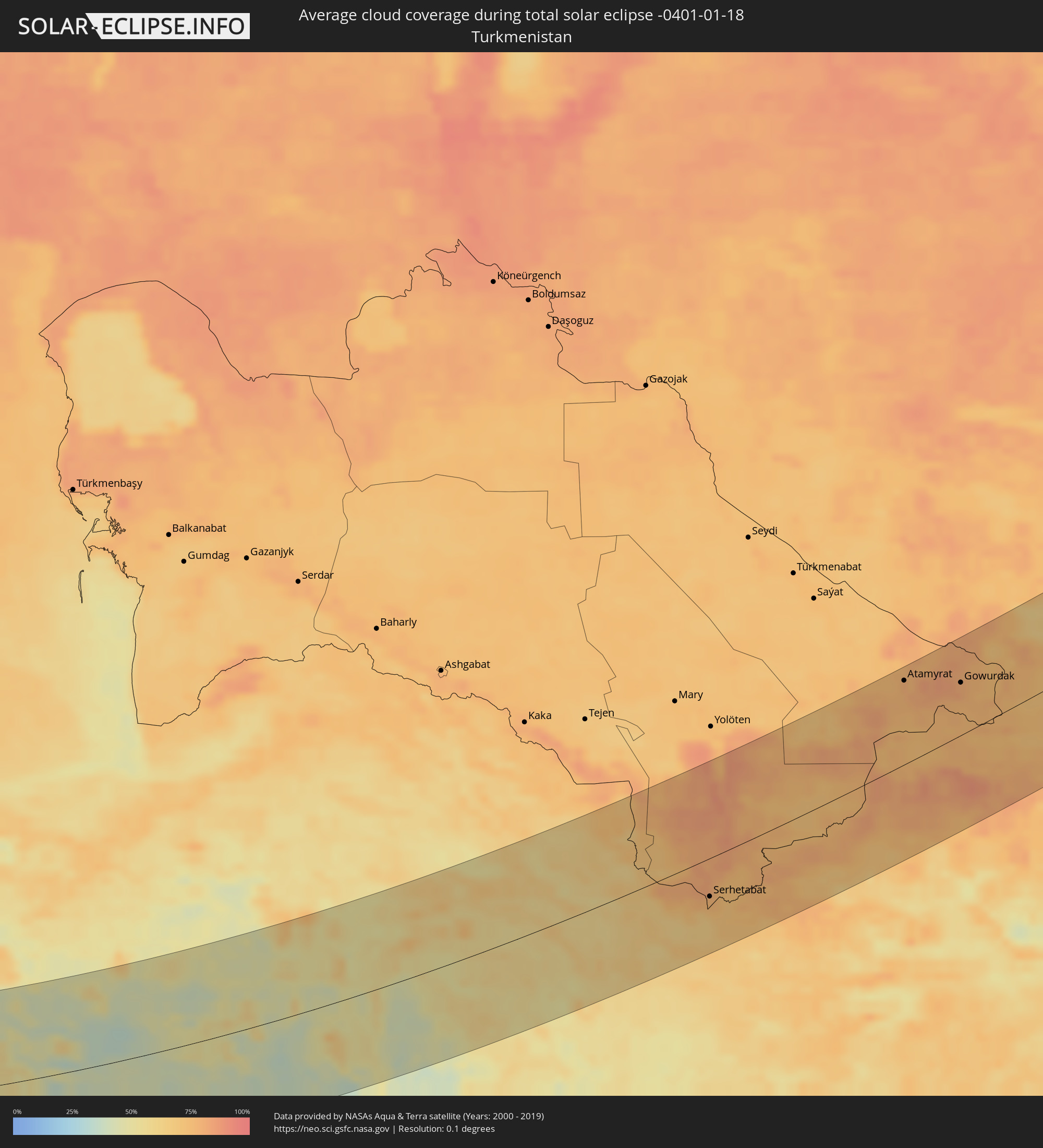 Turkmenistan
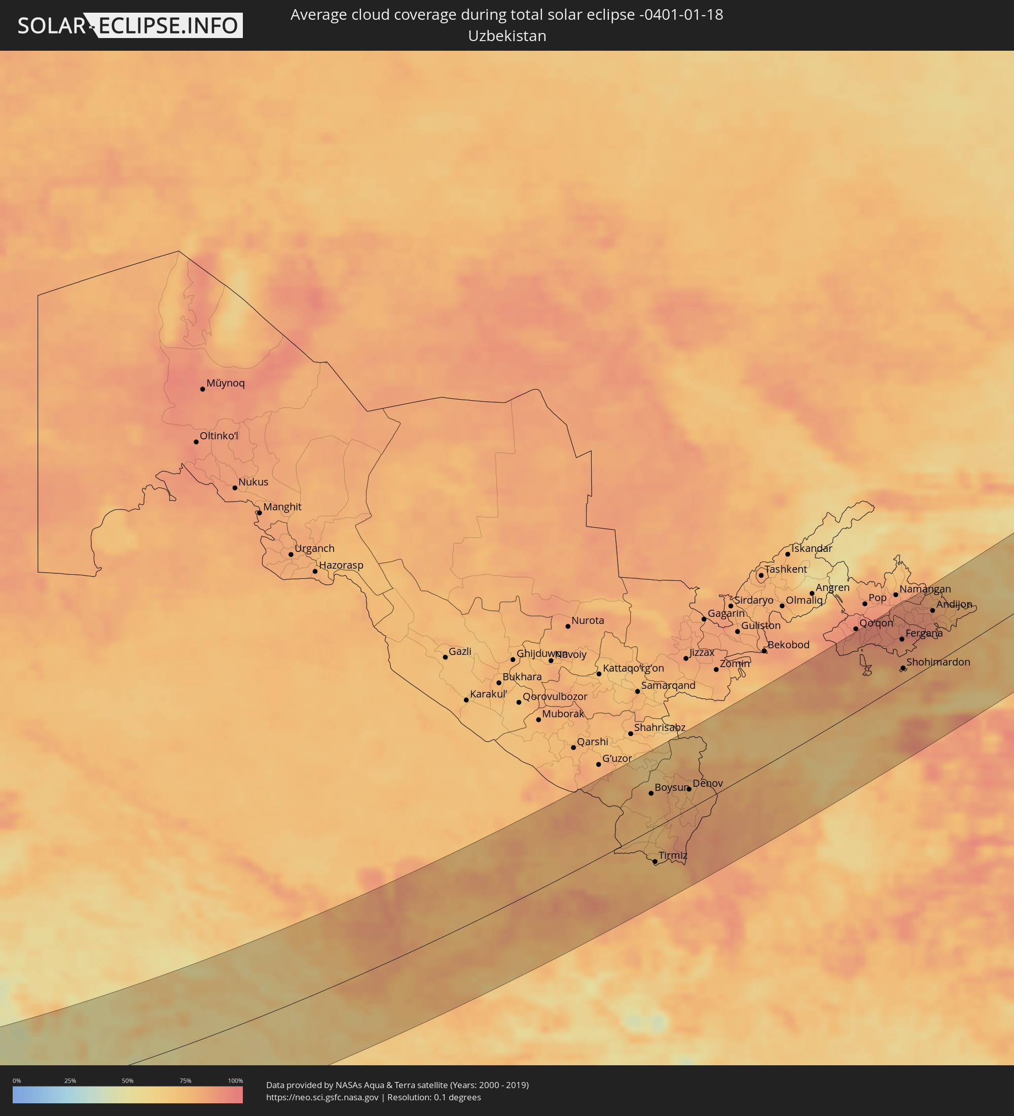 Uzbekistan
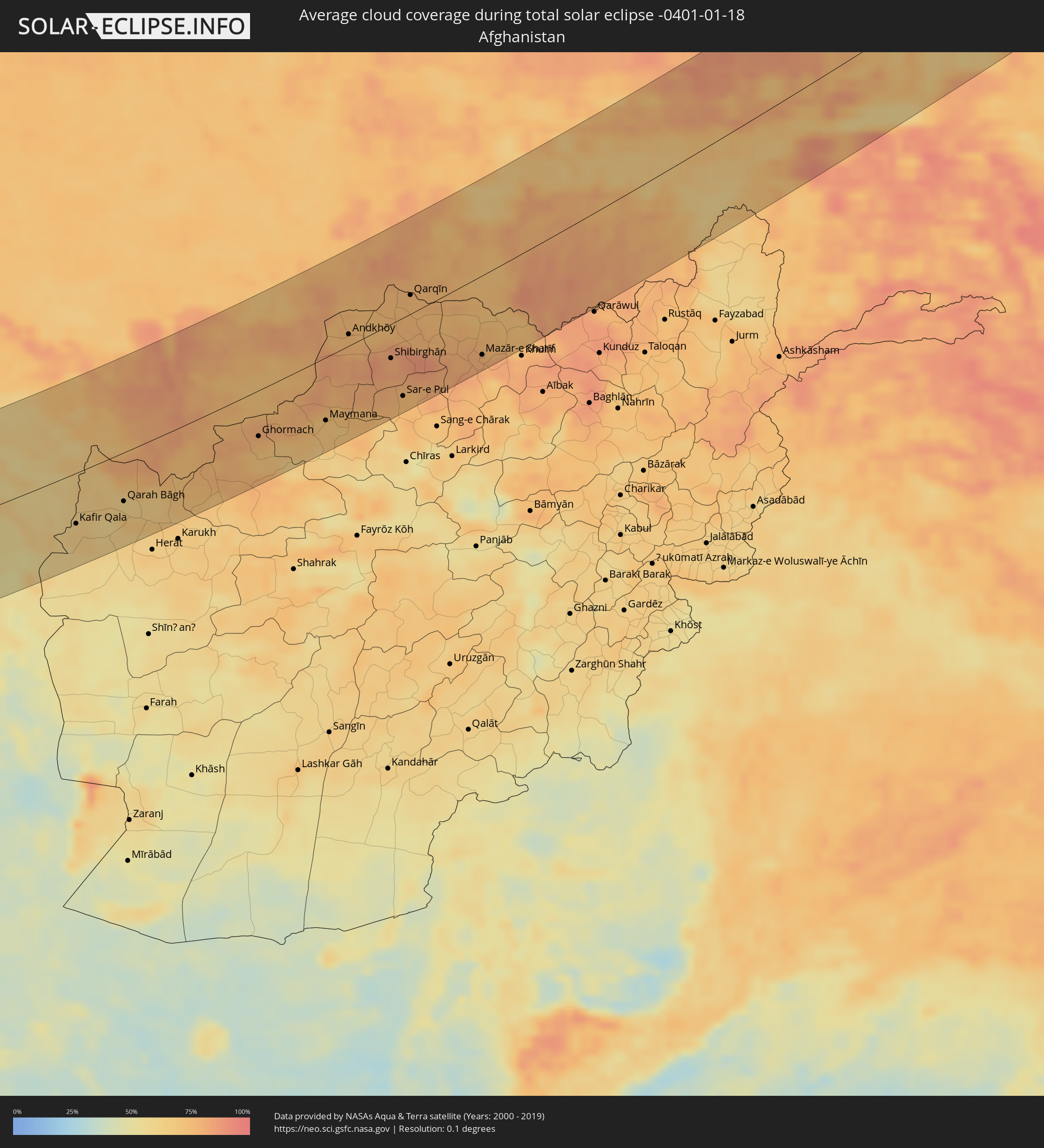 Afghanistan
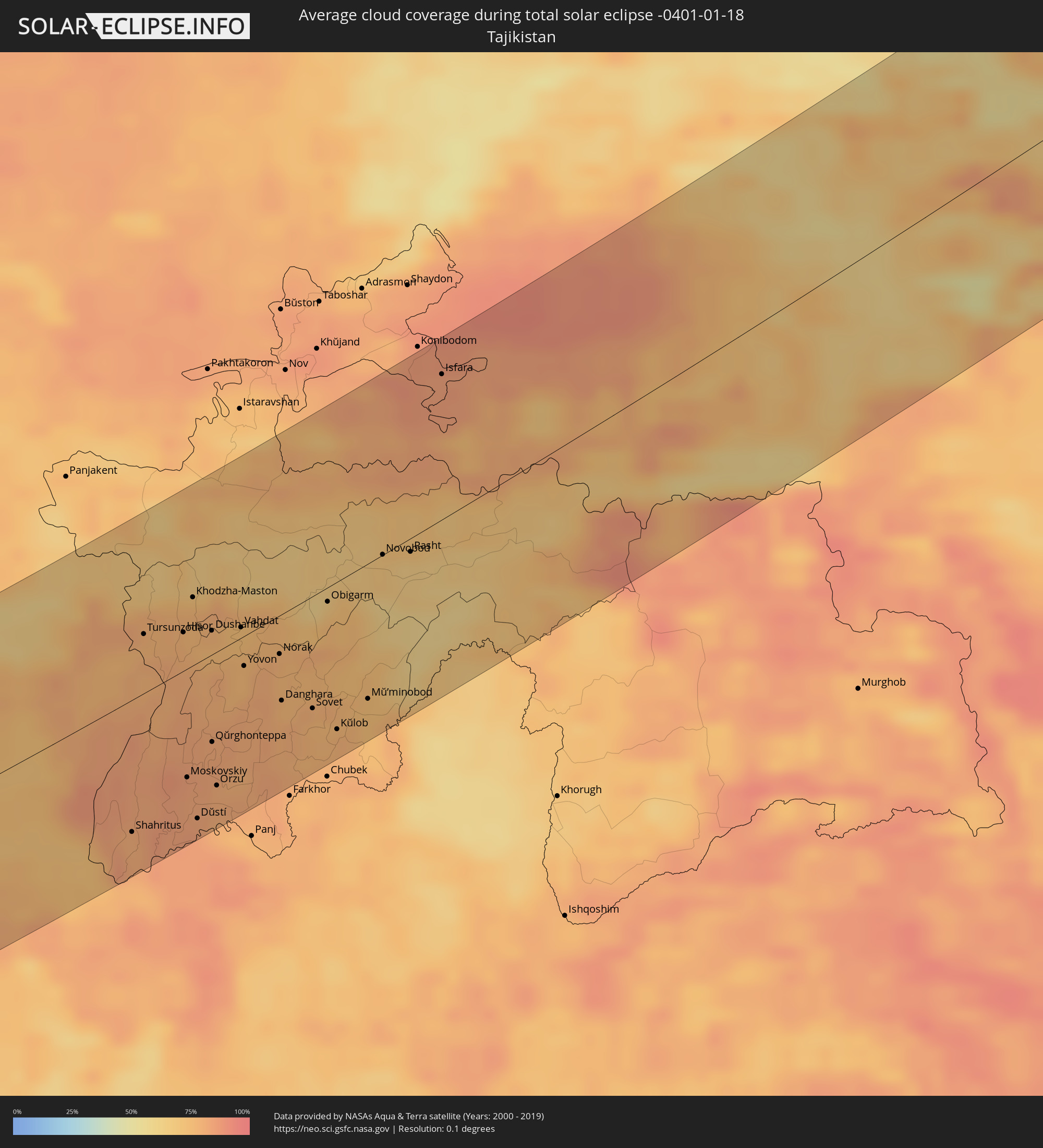 Tajikistan
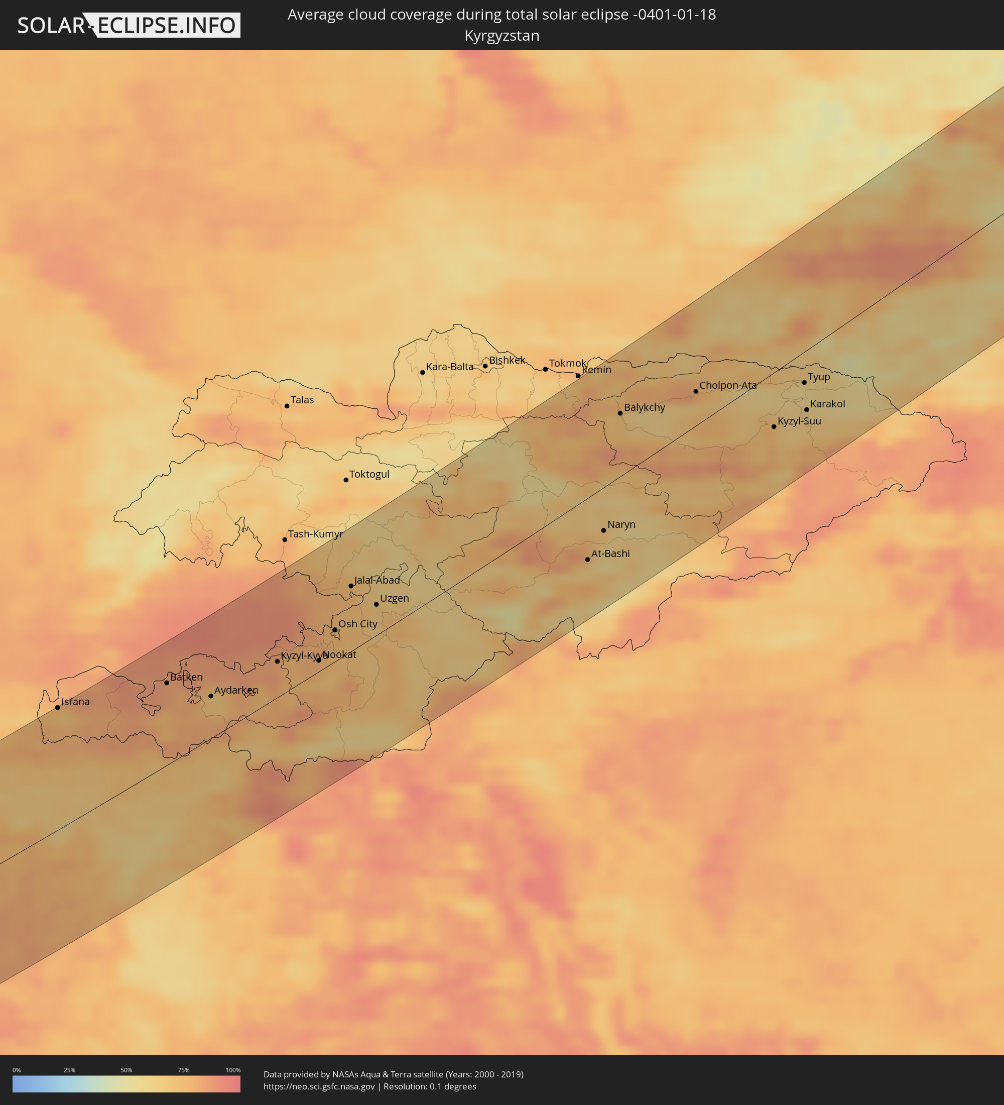 Kyrgyzstan
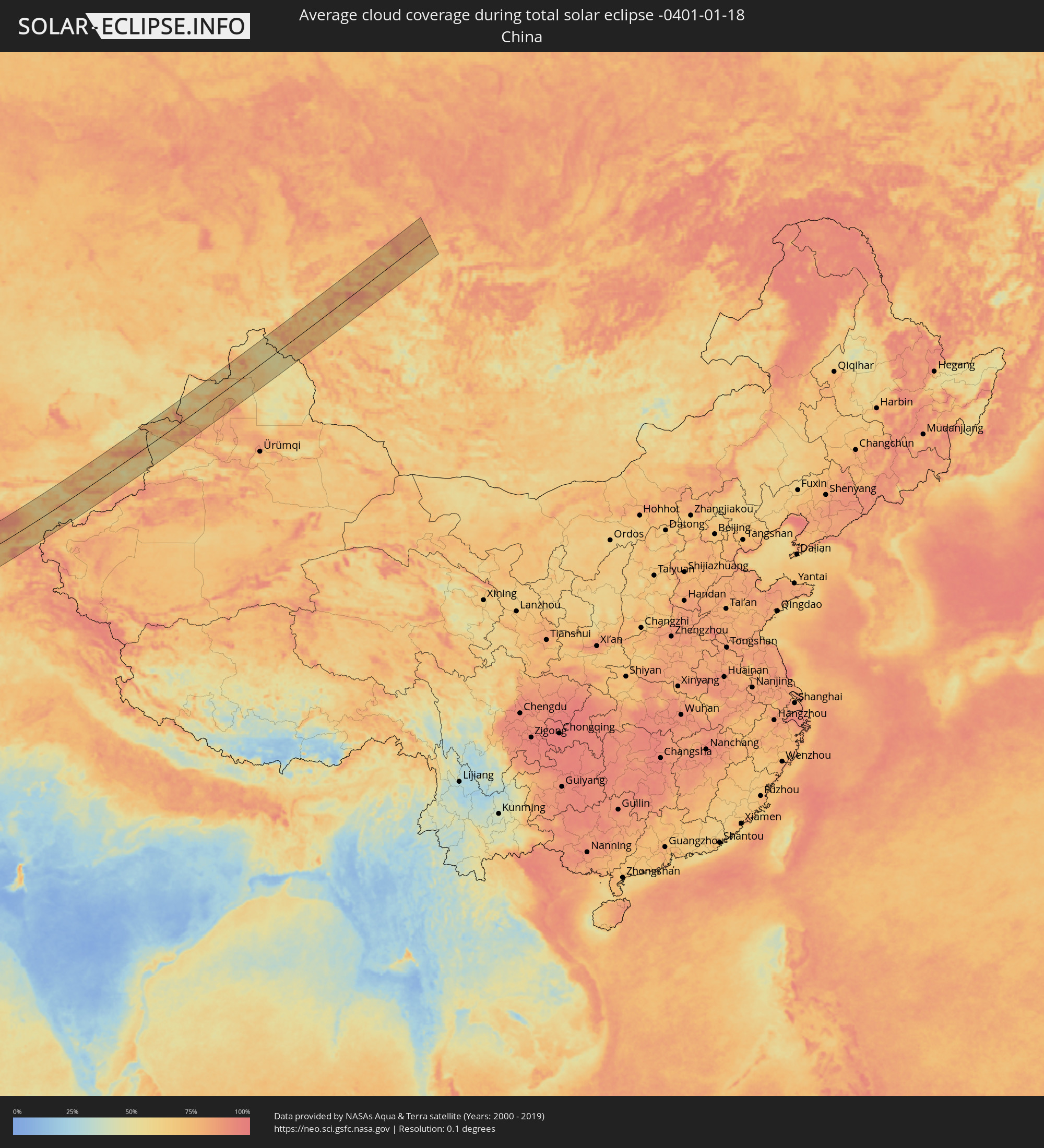 China
China
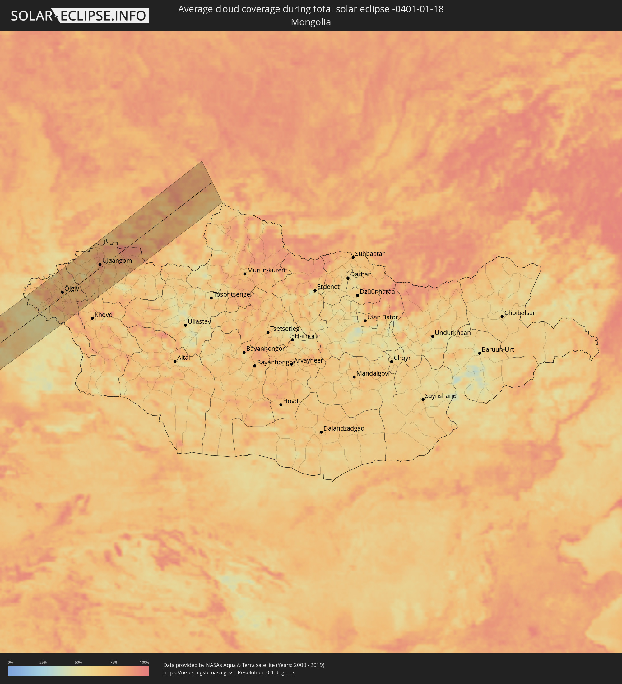 Mongolia
Cities inside the path of the eclipse
The following table shows all locations with a population of more than 5,000 inside the eclipse path. Cities which have more than 100,000 inhabitants are marked bold. A click at the locations opens a detailed map.
| City | Type | Eclipse duration | Local time of max. eclipse | Distance to central line | Ø Cloud coverage |
|
Saint-Étienne, Auvergne-Rhône-Alpes
|
total | - | 07:44:41 UTC+00:09 | 4 km | 83% |
|
Lyon, Auvergne-Rhône-Alpes
|
total | - | 07:45:22 UTC+00:09 | 52 km | 81% |
|
Valence, Auvergne-Rhône-Alpes
|
total | - | 07:44:20 UTC+00:09 | 22 km | 78% |
|
Grenoble, Auvergne-Rhône-Alpes
|
total | - | 07:45:09 UTC+00:09 | 33 km | 78% |
|
Chambéry, Auvergne-Rhône-Alpes
|
total | - | 07:45:48 UTC+00:09 | 80 km | 78% |
|
Gap, Provence-Alpes-Côte d'Azur
|
total | - | 07:44:37 UTC+00:09 | 8 km | 70% |
|
Grasse, Provence-Alpes-Côte d'Azur
|
total | - | 07:44:01 UTC+00:09 | 60 km | 65% |
|
Antibes, Provence-Alpes-Côte d'Azur
|
total | - | 07:44:02 UTC+00:09 | 61 km | 64% |
|
Nice, Provence-Alpes-Côte d'Azur
|
total | - | 07:44:18 UTC+00:09 | 42 km | 62% |
|
Monaco
|
total | - | 07:44:27 UTC+00:09 | 33 km | 63% |
|
La Condamine
|
total | - | 07:44:27 UTC+00:09 | 32 km | 63% |
|
Monte-Carlo
|
total | - | 07:44:28 UTC+00:09 | 32 km | 63% |
|
Bastia, Corsica
|
total | - | 07:44:39 UTC+00:09 | 47 km | 72% |
|
Livorno, Tuscany
|
total | - | 08:37:01 UTC+01:00 | 70 km | 68% |
|
Acilia-Castel Fusano-Ostia Antica, Latium
|
total | - | 08:36:32 UTC+01:00 | 19 km | 68% |
|
Vatican City
|
total | - | 08:36:48 UTC+01:00 | 1 km | 73% |
|
Rome, Latium
|
total | - | 08:36:51 UTC+01:00 | 1 km | 73% |
|
Terni, Umbria
|
total | - | 08:37:46 UTC+01:00 | 71 km | 72% |
|
Naples, Campania
|
total | - | 08:37:13 UTC+01:00 | 29 km | 68% |
|
Salerno, Campania
|
total | - | 08:37:32 UTC+01:00 | 24 km | 71% |
|
Foggia, Apulia
|
total | - | 08:39:12 UTC+01:00 | 83 km | 67% |
|
Andria, Apulia
|
total | - | 08:39:41 UTC+01:00 | 91 km | 63% |
|
Taranto, Apulia
|
total | - | 08:39:46 UTC+01:00 | 50 km | 63% |
|
Lecce, Apulia
|
total | - | 08:40:43 UTC+01:00 | 81 km | 72% |
|
Corfu, Ionian Islands
|
total | - | 09:16:47 UTC+01:34 | 78 km | 63% |
|
Agrínio, West Greece
|
total | - | 09:17:34 UTC+01:34 | 37 km | 63% |
|
Pátra, West Greece
|
total | - | 09:17:35 UTC+01:34 | 12 km | 64% |
|
Kalamáta, Peloponnese
|
total | - | 09:16:51 UTC+01:34 | 95 km | 62% |
|
Trípoli, Peloponnese
|
total | - | 09:17:41 UTC+01:34 | 37 km | 68% |
|
Kórinthos, Peloponnese
|
total | - | 09:18:53 UTC+01:34 | 28 km | 56% |
|
Salamína, Attica
|
total | - | 09:19:39 UTC+01:34 | 51 km | 57% |
|
Athens, Attica
|
total | - | 09:19:58 UTC+01:34 | 60 km | 66% |
|
Voúla, Attica
|
total | - | 09:19:54 UTC+01:34 | 49 km | 60% |
|
Turgutreis, Muğla
|
total | - | 09:46:18 UTC+01:56 | 91 km | 66% |
|
Bodrum, Muğla
|
total | - | 09:46:35 UTC+01:56 | 99 km | 65% |
|
Datça, Muğla
|
total | - | 09:46:42 UTC+01:56 | 77 km | 65% |
|
Ródos, South Aegean
|
total | - | 09:25:13 UTC+01:34 | 65 km | 66% |
|
Kaş, Antalya
|
total | - | 09:49:24 UTC+01:56 | 87 km | 60% |
|
Demre, Antalya
|
total | - | 09:50:01 UTC+01:56 | 104 km | 66% |
|
Demre, Antalya
|
total | - | 09:50:01 UTC+01:56 | 103 km | 55% |
|
Paphos, Pafos
|
total | - | 10:09:38 UTC+02:13 | 24 km | 63% |
|
Léfka, Nicosia
|
total | - | 10:10:41 UTC+02:13 | 72 km | 55% |
|
Mórfou, Nicosia
|
total | - | 10:11:01 UTC+02:13 | 85 km | 66% |
|
Limassol, Limassol
|
total | - | 10:10:41 UTC+02:13 | 32 km | 64% |
|
Kyrenia, Keryneia
|
total | - | 10:11:43 UTC+02:13 | 108 km | 75% |
|
Nicosia, Nicosia
|
total | - | 10:11:41 UTC+02:13 | 93 km | 76% |
|
Larnaca, Larnaka
|
total | - | 10:11:58 UTC+02:13 | 73 km | 66% |
|
Pérgamos, Larnaka
|
total | - | 10:12:13 UTC+02:13 | 88 km | 66% |
|
Famagusta, Ammochostos
|
total | - | 10:12:43 UTC+02:13 | 103 km | 71% |
|
Protaras, Ammochostos
|
total | - | 10:12:52 UTC+02:13 | 94 km | 53% |
|
Nahariya, Northern District
|
total | - | 10:20:35 UTC+02:20 | 93 km | 61% |
|
Qiryat Ata, Haifa
|
total | - | 10:20:29 UTC+02:20 | 114 km | 69% |
|
En Nâqoûra, South Governorate
|
total | - | 10:00:05 UTC+02:00 | 81 km | 63% |
|
Kafir Yasif, Northern District
|
total | - | 10:20:41 UTC+02:20 | 98 km | 71% |
|
Tyre, South Governorate
|
total | - | 10:00:18 UTC+02:00 | 63 km | 65% |
|
Kābūl, Northern District
|
total | - | 10:20:43 UTC+02:20 | 106 km | 69% |
|
Karmi’el, Northern District
|
total | - | 10:20:56 UTC+02:20 | 98 km | 70% |
|
Deir Ḥannā, Northern District
|
total | - | 10:21:01 UTC+02:20 | 103 km | 67% |
|
Bu‘eina, Northern District
|
total | - | 10:20:59 UTC+02:20 | 109 km | 65% |
|
Sidon, South Governorate
|
total | - | 10:00:53 UTC+02:00 | 27 km | 66% |
|
Nabatîyé et Tahta, Nabatîyé
|
total | - | 10:00:58 UTC+02:00 | 44 km | 72% |
|
Beirut, Beyrouth
|
total | - | 10:01:21 UTC+02:00 | 11 km | 64% |
|
Safed, Northern District
|
total | - | 10:21:21 UTC+02:20 | 89 km | 70% |
|
Tiberias, Northern District
|
total | - | 10:21:18 UTC+02:20 | 106 km | 61% |
|
Qiryat Shemona, Northern District
|
total | - | 10:21:41 UTC+02:20 | 61 km | 64% |
|
Djounie, Mont-Liban
|
total | - | 10:01:40 UTC+02:00 | 24 km | 63% |
|
Jbaïl, Mont-Liban
|
total | - | 10:01:50 UTC+02:00 | 39 km | 61% |
|
Malkā, Irbid
|
total | - | 10:24:44 UTC+02:23 | 114 km | 70% |
|
Saḩam al Kaffārāt, Irbid
|
total | - | 10:24:48 UTC+02:23 | 111 km | 69% |
|
Kafr Sawm, Irbid
|
total | - | 10:24:50 UTC+02:23 | 112 km | 69% |
|
Al Qunayţirah, Quneitra
|
total | - | 10:26:40 UTC+02:25 | 64 km | 69% |
|
Tripoli, Liban-Nord
|
total | - | 10:02:27 UTC+02:00 | 78 km | 65% |
|
Kharjā, Irbid
|
total | - | 10:25:00 UTC+02:23 | 113 km | 66% |
|
Zahlé, Béqaa
|
total | - | 10:02:08 UTC+02:00 | 16 km | 68% |
|
Ash Shajarah, Irbid
|
total | - | 10:25:06 UTC+02:23 | 113 km | 65% |
|
Aţ Ţurrah, Irbid
|
total | - | 10:25:11 UTC+02:23 | 113 km | 69% |
|
Jāsim, Daraa
|
total | - | 10:27:03 UTC+02:25 | 73 km | 68% |
|
Dar‘ā, Daraa
|
total | - | 10:26:52 UTC+02:25 | 112 km | 69% |
|
Baalbek, Baalbek-Hermel
|
total | - | 10:02:53 UTC+02:00 | 40 km | 68% |
|
Tallkalakh, Homs
|
total | - | 10:28:39 UTC+02:25 | 113 km | 69% |
|
Damascus, Dimashq
|
total | - | 10:27:53 UTC+02:25 | 12 km | 70% |
|
As Suwaydā’, As-Suwayda
|
total | - | 10:27:54 UTC+02:25 | 92 km | 66% |
|
Al Quşayr, Homs
|
total | - | 10:29:10 UTC+02:25 | 103 km | 73% |
|
An Nabk, Rif-dimashq
|
total | - | 10:29:08 UTC+02:25 | 54 km | 70% |
|
Jayrūd, Rif-dimashq
|
total | - | 10:29:00 UTC+02:25 | 31 km | 69% |
|
Al Qaryatayn, Homs
|
total | - | 10:30:20 UTC+02:25 | 87 km | 64% |
|
Ramadi, Anbar
|
total | - | 11:15:27 UTC+02:57 | 87 km | 64% |
|
Al Fallūjah, Anbar
|
total | - | 11:16:31 UTC+02:57 | 82 km | 70% |
|
Karbala, Karbalāʼ
|
total | - | 11:16:42 UTC+02:57 | 2 km | 64% |
|
Abū Ghurayb, Mayorality of Baghdad
|
total | - | 11:17:25 UTC+02:57 | 80 km | 67% |
|
Najaf, An Najaf
|
total | - | 11:17:10 UTC+02:57 | 62 km | 70% |
|
Baghdad, Mayorality of Baghdad
|
total | - | 11:17:56 UTC+02:57 | 84 km | 63% |
|
Al Ḩillah, Bābil
|
total | - | 11:17:33 UTC+02:57 | 13 km | 69% |
|
Ad Dīwānīyah, Al Qādisīyah
|
total | - | 11:18:31 UTC+02:57 | 64 km | 71% |
|
Al Kūt, Wāsiţ
|
total | - | 11:20:52 UTC+02:57 | 4 km | 74% |
|
Īlām, Īlām
|
total | - | 11:50:55 UTC+03:25 | 121 km | 67% |
|
Al ‘Amārah, Maysan
|
total | - | 11:23:45 UTC+02:57 | 81 km | 68% |
|
Kūhdasht, Lorestān
|
total | - | 11:53:41 UTC+03:25 | 106 km | 63% |
|
Khorramabad, Lorestān
|
total | - | 11:55:26 UTC+03:25 | 96 km | 65% |
|
Masjed Soleymān, Khuzestan
|
total | - | 11:57:10 UTC+03:25 | 83 km | 74% |
|
Shahr-e Kord, Chahār Maḩāll va Bakhtīārī
|
total | - | 12:01:05 UTC+03:25 | 57 km | 47% |
|
Najafābād, Isfahan
|
total | - | 12:02:24 UTC+03:25 | 30 km | 55% |
|
Kāshān, Isfahan
|
total | - | 12:02:55 UTC+03:25 | 117 km | 58% |
|
Isfahan, Isfahan
|
total | - | 12:03:08 UTC+03:25 | 33 km | 59% |
|
Shāhreẕā, Isfahan
|
total | - | 12:03:29 UTC+03:25 | 104 km | 57% |
|
Torbat-e Ḩeydarīyeh, Razavi Khorasan
|
total | - | 12:21:03 UTC+03:25 | 62 km | 61% |
|
Kafir Qala, Herat
|
total | - | 12:59:24 UTC+04:00 | 63 km | 62% |
|
Qarah Bāgh, Herat
|
total | - | 13:00:55 UTC+04:00 | 61 km | 64% |
|
Serhetabat, Mary
|
total | - | 12:55:37 UTC+03:53 | 47 km | 76% |
|
Ghormach, Badghis
|
total | - | 13:05:02 UTC+04:00 | 55 km | 74% |
|
Maymana, Faryab
|
total | - | 13:07:02 UTC+04:00 | 75 km | 70% |
|
Andkhōy, Faryab
|
total | - | 13:07:28 UTC+04:00 | 14 km | 76% |
|
Atamyrat, Lebap
|
total | - | 13:00:56 UTC+03:53 | 97 km | 77% |
|
Shibirghān, Jowzjan
|
total | - | 13:08:47 UTC+04:00 | 40 km | 79% |
|
Sar-e Pul, Sar-e Pol
|
total | - | 13:09:15 UTC+04:00 | 92 km | 74% |
|
Qarqīn, Jowzjan
|
total | - | 13:09:08 UTC+04:00 | 22 km | 75% |
|
Gowurdak, Lebap
|
total | - | 13:02:34 UTC+03:53 | 60 km | 81% |
|
Balkh, Balkh
|
total | - | 13:10:58 UTC+04:00 | 79 km | 79% |
|
Mazār-e Sharīf, Balkh
|
total | - | 13:11:23 UTC+04:00 | 92 km | 80% |
|
Tirmiz, Surxondaryo
|
total | - | 13:39:26 UTC+04:27 | 49 km | 72% |
|
Denov, Surxondaryo
|
total | - | 13:40:14 UTC+04:27 | 27 km | 76% |
|
Tursunzoda, Republican Subordination
|
total | - | 13:48:04 UTC+04:35 | 36 km | 77% |
|
Hisor, Republican Subordination
|
total | - | 13:48:38 UTC+04:35 | 23 km | 77% |
|
Moskovskiy, Khatlon
|
total | - | 13:49:02 UTC+04:35 | 67 km | 83% |
|
Dushanbe, Dushanbe
|
total | - | 13:49:03 UTC+04:35 | 15 km | 75% |
|
Qŭrghonteppa, Khatlon
|
total | - | 13:49:19 UTC+04:35 | 53 km | 82% |
|
Vahdat, Republican Subordination
|
total | - | 13:49:27 UTC+04:35 | 6 km | 74% |
|
Danghara, Khatlon
|
total | - | 13:50:13 UTC+04:35 | 52 km | 77% |
|
Vose’, Khatlon
|
total | - | 13:50:52 UTC+04:35 | 94 km | 77% |
|
Kŭlob, Khatlon
|
total | - | 13:51:05 UTC+04:35 | 89 km | 78% |
|
Isfara, Viloyati Sughd
|
total | - | 13:51:33 UTC+04:35 | 85 km | 85% |
|
Oltiariq, Fergana
|
total | - | 13:45:31 UTC+04:27 | 72 km | 90% |
|
Fergana, Fergana
|
total | - | 13:46:02 UTC+04:27 | 58 km | 86% |
|
Quvasoy, Fergana
|
total | - | 13:46:23 UTC+04:27 | 41 km | 83% |
|
Quva, Fergana
|
total | - | 13:46:25 UTC+04:27 | 58 km | 88% |
|
Haqqulobod, Namangan
|
total | - | 13:46:17 UTC+04:27 | 93 km | 87% |
|
Kyzyl-Kyya, Batken
|
total | - | 14:17:10 UTC+04:58 | 30 km | 82% |
|
Asaka, Andijon
|
total | - | 13:46:37 UTC+04:27 | 62 km | 88% |
|
Andijon, Andijon
|
total | - | 13:46:43 UTC+04:27 | 70 km | 88% |
|
Bazar-Korgon, Jalal-Abad
|
total | - | 14:17:44 UTC+04:58 | 76 km | 77% |
|
Qo‘rg‘ontepa, Andijon
|
total | - | 13:47:25 UTC+04:27 | 46 km | 76% |
|
Osh City, Osh City
|
total | - | 14:18:06 UTC+04:58 | 26 km | 76% |
|
Kara Suu, Osh
|
total | - | 14:18:06 UTC+04:58 | 39 km | 73% |
|
Jalal-Abad, Jalal-Abad
|
total | - | 14:18:11 UTC+04:58 | 54 km | 76% |
|
Uzgen, Osh
|
total | - | 14:18:45 UTC+04:58 | 25 km | 70% |
|
Naryn, Naryn
|
total | - | 14:22:23 UTC+04:58 | 36 km | 66% |
|
Balykchy, Issyk-Kul Region
|
total | - | 14:22:00 UTC+04:58 | 51 km | 69% |
|
Almaty, Almaty Qalasy
|
total | - | 13:45:57 UTC+04:21 | 90 km | 83% |
|
Pervomayskiy, Almaty Oblysy
|
total | - | 13:45:53 UTC+04:21 | 100 km | 81% |
|
Cholpon-Ata, Issyk-Kul Region
|
total | - | 14:23:07 UTC+04:58 | 27 km | 66% |
|
Talghar, Almaty Oblysy
|
total | - | 13:46:20 UTC+04:21 | 80 km | 64% |
|
Esik, Almaty Oblysy
|
total | - | 13:46:35 UTC+04:21 | 75 km | 62% |
|
Turgen, Almaty Oblysy
|
total | - | 13:46:45 UTC+04:21 | 72 km | 62% |
|
Karakol, Issyk-Kul Region
|
total | - | 14:25:00 UTC+04:58 | 48 km | 61% |
|
Kegen, Almaty Oblysy
|
total | - | 13:49:09 UTC+04:21 | 38 km | 56% |
|
Zharkent, Almaty Oblysy
|
total | - | 13:49:16 UTC+04:21 | 31 km | 77% |
|
Baijiantan, Xinjiang Uyghur Autonomous Region
|
total | - | 17:31:55 UTC+08:00 | 65 km | 76% |
|
Hoxtolgay, Xinjiang Uyghur Autonomous Region
|
total | - | 17:32:02 UTC+08:00 | 30 km | 63% |
|
Altay, Xinjiang Uyghur Autonomous Region
|
total | - | 17:32:46 UTC+08:00 | 7 km | 54% |
|
Ölgiy, Bayan-Ölgiy
|
total | - | 15:39:48 UTC+06:06 | 12 km | 74% |
|
Ulaangom, Uvs
|
total | - | 15:40:24 UTC+06:06 | 10 km | 85% |
|
Kyzyl, Tyva
|
total | - | 15:45:00 UTC+06:11 | 60 km | 82% |
|
Kaa-Khem, Tyva
|
total | - | 15:45:13 UTC+06:11 | 46 km | 78% |