Hybrid solar eclipse of 01/23/-0624
| Day of week: | Sunday |
| Maximum duration of eclipse: | 01m18s |
| Maximum width of eclipse path: | 45 km |
| Saros cycle: | 50 |
| Coverage: | 100% |
| Magnitude: | 1.0131 |
| Gamma: | -0.0754 |
Wo kann man die Sonnenfinsternis vom 01/23/-0624 sehen?
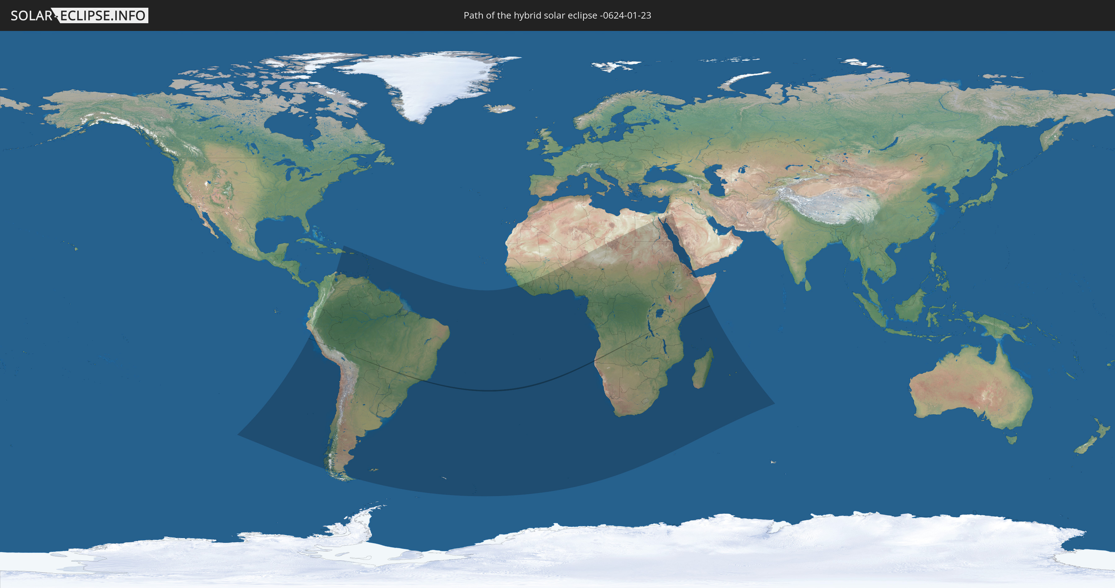
Die Sonnenfinsternis am 01/23/-0624 kann man in 88 Ländern als partielle Sonnenfinsternis beobachten.
Der Finsternispfad verläuft durch 7 Länder. Nur in diesen Ländern ist sie als hybrid Sonnenfinsternis zu sehen.
In den folgenden Ländern ist die Sonnenfinsternis hybrid zu sehen
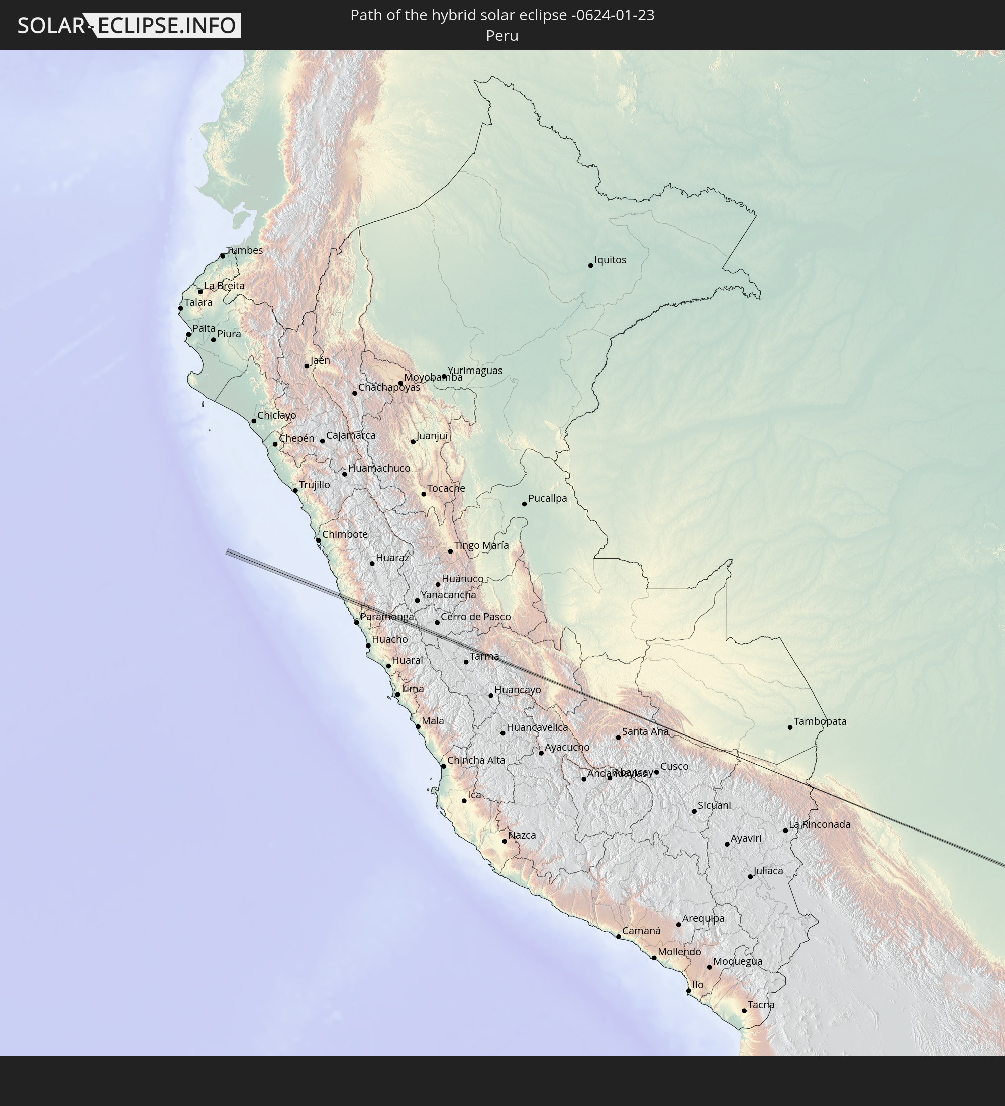 Peru
Peru
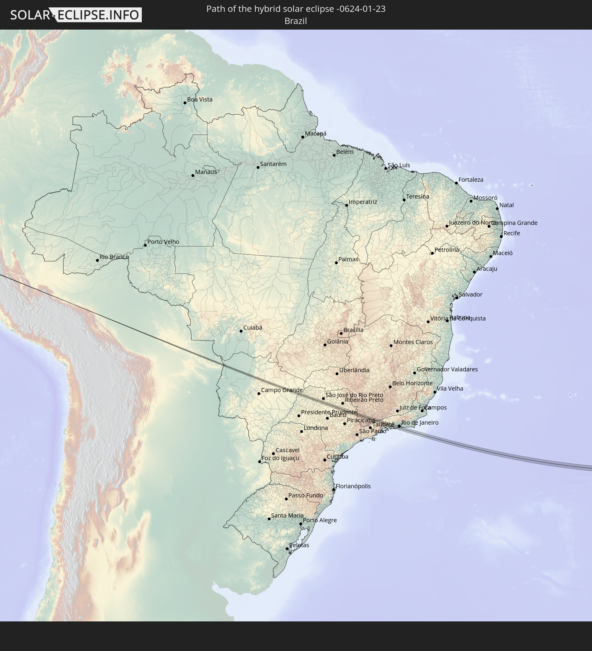 Brazil
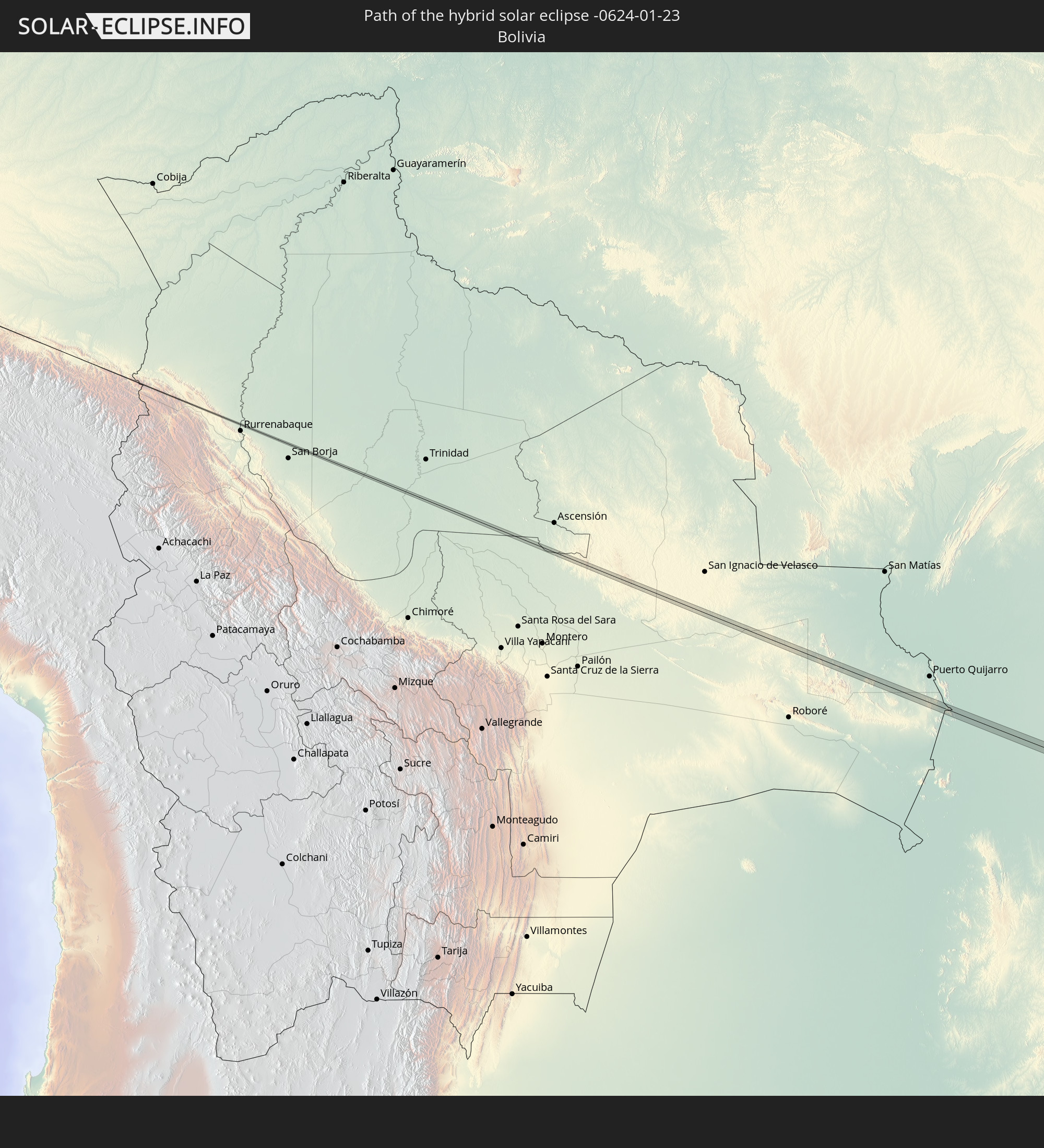 Bolivia
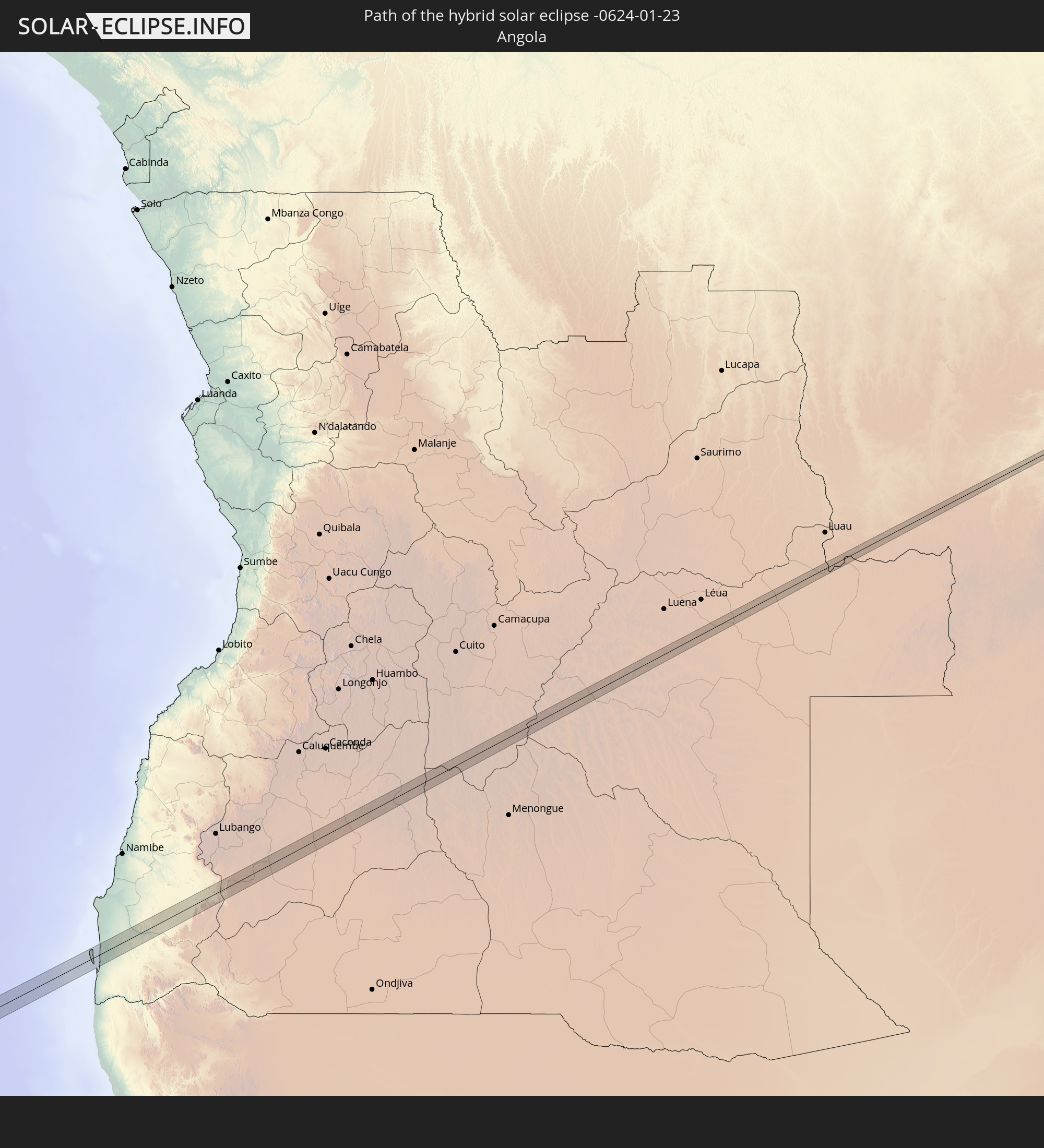 Angola
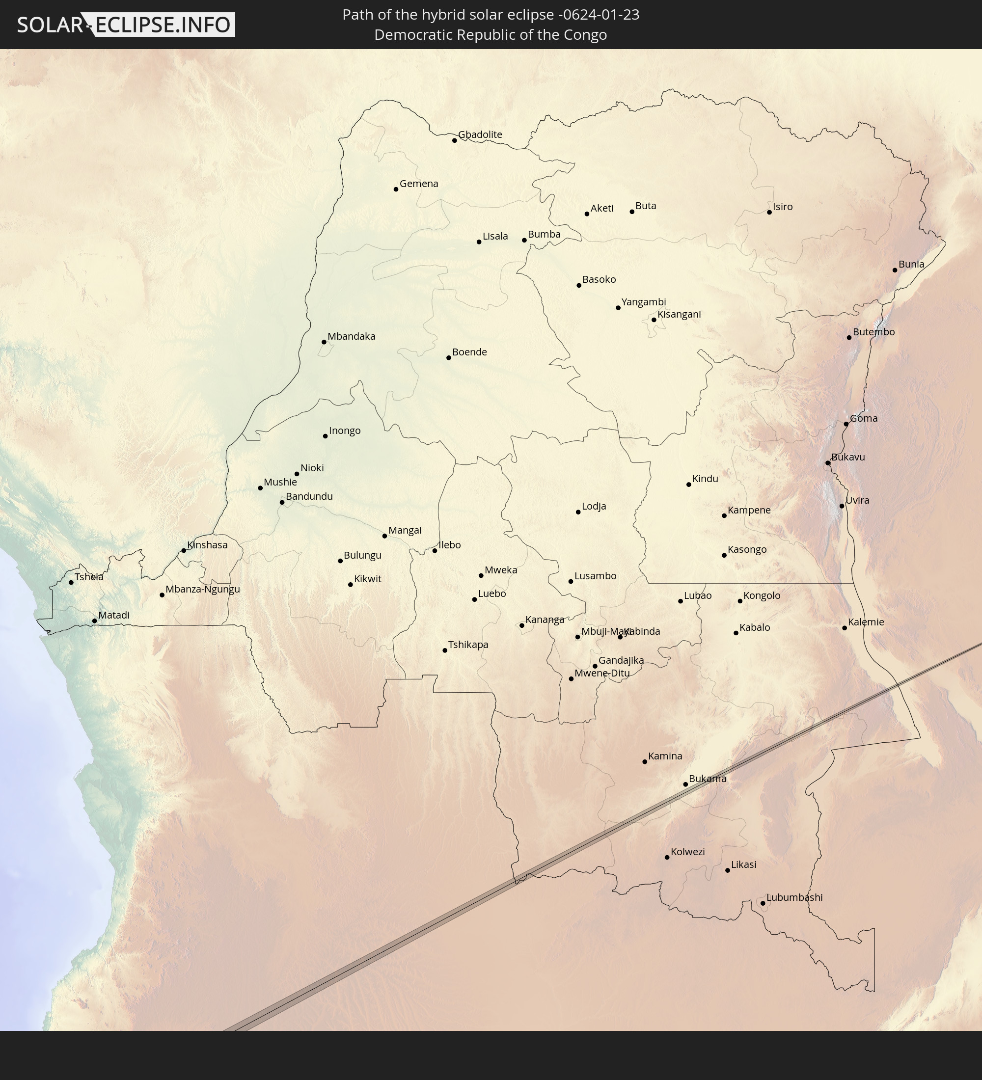 Democratic Republic of the Congo
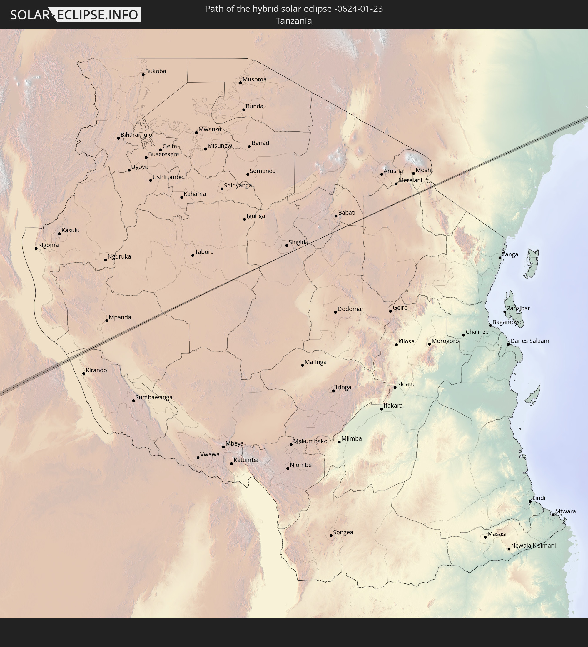 Tanzania
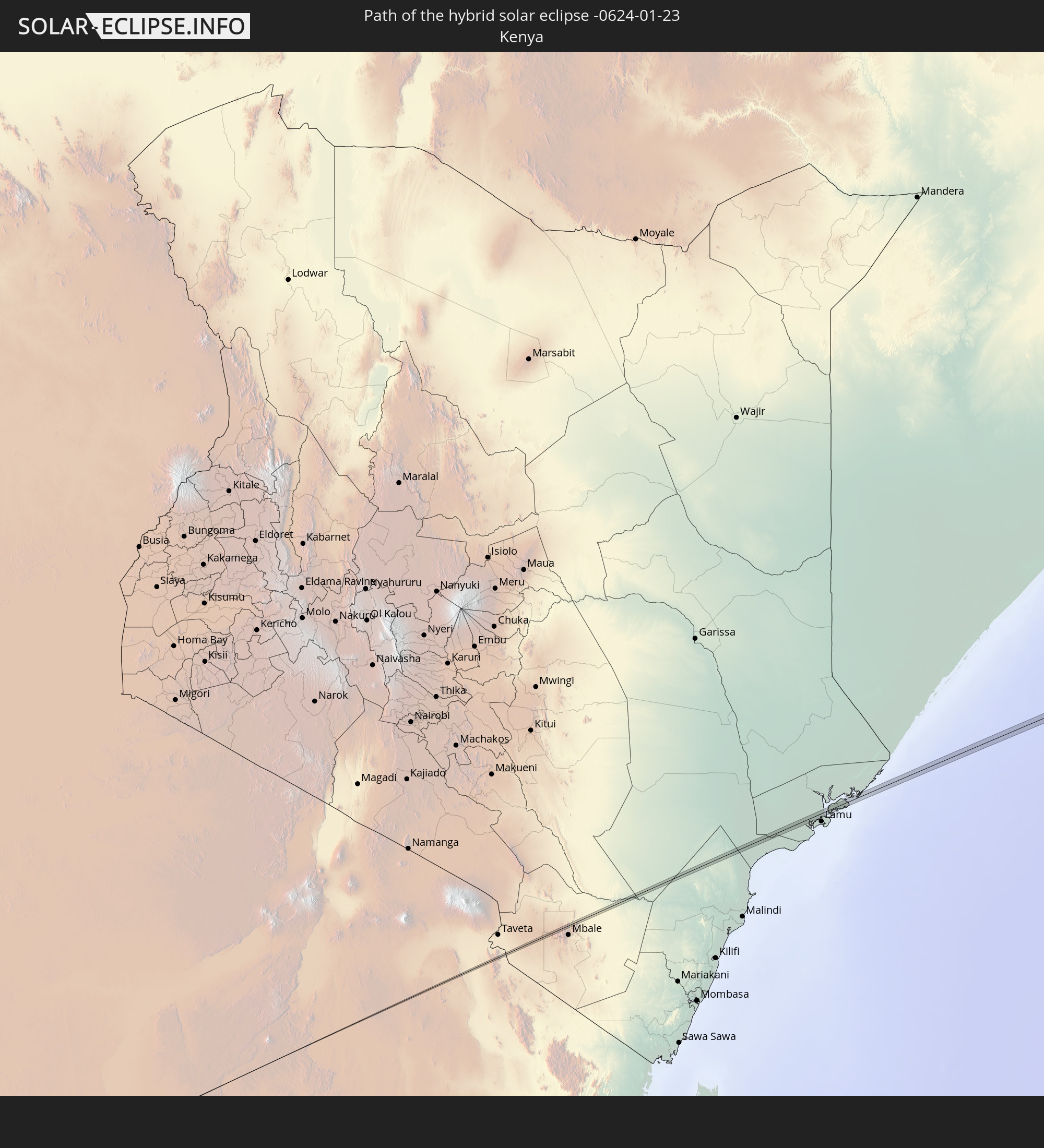 Kenya
Kenya
In den folgenden Ländern ist die Sonnenfinsternis partiell zu sehen
 Chile
Chile
 Ecuador
 Colombia
 Peru
Peru
 Brazil
 Argentina
 Venezuela
 Dominican Republic
 Aruba
Aruba
 Bolivia
 Puerto Rico
 United States Virgin Islands
 British Virgin Islands
 Anguilla
 Collectivity of Saint Martin
 Saint Barthélemy
 Saint Kitts and Nevis
 Paraguay
 Antigua and Barbuda
 Montserrat
 Trinidad and Tobago
 Guadeloupe
 Grenada
 Dominica
 Saint Vincent and the Grenadines
 Falkland Islands
 Guyana
 Martinique
 Saint Lucia
 Barbados
 Uruguay
 Suriname
 French Guiana
 South Georgia and the South Sandwich Islands
 Guinea
 Saint Helena, Ascension and Tristan da Cunha
 Sierra Leone
 Mali
Mali
 Liberia
 Ivory Coast
 Burkina Faso
 Ghana
Ghana
 Togo
Togo
 Niger
Niger
 Benin
Benin
 Nigeria
 Bouvet Island
 Equatorial Guinea
 São Tomé and Príncipe
 Cameroon
 Gabon
Gabon
 Libya
Libya
 Republic of the Congo
 Angola
 Namibia
 Democratic Republic of the Congo
 Chad
Chad
 Central African Republic
 South Africa
 Botswana
 Sudan
Sudan
 Zambia
 Egypt
Egypt
 Zimbabwe
 Lesotho
 Rwanda
 Burundi
 Tanzania
 Uganda
 Mozambique
 Swaziland
 Malawi
 Ethiopia
 Kenya
Kenya
 Israel
 Saudi Arabia
 Jordan
 Eritrea
 French Southern and Antarctic Lands
 Somalia
 Djibouti
 Yemen
Yemen
 Madagascar
 Comoros
 Mayotte
 Seychelles
 Réunion
 Mauritius
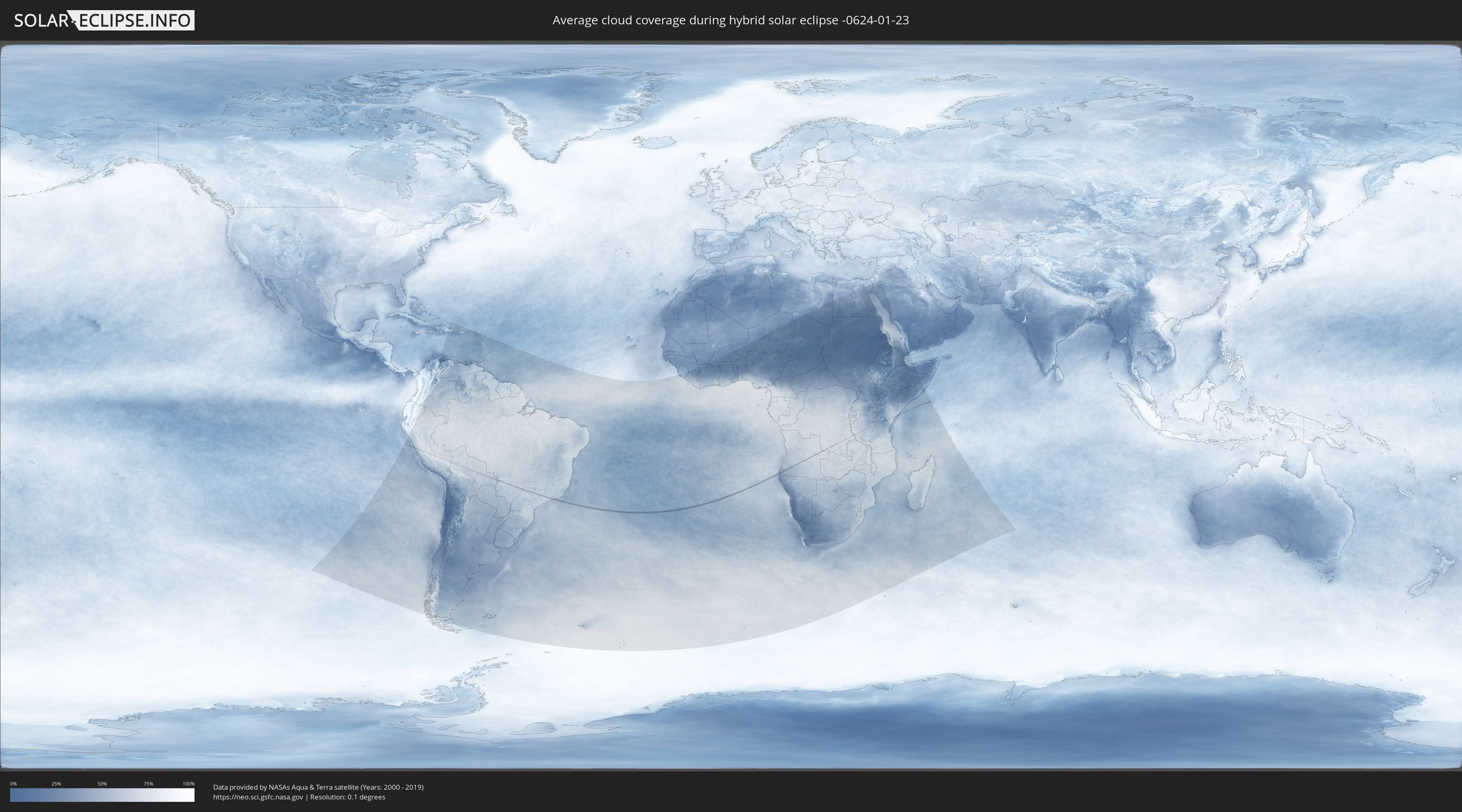
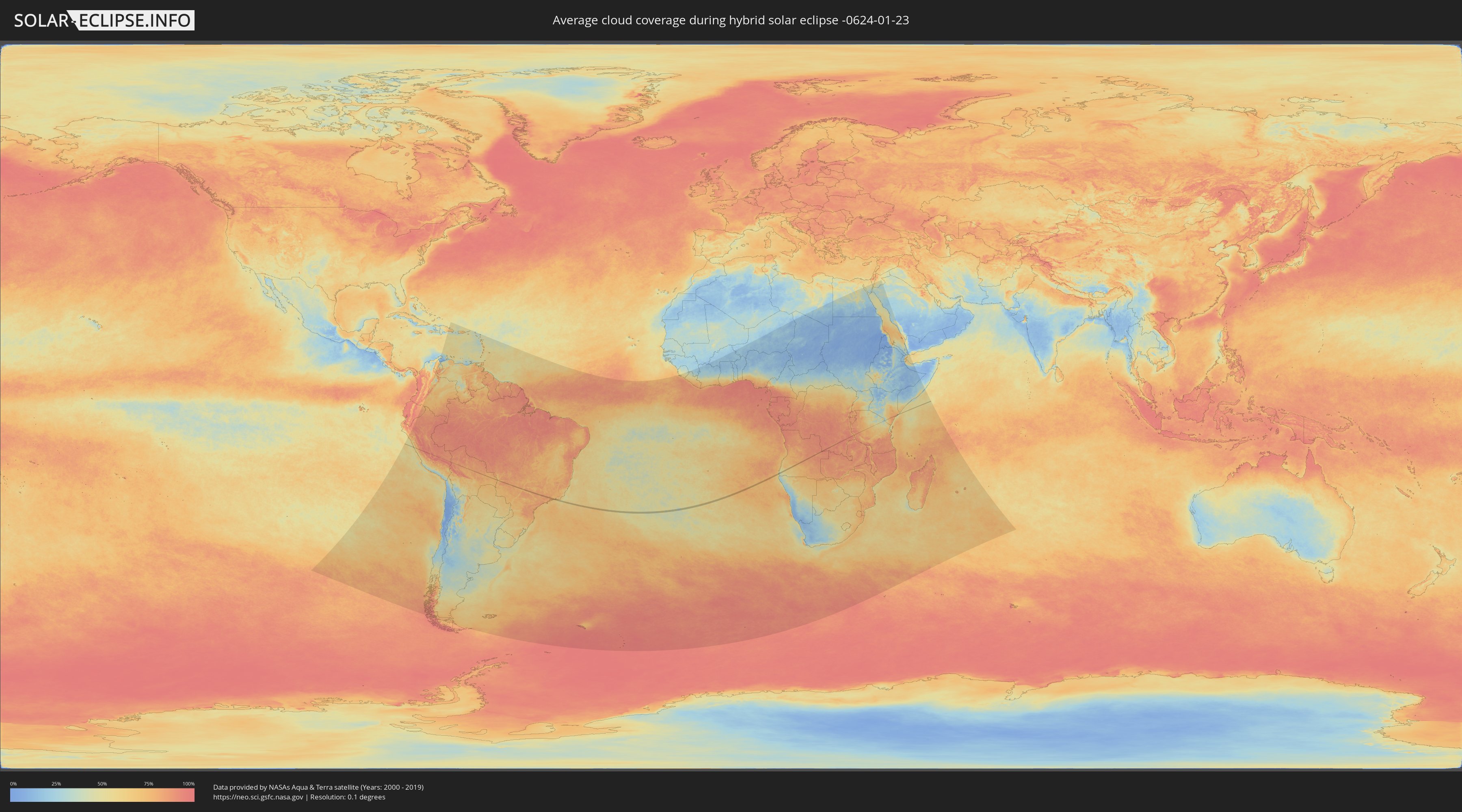
How will be the weather during the hybrid solar eclipse on 01/23/-0624?
Where is the best place to see the hybrid solar eclipse of 01/23/-0624?
The following maps show the average cloud coverage for the day of the hybrid solar eclipse.
With the help of these maps, it is possible to find the place along the eclipse path, which has the best
chance of a cloudless sky.
Nevertheless, you should consider local circumstances and inform about the weather of your chosen
observation site.
The data is provided by NASAs satellites
AQUA and TERRA.
The cloud maps are averaged over a period of 19 years (2000 - 2019).
Detailed country maps
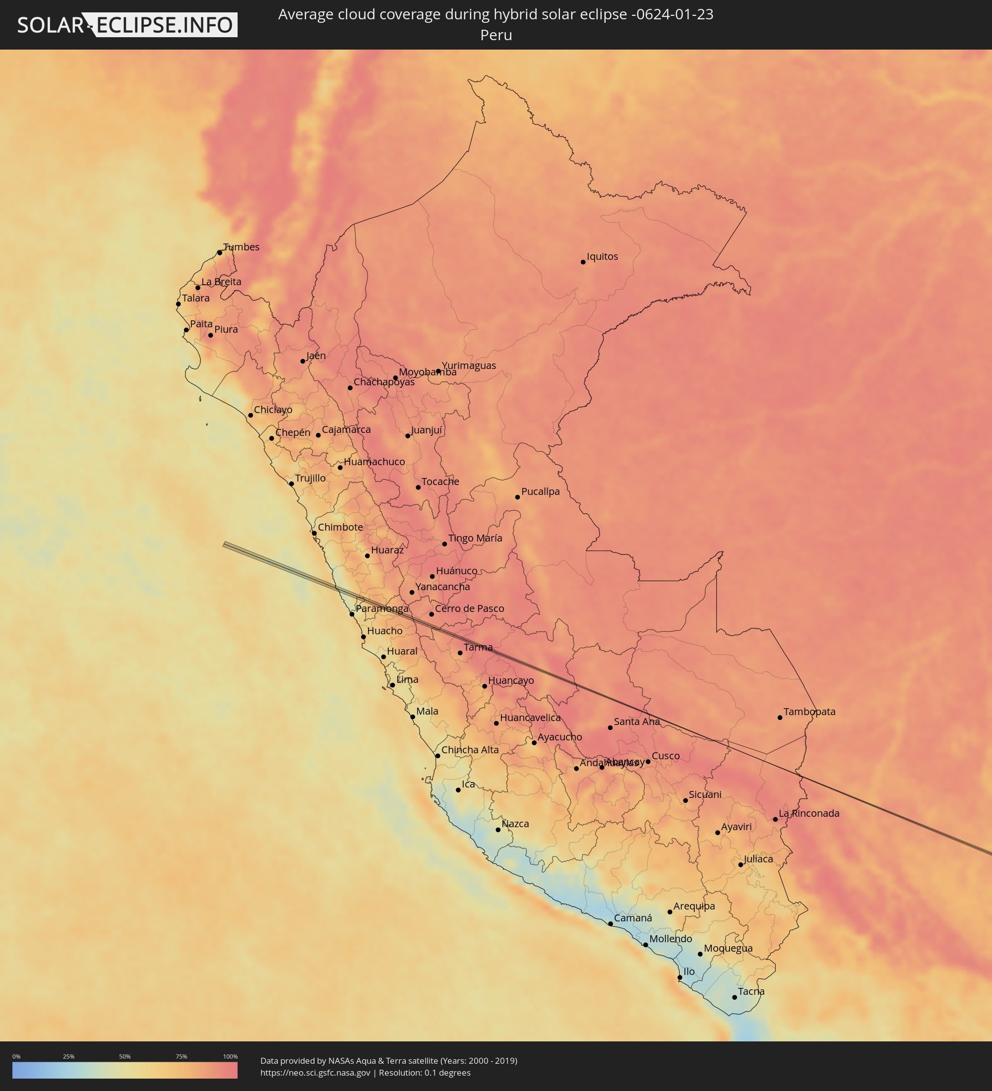 Peru
Peru
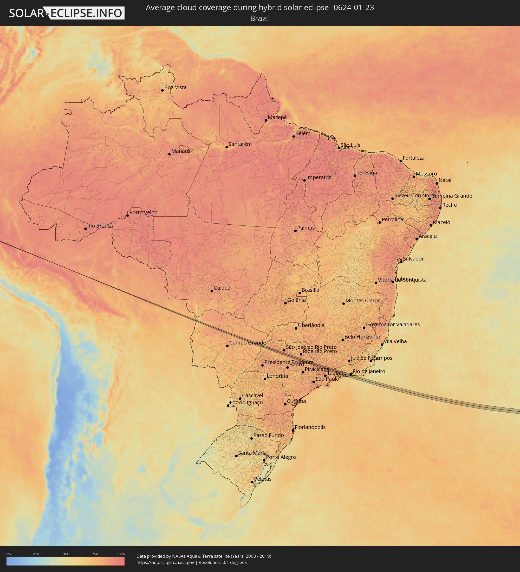 Brazil
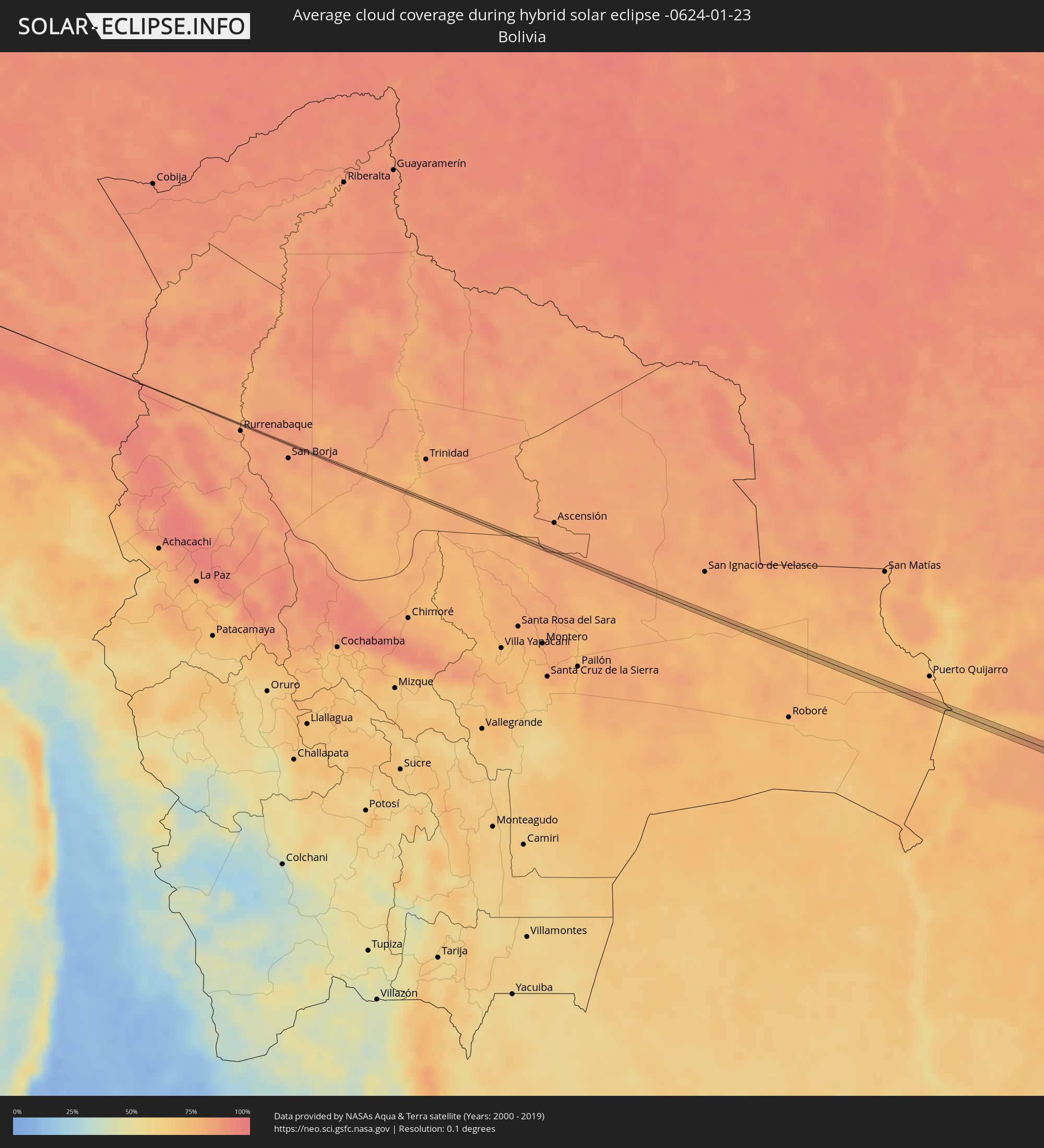 Bolivia
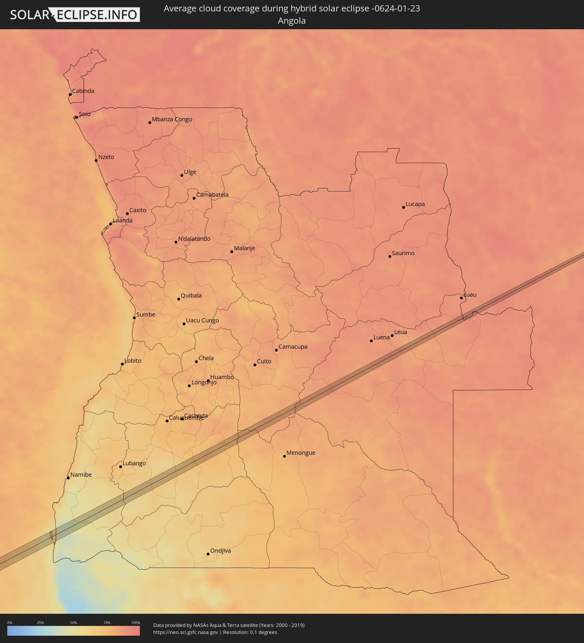 Angola
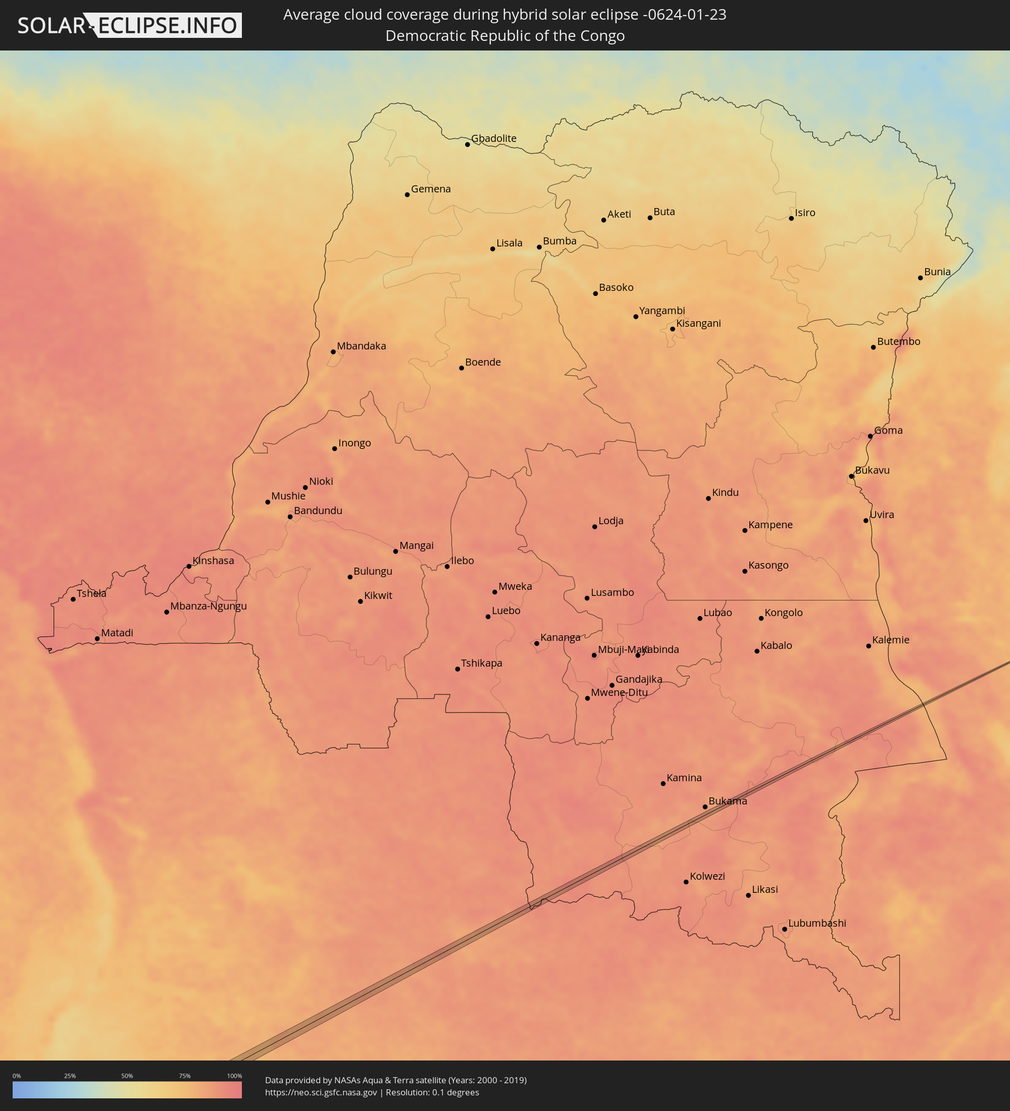 Democratic Republic of the Congo
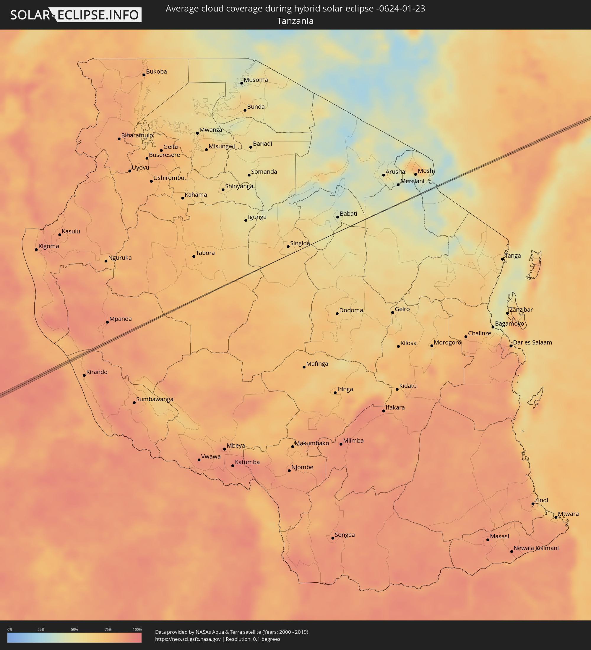 Tanzania
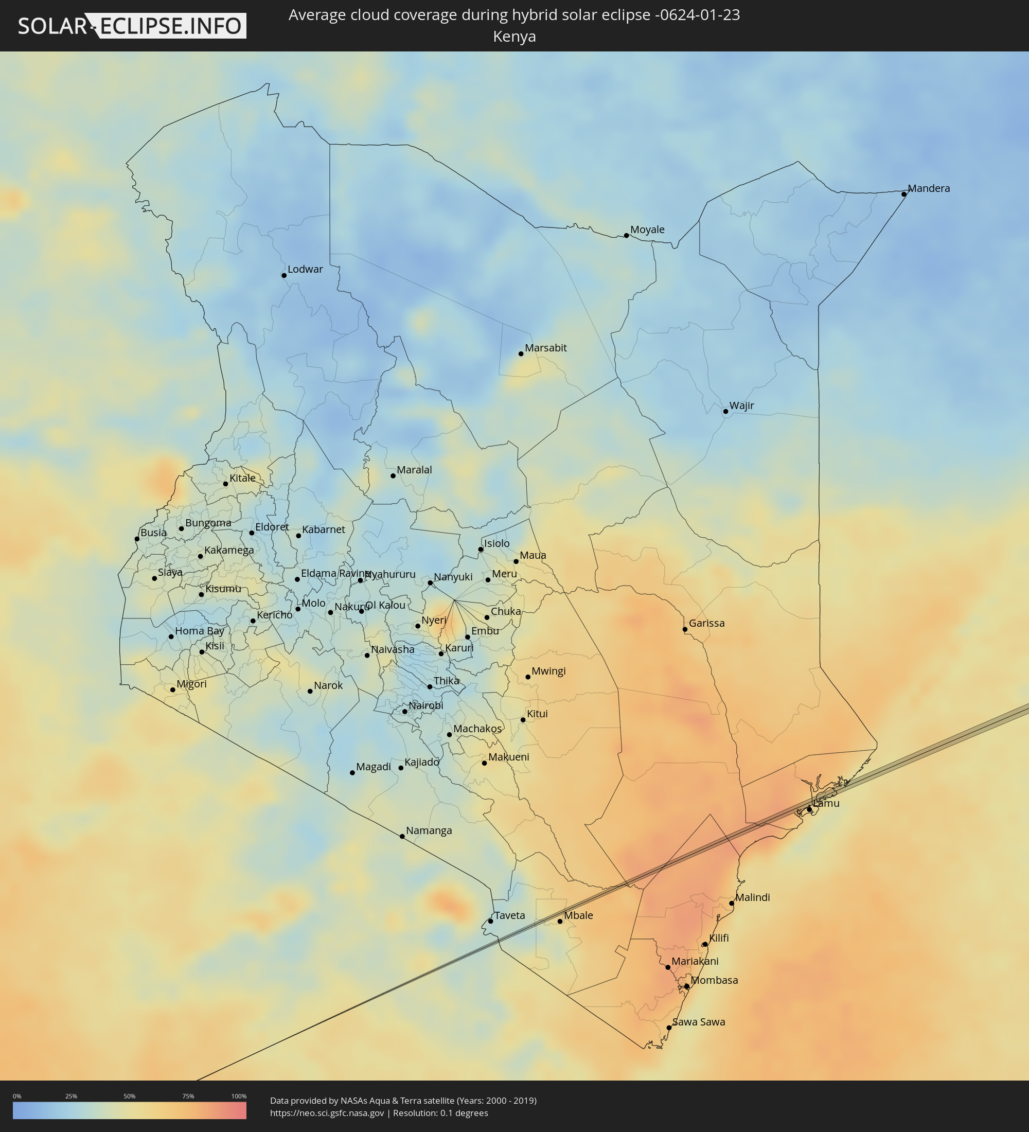 Kenya
Kenya
Cities inside the path of the eclipse
The following table shows all locations with a population of more than 5,000 inside the eclipse path. Cities which have more than 100,000 inhabitants are marked bold. A click at the locations opens a detailed map.
| City | Type | Eclipse duration | Local time of max. eclipse | Distance to central line | Ø Cloud coverage |
|
Oyón, Lima region
|
annular | - | 06:14:42 UTC-05:08 | 2 km | 82% |
|
Camapuã, Mato Grosso do Sul
|
total | - | 07:59:54 UTC-03:38 | 3 km | 75% |
|
Ilha Solteira, São Paulo
|
total | - | 08:35:25 UTC-03:06 | 2 km | 68% |
|
Pereira Barreto, São Paulo
|
total | - | 08:35:51 UTC-03:06 | 11 km | 71% |
|
Auriflama, São Paulo
|
total | - | 08:36:31 UTC-03:06 | 4 km | 82% |
|
José Bonifácio, São Paulo
|
total | - | 08:37:50 UTC-03:06 | 4 km | 76% |
|
Urupês, São Paulo
|
total | - | 08:38:27 UTC-03:06 | 6 km | 79% |
|
Itajobi, São Paulo
|
total | - | 08:38:50 UTC-03:06 | 10 km | 81% |
|
Catanduva, São Paulo
|
total | - | 08:38:47 UTC-03:06 | 12 km | 81% |
|
Pindorama, São Paulo
|
total | - | 08:38:54 UTC-03:06 | 9 km | 80% |
|
Santa Adélia, São Paulo
|
total | - | 08:39:05 UTC-03:06 | 7 km | 81% |
|
Taquaritinga, São Paulo
|
total | - | 08:39:36 UTC-03:06 | 1 km | 81% |
|
Porto Ferreira, São Paulo
|
total | - | 08:41:19 UTC-03:06 | 13 km | 80% |
|
Santa Rita do Passa Quatro, São Paulo
|
total | - | 08:41:12 UTC-03:06 | 2 km | 79% |
|
Tambaú, São Paulo
|
total | - | 08:41:28 UTC-03:06 | 10 km | 77% |
|
Santa Cruz das Palmeiras, São Paulo
|
total | - | 08:41:36 UTC-03:06 | 2 km | 78% |
|
Casa Branca, São Paulo
|
total | - | 08:41:46 UTC-03:06 | 9 km | 77% |
|
Vargem Grande do Sul, São Paulo
|
total | - | 08:42:05 UTC-03:06 | 9 km | 80% |
|
São João da Boa Vista, São Paulo
|
total | - | 08:42:20 UTC-03:06 | 2 km | 80% |
|
Andradas, Minas Gerais
|
total | - | 08:42:44 UTC-03:06 | 5 km | 83% |
|
Pouso Alegre, Minas Gerais
|
total | - | 08:43:46 UTC-03:06 | 2 km | 80% |
|
Santa Rita do Sapucaí, Minas Gerais
|
total | - | 08:44:07 UTC-03:06 | 3 km | 82% |
|
Itajubá, Minas Gerais
|
total | - | 08:44:37 UTC-03:06 | 7 km | 80% |
|
Cruzeiro, São Paulo
|
total | - | 08:45:27 UTC-03:06 | 7 km | 78% |
|
Passa Quatro, Minas Gerais
|
total | - | 08:45:18 UTC-03:06 | 12 km | 79% |
|
Itatiaia, Rio de Janeiro
|
total | - | 08:46:00 UTC-03:06 | 14 km | 75% |
|
Rio Claro, Rio de Janeiro
|
total | - | 08:46:51 UTC-03:06 | 3 km | 76% |
|
Itaguaí, Rio de Janeiro
|
total | - | 08:47:31 UTC-03:06 | 0 km | 73% |
|
Seropédica, Rio de Janeiro
|
total | - | 08:47:32 UTC-03:06 | 14 km | 76% |
|
Rio de Janeiro, Rio de Janeiro
|
total | - | 08:48:27 UTC-03:06 | 12 km | 67% |
|
Witu, Lamu
|
annular | - | 17:22:59 UTC+02:27 | 0 km | 82% |