Total solar eclipse of 07/28/-0671
| Day of week: | Tuesday |
| Maximum duration of eclipse: | 06m07s |
| Maximum width of eclipse path: | 226 km |
| Saros cycle: | 54 |
| Coverage: | 100% |
| Magnitude: | 1.0688 |
| Gamma: | -0.1364 |
Wo kann man die Sonnenfinsternis vom 07/28/-0671 sehen?
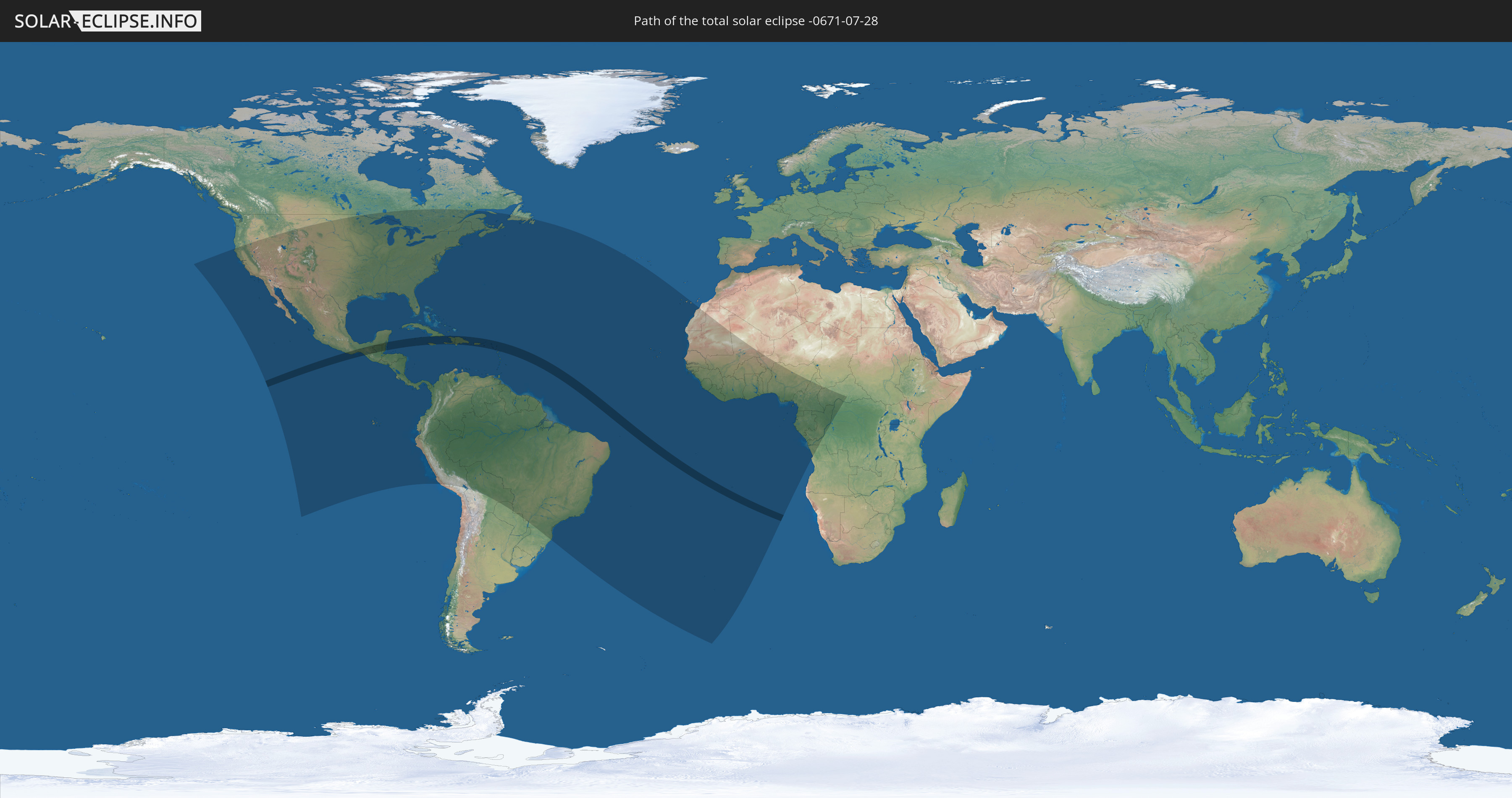
Die Sonnenfinsternis am 07/28/-0671 kann man in 75 Ländern als partielle Sonnenfinsternis beobachten.
Der Finsternispfad verläuft durch 21 Länder. Nur in diesen Ländern ist sie als total Sonnenfinsternis zu sehen.
In den folgenden Ländern ist die Sonnenfinsternis total zu sehen
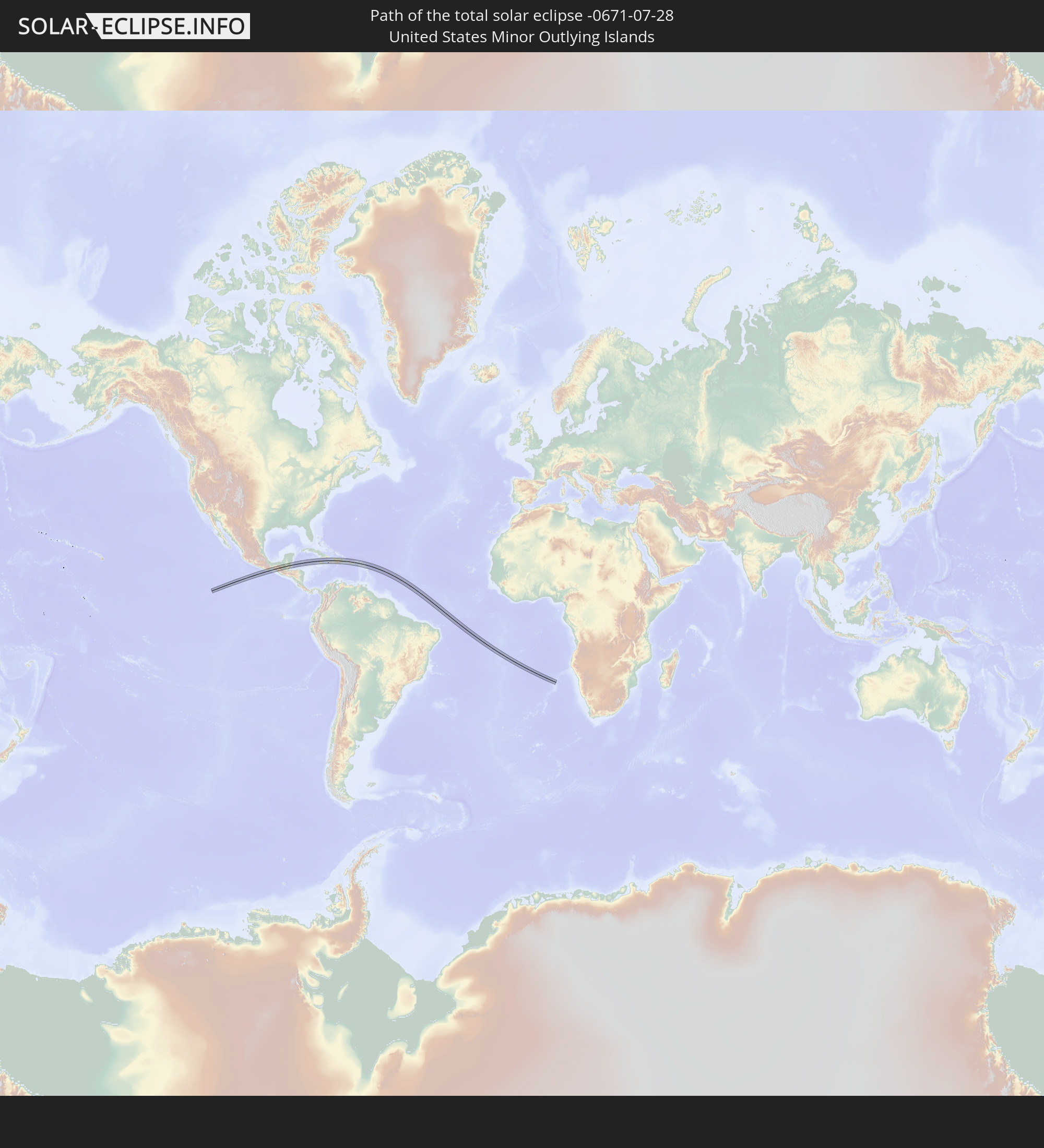 United States Minor Outlying Islands
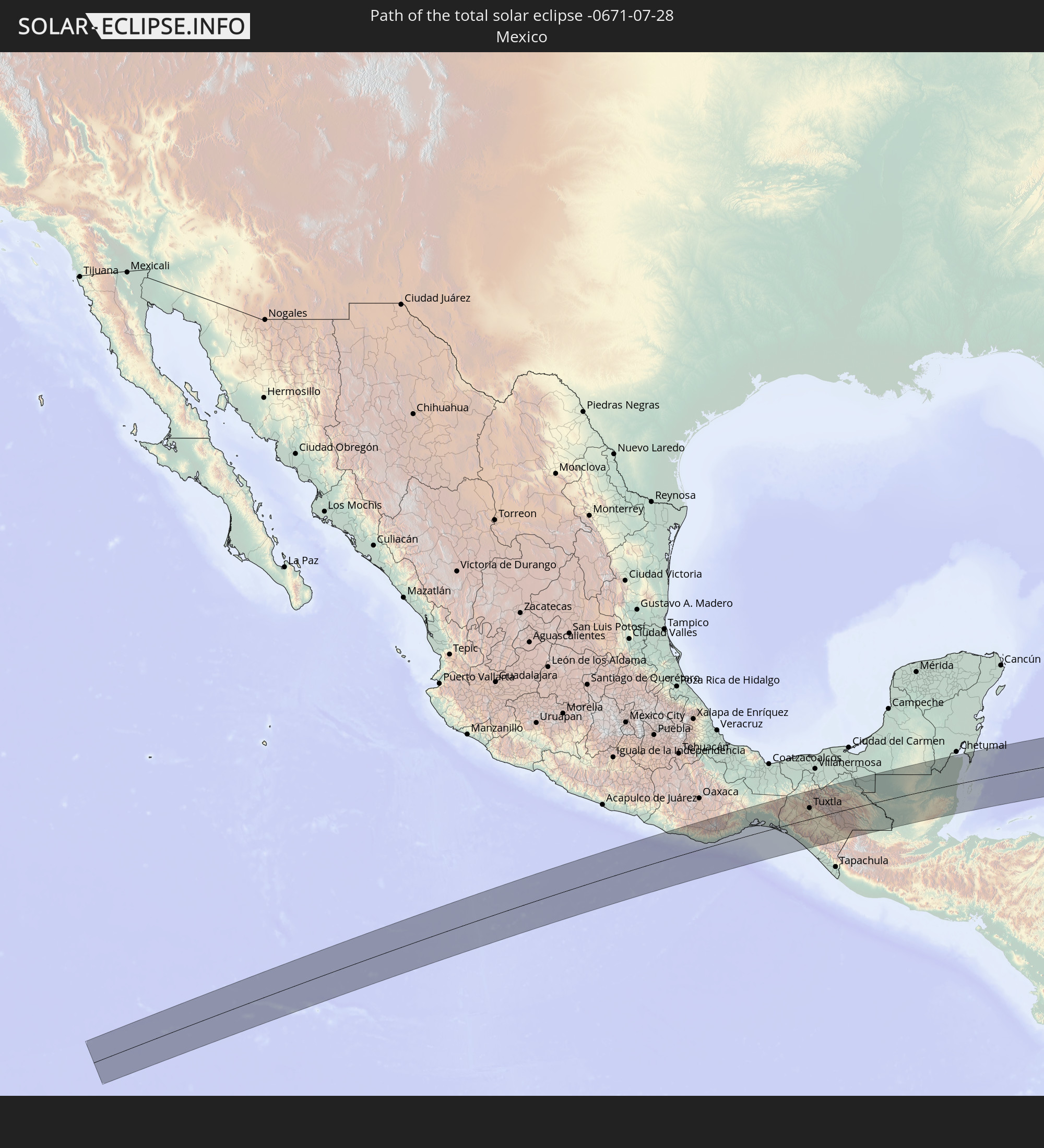 Mexico
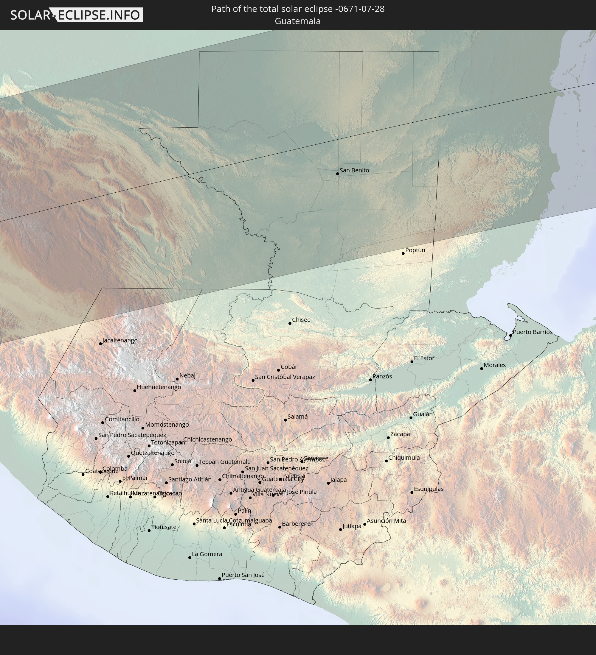 Guatemala
 Honduras
 Belize
 Cuba
Cuba
 Cayman Islands
 Jamaica
 Haiti
Haiti
 Dominican Republic
 Puerto Rico
 United States Virgin Islands
 British Virgin Islands
 Anguilla
 Sint Maarten
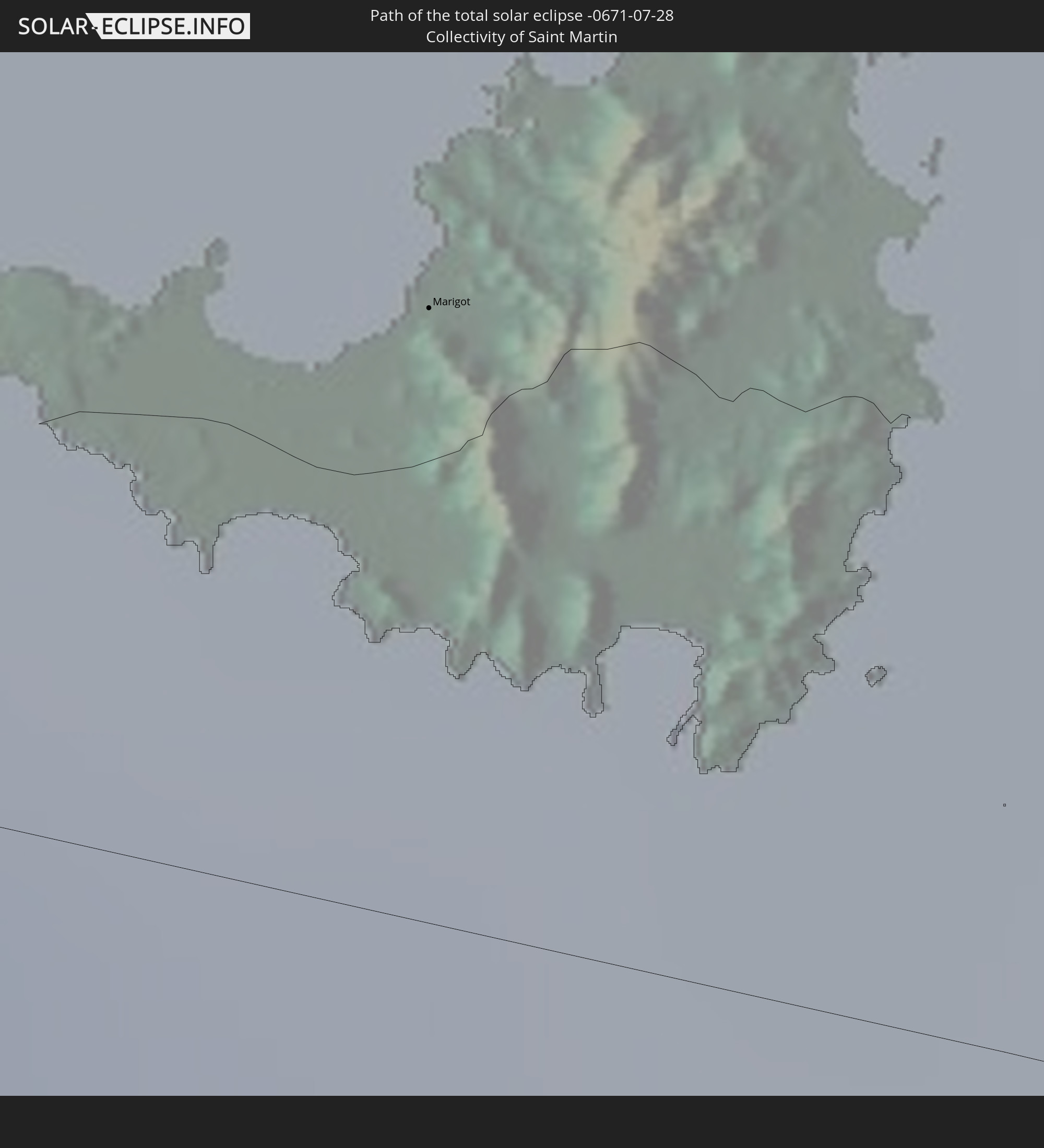 Collectivity of Saint Martin
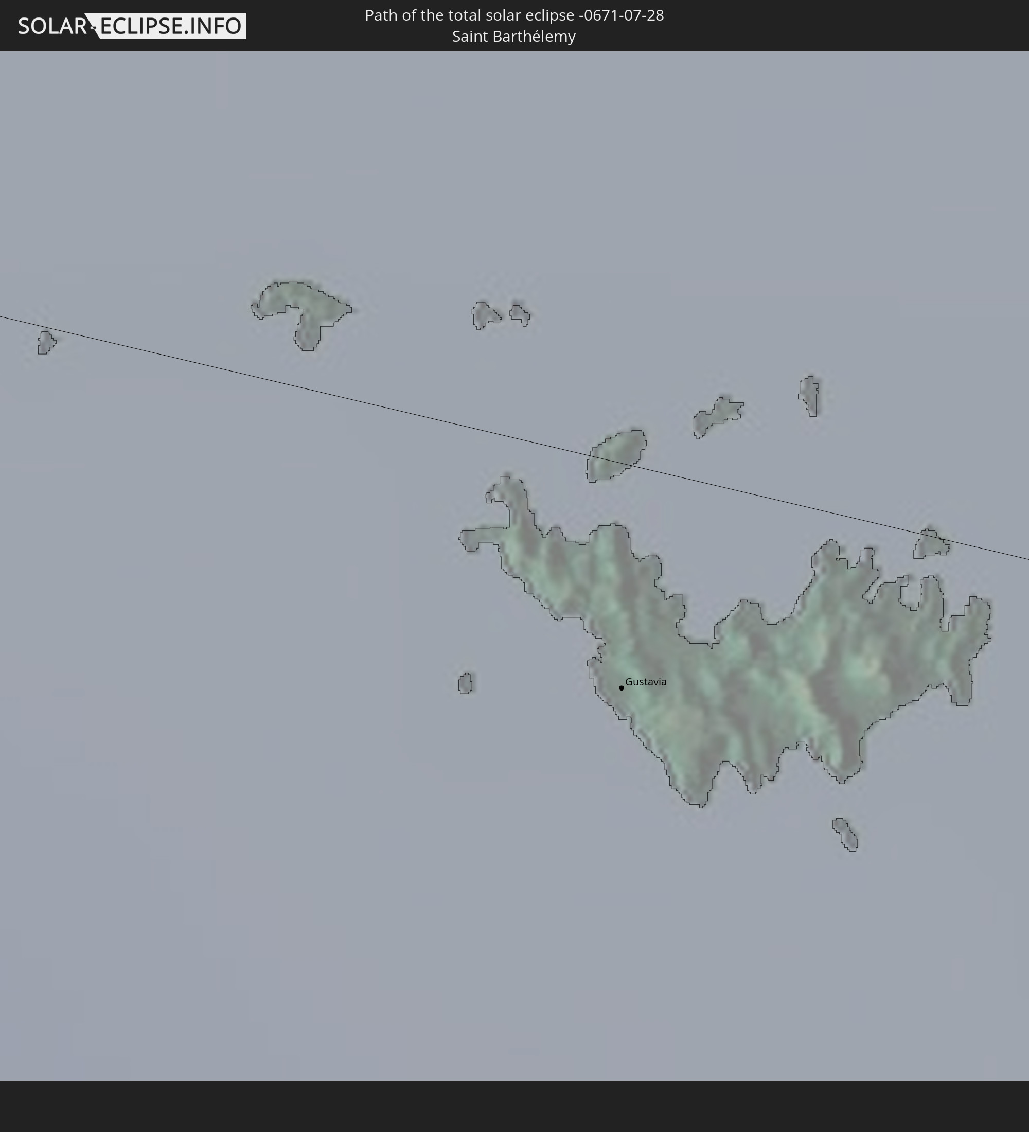 Saint Barthélemy
 Saint Kitts and Nevis
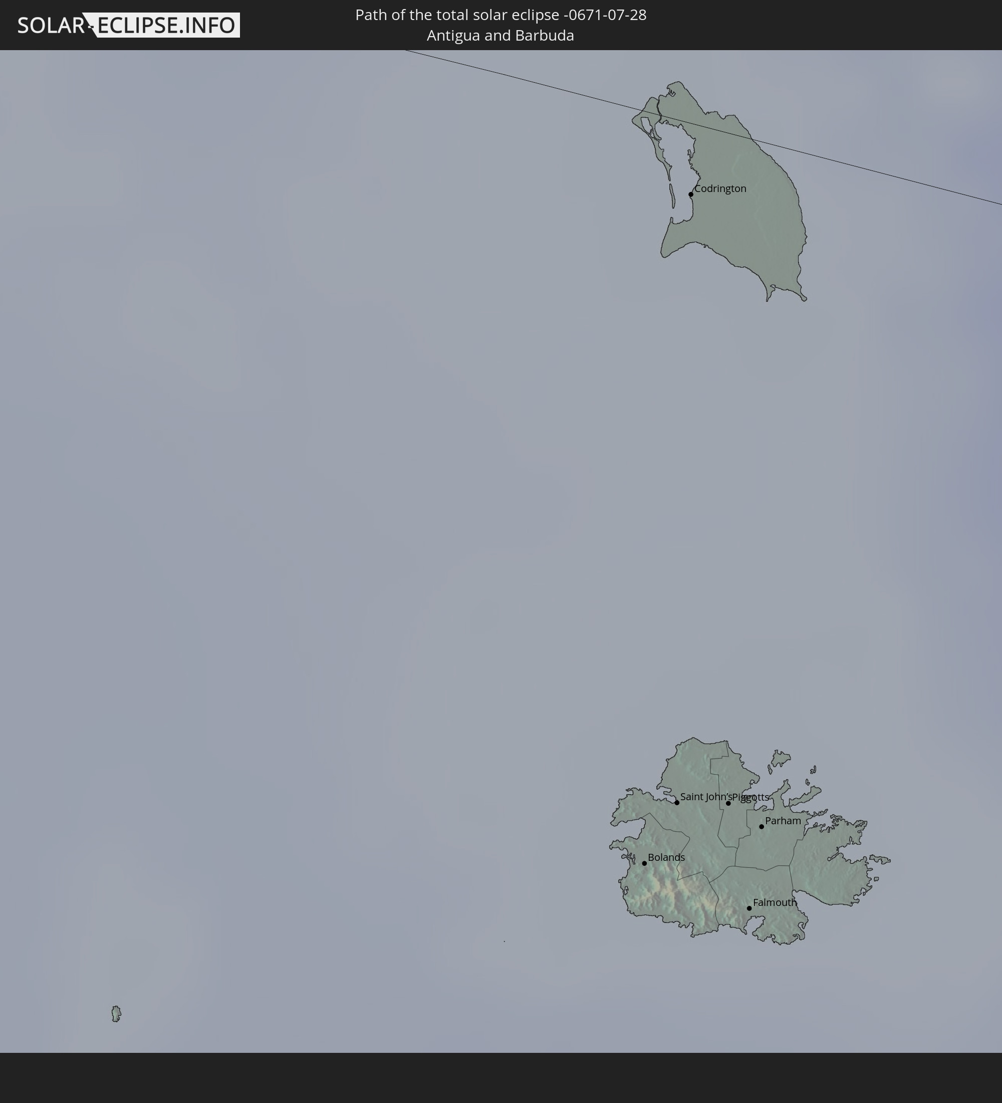 Antigua and Barbuda
 Montserrat
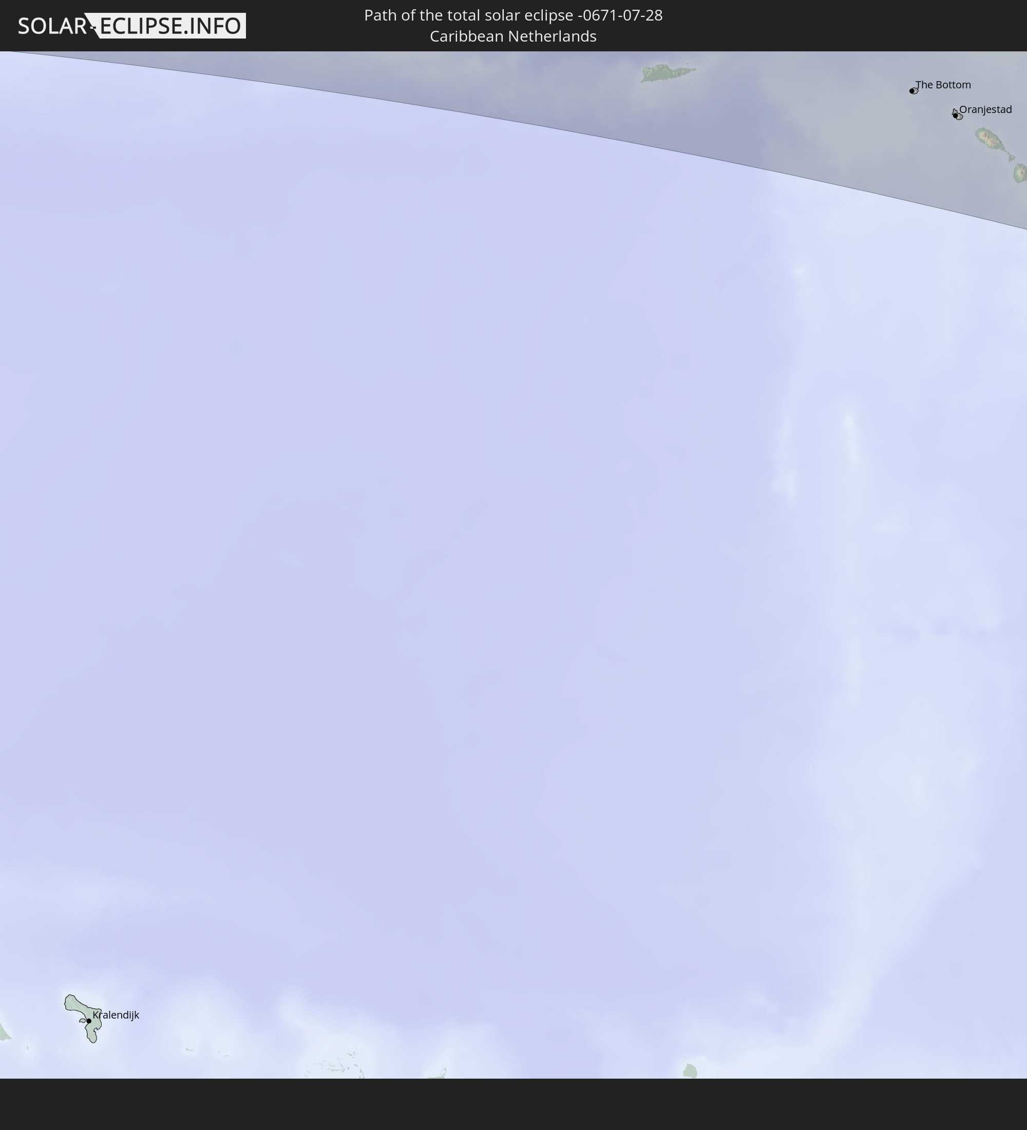 Caribbean Netherlands
In den folgenden Ländern ist die Sonnenfinsternis partiell zu sehen
 United States
 United States Minor Outlying Islands
 Canada
 Mexico
 Guatemala
 Ecuador
 El Salvador
 Honduras
 Belize
 Nicaragua
 Costa Rica
 Cuba
Cuba
 Panama
 Colombia
 Cayman Islands
 Peru
Peru
 The Bahamas
 Jamaica
 Haiti
Haiti
 Brazil
 Venezuela
 Turks and Caicos Islands
 Dominican Republic
 Aruba
Aruba
 Bolivia
 Puerto Rico
 United States Virgin Islands
 Bermuda
 British Virgin Islands
 Anguilla
 Collectivity of Saint Martin
 Saint Barthélemy
 Saint Kitts and Nevis
 Paraguay
 Antigua and Barbuda
 Montserrat
 Trinidad and Tobago
 Guadeloupe
 Grenada
 Dominica
 Saint Vincent and the Grenadines
 Guyana
 Martinique
 Saint Lucia
 Barbados
 Suriname
 Saint Pierre and Miquelon
 French Guiana
 Cabo Verde
 Spain
Spain
 Senegal
 Mauritania
 The Gambia
 Guinea-Bissau
 Guinea
 Saint Helena, Ascension and Tristan da Cunha
 Sierra Leone
 Mali
Mali
 Liberia
 Ivory Coast
 Burkina Faso
 Ghana
Ghana
 Togo
Togo
 Niger
Niger
 Benin
Benin
 Nigeria
 Equatorial Guinea
 São Tomé and Príncipe
 Cameroon
 Gabon
Gabon
 Republic of the Congo
 Angola
 Democratic Republic of the Congo
 Chad
Chad
 Central African Republic
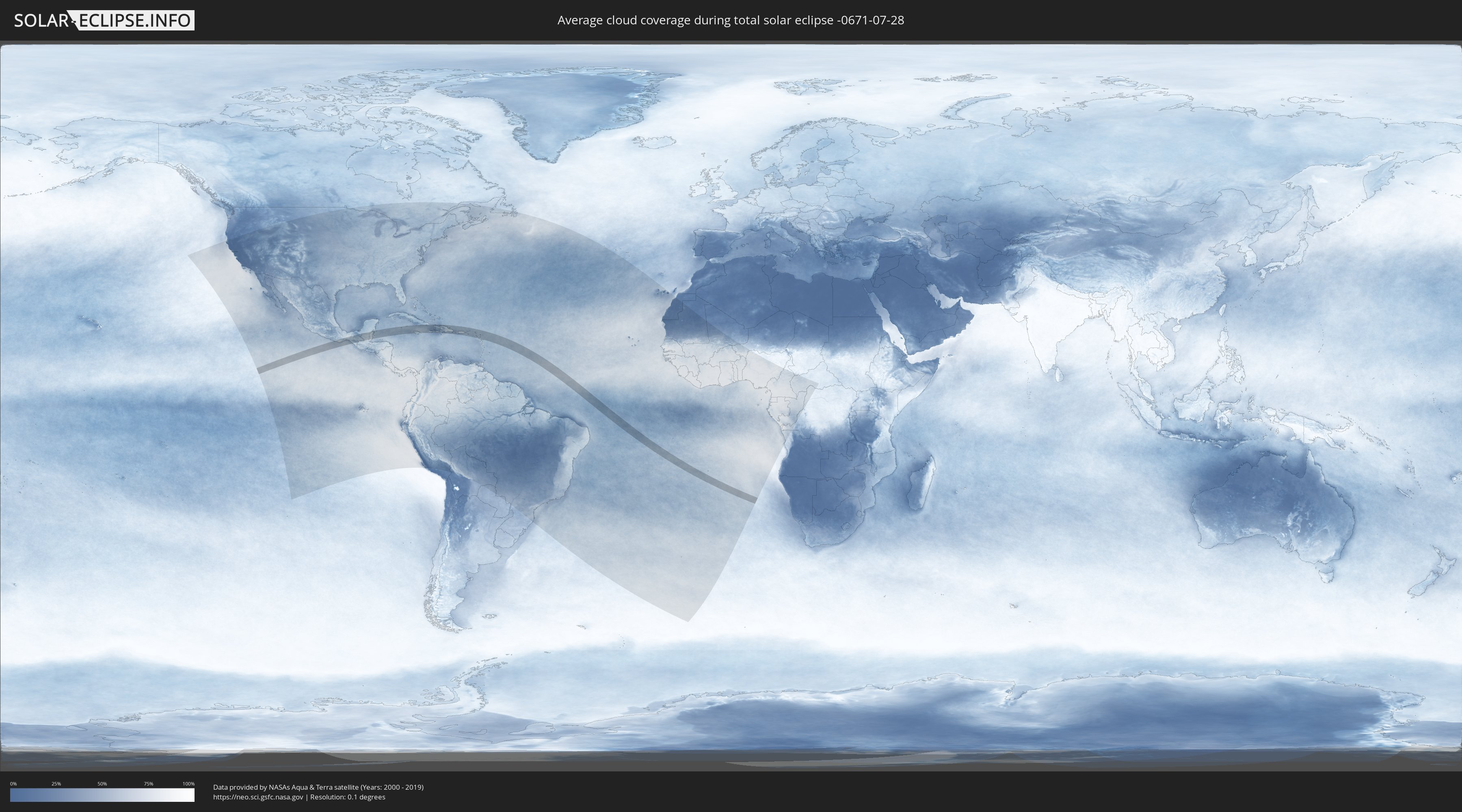
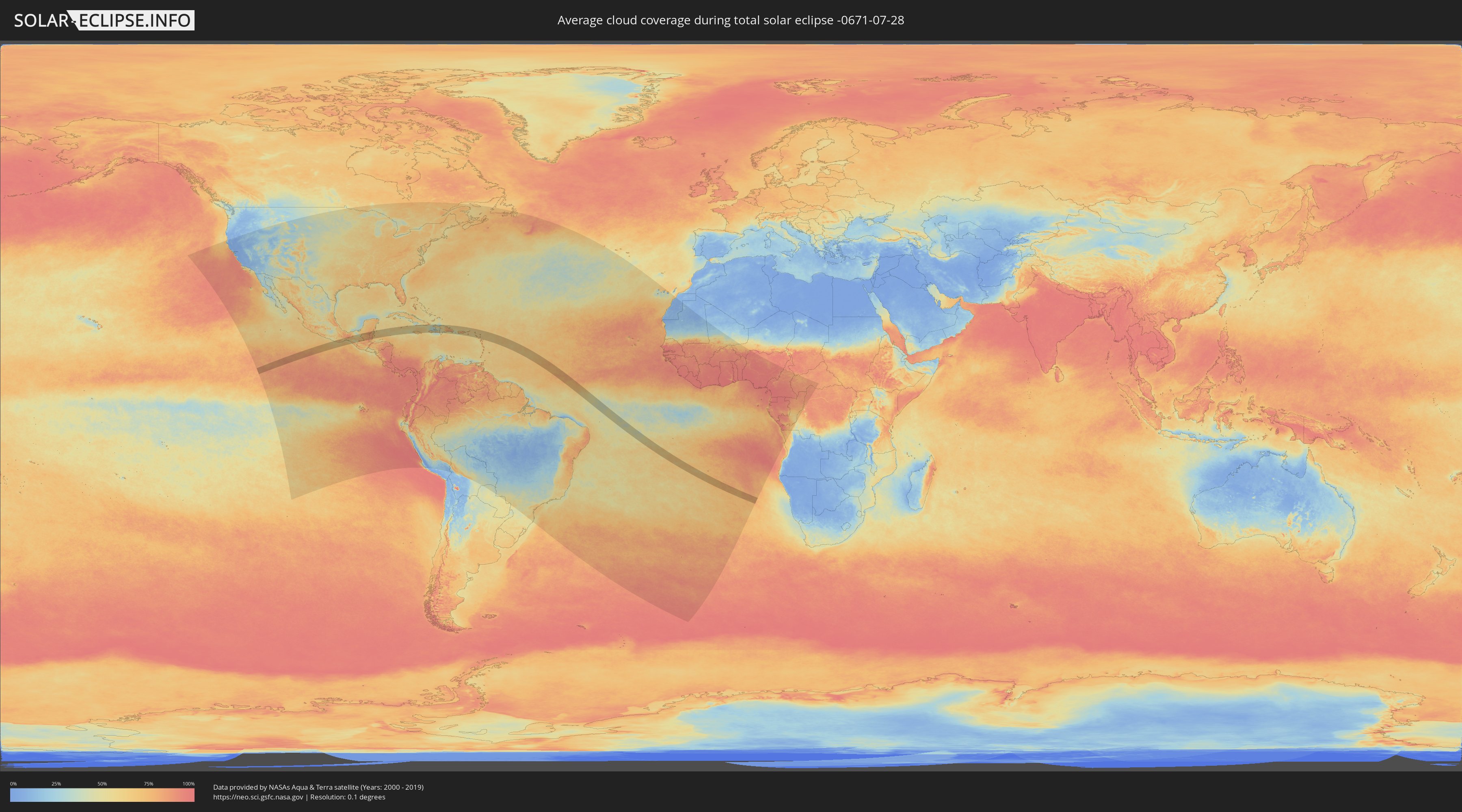
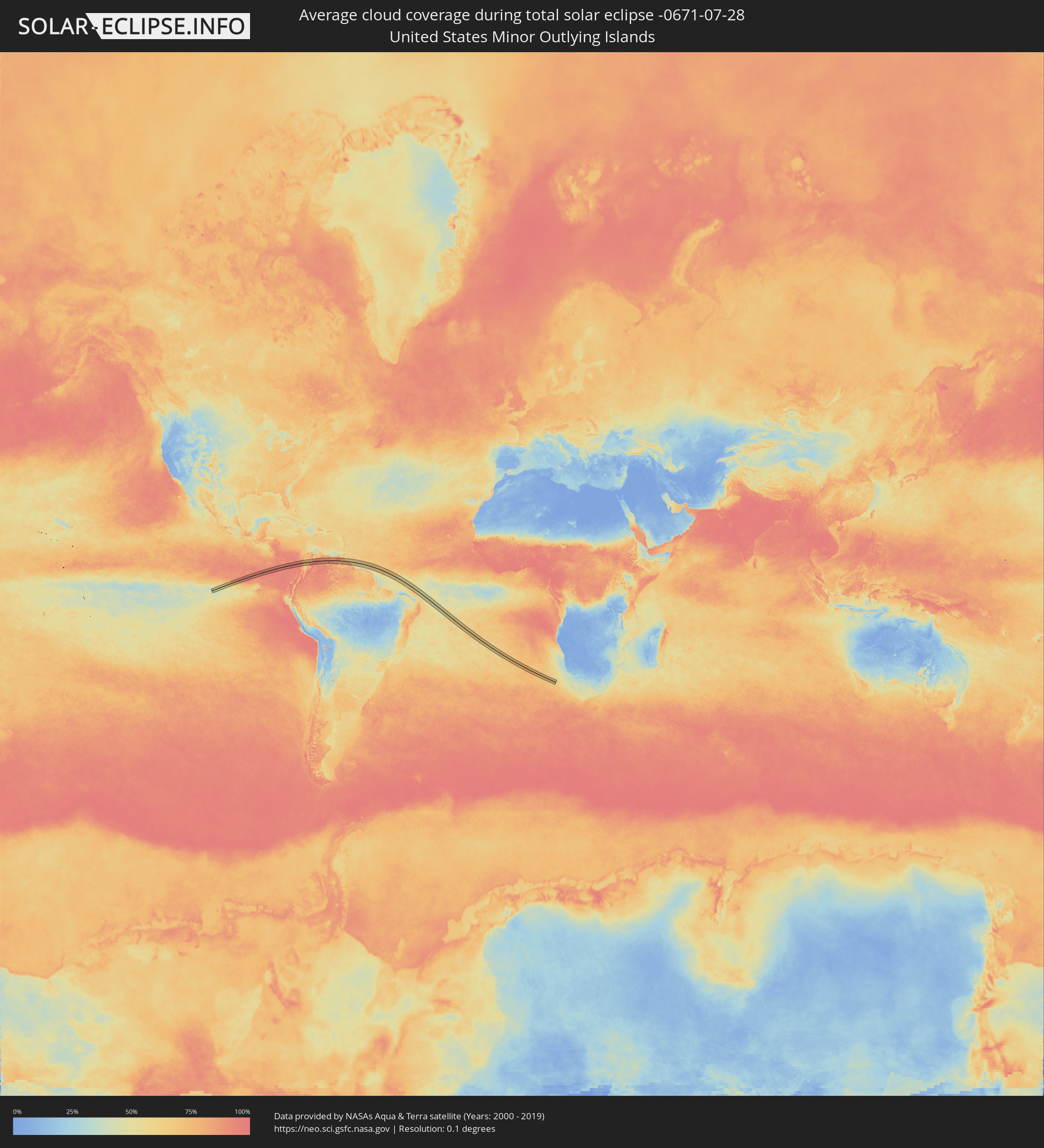
How will be the weather during the total solar eclipse on 07/28/-0671?
Where is the best place to see the total solar eclipse of 07/28/-0671?
The following maps show the average cloud coverage for the day of the total solar eclipse.
With the help of these maps, it is possible to find the place along the eclipse path, which has the best
chance of a cloudless sky.
Nevertheless, you should consider local circumstances and inform about the weather of your chosen
observation site.
The data is provided by NASAs satellites
AQUA and TERRA.
The cloud maps are averaged over a period of 19 years (2000 - 2019).
Detailed country maps
 United States Minor Outlying Islands
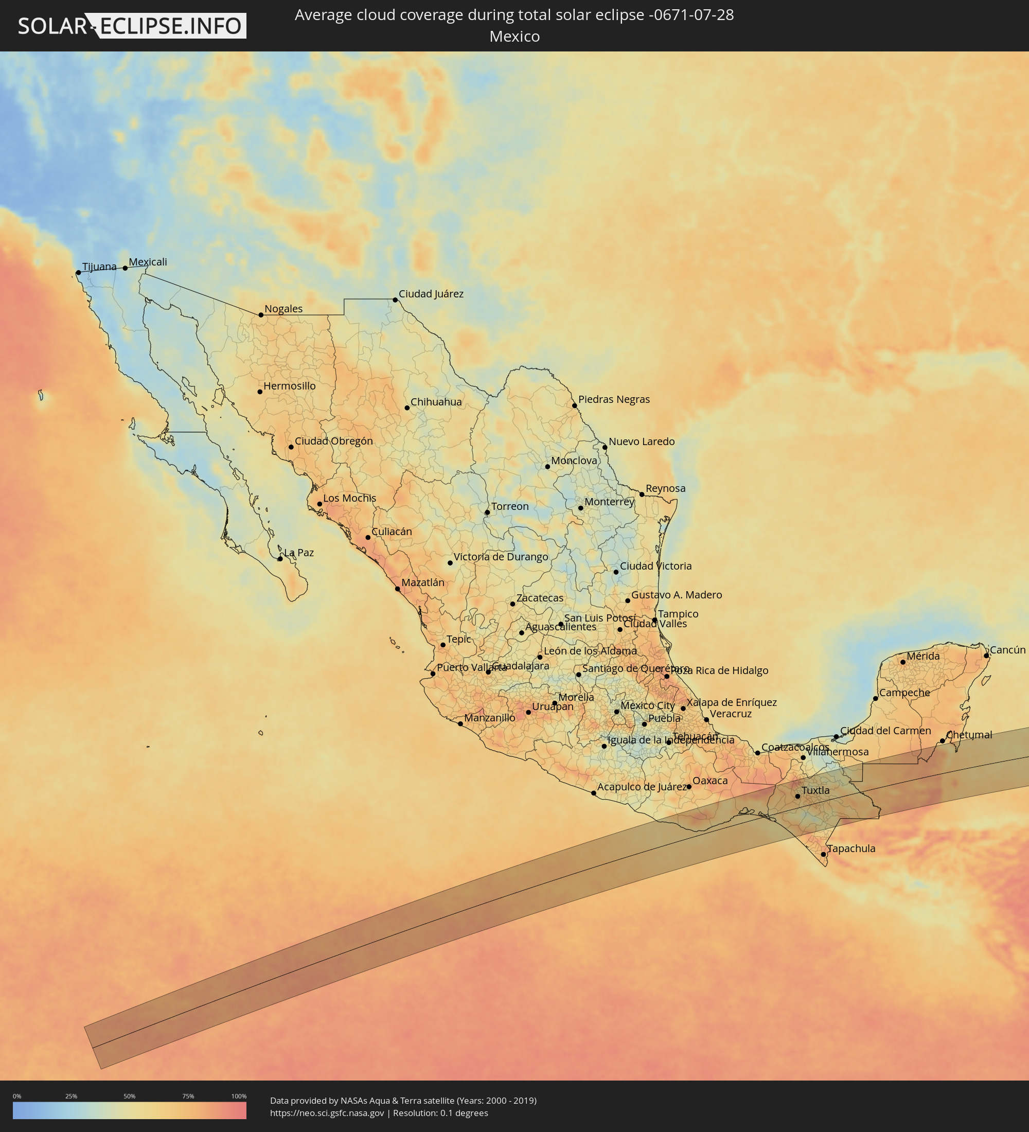 Mexico
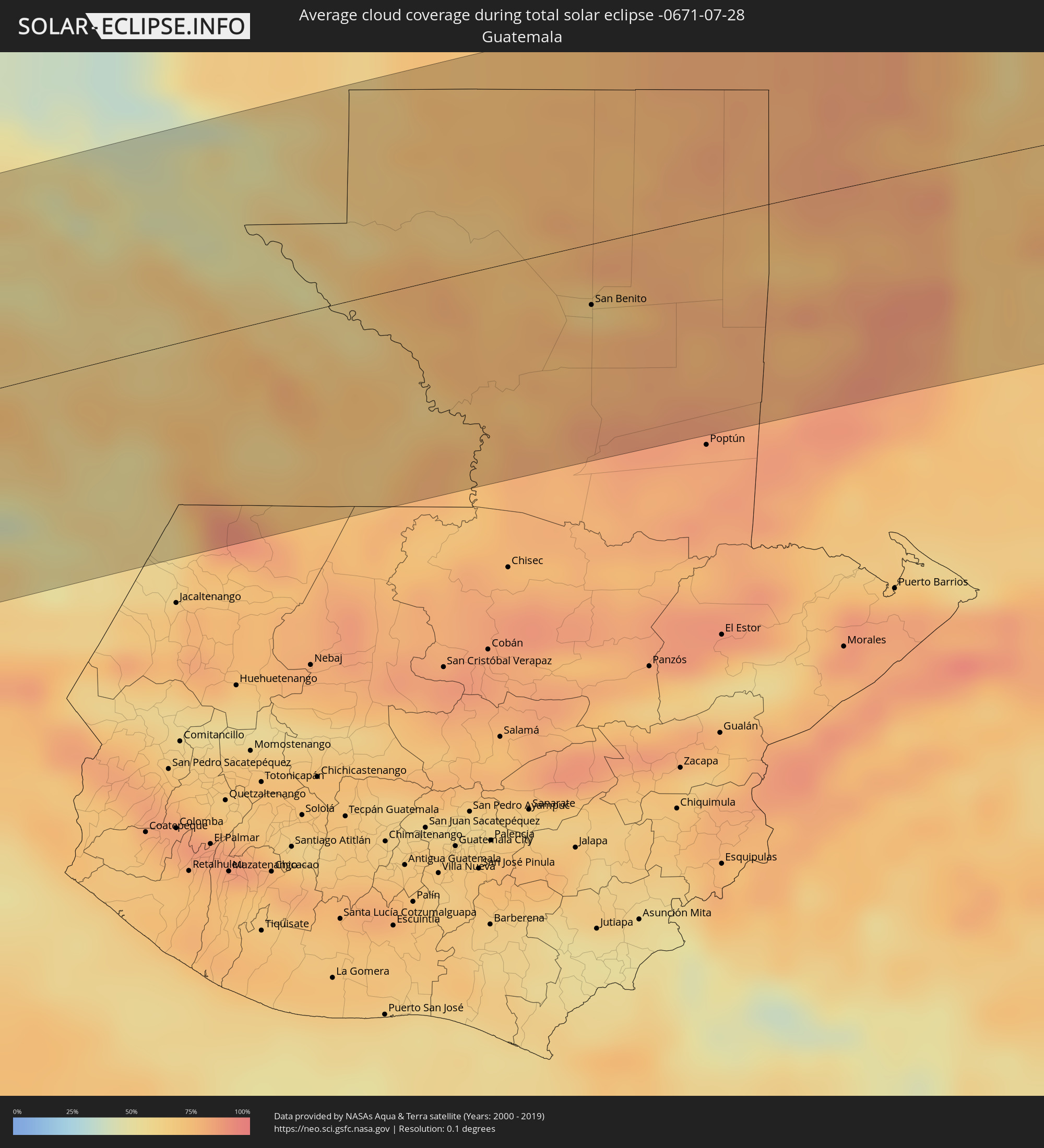 Guatemala
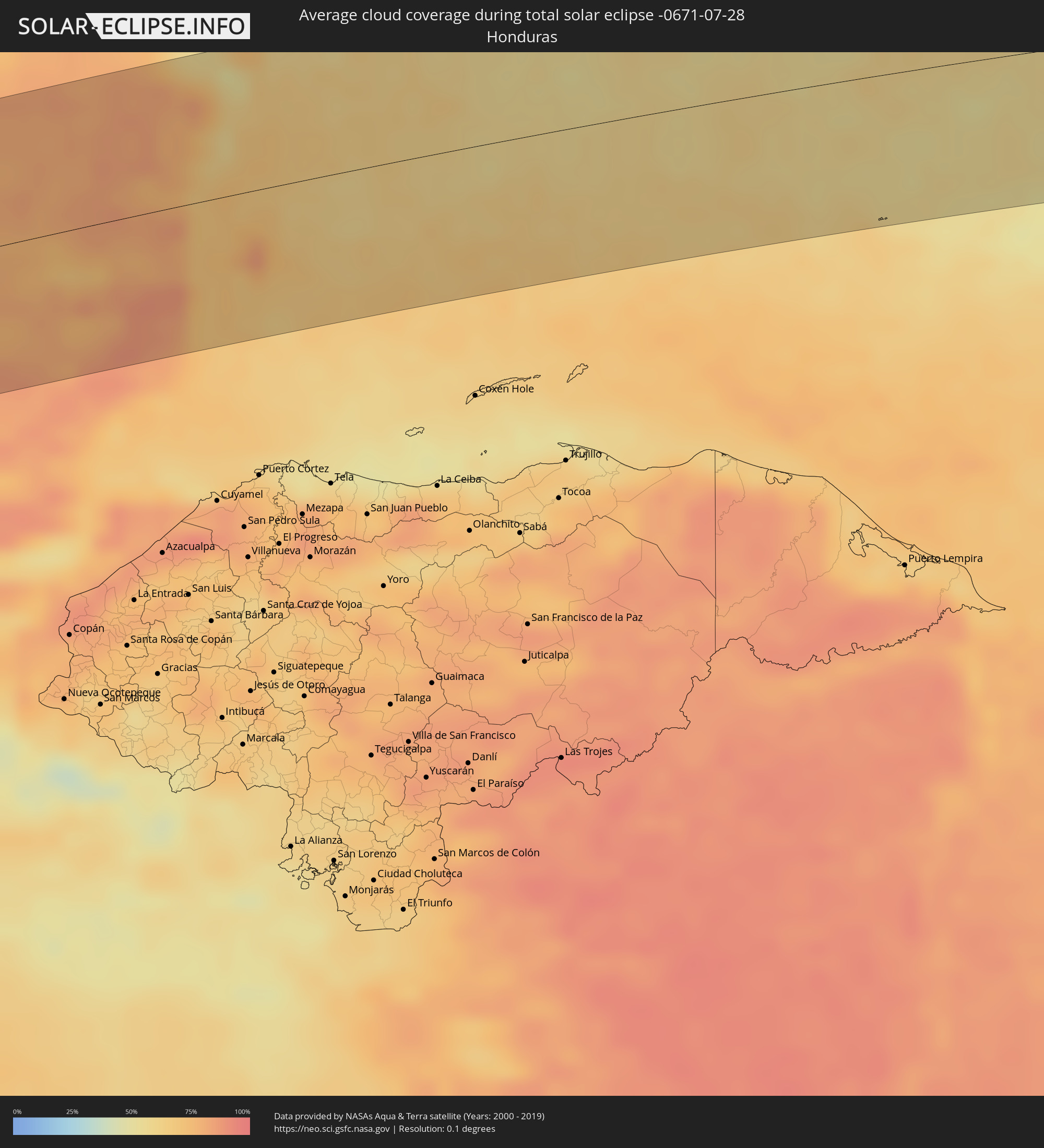 Honduras
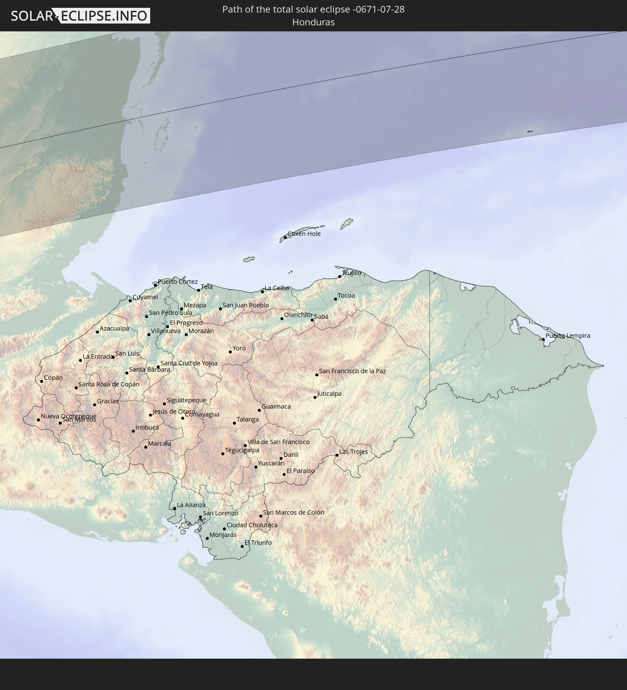
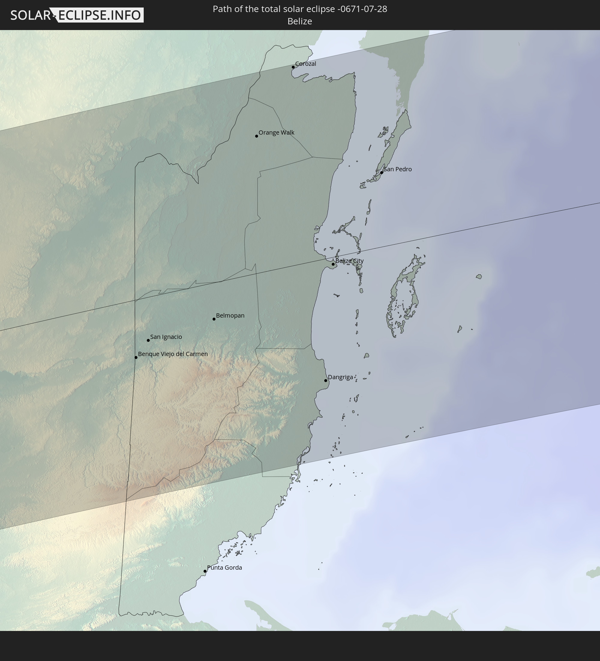
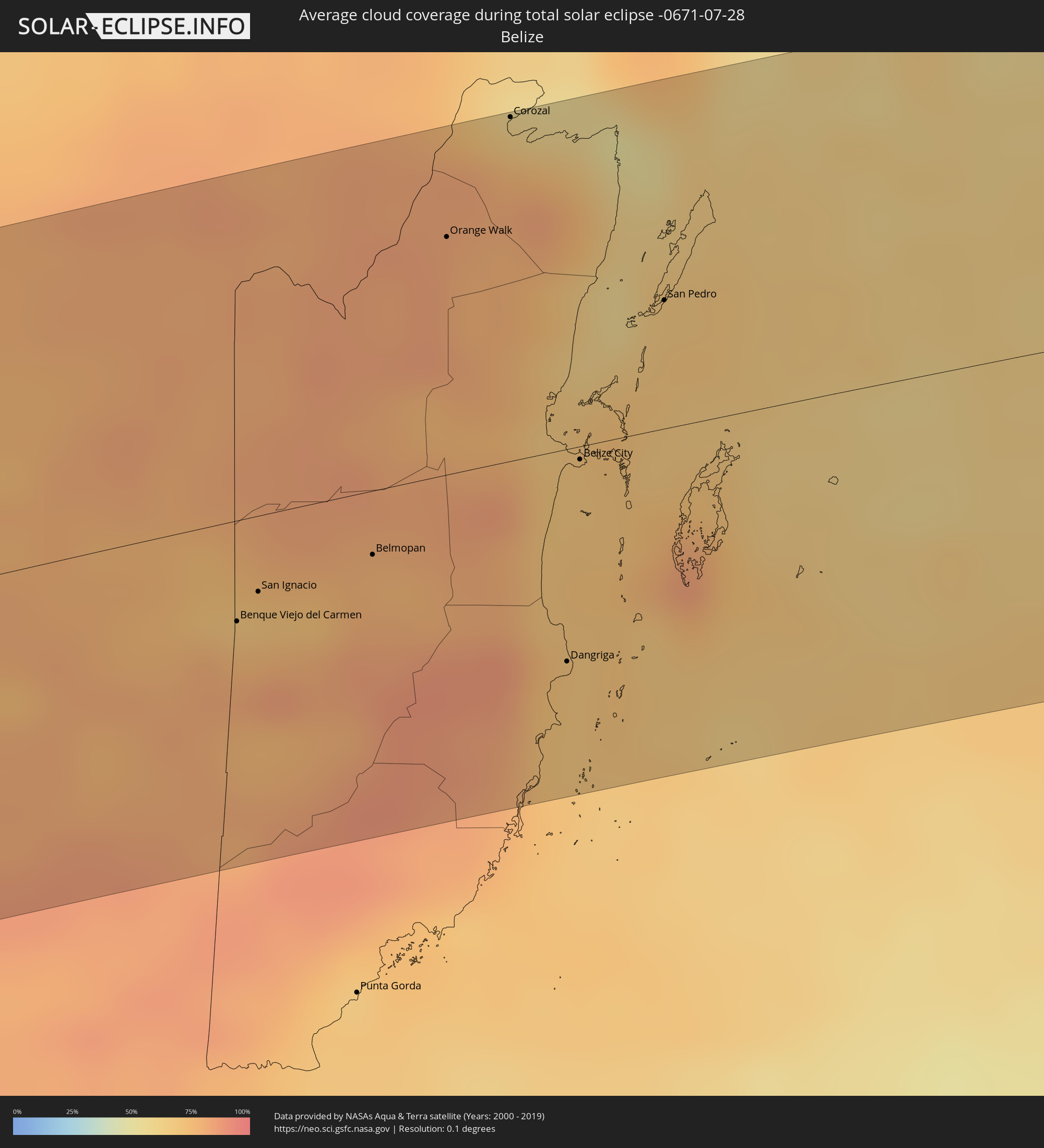 Belize
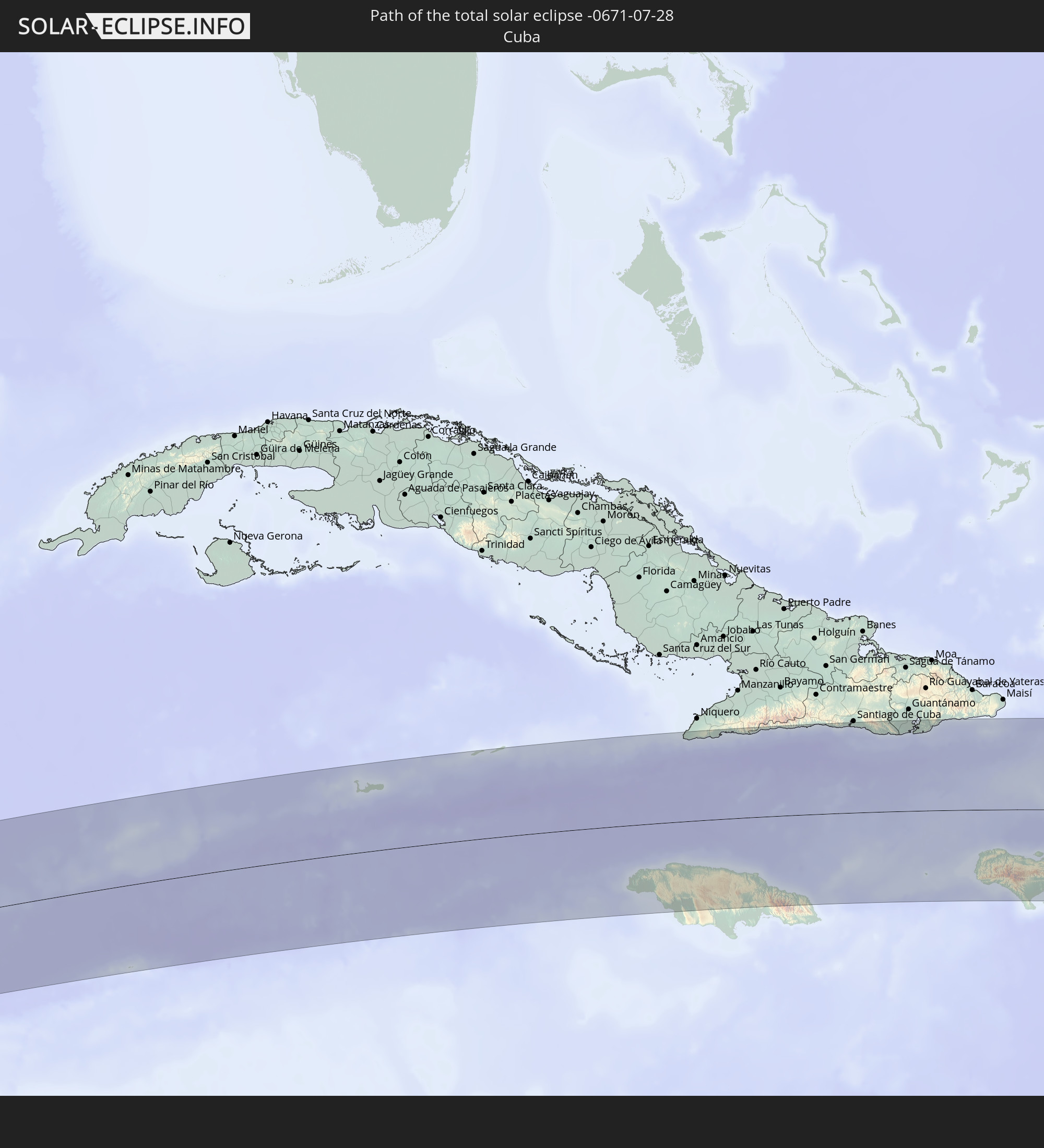
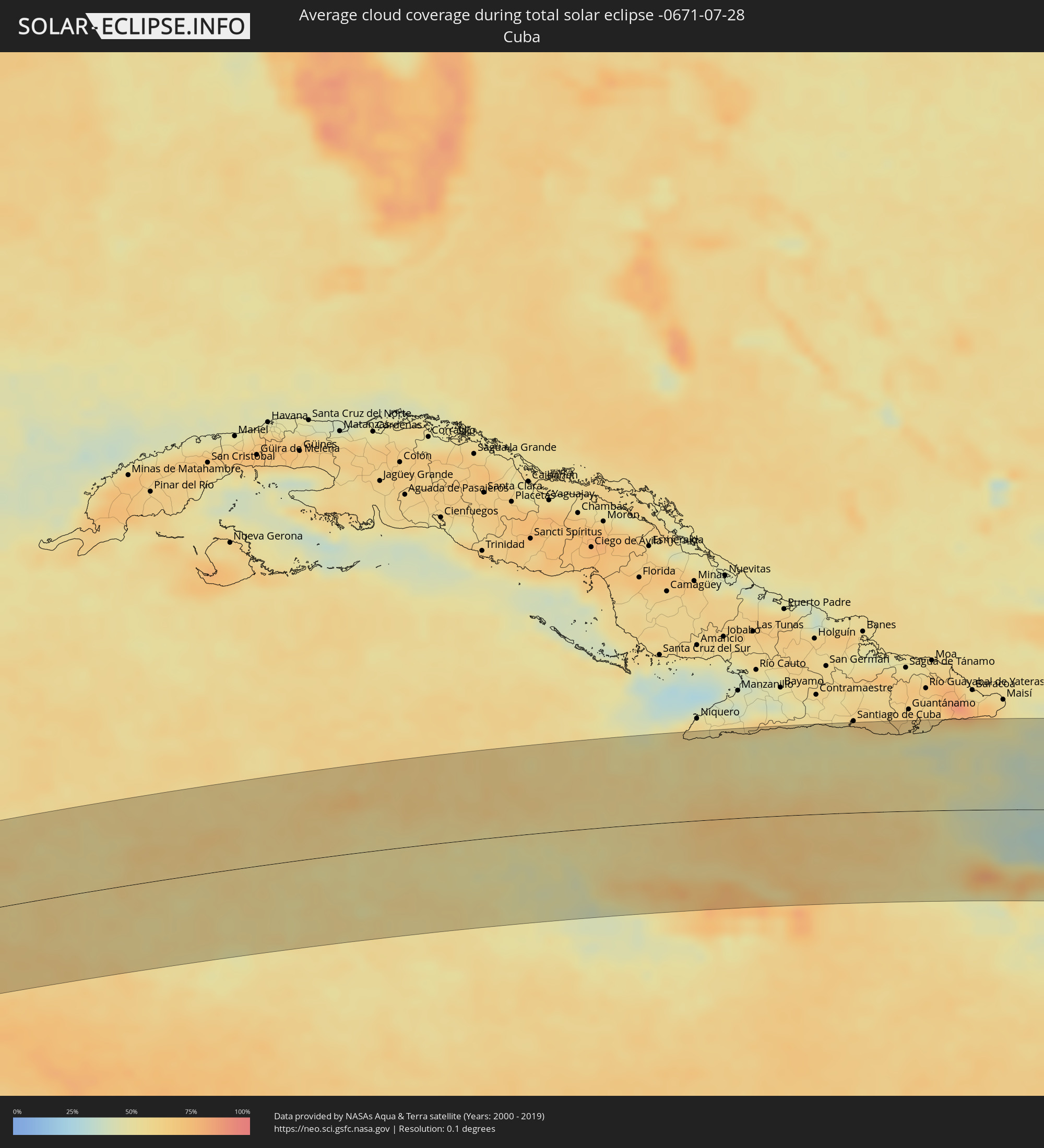 Cuba
Cuba
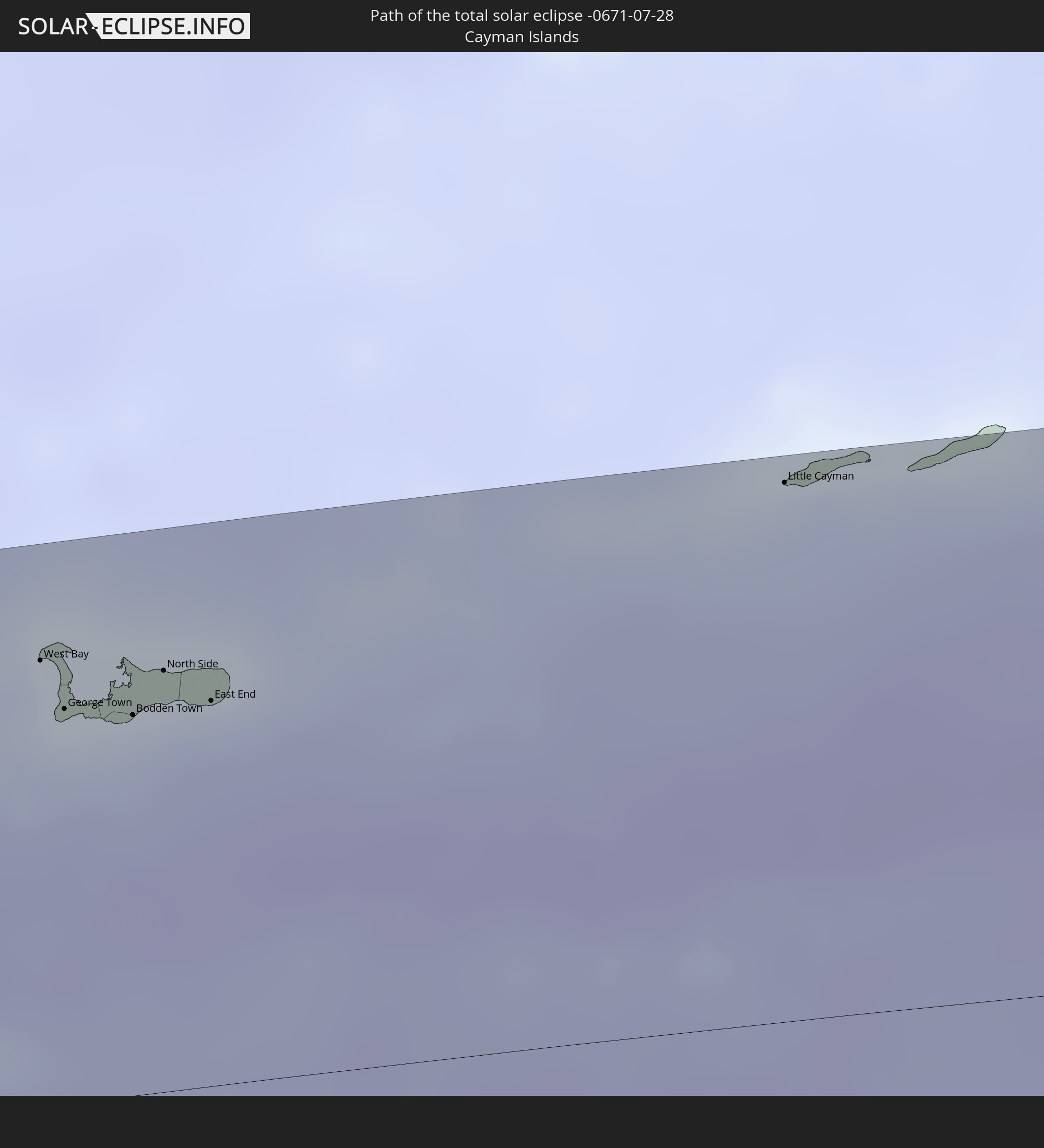
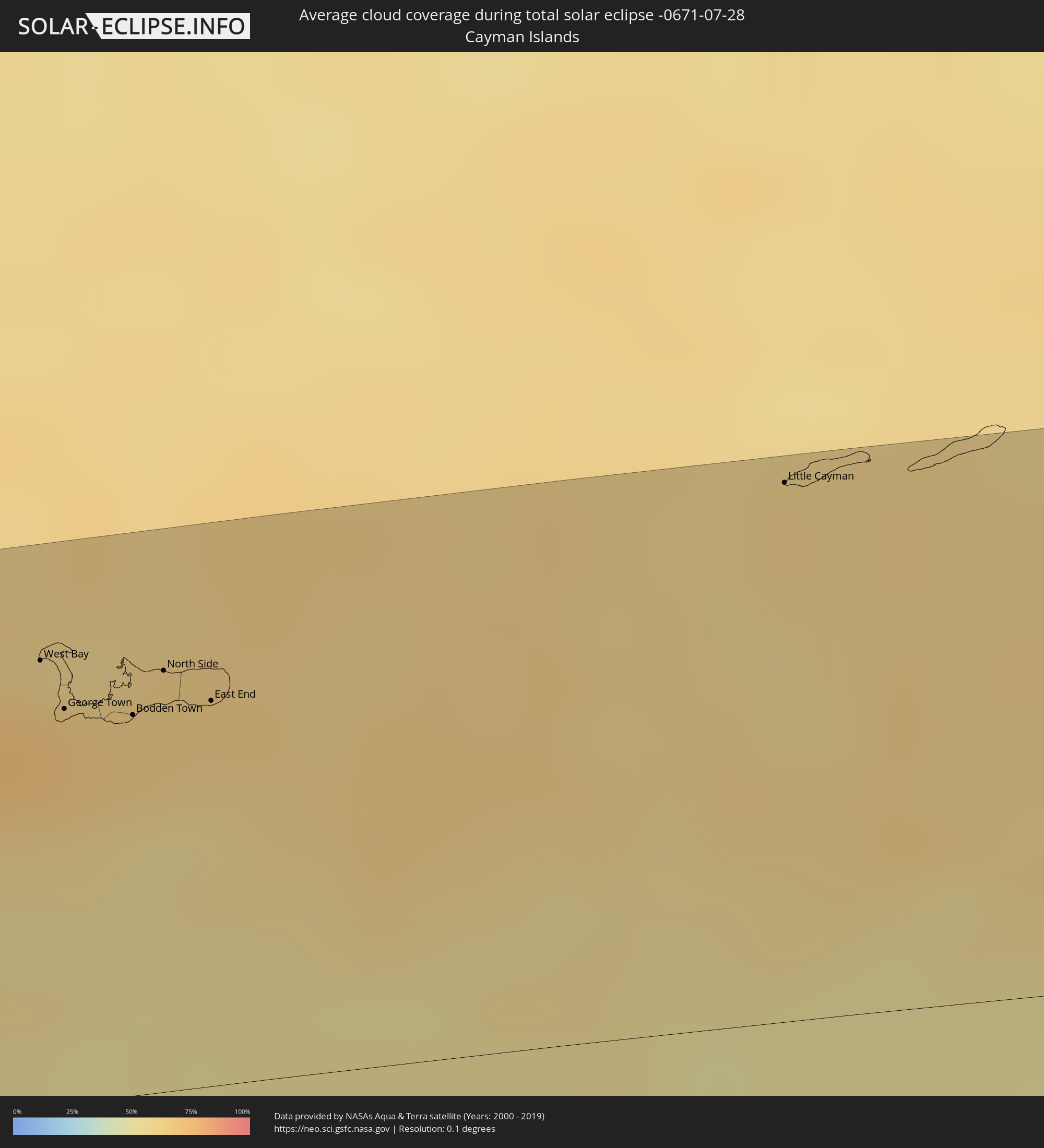 Cayman Islands
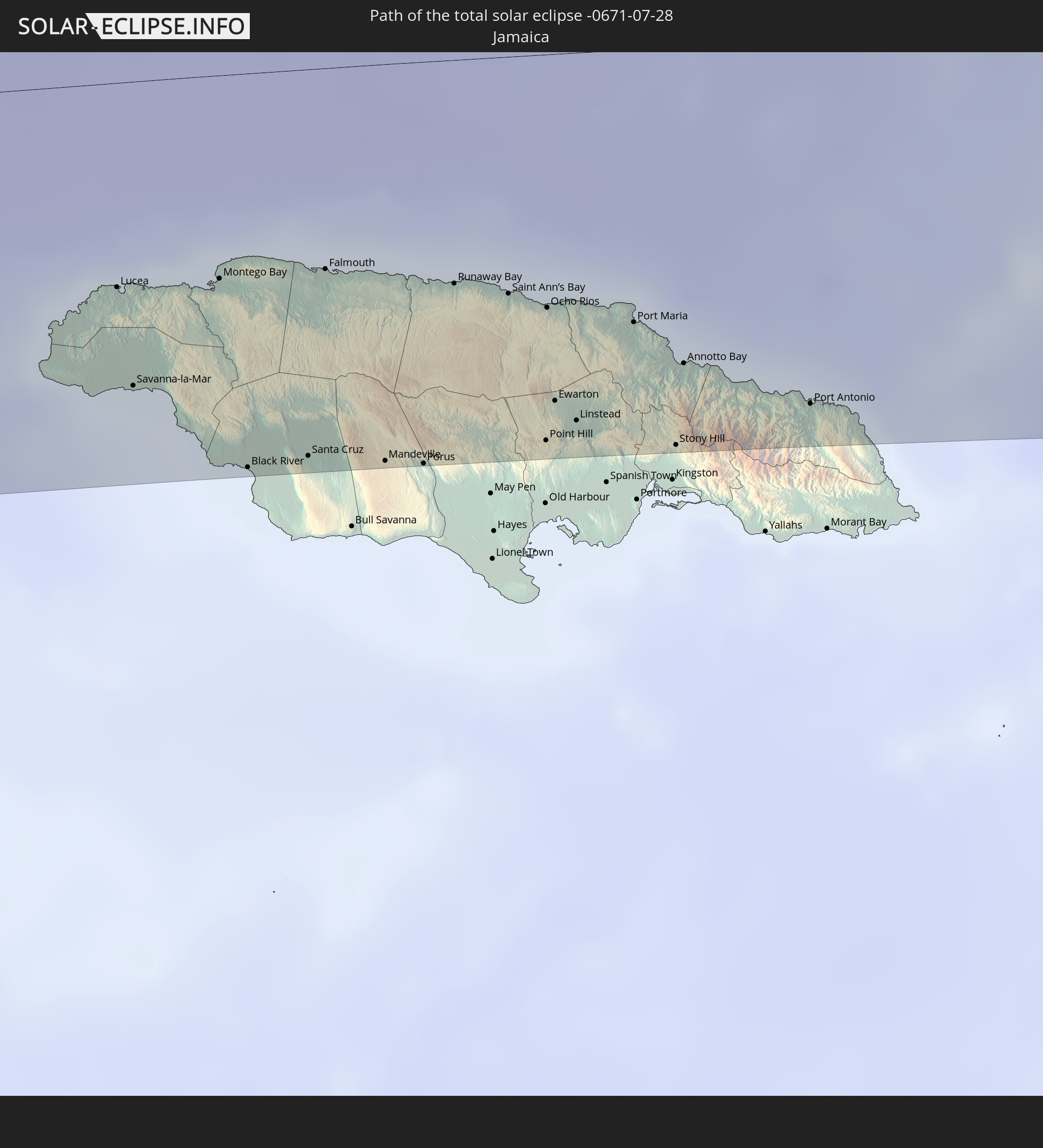
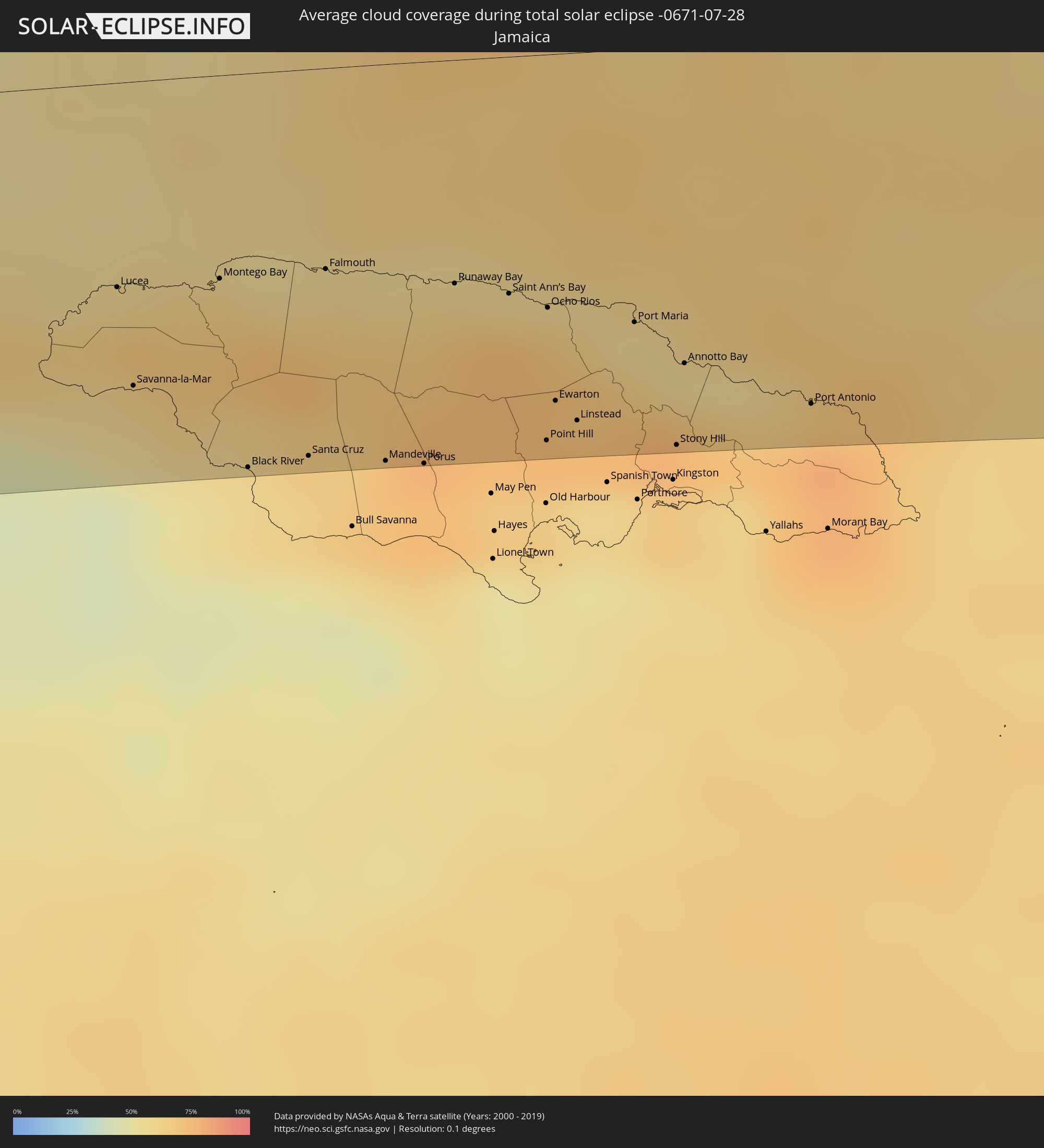 Jamaica
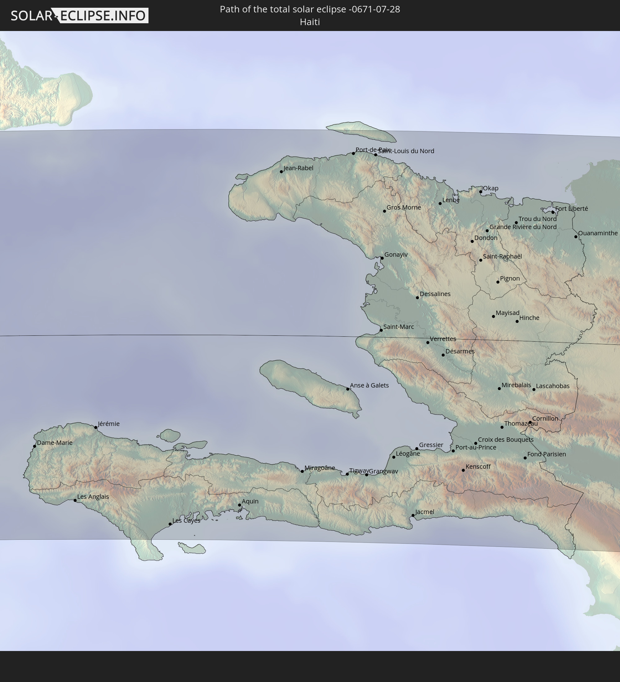
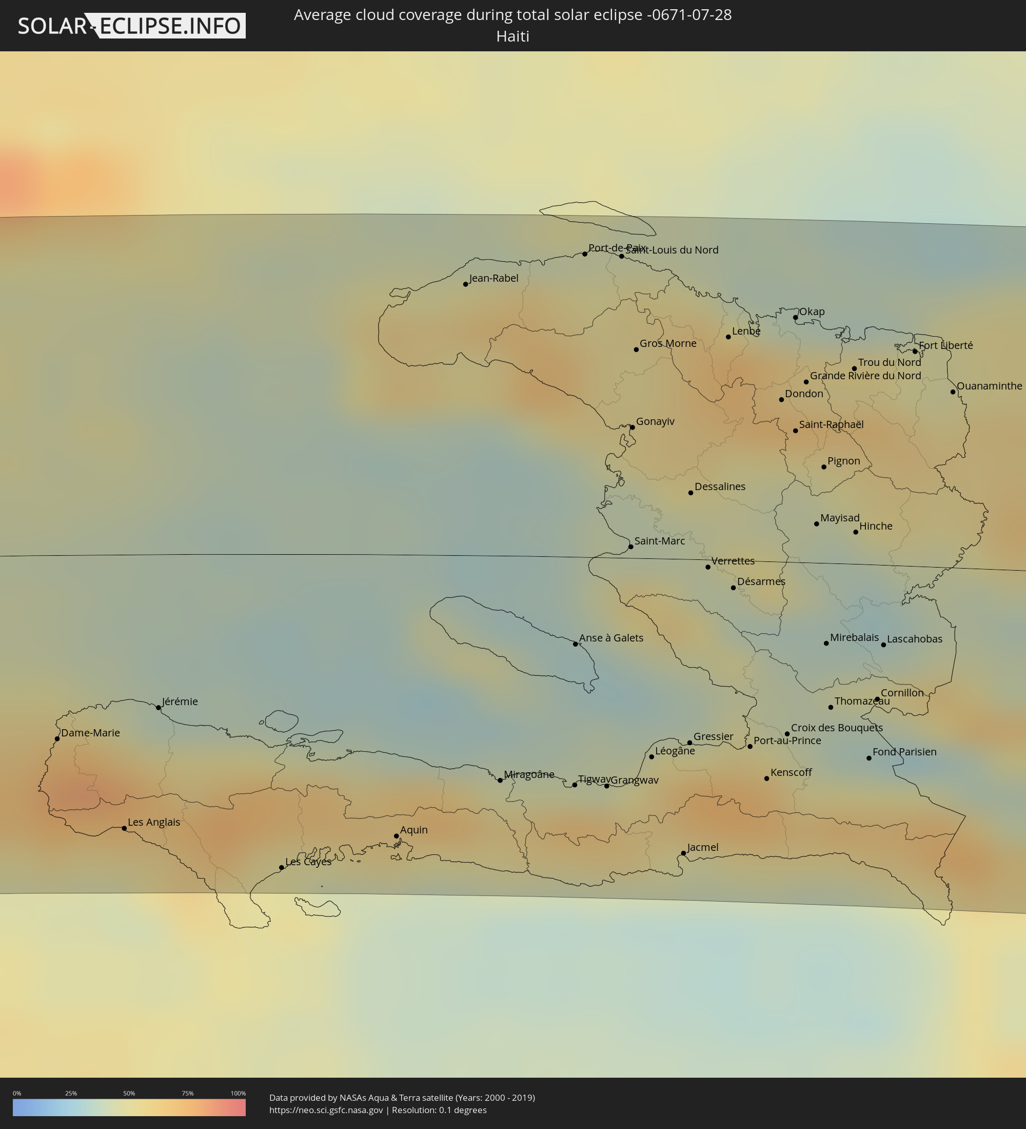 Haiti
Haiti
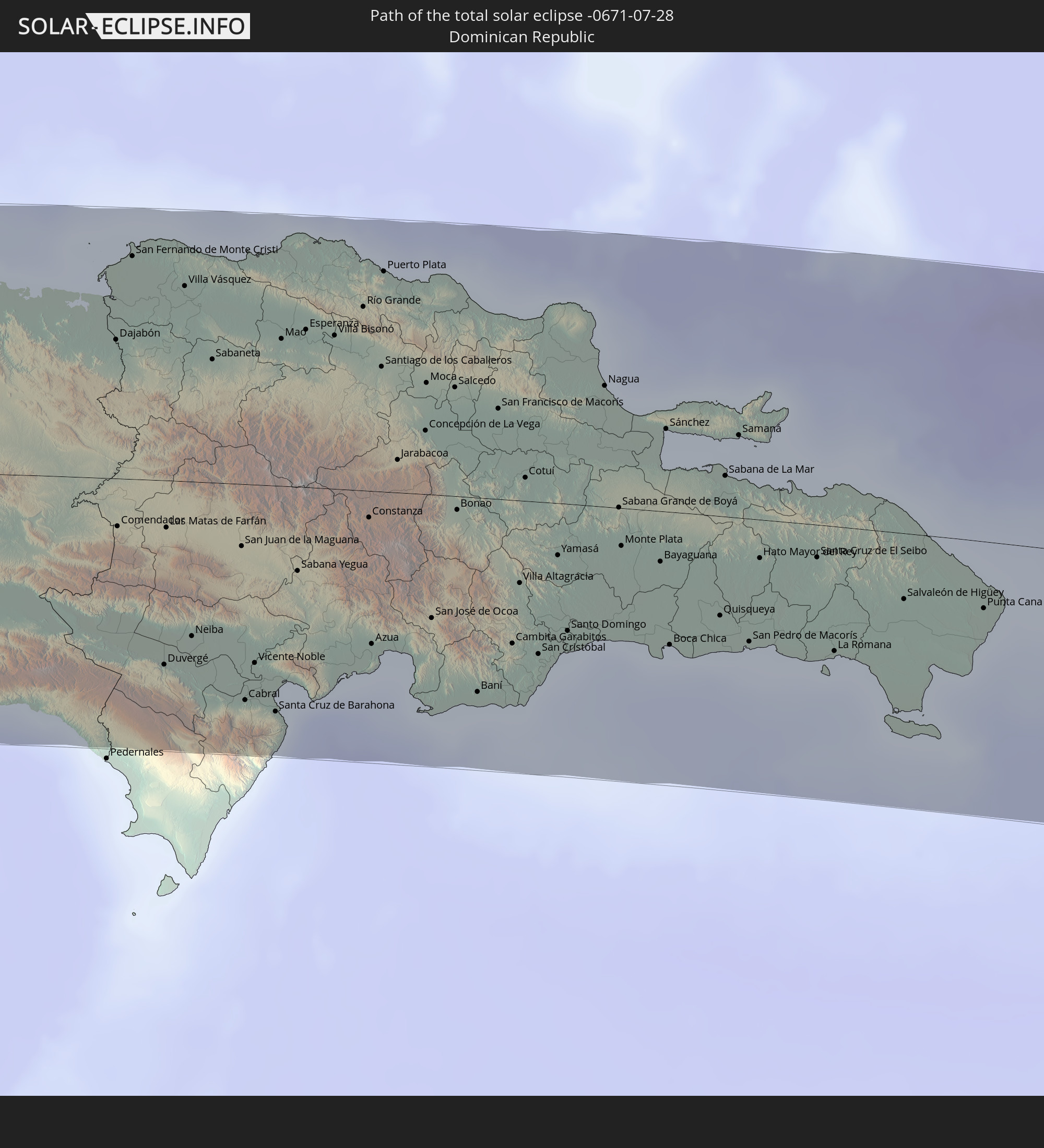
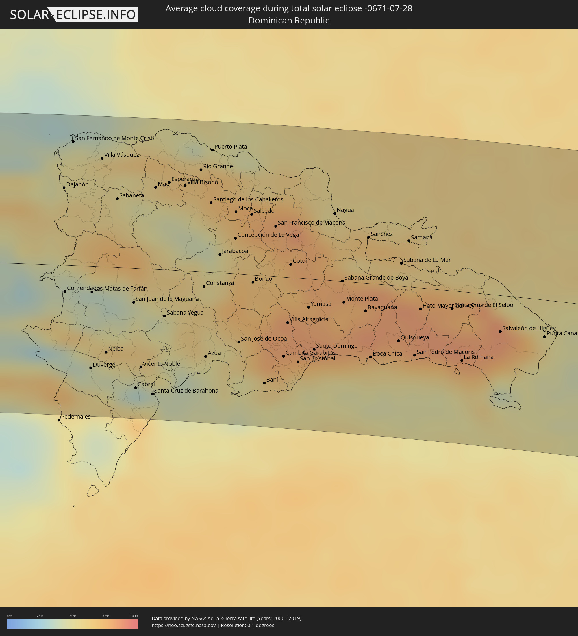 Dominican Republic
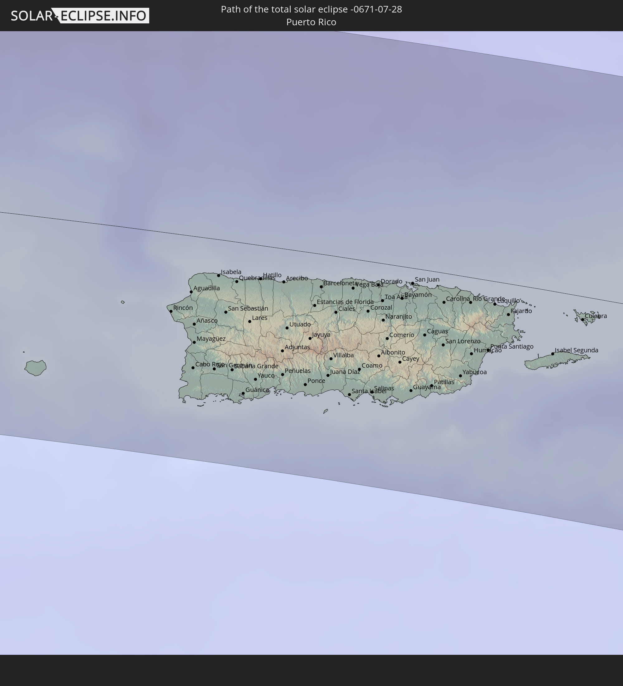
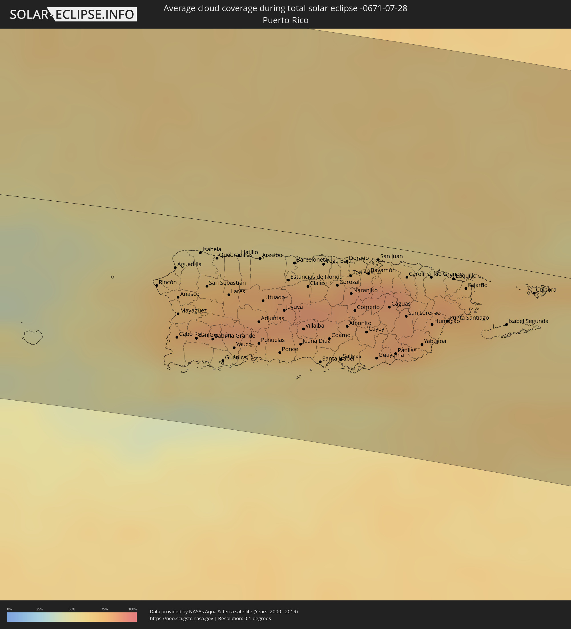 Puerto Rico
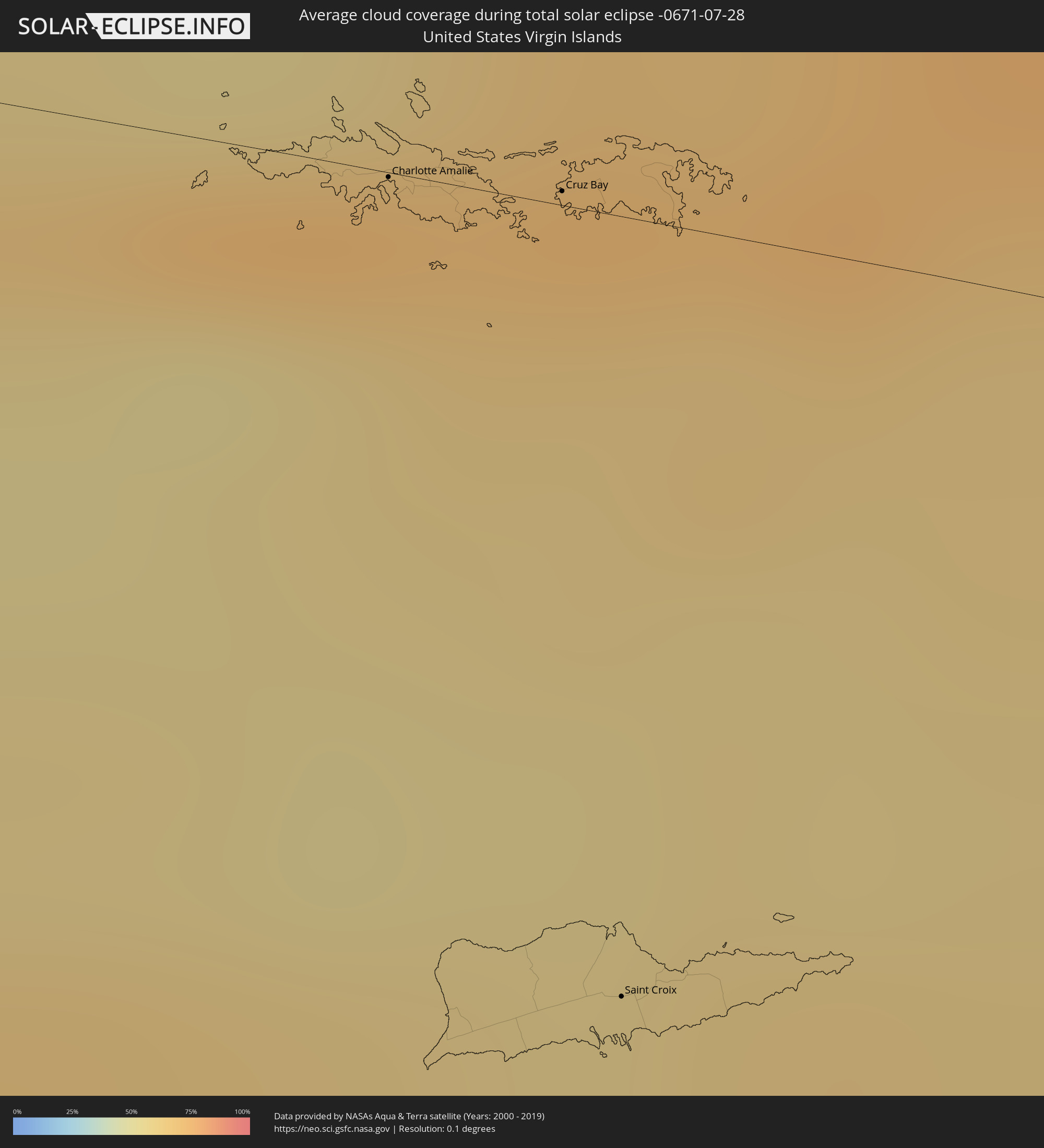 United States Virgin Islands
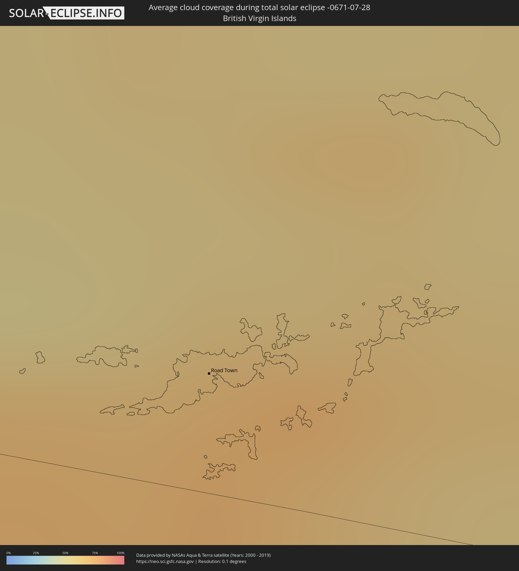 British Virgin Islands
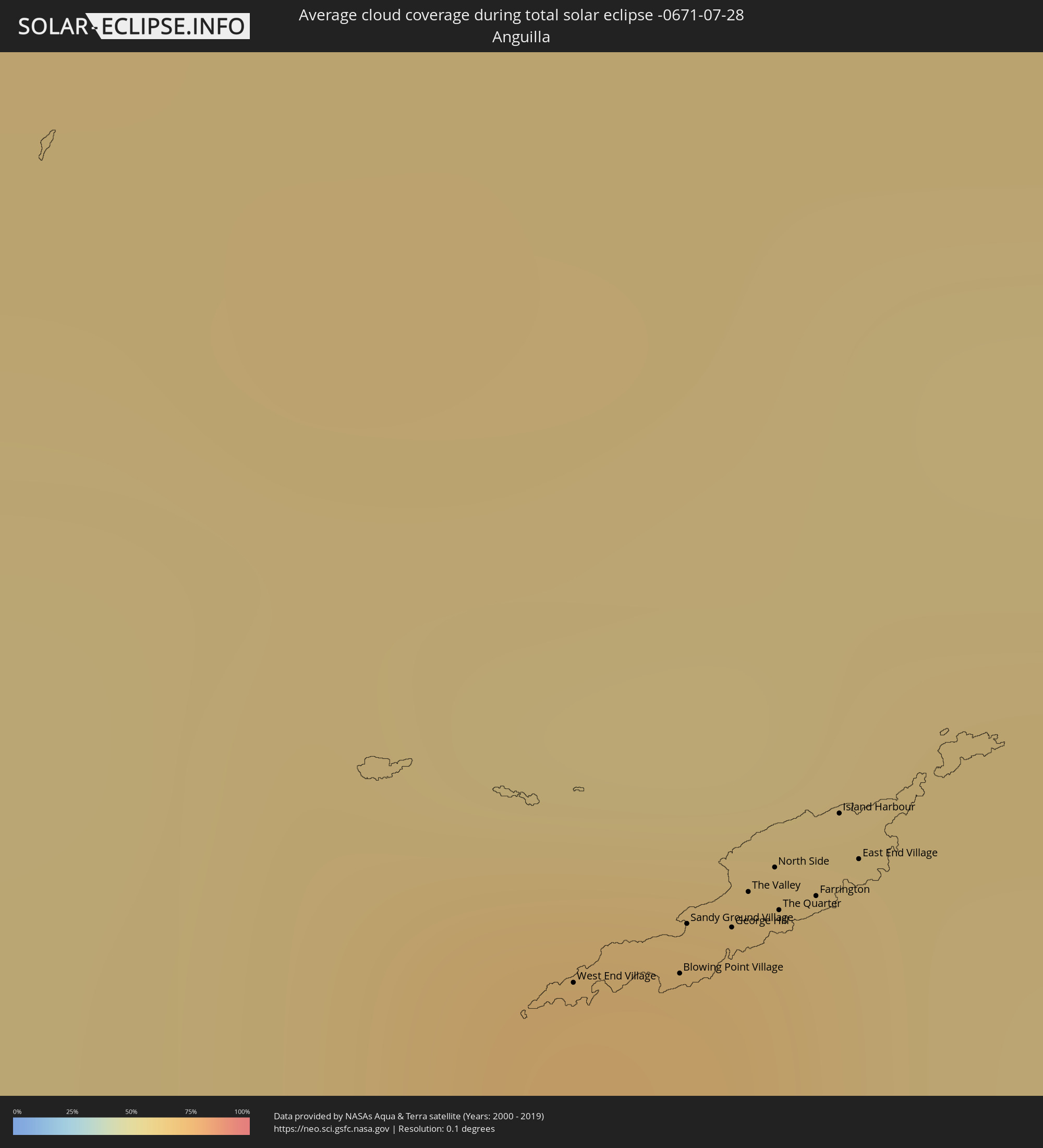 Anguilla
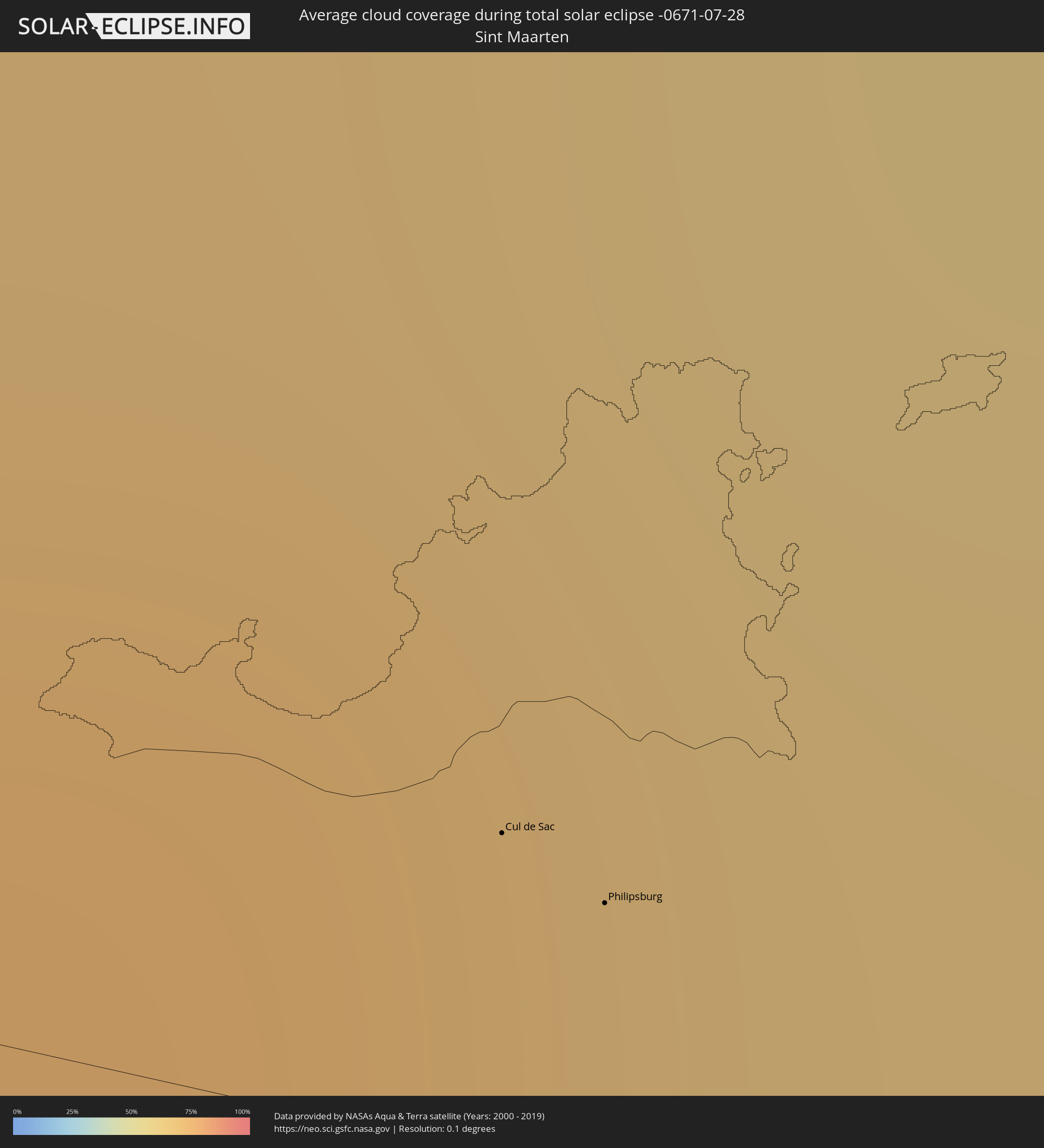 Sint Maarten
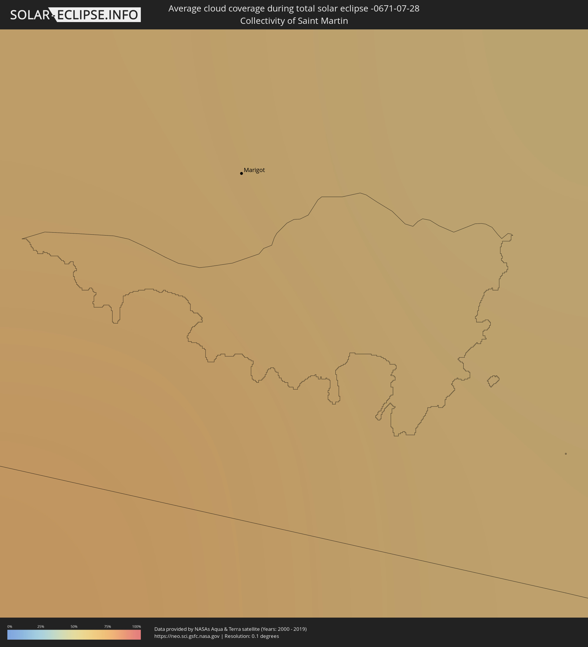 Collectivity of Saint Martin
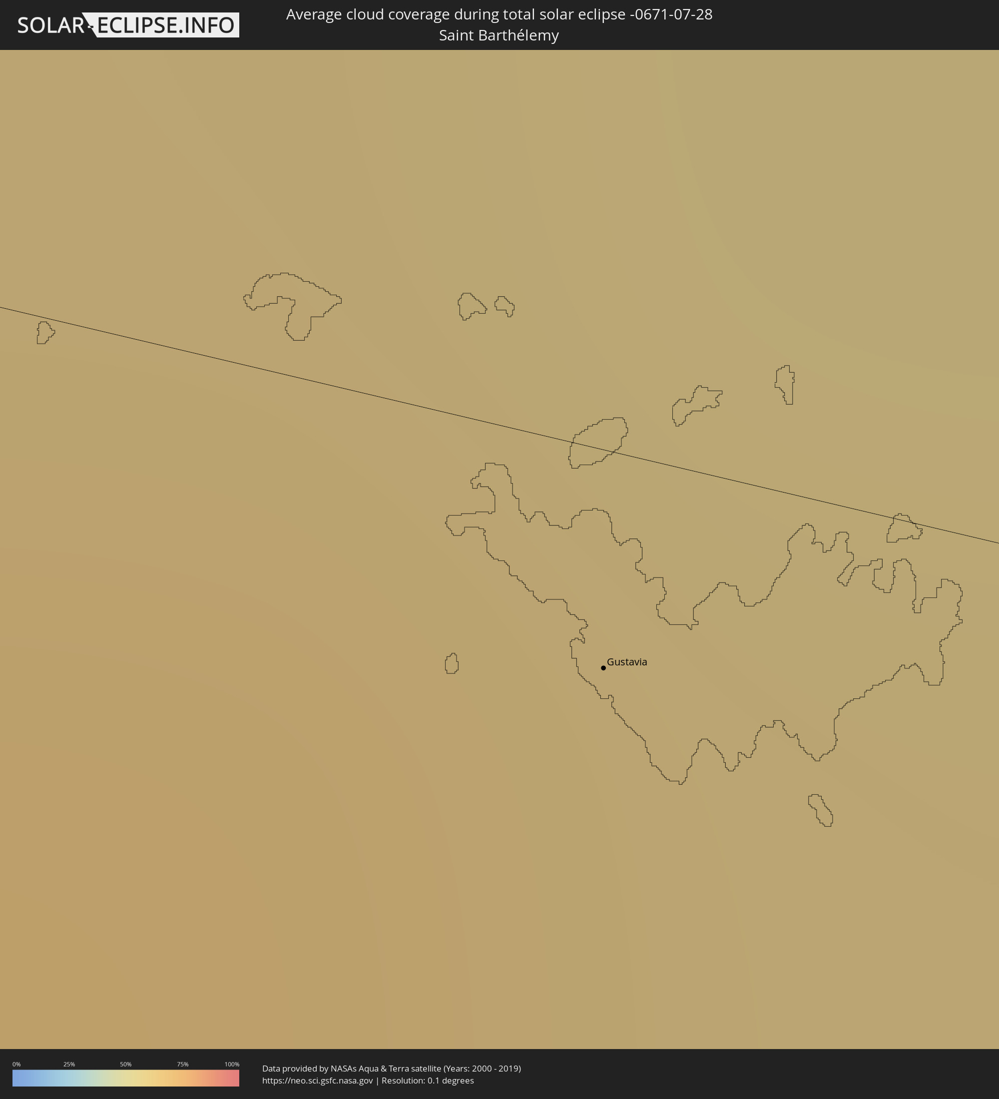 Saint Barthélemy
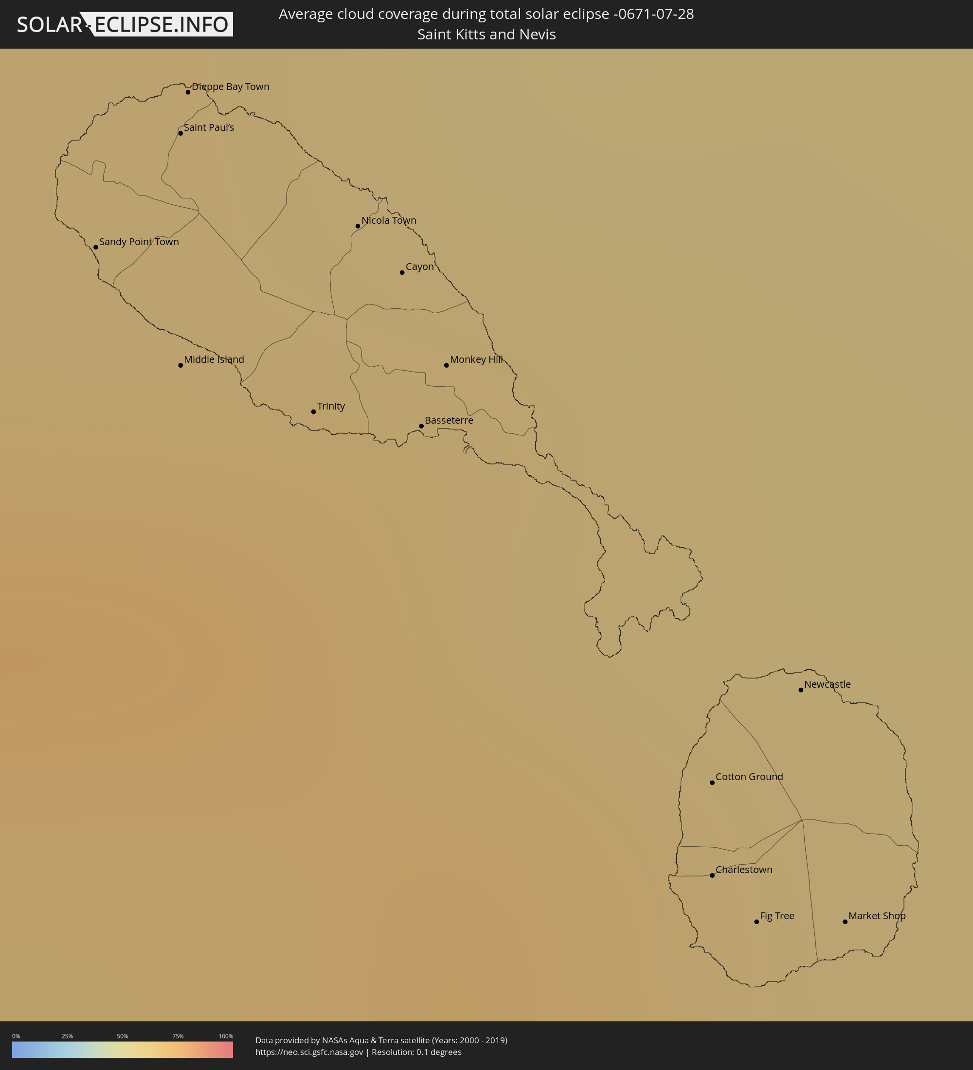 Saint Kitts and Nevis
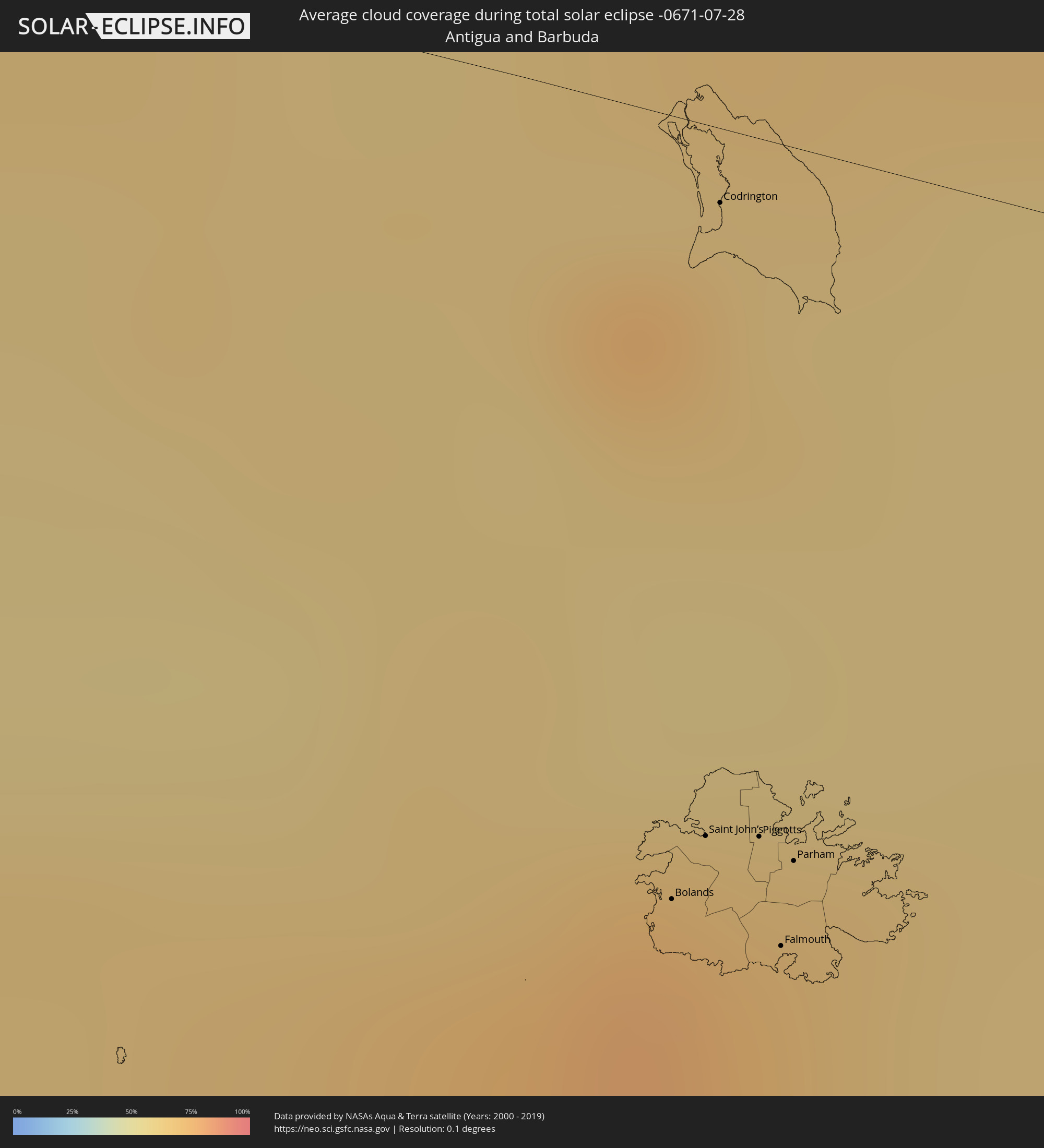 Antigua and Barbuda
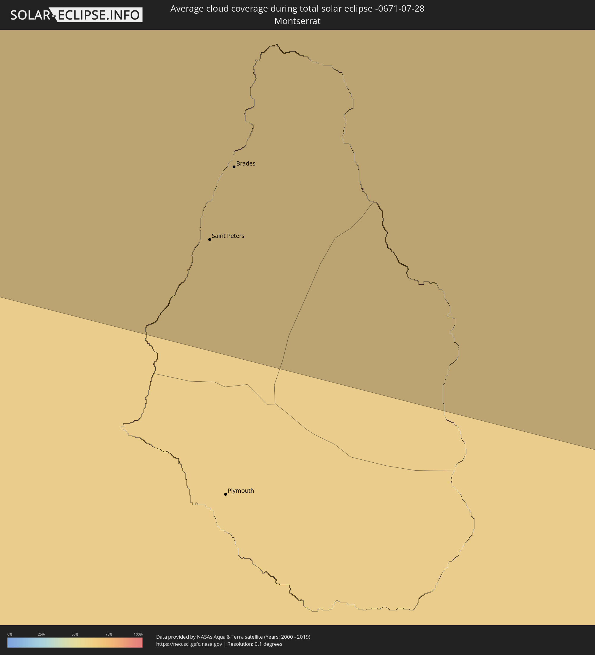 Montserrat
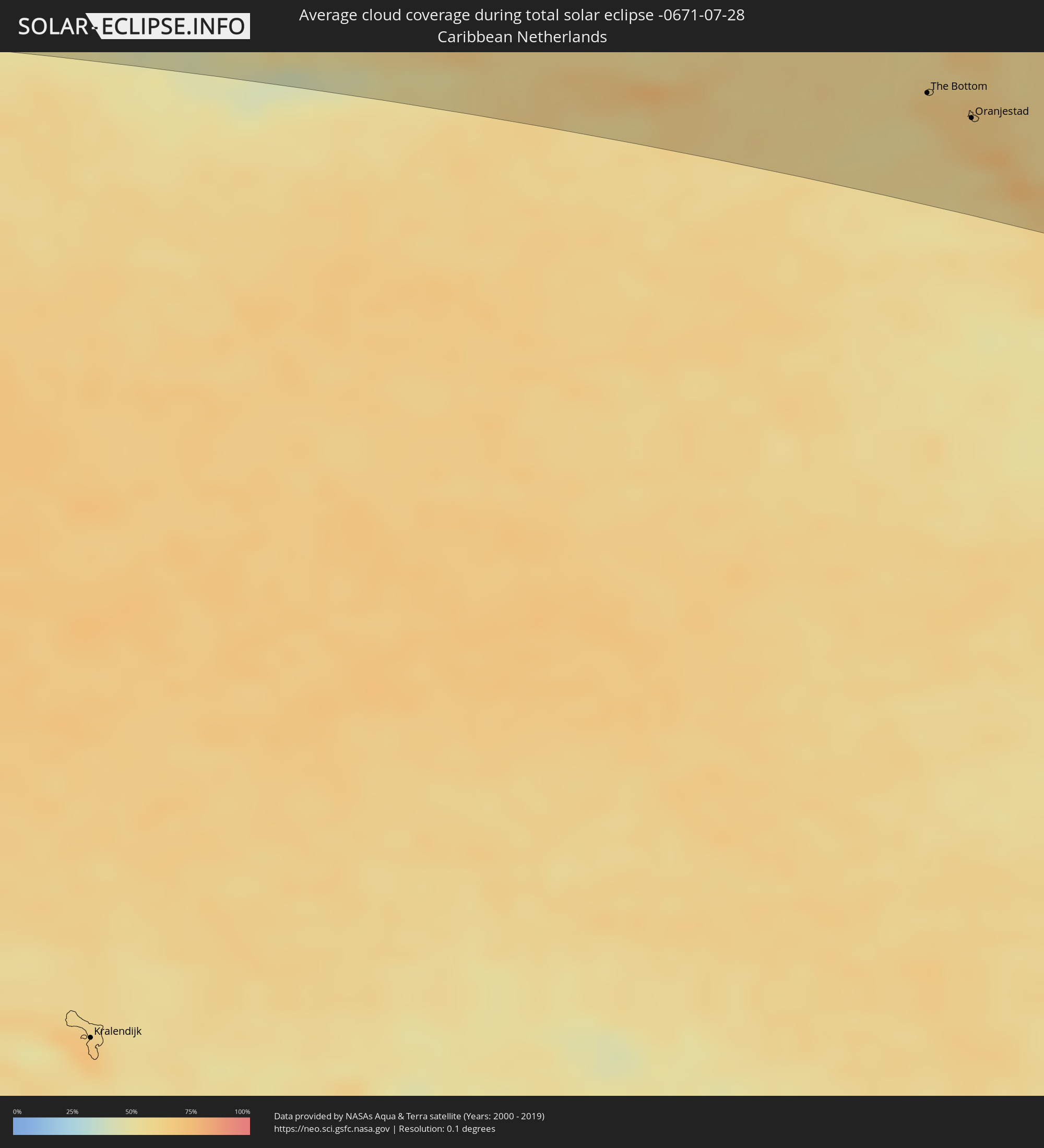 Caribbean Netherlands
Cities inside the path of the eclipse
The following table shows all locations with a population of more than 5,000 inside the eclipse path. Cities which have more than 100,000 inhabitants are marked bold. A click at the locations opens a detailed map.
| City | Type | Eclipse duration | Local time of max. eclipse | Distance to central line | Ø Cloud coverage |
|
Santo Domingo Tehuantepec, Oaxaca
|
total | - | 07:07:33 UTC-06:36 | 49 km | 68% |
|
Salina Cruz, Oaxaca
|
total | - | 07:07:33 UTC-06:36 | 33 km | 65% |
|
Juchitán de Zaragoza, Oaxaca
|
total | - | 07:07:45 UTC-06:36 | 55 km | 59% |
|
Tonalá, Chiapas
|
total | - | 07:08:49 UTC-06:36 | 18 km | 57% |
|
Cintalapa de Figueroa, Chiapas
|
total | - | 07:08:58 UTC-06:36 | 45 km | 70% |
|
Ocozocoautla de Espinosa, Chiapas
|
total | - | 07:09:18 UTC-06:36 | 44 km | 70% |
|
Tuxtla, Chiapas
|
total | - | 07:09:32 UTC-06:36 | 37 km | 74% |
|
San Cristóbal de las Casas, Chiapas
|
total | - | 07:09:59 UTC-06:36 | 21 km | 68% |
|
Comitán, Chiapas
|
total | - | 07:10:25 UTC-06:36 | 45 km | 53% |
|
Palenque, Chiapas
|
total | - | 07:10:48 UTC-06:36 | 88 km | 49% |
|
Las Margaritas, Chiapas
|
total | - | 07:10:35 UTC-06:36 | 41 km | 53% |
|
Tenosique de Pino Suárez, Tabasco
|
total | - | 07:11:21 UTC-06:36 | 70 km | 58% |
|
Sayaxché, Petén
|
total | - | 07:47:05 UTC-06:02 | 65 km | 75% |
|
La Libertad, Petén
|
total | - | 07:47:11 UTC-06:02 | 37 km | 73% |
|
San Benito, Petén
|
total | - | 07:47:25 UTC-06:02 | 28 km | 77% |
|
San Andrés, Petén
|
total | - | 07:47:26 UTC-06:02 | 22 km | 64% |
|
Flores, Petén
|
total | - | 07:47:27 UTC-06:02 | 27 km | 77% |
|
Santa Ana, Petén
|
total | - | 07:47:30 UTC-06:02 | 42 km | 79% |
|
Dolores, Petén
|
total | - | 07:47:56 UTC-06:02 | 83 km | 85% |
|
Melchor de Mencos, Petén
|
total | - | 07:48:19 UTC-06:02 | 29 km | 79% |
|
Benque Viejo del Carmen, Cayo
|
total | - | 07:57:36 UTC-05:52 | 29 km | 77% |
|
San Ignacio, Cayo
|
total | - | 07:57:41 UTC-05:52 | 22 km | 69% |
|
Belmopan, Cayo
|
total | - | 07:58:04 UTC-05:52 | 18 km | 78% |
|
Orange Walk, Orange Walk
|
total | - | 07:58:27 UTC-05:52 | 68 km | 83% |
|
Corozal, Corozal
|
total | - | 07:58:42 UTC-05:52 | 98 km | 66% |
|
Dangriga, Stann Creek
|
total | - | 07:58:41 UTC-05:52 | 61 km | 69% |
|
Belize City, Belize
|
total | - | 07:58:48 UTC-05:52 | 4 km | 69% |
|
San Pedro, Belize
|
total | - | 07:59:08 UTC-05:52 | 37 km | 68% |
|
West Bay, West Bay
|
total | - | 08:41:42 UTC-05:19 | 82 km | 69% |
|
George Town, George Town
|
total | - | 08:41:46 UTC-05:19 | 73 km | 69% |
|
Bodden Town, Bodden Town
|
total | - | 08:41:58 UTC-05:19 | 70 km | 65% |
|
North Side, North Side
|
total | - | 08:42:03 UTC-05:19 | 77 km | 64% |
|
East End, East End
|
total | - | 08:42:11 UTC-05:19 | 71 km | 61% |
|
Little Cayman, Sister Island
|
total | - | 08:43:50 UTC-05:19 | 99 km | 62% |
|
Savanna-la-Mar, Westmoreland
|
total | - | 08:59:45 UTC-05:07 | 79 km | 59% |
|
Montego Bay, St. James
|
total | - | 09:00:07 UTC-05:07 | 53 km | 63% |
|
Santa Cruz, St. Elizabeth
|
total | - | 09:00:34 UTC-05:07 | 101 km | 66% |
|
Falmouth, Trelawny
|
total | - | 09:00:36 UTC-05:07 | 52 km | 59% |
|
Mandeville, Manchester
|
total | - | 09:00:55 UTC-05:07 | 104 km | 71% |
|
Runaway Bay, St Ann
|
total | - | 09:01:12 UTC-05:07 | 58 km | 60% |
|
Saint Ann’s Bay, St Ann
|
total | - | 09:01:27 UTC-05:07 | 62 km | 74% |
|
Ocho Rios, St Ann
|
total | - | 09:01:38 UTC-05:07 | 66 km | 70% |
|
Linstead, Saint Catherine
|
total | - | 09:01:48 UTC-05:07 | 96 km | 75% |
|
Port Maria, St. Mary
|
total | - | 09:02:03 UTC-05:07 | 71 km | 57% |
|
Stony Hill, St. Andrew
|
total | - | 09:02:17 UTC-05:07 | 104 km | 78% |
|
Port Antonio, Portland
|
total | - | 09:02:54 UTC-05:07 | 95 km | 65% |
|
Jérémie, GrandʼAnse
|
total | - | 09:25:38 UTC-04:49 | 49 km | 38% |
|
Les Cayes, Sud
|
total | - | 09:26:30 UTC-04:49 | 100 km | 48% |
|
Miragoâne, Nippes
|
total | - | 09:27:49 UTC-04:49 | 71 km | 58% |
|
Tigwav, Ouest
|
total | - | 09:28:18 UTC-04:49 | 73 km | 66% |
|
Port-de-Paix, Nord-Ouest
|
total | - | 09:27:58 UTC-04:49 | 96 km | 49% |
|
Saint-Marc, Artibonite
|
total | - | 09:28:28 UTC-04:49 | 3 km | 56% |
|
Gonayiv, Artibonite
|
total | - | 09:28:23 UTC-04:49 | 41 km | 41% |
|
Léogâne, Ouest
|
total | - | 09:28:46 UTC-04:49 | 63 km | 62% |
|
Jacmel, Sud-Est
|
total | - | 09:29:03 UTC-04:49 | 94 km | 41% |
|
Port-au-Prince, Ouest
|
total | - | 09:29:23 UTC-04:49 | 59 km | 66% |
|
Okap, Nord
|
total | - | 09:29:20 UTC-04:49 | 77 km | 38% |
|
Thomazeau, Ouest
|
total | - | 09:29:53 UTC-04:49 | 46 km | 38% |
|
San Juan de la Maguana, San Juan
|
total | - | 09:40:42 UTC-04:40 | 25 km | 48% |
|
Santa Cruz de Barahona, Barahona
|
total | - | 09:41:12 UTC-04:40 | 91 km | 50% |
|
Santiago de los Caballeros, Santiago
|
total | - | 09:41:39 UTC-04:40 | 50 km | 60% |
|
Puerto Plata, Puerto Plata
|
total | - | 09:41:33 UTC-04:40 | 88 km | 59% |
|
Concepción de La Vega, La Vega
|
total | - | 09:42:06 UTC-04:40 | 25 km | 62% |
|
Bonao, Monseñor Nouel
|
total | - | 09:42:28 UTC-04:40 | 5 km | 69% |
|
San Francisco de Macorís, Duarte
|
total | - | 09:42:41 UTC-04:40 | 36 km | 73% |
|
Santo Domingo, Nacional
|
total | - | 09:43:35 UTC-04:40 | 51 km | 73% |
|
San Pedro de Macorís, San Pedro de Macorís
|
total | - | 09:45:11 UTC-04:40 | 49 km | 70% |
|
La Romana, La Romana
|
total | - | 09:45:57 UTC-04:40 | 50 km | 63% |
|
Salvaleón de Higüey, La Altagracia
|
total | - | 09:46:29 UTC-04:40 | 26 km | 82% |
|
Punta Cana, La Altagracia
|
total | - | 09:47:12 UTC-04:40 | 27 km | 58% |
|
Mayagüez, Mayaguez
|
total | - | 10:30:24 UTC-04:00 | 53 km | 77% |
|
Yauco, Yauco
|
total | - | 10:31:12 UTC-04:00 | 67 km | 53% |
|
Arecibo, Arecibo
|
total | - | 10:31:16 UTC-04:00 | 17 km | 66% |
|
Ponce, Ponce
|
total | - | 10:31:47 UTC-04:00 | 66 km | 55% |
|
Barceloneta, Barceloneta
|
total | - | 10:31:43 UTC-04:00 | 16 km | 64% |
|
Vega Baja, Vega Baja
|
total | - | 10:32:05 UTC-04:00 | 15 km | 77% |
|
Guayama, Guayama
|
total | - | 10:33:01 UTC-04:00 | 61 km | 63% |
|
San Juan, San Juan
|
total | - | 10:32:45 UTC-04:00 | 8 km | 71% |
|
Caguas, Caguas
|
total | - | 10:33:02 UTC-04:00 | 32 km | 81% |
|
Carolina, Carolina
|
total | - | 10:33:10 UTC-04:00 | 15 km | 82% |
|
Humacao, Humacao
|
total | - | 10:33:37 UTC-04:00 | 38 km | 64% |
|
Fajardo, Fajardo
|
total | - | 10:33:57 UTC-04:00 | 15 km | 76% |
|
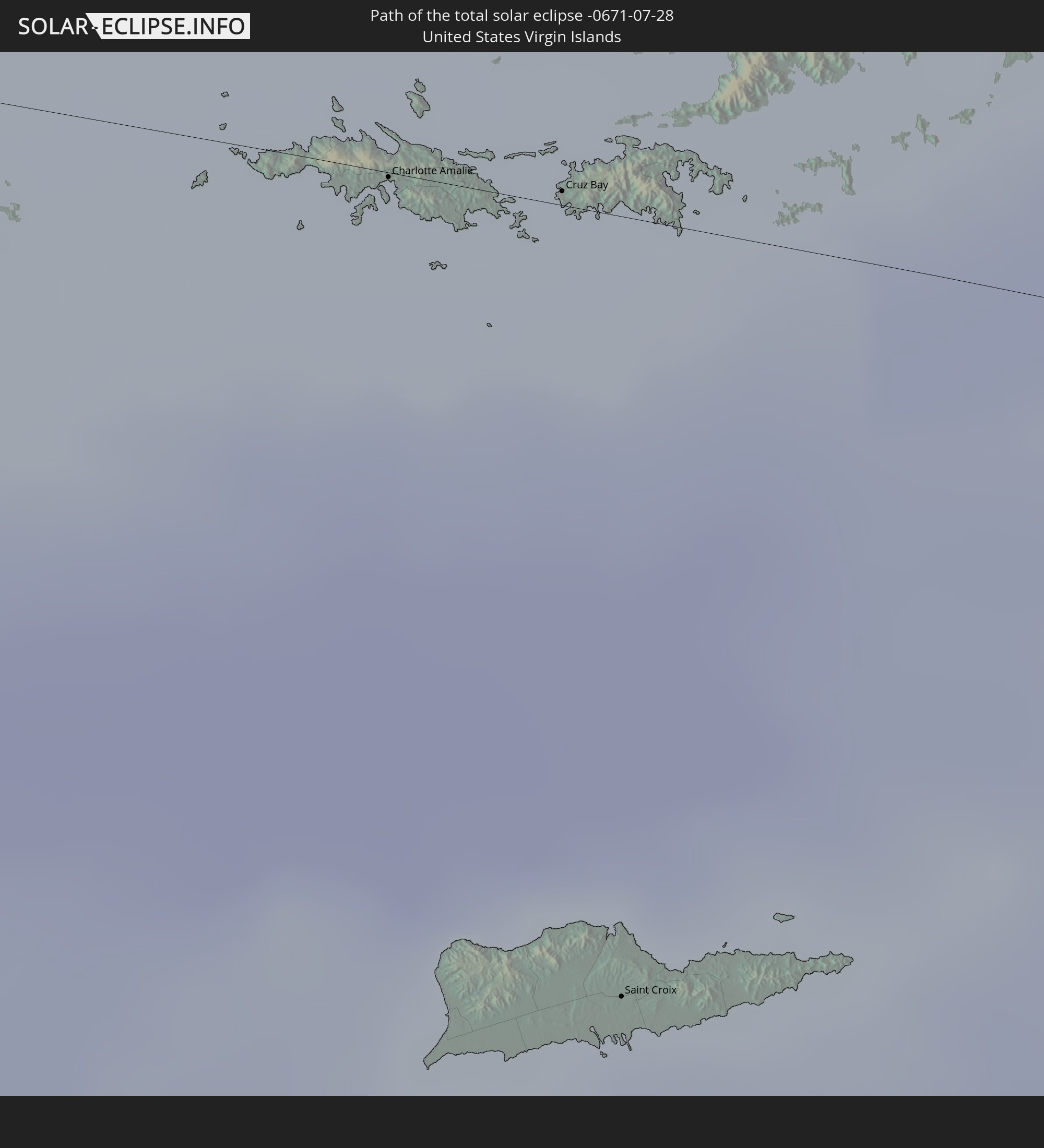
Charlotte Amalie, Saint Thomas Island
|
total | - | 10:29:39 UTC-04:06 | 0 km | 63% |
|
Cruz Bay, Saint John Island
|
total | - | 10:29:59 UTC-04:06 | 1 km | 64% |
|
Saint Croix, Saint Croix Island
|
total | - | 10:30:31 UTC-04:06 | 64 km | 62% |
|
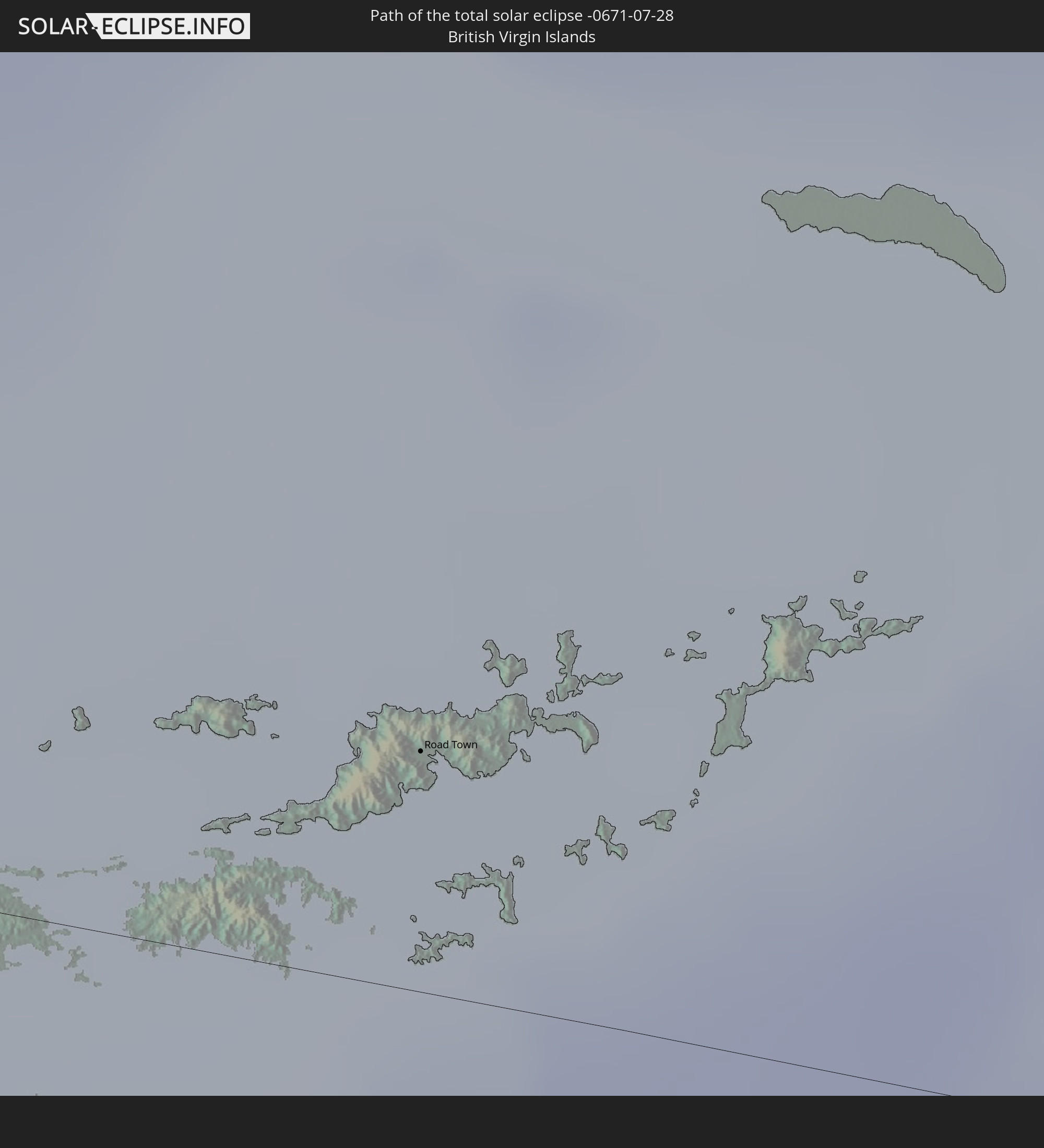
Road Town
|
total | - | 10:30:21 UTC-04:06 | 15 km | 74% |
 The Bottom, Saba
|
total | - | 10:04:40 UTC-04:35 | 43 km | 62% |
|
West End Village, West End
|
total | - | 10:34:13 UTC-04:06 | 19 km | 67% |
|
South Hill Village, South Hill
|
total | - | 10:34:22 UTC-04:06 | 23 km | 67% |
|
Marigot
|
total | - | 10:34:28 UTC-04:06 | 9 km | 73% |
|
North Hill Village, North Hill
|
total | - | 10:34:22 UTC-04:06 | 24 km | 67% |
|
George Hill, George Hill
|
total | - | 10:34:25 UTC-04:06 | 24 km | 67% |
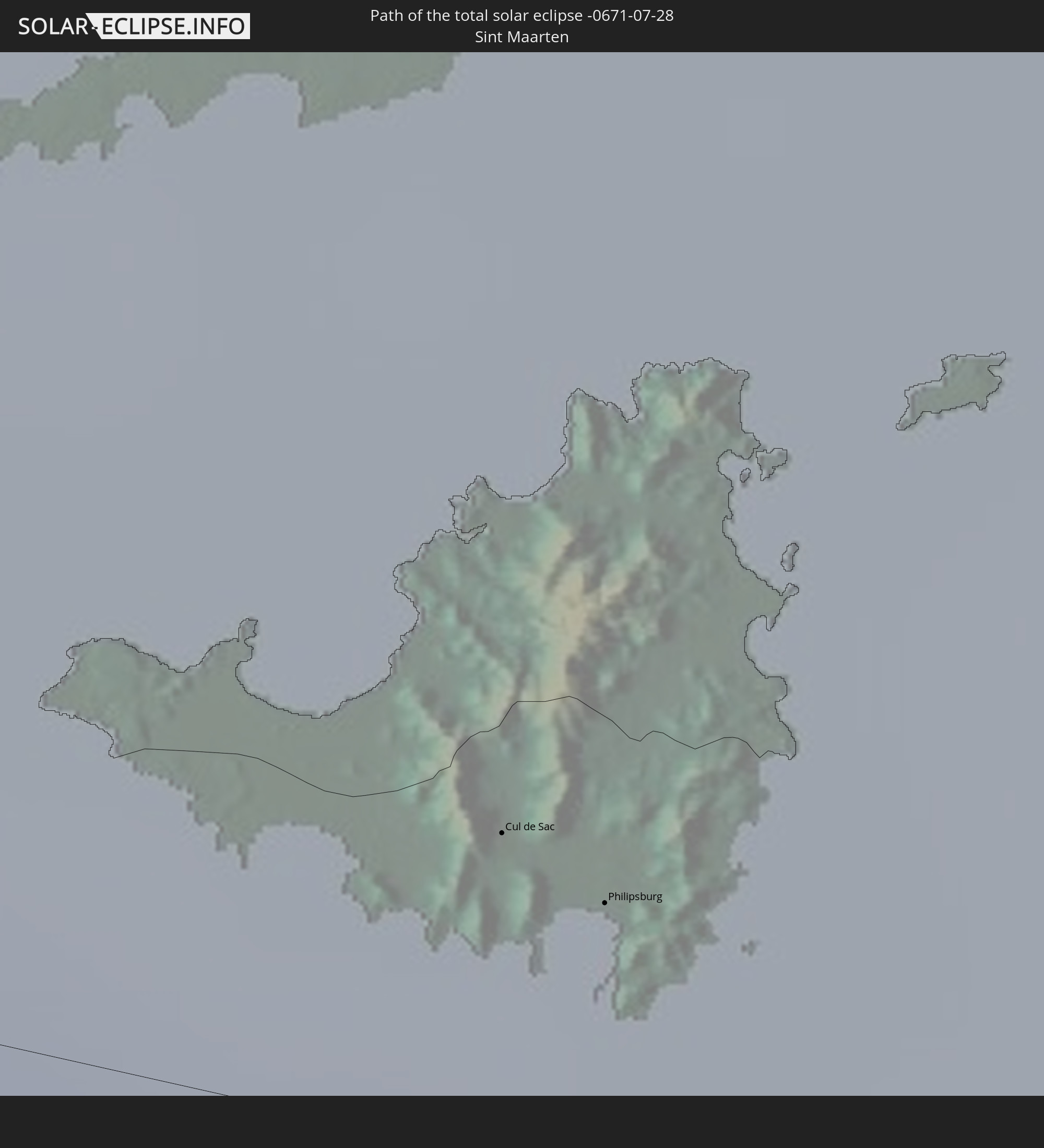
 Cul de Sac
|
total | - | 10:04:49 UTC-04:35 | 6 km | 65% |
|
The Valley, The Valley
|
total | - | 10:34:25 UTC-04:06 | 26 km | 67% |
|
Stoney Ground, Stoney Ground
|
total | - | 10:34:27 UTC-04:06 | 27 km | 62% |
|
Philipsburg
|
total | - | 10:04:53 UTC-04:35 | 5 km | 65% |
|
North Side, North Side
|
total | - | 10:34:27 UTC-04:06 | 28 km | 62% |
|
The Quarter, The Quarter
|
total | - | 10:34:28 UTC-04:06 | 25 km | 62% |
|
Farrington, The Farrington
|
total | - | 10:34:30 UTC-04:06 | 27 km | 62% |
|
Sandy Hill, Sandy Hill
|
total | - | 10:34:32 UTC-04:06 | 27 km | 62% |
|
Island Harbour, Island Harbour
|
total | - | 10:34:30 UTC-04:06 | 31 km | 60% |
|
East End Village, East End
|
total | - | 10:34:33 UTC-04:06 | 29 km | 62% |
|
Oranjestad, Sint Eustatius
|
total | - | 10:05:28 UTC-04:35 | 52 km | 66% |
|
Gustavia
|
total | - | 10:35:12 UTC-04:06 | 4 km | 59% |
|
Sandy Point Town, Saint Anne Sandy Point
|
total | - | 10:35:38 UTC-04:06 | 62 km | 71% |
|
Saint Paul’s, Saint Paul Capesterre
|
total | - | 10:35:41 UTC-04:06 | 57 km | 71% |
|
Middle Island, Saint Thomas Middle Island
|
total | - | 10:35:45 UTC-04:06 | 66 km | 65% |
|
Dieppe Bay Town, Saint John Capesterre
|
total | - | 10:35:40 UTC-04:06 | 55 km | 71% |
|
Trinity, Trinity Palmetto Point
|
total | - | 10:35:53 UTC-04:06 | 66 km | 65% |
|
Nicola Town, Christ Church Nichola Town
|
total | - | 10:35:52 UTC-04:06 | 59 km | 71% |
|
Cayon, Saint Mary Cayon
|
total | - | 10:35:56 UTC-04:06 | 60 km | 63% |
|
Basseterre, Saint George Basseterre
|
total | - | 10:36:00 UTC-04:06 | 66 km | 68% |
|
Monkey Hill, Saint Peter Basseterre
|
total | - | 10:36:00 UTC-04:06 | 63 km | 68% |
|
Charlestown, Saint Paul Charlestown
|
total | - | 10:36:25 UTC-04:06 | 81 km | 64% |
|
Fig Tree, Saint John Figtree
|
total | - | 10:36:28 UTC-04:06 | 82 km | 64% |
|
Newcastle, Saint James Windwa
|
total | - | 10:36:27 UTC-04:06 | 73 km | 70% |
|
Saint Peters, Saint Peter
|
total | - | 10:37:45 UTC-04:06 | 110 km | 72% |
|
Brades, Saint Peter
|
total | - | 10:37:45 UTC-04:06 | 107 km | 72% |
|
Bolands, Saint Mary
|
total | - | 10:38:24 UTC-04:06 | 69 km | 78% |
|
Saint John’s, Saint John
|
total | - | 10:38:26 UTC-04:06 | 62 km | 72% |
|
Codrington, Barbuda
|
total | - | 10:38:01 UTC-04:06 | 7 km | 64% |
|
Piggotts, Saint George
|
total | - | 10:38:33 UTC-04:06 | 61 km | 72% |
|
Falmouth, Saint Paul
|
total | - | 10:38:40 UTC-04:06 | 70 km | 64% |
|
Parham, Saint Peter
|
total | - | 10:38:38 UTC-04:06 | 63 km | 72% |