Total solar eclipse of 09/12/-0971
| Day of week: | Thursday |
| Maximum duration of eclipse: | 04m36s |
| Maximum width of eclipse path: | 195 km |
| Saros cycle: | 48 |
| Coverage: | 100% |
| Magnitude: | 1.0554 |
| Gamma: | -0.3588 |
Wo kann man die Sonnenfinsternis vom 09/12/-0971 sehen?
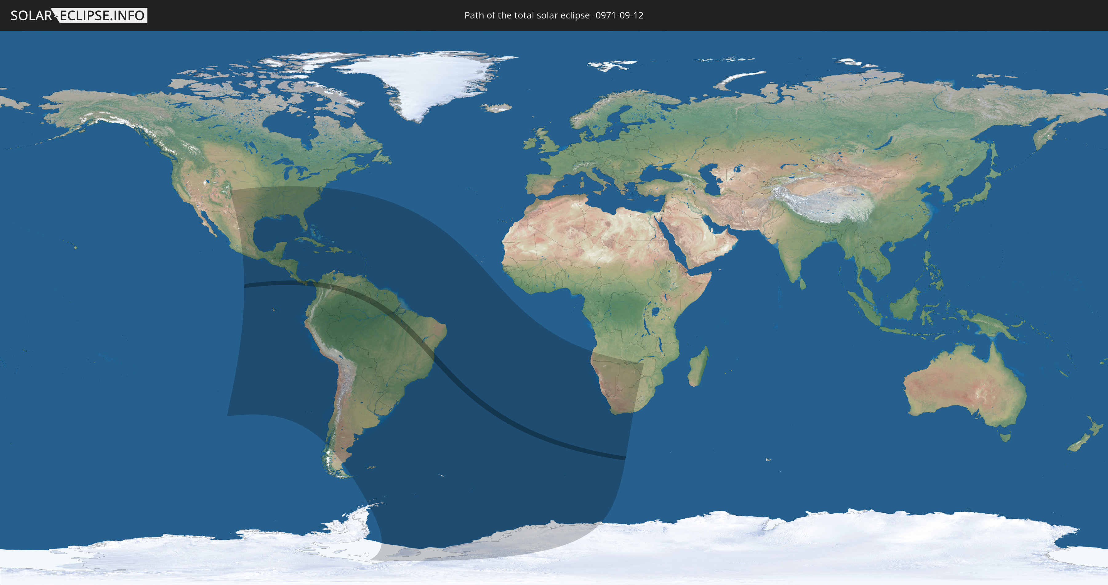
Die Sonnenfinsternis am 09/12/-0971 kann man in 60 Ländern als partielle Sonnenfinsternis beobachten.
Der Finsternispfad verläuft durch 7 Länder. Nur in diesen Ländern ist sie als total Sonnenfinsternis zu sehen.
In den folgenden Ländern ist die Sonnenfinsternis total zu sehen
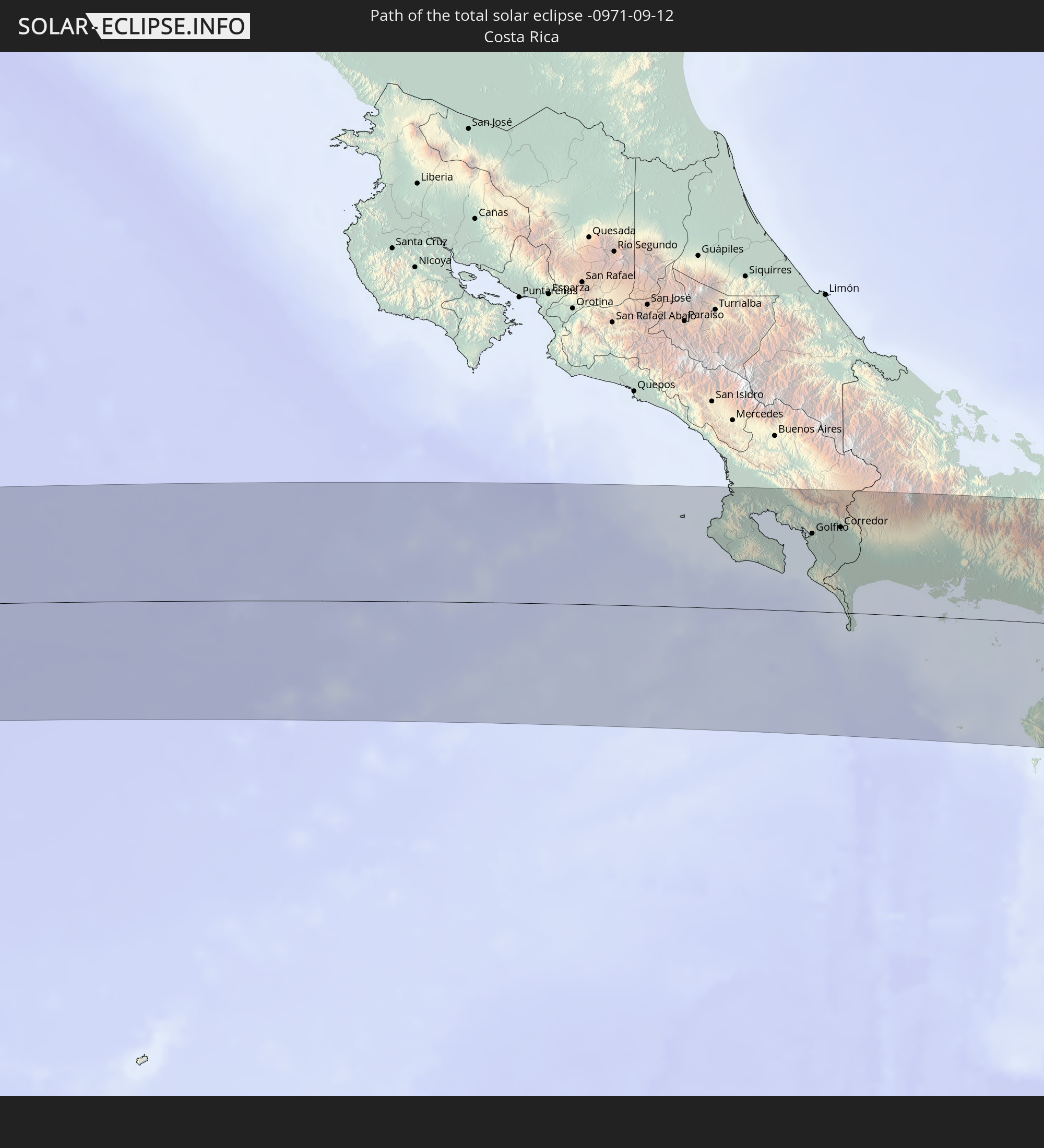 Costa Rica
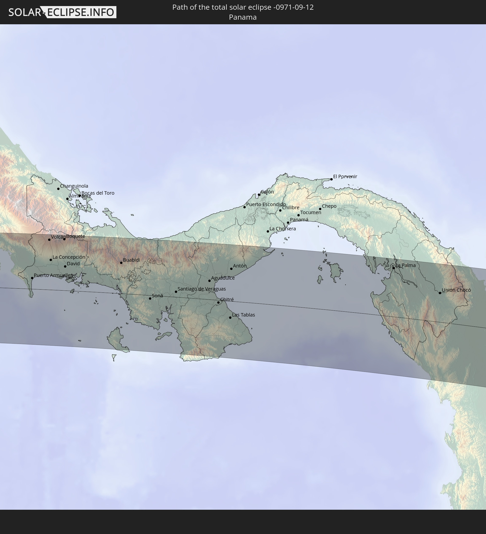 Panama
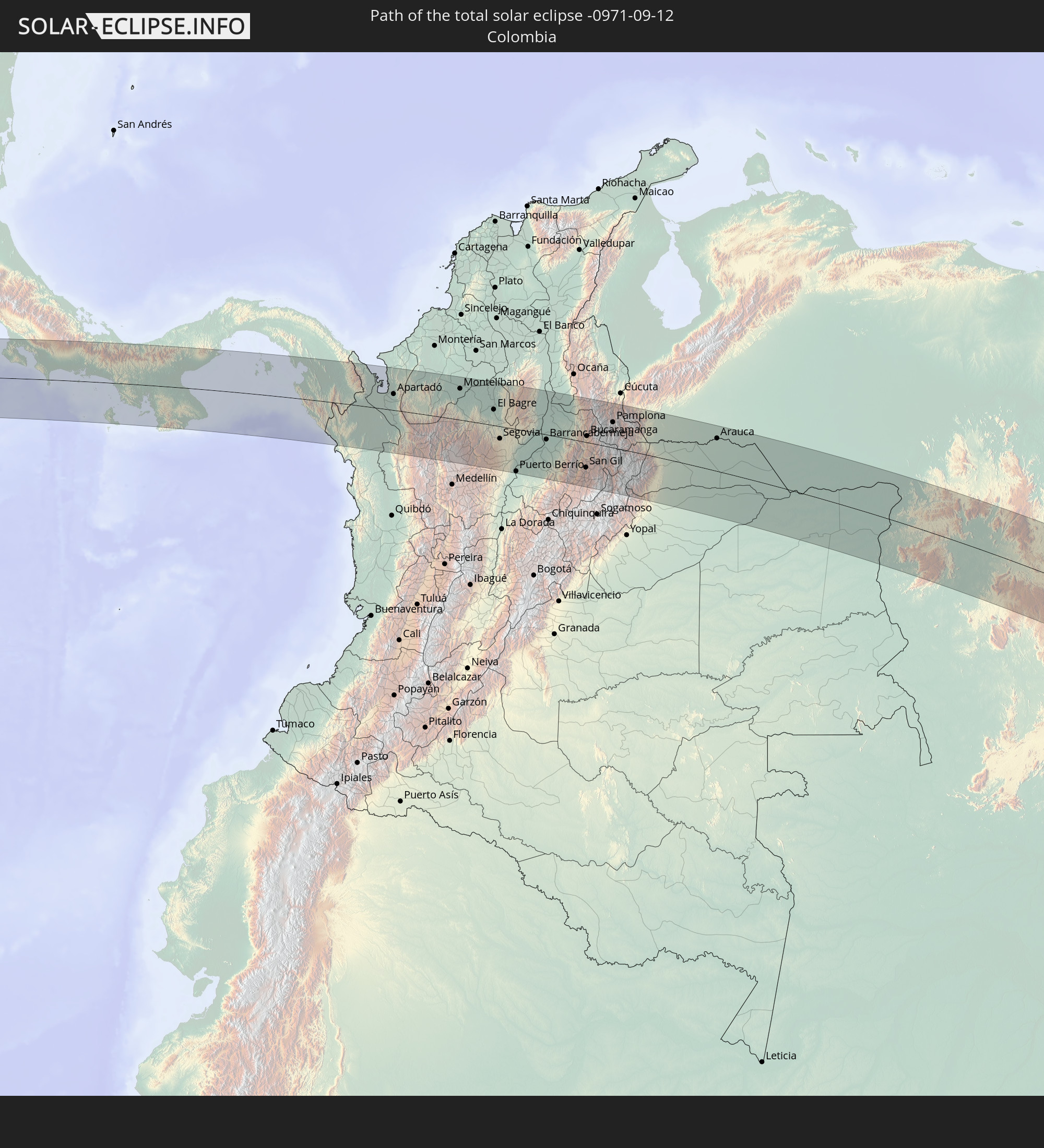 Colombia
 Brazil
 Venezuela
 Guyana
 Saint Helena, Ascension and Tristan da Cunha
In den folgenden Ländern ist die Sonnenfinsternis partiell zu sehen
 Antarctica
 United States
 United States Minor Outlying Islands
 Mexico
 Chile
Chile
 Guatemala
 Ecuador
 El Salvador
 Honduras
 Belize
 Nicaragua
 Costa Rica
 Cuba
Cuba
 Panama
 Colombia
 Cayman Islands
 Peru
Peru
 The Bahamas
 Jamaica
 Haiti
Haiti
 Brazil
 Argentina
 Venezuela
 Turks and Caicos Islands
 Dominican Republic
 Aruba
Aruba
 Bolivia
 Puerto Rico
 United States Virgin Islands
 Bermuda
 British Virgin Islands
 Anguilla
 Collectivity of Saint Martin
 Saint Barthélemy
 Saint Kitts and Nevis
 Paraguay
 Antigua and Barbuda
 Montserrat
 Trinidad and Tobago
 Guadeloupe
 Grenada
 Dominica
 Saint Vincent and the Grenadines
 Falkland Islands
 Guyana
 Martinique
 Saint Lucia
 Barbados
 Uruguay
 Suriname
 French Guiana
 South Georgia and the South Sandwich Islands
 Saint Helena, Ascension and Tristan da Cunha
 Bouvet Island
 Angola
 Namibia
 South Africa
 Botswana
 Zambia
 Zimbabwe
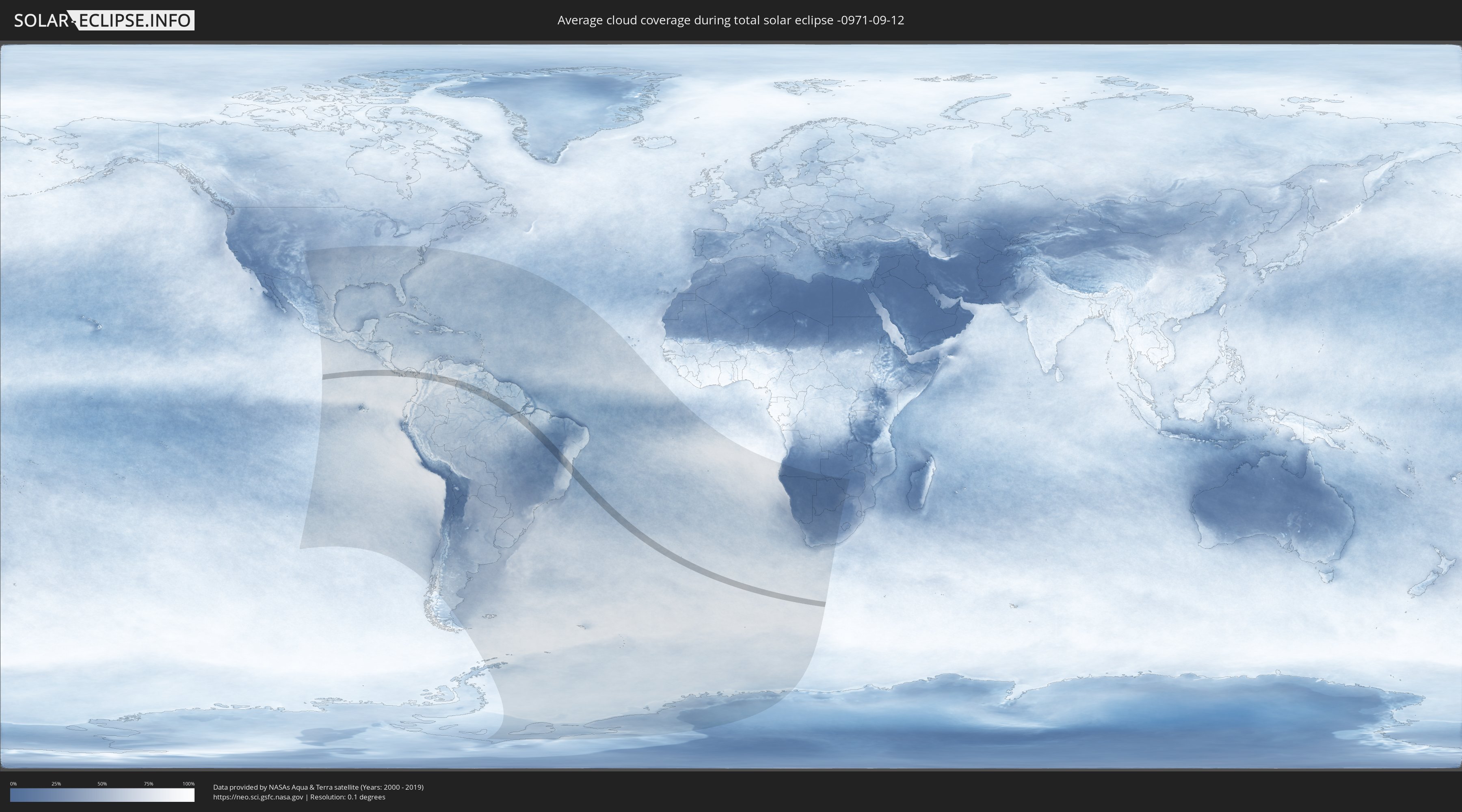
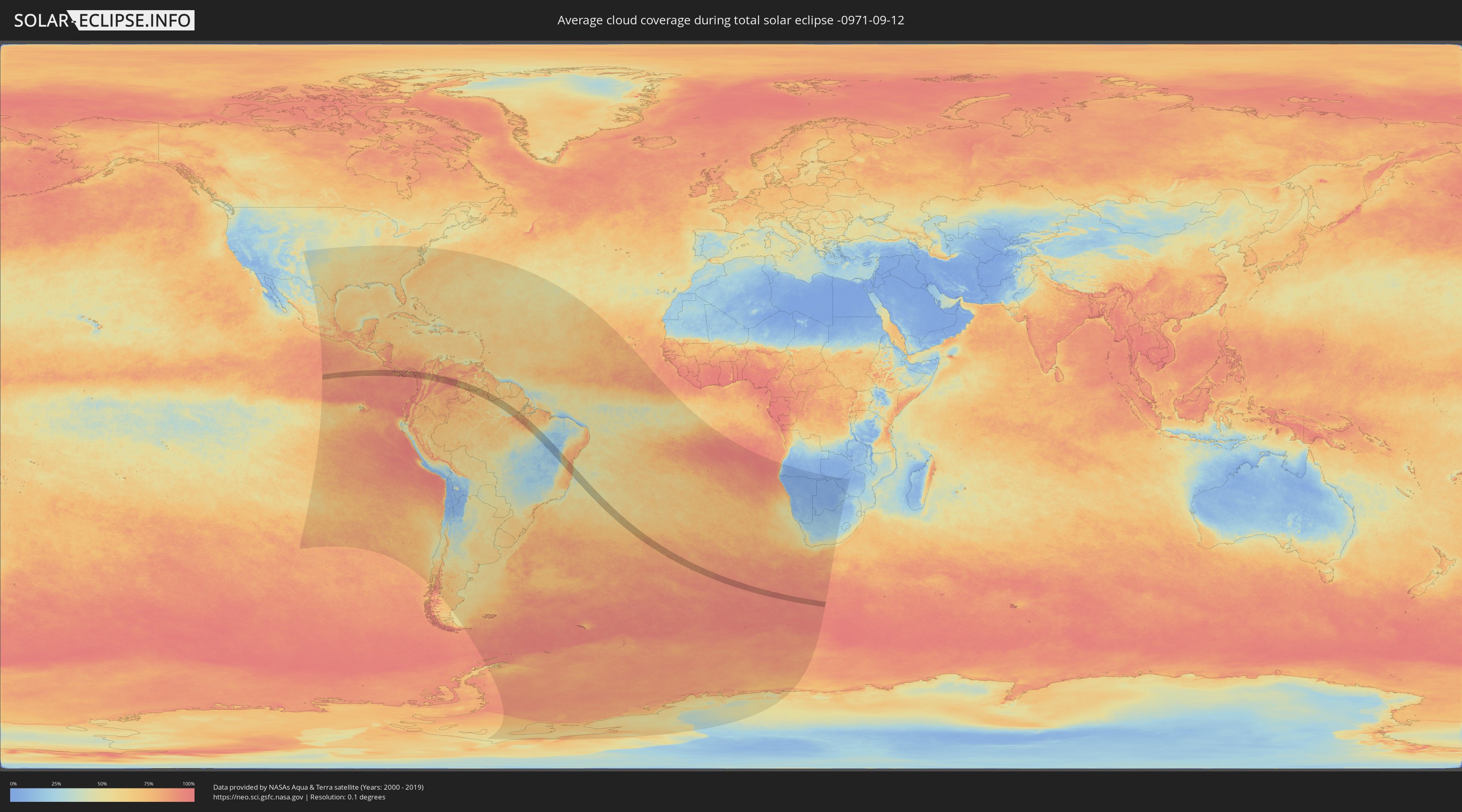
How will be the weather during the total solar eclipse on 09/12/-0971?
Where is the best place to see the total solar eclipse of 09/12/-0971?
The following maps show the average cloud coverage for the day of the total solar eclipse.
With the help of these maps, it is possible to find the place along the eclipse path, which has the best
chance of a cloudless sky.
Nevertheless, you should consider local circumstances and inform about the weather of your chosen
observation site.
The data is provided by NASAs satellites
AQUA and TERRA.
The cloud maps are averaged over a period of 19 years (2000 - 2019).
Detailed country maps
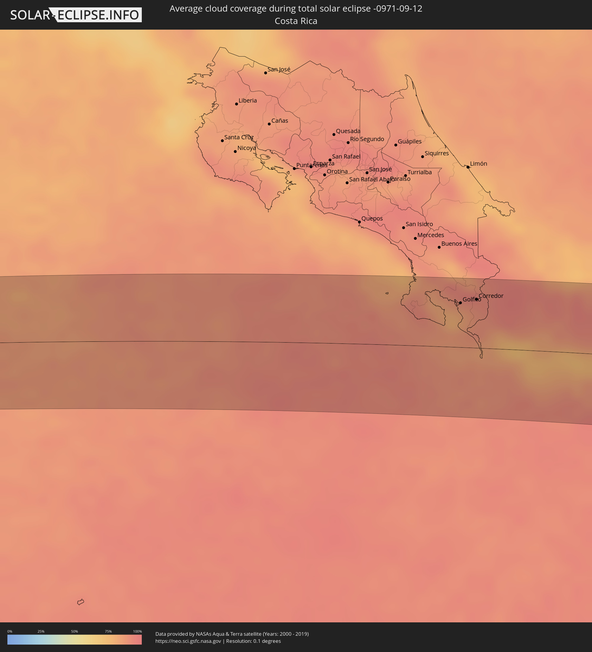 Costa Rica
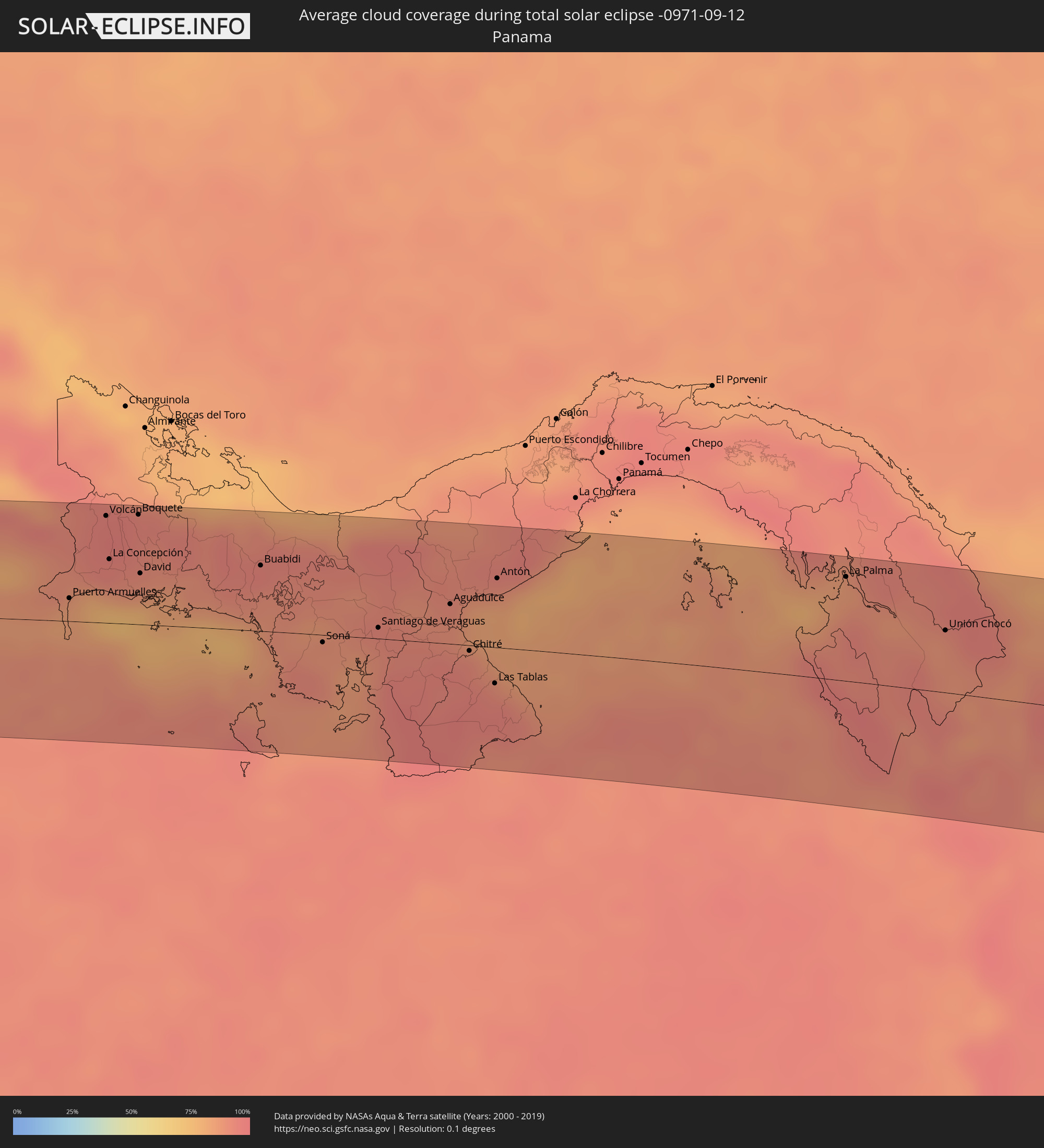 Panama
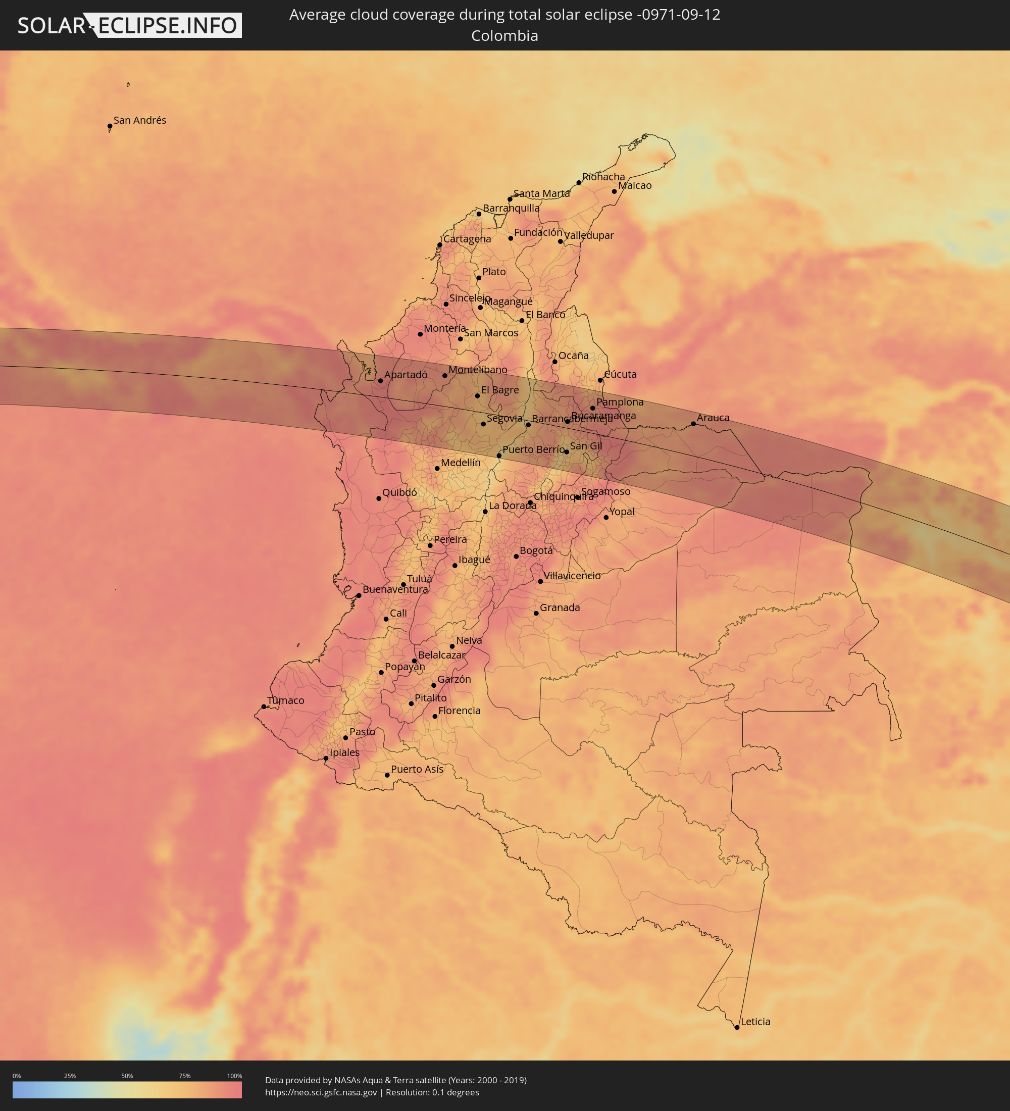 Colombia
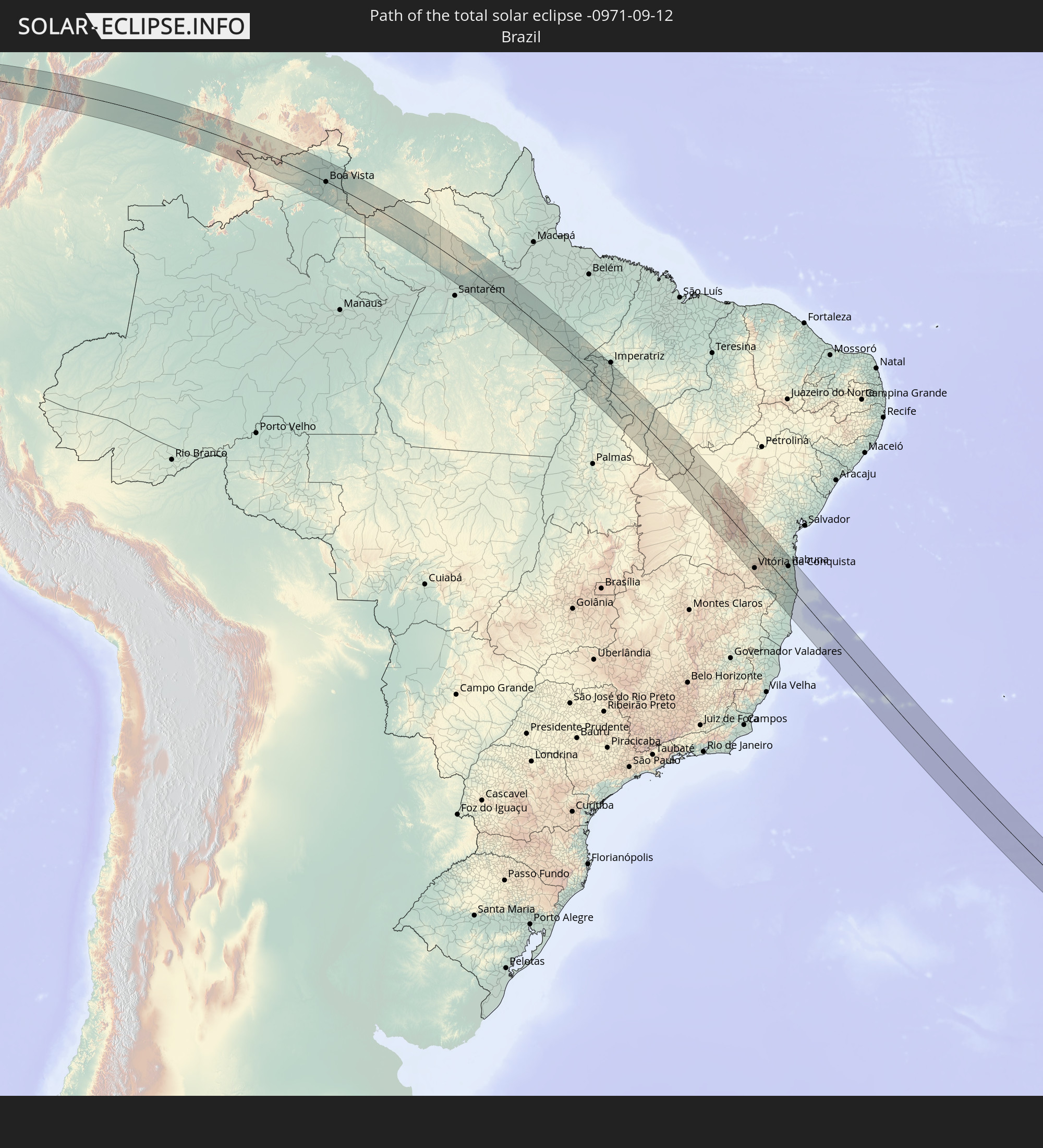
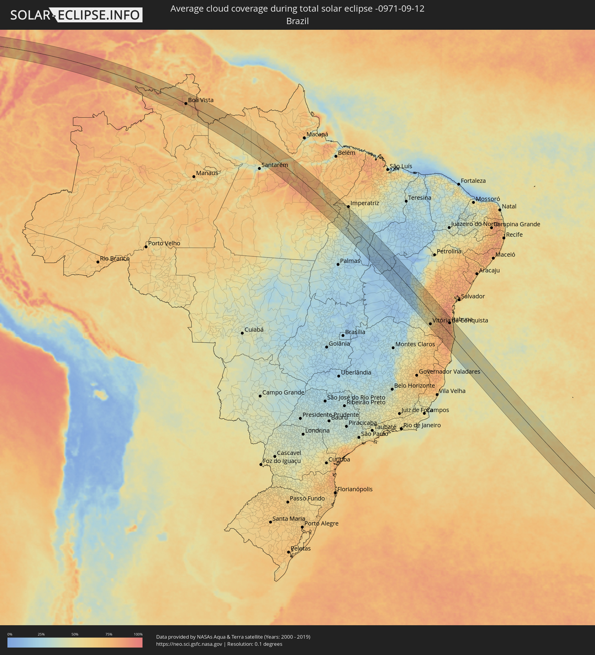 Brazil
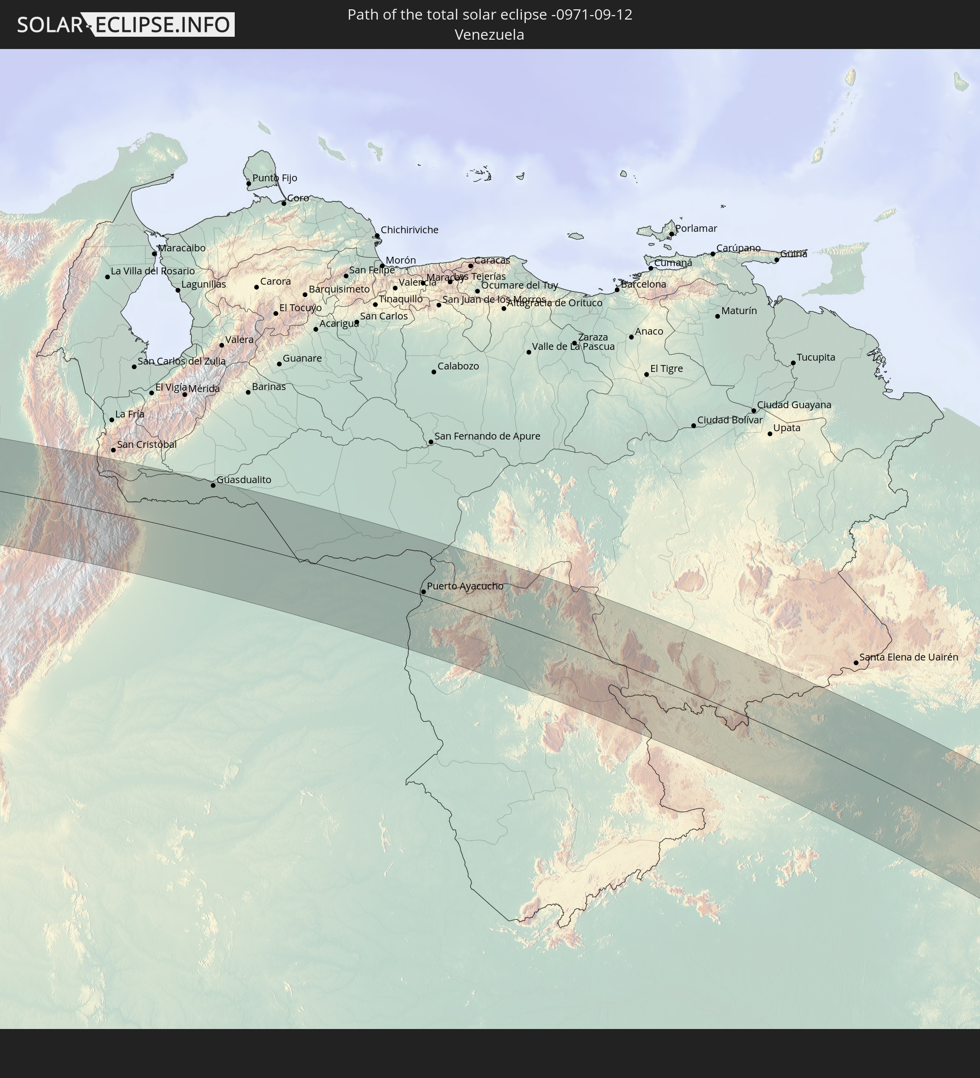
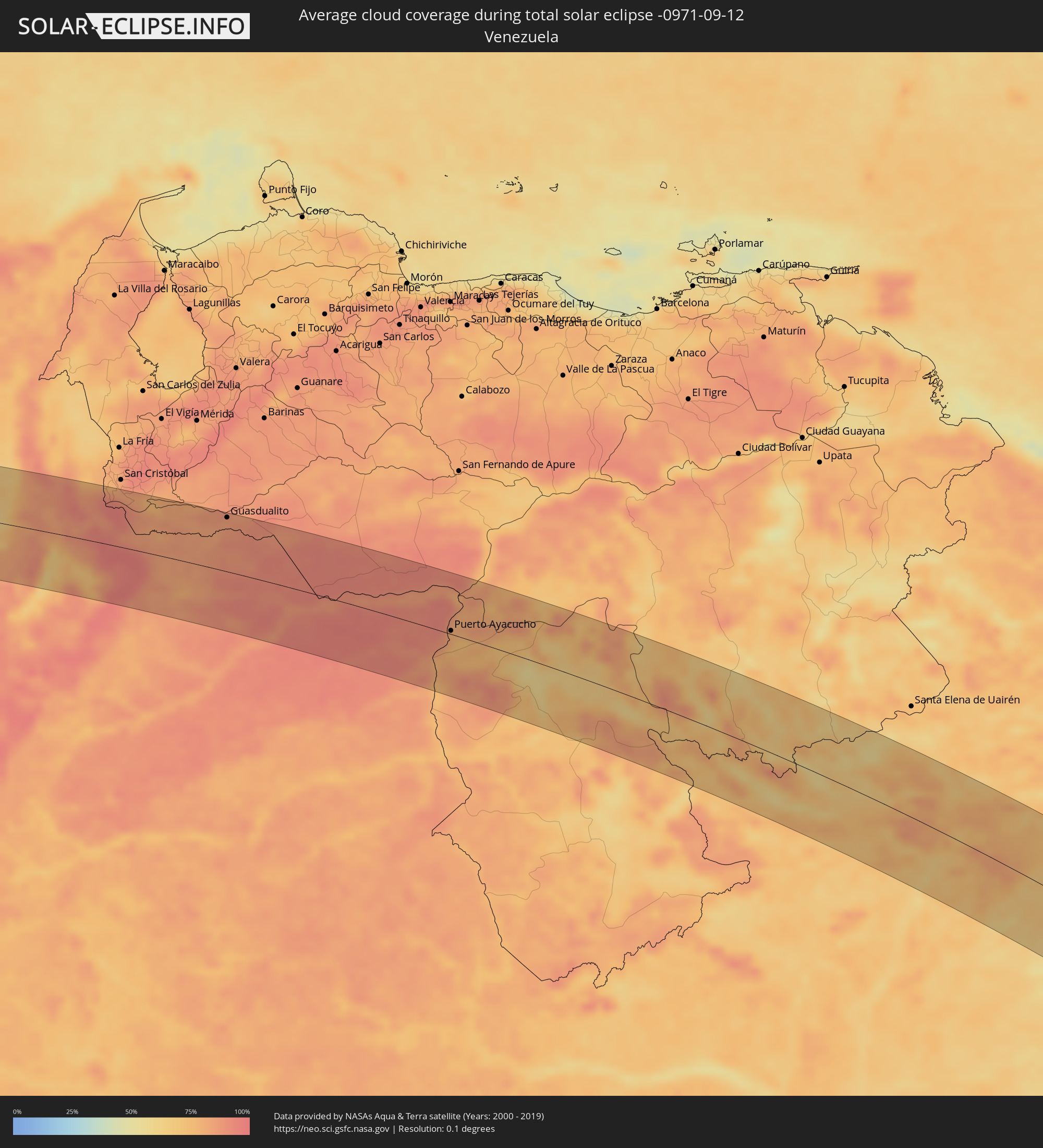 Venezuela
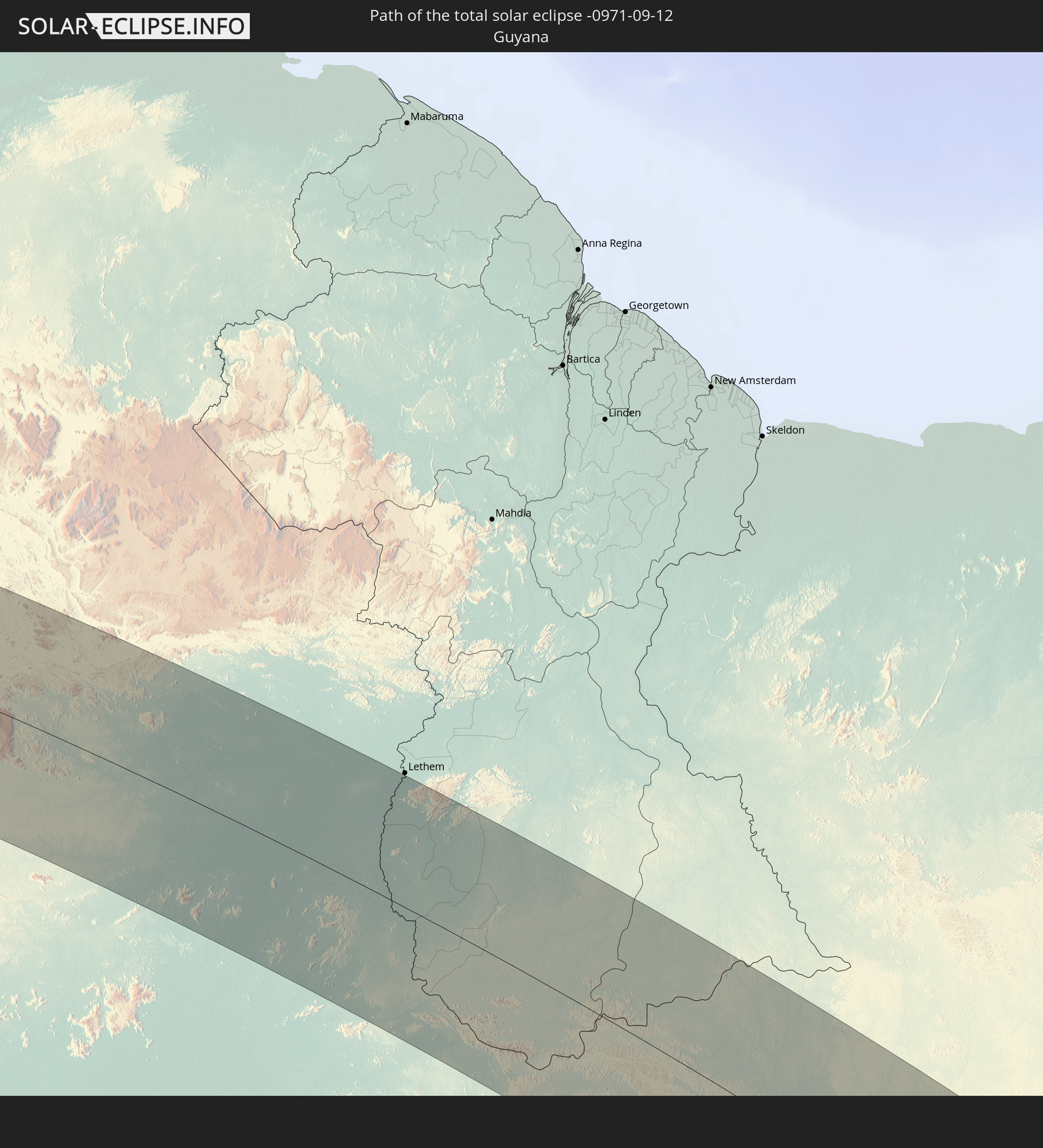
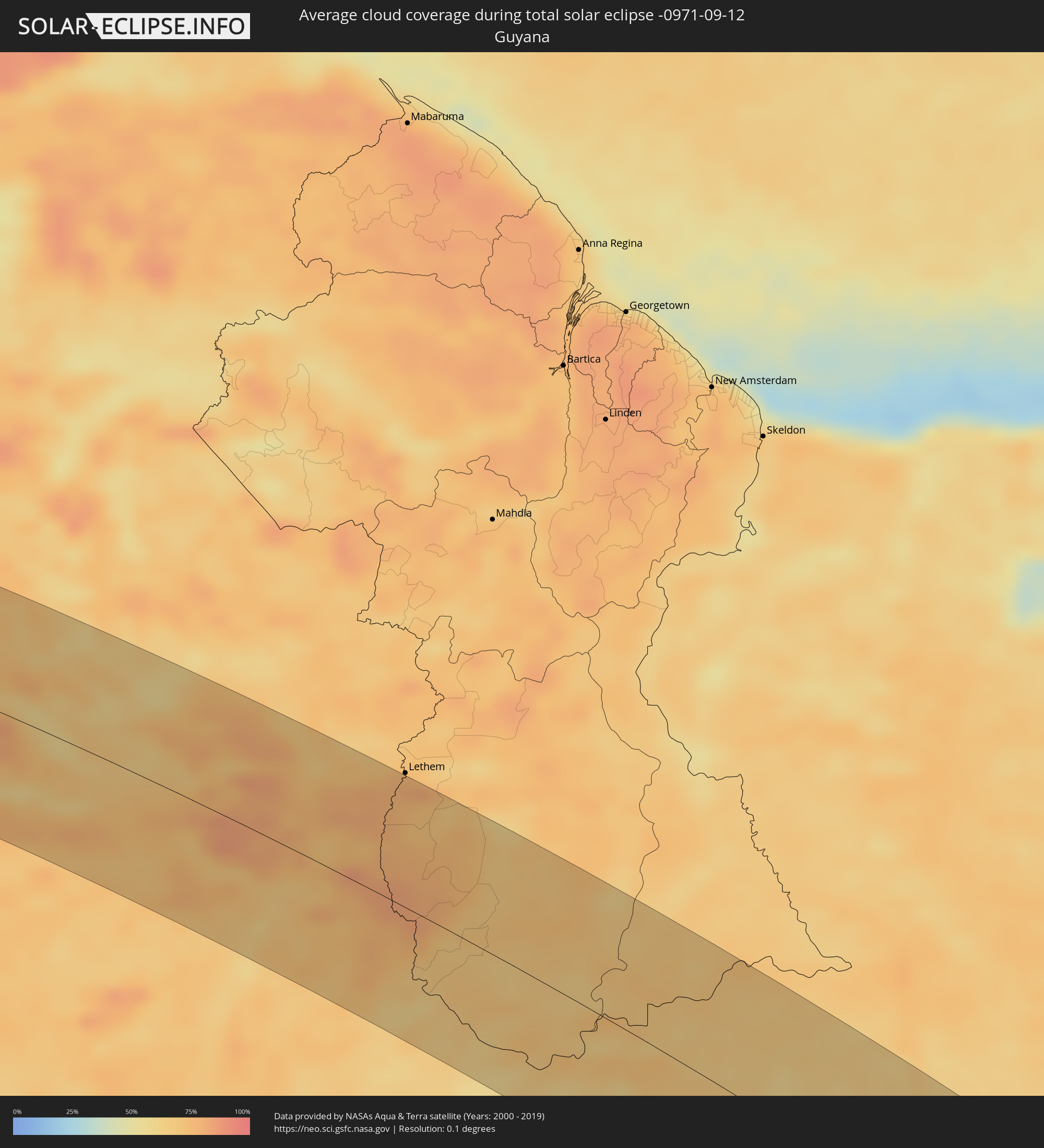 Guyana
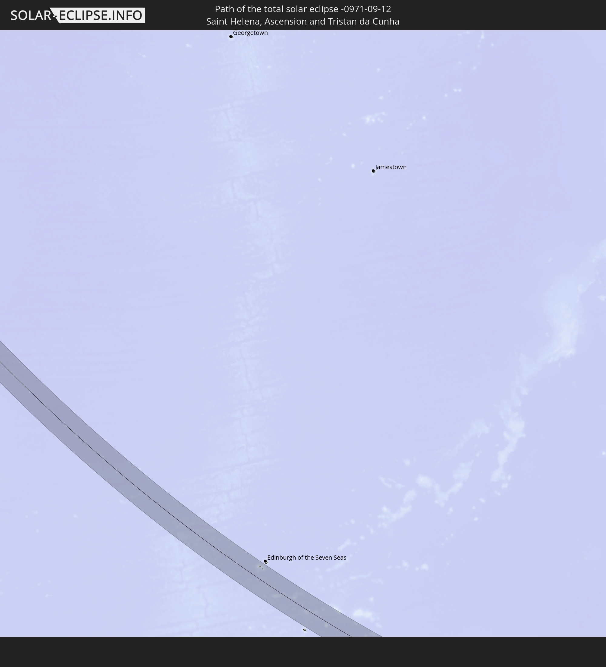
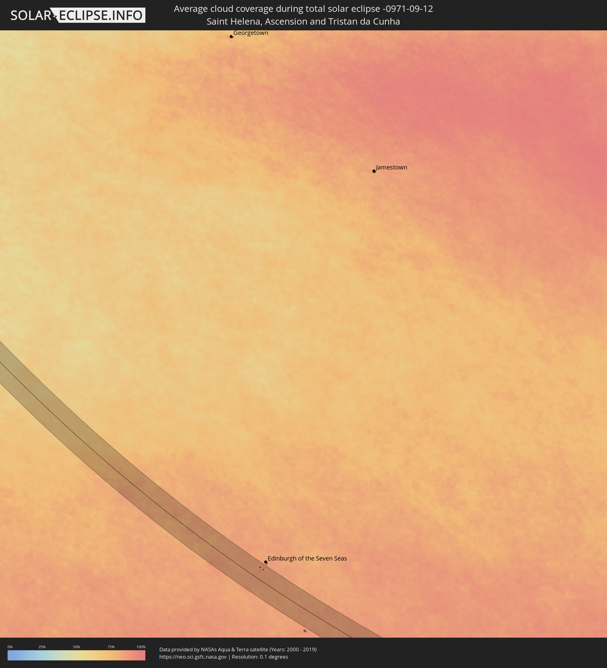 Saint Helena, Ascension and Tristan da Cunha
Cities inside the path of the eclipse
The following table shows all locations with a population of more than 5,000 inside the eclipse path. Cities which have more than 100,000 inhabitants are marked bold. A click at the locations opens a detailed map.
| City | Type | Eclipse duration | Local time of max. eclipse | Distance to central line | Ø Cloud coverage |
|
Golfito, Puntarenas
|
total | - | 07:07:33 UTC-05:36 | 50 km | 83% |
|
Corredor, Puntarenas
|
total | - | 07:07:39 UTC-05:36 | 55 km | 90% |
|
Puerto Armuelles, Chiriquí
|
total | - | 07:24:36 UTC-05:19 | 15 km | 85% |
|
Volcán, Chiriquí
|
total | - | 07:24:23 UTC-05:19 | 72 km | 96% |
|
La Concepción, Chiriquí
|
total | - | 07:24:35 UTC-05:19 | 43 km | 94% |
|
Boquete, Chiriquí
|
total | - | 07:24:31 UTC-05:19 | 73 km | 94% |
|
Pedregal, Chiriquí
|
total | - | 07:24:50 UTC-05:19 | 27 km | 87% |
|
David, Chiriquí
|
total | - | 07:24:47 UTC-05:19 | 34 km | 87% |
|
Las Lomas, Chiriquí
|
total | - | 07:24:49 UTC-05:19 | 35 km | 87% |
|
Buabidi, Ngöbe-Buglé
|
total | - | 07:25:17 UTC-05:19 | 44 km | 95% |
|
Soná, Veraguas
|
total | - | 07:25:56 UTC-05:19 | 5 km | 88% |
|
Santiago de Veraguas, Veraguas
|
total | - | 07:26:08 UTC-05:19 | 7 km | 91% |
|
Pocrí, Coclé
|
total | - | 07:26:21 UTC-05:19 | 28 km | 91% |
|
Aguadulce, Coclé
|
total | - | 07:26:22 UTC-05:19 | 27 km | 89% |
|
Natá, Coclé
|
total | - | 07:26:19 UTC-05:19 | 37 km | 91% |
|
Chitré, Herrera
|
total | - | 07:26:41 UTC-05:19 | 4 km | 91% |
|
Los Santos, Los Santos
|
total | - | 07:26:43 UTC-05:19 | 7 km | 92% |
|
Penonomé, Coclé
|
total | - | 07:26:18 UTC-05:19 | 59 km | 93% |
|
Las Tablas, Los Santos
|
total | - | 07:26:59 UTC-05:19 | 24 km | 92% |
|
Antón, Coclé
|
total | - | 07:26:28 UTC-05:19 | 46 km | 89% |
|
La Palma, Darién
|
total | - | 07:28:16 UTC-05:19 | 69 km | 86% |
|
Unión Chocó, Emberá
|
total | - | 07:29:06 UTC-05:19 | 41 km | 91% |
|
Turbo, Antioquia
|
total | - | 07:53:11 UTC-04:56 | 54 km | 89% |
|
Chigorodó, Antioquia
|
total | - | 07:53:37 UTC-04:56 | 7 km | 95% |
|
Carepa, Antioquia
|
total | - | 07:53:34 UTC-04:56 | 18 km | 95% |
|
Apartadó, Antioquia
|
total | - | 07:53:28 UTC-04:56 | 32 km | 96% |
|
San Pedro de Urabá, Antioquia
|
total | - | 07:53:22 UTC-04:56 | 79 km | 93% |
|
Dabeiba, Antioquia
|
total | - | 07:54:39 UTC-04:56 | 60 km | 91% |
|
Valencia, Córdoba
|
total | - | 07:53:36 UTC-04:56 | 81 km | 92% |
|
Frontino, Antioquia
|
total | - | 07:55:00 UTC-04:56 | 83 km | 82% |
|
Tierralta, Córdoba
|
total | - | 07:53:46 UTC-04:56 | 73 km | 91% |
|
Ituango, Antioquia
|
total | - | 07:55:00 UTC-04:56 | 33 km | 81% |
|
Santa Rosa de Osos, Antioquia
|
total | - | 07:55:49 UTC-04:56 | 85 km | 79% |
|
Montelíbano, Córdoba
|
total | - | 07:54:35 UTC-04:56 | 62 km | 88% |
|
Yarumal, Antioquia
|
total | - | 07:55:33 UTC-04:56 | 50 km | 78% |
|
Caucasia, Antioquia
|
total | - | 07:54:48 UTC-04:56 | 66 km | 78% |
|
Amalfi, Antioquia
|
total | - | 07:55:58 UTC-04:56 | 50 km | 76% |
|
Zaragoza, Antioquia
|
total | - | 07:55:37 UTC-04:56 | 18 km | 76% |
|
El Bagre, Antioquia
|
total | - | 07:55:34 UTC-04:56 | 31 km | 75% |
|
Vegachí, Antioquia
|
total | - | 07:56:24 UTC-04:56 | 61 km | 77% |
|
San Carlos, Antioquia
|
total | - | 07:55:25 UTC-04:56 | 53 km | 73% |
|
Segovia, Antioquia
|
total | - | 07:56:12 UTC-04:56 | 24 km | 73% |
|
Puerto Berrío, Antioquia
|
total | - | 07:57:06 UTC-04:56 | 83 km | 62% |
|
Santa Rosa del Sur, Bolívar
|
total | - | 07:56:01 UTC-04:56 | 85 km | 85% |
|
Puerto Wilches, Santander
|
total | - | 07:56:48 UTC-04:56 | 21 km | 63% |
|
Barrancabermeja, Santander
|
total | - | 07:57:07 UTC-04:56 | 10 km | 73% |
|
Sabana de Torres, Santander
|
total | - | 07:57:11 UTC-04:56 | 33 km | 88% |
|
San Vicente de Chucurí, Santander
|
total | - | 07:57:48 UTC-04:56 | 21 km | 88% |
|
San Alberto, Cesar
|
total | - | 07:56:56 UTC-04:56 | 76 km | 84% |
|
Socorro, Santander
|
total | - | 07:58:24 UTC-04:56 | 63 km | 63% |
|
Lebrija, Santander
|
total | - | 07:57:47 UTC-04:56 | 9 km | 82% |
|
San Gil, Santander
|
total | - | 07:58:27 UTC-04:56 | 50 km | 71% |
|
Bucaramanga, Santander
|
total | - | 07:57:53 UTC-04:56 | 12 km | 82% |
|
Piedecuesta, Santander
|
total | - | 07:58:06 UTC-04:56 | 1 km | 83% |
|
Málaga, Santander
|
total | - | 07:58:46 UTC-04:56 | 26 km | 79% |
|
Soatá, Boyacá
|
total | - | 07:59:12 UTC-04:56 | 65 km | 77% |
|
Pamplona, Norte de Santander
|
total | - | 07:58:09 UTC-04:56 | 50 km | 87% |
|
Chinácota, Norte de Santander
|
total | - | 07:57:58 UTC-04:56 | 76 km | 89% |
|
Tame, Arauca
|
total | - | 08:00:11 UTC-04:56 | 28 km | 84% |
|
Arauquita, Arauca
|
total | - | 07:59:57 UTC-04:56 | 41 km | 85% |
|
Arauca, Arauca
|
total | - | 08:00:42 UTC-04:56 | 64 km | 87% |
|
Guasdualito, Apure
|
total | - | 08:29:09 UTC-04:27 | 82 km | 87% |
|
Puerto Ayacucho, Amazonas
|
total | - | 08:35:04 UTC-04:27 | 5 km | 80% |
|
Puerto Carreño, Vichada
|
total | - | 08:05:57 UTC-04:56 | 64 km | 79% |
|
Boa Vista, Roraima
|
total | - | 09:14:33 UTC-04:02 | 1 km | 76% |
|
Monte Alegre, Pará
|
total | - | 10:23:14 UTC-03:13 | 72 km | 42% |
|
Almeirim, Pará
|
total | - | 10:25:11 UTC-03:13 | 71 km | 51% |
|
Altamira, Pará
|
total | - | 10:29:02 UTC-03:13 | 49 km | 75% |
|
Tucuruí, Pará
|
total | - | 10:34:58 UTC-03:13 | 85 km | 65% |
|
Itupiranga, Pará
|
total | - | 10:38:18 UTC-03:13 | 3 km | 71% |
|
Marabá, Pará
|
total | - | 10:39:10 UTC-03:13 | 8 km | 66% |
|
Araguaína, Tocantins
|
total | - | 11:24:27 UTC-02:34 | 84 km | 40% |
|
Carolina, Maranhão
|
total | - | 11:26:11 UTC-02:34 | 37 km | 38% |
|
Santa Luzia, Maranhão
|
total | - | 11:27:16 UTC-02:34 | 43 km | 35% |
|
Balsas, Maranhão
|
total | - | 11:29:22 UTC-02:34 | 59 km | 26% |
|
Ibotirama, Bahia
|
total | - | 11:43:58 UTC-02:34 | 69 km | 17% |
|
Barra, Bahia
|
total | - | 11:41:59 UTC-02:34 | 19 km | 14% |
|
Xique Xique, Bahia
|
total | - | 11:42:15 UTC-02:34 | 73 km | 15% |
|
Livramento do Brumado, Bahia
|
total | - | 11:49:24 UTC-02:34 | 65 km | 32% |
|
Seabra, Bahia
|
total | - | 11:47:10 UTC-02:34 | 32 km | 51% |
|
Brumado, Bahia
|
total | - | 11:50:47 UTC-02:34 | 90 km | 39% |
|
Vera Cruz, Bahia
|
total | - | 11:48:59 UTC-02:34 | 76 km | 70% |
|
Vitória da Conquista, Bahia
|
total | - | 11:53:35 UTC-02:34 | 71 km | 62% |
|
Itambé, Bahia
|
total | - | 11:54:41 UTC-02:34 | 81 km | 75% |
|
Maracás, Bahia
|
total | - | 11:51:40 UTC-02:34 | 66 km | 69% |
|
Poções, Bahia
|
total | - | 11:53:50 UTC-02:34 | 8 km | 66% |
|
Itapetinga, Bahia
|
total | - | 11:55:24 UTC-02:34 | 51 km | 80% |
|
Jequié, Bahia
|
total | - | 11:53:06 UTC-02:34 | 64 km | 72% |
|
Itororó, Bahia
|
total | - | 11:55:29 UTC-02:34 | 27 km | 80% |
|
Ipiaú, Bahia
|
total | - | 11:54:16 UTC-02:34 | 72 km | 82% |
|
Ibirataia, Bahia
|
total | - | 11:54:19 UTC-02:34 | 85 km | 84% |
|
Ibicaraí, Bahia
|
total | - | 11:55:55 UTC-02:34 | 31 km | 83% |
|
Coaraci, Bahia
|
total | - | 11:55:34 UTC-02:34 | 50 km | 85% |
|
Ubatã, Bahia
|
total | - | 11:54:48 UTC-02:34 | 83 km | 81% |
|
Ubaitaba, Bahia
|
total | - | 11:55:22 UTC-02:34 | 92 km | 83% |
|
Mascote, Bahia
|
total | - | 11:57:44 UTC-02:34 | 3 km | 84% |
|
Buerarema, Bahia
|
total | - | 11:56:37 UTC-02:34 | 47 km | 83% |
|
Uruçuca, Bahia
|
total | - | 11:55:58 UTC-02:34 | 75 km | 80% |
|
Itabuna, Bahia
|
total | - | 11:56:20 UTC-02:34 | 61 km | 83% |
|
Una, Bahia
|
total | - | 11:57:39 UTC-02:34 | 41 km | 77% |
|
Porto Seguro, Bahia
|
total | - | 11:59:47 UTC-02:34 | 42 km | 63% |
|
Ilhéus, Bahia
|
total | - | 11:56:47 UTC-02:34 | 80 km | 54% |
|
Santa Cruz Cabrália, Bahia
|
total | - | 11:59:32 UTC-02:34 | 27 km | 52% |
|
Canavieiras, Bahia
|
total | - | 11:58:35 UTC-02:34 | 24 km | 53% |