Total solar eclipse of 08/19/-1156
| Day of week: | Wednesday |
| Maximum duration of eclipse: | 02m09s |
| Maximum width of eclipse path: | 80 km |
| Saros cycle: | 36 |
| Coverage: | 100% |
| Magnitude: | 1.0233 |
| Gamma: | 0.0541 |
Wo kann man die Sonnenfinsternis vom 08/19/-1156 sehen?
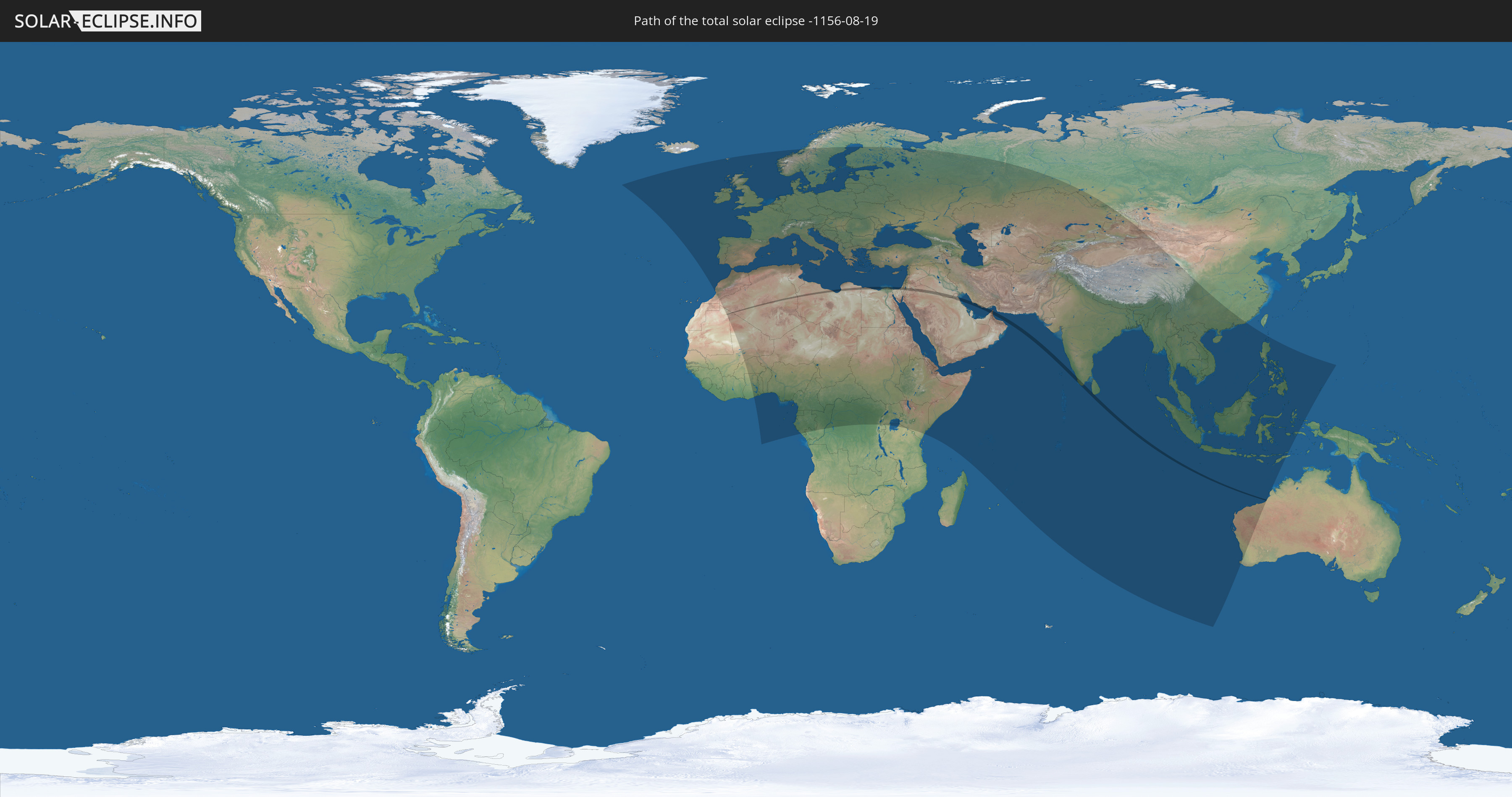
Die Sonnenfinsternis am 08/19/-1156 kann man in 134 Ländern als partielle Sonnenfinsternis beobachten.
Der Finsternispfad verläuft durch 16 Länder. Nur in diesen Ländern ist sie als total Sonnenfinsternis zu sehen.
In den folgenden Ländern ist die Sonnenfinsternis total zu sehen
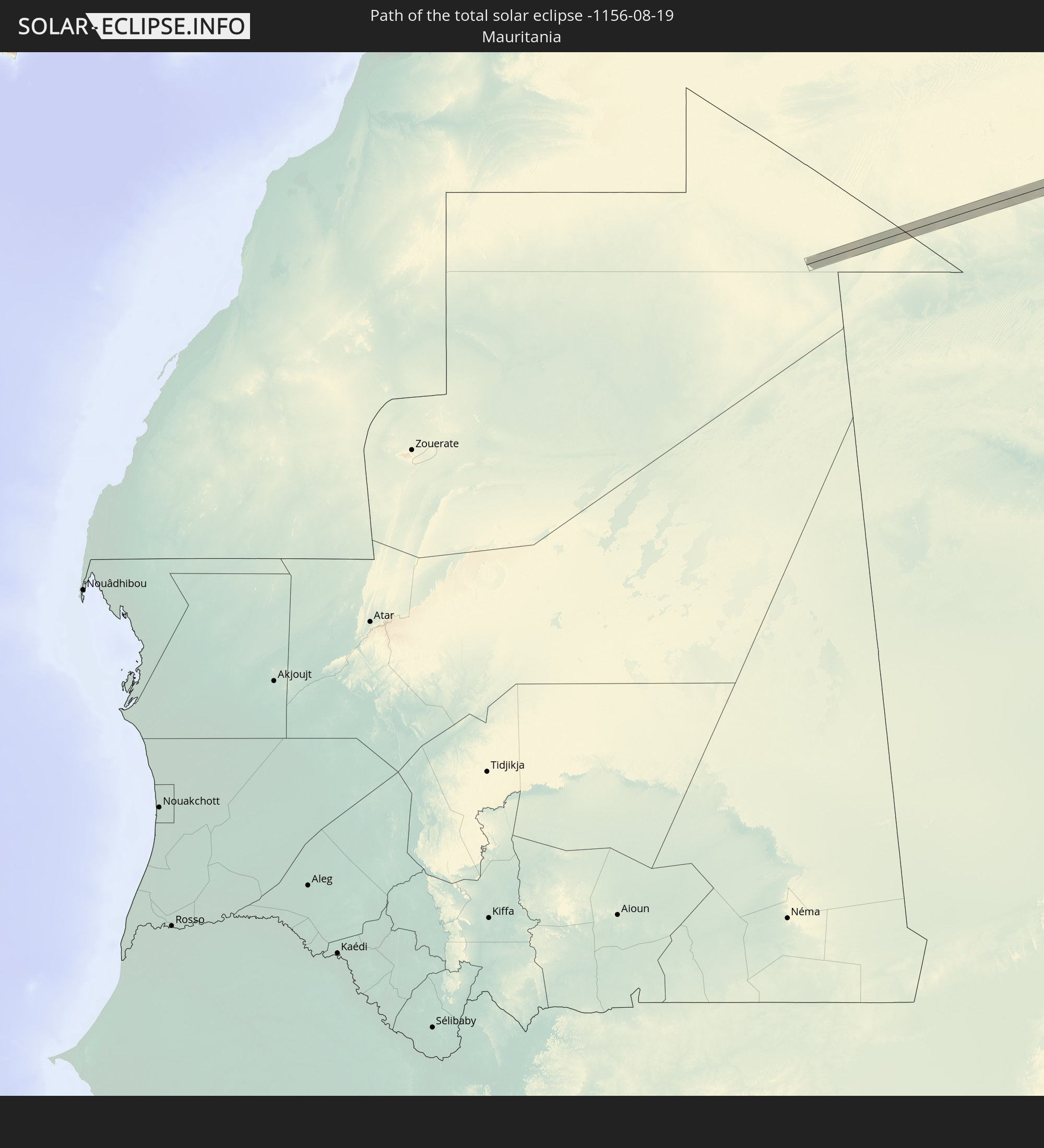 Mauritania
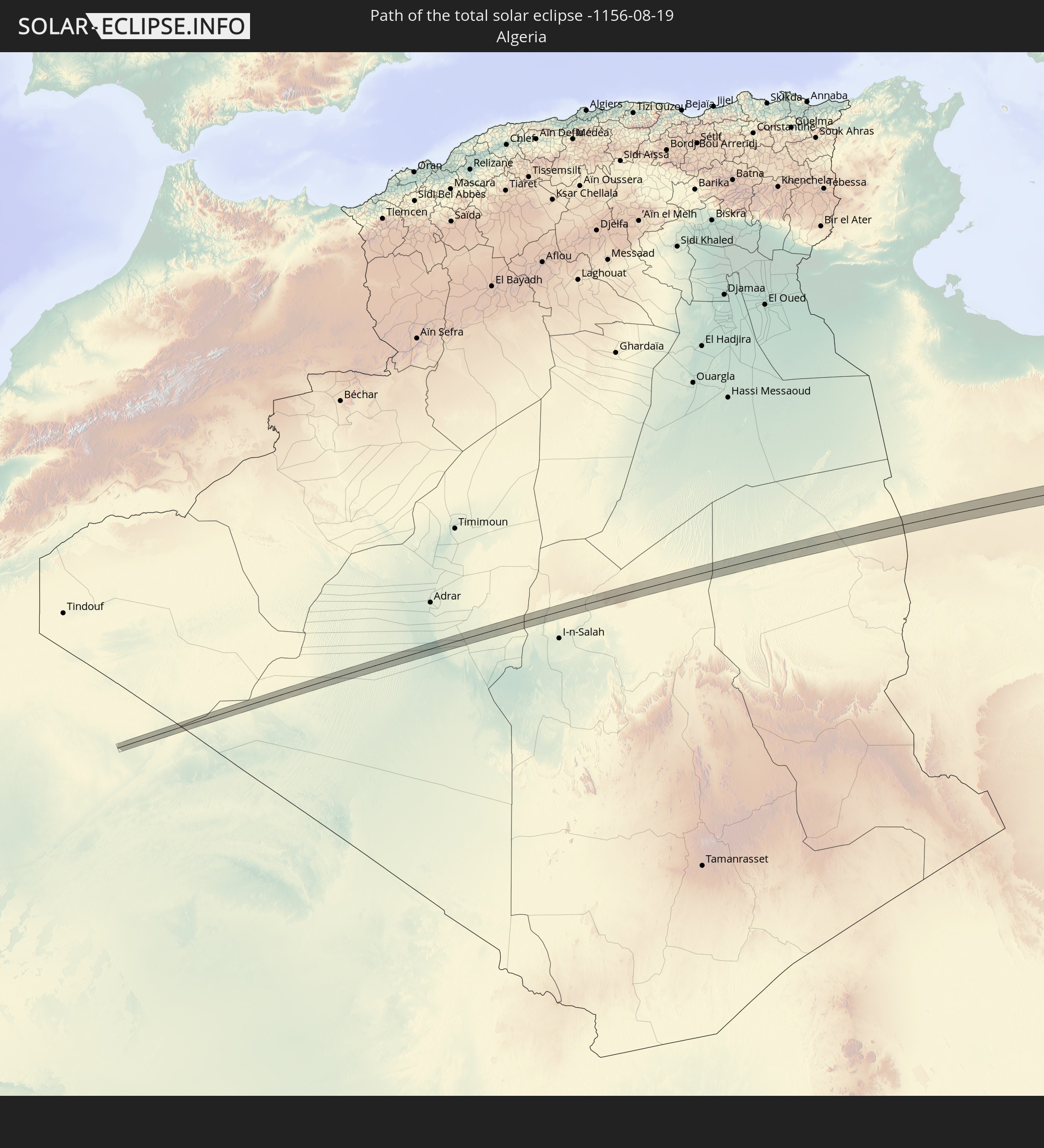 Algeria
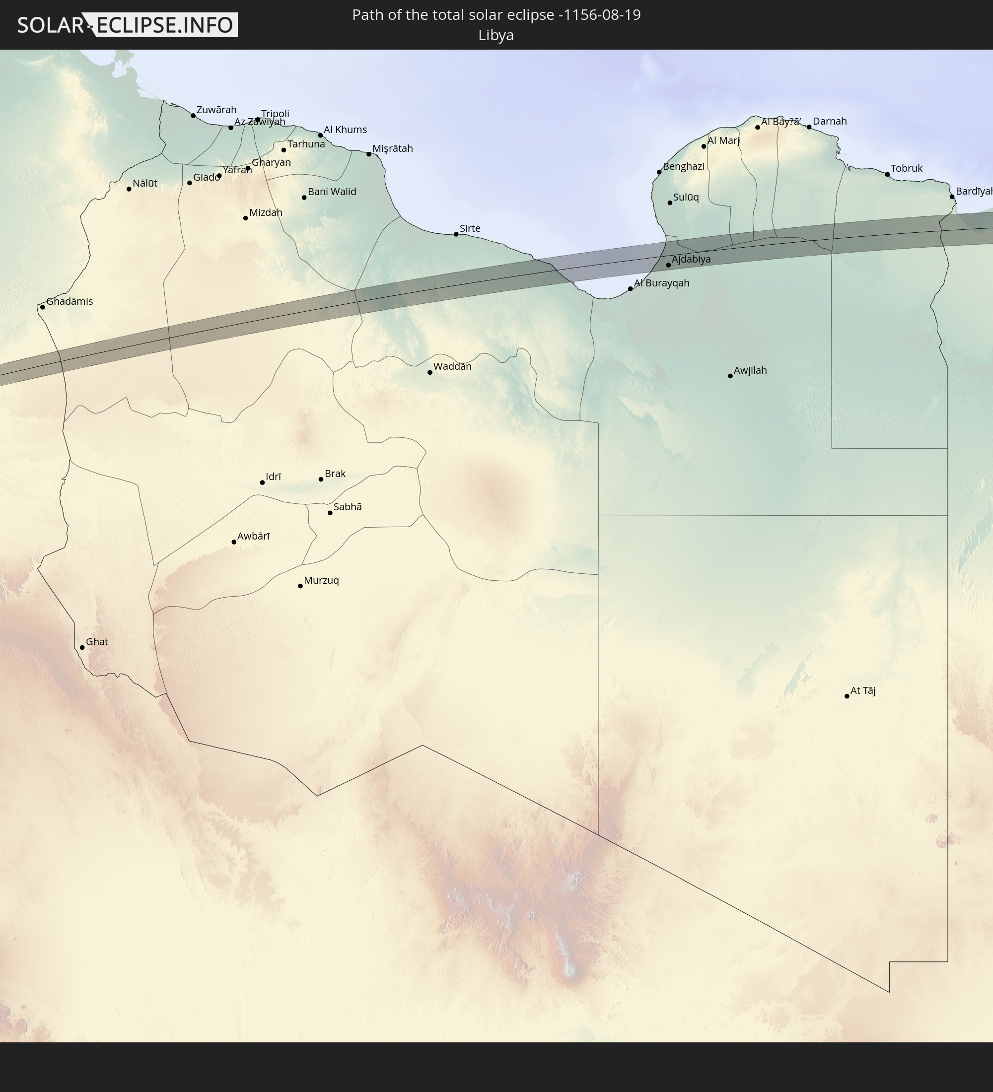 Libya
Libya
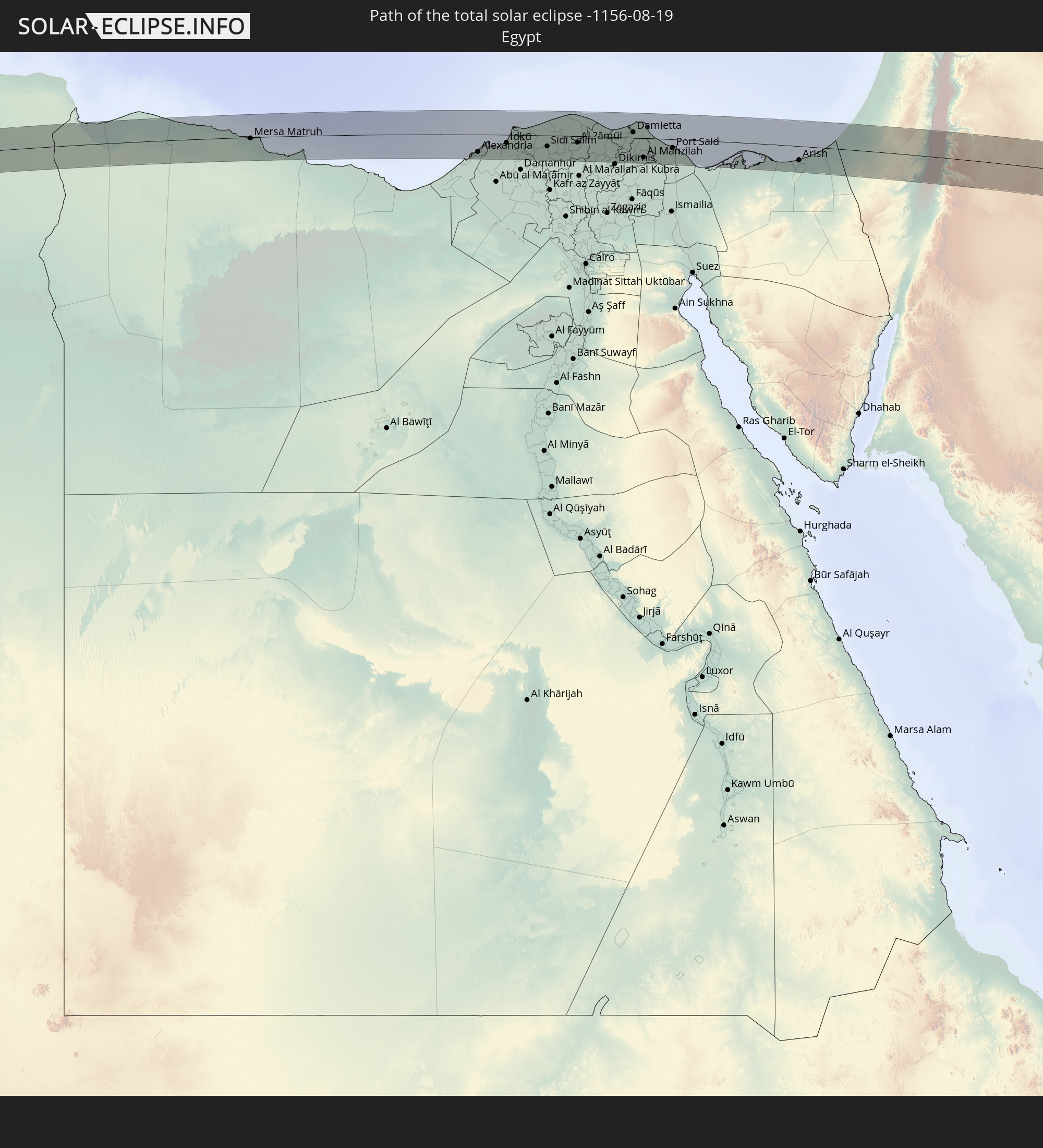 Egypt
Egypt
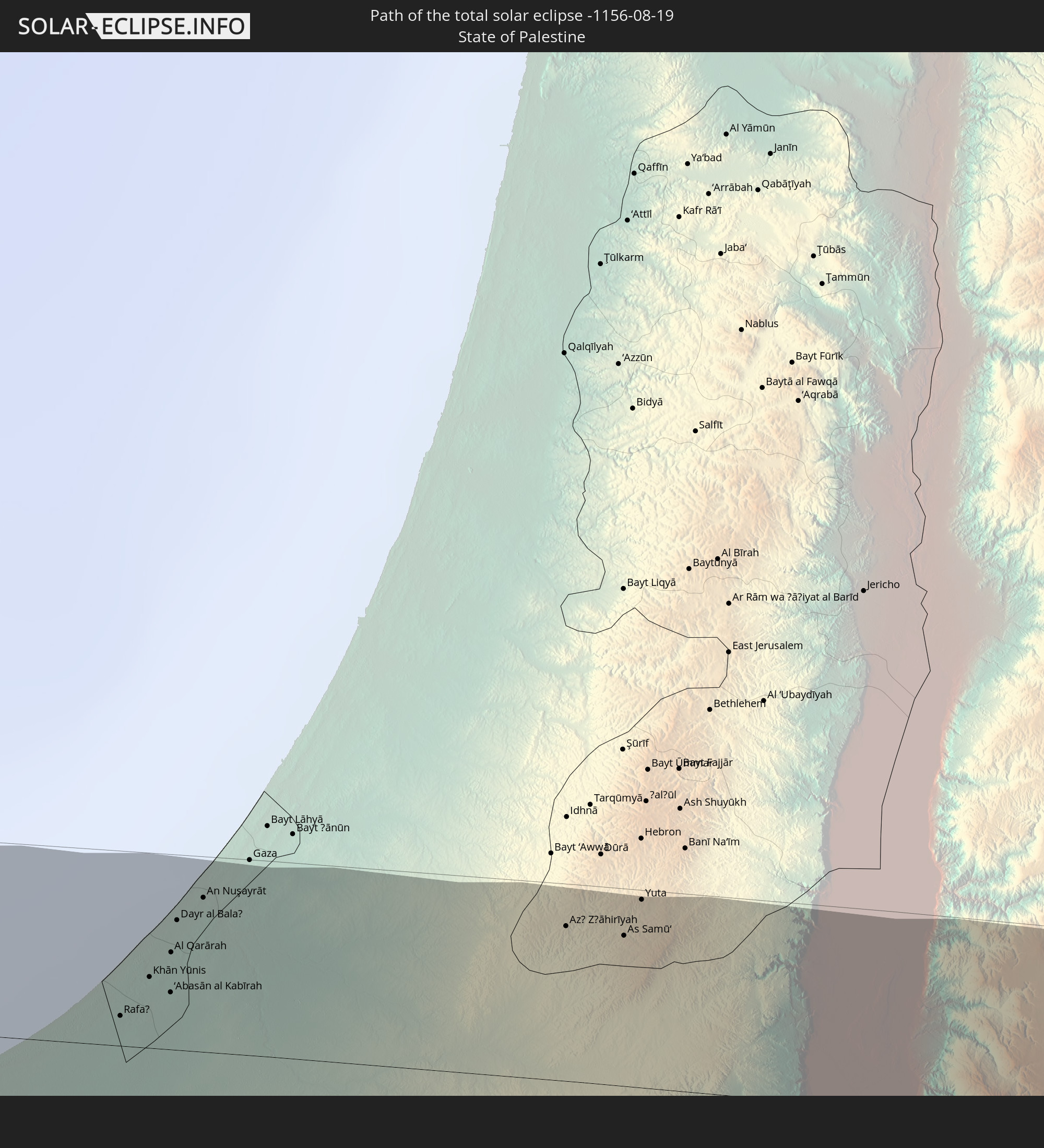 State of Palestine
 Israel
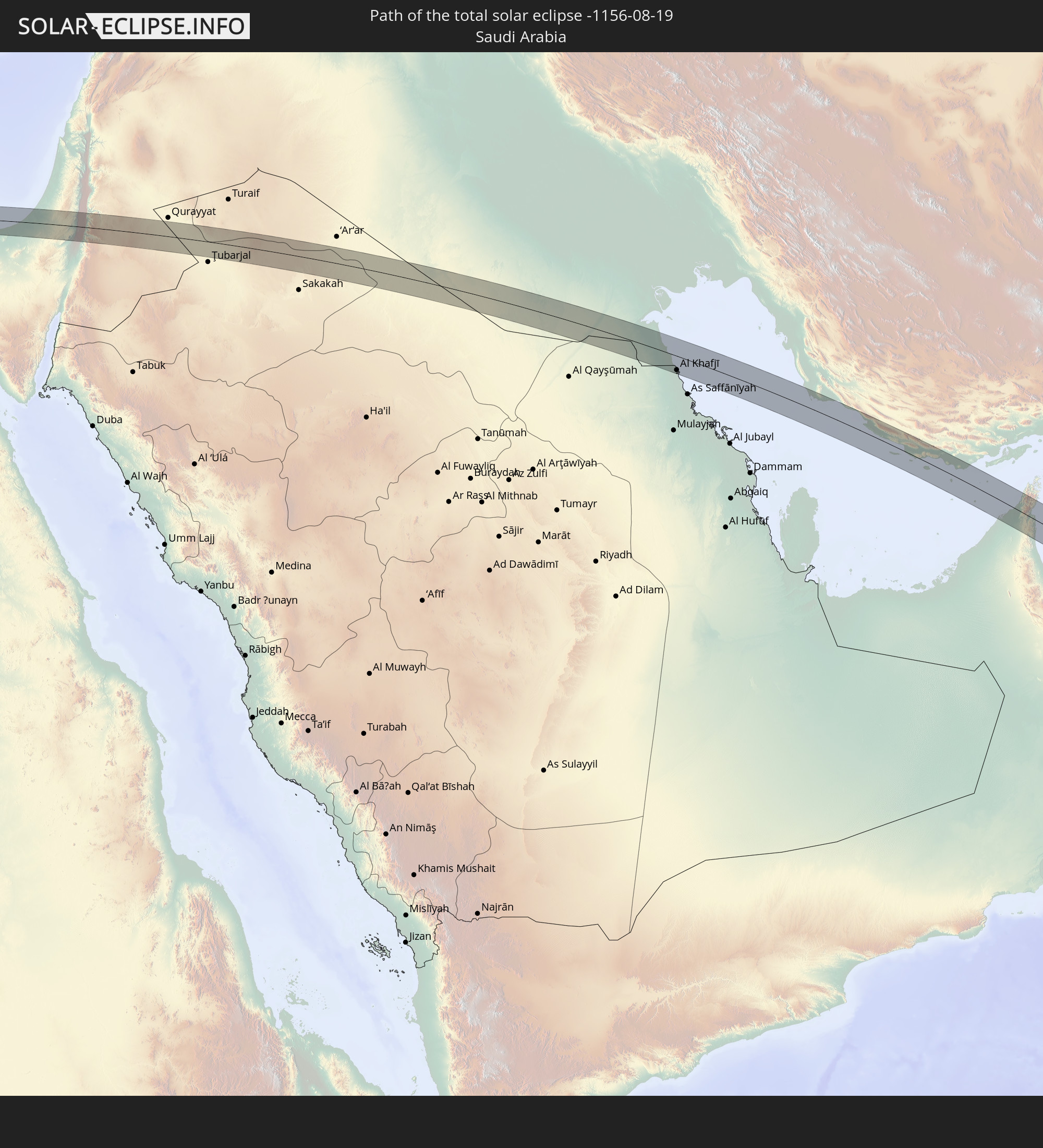 Saudi Arabia
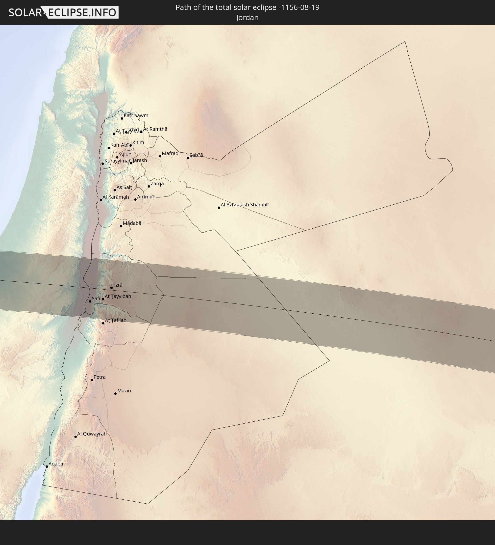 Jordan
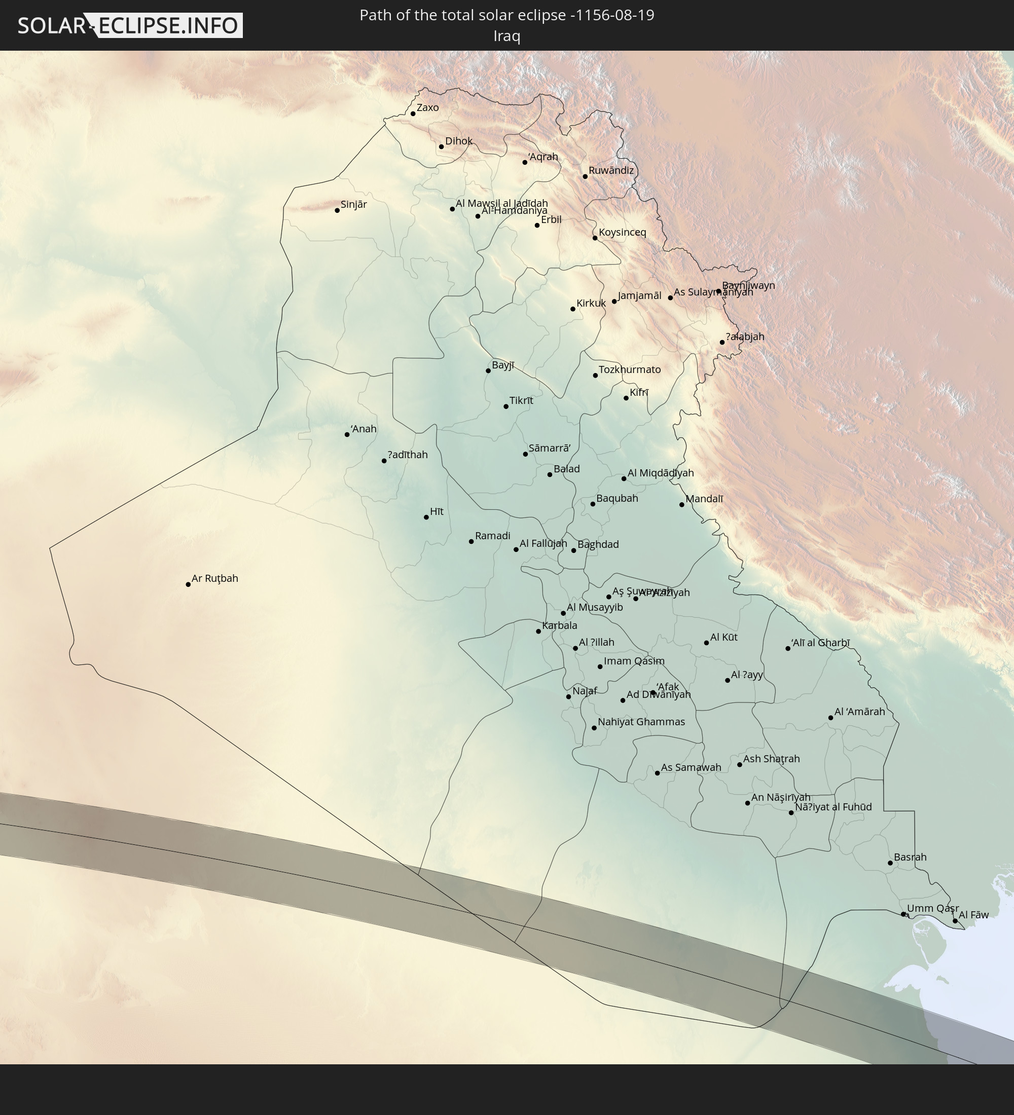 Iraq
Iraq
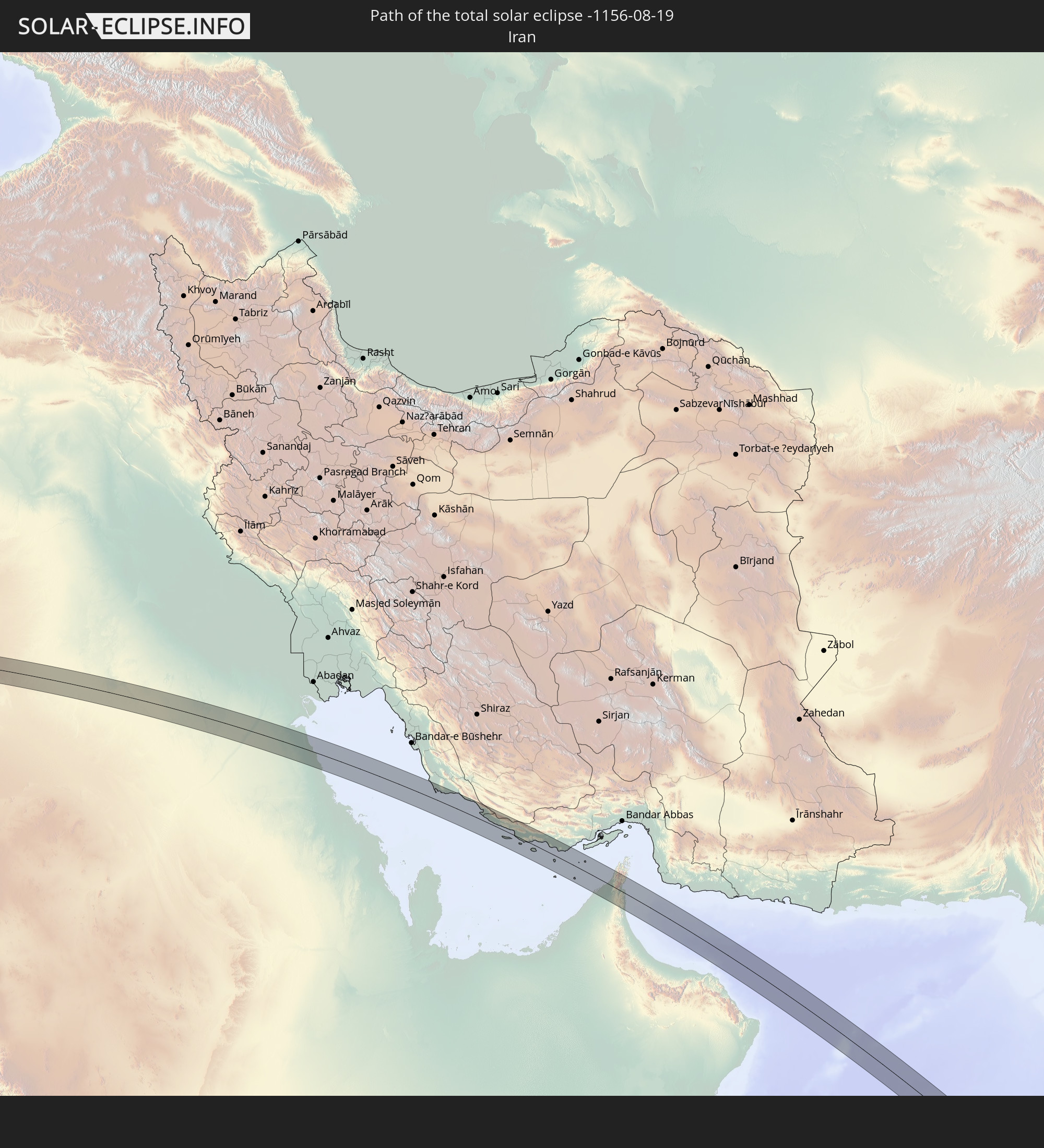 Iran
Iran
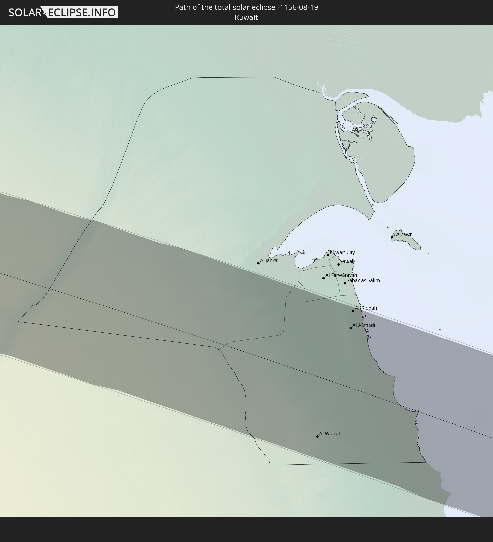 Kuwait
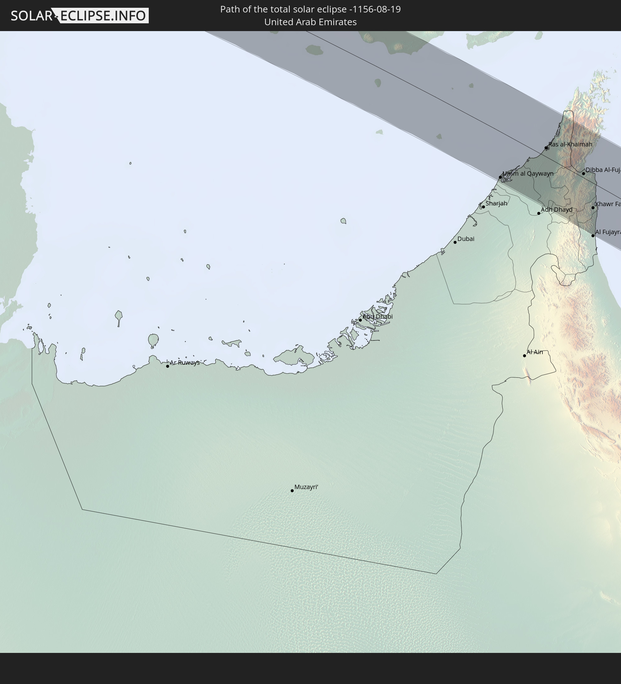 United Arab Emirates
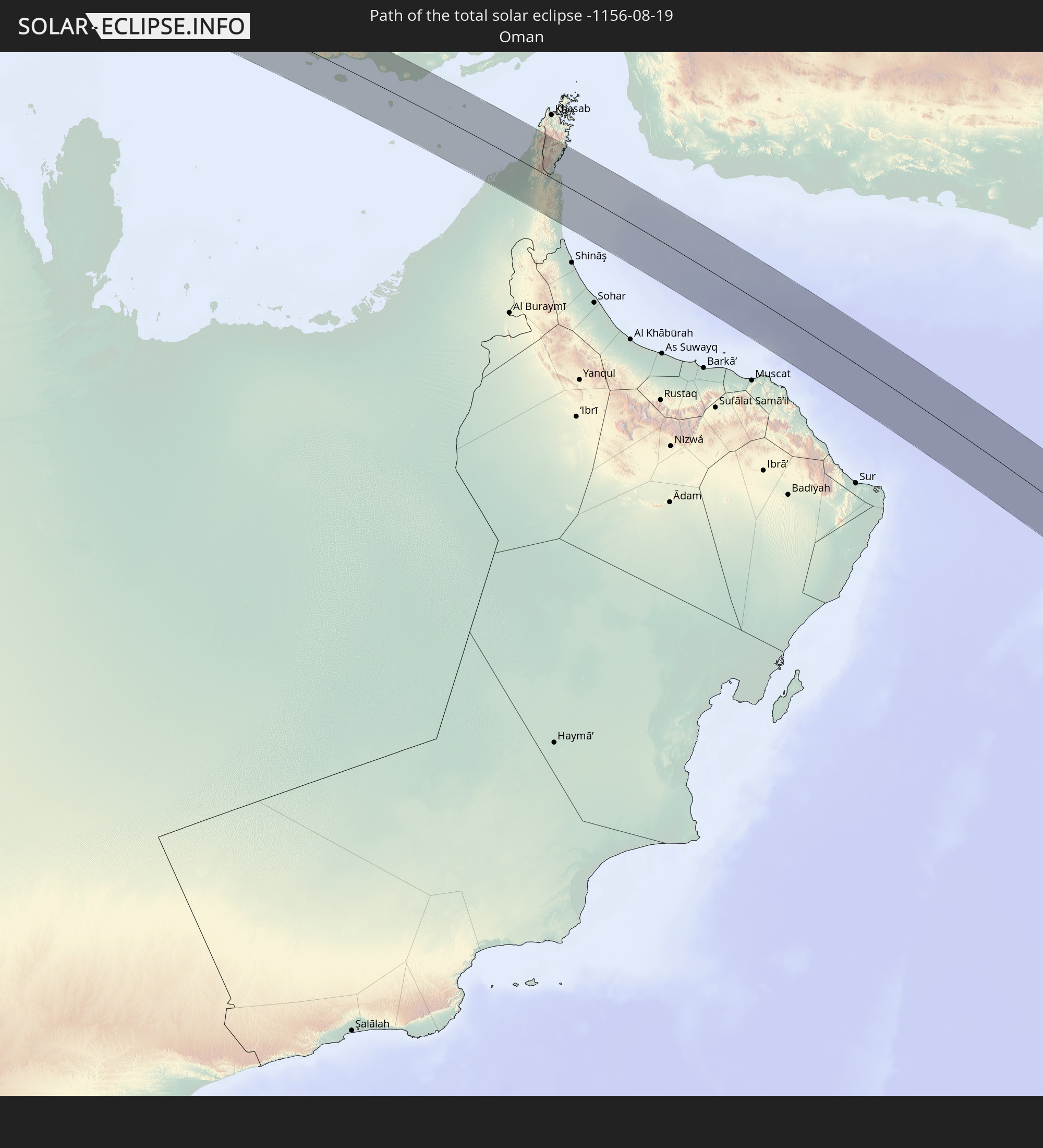 Oman
Oman
 India
India
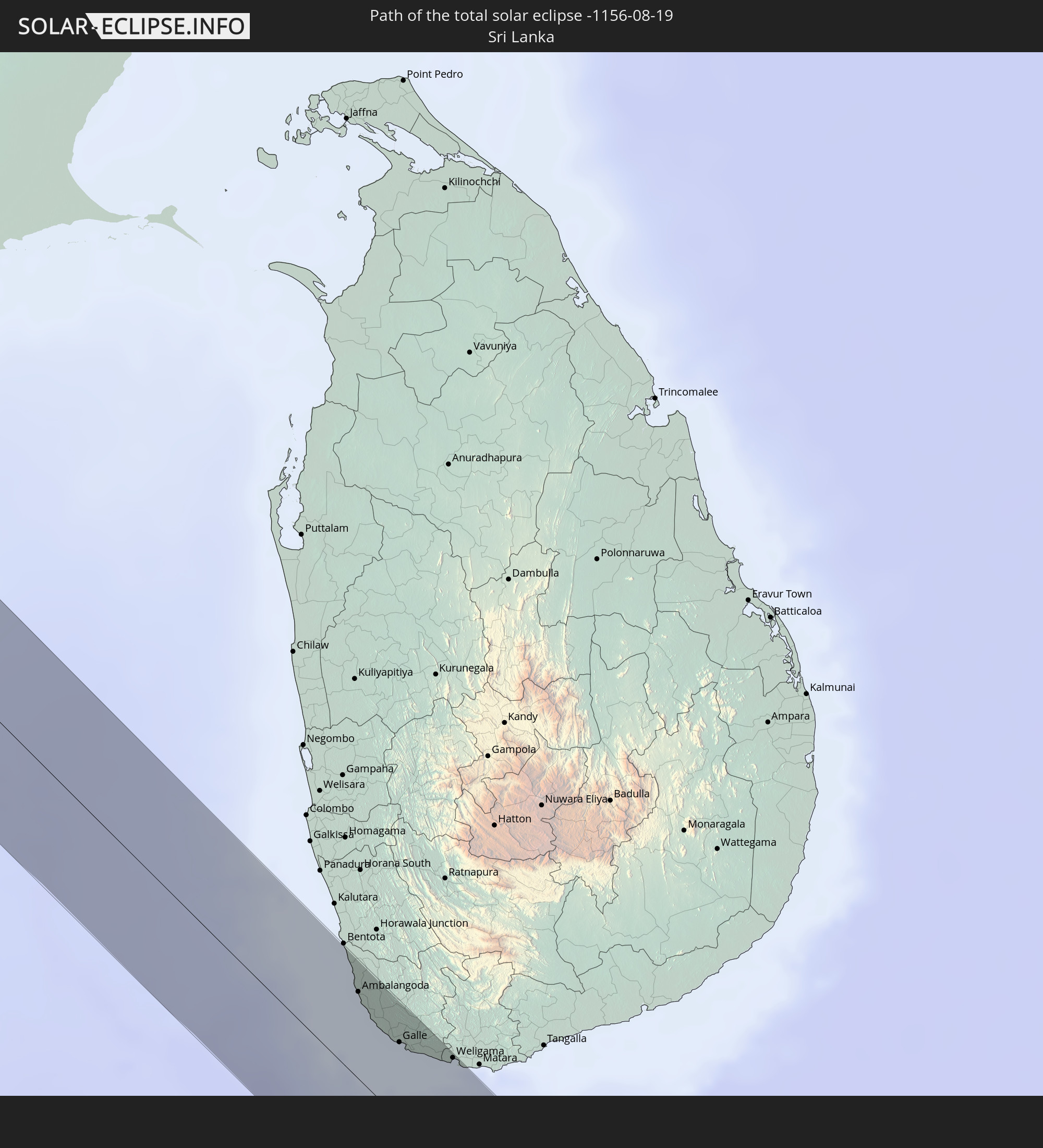 Sri Lanka
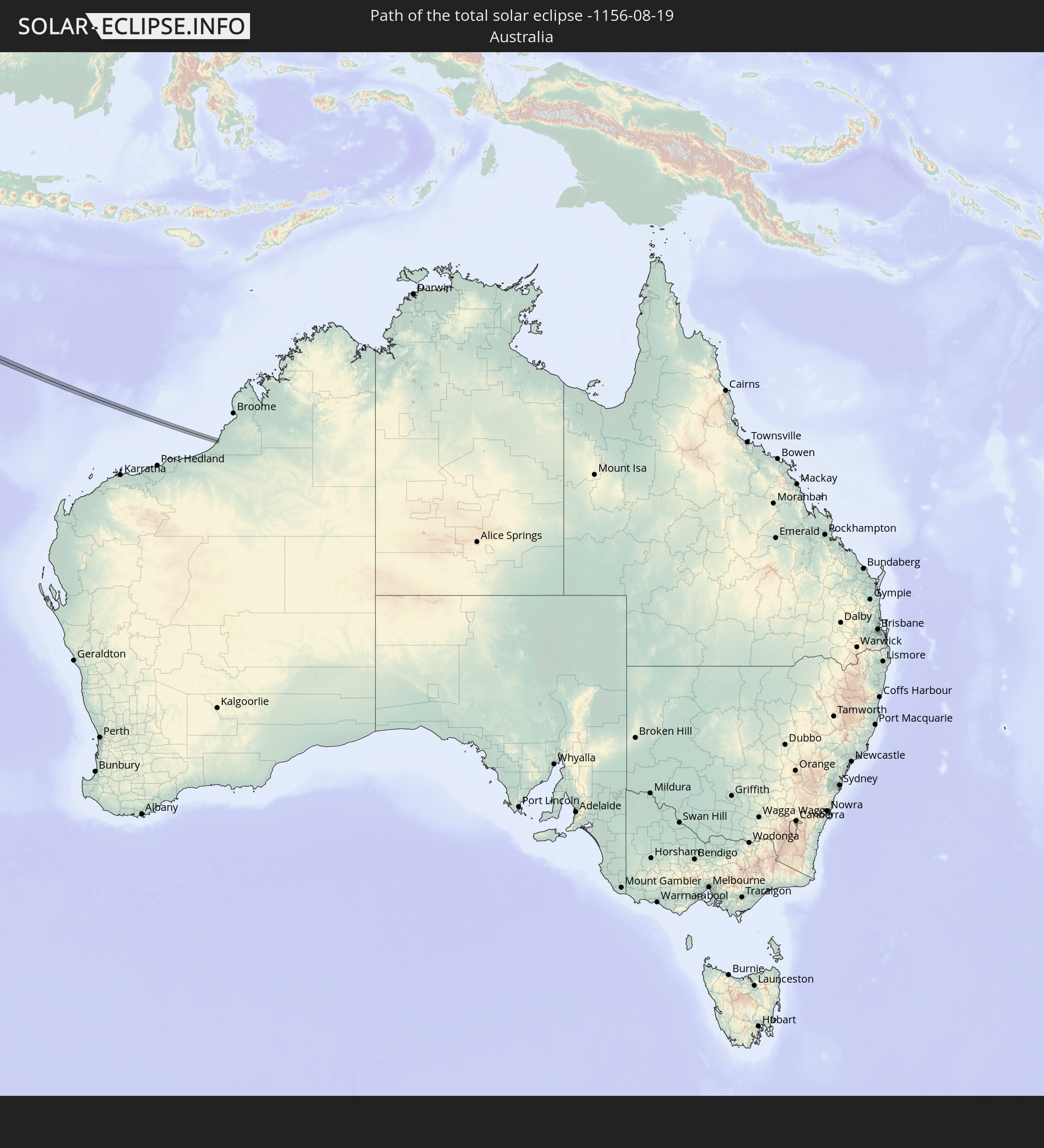 Australia
In den folgenden Ländern ist die Sonnenfinsternis partiell zu sehen
 Russia
 Portugal
 Spain
Spain
 Mauritania
 Morocco
 Mali
Mali
 Republic of Ireland
 Algeria
 United Kingdom
 Faroe Islands
 Burkina Faso
 Gibraltar
 France
 Isle of Man
 Ghana
Ghana
 Guernsey
 Jersey
 Togo
Togo
 Niger
Niger
 Benin
Benin
 Andorra
 Belgium
 Nigeria
 Netherlands
 Norway
 Equatorial Guinea
 Luxembourg
 Germany
 Switzerland
 São Tomé and Príncipe
 Italy
Italy
 Monaco
 Tunisia
 Denmark
 Cameroon
 Gabon
Gabon
 Libya
Libya
 Liechtenstein
 Austria
 Sweden
 Republic of the Congo
 Czechia
 Democratic Republic of the Congo
 San Marino
 Vatican City
 Slovenia
 Chad
Chad
 Croatia
 Poland
 Malta
Malta
 Central African Republic
 Bosnia and Herzegovina
 Hungary
 Slovakia
 Montenegro
 Serbia
 Albania
 Åland Islands
 Greece
 Romania
 Republic of Macedonia
 Finland
 Lithuania
 Latvia
 Estonia
 Sudan
Sudan
 Ukraine
 Bulgaria
 Belarus
 Egypt
Egypt
 Turkey
 Moldova
 Rwanda
 Tanzania
 Uganda
 Cyprus
 Ethiopia
 Kenya
Kenya
 State of Palestine
 Israel
 Saudi Arabia
 Jordan
 Lebanon
 Syria
Syria
 Eritrea
 Iraq
Iraq
 Georgia
 Somalia
 Djibouti
 Yemen
Yemen
 Armenia
 Iran
Iran
 Azerbaijan
 Seychelles
 Kazakhstan
 Kuwait
 Bahrain
 Qatar
Qatar
 United Arab Emirates
 Oman
Oman
 Turkmenistan
 Uzbekistan
 Mauritius
 Afghanistan
 Pakistan
 Tajikistan
 India
India
 Kyrgyzstan
 British Indian Ocean Territory
 Maldives
 China
China
 Sri Lanka
 Nepal
Nepal
 Mongolia
 Bangladesh
 Bhutan
 Myanmar
 Indonesia
 Cocos Islands
 Thailand
 Malaysia
 Laos
Laos
 Vietnam
 Cambodia
 Singapore
 Christmas Island
 Australia
 Macau
Macau
 Hong Kong
 Brunei
 Taiwan
 Philippines
 East Timor
 Palau
Palau
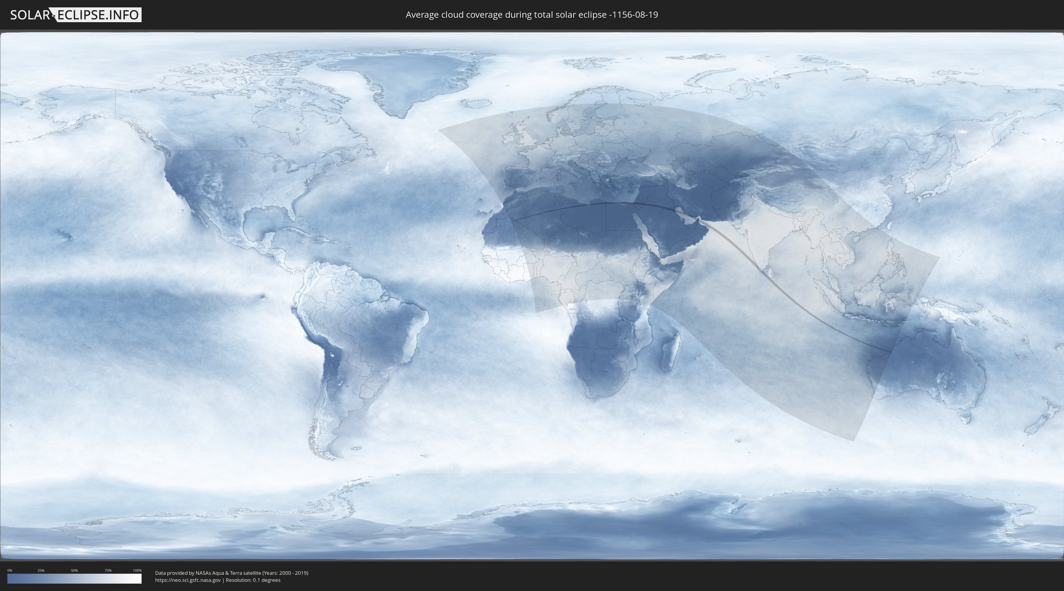
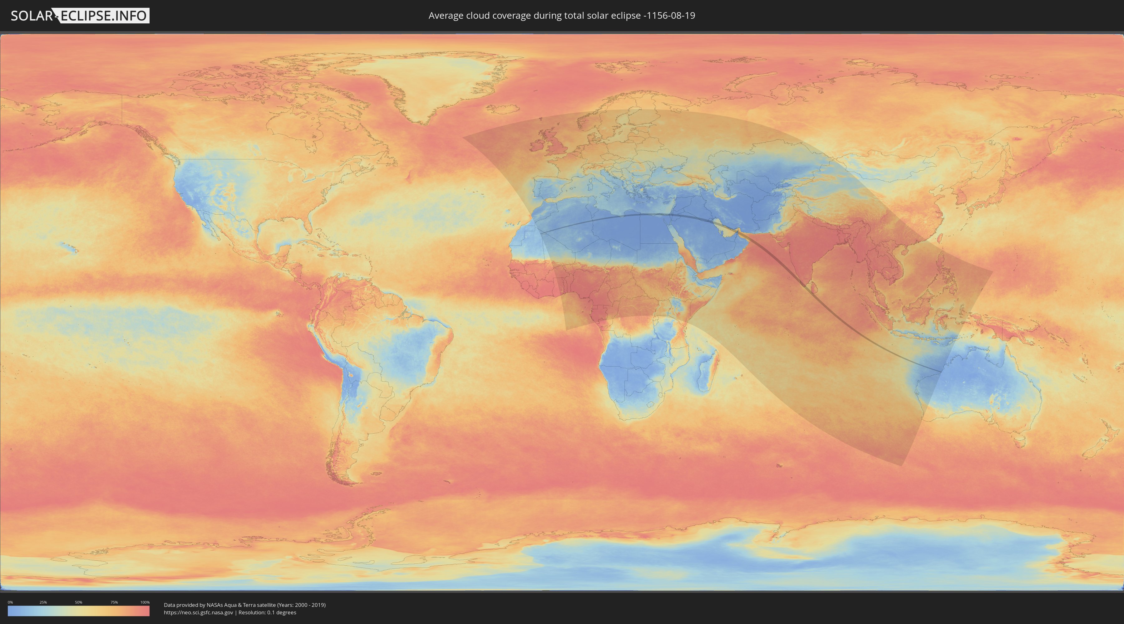
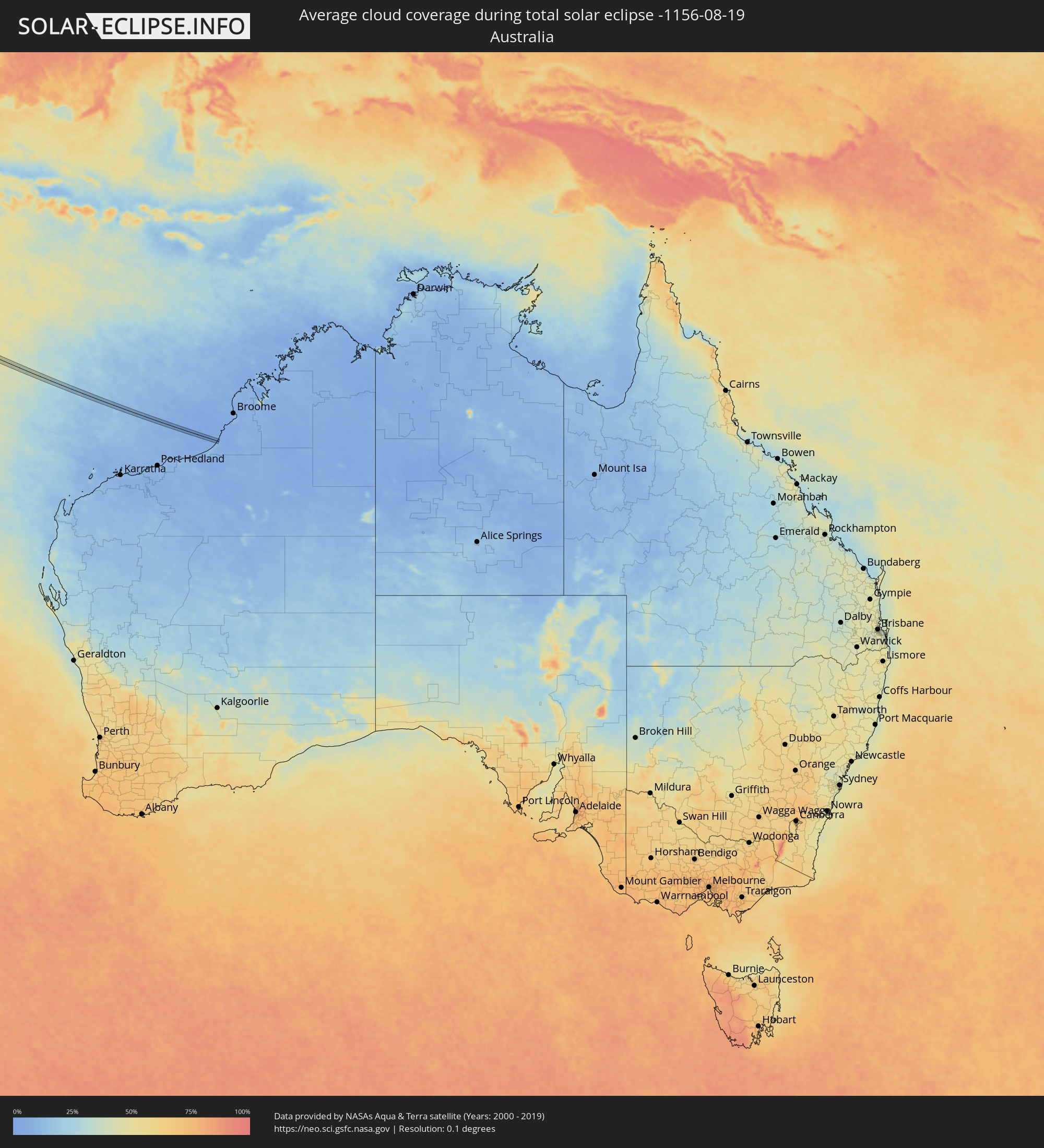
How will be the weather during the total solar eclipse on 08/19/-1156?
Where is the best place to see the total solar eclipse of 08/19/-1156?
The following maps show the average cloud coverage for the day of the total solar eclipse.
With the help of these maps, it is possible to find the place along the eclipse path, which has the best
chance of a cloudless sky.
Nevertheless, you should consider local circumstances and inform about the weather of your chosen
observation site.
The data is provided by NASAs satellites
AQUA and TERRA.
The cloud maps are averaged over a period of 19 years (2000 - 2019).
Detailed country maps
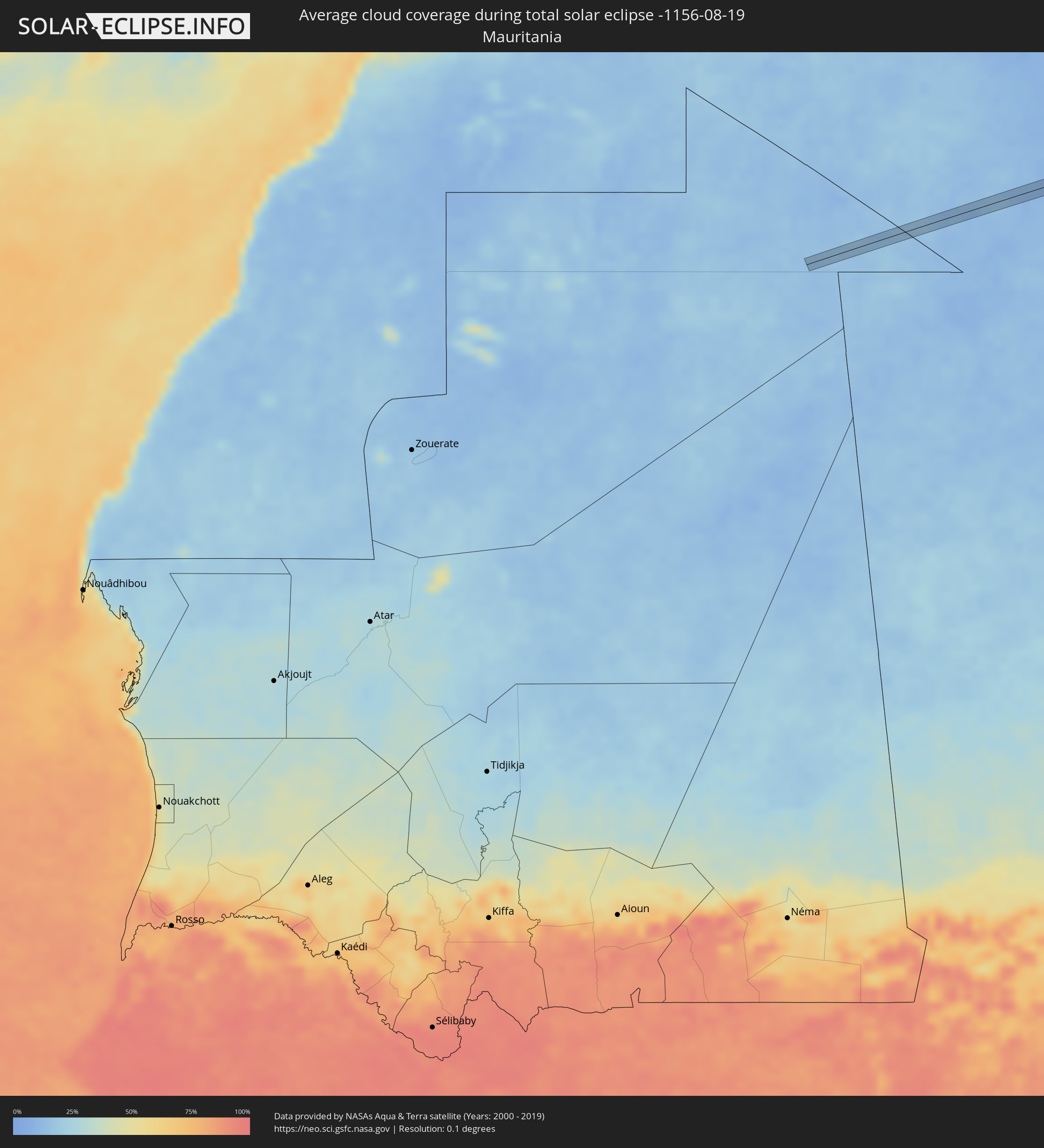 Mauritania
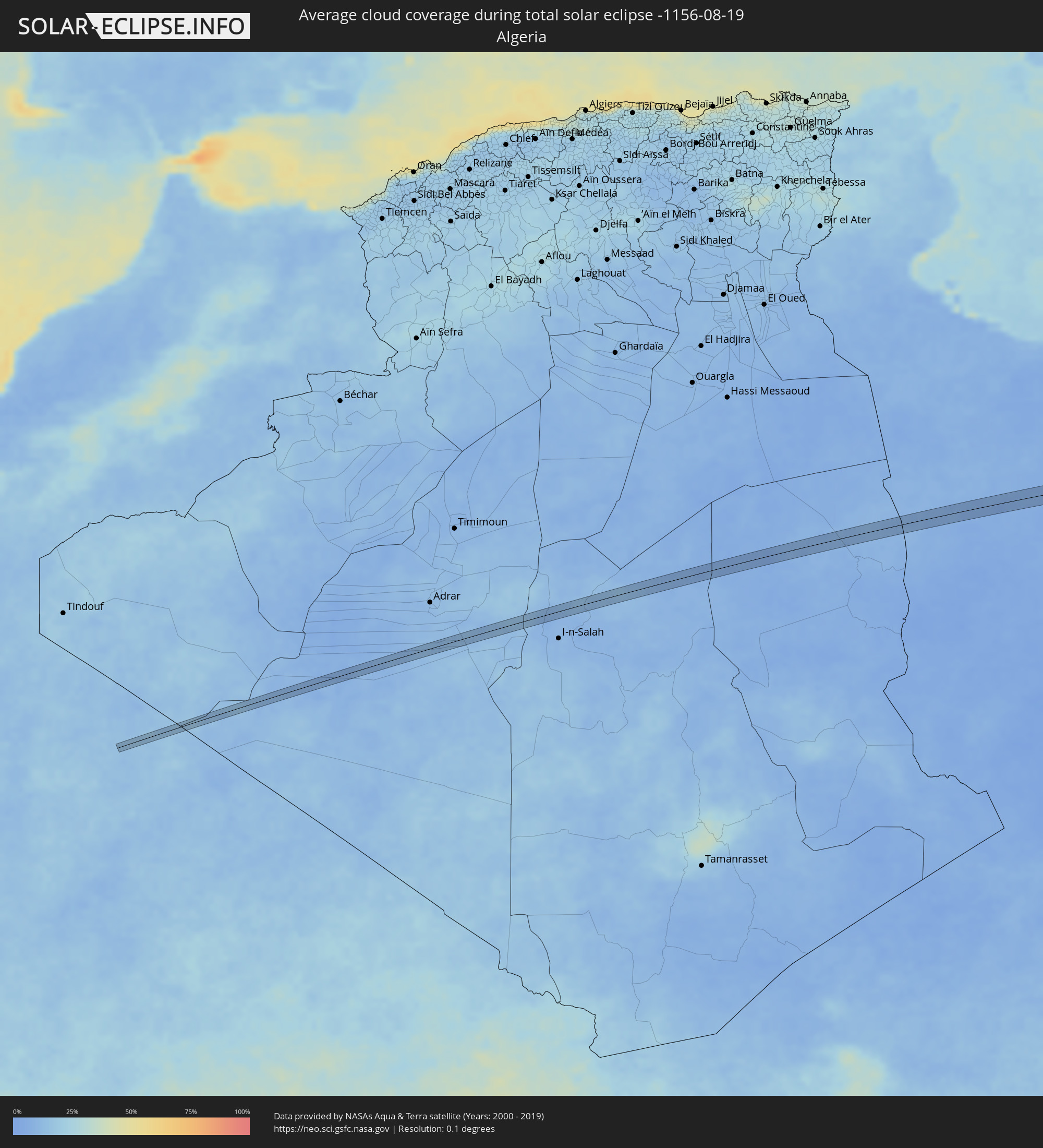 Algeria
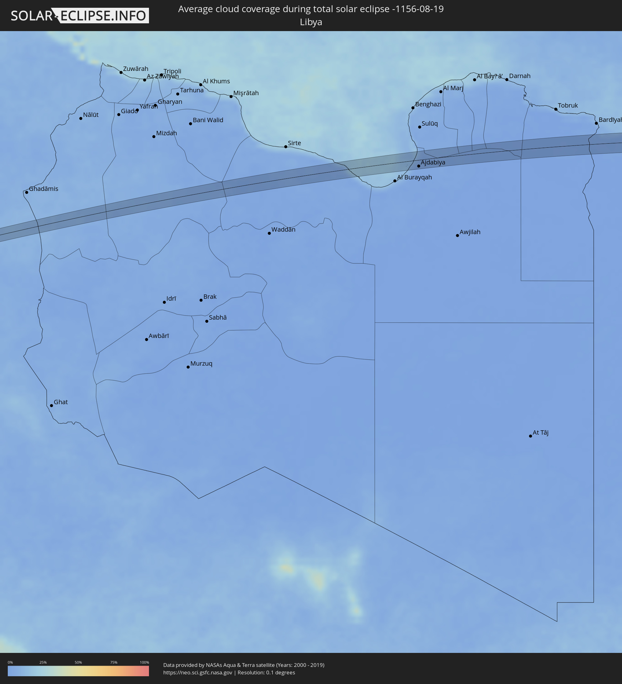 Libya
Libya
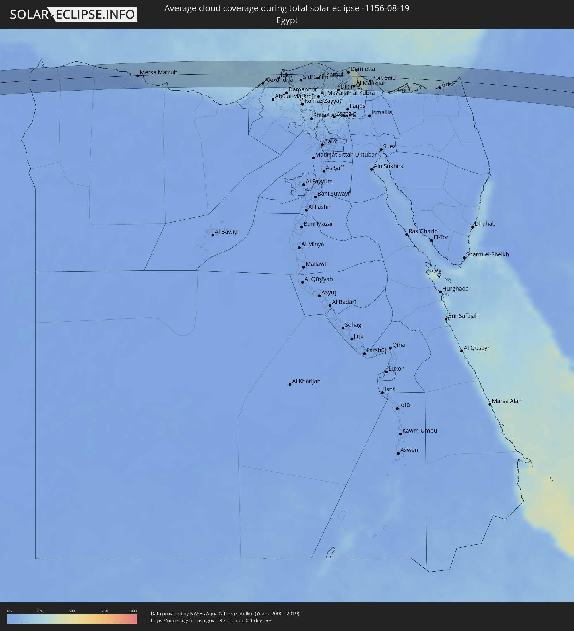 Egypt
Egypt
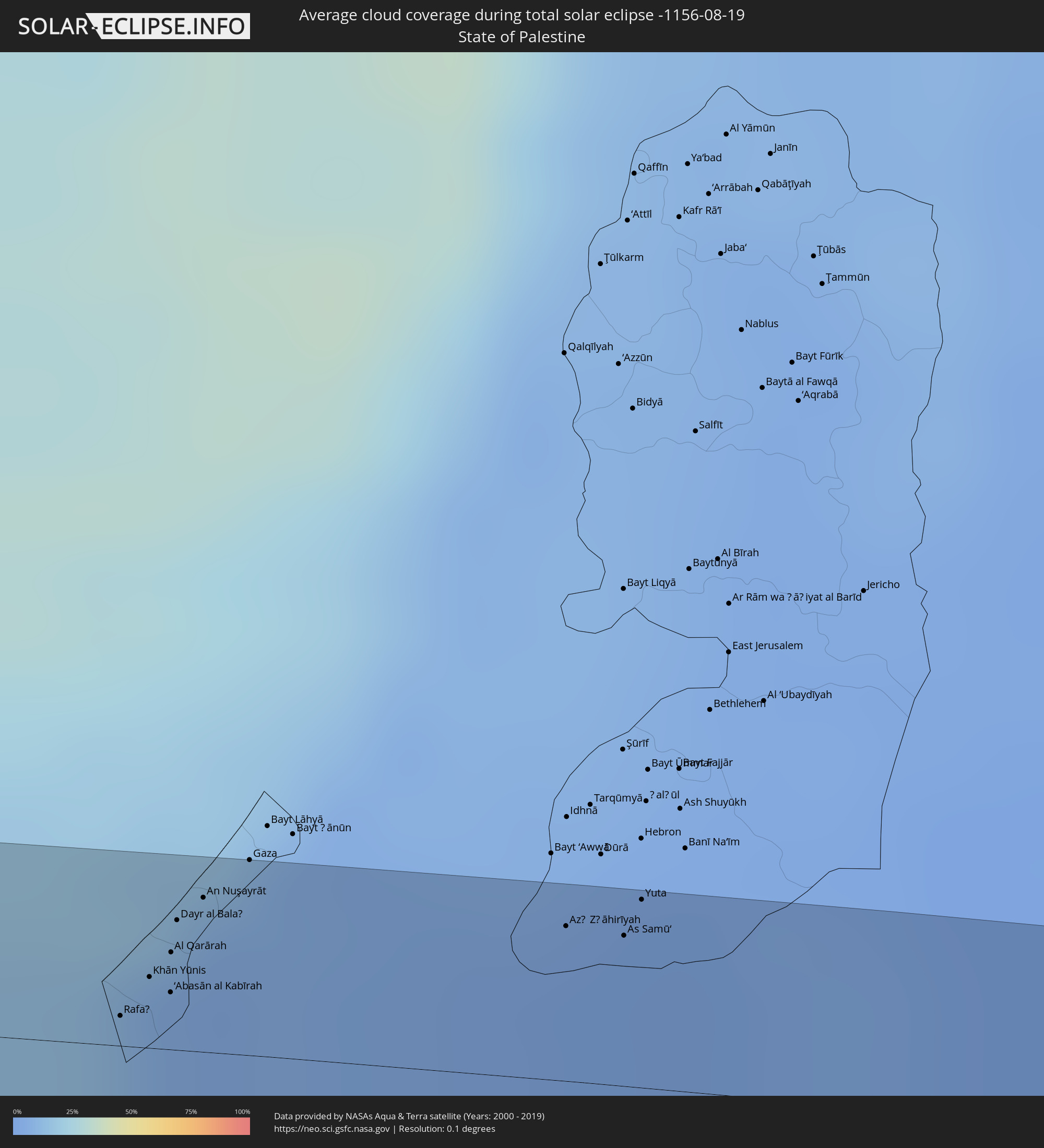 State of Palestine
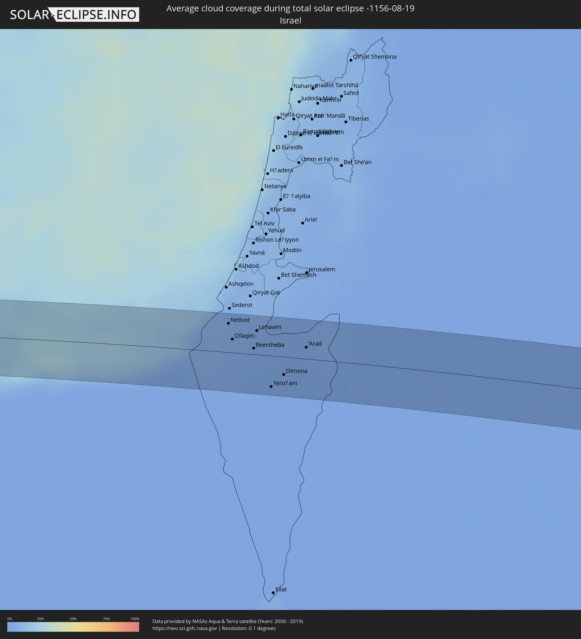 Israel
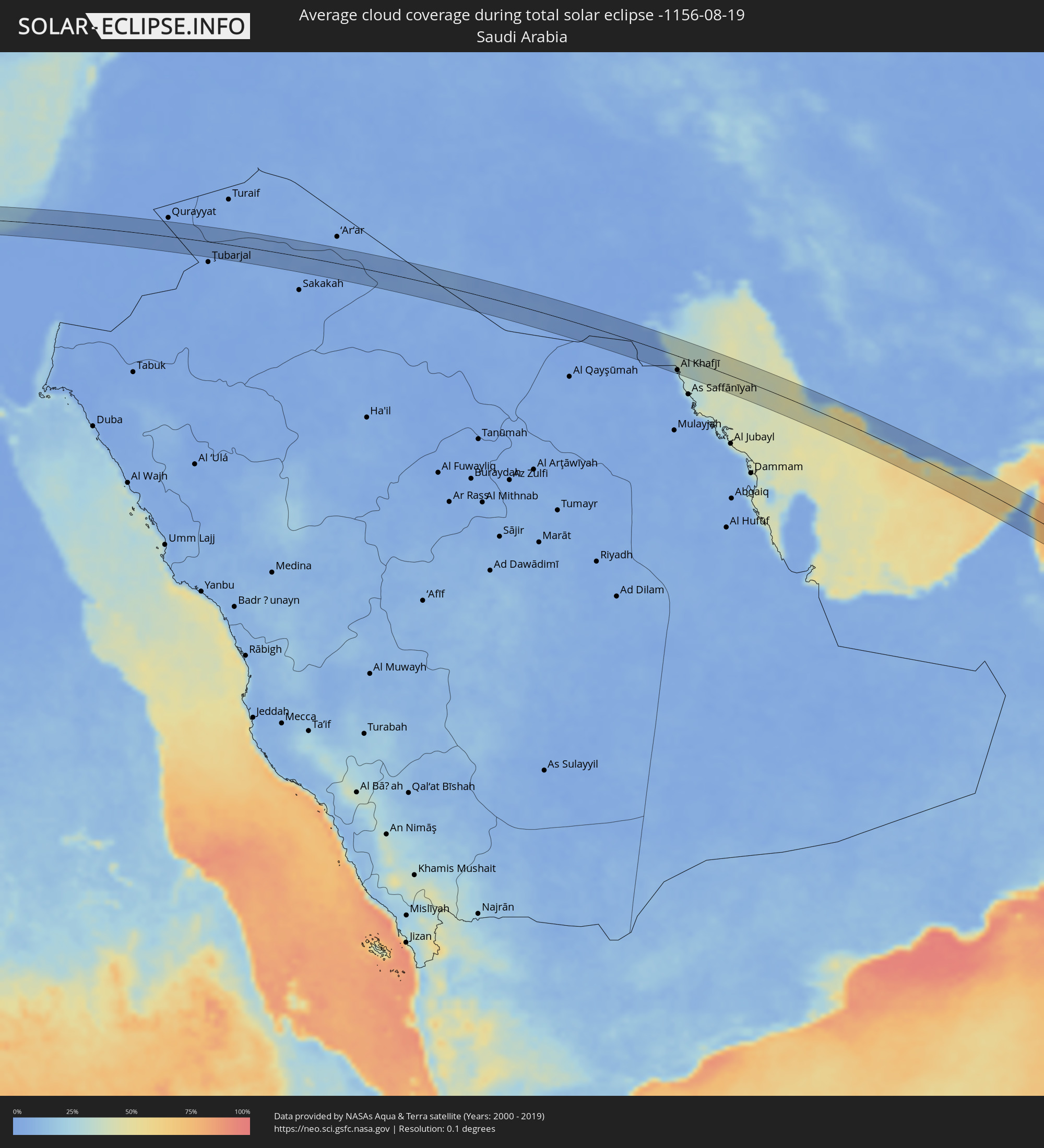 Saudi Arabia
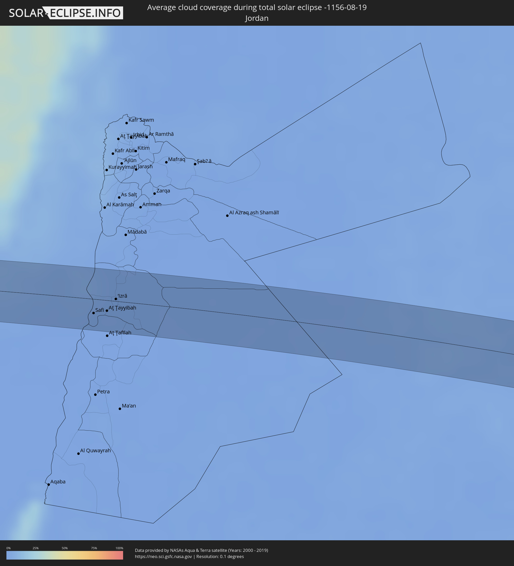 Jordan
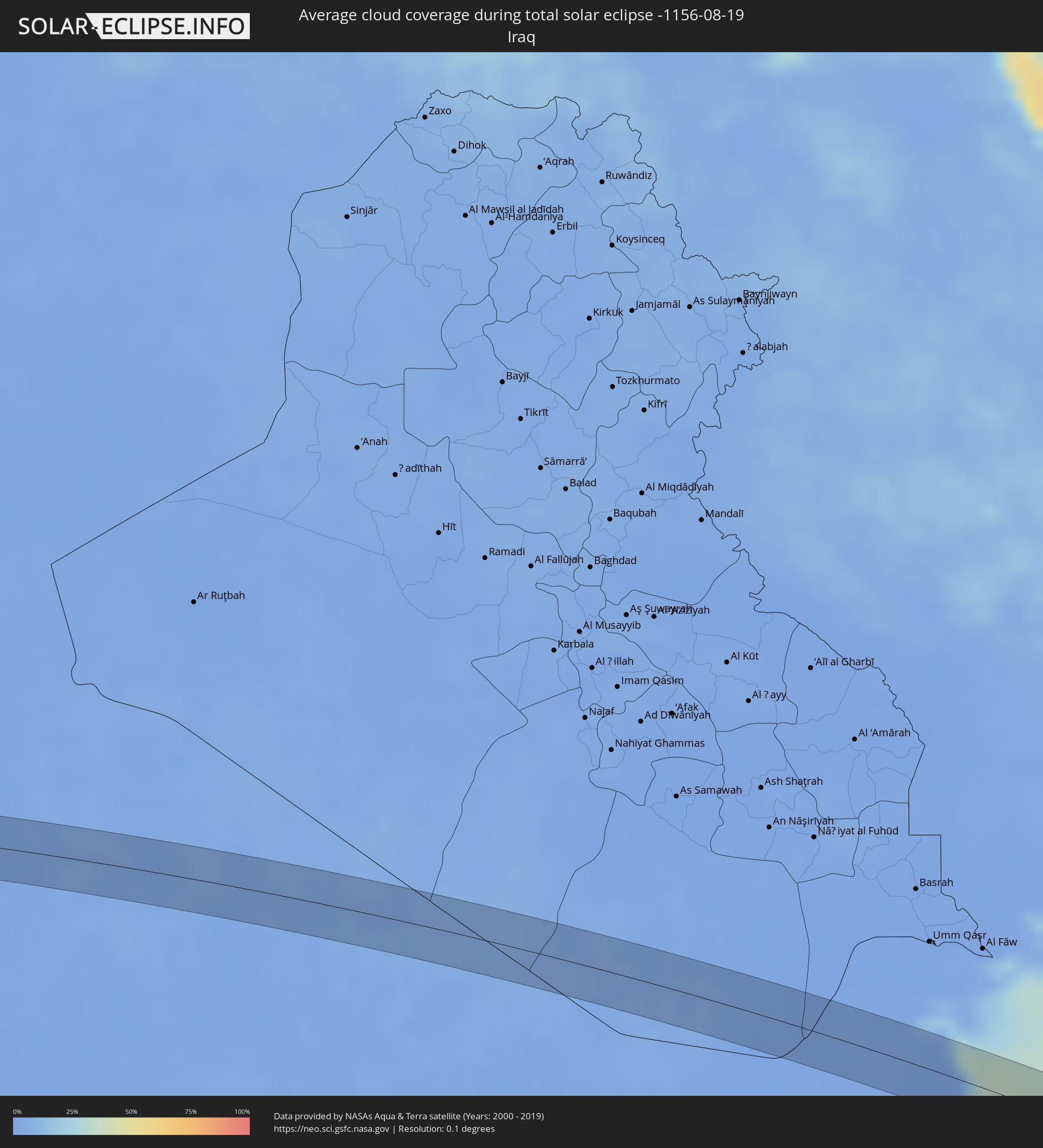 Iraq
Iraq
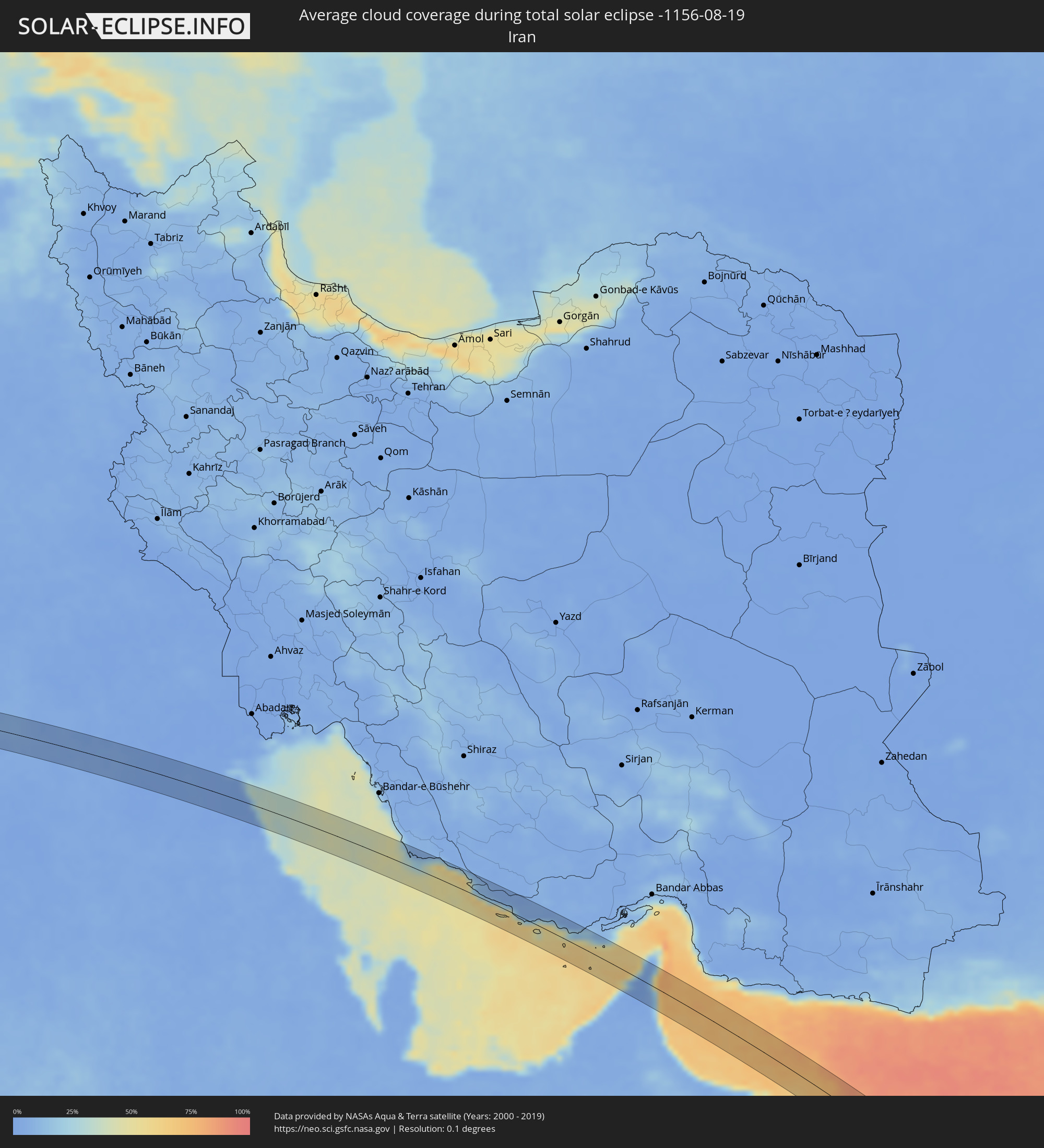 Iran
Iran
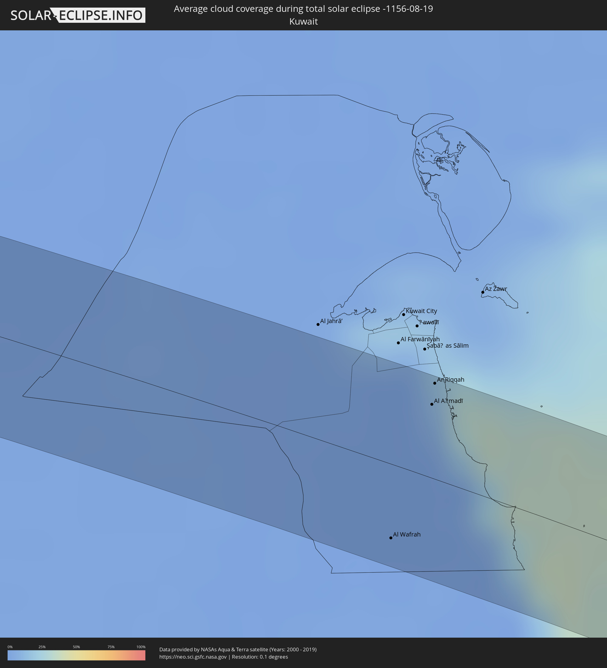 Kuwait
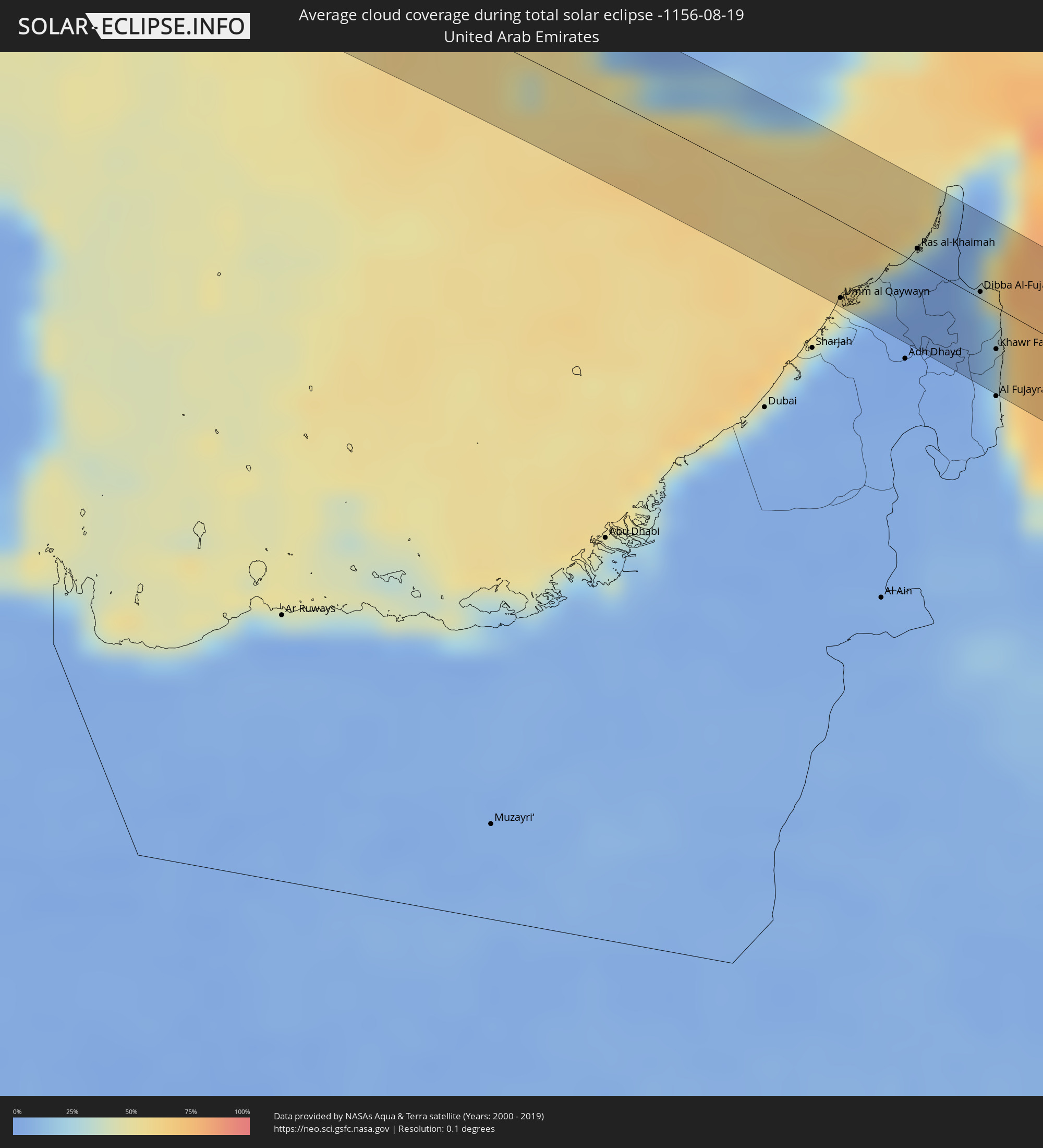 United Arab Emirates
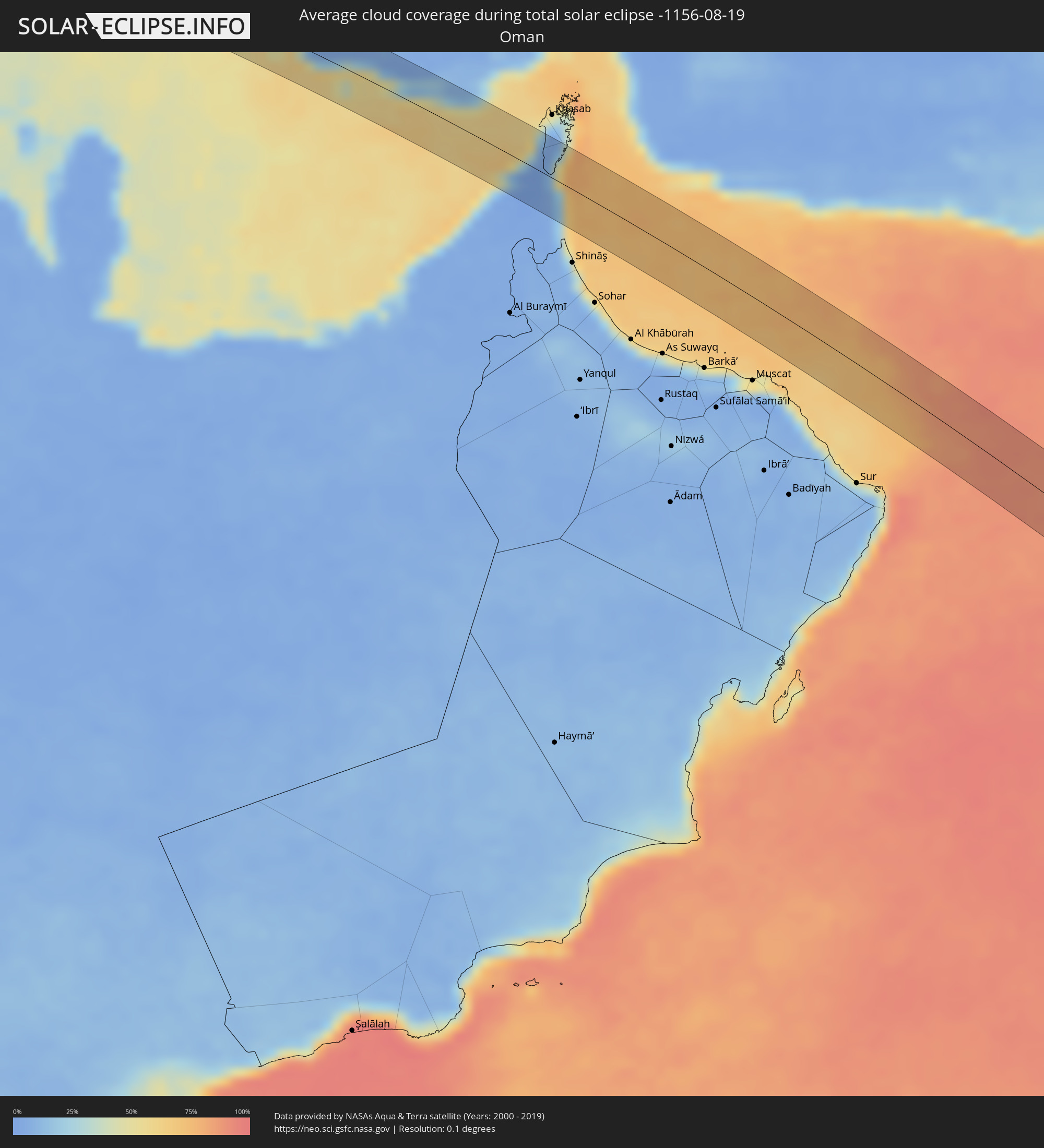 Oman
Oman
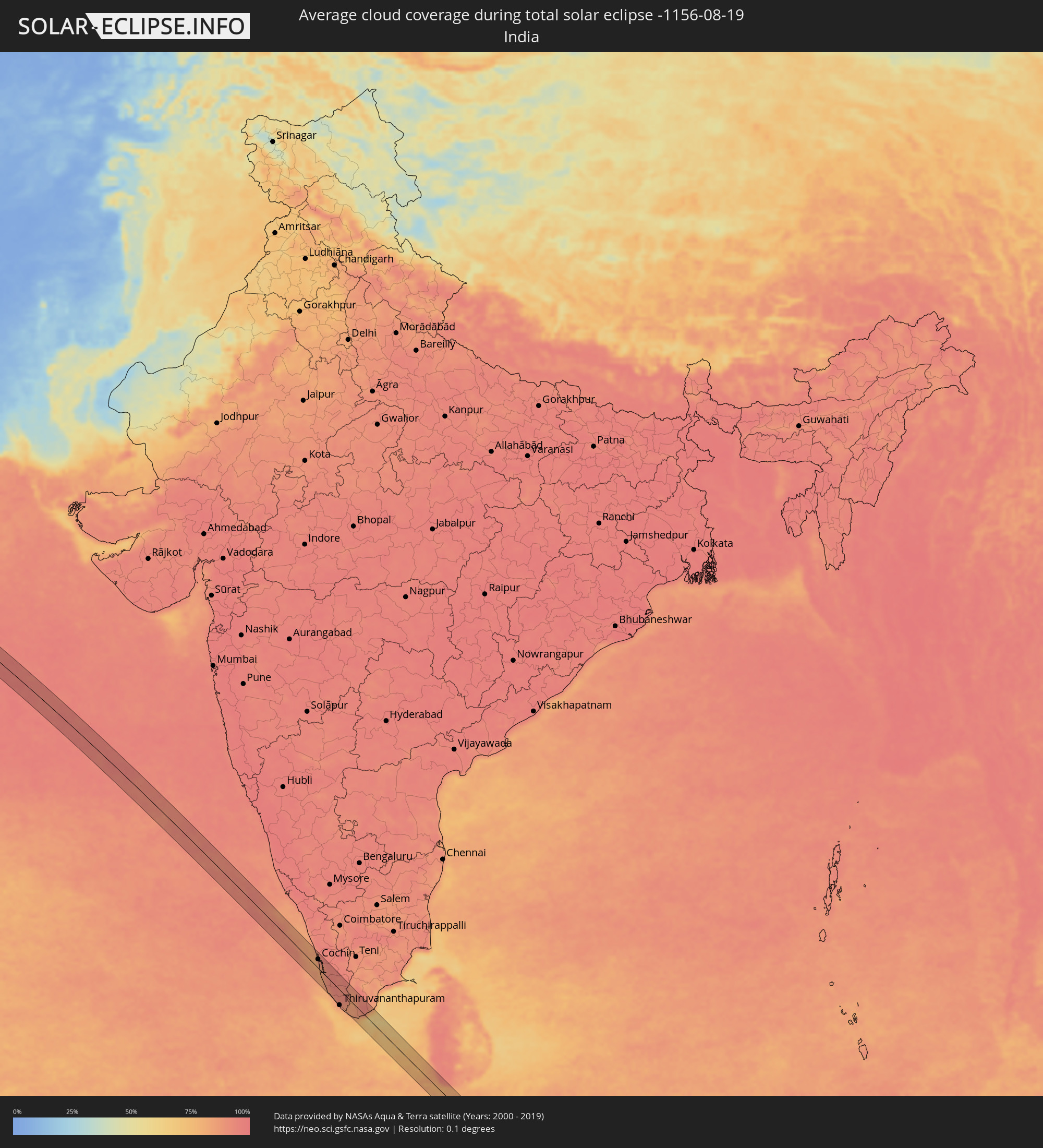 India
India
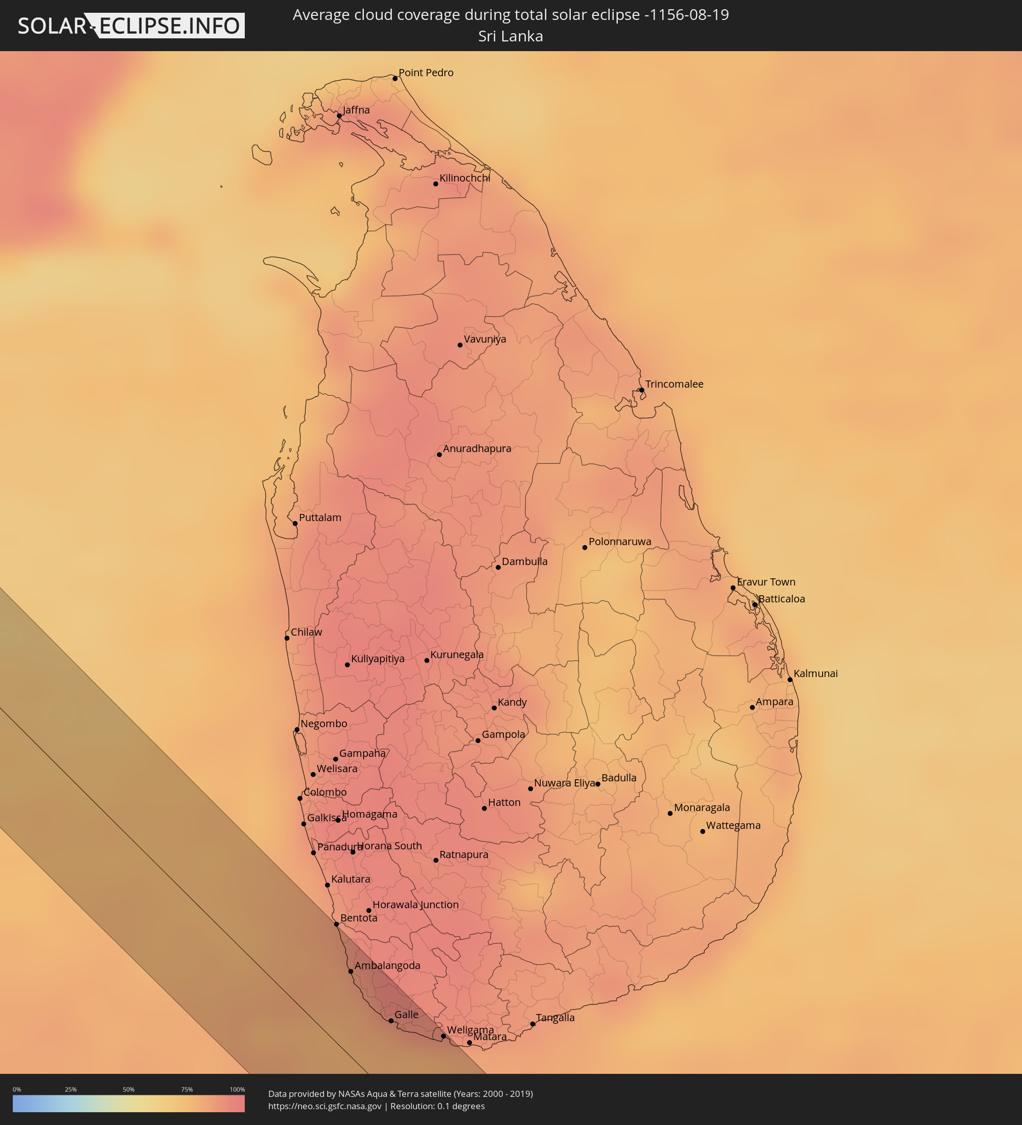 Sri Lanka
 Australia
Cities inside the path of the eclipse
The following table shows all locations with a population of more than 5,000 inside the eclipse path. Cities which have more than 100,000 inhabitants are marked bold. A click at the locations opens a detailed map.
| City | Type | Eclipse duration | Local time of max. eclipse | Distance to central line | Ø Cloud coverage |
|
Az Zuwaytīnah, Sha‘bīyat al Wāḩāt
|
total | - | 07:03:23 UTC+00:52 | 6 km | 8% |
|
Ajdabiya, Sha‘bīyat al Wāḩāt
|
total | - | 07:03:25 UTC+00:52 | 17 km | 1% |
|
Mersa Matruh, Matruh
|
total | - | 08:18:03 UTC+02:00 | 1 km | 4% |
|
Alexandria, Alexandria
|
total | - | 08:21:25 UTC+02:00 | 20 km | 11% |
|
Idkū, Beheira
|
total | - | 08:21:53 UTC+02:00 | 9 km | 10% |
|
Rosetta, Beheira
|
total | - | 08:22:03 UTC+02:00 | 1 km | 11% |
|
Fuwwah, Kafr el-Sheikh
|
total | - | 08:22:12 UTC+02:00 | 20 km | 17% |
|
Sīdī Sālim, Kafr el-Sheikh
|
total | - | 08:22:32 UTC+02:00 | 12 km | 19% |
|
Al Ḩāmūl, Kafr el-Sheikh
|
total | - | 08:23:01 UTC+02:00 | 7 km | 15% |
|
Bilqās, Dakahlia
|
total | - | 08:23:18 UTC+02:00 | 17 km | 14% |
|
Shirbīn, Dakahlia
|
total | - | 08:23:32 UTC+02:00 | 19 km | 15% |
|
Az Zarqā, Damietta
|
total | - | 08:23:41 UTC+02:00 | 17 km | 16% |
|
Minyat an Naşr, Dakahlia
|
total | - | 08:23:42 UTC+02:00 | 26 km | 14% |
|
Fāraskūr, Damietta
|
total | - | 08:23:48 UTC+02:00 | 4 km | 15% |
|
Damietta, Damietta
|
total | - | 08:23:56 UTC+02:00 | 6 km | 12% |
|
‘Izbat al Burj, Dakahlia
|
total | - | 08:23:59 UTC+02:00 | 17 km | 12% |
|
Al Jamālīyah, Dakahlia
|
total | - | 08:24:00 UTC+02:00 | 20 km | 15% |
|
Al Manzilah, Dakahlia
|
total | - | 08:24:06 UTC+02:00 | 22 km | 15% |
|
Al Maţarīyah, Dakahlia
|
total | - | 08:24:14 UTC+02:00 | 19 km | 12% |
|
Port Said, Port Said
|
total | - | 08:24:36 UTC+02:00 | 10 km | 15% |
|
Arish, North Sinai
|
total | - | 08:26:47 UTC+02:00 | 16 km | 2% |
|
Rafaḩ, Gaza Strip
|
total | - | 08:27:28 UTC+02:00 | 5 km | 3% |
|
Shūkat aş Şūfī, Gaza Strip
|
total | - | 08:27:30 UTC+02:00 | 2 km | 3% |
|
An Naşr, Gaza Strip
|
total | - | 08:27:32 UTC+02:00 | 4 km | 3% |
|
Khān Yūnis, Gaza Strip
|
total | - | 08:27:32 UTC+02:00 | 11 km | 3% |
|
Banī Suhaylā, Gaza Strip
|
total | - | 08:27:33 UTC+02:00 | 11 km | 3% |
|
Al Fukhkhārī, Gaza Strip
|
total | - | 08:27:34 UTC+02:00 | 6 km | 3% |
|
‘Abasān al Kabīrah, Gaza Strip
|
total | - | 08:27:35 UTC+02:00 | 9 km | 3% |
|
Al Qarārah, Gaza Strip
|
total | - | 08:27:35 UTC+02:00 | 15 km | 7% |
|
‘Abasān al Jadīdah
|
total | - | 08:27:36 UTC+02:00 | 11 km | 3% |
|
Dayr al Balaḩ, Gaza Strip
|
total | - | 08:27:36 UTC+02:00 | 20 km | 4% |
|
Khuzā‘ah, Gaza Strip
|
total | - | 08:27:37 UTC+02:00 | 7 km | 3% |
|
Az Zuwāydah, Gaza Strip
|
total | - | 08:27:38 UTC+02:00 | 22 km | 4% |
|
An Nuşayrāt, Gaza Strip
|
total | - | 08:27:39 UTC+02:00 | 23 km | 4% |
|
Al Burayj, Gaza Strip
|
total | - | 08:27:40 UTC+02:00 | 22 km | 4% |
|
Al Mughrāqah
|
total | - | 08:27:41 UTC+02:00 | 25 km | 7% |
|
Gaza, Gaza Strip
|
total | - | 08:27:46 UTC+02:00 | 30 km | 6% |
|
Netivot, Southern District
|
total | - | 08:48:37 UTC+02:20 | 22 km | 4% |
|
Ofaqim, Southern District
|
total | - | 08:48:40 UTC+02:20 | 10 km | 3% |
|
Beersheba, Southern District
|
total | - | 08:48:56 UTC+02:20 | 5 km | 2% |
|
Lehavim, Southern District
|
total | - | 08:48:58 UTC+02:20 | 18 km | 3% |
|
Yeroẖam, Southern District
|
total | - | 08:49:11 UTC+02:20 | 24 km | 1% |
|
Az̧ Z̧āhirīyah, West Bank
|
total | - | 08:28:32 UTC+02:00 | 24 km | 2% |
|
Dimona, Southern District
|
total | - | 08:49:19 UTC+02:20 | 14 km | 1% |
|
As Samū‘, West Bank
|
total | - | 08:28:41 UTC+02:00 | 23 km | 1% |
|
Yuta, West Bank
|
total | - | 08:28:43 UTC+02:00 | 29 km | 1% |
|
‘Arad, Southern District
|
total | - | 08:49:35 UTC+02:20 | 9 km | 1% |
|
Safi, Karak
|
total | - | 08:53:04 UTC+02:23 | 14 km | 0% |
|
Aţ Ţayyibah, Karak
|
total | - | 08:53:16 UTC+02:23 | 10 km | 1% |
|
‘Ayy, Karak
|
total | - | 08:53:20 UTC+02:23 | 1 km | 1% |
|
‘Izrā, Karak
|
total | - | 08:53:24 UTC+02:23 | 2 km | 0% |
|
Al Mazār al Janūbī, Karak
|
total | - | 08:53:25 UTC+02:23 | 8 km | 1% |
|
Qīr Moāv, Ma’an
|
total | - | 08:53:25 UTC+02:23 | 5 km | 0% |
|
Karak City, Karak
|
total | - | 08:53:31 UTC+02:23 | 3 km | 0% |
|
Al Wafrah, Al Aḩmadī
|
total | - | 10:00:10 UTC+03:06 | 26 km | 1% |
|
Al Aḩmadī, Al Aḩmadī
|
total | - | 10:00:08 UTC+03:06 | 25 km | 7% |
|
Ar Riqqah, Al Aḩmadī
|
total | - | 10:00:06 UTC+03:06 | 33 km | 7% |
|
Al Faḩāḩīl, Al Aḩmadī
|
total | - | 10:00:13 UTC+03:06 | 27 km | 7% |
|
Al Mahbūlah, Al Aḩmadī
|
total | - | 10:00:10 UTC+03:06 | 34 km | 7% |
|
Al Manqaf, Al Aḩmadī
|
total | - | 10:00:13 UTC+03:06 | 29 km | 7% |
|
Al Khafjī, Eastern Province
|
total | - | 10:01:30 UTC+03:06 | 29 km | 13% |
|
Kīsh, Hormozgan
|
total | - | 10:34:19 UTC+03:25 | 7 km | 42% |
|
Bandar-e Lengeh, Hormozgan
|
total | - | 10:36:13 UTC+03:25 | 32 km | 20% |
|
Umm al Qaywayn, Umm al Qaywayn
|
total | - | 10:54:30 UTC+03:41 | 34 km | 21% |
|
Ras al-Khaimah, Raʼs al Khaymah
|
total | - | 10:55:04 UTC+03:41 | 7 km | 27% |
|
Dibba Al-Fujairah, Al Fujayrah
|
total | - | 10:56:04 UTC+03:41 | 3 km | 25% |
|
Dibba Al-Hisn, Al Fujayrah
|
total | - | 10:56:03 UTC+03:41 | 6 km | 25% |
|
Khawr Fakkān, Ash Shāriqah
|
total | - | 10:56:36 UTC+03:41 | 18 km | 19% |
|
Cochin, Kerala
|
total | - | 13:47:44 UTC+05:21 | 22 km | 85% |
|
Kalamassery, Kerala
|
total | - | 13:47:36 UTC+05:21 | 36 km | 89% |
|
Alleppey, Kerala
|
total | - | 13:48:44 UTC+05:21 | 8 km | 83% |
|
Cherthala, Kerala
|
total | - | 13:48:22 UTC+05:21 | 8 km | 82% |
|
Kāyankulam, Kerala
|
total | - | 13:49:40 UTC+05:21 | 19 km | 85% |
|
Panmana, Kerala
|
total | - | 13:50:00 UTC+05:21 | 30 km | 79% |
|
Kottayam, Kerala
|
total | - | 13:48:52 UTC+05:21 | 15 km | 89% |
|
Tiruvalla, Kerala
|
total | - | 13:49:22 UTC+05:21 | 3 km | 91% |
|
Kollam, Kerala
|
total | - | 13:50:23 UTC+05:21 | 36 km | 80% |
|
Varkala, Kerala
|
total | - | 13:50:54 UTC+05:21 | 37 km | 79% |
|
Pathanāmthitta, Kerala
|
total | - | 13:49:57 UTC+05:21 | 10 km | 93% |
|
Punalūr, Kerala
|
total | - | 13:50:41 UTC+05:21 | 3 km | 94% |
|
Thiruvananthapuram, Kerala
|
total | - | 13:51:46 UTC+05:21 | 38 km | 82% |
|
Neyyāttinkara, Kerala
|
total | - | 13:52:10 UTC+05:21 | 34 km | 79% |
|
Thenkasi, Tamil Nadu
|
total | - | 13:51:27 UTC+05:21 | 28 km | 88% |
|
Nāgercoil, Tamil Nadu
|
total | - | 13:53:11 UTC+05:21 | 24 km | 79% |
|
Ambasamudram, Tamil Nadu
|
total | - | 13:52:10 UTC+05:21 | 19 km | 87% |
|
Ālangulam, Tamil Nadu
|
total | - | 13:51:57 UTC+05:21 | 35 km | 90% |
|
Tirunelveli, Tamil Nadu
|
total | - | 13:52:32 UTC+05:21 | 38 km | 92% |
|
Ambalangoda, Southern
|
total | - | 13:59:24 UTC+05:19 | 27 km | 82% |
|
Galle, Southern
|
total | - | 14:00:01 UTC+05:19 | 24 km | 79% |
|
Weligama, Southern
|
total | - | 14:00:27 UTC+05:19 | 36 km | 80% |