Annular solar eclipse of 11/07/-1337
| Day of week: | Thursday |
| Maximum duration of eclipse: | 11m24s |
| Maximum width of eclipse path: | 316 km |
| Saros cycle: | 31 |
| Coverage: | 91.8% |
| Magnitude: | 0.9176 |
| Gamma: | 0.1379 |
Wo kann man die Sonnenfinsternis vom 11/07/-1337 sehen?
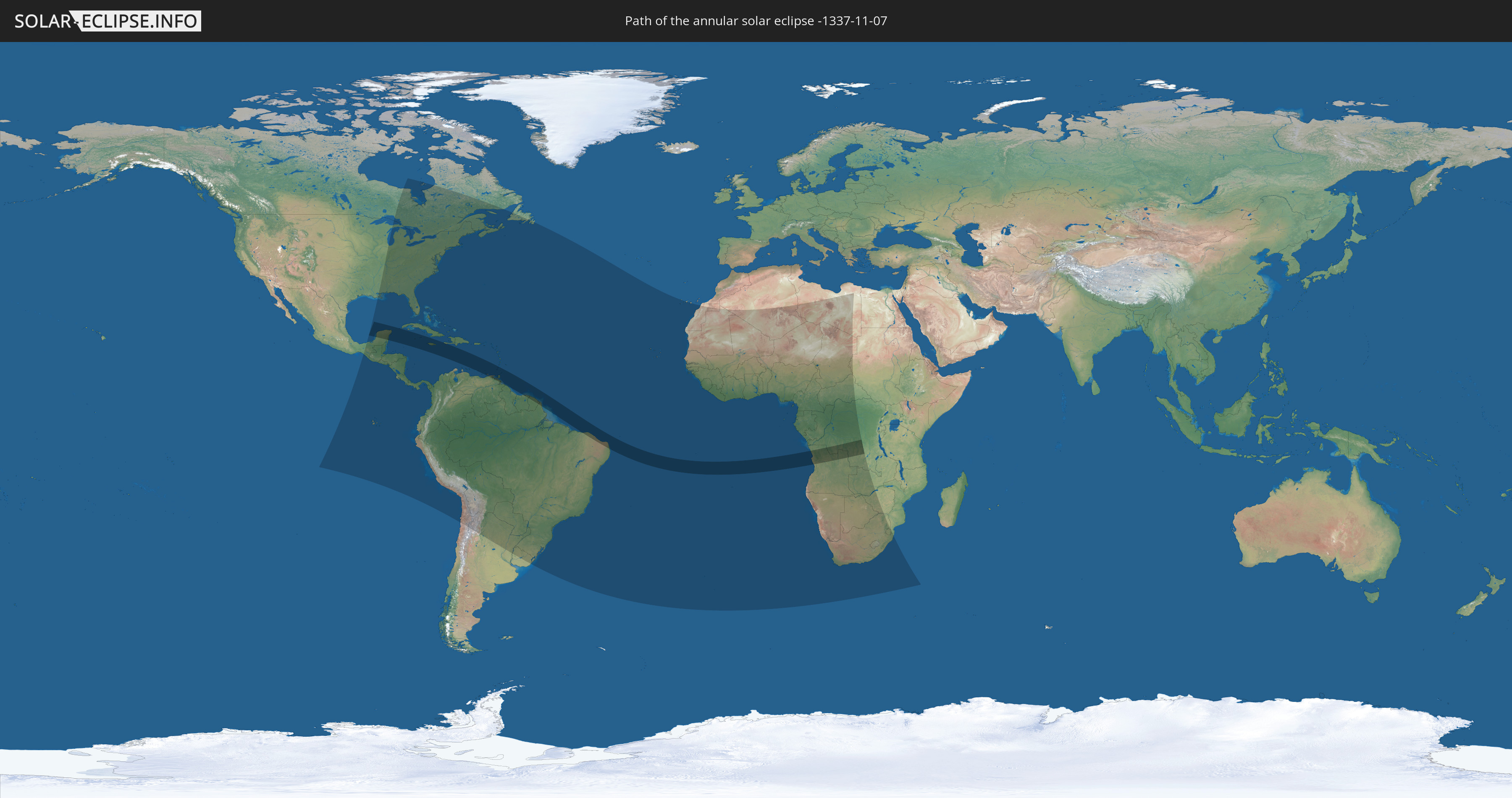
Die Sonnenfinsternis am 11/07/-1337 kann man in 89 Ländern als partielle Sonnenfinsternis beobachten.
Der Finsternispfad verläuft durch 15 Länder. Nur in diesen Ländern ist sie als annular Sonnenfinsternis zu sehen.
In den folgenden Ländern ist die Sonnenfinsternis annular zu sehen
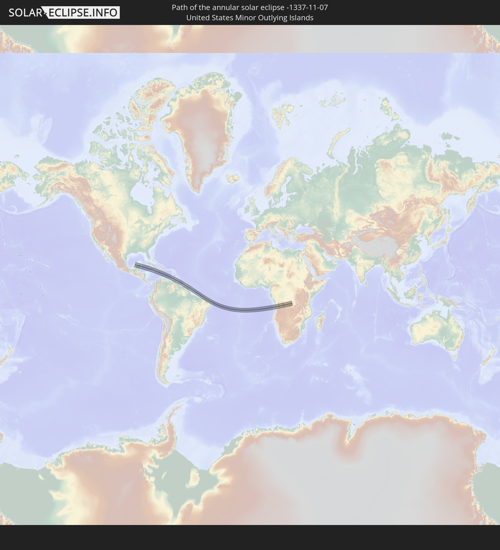 United States Minor Outlying Islands
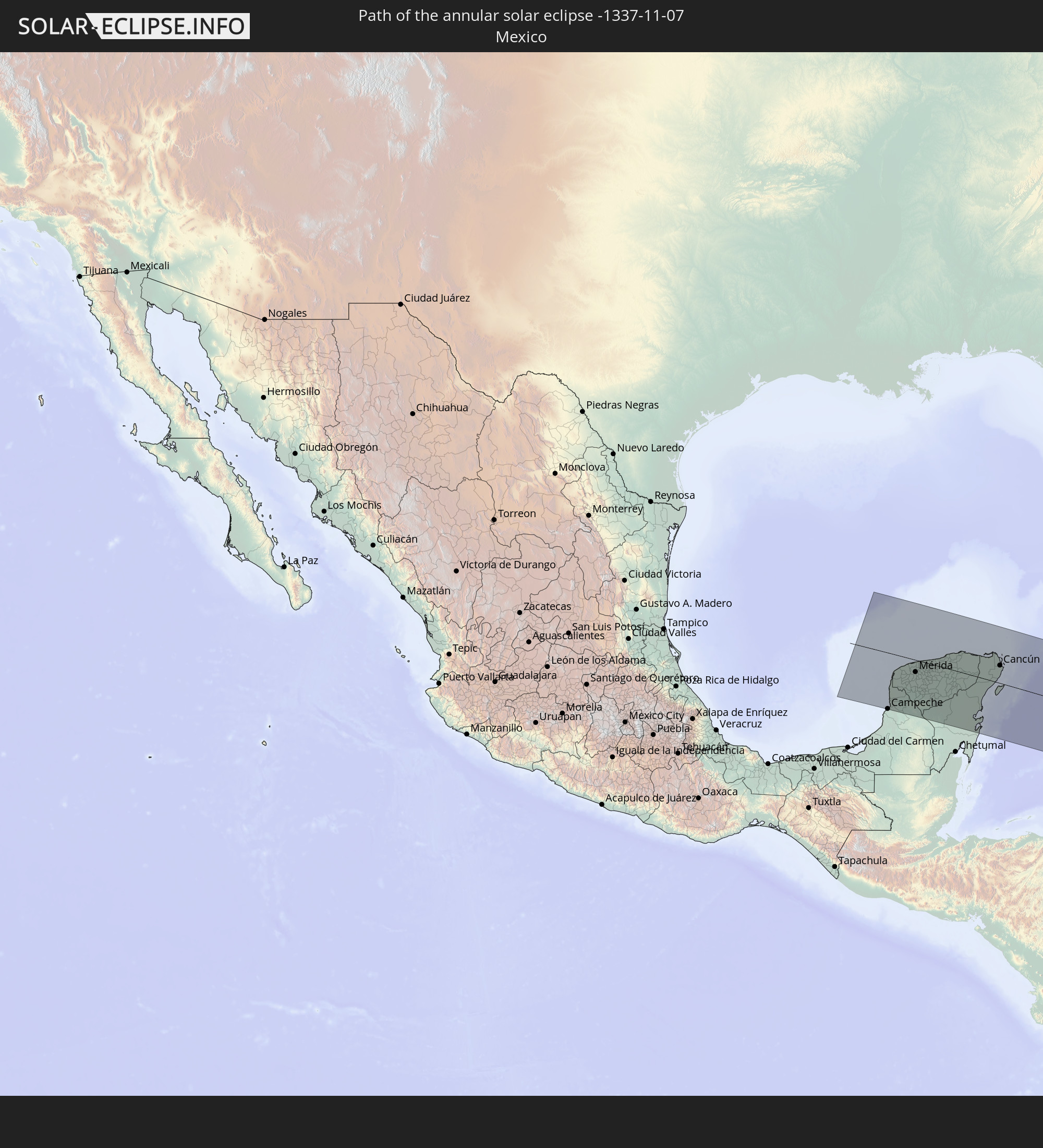 Mexico
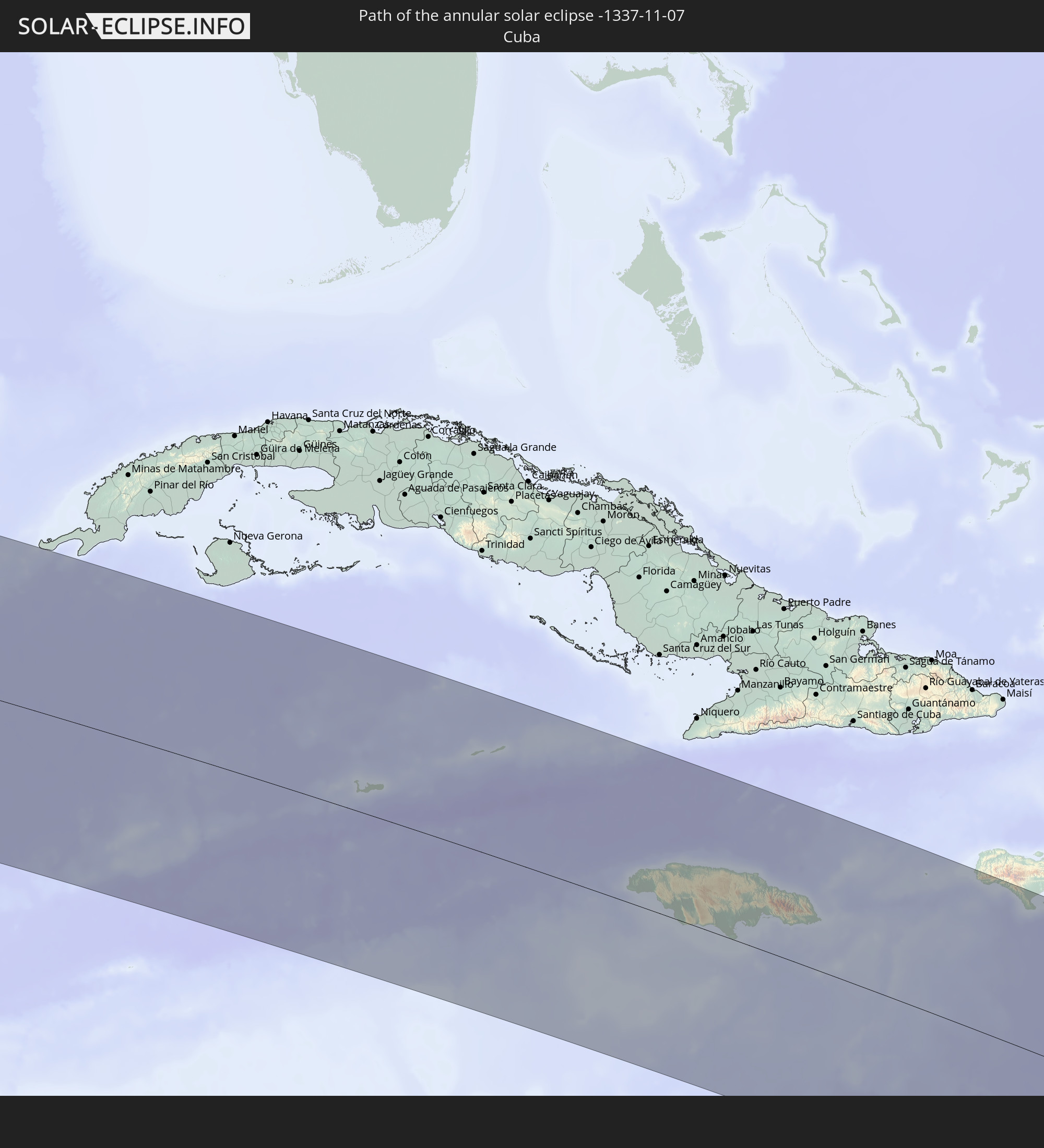 Cuba
Cuba
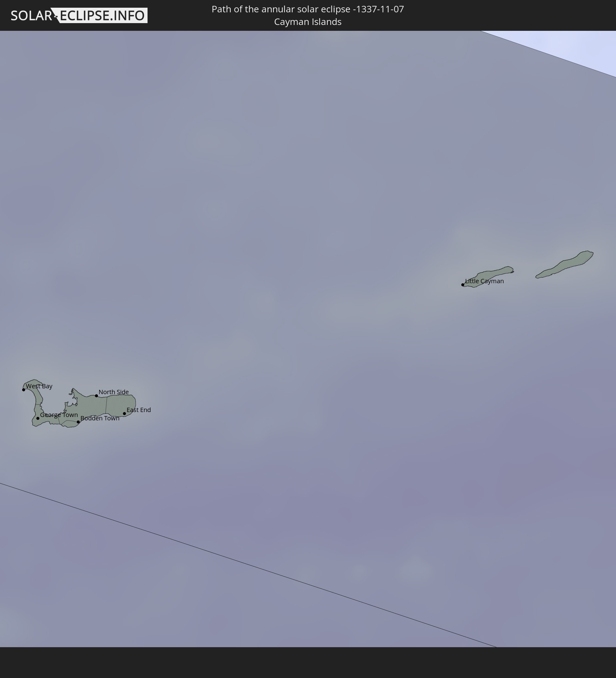 Cayman Islands
 Jamaica
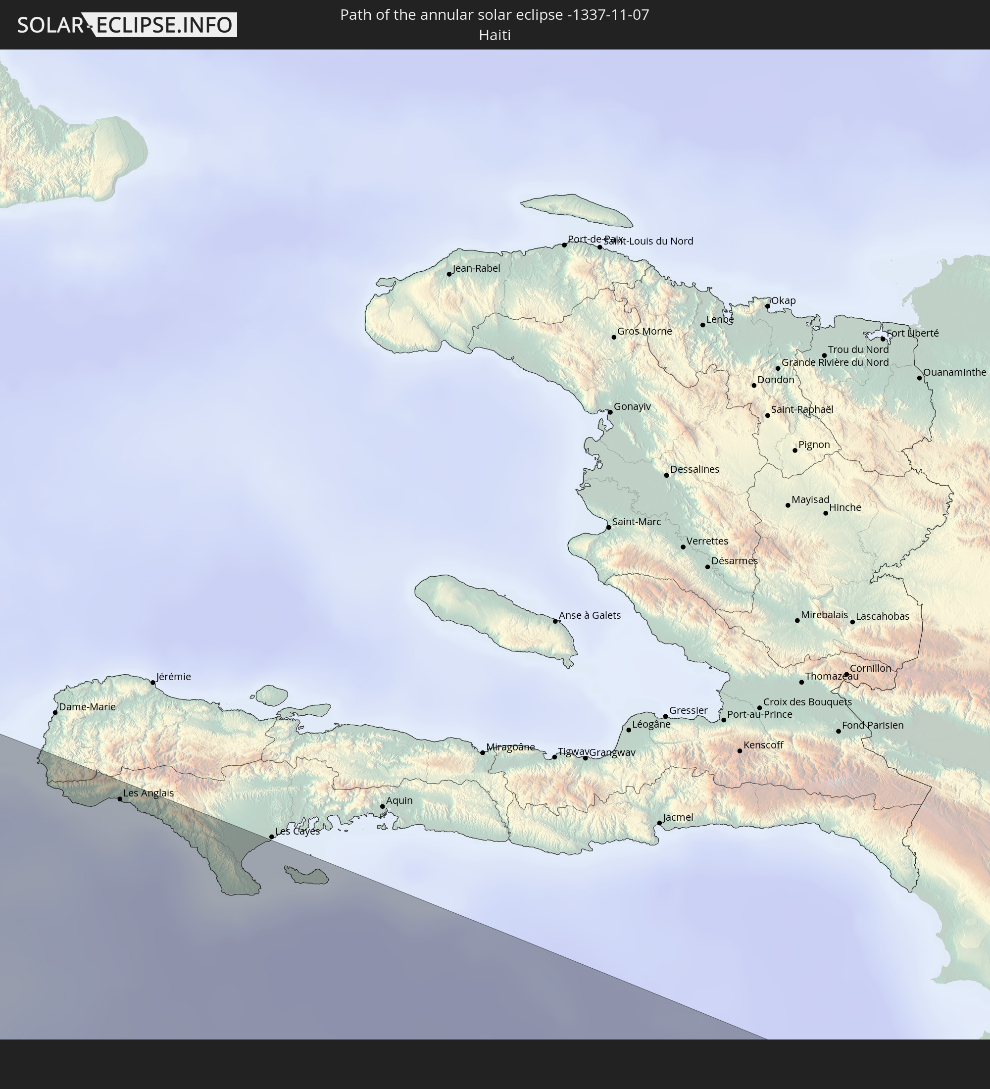 Haiti
Haiti
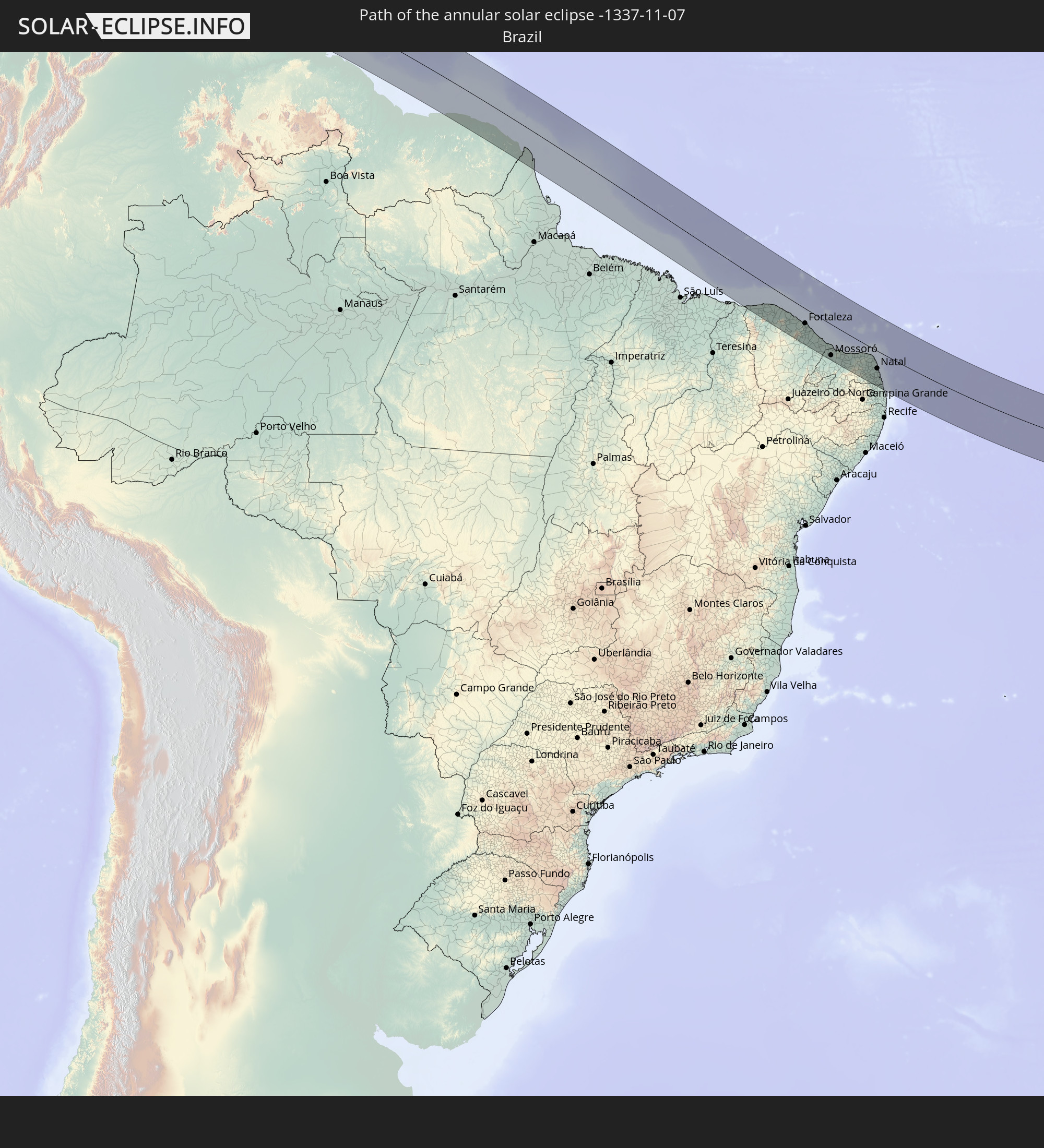 Brazil
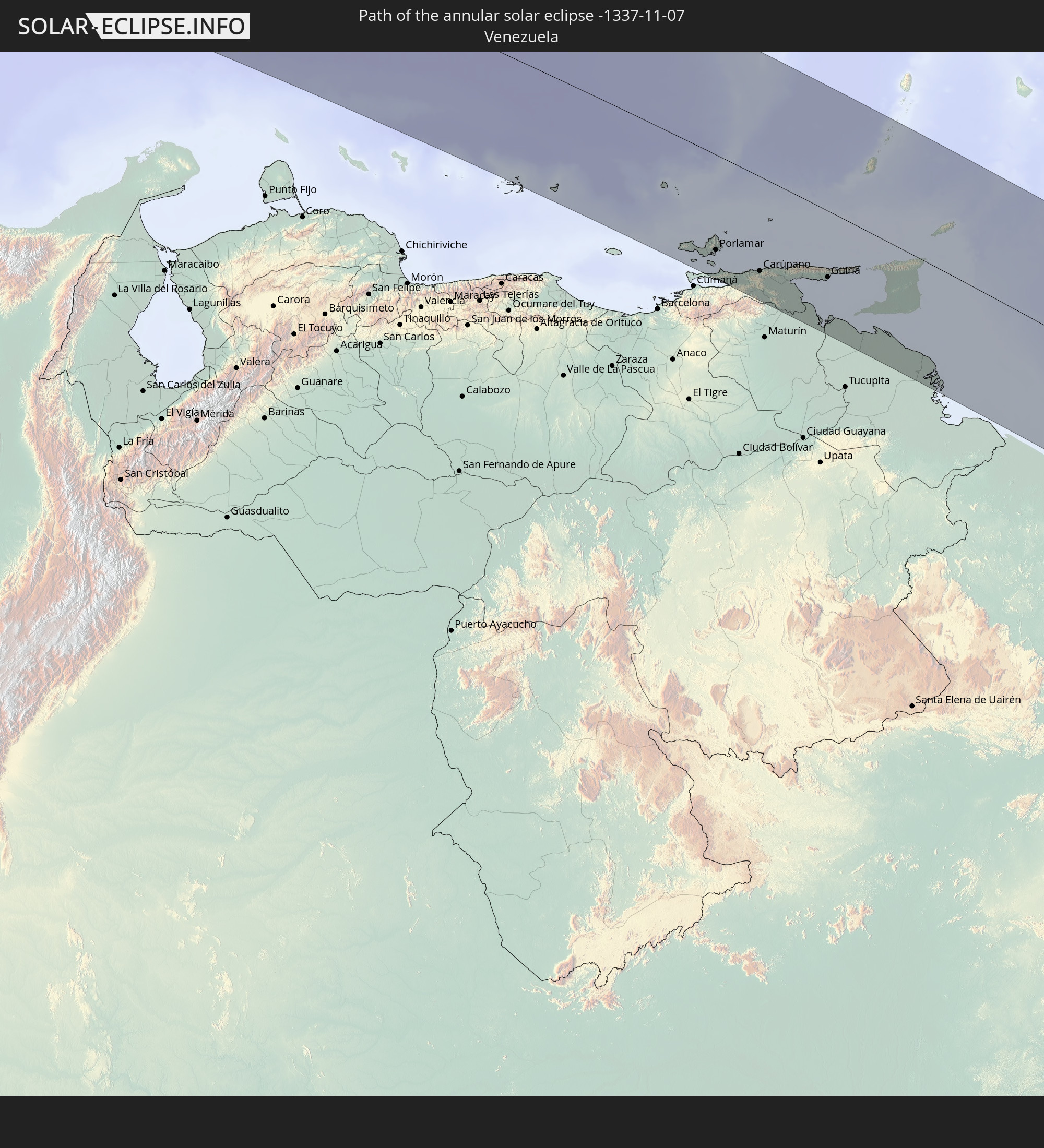 Venezuela
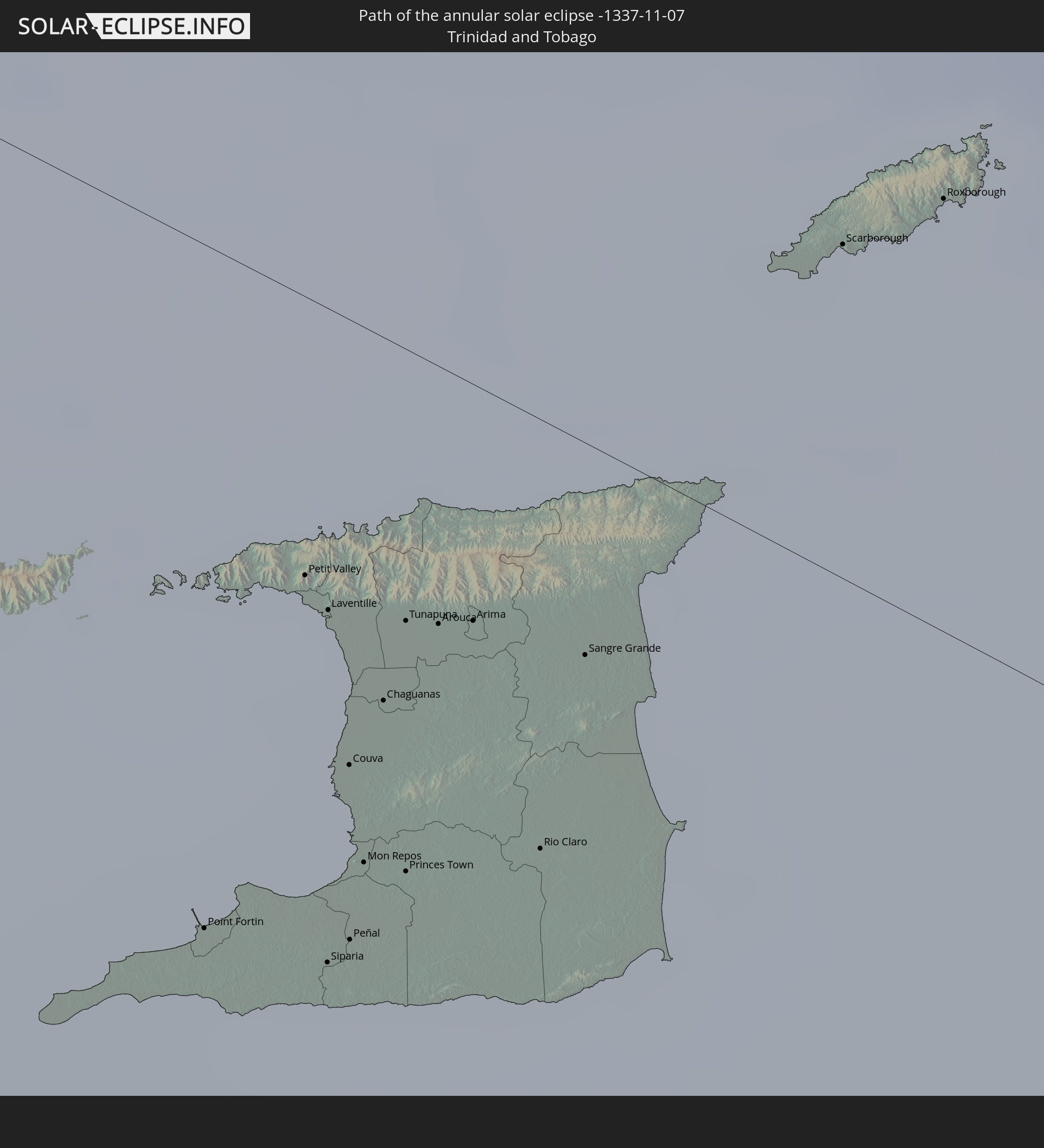 Trinidad and Tobago
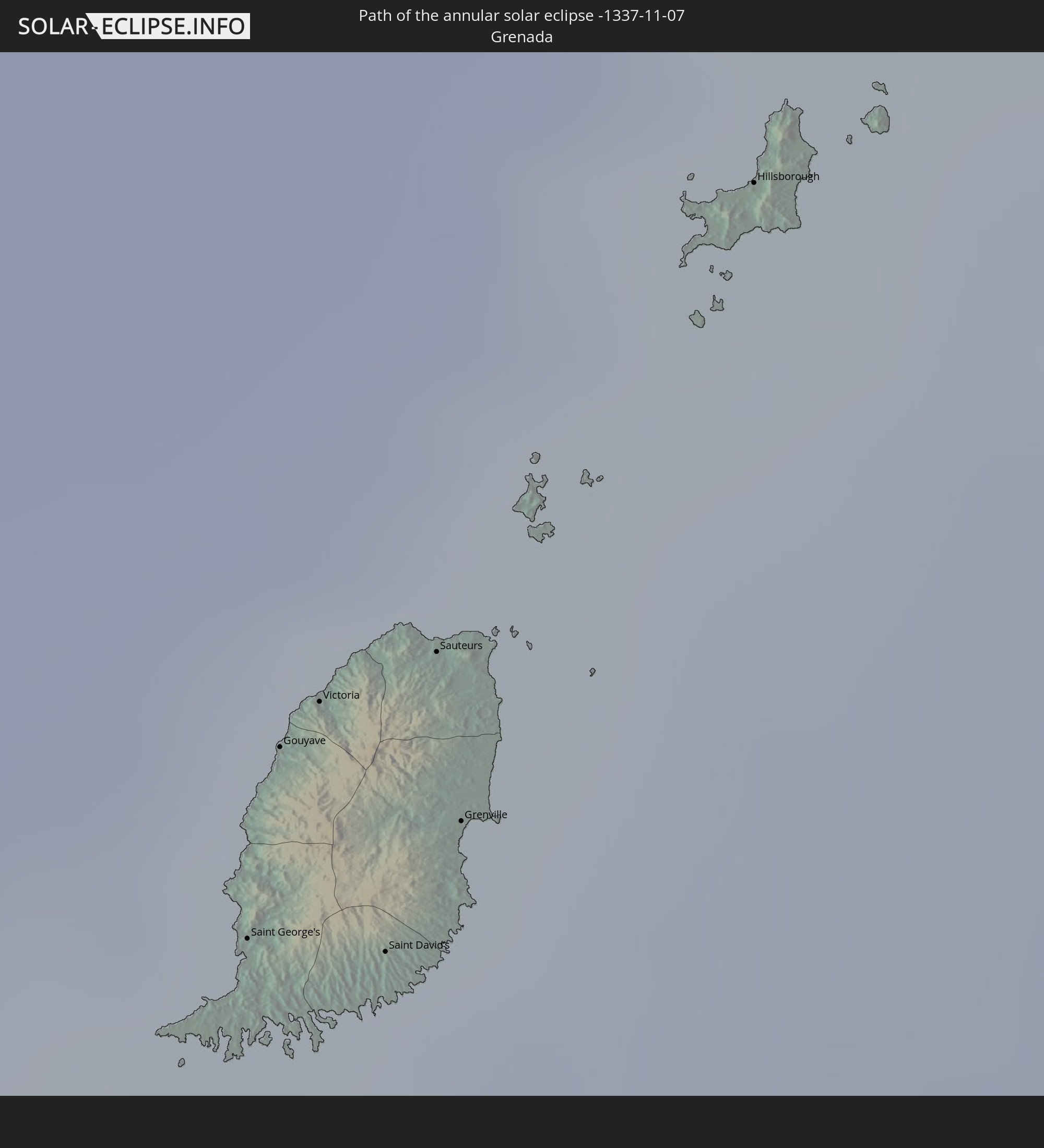 Grenada
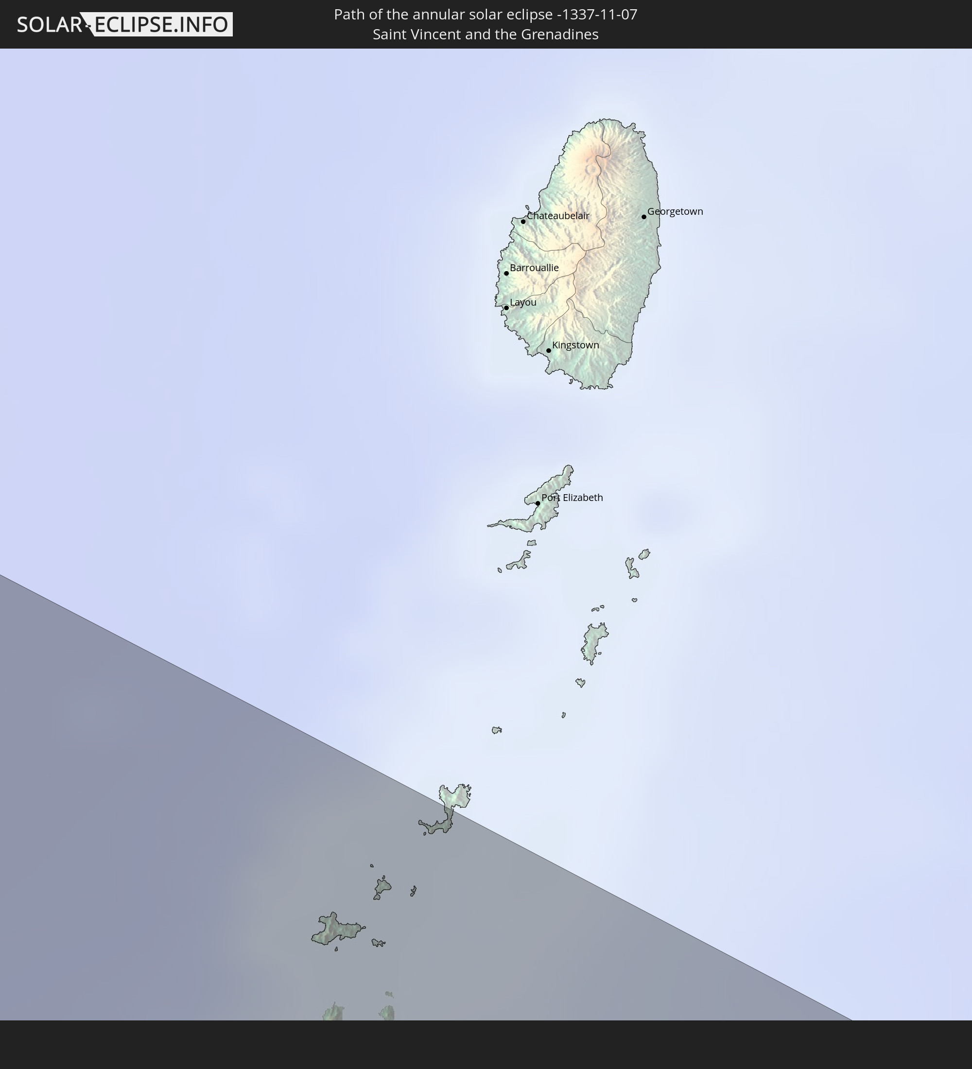 Saint Vincent and the Grenadines
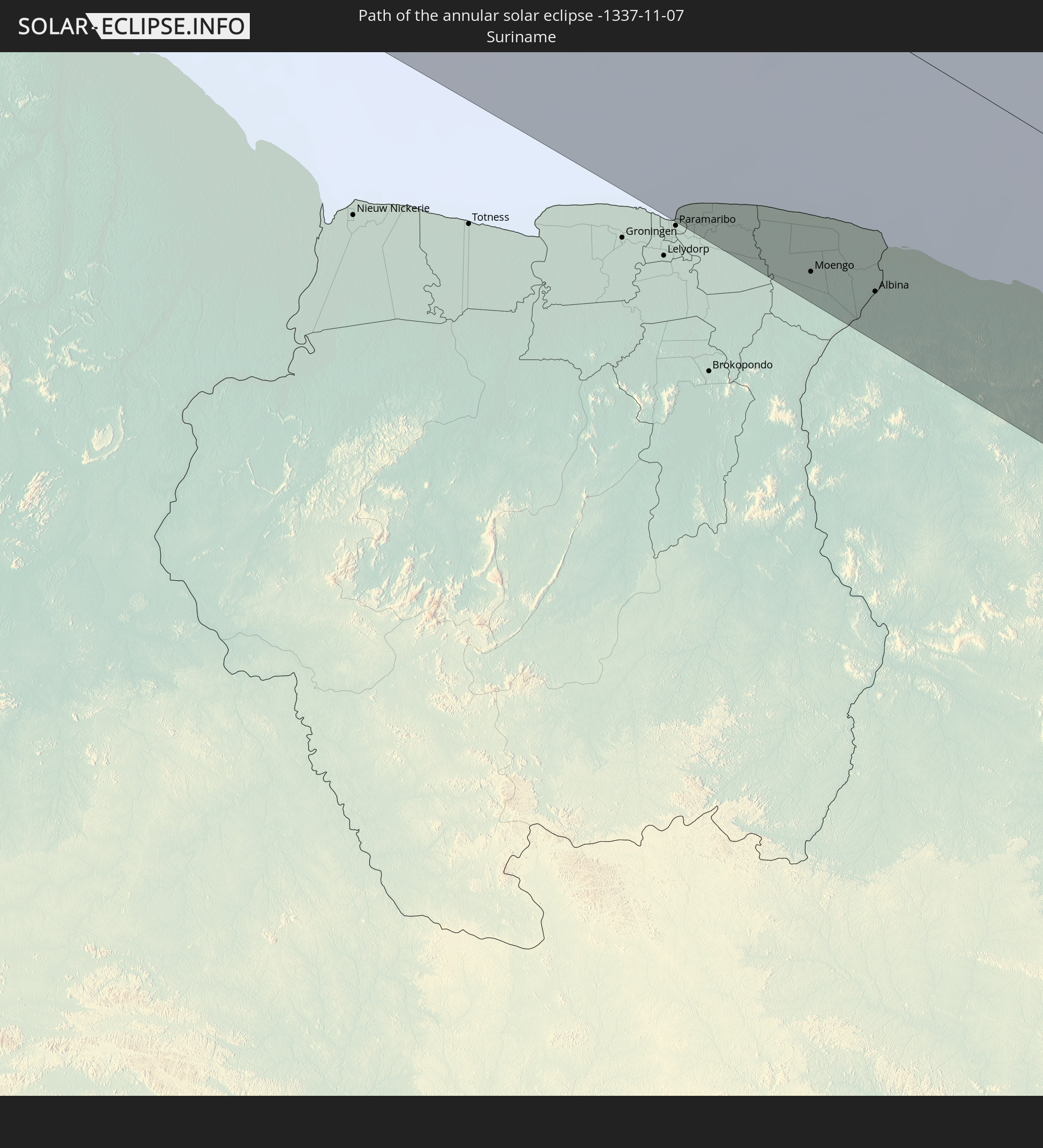 Suriname
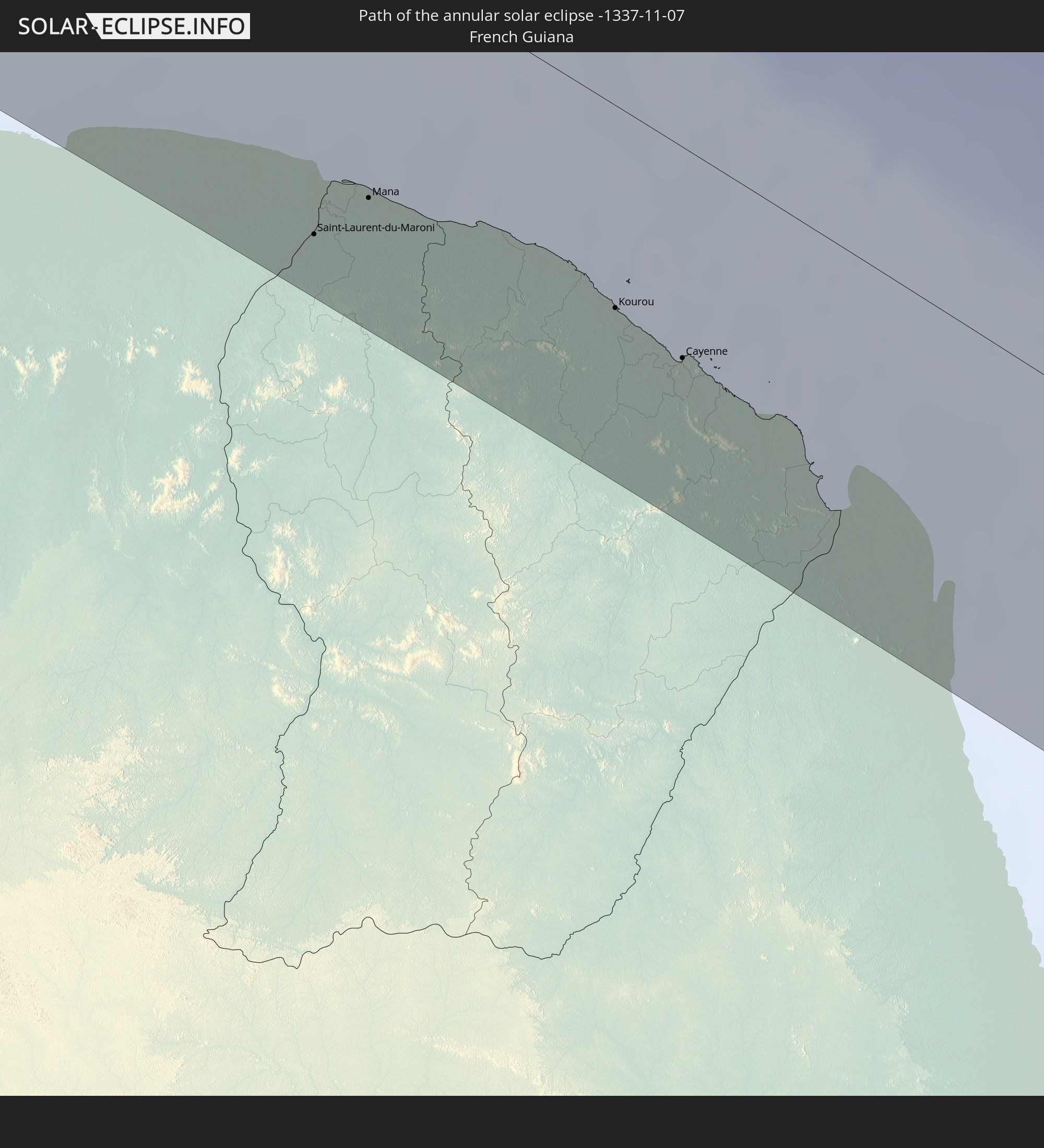 French Guiana
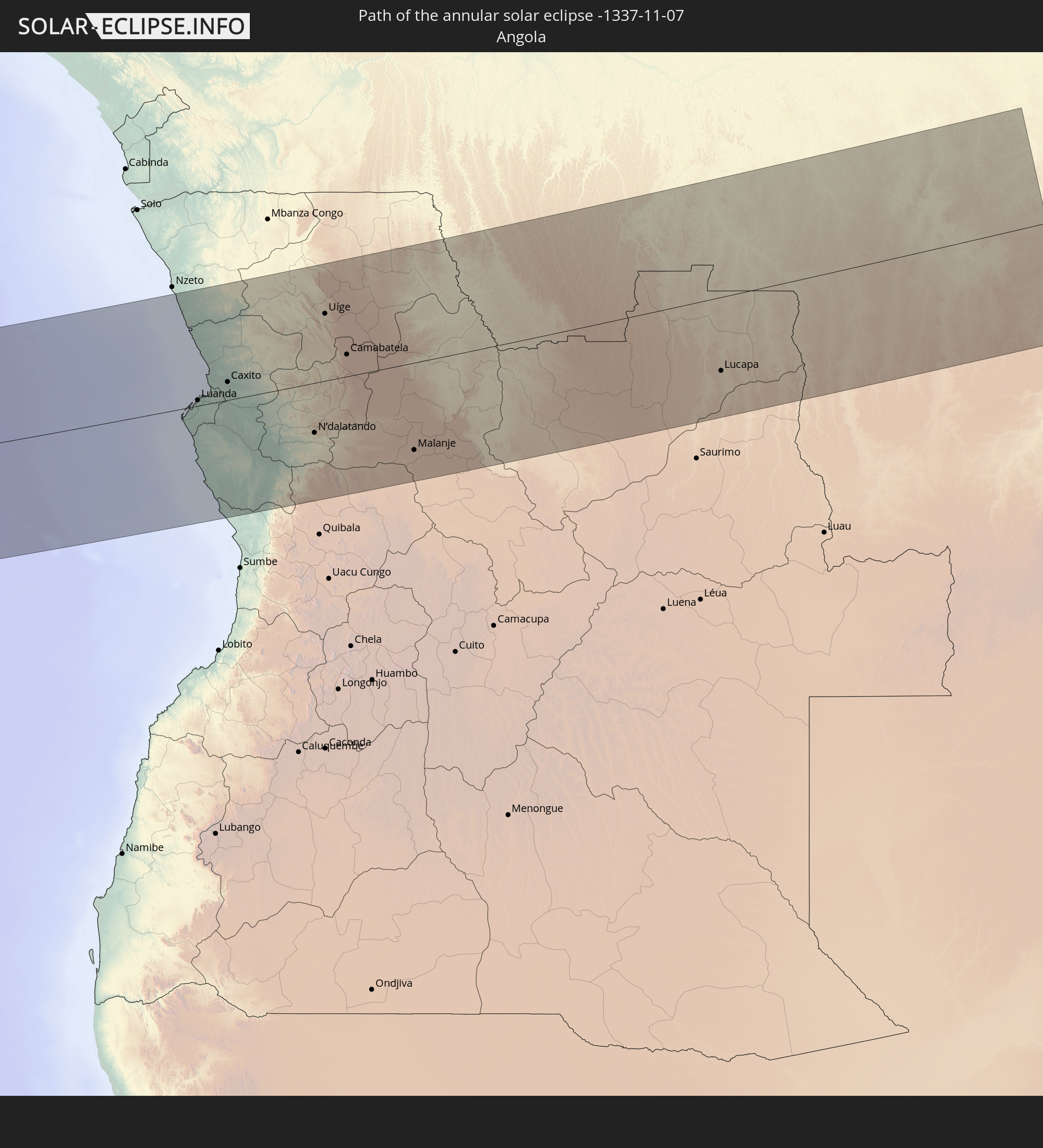 Angola
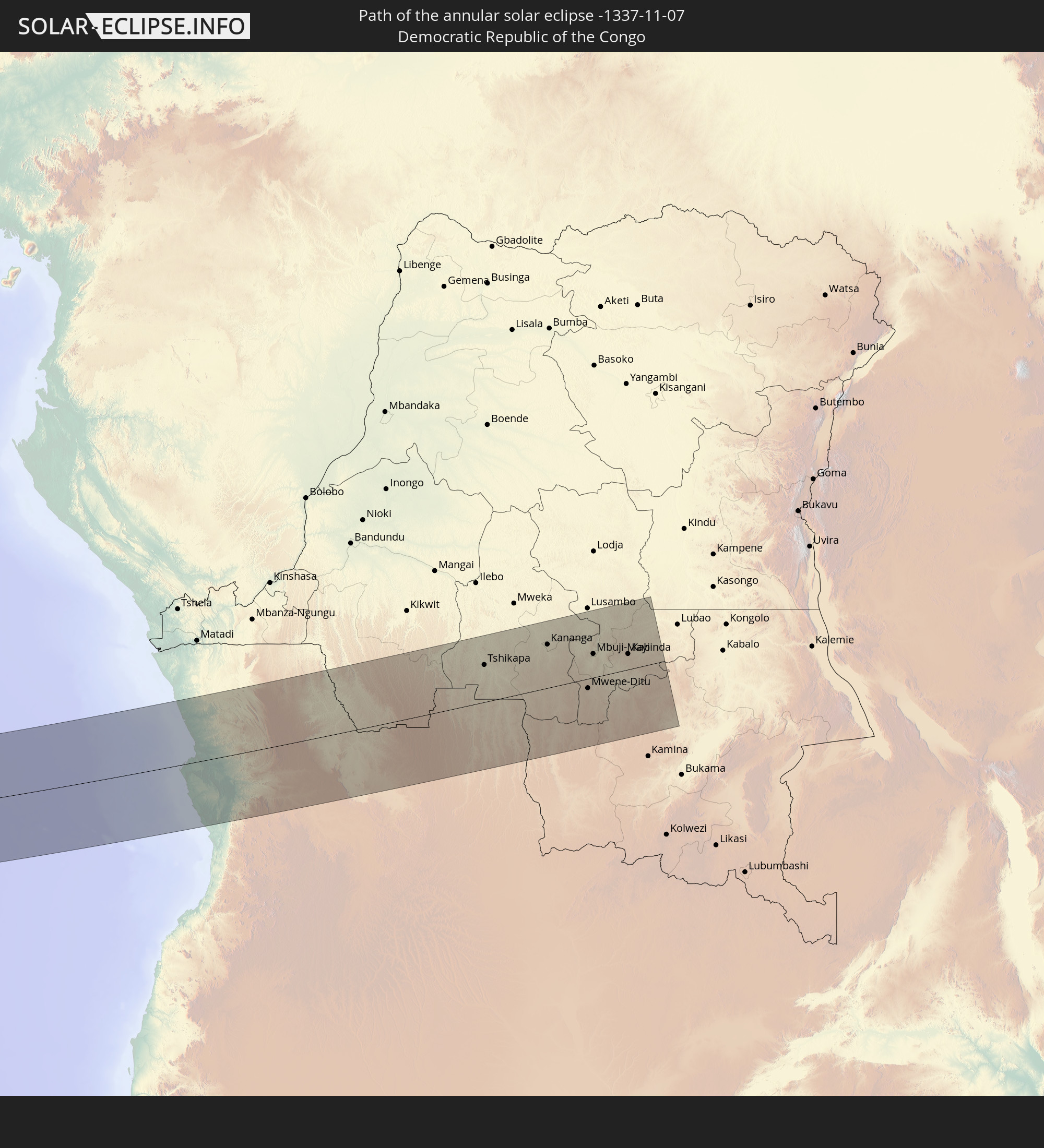 Democratic Republic of the Congo
In den folgenden Ländern ist die Sonnenfinsternis partiell zu sehen
 United States
 United States Minor Outlying Islands
 Canada
 Mexico
 Chile
Chile
 Guatemala
 Ecuador
 El Salvador
 Honduras
 Belize
 Nicaragua
 Costa Rica
 Cuba
Cuba
 Panama
 Colombia
 Cayman Islands
 Peru
Peru
 The Bahamas
 Jamaica
 Haiti
Haiti
 Brazil
 Argentina
 Venezuela
 Turks and Caicos Islands
 Dominican Republic
 Aruba
Aruba
 Bolivia
 Puerto Rico
 United States Virgin Islands
 Bermuda
 British Virgin Islands
 Anguilla
 Collectivity of Saint Martin
 Saint Barthélemy
 Saint Kitts and Nevis
 Paraguay
 Antigua and Barbuda
 Montserrat
 Trinidad and Tobago
 Guadeloupe
 Grenada
 Dominica
 Saint Vincent and the Grenadines
 Guyana
 Martinique
 Saint Lucia
 Barbados
 Uruguay
 Suriname
 Saint Pierre and Miquelon
 French Guiana
 Cabo Verde
 Spain
Spain
 Senegal
 Mauritania
 The Gambia
 Guinea-Bissau
 Guinea
 Saint Helena, Ascension and Tristan da Cunha
 Sierra Leone
 Mali
Mali
 Liberia
 Algeria
 Ivory Coast
 Burkina Faso
 Ghana
Ghana
 Togo
Togo
 Niger
Niger
 Benin
Benin
 Nigeria
 Equatorial Guinea
 São Tomé and Príncipe
 Cameroon
 Gabon
Gabon
 Libya
Libya
 Republic of the Congo
 Angola
 Namibia
 Democratic Republic of the Congo
 Chad
Chad
 Central African Republic
 South Africa
 Botswana
 Sudan
Sudan
 Zambia
 Zimbabwe
 Lesotho
 Mozambique
 Swaziland
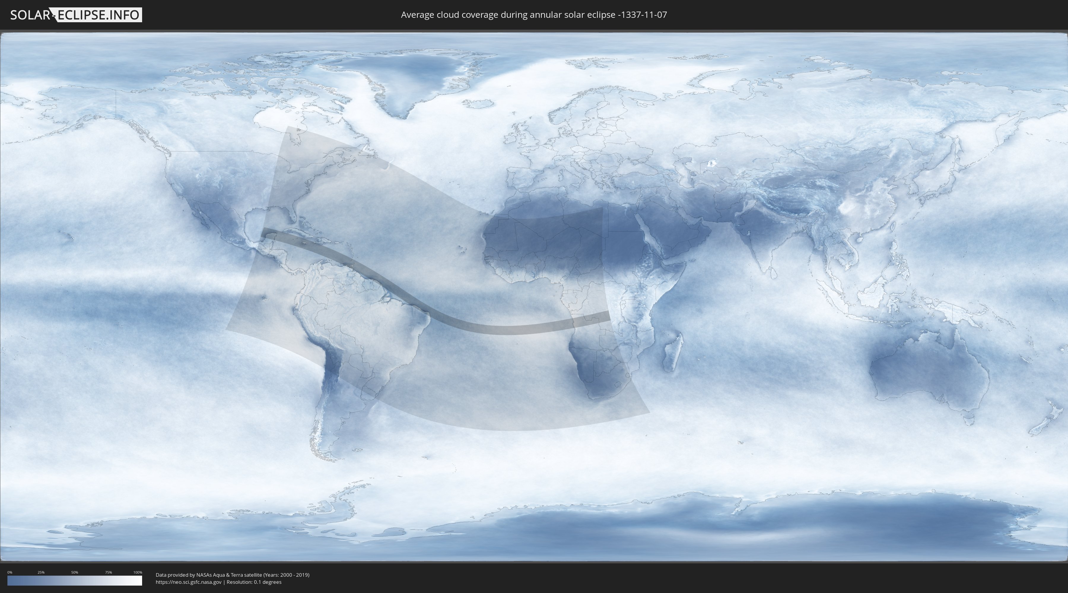
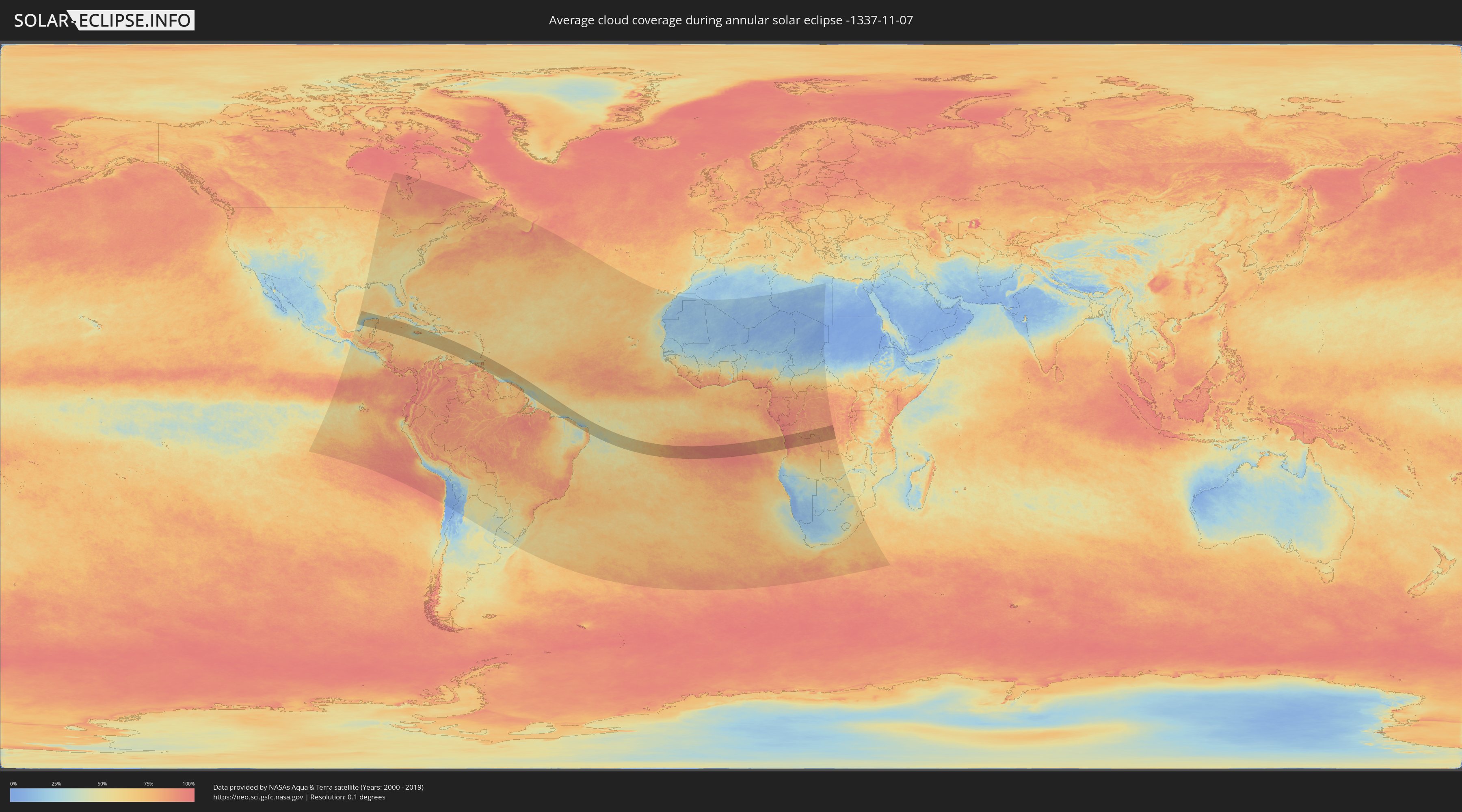
How will be the weather during the annular solar eclipse on 11/07/-1337?
Where is the best place to see the annular solar eclipse of 11/07/-1337?
The following maps show the average cloud coverage for the day of the annular solar eclipse.
With the help of these maps, it is possible to find the place along the eclipse path, which has the best
chance of a cloudless sky.
Nevertheless, you should consider local circumstances and inform about the weather of your chosen
observation site.
The data is provided by NASAs satellites
AQUA and TERRA.
The cloud maps are averaged over a period of 19 years (2000 - 2019).
Detailed country maps
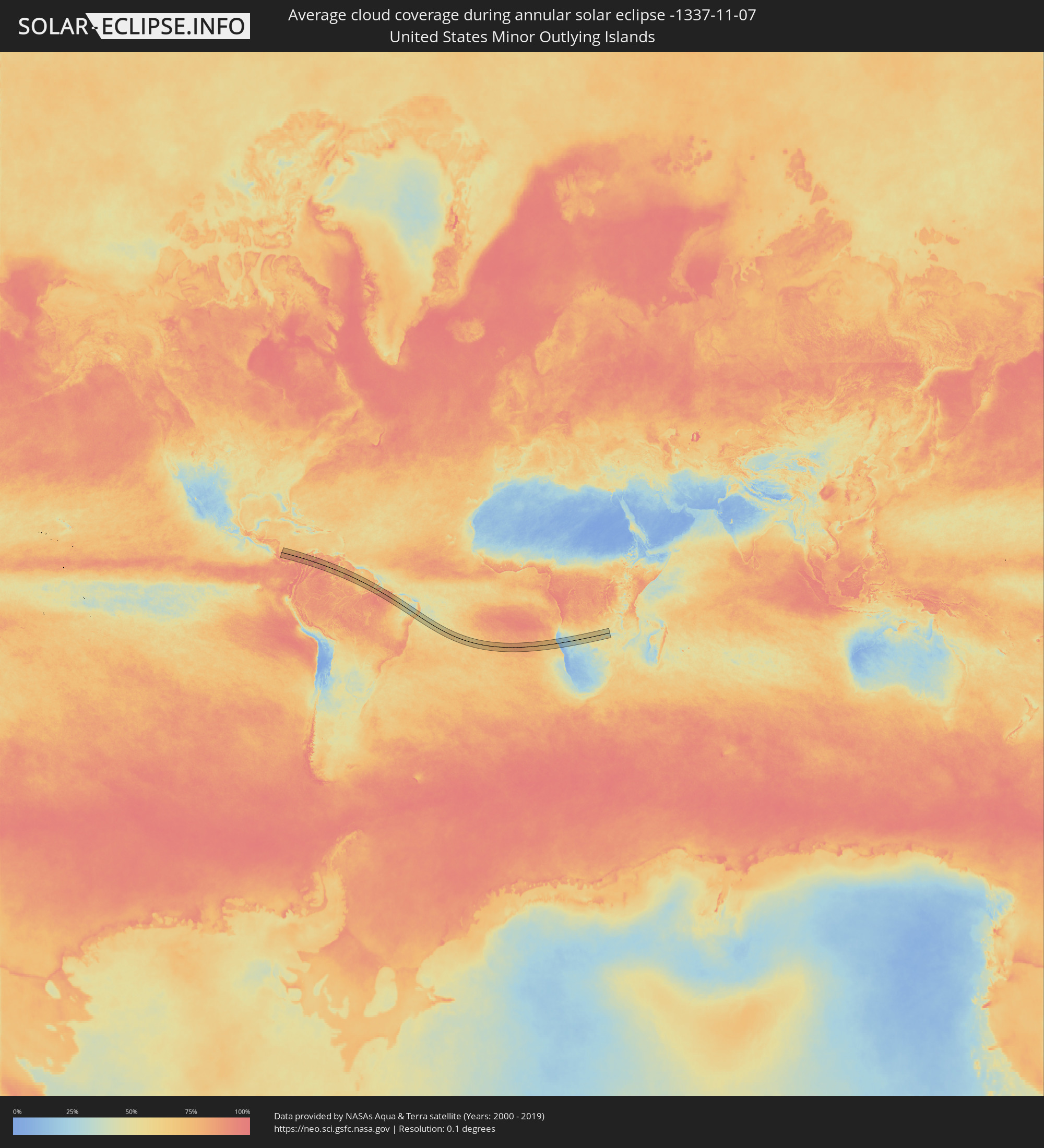 United States Minor Outlying Islands
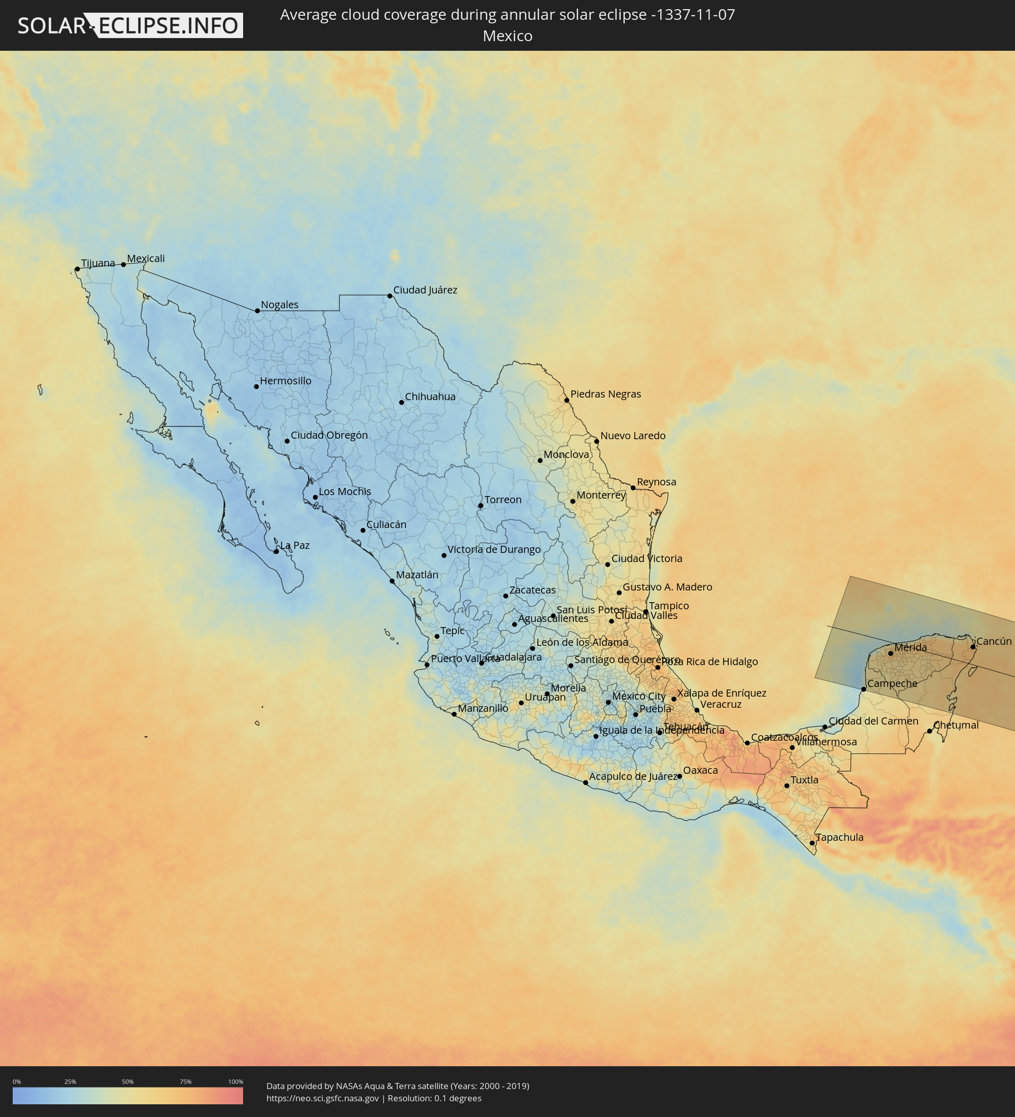 Mexico
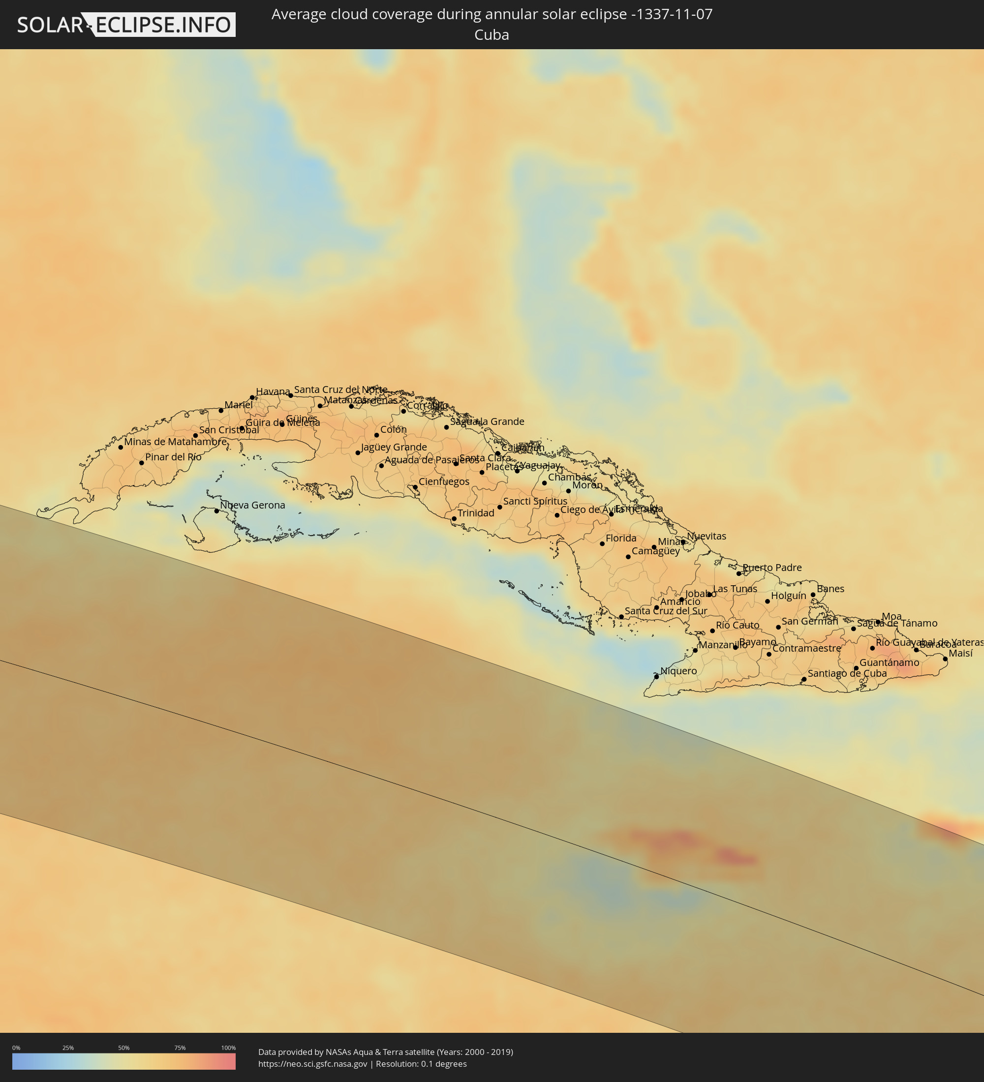 Cuba
Cuba
 Cayman Islands
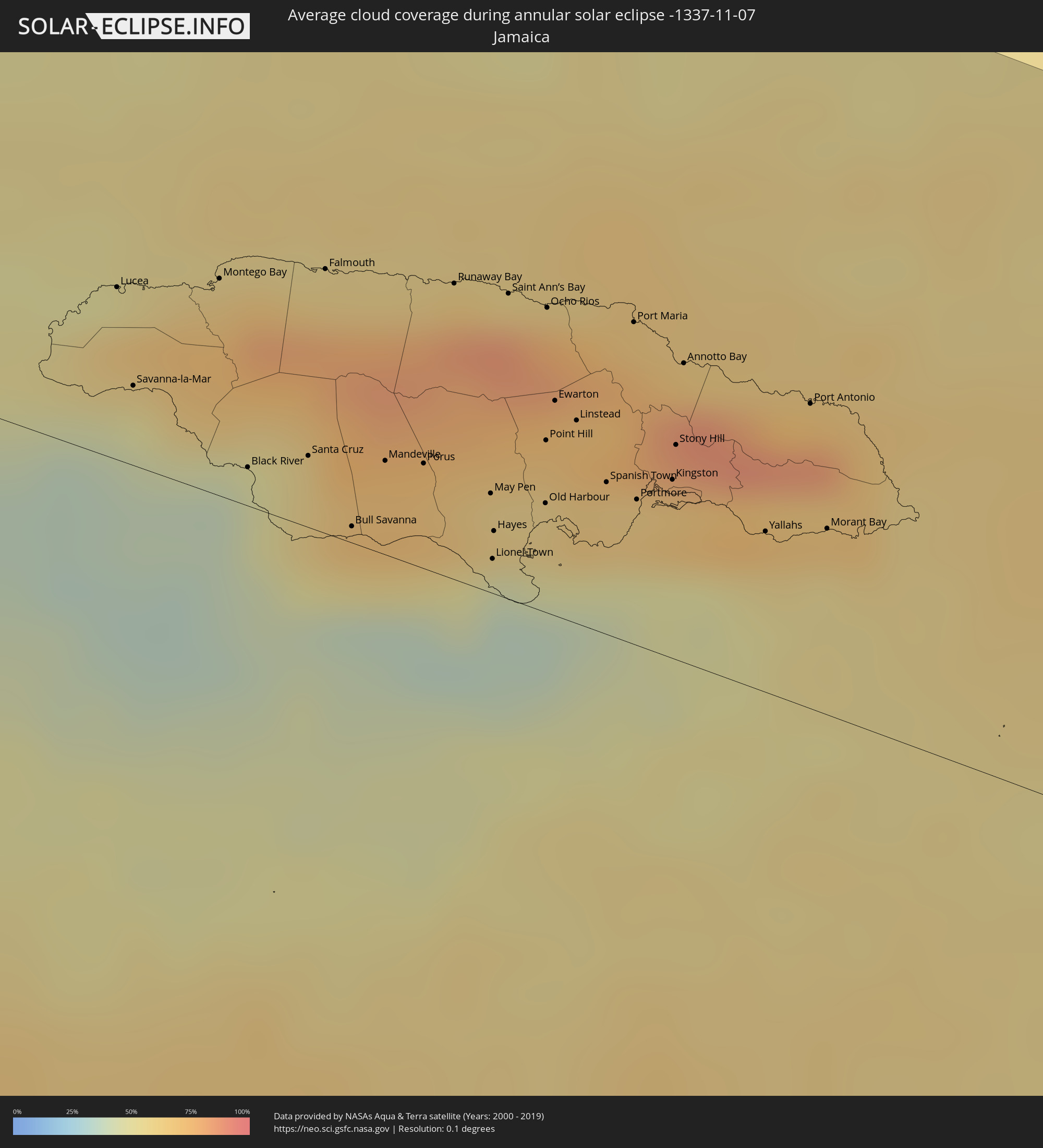 Jamaica
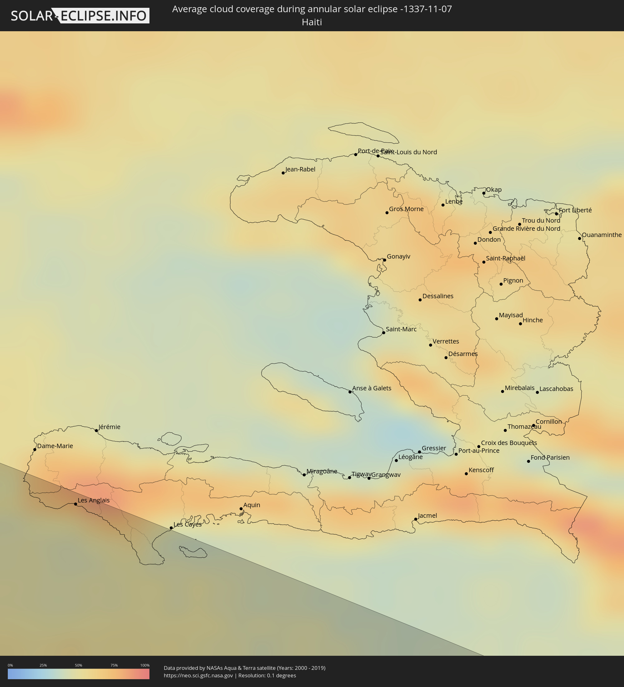 Haiti
Haiti
 Brazil
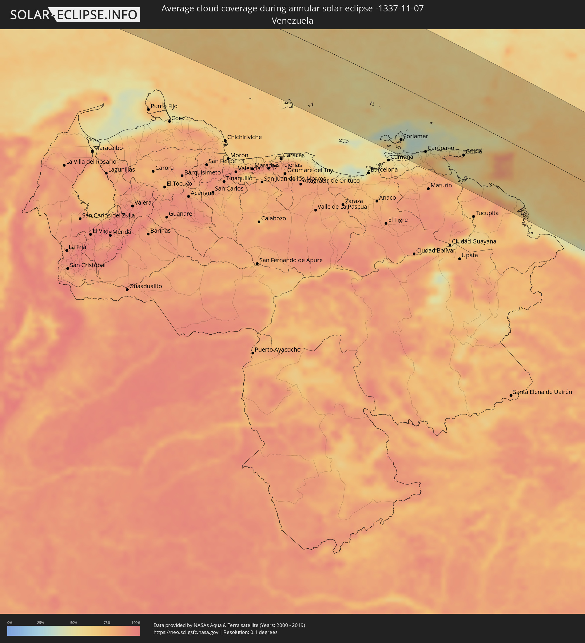 Venezuela
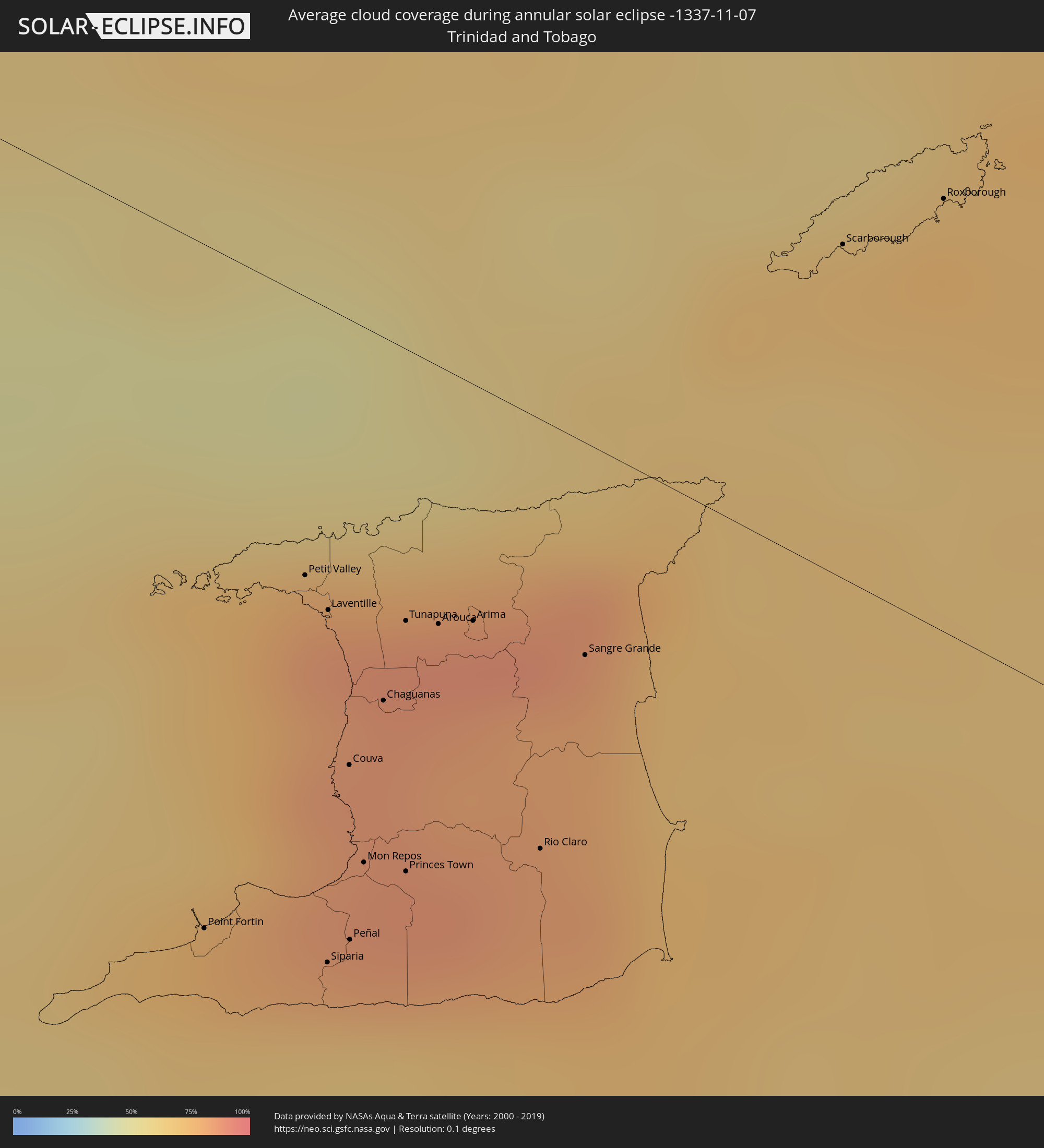 Trinidad and Tobago
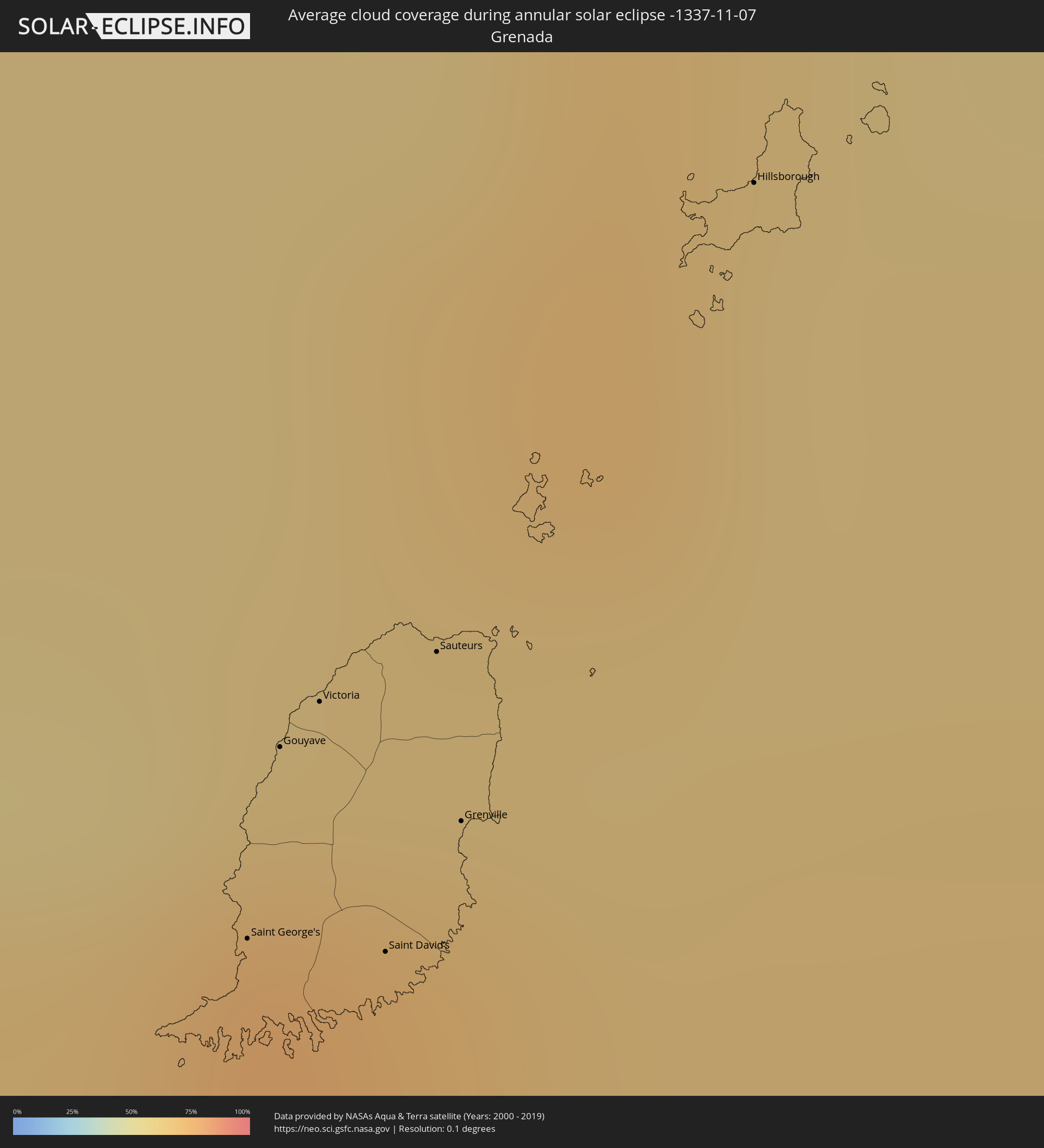 Grenada
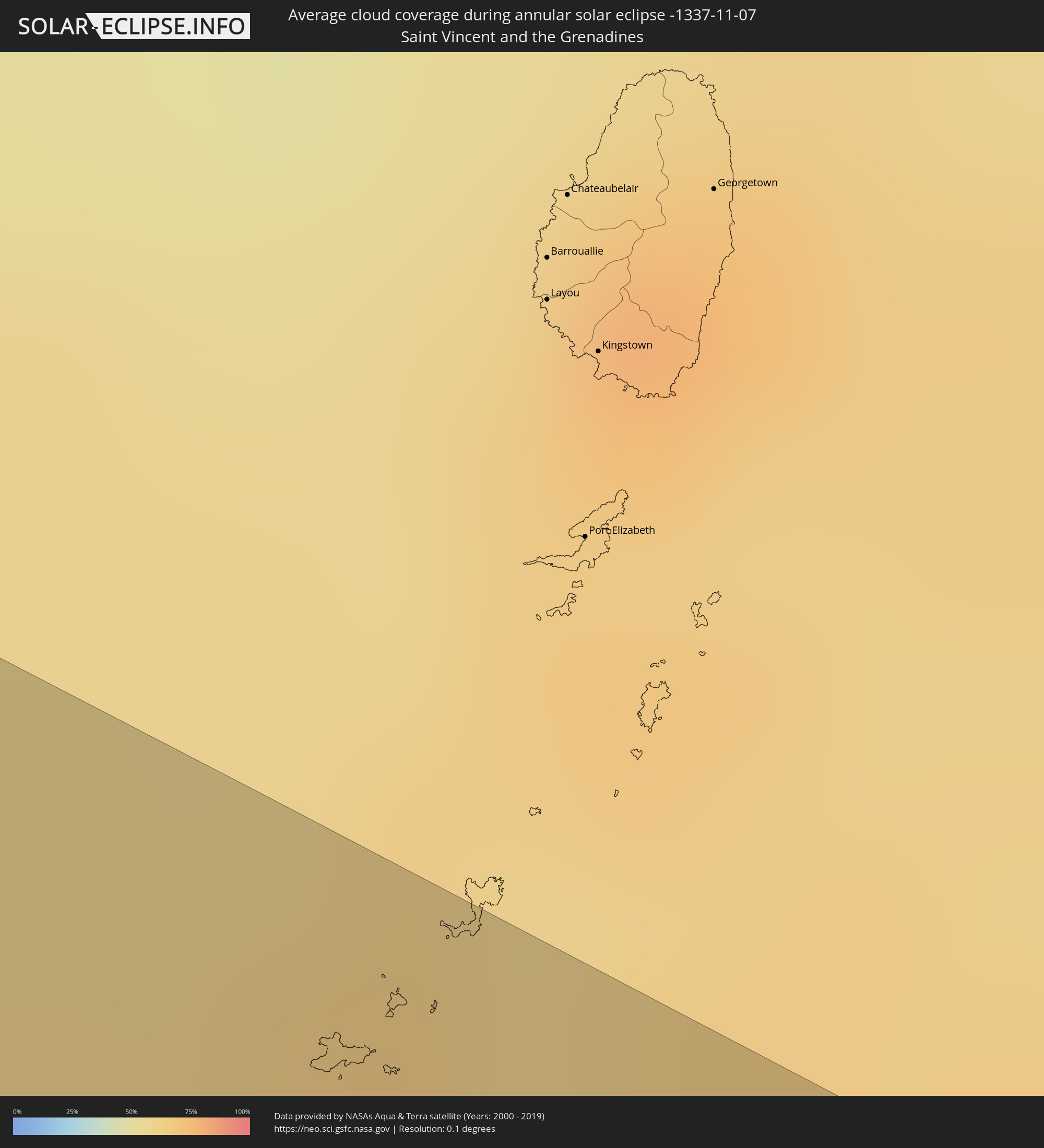 Saint Vincent and the Grenadines
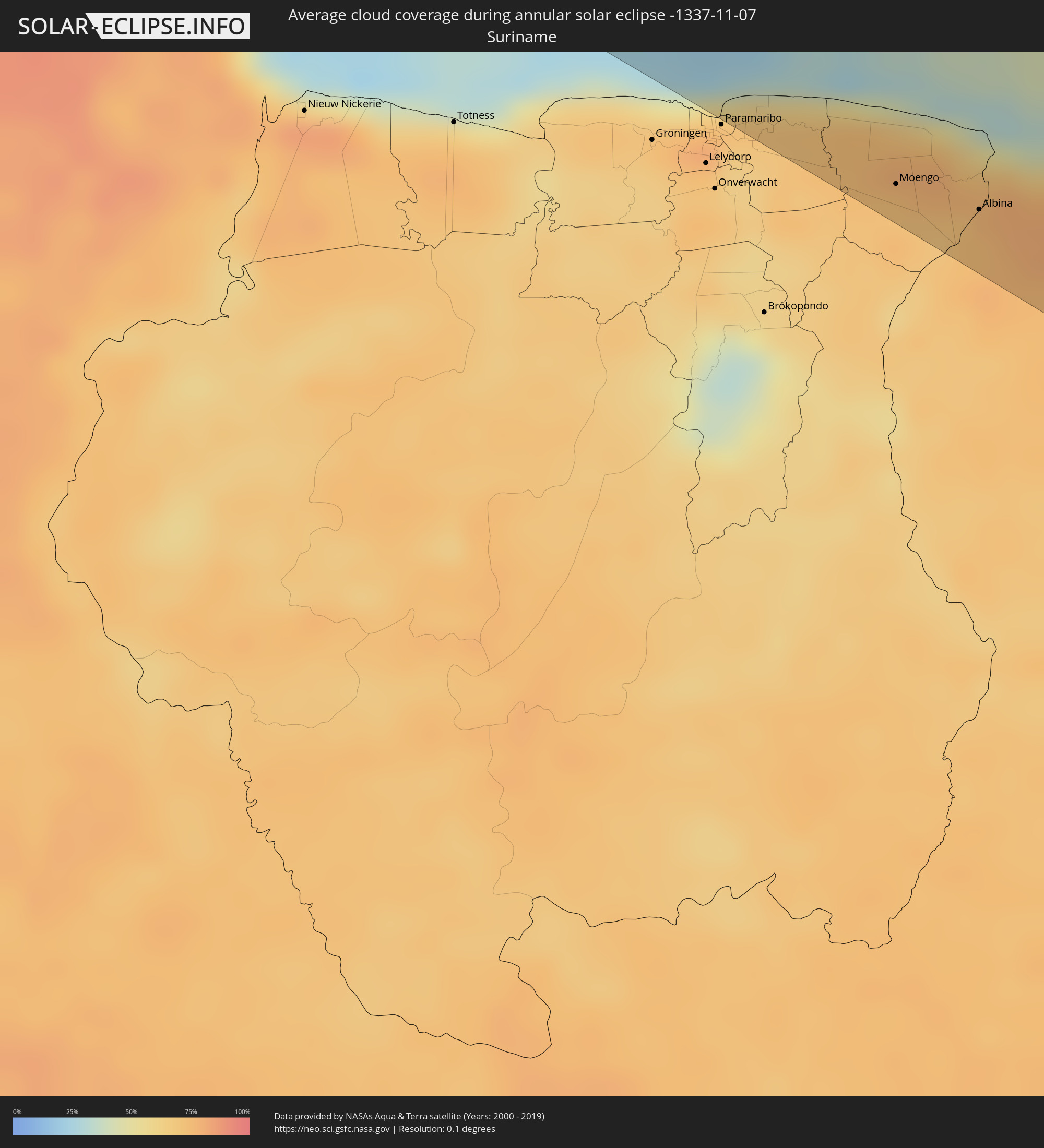 Suriname
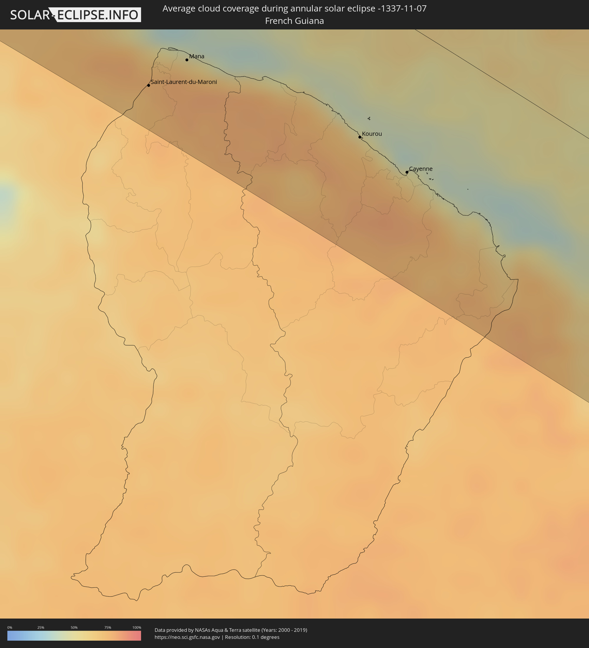 French Guiana
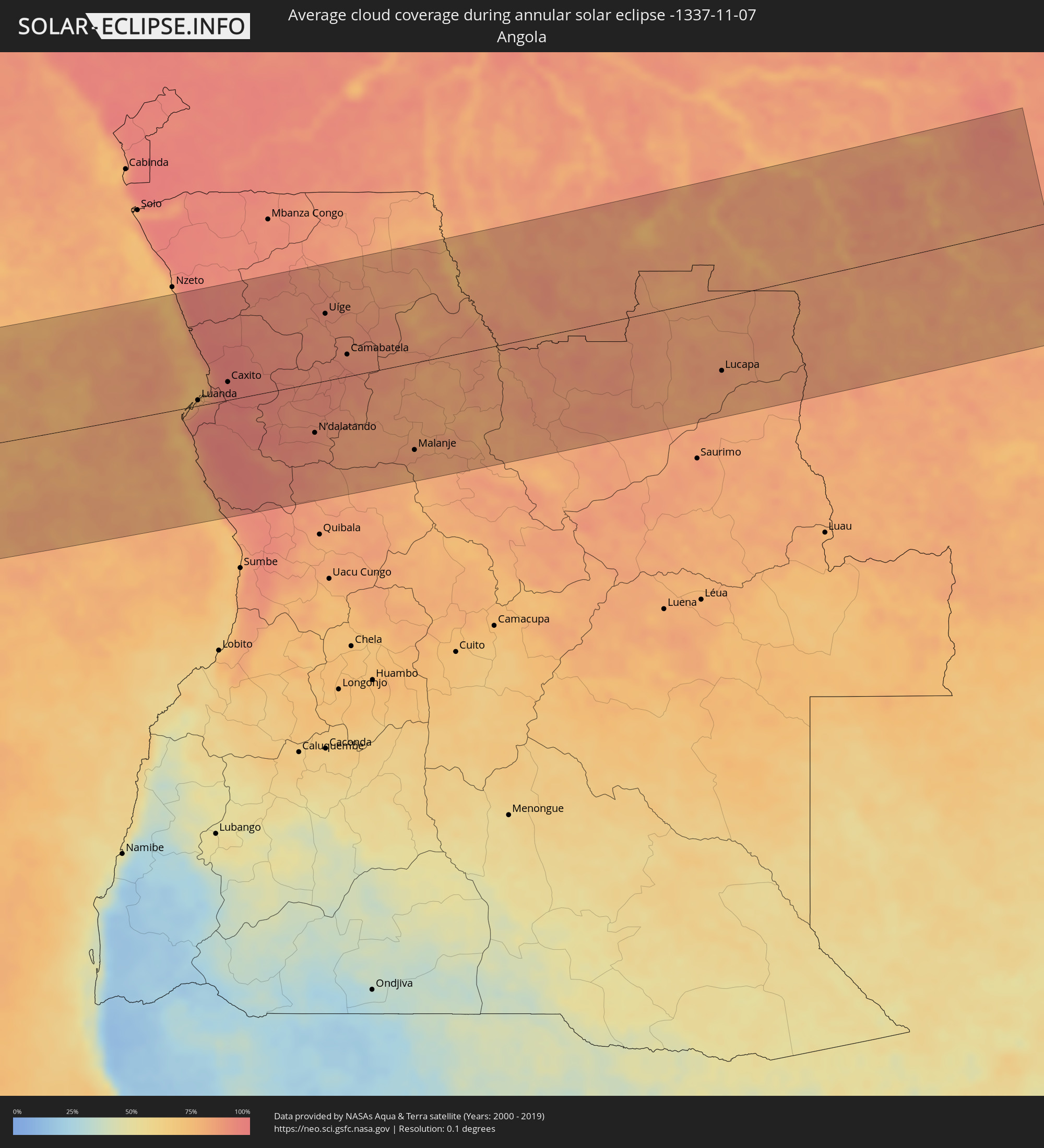 Angola
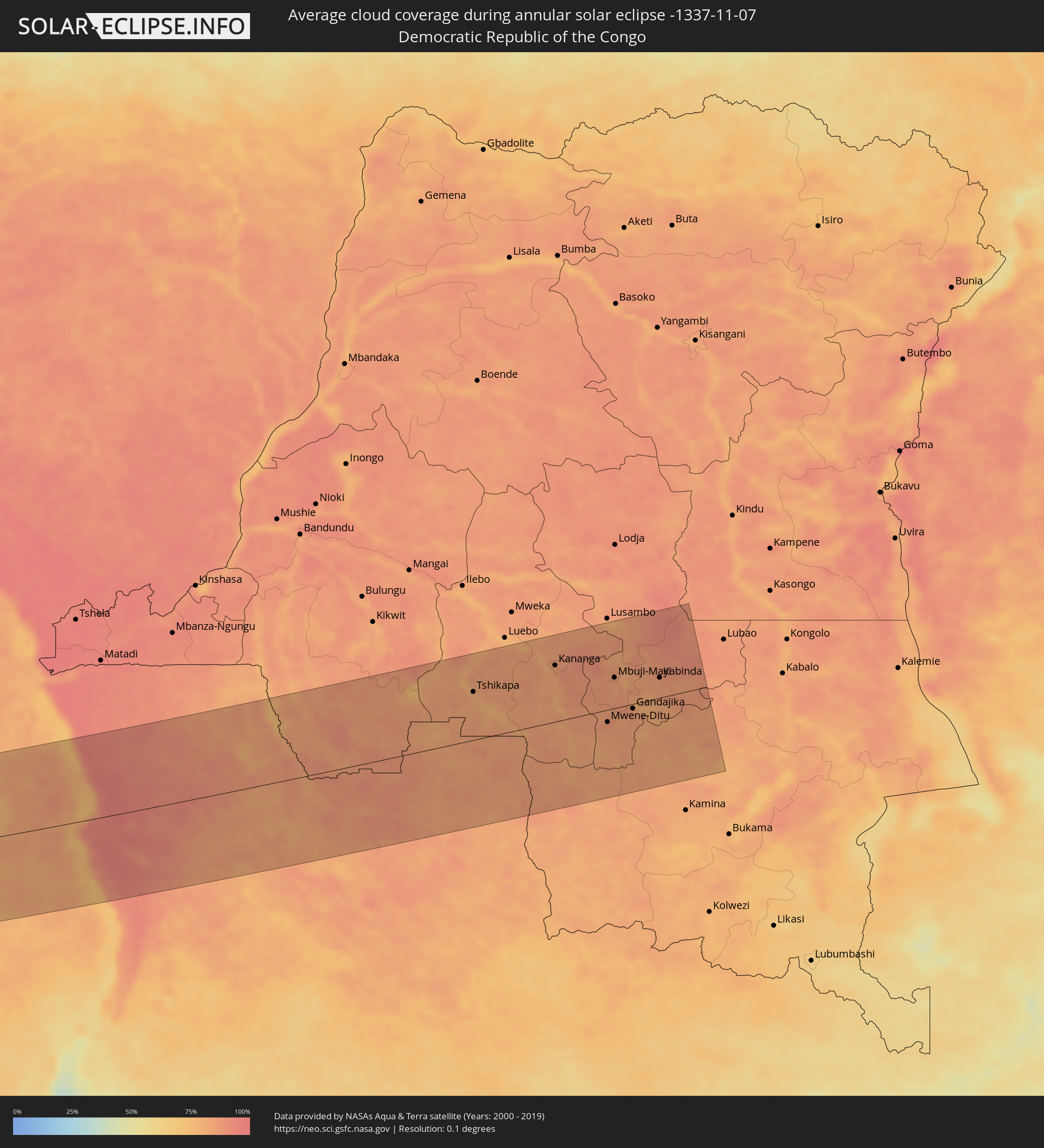 Democratic Republic of the Congo
Cities inside the path of the eclipse
The following table shows all locations with a population of more than 5,000 inside the eclipse path. Cities which have more than 100,000 inhabitants are marked bold. A click at the locations opens a detailed map.
| City | Type | Eclipse duration | Local time of max. eclipse | Distance to central line | Ø Cloud coverage |
|
Campeche, Campeche
|
annular | - | 05:41:45 UTC-06:36 | 186 km | 45% |
|
Hunucmá, Yucatán
|
annular | - | 05:41:47 UTC-06:36 | 42 km | 60% |
|
Uman, Yucatán
|
annular | - | 05:41:47 UTC-06:36 | 53 km | 62% |
|
Progreso de Castro, Yucatán
|
annular | - | 05:41:48 UTC-06:36 | 7 km | 51% |
|
Mérida, Yucatán
|
annular | - | 05:41:48 UTC-06:36 | 40 km | 71% |
|
Ticul, Yucatán
|
annular | - | 05:41:49 UTC-06:36 | 100 km | 58% |
|
Oxkutzkab, Yucatán
|
annular | - | 05:41:50 UTC-06:36 | 106 km | 58% |
|
Tecax, Yucatán
|
annular | - | 05:41:50 UTC-06:36 | 114 km | 57% |
|
Motul, Yucatán
|
annular | - | 05:41:50 UTC-06:36 | 18 km | 64% |
|
Peto, Yucatán
|
annular | - | 05:41:53 UTC-06:36 | 112 km | 57% |
|
Chichén-Itzá, Yucatán
|
annular | - | 05:41:54 UTC-06:36 | 45 km | 60% |
|
Valladolid, Yucatán
|
annular | - | 05:41:57 UTC-06:36 | 32 km | 65% |
|
Tizimín, Yucatán
|
annular | - | 05:41:57 UTC-06:36 | 18 km | 66% |
|
Felipe Carrillo Puerto, Quintana Roo
|
annular | - | 06:31:33 UTC-05:47 | 147 km | 65% |
|
Playa del Carmen, Quintana Roo
|
annular | - | 06:31:39 UTC-05:47 | 8 km | 65% |
|
San Miguel de Cozumel, Quintana Roo
|
annular | - | 06:31:40 UTC-05:47 | 17 km | 66% |
|
Cancún, Quintana Roo
|
annular | - | 06:31:40 UTC-05:47 | 58 km | 69% |
|
West Bay, West Bay
|
annular | - | 07:00:43 UTC-05:19 | 30 km | 63% |
|
George Town, George Town
|
annular | - | 07:00:45 UTC-05:19 | 23 km | 70% |
|
Bodden Town, Bodden Town
|
annular | - | 07:00:47 UTC-05:19 | 26 km | 69% |
|
North Side, North Side
|
annular | - | 07:00:48 UTC-05:19 | 35 km | 65% |
|
East End, East End
|
annular | - | 07:00:50 UTC-05:19 | 33 km | 67% |
|
Little Cayman, Sister Island
|
annular | - | 07:01:11 UTC-05:19 | 104 km | 64% |
|
Savanna-la-Mar, Westmoreland
|
annular | - | 07:14:48 UTC-05:07 | 20 km | 49% |
|
Montego Bay, St. James
|
annular | - | 07:14:51 UTC-05:07 | 54 km | 64% |
|
Santa Cruz, St. Elizabeth
|
annular | - | 07:15:03 UTC-05:07 | 18 km | 58% |
|
Falmouth, Trelawny
|
annular | - | 07:14:59 UTC-05:07 | 65 km | 64% |
|
Mandeville, Manchester
|
annular | - | 07:15:10 UTC-05:07 | 23 km | 70% |
|
May Pen, Clarendon
|
annular | - | 07:15:19 UTC-05:07 | 25 km | 60% |
|
Saint Ann’s Bay, St Ann
|
annular | - | 07:15:14 UTC-05:07 | 75 km | 85% |
|
Ocho Rios, St Ann
|
annular | - | 07:15:18 UTC-05:07 | 75 km | 78% |
|
Old Harbour Bay, Saint Catherine
|
annular | - | 07:15:25 UTC-05:07 | 24 km | 47% |
|
Linstead, Saint Catherine
|
annular | - | 07:15:24 UTC-05:07 | 50 km | 71% |
|
Spanish Town, Saint Catherine
|
annular | - | 07:15:28 UTC-05:07 | 38 km | 64% |
|
Port Maria, St. Mary
|
annular | - | 07:15:25 UTC-05:07 | 80 km | 68% |
|
Kingston, Kingston
|
annular | - | 07:15:34 UTC-05:07 | 44 km | 65% |
|
Stony Hill, St. Andrew
|
annular | - | 07:15:33 UTC-05:07 | 53 km | 80% |
|
Yallahs, St. Thomas
|
annular | - | 07:15:44 UTC-05:07 | 40 km | 54% |
|
Port Antonio, Portland
|
annular | - | 07:15:43 UTC-05:07 | 75 km | 73% |
|
Morant Bay, St. Thomas
|
annular | - | 07:15:49 UTC-05:07 | 46 km | 55% |
|
Les Anglais, Sud
|
annular | - | 07:35:14 UTC-04:49 | 172 km | 53% |
|
Juan Griego, Nueva Esparta
|
annular | - | 08:10:23 UTC-04:27 | 123 km | 62% |
|
Porlamar, Nueva Esparta
|
annular | - | 08:10:37 UTC-04:27 | 130 km | 62% |
|
La Asunción, Nueva Esparta
|
annular | - | 08:10:33 UTC-04:27 | 123 km | 62% |
|
Carúpano, Sucre
|
annular | - | 08:11:41 UTC-04:27 | 129 km | 69% |
|
Güiria, Sucre
|
annular | - | 08:13:04 UTC-04:27 | 91 km | 61% |
|
Saint George's, Saint George
|
annular | - | 08:34:10 UTC-04:06 | 83 km | 73% |
|
Gouyave, Saint John
|
annular | - | 08:34:06 UTC-04:06 | 95 km | 76% |
|
Victoria, Saint Mark
|
annular | - | 08:34:07 UTC-04:06 | 98 km | 76% |
|
Point Fortin, Point Fortin
|
annular | - | 08:35:55 UTC-04:06 | 99 km | 73% |
|
Saint David’s, Saint David
|
annular | - | 08:34:17 UTC-04:06 | 86 km | 67% |
|
Sauteurs, Saint Patrick
|
annular | - | 08:34:11 UTC-04:06 | 105 km | 71% |
|
Grenville, Saint Andrew
|
annular | - | 08:34:17 UTC-04:06 | 96 km | 73% |
|
Petit Valley, Diego Martin
|
annular | - | 08:35:39 UTC-04:06 | 40 km | 84% |
|
Port of Spain, City of Port of Spain
|
annular | - | 08:35:42 UTC-04:06 | 43 km | 84% |
|
Siparia, Siparia
|
annular | - | 08:36:14 UTC-04:06 | 94 km | 66% |
|
Laventille, San Juan/Laventille
|
annular | - | 08:35:45 UTC-04:06 | 43 km | 81% |
|
Peñal, Penal/Debe
|
annular | - | 08:36:15 UTC-04:06 | 89 km | 80% |
|
Hillsborough, Carriacou and Petite Martinique
|
annular | - | 08:34:14 UTC-04:06 | 140 km | 69% |
|
Marabella, City of San Fernando
|
annular | - | 08:36:09 UTC-04:06 | 75 km | 86% |
|
Mon Repos, City of San Fernando
|
annular | - | 08:36:10 UTC-04:06 | 77 km | 86% |
|
Chaguanas, Chaguanas
|
annular | - | 08:36:00 UTC-04:06 | 52 km | 85% |
|
Princes Town, Princes Town
|
annular | - | 08:36:16 UTC-04:06 | 75 km | 86% |
|
Tunapuna, Tunapuna/Piarco
|
annular | - | 08:35:56 UTC-04:06 | 39 km | 86% |
|
Paradise, Tunapuna/Piarco
|
annular | - | 08:35:57 UTC-04:06 | 36 km | 87% |
|
Arouca, Tunapuna/Piarco
|
annular | - | 08:36:01 UTC-04:06 | 37 km | 84% |
|
Arima, Borough of Arima
|
annular | - | 08:36:05 UTC-04:06 | 34 km | 84% |
|
Rio Claro, Mayaro
|
annular | - | 08:36:32 UTC-04:06 | 62 km | 82% |
|
Sangre Grande, Sangre Grande
|
annular | - | 08:36:22 UTC-04:06 | 31 km | 79% |
|
Scarborough, Tobago
|
annular | - | 08:36:23 UTC-04:06 | 48 km | 69% |
|
Nieuw Amsterdam, Commewijne
|
annular | - | 09:17:29 UTC-03:40 | 161 km | 71% |
|
Moengo, Marowijne
|
annular | - | 09:19:13 UTC-03:40 | 148 km | 73% |
|
Albina, Marowijne
|
annular | - | 09:20:06 UTC-03:40 | 138 km | 72% |
|
Saint-Laurent-du-Maroni, Guyane
|
annular | - | 09:31:29 UTC-03:29 | 137 km | 77% |
|
Mana, Guyane
|
annular | - | 09:31:46 UTC-03:29 | 106 km | 62% |
|
Kourou, Guyane
|
annular | - | 09:34:54 UTC-03:29 | 88 km | 52% |
|
Macouria, Guyane
|
annular | - | 09:35:51 UTC-03:29 | 96 km | 70% |
|
Cayenne, Guyane
|
annular | - | 09:35:54 UTC-03:29 | 91 km | 61% |
|
Matoury, Guyane
|
annular | - | 09:36:03 UTC-03:29 | 99 km | 71% |
|
Rémire-Montjoly, Guyane
|
annular | - | 09:36:05 UTC-03:29 | 89 km | 61% |
|
Camocim, Ceará
|
annular | - | 11:16:18 UTC-02:34 | 124 km | 55% |
|
Granja, Ceará
|
annular | - | 11:16:46 UTC-02:34 | 143 km | 60% |
|
Acaraú, Ceará
|
annular | - | 11:18:35 UTC-02:34 | 79 km | 56% |
|
Itapagé, Ceará
|
annular | - | 11:21:55 UTC-02:34 | 123 km | 60% |
|
Itapipoca, Ceará
|
annular | - | 11:21:34 UTC-02:34 | 104 km | 69% |
|
Maracanaú, Ceará
|
annular | - | 11:25:29 UTC-02:34 | 85 km | 67% |
|
Fortaleza, Ceará
|
annular | - | 11:25:27 UTC-02:34 | 65 km | 48% |
|
Horizonte, Ceará
|
annular | - | 11:26:24 UTC-02:34 | 98 km | 65% |
|
Aquiraz, Ceará
|
annular | - | 11:26:19 UTC-02:34 | 73 km | 61% |
|
Cascavel, Ceará
|
annular | - | 11:27:17 UTC-02:34 | 87 km | 52% |
|
Russas, Ceará
|
annular | - | 11:29:46 UTC-02:34 | 149 km | 60% |
|
Aracati, Ceará
|
annular | - | 11:29:43 UTC-02:34 | 101 km | 45% |
|
Mossoró, Rio Grande do Norte
|
annular | - | 11:32:23 UTC-02:34 | 137 km | 56% |
|
Açu, Rio Grande do Norte
|
annular | - | 11:34:38 UTC-02:34 | 150 km | 44% |
|
Ceará Mirim, Rio Grande do Norte
|
annular | - | 11:39:54 UTC-02:34 | 74 km | 66% |
|
Macaíba, Rio Grande do Norte
|
annular | - | 11:40:35 UTC-02:34 | 92 km | 71% |
|
Natal, Rio Grande do Norte
|
annular | - | 11:40:58 UTC-02:34 | 79 km | 53% |
|
Luanda, Luanda
|
annular | - | 16:24:44 UTC+00:13 | 9 km | 87% |
|
Caxito, Bengo
|
annular | - | 16:24:58 UTC+00:13 | 28 km | 95% |
|
N’dalatando, Cuanza Norte
|
annular | - | 16:25:34 UTC+00:13 | 77 km | 90% |
|
Uíge, Uíge
|
annular | - | 16:25:38 UTC+00:13 | 104 km | 89% |
|
Camabatela, Cuanza Norte
|
annular | - | 16:25:47 UTC+00:13 | 34 km | 90% |
|
Malanje, Malanje
|
annular | - | 16:26:09 UTC+00:13 | 135 km | 86% |
|
Lucapa, Luanda Norte
|
annular | - | 16:27:26 UTC+00:13 | 114 km | 86% |
|
Tshikapa, Kasaï-Occidental
|
annular | - | 18:24:10 UTC+02:10 | 103 km | 80% |
|
Demba, Kasaï-Occidental
|
annular | - | 18:24:21 UTC+02:10 | 167 km | 83% |
|
Kananga, Kasaï-Occidental
|
annular | - | 18:24:24 UTC+02:10 | 120 km | 84% |
|
Mwene-Ditu, Kasaï-Oriental
|
annular | - | 18:24:33 UTC+02:10 | 26 km | 85% |
|
Mbuji-Mayi, Kasaï-Oriental
|
annular | - | 18:24:32 UTC+02:10 | 65 km | 84% |
|
Gandajika, Kasaï-Oriental
|
annular | - | 18:24:35 UTC+02:10 | 10 km | 84% |
|
Kabinda, Kasaï-Oriental
|
annular | - | 18:24:35 UTC+02:10 | 43 km | 86% |