Annular solar eclipse of 12/02/-1692
| Day of week: | Tuesday |
| Maximum duration of eclipse: | 06m54s |
| Maximum width of eclipse path: | 209 km |
| Saros cycle: | 15 |
| Coverage: | 94.4% |
| Magnitude: | 0.9435 |
| Gamma: | -0.0611 |
Wo kann man die Sonnenfinsternis vom 12/02/-1692 sehen?
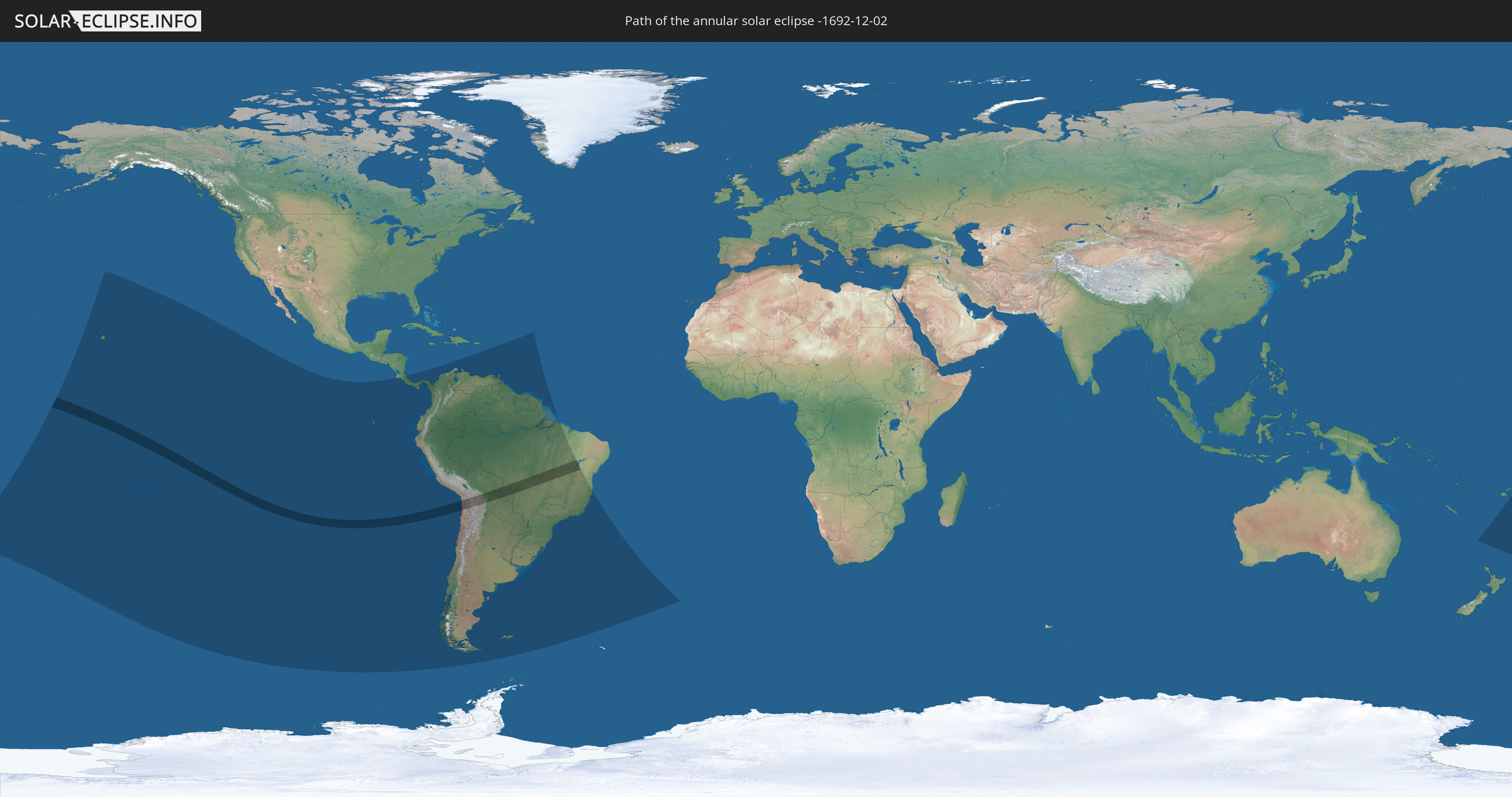
Die Sonnenfinsternis am 12/02/-1692 kann man in 42 Ländern als partielle Sonnenfinsternis beobachten.
Der Finsternispfad verläuft durch 4 Länder. Nur in diesen Ländern ist sie als annular Sonnenfinsternis zu sehen.
In den folgenden Ländern ist die Sonnenfinsternis annular zu sehen
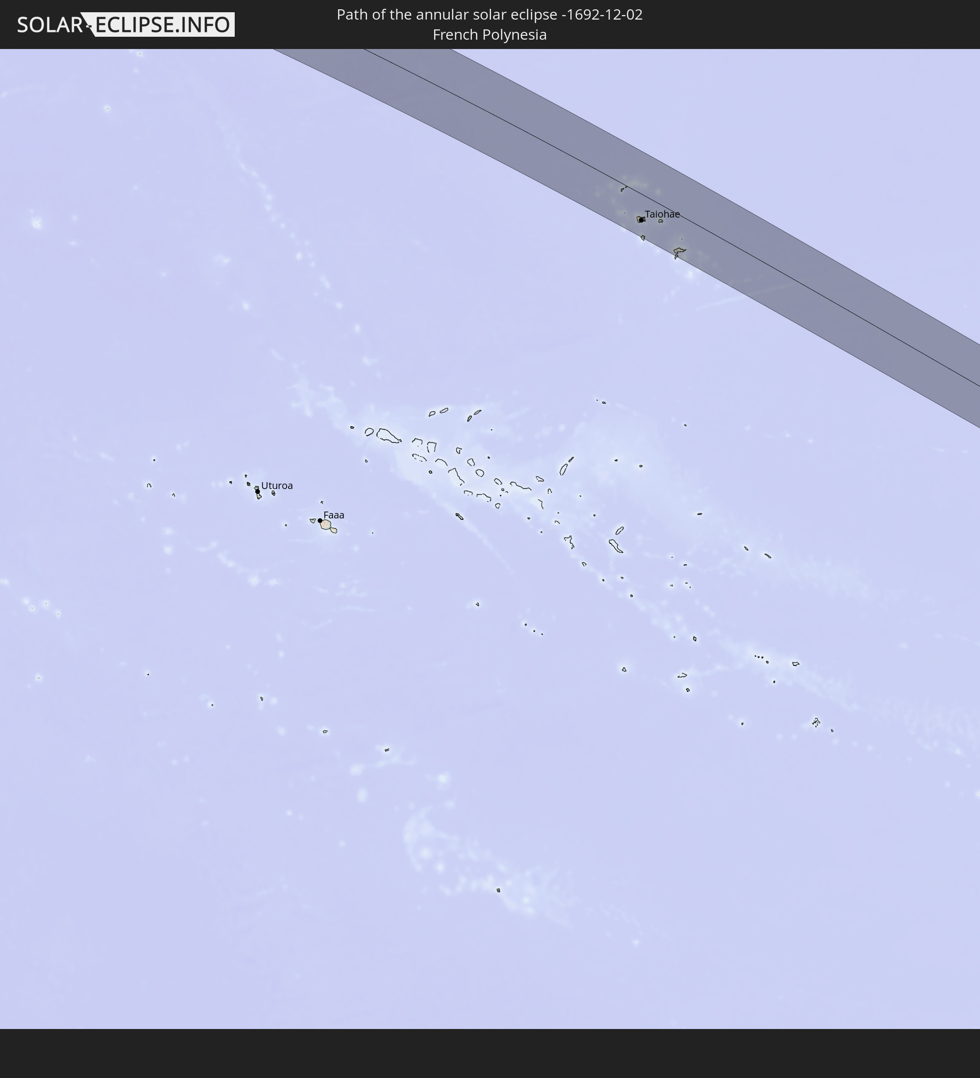 French Polynesia
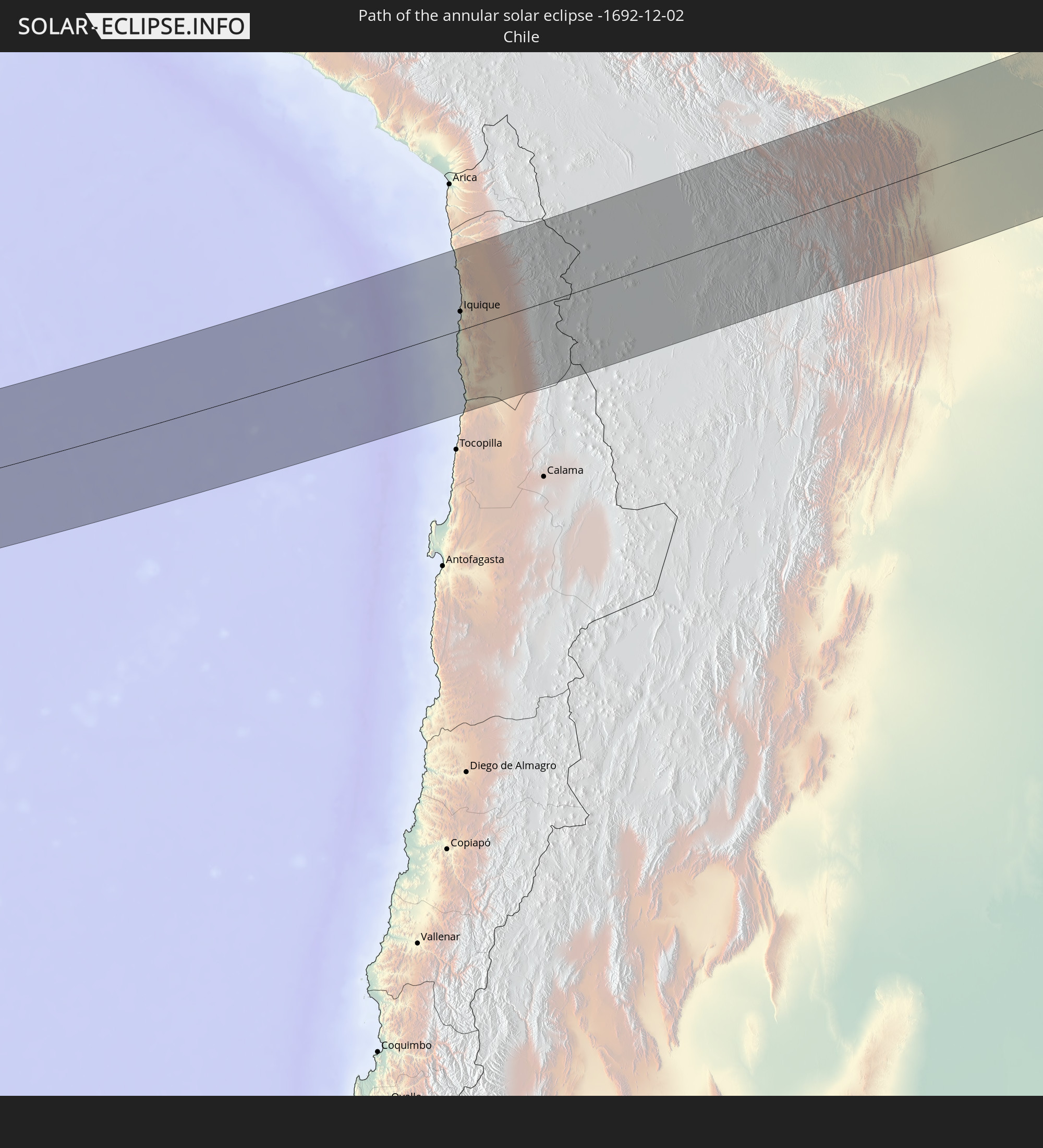 Chile
Chile
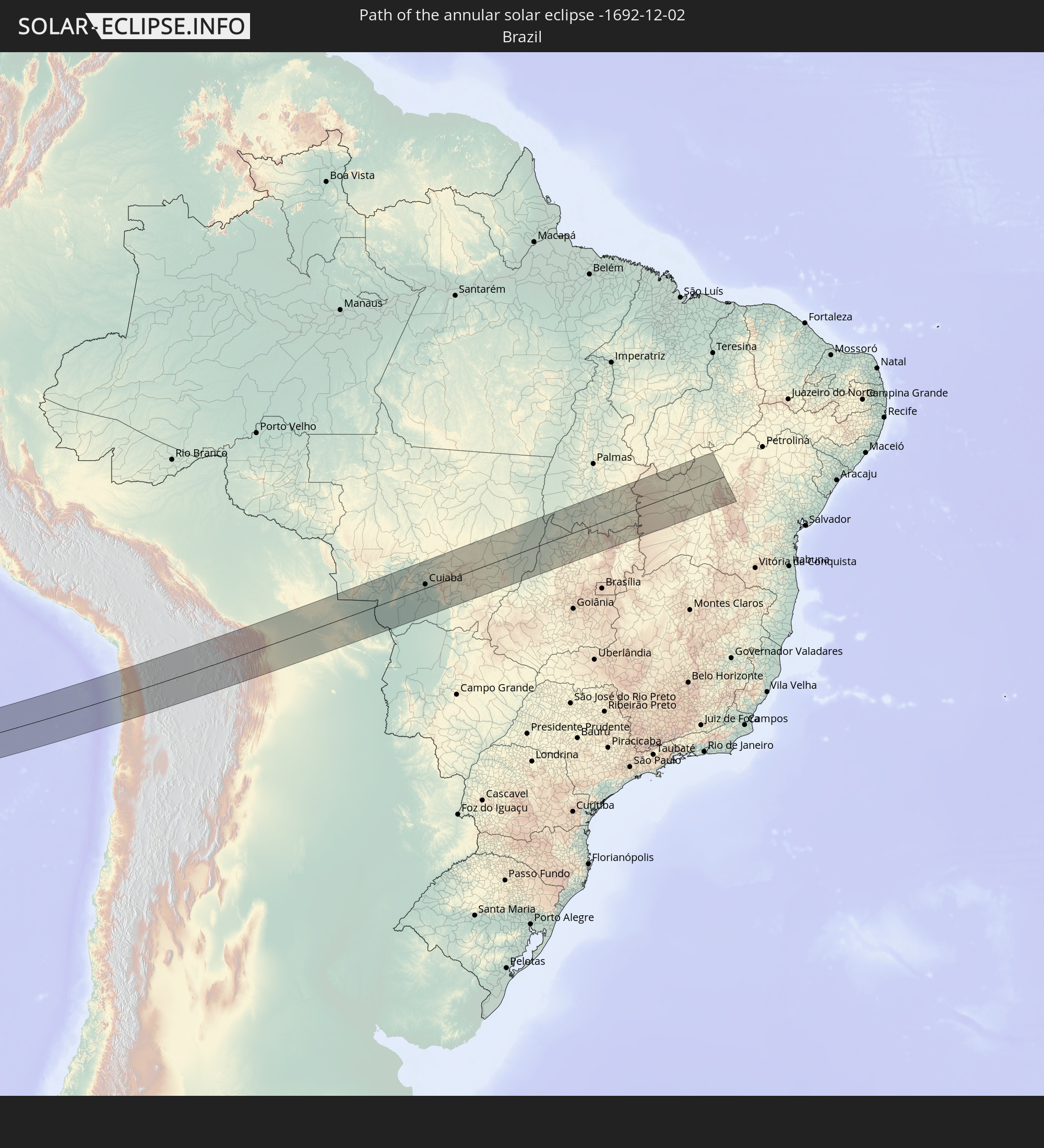 Brazil
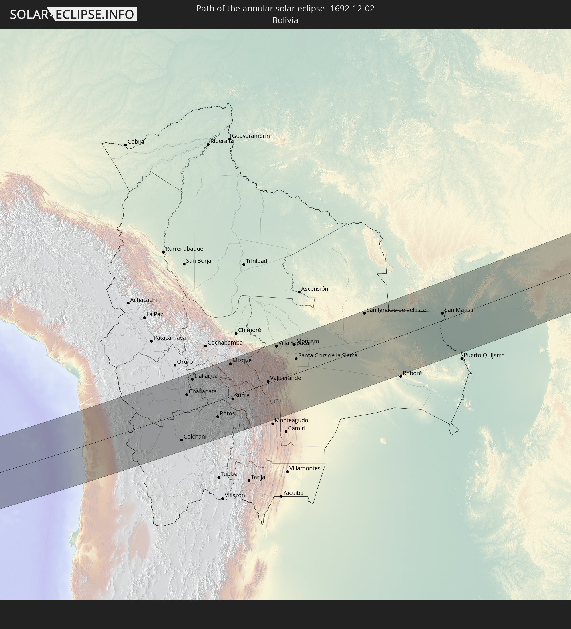 Bolivia
In den folgenden Ländern ist die Sonnenfinsternis partiell zu sehen
 Fiji
Fiji
 United States
 New Zealand
 United States Minor Outlying Islands
 Wallis and Futuna
 Tonga
Tonga
 Kiribati
 Samoa
Samoa
 Tokelau
 American Samoa
 Niue
Niue
 Cook Islands
 French Polynesia
 Pitcairn Islands
 Chile
Chile
 Ecuador
 Costa Rica
 Panama
 Colombia
 Peru
Peru
 Brazil
 Argentina
 Venezuela
 Aruba
Aruba
 Bolivia
 Saint Kitts and Nevis
 Paraguay
 Antigua and Barbuda
 Montserrat
 Trinidad and Tobago
 Guadeloupe
 Grenada
 Dominica
 Saint Vincent and the Grenadines
 Falkland Islands
 Guyana
 Martinique
 Saint Lucia
 Barbados
 Uruguay
 Suriname
 French Guiana
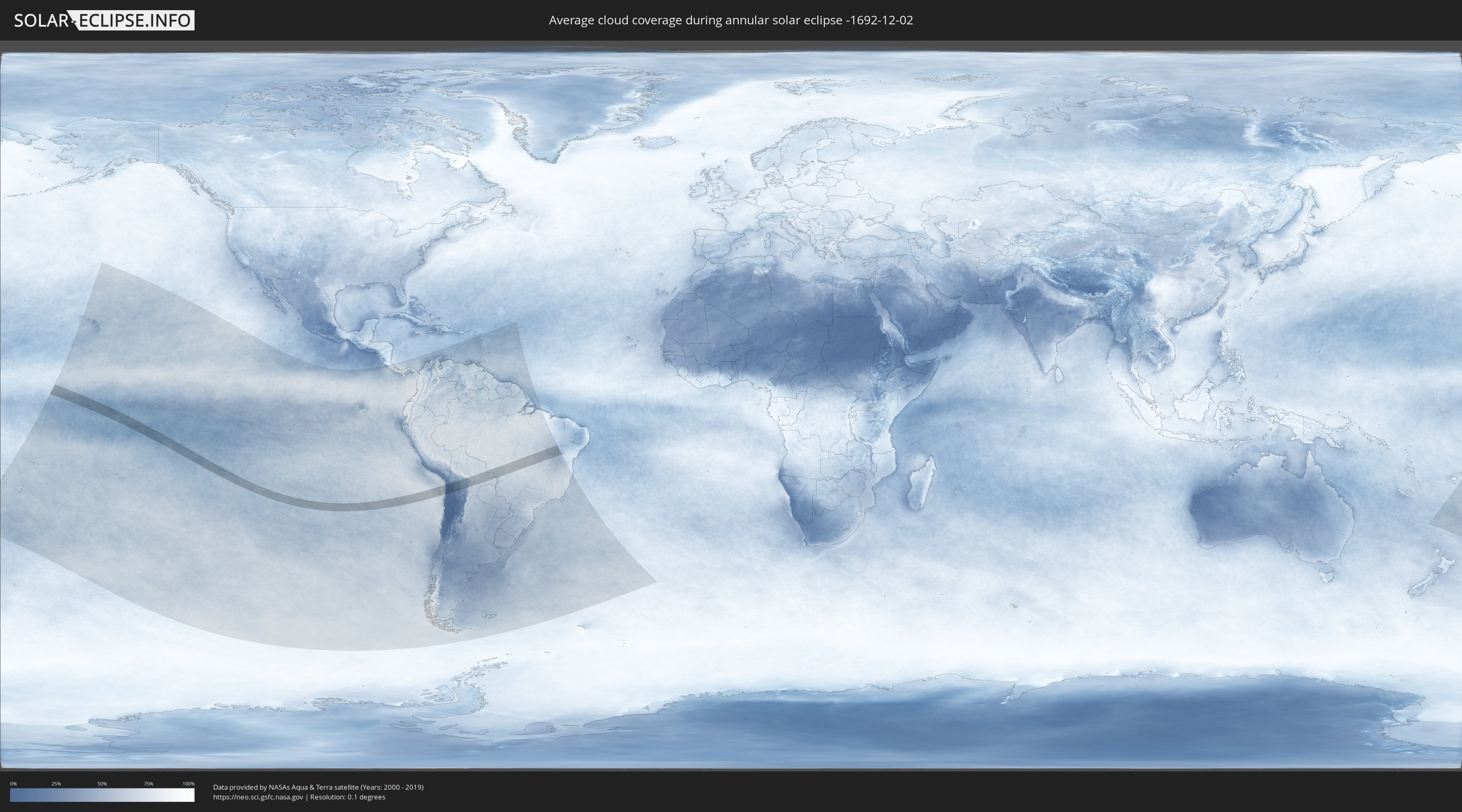
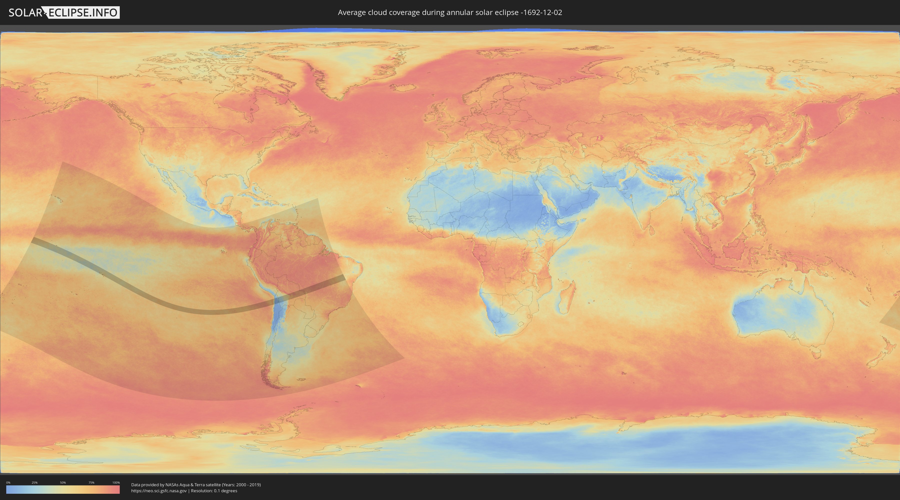
How will be the weather during the annular solar eclipse on 12/02/-1692?
Where is the best place to see the annular solar eclipse of 12/02/-1692?
The following maps show the average cloud coverage for the day of the annular solar eclipse.
With the help of these maps, it is possible to find the place along the eclipse path, which has the best
chance of a cloudless sky.
Nevertheless, you should consider local circumstances and inform about the weather of your chosen
observation site.
The data is provided by NASAs satellites
AQUA and TERRA.
The cloud maps are averaged over a period of 19 years (2000 - 2019).
Detailed country maps
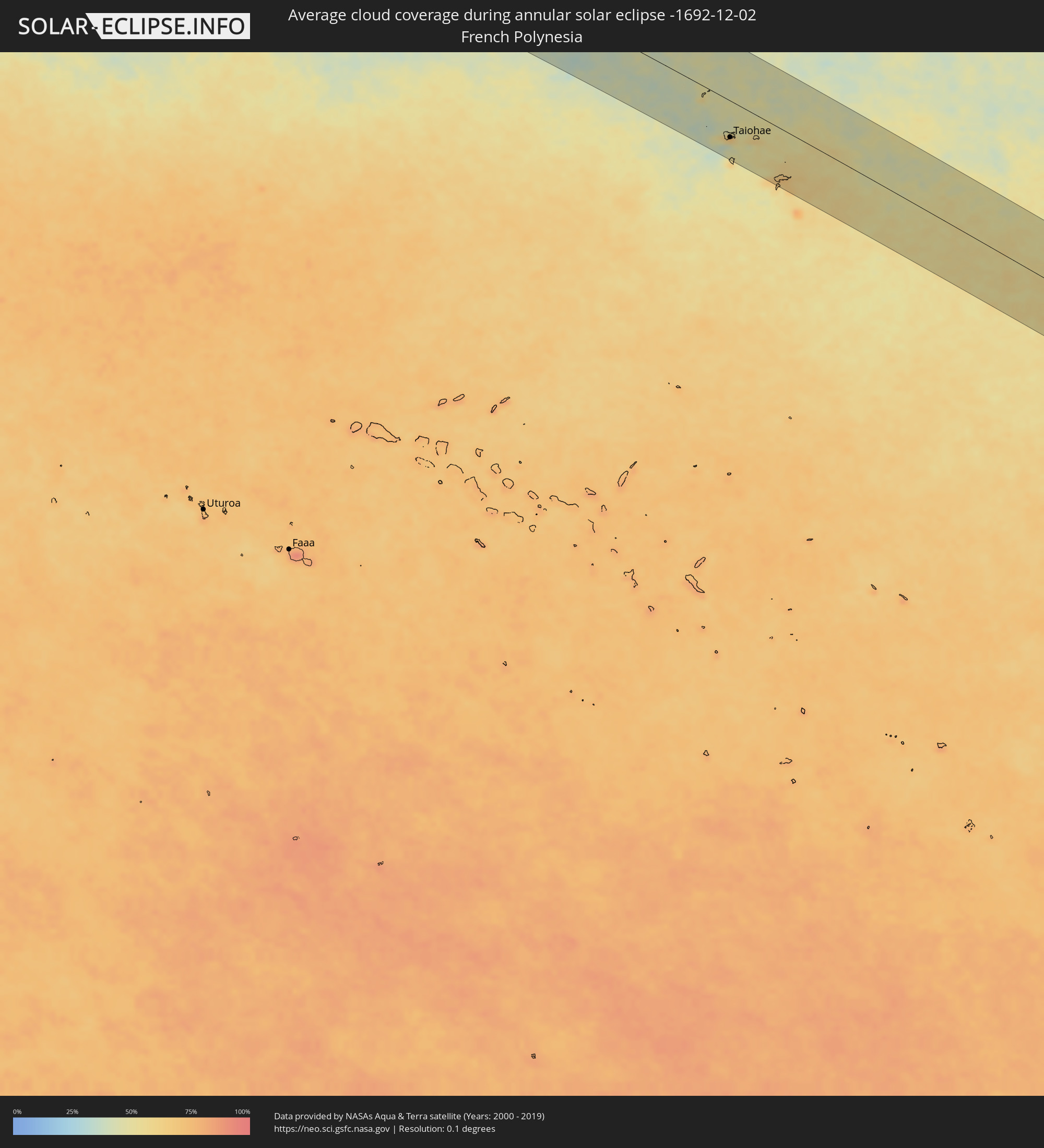 French Polynesia
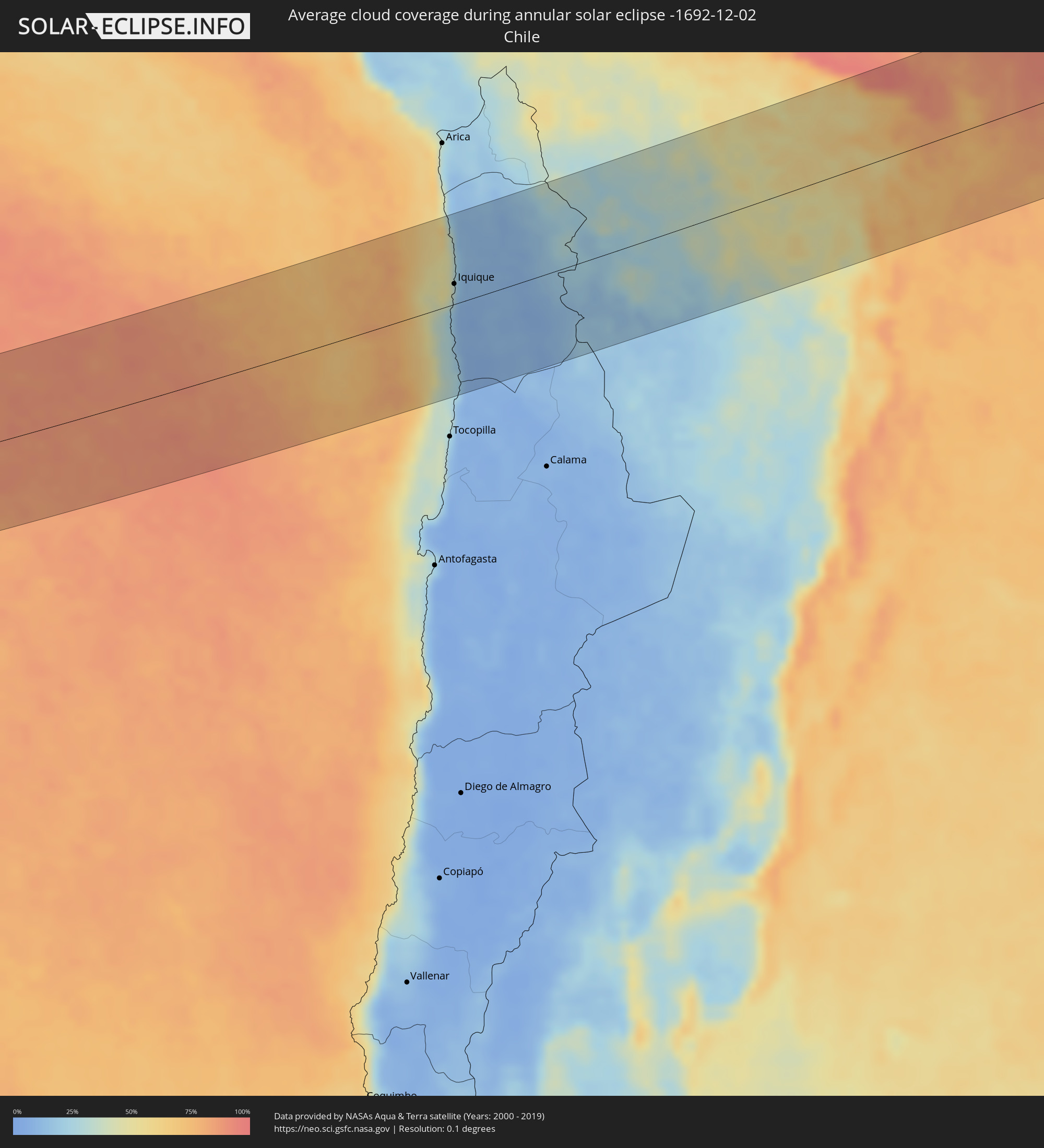 Chile
Chile
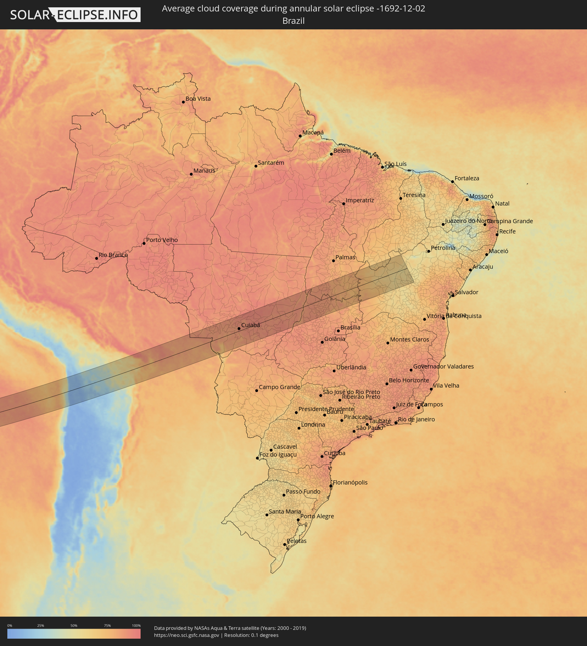 Brazil
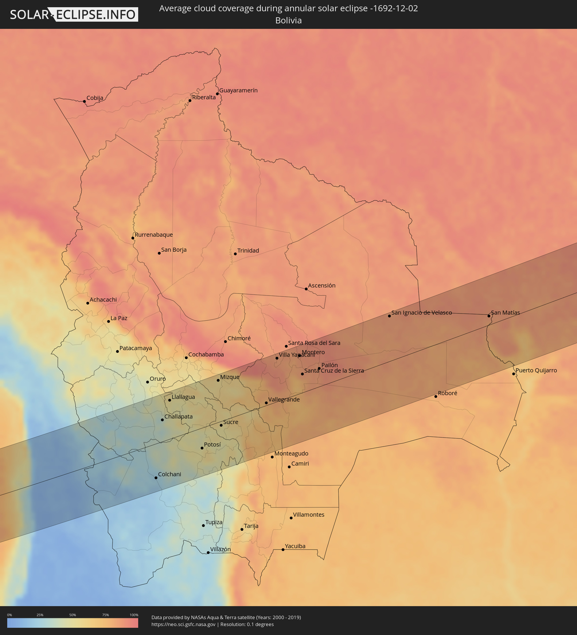 Bolivia
Cities inside the path of the eclipse
The following table shows all locations with a population of more than 5,000 inside the eclipse path. Cities which have more than 100,000 inhabitants are marked bold. A click at the locations opens a detailed map.
| City | Type | Eclipse duration | Local time of max. eclipse | Distance to central line | Ø Cloud coverage |
|
Taiohae, Îles Marquises
|
annular | - | 08:11:33 UTC-09:18 | 76 km | 61% |
|
Iquique, Tarapacá
|
annular | - | 15:58:09 UTC-04:42 | 26 km | 19% |
|
Colchani, Potosí
|
annular | - | 16:11:41 UTC-04:32 | 87 km | 22% |
|
Huanuni, Oruro
|
annular | - | 16:13:22 UTC-04:32 | 121 km | 48% |
|
Uyuni, Potosí
|
annular | - | 16:11:39 UTC-04:32 | 108 km | 22% |
|
Challapata, Oruro
|
annular | - | 16:12:57 UTC-04:32 | 54 km | 36% |
|
Llallagua, Potosí
|
annular | - | 16:13:30 UTC-04:32 | 98 km | 52% |
|
Potosí, Potosí
|
annular | - | 16:13:22 UTC-04:32 | 52 km | 50% |
|
Mizque, Cochabamba
|
annular | - | 16:15:00 UTC-04:32 | 106 km | 56% |
|
Sucre, Chuquisaca
|
annular | - | 16:14:14 UTC-04:32 | 11 km | 51% |
|
Aiquile, Cochabamba
|
annular | - | 16:14:56 UTC-04:32 | 73 km | 61% |
|
Vallegrande, Santa Cruz
|
annular | - | 16:15:37 UTC-04:32 | 6 km | 76% |
|
Villa Yapacaní, Santa Cruz
|
annular | - | 16:16:39 UTC-04:32 | 110 km | 83% |
|
Portachuelo, Santa Cruz
|
annular | - | 16:17:01 UTC-04:32 | 100 km | 80% |
|
Santiago del Torno, Santa Cruz
|
annular | - | 16:16:34 UTC-04:32 | 33 km | 72% |
|
Montero, Santa Cruz
|
annular | - | 16:17:08 UTC-04:32 | 96 km | 85% |
|
Mineros, Santa Cruz
|
annular | - | 16:17:19 UTC-04:32 | 119 km | 87% |
|
La Bélgica, Santa Cruz
|
annular | - | 16:17:01 UTC-04:32 | 73 km | 84% |
|
Santa Cruz de la Sierra, Santa Cruz
|
annular | - | 16:16:52 UTC-04:32 | 47 km | 83% |
|
Warnes, Santa Cruz
|
annular | - | 16:17:04 UTC-04:32 | 75 km | 85% |
|
Cotoca, Santa Cruz
|
annular | - | 16:16:56 UTC-04:32 | 39 km | 83% |
|
San Julian, Santa Cruz
|
annular | - | 16:17:06 UTC-04:32 | 36 km | 85% |
|
Pailón, Santa Cruz
|
annular | - | 16:17:17 UTC-04:32 | 46 km | 85% |
|
San Ignacio de Velasco, Santa Cruz
|
annular | - | 16:19:25 UTC-04:32 | 115 km | 84% |
|
Concepción, Santa Cruz
|
annular | - | 16:19:24 UTC-04:32 | 107 km | 84% |
|
San Matías, Santa Cruz
|
annular | - | 16:20:51 UTC-04:32 | 22 km | 81% |
|
Barra do Bugres, Mato Grosso
|
annular | - | 17:16:24 UTC-03:38 | 112 km | 89% |
|
Poconé, Mato Grosso
|
annular | - | 17:15:52 UTC-03:38 | 32 km | 84% |
|
Rosário Oeste, Mato Grosso
|
annular | - | 17:16:51 UTC-03:38 | 109 km | 90% |
|
Nobres, Mato Grosso
|
annular | - | 17:16:58 UTC-03:38 | 117 km | 90% |
|
Várzea Grande, Mato Grosso
|
annular | - | 17:16:27 UTC-03:38 | 13 km | 89% |
|
Cuiabá, Mato Grosso
|
annular | - | 17:16:30 UTC-03:38 | 17 km | 89% |
|
Santo Antônio do Leverger, Mato Grosso
|
annular | - | 17:16:20 UTC-03:38 | 12 km | 83% |
|
Lucas, Mato Grosso
|
annular | - | 17:16:05 UTC-03:38 | 66 km | 80% |
|
Chapada dos Guimarães, Mato Grosso
|
annular | - | 17:16:43 UTC-03:38 | 18 km | 89% |
|
Jaciara, Mato Grosso
|
annular | - | 17:16:40 UTC-03:38 | 64 km | 86% |
|
Rondonópolis, Mato Grosso
|
annular | - | 17:16:27 UTC-03:38 | 129 km | 86% |
|
Poxoréo, Mato Grosso
|
annular | - | 17:16:57 UTC-03:38 | 72 km | 88% |
|
Mozarlândia, Goiás
|
annular | - | 17:50:30 UTC-03:06 | 103 km | 88% |
|
São Miguel do Araguaia, Goiás
|
annular | - | 17:51:23 UTC-03:06 | 35 km | 88% |
|
Crixás, Goiás
|
annular | - | 17:50:42 UTC-03:06 | 105 km | 88% |
|
Porangatu, Goiás
|
annular | - | 17:51:25 UTC-03:06 | 21 km | 86% |
|
Alvorada, Tocantins
|
annular | - | 18:24:23 UTC-02:34 | 78 km | 85% |
|
Campos Belos, Goiás
|
annular | - | 17:51:45 UTC-03:06 | 69 km | 79% |
|
Taguatinga, Tocantins
|
annular | - | 18:24:32 UTC-02:34 | 16 km | 77% |
|
Formosa do Rio Preto, Bahia
|
annular | - | 18:25:07 UTC-02:34 | 78 km | 65% |
|
Barreiras, Bahia
|
annular | - | 18:24:36 UTC-02:34 | 45 km | 70% |
|
São Desidério, Bahia
|
annular | - | 18:24:30 UTC-02:34 | 68 km | 72% |
|
Riachão das Neves, Bahia
|
annular | - | 18:24:47 UTC-02:34 | 6 km | 62% |
|
Ibotirama, Bahia
|
annular | - | 18:24:26 UTC-02:34 | 116 km | 60% |
|
Barra, Bahia
|
annular | - | 18:24:55 UTC-02:34 | 4 km | 58% |
|
Xique Xique, Bahia
|
annular | - | 18:24:58 UTC-02:34 | 8 km | 53% |
|
Ibipeba, Bahia
|
annular | - | 18:24:31 UTC-02:34 | 105 km | 58% |
|
Barro Alto, Bahia
|
annular | - | 18:24:27 UTC-02:34 | 121 km | 59% |