Annular solar eclipse of 11/18/-1840
| Day of week: | Sunday |
| Maximum duration of eclipse: | 07m13s |
| Maximum width of eclipse path: | 214 km |
| Saros cycle: | 13 |
| Coverage: | 94.2% |
| Magnitude: | 0.9422 |
| Gamma: | 0.0048 |
Wo kann man die Sonnenfinsternis vom 11/18/-1840 sehen?
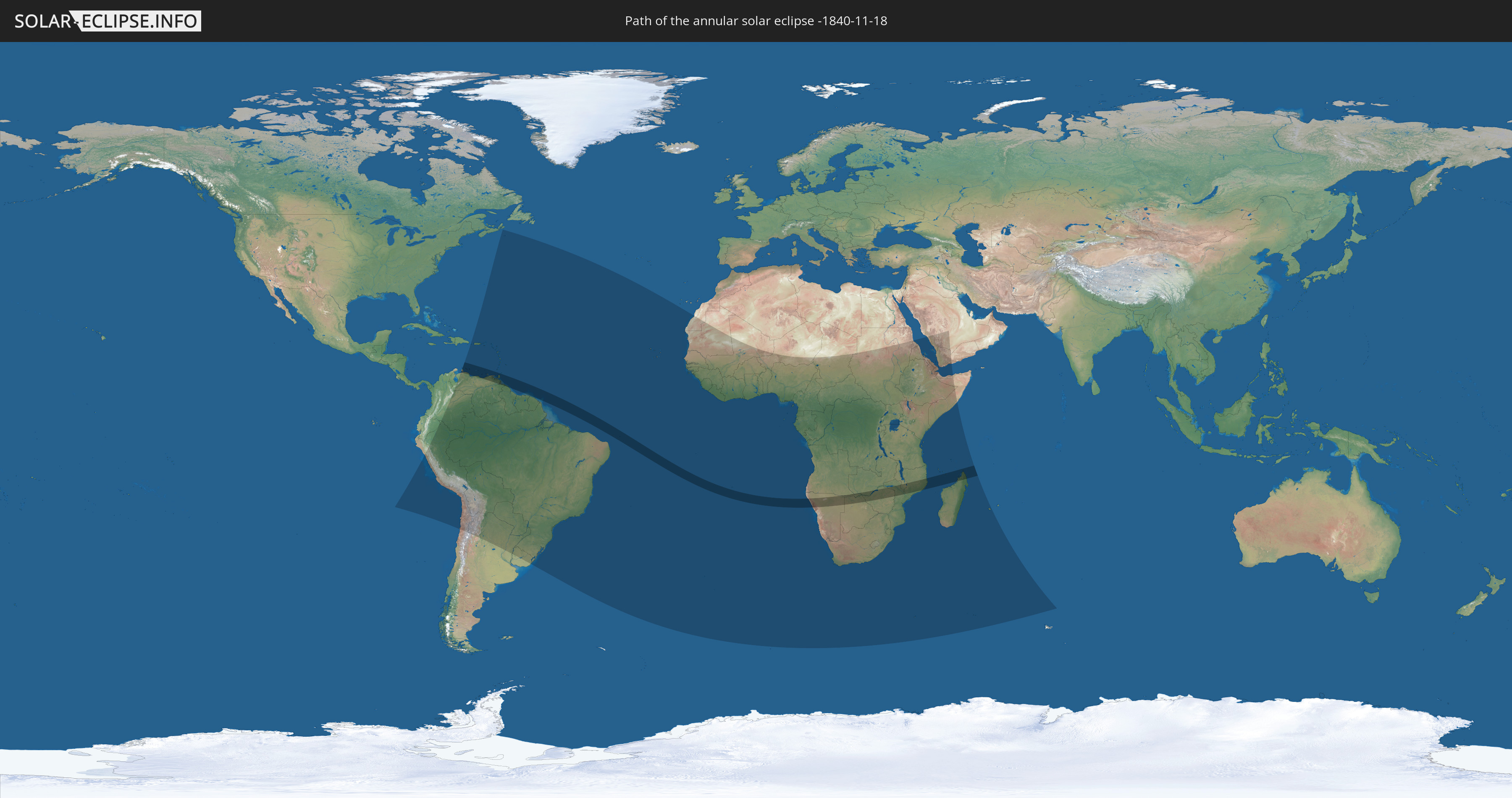
Die Sonnenfinsternis am 11/18/-1840 kann man in 84 Ländern als partielle Sonnenfinsternis beobachten.
Der Finsternispfad verläuft durch 16 Länder. Nur in diesen Ländern ist sie als annular Sonnenfinsternis zu sehen.
In den folgenden Ländern ist die Sonnenfinsternis annular zu sehen
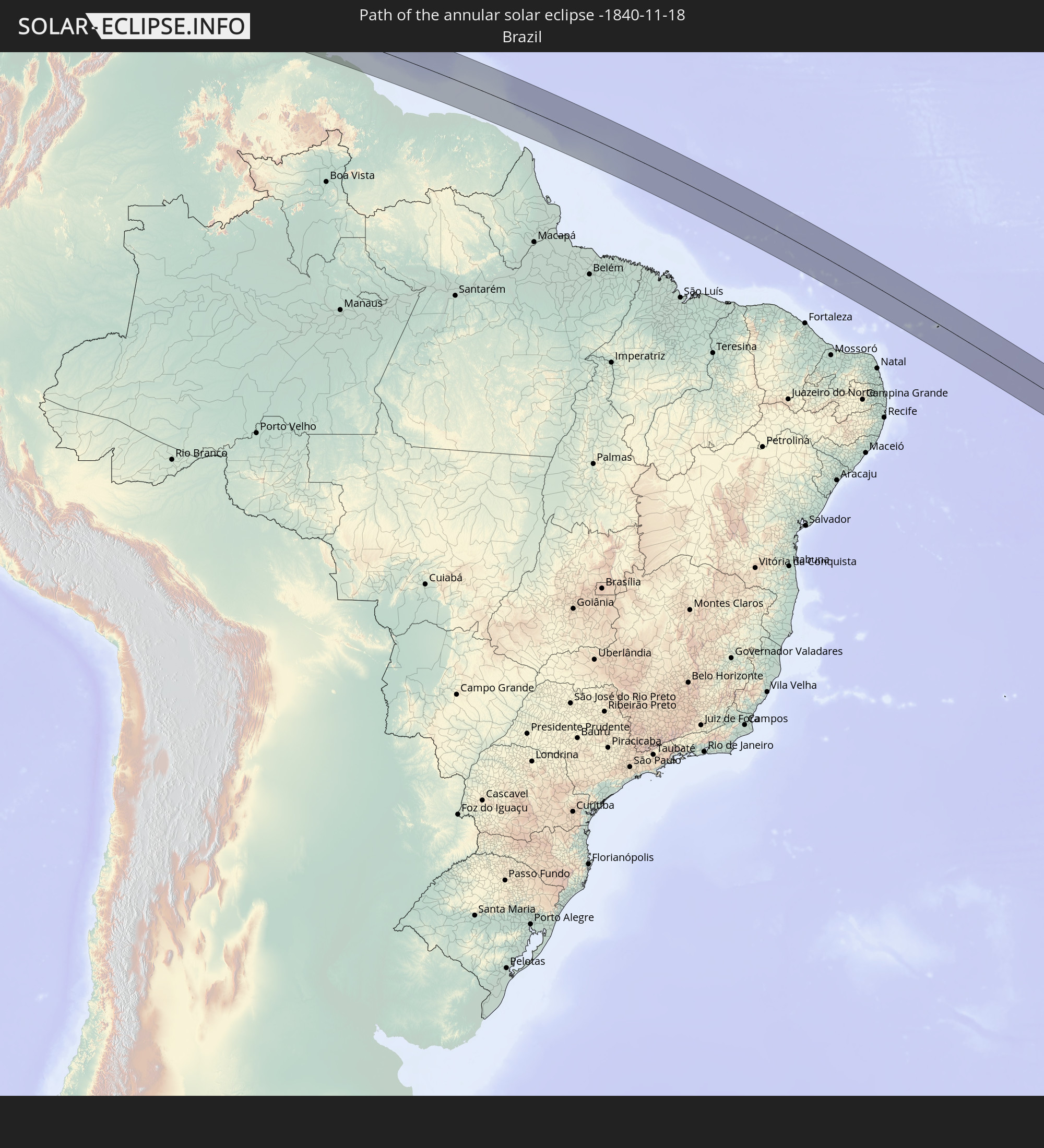 Brazil
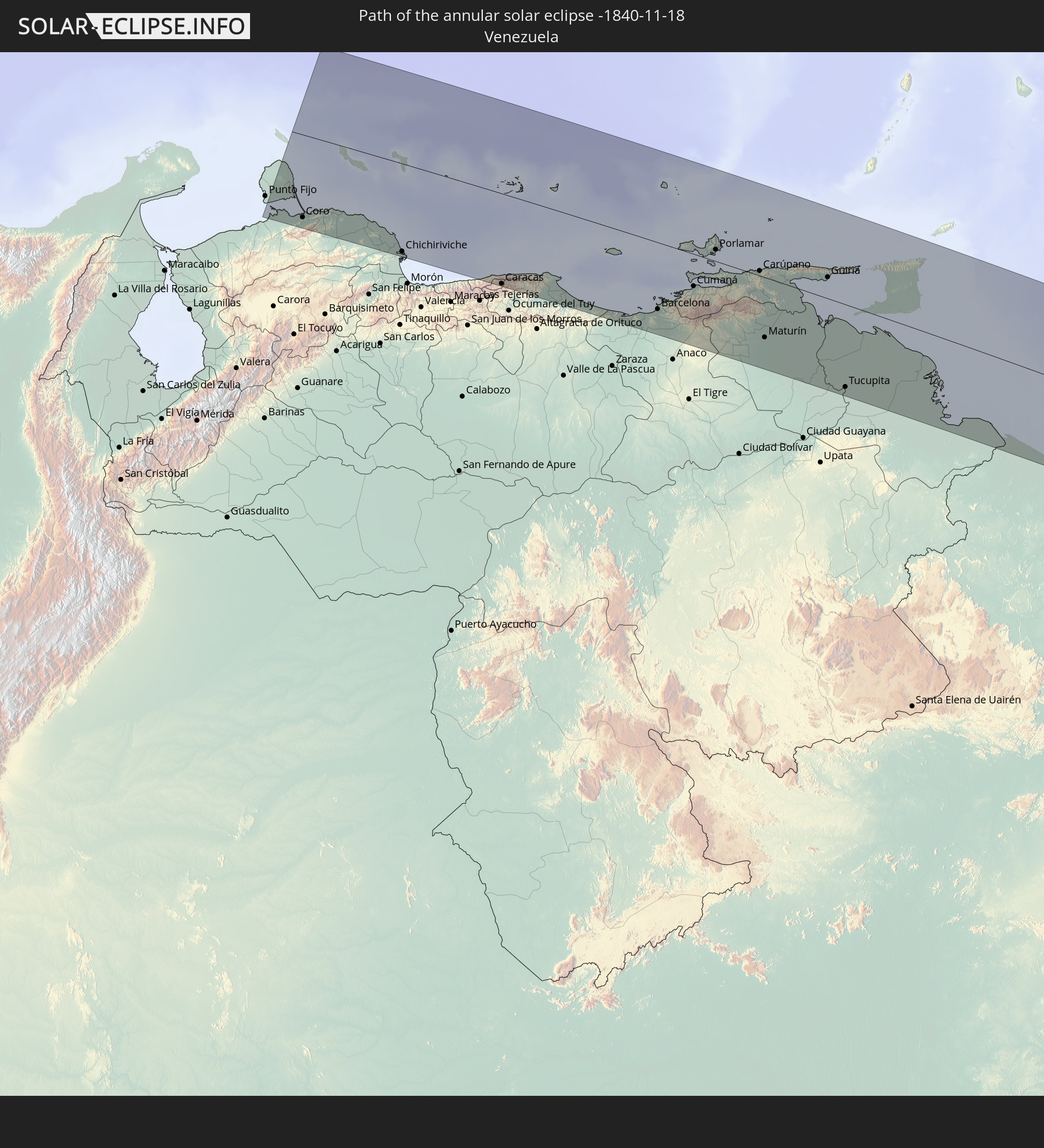 Venezuela
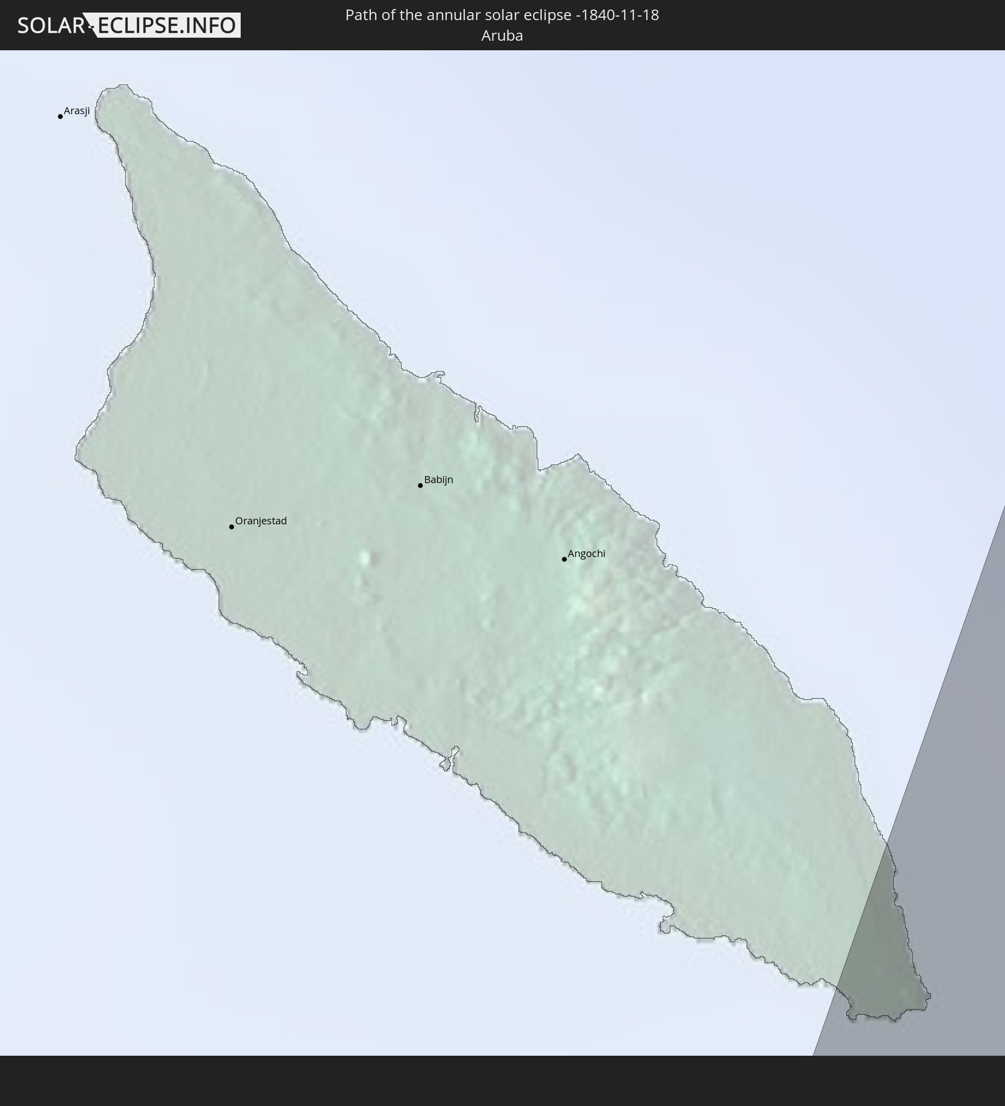 Aruba
Aruba
 Curaçao
 Trinidad and Tobago
 Guyana
 Caribbean Netherlands
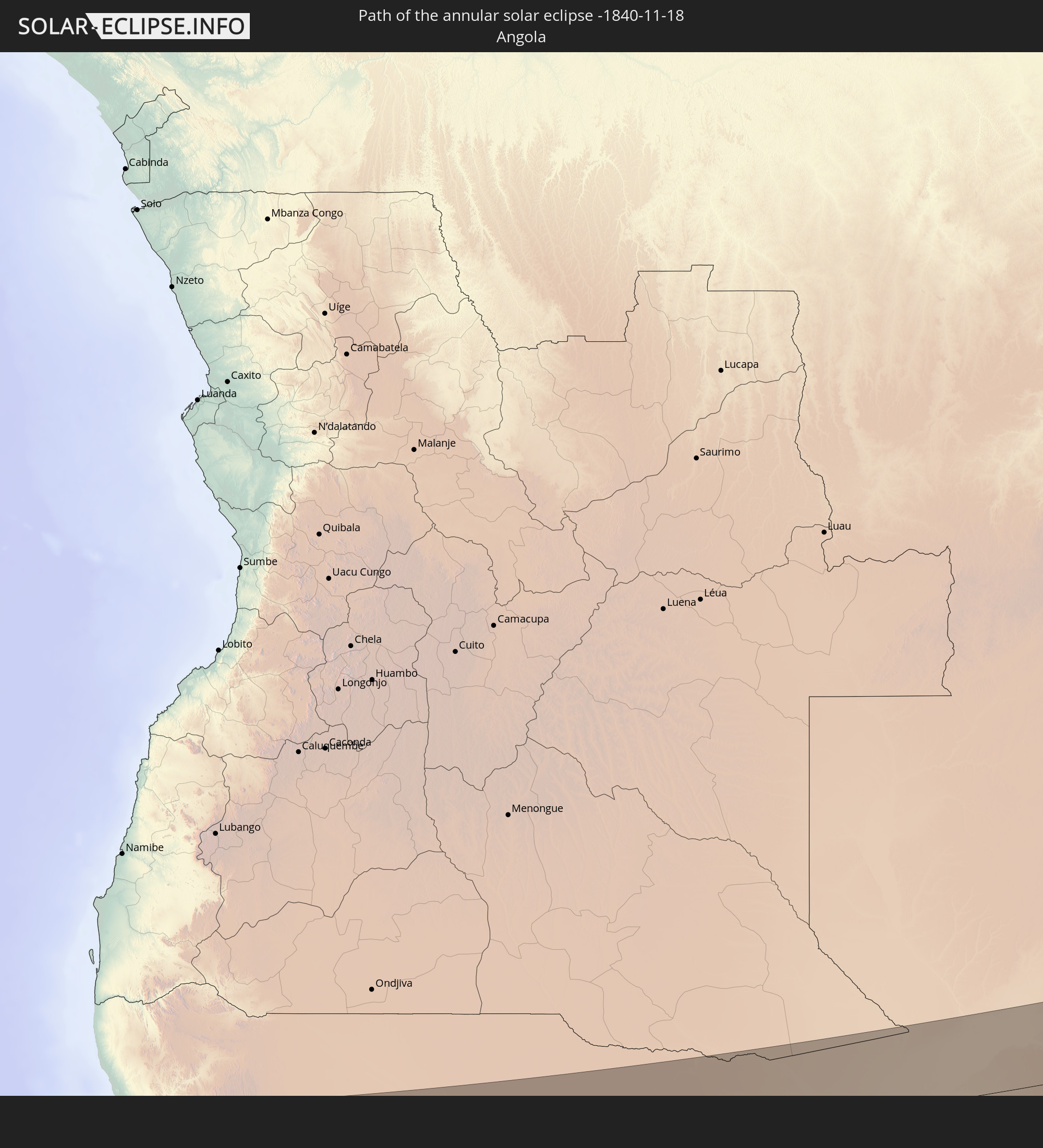 Angola
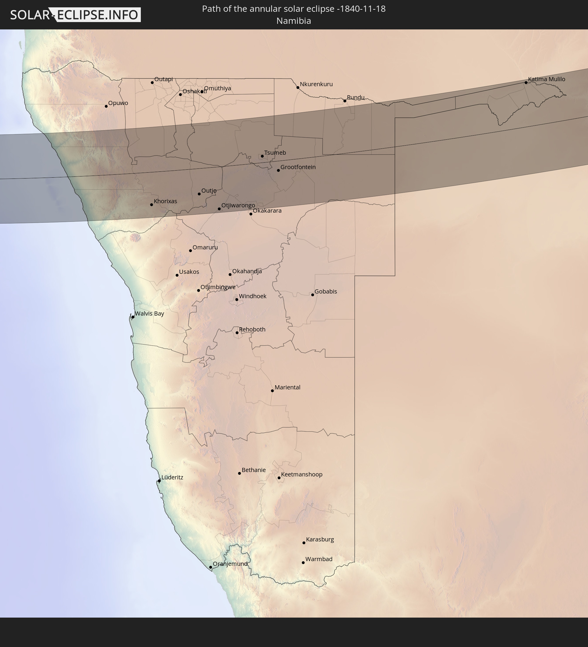 Namibia
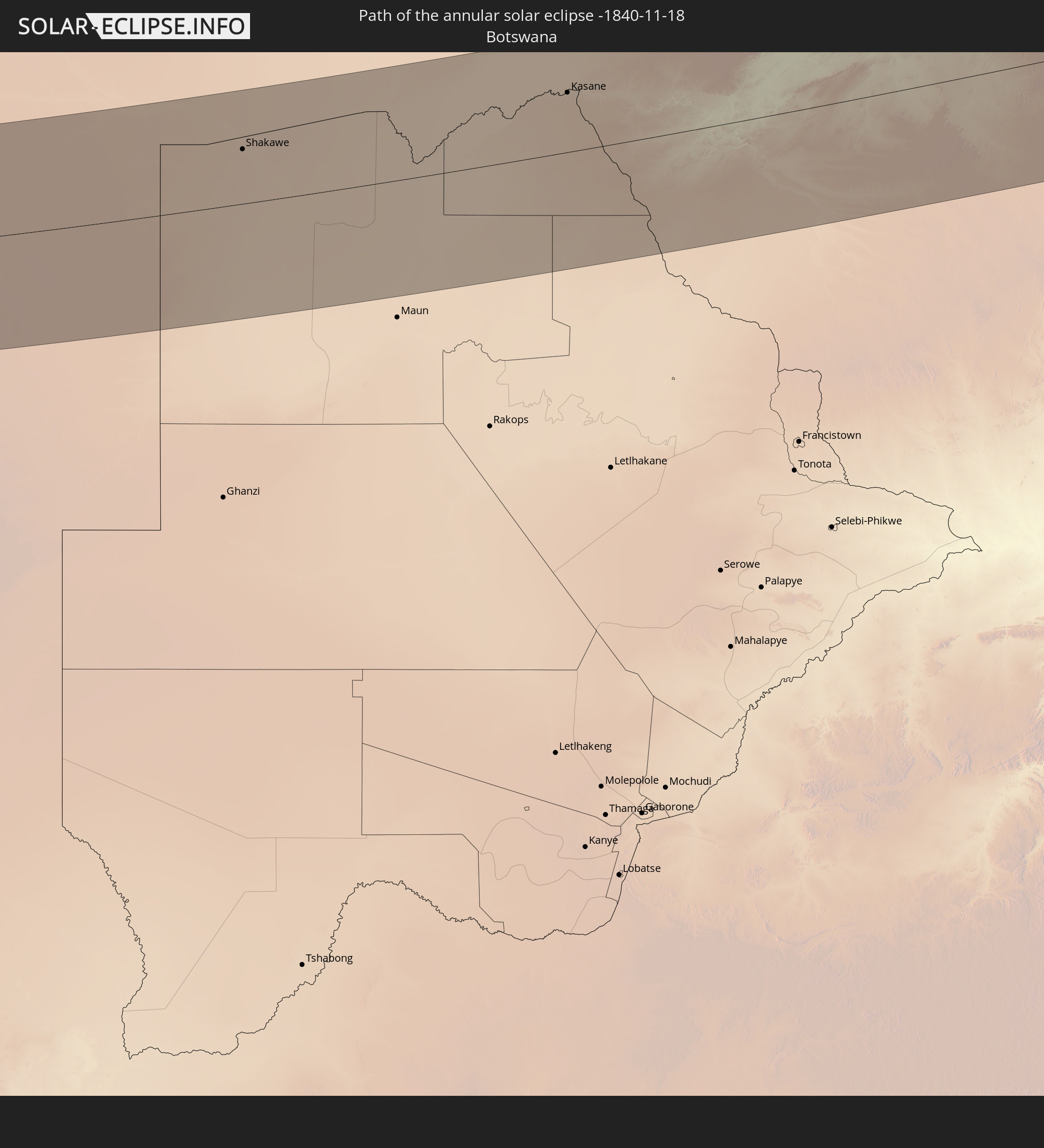 Botswana
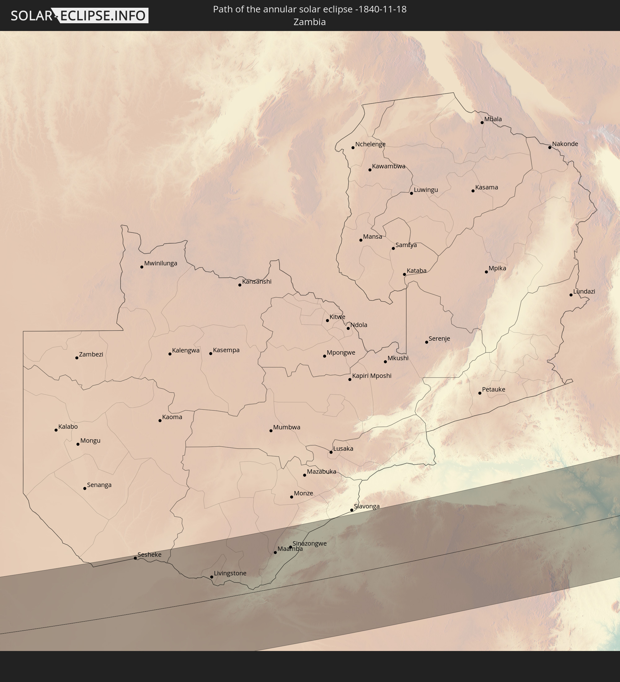 Zambia
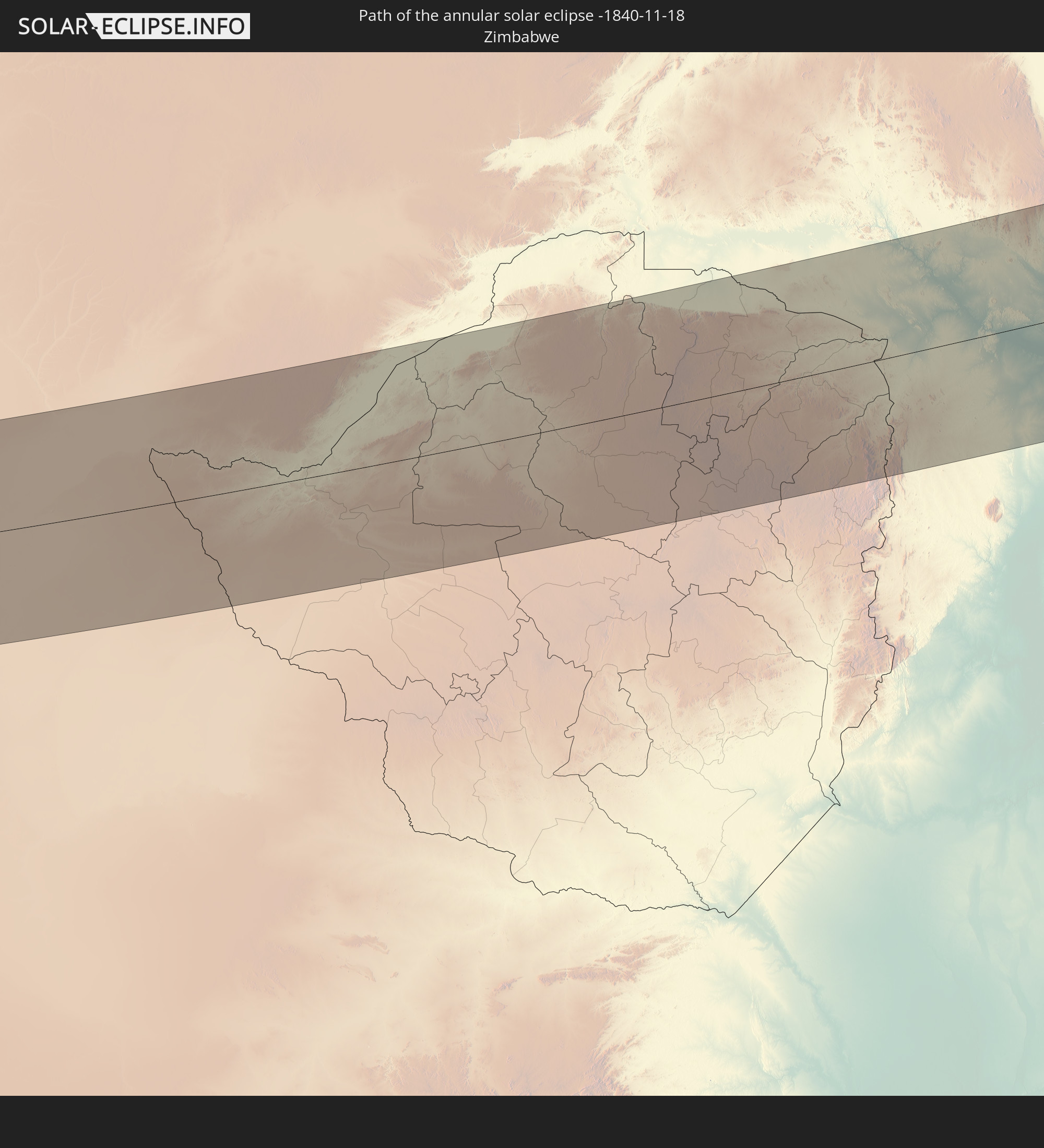 Zimbabwe
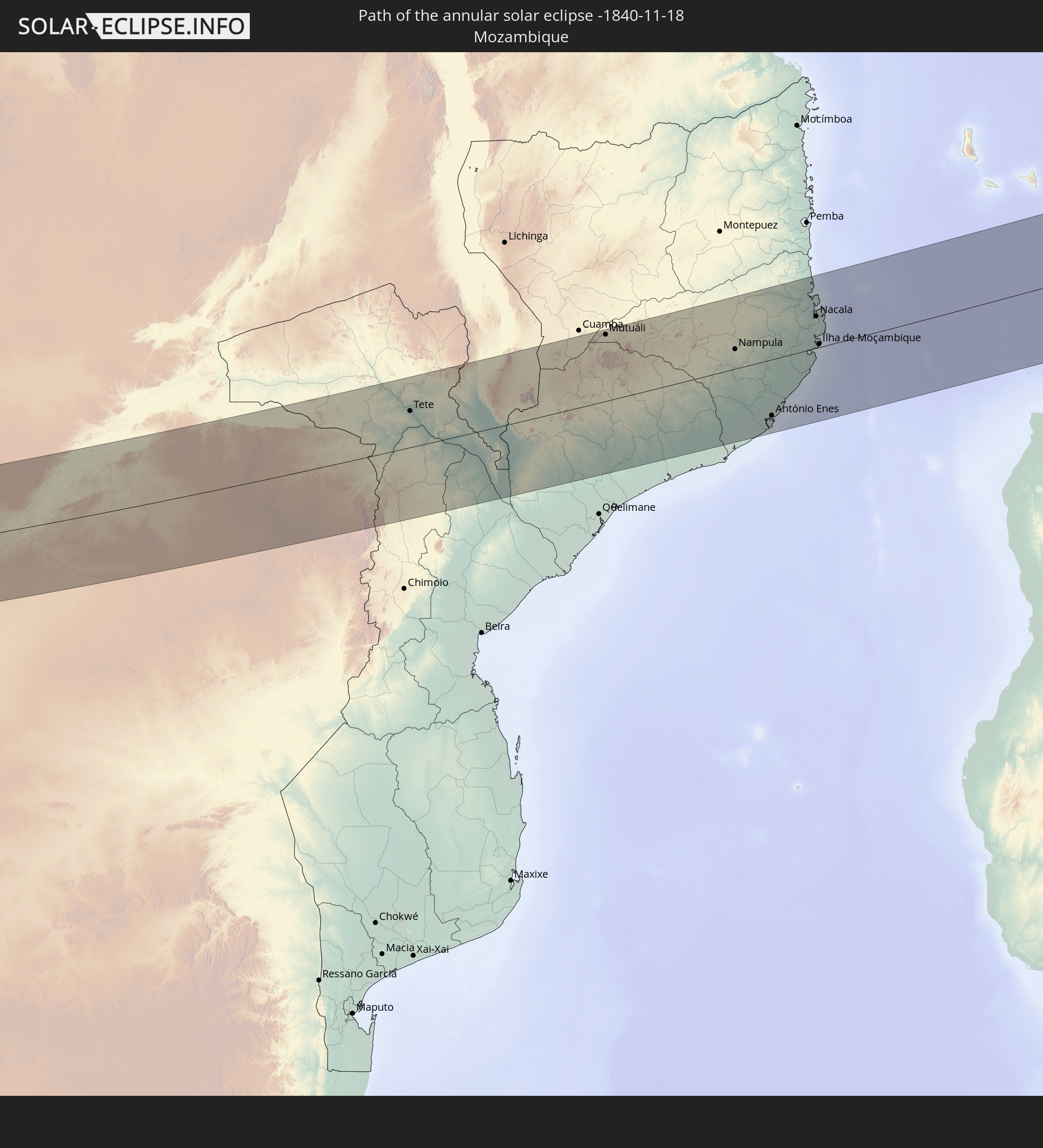 Mozambique
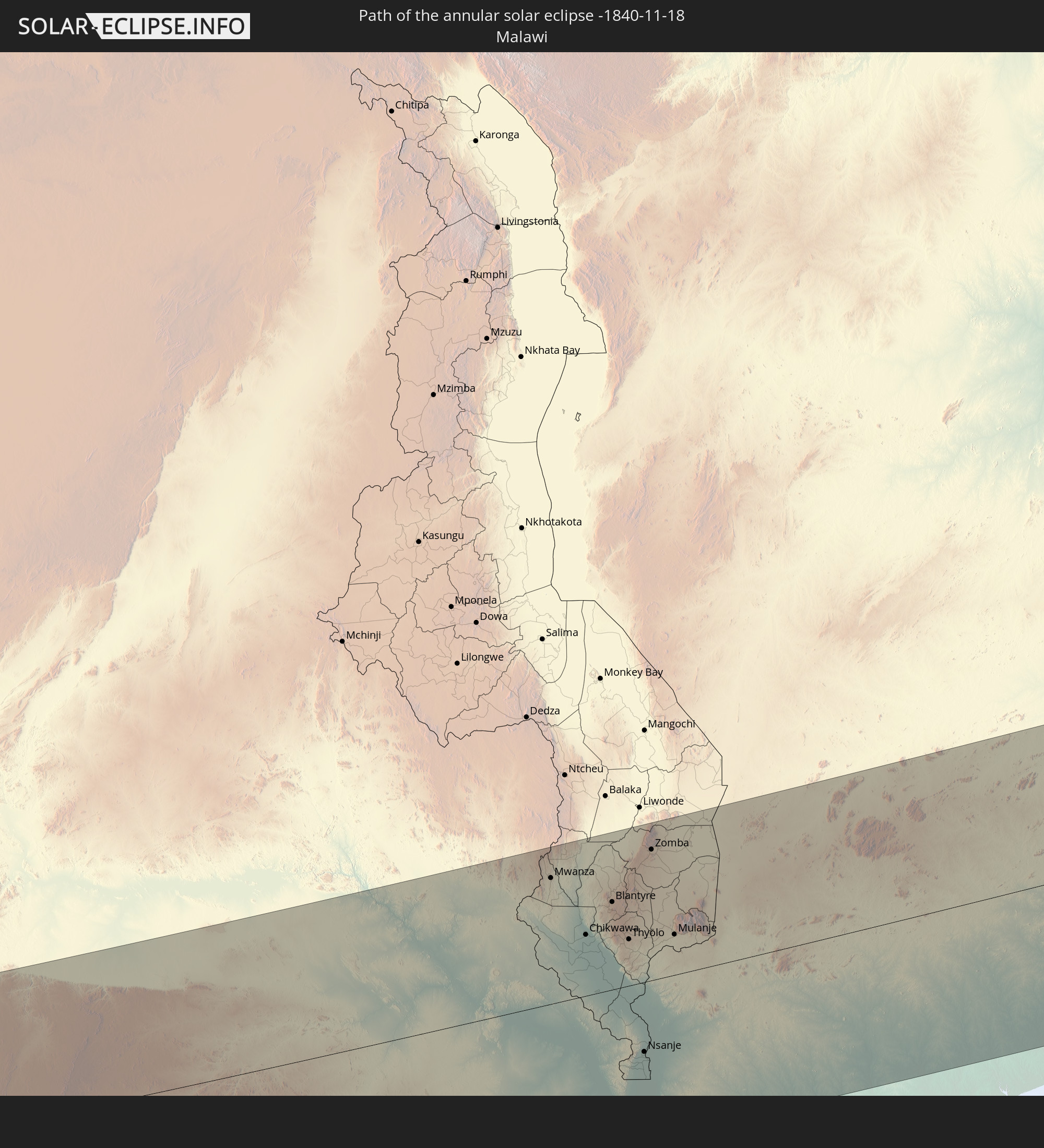 Malawi
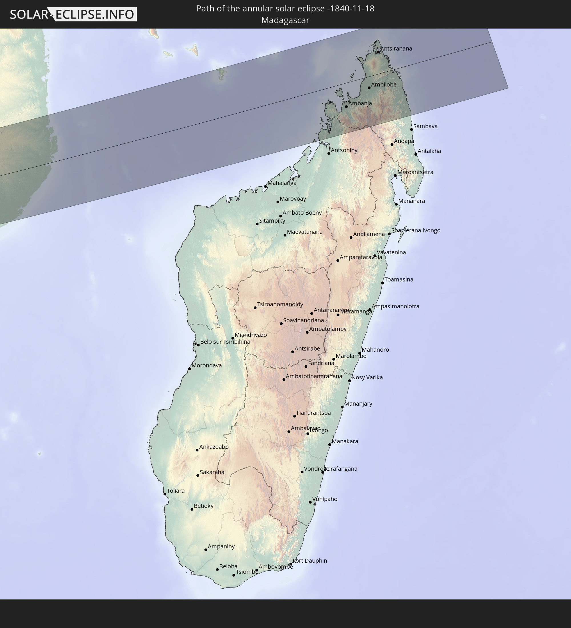 Madagascar
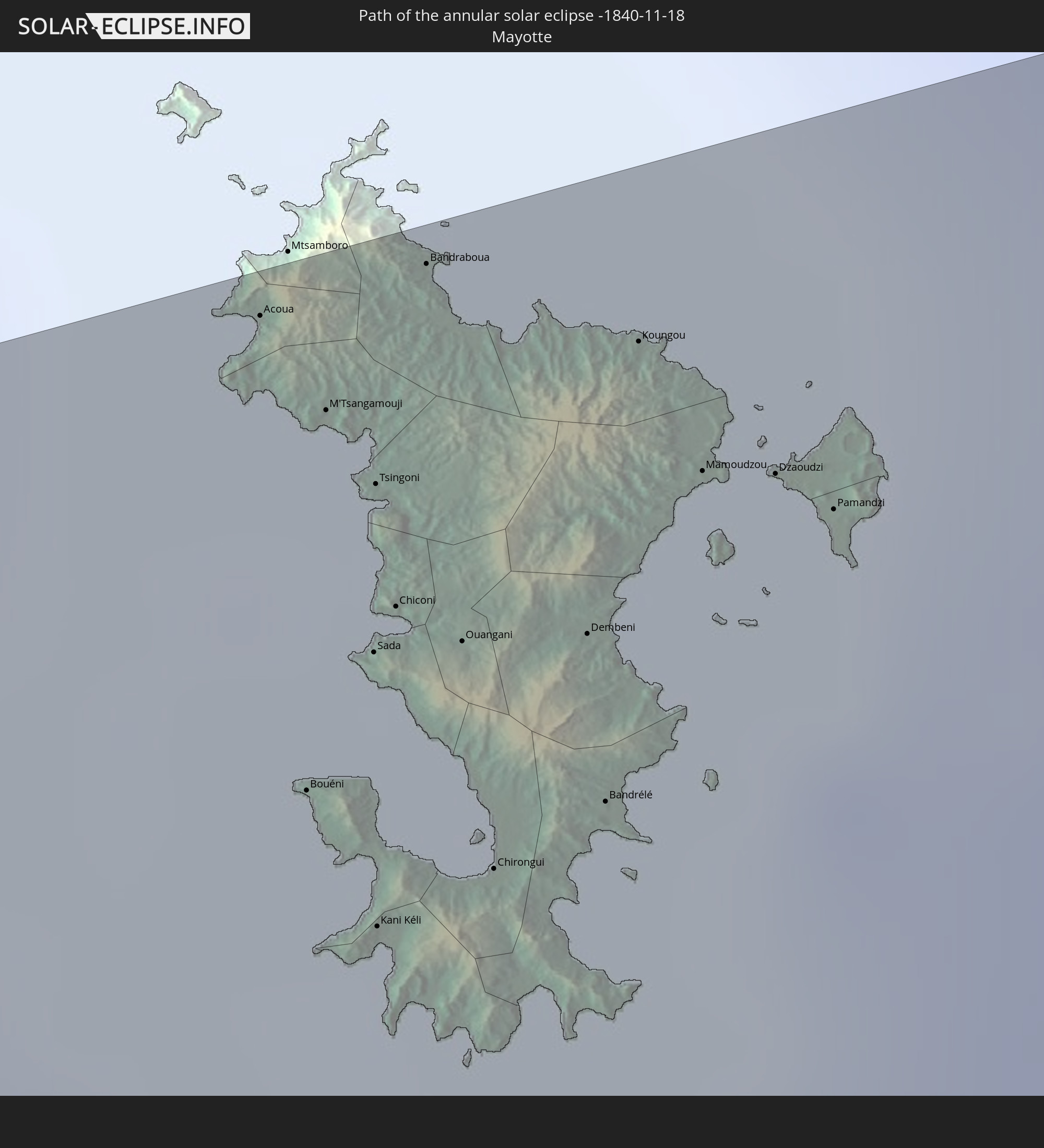 Mayotte
In den folgenden Ländern ist die Sonnenfinsternis partiell zu sehen
 Chile
Chile
 Ecuador
 Colombia
 Peru
Peru
 Brazil
 Argentina
 Venezuela
 Aruba
Aruba
 Bolivia
 Puerto Rico
 United States Virgin Islands
 British Virgin Islands
 Anguilla
 Collectivity of Saint Martin
 Saint Barthélemy
 Saint Kitts and Nevis
 Paraguay
 Antigua and Barbuda
 Montserrat
 Trinidad and Tobago
 Guadeloupe
 Grenada
 Dominica
 Saint Vincent and the Grenadines
 Guyana
 Martinique
 Saint Lucia
 Barbados
 Uruguay
 Suriname
 French Guiana
 Cabo Verde
 Senegal
 Mauritania
 The Gambia
 Guinea-Bissau
 Guinea
 Saint Helena, Ascension and Tristan da Cunha
 Sierra Leone
 Mali
Mali
 Liberia
 Ivory Coast
 Burkina Faso
 Ghana
Ghana
 Togo
Togo
 Niger
Niger
 Benin
Benin
 Nigeria
 Equatorial Guinea
 São Tomé and Príncipe
 Cameroon
 Gabon
Gabon
 Republic of the Congo
 Angola
 Namibia
 Democratic Republic of the Congo
 Chad
Chad
 Central African Republic
 South Africa
 Botswana
 Sudan
Sudan
 Zambia
 Zimbabwe
 Lesotho
 Rwanda
 Burundi
 Tanzania
 Uganda
 Mozambique
 Swaziland
 Malawi
 Ethiopia
 Kenya
Kenya
 Saudi Arabia
 Eritrea
 French Southern and Antarctic Lands
 Somalia
 Djibouti
 Yemen
Yemen
 Madagascar
 Comoros
 Mayotte
 Seychelles
 Réunion
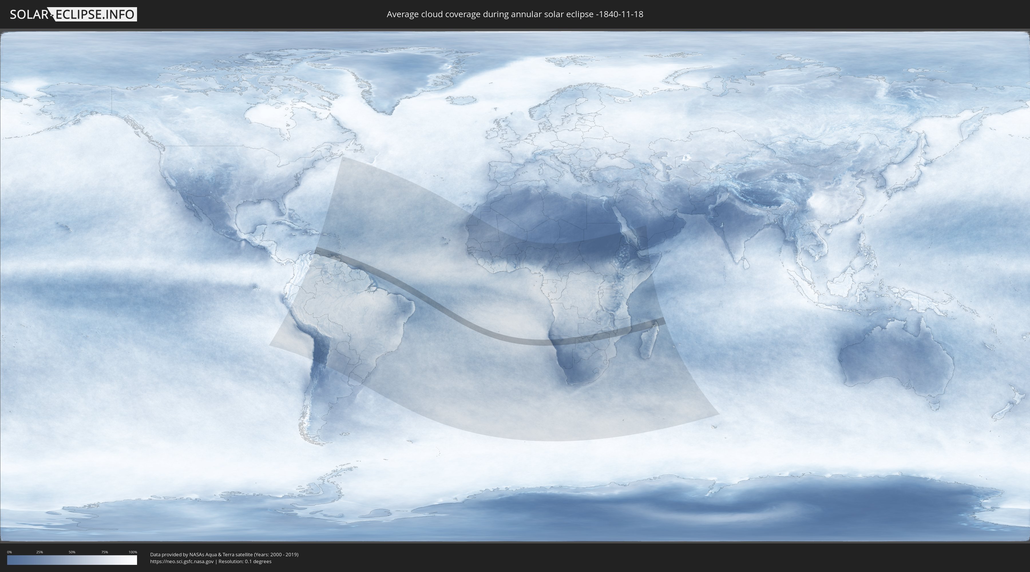
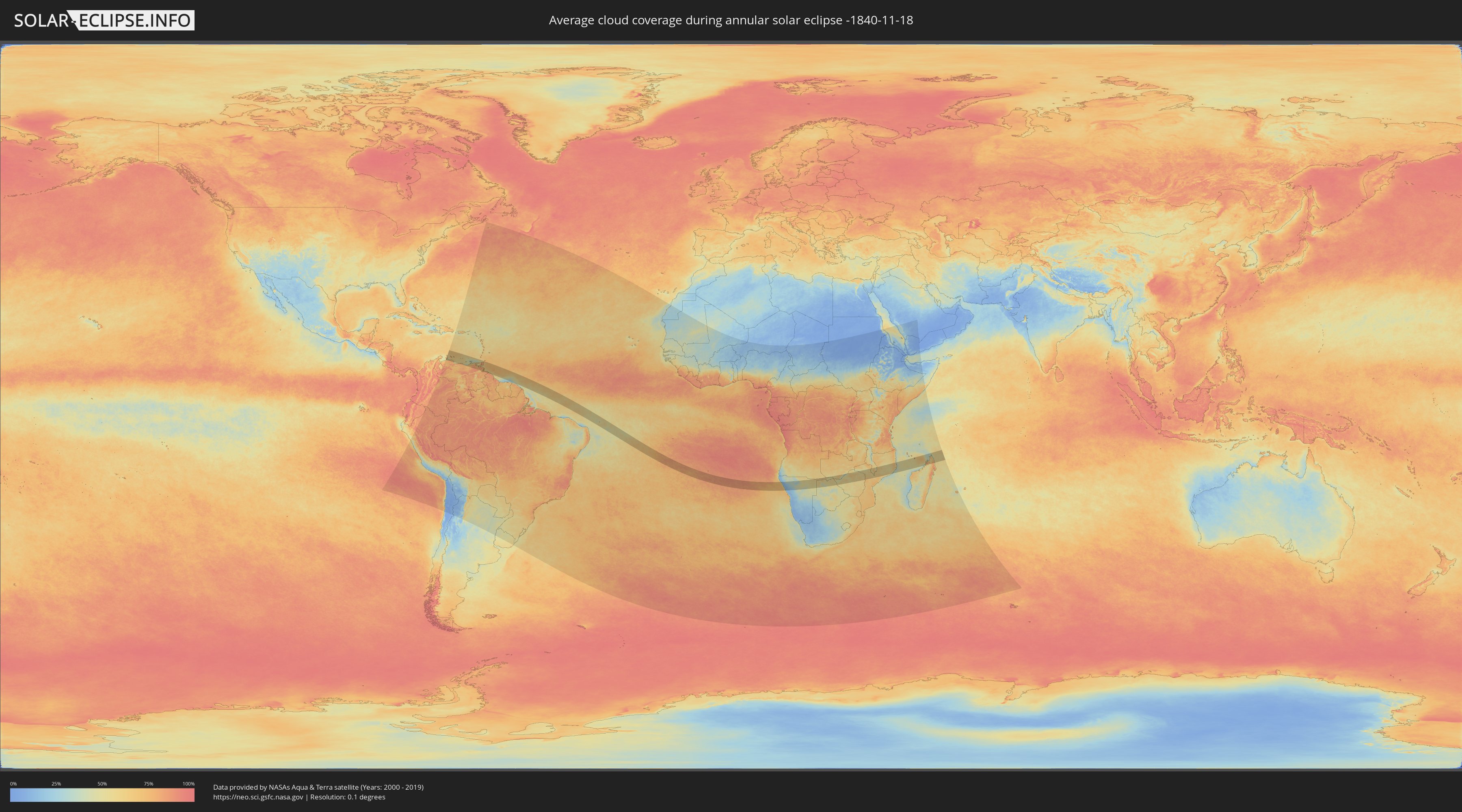
How will be the weather during the annular solar eclipse on 11/18/-1840?
Where is the best place to see the annular solar eclipse of 11/18/-1840?
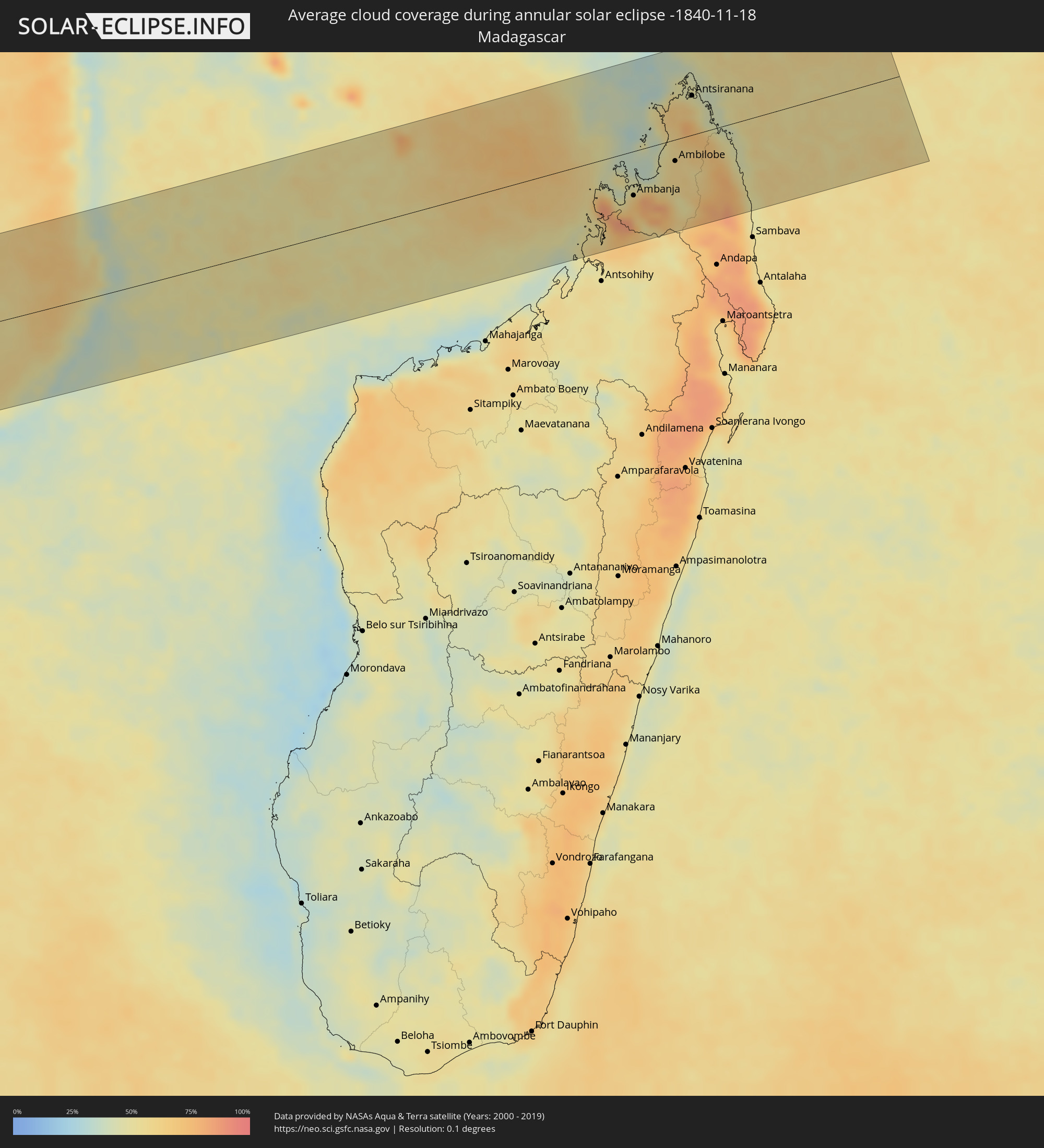
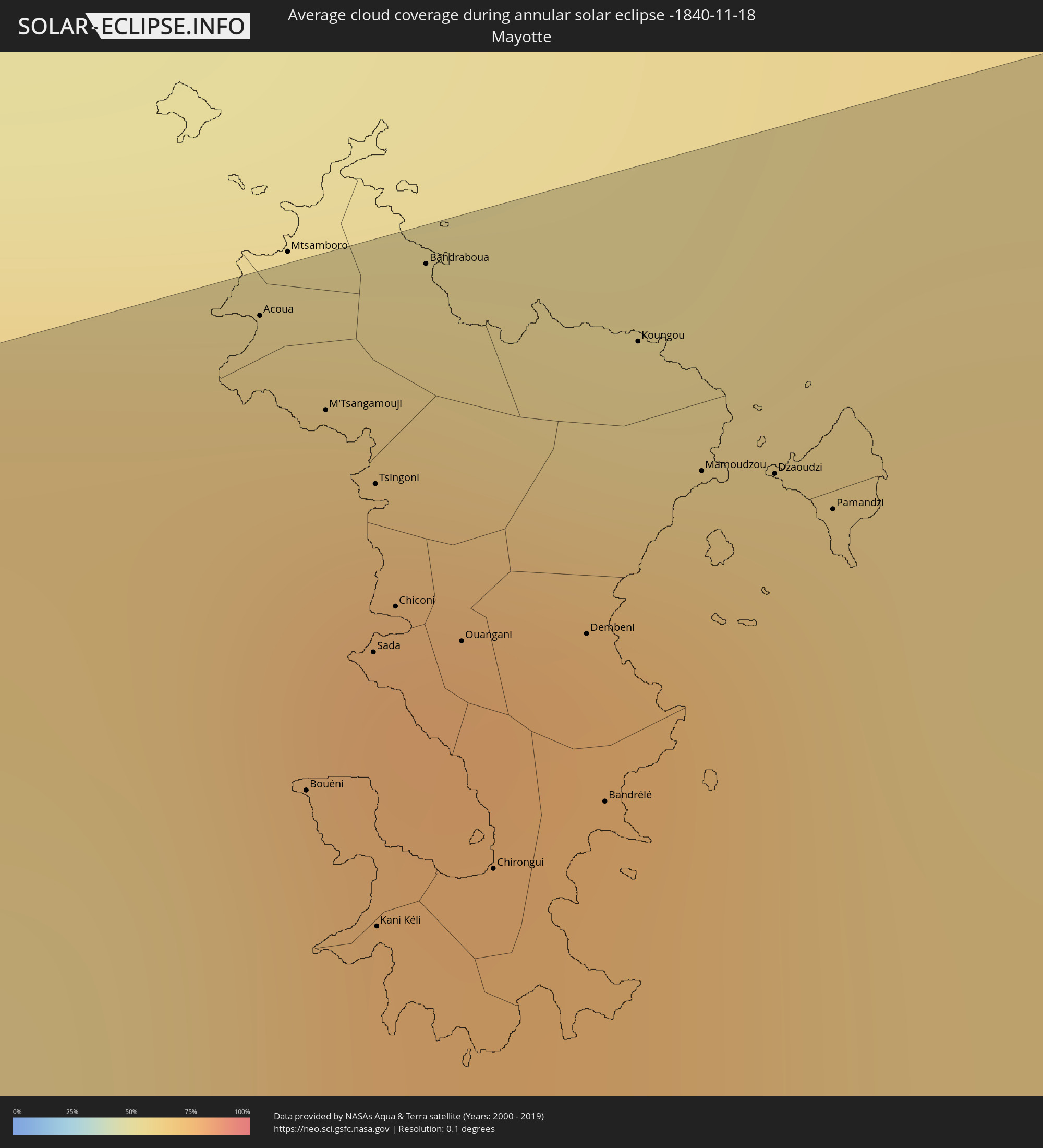
The following maps show the average cloud coverage for the day of the annular solar eclipse.
With the help of these maps, it is possible to find the place along the eclipse path, which has the best
chance of a cloudless sky.
Nevertheless, you should consider local circumstances and inform about the weather of your chosen
observation site.
The data is provided by NASAs satellites
AQUA and TERRA.
The cloud maps are averaged over a period of 19 years (2000 - 2019).
Detailed country maps
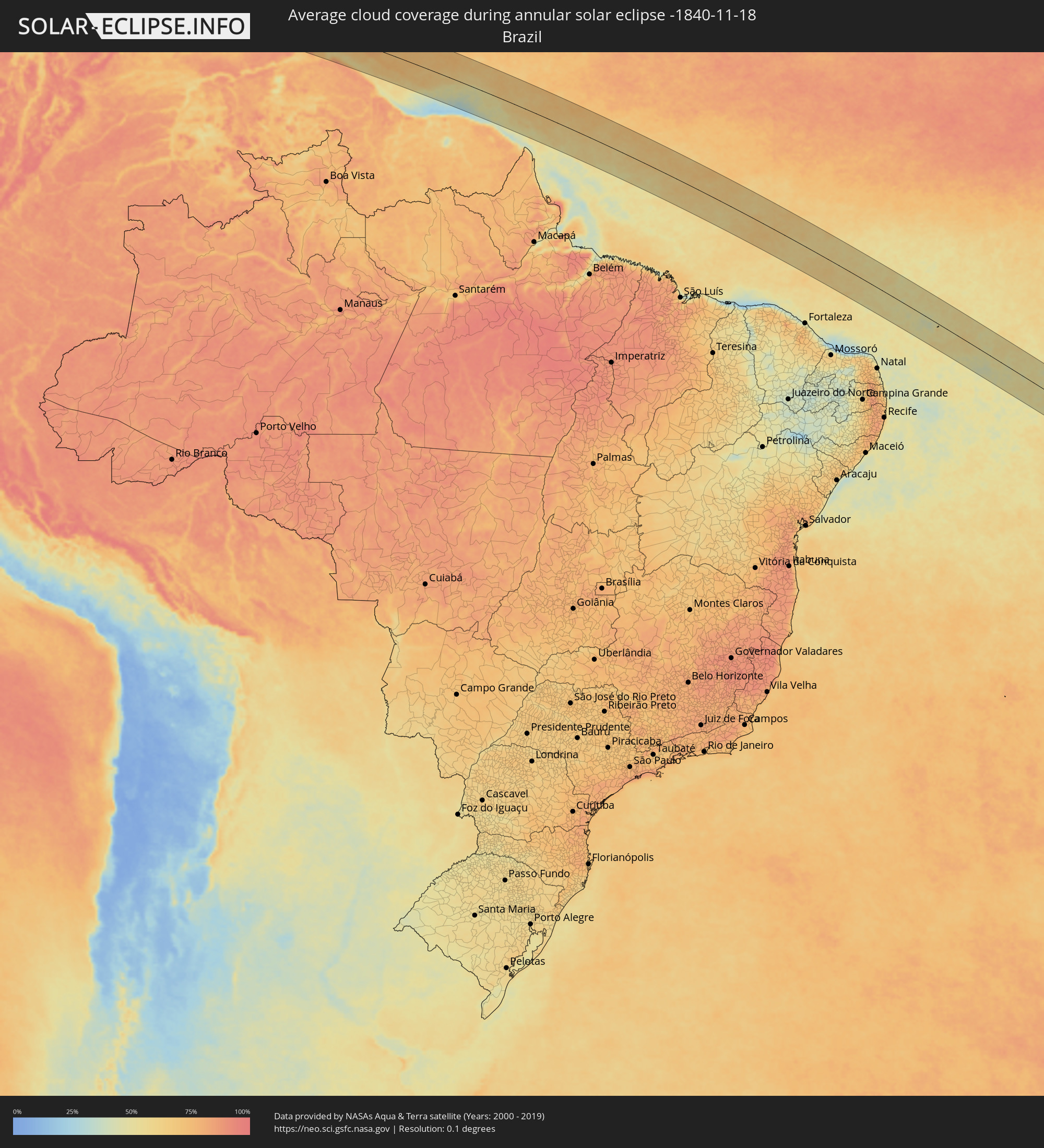 Brazil
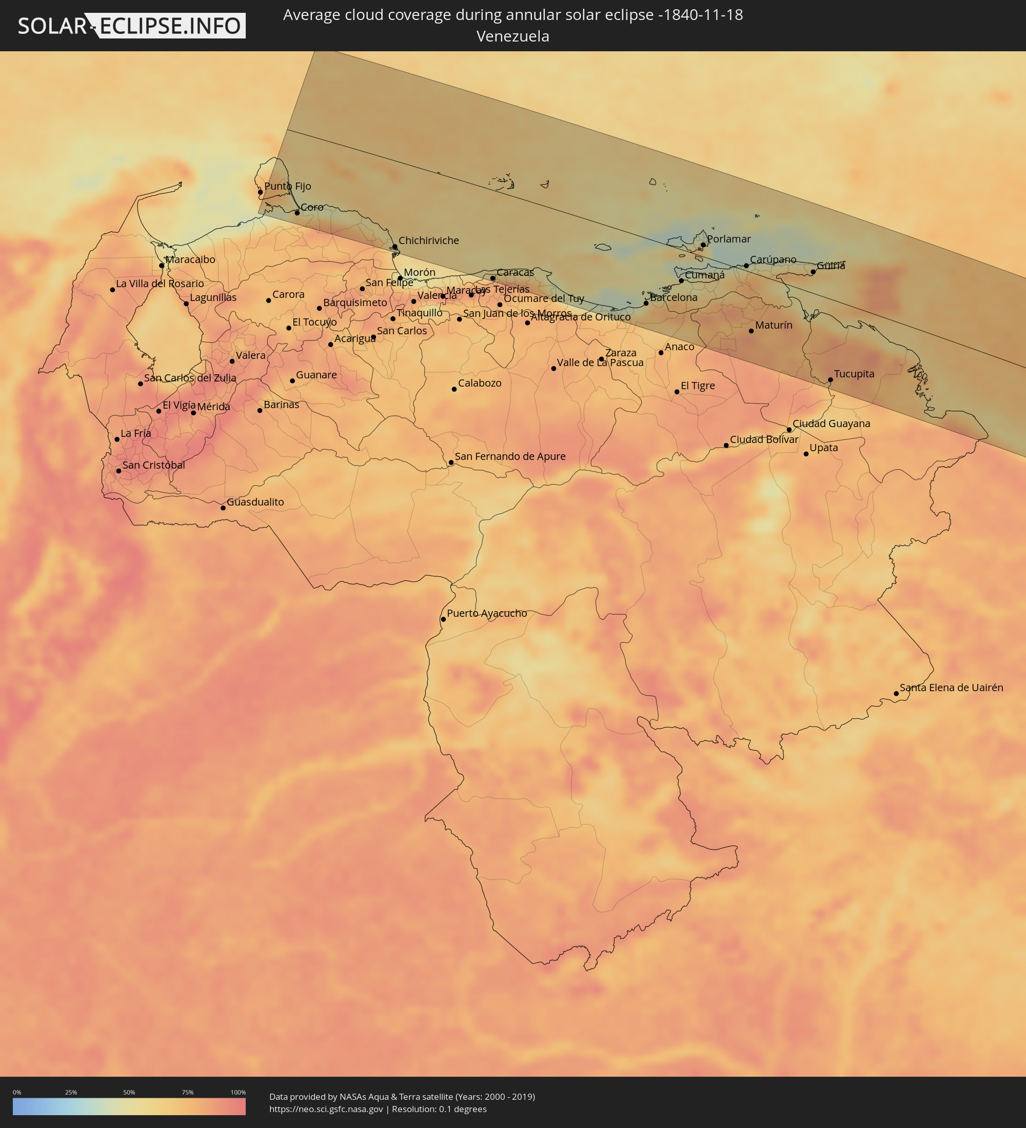 Venezuela
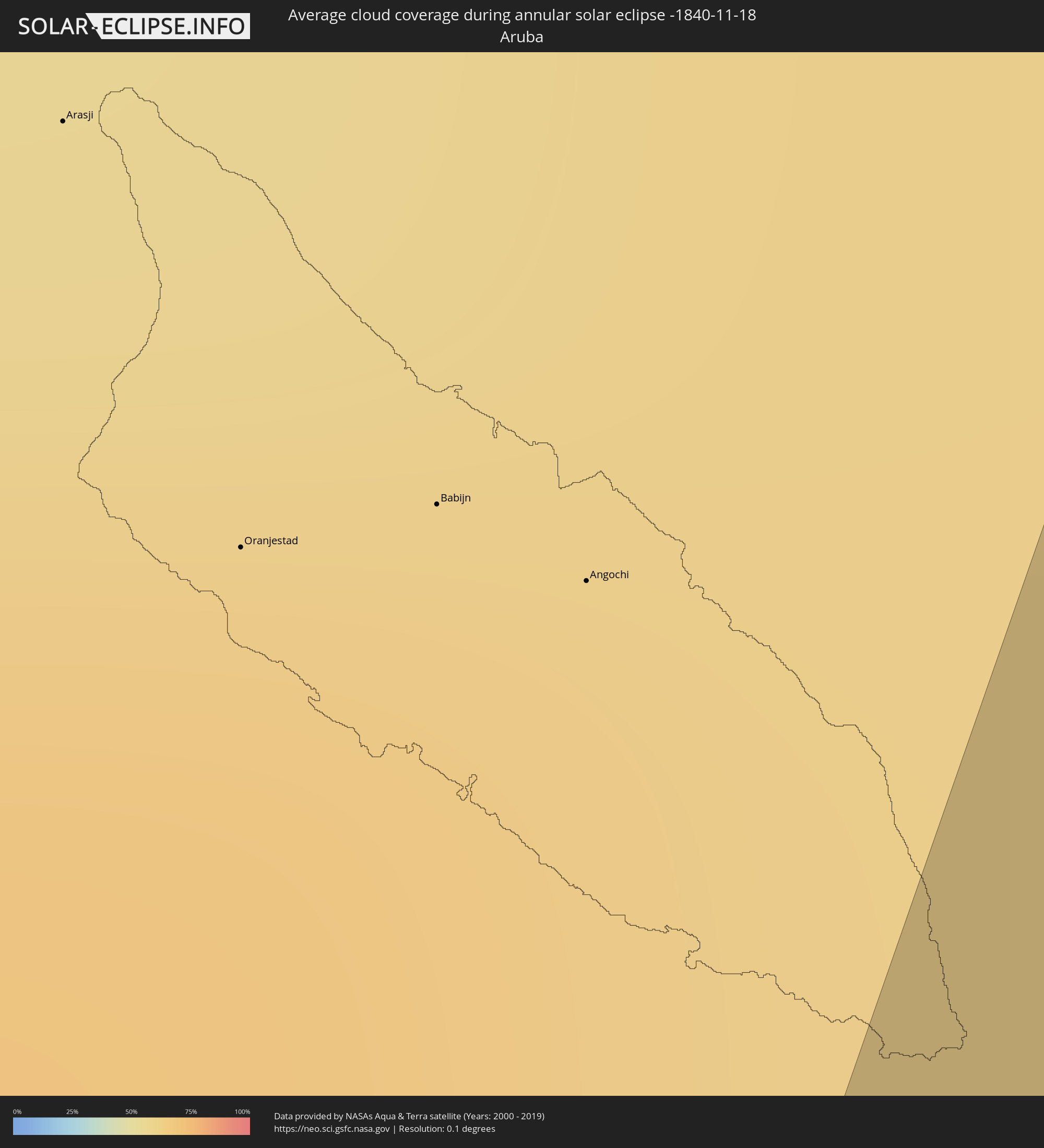 Aruba
Aruba
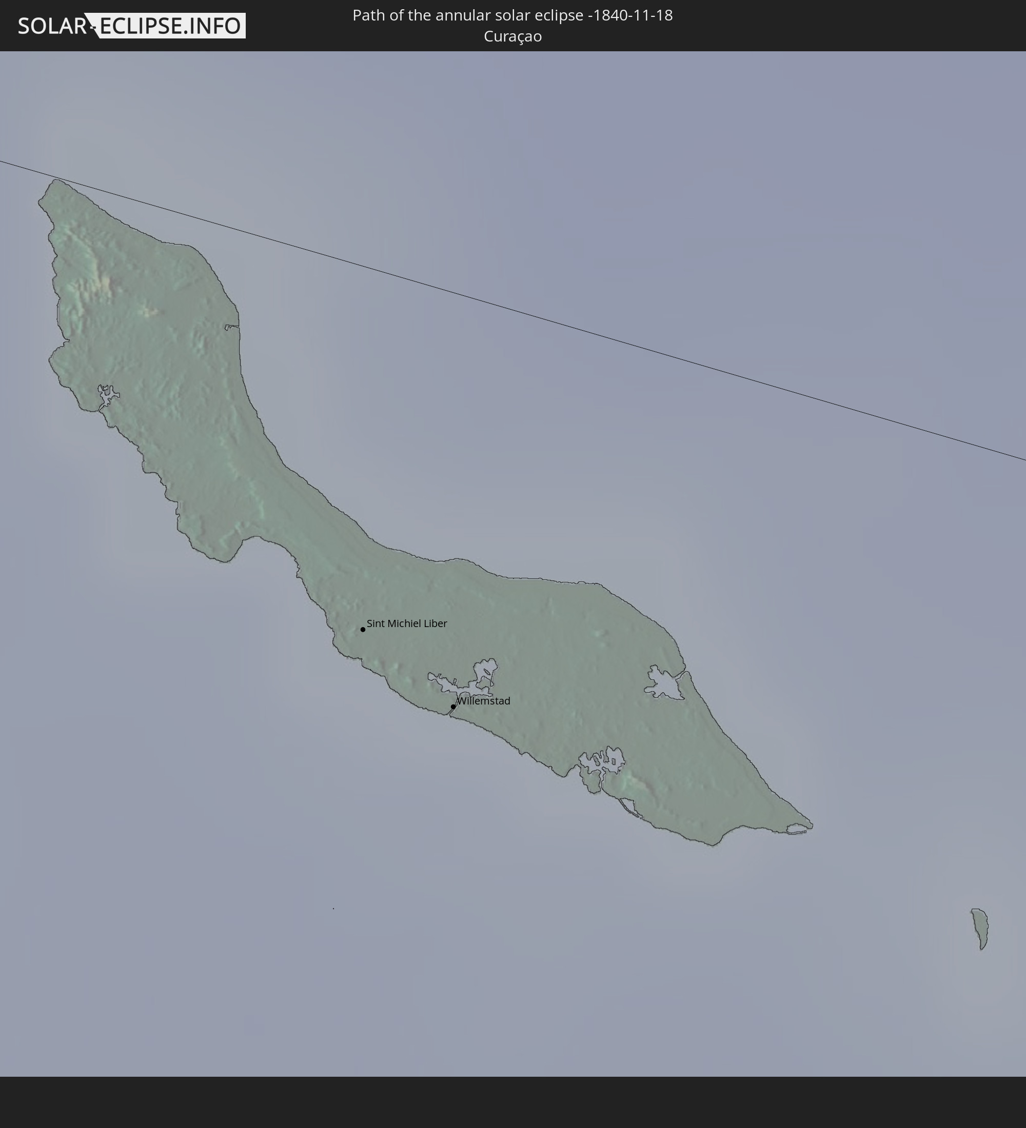
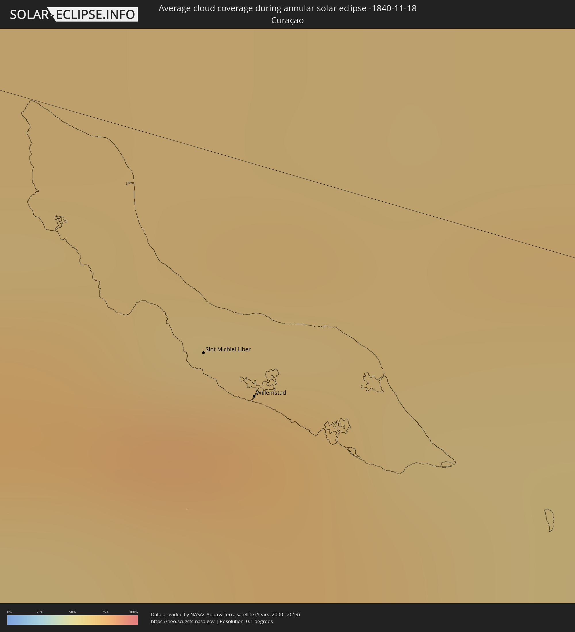 Curaçao
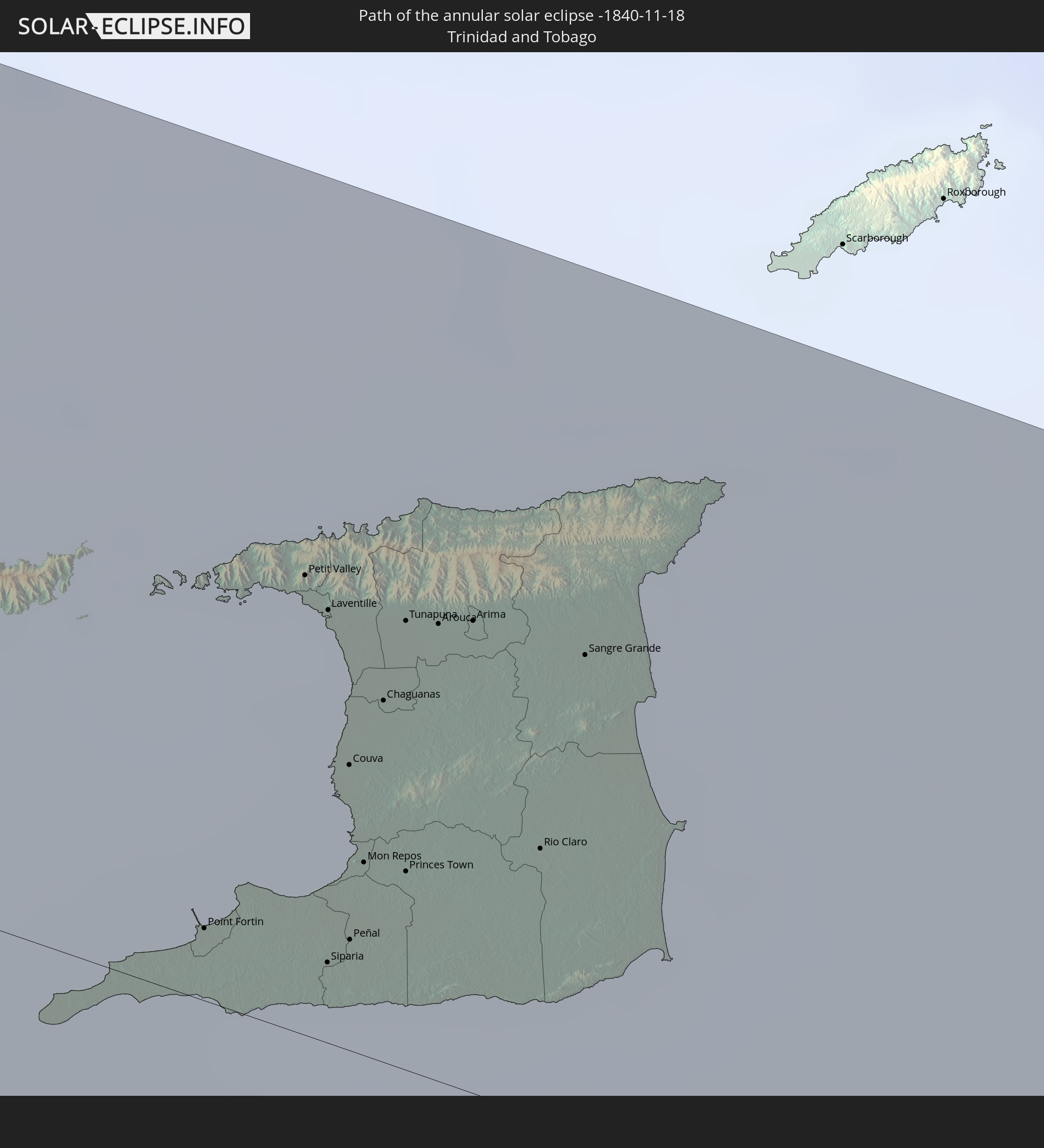
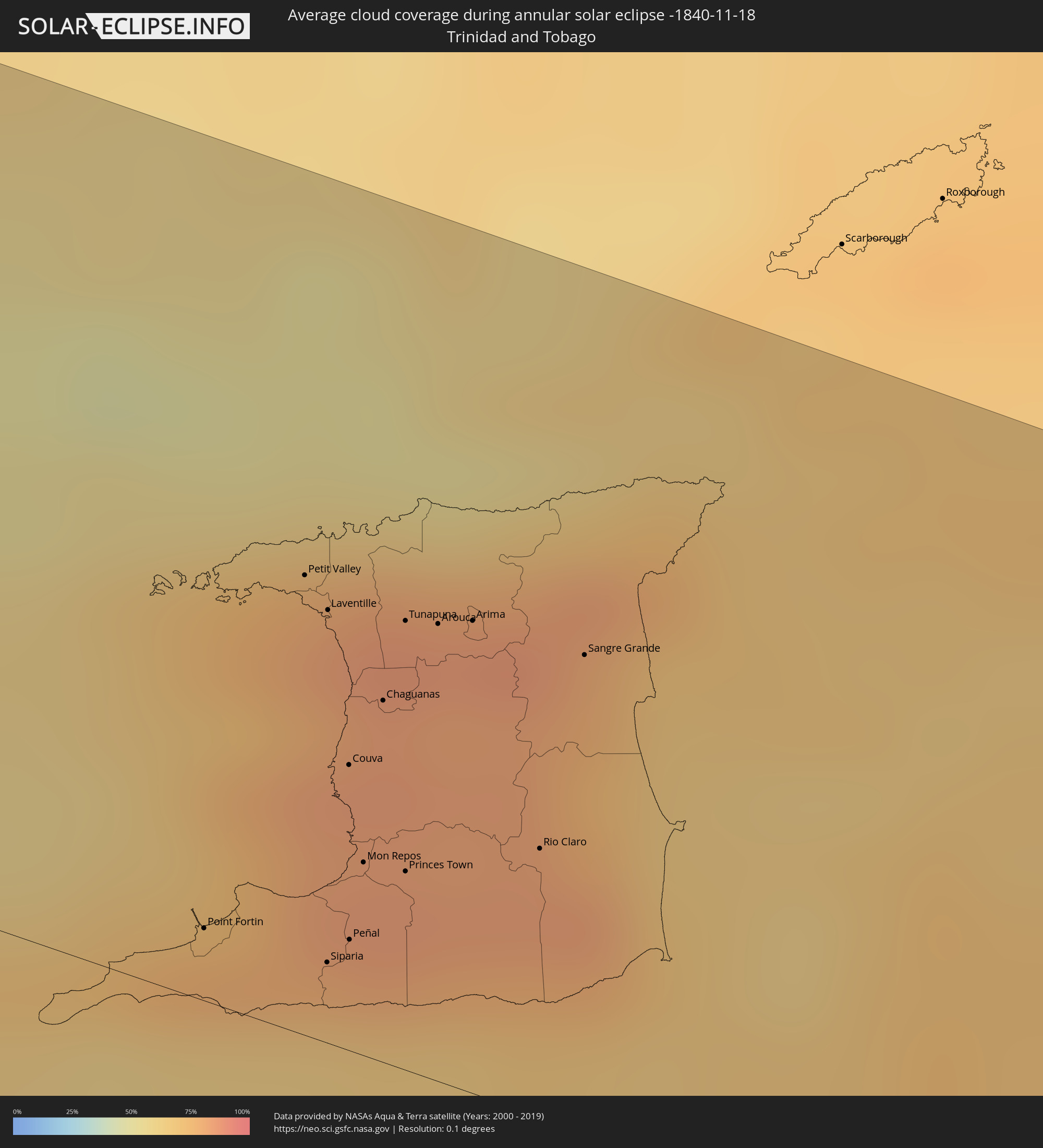 Trinidad and Tobago
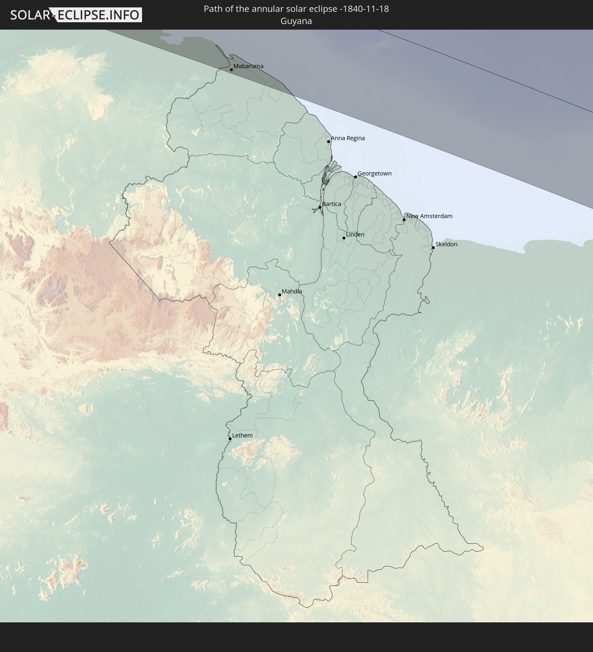
 Guyana
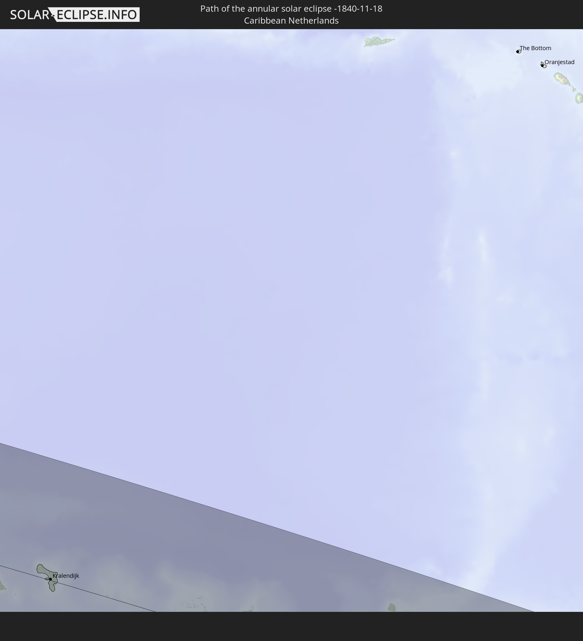
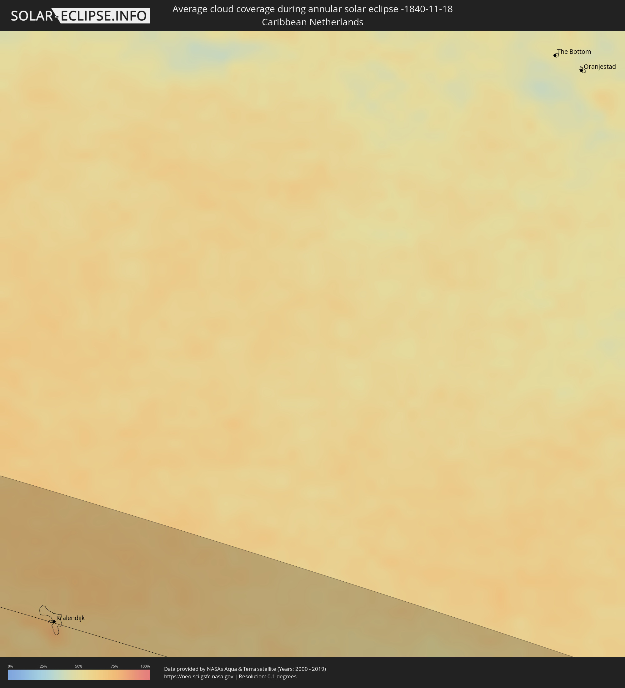 Caribbean Netherlands
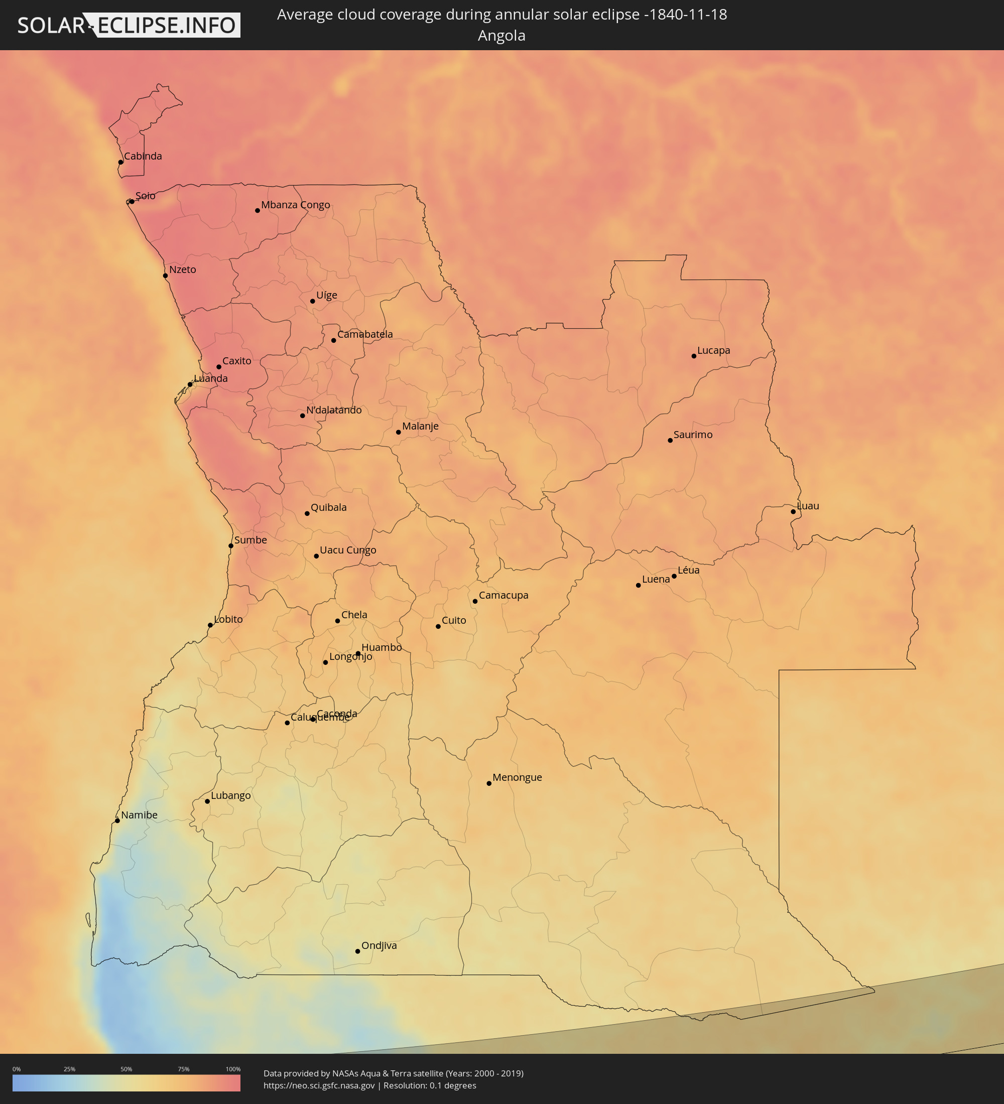 Angola
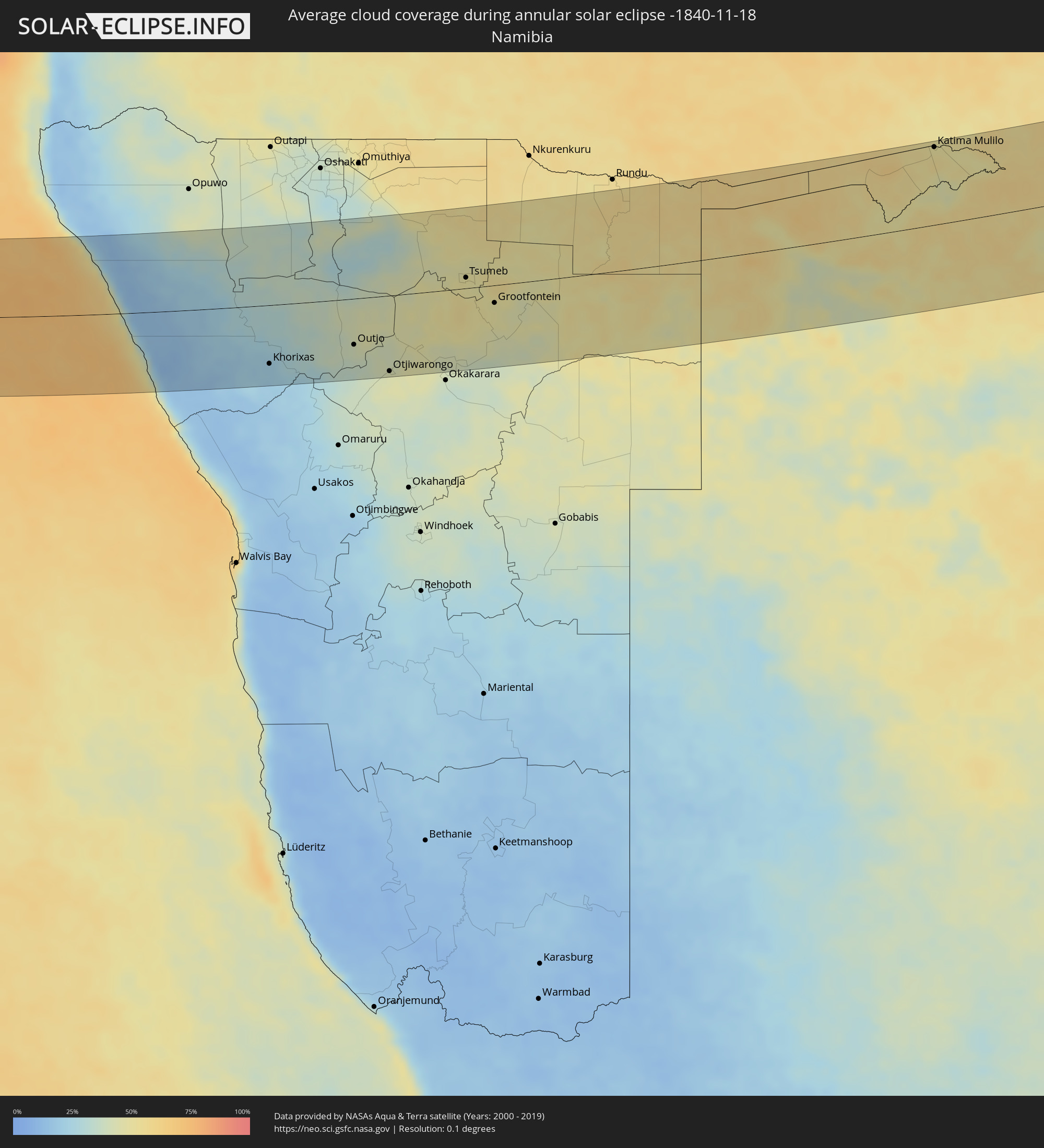 Namibia
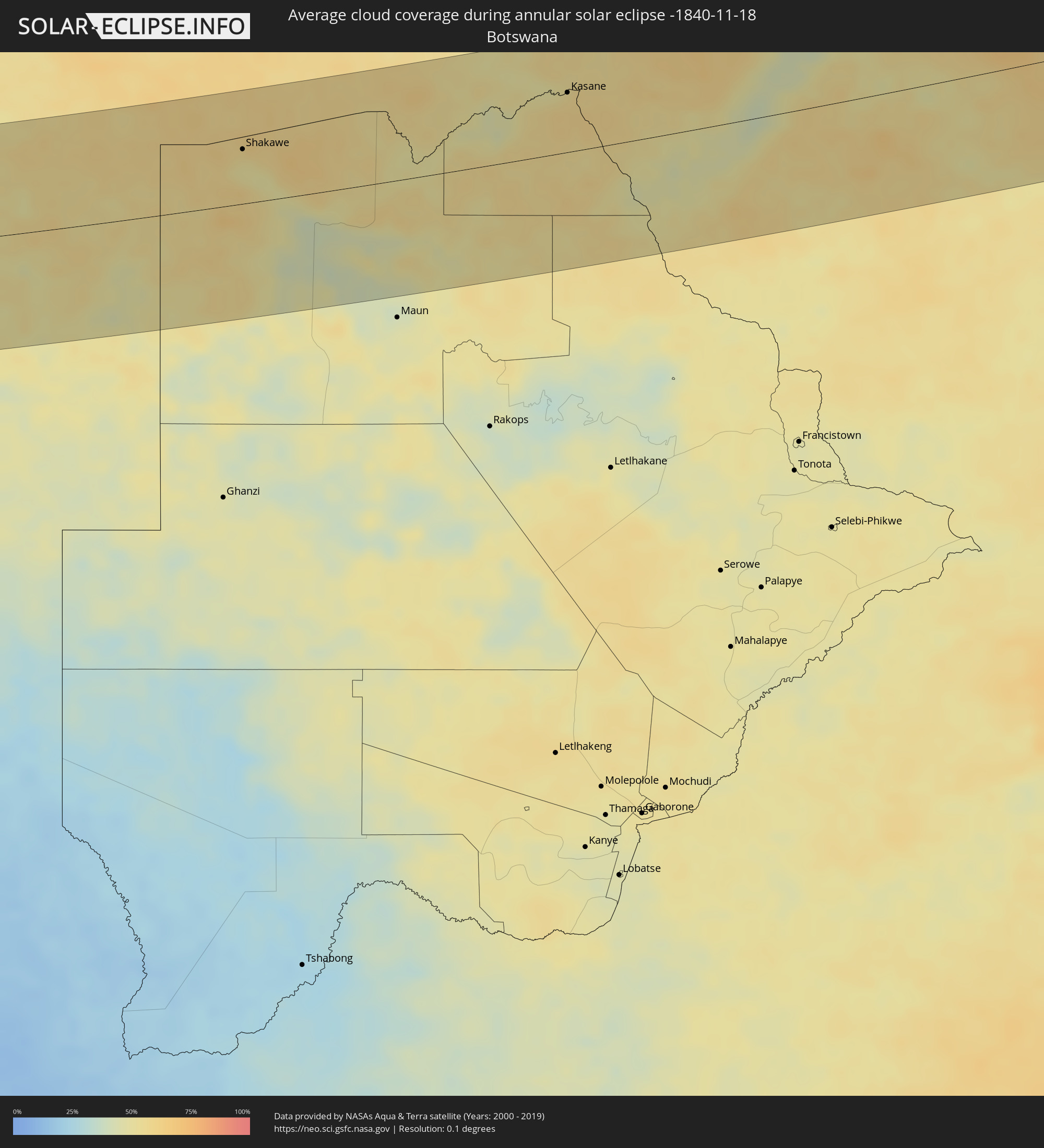 Botswana
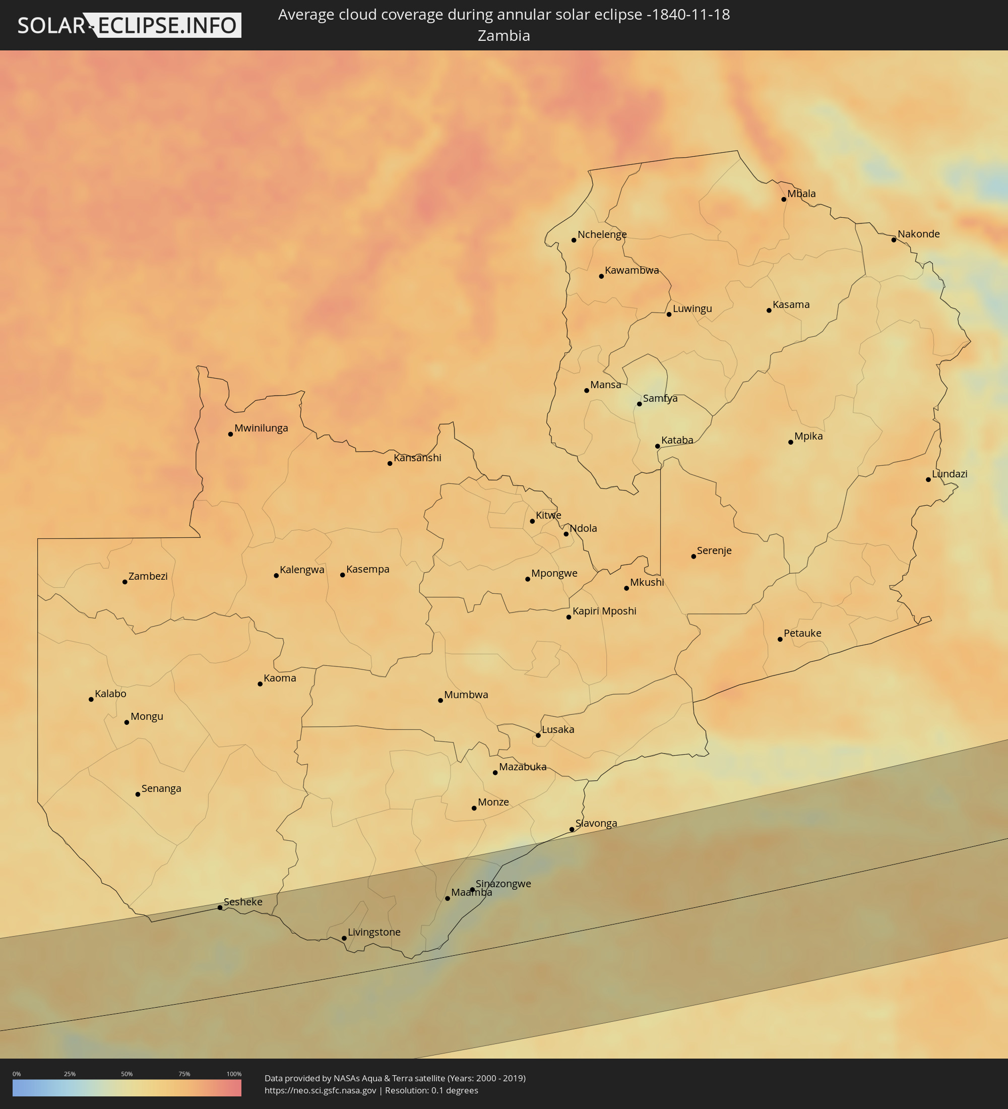 Zambia
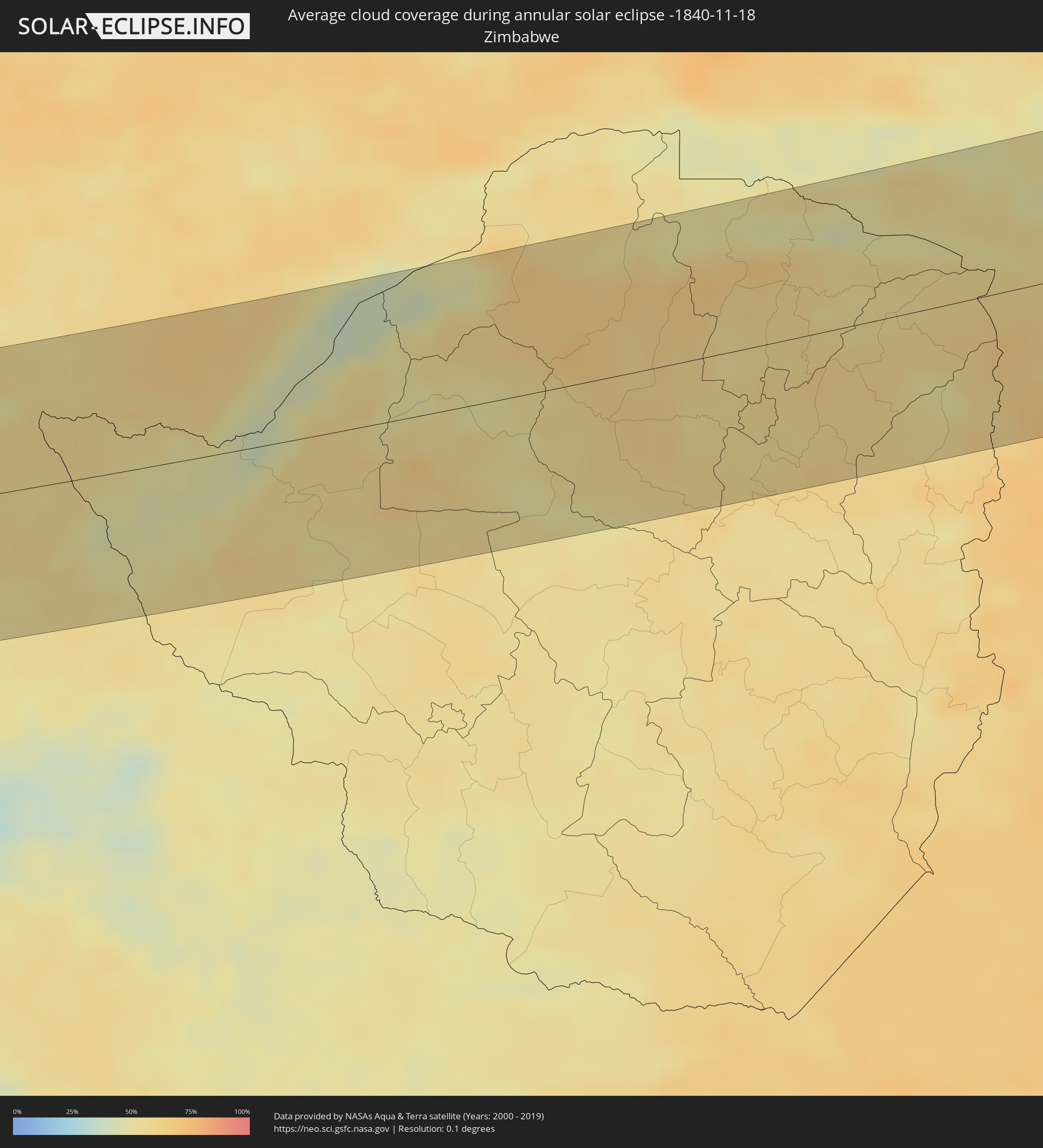 Zimbabwe
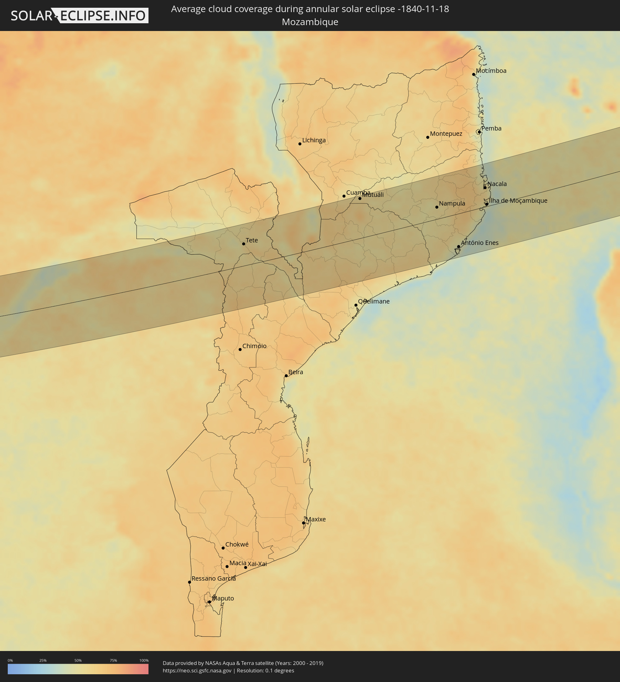 Mozambique
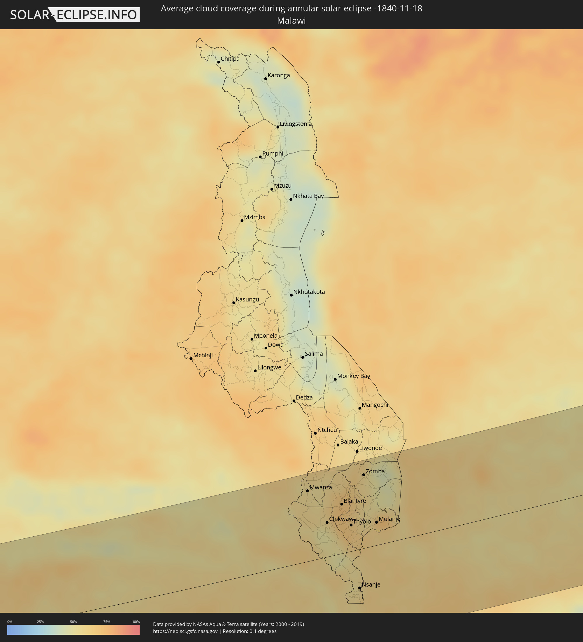 Malawi
 Madagascar
 Mayotte
Cities inside the path of the eclipse
The following table shows all locations with a population of more than 5,000 inside the eclipse path. Cities which have more than 100,000 inhabitants are marked bold. A click at the locations opens a detailed map.
| City | Type | Eclipse duration | Local time of max. eclipse | Distance to central line | Ø Cloud coverage |
|
Coro, Falcón
|
annular | - | 06:17:54 UTC-04:27 | 122 km | 69% |
 Sint Michiel Liber
|
annular | - | 06:09:32 UTC-04:35 | 21 km | 77% |
|
Willemstad
|
annular | - | 06:09:33 UTC-04:35 | 24 km | 70% |
 Kralendijk, Bonaire
|
annular | - | 06:09:31 UTC-04:35 | 1 km | 76% |
|
Catia La Mar, Vargas
|
annular | - | 06:18:07 UTC-04:27 | 125 km | 77% |
|
Maiquetía, Vargas
|
annular | - | 06:18:07 UTC-04:27 | 123 km | 77% |
|
Caracas, Capital
|
annular | - | 06:18:09 UTC-04:27 | 132 km | 80% |
|
Chacao, Miranda
|
annular | - | 06:18:09 UTC-04:27 | 131 km | 80% |
|
El Cafetal, Miranda
|
annular | - | 06:18:10 UTC-04:27 | 133 km | 82% |
|
Los Dos Caminos, Miranda
|
annular | - | 06:18:09 UTC-04:27 | 130 km | 82% |
|
La Dolorita, Miranda
|
annular | - | 06:18:09 UTC-04:27 | 129 km | 82% |
|
Caucagüito, Miranda
|
annular | - | 06:18:10 UTC-04:27 | 128 km | 83% |
|
Guatire, Miranda
|
annular | - | 06:18:10 UTC-04:27 | 123 km | 80% |
|
Barcelona, Anzoátegui
|
annular | - | 06:18:26 UTC-04:27 | 98 km | 70% |
|
Cumaná, Sucre
|
annular | - | 06:18:22 UTC-04:27 | 47 km | 53% |
|
Porlamar, Nueva Esparta
|
annular | - | 06:18:14 UTC-04:27 | 17 km | 60% |
|
Carúpano, Sucre
|
annular | - | 06:18:25 UTC-04:27 | 7 km | 66% |
|
Maturín, Monagas
|
annular | - | 06:18:47 UTC-04:27 | 88 km | 82% |
|
Güiria, Sucre
|
annular | - | 06:18:36 UTC-04:27 | 31 km | 58% |
|
Tucupita, Delta Amacuro
|
annular | - | 06:19:16 UTC-04:27 | 120 km | 73% |
|
Point Fortin, Point Fortin
|
annular | - | 06:40:28 UTC-04:06 | 11 km | 76% |
|
Petit Valley, Diego Martin
|
annular | - | 06:40:18 UTC-04:06 | 71 km | 82% |
|
Port of Spain, City of Port of Spain
|
annular | - | 06:40:19 UTC-04:06 | 68 km | 82% |
|
Siparia, Siparia
|
annular | - | 06:40:32 UTC-04:06 | 12 km | 65% |
|
Laventille, San Juan/Laventille
|
annular | - | 06:40:20 UTC-04:06 | 67 km | 78% |
|
San Fernando, City of San Fernando
|
annular | - | 06:40:29 UTC-04:06 | 29 km | 82% |
|
Peñal, Penal/Debe
|
annular | - | 06:40:31 UTC-04:06 | 17 km | 78% |
|
Marabella, City of San Fernando
|
annular | - | 06:40:28 UTC-04:06 | 32 km | 85% |
|
Mon Repos, City of San Fernando
|
annular | - | 06:40:29 UTC-04:06 | 30 km | 85% |
|
Chaguanas, Chaguanas
|
annular | - | 06:40:24 UTC-04:06 | 56 km | 84% |
|
Princes Town, Princes Town
|
annular | - | 06:40:30 UTC-04:06 | 31 km | 85% |
|
Tunapuna, Tunapuna/Piarco
|
annular | - | 06:40:21 UTC-04:06 | 69 km | 83% |
|
Paradise, Tunapuna/Piarco
|
annular | - | 06:40:21 UTC-04:06 | 72 km | 86% |
|
Arouca, Tunapuna/Piarco
|
annular | - | 06:40:22 UTC-04:06 | 70 km | 82% |
|
Arima, Borough of Arima
|
annular | - | 06:40:23 UTC-04:06 | 73 km | 82% |
|
Rio Claro, Mayaro
|
annular | - | 06:40:32 UTC-04:06 | 41 km | 83% |
|
Sangre Grande, Sangre Grande
|
annular | - | 06:40:26 UTC-04:06 | 73 km | 77% |
|
Mabaruma, Barima-Waini
|
annular | - | 06:55:14 UTC-03:52 | 128 km | 86% |
|
Khorixas, Kunene
|
annular | - | 15:33:11 UTC+01:30 | 86 km | 22% |
|
Outjo, Kunene
|
annular | - | 15:35:31 UTC+01:30 | 67 km | 41% |
|
Otjiwarongo, Otjozondjupa
|
annular | - | 15:36:20 UTC+01:30 | 110 km | 44% |
|
Tsumeb, Oshikoto
|
annular | - | 15:38:35 UTC+01:30 | 16 km | 49% |
|
Grootfontein, Otjozondjupa
|
annular | - | 15:39:12 UTC+01:30 | 26 km | 48% |
|
Shakawe, North-West
|
annular | - | 16:25:53 UTC+02:10 | 58 km | 50% |
|
Katima Mulilo, Zambezi
|
annular | - | 15:49:14 UTC+01:30 | 114 km | 51% |
|
Sesheke, Western
|
annular | - | 16:29:37 UTC+02:10 | 116 km | 51% |
|
Kasane, North-West
|
annular | - | 16:30:35 UTC+02:10 | 63 km | 58% |
|
Livingstone, Southern
|
annular | - | 16:31:27 UTC+02:10 | 48 km | 56% |
|
Maamba, Southern
|
annular | - | 16:33:08 UTC+02:10 | 75 km | 44% |
|
Sinazongwe, Southern
|
annular | - | 16:33:31 UTC+02:10 | 80 km | 43% |
|
Tete, Tete
|
annular | - | 16:39:34 UTC+02:10 | 66 km | 55% |
|
Mwanza, Southern Region
|
annular | - | 16:40:26 UTC+02:10 | 104 km | 57% |
|
Chikwawa, Southern Region
|
annular | - | 16:40:28 UTC+02:10 | 50 km | 51% |
|
Blantyre, Southern Region
|
annular | - | 16:40:42 UTC+02:10 | 72 km | 68% |
|
Thyolo, Southern Region
|
annular | - | 16:40:41 UTC+02:10 | 38 km | 67% |
|
Nsanje, Southern Region
|
annular | - | 16:40:26 UTC+02:10 | 57 km | 57% |
|
Luchenza, Southern Region
|
annular | - | 16:40:49 UTC+02:10 | 41 km | 59% |
|
Zomba, Southern Region
|
annular | - | 16:41:03 UTC+02:10 | 108 km | 58% |
|
Mulanje, Southern Region
|
annular | - | 16:40:56 UTC+02:10 | 33 km | 62% |
|
Mutuáli, Nampula
|
annular | - | 16:42:15 UTC+02:10 | 121 km | 58% |
|
Nampula, Nampula
|
annular | - | 16:43:19 UTC+02:10 | 36 km | 54% |
|
António Enes, Nampula
|
annular | - | 16:43:11 UTC+02:10 | 102 km | 47% |
|
Nacala, Nampula
|
annular | - | 16:44:07 UTC+02:10 | 58 km | 56% |
|
Ilha de Moçambique, Nampula
|
annular | - | 16:43:58 UTC+02:10 | 5 km | 49% |
|
Acoua, Acoua
|
annular | - | 17:02:53 UTC+02:27 | 134 km | 78% |
|
Bouéni, Bouéni
|
annular | - | 17:02:50 UTC+02:27 | 114 km | 71% |
|
M'Tsangamouji, M'Tsangamouji
|
annular | - | 17:02:53 UTC+02:27 | 130 km | 76% |
|
Sada, Sada
|
annular | - | 17:02:52 UTC+02:27 | 119 km | 71% |
|
Tsingoni, Tsingoni
|
annular | - | 17:02:53 UTC+02:27 | 126 km | 76% |
|
Kani Kéli, Kani-Kéli
|
annular | - | 17:02:50 UTC+02:27 | 108 km | 59% |
|
Chiconi, Chiconi
|
annular | - | 17:02:52 UTC+02:27 | 121 km | 76% |
|
Bandraboua, Bandraboua
|
annular | - | 17:02:54 UTC+02:27 | 134 km | 78% |
|
Ouangani, Ouangani
|
annular | - | 17:02:52 UTC+02:27 | 119 km | 76% |
|
Chirongui, Chirongui
|
annular | - | 17:02:51 UTC+02:27 | 109 km | 71% |
|
Dembeni, Dembeni
|
annular | - | 17:02:53 UTC+02:27 | 118 km | 75% |
|
Bandrélé, Bandrele
|
annular | - | 17:02:52 UTC+02:27 | 111 km | 67% |
|
Koungou, Koungou
|
annular | - | 17:02:55 UTC+02:27 | 129 km | 74% |
|
Mamoudzou, Mamoudzou
|
annular | - | 17:02:54 UTC+02:27 | 123 km | 75% |
|
Dzaoudzi, Dzaoudzi
|
annular | - | 17:02:54 UTC+02:27 | 122 km | 64% |
|
Pamandzi, Pamandzi
|
annular | - | 17:02:55 UTC+02:27 | 120 km | 64% |
|
Hell-Ville, Diana
|
annular | - | 17:03:07 UTC+02:27 | 31 km | 48% |
|
Ambanja, Diana
|
annular | - | 17:03:03 UTC+02:27 | 67 km | 73% |
|
Antsohimbondrona, Diana
|
annular | - | 17:03:15 UTC+02:27 | 14 km | 52% |
|
Ambarakaraka, Diana
|
annular | - | 17:03:08 UTC+02:27 | 59 km | 60% |
|
Ambilobe, Diana
|
annular | - | 17:03:14 UTC+02:27 | 32 km | 59% |
|
Antsiranana, Diana
|
annular | - | 17:03:30 UTC+02:27 | 59 km | 52% |
|
Sadjoavato, Diana
|
annular | - | 17:03:24 UTC+02:27 | 21 km | 67% |