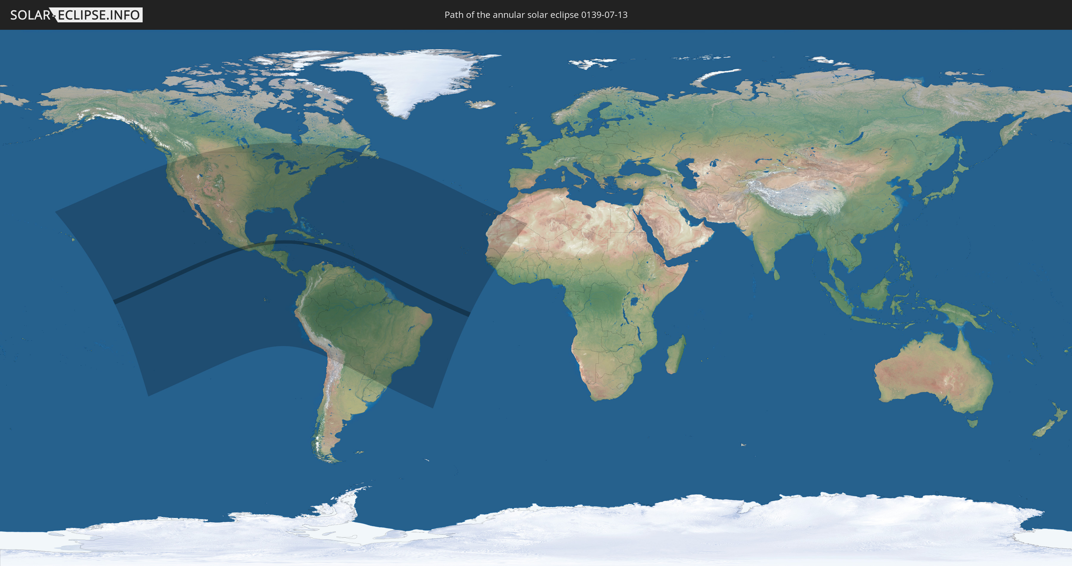
Annular solar eclipse of 07/13/0139
| Day of week: | Monday |
| Maximum duration of eclipse: | 04m02s |
| Maximum width of eclipse path: | 116 km |
| Saros cycle: | 77 |
| Coverage: | 96.8% |
| Magnitude: | 0.9677 |
| Gamma: | -0.0655 |
Wo kann man die Sonnenfinsternis vom 07/13/0139 sehen?
Die Sonnenfinsternis am 07/13/0139 kann man in 62 Ländern als partielle Sonnenfinsternis beobachten.
Der Finsternispfad verläuft durch 8 Länder. Nur in diesen Ländern ist sie als annular Sonnenfinsternis zu sehen.
In den folgenden Ländern ist die Sonnenfinsternis annular zu sehen
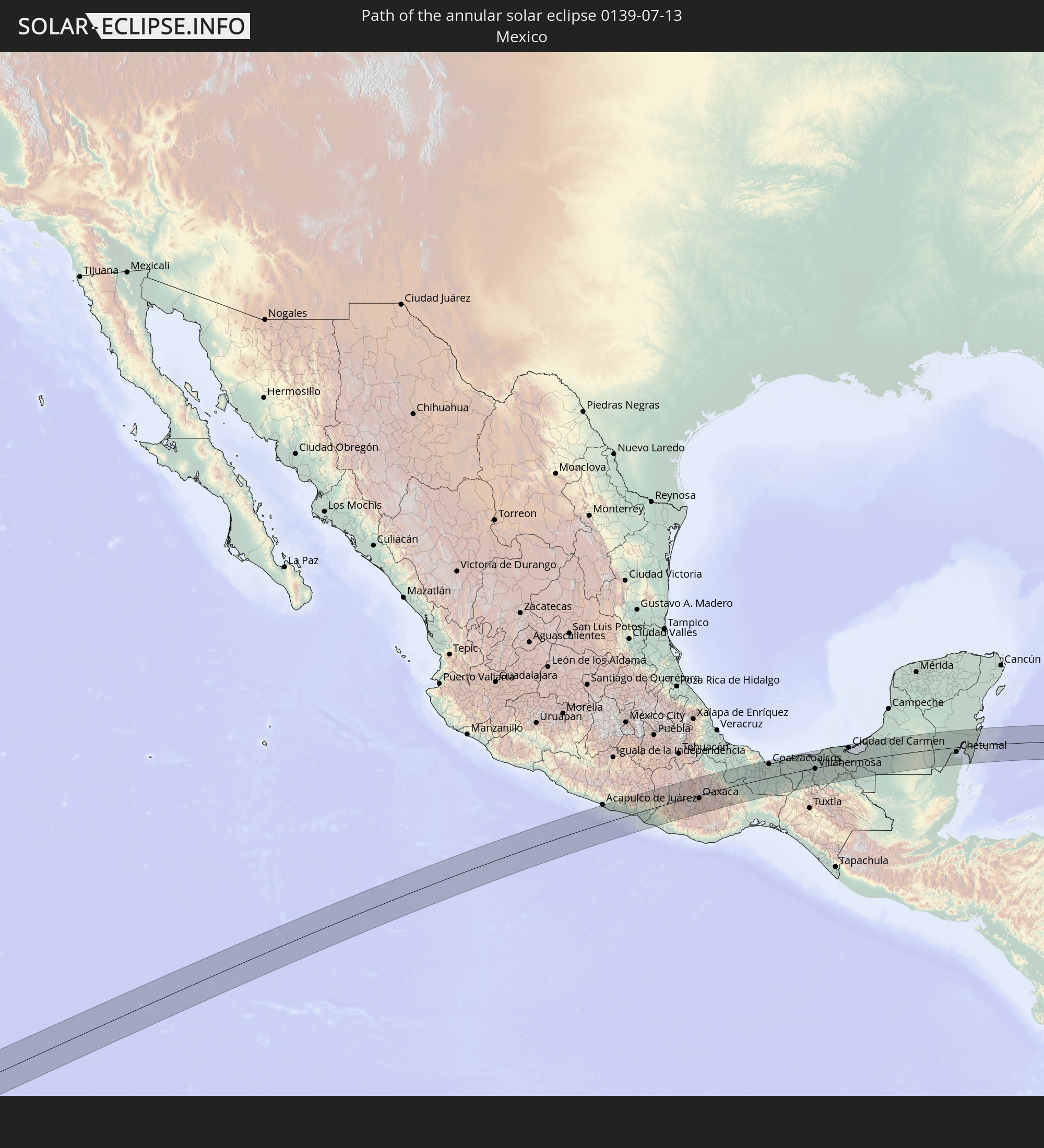 Mexico
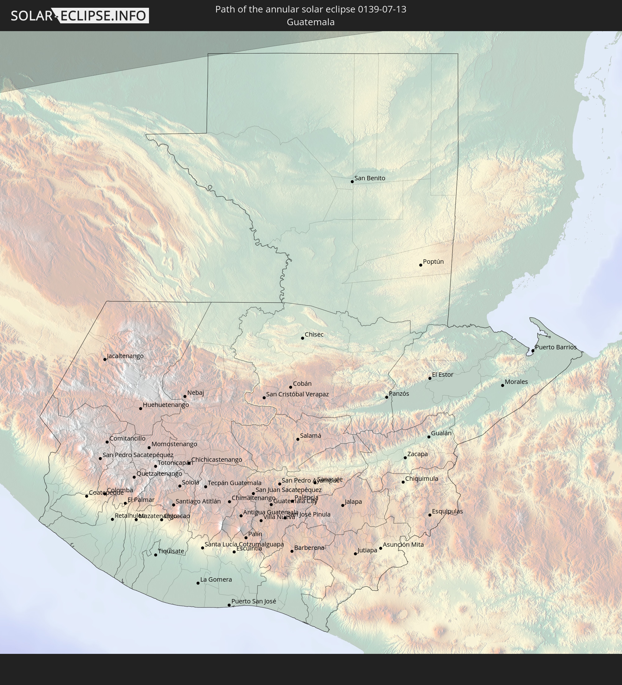 Guatemala
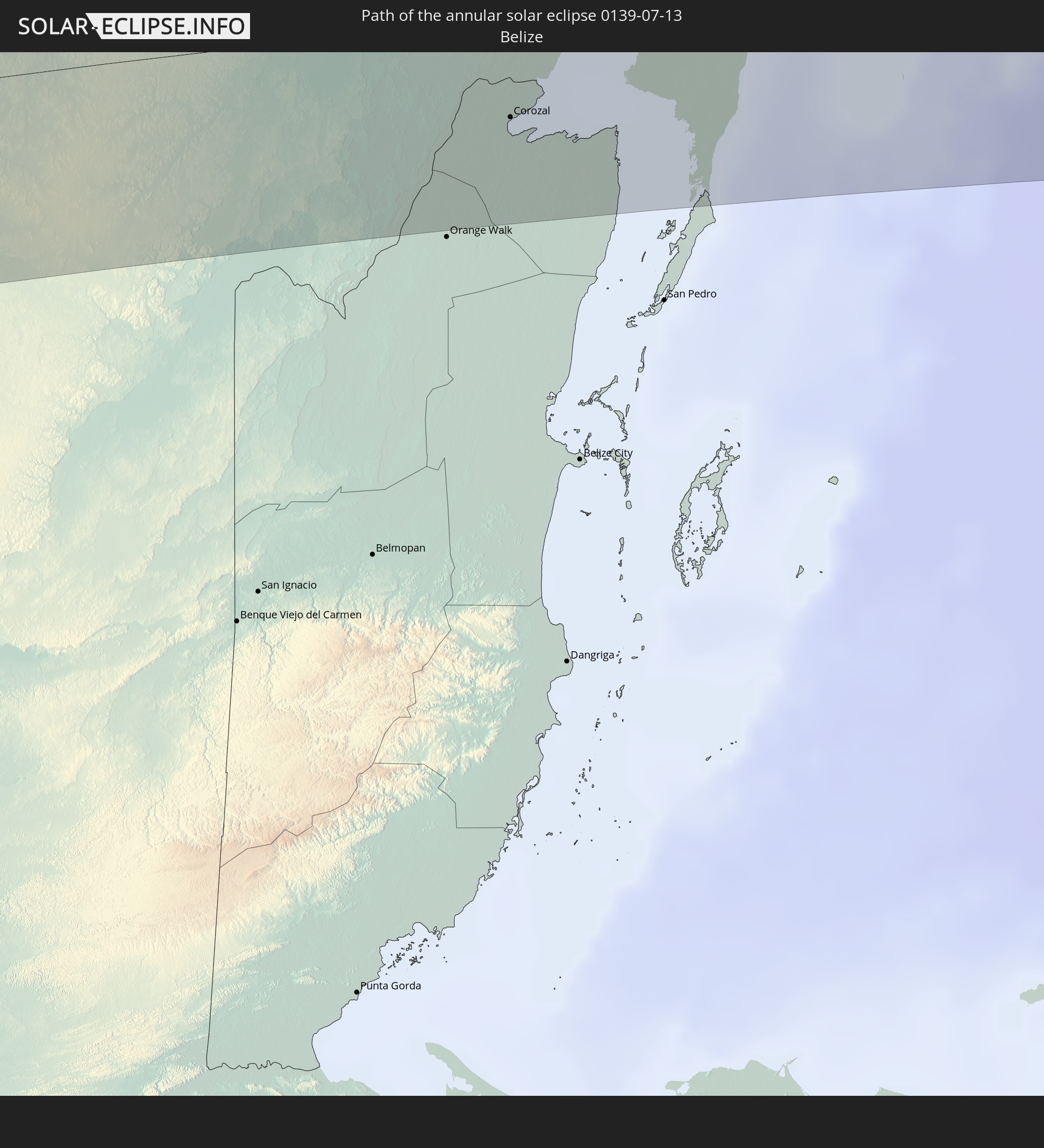 Belize
 Jamaica
 Haiti
Haiti
 Dominican Republic
 Grenada
 Saint Vincent and the Grenadines
In den folgenden Ländern ist die Sonnenfinsternis partiell zu sehen
 United States
 United States Minor Outlying Islands
 Canada
 Pitcairn Islands
 Mexico
 Chile
Chile
 Guatemala
 Ecuador
 El Salvador
 Honduras
 Belize
 Nicaragua
 Costa Rica
 Cuba
Cuba
 Panama
 Colombia
 Cayman Islands
 Peru
Peru
 The Bahamas
 Jamaica
 Haiti
Haiti
 Brazil
 Argentina
 Venezuela
 Turks and Caicos Islands
 Dominican Republic
 Aruba
Aruba
 Bolivia
 Puerto Rico
 United States Virgin Islands
 Bermuda
 British Virgin Islands
 Anguilla
 Collectivity of Saint Martin
 Saint Barthélemy
 Saint Kitts and Nevis
 Paraguay
 Antigua and Barbuda
 Montserrat
 Trinidad and Tobago
 Guadeloupe
 Grenada
 Dominica
 Saint Vincent and the Grenadines
 Guyana
 Martinique
 Saint Lucia
 Barbados
 Suriname
 Saint Pierre and Miquelon
 French Guiana
 Portugal
 Cabo Verde
 Spain
Spain
 Senegal
 Mauritania
 The Gambia
 Guinea-Bissau
 Guinea
 Morocco
 Mali
Mali
 Algeria
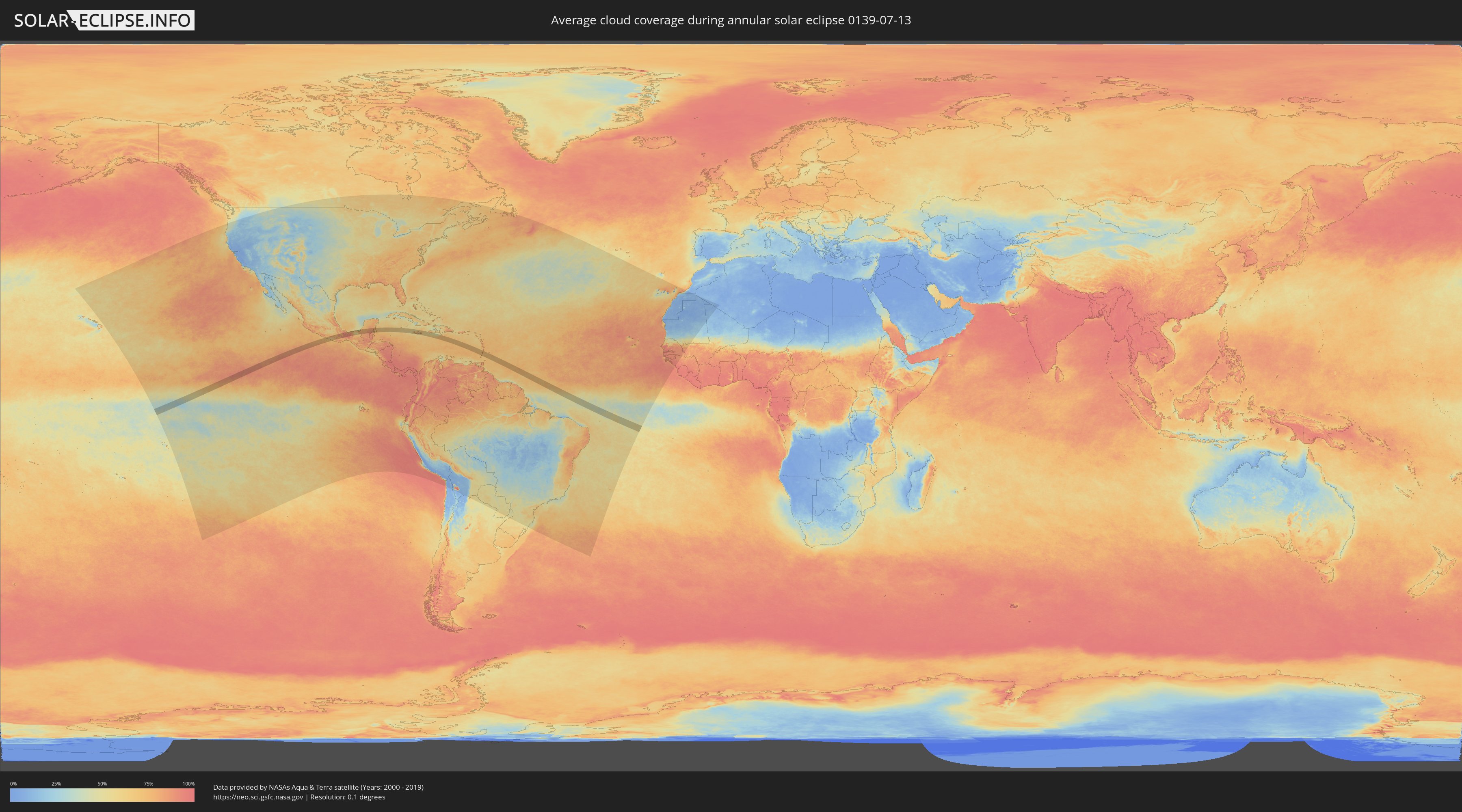
How will be the weather during the annular solar eclipse on 07/13/0139?
Where is the best place to see the annular solar eclipse of 07/13/0139?
The following maps show the average cloud coverage for the day of the annular solar eclipse.
With the help of these maps, it is possible to find the place along the eclipse path, which has the best
chance of a cloudless sky.
Nevertheless, you should consider local circumstances and inform about the weather of your chosen
observation site.
The data is provided by NASAs satellites
AQUA and TERRA.
The cloud maps are averaged over a period of 19 years (2000 - 2019).

Detailed country maps
 Mexico
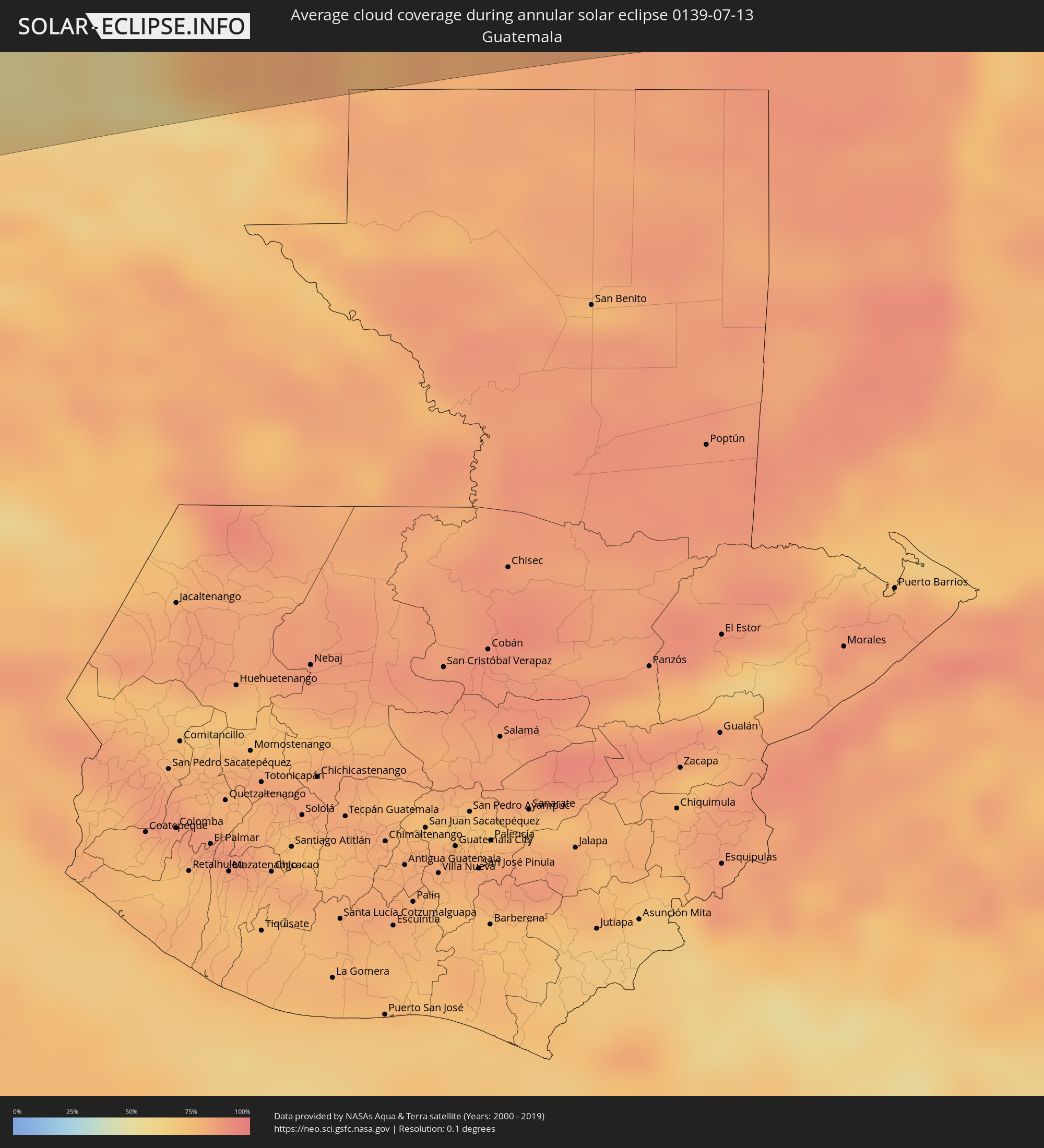 Guatemala
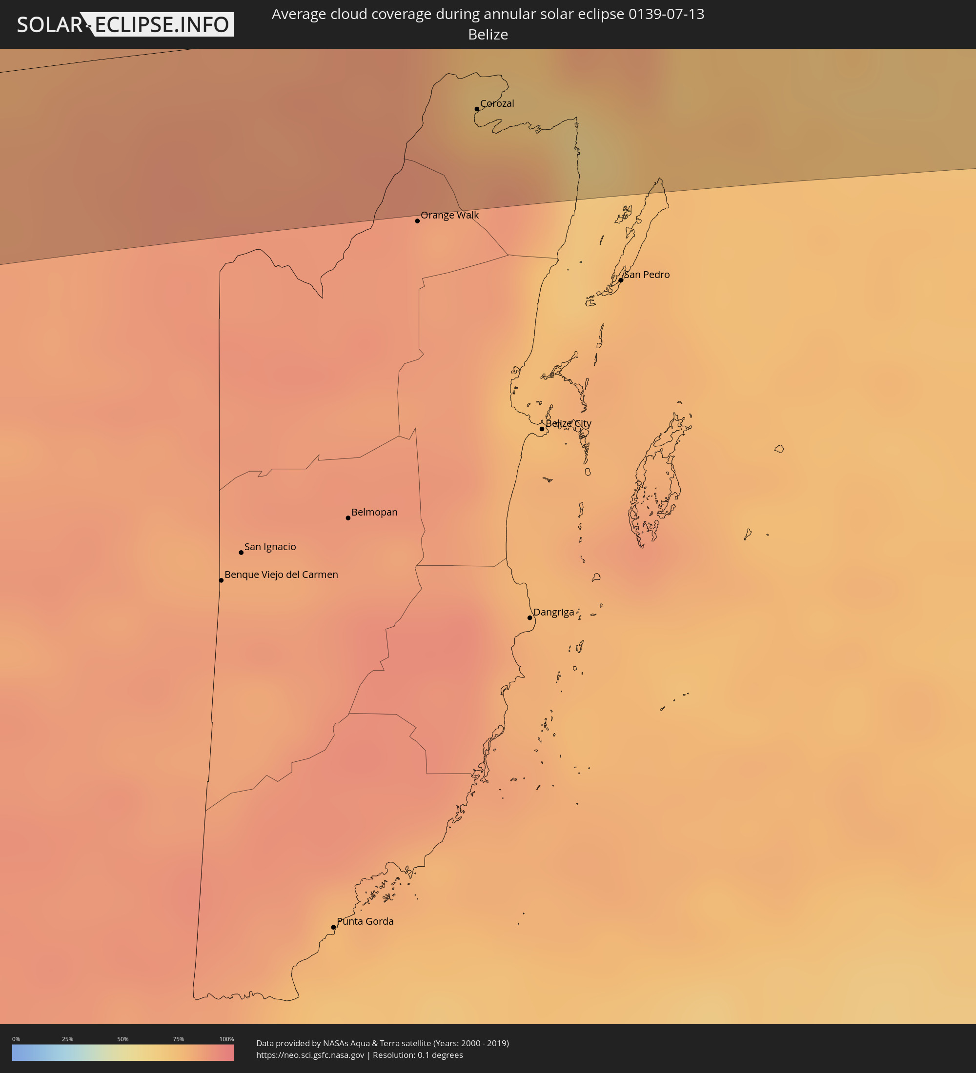 Belize
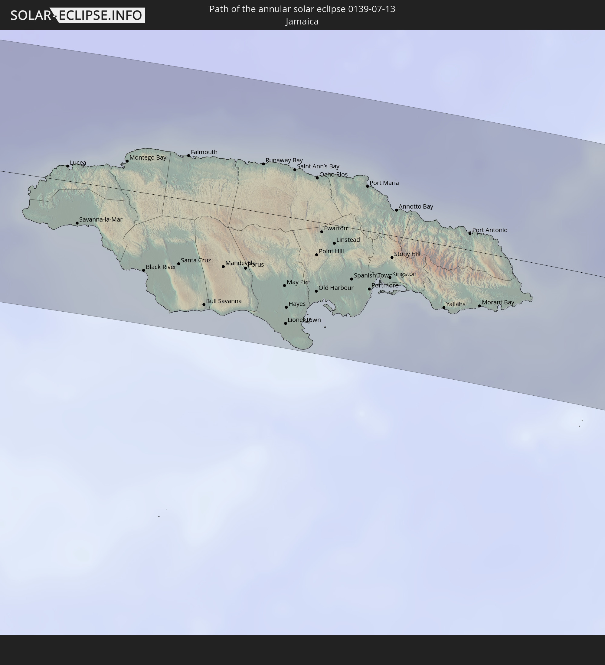
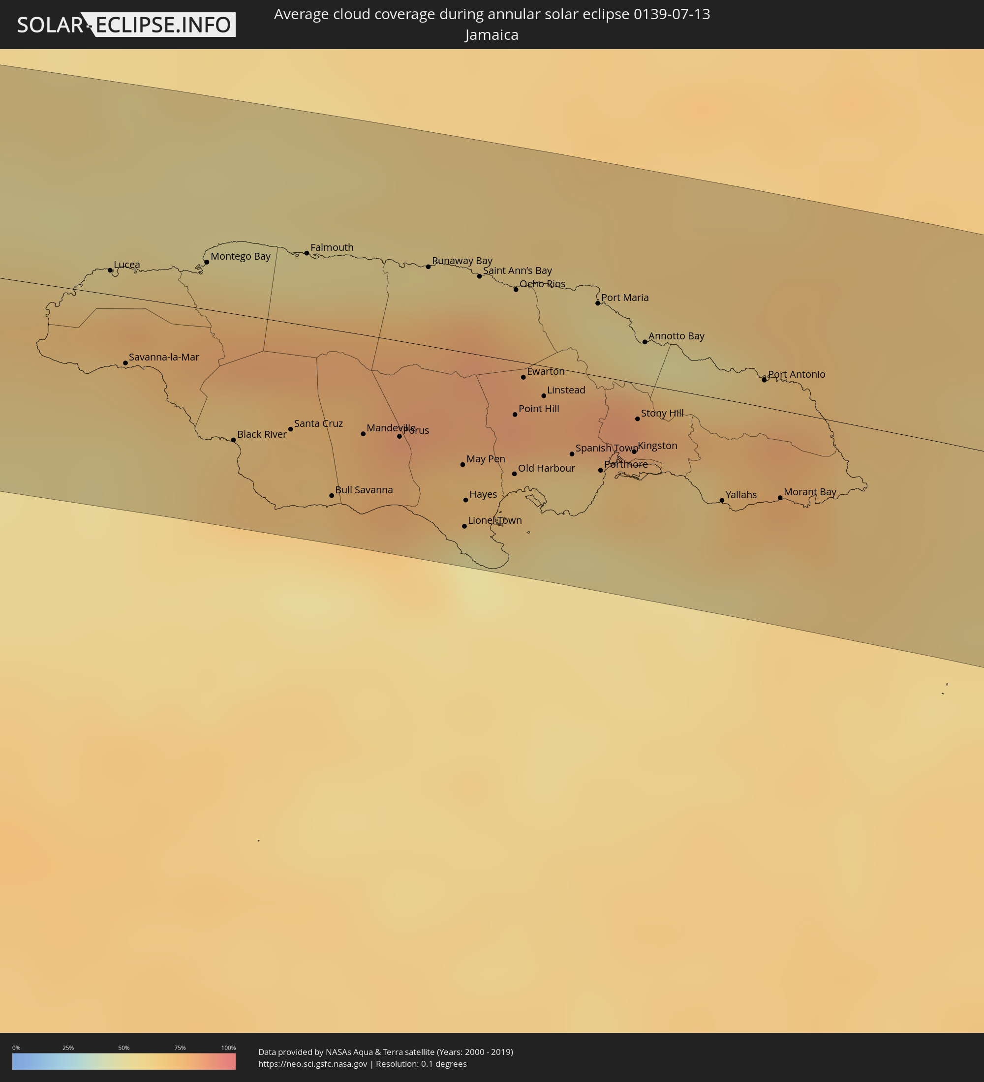 Jamaica
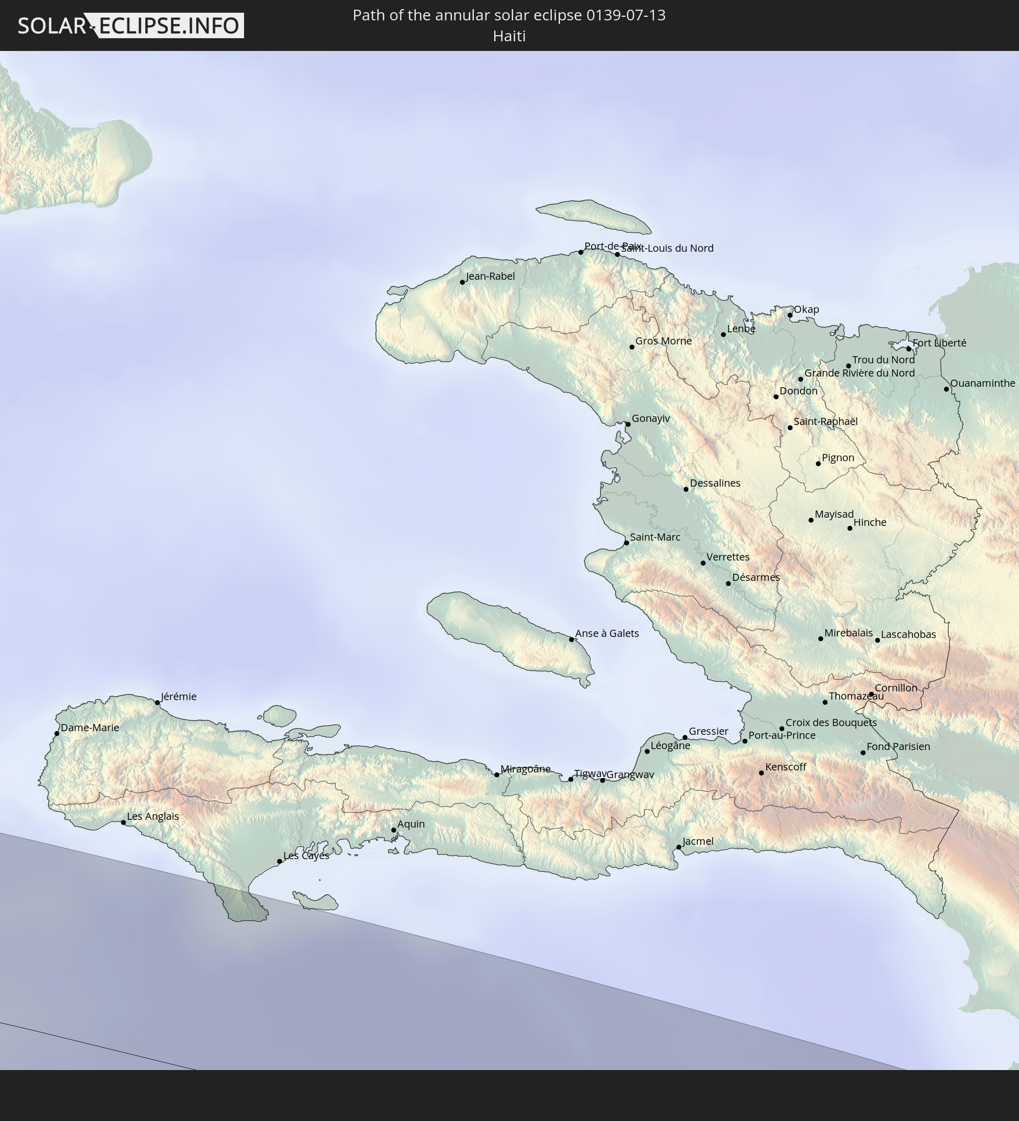
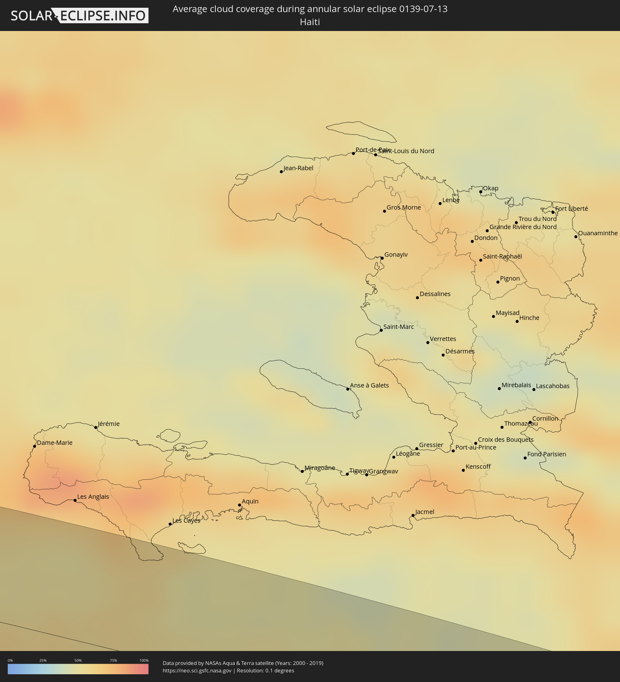 Haiti
Haiti
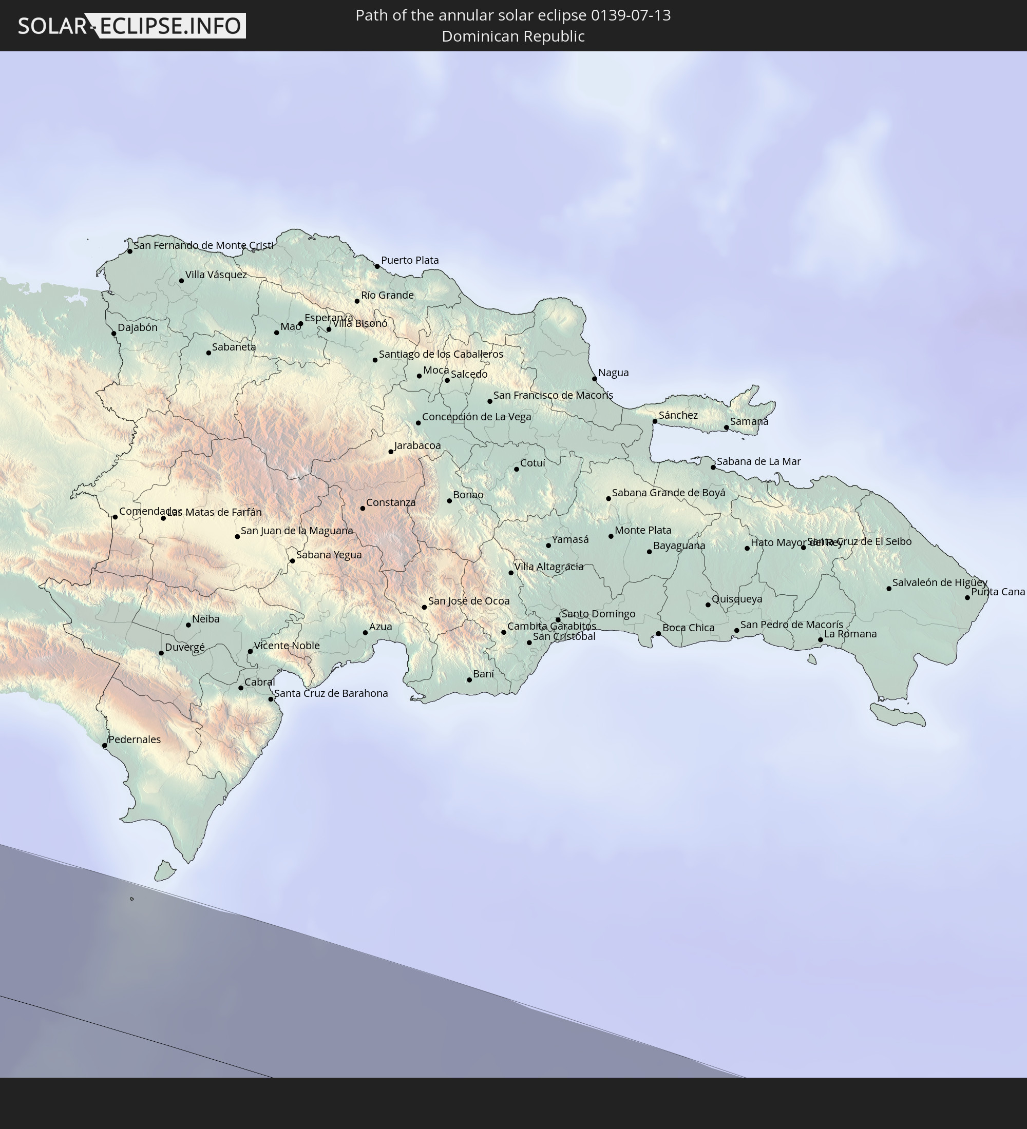
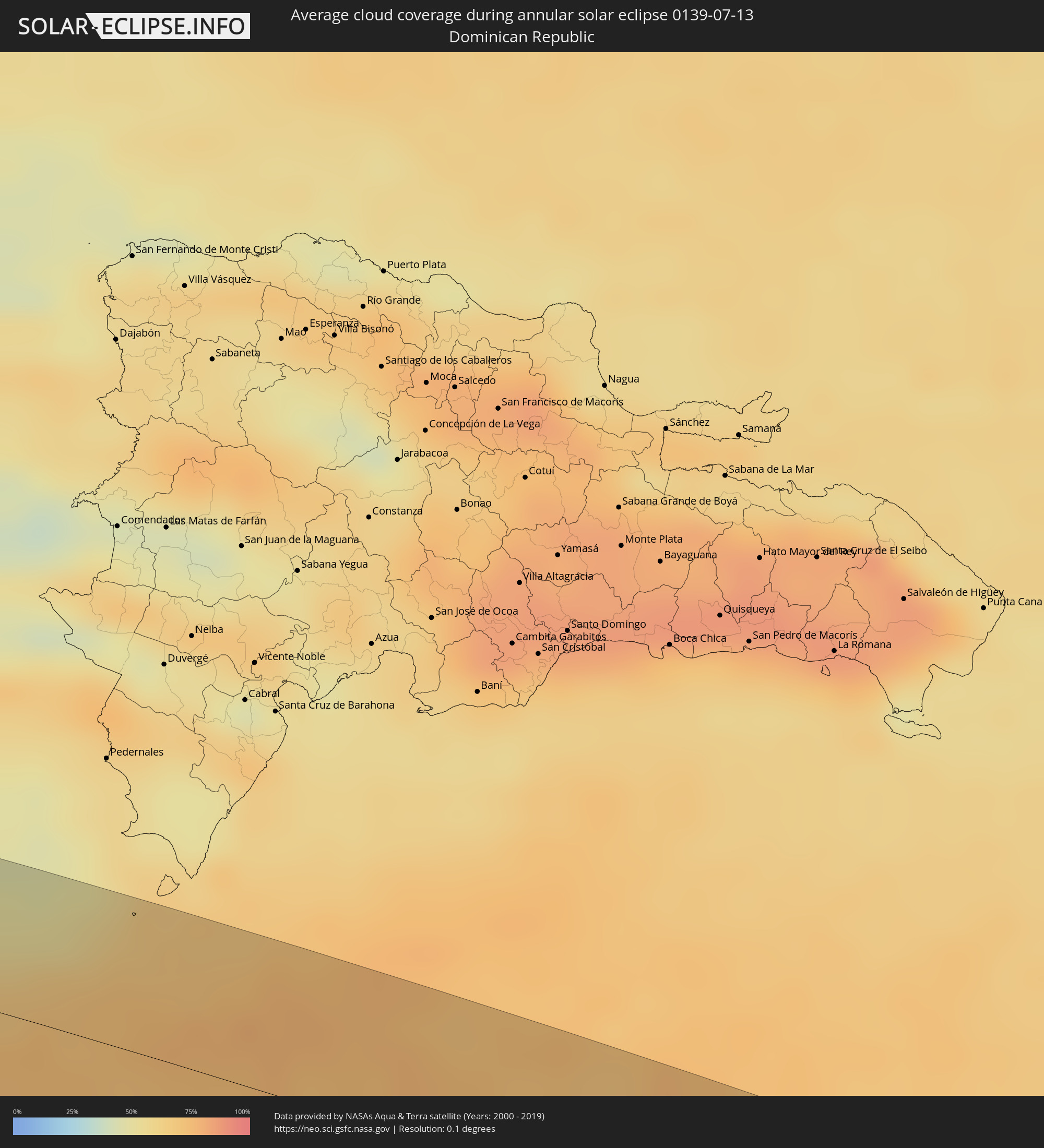 Dominican Republic
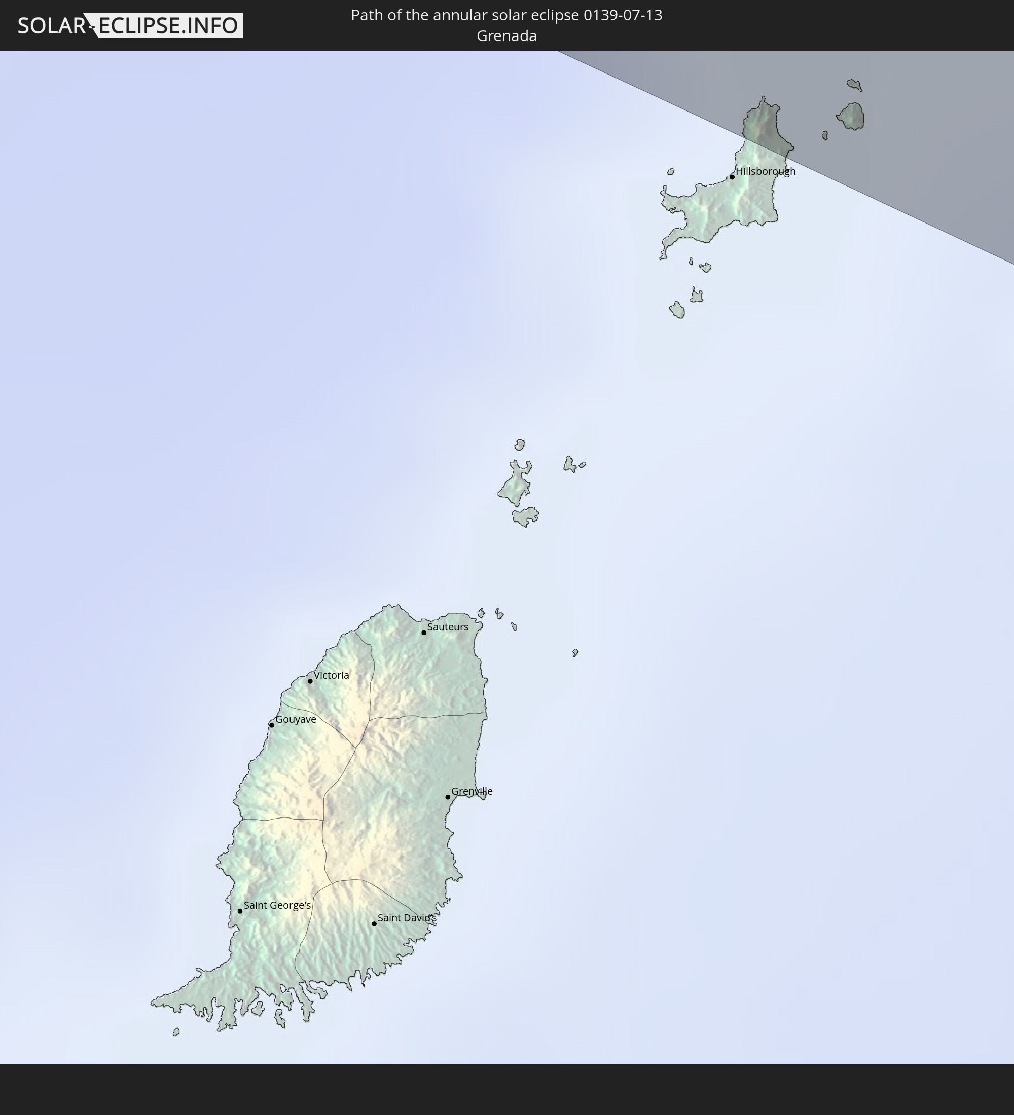
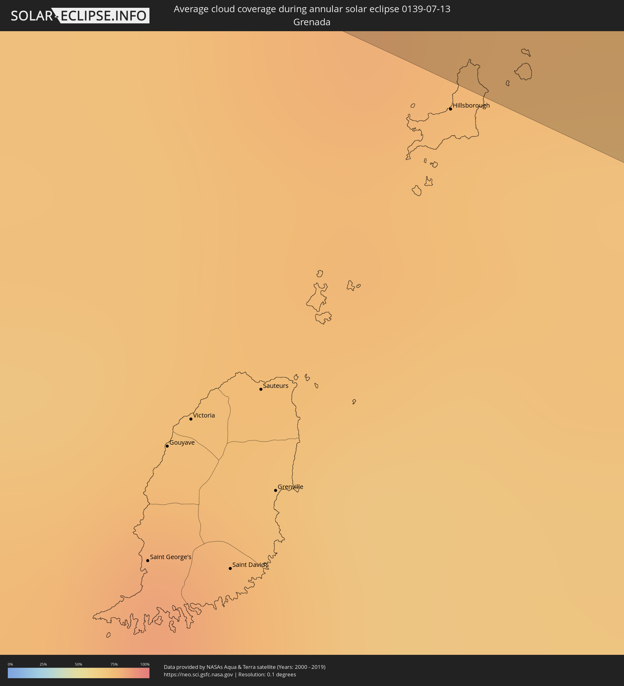 Grenada
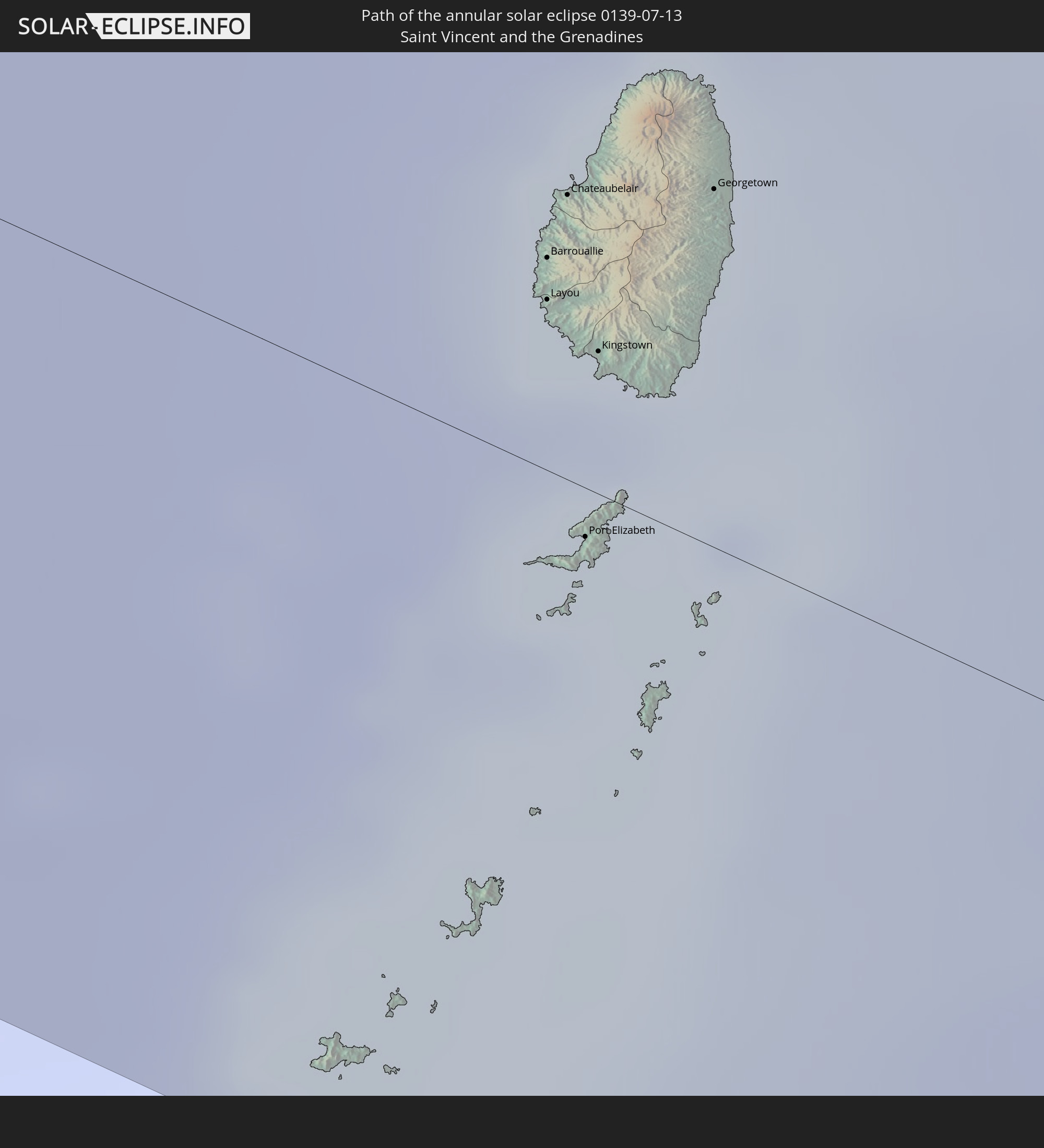
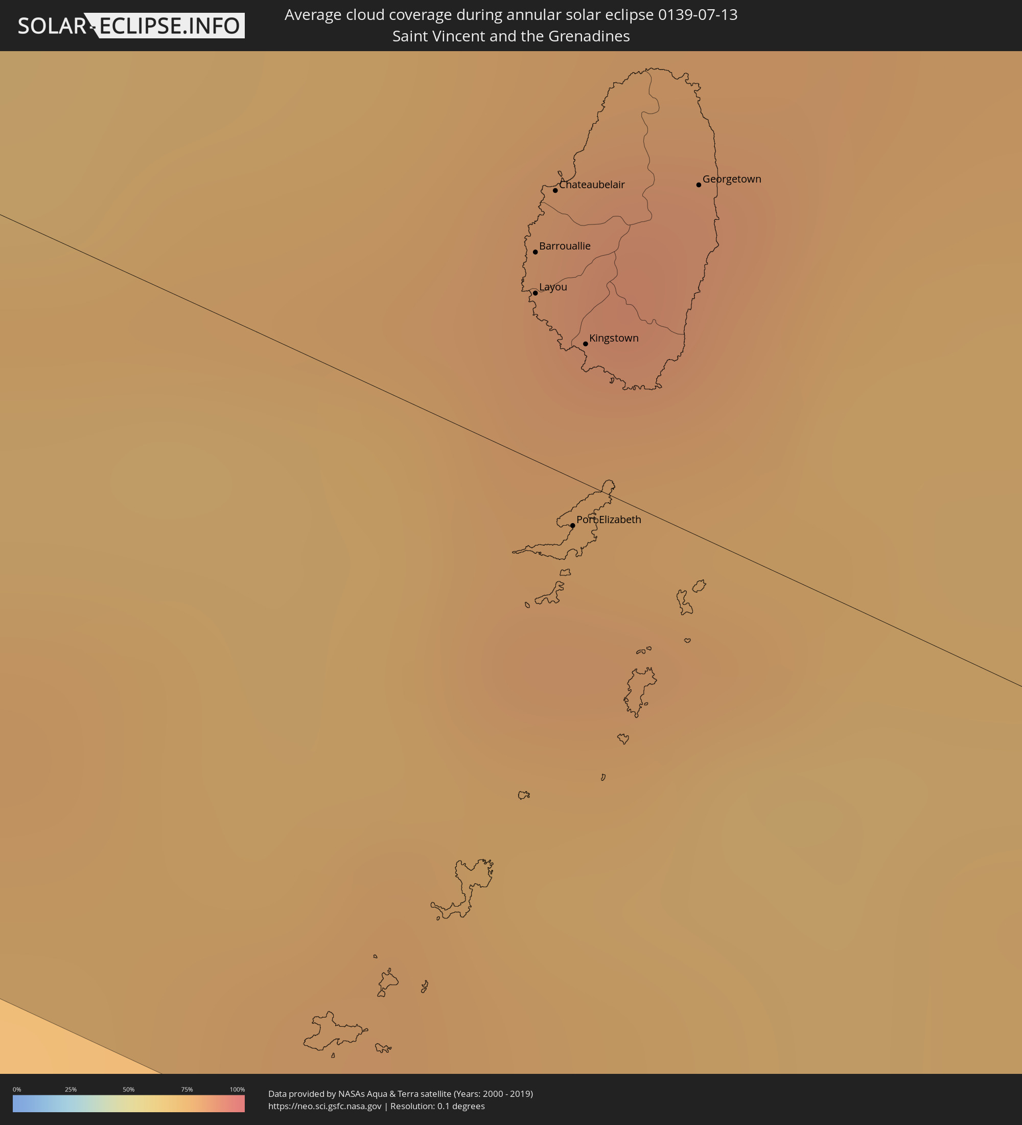 Saint Vincent and the Grenadines
Cities inside the path of the eclipse
The following table shows all locations with a population of more than 5,000 inside the eclipse path. Cities which have more than 100,000 inhabitants are marked bold. A click at the locations opens a detailed map.
| City | Type | Eclipse duration | Local time of max. eclipse | Distance to central line | Ø Cloud coverage |
|
San Marcos, Guerrero
|
annular | - | 09:49:18 UTC-06:36 | 39 km | 66% |
|
Cruz Grande, Guerrero
|
annular | - | 09:49:56 UTC-06:36 | 23 km | 66% |
|
Ayutla de los Libres, Guerrero
|
annular | - | 09:50:13 UTC-06:36 | 48 km | 73% |
|
San Luis Acatlán, Guerrero
|
annular | - | 09:51:02 UTC-06:36 | 20 km | 65% |
|
Cuajinicuilapa de Santa Maria, Guerrero
|
annular | - | 09:51:37 UTC-06:36 | 26 km | 71% |
|
Ometepec, Guerrero
|
annular | - | 09:51:49 UTC-06:36 | 3 km | 61% |
|
Pinotepa, Oaxaca
|
annular | - | 09:52:30 UTC-06:36 | 51 km | 64% |
|
Santiago Juxtlahuaca, Oaxaca
|
annular | - | 09:53:26 UTC-06:36 | 54 km | 81% |
|
Putla Villa de Guerrero, Oaxaca
|
annular | - | 09:53:24 UTC-06:36 | 19 km | 68% |
|
Heroica Ciudad de Tlaxiaco, Oaxaca
|
annular | - | 09:54:17 UTC-06:36 | 38 km | 76% |
|
Asunción Nochixtlán, Oaxaca
|
annular | - | 09:55:42 UTC-06:36 | 45 km | 71% |
|
San Francisco Telixtlahuaca, Oaxaca
|
annular | - | 09:56:28 UTC-06:36 | 19 km | 75% |
|
San Pablo Huixtepec, Oaxaca
|
annular | - | 09:56:27 UTC-06:36 | 36 km | 74% |
|
Trinidad Zaachila, Oaxaca
|
annular | - | 09:56:35 UTC-06:36 | 26 km | 72% |
|
Oaxaca, Oaxaca
|
annular | - | 09:56:48 UTC-06:36 | 11 km | 78% |
|
Tlacolula de Matamoros, Oaxaca
|
annular | - | 09:57:26 UTC-06:36 | 30 km | 74% |
|
Playa Vicente, Veracruz
|
annular | - | 10:00:02 UTC-06:36 | 47 km | 77% |
|
Juan Rodríguez Clara, Veracruz
|
annular | - | 10:01:21 UTC-06:36 | 54 km | 93% |
|
Acayucan, Veracruz
|
annular | - | 10:02:47 UTC-06:36 | 37 km | 89% |
|
Texistepec, Veracruz
|
annular | - | 10:03:02 UTC-06:36 | 29 km | 88% |
|
Minatitlan, Veracruz
|
annular | - | 10:03:54 UTC-06:36 | 34 km | 81% |
|
Lomas de Barrillas, Veracruz
|
annular | - | 10:04:05 UTC-06:36 | 50 km | 77% |
|
Coatzacoalcos, Veracruz
|
annular | - | 10:04:20 UTC-06:36 | 46 km | 81% |
|
Cuichapa, Veracruz
|
annular | - | 10:04:41 UTC-06:36 | 21 km | 82% |
|
Agua Dulce, Veracruz
|
annular | - | 10:05:14 UTC-06:36 | 40 km | 87% |
|
Las Choapas, Veracruz
|
annular | - | 10:05:14 UTC-06:36 | 14 km | 90% |
|
Villa la Venta, Tabasco
|
annular | - | 10:05:31 UTC-06:36 | 33 km | 88% |
|
Huimanguillo, Tabasco
|
annular | - | 10:07:22 UTC-06:36 | 10 km | 78% |
|
Cárdenas, Tabasco
|
annular | - | 10:07:32 UTC-06:36 | 8 km | 80% |
|
Villa Tecolutilla, Tabasco
|
annular | - | 10:07:50 UTC-06:36 | 38 km | 80% |
|
Comalcalco, Tabasco
|
annular | - | 10:08:10 UTC-06:36 | 34 km | 81% |
|
Paraiso, Tabasco
|
annular | - | 10:08:17 UTC-06:36 | 48 km | 72% |
|
Cunduacán, Tabasco
|
annular | - | 10:08:13 UTC-06:36 | 11 km | 72% |
|
Pichucalco, Chiapas
|
annular | - | 10:08:03 UTC-06:36 | 51 km | 83% |
|
Jalpa de Méndez, Tabasco
|
annular | - | 10:08:38 UTC-06:36 | 21 km | 77% |
|
Nacajuca, Tabasco
|
annular | - | 10:08:46 UTC-06:36 | 19 km | 73% |
|
La Selva, Tabasco
|
annular | - | 10:08:51 UTC-06:36 | 2 km | 72% |
|
Bosque de Saloya, Tabasco
|
annular | - | 10:08:52 UTC-06:36 | 1 km | 72% |
|
Teapa, Tabasco
|
annular | - | 10:08:36 UTC-06:36 | 50 km | 81% |
|
Villahermosa, Tabasco
|
annular | - | 10:08:56 UTC-06:36 | 3 km | 65% |
|
Río de Teapa, Tabasco
|
annular | - | 10:08:54 UTC-06:36 | 26 km | 73% |
|
Tamulte de las Sabanas, Tabasco
|
annular | - | 10:09:30 UTC-06:36 | 13 km | 58% |
|
Frontera, Tabasco
|
annular | - | 10:10:10 UTC-06:36 | 52 km | 71% |
|
Macuspana, Tabasco
|
annular | - | 10:09:52 UTC-06:36 | 34 km | 65% |
|
Ciudad del Carmen, Campeche
|
annular | - | 10:12:50 UTC-06:36 | 48 km | 53% |
|
Emiliano Zapata, Chiapas
|
annular | - | 10:12:33 UTC-06:36 | 52 km | 69% |
|
Balancán de Domínguez, Tabasco
|
annular | - | 10:13:21 UTC-06:36 | 49 km | 61% |
|
Escárcega, Campeche
|
annular | - | 10:16:22 UTC-06:36 | 26 km | 77% |
|
Bacalar, Quintana Roo
|
annular | - | 11:13:56 UTC-05:47 | 4 km | 76% |
|
Corozal, Corozal
|
annular | - | 11:08:08 UTC-05:52 | 28 km | 75% |
|
Chetumal, Quintana Roo
|
annular | - | 11:14:12 UTC-05:47 | 16 km | 67% |
|
Lucea, Hanover
|
annular | - | 12:30:50 UTC-05:07 | 7 km | 58% |
|
Savanna-la-Mar, Westmoreland
|
annular | - | 12:31:07 UTC-05:07 | 18 km | 65% |
|
Montego Bay, St. James
|
annular | - | 12:31:44 UTC-05:07 | 13 km | 62% |
|
Black River, St. Elizabeth
|
annular | - | 12:32:14 UTC-05:07 | 35 km | 69% |
|
Santa Cruz, St. Elizabeth
|
annular | - | 12:32:46 UTC-05:07 | 29 km | 70% |
|
Falmouth, Trelawny
|
annular | - | 12:32:40 UTC-05:07 | 20 km | 58% |
|
Bull Savanna, St. Elizabeth
|
annular | - | 12:33:15 UTC-05:07 | 46 km | 62% |
|
Mandeville, Manchester
|
annular | - | 12:33:27 UTC-05:07 | 27 km | 75% |
|
Porus, Manchester
|
annular | - | 12:33:48 UTC-05:07 | 26 km | 77% |
|
Runaway Bay, St Ann
|
annular | - | 12:33:49 UTC-05:07 | 22 km | 59% |
|
May Pen, Clarendon
|
annular | - | 12:34:26 UTC-05:07 | 31 km | 70% |
|
Lionel Town, Clarendon
|
annular | - | 12:34:33 UTC-05:07 | 48 km | 52% |
|
Hayes, Clarendon
|
annular | - | 12:34:32 UTC-05:07 | 41 km | 51% |
|
Saint Ann’s Bay, St Ann
|
annular | - | 12:34:18 UTC-05:07 | 21 km | 78% |
|
Old Harbour, Saint Catherine
|
annular | - | 12:34:56 UTC-05:07 | 31 km | 58% |
|
Point Hill, Saint Catherine
|
annular | - | 12:34:51 UTC-05:07 | 15 km | 82% |
|
Ocho Rios, St Ann
|
annular | - | 12:34:40 UTC-05:07 | 20 km | 71% |
|
Old Harbour Bay, Saint Catherine
|
annular | - | 12:35:00 UTC-05:07 | 34 km | 58% |
|
Ewarton, Saint Catherine
|
annular | - | 12:34:52 UTC-05:07 | 4 km | 82% |
|
Linstead, Saint Catherine
|
annular | - | 12:35:06 UTC-05:07 | 8 km | 80% |
|
Bog Walk, Saint Catherine
|
annular | - | 12:35:12 UTC-05:07 | 12 km | 80% |
|
Spanish Town, Saint Catherine
|
annular | - | 12:35:27 UTC-05:07 | 23 km | 62% |
|
Port Maria, St. Mary
|
annular | - | 12:35:27 UTC-05:07 | 20 km | 56% |
|
Portmore, Saint Catherine
|
annular | - | 12:35:45 UTC-05:07 | 26 km | 63% |
|
Half Way Tree, St. Andrew
|
annular | - | 12:36:00 UTC-05:07 | 17 km | 69% |
|
Constant Spring, St. Andrew
|
annular | - | 12:35:59 UTC-05:07 | 13 km | 83% |
|
Kingston, Kingston
|
annular | - | 12:36:02 UTC-05:07 | 19 km | 69% |
|
Stony Hill, St. Andrew
|
annular | - | 12:36:00 UTC-05:07 | 10 km | 83% |
|
New Kingston, St. Andrew
|
annular | - | 12:36:03 UTC-05:07 | 18 km | 69% |
|
Annotto Bay, St. Mary
|
annular | - | 12:35:57 UTC-05:07 | 12 km | 57% |
|
Yallahs, St. Thomas
|
annular | - | 12:36:56 UTC-05:07 | 28 km | 63% |
|
Port Antonio, Portland
|
annular | - | 12:37:07 UTC-05:07 | 7 km | 64% |
|
Morant Bay, St. Thomas
|
annular | - | 12:37:28 UTC-05:07 | 24 km | 66% |
|
Layou, Saint Andrew
|
annular | - | 14:28:14 UTC-04:06 | 14 km | 79% |
|
Barrouallie, Saint Patrick
|
annular | - | 14:28:11 UTC-04:06 | 17 km | 79% |
|
Chateaubelair, Saint David
|
annular | - | 14:28:10 UTC-04:06 | 23 km | 80% |
|
Port Elizabeth, Grenadines
|
annular | - | 14:28:31 UTC-04:06 | 4 km | 79% |
|
Kingstown Park, Saint George
|
annular | - | 14:28:21 UTC-04:06 | 11 km | 79% |
|
Kingstown, Saint George
|
annular | - | 14:28:22 UTC-04:06 | 11 km | 79% |
|
Georgetown, Charlotte
|
annular | - | 14:28:26 UTC-04:06 | 29 km | 81% |