Total solar eclipse of 05/19/0486
| Day of week: | Sunday |
| Maximum duration of eclipse: | 06m54s |
| Maximum width of eclipse path: | 262 km |
| Saros cycle: | 84 |
| Coverage: | 100% |
| Magnitude: | 1.0806 |
| Gamma: | 0.1193 |
Wo kann man die Sonnenfinsternis vom 05/19/0486 sehen?
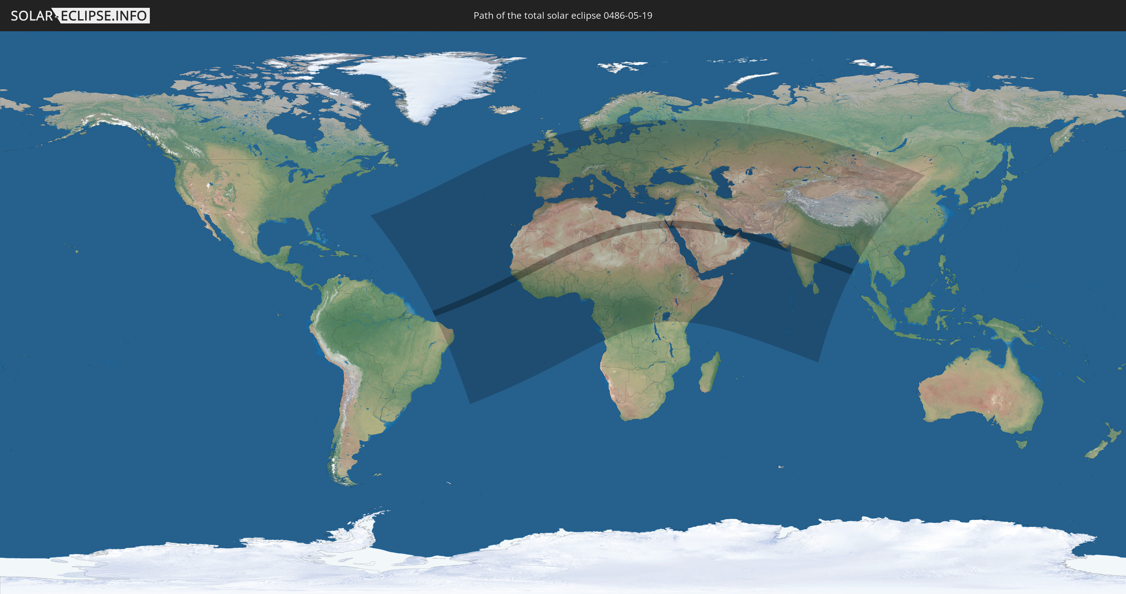
Die Sonnenfinsternis am 05/19/0486 kann man in 127 Ländern als partielle Sonnenfinsternis beobachten.
Der Finsternispfad verläuft durch 17 Länder. Nur in diesen Ländern ist sie als total Sonnenfinsternis zu sehen.
In den folgenden Ländern ist die Sonnenfinsternis total zu sehen
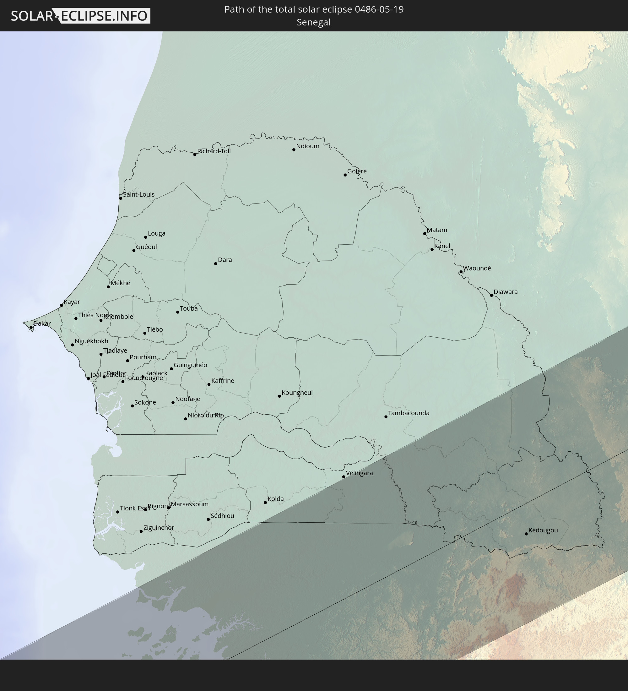 Senegal
 Mauritania
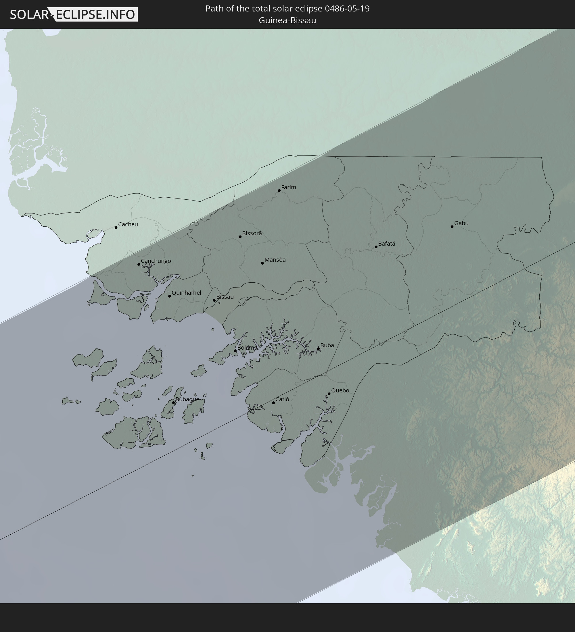 Guinea-Bissau
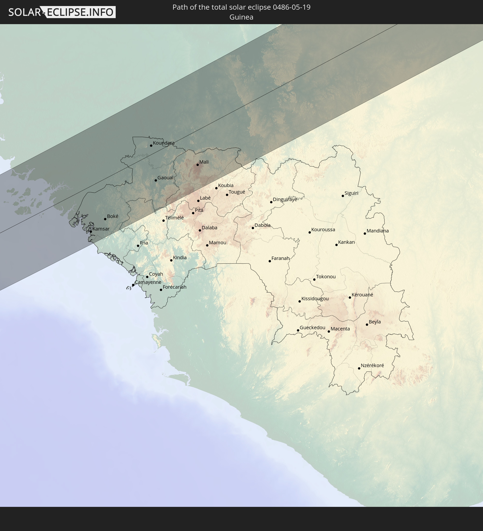 Guinea
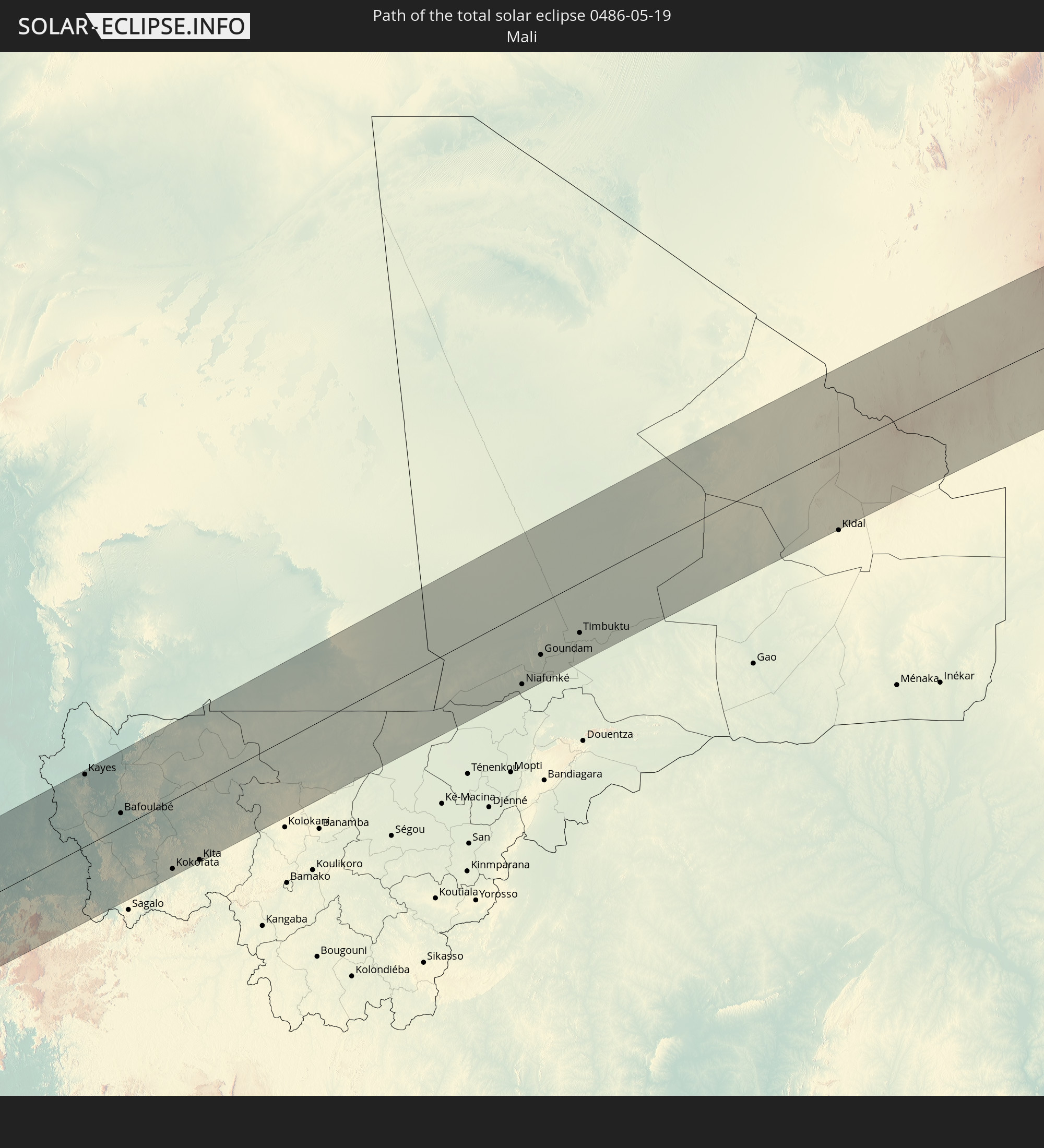 Mali
Mali
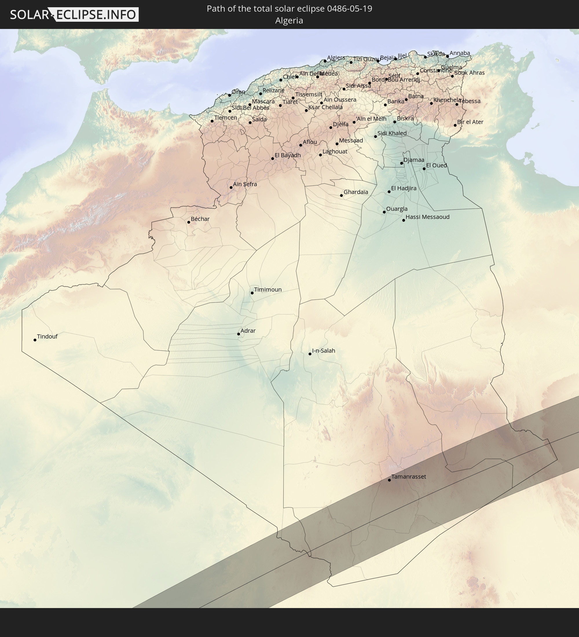 Algeria
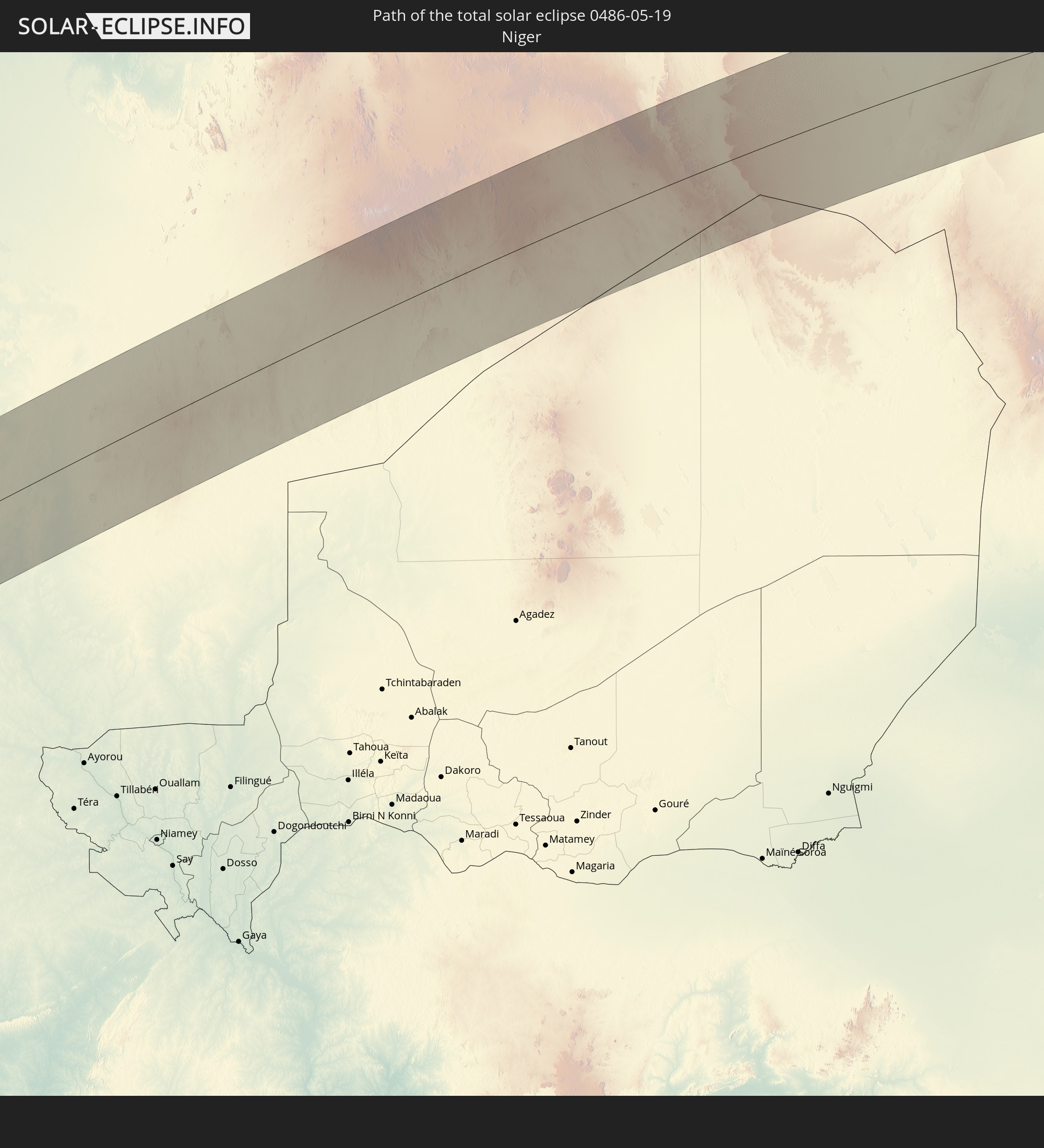 Niger
Niger
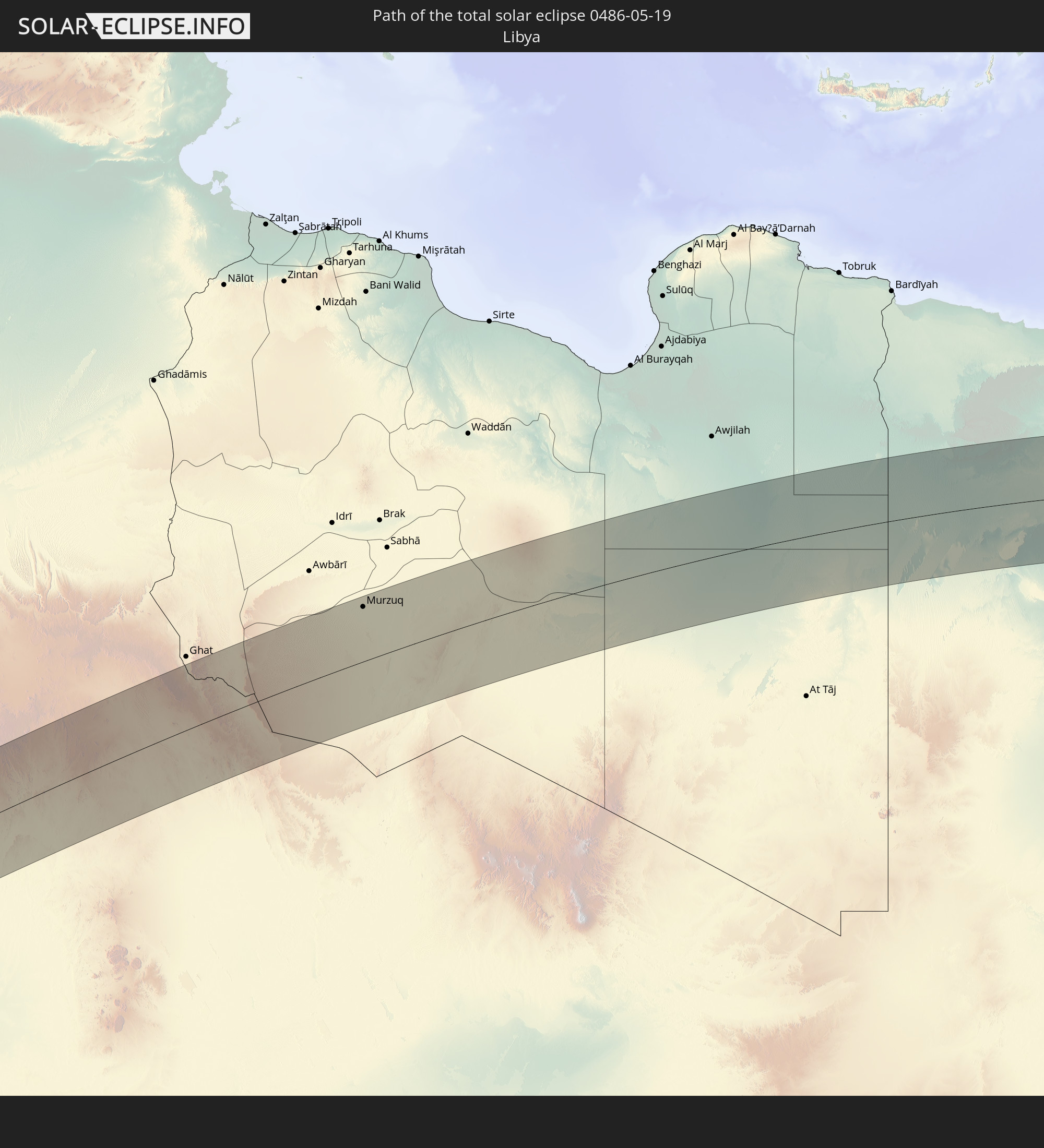 Libya
Libya
 Egypt
Egypt
 Saudi Arabia
 Jordan
 Iran
Iran
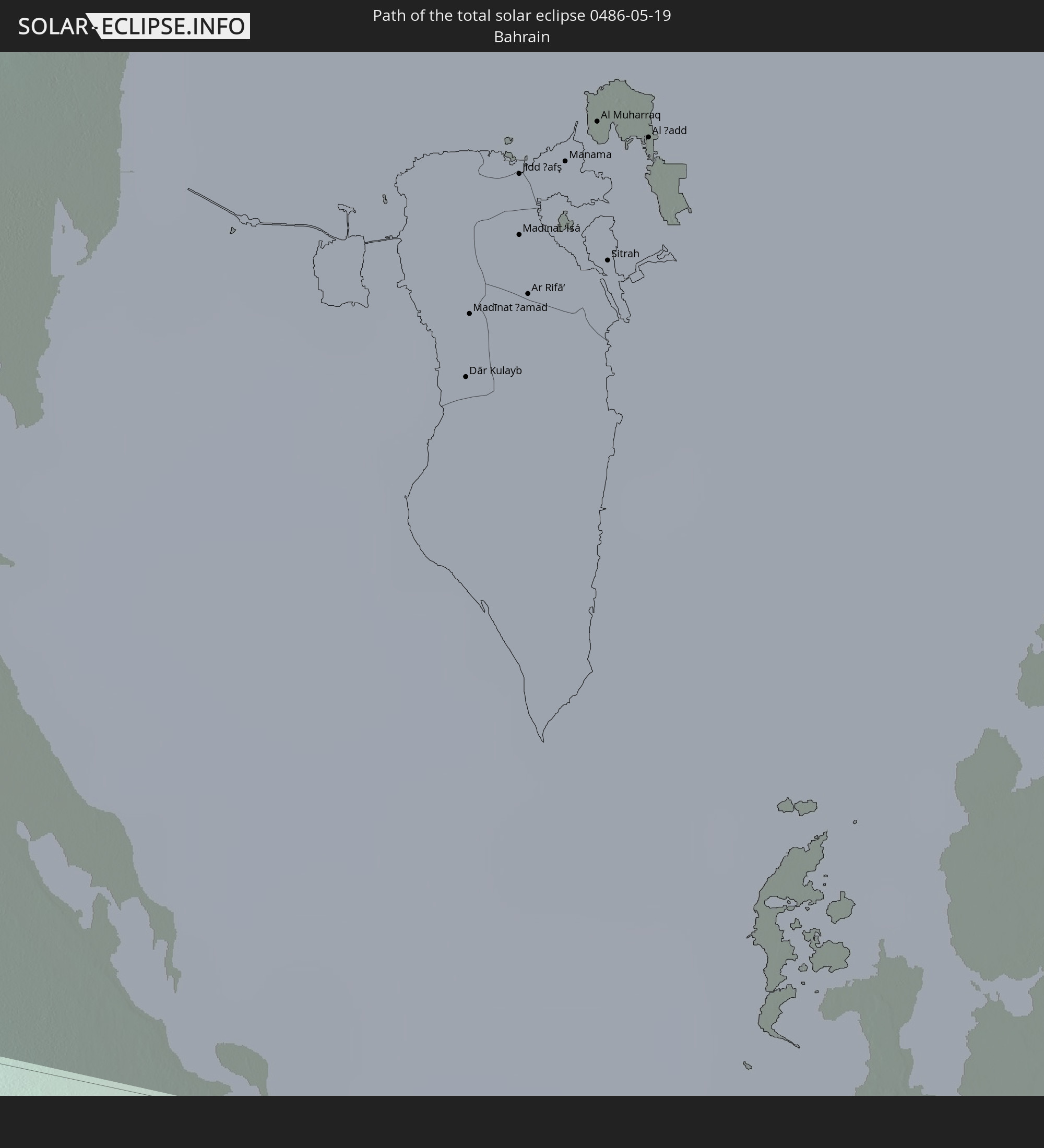 Bahrain
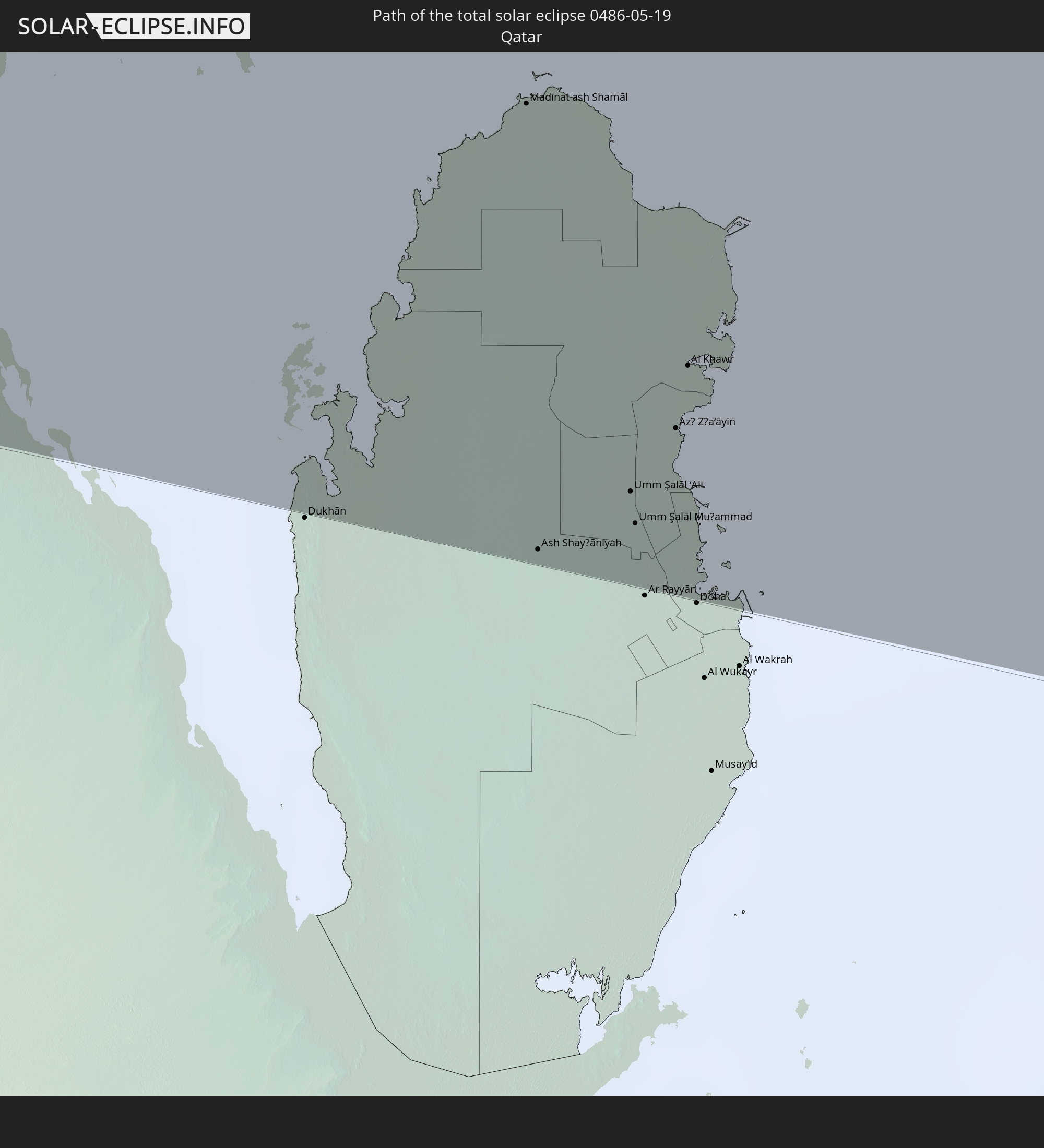 Qatar
Qatar
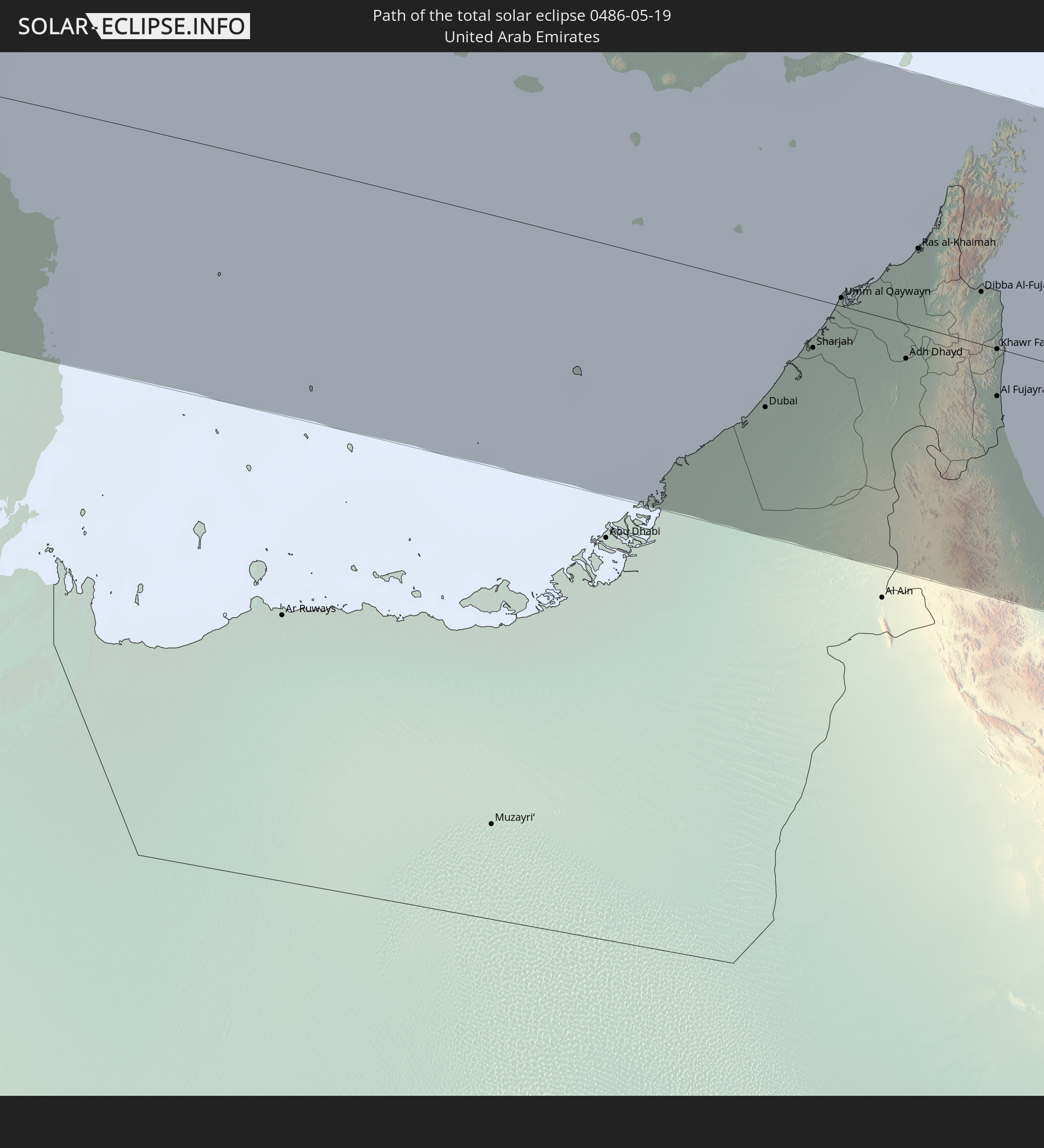 United Arab Emirates
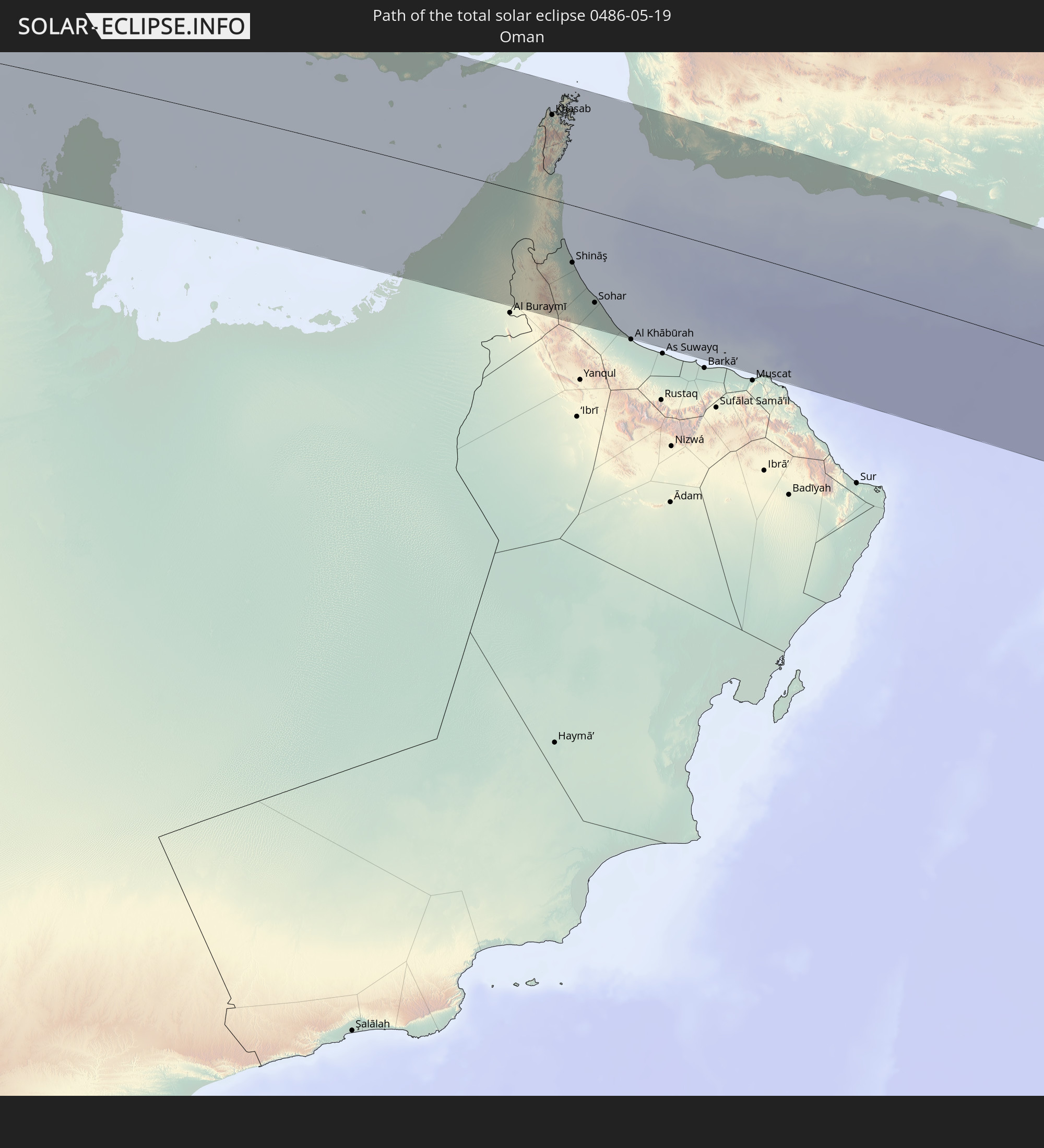 Oman
Oman
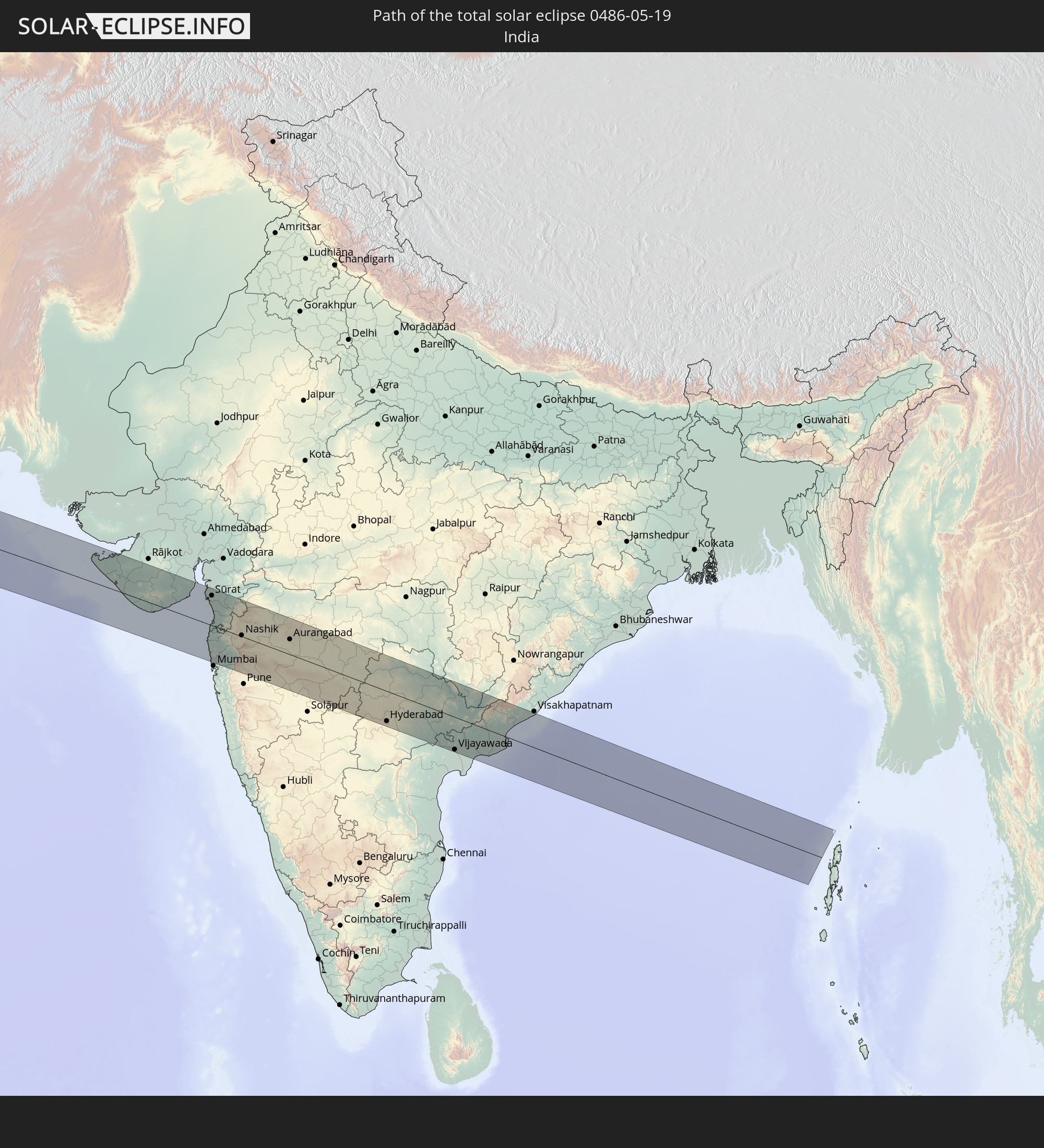 India
India
In den folgenden Ländern ist die Sonnenfinsternis partiell zu sehen
 Russia
 Brazil
 Portugal
 Cabo Verde
 Spain
Spain
 Senegal
 Mauritania
 The Gambia
 Guinea-Bissau
 Guinea
 Saint Helena, Ascension and Tristan da Cunha
 Sierra Leone
 Morocco
 Mali
Mali
 Liberia
 Republic of Ireland
 Algeria
 United Kingdom
 Ivory Coast
 Burkina Faso
 Gibraltar
 France
 Isle of Man
 Ghana
Ghana
 Guernsey
 Jersey
 Togo
Togo
 Niger
Niger
 Benin
Benin
 Andorra
 Belgium
 Nigeria
 Netherlands
 Norway
 Equatorial Guinea
 Luxembourg
 Germany
 Switzerland
 São Tomé and Príncipe
 Italy
Italy
 Monaco
 Tunisia
 Denmark
 Cameroon
 Gabon
Gabon
 Libya
Libya
 Liechtenstein
 Austria
 Sweden
 Republic of the Congo
 Angola
 Czechia
 Democratic Republic of the Congo
 San Marino
 Vatican City
 Slovenia
 Chad
Chad
 Croatia
 Poland
 Malta
Malta
 Central African Republic
 Bosnia and Herzegovina
 Hungary
 Slovakia
 Montenegro
 Serbia
 Albania
 Åland Islands
 Greece
 Romania
 Republic of Macedonia
 Finland
 Lithuania
 Latvia
 Estonia
 Sudan
Sudan
 Ukraine
 Bulgaria
 Belarus
 Egypt
Egypt
 Turkey
 Moldova
 Rwanda
 Burundi
 Tanzania
 Uganda
 Cyprus
 Ethiopia
 Kenya
Kenya
 State of Palestine
 Israel
 Saudi Arabia
 Jordan
 Lebanon
 Syria
Syria
 Eritrea
 Iraq
Iraq
 Georgia
 Somalia
 Djibouti
 Yemen
Yemen
 Armenia
 Iran
Iran
 Azerbaijan
 Seychelles
 Kazakhstan
 Kuwait
 Bahrain
 Qatar
Qatar
 United Arab Emirates
 Oman
Oman
 Turkmenistan
 Uzbekistan
 Afghanistan
 Pakistan
 Tajikistan
 India
India
 Kyrgyzstan
 British Indian Ocean Territory
 Maldives
 China
China
 Sri Lanka
 Nepal
Nepal
 Mongolia
 Bangladesh
 Bhutan
 Myanmar
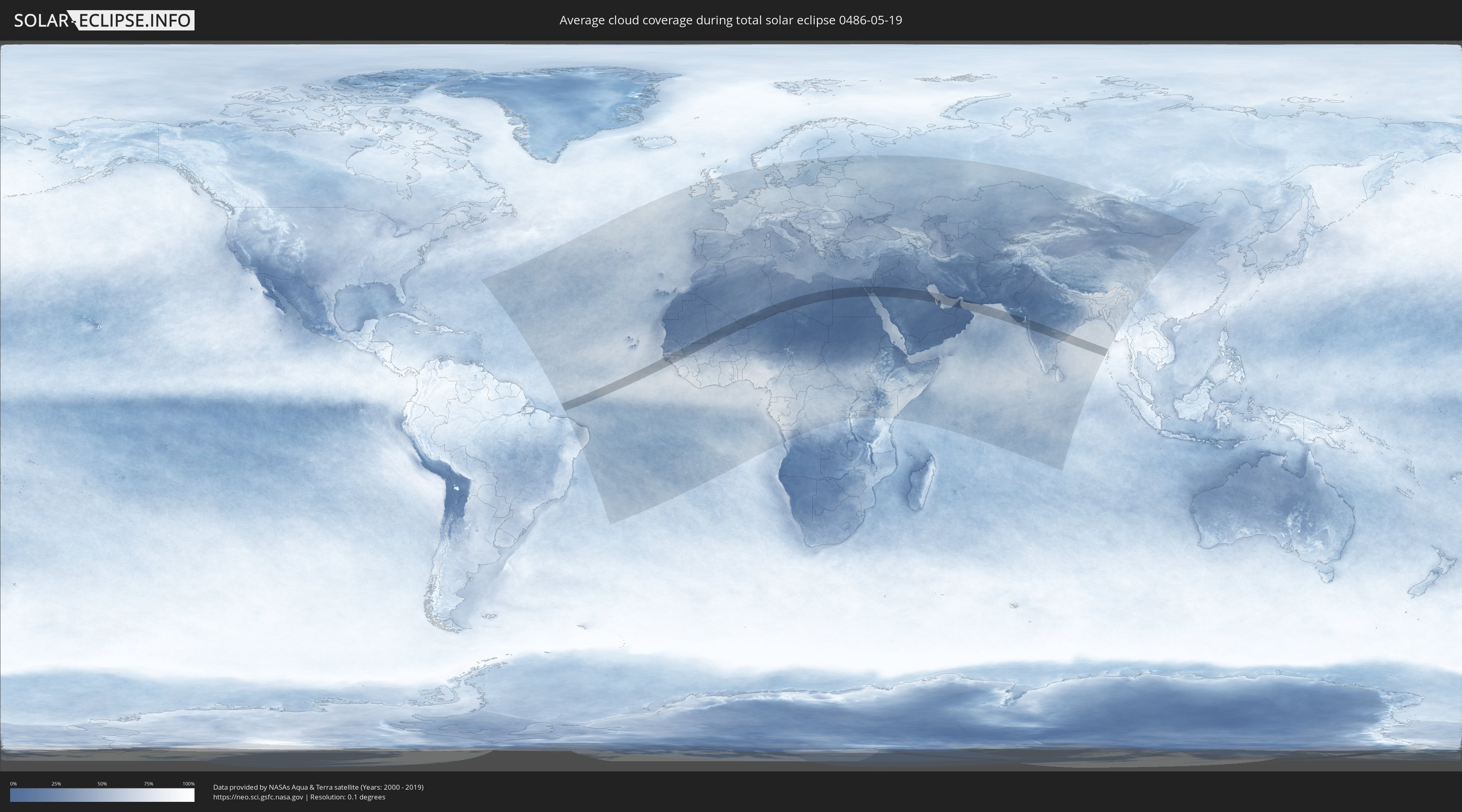
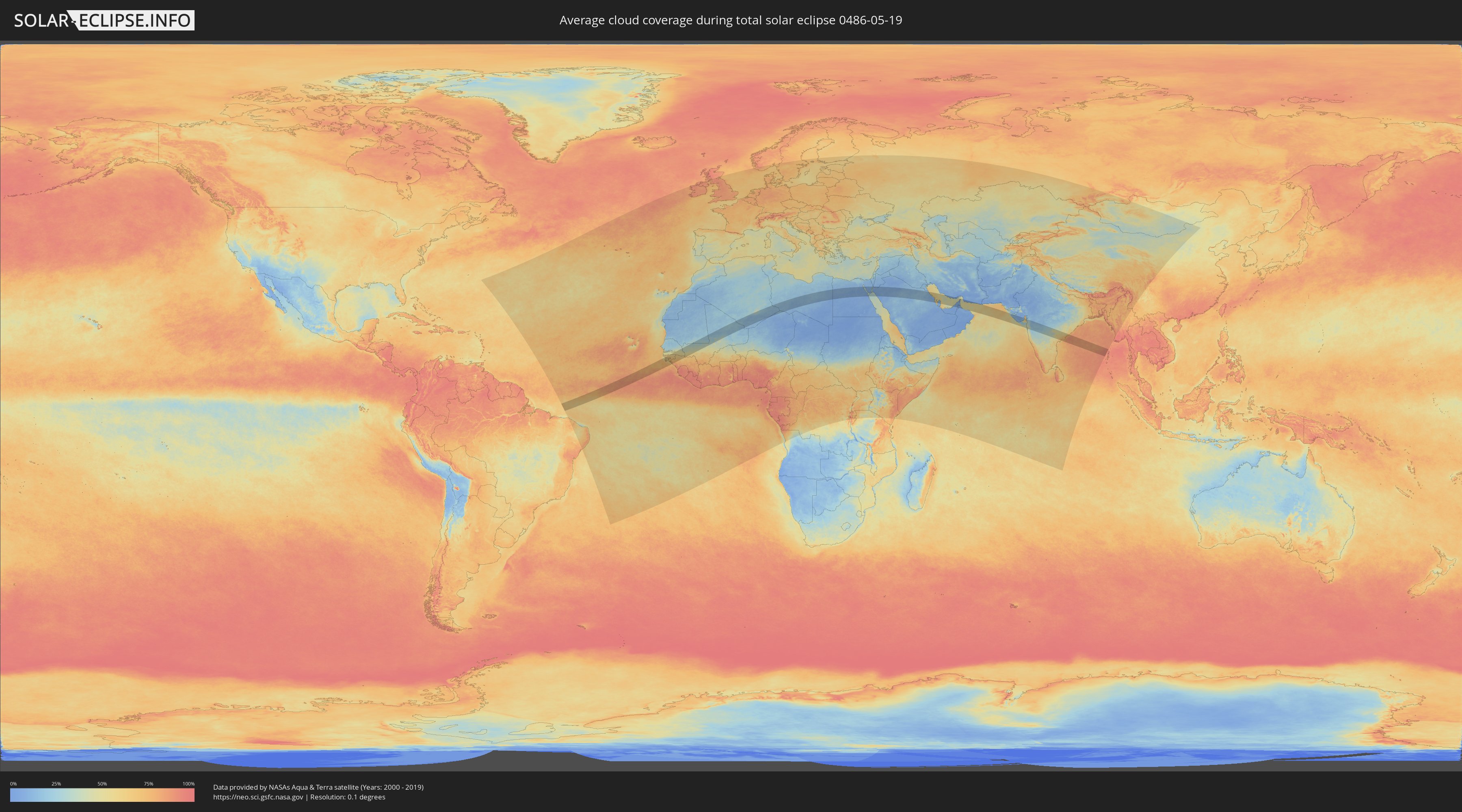
How will be the weather during the total solar eclipse on 05/19/0486?
Where is the best place to see the total solar eclipse of 05/19/0486?
The following maps show the average cloud coverage for the day of the total solar eclipse.
With the help of these maps, it is possible to find the place along the eclipse path, which has the best
chance of a cloudless sky.
Nevertheless, you should consider local circumstances and inform about the weather of your chosen
observation site.
The data is provided by NASAs satellites
AQUA and TERRA.
The cloud maps are averaged over a period of 19 years (2000 - 2019).
Detailed country maps
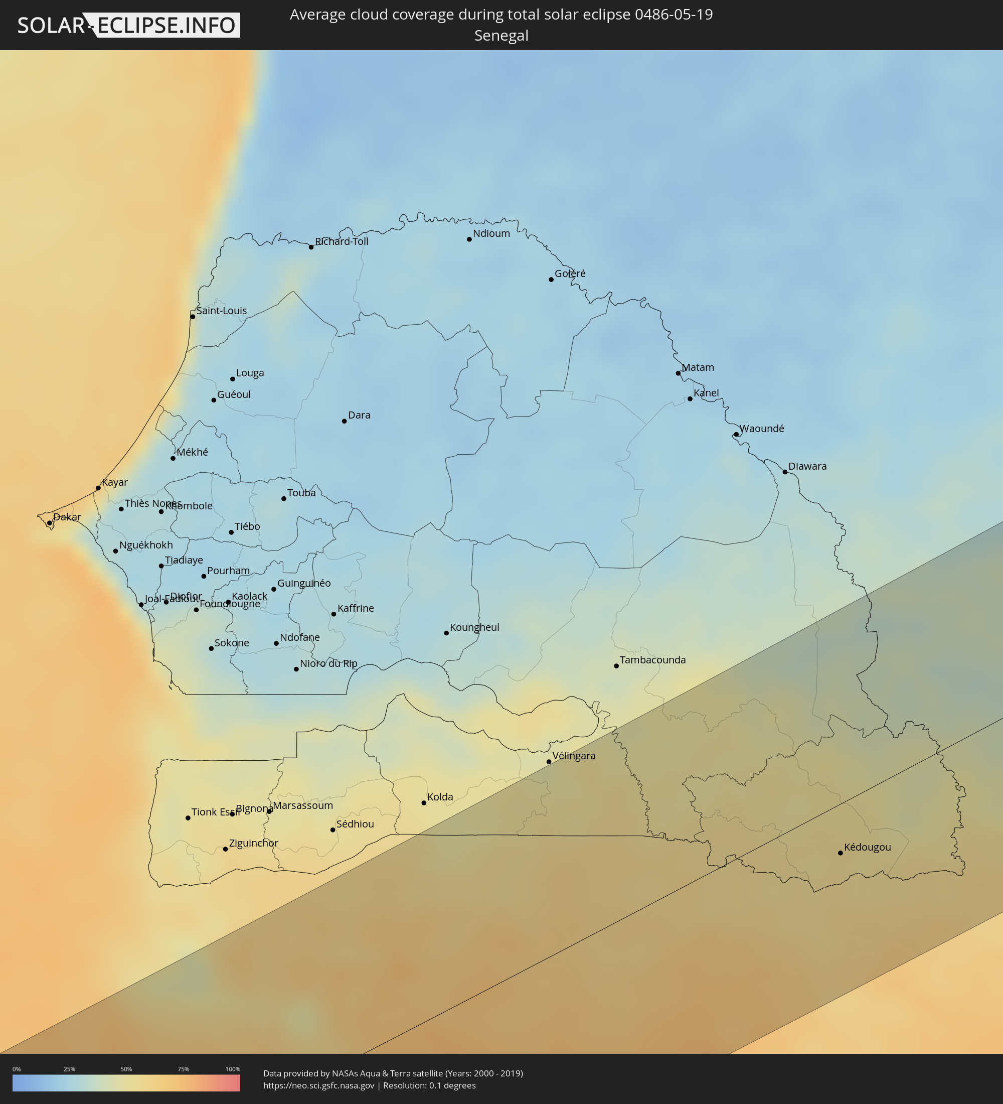 Senegal
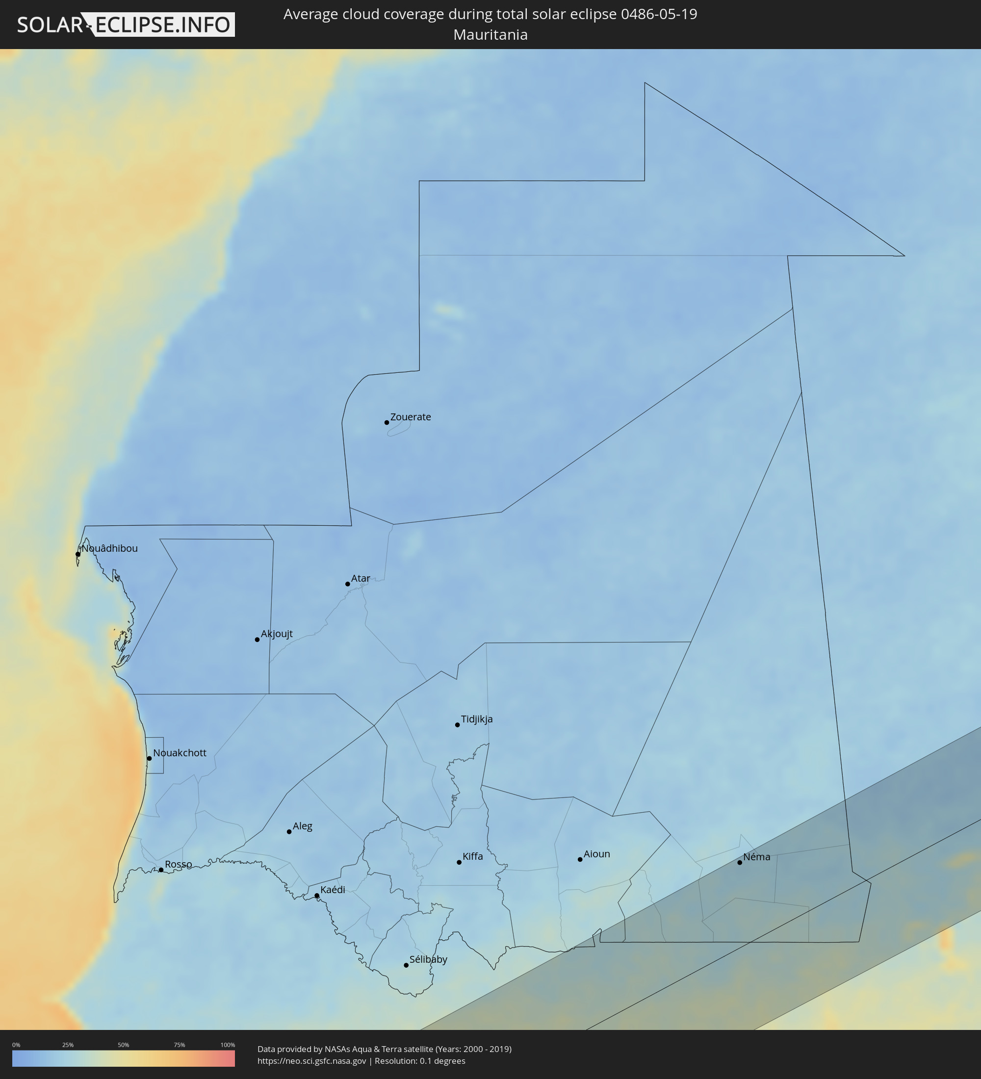 Mauritania
 Guinea-Bissau
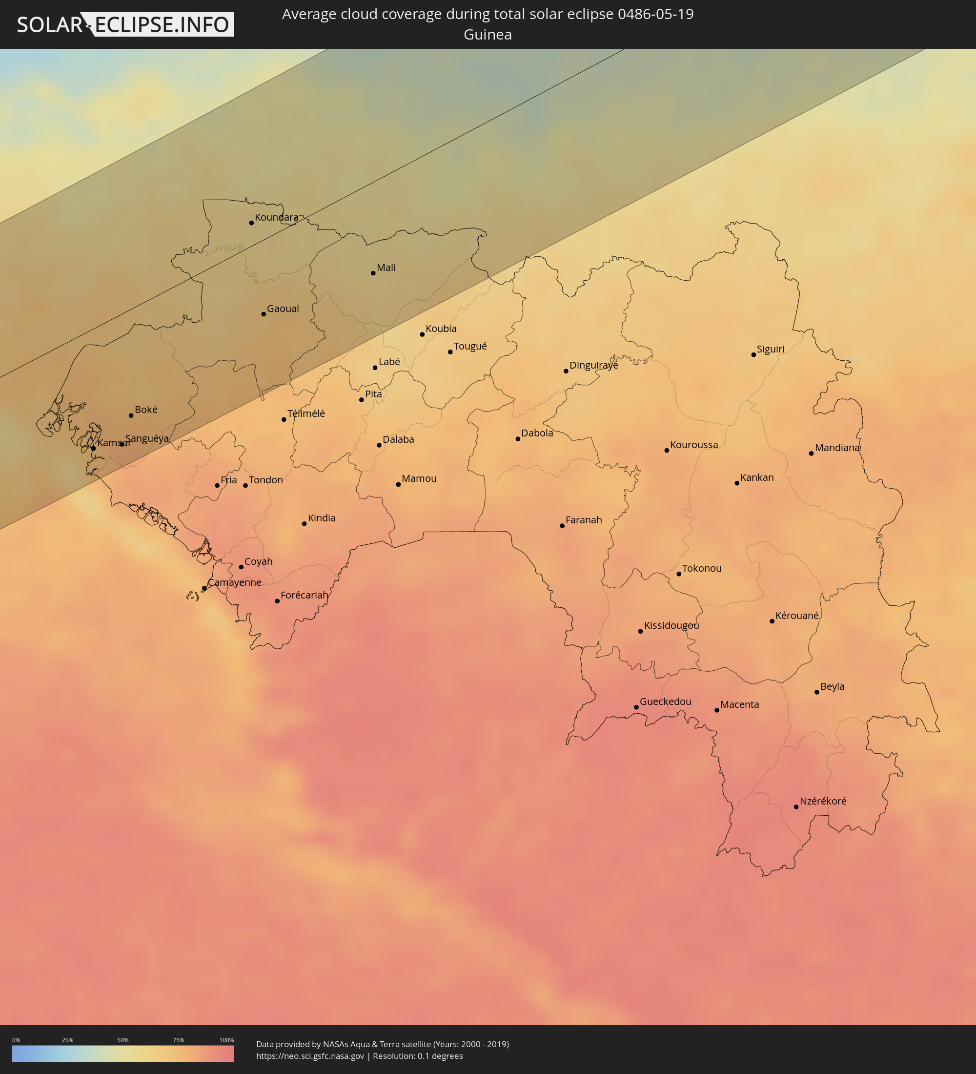 Guinea
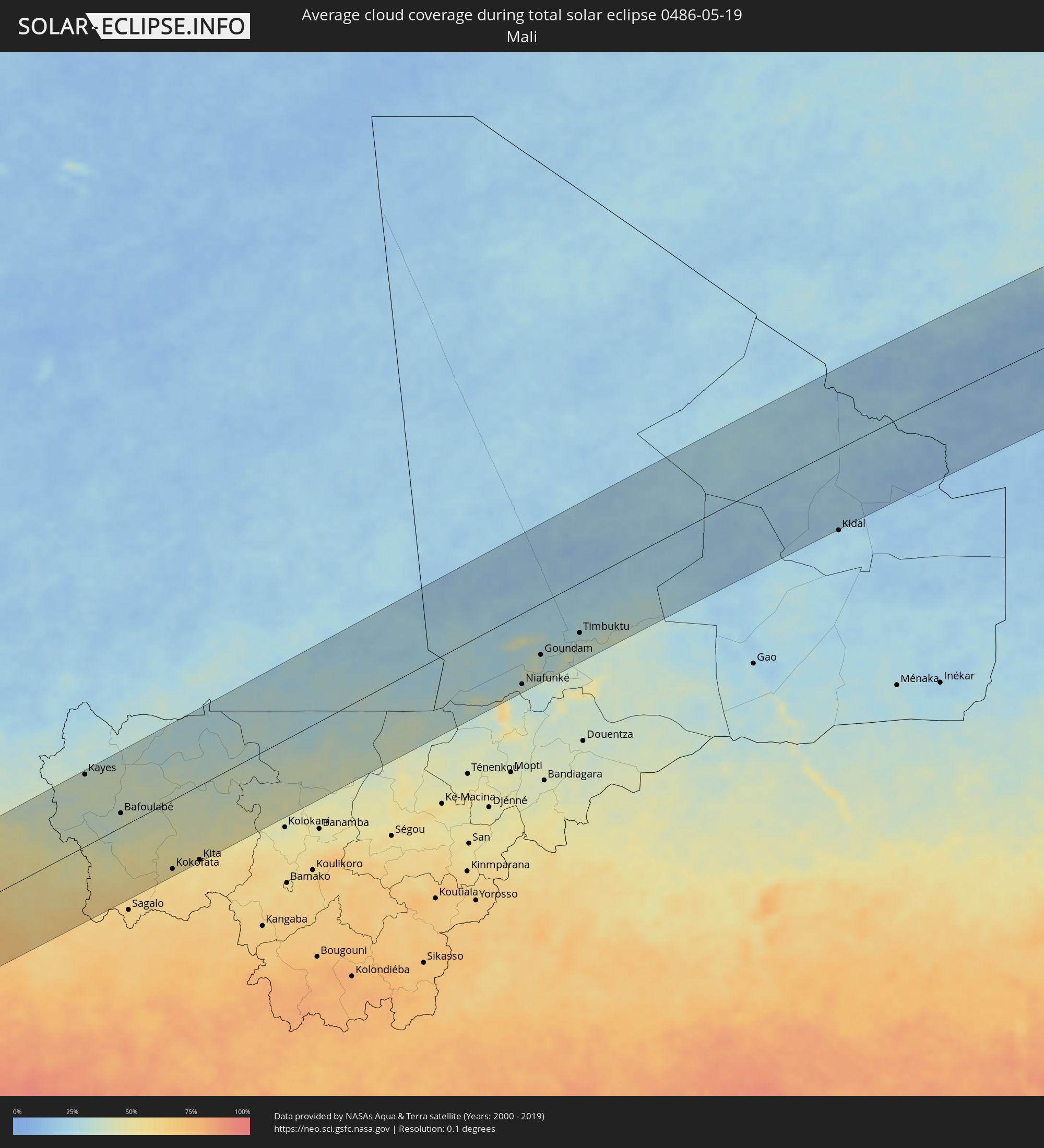 Mali
Mali
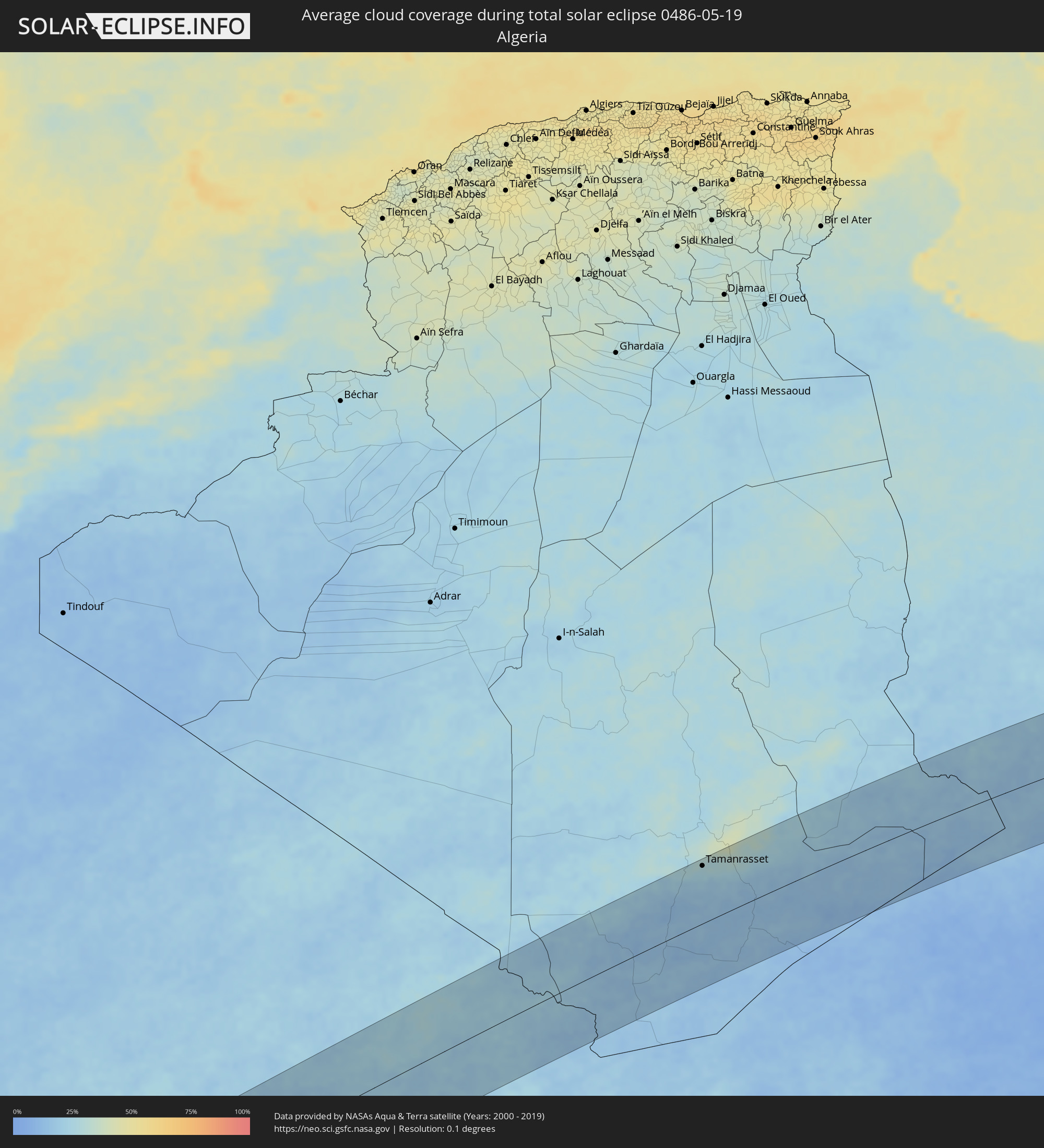 Algeria
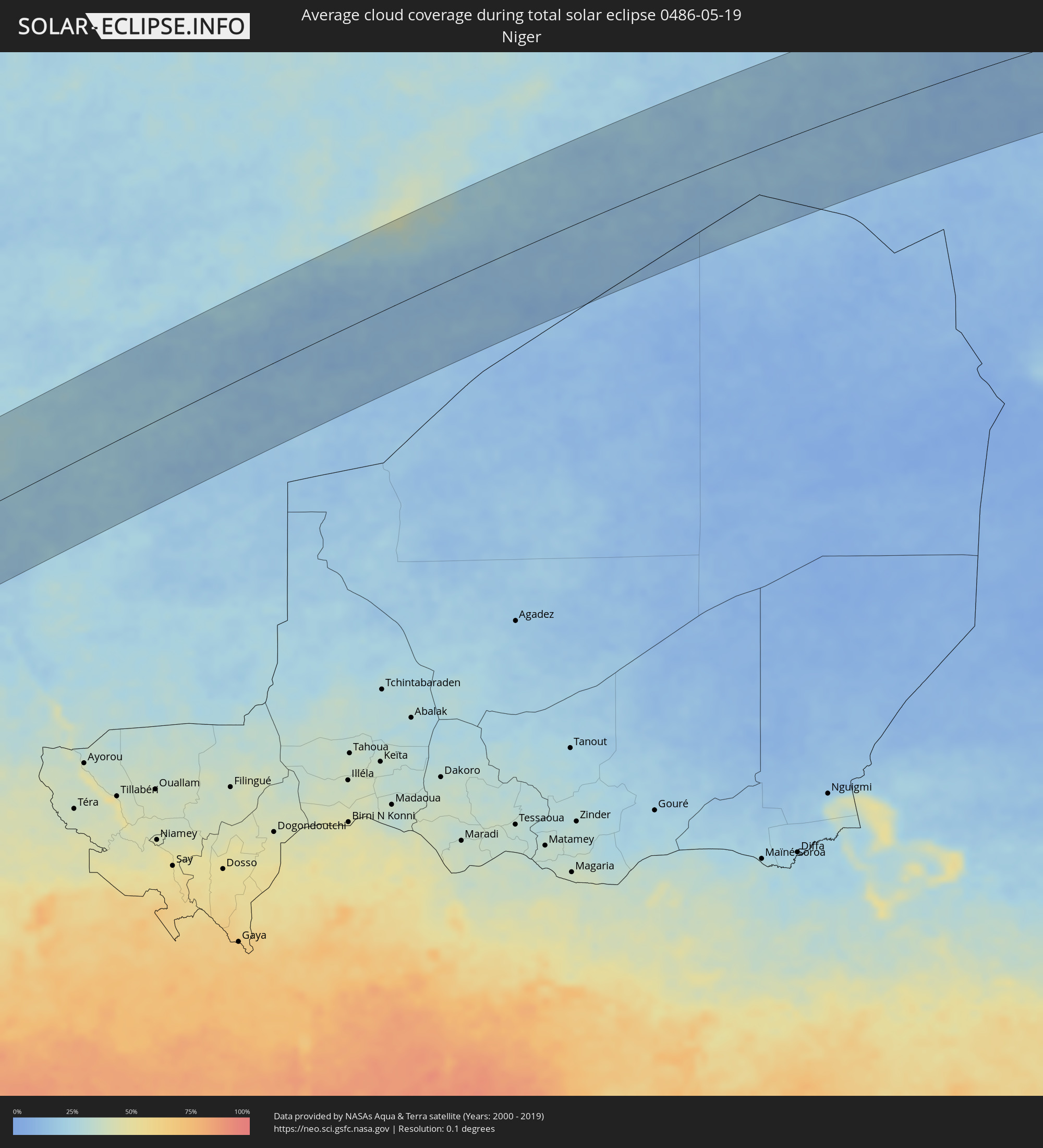 Niger
Niger
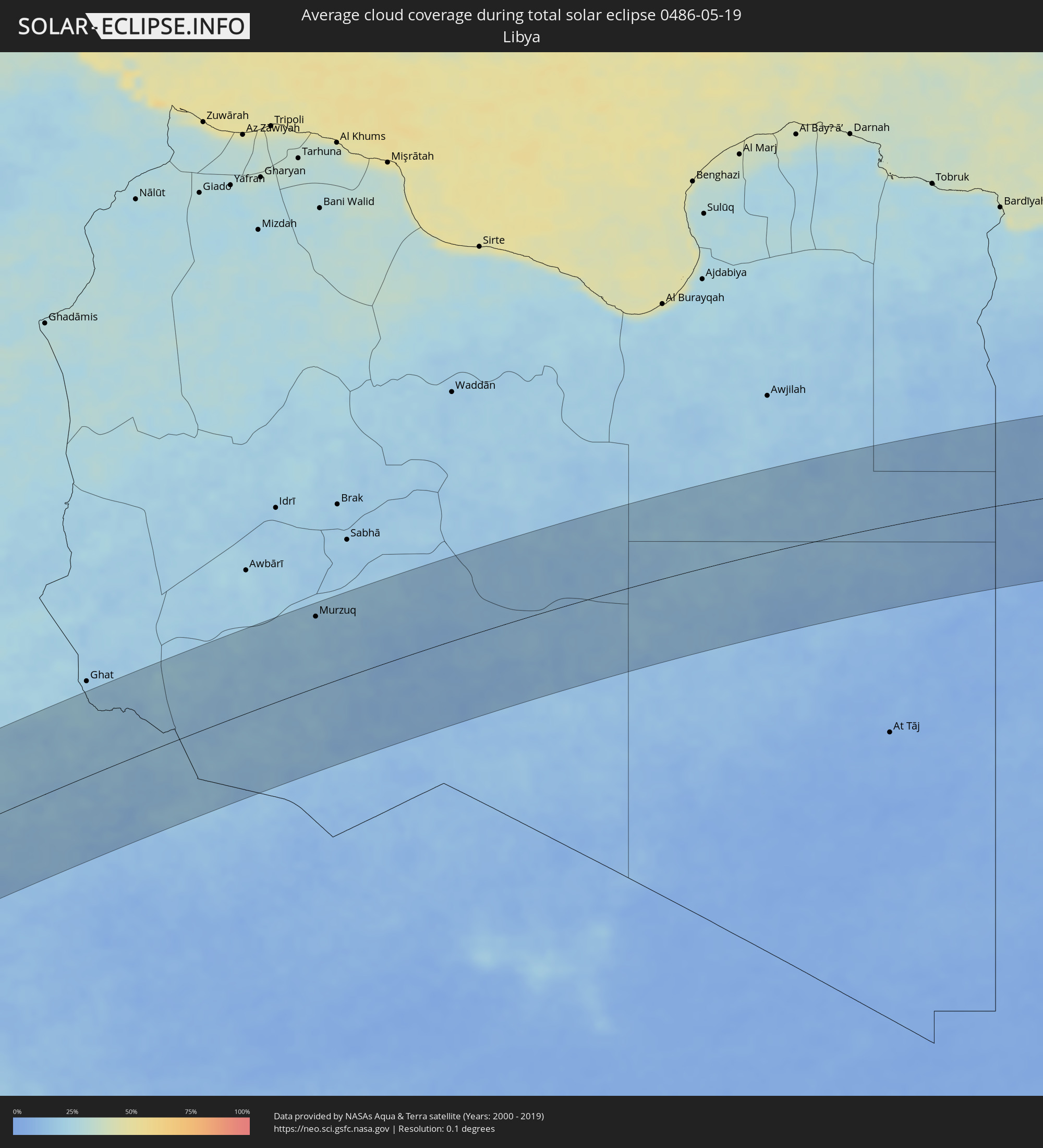 Libya
Libya
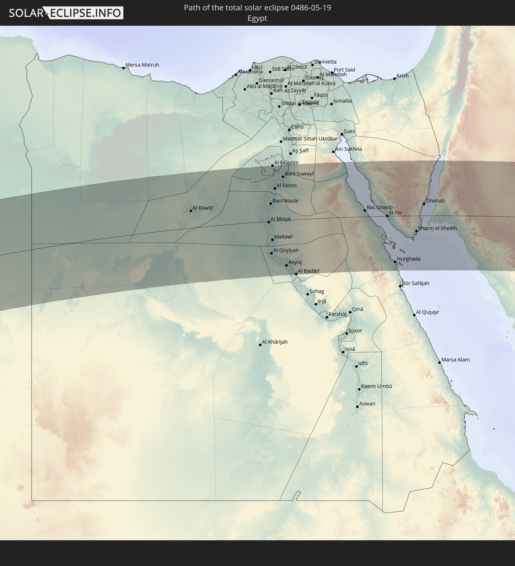
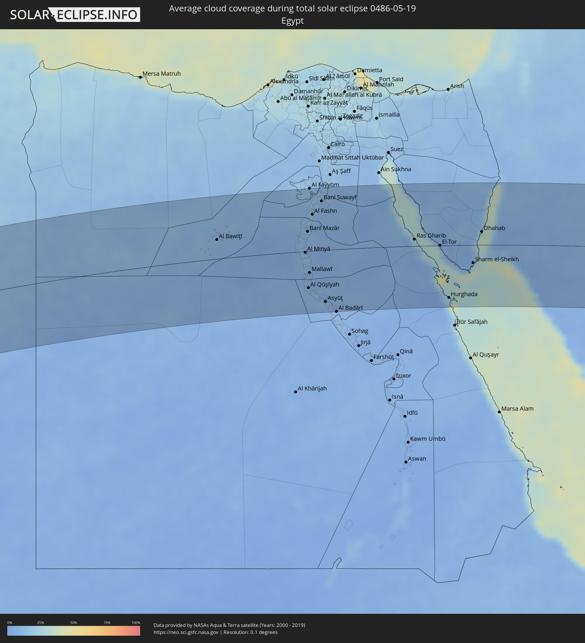 Egypt
Egypt
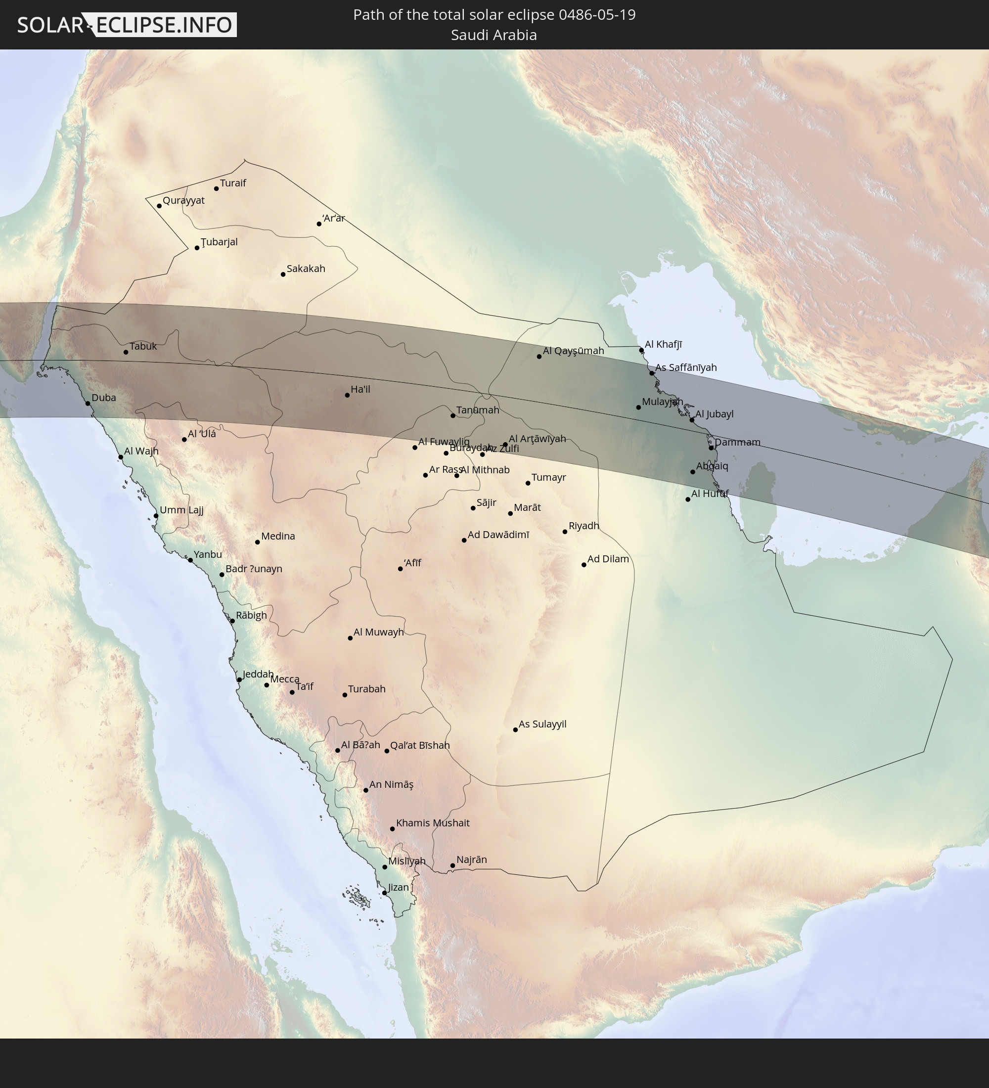
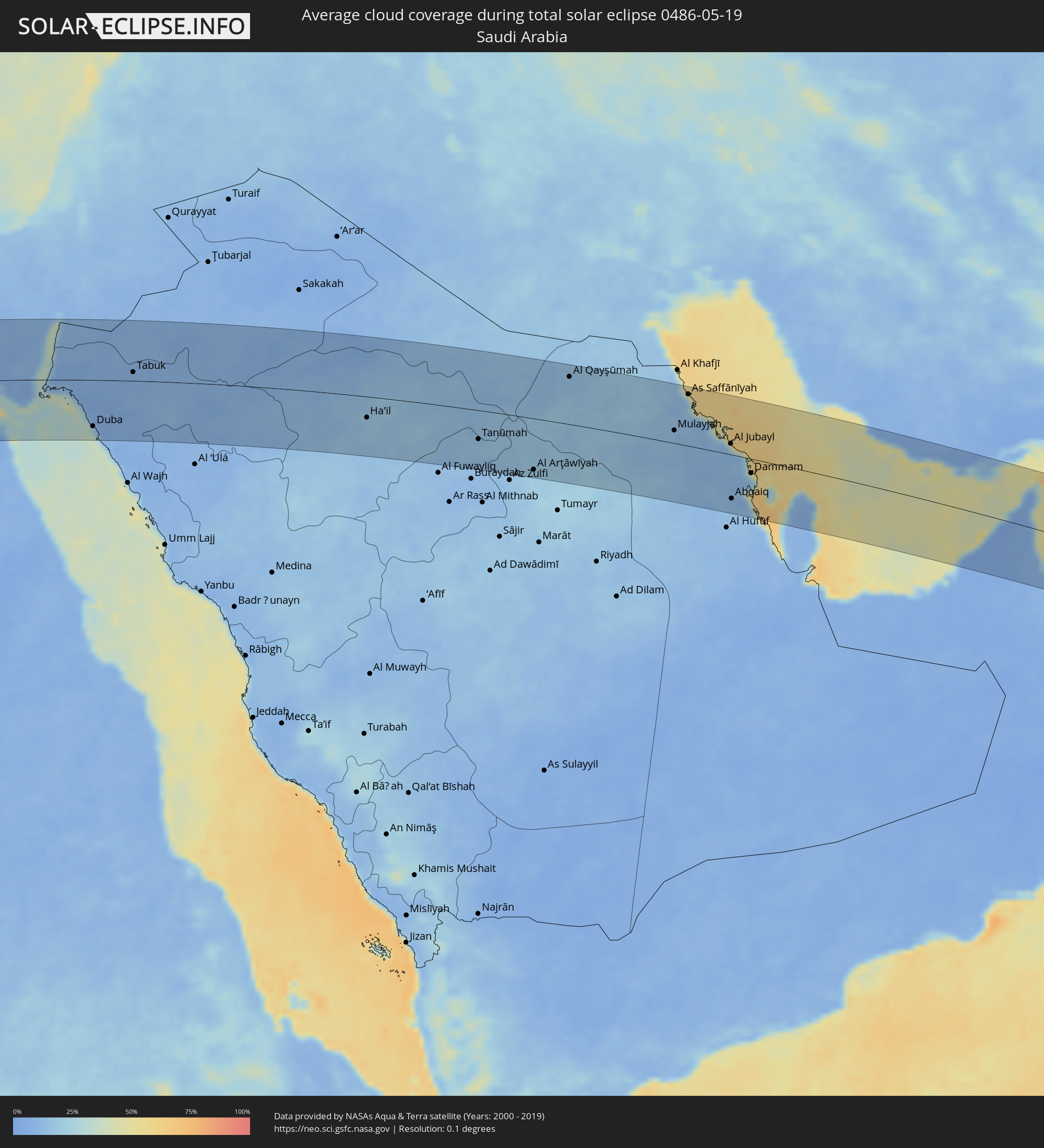 Saudi Arabia
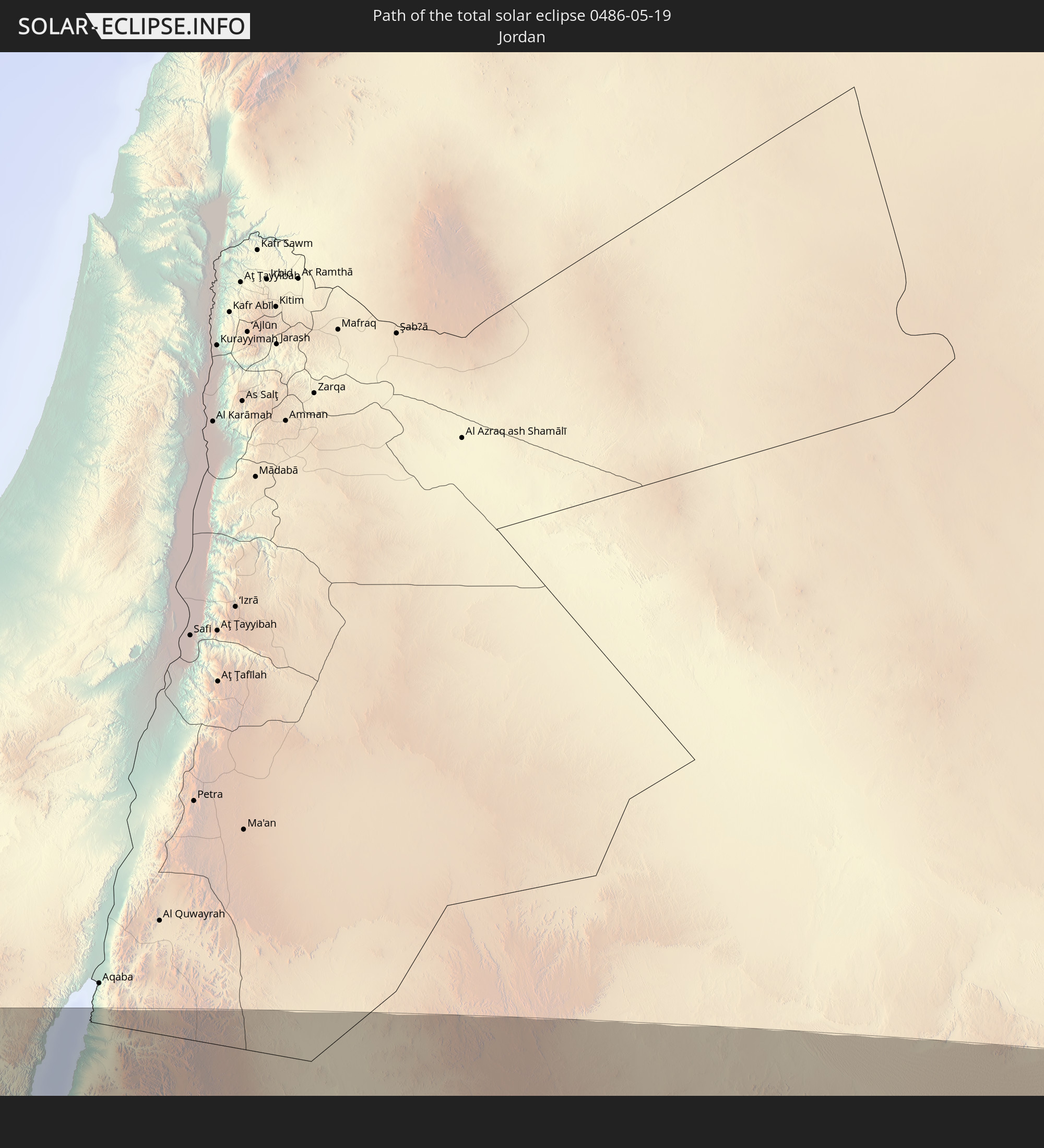
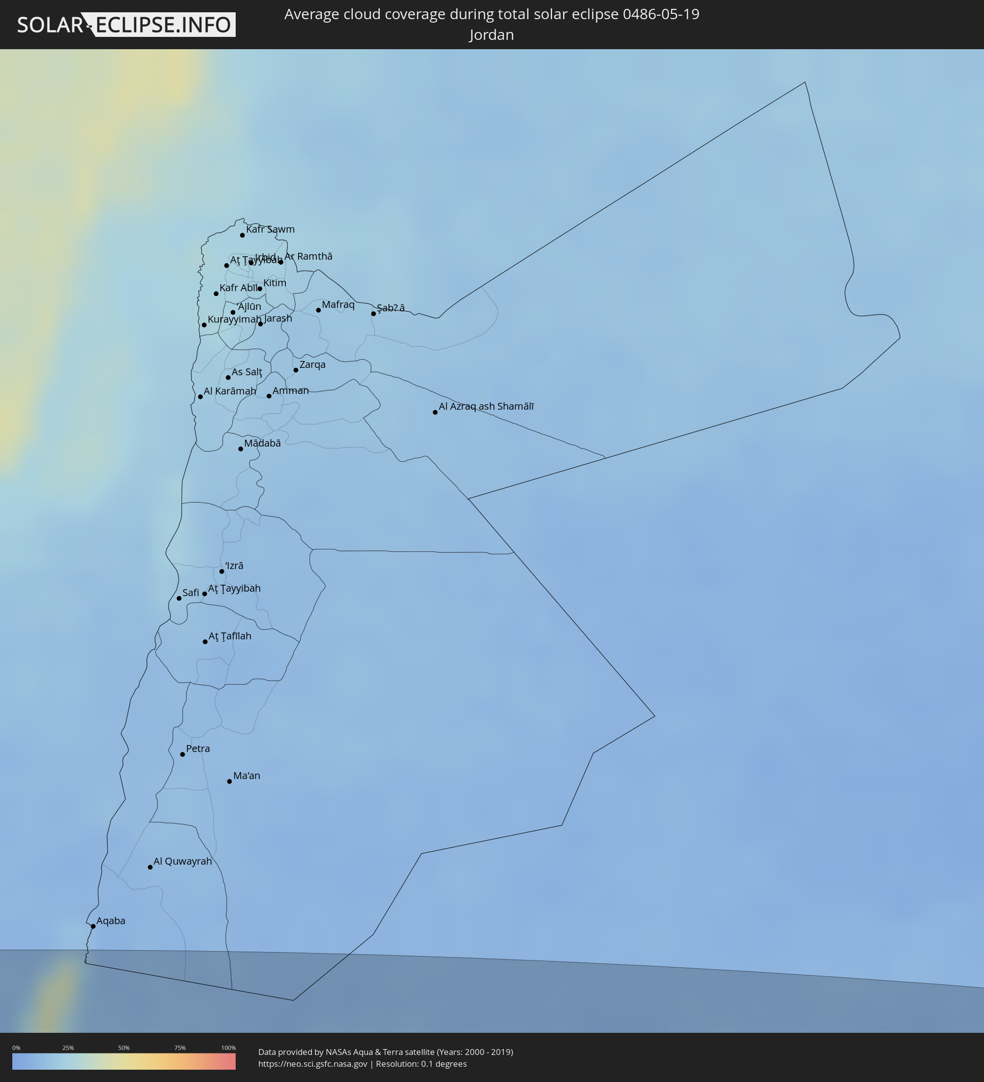 Jordan
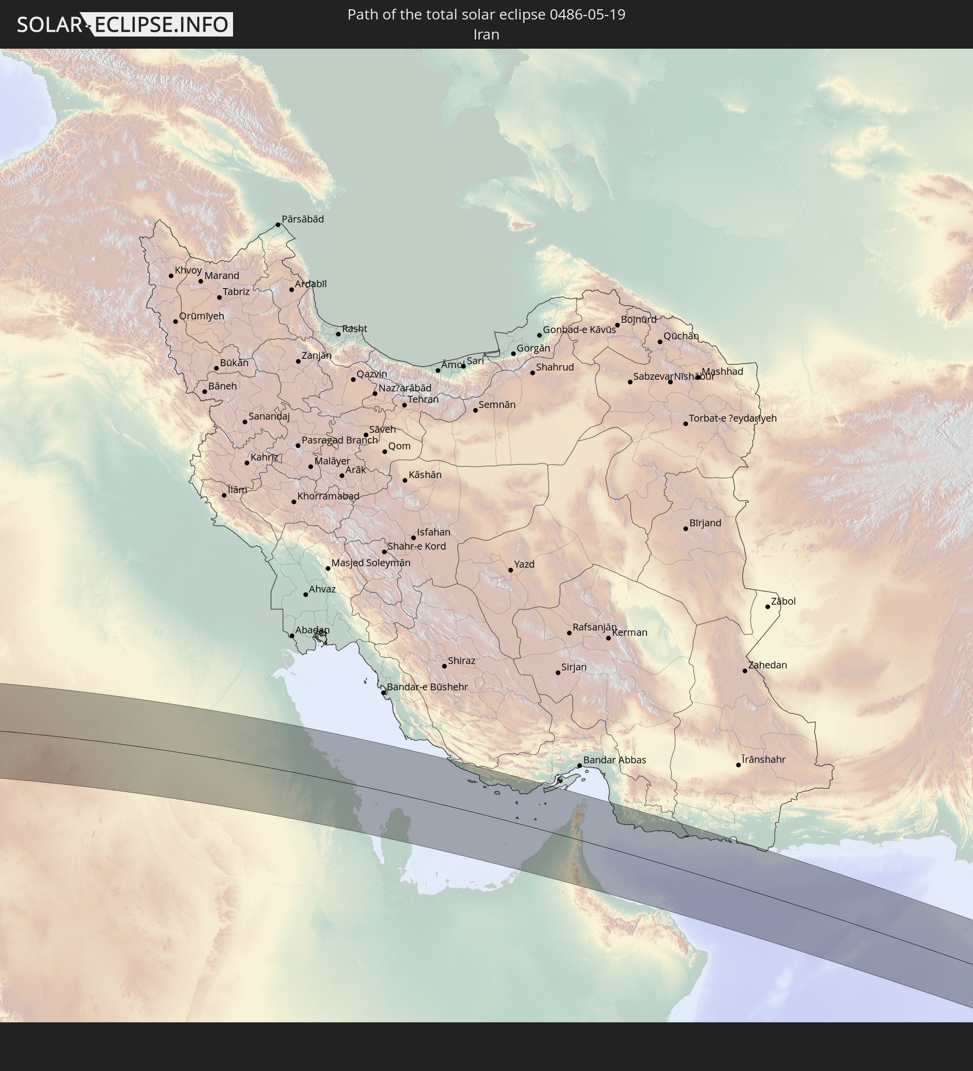
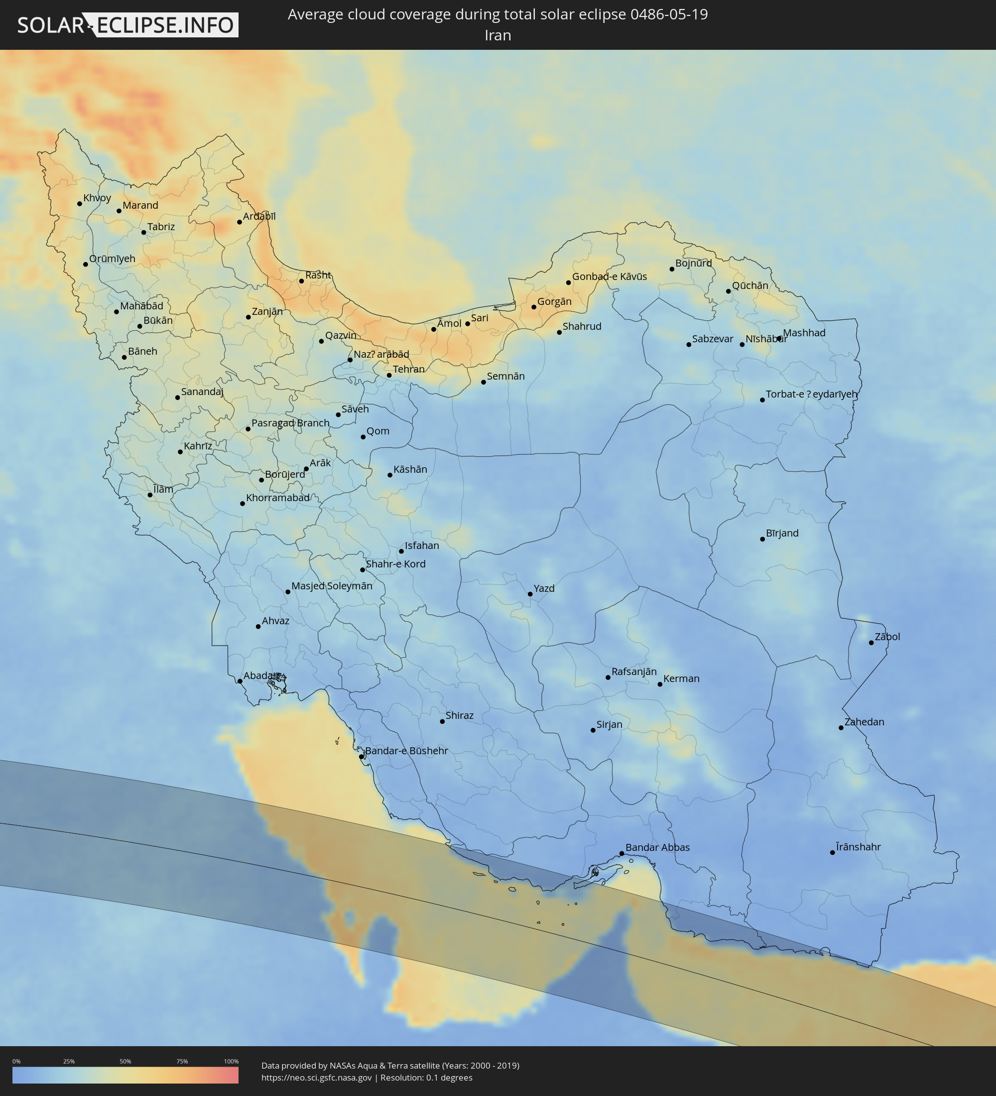 Iran
Iran
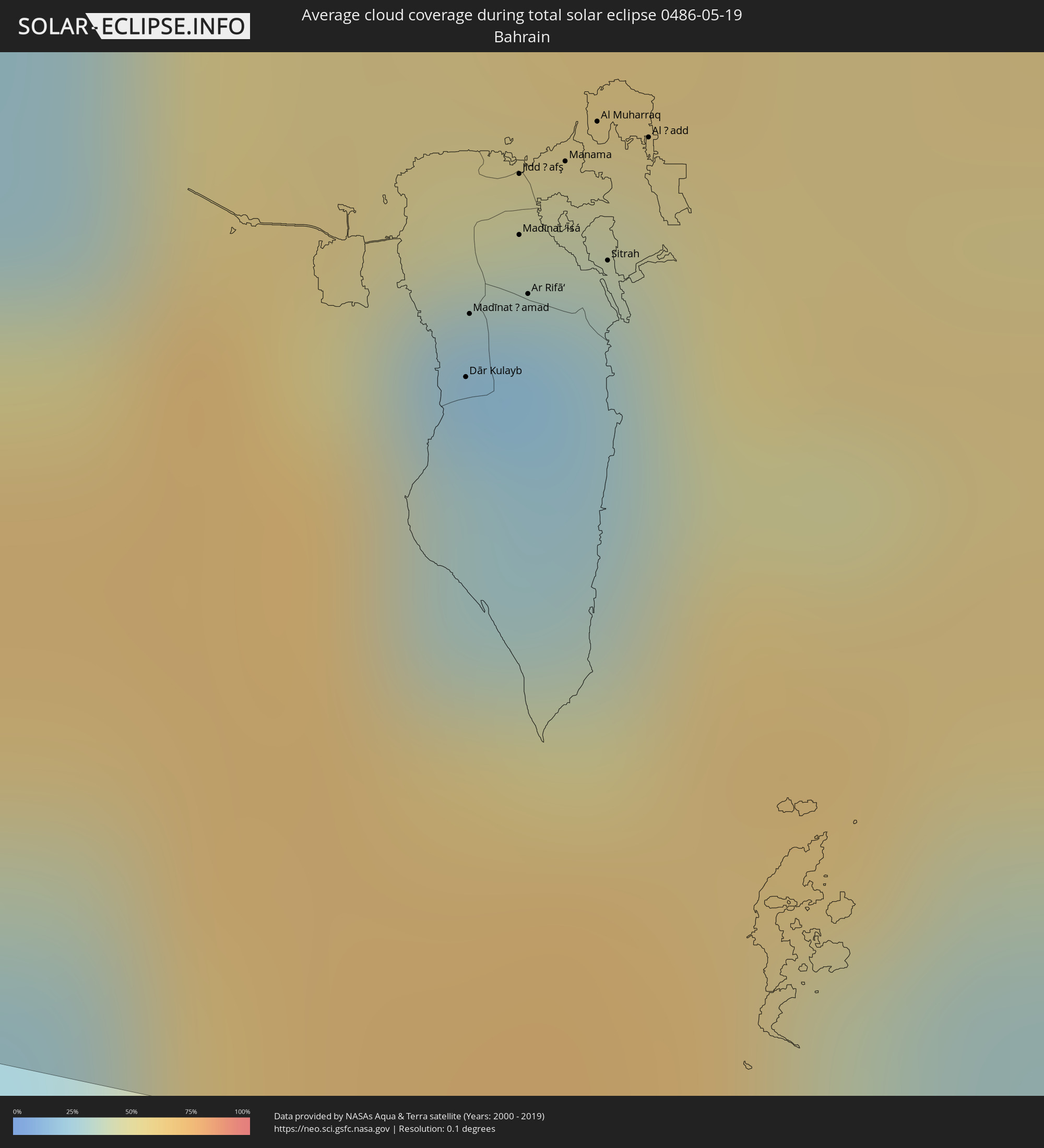 Bahrain
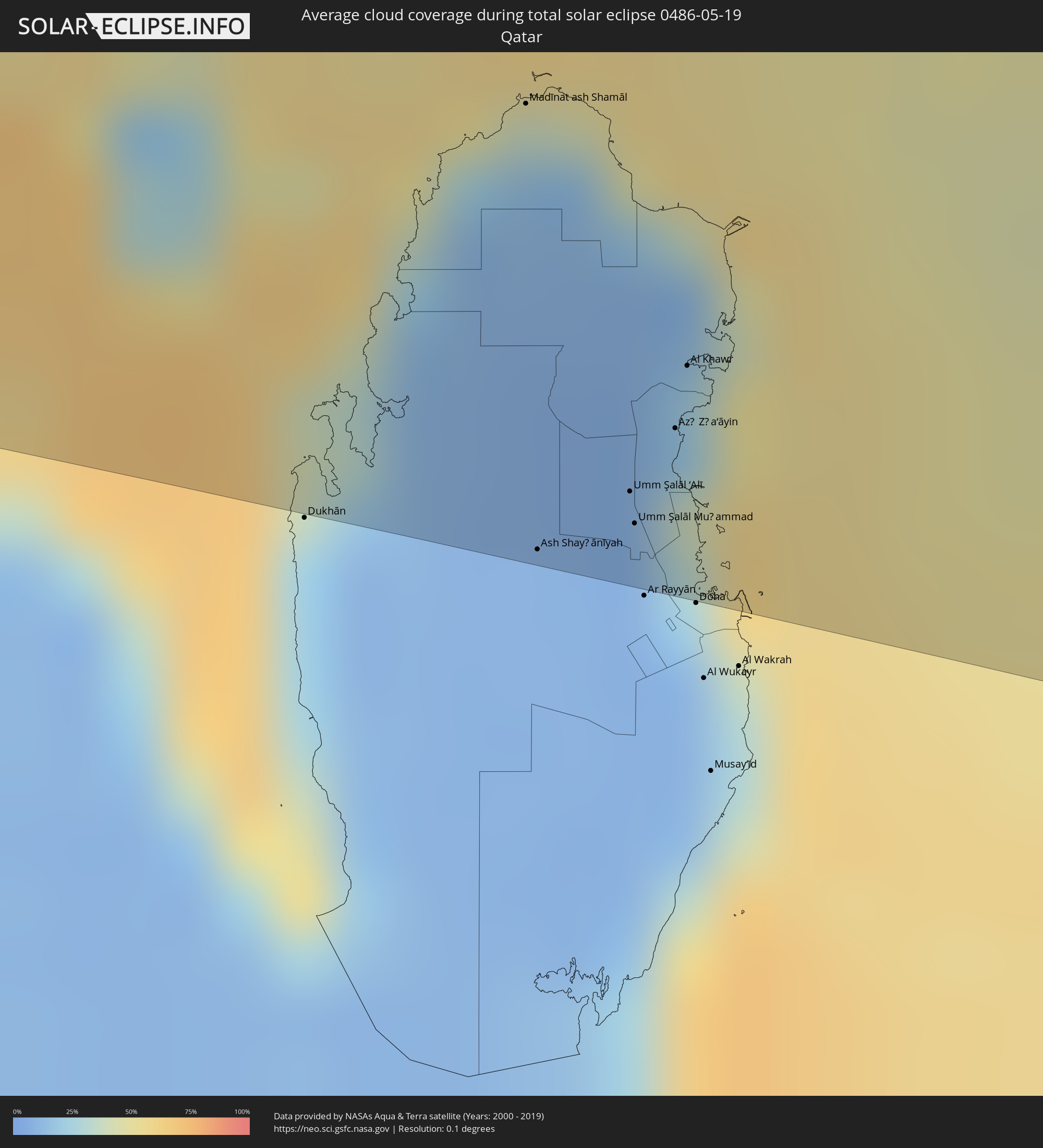 Qatar
Qatar
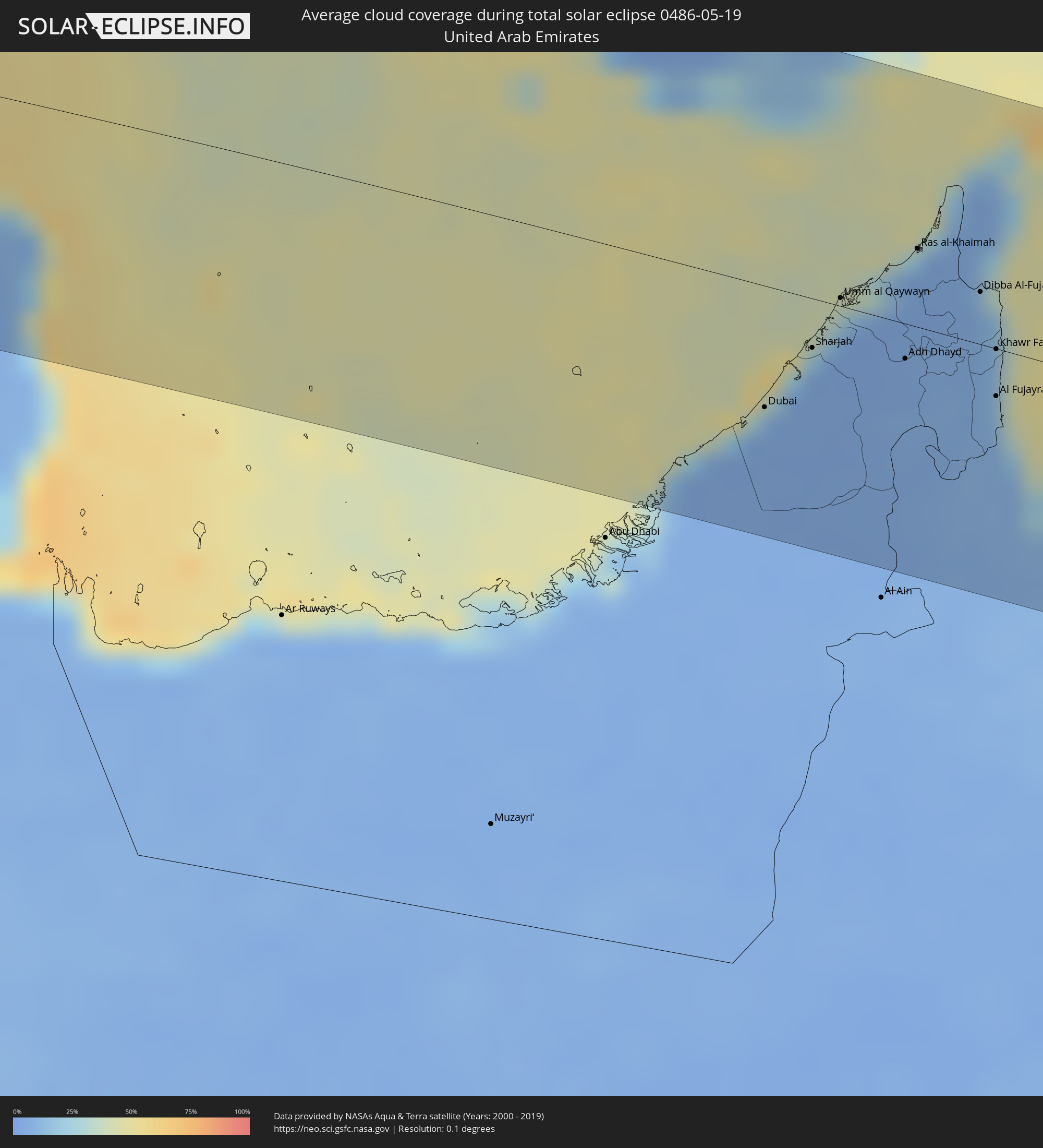 United Arab Emirates
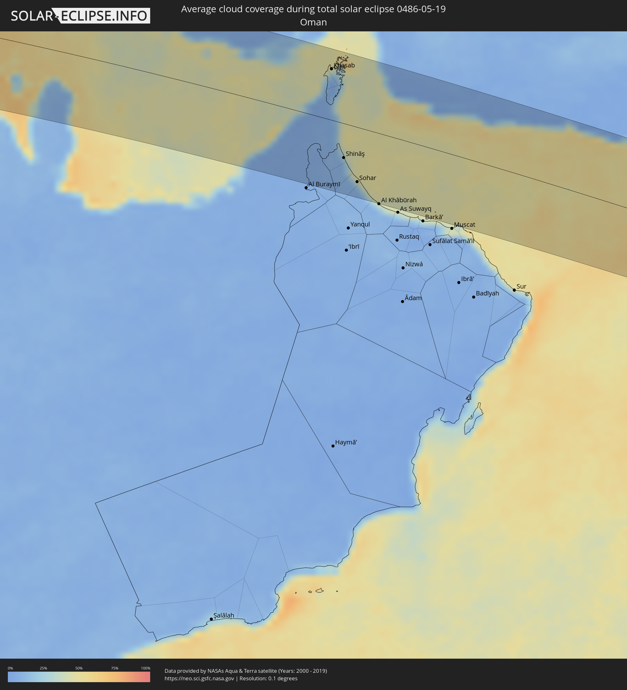 Oman
Oman
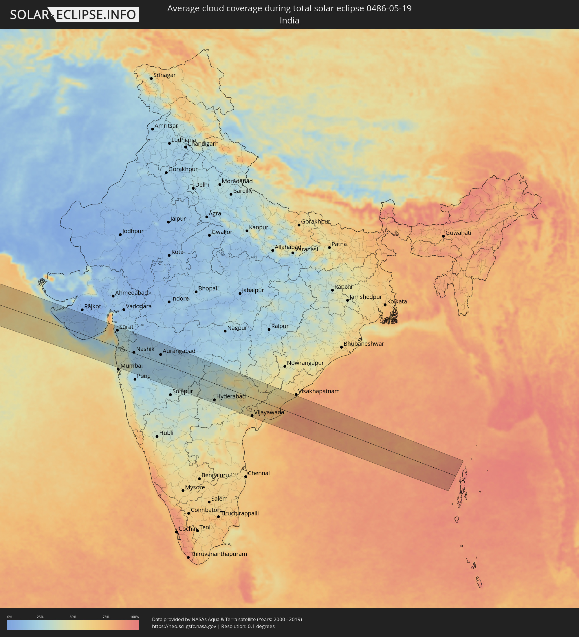 India
India
Cities inside the path of the eclipse
The following table shows all locations with a population of more than 5,000 inside the eclipse path. Cities which have more than 100,000 inhabitants are marked bold. A click at the locations opens a detailed map.
| City | Type | Eclipse duration | Local time of max. eclipse | Distance to central line | Ø Cloud coverage |
|
Canchungo, Cacheu
|
total | - | 07:53:04 UTC-01:02 | 114 km | 61% |
|
Quinhámel, Biombo
|
total | - | 07:53:01 UTC-01:02 | 88 km | 61% |
|
Bubaque, Bolama and Bijagos
|
total | - | 07:52:26 UTC-01:02 | 27 km | 64% |
|
Bissau, Bissau
|
total | - | 07:53:13 UTC-01:02 | 72 km | 63% |
|
Bolama, Bolama and Bijagos
|
total | - | 07:53:01 UTC-01:02 | 38 km | 64% |
|
Bissorã, Oio
|
total | - | 07:53:42 UTC-01:02 | 100 km | 61% |
|
Mansôa, Oio
|
total | - | 07:53:39 UTC-01:02 | 79 km | 61% |
|
Catió, Tombali
|
total | - | 07:52:54 UTC-01:02 | 2 km | 71% |
|
Farim, Oio
|
total | - | 07:54:10 UTC-01:02 | 115 km | 61% |
|
Buba, Quinara
|
total | - | 07:53:26 UTC-01:02 | 15 km | 70% |
|
Quebo, Tombali
|
total | - | 07:53:13 UTC-01:02 | 13 km | 72% |
|
Bafatá, Bafatá
|
total | - | 07:54:19 UTC-01:02 | 55 km | 61% |
|
Kamsar, Boke
|
total | - | 08:39:02 UTC-00:16 | 96 km | 72% |
|
Sanguéya, Boke
|
total | - | 08:39:16 UTC-00:16 | 105 km | 78% |
|
Boké, Boke
|
total | - | 08:39:34 UTC-00:16 | 85 km | 77% |
|
Gabú, Gabú
|
total | - | 07:54:49 UTC-01:02 | 44 km | 61% |
|
Koundara, Boke
|
total | - | 08:42:04 UTC-00:16 | 18 km | 58% |
|
Gaoual, Boke
|
total | - | 08:41:23 UTC-00:16 | 60 km | 67% |
|
Youkounkoun, Boke
|
total | - | 08:42:17 UTC-00:16 | 13 km | 59% |
|
Mali, Labe
|
total | - | 08:42:36 UTC-00:16 | 73 km | 60% |
|
Kédougou, Kédougou
|
total | - | 08:43:14 UTC-00:16 | 32 km | 55% |
|
Kayes, Kayes
|
total | - | 08:46:03 UTC-00:16 | 117 km | 40% |
|
Diré
|
total | - | 08:44:10 UTC-00:16 | 120 km | 62% |
|
Bafoulabé, Kayes
|
total | - | 08:45:59 UTC-00:16 | 23 km | 39% |
|
Kokofata
|
total | - | 08:45:55 UTC-00:16 | 113 km | 55% |
|
Kita, Kayes
|
total | - | 08:46:35 UTC-00:16 | 121 km | 56% |
|
Néma, Hodh ech Chargui
|
total | - | 08:53:26 UTC-00:16 | 117 km | 23% |
|
Niafunké, Tombouctou
|
total | - | 08:57:03 UTC-00:16 | 114 km | 36% |
|
Goundam, Tombouctou
|
total | - | 08:58:06 UTC-00:16 | 83 km | 38% |
|
Timbuktu, Tombouctou
|
total | - | 08:59:32 UTC-00:16 | 80 km | 30% |
|
Tamanrasset, Tamanrasset
|
total | - | 09:47:38 UTC+00:09 | 115 km | 26% |
|
Murzuq, Murzuq
|
total | - | 10:53:01 UTC+00:52 | 110 km | 18% |
|
Samālūţ, Minya
|
total | - | 12:44:07 UTC+02:00 | 20 km | 10% |
|
Al Minyā, Minya
|
total | - | 12:44:11 UTC+02:00 | 2 km | 11% |
|
Iţsā, Faiyum
|
total | - | 12:44:24 UTC+02:00 | 123 km | 13% |
|
Banī Mazār, Minya
|
total | - | 12:44:22 UTC+02:00 | 41 km | 10% |
|
Al Qūşīyah, Asyut
|
total | - | 12:44:17 UTC+02:00 | 77 km | 9% |
|
Abū Qurqāş, Minya
|
total | - | 12:44:23 UTC+02:00 | 23 km | 10% |
|
Mallawī, Minya
|
total | - | 12:44:22 UTC+02:00 | 45 km | 10% |
|
Al Fayyūm, Faiyum
|
total | - | 12:44:33 UTC+02:00 | 130 km | 13% |
|
Al Fashn, Beni Suweif
|
total | - | 12:44:38 UTC+02:00 | 76 km | 12% |
|
Manfalūţ, Asyut
|
total | - | 12:44:39 UTC+02:00 | 93 km | 9% |
|
Banī Suwayf, Beni Suweif
|
total | - | 12:45:09 UTC+02:00 | 103 km | 14% |
|
Asyūţ, Asyut
|
total | - | 12:45:11 UTC+02:00 | 108 km | 9% |
|
Abū Tīj, Asyut
|
total | - | 12:45:31 UTC+02:00 | 124 km | 9% |
|
Hurghada, Red Sea
|
total | - | 12:51:48 UTC+02:00 | 110 km | 17% |
|
Duba, Tabuk
|
total | - | 14:03:15 UTC+03:06 | 100 km | 21% |
|
Tabuk, Tabuk
|
total | - | 14:05:09 UTC+03:06 | 19 km | 8% |
|
Ha'il, Ḩāʼil
|
total | - | 14:16:51 UTC+03:06 | 45 km | 18% |
|
Tanūmah, Al-Qassim
|
total | - | 14:22:06 UTC+03:06 | 62 km | 16% |
|
Al Qayşūmah, Eastern Province
|
total | - | 14:25:18 UTC+03:06 | 101 km | 15% |
|
Al Jubayl, Eastern Province
|
total | - | 14:32:26 UTC+03:06 | 23 km | 31% |
|
Abqaiq, Eastern Province
|
total | - | 14:33:11 UTC+03:06 | 94 km | 12% |
|
Umm as Sāhik, Eastern Province
|
total | - | 14:33:06 UTC+03:06 | 11 km | 14% |
|
Şafwá, Eastern Province
|
total | - | 14:33:10 UTC+03:06 | 10 km | 23% |
|
Tārūt, Eastern Province
|
total | - | 14:33:22 UTC+03:06 | 17 km | 23% |
|
Sayhāt, Eastern Province
|
total | - | 14:33:26 UTC+03:06 | 26 km | 15% |
|
Raḩīmah, Eastern Province
|
total | - | 14:33:19 UTC+03:06 | 2 km | 55% |
|
Dammam, Eastern Province
|
total | - | 14:33:34 UTC+03:06 | 31 km | 14% |
|
Khobar, Eastern Province
|
total | - | 14:33:51 UTC+03:06 | 45 km | 31% |
|
Dār Kulayb, Southern Governorate
|
total | - | 14:53:46 UTC+03:26 | 62 km | 30% |
|
Madīnat Ḩamad, Central Governorate
|
total | - | 14:53:44 UTC+03:26 | 57 km | 30% |
|
Madīnat ‘Īsá, Southern Governorate
|
total | - | 14:53:46 UTC+03:26 | 50 km | 22% |
|
Jidd Ḩafş, Manama
|
total | - | 14:53:44 UTC+03:26 | 45 km | 22% |
|
Ar Rifā‘, Southern Governorate
|
total | - | 14:53:48 UTC+03:26 | 54 km | 27% |
|
Manama, Manama
|
total | - | 14:53:47 UTC+03:26 | 43 km | 26% |
|
Al Muharraq, Muharraq
|
total | - | 14:53:49 UTC+03:26 | 39 km | 42% |
|
Sitrah, Manama
|
total | - | 14:53:54 UTC+03:26 | 50 km | 26% |
|
Al Ḩadd, Muharraq
|
total | - | 14:53:53 UTC+03:26 | 39 km | 51% |
|
Madīnat ash Shamāl, Madīnat ash Shamāl
|
total | - | 14:54:52 UTC+03:26 | 40 km | 16% |
|
Ash Shayḩānīyah, Baladīyat ar Rayyān
|
total | - | 14:55:26 UTC+03:26 | 122 km | 8% |
|
Umm Şalāl ‘Alī, Baladīyat Umm Şalāl
|
total | - | 14:55:39 UTC+03:26 | 107 km | 8% |
|
Umm Şalāl Muḩammad, Baladīyat Umm Şalāl
|
total | - | 14:55:42 UTC+03:26 | 113 km | 8% |
|
Az̧ Z̧a‘āyin, Baladīyat az̧ Z̧a‘āyin
|
total | - | 14:55:43 UTC+03:26 | 94 km | 38% |
|
Al Khawr, Al Khawr
|
total | - | 14:55:41 UTC+03:26 | 82 km | 22% |
|
Kīsh, Hormozgan
|
total | - | 14:58:31 UTC+03:25 | 72 km | 36% |
|
Bandar-e Lengeh, Hormozgan
|
total | - | 14:59:45 UTC+03:25 | 93 km | 25% |
|
Dubai, Dubai
|
total | - | 15:16:46 UTC+03:41 | 60 km | 10% |
|
Sharjah, Ash Shāriqah
|
total | - | 15:16:54 UTC+03:41 | 24 km | 7% |
|
Ajman, Ajman
|
total | - | 15:16:53 UTC+03:41 | 16 km | 21% |
|
Umm al Qaywayn, Umm al Qaywayn
|
total | - | 15:16:56 UTC+03:41 | 4 km | 17% |
|
Adh Dhayd, Ash Shāriqah
|
total | - | 15:17:35 UTC+03:41 | 17 km | 6% |
|
Ras al-Khaimah, Raʼs al Khaymah
|
total | - | 15:17:17 UTC+03:41 | 38 km | 24% |
|
Khasab, Musandam
|
total | - | 15:17:24 UTC+03:41 | 88 km | 16% |
|
Dibba Al-Fujairah, Al Fujayrah
|
total | - | 15:17:52 UTC+03:41 | 26 km | 15% |
|
Dibba Al-Hisn, Al Fujayrah
|
total | - | 15:17:52 UTC+03:41 | 29 km | 15% |
|
Al Fujayrah, Al Fujayrah
|
total | - | 15:18:21 UTC+03:41 | 23 km | 13% |
|
Khawr Fakkān, Ash Shāriqah
|
total | - | 15:18:11 UTC+03:41 | 0 km | 12% |
|
Shināş, Al Batinah North Governorate
|
total | - | 15:18:48 UTC+03:41 | 60 km | 22% |
|
Al Liwā’, Al Batinah North Governorate
|
total | - | 15:19:05 UTC+03:41 | 79 km | 14% |
|
Sohar, Al Batinah North Governorate
|
total | - | 15:19:25 UTC+03:41 | 96 km | 15% |
|
Şaḩam, Al Batinah North Governorate
|
total | - | 15:19:48 UTC+03:41 | 110 km | 24% |
|
Chabahar, Sistan and Baluchestan
|
total | - | 15:08:02 UTC+03:25 | 118 km | 54% |
|
Sūrat, Gujarat
|
total | - | 17:16:39 UTC+05:21 | 94 km | 26% |
|
Bhayandar, Maharashtra
|
total | - | 17:18:00 UTC+05:21 | 103 km | 43% |
|
Bilimora, Gujarat
|
total | - | 17:17:02 UTC+05:21 | 54 km | 31% |
|
Thāne, Maharashtra
|
total | - | 17:18:08 UTC+05:21 | 110 km | 42% |
|
Kalyān, Maharashtra
|
total | - | 17:18:12 UTC+05:21 | 99 km | 42% |
|
Nashik, Maharashtra
|
total | - | 17:18:00 UTC+05:21 | 3 km | 20% |
|
Mālegaon, Maharashtra
|
total | - | 17:17:58 UTC+05:21 | 88 km | 16% |
|
Ahmadnagar, Maharashtra
|
total | - | 17:19:05 UTC+05:21 | 56 km | 17% |
|
Aurangabad, Maharashtra
|
total | - | 17:18:49 UTC+05:21 | 48 km | 20% |
|
Nanded, Maharashtra
|
total | - | 17:20:04 UTC+05:21 | 46 km | 27% |
|
Hyderabad, Telangana
|
total | - | 17:21:35 UTC+05:21 | 96 km | 38% |
|
Rāmgundam, Telangana
|
total | - | 17:20:59 UTC+05:21 | 89 km | 40% |
|
Warangal, Telangana
|
total | - | 17:21:31 UTC+05:21 | 11 km | 37% |
|
Vijayawada, Andhra Pradesh
|
total | - | 17:22:41 UTC+05:21 | 104 km | 62% |