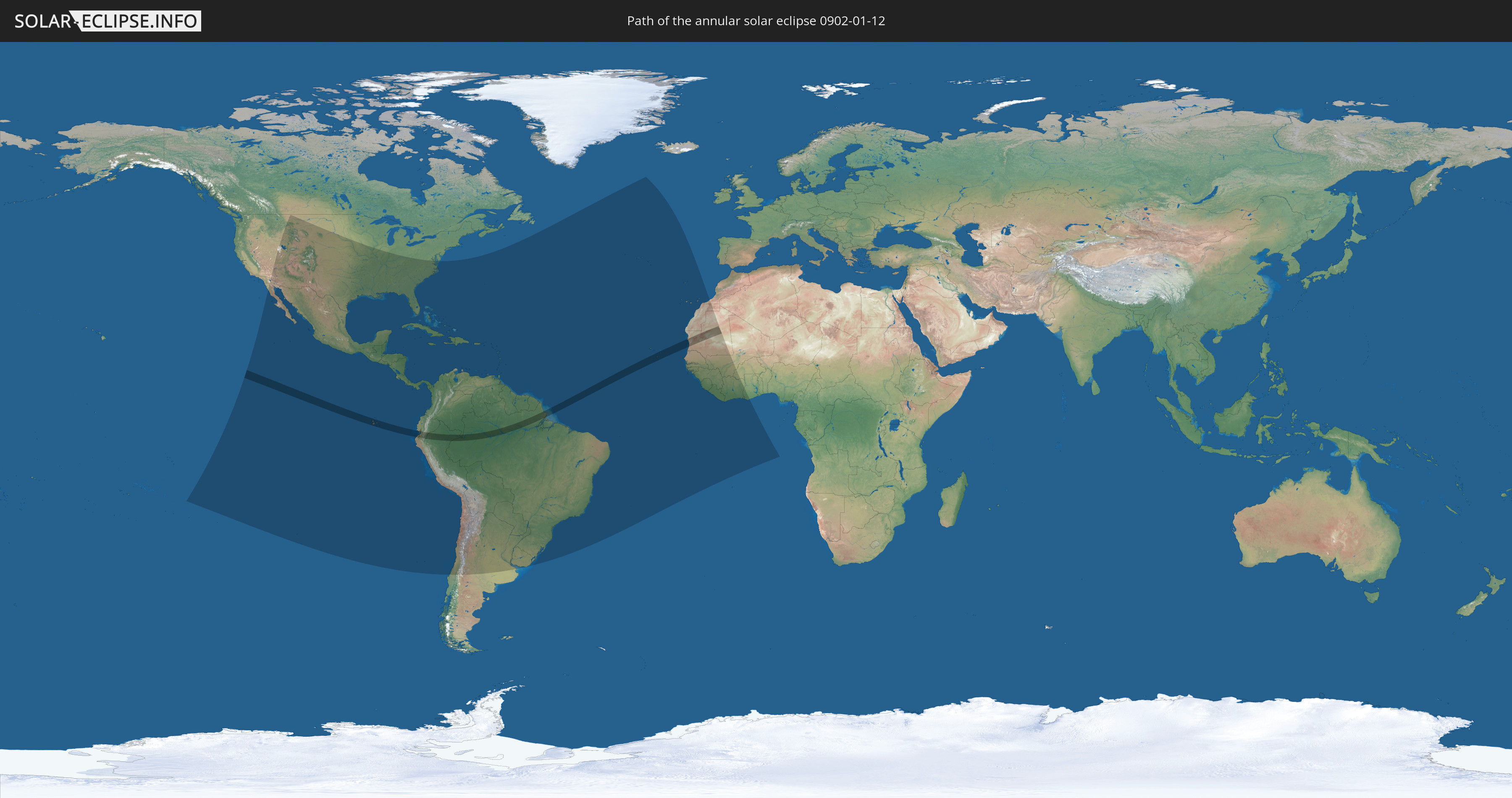
Annular solar eclipse of 01/12/0902
| Day of week: | Thursday |
| Maximum duration of eclipse: | 05m06s |
| Maximum width of eclipse path: | 153 km |
| Saros cycle: | 94 |
| Coverage: | 96% |
| Magnitude: | 0.9597 |
| Gamma: | 0.2978 |
Wo kann man die Sonnenfinsternis vom 01/12/0902 sehen?
Die Sonnenfinsternis am 01/12/0902 kann man in 65 Ländern als partielle Sonnenfinsternis beobachten.
Der Finsternispfad verläuft durch 6 Länder. Nur in diesen Ländern ist sie als annular Sonnenfinsternis zu sehen.
In den folgenden Ländern ist die Sonnenfinsternis annular zu sehen
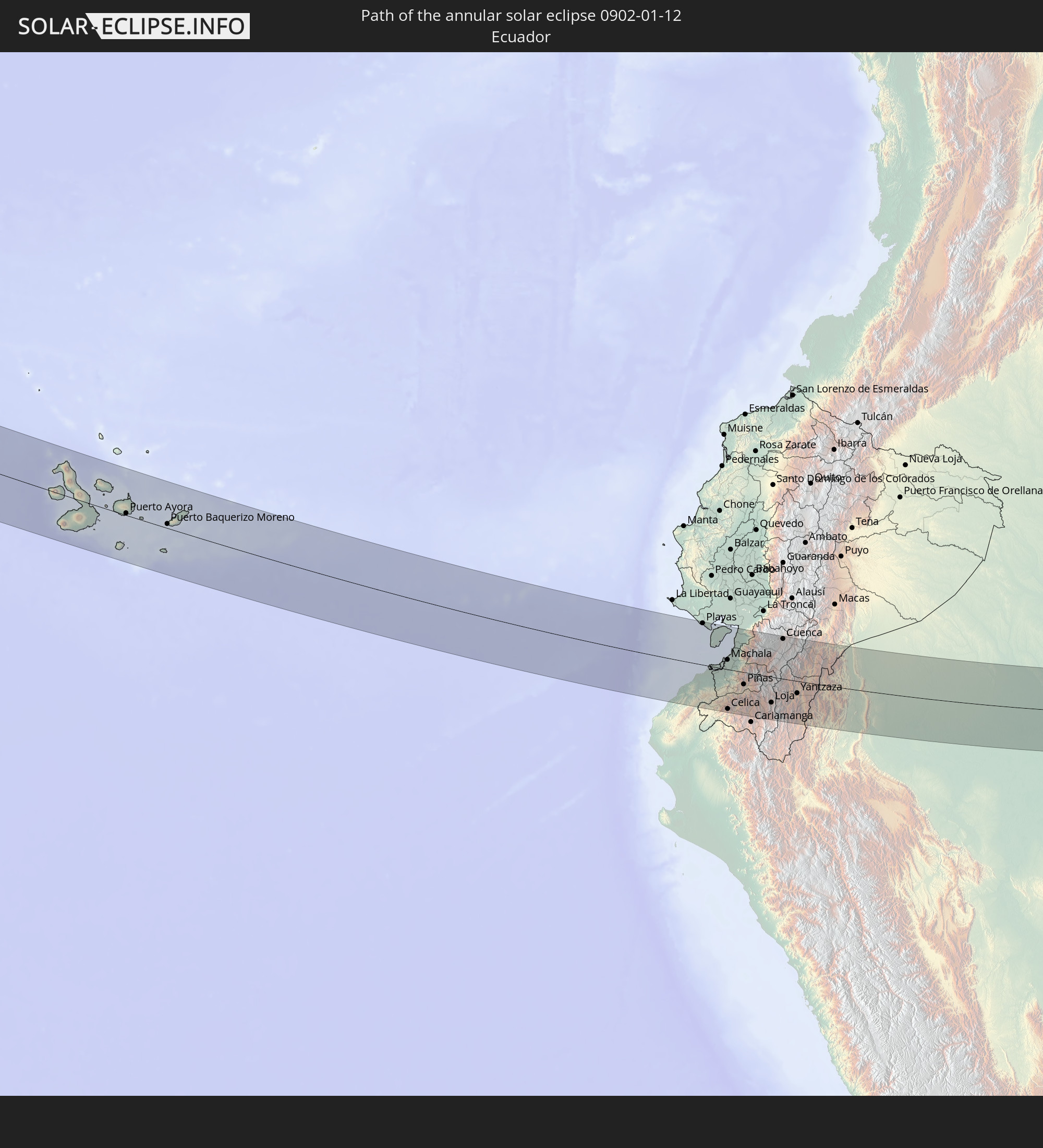 Ecuador
 Colombia
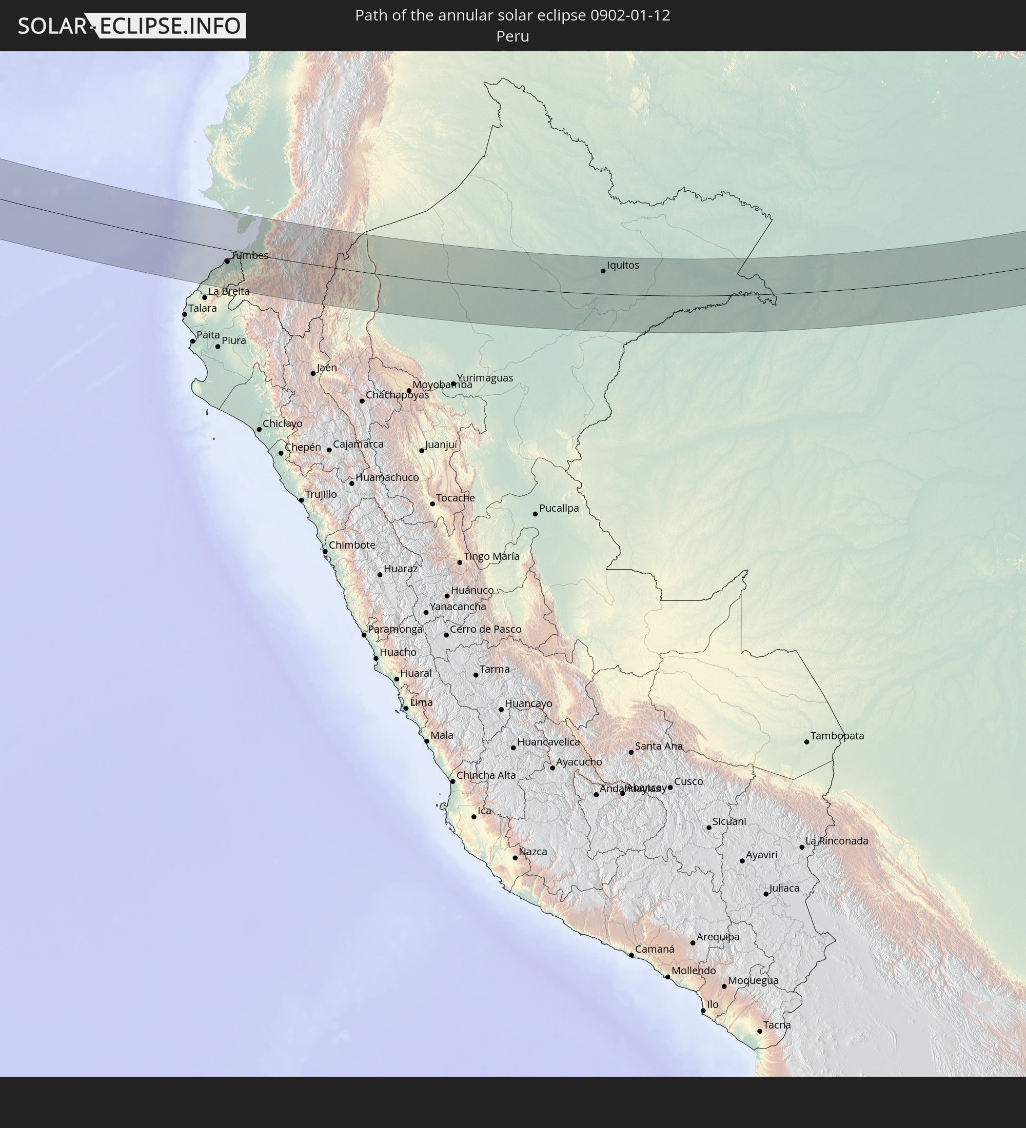 Peru
Peru
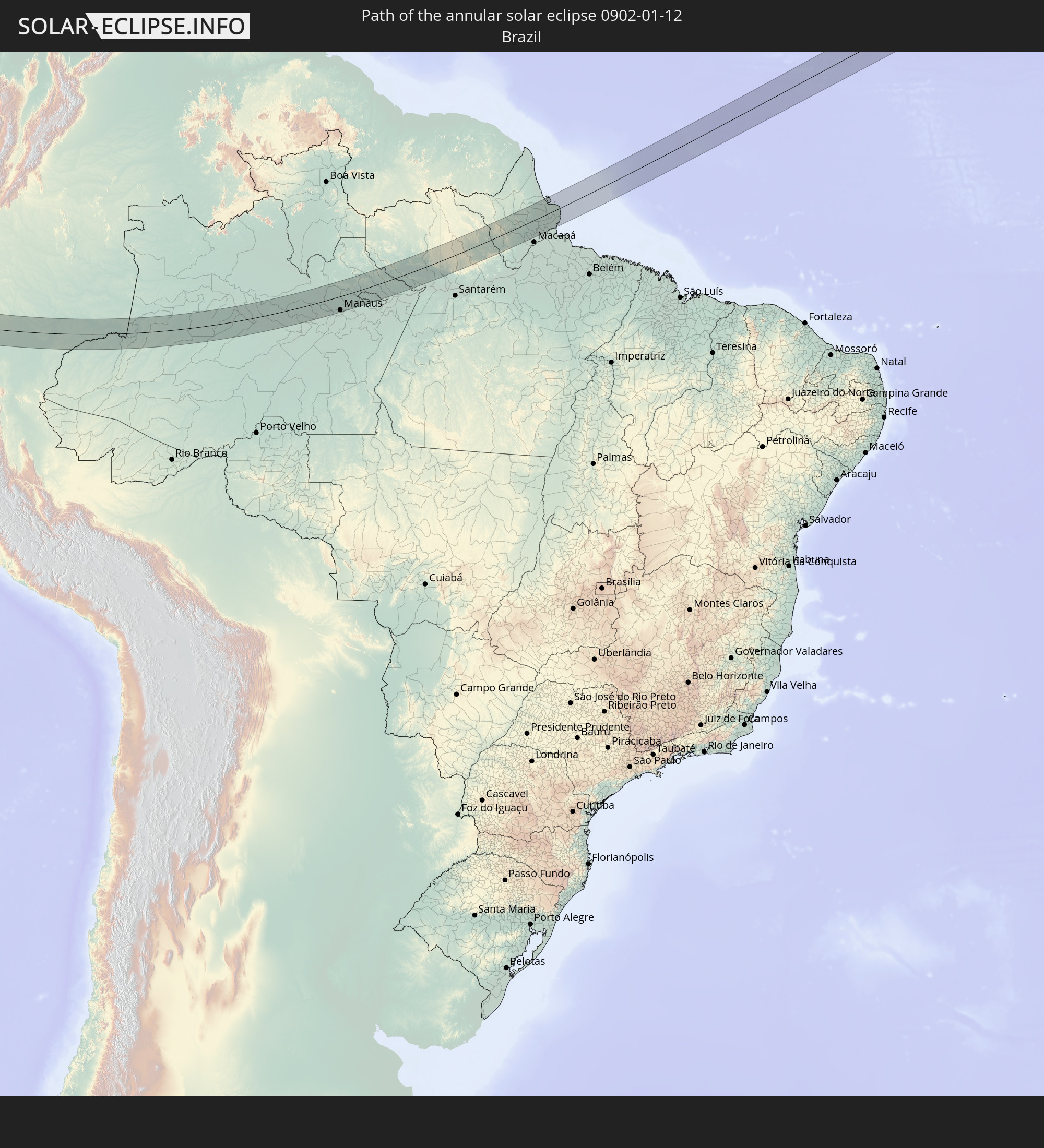 Brazil
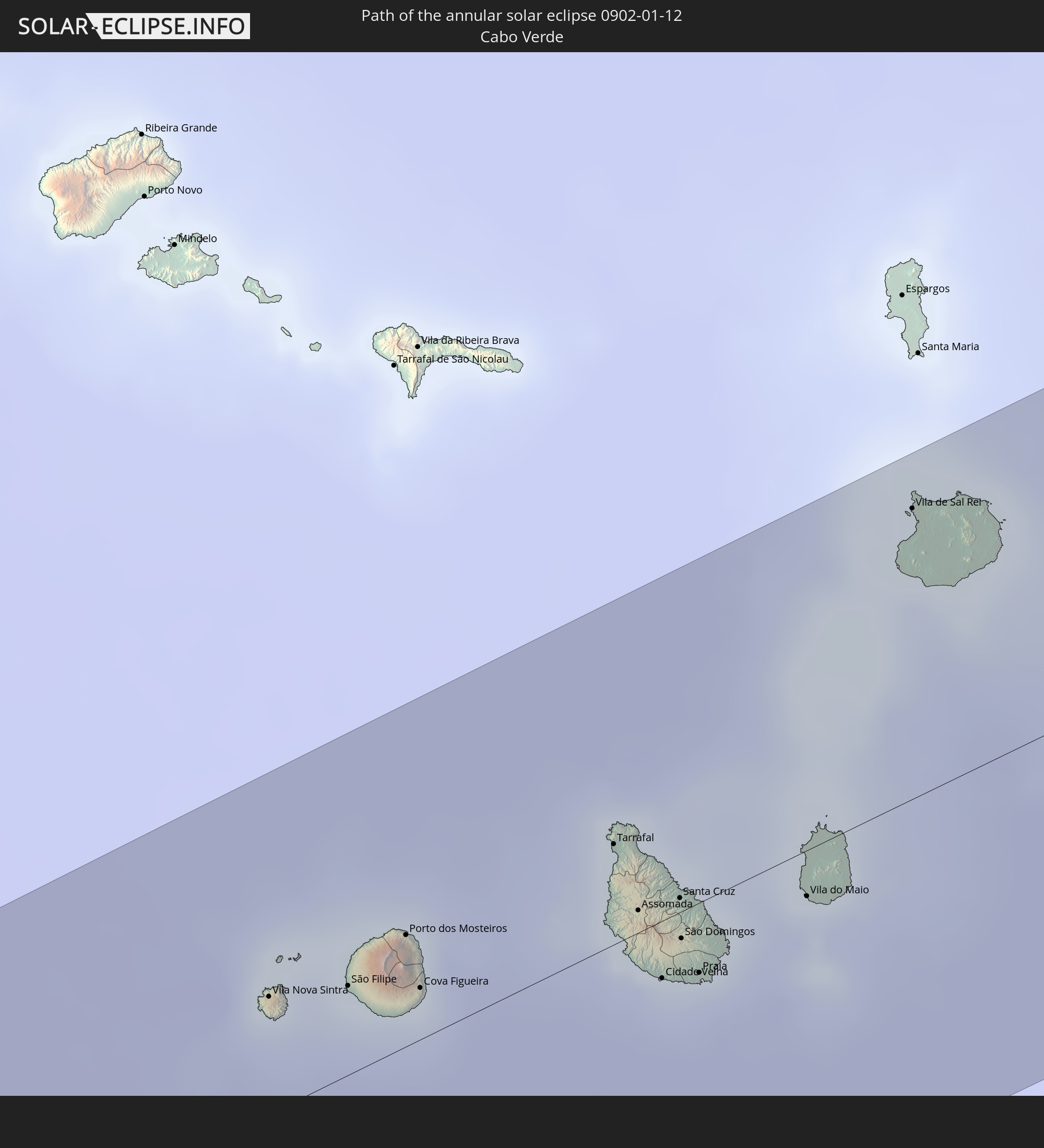 Cabo Verde
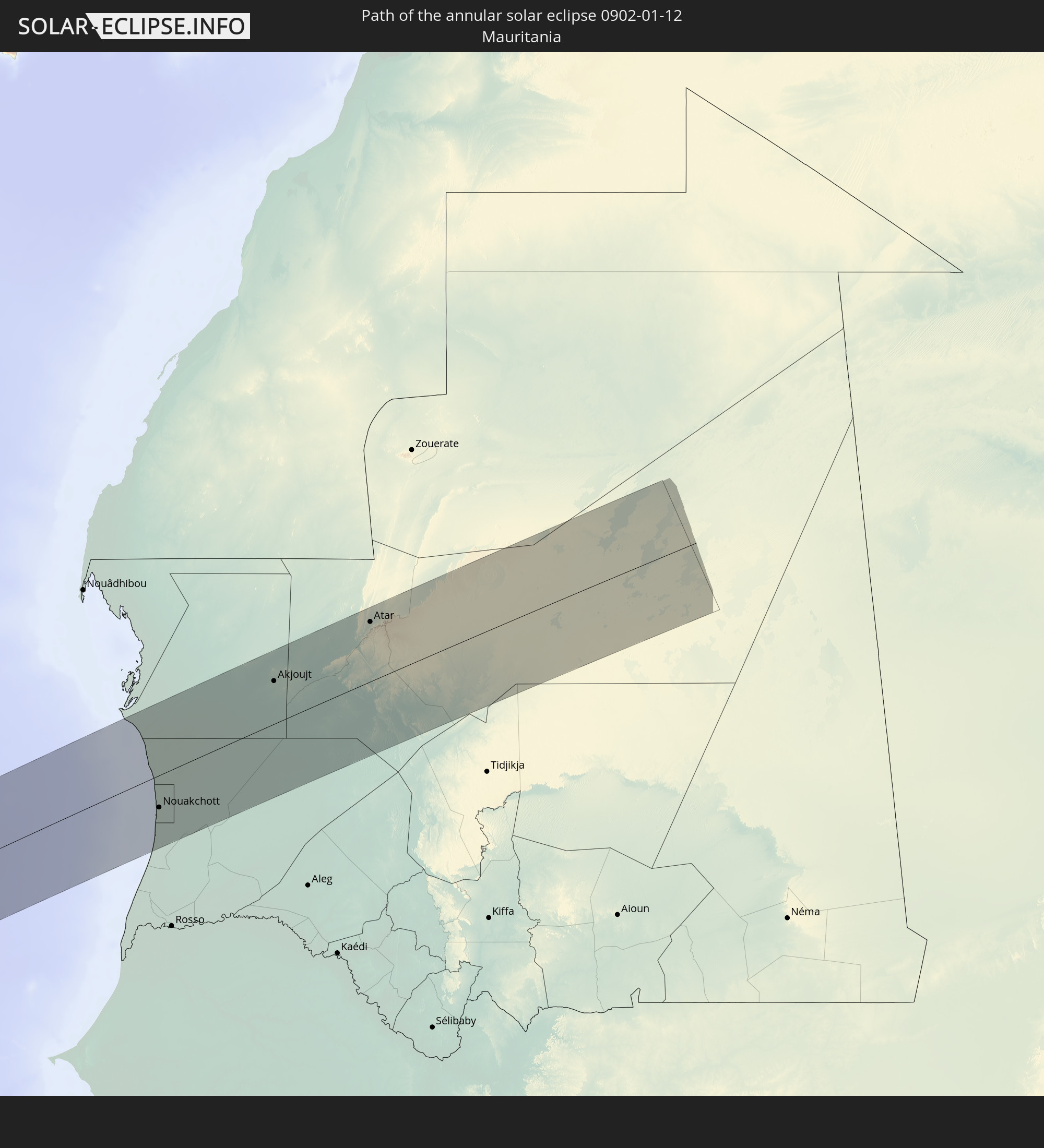 Mauritania
In den folgenden Ländern ist die Sonnenfinsternis partiell zu sehen
 United States
 United States Minor Outlying Islands
 Mexico
 Chile
Chile
 Guatemala
 Ecuador
 El Salvador
 Honduras
 Belize
 Nicaragua
 Costa Rica
 Cuba
Cuba
 Panama
 Colombia
 Cayman Islands
 Peru
Peru
 The Bahamas
 Jamaica
 Haiti
Haiti
 Brazil
 Argentina
 Venezuela
 Turks and Caicos Islands
 Dominican Republic
 Aruba
Aruba
 Bolivia
 Puerto Rico
 United States Virgin Islands
 Bermuda
 British Virgin Islands
 Anguilla
 Collectivity of Saint Martin
 Saint Barthélemy
 Saint Kitts and Nevis
 Paraguay
 Antigua and Barbuda
 Montserrat
 Trinidad and Tobago
 Guadeloupe
 Grenada
 Dominica
 Saint Vincent and the Grenadines
 Guyana
 Martinique
 Saint Lucia
 Barbados
 Uruguay
 Suriname
 French Guiana
 Portugal
 Cabo Verde
 Spain
Spain
 Senegal
 Mauritania
 The Gambia
 Guinea-Bissau
 Guinea
 Saint Helena, Ascension and Tristan da Cunha
 Sierra Leone
 Morocco
 Mali
Mali
 Liberia
 Ivory Coast
 Burkina Faso
 Ghana
Ghana
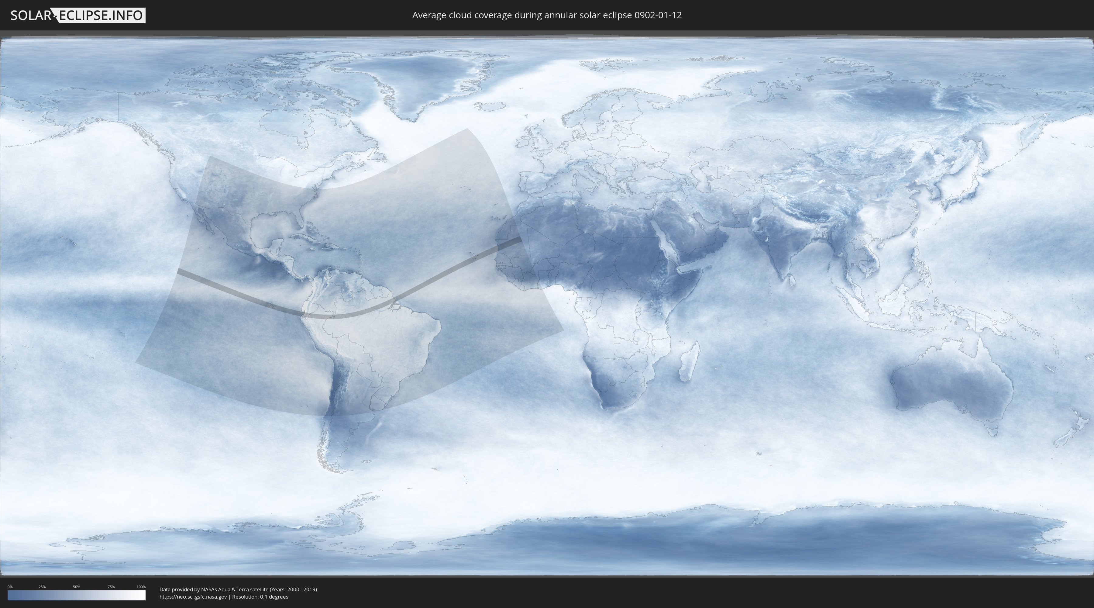
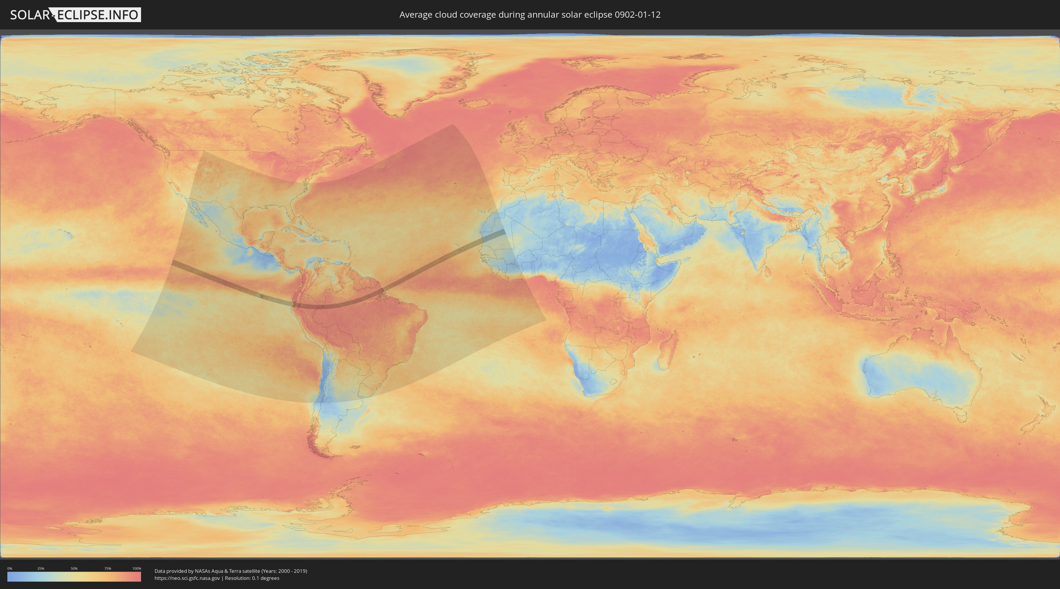
How will be the weather during the annular solar eclipse on 01/12/0902?
Where is the best place to see the annular solar eclipse of 01/12/0902?
The following maps show the average cloud coverage for the day of the annular solar eclipse.
With the help of these maps, it is possible to find the place along the eclipse path, which has the best
chance of a cloudless sky.
Nevertheless, you should consider local circumstances and inform about the weather of your chosen
observation site.
The data is provided by NASAs satellites
AQUA and TERRA.
The cloud maps are averaged over a period of 19 years (2000 - 2019).
Detailed country maps
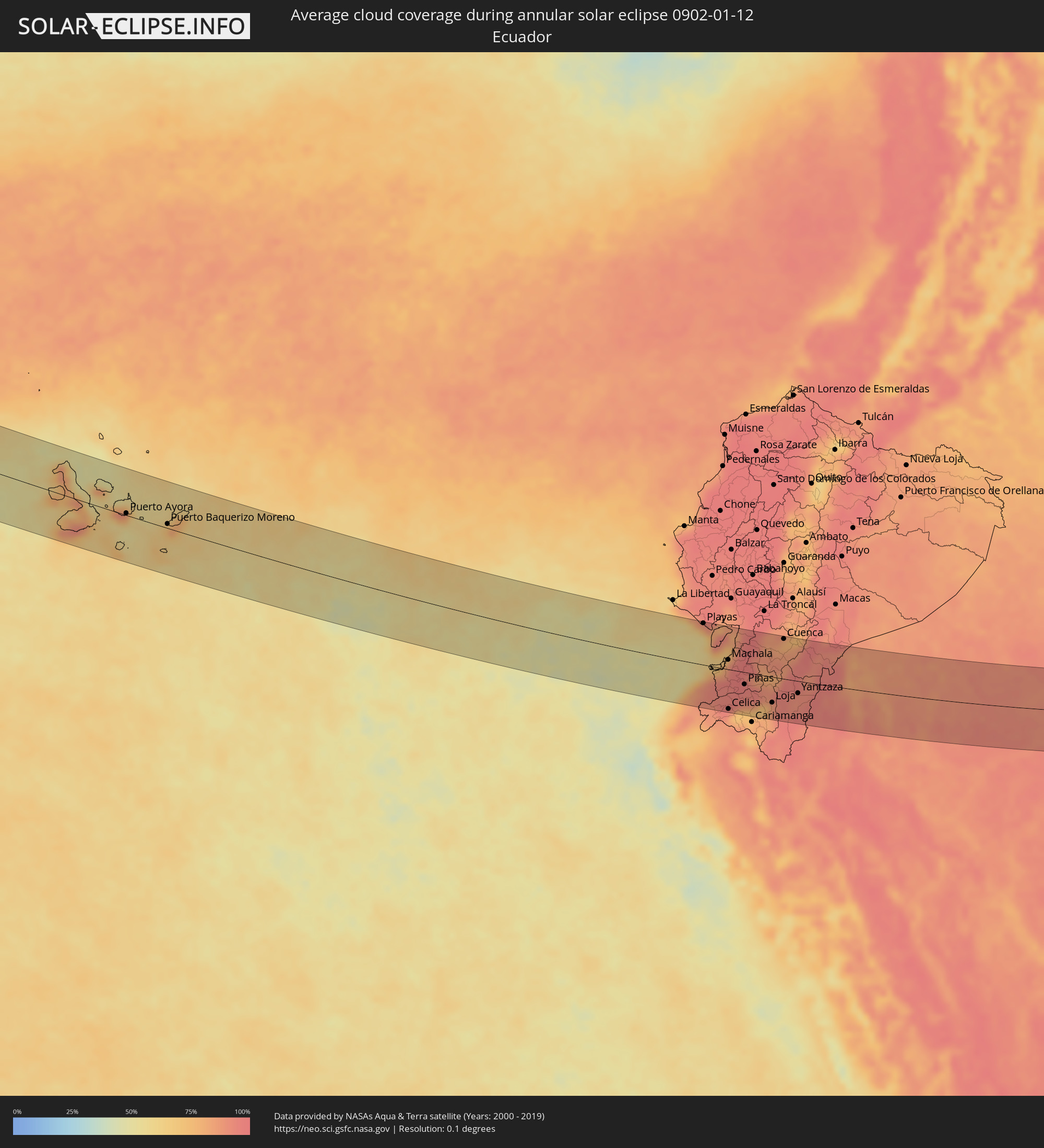 Ecuador
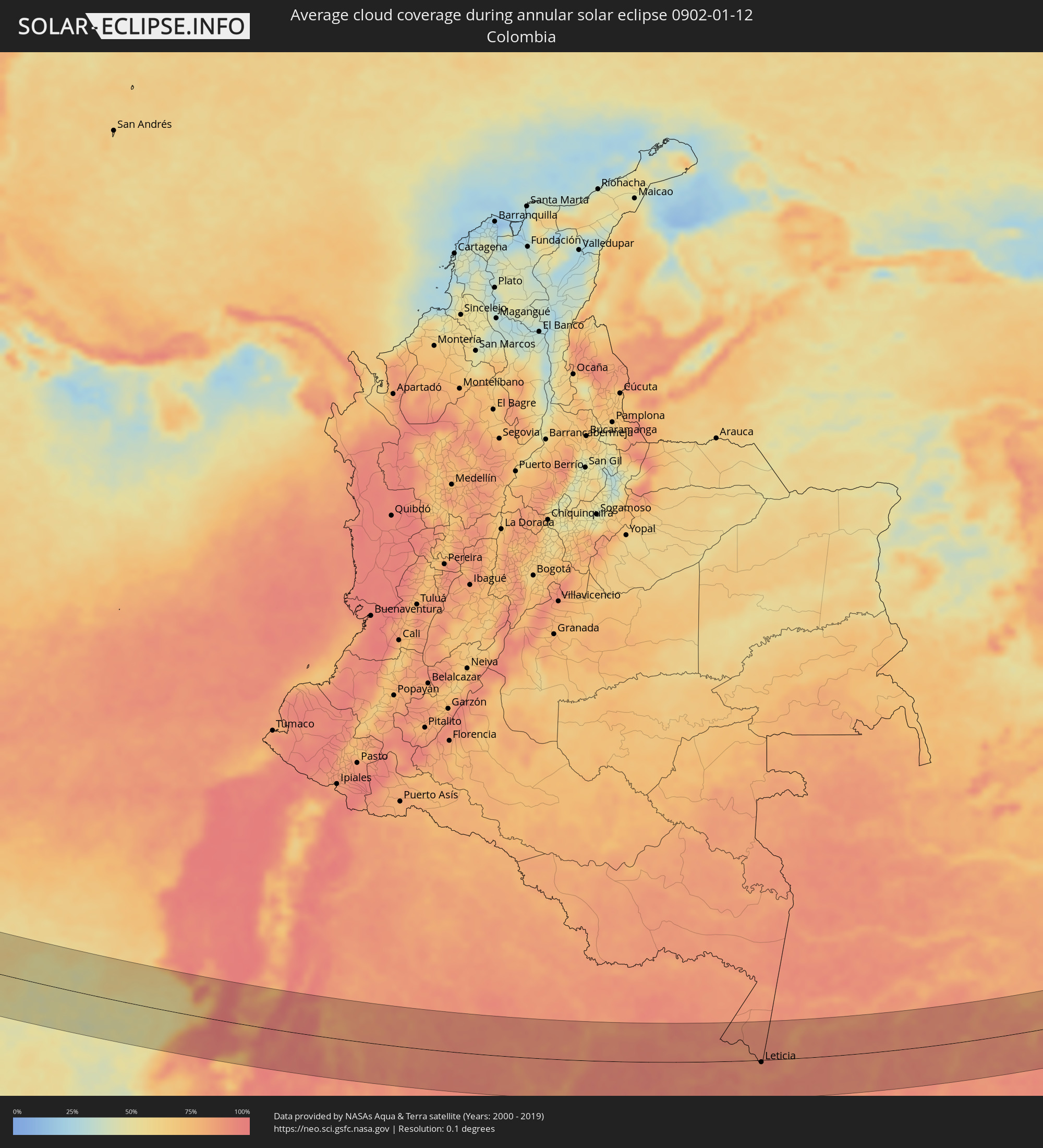 Colombia
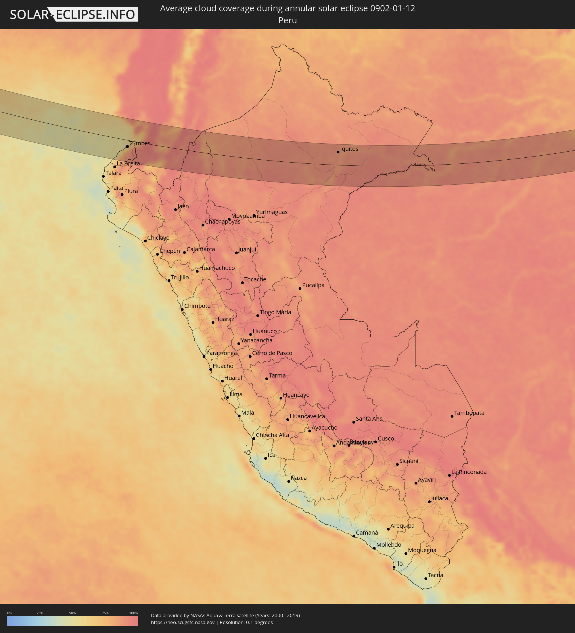 Peru
Peru
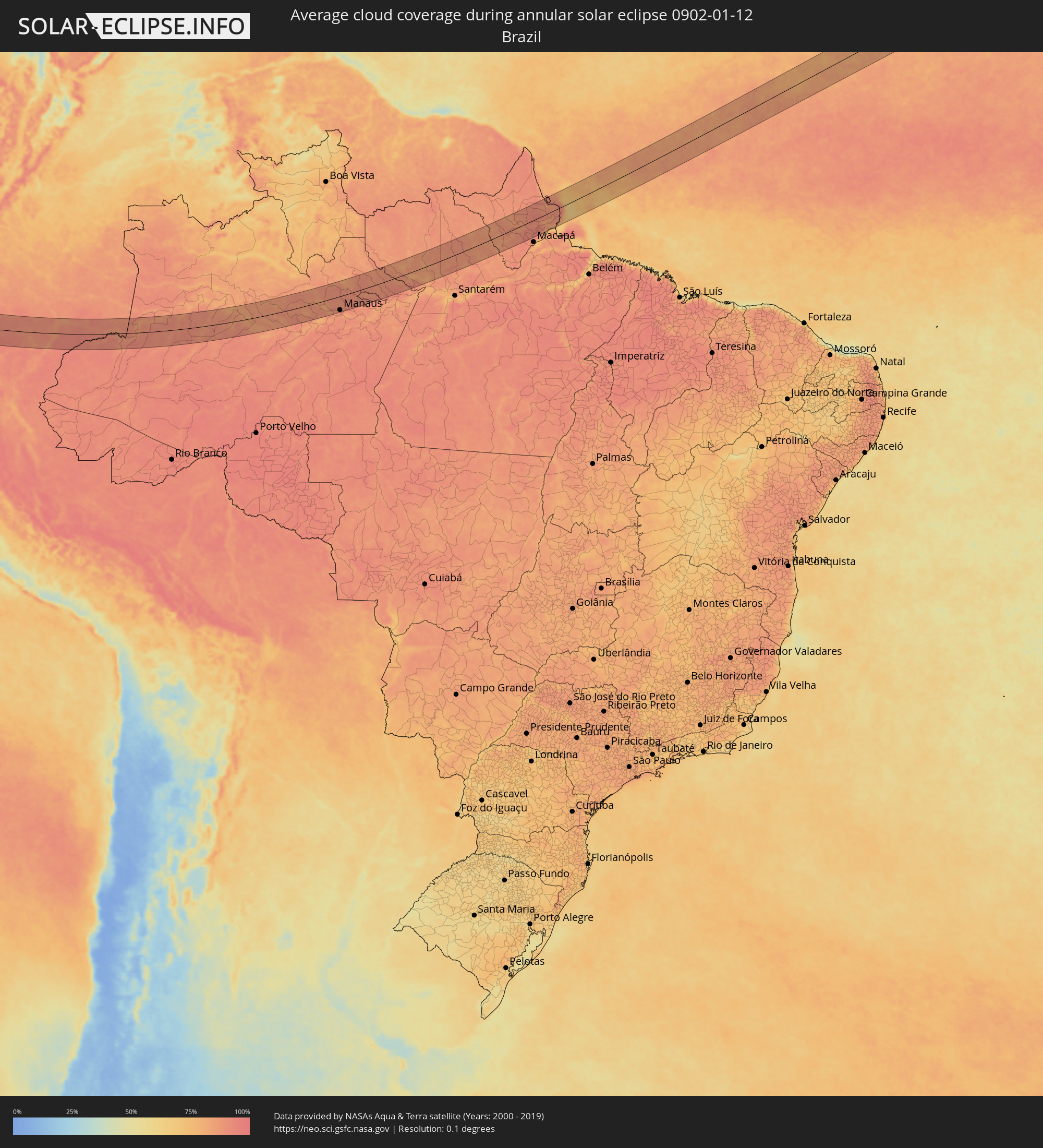 Brazil
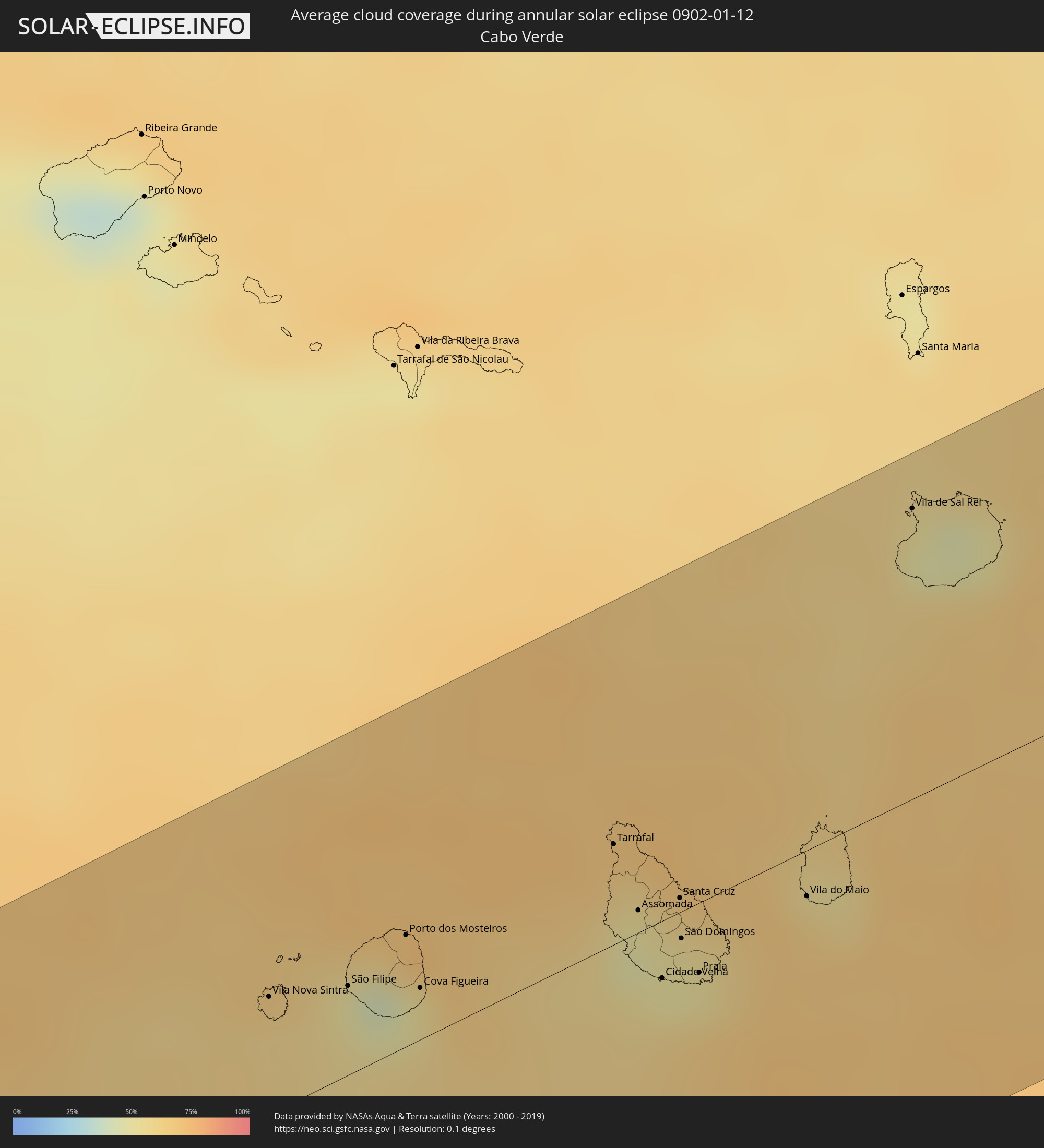 Cabo Verde
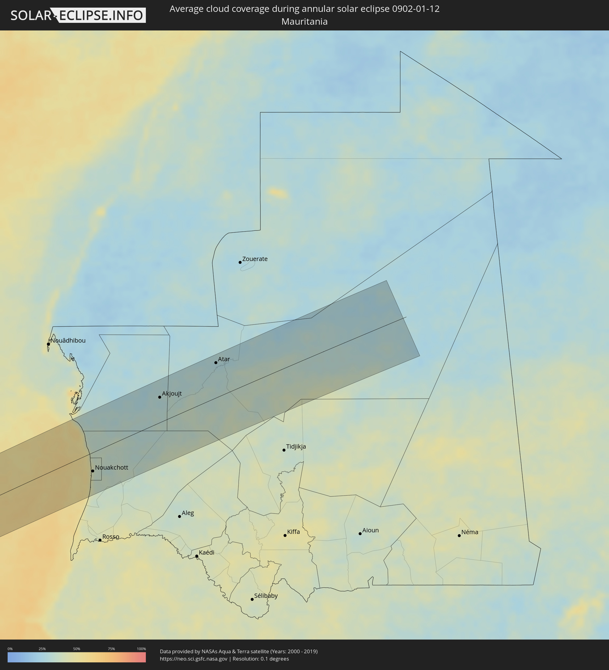 Mauritania
Cities inside the path of the eclipse
The following table shows all locations with a population of more than 5,000 inside the eclipse path. Cities which have more than 100,000 inhabitants are marked bold. A click at the locations opens a detailed map.
| City | Type | Eclipse duration | Local time of max. eclipse | Distance to central line | Ø Cloud coverage |
|
Puerto Ayora, Galápagos
|
annular | - | 09:04:47 UTC-05:58 | 4 km | 78% |
|
Puerto Baquerizo Moreno, Galápagos
|
annular | - | 09:06:14 UTC-05:58 | 8 km | 72% |
|
Zorritos, Tumbes
|
annular | - | 10:18:26 UTC-05:08 | 43 km | 73% |
|
Tumbes, Tumbes
|
annular | - | 10:19:05 UTC-05:08 | 26 km | 84% |
|
Playas, Guayas
|
annular | - | 10:13:49 UTC-05:14 | 78 km | 78% |
|
Zarumilla, Tumbes
|
annular | - | 10:19:37 UTC-05:08 | 15 km | 89% |
|
Aguas Verdes, Tumbes
|
annular | - | 10:19:41 UTC-05:08 | 12 km | 93% |
|
Huaquillas, El Oro
|
annular | - | 10:14:20 UTC-05:14 | 11 km | 93% |
|
Puerto Bolívar, El Oro
|
annular | - | 10:15:01 UTC-05:14 | 16 km | 85% |
|
Machala, El Oro
|
annular | - | 10:15:07 UTC-05:14 | 18 km | 85% |
|
Santa Rosa, El Oro
|
annular | - | 10:15:08 UTC-05:14 | 3 km | 90% |
|
Celica, Loja
|
annular | - | 10:15:11 UTC-05:14 | 74 km | 90% |
|
Baláo, Guayas
|
annular | - | 10:15:33 UTC-05:14 | 59 km | 88% |
|
Pasaje, El Oro
|
annular | - | 10:15:35 UTC-05:14 | 14 km | 97% |
|
Piñas, El Oro
|
annular | - | 10:15:59 UTC-05:14 | 23 km | 95% |
|
Catacocha, Loja
|
annular | - | 10:16:06 UTC-05:14 | 63 km | 73% |
|
Portovelo, El Oro
|
annular | - | 10:16:10 UTC-05:14 | 26 km | 94% |
|
Zaruma, El Oro
|
annular | - | 10:16:11 UTC-05:14 | 23 km | 94% |
|
Catamayo, Loja
|
annular | - | 10:16:58 UTC-05:14 | 50 km | 69% |
|
Loja, Loja
|
annular | - | 10:17:26 UTC-05:14 | 48 km | 88% |
|
Cuenca, Azuay
|
annular | - | 10:18:01 UTC-05:14 | 75 km | 79% |
|
Zamora, Zamora-Chinchipe
|
annular | - | 10:18:12 UTC-05:14 | 52 km | 94% |
|
Gualaceo, Azuay
|
annular | - | 10:18:43 UTC-05:14 | 80 km | 83% |
|
Yantzaza, Zamora-Chinchipe
|
annular | - | 10:18:47 UTC-05:14 | 23 km | 90% |
|
Iquitos, Loreto
|
annular | - | 10:42:38 UTC-05:08 | 48 km | 89% |
|
Benjamin Constant, Amazonas
|
annular | - | 12:00:12 UTC-04:02 | 22 km | 87% |
|
Ramón Castilla, Loreto
|
annular | - | 10:54:35 UTC-05:08 | 9 km | 86% |
|
Leticia, Amazonas
|
annular | - | 12:00:36 UTC-04:02 | 4 km | 90% |
|
Tabatinga, Amazonas
|
annular | - | 12:00:36 UTC-04:02 | 6 km | 90% |
|
Alvarães, Amazonas
|
annular | - | 12:20:43 UTC-04:02 | 43 km | 86% |
|
Tefé, Amazonas
|
annular | - | 12:20:56 UTC-04:02 | 25 km | 86% |
|
Manacapuru, Amazonas
|
annular | - | 12:36:23 UTC-04:02 | 71 km | 87% |
|
Manaus, Amazonas
|
annular | - | 12:38:43 UTC-04:02 | 68 km | 91% |
|
Rio Preto da Eva, Amazonas
|
annular | - | 12:40:14 UTC-04:02 | 35 km | 91% |
|
Vila Nova Sintra, Brava
|
annular | - | 16:32:26 UTC-01:34 | 32 km | 59% |
|
São Filipe, São Filipe
|
annular | - | 16:32:36 UTC-01:34 | 24 km | 53% |
|
Porto dos Mosteiros, Mosteiros
|
annular | - | 16:32:44 UTC-01:34 | 30 km | 53% |
|
Cova Figueira, Santa Catarina do Fogo
|
annular | - | 16:32:45 UTC-01:34 | 14 km | 53% |
|
Tarrafal, Tarrafal
|
annular | - | 16:33:11 UTC-01:34 | 27 km | 66% |
|
Assomada, Santa Catarina
|
annular | - | 16:33:13 UTC-01:34 | 6 km | 47% |
|
Picos, São Salvador do Mundo
|
annular | - | 16:33:15 UTC-01:34 | 2 km | 51% |
|
Cidade Velha, Ribeira Grande de Santiago
|
annular | - | 16:33:15 UTC-01:34 | 15 km | 60% |
|
Calheta, São Miguel
|
annular | - | 16:33:17 UTC-01:34 | 10 km | 57% |
|
João Teves, São Lourenço dos Órgãos
|
annular | - | 16:33:17 UTC-01:34 | 2 km | 51% |
|
Santa Cruz, Santa Cruz
|
annular | - | 16:33:18 UTC-01:34 | 4 km | 51% |
|
São Domingos, São Domingos
|
annular | - | 16:33:17 UTC-01:34 | 7 km | 51% |
|
Pedra Badejo, Santa Cruz
|
annular | - | 16:33:19 UTC-01:34 | 2 km | 53% |
|
Praia, Praia
|
annular | - | 16:33:19 UTC-01:34 | 19 km | 63% |
|
Vila do Maio, Maio
|
annular | - | 16:33:33 UTC-01:34 | 12 km | 65% |
|
Vila de Sal Rei, Boa Vista
|
annular | - | 16:33:48 UTC-01:34 | 78 km | 52% |
|
Tevragh Zeina, Nouakchott
|
annular | - | 17:55:11 UTC-00:16 | 41 km | 44% |
|
Nouakchott, Nouakchott
|
annular | - | 17:55:11 UTC-00:16 | 43 km | 44% |
|
Akjoujt, Inchiri
|
annular | - | 17:55:31 UTC-00:16 | 57 km | 28% |
|
Atar, Adrar
|
annular | - | 17:55:44 UTC-00:16 | 79 km | 28% |