Total solar eclipse of 04/27/0971
| Day of week: | Saturday |
| Maximum duration of eclipse: | 04m38s |
| Maximum width of eclipse path: | 158 km |
| Saros cycle: | 102 |
| Coverage: | 100% |
| Magnitude: | 1.0473 |
| Gamma: | -0.0983 |
Wo kann man die Sonnenfinsternis vom 04/27/0971 sehen?
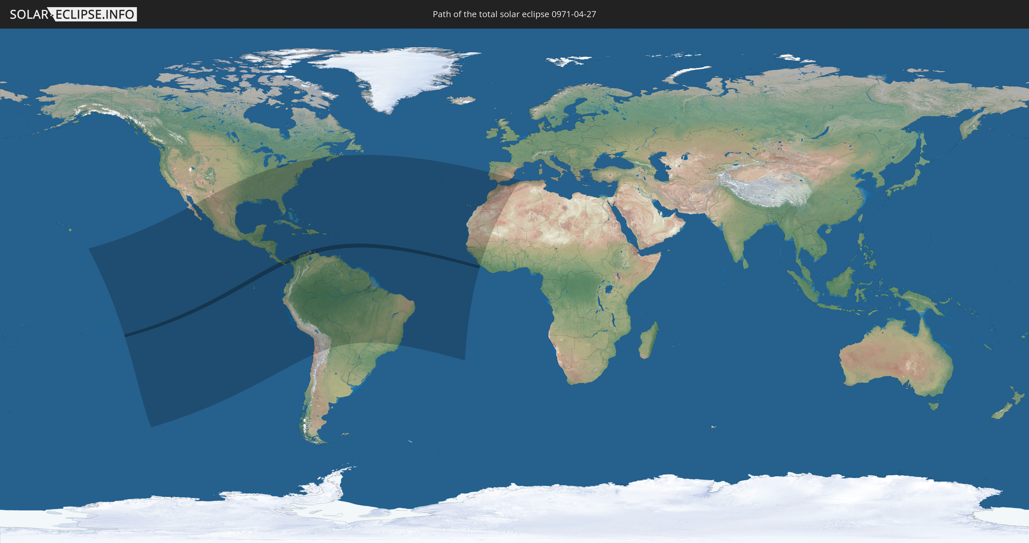
Die Sonnenfinsternis am 04/27/0971 kann man in 64 Ländern als partielle Sonnenfinsternis beobachten.
Der Finsternispfad verläuft durch 12 Länder. Nur in diesen Ländern ist sie als total Sonnenfinsternis zu sehen.
In den folgenden Ländern ist die Sonnenfinsternis total zu sehen
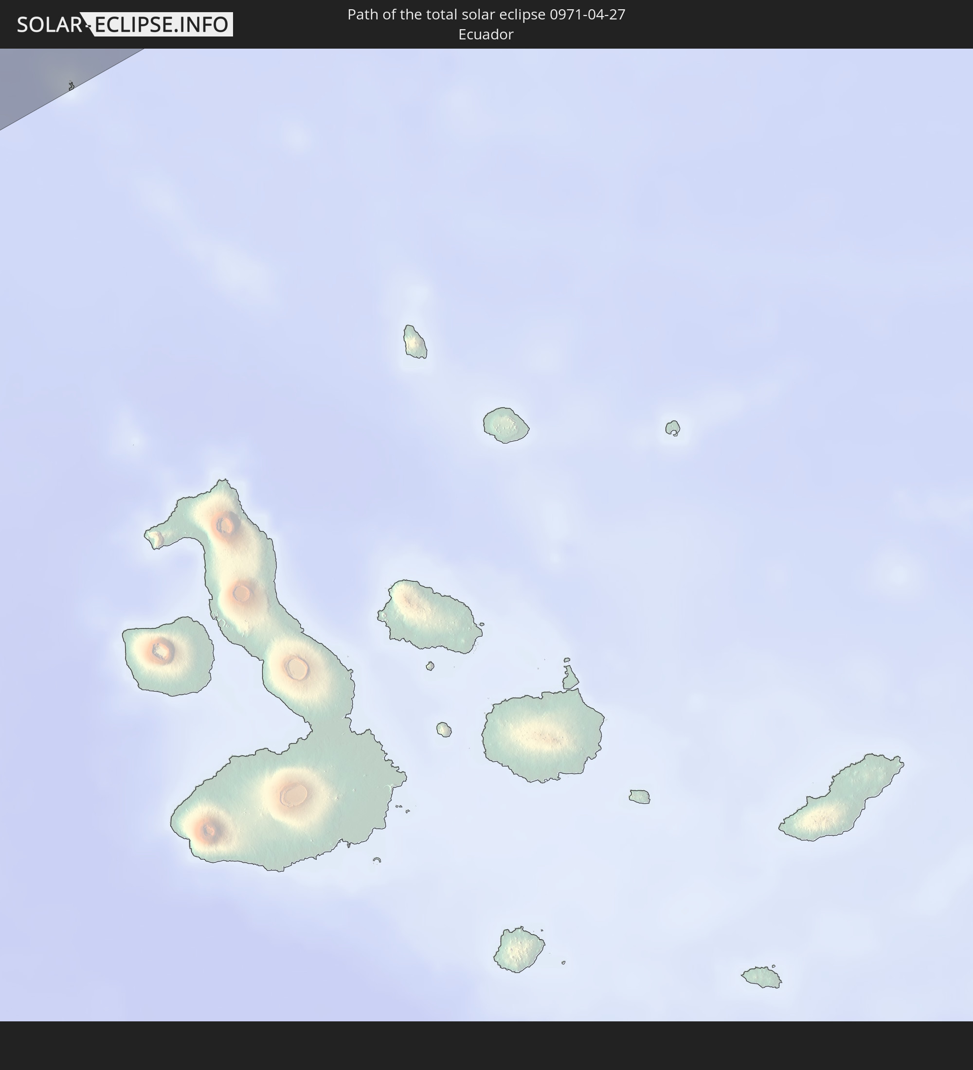 Ecuador
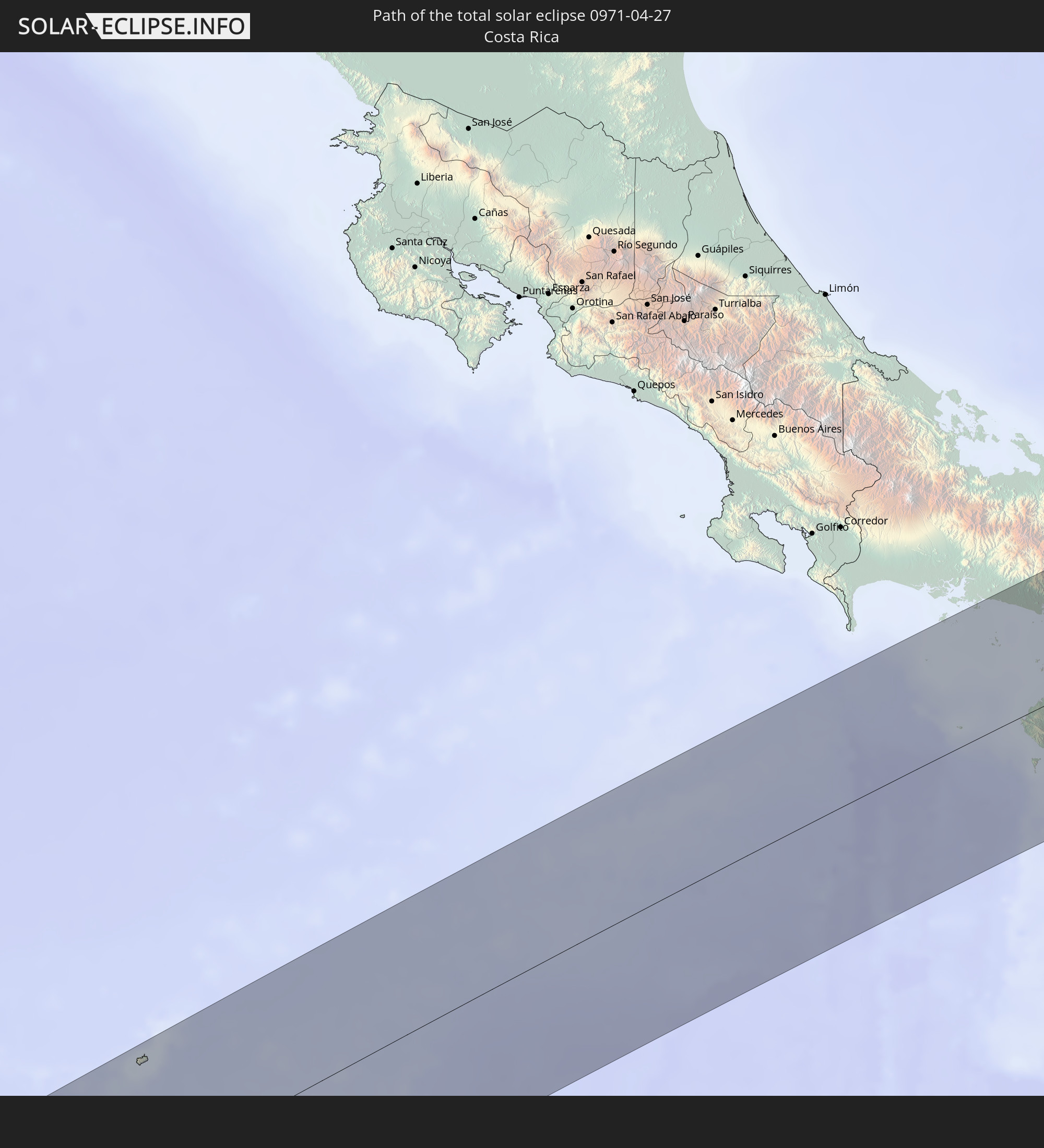 Costa Rica
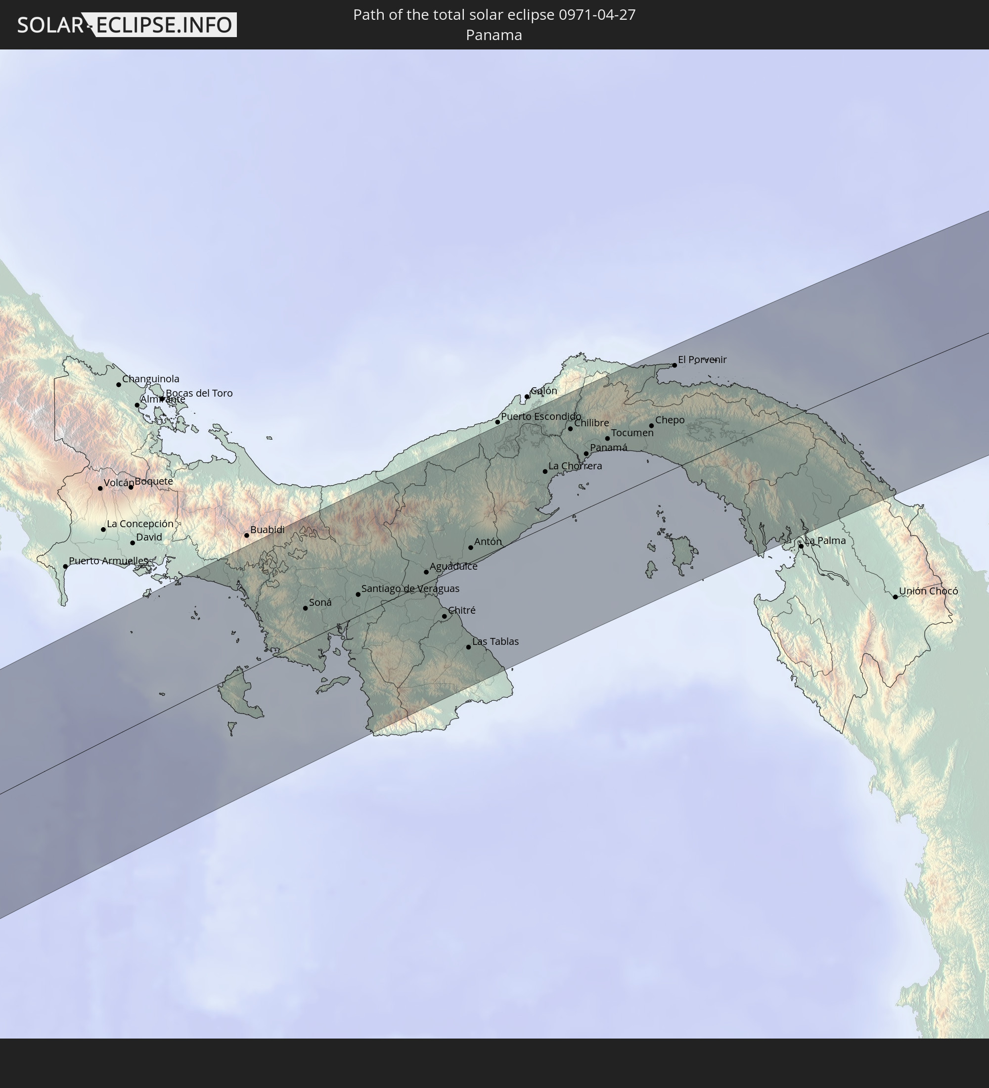 Panama
 Colombia
 Venezuela
 Aruba
Aruba
 Curaçao
 Saint Vincent and the Grenadines
 Martinique
 Saint Lucia
 Barbados
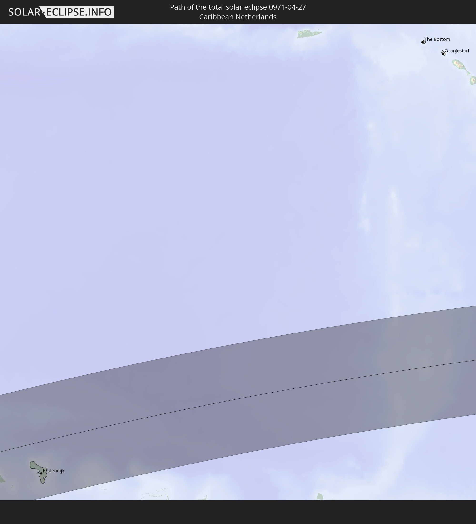 Caribbean Netherlands
In den folgenden Ländern ist die Sonnenfinsternis partiell zu sehen
 United States
 United States Minor Outlying Islands
 French Polynesia
 Canada
 Pitcairn Islands
 Mexico
 Chile
Chile
 Guatemala
 Ecuador
 El Salvador
 Honduras
 Belize
 Nicaragua
 Costa Rica
 Cuba
Cuba
 Panama
 Colombia
 Cayman Islands
 Peru
Peru
 The Bahamas
 Jamaica
 Haiti
Haiti
 Brazil
 Argentina
 Venezuela
 Turks and Caicos Islands
 Dominican Republic
 Aruba
Aruba
 Bolivia
 Puerto Rico
 United States Virgin Islands
 Bermuda
 British Virgin Islands
 Anguilla
 Collectivity of Saint Martin
 Saint Barthélemy
 Saint Kitts and Nevis
 Paraguay
 Antigua and Barbuda
 Montserrat
 Trinidad and Tobago
 Guadeloupe
 Grenada
 Dominica
 Saint Vincent and the Grenadines
 Guyana
 Martinique
 Saint Lucia
 Barbados
 Suriname
 French Guiana
 Portugal
 Cabo Verde
 Spain
Spain
 Senegal
 Mauritania
 The Gambia
 Guinea-Bissau
 Guinea
 Sierra Leone
 Morocco
 Mali
Mali
 Algeria
 Gibraltar
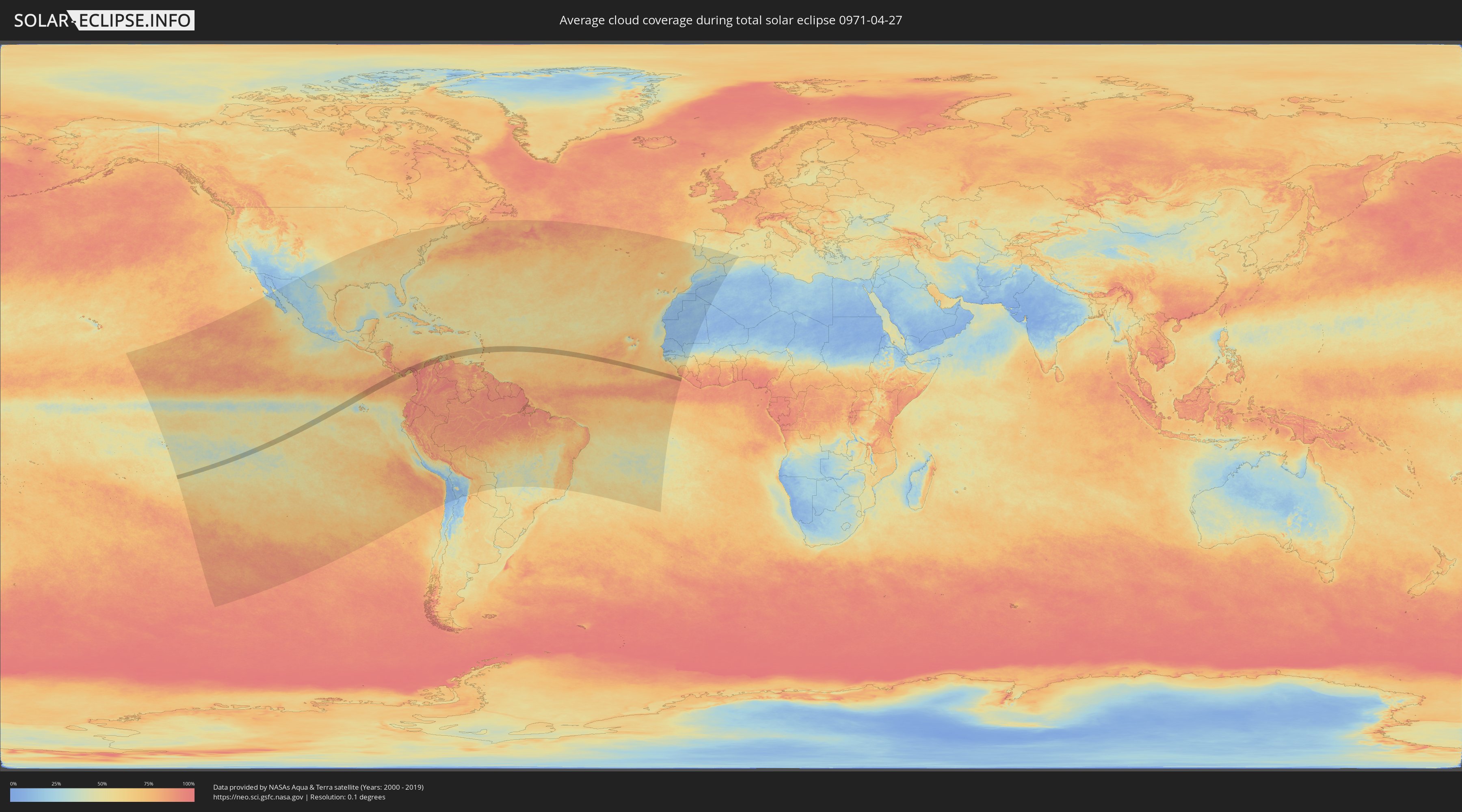
How will be the weather during the total solar eclipse on 04/27/0971?
Where is the best place to see the total solar eclipse of 04/27/0971?
The following maps show the average cloud coverage for the day of the total solar eclipse.
With the help of these maps, it is possible to find the place along the eclipse path, which has the best
chance of a cloudless sky.
Nevertheless, you should consider local circumstances and inform about the weather of your chosen
observation site.
The data is provided by NASAs satellites
AQUA and TERRA.
The cloud maps are averaged over a period of 19 years (2000 - 2019).

Detailed country maps
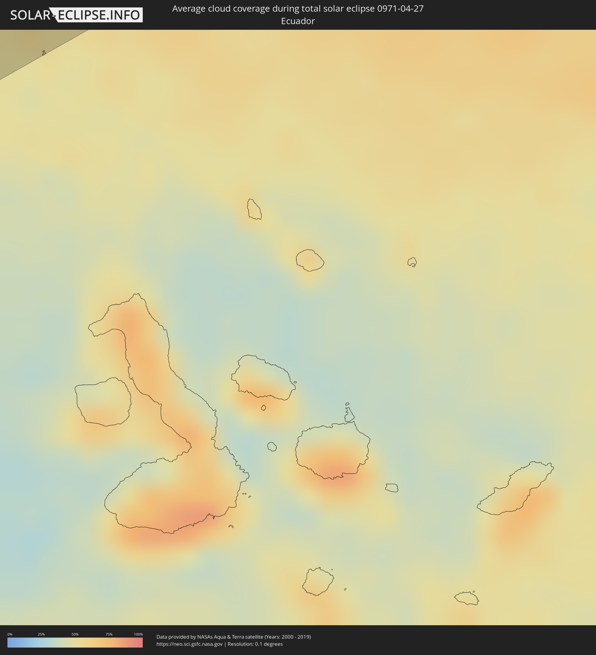 Ecuador
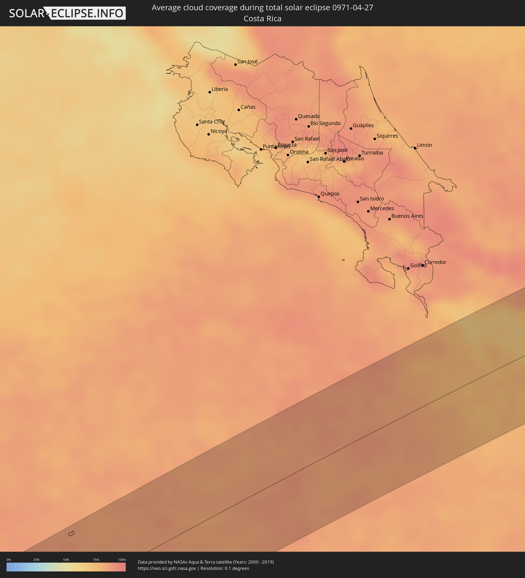 Costa Rica
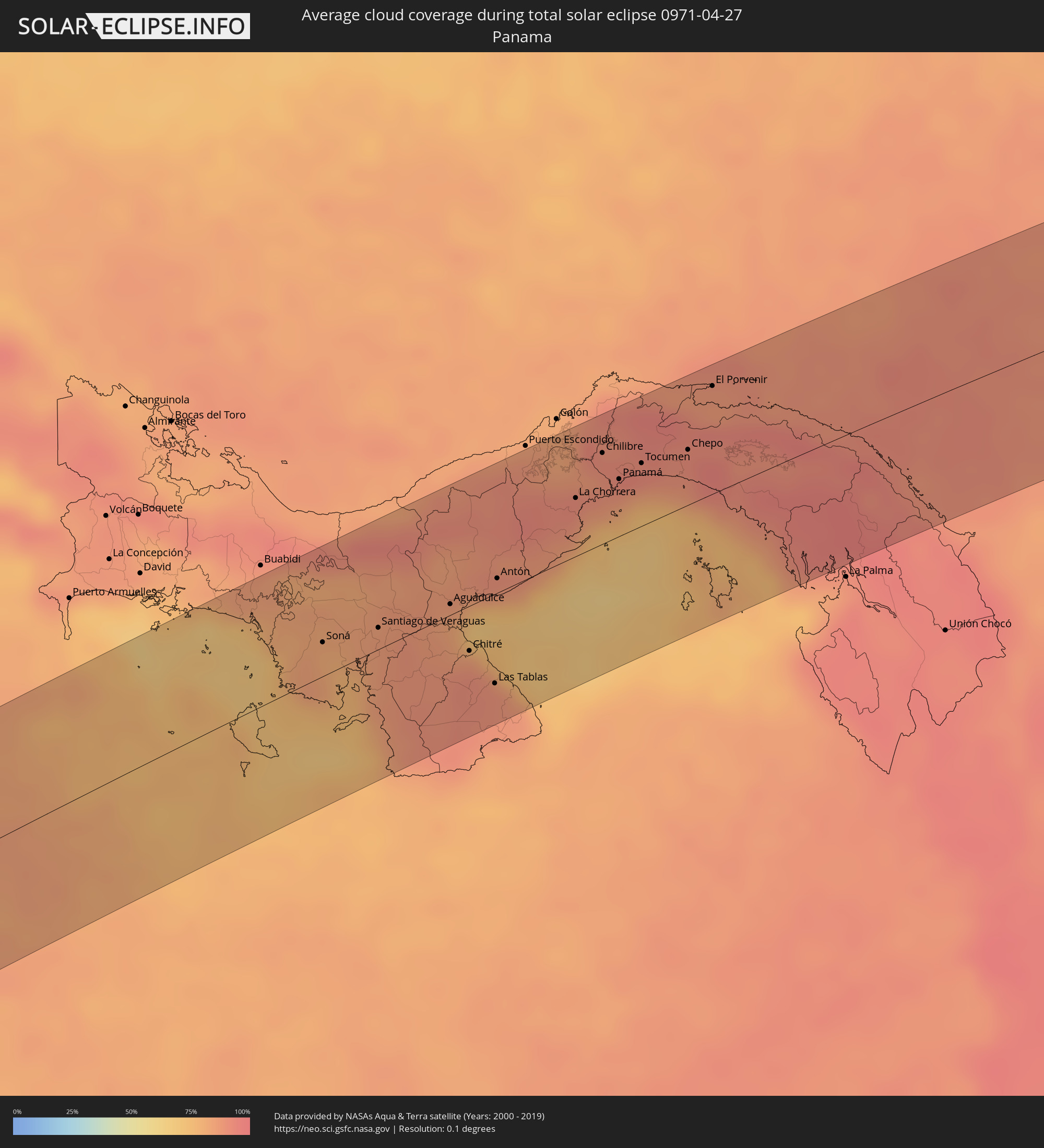 Panama
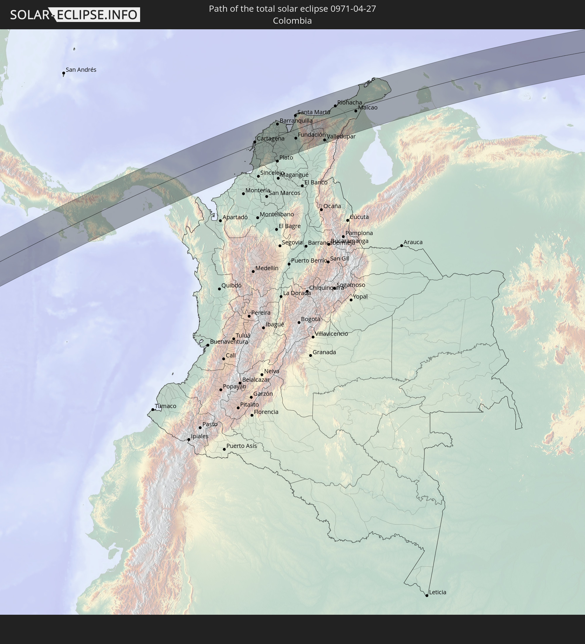
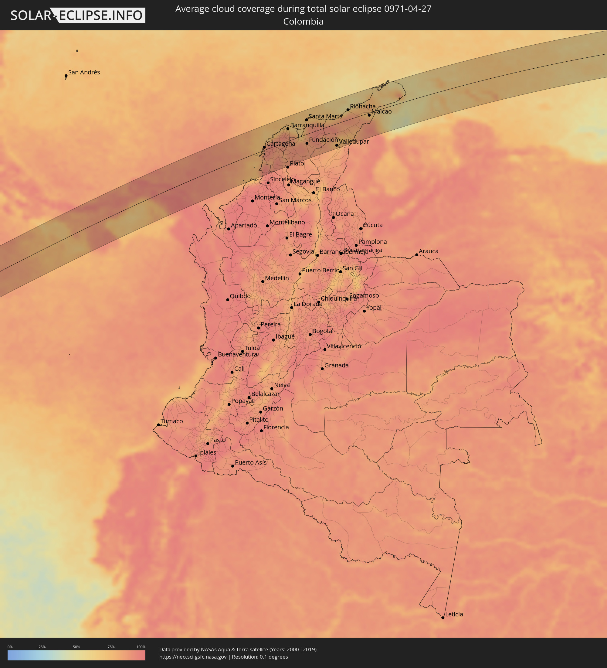 Colombia
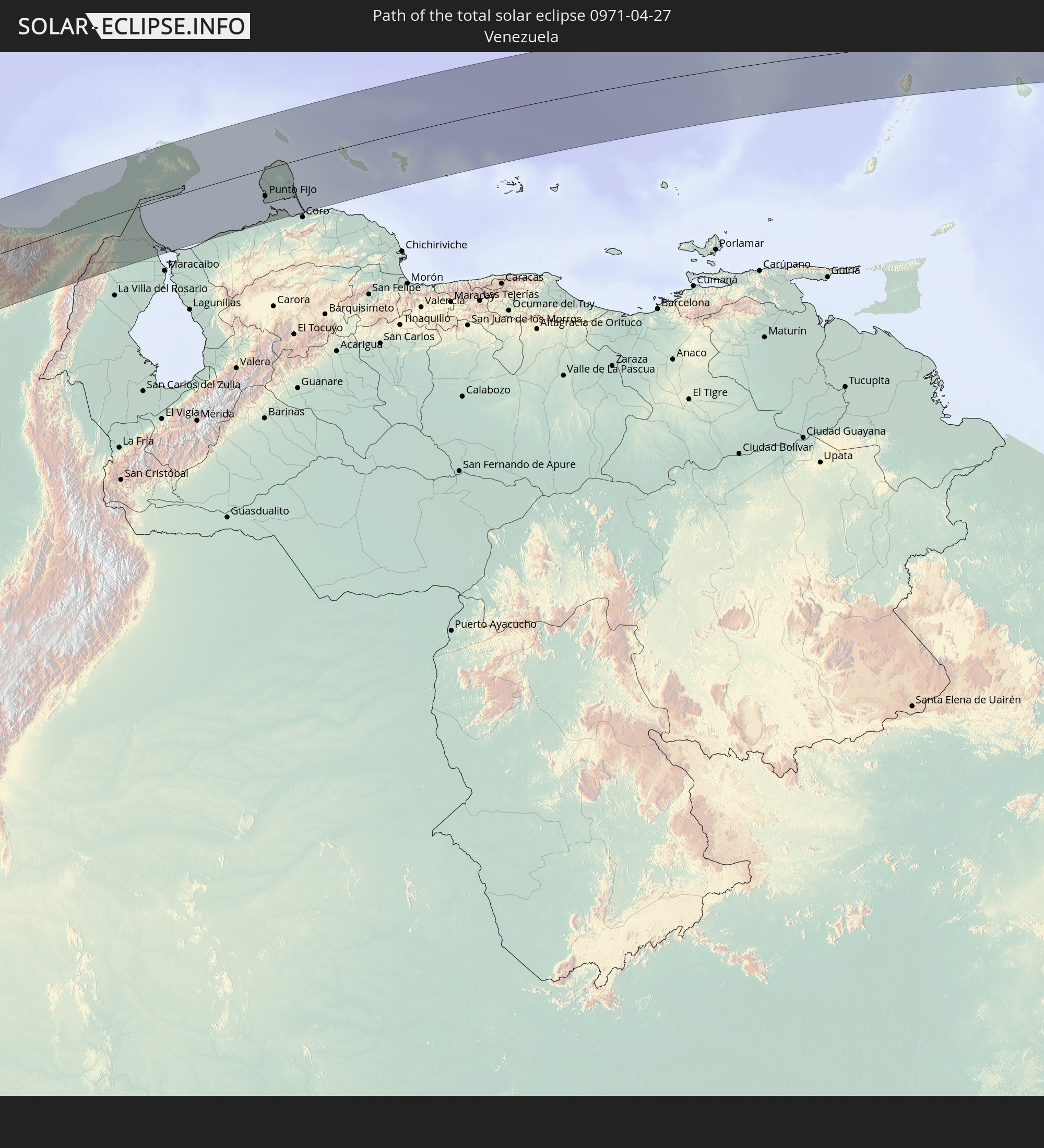
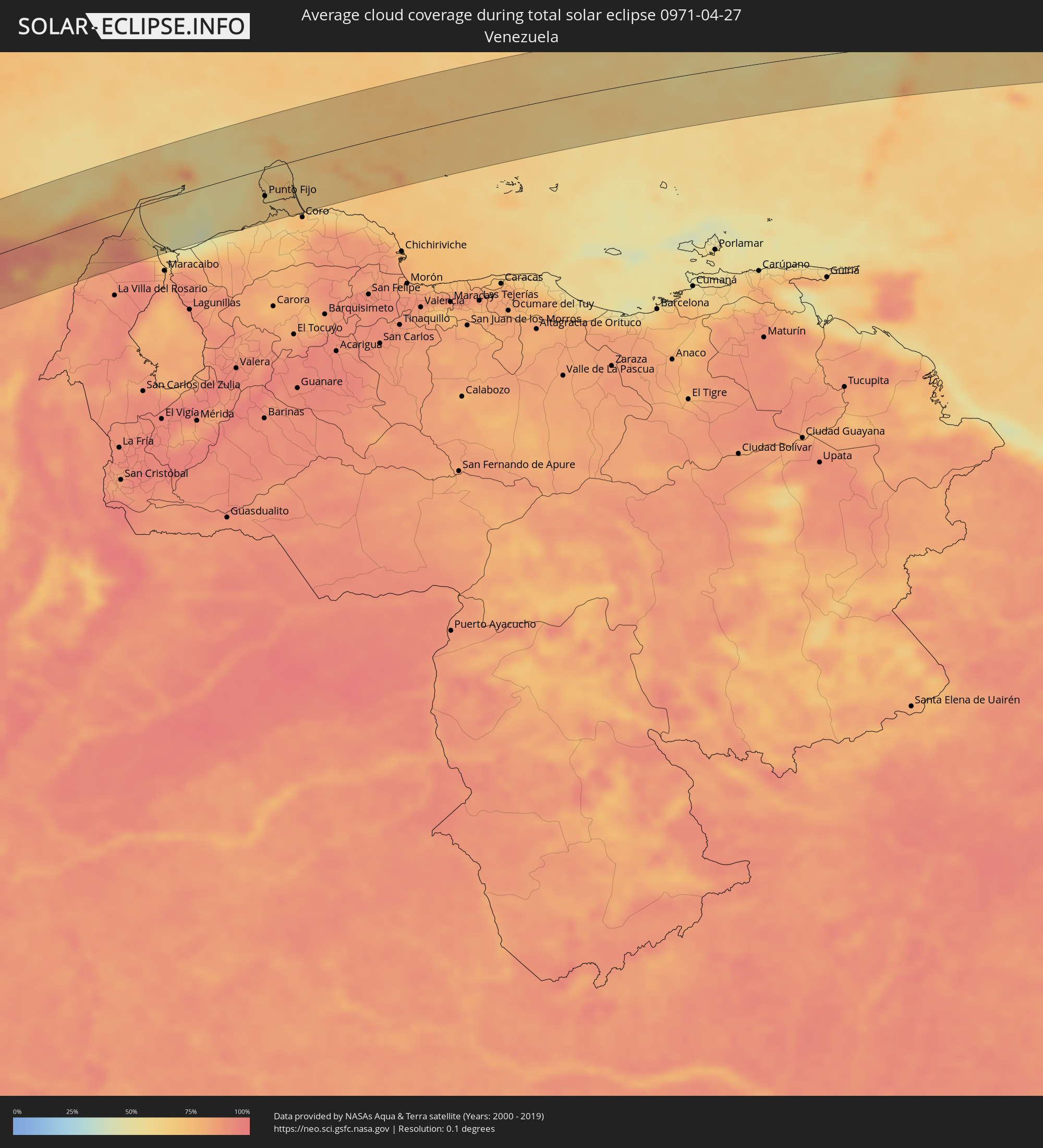 Venezuela
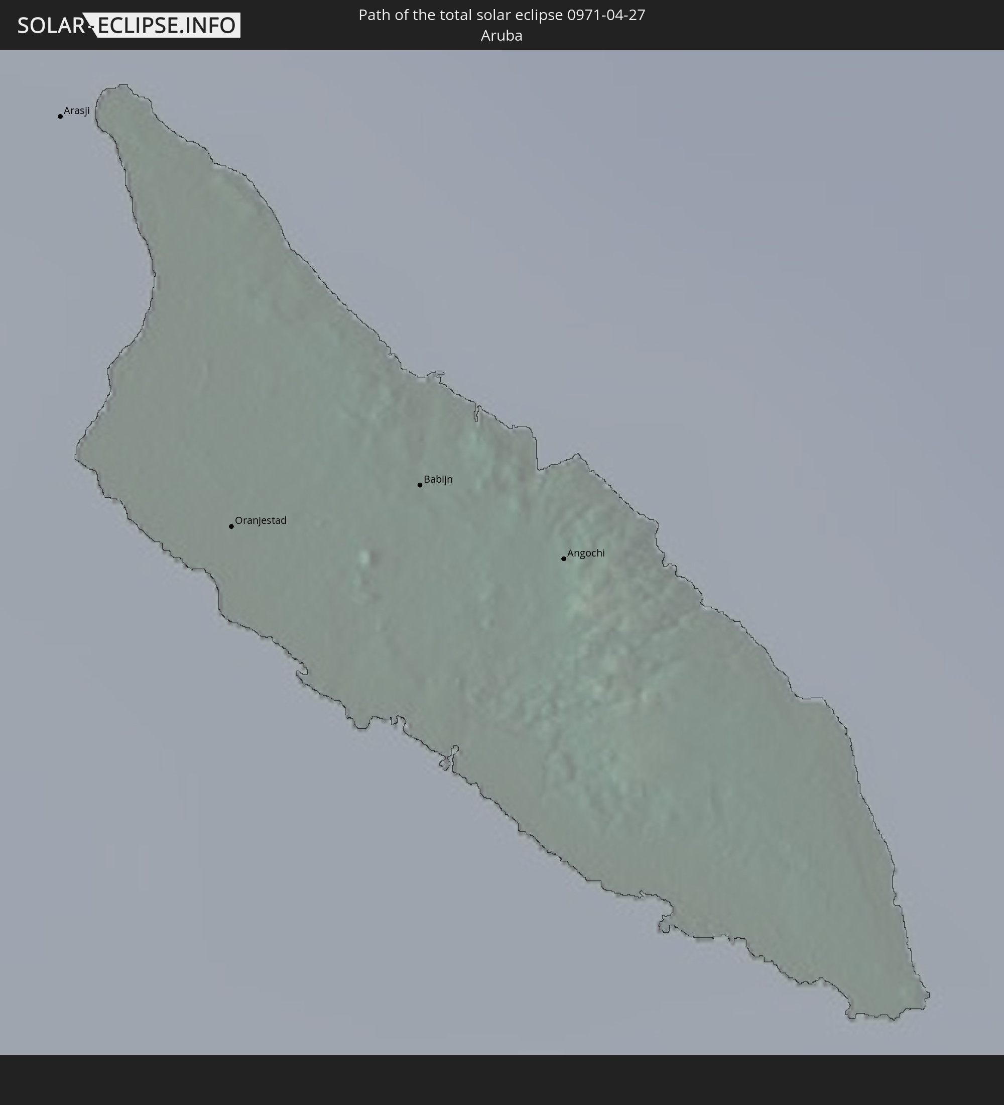
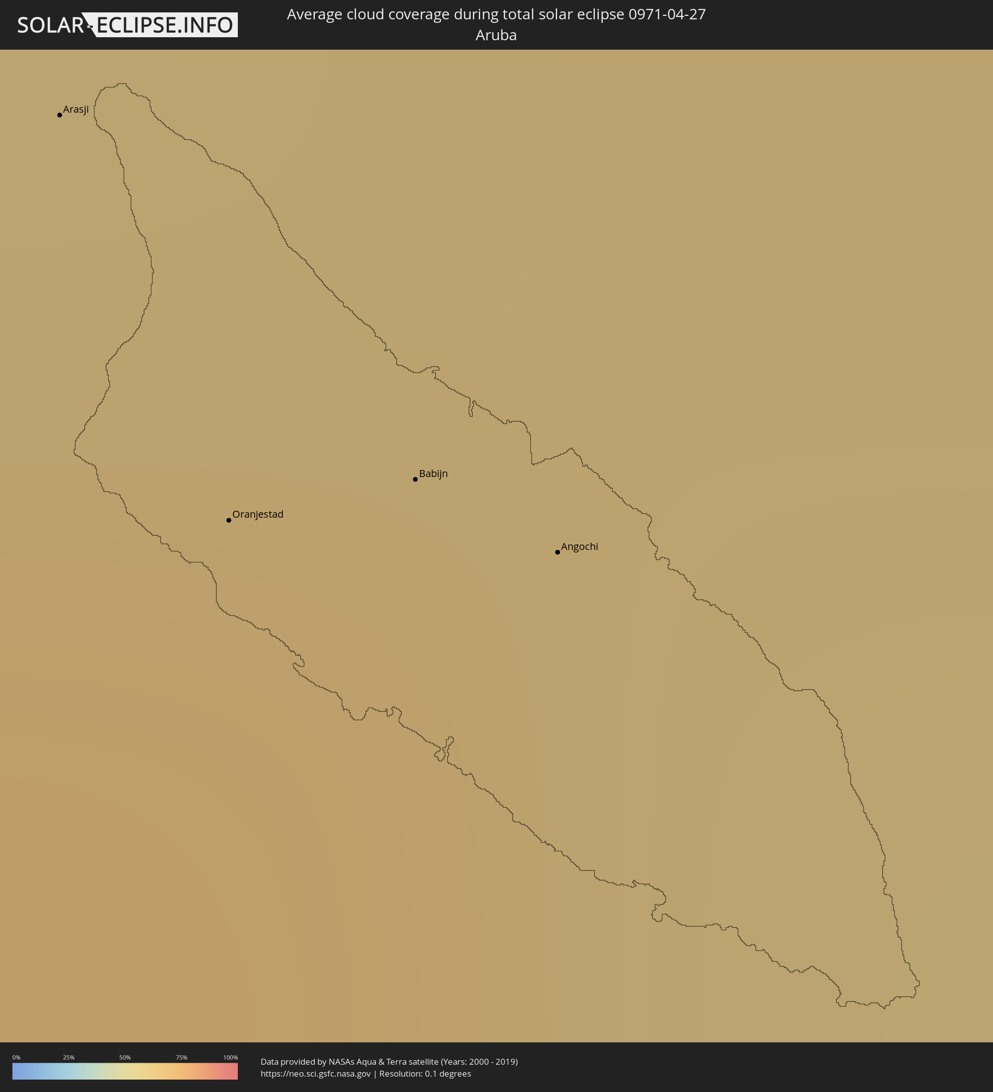 Aruba
Aruba
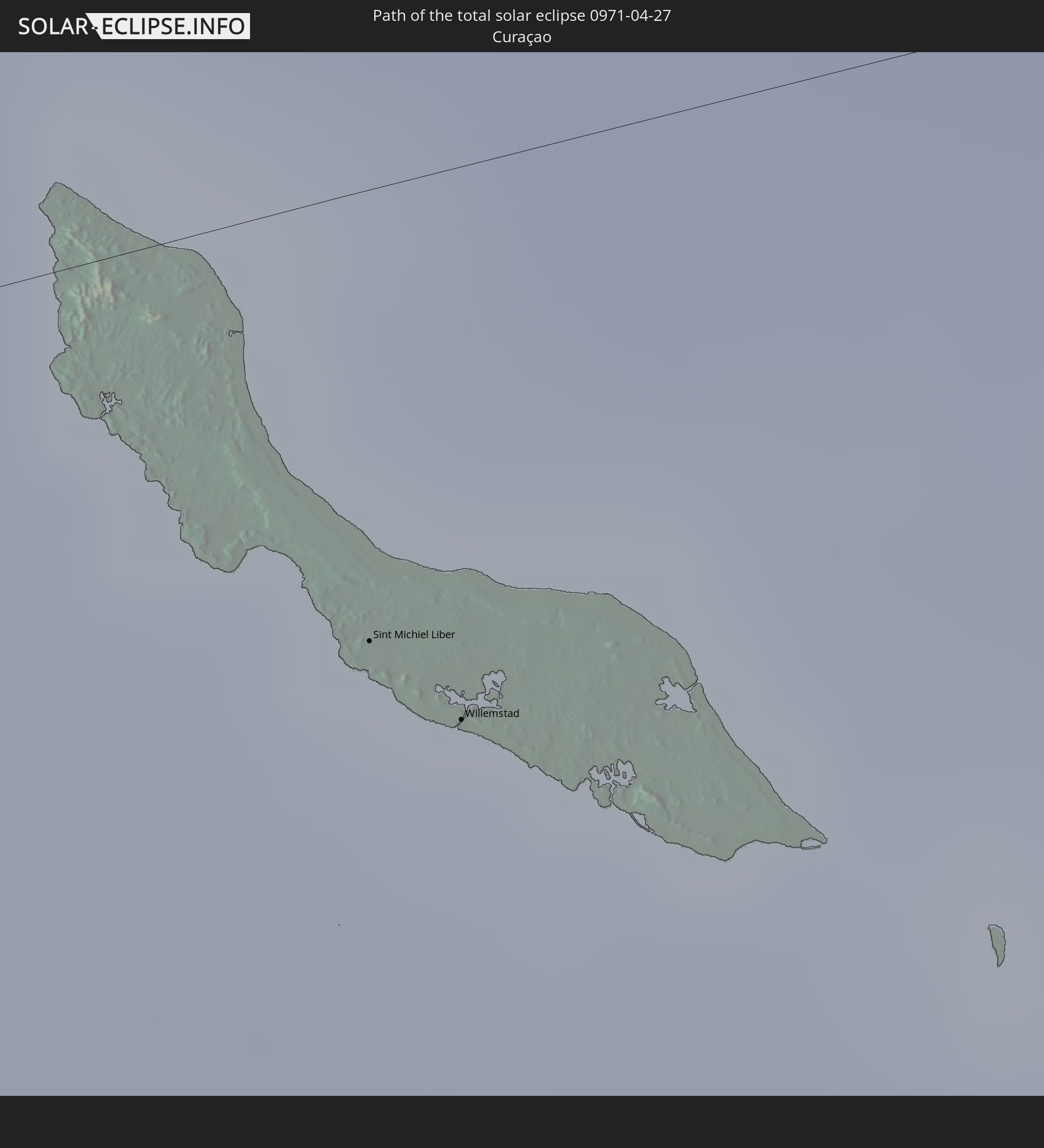
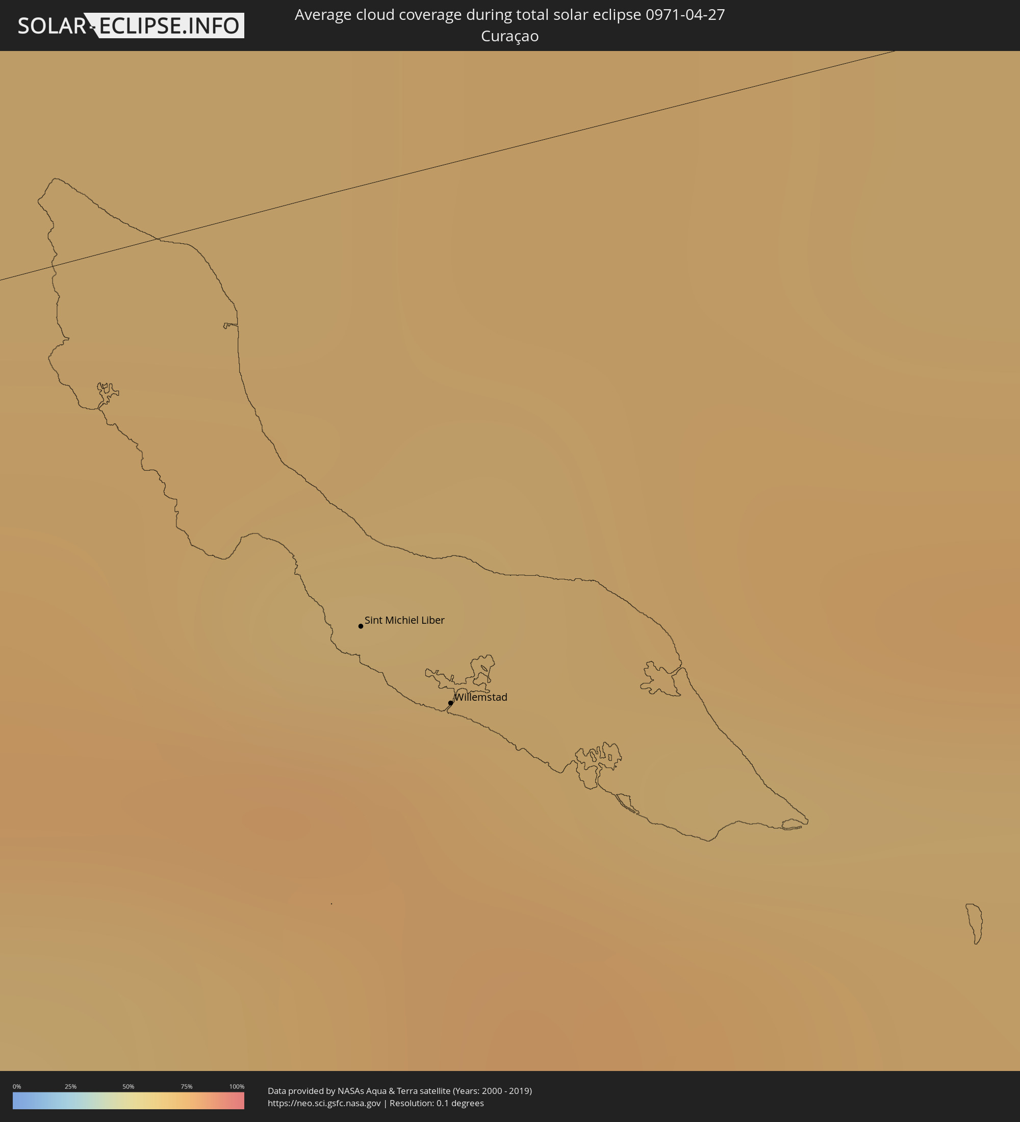 Curaçao
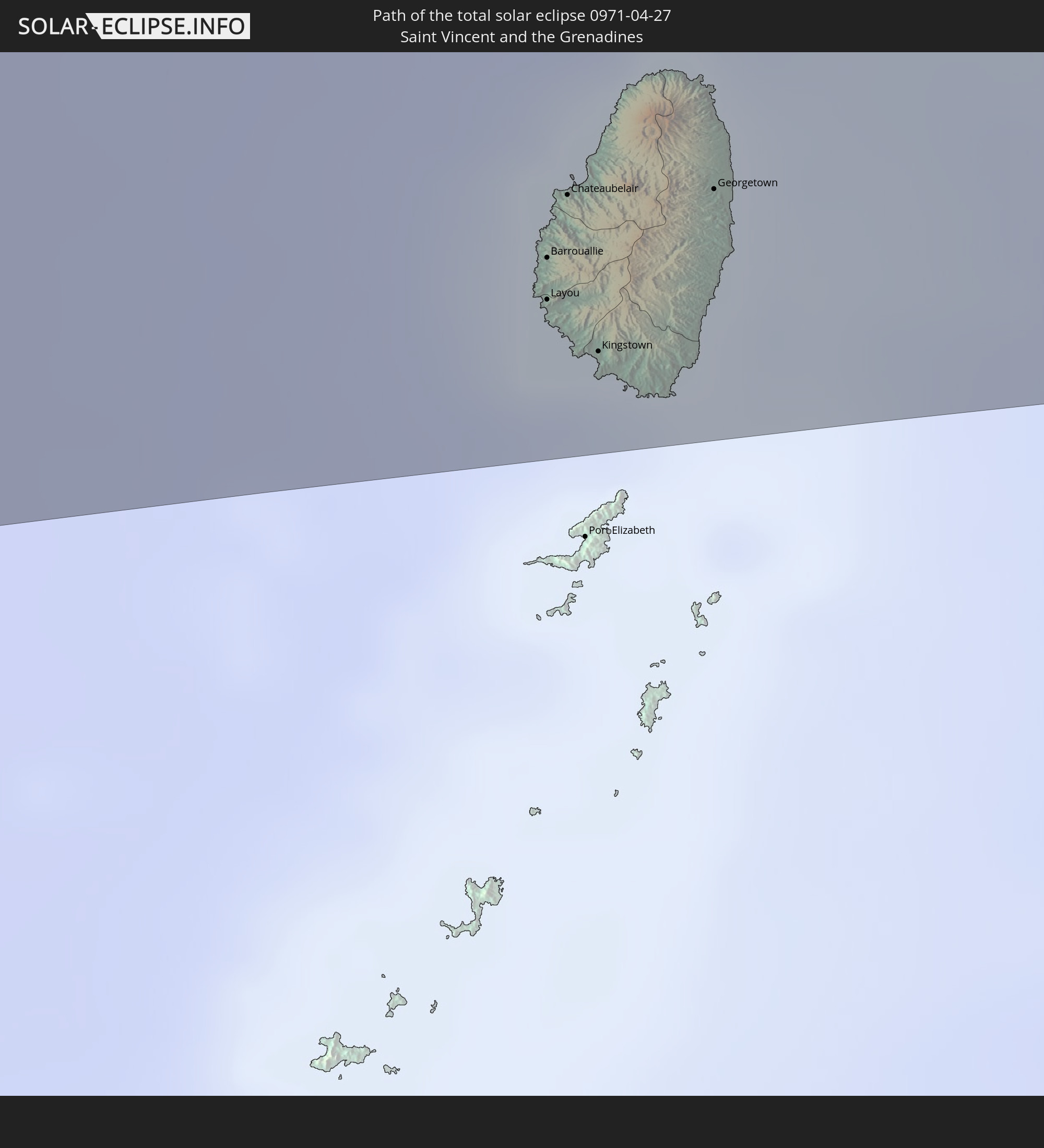
 Saint Vincent and the Grenadines
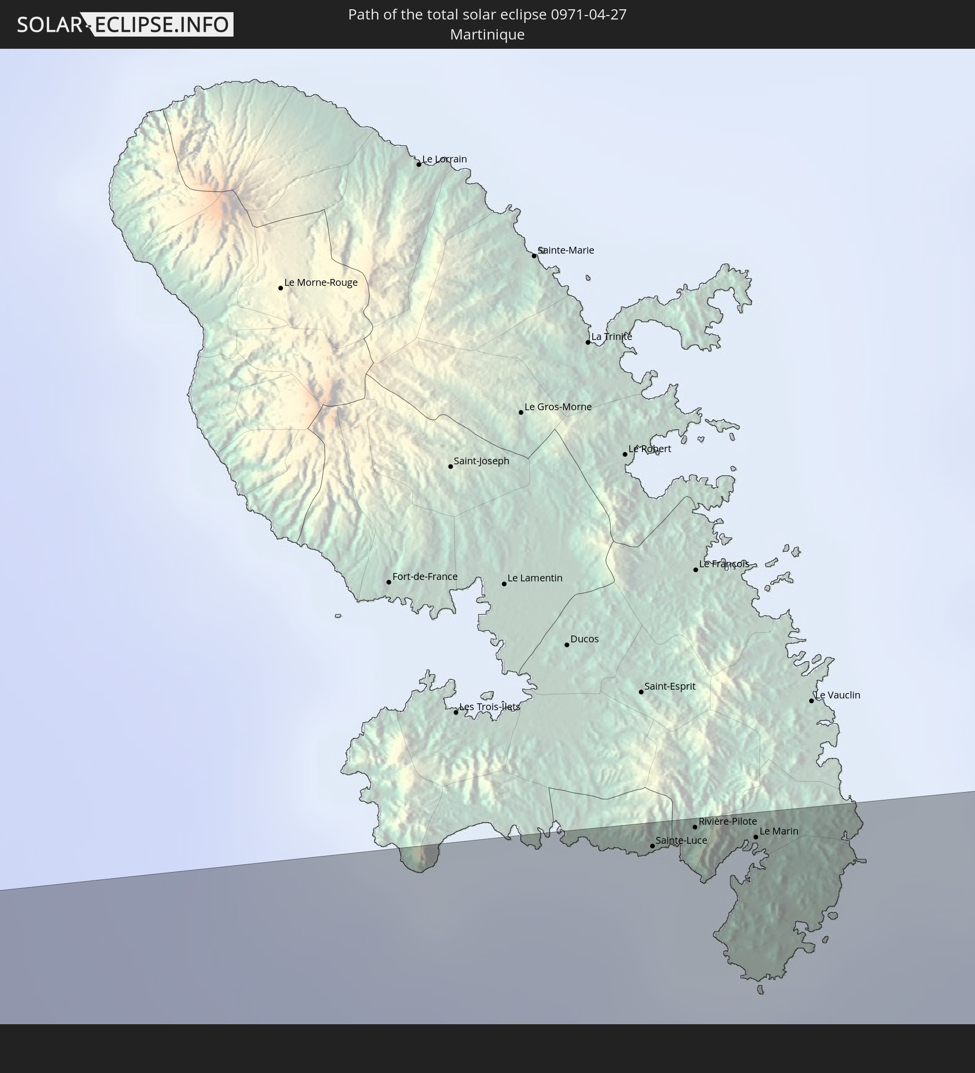
 Martinique
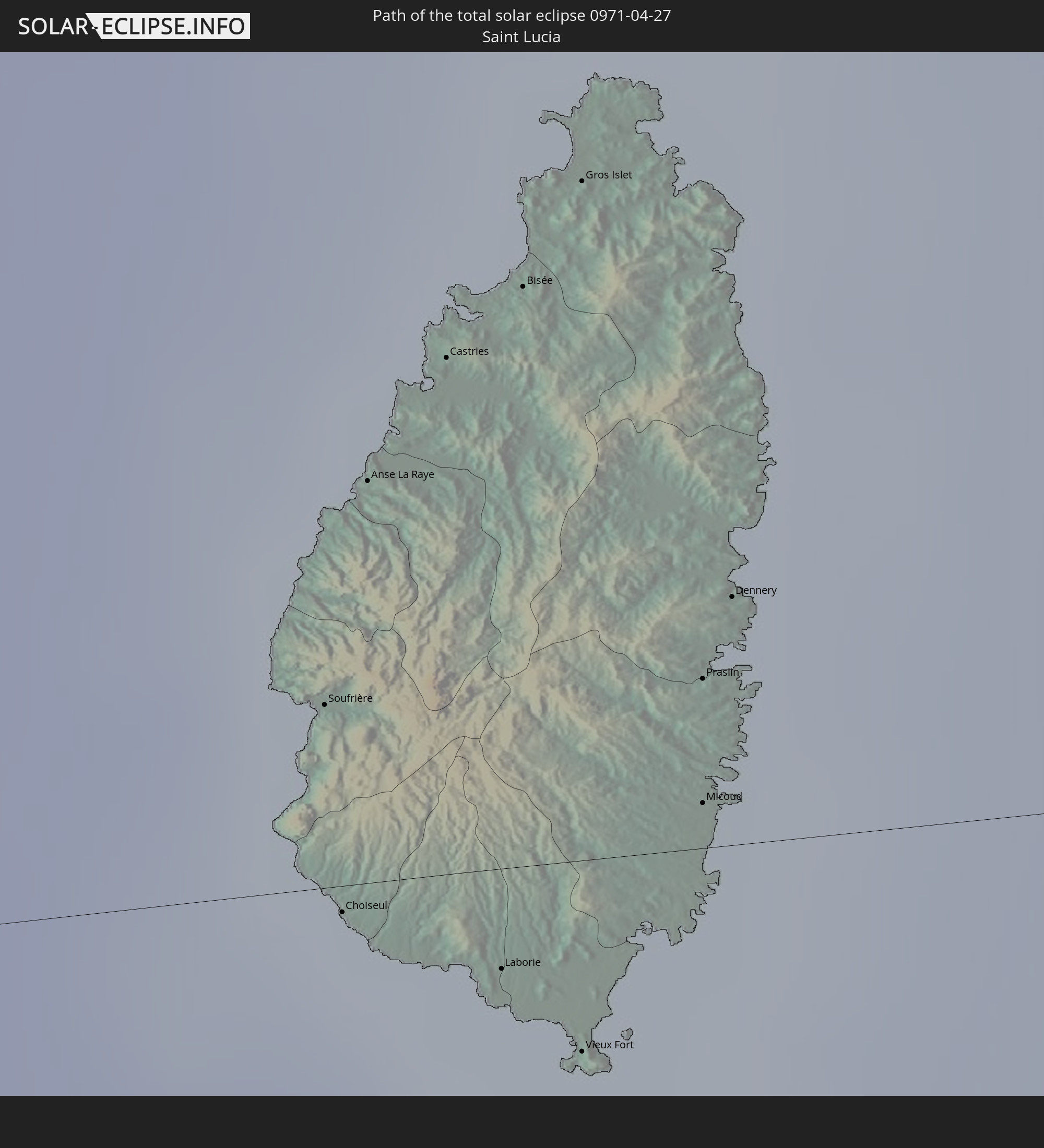
 Saint Lucia
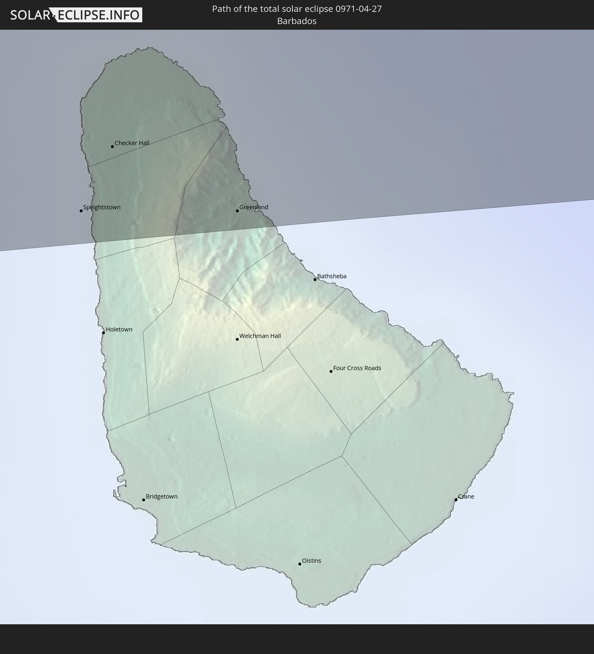
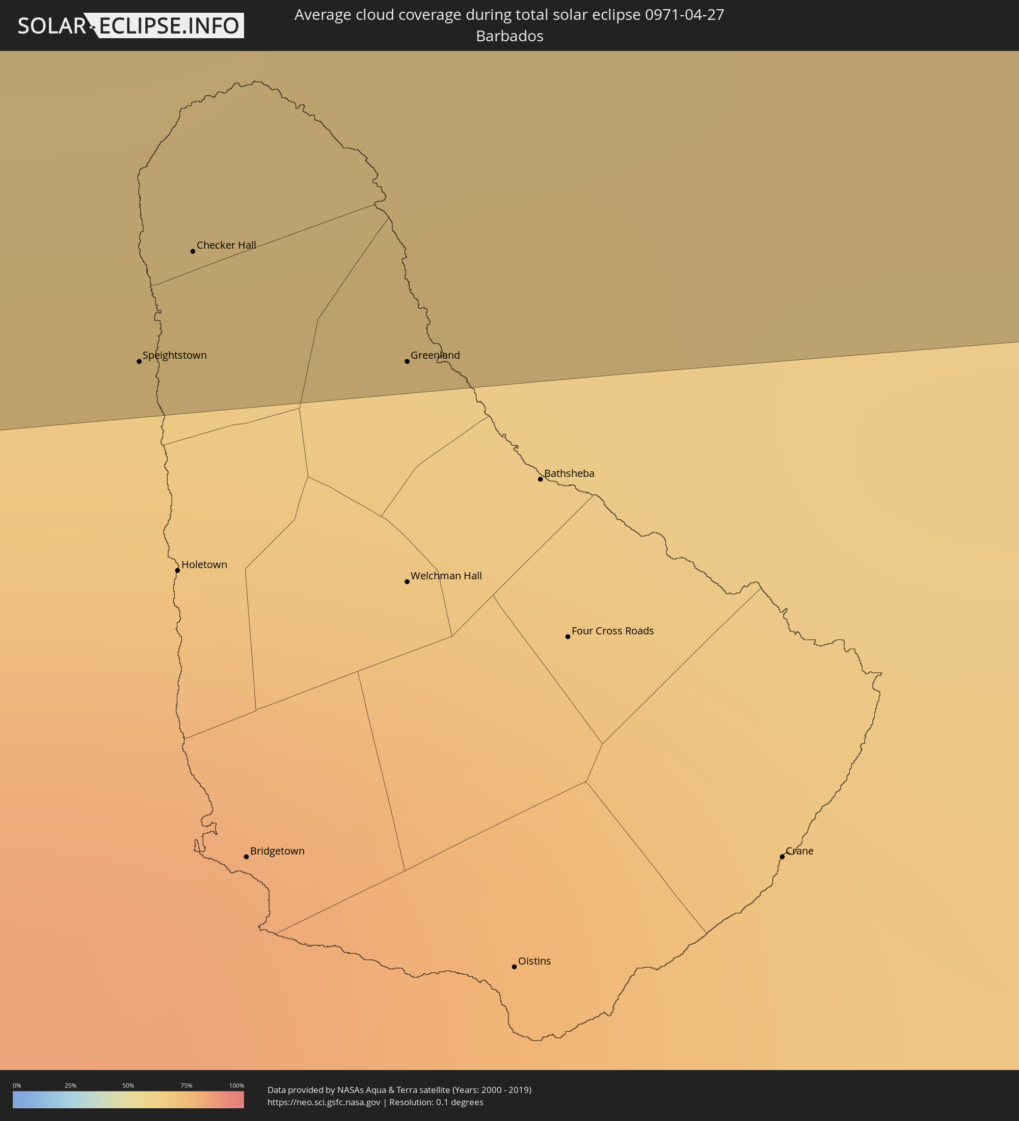 Barbados
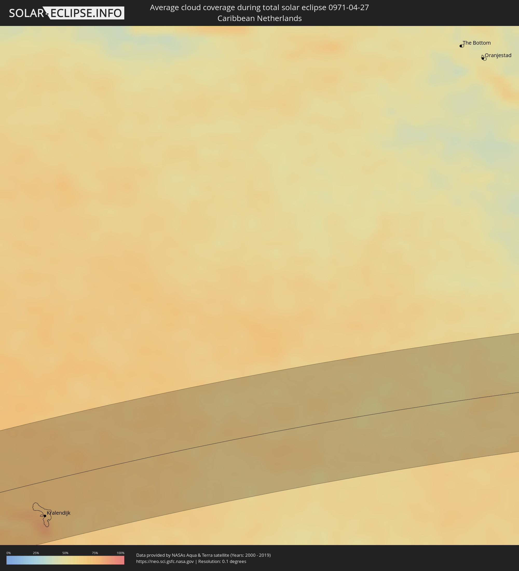 Caribbean Netherlands
Cities inside the path of the eclipse
The following table shows all locations with a population of more than 5,000 inside the eclipse path. Cities which have more than 100,000 inhabitants are marked bold. A click at the locations opens a detailed map.
| City | Type | Eclipse duration | Local time of max. eclipse | Distance to central line | Ø Cloud coverage |
|
Santiago de Veraguas, Veraguas
|
total | - | 11:31:32 UTC-05:19 | 13 km | 85% |
|
Pocrí, Coclé
|
total | - | 11:32:59 UTC-05:19 | 8 km | 85% |
|
Aguadulce, Coclé
|
total | - | 11:32:58 UTC-05:19 | 7 km | 81% |
|
Chitré, Herrera
|
total | - | 11:32:56 UTC-05:19 | 27 km | 84% |
|
Penonomé, Coclé
|
total | - | 11:33:53 UTC-05:19 | 26 km | 88% |
|
Las Tablas, Los Santos
|
total | - | 11:33:07 UTC-05:19 | 54 km | 90% |
|
Antón, Coclé
|
total | - | 11:34:00 UTC-05:19 | 9 km | 87% |
|
El Coco, Panamá
|
total | - | 11:35:55 UTC-05:19 | 36 km | 91% |
|
La Chorrera, Panamá
|
total | - | 11:36:01 UTC-05:19 | 35 km | 91% |
|
Nuevo Arraiján, Panamá
|
total | - | 11:36:15 UTC-05:19 | 36 km | 87% |
|
Vista Alegre, Panamá
|
total | - | 11:36:20 UTC-05:19 | 37 km | 87% |
|
Arraiján, Panamá
|
total | - | 11:36:30 UTC-05:19 | 36 km | 91% |
|
Veracruz, Panamá
|
total | - | 11:36:27 UTC-05:19 | 29 km | 84% |
|
Chilibre, Panamá
|
total | - | 11:36:50 UTC-05:19 | 55 km | 91% |
|
Alcalde Díaz, Panamá
|
total | - | 11:36:59 UTC-05:19 | 49 km | 90% |
|
Ancón, Panamá
|
total | - | 11:36:48 UTC-05:19 | 33 km | 89% |
|
La Cabima, Panamá
|
total | - | 11:37:03 UTC-05:19 | 48 km | 93% |
|
Panamá, Panamá
|
total | - | 11:36:56 UTC-05:19 | 35 km | 88% |
|
Tocumen, Panamá
|
total | - | 11:37:27 UTC-05:19 | 38 km | 92% |
|
Chepo, Panamá
|
total | - | 11:38:23 UTC-05:19 | 34 km | 91% |
|
San Onofre, Sucre
|
total | - | 12:13:04 UTC-04:56 | 61 km | 94% |
|
Cartagena, Bolívar
|
total | - | 12:13:53 UTC-04:56 | 8 km | 88% |
|
Arjona, Bolívar
|
total | - | 12:14:14 UTC-04:56 | 14 km | 88% |
|
El Carmen de Bolívar, Bolívar
|
total | - | 12:14:17 UTC-04:56 | 79 km | 92% |
|
San Juan Nepomuceno, Bolívar
|
total | - | 12:14:40 UTC-04:56 | 56 km | 92% |
|
Puerto Colombia, Atlántico
|
total | - | 12:16:15 UTC-04:56 | 47 km | 80% |
|
Sabanalarga, Atlántico
|
total | - | 12:15:56 UTC-04:56 | 9 km | 88% |
|
Baranoa, Atlántico
|
total | - | 12:16:08 UTC-04:56 | 26 km | 90% |
|
Barranquilla, Atlántico
|
total | - | 12:16:45 UTC-04:56 | 39 km | 84% |
|
Palmar de Varela, Atlántico
|
total | - | 12:16:34 UTC-04:56 | 14 km | 88% |
|
Pivijay, Magdalena
|
total | - | 12:16:40 UTC-04:56 | 20 km | 89% |
|
Ciénaga, Magdalena
|
total | - | 12:18:24 UTC-04:56 | 23 km | 82% |
|
Santa Marta, Magdalena
|
total | - | 12:18:48 UTC-04:56 | 45 km | 81% |
|
Fundación, Magdalena
|
total | - | 12:18:02 UTC-04:56 | 31 km | 87% |
|
Ariguaní, Cesar
|
total | - | 12:18:18 UTC-04:56 | 66 km | 85% |
|
Valledupar, Cesar
|
total | - | 12:20:48 UTC-04:56 | 71 km | 77% |
|
San Juan del Cesar, La Guajira
|
total | - | 12:21:54 UTC-04:56 | 47 km | 75% |
|
Ríohacha, La Guajira
|
total | - | 12:23:01 UTC-04:56 | 31 km | 87% |
|
Fonseca, La Guajira
|
total | - | 12:22:29 UTC-04:56 | 40 km | 76% |
|
Maicao, La Guajira
|
total | - | 12:24:50 UTC-04:56 | 9 km | 84% |
|
Punta Cardón, Falcón
|
total | - | 12:59:49 UTC-04:27 | 43 km | 64% |
|
Punto Fijo, Falcón
|
total | - | 12:59:54 UTC-04:27 | 40 km | 64% |
|
Arasji
|
total | - | 12:53:01 UTC-04:35 | 55 km | 74% |
|
Oranjestad
|
total | - | 12:53:03 UTC-04:35 | 44 km | 75% |
|
Babijn
|
total | - | 12:53:12 UTC-04:35 | 44 km | 75% |
|
Angochi
|
total | - | 12:53:17 UTC-04:35 | 41 km | 75% |
 Sint Michiel Liber
|
total | - | 12:55:49 UTC-04:35 | 26 km | 77% |
|
Willemstad
|
total | - | 12:55:56 UTC-04:35 | 32 km | 77% |
 Kralendijk, Bonaire
|
total | - | 12:57:56 UTC-04:35 | 45 km | 81% |
|
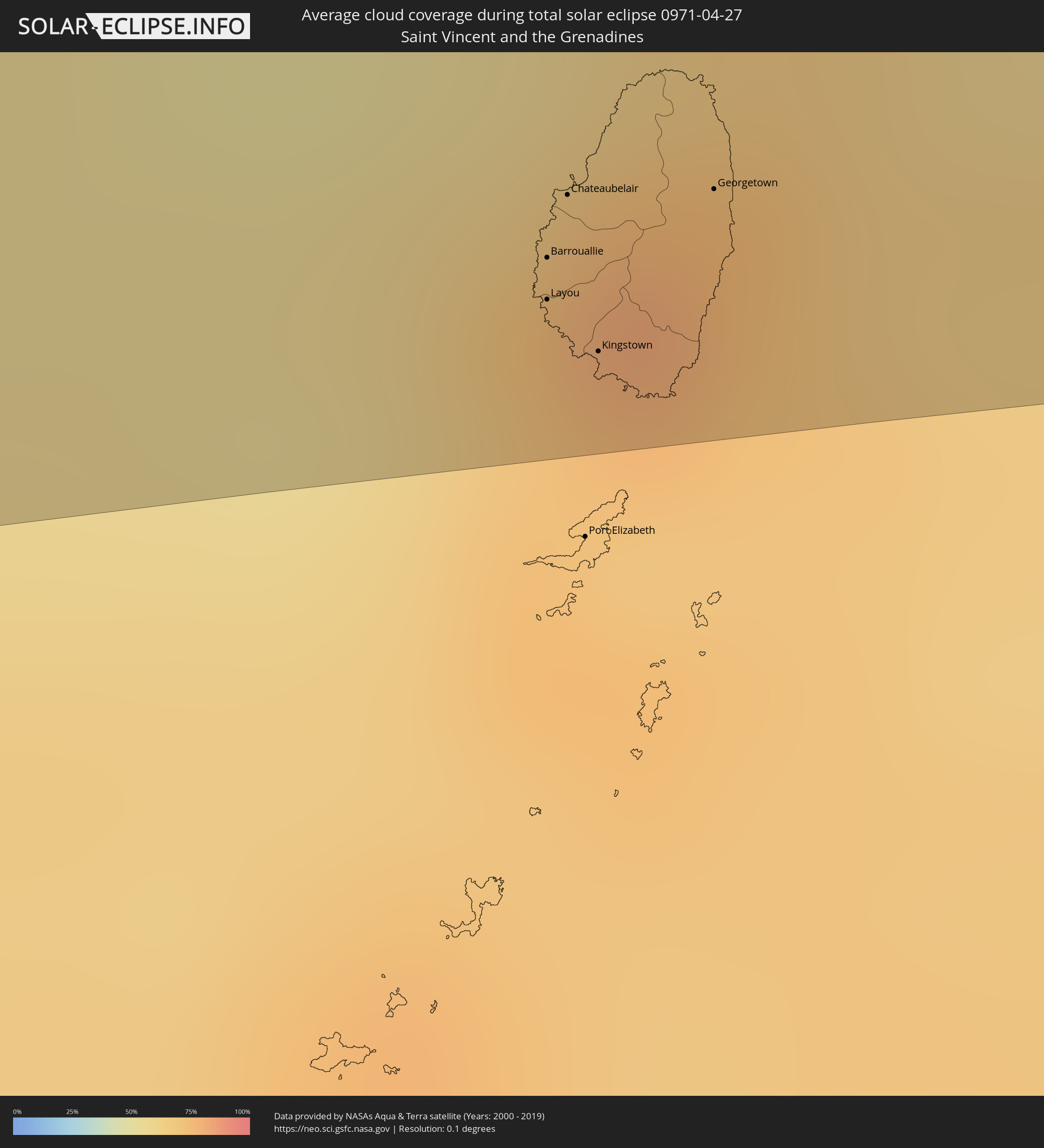
Layou, Saint Andrew
|
total | - | 13:48:05 UTC-04:06 | 62 km | 69% |
|
Barrouallie, Saint Patrick
|
total | - | 13:48:06 UTC-04:06 | 58 km | 69% |
|
Chateaubelair, Saint David
|
total | - | 13:48:10 UTC-04:06 | 53 km | 72% |
|
Kingstown Park, Saint George
|
total | - | 13:48:09 UTC-04:06 | 67 km | 76% |
|
Kingstown, Saint George
|
total | - | 13:48:10 UTC-04:06 | 67 km | 76% |
|
Georgetown, Charlotte
|
total | - | 13:48:29 UTC-04:06 | 54 km | 74% |
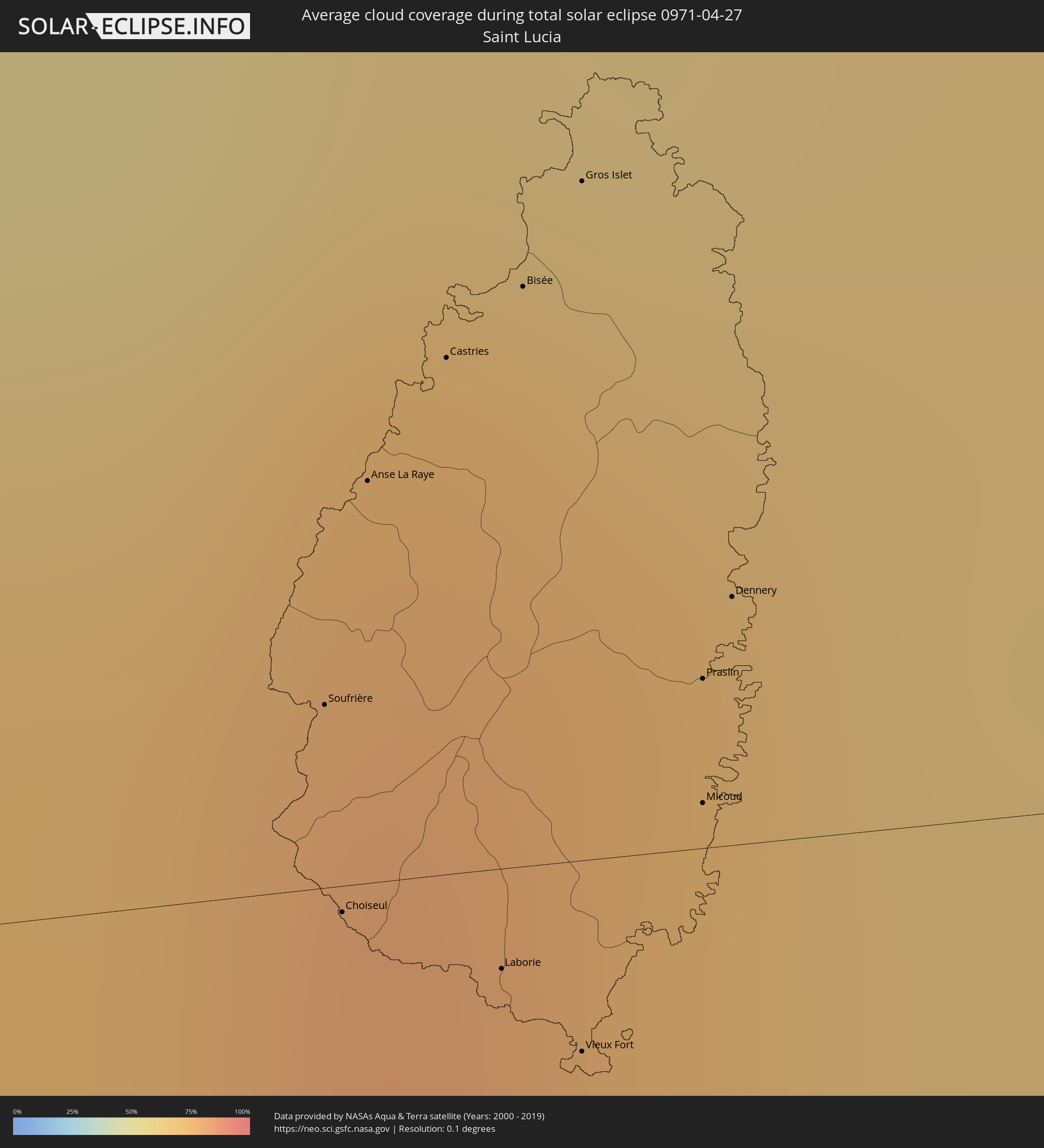
|
Soufrière, Soufrière
|
total | - | 13:48:56 UTC-04:06 | 8 km | 73% |
|
Choiseul, Choiseul Quarter
|
total | - | 13:48:55 UTC-04:06 | 1 km | 73% |
|
Anse La Raye, Anse-la-Raye
|
total | - | 13:49:01 UTC-04:06 | 18 km | 81% |
|
Castries, Castries Quarter
|
total | - | 13:49:08 UTC-04:06 | 23 km | 77% |
|
Laborie, Laborie Quarter
|
total | - | 13:49:05 UTC-04:06 | 4 km | 73% |
|
Bisée, Castries Quarter
|
total | - | 13:49:14 UTC-04:06 | 26 km | 77% |
|
Gros Islet, Gros-Islet
|
total | - | 13:49:18 UTC-04:06 | 30 km | 74% |
|
Vieux Fort, Vieux-Fort
|
total | - | 13:49:09 UTC-04:06 | 9 km | 66% |
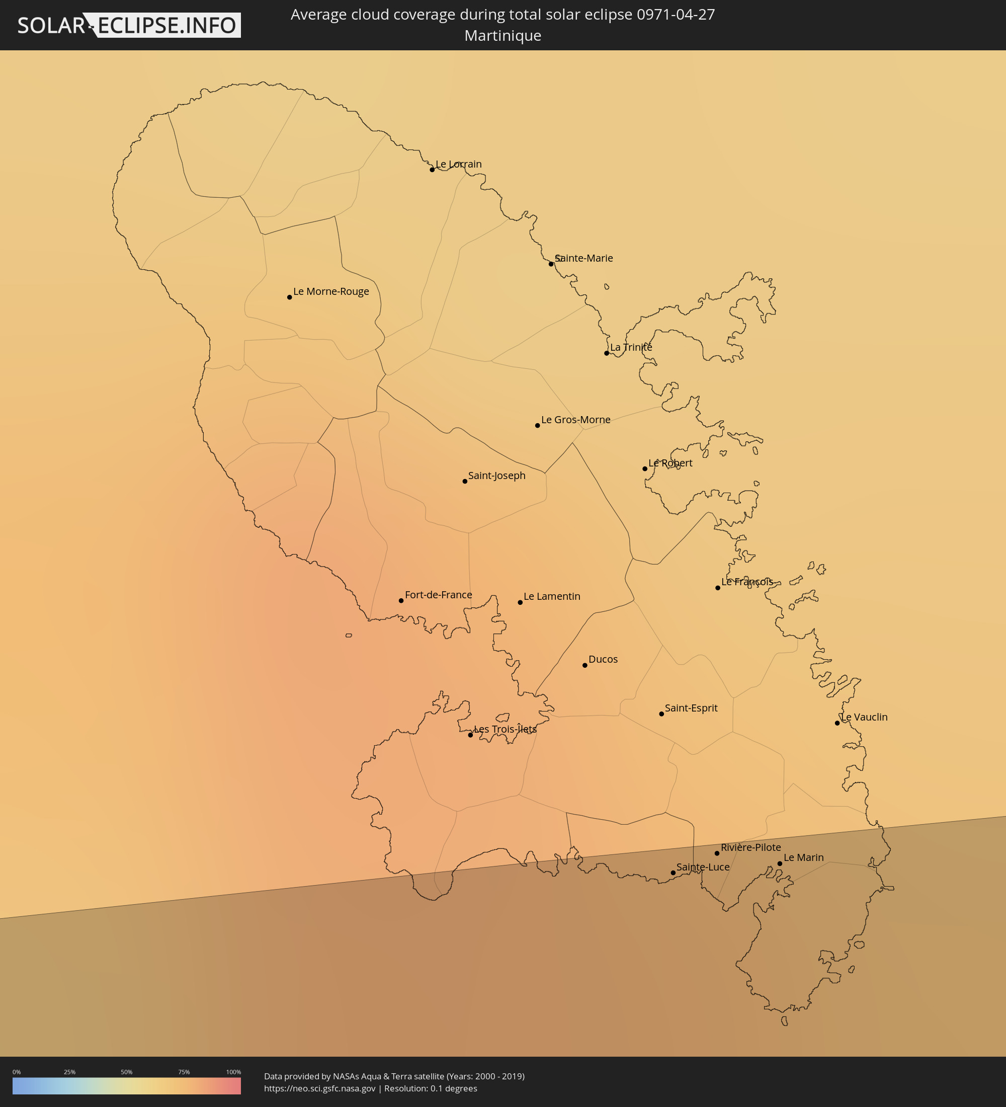
|
Sainte-Luce, Martinique
|
total | - | 13:51:16 UTC-04:04 | 74 km | 76% |
|
Rivière-Pilote, Martinique
|
total | - | 13:51:20 UTC-04:04 | 75 km | 76% |
|
Micoud, Micoud Quarter
|
total | - | 13:49:20 UTC-04:06 | 2 km | 69% |
|
Praslin, Praslin
|
total | - | 13:49:21 UTC-04:06 | 8 km | 74% |
|
Dennery, Dennery Quarter
|
total | - | 13:49:24 UTC-04:06 | 11 km | 74% |
|
Le Marin, Martinique
|
total | - | 13:51:25 UTC-04:04 | 74 km | 76% |
|
Speightstown, Saint Peter
|
total | - | 13:59:54 UTC-03:58 | 73 km | 74% |
|
Checker Hall, Saint Lucy
|
total | - | 13:59:57 UTC-03:58 | 70 km | 68% |
|
Greenland, Saint Andrew
|
total | - | 14:00:06 UTC-03:58 | 74 km | 68% |